Jasper Whirlpool Valley Introdcution
The Whirlpool Valley extends southwest through Jasper National Park, following the glacier-fed Whirlpool River through a broad mountain landscape of forests, gravel flats, wetlands, and steep ranges. The valley is reached from the Icefields Parkway and Highway 93A, where the quieter Moab Lake Road provides access to trails and viewpoints along the river. Like many of Jasper’s major valleys, its distinctive form reflects the enormous glaciers that occupied the Canadian Rockies during the last ice age, carving broad U-shaped corridors subsequently reshaped by rivers and glacial sediment.
Beyond its scenery, the Whirlpool Valley forms part of one of the most historically important travel corridors across the Canadian Rockies. The Athabasca Pass Trail follows the Whirlpool River toward Athabasca Pass, a route used by Indigenous peoples long before European arrival and later adopted by explorers and fur traders traveling between the eastern slopes of the Rockies and the Columbia River watershed. During the nineteenth-century fur trade, the route became an important connection across the Continental Divide, with Jasper House serving as a staging and supply point for travelers crossing Athabasca Pass.
Today the Whirlpool Valley remains considerably quieter and less developed than many of Jasper National Park’s better-known destinations. Trails lead toward Moab Lake, along the Whirlpool River, and eventually deep into the backcountry toward Athabasca Pass, passing forests, old river channels, expansive gravel flats, and increasingly remote mountain scenery. The first portion of the historic route follows an old fire road past Whirlpool Campground before continuing into rugged wilderness, preserving a sense of the immense landscape encountered by generations of people who traveled through this secluded corner of the Canadian Rockies.
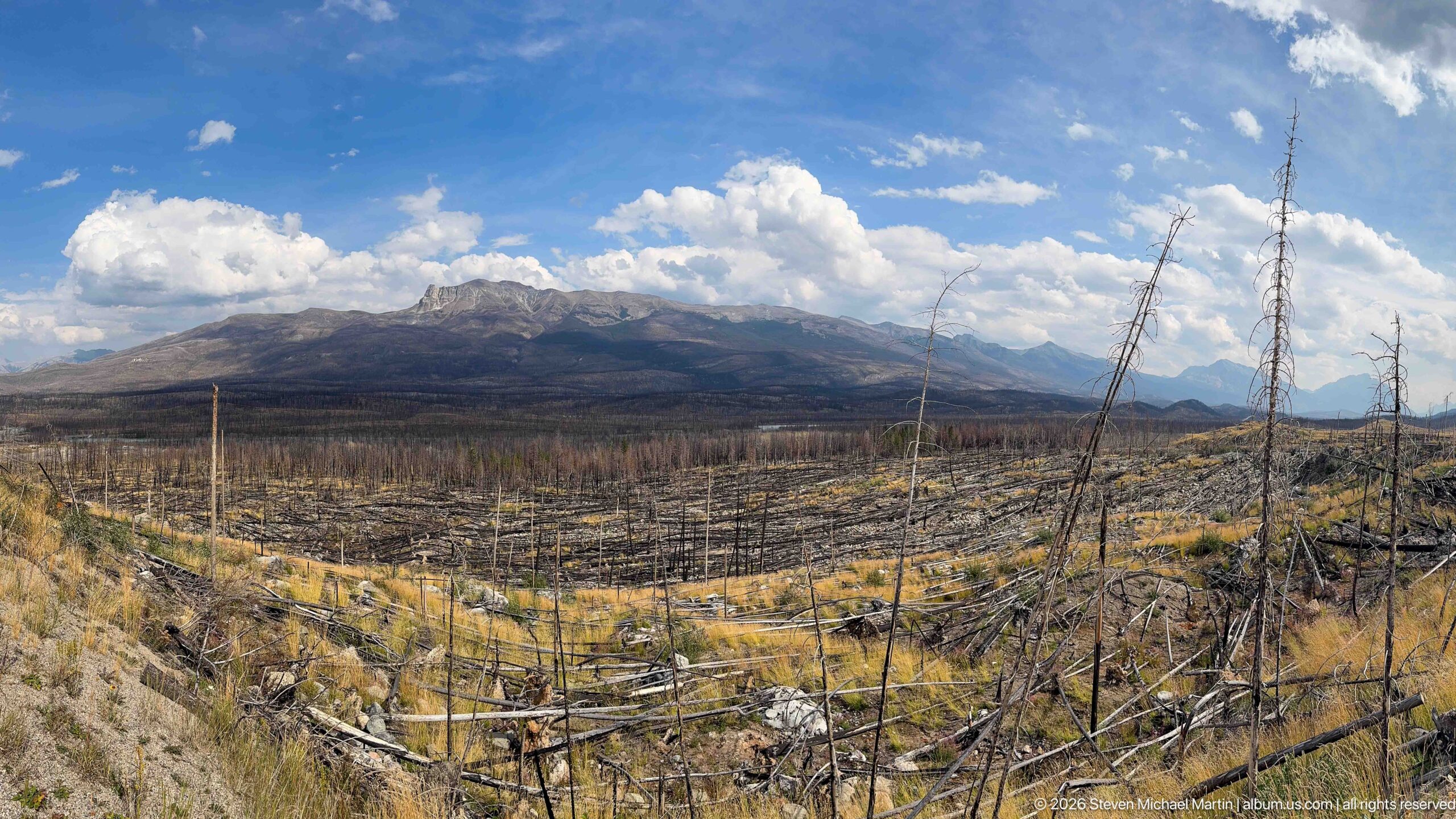
A wide field of charred trunks and fallen timber stretches toward a rugged mountain ridge under bright cumulus clouds. Golden grasses and low plants are returning between the blackened remains, while a few tall snags punctuate the foreground and reveal the former height of the forest.
Caption
A wide field of charred trunks and fallen timber stretches toward a rugged mountain ridge under bright cumulus clouds. Golden grasses and low plants are returning between the blackened remains, while a few tall snags punctuate the foreground and reveal the former height of the forest.
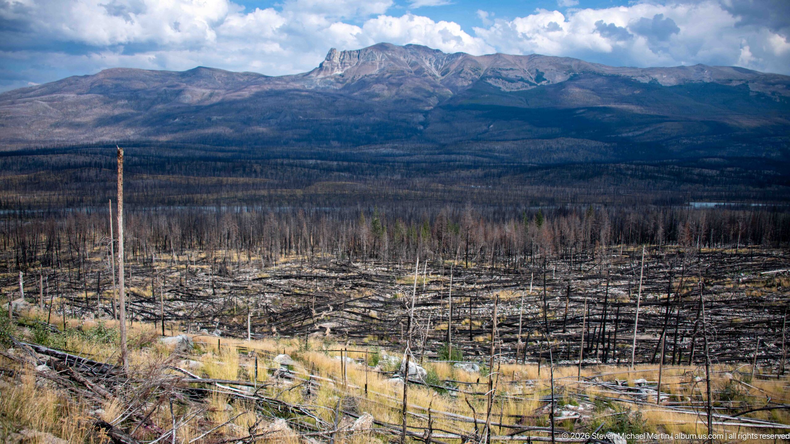
A rugged mountain massif rises above a broad foreground of fire-killed forest, where blackened trunks and fallen timber extend across the valley floor. Patches of golden vegetation mark early recovery, while moving cloud shadows create alternating bands of light across the slopes.
Caption
A rugged mountain massif rises above a broad foreground of fire-killed forest, where blackened trunks and fallen timber extend across the valley floor. Patches of golden vegetation mark early recovery, while moving cloud shadows create alternating bands of light across the slopes.
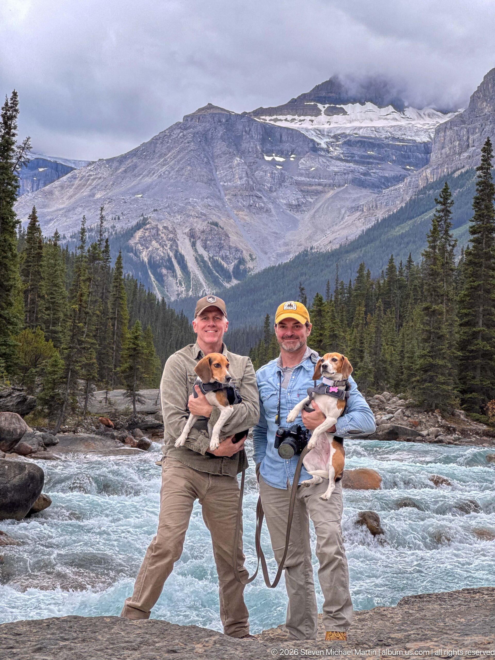
Two visitors holding beagles stand on a broad rock beside rushing turquoise water, framed by dense conifers and an exposed mountain slope partly hidden by low cloud. The vertical composition gives equal weight to the portrait and the dramatic topographic setting of the Whirlpool Valley.
Caption
Two visitors holding beagles stand on a broad rock beside rushing turquoise water, framed by dense conifers and an exposed mountain slope partly hidden by low cloud. The vertical composition gives equal weight to the portrait and the dramatic topographic setting of the Whirlpool Valley.
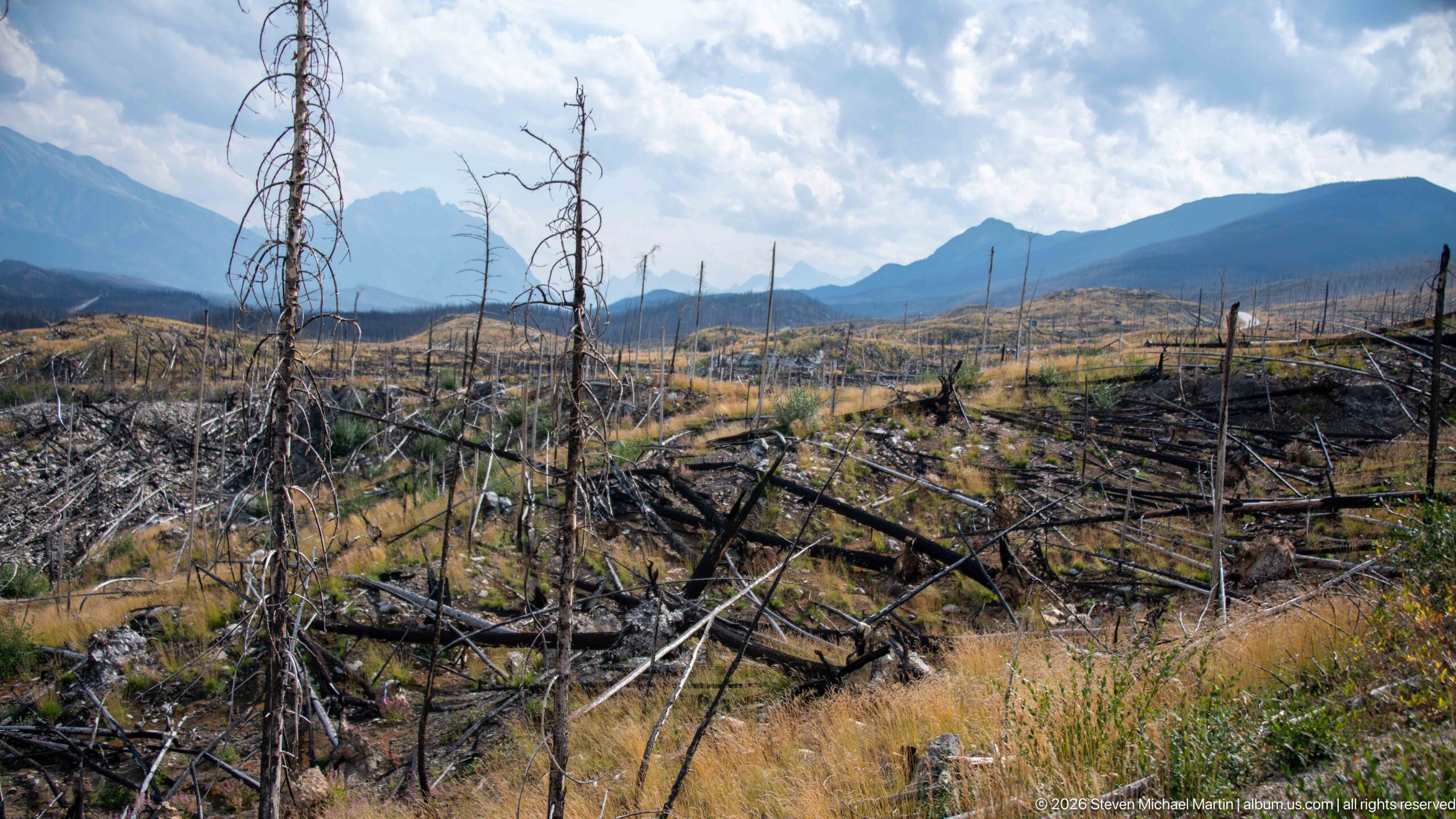
Charred snags and fallen trunks spread across an open valley floor where grasses and low vegetation are beginning to recolonize the ground. Layered mountain ridges frame the horizon, while the wide composition reveals the spatial extent of forest loss and the patchwork of early recovery.
Caption
Charred snags and fallen trunks spread across an open valley floor where grasses and low vegetation are beginning to recolonize the ground. Layered mountain ridges frame the horizon, while the wide composition reveals the spatial extent of forest loss and the patchwork of early recovery.
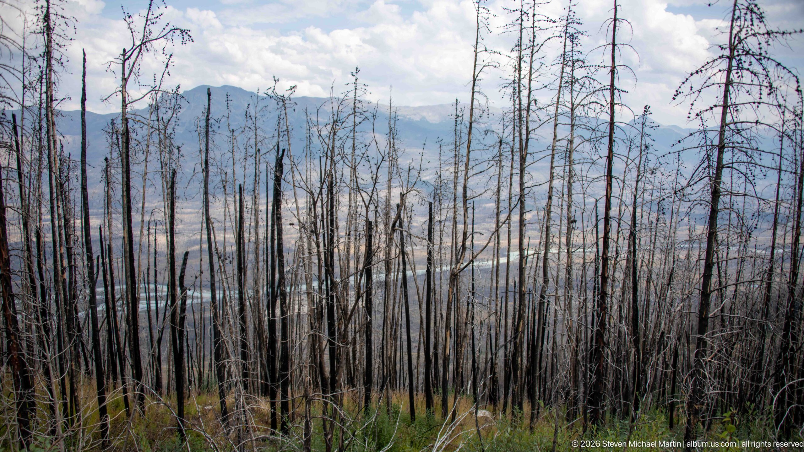
A hillside of slender fire-killed trunks descends toward a pale river and hazy mountain slopes. Young green plants occupy the foreground beneath the dead overstory, making the contrast between surviving ground vegetation and the extensively burned forest especially visible.
Caption
A hillside of slender fire-killed trunks descends toward a pale river and hazy mountain slopes. Young green plants occupy the foreground beneath the dead overstory, making the contrast between surviving ground vegetation and the extensively burned forest especially visible.
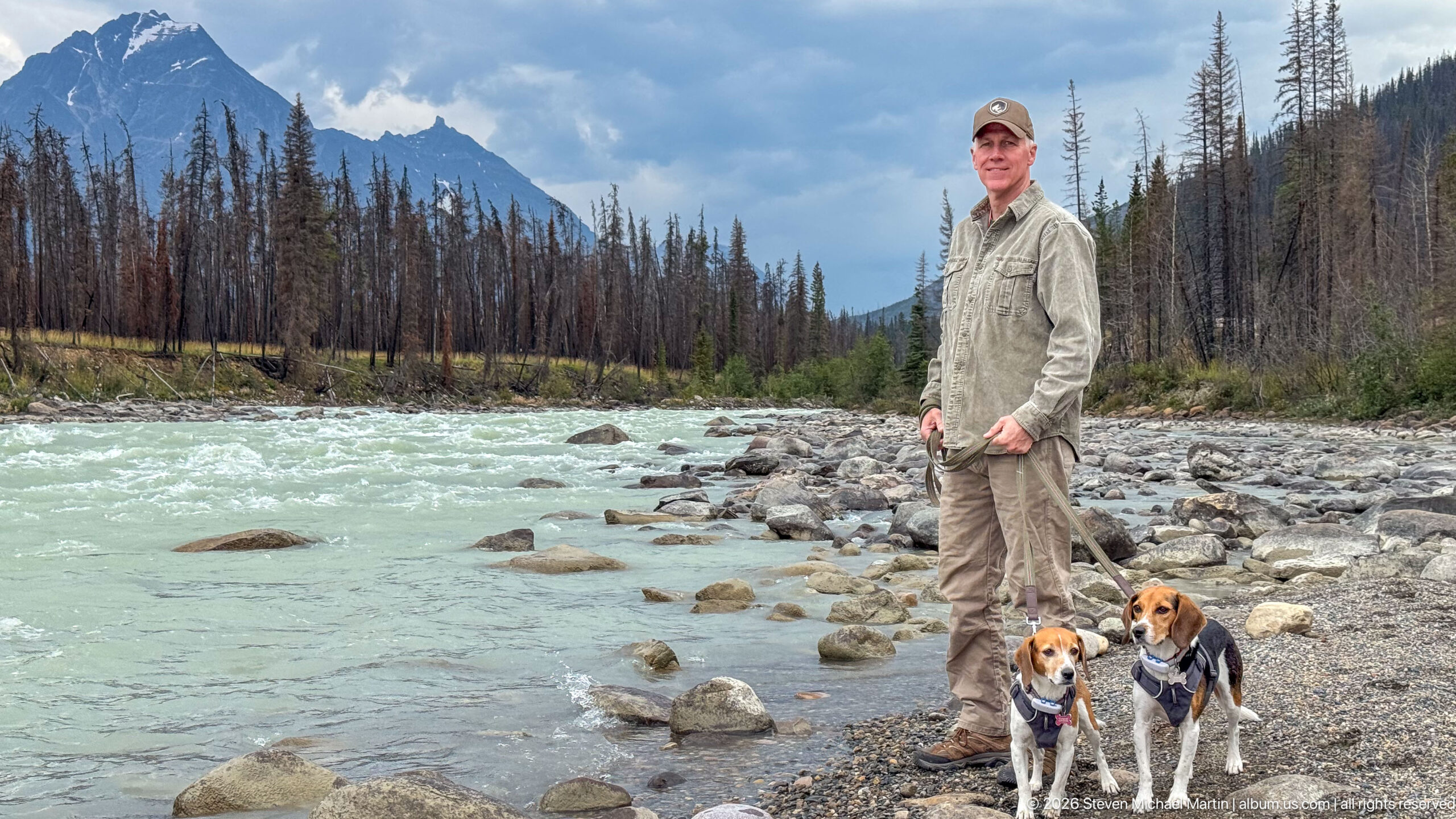
A visitor and two beagles pose on a cobble-strewn riverbank beside fast, opaque turquoise water. Burned tree trunks line the opposite shore and mountains rise beyond, giving the portrait a strong environmental context and documenting the valley’s mixture of glacial river scenery and fire-affected forest.
Caption
A visitor and two beagles pose on a cobble-strewn riverbank beside fast, opaque turquoise water. Burned tree trunks line the opposite shore and mountains rise beyond, giving the portrait a strong environmental context and documenting the valley’s mixture of glacial river scenery and fire-affected forest.
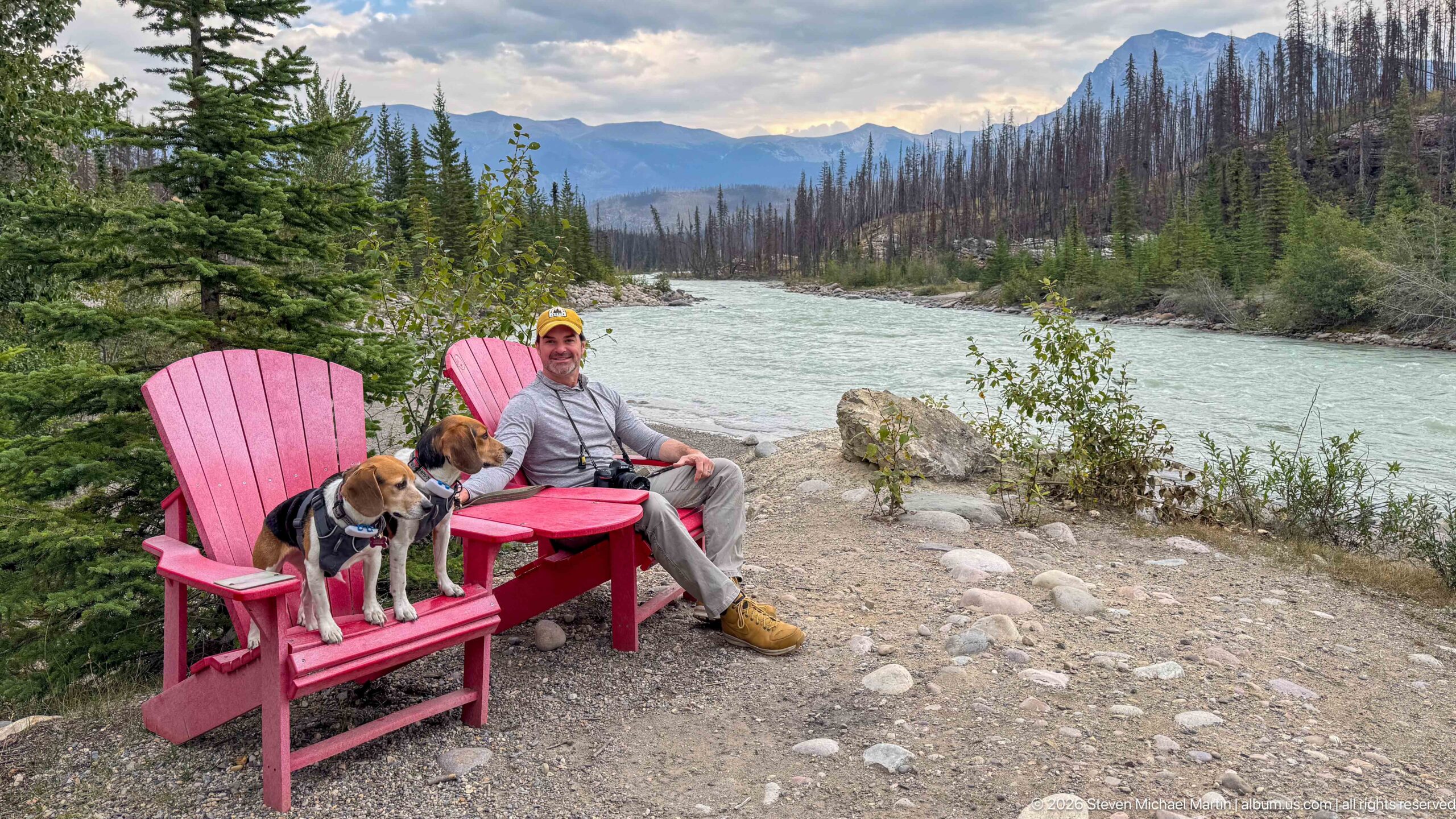
A visitor and two beagles occupy bright red Adirondack-style chairs at a quiet riverside viewpoint. Beyond them, the pale river bends through a valley lined with regenerating and fire-scarred forest, turning the Parks Canada seating area into a foreground marker for the broader Whirlpool Valley landscape.
Caption
A visitor and two beagles occupy bright red Adirondack-style chairs at a quiet riverside viewpoint. Beyond them, the pale river bends through a valley lined with regenerating and fire-scarred forest, turning the Parks Canada seating area into a foreground marker for the broader Whirlpool Valley landscape.
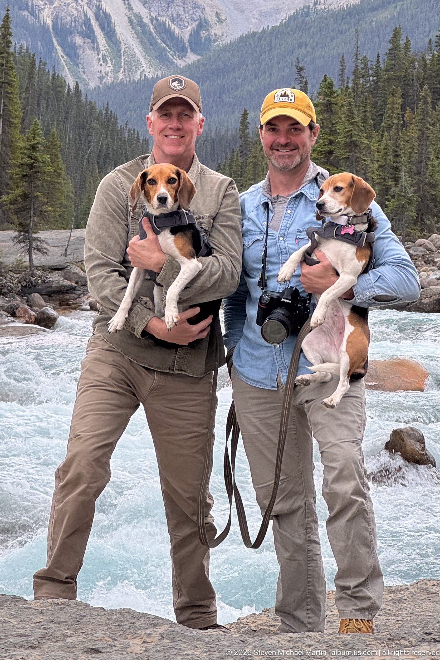
Two visitors pose with their beagles at the edge of the Whirlpool River, where swift glacially colored water passes through a rocky channel. The tighter framing concentrates attention on the travelers and dogs while retaining the forested valley and steep mountain walls as environmental context.
Caption
Two visitors pose with their beagles at the edge of the Whirlpool River, where swift glacially colored water passes through a rocky channel. The tighter framing concentrates attention on the travelers and dogs while retaining the forested valley and steep mountain walls as environmental context.
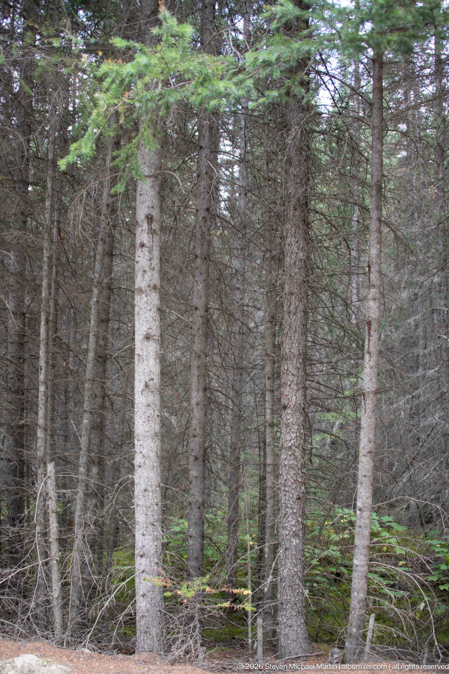
Straight conifer trunks rise through a dense, shaded understory, creating a close interior view of the valley’s forest rather than its open river corridor. Layers of branches and young evergreen growth obscure the distance and emphasize the enclosed structure of the woodland.
Caption
Straight conifer trunks rise through a dense, shaded understory, creating a close interior view of the valley’s forest rather than its open river corridor. Layers of branches and young evergreen growth obscure the distance and emphasize the enclosed structure of the woodland.
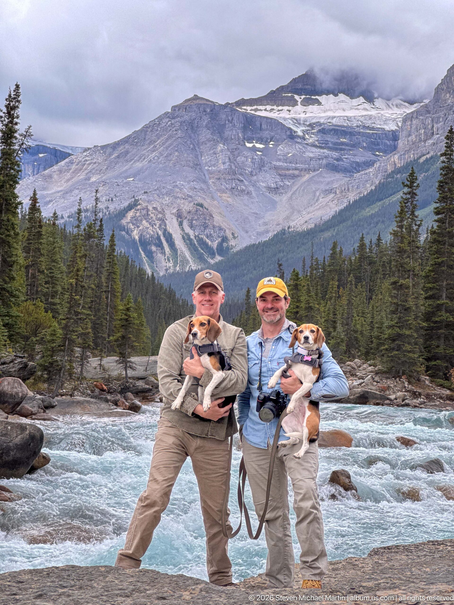
Two visitors holding their beagles stand beside the pale turquoise Whirlpool River, with conifer forest and a broad, cloud-wrapped mountain slope rising behind them. The portrait places the travelers directly within the river corridor and emphasizes the scale of the surrounding Canadian Rockies landscape.
Caption
Two visitors holding their beagles stand beside the pale turquoise Whirlpool River, with conifer forest and a broad, cloud-wrapped mountain slope rising behind them. The portrait places the travelers directly within the river corridor and emphasizes the scale of the surrounding Canadian Rockies landscape.
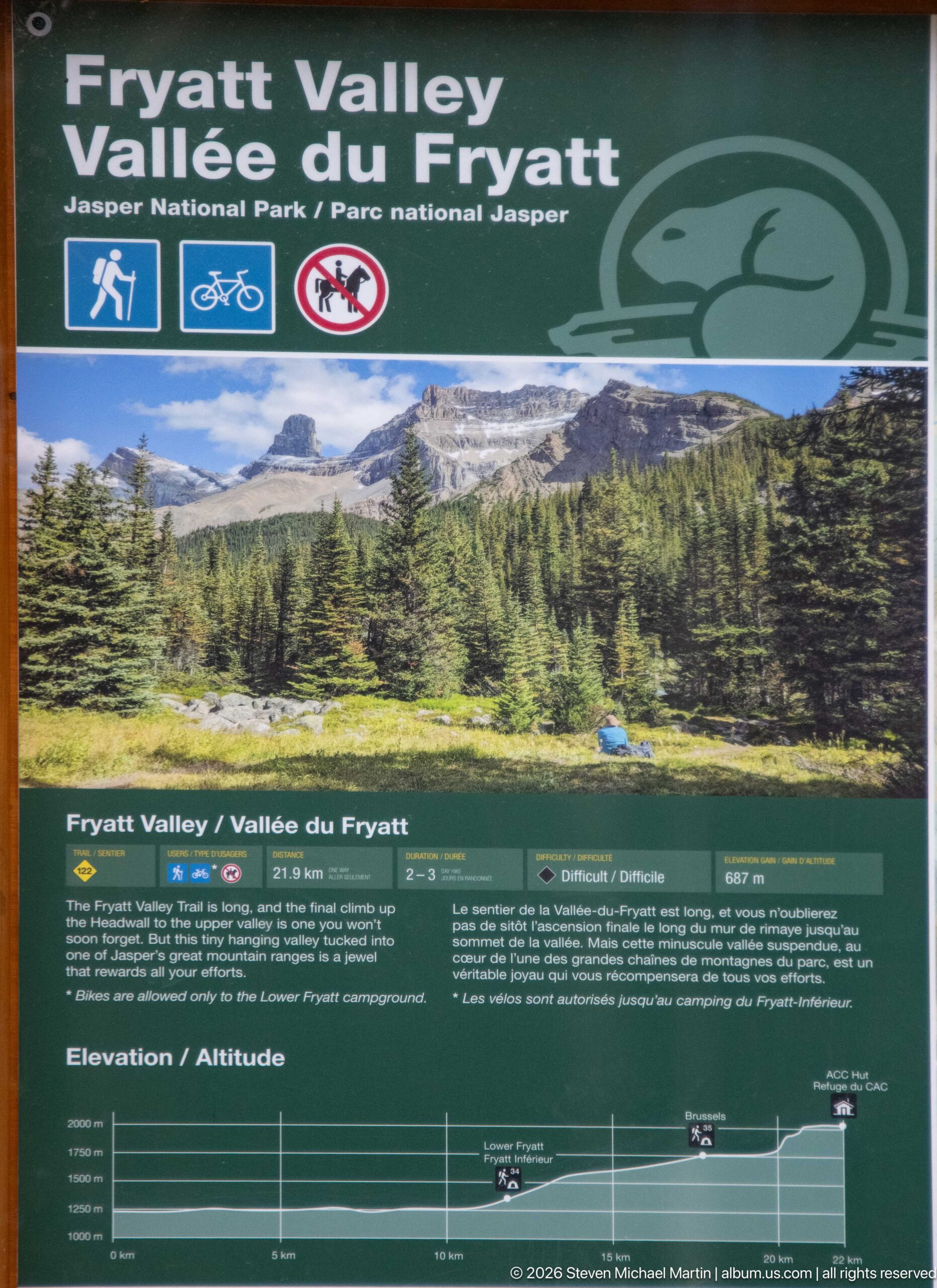
A Parks Canada panel introduces Fryatt Valley with a landscape photograph, route information, an elevation profile, and trail-use symbols. The sign identifies a backcountry corridor in Jasper National Park and provides practical orientation while visually linking the trail to the high mountain terrain beyond.
Caption
A Parks Canada panel introduces Fryatt Valley with a landscape photograph, route information, an elevation profile, and trail-use symbols. The sign identifies a backcountry corridor in Jasper National Park and provides practical orientation while visually linking the trail to the high mountain terrain beyond.
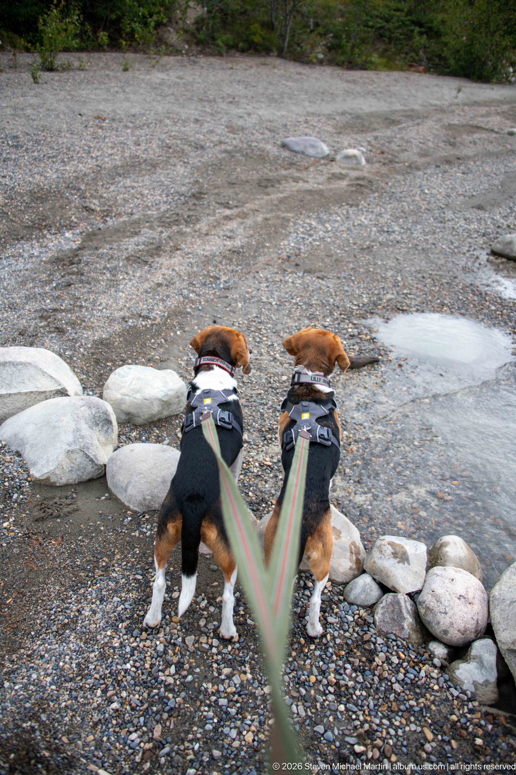
Two leashed beagles stand side by side on a broad gravel bar, facing toward the shallow river and pale boulders. Their paired stance and converging leashes create a close, ground-level record of pet travel in the valley while the stony surface conveys the river’s actively deposited alluvial margin.
Caption
Two leashed beagles stand side by side on a broad gravel bar, facing toward the shallow river and pale boulders. Their paired stance and converging leashes create a close, ground-level record of pet travel in the valley while the stony surface conveys the river’s actively deposited alluvial margin.
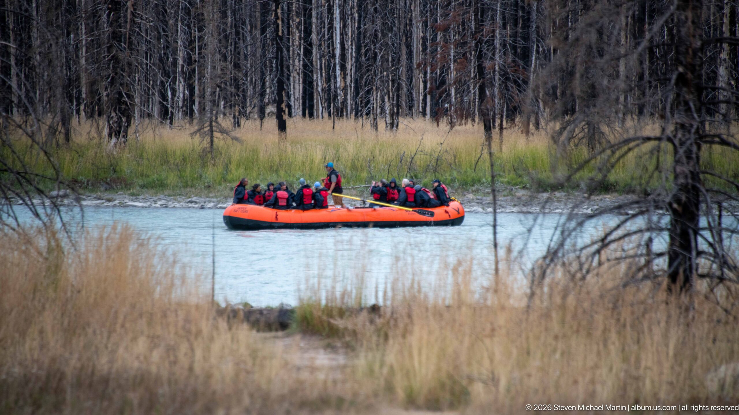
An orange inflatable raft carrying a group of helmeted passengers moves across a pale mountain river, viewed through grasses and fire-affected woodland. The distant viewpoint makes the raft a vivid human-scale element within a broader riparian landscape marked by standing dead trees and regenerating vegetation.
Caption
An orange inflatable raft carrying a group of helmeted passengers moves across a pale mountain river, viewed through grasses and fire-affected woodland. The distant viewpoint makes the raft a vivid human-scale element within a broader riparian landscape marked by standing dead trees and regenerating vegetation.
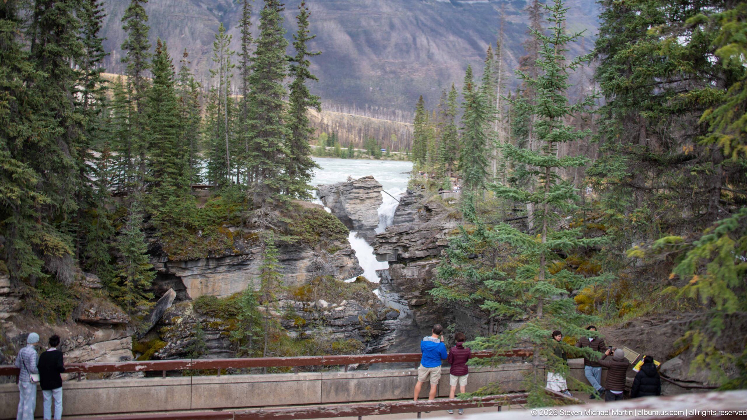
A forceful cascade drops through a narrow slot cut into layered rock, while visitors observe from a railing in the foreground. Evergreen trees crowd the gorge margins and partially screen the upper river, creating a compact view of water, bedrock, forest, and human scale.
Caption
A forceful cascade drops through a narrow slot cut into layered rock, while visitors observe from a railing in the foreground. Evergreen trees crowd the gorge margins and partially screen the upper river, creating a compact view of water, bedrock, forest, and human scale.
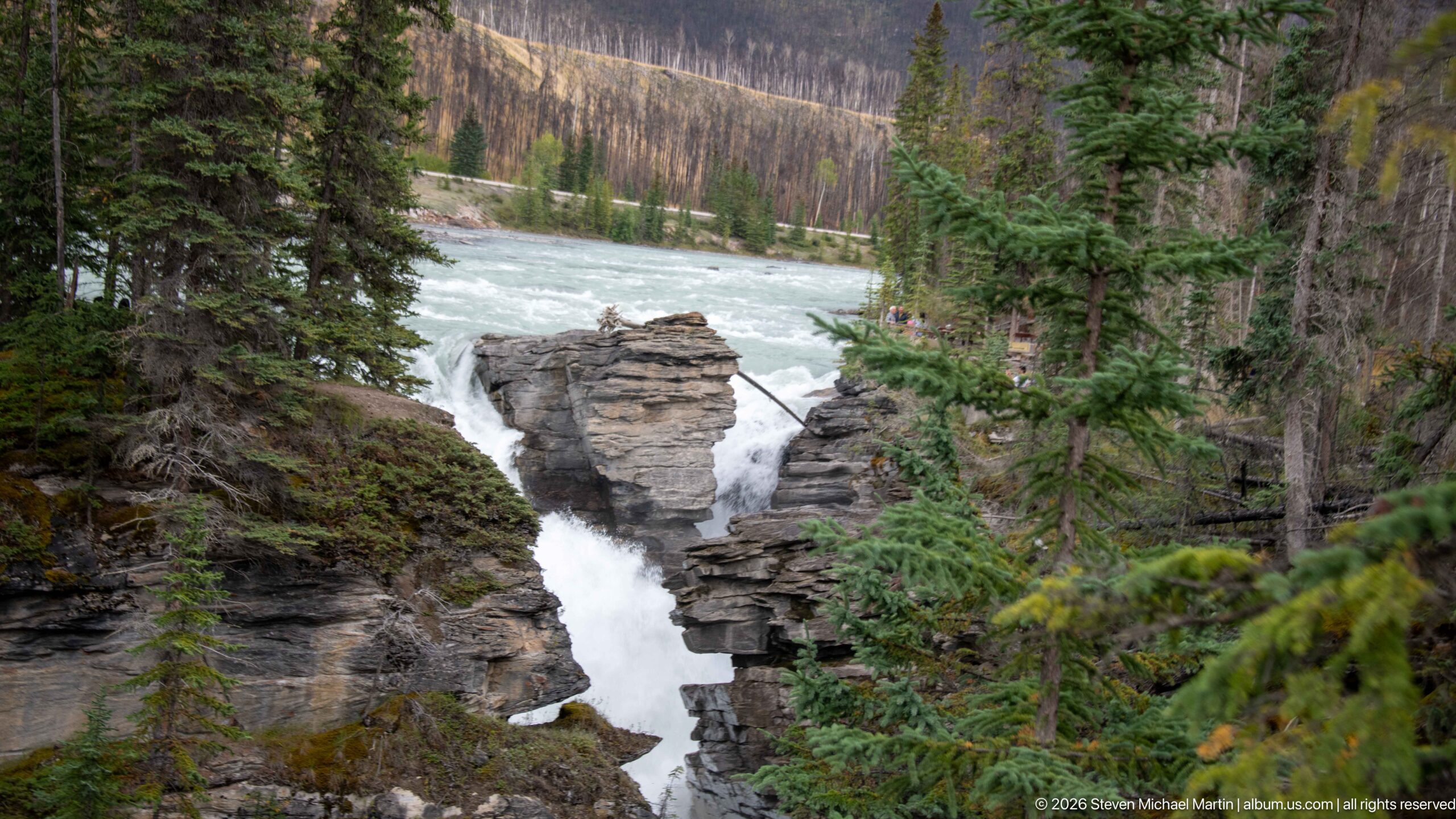
Turquoise water funnels through a narrow break in horizontally layered bedrock before dropping into a confined gorge. Conifers frame the channel, while the upper river spreads broadly behind the rock outcrop, showing the transition from open flow to a concentrated cascade.
Caption
Turquoise water funnels through a narrow break in horizontally layered bedrock before dropping into a confined gorge. Conifers frame the channel, while the upper river spreads broadly behind the rock outcrop, showing the transition from open flow to a concentrated cascade.
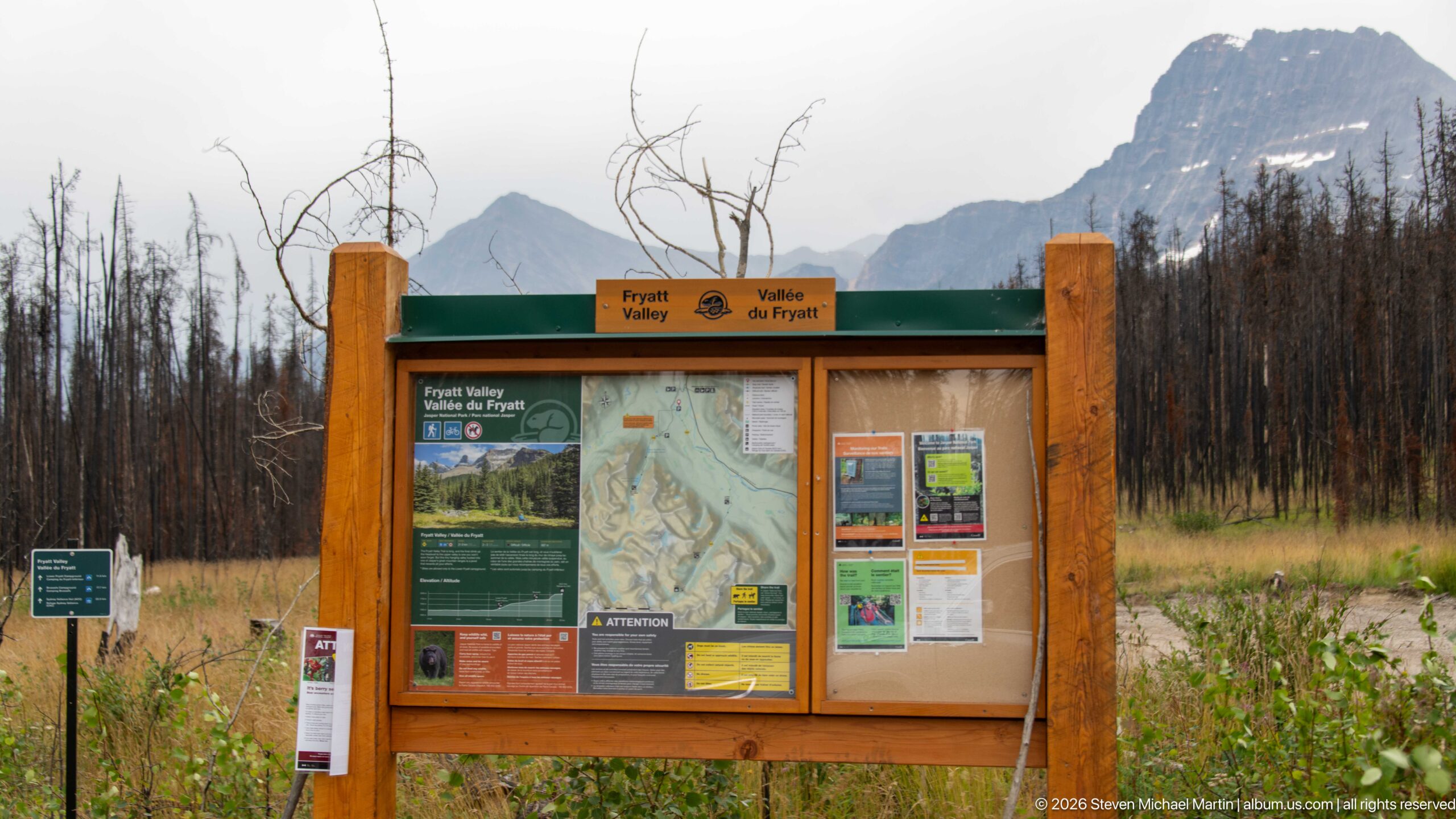
A wooden Parks Canada kiosk marks access to Fryatt Valley, displaying a topographic map, route information, safety notices, and trail guidance. Fire-scarred trees and steep mountain slopes behind the board place the developed trailhead within a landscape strongly shaped by recent disturbance and rugged relief.
Caption
A wooden Parks Canada kiosk marks access to Fryatt Valley, displaying a topographic map, route information, safety notices, and trail guidance. Fire-scarred trees and steep mountain slopes behind the board place the developed trailhead within a landscape strongly shaped by recent disturbance and rugged relief.
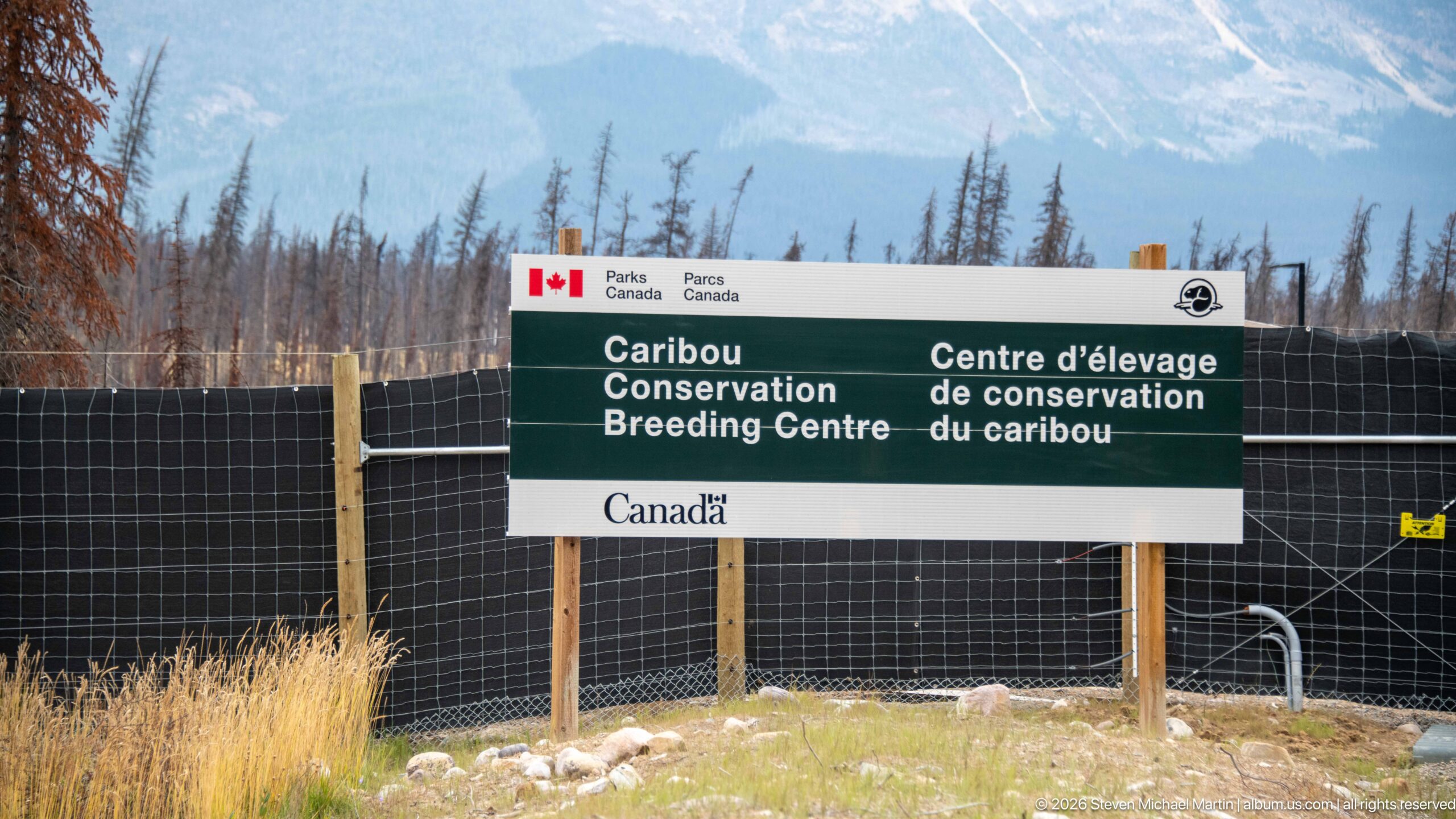
A bilingual Parks Canada sign identifies the Caribou Conservation Breeding Centre behind a tall perimeter fence. The fenced compound sits amid a fire-affected mountain landscape, documenting a specialized conservation facility associated with efforts to support Jasper National Park’s threatened woodland caribou.
Caption
A bilingual Parks Canada sign identifies the Caribou Conservation Breeding Centre behind a tall perimeter fence. The fenced compound sits amid a fire-affected mountain landscape, documenting a specialized conservation facility associated with efforts to support Jasper National Park’s threatened woodland caribou.
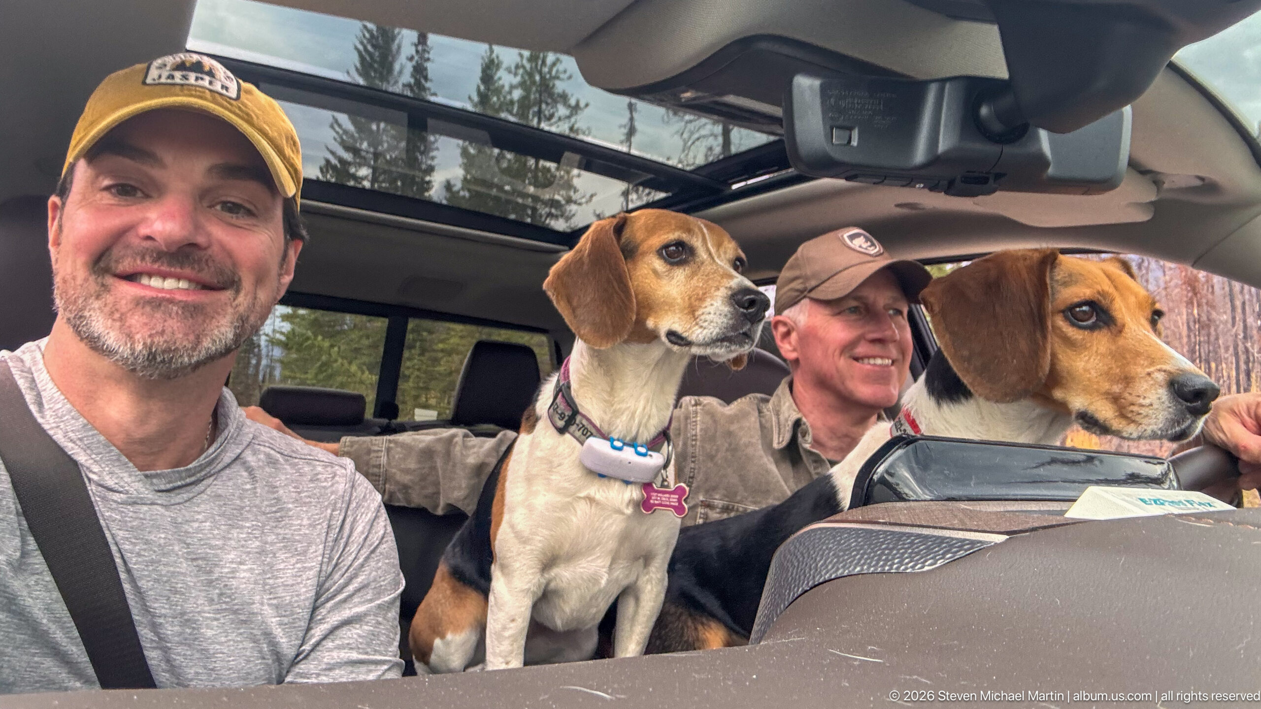
Two visitors and their beagles pause inside a vehicle with mountain forest visible through the windows and panoramic roof. The informal portrait records the human and canine side of travel through the Whirlpool Valley, contrasting with the portfolio’s wider views of rivers, trails, and recovering forest.
Caption
Two visitors and their beagles pause inside a vehicle with mountain forest visible through the windows and panoramic roof. The informal portrait records the human and canine side of travel through the Whirlpool Valley, contrasting with the portfolio’s wider views of rivers, trails, and recovering forest.
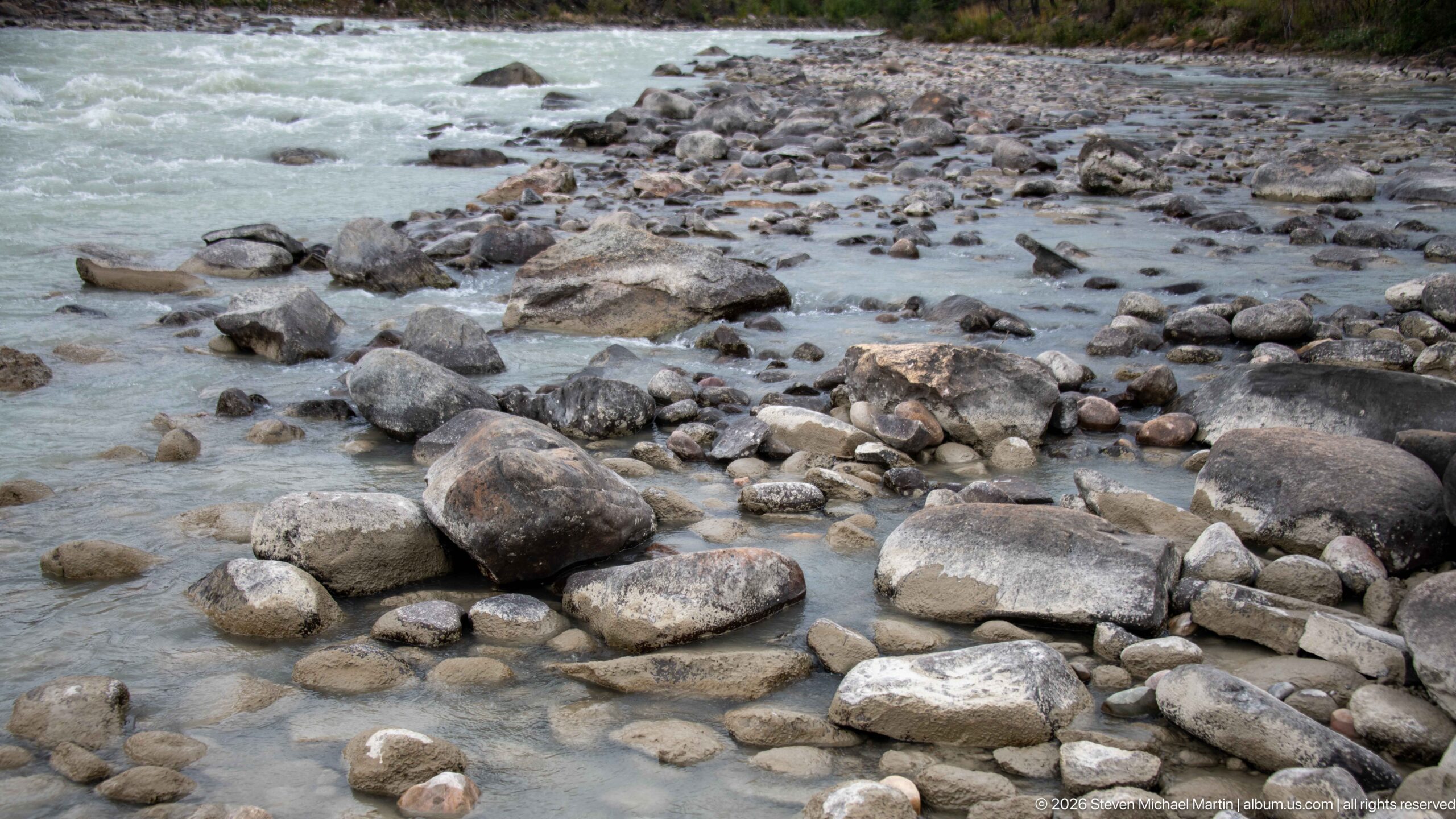
Milky turquoise water threads among rounded cobbles and larger boulders along a shallow margin of the river. The close view shifts attention from the valley’s mountain scale to the active riverbed, where varied stone sizes and braided flow reveal the coarse sediment carried and reworked by mountain water.
Caption
Milky turquoise water threads among rounded cobbles and larger boulders along a shallow margin of the river. The close view shifts attention from the valley’s mountain scale to the active riverbed, where varied stone sizes and braided flow reveal the coarse sediment carried and reworked by mountain water.
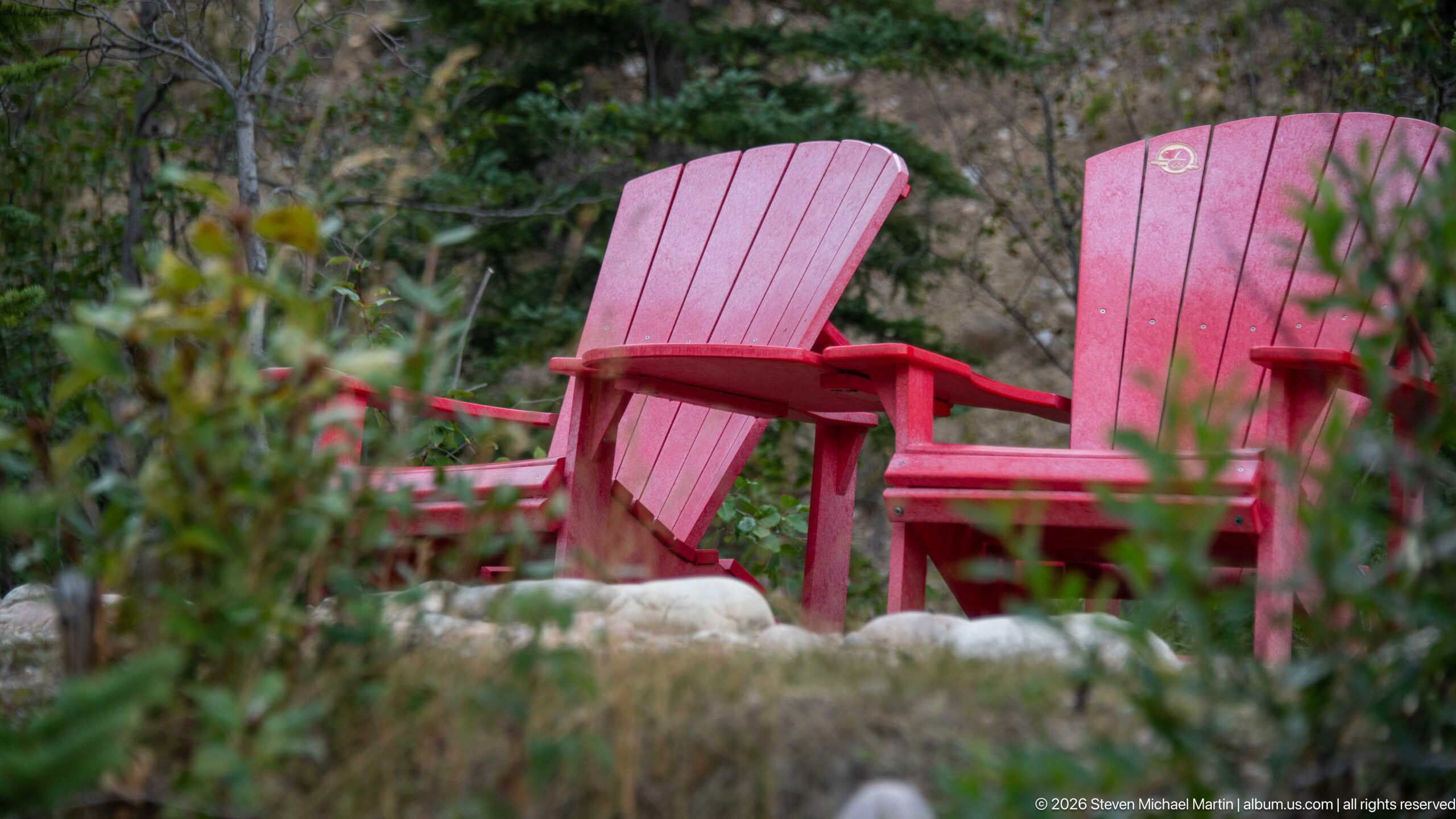
Two empty red Adirondack-style chairs sit among low vegetation and conifers, their vivid color standing out against the subdued forest floor. The shallow depth of field isolates the seating as the subject and records a small developed viewpoint element within the otherwise natural Whirlpool Valley setting.
Caption
Two empty red Adirondack-style chairs sit among low vegetation and conifers, their vivid color standing out against the subdued forest floor. The shallow depth of field isolates the seating as the subject and records a small developed viewpoint element within the otherwise natural Whirlpool Valley setting.
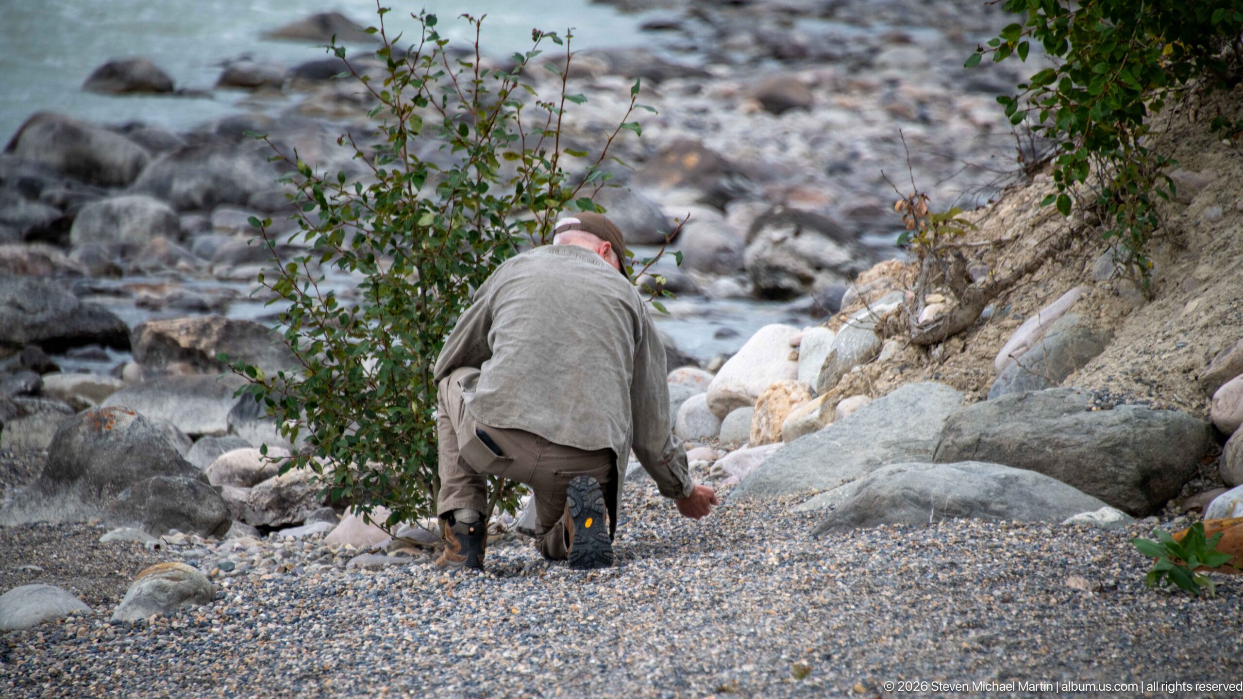
A visitor crouches on a gravel and boulder bank beside the river, partly screened by a leafy shrub. The downward viewpoint emphasizes the coarse alluvial surface and steep edge leading to the water, documenting a close encounter with the riverbank rather than a broad valley panorama.
Caption
A visitor crouches on a gravel and boulder bank beside the river, partly screened by a leafy shrub. The downward viewpoint emphasizes the coarse alluvial surface and steep edge leading to the water, documenting a close encounter with the riverbank rather than a broad valley panorama.
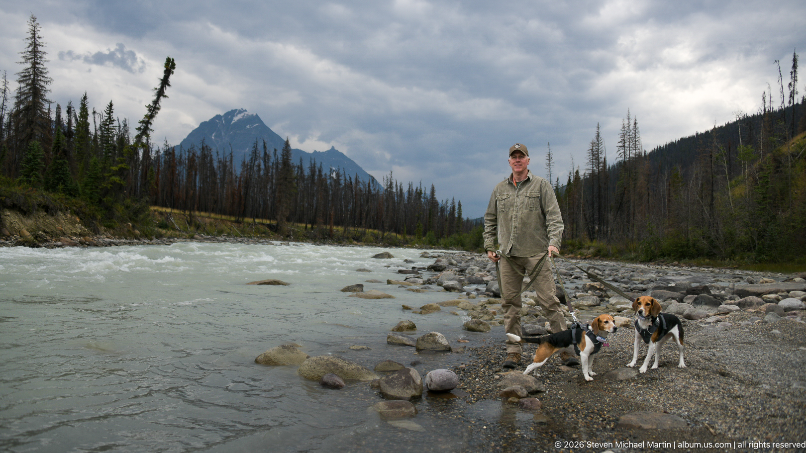
A visitor stands with two beagles on a broad gravel-and-cobble margin where the river curves through a fire-affected valley. Dark clouds and a sharply profiled mountain reinforce the depth of the scene, while the expansive rocky foreground shows the wide zone periodically occupied and reworked by the river.
Caption
A visitor stands with two beagles on a broad gravel-and-cobble margin where the river curves through a fire-affected valley. Dark clouds and a sharply profiled mountain reinforce the depth of the scene, while the expansive rocky foreground shows the wide zone periodically occupied and reworked by the river.
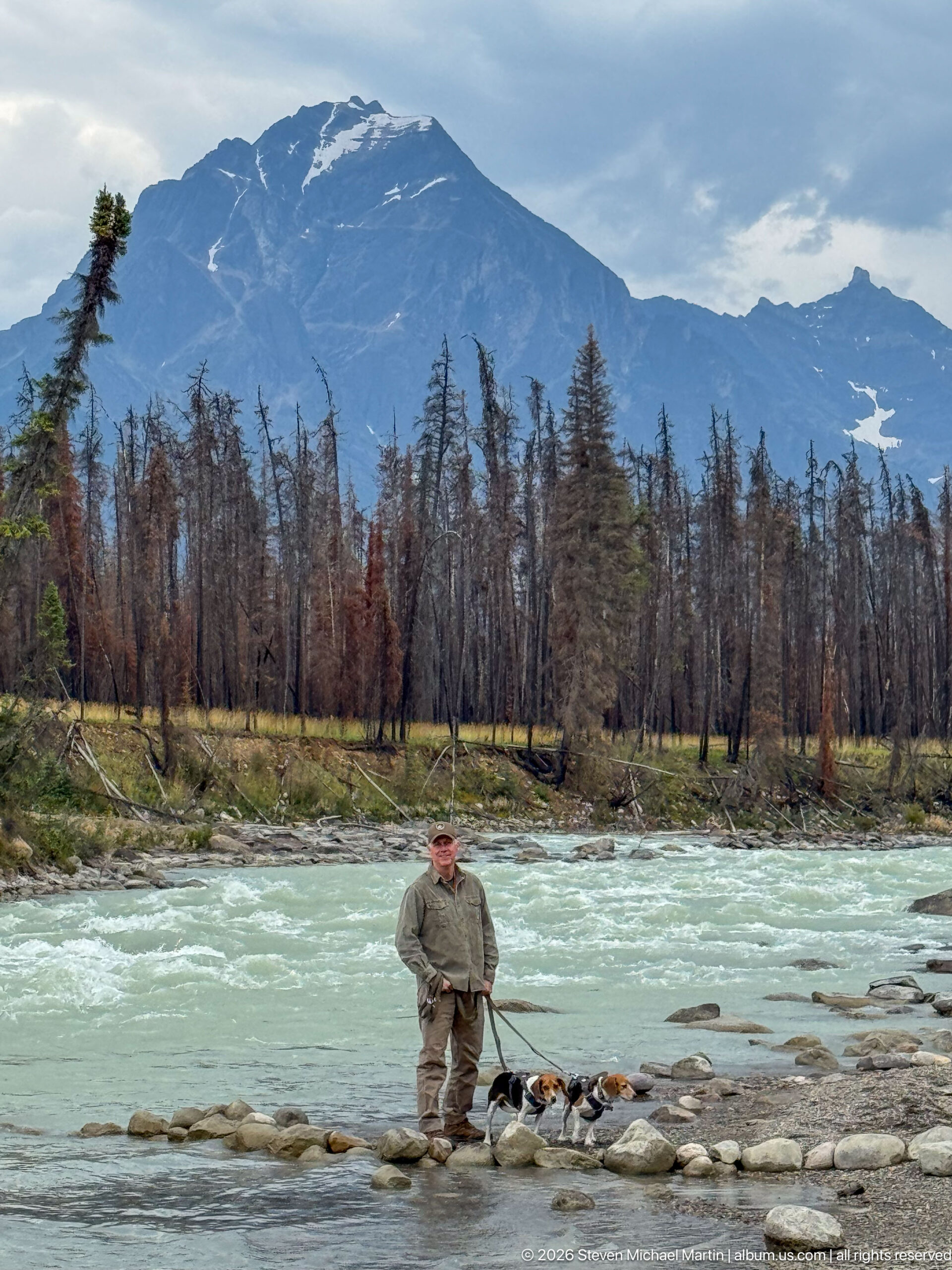
A visitor stands with two beagles on a stony margin of the pale turquoise river, backed by a broad belt of standing fire-killed trees and a massive mountain ridge. The wide composition records the contrast between active river, disturbed forest, and high alpine relief that characterizes this section of the valley.
Caption
A visitor stands with two beagles on a stony margin of the pale turquoise river, backed by a broad belt of standing fire-killed trees and a massive mountain ridge. The wide composition records the contrast between active river, disturbed forest, and high alpine relief that characterizes this section of the valley.
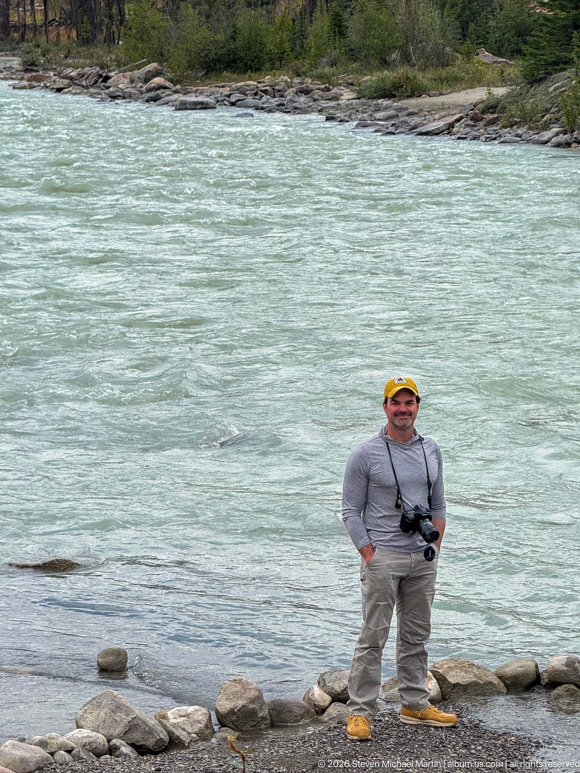
A visitor stands on rounded riverside stones immediately beside the broad, opaque turquoise current. The compressed composition removes most of the surrounding valley and concentrates on the contrast between the human figure, dark shoreline rocks, and the river’s glacially colored surface.
Caption
A visitor stands on rounded riverside stones immediately beside the broad, opaque turquoise current. The compressed composition removes most of the surrounding valley and concentrates on the contrast between the human figure, dark shoreline rocks, and the river’s glacially colored surface.
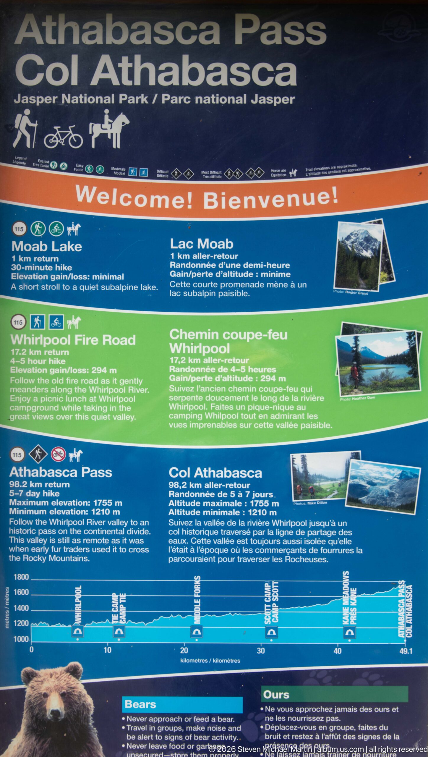
A large bilingual Parks Canada panel welcomes visitors to the Athabasca Pass area and summarizes nearby routes including Moab Lake, Whirlpool Fire Road, and Athabasca Pass. Photographs, route descriptions, and an elevation profile provide orientation for travel through the Whirlpool Valley and into the historic backcountry corridor.
Caption
A large bilingual Parks Canada panel welcomes visitors to the Athabasca Pass area and summarizes nearby routes including Moab Lake, Whirlpool Fire Road, and Athabasca Pass. Photographs, route descriptions, and an elevation profile provide orientation for travel through the Whirlpool Valley and into the historic backcountry corridor.
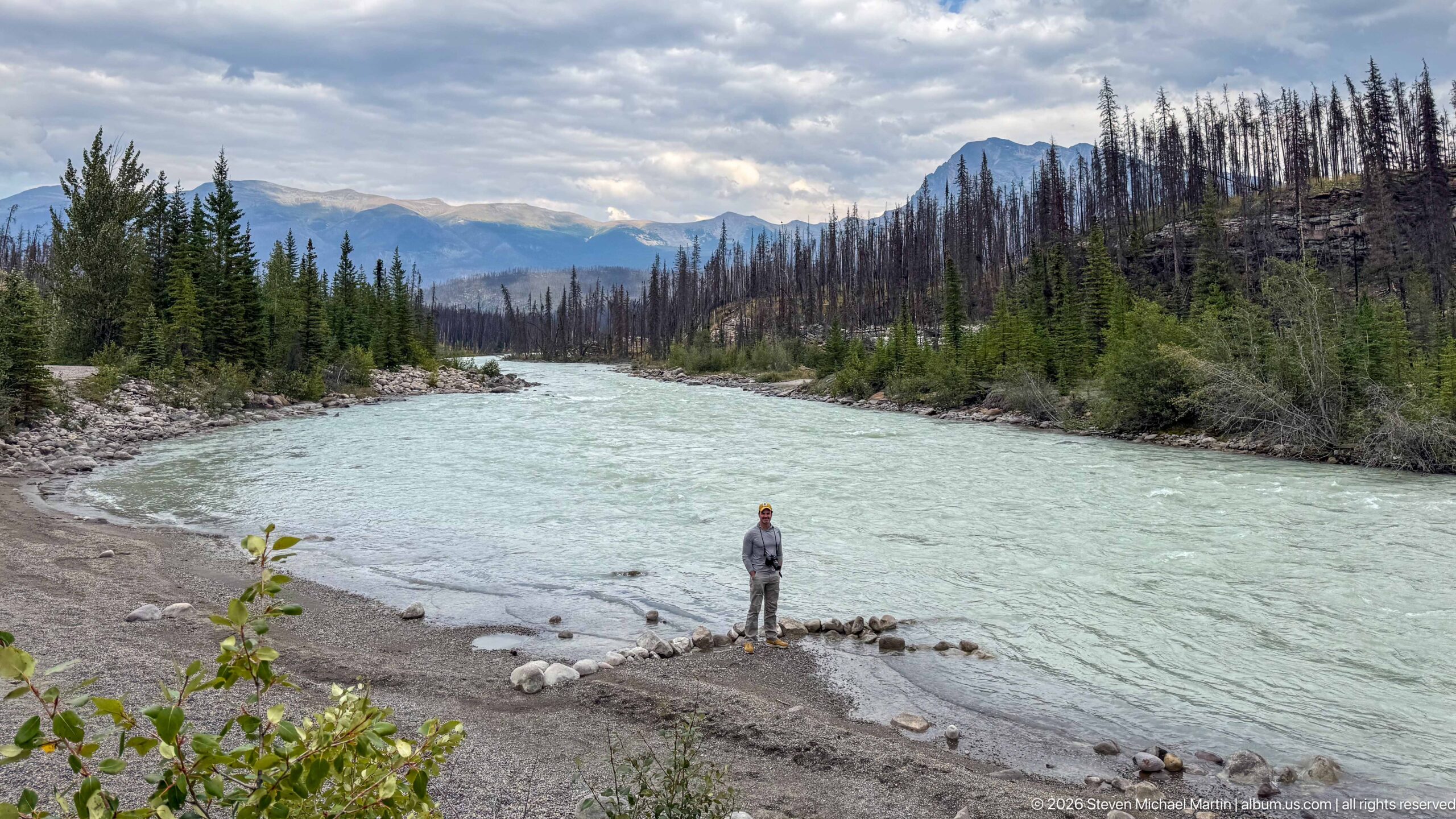
The pale turquoise river sweeps through a broad mountain corridor, with a visitor and two small beagles providing scale on the gravel shore below. Dense green conifers mingle with extensive stands of fire-killed trees, while layered peaks recede beneath a broken cloud deck.
Caption
The pale turquoise river sweeps through a broad mountain corridor, with a visitor and two small beagles providing scale on the gravel shore below. Dense green conifers mingle with extensive stands of fire-killed trees, while layered peaks recede beneath a broken cloud deck.
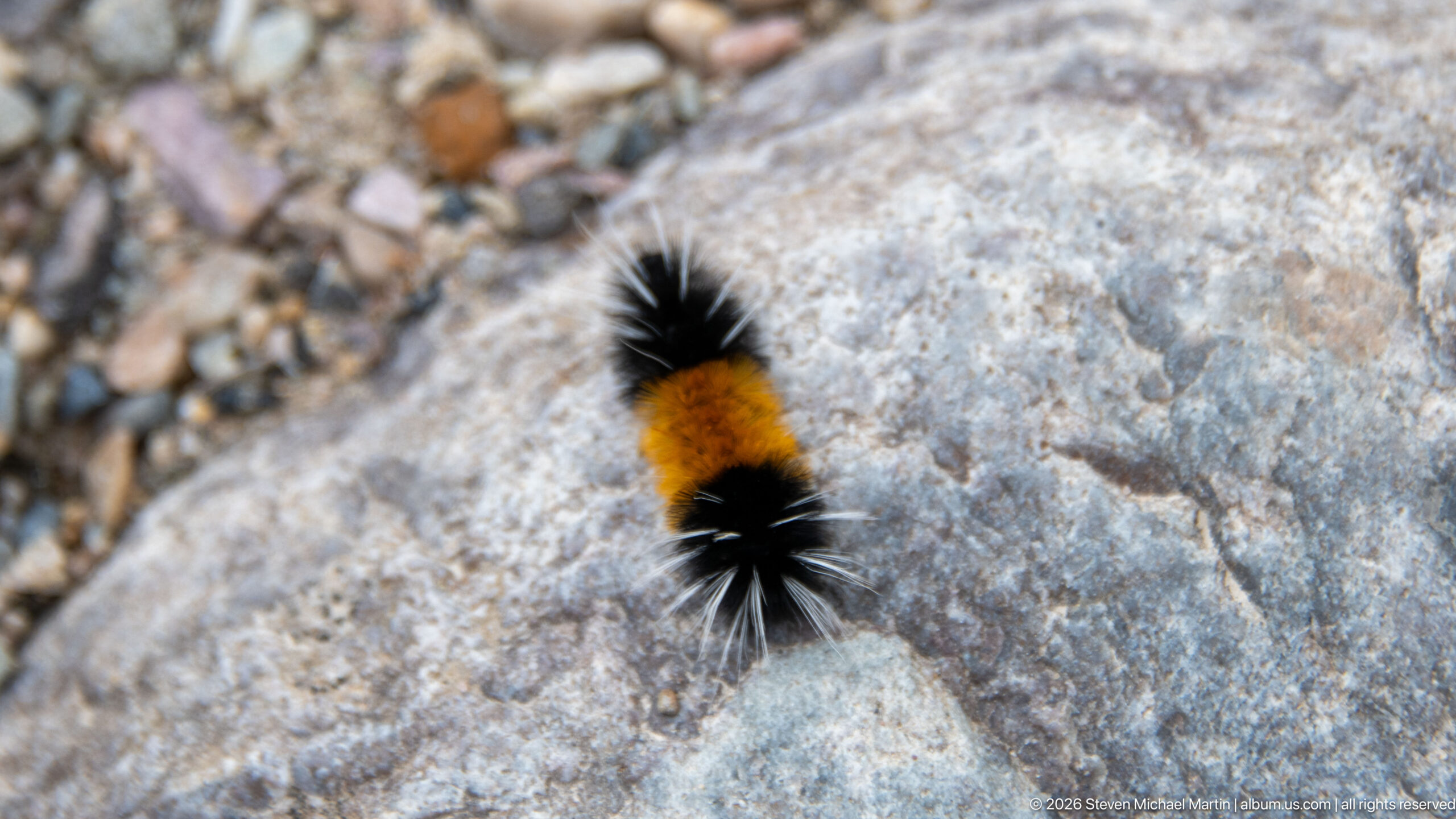
A bristly black-and-orange caterpillar crosses a pale gray rock, isolated at close range against the coarse mineral surface. The macro-scale view records a small invertebrate encounter within the valley and clearly shows the caterpillar’s dense setae and contrasting central orange band.
Caption
A bristly black-and-orange caterpillar crosses a pale gray rock, isolated at close range against the coarse mineral surface. The macro-scale view records a small invertebrate encounter within the valley and clearly shows the caterpillar’s dense setae and contrasting central orange band.
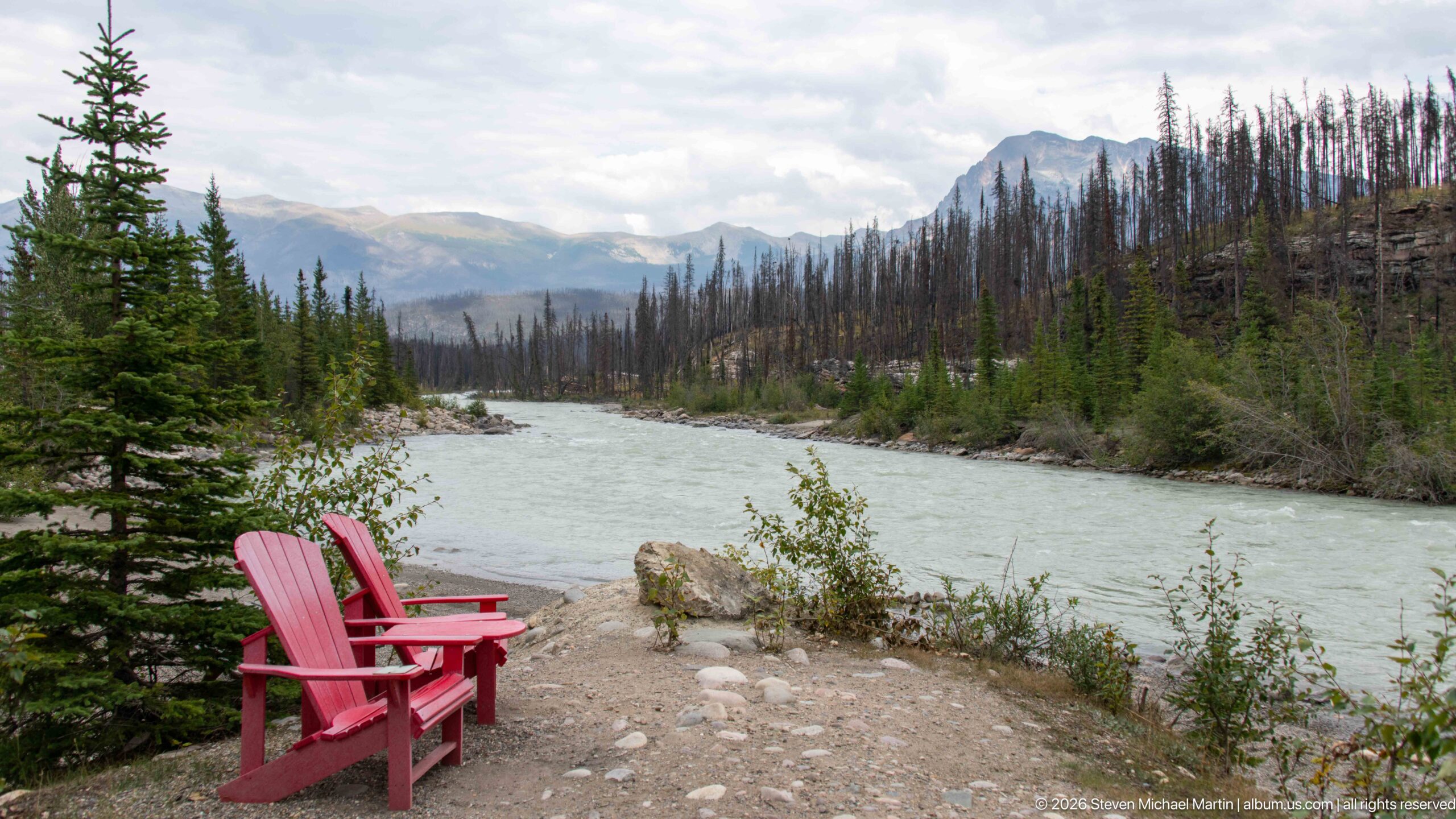
A pair of red Adirondack-style chairs faces the pale turquoise river from a small clearing among conifers. Across the water, extensive standing dead trees climb toward layered mountain ridges, making the viewpoint a concise record of both visitor infrastructure and the valley’s fire-altered landscape.
Caption
A pair of red Adirondack-style chairs faces the pale turquoise river from a small clearing among conifers. Across the water, extensive standing dead trees climb toward layered mountain ridges, making the viewpoint a concise record of both visitor infrastructure and the valley’s fire-altered landscape.
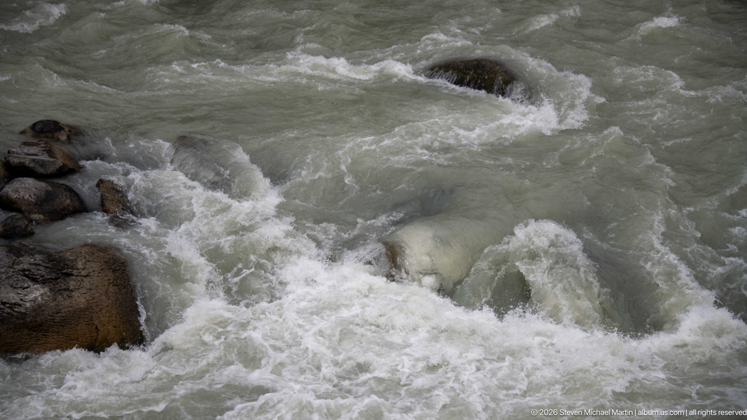
Gray-green mountain water surges over and around partially submerged boulders, producing short standing waves and white foam. The tight framing eliminates the wider valley and focuses on hydraulic force, showing how uneven bedrock and coarse river stones disrupt the current into turbulent rapids.
Caption
Gray-green mountain water surges over and around partially submerged boulders, producing short standing waves and white foam. The tight framing eliminates the wider valley and focuses on hydraulic force, showing how uneven bedrock and coarse river stones disrupt the current into turbulent rapids.
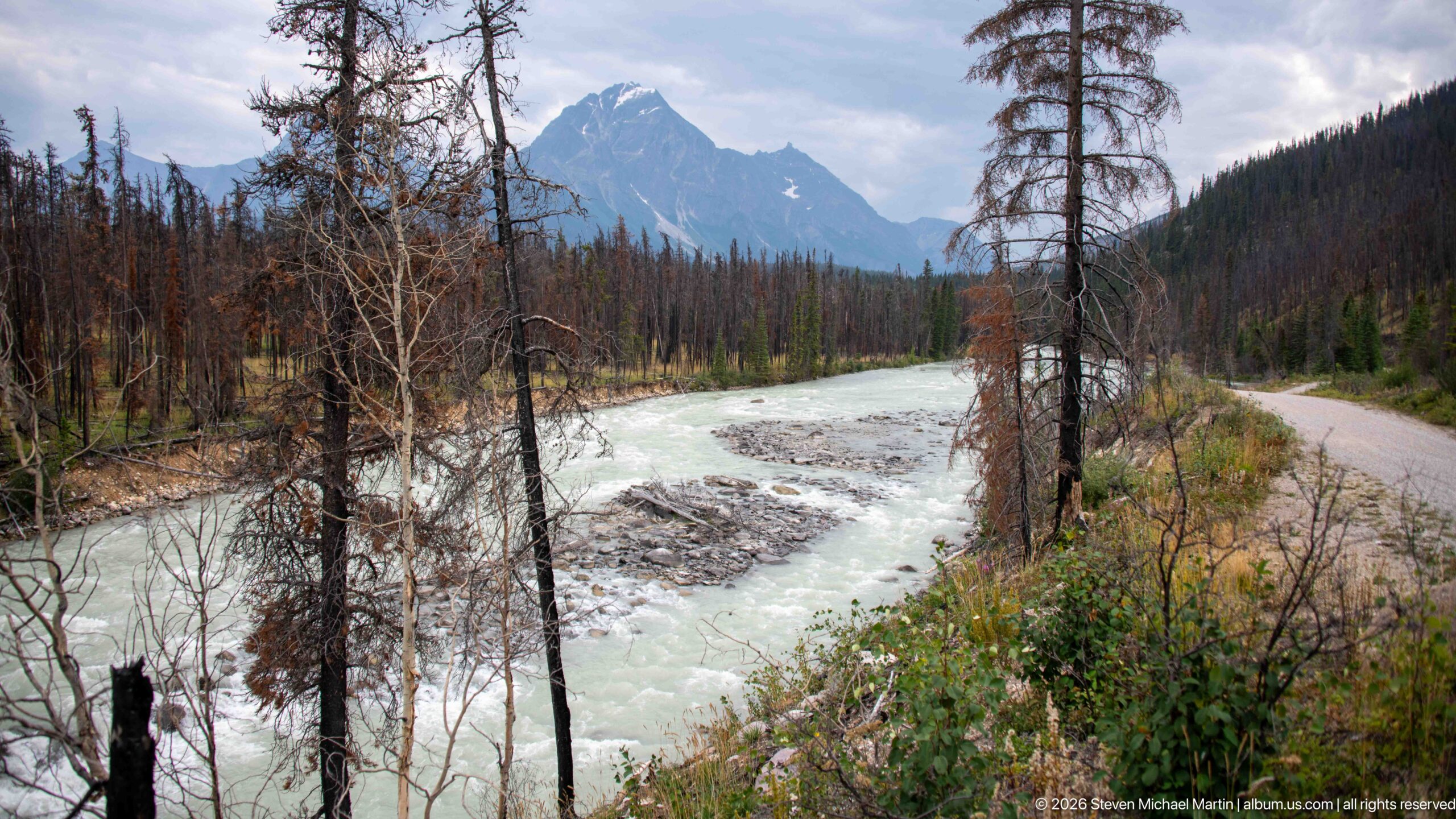
A narrow road follows the right bank of the pale turquoise river as both curve toward a steep mountain framed by fire-scarred trees. The elevated view reveals the close relationship between transportation corridor, river channel, recovering vegetation, and mountain relief within the Whirlpool Valley.
Caption
A narrow road follows the right bank of the pale turquoise river as both curve toward a steep mountain framed by fire-scarred trees. The elevated view reveals the close relationship between transportation corridor, river channel, recovering vegetation, and mountain relief within the Whirlpool Valley.
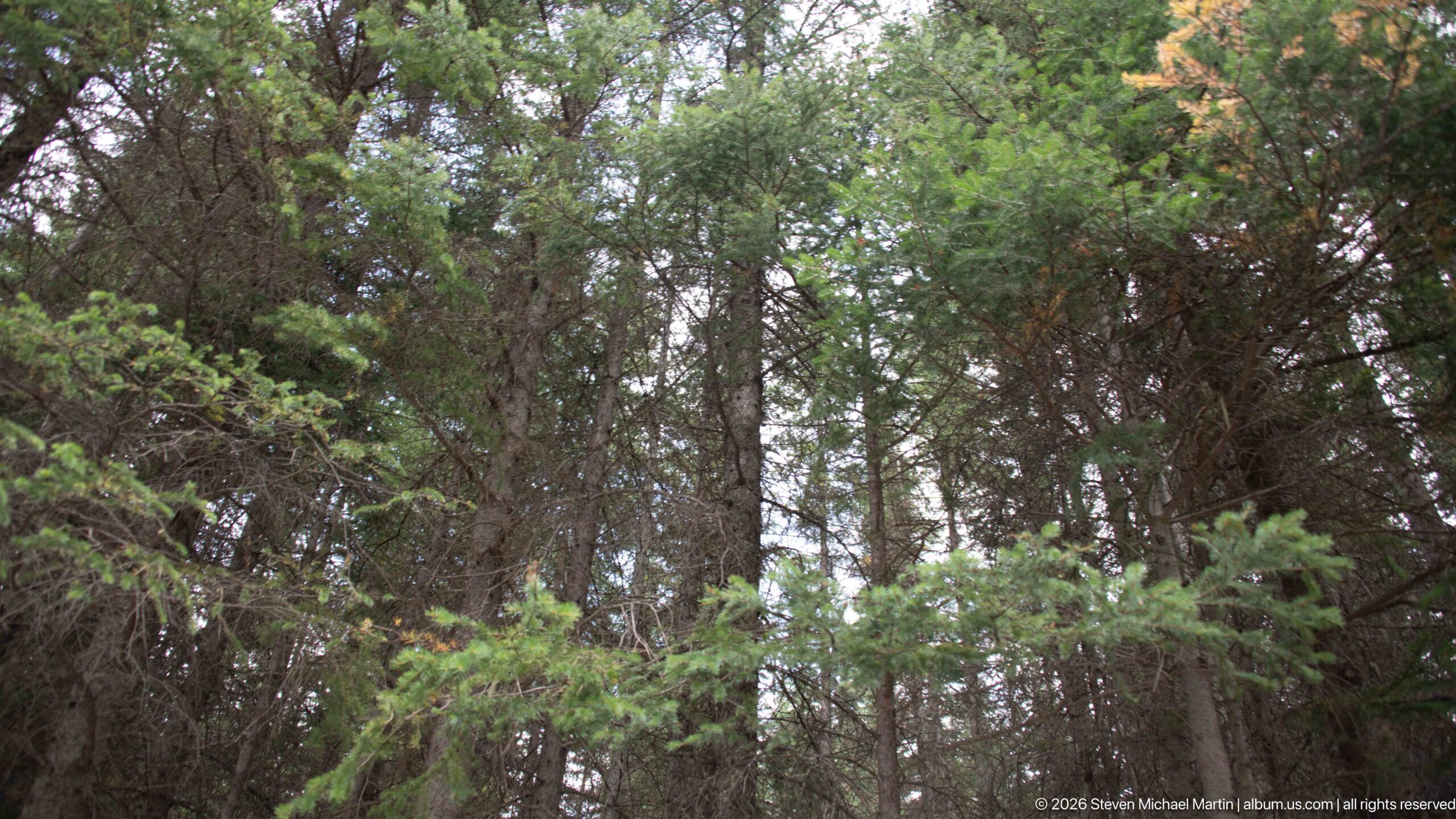
Interlocking evergreen branches fill the upper forest view, with multiple trunks disappearing into a layered canopy. The upward-looking composition concentrates on foliage density and vertical structure, complementing the neighboring ground-level forest interior with a closer study of the woodland canopy.
Caption
Interlocking evergreen branches fill the upper forest view, with multiple trunks disappearing into a layered canopy. The upward-looking composition concentrates on foliage density and vertical structure, complementing the neighboring ground-level forest interior with a closer study of the woodland canopy.
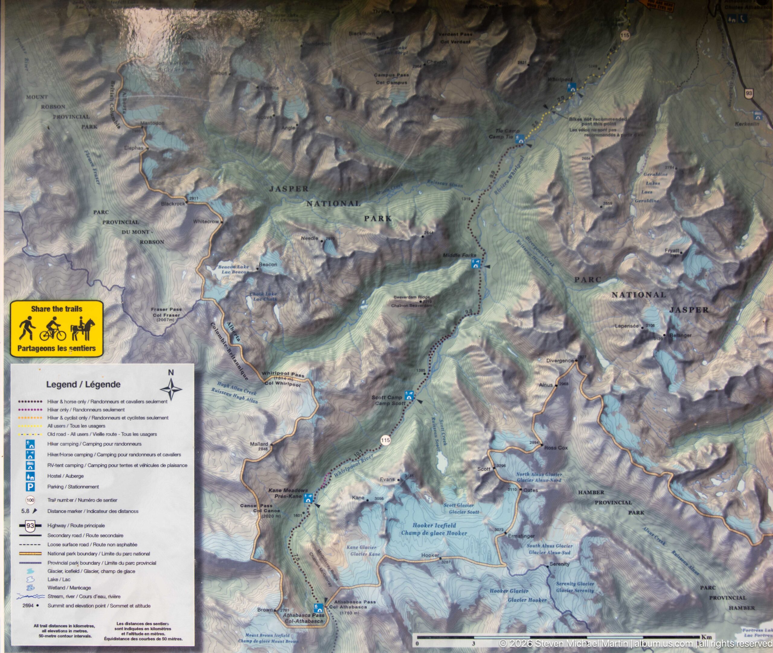
A detailed Parks Canada relief map presents the mountain terrain around Jasper National Park and the Athabasca Pass corridor, with trails, roads, waterways, campsites, and other route symbols keyed in a bilingual legend. Shaded relief makes the steep valleys and high ranges legible as a connected backcountry landscape.
Caption
A detailed Parks Canada relief map presents the mountain terrain around Jasper National Park and the Athabasca Pass corridor, with trails, roads, waterways, campsites, and other route symbols keyed in a bilingual legend. Shaded relief makes the steep valleys and high ranges legible as a connected backcountry landscape.
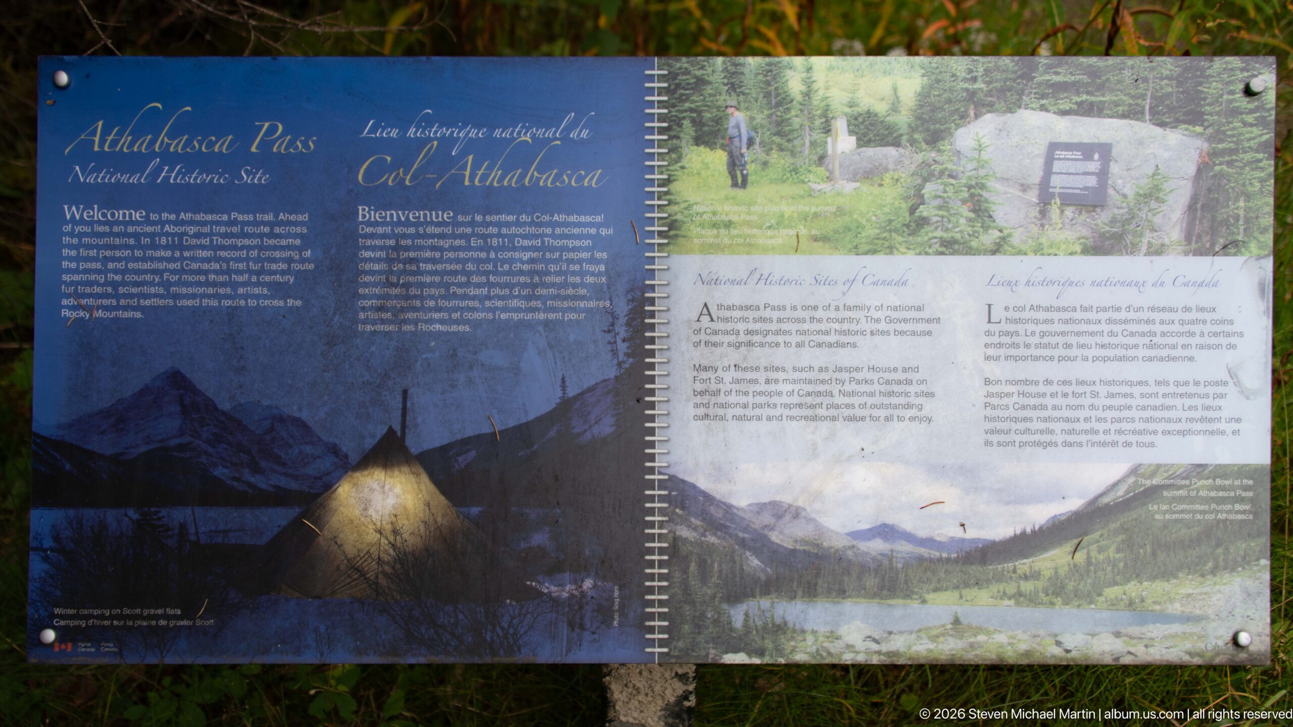
A bilingual interpretive panel introduces Athabasca Pass National Historic Site of Canada, combining historical text with archival and landscape imagery. The display places the pass within a long history of travel through the Rockies and interprets the route as both a natural mountain corridor and a nationally recognized historic place.
Caption
A bilingual interpretive panel introduces Athabasca Pass National Historic Site of Canada, combining historical text with archival and landscape imagery. The display places the pass within a long history of travel through the Rockies and interprets the route as both a natural mountain corridor and a nationally recognized historic place.
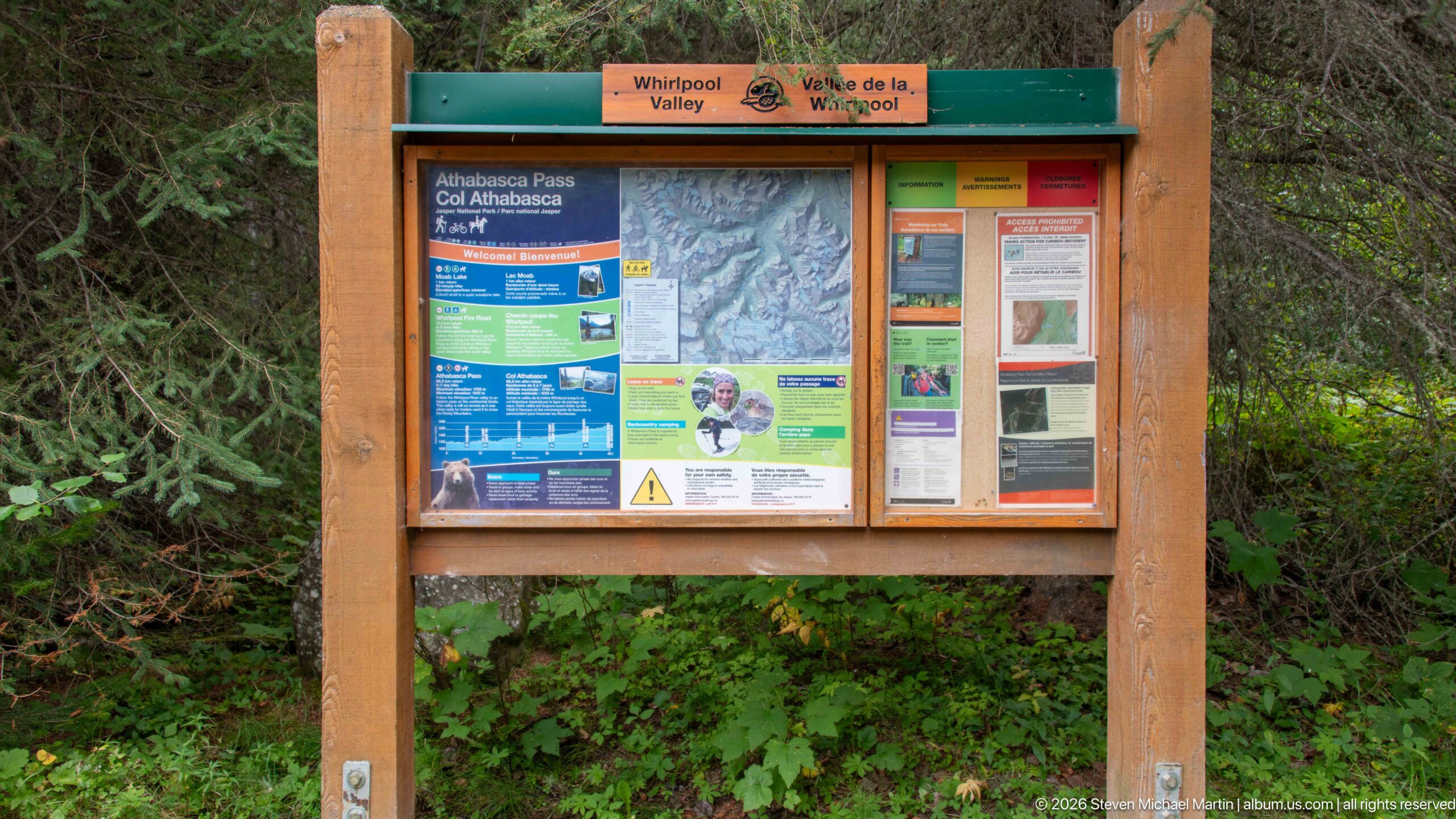
A wooden trailhead kiosk identifies Whirlpool Valley and presents Athabasca Pass information alongside maps, safety notices, and visitor guidance. Set against dense forest vegetation, the board marks the transition from developed roadside access to the backcountry routes extending through the valley and toward the Continental Divide.
Caption
A wooden trailhead kiosk identifies Whirlpool Valley and presents Athabasca Pass information alongside maps, safety notices, and visitor guidance. Set against dense forest vegetation, the board marks the transition from developed roadside access to the backcountry routes extending through the valley and toward the Continental Divide.

A beagle peers past a passenger and the open edge of a vehicle window, its face framed tightly by the dark interior and silver door trim. The close composition shifts the portfolio briefly from landscape to travel experience, recording one of the dogs accompanying the journey through Jasper’s mountain corridor.
Caption
A beagle peers past a passenger and the open edge of a vehicle window, its face framed tightly by the dark interior and silver door trim. The close composition shifts the portfolio briefly from landscape to travel experience, recording one of the dogs accompanying the journey through Jasper’s mountain corridor.
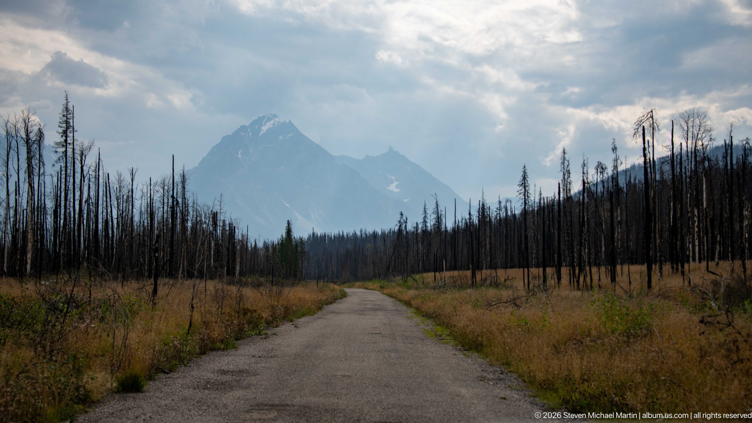
A narrow paved road runs straight through extensive fire-killed forest toward a sharply profiled mountain under broken cloud. Low grasses and young vegetation occupy the open roadside, while ranks of blackened trunks make the scale of the burned landscape especially apparent.
Caption
A narrow paved road runs straight through extensive fire-killed forest toward a sharply profiled mountain under broken cloud. Low grasses and young vegetation occupy the open roadside, while ranks of blackened trunks make the scale of the burned landscape especially apparent.
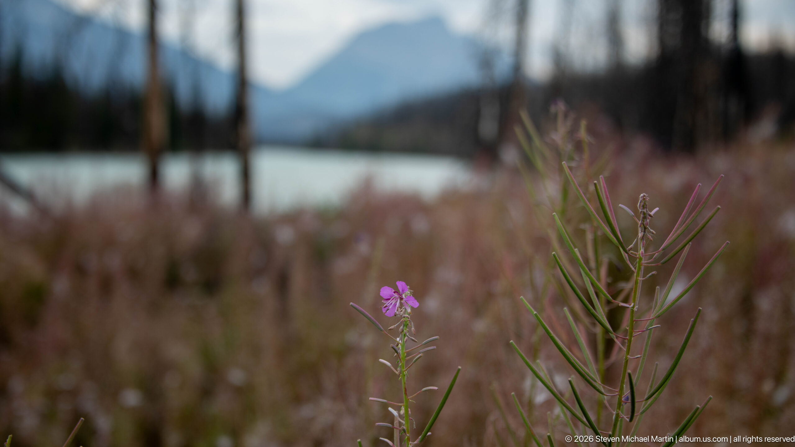
A small pink fireweed bloom rises sharply from slender leaves, isolated against a softly blurred background of pale water, mountain slope, and fire-affected vegetation. The selective focus turns a common post-disturbance plant into the principal subject while retaining enough landscape context to connect it with the recovering valley.
Caption
A small pink fireweed bloom rises sharply from slender leaves, isolated against a softly blurred background of pale water, mountain slope, and fire-affected vegetation. The selective focus turns a common post-disturbance plant into the principal subject while retaining enough landscape context to connect it with the recovering valley.
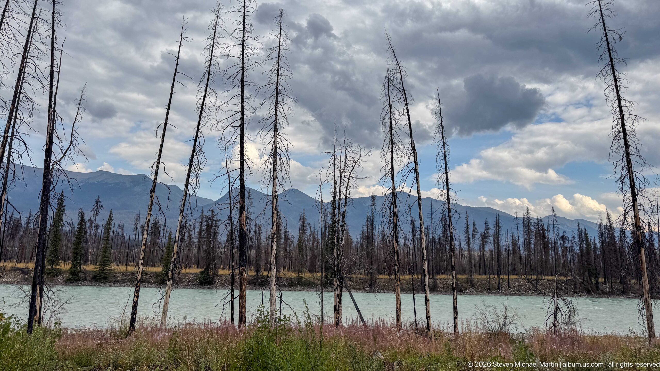
Tall fire-killed trunks form a sparse screen in front of a pale turquoise river, with dark mountain ridges and dramatic clouds beyond. The composition layers burned woodland, water, and distant relief, showing how the river corridor remains visually open where the former forest canopy has been lost.
Caption
Tall fire-killed trunks form a sparse screen in front of a pale turquoise river, with dark mountain ridges and dramatic clouds beyond. The composition layers burned woodland, water, and distant relief, showing how the river corridor remains visually open where the former forest canopy has been lost.
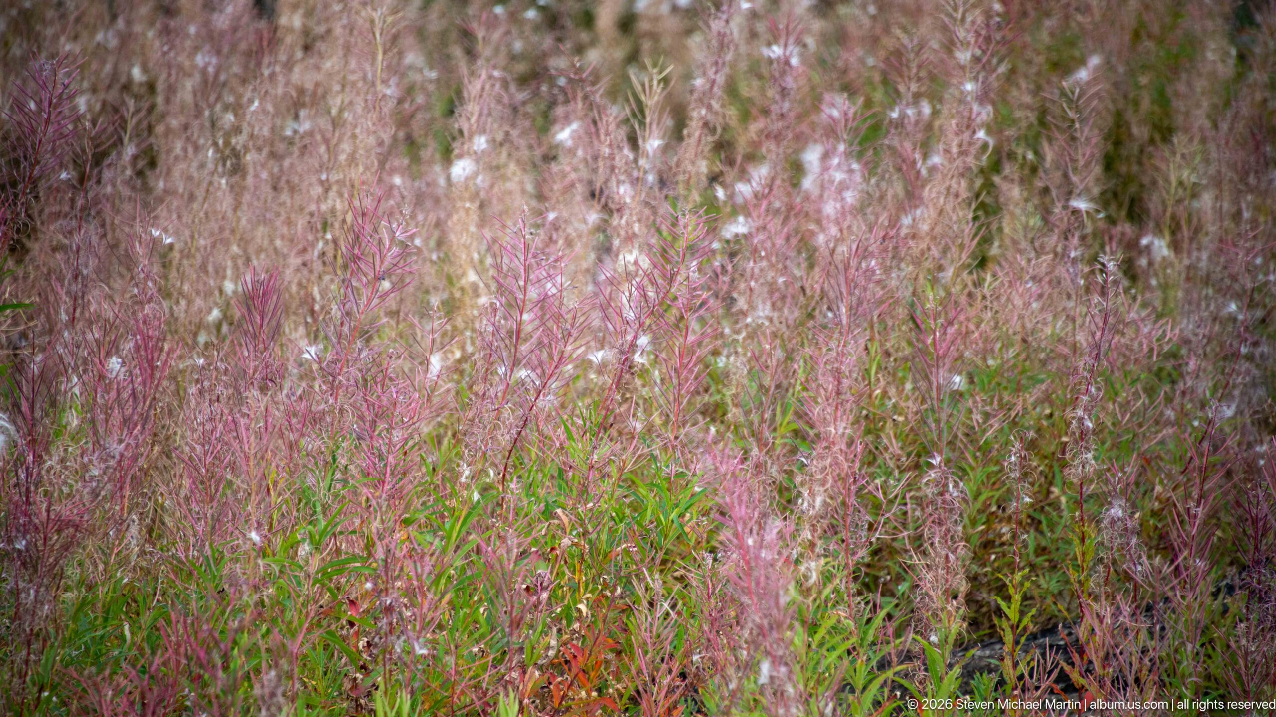
A dense patch of fireweed fills the frame with pink-purple seed heads, reddish stems, and green leaves. Seen at close range, the vegetation forms a textured record of vigorous ground-layer recovery in a disturbed landscape, contrasting with the standing dead trees visible elsewhere in the valley.
Caption
A dense patch of fireweed fills the frame with pink-purple seed heads, reddish stems, and green leaves. Seen at close range, the vegetation forms a textured record of vigorous ground-layer recovery in a disturbed landscape, contrasting with the standing dead trees visible elsewhere in the valley.
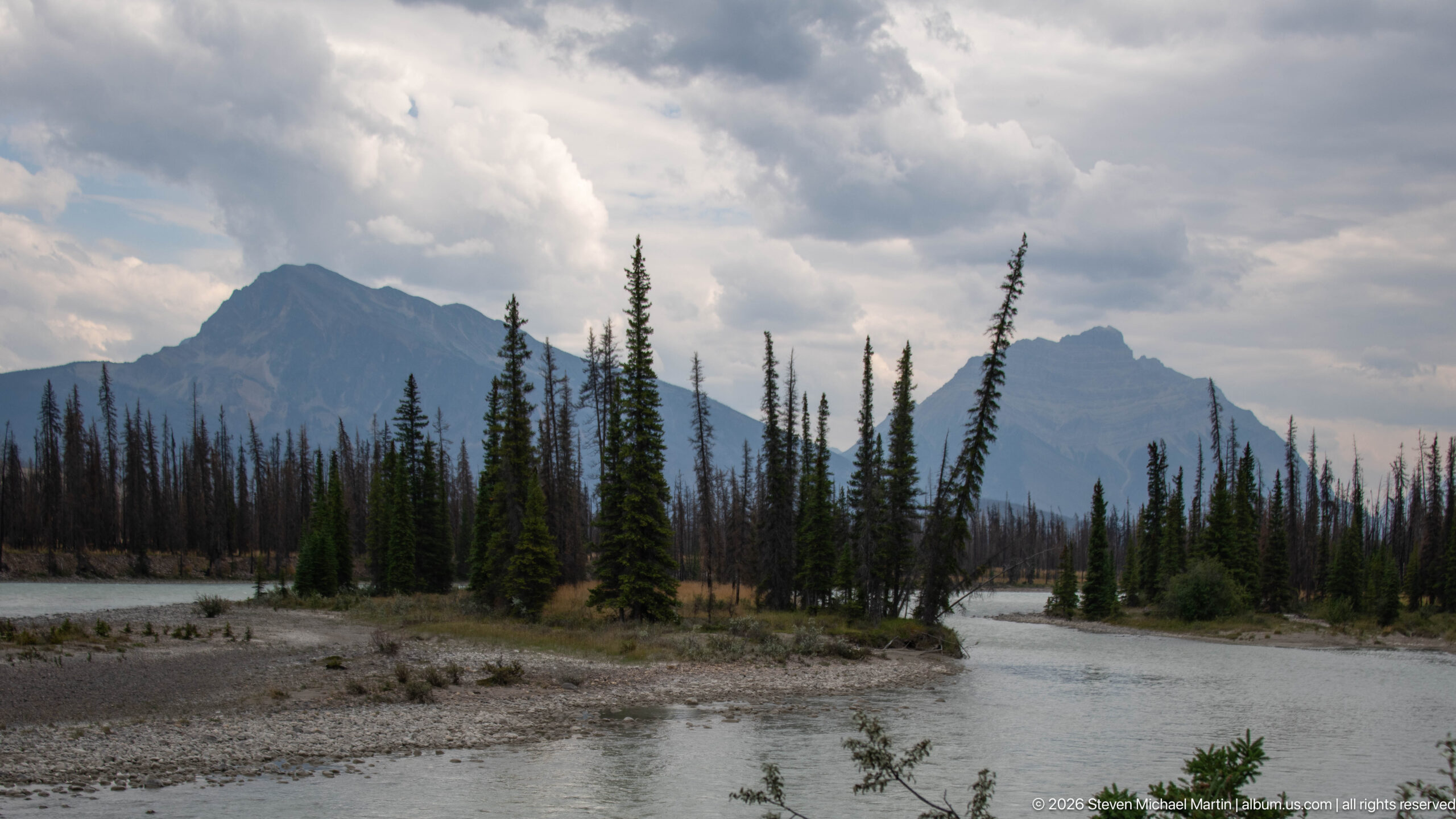
Pale mountain water divides around a low gravel island carrying a cluster of surviving conifers, then rejoins beneath rugged peaks. Gravel bars, living evergreens, standing dead trees, and cloud-shadowed mountains combine in a broad view of a dynamic river corridor shaped by both flowing water and recent forest disturbance.
Caption
Pale mountain water divides around a low gravel island carrying a cluster of surviving conifers, then rejoins beneath rugged peaks. Gravel bars, living evergreens, standing dead trees, and cloud-shadowed mountains combine in a broad view of a dynamic river corridor shaped by both flowing water and recent forest disturbance.
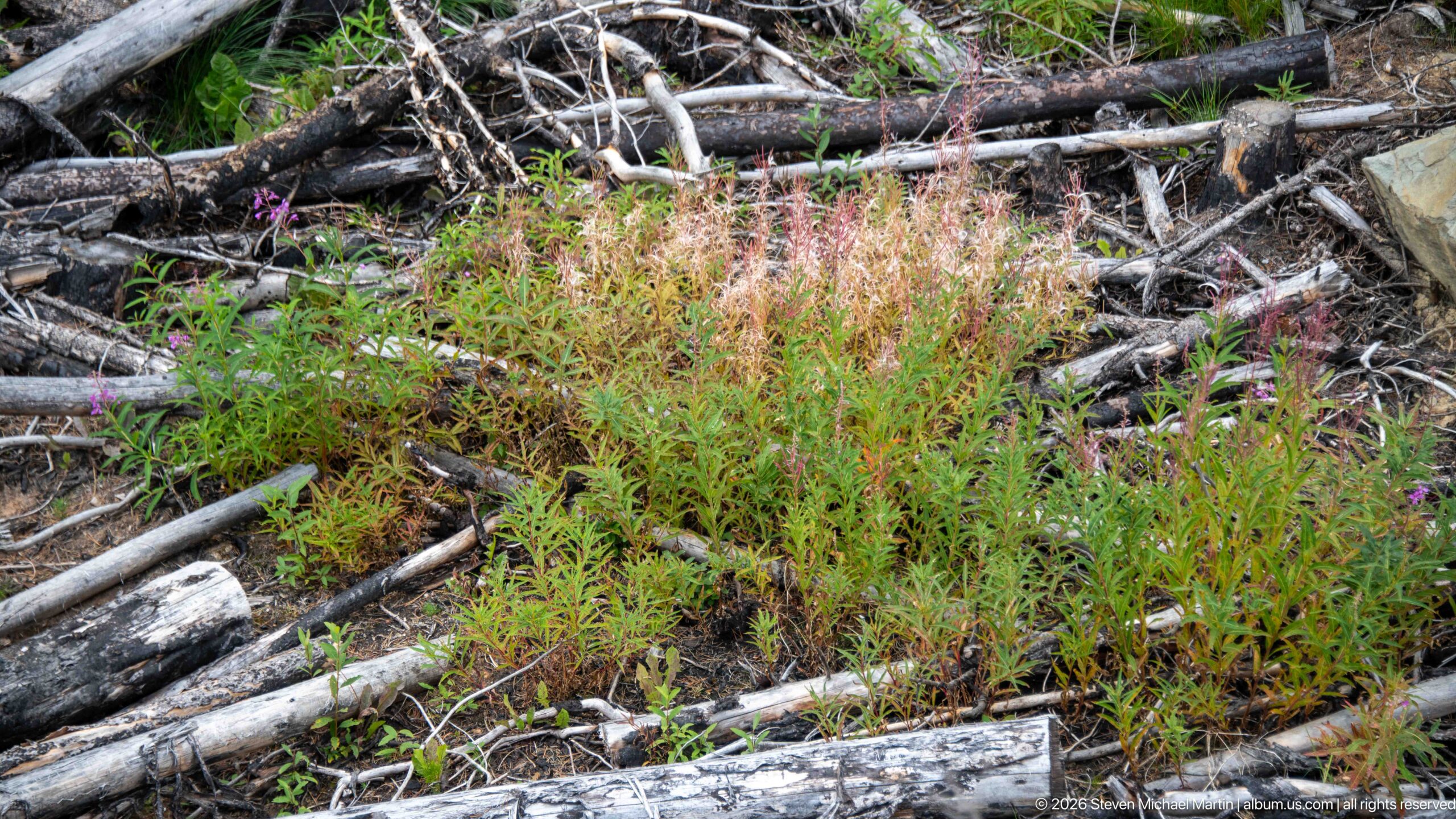
Fireweed and other low plants grow through a tangle of fallen, charred trunks and branches on the forest floor. The close view concentrates on early vegetation recovery rather than distant scenery, showing living stems occupying openings created by fire and fallen woody debris.
Caption
Fireweed and other low plants grow through a tangle of fallen, charred trunks and branches on the forest floor. The close view concentrates on early vegetation recovery rather than distant scenery, showing living stems occupying openings created by fire and fallen woody debris.
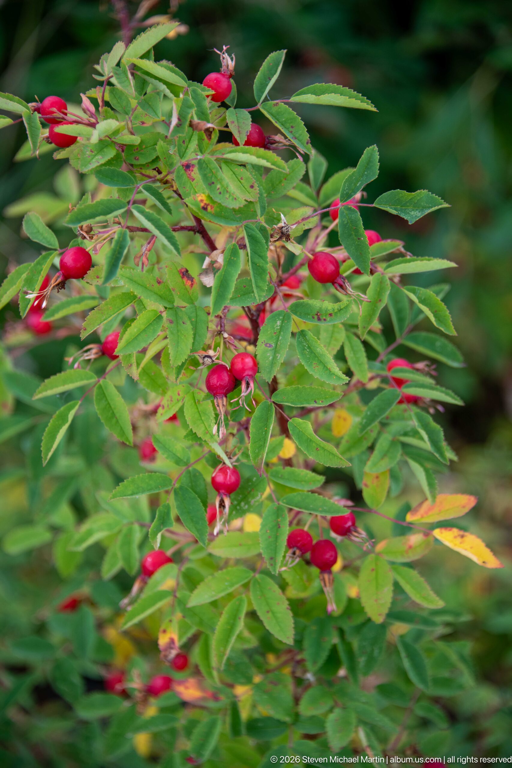
Bright red rose hips hang among compound green leaves, with a few drying flower remnants and yellowing foliage indicating late-season change. The close botanical view records fruiting vegetation within the valley and provides a colorful counterpoint to the portfolio’s broader scenes of river, mountains, and burned woodland.
Caption
Bright red rose hips hang among compound green leaves, with a few drying flower remnants and yellowing foliage indicating late-season change. The close botanical view records fruiting vegetation within the valley and provides a colorful counterpoint to the portfolio’s broader scenes of river, mountains, and burned woodland.
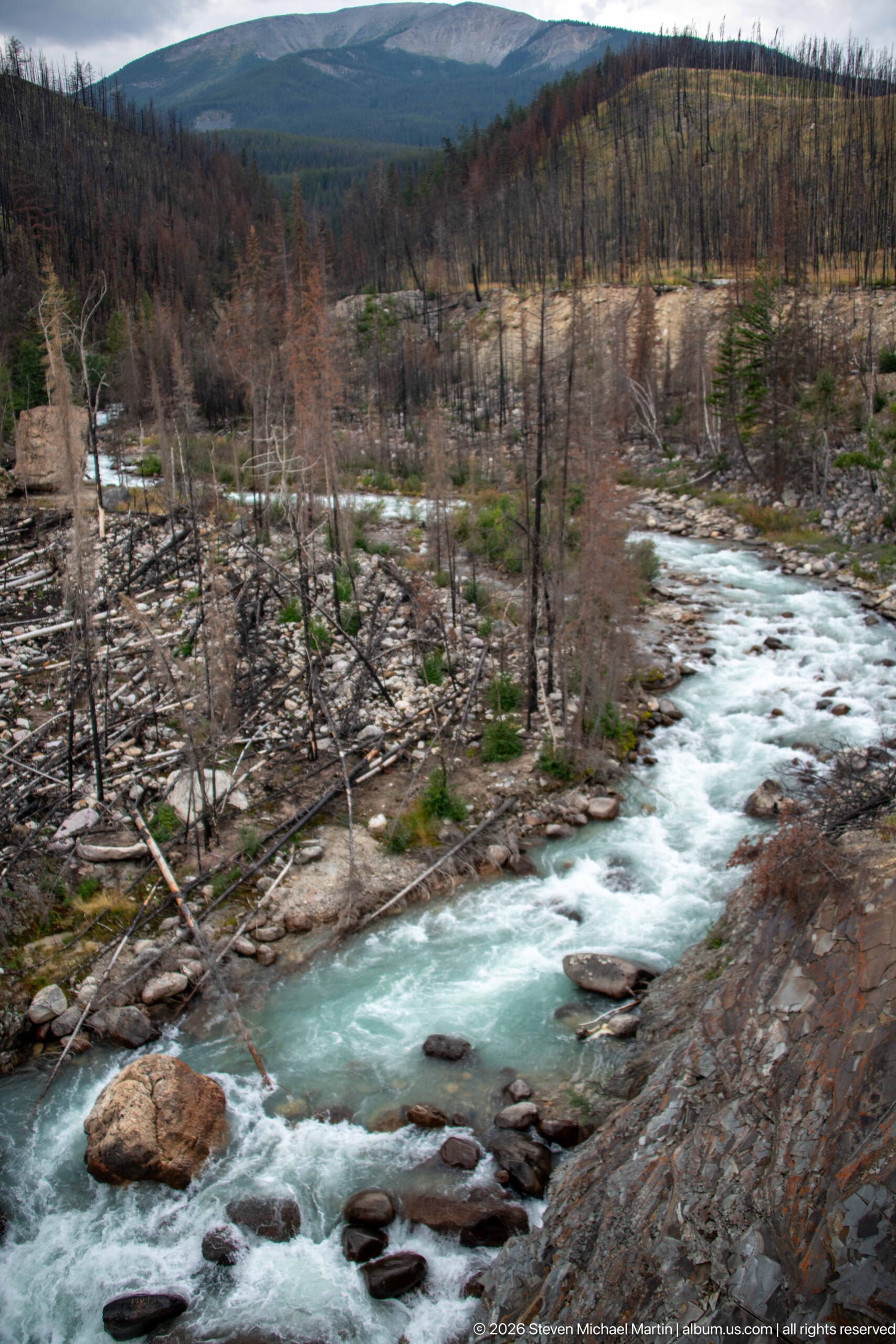
A turquoise mountain river rushes around boulders and fallen timber through a landscape heavily affected by fire. Standing dead trunks, downed trees, exposed gravel, and sparse regrowth line both banks, while the energetic whitewater remains the dominant element cutting through the disturbed valley floor.
Caption
A turquoise mountain river rushes around boulders and fallen timber through a landscape heavily affected by fire. Standing dead trunks, downed trees, exposed gravel, and sparse regrowth line both banks, while the energetic whitewater remains the dominant element cutting through the disturbed valley floor.
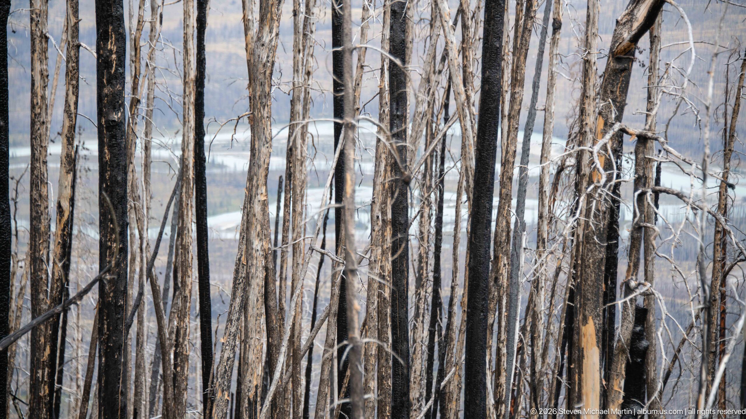
Closely spaced fire-killed trunks create a vertical screen across the frame, with pale river water and distant slopes visible through narrow gaps. The compressed viewpoint emphasizes the density of standing dead timber and the altered transparency of the forest after canopy loss.
Caption
Closely spaced fire-killed trunks create a vertical screen across the frame, with pale river water and distant slopes visible through narrow gaps. The compressed viewpoint emphasizes the density of standing dead timber and the altered transparency of the forest after canopy loss.
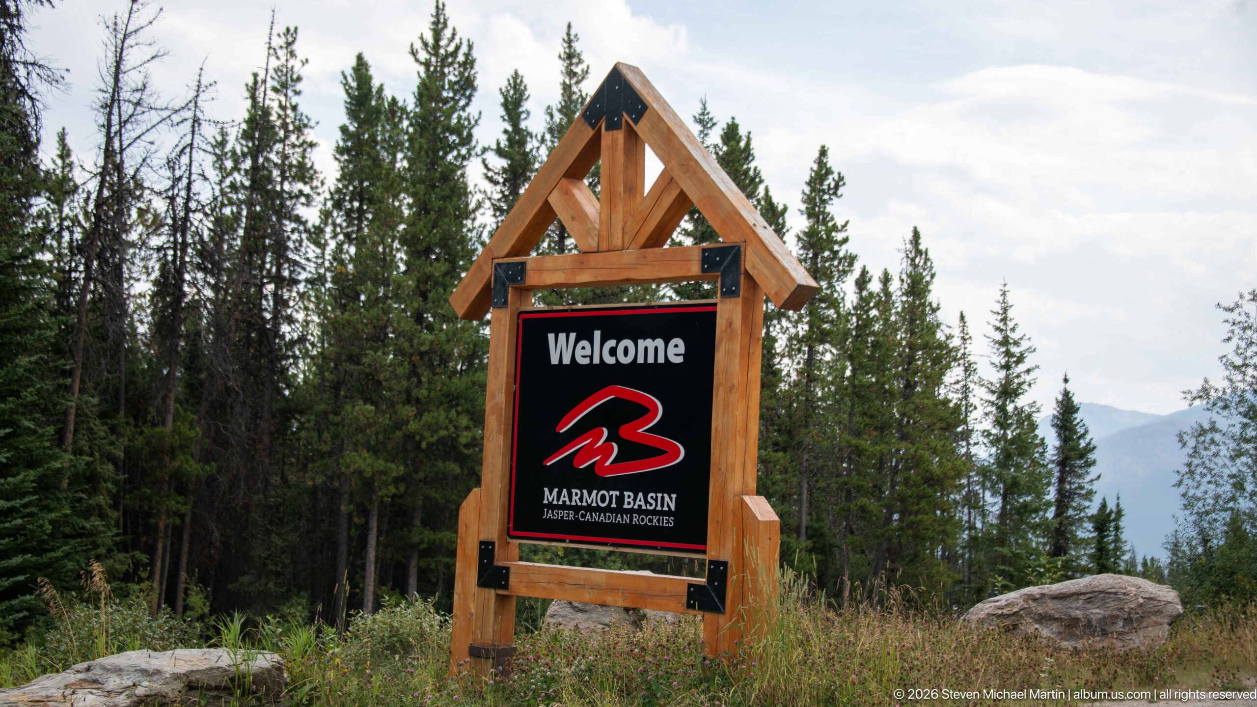
A timber-framed roadside sign welcomes visitors to Marmot Basin, with the ski area’s red mountain logo and the words “Jasper Canadian Rockies” clearly displayed. Evergreen forest surrounds the sign, while a glimpse of mountain terrain beyond situates the developed entrance within Jasper’s larger alpine landscape.
Caption
A timber-framed roadside sign welcomes visitors to Marmot Basin, with the ski area’s red mountain logo and the words “Jasper Canadian Rockies” clearly displayed. Evergreen forest surrounds the sign, while a glimpse of mountain terrain beyond situates the developed entrance within Jasper’s larger alpine landscape.
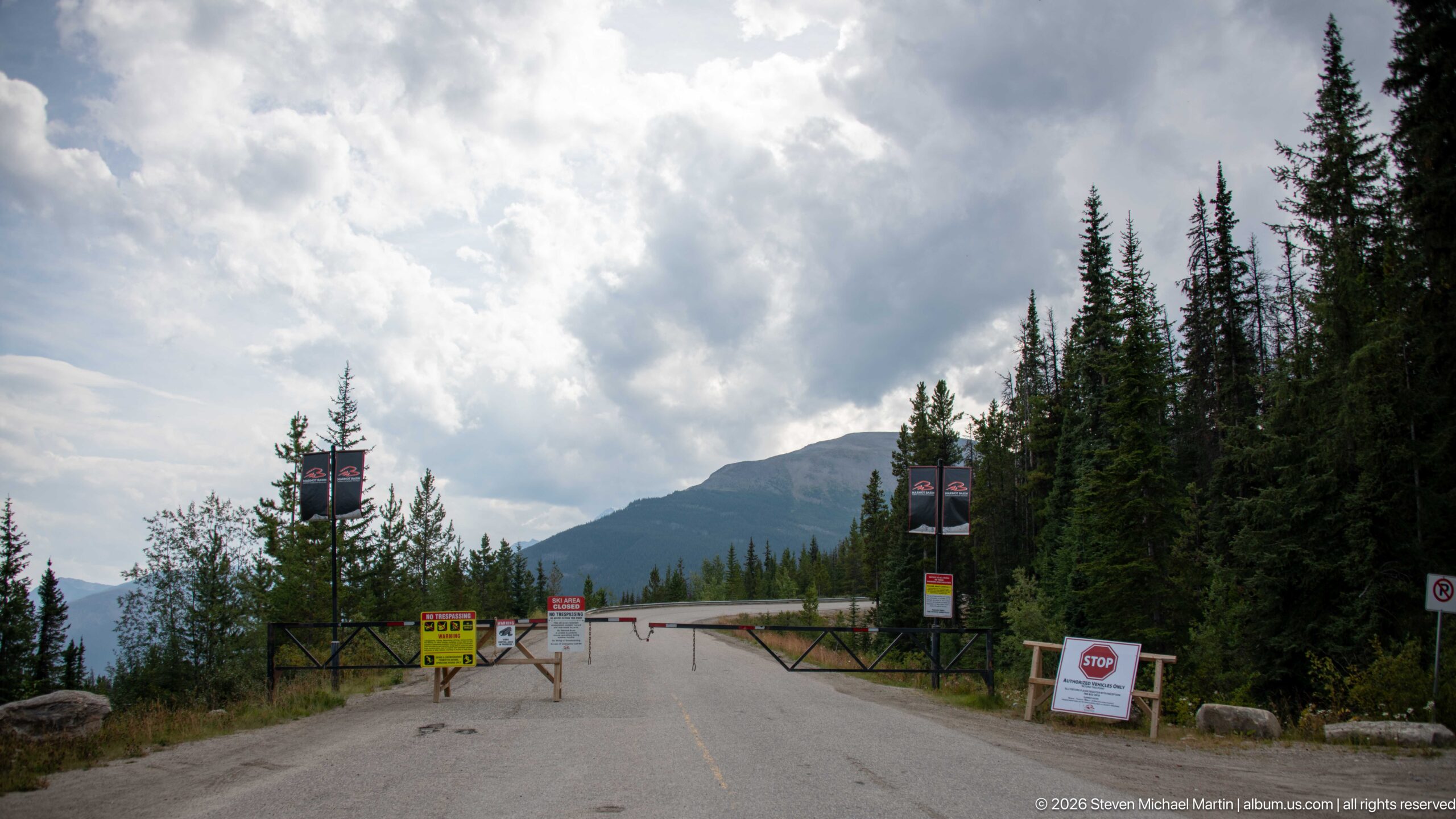
A barrier gate closes a paved mountain road lined by conifers, with multiple stop, warning, and access-control signs positioned across the entrance. Mountain slopes rise behind the trees under heavy clouds, placing the controlled roadway within a developed alpine access corridor.
Caption
A barrier gate closes a paved mountain road lined by conifers, with multiple stop, warning, and access-control signs positioned across the entrance. Mountain slopes rise behind the trees under heavy clouds, placing the controlled roadway within a developed alpine access corridor.
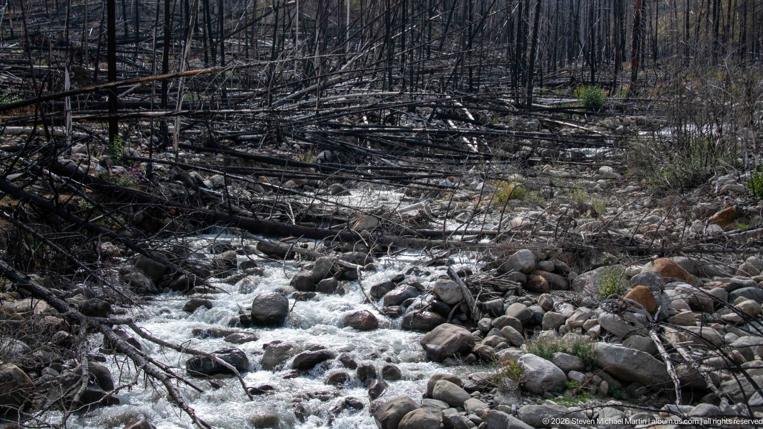
A small, fast stream tumbles through rounded boulders and fallen timber in a severely burned forest. Charred trunks and downed logs crowd the channel, while fresh green plants appear along the banks, creating a close record of water moving through an early post-fire landscape.
Caption
A small, fast stream tumbles through rounded boulders and fallen timber in a severely burned forest. Charred trunks and downed logs crowd the channel, while fresh green plants appear along the banks, creating a close record of water moving through an early post-fire landscape.
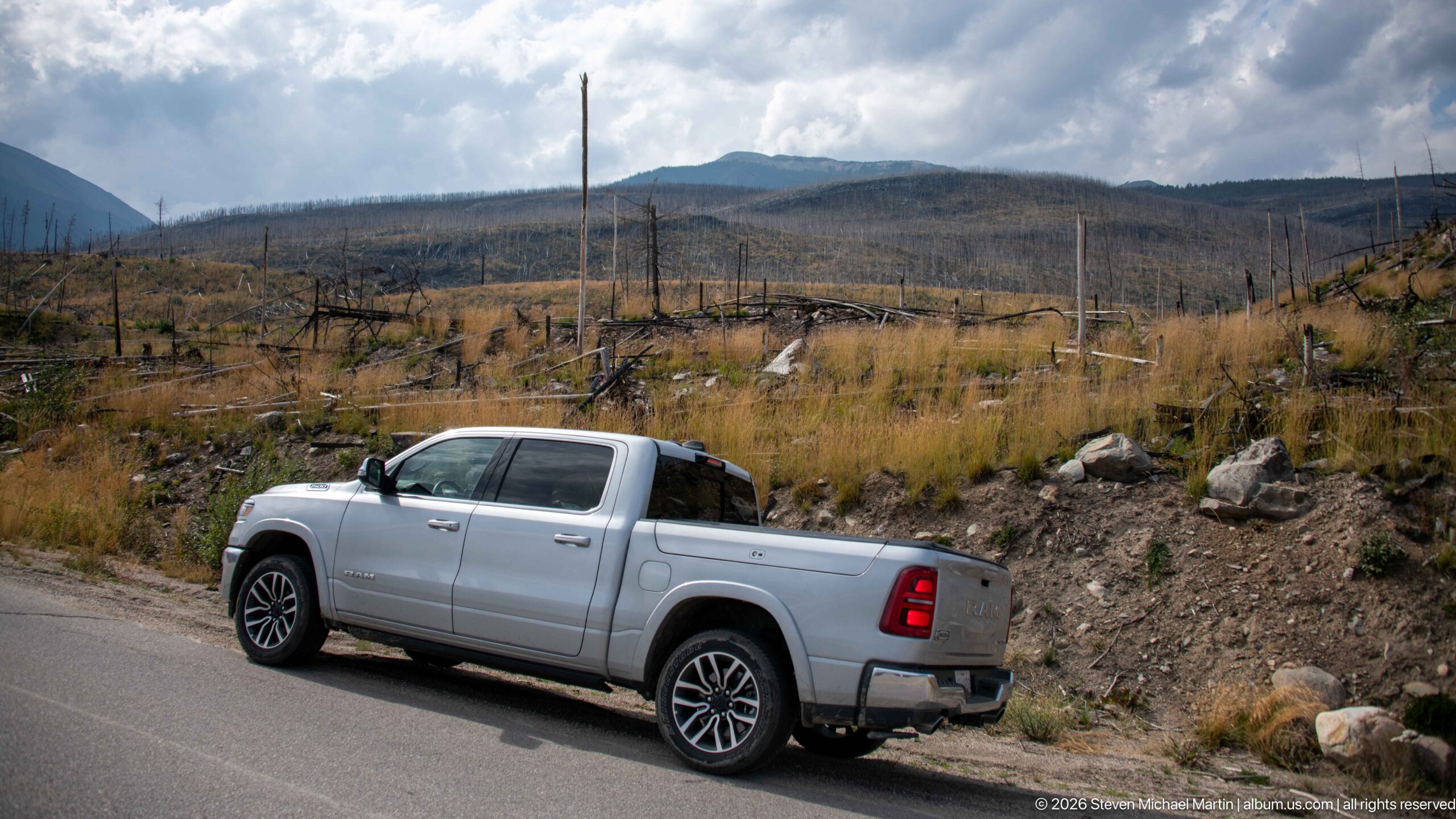
A silver pickup truck is parked along the road below an expansive fire-affected slope filled with standing dead trees and low golden regrowth. The vehicle provides scale for the broad disturbed landscape, where ridges and mountain slopes extend beneath a dramatic cloud-filled sky.
Caption
A silver pickup truck is parked along the road below an expansive fire-affected slope filled with standing dead trees and low golden regrowth. The vehicle provides scale for the broad disturbed landscape, where ridges and mountain slopes extend beneath a dramatic cloud-filled sky.
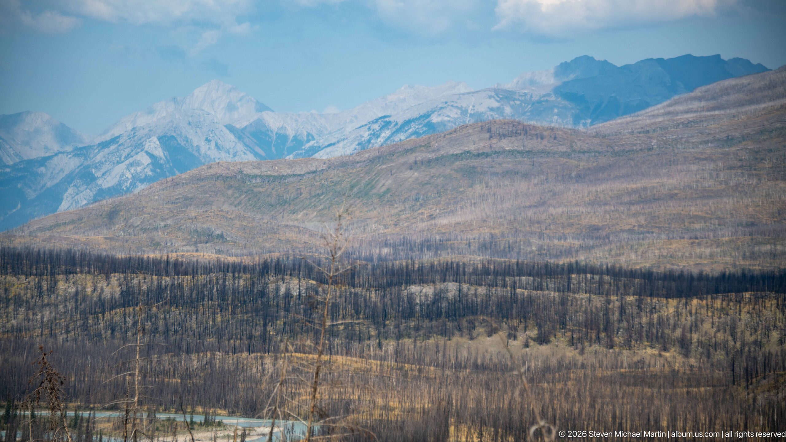
Successive mountain ridges recede into blue haze beyond a broad fire-affected forest, creating a compressed view from low burned slopes to jagged high peaks. The telephoto perspective emphasizes the depth of the Canadian Rockies landscape and the large area of altered forest occupying the lower elevations.
Caption
Successive mountain ridges recede into blue haze beyond a broad fire-affected forest, creating a compressed view from low burned slopes to jagged high peaks. The telephoto perspective emphasizes the depth of the Canadian Rockies landscape and the large area of altered forest occupying the lower elevations.
Scenic Landscape Field Guide
📍 Overview
Jasper Whirlpool Valley presents a broad Canadian Rockies landscape where river, mountains, forest, fire, and human history intersect within Jasper National Park. The portfolio follows the pale turquoise Whirlpool River through mountain terrain that ranges from enclosed conifer forest to open gravel margins and sweeping views of layered ridges. Parks Canada trail information also connects the valley with Moab Lake, the Whirlpool Fire Road, and the historic Athabasca Pass corridor, placing today’s landscape within a much longer story of movement through the mountains. The photographs are especially notable for documenting a landscape undergoing visible ecological change: extensive stands of fire-killed trees and fallen timber are repeatedly set against living conifers, returning ground vegetation, fireweed, and the continuing force of the river.
🏔️ Physical Setting
The Whirlpool River forms the visual spine of the valley, appearing as a broad, opaque turquoise watercourse bordered by gravel bars, cobbles, boulders, forest, and steep mountain slopes. In some views the river spreads around gravel islands and divides into separate channels; elsewhere it narrows into rapids, cascades, and confined rocky passages. Roads and trails occupy the same valley corridor, sometimes running close beside the water before the landscape gives way to backcountry routes. The surrounding relief is substantial: massive slopes rise directly above the river while successive ridges and jagged distant peaks create a layered mountain horizon. The combination of open river corridor and steep enclosing terrain gives the valley both an intimate riverside scale and the much larger spatial character of the Canadian Rockies.
🪨 Geology & Landform
Water and rock provide the clearest visible evidence of the processes shaping Whirlpool Valley. The river moves through coarse sediment ranging from gravel and rounded cobbles to large boulders, while broad stony margins and gravel islands record areas where material has accumulated within the channel. In narrower reaches, fast water breaks around submerged rocks, forms standing waves and whitewater, or funnels through resistant layered bedrock into cascades and confined gorges. These contrasting forms show a river continually interacting with its valley floor: transporting and rearranging sediment in broader reaches while concentrating its energy where the channel narrows. At the largest scale, the river lies beneath steep mountain walls and successive ridges, linking the close details of erosion and sediment to the valley’s broader mountain topography.
🌿 Ecology
The portfolio’s strongest ecological story is recovery within a heavily fire-affected landscape. Large areas contain standing dead trunks, blackened snags, fallen logs, and an opened forest canopy, yet the same photographs repeatedly show green understory growth, grasses, surviving conifers, and vigorous patches of fireweed. Close views of pink fireweed and red rose hips bring that regeneration down to the scale of individual plants, while broader scenes show new vegetation spreading beneath dead overstory and among fallen timber. Living conifer stands and dense evergreen canopy survive in other parts of the valley, creating a visible mosaic of disturbance and persistence. Wildlife evidence in the photographs is limited but includes a black-and-orange woolly bear caterpillar encountered on a rock, a small-scale reminder that the valley’s ecological community extends well beyond the large mammals often associated with Jasper. A photographed Parks Canada Caribou Conservation Breeding Centre sign also records the presence of organized wildlife-conservation work in the broader park landscape without itself documenting a caribou encounter.
🦌 Wildlife Encounters
Photographs in this portfolio document wildlife encounters with Woolly bear caterpillar in the Jasper landscape. The photographs place these animals in settings that include Black-and-orange woolly bear caterpillar on rock. These encounters provide direct, visit-specific evidence of how wildlife uses the habitats interpreted in this field guide.
◆ Seasonal Character
The photographs record Whirlpool Valley during a period of active summer-to-late-season vegetation, with green conifers and understory plants accompanied by flowering fireweed, developing seed structures, bright red rose hips, and some yellowing foliage. Weather changes quickly across the sequence. Low cloud obscures mountain slopes in some views, dark storm clouds deepen the river valley in others, and intervals of blue sky and bright cumulus clouds illuminate the burned forest and mountain ridges. These shifts strongly affect the appearance of the landscape: turquoise water becomes brighter or more subdued, distant ridges alternately emerge and recede, and moving light reveals the texture of slopes and fire-affected woodland. The result is a landscape whose photographic character can change substantially even during a single visit.
👁️ Viewpoints
The most revealing viewpoints combine the Whirlpool River with the surrounding mountains and fire-affected forest. Broad gravel margins provide low, open perspectives along the water, while higher roadside views show the river and transportation corridor bending together through the valley. Parks Canada’s red Adirondack-style chairs create another distinctive riverside viewpoint, facing across pale turquoise water toward burned woodland and layered mountain ridges. Trailhead and interpretive areas add a cultural dimension to the landscape: signs for Whirlpool Valley, Athabasca Pass, Fryatt Valley, and associated routes connect what is visible on the ground with the larger backcountry network. The portfolio also extends beyond scenic overlooks to Marmot Basin and controlled mountain-road access, illustrating how developed visitor corridors sit within the surrounding alpine terrain.
📷 Photography Notes
Whirlpool Valley rewards photography at several scales. Wide compositions are most effective when they preserve the relationship among river, burned forest, and mountain relief, particularly where a gravel bar, road, visitor, or surviving conifer provides scale. Tighter river studies can isolate turquoise current, whitewater, boulders, and layered bedrock, while close botanical photographs reveal fireweed, rose hips, and other signs of regeneration that can disappear in a panoramic view. The standing dead forest is especially graphic when trunks are used as vertical foreground elements against water or distant mountains, and the contrast between blackened timber and fresh vegetation gives post-fire scenes visual structure without requiring dramatic light. Changing clouds are also important: low cloud can simplify mountain forms, while openings in the cloud cover create moving highlights across ridges and recovering forest. Together, establishing views, environmental portraits, interpretive details, and close natural-history studies provide a more complete photographic account of the valley than scenic panoramas alone.