Jasper – Athabasca River
The Athabasca River flows through the heart of Jasper National Park in Alberta, forming one of the defining features of the broad mountain valley surrounding the town of Jasper. Fed by glaciers and mountain streams originating in the Columbia Icefield, the river flows north and east for nearly 150 kilometres through the park, draining more than four-fifths of Jasper National Park before continuing across Alberta toward the Arctic Ocean.
The Athabasca has played an important role in both the natural and human history of the Canadian Rockies. Its broad valley provided a transportation corridor through the mountains, and in the early nineteenth century explorer and mapmaker David Thompson traveled along the river while searching for a fur-trade route across the Continental Divide. Later travelers, railways, and highways followed portions of the same corridor. Recognized for its outstanding natural, cultural, and recreational values, the section of the Athabasca River within Jasper National Park was designated a Canadian Heritage River in 1989.
Within Jasper National Park, the Athabasca alternates between broad, braided channels and narrower passages bordered by forests, gravel bars, and the surrounding peaks of the Canadian Rockies. Glacial meltwater and seasonal snowmelt continually shape the river and its valley, while viewpoints, bridges, trails, and roads provide changing perspectives of the river as it passes through the park. Together, the Athabasca River and its mountain setting illustrate the continuing influence of water and ice in shaping the landscape of Jasper National Park.
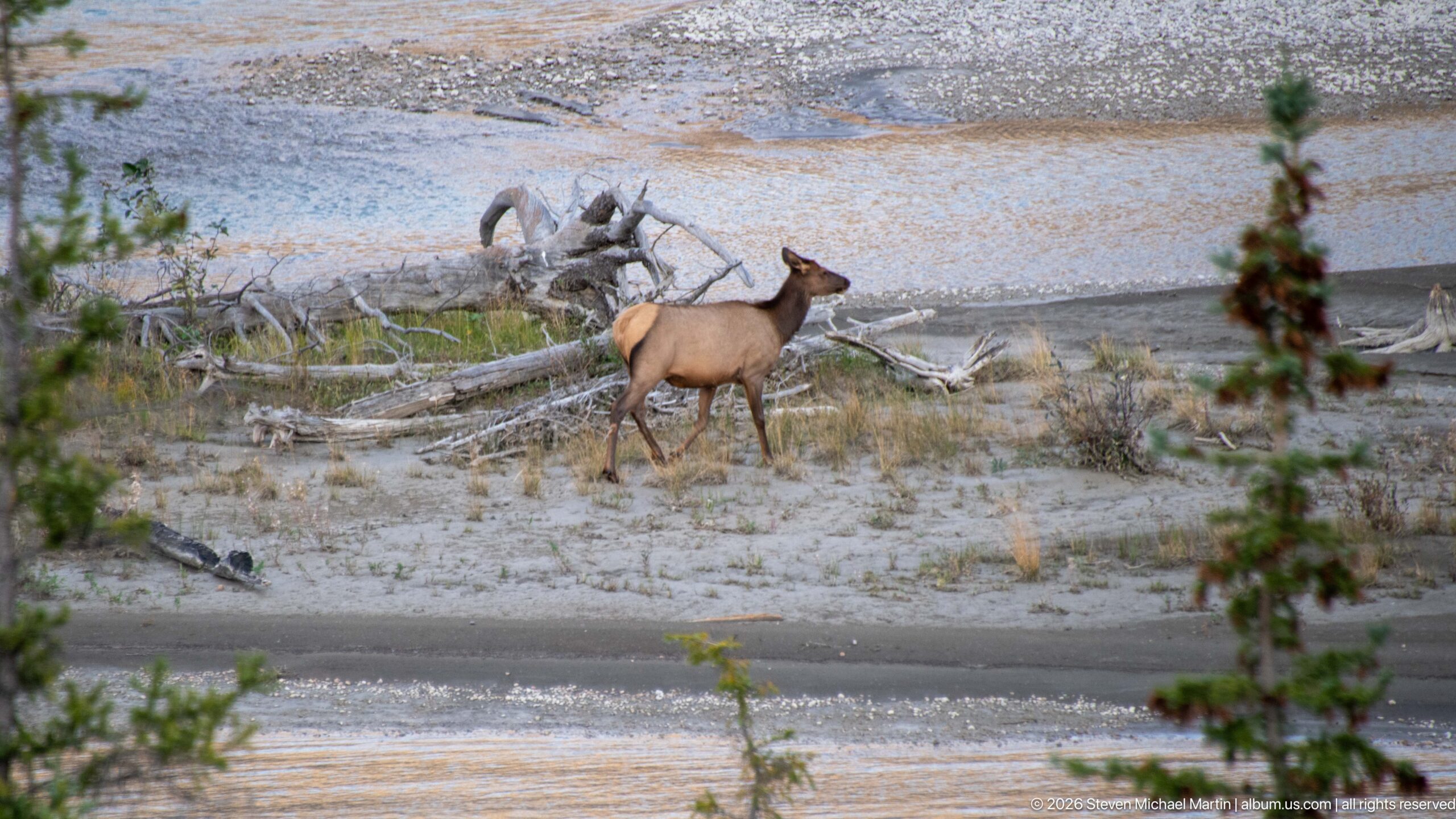
An elk walks across a broad gravel bar beside shallow channels of the Athabasca River, passing bleached driftwood deposited across the floodplain. The animal's tawny coat contrasts with the gray sediment, while the open channel pattern illustrates the river's shifting gravel-and-water landscape.
Caption
An elk walks across a broad gravel bar beside shallow channels of the Athabasca River, passing bleached driftwood deposited across the floodplain. The animal's tawny coat contrasts with the gray sediment, while the open channel pattern illustrates the river's shifting gravel-and-water landscape.
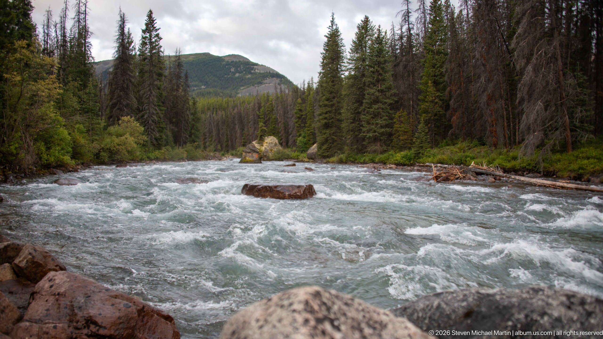
Fast, pale blue-green water surges around exposed boulders in a forested mountain channel. The low viewpoint emphasizes current and turbulence, while conifers, dead standing trees, and a rounded mountain slope frame the river without requiring an unsupported identification of a specific rapid or tributary.
Caption
Fast, pale blue-green water surges around exposed boulders in a forested mountain channel. The low viewpoint emphasizes current and turbulence, while conifers, dead standing trees, and a rounded mountain slope frame the river without requiring an unsupported identification of a specific rapid or tributary.
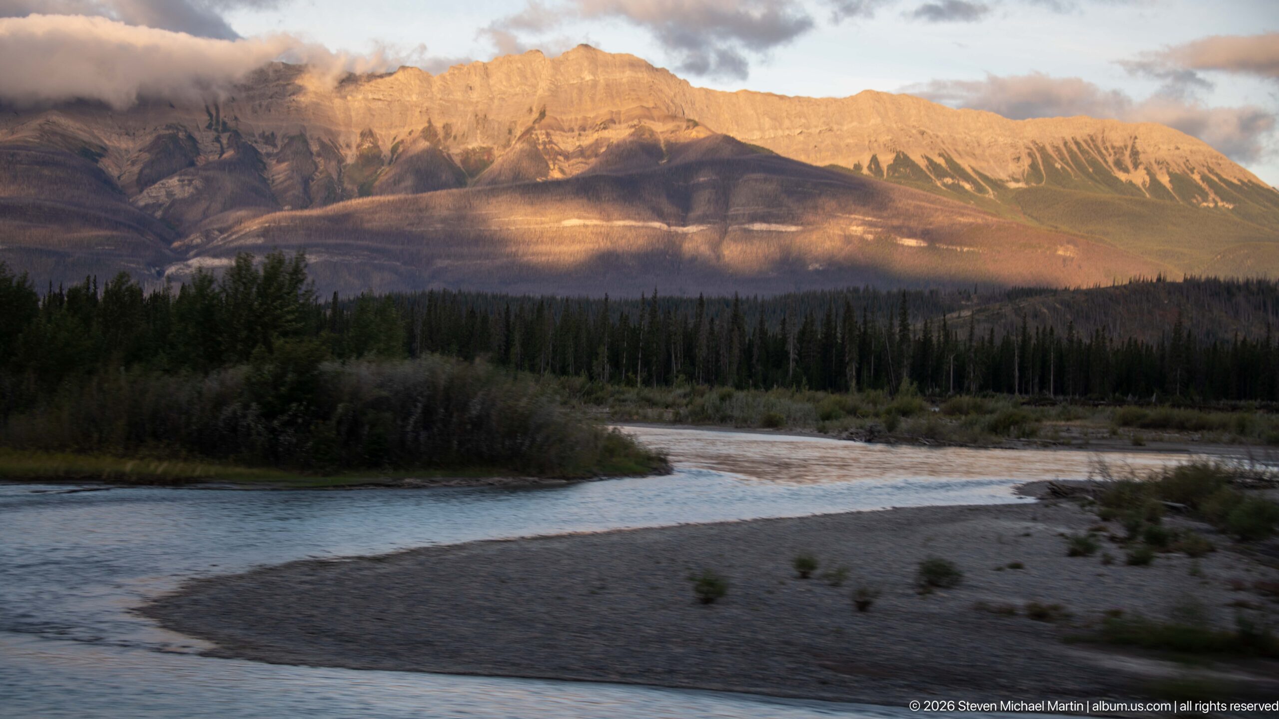
A shallow river channel curves around a broad gravel bar beneath a mountain wall glowing in late-day light. Forest and shrubs line the valley floor while the exposed sediment records the river's shifting channels, making the relationship between water, gravel, and surrounding relief especially clear.
Caption
A shallow river channel curves around a broad gravel bar beneath a mountain wall glowing in late-day light. Forest and shrubs line the valley floor while the exposed sediment records the river's shifting channels, making the relationship between water, gravel, and surrounding relief especially clear.
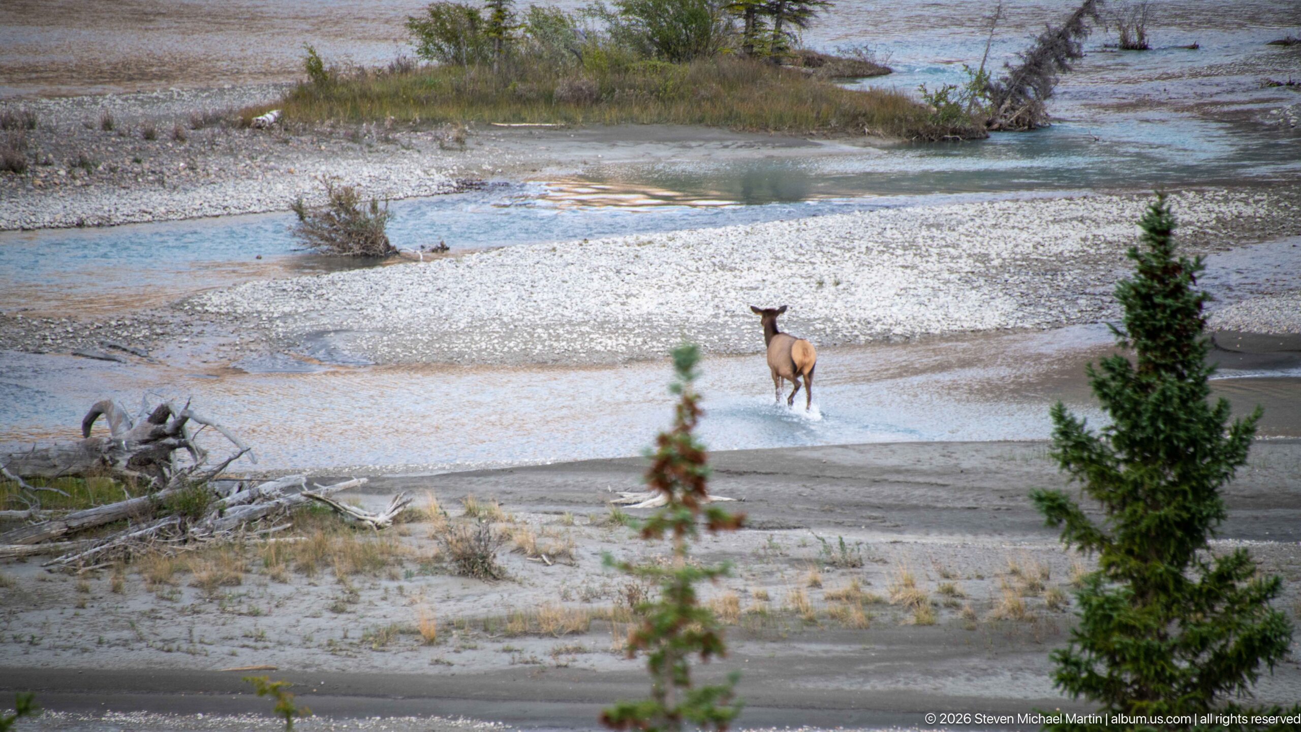
An elk stands on a shallow edge of the Athabasca River amid pale gravel bars, driftwood, and branching channels. The wider landscape view links the animal directly to the river's depositional terrain, with conifers in the foreground framing the open gravel flats beyond.
Caption
An elk stands on a shallow edge of the Athabasca River amid pale gravel bars, driftwood, and branching channels. The wider landscape view links the animal directly to the river's depositional terrain, with conifers in the foreground framing the open gravel flats beyond.
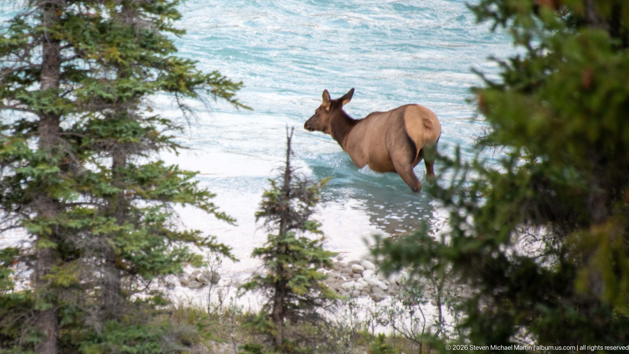
An elk moves through the Athabasca River behind foreground conifers, its tawny hindquarters and dark neck standing out against turquoise water. The partially screened viewpoint gives the scene a more naturalistic, observational quality while still clearly documenting the animal's use of the river channel.
Caption
An elk moves through the Athabasca River behind foreground conifers, its tawny hindquarters and dark neck standing out against turquoise water. The partially screened viewpoint gives the scene a more naturalistic, observational quality while still clearly documenting the animal's use of the river channel.
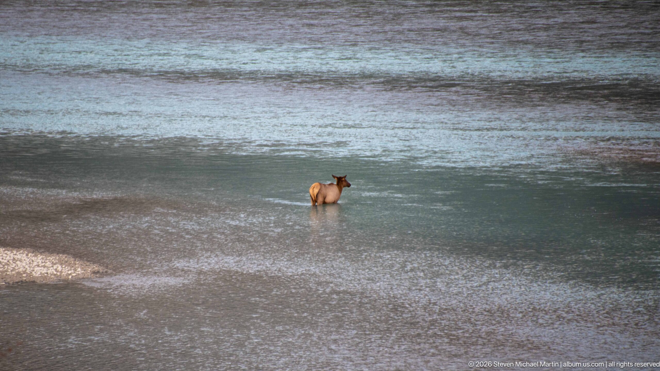
A lone elk wades through the Athabasca River with much of the broad channel visible around it. The distant viewpoint reduces the animal to a small but distinct tawny figure, emphasizing the scale of the river and the use of its shallow reaches by large mammals.
Caption
A lone elk wades through the Athabasca River with much of the broad channel visible around it. The distant viewpoint reduces the animal to a small but distinct tawny figure, emphasizing the scale of the river and the use of its shallow reaches by large mammals.
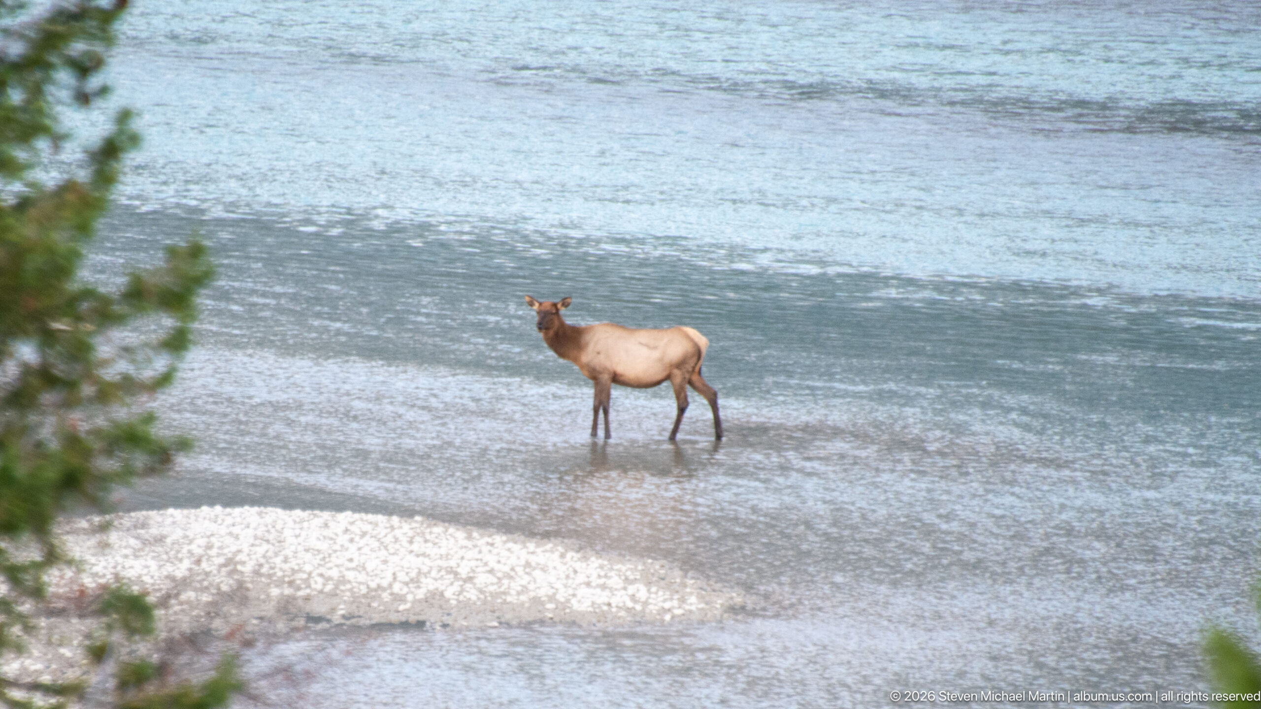
An elk stands in shallow, pale blue-green river water near a gravel bar, isolated against the broad surface of the Athabasca corridor. The animal's long legs, tawny body, dark neck, and deer-like head support identification as elk while the surrounding channel provides direct river-habitat context.
Caption
An elk stands in shallow, pale blue-green river water near a gravel bar, isolated against the broad surface of the Athabasca corridor. The animal's long legs, tawny body, dark neck, and deer-like head support identification as elk while the surrounding channel provides direct river-habitat context.
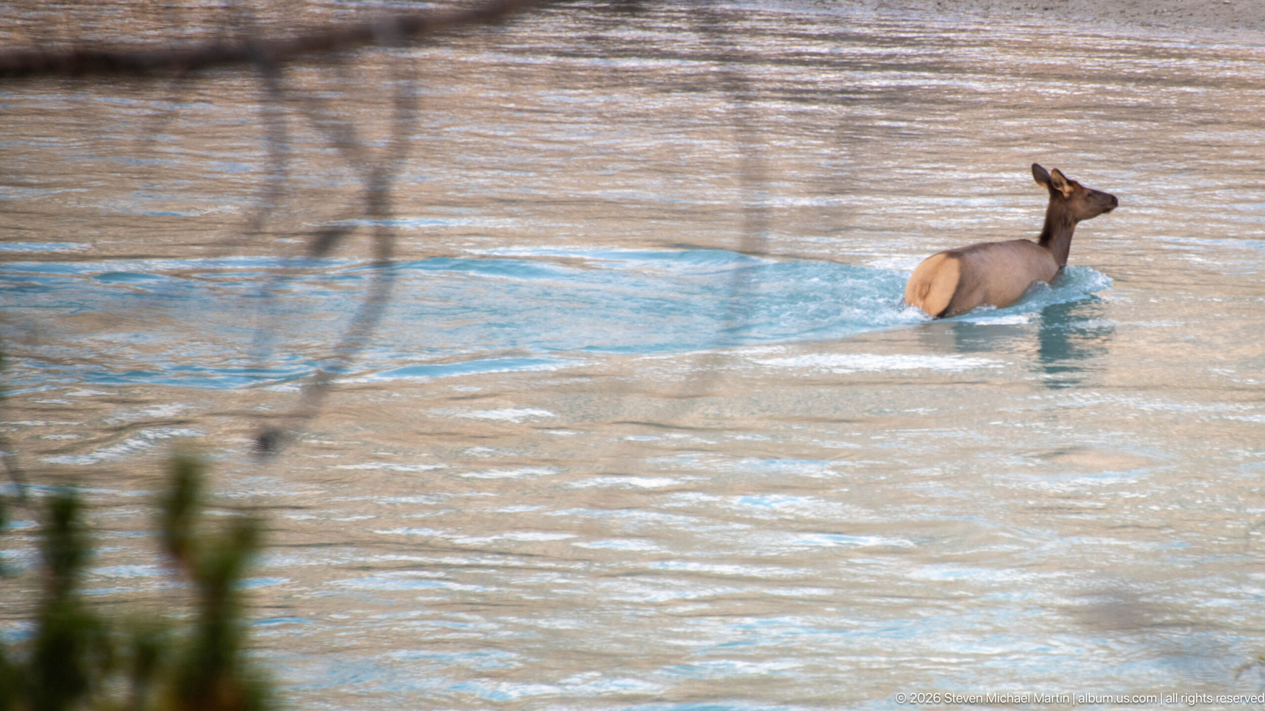
An elk wades through deeper blue-green water with only its upper legs and body above the surface. Seen in side profile, the animal appears to be crossing the channel, and the uninterrupted water around it creates a more intimate study of wildlife using the Athabasca River itself.
Caption
An elk wades through deeper blue-green water with only its upper legs and body above the surface. Seen in side profile, the animal appears to be crossing the channel, and the uninterrupted water around it creates a more intimate study of wildlife using the Athabasca River itself.
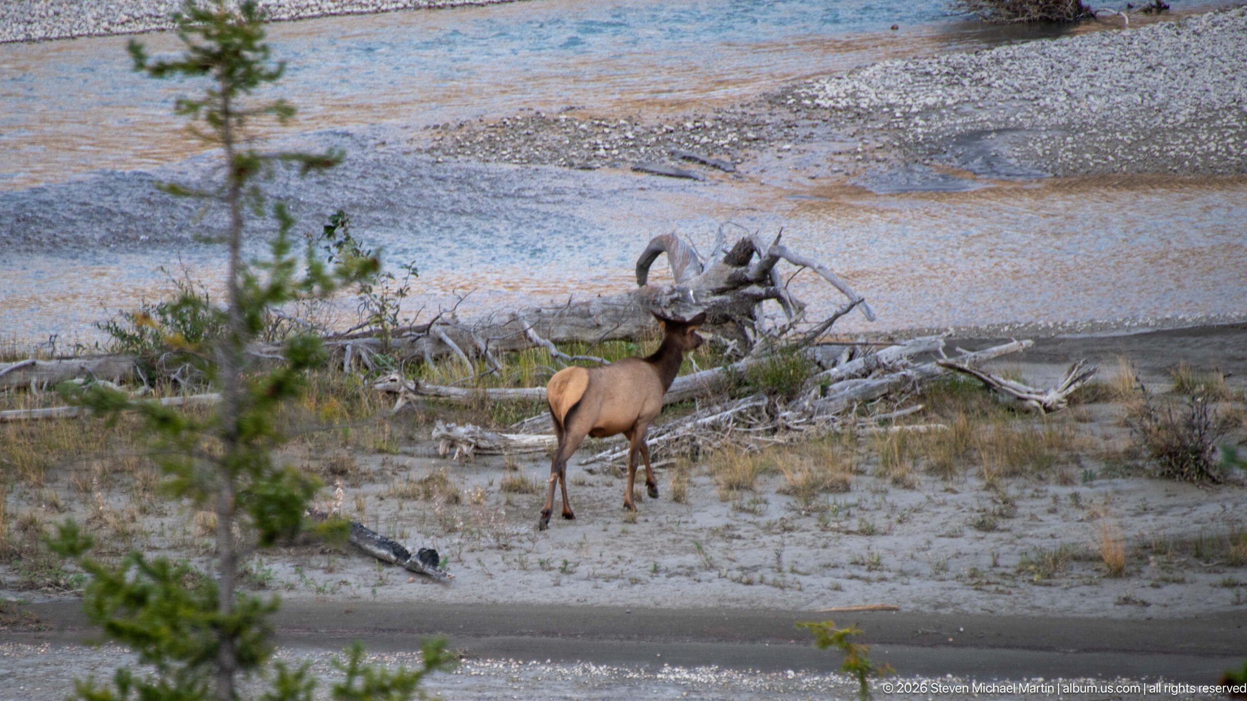
An elk stands on exposed river gravel near a tangle of weathered driftwood, with shallow Athabasca channels and additional gravel bars behind. The composition places the animal firmly within the active river corridor, where sediment and woody debris record changing water levels and channel movement.
Caption
An elk stands on exposed river gravel near a tangle of weathered driftwood, with shallow Athabasca channels and additional gravel bars behind. The composition places the animal firmly within the active river corridor, where sediment and woody debris record changing water levels and channel movement.
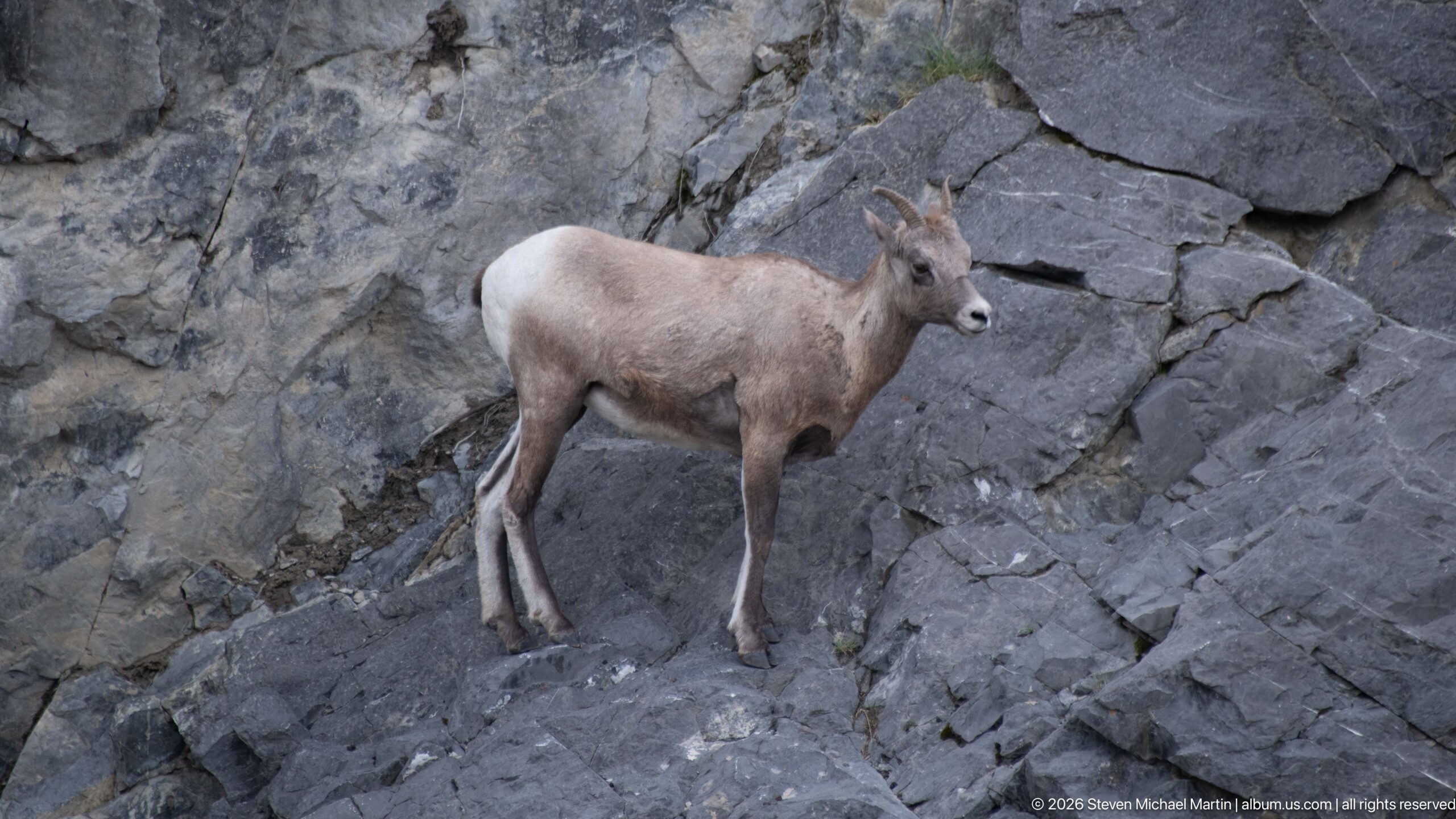
A bighorn sheep stands securely on a steep, fractured rock face above the Athabasca River corridor. Its compact stance, tan-gray coat, white rump, and short curved horns identify a younger bighorn rather than a mature ram, while the exposed bedrock shows the species' agility in rugged mountain terrain.
Caption
A bighorn sheep stands securely on a steep, fractured rock face above the Athabasca River corridor. Its compact stance, tan-gray coat, white rump, and short curved horns identify a younger bighorn rather than a mature ram, while the exposed bedrock shows the species' agility in rugged mountain terrain.
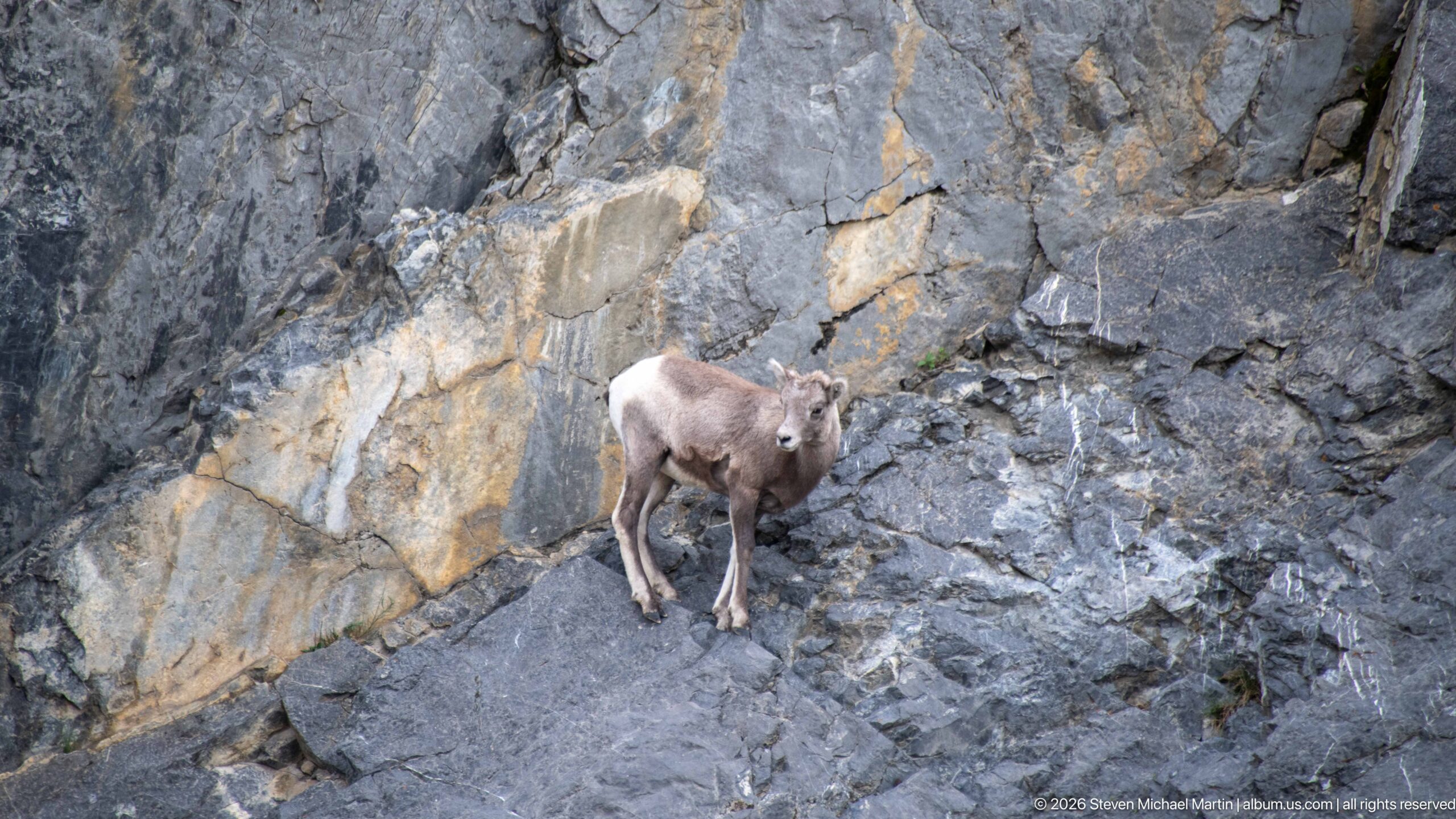
A bighorn sheep pauses within a recess of fractured gray and ochre bedrock, its small curved horns and white rump visible against the rock wall. The wider view places the animal within the steep, sparsely vegetated terrain used by bighorn sheep along Jasper's mountain valleys.
Caption
A bighorn sheep pauses within a recess of fractured gray and ochre bedrock, its small curved horns and white rump visible against the rock wall. The wider view places the animal within the steep, sparsely vegetated terrain used by bighorn sheep along Jasper's mountain valleys.
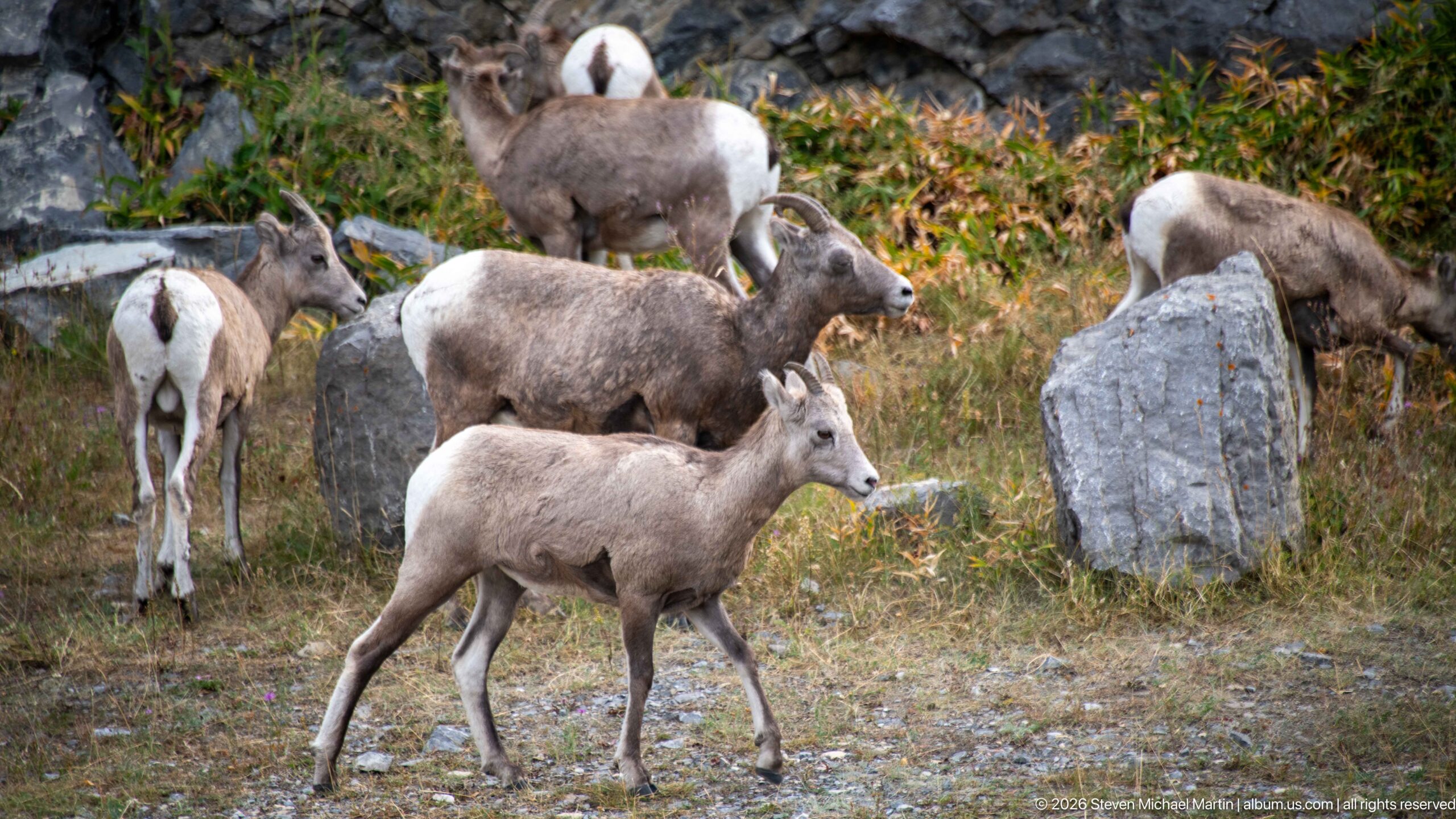
Several bighorn sheep gather among grasses, shrubs, and scattered boulders, creating a layered view of the herd's social setting. Individuals face different directions and occupy both open ground and rocky cover, while white rump patches and developing horns provide clear species recognition.
Caption
Several bighorn sheep gather among grasses, shrubs, and scattered boulders, creating a layered view of the herd's social setting. Individuals face different directions and occupy both open ground and rocky cover, while white rump patches and developing horns provide clear species recognition.
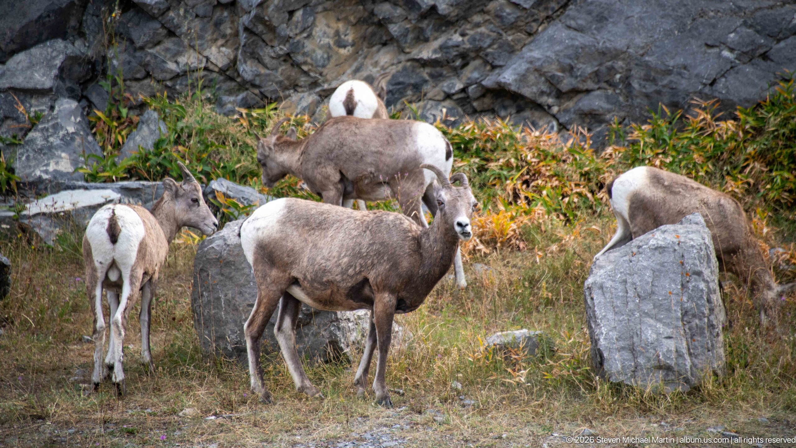
A small group of bighorn sheep stands and feeds in dry grass beside a prominent gray boulder. The central animal faces the camera while others turn away or lower their heads, distinguishing this frame through the herd's varied postures and close grouping.
Caption
A small group of bighorn sheep stands and feeds in dry grass beside a prominent gray boulder. The central animal faces the camera while others turn away or lower their heads, distinguishing this frame through the herd's varied postures and close grouping.
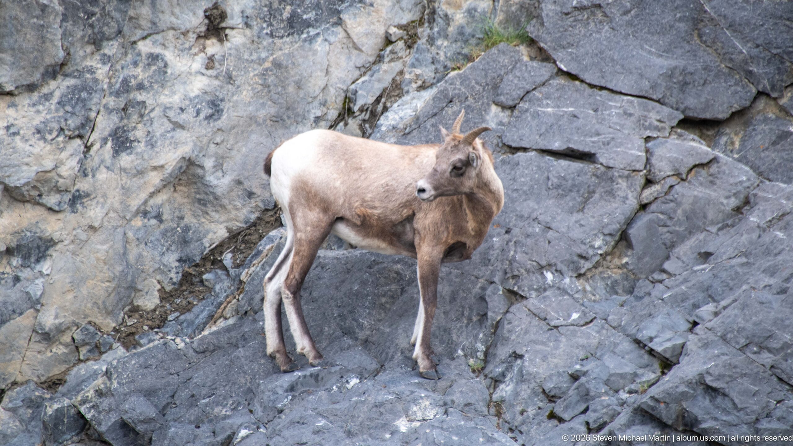
A bighorn sheep stands broadside on steep gray bedrock and turns its head back toward the camera. The pose clearly shows the pale rump, muscular legs, compact mountain-sheep build, and modest curved horns against the angular rock surface.
Caption
A bighorn sheep stands broadside on steep gray bedrock and turns its head back toward the camera. The pose clearly shows the pale rump, muscular legs, compact mountain-sheep build, and modest curved horns against the angular rock surface.
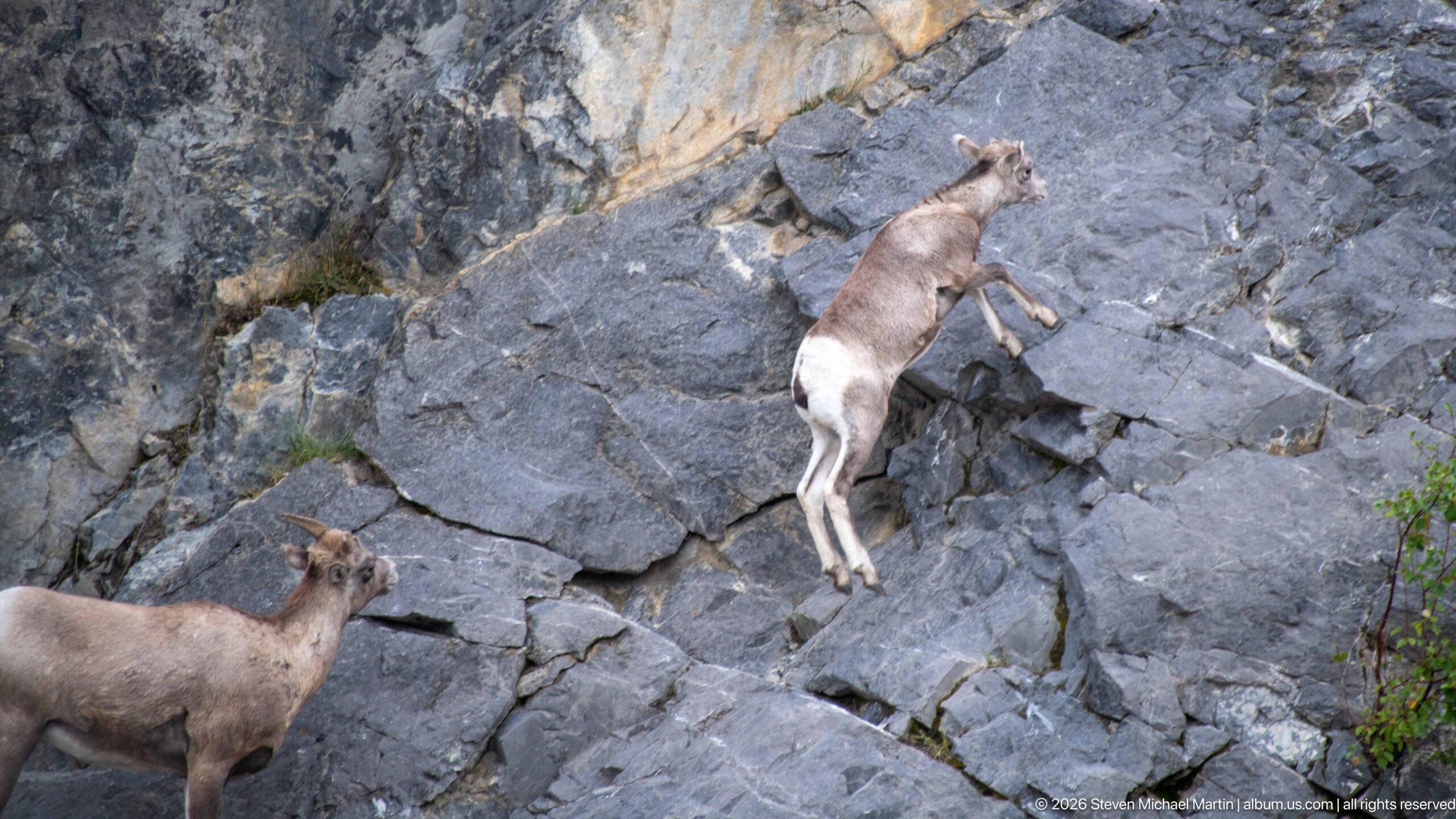
One bighorn sheep climbs diagonally across a steep rock face while another watches from below. The elevated animal's extended legs and placement on narrow rock ledges emphasize the climbing ability that allows bighorn sheep to use precipitous terrain as refuge and travel habitat.
Caption
One bighorn sheep climbs diagonally across a steep rock face while another watches from below. The elevated animal's extended legs and placement on narrow rock ledges emphasize the climbing ability that allows bighorn sheep to use precipitous terrain as refuge and travel habitat.
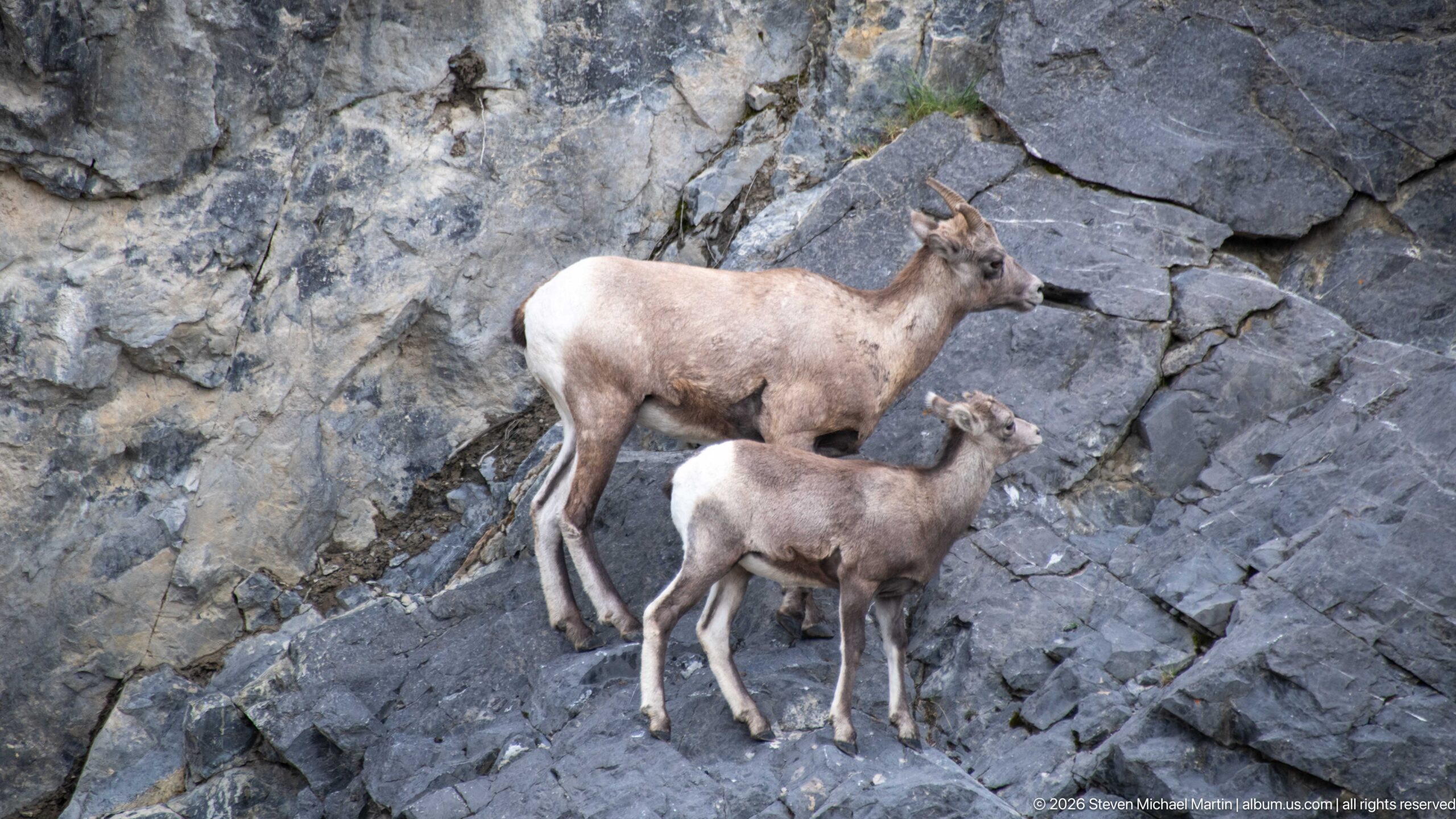
An adult bighorn sheep and a smaller juvenile stand together on a steep rock shelf, both oriented toward the same side of the slope. Their difference in body size and horn development is especially clear in this paired view, while the fractured bedrock provides immediate mountain-habitat context.
Caption
An adult bighorn sheep and a smaller juvenile stand together on a steep rock shelf, both oriented toward the same side of the slope. Their difference in body size and horn development is especially clear in this paired view, while the fractured bedrock provides immediate mountain-habitat context.
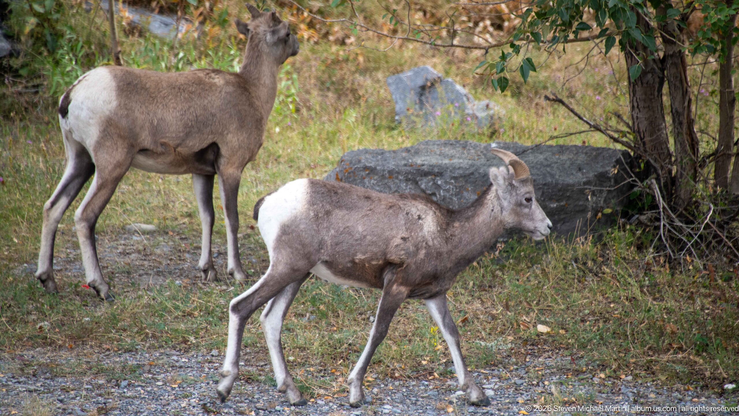
Two bighorn sheep move through a patch of dry grass, gravel, shrubs, and scattered rock at the base of the mountain slope. The foreground sheep's developing horns and white rump are clearly visible, while the second animal provides a broader sense of the herd's use of lower valley habitat.
Caption
Two bighorn sheep move through a patch of dry grass, gravel, shrubs, and scattered rock at the base of the mountain slope. The foreground sheep's developing horns and white rump are clearly visible, while the second animal provides a broader sense of the herd's use of lower valley habitat.
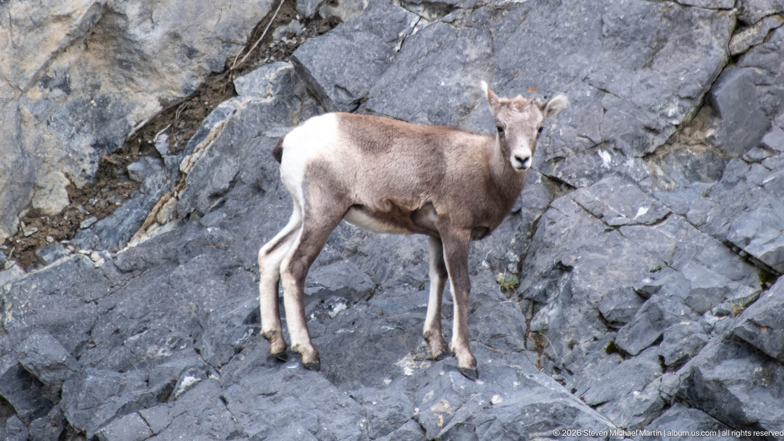
A young bighorn sheep pauses on a gray rock ledge and looks directly toward the camera. Its small horn growth, slender legs, pale muzzle, and white rump are visible in a simple portrait that isolates the animal against fractured mountain bedrock.
Caption
A young bighorn sheep pauses on a gray rock ledge and looks directly toward the camera. Its small horn growth, slender legs, pale muzzle, and white rump are visible in a simple portrait that isolates the animal against fractured mountain bedrock.
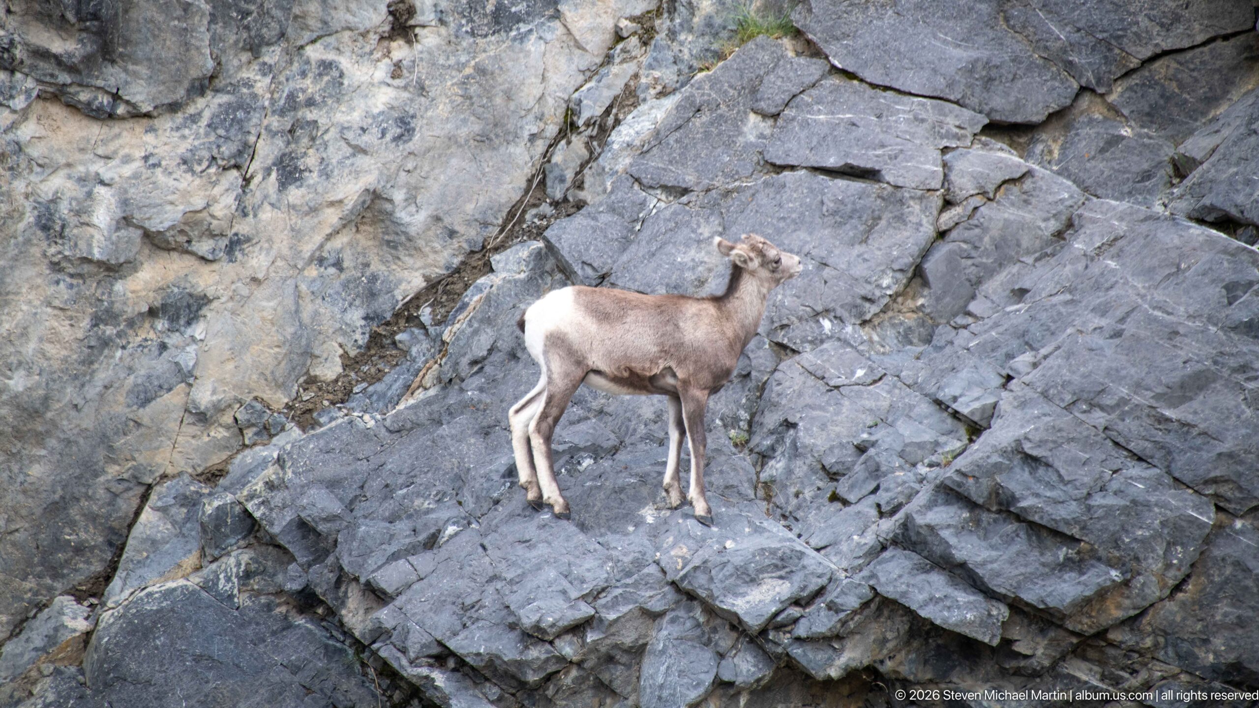
A solitary bighorn sheep stands on a projecting shelf of layered gray bedrock, separated visually from the surrounding slope. The composition emphasizes the animal's scale against the rock formation and its ability to occupy narrow, uneven mountain ledges.
Caption
A solitary bighorn sheep stands on a projecting shelf of layered gray bedrock, separated visually from the surrounding slope. The composition emphasizes the animal's scale against the rock formation and its ability to occupy narrow, uneven mountain ledges.
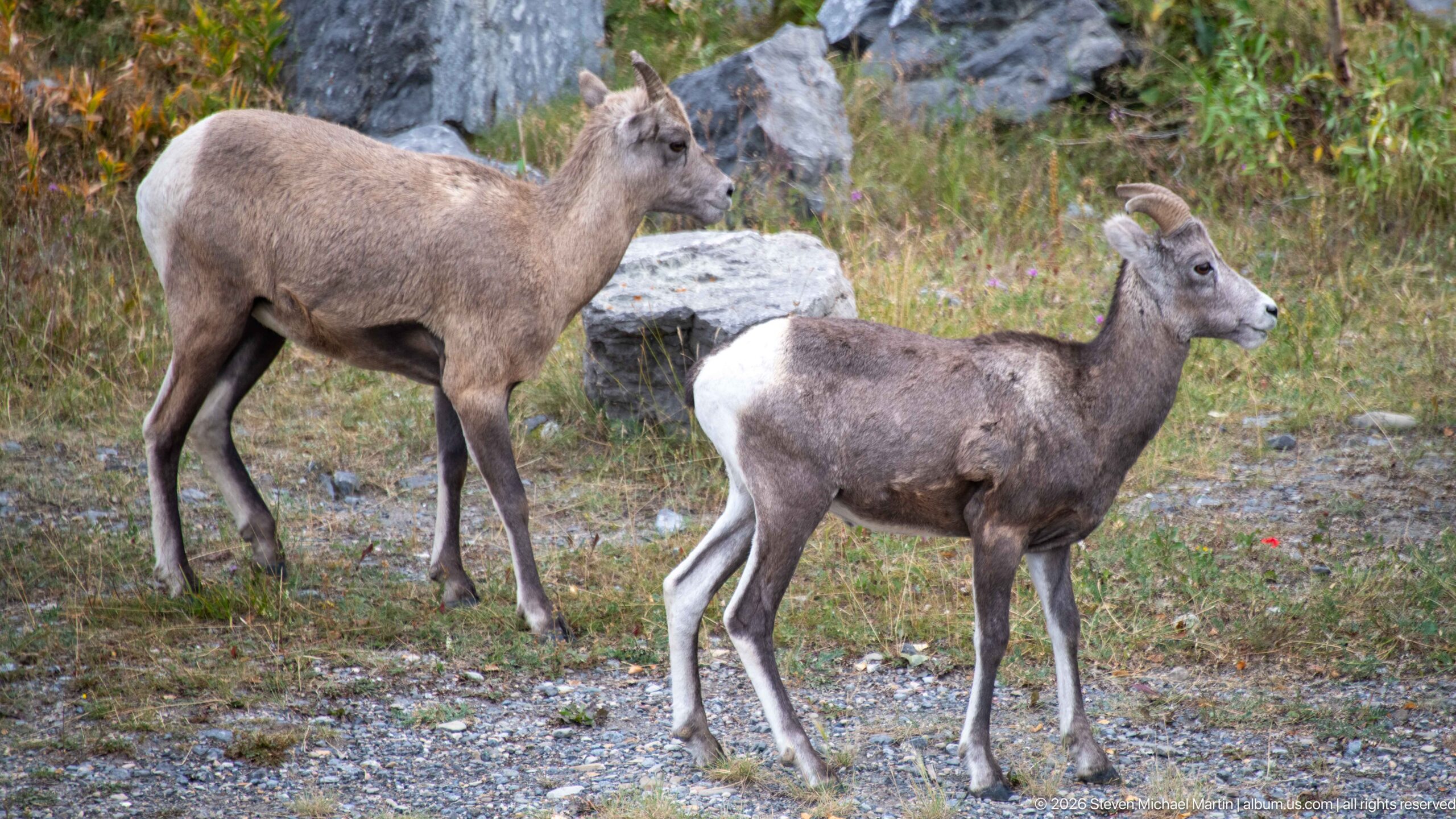
Two bighorn sheep cross open gravel and grass near scattered boulders and shrubs. The foreground animal is sharply profiled with curved horns and a bright white rump, while the second sheep behind it establishes the small-group context of the encounter.
Caption
Two bighorn sheep cross open gravel and grass near scattered boulders and shrubs. The foreground animal is sharply profiled with curved horns and a bright white rump, while the second sheep behind it establishes the small-group context of the encounter.
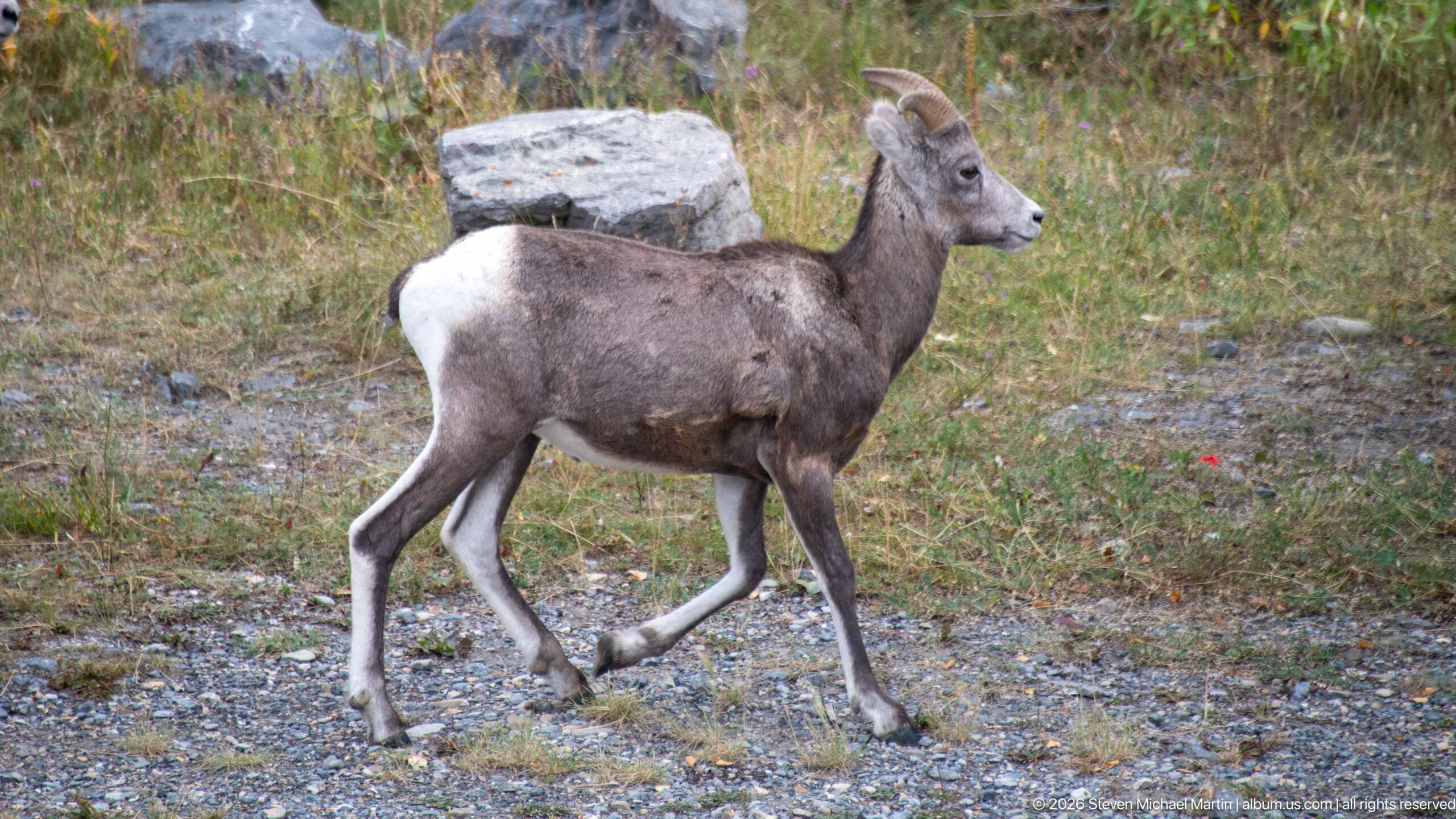
A bighorn sheep strides across gravelly valley-floor ground with its head raised and body in clean side profile. The white rump, short curved horns, and lifted foreleg make this a particularly clear study of the animal's form and movement away from the steeper rock face.
Caption
A bighorn sheep strides across gravelly valley-floor ground with its head raised and body in clean side profile. The white rump, short curved horns, and lifted foreleg make this a particularly clear study of the animal's form and movement away from the steeper rock face.
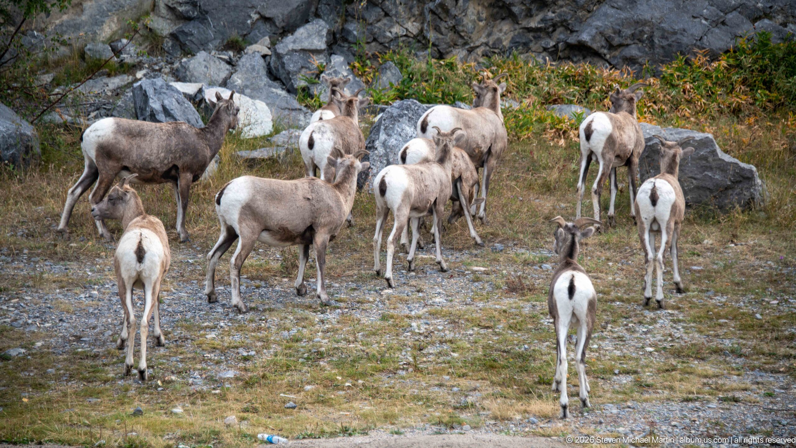
A larger group of bighorn sheep spreads across gravel, grass, and scattered rocks, with animals facing in several directions and occupying different depths of the frame. The view documents the herd as a social group rather than isolating a single animal, with numerous white rump patches visible throughout.
Caption
A larger group of bighorn sheep spreads across gravel, grass, and scattered rocks, with animals facing in several directions and occupying different depths of the frame. The view documents the herd as a social group rather than isolating a single animal, with numerous white rump patches visible throughout.
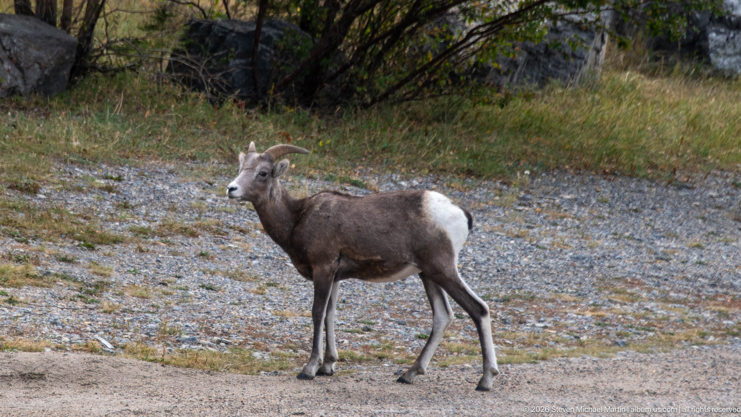
A horned bighorn sheep walks across a pale gravel surface at the edge of grass and shrubs. Its dark brown-gray body contrasts strongly with the white rump patch, while the curved horns and side profile make the species identification especially clear.
Caption
A horned bighorn sheep walks across a pale gravel surface at the edge of grass and shrubs. Its dark brown-gray body contrasts strongly with the white rump patch, while the curved horns and side profile make the species identification especially clear.
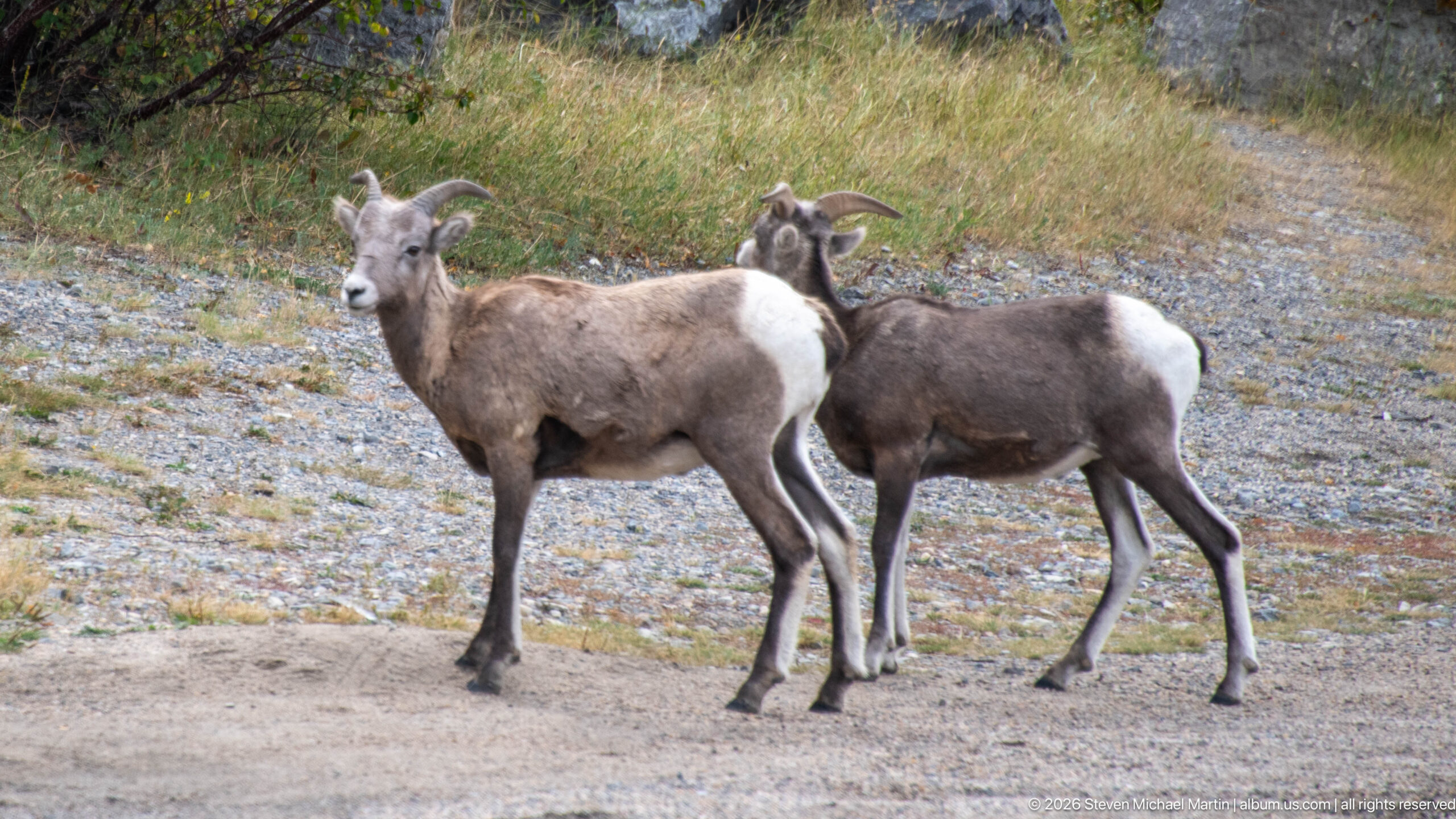
Two bighorn sheep stand close together on open gravel, their overlapping bodies showing different angles of the same distinctive white-rumped form. Both carry curved horns, and the nearer animal looks toward the camera while the second turns partly away.
Caption
Two bighorn sheep stand close together on open gravel, their overlapping bodies showing different angles of the same distinctive white-rumped form. Both carry curved horns, and the nearer animal looks toward the camera while the second turns partly away.
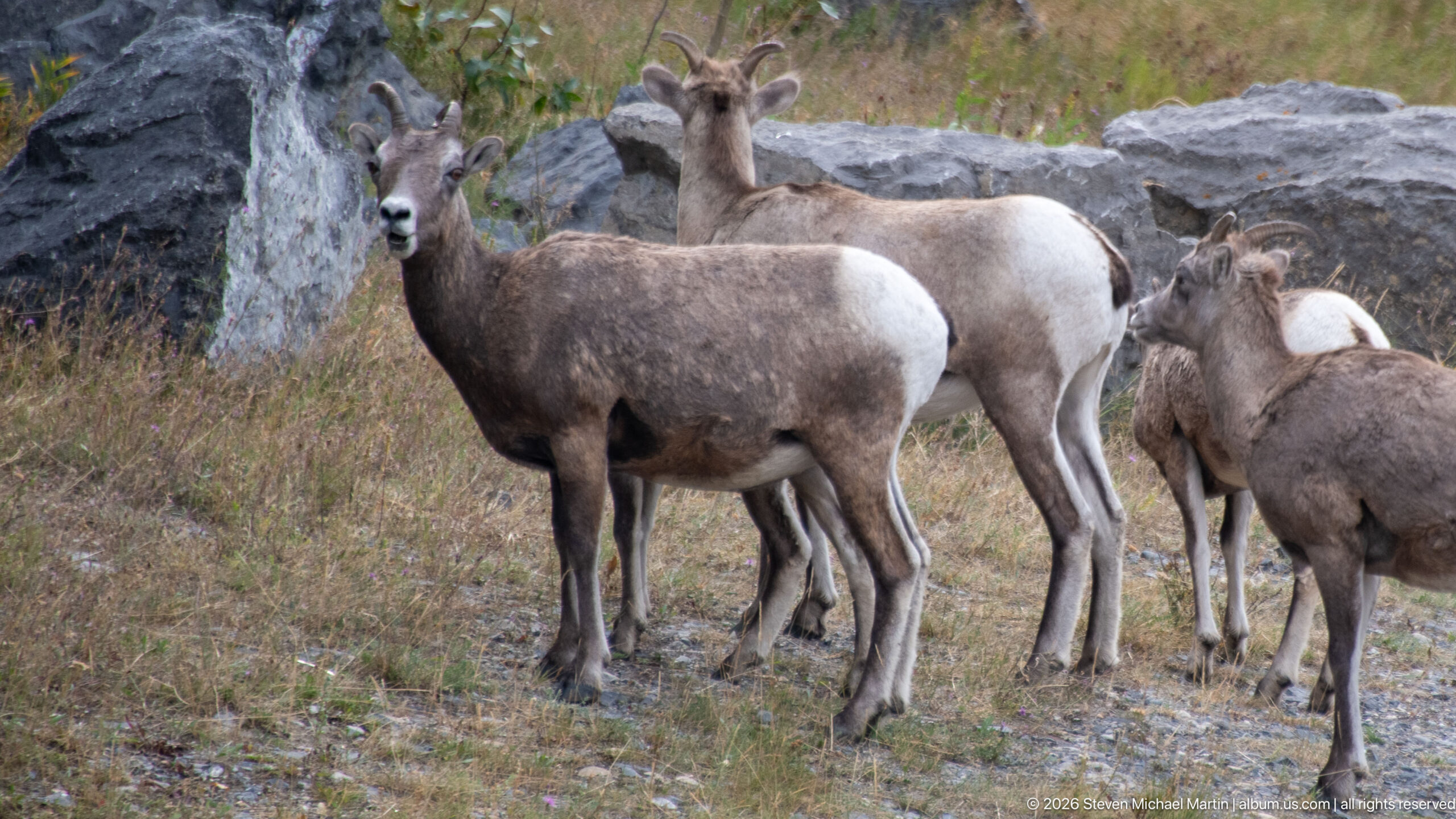
Several bighorn sheep cluster tightly among dry grass and gray boulders, filling the frame with overlapping bodies, horns, and white rump patches. The nearest sheep faces forward, providing a direct portrait within the denser herd composition.
Caption
Several bighorn sheep cluster tightly among dry grass and gray boulders, filling the frame with overlapping bodies, horns, and white rump patches. The nearest sheep faces forward, providing a direct portrait within the denser herd composition.
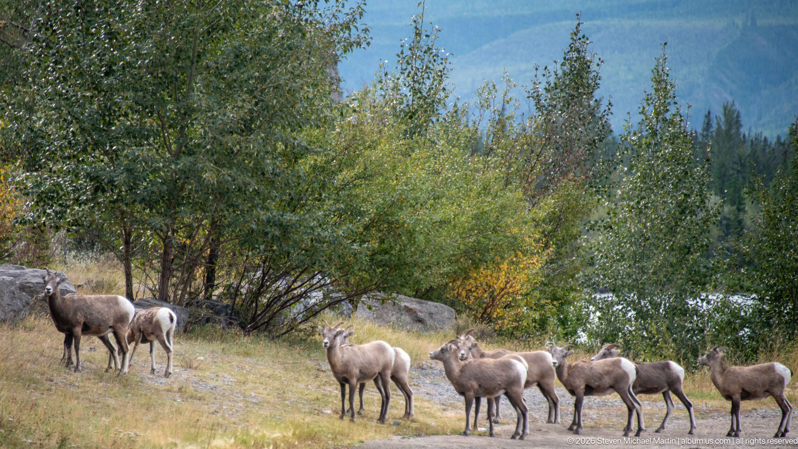
A line of bighorn sheep moves through a grassy roadside clearing bordered by shrubs and trees, with additional animals standing farther left. The wider composition shows the herd transitioning through lower-elevation valley habitat rather than the exposed rock faces seen in earlier views.
Caption
A line of bighorn sheep moves through a grassy roadside clearing bordered by shrubs and trees, with additional animals standing farther left. The wider composition shows the herd transitioning through lower-elevation valley habitat rather than the exposed rock faces seen in earlier views.
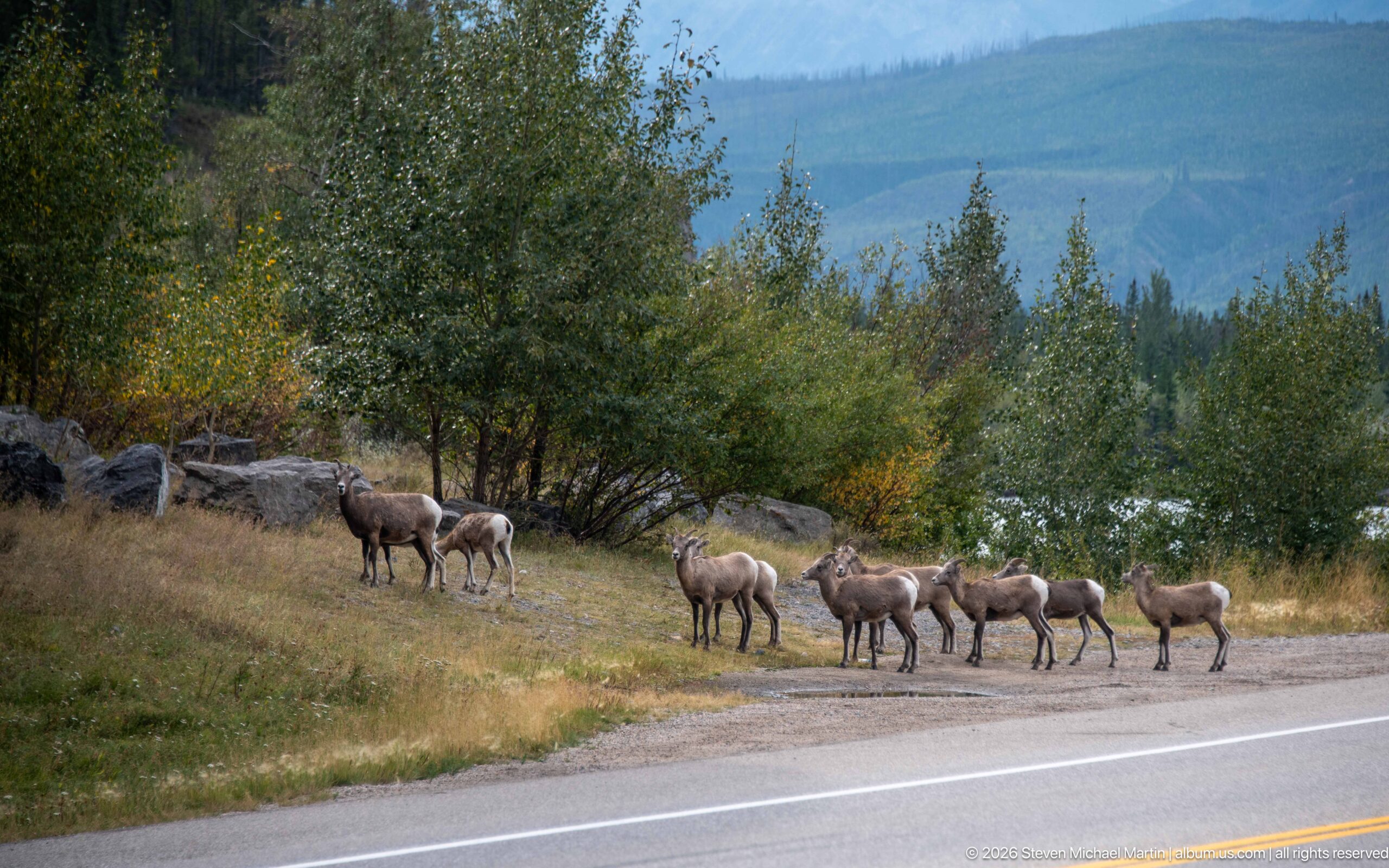
A herd of bighorn sheep travels in a loose line along the edge of a paved mountain road, with forest and distant slopes behind them. The road provides a clear human-wildlife context and shows how animals moving through Jasper's valley floor can come into close proximity to transportation corridors.
Caption
A herd of bighorn sheep travels in a loose line along the edge of a paved mountain road, with forest and distant slopes behind them. The road provides a clear human-wildlife context and shows how animals moving through Jasper's valley floor can come into close proximity to transportation corridors.
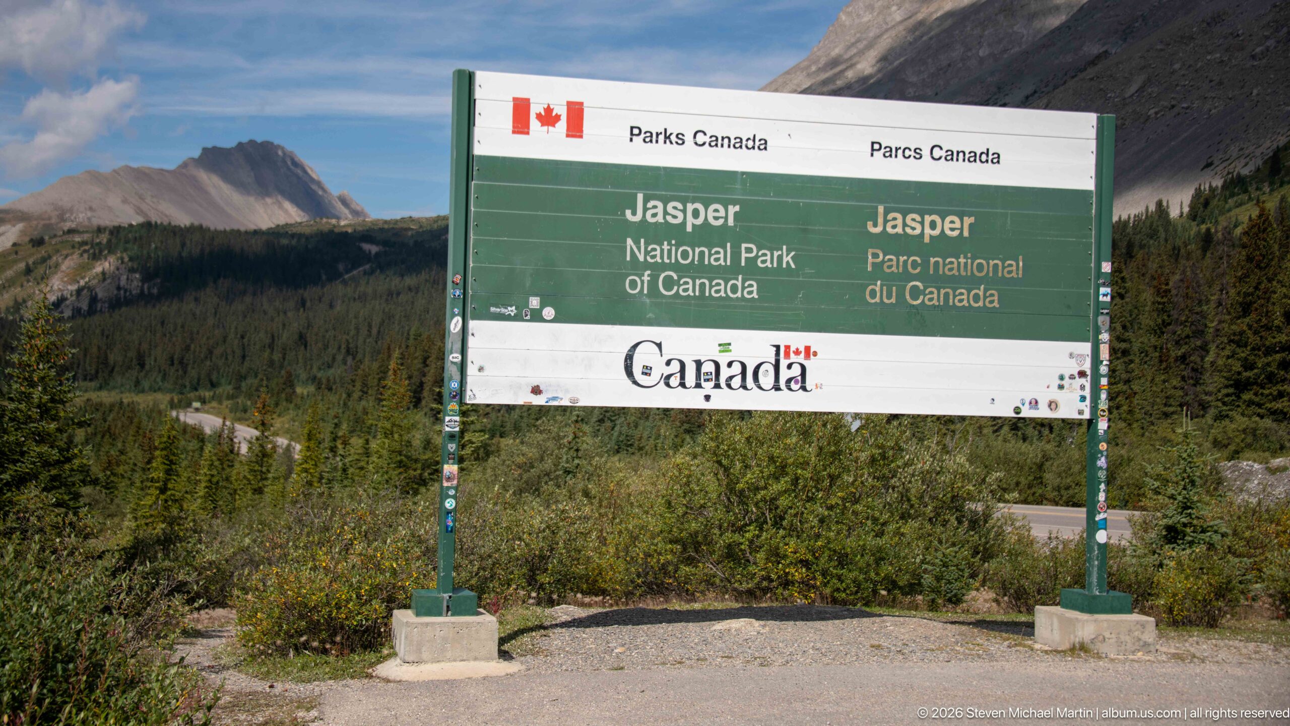
A bilingual Parks Canada sign marks Jasper National Park against a backdrop of conifer forest and Rocky Mountain slopes. The green-and-white panel provides an explicit geographic anchor for the portfolio, identifying the protected landscape in English and French rather than relying on contextual inference.
Caption
A bilingual Parks Canada sign marks Jasper National Park against a backdrop of conifer forest and Rocky Mountain slopes. The green-and-white panel provides an explicit geographic anchor for the portfolio, identifying the protected landscape in English and French rather than relying on contextual inference.
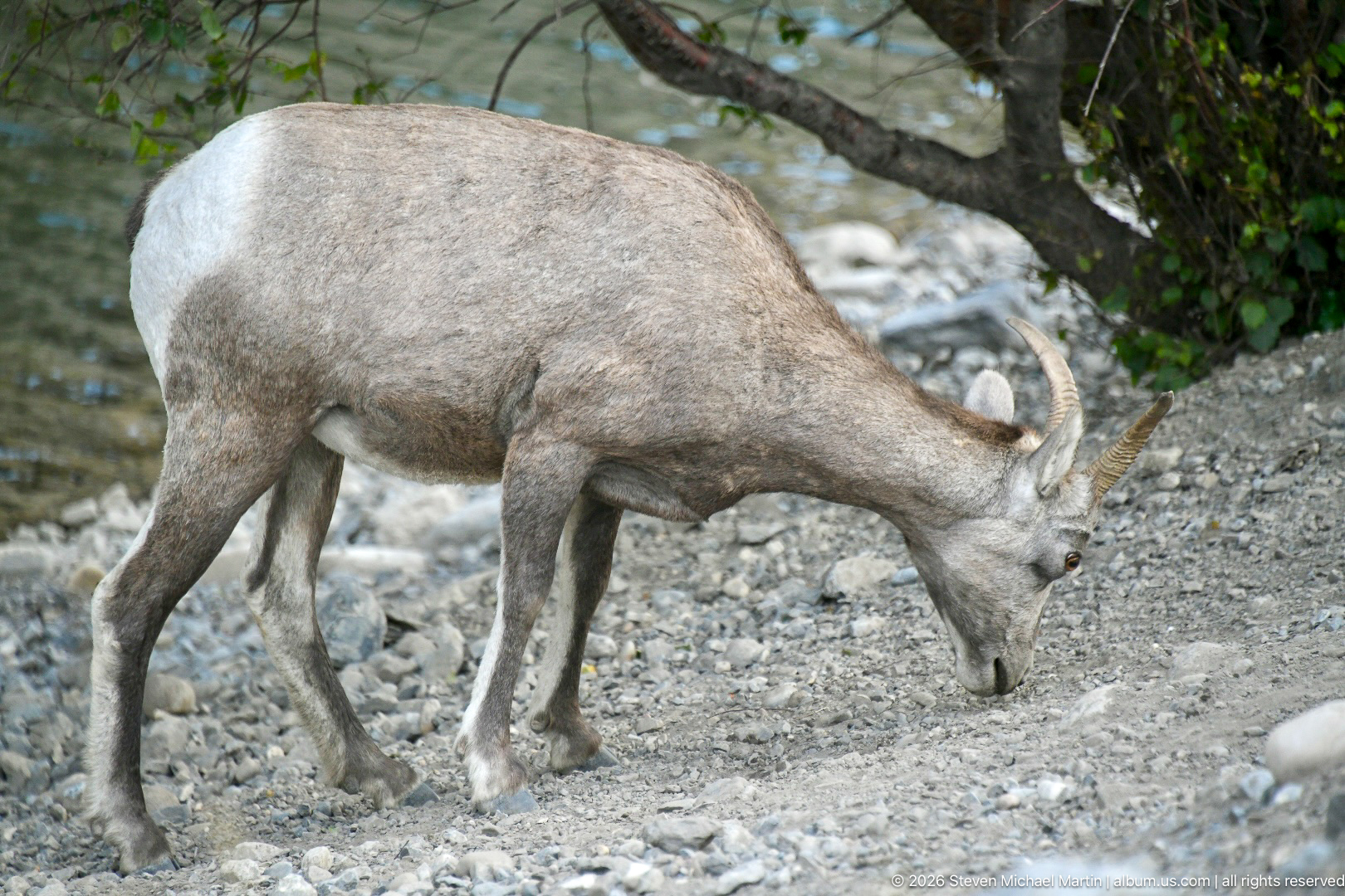
A horned bighorn sheep lowers its head to feed or investigate sparse vegetation among rounded stones near the river corridor. The close view emphasizes the compact horns, pale muzzle, coarse gray-brown coat, and sturdy legs while the gravelly substrate distinguishes the setting from the earlier cliff portraits.
Caption
A horned bighorn sheep lowers its head to feed or investigate sparse vegetation among rounded stones near the river corridor. The close view emphasizes the compact horns, pale muzzle, coarse gray-brown coat, and sturdy legs while the gravelly substrate distinguishes the setting from the earlier cliff portraits.
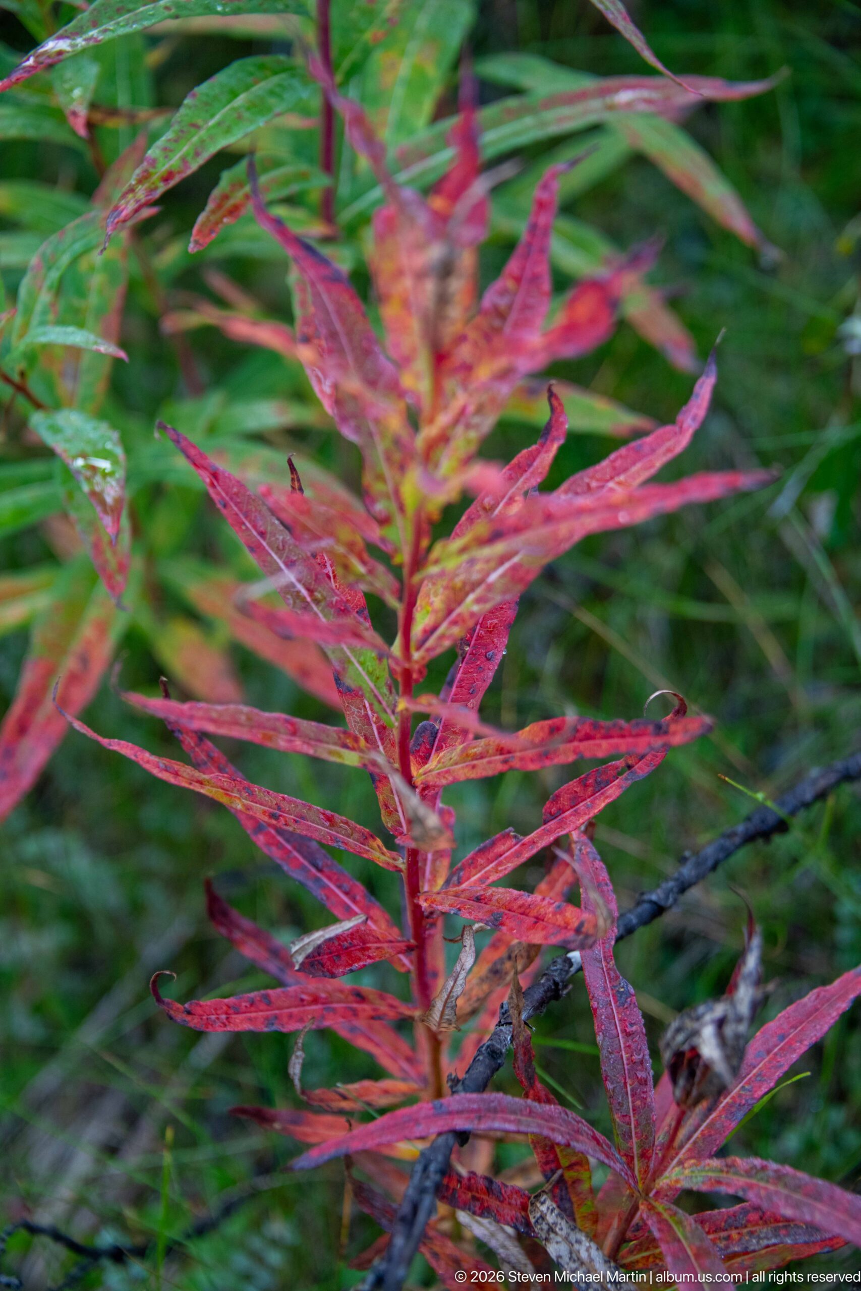
Fireweed leaves shift from green to vivid red and magenta as seasonal colour develops along the Jasper river corridor. The narrow lance-shaped leaves and reddish stems form a strong vertical pattern, providing a close botanical counterpoint to the portfolio's broad river and wildlife views.
Caption
Fireweed leaves shift from green to vivid red and magenta as seasonal colour develops along the Jasper river corridor. The narrow lance-shaped leaves and reddish stems form a strong vertical pattern, providing a close botanical counterpoint to the portfolio's broad river and wildlife views.
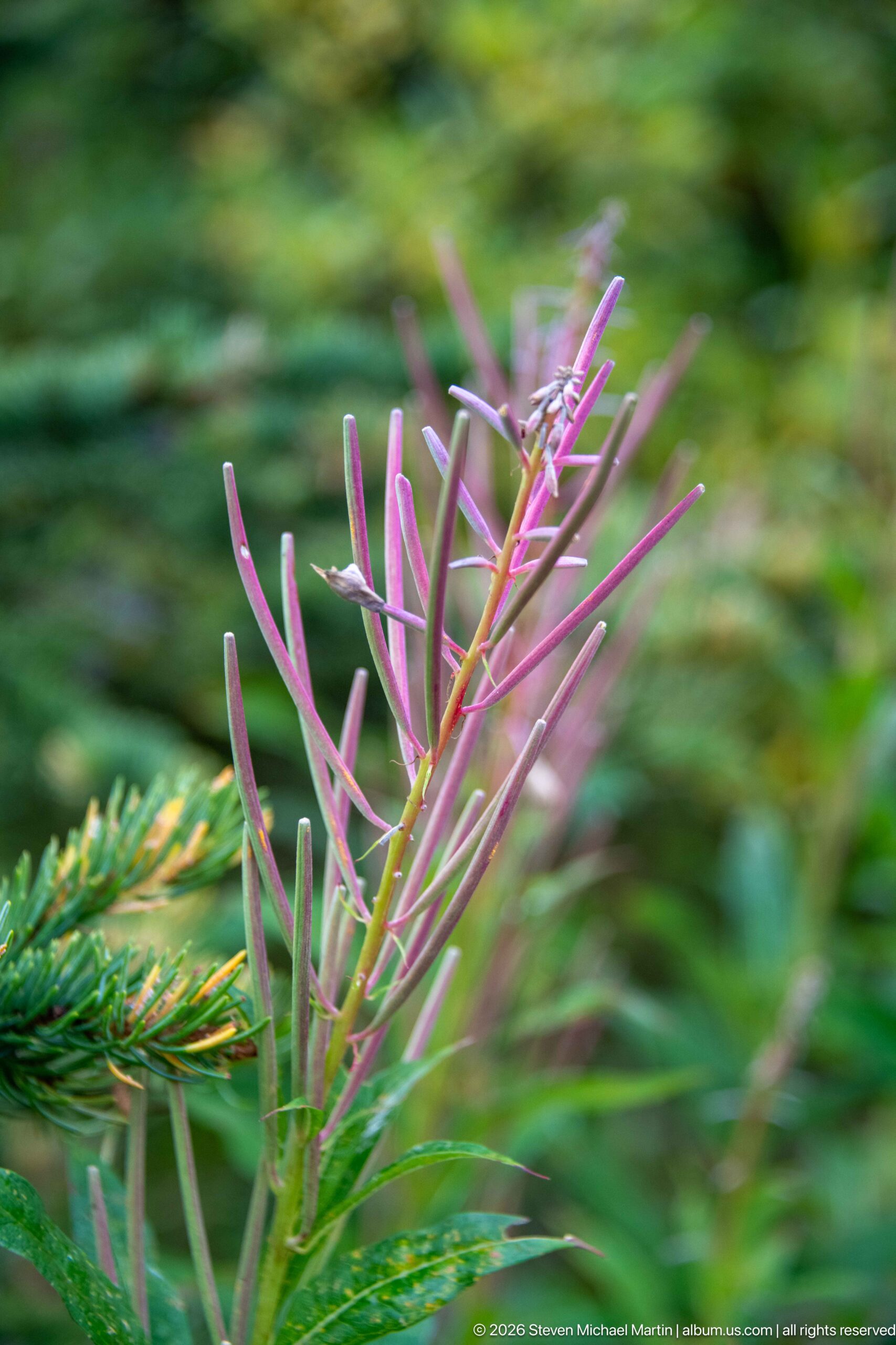
Slender pink-purple leaves and narrow seed pods rise beside an evergreen branch, recording a close seasonal detail of vegetation along the Jasper river corridor. The plant's changing foliage and elongated pods suggest fireweed after flowering, but the absence of blossoms makes a cautious identification appropriate.
Caption
Slender pink-purple leaves and narrow seed pods rise beside an evergreen branch, recording a close seasonal detail of vegetation along the Jasper river corridor. The plant's changing foliage and elongated pods suggest fireweed after flowering, but the absence of blossoms makes a cautious identification appropriate.
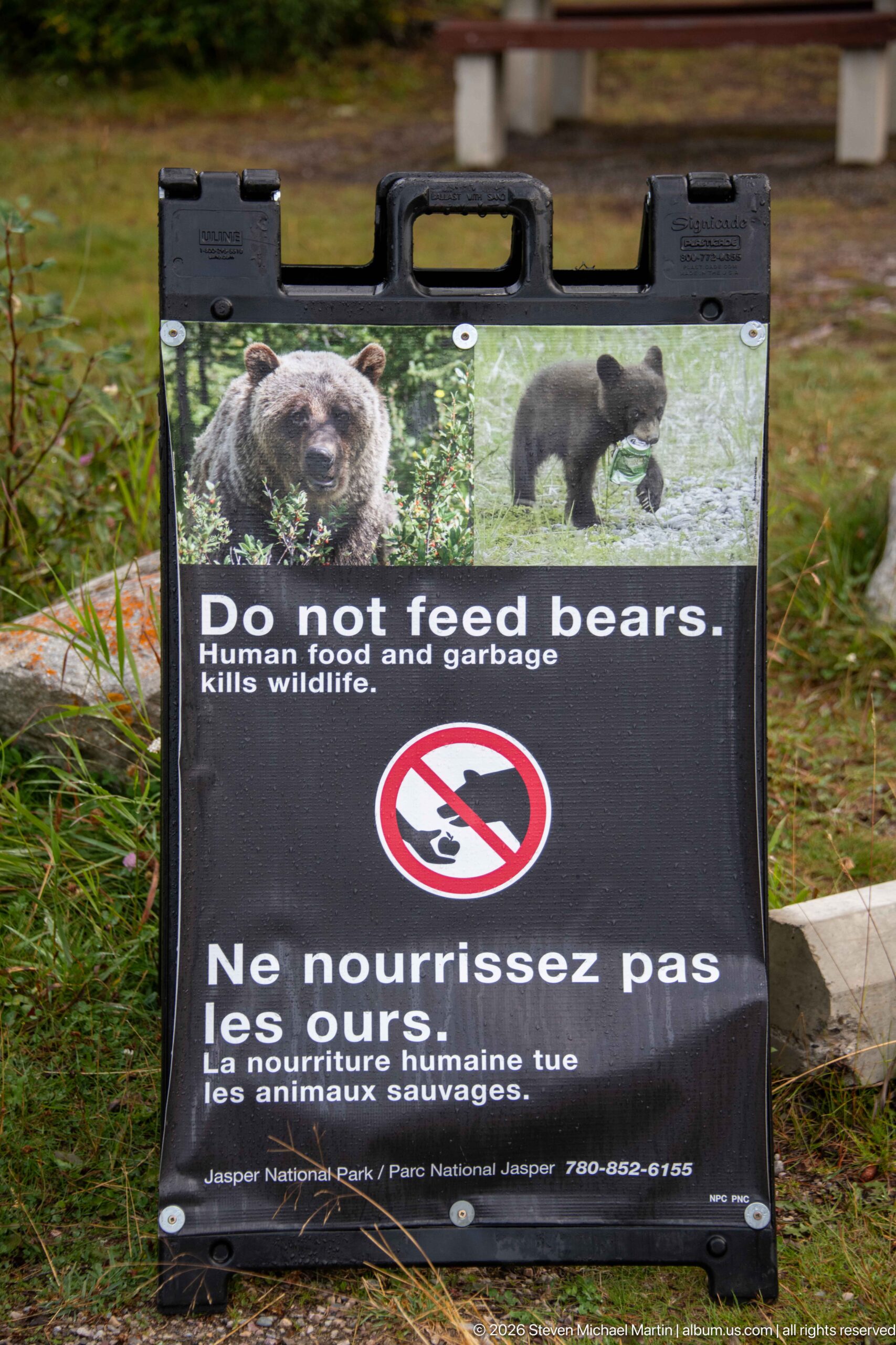
A portable Parks Canada sign warns visitors in English and French not to feed bears, pairing photographs of bears with a crossed-out feeding symbol. The message explicitly connects human food and garbage with wildlife mortality, documenting the park's effort to reduce dangerous human-bear interactions.
Caption
A portable Parks Canada sign warns visitors in English and French not to feed bears, pairing photographs of bears with a crossed-out feeding symbol. The message explicitly connects human food and garbage with wildlife mortality, documenting the park's effort to reduce dangerous human-bear interactions.
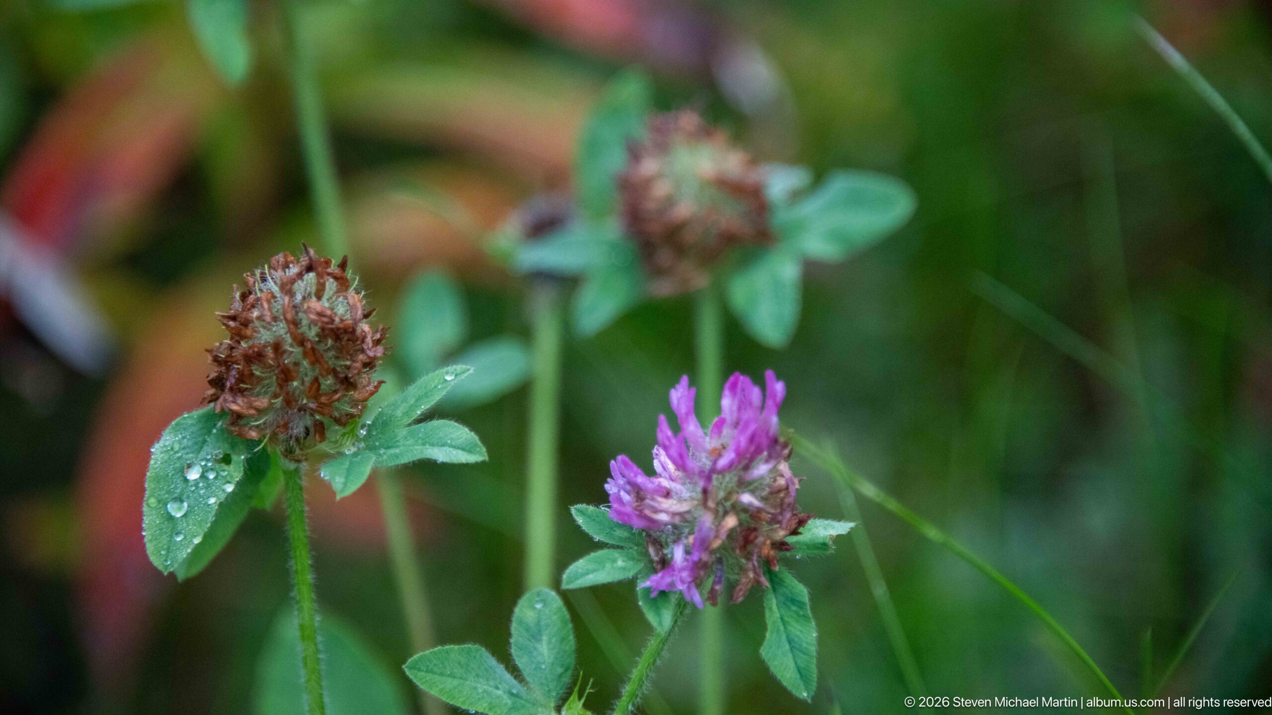
Purple-pink clover flower heads rise from green trifoliate leaves, with droplets of moisture visible on the fading brownish head at left. The shallow depth of field isolates the small plants from the surrounding meadow vegetation and records a close seasonal detail of the Athabasca valley floor.
Caption
Purple-pink clover flower heads rise from green trifoliate leaves, with droplets of moisture visible on the fading brownish head at left. The shallow depth of field isolates the small plants from the surrounding meadow vegetation and records a close seasonal detail of the Athabasca valley floor.
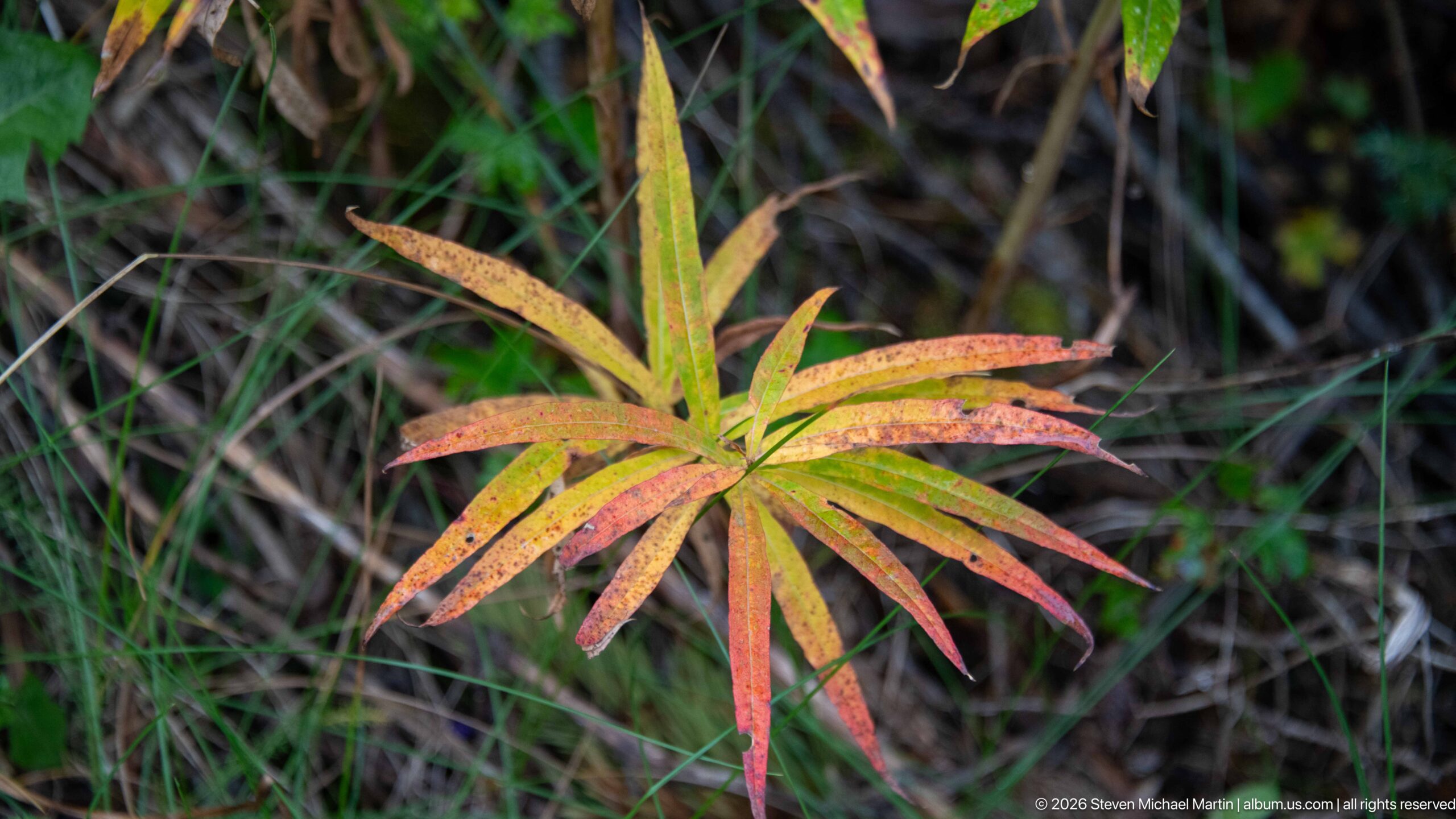
A fireweed plant displays a full transition from green to yellow, orange, and red, its narrow leaves radiating from the upright stem against dark ground vegetation. The close view records the striking autumn colour that develops in this common Rocky Mountain plant after flowering.
Caption
A fireweed plant displays a full transition from green to yellow, orange, and red, its narrow leaves radiating from the upright stem against dark ground vegetation. The close view records the striking autumn colour that develops in this common Rocky Mountain plant after flowering.
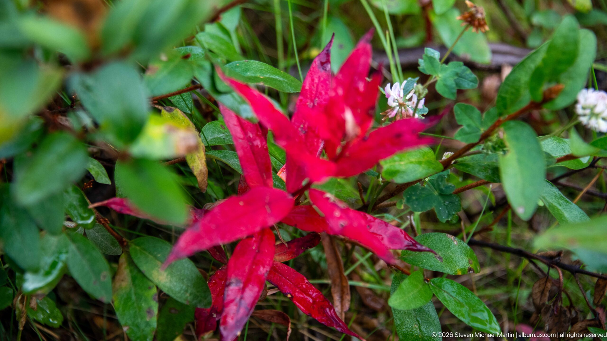
Vivid red leaves stand out against green understory vegetation and small white flowers, creating a concentrated study of early autumn color on the Jasper valley floor. Moisture beads on the foliage, adding texture and reinforcing the cool, damp conditions visible in this close forest-floor view.
Caption
Vivid red leaves stand out against green understory vegetation and small white flowers, creating a concentrated study of early autumn color on the Jasper valley floor. Moisture beads on the foliage, adding texture and reinforcing the cool, damp conditions visible in this close forest-floor view.
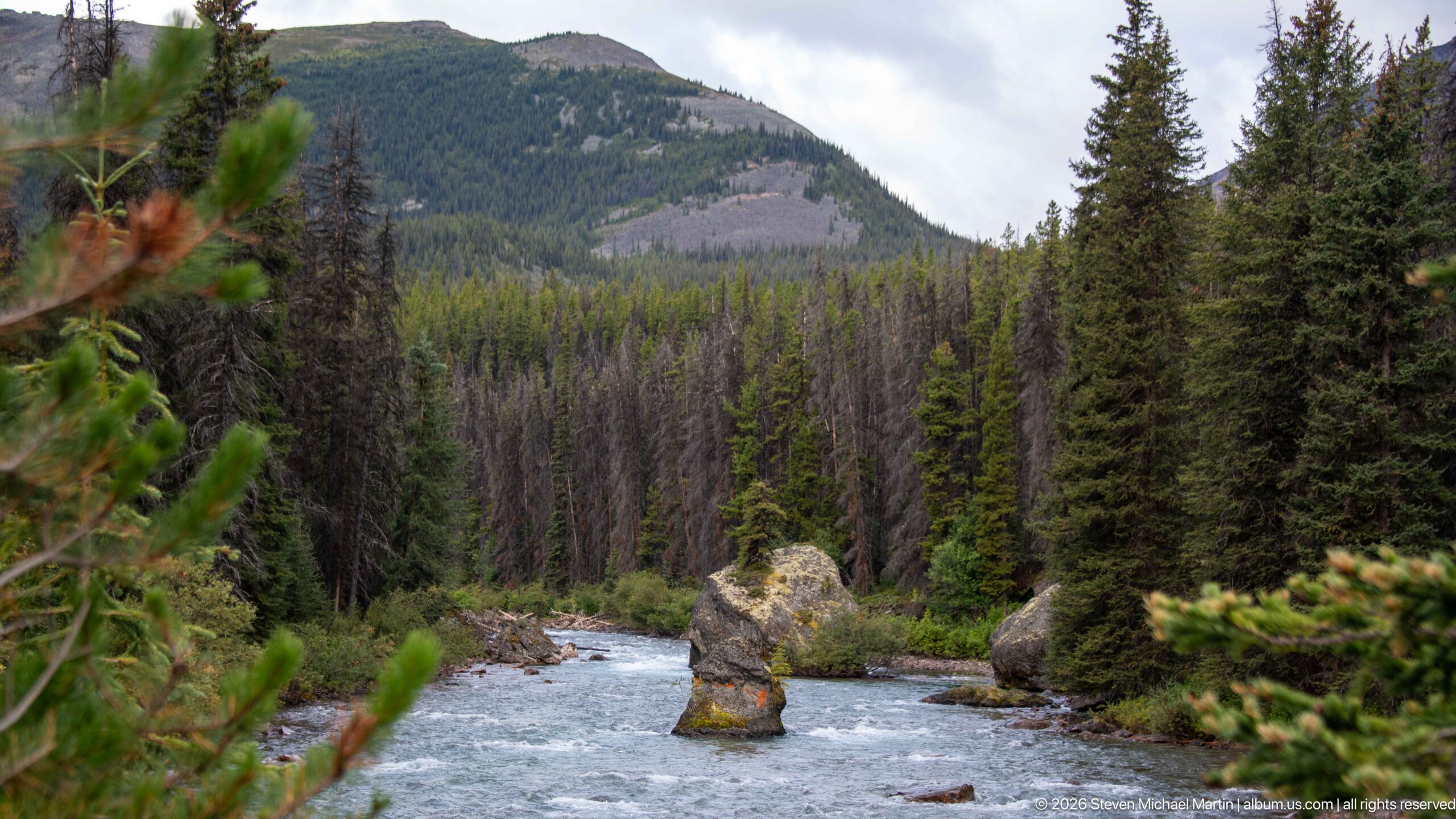
A prominent weathered rock rises from the river channel as swift water passes between forested banks. Dead and living conifers cover the valley sides beneath a rounded mountain, giving the frame a strong vertical progression from moving water to rock, forest, and high relief.
Caption
A prominent weathered rock rises from the river channel as swift water passes between forested banks. Dead and living conifers cover the valley sides beneath a rounded mountain, giving the frame a strong vertical progression from moving water to rock, forest, and high relief.
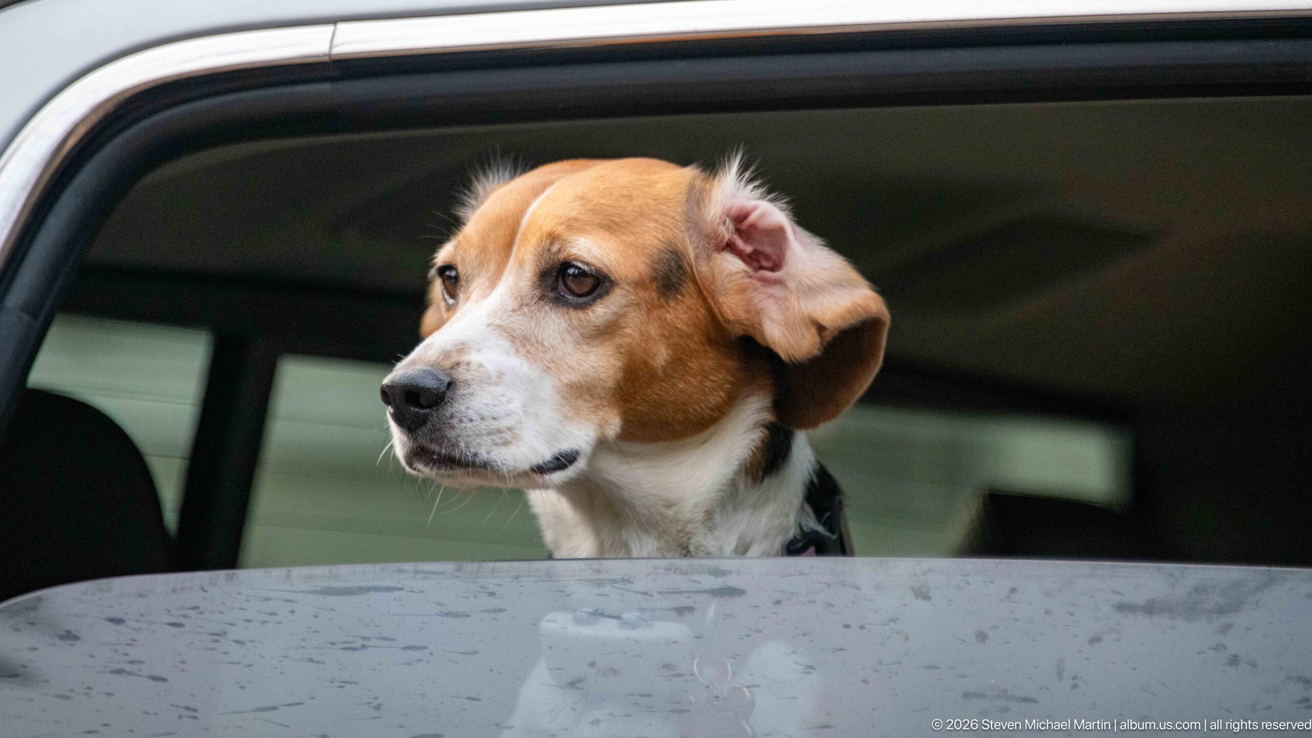
A beagle looks attentively through an open vehicle window, its head framed by the dark interior and rain-speckled exterior door. The close portrait shifts the portfolio briefly from landscape and wildlife to the experience of traveling through Jasper with a companion animal.
Caption
A beagle looks attentively through an open vehicle window, its head framed by the dark interior and rain-speckled exterior door. The close portrait shifts the portfolio briefly from landscape and wildlife to the experience of traveling through Jasper with a companion animal.
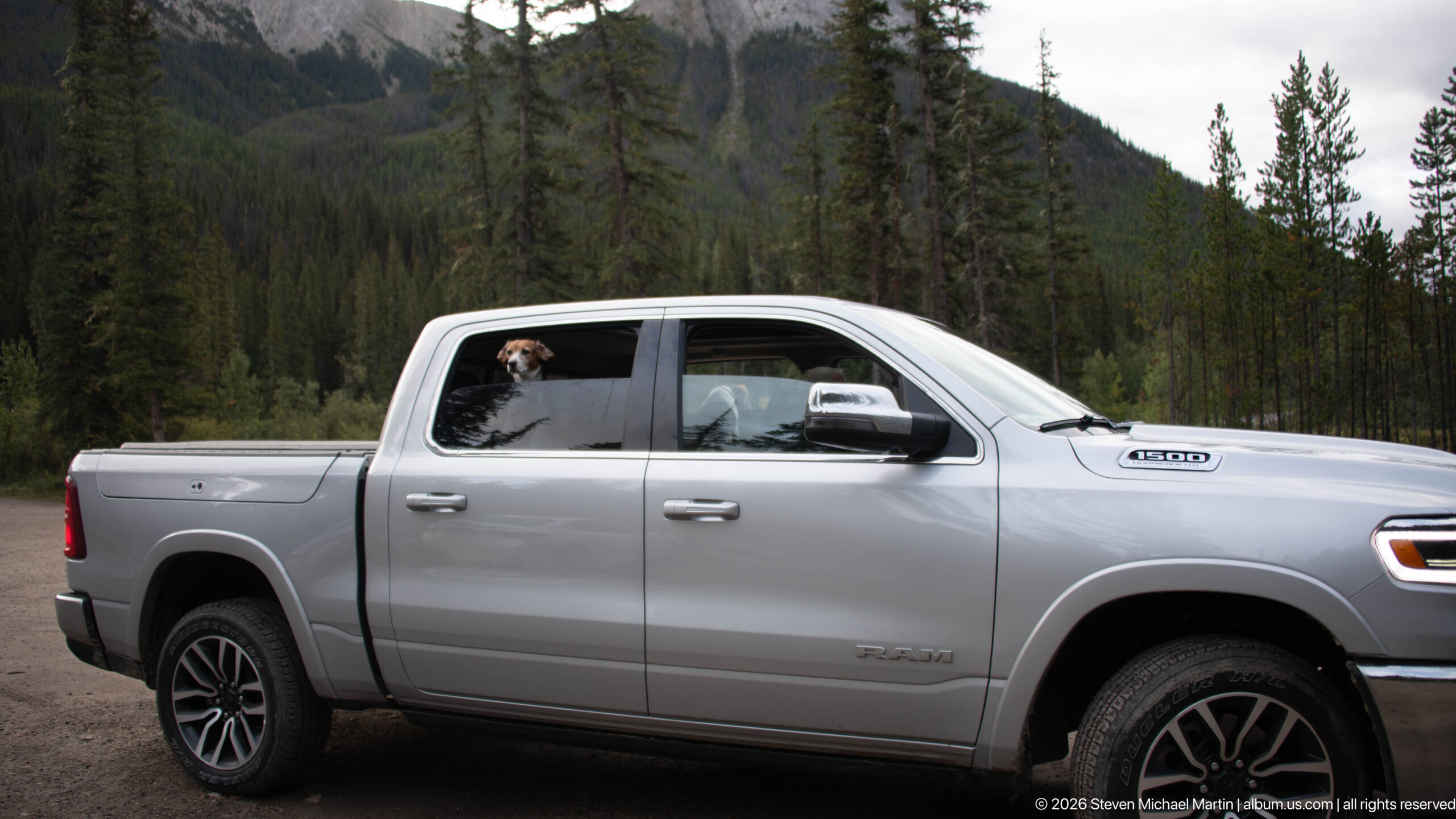
A silver pickup truck is parked against a forested Rocky Mountain backdrop while a beagle peers from the rear window. The wider composition places the traveling companion and vehicle within Jasper's mountain setting, combining the human journey with the surrounding landscape.
Caption
A silver pickup truck is parked against a forested Rocky Mountain backdrop while a beagle peers from the rear window. The wider composition places the traveling companion and vehicle within Jasper's mountain setting, combining the human journey with the surrounding landscape.
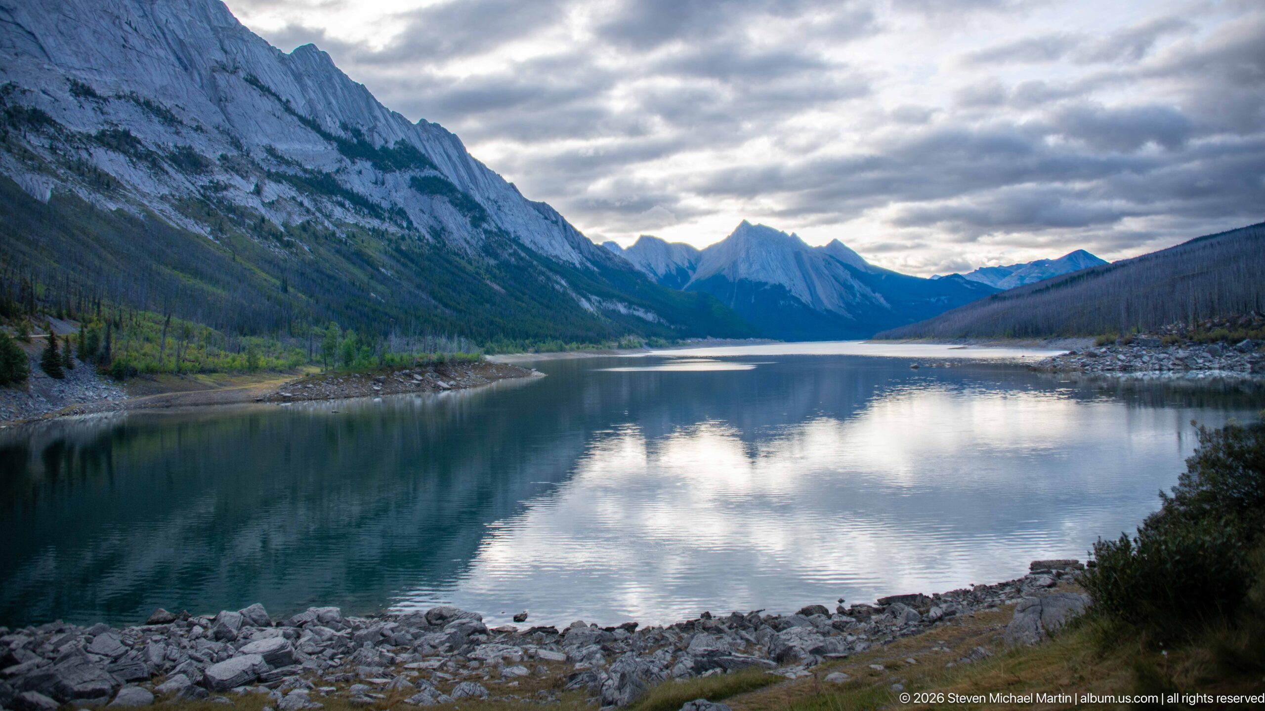
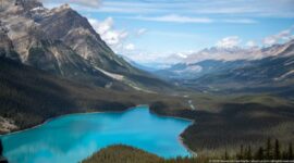
A long, calm body of blue-green water mirrors layered clouds between steep Rocky Mountain slopes. Exposed pale shoreline and forested lower slopes lead toward jagged peaks in the distance, creating a strong corridor view without enough visual evidence to assign a specific lake or river reach.
Caption
A long, calm body of blue-green water mirrors layered clouds between steep Rocky Mountain slopes. Exposed pale shoreline and forested lower slopes lead toward jagged peaks in the distance, creating a strong corridor view without enough visual evidence to assign a specific lake or river reach.
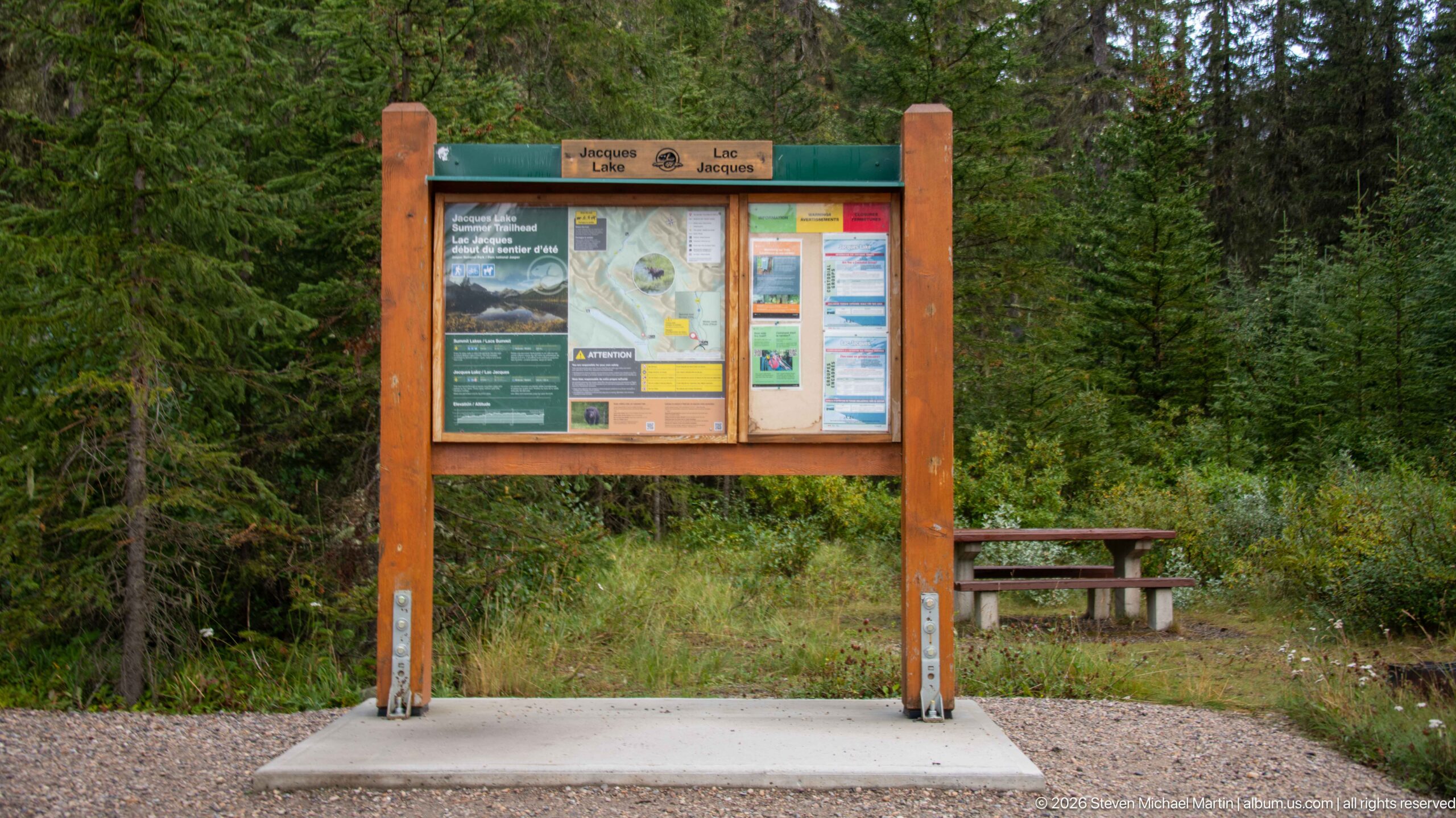
A wood-framed Parks Canada information board stands beside a picnic table at a forested visitor stop. Maps, notices, and interpretive panels are arranged beneath a small bilingual header, documenting the practical visitor infrastructure that accompanies access to Jasper's river and mountain landscapes.
Caption
A wood-framed Parks Canada information board stands beside a picnic table at a forested visitor stop. Maps, notices, and interpretive panels are arranged beneath a small bilingual header, documenting the practical visitor infrastructure that accompanies access to Jasper's river and mountain landscapes.
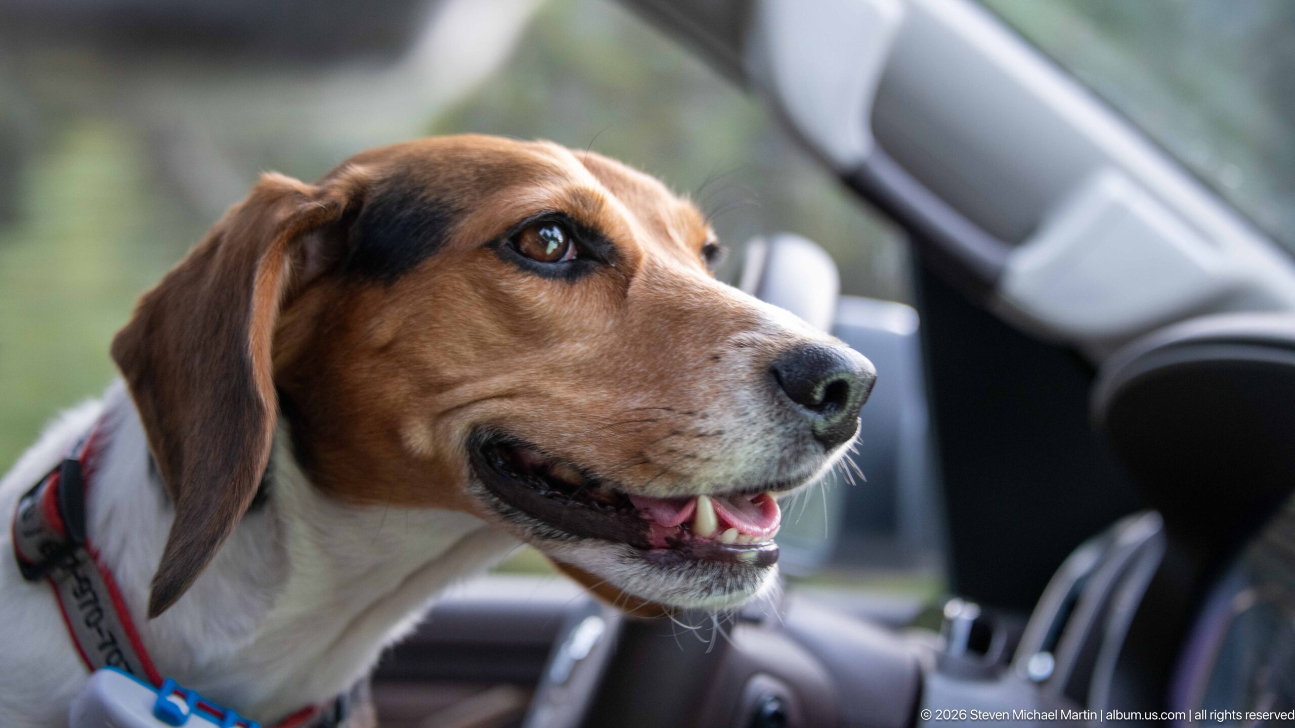
A beagle turns toward the open side of a vehicle with an alert, relaxed expression. Warm brown facial markings, long ears, and a white muzzle fill the frame, creating an intimate travel portrait distinct from the portfolio's wider landscapes and wildlife encounters.
Caption
A beagle turns toward the open side of a vehicle with an alert, relaxed expression. Warm brown facial markings, long ears, and a white muzzle fill the frame, creating an intimate travel portrait distinct from the portfolio's wider landscapes and wildlife encounters.
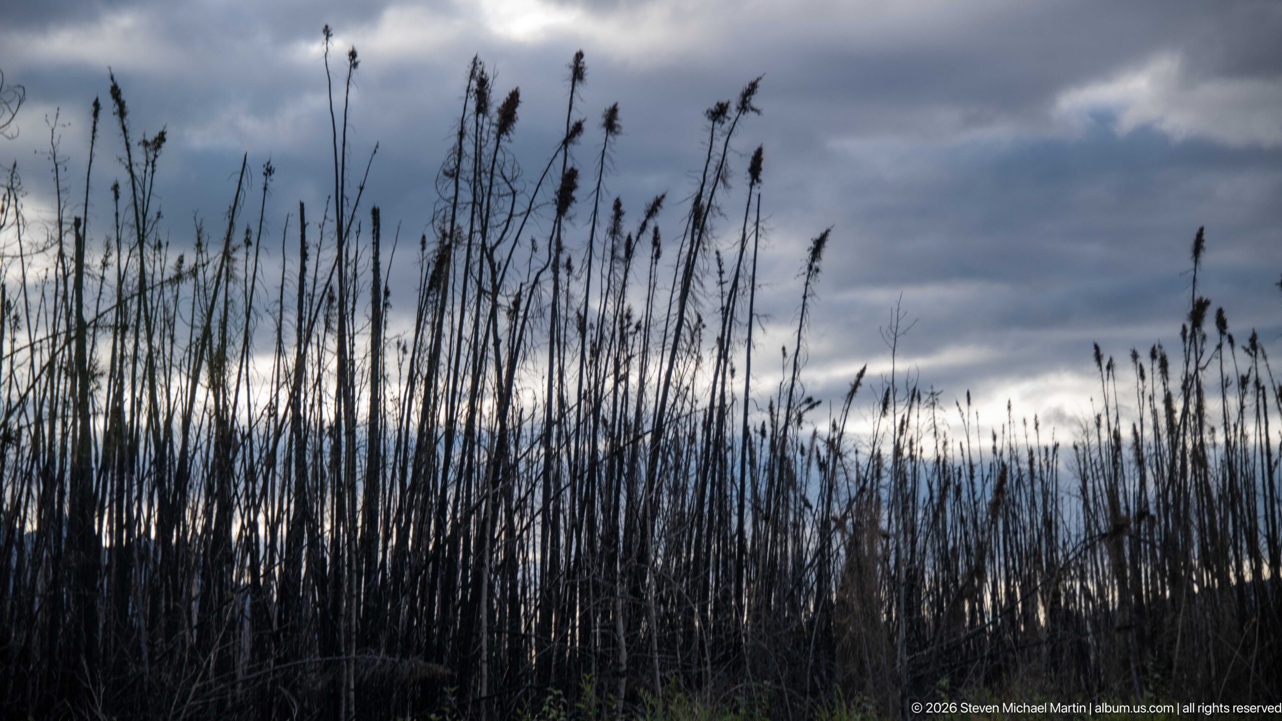
Blackened, leafless trunks rise in dense vertical lines beneath a dark, layered sky, recording a forest recently altered by wildfire. Sparse regeneration is visible near the ground, while the silhouetted snags create a stark contrast with the brighter band of cloud along the horizon.
Caption
Blackened, leafless trunks rise in dense vertical lines beneath a dark, layered sky, recording a forest recently altered by wildfire. Sparse regeneration is visible near the ground, while the silhouetted snags create a stark contrast with the brighter band of cloud along the horizon.
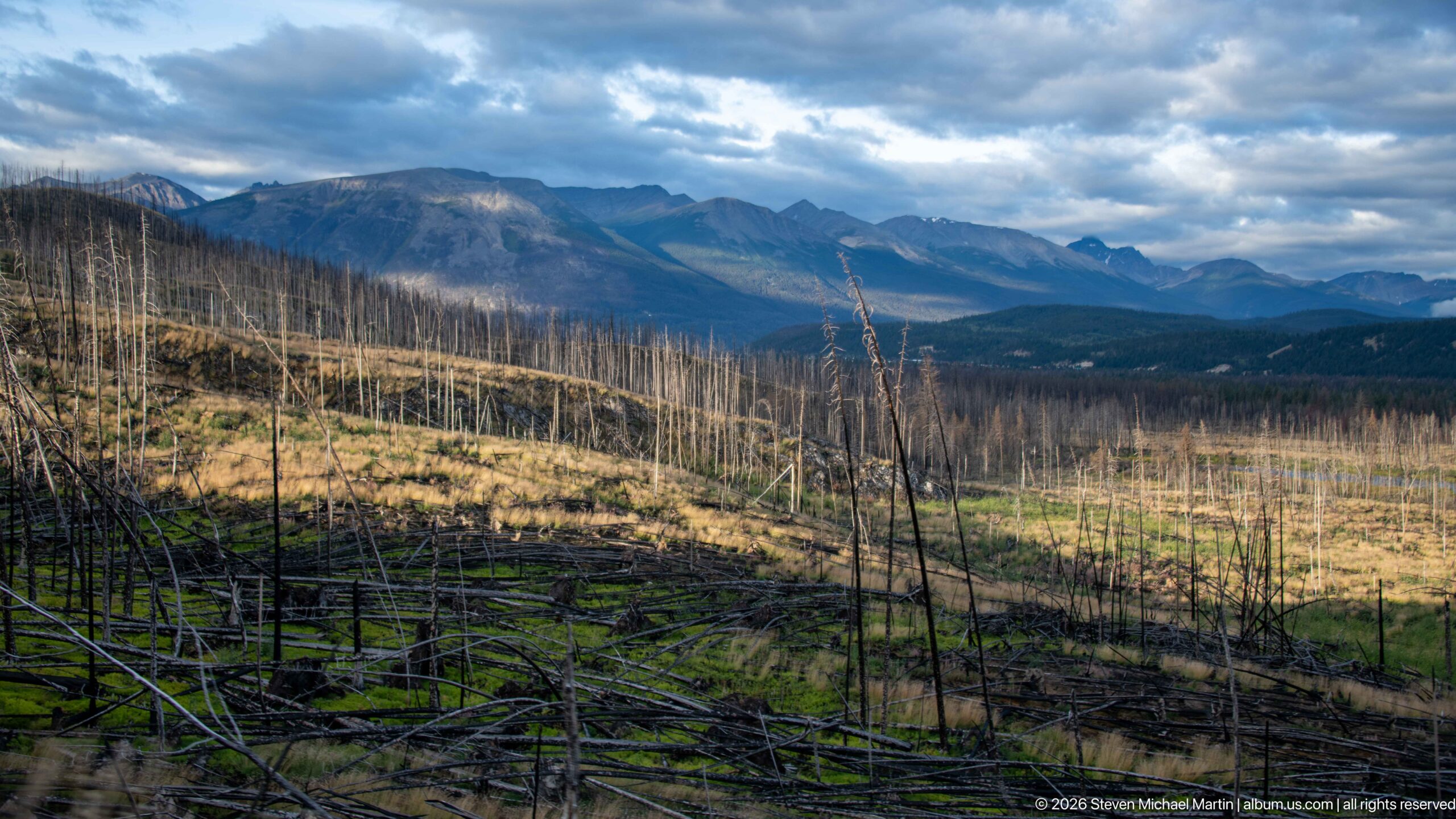
A broad slope of standing dead trees and fallen trunks opens toward distant blue-gray mountains under broken clouds. Patches of green groundcover and sunlit grass indicate early recovery within the burned area, while the panoramic scale shows how extensively fire has reshaped the valley landscape.
Caption
A broad slope of standing dead trees and fallen trunks opens toward distant blue-gray mountains under broken clouds. Patches of green groundcover and sunlit grass indicate early recovery within the burned area, while the panoramic scale shows how extensively fire has reshaped the valley landscape.
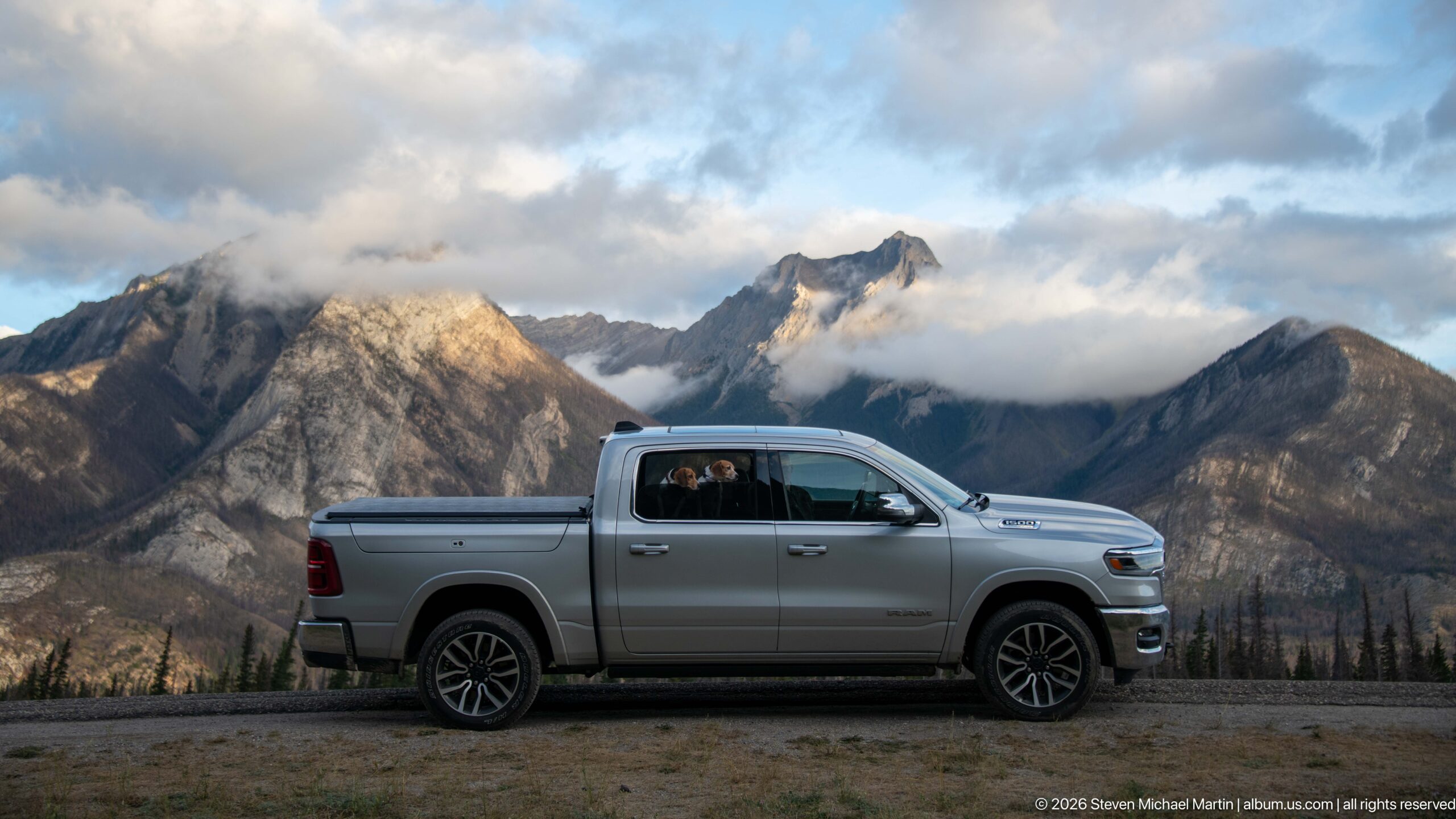
A silver pickup is parked in profile before steep, cloud-wrapped Rocky Mountain peaks, with two beagles visible through the windows. Low evening light touches portions of the mountains while the vehicle remains in shadow, linking the road-trip experience directly to Jasper's dramatic valley setting.
Caption
A silver pickup is parked in profile before steep, cloud-wrapped Rocky Mountain peaks, with two beagles visible through the windows. Low evening light touches portions of the mountains while the vehicle remains in shadow, linking the road-trip experience directly to Jasper's dramatic valley setting.
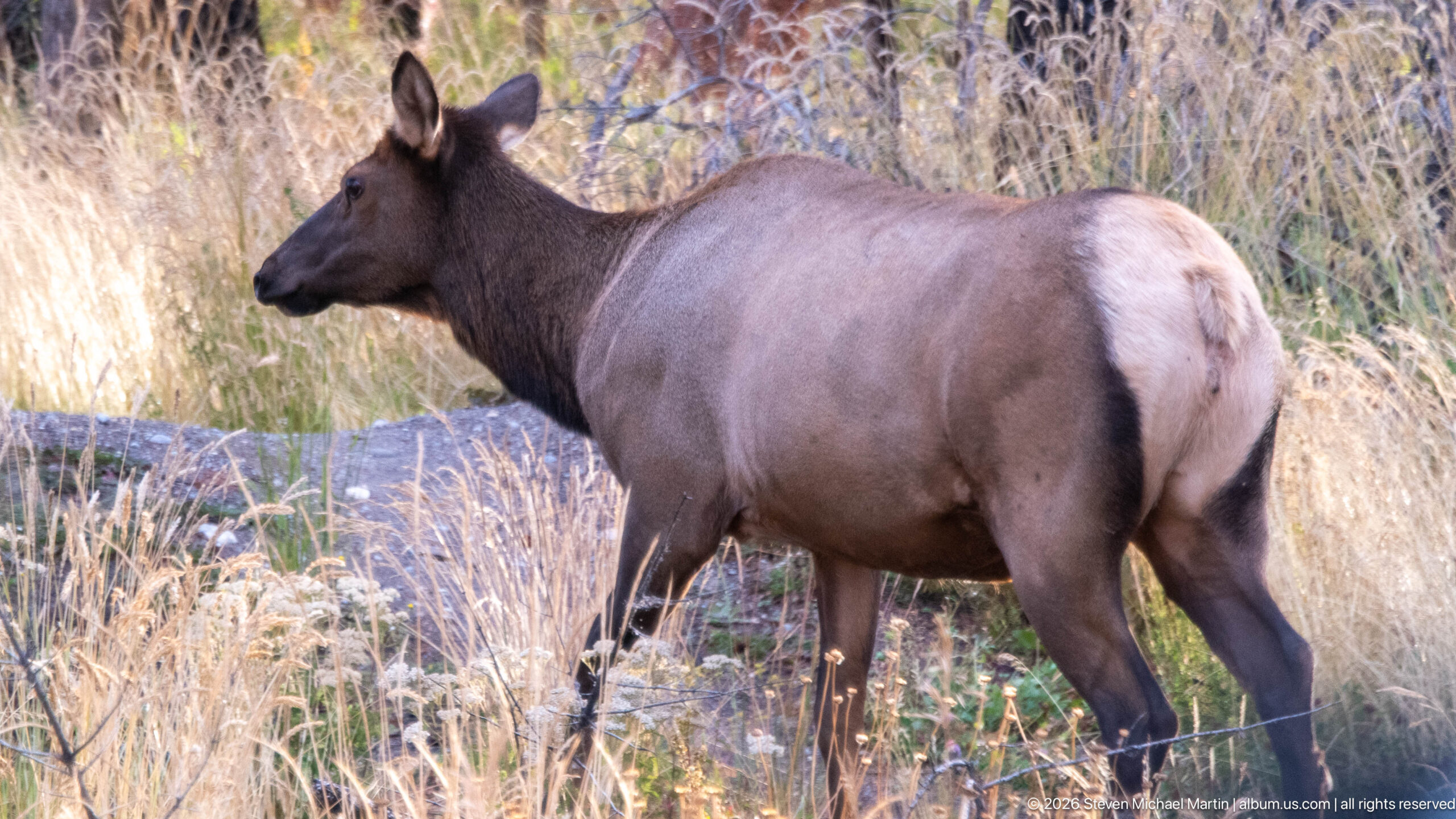
A cow elk stands broadside among tall, dry grasses at the forest edge. The animal's large body, dark neck, pale rump, and lack of antlers support identification as an adult female elk, while the close side profile provides a clear study of its proportions and coat.
Caption
A cow elk stands broadside among tall, dry grasses at the forest edge. The animal's large body, dark neck, pale rump, and lack of antlers support identification as an adult female elk, while the close side profile provides a clear study of its proportions and coat.
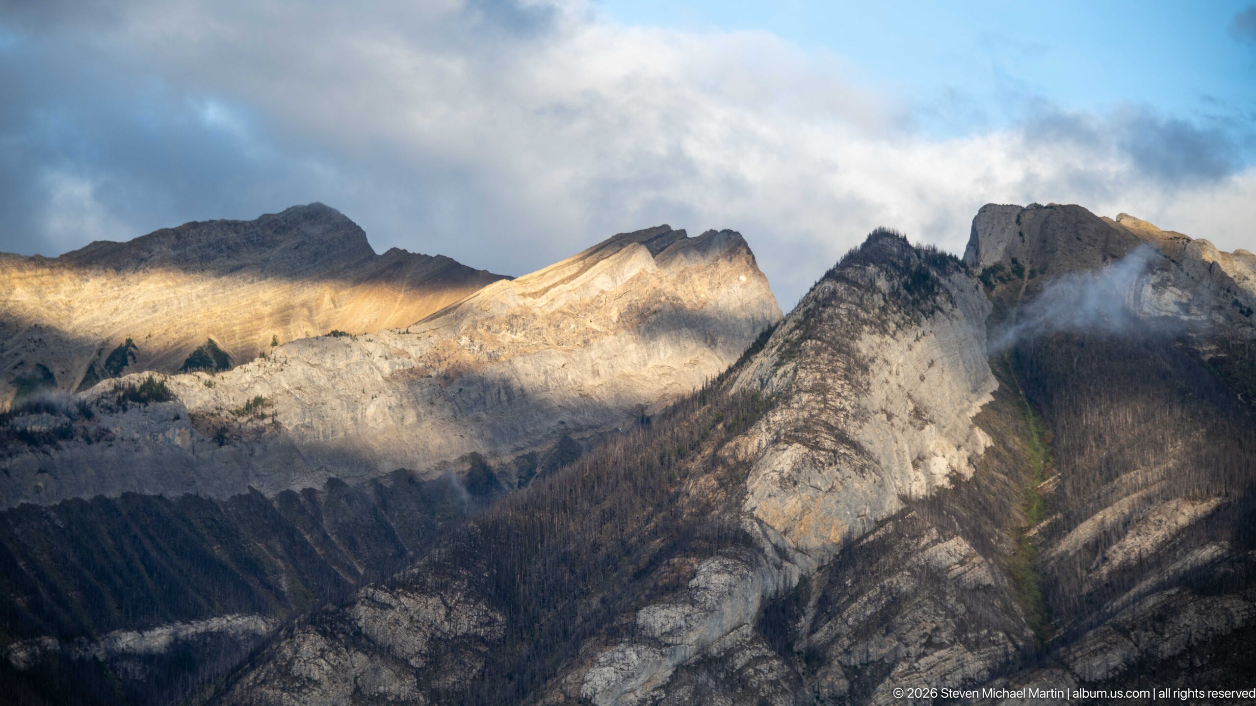
Late light sweeps across a complex sequence of steep, folded mountain ridges, illuminating pale rock while adjacent slopes remain in shadow. Low clouds cling to the higher crest, emphasizing the layered structure and dramatic relief of the Canadian Rockies without requiring a specific peak identification.
Caption
Late light sweeps across a complex sequence of steep, folded mountain ridges, illuminating pale rock while adjacent slopes remain in shadow. Low clouds cling to the higher crest, emphasizing the layered structure and dramatic relief of the Canadian Rockies without requiring a specific peak identification.
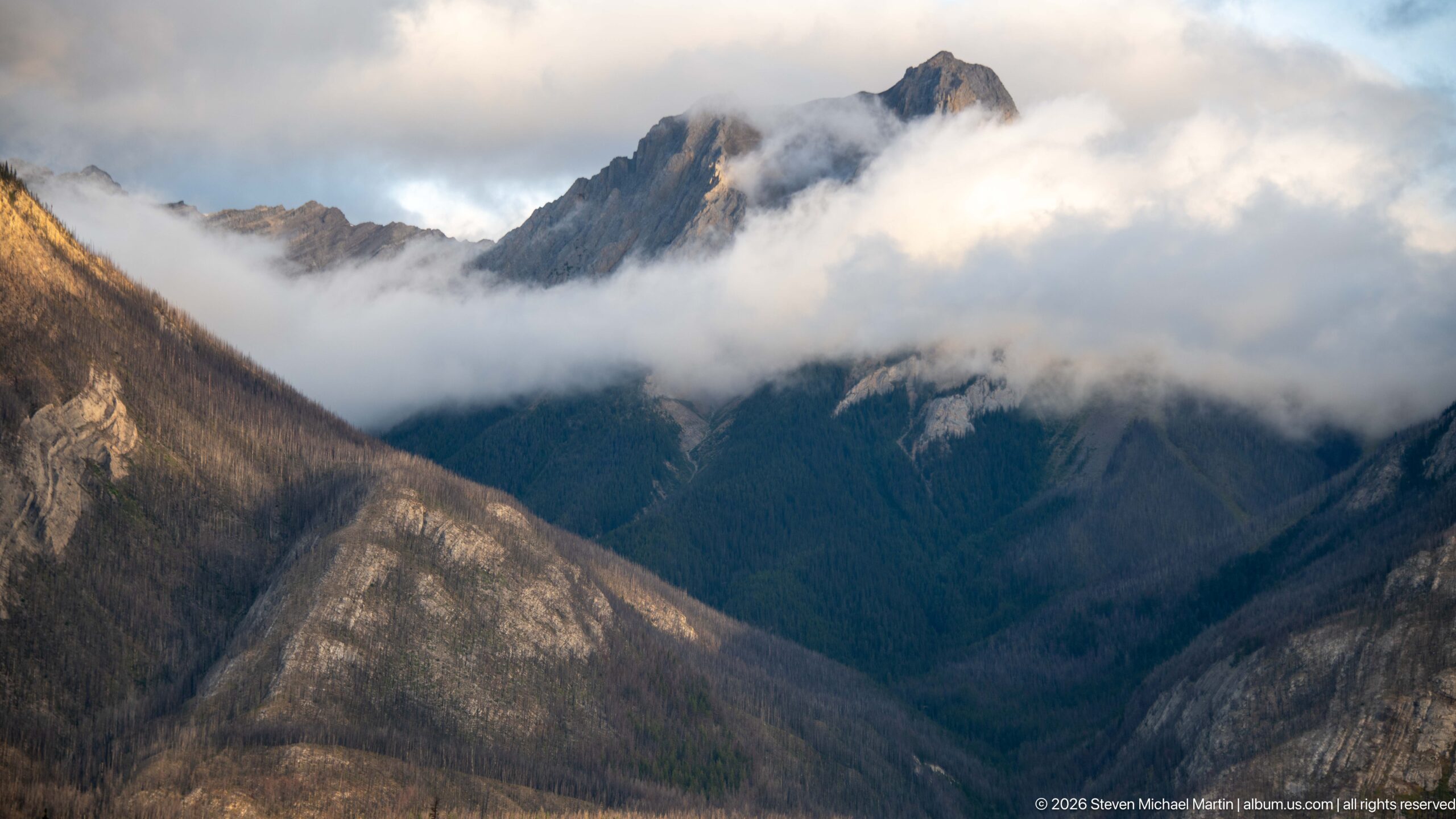
A jagged mountain summit rises above a horizontal band of low cloud while dark forested slopes descend beneath it. Warm light catches the exposed upper rock, creating a layered composition of illuminated summit, cloud, shadowed valley wall, and pale foreground ridge.
Caption
A jagged mountain summit rises above a horizontal band of low cloud while dark forested slopes descend beneath it. Warm light catches the exposed upper rock, creating a layered composition of illuminated summit, cloud, shadowed valley wall, and pale foreground ridge.
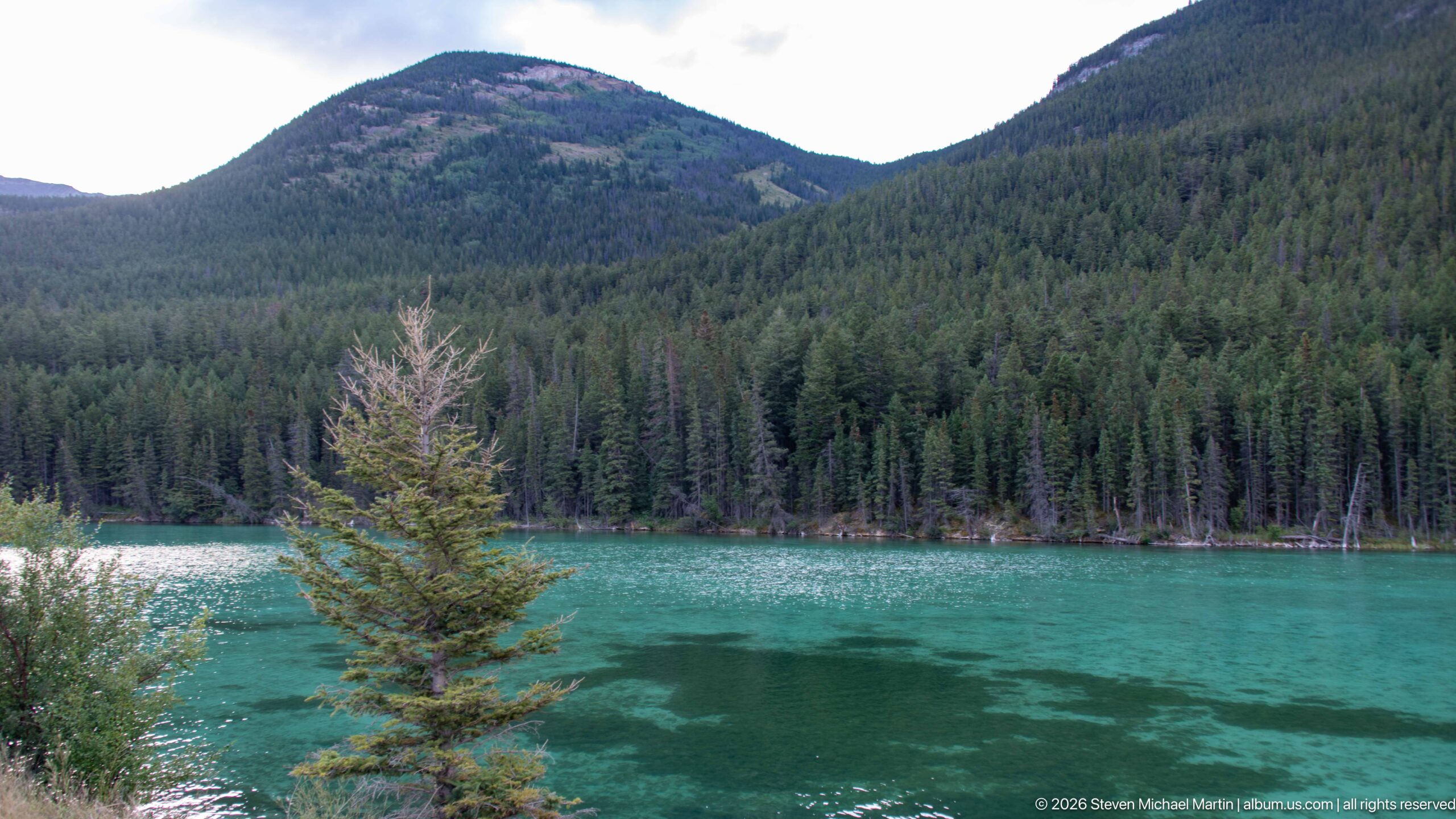
Clear turquoise water fills the foreground beneath densely forested mountain slopes, with a small conifer standing near the near shore. The intense water color and simple forested enclosure create a quieter landscape study, but the proof sheet does not provide enough evidence to name the water body confidently.
Caption
Clear turquoise water fills the foreground beneath densely forested mountain slopes, with a small conifer standing near the near shore. The intense water color and simple forested enclosure create a quieter landscape study, but the proof sheet does not provide enough evidence to name the water body confidently.
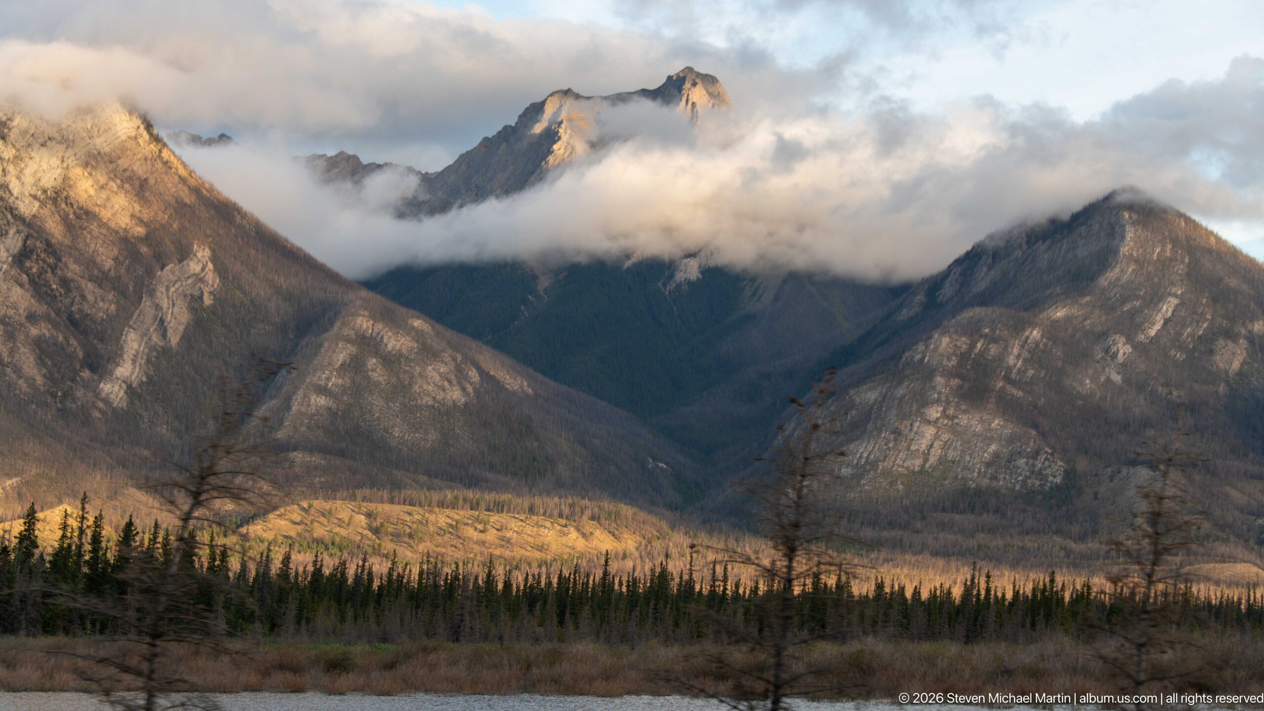
Broken evening light illuminates mountain faces and the upper edges of low clouds above a dark conifer valley. A sharp central summit appears intermittently through the cloud layer, while the broader scene emphasizes changing weather and light across Jasper's steep Rocky Mountain relief.
Caption
Broken evening light illuminates mountain faces and the upper edges of low clouds above a dark conifer valley. A sharp central summit appears intermittently through the cloud layer, while the broader scene emphasizes changing weather and light across Jasper's steep Rocky Mountain relief.
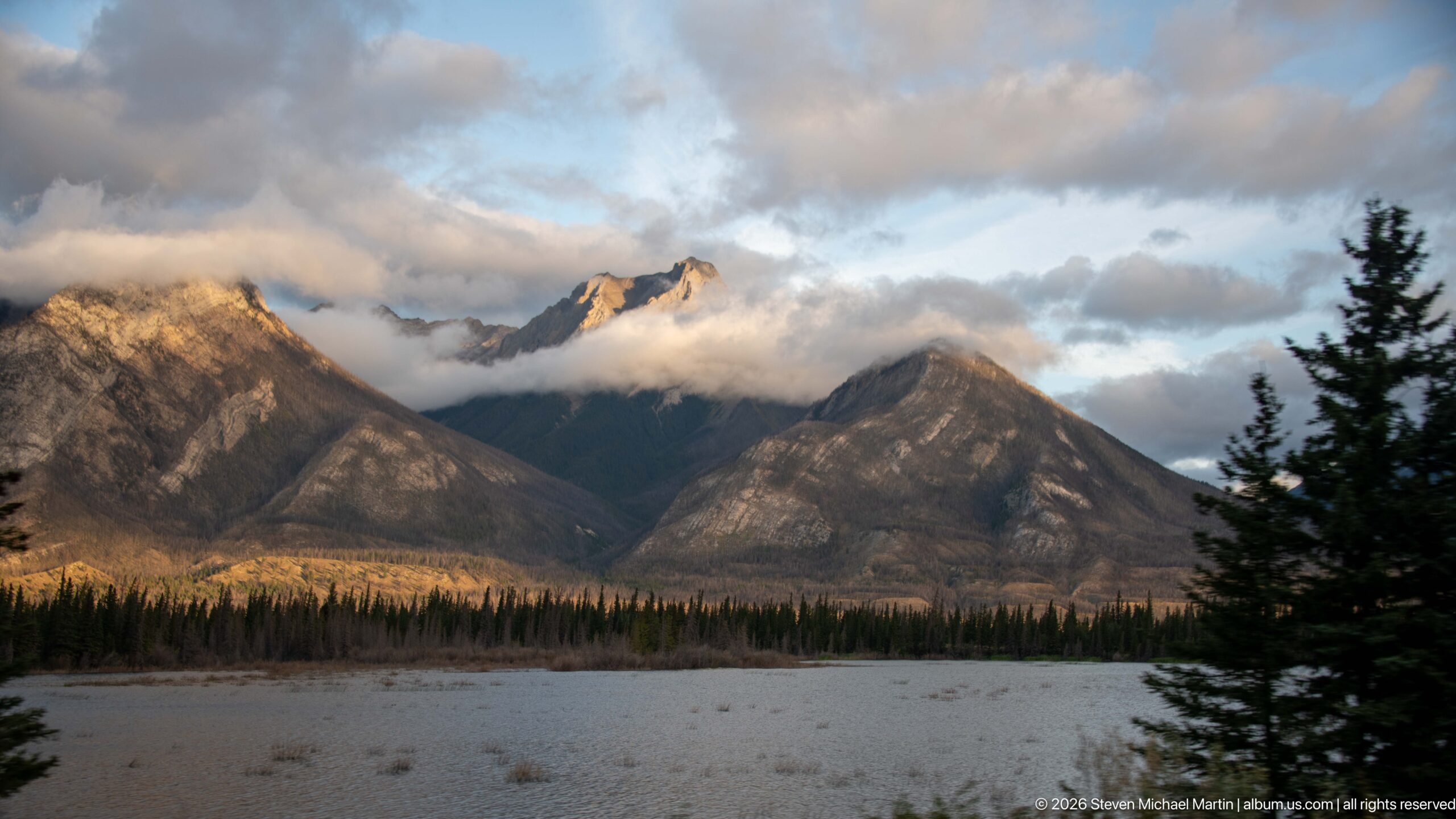
Broad pale gravel flats stretch across the foreground beneath forested mountain slopes and cloud-wrapped peaks. Warm light reaches parts of the valley and ridges while a dark conifer frames the right edge, illustrating the wide depositional floor characteristic of portions of the Athabasca corridor.
Caption
Broad pale gravel flats stretch across the foreground beneath forested mountain slopes and cloud-wrapped peaks. Warm light reaches parts of the valley and ridges while a dark conifer frames the right edge, illustrating the wide depositional floor characteristic of portions of the Athabasca corridor.
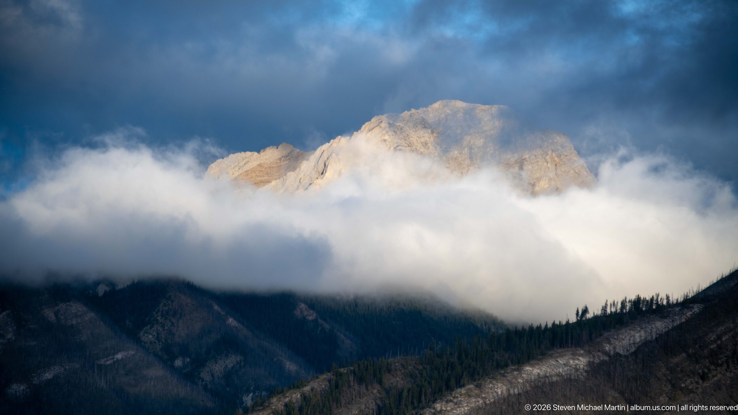
A pale rocky summit catches warm sunlight above a thick bank of white cloud, while the lower slopes remain dark beneath a blue-gray sky. The compressed view isolates the changing atmospheric layers and exposed upper rock rather than identifying the mountain by name.
Caption
A pale rocky summit catches warm sunlight above a thick bank of white cloud, while the lower slopes remain dark beneath a blue-gray sky. The compressed view isolates the changing atmospheric layers and exposed upper rock rather than identifying the mountain by name.
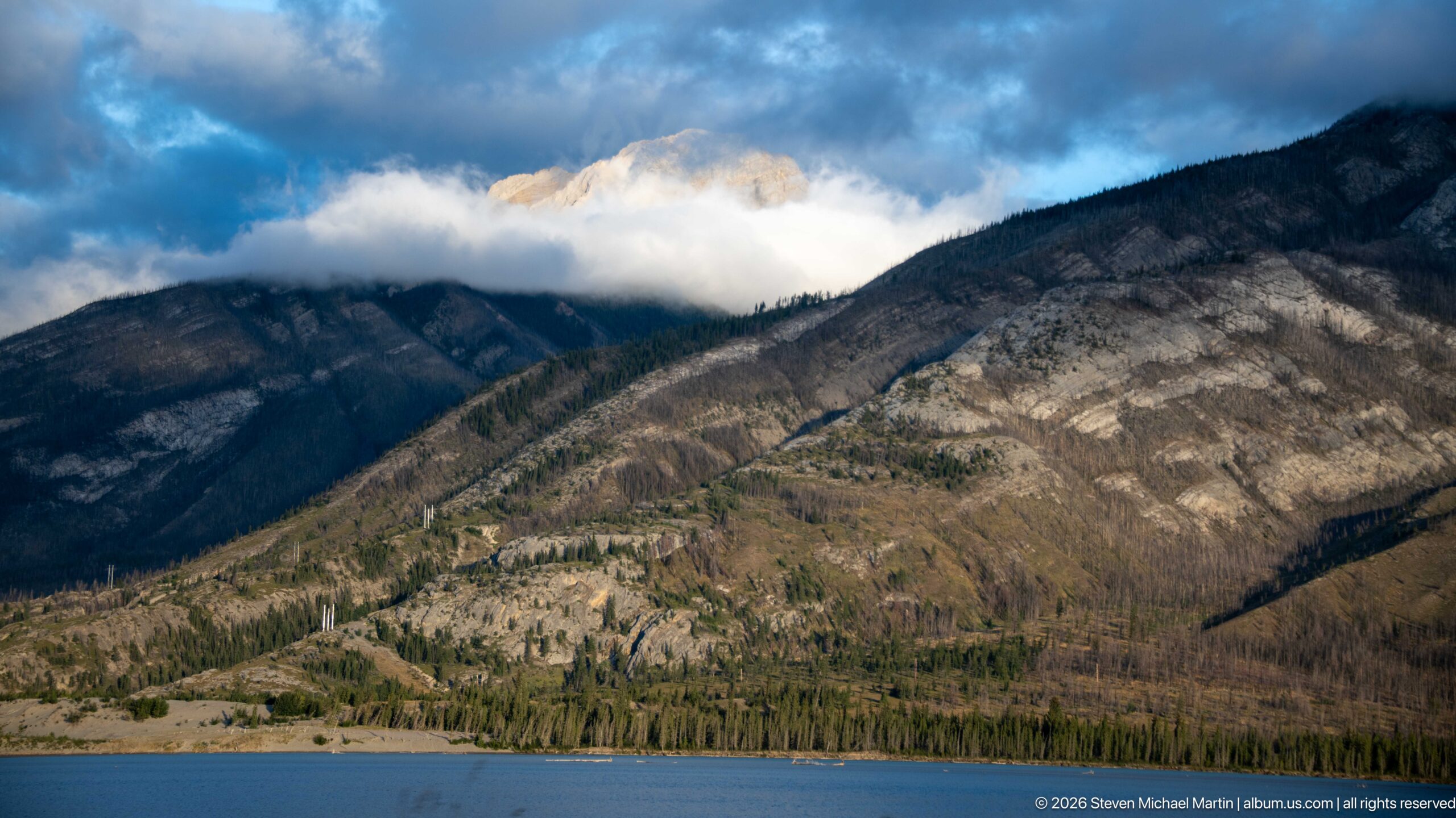
Blue water forms a narrow foreground band beneath steep mountain slopes marked by pale exposed rock, forest, and a low cloud layer. Sunlight reaches the upper summit while the nearer ridges remain darker, creating a strong sequence from water to valley wall to cloud-wrapped peak.
Caption
Blue water forms a narrow foreground band beneath steep mountain slopes marked by pale exposed rock, forest, and a low cloud layer. Sunlight reaches the upper summit while the nearer ridges remain darker, creating a strong sequence from water to valley wall to cloud-wrapped peak.
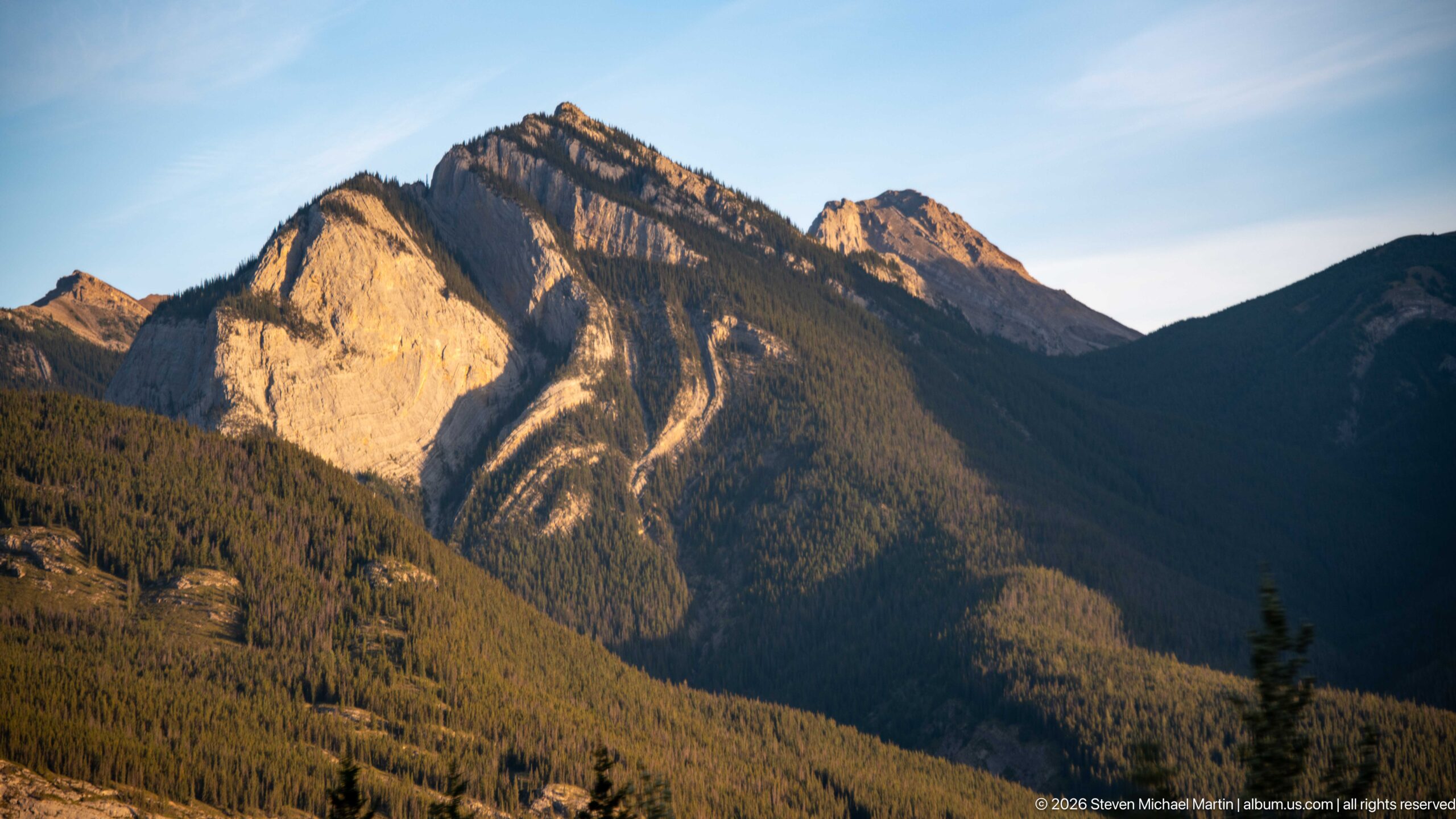
Warm low-angle light illuminates a steep pale rock face and upper ridge while the adjoining valley falls into deep shadow. Dense conifer forest blankets the lower slopes, accentuating the contrast between exposed bedrock and vegetation across the mountain's sharply defined relief.
Caption
Warm low-angle light illuminates a steep pale rock face and upper ridge while the adjoining valley falls into deep shadow. Dense conifer forest blankets the lower slopes, accentuating the contrast between exposed bedrock and vegetation across the mountain's sharply defined relief.
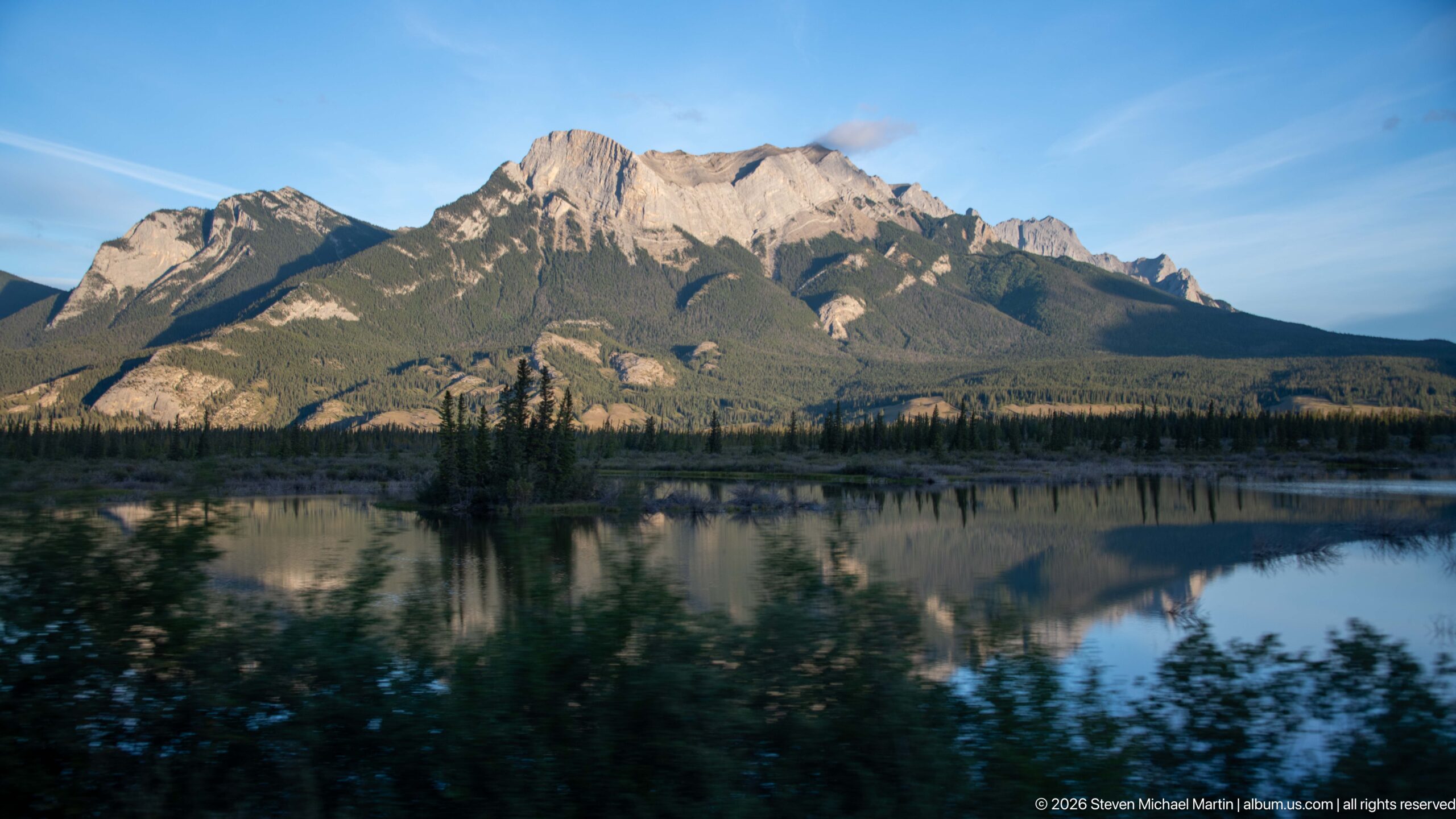
A rugged mountain massif rises beyond calm water that reflects the peaks, forest, and blue evening sky. Dark foreground shrubs and a narrow band of conifers frame the reflection, producing one of the portfolio's clearest combinations of mountain form and still water.
Caption
A rugged mountain massif rises beyond calm water that reflects the peaks, forest, and blue evening sky. Dark foreground shrubs and a narrow band of conifers frame the reflection, producing one of the portfolio's clearest combinations of mountain form and still water.
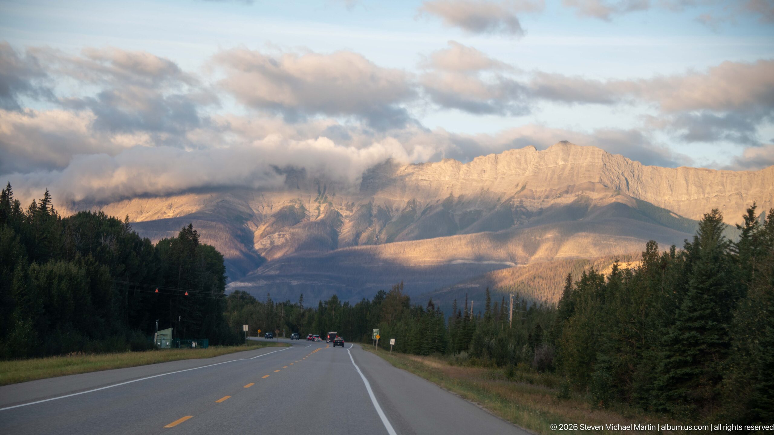
A two-lane highway leads directly toward a broad, pale Rocky Mountain wall lit by low evening sun. Forest borders both sides of the road and small roadside signs punctuate the approach, making the transportation corridor itself the foreground subject within the larger mountain landscape.
Caption
A two-lane highway leads directly toward a broad, pale Rocky Mountain wall lit by low evening sun. Forest borders both sides of the road and small roadside signs punctuate the approach, making the transportation corridor itself the foreground subject within the larger mountain landscape.
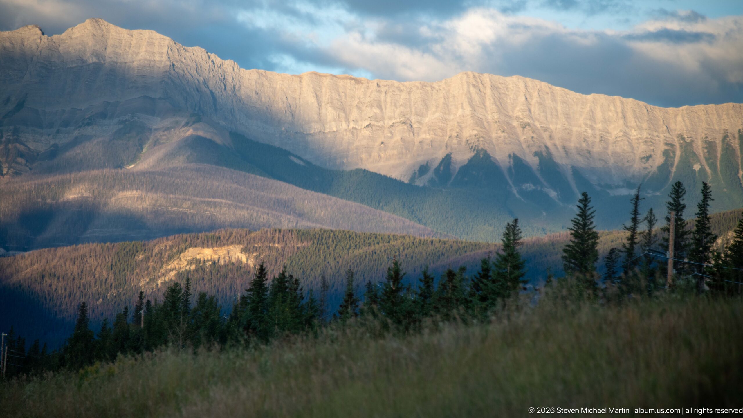
A long, pale mountain escarpment catches soft evening light above darker forested foothills and meadow grasses. Vertical grooves and shadowed gullies texture the exposed rock face, while bands of sunlight and cloud shadow create depth across the lower slopes.
Caption
A long, pale mountain escarpment catches soft evening light above darker forested foothills and meadow grasses. Vertical grooves and shadowed gullies texture the exposed rock face, while bands of sunlight and cloud shadow create depth across the lower slopes.
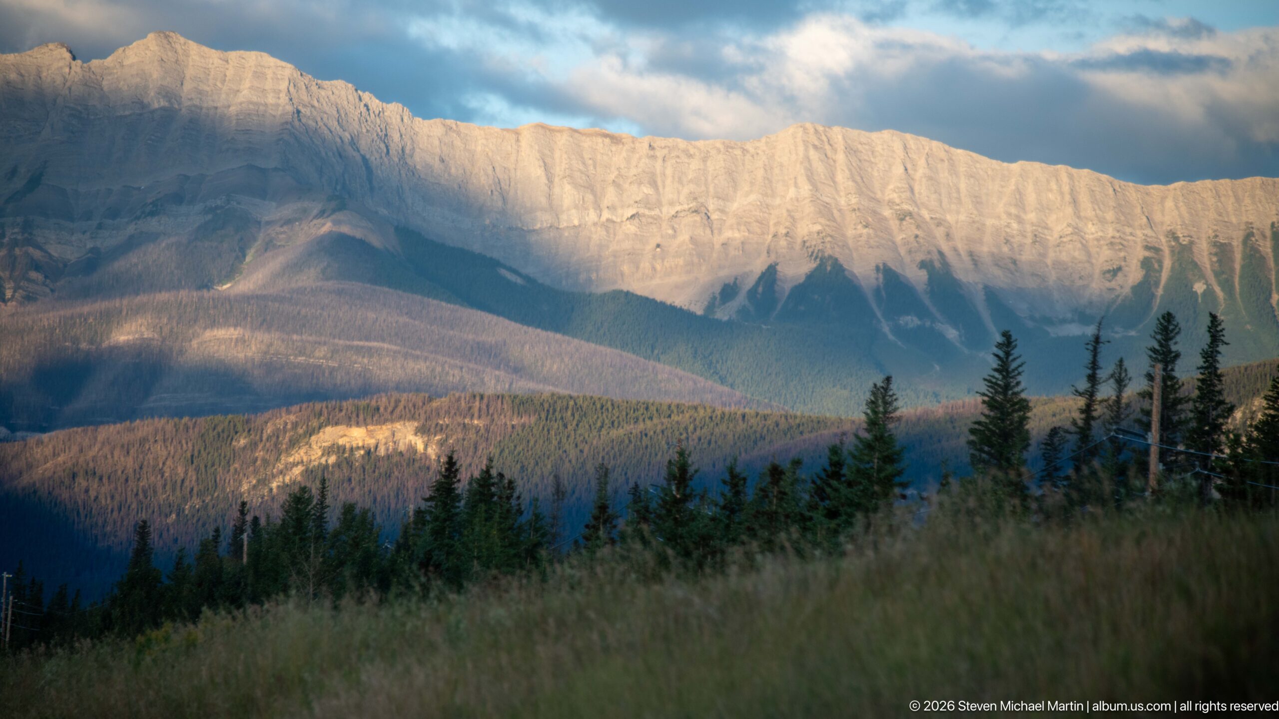
The final view concentrates on the same broad mountain wall from a slightly tighter composition, with pale upper cliffs glowing above shadowed forest and grassy foreground. Heavy blue-gray clouds deepen the contrast, leaving the illuminated rock face as the dominant visual conclusion to the portfolio.
Caption
The final view concentrates on the same broad mountain wall from a slightly tighter composition, with pale upper cliffs glowing above shadowed forest and grassy foreground. Heavy blue-gray clouds deepen the contrast, leaving the illuminated rock face as the dominant visual conclusion to the portfolio.
Scenic Landscape Field Guide
📍 Overview
The Athabasca River is one of the defining natural features of Jasper National Park, flowing north and east through the park from the Columbia Icefield region. The river is more than a scenic element in the mountain landscape: it is a glacially influenced river system, a wildlife corridor, and a route that has connected people through the Canadian Rockies for generations. A 168-kilometre section within Jasper National Park was designated a Canadian Heritage River in 1989 for its outstanding natural, cultural, and recreational values. Seen within the broader landscape, the Athabasca connects water, ice, mountains, wildlife, and human history into a single evolving corridor.
🏔️ Physical Setting
Within Jasper National Park, the Athabasca occupies a broad mountain valley framed by the steep relief of the Canadian Rockies. Its character changes along the corridor, from broad gravel flats and multiple shallow channels to faster reaches, gorges, waterfalls, and shallow expansions such as Jasper Lake. Forested valley bottoms, exposed sediment, gravel bars, tributary fans, and mountain slopes reveal the river’s interaction with the surrounding terrain. The Athabasca Valley is also a natural passage through the mountains, a geographic quality that helps explain its importance to wildlife movement and its long use as a human transportation corridor.
🪨 Geology & Landform
Water and ice continually reshape the Athabasca corridor. The river rises in the Columbia Icefield region and carries glacial meltwater and seasonal snowmelt through Jasper National Park, eroding and transporting sediment before redepositing it as gravel flats, bars, channels, and fans. These processes help create the changing pattern of the river across the valley floor. At Athabasca Falls, a more concentrated example of river erosion occurs where the river crosses resistant quartzite and has eroded softer limestone beneath, producing potholes and a short canyon. Across the wider valley, channel patterns, exposed sediment, tributary fans, and surrounding mountain slopes provide visible evidence of a landscape continually shaped by flowing water, erosion, deposition, and glacial influence.
🌿 Ecology
The portfolio includes The lower Athabasca and Miette valley bottoms contain Jasper’s montane life zone, a relatively warm and dry environment that supports grasslands, forests, and diverse large mammals., Parks Canada identifies the confluence area of the Miette, Maligne, and Athabasca rivers as critical habitat for elk, sheep, moose, and deer and for predators including wolves, cougars, grizzly bears, and black bears., Osprey and bald eagles occur near Jasper’s rivers, where fish form part of their food supply., The designated Athabasca River supports fish including mountain whitefish, bull trout, Athabasca rainbow trout, and pygmy whitefish; several are of conservation concern., Mountain whitefish undertake substantial spawning migrations into Jasper National Park in autumn., and River-edge and valley-bottom habitats are movement corridors as well as feeding and breeding environments for wildlife..
🦌 Wildlife Encounters
Photographs in this portfolio document wildlife encounters with Elk and Bighorn sheep in the Jasper landscape. The photographs place these animals in settings that include Elk wading through river water framed by conifers, Elk wading chest-deep through the Athabasca River, Elk standing on gravel beside driftwood, and Elk among braided channels and gravel bars. These encounters provide direct, visit-specific evidence of how wildlife uses the habitats interpreted in this field guide.
◆ Seasonal Character
Seasonal change is fundamental to the character of the Athabasca River. Snowmelt and rainfall typically begin driving peak river flow in late June, while glacier melt helps maintain high water levels through July. Changes in water level, weather, vegetation, and light can substantially alter the appearance of the river and its banks over the course of the year. Wildlife activity also follows seasonal patterns; mountain whitefish, for example, undertake substantial spawning migrations into Jasper National Park in autumn. These changing conditions make the Athabasca a dynamic landscape rather than a fixed scenic setting.
👁️ Viewpoints
The most revealing views of the Athabasca place the river within its larger mountain setting. Broad perspectives that include the river, valley floor, forested banks, gravel bars, and surrounding peaks show how the Athabasca functions as a landscape corridor rather than simply a water feature. Closer viewpoints can reveal current, exposed sediment, multiple channels, riparian vegetation, and other evidence of river processes. Where roads, rail lines, bridges, trails, or other developed features enter the scene, they can also illustrate the valley’s continuing role as a transportation corridor. Together, these perspectives connect the visible river with the geological, ecological, and human processes that have shaped the Athabasca Valley.
📷 Photography Notes
Photographs of the Athabasca are strongest when they communicate both the river itself and its relationship to the surrounding Canadian Rockies. Wide compositions can establish scale by pairing the river and valley floor with mountain relief, while closer images can emphasize channels, gravel bars, sediment, current, vegetation, and changing water conditions. Seasonal light, weather, water colour, and water level can transform the appearance of the same landscape and are valuable parts of the visual story rather than fixed identifying characteristics. Human features such as roads, rail lines, bridges, and trails can provide additional context for the valley’s long transportation history when they are actually visible. Specific peaks, tributaries, geologic formations, wildlife species, or named landmarks should be identified only when the photograph provides sufficient evidence.