Banff Peyto and Bow Lakes
Along the Icefields Parkway north of Lake Louise, Peyto Lake and Bow Lake reveal two very different perspectives on the glacial landscape of Banff National Park. Bow Lake lies almost directly beside the highway, its broad expanse framed by Crowfoot Mountain, Bow Glacier, and the Wapta Icefield. Meltwater from these high icefields feeds the lake and begins the Bow River, which flows from the Canadian Rockies across Alberta. A short distance farther north, the road climbs toward Bow Summit, where the landscape opens dramatically above the forest and the mountains gather around the valley of Peyto Lake.
From the viewpoint above Bow Summit, Peyto Lake appears far below as an intensely blue-green ribbon winding between steep mountain slopes. The lake is fed by Peyto Glacier, an outlet of the Wapta Icefield, and its remarkable color comes from fine particles of glacial rock suspended in the water. It was named for Ebenezer William “Bill” Peyto, one of the early guides, outfitters, and park wardens associated with the exploration of the Canadian Rockies. Seen from above, the lake and the surrounding peaks form one of the defining panoramas of Banff, a landscape shaped by ice on a scale that becomes particularly apparent from this elevated vantage point.
Bow Lake offers a quieter and more immediate encounter with the same glacial system. From its shoreline, the mountains rise directly beyond the water while glaciers remain visible high above, connecting the lake to the icefields that continue to shape this part of the Rockies. Together, Bow and Peyto Lakes illustrate the movement of water through the landscape—from accumulated snow and ancient ice to glaciers, lakes, rivers, and distant watersheds. Along a highway celebrated for its succession of extraordinary mountain scenery, these neighboring lakes stand out not simply for their color, but for the unusually clear view they provide into the forces that created and continue to transform the Canadian Rockies.
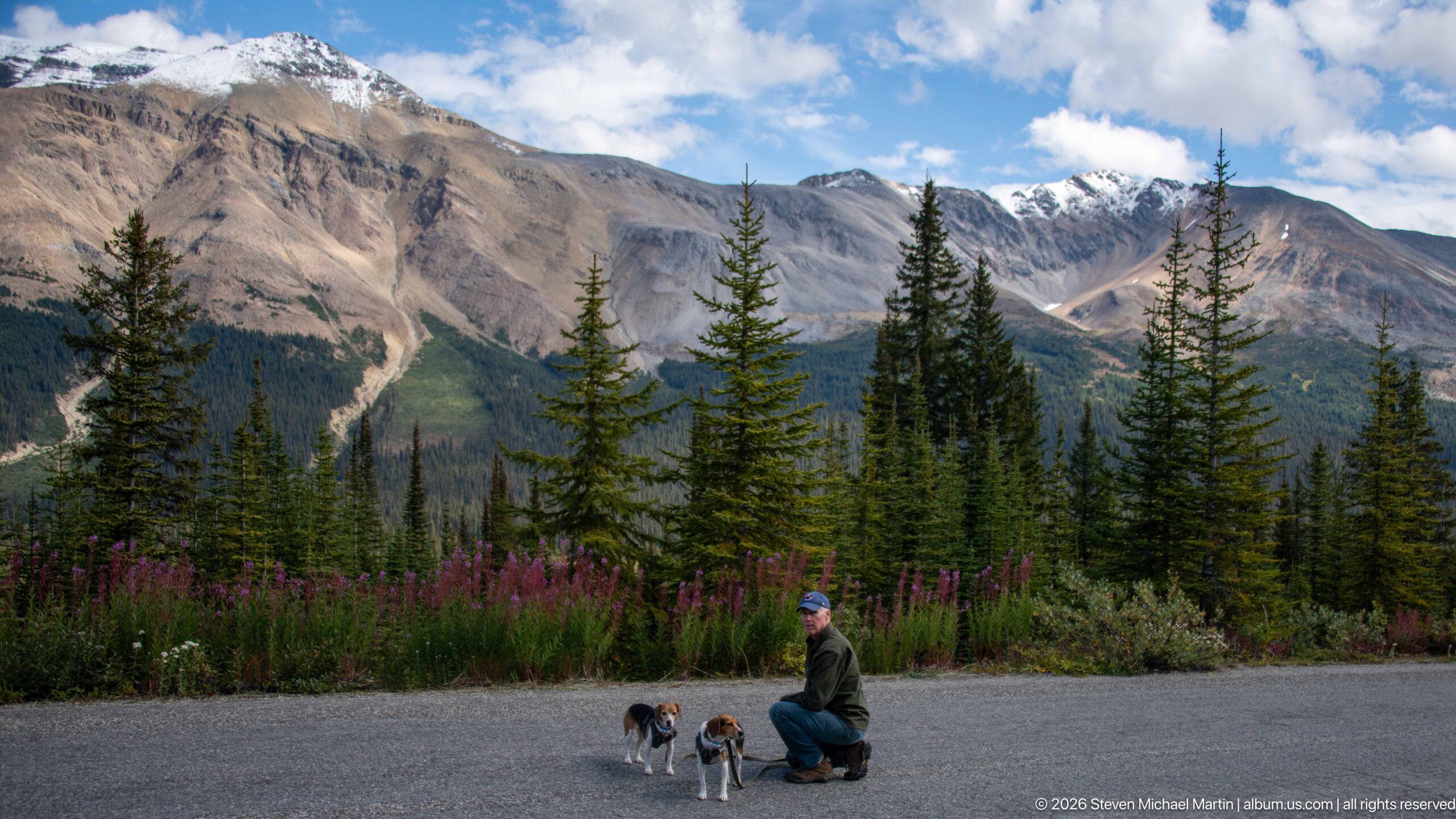
A visitor kneels beside two leashed beagles at the edge of a paved area, backed by fireweed, conifers, and a broad wall of Rocky Mountain limestone. The human-scale foreground contrasts with the steep alpine terrain beyond. This contextual view records the visitor experience on the approach to Peyto Lake rather than the overlook itself.
Caption
A visitor kneels beside two leashed beagles at the edge of a paved area, backed by fireweed, conifers, and a broad wall of Rocky Mountain limestone. The human-scale foreground contrasts with the steep alpine terrain beyond. This contextual view records the visitor experience on the approach to Peyto Lake rather than the overlook itself.
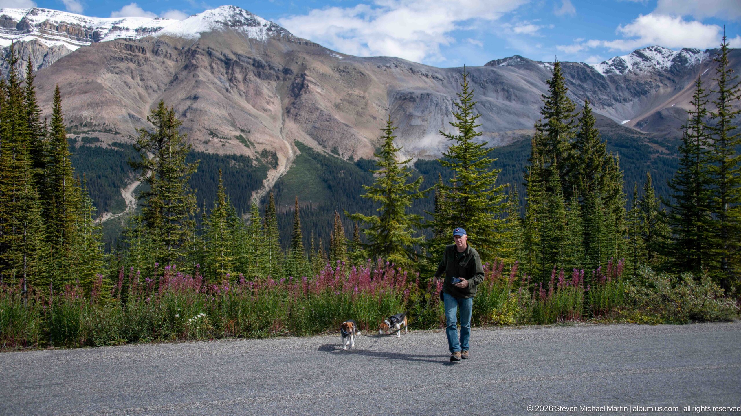
A visitor walks two small beagles across the paved approach, with tall fireweed and conifers forming a colorful band before the mountain wall beyond. The dogs move together on their leashes while the person faces the camera, turning a transit moment into a portrait of travel through the park. Snow remains visible on the highest background slopes.
Caption
A visitor walks two small beagles across the paved approach, with tall fireweed and conifers forming a colorful band before the mountain wall beyond. The dogs move together on their leashes while the person faces the camera, turning a transit moment into a portrait of travel through the park. Snow remains visible on the highest background slopes.
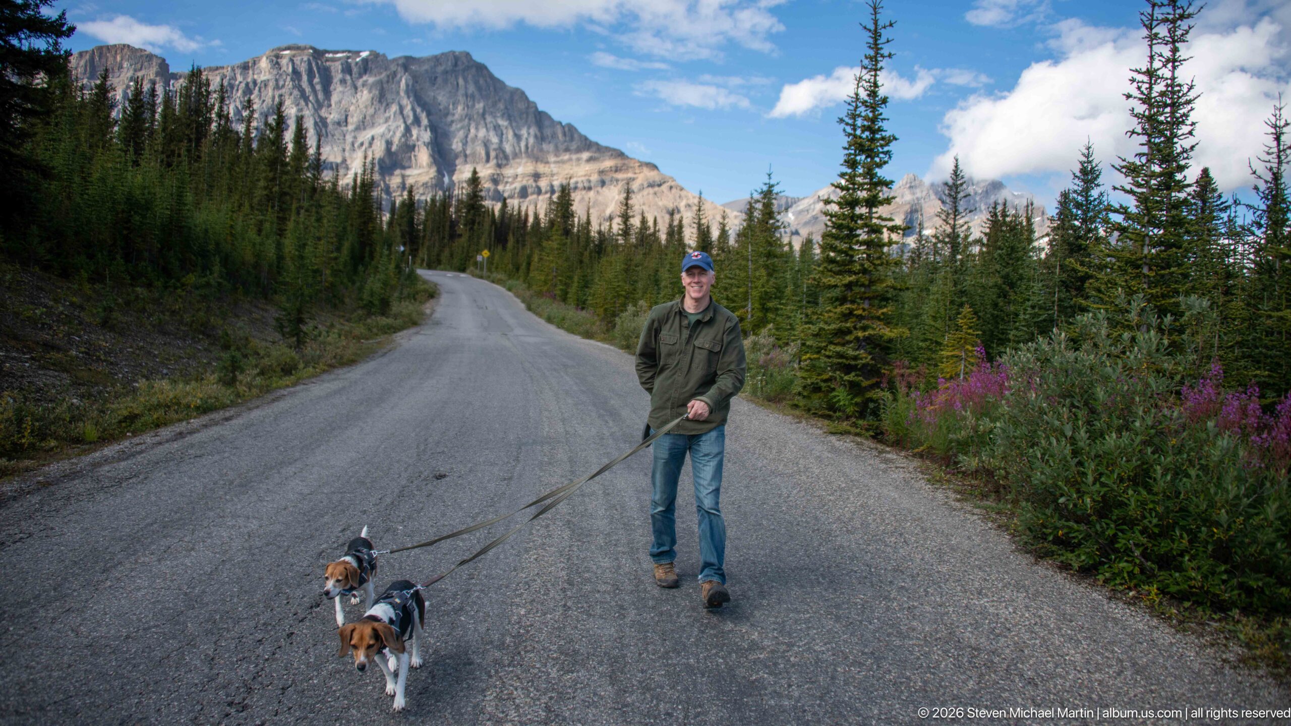
A visitor leads two beagles down a quiet paved road bordered by dense spruce and fir, with a sheer gray mountain rising ahead. Fireweed and low shrubs edge the right shoulder. The road’s gentle curve draws the eye into the forested approach, presenting the Peyto Lake visit as a movement through subalpine terrain rather than only a destination view.
Caption
A visitor leads two beagles down a quiet paved road bordered by dense spruce and fir, with a sheer gray mountain rising ahead. Fireweed and low shrubs edge the right shoulder. The road’s gentle curve draws the eye into the forested approach, presenting the Peyto Lake visit as a movement through subalpine terrain rather than only a destination view.
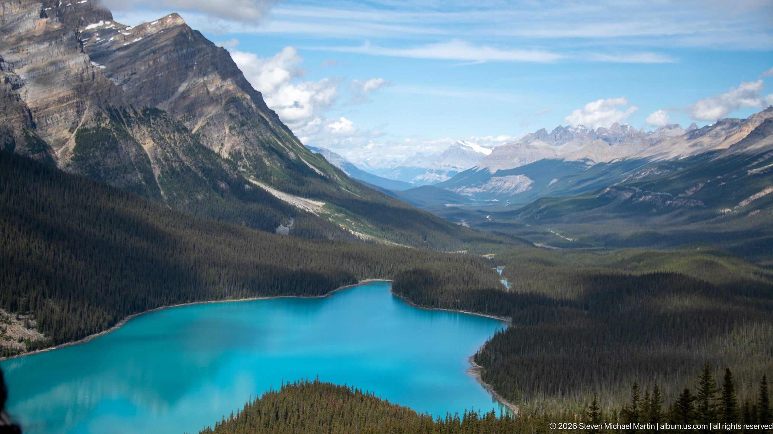
Peyto Lake fills the foreground with vivid turquoise glacial water while the valley extends northward between steep, forested mountain walls. From the high viewpoint near Bow Summit, the lake’s irregular shoreline gives way to a long corridor of conifer forest, river channels, and layered peaks, placing the famous lake within the much larger mountain watershed that surrounds it.
Caption
Peyto Lake fills the foreground with vivid turquoise glacial water while the valley extends northward between steep, forested mountain walls. From the high viewpoint near Bow Summit, the lake’s irregular shoreline gives way to a long corridor of conifer forest, river channels, and layered peaks, placing the famous lake within the much larger mountain watershed that surrounds it.
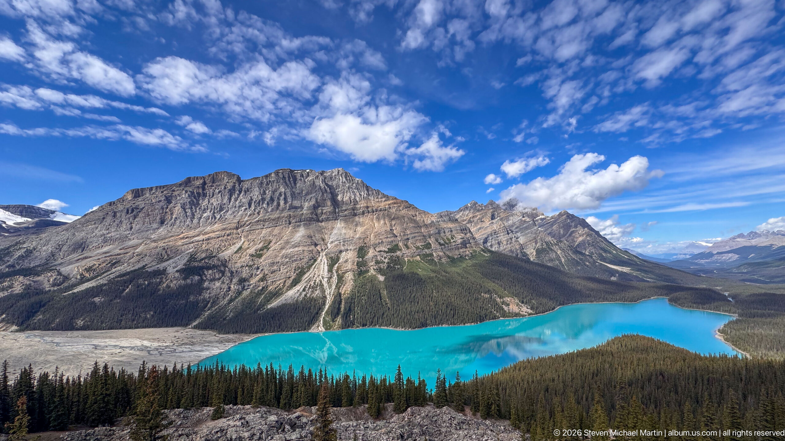
Under a broad blue sky streaked with textured white cloud, Peyto Lake glows turquoise at the base of a monumental gray mountain. The viewpoint includes rocky foreground terrain, a dark belt of conifers, and the lake’s long reach into the valley. Compared with tighter studies, the generous sky and surrounding landforms make this a more atmospheric survey of the Bow Summit landscape.
Caption
Under a broad blue sky streaked with textured white cloud, Peyto Lake glows turquoise at the base of a monumental gray mountain. The viewpoint includes rocky foreground terrain, a dark belt of conifers, and the lake’s long reach into the valley. Compared with tighter studies, the generous sky and surrounding landforms make this a more atmospheric survey of the Bow Summit landscape.
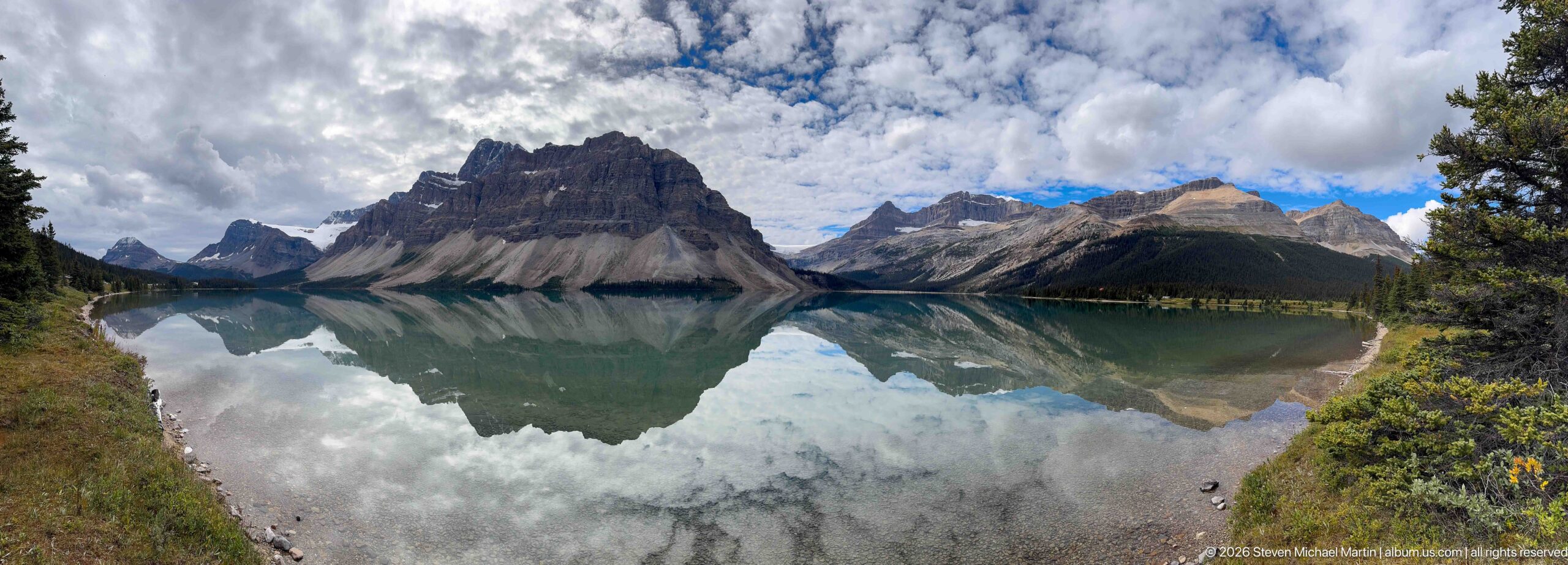
From a slightly elevated shoreline position, Bow Lake becomes a wide reflective basin enclosed by several sharply different mountain forms. A dark, steep-sided peak anchors the center while lighter ridges recede toward the right, all repeated in the water beneath broken clouds. Evergreen branches frame the scene and reinforce the sense of viewing the lake from within the surrounding forest.
Caption
From a slightly elevated shoreline position, Bow Lake becomes a wide reflective basin enclosed by several sharply different mountain forms. A dark, steep-sided peak anchors the center while lighter ridges recede toward the right, all repeated in the water beneath broken clouds. Evergreen branches frame the scene and reinforce the sense of viewing the lake from within the surrounding forest.
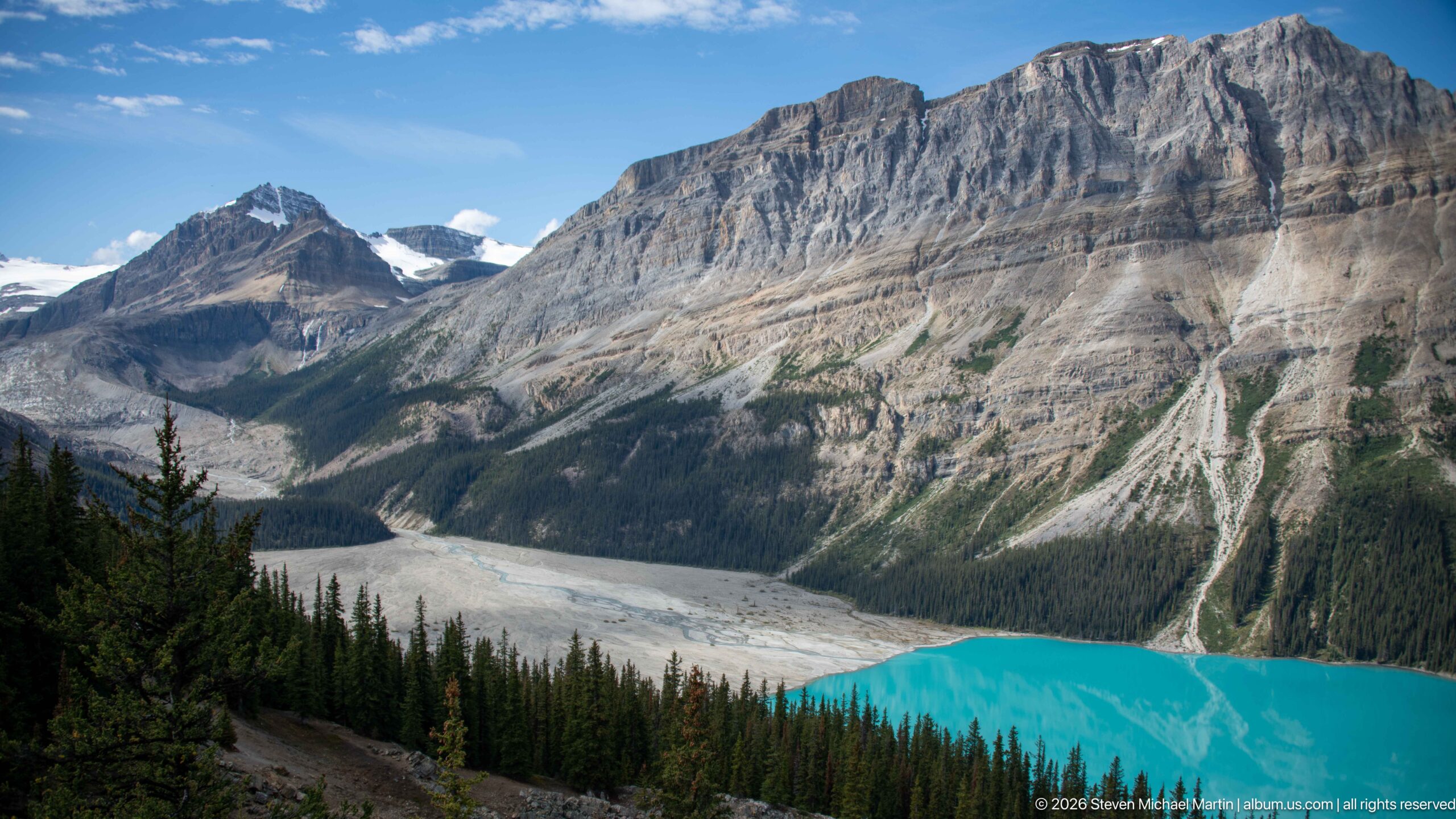
The turquoise edge of Peyto Lake lies beneath a massive layered limestone escarpment, while pale unvegetated terrain spreads along the upper end of the basin. A small body of snow or ice remains visible between the peaks in the distance. The oblique viewpoint brings together glacial water, debris-covered valley floor, forest, and exposed bedrock, showing several of the landscape elements that define the Peyto Lake basin.
Caption
The turquoise edge of Peyto Lake lies beneath a massive layered limestone escarpment, while pale unvegetated terrain spreads along the upper end of the basin. A small body of snow or ice remains visible between the peaks in the distance. The oblique viewpoint brings together glacial water, debris-covered valley floor, forest, and exposed bedrock, showing several of the landscape elements that define the Peyto Lake basin.
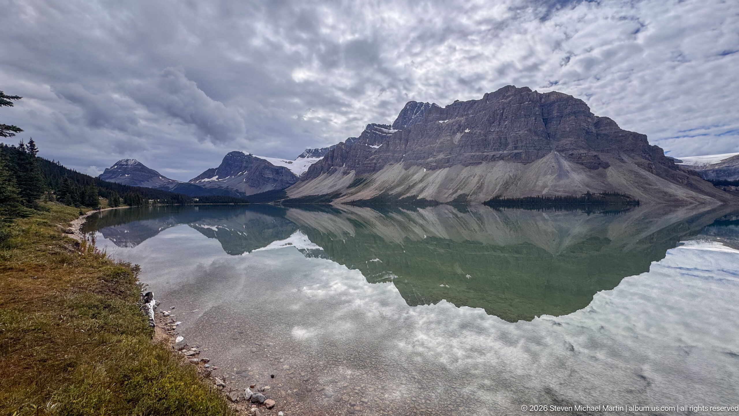
A steep, castellated mountain massif rises immediately beyond Bow Lake, its pale scree slopes and dark forest band doubled in the exceptionally still water. The curving gravel shoreline enters from the left, giving depth to a composition dominated by reflection and layered cloud. The view records the close relationship between exposed Rocky Mountain strata, conifer forest, and the glacially fed lake.
Caption
A steep, castellated mountain massif rises immediately beyond Bow Lake, its pale scree slopes and dark forest band doubled in the exceptionally still water. The curving gravel shoreline enters from the left, giving depth to a composition dominated by reflection and layered cloud. The view records the close relationship between exposed Rocky Mountain strata, conifer forest, and the glacially fed lake.
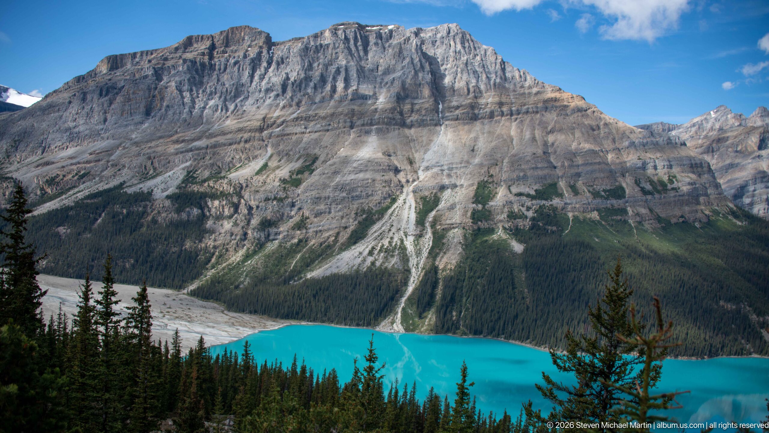
Peyto Lake forms a brilliant turquoise strip beneath a broad, flat-topped limestone escarpment. Repeated vertical gullies and pale debris fans interrupt the mountain’s horizontal strata before reaching the dense conifer forest along the shore. The near trees provide depth and scale, while the tightly framed composition concentrates on the physical relationship between exposed rock, eroded slopes, forest, and glacial water.
Caption
Peyto Lake forms a brilliant turquoise strip beneath a broad, flat-topped limestone escarpment. Repeated vertical gullies and pale debris fans interrupt the mountain’s horizontal strata before reaching the dense conifer forest along the shore. The near trees provide depth and scale, while the tightly framed composition concentrates on the physical relationship between exposed rock, eroded slopes, forest, and glacial water.
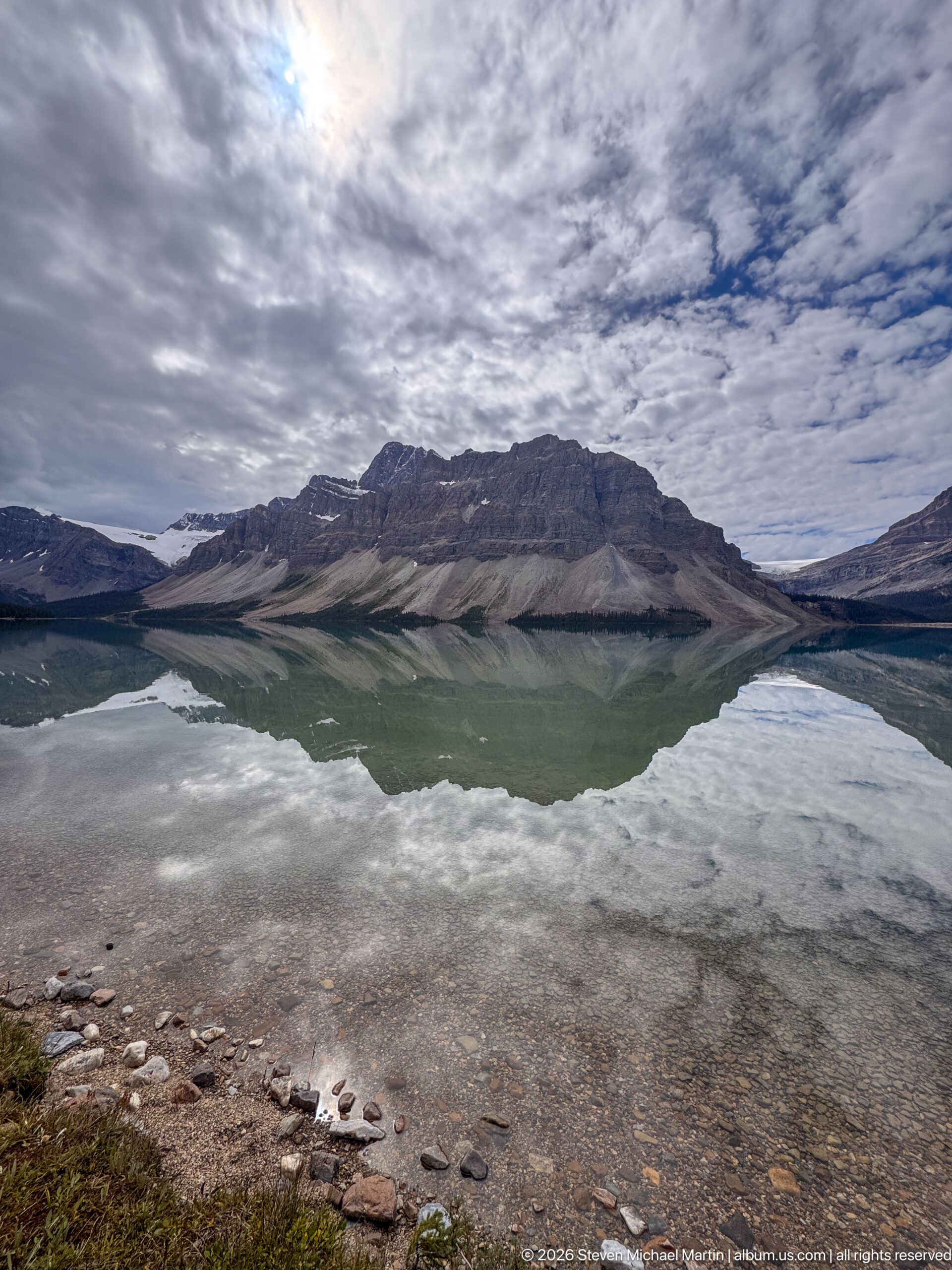
Still water along the shallow shore of Bow Lake mirrors a broad, layered mountain ridge beneath a textured ceiling of cloud. Pebbles remain visible through the clear foreground water, while the nearly symmetrical reflection emphasizes the lake’s calm surface. This low shoreline viewpoint places the viewer directly at water level and introduces the expansive alpine setting along the Icefields Parkway.
Caption
Still water along the shallow shore of Bow Lake mirrors a broad, layered mountain ridge beneath a textured ceiling of cloud. Pebbles remain visible through the clear foreground water, while the nearly symmetrical reflection emphasizes the lake’s calm surface. This low shoreline viewpoint places the viewer directly at water level and introduces the expansive alpine setting along the Icefields Parkway.
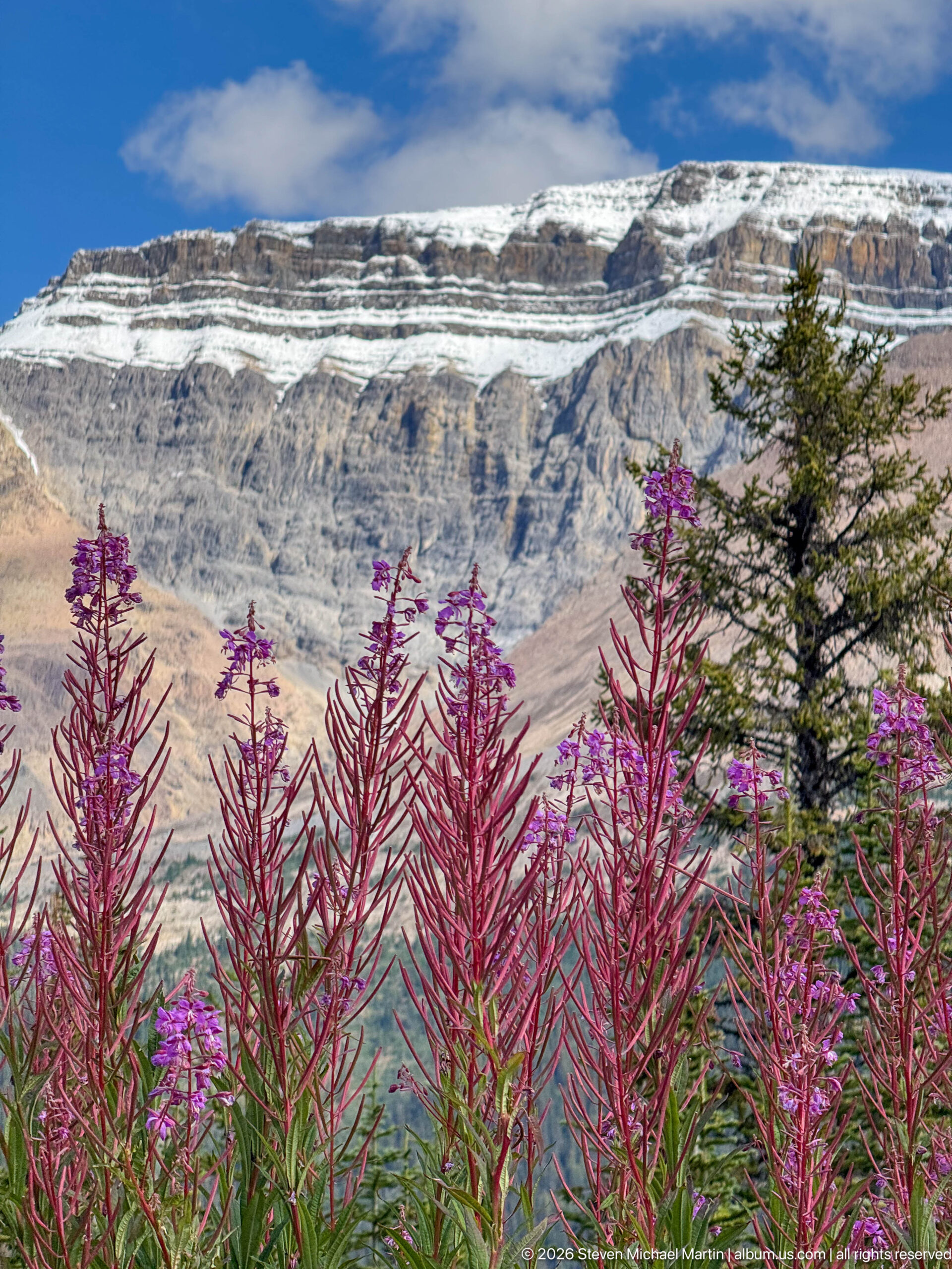
Dense spikes of fireweed fill the lower frame beneath a massive horizontally layered mountain with patches of lingering snow. The close foreground flowers create a strong seasonal counterpoint to the austere rock above, while a single conifer at right provides scale. This study emphasizes the short, vivid growing season of the Canadian Rockies at the Peyto Lake stop.
Caption
Dense spikes of fireweed fill the lower frame beneath a massive horizontally layered mountain with patches of lingering snow. The close foreground flowers create a strong seasonal counterpoint to the austere rock above, while a single conifer at right provides scale. This study emphasizes the short, vivid growing season of the Canadian Rockies at the Peyto Lake stop.
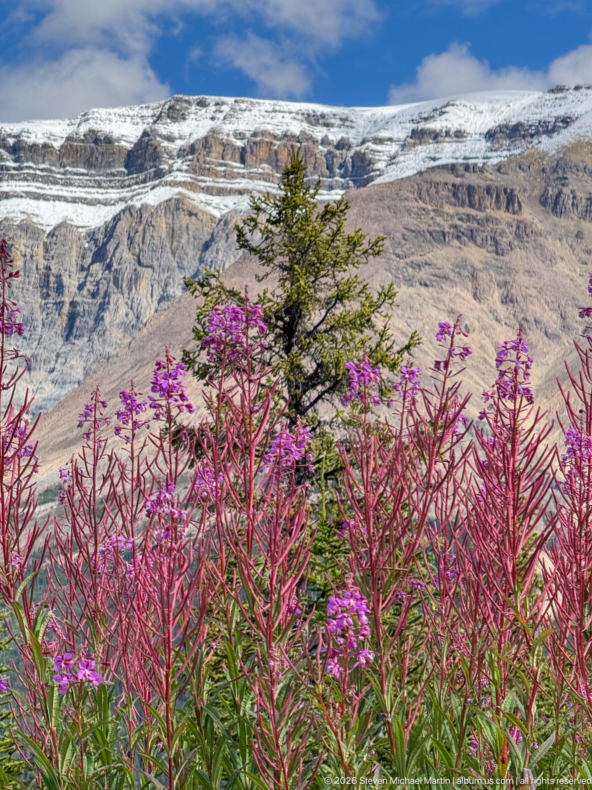
Fireweed in multiple stages of bloom rises across the foreground, from bright magenta flowers to reddish seed stalks, beneath a pale stratified mountain. A small evergreen breaks the horizontal sweep of the rock face. The view records both the seasonal progression of subalpine plants and the strongly layered geology characteristic of the surrounding Canadian Rockies.
Caption
Fireweed in multiple stages of bloom rises across the foreground, from bright magenta flowers to reddish seed stalks, beneath a pale stratified mountain. A small evergreen breaks the horizontal sweep of the rock face. The view records both the seasonal progression of subalpine plants and the strongly layered geology characteristic of the surrounding Canadian Rockies.
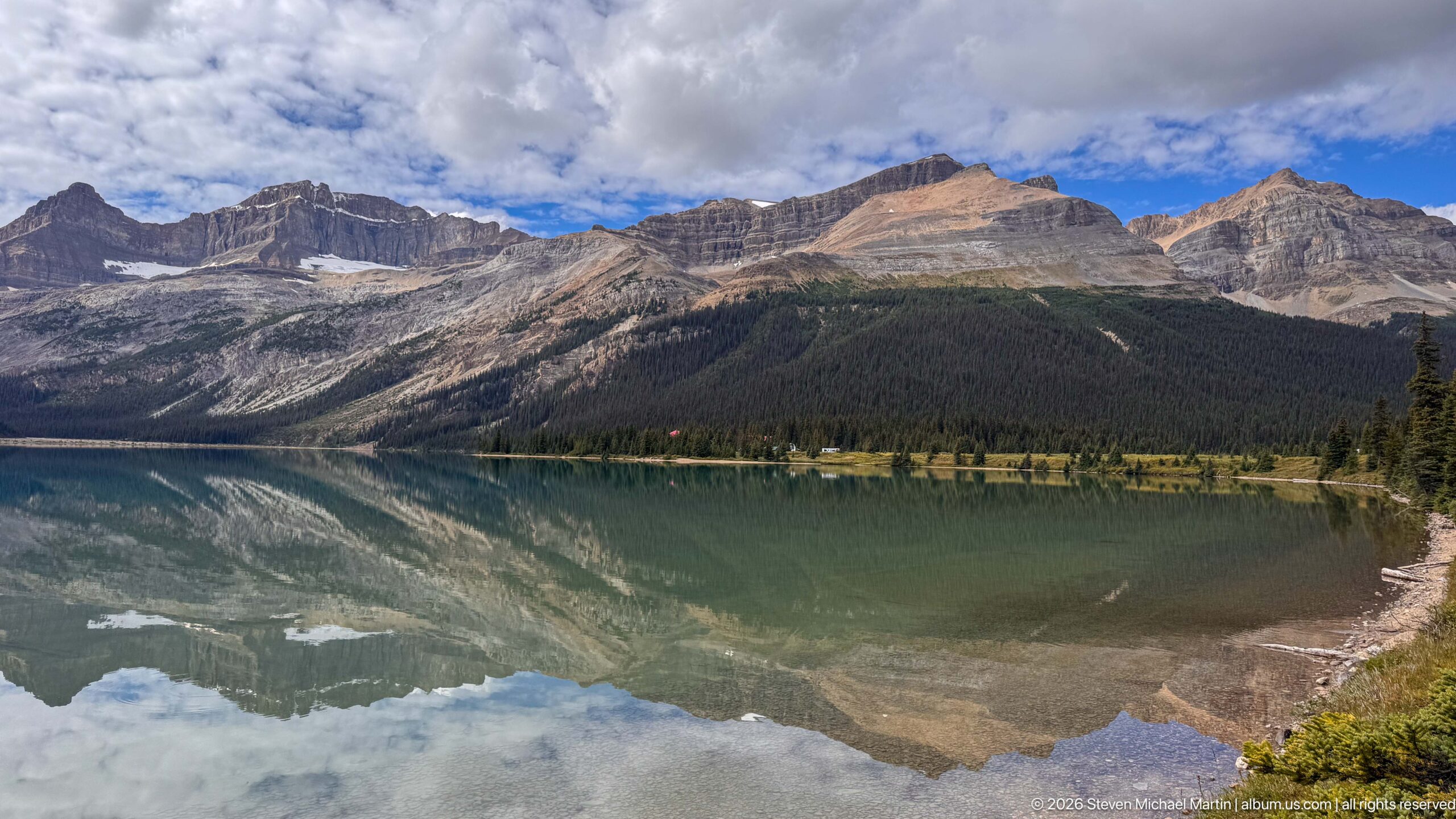
Bow Lake stretches across the foreground beneath a sequence of rugged peaks and sloping sedimentary ridges. The glassy water reflects the mountains and patches of blue sky, while a narrow strip of autumn-toned vegetation marks the opposite shore. Compared with the tighter mountain studies nearby, this view opens the composition to show the lake’s broader basin and surrounding forest.
Caption
Bow Lake stretches across the foreground beneath a sequence of rugged peaks and sloping sedimentary ridges. The glassy water reflects the mountains and patches of blue sky, while a narrow strip of autumn-toned vegetation marks the opposite shore. Compared with the tighter mountain studies nearby, this view opens the composition to show the lake’s broader basin and surrounding forest.
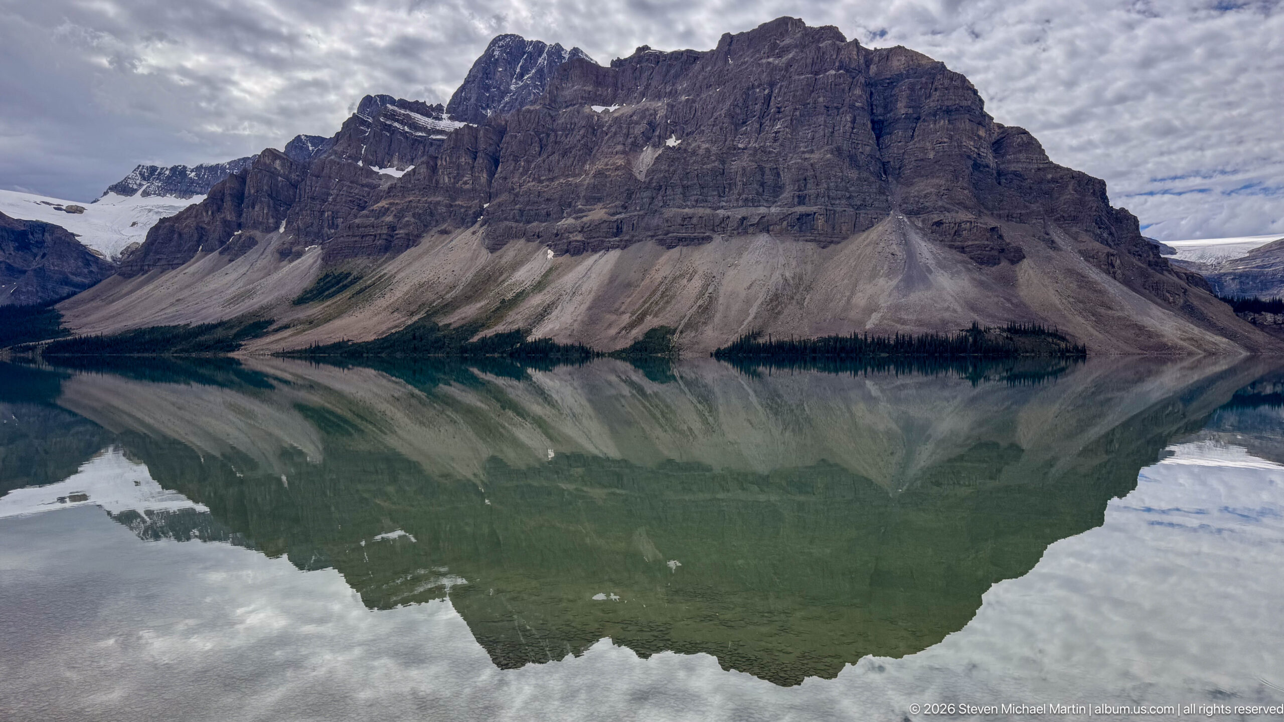
A massive wall of horizontally bedded rock fills the view above Bow Lake, descending through broad gray scree aprons to a dark belt of conifers. Its reflection nearly completes the mountain below the waterline, interrupted only by subtle ripples and cloud reflections. The close framing makes the exposed geology and steep transition from bare rock to forest the principal subjects.
Caption
A massive wall of horizontally bedded rock fills the view above Bow Lake, descending through broad gray scree aprons to a dark belt of conifers. Its reflection nearly completes the mountain below the waterline, interrupted only by subtle ripples and cloud reflections. The close framing makes the exposed geology and steep transition from bare rock to forest the principal subjects.
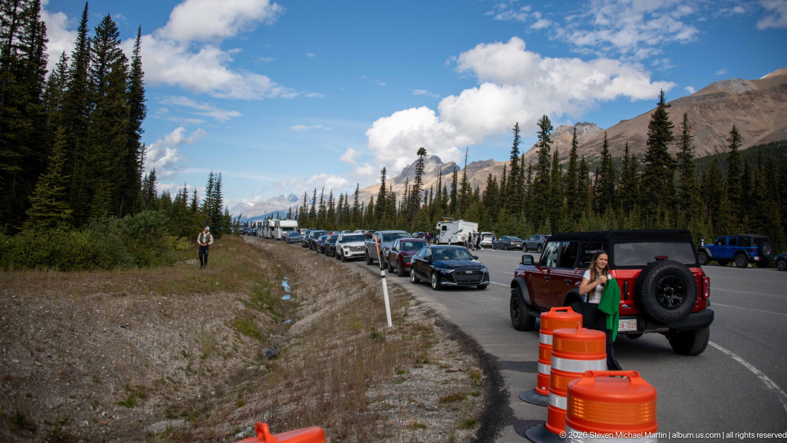
Vehicles line both sides of a mountain highway pullout as visitors walk along the shoulder beneath conifer forest and open alpine slopes. Orange traffic barrels in the foreground mark active roadside control, contrasting with the otherwise natural setting. The scene documents the heavily used access corridor linking the Bow Lake and Peyto Lake stops along the Icefields Parkway.
Caption
Vehicles line both sides of a mountain highway pullout as visitors walk along the shoulder beneath conifer forest and open alpine slopes. Orange traffic barrels in the foreground mark active roadside control, contrasting with the otherwise natural setting. The scene documents the heavily used access corridor linking the Bow Lake and Peyto Lake stops along the Icefields Parkway.
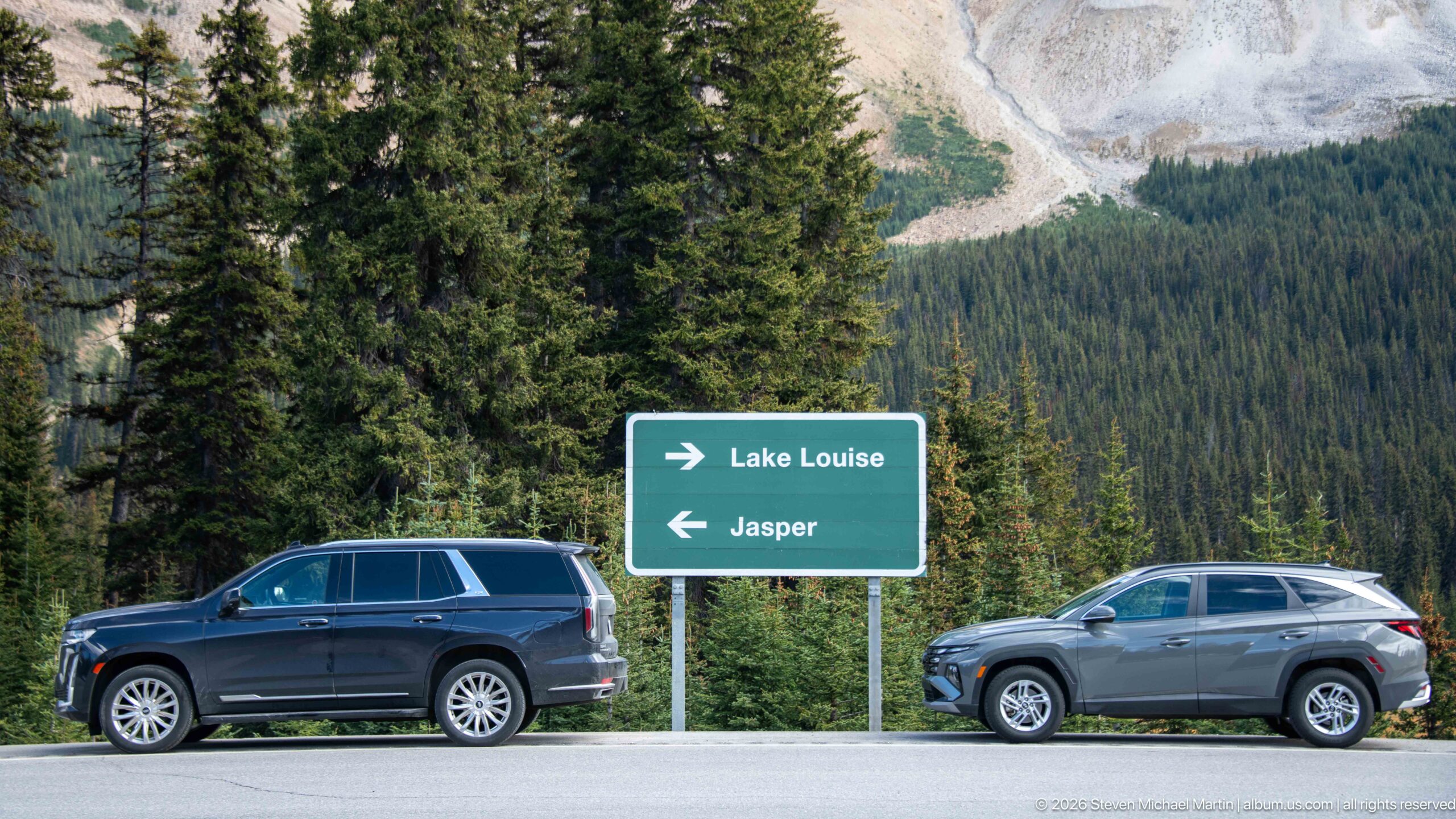
A green highway sign marks the route choices for Lake Louise and Jasper, with Lake Louise indicated to the right and Jasper to the left. Two vehicles pass in front of dense conifer forest and a pale mountain slope. The sign situates this sequence directly within the north–south travel corridor of Banff National Park and the Icefields Parkway.
Caption
A green highway sign marks the route choices for Lake Louise and Jasper, with Lake Louise indicated to the right and Jasper to the left. Two vehicles pass in front of dense conifer forest and a pale mountain slope. The sign situates this sequence directly within the north–south travel corridor of Banff National Park and the Icefields Parkway.
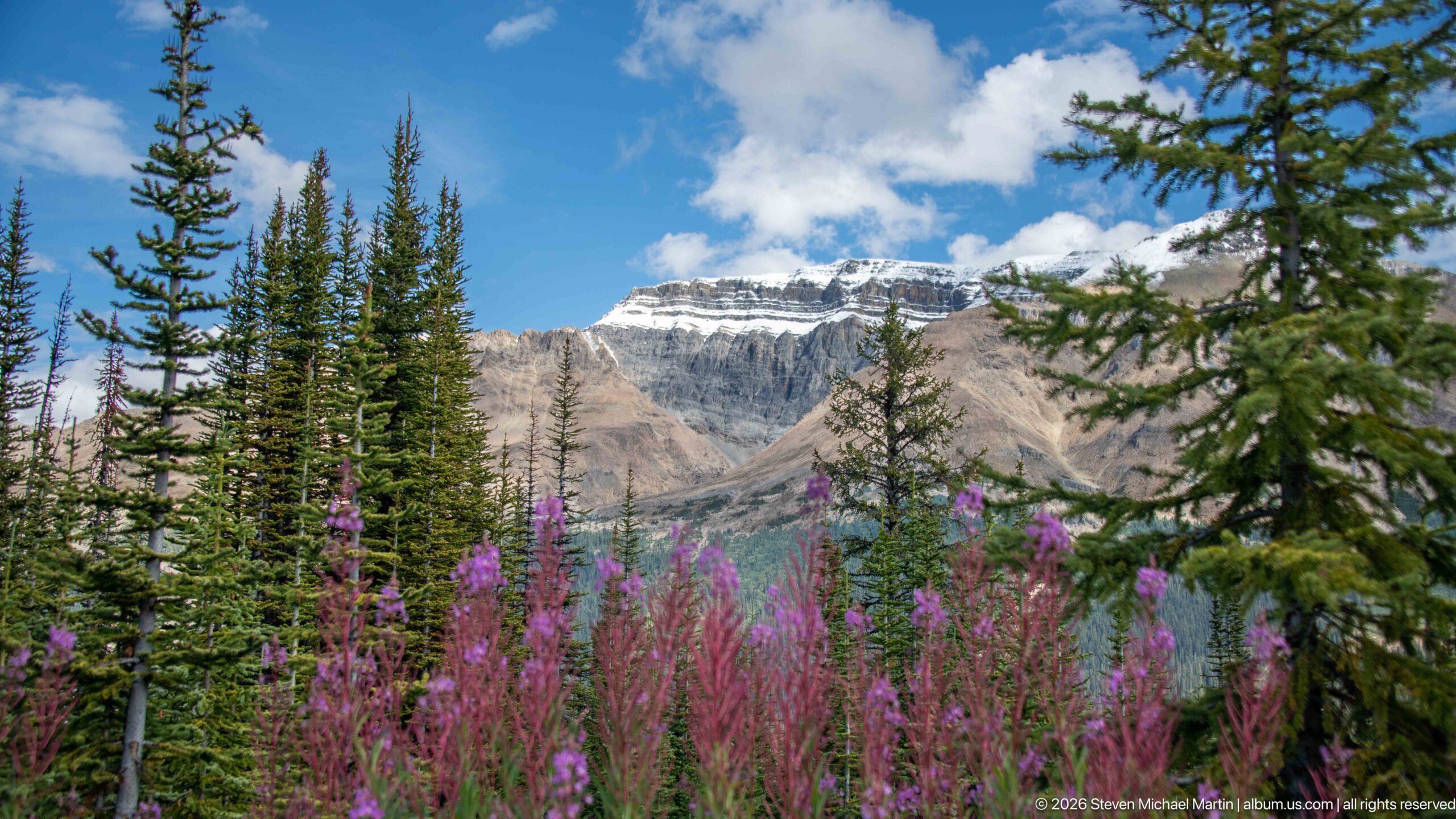
Tall magenta fireweed rises beside spruce and fir trees, with a pale, snow-streaked mountain forming the distant backdrop. The flowers supply a vivid foreground layer against the gray-brown rock and blue sky, recording late-summer vegetation along the high-elevation approach to Peyto Lake. The composition shifts attention from the major lake views to the smaller ecological details of the surrounding subalpine landscape.
Caption
Tall magenta fireweed rises beside spruce and fir trees, with a pale, snow-streaked mountain forming the distant backdrop. The flowers supply a vivid foreground layer against the gray-brown rock and blue sky, recording late-summer vegetation along the high-elevation approach to Peyto Lake. The composition shifts attention from the major lake views to the smaller ecological details of the surrounding subalpine landscape.
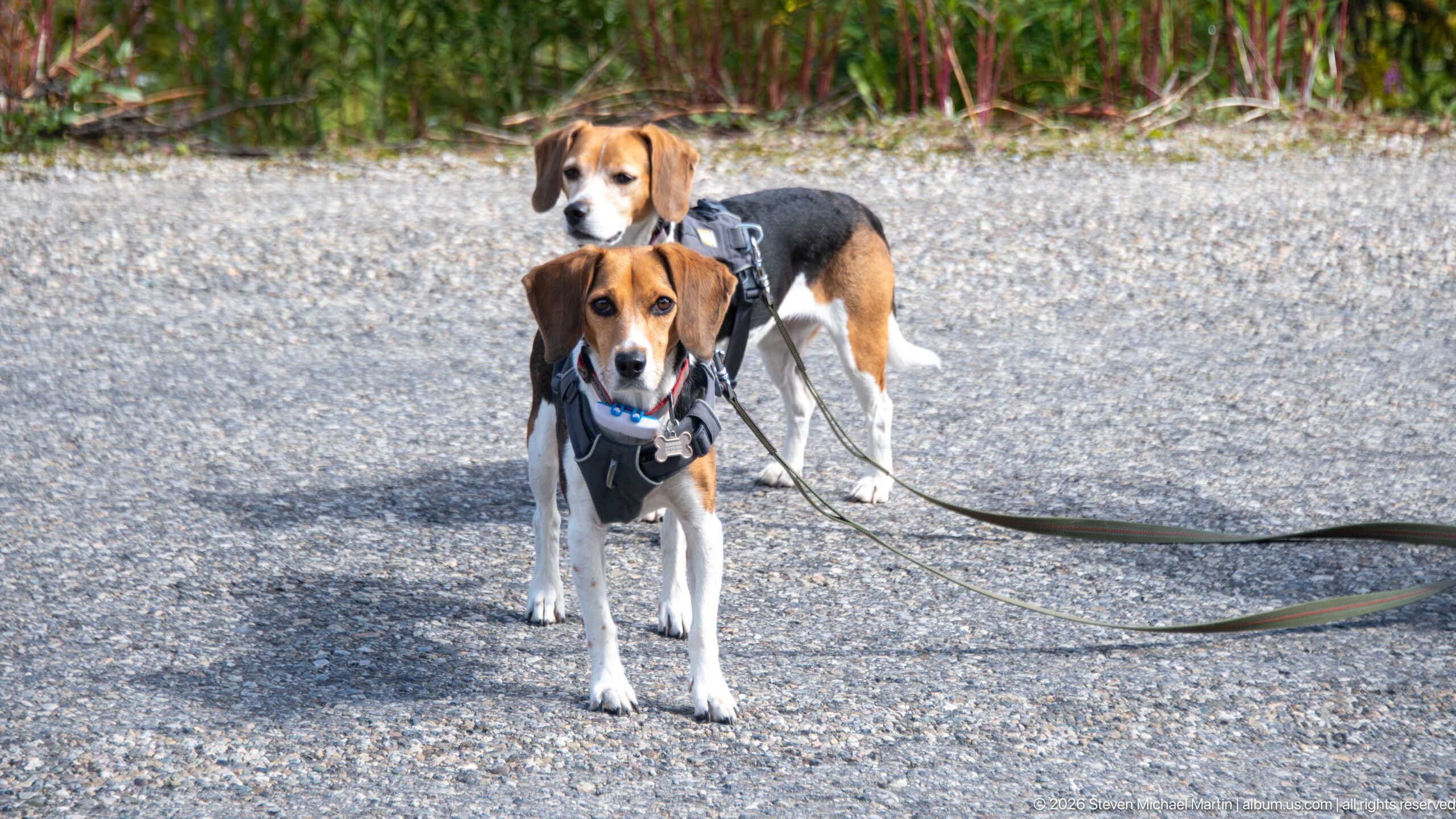
Two beagles stand alert on a paved surface, both wearing harnesses and attached to leashes that extend outside the frame. The nearer dog faces the camera while the second stands slightly behind, creating a compact portrait within the mountain outing. Fireweed and other vegetation soften the background without distracting from the dogs as the clear primary subjects.
Caption
Two beagles stand alert on a paved surface, both wearing harnesses and attached to leashes that extend outside the frame. The nearer dog faces the camera while the second stands slightly behind, creating a compact portrait within the mountain outing. Fireweed and other vegetation soften the background without distracting from the dogs as the clear primary subjects.
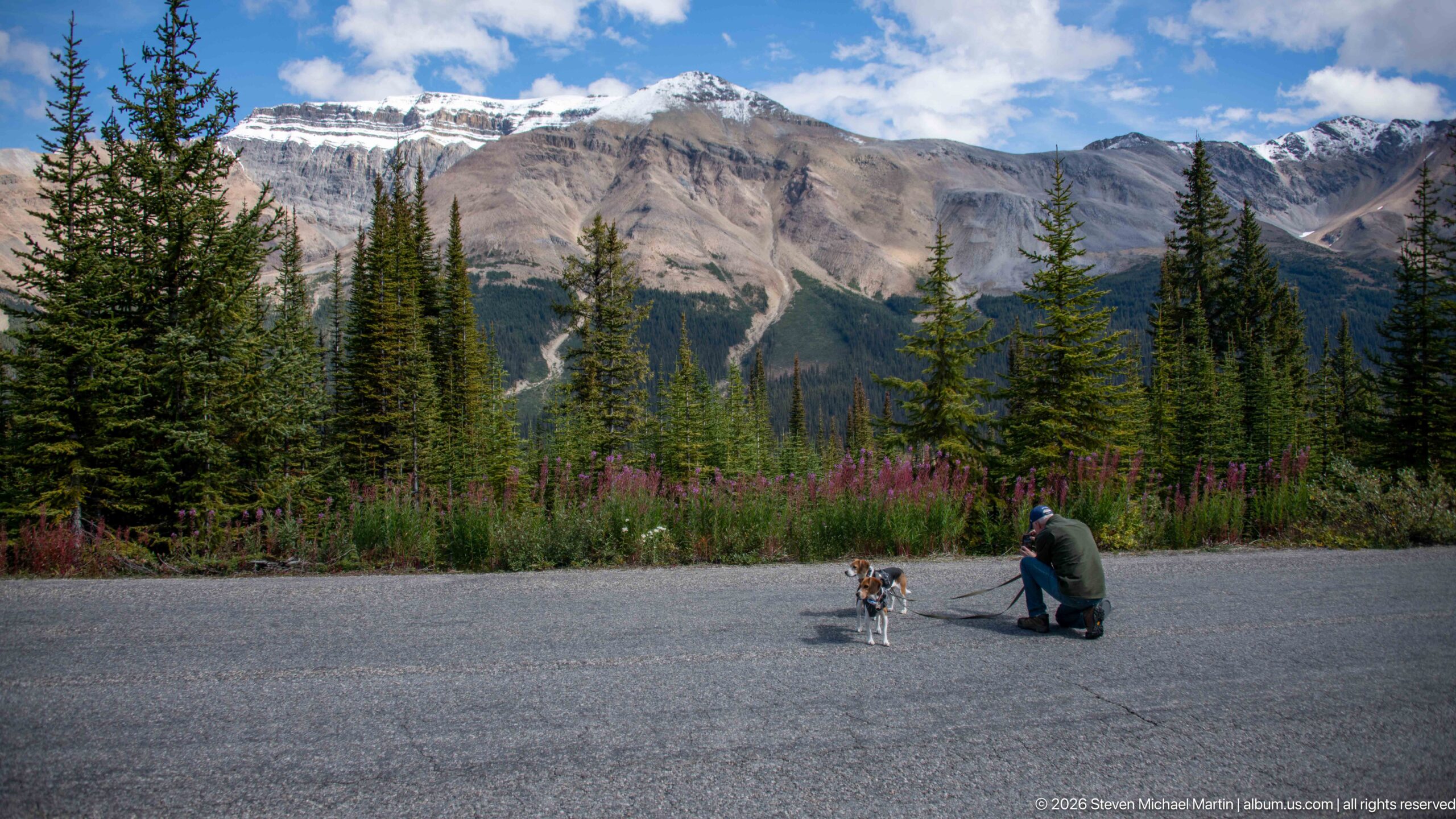
A visitor crouches to attend to a leashed beagle on a broad paved area bordered by fireweed and conifers. Behind them, a high wall of gray and tan mountains rises above dense forest, with small snow patches lingering near the upper slopes. The wide framing gives the people and dog a modest scale against the surrounding Rockies.
Caption
A visitor crouches to attend to a leashed beagle on a broad paved area bordered by fireweed and conifers. Behind them, a high wall of gray and tan mountains rises above dense forest, with small snow patches lingering near the upper slopes. The wide framing gives the people and dog a modest scale against the surrounding Rockies.
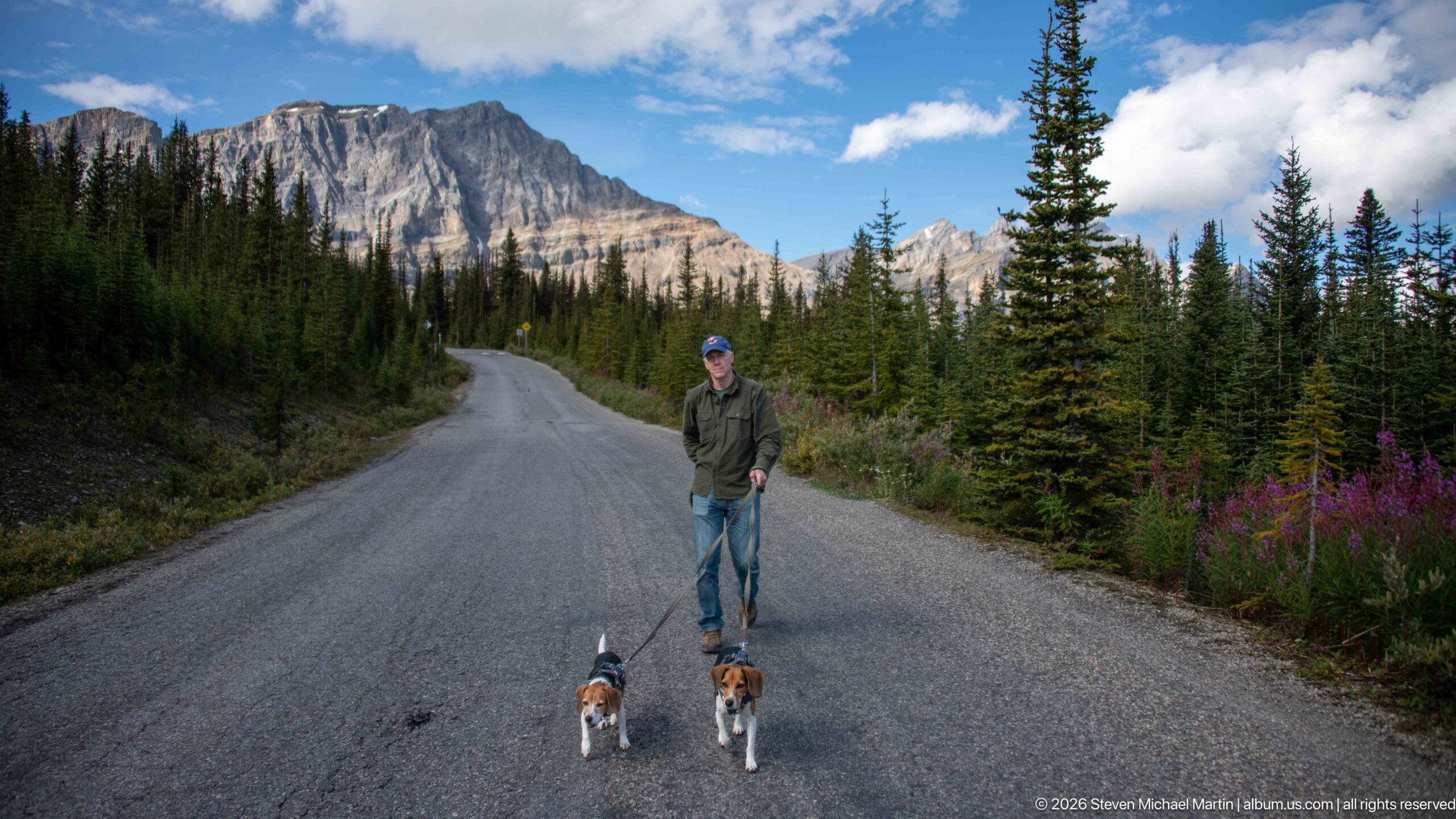
Centered in the roadway, a visitor pauses with two leashed beagles while the paved route bends uphill into conifer forest. A rugged limestone wall and distant peaks frame the opening beyond the trees, and fireweed adds a narrow band of color at the roadside. The symmetrical placement of the trio makes the human and canine travelers the focal point within the alpine setting.
Caption
Centered in the roadway, a visitor pauses with two leashed beagles while the paved route bends uphill into conifer forest. A rugged limestone wall and distant peaks frame the opening beyond the trees, and fireweed adds a narrow band of color at the roadside. The symmetrical placement of the trio makes the human and canine travelers the focal point within the alpine setting.
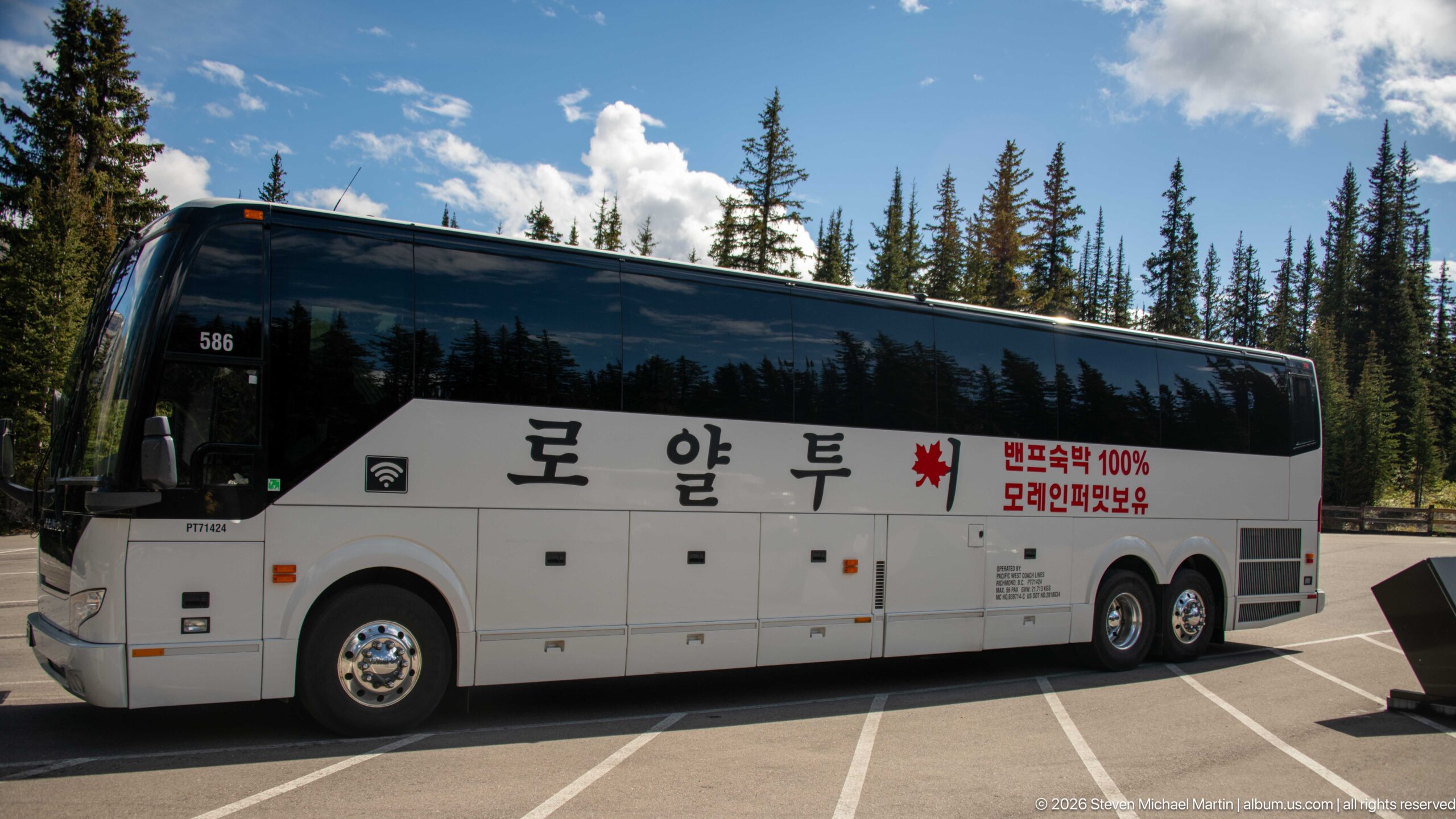
A large white motor coach occupies the parking area, its side marked with Korean lettering, a Canadian maple leaf, and additional Korean text. Conifers and mountain slopes rise behind the vehicle. The bus documents the international tour traffic drawn to the Peyto Lake viewpoint and provides a contrasting, human-made element within the otherwise alpine sequence.
Caption
A large white motor coach occupies the parking area, its side marked with Korean lettering, a Canadian maple leaf, and additional Korean text. Conifers and mountain slopes rise behind the vehicle. The bus documents the international tour traffic drawn to the Peyto Lake viewpoint and provides a contrasting, human-made element within the otherwise alpine sequence.
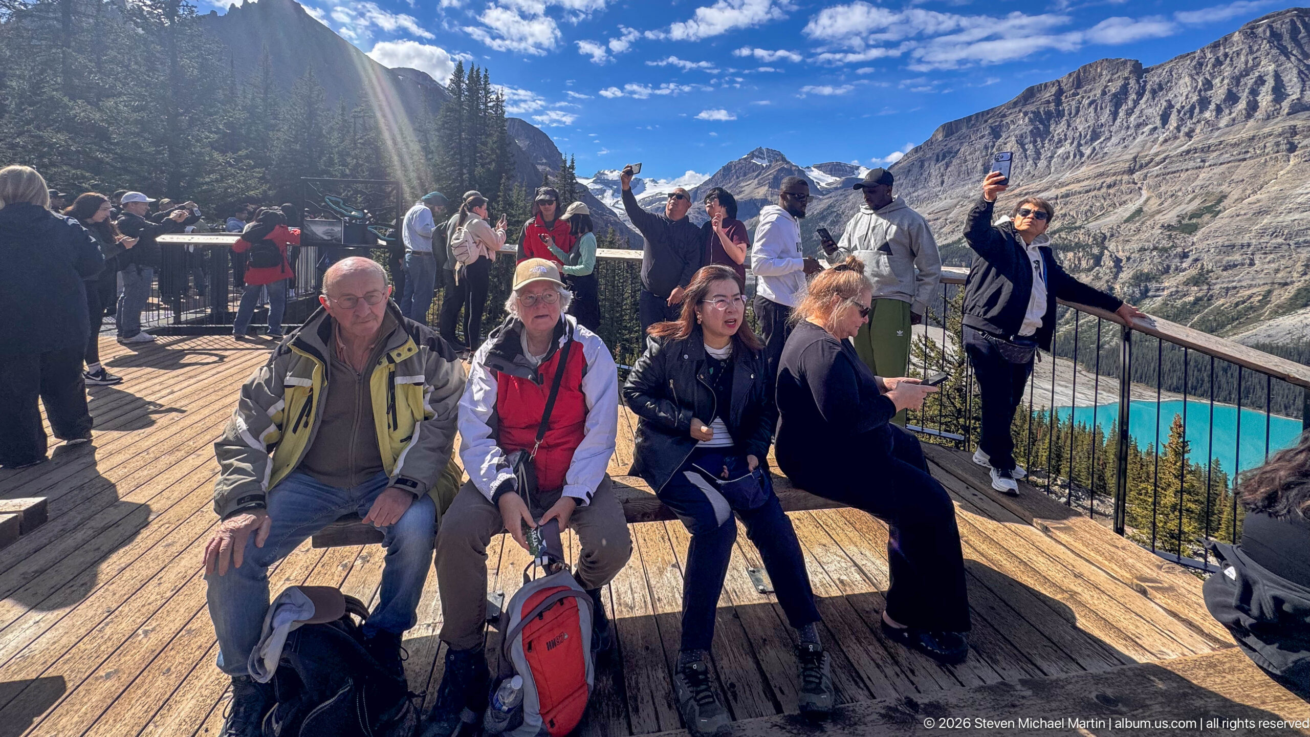
Visitors crowd the wooden viewing platform above the brilliant turquoise water of Peyto Lake, visible at the lower right beyond the railing. Some sit on benches while others stand along the overlook, backed by steep mountain walls and forest. The photograph records the social character of one of the Icefields Parkway’s major viewpoints as clearly as it does the landscape itself.
Caption
Visitors crowd the wooden viewing platform above the brilliant turquoise water of Peyto Lake, visible at the lower right beyond the railing. Some sit on benches while others stand along the overlook, backed by steep mountain walls and forest. The photograph records the social character of one of the Icefields Parkway’s major viewpoints as clearly as it does the landscape itself.
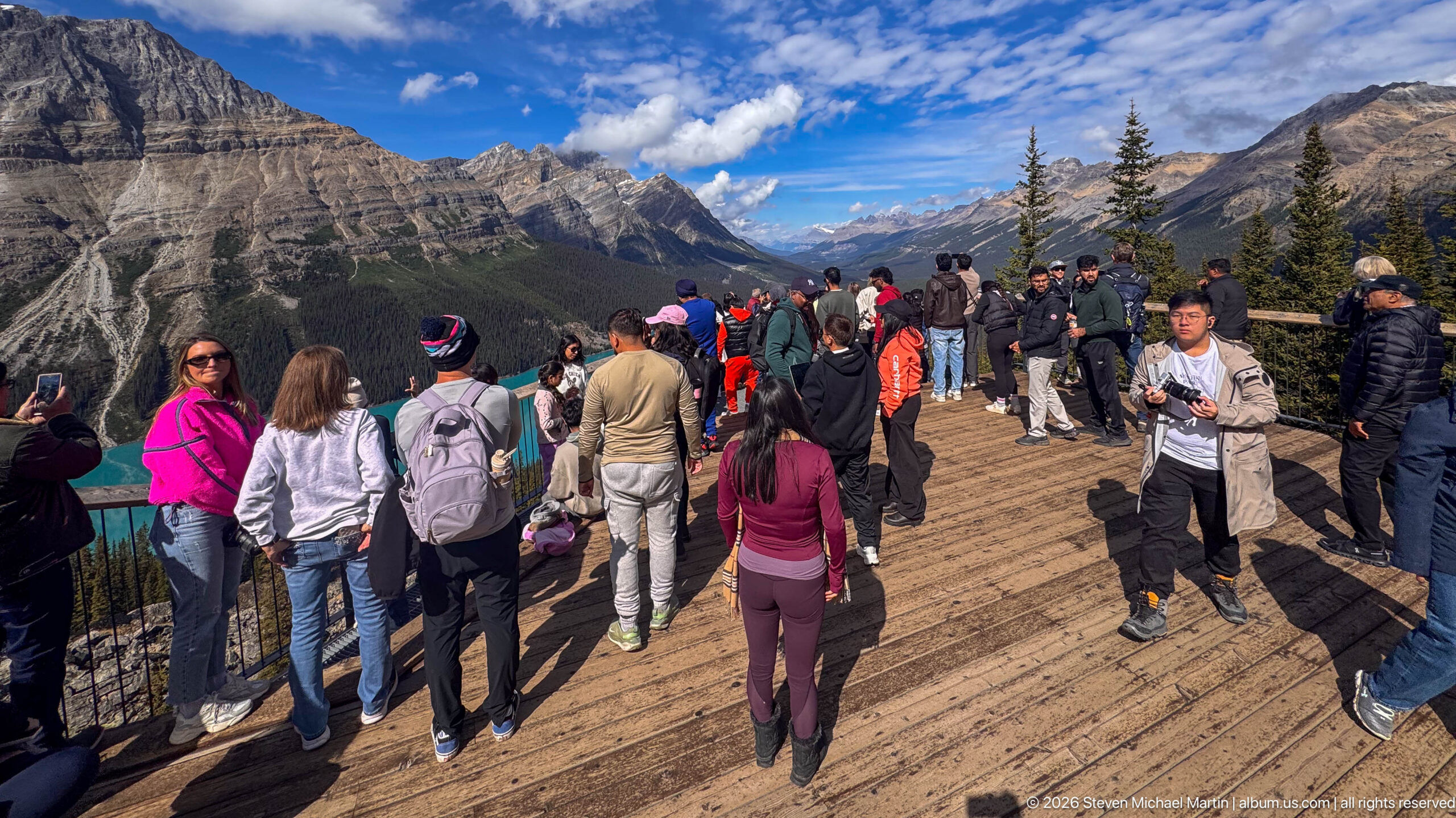
A dense crowd spreads across the timber viewing deck at Bow Summit, many visitors turning toward the lake just outside the left edge of the frame. Layered mountains and a forested valley extend beyond the railings under crisp blue sky. By looking across rather than outward from the overlook, the photograph emphasizes the scale and popularity of the viewpoint infrastructure.
Caption
A dense crowd spreads across the timber viewing deck at Bow Summit, many visitors turning toward the lake just outside the left edge of the frame. Layered mountains and a forested valley extend beyond the railings under crisp blue sky. By looking across rather than outward from the overlook, the photograph emphasizes the scale and popularity of the viewpoint infrastructure.
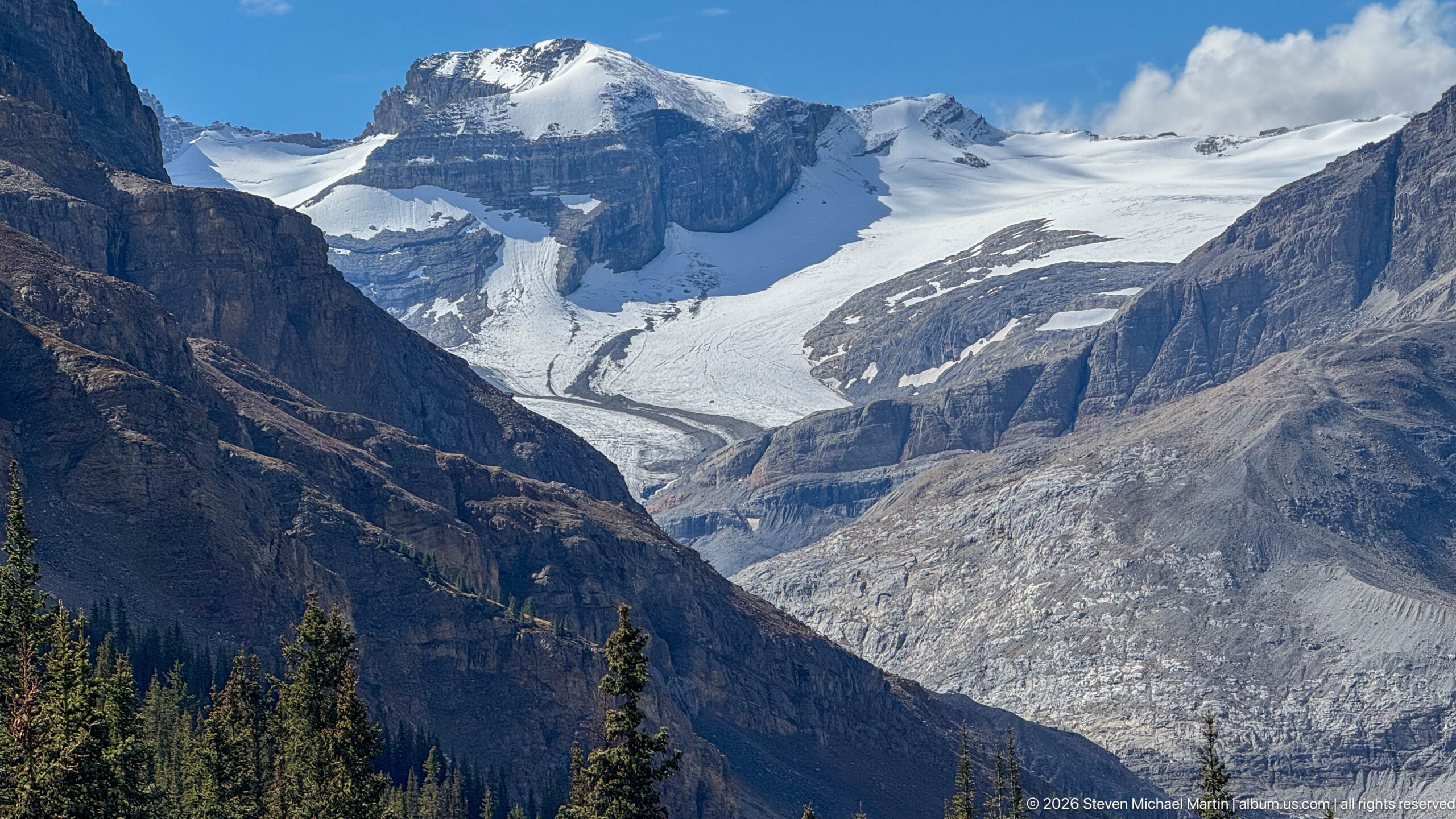
A broad glacier descends from a high snow-and-ice field between dark, steep rock walls, narrowing as it reaches the debris-covered lower valley. Crevassed white ice contrasts sharply with bare gray rock and scattered conifers in the foreground. Seen from the Peyto Lake overlook area, the view reveals the glacial source landscape that feeds the lake below.
Caption
A broad glacier descends from a high snow-and-ice field between dark, steep rock walls, narrowing as it reaches the debris-covered lower valley. Crevassed white ice contrasts sharply with bare gray rock and scattered conifers in the foreground. Seen from the Peyto Lake overlook area, the view reveals the glacial source landscape that feeds the lake below.
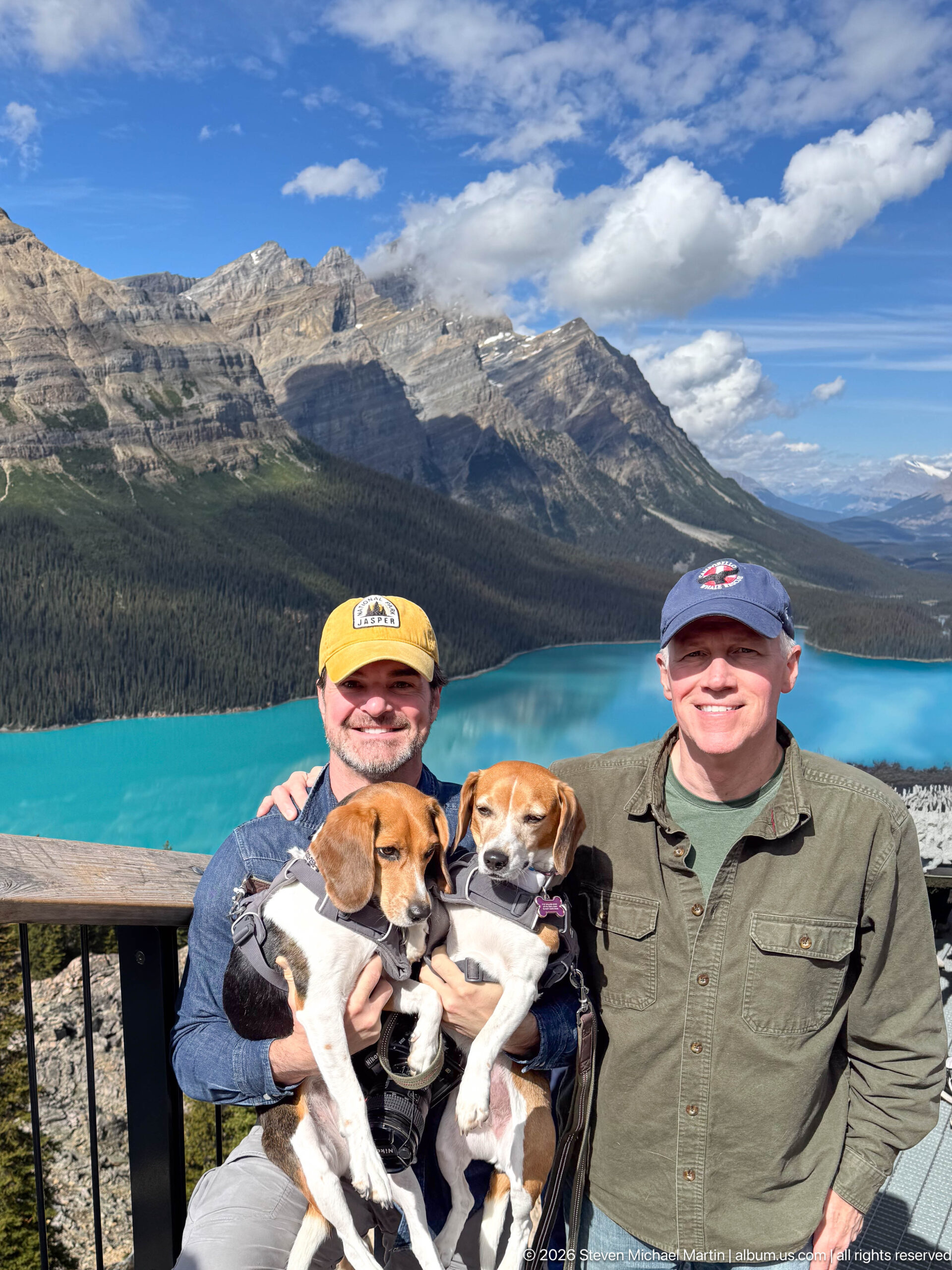
Two visitors pose with their beagles at the railing above Peyto Lake, the lake’s saturated turquoise water sweeping behind them beneath steep mountains and forest. The dogs are held securely in the foreground, turning the famous overlook into a personal travel portrait. The elevated viewpoint also reveals the long, narrow form of the lake as it recedes into the valley.
Caption
Two visitors pose with their beagles at the railing above Peyto Lake, the lake’s saturated turquoise water sweeping behind them beneath steep mountains and forest. The dogs are held securely in the foreground, turning the famous overlook into a personal travel portrait. The elevated viewpoint also reveals the long, narrow form of the lake as it recedes into the valley.
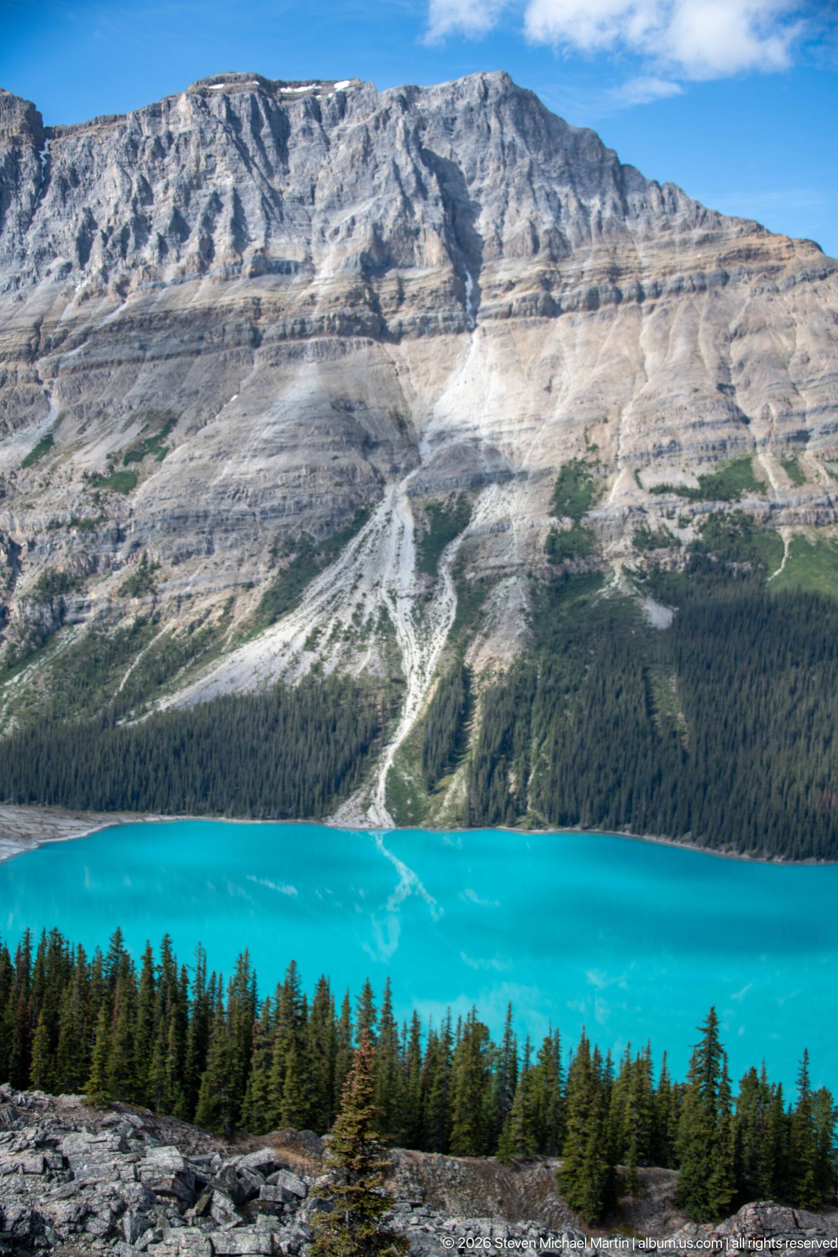
A close elevated view isolates the luminous turquoise water of Peyto Lake beneath a broad gray mountain slope cut by pale drainage and erosion lines. A dark strip of conifer forest separates water from rock, while a rocky foreground ledge anchors the lower frame. The compressed composition emphasizes color, texture, and the abrupt vertical layering of lake, forest, and mountain.
Caption
A close elevated view isolates the luminous turquoise water of Peyto Lake beneath a broad gray mountain slope cut by pale drainage and erosion lines. A dark strip of conifer forest separates water from rock, while a rocky foreground ledge anchors the lower frame. The compressed composition emphasizes color, texture, and the abrupt vertical layering of lake, forest, and mountain.
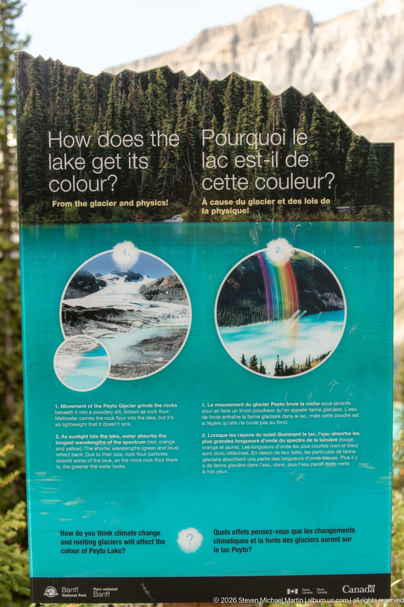
A Parks Canada interpretive panel asks how the lake gets its colour and explains the glacial processes behind the vivid water. Photographs and diagrams illustrate suspended glacial sediment and the optical effects that produce turquoise hues. Positioned at the Peyto Lake visitor area, the panel connects the striking appearance of the landscape with the movement and grinding action of ice on mountain rock.
Caption
A Parks Canada interpretive panel asks how the lake gets its colour and explains the glacial processes behind the vivid water. Photographs and diagrams illustrate suspended glacial sediment and the optical effects that produce turquoise hues. Positioned at the Peyto Lake visitor area, the panel connects the striking appearance of the landscape with the movement and grinding action of ice on mountain rock.
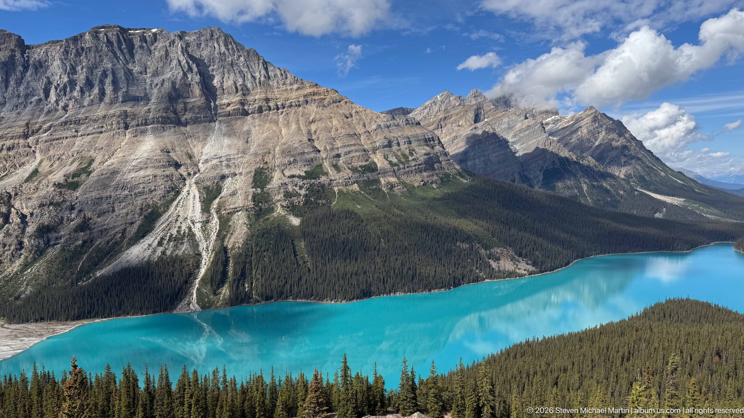
Peyto Lake curves through the forested valley in an intense band of turquoise beneath the steep, layered mountains on its western shore. Pale erosion channels descend across the rock and scree, while distant peaks close the valley toward the horizon. This elevated view shows the lake’s elongated form and the dramatic contrast between glacial water, dark forest, and exposed limestone.
Caption
Peyto Lake curves through the forested valley in an intense band of turquoise beneath the steep, layered mountains on its western shore. Pale erosion channels descend across the rock and scree, while distant peaks close the valley toward the horizon. This elevated view shows the lake’s elongated form and the dramatic contrast between glacial water, dark forest, and exposed limestone.
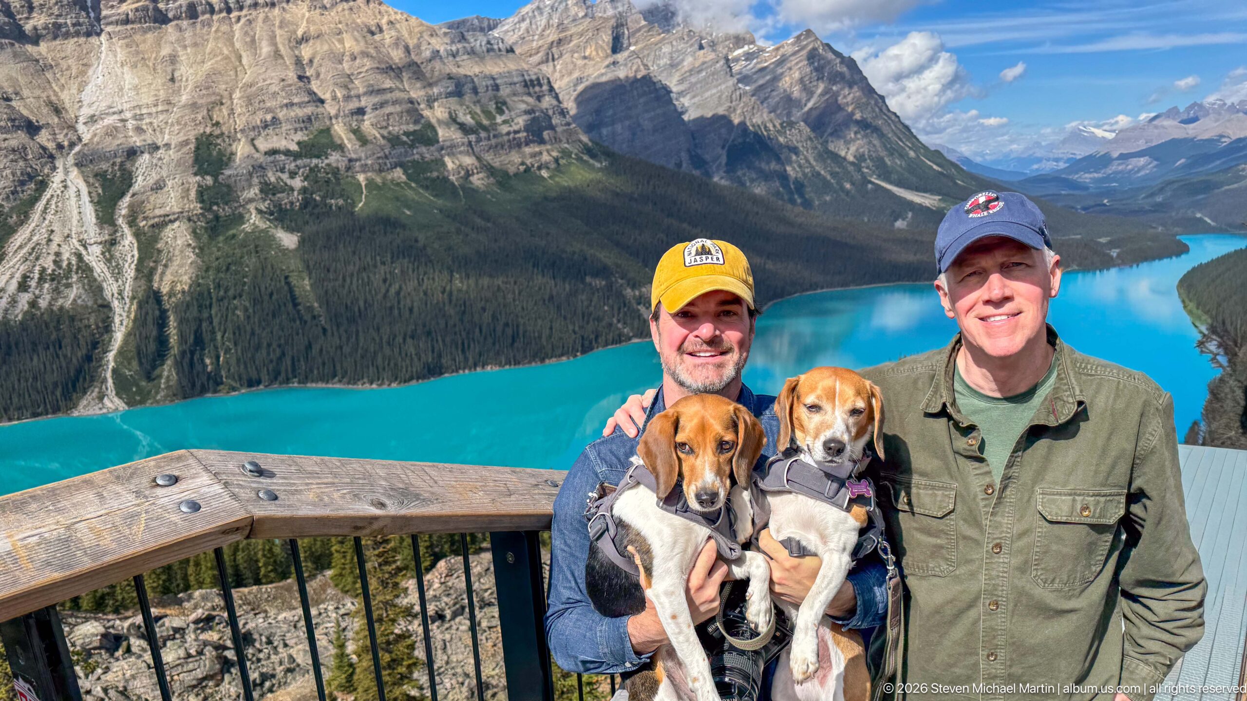
Two visitors stand shoulder to shoulder with their beagles at the wooden railing, framed by the vivid turquoise arc of Peyto Lake and the mountain wall beyond. The higher camera angle reveals more of the overlook structure and the lake’s shoreline below. The portrait combines the personal scale of the travelers with one of Banff National Park’s most recognizable glacial landscapes.
Caption
Two visitors stand shoulder to shoulder with their beagles at the wooden railing, framed by the vivid turquoise arc of Peyto Lake and the mountain wall beyond. The higher camera angle reveals more of the overlook structure and the lake’s shoreline below. The portrait combines the personal scale of the travelers with one of Banff National Park’s most recognizable glacial landscapes.
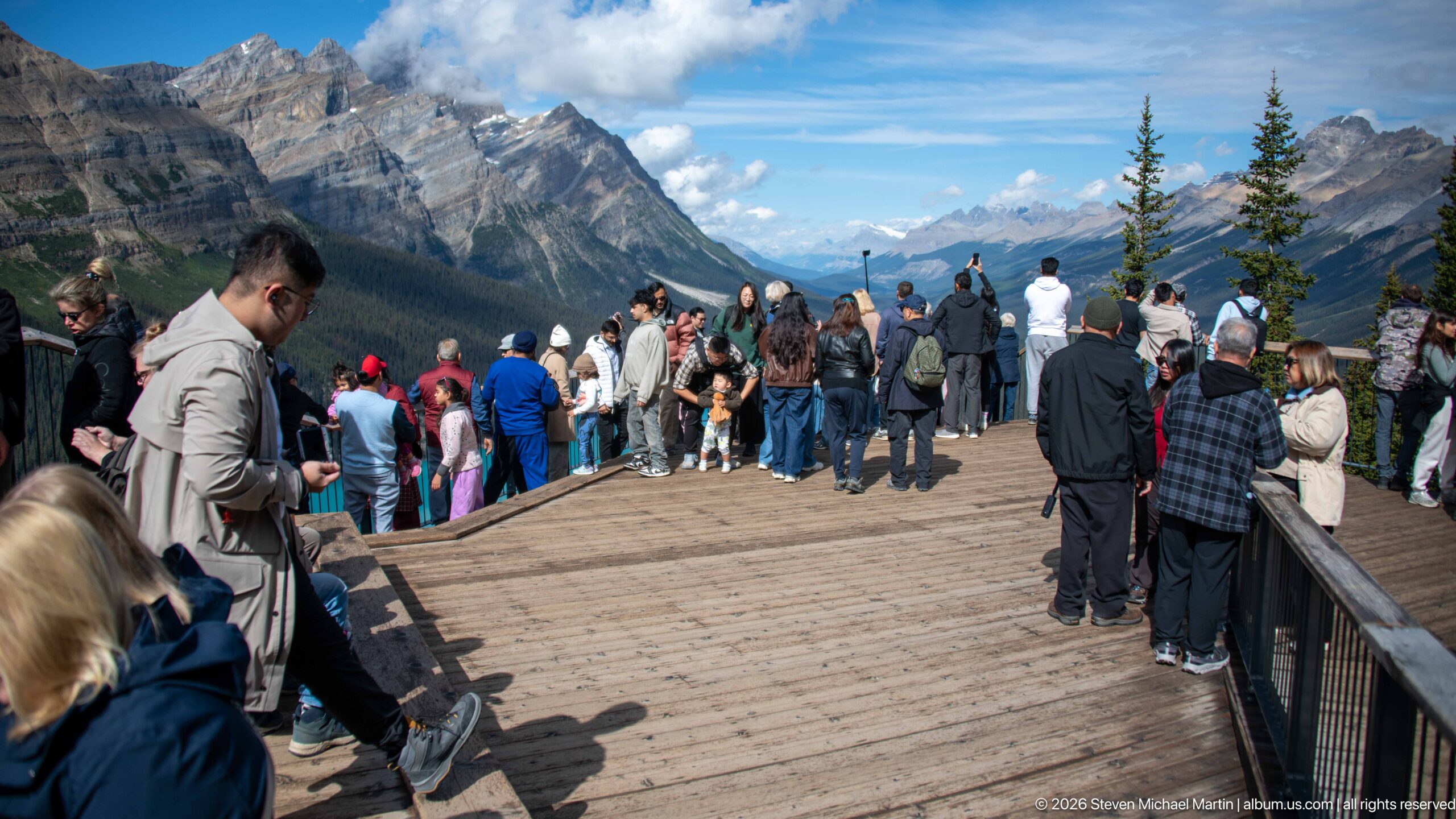
Visitors fill the wooden observation deck, clustering along the railings and steps as they look toward Peyto Lake and the surrounding mountains. The lake itself is mostly outside the frame, leaving the crowded platform and expansive alpine valley as the principal subjects. This reverse view documents the built overlook and the volume of visitors drawn to the Bow Summit panorama.
Caption
Visitors fill the wooden observation deck, clustering along the railings and steps as they look toward Peyto Lake and the surrounding mountains. The lake itself is mostly outside the frame, leaving the crowded platform and expansive alpine valley as the principal subjects. This reverse view documents the built overlook and the volume of visitors drawn to the Bow Summit panorama.
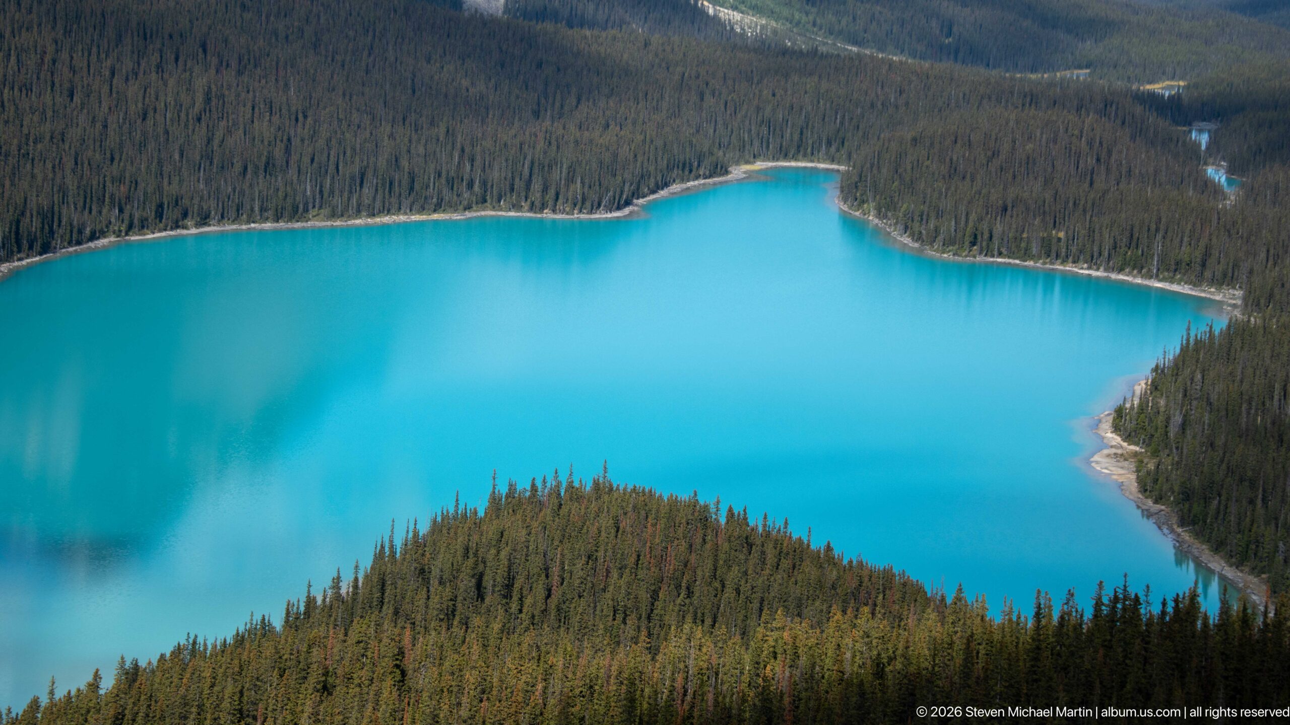
A telephoto-like view concentrates on the upper basin of Peyto Lake, where intensely turquoise water presses against an irregular shoreline of dense conifer forest. A wooded peninsula projects into the foreground, dividing the visible water into curving forms. With mountains excluded from the frame, the composition makes the lake’s glacial color and forest boundary the entire subject.
Caption
A telephoto-like view concentrates on the upper basin of Peyto Lake, where intensely turquoise water presses against an irregular shoreline of dense conifer forest. A wooded peninsula projects into the foreground, dividing the visible water into curving forms. With mountains excluded from the frame, the composition makes the lake’s glacial color and forest boundary the entire subject.
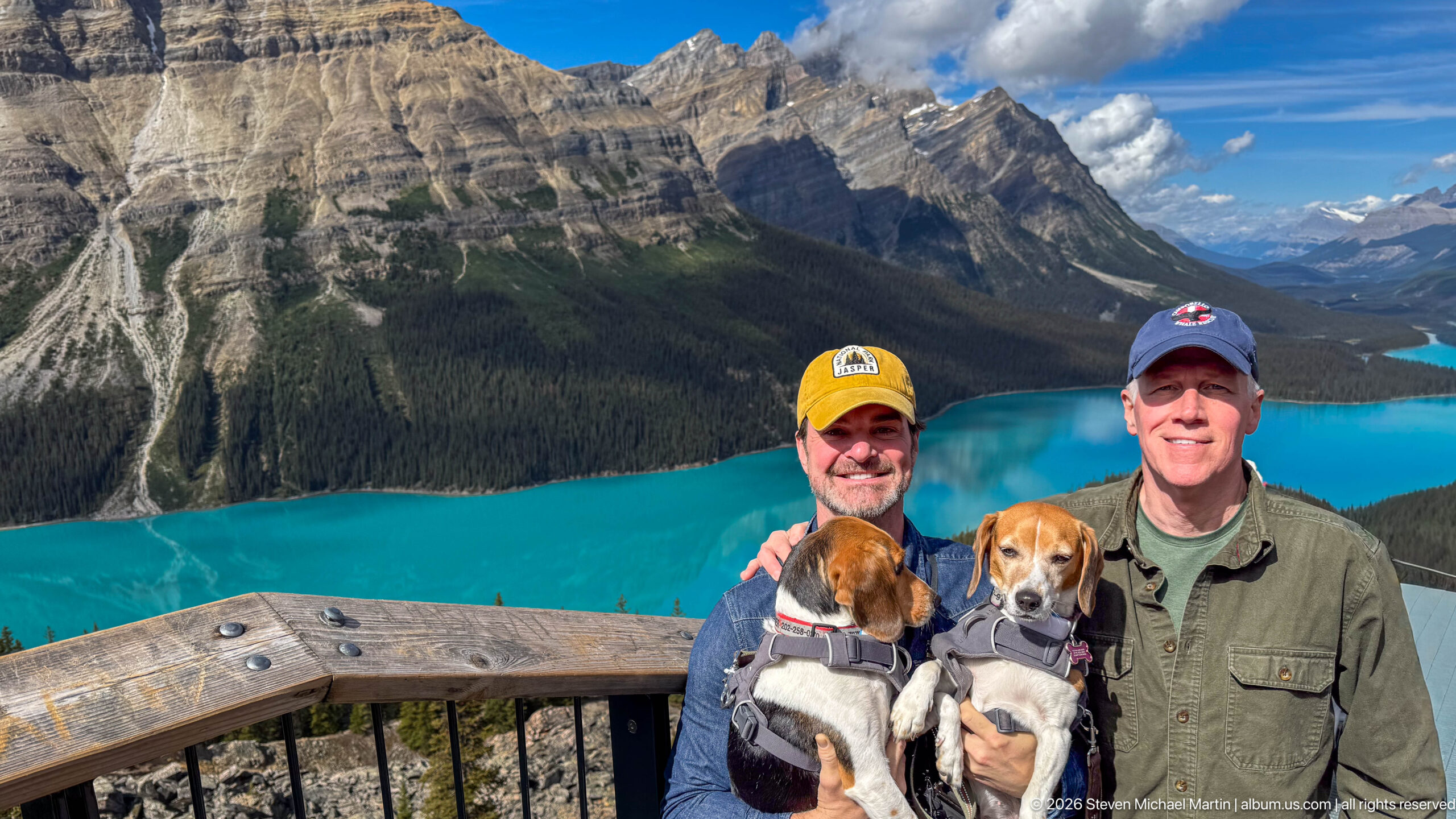
Two visitors pose closely with their beagles at the overlook, backed by Peyto Lake’s brilliant turquoise water and the massive layered mountain rising from its western shore. The wooden railing creates a strong foreground boundary while the lake narrows into the distant valley. The image balances an intimate group portrait with the monumental scale of the surrounding Canadian Rockies.
Caption
Two visitors pose closely with their beagles at the overlook, backed by Peyto Lake’s brilliant turquoise water and the massive layered mountain rising from its western shore. The wooden railing creates a strong foreground boundary while the lake narrows into the distant valley. The image balances an intimate group portrait with the monumental scale of the surrounding Canadian Rockies.
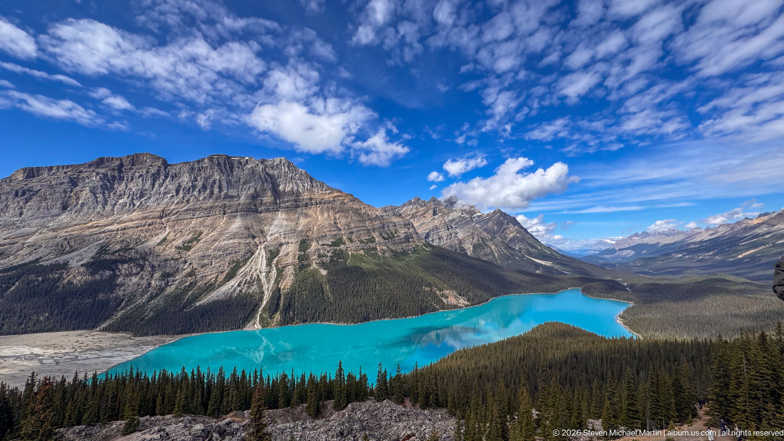
Peyto Lake occupies the center of a sweeping high-country panorama, its turquoise water curling through dark conifer forest beneath a massive, horizontally layered mountain. Gray glacial debris and rocky ground appear at left, while the valley opens toward distant peaks at right. The broad framing reveals how the lake sits within a much larger system of steep slopes, forest, and glacially shaped terrain.
Caption
Peyto Lake occupies the center of a sweeping high-country panorama, its turquoise water curling through dark conifer forest beneath a massive, horizontally layered mountain. Gray glacial debris and rocky ground appear at left, while the valley opens toward distant peaks at right. The broad framing reveals how the lake sits within a much larger system of steep slopes, forest, and glacially shaped terrain.
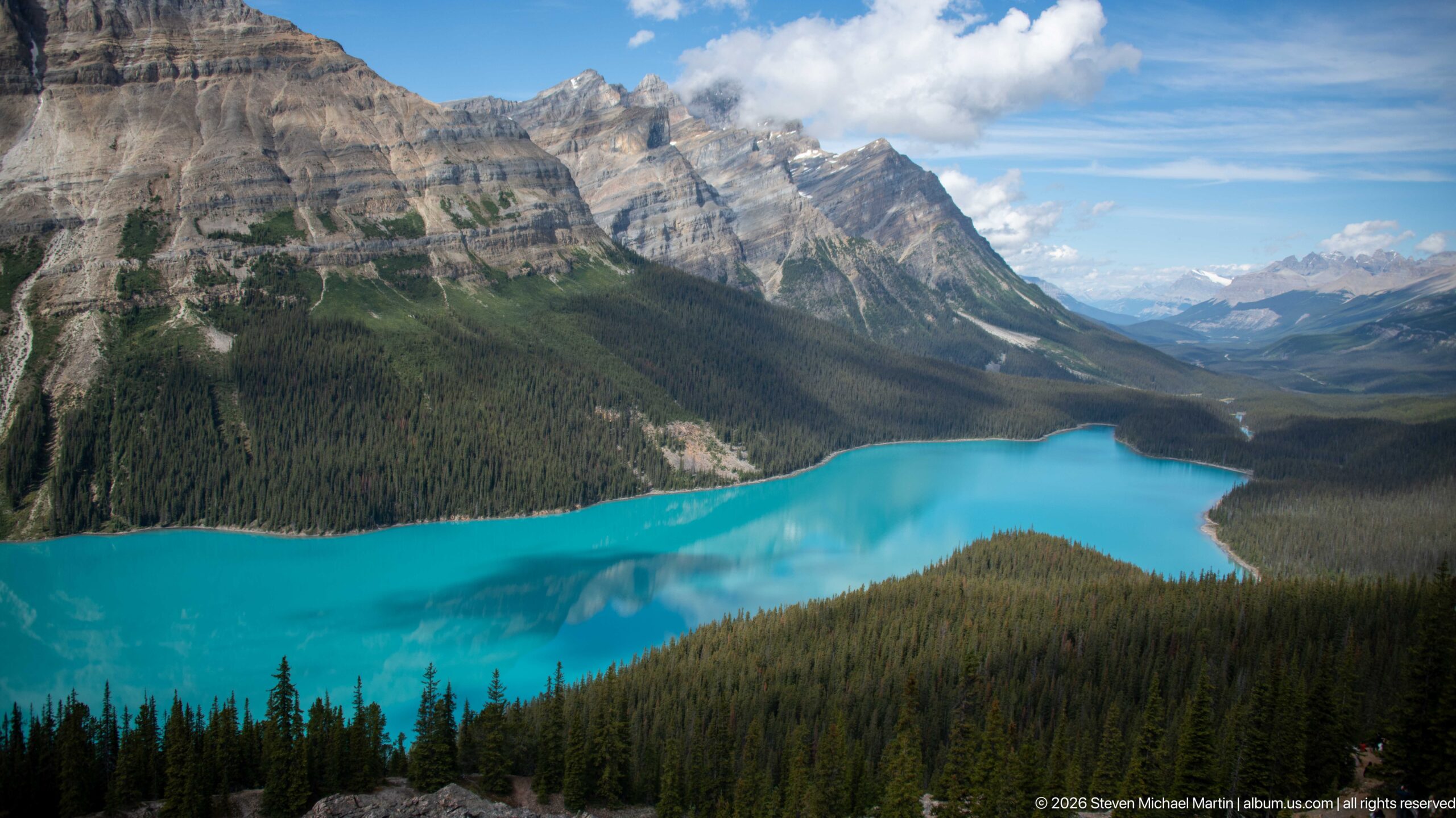
Peyto Lake sweeps across the lower frame in a vivid turquoise curve, bordered by dense forest and the steep, layered mountain wall to the west. The valley narrows toward a succession of distant peaks under scattered cloud. This balanced composition gives equal weight to the lake’s glacial color, the forested shoreline, and the immense sedimentary structure rising directly above it.
Caption
Peyto Lake sweeps across the lower frame in a vivid turquoise curve, bordered by dense forest and the steep, layered mountain wall to the west. The valley narrows toward a succession of distant peaks under scattered cloud. This balanced composition gives equal weight to the lake’s glacial color, the forested shoreline, and the immense sedimentary structure rising directly above it.
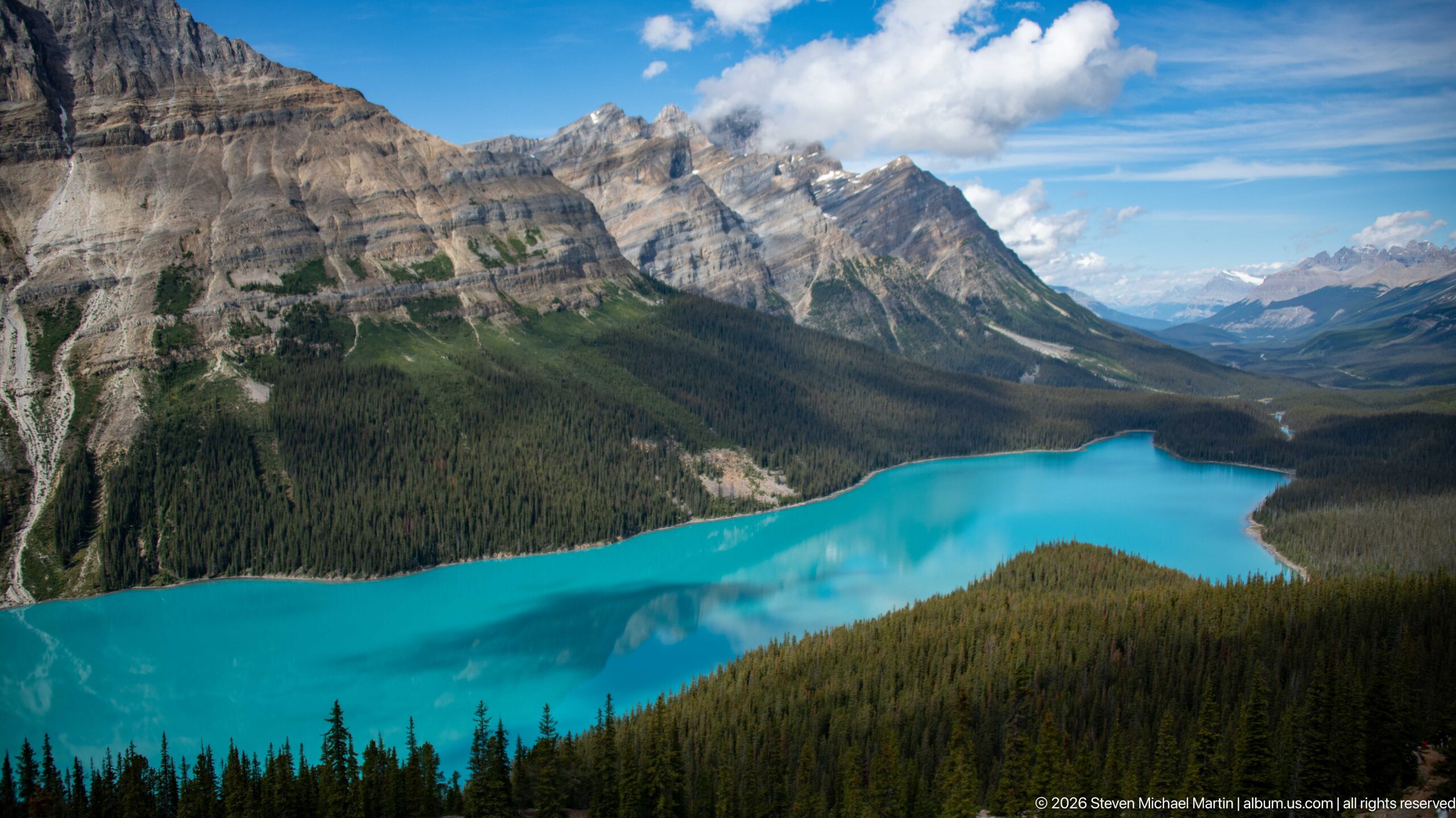
A broad sweep of Peyto Lake curves beneath massive, horizontally banded limestone peaks, its saturated turquoise surface reflecting patches of cloud and sky. Dense conifer forest covers the lower slopes and shoreline, creating a dark frame around the glacial water. The elevated perspective emphasizes both the lake’s elongated form and the abrupt scale of the mountains rising immediately above it.
Caption
A broad sweep of Peyto Lake curves beneath massive, horizontally banded limestone peaks, its saturated turquoise surface reflecting patches of cloud and sky. Dense conifer forest covers the lower slopes and shoreline, creating a dark frame around the glacial water. The elevated perspective emphasizes both the lake’s elongated form and the abrupt scale of the mountains rising immediately above it.
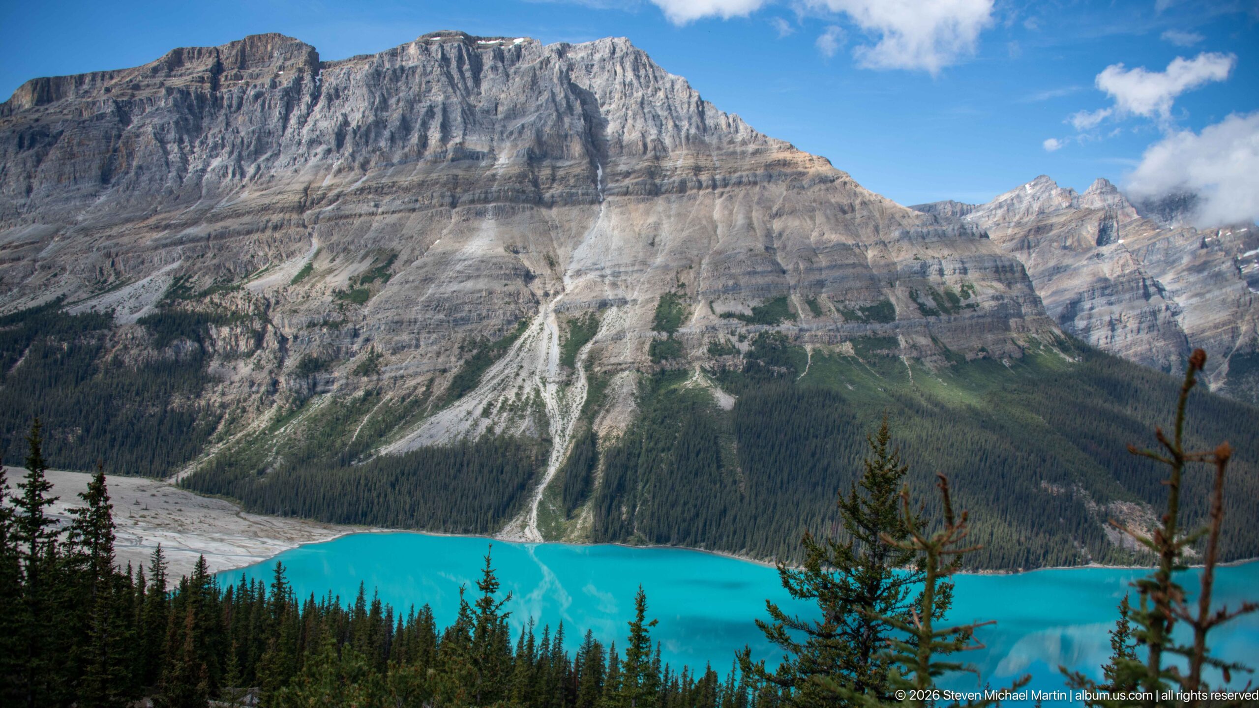
A narrow band of Peyto Lake glows turquoise beneath an immense wall of stratified gray limestone. Pale scree channels descend through darker forest toward the water, revealing the erosional patterns of the steep mountain face. By restricting the lake to the lower edge of the composition, the view shifts attention from the celebrated water color to the geology and vertical relief surrounding the basin.
Caption
A narrow band of Peyto Lake glows turquoise beneath an immense wall of stratified gray limestone. Pale scree channels descend through darker forest toward the water, revealing the erosional patterns of the steep mountain face. By restricting the lake to the lower edge of the composition, the view shifts attention from the celebrated water color to the geology and vertical relief surrounding the basin.
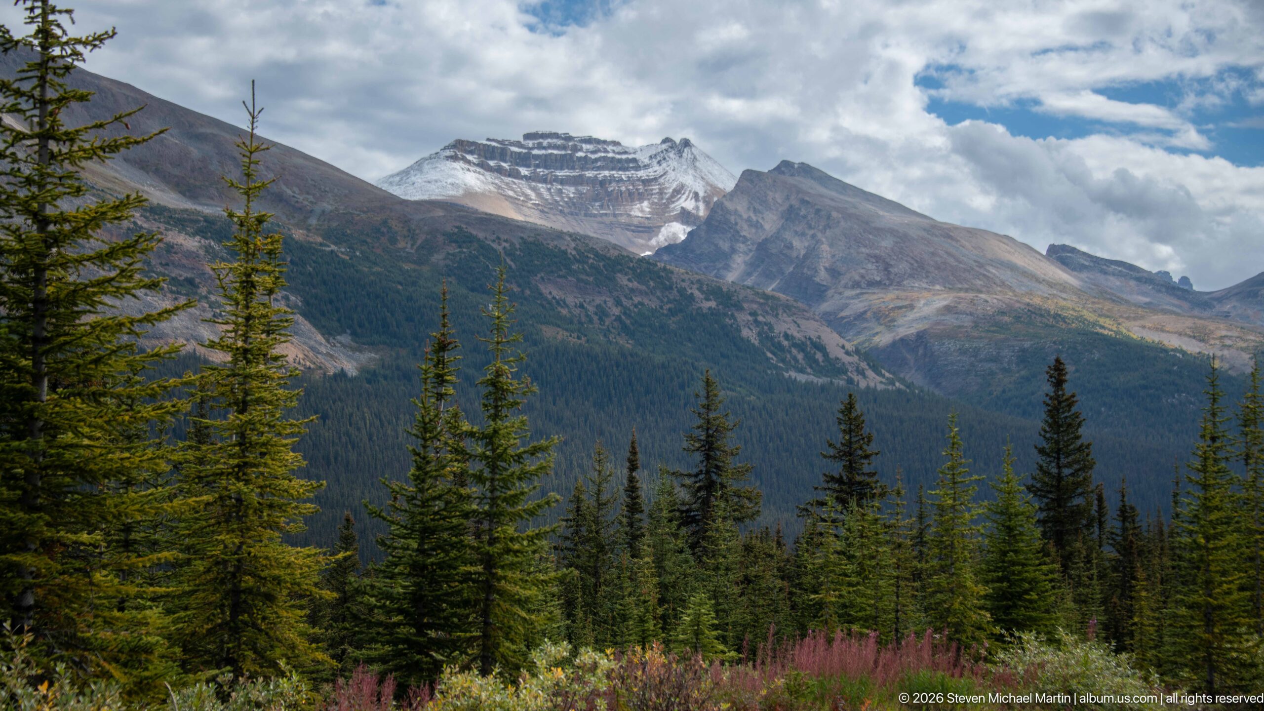
Jagged gray peaks rise beyond a dense stand of spruce and fir near the Bow Summit–Peyto Lake area. Low cloud gathers around the upper ridges while patches of light pick out pale rock faces and a small remnant of snow or ice. The foreground forest and pink fireweed create a layered transition from subalpine vegetation to the exposed rock of the high Canadian Rockies.
Caption
Jagged gray peaks rise beyond a dense stand of spruce and fir near the Bow Summit–Peyto Lake area. Low cloud gathers around the upper ridges while patches of light pick out pale rock faces and a small remnant of snow or ice. The foreground forest and pink fireweed create a layered transition from subalpine vegetation to the exposed rock of the high Canadian Rockies.
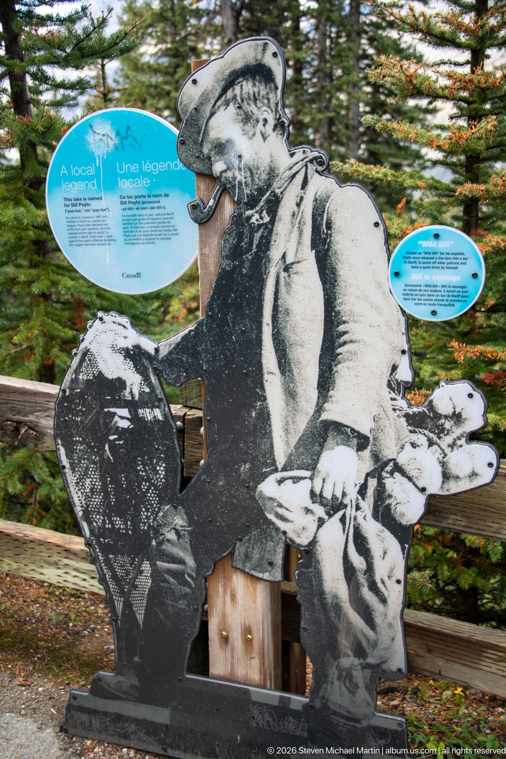
A life-size historic mountaineer cutout sits beside Parks Canada interpretation in the forested visitor area above Peyto Lake. The figure, equipped in period outdoor clothing and posed beside a pack or field gear, introduces a human-history element amid displays otherwise focused on the surrounding landscape. Circular bilingual panels behind the cutout provide additional context for visitors moving through the viewpoint area.
Caption
A life-size historic mountaineer cutout sits beside Parks Canada interpretation in the forested visitor area above Peyto Lake. The figure, equipped in period outdoor clothing and posed beside a pack or field gear, introduces a human-history element amid displays otherwise focused on the surrounding landscape. Circular bilingual panels behind the cutout provide additional context for visitors moving through the viewpoint area.
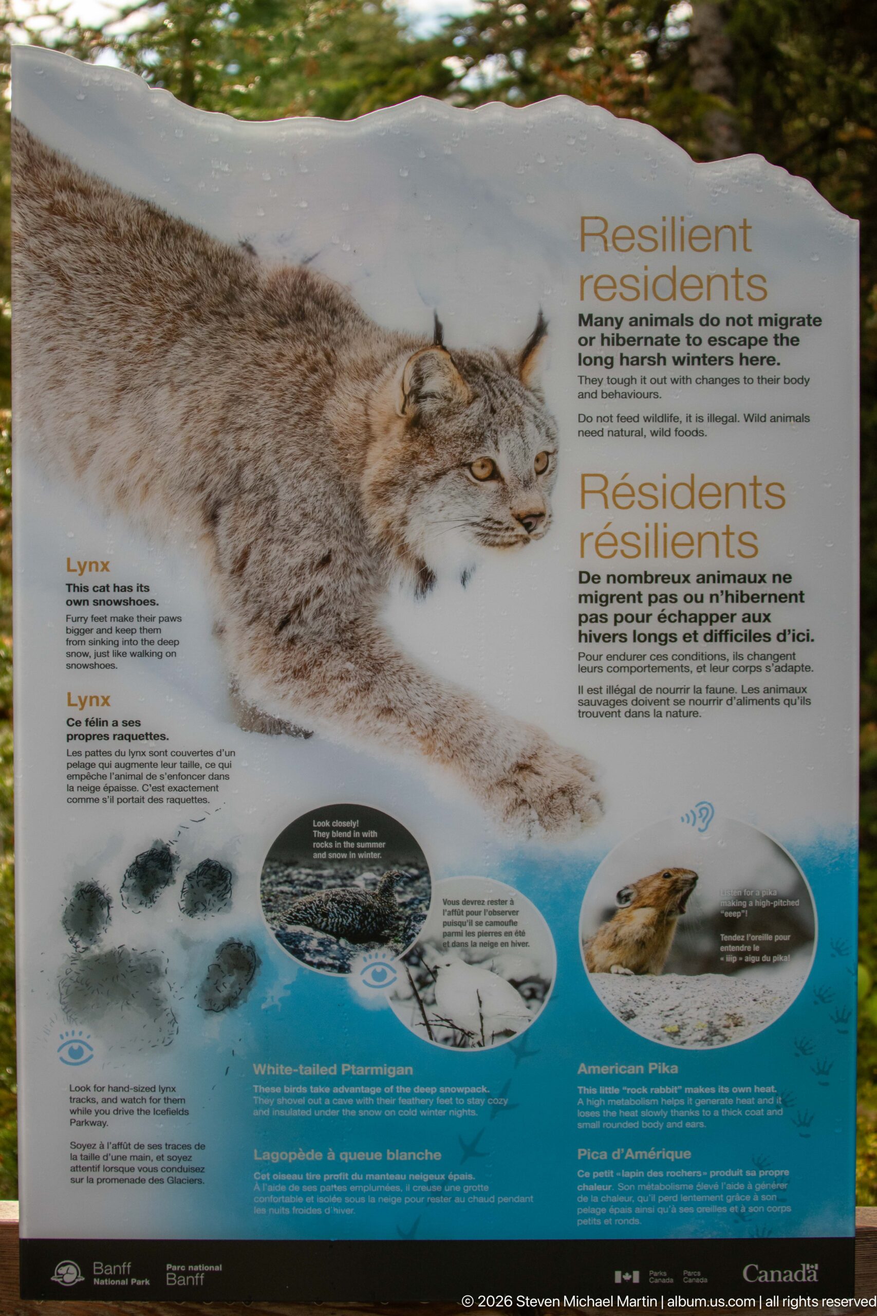
“Resilient Residents” introduces the Canada lynx as a cold-adapted inhabitant of the high-elevation landscape. A large winter portrait dominates the bilingual Parks Canada panel, accompanied by smaller images and diagrams concerning tracks, prey, and adaptations. The display broadens the Peyto Lake visitor experience beyond scenery by drawing attention to wildlife that survives the long, snowy conditions of the Canadian Rockies.
Caption
“Resilient Residents” introduces the Canada lynx as a cold-adapted inhabitant of the high-elevation landscape. A large winter portrait dominates the bilingual Parks Canada panel, accompanied by smaller images and diagrams concerning tracks, prey, and adaptations. The display broadens the Peyto Lake visitor experience beyond scenery by drawing attention to wildlife that survives the long, snowy conditions of the Canadian Rockies.
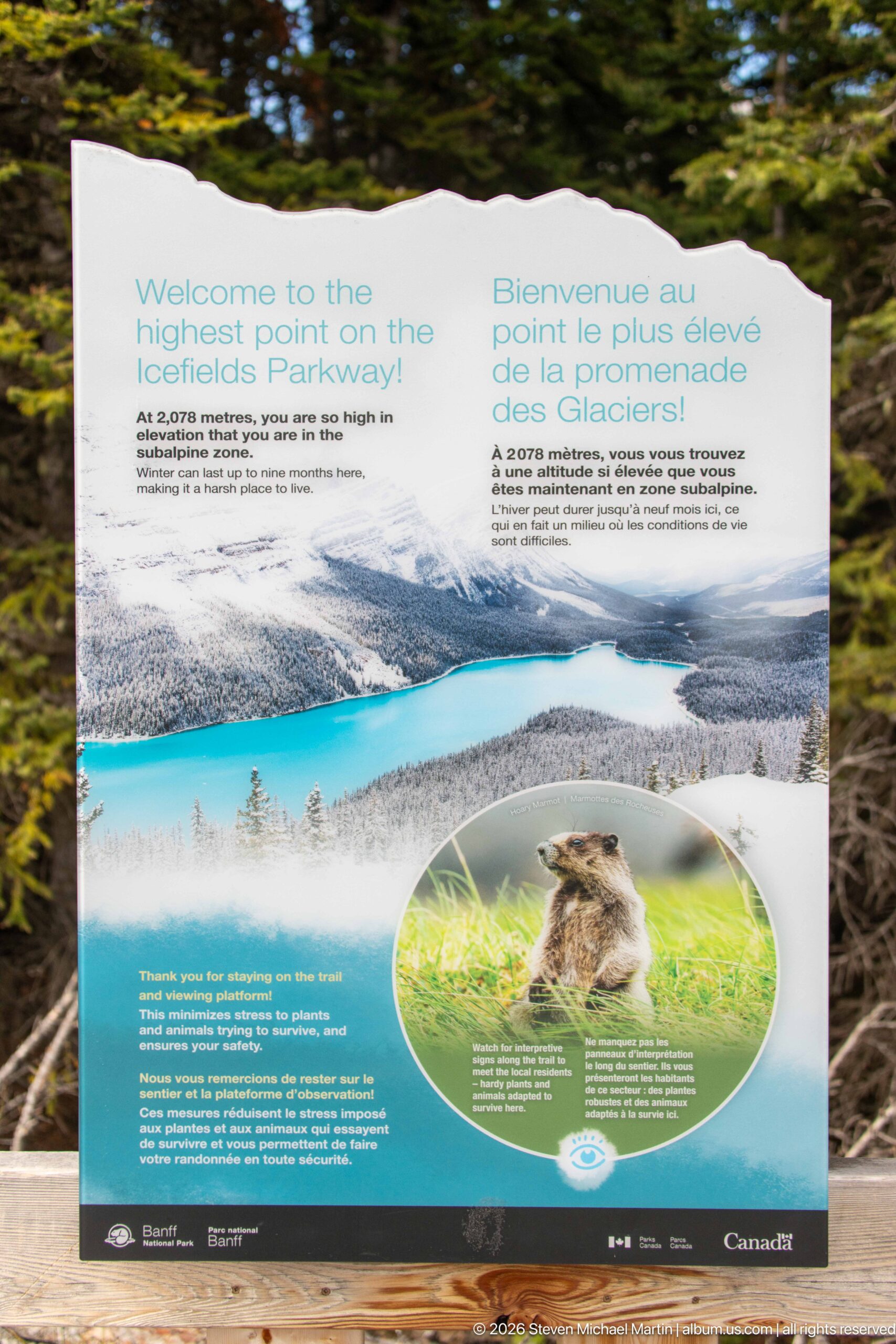
A bilingual Parks Canada panel marks the high point of the Icefields Parkway and interprets the mountain environment around Bow Summit. A panoramic photograph of turquoise water and surrounding peaks anchors the display, while text discusses the elevated setting and its geological context. The panel situates the Peyto Lake stop within the larger Icefields Parkway corridor rather than presenting the viewpoint as an isolated destination.
Caption
A bilingual Parks Canada panel marks the high point of the Icefields Parkway and interprets the mountain environment around Bow Summit. A panoramic photograph of turquoise water and surrounding peaks anchors the display, while text discusses the elevated setting and its geological context. The panel situates the Peyto Lake stop within the larger Icefields Parkway corridor rather than presenting the viewpoint as an isolated destination.
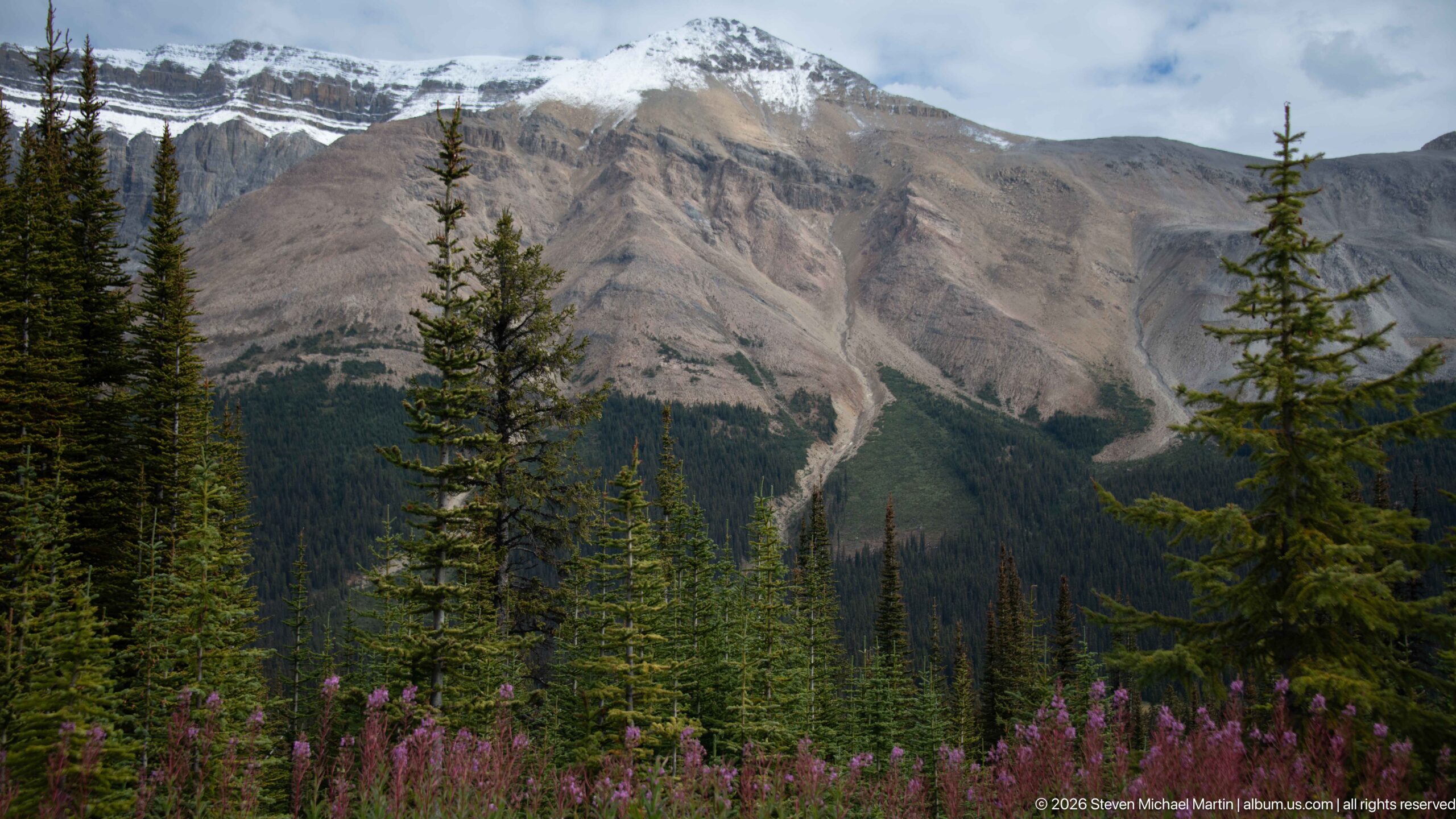
A steep, sparsely vegetated mountain face rises above the subalpine forest near Bow Summit. Broad gray-brown slopes are cut by pale erosion channels and debris chutes, while a small patch of snow clings near the summit ridge. Dark conifers and a band of pink fireweed soften the foreground, emphasizing the sharp ecological transition between forested lower ground and exposed alpine rock.
Caption
A steep, sparsely vegetated mountain face rises above the subalpine forest near Bow Summit. Broad gray-brown slopes are cut by pale erosion channels and debris chutes, while a small patch of snow clings near the summit ridge. Dark conifers and a band of pink fireweed soften the foreground, emphasizing the sharp ecological transition between forested lower ground and exposed alpine rock.
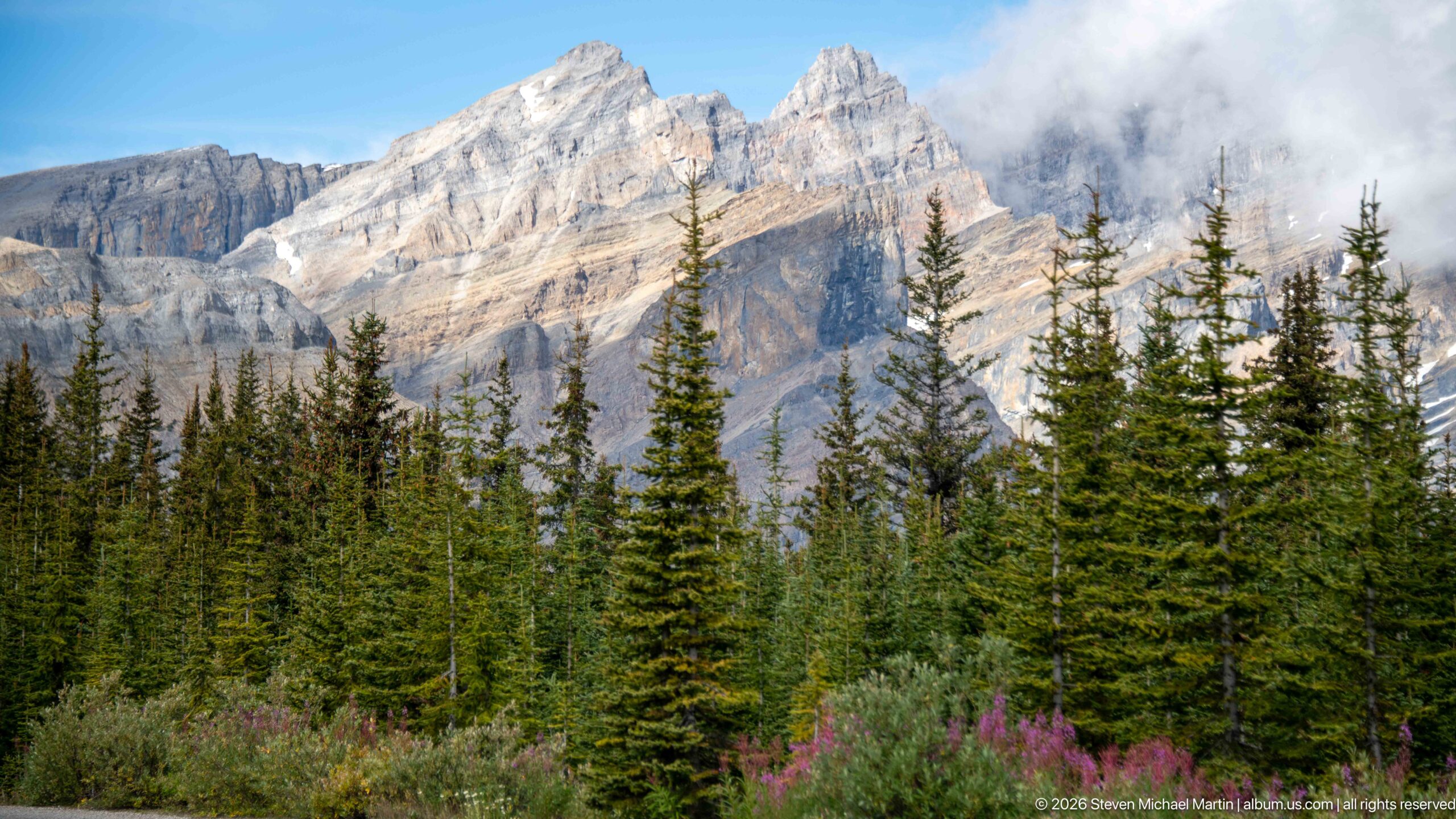
Sunlight breaks across pale limestone peaks while a bank of cloud drifts around the upper ridges. Dense conifers occupy the lower half of the scene, with scattered pink fireweed adding color at the forest edge. The composition records the rapidly changing mountain weather around Bow Summit, where exposed alpine rock can move between bright clarity and cloud cover within the same view.
Caption
Sunlight breaks across pale limestone peaks while a bank of cloud drifts around the upper ridges. Dense conifers occupy the lower half of the scene, with scattered pink fireweed adding color at the forest edge. The composition records the rapidly changing mountain weather around Bow Summit, where exposed alpine rock can move between bright clarity and cloud cover within the same view.
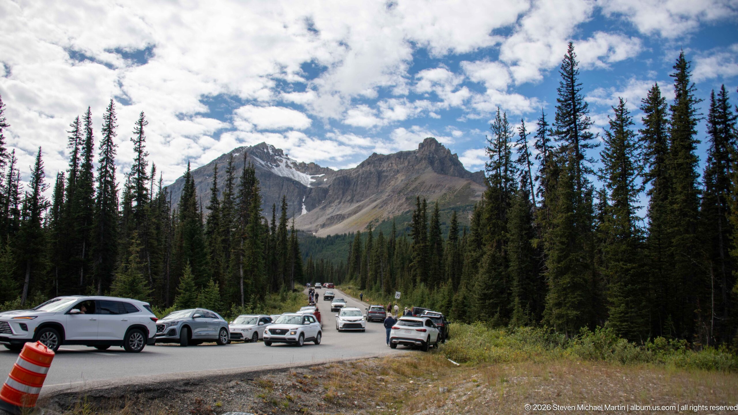
Vehicles line a roadside pullout beneath the forested mountains near Bow Summit, recording the visitor infrastructure of the Icefields Parkway corridor. Tall conifers frame the road while jagged peaks rise ahead under broken cloud. Unlike the elevated lake panoramas elsewhere in the sequence, this ground-level view shows how travelers encounter the high mountain landscape directly from the highway and its stopping areas.
Caption
Vehicles line a roadside pullout beneath the forested mountains near Bow Summit, recording the visitor infrastructure of the Icefields Parkway corridor. Tall conifers frame the road while jagged peaks rise ahead under broken cloud. Unlike the elevated lake panoramas elsewhere in the sequence, this ground-level view shows how travelers encounter the high mountain landscape directly from the highway and its stopping areas.
🏞️ National Park Field Guide
📍 Overview
Bow Lake and Peyto Lake present two complementary views of the high Canadian Rockies along the Icefields Parkway. At Bow Lake, the landscape is encountered at water level, where clear shallows, gravel shoreline, conifer forest, and immense stratified mountains are repeated in remarkably calm water. At Peyto Lake, the perspective shifts dramatically upward: from Bow Summit, brilliant turquoise water curves through a deep forested basin beneath massive limestone walls and toward a long mountain valley. Together, the two settings reveal a protected landscape in which glacial water, exposed rock, subalpine vegetation, weather, and visitor access are closely intertwined.
🏔️ Landscape
The portfolio moves from Bow Lake’s broad reflective basin to the elevated panoramas of Peyto Lake, repeatedly changing scale and viewpoint. Bow Lake’s shoreline places mountains directly across the water, making their reflections almost extensions of the rock itself. Around Bow Summit, the landscape becomes more vertical: forest gives way to exposed slopes, erosion gullies, scree, lingering snow, and jagged ridges. From above Peyto Lake, the turquoise basin opens northward into a long forested valley, while tighter views isolate wooded peninsulas, irregular shorelines, pale glacial terrain, and the abrupt meeting of lake, forest, and mountain.
🪨 Geology
Layered rock is one of the strongest visual themes throughout the sequence. Mountains above both lakes display conspicuous horizontal strata, steep escarpments, scree aprons, debris fans, and pale erosion channels descending toward the forest. Around Peyto Lake, these exposed rock walls stand in sharp contrast to the saturated color of the glacial water. Parks Canada interpretation at the viewpoint explains the connection between glaciers and lake color: the grinding action of ice produces fine suspended sediment that contributes to the turquoise appearance of glacial lakes. Distant ice, snow, unvegetated debris, and the form of the surrounding valleys provide additional evidence of the glacial processes that have shaped this high mountain terrain.
🌿 Ecology
The photographs show a pronounced transition between dense conifer forest and exposed alpine terrain. Spruce and fir frame the lakes, roads, viewpoints, and mountain slopes, while fireweed supplies vivid magenta and reddish accents around the Peyto Lake approach and Bow Summit. Several views juxtapose flowering plants and evergreens with lingering snow and bare limestone, illustrating the compressed seasonal and elevational changes of the subalpine environment. Wildlife interpretation at the visitor area extends this ecological story to animals adapted to the high Rockies, including a Parks Canada display devoted to the Canada lynx and its adaptations to snowy conditions.
🦌 Wildlife
Wildlife enters this portfolio primarily through interpretation rather than direct observation. At the Peyto Lake visitor area, Parks Canada uses the Canada lynx to explain how animals persist in the cold, snowy conditions of the high Rockies, with photographs, tracks, prey relationships, and adaptations incorporated into the display. The portfolio’s animal photographs instead document two leashed beagles accompanying visitors through the paved approach, access road, and overlook. Their presence adds another dimension to the visitor experience while remaining distinct from the park’s wild fauna.
🧭 Human History
Human presence is woven through the landscape rather than confined to a single historical feature. The Icefields Parkway provides the organizing corridor, connecting Bow Lake, Bow Summit, and Peyto Lake through roads, pullouts, parking areas, and heavily used viewpoints. Directional signs toward Lake Louise and Jasper place the sites within this larger north-south route, while tour coaches and crowded observation decks demonstrate the international reach and popularity of the landscape. At Peyto Lake, Parks Canada interpretation adds a historical dimension through a life-size historic mountaineer figure and bilingual displays, linking present-day visitors with earlier traditions of travel and exploration in the Canadian Rockies.
🥾 Visitor Experience
The experience changes markedly between the two lakes. Bow Lake invites close shoreline observation: shallow clear water, pebbles, reflections, forest edges, and mountain walls can be studied from nearly the same elevation as the lake surface. Peyto Lake is defined by ascent and revelation. Visitors move through paved approaches and subalpine forest before reaching the busy Bow Summit viewing platform, where the lake suddenly appears far below in intense turquoise. Crowds, tour buses, roadside pullouts, traffic controls, interpretive panels, and the overlook itself are visible parts of the experience, demonstrating how access infrastructure concentrates large numbers of travelers within an otherwise immense mountain setting.
📷 Photography Notes
The portfolio is strongest when it alternates between expansive landscape views and details that explain how the landscape works. At Bow Lake, low shoreline positions exploit exceptionally still water to create near-symmetrical mountain reflections, while wider compositions establish the lake within its surrounding peaks and forest. Peyto Lake benefits from the opposite strategy: elevated viewpoints reveal the lake’s distinctive shape, turquoise color, forested margins, and relationship to the larger valley. Tighter frames isolate erosion gullies, limestone strata, glacial terrain, fireweed, and shoreline forms. Photographs of roads, crowds, signs, dogs, interpretive displays, and visitor infrastructure provide essential counterpoints to the panoramic scenery, preserving the experience of moving through and observing the park rather than presenting it only as an uninhabited landscape.