Fundy National Park – New Brunswick, Canada
Fundy National Park lies along the northern shore of the Bay of Fundy in southern New Brunswick, a region famous for having the highest tides in the world. Twice each day the waters of the bay rise and fall dramatically, exposing vast tidal flats, sea stacks, and rocky coastal formations along the shoreline.
The park protects a landscape of rugged coastline, forested hills, and river valleys where streams descend toward the bay through waterfalls and narrow gorges. Trails throughout the park lead to scenic viewpoints overlooking the bay as well as quiet inland lakes and dense Acadian forests.
From the coastal cliffs and beaches, the sweeping views of the Bay of Fundy reveal the powerful tidal forces that have shaped this distinctive maritime landscape.

A forest opening reveals a sheltered Fundy coastline where a pale intertidal shore curves beneath densely wooded headlands. Conifers frame the view on both sides, emphasizing the steep transition from upland forest to marine water. The elevated viewpoint records the close relationship between Fundy National Park’s forest cover and its tide-shaped coast.
Caption
A forest opening reveals a sheltered Fundy coastline where a pale intertidal shore curves beneath densely wooded headlands. Conifers frame the view on both sides, emphasizing the steep transition from upland forest to marine water. The elevated viewpoint records the close relationship between Fundy National Park’s forest cover and its tide-shaped coast.

A long wooden boardwalk follows the edge of a broad coastal overlook above the Bay of Fundy. Gravelly open ground and low vegetation occupy the foreground, while a dramatic bank of clouds stretches over the marine horizon. The constructed path provides a clear visitor route through an exposed shoreline landscape rather than the enclosed forest trails seen earlier in the portfolio.
Caption
A long wooden boardwalk follows the edge of a broad coastal overlook above the Bay of Fundy. Gravelly open ground and low vegetation occupy the foreground, while a dramatic bank of clouds stretches over the marine horizon. The constructed path provides a clear visitor route through an exposed shoreline landscape rather than the enclosed forest trails seen earlier in the portfolio.

A long wooden walkway or footbridge crosses a low, wet meadow at the base of a densely wooded slope. Seen from across an open lawn, the structure forms a horizontal line through layers of grass, water-edge vegetation, and mixed forest, linking the park's developed visitor landscape with the wetter ground beyond.
Caption
A long wooden walkway or footbridge crosses a low, wet meadow at the base of a densely wooded slope. Seen from across an open lawn, the structure forms a horizontal line through layers of grass, water-edge vegetation, and mixed forest, linking the park's developed visitor landscape with the wetter ground beyond.

A two-lane paved road descends through dense mixed forest toward layered, blue-gray uplands in the distance. The long central perspective and break in the trees turn the roadway into a corridor through Fundy National Park's wooded terrain, while the heavy cloud cover reinforces the cool, maritime character of the landscape.
Caption
A two-lane paved road descends through dense mixed forest toward layered, blue-gray uplands in the distance. The long central perspective and break in the trees turn the roadway into a corridor through Fundy National Park's wooded terrain, while the heavy cloud cover reinforces the cool, maritime character of the landscape.

A quiet Bay of Fundy shoreline lies beneath heavy clouds, with reddish coastal rocks and tall grasses occupying the foreground. Parallel bands of exposed nearshore substrate and shallow water mark the receded tide. The subdued view focuses on the broad marine horizon and tidal margin rather than a named landmark.
Caption
A quiet Bay of Fundy shoreline lies beneath heavy clouds, with reddish coastal rocks and tall grasses occupying the foreground. Parallel bands of exposed nearshore substrate and shallow water mark the receded tide. The subdued view focuses on the broad marine horizon and tidal margin rather than a named landmark.

Low meadow vegetation and mixed conifer forest occupy the foreground, opening toward a distant blue-gray horizon beneath layered storm clouds. A rounded upland rises at left while a pale horizontal band beyond the trees appears to be distant water, giving the scene a broad transition from Fundy National Park's interior vegetation toward the Bay of Fundy landscape.
Caption
Low meadow vegetation and mixed conifer forest occupy the foreground, opening toward a distant blue-gray horizon beneath layered storm clouds. A rounded upland rises at left while a pale horizontal band beyond the trees appears to be distant water, giving the scene a broad transition from Fundy National Park's interior vegetation toward the Bay of Fundy landscape.

Dark water threads through a narrow, steep-sided gorge below the Point Wolfe covered bridge area. Exposed reddish bedrock, a pale gravel bar, and dense forest define the channel, while visitors at the right edge provide scale. The view shifts attention from the bridge itself to the river corridor and the erosional landscape it crosses.
Caption
Dark water threads through a narrow, steep-sided gorge below the Point Wolfe covered bridge area. Exposed reddish bedrock, a pale gravel bar, and dense forest define the channel, while visitors at the right edge provide scale. The view shifts attention from the bridge itself to the river corridor and the erosional landscape it crosses.

A narrow opening through dense mixed forest reveals a distant, rounded ridge beneath a gray, overcast sky. Layered greens dominate the foreground and middle distance, while the small glimpse of higher terrain gives the composition unusual depth. The view emphasizes the enclosed, heavily forested character of the Fundy National Park landscape rather than a single named landmark.
Caption
A narrow opening through dense mixed forest reveals a distant, rounded ridge beneath a gray, overcast sky. Layered greens dominate the foreground and middle distance, while the small glimpse of higher terrain gives the composition unusual depth. The view emphasizes the enclosed, heavily forested character of the Fundy National Park landscape rather than a single named landmark.

Hopewell’s flowerpot formations stand against the broad Bay of Fundy in the final view of the portfolio. Two undercut pillars occupy the foreground while a larger conifer-topped stack rises at right, all resting on the exposed intertidal floor. The subdued evening-like light and open water emphasize the isolated silhouettes created by repeated coastal erosion.
Caption
Hopewell’s flowerpot formations stand against the broad Bay of Fundy in the final view of the portfolio. Two undercut pillars occupy the foreground while a larger conifer-topped stack rises at right, all resting on the exposed intertidal floor. The subdued evening-like light and open water emphasize the isolated silhouettes created by repeated coastal erosion.

Large angular boulders form a riprap barrier along the Fundy shoreline, with exposed tidal flats and calm water beyond. Varied red, gray, and brown rock surfaces dominate the foreground, making the engineered edge visually distinct from the natural bedrock ledges elsewhere in the portfolio. The structure records shoreline stabilization at the park’s developed coastal margin.
Caption
Large angular boulders form a riprap barrier along the Fundy shoreline, with exposed tidal flats and calm water beyond. Varied red, gray, and brown rock surfaces dominate the foreground, making the engineered edge visually distinct from the natural bedrock ledges elsewhere in the portfolio. The structure records shoreline stabilization at the park’s developed coastal margin.

The fishing boat Fundy Fury is grounded on supports below Alma’s high wharf, its black hull and white wheelhouse set against a dense grid of timber pilings. Yellow fenders hang along the side and deck equipment rises above the cabin. The low-tide portrait isolates a named working vessel while retaining the distinctive tidal infrastructure of the harbor.
Caption
The fishing boat Fundy Fury is grounded on supports below Alma’s high wharf, its black hull and white wheelhouse set against a dense grid of timber pilings. Yellow fenders hang along the side and deck equipment rises above the cabin. The low-tide portrait isolates a named working vessel while retaining the distinctive tidal infrastructure of the harbor.

Open water fills the foreground of this broad wetland view, its smooth gray surface edged by vivid sedges and low shrubs. Across the basin, standing dead trunks punctuate a narrow band of saturated vegetation before the conifer forest rises behind it, giving the scene a clear layered structure from pond to marshy margin to woodland.
Caption
Open water fills the foreground of this broad wetland view, its smooth gray surface edged by vivid sedges and low shrubs. Across the basin, standing dead trunks punctuate a narrow band of saturated vegetation before the conifer forest rises behind it, giving the scene a clear layered structure from pond to marshy margin to woodland.

A route map traces the photographed journey through Atlantic Canada, looping from the Maritime Provinces north through New Brunswick and Québec toward Labrador and Newfoundland before returning along the Atlantic coast. Lettered waypoints and a blue route line establish the broader travel context in which the Fundy National Park portfolio was made.
Caption
A route map traces the photographed journey through Atlantic Canada, looping from the Maritime Provinces north through New Brunswick and Québec toward Labrador and Newfoundland before returning along the Atlantic coast. Lettered waypoints and a blue route line establish the broader travel context in which the Fundy National Park portfolio was made.

A wooden wildlife-viewing platform marked “Eagles Nesting” overlooks an elevated nest structure beyond the mesh railing. The enclosure organizes visitors around a protected observation point while maintaining distance from the nesting site, linking roadside interpretation with the wetland and forest habitat visible behind it.
Caption
A wooden wildlife-viewing platform marked “Eagles Nesting” overlooks an elevated nest structure beyond the mesh railing. The enclosure organizes visitors around a protected observation point while maintaining distance from the nesting site, linking roadside interpretation with the wetland and forest habitat visible behind it.

The “Eagles Nesting” sign fills the foreground of a timber observation deck, with wire-mesh panels framing the nesting area beyond. This closer, centered view emphasizes the visitor infrastructure rather than the birds themselves: a deliberately separated viewing space designed to direct attention toward a sensitive nesting location.
Caption
The “Eagles Nesting” sign fills the foreground of a timber observation deck, with wire-mesh panels framing the nesting area beyond. This closer, centered view emphasizes the visitor infrastructure rather than the birds themselves: a deliberately separated viewing space designed to direct attention toward a sensitive nesting location.

A tall pole-mounted nest platform rises above dense green wetland vegetation, backed by a forested slope under an overcast sky. Seen from a distance, the structure reveals the nesting site in its broader habitat and shows how an artificial platform can stand above low vegetation and provide an open approach for large birds.
Caption
A tall pole-mounted nest platform rises above dense green wetland vegetation, backed by a forested slope under an overcast sky. Seen from a distance, the structure reveals the nesting site in its broader habitat and shows how an artificial platform can stand above low vegetation and provide an open approach for large birds.

An immature bald eagle stands on a stick nest built atop an artificial platform, its dark mottled plumage lacking the white head and tail of an adult. The elevated nest is isolated against a softly focused forest backdrop, giving a clear wildlife portrait of the young raptor and the engineered nesting structure supporting it.
Caption
An immature bald eagle stands on a stick nest built atop an artificial platform, its dark mottled plumage lacking the white head and tail of an adult. The elevated nest is isolated against a softly focused forest backdrop, giving a clear wildlife portrait of the young raptor and the engineered nesting structure supporting it.

Two immature bald eagles occupy the same elevated stick nest, one bending toward the nest material while the other stands nearby. Their dark juvenile plumage and large hooked bills contrast with the pale sticks and green forest behind, while the paired birds provide behavioral context absent from the preceding single-bird portrait.
Caption
Two immature bald eagles occupy the same elevated stick nest, one bending toward the nest material while the other stands nearby. Their dark juvenile plumage and large hooked bills contrast with the pale sticks and green forest behind, while the paired birds provide behavioral context absent from the preceding single-bird portrait.

Two immature bald eagles share the elevated nest in a tighter view, their bodies angled toward one another over the stick structure. One bird holds an upright posture while the second lowers its head, creating a compact study of juvenile plumage, scale, and nest behavior against a distant green hillside.
Caption
Two immature bald eagles share the elevated nest in a tighter view, their bodies angled toward one another over the stick structure. One bird holds an upright posture while the second lowers its head, creating a compact study of juvenile plumage, scale, and nest behavior against a distant green hillside.

Two immature bald eagles stand on a platform nest framed by leafy deciduous branches. The wider composition places the raptors within the immediate vegetation around the nesting structure, softening the engineered character of the platform and emphasizing the sheltered edge habitat surrounding the site.
Caption
Two immature bald eagles stand on a platform nest framed by leafy deciduous branches. The wider composition places the raptors within the immediate vegetation around the nesting structure, softening the engineered character of the platform and emphasizing the sheltered edge habitat surrounding the site.

A small timber covered bridge serves as a roadside welcome feature for St. Stephen, New Brunswick, with a sign identifying the community as the hometown of Jon Sweeney. The rustic gabled structure is set among dense summer foliage, functioning as a civic landmark rather than a transportation-scale bridge.
Caption
A small timber covered bridge serves as a roadside welcome feature for St. Stephen, New Brunswick, with a sign identifying the community as the hometown of Jon Sweeney. The rustic gabled structure is set among dense summer foliage, functioning as a civic landmark rather than a transportation-scale bridge.

A broad view shows the “Eagles Nesting” observation deck at the end of a wooden walkway, with open wetland and low forest stretching beyond under dark clouds. A visitor at the railing provides scale and clarifies how the viewing station is positioned to overlook the nesting area from a controlled distance.
Caption
A broad view shows the “Eagles Nesting” observation deck at the end of a wooden walkway, with open wetland and low forest stretching beyond under dark clouds. A visitor at the railing provides scale and clarifies how the viewing station is positioned to overlook the nesting area from a controlled distance.

A roadside “Welcome to St. Stephen” sign stands beneath a row of flagpoles at the entrance to the New Brunswick community. Canadian, American, provincial, and other flags underscore the border-town setting, while the landscaped sign directs visitors toward free parking downtown.
Caption
A roadside “Welcome to St. Stephen” sign stands beneath a row of flagpoles at the entrance to the New Brunswick community. Canadian, American, provincial, and other flags underscore the border-town setting, while the landscaped sign directs visitors toward free parking downtown.

A rustic timber gateway marks the entrance to the Bennett Brook trail, with directional and activity signs suspended above a gravel path. The trailhead opens from a managed roadside area into thick green vegetation, creating a clear threshold between visitor infrastructure and the wooded hiking route within Fundy National Park.
Caption
A rustic timber gateway marks the entrance to the Bennett Brook trail, with directional and activity signs suspended above a gravel path. The trailhead opens from a managed roadside area into thick green vegetation, creating a clear threshold between visitor infrastructure and the wooded hiking route within Fundy National Park.

A low, densely vegetated island stretches horizontally across calm water, with mature conifers rising above shrubs and younger trees. The closer framing reduces the surrounding shoreline and concentrates attention on the island’s layered vegetation, mirrored faintly in the lake under a soft, overcast sky.
Caption
A low, densely vegetated island stretches horizontally across calm water, with mature conifers rising above shrubs and younger trees. The closer framing reduces the surrounding shoreline and concentrates attention on the island’s layered vegetation, mirrored faintly in the lake under a soft, overcast sky.

Waterlogged timbers form a dense, moss-covered lattice along an eroding bank, suggesting the remains of former shoreline cribwork or a wharf structure. The exposed construction lies at the water’s edge, where repeated wetting, sediment loss, and vegetation have transformed a utilitarian timber framework into a conspicuous piece of maritime landscape.
Caption
Waterlogged timbers form a dense, moss-covered lattice along an eroding bank, suggesting the remains of former shoreline cribwork or a wharf structure. The exposed construction lies at the water’s edge, where repeated wetting, sediment loss, and vegetation have transformed a utilitarian timber framework into a conspicuous piece of maritime landscape.

A calm tidal channel curves past a bank lined with mossy timber remains, while houses and low vegetation recede toward the horizon beneath a gray sky. This wider view places the deteriorated shoreline construction within its working-waterfront setting and emphasizes the close relationship between settlement, tidal water, and engineered banks.
Caption
A calm tidal channel curves past a bank lined with mossy timber remains, while houses and low vegetation recede toward the horizon beneath a gray sky. This wider view places the deteriorated shoreline construction within its working-waterfront setting and emphasizes the close relationship between settlement, tidal water, and engineered banks.

Traffic queues beside a Canadian inspection facility at a bridge crossing, where overhead lane signals and a large “Canada” wordmark mark the international boundary. The view from the bridge emphasizes the controlled transition into Canada and the utilitarian architecture of the port of entry serving the St. Stephen border crossing.
Caption
Traffic queues beside a Canadian inspection facility at a bridge crossing, where overhead lane signals and a large “Canada” wordmark mark the international boundary. The view from the bridge emphasizes the controlled transition into Canada and the utilitarian architecture of the port of entry serving the St. Stephen border crossing.

The bilingual Parks Canada entrance sign identifies Fundy National Park / Parc national Fundy du Canada against a dense evergreen forest. Its restrained green-and-white design and red Canada wordmark mark the formal transition into the protected landscape, providing a clear establishing record of the park’s official identity.
Caption
The bilingual Parks Canada entrance sign identifies Fundy National Park / Parc national Fundy du Canada against a dense evergreen forest. Its restrained green-and-white design and red Canada wordmark mark the formal transition into the protected landscape, providing a clear establishing record of the park’s official identity.

An interpretive panel for Bennett Brook combines a route map with bilingual trail information, safety guidance, and natural-history illustrations. Mounted beneath leafy vegetation, the sign introduces visitors to a specific Fundy National Park trail while visually organizing the route, landmarks, and expected conditions before entering the forest.
Caption
An interpretive panel for Bennett Brook combines a route map with bilingual trail information, safety guidance, and natural-history illustrations. Mounted beneath leafy vegetation, the sign introduces visitors to a specific Fundy National Park trail while visually organizing the route, landmarks, and expected conditions before entering the forest.

Clusters of white five-petaled bramble flowers bloom among serrated compound leaves beside woody stems. The close botanical study isolates the blossoms and developing flower centers from the surrounding greenery, documenting a common Rubus-type plant of disturbed edges and forest openings without relying on fruit for a species-level identification.
Caption
Clusters of white five-petaled bramble flowers bloom among serrated compound leaves beside woody stems. The close botanical study isolates the blossoms and developing flower centers from the surrounding greenery, documenting a common Rubus-type plant of disturbed edges and forest openings without relying on fruit for a species-level identification.

A mixed flock of Canada geese rests on smooth water, with several smaller, browner juveniles clustered among darker-necked adults. The loose grouping and reflected silhouettes create a quiet behavioral study, recording family groups during the summer season in freshwater habitat associated with Fundy National Park.
Caption
A mixed flock of Canada geese rests on smooth water, with several smaller, browner juveniles clustered among darker-necked adults. The loose grouping and reflected silhouettes create a quiet behavioral study, recording family groups during the summer season in freshwater habitat associated with Fundy National Park.

Canada geese move across blue-gray water in several family groups, most birds facing away while two adults hold watchful positions at the edges. Juveniles remain gathered near the center, and the broad spacing across the calm surface gives this view a stronger sense of movement and social organization than the preceding clustered flock.
Caption
Canada geese move across blue-gray water in several family groups, most birds facing away while two adults hold watchful positions at the edges. Juveniles remain gathered near the center, and the broad spacing across the calm surface gives this view a stronger sense of movement and social organization than the preceding clustered flock.

A small conifer-covered islet rises from still freshwater beneath heavy gray clouds, its trees reflected in the dark surface. Forested shores recede behind it while a few waterfowl occupy the lower corner, giving the scene a layered sense of scale and emphasizing the quiet inland-water habitat within the Fundy landscape.
Caption
A small conifer-covered islet rises from still freshwater beneath heavy gray clouds, its trees reflected in the dark surface. Forested shores recede behind it while a few waterfowl occupy the lower corner, giving the scene a layered sense of scale and emphasizing the quiet inland-water habitat within the Fundy landscape.

Scattered round lily pads float across dark, tea-colored water, forming loose clusters of green and reddish leaves. The overhead view removes the surrounding shoreline and concentrates on the patterned surface, documenting emergent and floating vegetation in a quiet freshwater habitat within Fundy National Park.
Caption
Scattered round lily pads float across dark, tea-colored water, forming loose clusters of green and reddish leaves. The overhead view removes the surrounding shoreline and concentrates on the patterned surface, documenting emergent and floating vegetation in a quiet freshwater habitat within Fundy National Park.

Two bilingual blue safety signs warn visitors to keep away from fast water and prohibit swimming near a hazardous channel. Mounted beside the water, the bold pictograms and English-French wording make the risk explicit, documenting the park’s management of areas where strong currents can create dangerous conditions.
Caption
Two bilingual blue safety signs warn visitors to keep away from fast water and prohibit swimming near a hazardous channel. Mounted beside the water, the bold pictograms and English-French wording make the risk explicit, documenting the park’s management of areas where strong currents can create dangerous conditions.

A rounded deciduous shrub forms a small green island within shallow wetland water, its canopy reflected almost completely in the still foreground. The isolated plant and surrounding mats of emergent vegetation reveal the patchwork character of this saturated habitat, where raised hummocks support woody growth amid open water.
Caption
A rounded deciduous shrub forms a small green island within shallow wetland water, its canopy reflected almost completely in the still foreground. The isolated plant and surrounding mats of emergent vegetation reveal the patchwork character of this saturated habitat, where raised hummocks support woody growth amid open water.

A bilingual interpretive map outlines the Fundy Biosphere Reserve and situates the protected landscape in relation to the Bay of Fundy, New Brunswick, and Nova Scotia. The panel combines a regional map with conservation and organizational information, placing Fundy National Park within a broader landscape-scale framework rather than treating the park as an isolated protected area.
Caption
A bilingual interpretive map outlines the Fundy Biosphere Reserve and situates the protected landscape in relation to the Bay of Fundy, New Brunswick, and Nova Scotia. The panel combines a regional map with conservation and organizational information, placing Fundy National Park within a broader landscape-scale framework rather than treating the park as an isolated protected area.

White oxeye daisies bloom against a soft green meadow background, their yellow disk centers and radiating white petals sharply separated from the out-of-focus stems behind. The shallow depth of field turns a common roadside or meadow flower into a focused botanical portrait while retaining the lush summer setting.
Caption
White oxeye daisies bloom against a soft green meadow background, their yellow disk centers and radiating white petals sharply separated from the out-of-focus stems behind. The shallow depth of field turns a common roadside or meadow flower into a focused botanical portrait while retaining the lush summer setting.

Several oxeye daisies fill the frame at different distances, with one large flower on the right showing a bright yellow disk surrounded by clean white rays. The selective focus separates individual blossoms from the deep green background and provides a closer study of flower form than the preceding wider grouping.
Caption
Several oxeye daisies fill the frame at different distances, with one large flower on the right showing a bright yellow disk surrounded by clean white rays. The selective focus separates individual blossoms from the deep green background and provides a closer study of flower form than the preceding wider grouping.

A visitor walks two beagles on leashes along a wooden boardwalk bordered by tall summer vegetation. Yellow bollards mark the transition between the walkway and adjoining path, while the paired dogs, both moving toward the camera, turn the scene into a record of everyday recreational use rather than a purely scenic park view.
Caption
A visitor walks two beagles on leashes along a wooden boardwalk bordered by tall summer vegetation. Yellow bollards mark the transition between the walkway and adjoining path, while the paired dogs, both moving toward the camera, turn the scene into a record of everyday recreational use rather than a purely scenic park view.

A small gray park building stands in a meadow beside the water, with colorful outdoor-equipment graphics on the wall and several boats or watercraft stored alongside. Solar panels on the roof and a satellite dish add contemporary utility details, while the porch and gear suggest a visitor-service or recreation function.
Caption
A small gray park building stands in a meadow beside the water, with colorful outdoor-equipment graphics on the wall and several boats or watercraft stored alongside. Solar panels on the roof and a satellite dish add contemporary utility details, while the porch and gear suggest a visitor-service or recreation function.

Delicate yellow buttercup-type flowers rise on slender branching stems against a dark green forest background. The shallow focus isolates a few open five-petaled blooms and small buds, emphasizing their fine stems and glossy yellow petals while leaving species-level identification appropriately cautious.
Caption
Delicate yellow buttercup-type flowers rise on slender branching stems against a dark green forest background. The shallow focus isolates a few open five-petaled blooms and small buds, emphasizing their fine stems and glossy yellow petals while leaving species-level identification appropriately cautious.

A drooping cluster of purple pea-family flowers hangs beneath broad green leaves, each small blossom arranged along a narrow raceme. The close view records the distinctive violet floral structure of a vetch-type plant while keeping the surrounding foliage softly secondary to the pendant flower cluster.
Caption
A drooping cluster of purple pea-family flowers hangs beneath broad green leaves, each small blossom arranged along a narrow raceme. The close view records the distinctive violet floral structure of a vetch-type plant while keeping the surrounding foliage softly secondary to the pendant flower cluster.

A saturated opening in the conifer forest forms a low, green wetland of sedges, shrubs, and scattered standing snags. The transition from open ground to dense spruce and fir is especially clear here, illustrating the close interlocking of forest and wet habitats within Fundy National Park without requiring a more specific wetland classification.
Caption
A saturated opening in the conifer forest forms a low, green wetland of sedges, shrubs, and scattered standing snags. The transition from open ground to dense spruce and fir is especially clear here, illustrating the close interlocking of forest and wet habitats within Fundy National Park without requiring a more specific wetland classification.

Purple-blue irises rise in a dense clump at the edge of dark wetland water, their upright leaves and flowers mirrored in the rippled surface. The combination of sword-shaped foliage, violet blooms, and saturated shoreline is consistent with blue flag iris, a moisture-loving native associated with marshes, wet meadows, and pond margins in Atlantic Canada.
Caption
Purple-blue irises rise in a dense clump at the edge of dark wetland water, their upright leaves and flowers mirrored in the rippled surface. The combination of sword-shaped foliage, violet blooms, and saturated shoreline is consistent with blue flag iris, a moisture-loving native associated with marshes, wet meadows, and pond margins in Atlantic Canada.

A shallow pond occupies a forest opening beneath a low, misty sky, with bright emergent vegetation forming an irregular shoreline. Numerous pale snags and broken trunks stand beyond the water, creating a pronounced boundary between the flooded or saturated basin and the surrounding conifer forest of Fundy National Park.
Caption
A shallow pond occupies a forest opening beneath a low, misty sky, with bright emergent vegetation forming an irregular shoreline. Numerous pale snags and broken trunks stand beyond the water, creating a pronounced boundary between the flooded or saturated basin and the surrounding conifer forest of Fundy National Park.

A band of flowering irises occupies a narrow, saturated shelf above the pond, with violet blossoms and vertical green leaves repeated as soft reflections in the dark water. The closer framing isolates the wetland plant community from the surrounding forest and emphasizes the relationship between flowering vegetation and the shallow shoreline habitat.
Caption
A band of flowering irises occupies a narrow, saturated shelf above the pond, with violet blossoms and vertical green leaves repeated as soft reflections in the dark water. The closer framing isolates the wetland plant community from the surrounding forest and emphasizes the relationship between flowering vegetation and the shallow shoreline habitat.

Dead and fallen trees dominate this intimate wetland scene, where weathered trunks project from dark water in front of a dense stand of slender conifers. Fresh green marsh vegetation grows around the woody debris, contrasting living groundcover with standing and submerged deadwood and showing the structural complexity of a forested wetland.
Caption
Dead and fallen trees dominate this intimate wetland scene, where weathered trunks project from dark water in front of a dense stand of slender conifers. Fresh green marsh vegetation grows around the woody debris, contrasting living groundcover with standing and submerged deadwood and showing the structural complexity of a forested wetland.

Blue-violet irises bloom from a narrow wetland clump surrounded by dark water and weathered standing trunks. Their fresh green leaves and flowers contrast sharply with the reddish-brown deadwood behind them, making this a close study of seasonal flowering within a snag-rich freshwater habitat in Fundy National Park.
Caption
Blue-violet irises bloom from a narrow wetland clump surrounded by dark water and weathered standing trunks. Their fresh green leaves and flowers contrast sharply with the reddish-brown deadwood behind them, making this a close study of seasonal flowering within a snag-rich freshwater habitat in Fundy National Park.

An outdoor interpretive panel titled “Lives and Landscape Shaped by the Bay” links the Bay of Fundy to wildlife and human activity. Illustrated sections on a fisherman's clock and “Little Feathered Travellers” pair coastal imagery with natural-history interpretation, presenting tidal rhythms and migratory life as connected parts of the Fundy landscape.
Caption
An outdoor interpretive panel titled “Lives and Landscape Shaped by the Bay” links the Bay of Fundy to wildlife and human activity. Illustrated sections on a fisherman's clock and “Little Feathered Travellers” pair coastal imagery with natural-history interpretation, presenting tidal rhythms and migratory life as connected parts of the Fundy landscape.

Rounded pale boulders emerge from a dense patchwork of grasses and low flowering plants, including white, yellow, pink, and purple blooms. The close ground-level view emphasizes the meeting of exposed stone and meadow vegetation, recording a small-scale plant community rather than a broad scenic landscape.
Caption
Rounded pale boulders emerge from a dense patchwork of grasses and low flowering plants, including white, yellow, pink, and purple blooms. The close ground-level view emphasizes the meeting of exposed stone and meadow vegetation, recording a small-scale plant community rather than a broad scenic landscape.

Four bright red Adirondack chairs face away from the camera toward a distant coastal horizon beneath heavy gray clouds. Set on a grassy rise, the paired chairs create a deliberate viewing place within Fundy National Park, using Parks Canada's familiar red seating as a foreground marker for the expansive Bay of Fundy landscape beyond.
Caption
Four bright red Adirondack chairs face away from the camera toward a distant coastal horizon beneath heavy gray clouds. Set on a grassy rise, the paired chairs create a deliberate viewing place within Fundy National Park, using Parks Canada's familiar red seating as a foreground marker for the expansive Bay of Fundy landscape beyond.

Open magenta-pink flowers and wrinkled, strongly veined leaves fill the frame in a dense flowering shrub. The simple five-petaled blooms with yellow centers and the characteristic rugose foliage are consistent with rugosa rose, a hardy coastal shrub widely encountered in Atlantic Canada's maritime environments.
Caption
Open magenta-pink flowers and wrinkled, strongly veined leaves fill the frame in a dense flowering shrub. The simple five-petaled blooms with yellow centers and the characteristic rugose foliage are consistent with rugosa rose, a hardy coastal shrub widely encountered in Atlantic Canada's maritime environments.

A single saturated magenta rugosa rose fills the composition, revealing five broad petals, a pale green central structure, and a dense ring of yellow stamens. Water droplets remain on the petals, while dark serrated leaves form a subdued background. The close framing records floral anatomy more clearly than the wider shrub view beside it in the sequence.
Caption
A single saturated magenta rugosa rose fills the composition, revealing five broad petals, a pale green central structure, and a dense ring of yellow stamens. Water droplets remain on the petals, while dark serrated leaves form a subdued background. The close framing records floral anatomy more clearly than the wider shrub view beside it in the sequence.

A large bilingual panel welcomes visitors to Fundy National Park and states that Parks Canada has protected the park since 1948. Above the text, an autumn landscape photograph shows a winding road, forested hills, and a red covered bridge, visually connecting the park's welcome message with the wooded terrain and cultural landscape visitors encounter in the Fundy region.
Caption
A large bilingual panel welcomes visitors to Fundy National Park and states that Parks Canada has protected the park since 1948. Above the text, an autumn landscape photograph shows a winding road, forested hills, and a red covered bridge, visually connecting the park's welcome message with the wooded terrain and cultural landscape visitors encounter in the Fundy region.

A bilingual Parks Canada information panel organizes practical guidance for visitors, including safety and service information and a section headed “Services in Alma and nearby villages.” The layout combines short text blocks with a small panoramic image, functioning as orientation material for people moving between Fundy National Park and surrounding communities.
Caption
A bilingual Parks Canada information panel organizes practical guidance for visitors, including safety and service information and a section headed “Services in Alma and nearby villages.” The layout combines short text blocks with a small panoramic image, functioning as orientation material for people moving between Fundy National Park and surrounding communities.

A bilingual recreation panel headed “Favourite things to do around Fundy” presents a collage of active experiences, including walking, winter recreation, and cycling. Photographs of visitors engaged in different activities are paired with short descriptive sections, turning the display into a compact guide to ways of exploring the park and surrounding Fundy region across seasons.
Caption
A bilingual recreation panel headed “Favourite things to do around Fundy” presents a collage of active experiences, including walking, winter recreation, and cycling. Photographs of visitors engaged in different activities are paired with short descriptive sections, turning the display into a compact guide to ways of exploring the park and surrounding Fundy region across seasons.

A bilingual visitor panel combines practical orientation with family-focused suggestions for exploring the Fundy area. Photographs, tide-related graphics, a regional map, social-media symbols, and a prominent “Stay connected” section divide the display into multiple kinds of trip-planning information, reflecting the park's role as both a protected landscape and a visitor destination.
Caption
A bilingual visitor panel combines practical orientation with family-focused suggestions for exploring the Fundy area. Photographs, tide-related graphics, a regional map, social-media symbols, and a prominent “Stay connected” section divide the display into multiple kinds of trip-planning information, reflecting the park's role as both a protected landscape and a visitor destination.

A detailed visitor map presents Fundy National Park as a large green protected area crossed by roads, trails, waterways, and numerous facility symbols. The Bay of Fundy coastline anchors the lower edge, while inset maps and a long legend help visitors relate the park's interior recreation network to access points and nearby communities.
Caption
A detailed visitor map presents Fundy National Park as a large green protected area crossed by roads, trails, waterways, and numerous facility symbols. The Bay of Fundy coastline anchors the lower edge, while inset maps and a long legend help visitors relate the park's interior recreation network to access points and nearby communities.

An oversized wooden sign marks the Outpost East Gift Shop Boutique, identified on the sign as the official gift shop of Fundy National Park. A carved bird silhouette crowns the rustic timber frame, while bilingual wording and the Parks Canada beaver emblem connect the commercial stop directly with the park visitor experience.
Caption
An oversized wooden sign marks the Outpost East Gift Shop Boutique, identified on the sign as the official gift shop of Fundy National Park. A carved bird silhouette crowns the rustic timber frame, while bilingual wording and the Parks Canada beaver emblem connect the commercial stop directly with the park visitor experience.

Pride-themed merchandise is displayed on a wooden retail rack, including a “Sois ta vraie nature” item and a rainbow-striped Parks Canada beaver emblem. The bilingual presentation combines the agency’s familiar visual identity with rainbow colors, documenting a contemporary visitor-services display inside the Fundy National Park retail environment.
Caption
Pride-themed merchandise is displayed on a wooden retail rack, including a “Sois ta vraie nature” item and a rainbow-striped Parks Canada beaver emblem. The bilingual presentation combines the agency’s familiar visual identity with rainbow colors, documenting a contemporary visitor-services display inside the Fundy National Park retail environment.

Large double white roses hang among dense, deeply veined green leaves, some blossoms fresh and others beginning to brown at the edges. The wrinkled foliage is characteristic of rugosa rose, while the unusually full flowers indicate a cultivated double-flowered form rather than the simple five-petaled magenta blooms seen earlier in the sequence.
Caption
Large double white roses hang among dense, deeply veined green leaves, some blossoms fresh and others beginning to brown at the edges. The wrinkled foliage is characteristic of rugosa rose, while the unusually full flowers indicate a cultivated double-flowered form rather than the simple five-petaled magenta blooms seen earlier in the sequence.

A life-size fish sculpture mounted above rounded stones represents a salmon, with a streamlined body, forked tail, and dark spotting along the upper flanks. Its placement in a landscaped rocky setting turns the fish into an interpretive or decorative reference to the cold-water streams and Atlantic salmon heritage associated with the Fundy region.
Caption
A life-size fish sculpture mounted above rounded stones represents a salmon, with a streamlined body, forked tail, and dark spotting along the upper flanks. Its placement in a landscaped rocky setting turns the fish into an interpretive or decorative reference to the cold-water streams and Atlantic salmon heritage associated with the Fundy region.

Three salmon sculptures appear to swim above a bed of rounded stones, each supported on a slender post at a different height and angle. The grouped installation suggests fish moving through a rocky stream channel, using repeated salmon forms to evoke aquatic life and the importance of cold-water habitat within the wider Fundy landscape.
Caption
Three salmon sculptures appear to swim above a bed of rounded stones, each supported on a slender post at a different height and angle. The grouped installation suggests fish moving through a rocky stream channel, using repeated salmon forms to evoke aquatic life and the importance of cold-water habitat within the wider Fundy landscape.

A bleached, weathered root mass lies at the edge of dense green vegetation, its twisting limbs and exposed roots forming an intricate sculptural tangle. The pale deadwood stands out sharply against grasses, shrubs, and leafy trees, making natural decay and the persistent structure of fallen timber the principal subject of the frame.
Caption
A bleached, weathered root mass lies at the edge of dense green vegetation, its twisting limbs and exposed roots forming an intricate sculptural tangle. The pale deadwood stands out sharply against grasses, shrubs, and leafy trees, making natural decay and the persistent structure of fallen timber the principal subject of the frame.

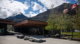
A compact building with a steep green roof, stone lower walls, dark shingle siding, dormers, and white trim stands among mature trees on a maintained lawn. Its picturesque, cottage-like design and covered entrance distinguish it from the surrounding natural scenes, recording one of the built elements associated with visitor use in the Fundy National Park landscape.
Caption
A compact building with a steep green roof, stone lower walls, dark shingle siding, dormers, and white trim stands among mature trees on a maintained lawn. Its picturesque, cottage-like design and covered entrance distinguish it from the surrounding natural scenes, recording one of the built elements associated with visitor use in the Fundy National Park landscape.

Dozens of white daisies with yellow centers spread through tall grasses and other meadow plants, forming an irregular flowering band rather than a planted bed. Their classic white rays, yellow disks, and abundance are consistent with oxeye daisy, a familiar introduced species that readily occupies roadsides, fields, and other open ground in Atlantic Canada.
Caption
Dozens of white daisies with yellow centers spread through tall grasses and other meadow plants, forming an irregular flowering band rather than a planted bed. Their classic white rays, yellow disks, and abundance are consistent with oxeye daisy, a familiar introduced species that readily occupies roadsides, fields, and other open ground in Atlantic Canada.

A single white daisy rises in sharp focus against a softly blurred field of matching blooms, isolating its yellow disk and radiating white petals from the surrounding meadow. The shallow depth of field turns a common open-ground flower into a botanical portrait while still retaining enough background repetition to show it as part of a larger flowering stand.
Caption
A single white daisy rises in sharp focus against a softly blurred field of matching blooms, isolating its yellow disk and radiating white petals from the surrounding meadow. The shallow depth of field turns a common open-ground flower into a botanical portrait while still retaining enough background repetition to show it as part of a larger flowering stand.

Two white daisies overlap in the foreground, their yellow disk centers and slightly irregular white rays sharply defined against a dark, softly mottled meadow. A few out-of-focus blossoms remain behind them, but the tighter composition concentrates attention on the paired flowers and their contrasting bright petals and warm centers.
Caption
Two white daisies overlap in the foreground, their yellow disk centers and slightly irregular white rays sharply defined against a dark, softly mottled meadow. A few out-of-focus blossoms remain behind them, but the tighter composition concentrates attention on the paired flowers and their contrasting bright petals and warm centers.

Wildlife-themed ceramic mugs line a wooden shelf in the Fundy National Park gift shop. Moose silhouettes and conifer motifs appear in contrasting designs, with the park name printed near the base. The close view records the visual vocabulary used in contemporary park souvenirs, linking recognizable Canadian wildlife with the visitor retail setting.
Caption
Wildlife-themed ceramic mugs line a wooden shelf in the Fundy National Park gift shop. Moose silhouettes and conifer motifs appear in contrasting designs, with the park name printed near the base. The close view records the visual vocabulary used in contemporary park souvenirs, linking recognizable Canadian wildlife with the visitor retail setting.

Clusters of purple, pea-shaped blossoms hang among grasses and fernlike foliage in a moist, densely vegetated setting. The flower form suggests a vetch or closely related member of the pea family, but the proof-sheet view does not provide enough diagnostic detail for a secure species identification. The shallow depth of field isolates the flowering stems from the surrounding greenery.
Caption
Clusters of purple, pea-shaped blossoms hang among grasses and fernlike foliage in a moist, densely vegetated setting. The flower form suggests a vetch or closely related member of the pea family, but the proof-sheet view does not provide enough diagnostic detail for a secure species identification. The shallow depth of field isolates the flowering stems from the surrounding greenery.

Three bilingual interpretive panels introduce themes of tides, ecological connections, and the shrinking Acadian forest. Mounted together at a forested overlook, they connect Fundy National Park’s coastal processes with its terrestrial ecology. The arrangement documents how Parks Canada interprets multiple natural-history themes at a single visitor stop.
Caption
Three bilingual interpretive panels introduce themes of tides, ecological connections, and the shrinking Acadian forest. Mounted together at a forested overlook, they connect Fundy National Park’s coastal processes with its terrestrial ecology. The arrangement documents how Parks Canada interprets multiple natural-history themes at a single visitor stop.

A low circular interpretive installation is set into a paved visitor area, its central map-like relief surrounded by segmented wood and metal rings. Text around the base invokes national parks as places preserved for the people, turning the functional viewing surface into a compact statement about conservation and public stewardship.
Caption
A low circular interpretive installation is set into a paved visitor area, its central map-like relief surrounded by segmented wood and metal rings. Text around the base invokes national parks as places preserved for the people, turning the functional viewing surface into a compact statement about conservation and public stewardship.

Bilingual panels titled around ecological integrity explain the park’s role in conservation and representation of Canada’s natural regions. Photographs, maps, and blocks of text are arranged across a railing-mounted display surrounded by living vegetation, visually reinforcing the ecological subject being interpreted for visitors.
Caption
Bilingual panels titled around ecological integrity explain the park’s role in conservation and representation of Canada’s natural regions. Photographs, maps, and blocks of text are arranged across a railing-mounted display surrounded by living vegetation, visually reinforcing the ecological subject being interpreted for visitors.

The red Point Wolfe covered bridge spans the rocky river gorge as the road curves toward its enclosed portal. Its long timber-clad side, dark shingled roof, and elevated foundation contrast with the surrounding coniferous forest. This oblique exterior view emphasizes the bridge’s relationship to the narrow valley and roadway rather than its internal timber structure.
Caption
The red Point Wolfe covered bridge spans the rocky river gorge as the road curves toward its enclosed portal. Its long timber-clad side, dark shingled roof, and elevated foundation contrast with the surrounding coniferous forest. This oblique exterior view emphasizes the bridge’s relationship to the narrow valley and roadway rather than its internal timber structure.

The road approaches the red portal of the Point Wolfe covered bridge after rain, with a vehicle paused near the entrance. Rock walls, guardrails, and dense forest compress the roadway around the structure. The frontal-oblique viewpoint makes the enclosed opening and bridge clearance more prominent than in the preceding broad exterior view.
Caption
The road approaches the red portal of the Point Wolfe covered bridge after rain, with a vehicle paused near the entrance. Rock walls, guardrails, and dense forest compress the roadway around the structure. The frontal-oblique viewpoint makes the enclosed opening and bridge clearance more prominent than in the preceding broad exterior view.

Inside the Point Wolfe covered bridge, a vehicle travels along rain-darkened wooden decking toward the bright far portal. Repetitive timber posts, braces, and roof members form a tunnel-like frame, while reflected red taillights streak across the wet floorboards. A posted 23-tonne maximum sign is visible at the entrance.
Caption
Inside the Point Wolfe covered bridge, a vehicle travels along rain-darkened wooden decking toward the bright far portal. Repetitive timber posts, braces, and roof members form a tunnel-like frame, while reflected red taillights streak across the wet floorboards. A posted 23-tonne maximum sign is visible at the entrance.

The Point Wolfe River bends through a rocky, forested channel, with a broad gravel deposit occupying the inside of the bend. Fallen and cut-looking logs collect along the left bank beneath steep vegetated slopes. The elevated viewpoint gives a clearer reading of channel form, sediment, and woody debris than the preceding downstream view.
Caption
The Point Wolfe River bends through a rocky, forested channel, with a broad gravel deposit occupying the inside of the bend. Fallen and cut-looking logs collect along the left bank beneath steep vegetated slopes. The elevated viewpoint gives a clearer reading of channel form, sediment, and woody debris than the preceding downstream view.

Daylight floods the far portal of the Point Wolfe covered bridge, silhouetting the repeated timber trusses and side braces that carry the enclosed span. The centered viewpoint turns the structural system into a strong sequence of geometric frames, while the plank roadway and narrow pedestrian edge lead directly toward the exit.
Caption
Daylight floods the far portal of the Point Wolfe covered bridge, silhouetting the repeated timber trusses and side braces that carry the enclosed span. The centered viewpoint turns the structural system into a strong sequence of geometric frames, while the plank roadway and narrow pedestrian edge lead directly toward the exit.

A darker interior view of the Point Wolfe covered bridge concentrates on the underside of the roof and the heavy timber members above the roadway. Metal connector plates punctuate the beams, while the far opening frames wet pavement and greenery outside. The lower exposure brings the bridge’s enclosed construction and layered structural members forward.
Caption
A darker interior view of the Point Wolfe covered bridge concentrates on the underside of the roof and the heavy timber members above the roadway. Metal connector plates punctuate the beams, while the far opening frames wet pavement and greenery outside. The lower exposure brings the bridge’s enclosed construction and layered structural members forward.

Woody debris lies stacked along the bank of the Point Wolfe River beneath a steep, reddish rock face. Dark flowing water fills the foreground while moss, conifers, and deciduous growth crowd the narrow gorge. The lateral view emphasizes the interaction of river current, fallen timber, exposed bedrock, and forest at the gorge floor.
Caption
Woody debris lies stacked along the bank of the Point Wolfe River beneath a steep, reddish rock face. Dark flowing water fills the foreground while moss, conifers, and deciduous growth crowd the narrow gorge. The lateral view emphasizes the interaction of river current, fallen timber, exposed bedrock, and forest at the gorge floor.

A simple timber gateway marks a Point Wolfe trail entrance, where a gravel path disappears into dense evergreen forest. A green-and-white Point Wolfe sign spans the crossbeam, with smaller trail symbols and an information board nearby. The restrained trailhead infrastructure transitions immediately from the visitor area into shaded woodland.
Caption
A simple timber gateway marks a Point Wolfe trail entrance, where a gravel path disappears into dense evergreen forest. A green-and-white Point Wolfe sign spans the crossbeam, with smaller trail symbols and an information board nearby. The restrained trailhead infrastructure transitions immediately from the visitor area into shaded woodland.

Red-painted portal boards frame the shadowed interior of the Point Wolfe covered bridge, drawing the eye through successive timber bays toward a bright roadway beyond. The symmetrical composition highlights the contrast between the bridge’s painted exterior sheathing and its unfinished structural wood, with the plank deck forming a strong central axis.
Caption
Red-painted portal boards frame the shadowed interior of the Point Wolfe covered bridge, drawing the eye through successive timber bays toward a bright roadway beyond. The symmetrical composition highlights the contrast between the bridge’s painted exterior sheathing and its unfinished structural wood, with the plank deck forming a strong central axis.

Looking upward inside the Point Wolfe covered bridge reveals the dense timber roof system: repeated triangular trusses, diagonal cross-bracing, vertical hangers, and metal connection hardware. Freed from the roadway view, the composition records the craftsmanship and structural rhythm of the enclosed span in unusually direct detail.
Caption
Looking upward inside the Point Wolfe covered bridge reveals the dense timber roof system: repeated triangular trusses, diagonal cross-bracing, vertical hangers, and metal connection hardware. Freed from the roadway view, the composition records the craftsmanship and structural rhythm of the enclosed span in unusually direct detail.

The Point Wolfe River is seen through a rectangular opening in the covered bridge, turning the dark interior wall into a natural frame. Outside, the shallow channel divides around a broad gravel bar before winding into dense forest and low hills. The viewpoint explicitly connects the bridge structure with the river landscape below.
Caption
The Point Wolfe River is seen through a rectangular opening in the covered bridge, turning the dark interior wall into a natural frame. Outside, the shallow channel divides around a broad gravel bar before winding into dense forest and low hills. The viewpoint explicitly connects the bridge structure with the river landscape below.

A bilingual Trans Canada Trail marker is mounted directly to weathered wooden boards. The blue maple-leaf emblem is split by a winding white path, with “Trans Canada Trail / Sentier Transcanadien” printed below. The close detail records a national trail-system marker encountered in the Point Wolfe area of Fundy National Park.
Caption
A bilingual Trans Canada Trail marker is mounted directly to weathered wooden boards. The blue maple-leaf emblem is split by a winding white path, with “Trans Canada Trail / Sentier Transcanadien” printed below. The close detail records a national trail-system marker encountered in the Point Wolfe area of Fundy National Park.

A bilingual interpretive panel identifies the Point Wolfe River and places it within a longer history of tides, logging, and landscape change. Historic photographs and explanatory sections titled “Timing the Tide” and “Looking Back in Time” accompany the central river heading, connecting the present gorge with human use of the watershed.
Caption
A bilingual interpretive panel identifies the Point Wolfe River and places it within a longer history of tides, logging, and landscape change. Historic photographs and explanatory sections titled “Timing the Tide” and “Looking Back in Time” accompany the central river heading, connecting the present gorge with human use of the watershed.

The bilingual panel “The Cost of Cutting” interprets the ecological consequences of historic timber cutting around the Point Wolfe River. Archival photographs and a large salmon illustration link forest removal and river alteration with aquatic habitat. Positioned beside the gorge, the exhibit makes the relationship between logging history and river ecology explicit for park visitors.
Caption
The bilingual panel “The Cost of Cutting” interprets the ecological consequences of historic timber cutting around the Point Wolfe River. Archival photographs and a large salmon illustration link forest removal and river alteration with aquatic habitat. Positioned beside the gorge, the exhibit makes the relationship between logging history and river ecology explicit for park visitors.

The red Point Wolfe covered bridge crosses high above the rocky, wooded gorge, viewed from a nearby pedestrian walkway. Only the side and lower portion of the enclosed span are visible through trees, emphasizing how tightly the bridge is fitted into the steep terrain. Railings in the foreground establish the visitor viewpoint beside the river.
Caption
The red Point Wolfe covered bridge crosses high above the rocky, wooded gorge, viewed from a nearby pedestrian walkway. Only the side and lower portion of the enclosed span are visible through trees, emphasizing how tightly the bridge is fitted into the steep terrain. Railings in the foreground establish the visitor viewpoint beside the river.

The front portal of the Point Wolfe covered bridge stands squarely across the narrow road, its red siding vivid against dense green forest. A sign above the opening reads “Point Wolfe,” and a 23-tonne maximum marker appears beside the entrance. This direct approach view provides the clearest identification of the bridge in the sequence.
Caption
The front portal of the Point Wolfe covered bridge stands squarely across the narrow road, its red siding vivid against dense green forest. A sign above the opening reads “Point Wolfe,” and a 23-tonne maximum marker appears beside the entrance. This direct approach view provides the clearest identification of the bridge in the sequence.

A yellow-and-brown trail pictogram shows a stylized person looking through a spotting scope or viewing device. Mounted to a wooden post, the symbol directs visitors toward an observation or scenic-viewing feature without relying on text. Its close framing isolates the wayfinding graphic from the surrounding Point Wolfe trail environment.
Caption
A yellow-and-brown trail pictogram shows a stylized person looking through a spotting scope or viewing device. Mounted to a wooden post, the symbol directs visitors toward an observation or scenic-viewing feature without relying on text. Its close framing isolates the wayfinding graphic from the surrounding Point Wolfe trail environment.

A smiling visitor pauses with two leashed dogs on the Point Wolfe boardwalk, surrounded by ferns and closely spaced conifers. Compared with the preceding walking view, this frame functions as a recreational portrait, placing the person and dogs at the center while retaining enough of the wet timber walkway to establish the forest-trail setting.
Caption
A smiling visitor pauses with two leashed dogs on the Point Wolfe boardwalk, surrounded by ferns and closely spaced conifers. Compared with the preceding walking view, this frame functions as a recreational portrait, placing the person and dogs at the center while retaining enough of the wet timber walkway to establish the forest-trail setting.

A bilingual panel titled “Our Role / Notre rôle” discusses the eastern cougar and the uncertainty surrounding its presence in New Brunswick. The text notes the last known cougar in the province was shot in 1938 and describes later unconfirmed reports, placing the species within a conservation and public-reporting context at Fundy National Park.
Caption
A bilingual panel titled “Our Role / Notre rôle” discusses the eastern cougar and the uncertainty surrounding its presence in New Brunswick. The text notes the last known cougar in the province was shot in 1938 and describes later unconfirmed reports, placing the species within a conservation and public-reporting context at Fundy National Park.

A narrow wooden boardwalk carries the Point Wolfe trail through damp, closely spaced conifers. Railings protect a short bridge-like section before the walkway continues as planks through the shaded forest. Wet surfaces and lush understory vegetation suggest the structure’s practical role in keeping foot traffic above saturated ground.
Caption
A narrow wooden boardwalk carries the Point Wolfe trail through damp, closely spaced conifers. Railings protect a short bridge-like section before the walkway continues as planks through the shaded forest. Wet surfaces and lush understory vegetation suggest the structure’s practical role in keeping foot traffic above saturated ground.

A visitor walks two small dogs along the wet wooden boardwalk through dense conifer forest near Point Wolfe. The railing and narrow planked surface guide the group through the shaded understory, adding human scale to the trail infrastructure. The scene records ordinary recreational use of the park rather than a posed landmark view.
Caption
A visitor walks two small dogs along the wet wooden boardwalk through dense conifer forest near Point Wolfe. The railing and narrow planked surface guide the group through the shaded understory, adding human scale to the trail infrastructure. The scene records ordinary recreational use of the park rather than a posed landmark view.

A wooded rocky headland projects into the Bay of Fundy above a narrow tidal cove. Exposed reddish cliffs meet a pale bar and shallow water below, while foreground spruce partly screens the elevated view. The composition distinguishes the resistant headland from the lower intertidal margin and shows the pronounced vertical relief of this park coastline.
Caption
A wooded rocky headland projects into the Bay of Fundy above a narrow tidal cove. Exposed reddish cliffs meet a pale bar and shallow water below, while foreground spruce partly screens the elevated view. The composition distinguishes the resistant headland from the lower intertidal margin and shows the pronounced vertical relief of this park coastline.

A sequence of narrow bilingual panels mounted to heavy timber posts addresses visitors’ role in protecting wildlife. Animal silhouettes and the repeated heading “Your Role / Votre rôle” appear along a shaded boardwalk, turning the walkway itself into an interpretive corridor. The setting integrates visitor education directly into the surrounding Fundy National Park forest.
Caption
A sequence of narrow bilingual panels mounted to heavy timber posts addresses visitors’ role in protecting wildlife. Animal silhouettes and the repeated heading “Your Role / Votre rôle” appear along a shaded boardwalk, turning the walkway itself into an interpretive corridor. The setting integrates visitor education directly into the surrounding Fundy National Park forest.

Dense rounded clusters of small creamy-white flowers bloom against glossy pinnate foliage and reddish stems. The combination is consistent with a mountain-ash in the genus Sorbus, a group represented in northeastern forest habitats. The close view concentrates on the compact flower heads and branching stems rather than the whole plant, so species-level identification is left open.
Caption
Dense rounded clusters of small creamy-white flowers bloom against glossy pinnate foliage and reddish stems. The combination is consistent with a mountain-ash in the genus Sorbus, a group represented in northeastern forest habitats. The close view concentrates on the compact flower heads and branching stems rather than the whole plant, so species-level identification is left open.

A broader botanical view shows mountain-ash flower clusters suspended beneath long pinnate leaves on reddish twigs. Compared with the preceding floral close-up, this frame provides stronger evidence of leaf arrangement and overall branching form. The combination supports identification as Sorbus while avoiding a species assignment that cannot be established from the proof sheet alone.
Caption
A broader botanical view shows mountain-ash flower clusters suspended beneath long pinnate leaves on reddish twigs. Compared with the preceding floral close-up, this frame provides stronger evidence of leaf arrangement and overall branching form. The combination supports identification as Sorbus while avoiding a species assignment that cannot be established from the proof sheet alone.

A timber trailhead gateway marks routes for Coppermine and Goose River, with green bilingual destination signs mounted above a gravel path entering dense forest. Trans Canada Trail and caution signage share the posts, documenting a junction where national trail branding, park wayfinding, and safety information converge.
Caption
A timber trailhead gateway marks routes for Coppermine and Goose River, with green bilingual destination signs mounted above a gravel path entering dense forest. Trans Canada Trail and caution signage share the posts, documenting a junction where national trail branding, park wayfinding, and safety information converge.

A bilingual panel introduces the Coastal Trail, describing a mixed-forest route along the Bay of Fundy and illustrating the path with a simple map. The panel situates the hiking experience between wooded uplands and the marine shoreline, while route graphics help visitors understand the trail’s relationship to the coast before entering it.
Caption
A bilingual panel introduces the Coastal Trail, describing a mixed-forest route along the Bay of Fundy and illustrating the path with a simple map. The panel situates the hiking experience between wooded uplands and the marine shoreline, while route graphics help visitors understand the trail’s relationship to the coast before entering it.

White five-petaled blossoms open on a thorny-looking, leafy stem in bright sunlight. Numerous stamens form pale centers, a floral structure characteristic of brambles in the genus Rubus. The close view provides strong family and genus-level cues, but leaves insufficient evidence to distinguish confidently among raspberry and blackberry relatives.
Caption
White five-petaled blossoms open on a thorny-looking, leafy stem in bright sunlight. Numerous stamens form pale centers, a floral structure characteristic of brambles in the genus Rubus. The close view provides strong family and genus-level cues, but leaves insufficient evidence to distinguish confidently among raspberry and blackberry relatives.

A wooden viewing platform occupies a grassy opening above the Bay of Fundy, with a forested headland extending into calm blue-gray water. Interpretive panels line the railings, linking the broad coastal panorama with the site’s natural and cultural history. The overlook provides an elevated reading of Herring Cove’s wooded shoreline and expansive marine setting.
Caption
A wooden viewing platform occupies a grassy opening above the Bay of Fundy, with a forested headland extending into calm blue-gray water. Interpretive panels line the railings, linking the broad coastal panorama with the site’s natural and cultural history. The overlook provides an elevated reading of Herring Cove’s wooded shoreline and expansive marine setting.

Historic photographs and portraits anchor the bilingual panel “The Way It Was / Images du passé de Herring Cove.” The exhibit recounts the cove’s earlier human landscape through archival imagery, including buildings and residents, contrasting that history with the forested park setting seen today. Its documentary material makes Herring Cove’s cultural history a visible part of the coastal overlook.
Caption
Historic photographs and portraits anchor the bilingual panel “The Way It Was / Images du passé de Herring Cove.” The exhibit recounts the cove’s earlier human landscape through archival imagery, including buildings and residents, contrasting that history with the forested park setting seen today. Its documentary material makes Herring Cove’s cultural history a visible part of the coastal overlook.

A long interpretive panel titled “These Rocks Have a Story To Tell” uses diagrams and photographs to explain the geological history visible around Herring Cove. Cross-sections illustrate changing rock relationships through time, while the overlook setting places those diagrams beside the coastal exposures they interpret. The panel turns the scenic stop into a concise lesson in landscape formation.
Caption
A long interpretive panel titled “These Rocks Have a Story To Tell” uses diagrams and photographs to explain the geological history visible around Herring Cove. Cross-sections illustrate changing rock relationships through time, while the overlook setting places those diagrams beside the coastal exposures they interpret. The panel turns the scenic stop into a concise lesson in landscape formation.

Reddish, rounded bedrock ledges form the edge of a small tidal inlet beneath dense coastal forest at Herring Cove. Shallow clear water reveals submerged rock surfaces and marine growth near the lower margin. The elevated view emphasizes the contact between resistant rock, intertidal water, and vegetation without assigning a formation not established by the photograph alone.
Caption
Reddish, rounded bedrock ledges form the edge of a small tidal inlet beneath dense coastal forest at Herring Cove. Shallow clear water reveals submerged rock surfaces and marine growth near the lower margin. The elevated view emphasizes the contact between resistant rock, intertidal water, and vegetation without assigning a formation not established by the photograph alone.

A wooded promontory drops to reddish rock shelves at Herring Cove, with the open Bay of Fundy filling the background. Deciduous foliage partly conceals the intertidal edge, creating a layered view from upland vegetation to exposed coastal rock and calm marine water. The frame broadens the preceding geological detail into its larger shoreline setting.
Caption
A wooded promontory drops to reddish rock shelves at Herring Cove, with the open Bay of Fundy filling the background. Deciduous foliage partly conceals the intertidal edge, creating a layered view from upland vegetation to exposed coastal rock and calm marine water. The frame broadens the preceding geological detail into its larger shoreline setting.

A broad Herring Cove panorama looks across the Bay of Fundy toward a high, forested headland under layered storm clouds. A small vessel provides scale on the water, while dark conifers frame the lower foreground. The expansive composition shifts from close shoreline geology to the larger coastal relief and marine horizon.
Caption
A broad Herring Cove panorama looks across the Bay of Fundy toward a high, forested headland under layered storm clouds. A small vessel provides scale on the water, while dark conifers frame the lower foreground. The expansive composition shifts from close shoreline geology to the larger coastal relief and marine horizon.

Glossy yellow, five-petaled buttercup flowers rise above dark green vegetation, their reflective petals catching isolated patches of sunlight. Several blossoms appear at different stages, from rounded buds to fully open flowers. The floral form supports identification as a buttercup in the genus Ranunculus, though the proof sheet does not establish a particular species.
Caption
Glossy yellow, five-petaled buttercup flowers rise above dark green vegetation, their reflective petals catching isolated patches of sunlight. Several blossoms appear at different stages, from rounded buds to fully open flowers. The floral form supports identification as a buttercup in the genus Ranunculus, though the proof sheet does not establish a particular species.

A weathered hollow timber has become a miniature growing site for moss, lichen, and a young leafy plant. Cracked end grain and charred-looking dark wood surround the small pocket of vegetation, while the blurred meadow behind isolates this accidental microhabitat. The close detail records natural recolonization of a human-cut wooden element.
Caption
A weathered hollow timber has become a miniature growing site for moss, lichen, and a young leafy plant. Cracked end grain and charred-looking dark wood surround the small pocket of vegetation, while the blurred meadow behind isolates this accidental microhabitat. The close detail records natural recolonization of a human-cut wooden element.

A shallow, fast-moving stream winds through a lush valley floor, dividing around exposed stones and low vegetated islands. Dense shrubs crowd the banks and mixed forest rises behind, while a road or path traces the right side of the valley. The scene emphasizes freshwater habitat within Fundy National Park rather than the marine coast seen in neighboring frames.
Caption
A shallow, fast-moving stream winds through a lush valley floor, dividing around exposed stones and low vegetated islands. Dense shrubs crowd the banks and mixed forest rises behind, while a road or path traces the right side of the valley. The scene emphasizes freshwater habitat within Fundy National Park rather than the marine coast seen in neighboring frames.

At low tide, broad mud and gravel flats extend across Herring Cove beneath an overcast sky. A steep wooded cliff anchors the left edge while shallow tidal channels curve across the exposed seabed; tiny visitors provide scale near the center. The receded water makes the Bay of Fundy’s large tidal range directly legible in the landscape.
Caption
At low tide, broad mud and gravel flats extend across Herring Cove beneath an overcast sky. A steep wooded cliff anchors the left edge while shallow tidal channels curve across the exposed seabed; tiny visitors provide scale near the center. The receded water makes the Bay of Fundy’s large tidal range directly legible in the landscape.

A bilingual Parks Canada monument sign identifies Fundy National Park of Canada beside the roadway. Green-and-white panels are mounted on a substantial stone base, with a Canadian flag rising behind. The formal roadside marker provides an unmistakable institutional identification of the protected landscape documented throughout the portfolio.
Caption
A bilingual Parks Canada monument sign identifies Fundy National Park of Canada beside the roadway. Green-and-white panels are mounted on a substantial stone base, with a Canadian flag rising behind. The formal roadside marker provides an unmistakable institutional identification of the protected landscape documented throughout the portfolio.

A brightly illustrated bilingual sign welcomes visitors to the Fundy shore with lobsters, crabs, shells, seaweed, and other intertidal life. Text describes the shore as a shared home and asks visitors to explore while leaving it for others to enjoy. The playful artwork turns low-impact recreation guidance into an accessible stewardship message.
Caption
A brightly illustrated bilingual sign welcomes visitors to the Fundy shore with lobsters, crabs, shells, seaweed, and other intertidal life. Text describes the shore as a shared home and asks visitors to explore while leaving it for others to enjoy. The playful artwork turns low-impact recreation guidance into an accessible stewardship message.

Slender yellow flower spikes hang among three-part leaves in a sunlit patch near the Fundy coast. The small pea-like blossoms and trifoliate foliage are consistent with yellow sweet-clover, Melilotus officinalis, a widespread introduced plant in disturbed habitats. The close view isolates several flowering stems against softly blurred greenery.
Caption
Slender yellow flower spikes hang among three-part leaves in a sunlit patch near the Fundy coast. The small pea-like blossoms and trifoliate foliage are consistent with yellow sweet-clover, Melilotus officinalis, a widespread introduced plant in disturbed habitats. The close view isolates several flowering stems against softly blurred greenery.

A dense stand of yellow sweet-clover fills the frame with hundreds of narrow flowering racemes. Seen at colony scale rather than as an individual plant, the vegetation forms a yellow-green mass typical of disturbed open ground. This broader view complements the preceding close-up by showing the abundance and growth habit of the species at the site.
Caption
A dense stand of yellow sweet-clover fills the frame with hundreds of narrow flowering racemes. Seen at colony scale rather than as an individual plant, the vegetation forms a yellow-green mass typical of disturbed open ground. This broader view complements the preceding close-up by showing the abundance and growth habit of the species at the site.

A branching piece of driftwood rests on rippled wet sediment far below the high-tide line. Shallow water and parallel tidal bands extend across the background, emphasizing the vast area uncovered as the Bay of Fundy recedes. The isolated wood provides a simple scale cue within an otherwise broad, sparsely occupied intertidal surface.
Caption
A branching piece of driftwood rests on rippled wet sediment far below the high-tide line. Shallow water and parallel tidal bands extend across the background, emphasizing the vast area uncovered as the Bay of Fundy recedes. The isolated wood provides a simple scale cue within an otherwise broad, sparsely occupied intertidal surface.

Moss and marine growth soften the lower stones of a large riprap embankment at the edge of the Fundy shore. Dark angular boulders rise toward dense forest, while smaller beach cobbles occupy the foreground. The contrast between vegetated upper land, engineered rock, and tide-influenced lower surfaces shows the layered character of this developed shoreline.
Caption
Moss and marine growth soften the lower stones of a large riprap embankment at the edge of the Fundy shore. Dark angular boulders rise toward dense forest, while smaller beach cobbles occupy the foreground. The contrast between vegetated upper land, engineered rock, and tide-influenced lower surfaces shows the layered character of this developed shoreline.

Brown rockweed clings densely to the lower surfaces of large shoreline boulders, while green algal growth coats the more exposed faces above. The close view records clear biological zonation on the intertidal rocks, where different moisture and immersion conditions create contrasting bands of marine vegetation across the stone surfaces.
Caption
Brown rockweed clings densely to the lower surfaces of large shoreline boulders, while green algal growth coats the more exposed faces above. The close view records clear biological zonation on the intertidal rocks, where different moisture and immersion conditions create contrasting bands of marine vegetation across the stone surfaces.

A compact clump of coarse beach grass grows from sandy upper-shore sediment above the exposed tidal flats. Seed heads rise above narrow green blades while the low-tide beach and blue water recede into the background. The isolated plant demonstrates how salt-tolerant vegetation begins to colonize the transition between beach and more stable upland ground.
Caption
A compact clump of coarse beach grass grows from sandy upper-shore sediment above the exposed tidal flats. Seed heads rise above narrow green blades while the low-tide beach and blue water recede into the background. The isolated plant demonstrates how salt-tolerant vegetation begins to colonize the transition between beach and more stable upland ground.

A large turquoise roadside sign welcomes travelers to Alma, the community immediately outside Fundy National Park, and proclaims it the “Home of the Highest Tides in the World.” Lobsters, shells, a whale, and stylized waves surround the lettering, visually tying the village identity to the Bay of Fundy’s marine environment and celebrated tidal range.
Caption
A large turquoise roadside sign welcomes travelers to Alma, the community immediately outside Fundy National Park, and proclaims it the “Home of the Highest Tides in the World.” Lobsters, shells, a whale, and stylized waves surround the lettering, visually tying the village identity to the Bay of Fundy’s marine environment and celebrated tidal range.

A narrow tidal channel winds through broad exposed sediment flats between forested hills near Alma. Pale sand and mud bars occupy most of the valley floor, while buildings line the distant right bank beneath steep green slopes. The low-water view demonstrates how dramatically Fundy tides reshape river mouths and estuarine channels along this coast.
Caption
A narrow tidal channel winds through broad exposed sediment flats between forested hills near Alma. Pale sand and mud bars occupy most of the valley floor, while buildings line the distant right bank beneath steep green slopes. The low-water view demonstrates how dramatically Fundy tides reshape river mouths and estuarine channels along this coast.

Fishing boats rest on supports and exposed harbor bottom at low tide in Alma, with compact houses and working waterfront buildings rising behind them. The grounded vessels make the Bay of Fundy’s tidal range immediately visible in a maritime setting, while ramps, docks, utility lines, and shore structures record the practical infrastructure of a small fishing community.
Caption
Fishing boats rest on supports and exposed harbor bottom at low tide in Alma, with compact houses and working waterfront buildings rising behind them. The grounded vessels make the Bay of Fundy’s tidal range immediately visible in a maritime setting, while ramps, docks, utility lines, and shore structures record the practical infrastructure of a small fishing community.

A turquoise commercial fishing boat stands upright on supports against the tall timber pilings of Alma’s harbor at low tide. Antennas, work lights, rigging, and deck equipment identify it as a working vessel, while the exposed harbor floor and elevated wharf structure reveal the tidal conditions that shape daily operations along this Bay of Fundy waterfront.
Caption
A turquoise commercial fishing boat stands upright on supports against the tall timber pilings of Alma’s harbor at low tide. Antennas, work lights, rigging, and deck equipment identify it as a working vessel, while the exposed harbor floor and elevated wharf structure reveal the tidal conditions that shape daily operations along this Bay of Fundy waterfront.

Two fishing boats, one red and one green, sit below the high wharf at low tide in Alma. Dense vertical pilings and the rust-toned retaining wall tower above the vessels, emphasizing the difference between water levels across the tidal cycle. The paired boats provide a strong visual measure of the working harbor’s adaptation to extreme Bay of Fundy tides.
Caption
Two fishing boats, one red and one green, sit below the high wharf at low tide in Alma. Dense vertical pilings and the rust-toned retaining wall tower above the vessels, emphasizing the difference between water levels across the tidal cycle. The paired boats provide a strong visual measure of the working harbor’s adaptation to extreme Bay of Fundy tides.

The black-hulled fishing vessel Fundy Tradition II rests on metal supports beside the wharf at low tide. A Canadian flag flies above its wheelhouse, and work lights, antennas, and deck equipment crowd the superstructure. Nearby harbor structures and another vessel in the background place this individual boat within Alma’s active Bay of Fundy fishing waterfront.
Caption
The black-hulled fishing vessel Fundy Tradition II rests on metal supports beside the wharf at low tide. A Canadian flag flies above its wheelhouse, and work lights, antennas, and deck equipment crowd the superstructure. Nearby harbor structures and another vessel in the background place this individual boat within Alma’s active Bay of Fundy fishing waterfront.

A large red lobster emblem dominates the gable of a dark shingled waterfront building, while floats and maritime objects hang beneath the covered porch. Wildflowers and shrubs soften the foreground. The oversized crustacean motif unmistakably links the structure with the region’s fishing culture, though the proof sheet does not provide enough legible signage to establish the business name.
Caption
A large red lobster emblem dominates the gable of a dark shingled waterfront building, while floats and maritime objects hang beneath the covered porch. Wildflowers and shrubs soften the foreground. The oversized crustacean motif unmistakably links the structure with the region’s fishing culture, though the proof sheet does not provide enough legible signage to establish the business name.

A mud-splattered off-road vehicle is parked beside a gray visitor-area building marked with large letters and an OPEN flag. The scene shifts from the Alma waterfront toward the Hopewell Rocks visitor complex, documented explicitly in the following map and exhibits. Concrete barriers and outdoor seating indicate a developed service area serving travelers at the coastal attraction.
Caption
A mud-splattered off-road vehicle is parked beside a gray visitor-area building marked with large letters and an OPEN flag. The scene shifts from the Alma waterfront toward the Hopewell Rocks visitor complex, documented explicitly in the following map and exhibits. Concrete barriers and outdoor seating indicate a developed service area serving travelers at the coastal attraction.

A large bilingual orientation panel maps the Hopewell Rocks visitor site, combining trails, facilities, shoreline access, and safety information in a single color-coded plan. The prominent title welcomes visitors to the Hopewell Rocks, while symbols and route lines organize movement through the property. The panel provides direct geographic confirmation for the exhibits and coastal formations that follow.
Caption
A large bilingual orientation panel maps the Hopewell Rocks visitor site, combining trails, facilities, shoreline access, and safety information in a single color-coded plan. The prominent title welcomes visitors to the Hopewell Rocks, while symbols and route lines organize movement through the property. The panel provides direct geographic confirmation for the exhibits and coastal formations that follow.

The Hopewell Rocks Interpretive Centre is approached along a paved path through landscaped grounds and mature trees. The gray, gabled building carries a distinctive circular emblem near the entrance, with a display case mounted beside the doors. This exterior establishes the visitor-education setting for the geology and Bay of Fundy exhibits photographed inside.
Caption
The Hopewell Rocks Interpretive Centre is approached along a paved path through landscaped grounds and mature trees. The gray, gabled building carries a distinctive circular emblem near the entrance, with a display case mounted beside the doors. This exterior establishes the visitor-education setting for the geology and Bay of Fundy exhibits photographed inside.

A circular emblem depicts the distinctive sea-stack forms associated with the Hopewell Rocks above stylized blue water and an orange shoreline. Mounted on the visitor-centre wall, the simplified graphic condenses the site’s recognizable geology into a wayfinding identity, preparing visitors for the flowerpot formations interpreted inside and encountered along the shore.
Caption
A circular emblem depicts the distinctive sea-stack forms associated with the Hopewell Rocks above stylized blue water and an orange shoreline. Mounted on the visitor-centre wall, the simplified graphic condenses the site’s recognizable geology into a wayfinding identity, preparing visitors for the flowerpot formations interpreted inside and encountered along the shore.

Large panoramic photographs inside the interpretive centre show visitors walking among the Hopewell Rocks at low tide. Repeated views across the wall emphasize the scale of the eroded pillars and the human access possible when the seabed is exposed. The display uses immersive photography to introduce the formations before visitors descend to the shoreline.
Caption
Large panoramic photographs inside the interpretive centre show visitors walking among the Hopewell Rocks at low tide. Repeated views across the wall emphasize the scale of the eroded pillars and the human access possible when the seabed is exposed. The display uses immersive photography to introduce the formations before visitors descend to the shoreline.

A bilingual exhibit titled “New Brunswick Landscape: Where Geology Meets Art” combines maps, historic imagery, explanatory text, and photographs of coastal formations. The display places the Hopewell Rocks within a wider provincial landscape story, linking geological processes with the ways artists and observers have represented New Brunswick’s distinctive scenery.
Caption
A bilingual exhibit titled “New Brunswick Landscape: Where Geology Meets Art” combines maps, historic imagery, explanatory text, and photographs of coastal formations. The display places the Hopewell Rocks within a wider provincial landscape story, linking geological processes with the ways artists and observers have represented New Brunswick’s distinctive scenery.

A large plush moose stands inside the Hopewell Rocks visitor centre wearing a red-and-black plaid vest embroidered with the site name. Oversized antlers, rounded muzzle, and soft sculpted body give the figure a friendly mascot-like presence, introducing a playful wildlife element among the more formal geology and natural-history displays.
Caption
A large plush moose stands inside the Hopewell Rocks visitor centre wearing a red-and-black plaid vest embroidered with the site name. Oversized antlers, rounded muzzle, and soft sculpted body give the figure a friendly mascot-like presence, introducing a playful wildlife element among the more formal geology and natural-history displays.

The bilingual “Life in the Bay of Fundy” exhibit introduces the bay as a living ecological system rather than only a tidal spectacle. Text panels, a broad coastal photograph, and display elements below the graphic connect marine conditions with organisms and habitats. Its placement within the Hopewell Rocks interpretive centre expands the visitor story from geology to natural history.
Caption
The bilingual “Life in the Bay of Fundy” exhibit introduces the bay as a living ecological system rather than only a tidal spectacle. Text panels, a broad coastal photograph, and display elements below the graphic connect marine conditions with organisms and habitats. Its placement within the Hopewell Rocks interpretive centre expands the visitor story from geology to natural history.

A three-dimensional model accompanies the bilingual exhibit “Hopewell’s Flowerpot Rocks,” translating the shoreline’s eroded pillars into a compact indoor landscape. Small model trees crown the sculpted rock forms, echoing the vegetation that survives atop the real sea stacks. The display explains the formations through scale, profile, and surrounding interpretive text before visitors encounter them outside.
Caption
A three-dimensional model accompanies the bilingual exhibit “Hopewell’s Flowerpot Rocks,” translating the shoreline’s eroded pillars into a compact indoor landscape. Small model trees crown the sculpted rock forms, echoing the vegetation that survives atop the real sea stacks. The display explains the formations through scale, profile, and surrounding interpretive text before visitors encounter them outside.

A broad, compacted path curves gently through dense mixed woodland at the Hopewell Rocks site. Conifers and deciduous trees form a shaded corridor, with ferns and low vegetation along the margins. The accessible-looking route contrasts with the exposed tidal shore ahead, documenting the forested approach that links the interpretive centre with coastal viewpoints and access points.
Caption
A broad, compacted path curves gently through dense mixed woodland at the Hopewell Rocks site. Conifers and deciduous trees form a shaded corridor, with ferns and low vegetation along the margins. The accessible-looking route contrasts with the exposed tidal shore ahead, documenting the forested approach that links the interpretive centre with coastal viewpoints and access points.

A visitor walks two leashed dogs along the shaded forest path at Hopewell Rocks. Tall trunks and dense evergreen growth frame the broad trail, while the casual walking scene records ordinary recreational use of the developed site away from the shoreline. The dogs and person provide human scale within the enclosed woodland corridor.
Caption
A visitor walks two leashed dogs along the shaded forest path at Hopewell Rocks. Tall trunks and dense evergreen growth frame the broad trail, while the casual walking scene records ordinary recreational use of the developed site away from the shoreline. The dogs and person provide human scale within the enclosed woodland corridor.

From a high overlook, the Hopewell Rocks shoreline stretches beneath a densely forested cliff, with sculpted reddish sea stacks rising from exposed intertidal sediment. Darker seaweed bands mark lower rock surfaces while orange-brown flats extend toward calm water. The elevated view shows how erosion has separated pillars from the retreating cliff along the Bay of Fundy.
Caption
From a high overlook, the Hopewell Rocks shoreline stretches beneath a densely forested cliff, with sculpted reddish sea stacks rising from exposed intertidal sediment. Darker seaweed bands mark lower rock surfaces while orange-brown flats extend toward calm water. The elevated view shows how erosion has separated pillars from the retreating cliff along the Bay of Fundy.

Several flowerpot-shaped sea stacks stand below the forested Hopewell Rocks cliff, their narrow, darkened bases supporting broader reddish upper sections crowned with vegetation. Low tide exposes the sediment and seaweed around them, making differential erosion especially legible. The composition concentrates on the sculptural forms that give this Bay of Fundy site its popular identity.
Caption
Several flowerpot-shaped sea stacks stand below the forested Hopewell Rocks cliff, their narrow, darkened bases supporting broader reddish upper sections crowned with vegetation. Low tide exposes the sediment and seaweed around them, making differential erosion especially legible. The composition concentrates on the sculptural forms that give this Bay of Fundy site its popular identity.

A single prominent flowerpot rock fills the frame, its layered reddish upper mass balanced on a narrow, seaweed-darkened pedestal. Vegetation grows across the top while neighboring cliff recesses and tidal sediment provide context. The close view makes the erosional undercutting at the base especially apparent, distinguishing this pillar from the broader shoreline panoramas.
Caption
A single prominent flowerpot rock fills the frame, its layered reddish upper mass balanced on a narrow, seaweed-darkened pedestal. Vegetation grows across the top while neighboring cliff recesses and tidal sediment provide context. The close view makes the erosional undercutting at the base especially apparent, distinguishing this pillar from the broader shoreline panoramas.

A cluster of eroded rock pillars projects from the base of the Hopewell Rocks cliff, with small conifers and shrubs rooted on ledges and summits. Dark seaweed coats the lower surfaces above orange-brown intertidal sediment. The oblique view emphasizes the transition from continuous cliff to isolated stack, revealing multiple stages of coastal erosion within one composition.
Caption
A cluster of eroded rock pillars projects from the base of the Hopewell Rocks cliff, with small conifers and shrubs rooted on ledges and summits. Dark seaweed coats the lower surfaces above orange-brown intertidal sediment. The oblique view emphasizes the transition from continuous cliff to isolated stack, revealing multiple stages of coastal erosion within one composition.

A wider overlook returns the flowerpot formations to their full coastal setting, with forested cliffs, isolated pillars, exposed tidal flats, and the Bay of Fundy extending toward the horizon. Foreground foliage partly frames the scene. The broad composition records both the geological forms and the extensive intertidal zone that visitors can enter when the tide recedes.
Caption
A wider overlook returns the flowerpot formations to their full coastal setting, with forested cliffs, isolated pillars, exposed tidal flats, and the Bay of Fundy extending toward the horizon. Foreground foliage partly frames the scene. The broad composition records both the geological forms and the extensive intertidal zone that visitors can enter when the tide recedes.

A broad gravelly and muddy shore extends toward distant water under a bright, cloud-filled sky near Hopewell Rocks. Low tide has exposed a wide expanse of sediment, while a pile of large rocks and a wooded point define the right edge. The open ground provides a strong contrast with the vertical cliffs and sea stacks photographed from the overlook.
Caption
A broad gravelly and muddy shore extends toward distant water under a bright, cloud-filled sky near Hopewell Rocks. Low tide has exposed a wide expanse of sediment, while a pile of large rocks and a wooded point define the right edge. The open ground provides a strong contrast with the vertical cliffs and sea stacks photographed from the overlook.

Exposed gravel and mud dominate the low-tide shore near Hopewell Rocks, with the sea reduced to a distant band beneath a dramatic summer sky. A rocky embankment and wooded point frame the right side. This second ground-level view emphasizes the breadth and rough texture of the intertidal walking surface before the descent among the famous formations.
Caption
Exposed gravel and mud dominate the low-tide shore near Hopewell Rocks, with the sea reduced to a distant band beneath a dramatic summer sky. A rocky embankment and wooded point frame the right side. This second ground-level view emphasizes the breadth and rough texture of the intertidal walking surface before the descent among the famous formations.

A stairway descends through the trees toward the Hopewell Rocks shoreline beneath a large tide-information board. The display gives hours of operation, identifies an emergency “UP ONLY” route and normal “DOWN ONLY” direction, and lists the day’s high and low tides. The infrastructure makes safe access explicitly dependent on the Bay of Fundy tidal cycle.
Caption
A stairway descends through the trees toward the Hopewell Rocks shoreline beneath a large tide-information board. The display gives hours of operation, identifies an emergency “UP ONLY” route and normal “DOWN ONLY” direction, and lists the day’s high and low tides. The infrastructure makes safe access explicitly dependent on the Bay of Fundy tidal cycle.

A large bilingual Safety Warning explains the hazards of entering the Hopewell Rocks shore and stresses the need to return before the incoming tide cuts off access. Bright yellow panels, red headings, and detailed instructions make the warning visually prominent against the surrounding forest. The sign underscores that visiting the exposed seabed requires close attention to tidal timing.
Caption
A large bilingual Safety Warning explains the hazards of entering the Hopewell Rocks shore and stresses the need to return before the incoming tide cuts off access. Bright yellow panels, red headings, and detailed instructions make the warning visually prominent against the surrounding forest. The sign underscores that visiting the exposed seabed requires close attention to tidal timing.

Metal-railed stairs descend steeply through the wooded slope toward the Hopewell Rocks shoreline. Yellow safety stripes mark each tread and a central divided handrail organizes two-way movement. The engineered descent negotiates the sharp elevation change between the forested cliff top and the intertidal floor, where access is controlled by the tides.
Caption
Metal-railed stairs descend steeply through the wooded slope toward the Hopewell Rocks shoreline. Yellow safety stripes mark each tread and a central divided handrail organizes two-way movement. The engineered descent negotiates the sharp elevation change between the forested cliff top and the intertidal floor, where access is controlled by the tides.

Slender eroded pillars rise from the exposed seabed between massive reddish cliff walls at Hopewell Rocks. Green algae and dark marine growth mark their lower zones, while the Bay of Fundy appears through the narrow opening beyond. The enclosed viewpoint brings visitors visually into the spaces between formations that are submerged or inaccessible at higher stages of the tide.
Caption
Slender eroded pillars rise from the exposed seabed between massive reddish cliff walls at Hopewell Rocks. Green algae and dark marine growth mark their lower zones, while the Bay of Fundy appears through the narrow opening beyond. The enclosed viewpoint brings visitors visually into the spaces between formations that are submerged or inaccessible at higher stages of the tide.

A massive natural arch opens through a vegetation-topped rock mass at Hopewell Rocks, framing the Bay of Fundy and a visitor standing beneath it for scale. Two narrower pillars rise nearby from the exposed seabed. Darkened lower rock surfaces show the intertidal zone, while the broad opening demonstrates an advanced stage in coastal erosion before complete separation into stacks.
Caption
A massive natural arch opens through a vegetation-topped rock mass at Hopewell Rocks, framing the Bay of Fundy and a visitor standing beneath it for scale. Two narrower pillars rise nearby from the exposed seabed. Darkened lower rock surfaces show the intertidal zone, while the broad opening demonstrates an advanced stage in coastal erosion before complete separation into stacks.

A multi-level steel stair tower rises beside the forested cliff at Hopewell Rocks, providing controlled access between the upland trail and the intertidal shore. Visitors stand on the upper landing while flights of stairs descend out of view below. The structure records the engineered transition from cliff-top visitor routes to a seabed that is accessible only during safe tidal conditions.
Caption
A multi-level steel stair tower rises beside the forested cliff at Hopewell Rocks, providing controlled access between the upland trail and the intertidal shore. Visitors stand on the upper landing while flights of stairs descend out of view below. The structure records the engineered transition from cliff-top visitor routes to a seabed that is accessible only during safe tidal conditions.

A massive Hopewell sea stack rises from the exposed intertidal floor, its broad reddish cap balanced above a narrower pedestal darkened by marine growth. A vivid green band of algae marks the mid-level rock surface, visually tracing the zone of repeated tidal wetting. The isolated profile makes the erosional undercutting characteristic of the flowerpot formations especially clear.
Caption
A massive Hopewell sea stack rises from the exposed intertidal floor, its broad reddish cap balanced above a narrower pedestal darkened by marine growth. A vivid green band of algae marks the mid-level rock surface, visually tracing the zone of repeated tidal wetting. The isolated profile makes the erosional undercutting characteristic of the flowerpot formations especially clear.

An eroded opening in the coastal rock frames a neighboring Hopewell flowerpot stack against the pale Bay of Fundy horizon. Dark, seaweed-coated walls create a natural border around the reddish pillar, whose constricted base carries a bright green algal band. The composition shows several stages of erosion at once: cavity formation, arch-like opening, and isolated sea stack.
Caption
An eroded opening in the coastal rock frames a neighboring Hopewell flowerpot stack against the pale Bay of Fundy horizon. Dark, seaweed-coated walls create a natural border around the reddish pillar, whose constricted base carries a bright green algal band. The composition shows several stages of erosion at once: cavity formation, arch-like opening, and isolated sea stack.

A low-tide opening through the rock frames a large Hopewell flowerpot pillar while two visitors stand at the right edge for scale. The dark interior surfaces are coated with marine growth, contrasting with the lighter reddish stack beyond. Human figures make the size of the erosional forms immediately legible and underscore the temporary pedestrian access created by the receding tide.
Caption
A low-tide opening through the rock frames a large Hopewell flowerpot pillar while two visitors stand at the right edge for scale. The dark interior surfaces are coated with marine growth, contrasting with the lighter reddish stack beyond. Human figures make the size of the erosional forms immediately legible and underscore the temporary pedestrian access created by the receding tide.

A deeply undercut rock pillar rises from the exposed shoreline, its narrow trunk heavily darkened by seaweed and marine growth while the broader upper rock remains reddish brown. A second formation appears through the narrow gap at right. The close viewpoint isolates the hourglass-like erosion produced where repeated tidal action concentrates on the lower rock surface.
Caption
A deeply undercut rock pillar rises from the exposed shoreline, its narrow trunk heavily darkened by seaweed and marine growth while the broader upper rock remains reddish brown. A second formation appears through the narrow gap at right. The close viewpoint isolates the hourglass-like erosion produced where repeated tidal action concentrates on the lower rock surface.

A broad, blocky flowerpot rock stands alone on the exposed shore, its reddish upper section resting on a sharply narrowed base. Bands of green algae and darker seaweed wrap around the lower half, recording the vertical reach of the tide. The nearly isolated profile presents the sculptural balance of the formation against a subdued marine horizon.
Caption
A broad, blocky flowerpot rock stands alone on the exposed shore, its reddish upper section resting on a sharply narrowed base. Bands of green algae and darker seaweed wrap around the lower half, recording the vertical reach of the tide. The nearly isolated profile presents the sculptural balance of the formation against a subdued marine horizon.

Layered reddish cliffs line the Hopewell Rocks shore, descending to dark, seaweed-covered ledges exposed at low tide. Forest crowns the cliff tops while shallow water washes around the irregular rock platform in the foreground. This lateral shoreline view broadens attention from individual flowerpot stacks to the cliff system from which those isolated formations are progressively carved.
Caption
Layered reddish cliffs line the Hopewell Rocks shore, descending to dark, seaweed-covered ledges exposed at low tide. Forest crowns the cliff tops while shallow water washes around the irregular rock platform in the foreground. This lateral shoreline view broadens attention from individual flowerpot stacks to the cliff system from which those isolated formations are progressively carved.

The shoreline access tower is seen from the intertidal floor, rising between steep rock walls while visitors cross the exposed shore below. The gray steel framework emphasizes the height of the cliff-top trail above the seabed. Viewed from ground level, the structure demonstrates the significant vertical climb required to enter and leave the tidal zone safely.
Caption
The shoreline access tower is seen from the intertidal floor, rising between steep rock walls while visitors cross the exposed shore below. The gray steel framework emphasizes the height of the cliff-top trail above the seabed. Viewed from ground level, the structure demonstrates the significant vertical climb required to enter and leave the tidal zone safely.

A massive overhanging rock wall dominates the foreground while the Hopewell Rocks access tower rises beyond it. Visitors crossing the open intertidal floor provide scale to both natural and constructed features. The view places the steel tower within a landscape of deeply eroded recesses, showing how visitor infrastructure has been fitted into a narrow corridor between cliff faces.
Caption
A massive overhanging rock wall dominates the foreground while the Hopewell Rocks access tower rises beyond it. Visitors crossing the open intertidal floor provide scale to both natural and constructed features. The view places the steel tower within a landscape of deeply eroded recesses, showing how visitor infrastructure has been fitted into a narrow corridor between cliff faces.

Several Hopewell sea stacks rise together from the low-tide shore, including one narrow flowerpot pillar and a much larger formation crowned by mature conifers. Visitors gathered at the base provide scale to the steep rock walls and undercut pedestals. The grouping shows how isolated pillars can retain substantial vegetation even after erosion separates them from the mainland cliff.
Caption
Several Hopewell sea stacks rise together from the low-tide shore, including one narrow flowerpot pillar and a much larger formation crowned by mature conifers. Visitors gathered at the base provide scale to the steep rock walls and undercut pedestals. The grouping shows how isolated pillars can retain substantial vegetation even after erosion separates them from the mainland cliff.

A Hopewell flowerpot rock stands on a dramatically constricted pedestal, the lower surface darkened by marine growth and banded with bright green algae. Its reddish upper mass projects outward like a broad cap above the narrow stem. The side profile accentuates the imbalance created by differential erosion at the tidal zone.
Caption
A Hopewell flowerpot rock stands on a dramatically constricted pedestal, the lower surface darkened by marine growth and banded with bright green algae. Its reddish upper mass projects outward like a broad cap above the narrow stem. The side profile accentuates the imbalance created by differential erosion at the tidal zone.

Seen from a slightly different angle, the same type of flowerpot formation appears almost hourglass-shaped, with a broad upper block tapering sharply into a narrow waist above a flared base. Bright green algae crosses the constricted zone while dark marine growth coats the lowest rock. A small barrier rope in the foreground marks visitor-management measures on the exposed shore.
Caption
Seen from a slightly different angle, the same type of flowerpot formation appears almost hourglass-shaped, with a broad upper block tapering sharply into a narrow waist above a flared base. Bright green algae crosses the constricted zone while dark marine growth coats the lowest rock. A small barrier rope in the foreground marks visitor-management measures on the exposed shore.

From above, several flowerpot formations are arranged across the exposed intertidal floor, including a broad forest-topped stack and smaller pedestal rocks nearby. A visitor walking below supplies scale, while the pale Bay of Fundy stretches behind the formations. The elevated angle reveals their spacing and the broad tidal surface that connects them at low water.
Caption
From above, several flowerpot formations are arranged across the exposed intertidal floor, including a broad forest-topped stack and smaller pedestal rocks nearby. A visitor walking below supplies scale, while the pale Bay of Fundy stretches behind the formations. The elevated angle reveals their spacing and the broad tidal surface that connects them at low water.

A dramatic cluster of Hopewell formations includes a narrow flowerpot pillar at left, a larger undercut stack crowned with conifers at center, and slimmer rock spires beyond. Dark marine growth coats the bases while the Bay of Fundy forms a calm backdrop. A visitor on the shore gives scale to the verticality and mass of the isolated rocks.
Caption
A dramatic cluster of Hopewell formations includes a narrow flowerpot pillar at left, a larger undercut stack crowned with conifers at center, and slimmer rock spires beyond. Dark marine growth coats the bases while the Bay of Fundy forms a calm backdrop. A visitor on the shore gives scale to the verticality and mass of the isolated rocks.

A tighter elevated view looks down between several Hopewell sea stacks, emphasizing their narrow pedestals and the dark marine-growth zone around each base. The central pillar carries a small patch of vegetation, while a taller slab-like stack and slimmer spire rise behind. A visitor on the shore clarifies the dramatic difference in scale between people and the eroded rock forms.
Caption
A tighter elevated view looks down between several Hopewell sea stacks, emphasizing their narrow pedestals and the dark marine-growth zone around each base. The central pillar carries a small patch of vegetation, while a taller slab-like stack and slimmer spire rise behind. A visitor on the shore clarifies the dramatic difference in scale between people and the eroded rock forms.

A forested sea stack dominates the center of this Hopewell Rocks panorama, flanked by smaller flowerpot pillars with undercut bases. The exposed shore spreads across the foreground, where a single visitor emphasizes scale. Seen from the cliff-top perspective, the composition demonstrates how entire patches of woodland can persist atop rock masses isolated by coastal erosion.
Caption
A forested sea stack dominates the center of this Hopewell Rocks panorama, flanked by smaller flowerpot pillars with undercut bases. The exposed shore spreads across the foreground, where a single visitor emphasizes scale. Seen from the cliff-top perspective, the composition demonstrates how entire patches of woodland can persist atop rock masses isolated by coastal erosion.

Two prominent flowerpot rocks rise from the exposed shore beneath a soft gray sky, their broad reddish caps balanced above narrow dark pedestals. Behind them, a larger forested mass anchors the composition while the Bay of Fundy forms a muted horizon. A lone visitor between the formations provides scale and reinforces the accessibility of the seabed at low tide.
Caption
Two prominent flowerpot rocks rise from the exposed shore beneath a soft gray sky, their broad reddish caps balanced above narrow dark pedestals. Behind them, a larger forested mass anchors the composition while the Bay of Fundy forms a muted horizon. A lone visitor between the formations provides scale and reinforces the accessibility of the seabed at low tide.