Cape of Good Hope – South Africa
The dramatic cliffs of the Cape of Good Hope rise above the meeting waters of the Atlantic and Indian Oceans along the southern tip of the African continent. Located within the Table Mountain National Park, the cape forms one of the most famous coastal landmarks in the world.
For centuries this rugged headland was an important navigational point for ships traveling between Europe and Asia. The surrounding landscapes include rocky cliffs, coastal heathlands, and sweeping ocean views.
Today the Cape of Good Hope offers one of the most dramatic natural landscapes in South Africa.
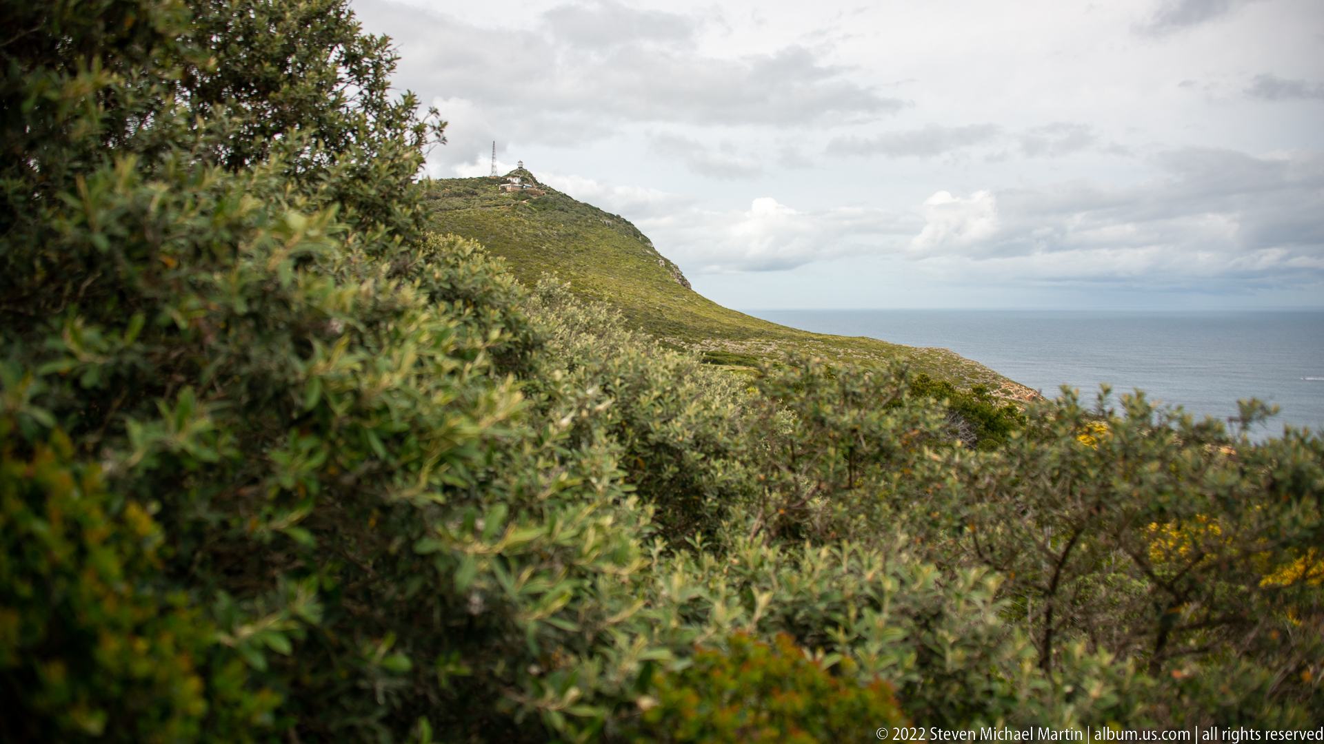
Dense fynbos fills the foreground and middle distance as a rounded mountain slope rises toward a small structure or installation on the skyline. The sea appears as a narrow blue band beyond the vegetation. Rather than centering a landmark, the photograph records the thick shrub community covering the Cape Peninsula’s exposed slopes and the limited openings through which the coast becomes visible.
Caption
Dense fynbos fills the foreground and middle distance as a rounded mountain slope rises toward a small structure or installation on the skyline. The sea appears as a narrow blue band beyond the vegetation. Rather than centering a landmark, the photograph records the thick shrub community covering the Cape Peninsula’s exposed slopes and the limited openings through which the coast becomes visible.
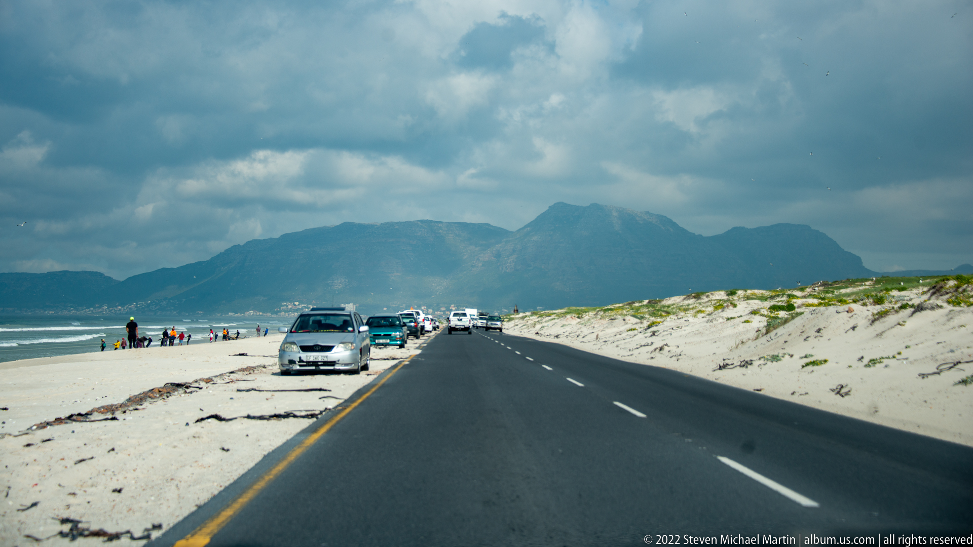
A paved coastal road runs between pale beach sand and vegetated dunes, with cars pulled onto the seaward shoulder and a rugged mountain ridge rising ahead. Beachgoers and vehicles give the scene a human scale, while the roadway creates a strong line toward the mountains bordering False Bay. The view records the developed coastal approach toward the Cape Peninsula rather than an isolated wilderness landscape.
Caption
A paved coastal road runs between pale beach sand and vegetated dunes, with cars pulled onto the seaward shoulder and a rugged mountain ridge rising ahead. Beachgoers and vehicles give the scene a human scale, while the roadway creates a strong line toward the mountains bordering False Bay. The view records the developed coastal approach toward the Cape Peninsula rather than an isolated wilderness landscape.
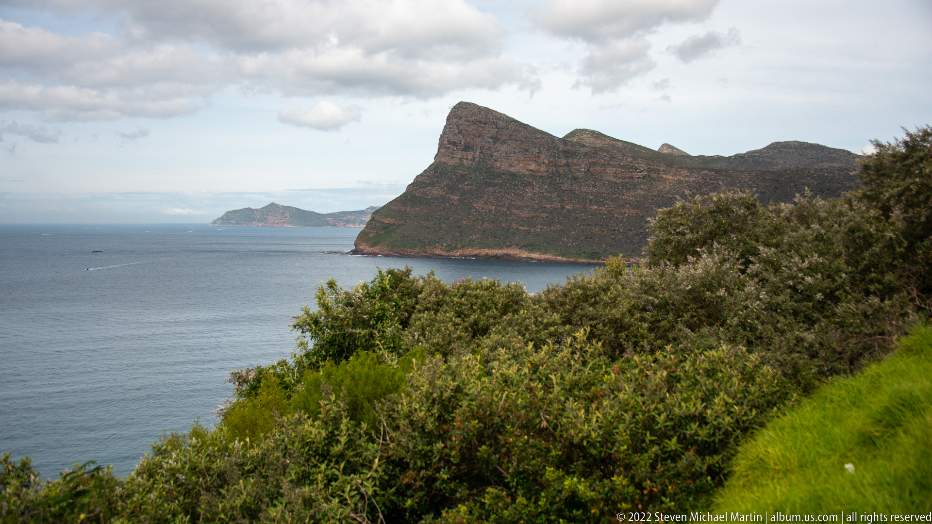
A steep, dark headland rises directly from blue-gray water, its sloping face patterned by reddish rock bands and low vegetation. Dense shrubs fill the foreground while a smaller distant promontory appears beyond the bay. The elevated viewpoint emphasizes the abrupt meeting of mountain and sea that characterizes the southern Cape Peninsula, without forcing a more specific headland identification from visual evidence alone.
Caption
A steep, dark headland rises directly from blue-gray water, its sloping face patterned by reddish rock bands and low vegetation. Dense shrubs fill the foreground while a smaller distant promontory appears beyond the bay. The elevated viewpoint emphasizes the abrupt meeting of mountain and sea that characterizes the southern Cape Peninsula, without forcing a more specific headland identification from visual evidence alone.
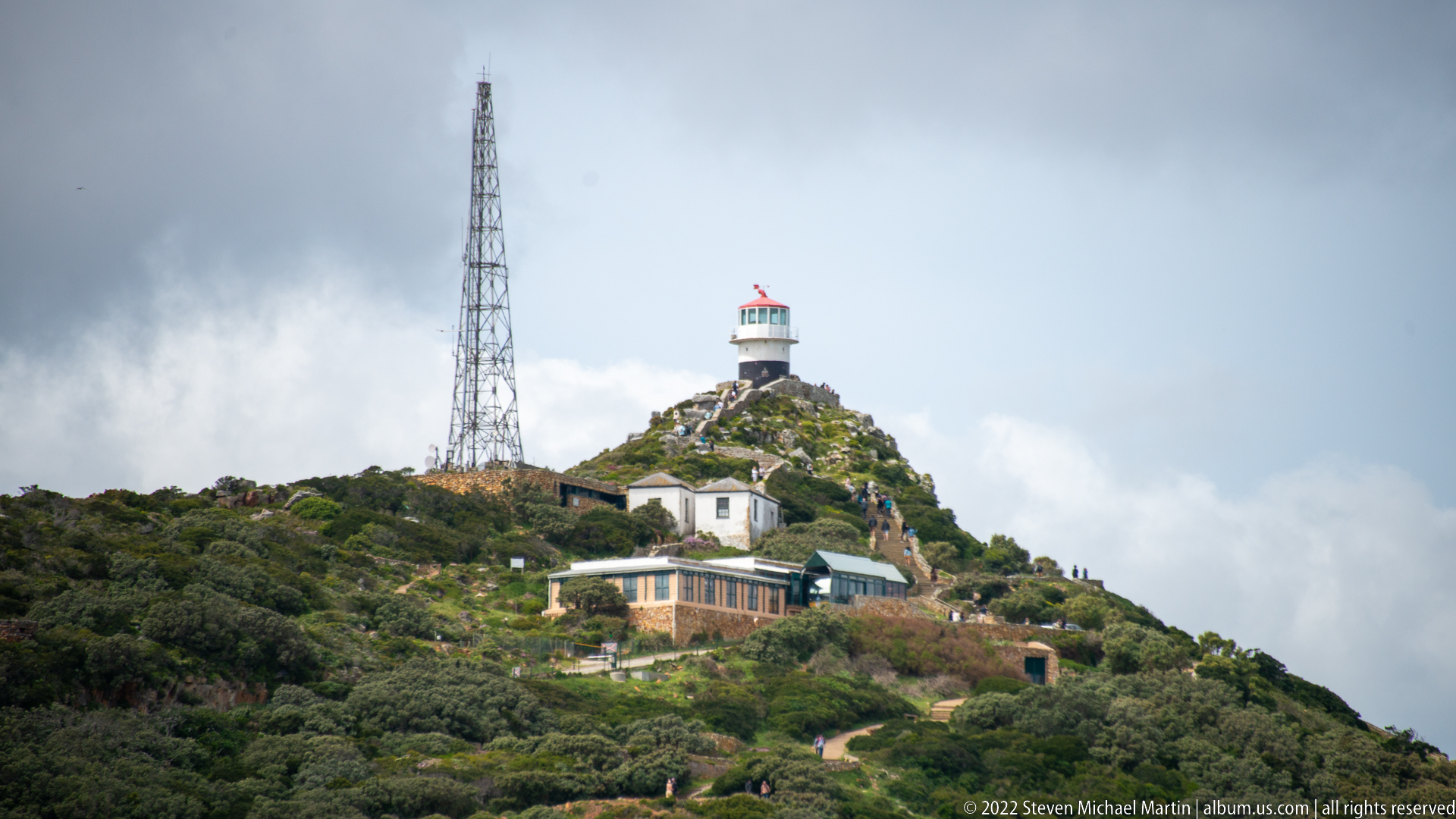
The Old Cape Point Lighthouse crowns a fynbos-covered summit beside a tall communications mast, with service buildings stepping down the slope below. Its compact white tower, dark lantern room, and red cap are clearly visible against the clouded sky. The elevated lighthouse occupies the high ground above Cape Point and forms the principal built landmark in this otherwise densely vegetated mountain setting.
Caption
The Old Cape Point Lighthouse crowns a fynbos-covered summit beside a tall communications mast, with service buildings stepping down the slope below. Its compact white tower, dark lantern room, and red cap are clearly visible against the clouded sky. The elevated lighthouse occupies the high ground above Cape Point and forms the principal built landmark in this otherwise densely vegetated mountain setting.
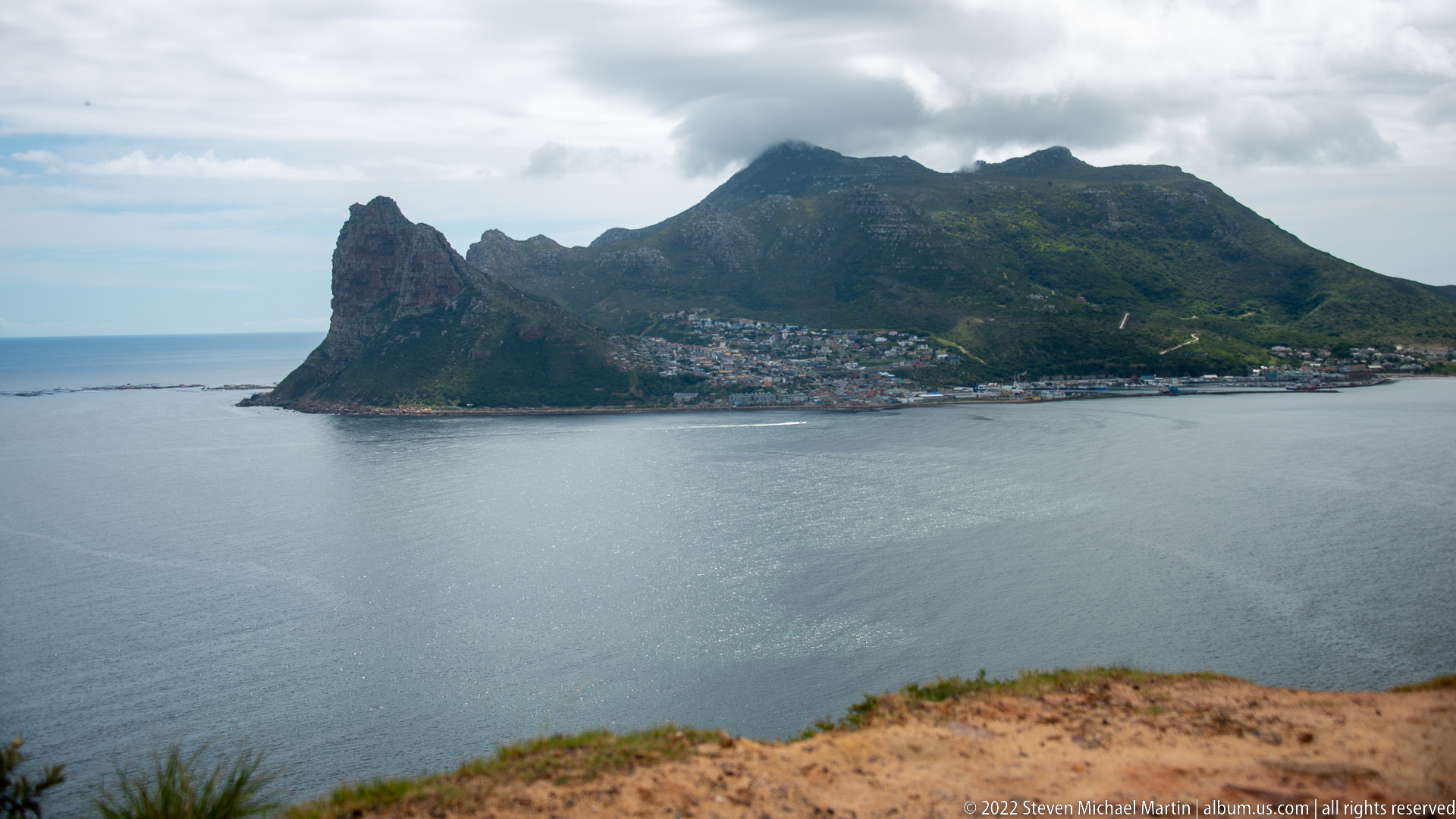
The Sentinel forms a massive, jagged headland above the calm water of Hout Bay, with dense settlement spread along its lower slopes and shoreline. Dark cloud clings to the higher mountain mass behind, while the bay remains smooth in the foreground. Viewed from the Chapman’s Peak side, the composition clearly links the landmark peak, harbor settlement, and enclosing mountain landscape.
Caption
The Sentinel forms a massive, jagged headland above the calm water of Hout Bay, with dense settlement spread along its lower slopes and shoreline. Dark cloud clings to the higher mountain mass behind, while the bay remains smooth in the foreground. Viewed from the Chapman’s Peak side, the composition clearly links the landmark peak, harbor settlement, and enclosing mountain landscape.
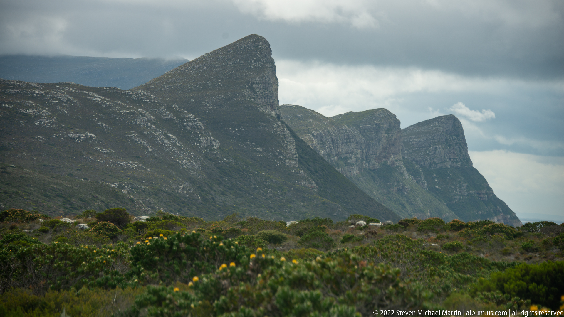
A succession of steep, dark mountain ridges rises dramatically above dense foreground fynbos, the nearest peak forming a sharply angled profile while receding cliffs fade into cloud and haze. Yellow flowers punctuate the shrubland at the bottom of the frame. The telephoto compression transforms the southern Cape Peninsula into a layered study of vegetation, rock faces, and overlapping coastal relief.
Caption
A succession of steep, dark mountain ridges rises dramatically above dense foreground fynbos, the nearest peak forming a sharply angled profile while receding cliffs fade into cloud and haze. Yellow flowers punctuate the shrubland at the bottom of the frame. The telephoto compression transforms the southern Cape Peninsula into a layered study of vegetation, rock faces, and overlapping coastal relief.
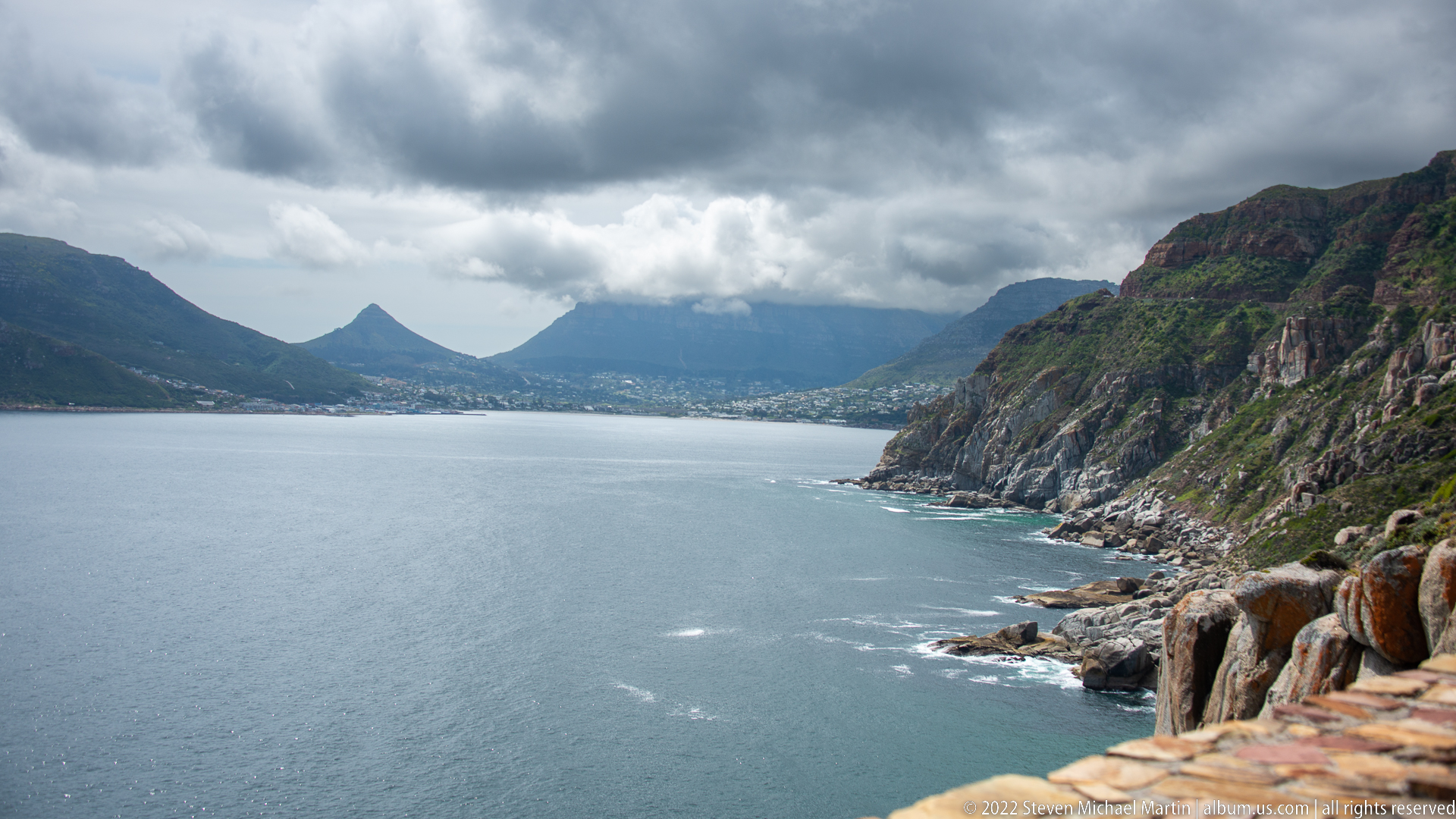
Hout Bay opens across the frame beneath heavy clouds, enclosed by steep mountain walls and rocky headlands. The viewpoint looks from the Chapman’s Peak side across calm gray-blue water toward the settlement and the dramatic peaks beyond. Layered cliffs at right and the enclosed shape of the bay make the photograph a strong geographical overview of the mountain-ringed harbor landscape.
Caption
Hout Bay opens across the frame beneath heavy clouds, enclosed by steep mountain walls and rocky headlands. The viewpoint looks from the Chapman’s Peak side across calm gray-blue water toward the settlement and the dramatic peaks beyond. Layered cliffs at right and the enclosed shape of the bay make the photograph a strong geographical overview of the mountain-ringed harbor landscape.
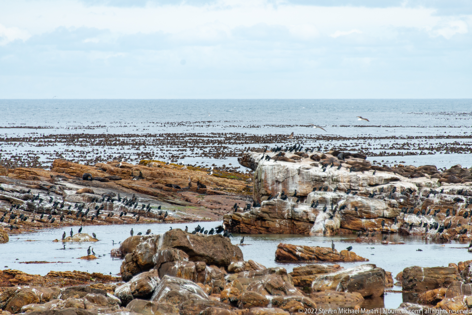
Layered rock platforms step into a broad intertidal zone covered by dark kelp and scattered seabirds. White guano stains the central outcrop while shallow pools and exposed reefs break the surface toward the open sea. The elevated view emphasizes the biologically productive meeting of rock, kelp, birds, and tidal water along the rugged Cape of Good Hope coast.
Caption
Layered rock platforms step into a broad intertidal zone covered by dark kelp and scattered seabirds. White guano stains the central outcrop while shallow pools and exposed reefs break the surface toward the open sea. The elevated view emphasizes the biologically productive meeting of rock, kelp, birds, and tidal water along the rugged Cape of Good Hope coast.
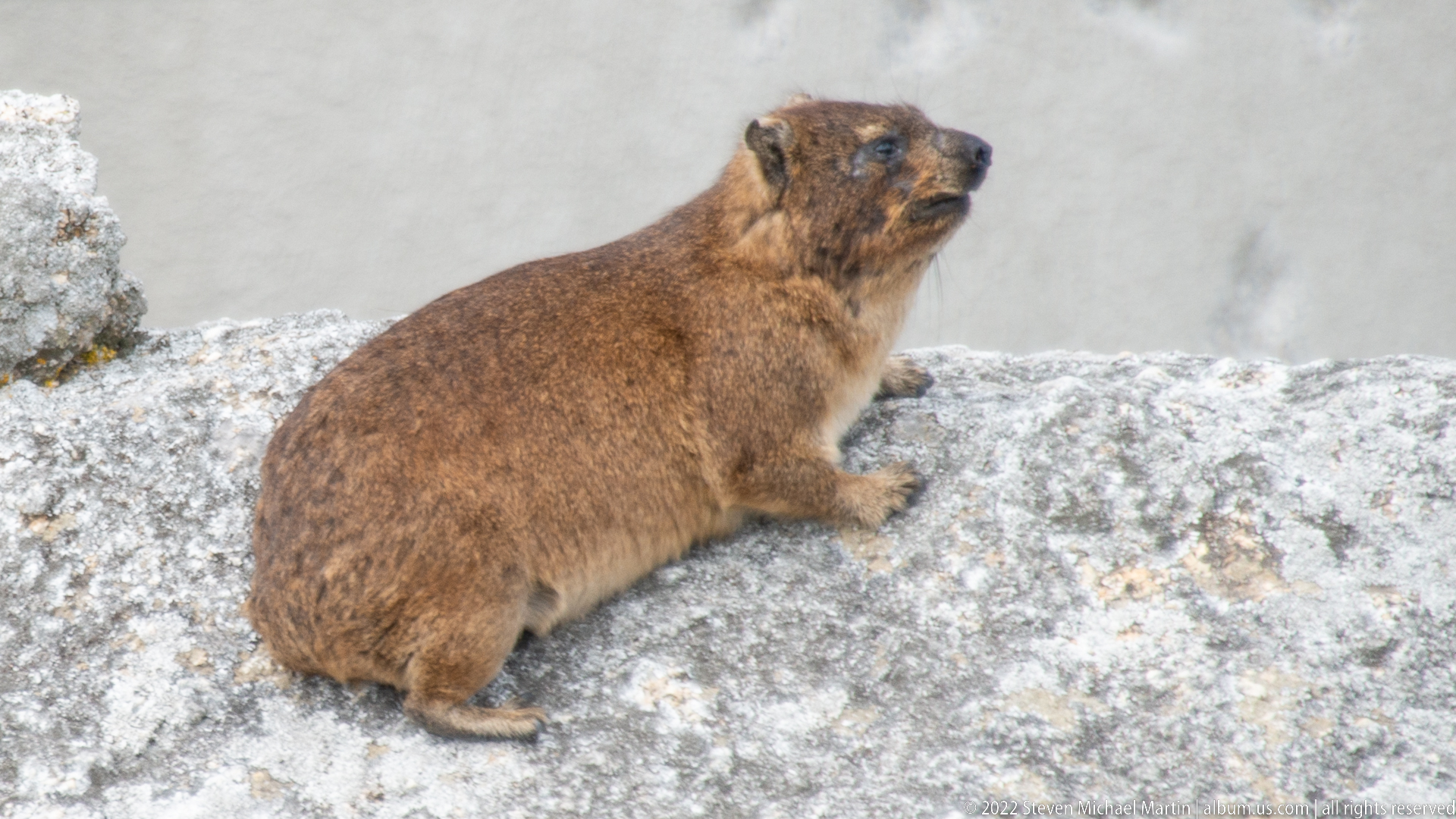
A rock hyrax, locally known as a dassie, sits on pale granite with its compact body, rounded ears, short muzzle, and coarse brown coat clearly visible. Although superficially rodent-like, hyraxes belong to a distinct mammalian lineage and are common on rocky slopes in southern Africa. The animal’s position on exposed stone reflects its characteristic use of boulder-rich habitat.
Caption
A rock hyrax, locally known as a dassie, sits on pale granite with its compact body, rounded ears, short muzzle, and coarse brown coat clearly visible. Although superficially rodent-like, hyraxes belong to a distinct mammalian lineage and are common on rocky slopes in southern Africa. The animal’s position on exposed stone reflects its characteristic use of boulder-rich habitat.
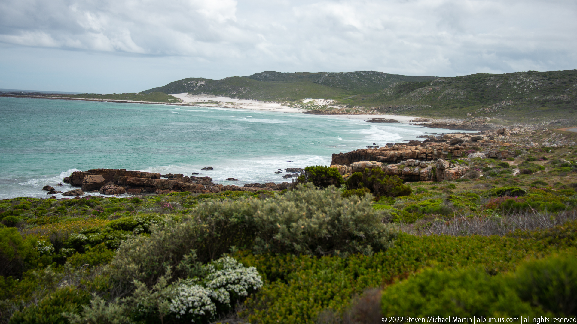
A broad sweep of turquoise water curves toward a pale sandy beach backed by low, densely vegetated hills. Layered coastal rocks edge the nearer shore while varied fynbos shrubs fill the foreground. The elevated viewpoint presents a softer counterpoint to the Cape’s cliff-bound headlands, showing a sheltered bay where beach, rocky margin, and low coastal vegetation meet beneath a changing sky.
Caption
A broad sweep of turquoise water curves toward a pale sandy beach backed by low, densely vegetated hills. Layered coastal rocks edge the nearer shore while varied fynbos shrubs fill the foreground. The elevated viewpoint presents a softer counterpoint to the Cape’s cliff-bound headlands, showing a sheltered bay where beach, rocky margin, and low coastal vegetation meet beneath a changing sky.
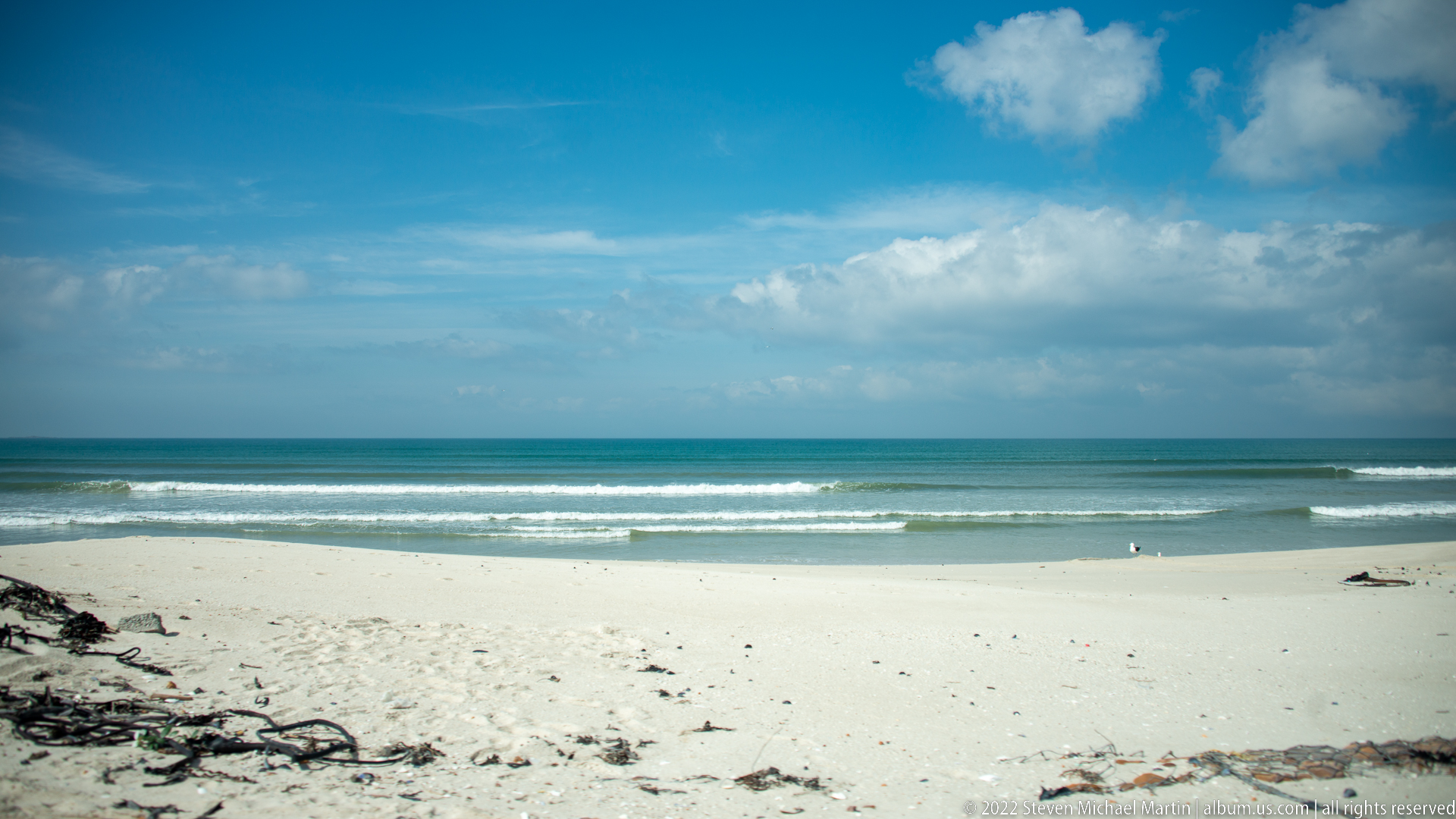
Broad white sand meets low Atlantic surf beneath a bright, cloud-filled sky. Dark strands of washed-up kelp edge the foreground while parallel breakers mark the shallow nearshore water. The open composition establishes the False Bay coastal landscape encountered at the beginning of the Cape of Good Hope route, emphasizing the meeting of dune sand, seaweed wrack, surf, and expansive sky.
Caption
Broad white sand meets low Atlantic surf beneath a bright, cloud-filled sky. Dark strands of washed-up kelp edge the foreground while parallel breakers mark the shallow nearshore water. The open composition establishes the False Bay coastal landscape encountered at the beginning of the Cape of Good Hope route, emphasizing the meeting of dune sand, seaweed wrack, surf, and expansive sky.

Low dunes and a broad sandy beach stretch toward a steep, layered mountain face under broken cloud. Kelp and drift material scatter across the upper beach, while buildings at the mountain's foot indicate the close relationship between the False Bay shoreline and urban settlement. The elevated viewpoint distinguishes this frame as a landscape study of beach, dune, town, and mountain arranged in successive bands.
Caption
Low dunes and a broad sandy beach stretch toward a steep, layered mountain face under broken cloud. Kelp and drift material scatter across the upper beach, while buildings at the mountain's foot indicate the close relationship between the False Bay shoreline and urban settlement. The elevated viewpoint distinguishes this frame as a landscape study of beach, dune, town, and mountain arranged in successive bands.
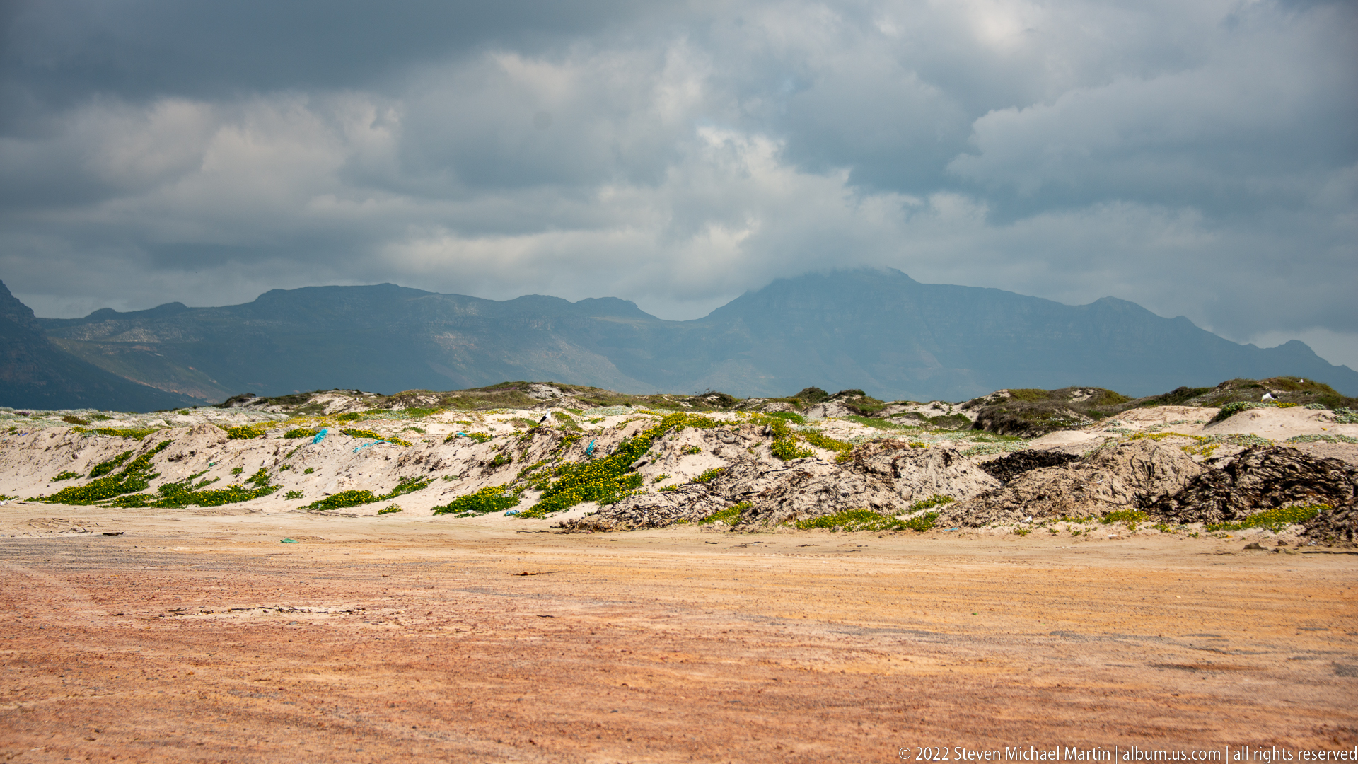
Wind-shaped foredunes occupy the foreground, their pale sand broken by mats of low coastal vegetation and patches of exposed reddish ground. A dark mountain chain fills the horizon beneath dense clouds. With the sea excluded from the frame, the photograph concentrates on the transitional dune habitat that separates the developed shoreline from the larger mountain landscape of the Cape Peninsula.
Caption
Wind-shaped foredunes occupy the foreground, their pale sand broken by mats of low coastal vegetation and patches of exposed reddish ground. A dark mountain chain fills the horizon beneath dense clouds. With the sea excluded from the frame, the photograph concentrates on the transitional dune habitat that separates the developed shoreline from the larger mountain landscape of the Cape Peninsula.
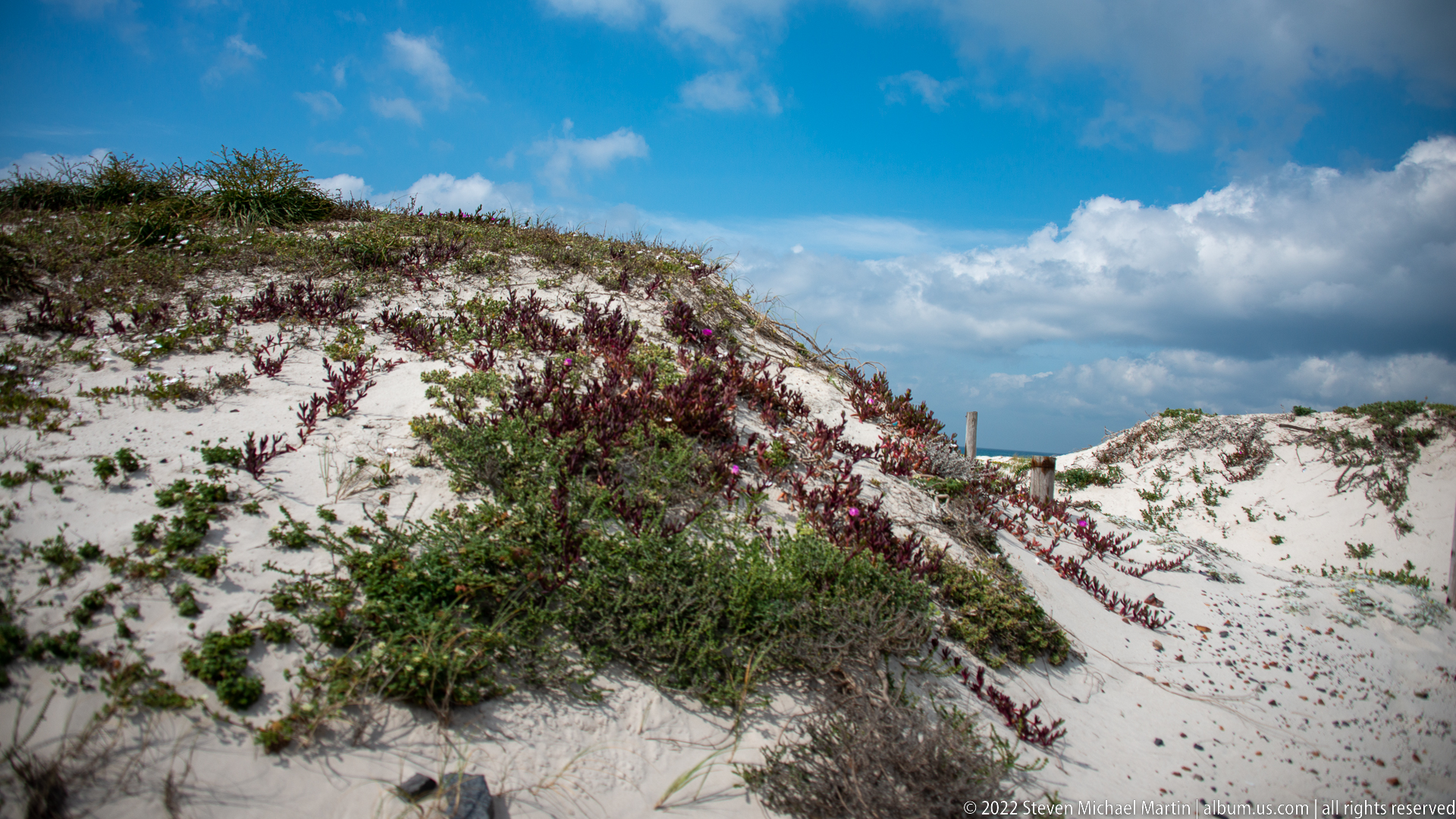
Low flowering vegetation spreads across steep, pale sand dunes, forming dense patches where roots and stems help bind the exposed substrate. Pink-purple flower spikes punctuate the green growth beneath a vivid blue and clouded sky. The close landscape view shifts attention from the broader coast to the plant communities adapted to wind, salt, and mobile sand along the Cape Peninsula.
Caption
Low flowering vegetation spreads across steep, pale sand dunes, forming dense patches where roots and stems help bind the exposed substrate. Pink-purple flower spikes punctuate the green growth beneath a vivid blue and clouded sky. The close landscape view shifts attention from the broader coast to the plant communities adapted to wind, salt, and mobile sand along the Cape Peninsula.
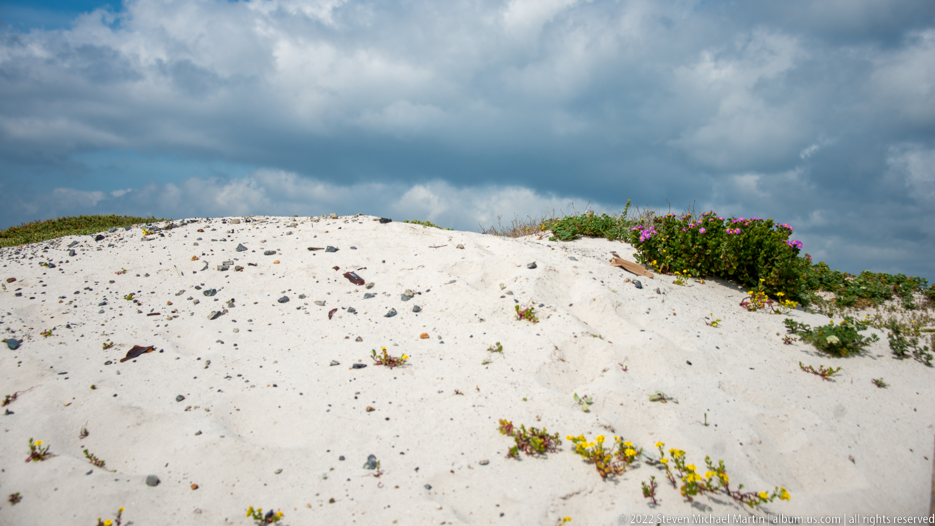
A crest of clean white dune sand is sparsely colonized by low succulents and flowering plants, including small yellow blossoms and a bright magenta-flowering shrub at the right edge. The minimal composition makes the ecological contrast especially clear: mobile sand remains largely bare while hardy coastal vegetation occupies scattered footholds along the ridge.
Caption
A crest of clean white dune sand is sparsely colonized by low succulents and flowering plants, including small yellow blossoms and a bright magenta-flowering shrub at the right edge. The minimal composition makes the ecological contrast especially clear: mobile sand remains largely bare while hardy coastal vegetation occupies scattered footholds along the ridge.
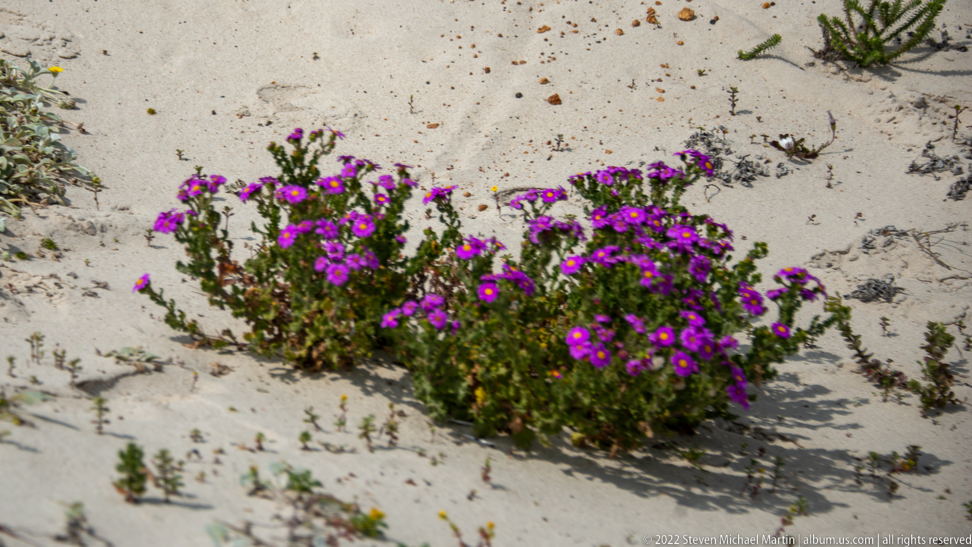
A compact mound of vivid purple flowers grows directly from pale coastal sand, surrounded by sparse creeping vegetation and windblown debris. The isolated plant is shown at close range, allowing its dense flowering habit and low, spreading form to stand out against the nearly bare dune surface. Species-level identification is not secure from the proof sheet alone.
Caption
A compact mound of vivid purple flowers grows directly from pale coastal sand, surrounded by sparse creeping vegetation and windblown debris. The isolated plant is shown at close range, allowing its dense flowering habit and low, spreading form to stand out against the nearly bare dune surface. Species-level identification is not secure from the proof sheet alone.
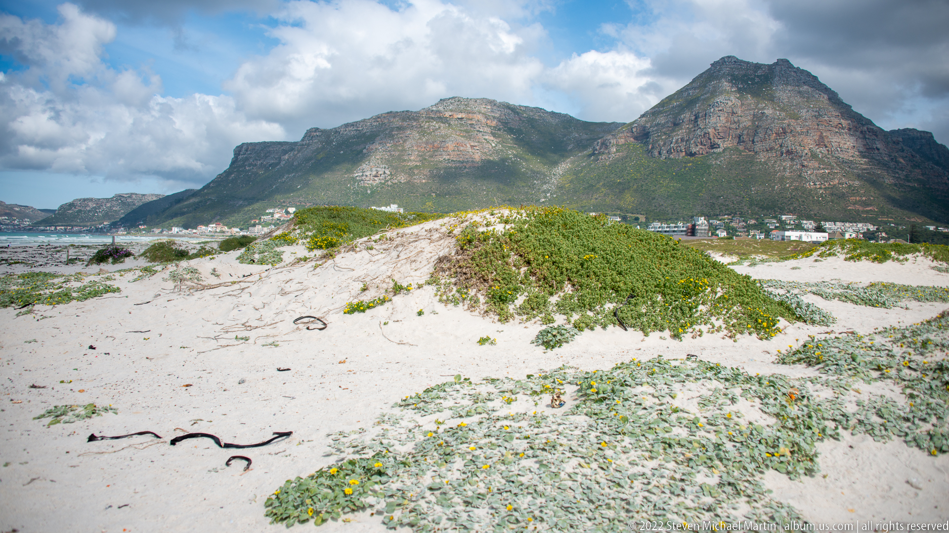
Pale dune ridges covered in silver-green groundcover lead toward the steep mountain mass behind Muizenberg. Yellow flowers dot the foreground while houses and other development form a narrow band at the mountain's base. The layered composition shows how coastal dune habitat, settlement, and the sandstone mountain landscape meet along the False Bay shore.
Caption
Pale dune ridges covered in silver-green groundcover lead toward the steep mountain mass behind Muizenberg. Yellow flowers dot the foreground while houses and other development form a narrow band at the mountain's base. The layered composition shows how coastal dune habitat, settlement, and the sandstone mountain landscape meet along the False Bay shore.
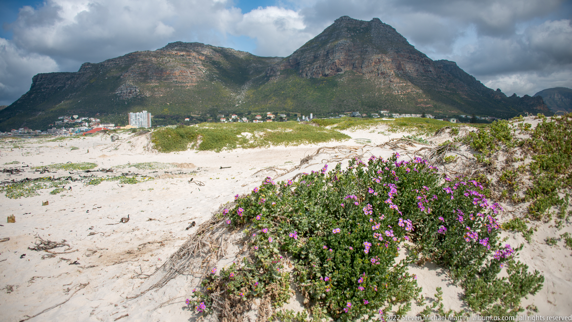
A purple-flowering shrub fills the foreground at the edge of a broad white dune field, with the rugged Muizenberg mountain landscape rising beyond. The plant's dense blossoms contrast with the open sand and distant urban strip, creating a near-to-far study of coastal vegetation, dune topography, settlement, and mountain terrain along False Bay.
Caption
A purple-flowering shrub fills the foreground at the edge of a broad white dune field, with the rugged Muizenberg mountain landscape rising beyond. The plant's dense blossoms contrast with the open sand and distant urban strip, creating a near-to-far study of coastal vegetation, dune topography, settlement, and mountain terrain along False Bay.
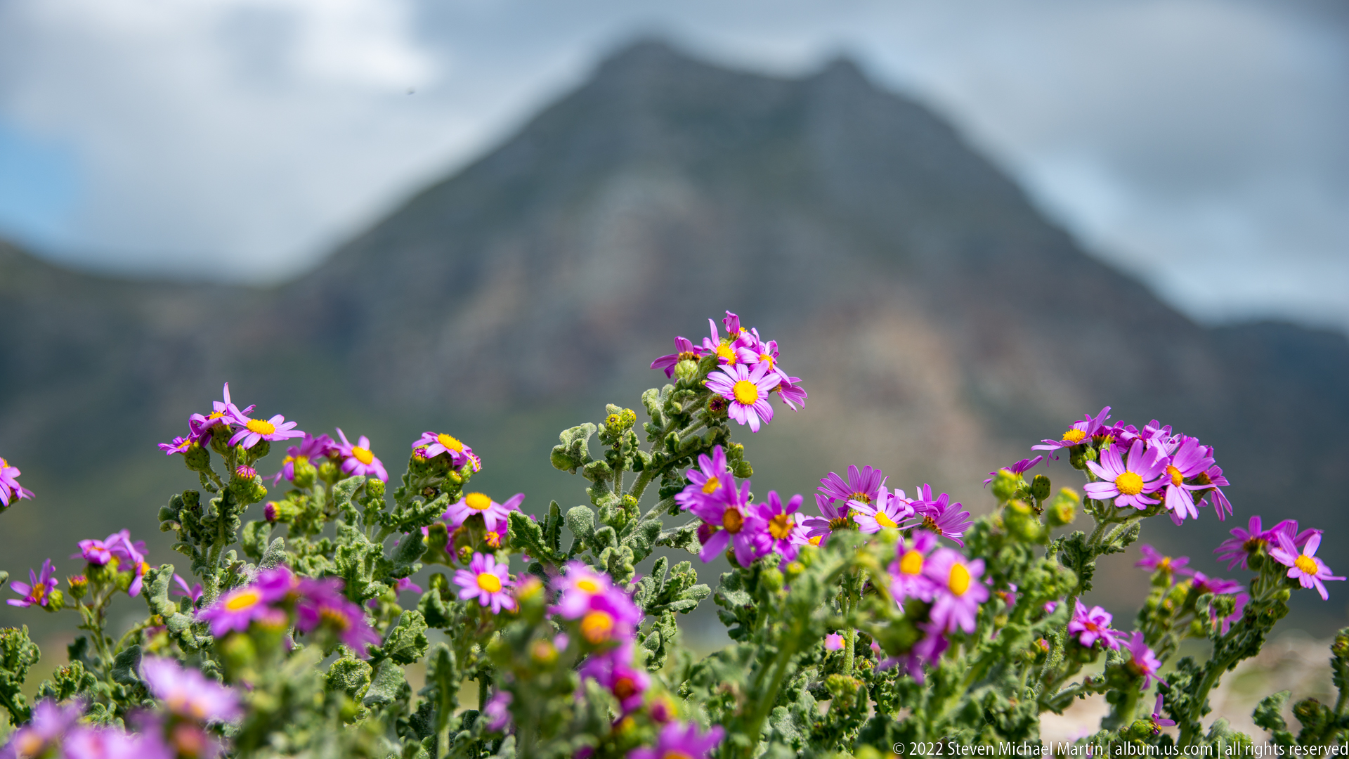
Clusters of purple, yellow-centered daisy-like flowers rise sharply in focus against a deliberately blurred mountain backdrop. The shallow depth of field isolates the flowering stems while retaining enough of the steep Cape Peninsula terrain to establish their coastal setting. The image functions as a botanical detail rather than a species record, since diagnostic foliage and other features are not fully visible.
Caption
Clusters of purple, yellow-centered daisy-like flowers rise sharply in focus against a deliberately blurred mountain backdrop. The shallow depth of field isolates the flowering stems while retaining enough of the steep Cape Peninsula terrain to establish their coastal setting. The image functions as a botanical detail rather than a species record, since diagnostic foliage and other features are not fully visible.
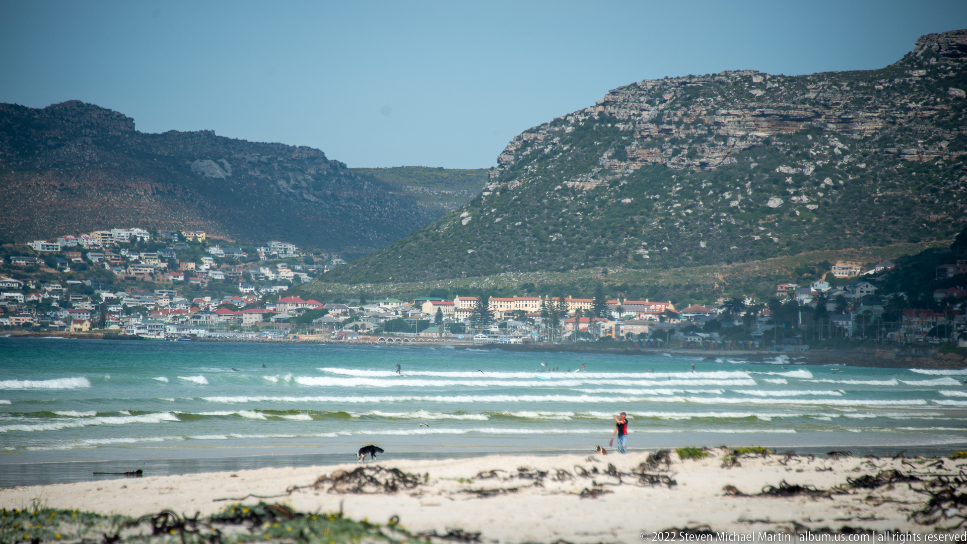
Breaking waves cross False Bay toward a sandy foreground where a solitary person walks near the waterline. Across the bay, dense housing climbs the lower slopes beneath a rugged mountain ridge. The telephoto view compresses beach, surf, settlement, and mountain into a single plane, emphasizing the unusually close proximity of urban neighborhoods to the peninsula's dramatic coastal topography.
Caption
Breaking waves cross False Bay toward a sandy foreground where a solitary person walks near the waterline. Across the bay, dense housing climbs the lower slopes beneath a rugged mountain ridge. The telephoto view compresses beach, surf, settlement, and mountain into a single plane, emphasizing the unusually close proximity of urban neighborhoods to the peninsula's dramatic coastal topography.
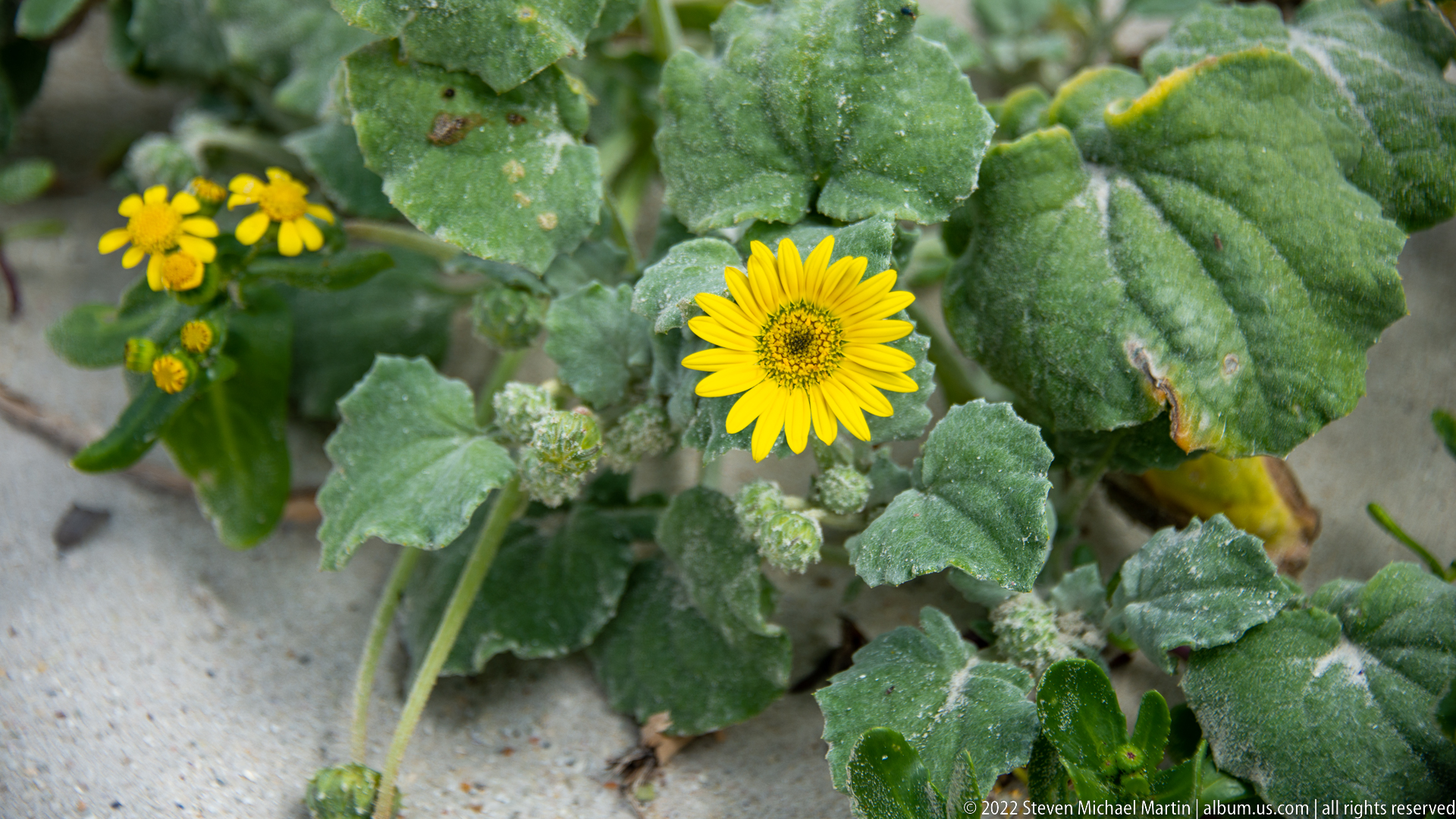
A single yellow, daisy-like flower opens above broad gray-green leaves with a visibly soft, textured surface. Smaller buds and blooms cluster nearby, and pale sand appears between the foliage. The tight botanical framing records the form and growth habit of a coastal plant while avoiding an unsupported species assignment from limited visual evidence.
Caption
A single yellow, daisy-like flower opens above broad gray-green leaves with a visibly soft, textured surface. Smaller buds and blooms cluster nearby, and pale sand appears between the foliage. The tight botanical framing records the form and growth habit of a coastal plant while avoiding an unsupported species assignment from limited visual evidence.
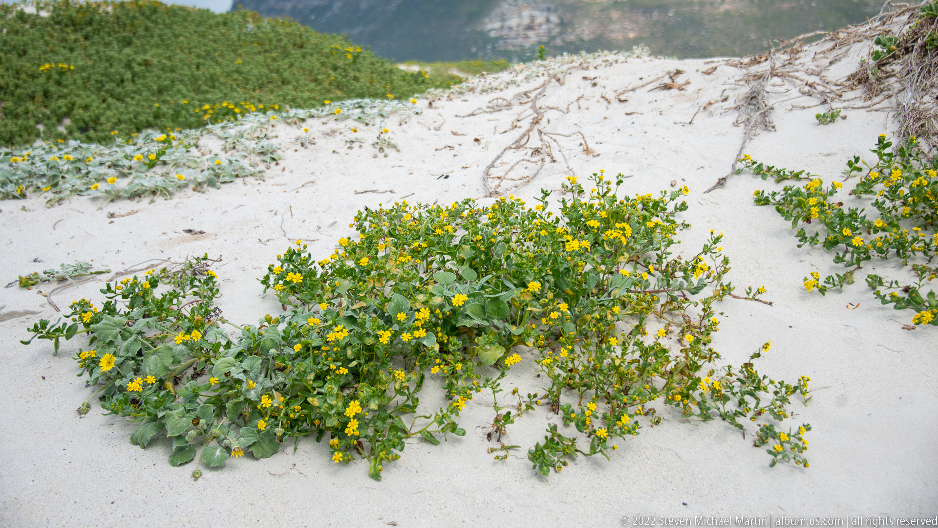
Sprawling gray-green plants carrying numerous small yellow flowers spread across a white dune slope, following shallow hollows in the windblown sand. Exposed roots and drift fragments mark the unstable substrate. The broader framing complements the preceding botanical close-up by showing the plant community's low, ground-hugging growth pattern within the Cape Peninsula's coastal dune environment.
Caption
Sprawling gray-green plants carrying numerous small yellow flowers spread across a white dune slope, following shallow hollows in the windblown sand. Exposed roots and drift fragments mark the unstable substrate. The broader framing complements the preceding botanical close-up by showing the plant community's low, ground-hugging growth pattern within the Cape Peninsula's coastal dune environment.
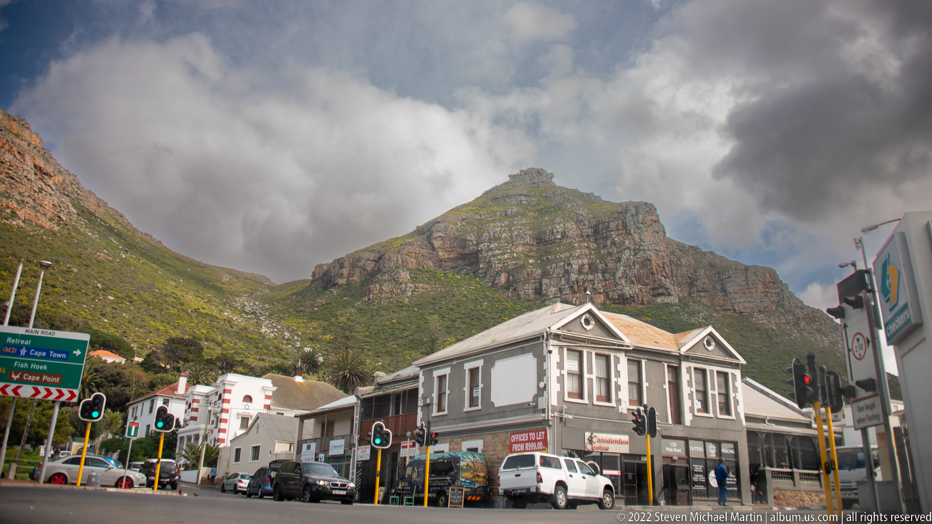
A steep, stratified mountain rises immediately behind a Muizenberg streetscape of low historic buildings, parked vehicles, traffic lights, and directional signs. Heavy clouds gather around the summit, intensifying the contrast between the built foreground and the monumental terrain behind it. The frame marks the transition from the beach environment into the town associated with the False Bay railway corridor.
Caption
A steep, stratified mountain rises immediately behind a Muizenberg streetscape of low historic buildings, parked vehicles, traffic lights, and directional signs. Heavy clouds gather around the summit, intensifying the contrast between the built foreground and the monumental terrain behind it. The frame marks the transition from the beach environment into the town associated with the False Bay railway corridor.
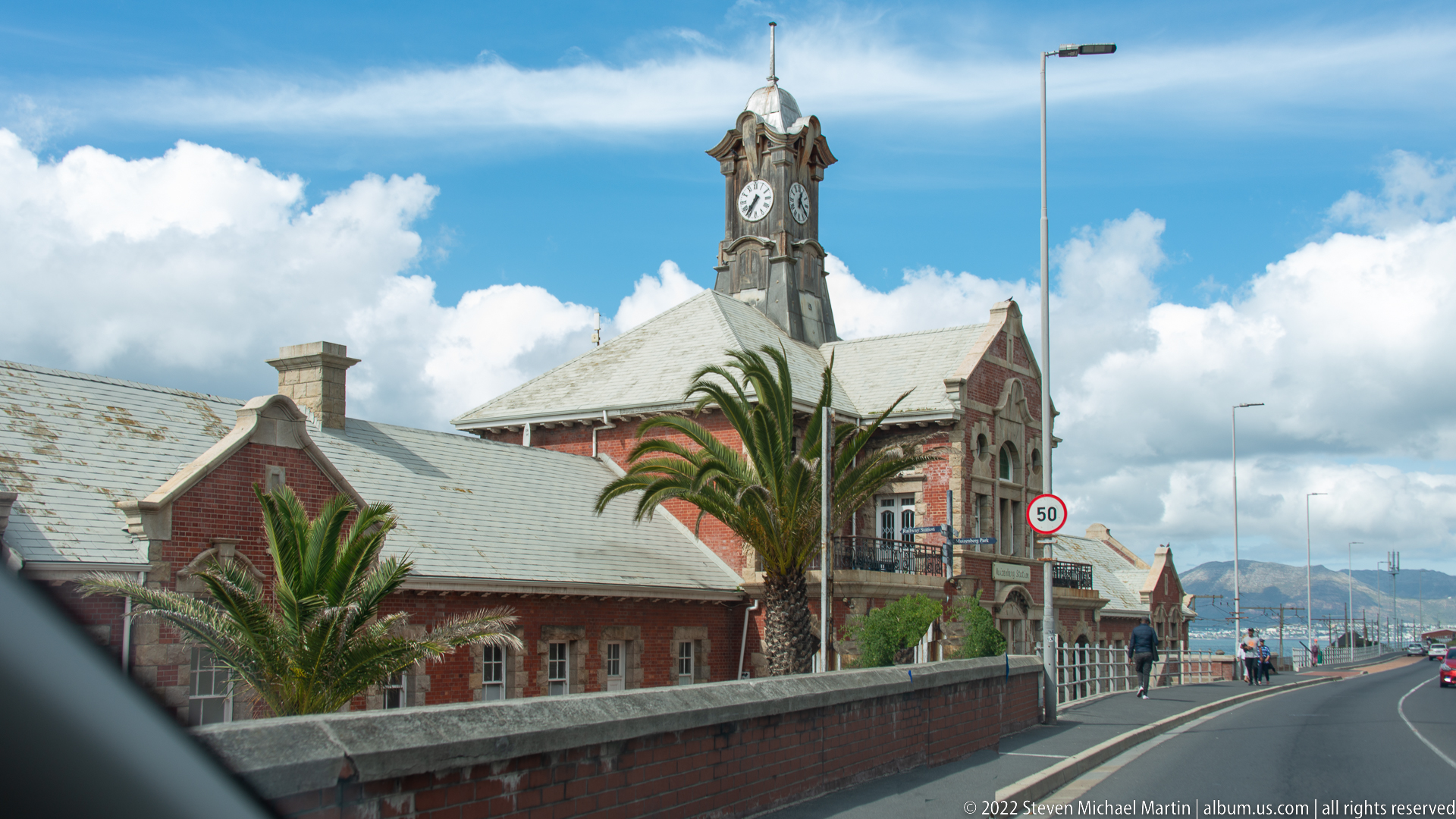
Muizenberg Railway Station appears from the roadside, its red-brick walls, pale stone trim, steep roof, palms, and distinctive clock tower rising above the boundary wall. The oblique approach view emphasizes the station's long roofline and its position along the coastal transport corridor. Later signage in the sequence identifies the building as Muizenberg Railway Station.
Caption
Muizenberg Railway Station appears from the roadside, its red-brick walls, pale stone trim, steep roof, palms, and distinctive clock tower rising above the boundary wall. The oblique approach view emphasizes the station's long roofline and its position along the coastal transport corridor. Later signage in the sequence identifies the building as Muizenberg Railway Station.
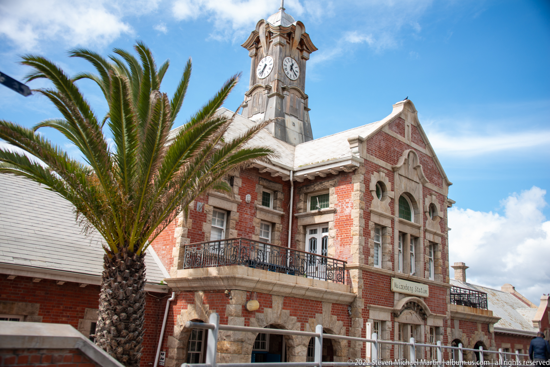
The central façade of Muizenberg Railway Station is framed by a tall palm, revealing red brickwork, pale masonry trim, arched openings, balcony railings, gabled rooflines, and the station's prominent clock tower. The more frontal viewpoint clarifies the building's symmetrical civic character and ornamental detailing, while the visible station name confirms the identification.
Caption
The central façade of Muizenberg Railway Station is framed by a tall palm, revealing red brickwork, pale masonry trim, arched openings, balcony railings, gabled rooflines, and the station's prominent clock tower. The more frontal viewpoint clarifies the building's symmetrical civic character and ornamental detailing, while the visible station name confirms the identification.
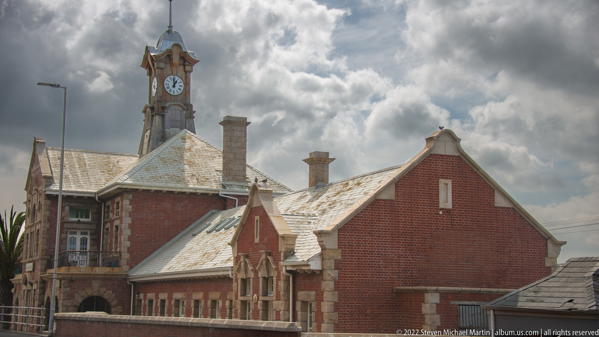
Seen beneath a dramatic clouded sky, the side elevation of Muizenberg Railway Station reveals a sequence of red-brick gables, pale stone accents, chimneys, and weathered roof surfaces extending away from the clock tower. This angle emphasizes the station as a long functional complex rather than a single ornamental façade, documenting the architectural massing of the historic railway building.
Caption
Seen beneath a dramatic clouded sky, the side elevation of Muizenberg Railway Station reveals a sequence of red-brick gables, pale stone accents, chimneys, and weathered roof surfaces extending away from the clock tower. This angle emphasizes the station as a long functional complex rather than a single ornamental façade, documenting the architectural massing of the historic railway building.
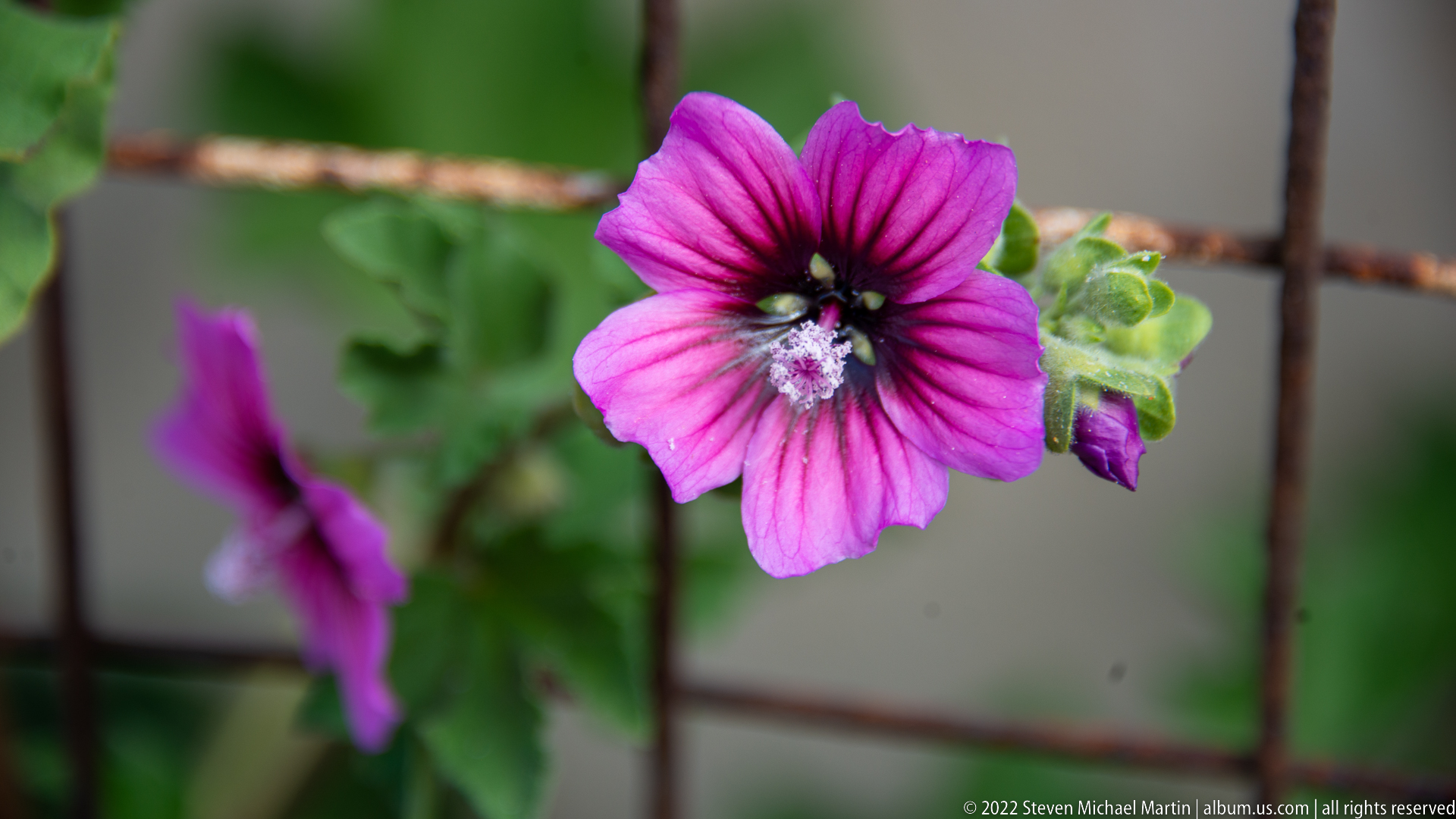
A vivid pink, five-petaled flower with a dark central eye opens beside a rusted wire grid, its pale pollen-bearing center sharply rendered against a soft green background. A second bloom and unopened bud fall out of focus behind it. The close-up isolates floral structure and texture while leaving species identification deliberately broad.
Caption
A vivid pink, five-petaled flower with a dark central eye opens beside a rusted wire grid, its pale pollen-bearing center sharply rendered against a soft green background. A second bloom and unopened bud fall out of focus behind it. The close-up isolates floral structure and texture while leaving species identification deliberately broad.
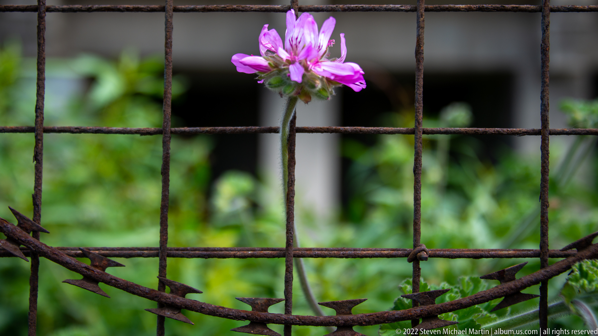
A small pink flower rises behind a heavily rusted grid and strands of barbed wire, creating a striking juxtaposition of delicate vegetation and weathered metal. The shallow focus keeps the blossom and fence near the same visual plane while the green background dissolves into blur. Salt-laden coastal conditions are suggested by the pronounced corrosion, though the precise location is not visible.
Caption
A small pink flower rises behind a heavily rusted grid and strands of barbed wire, creating a striking juxtaposition of delicate vegetation and weathered metal. The shallow focus keeps the blossom and fence near the same visual plane while the green background dissolves into blur. Salt-laden coastal conditions are suggested by the pronounced corrosion, though the precise location is not visible.
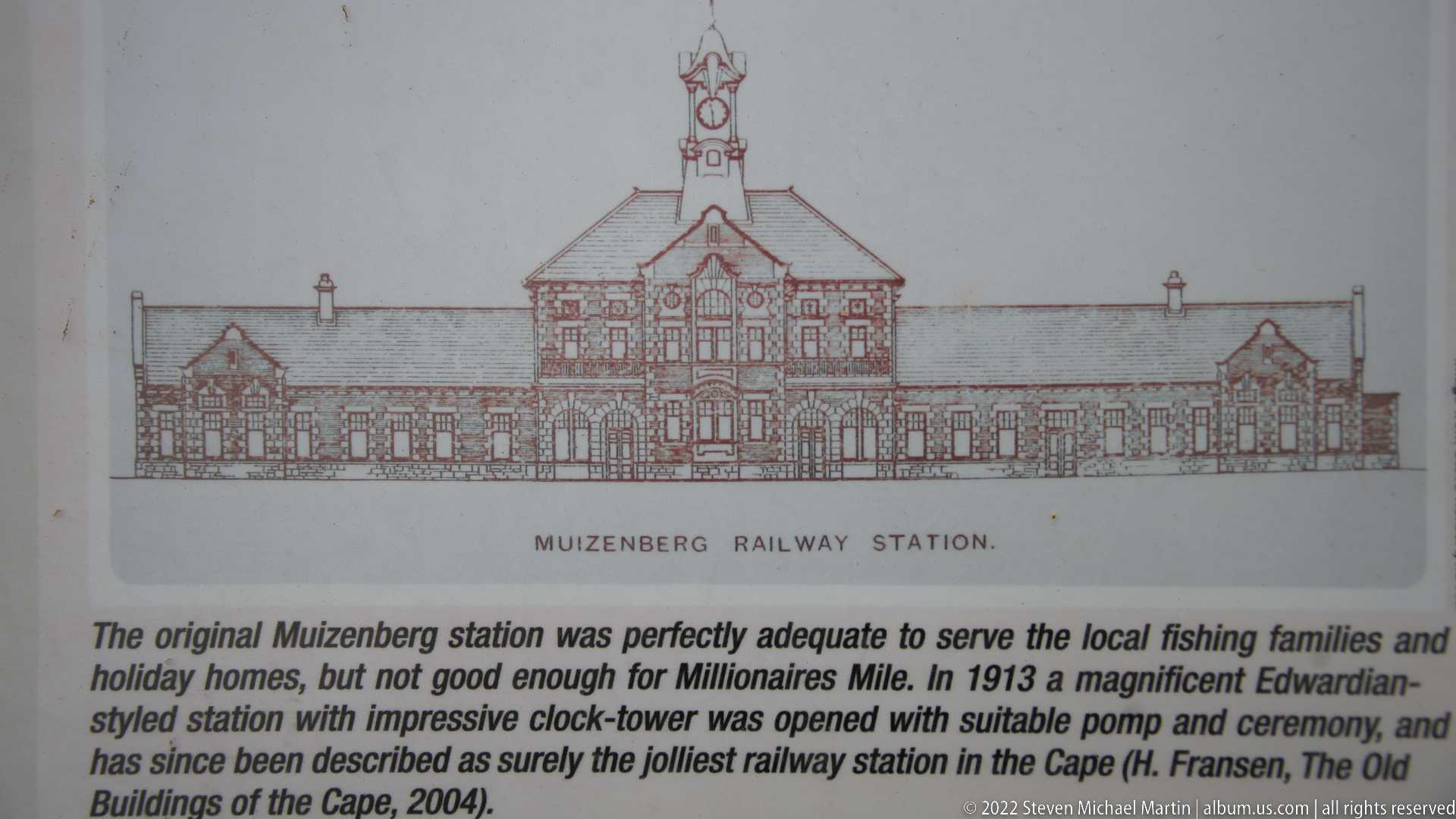
An interpretive panel reproduces an architectural elevation labeled “Muizenberg Railway Station” and explains the development of the present building. The text identifies the Edwardian-style station as opening in 1913 and notes its clock tower, pomp, and ceremony. As a documentary record, the photograph provides direct on-site evidence for identifying the station architecture shown in the preceding frames.
Caption
An interpretive panel reproduces an architectural elevation labeled “Muizenberg Railway Station” and explains the development of the present building. The text identifies the Edwardian-style station as opening in 1913 and notes its clock tower, pomp, and ceremony. As a documentary record, the photograph provides direct on-site evidence for identifying the station architecture shown in the preceding frames.

A rocky intertidal shoreline and narrow coastal path occupy the foreground while calm gray-blue water extends toward a densely settled mountain slope across False Bay. Low clouds soften the upper ridges. The elevated view broadens the sequence beyond Muizenberg's beach, showing the combination of exposed rock, sheltered bay water, hillside settlement, and steep peninsula terrain.
Caption
A rocky intertidal shoreline and narrow coastal path occupy the foreground while calm gray-blue water extends toward a densely settled mountain slope across False Bay. Low clouds soften the upper ridges. The elevated view broadens the sequence beyond Muizenberg's beach, showing the combination of exposed rock, sheltered bay water, hillside settlement, and steep peninsula terrain.
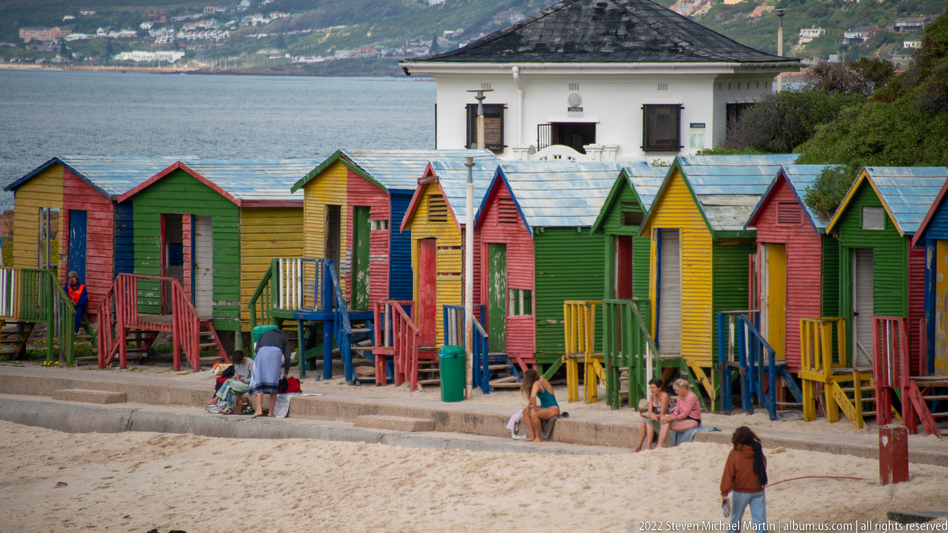
A row of brightly painted wooden bathing boxes lines the sand at Muizenberg, alternating saturated reds, greens, yellows, and blues. Beachgoers sit and walk around the huts while a white building and the bay rise behind them. These compact gabled structures are a distinctive visual feature of Muizenberg's beachfront and connect the historic resort landscape with contemporary beach use.
Caption
A row of brightly painted wooden bathing boxes lines the sand at Muizenberg, alternating saturated reds, greens, yellows, and blues. Beachgoers sit and walk around the huts while a white building and the bay rise behind them. These compact gabled structures are a distinctive visual feature of Muizenberg's beachfront and connect the historic resort landscape with contemporary beach use.
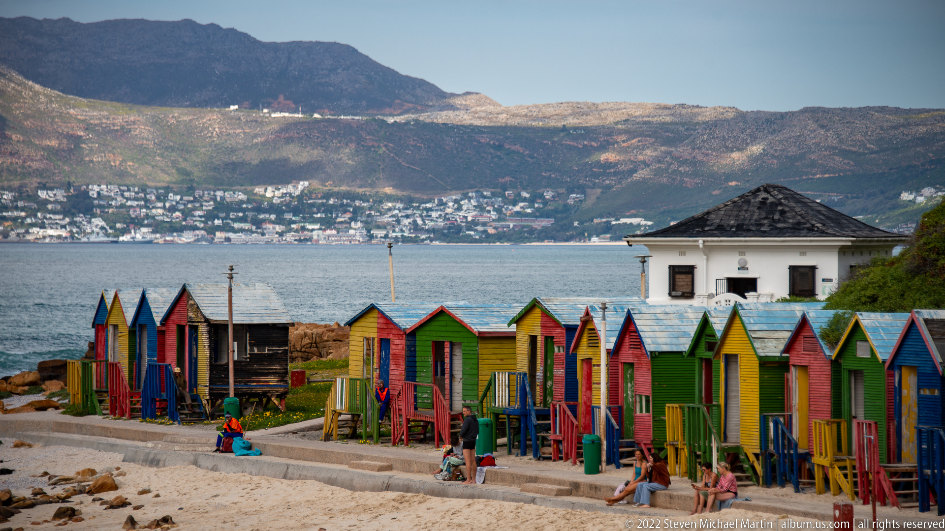
Muizenberg's colorful bathing boxes form a vivid horizontal band along the beach, backed by a white pavilion-like building, blue-gray bay water, hillside neighborhoods, and a long mountain ridge. Compared with the closer view, this frame places the huts within their wider coastal setting and shows how the resort structures sit between the sandy shore and the developed slopes of False Bay.
Caption
Muizenberg's colorful bathing boxes form a vivid horizontal band along the beach, backed by a white pavilion-like building, blue-gray bay water, hillside neighborhoods, and a long mountain ridge. Compared with the closer view, this frame places the huts within their wider coastal setting and shows how the resort structures sit between the sandy shore and the developed slopes of False Bay.

Numerous tiny purple-and-white star-shaped flowers cluster on branching stems, with unopened reddish-purple buds rising above the open blossoms. A shallow depth of field separates the inflorescence from a luminous green background. The photograph records floral form and color in close detail, but the proof-sheet view does not provide enough diagnostic evidence for a confident species identification.
Caption
Numerous tiny purple-and-white star-shaped flowers cluster on branching stems, with unopened reddish-purple buds rising above the open blossoms. A shallow depth of field separates the inflorescence from a luminous green background. The photograph records floral form and color in close detail, but the proof-sheet view does not provide enough diagnostic evidence for a confident species identification.
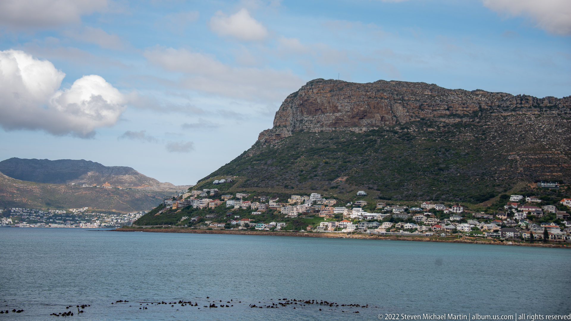
A broad False Bay view centers on a steep, flat-topped mountain descending directly to the water, with tightly packed houses wrapping around its lower slopes. Dark rocks trace the near shoreline and cloud banks gather beyond the ridge. The frame continues the southward coastal journey by emphasizing the recurring relationship between sheltered bay water, mountain topography, and settlements compressed along the narrow coastal margin.
Caption
A broad False Bay view centers on a steep, flat-topped mountain descending directly to the water, with tightly packed houses wrapping around its lower slopes. Dark rocks trace the near shoreline and cloud banks gather beyond the ridge. The frame continues the southward coastal journey by emphasizing the recurring relationship between sheltered bay water, mountain topography, and settlements compressed along the narrow coastal margin.
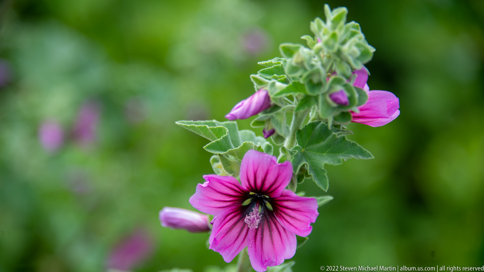
A bright pink, dark-centered flower opens on a vertical stem surrounded by multiple elongated buds and softly textured, lobed leaves. The closer botanical portrait reveals more of the plant's growth habit than the earlier flower detail, including clustered buds and pale green new growth. The morphology suggests a mallow relative, but the proof sheet does not support a secure species-level identification.
Caption
A bright pink, dark-centered flower opens on a vertical stem surrounded by multiple elongated buds and softly textured, lobed leaves. The closer botanical portrait reveals more of the plant's growth habit than the earlier flower detail, including clustered buds and pale green new growth. The morphology suggests a mallow relative, but the proof sheet does not support a secure species-level identification.
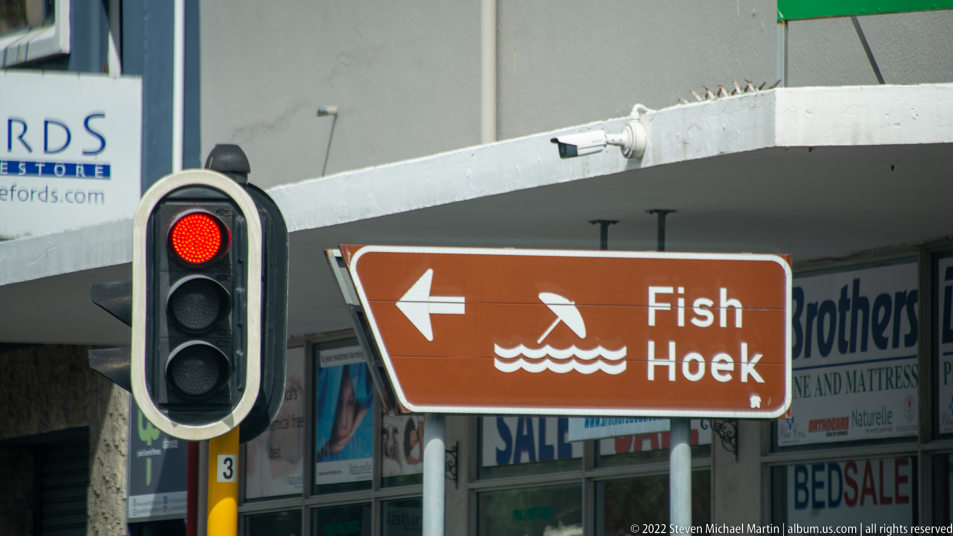
A brown directional sign marked “Fish Hoek,” with a swimmer-and-waves pictogram and left-pointing arrow, stands beside a red traffic signal on a commercial street. The sign provides explicit geographic evidence for the route through the False Bay settlements and marks the transition south from Muizenberg toward Fish Hoek and the Cape Peninsula.
Caption
A brown directional sign marked “Fish Hoek,” with a swimmer-and-waves pictogram and left-pointing arrow, stands beside a red traffic signal on a commercial street. The sign provides explicit geographic evidence for the route through the False Bay settlements and marks the transition south from Muizenberg toward Fish Hoek and the Cape Peninsula.
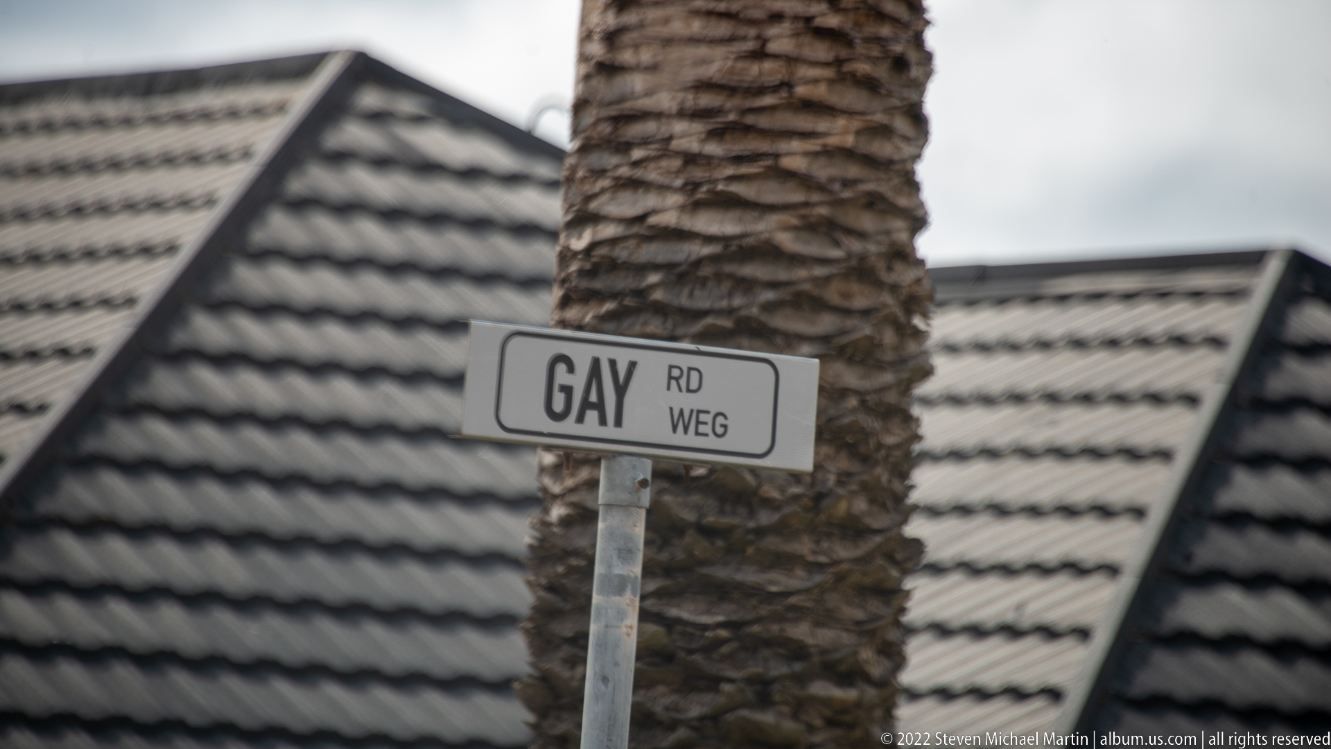
A small municipal street blade reads “GAY RD WEG,” using English and Afrikaans abbreviations, and is mounted in front of a palm trunk and tiled residential roof. The tight framing turns an ordinary wayfinding marker into a geographic detail of the False Bay journey, while the bilingual wording reflects South Africa's multilingual public signage.
Caption
A small municipal street blade reads “GAY RD WEG,” using English and Afrikaans abbreviations, and is mounted in front of a palm trunk and tiled residential roof. The tight framing turns an ordinary wayfinding marker into a geographic detail of the False Bay journey, while the bilingual wording reflects South Africa's multilingual public signage.
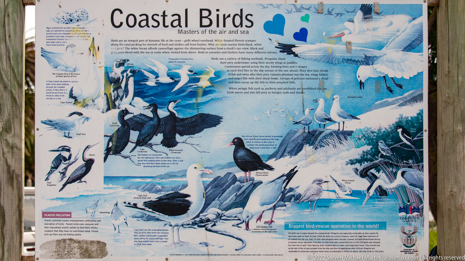
An illustrated interpretive board titled “Coastal Birds” presents numerous seabirds and shorebirds associated with the air and sea, combining painted species portraits with explanatory text. Penguins, cormorant-like birds, gulls, terns, and other coastal forms are depicted across the panel. The display introduces the avian ecology of the Cape Peninsula before the route reaches protected wildlife areas farther south.
Caption
An illustrated interpretive board titled “Coastal Birds” presents numerous seabirds and shorebirds associated with the air and sea, combining painted species portraits with explanatory text. Penguins, cormorant-like birds, gulls, terns, and other coastal forms are depicted across the panel. The display introduces the avian ecology of the Cape Peninsula before the route reaches protected wildlife areas farther south.
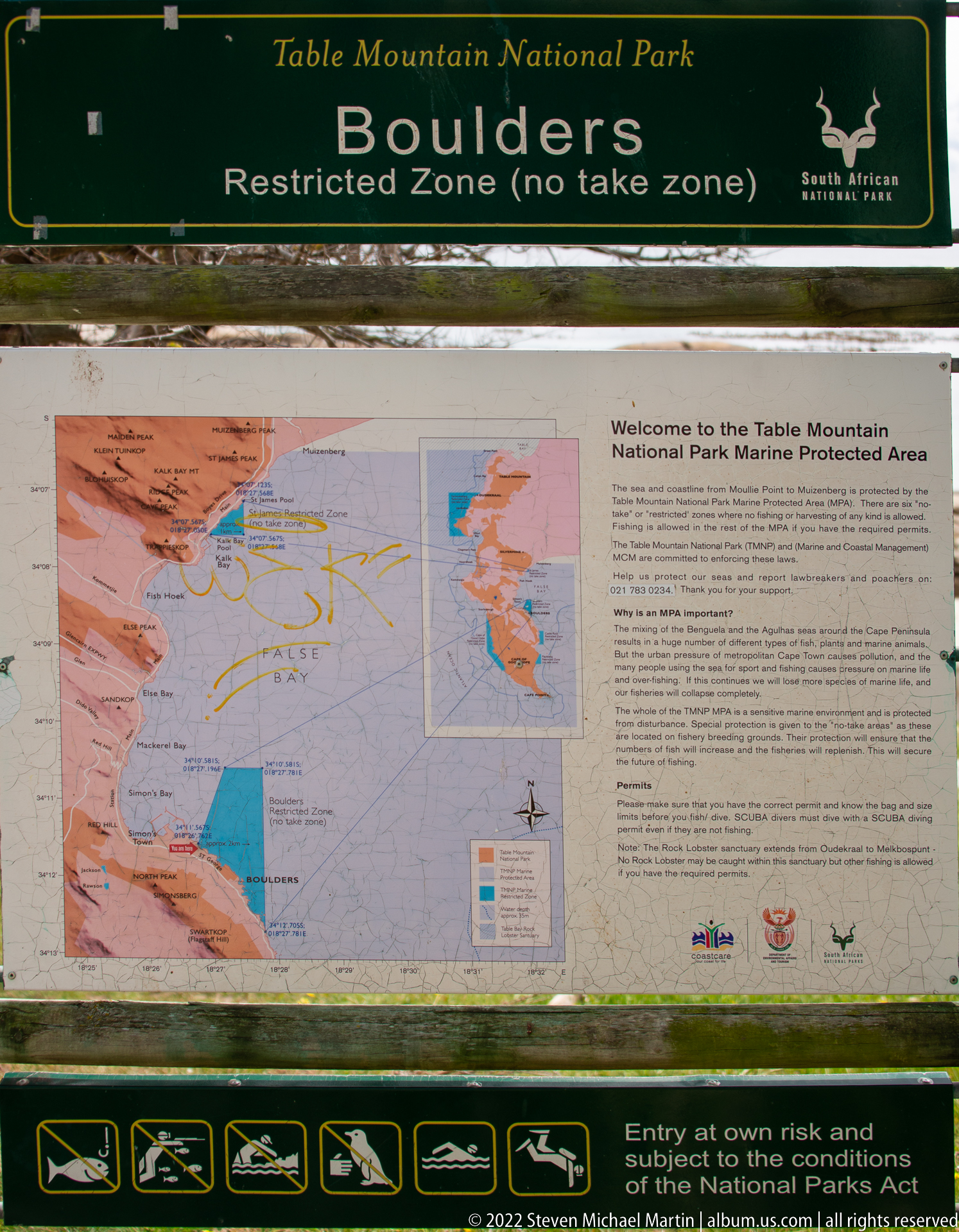
Table Mountain National Park signage identifies the Boulders shoreline as a restricted, no-take zone, with a map and visitor information for the marine protected area displayed below. The board establishes the protected-management context of this part of the Cape Peninsula and signals entry into the Boulders coastal environment, internationally associated with its African penguin colony.
Caption
Table Mountain National Park signage identifies the Boulders shoreline as a restricted, no-take zone, with a map and visitor information for the marine protected area displayed below. The board establishes the protected-management context of this part of the Cape Peninsula and signals entry into the Boulders coastal environment, internationally associated with its African penguin colony.
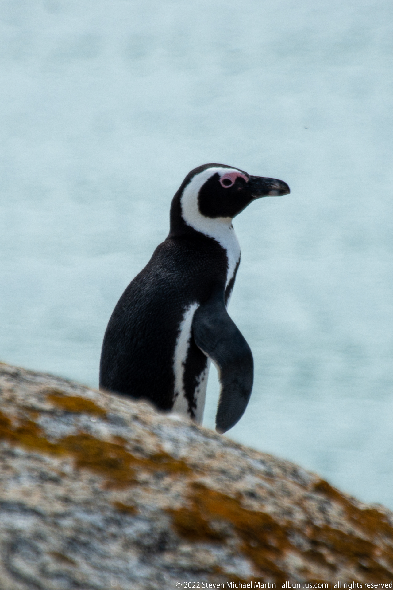
Seen in side profile, an African penguin leans forward as it moves across a smooth granite surface above the sea. The pose accentuates the long black bill, white facial band, breast stripe, and streamlined body. A shallow depth of field reduces the water to a cool blue background, placing emphasis on posture and locomotion rather than the colony landscape.
Caption
Seen in side profile, an African penguin leans forward as it moves across a smooth granite surface above the sea. The pose accentuates the long black bill, white facial band, breast stripe, and streamlined body. A shallow depth of field reduces the water to a cool blue background, placing emphasis on posture and locomotion rather than the colony landscape.
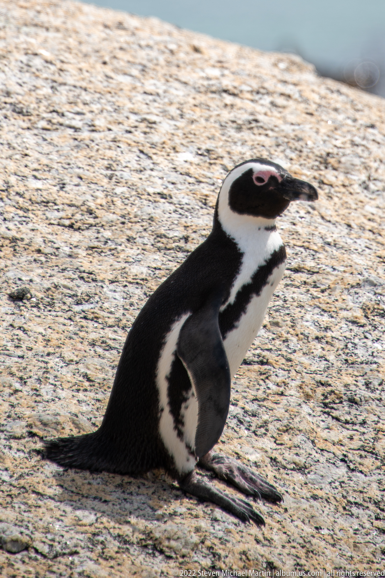
An African penguin sits upright on a broad granite surface with both feet stretched forward and its tail flattened behind. The side-lit pose reveals the bird’s white throat band, dark breast stripe, mottled belly spots, and pink orbital skin. This low, seated posture gives a clear view of how the species rests on the sun-warmed rocks of the Boulders colony.
Caption
An African penguin sits upright on a broad granite surface with both feet stretched forward and its tail flattened behind. The side-lit pose reveals the bird’s white throat band, dark breast stripe, mottled belly spots, and pink orbital skin. This low, seated posture gives a clear view of how the species rests on the sun-warmed rocks of the Boulders colony.
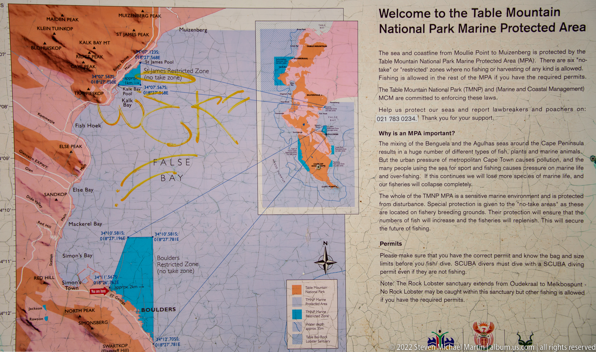
An interpretive map introduces the Table Mountain National Park Marine Protected Area, showing the protected coastline around the Cape Peninsula and the zoning of its marine environment. Text at right explains the reserve’s purpose and permit requirements, while colored areas distinguish sections of the protected waters. The panel provides conservation context for the rocky shore and wildlife encountered in the following photographs.
Caption
An interpretive map introduces the Table Mountain National Park Marine Protected Area, showing the protected coastline around the Cape Peninsula and the zoning of its marine environment. Text at right explains the reserve’s purpose and permit requirements, while colored areas distinguish sections of the protected waters. The panel provides conservation context for the rocky shore and wildlife encountered in the following photographs.
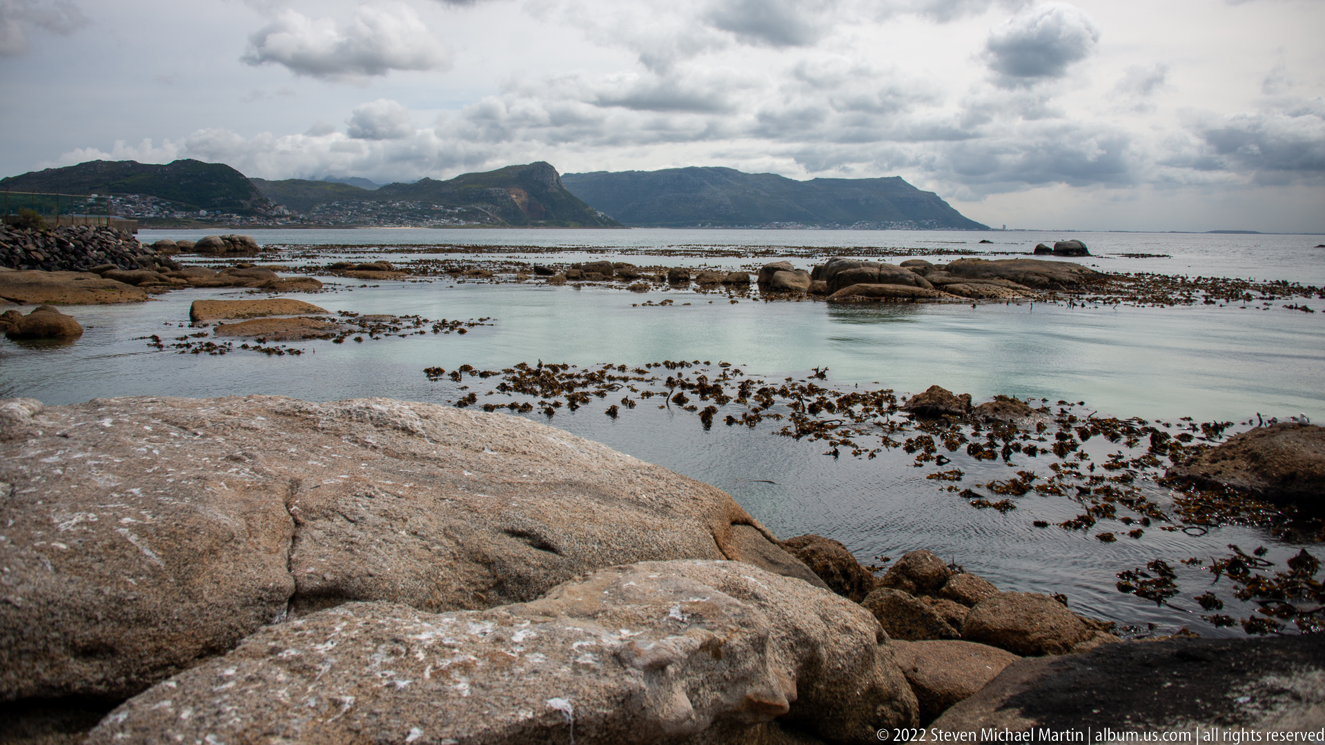
Rounded granite outcrops extend into calm, shallow water where dark kelp beds and exposed intertidal rocks form a patchwork across the bay. A long mountain ridge rises on the opposite shore beneath layered clouds. The broad composition establishes the sheltered coastal habitat around Boulders, combining weathered granite, nearshore kelp, tidal pools, and the mountainous False Bay setting.
Caption
Rounded granite outcrops extend into calm, shallow water where dark kelp beds and exposed intertidal rocks form a patchwork across the bay. A long mountain ridge rises on the opposite shore beneath layered clouds. The broad composition establishes the sheltered coastal habitat around Boulders, combining weathered granite, nearshore kelp, tidal pools, and the mountainous False Bay setting.
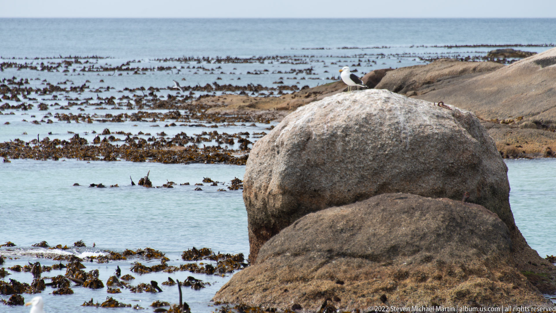
An African penguin stands upright on a pale granite boulder above kelp-fringed shallows, its black-and-white plumage and pink skin above the eye clearly visible. The solitary bird is placed within the characteristic Boulders coastal habitat rather than isolated as a portrait, linking the species to the smooth granite outcrops, sheltered water, and productive intertidal zone of False Bay.
Caption
An African penguin stands upright on a pale granite boulder above kelp-fringed shallows, its black-and-white plumage and pink skin above the eye clearly visible. The solitary bird is placed within the characteristic Boulders coastal habitat rather than isolated as a portrait, linking the species to the smooth granite outcrops, sheltered water, and productive intertidal zone of False Bay.
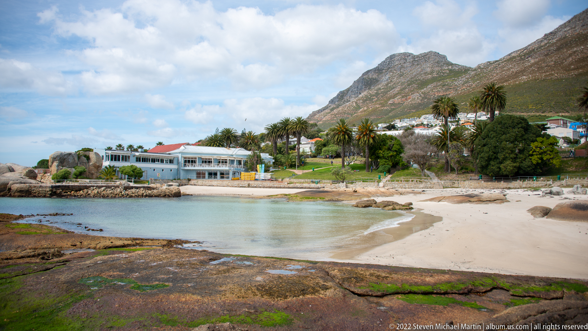
A small sandy cove curves between granite outcrops at Boulders, with pale turquoise water, exposed rock shelves, and low buildings set among palms and dense vegetation. Steep mountain slopes rise immediately behind the shoreline. The elevated viewpoint shows the intimate scale of the sheltered coves that distinguish this part of the False Bay coast and provide protected habitat for marine wildlife.
Caption
A small sandy cove curves between granite outcrops at Boulders, with pale turquoise water, exposed rock shelves, and low buildings set among palms and dense vegetation. Steep mountain slopes rise immediately behind the shoreline. The elevated viewpoint shows the intimate scale of the sheltered coves that distinguish this part of the False Bay coast and provide protected habitat for marine wildlife.
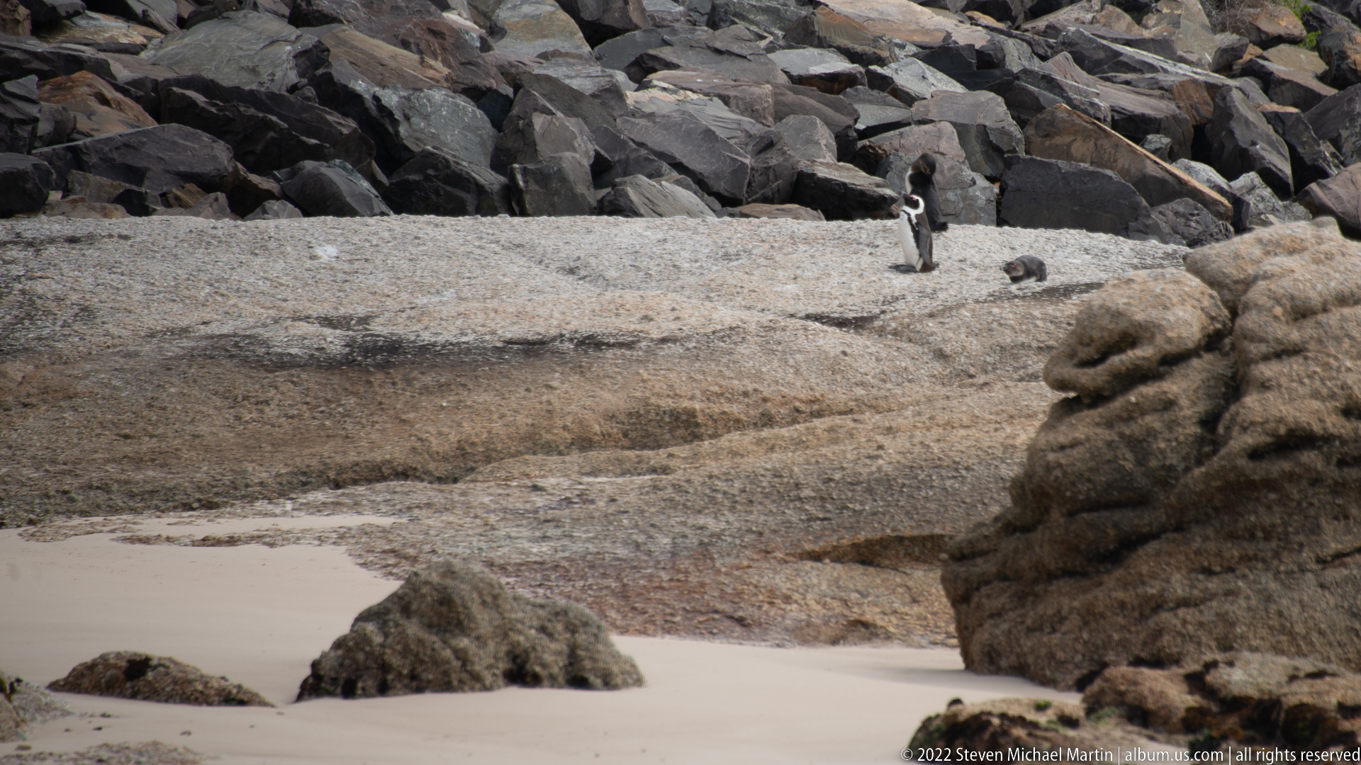
Two African penguins stand apart on a broad granite shelf above a narrow sandy inlet, their compact black-and-white forms contrasting with the warm, textured rock. The wider framing gives the birds substantial environmental context and shows how the colony uses exposed granite surfaces immediately beside the sea. Their spacing and posture distinguish this scene from the closer individual portraits that follow.
Caption
Two African penguins stand apart on a broad granite shelf above a narrow sandy inlet, their compact black-and-white forms contrasting with the warm, textured rock. The wider framing gives the birds substantial environmental context and shows how the colony uses exposed granite surfaces immediately beside the sea. Their spacing and posture distinguish this scene from the closer individual portraits that follow.
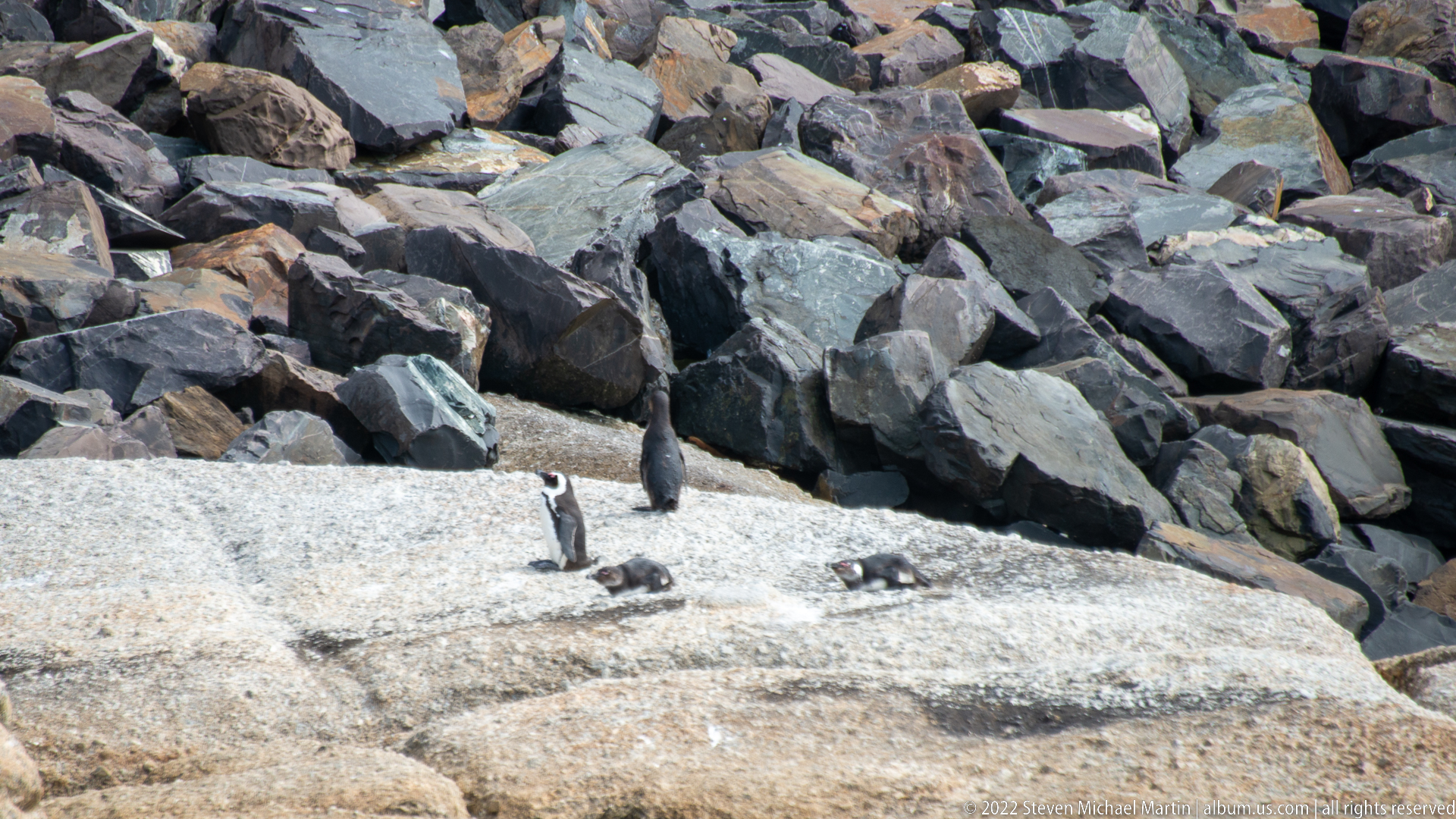
A small group of African penguins occupies a pale rock shelf at the base of a steep bank armored with angular stone. One bird stands prominently while others rest lower on the granite. The view records the colony within a partly managed shoreline setting, contrasting the penguins’ natural use of exposed rock with the engineered slope immediately behind them.
Caption
A small group of African penguins occupies a pale rock shelf at the base of a steep bank armored with angular stone. One bird stands prominently while others rest lower on the granite. The view records the colony within a partly managed shoreline setting, contrasting the penguins’ natural use of exposed rock with the engineered slope immediately behind them.

An African penguin bends forward in ankle-deep water, head and bill lowered as it investigates the sandy bottom near shore. Ripples spread around its body while the bird’s white facial band, black breast stripe, and pink eye patch remain clearly visible. The behavior-oriented frame differs from the rock portraits by showing the species actively using the shallow edge of its coastal habitat.
Caption
An African penguin bends forward in ankle-deep water, head and bill lowered as it investigates the sandy bottom near shore. Ripples spread around its body while the bird’s white facial band, black breast stripe, and pink eye patch remain clearly visible. The behavior-oriented frame differs from the rock portraits by showing the species actively using the shallow edge of its coastal habitat.
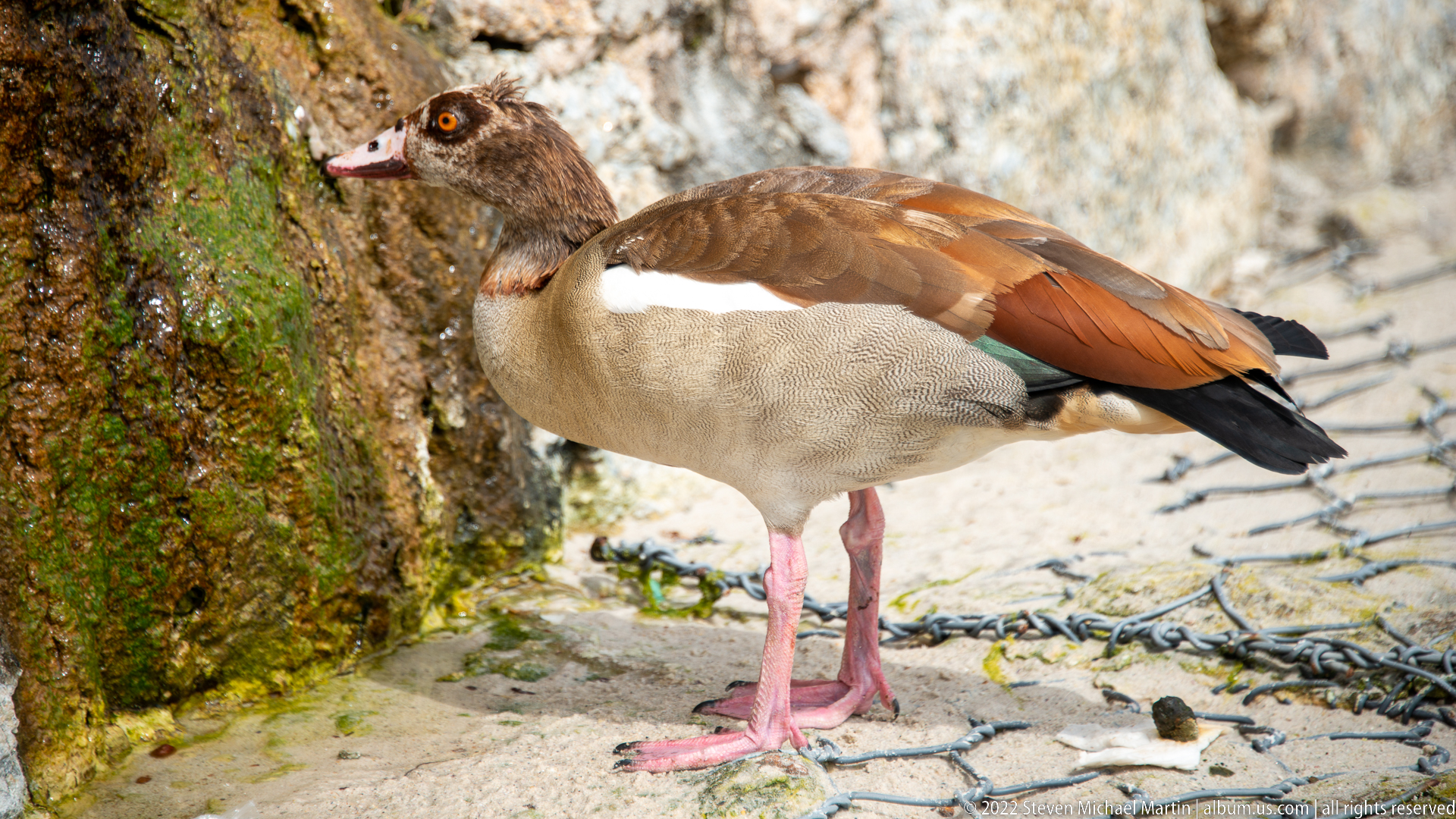
An Egyptian goose stands in profile beside a mossy rock, showing its chestnut eye patch, warm brown back, buff body, white wing panel, dark tail, and pink legs. The close view provides a strong identification of this common southern African waterfowl. Its presence among the penguin-colony landscape illustrates the wider bird community using the sheltered coastal environment at Boulders.
Caption
An Egyptian goose stands in profile beside a mossy rock, showing its chestnut eye patch, warm brown back, buff body, white wing panel, dark tail, and pink legs. The close view provides a strong identification of this common southern African waterfowl. Its presence among the penguin-colony landscape illustrates the wider bird community using the sheltered coastal environment at Boulders.
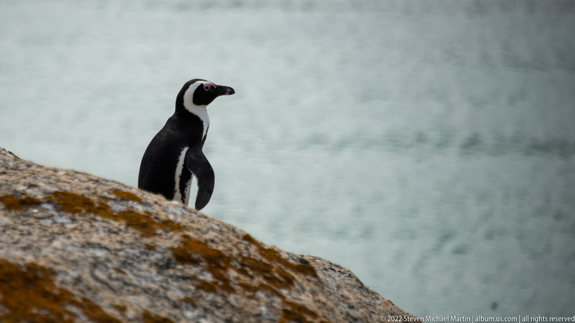
An African penguin stands erect on a sloping granite outcrop, silhouetted against softly blurred blue-gray water. The uncluttered background isolates the bird’s compact body, white facial band, pink orbital skin, and paddle-like flippers. By minimizing environmental detail, the frame functions as a clean species portrait while still retaining the rocky coastal substrate characteristic of the Boulders colony.
Caption
An African penguin stands erect on a sloping granite outcrop, silhouetted against softly blurred blue-gray water. The uncluttered background isolates the bird’s compact body, white facial band, pink orbital skin, and paddle-like flippers. By minimizing environmental detail, the frame functions as a clean species portrait while still retaining the rocky coastal substrate characteristic of the Boulders colony.
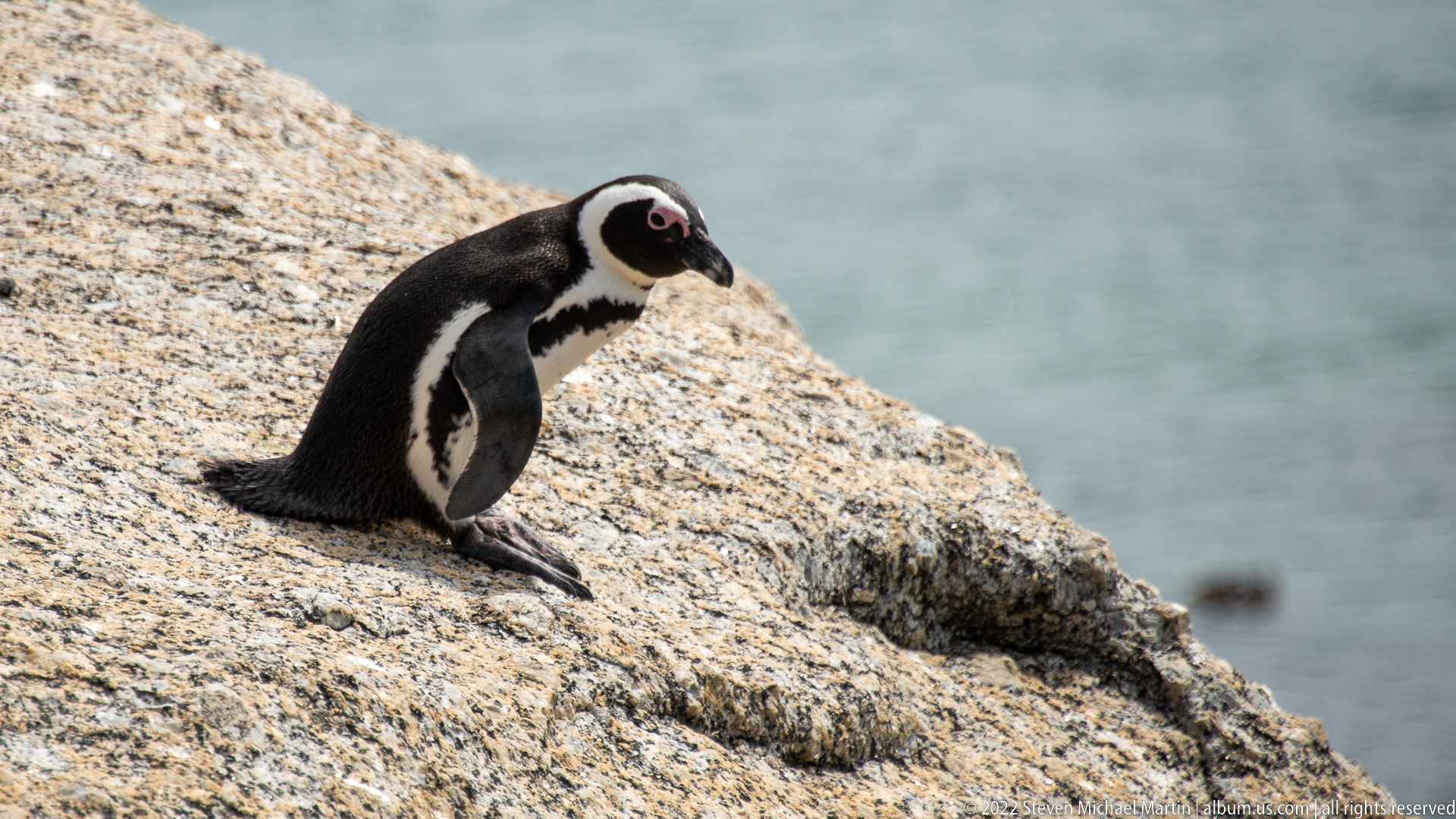
An African penguin stands near the edge of a broad granite slab, body angled downward toward the water. Its tail feathers brace against the rock while both flippers hang loosely at its sides. The photograph emphasizes the bird’s balance and characteristic upright gait on uneven coastal rock, with the sea reduced to a soft, unobtrusive background.
Caption
An African penguin stands near the edge of a broad granite slab, body angled downward toward the water. Its tail feathers brace against the rock while both flippers hang loosely at its sides. The photograph emphasizes the bird’s balance and characteristic upright gait on uneven coastal rock, with the sea reduced to a soft, unobtrusive background.
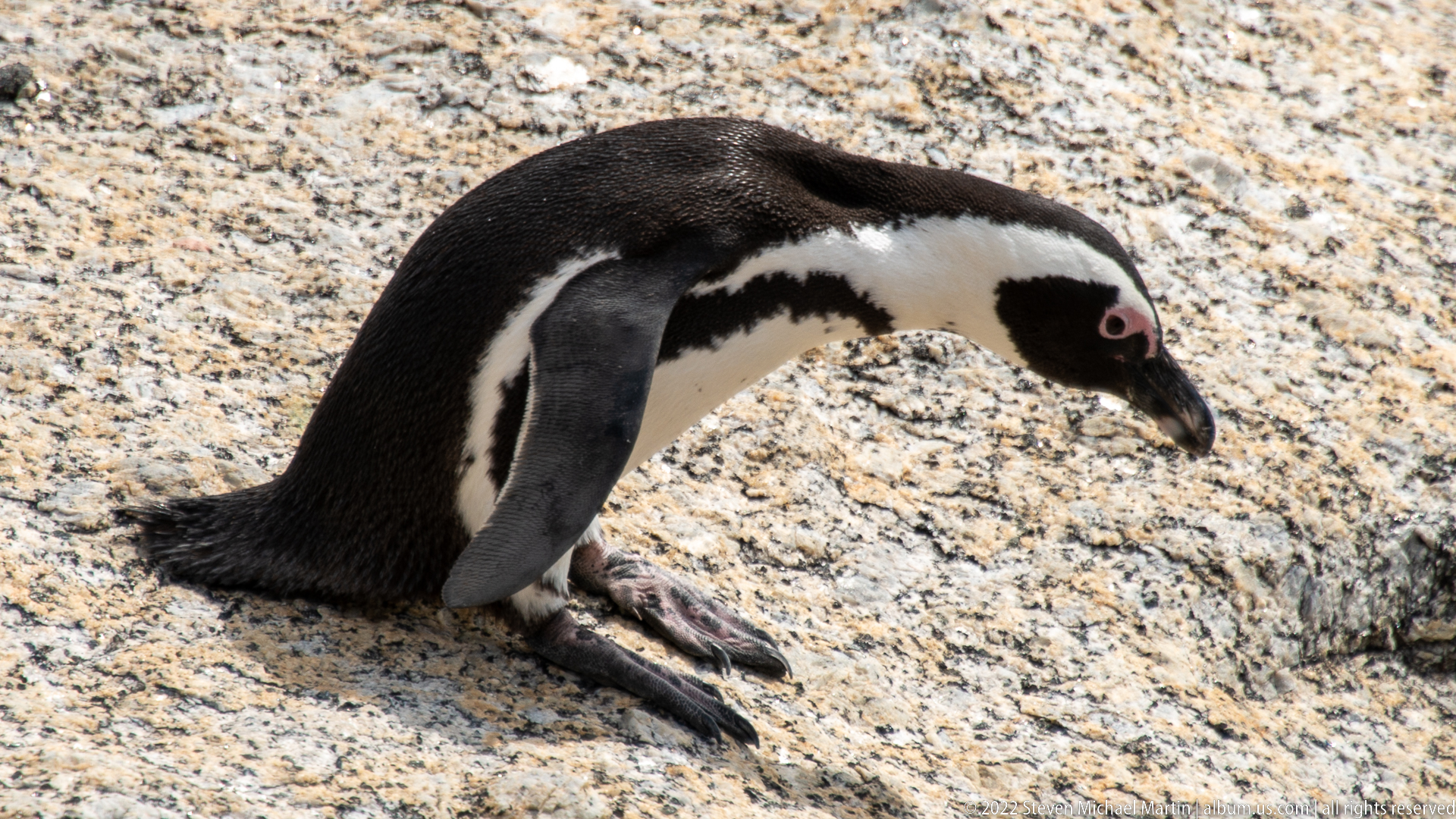
An African penguin crouches low on sunlit granite, with its feet extended forward and tail resting against the rock. The bird’s head is lowered slightly, creating a quiet resting posture distinct from the standing and walking views nearby. Fine plumage detail, pink skin above the eye, and the spotted white breast are all clearly visible at close range.
Caption
An African penguin crouches low on sunlit granite, with its feet extended forward and tail resting against the rock. The bird’s head is lowered slightly, creating a quiet resting posture distinct from the standing and walking views nearby. Fine plumage detail, pink skin above the eye, and the spotted white breast are all clearly visible at close range.
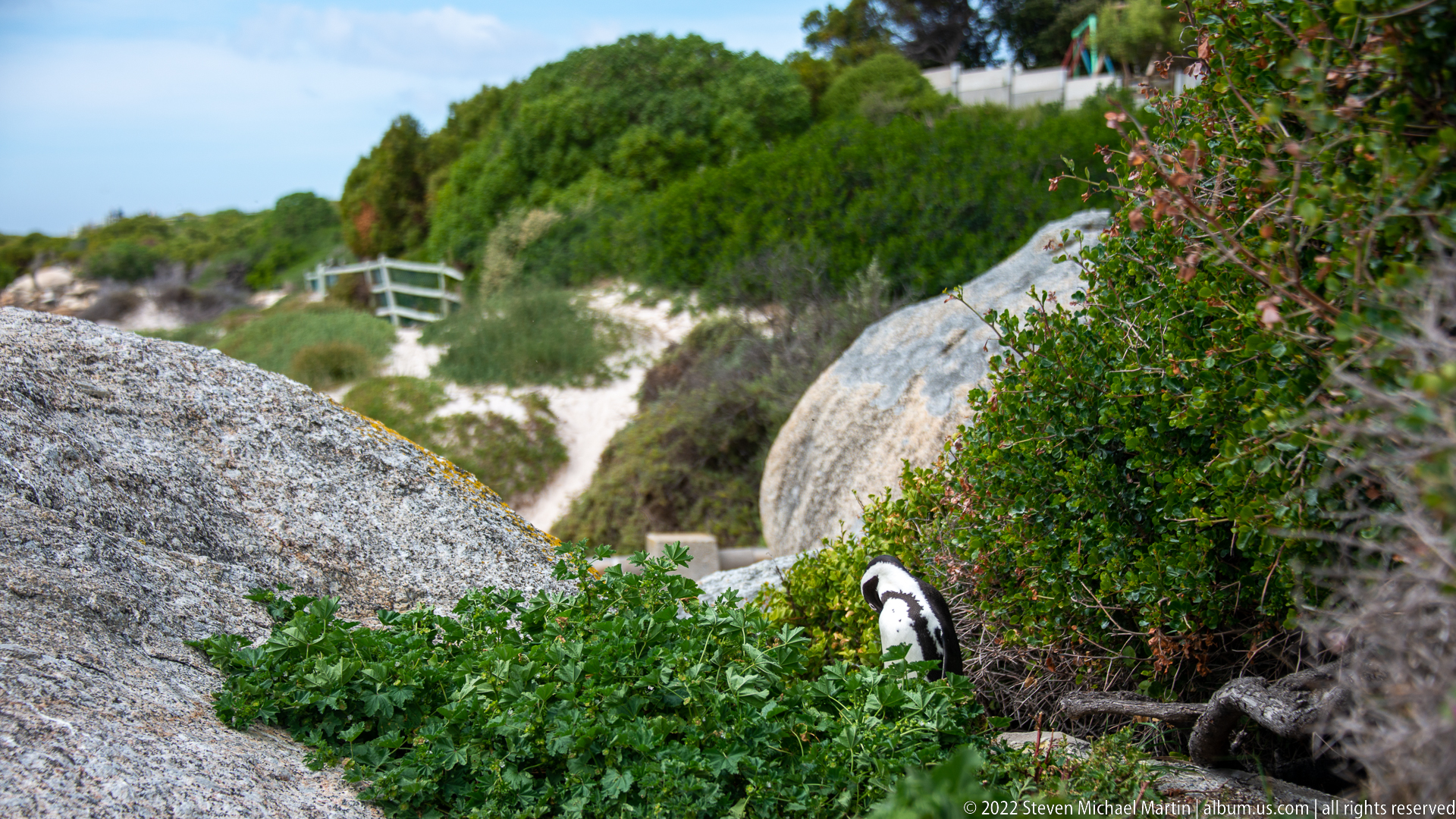
An African penguin is partly concealed by dense green coastal vegetation between large granite boulders, with a sandy path and boardwalk-like rail visible farther upslope. The frame shifts attention from open rock to the vegetated nesting environment used by the colony. The bird’s black-and-white body emerges from the foliage, showing how closely penguins move through shrub cover near visitor infrastructure.
Caption
An African penguin is partly concealed by dense green coastal vegetation between large granite boulders, with a sandy path and boardwalk-like rail visible farther upslope. The frame shifts attention from open rock to the vegetated nesting environment used by the colony. The bird’s black-and-white body emerges from the foliage, showing how closely penguins move through shrub cover near visitor infrastructure.
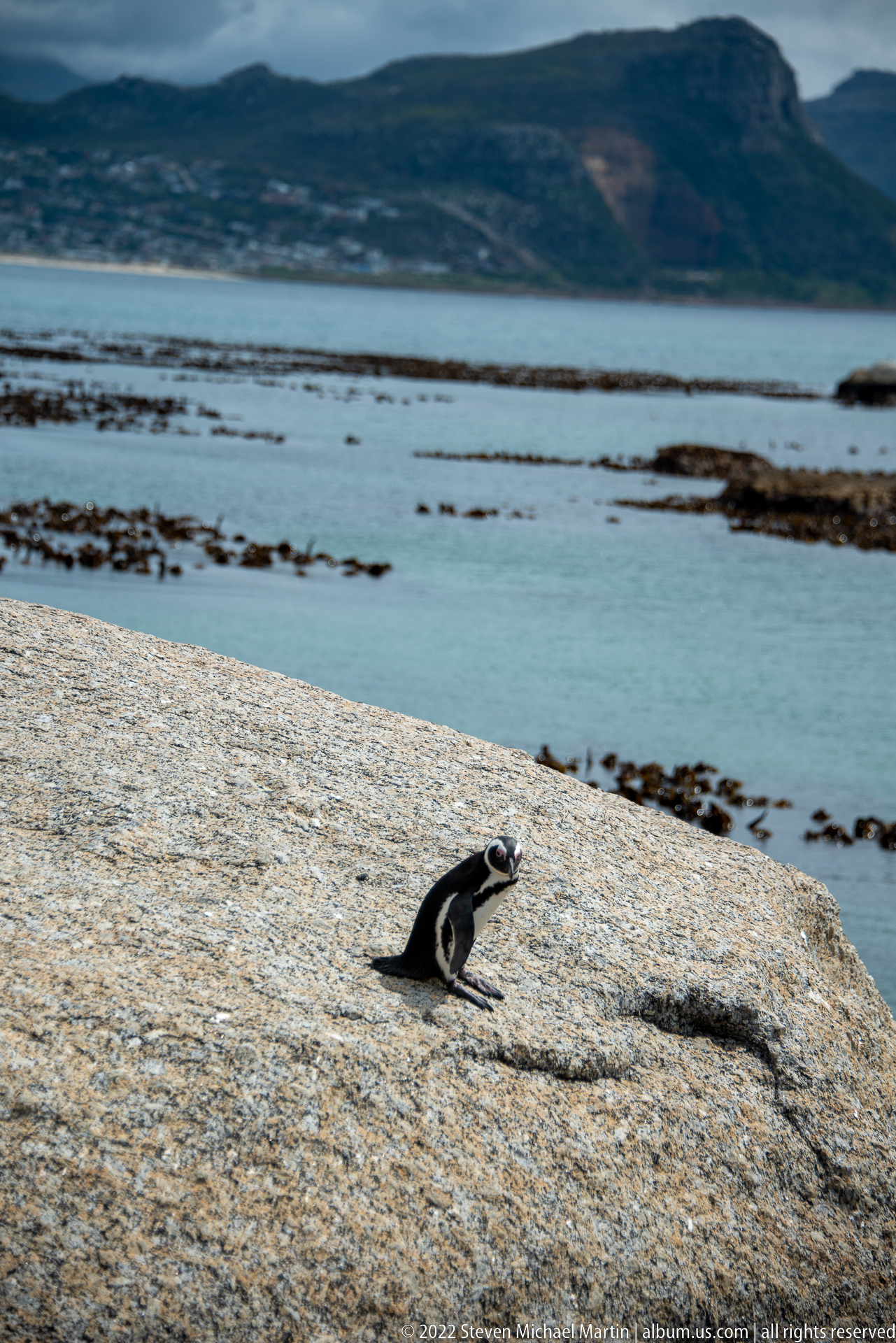
A solitary African penguin sits on an expansive granite platform above calm water, with kelp beds and a dark mountain ridge stretching across the distance. The unusually wide composition reduces the bird to a small figure and makes habitat the dominant subject. Smooth granite, sheltered sea, intertidal kelp, and the mountain-lined bay together define the broader environmental setting of the Boulders colony.
Caption
A solitary African penguin sits on an expansive granite platform above calm water, with kelp beds and a dark mountain ridge stretching across the distance. The unusually wide composition reduces the bird to a small figure and makes habitat the dominant subject. Smooth granite, sheltered sea, intertidal kelp, and the mountain-lined bay together define the broader environmental setting of the Boulders colony.
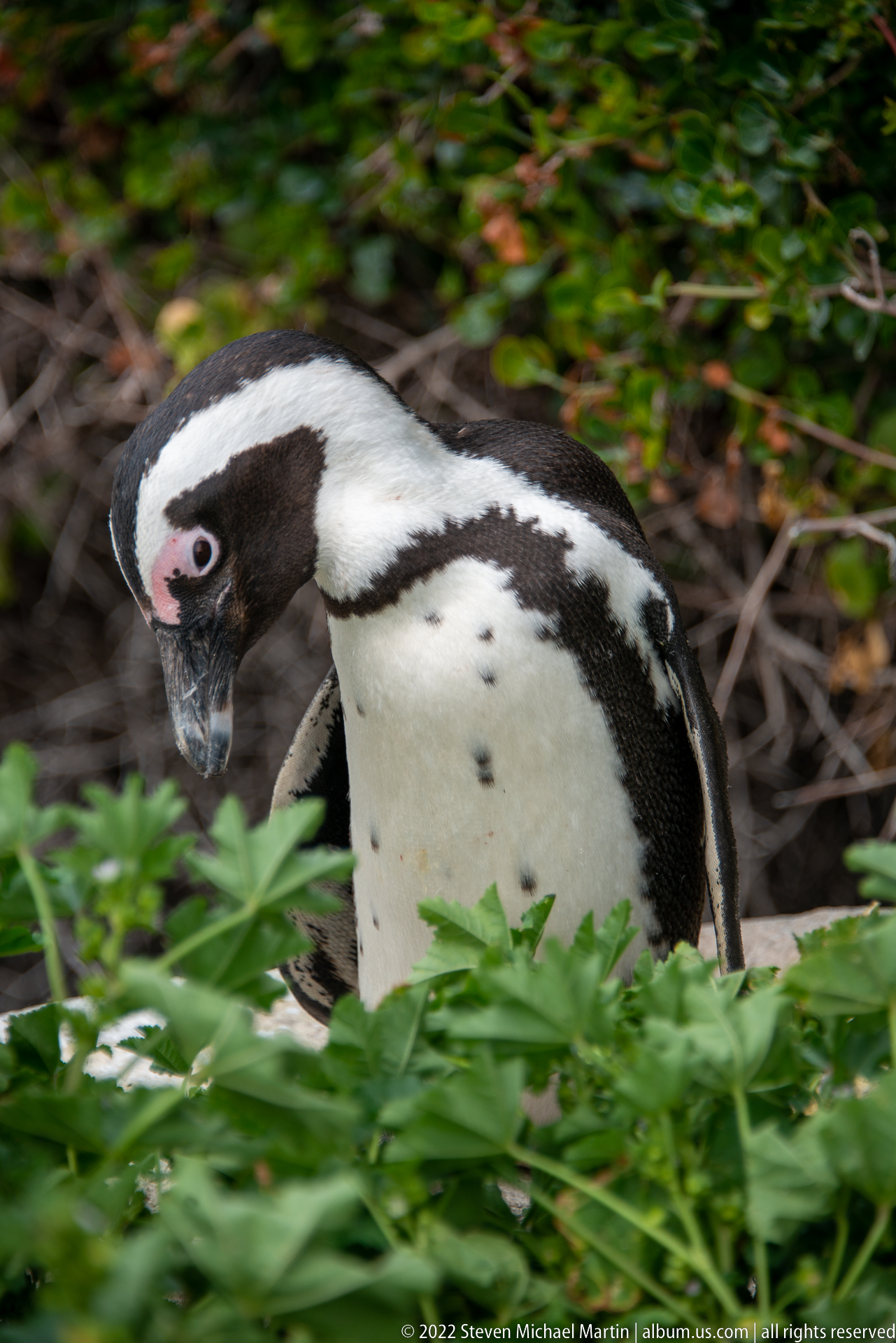
An African penguin advances through dense green foliage, its face and upper body emerging sharply against a darker tangle of branches. The pink skin above the eye, black bill, white facial stripe, breast spotting, and layered waterproof feathers are rendered in close detail. The vegetation-filled frame emphasizes the terrestrial side of the species’ life at Boulders, away from the open shoreline.
Caption
An African penguin advances through dense green foliage, its face and upper body emerging sharply against a darker tangle of branches. The pink skin above the eye, black bill, white facial stripe, breast spotting, and layered waterproof feathers are rendered in close detail. The vegetation-filled frame emphasizes the terrestrial side of the species’ life at Boulders, away from the open shoreline.

An African penguin fills the frame as it moves through low green vegetation, its black bill angled forward and pink orbital skin clearly visible. Fine feather texture and several dark breast spots distinguish the individual at close range. The shallow background keeps attention on the bird while retaining enough foliage to place the portrait within the vegetated portion of the Boulders colony.
Caption
An African penguin fills the frame as it moves through low green vegetation, its black bill angled forward and pink orbital skin clearly visible. Fine feather texture and several dark breast spots distinguish the individual at close range. The shallow background keeps attention on the bird while retaining enough foliage to place the portrait within the vegetated portion of the Boulders colony.
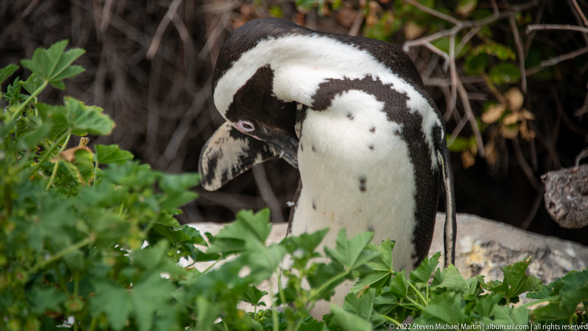
An African penguin bends its head down toward its chest and flank while standing among green leaves and woody stems. The close crop records preening behavior, an essential part of maintaining the dense waterproof plumage required for marine life. White belly feathers, black breast band, and the side of the head remain visible through the surrounding vegetation.
Caption
An African penguin bends its head down toward its chest and flank while standing among green leaves and woody stems. The close crop records preening behavior, an essential part of maintaining the dense waterproof plumage required for marine life. White belly feathers, black breast band, and the side of the head remain visible through the surrounding vegetation.
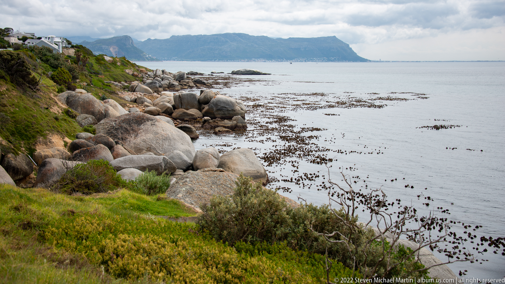
Large rounded boulders line the near shore while floating and exposed kelp forms dark bands across the calm water of False Bay. Across the bay, a broad mountain massif sits beneath overcast skies. The view returns from wildlife portraiture to habitat, showing the rocky, kelp-rich coast that supports the Boulders penguin colony and other marine life along the Cape Peninsula.
Caption
Large rounded boulders line the near shore while floating and exposed kelp forms dark bands across the calm water of False Bay. Across the bay, a broad mountain massif sits beneath overcast skies. The view returns from wildlife portraiture to habitat, showing the rocky, kelp-rich coast that supports the Boulders penguin colony and other marine life along the Cape Peninsula.
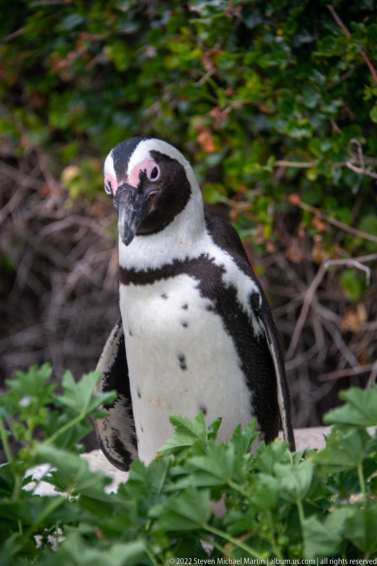
An African penguin turns toward the viewer from behind a band of green foliage, giving a nearly frontal view of its face, throat, and upper breast. The pale pink skin above both eyes and the strong black-and-white facial pattern are especially prominent. The alert posture contrasts with adjacent profile views and provides a direct species portrait in the colony’s shrub habitat.
Caption
An African penguin turns toward the viewer from behind a band of green foliage, giving a nearly frontal view of its face, throat, and upper breast. The pale pink skin above both eyes and the strong black-and-white facial pattern are especially prominent. The alert posture contrasts with adjacent profile views and provides a direct species portrait in the colony’s shrub habitat.
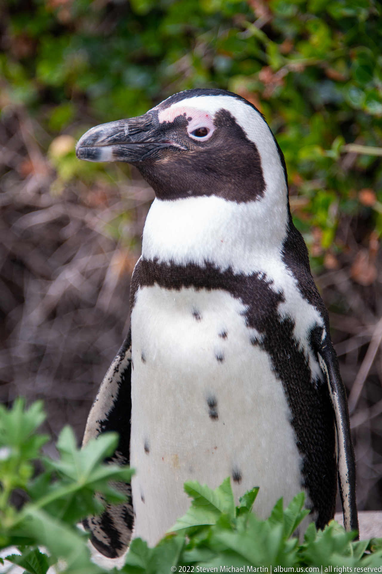
A tight side portrait isolates an African penguin’s head, neck, and upper breast against blurred vegetation. The long dark bill, narrow pink orbital patch, white facial band, black breast stripe, and scattered dark spots on the white plumage are clearly resolved. This close view provides the strongest morphological detail in the sequence and supports confident species identification.
Caption
A tight side portrait isolates an African penguin’s head, neck, and upper breast against blurred vegetation. The long dark bill, narrow pink orbital patch, white facial band, black breast stripe, and scattered dark spots on the white plumage are clearly resolved. This close view provides the strongest morphological detail in the sequence and supports confident species identification.
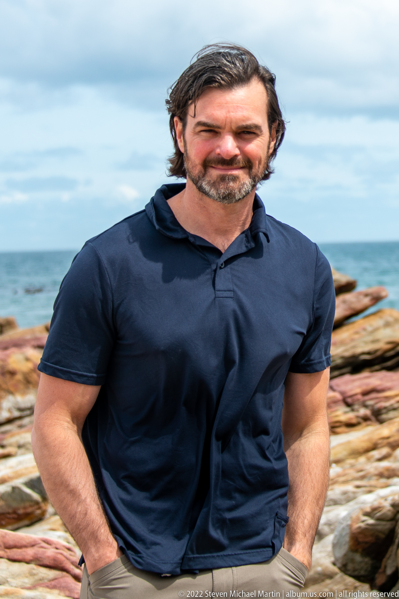
A close portrait shows a visitor in a dark navy shirt against softly blurred bands of reddish coastal rock and blue-gray sea. The shallow focus keeps facial expression and upper-body posture dominant while the distinctive shoreline colors remain legible in the background. Unlike the preceding environmental portrait, this frame minimizes geological context in favor of a direct human study at the Cape of Good Hope.
Caption
A close portrait shows a visitor in a dark navy shirt against softly blurred bands of reddish coastal rock and blue-gray sea. The shallow focus keeps facial expression and upper-body posture dominant while the distinctive shoreline colors remain legible in the background. Unlike the preceding environmental portrait, this frame minimizes geological context in favor of a direct human study at the Cape of Good Hope.
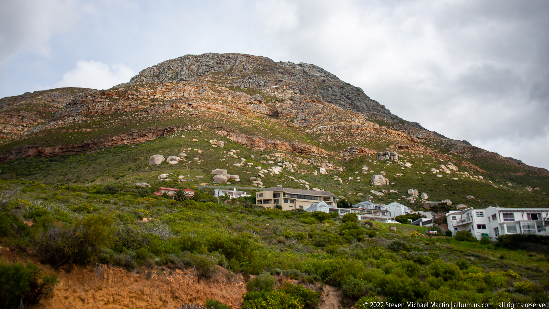
White houses cluster along the lower edge of a rugged mountain slope covered in dense green shrubland and scattered pale boulders. Horizontal bands of exposed rock and reddish vegetation reveal the layered geology of the terrain above the settlement. The photograph records the narrow interface between residential development and the steep, fynbos-covered mountains of the southern Cape Peninsula.
Caption
White houses cluster along the lower edge of a rugged mountain slope covered in dense green shrubland and scattered pale boulders. Horizontal bands of exposed rock and reddish vegetation reveal the layered geology of the terrain above the settlement. The photograph records the narrow interface between residential development and the steep, fynbos-covered mountains of the southern Cape Peninsula.
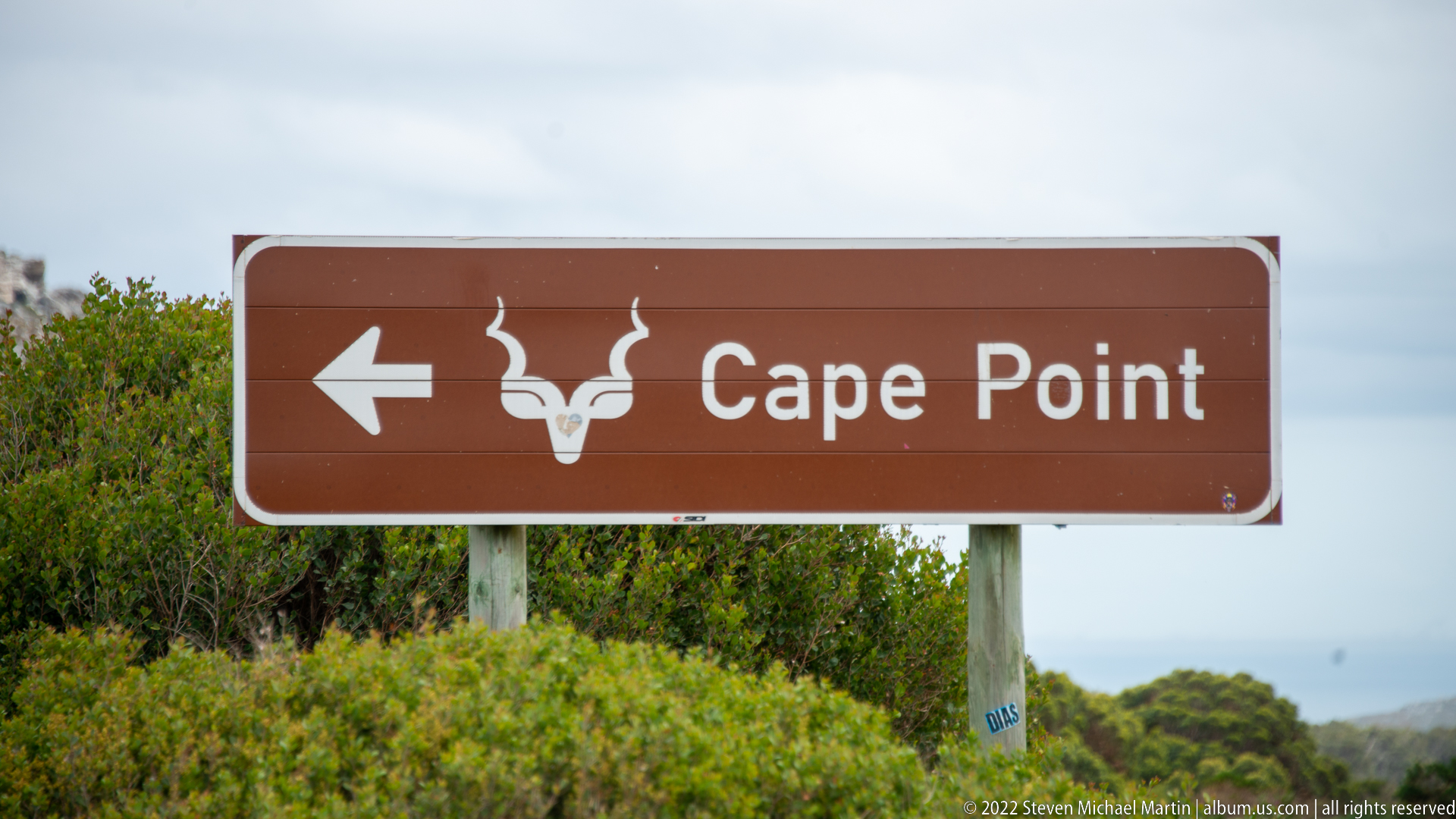
A brown tourism road sign points left toward Cape Point and includes a stylized antelope-head emblem. Set against dense coastal shrubland, the sign marks the route deeper into the Cape of Good Hope section of Table Mountain National Park. Its explicit wording provides firm geographic evidence for the transition from the False Bay settlements and Boulders area toward the peninsula’s southern headlands.
Caption
A brown tourism road sign points left toward Cape Point and includes a stylized antelope-head emblem. Set against dense coastal shrubland, the sign marks the route deeper into the Cape of Good Hope section of Table Mountain National Park. Its explicit wording provides firm geographic evidence for the transition from the False Bay settlements and Boulders area toward the peninsula’s southern headlands.
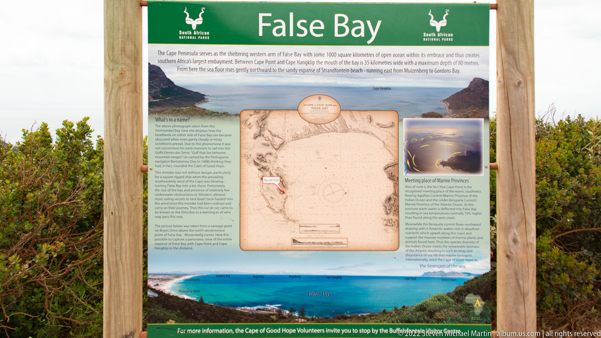
An outdoor interpretive panel headed “False Bay” combines maps, historical graphics, landscape photographs, and explanatory text about the bay. Mounted between timber posts within dense shrubland, the display provides geographic and historical context for the coastal landscapes seen earlier in the portfolio. Its maps and title directly identify the broad body of water east of the Cape Peninsula.
Caption
An outdoor interpretive panel headed “False Bay” combines maps, historical graphics, landscape photographs, and explanatory text about the bay. Mounted between timber posts within dense shrubland, the display provides geographic and historical context for the coastal landscapes seen earlier in the portfolio. Its maps and title directly identify the broad body of water east of the Cape Peninsula.
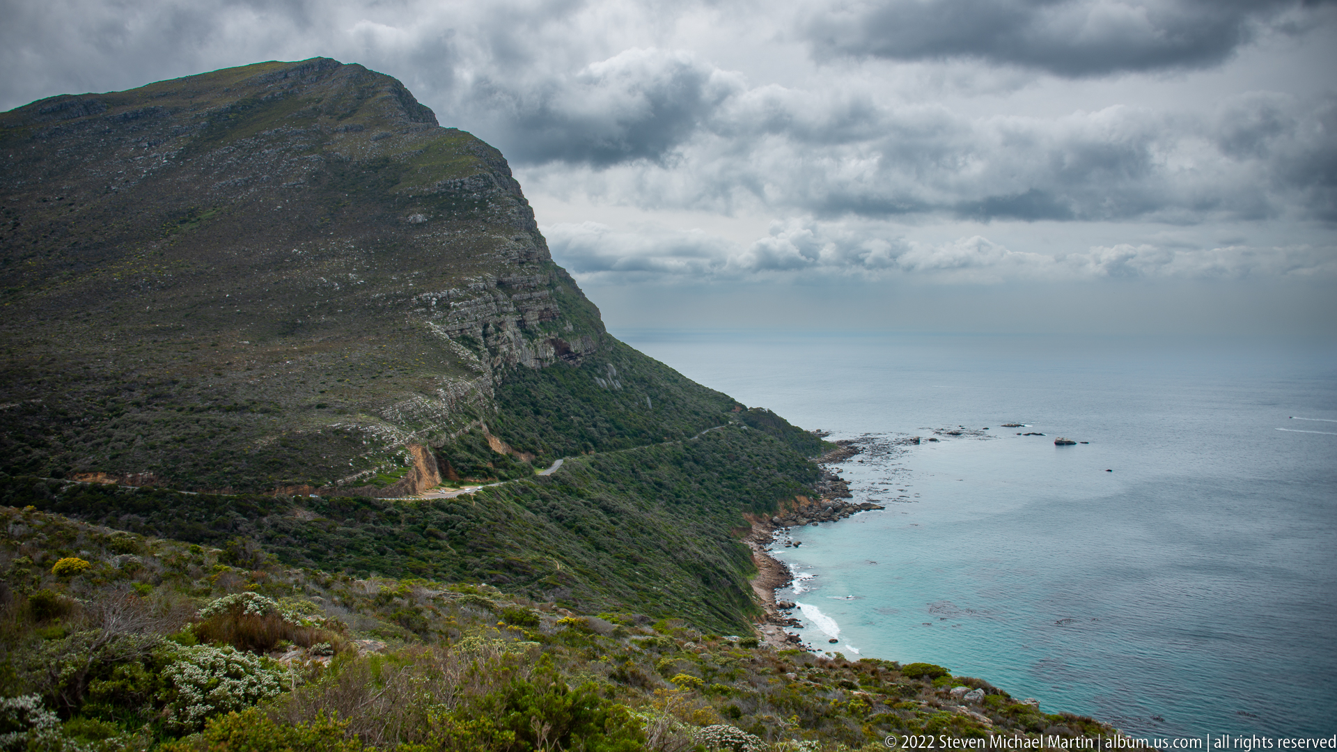
A steep mountain wall drops toward a narrow rocky shoreline and pale turquoise shallows, with a small track or road cut visible on the lower slope. Low fynbos covers the foreground and dark clouds hang above the sea. The elevated perspective emphasizes the dramatic relief of the southern Cape Peninsula, where mountain, vegetation, and exposed coast meet within a confined strip.
Caption
A steep mountain wall drops toward a narrow rocky shoreline and pale turquoise shallows, with a small track or road cut visible on the lower slope. Low fynbos covers the foreground and dark clouds hang above the sea. The elevated perspective emphasizes the dramatic relief of the southern Cape Peninsula, where mountain, vegetation, and exposed coast meet within a confined strip.
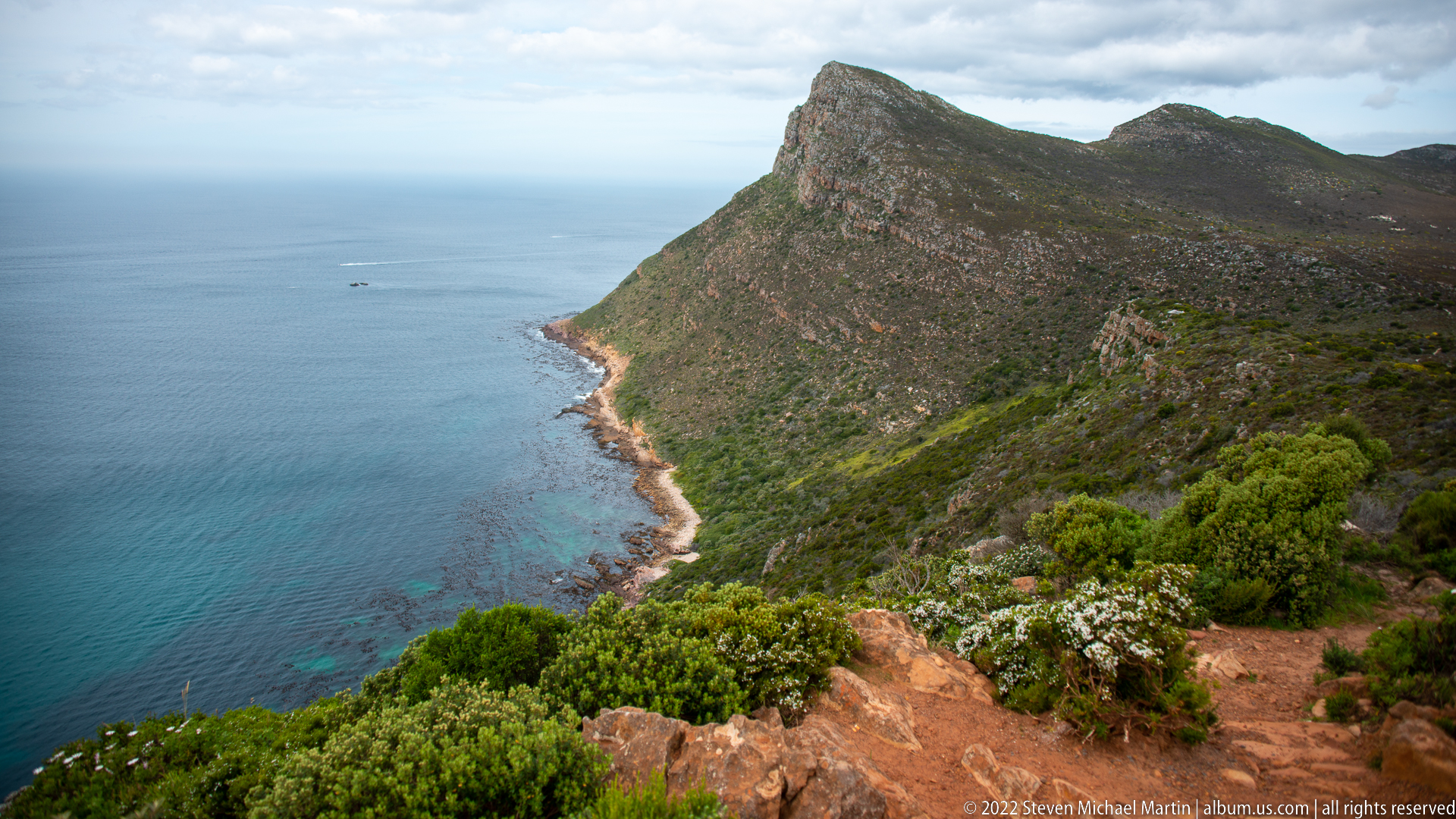
A rugged ridge covered in dark green fynbos rises sharply above a narrow rocky shoreline, with deep blue water extending into the distance. Reddish footpaths and exposed stone break the vegetation in the foreground. Compared with the preceding valley view, this frame looks along the mountain’s seaward face and emphasizes the elongated headland geometry of the Cape Peninsula.
Caption
A rugged ridge covered in dark green fynbos rises sharply above a narrow rocky shoreline, with deep blue water extending into the distance. Reddish footpaths and exposed stone break the vegetation in the foreground. Compared with the preceding valley view, this frame looks along the mountain’s seaward face and emphasizes the elongated headland geometry of the Cape Peninsula.
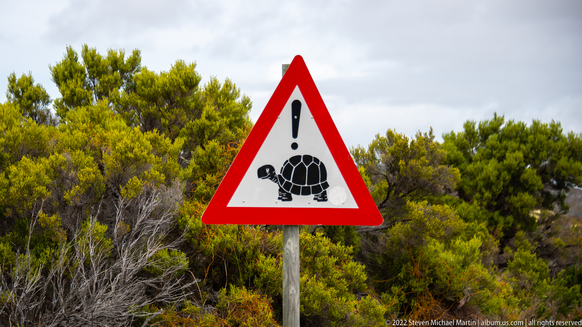
A triangular roadside warning sign shows a stylized tortoise beneath a vertical caution symbol, set against dense fynbos vegetation. The sign alerts drivers to slow-moving terrestrial wildlife crossing roads within the protected Cape Peninsula landscape. Rather than identifying a particular tortoise species, the photograph records the park’s wildlife-management message and the shared space between vehicles and native fauna.
Caption
A triangular roadside warning sign shows a stylized tortoise beneath a vertical caution symbol, set against dense fynbos vegetation. The sign alerts drivers to slow-moving terrestrial wildlife crossing roads within the protected Cape Peninsula landscape. Rather than identifying a particular tortoise species, the photograph records the park’s wildlife-management message and the shared space between vehicles and native fauna.
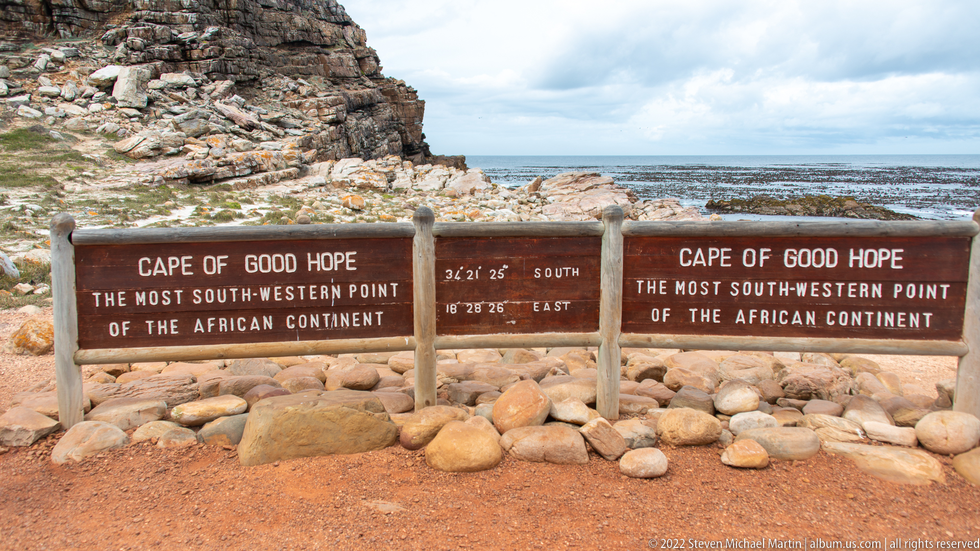
The well-known Cape of Good Hope marker stands on the rocky Atlantic shore, identifying the site as “the most south-western point of the African continent” and displaying its coordinates. Behind the timber signs, pale boulders, stratified rock, and a kelp-fringed sea establish the rugged coastal setting. The marker provides direct visual confirmation that the route has reached the Cape of Good Hope itself.
Caption
The well-known Cape of Good Hope marker stands on the rocky Atlantic shore, identifying the site as “the most south-western point of the African continent” and displaying its coordinates. Behind the timber signs, pale boulders, stratified rock, and a kelp-fringed sea establish the rugged coastal setting. The marker provides direct visual confirmation that the route has reached the Cape of Good Hope itself.
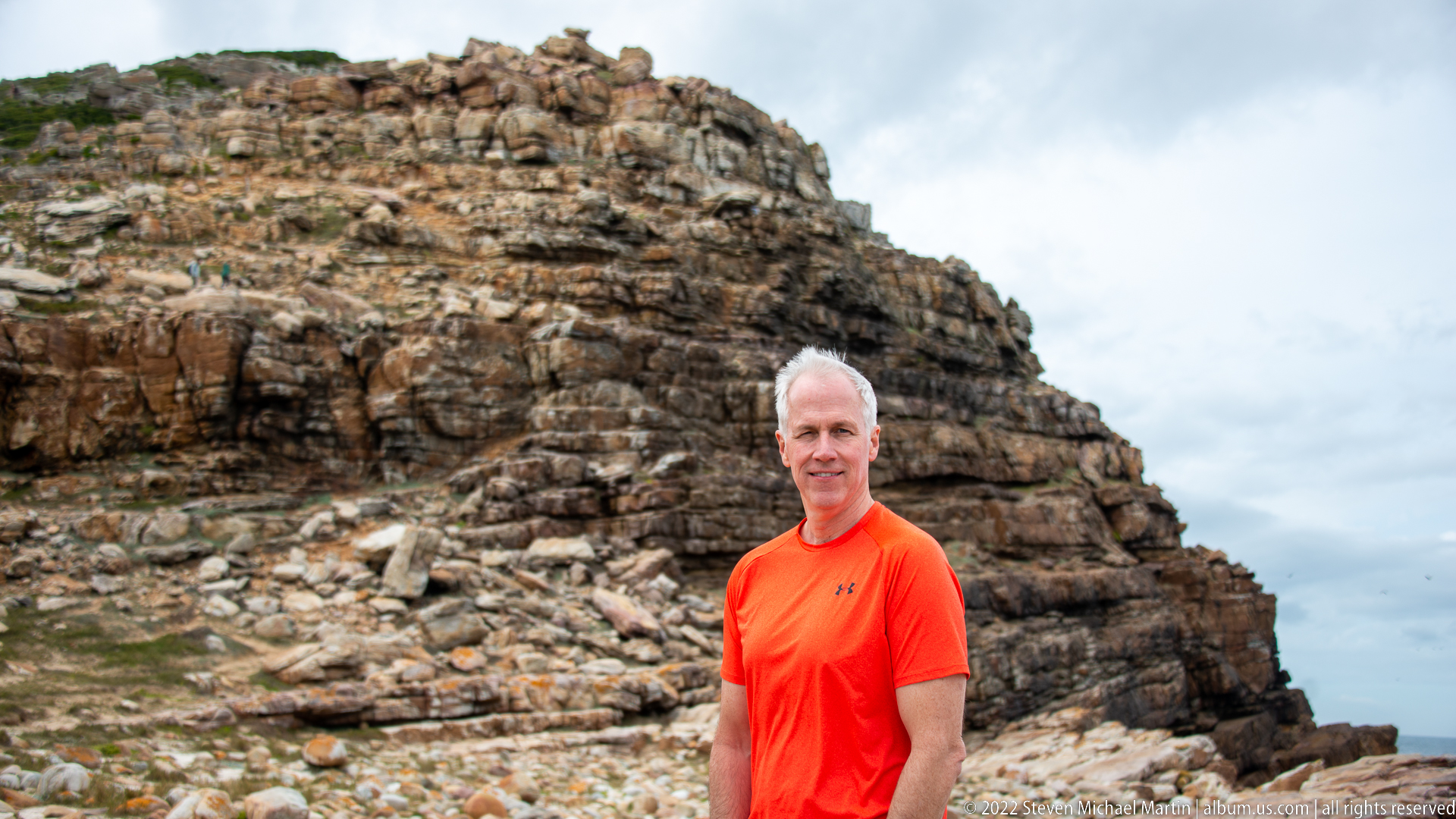
A visitor in a bright orange shirt stands before a steep wall of fractured, layered rock near the Cape of Good Hope shoreline. The portrait places the person against the site’s rugged geology, using the angular strata and weathered surfaces to establish scale. Cloudy light softens the background while the saturated clothing separates the figure clearly from the muted brown and gray rock.
Caption
A visitor in a bright orange shirt stands before a steep wall of fractured, layered rock near the Cape of Good Hope shoreline. The portrait places the person against the site’s rugged geology, using the angular strata and weathered surfaces to establish scale. Cloudy light softens the background while the saturated clothing separates the figure clearly from the muted brown and gray rock.
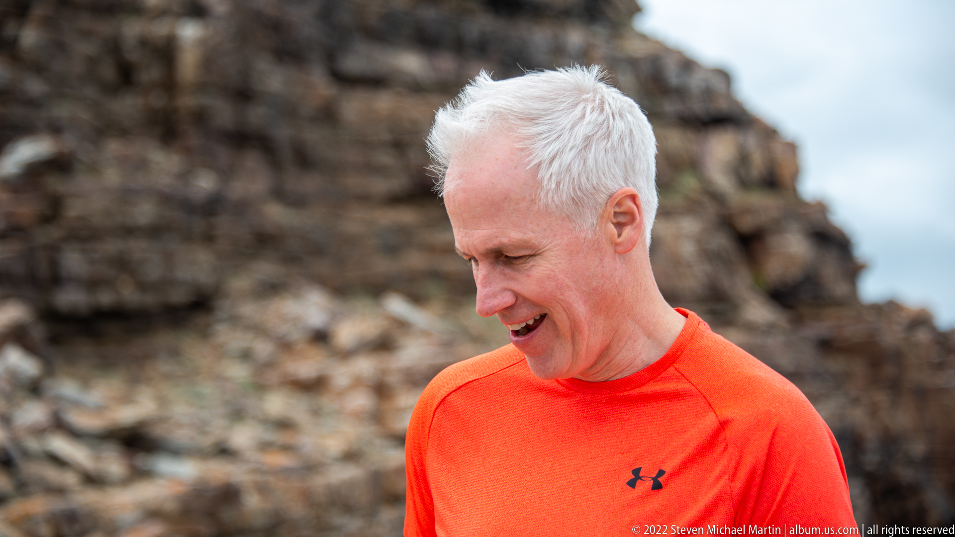
A close portrait isolates a visitor in an orange shirt against a softly blurred wall of weathered coastal rock. The shallow depth of field removes most environmental detail while retaining enough of the fractured stone to connect the portrait with the Cape of Good Hope shoreline. The downward glance and candid expression distinguish this frame from the more formal standing portrait immediately before it.
Caption
A close portrait isolates a visitor in an orange shirt against a softly blurred wall of weathered coastal rock. The shallow depth of field removes most environmental detail while retaining enough of the fractured stone to connect the portrait with the Cape of Good Hope shoreline. The downward glance and candid expression distinguish this frame from the more formal standing portrait immediately before it.
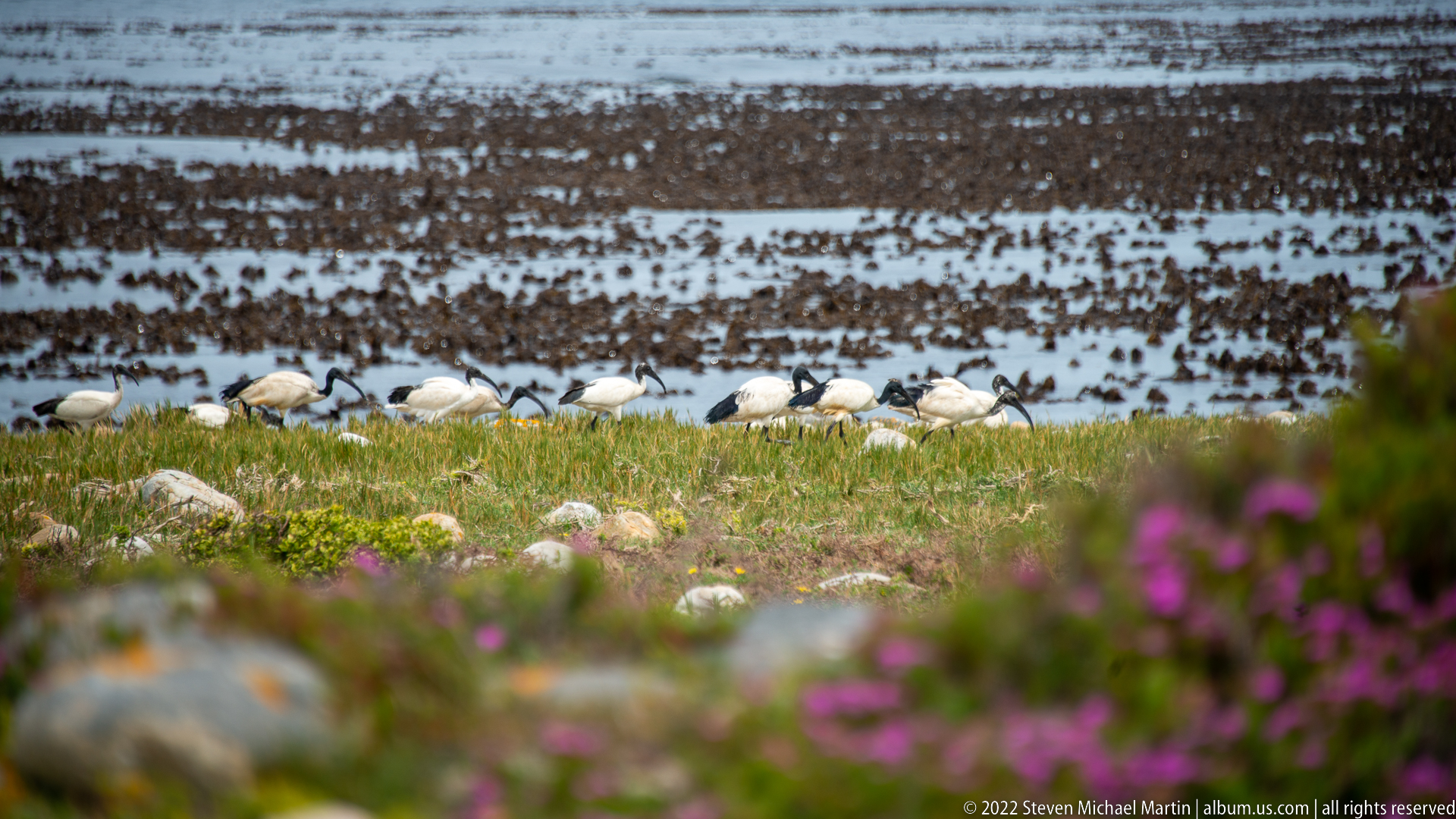
A line of African sacred ibises forages through short coastal vegetation above a broad, kelp-covered intertidal flat. Their white bodies, black heads, and long down-curved bills are visible against the dark seaweed behind them. The compressed telephoto view links the birds with the nutrient-rich shoreline habitat, while soft purple flowers in the foreground add a distinct seasonal layer to the coastal scene.
Caption
A line of African sacred ibises forages through short coastal vegetation above a broad, kelp-covered intertidal flat. Their white bodies, black heads, and long down-curved bills are visible against the dark seaweed behind them. The compressed telephoto view links the birds with the nutrient-rich shoreline habitat, while soft purple flowers in the foreground add a distinct seasonal layer to the coastal scene.
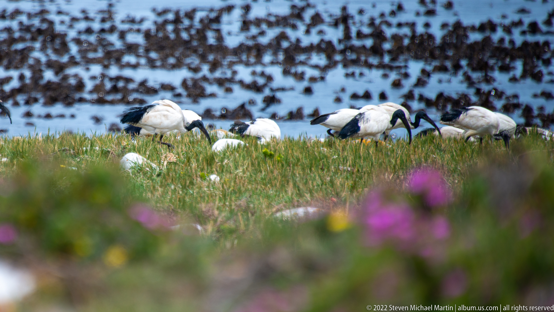
A small group of African sacred ibises moves through low grass at the edge of the kelp-covered shore, their black bare heads and strongly curved bills sharply defined. The tighter framing emphasizes individual plumage and feeding posture rather than the wider coastline. Out-of-focus purple flowers across the foreground create depth while the dark intertidal background situates the birds within the Cape’s marine-edge habitat.
Caption
A small group of African sacred ibises moves through low grass at the edge of the kelp-covered shore, their black bare heads and strongly curved bills sharply defined. The tighter framing emphasizes individual plumage and feeding posture rather than the wider coastline. Out-of-focus purple flowers across the foreground create depth while the dark intertidal background situates the birds within the Cape’s marine-edge habitat.
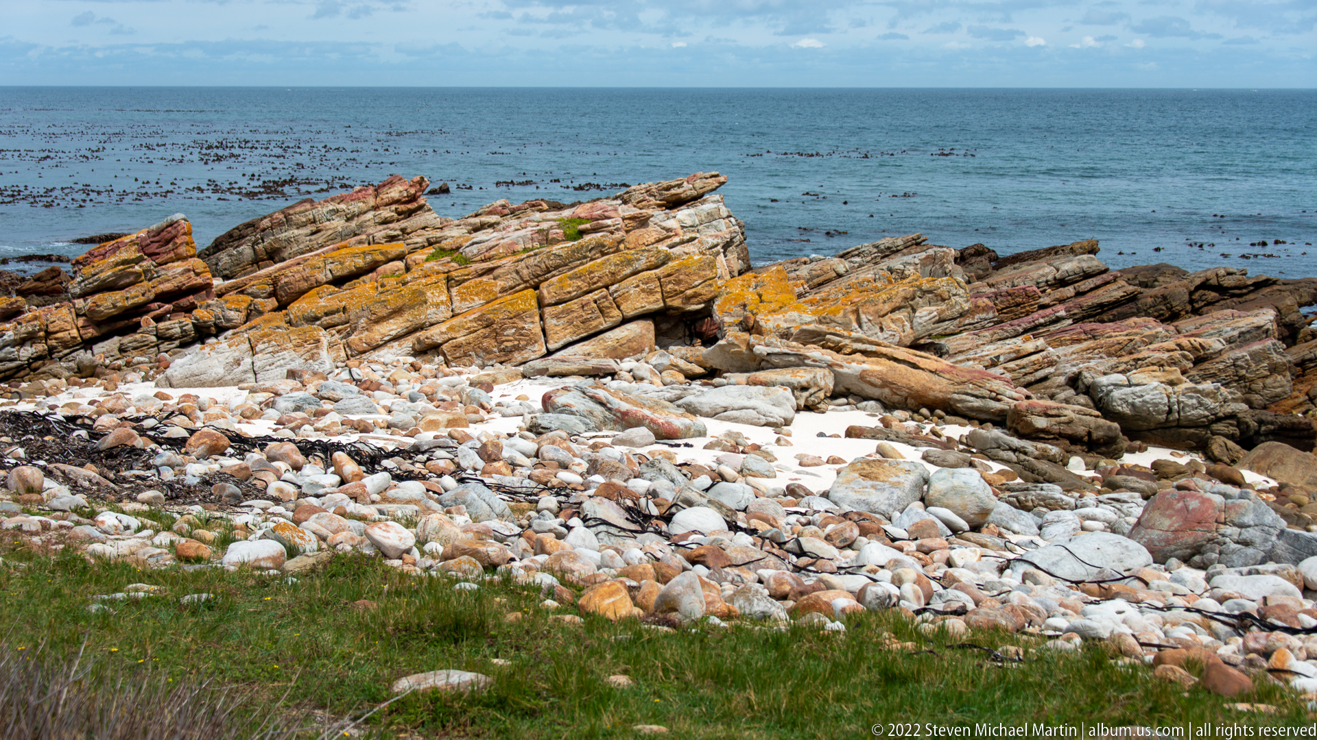
Strongly tilted bands of reddish, ocher, and gray rock form a jagged shoreline above a narrow beach of rounded pale cobbles. Beyond the outcrop, dark kelp beds spread across the calm sea. The frame concentrates on geological structure and erosion, showing how resistant strata break into angular ledges while wave action rounds loose fragments along the waterline.
Caption
Strongly tilted bands of reddish, ocher, and gray rock form a jagged shoreline above a narrow beach of rounded pale cobbles. Beyond the outcrop, dark kelp beds spread across the calm sea. The frame concentrates on geological structure and erosion, showing how resistant strata break into angular ledges while wave action rounds loose fragments along the waterline.

A visitor stands among rounded beach stones and tilted rock slabs beside the Cape of Good Hope shoreline. Tide pools, exposed reefs, and the open sea extend behind the figure beneath a heavy cloud deck. The wide portrait gives the strongest sense of human scale in this rocky landscape, contrasting the person’s upright form with the broken geometry of the surrounding coast.
Caption
A visitor stands among rounded beach stones and tilted rock slabs beside the Cape of Good Hope shoreline. Tide pools, exposed reefs, and the open sea extend behind the figure beneath a heavy cloud deck. The wide portrait gives the strongest sense of human scale in this rocky landscape, contrasting the person’s upright form with the broken geometry of the surrounding coast.
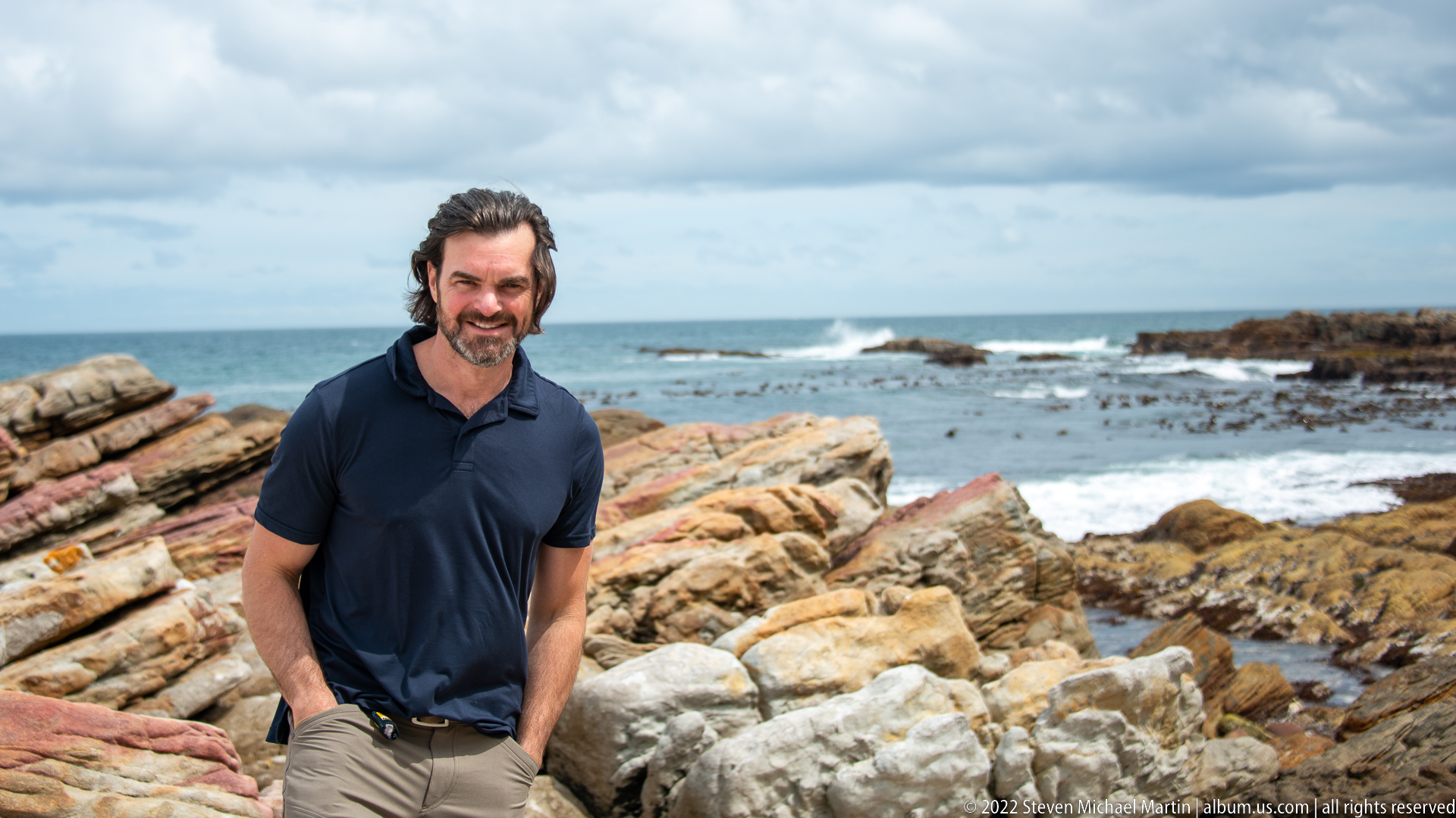
A visitor in a navy shirt stands before a vivid sequence of tilted rock ledges, shallow tidal water, kelp, and breaking surf. The three-quarter portrait preserves more of the Cape of Good Hope environment than the adjacent close-up, allowing the weathered geology and active shoreline to share visual weight with the figure. Cloud-filtered light brings out the varied rust, cream, and gray tones of the rocks.
Caption
A visitor in a navy shirt stands before a vivid sequence of tilted rock ledges, shallow tidal water, kelp, and breaking surf. The three-quarter portrait preserves more of the Cape of Good Hope environment than the adjacent close-up, allowing the weathered geology and active shoreline to share visual weight with the figure. Cloud-filtered light brings out the varied rust, cream, and gray tones of the rocks.
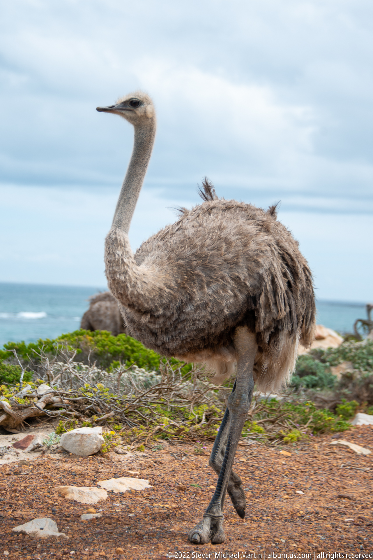
A brown-gray common ostrich walks across low coastal vegetation with the ocean and rocky shore behind. Its long bare neck, powerful legs, compact feathered body, and small head clearly identify the species, while the muted plumage is consistent with a female or immature bird. The coastal setting is distinctive: an animal usually associated with open terrestrial landscapes appears here within the windswept Cape Peninsula environment.
Caption
A brown-gray common ostrich walks across low coastal vegetation with the ocean and rocky shore behind. Its long bare neck, powerful legs, compact feathered body, and small head clearly identify the species, while the muted plumage is consistent with a female or immature bird. The coastal setting is distinctive: an animal usually associated with open terrestrial landscapes appears here within the windswept Cape Peninsula environment.
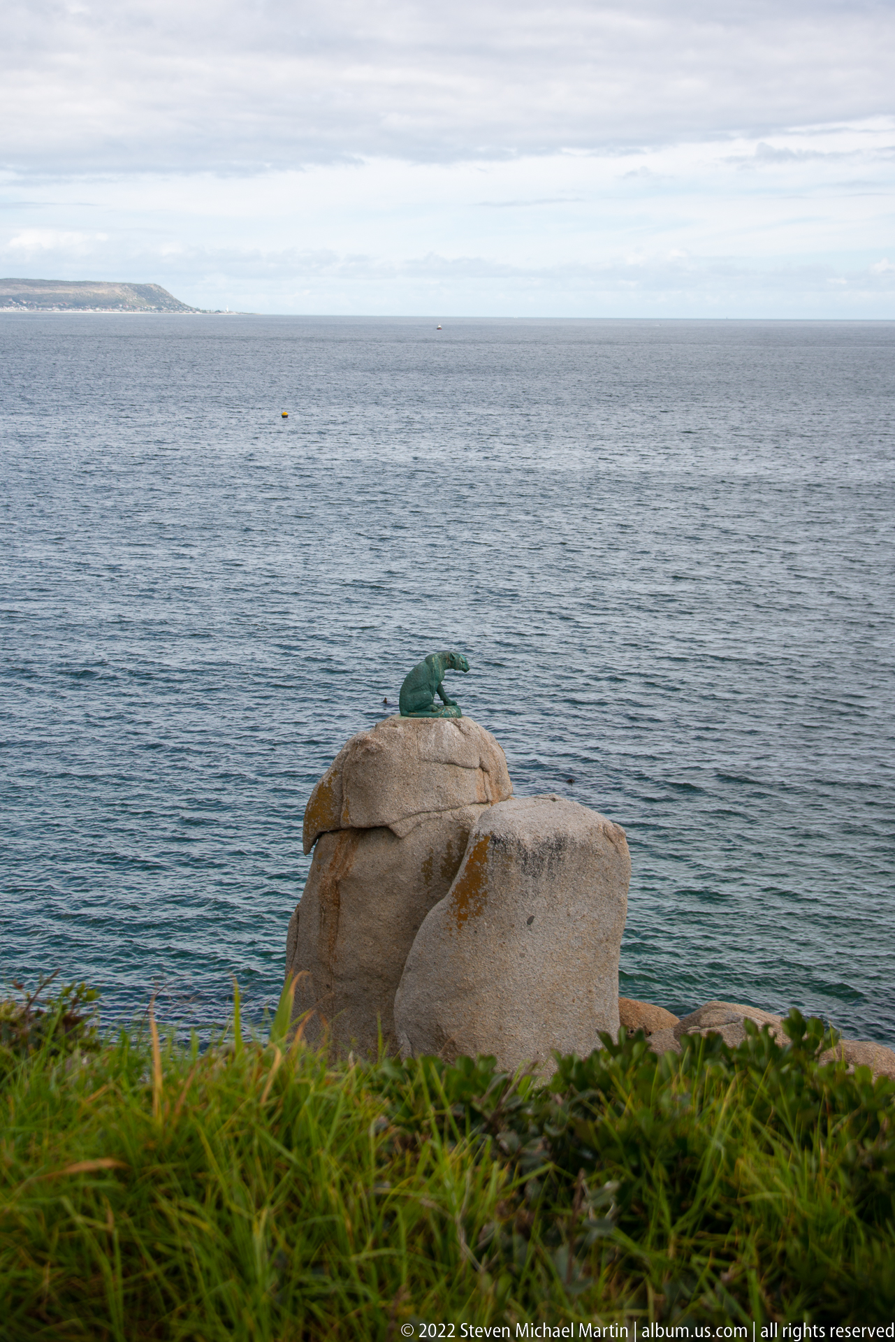
A rounded pale boulder rises above dense green coastal vegetation with open gray-blue water stretching to the horizon. Weathering has softened the rock into smooth, bulbous forms, and a small patch of vivid green growth clings to its upper surface. The spare composition isolates one element of the Cape Peninsula’s rocky coastal landscape rather than presenting a named landmark.
Caption
A rounded pale boulder rises above dense green coastal vegetation with open gray-blue water stretching to the horizon. Weathering has softened the rock into smooth, bulbous forms, and a small patch of vivid green growth clings to its upper surface. The spare composition isolates one element of the Cape Peninsula’s rocky coastal landscape rather than presenting a named landmark.
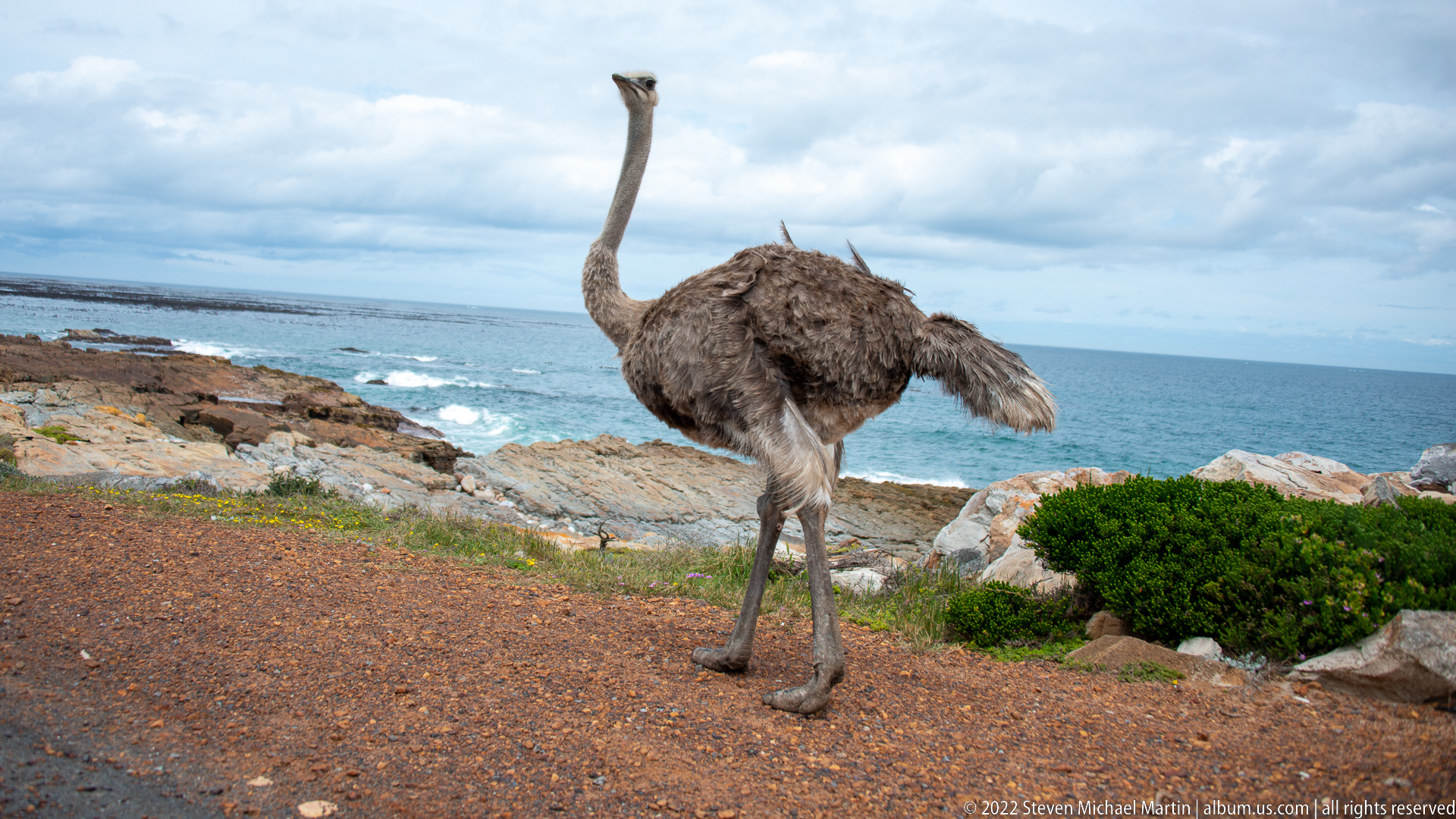
A common ostrich strides away along a reddish gravel track above the rocky coast, its long neck held upright and loose brown-gray wing feathers lifted slightly by movement or wind. The rear three-quarter view emphasizes the bird’s long legs and powerful walking gait. Blue ocean, low shrubs, and exposed shore rock clearly place the encounter within the open coastal landscape of the Cape Peninsula.
Caption
A common ostrich strides away along a reddish gravel track above the rocky coast, its long neck held upright and loose brown-gray wing feathers lifted slightly by movement or wind. The rear three-quarter view emphasizes the bird’s long legs and powerful walking gait. Blue ocean, low shrubs, and exposed shore rock clearly place the encounter within the open coastal landscape of the Cape Peninsula.

An adult male common ostrich stands in side profile near the Cape coast, its predominantly black body plumage and conspicuous white wing and tail feathers clearly visible. The pale neck and long legs rise above a rocky shoreline blurred by shallow depth of field. The plumage strongly distinguishes this bird from the brown-gray individuals in the preceding frames and supports identification as an adult male.
Caption
An adult male common ostrich stands in side profile near the Cape coast, its predominantly black body plumage and conspicuous white wing and tail feathers clearly visible. The pale neck and long legs rise above a rocky shoreline blurred by shallow depth of field. The plumage strongly distinguishes this bird from the brown-gray individuals in the preceding frames and supports identification as an adult male.
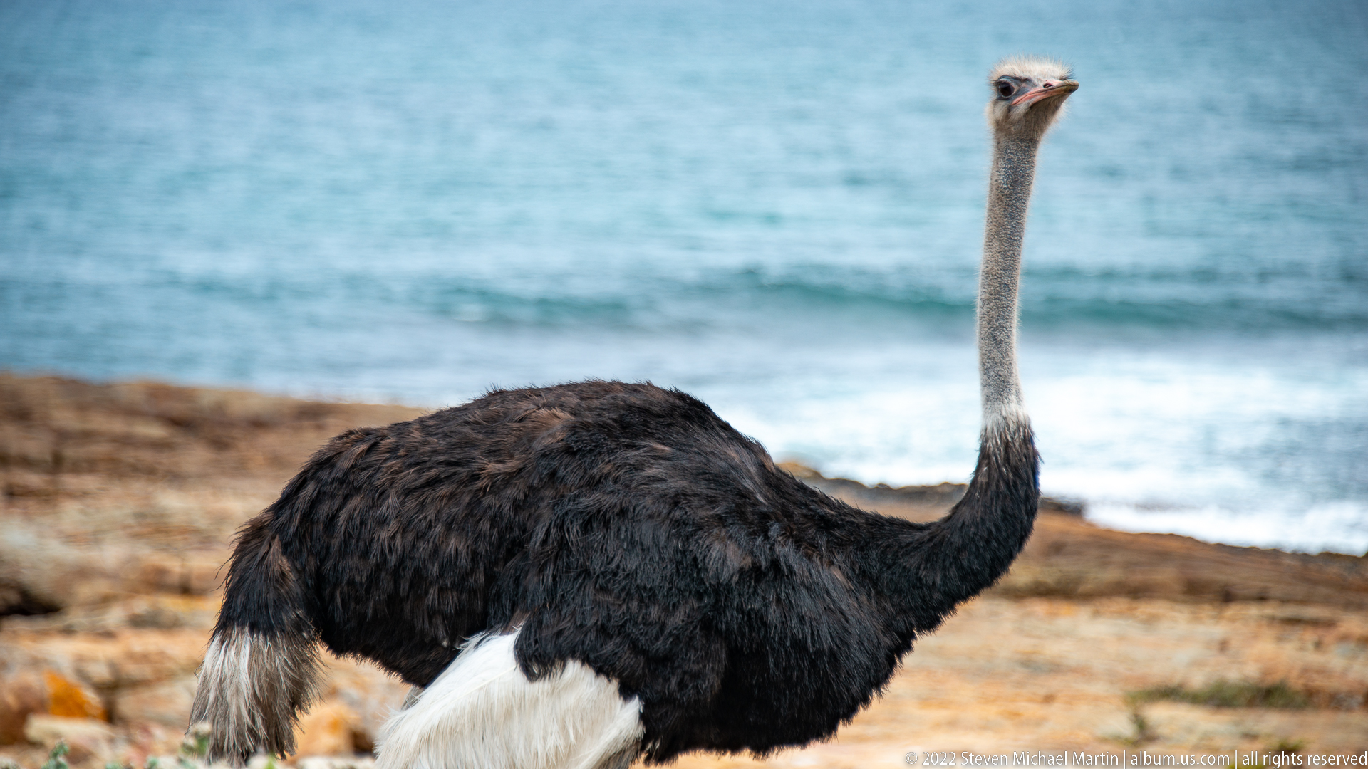
An adult male common ostrich fills the frame from body to head, its black plumage, white wing feathers, pale neck, and small alert head standing out against turquoise coastal water. The clean lateral view provides a strong species portrait and reinforces the sexual plumage contrast seen in the preceding sequence. The ocean backdrop makes the Cape Peninsula setting especially unusual for this large terrestrial bird.
Caption
An adult male common ostrich fills the frame from body to head, its black plumage, white wing feathers, pale neck, and small alert head standing out against turquoise coastal water. The clean lateral view provides a strong species portrait and reinforces the sexual plumage contrast seen in the preceding sequence. The ocean backdrop makes the Cape Peninsula setting especially unusual for this large terrestrial bird.

A narrow paved road runs beneath an arching canopy of mature trees whose pale trunks and twisting branches form a tunnel over the carriageway. Dense low vegetation borders both shoulders and mountain slopes are glimpsed beyond the avenue. The strong central perspective shifts the portfolio from open headlands to a sheltered, tree-lined section of the Cape Peninsula route.
Caption
A narrow paved road runs beneath an arching canopy of mature trees whose pale trunks and twisting branches form a tunnel over the carriageway. Dense low vegetation borders both shoulders and mountain slopes are glimpsed beyond the avenue. The strong central perspective shifts the portfolio from open headlands to a sheltered, tree-lined section of the Cape Peninsula route.
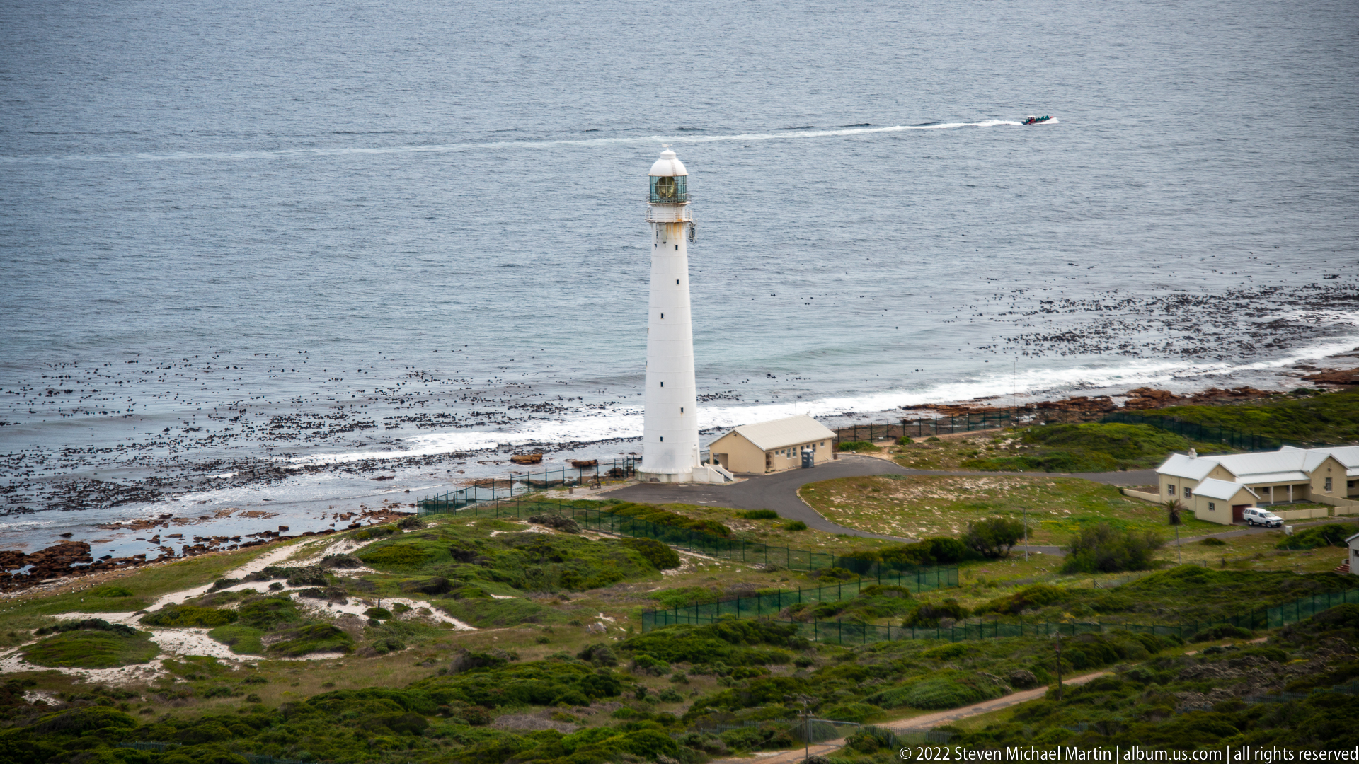
Slangkop Lighthouse rises as a slender white tower on the rocky shore at Kommetjie, with low service buildings clustered around its base and extensive kelp beds visible offshore. The tall cylindrical form and lantern stand clearly against the gray-blue Atlantic. Seen from an elevated viewpoint, the lighthouse anchors a wide coastal setting of exposed rock, low vegetation, surf, and open sea.
Caption
Slangkop Lighthouse rises as a slender white tower on the rocky shore at Kommetjie, with low service buildings clustered around its base and extensive kelp beds visible offshore. The tall cylindrical form and lantern stand clearly against the gray-blue Atlantic. Seen from an elevated viewpoint, the lighthouse anchors a wide coastal setting of exposed rock, low vegetation, surf, and open sea.
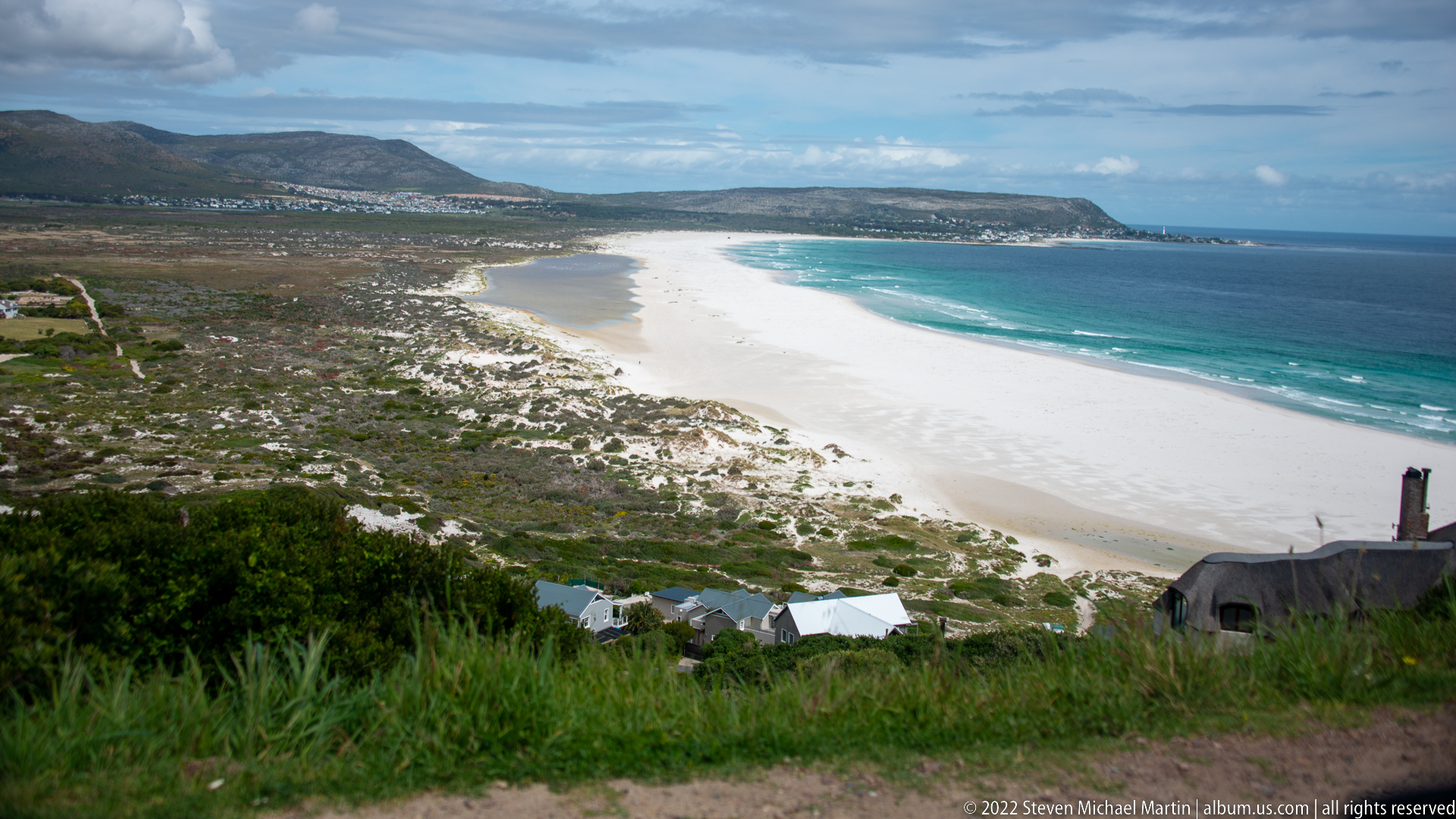
Noordhoek’s long white beach sweeps in a broad arc between turquoise Atlantic water and a wide belt of pale dunes and coastal vegetation. Development is concentrated in the far distance beneath low mountains, leaving most of the shoreline visually open. The elevated perspective, characteristic of viewpoints along Chapman’s Peak Drive, reveals the exceptional scale of the beach and its transition from surf zone to dunes and inland slopes.
Caption
Noordhoek’s long white beach sweeps in a broad arc between turquoise Atlantic water and a wide belt of pale dunes and coastal vegetation. Development is concentrated in the far distance beneath low mountains, leaving most of the shoreline visually open. The elevated perspective, characteristic of viewpoints along Chapman’s Peak Drive, reveals the exceptional scale of the beach and its transition from surf zone to dunes and inland slopes.
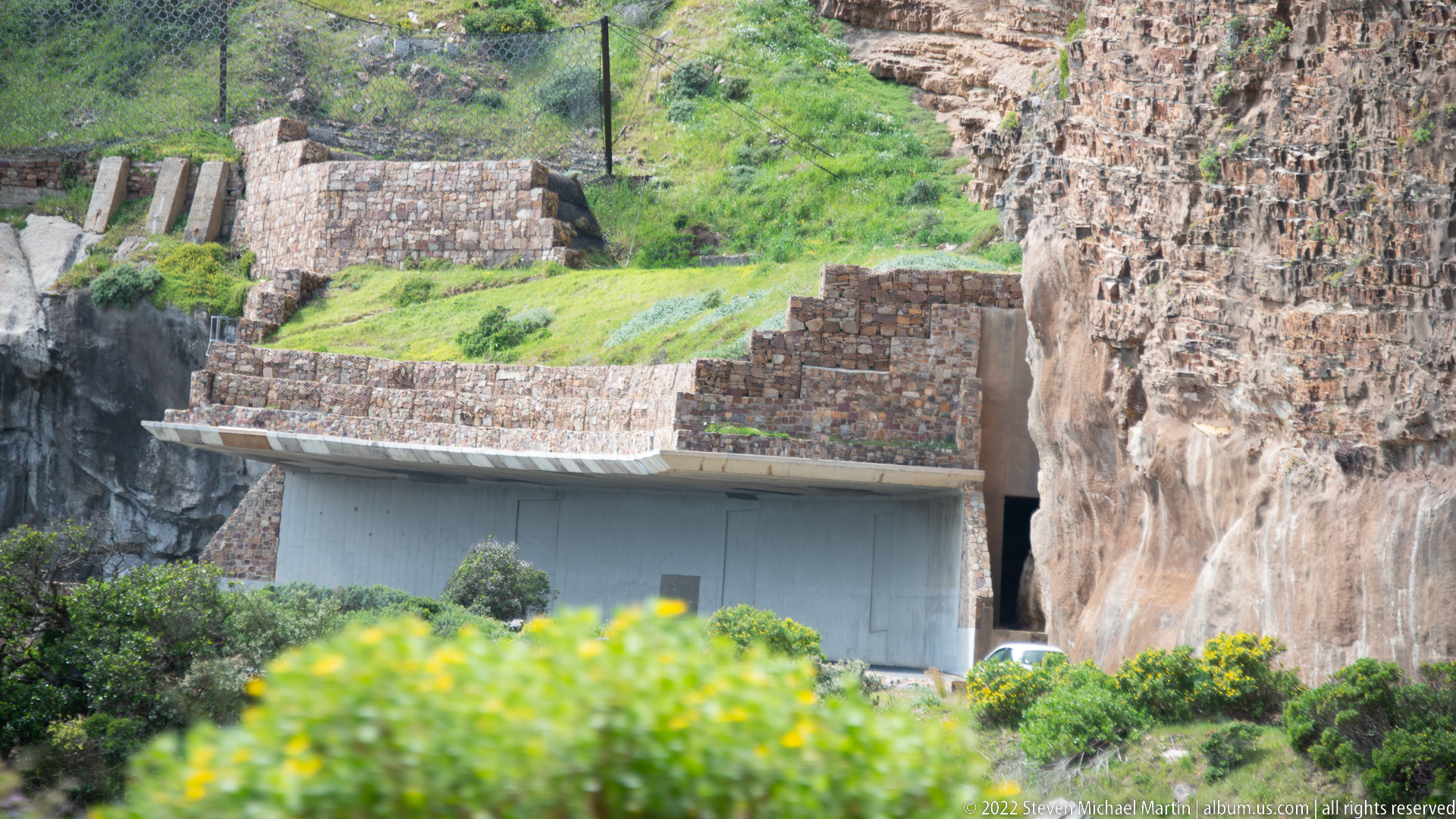
Masonry retaining walls and a concrete road gallery are built directly into the steep rock face of Chapman’s Peak Drive. The structure sits beneath exposed cliff and grassy ledges, illustrating the engineering required to carry the coastal road across unstable mountain terrain. The close telephoto view concentrates on the relationship between constructed support works and the natural rock rather than the sweeping ocean panoramas for which the road is known.
Caption
Masonry retaining walls and a concrete road gallery are built directly into the steep rock face of Chapman’s Peak Drive. The structure sits beneath exposed cliff and grassy ledges, illustrating the engineering required to carry the coastal road across unstable mountain terrain. The close telephoto view concentrates on the relationship between constructed support works and the natural rock rather than the sweeping ocean panoramas for which the road is known.
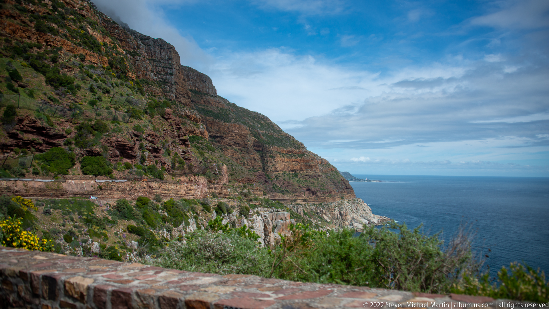
Chapman’s Peak Drive traces a narrow horizontal line across a steep, layered mountainside high above the Atlantic. Retaining walls, cut rock, and the roadway are visibly integrated into the cliff while low fynbos and yellow flowers occupy the foreground. The oblique view makes the road’s engineering audacity legible, showing the route suspended between sheer mountain slopes and open water.
Caption
Chapman’s Peak Drive traces a narrow horizontal line across a steep, layered mountainside high above the Atlantic. Retaining walls, cut rock, and the roadway are visibly integrated into the cliff while low fynbos and yellow flowers occupy the foreground. The oblique view makes the road’s engineering audacity legible, showing the route suspended between sheer mountain slopes and open water.
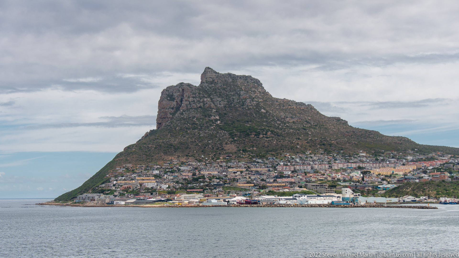
The Sentinel dominates this closer view of Hout Bay, its rugged triangular profile rising abruptly behind tightly packed houses and waterfront buildings. The calm bay fills the foreground while the developed shoreline forms a narrow band between water and mountain. Compared with the wider preceding panorama, this frame concentrates on the striking proximity of settlement to the steep headland that guards the western side of Hout Bay.
Caption
The Sentinel dominates this closer view of Hout Bay, its rugged triangular profile rising abruptly behind tightly packed houses and waterfront buildings. The calm bay fills the foreground while the developed shoreline forms a narrow band between water and mountain. Compared with the wider preceding panorama, this frame concentrates on the striking proximity of settlement to the steep headland that guards the western side of Hout Bay.
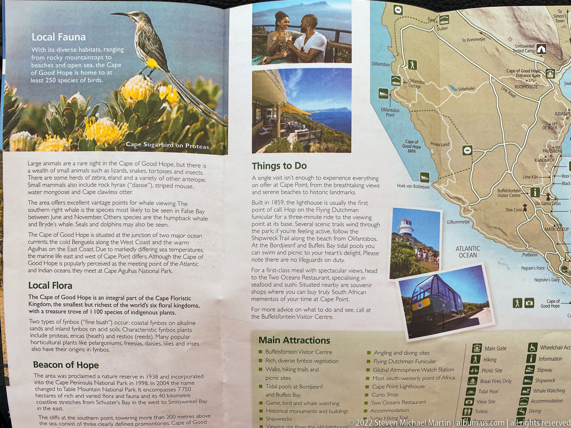
A large visitor panel combines a Cape Peninsula map with photographs and text about local flora, viewpoints, and attractions in the Cape of Good Hope area. Illustrated fynbos flowers occupy the upper left, while route information and visitor guidance fill the center and right. The display summarizes the natural-history and orientation context of the journey after the portfolio’s sequence of coastal landscapes and wildlife encounters.
Caption
A large visitor panel combines a Cape Peninsula map with photographs and text about local flora, viewpoints, and attractions in the Cape of Good Hope area. Illustrated fynbos flowers occupy the upper left, while route information and visitor guidance fill the center and right. The display summarizes the natural-history and orientation context of the journey after the portfolio’s sequence of coastal landscapes and wildlife encounters.
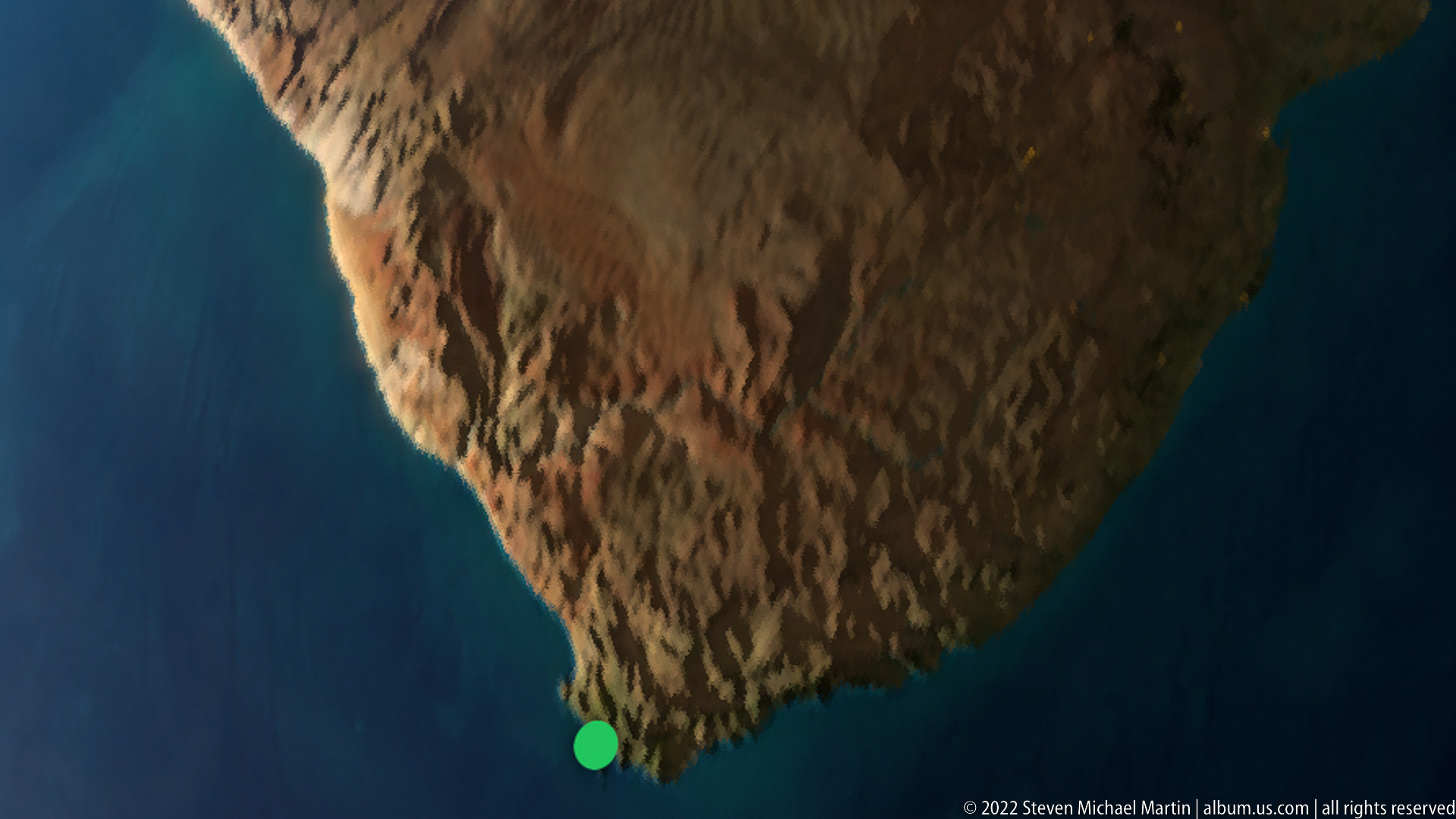
A digital display shows a satellite-style view of the Cape Peninsula projecting into deep blue ocean, with a bright green location marker near its southern end. The unusual screen-based perspective reduces the landscape encountered throughout the portfolio to its geographic outline, making the peninsula’s narrow, elongated form immediately legible. The frame serves as a concluding cartographic view rather than a conventional ground-level landscape.
Caption
A digital display shows a satellite-style view of the Cape Peninsula projecting into deep blue ocean, with a bright green location marker near its southern end. The unusual screen-based perspective reduces the landscape encountered throughout the portfolio to its geographic outline, making the peninsula’s narrow, elongated form immediately legible. The frame serves as a concluding cartographic view rather than a conventional ground-level landscape.