Victoria Falls – Zambia / Zimbabwe
The immense cascade of Victoria Falls ranks among the most spectacular waterfalls on Earth. Located along the Zambezi River, the falls form the natural boundary between Zambia and Zimbabwe.
Stretching more than a kilometer across, the curtain of water plunges into a deep gorge below, sending enormous clouds of mist high into the air. The falls were famously documented by the explorer David Livingstone in the 19th century, who named them in honor of Queen Victoria.
Known locally as Mosi-oa-Tunya, meaning “The Smoke That Thunders,” Victoria Falls remains one of Africa’s greatest natural wonders.
Photos:
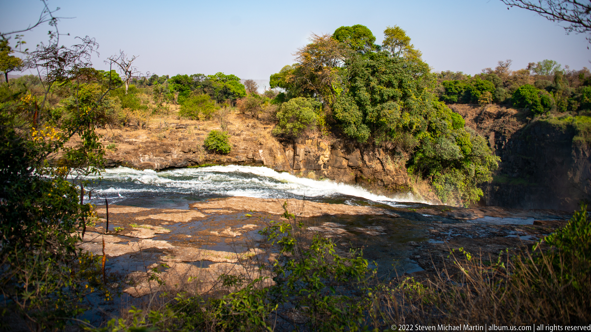
A wider view shows the Zambezi spreading across exposed rock shelves before dropping toward the Victoria Falls gorge. Low rapids cross the center of the frame, while mature trees cling to islands and banks above the dark basalt. The composition records the river’s broken, uneven approach to the precipice rather than the main waterfall itself.
Caption
A wider view shows the Zambezi spreading across exposed rock shelves before dropping toward the Victoria Falls gorge. Low rapids cross the center of the frame, while mature trees cling to islands and banks above the dark basalt. The composition records the river’s broken, uneven approach to the precipice rather than the main waterfall itself.
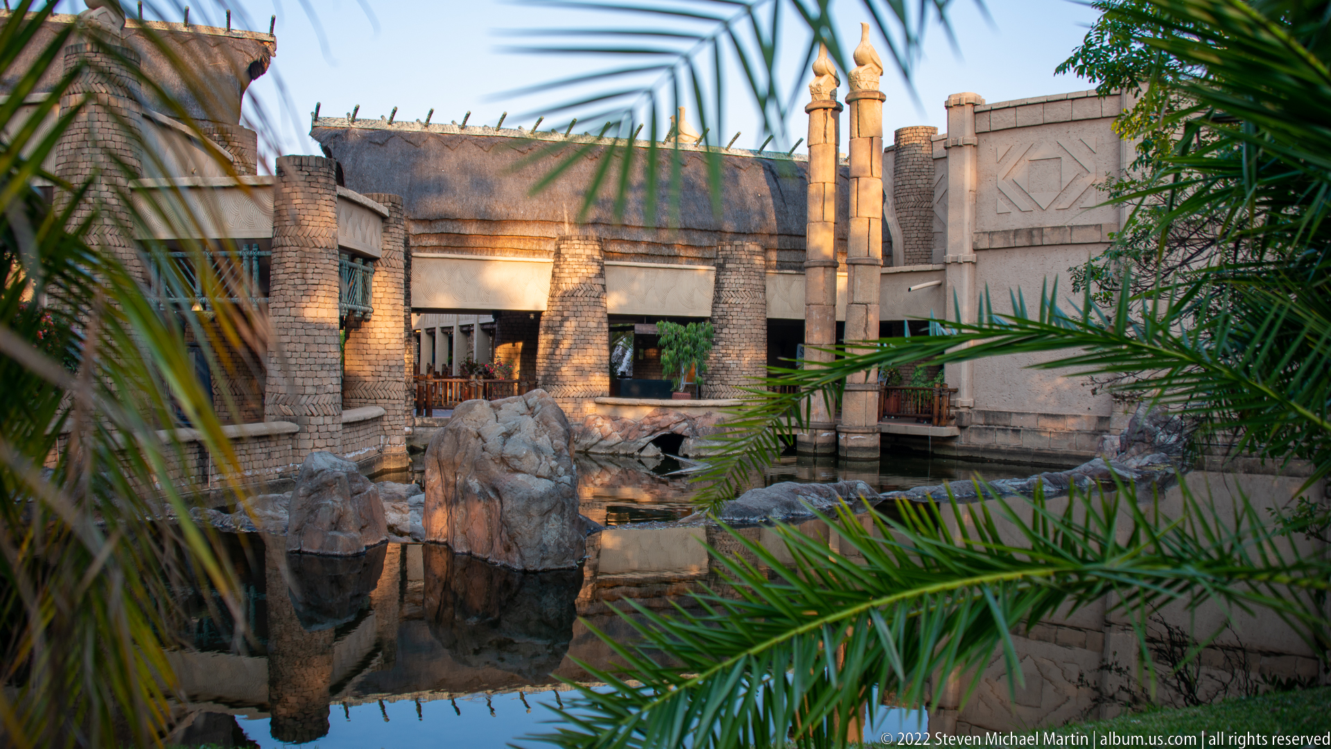
A sheltered courtyard at The Victoria Falls Hotel combines pale masonry, arched openings, projecting rooflines, palms, and a rock-edged water feature. Warm late-day light catches the textured walls while the foreground foliage partly screens the architecture. Rather than presenting the hotel as a formal façade, this view concentrates on an intimate garden court and the building’s layered colonial-era resort character.
Caption
A sheltered courtyard at The Victoria Falls Hotel combines pale masonry, arched openings, projecting rooflines, palms, and a rock-edged water feature. Warm late-day light catches the textured walls while the foreground foliage partly screens the architecture. Rather than presenting the hotel as a formal façade, this view concentrates on an intimate garden court and the building’s layered colonial-era resort character.
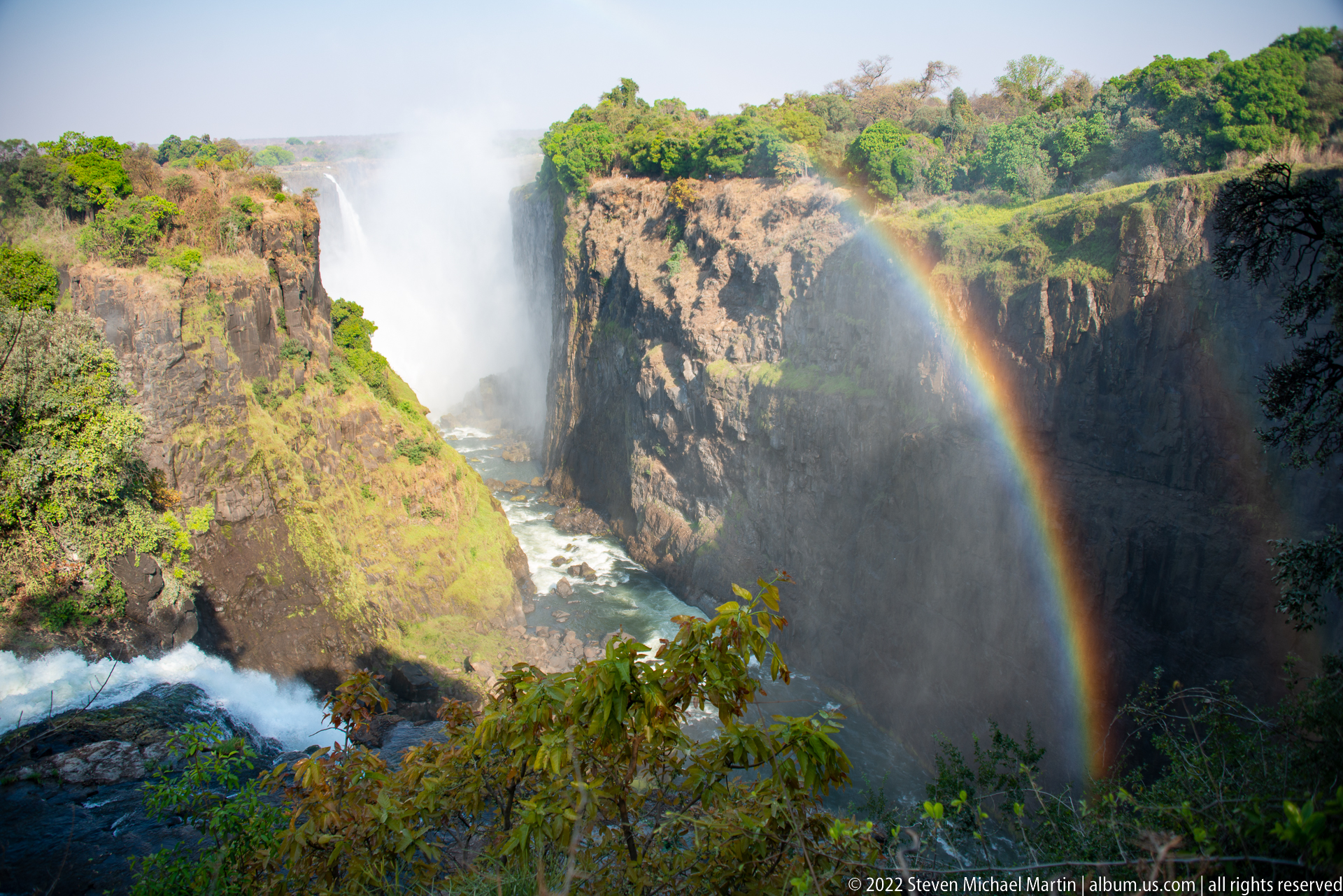
A near-complete rainbow rises from the lower gorge beside a forceful section of Victoria Falls, its colors standing out against shaded basalt. Green vegetation covers the opposing rim and a rocky spur in the foreground. This balanced view joins the waterfall, gorge structure, rainforest growth, and spray-generated rainbow in a single landscape composition.
Caption
A near-complete rainbow rises from the lower gorge beside a forceful section of Victoria Falls, its colors standing out against shaded basalt. Green vegetation covers the opposing rim and a rocky spur in the foreground. This balanced view joins the waterfall, gorge structure, rainforest growth, and spray-generated rainbow in a single landscape composition.
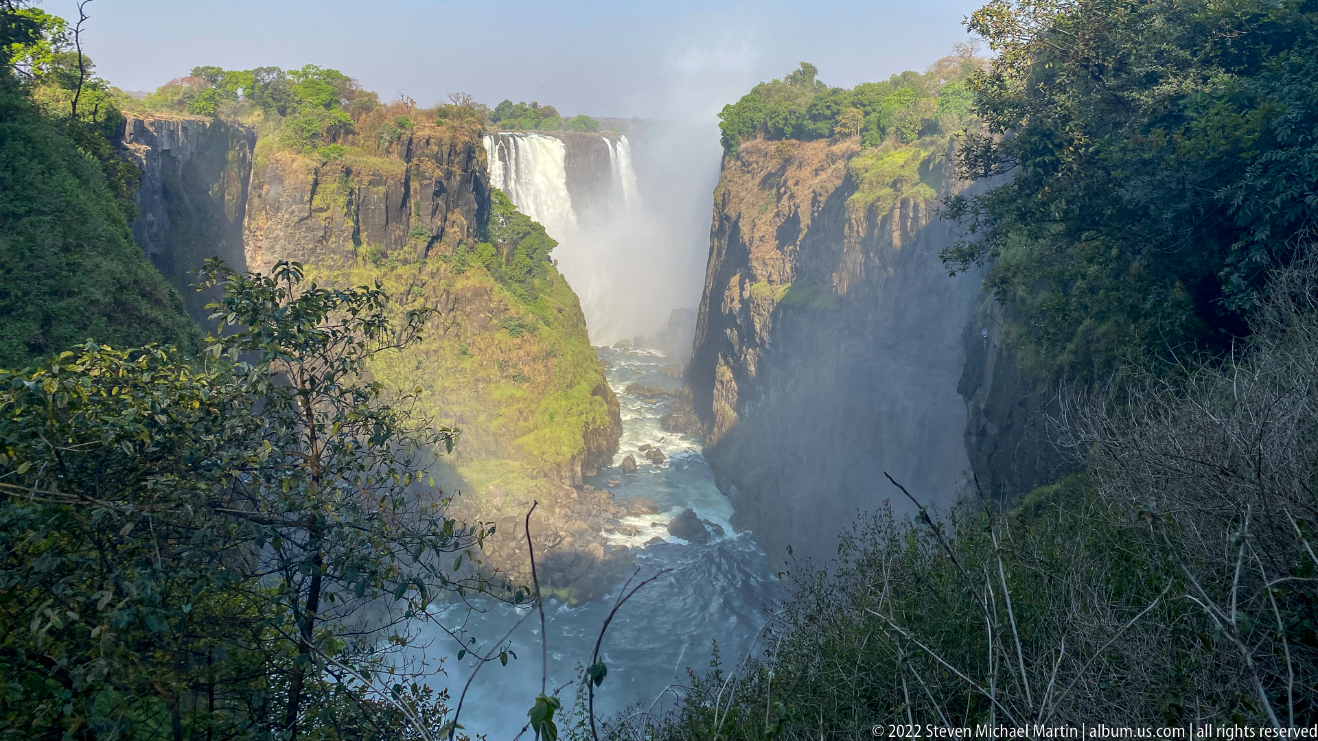
A powerful central curtain of Victoria Falls drops between tall basalt walls into a narrow river channel, with spray obscuring parts of the cliff face and valley floor. Dense vegetation encloses the viewpoint on both sides. The composition compresses the landscape into a steep, almost vertical corridor, emphasizing gorge depth and the force of water rather than the breadth of the falls.
Caption
A powerful central curtain of Victoria Falls drops between tall basalt walls into a narrow river channel, with spray obscuring parts of the cliff face and valley floor. Dense vegetation encloses the viewpoint on both sides. The composition compresses the landscape into a steep, almost vertical corridor, emphasizing gorge depth and the force of water rather than the breadth of the falls.
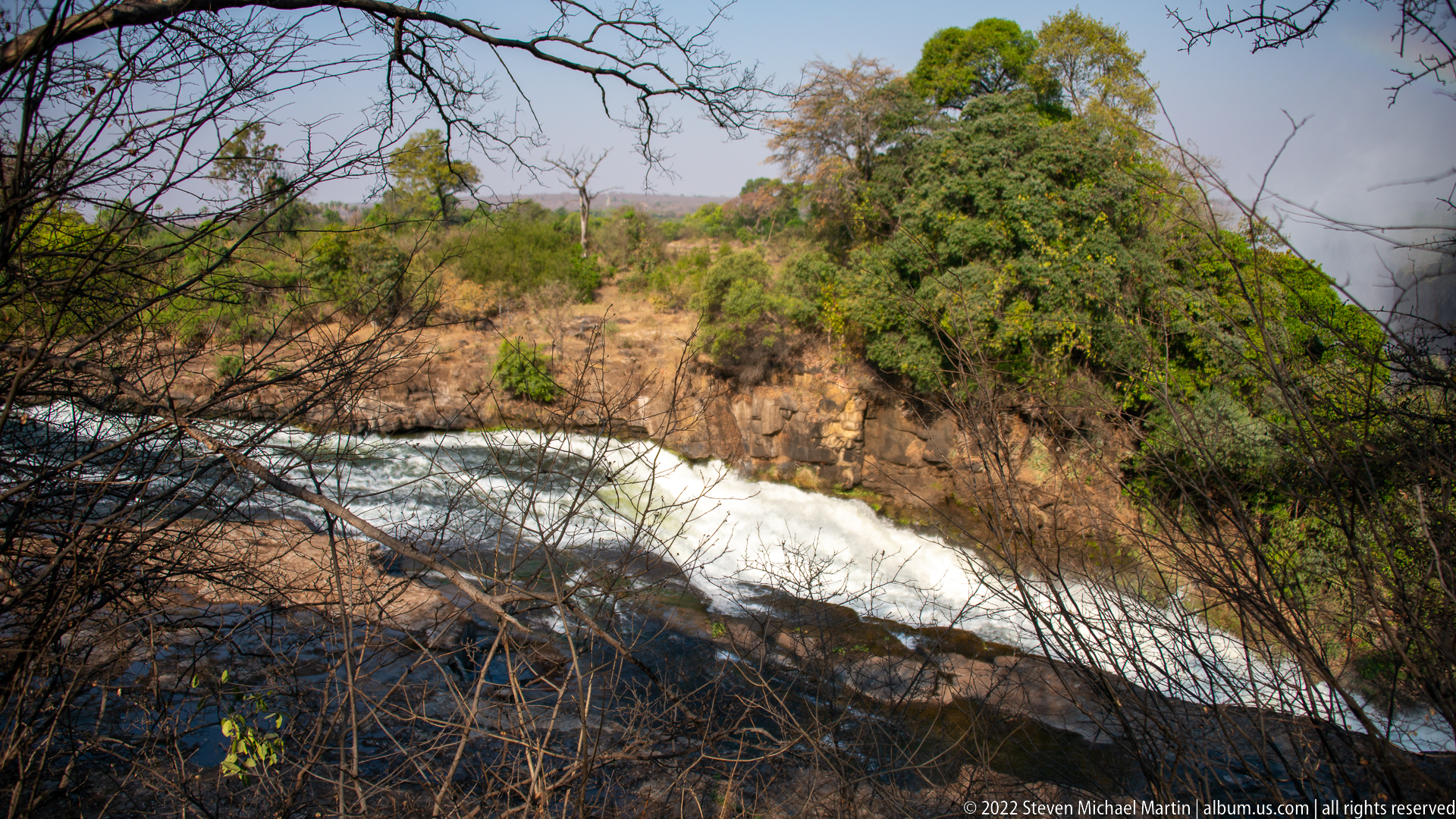
White water surges through a rocky channel of the Zambezi River above Victoria Falls, bordered by dry-season woodland and dark basalt outcrops. Branches in the foreground partly frame the view, emphasizing the river’s force as it accelerates toward the falls while still confined within a relatively shallow, broken bed.
Caption
White water surges through a rocky channel of the Zambezi River above Victoria Falls, bordered by dry-season woodland and dark basalt outcrops. Branches in the foreground partly frame the view, emphasizing the river’s force as it accelerates toward the falls while still confined within a relatively shallow, broken bed.
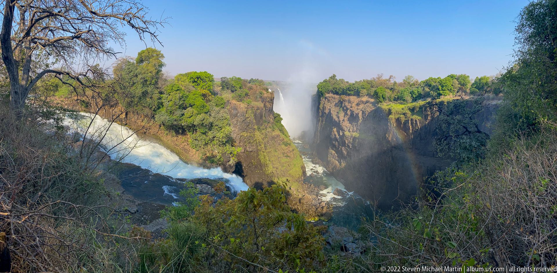
A wider view opens the gorge to show several separated curtains of falling water, the turbulent river channel below, and a rainbow suspended in the spray near the center. Foreground branches frame the scene and emphasize the depth between viewpoint and opposite cliffs. Compared with the preceding image, this composition gives more spatial context to the waterfall system and its fractured basalt walls.
Caption
A wider view opens the gorge to show several separated curtains of falling water, the turbulent river channel below, and a rainbow suspended in the spray near the center. Foreground branches frame the scene and emphasize the depth between viewpoint and opposite cliffs. Compared with the preceding image, this composition gives more spatial context to the waterfall system and its fractured basalt walls.
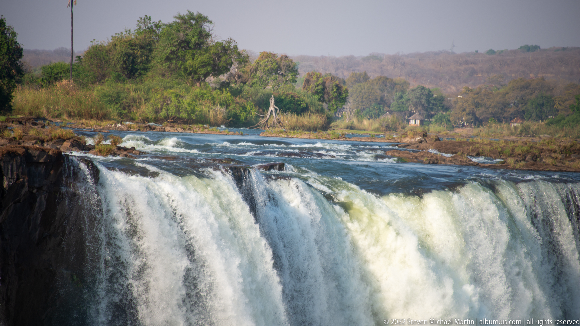
The upper Zambezi River races toward the brink of Victoria Falls, where several thick curtains of water pour over the dark rock edge. The viewpoint looks almost level with the crest, revealing rapids, exposed rock, and wooded riverbank beyond. This near-brink perspective shows how the broad river is divided into separate channels immediately before the vertical drop.
Caption
The upper Zambezi River races toward the brink of Victoria Falls, where several thick curtains of water pour over the dark rock edge. The viewpoint looks almost level with the crest, revealing rapids, exposed rock, and wooded riverbank beyond. This near-brink perspective shows how the broad river is divided into separate channels immediately before the vertical drop.
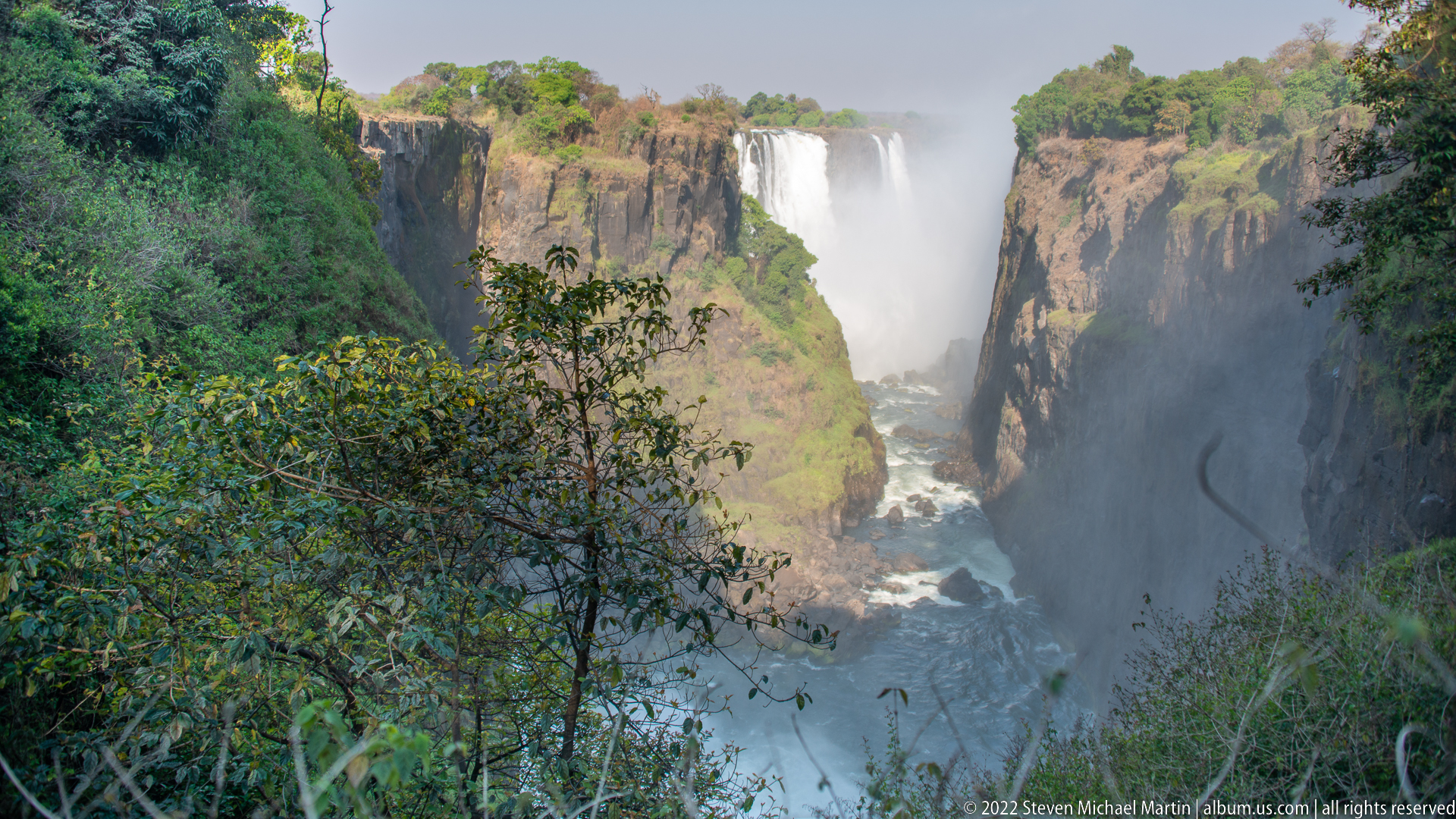
From a forested overlook, the Zambezi River is confined within a steep basalt gorge below Victoria Falls. A segment of the falling water appears beyond the opposing cliff, while spray rises through the chasm and dense vegetation frames the foreground. The view emphasizes the abrupt transition from the broad river above the falls to the narrow, rock-walled channel downstream.
Caption
From a forested overlook, the Zambezi River is confined within a steep basalt gorge below Victoria Falls. A segment of the falling water appears beyond the opposing cliff, while spray rises through the chasm and dense vegetation frames the foreground. The view emphasizes the abrupt transition from the broad river above the falls to the narrow, rock-walled channel downstream.
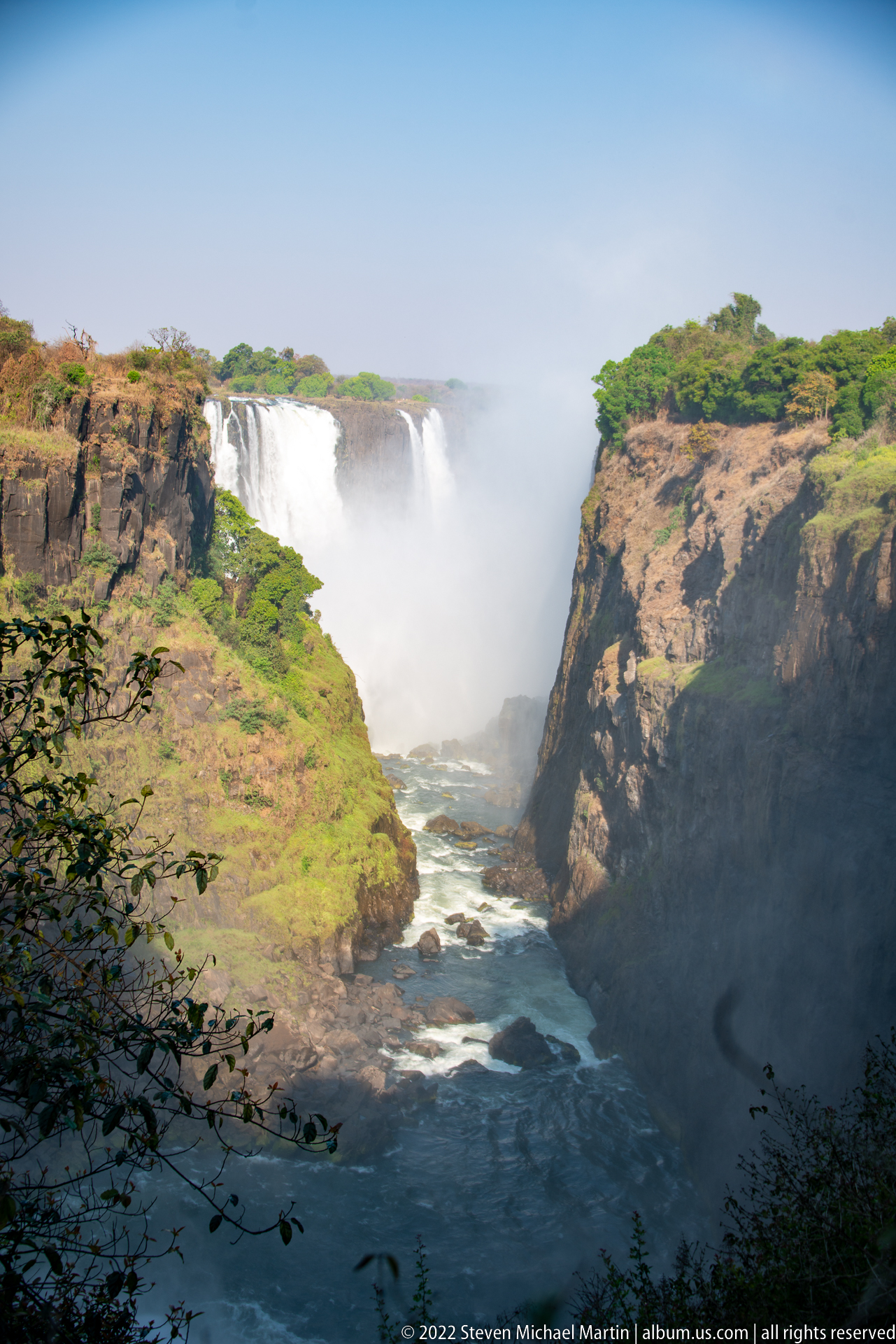
A broad section of Victoria Falls pours over the distant rim beyond a deep basalt gorge, with the Zambezi channel visible below between steep, vegetation-covered walls. Compared with the preceding rainbow studies, this clear atmospheric view restores the larger landform, showing the waterfall as part of a connected system of cliff, gorge, river, and rainforest.
Caption
A broad section of Victoria Falls pours over the distant rim beyond a deep basalt gorge, with the Zambezi channel visible below between steep, vegetation-covered walls. Compared with the preceding rainbow studies, this clear atmospheric view restores the larger landform, showing the waterfall as part of a connected system of cliff, gorge, river, and rainforest.
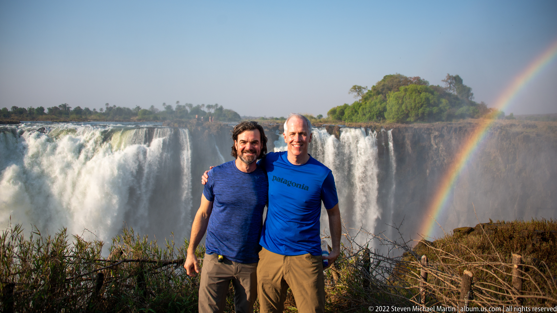
Two visitors stand together at a viewpoint with Victoria Falls spread across the background and a bright rainbow rising from the gorge at right. The men provide a direct sense of scale against the broad waterfall curtain and mist plume. Dry brush and a simple barrier mark the overlook in the foreground, while a wooded river island appears above the falls.
Caption
Two visitors stand together at a viewpoint with Victoria Falls spread across the background and a bright rainbow rising from the gorge at right. The men provide a direct sense of scale against the broad waterfall curtain and mist plume. Dry brush and a simple barrier mark the overlook in the foreground, while a wooded river island appears above the falls.
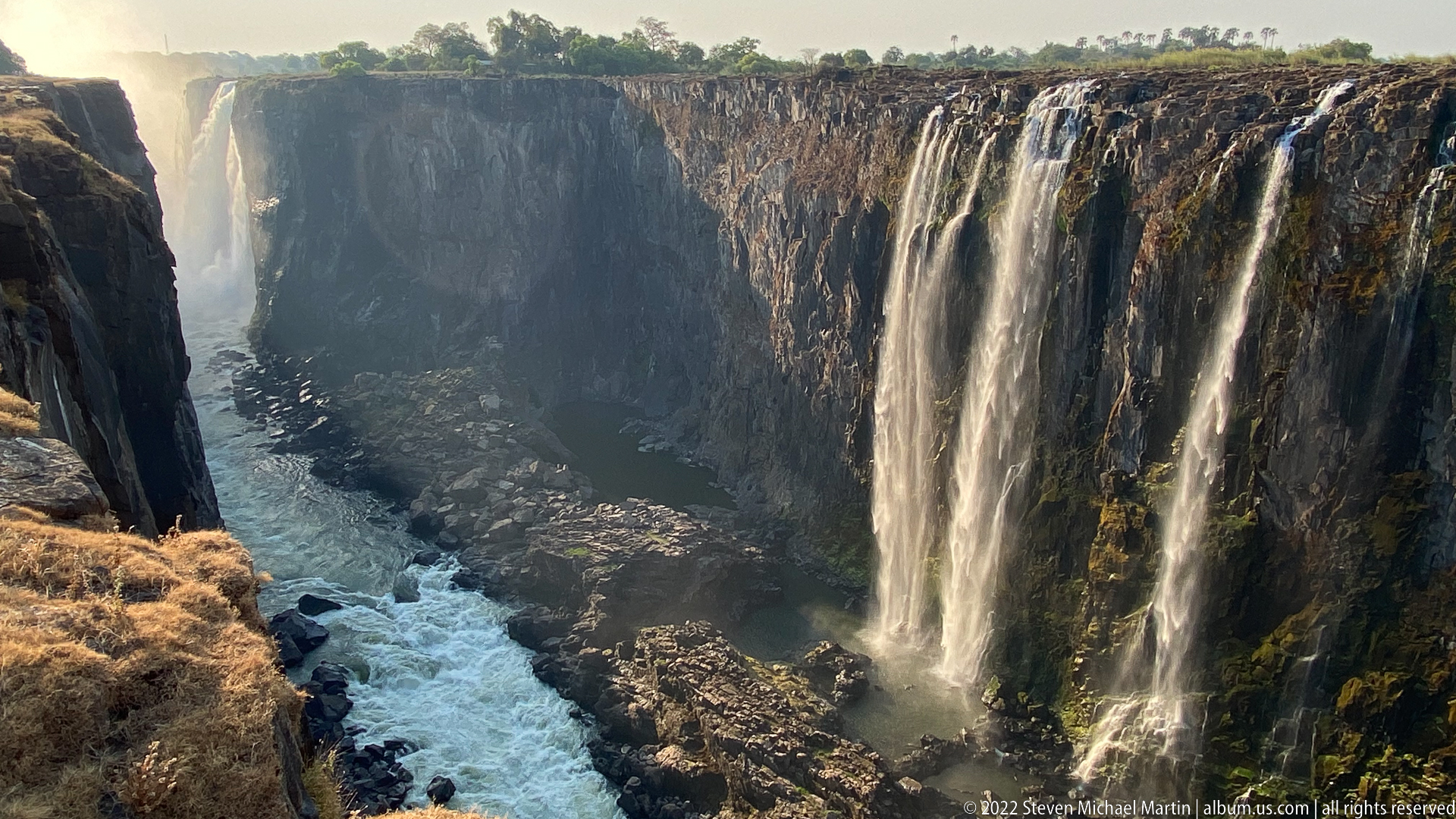
Several slender streams spill from the rim of a tall, shadowed basalt wall into the gorge below, where white water churns around dark rock. Unlike the broad curtain views nearby, this frame concentrates on reduced-flow channels tracing the cliff face. The exposed rock makes columnar and fractured volcanic structure especially prominent, giving geology equal importance with the remaining cascades.
Caption
Several slender streams spill from the rim of a tall, shadowed basalt wall into the gorge below, where white water churns around dark rock. Unlike the broad curtain views nearby, this frame concentrates on reduced-flow channels tracing the cliff face. The exposed rock makes columnar and fractured volcanic structure especially prominent, giving geology equal importance with the remaining cascades.
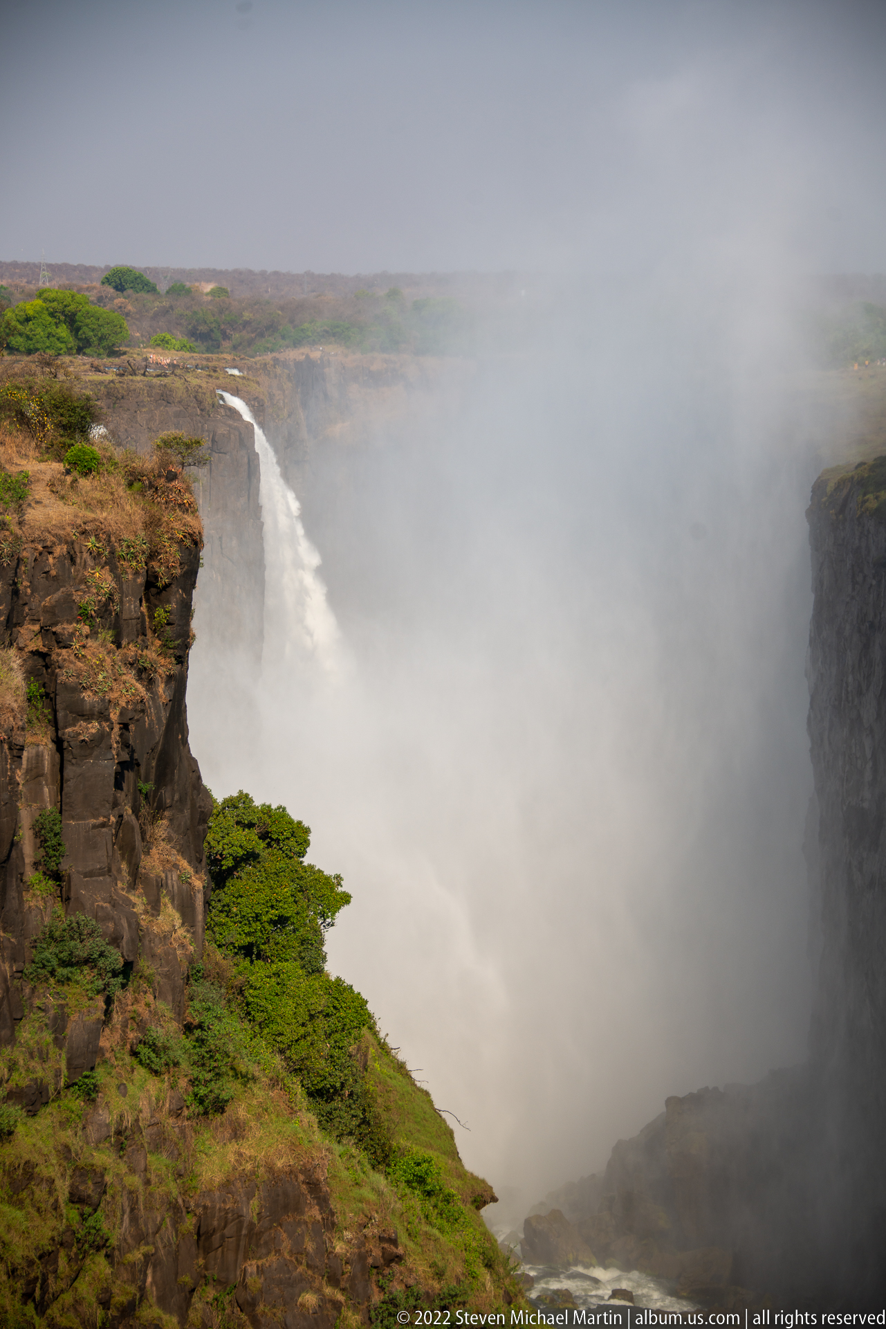
Dense spray fills the gorge, reducing the waterfall to a pale vertical curtain beyond the near basalt rim. The foreground cliff and low green vegetation remain sharply defined while the opposite side disappears into mist, demonstrating how the falls can generate its own localized veil of moisture and radically limit visibility along the rainforest viewpoints.
Caption
Dense spray fills the gorge, reducing the waterfall to a pale vertical curtain beyond the near basalt rim. The foreground cliff and low green vegetation remain sharply defined while the opposite side disappears into mist, demonstrating how the falls can generate its own localized veil of moisture and radically limit visibility along the rainforest viewpoints.
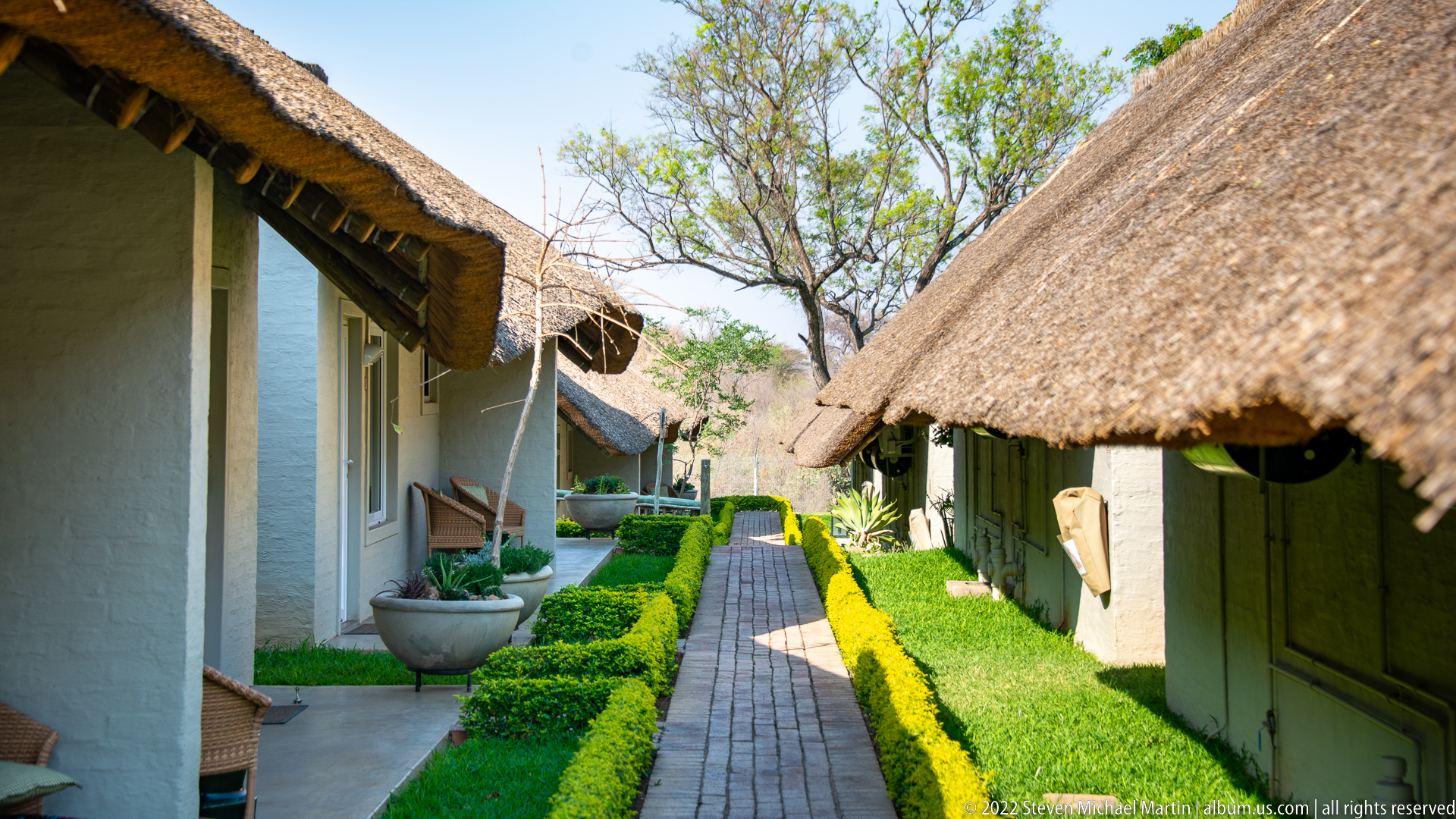
A narrow brick walkway runs between low, whitewashed lodge buildings beneath deep thatched roofs, with clipped hedges defining the path. The shaded verandas, garden planting, and close-set accommodation blocks establish the built visitor environment near Victoria Falls before the sequence moves into the national park and its interpretive displays.
Caption
A narrow brick walkway runs between low, whitewashed lodge buildings beneath deep thatched roofs, with clipped hedges defining the path. The shaded verandas, garden planting, and close-set accommodation blocks establish the built visitor environment near Victoria Falls before the sequence moves into the national park and its interpretive displays.
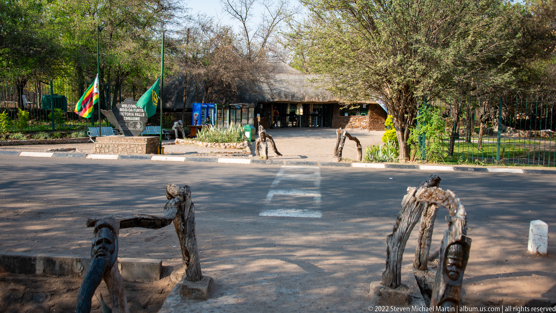
The entrance forecourt of Victoria Falls National Park combines rustic timber seating, flagpoles, a stone welcome marker, and low thatched visitor buildings. People cross the broad paved approach beyond the carved wooden furniture, giving the scene a useful sense of scale and showing the transition from the town-side visitor area into the protected landscape.
Caption
The entrance forecourt of Victoria Falls National Park combines rustic timber seating, flagpoles, a stone welcome marker, and low thatched visitor buildings. People cross the broad paved approach beyond the carved wooden furniture, giving the scene a useful sense of scale and showing the transition from the town-side visitor area into the protected landscape.

An expressive human face is carved directly into a weathered section of wood, its heavy brow, broad nose, and open mouth shaped from the natural grain. A metal cable passes above the carving, indicating that the figure forms part of the rustic constructed furnishings at the Victoria Falls National Park entrance rather than a freestanding museum object.
Caption
An expressive human face is carved directly into a weathered section of wood, its heavy brow, broad nose, and open mouth shaped from the natural grain. A metal cable passes above the carving, indicating that the figure forms part of the rustic constructed furnishings at the Victoria Falls National Park entrance rather than a freestanding museum object.
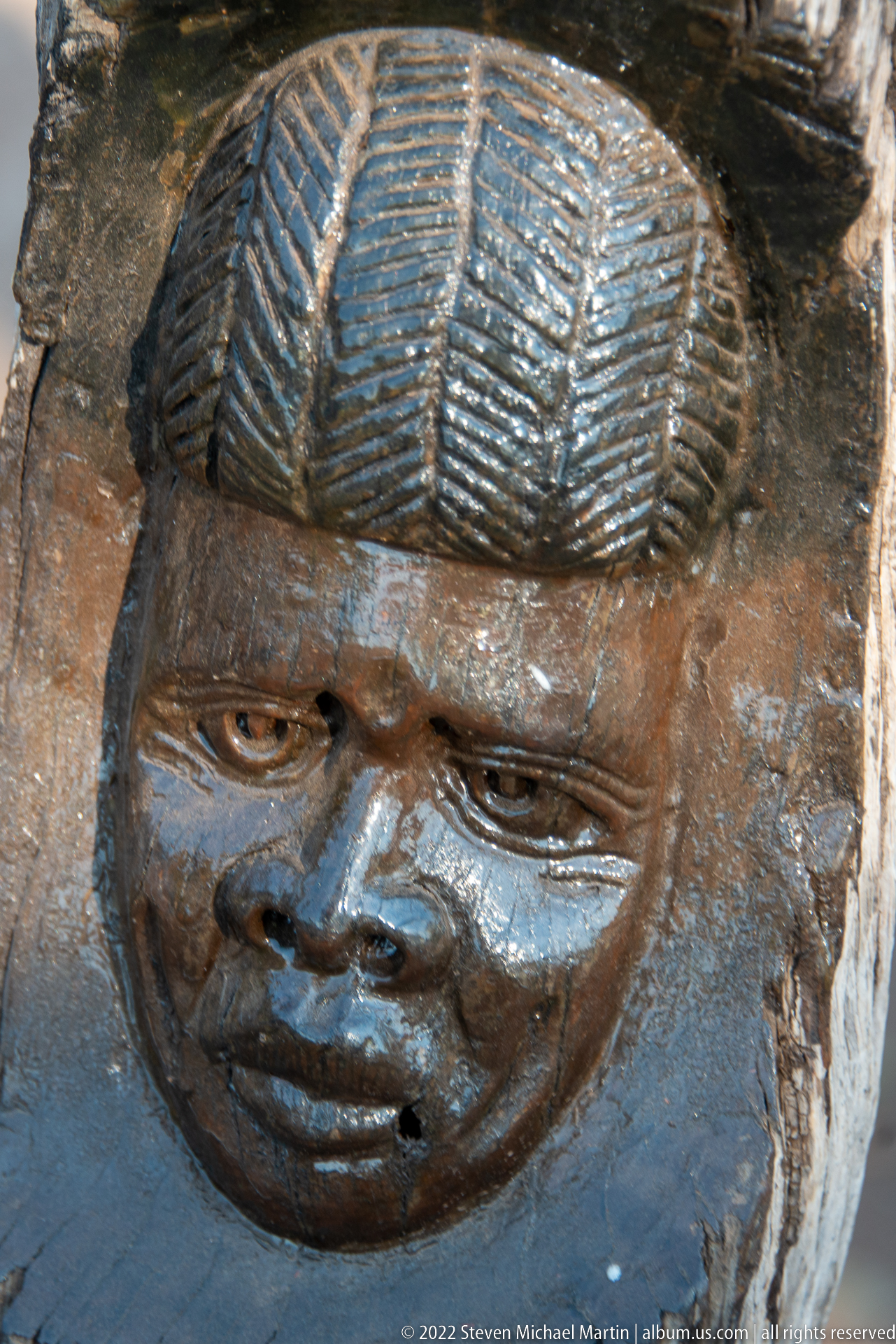
A polished dark wooden face emerges from a rougher timber surface, crowned by a strongly patterned coiffure rendered in parallel ridges. The close framing isolates the carving’s rounded cheeks, downcast eyes, and carefully incised hair, documenting another decorative figure incorporated into the rustic entrance furnishings at Victoria Falls National Park.
Caption
A polished dark wooden face emerges from a rougher timber surface, crowned by a strongly patterned coiffure rendered in parallel ridges. The close framing isolates the carving’s rounded cheeks, downcast eyes, and carefully incised hair, documenting another decorative figure incorporated into the rustic entrance furnishings at Victoria Falls National Park.
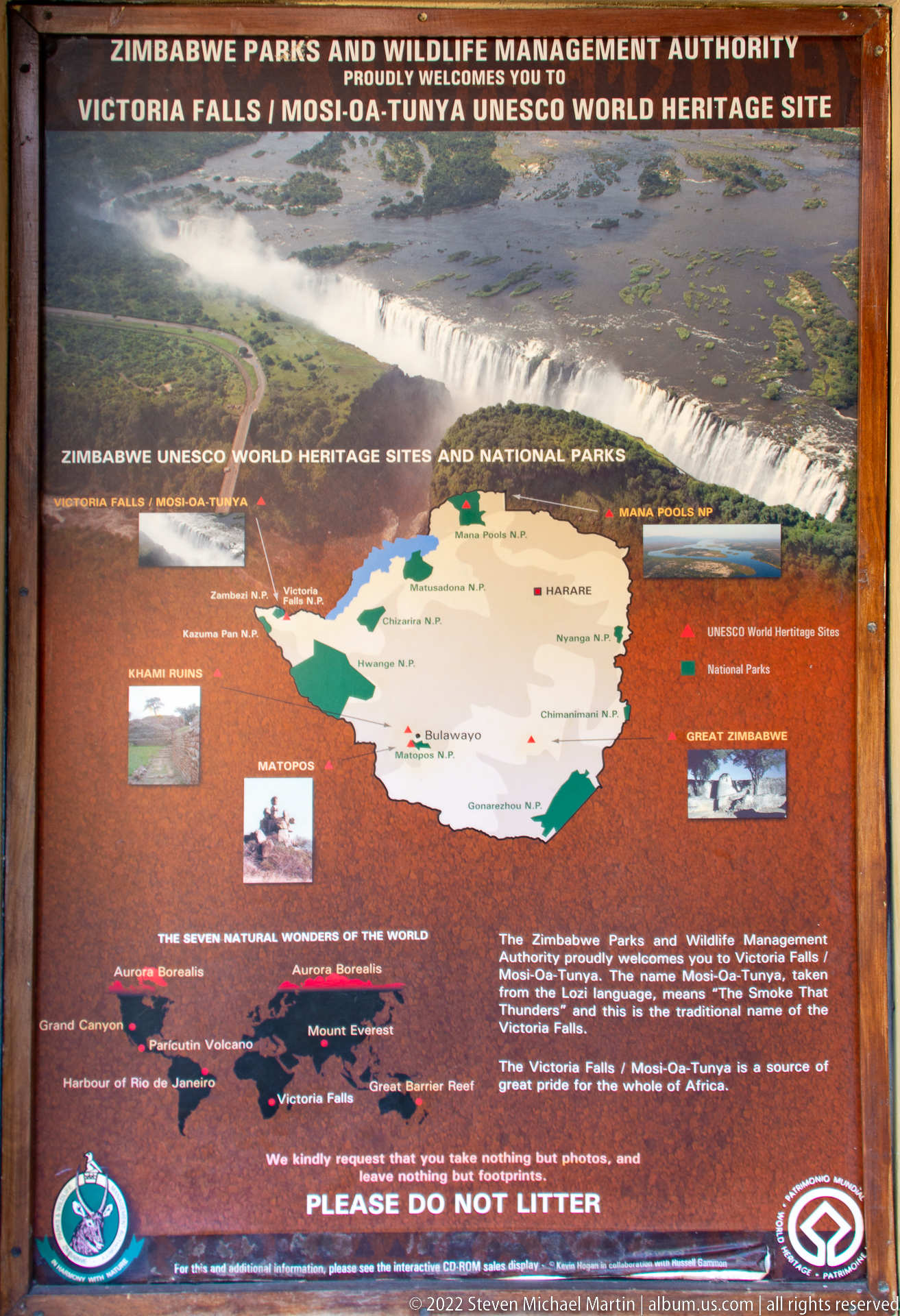
A large Zimbabwe Parks and Wildlife Management Authority panel introduces Mosi-oa-Tunya / Victoria Falls as a UNESCO World Heritage Site. An aerial photograph of the waterfall crowns a map of Zimbabwe locating protected areas and heritage sites, while smaller photographs and explanatory text place Victoria Falls within the country’s wider conservation and tourism network.
Caption
A large Zimbabwe Parks and Wildlife Management Authority panel introduces Mosi-oa-Tunya / Victoria Falls as a UNESCO World Heritage Site. An aerial photograph of the waterfall crowns a map of Zimbabwe locating protected areas and heritage sites, while smaller photographs and explanatory text place Victoria Falls within the country’s wider conservation and tourism network.

A Zimbabwe-shaped stone marker announces “Welcome to Mosi-oa-Tunya Victoria Falls Zimbabwe” beside national and park flags at the visitor entrance. The monument also displays heritage emblems near its base, making this a clear orientation image linking the local name Mosi-oa-Tunya with Victoria Falls and the protected-site entrance.
Caption
A Zimbabwe-shaped stone marker announces “Welcome to Mosi-oa-Tunya Victoria Falls Zimbabwe” beside national and park flags at the visitor entrance. The monument also displays heritage emblems near its base, making this a clear orientation image linking the local name Mosi-oa-Tunya with Victoria Falls and the protected-site entrance.
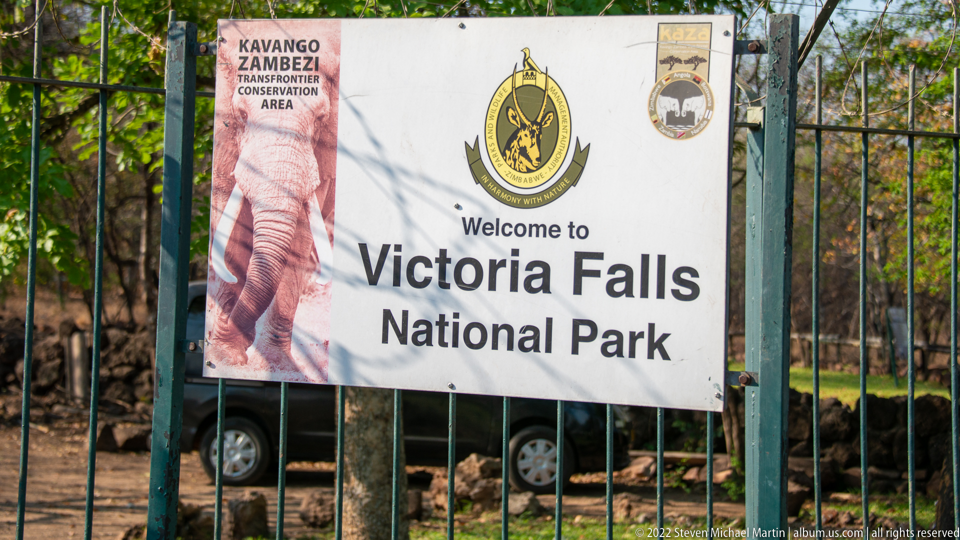
A large banner fixed to the entrance fence reads “Welcome to Victoria Falls National Park,” accompanied by Zimbabwe Parks and Wildlife Management Authority branding and regional conservation logos. Framed tightly against the metal gate, the sign provides direct documentary evidence for the protected-area identity before the photographic sequence enters the falls landscape.
Caption
A large banner fixed to the entrance fence reads “Welcome to Victoria Falls National Park,” accompanied by Zimbabwe Parks and Wildlife Management Authority branding and regional conservation logos. Framed tightly against the metal gate, the sign provides direct documentary evidence for the protected-area identity before the photographic sequence enters the falls landscape.
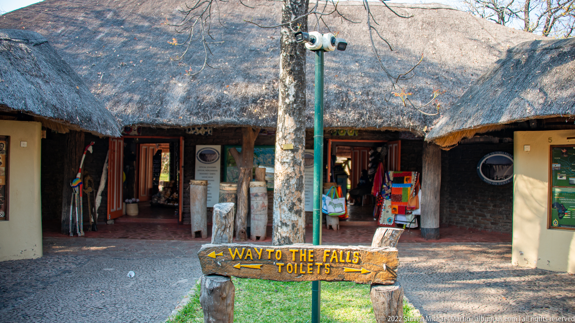
A thatched visitor building stands just inside the park, its open doorways displaying maps, notices, and colorful merchandise. In the foreground, a hand-painted wooden arrow marked “Way to the Falls / Toilets” points left, turning the scene into a practical record of visitor orientation and services at Victoria Falls National Park.
Caption
A thatched visitor building stands just inside the park, its open doorways displaying maps, notices, and colorful merchandise. In the foreground, a hand-painted wooden arrow marked “Way to the Falls / Toilets” points left, turning the scene into a practical record of visitor orientation and services at Victoria Falls National Park.
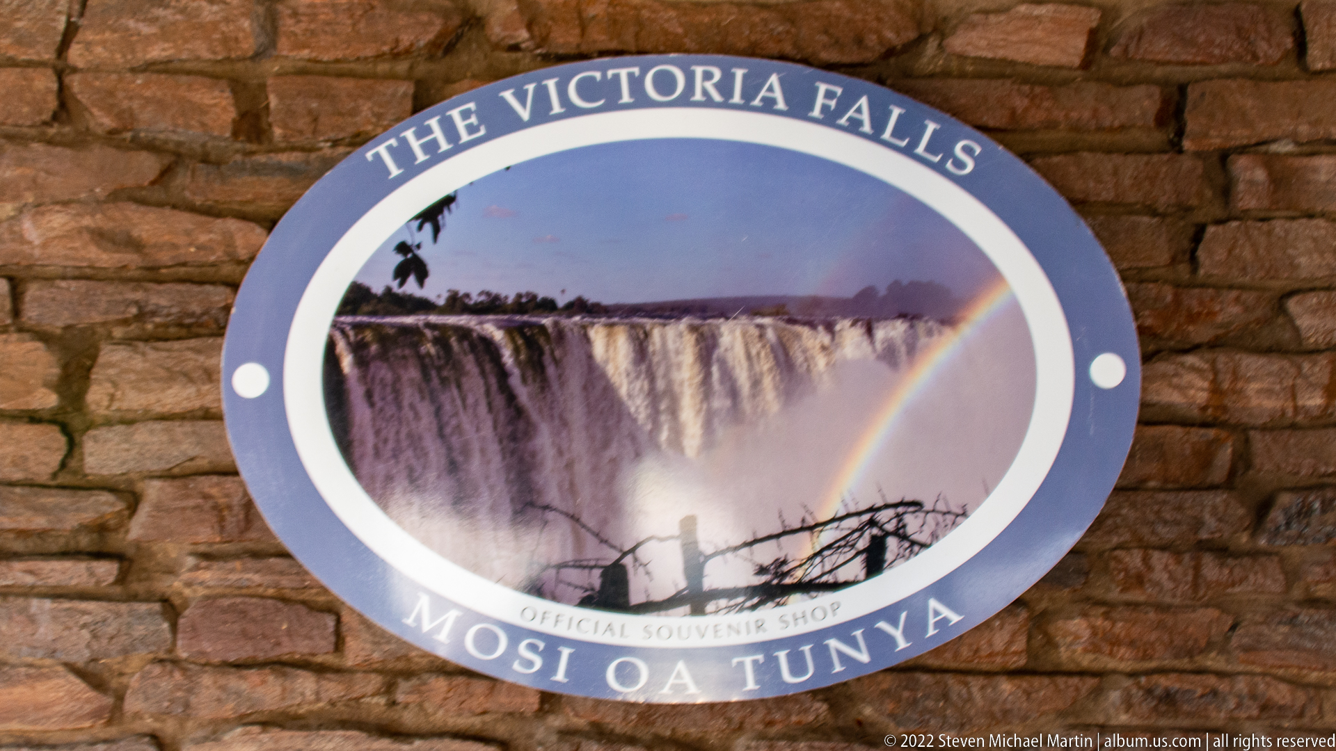
A circular wall sign for “The Victoria Falls – Mosi Oa Tunya” official souvenir shop centers a photograph of the waterfall crossed by a rainbow. Mounted on rough brickwork, the commercial emblem repeats both the English and local names of the site while using the falls’ characteristic spray and rainbow as its visual identity.
Caption
A circular wall sign for “The Victoria Falls – Mosi Oa Tunya” official souvenir shop centers a photograph of the waterfall crossed by a rainbow. Mounted on rough brickwork, the commercial emblem repeats both the English and local names of the site while using the falls’ characteristic spray and rainbow as its visual identity.
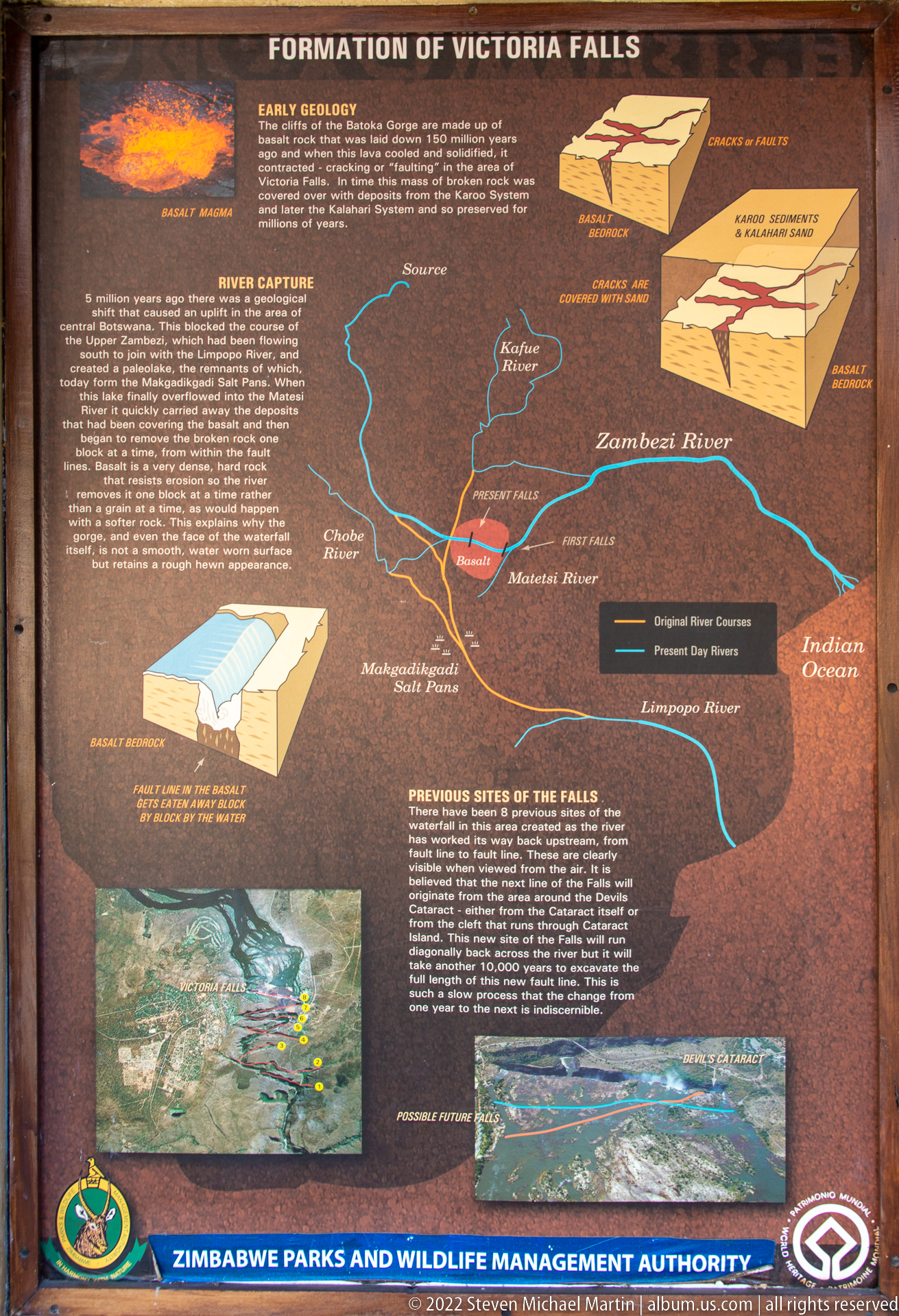
The “Formation of Victoria Falls” panel explains the geological setting of the waterfall through diagrams of faulted basalt blocks, a regional drainage map, and images of former fall sites. The display connects the present Zambezi River course with the sequence of gorges cut through the basalt plateau, making geology rather than scenic spectacle the focus of this photograph.
Caption
The “Formation of Victoria Falls” panel explains the geological setting of the waterfall through diagrams of faulted basalt blocks, a regional drainage map, and images of former fall sites. The display connects the present Zambezi River course with the sequence of gorges cut through the basalt plateau, making geology rather than scenic spectacle the focus of this photograph.

An interpretive panel on the indigenous peoples of the Victoria Falls area pairs prehistoric stone tools with rock-art imagery and explanatory text. Large flaked implements dominate the upper half, while smaller artifacts and painted scenes below connect human occupation of the region to archaeological evidence preserved around the falls.
Caption
An interpretive panel on the indigenous peoples of the Victoria Falls area pairs prehistoric stone tools with rock-art imagery and explanatory text. Large flaked implements dominate the upper half, while smaller artifacts and painted scenes below connect human occupation of the region to archaeological evidence preserved around the falls.
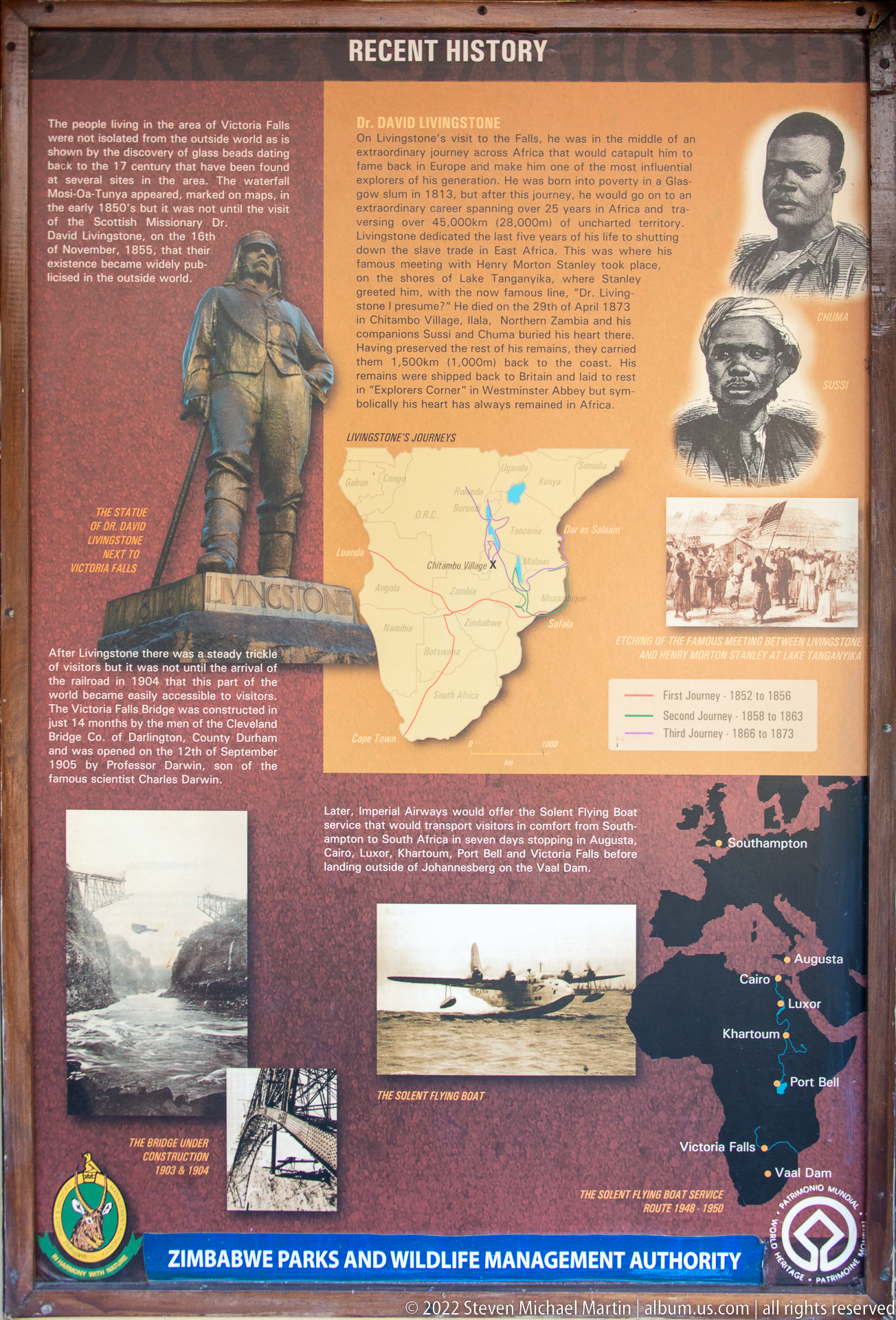
The “Recent History” display brings nineteenth-century exploration into the park’s interpretive sequence, prominently featuring David Livingstone through a statue image and period portraits. A map, historical photographs, and images of the falls trace later documentation and access, contrasting the written colonial-era record with the deeper archaeological history presented on the preceding panel.
Caption
The “Recent History” display brings nineteenth-century exploration into the park’s interpretive sequence, prominently featuring David Livingstone through a statue image and period portraits. A map, historical photographs, and images of the falls trace later documentation and access, contrasting the written colonial-era record with the deeper archaeological history presented on the preceding panel.
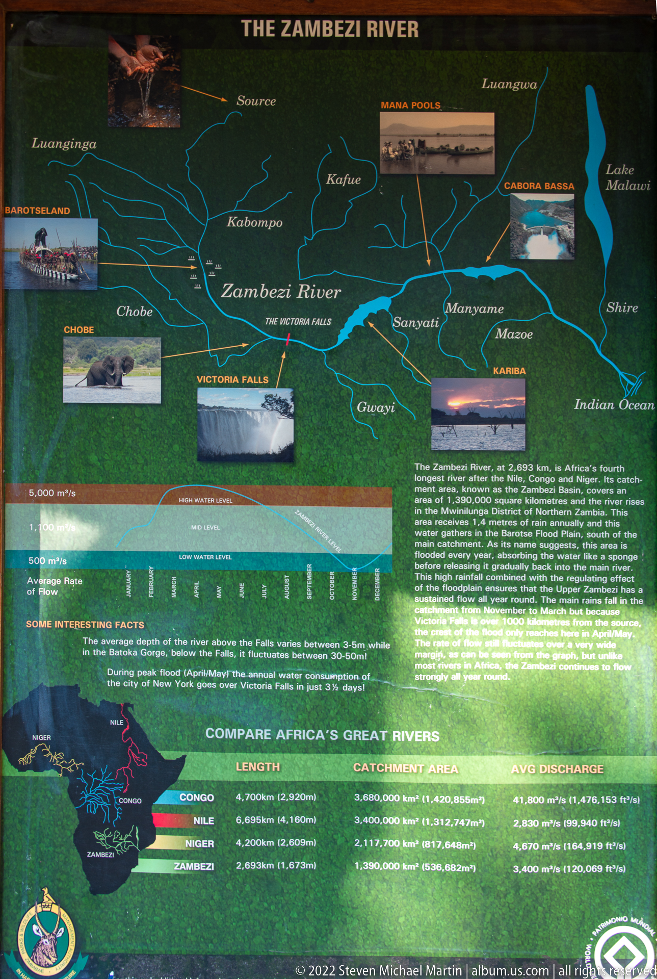
A panel titled “The Zambezi River” maps the river and its tributaries across south-central Africa, marking Victoria Falls among other places along the basin. Photographs of river landscapes and a comparative chart of major African rivers combine geographic orientation with hydrological context, presenting the waterfall as one feature within a much larger river system.
Caption
A panel titled “The Zambezi River” maps the river and its tributaries across south-central Africa, marking Victoria Falls among other places along the basin. Photographs of river landscapes and a comparative chart of major African rivers combine geographic orientation with hydrological context, presenting the waterfall as one feature within a much larger river system.
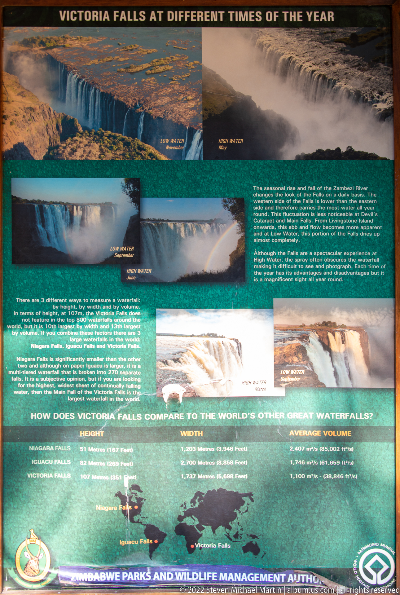
Seasonal photographs on this interpretive panel compare Victoria Falls under markedly different Zambezi River flows, from exposed rock and narrower curtains of water to a broad, mist-filled cascade. Additional text and a comparison with other major waterfalls frame the changing appearance of the falls as a hydrological cycle rather than a fixed scenic view.
Caption
Seasonal photographs on this interpretive panel compare Victoria Falls under markedly different Zambezi River flows, from exposed rock and narrower curtains of water to a broad, mist-filled cascade. Additional text and a comparison with other major waterfalls frame the changing appearance of the falls as a hydrological cycle rather than a fixed scenic view.
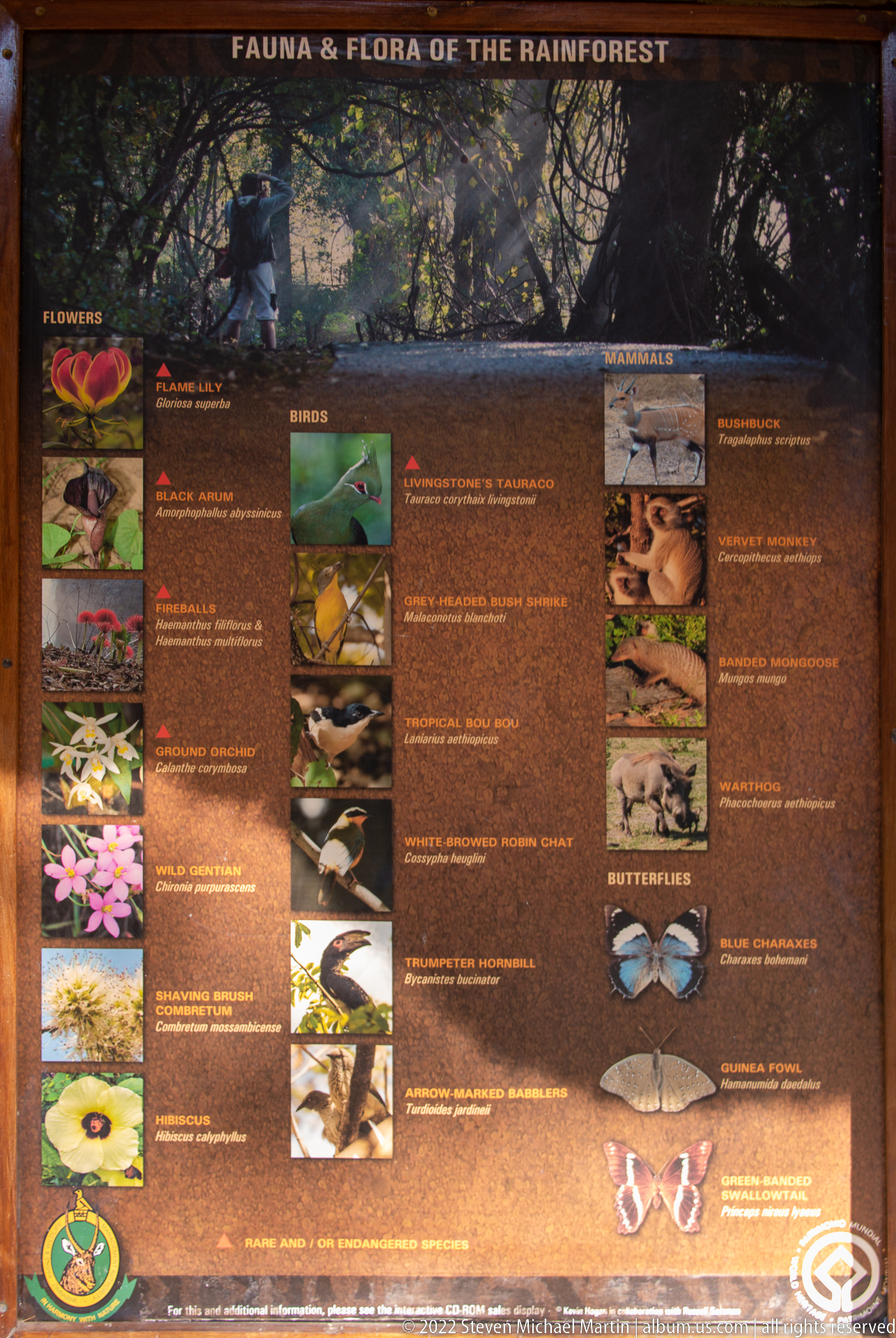
The rainforest ecology panel assembles photographs of flowers, birds, reptiles, mammals, and butterflies associated with the moist habitat beside Victoria Falls. Organized by biological groups, the display emphasizes the ecological consequences of persistent spray, shifting attention from the waterfall itself to the diverse plant and animal life supported along the gorge rim.
Caption
The rainforest ecology panel assembles photographs of flowers, birds, reptiles, mammals, and butterflies associated with the moist habitat beside Victoria Falls. Organized by biological groups, the display emphasizes the ecological consequences of persistent spray, shifting attention from the waterfall itself to the diverse plant and animal life supported along the gorge rim.

A detailed “Map of the Rainforest” traces the visitor route along the Zimbabwean rim of Victoria Falls, using numbered stops, waterfall photographs, and labeled viewpoints to orient walkers. The linear plan shows how the trail follows the gorge edge, while inset images preview changing perspectives of the falls encountered along the route.
Caption
A detailed “Map of the Rainforest” traces the visitor route along the Zimbabwean rim of Victoria Falls, using numbered stops, waterfall photographs, and labeled viewpoints to orient walkers. The linear plan shows how the trail follows the gorge edge, while inset images preview changing perspectives of the falls encountered along the route.
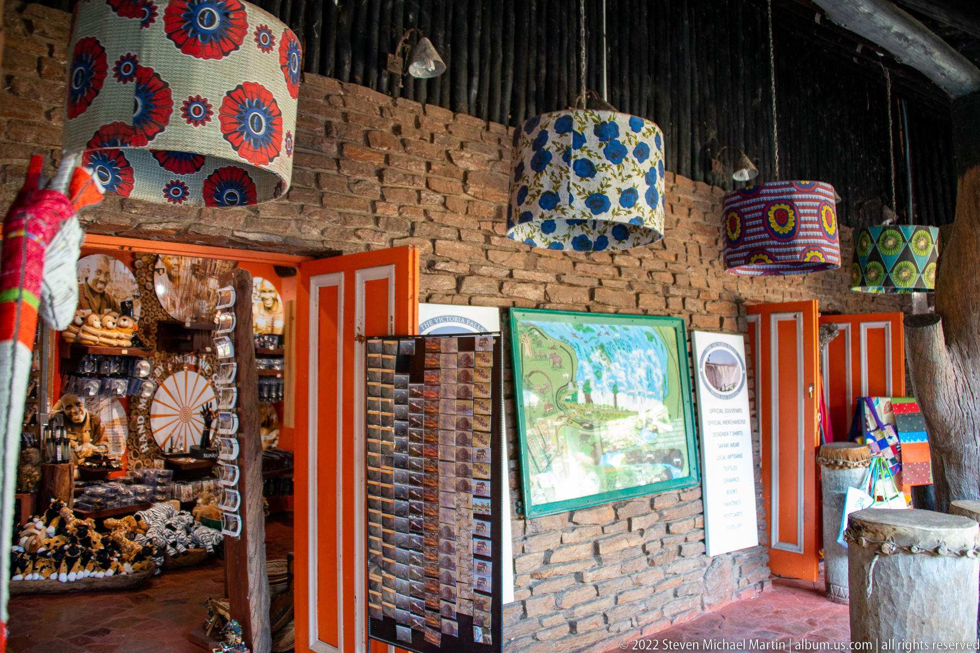
Colorful hanging lampshades, patterned textiles, carved objects, and racks of small souvenirs fill a brick-and-timber shop interior near the falls. The dense arrangement of locally themed merchandise contrasts with the park’s formal interpretive displays, documenting the commercial visitor environment through handcrafted-looking decorative goods and a bright orange doorway.
Caption
Colorful hanging lampshades, patterned textiles, carved objects, and racks of small souvenirs fill a brick-and-timber shop interior near the falls. The dense arrangement of locally themed merchandise contrasts with the park’s formal interpretive displays, documenting the commercial visitor environment through handcrafted-looking decorative goods and a bright orange doorway.

A KAZA information panel maps the Kavango-Zambezi Transfrontier Conservation Area across Angola, Botswana, Namibia, Zambia, and Zimbabwe. Text explains the multinational conservation landscape, while photographs of wildlife and Victoria Falls connect the protected river systems and habitats to one of the region’s best-known natural landmarks.
Caption
A KAZA information panel maps the Kavango-Zambezi Transfrontier Conservation Area across Angola, Botswana, Namibia, Zambia, and Zimbabwe. Text explains the multinational conservation landscape, while photographs of wildlife and Victoria Falls connect the protected river systems and habitats to one of the region’s best-known natural landmarks.
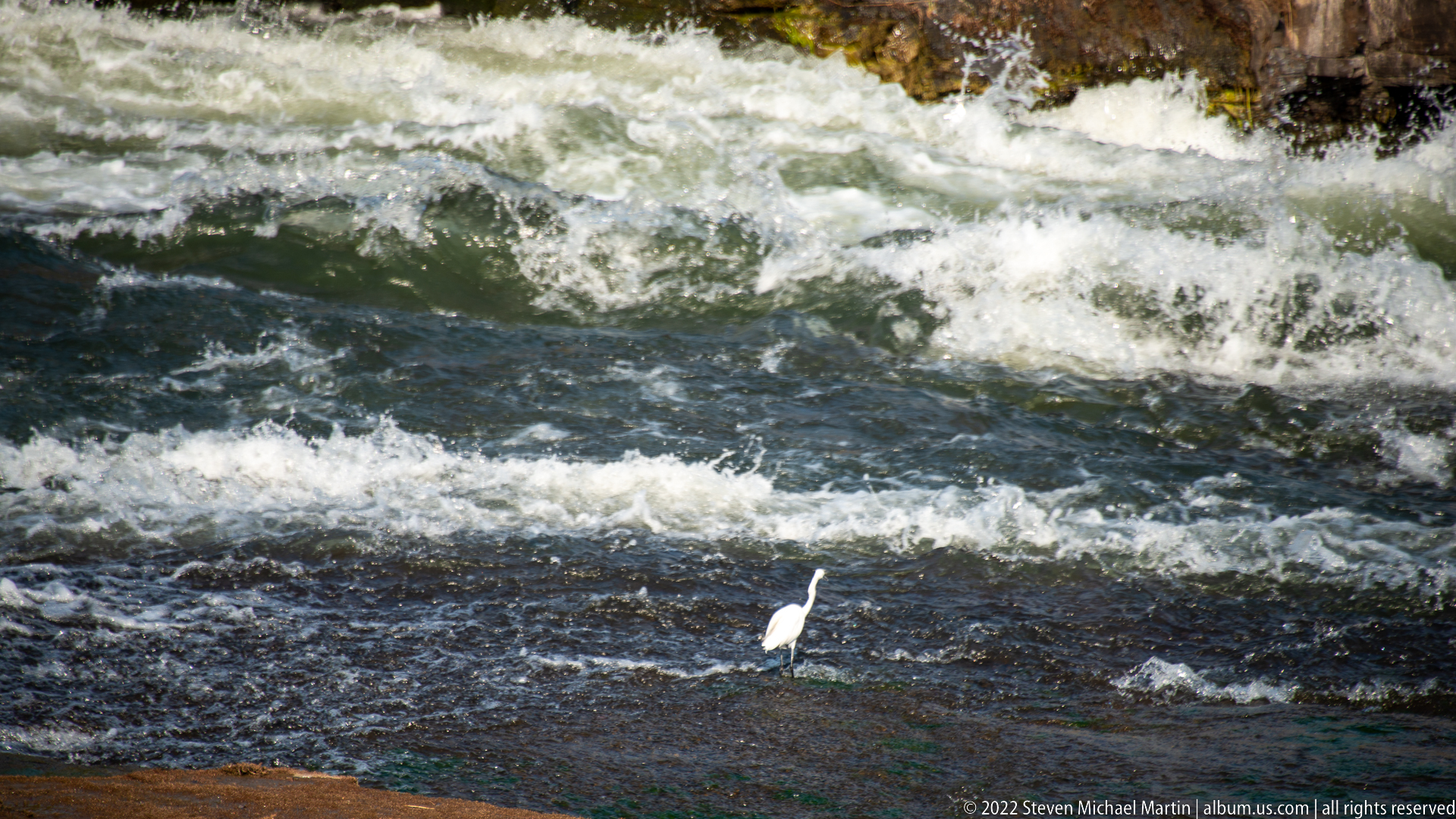
A small white wading bird stands on a dark rock amid churning Zambezi rapids, its slender legs and pointed bill contrasting with the turbulent water around it. The tight crop shifts the portfolio briefly from geology and landscape to wildlife, showing how birds use exposed stones and shallow margins within the river immediately above the falls.
Caption
A small white wading bird stands on a dark rock amid churning Zambezi rapids, its slender legs and pointed bill contrasting with the turbulent water around it. The tight crop shifts the portfolio briefly from geology and landscape to wildlife, showing how birds use exposed stones and shallow margins within the river immediately above the falls.
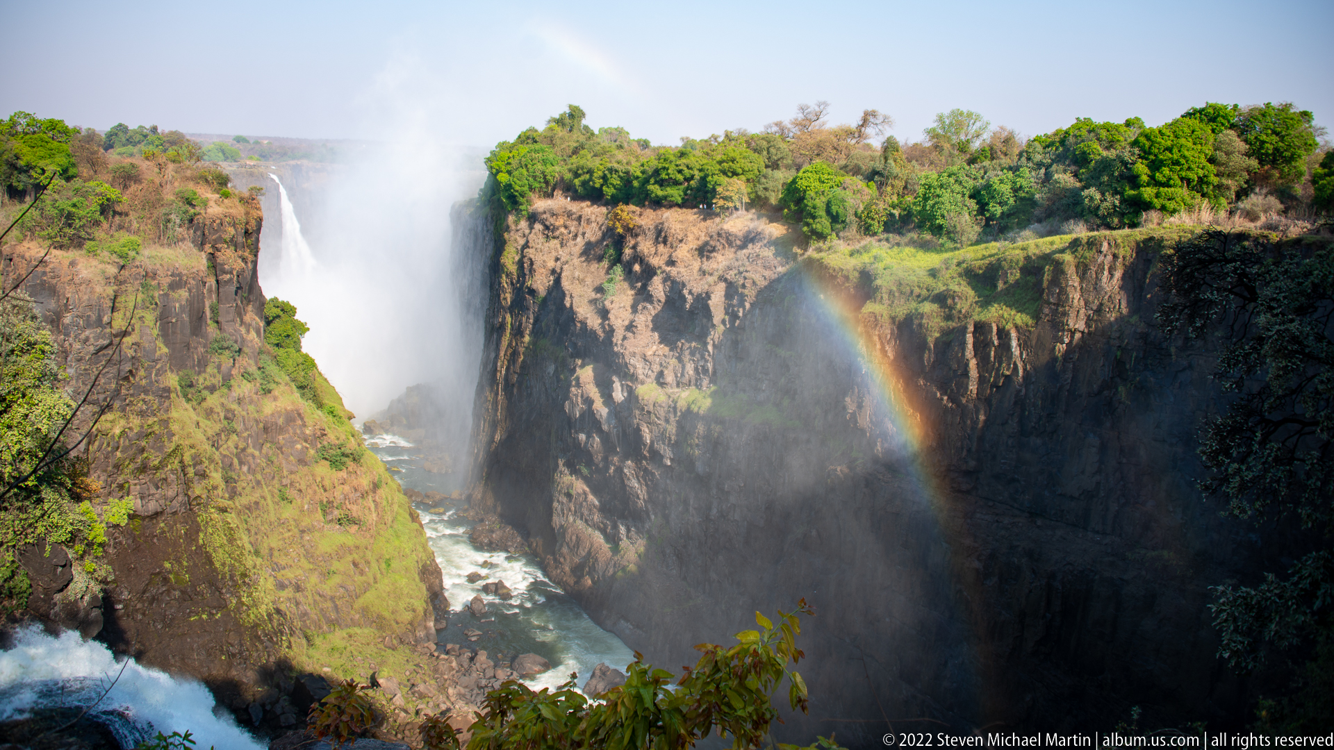
A powerful curtain of Victoria Falls drops between steep basalt walls as spray rises from the gorge and a rainbow forms in the mist. The viewpoint looks obliquely into a narrower section of the chasm, where green vegetation clings to the cliff tops and ledges, revealing the close relationship between falling water, fractured rock, and rainforest moisture.
Caption
A powerful curtain of Victoria Falls drops between steep basalt walls as spray rises from the gorge and a rainbow forms in the mist. The viewpoint looks obliquely into a narrower section of the chasm, where green vegetation clings to the cliff tops and ledges, revealing the close relationship between falling water, fractured rock, and rainforest moisture.
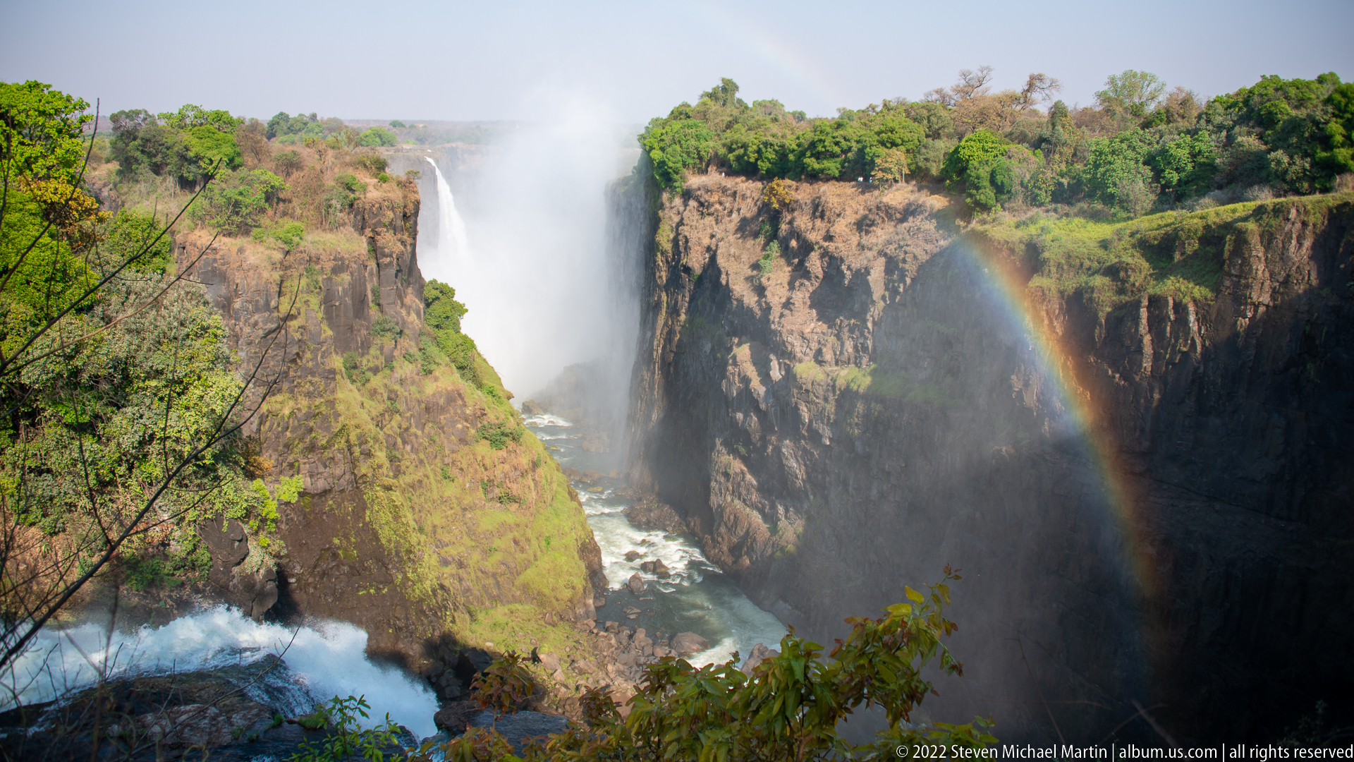
From a slightly tighter angle, a rainbow arcs across the spray-filled gorge beside a concentrated plunge of Victoria Falls. Sunlit vegetation brightens the cliff rim while the basalt walls descend sharply to turbulent water below. The closer framing gives the rainbow and mist equal visual weight with the waterfall, distinguishing this view from the preceding wider composition.
Caption
From a slightly tighter angle, a rainbow arcs across the spray-filled gorge beside a concentrated plunge of Victoria Falls. Sunlit vegetation brightens the cliff rim while the basalt walls descend sharply to turbulent water below. The closer framing gives the rainbow and mist equal visual weight with the waterfall, distinguishing this view from the preceding wider composition.
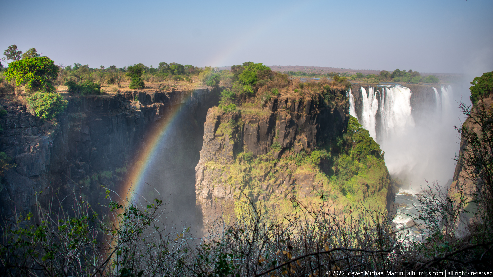
A bright rainbow arcs through the spray-filled gorge as a broad curtain of Victoria Falls drops over the basalt escarpment at right. Sunlit cliff faces and green vegetation contrast with the shaded chasm below, where the Zambezi River disappears into mist. The composition records the optical effect produced when direct sunlight meets airborne droplets from the falls.
Caption
A bright rainbow arcs through the spray-filled gorge as a broad curtain of Victoria Falls drops over the basalt escarpment at right. Sunlit cliff faces and green vegetation contrast with the shaded chasm below, where the Zambezi River disappears into mist. The composition records the optical effect produced when direct sunlight meets airborne droplets from the falls.
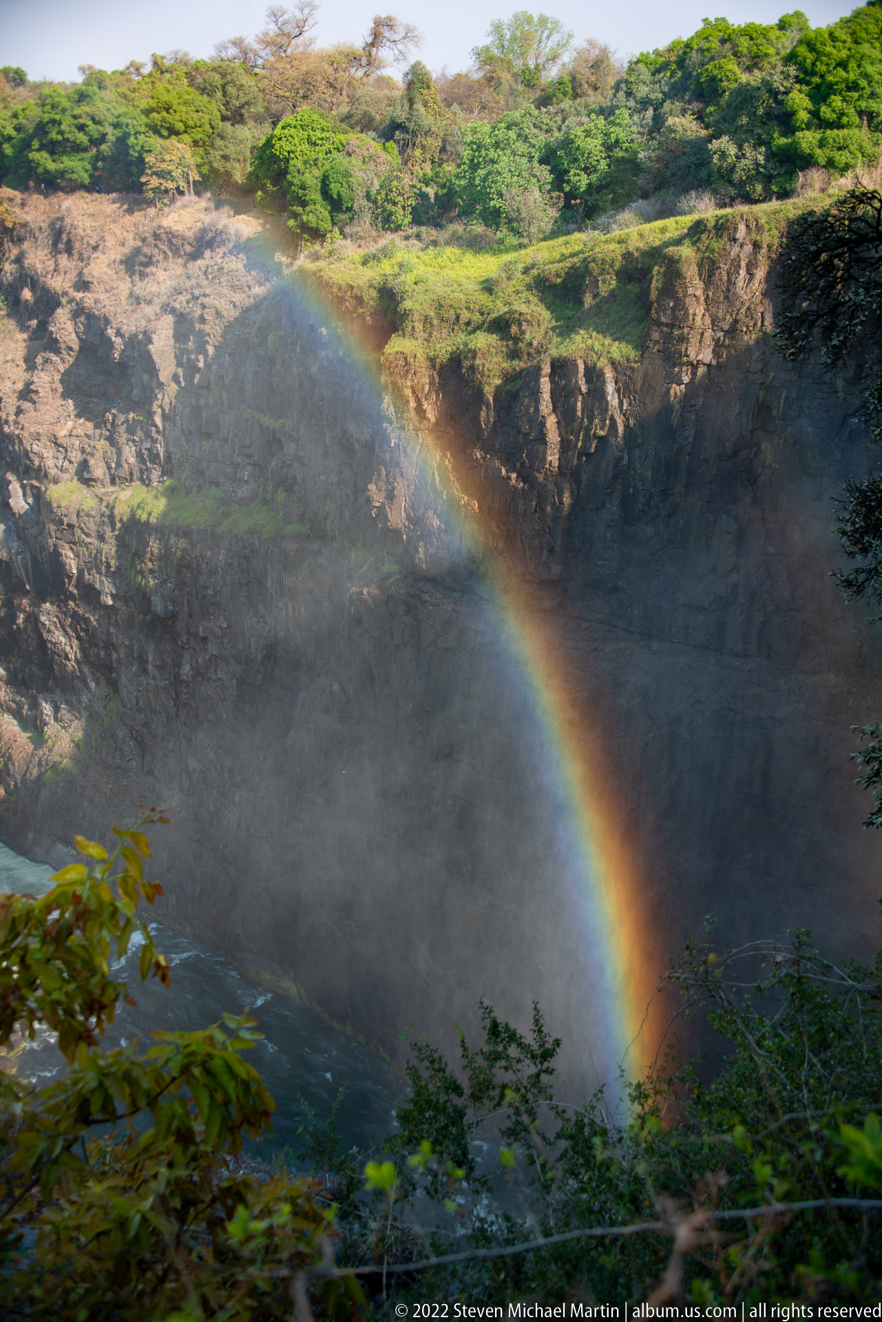
A broad rainbow descends through the spray of Victoria Falls against a shadowed basalt cliff, with only a small portion of falling water visible at the edge. By minimizing the waterfall itself, the composition isolates one of the site’s recurring optical effects: sunlight refracted through the dense mist rising continuously from the gorge.
Caption
A broad rainbow descends through the spray of Victoria Falls against a shadowed basalt cliff, with only a small portion of falling water visible at the edge. By minimizing the waterfall itself, the composition isolates one of the site’s recurring optical effects: sunlight refracted through the dense mist rising continuously from the gorge.
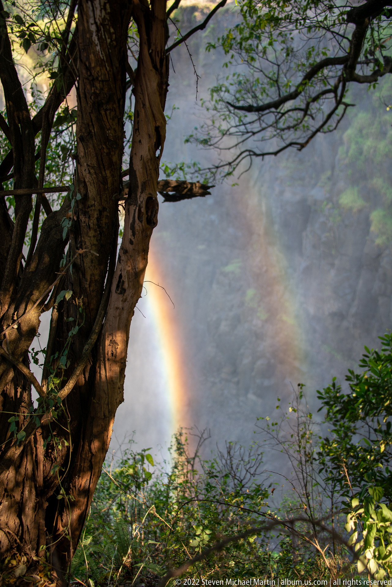
A narrow rainbow glows through dense spray beyond a large tree trunk and layered rainforest foliage. The waterfall is mostly concealed, leaving vegetation and mist to frame the optical effect. This more intimate viewpoint records the rainforest experience along the gorge rim, where shifting branches repeatedly reveal and obscure the falls and their rainbows.
Caption
A narrow rainbow glows through dense spray beyond a large tree trunk and layered rainforest foliage. The waterfall is mostly concealed, leaving vegetation and mist to frame the optical effect. This more intimate viewpoint records the rainforest experience along the gorge rim, where shifting branches repeatedly reveal and obscure the falls and their rainbows.
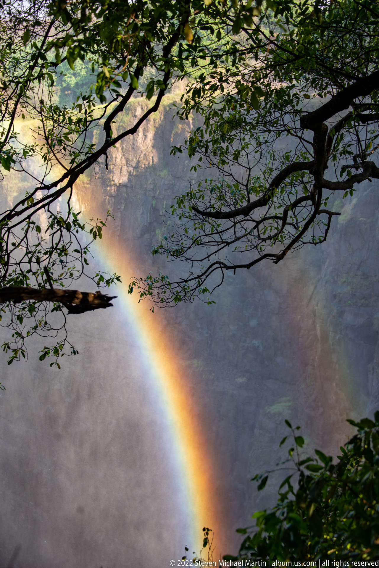
Overhanging branches form a dark natural frame around a vivid diagonal rainbow suspended in the mist above the gorge. Only hints of cliff and vegetation remain visible through the spray, producing a more abstract study of light, water droplets, and rainforest canopy than the broader waterfall views elsewhere in the sequence.
Caption
Overhanging branches form a dark natural frame around a vivid diagonal rainbow suspended in the mist above the gorge. Only hints of cliff and vegetation remain visible through the spray, producing a more abstract study of light, water droplets, and rainforest canopy than the broader waterfall views elsewhere in the sequence.
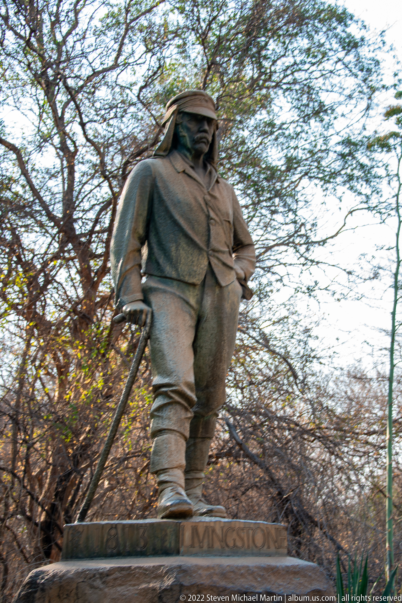
A bronze-colored statue of David Livingstone stands among trees near Victoria Falls, depicting the nineteenth-century explorer in travel clothing with a walking staff at his side. The low viewpoint emphasizes the full-length figure and the plinth inscription “Livingstone,” connecting the park landscape with the historical interpretation introduced earlier in the visitor-center displays.
Caption
A bronze-colored statue of David Livingstone stands among trees near Victoria Falls, depicting the nineteenth-century explorer in travel clothing with a walking staff at his side. The low viewpoint emphasizes the full-length figure and the plinth inscription “Livingstone,” connecting the park landscape with the historical interpretation introduced earlier in the visitor-center displays.
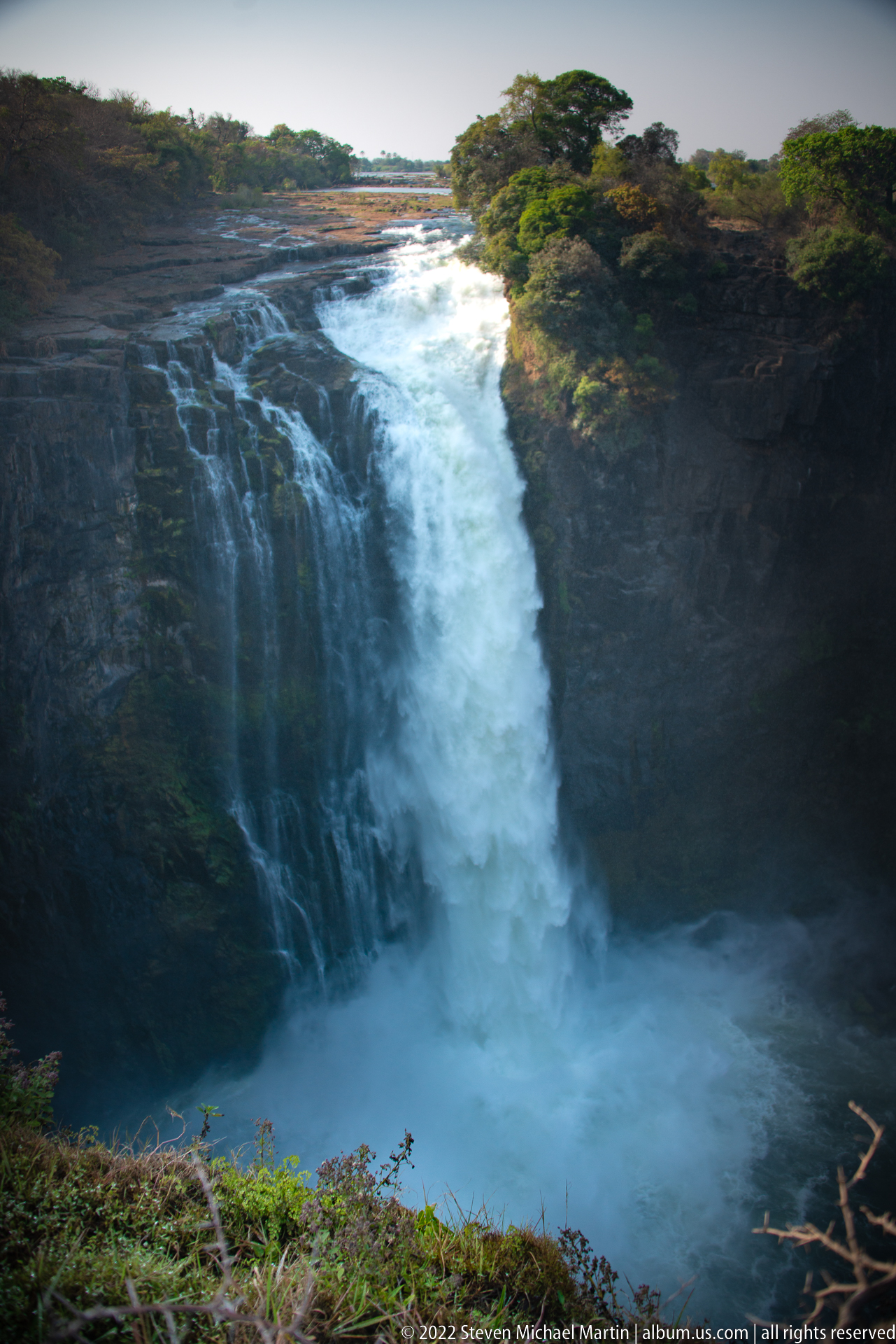
A concentrated section of Victoria Falls plunges from a flat rock ledge into a shadowed basin, where impact spray obscures the lower water surface. The river above the drop appears comparatively calm before accelerating over the brink. Dark basalt walls and a narrow fringe of vegetation surround the fall, creating a compact study of water, rock, and mist.
Caption
A concentrated section of Victoria Falls plunges from a flat rock ledge into a shadowed basin, where impact spray obscures the lower water surface. The river above the drop appears comparatively calm before accelerating over the brink. Dark basalt walls and a narrow fringe of vegetation surround the fall, creating a compact study of water, rock, and mist.

A low rainbow spans the mist above a broad section of Victoria Falls, arching from the distant riverbank toward dense trees at right. Multiple white curtains fall across the basalt escarpment below the arc, while dry brush occupies the foreground. The wide view balances the scale of the waterfall with the atmospheric conditions created by sunlight passing through persistent spray.
Caption
A low rainbow spans the mist above a broad section of Victoria Falls, arching from the distant riverbank toward dense trees at right. Multiple white curtains fall across the basalt escarpment below the arc, while dry brush occupies the foreground. The wide view balances the scale of the waterfall with the atmospheric conditions created by sunlight passing through persistent spray.

Water surges over the rocky lip of Victoria Falls at close range, breaking into a white cascade beside a sheer basalt wall. A narrow rainbow appears in the mist near the base of the gorge, while scrub and trees cling to the upper rim. This oblique viewpoint stresses the height of the drop and the fractured volcanic rock that channels the river.
Caption
Water surges over the rocky lip of Victoria Falls at close range, breaking into a white cascade beside a sheer basalt wall. A narrow rainbow appears in the mist near the base of the gorge, while scrub and trees cling to the upper rim. This oblique viewpoint stresses the height of the drop and the fractured volcanic rock that channels the river.
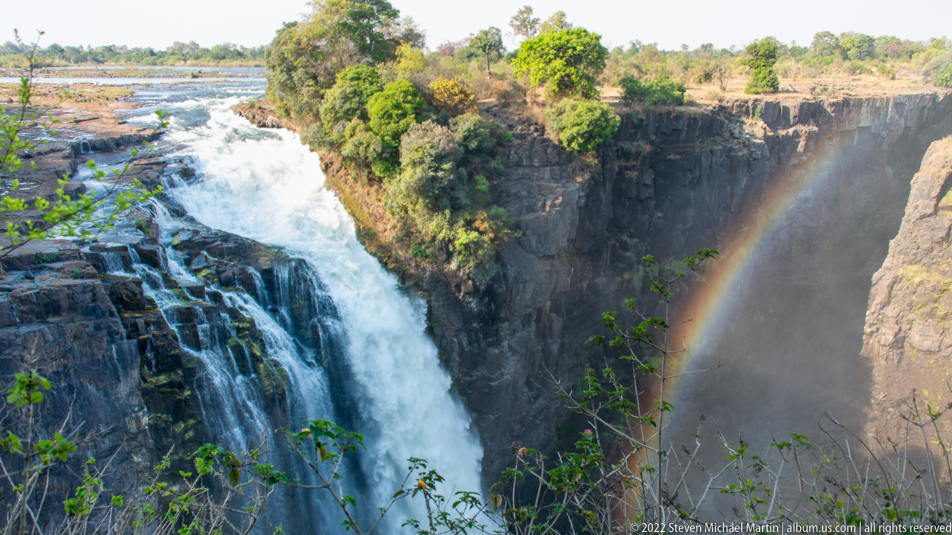
A powerful sheet of the Zambezi River spills over the edge of Victoria Falls, its flow broken into multiple channels by dark rock at the lip. The falling water fills the left side of the frame, while a rainbow forms in the shaded spray against the opposite cliff. Vegetation along the rim provides scale to the broad cascade and steep gorge.
Caption
A powerful sheet of the Zambezi River spills over the edge of Victoria Falls, its flow broken into multiple channels by dark rock at the lip. The falling water fills the left side of the frame, while a rainbow forms in the shaded spray against the opposite cliff. Vegetation along the rim provides scale to the broad cascade and steep gorge.
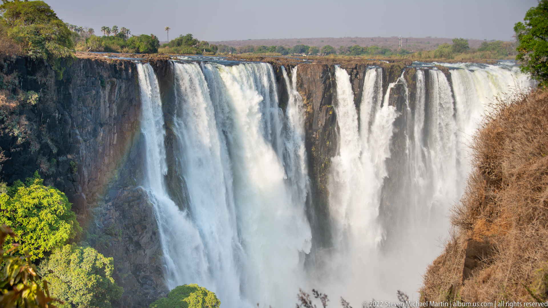
A broad frontal section of Victoria Falls descends in parallel white streams over the dark basalt rim. Spray billows upward from the unseen base, softening the lower half of the falls, while green foliage and dry-season brush frame the gorge. The view emphasizes the width and segmentation of the curtain as water follows joints and irregularities in the rock edge.
Caption
A broad frontal section of Victoria Falls descends in parallel white streams over the dark basalt rim. Spray billows upward from the unseen base, softening the lower half of the falls, while green foliage and dry-season brush frame the gorge. The view emphasizes the width and segmentation of the curtain as water follows joints and irregularities in the rock edge.
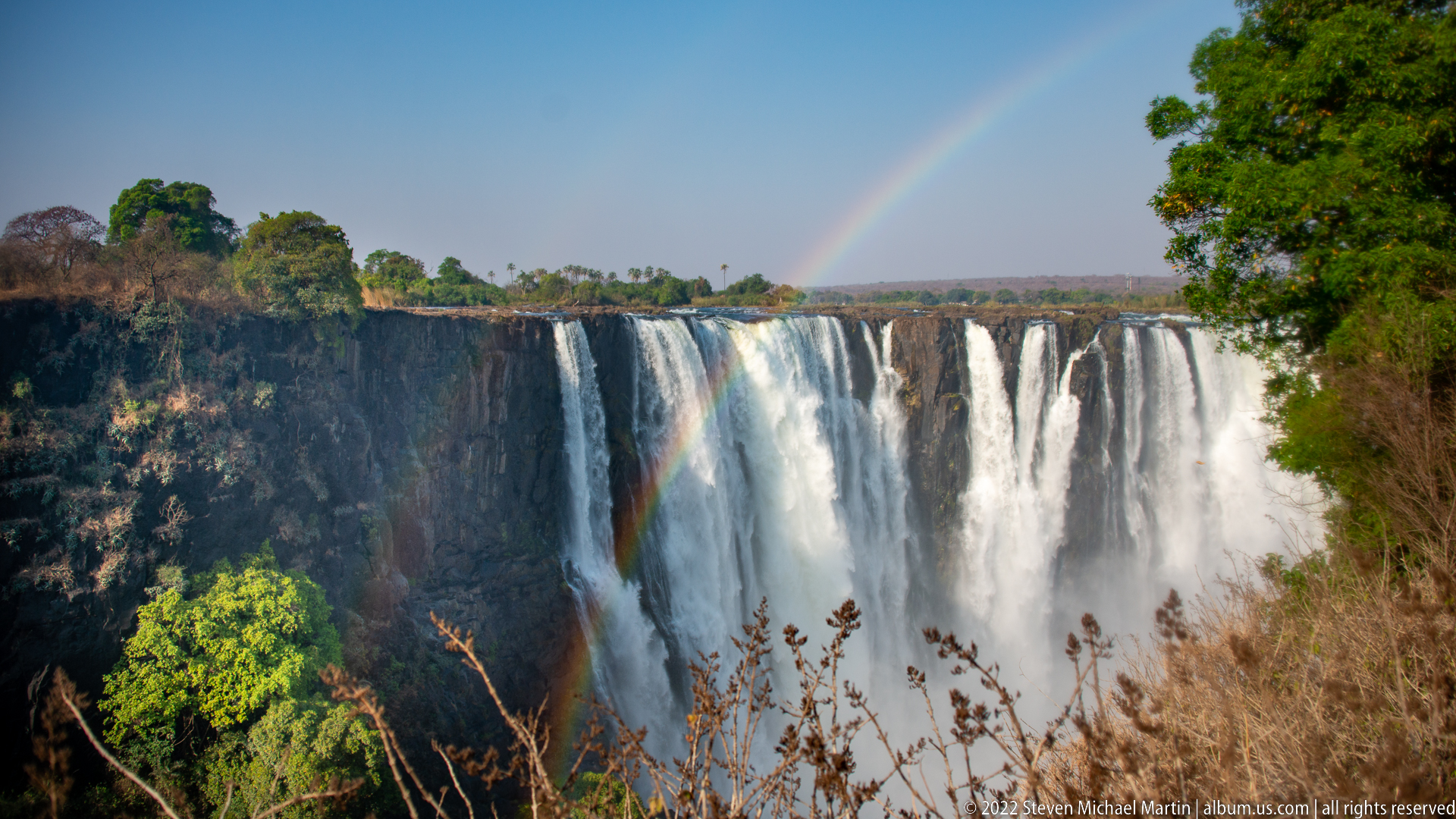
A vivid rainbow appears to descend into the gorge beside the segmented curtain of Victoria Falls. The basalt cliff is visible at left, while dense spray veils the lower drop and sunlit vegetation occupies the upper rim. The tighter framing places the rainbow against the waterfall itself, highlighting the interaction between the falls’ persistent mist and strong direct light.
Caption
A vivid rainbow appears to descend into the gorge beside the segmented curtain of Victoria Falls. The basalt cliff is visible at left, while dense spray veils the lower drop and sunlit vegetation occupies the upper rim. The tighter framing places the rainbow against the waterfall itself, highlighting the interaction between the falls’ persistent mist and strong direct light.
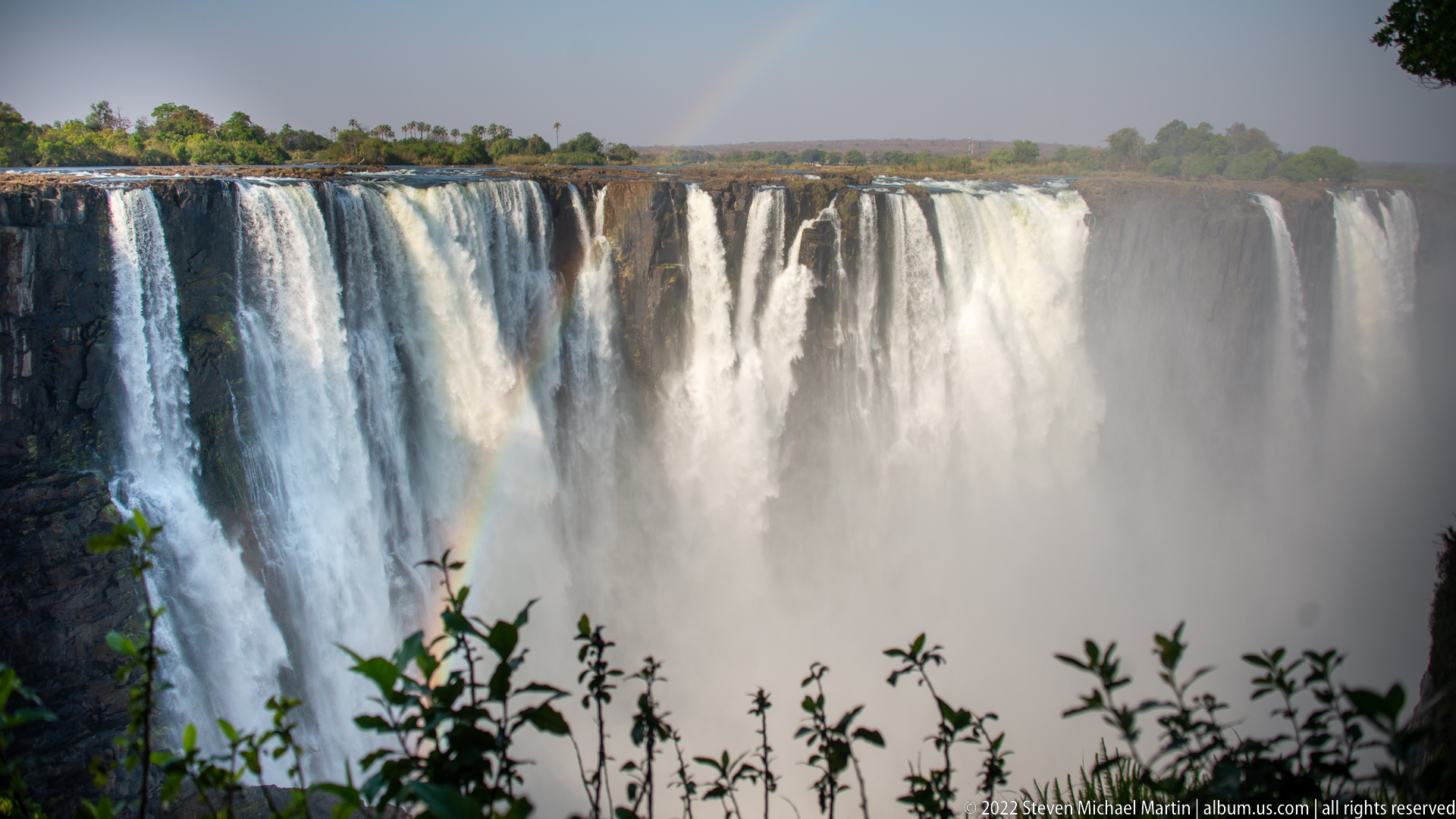
Tall, closely spaced curtains of Victoria Falls drop from the flat river edge into a mass of rising spray. A faint rainbow is visible through the mist near the lower center, while silhouetted leaves in the foreground add depth. The nearly frontal angle stresses the repeated vertical bands of water and the way spray obscures the base of the basalt escarpment.
Caption
Tall, closely spaced curtains of Victoria Falls drop from the flat river edge into a mass of rising spray. A faint rainbow is visible through the mist near the lower center, while silhouetted leaves in the foreground add depth. The nearly frontal angle stresses the repeated vertical bands of water and the way spray obscures the base of the basalt escarpment.
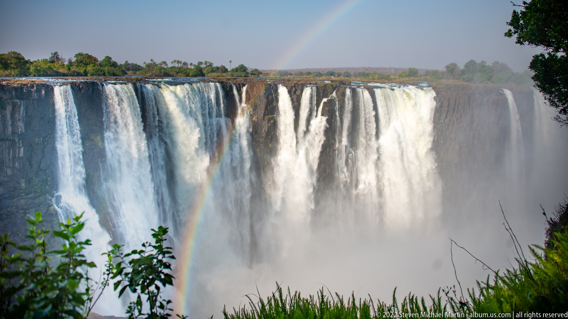
A broad expanse of Victoria Falls fills the view, its separate white curtains merging into dense spray below. A narrow rainbow rises from the gorge near the left-center, while leafy shrubs and grasses frame the foreground. Compared with the adjacent closer views, this composition gives more space to the upper rim and shows the waterfall as a continuous landscape feature across the basalt edge.
Caption
A broad expanse of Victoria Falls fills the view, its separate white curtains merging into dense spray below. A narrow rainbow rises from the gorge near the left-center, while leafy shrubs and grasses frame the foreground. Compared with the adjacent closer views, this composition gives more space to the upper rim and shows the waterfall as a continuous landscape feature across the basalt edge.
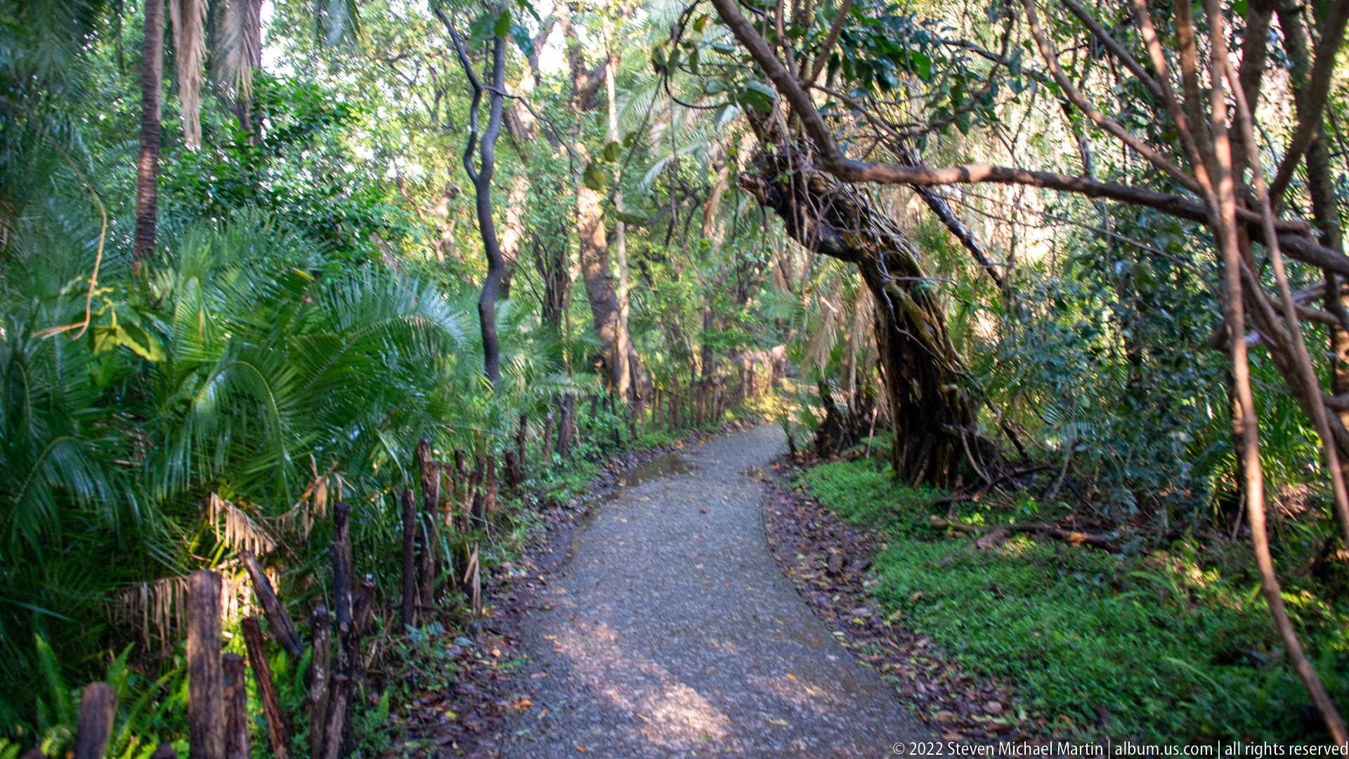
A narrow paved path curves through dense, shaded vegetation near Victoria Falls. Palms, broadleaf plants, tangled vines, and mature trees form a humid forest corridor, with dappled sunlight reaching the path from openings in the canopy. The scene records the lush microclimate sustained by persistent waterfall spray, contrasting sharply with the drier vegetation visible along exposed viewpoints.
Caption
A narrow paved path curves through dense, shaded vegetation near Victoria Falls. Palms, broadleaf plants, tangled vines, and mature trees form a humid forest corridor, with dappled sunlight reaching the path from openings in the canopy. The scene records the lush microclimate sustained by persistent waterfall spray, contrasting sharply with the drier vegetation visible along exposed viewpoints.
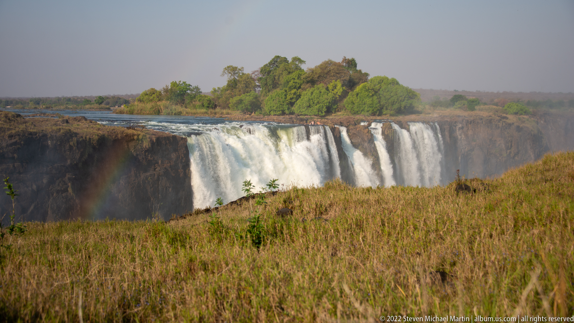
A wide dry-season view places a segmented section of Victoria Falls beyond a broad foreground of tawny grass. Water descends in several strong white curtains from a low, tree-covered island and rocky rim, while mist lingers in the gorge. The open foreground makes the seasonal contrast especially clear: dry grassland stands only a short distance from the spray-fed vegetation surrounding the falls.
Caption
A wide dry-season view places a segmented section of Victoria Falls beyond a broad foreground of tawny grass. Water descends in several strong white curtains from a low, tree-covered island and rocky rim, while mist lingers in the gorge. The open foreground makes the seasonal contrast especially clear: dry grassland stands only a short distance from the spray-fed vegetation surrounding the falls.
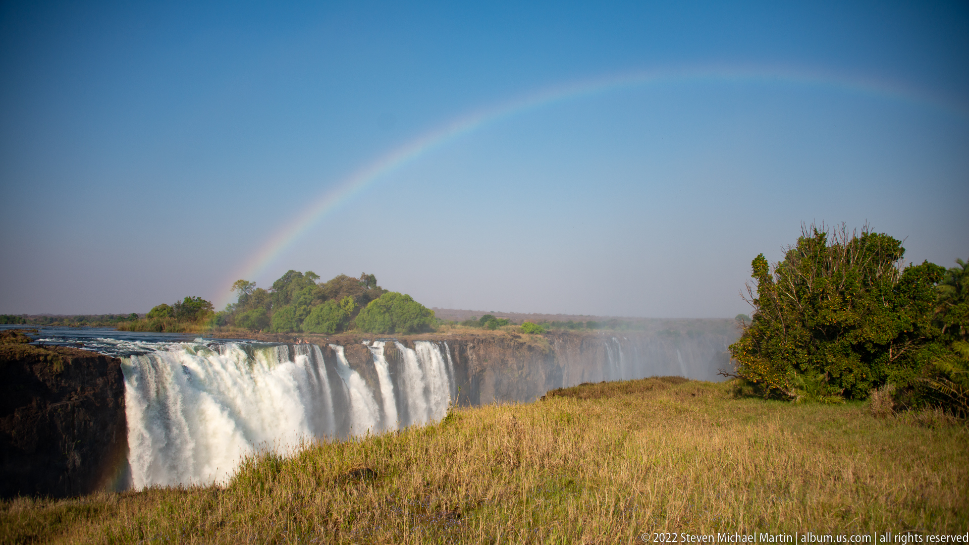
A full rainbow arches above a broad section of Victoria Falls, its colors spanning the blue sky from the waterfall spray toward scrub at right. White cascades descend beneath the arc, while a dry, golden grassland foreground contrasts with the green island vegetation along the river. The expansive composition links the falls’ mist plume to the surrounding dry-season landscape.
Caption
A full rainbow arches above a broad section of Victoria Falls, its colors spanning the blue sky from the waterfall spray toward scrub at right. White cascades descend beneath the arc, while a dry, golden grassland foreground contrasts with the green island vegetation along the river. The expansive composition links the falls’ mist plume to the surrounding dry-season landscape.

Several visitors gather on exposed rock immediately beside flowing water at the lip of Victoria Falls. The group appears small against the broad curtain dropping in the foreground, while green riverbank vegetation lies behind them. The elevated viewpoint makes the precarious relationship between people, shallow rock ledges, and the abrupt waterfall edge the central subject of the scene.
Caption
Several visitors gather on exposed rock immediately beside flowing water at the lip of Victoria Falls. The group appears small against the broad curtain dropping in the foreground, while green riverbank vegetation lies behind them. The elevated viewpoint makes the precarious relationship between people, shallow rock ledges, and the abrupt waterfall edge the central subject of the scene.
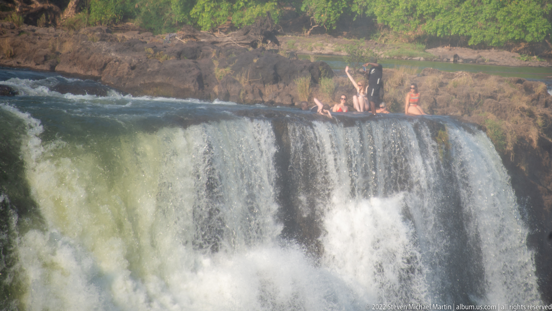
A closer view isolates visitors seated and standing on the rocky river margin just above a powerful drop at Victoria Falls. White water pours over the foreground edge, and a smaller side channel falls through a notch in the rock to the right. The composition emphasizes human scale and the narrow margin between shallow riverbed rock and the vertical cascade.
Caption
A closer view isolates visitors seated and standing on the rocky river margin just above a powerful drop at Victoria Falls. White water pours over the foreground edge, and a smaller side channel falls through a notch in the rock to the right. The composition emphasizes human scale and the narrow margin between shallow riverbed rock and the vertical cascade.
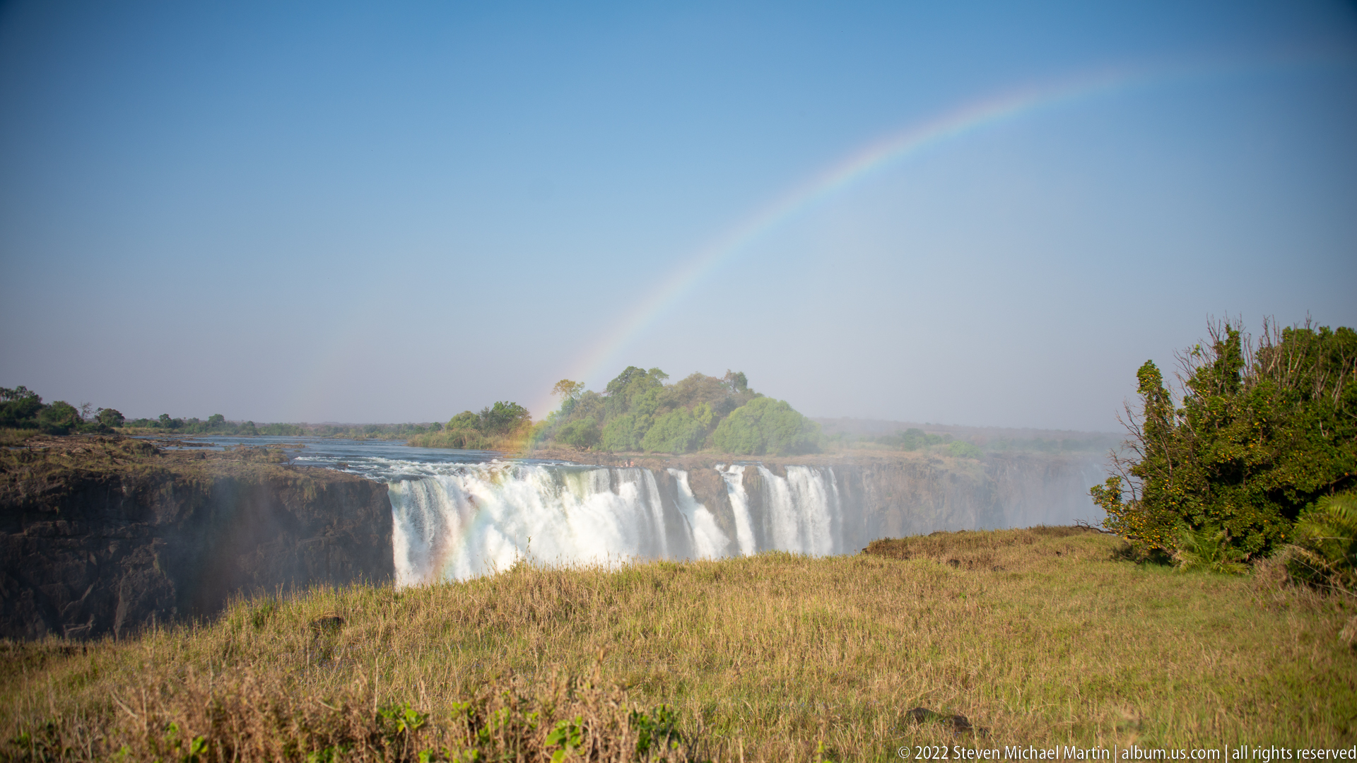
A pale rainbow spans the sky above a distant section of Victoria Falls, where white water drops beyond dry grass and scrub. The falls occupy a relatively small portion of the frame, allowing the blue sky and open foreground to dominate. This more distant perspective records the waterfall within its broader plateau setting rather than concentrating on the cliff face or gorge.
Caption
A pale rainbow spans the sky above a distant section of Victoria Falls, where white water drops beyond dry grass and scrub. The falls occupy a relatively small portion of the frame, allowing the blue sky and open foreground to dominate. This more distant perspective records the waterfall within its broader plateau setting rather than concentrating on the cliff face or gorge.
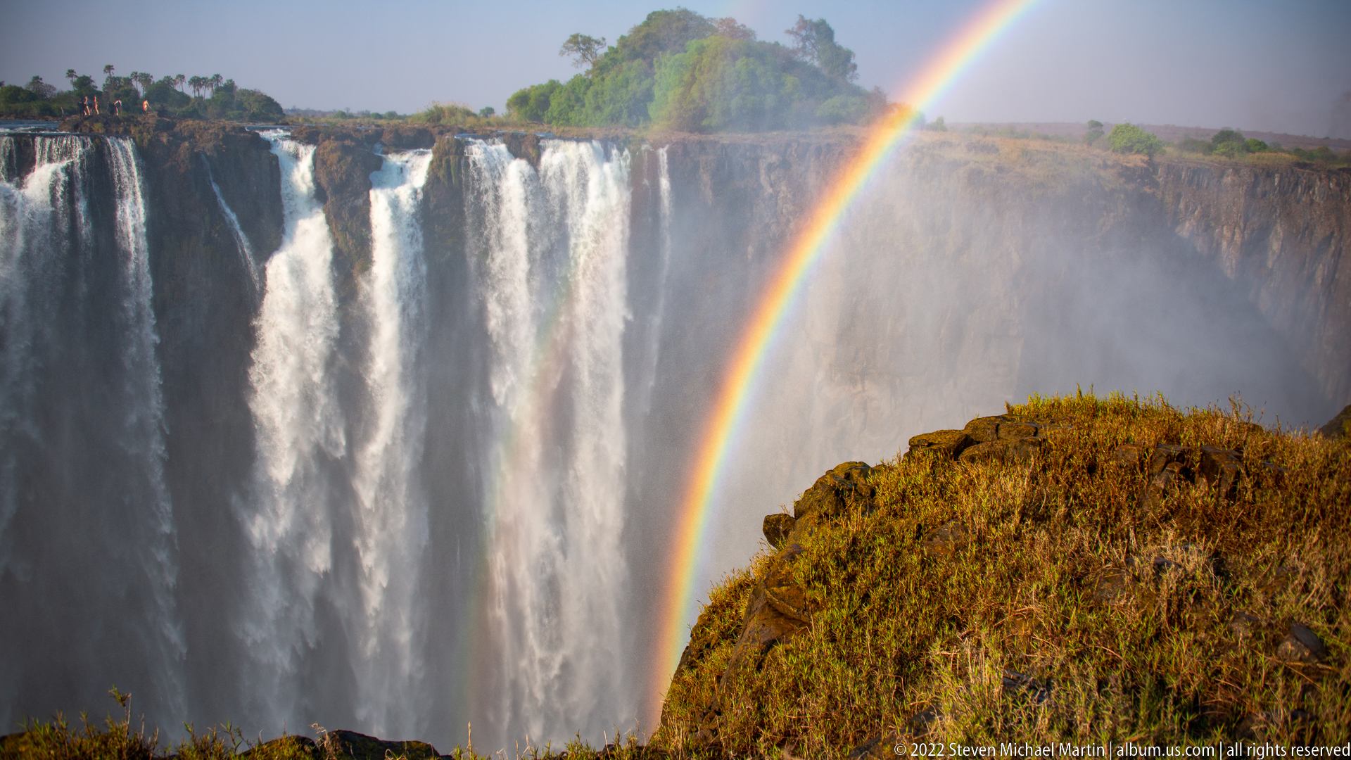
A saturated rainbow rises steeply from the spray beside a tall curtain of Victoria Falls. White water occupies the left half of the frame, while the rainbow cuts through mist above a sunlit, grass-covered rock outcrop in the foreground. The close composition separates the optical phenomenon from the wider landscape and shows individual bands of color against the pale spray cloud.
Caption
A saturated rainbow rises steeply from the spray beside a tall curtain of Victoria Falls. White water occupies the left half of the frame, while the rainbow cuts through mist above a sunlit, grass-covered rock outcrop in the foreground. The close composition separates the optical phenomenon from the wider landscape and shows individual bands of color against the pale spray cloud.
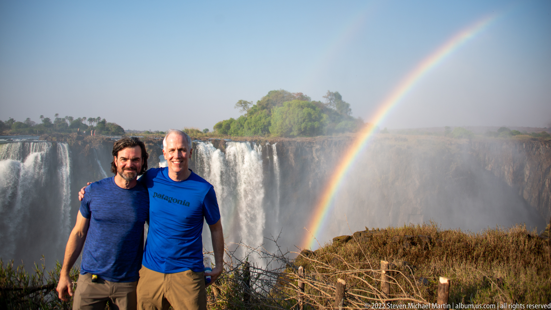
Two visitors pose shoulder to shoulder at a Victoria Falls overlook, framed by a broad white cascade and a rainbow descending into mist at right. Compared with the preceding portrait, the tighter arrangement centers the pair against the green island and bright spray plume. The simple viewpoint barrier and dry vegetation remain visible along the lower edge of the frame.
Caption
Two visitors pose shoulder to shoulder at a Victoria Falls overlook, framed by a broad white cascade and a rainbow descending into mist at right. Compared with the preceding portrait, the tighter arrangement centers the pair against the green island and bright spray plume. The simple viewpoint barrier and dry vegetation remain visible along the lower edge of the frame.
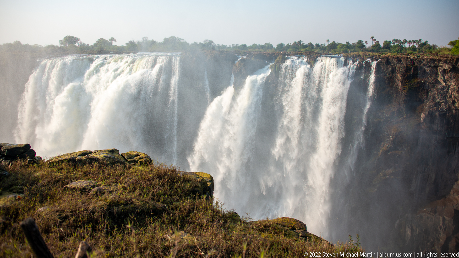
A massive section of Victoria Falls pours over the cliff in several adjoining curtains, filling the gorge with rising spray. Low, sunlit rock and dry vegetation occupy the foreground, contrasting with the bright water and hazy background. The frontal viewpoint concentrates on the volume of the drop and the way adjacent channels merge visually into a continuous wall of white water.
Caption
A massive section of Victoria Falls pours over the cliff in several adjoining curtains, filling the gorge with rising spray. Low, sunlit rock and dry vegetation occupy the foreground, contrasting with the bright water and hazy background. The frontal viewpoint concentrates on the volume of the drop and the way adjacent channels merge visually into a continuous wall of white water.
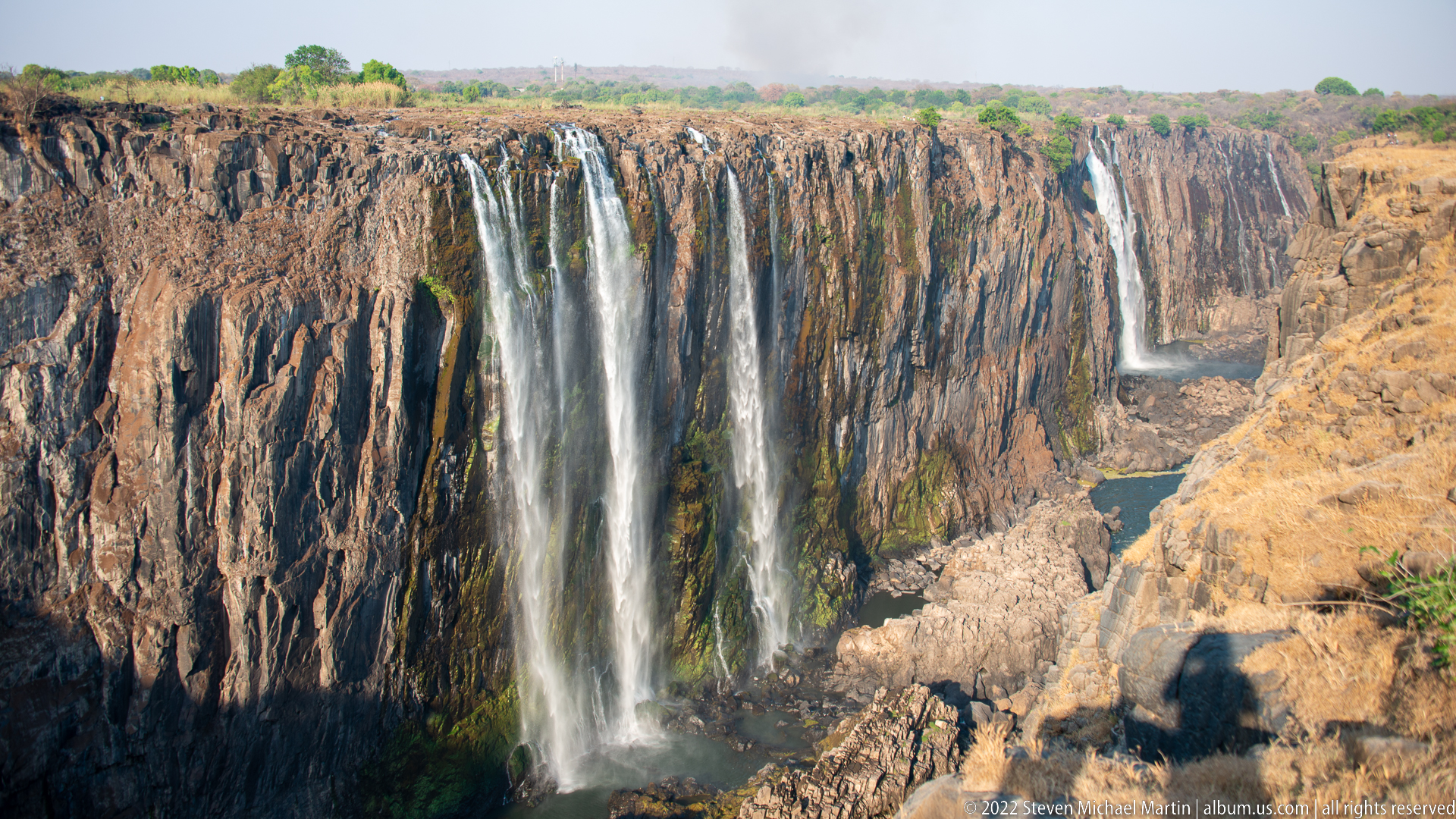
During lower flow, several narrow cascades descend separately over the exposed basalt wall of Victoria Falls. Large expanses of dark, vertically jointed rock stand between the streams, and the river channel is visible far below in the gorge. The reduced water volume reveals the structure of the escarpment more clearly than the broad white curtains seen in higher-flow sections.
Caption
During lower flow, several narrow cascades descend separately over the exposed basalt wall of Victoria Falls. Large expanses of dark, vertically jointed rock stand between the streams, and the river channel is visible far below in the gorge. The reduced water volume reveals the structure of the escarpment more clearly than the broad white curtains seen in higher-flow sections.
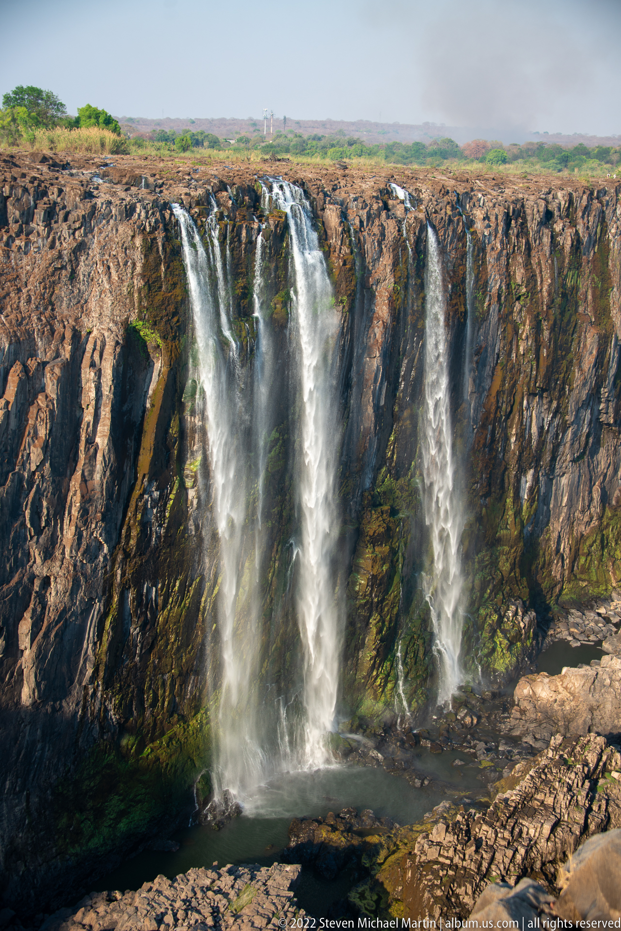
Three principal streams of Victoria Falls drop over a heavily exposed basalt face, spreading into white veils before reaching a dark basin below. Mossy or algae-stained rock marks wetter channels, while broad dry sections of cliff remain visible between the falls. The composition is especially useful for reading the rock structure and the seasonal concentration of flow into discrete channels.
Caption
Three principal streams of Victoria Falls drop over a heavily exposed basalt face, spreading into white veils before reaching a dark basin below. Mossy or algae-stained rock marks wetter channels, while broad dry sections of cliff remain visible between the falls. The composition is especially useful for reading the rock structure and the seasonal concentration of flow into discrete channels.
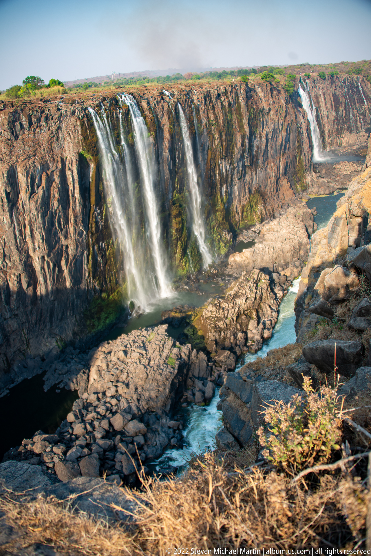
A wide view of the lower-flow falls reveals separated cascades along the basalt escarpment and the narrow Zambezi channel winding through the rocky gorge below. Pale boulder fields and exposed bedrock occupy much of the canyon floor, while dry grass frames the near rim. The scene shows how dramatically the gorge’s geology becomes visible when seasonal water levels recede.
Caption
A wide view of the lower-flow falls reveals separated cascades along the basalt escarpment and the narrow Zambezi channel winding through the rocky gorge below. Pale boulder fields and exposed bedrock occupy much of the canyon floor, while dry grass frames the near rim. The scene shows how dramatically the gorge’s geology becomes visible when seasonal water levels recede.
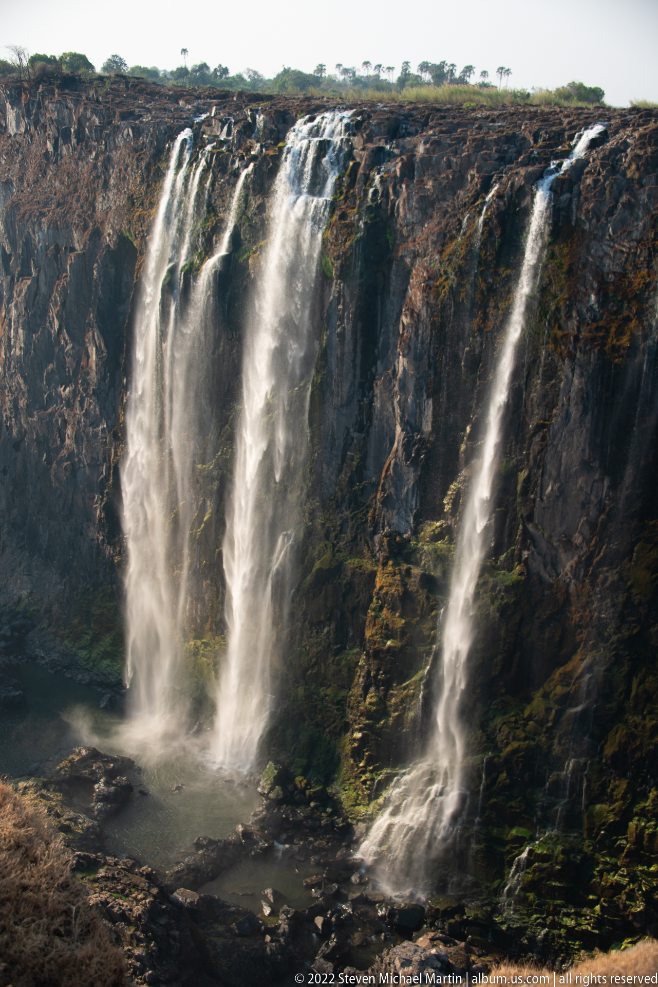
Several thin veils of Victoria Falls descend over a broad, dark basalt wall during lower flow. The streams spread and rejoin across irregular rock surfaces before reaching shallow pools and wet ledges at the base. With little spray to obscure the cliff, the photograph reveals the texture, vertical fractures, and green moisture staining that shape individual waterfall channels.
Caption
Several thin veils of Victoria Falls descend over a broad, dark basalt wall during lower flow. The streams spread and rejoin across irregular rock surfaces before reaching shallow pools and wet ledges at the base. With little spray to obscure the cliff, the photograph reveals the texture, vertical fractures, and green moisture staining that shape individual waterfall channels.
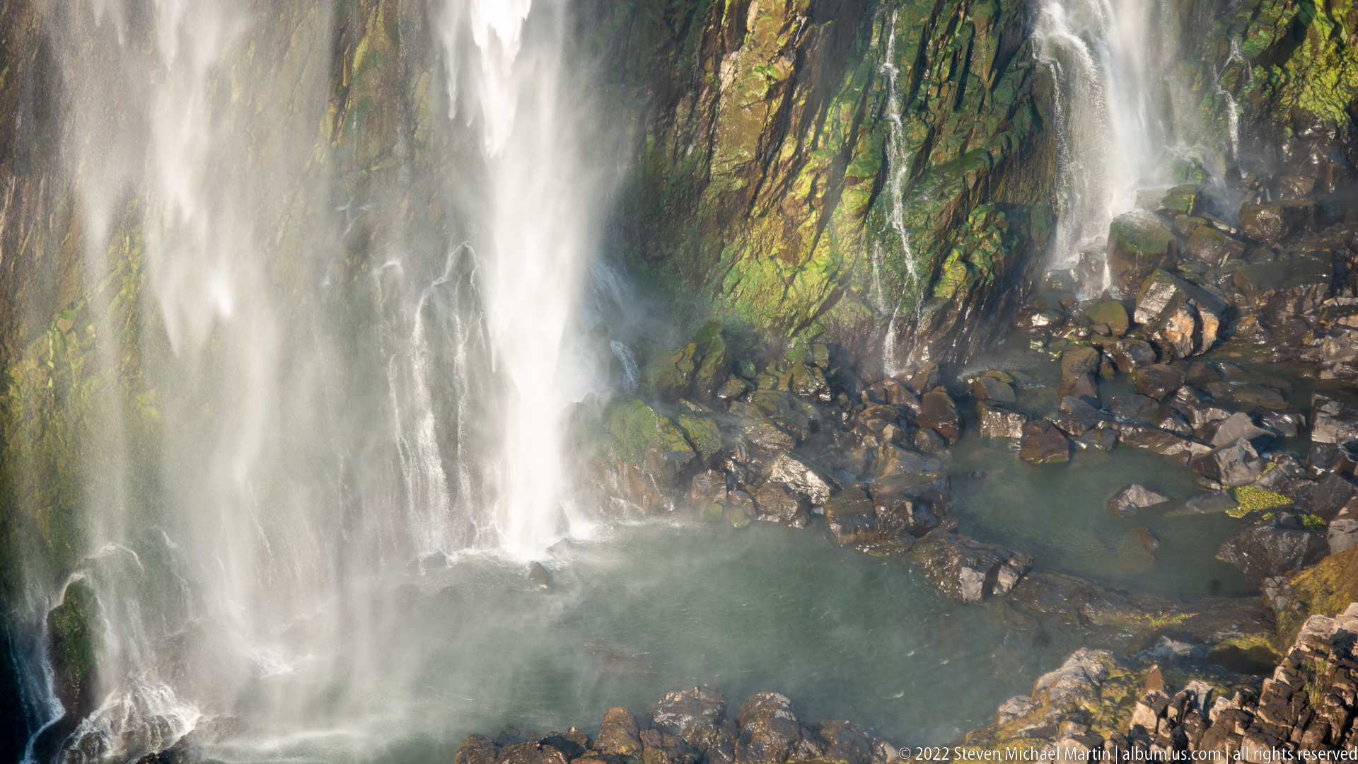
Falling water breaks into mist as it strikes a jumble of dark basalt boulders at the base of Victoria Falls. Green staining and moisture-loving growth mark the continuously wet cliff face, while a small pool collects among the rocks. The close view shifts attention from the scale of the falls to the turbulent contact zone where water, spray, and rock interact.
Caption
Falling water breaks into mist as it strikes a jumble of dark basalt boulders at the base of Victoria Falls. Green staining and moisture-loving growth mark the continuously wet cliff face, while a small pool collects among the rocks. The close view shifts attention from the scale of the falls to the turbulent contact zone where water, spray, and rock interact.
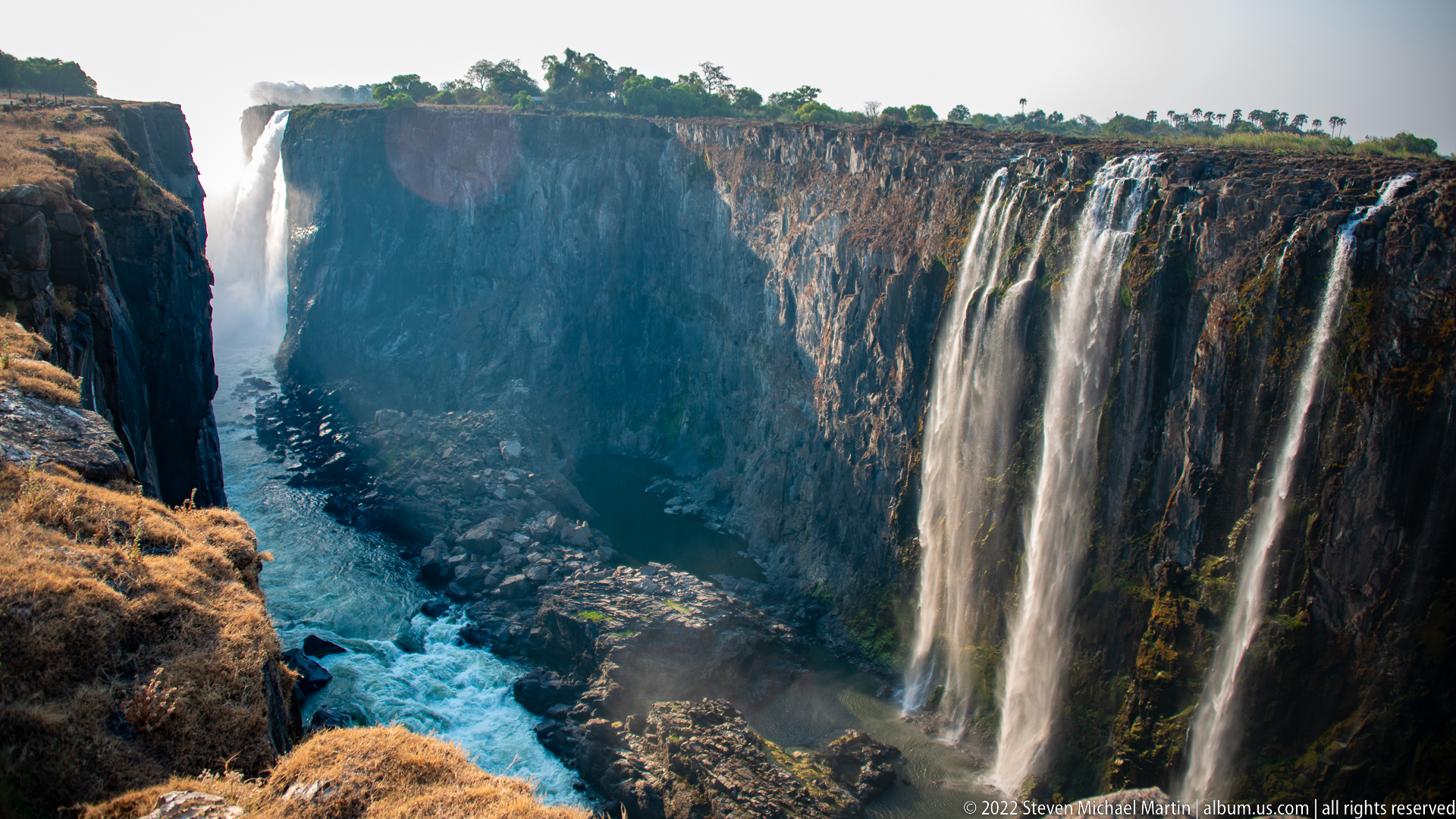
From above the gorge, several narrow curtains of Victoria Falls descend over opposing basalt walls while the Zambezi River accelerates through the confined channel below. Exposed brown rock and dry grasses show the seasonal low-water setting, and a blue-white rapid bends away through the canyon. The elevated perspective links the separated falls directly to the river’s downstream course.
Caption
From above the gorge, several narrow curtains of Victoria Falls descend over opposing basalt walls while the Zambezi River accelerates through the confined channel below. Exposed brown rock and dry grasses show the seasonal low-water setting, and a blue-white rapid bends away through the canyon. The elevated perspective links the separated falls directly to the river’s downstream course.
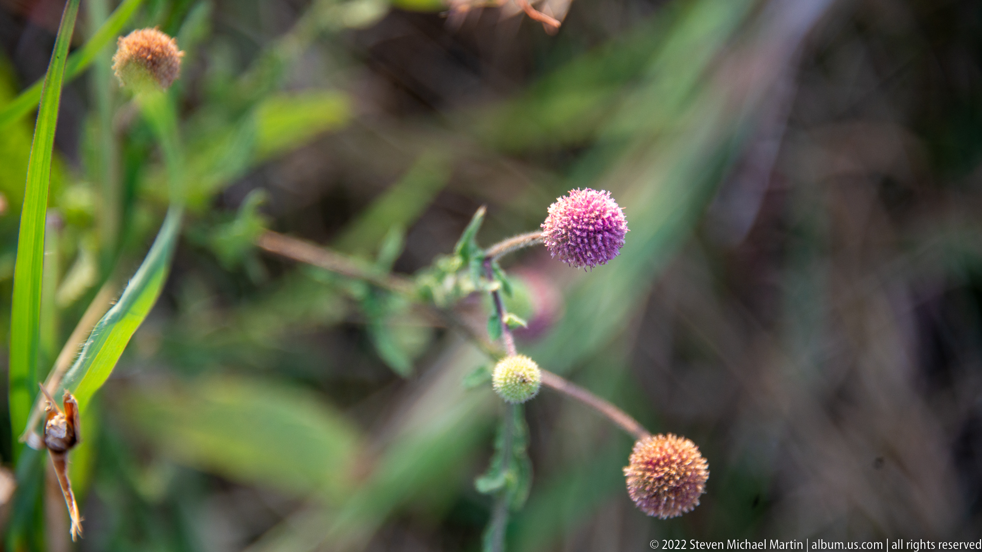
A small wildflower bears a rounded pink-purple flower head on a slender branching stem, with younger pale buds and a brown aging head nearby. The shallow depth of field isolates the plant against blurred green vegetation. Rather than identifying the species from the proof sheet alone, the photograph records the form and color of a low herb growing in the Victoria Falls landscape.
Caption
A small wildflower bears a rounded pink-purple flower head on a slender branching stem, with younger pale buds and a brown aging head nearby. The shallow depth of field isolates the plant against blurred green vegetation. Rather than identifying the species from the proof sheet alone, the photograph records the form and color of a low herb growing in the Victoria Falls landscape.
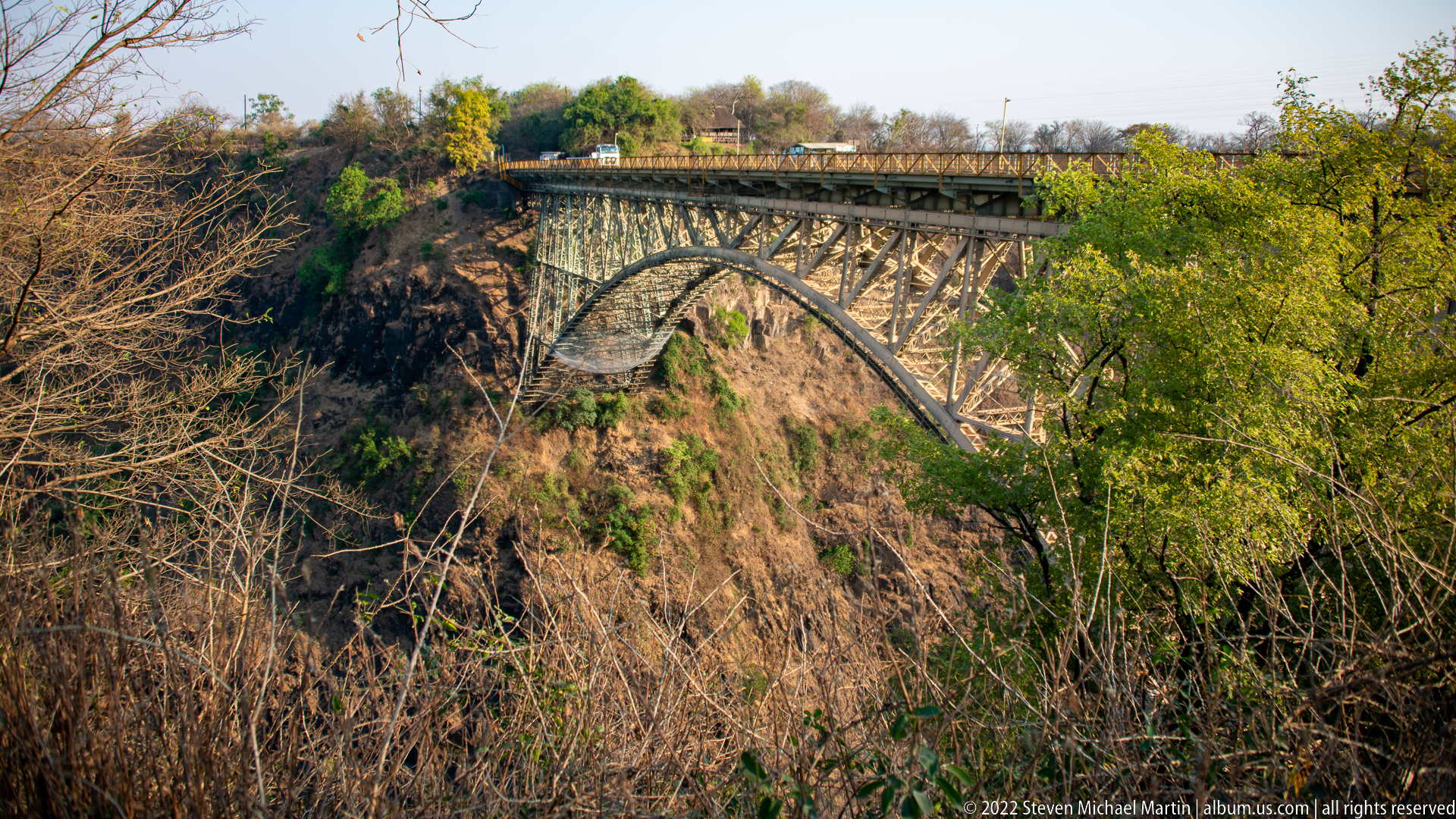
The Victoria Falls Bridge crosses the deep Zambezi gorge on a steel arch truss, seen from a vegetated rim below and to the side of the deck. Repeating lattice members form the arch and upper roadway structure, while dry-season scrub and trees partly frame the span. The bridge provides a strong human-made counterpoint to the basalt gorge and waterfall landscape surrounding Victoria Falls.
Caption
The Victoria Falls Bridge crosses the deep Zambezi gorge on a steel arch truss, seen from a vegetated rim below and to the side of the deck. Repeating lattice members form the arch and upper roadway structure, while dry-season scrub and trees partly frame the span. The bridge provides a strong human-made counterpoint to the basalt gorge and waterfall landscape surrounding Victoria Falls.

A tight macro view isolates a purple, spherical flower head composed of many small florets, with a pale green bud below and a brown mature head farther right. The background dissolves into soft bands of green and mauve, emphasizing the plant’s texture and branching stem. The proof sheet supports a detailed morphological description but not a secure species-level identification.
Caption
A tight macro view isolates a purple, spherical flower head composed of many small florets, with a pale green bud below and a brown mature head farther right. The background dissolves into soft bands of green and mauve, emphasizing the plant’s texture and branching stem. The proof sheet supports a detailed morphological description but not a secure species-level identification.
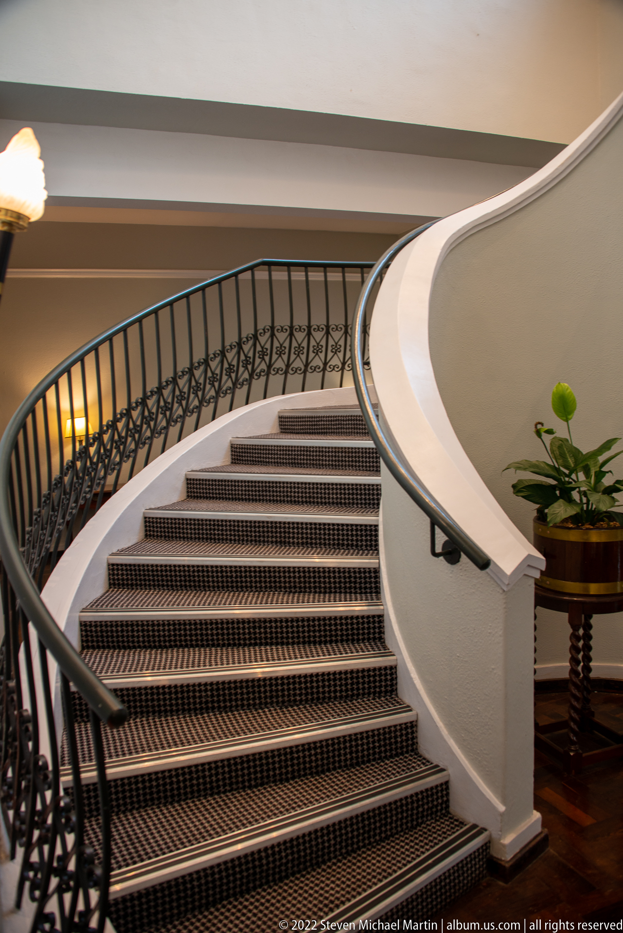
Viewed from lower on the flight, the hotel’s staircase becomes a study in sweeping curves: broad carpeted treads rise beneath a white plaster parapet while a black iron handrail follows the turn. The tighter framing removes most surrounding furniture and concentrates on the stair’s sculptural geometry, decorative metalwork, and contrast between pale walls and dark trim.
Caption
Viewed from lower on the flight, the hotel’s staircase becomes a study in sweeping curves: broad carpeted treads rise beneath a white plaster parapet while a black iron handrail follows the turn. The tighter framing removes most surrounding furniture and concentrates on the stair’s sculptural geometry, decorative metalwork, and contrast between pale walls and dark trim.
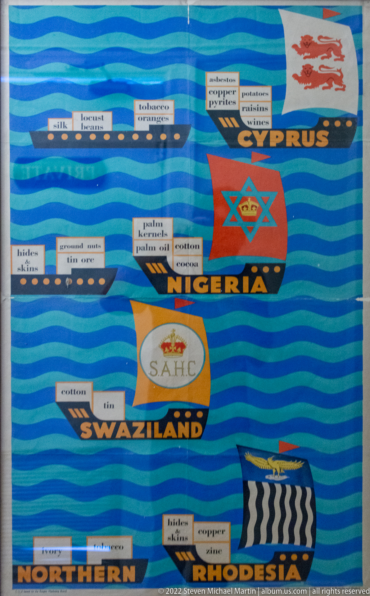
A closer section of the colonial trade display centers on Cyprus, Nigeria, Swaziland, and Northern Rhodesia. Historic emblems sit above rows of small labels naming imported or exported goods, while blue wave bands unify the composition. The tighter framing makes the economic theme more legible than in the wider panel and preserves period terminology used by the original display.
Caption
A closer section of the colonial trade display centers on Cyprus, Nigeria, Swaziland, and Northern Rhodesia. Historic emblems sit above rows of small labels naming imported or exported goods, while blue wave bands unify the composition. The tighter framing makes the economic theme more legible than in the wider panel and preserves period terminology used by the original display.
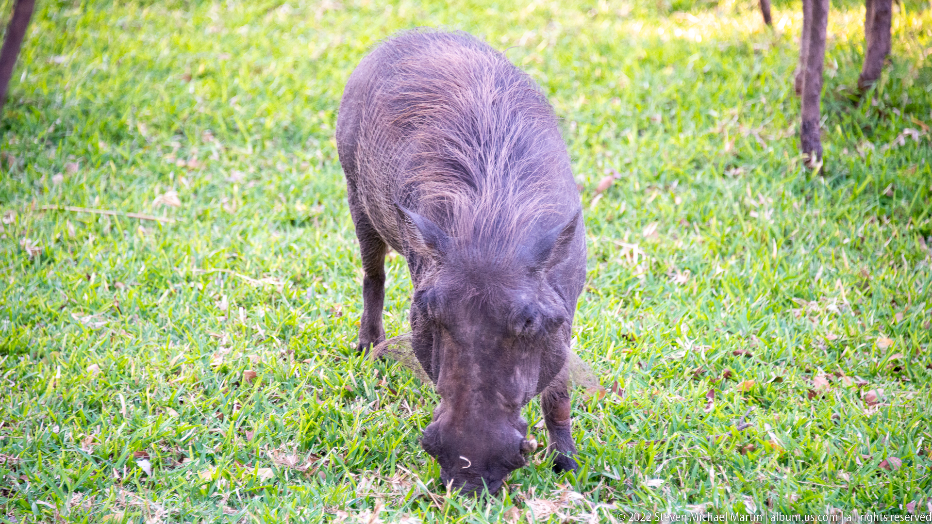
A warthog grazes head-down on closely cropped grass, its elongated face nearly buried in the turf. The low viewpoint brings out the animal’s coarse gray-brown coat, narrow legs, and bristled mane while keeping the setting deliberately simple. The scene records the close overlap between wildlife and landscaped green spaces around Victoria Falls.
Caption
A warthog grazes head-down on closely cropped grass, its elongated face nearly buried in the turf. The low viewpoint brings out the animal’s coarse gray-brown coat, narrow legs, and bristled mane while keeping the setting deliberately simple. The scene records the close overlap between wildlife and landscaped green spaces around Victoria Falls.
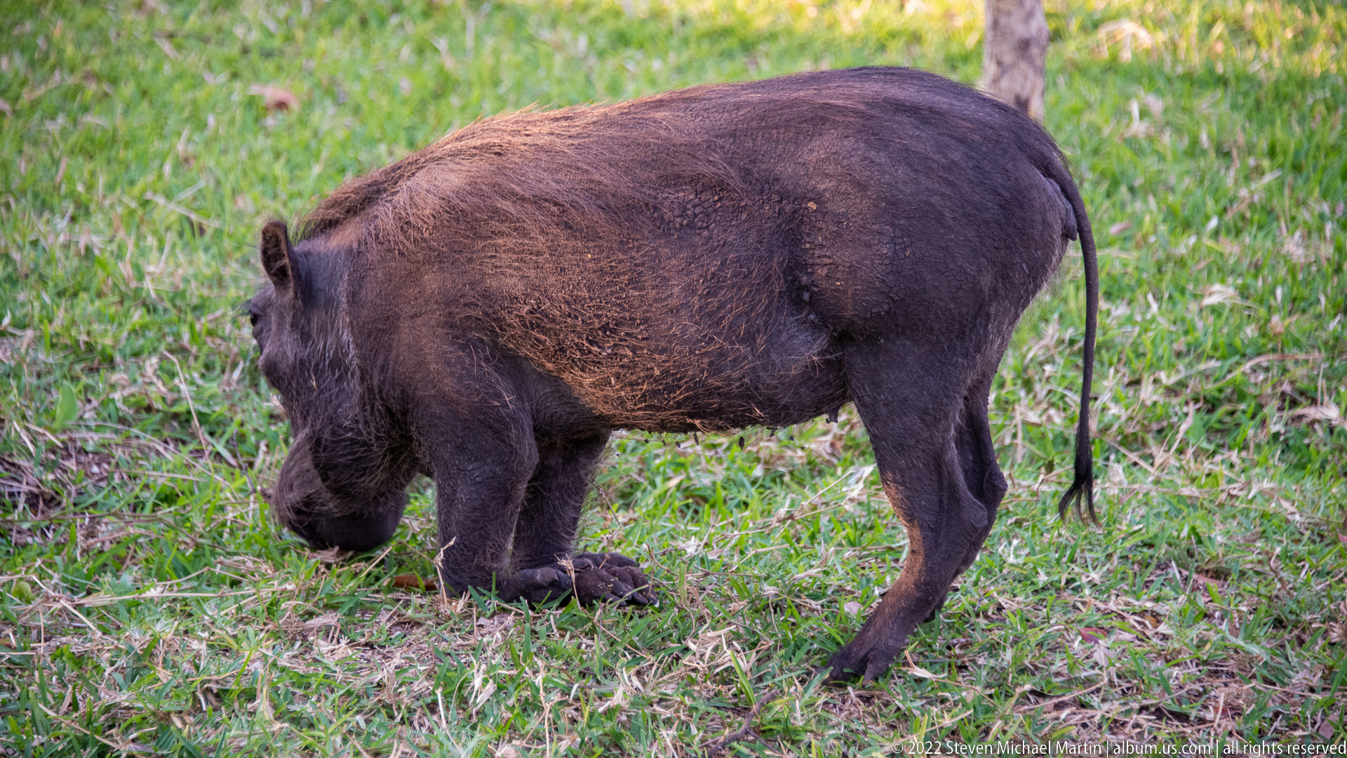
Seen broadside, a warthog pauses on a grassy verge with its head lowered and tail hanging straight behind. The profile reveals the barrel-shaped torso, coarse dark coat, short neck, and comparatively slender legs more clearly than the neighboring grazing views. The close study functions as a useful field-guide portrait of a familiar southern African ungulate.
Caption
Seen broadside, a warthog pauses on a grassy verge with its head lowered and tail hanging straight behind. The profile reveals the barrel-shaped torso, coarse dark coat, short neck, and comparatively slender legs more clearly than the neighboring grazing views. The close study functions as a useful field-guide portrait of a familiar southern African ungulate.
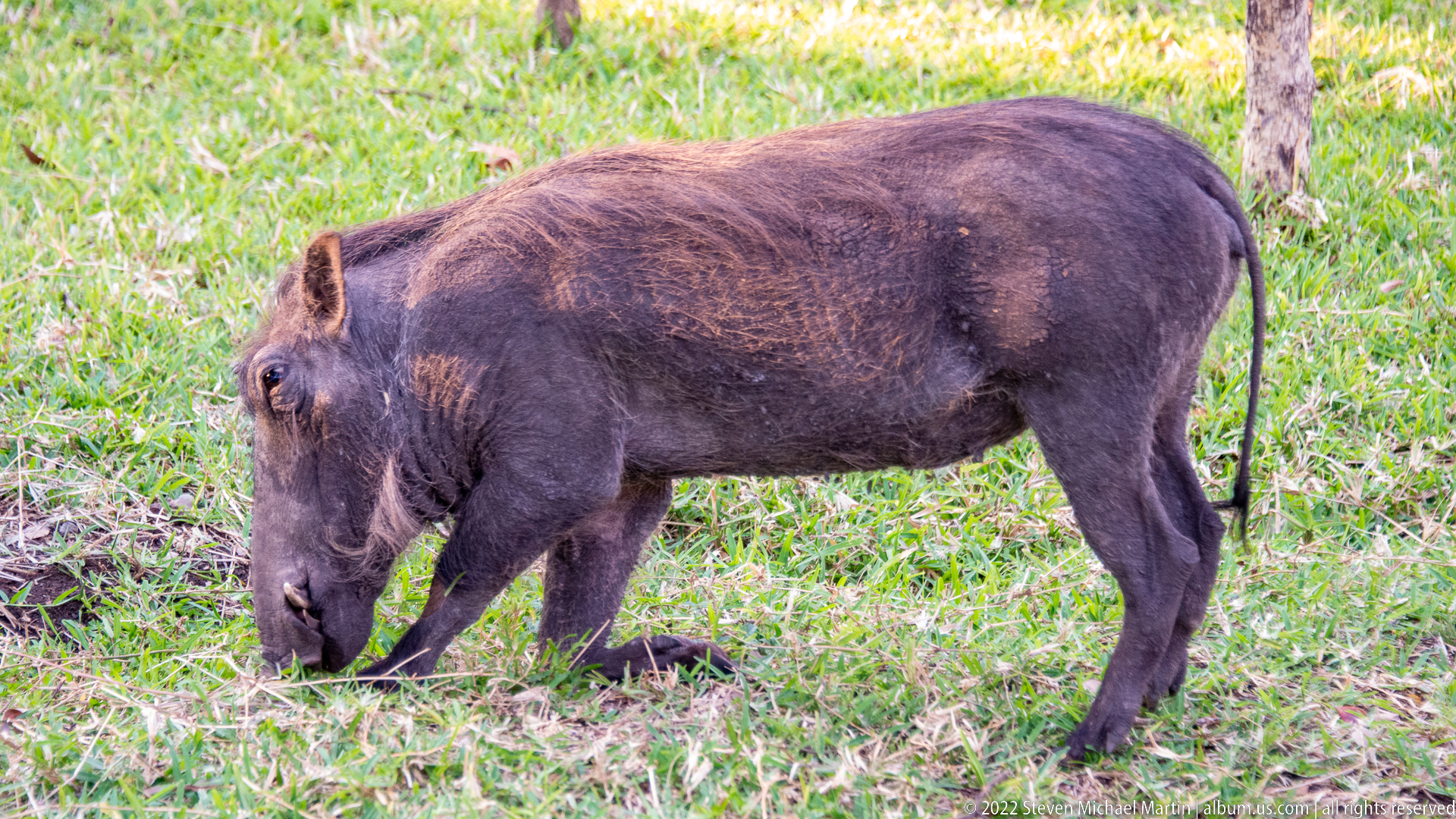
A warthog feeds beside a tree trunk, shown in a clean side profile that emphasizes the slope from shoulder to rump and the coarse ridge of hair along its back. Its snout is pressed close to the ground as it searches the turf. The image distinguishes feeding behavior and body structure from the more frontal and three-quarter views in this sequence.
Caption
A warthog feeds beside a tree trunk, shown in a clean side profile that emphasizes the slope from shoulder to rump and the coarse ridge of hair along its back. Its snout is pressed close to the ground as it searches the turf. The image distinguishes feeding behavior and body structure from the more frontal and three-quarter views in this sequence.
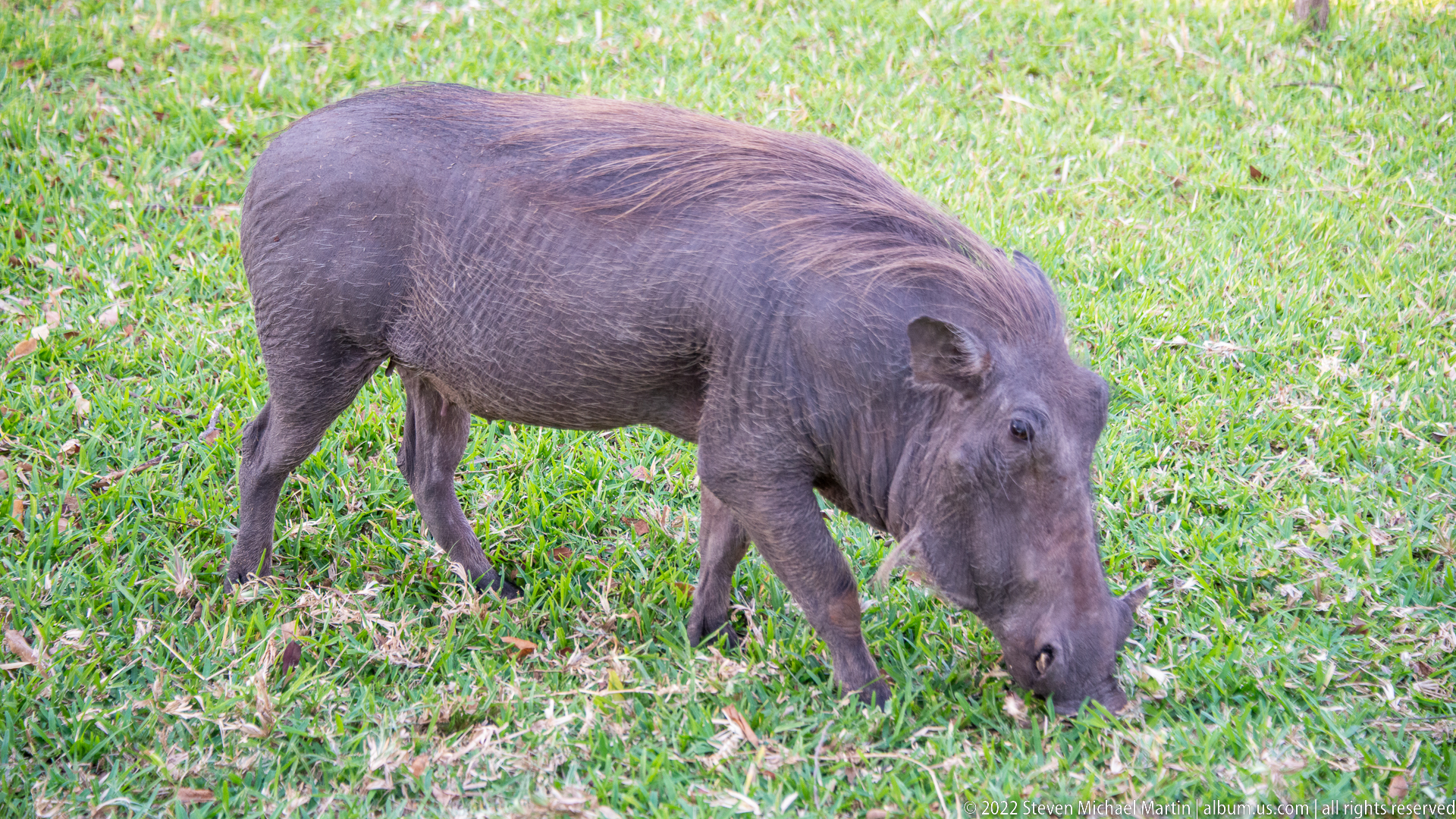
A warthog moves diagonally through the grass with its muzzle lowered, combining a feeding posture with a more open three-quarter view of the head and shoulders. Soft daylight reveals the sparse bristles along its back and the smooth, gray-brown skin of the flanks. The composition gives a stronger sense of movement than the adjacent static profile studies.
Caption
A warthog moves diagonally through the grass with its muzzle lowered, combining a feeding posture with a more open three-quarter view of the head and shoulders. Soft daylight reveals the sparse bristles along its back and the smooth, gray-brown skin of the flanks. The composition gives a stronger sense of movement than the adjacent static profile studies.
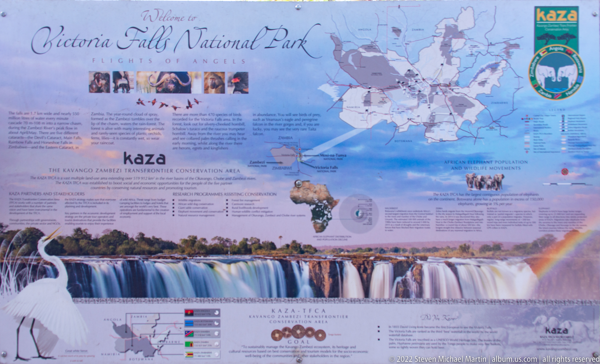
An interpretive panel presents the Kavango-Zambezi Transfrontier Conservation Area, commonly abbreviated KAZA, with maps, wildlife imagery, explanatory text, and a large photograph of Victoria Falls. The display links the falls to a much broader conservation landscape spanning national borders in southern Africa. Its map-based design turns regional ecology and protected-area cooperation into a compact visitor orientation.
Caption
An interpretive panel presents the Kavango-Zambezi Transfrontier Conservation Area, commonly abbreviated KAZA, with maps, wildlife imagery, explanatory text, and a large photograph of Victoria Falls. The display links the falls to a much broader conservation landscape spanning national borders in southern Africa. Its map-based design turns regional ecology and protected-area cooperation into a compact visitor orientation.

A large white blossom opens against glossy green leaves, its broad petals surrounding a dense cluster of yellow stamens. Shallow depth of field separates the flower from the softly mottled woodland background and turns the botanical detail into the dominant subject. The image records plant life around Victoria Falls without forcing a species identification from limited floral evidence.
Caption
A large white blossom opens against glossy green leaves, its broad petals surrounding a dense cluster of yellow stamens. Shallow depth of field separates the flower from the softly mottled woodland background and turns the botanical detail into the dominant subject. The image records plant life around Victoria Falls without forcing a species identification from limited floral evidence.
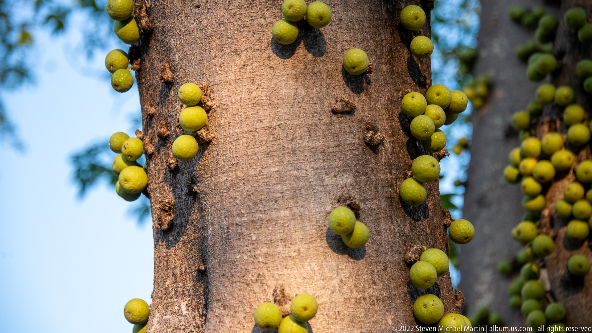
Small green, fig-like fruits emerge directly from the trunk and larger branches of a mature tree, an example of cauliflory in which flowers or fruits develop from older woody tissue rather than twig tips. The close view emphasizes their scattered attachment to smooth bark and the unusual relationship between fruit and trunk, a distinctive botanical detail in the Victoria Falls landscape.
Caption
Small green, fig-like fruits emerge directly from the trunk and larger branches of a mature tree, an example of cauliflory in which flowers or fruits develop from older woody tissue rather than twig tips. The close view emphasizes their scattered attachment to smooth bark and the unusual relationship between fruit and trunk, a distinctive botanical detail in the Victoria Falls landscape.
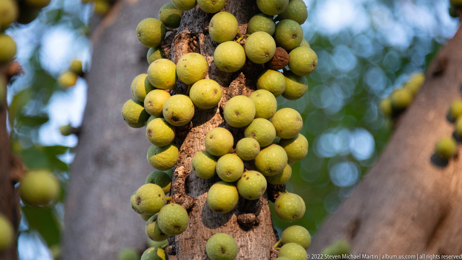
A dense cluster of round green fruits crowds a woody stem, creating a more concentrated study of the same cauliflorous growth seen nearby. Individual fruits vary slightly in size and maturity, while the shallow background keeps attention on their attachment directly to the bark. The photograph is especially useful for documenting fruiting habit rather than the overall form of the tree.
Caption
A dense cluster of round green fruits crowds a woody stem, creating a more concentrated study of the same cauliflorous growth seen nearby. Individual fruits vary slightly in size and maturity, while the shallow background keeps attention on their attachment directly to the bark. The photograph is especially useful for documenting fruiting habit rather than the overall form of the tree.
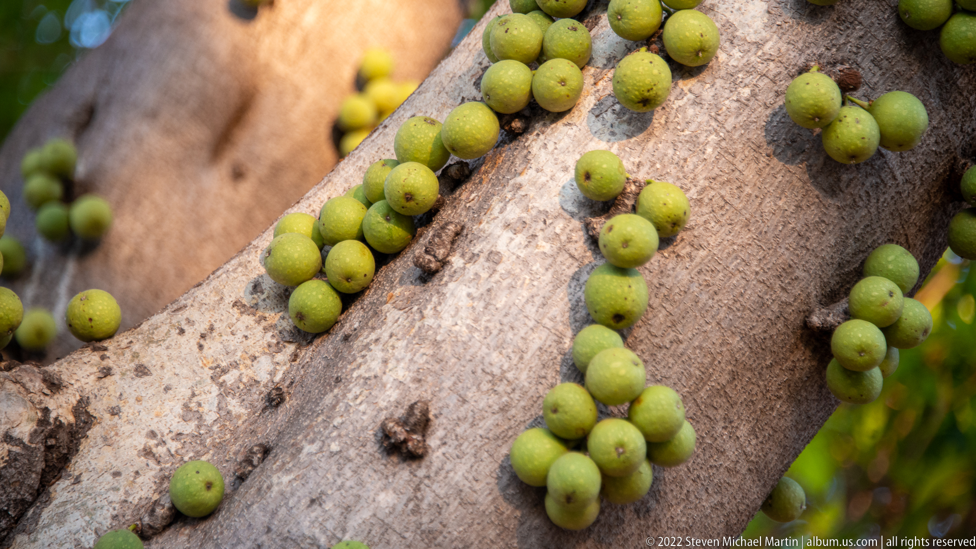
Round green fruits trace the surface of a sloping trunk and branch junction, spaced more openly than in the adjacent clustered view. Their direct attachment to older wood makes the cauliflorous growth pattern easy to read. By widening the composition slightly, the photograph shows how the fruits are distributed along the tree rather than presenting only a dense botanical close-up.
Caption
Round green fruits trace the surface of a sloping trunk and branch junction, spaced more openly than in the adjacent clustered view. Their direct attachment to older wood makes the cauliflorous growth pattern easy to read. By widening the composition slightly, the photograph shows how the fruits are distributed along the tree rather than presenting only a dense botanical close-up.
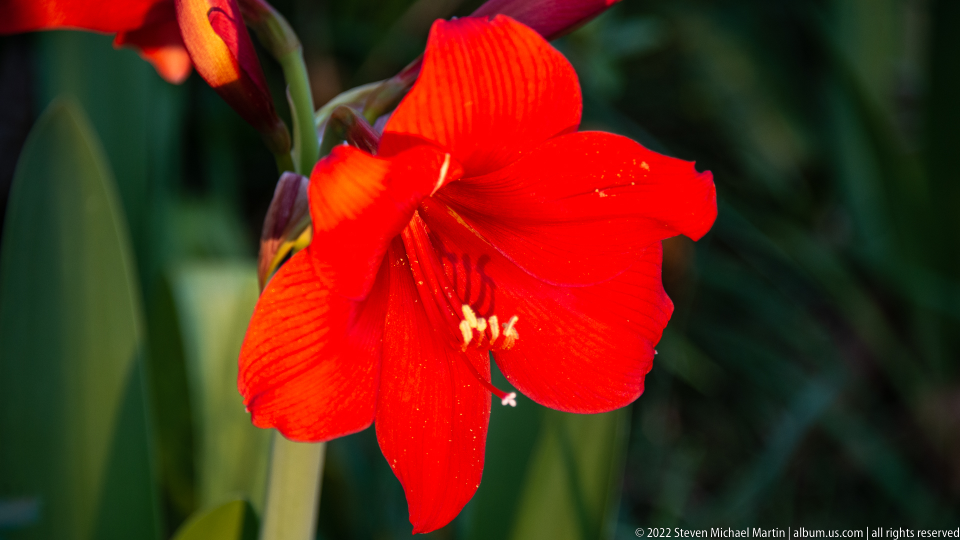
A vivid red trumpet-shaped flower fills the frame, its broad overlapping petals and projecting stamens set against deep green foliage. The close crop isolates color, form, and reproductive structures rather than the plant as a whole. Its cultivated appearance suggests ornamental planting in the Victoria Falls hotel landscape, though the proof-sheet view does not warrant a firm species identification.
Caption
A vivid red trumpet-shaped flower fills the frame, its broad overlapping petals and projecting stamens set against deep green foliage. The close crop isolates color, form, and reproductive structures rather than the plant as a whole. Its cultivated appearance suggests ornamental planting in the Victoria Falls hotel landscape, though the proof-sheet view does not warrant a firm species identification.
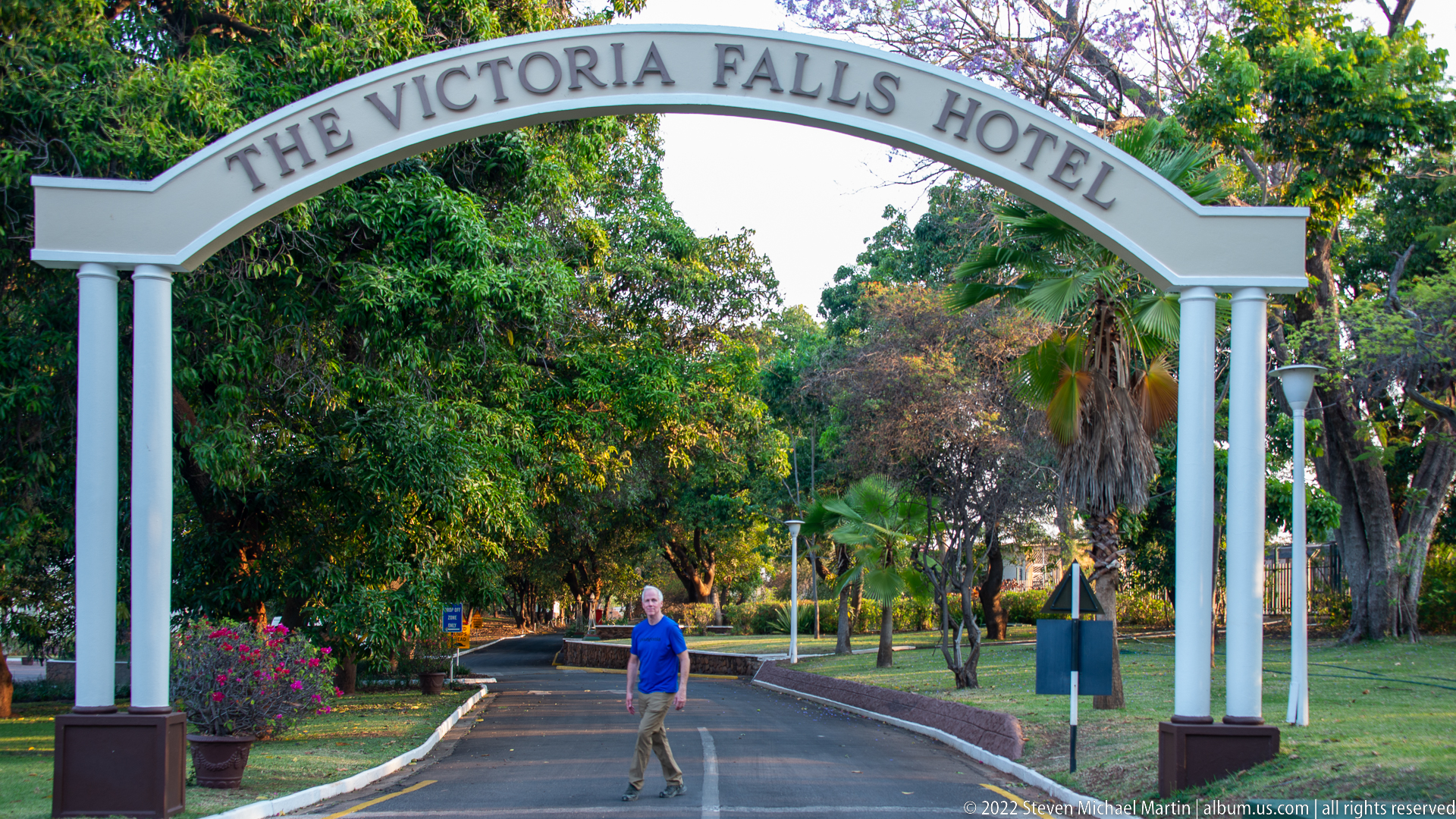
A white entrance arch marked “Victoria Falls Hotel” spans the tree-lined approach road, framing a pedestrian and the landscaped grounds beyond. The sign functions as both threshold and visual marker for the historic hotel property. Palms, flowering shrubs, lawns, and mature shade trees soften the formal geometry of the columns and curved pediment.
Caption
A white entrance arch marked “Victoria Falls Hotel” spans the tree-lined approach road, framing a pedestrian and the landscaped grounds beyond. The sign functions as both threshold and visual marker for the historic hotel property. Palms, flowering shrubs, lawns, and mature shade trees soften the formal geometry of the columns and curved pediment.
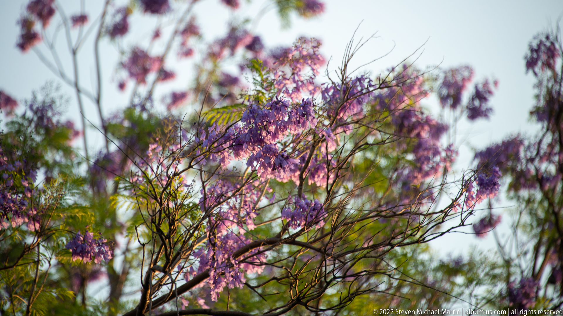
Clusters of lavender-purple blossoms hang from a fine-branched ornamental tree against bright sky and soft green foliage. The photograph uses shallow focus to isolate the flowering canopy and convey the lush garden setting around The Victoria Falls Hotel. The species is not asserted from the proof sheet, but the image clearly records one of the property’s conspicuous flowering trees.
Caption
Clusters of lavender-purple blossoms hang from a fine-branched ornamental tree against bright sky and soft green foliage. The photograph uses shallow focus to isolate the flowering canopy and convey the lush garden setting around The Victoria Falls Hotel. The species is not asserted from the proof sheet, but the image clearly records one of the property’s conspicuous flowering trees.
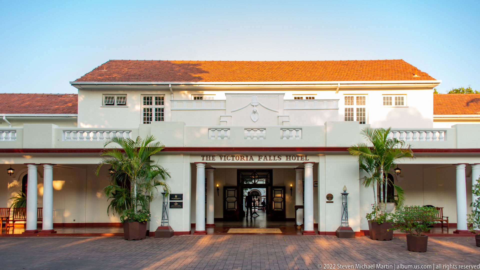
The main entrance of The Victoria Falls Hotel presents a symmetrical white façade beneath a red-tiled roof, with a columned veranda, palms, and the hotel name centered above the doorway. Low morning or evening light warms the upper walls and roofline. The frontal composition records the building’s formal resort architecture and clearly establishes the property before the interior sequence that follows.
Caption
The main entrance of The Victoria Falls Hotel presents a symmetrical white façade beneath a red-tiled roof, with a columned veranda, palms, and the hotel name centered above the doorway. Low morning or evening light warms the upper walls and roofline. The frontal composition records the building’s formal resort architecture and clearly establishes the property before the interior sequence that follows.

Fresh flower arrangements in tall glass vases form the centerpiece of a polished corridor inside The Victoria Falls Hotel. Dark timber counters and trim line the space, while signage for the activity desk and adjoining service areas establishes its reception function. The restrained palette of cream walls, wood, stone flooring, and greenery gives the interior a formal but welcoming character.
Caption
Fresh flower arrangements in tall glass vases form the centerpiece of a polished corridor inside The Victoria Falls Hotel. Dark timber counters and trim line the space, while signage for the activity desk and adjoining service areas establishes its reception function. The restrained palette of cream walls, wood, stone flooring, and greenery gives the interior a formal but welcoming character.

Dark wood display cases and a long counter define the activity-desk corridor inside The Victoria Falls Hotel. Arched openings, a hanging light, and a glimpse into a brightly stocked room add depth to the narrow composition. Compared with the floral lobby view, this photograph concentrates on guest-service functions and the hotel’s crafted timber fittings.
Caption
Dark wood display cases and a long counter define the activity-desk corridor inside The Victoria Falls Hotel. Arched openings, a hanging light, and a glimpse into a brightly stocked room add depth to the narrow composition. Compared with the floral lobby view, this photograph concentrates on guest-service functions and the hotel’s crafted timber fittings.
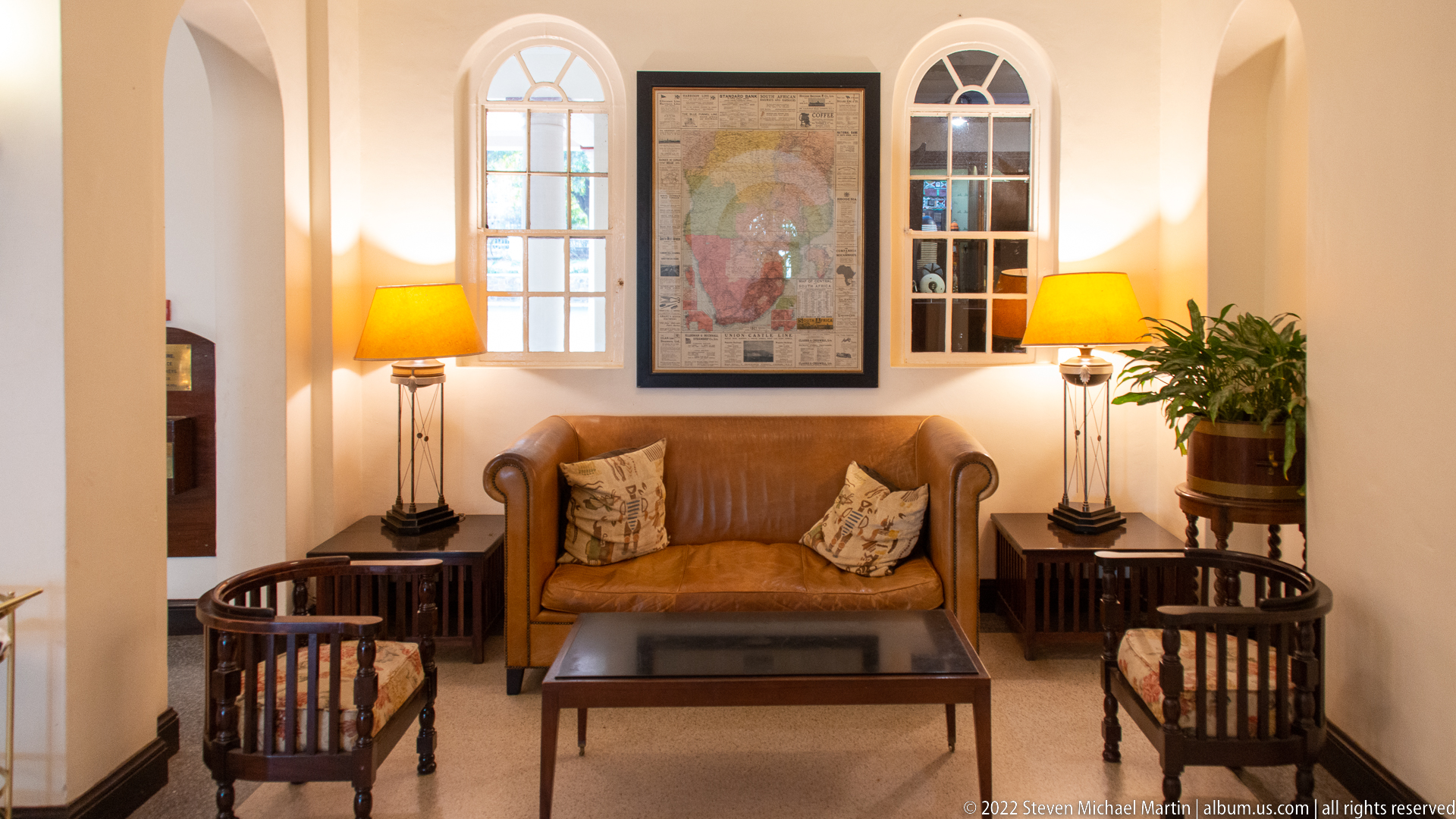
A compact sitting alcove pairs a tan leather settee with dark wooden chairs, matching side tables, shaded lamps, and a framed map between tall arched windows. The balanced arrangement and warm lighting create a residential scale within the larger hotel interior. Decorative cushions, potted greenery, and polished wood reinforce the historic resort atmosphere without overwhelming the functional seating area.
Caption
A compact sitting alcove pairs a tan leather settee with dark wooden chairs, matching side tables, shaded lamps, and a framed map between tall arched windows. The balanced arrangement and warm lighting create a residential scale within the larger hotel interior. Decorative cushions, potted greenery, and polished wood reinforce the historic resort atmosphere without overwhelming the functional seating area.
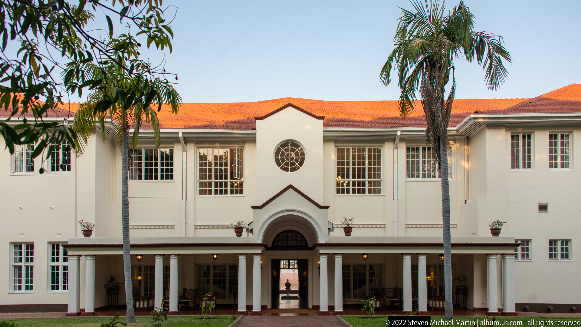
The garden-side elevation of The Victoria Falls Hotel rises behind a lawn and tall palms, its white walls articulated by gridded windows, a central arched entrance, and a red-tiled roof. A circular window above the entrance gives the middle bay added emphasis. The straight-on composition contrasts with the more ceremonial front façade by presenting a quieter garden-facing side of the property.
Caption
The garden-side elevation of The Victoria Falls Hotel rises behind a lawn and tall palms, its white walls articulated by gridded windows, a central arched entrance, and a red-tiled roof. A circular window above the entrance gives the middle bay added emphasis. The straight-on composition contrasts with the more ceremonial front façade by presenting a quieter garden-facing side of the property.
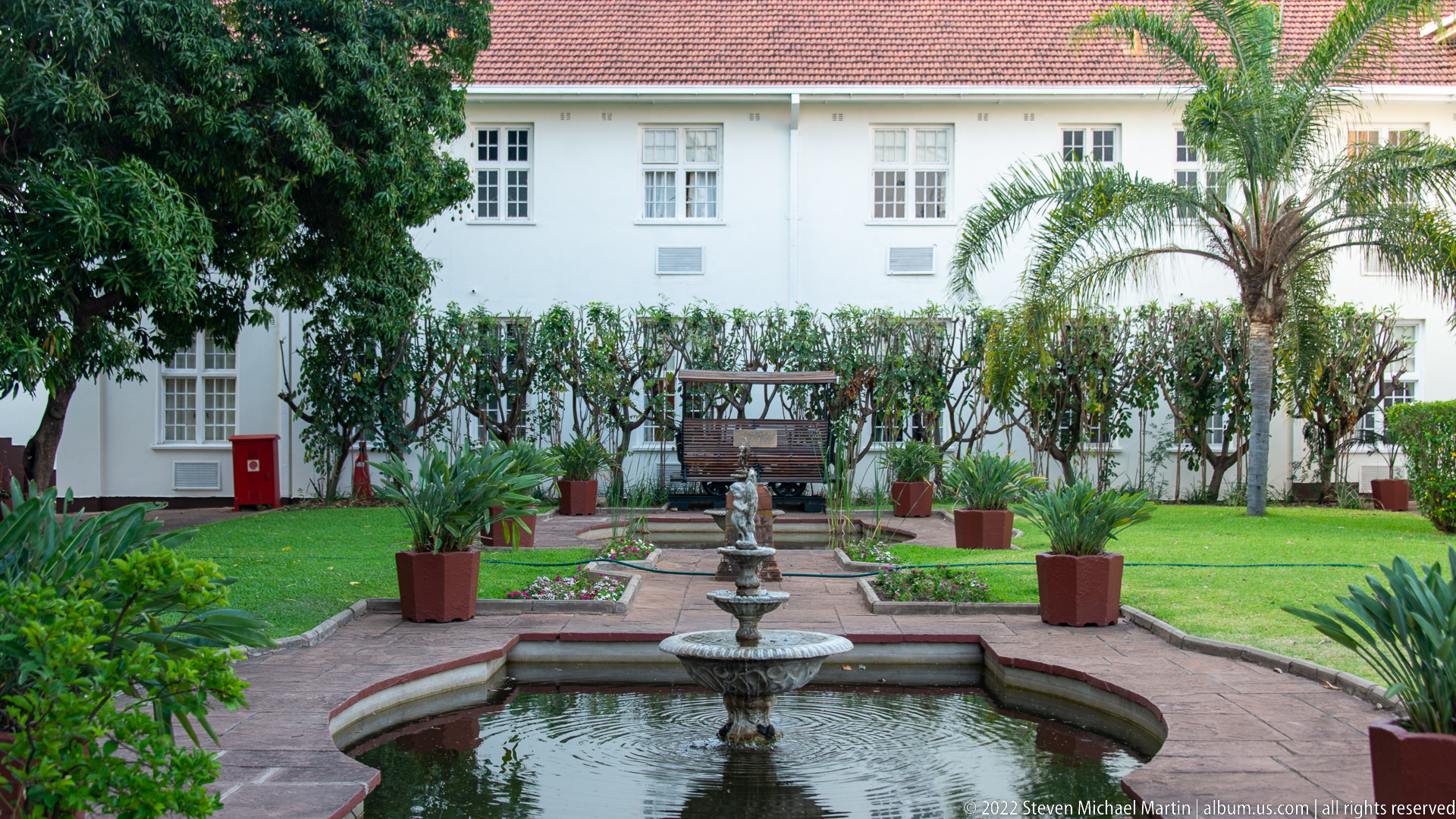
A tiered fountain anchors a formal courtyard garden at The Victoria Falls Hotel, aligned along a brick path toward the white hotel wing beyond. Clipped shrubs, potted plants, palms, and lawn create a symmetrical garden framework around the water basin. The image emphasizes the property’s landscaped interior court rather than its monumental exterior façades.
Caption
A tiered fountain anchors a formal courtyard garden at The Victoria Falls Hotel, aligned along a brick path toward the white hotel wing beyond. Clipped shrubs, potted plants, palms, and lawn create a symmetrical garden framework around the water basin. The image emphasizes the property’s landscaped interior court rather than its monumental exterior façades.
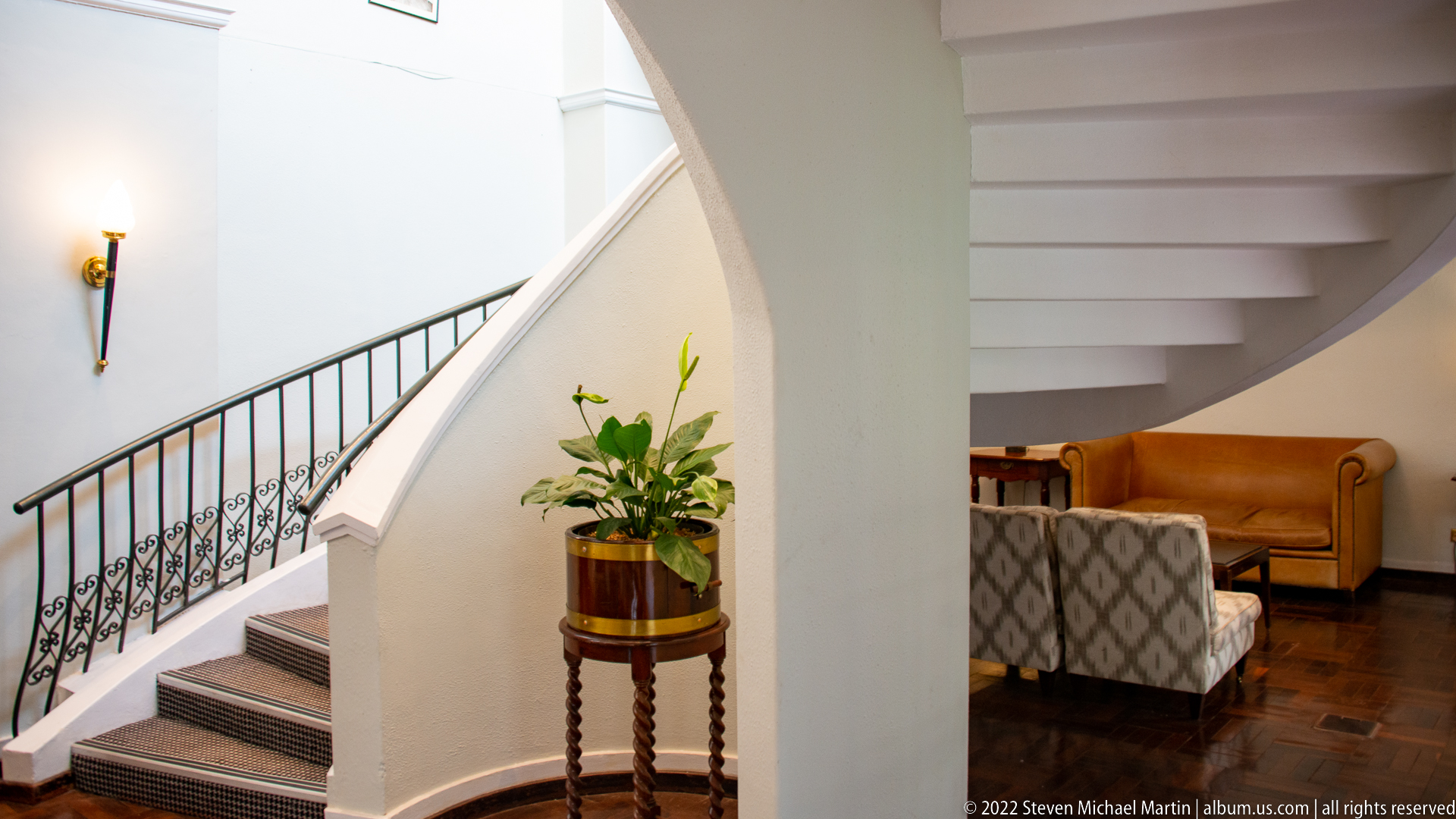
A sweeping white staircase curves upward beside a black wrought-iron balustrade, with a potted plant marking the transition to a small lounge furnished in warm tan upholstery. The composition uses the arching wall and stair geometry to lead the eye through the interior. Its restrained materials—white plaster, dark wood flooring, ironwork, and leather—create an elegant circulation space.
Caption
A sweeping white staircase curves upward beside a black wrought-iron balustrade, with a potted plant marking the transition to a small lounge furnished in warm tan upholstery. The composition uses the arching wall and stair geometry to lead the eye through the interior. Its restrained materials—white plaster, dark wood flooring, ironwork, and leather—create an elegant circulation space.
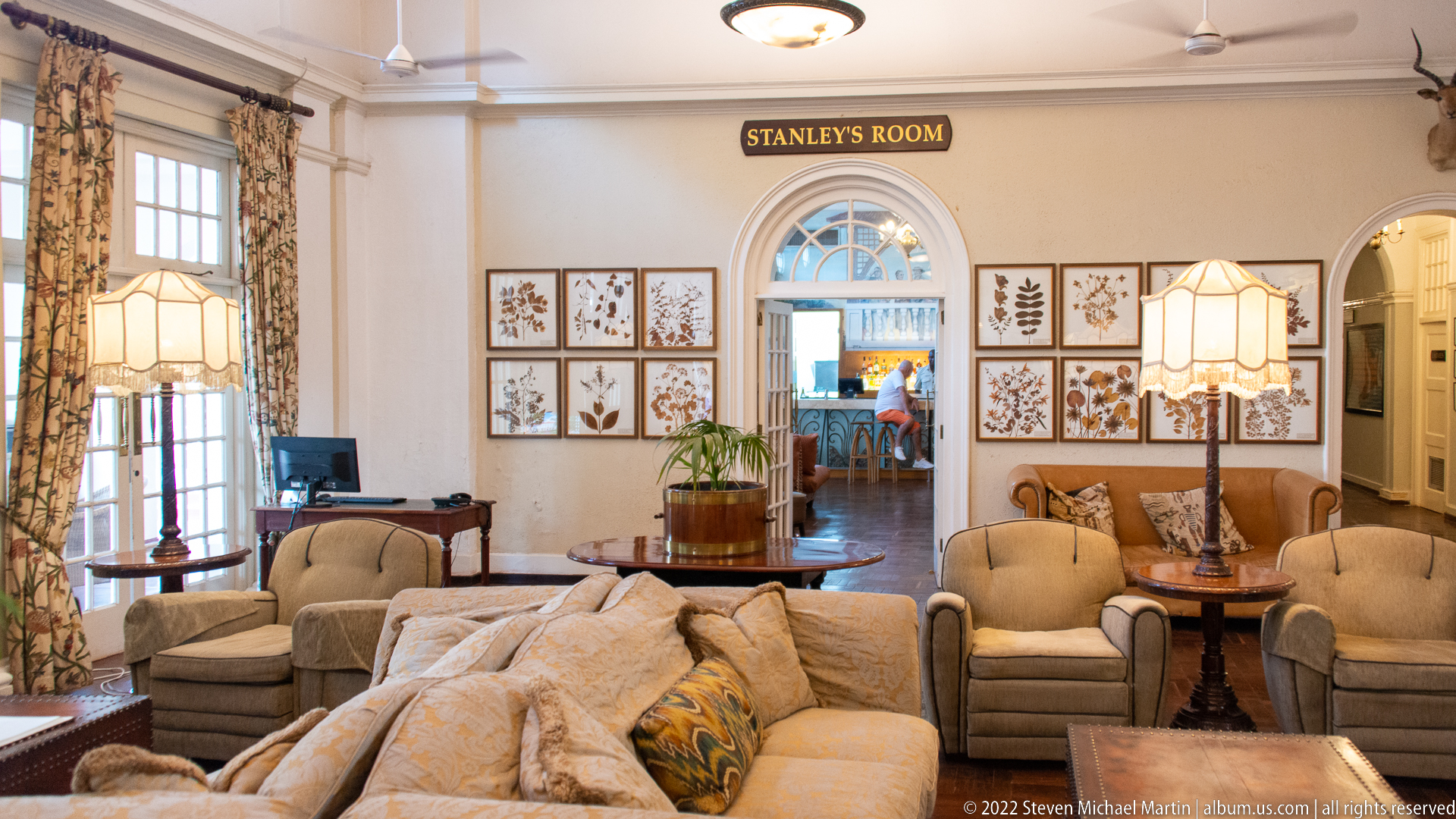
Stanley’s Room at The Victoria Falls Hotel is arranged as a generous lounge of cream sofas and armchairs, patterned curtains, shaded lamps, framed botanical studies, and polished dark-wood tables. The room name is clearly marked above the central archway. Its layered seating groups and traditional decorative program present a formal social interior closely tied to the hotel’s historic identity.
Caption
Stanley’s Room at The Victoria Falls Hotel is arranged as a generous lounge of cream sofas and armchairs, patterned curtains, shaded lamps, framed botanical studies, and polished dark-wood tables. The room name is clearly marked above the central archway. Its layered seating groups and traditional decorative program present a formal social interior closely tied to the hotel’s historic identity.
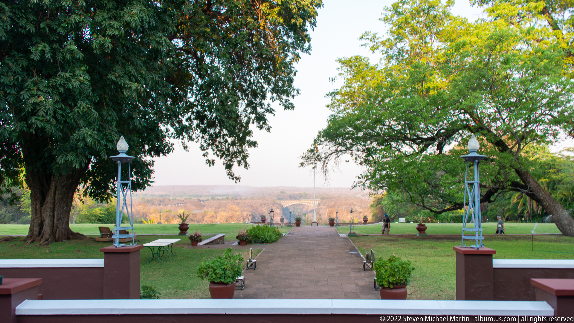
From the hotel terrace, a straight garden path runs between lawns, potted plants, ornamental standards, and mature shade trees toward the hazy landscape beyond. The carefully framed axis creates a formal transition from hotel grounds to the broader Victoria Falls setting. Human figures at the far end provide scale while leaving the garden vista as the dominant subject.
Caption
From the hotel terrace, a straight garden path runs between lawns, potted plants, ornamental standards, and mature shade trees toward the hazy landscape beyond. The carefully framed axis creates a formal transition from hotel grounds to the broader Victoria Falls setting. Human figures at the far end provide scale while leaving the garden vista as the dominant subject.
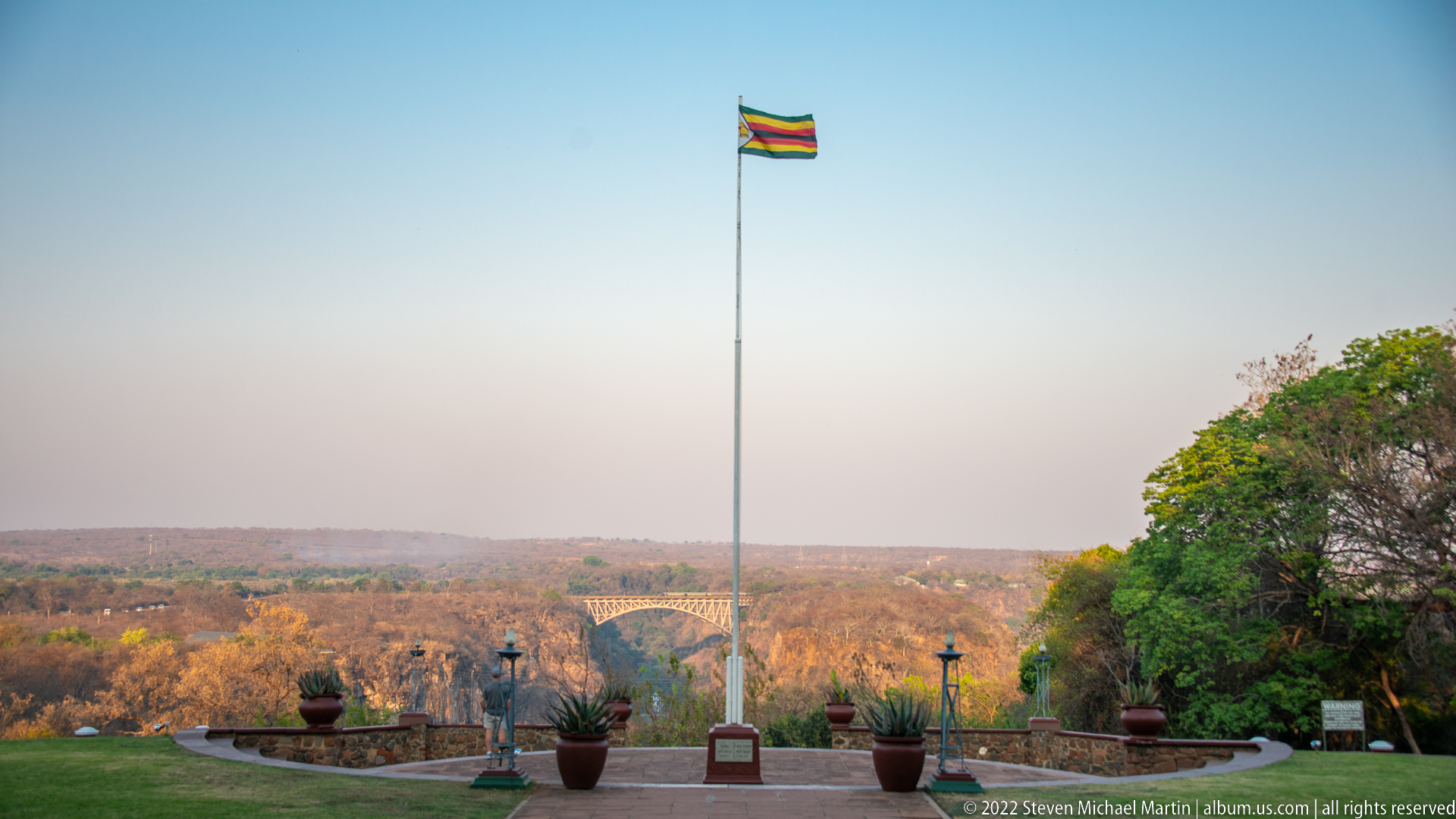
The Zimbabwe national flag flies from a tall central pole above the landscaped grounds of The Victoria Falls Hotel, with the garden terrace and distant gorge country spread below. The flag’s green, yellow, red, black, and white bands are distinct against a clear blue sky. Its elevated placement turns a garden viewpoint into a concise statement of place.
Caption
The Zimbabwe national flag flies from a tall central pole above the landscaped grounds of The Victoria Falls Hotel, with the garden terrace and distant gorge country spread below. The flag’s green, yellow, red, black, and white bands are distinct against a clear blue sky. Its elevated placement turns a garden viewpoint into a concise statement of place.

Zimbabwe’s national flag billows strongly against a clear blue sky, its green, yellow, red, and black stripes twisting around the white hoist triangle with the Zimbabwe Bird emblem. The tight crop removes the surrounding hotel grounds and concentrates on movement, color, and national symbolism. Folds in the fabric make the flag feel dynamic rather than diagrammatic.
Caption
Zimbabwe’s national flag billows strongly against a clear blue sky, its green, yellow, red, and black stripes twisting around the white hoist triangle with the Zimbabwe Bird emblem. The tight crop removes the surrounding hotel grounds and concentrates on movement, color, and national symbolism. Folds in the fabric make the flag feel dynamic rather than diagrammatic.
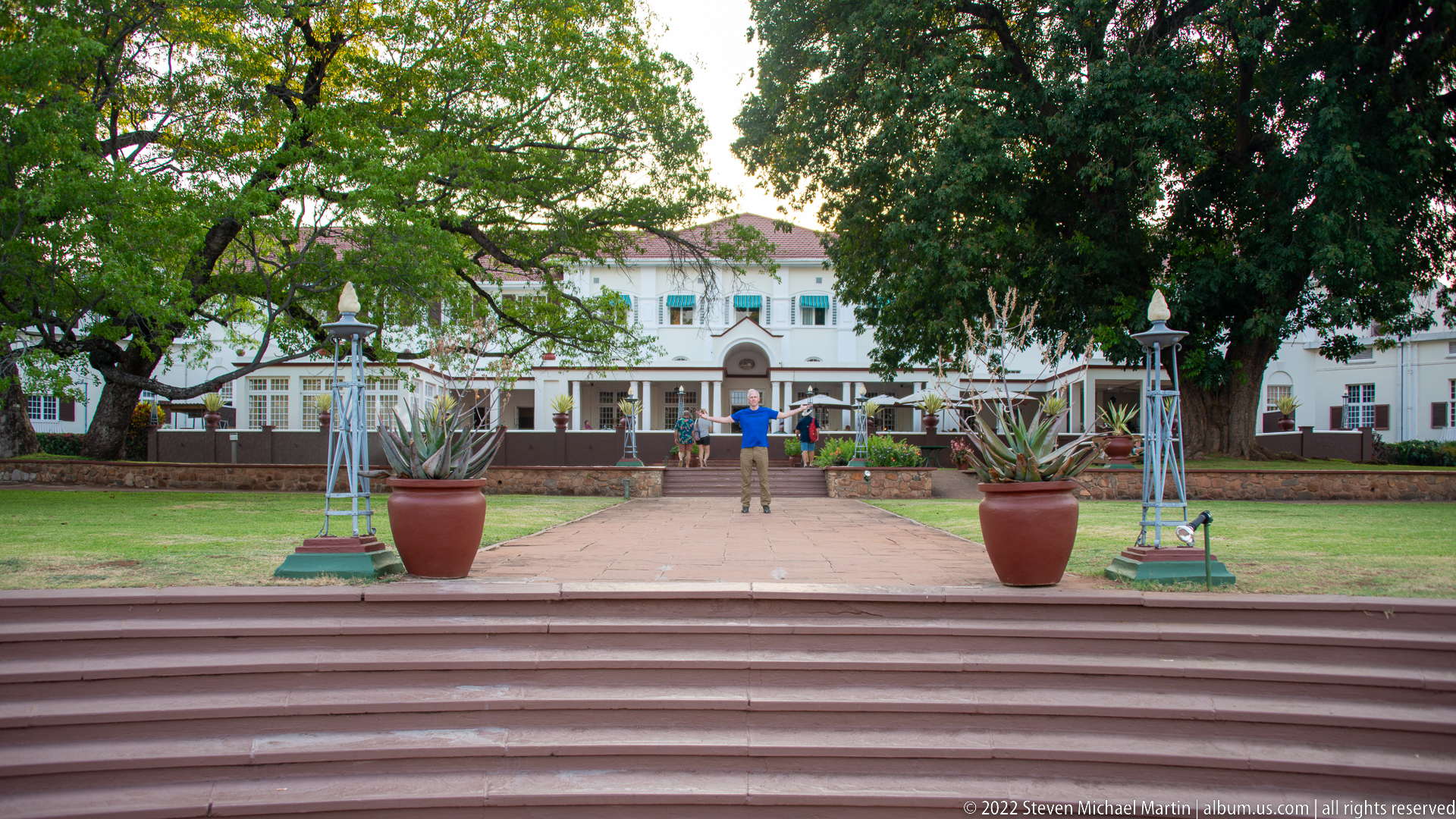
Broad steps descend to a straight garden path leading toward The Victoria Falls Hotel, framed by large potted succulents, ornamental standards, and mature trees. A person standing on the axis provides scale and reinforces the strong symmetry. From this lower garden viewpoint, the white hotel façade appears as the terminus of a deliberately composed landscape approach.
Caption
Broad steps descend to a straight garden path leading toward The Victoria Falls Hotel, framed by large potted succulents, ornamental standards, and mature trees. A person standing on the axis provides scale and reinforces the strong symmetry. From this lower garden viewpoint, the white hotel façade appears as the terminus of a deliberately composed landscape approach.
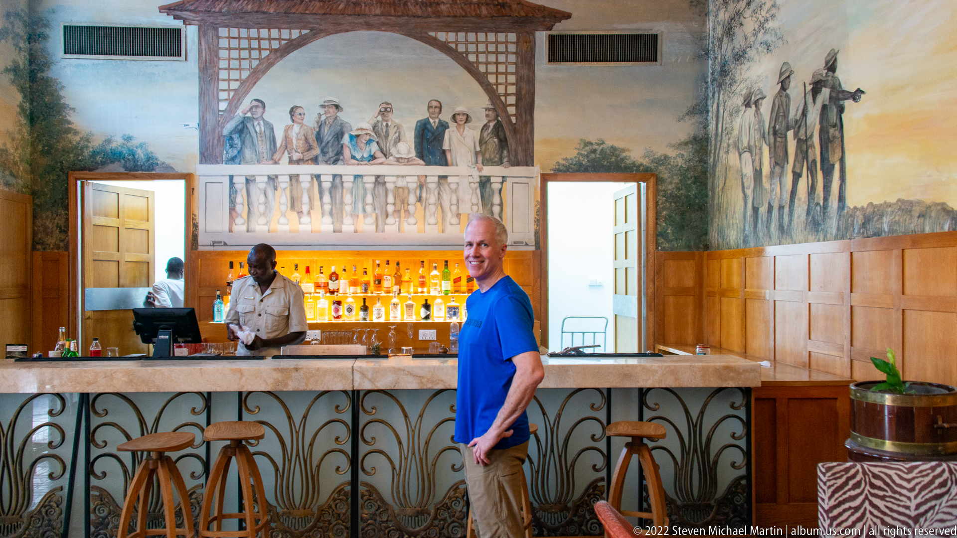
A polished bar at The Victoria Falls Hotel is backed by a glowing display of bottles and surrounded by large wall murals depicting groups of travelers and African figures in period dress. Decorative ironwork fronts the counter, while wood paneling and painted scenes give the room a strong historical theme. A bartender and guest provide a contemporary counterpoint to the nostalgic imagery above them.
Caption
A polished bar at The Victoria Falls Hotel is backed by a glowing display of bottles and surrounded by large wall murals depicting groups of travelers and African figures in period dress. Decorative ironwork fronts the counter, while wood paneling and painted scenes give the room a strong historical theme. A bartender and guest provide a contemporary counterpoint to the nostalgic imagery above them.
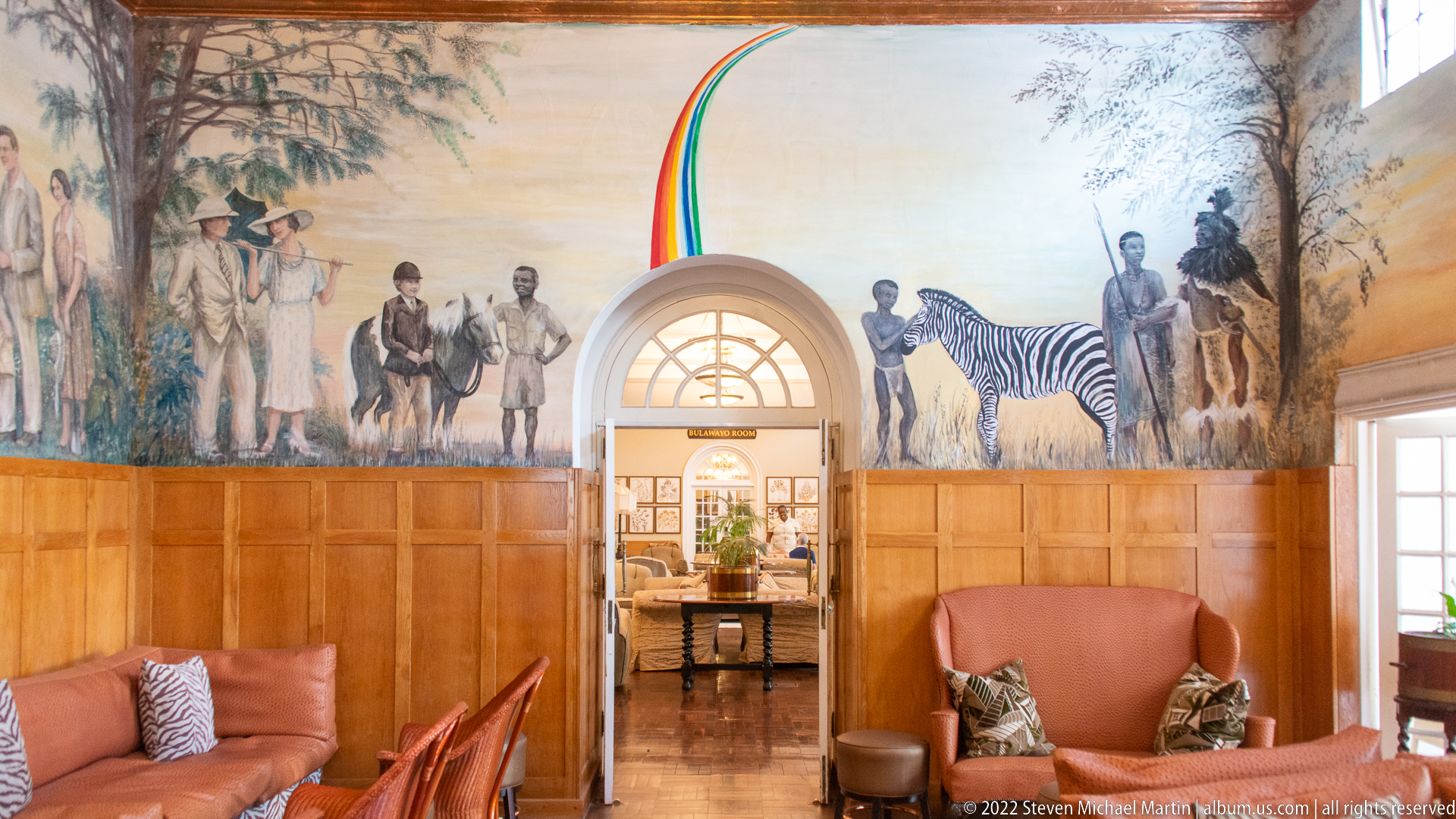
A mural-lined lounge passage at The Victoria Falls Hotel surrounds an arched doorway with painted figures, a zebra, and safari-era travelers rendered across the upper walls. Dark wood paneling grounds the decorative cycle, while leather seating occupies the foreground. The centered doorway creates a strong axial composition and frames a view into the adjoining room beyond.
Caption
A mural-lined lounge passage at The Victoria Falls Hotel surrounds an arched doorway with painted figures, a zebra, and safari-era travelers rendered across the upper walls. Dark wood paneling grounds the decorative cycle, while leather seating occupies the foreground. The centered doorway creates a strong axial composition and frames a view into the adjoining room beyond.
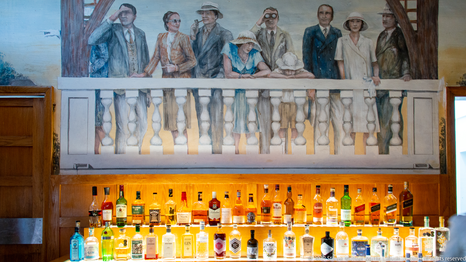
Rows of illuminated bottles form a bright horizontal band beneath a painted balcony populated by travelers in period clothing. The mural’s fictive balustrade visually extends the architecture of the bar, making painted spectators appear to overlook the counter below. This tighter view isolates the relationship between decorative narrative, wood paneling, and the working bar rather than the room as a whole.
Caption
Rows of illuminated bottles form a bright horizontal band beneath a painted balcony populated by travelers in period clothing. The mural’s fictive balustrade visually extends the architecture of the bar, making painted spectators appear to overlook the counter below. This tighter view isolates the relationship between decorative narrative, wood paneling, and the working bar rather than the room as a whole.
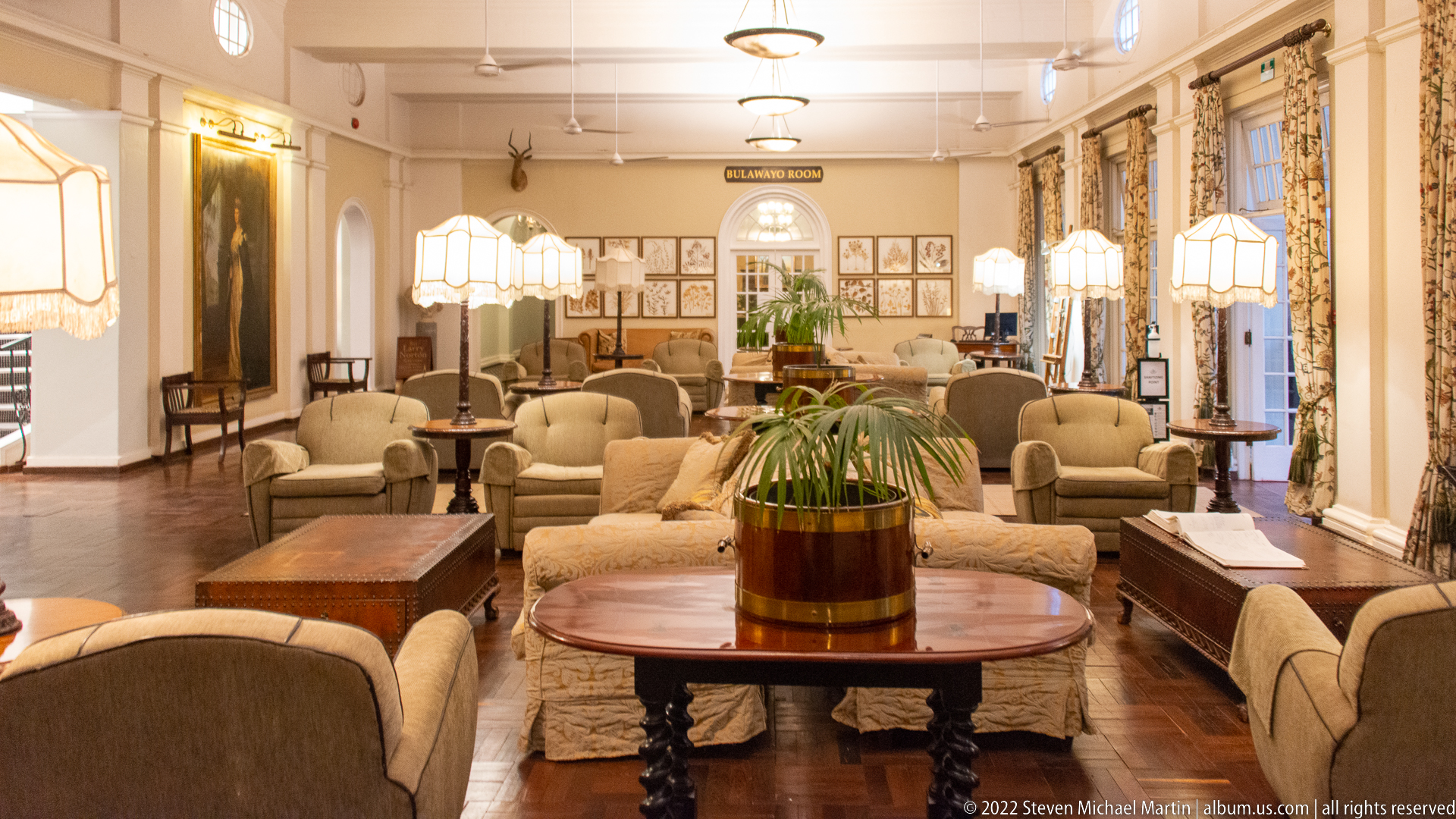
A wide view of Stanley’s Room shows its layered arrangement of cream sofas and armchairs, dark wood tables, shaded lamps, patterned curtains, framed botanical studies, and polished parquet flooring. The room name is visible above the far archway, anchoring the identification. Compared with the closer lounge view, this composition emphasizes the room’s depth, multiple seating groups, and formal symmetry.
Caption
A wide view of Stanley’s Room shows its layered arrangement of cream sofas and armchairs, dark wood tables, shaded lamps, patterned curtains, framed botanical studies, and polished parquet flooring. The room name is visible above the far archway, anchoring the identification. Compared with the closer lounge view, this composition emphasizes the room’s depth, multiple seating groups, and formal symmetry.

Eight framed botanical specimens form a tightly ordered wall display, each presenting pressed leaves, flowers, or seed structures against pale paper. The arrangement turns local plant material into decorative natural-history imagery within the hotel interior. Differences in leaf shape, branching pattern, and flowering structure make each panel distinct while the uniform wooden frames bind them into a single curated ensemble.
Caption
Eight framed botanical specimens form a tightly ordered wall display, each presenting pressed leaves, flowers, or seed structures against pale paper. The arrangement turns local plant material into decorative natural-history imagery within the hotel interior. Differences in leaf shape, branching pattern, and flowering structure make each panel distinct while the uniform wooden frames bind them into a single curated ensemble.
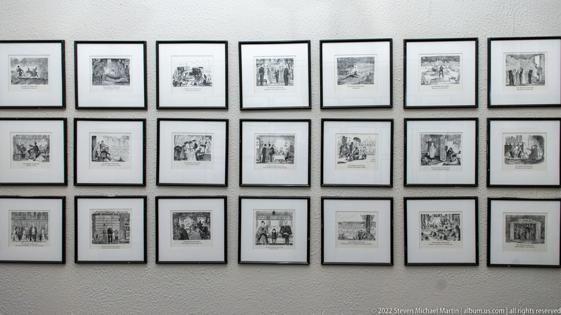
A grid of small monochrome prints covers a pale wall in an orderly museum-like arrangement. Individual scenes appear to include travelers, buildings, landscapes, and groups of figures, suggesting a historical visual narrative connected with the hotel and region. The photograph emphasizes the serial presentation and archival character of the display rather than any single print, whose captions are too small to read reliably.
Caption
A grid of small monochrome prints covers a pale wall in an orderly museum-like arrangement. Individual scenes appear to include travelers, buildings, landscapes, and groups of figures, suggesting a historical visual narrative connected with the hotel and region. The photograph emphasizes the serial presentation and archival character of the display rather than any single print, whose captions are too small to read reliably.
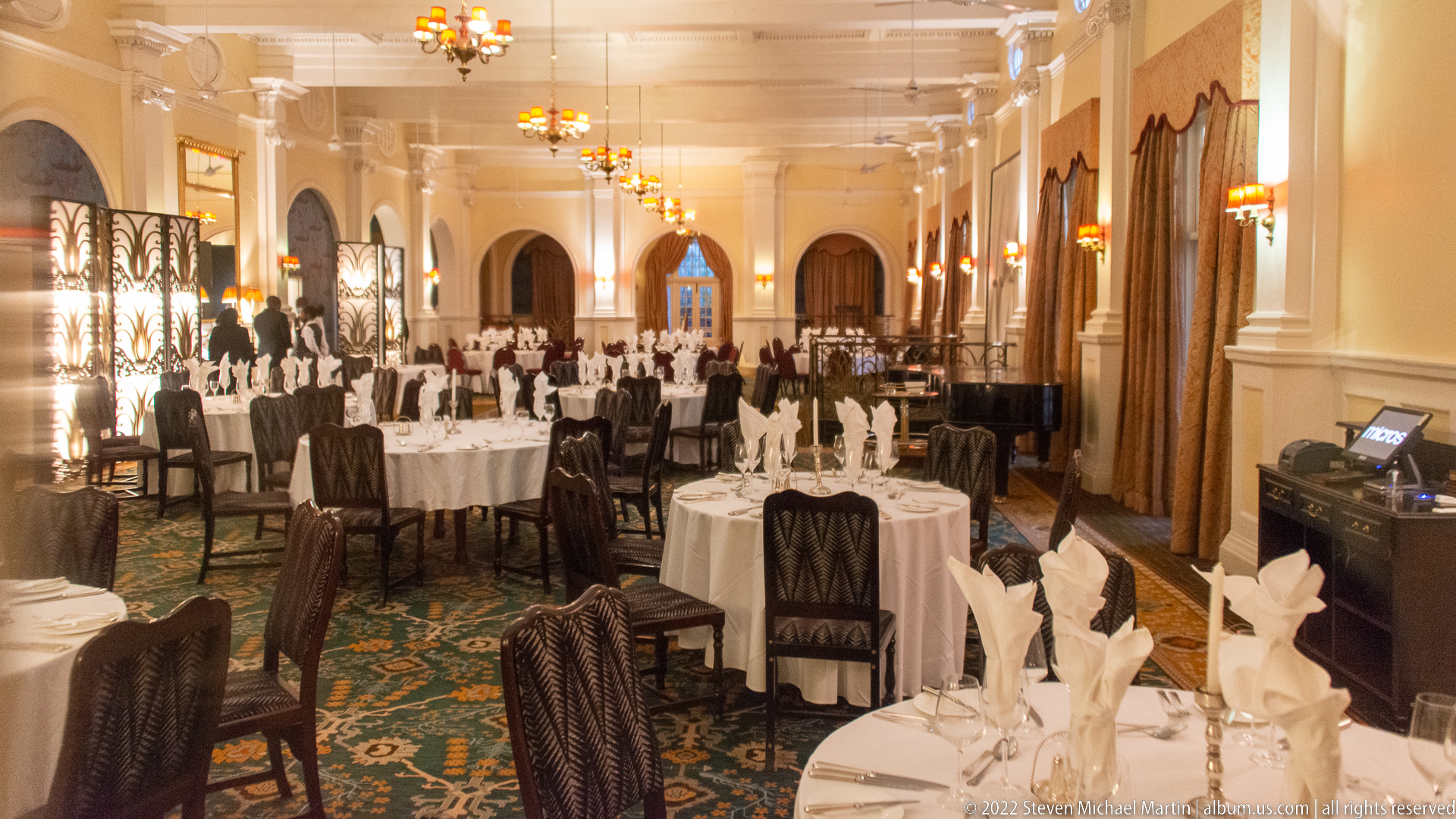
Round tables dressed in white cloths fill a long formal dining room, each set with folded napkins and surrounded by dark woven-back chairs. Repeating chandeliers, tall curtains, mirrors, and arched openings draw the eye through the elongated space. The polished presentation records the hotel’s ceremonial dining environment, balancing grand scale with the precise repetition of table settings.
Caption
Round tables dressed in white cloths fill a long formal dining room, each set with folded napkins and surrounded by dark woven-back chairs. Repeating chandeliers, tall curtains, mirrors, and arched openings draw the eye through the elongated space. The polished presentation records the hotel’s ceremonial dining environment, balancing grand scale with the precise repetition of table settings.
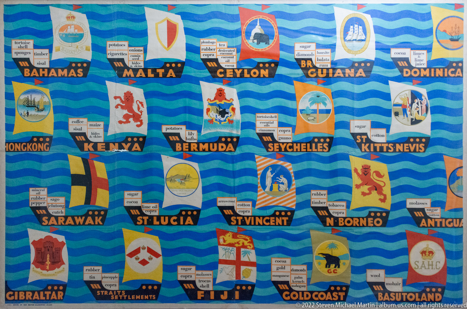
A brightly colored interpretive panel combines historic colonial flags or emblems with labels for territories including the Bahamas, Malta, Ceylon, British Guiana, Kenya, Bermuda, Seychelles, St. Kitts-Nevis, Sarawak, St. Lucia, St. Vincent, North Borneo, Gibraltar, Fiji, Gold Coast, and Basutoland. Small commodity labels accompany many entries, turning the display into a graphic summary of imperial trade networks.
Caption
A brightly colored interpretive panel combines historic colonial flags or emblems with labels for territories including the Bahamas, Malta, Ceylon, British Guiana, Kenya, Bermuda, Seychelles, St. Kitts-Nevis, Sarawak, St. Lucia, St. Vincent, North Borneo, Gibraltar, Fiji, Gold Coast, and Basutoland. Small commodity labels accompany many entries, turning the display into a graphic summary of imperial trade networks.
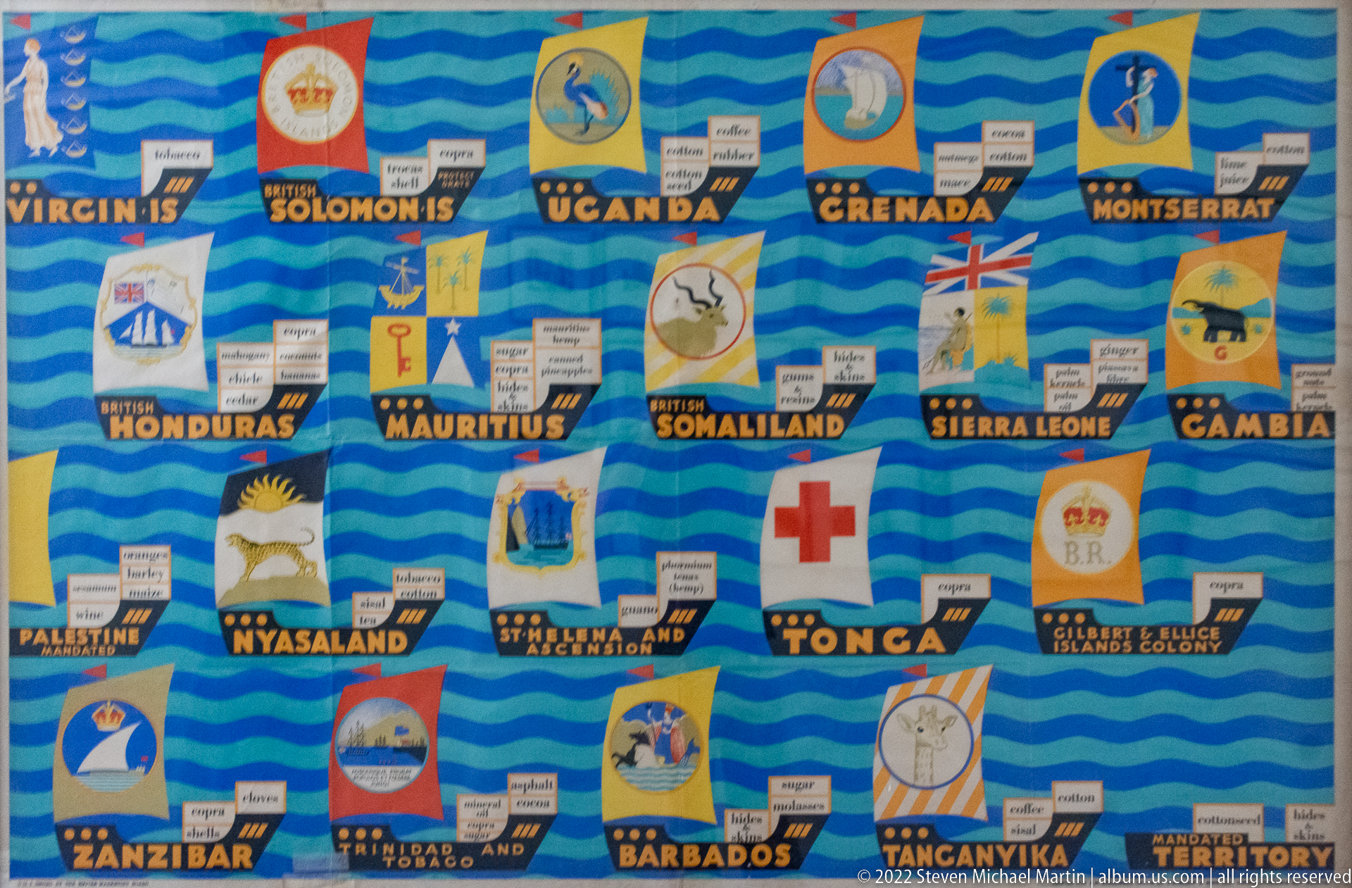
Another section of the trade panel groups territories such as Uganda, Grenada, Mauritius, Somaliland, Sierra Leone, Gambia, Palestine, Nyasaland, Zanzibar, Barbados, and Tanganyika Territory beneath period flags or emblems. Commodity labels are interspersed between the symbols. The photograph documents how the display compresses a wide geography of British imperial commerce into a dense, decorative visual catalogue.
Caption
Another section of the trade panel groups territories such as Uganda, Grenada, Mauritius, Somaliland, Sierra Leone, Gambia, Palestine, Nyasaland, Zanzibar, Barbados, and Tanganyika Territory beneath period flags or emblems. Commodity labels are interspersed between the symbols. The photograph documents how the display compresses a wide geography of British imperial commerce into a dense, decorative visual catalogue.
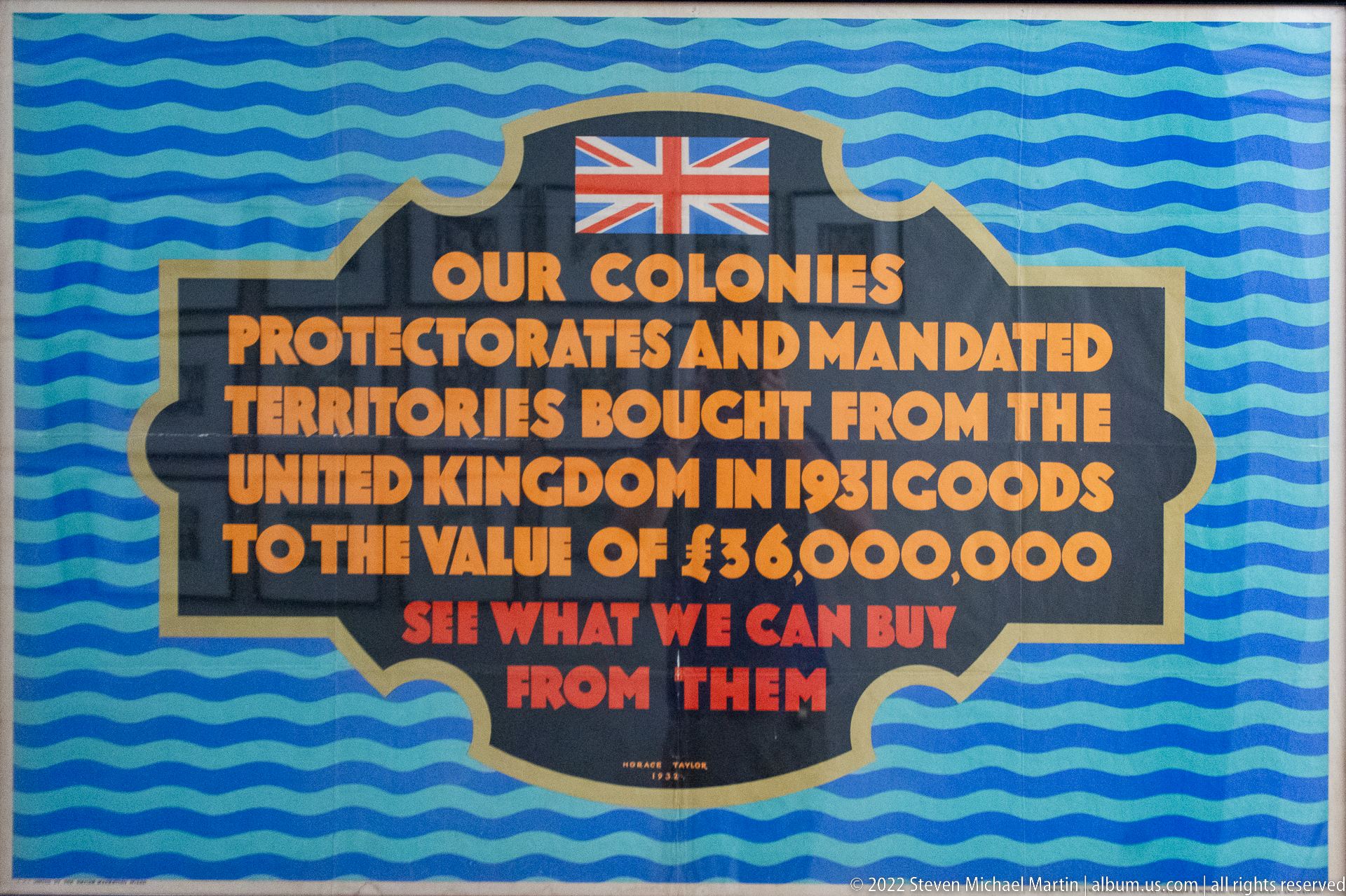
A bold panel states that Britain’s colonies, protectorates, and mandated territories bought goods from the United Kingdom valued at £136,000,000 in 1913, then invites visitors to “see what we can buy from them.” A Union Jack crowns the text against the same blue wave motif used on the neighboring trade panels, linking this statement to the larger imperial-commerce display.
Caption
A bold panel states that Britain’s colonies, protectorates, and mandated territories bought goods from the United Kingdom valued at £136,000,000 in 1913, then invites visitors to “see what we can buy from them.” A Union Jack crowns the text against the same blue wave motif used on the neighboring trade panels, linking this statement to the larger imperial-commerce display.
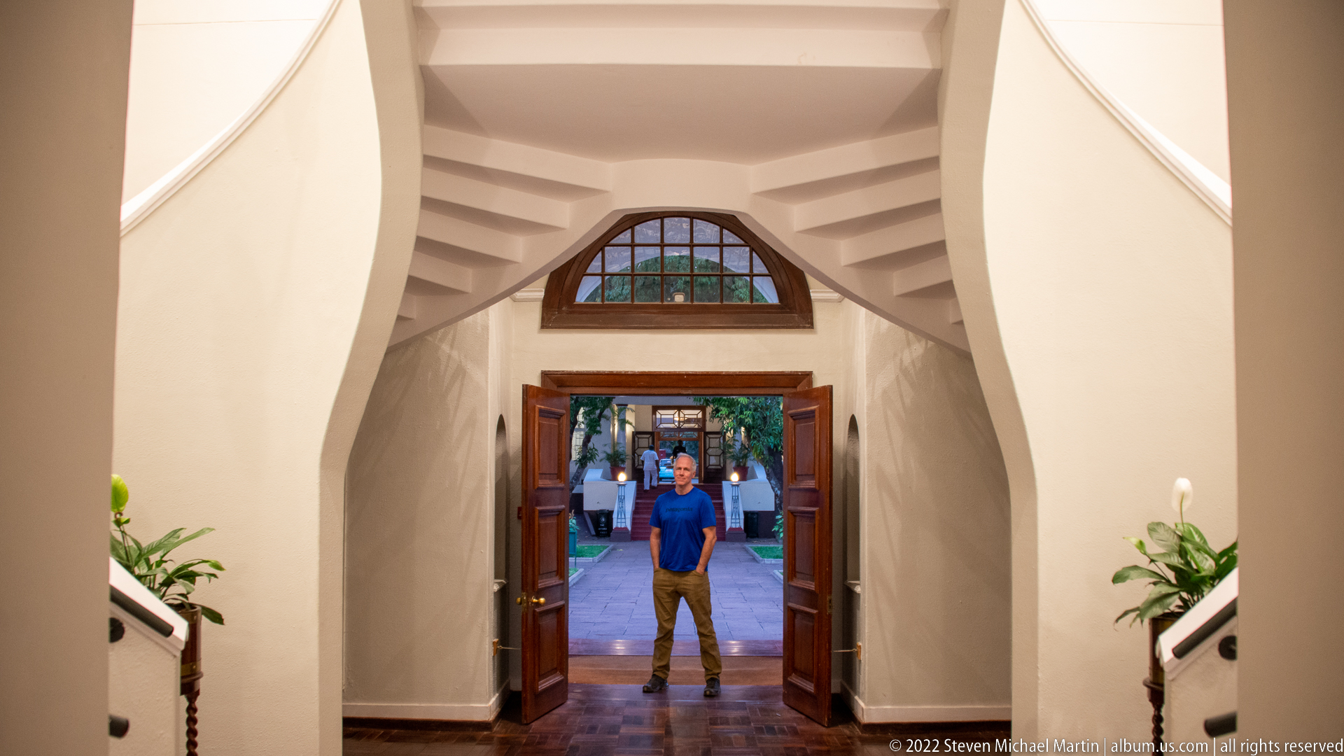
A person stands framed by open wooden doors at the end of a white, vaulted passage, creating a strong line of sight from the hotel interior to the garden outside. A semicircular stained-glass transom sits above the doorway, while stair flights rise symmetrically along both sides. The composition emphasizes transition, symmetry, and the architectural framing of indoor and outdoor space.
Caption
A person stands framed by open wooden doors at the end of a white, vaulted passage, creating a strong line of sight from the hotel interior to the garden outside. A semicircular stained-glass transom sits above the doorway, while stair flights rise symmetrically along both sides. The composition emphasizes transition, symmetry, and the architectural framing of indoor and outdoor space.
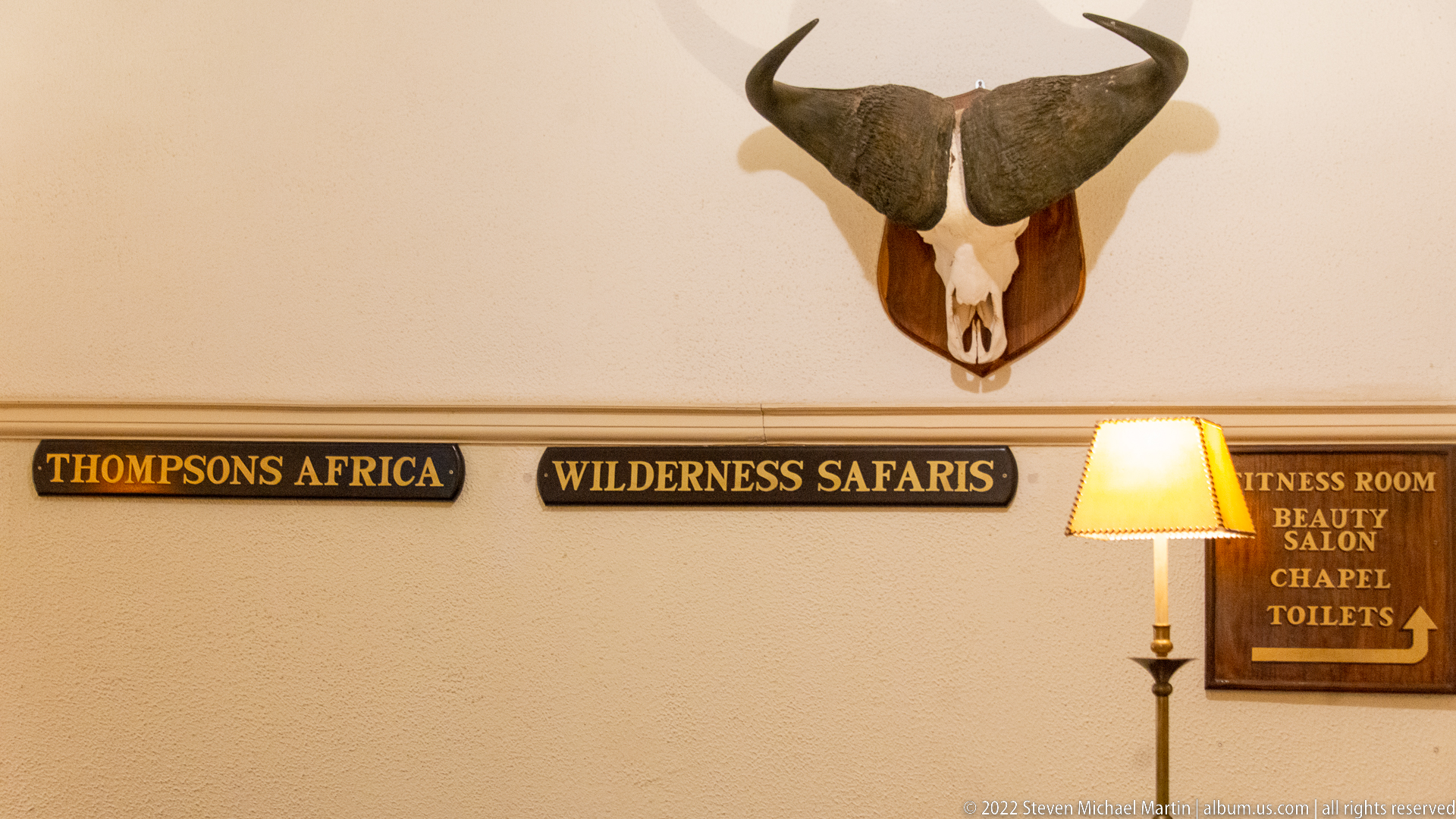
A mounted horned bovine skull crowns a wall of directional signage, with plaques for Thompson’s Africa and Wilderness Safaris flanking a larger board pointing toward the fitness room, beauty salon, chapel, and toilets. The juxtaposition of wildlife trophy imagery and practical wayfinding is characteristic of the safari-themed hospitality environment documented in this sequence.
Caption
A mounted horned bovine skull crowns a wall of directional signage, with plaques for Thompson’s Africa and Wilderness Safaris flanking a larger board pointing toward the fitness room, beauty salon, chapel, and toilets. The juxtaposition of wildlife trophy imagery and practical wayfinding is characteristic of the safari-themed hospitality environment documented in this sequence.
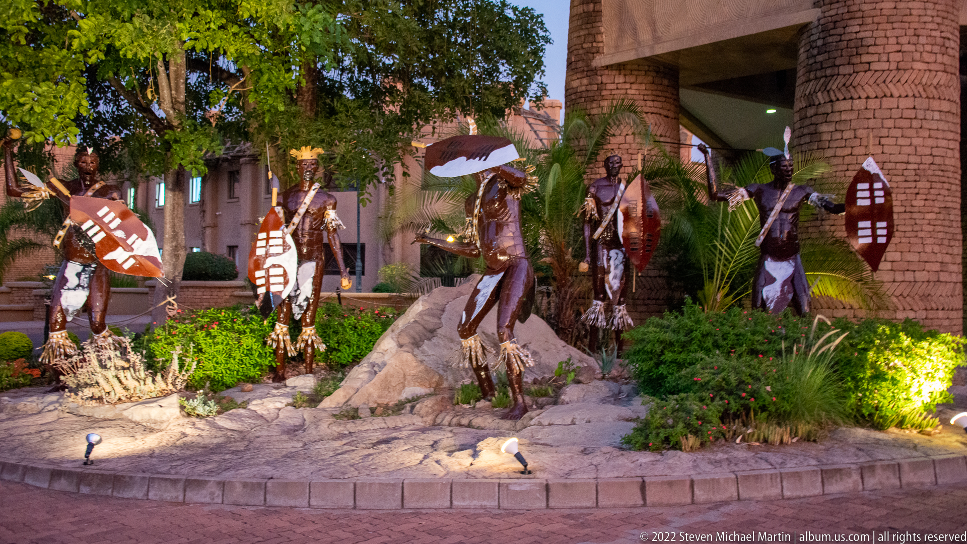
Life-size decorative figures carrying spears and patterned shields stand among rocks, palms, and flowering plants outside a brick-and-thatch resort building. Their staged poses and fixed placement indicate sculptural or display figures rather than a live performance. The ensemble creates a theatrical entrance setting, using weapon forms, costume, and landscaping to signal a generalized safari-themed visual identity.
Caption
Life-size decorative figures carrying spears and patterned shields stand among rocks, palms, and flowering plants outside a brick-and-thatch resort building. Their staged poses and fixed placement indicate sculptural or display figures rather than a live performance. The ensemble creates a theatrical entrance setting, using weapon forms, costume, and landscaping to signal a generalized safari-themed visual identity.
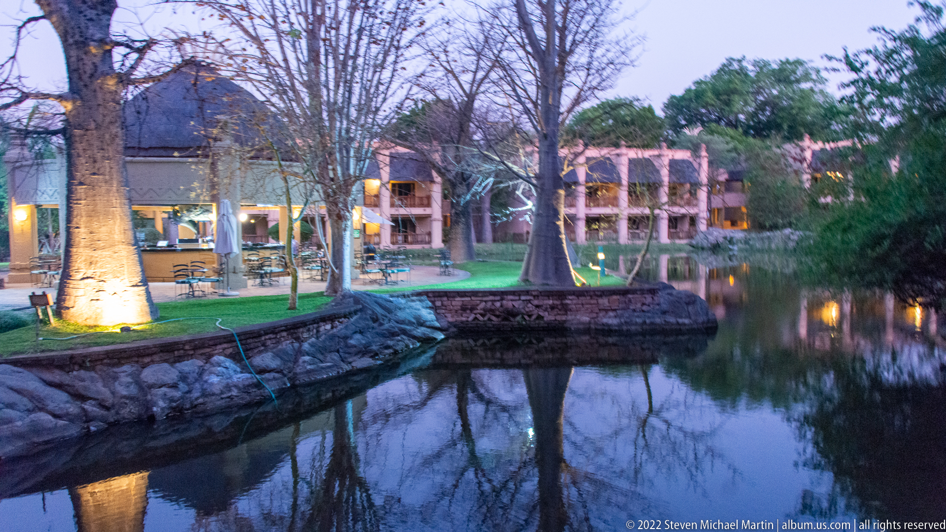
Low lodge buildings curve around a quiet landscaped waterway at dusk, their warm interior lights mirrored in the dark surface. Mature trees, stone edging, lawn, and small footbridges create a sheltered garden setting, while the architecture remains partly screened by vegetation. The photograph functions as an establishing view of a resort environment rather than a portrait of any single building.
Caption
Low lodge buildings curve around a quiet landscaped waterway at dusk, their warm interior lights mirrored in the dark surface. Mature trees, stone edging, lawn, and small footbridges create a sheltered garden setting, while the architecture remains partly screened by vegetation. The photograph functions as an establishing view of a resort environment rather than a portrait of any single building.
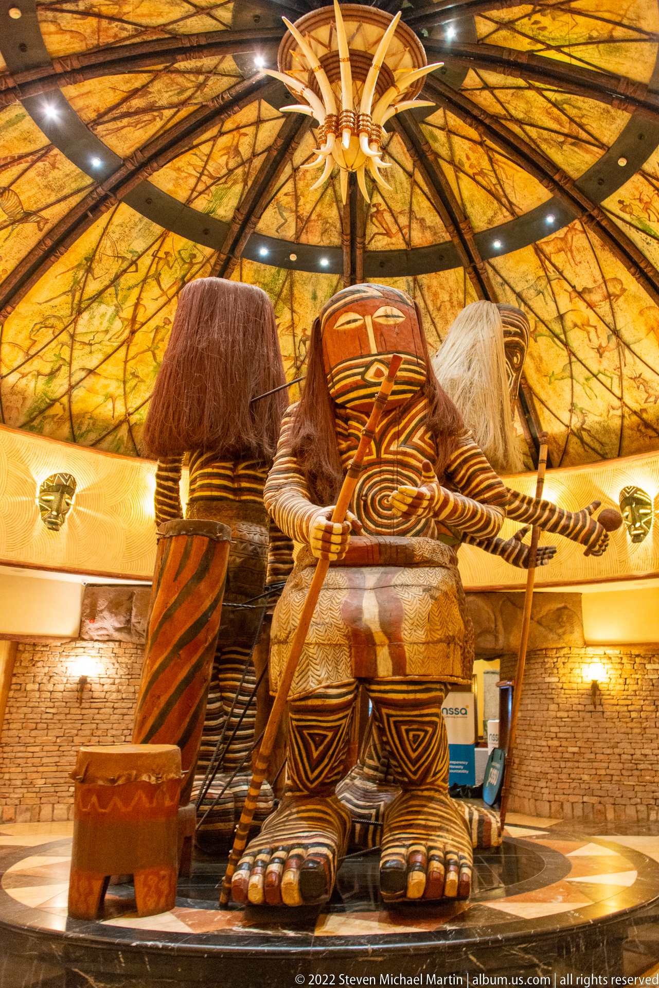
Monumental stylized figures dominate a circular lobby beneath a radial timber-and-thatch ceiling. Their oversized feet, mask-like faces, painted geometric patterns, and fiber-like hair give the installation a theatrical sculptural presence. Smaller carved forms flank the central group, creating a dramatic interior focal point that blends resort architecture with an intentionally African-themed decorative program.
Caption
Monumental stylized figures dominate a circular lobby beneath a radial timber-and-thatch ceiling. Their oversized feet, mask-like faces, painted geometric patterns, and fiber-like hair give the installation a theatrical sculptural presence. Smaller carved forms flank the central group, creating a dramatic interior focal point that blends resort architecture with an intentionally African-themed decorative program.
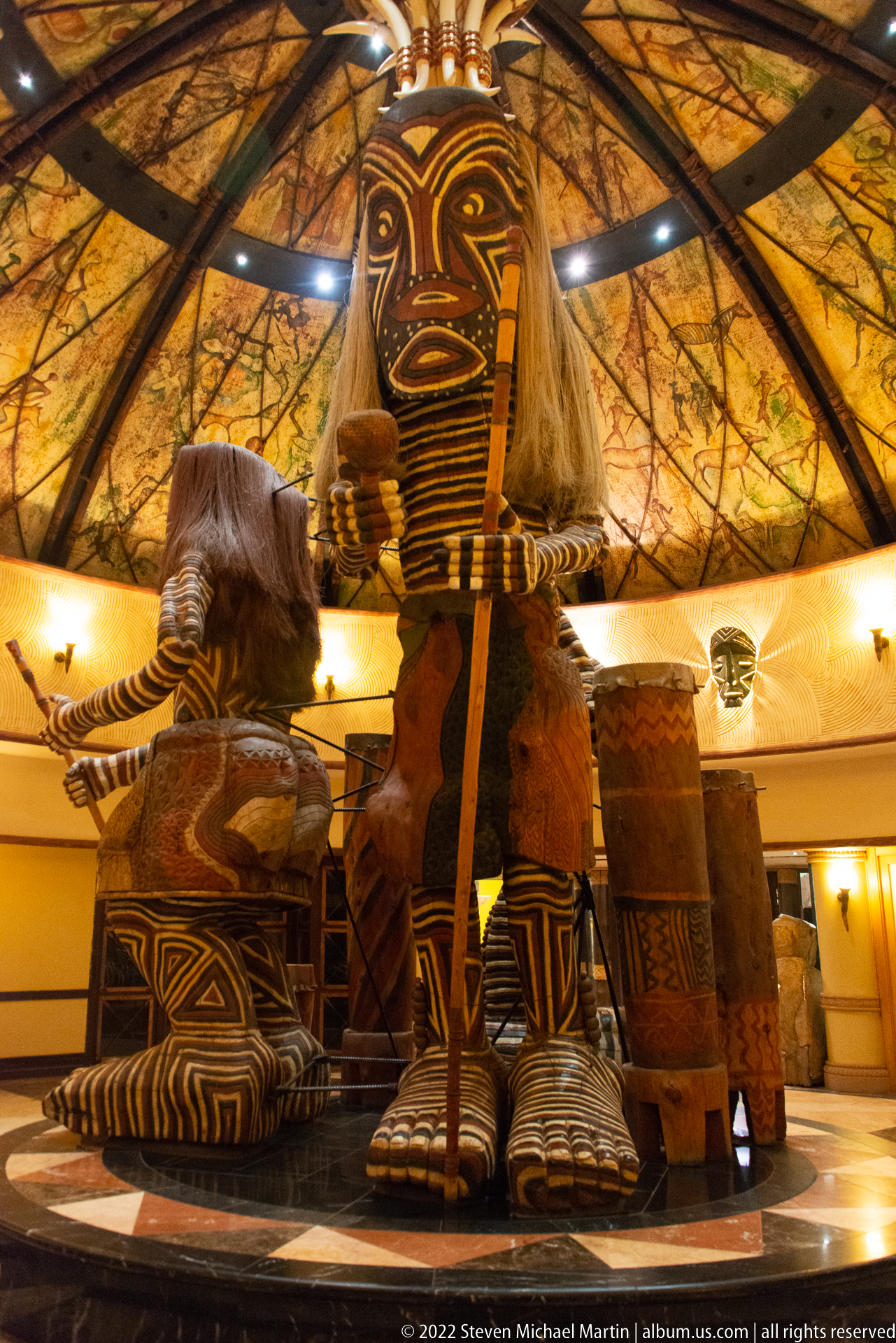
A lower and more frontal viewpoint makes the central carved figure appear especially imposing, with its elongated mask-like face, striped torso, massive feet, and pale fiber hair rising toward the circular roof. Companion figures sit or stand behind it. The photograph separates this installation from the wider lobby view by emphasizing scale, frontal symmetry, and the patterned surface treatment of the sculpture.
Caption
A lower and more frontal viewpoint makes the central carved figure appear especially imposing, with its elongated mask-like face, striped torso, massive feet, and pale fiber hair rising toward the circular roof. Companion figures sit or stand behind it. The photograph separates this installation from the wider lobby view by emphasizing scale, frontal symmetry, and the patterned surface treatment of the sculpture.
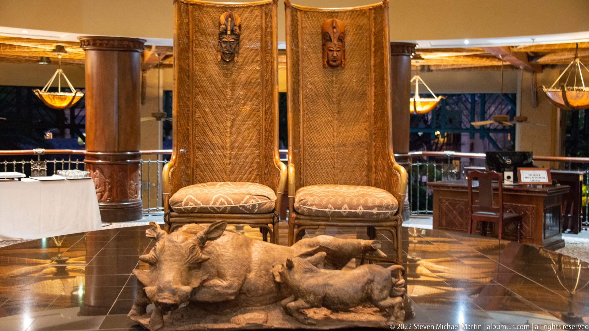
Two high-backed carved chairs stand behind a large sculptural warthog and piglet group in a polished resort interior. The chair backs combine woven-looking textures with mask-like carvings at the top, while the animal sculpture occupies the foreground at floor level. The arrangement reads as a deliberately theatrical furniture-and-sculpture ensemble rather than a conventional seating area.
Caption
Two high-backed carved chairs stand behind a large sculptural warthog and piglet group in a polished resort interior. The chair backs combine woven-looking textures with mask-like carvings at the top, while the animal sculpture occupies the foreground at floor level. The arrangement reads as a deliberately theatrical furniture-and-sculpture ensemble rather than a conventional seating area.
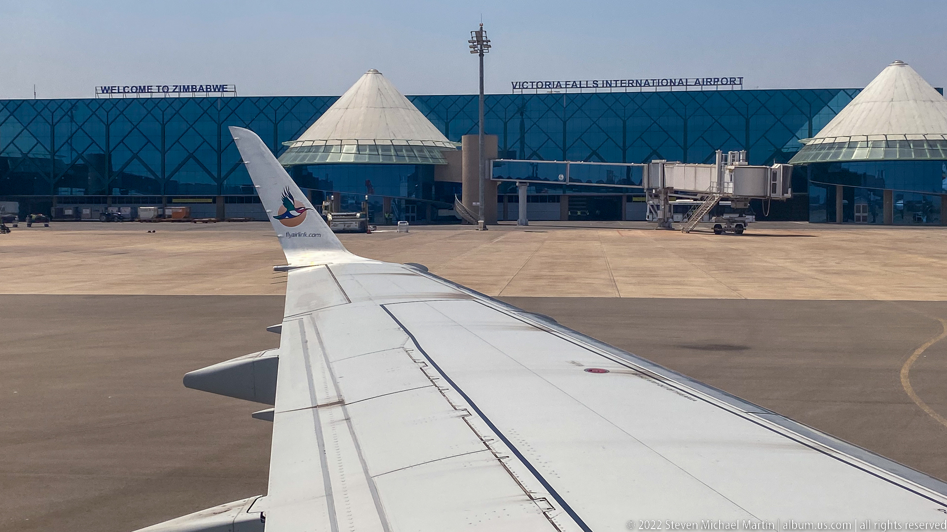
An aircraft wing points toward the terminal at Victoria Falls International Airport, whose name is legible above a blue-glazed façade flanked by white conical roof forms. Boarding equipment and apron markings place the viewer firmly airside. The image records arrival or departure infrastructure and provides a geographic transition between the resort sequence and renewed views of the falls.
Caption
An aircraft wing points toward the terminal at Victoria Falls International Airport, whose name is legible above a blue-glazed façade flanked by white conical roof forms. Boarding equipment and apron markings place the viewer firmly airside. The image records arrival or departure infrastructure and provides a geographic transition between the resort sequence and renewed views of the falls.
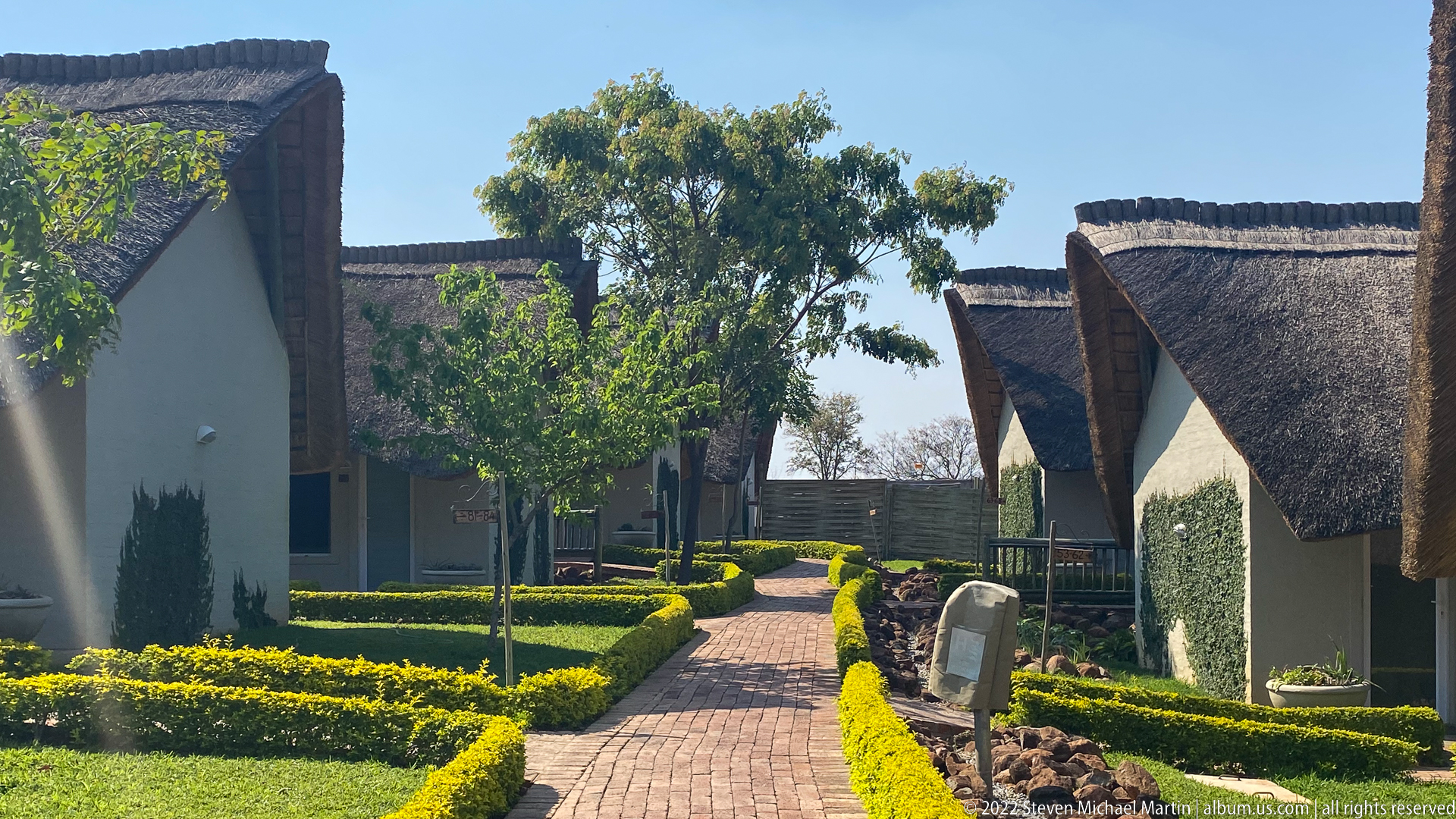
A brick path runs between small white guest buildings with steep thatched roofs, clipped hedges, young trees, and carefully maintained lawn. Bright sun sharpens the contrast between dark roof thatch and pale walls. The view emphasizes the pedestrian scale and garden planning of a lodge compound, with individual accommodation units arranged along a landscaped central route.
Caption
A brick path runs between small white guest buildings with steep thatched roofs, clipped hedges, young trees, and carefully maintained lawn. Bright sun sharpens the contrast between dark roof thatch and pale walls. The view emphasizes the pedestrian scale and garden planning of a lodge compound, with individual accommodation units arranged along a landscaped central route.
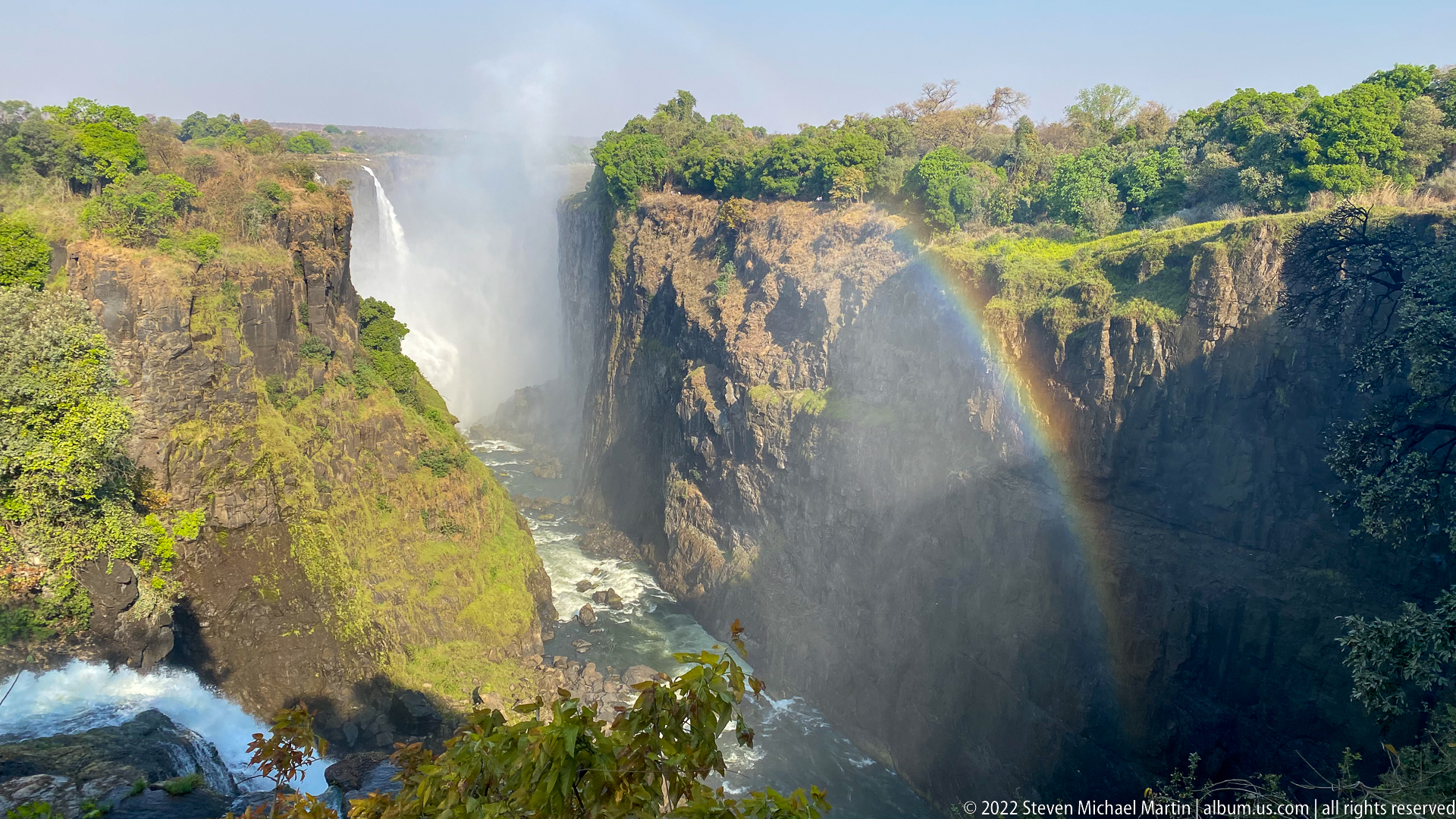
Multiple curtains of Victoria Falls plunge into the basalt gorge as spray rises from the river below and a bright rainbow arcs through the mist. The view looks obliquely across deeply incised dark rock walls softened by patches of green vegetation. The rainbow provides a fleeting atmospheric counterpoint to the permanent geological structure of the gorge and the force of the falling water.
Caption
Multiple curtains of Victoria Falls plunge into the basalt gorge as spray rises from the river below and a bright rainbow arcs through the mist. The view looks obliquely across deeply incised dark rock walls softened by patches of green vegetation. The rainbow provides a fleeting atmospheric counterpoint to the permanent geological structure of the gorge and the force of the falling water.
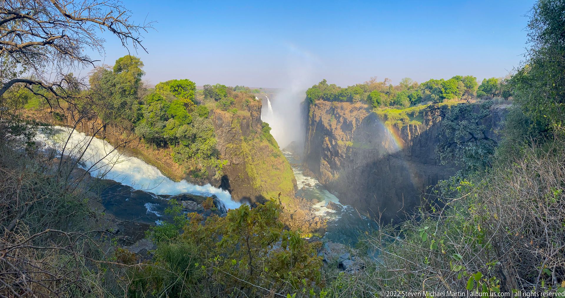
From a vegetation-framed overlook, Victoria Falls appears as a sequence of white curtains dropping into the deep gorge, with a rainbow standing in the central spray. The left side includes fast-moving water approaching a drop, while the opposite cliff catches stronger sunlight. The wider framing balances river, rock, woodland, and atmosphere, making this a contextual landscape rather than a close waterfall study.
Caption
From a vegetation-framed overlook, Victoria Falls appears as a sequence of white curtains dropping into the deep gorge, with a rainbow standing in the central spray. The left side includes fast-moving water approaching a drop, while the opposite cliff catches stronger sunlight. The wider framing balances river, rock, woodland, and atmosphere, making this a contextual landscape rather than a close waterfall study.
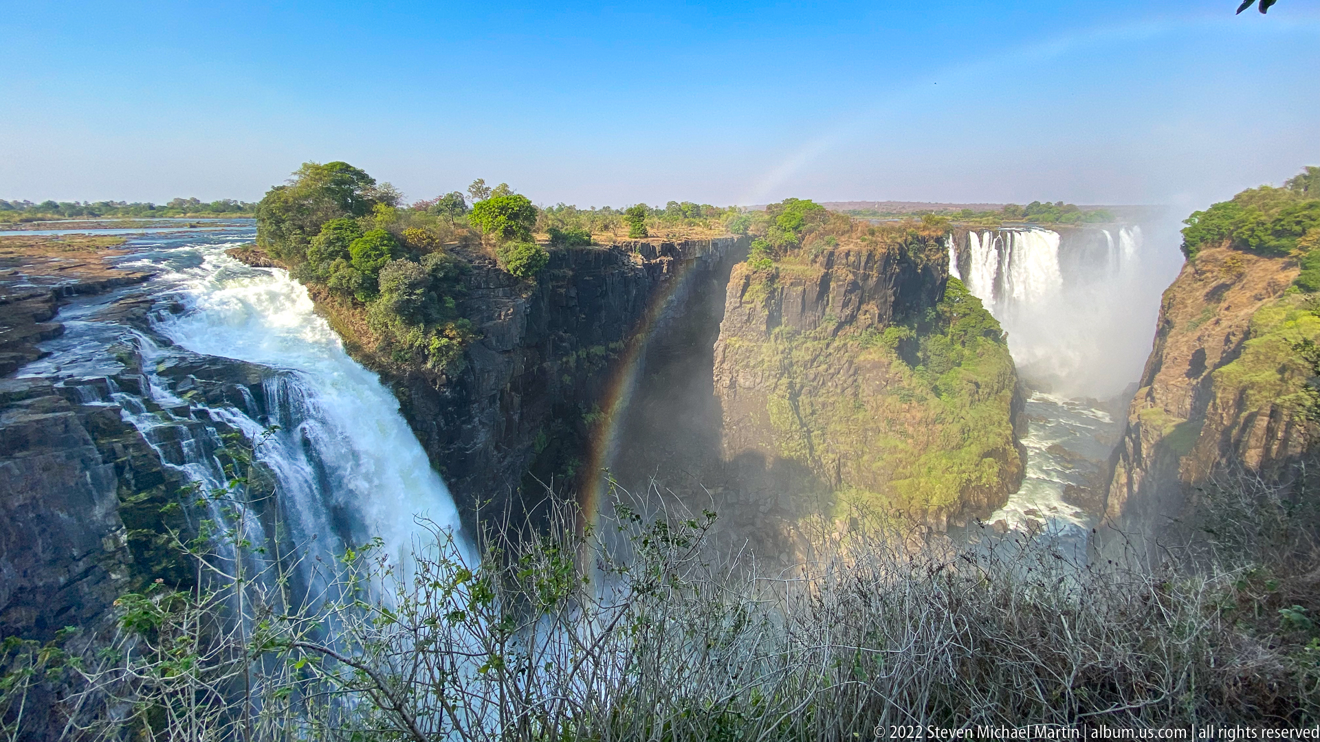
The upstream edge of Victoria Falls fills the left foreground, where the Zambezi River breaks into white water before plunging over the basalt lip. Across the gorge, another broad curtain falls through mist, while a tall rainbow rises between them. This viewpoint is especially effective at showing the transition from broad river surface to abrupt escarpment and deeply cut gorge.
Caption
The upstream edge of Victoria Falls fills the left foreground, where the Zambezi River breaks into white water before plunging over the basalt lip. Across the gorge, another broad curtain falls through mist, while a tall rainbow rises between them. This viewpoint is especially effective at showing the transition from broad river surface to abrupt escarpment and deeply cut gorge.
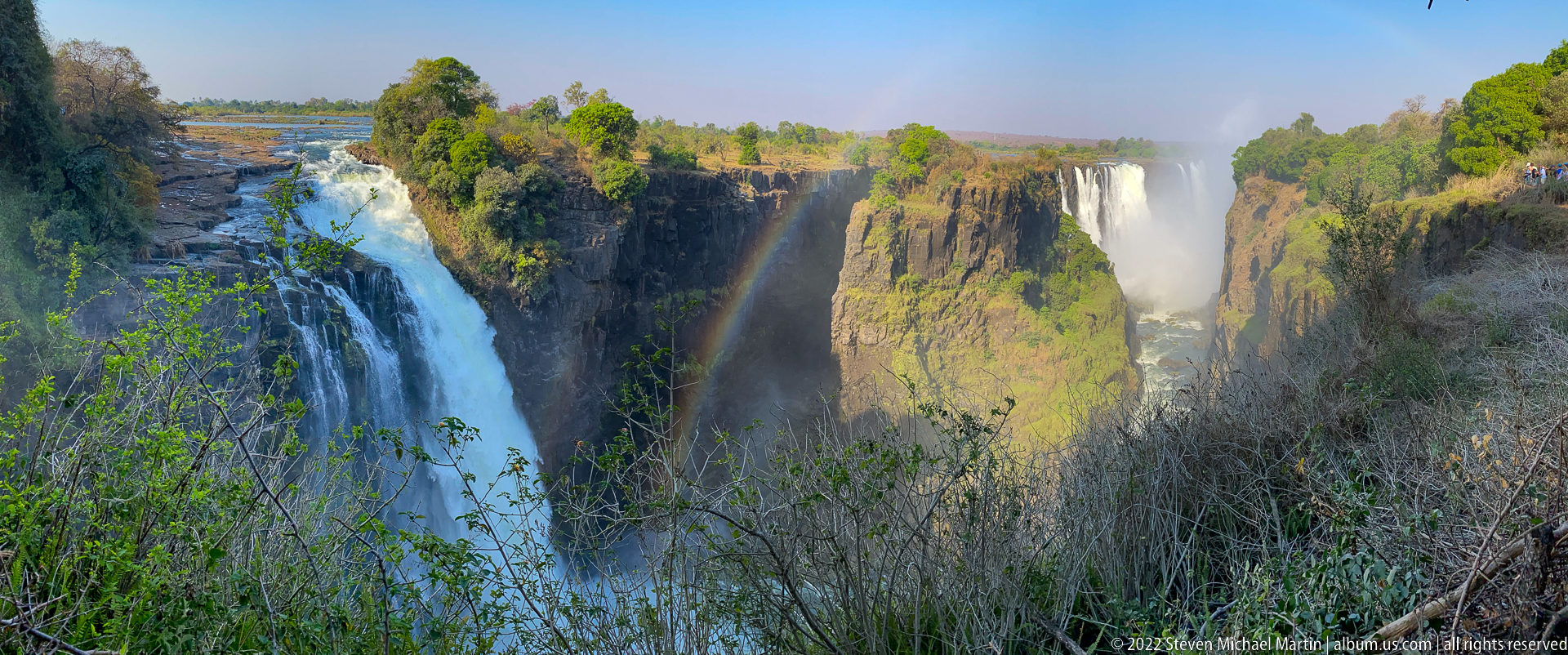
A thick white curtain pours over the near cliff at left while a rainbow rises vertically from the mist-filled gorge beside it. Across the chasm, a second waterfall descends from the opposite rim. Foreground shrubs partially screen the lower gorge, concentrating attention on the contrast between sunlit vegetation, dark basalt, bright water, and the saturated colors of the rainbow.
Caption
A thick white curtain pours over the near cliff at left while a rainbow rises vertically from the mist-filled gorge beside it. Across the chasm, a second waterfall descends from the opposite rim. Foreground shrubs partially screen the lower gorge, concentrating attention on the contrast between sunlit vegetation, dark basalt, bright water, and the saturated colors of the rainbow.
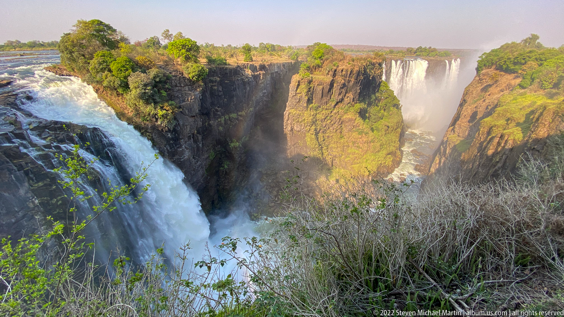
White water surges over the near brink of Victoria Falls at left, dropping out of sight beside a massive sunlit basalt promontory. Farther across the gorge, another waterfall descends through a cloud of spray. The framing gives the near cascade unusual weight and makes the hard volcanic cliff geometry a coequal subject with the water, underscoring the geological structure that channels the falls.
Caption
White water surges over the near brink of Victoria Falls at left, dropping out of sight beside a massive sunlit basalt promontory. Farther across the gorge, another waterfall descends through a cloud of spray. The framing gives the near cascade unusual weight and makes the hard volcanic cliff geometry a coequal subject with the water, underscoring the geological structure that channels the falls.
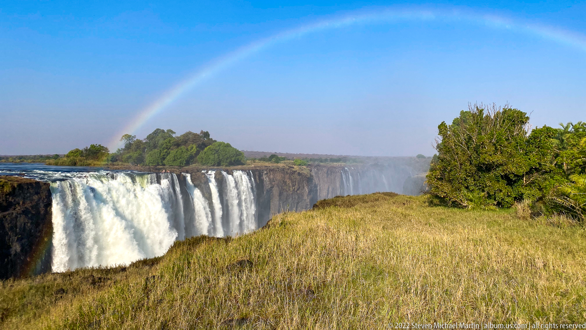
A long white curtain of Victoria Falls extends across the left half of the frame, viewed from a dry grassy bank under clear blue sky. A faint rainbow spans the mist above the gorge, while trees mass along the distant rim. The open foreground distinguishes this view from the enclosed gorge compositions, giving the waterfall a broader horizontal scale and a stronger sense of the surrounding plateau.
Caption
A long white curtain of Victoria Falls extends across the left half of the frame, viewed from a dry grassy bank under clear blue sky. A faint rainbow spans the mist above the gorge, while trees mass along the distant rim. The open foreground distinguishes this view from the enclosed gorge compositions, giving the waterfall a broader horizontal scale and a stronger sense of the surrounding plateau.
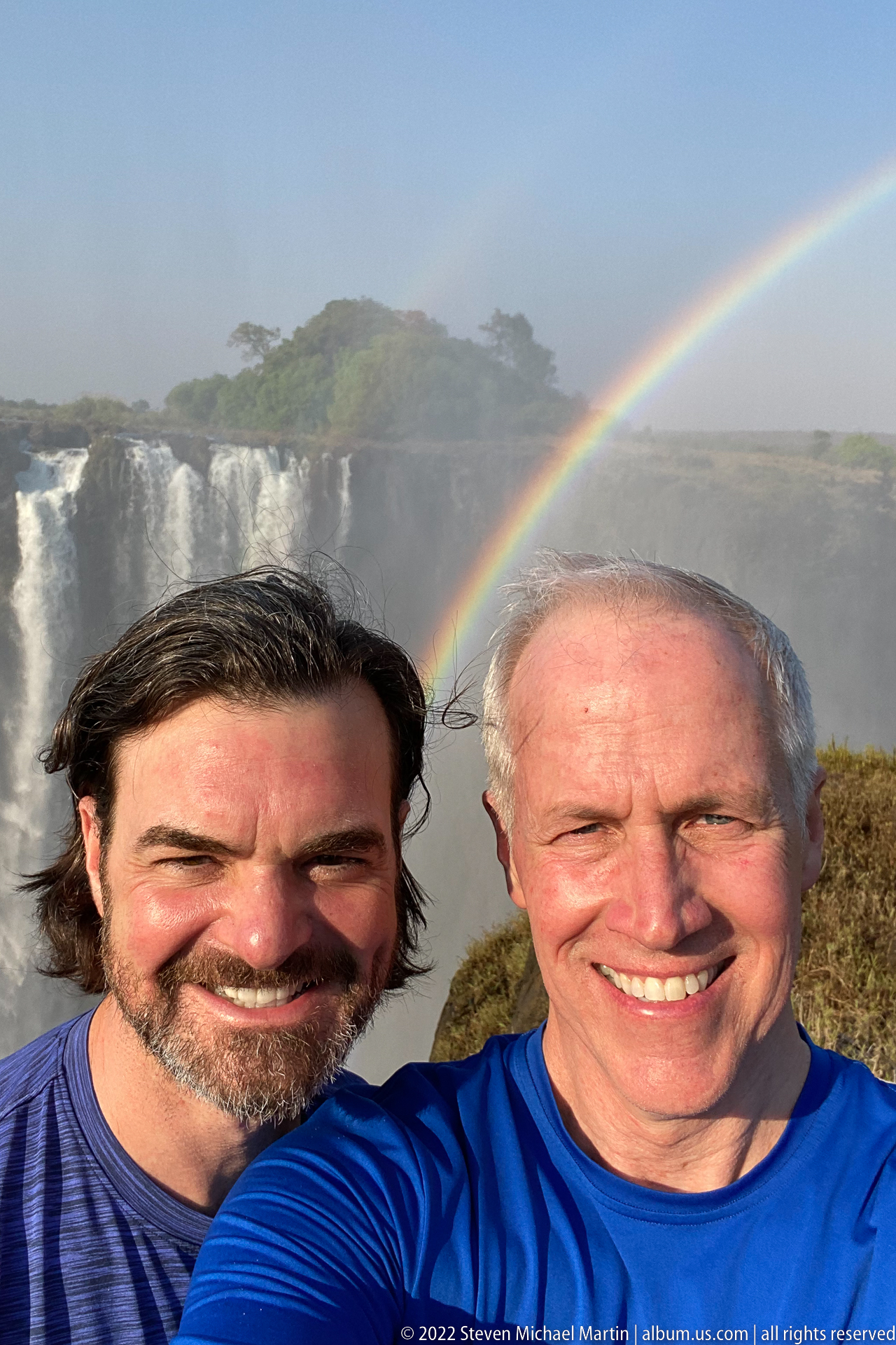
Two smiling visitors fill the foreground in a close selfie at Victoria Falls, with the broad white waterfall and a vivid rainbow visible behind their shoulders. The tightly cropped portrait shifts emphasis from the landscape itself to the experience of being at the site while still retaining unmistakable environmental context. Bright sunlight and spray give the scene a distinctly outdoor, celebratory character.
Caption
Two smiling visitors fill the foreground in a close selfie at Victoria Falls, with the broad white waterfall and a vivid rainbow visible behind their shoulders. The tightly cropped portrait shifts emphasis from the landscape itself to the experience of being at the site while still retaining unmistakable environmental context. Bright sunlight and spray give the scene a distinctly outdoor, celebratory character.

A second close selfie places two smiling visitors almost edge-to-edge across the frame, with the bright curtain of Victoria Falls filling the background. Compared with the neighboring rainbow portrait, this image gives the waterfall more visual weight and reduces the surrounding landscape. The photograph records personal presence at the site while preserving the immense scale and luminous spray of the falls behind them.
Caption
A second close selfie places two smiling visitors almost edge-to-edge across the frame, with the bright curtain of Victoria Falls filling the background. Compared with the neighboring rainbow portrait, this image gives the waterfall more visual weight and reduces the surrounding landscape. The photograph records personal presence at the site while preserving the immense scale and luminous spray of the falls behind them.
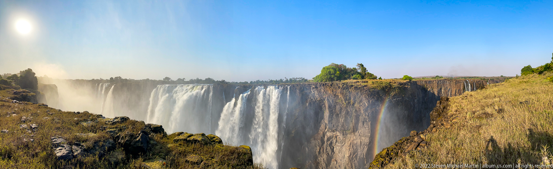
A broad section of Victoria Falls drops in parallel white streams along a dark cliff, seen obliquely from a dry grassy rim. Mist rises at the left and softens the distant edge, while the long line of the precipice recedes toward the horizon. The composition emphasizes breadth and repetition in the falling water rather than the enclosed depth of the gorge seen in earlier frames.
Caption
A broad section of Victoria Falls drops in parallel white streams along a dark cliff, seen obliquely from a dry grassy rim. Mist rises at the left and softens the distant edge, while the long line of the precipice recedes toward the horizon. The composition emphasizes breadth and repetition in the falling water rather than the enclosed depth of the gorge seen in earlier frames.
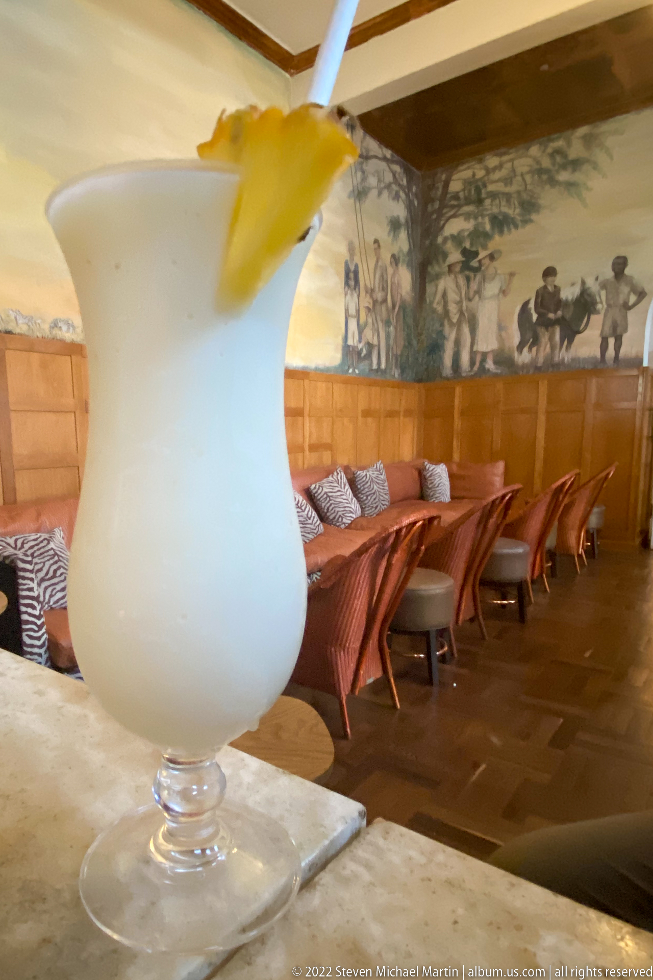
A pale frozen cocktail in a stemmed glass dominates the foreground, garnished with a citrus wedge and served on a bar or table. Behind it, low lounge seating and a long mural recede softly out of focus. The shallow depth of field turns the drink into a still-life detail while retaining enough of the safari-themed interior to connect it with the surrounding hospitality setting.
Caption
A pale frozen cocktail in a stemmed glass dominates the foreground, garnished with a citrus wedge and served on a bar or table. Behind it, low lounge seating and a long mural recede softly out of focus. The shallow depth of field turns the drink into a still-life detail while retaining enough of the safari-themed interior to connect it with the surrounding hospitality setting.
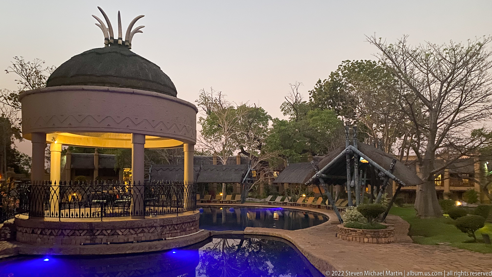
A circular open-sided pavilion with a domed roof glows beside a curving swimming pool at dusk. Blue underwater lighting traces the pool edge, while thatched structures, sculptural landscaping, trimmed shrubs, and mature trees fill the surrounding resort grounds. The photograph emphasizes evening atmosphere and the contrast between warm pavilion light, cool pool illumination, and the muted sky.
Caption
A circular open-sided pavilion with a domed roof glows beside a curving swimming pool at dusk. Blue underwater lighting traces the pool edge, while thatched structures, sculptural landscaping, trimmed shrubs, and mature trees fill the surrounding resort grounds. The photograph emphasizes evening atmosphere and the contrast between warm pavilion light, cool pool illumination, and the muted sky.
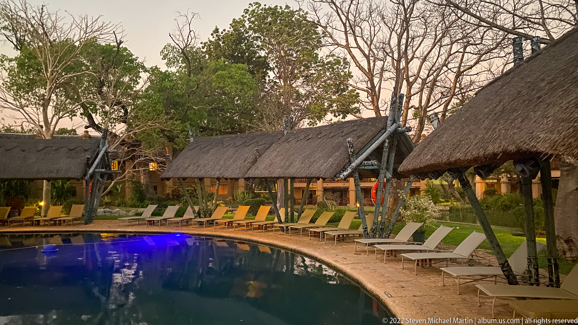
A curving swimming pool glows blue at dusk beside a row of thatched-roof lodge buildings and shaded verandas. Reclining chairs follow the pool edge beneath mature trees, while warm interior lights contrast with the deepening evening sky. The composition records the landscaped hospitality setting as a distinct part of the Victoria Falls visitor environment rather than the waterfall landscape itself.
Caption
A curving swimming pool glows blue at dusk beside a row of thatched-roof lodge buildings and shaded verandas. Reclining chairs follow the pool edge beneath mature trees, while warm interior lights contrast with the deepening evening sky. The composition records the landscaped hospitality setting as a distinct part of the Victoria Falls visitor environment rather than the waterfall landscape itself.
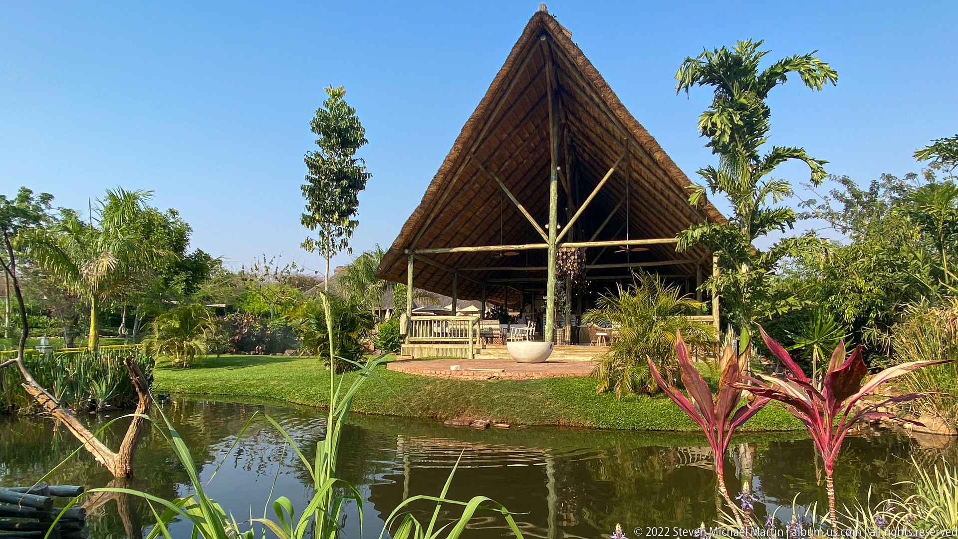
A steeply pitched thatched pavilion rises beyond a landscaped pond, its open gable revealing timber supports and a shaded seating area. Palms, reeds, clipped lawn, and colorful tropical foliage surround the water, softening the strong triangular roofline. The frontal viewpoint emphasizes the relationship between vernacular-inspired lodge architecture and the carefully maintained garden setting.
Caption
A steeply pitched thatched pavilion rises beyond a landscaped pond, its open gable revealing timber supports and a shaded seating area. Palms, reeds, clipped lawn, and colorful tropical foliage surround the water, softening the strong triangular roofline. The frontal viewpoint emphasizes the relationship between vernacular-inspired lodge architecture and the carefully maintained garden setting.
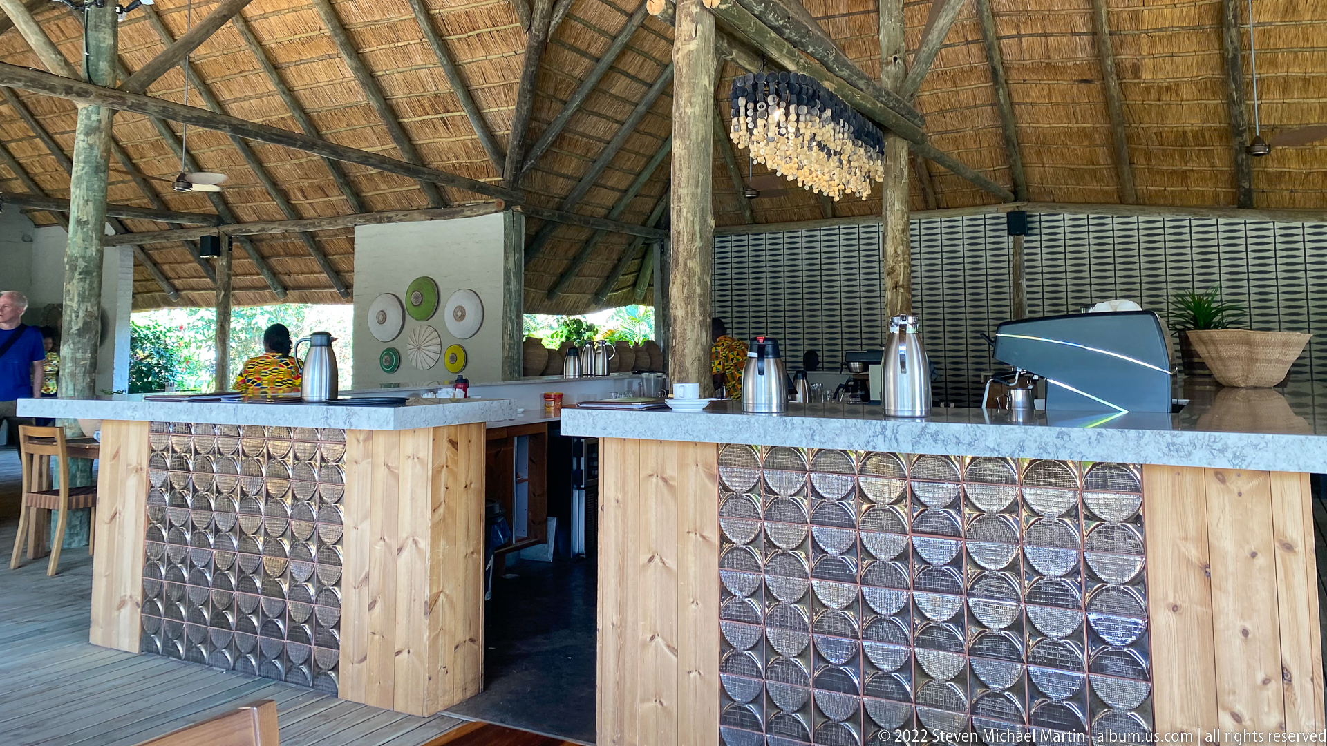
An open-air bar sits beneath a high thatched roof, with pale timber counters faced by repeating circular decorative panels and topped by light stone or composite surfaces. Exposed posts and roof structure keep the construction legible, while a small hanging installation adds texture above the service area. The close interior view shifts attention from the lodge grounds to materials, craftsmanship, and guest-service design.
Caption
An open-air bar sits beneath a high thatched roof, with pale timber counters faced by repeating circular decorative panels and topped by light stone or composite surfaces. Exposed posts and roof structure keep the construction legible, while a small hanging installation adds texture above the service area. The close interior view shifts attention from the lodge grounds to materials, craftsmanship, and guest-service design.
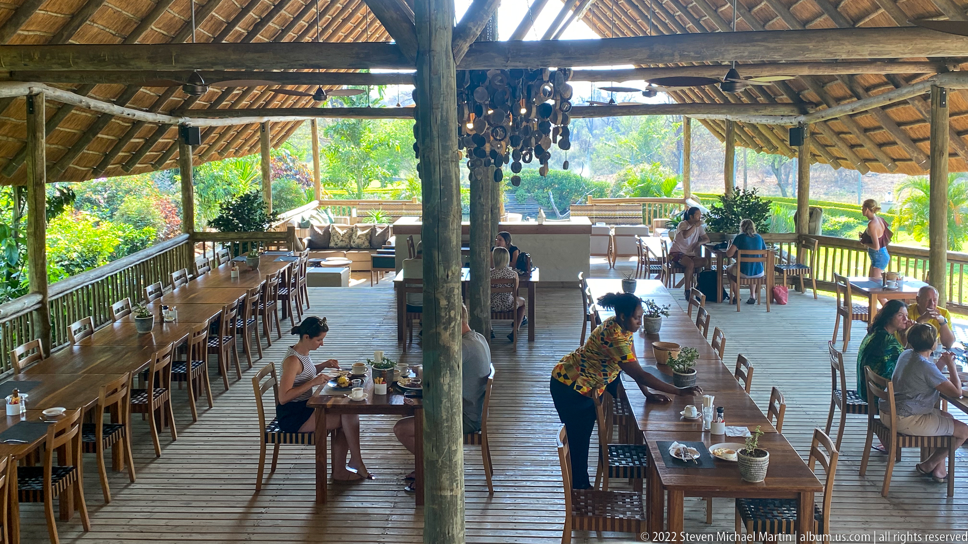
Long wooden tables and rows of chairs fill an open-sided dining pavilion beneath a broad thatched roof, with guests seated in smaller groups and staff working among the tables. A massive natural timber post divides the composition, while the open perimeter looks directly onto dense garden vegetation. The scene conveys the pavilion’s communal scale and its close visual connection to the surrounding landscape.
Caption
Long wooden tables and rows of chairs fill an open-sided dining pavilion beneath a broad thatched roof, with guests seated in smaller groups and staff working among the tables. A massive natural timber post divides the composition, while the open perimeter looks directly onto dense garden vegetation. The scene conveys the pavilion’s communal scale and its close visual connection to the surrounding landscape.
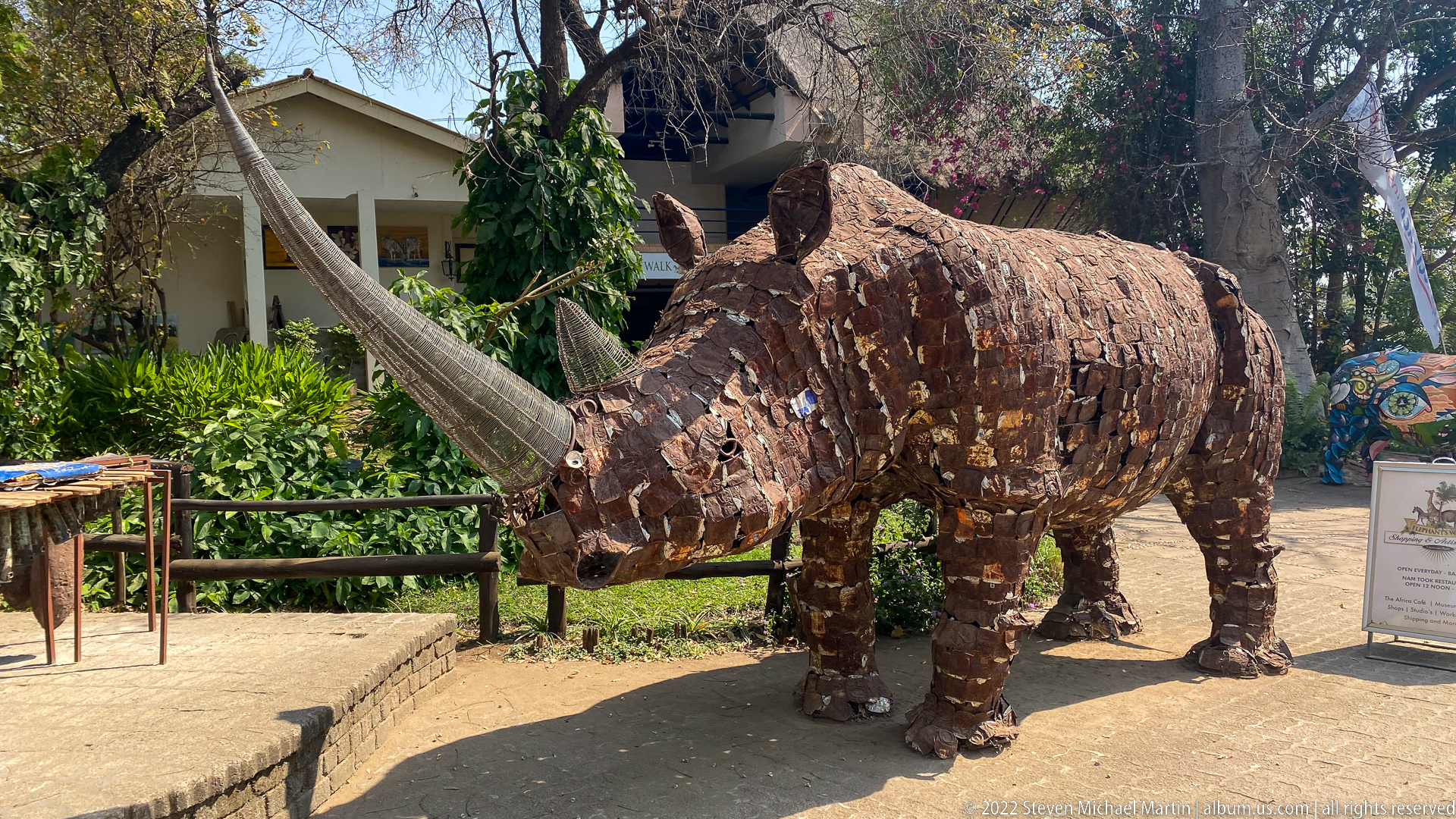
A life-size rhinoceros sculpture stands outdoors, its bulky body and prominent horn assembled from overlapping rust-brown metal pieces. The irregular surface turns scrap-like material into hide, folds, ears, and heavy legs while preserving the animal’s immediately recognizable silhouette. Set among garden vegetation and craft displays, the work connects wildlife imagery with contemporary decorative metalwork in Victoria Falls.
Caption
A life-size rhinoceros sculpture stands outdoors, its bulky body and prominent horn assembled from overlapping rust-brown metal pieces. The irregular surface turns scrap-like material into hide, folds, ears, and heavy legs while preserving the animal’s immediately recognizable silhouette. Set among garden vegetation and craft displays, the work connects wildlife imagery with contemporary decorative metalwork in Victoria Falls.
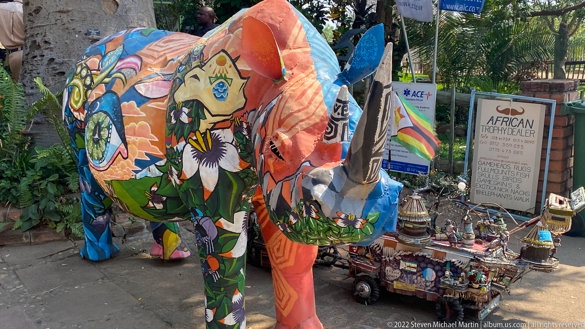
Colorfully painted elephant sculptures dominate a roadside craft display, their surfaces covered with flowers, animals, abstract patterns, and vivid blocks of orange, blue, green, and black. Smaller carved and decorated objects cluster at their feet beside a sign advertising African handicrafts. The final portfolio image shifts from natural wildlife to the elephant as a recurring motif in contemporary tourist art and local craft commerce.
Caption
Colorfully painted elephant sculptures dominate a roadside craft display, their surfaces covered with flowers, animals, abstract patterns, and vivid blocks of orange, blue, green, and black. Smaller carved and decorated objects cluster at their feet beside a sign advertising African handicrafts. The final portfolio image shifts from natural wildlife to the elephant as a recurring motif in contemporary tourist art and local craft commerce.
Videos:
Victoria Falls is one of the most visually powerful natural landmarks in the world. The Zambezi River narrows and then suddenly drops over a wide basalt cliff, producing a curtain of water that can stretch more than a mile across during high flow. The sound, mist, and scale combine to create an experience that feels immersive long before the falls themselves come fully into view.
Unlike many scenic destinations, Victoria Falls reveals itself gradually. The approach moves through rainforest vegetation created by the constant spray, with viewpoints appearing one after another along the edge of the gorge. Each vantage point offers a slightly different balance of water, rock, and mist.
Highlights
- One of the largest continuous waterfalls in the world
- Powerful visual scale created by width, height, and mist
- Rainforest microclimate formed by constant spray
- Series of viewpoints offering varied perspectives
- Unique photographic conditions influenced by light and water volume
Field Guide
📍 Location
Victoria Falls lies along the Zambezi River at the border of Zambia and Zimbabwe. The river forms a natural boundary between the two countries before plunging into a deep basalt gorge that continues downstream through a series of zigzagging chasms.
🌍 Geological Setting
The falls were formed as the Zambezi River eroded softer rock between harder basalt layers, gradually carving a dramatic drop. Over long periods of time, the waterfall has shifted upstream as erosion continues to cut new channels through the rock.
The present waterfall spans roughly 1.7 kilometers (about one mile) in width, with water dropping more than 100 meters (over 300 feet) into the gorge below.
📜 Historical Context
Local communities have known the falls for centuries, referring to them as Mosi-oa-Tunya, often translated as “The Smoke That Thunders.” The name reflects the towering columns of mist visible from miles away and the constant roar produced by the falling water.
In 1855, explorer David Livingstone documented the falls during his travels along the Zambezi River, bringing broader international awareness to the site.
🌿 Landscape & Environment
The constant spray from the falls creates a narrow band of rainforest vegetation along the rim of the gorge. Even during dry seasons, this microclimate supports dense plant growth that contrasts with the surrounding savanna landscape.
Depending on water levels, the falls may appear as a continuous curtain of water or as a series of segmented cascades revealing more of the cliff face.
👣 Visitor Experience
The primary viewing path follows the edge of the gorge, with marked viewpoints positioned to highlight different sections of the falls. The experience unfolds gradually, beginning with the sound of rushing water and glimpses of mist before the full width of the falls becomes visible.
Conditions can vary significantly depending on the season. During high water flow, mist can be intense and may partially obscure views. During lower flow periods, more of the rock formations and individual cascades become visible.
Viewing Perspectives
Main Falls
One of the most dramatic sections, where a broad sheet of water drops vertically into the gorge. The scale of the cliff face becomes especially apparent when mist clears briefly.
Knife-Edge Ridge
A narrow viewpoint that offers a strong sense of depth into the gorge, often accompanied by heavy spray and dramatic atmospheric conditions.
Rainbow Effects
Sunlight interacting with mist frequently produces rainbows, especially during mid-morning or late afternoon when the angle of light is favorable.
Gorge Views
Looking downstream reveals the zigzag pattern of the basalt gorges carved by the river over long geological periods.
Story & Experience
First Impressions
The sound of the falls is often noticeable before the water itself becomes visible. As the path approaches the gorge, the air becomes cooler and more humid, and vegetation becomes denser.
Scale and Movement
The visual scale of the falls can be difficult to appreciate from photographs alone. In person, the width of the waterfall and the volume of water create a constant sense of motion that draws attention across the entire horizon.
Changing Conditions
Light, mist, and water flow combine to create changing viewing conditions throughout the day. Brief openings in the mist can reveal wide sections of the cliff face before visibility shifts again.
Atmosphere
The combination of sound, mist, and moving water creates a strong sense of place. Even when visibility is partially reduced by spray, the environment remains visually engaging because of the surrounding vegetation and changing light.
Photography Notes
- Water volume strongly affects visibility of the cliff face
- Spray can create dramatic atmosphere but may require lens protection
- Early or late light often provides better contrast through mist
- Wider compositions help communicate the scale of the falls
- Rainbows are most likely when sunlight intersects the mist at lower angles
Quick Facts
- Location: Border of Zambia and Zimbabwe
- River: Zambezi River
- Width: Approximately 1.7 km (1 mile)
- Height: Over 100 meters (300+ feet)
- Local Name: Mosi-oa-Tunya (“The Smoke That Thunders”)
- Environment: Gorge, rainforest microclimate, basalt rock formations