Jasper Icefield Mistaya Canyon
Mistaya Canyon lies along the Icefields Parkway in the northern reaches of Banff National Park, where the Mistaya River has carved a narrow, twisting gorge through the limestone bedrock of the Canadian Rockies. Reached by a short trail descending from the parkway, the canyon provides a dramatic contrast to the broad mountain valleys and glacial landscapes that characterize much of the route between Lake Louise and Jasper. A footbridge crosses the gorge, offering views into the sculpted rock walls and the powerful river rushing through the confined channel below.
The Mistaya River originates in the glacial landscapes near Peyto Lake and flows north through the valley past Mistaya Lake and the Waterfowl Lakes before reaching the canyon. Over thousands of years, the river and the sediment carried within it have eroded and dissolved the limestone, producing the canyon’s smooth curves, rounded potholes, and deeply incised passage. Parks Canada highlights Mistaya Canyon as an especially visible example of the erosive power of mountain rivers, demonstrating how flowing water continues to shape the geology of the Canadian Rockies.
Beyond the canyon, the Mistaya River continues north toward Saskatchewan River Crossing, where it joins the Howse and North Saskatchewan rivers beneath the surrounding peaks of the Continental Divide. This confluence lies within a landscape historically used as a route through the mountains by Indigenous peoples and later by explorers and fur traders traveling toward Howse Pass. Today, Mistaya Canyon is one of the Icefields Parkway’s most accessible encounters with the forces that created this landscape, combining rushing glacial water, sculpted limestone, dense conifer forest, and the high peaks of the Canadian Rockies within a short walk of the highway.
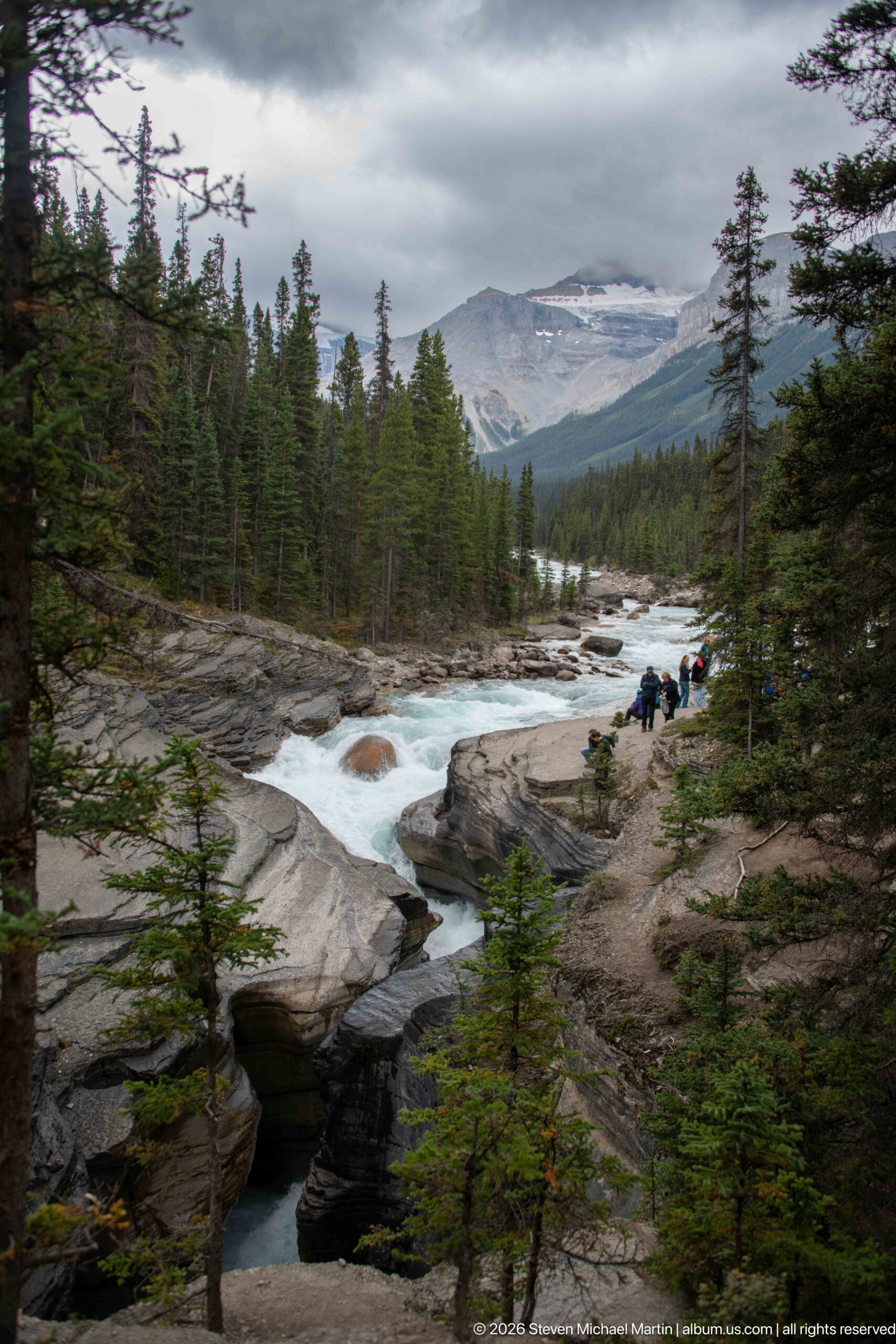
The Mistaya River spreads into bright whitewater across rock ledges before disappearing into the darker canyon opening in the foreground. Conifer forest fills the valley sides, and distant mountains sit beneath low cloud, creating a layered view from active river erosion to the broader Canadian Rockies landscape.
Caption
The Mistaya River spreads into bright whitewater across rock ledges before disappearing into the darker canyon opening in the foreground. Conifer forest fills the valley sides, and distant mountains sit beneath low cloud, creating a layered view from active river erosion to the broader Canadian Rockies landscape.
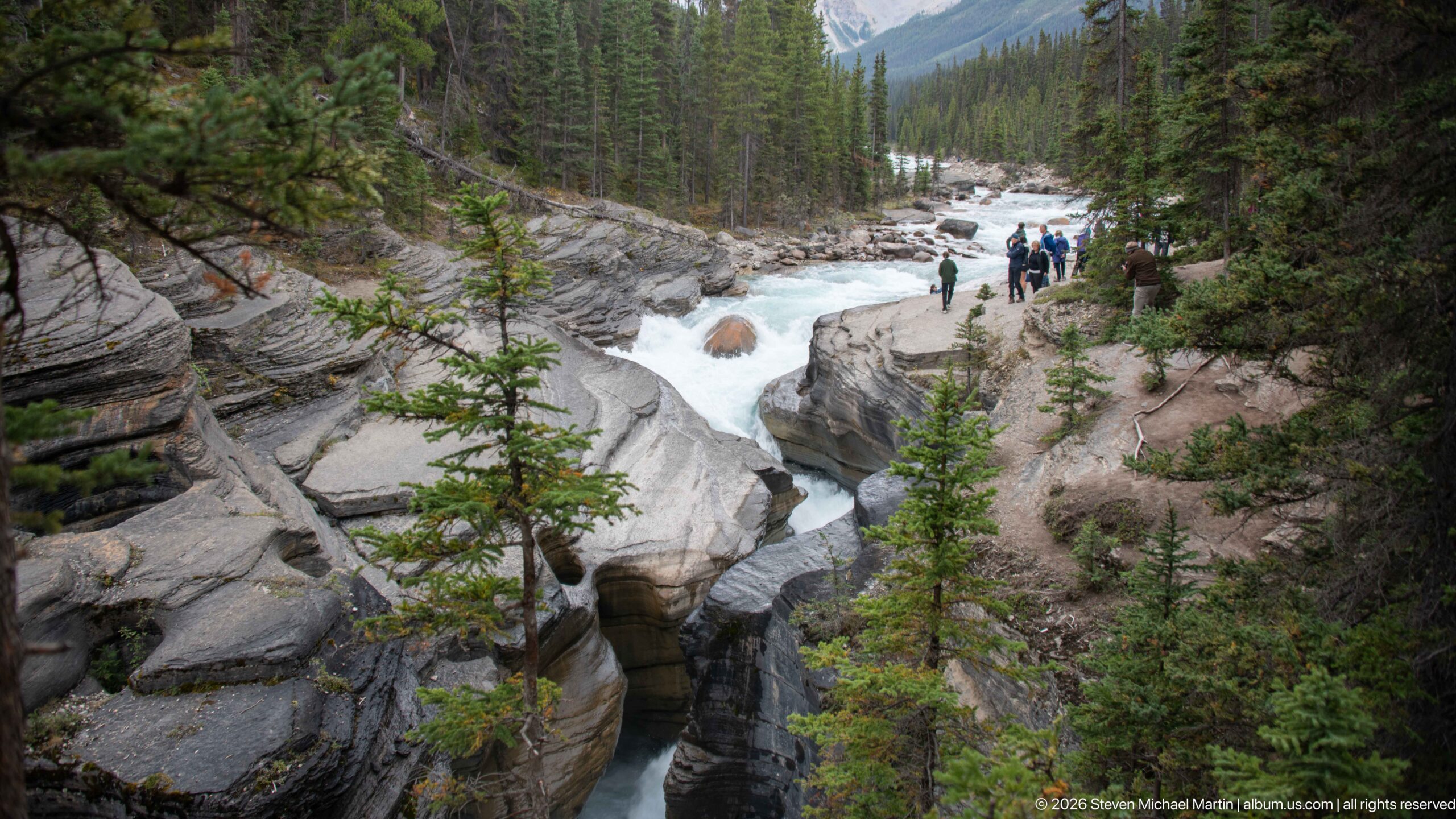
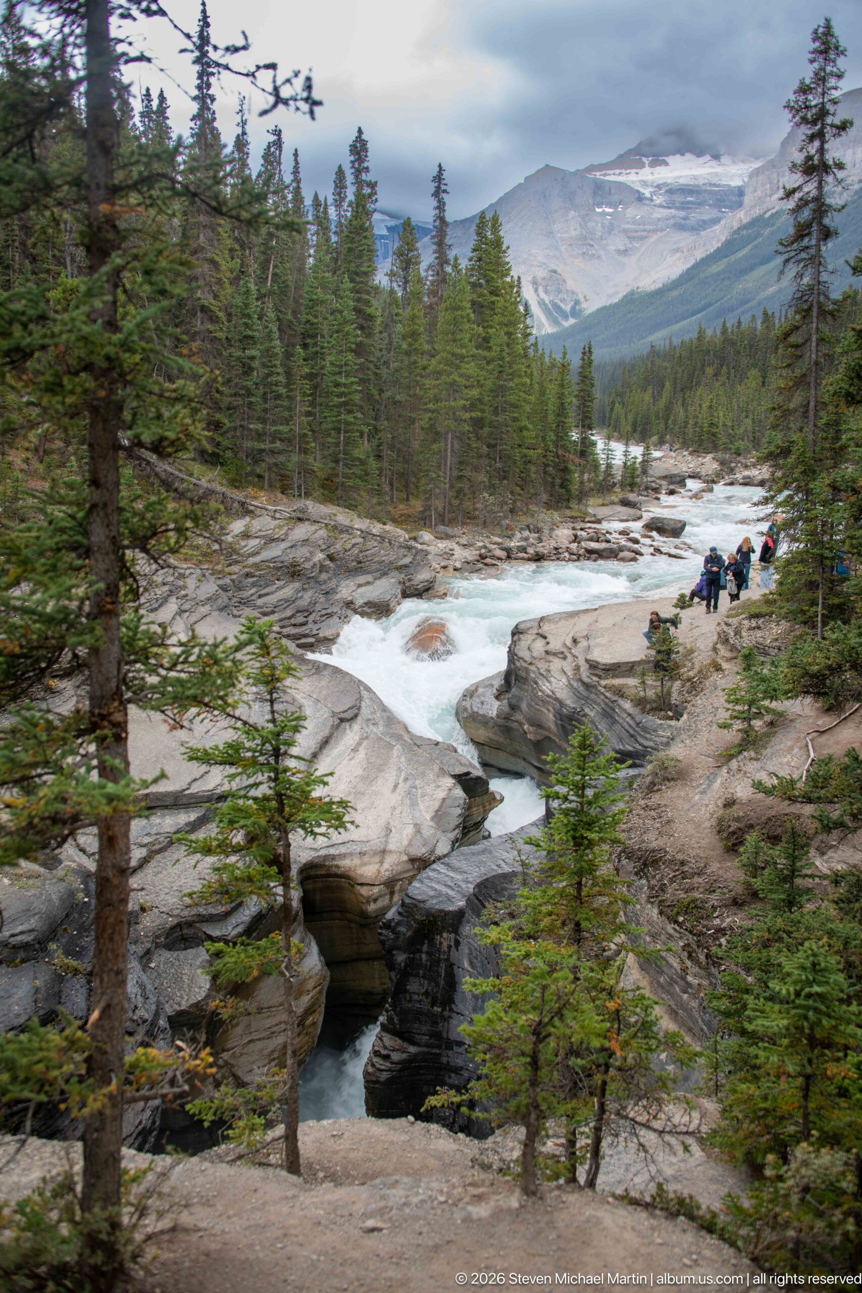
A narrow, deeply sculpted channel carries the Mistaya River between smooth rock walls below the broader upstream rapids. Visitors line the rim at upper right, giving scale to the constricted gorge, while conifers cling to rocky margins above the water-carved forms.
Caption
A narrow, deeply sculpted channel carries the Mistaya River between smooth rock walls below the broader upstream rapids. Visitors line the rim at upper right, giving scale to the constricted gorge, while conifers cling to rocky margins above the water-carved forms.
A broad landscape view follows the Mistaya River as white water crosses pale bedrock and enters the sculpted canyon. Conifers frame the river corridor, while layered mountain slopes rise under an overcast sky, linking the close geological forms of the gorge to the larger glacially shaped Rocky Mountain valley.
Caption
A broad landscape view follows the Mistaya River as white water crosses pale bedrock and enters the sculpted canyon. Conifers frame the river corridor, while layered mountain slopes rise under an overcast sky, linking the close geological forms of the gorge to the larger glacially shaped Rocky Mountain valley.
The Mistaya River rushes across exposed bedrock before narrowing into the canyon, with visitors gathered along the rocky margins. Dense conifer forest encloses the river corridor, and a steep mountain rises beyond, showing the gorge as part of a larger high-energy river landscape rather than an isolated rock feature.
Caption
The Mistaya River rushes across exposed bedrock before narrowing into the canyon, with visitors gathered along the rocky margins. Dense conifer forest encloses the river corridor, and a steep mountain rises beyond, showing the gorge as part of a larger high-energy river landscape rather than an isolated rock feature.
Beyond the narrow canyon, the Mistaya River courses through a broader boulder-strewn channel bordered by dense conifer forest. Steep layered mountains close the valley in the distance beneath low cloud, contrasting the open river corridor with the confined gorge shown in nearby views.
Caption
Beyond the narrow canyon, the Mistaya River courses through a broader boulder-strewn channel bordered by dense conifer forest. Steep layered mountains close the valley in the distance beneath low cloud, contrasting the open river corridor with the confined gorge shown in nearby views.
From the canyon rim, a narrow opening exposes the Mistaya River beneath a nearly continuous rock surface. Fractures, shallow channels, and rounded edges interrupt the pale-gray bedrock, illustrating the complex surface forms created around the actively eroding gorge amid sparse subalpine vegetation.
Caption
From the canyon rim, a narrow opening exposes the Mistaya River beneath a nearly continuous rock surface. Fractures, shallow channels, and rounded edges interrupt the pale-gray bedrock, illustrating the complex surface forms created around the actively eroding gorge amid sparse subalpine vegetation.
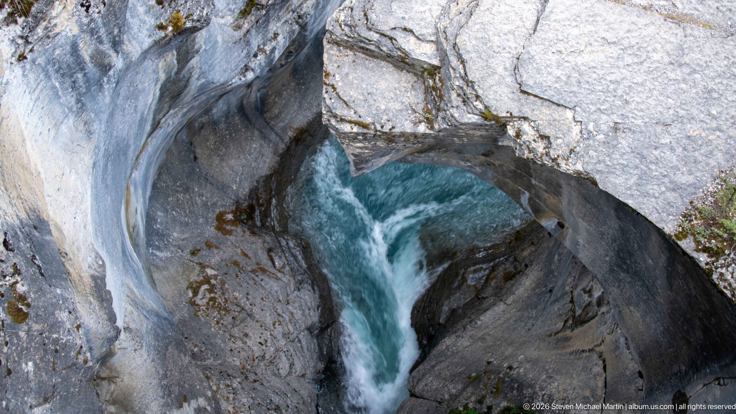
Turquoise water plunges through a narrow, smoothly sculpted rock chute in Mistaya Canyon. The close view emphasizes the force of the Mistaya River where it is compressed between pale, rounded canyon walls, with grooves and concave surfaces recording sustained abrasion and erosion in the carbonate bedrock.
Caption
Turquoise water plunges through a narrow, smoothly sculpted rock chute in Mistaya Canyon. The close view emphasizes the force of the Mistaya River where it is compressed between pale, rounded canyon walls, with grooves and concave surfaces recording sustained abrasion and erosion in the carbonate bedrock.
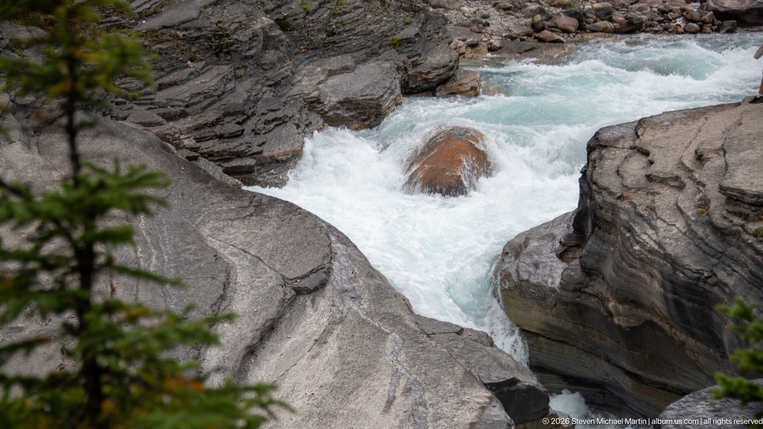
Fast, aerated water surges around a reddish boulder and between smoothly worn gray rock walls at Mistaya Canyon. The tight composition isolates the hydraulic force of the river, showing how turbulent flow is concentrated against resistant bedrock within the gorge.
Caption
Fast, aerated water surges around a reddish boulder and between smoothly worn gray rock walls at Mistaya Canyon. The tight composition isolates the hydraulic force of the river, showing how turbulent flow is concentrated against resistant bedrock within the gorge.
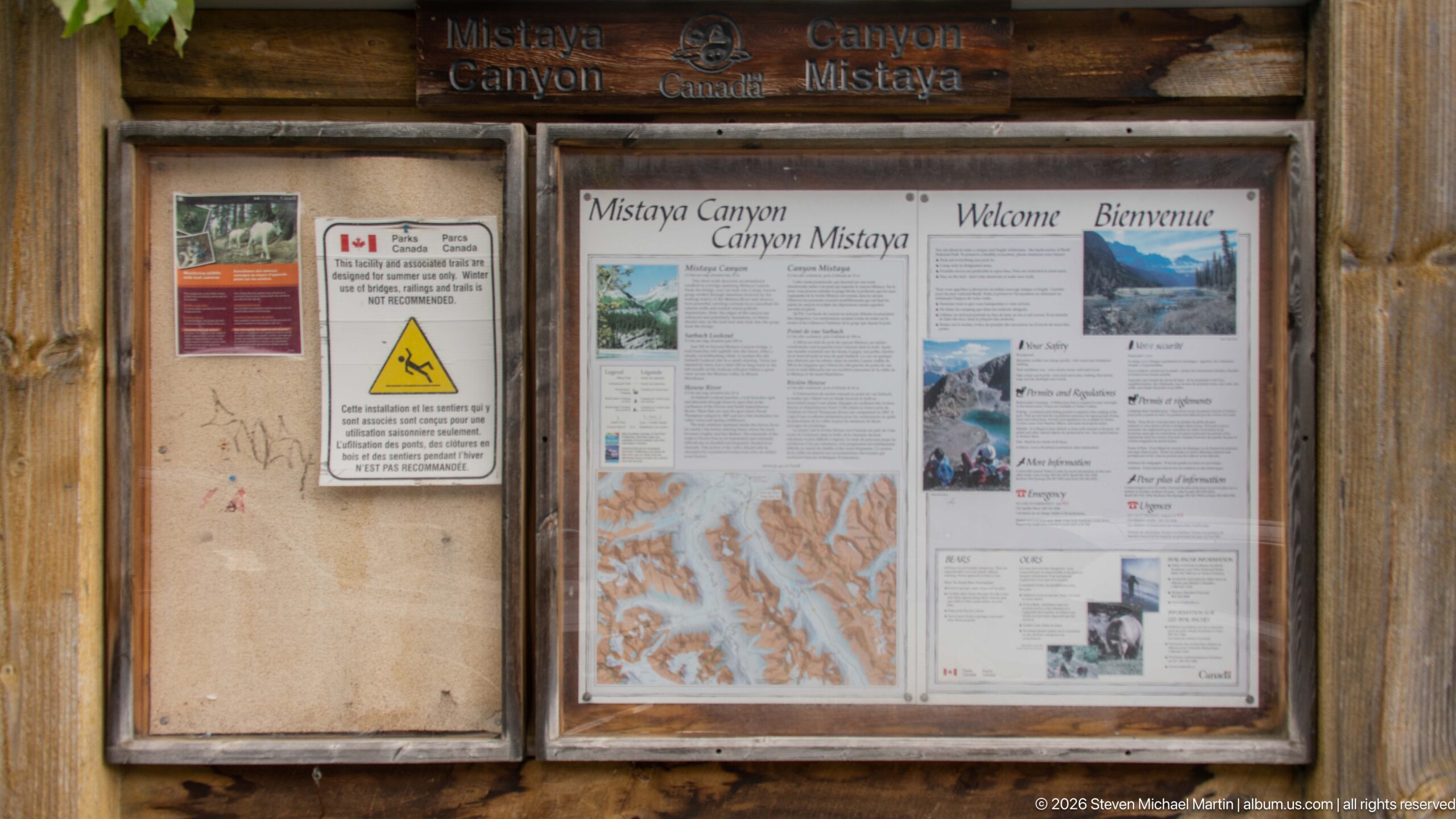
A rustic wooden information kiosk marks the Mistaya Canyon visitor area, with bilingual Parks Canada panels introducing the canyon and its setting. The display combines maps, photographs, safety information, and interpretive text, providing orientation before visitors approach the gorge and Mistaya River.
Caption
A rustic wooden information kiosk marks the Mistaya Canyon visitor area, with bilingual Parks Canada panels introducing the canyon and its setting. The display combines maps, photographs, safety information, and interpretive text, providing orientation before visitors approach the gorge and Mistaya River.
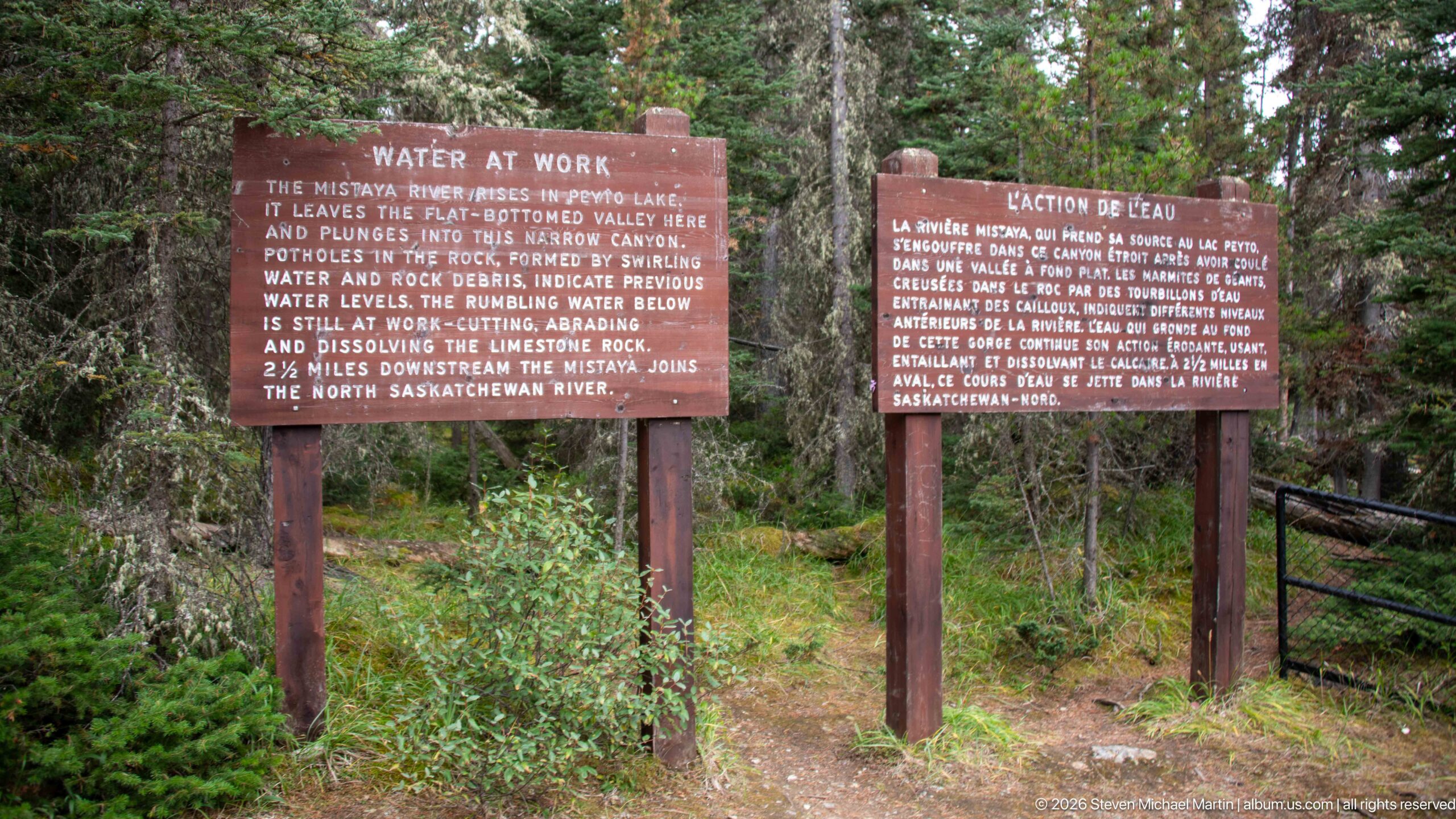
Two roadside-style interpretive panels titled “Water at Work” stand among conifers near Mistaya Canyon. The English and French texts explain how swirling water and rock debris form potholes, while abrasion and dissolution continue cutting the limestone gorge and connecting the Mistaya River to the North Saskatchewan River watershed.
Caption
Two roadside-style interpretive panels titled “Water at Work” stand among conifers near Mistaya Canyon. The English and French texts explain how swirling water and rock debris form potholes, while abrasion and dissolution continue cutting the limestone gorge and connecting the Mistaya River to the North Saskatchewan River watershed.
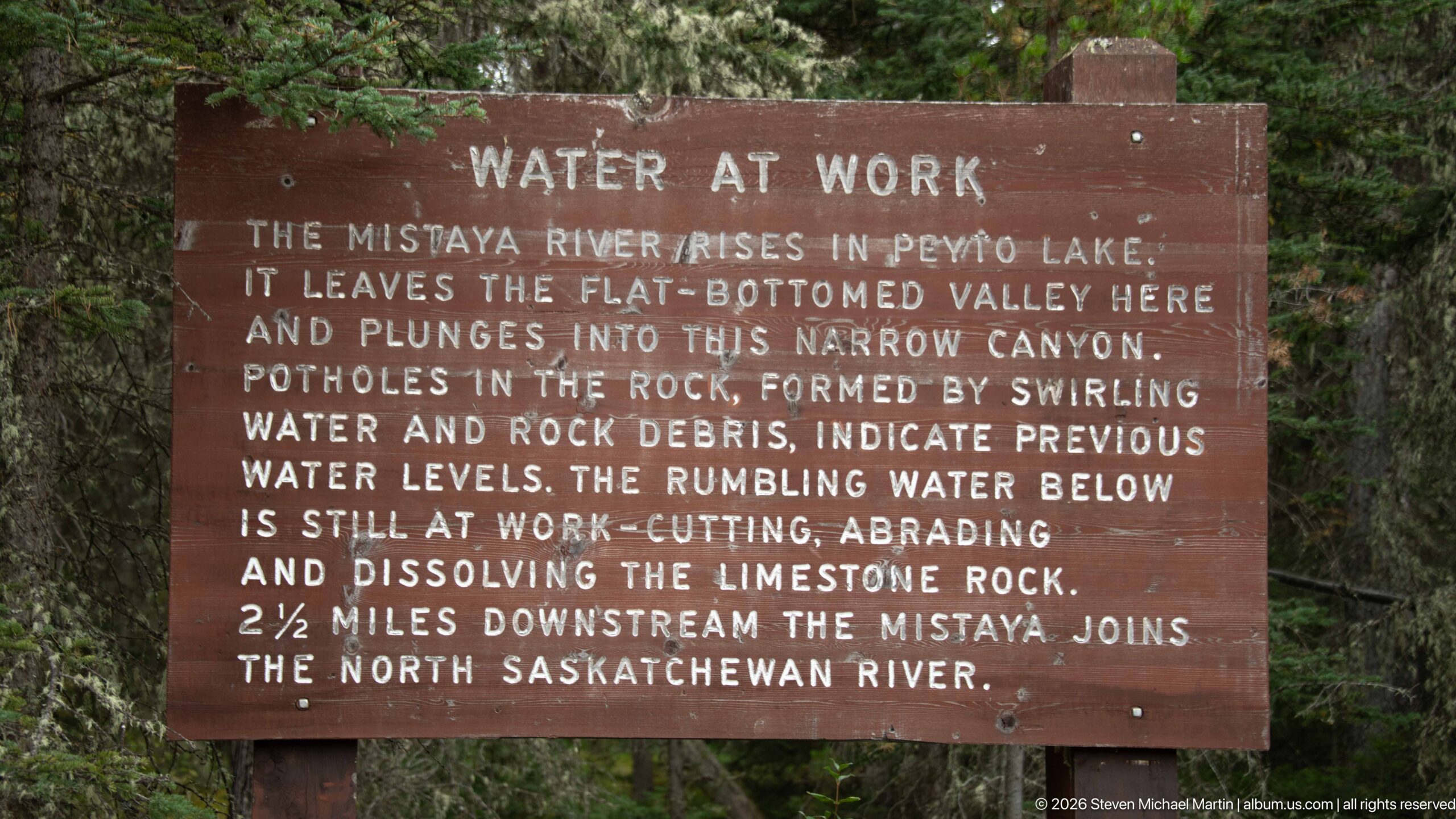
The English “Water at Work” panel explains the erosive processes visible at Mistaya Canyon: swirling water and rock debris form potholes, while the river continues cutting, abrading, and dissolving limestone. It also notes that the Mistaya River rises in Peyto Lake and joins the North Saskatchewan River downstream.
Caption
The English “Water at Work” panel explains the erosive processes visible at Mistaya Canyon: swirling water and rock debris form potholes, while the river continues cutting, abrading, and dissolving limestone. It also notes that the Mistaya River rises in Peyto Lake and joins the North Saskatchewan River downstream.
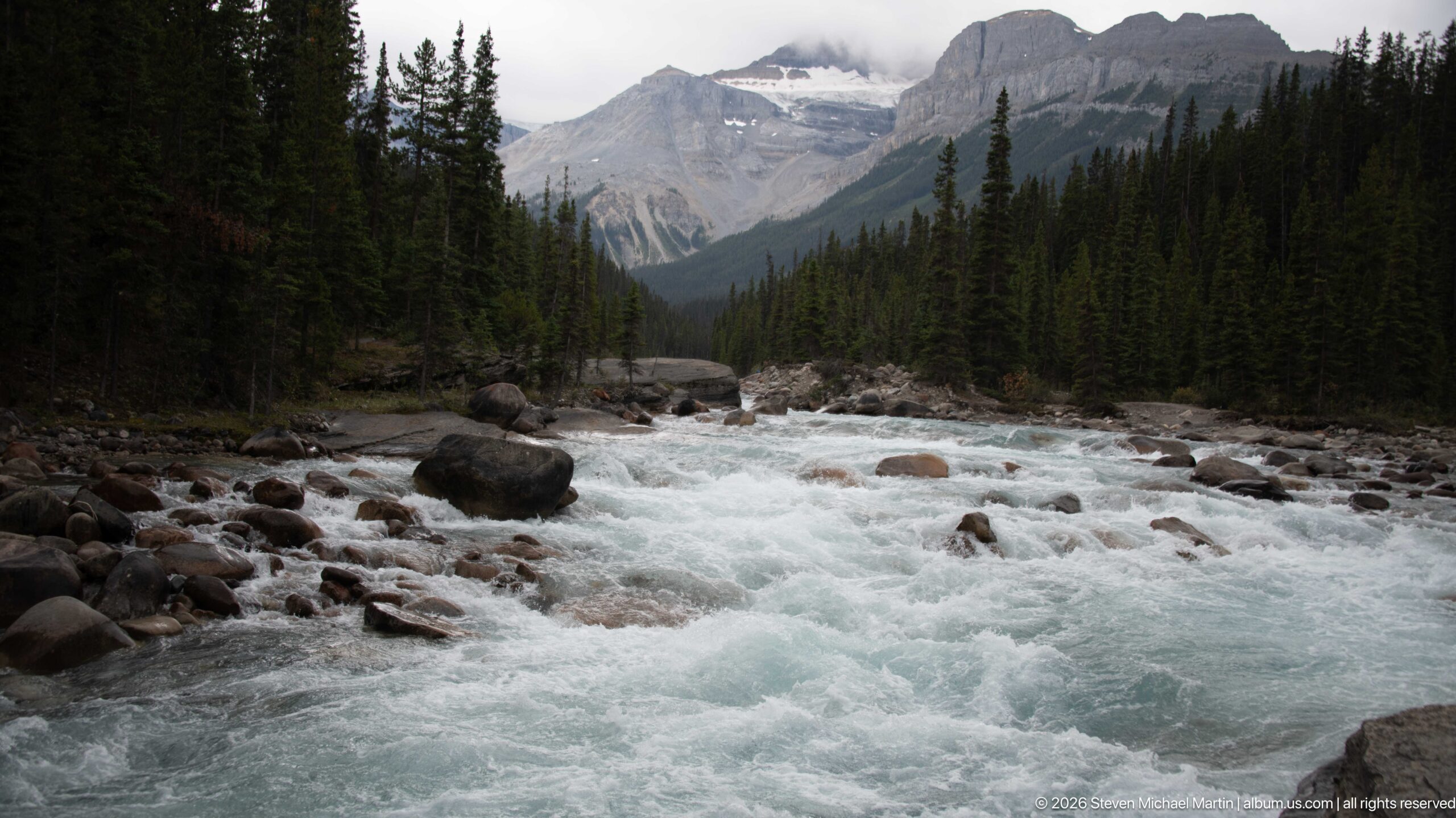
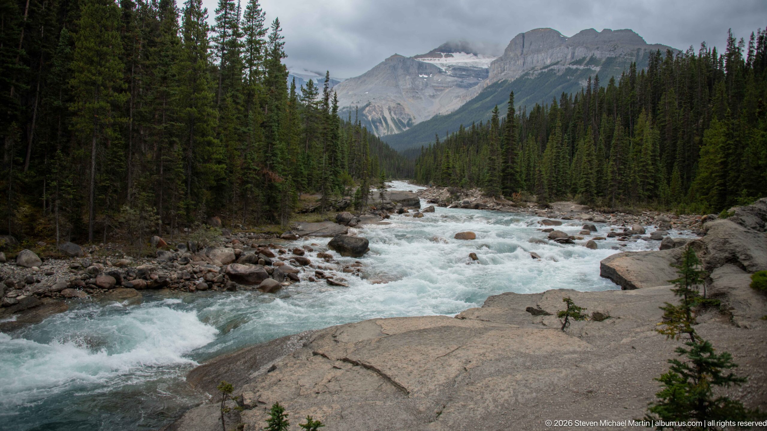
A low viewpoint emphasizes the volume and speed of the Mistaya River as whitewater breaks across a channel crowded with rounded boulders. Dark conifers rise along both banks, while a massive layered mountain anchors the valley beyond beneath a ceiling of cloud.
Caption
A low viewpoint emphasizes the volume and speed of the Mistaya River as whitewater breaks across a channel crowded with rounded boulders. Dark conifers rise along both banks, while a massive layered mountain anchors the valley beyond beneath a ceiling of cloud.
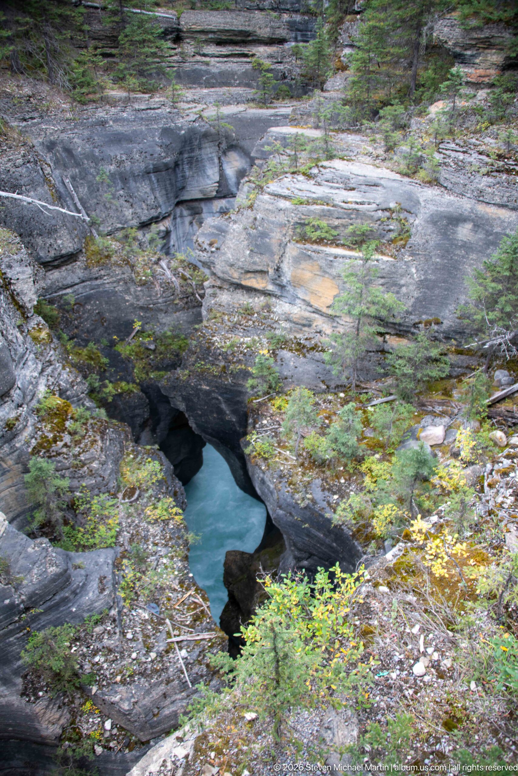
An opening in the canyon rim reveals blue-green water moving below a broad expanse of weathered rock. Rounded margins and irregular depressions show how flowing water has sculpted the exposed bedrock, while low vegetation and conifers occupy cracks and shallow pockets around the gorge.
Caption
An opening in the canyon rim reveals blue-green water moving below a broad expanse of weathered rock. Rounded margins and irregular depressions show how flowing water has sculpted the exposed bedrock, while low vegetation and conifers occupy cracks and shallow pockets around the gorge.
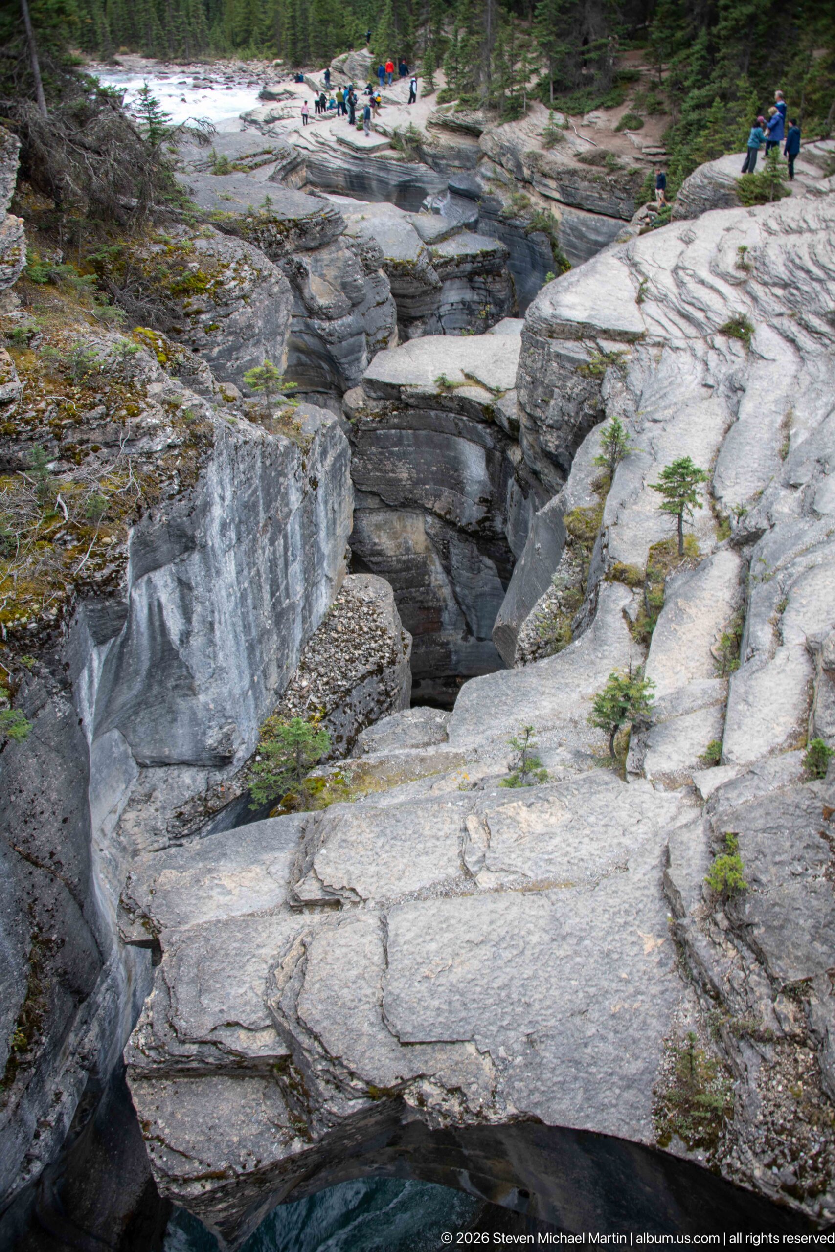
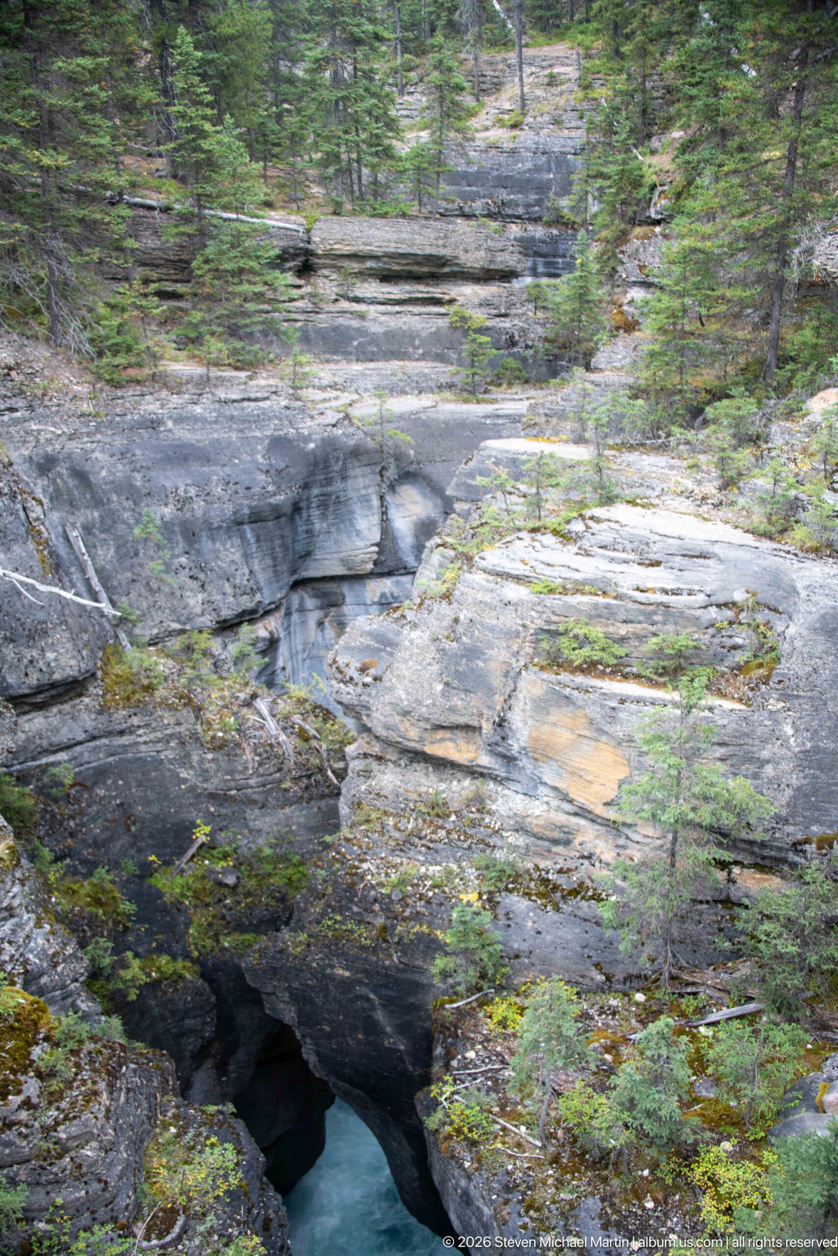
Broad slabs of pale bedrock frame the deeply incised upper portion of Mistaya Canyon. Smooth vertical faces, fractures, and rounded margins reveal contrasting patterns of erosion, while small conifers rooted in cracks underscore the thin soils and exposed character of the canyon rim.
Caption
Broad slabs of pale bedrock frame the deeply incised upper portion of Mistaya Canyon. Smooth vertical faces, fractures, and rounded margins reveal contrasting patterns of erosion, while small conifers rooted in cracks underscore the thin soils and exposed character of the canyon rim.
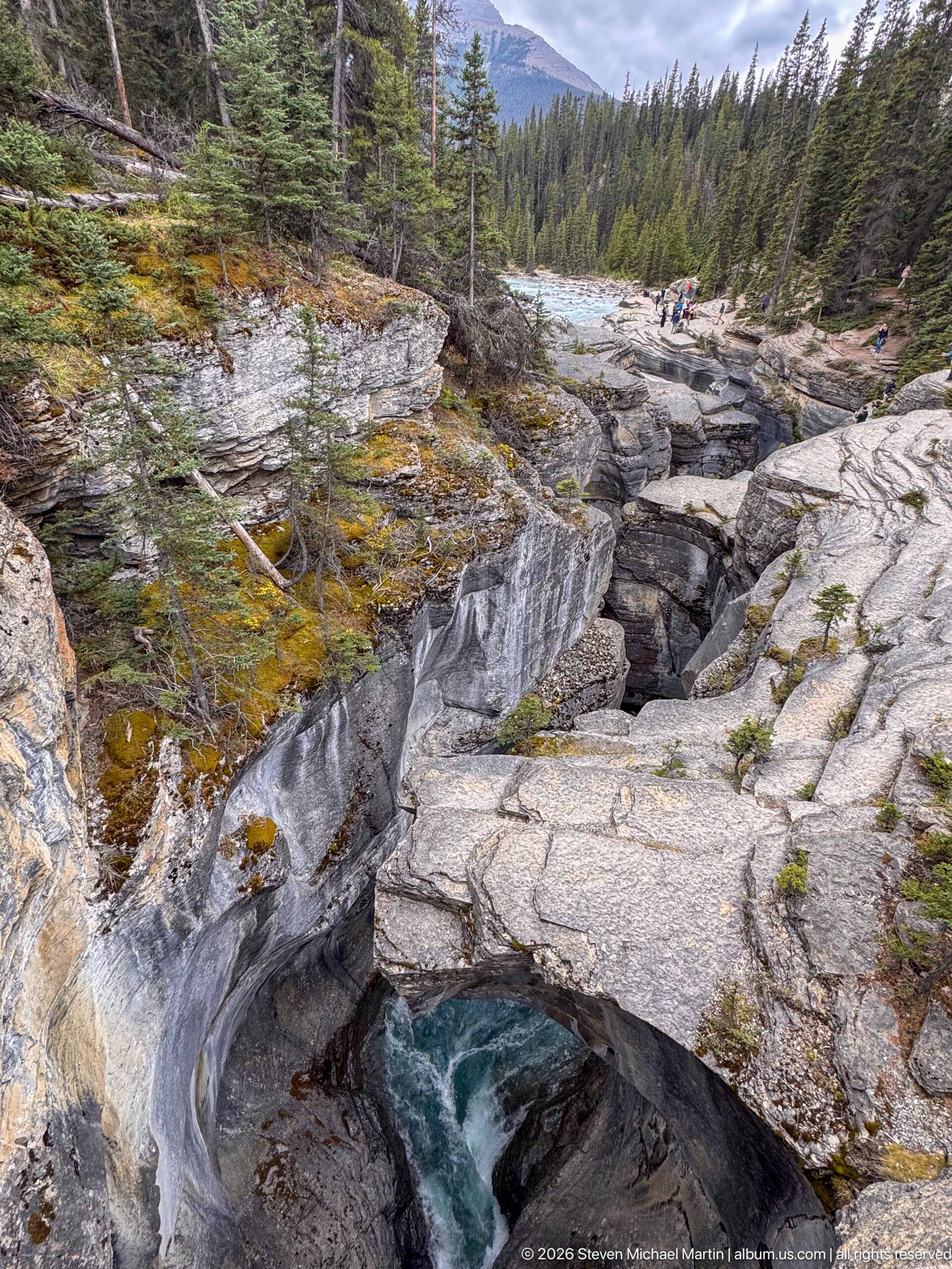
The Mistaya River drops into a constricted channel beneath broad, polished bedrock at the canyon rim. Curving rock surfaces and a deeply cut slot dominate the foreground, while conifer forest and distant mountain slopes place the active gorge within its broader Canadian Rockies setting.
Caption
The Mistaya River drops into a constricted channel beneath broad, polished bedrock at the canyon rim. Curving rock surfaces and a deeply cut slot dominate the foreground, while conifer forest and distant mountain slopes place the active gorge within its broader Canadian Rockies setting.
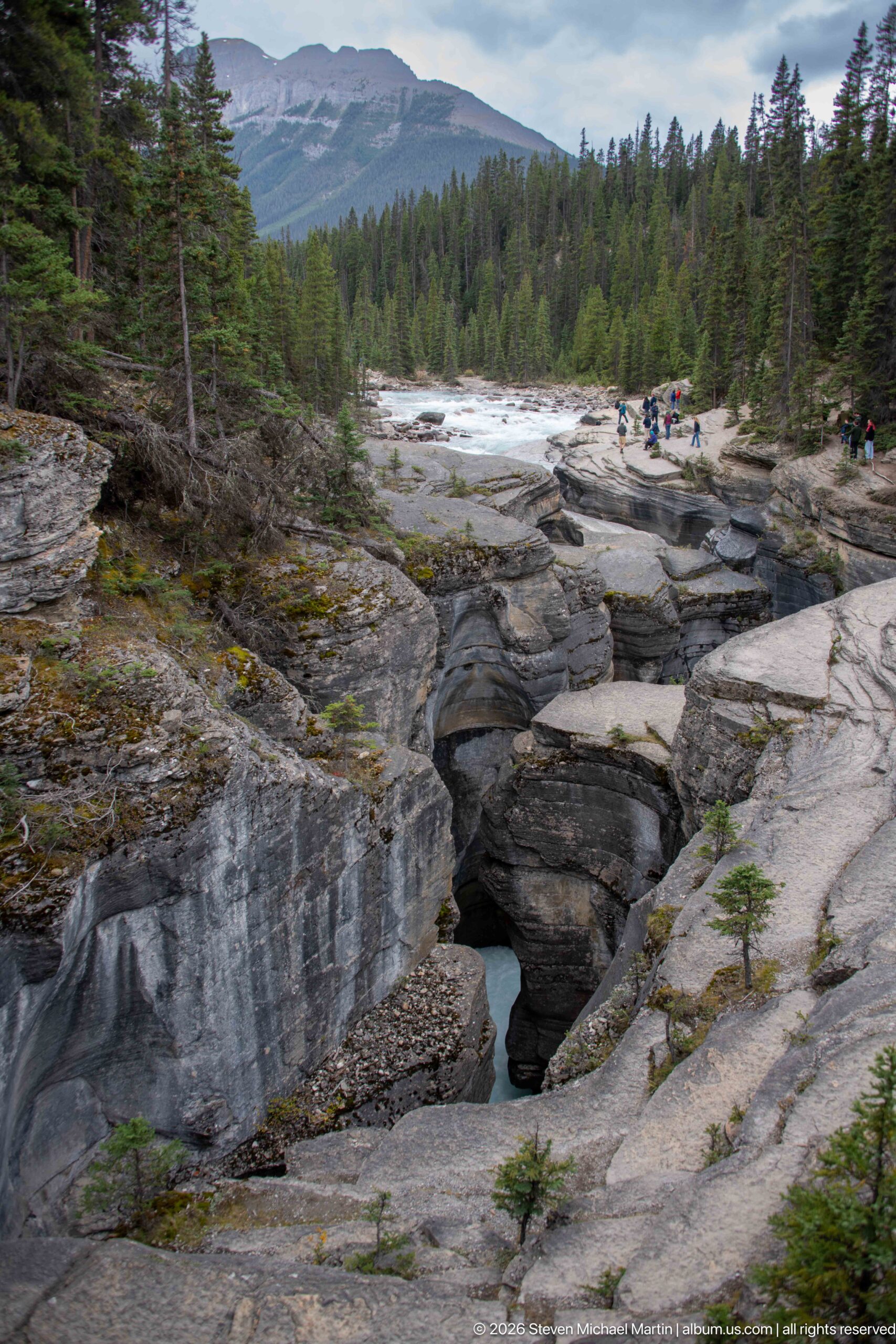
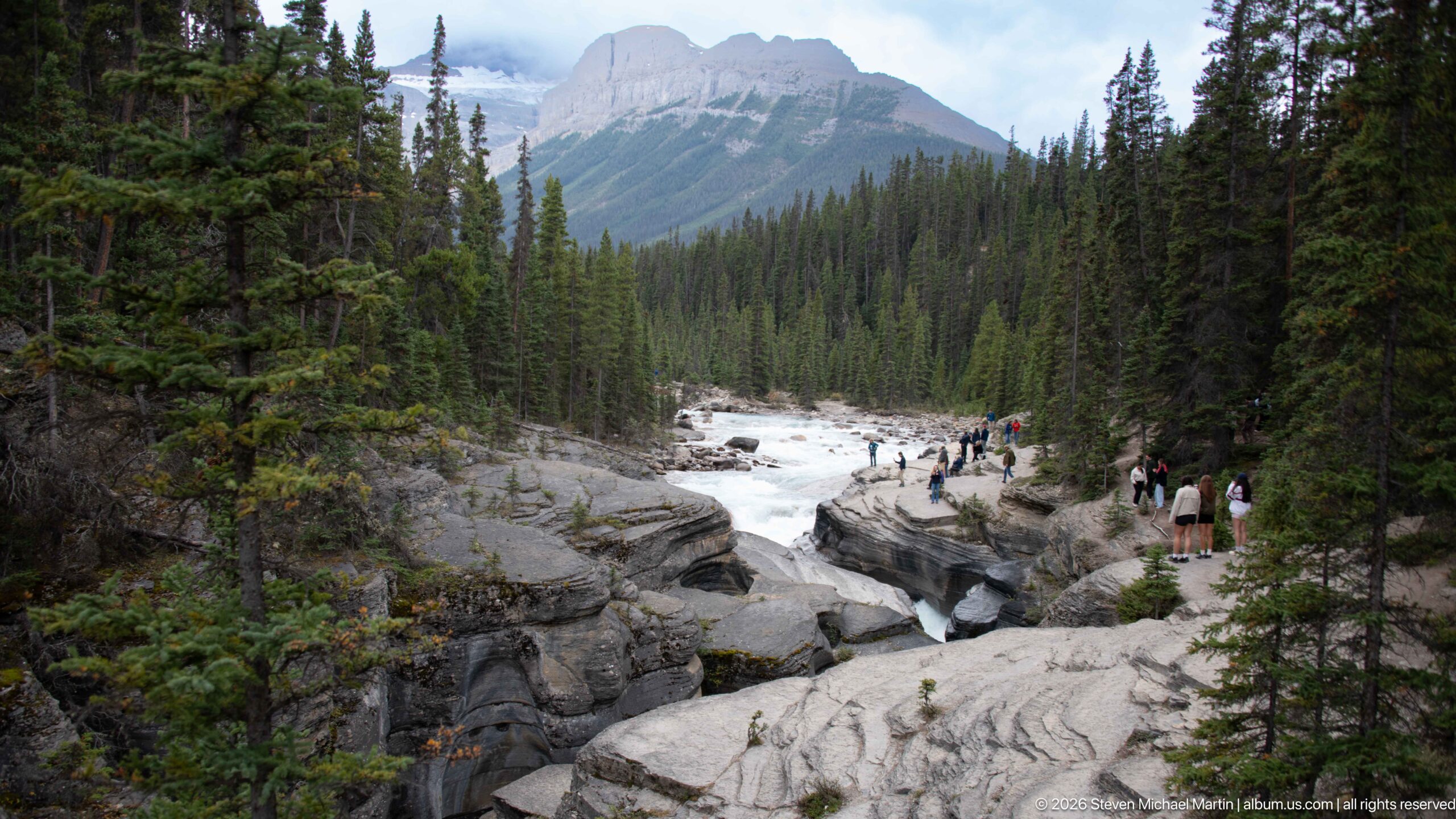
A wider view shows the incised channel of Mistaya Canyon cutting through broad rock benches beneath a forested mountain landscape. The pale, smoothed walls and deep openings trace the river's erosive path, while visitors on the far rim provide a useful sense of scale.
Caption
A wider view shows the incised channel of Mistaya Canyon cutting through broad rock benches beneath a forested mountain landscape. The pale, smoothed walls and deep openings trace the river's erosive path, while visitors on the far rim provide a useful sense of scale.
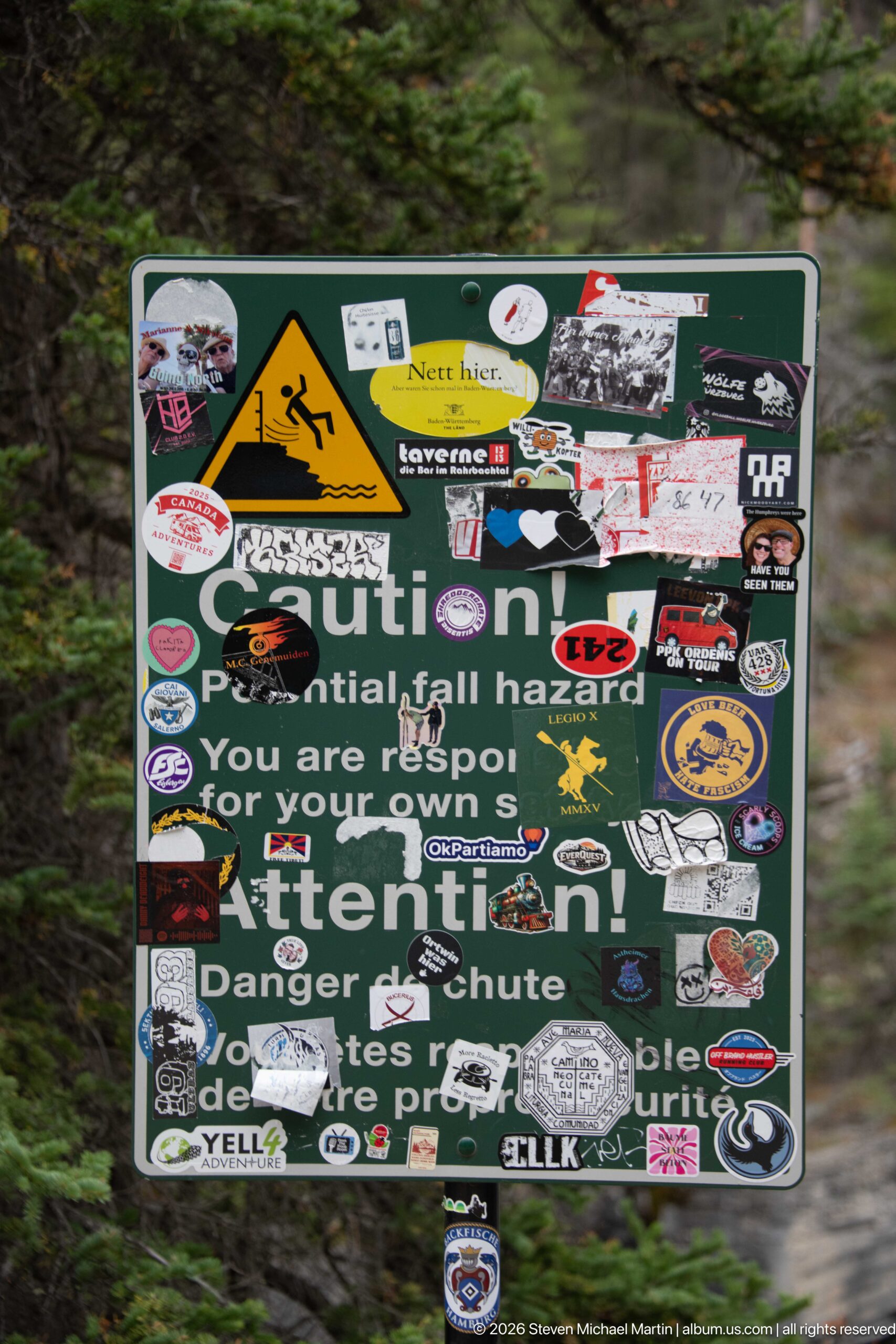
A heavily sticker-covered warning sign stands beside the Mistaya Canyon route. Despite the accumulated decals, the original graphic and fragments of text still indicate a steep-drop or cliff hazard, documenting both visitor safety infrastructure and the visual impact of repeated informal sticker placement.
Caption
A heavily sticker-covered warning sign stands beside the Mistaya Canyon route. Despite the accumulated decals, the original graphic and fragments of text still indicate a steep-drop or cliff hazard, documenting both visitor safety infrastructure and the visual impact of repeated informal sticker placement.
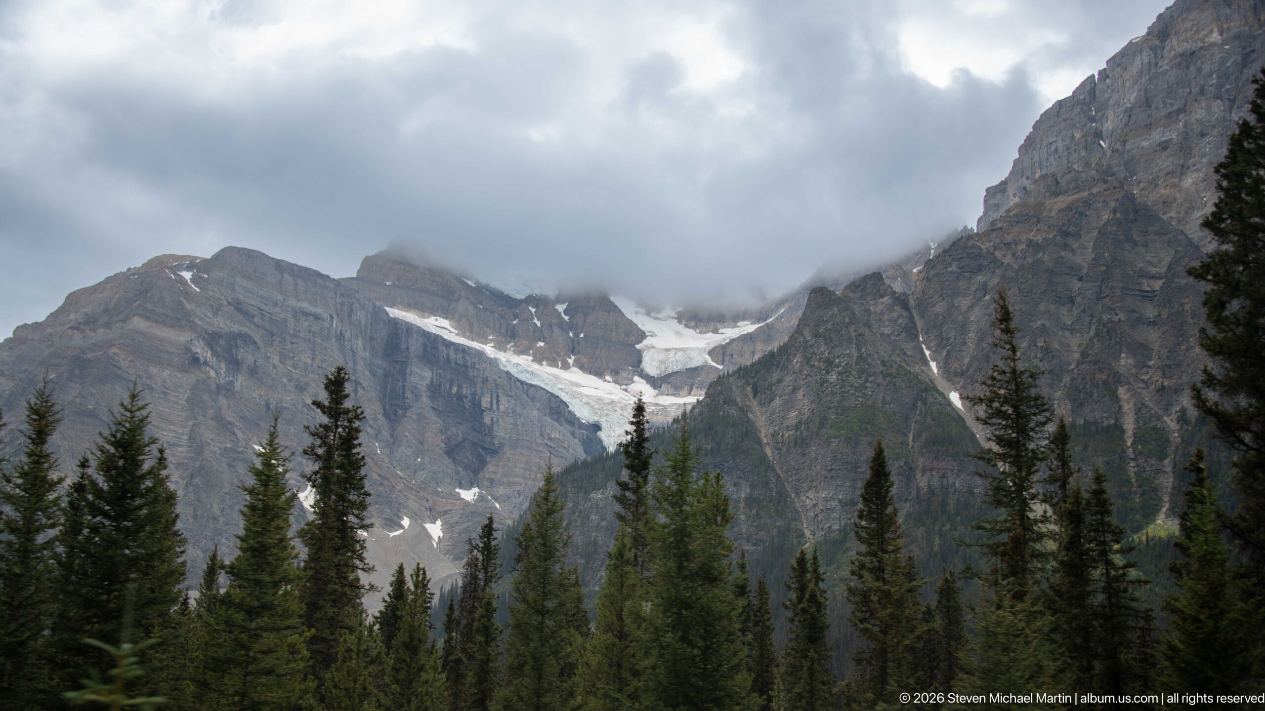
A glacier occupies a high basin between steep, horizontally layered mountain walls, with dark conifers forming a foreground band. Low clouds partly obscure the upper ridges, while exposed ice and snow descend toward a narrow outlet, illustrating the glacial character of the broader Icefields Parkway landscape.
Caption
A glacier occupies a high basin between steep, horizontally layered mountain walls, with dark conifers forming a foreground band. Low clouds partly obscure the upper ridges, while exposed ice and snow descend toward a narrow outlet, illustrating the glacial character of the broader Icefields Parkway landscape.
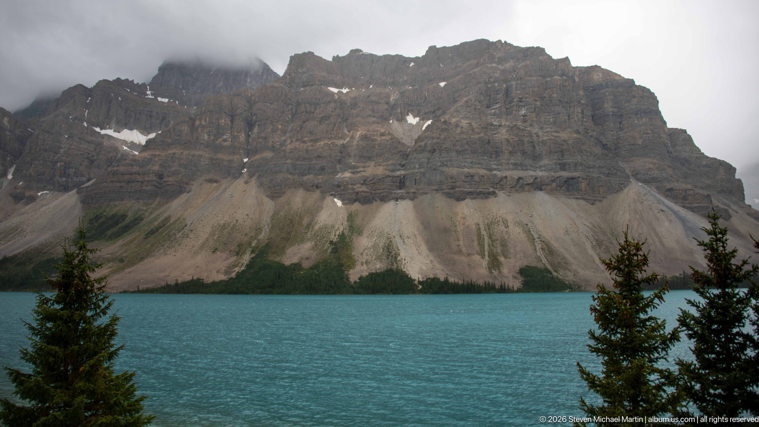
A turquoise mountain lake fills the foreground beneath a massive wall of horizontally layered rock. Broad pale scree fans descend from the cliffs to a narrow conifer fringe along the shore, while low cloud softens the summit line and reinforces the scale of the valley.
Caption
A turquoise mountain lake fills the foreground beneath a massive wall of horizontally layered rock. Broad pale scree fans descend from the cliffs to a narrow conifer fringe along the shore, while low cloud softens the summit line and reinforces the scale of the valley.
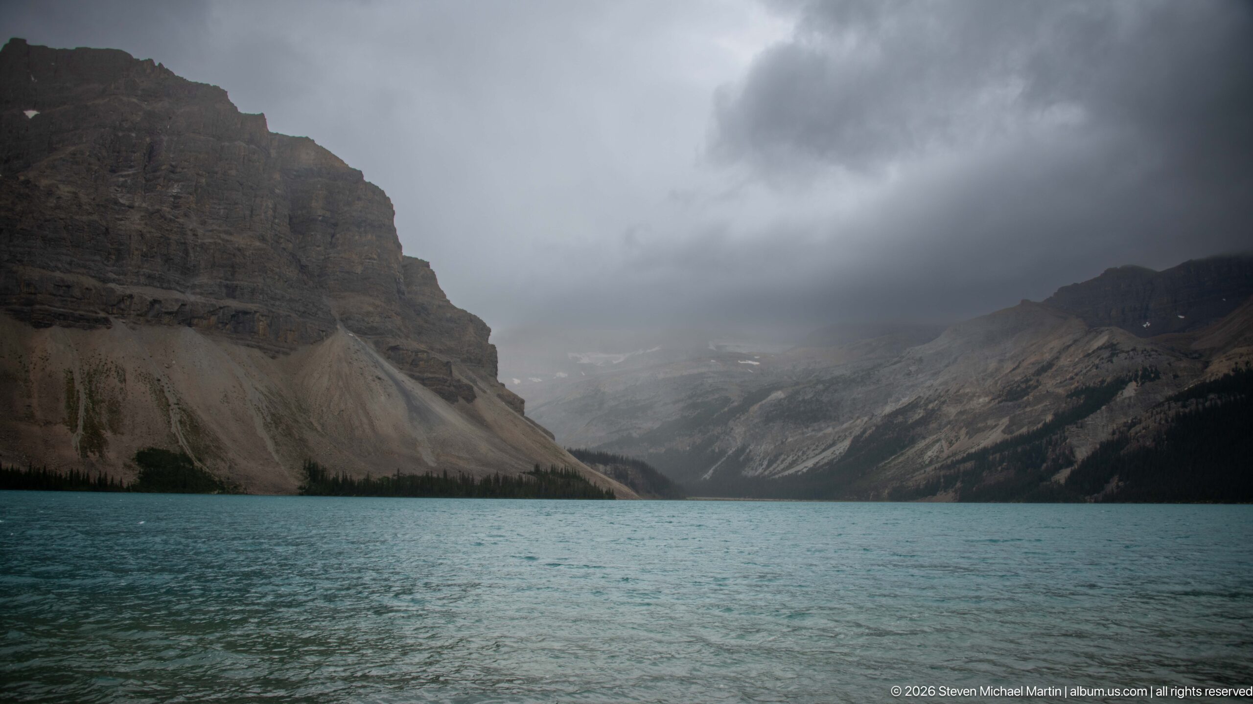
Dark storm clouds hang over a turquoise lake enclosed by steep mountain walls. The valley narrows toward a pale, partly obscured high basin in the distance, while scree-covered slopes and a thin forested shoreline frame the water under rapidly changing mountain weather.
Caption
Dark storm clouds hang over a turquoise lake enclosed by steep mountain walls. The valley narrows toward a pale, partly obscured high basin in the distance, while scree-covered slopes and a thin forested shoreline frame the water under rapidly changing mountain weather.
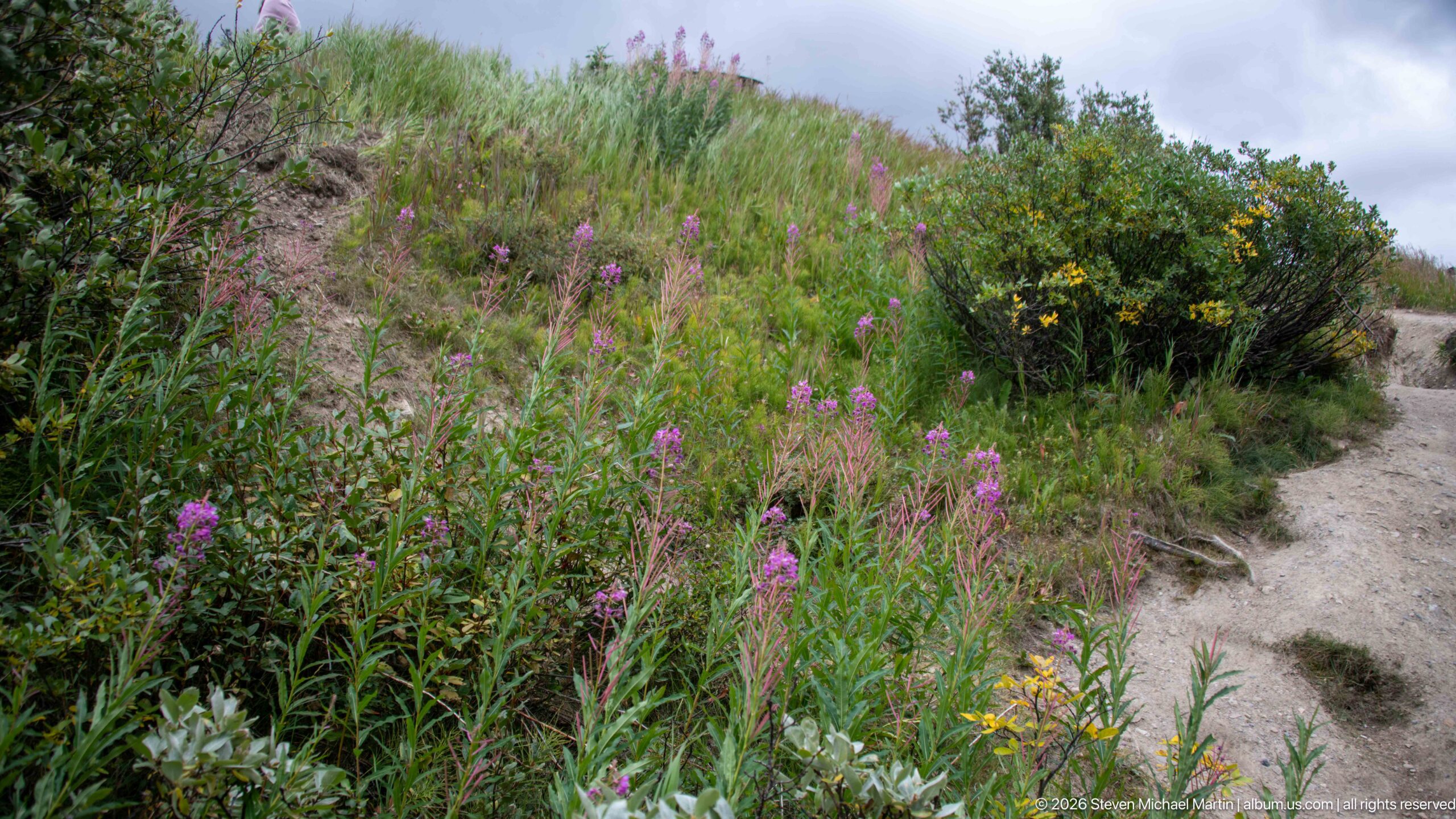
Pink and yellow wildflowers rise among dense green vegetation beside a narrow dirt path. Shrubby growth and scattered blooms fill the sloping foreground, offering a close botanical counterpoint to the rock, water, and ice landscapes elsewhere in the portfolio.
Caption
Pink and yellow wildflowers rise among dense green vegetation beside a narrow dirt path. Shrubby growth and scattered blooms fill the sloping foreground, offering a close botanical counterpoint to the rock, water, and ice landscapes elsewhere in the portfolio.
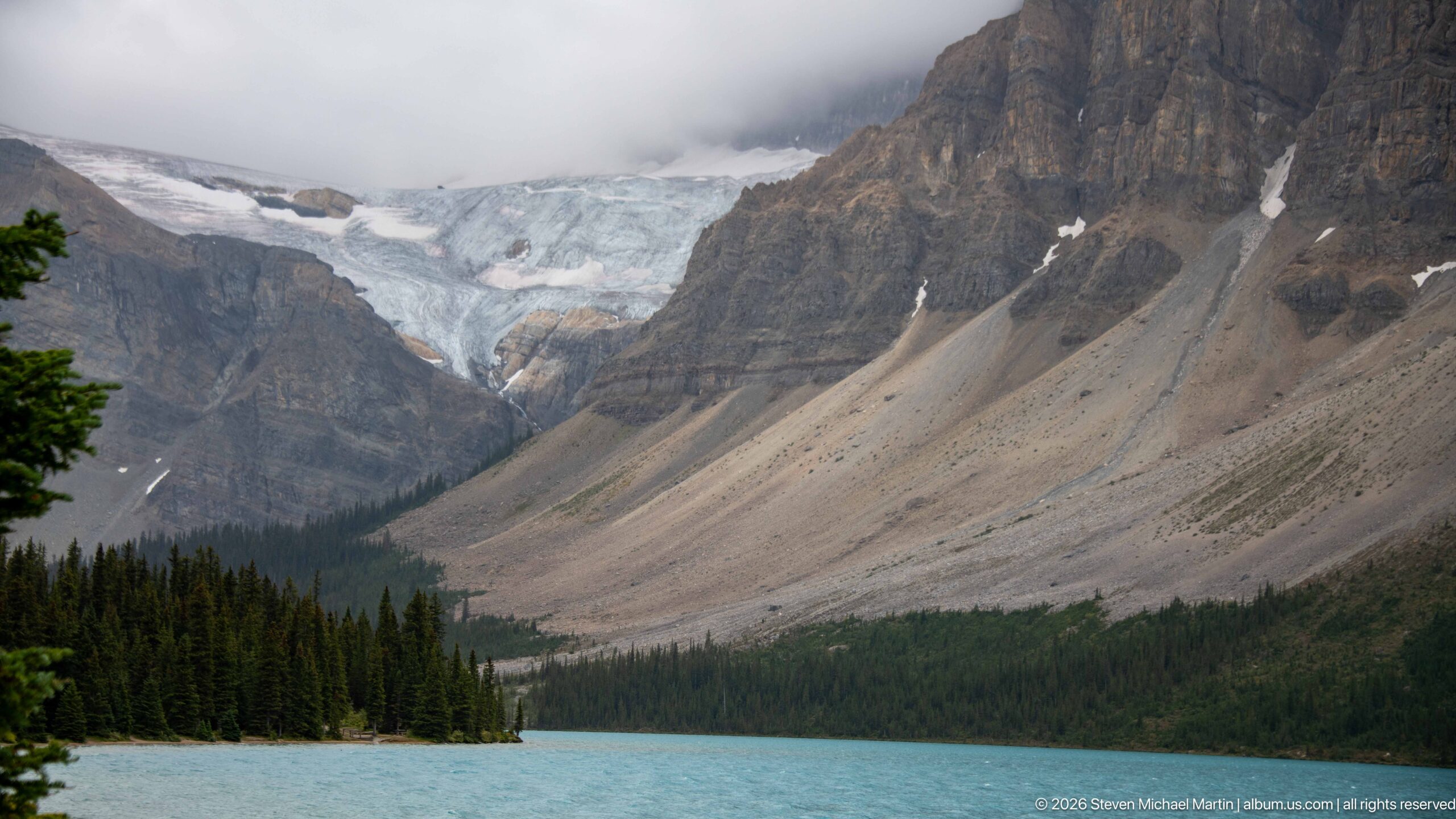
A glacier descends from a high, cloud-wrapped basin above a turquoise lake, bordered by dark conifer forest and enormous talus-covered mountain slopes. The composition connects present-day ice with the steep sedimentary relief and broad valley forms characteristic of the Canadian Rockies.
Caption
A glacier descends from a high, cloud-wrapped basin above a turquoise lake, bordered by dark conifer forest and enormous talus-covered mountain slopes. The composition connects present-day ice with the steep sedimentary relief and broad valley forms characteristic of the Canadian Rockies.
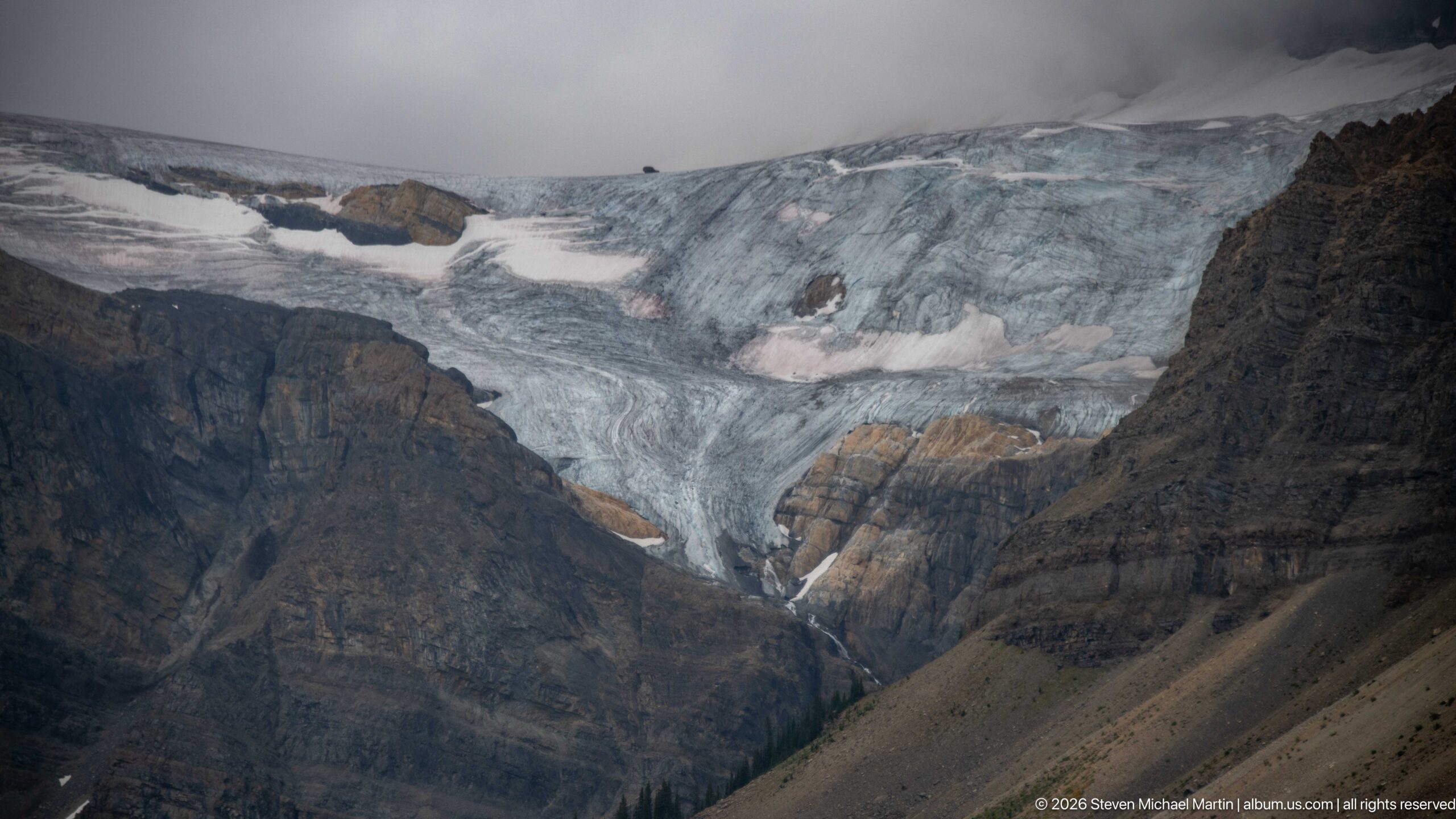
A closer view isolates blue-gray glacier ice spilling across a high mountain basin. Dark sedimentary rock walls border the ice, while bands of snow, crevasses, and debris mark its irregular surface; low cloud cuts across the upper edge of the glacier and surrounding ridge.
Caption
A closer view isolates blue-gray glacier ice spilling across a high mountain basin. Dark sedimentary rock walls border the ice, while bands of snow, crevasses, and debris mark its irregular surface; low cloud cuts across the upper edge of the glacier and surrounding ridge.
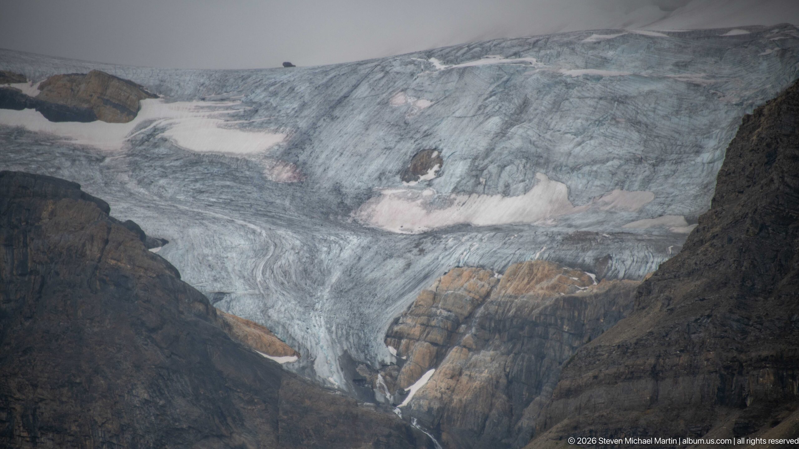
Crevassed blue-gray ice flows around exposed bands of brown and dark sedimentary rock in this tight glacier study. Snow patches and surface debris interrupt the ice, and a narrow meltwater streak descends from the lower margin, emphasizing the glacier's complex contact with the surrounding mountain bedrock.
Caption
Crevassed blue-gray ice flows around exposed bands of brown and dark sedimentary rock in this tight glacier study. Snow patches and surface debris interrupt the ice, and a narrow meltwater streak descends from the lower margin, emphasizing the glacier's complex contact with the surrounding mountain bedrock.
🏞️ National Park Field Guide
📍 Overview
Mistaya Canyon lies in Banff National Park along the Icefields Parkway, where the Mistaya River has cut a narrow, twisting gorge through carbonate sedimentary rock in the Canadian Rockies. Although the portfolio is titled Jasper Icefield Mistaya Canyon, the canyon itself is in Banff National Park and forms part of the Canadian Rocky Mountain Parks World Heritage property rather than a separately inscribed UNESCO site. A short approach from the parkway leads toward the canyon and its pedestrian bridge, where the river’s concentrated force, pale sculpted bedrock, and surrounding conifer forest bring the geological processes of the mountain landscape into unusually close view.
🏔️ Landscape
Mistaya Canyon is a small, deeply incised feature within a much larger Rocky Mountain landscape shaped by Pleistocene glaciation. Broad mountain valleys, lakes, river corridors, conifer forest, steep sedimentary slopes, and high glacial basins provide the regional setting, while the canyon compresses that scale into a confined passage of rock and rushing water. The Mistaya River is part of the Peyto Lake–Mistaya River drainage and flows generally northward through the Icefields Parkway landscape before joining the North Saskatchewan River near Saskatchewan River Crossing. Seen in this wider context, the canyon is not an isolated attraction but one expression of a connected mountain watershed.
🪨 Geology
The defining story of Mistaya Canyon is erosion. The Mistaya River has incised the gorge into carbonate sedimentary bedrock, and its rounded walls, grooves, smooth concave surfaces, and pothole-like depressions record the continuing interaction of water, rock, and transported sediment. Where the river is forced through narrow chutes, turbulent flow concentrates erosive energy; sediment carried by the current abrades the rock while dissolution also acts on the carbonate bedrock. The result is a gorge whose polished curves and irregular openings make active fluvial erosion visible at close range. The larger valleys occupied by the modern river were strongly influenced by Pleistocene glaciation, linking the canyon’s present river processes to the much broader glacial history of the Canadian Rockies.
🌿 Ecology
The canyon corridor combines a cold, high-energy mountain river with steep exposed rock and montane to subalpine conifer forest. Vegetation occupies the canyon margins and fractures in the bedrock, while the surrounding Banff landscape provides habitat capable of supporting large mammals and other forest wildlife. The photographs also show how quickly the ecological setting changes with elevation and terrain: dense conifer stands border river channels and lakes, while higher mountain basins become increasingly dominated by rock, snow, and ice. These transitions are part of the broader environmental gradient of the Canadian Rockies, but individual plant or wildlife species should be identified only where diagnostic evidence supports them.
🦌 Wildlife
Mistaya Canyon lies within a protected Rocky Mountain landscape that can support large mammals and other forest wildlife, but the portfolio does not provide photographic evidence sufficient to document a specific wildlife encounter. The most defensible interpretation is therefore habitat-based: the river gorge, conifer forest, rocky slopes, and connected mountain valleys form part of the larger Banff ecosystem. Species, behavior, age, sex, or seasonal status should not be inferred from location alone.
🧭 Human History
Mistaya Canyon is protected within Banff National Park, one of the parks included in the Canadian Rocky Mountain Parks World Heritage property. That designation recognizes the exceptional natural landscapes and geological features of a multi-park Canadian Rockies property; it does not designate Mistaya Canyon as a separate World Heritage Site. Today, the Icefields Parkway provides access to this landscape, while interpretive displays at the canyon explain the erosive work of the Mistaya River and its relationship to the surrounding watershed. The portfolio’s evidence supports this protected-landscape and visitor-interpretation story without assigning more specific Indigenous, exploration, or travel history to the canyon itself.
🥾 Visitor Experience
The experience of Mistaya Canyon is built around a dramatic change in scale. From the Icefields Parkway landscape, visitors approach a gorge where the broad mountain river is suddenly confined between sculpted rock walls. The bridge and canyon rim provide elevated views into narrow chutes, rounded depressions, undercut forms, and turbulent water, allowing the erosional processes described by the interpretive panels to be seen directly. Wider viewpoints reconnect the gorge with conifer forest and surrounding mountains, while close positions along the rim reveal the textures and shapes of the bedrock. Water color and flow intensity can change with weather, snowmelt, sediment load, and season, so the canyon’s appearance is not fixed.
📷 Photography Notes
Mistaya Canyon rewards a combination of wide environmental views and tight geological studies. Wider compositions can place the gorge and Mistaya River within conifer forest and the surrounding Canadian Rockies, while closer frames are especially effective for smooth concave walls, pothole-like depressions, fractures, narrow chutes, and turbulent water. Elevated viewpoints from the bridge and canyon rim help reveal the river’s sinuous course and the relationship between water and sculpted bedrock. The strongest photographs emphasize visible geomorphology and river action rather than generic scenery, and distant peaks, glaciers, plants, or other features should remain unnamed unless the image or precise location provides enough evidence for a reliable identification.