Banff Ice Fields
North of Lake Louise, the Icefields Parkway climbs through Banff National Park toward the Continental Divide, passing glacier-fed lakes, steep rock walls, and broad mountain valleys. Bow Summit, Peyto Lake, Bow Lake, and Crowfoot Glacier reveal how ice and meltwater have shaped this part of the Canadian Rockies. Farther north, the road reaches Sunwapta Pass and the Columbia Icefield, where the landscape opens onto a high world of ice, rock, and snow.
Randy and I treated the Parkway as a destination in itself, taking time for places such as Mistaya Canyon, the Weeping Wall, and the viewpoints around Bow Lake and Peyto Lake. Each stop offered a different view of the same changing terrain: water cutting through rock, glaciers tucked beneath ridgelines, and weather moving quickly across the peaks.
These photographs follow that progression from lakes and forested slopes to exposed cliffs, waterfalls, and distant ice. Together, they record a route shaped by glaciation and still changing under the force of water and weather—a mountain landscape best understood not in a single overlook, but across the long drive through it.
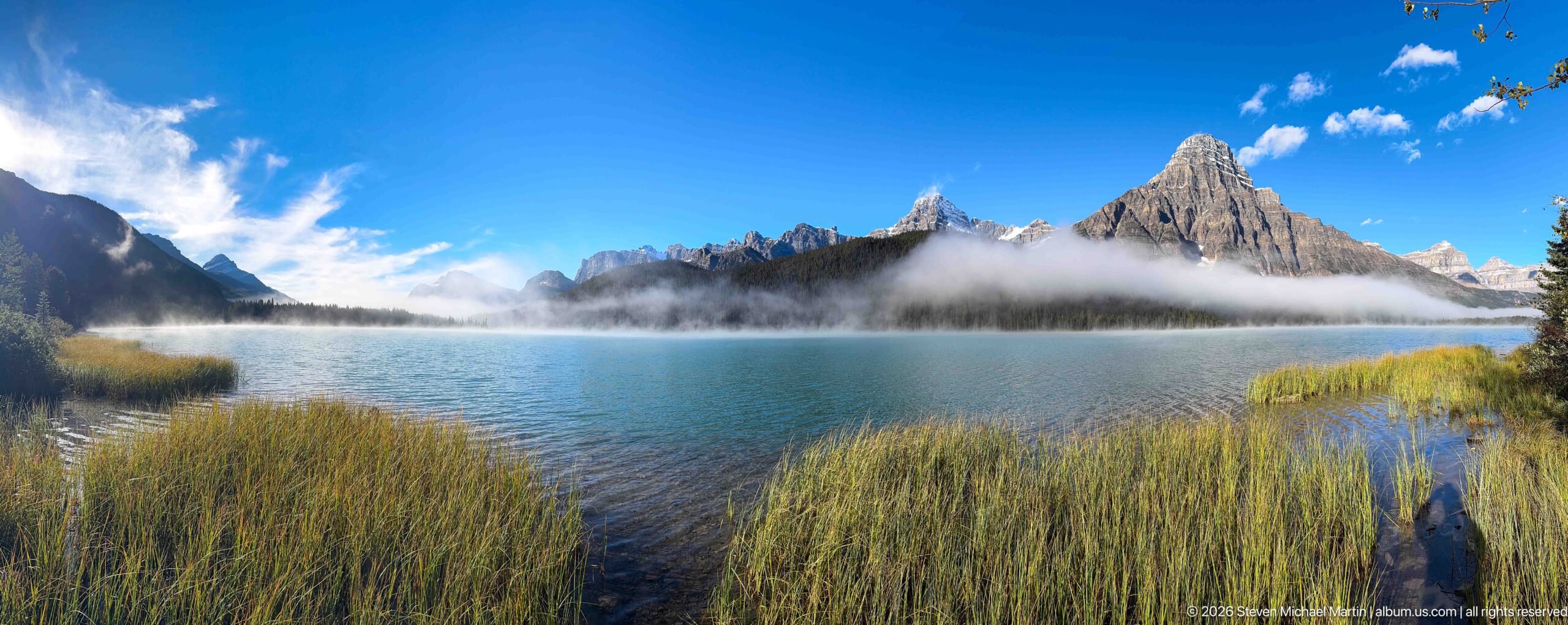
Tall grasses and reeds frame a clear lake below a pointed mountain summit and a jagged chain of peaks. A low cloud band hangs over the forested shore, while a small visitor at the water’s edge provides scale near the right side. The panoramic view balances close shoreline vegetation with the distant alpine skyline.
Caption
Tall grasses and reeds frame a clear lake below a pointed mountain summit and a jagged chain of peaks. A low cloud band hangs over the forested shore, while a small visitor at the water’s edge provides scale near the right side. The panoramic view balances close shoreline vegetation with the distant alpine skyline.
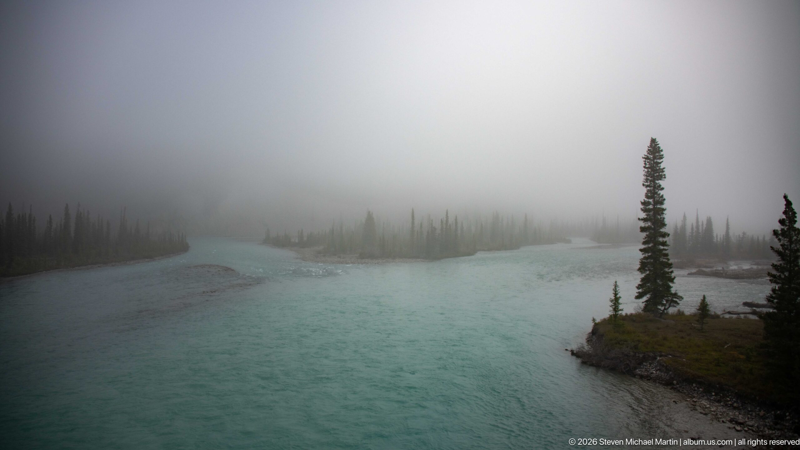
A turquoise river sweeps around a small, tree-covered gravel point, its far bank nearly erased by fog. The dark spruce silhouettes stand against the pale gray air, while the foreground water remains vivid and clear. This view shifts from the preceding road scenes to the river valley, where the mist softens depth but leaves the braided current visible.
Caption
A turquoise river sweeps around a small, tree-covered gravel point, its far bank nearly erased by fog. The dark spruce silhouettes stand against the pale gray air, while the foreground water remains vivid and clear. This view shifts from the preceding road scenes to the river valley, where the mist softens depth but leaves the braided current visible.
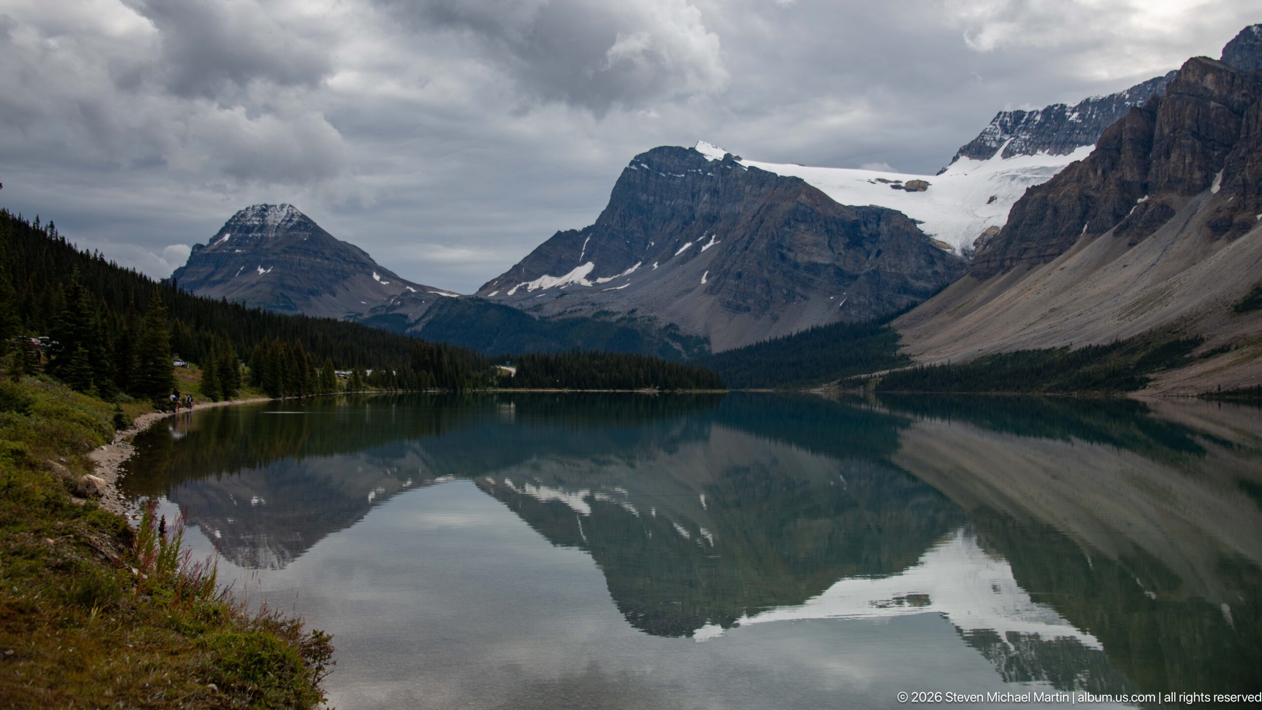
Cloud cover darkens the mountains above Bow Lake, where a pale glacier occupies a notch between the higher summits. The foreground shore and tree line lead toward the far end of the water, tying the ice to the lake below. Compared with the clearer reflections nearby, this view emphasizes the glacier’s position within the mountain chain and the changing weather.
Caption
Cloud cover darkens the mountains above Bow Lake, where a pale glacier occupies a notch between the higher summits. The foreground shore and tree line lead toward the far end of the water, tying the ice to the lake below. Compared with the clearer reflections nearby, this view emphasizes the glacier’s position within the mountain chain and the changing weather.
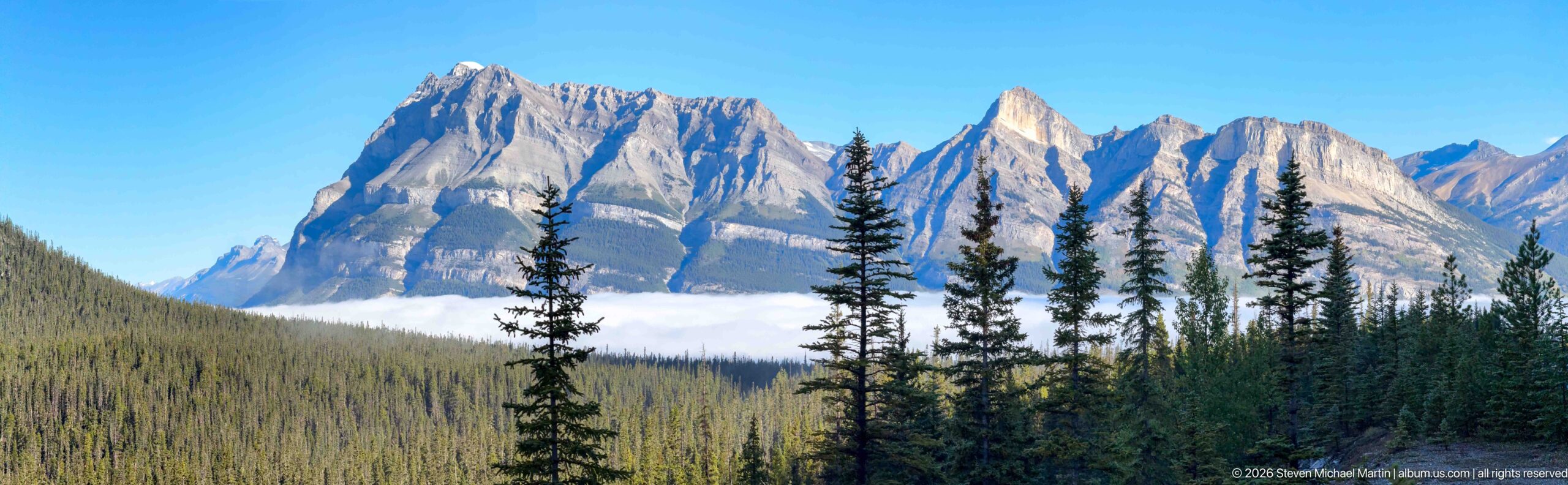
A jagged, snow-dusted summit rises above a dense conifer slope while a low bank of cloud hides the mountain’s lower face. Tall spruce in the foreground create a scale reference against the serrated skyline. Bright blue sky and direct sunlight sharpen the contrast between pale rock, small snow patches, and the dark forest below.
Caption
A jagged, snow-dusted summit rises above a dense conifer slope while a low bank of cloud hides the mountain’s lower face. Tall spruce in the foreground create a scale reference against the serrated skyline. Bright blue sky and direct sunlight sharpen the contrast between pale rock, small snow patches, and the dark forest below.
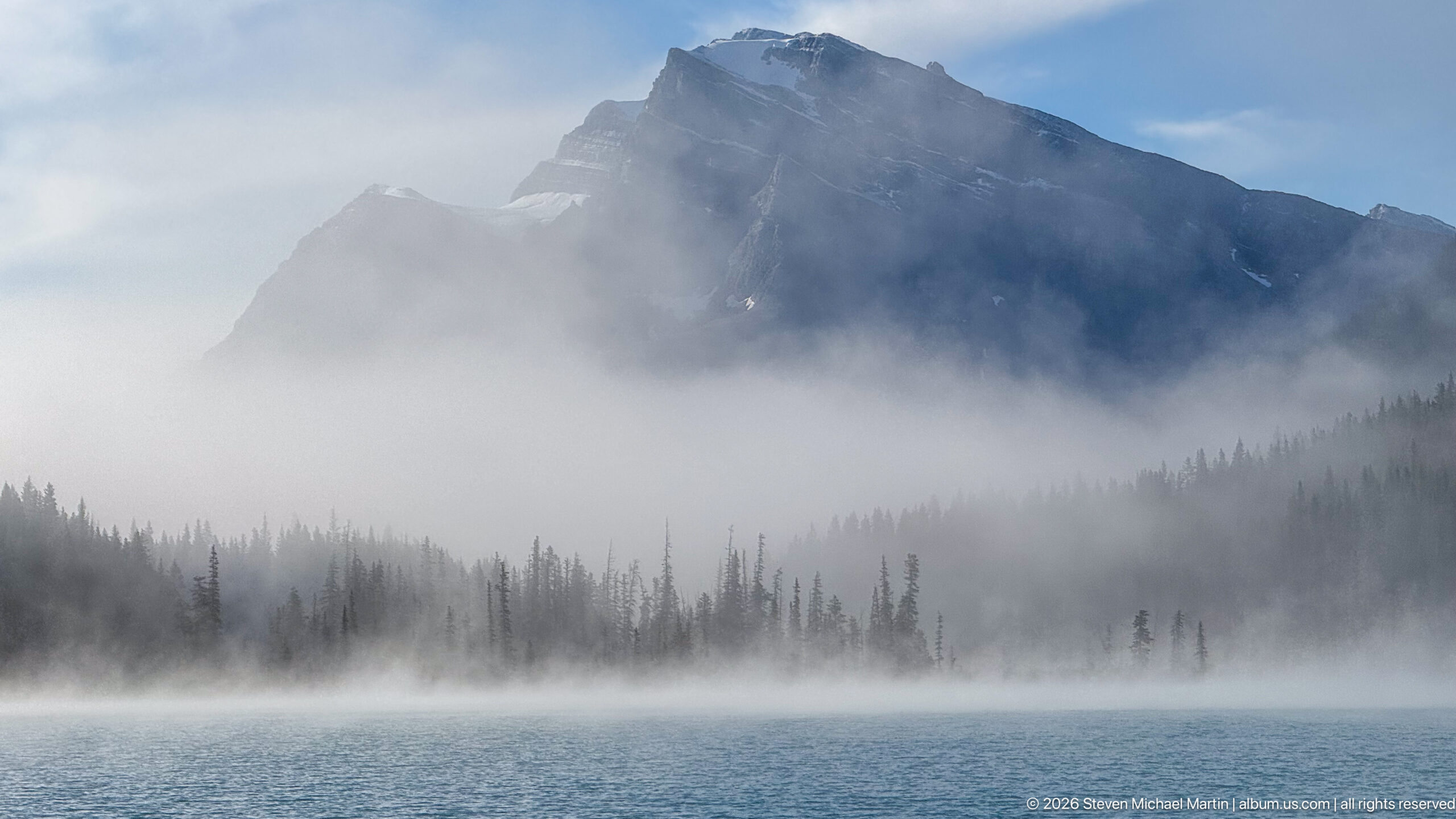
A dark mountain ridge rises behind a nearly continuous bank of fog, with only its upper contours visible above the white cloud. Blue water fills the foreground and a narrow conifer belt marks the opposite shore. The compressed layers of water, forest, mist, and rock give this view a quieter, more atmospheric character than the clear-sky lake panoramas nearby.
Caption
A dark mountain ridge rises behind a nearly continuous bank of fog, with only its upper contours visible above the white cloud. Blue water fills the foreground and a narrow conifer belt marks the opposite shore. The compressed layers of water, forest, mist, and rock give this view a quieter, more atmospheric character than the clear-sky lake panoramas nearby.
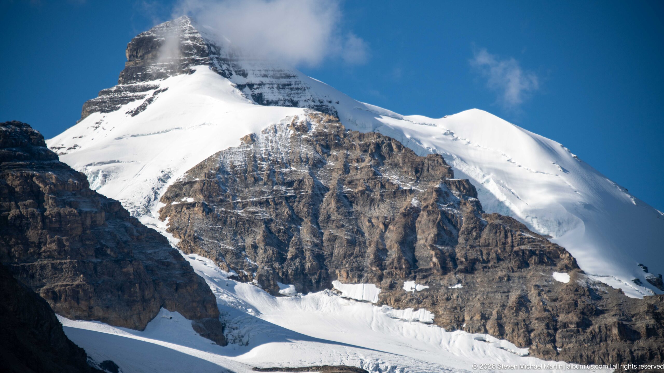
A broad snowfield and glacier mantle the upper mountain, interrupted by exposed rock bands and a broken icefall lower on the slope. The tight view removes the valley floor and focuses on the steep transition from dark stratified cliff to bright snow. Clear blue sky and hard sunlight reveal surface ridges and crevasses in the ice.
Caption
A broad snowfield and glacier mantle the upper mountain, interrupted by exposed rock bands and a broken icefall lower on the slope. The tight view removes the valley floor and focuses on the steep transition from dark stratified cliff to bright snow. Clear blue sky and hard sunlight reveal surface ridges and crevasses in the ice.
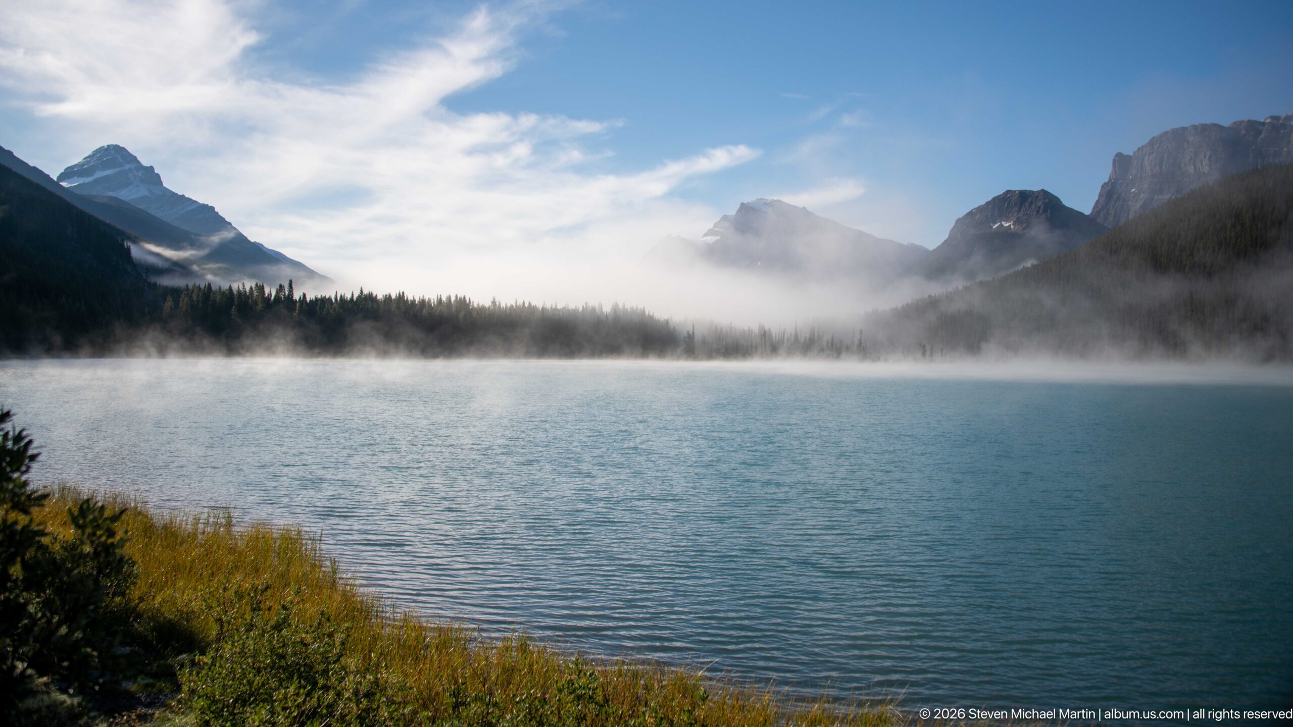
The lake opens across the foreground toward a wooded shore, where mist drifts beneath a chain of dark mountain peaks. A band of cloud softens the far slopes but leaves the waterline and outer ridges visible. Low shrubs frame the left edge, making this broader view feel open while preserving the layered relationship between lake, forest, fog, and mountains.
Caption
The lake opens across the foreground toward a wooded shore, where mist drifts beneath a chain of dark mountain peaks. A band of cloud softens the far slopes but leaves the waterline and outer ridges visible. Low shrubs frame the left edge, making this broader view feel open while preserving the layered relationship between lake, forest, fog, and mountains.
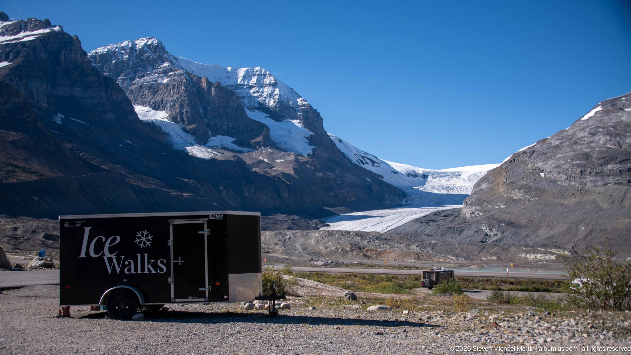
A black trailer marked “Ice Walks” sits on the gravel foreground below a glacier flowing between steep rock walls. The branded vehicle identifies a guided glacier activity, while the broad view places the departure point within the valley leading toward the ice. Sparse shrubs, moraine, and the distant glacier connect the visitor service to the terrain it explores.
Caption
A black trailer marked “Ice Walks” sits on the gravel foreground below a glacier flowing between steep rock walls. The branded vehicle identifies a guided glacier activity, while the broad view places the departure point within the valley leading toward the ice. Sparse shrubs, moraine, and the distant glacier connect the visitor service to the terrain it explores.
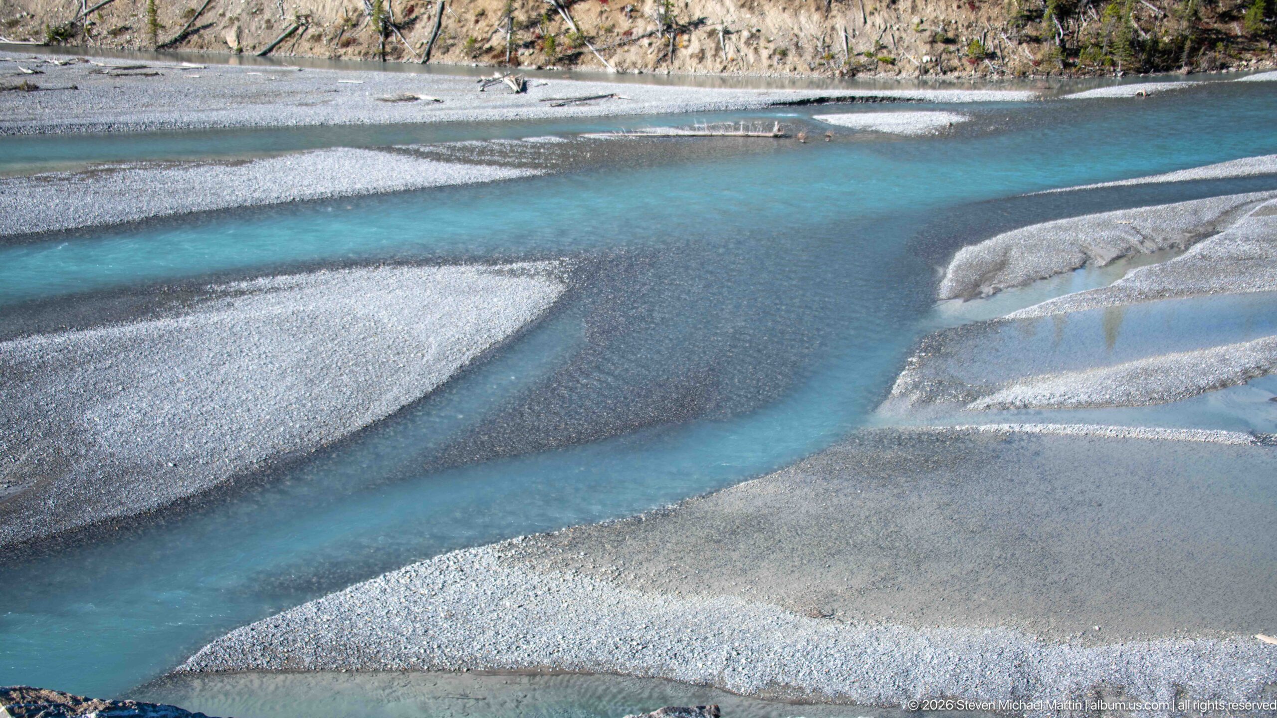
Turquoise water divides into narrow channels around pale gravel bars, forming a branching pattern across the glacial valley floor. The close composition looks down on the braided channels, where fine sediment creates milky blue shallows beside gray gravel. A thin wooded bank and road infrastructure at the upper edge provide context without distracting from the river’s shifting course.
Caption
Turquoise water divides into narrow channels around pale gravel bars, forming a branching pattern across the glacial valley floor. The close composition looks down on the braided channels, where fine sediment creates milky blue shallows beside gray gravel. A thin wooded bank and road infrastructure at the upper edge provide context without distracting from the river’s shifting course.
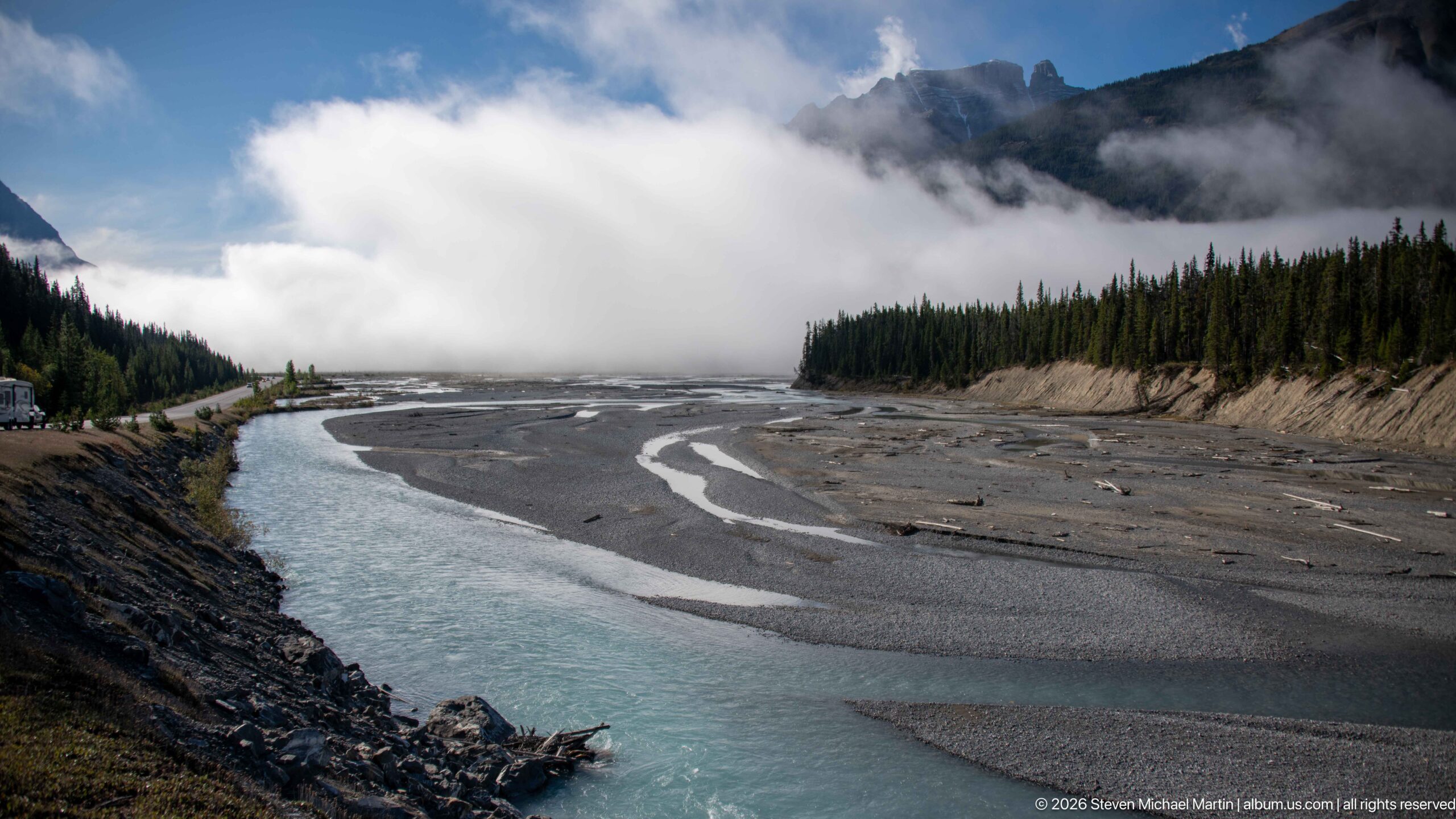
A single turquoise channel curves along the near edge of an expansive gravel plain, with smaller rivulets tracing the exposed sediment beyond it. Low cloud hides much of the ridge and softens the forest line, giving the broad valley a muted atmosphere. The foreground bank and sweep of water guide the eye into the open floodplain.
Caption
A single turquoise channel curves along the near edge of an expansive gravel plain, with smaller rivulets tracing the exposed sediment beyond it. Low cloud hides much of the ridge and softens the forest line, giving the broad valley a muted atmosphere. The foreground bank and sweep of water guide the eye into the open floodplain.
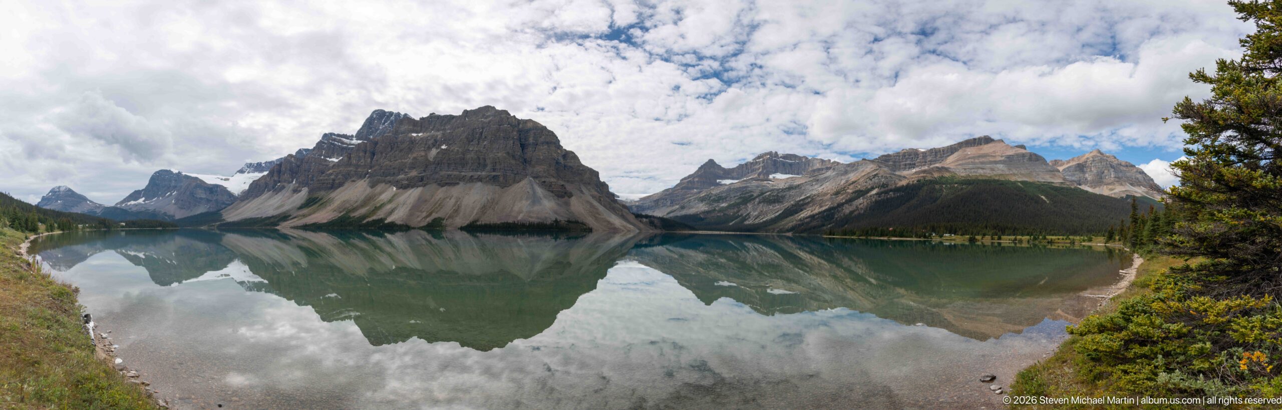
Bow Lake lies still beneath a jagged wall of Canadian Rockies peaks, their slopes and scattered snowfields mirrored almost symmetrically in the water. A triangular summit anchors the center while cloud shadows and bright openings in the sky shift the tones across the reflection. Low shrubs and a narrow strip of shore frame the lower edge, giving the expansive mountain basin a quiet foreground.
Caption
Bow Lake lies still beneath a jagged wall of Canadian Rockies peaks, their slopes and scattered snowfields mirrored almost symmetrically in the water. A triangular summit anchors the center while cloud shadows and bright openings in the sky shift the tones across the reflection. Low shrubs and a narrow strip of shore frame the lower edge, giving the expansive mountain basin a quiet foreground.
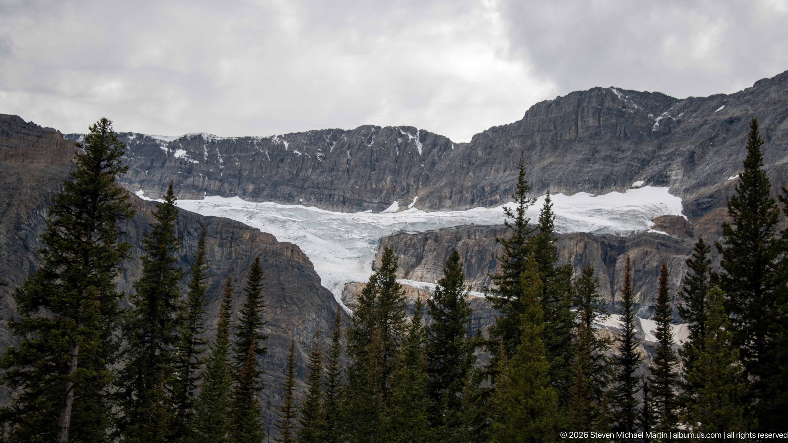
A broad glacier descends through a high basin between steep, horizontally banded rock walls. Dark conifers in the foreground partly screen the ice, while the glacier’s pale surface draws the eye toward the snow-filled upper cirque. Overcast light softens the ridges but keeps the contrast between forest, exposed stone, and ice distinct.
Caption
A broad glacier descends through a high basin between steep, horizontally banded rock walls. Dark conifers in the foreground partly screen the ice, while the glacier’s pale surface draws the eye toward the snow-filled upper cirque. Overcast light softens the ridges but keeps the contrast between forest, exposed stone, and ice distinct.
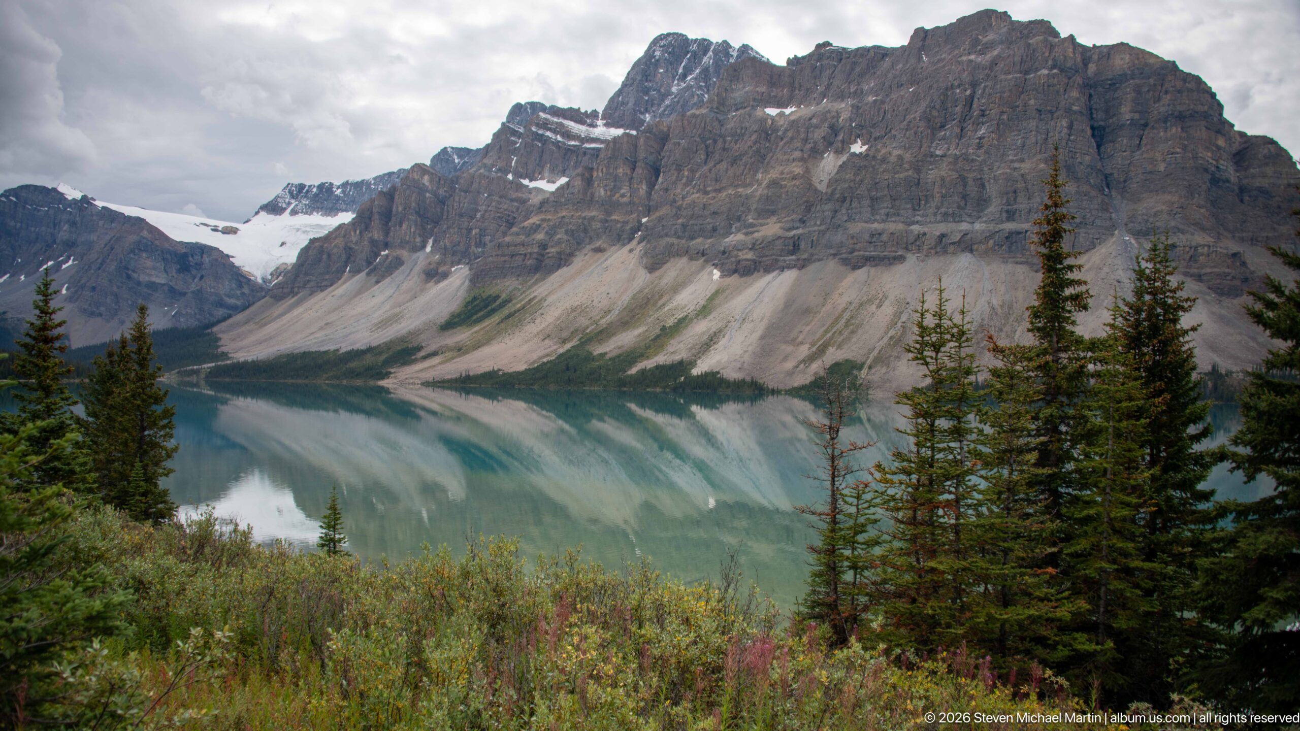
A glacier spills from the high icefield into a rocky basin above Bow Lake, where pale blue-green water reflects the surrounding slopes. The wider view connects the glacier’s broken lower margin with the lake and forested shore below. Dark conifers and low alpine vegetation add scale to the succession of ice, bare rock, and water.
Caption
A glacier spills from the high icefield into a rocky basin above Bow Lake, where pale blue-green water reflects the surrounding slopes. The wider view connects the glacier’s broken lower margin with the lake and forested shore below. Dark conifers and low alpine vegetation add scale to the succession of ice, bare rock, and water.
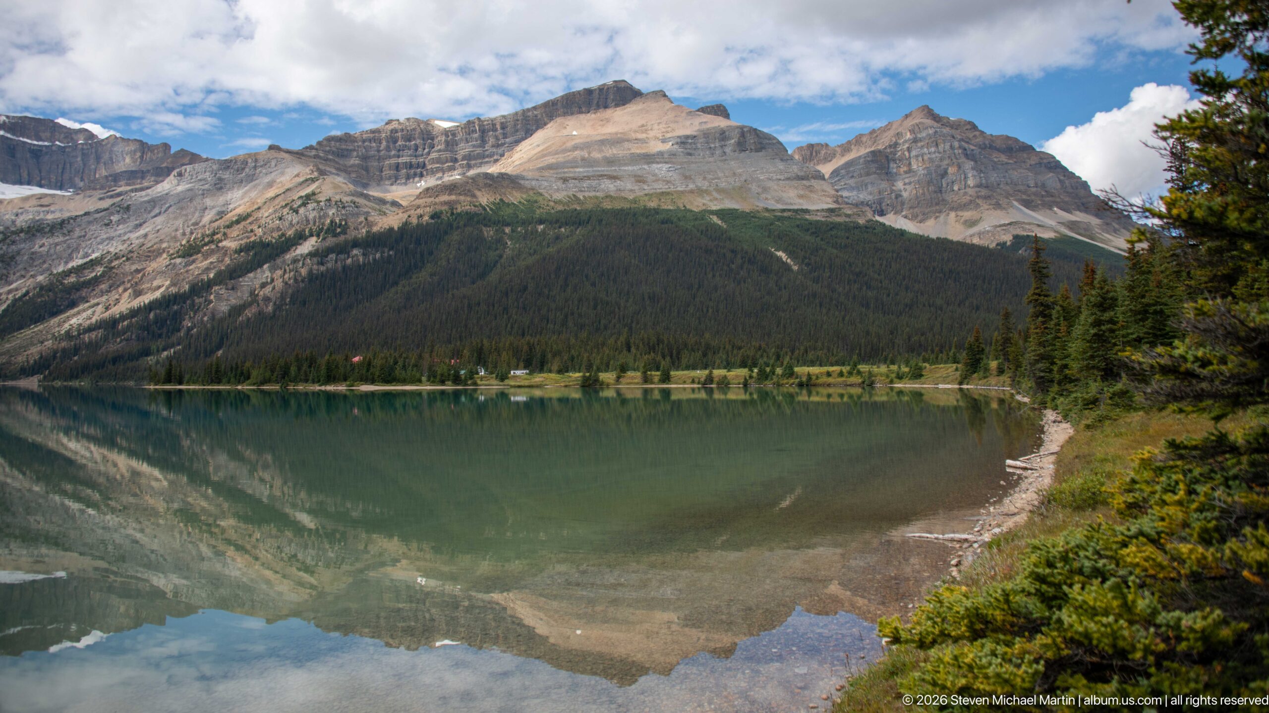
A pebbled shoreline curves around the near edge of Bow Lake, opening a broad reflection of the layered mountains and broken clouds. A low conifer belt separates the water from the rock slopes, while pale scree and lingering snow mark higher elevations. The composition gives the lake more space than the peaks, emphasizing its calm surface and the scale of the enclosing valley.
Caption
A pebbled shoreline curves around the near edge of Bow Lake, opening a broad reflection of the layered mountains and broken clouds. A low conifer belt separates the water from the rock slopes, while pale scree and lingering snow mark higher elevations. The composition gives the lake more space than the peaks, emphasizing its calm surface and the scale of the enclosing valley.
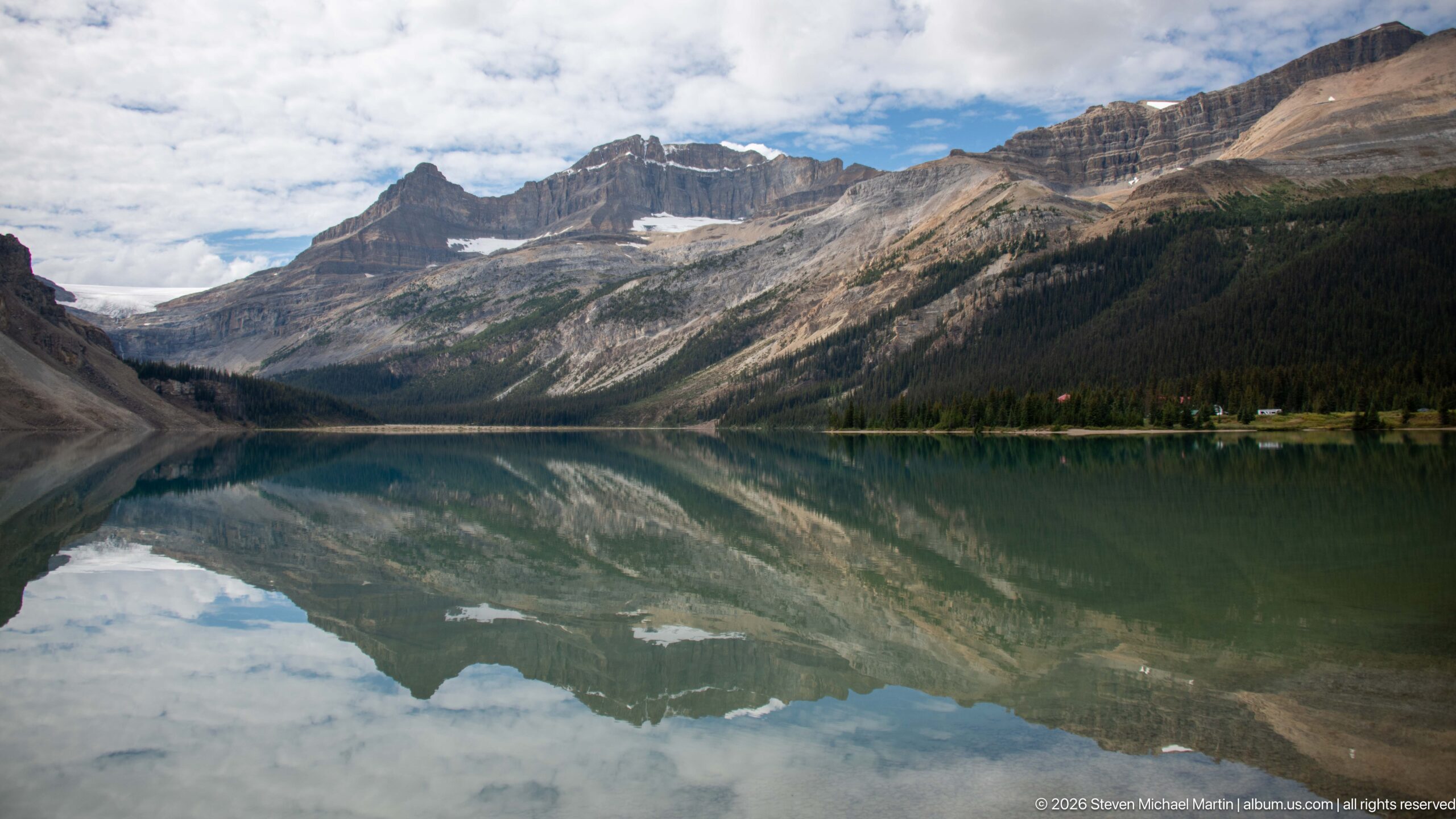
From the near shore, Bow Lake stretches toward a distant notch between ridges, with the forested waterline dividing mountain and reflection. A narrow strip of pale cloud mirrors the real sky, while the broad framing reveals the lake’s long axis and the varied slopes around it. The view reads as a geographic overview rather than a close study of the glacier or shoreline.
Caption
From the near shore, Bow Lake stretches toward a distant notch between ridges, with the forested waterline dividing mountain and reflection. A narrow strip of pale cloud mirrors the real sky, while the broad framing reveals the lake’s long axis and the varied slopes around it. The view reads as a geographic overview rather than a close study of the glacier or shoreline.
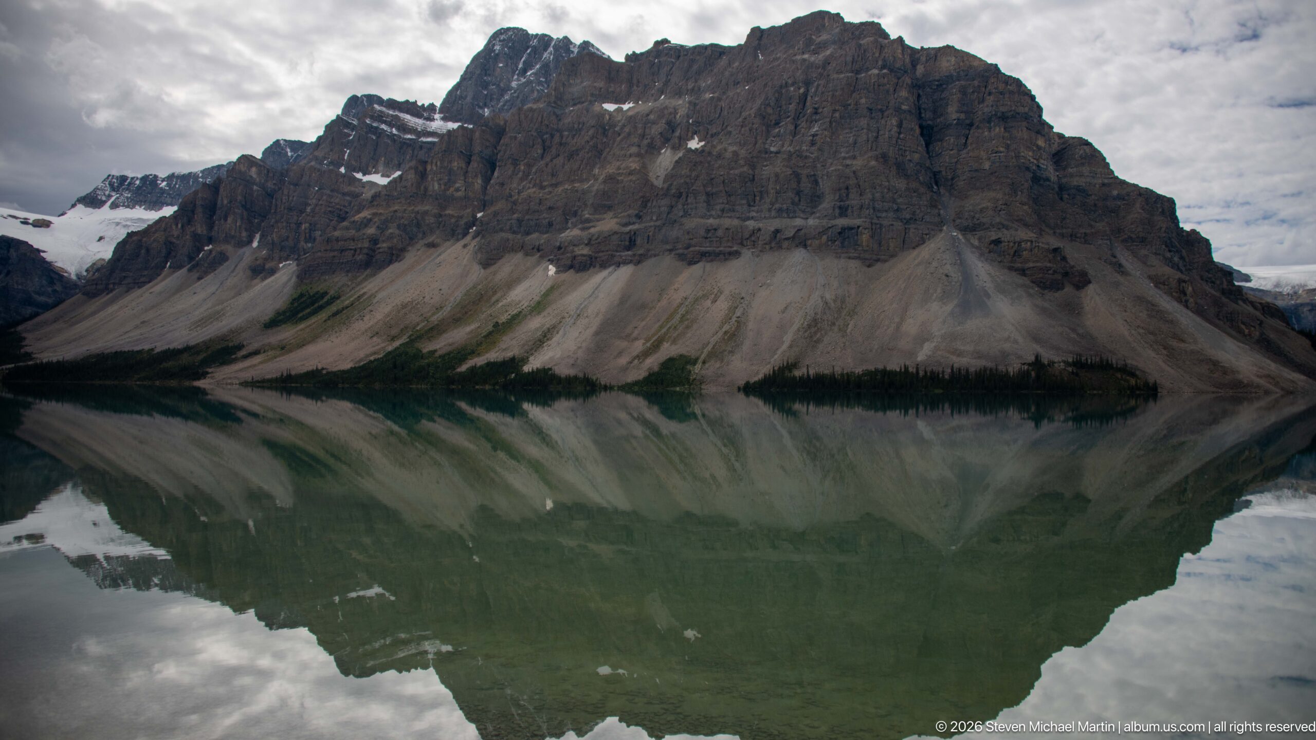
A steep, dark mountain shoulder rises above Bow Lake and repeats almost perfectly in the glassy surface below. The tighter composition reduces the shoreline and surrounding valley to a thin fringe, concentrating attention on the mountain’s layered rock, pale scree fans, and cloud-softened summit. Subtle ripples slightly break the symmetry without obscuring the reflected form.
Caption
A steep, dark mountain shoulder rises above Bow Lake and repeats almost perfectly in the glassy surface below. The tighter composition reduces the shoreline and surrounding valley to a thin fringe, concentrating attention on the mountain’s layered rock, pale scree fans, and cloud-softened summit. Subtle ripples slightly break the symmetry without obscuring the reflected form.
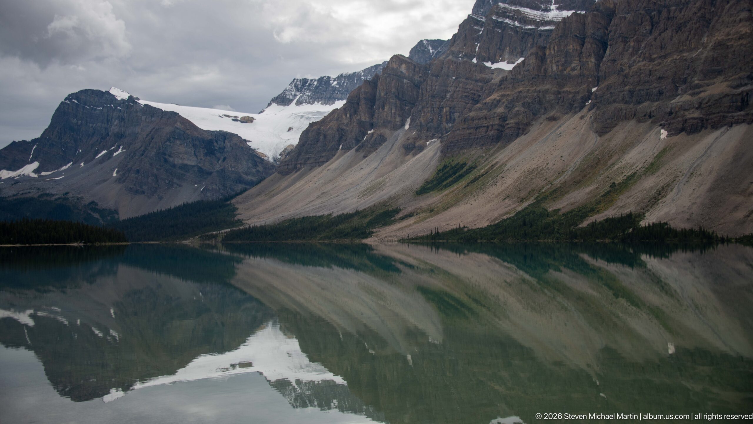
The glacier sits low between steep, banded rock faces, with its broken ice margin mirrored in the dark water below. This closer view removes most of the shoreline and foreground trees, making the relationship between the glacier, debris-covered slope, and lake the central subject. Gray cloud light flattens the upper ridges and lends the ice a subdued tone.
Caption
The glacier sits low between steep, banded rock faces, with its broken ice margin mirrored in the dark water below. This closer view removes most of the shoreline and foreground trees, making the relationship between the glacier, debris-covered slope, and lake the central subject. Gray cloud light flattens the upper ridges and lends the ice a subdued tone.
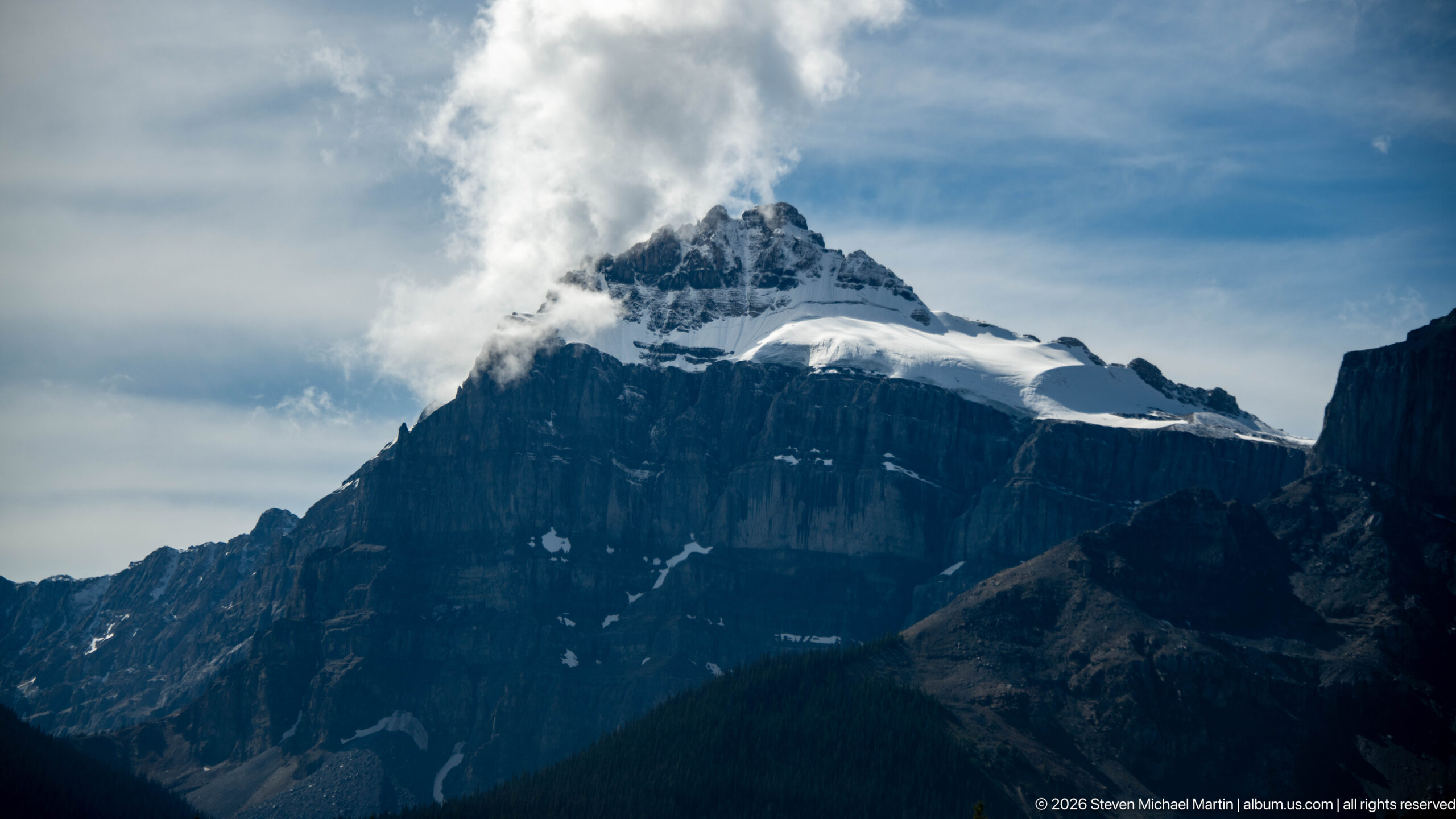
Cloud wraps around a snow-covered summit above dark, sharply layered cliffs. A broad glacier or permanent snowfield rests in the saddle to the right, while the mountain’s shadowed face fills the foreground. The close crop isolates the upper relief and unsettled weather, shifting attention from the lake below to the steep transition between exposed rock and high-elevation ice.
Caption
Cloud wraps around a snow-covered summit above dark, sharply layered cliffs. A broad glacier or permanent snowfield rests in the saddle to the right, while the mountain’s shadowed face fills the foreground. The close crop isolates the upper relief and unsettled weather, shifting attention from the lake below to the steep transition between exposed rock and high-elevation ice.
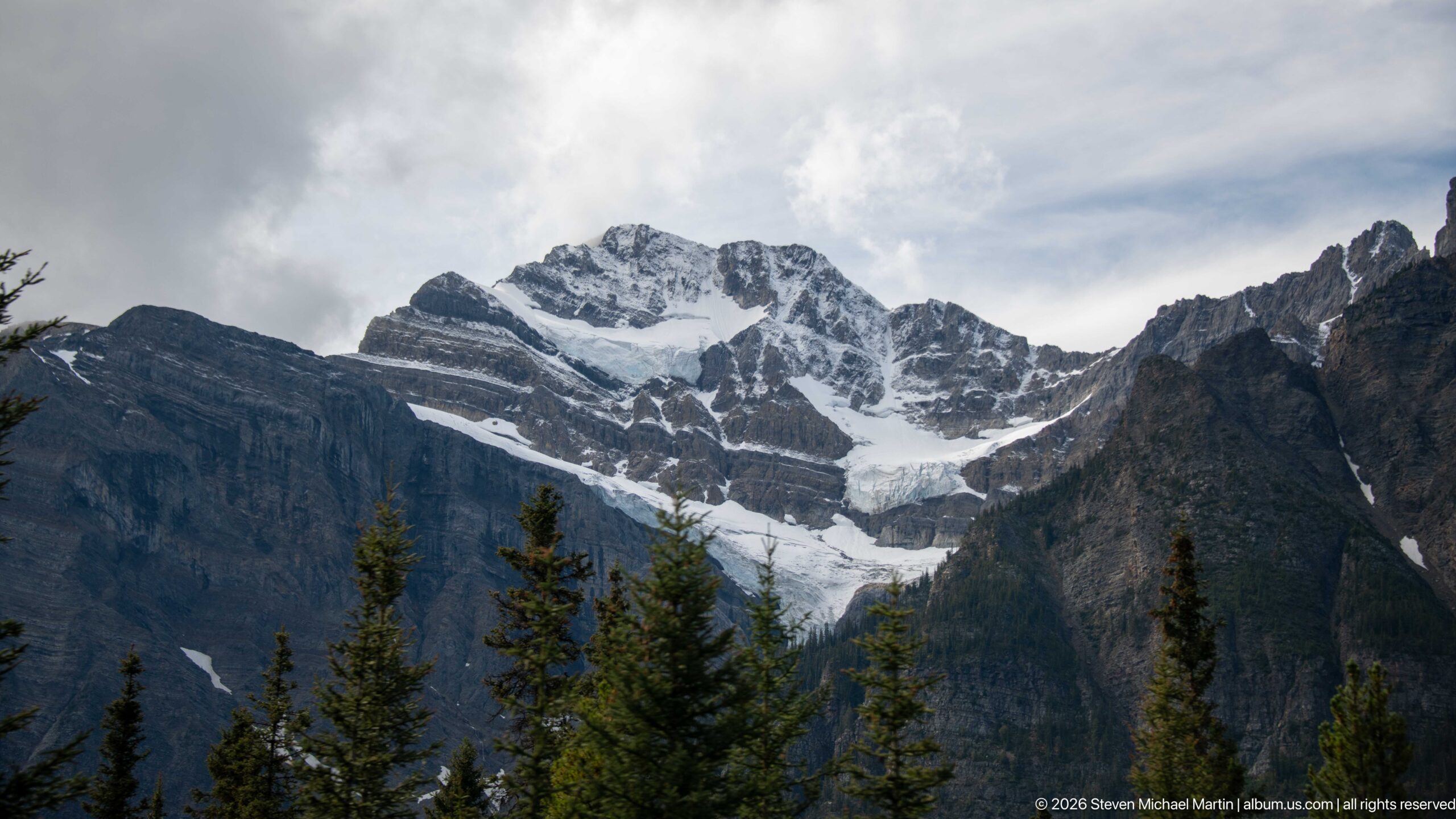
A white glacier descends in several lobes from a high snowfield into a forested valley, framed by dark, sharply folded rock. Sparse conifers in the foreground provide scale and partially mask the lower ice. The wider framing shows how the glacier follows the gap between mountain walls rather than occupying a broad, level icefield.
Caption
A white glacier descends in several lobes from a high snowfield into a forested valley, framed by dark, sharply folded rock. Sparse conifers in the foreground provide scale and partially mask the lower ice. The wider framing shows how the glacier follows the gap between mountain walls rather than occupying a broad, level icefield.
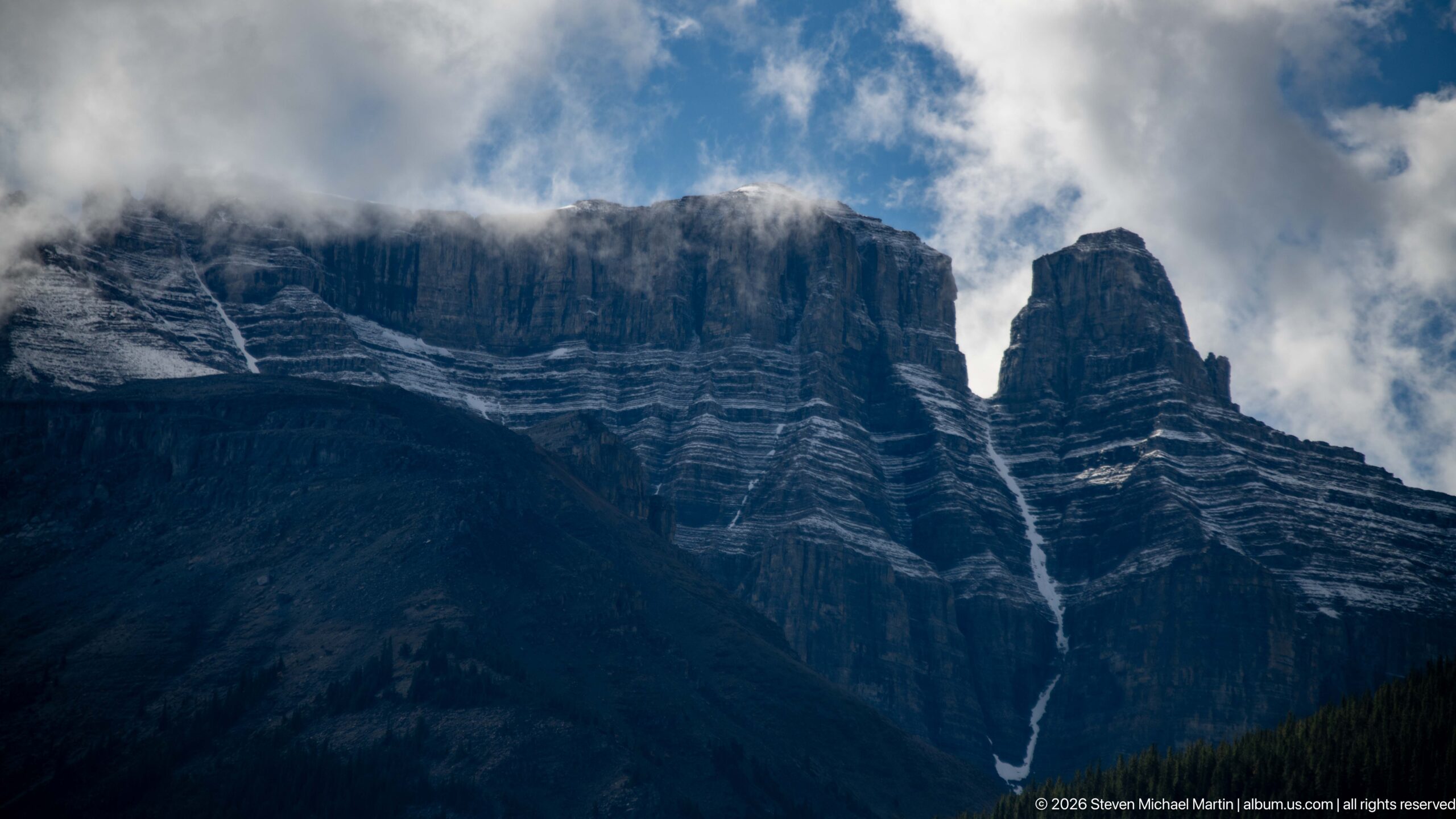
A slender waterfall drops from a notch high in the Weeping Wall, tracing the nearly vertical, horizontally banded limestone face. Low cloud drifts across the ridge and softens the upper rock, while a dark forested slope anchors the base. The narrow cascade is a small feature against the cliff’s immense scale, illustrating how meltwater finds routes through the fractured mountain wall.
Caption
A slender waterfall drops from a notch high in the Weeping Wall, tracing the nearly vertical, horizontally banded limestone face. Low cloud drifts across the ridge and softens the upper rock, while a dark forested slope anchors the base. The narrow cascade is a small feature against the cliff’s immense scale, illustrating how meltwater finds routes through the fractured mountain wall.
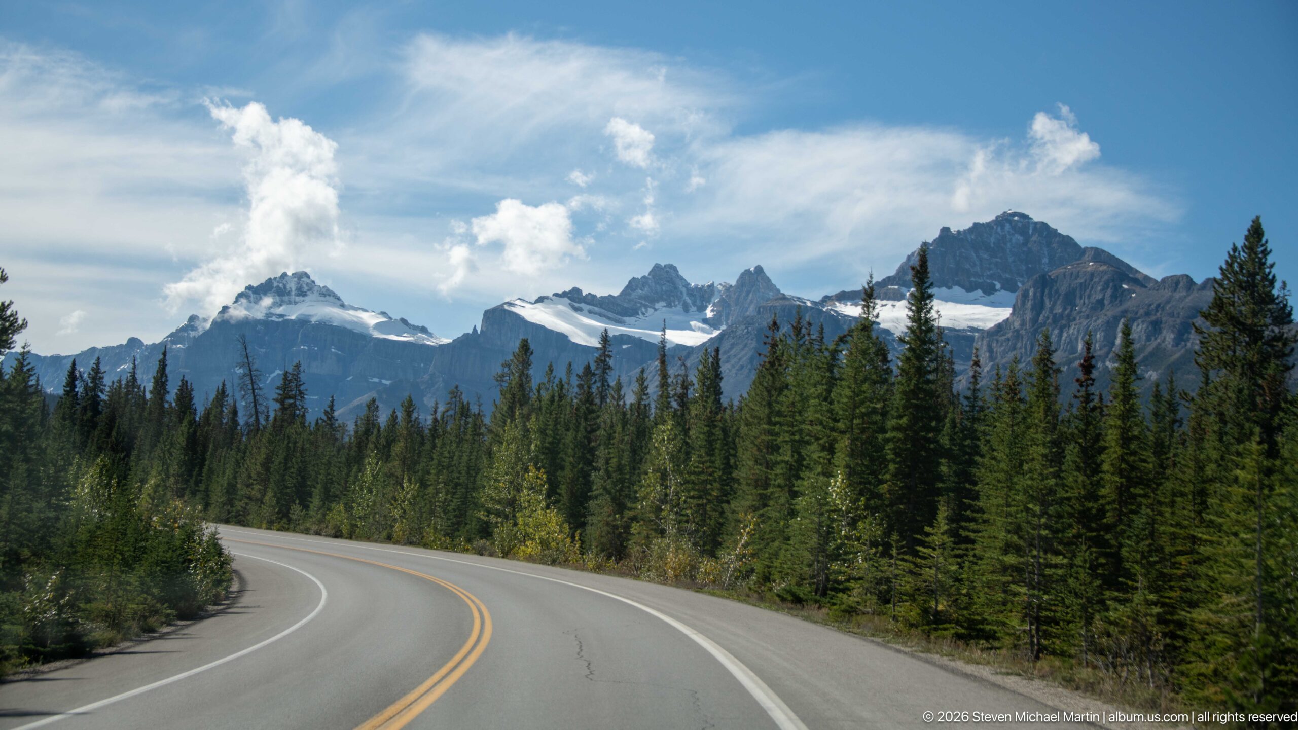
The Icefields Parkway bends through a conifer-lined valley toward a chain of jagged, snow-dusted peaks. Center markings and roadside barriers lead the eye into the mountain corridor, while clear sky opens above the high ridges. This roadway view makes the route itself part of the landscape, linking the wooded lower slopes to glaciers and exposed summits ahead.
Caption
The Icefields Parkway bends through a conifer-lined valley toward a chain of jagged, snow-dusted peaks. Center markings and roadside barriers lead the eye into the mountain corridor, while clear sky opens above the high ridges. This roadway view makes the route itself part of the landscape, linking the wooded lower slopes to glaciers and exposed summits ahead.
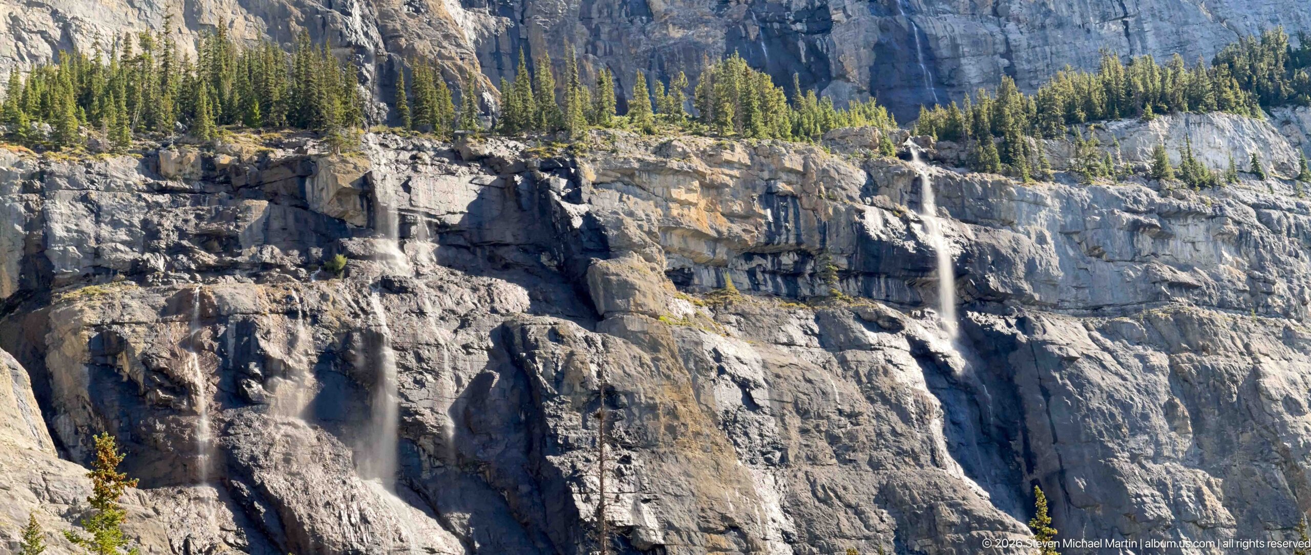
Several narrow streams spill from ledges in the Weeping Wall, falling across a towering, pale-gray limestone face. Horizontal bedding, dark recesses, and broken shelves divide the cliff into irregular bands, while a fringe of spruce marks the top. The close framing favors the wall’s texture and the scattered paths of water over the broader mountain setting.
Caption
Several narrow streams spill from ledges in the Weeping Wall, falling across a towering, pale-gray limestone face. Horizontal bedding, dark recesses, and broken shelves divide the cliff into irregular bands, while a fringe of spruce marks the top. The close framing favors the wall’s texture and the scattered paths of water over the broader mountain setting.
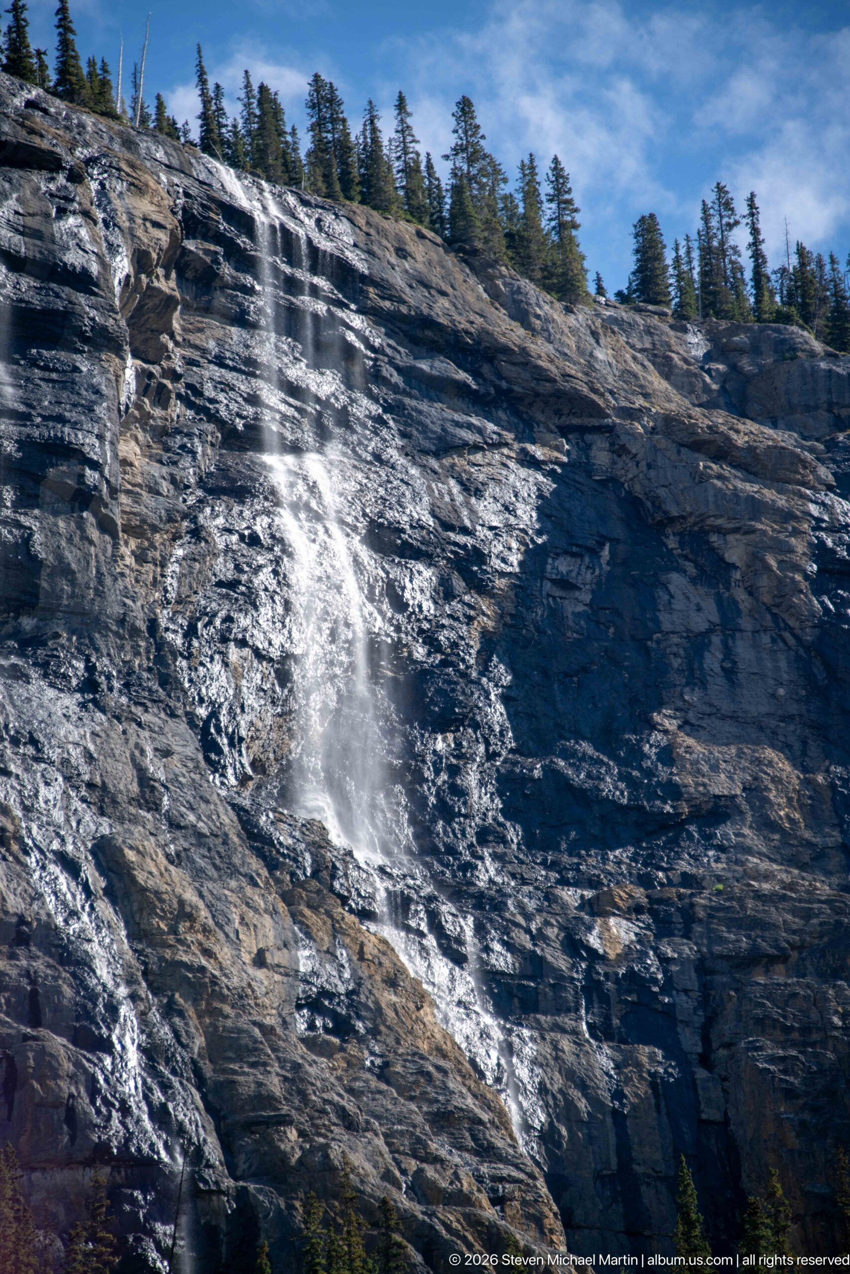
Water fans over a sloping rock shelf at the Weeping Wall, breaking into spray before gathering in narrow channels below. The low, close viewpoint makes the wet stone and bright, moving water more prominent than the larger cliff. Sunlight catches the spray and slick surfaces, contrasting with the dark evergreen fringe along the ridge.
Caption
Water fans over a sloping rock shelf at the Weeping Wall, breaking into spray before gathering in narrow channels below. The low, close viewpoint makes the wet stone and bright, moving water more prominent than the larger cliff. Sunlight catches the spray and slick surfaces, contrasting with the dark evergreen fringe along the ridge.
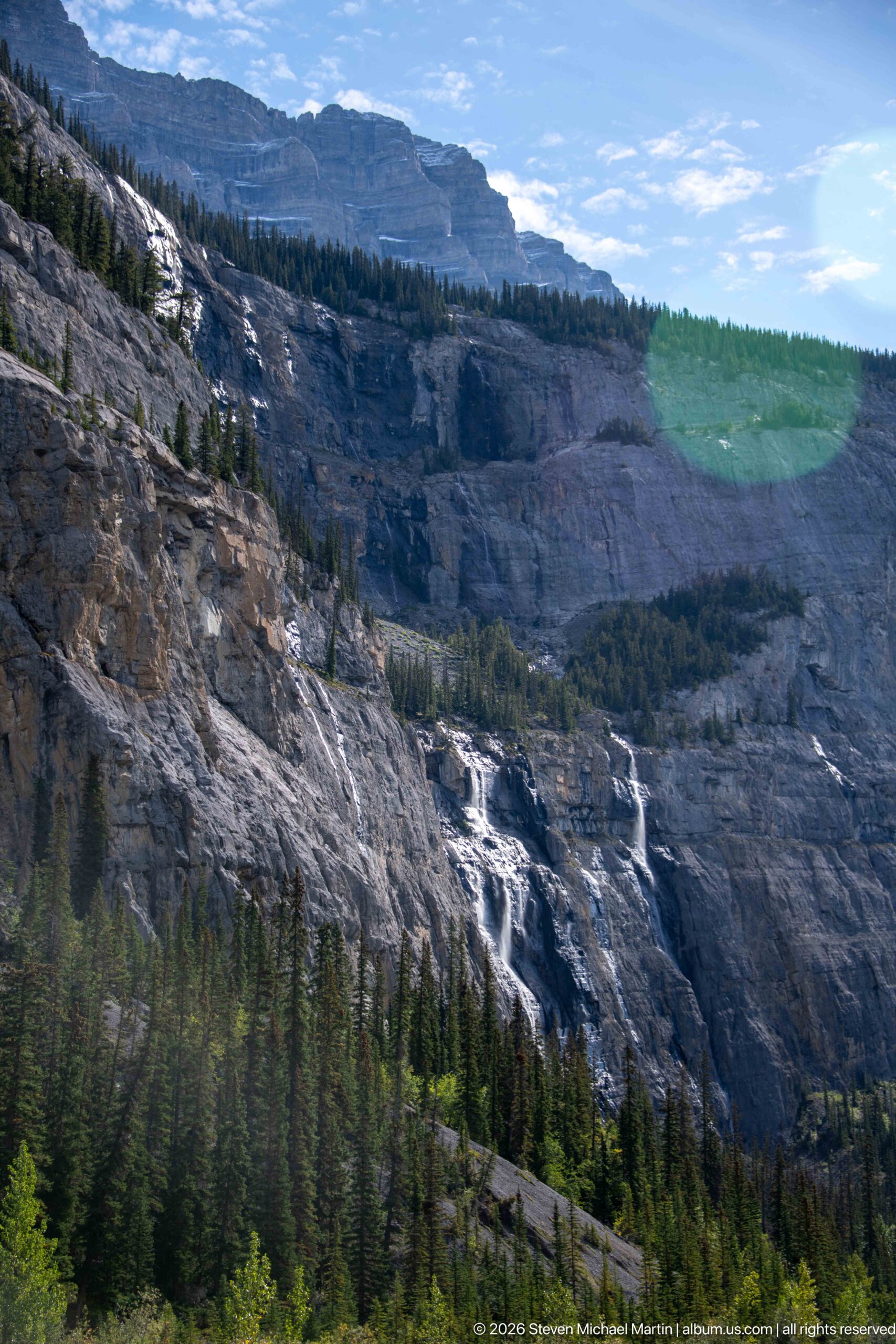
Water courses diagonally across the Weeping Wall’s exposed shelves, gathering into several bright channels above the dark forest. The broad view includes a stepped upper plateau and long, sloping rock bands, making the cliff’s structure as prominent as the falls. A slight lens flare crosses the sky, a reminder of the direct sunlight on this otherwise cool, high-elevation scene.
Caption
Water courses diagonally across the Weeping Wall’s exposed shelves, gathering into several bright channels above the dark forest. The broad view includes a stepped upper plateau and long, sloping rock bands, making the cliff’s structure as prominent as the falls. A slight lens flare crosses the sky, a reminder of the direct sunlight on this otherwise cool, high-elevation scene.
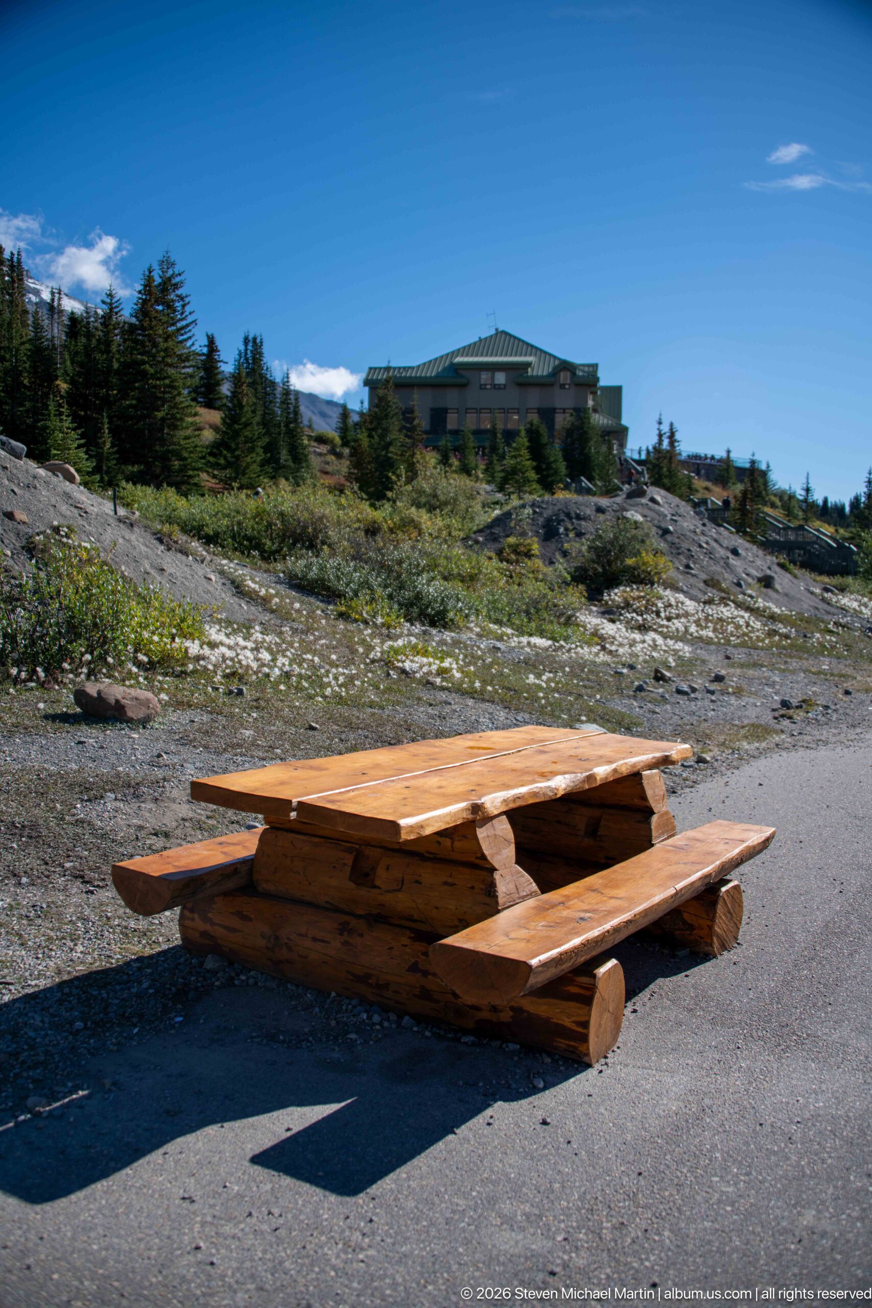
A low timber picnic table occupies the foreground of a paved rest area, with alpine shrubs and the large visitor building set farther up the slope. The simple seating structure contrasts with the expansive mountain terrain and shows how visitors pause within the Columbia Icefield approach. Bright sun casts a long shadow across the pavement and brings out the table’s stacked-log construction.
Caption
A low timber picnic table occupies the foreground of a paved rest area, with alpine shrubs and the large visitor building set farther up the slope. The simple seating structure contrasts with the expansive mountain terrain and shows how visitors pause within the Columbia Icefield approach. Bright sun casts a long shadow across the pavement and brings out the table’s stacked-log construction.
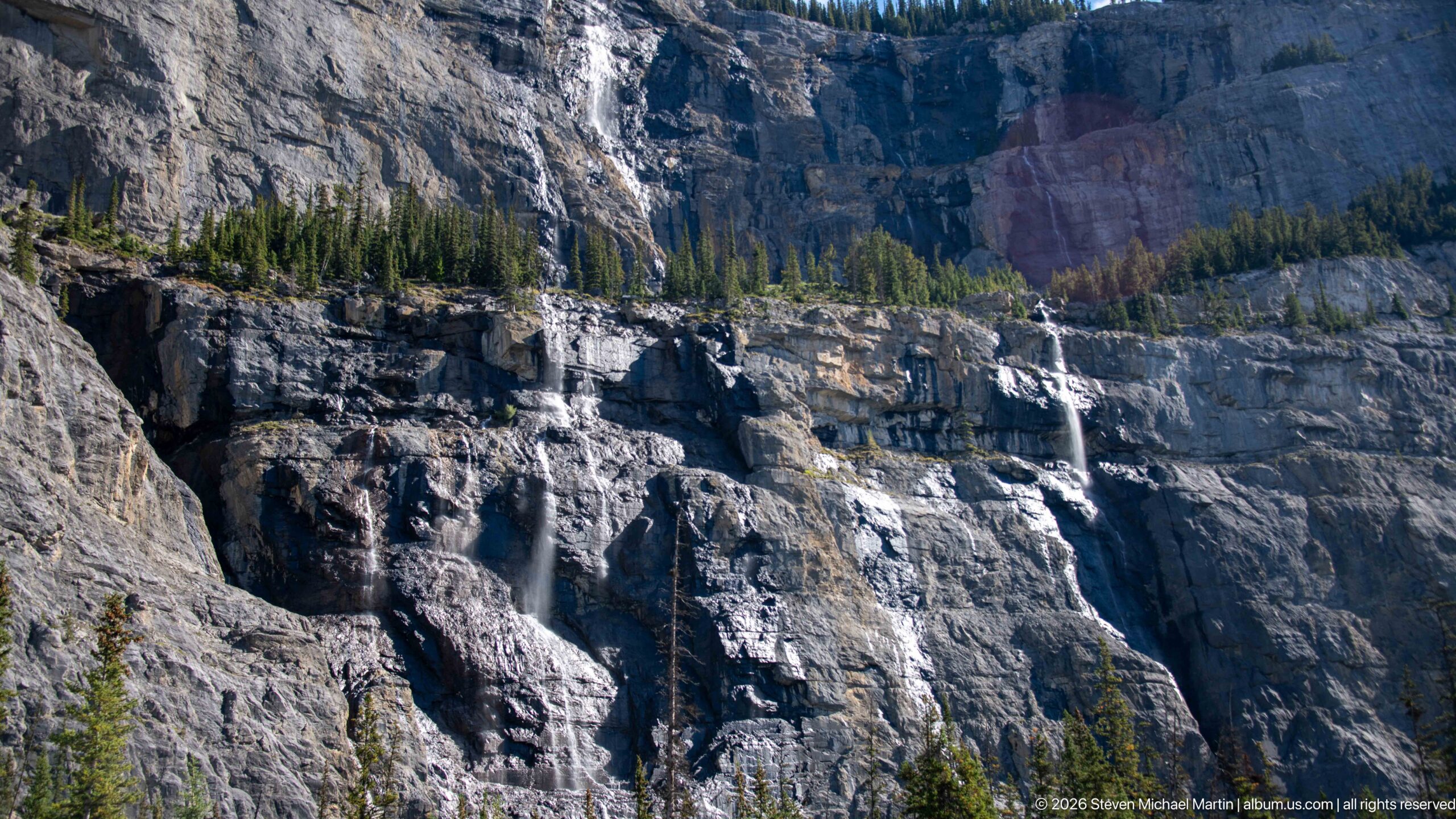
A group of waterfalls threads down the Weeping Wall, each following a separate groove through the broad, stratified escarpment. Dark pine trees at the foot and crest provide scale against the pale cliff. The composition keeps several cascades in view at once, showing the water as a scattered network rather than a single dominant fall.
Caption
A group of waterfalls threads down the Weeping Wall, each following a separate groove through the broad, stratified escarpment. Dark pine trees at the foot and crest provide scale against the pale cliff. The composition keeps several cascades in view at once, showing the water as a scattered network rather than a single dominant fall.
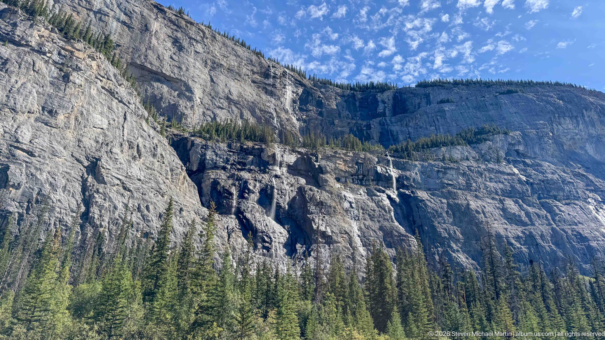
The Weeping Wall spans the frame as a long, pale escarpment, its ledges broken by forest and several descending streams. Evergreen trees fill the lower slope, placing the waterfall system high above the parkway corridor. A bright sky and open framing reveal the scale of the cliff, while the scattered falls remain fine details within the larger geological face.
Caption
The Weeping Wall spans the frame as a long, pale escarpment, its ledges broken by forest and several descending streams. Evergreen trees fill the lower slope, placing the waterfall system high above the parkway corridor. A bright sky and open framing reveal the scale of the cliff, while the scattered falls remain fine details within the larger geological face.
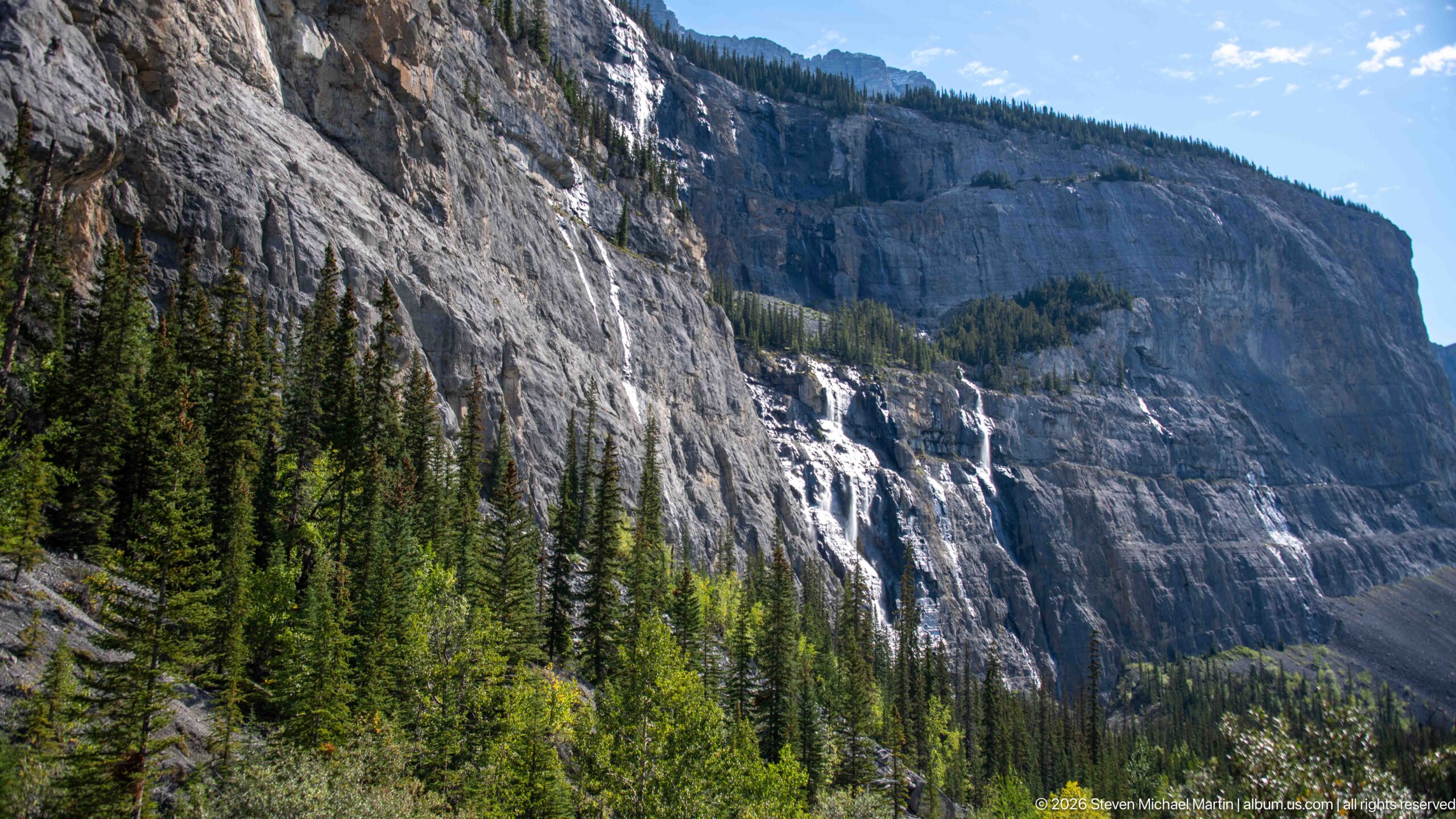
A narrow cascade drops down a steep, pale rock face beside dense conifers, with smaller streams tracing the neighboring shelves. The oblique view emphasizes the cliff’s broken profile and the way water crosses exposed ledges before disappearing into forest. Blue sky and hard sunlight sharpen the contrast between bare limestone and the dark evergreen stand.
Caption
A narrow cascade drops down a steep, pale rock face beside dense conifers, with smaller streams tracing the neighboring shelves. The oblique view emphasizes the cliff’s broken profile and the way water crosses exposed ledges before disappearing into forest. Blue sky and hard sunlight sharpen the contrast between bare limestone and the dark evergreen stand.
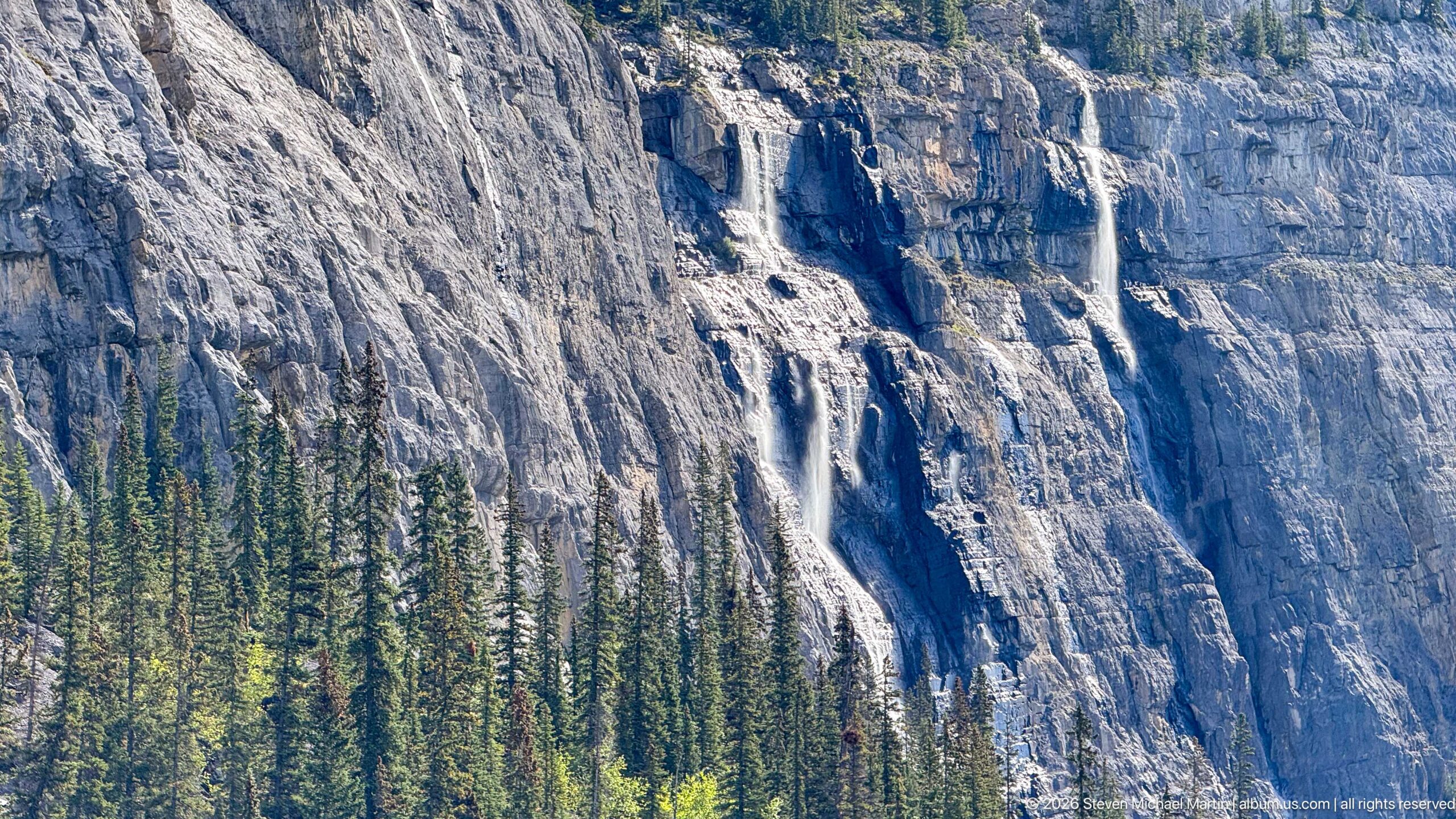
A tall ribbon of water drops through a narrow cleft in the Weeping Wall, bright against the dark vertical groove. The closer framing reveals irregular rock ledges and wet surfaces around the cascade, while spruce tops intrude along the lower edge. Unlike the wider views, this image isolates one waterfall and its direct path down the cliff.
Caption
A tall ribbon of water drops through a narrow cleft in the Weeping Wall, bright against the dark vertical groove. The closer framing reveals irregular rock ledges and wet surfaces around the cascade, while spruce tops intrude along the lower edge. Unlike the wider views, this image isolates one waterfall and its direct path down the cliff.
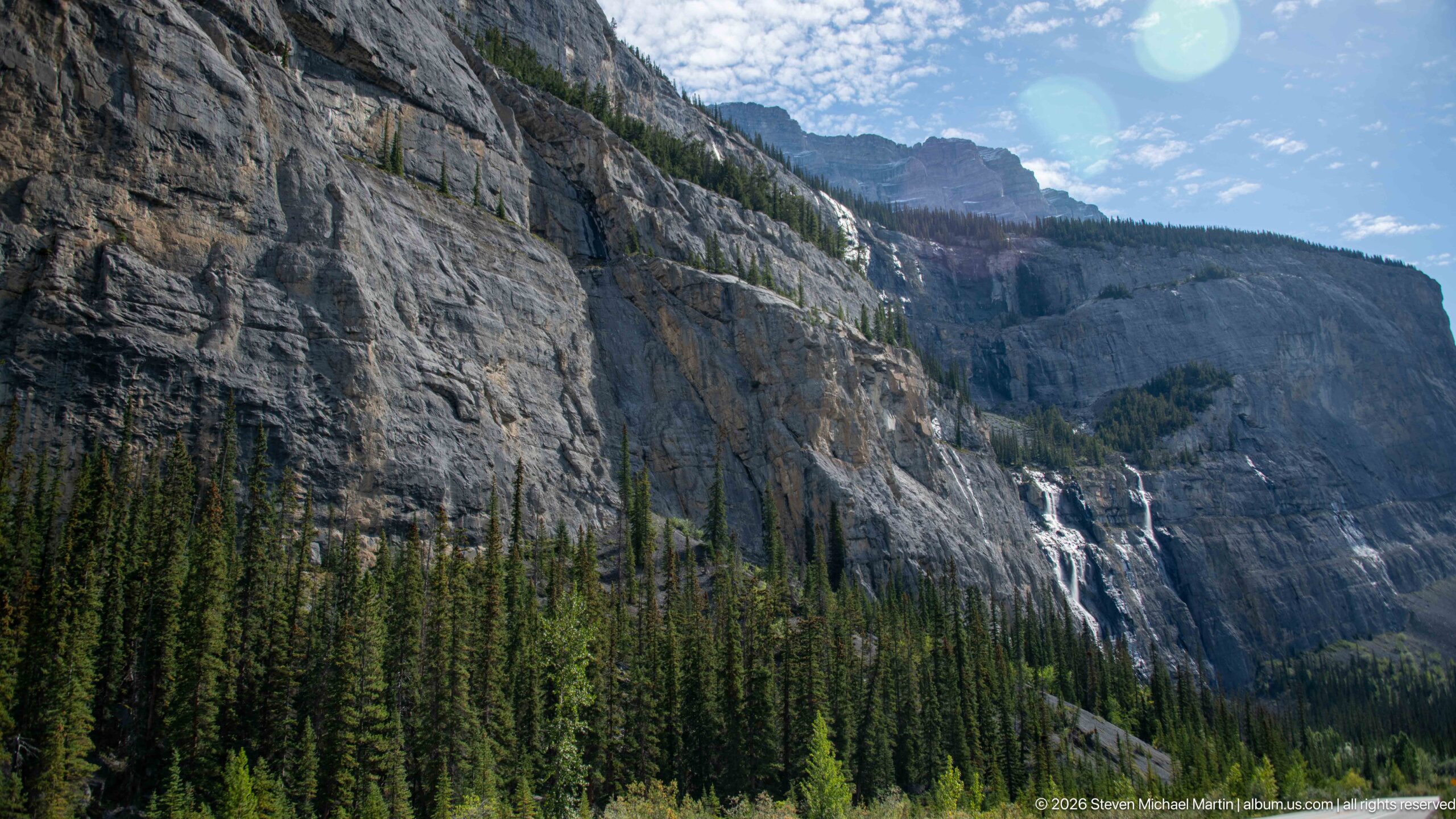
From farther along the cliff, several thin falls descend across a steep gray face above a continuous band of conifers. The composition follows the escarpment diagonally into the distance, revealing how the wall recedes rather than presenting a flat front. Sun flare near the upper corner and bright rock emphasize the clear conditions around this section of the parkway.
Caption
From farther along the cliff, several thin falls descend across a steep gray face above a continuous band of conifers. The composition follows the escarpment diagonally into the distance, revealing how the wall recedes rather than presenting a flat front. Sun flare near the upper corner and bright rock emphasize the clear conditions around this section of the parkway.
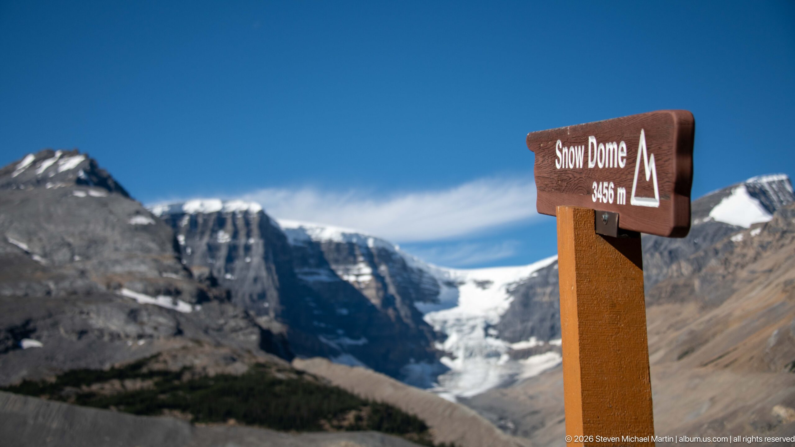
A brown trail sign identifies Snow Dome at 3,450 metres, standing in the foreground against glacier-covered peaks. The sign anchors the otherwise immense alpine view to a named summit, while a broad icefield and moraine-striped valley fill the background. Its placement foregrounds the elevation and geographic scale of the Columbia Icefield region.
Caption
A brown trail sign identifies Snow Dome at 3,450 metres, standing in the foreground against glacier-covered peaks. The sign anchors the otherwise immense alpine view to a named summit, while a broad icefield and moraine-striped valley fill the background. Its placement foregrounds the elevation and geographic scale of the Columbia Icefield region.
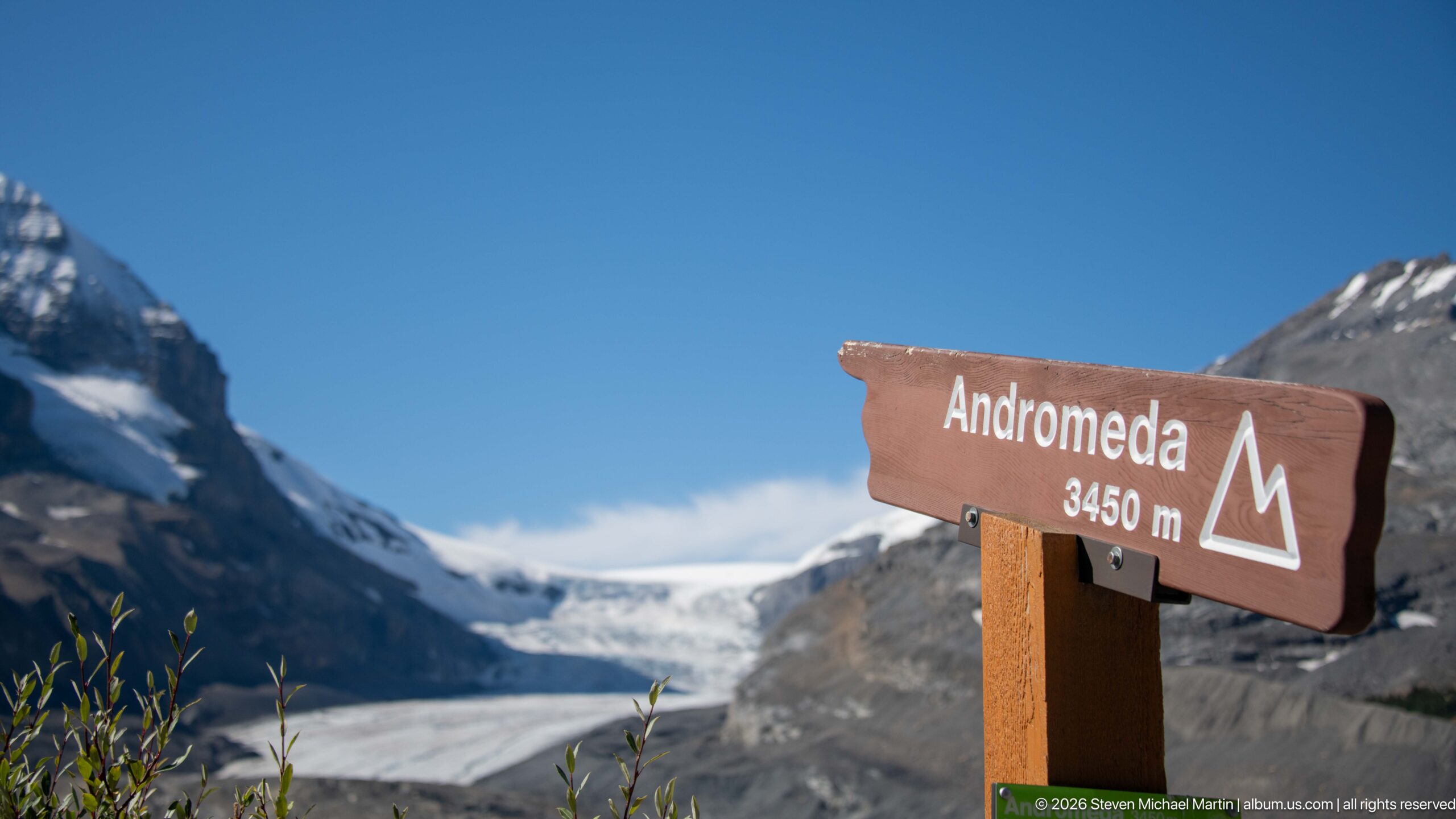
A trail sign names Mount Andromeda and gives its elevation as 3,450 metres, with a glacier filling the valley behind it. The close framing makes the brown sign the sharp foreground subject and leaves the ice and mountain walls softly out of focus. The pairing of label and glacial setting connects a specific summit to the surrounding high icefield.
Caption
A trail sign names Mount Andromeda and gives its elevation as 3,450 metres, with a glacier filling the valley behind it. The close framing makes the brown sign the sharp foreground subject and leaves the ice and mountain walls softly out of focus. The pairing of label and glacial setting connects a specific summit to the surrounding high icefield.
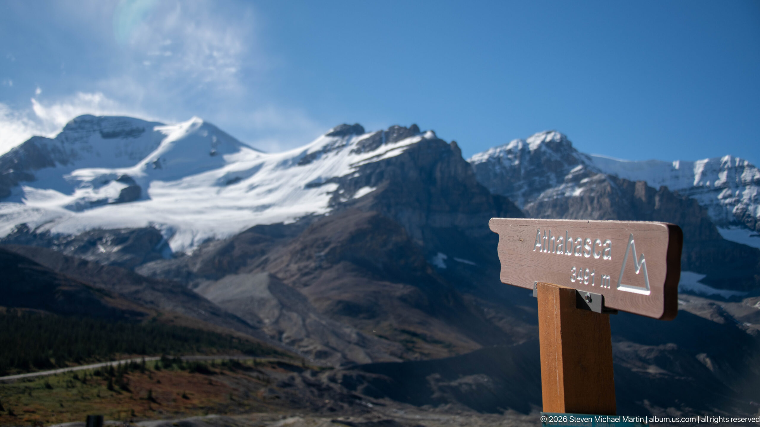
A wooden sign identifies Mount Athabasca at 3,493 metres, standing in the foreground of a broad glacier valley. Behind it, ice descends between steep peaks toward a gray, debris-covered terminus and braided meltwater plain. The marker anchors the expansive Columbia Icefield scenery to a named summit, while the wide view reveals the surrounding glacier and mountain catchment.
Caption
A wooden sign identifies Mount Athabasca at 3,493 metres, standing in the foreground of a broad glacier valley. Behind it, ice descends between steep peaks toward a gray, debris-covered terminus and braided meltwater plain. The marker anchors the expansive Columbia Icefield scenery to a named summit, while the wide view reveals the surrounding glacier and mountain catchment.
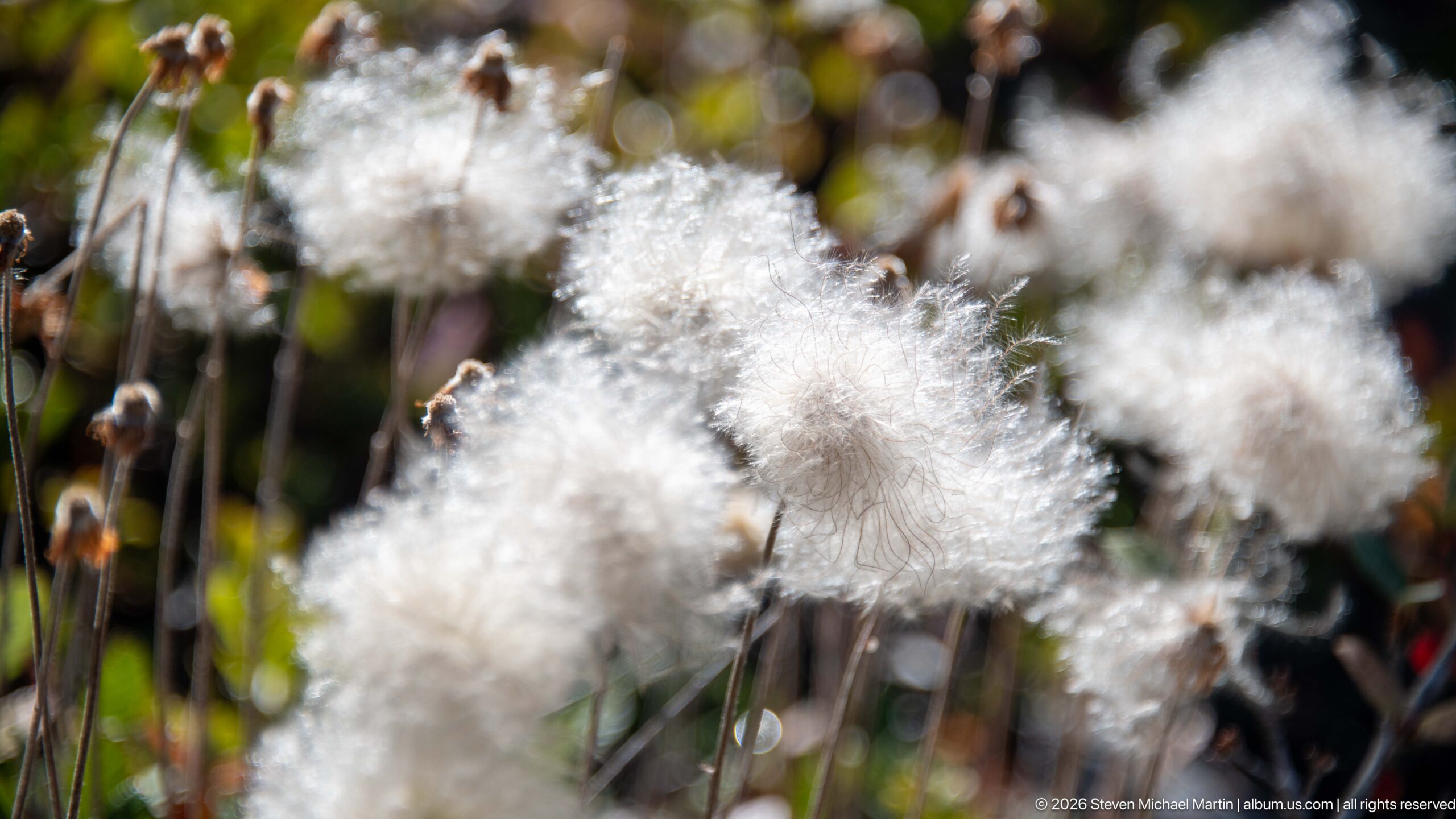
White, woolly seed heads cluster on slender stems among dark brown flower spikes and green alpine grasses. Shallow focus turns the background into soft circles of light, isolating the plants’ fibrous forms and delicate edges. The close view shifts from the scale of icefields to the small wetland vegetation growing in the high mountain environment.
Caption
White, woolly seed heads cluster on slender stems among dark brown flower spikes and green alpine grasses. Shallow focus turns the background into soft circles of light, isolating the plants’ fibrous forms and delicate edges. The close view shifts from the scale of icefields to the small wetland vegetation growing in the high mountain environment.
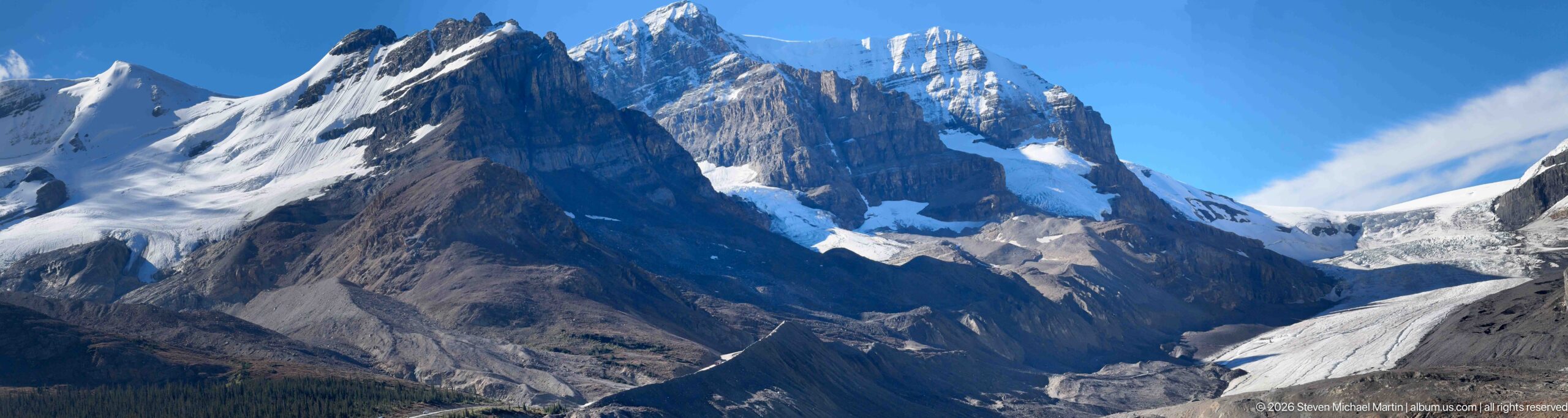
Mount Athabasca’s jagged, snow-brightened crest rises above a steep glacier that descends into the rocky valley. The close framing makes the serrated summit and fractured ice dominate, with a narrow strip of blue sky and drifting cloud above. Deep shadow across the lower slopes contrasts with bright snow and ice on the upper mountain.
Caption
Mount Athabasca’s jagged, snow-brightened crest rises above a steep glacier that descends into the rocky valley. The close framing makes the serrated summit and fractured ice dominate, with a narrow strip of blue sky and drifting cloud above. Deep shadow across the lower slopes contrasts with bright snow and ice on the upper mountain.
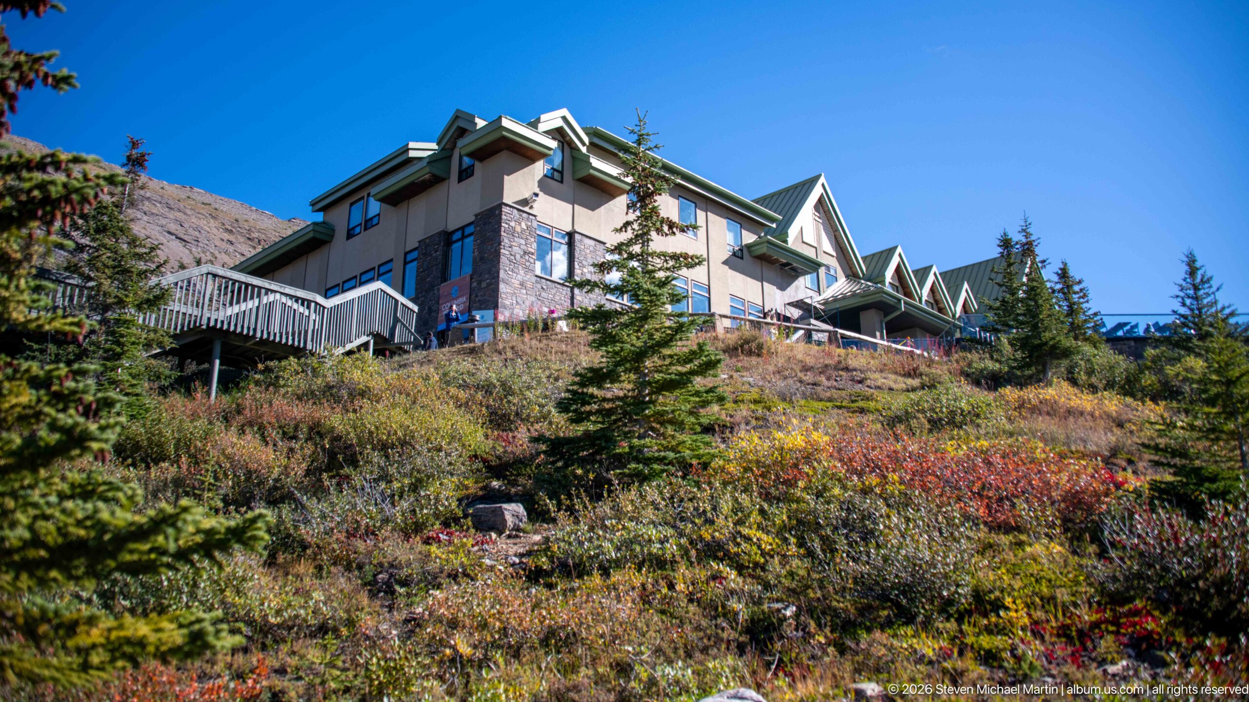
A large, multi-gabled building with a green metal roof sits above a slope of low shrubs and conifers, its windows and projecting decks facing the mountain landscape. The low camera position places the structure among alpine vegetation rather than against an urban setting. Sunlight picks out the red and gold groundcover around the building.
Caption
A large, multi-gabled building with a green metal roof sits above a slope of low shrubs and conifers, its windows and projecting decks facing the mountain landscape. The low camera position places the structure among alpine vegetation rather than against an urban setting. Sunlight picks out the red and gold groundcover around the building.
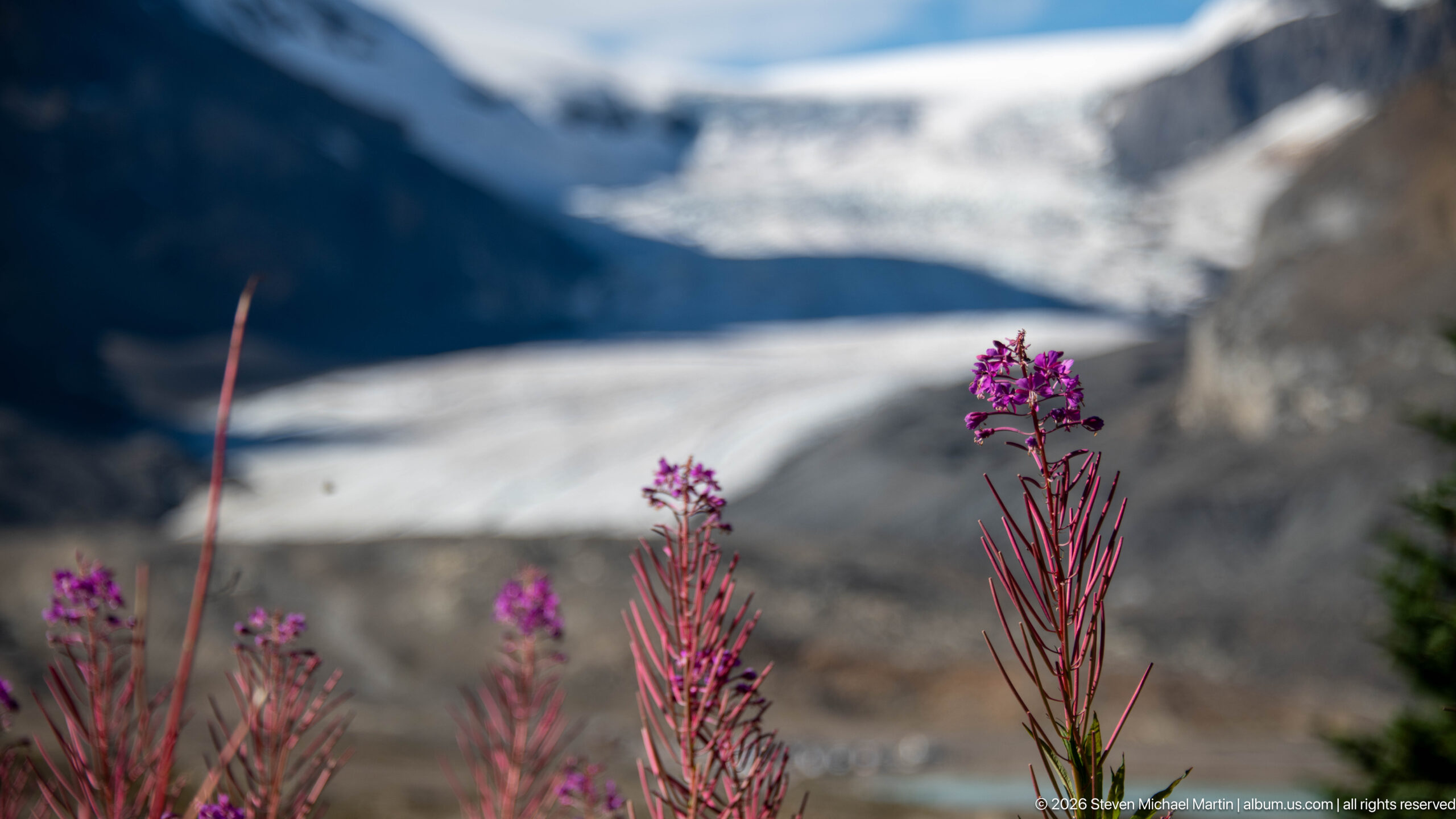
Magenta fireweed flowers rise sharply from the lower foreground, while the glacier and opposite rock wall dissolve into soft bands behind them. The shallow depth of field turns the icefield into context rather than a competing subject, joining short-season alpine flowering to the cold landscape. A single bent stem at left adds a fine linear counterpoint to the upright blooms.
Caption
Magenta fireweed flowers rise sharply from the lower foreground, while the glacier and opposite rock wall dissolve into soft bands behind them. The shallow depth of field turns the icefield into context rather than a competing subject, joining short-season alpine flowering to the cold landscape. A single bent stem at left adds a fine linear counterpoint to the upright blooms.
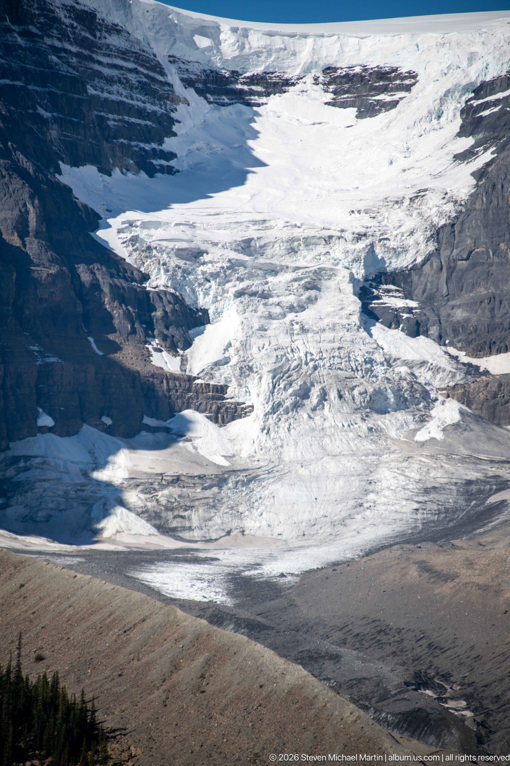
A close view of the Athabasca Glacier reveals ridges, crevasses, and dark bands of debris tracing movement across the ice. The compressed perspective emphasizes the glacier’s rough surface and internal lines rather than its full length or surrounding peaks. Sunlight picks out bright folds in the ice while deep blue shadow gathers in the crevasses.
Caption
A close view of the Athabasca Glacier reveals ridges, crevasses, and dark bands of debris tracing movement across the ice. The compressed perspective emphasizes the glacier’s rough surface and internal lines rather than its full length or surrounding peaks. Sunlight picks out bright folds in the ice while deep blue shadow gathers in the crevasses.
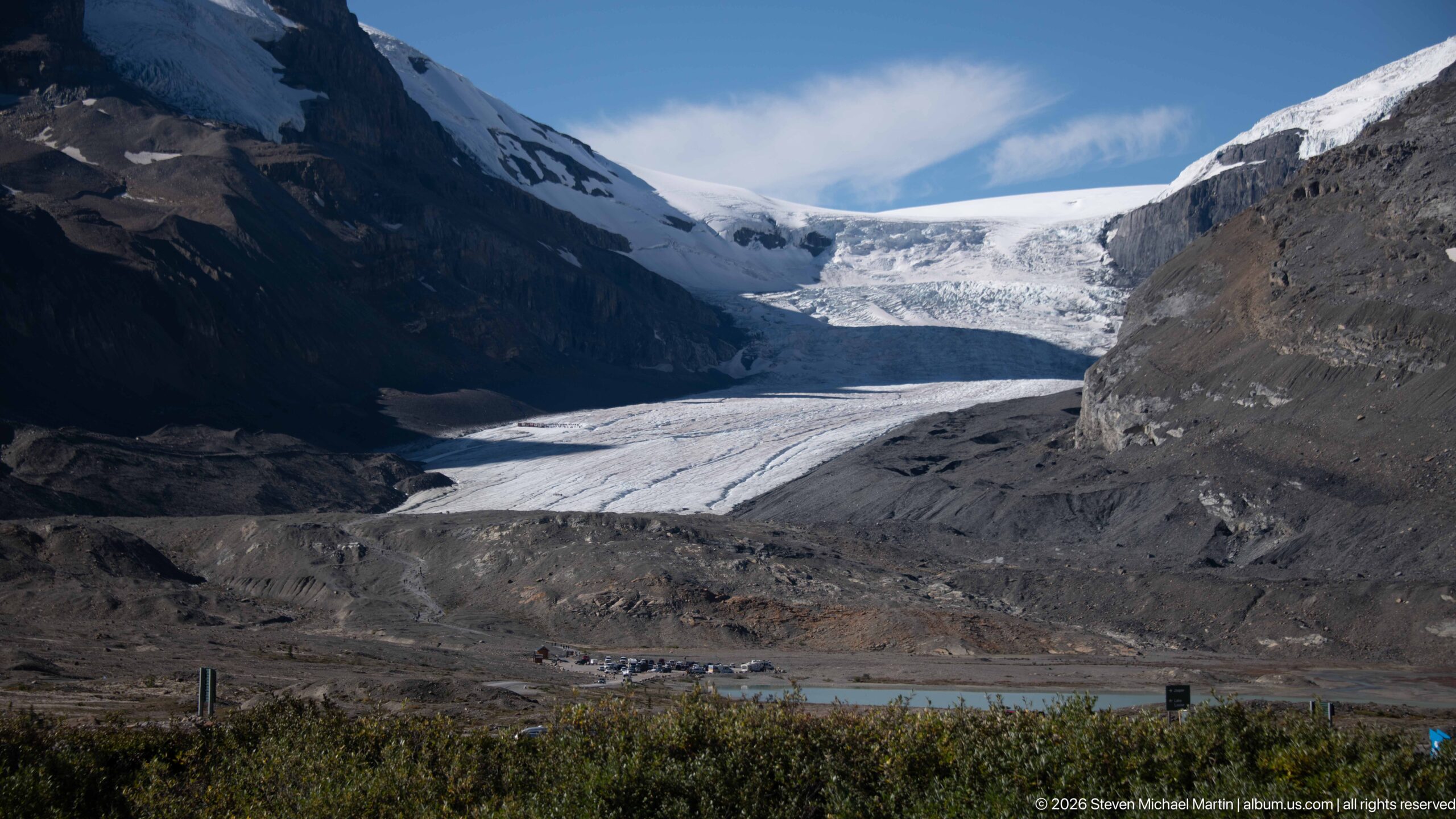
The Athabasca Glacier extends down a broad mountain valley to a debris-covered terminus bordered by gray moraine and sparse shrubs. Rock walls close in on both sides, while the glacier’s layered surface leads the eye toward the snowfield at its head. A small structure near the lower edge provides scale without diminishing the expanse of ice and exposed sediment.
Caption
The Athabasca Glacier extends down a broad mountain valley to a debris-covered terminus bordered by gray moraine and sparse shrubs. Rock walls close in on both sides, while the glacier’s layered surface leads the eye toward the snowfield at its head. A small structure near the lower edge provides scale without diminishing the expanse of ice and exposed sediment.
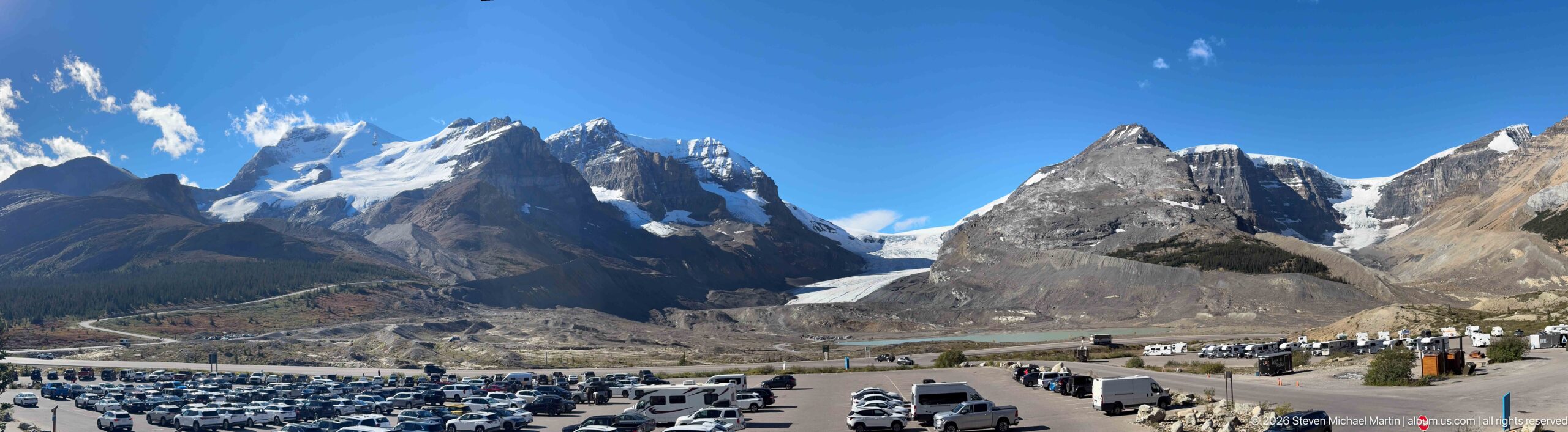
The Athabasca Glacier fills the mountain valley beyond a large parking area crowded with cars, buses, and recreational vehicles. Its bright ice descends between dark rock walls to a broad gray moraine, placing visitor infrastructure in the same frame as the glacial landscape. The viewpoint records both the scale of the icefield and the concentration of access around this heavily visited overlook.
Caption
The Athabasca Glacier fills the mountain valley beyond a large parking area crowded with cars, buses, and recreational vehicles. Its bright ice descends between dark rock walls to a broad gray moraine, placing visitor infrastructure in the same frame as the glacial landscape. The viewpoint records both the scale of the icefield and the concentration of access around this heavily visited overlook.
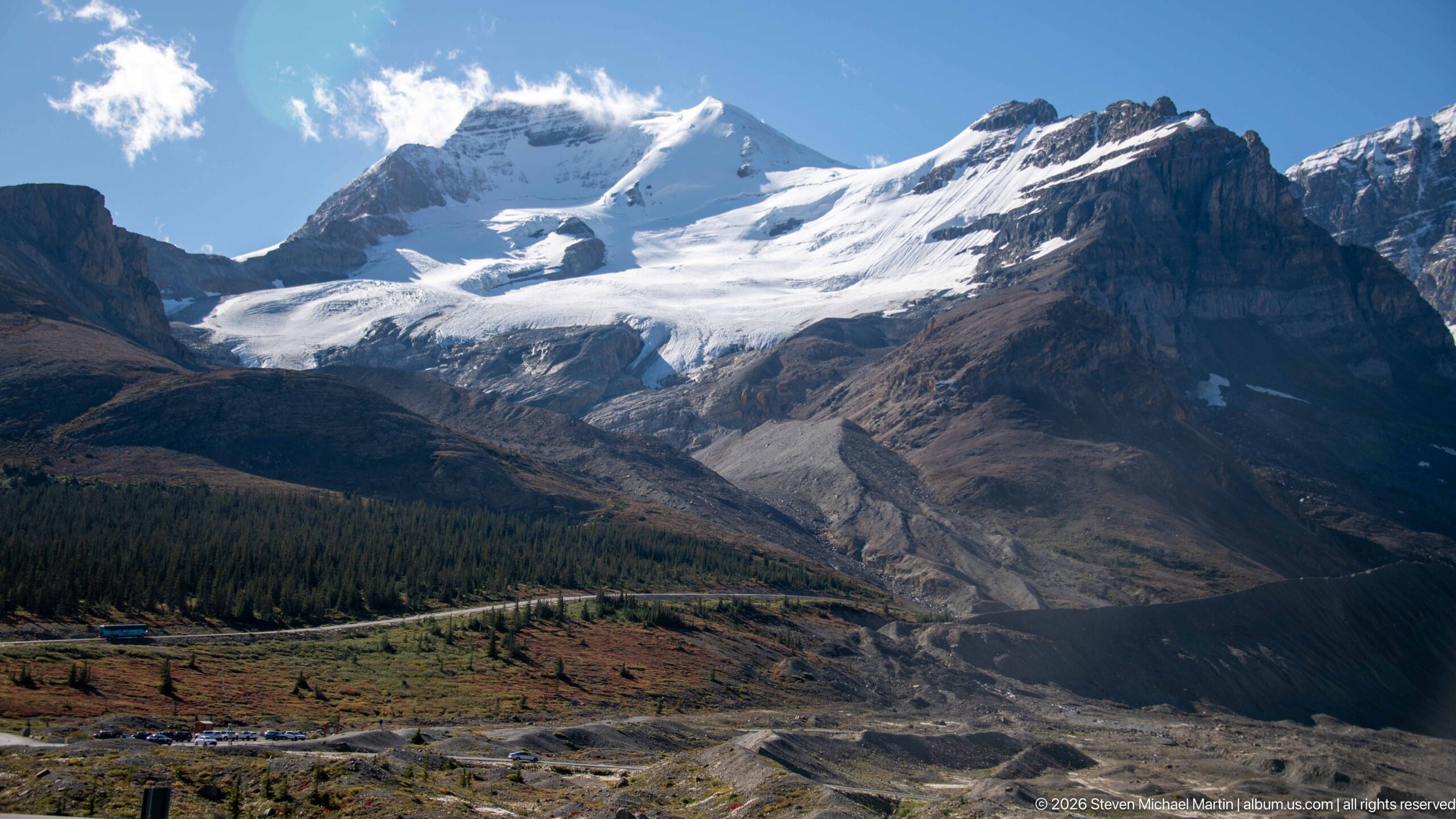
A glacier descends from a high snowfield into a gray, debris-covered valley, with parallel moraine ridges marking the lower ice and surrounding ground. Forest and low alpine vegetation occupy the valley margins, while the upper glacier remains bright against the darker rock. The elevated viewpoint makes the glacier’s full route from icefield to terminus legible.
Caption
A glacier descends from a high snowfield into a gray, debris-covered valley, with parallel moraine ridges marking the lower ice and surrounding ground. Forest and low alpine vegetation occupy the valley margins, while the upper glacier remains bright against the darker rock. The elevated viewpoint makes the glacier’s full route from icefield to terminus legible.
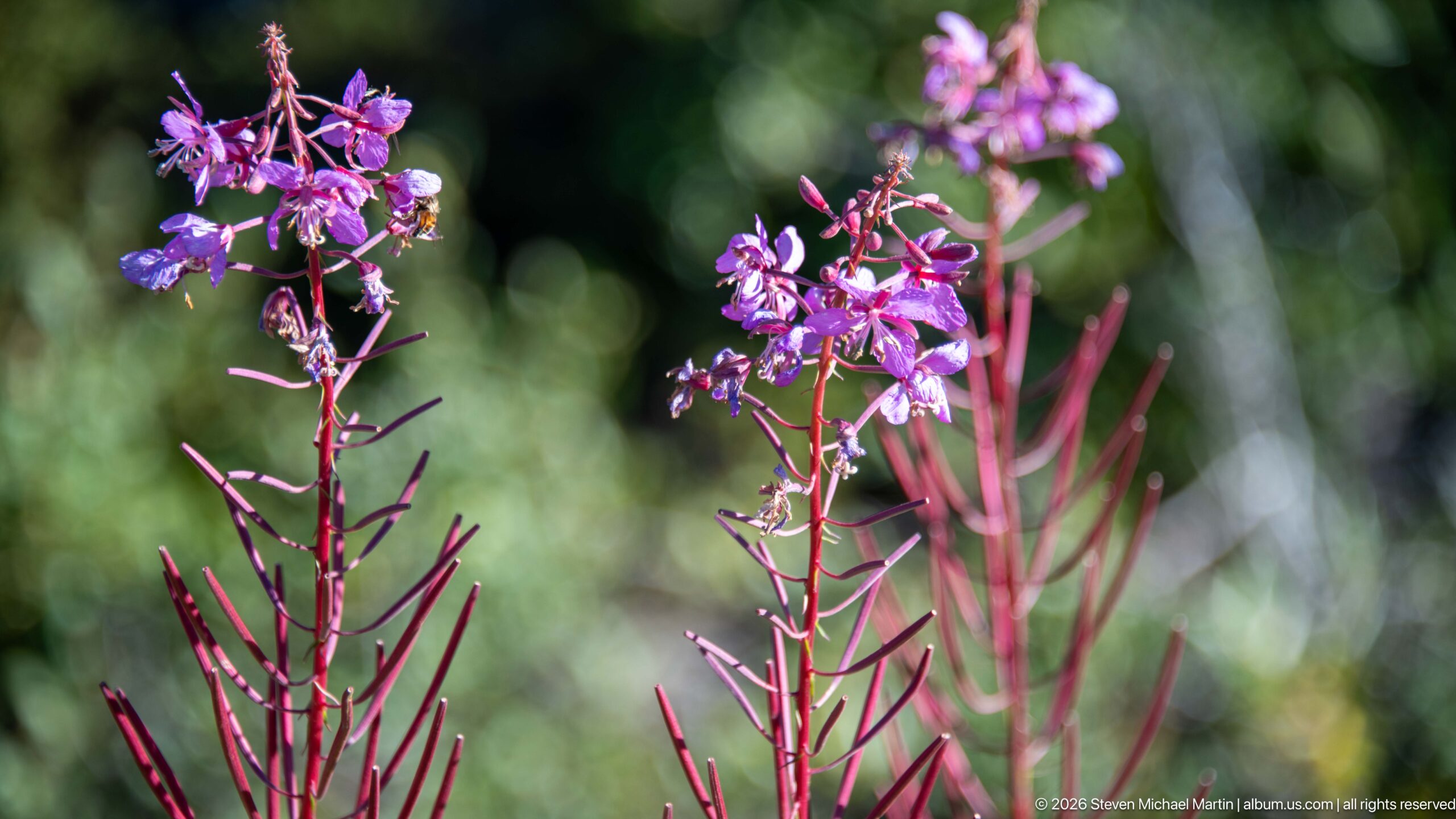
Magenta fireweed blossoms open along tall reddish stems, with unopened buds and narrow leaves repeating down the stalks. Shallow focus isolates the flowers against a deep green woodland background, turning the image into a botanical close view rather than another glacier panorama. Sunlight brightens the petals and separates their pink-purple color from the surrounding foliage.
Caption
Magenta fireweed blossoms open along tall reddish stems, with unopened buds and narrow leaves repeating down the stalks. Shallow focus isolates the flowers against a deep green woodland background, turning the image into a botanical close view rather than another glacier panorama. Sunlight brightens the petals and separates their pink-purple color from the surrounding foliage.
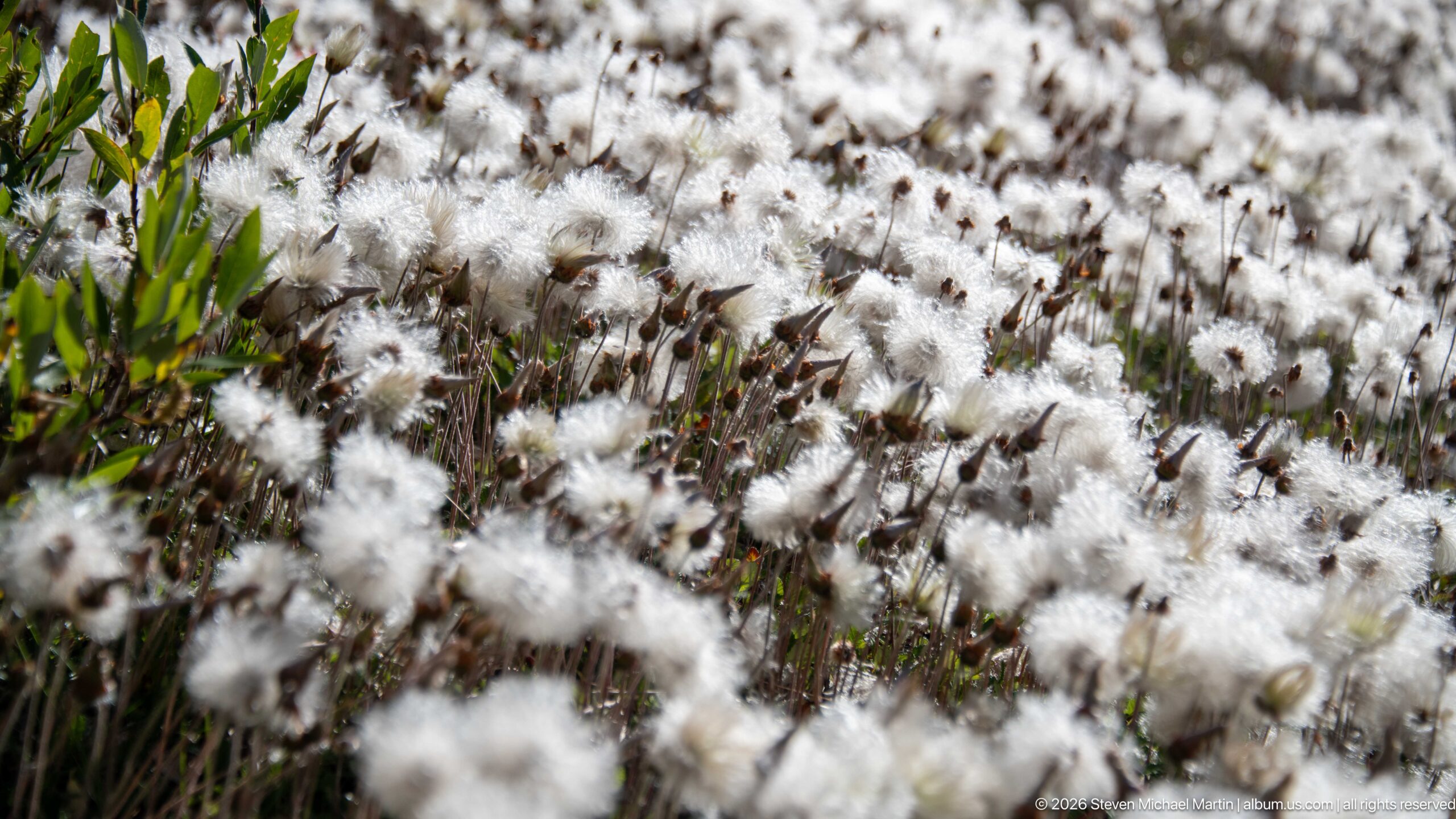
A dense stand of white, cottony seed heads spreads across a wet alpine meadow, with reddish-brown stems and green leaves visible beneath the tufts. The close framing turns the plants into a textured field of repeating forms; only a few foreground leaves remain sharply defined. The species-level identification is cautious because the proof sheet does not show diagnostic stem or leaf details.
Caption
A dense stand of white, cottony seed heads spreads across a wet alpine meadow, with reddish-brown stems and green leaves visible beneath the tufts. The close framing turns the plants into a textured field of repeating forms; only a few foreground leaves remain sharply defined. The species-level identification is cautious because the proof sheet does not show diagnostic stem or leaf details.
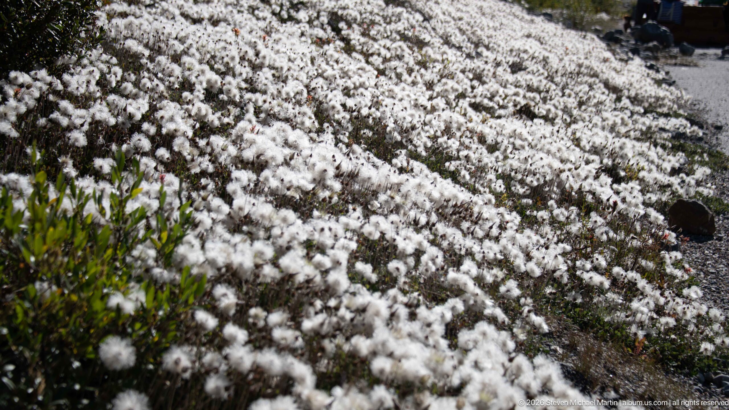
A patch of white seed tufts fills a rocky, open alpine slope, with green lance-shaped leaves and thin brown stems visible among the plants. Unlike the compressed flower study on the preceding page, this wider view includes bare gravel and a few stones, placing the growth in its high-elevation ground cover. The repeated tufts form a pale band against the darker soil.
Caption
A patch of white seed tufts fills a rocky, open alpine slope, with green lance-shaped leaves and thin brown stems visible among the plants. Unlike the compressed flower study on the preceding page, this wider view includes bare gravel and a few stones, placing the growth in its high-elevation ground cover. The repeated tufts form a pale band against the darker soil.
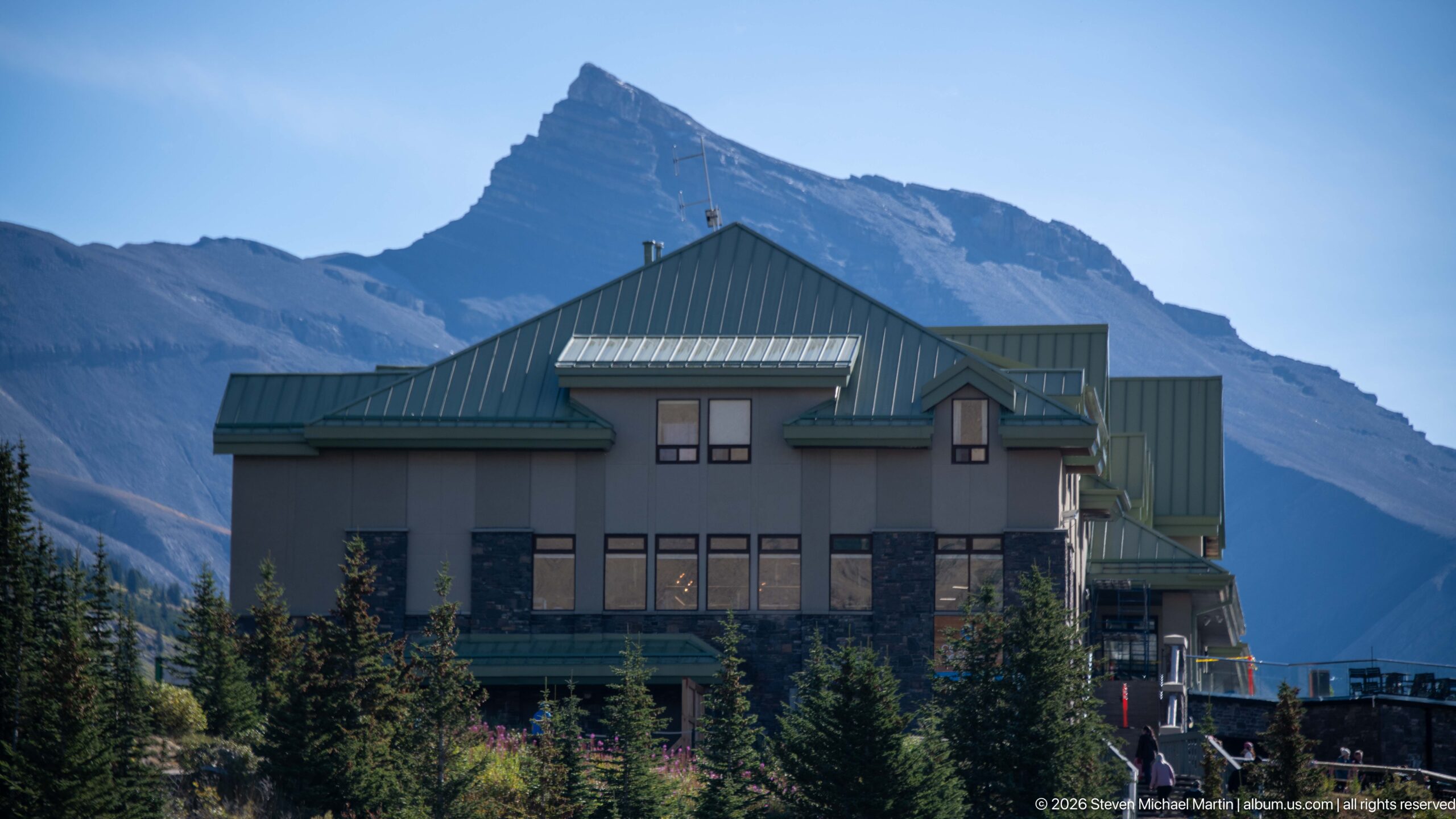
A multi-story visitor lodge with green metal roofs and broad windows stands at the foot of a steep mountain, its clustered gables set against a dark, layered rock face. Conifers and low shrubs partly screen the lower floors, integrating the building into the alpine slope. The frontal view emphasizes the lodge’s scale and its immediate relationship to the high peak behind it.
Caption
A multi-story visitor lodge with green metal roofs and broad windows stands at the foot of a steep mountain, its clustered gables set against a dark, layered rock face. Conifers and low shrubs partly screen the lower floors, integrating the building into the alpine slope. The frontal view emphasizes the lodge’s scale and its immediate relationship to the high peak behind it.
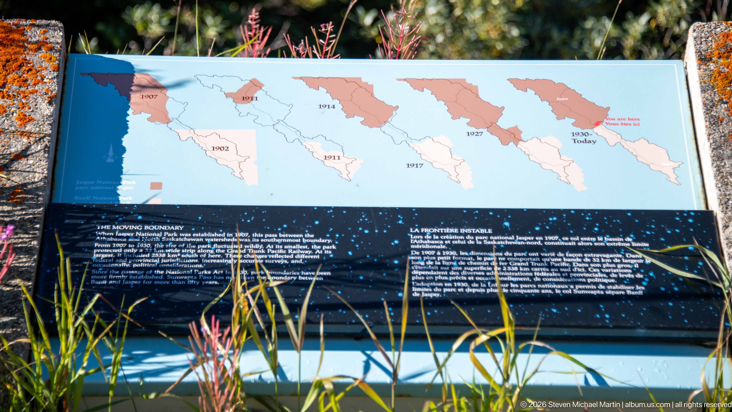
An outdoor interpretive panel compares glacier outlines across a sequence of dated maps, with bands of blue and salmon marking changing ice margins. Small explanatory text sits beneath the diagrams, while grasses and pink flower stems rise across the lower edge. The display turns the surrounding icefield into a record of change, linking a broad mountain landscape with mapped historical boundaries.
Caption
An outdoor interpretive panel compares glacier outlines across a sequence of dated maps, with bands of blue and salmon marking changing ice margins. Small explanatory text sits beneath the diagrams, while grasses and pink flower stems rise across the lower edge. The display turns the surrounding icefield into a record of change, linking a broad mountain landscape with mapped historical boundaries.
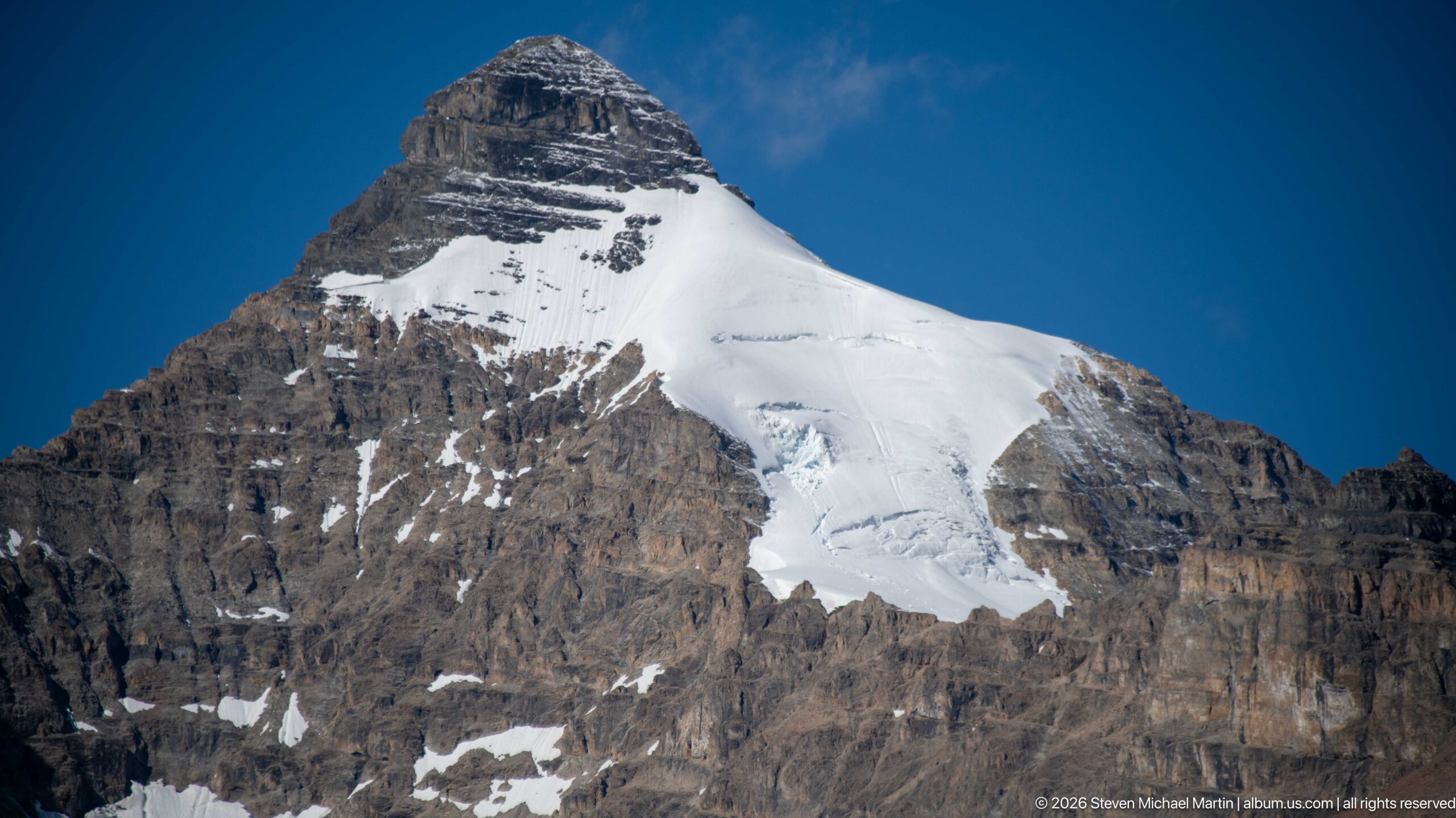
A rounded snowfield drapes over a steep, banded rock face and funnels downward into a fractured icefall. The isolated mountain view shows layers of snow and exposed stone in sharp contrast, with a clean blue sky separating the summit from the surrounding range. It offers a closer, more graphic study of the mountain than the broader valley views nearby.
Caption
A rounded snowfield drapes over a steep, banded rock face and funnels downward into a fractured icefall. The isolated mountain view shows layers of snow and exposed stone in sharp contrast, with a clean blue sky separating the summit from the surrounding range. It offers a closer, more graphic study of the mountain than the broader valley views nearby.
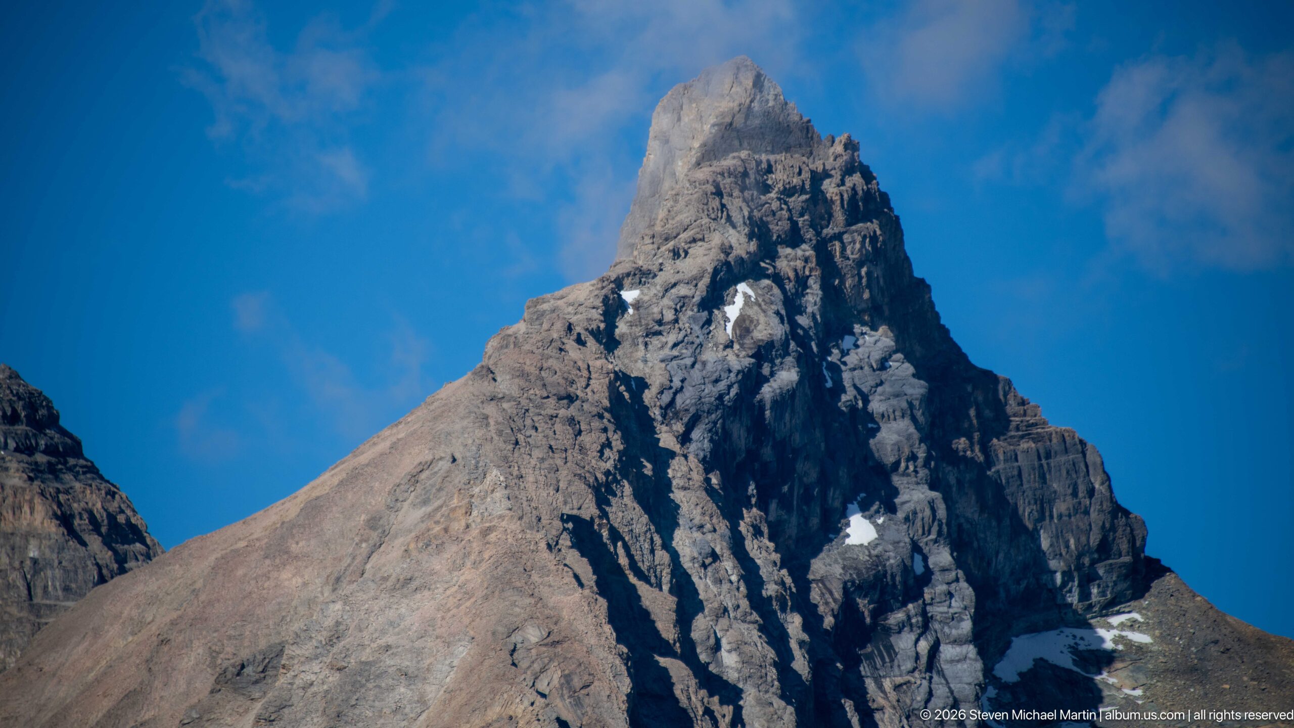
A steep, narrow summit rises as a dark rock spire above a pale, scree-covered shoulder. The close viewpoint exposes broken ledges and vertical fissures on the face, while blue sky isolates the peak from the neighboring range. The photograph concentrates on the contrast between the resistant central tower and the looser slope beneath it.
Caption
A steep, narrow summit rises as a dark rock spire above a pale, scree-covered shoulder. The close viewpoint exposes broken ledges and vertical fissures on the face, while blue sky isolates the peak from the neighboring range. The photograph concentrates on the contrast between the resistant central tower and the looser slope beneath it.
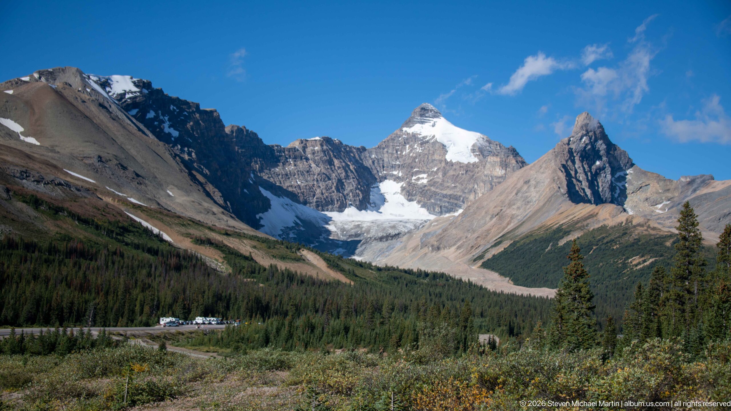
A pale glacier fills a notch between steep mountains at the end of a broad, forested valley. Green conifer slopes and low meadow vegetation occupy the foreground, while the rocky basin narrows toward the ice. The wide composition links high snow and glacier to the lower valley floor, giving a geographic context absent from the preceding summit close-ups.
Caption
A pale glacier fills a notch between steep mountains at the end of a broad, forested valley. Green conifer slopes and low meadow vegetation occupy the foreground, while the rocky basin narrows toward the ice. The wide composition links high snow and glacier to the lower valley floor, giving a geographic context absent from the preceding summit close-ups.
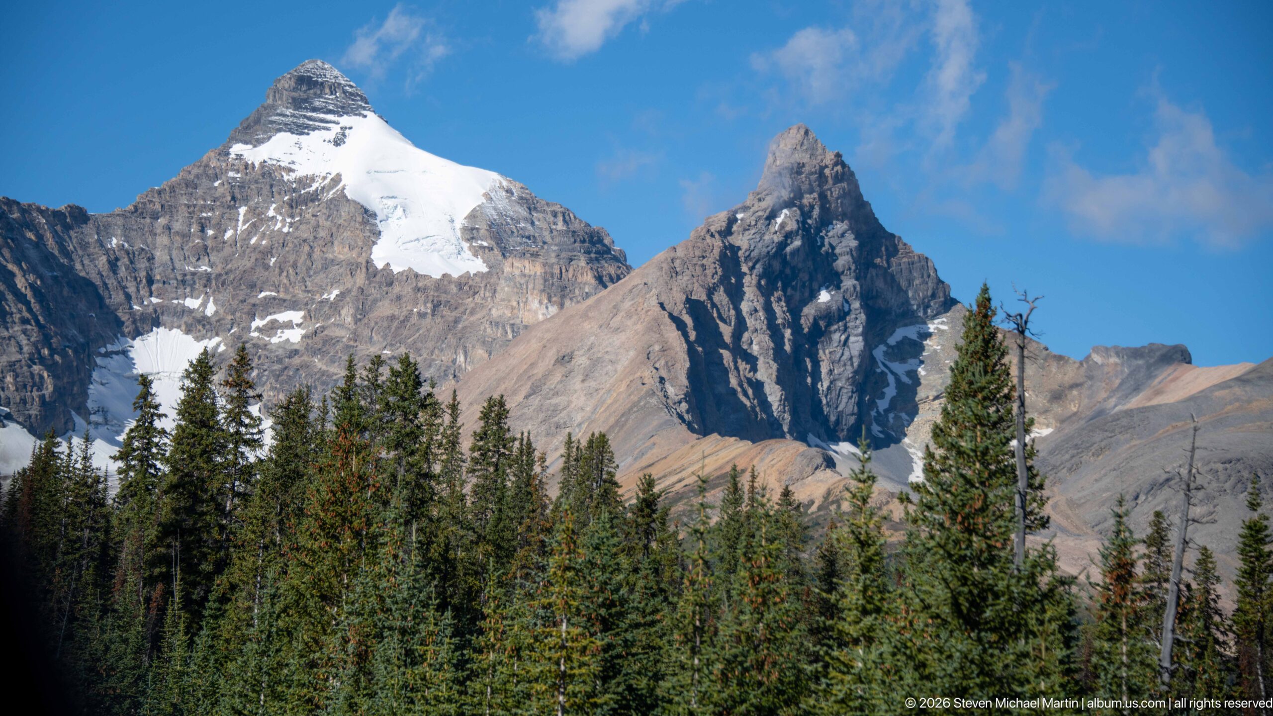
A sharp rock peak rises above a dense conifer belt, with snow and a small glacier clinging to the higher shoulder at left. Blue sky opens behind the summit, while low cloud touches the neighboring ridge. The forested foreground gives scale to the abrupt rise from valley trees to exposed high-altitude rock and ice.
Caption
A sharp rock peak rises above a dense conifer belt, with snow and a small glacier clinging to the higher shoulder at left. Blue sky opens behind the summit, while low cloud touches the neighboring ridge. The forested foreground gives scale to the abrupt rise from valley trees to exposed high-altitude rock and ice.
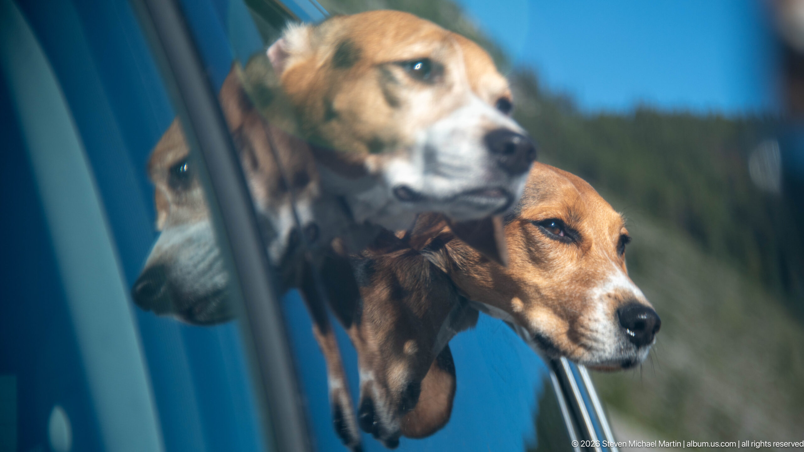
A beagle leans toward an open vehicle window, its muzzle and watchful eye repeated in the reflective glass above. The close framing joins the dog’s direct profile with a softer reflection and a sliver of blue vehicle bodywork. Forested hills blur outside, making the animal’s alert expression and the layered reflections the photograph’s central subject.
Caption
A beagle leans toward an open vehicle window, its muzzle and watchful eye repeated in the reflective glass above. The close framing joins the dog’s direct profile with a softer reflection and a sliver of blue vehicle bodywork. Forested hills blur outside, making the animal’s alert expression and the layered reflections the photograph’s central subject.
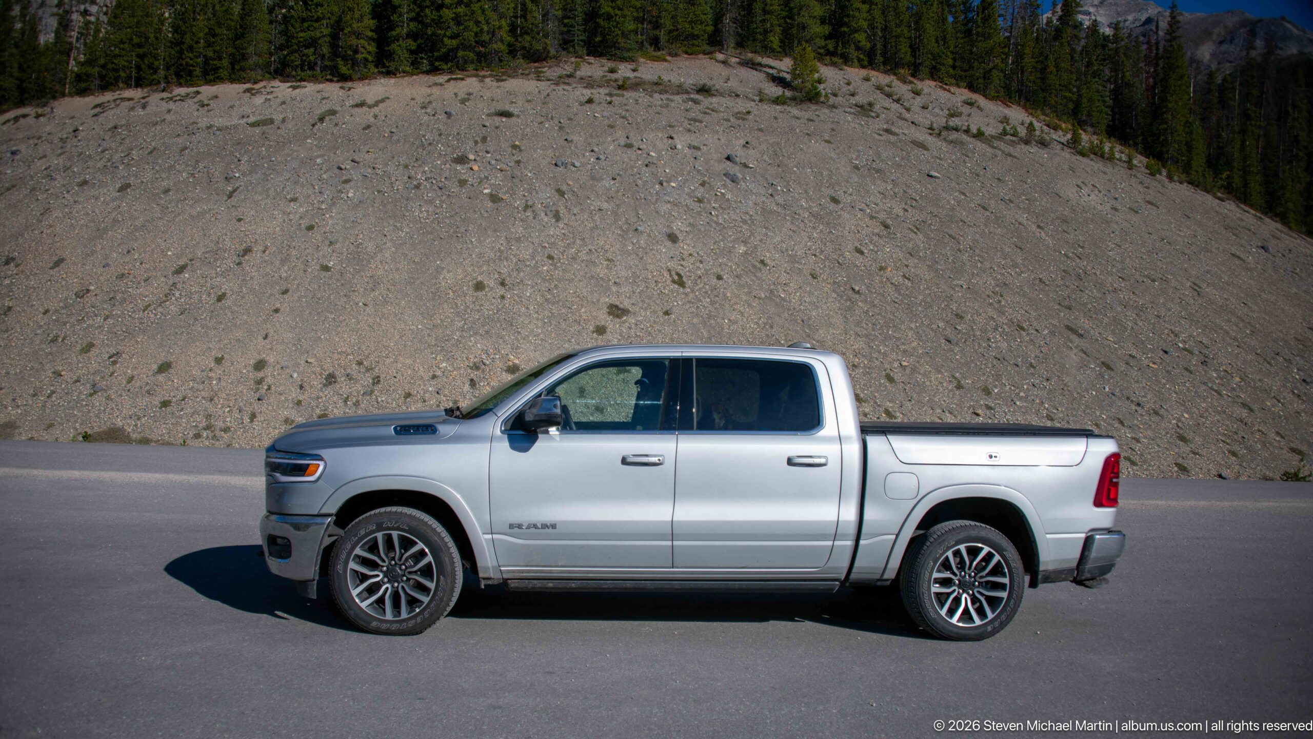
A silver Ram pickup is parked beside the highway below a broad gravel slope and dark conifer ridge. The side view shows the four-door cab, short bed, and black wheels against the open roadside terrain. Bright sun and a clear sky sharpen the contrast between the vehicle’s metallic body and the pale mountain debris behind it.
Caption
A silver Ram pickup is parked beside the highway below a broad gravel slope and dark conifer ridge. The side view shows the four-door cab, short bed, and black wheels against the open roadside terrain. Bright sun and a clear sky sharpen the contrast between the vehicle’s metallic body and the pale mountain debris behind it.
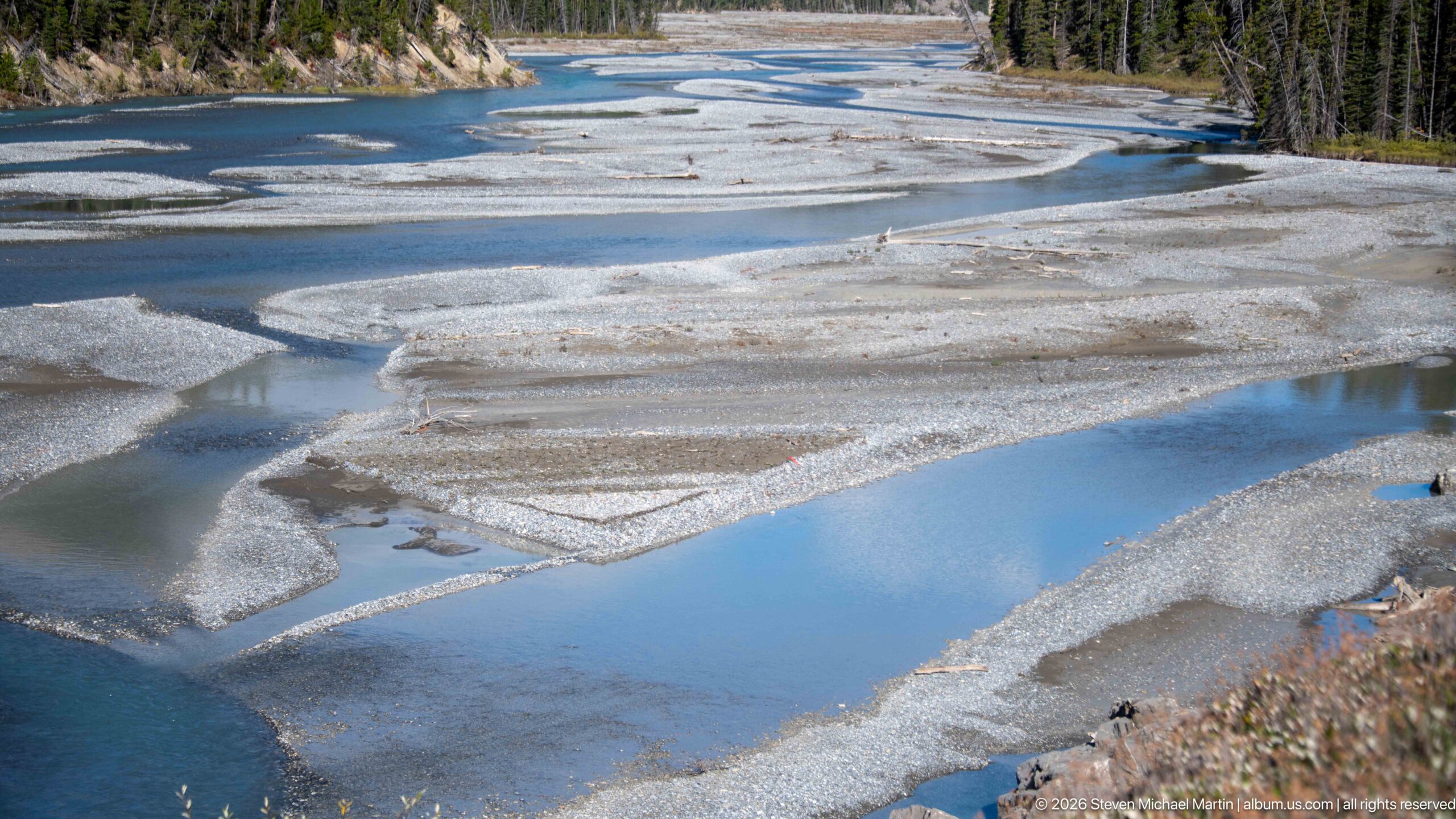
Pale gravel islands and braided blue channels stretch across a wide floodplain, with shallow pools reflecting the sky between bars. The elevated viewpoint reveals repeated bends and junctions in the watercourse, contrasting bright turquoise meltwater with gray sediment. This more open view shows the river’s broad footprint across the valley rather than a single channel close-up.
Caption
Pale gravel islands and braided blue channels stretch across a wide floodplain, with shallow pools reflecting the sky between bars. The elevated viewpoint reveals repeated bends and junctions in the watercourse, contrasting bright turquoise meltwater with gray sediment. This more open view shows the river’s broad footprint across the valley rather than a single channel close-up.
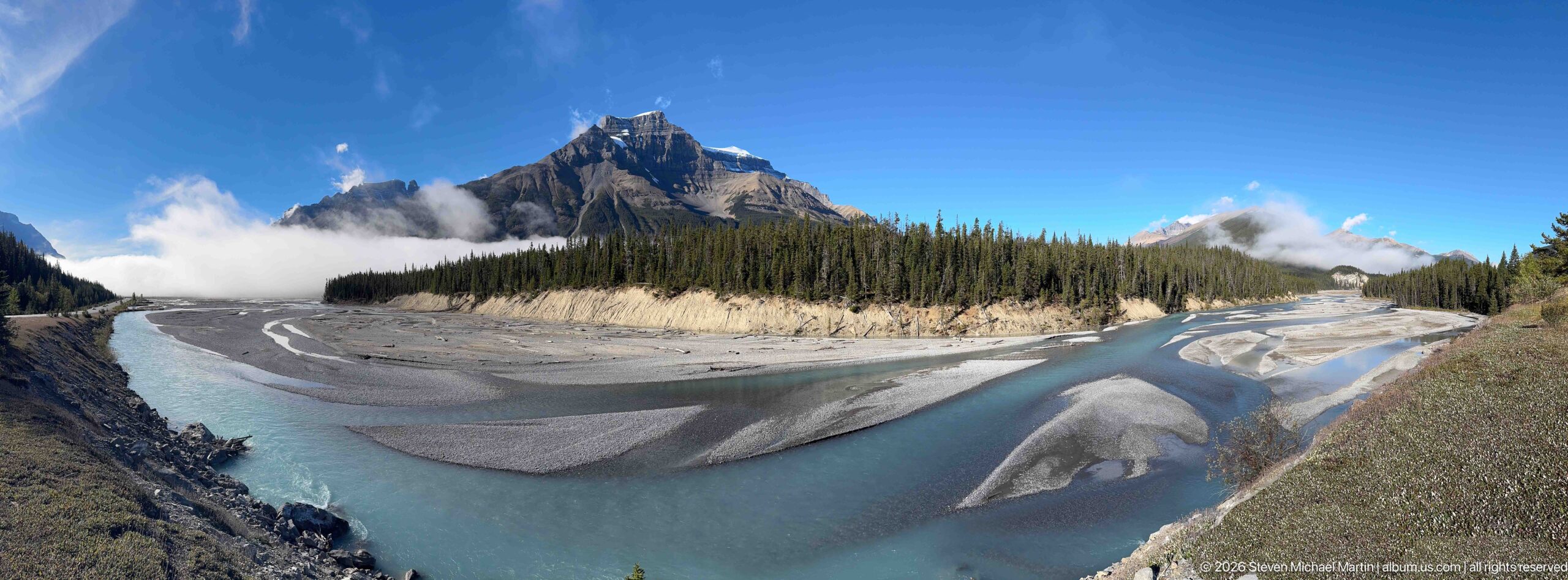
A broad river loops around pale gravel bars beneath a forested mountain valley, with a jagged peak rising behind the tree line. The panoramic framing shows the braided channel in relation to the surrounding terrain: gravel deposits spread across the valley floor, while dark forest and exposed slopes enclose it. Clouds drift around the summit and soften the distant ridges.
Caption
A broad river loops around pale gravel bars beneath a forested mountain valley, with a jagged peak rising behind the tree line. The panoramic framing shows the braided channel in relation to the surrounding terrain: gravel deposits spread across the valley floor, while dark forest and exposed slopes enclose it. Clouds drift around the summit and soften the distant ridges.
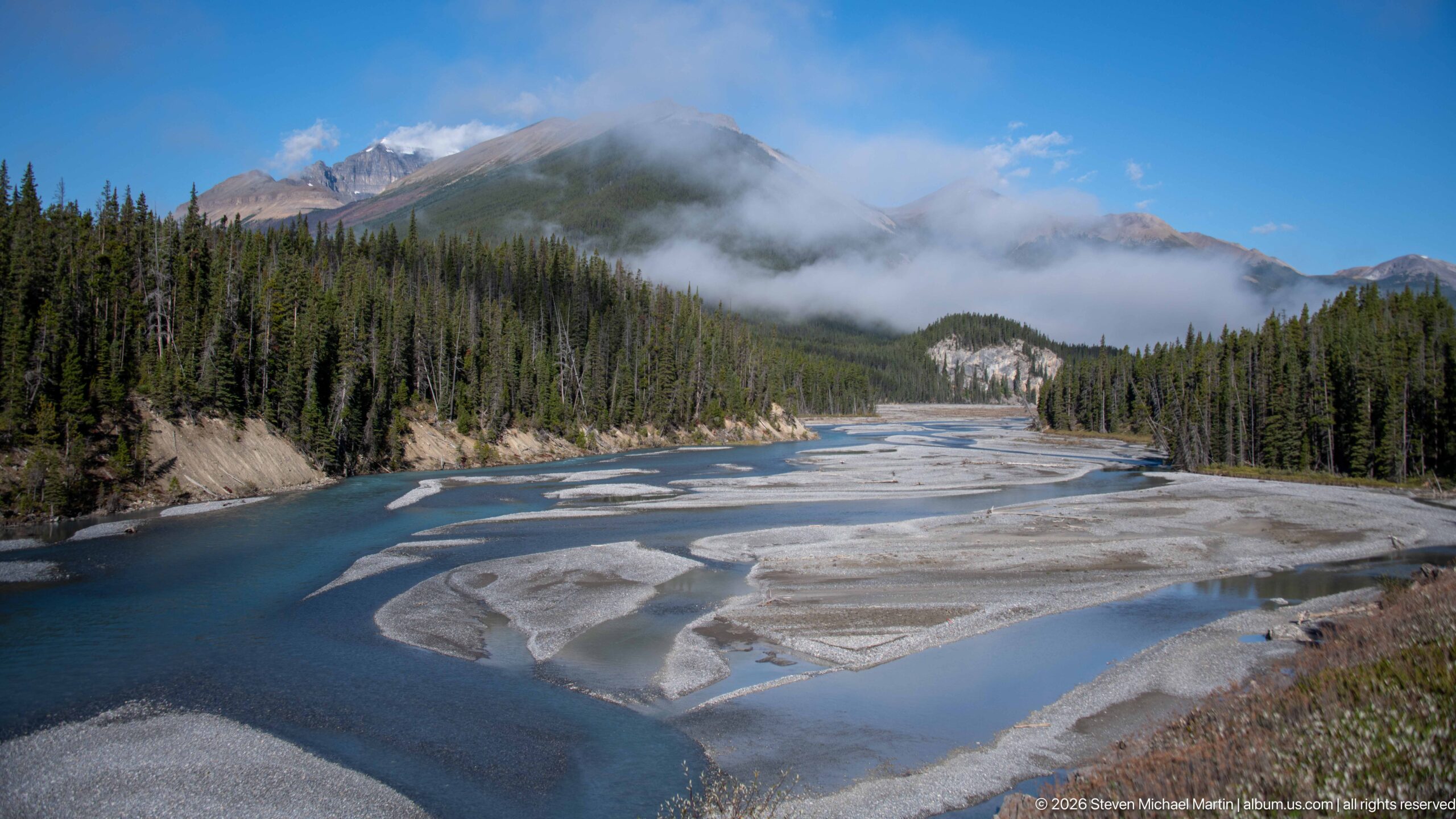
A blue-green river bends across a gravel floodplain beneath spruce-covered slopes, with low cloud drifting through the background peaks. Broad sediment bars break the water into parallel channels, and a pale cutbank reveals the edge of the forest. The scene balances the river’s shifting geometry with the enclosed scale of the mountain valley.
Caption
A blue-green river bends across a gravel floodplain beneath spruce-covered slopes, with low cloud drifting through the background peaks. Broad sediment bars break the water into parallel channels, and a pale cutbank reveals the edge of the forest. The scene balances the river’s shifting geometry with the enclosed scale of the mountain valley.
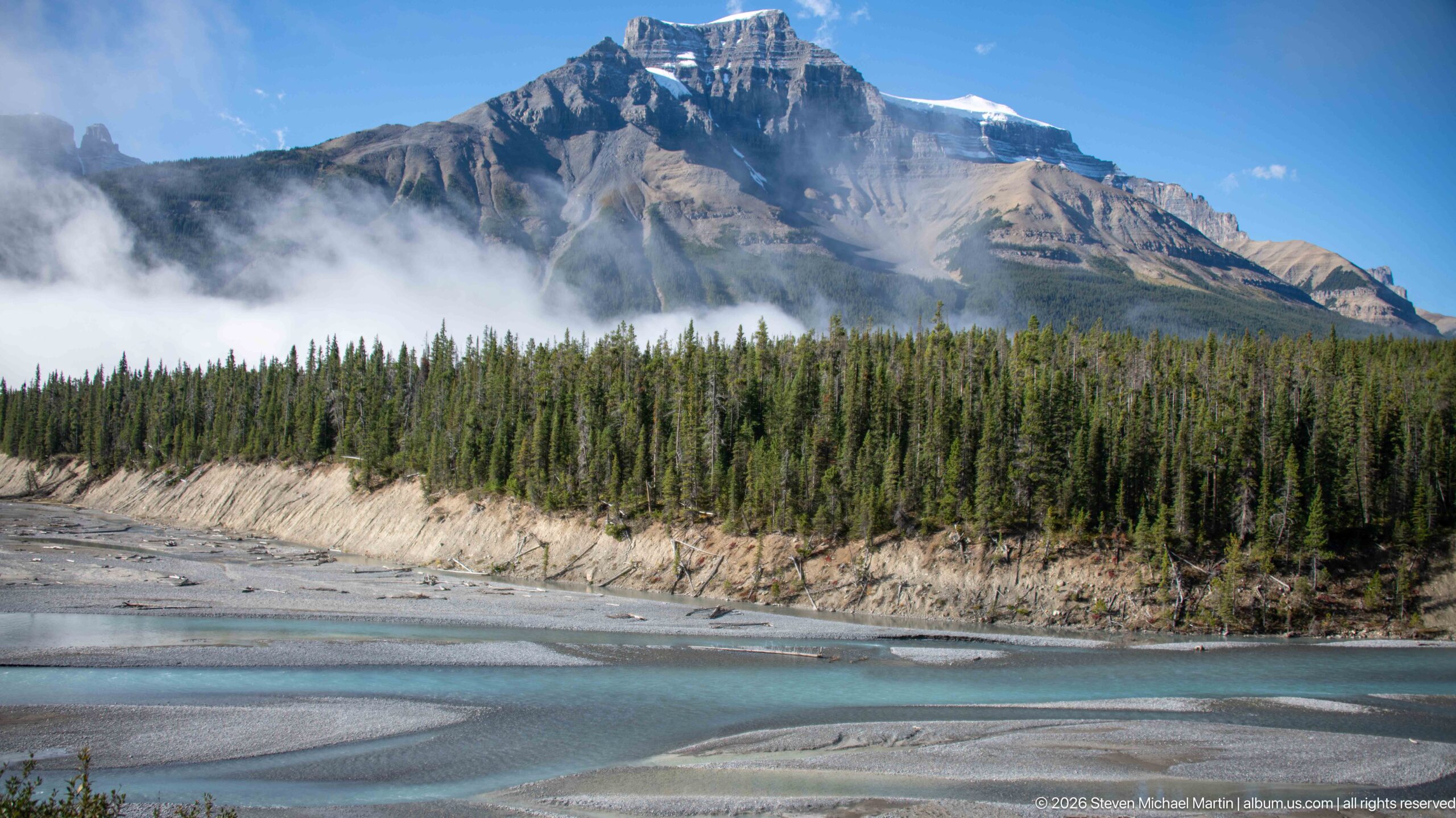
Cloud banks drift across a broad, horizontally banded mountain above the braided river. The dark forest belt separates the pale rock face from turquoise water and gravel bars below, layering peak, woodland, and floodplain in one view. A diagonal channel in the foreground introduces movement into the otherwise horizontal arrangement of mountain strata and tree line.
Caption
Cloud banks drift across a broad, horizontally banded mountain above the braided river. The dark forest belt separates the pale rock face from turquoise water and gravel bars below, layering peak, woodland, and floodplain in one view. A diagonal channel in the foreground introduces movement into the otherwise horizontal arrangement of mountain strata and tree line.
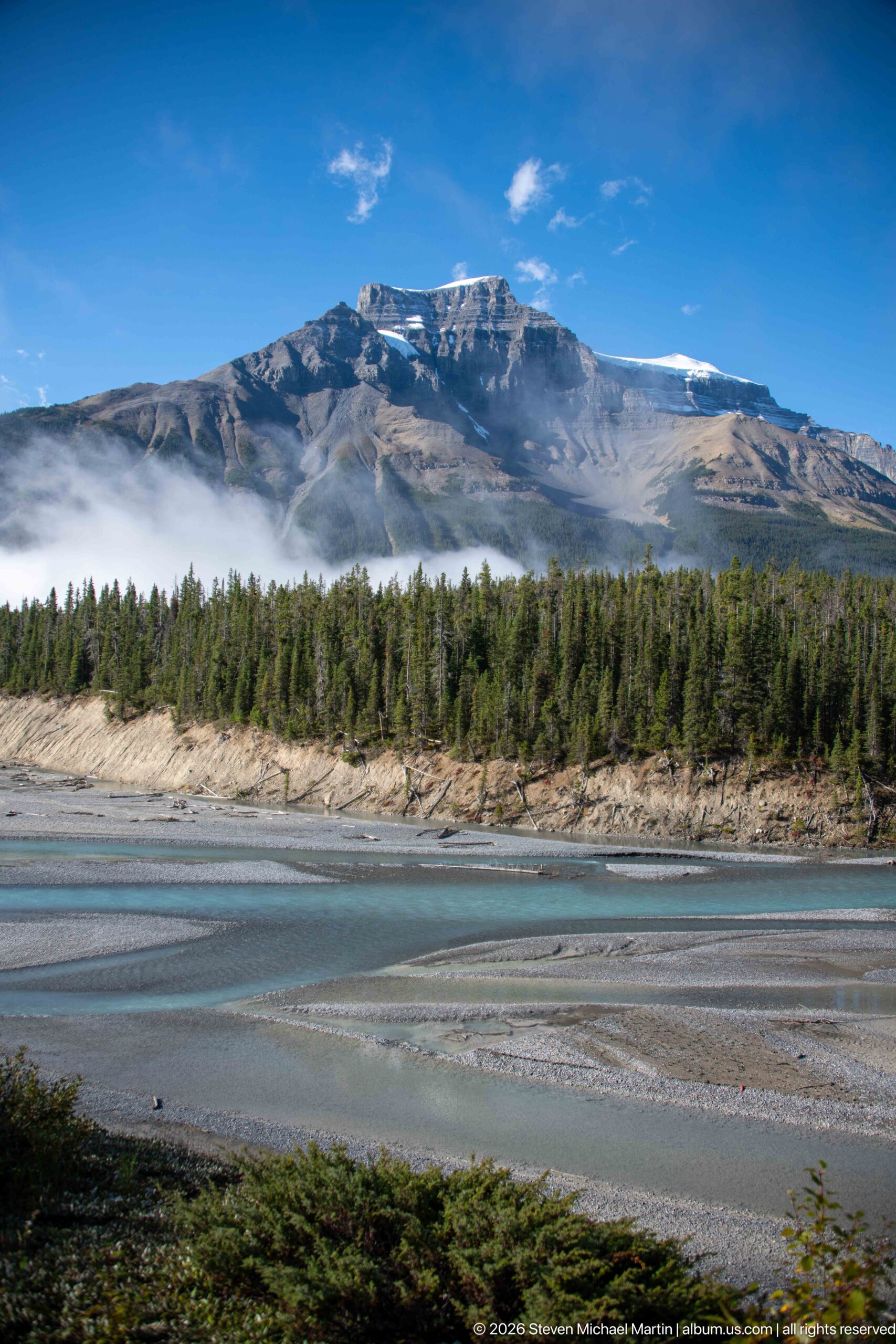
The river’s turquoise foreground channel runs beneath a long, level ridge with pale rock bands near its summit. A dark conifer forest separates the water from the mountain, while wisps of cloud drift low across the slope. This lateral composition stresses the relationship between the broad riverbed and the horizontally layered mountain wall beyond it.
Caption
The river’s turquoise foreground channel runs beneath a long, level ridge with pale rock bands near its summit. A dark conifer forest separates the water from the mountain, while wisps of cloud drift low across the slope. This lateral composition stresses the relationship between the broad riverbed and the horizontally layered mountain wall beyond it.
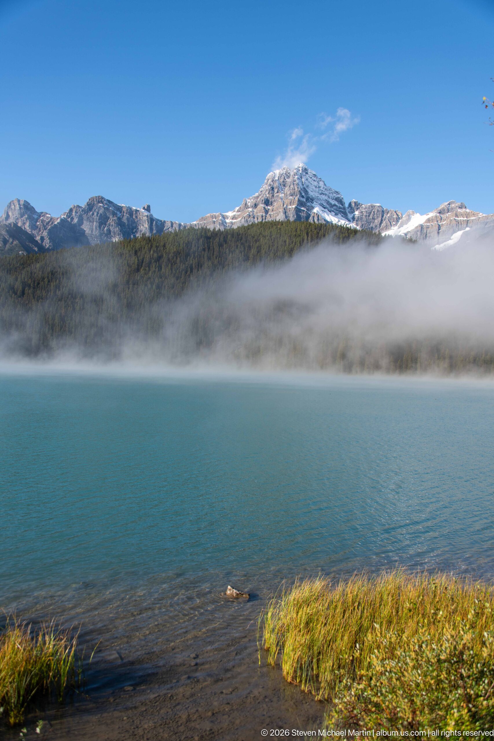
A low, snow-dusted ridge stretches above a narrow line of conifers, with fog softening its summit and the far shore. The broad lake dominates the middle ground, while yellow-green grasses and a shallow strip of shore anchor the foreground. The subdued atmosphere reduces the mountain to a pale silhouette without obscuring the water’s blue surface.
Caption
A low, snow-dusted ridge stretches above a narrow line of conifers, with fog softening its summit and the far shore. The broad lake dominates the middle ground, while yellow-green grasses and a shallow strip of shore anchor the foreground. The subdued atmosphere reduces the mountain to a pale silhouette without obscuring the water’s blue surface.
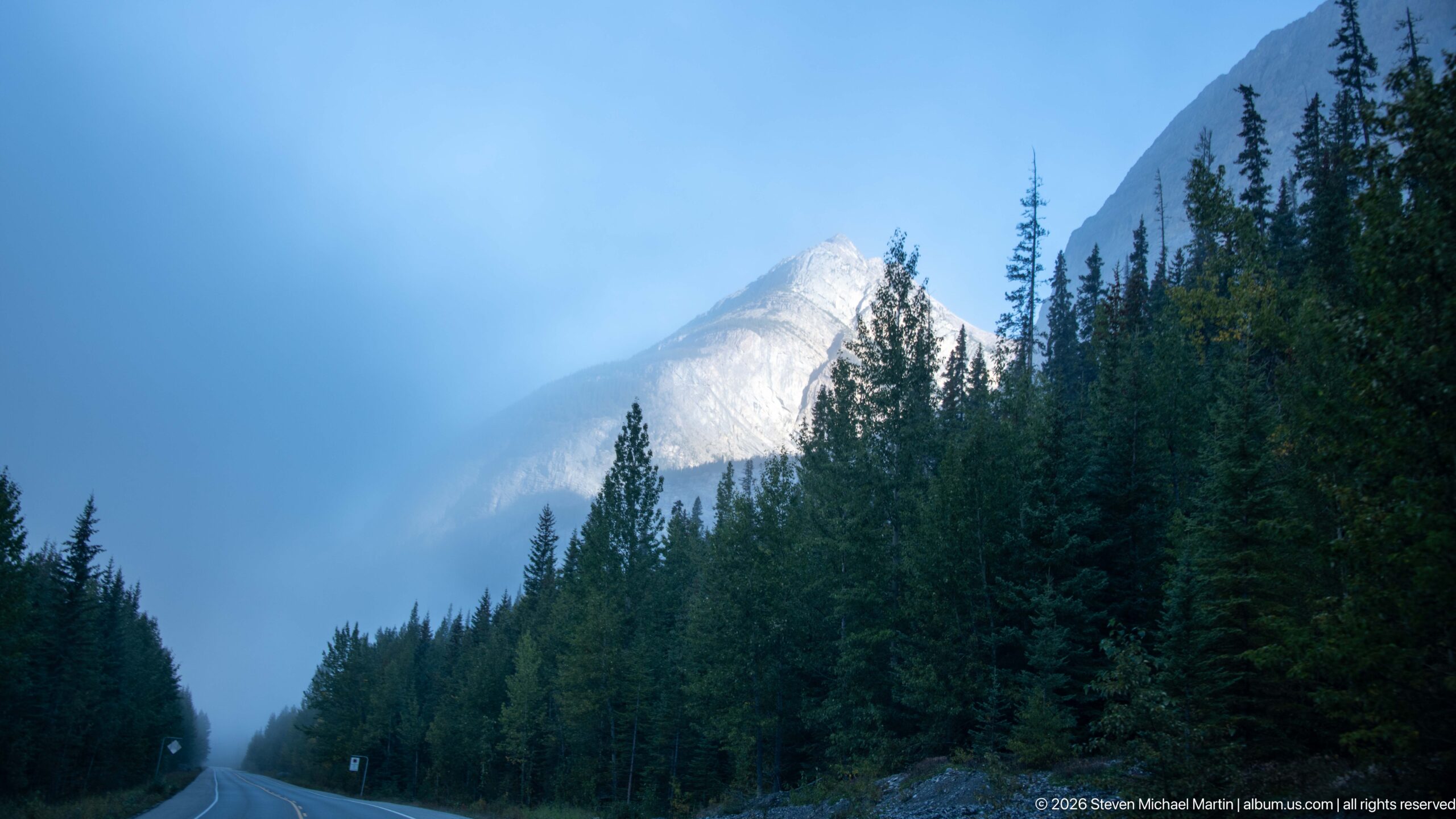
The Icefields Parkway runs between tall conifers toward a sunlit, cloud-veiled peak, its painted center line vanishing into the blue haze. Trees crowd the narrow road corridor and partly obscure the mountain, turning the drive itself into a passage between forest and weather. The low viewpoint emphasizes the road’s curve and the sudden change in visibility.
Caption
The Icefields Parkway runs between tall conifers toward a sunlit, cloud-veiled peak, its painted center line vanishing into the blue haze. Trees crowd the narrow road corridor and partly obscure the mountain, turning the drive itself into a passage between forest and weather. The low viewpoint emphasizes the road’s curve and the sudden change in visibility.
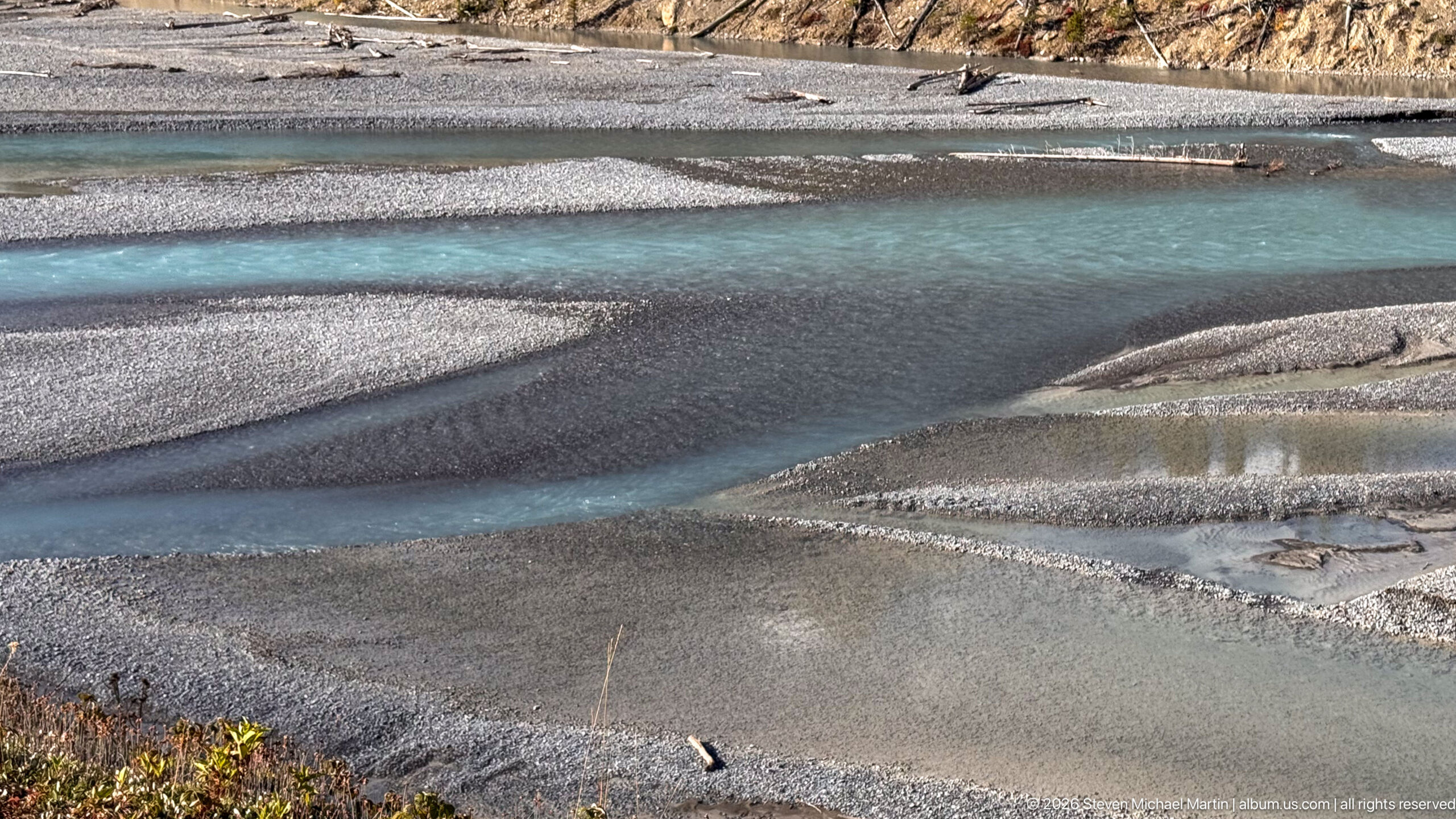
Interlaced channels cut through fine gray gravel, creating curved bars and shallow pools across the riverbed. The close viewpoint removes most of the mountain background and concentrates on the patterns left by moving water: narrow blue-green threads, smooth sediment surfaces, and a few driftwood fragments. Small differences in water depth shift the channel color from turquoise to slate.
Caption
Interlaced channels cut through fine gray gravel, creating curved bars and shallow pools across the riverbed. The close viewpoint removes most of the mountain background and concentrates on the patterns left by moving water: narrow blue-green threads, smooth sediment surfaces, and a few driftwood fragments. Small differences in water depth shift the channel color from turquoise to slate.
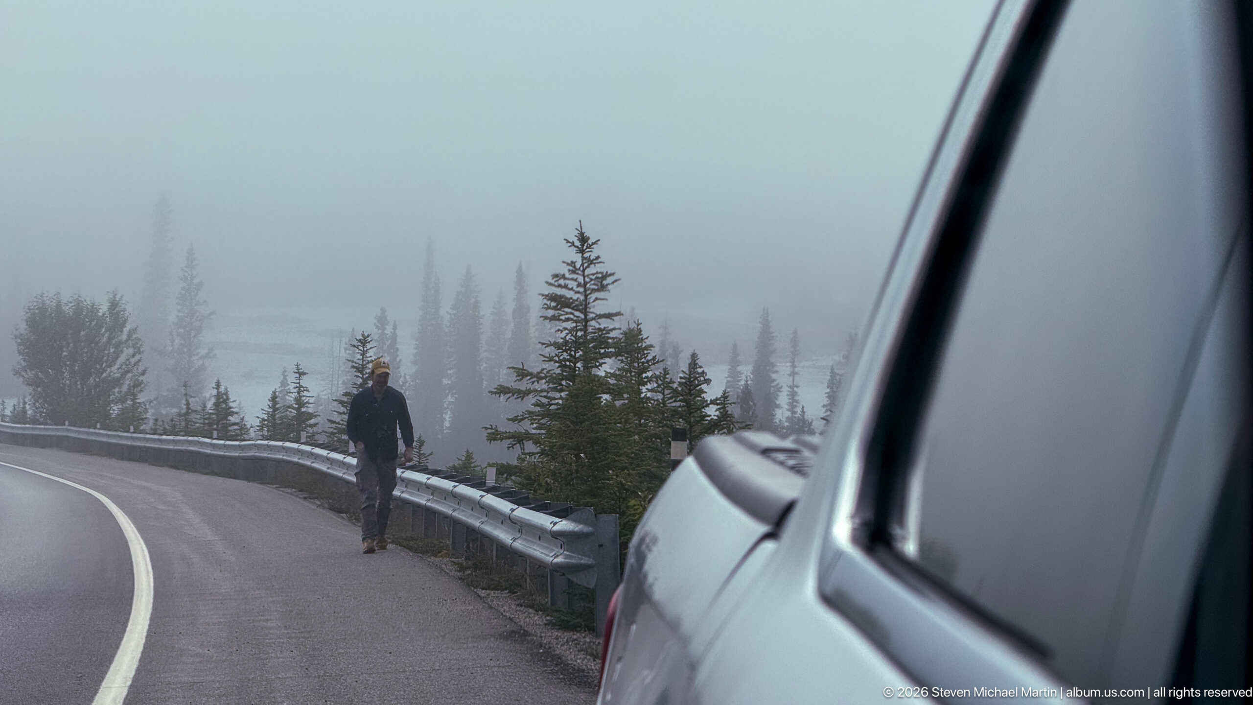
A traveler walks beside the guardrail along a curving highway in dense mountain fog, with a white vehicle close in the right foreground. Spruce trees fade into the mist beyond the road, leaving the person and guardrail as the clearest measures of scale. The scene records the experience of moving through a high pass when cloud closes in around the route.
Caption
A traveler walks beside the guardrail along a curving highway in dense mountain fog, with a white vehicle close in the right foreground. Spruce trees fade into the mist beyond the road, leaving the person and guardrail as the clearest measures of scale. The scene records the experience of moving through a high pass when cloud closes in around the route.
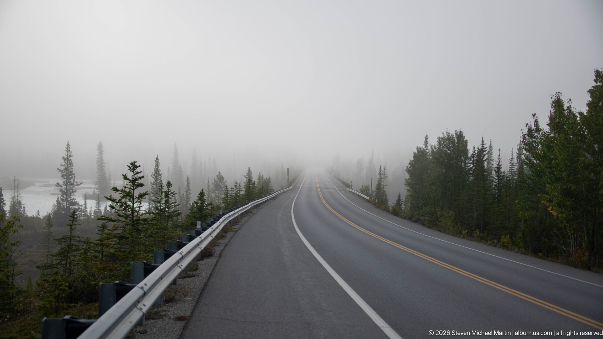
The two-lane parkway rises gently into a wall of fog, its yellow center lines and white edge markings narrowing toward the vanishing point. A metal guardrail and scattered young conifers border the road, while larger trees dissolve into the mist. The empty roadway makes restricted visibility the dominant subject and reduces the mountain corridor to layered silhouettes.
Caption
The two-lane parkway rises gently into a wall of fog, its yellow center lines and white edge markings narrowing toward the vanishing point. A metal guardrail and scattered young conifers border the road, while larger trees dissolve into the mist. The empty roadway makes restricted visibility the dominant subject and reduces the mountain corridor to layered silhouettes.
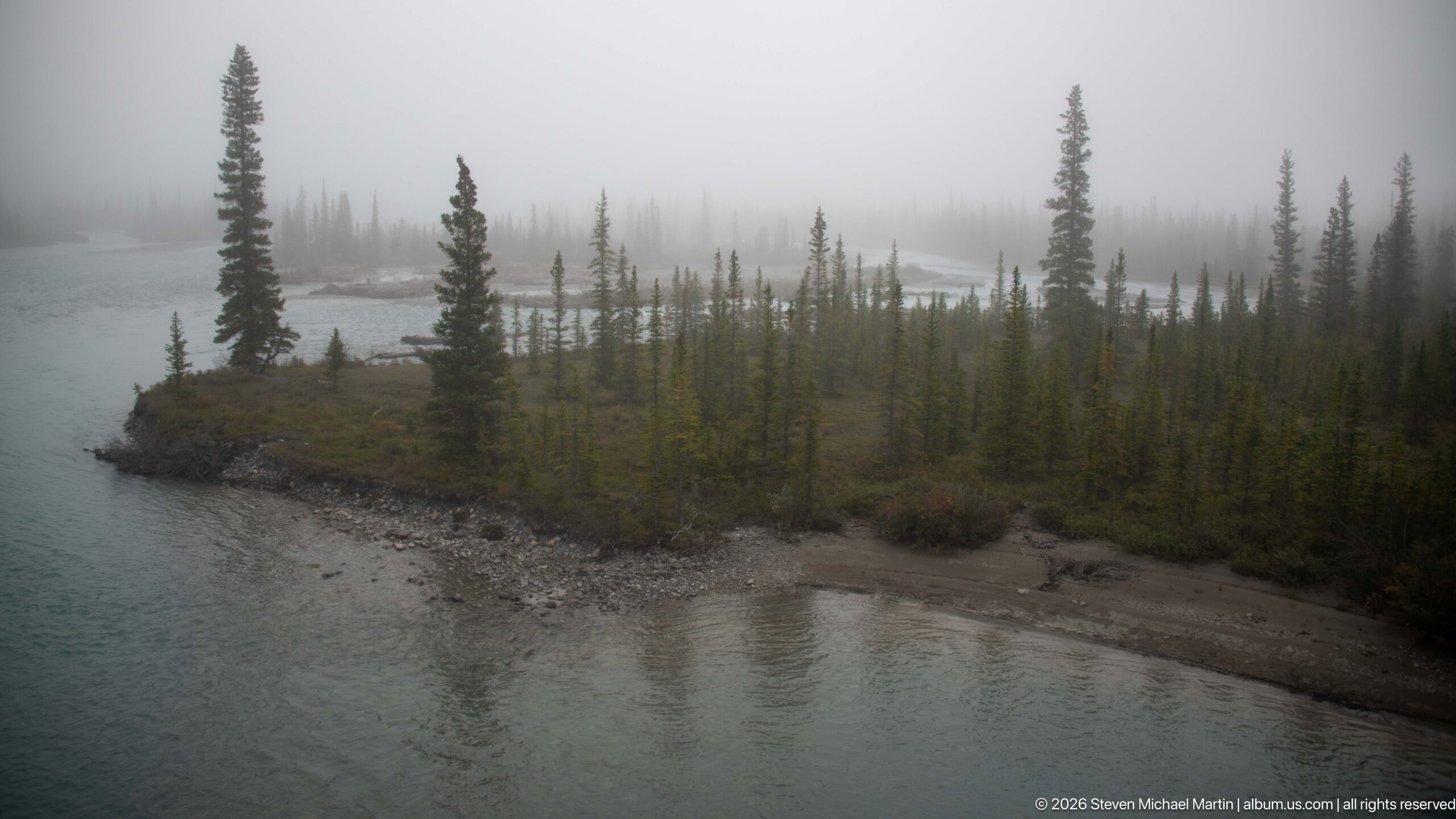
A narrow gravel bar with scattered spruce trees divides the river’s pale turquoise channels, its shoreline softened by a veil of mist. The elevated viewpoint reveals the bar’s irregular banks, exposed stones, and shallow reflective water. Compared with the preceding bend, this composition centers the small island-like landform and the sparse trees rooted along its spine.
Caption
A narrow gravel bar with scattered spruce trees divides the river’s pale turquoise channels, its shoreline softened by a veil of mist. The elevated viewpoint reveals the bar’s irregular banks, exposed stones, and shallow reflective water. Compared with the preceding bend, this composition centers the small island-like landform and the sparse trees rooted along its spine.
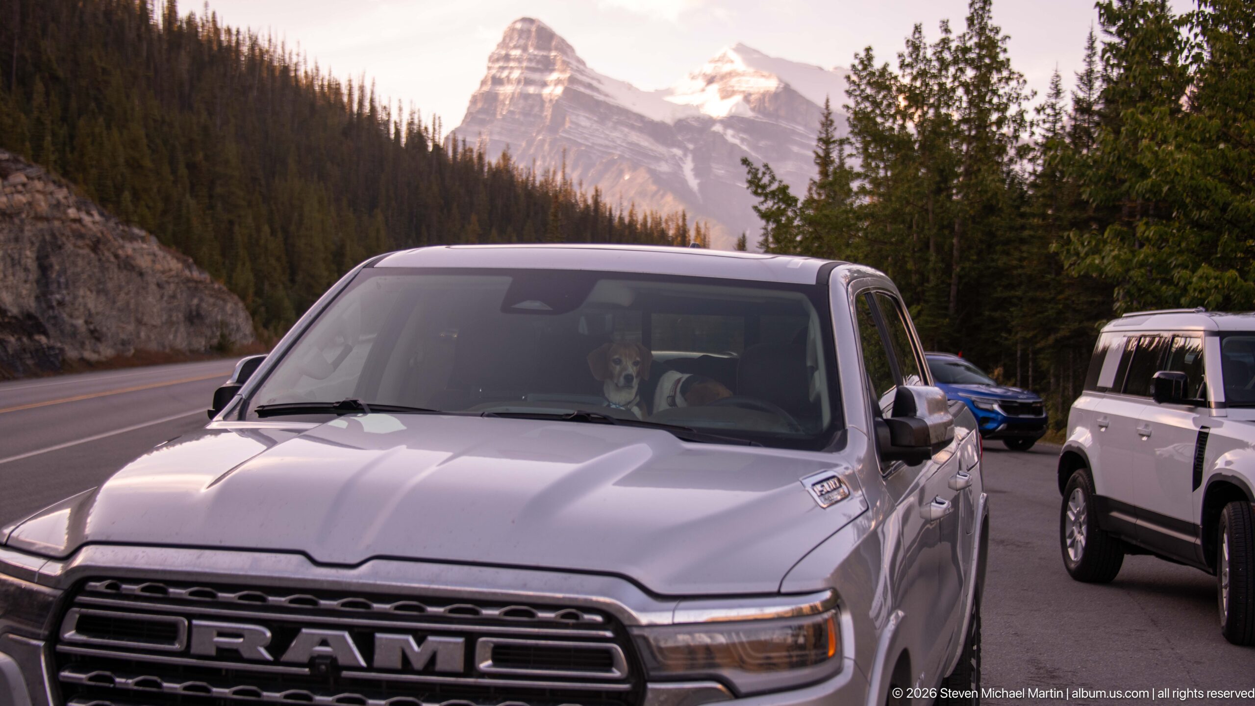
A white Ram pickup and another vehicle pause on the parkway beneath a steep, snow-streaked mountain, while warm late light catches the upper rock. The vehicles occupy the lower foreground, and the road forms a band between them and the rising slope. A readable RAM grille badge identifies the truck, anchoring this travel moment within the alpine landscape.
Caption
A white Ram pickup and another vehicle pause on the parkway beneath a steep, snow-streaked mountain, while warm late light catches the upper rock. The vehicles occupy the lower foreground, and the road forms a band between them and the rising slope. A readable RAM grille badge identifies the truck, anchoring this travel moment within the alpine landscape.
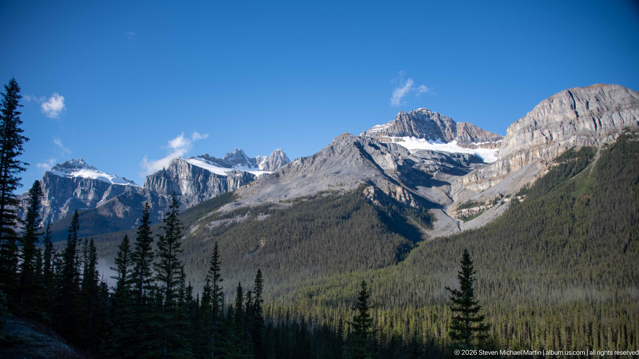
A broad, pale rock mountain rises beyond a forested valley, its nearly horizontal strata exposed beneath scattered snow patches. Dark spruce trees frame the lower slopes, while blue sky and bright clouds leave the summit sharply outlined. The wide view returns to open mountain scenery after the road and fog sequence, revealing the layered geology and scale of the range.
Caption
A broad, pale rock mountain rises beyond a forested valley, its nearly horizontal strata exposed beneath scattered snow patches. Dark spruce trees frame the lower slopes, while blue sky and bright clouds leave the summit sharply outlined. The wide view returns to open mountain scenery after the road and fog sequence, revealing the layered geology and scale of the range.
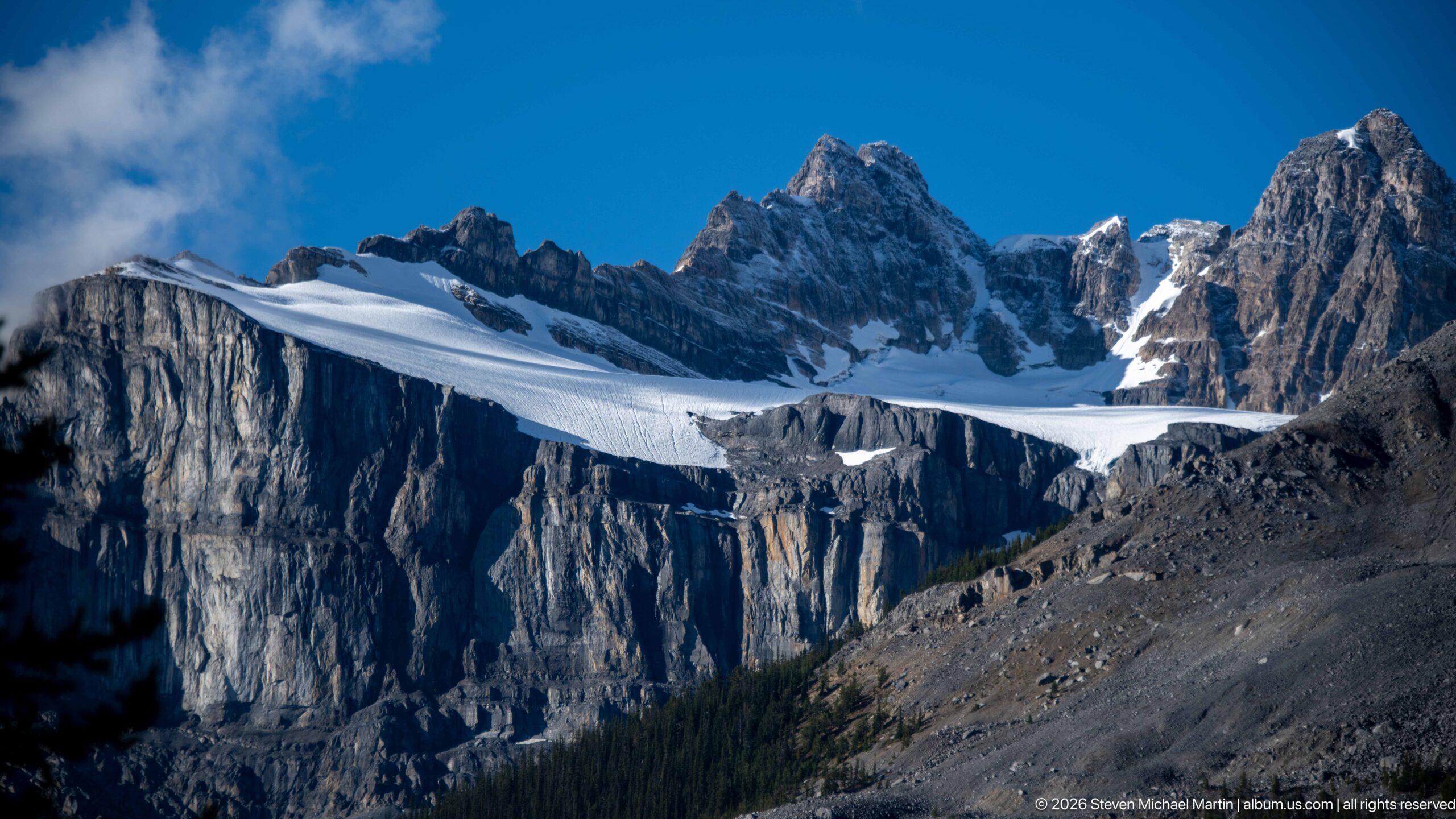
A broad glacier stretches across a high, shadowed basin, its crevassed surface bridging steep rock walls beneath a line of jagged peaks. The exposed moraine slope at right descends toward the forested valley floor, placing the ice above its debris field. Strong sunlight catches the upper snow while leaving the near cliffs in deep blue shadow.
Caption
A broad glacier stretches across a high, shadowed basin, its crevassed surface bridging steep rock walls beneath a line of jagged peaks. The exposed moraine slope at right descends toward the forested valley floor, placing the ice above its debris field. Strong sunlight catches the upper snow while leaving the near cliffs in deep blue shadow.
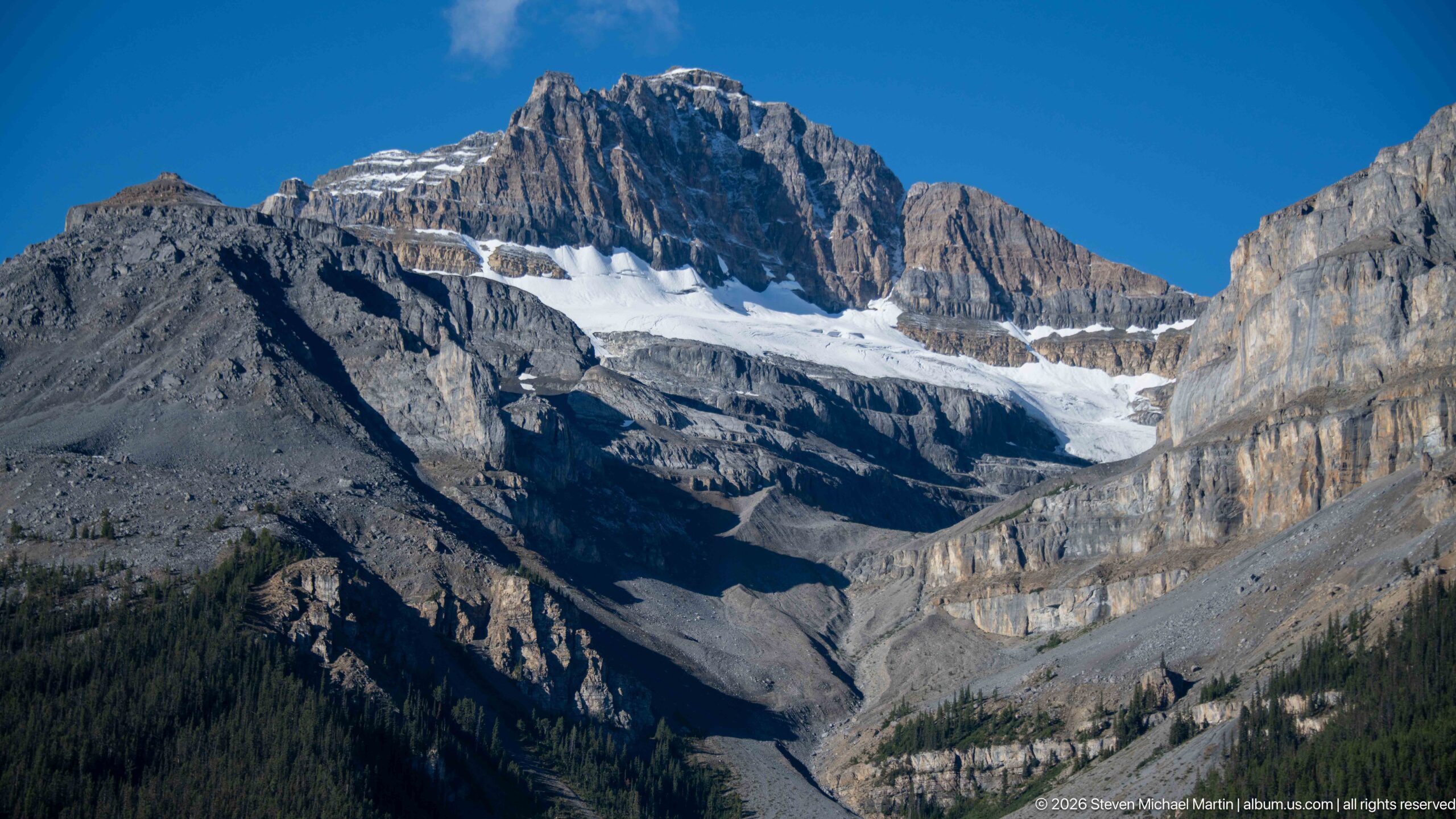
The glacier descends through a broad mountain amphitheater, ending above a dark, forested valley crossed by gray moraine and meltwater deposits. Bare, steep slopes frame the ice on both sides, while a serrated ridge crowns the basin. This wider view relates the glacier to the terrain it has shaped, from upper snowfield to lower debris apron.
Caption
The glacier descends through a broad mountain amphitheater, ending above a dark, forested valley crossed by gray moraine and meltwater deposits. Bare, steep slopes frame the ice on both sides, while a serrated ridge crowns the basin. This wider view relates the glacier to the terrain it has shaped, from upper snowfield to lower debris apron.
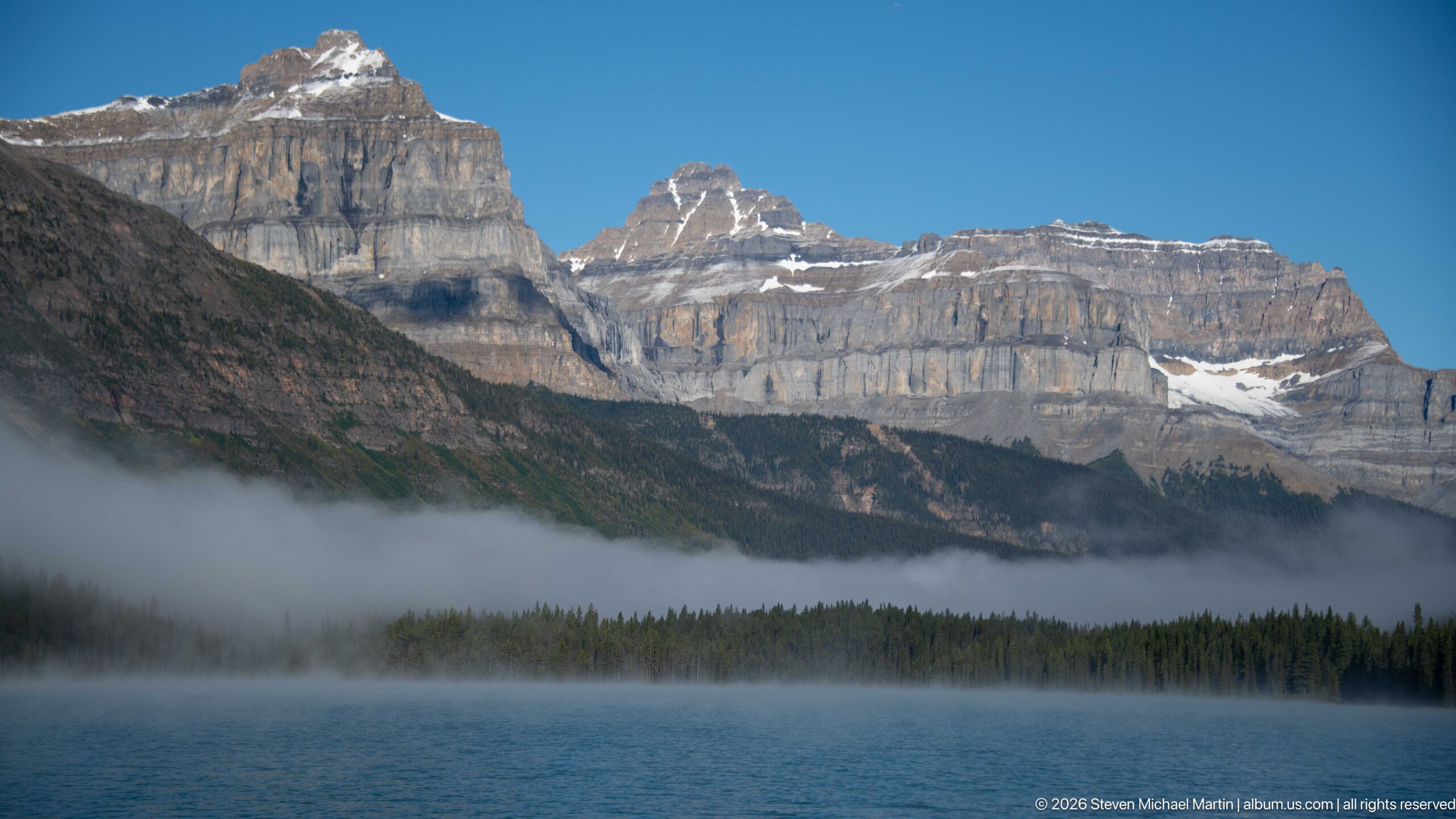
A broad lake occupies the foreground beneath a long, horizontally banded mountain wall. A low fog bank drifts across the conifer shoreline, partly concealing the lower slopes while leaving the layered upper cliffs in clear view. The calm water and moving mist divide the frame into distinct bands of lake, forest, cloud, and rock.
Caption
A broad lake occupies the foreground beneath a long, horizontally banded mountain wall. A low fog bank drifts across the conifer shoreline, partly concealing the lower slopes while leaving the layered upper cliffs in clear view. The calm water and moving mist divide the frame into distinct bands of lake, forest, cloud, and rock.
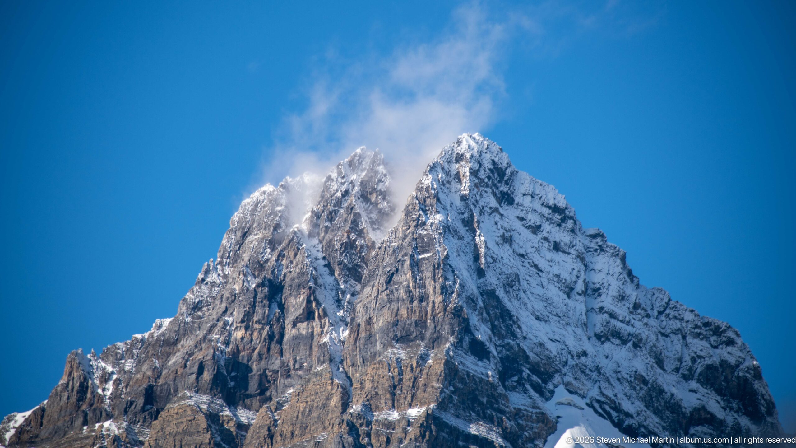
Cloud streams past a sharp, snow-covered summit, revealing a steep rock face cut by narrow gullies and ledges. The close upward angle removes the valley and foreground, concentrating on the peak’s pointed outline and patchwork of snow and exposed stone. Blue sky behind the summit makes the moving cloud and pale upper slopes especially distinct.
Caption
Cloud streams past a sharp, snow-covered summit, revealing a steep rock face cut by narrow gullies and ledges. The close upward angle removes the valley and foreground, concentrating on the peak’s pointed outline and patchwork of snow and exposed stone. Blue sky behind the summit makes the moving cloud and pale upper slopes especially distinct.
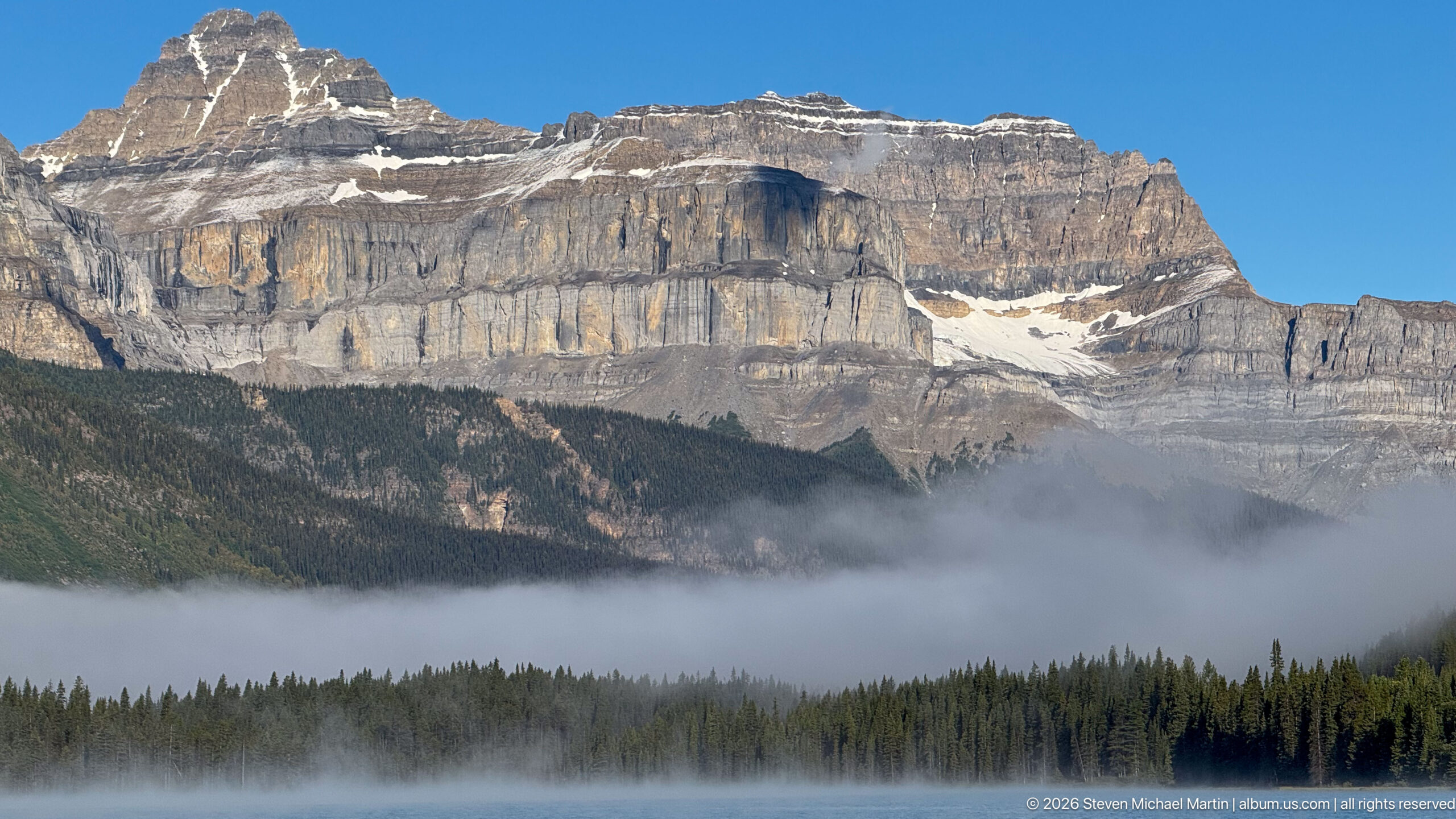
A long escarpment of horizontal rock layers rises beyond a conifer forest, its lower slope veiled by a ribbon of fog above the lake. Snow lingers in a cleft near the right end of the ridge. The wide view emphasizes the mountain’s broad, banded profile and the way low cloud separates the forested middle ground from the rock wall.
Caption
A long escarpment of horizontal rock layers rises beyond a conifer forest, its lower slope veiled by a ribbon of fog above the lake. Snow lingers in a cleft near the right end of the ridge. The wide view emphasizes the mountain’s broad, banded profile and the way low cloud separates the forested middle ground from the rock wall.
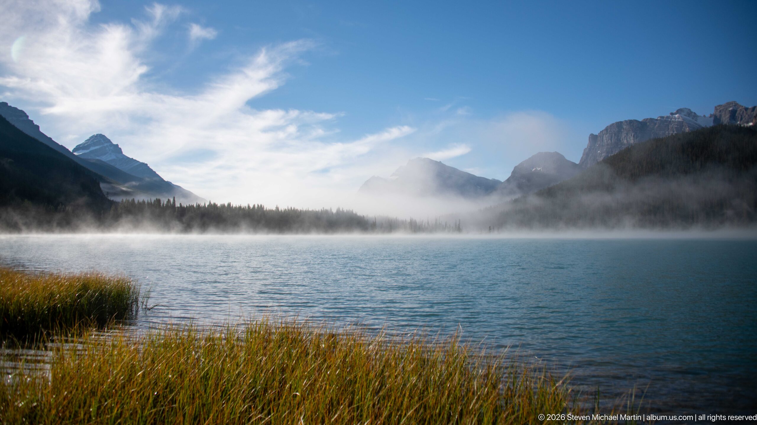
Low mist spreads across the far side of the lake, drifting between forested slopes and partly obscuring the peaks. Reeds and grasses gather along the near shoreline, where ripples break the blue water. The open framing gives the cloud room to stretch across the basin and shows how quickly it changes the visibility of the surrounding mountains.
Caption
Low mist spreads across the far side of the lake, drifting between forested slopes and partly obscuring the peaks. Reeds and grasses gather along the near shoreline, where ripples break the blue water. The open framing gives the cloud room to stretch across the basin and shows how quickly it changes the visibility of the surrounding mountains.
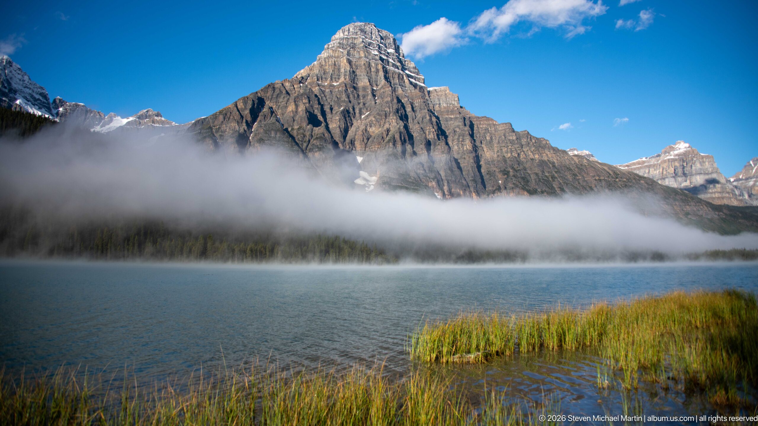
A sharply peaked mountain rises behind a horizontal band of fog that settles over the forested shoreline. Reeds edge the clear blue lake in the foreground, while bright cloud opens around the summit. This composition sets the mountain’s hard, angular outline against softer atmospheric layers, preserving both the shoreline detail and the larger basin.
Caption
A sharply peaked mountain rises behind a horizontal band of fog that settles over the forested shoreline. Reeds edge the clear blue lake in the foreground, while bright cloud opens around the summit. This composition sets the mountain’s hard, angular outline against softer atmospheric layers, preserving both the shoreline detail and the larger basin.
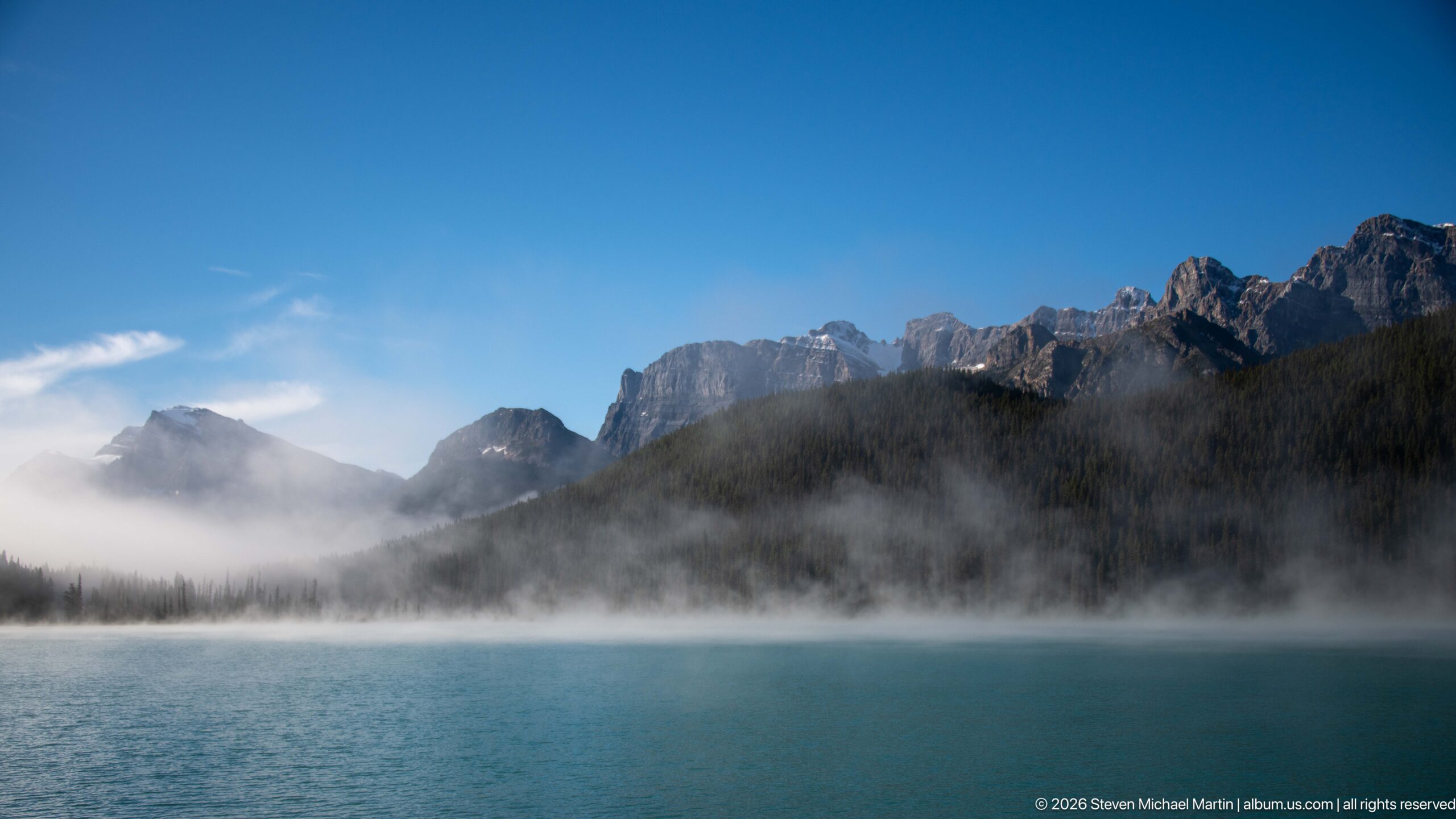
A line of dark, jagged peaks appears above a low fog bank, while the forested shoreline forms a continuous strip between mist and water. The foreground lake is deep blue and relatively calm, its surface free of the close reed detail seen in neighboring frames. Cloud and shadow soften the distant mountains and give the scene a layered, tonal structure.
Caption
A line of dark, jagged peaks appears above a low fog bank, while the forested shoreline forms a continuous strip between mist and water. The foreground lake is deep blue and relatively calm, its surface free of the close reed detail seen in neighboring frames. Cloud and shadow soften the distant mountains and give the scene a layered, tonal structure.
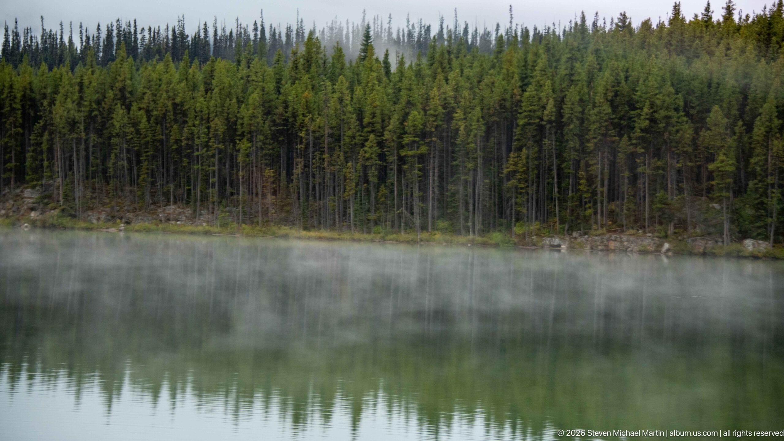
A dense stand of conifers forms a dark horizontal band across the lake, its reflection inverted in unusually calm water. Thin mist hangs above the far shoreline and blends the forest’s upper edge into the pale background. Without prominent peaks, this quieter frame concentrates on symmetry, tree texture, and the subtle separation between water and air.
Caption
A dense stand of conifers forms a dark horizontal band across the lake, its reflection inverted in unusually calm water. Thin mist hangs above the far shoreline and blends the forest’s upper edge into the pale background. Without prominent peaks, this quieter frame concentrates on symmetry, tree texture, and the subtle separation between water and air.
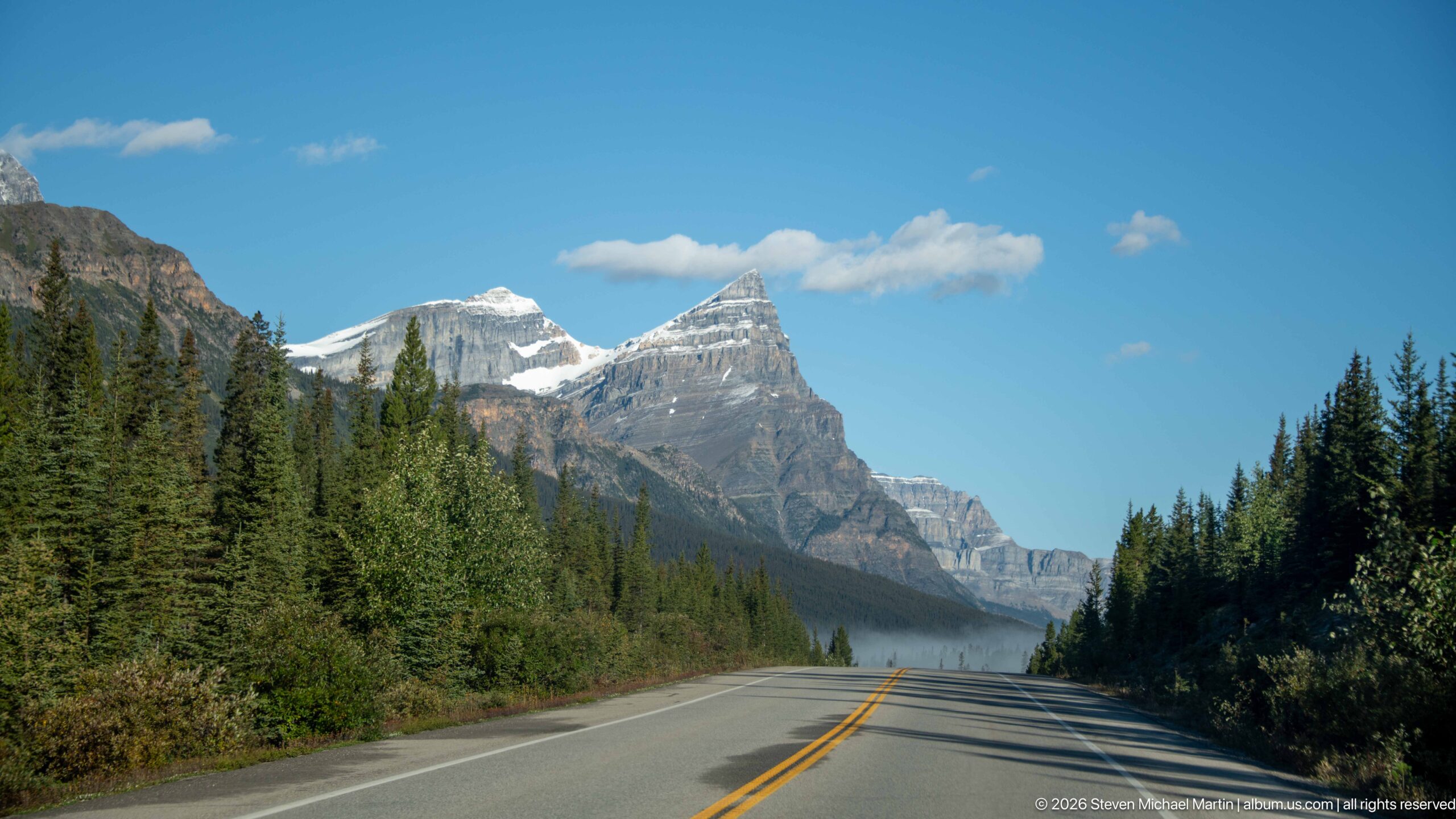
The two-lane highway leads straight through a forested valley toward a chain of snow-brightened peaks. Double yellow lines and long tree shadows establish a low roadway viewpoint, while the distant mountains rise above the narrow corridor of spruce. Clear light makes this final road view more open than the fog-bound parkway scenes earlier in the portfolio.
Caption
The two-lane highway leads straight through a forested valley toward a chain of snow-brightened peaks. Double yellow lines and long tree shadows establish a low roadway viewpoint, while the distant mountains rise above the narrow corridor of spruce. Clear light makes this final road view more open than the fog-bound parkway scenes earlier in the portfolio.
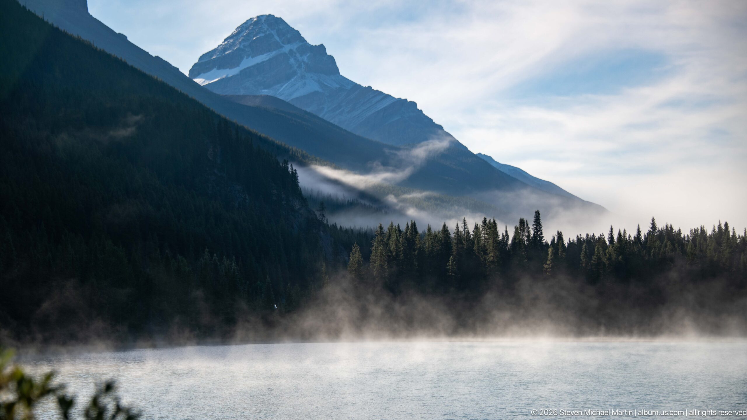
A steep, forested mountain descends toward the lake, its upper ridge partly hidden by cloud while bands of mist hover above the water. The near shore is cropped tightly, leaving the blue lake and dark conifer slope to define the scene. Bright cloud opens on the right, contrasting with the shaded mountain and the low, drifting fog.
Caption
A steep, forested mountain descends toward the lake, its upper ridge partly hidden by cloud while bands of mist hover above the water. The near shore is cropped tightly, leaving the blue lake and dark conifer slope to define the scene. Bright cloud opens on the right, contrasting with the shaded mountain and the low, drifting fog.
🏞️ National Park Field Guide
📍 Overview
Banff Ice Fields brings together landscapes along the Icefields Parkway, from Bow Lake and the Weeping Wall to the Columbia Icefield and Athabasca Glacier. The photographs show a protected mountain region shaped by ice, rock, water, forest, and changing weather. Rather than presenting a single viewpoint, the portfolio moves among broad valley scenes, glacier basins, lakeshores, roadside stops, and close studies of alpine plants.
🏔️ Landscape
The landscape shifts between steep, layered cliffs and open glacial valleys. Conifer forests cover lower slopes and line lakeshores, while exposed rock, snowfields, and ice dominate higher elevations. Meltwater gathers in lakes and divides into braided channels around gravel bars. Fog and low cloud often obscure the forested middle ground, creating a changing boundary between water, trees, and mountain.
🪨 Geology
Glacial forms shape many of the views: ice occupies high basins and valleys, while moraines and broad gravel deposits mark where ice and meltwater have moved rock and sediment. The Weeping Wall exposes distinct horizontal layers in a steep cliff, with water tracing ledges and channels down its face. Across the river scenes, braided currents divide around gravel bars, revealing an active landscape of erosion and deposition.
🌿 Ecology
The photographs show a close transition among ice, meltwater, forest, and lakeshore vegetation. Conifers establish a dark band below the exposed rock and snow, while grasses and cottony seed heads grow along wet or gravelly ground. Fireweed adds magenta color to the high mountain setting. These plant details bring attention to habitats at the edges of the larger glacial and alpine landscapes.
🦌 Wildlife
Wildlife should be interpreted in relation to habitat, behavior, seasonality, and conservation.
🧭 Human History
The human presence is most visible in the Icefields Parkway, roadside viewpoints, visitor facilities, summit signs, and the Ice Walks trailer near the glacier. An interpretive panel compares dated glacier boundaries, connecting the landscape to observation of change over time. Together, these features show how visitors travel through, name, interpret, and study the icefield region.
🥾 Visitor Experience
Travel along the parkway brings frequent changes in scale and atmosphere: a glacier or mountain wall may dominate one stop, while a lake, braided river, or small patch of alpine vegetation becomes the focus at another. Clear skies reveal distant ridges; fog can reduce visibility to the road, shoreline, or forest edge. Viewpoints, signs, and visitor facilities provide places to pause and observe these contrasts.
📷 Photography Notes
The collection pairs broad mountain and glacier views with close details of waterfalls, layered rock, river channels, and alpine plants. Reflections and shorelines give several lake photographs a strong horizontal structure, while fog and cloud soften or conceal parts of the landscape. Roads, vehicles, signs, and a visitor near the shore provide human scale within scenes otherwise dominated by mountain terrain.