Banff Trans Canada Highway Introduction
The Trans-Canada Highway cuts through Banff National Park along one of the great mountain corridors of the Canadian Rockies, following the Bow Valley between immense ranges of limestone peaks. What began in the 1950s as a scenic two-lane road has become one of Canada’s principal transportation routes, carrying travelers through a landscape of forests, broad river flats, and mountains that rise abruptly from the valley floor. Between Banff and Lake Louise, the highway offers particularly dramatic views toward the Sawback Range, Castle Mountain, Mount Temple, and the surrounding peaks, making even the passage between destinations an essential part of experiencing the national park.
The highway also reveals one of Banff’s central challenges: accommodating millions of people within a landscape that remains critical habitat for wildlife. Because the Bow Valley provides an important natural route through the mountains, the highway can become a barrier for animals moving between feeding grounds, shelter, and breeding habitat. Beginning in 1981, Parks Canada gradually transformed the road into a four-lane divided highway while introducing an extensive system of fencing, underpasses, and broad, vegetation-covered wildlife overpasses. Banff ultimately became an international model for highway wildlife mitigation, with dozens of crossing structures allowing grizzly and black bears, wolves, elk, deer, cougars, and other species to move across the transportation corridor while greatly reducing wildlife-vehicle collisions.
Traveling the Trans-Canada Highway through Banff is therefore more than simply getting from one part of the park to another. The road continually shifts between open views across the Bow Valley and narrower passages enclosed by forest and mountain walls, while bridges, fencing, and wildlife crossings show how closely transportation and conservation have become intertwined here. Seen from the highway, Banff is both a monumental Rocky Mountain landscape and a working experiment in preserving ecological connections across a heavily traveled national corridor—a place where one of Canada’s busiest roads passes directly through one of its most celebrated wild landscapes.
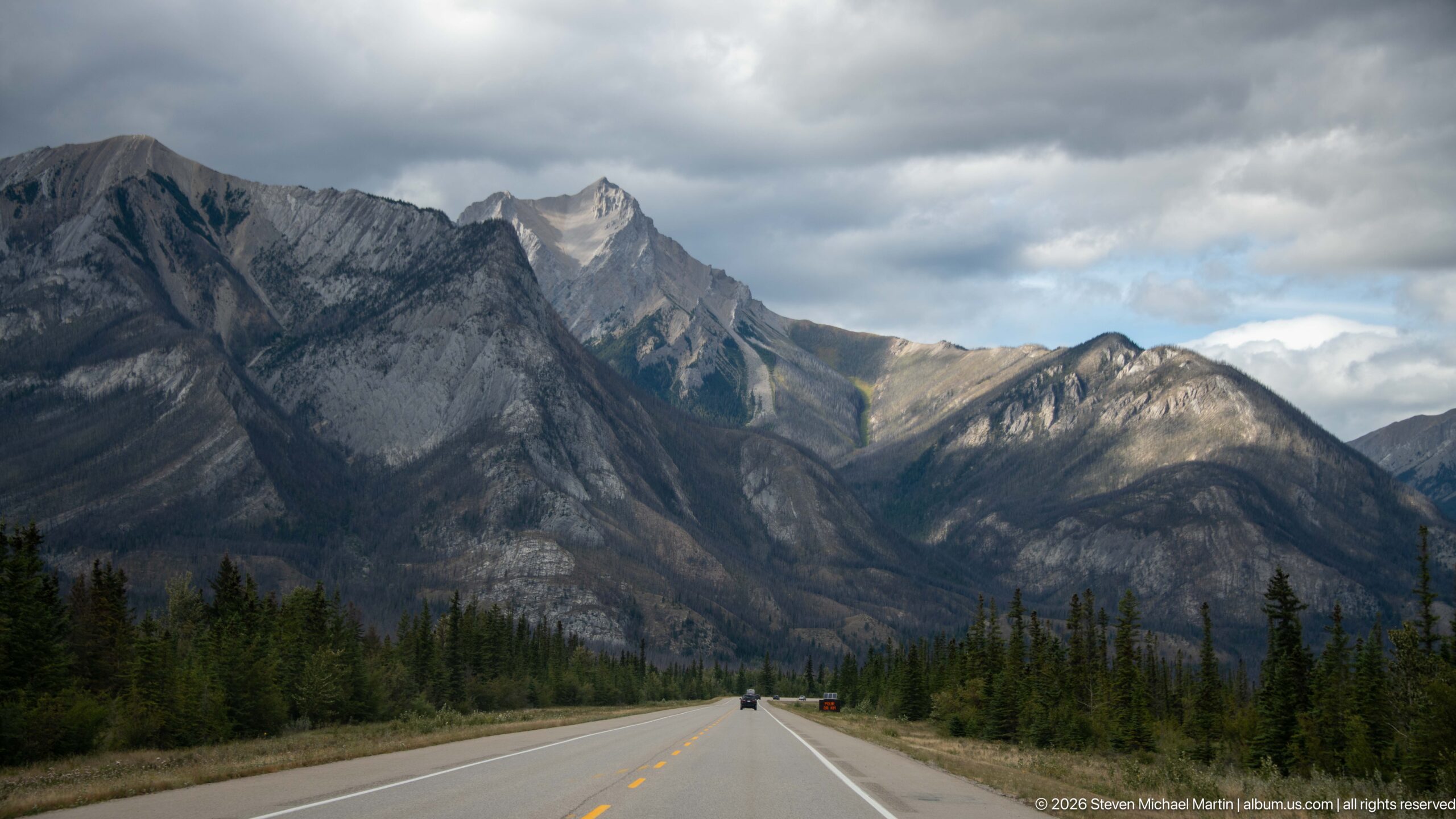
A straight two-lane highway leads directly toward a wall of steep gray peaks, with conifer forest lining both shoulders and vehicles receding toward the mountains. Sunlight breaks through layered cloud to pick out individual ridges and a sharper summit beyond. The centered road perspective makes the transportation corridor itself the organizing element, showing how closely highway travel is framed by the abrupt relief of the Canadian Rockies.
Caption
A straight two-lane highway leads directly toward a wall of steep gray peaks, with conifer forest lining both shoulders and vehicles receding toward the mountains. Sunlight breaks through layered cloud to pick out individual ridges and a sharper summit beyond. The centered road perspective makes the transportation corridor itself the organizing element, showing how closely highway travel is framed by the abrupt relief of the Canadian Rockies.
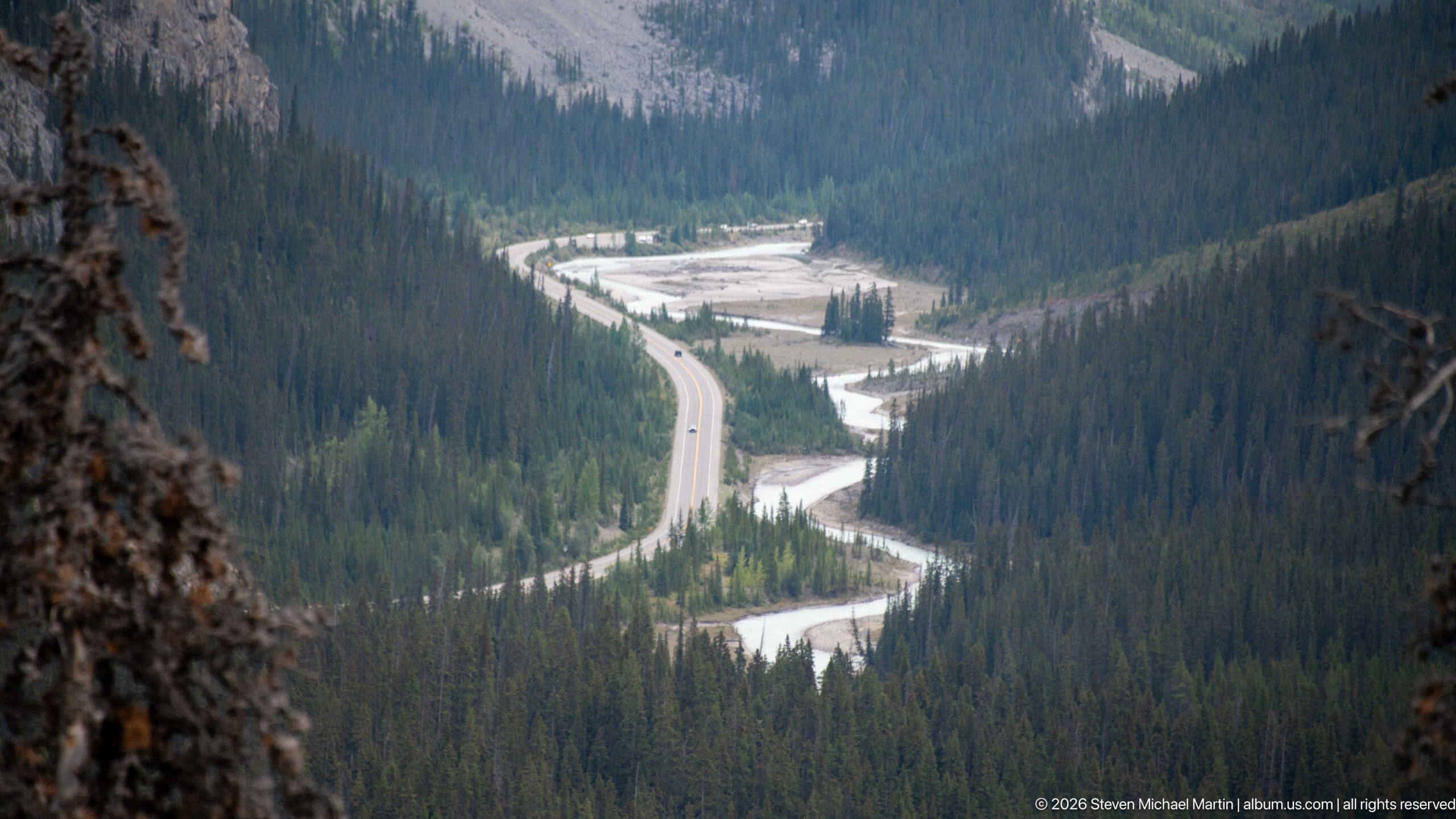
A paved highway curves through dense conifer forest beside a pale, braided mountain river. Viewed from high above, the road and waterway repeatedly converge as they follow the same narrow valley floor between steep slopes. The composition makes the geographic logic of the transportation corridor especially clear: both engineered route and river are constrained by the surrounding Rocky Mountain terrain.
Caption
A paved highway curves through dense conifer forest beside a pale, braided mountain river. Viewed from high above, the road and waterway repeatedly converge as they follow the same narrow valley floor between steep slopes. The composition makes the geographic logic of the transportation corridor especially clear: both engineered route and river are constrained by the surrounding Rocky Mountain terrain.
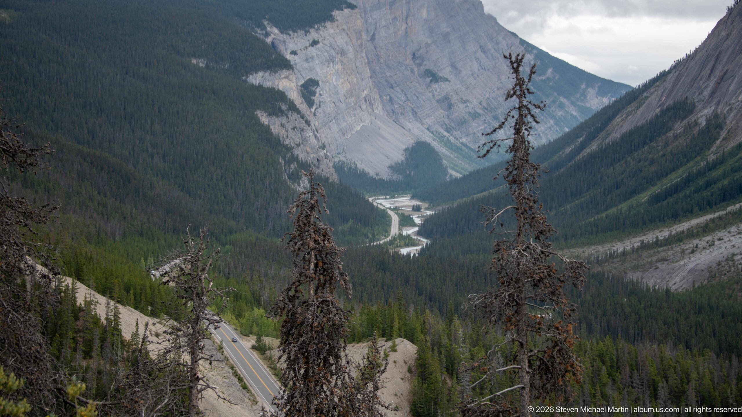
A highway descends into a deeply incised mountain valley framed by steep gray rock walls and forested slopes. A pale river winds along the valley floor beyond the road, while dead standing trees punctuate the foreground. The elevated viewpoint shows how closely the roadway follows the available terrain through a narrow Rocky Mountain passage.
Caption
A highway descends into a deeply incised mountain valley framed by steep gray rock walls and forested slopes. A pale river winds along the valley floor beyond the road, while dead standing trees punctuate the foreground. The elevated viewpoint shows how closely the roadway follows the available terrain through a narrow Rocky Mountain passage.
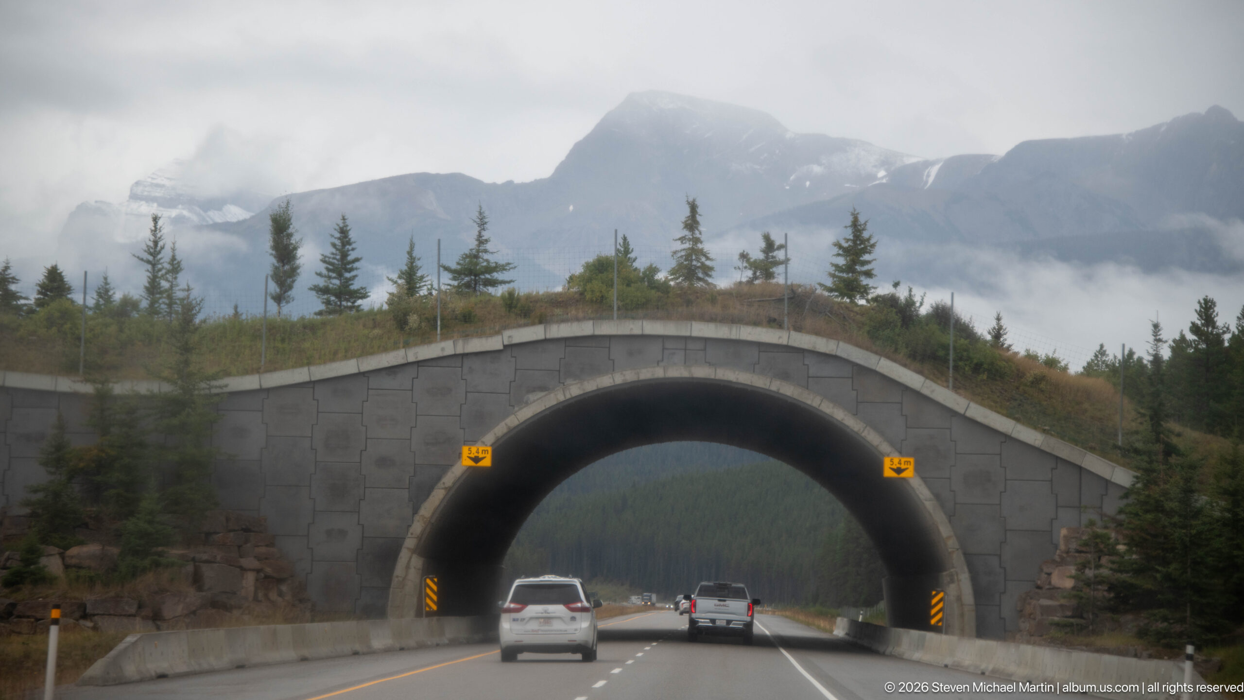
A broad wildlife overpass spans the divided Trans-Canada Highway, its arched concrete opening carrying traffic beneath a planted surface of grasses and young trees. Such crossings reconnect habitat separated by the highway and are a defining feature of Banff’s wildlife-mitigation system. Cloud-covered mountains beyond place the engineered structure directly within the park’s forested Bow Valley landscape.
Caption
A broad wildlife overpass spans the divided Trans-Canada Highway, its arched concrete opening carrying traffic beneath a planted surface of grasses and young trees. Such crossings reconnect habitat separated by the highway and are a defining feature of Banff’s wildlife-mitigation system. Cloud-covered mountains beyond place the engineered structure directly within the park’s forested Bow Valley landscape.
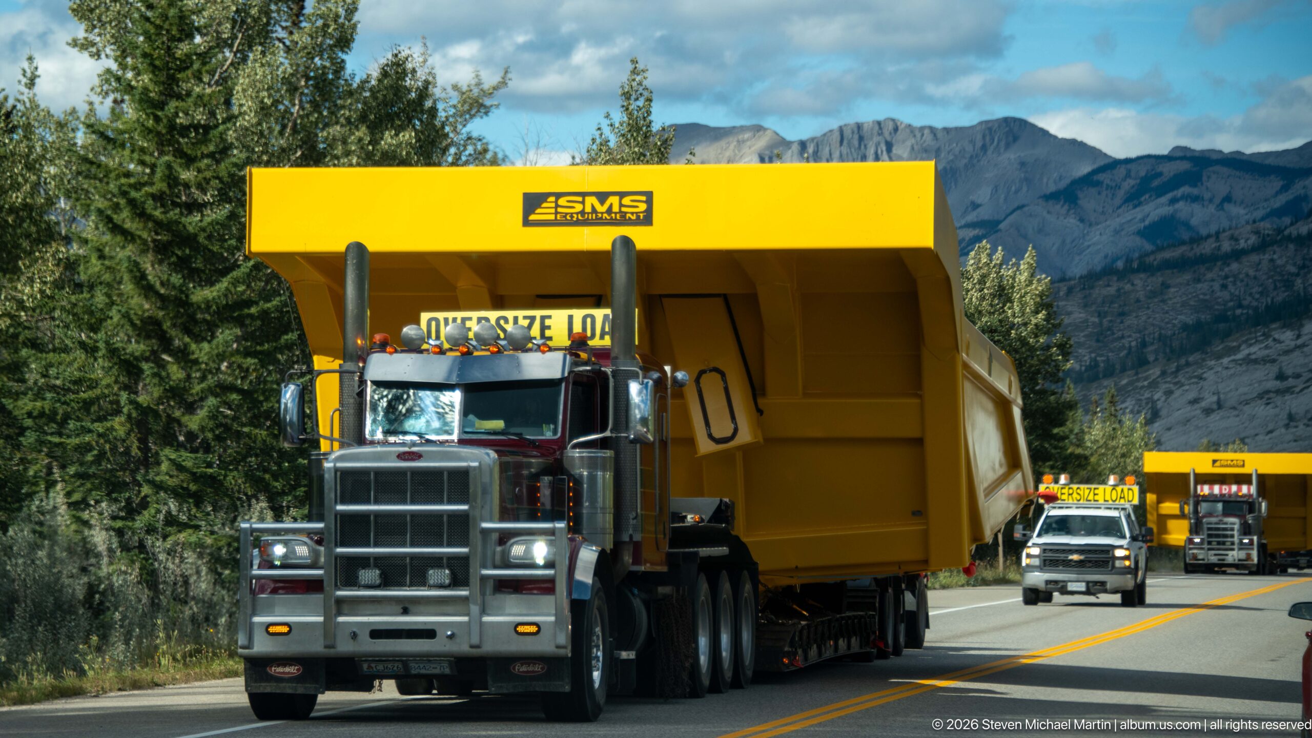
A heavy-haul tractor pulls an enormous yellow industrial module along a two-lane mountain highway, followed by additional escort and transport vehicles. The load towers above the truck cab and nearly fills its lane, while forest and gray Rocky Mountain slopes rise behind the convoy. The unusual road scene demonstrates the highway’s role as a working transportation route as well as a scenic corridor.
Caption
A heavy-haul tractor pulls an enormous yellow industrial module along a two-lane mountain highway, followed by additional escort and transport vehicles. The load towers above the truck cab and nearly fills its lane, while forest and gray Rocky Mountain slopes rise behind the convoy. The unusual road scene demonstrates the highway’s role as a working transportation route as well as a scenic corridor.
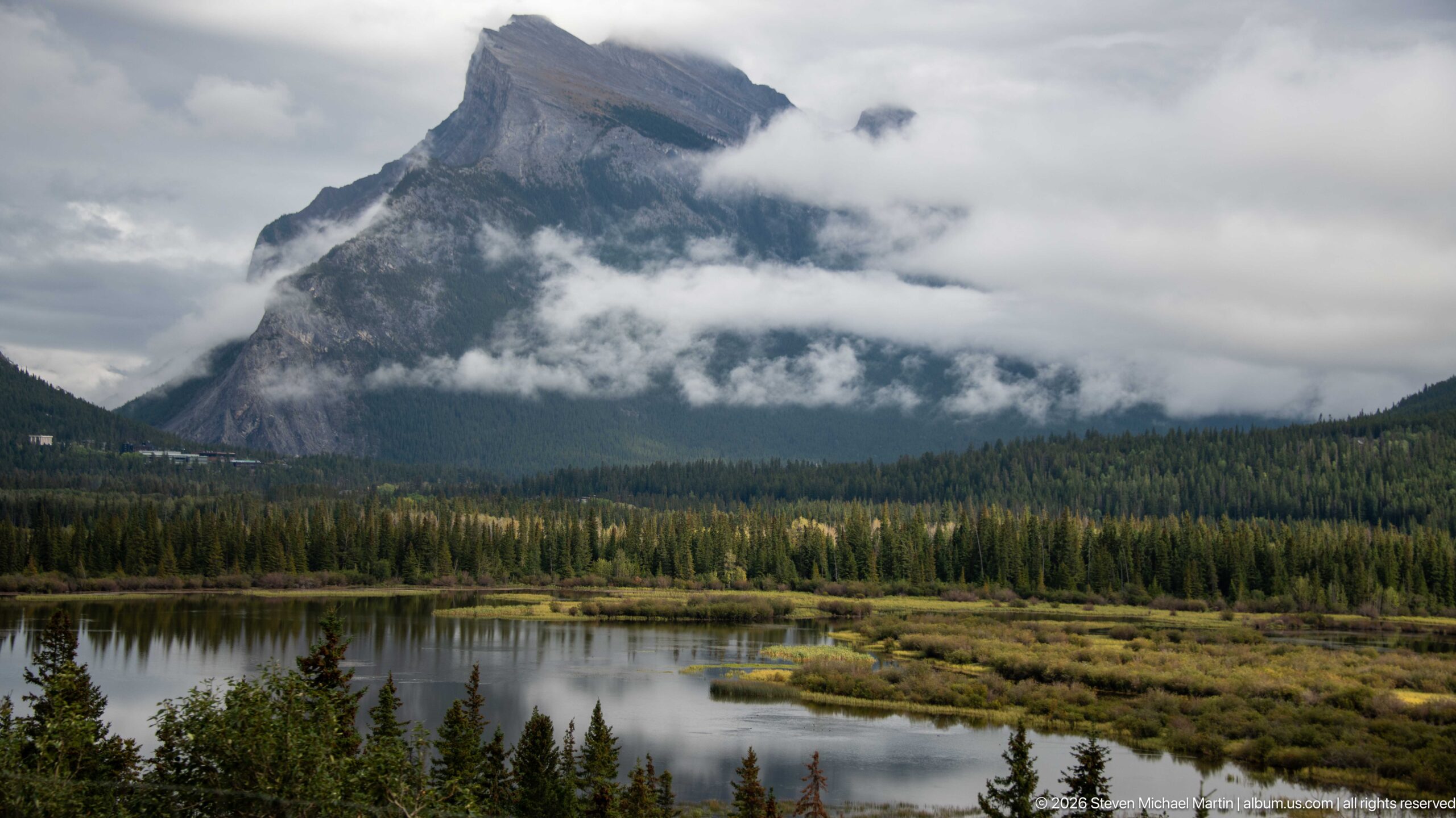
A massive, steep-sided mountain emerges through horizontal bands of low cloud above a quiet wetland in the Bow Valley. Conifer forest forms a dark middle ground, while reflective water and marsh vegetation open the foreground. The cloud layers partly conceal the summit and accentuate the mountain’s vertical relief without providing enough evidence here for a secure named-peak identification.
Caption
A massive, steep-sided mountain emerges through horizontal bands of low cloud above a quiet wetland in the Bow Valley. Conifer forest forms a dark middle ground, while reflective water and marsh vegetation open the foreground. The cloud layers partly conceal the summit and accentuate the mountain’s vertical relief without providing enough evidence here for a secure named-peak identification.
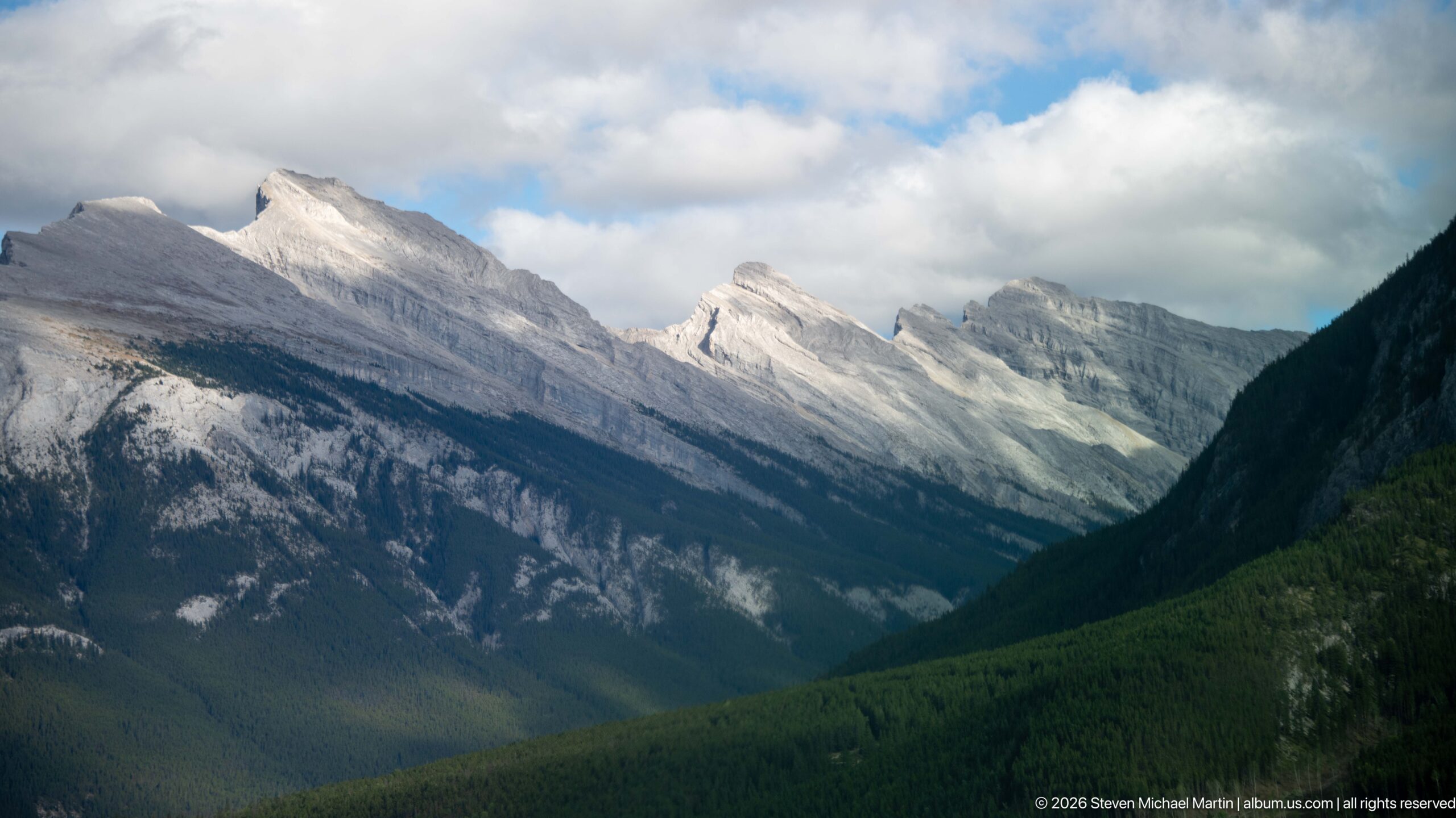
A succession of pale, steeply tilted limestone peaks recedes along the valley, their parallel bedding planes creating a rhythmic sequence of sloping ridges. Dark conifer forest fills the valley floor and lower slopes, while broken cloud casts alternating light and shadow across the exposed rock. The wider view shows the structural continuity of the mountain chain more clearly than the adjacent close study.
Caption
A succession of pale, steeply tilted limestone peaks recedes along the valley, their parallel bedding planes creating a rhythmic sequence of sloping ridges. Dark conifer forest fills the valley floor and lower slopes, while broken cloud casts alternating light and shadow across the exposed rock. The wider view shows the structural continuity of the mountain chain more clearly than the adjacent close study.
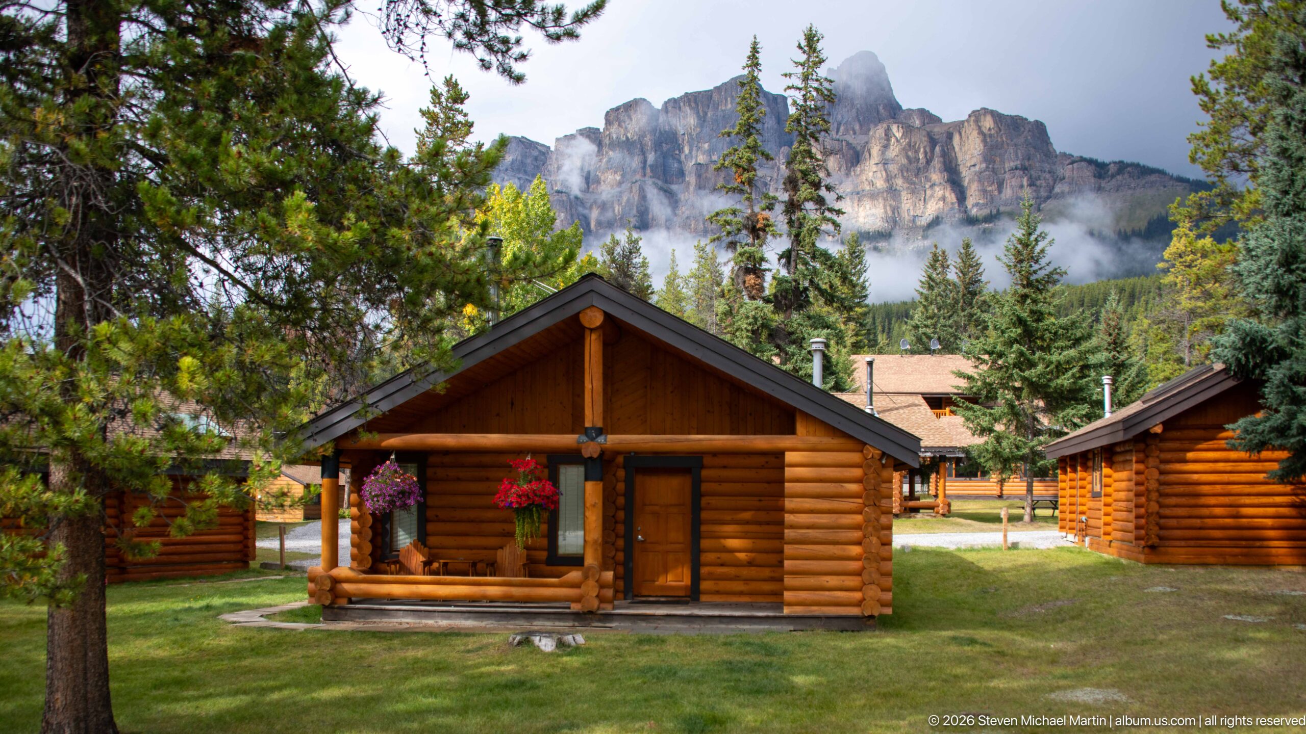
A small group of log cabins occupies a grassy clearing beneath a dramatic castellated limestone ridge. The nearest cabin’s simple gabled porch and hanging flowers establish the human scale, while conifers partially screen additional buildings. Low clouds cling to the mountain behind, linking the rustic lodging complex visually to its Bow Valley setting.
Caption
A small group of log cabins occupies a grassy clearing beneath a dramatic castellated limestone ridge. The nearest cabin’s simple gabled porch and hanging flowers establish the human scale, while conifers partially screen additional buildings. Low clouds cling to the mountain behind, linking the rustic lodging complex visually to its Bow Valley setting.
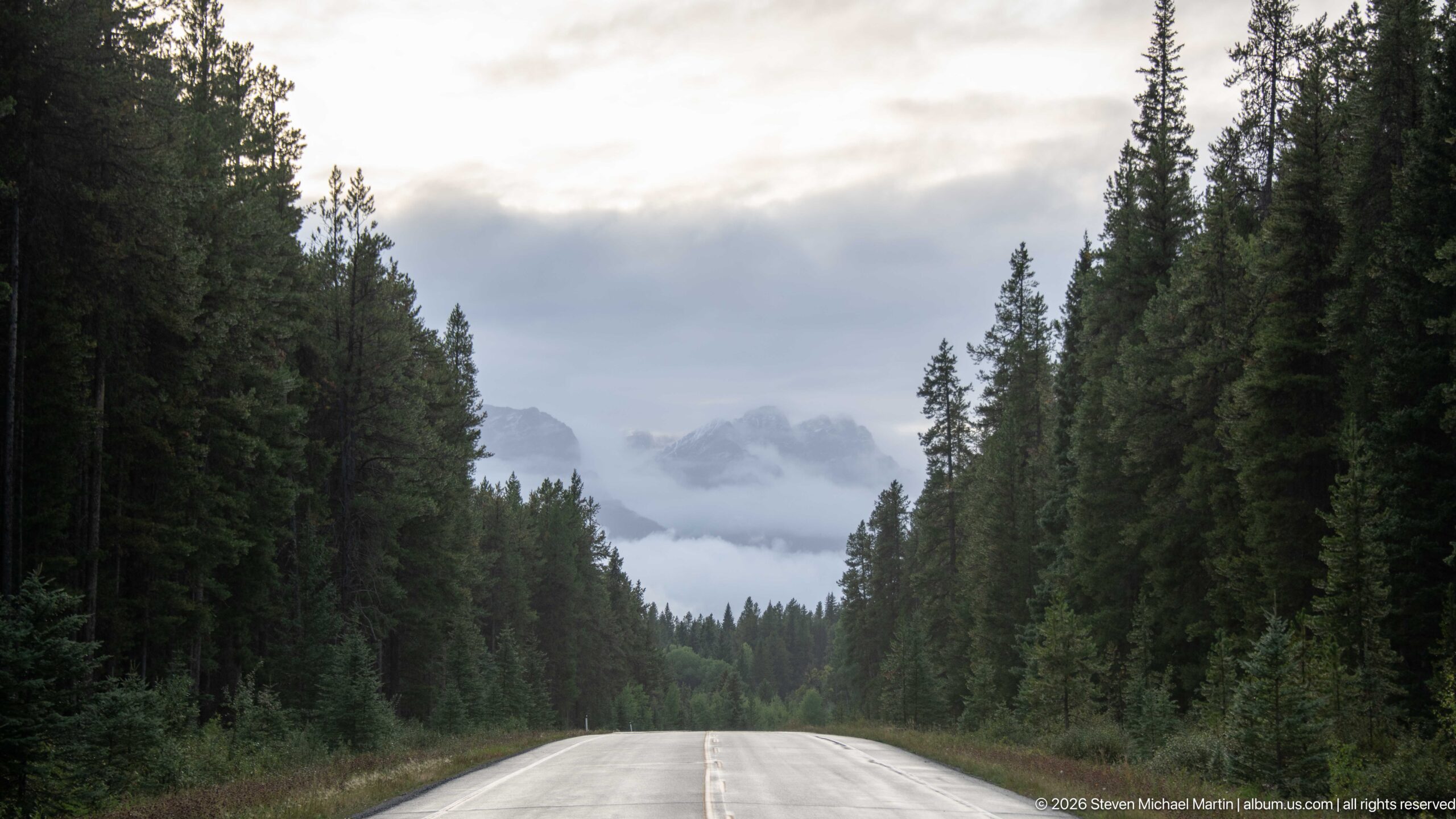
A wet two-lane road runs straight through dense conifer forest toward a distant opening filled with low cloud and partially visible mountain peaks. The centered composition uses the roadway as a strong vanishing line, while the quiet shoulders and absence of traffic distinguish this slower park road from the divided Trans-Canada Highway nearby.
Caption
A wet two-lane road runs straight through dense conifer forest toward a distant opening filled with low cloud and partially visible mountain peaks. The centered composition uses the roadway as a strong vanishing line, while the quiet shoulders and absence of traffic distinguish this slower park road from the divided Trans-Canada Highway nearby.
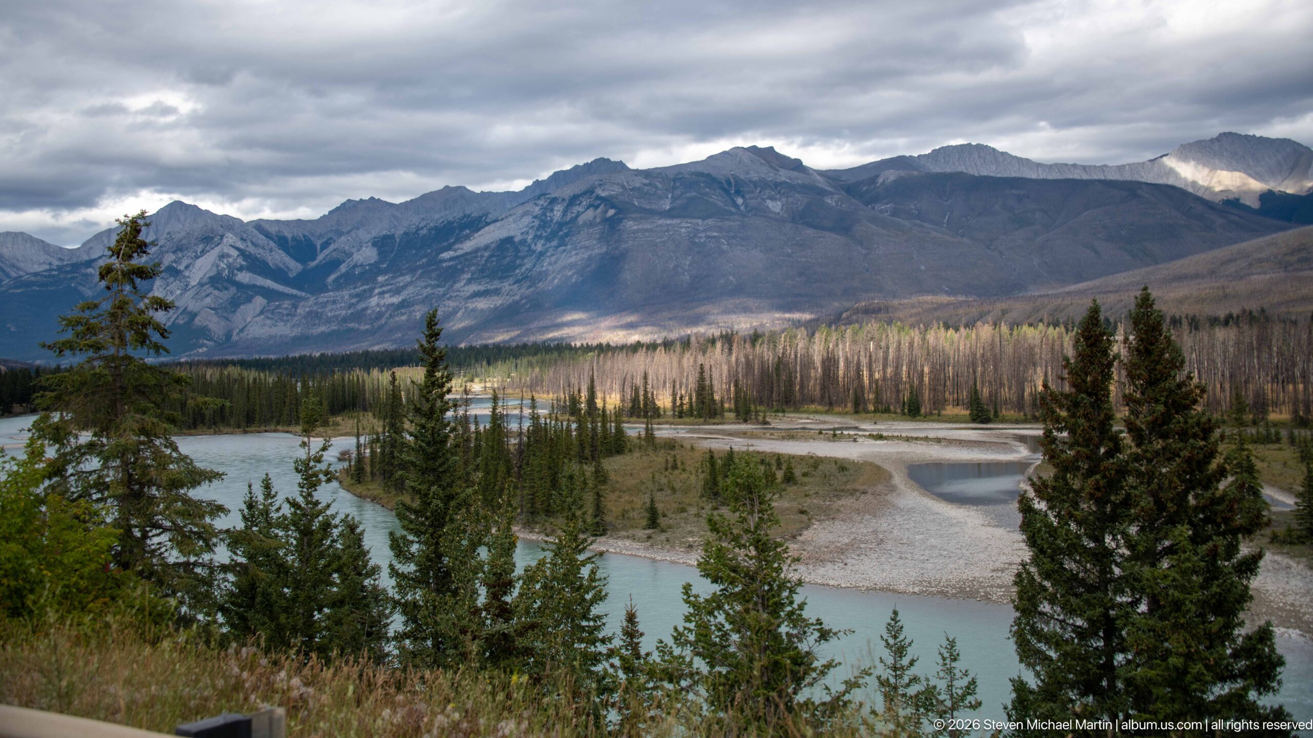
A turquoise mountain river divides around pale gravel bars and forested islands beneath a broad, horizontally layered ridge. Conifers frame the elevated viewpoint, while a band of light catches the valley floor beneath heavy cloud. The composition brings together the braided channel, floodplain vegetation, and strongly bedded Rocky Mountain terrain that shape this transportation corridor through the Canadian Rockies.
Caption
A turquoise mountain river divides around pale gravel bars and forested islands beneath a broad, horizontally layered ridge. Conifers frame the elevated viewpoint, while a band of light catches the valley floor beneath heavy cloud. The composition brings together the braided channel, floodplain vegetation, and strongly bedded Rocky Mountain terrain that shape this transportation corridor through the Canadian Rockies.
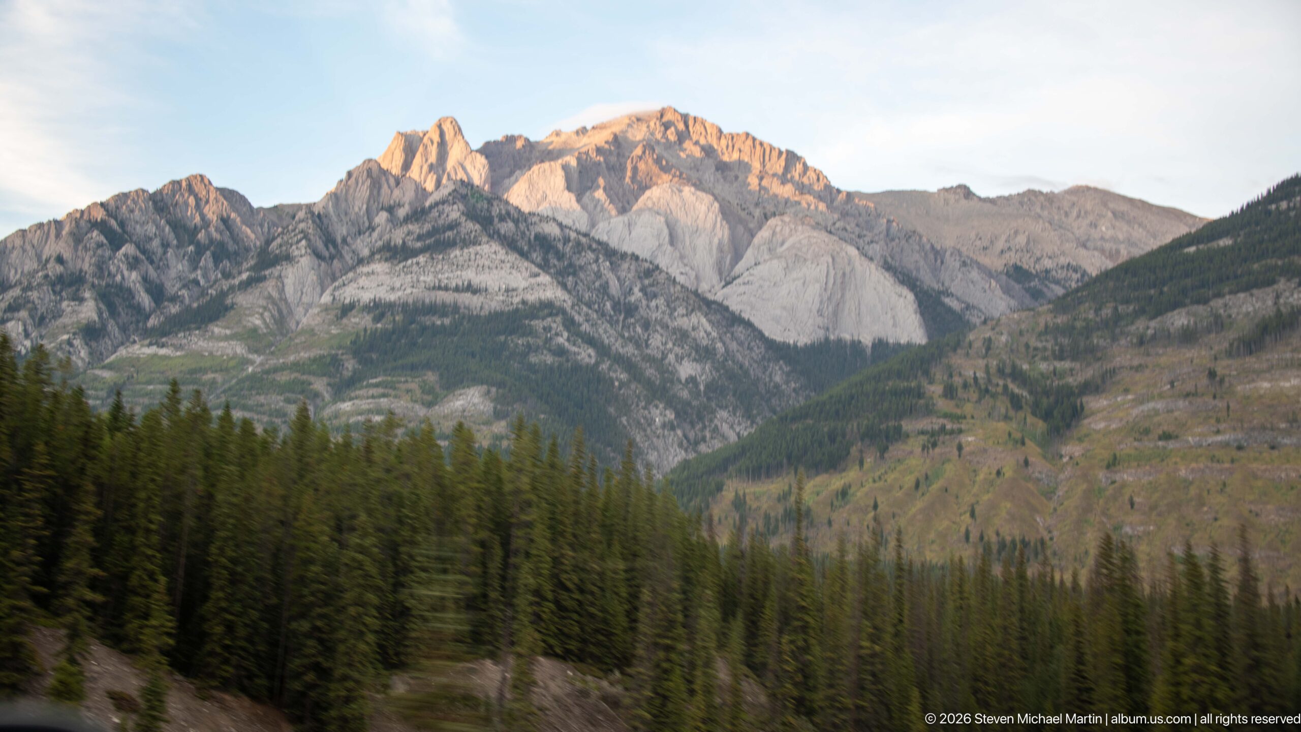
A steep, pale limestone ridge rises above dense conifer forest along the Trans-Canada Highway corridor in Banff National Park. Strongly folded and eroded rock faces form a broken skyline, while the lower slopes alternate between dark forest and exposed gray stone. The roadside viewpoint emphasizes the abrupt transition from the broad valley floor to the layered mountain front.
Caption
A steep, pale limestone ridge rises above dense conifer forest along the Trans-Canada Highway corridor in Banff National Park. Strongly folded and eroded rock faces form a broken skyline, while the lower slopes alternate between dark forest and exposed gray stone. The roadside viewpoint emphasizes the abrupt transition from the broad valley floor to the layered mountain front.
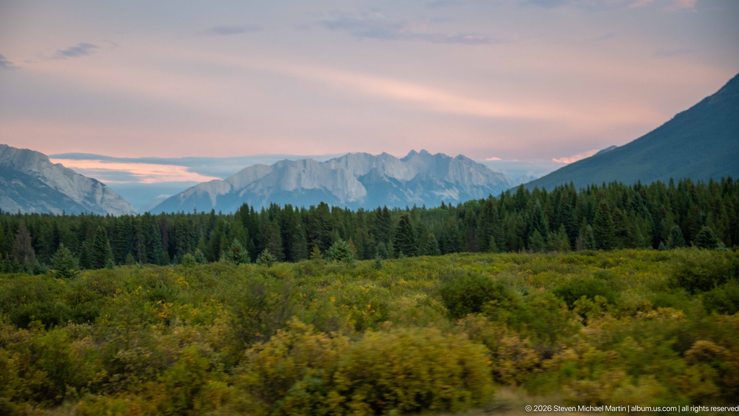
Bands of forest and low shrubs fill the Bow Valley foreground beneath distant serrated peaks and a softly colored evening sky. The subdued light separates the scene into successive layers—green vegetation, dark conifers, blue-gray mountains, and pink cloud—showing the breadth of the transportation corridor through Banff without making an unsupported identification of the individual summits.
Caption
Bands of forest and low shrubs fill the Bow Valley foreground beneath distant serrated peaks and a softly colored evening sky. The subdued light separates the scene into successive layers—green vegetation, dark conifers, blue-gray mountains, and pink cloud—showing the breadth of the transportation corridor through Banff without making an unsupported identification of the individual summits.
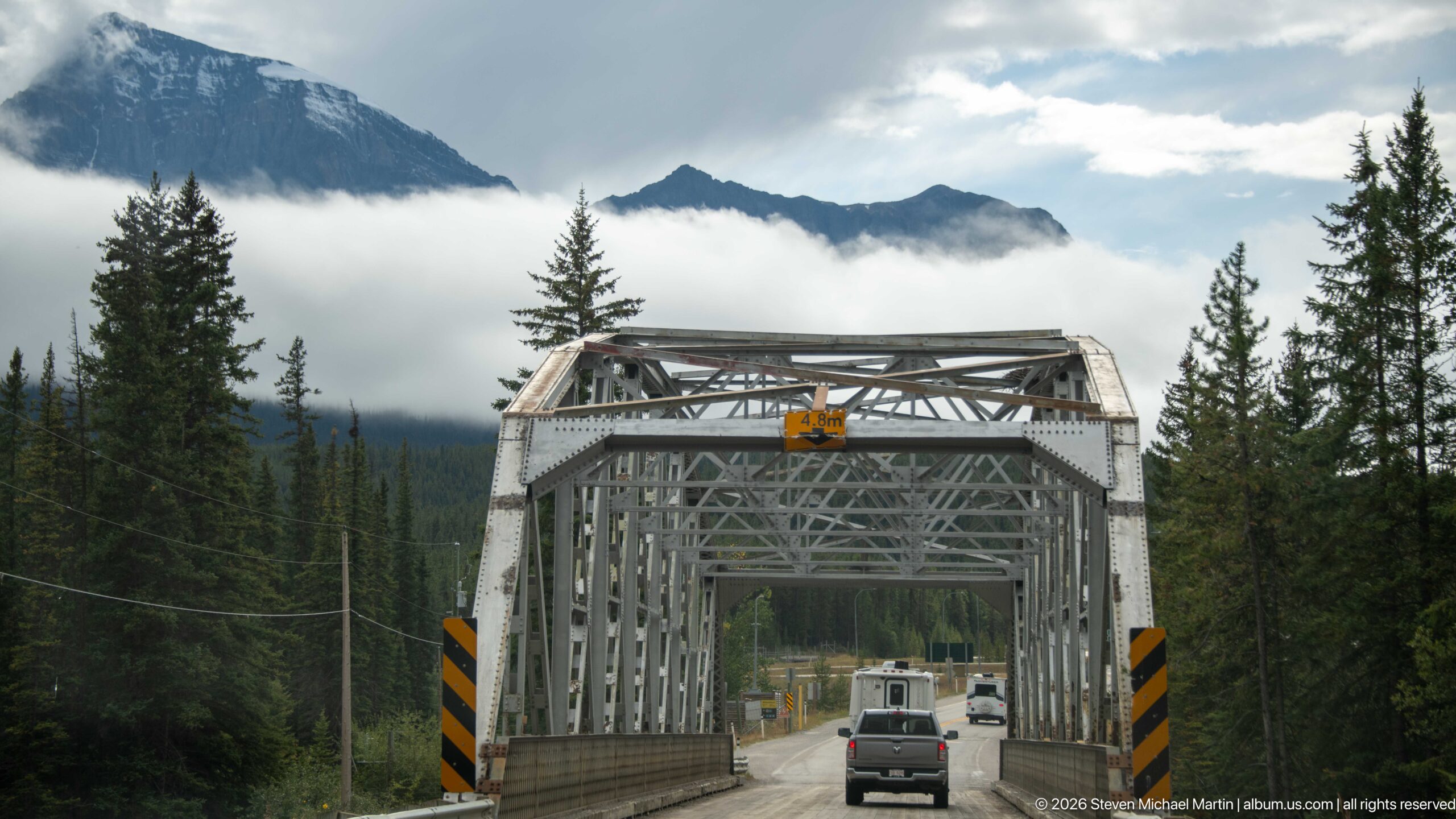
Traffic crosses a compact steel through-truss bridge framed by conifers and cloud-covered mountains. The geometric lattice of the gray metal superstructure contrasts with the forested setting, while black-and-yellow hazard panels mark the narrow bridge portals. The view records an older-scale piece of road infrastructure within the broader Banff transportation corridor.
Caption
Traffic crosses a compact steel through-truss bridge framed by conifers and cloud-covered mountains. The geometric lattice of the gray metal superstructure contrasts with the forested setting, while black-and-yellow hazard panels mark the narrow bridge portals. The view records an older-scale piece of road infrastructure within the broader Banff transportation corridor.
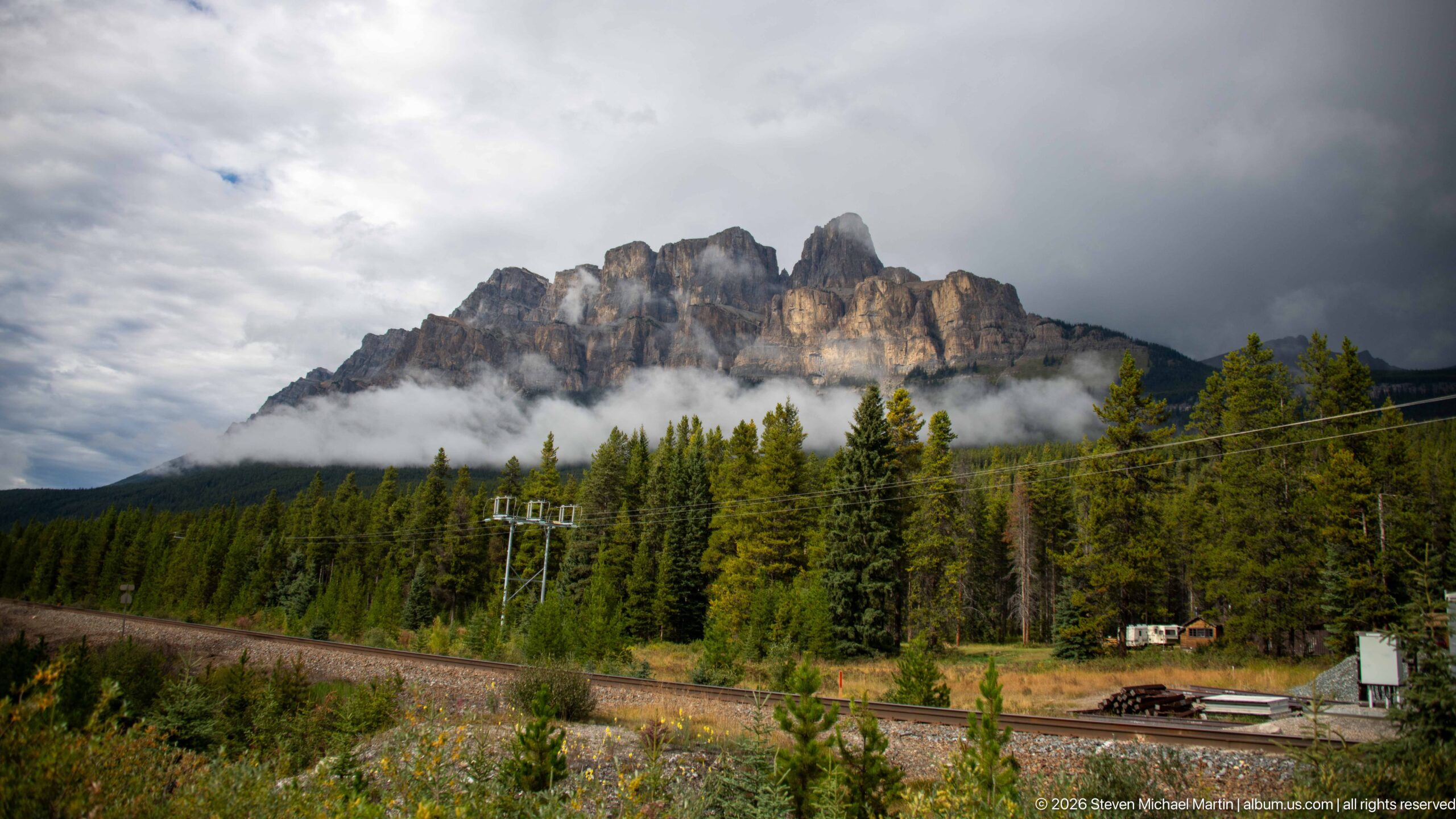
A sharply crenellated limestone ridge catches intermittent light above a band of low cloud and dense evergreen forest. Railway tracks and utility infrastructure cross the lower foreground, placing the mountain scenery within the working transportation corridor of the Bow Valley. The combination of rail, forest, cloud, and exposed rock shows how closely major travel routes follow the valley floor through Banff.
Caption
A sharply crenellated limestone ridge catches intermittent light above a band of low cloud and dense evergreen forest. Railway tracks and utility infrastructure cross the lower foreground, placing the mountain scenery within the working transportation corridor of the Bow Valley. The combination of rail, forest, cloud, and exposed rock shows how closely major travel routes follow the valley floor through Banff.
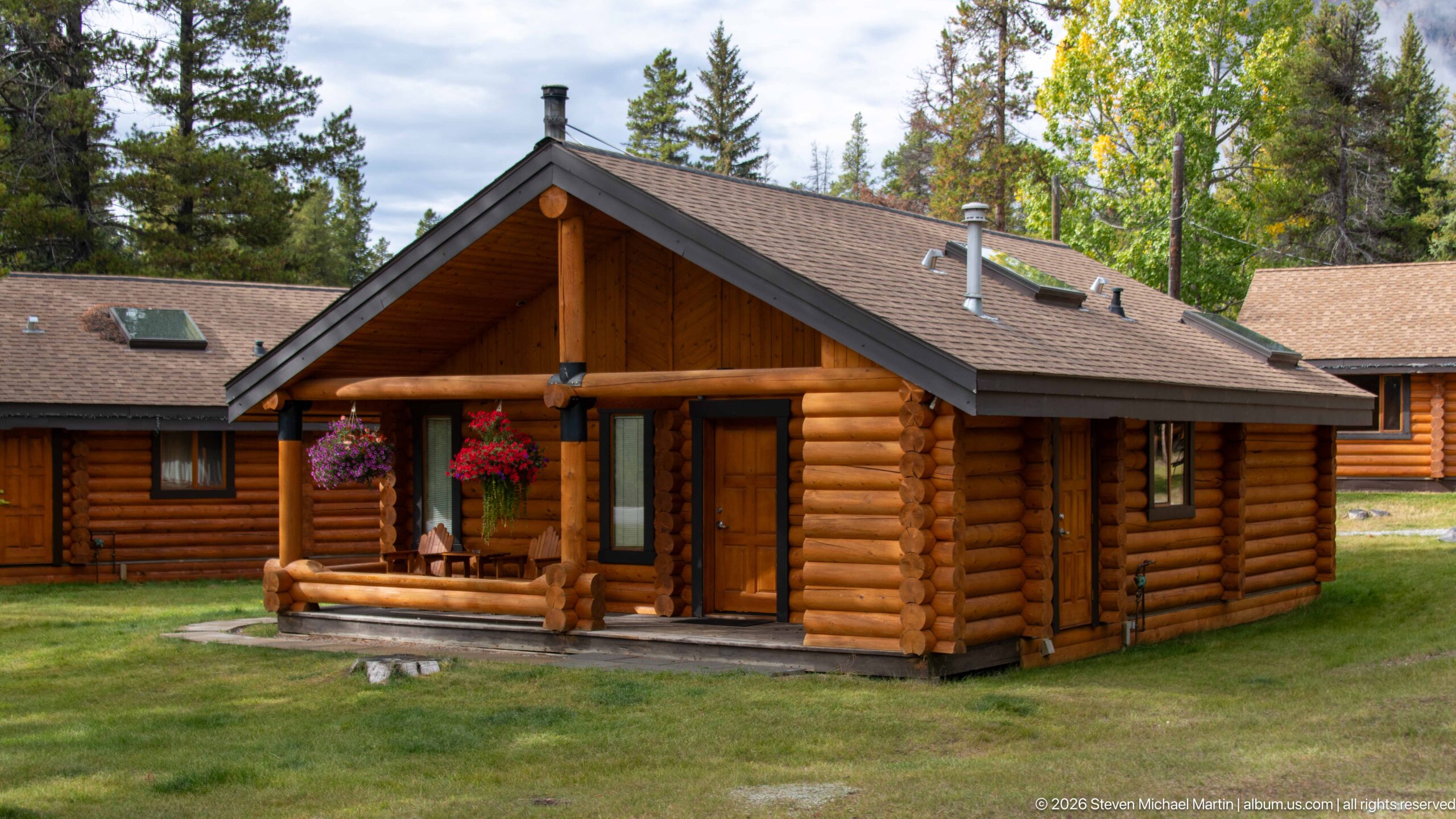
A compact log cabin stands on a clipped lawn among mature trees, its projecting gabled porch supported by round timber posts. Hanging flower baskets add color to the dark-stained log walls, while adjoining lodge buildings appear behind it. The architecture reflects the rustic mountain-resort vocabulary commonly used for visitor accommodations along the Bow Valley corridor.
Caption
A compact log cabin stands on a clipped lawn among mature trees, its projecting gabled porch supported by round timber posts. Hanging flower baskets add color to the dark-stained log walls, while adjoining lodge buildings appear behind it. The architecture reflects the rustic mountain-resort vocabulary commonly used for visitor accommodations along the Bow Valley corridor.
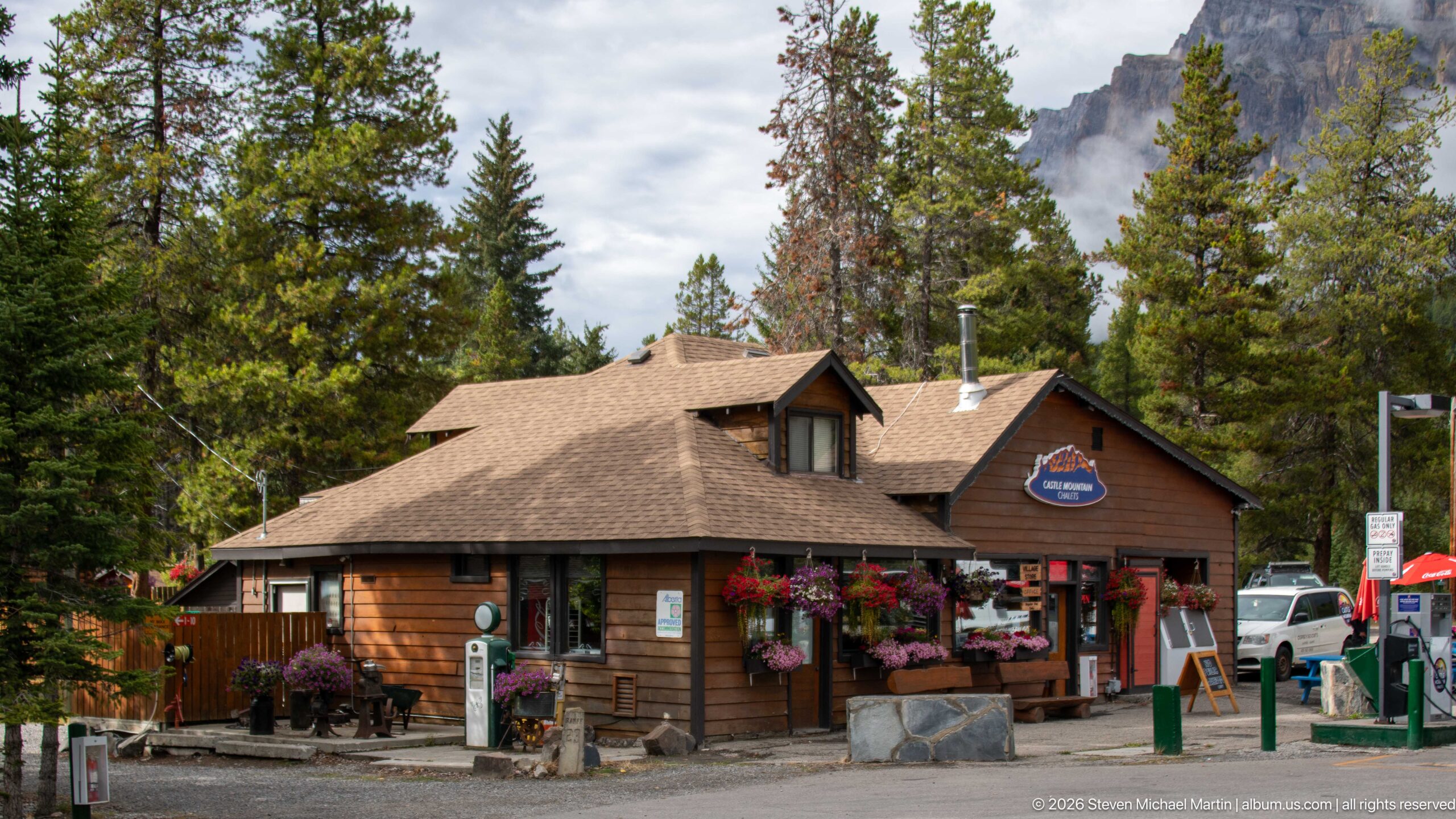
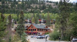
A low, wood-sided roadside building serves as the public-facing center of a mountain lodging complex, with flower baskets, signs, parked vehicles, and service equipment gathered around its entrance. Mature conifers and a sheer limestone wall rise behind the roofline. The scene records the small-scale visitor infrastructure clustered along the Bow Valley transportation corridor.
Caption
A low, wood-sided roadside building serves as the public-facing center of a mountain lodging complex, with flower baskets, signs, parked vehicles, and service equipment gathered around its entrance. Mature conifers and a sheer limestone wall rise behind the roofline. The scene records the small-scale visitor infrastructure clustered along the Bow Valley transportation corridor.
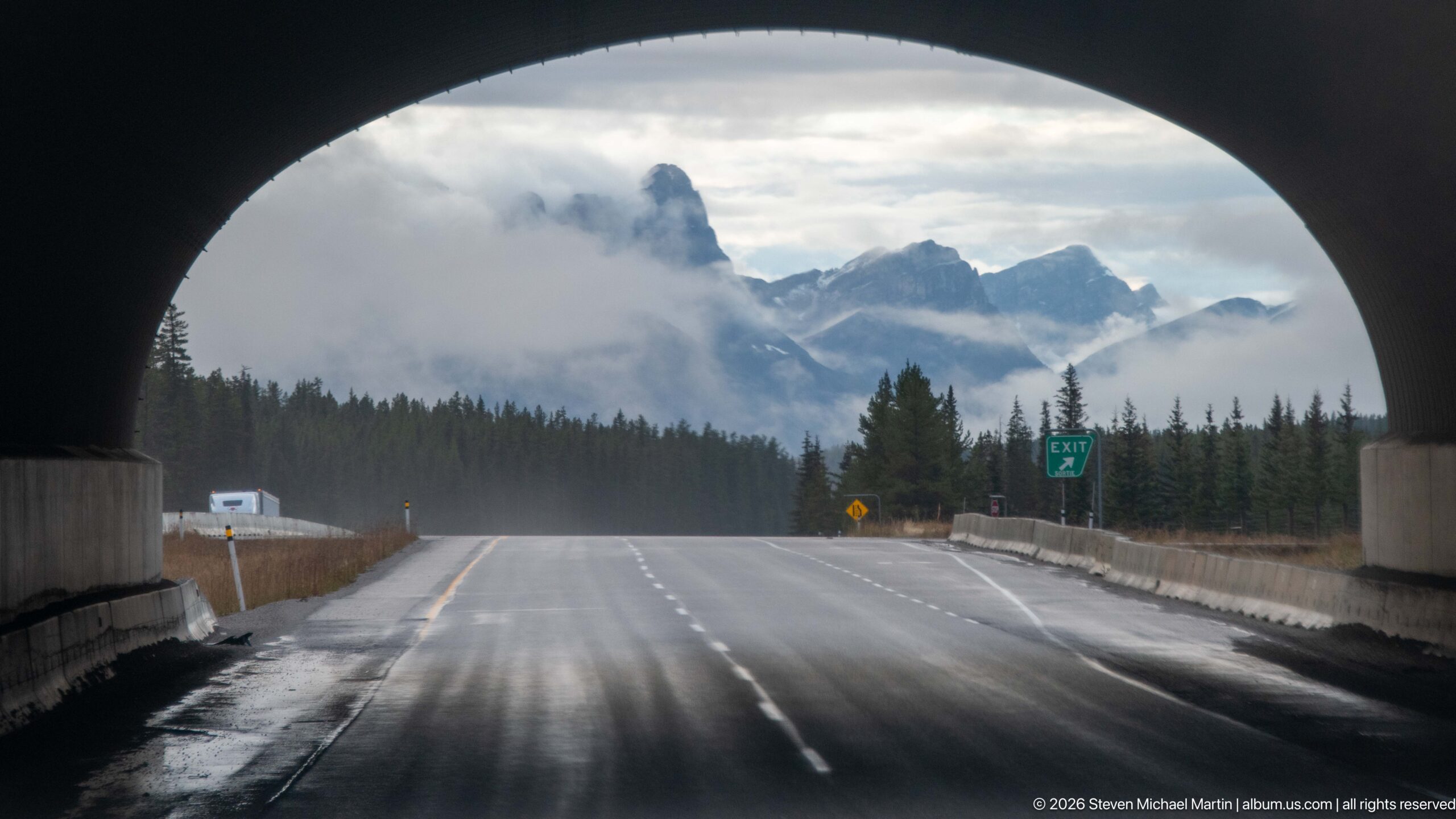
Seen from beneath a wildlife overpass, the wet Trans-Canada Highway opens toward forest and cloud-wrapped peaks. The dark arch frames the roadway like a tunnel mouth, emphasizing the scale of the crossing above while vehicles travel through the divided corridor. A green exit sign and concrete barriers reinforce the image’s focus on transportation infrastructure rather than the surrounding scenery alone.
Caption
Seen from beneath a wildlife overpass, the wet Trans-Canada Highway opens toward forest and cloud-wrapped peaks. The dark arch frames the roadway like a tunnel mouth, emphasizing the scale of the crossing above while vehicles travel through the divided corridor. A green exit sign and concrete barriers reinforce the image’s focus on transportation infrastructure rather than the surrounding scenery alone.
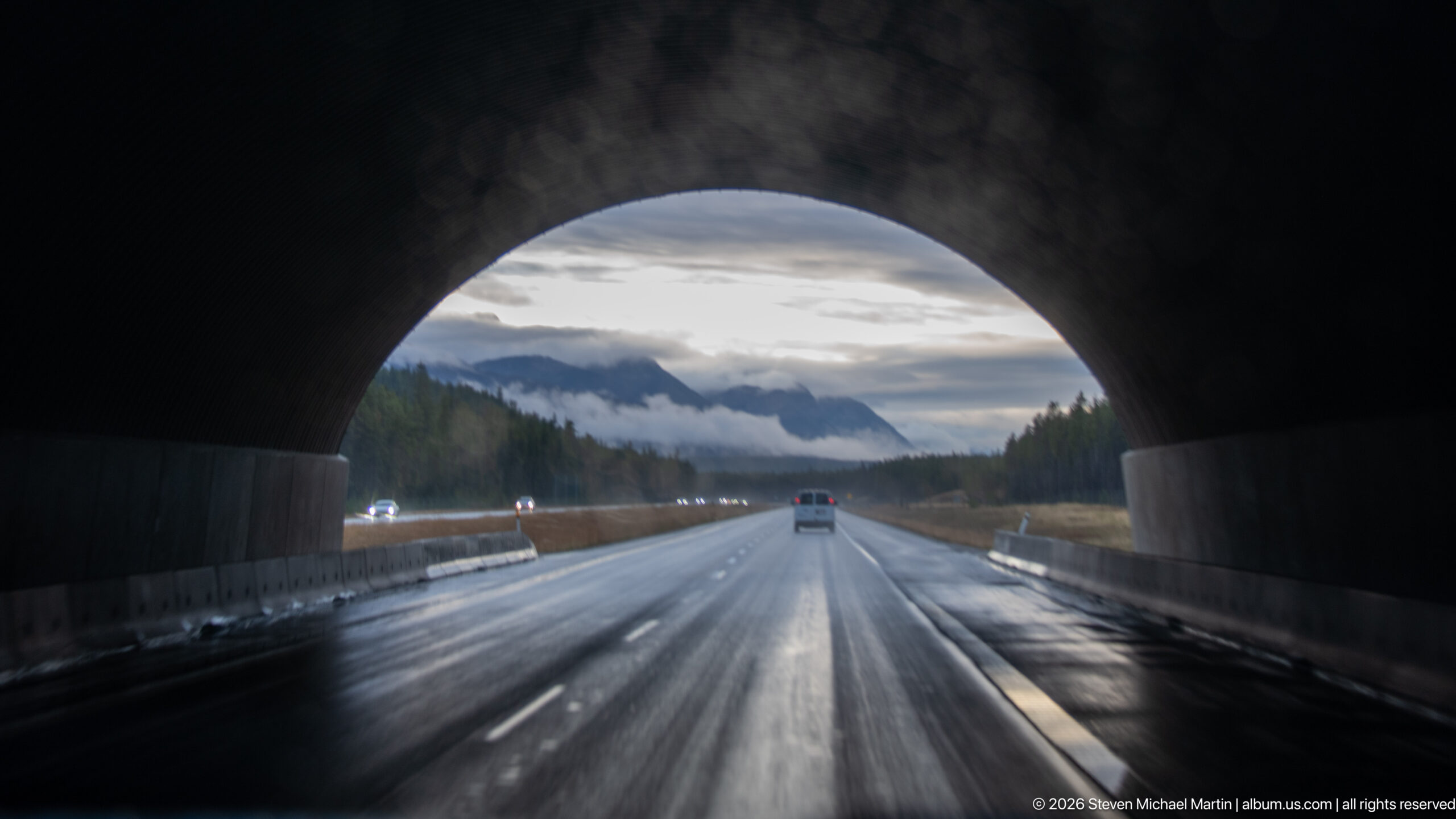
The underside of a wildlife crossing forms a broad dark arch around the Trans-Canada Highway, concentrating attention on the wet pavement and receding traffic. Concrete median barriers divide the roadway as low cloud hangs over forested mountain slopes in the distance. This reverse-looking view highlights how the crossing is integrated into a fully functioning high-speed transportation corridor.
Caption
The underside of a wildlife crossing forms a broad dark arch around the Trans-Canada Highway, concentrating attention on the wet pavement and receding traffic. Concrete median barriers divide the roadway as low cloud hangs over forested mountain slopes in the distance. This reverse-looking view highlights how the crossing is integrated into a fully functioning high-speed transportation corridor.
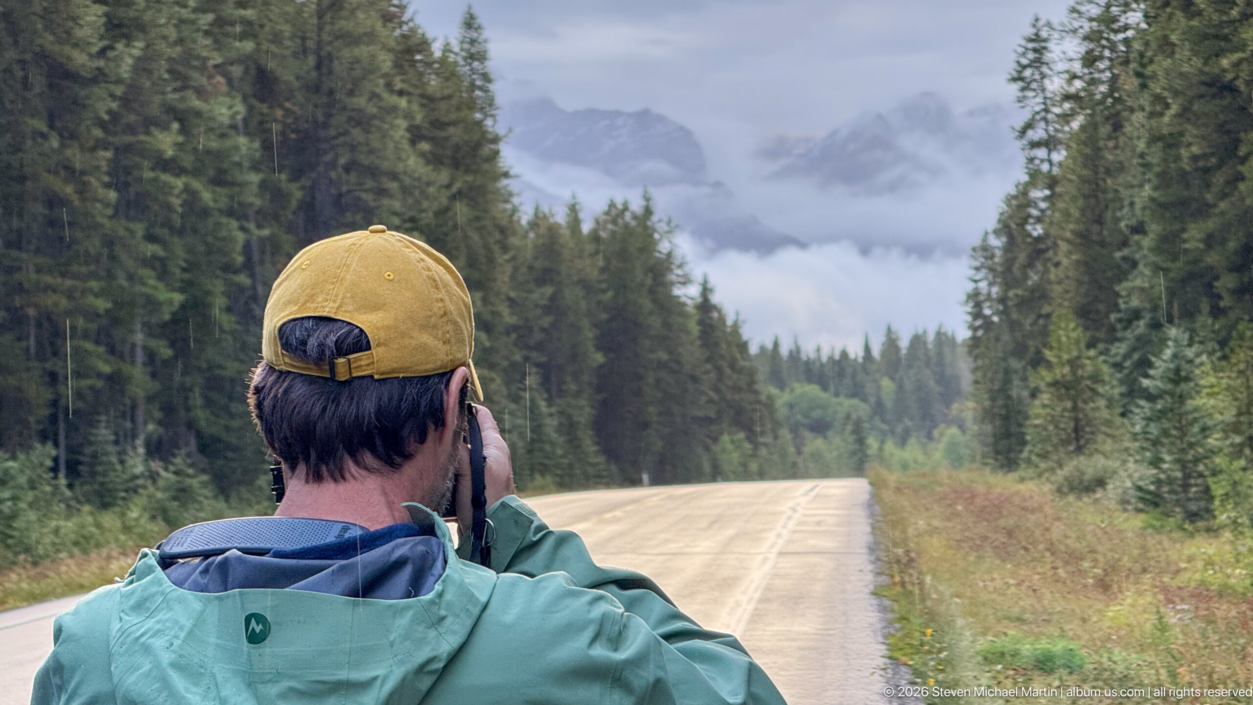
A traveler stands near the centerline of a quiet two-lane road, raising a camera toward distant mountains partly hidden by cloud. Dense conifers form symmetrical walls along the roadway, drawing the eye toward the misty horizon. The human figure provides scale and records the act of observing the Bow Valley landscape from the road itself.
Caption
A traveler stands near the centerline of a quiet two-lane road, raising a camera toward distant mountains partly hidden by cloud. Dense conifers form symmetrical walls along the roadway, drawing the eye toward the misty horizon. The human figure provides scale and records the act of observing the Bow Valley landscape from the road itself.
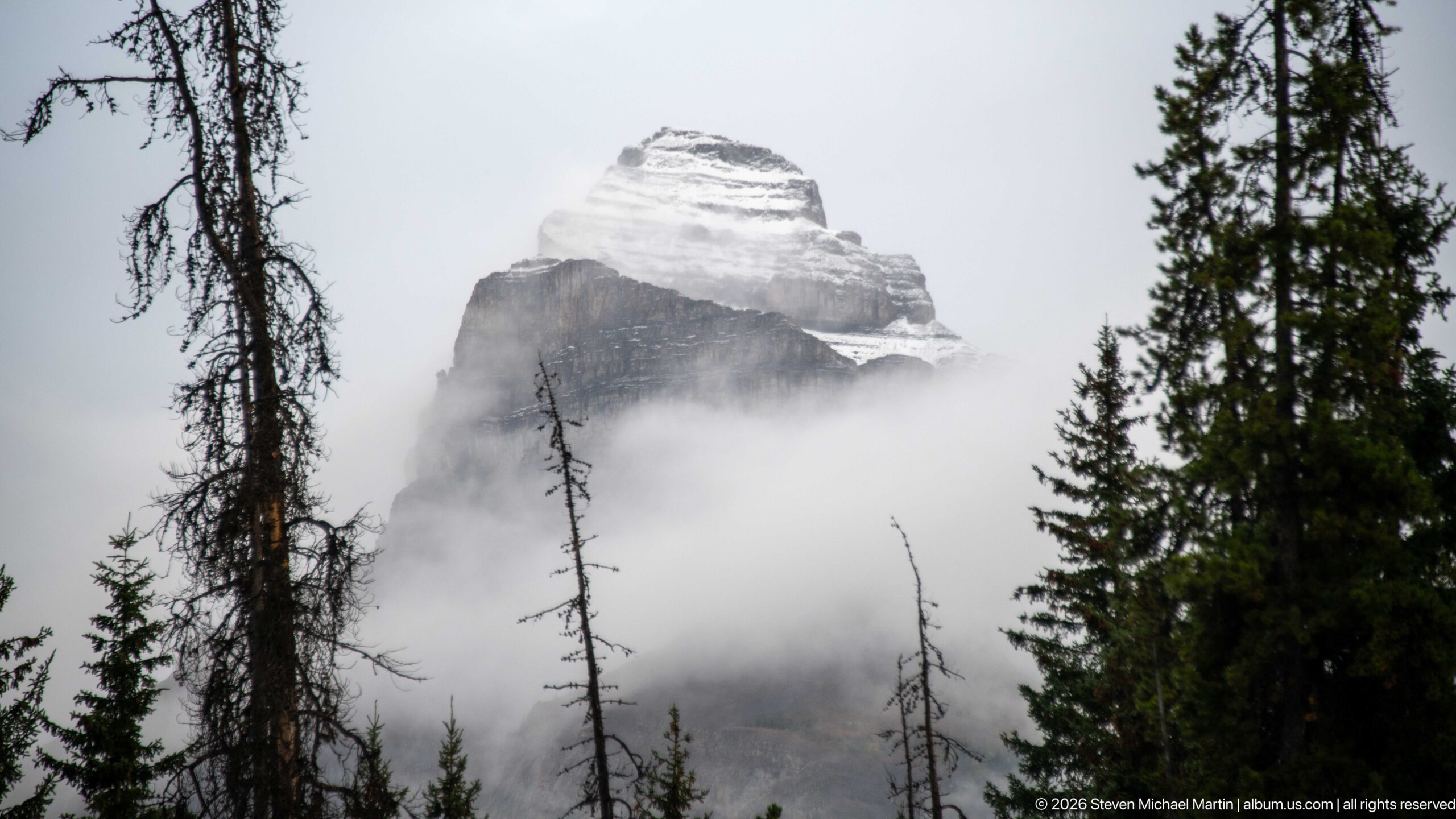
A blocky, horizontally layered limestone summit rises above a dense belt of low cloud, framed by dark spruce trunks and branches. Snow or pale rock highlights the stepped upper profile while the mountain’s lower slopes disappear completely into mist. The restricted view makes the peak’s geological form striking but does not securely establish a proper-name identification.
Caption
A blocky, horizontally layered limestone summit rises above a dense belt of low cloud, framed by dark spruce trunks and branches. Snow or pale rock highlights the stepped upper profile while the mountain’s lower slopes disappear completely into mist. The restricted view makes the peak’s geological form striking but does not securely establish a proper-name identification.
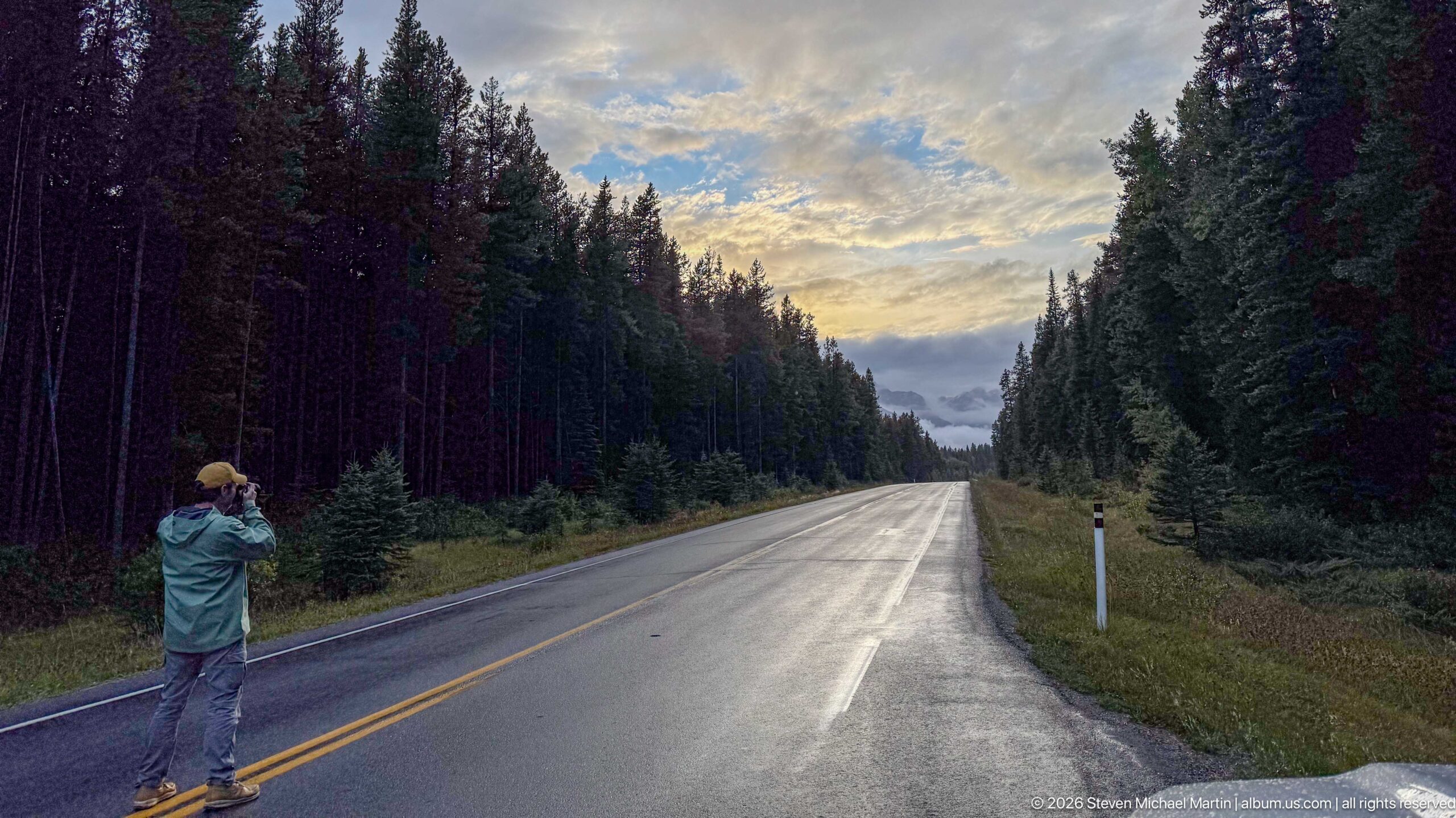
A photographer stands on the yellow centerline of the Bow Valley Parkway, facing a long, wet roadway that disappears between tall conifers. Broken clouds and late-day light brighten the sky ahead, while the reflective pavement creates a luminous path through the forest. The figure turns the scenic roadway into a record of travel and field photography within Banff.
Caption
A photographer stands on the yellow centerline of the Bow Valley Parkway, facing a long, wet roadway that disappears between tall conifers. Broken clouds and late-day light brighten the sky ahead, while the reflective pavement creates a luminous path through the forest. The figure turns the scenic roadway into a record of travel and field photography within Banff.
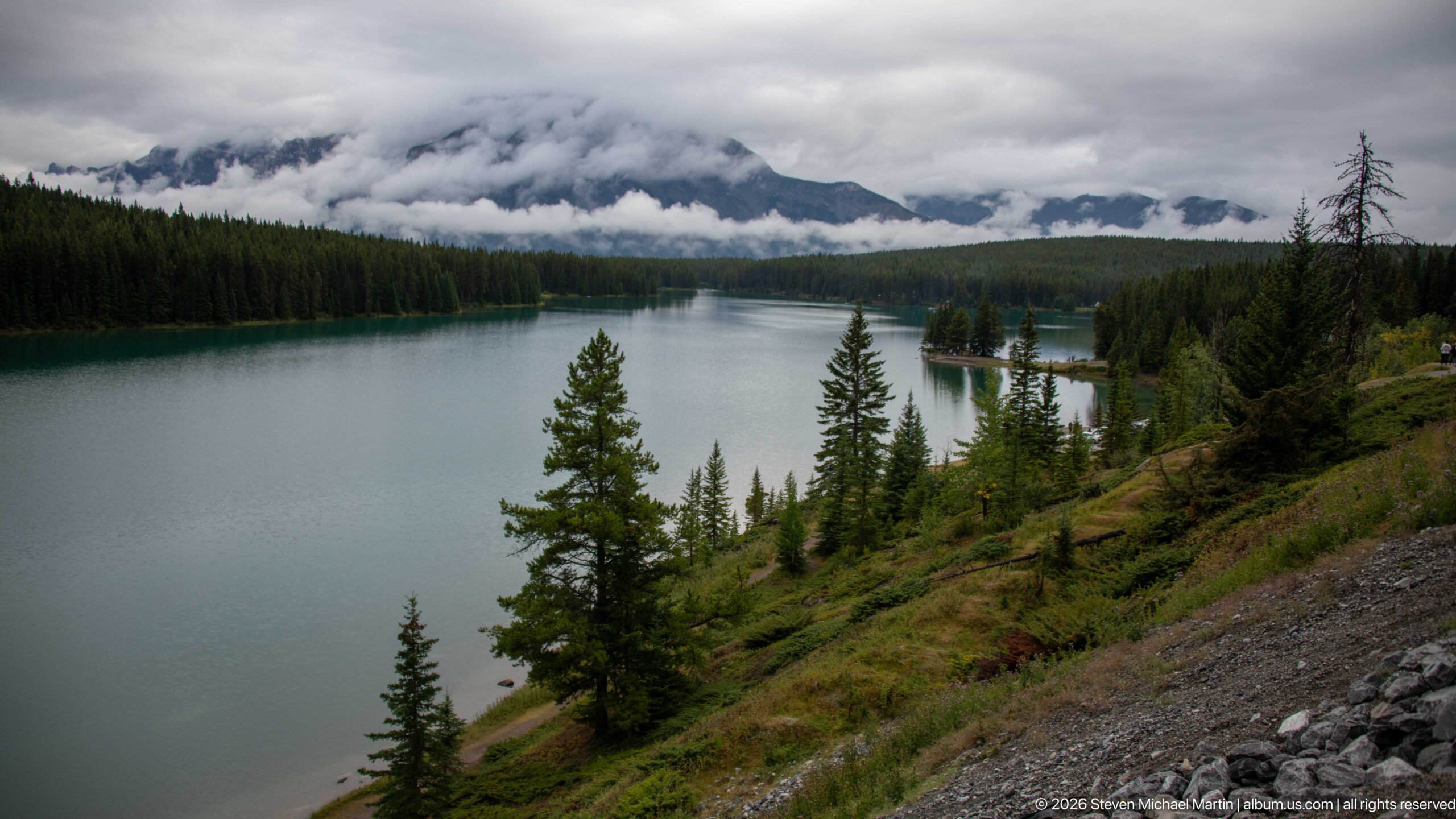
A long turquoise-gray lake curves through dense conifer forest beneath mountains almost completely wrapped in low cloud. The elevated roadside viewpoint reveals a steep, sparsely vegetated bank in the foreground and a small wooded point projecting into the water. The subdued weather flattens distant detail while intensifying the contrast between calm water and dark forest.
Caption
A long turquoise-gray lake curves through dense conifer forest beneath mountains almost completely wrapped in low cloud. The elevated roadside viewpoint reveals a steep, sparsely vegetated bank in the foreground and a small wooded point projecting into the water. The subdued weather flattens distant detail while intensifying the contrast between calm water and dark forest.
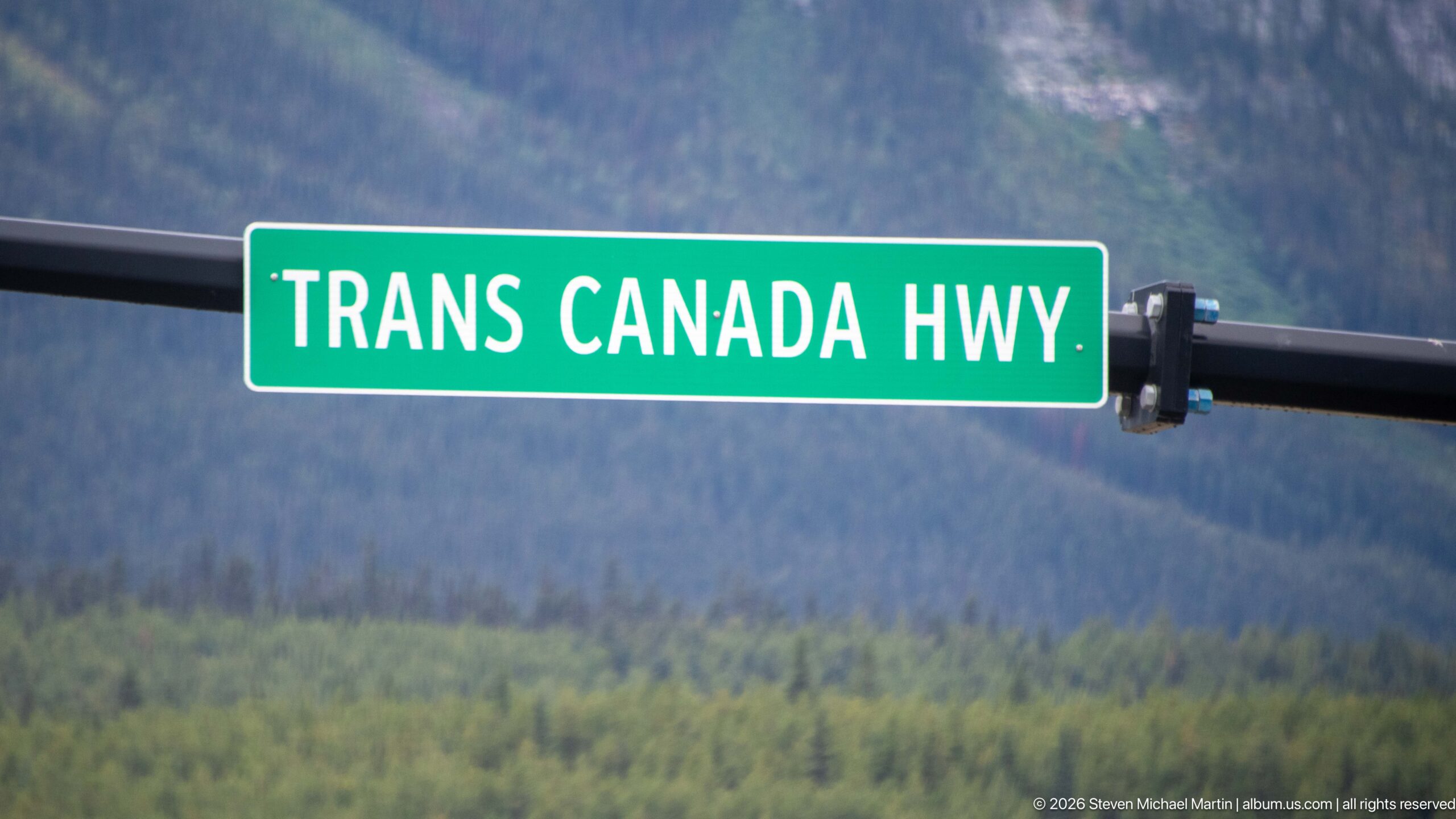
A green roadside sign reading “TRANS CANADA HWY” identifies the principal east-west transportation route through Banff National Park. Mounted on a black support with a softly focused forested mountain slope behind it, the sign reduces the immense highway corridor to a concise piece of wayfinding infrastructure and provides a literal geographic marker for the portfolio.
Caption
A green roadside sign reading “TRANS CANADA HWY” identifies the principal east-west transportation route through Banff National Park. Mounted on a black support with a softly focused forested mountain slope behind it, the sign reduces the immense highway corridor to a concise piece of wayfinding infrastructure and provides a literal geographic marker for the portfolio.
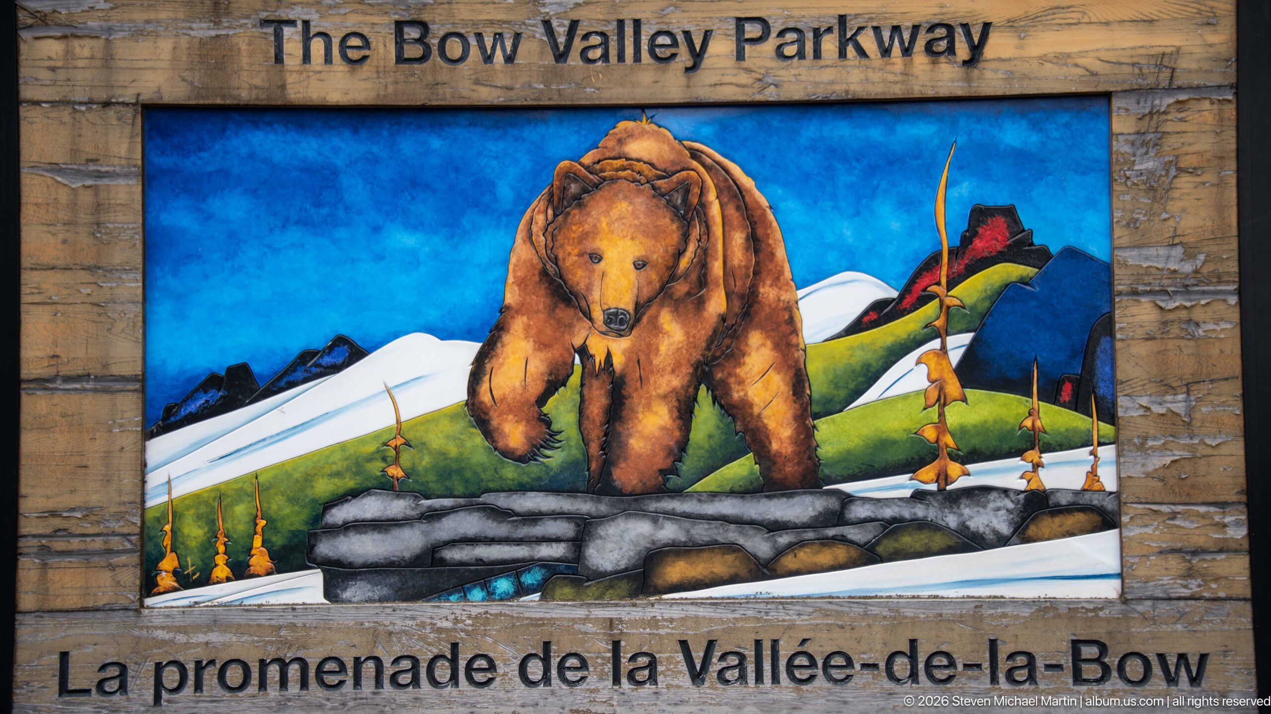
A colorful bear illustration fills the center of a rustic bilingual sign for “The Bow Valley Parkway / La promenade de la Vallée-de-la-Bow.” The stylized grizzly walks through a mountain landscape rendered in vivid blues, greens, reds, and whites. The sign links the scenic roadway with the wildlife and mountain environment that define this quieter route through Banff.
Caption
A colorful bear illustration fills the center of a rustic bilingual sign for “The Bow Valley Parkway / La promenade de la Vallée-de-la-Bow.” The stylized grizzly walks through a mountain landscape rendered in vivid blues, greens, reds, and whites. The sign links the scenic roadway with the wildlife and mountain environment that define this quieter route through Banff.
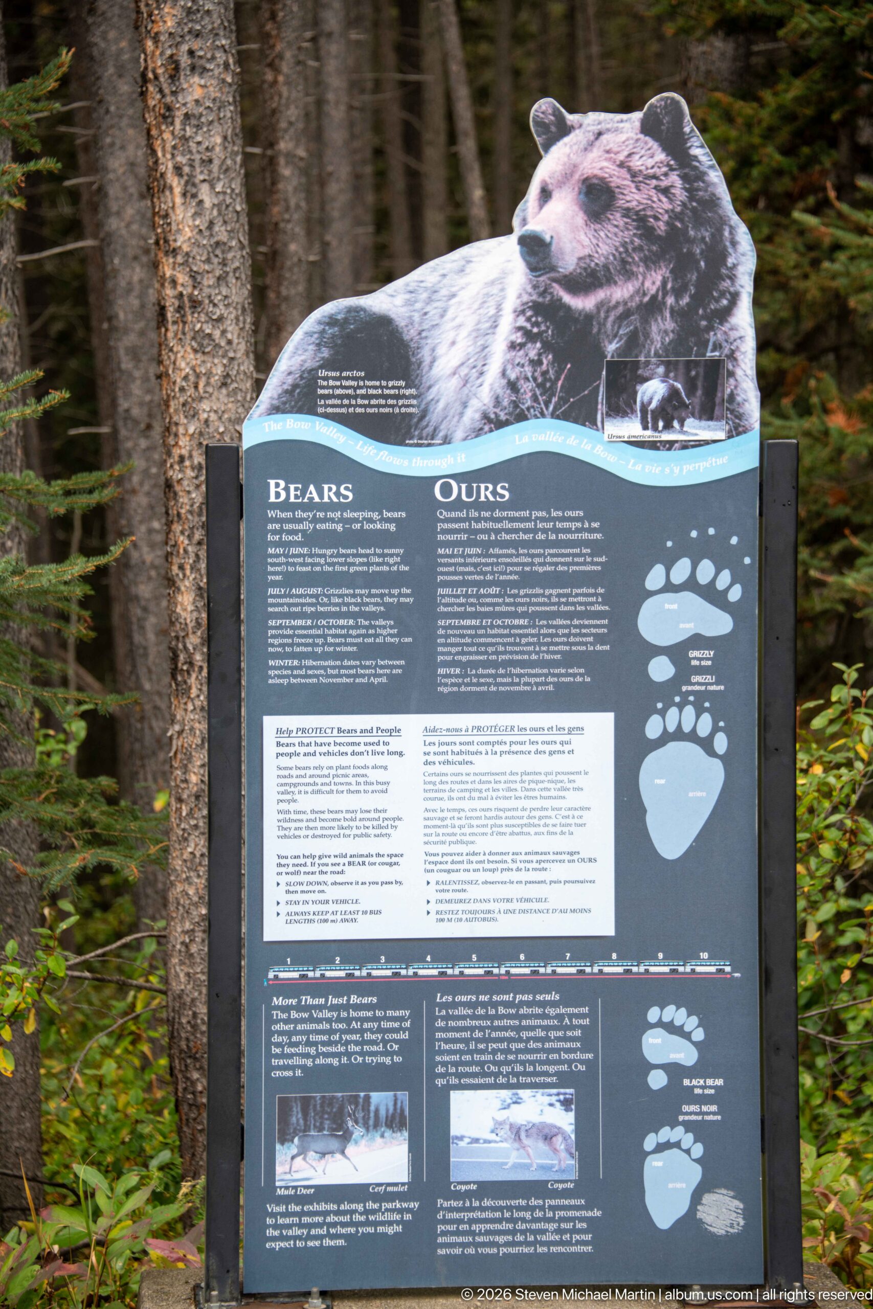
A bilingual interpretive panel titled “Bears / Ours” presents bear information beneath a life-size cutout image of a bear. Large paw-print diagrams and blocks of English and French text help visitors compare signs and understand bear-related guidance. Set directly in the conifer forest, the display makes wildlife awareness part of the roadside experience along Banff’s Bow Valley corridor.
Caption
A bilingual interpretive panel titled “Bears / Ours” presents bear information beneath a life-size cutout image of a bear. Large paw-print diagrams and blocks of English and French text help visitors compare signs and understand bear-related guidance. Set directly in the conifer forest, the display makes wildlife awareness part of the roadside experience along Banff’s Bow Valley corridor.
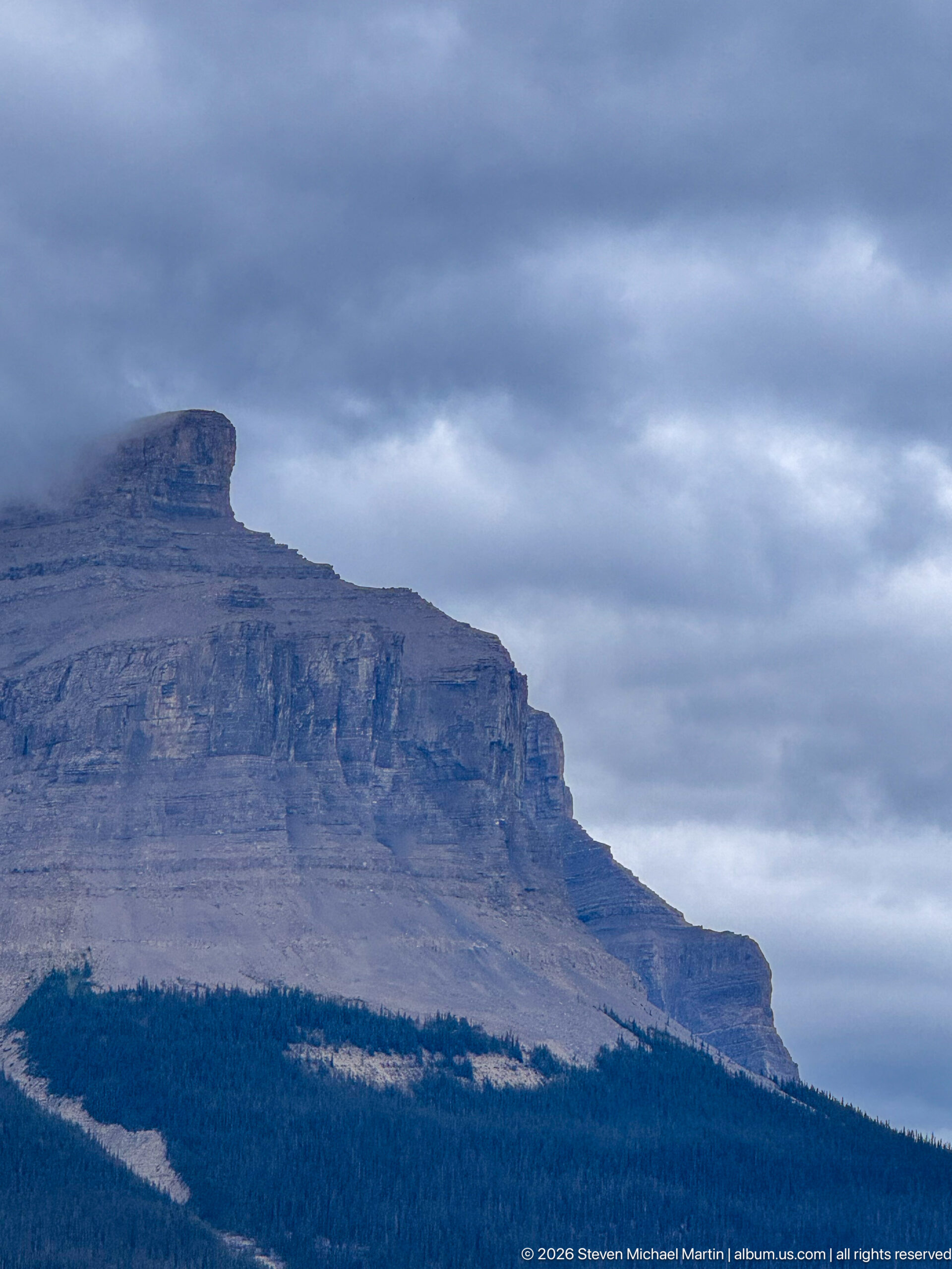
A broad, flat-topped limestone escarpment rises above a dark conifer belt beneath heavy gray cloud. Horizontal sedimentary bands and stepped cliff faces dominate the mountain, while a pale scree band cuts across the forested lower slope. The close roadside view emphasizes the strongly bedded geology of the Canadian Rockies without relying on a proper-name identification unsupported by the proof sheet.
Caption
A broad, flat-topped limestone escarpment rises above a dark conifer belt beneath heavy gray cloud. Horizontal sedimentary bands and stepped cliff faces dominate the mountain, while a pale scree band cuts across the forested lower slope. The close roadside view emphasizes the strongly bedded geology of the Canadian Rockies without relying on a proper-name identification unsupported by the proof sheet.
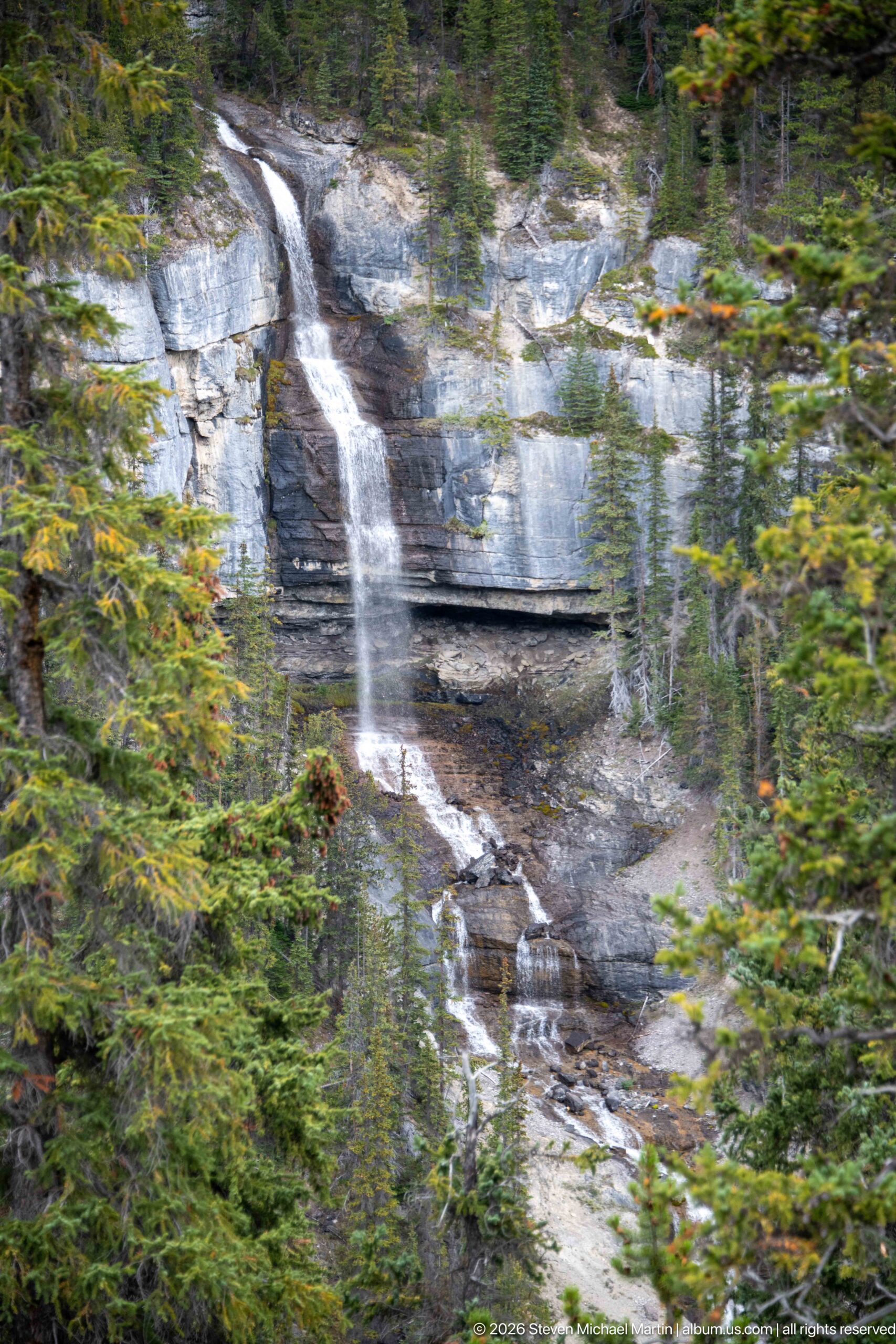
A narrow waterfall drops in several stages over gray, horizontally bedded limestone within dense conifer forest. The upper stream spills over a vertical ledge before breaking across lower shelves and disappearing among trees. The roadside telephoto view isolates the cascade against the rock face, revealing both the stepped structure of the cliff and the surrounding forest without enough evidence to assign a secure waterfall name.
Caption
A narrow waterfall drops in several stages over gray, horizontally bedded limestone within dense conifer forest. The upper stream spills over a vertical ledge before breaking across lower shelves and disappearing among trees. The roadside telephoto view isolates the cascade against the rock face, revealing both the stepped structure of the cliff and the surrounding forest without enough evidence to assign a secure waterfall name.
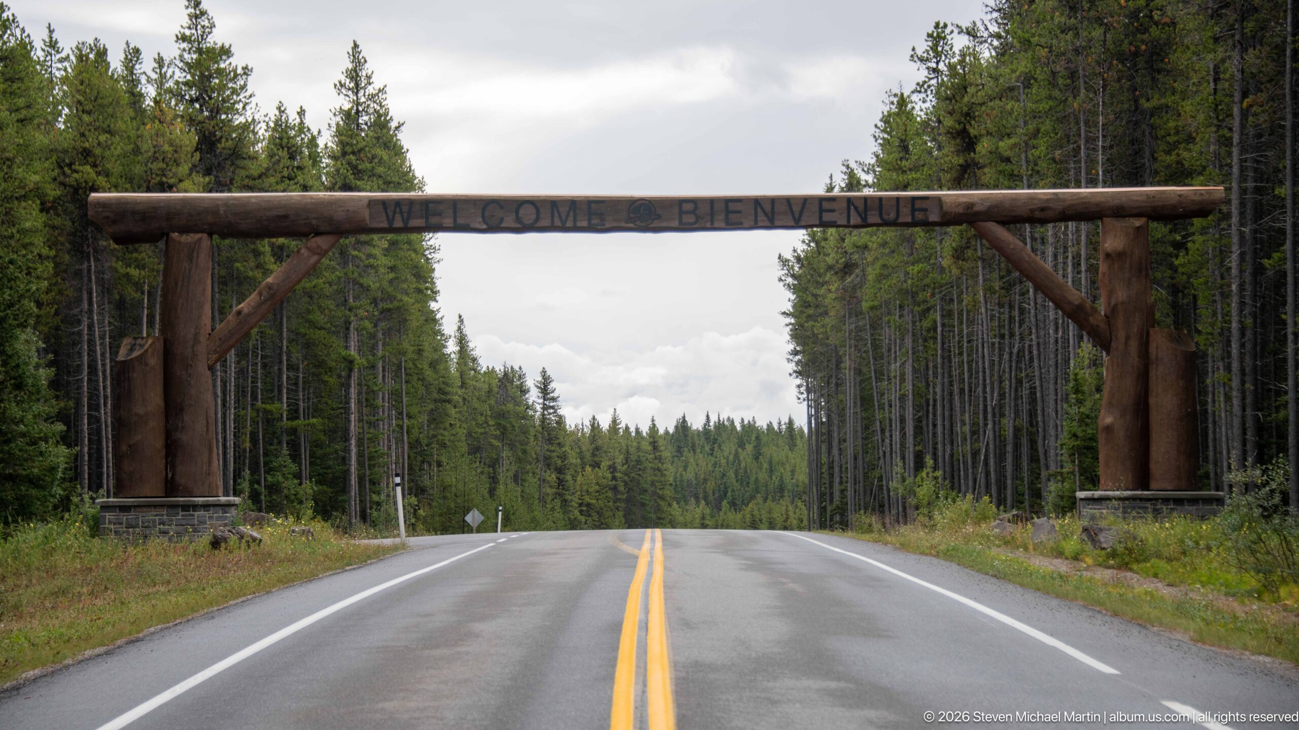
A massive timber gateway spans the two-lane Bow Valley Parkway, with “WELCOME • BIENVENUE” carved across the horizontal log beam. Stone bases anchor the heavy posts at either shoulder while dense lodgepole pine forest closes around the wet roadway. The simple gateway marks a transition from the major highway corridor to a slower, forested park route.
Caption
A massive timber gateway spans the two-lane Bow Valley Parkway, with “WELCOME • BIENVENUE” carved across the horizontal log beam. Stone bases anchor the heavy posts at either shoulder while dense lodgepole pine forest closes around the wet roadway. The simple gateway marks a transition from the major highway corridor to a slower, forested park route.
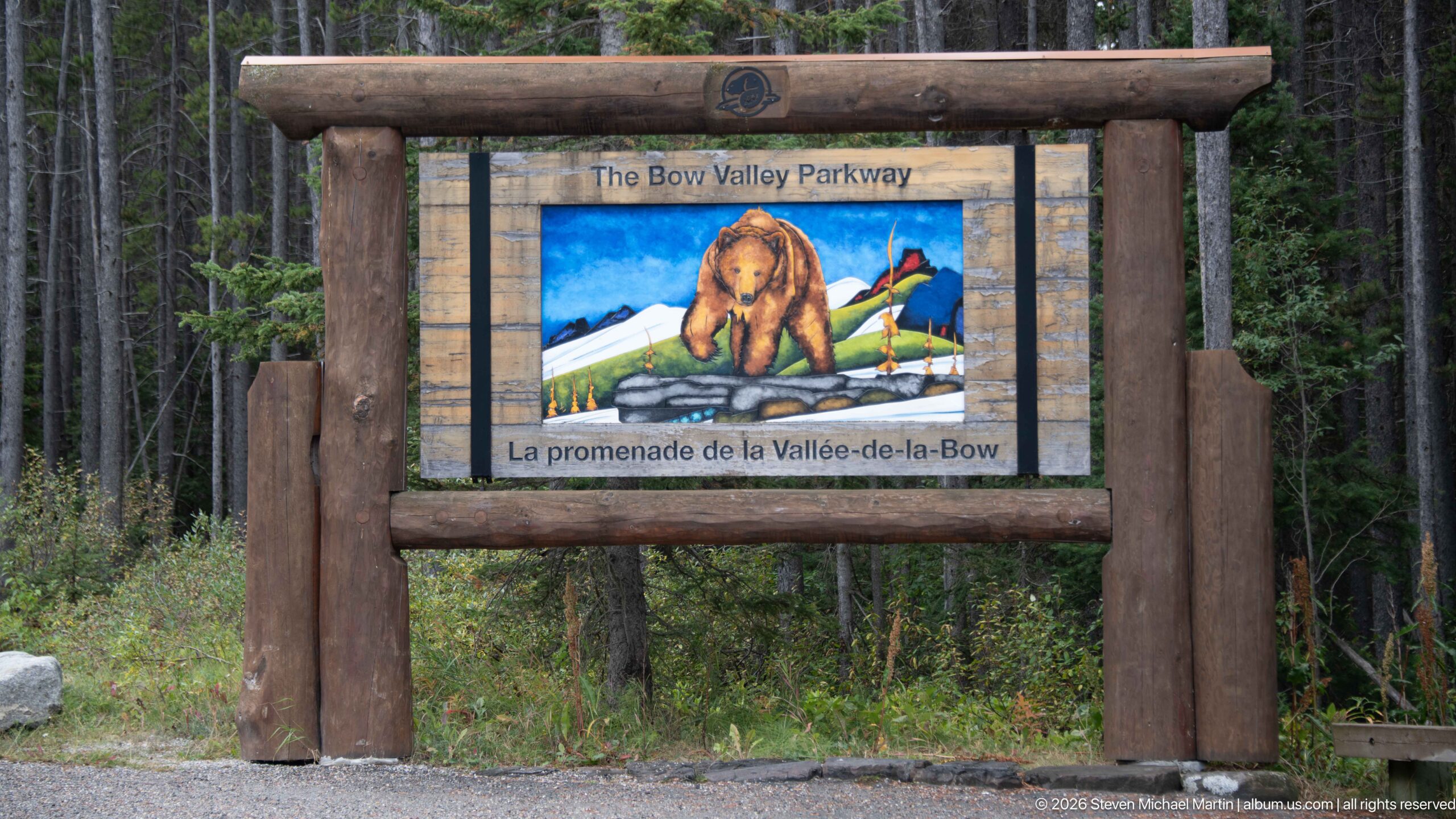
A freestanding timber sign announces “The Bow Valley Parkway / La promenade de la Vallée-de-la-Bow” with a painted bear crossing a stylized mountain landscape. Heavy round-log framing and a small Parks Canada emblem give the marker the visual language of park infrastructure, while the surrounding conifer forest situates it at the roadway’s wooded entrance.
Caption
A freestanding timber sign announces “The Bow Valley Parkway / La promenade de la Vallée-de-la-Bow” with a painted bear crossing a stylized mountain landscape. Heavy round-log framing and a small Parks Canada emblem give the marker the visual language of park infrastructure, while the surrounding conifer forest situates it at the roadway’s wooded entrance.
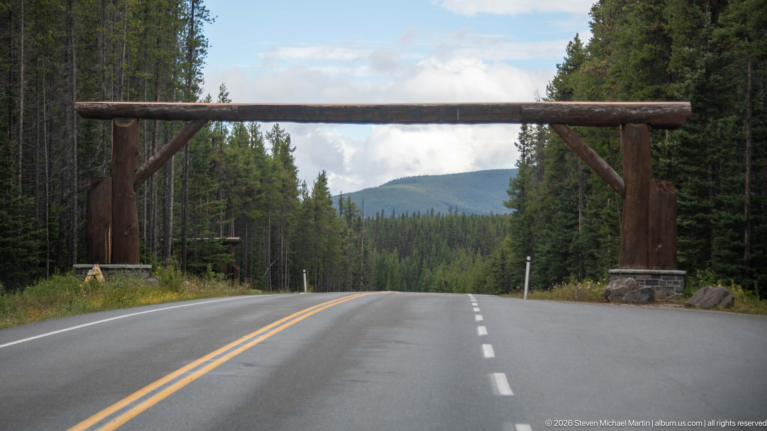
The Bow Valley Parkway passes beneath a broad timber portal supported on stone bases before descending gently into dense forest. Seen from the roadway, the unlettered reverse side of the gateway becomes a simple structural frame for the distant green hills. Centerlines, shoulder markings, and the empty pavement emphasize the controlled, scenic character of this park route.
Caption
The Bow Valley Parkway passes beneath a broad timber portal supported on stone bases before descending gently into dense forest. Seen from the roadway, the unlettered reverse side of the gateway becomes a simple structural frame for the distant green hills. Centerlines, shoulder markings, and the empty pavement emphasize the controlled, scenic character of this park route.
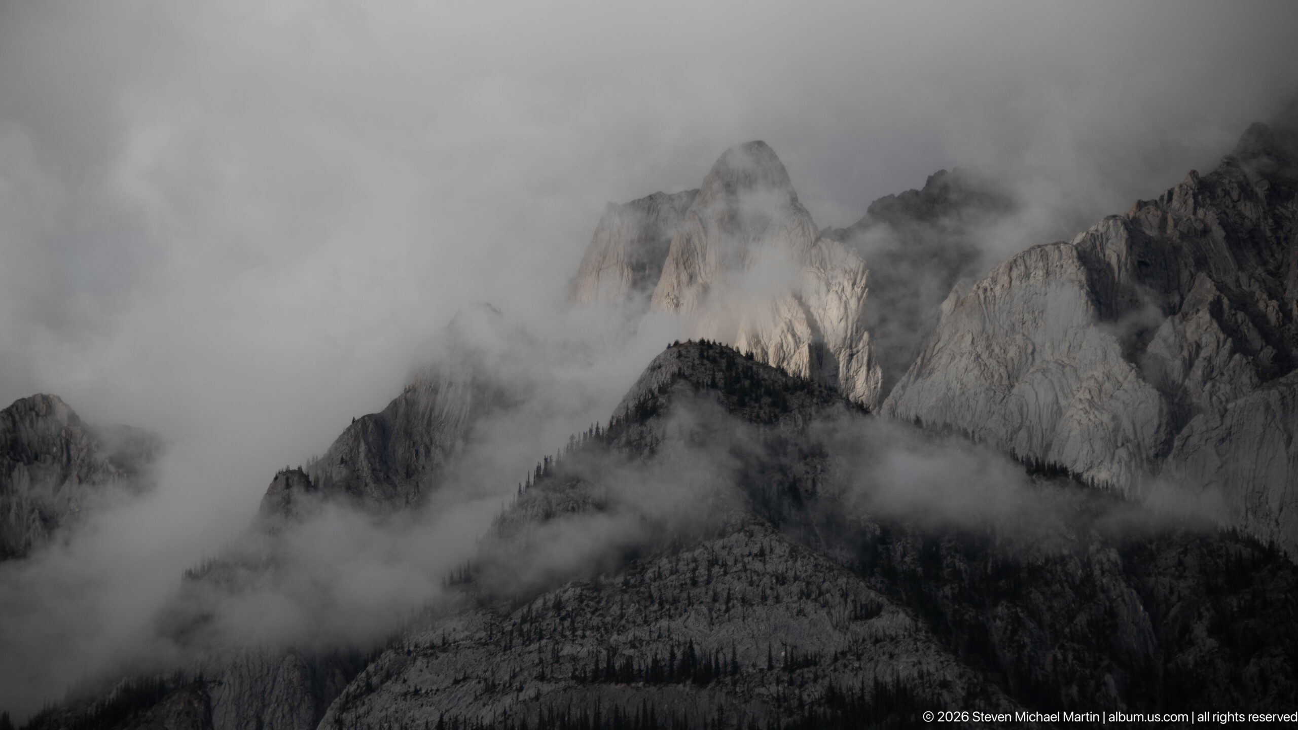
Sharp limestone towers appear and disappear within thick gray cloud above a dark forested slope. Only portions of the pale rock faces remain visible, producing a compressed study of mountain form and weather rather than a broad landscape. The obscured skyline prevents a secure named-peak identification, but the exposed sedimentary cliffs are characteristic of the Canadian Rockies around Banff.
Caption
Sharp limestone towers appear and disappear within thick gray cloud above a dark forested slope. Only portions of the pale rock faces remain visible, producing a compressed study of mountain form and weather rather than a broad landscape. The obscured skyline prevents a secure named-peak identification, but the exposed sedimentary cliffs are characteristic of the Canadian Rockies around Banff.
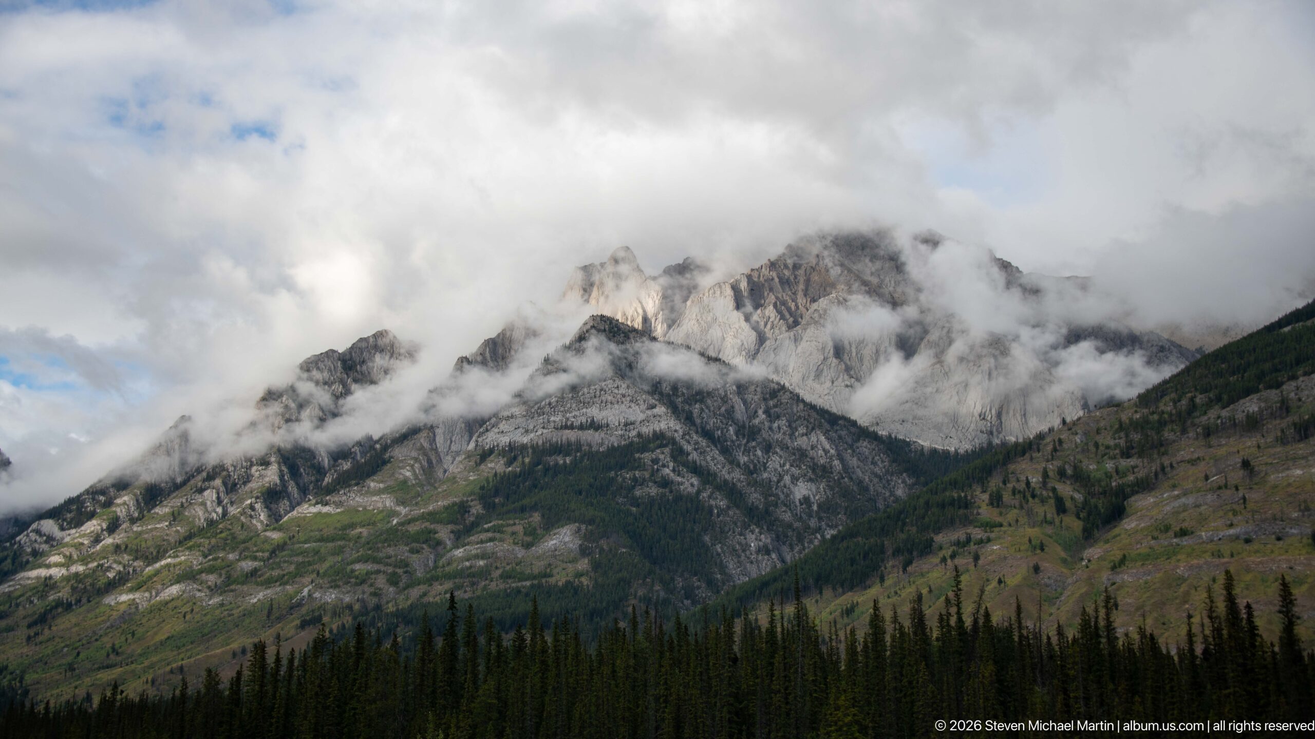
Broken limestone summits stretch across the frame above a steep, forested lower slope, with bands of cloud curling through gullies and around the highest points. Patches of blue sky and brighter rock distinguish this view from the denser fog of the preceding scene. The composition emphasizes the layered structure and erosion of the ridge without forcing a specific mountain name.
Caption
Broken limestone summits stretch across the frame above a steep, forested lower slope, with bands of cloud curling through gullies and around the highest points. Patches of blue sky and brighter rock distinguish this view from the denser fog of the preceding scene. The composition emphasizes the layered structure and erosion of the ridge without forcing a specific mountain name.
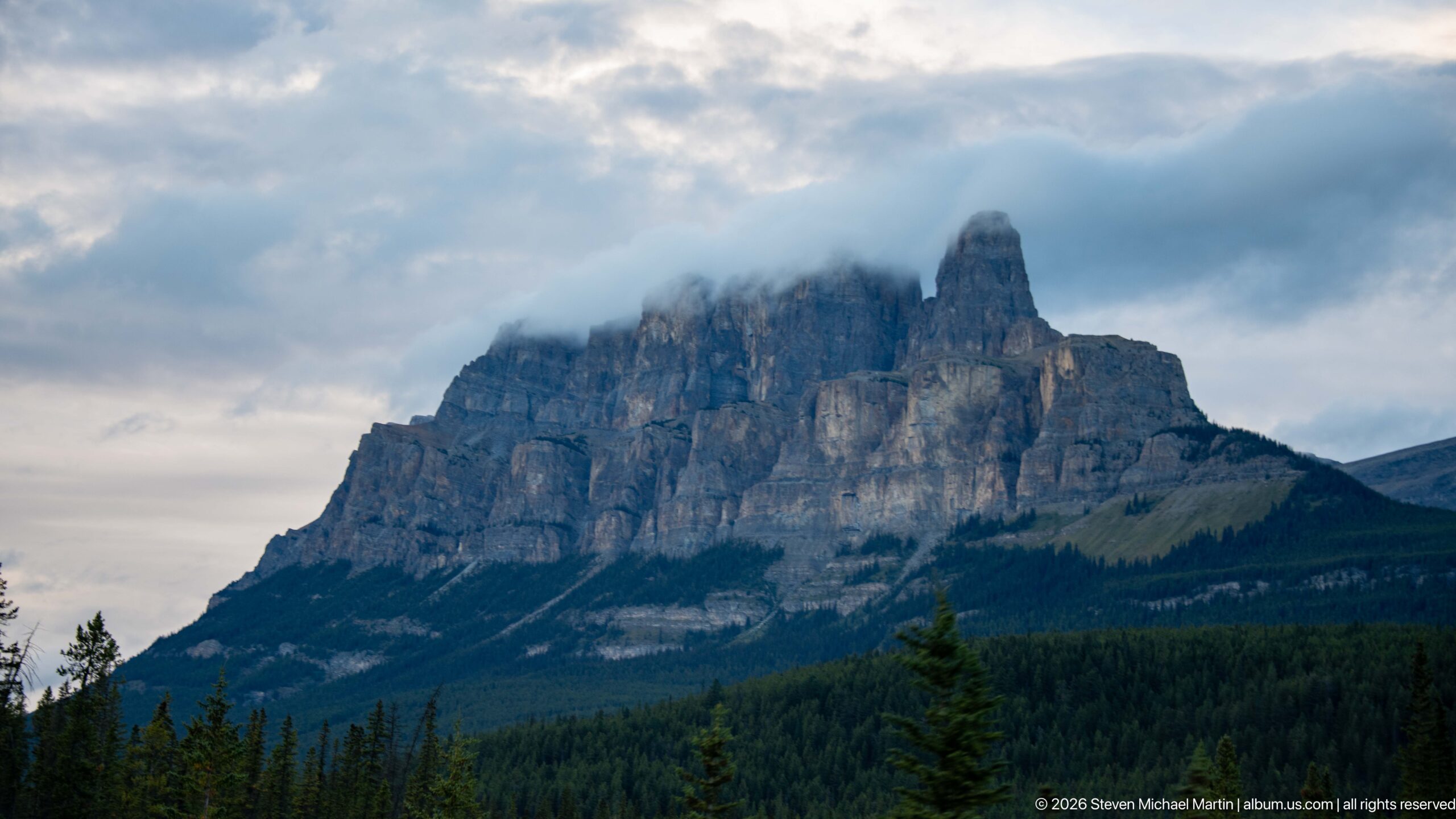
Castle Mountain rises above the Bow Valley with its distinctive fortress-like cliffs and projecting tower, a profile that inspired its name. Horizontal limestone bands and near-vertical walls dominate the upper massif, while dark conifer forest blankets the lower slopes. Cloud brushes the summit, reinforcing the monumental silhouette visible from the Trans-Canada Highway and nearby Bow Valley routes.
Caption
Castle Mountain rises above the Bow Valley with its distinctive fortress-like cliffs and projecting tower, a profile that inspired its name. Horizontal limestone bands and near-vertical walls dominate the upper massif, while dark conifer forest blankets the lower slopes. Cloud brushes the summit, reinforcing the monumental silhouette visible from the Trans-Canada Highway and nearby Bow Valley routes.
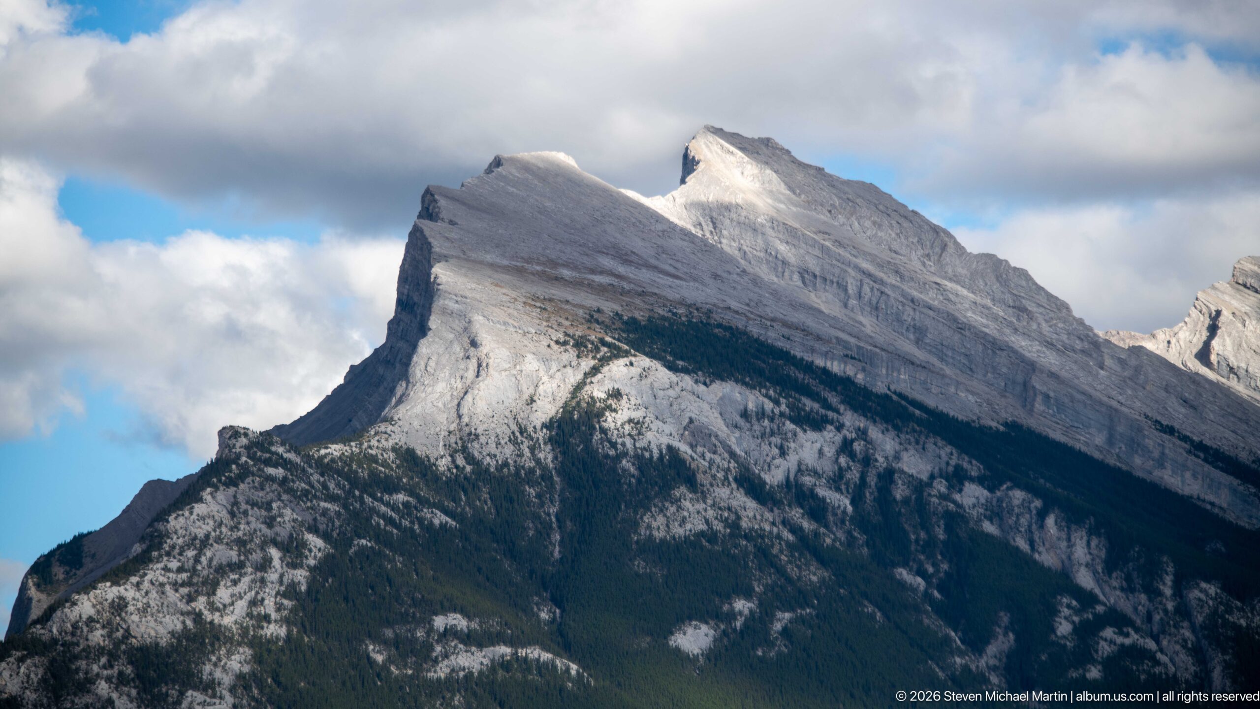
A sharply angled limestone ridge rises above dark forest, its pale bedding planes forming a dramatic sloping crest and abrupt cliff at the near end. Sunlight breaks through cloud to illuminate portions of the exposed rock, revealing the tilted sedimentary structure characteristic of the Canadian Rockies. The close framing supports the geological description but not a secure proper-name identification.
Caption
A sharply angled limestone ridge rises above dark forest, its pale bedding planes forming a dramatic sloping crest and abrupt cliff at the near end. Sunlight breaks through cloud to illuminate portions of the exposed rock, revealing the tilted sedimentary structure characteristic of the Canadian Rockies. The close framing supports the geological description but not a secure proper-name identification.
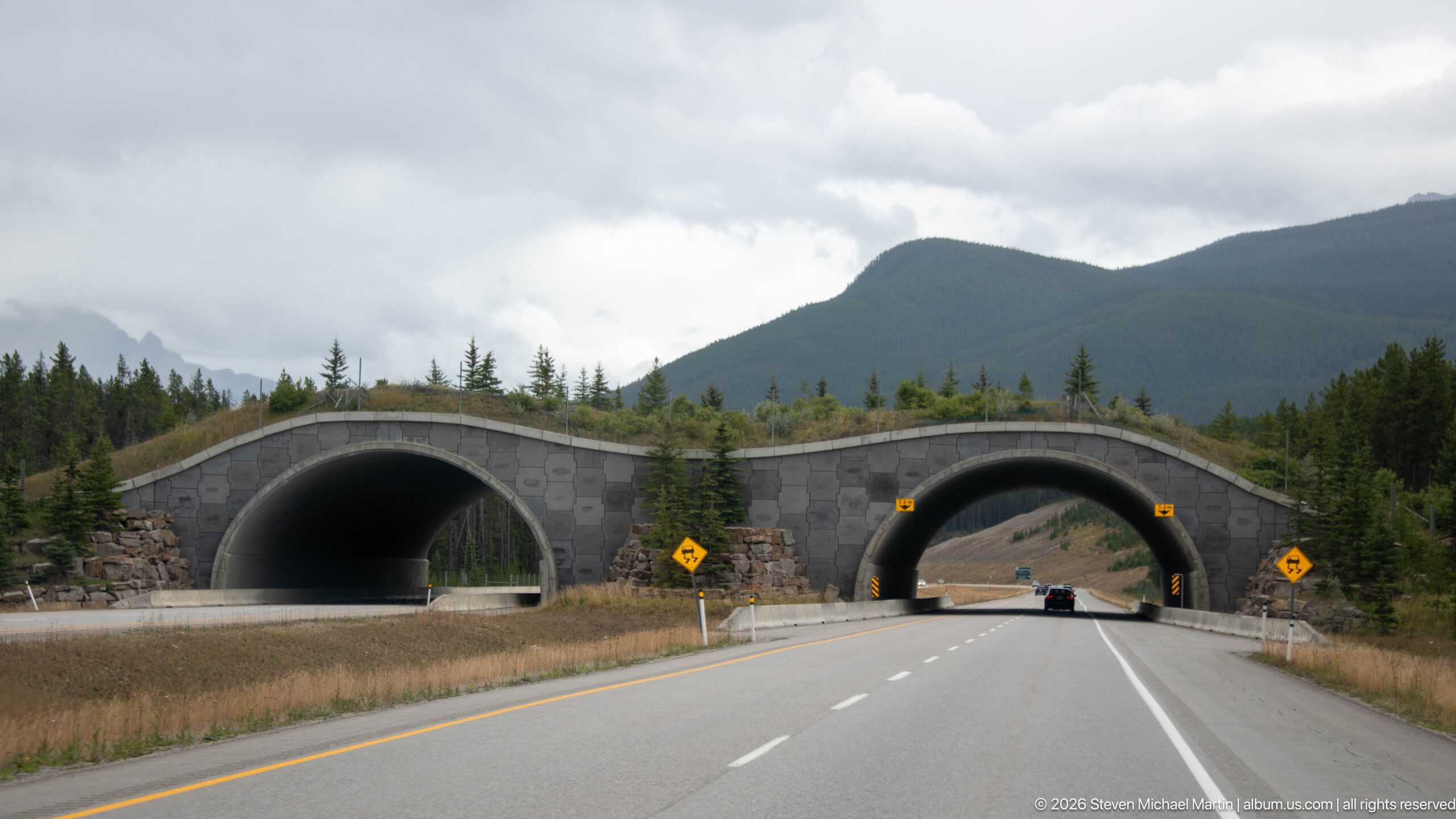
Two adjacent vegetated wildlife overpasses span the Trans-Canada Highway, creating broad arched passages above the divided roadway. Grasses and small trees cover the crossing surfaces, visually extending the surrounding habitat across the traffic corridor. The paired structures make Banff’s approach to wildlife connectivity especially legible, showing engineered crossings integrated directly into the highway landscape.
Caption
Two adjacent vegetated wildlife overpasses span the Trans-Canada Highway, creating broad arched passages above the divided roadway. Grasses and small trees cover the crossing surfaces, visually extending the surrounding habitat across the traffic corridor. The paired structures make Banff’s approach to wildlife connectivity especially legible, showing engineered crossings integrated directly into the highway landscape.
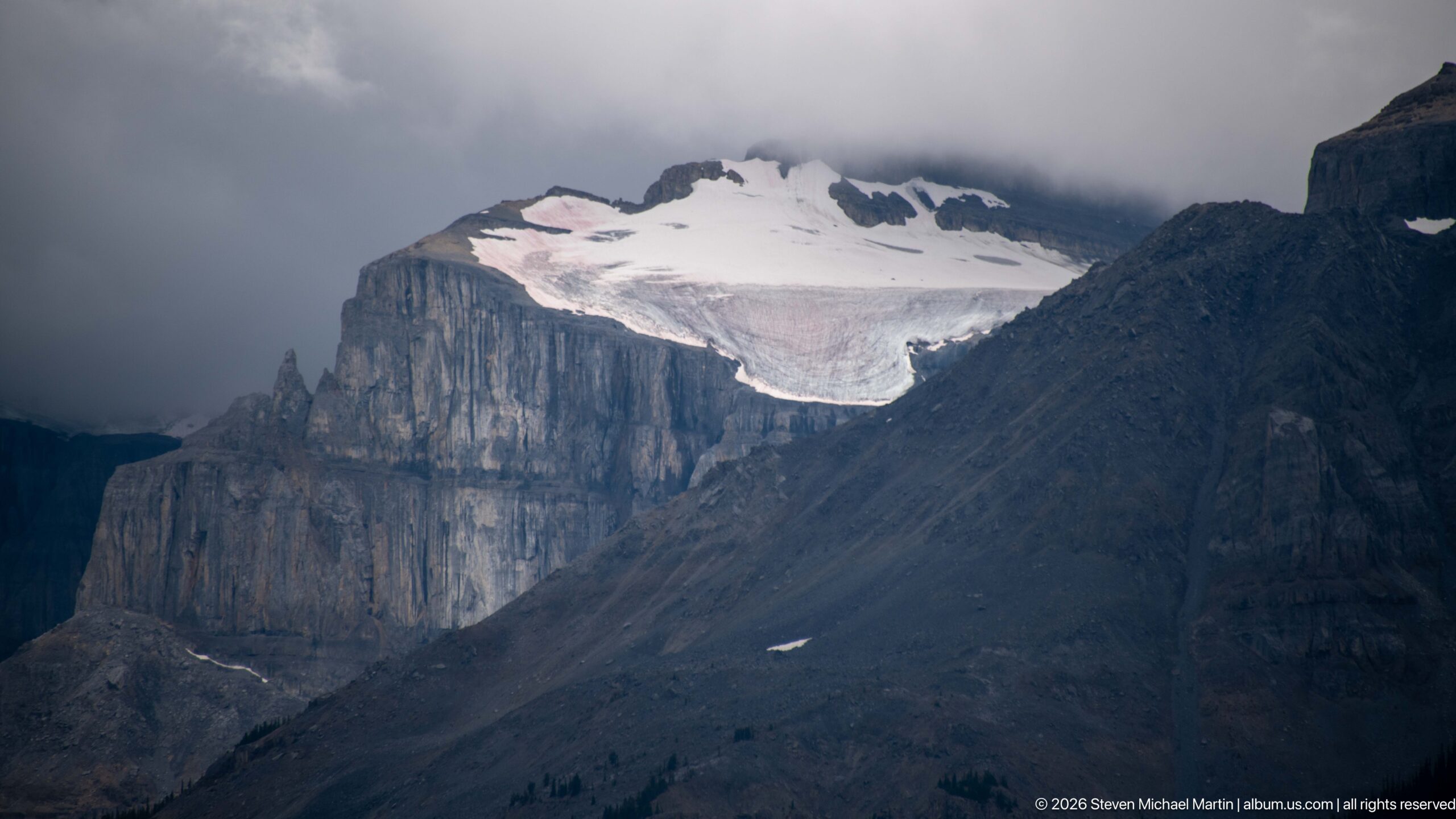
A broad patch of persistent snow or ice rests on a high bench above sheer, horizontally layered limestone cliffs. Dark cloud obscures the upper ridge and deepens the contrast between the white frozen surface and gray rock walls below. The close view records alpine conditions and erosional form, but the proof sheet alone does not support naming the ice body or mountain.
Caption
A broad patch of persistent snow or ice rests on a high bench above sheer, horizontally layered limestone cliffs. Dark cloud obscures the upper ridge and deepens the contrast between the white frozen surface and gray rock walls below. The close view records alpine conditions and erosional form, but the proof sheet alone does not support naming the ice body or mountain.

A beagle leans toward the dashboard navigation screen inside a vehicle traveling the Banff corridor. The display visibly labels the Trans-Canada Highway and shows the mapped route ahead, turning an ordinary travel moment into a playful counterpoint to the portfolio’s mountain and infrastructure views. The dog’s profile, dashboard, and digital map firmly locate the scene inside the road-trip experience.
Caption
A beagle leans toward the dashboard navigation screen inside a vehicle traveling the Banff corridor. The display visibly labels the Trans-Canada Highway and shows the mapped route ahead, turning an ordinary travel moment into a playful counterpoint to the portfolio’s mountain and infrastructure views. The dog’s profile, dashboard, and digital map firmly locate the scene inside the road-trip experience.
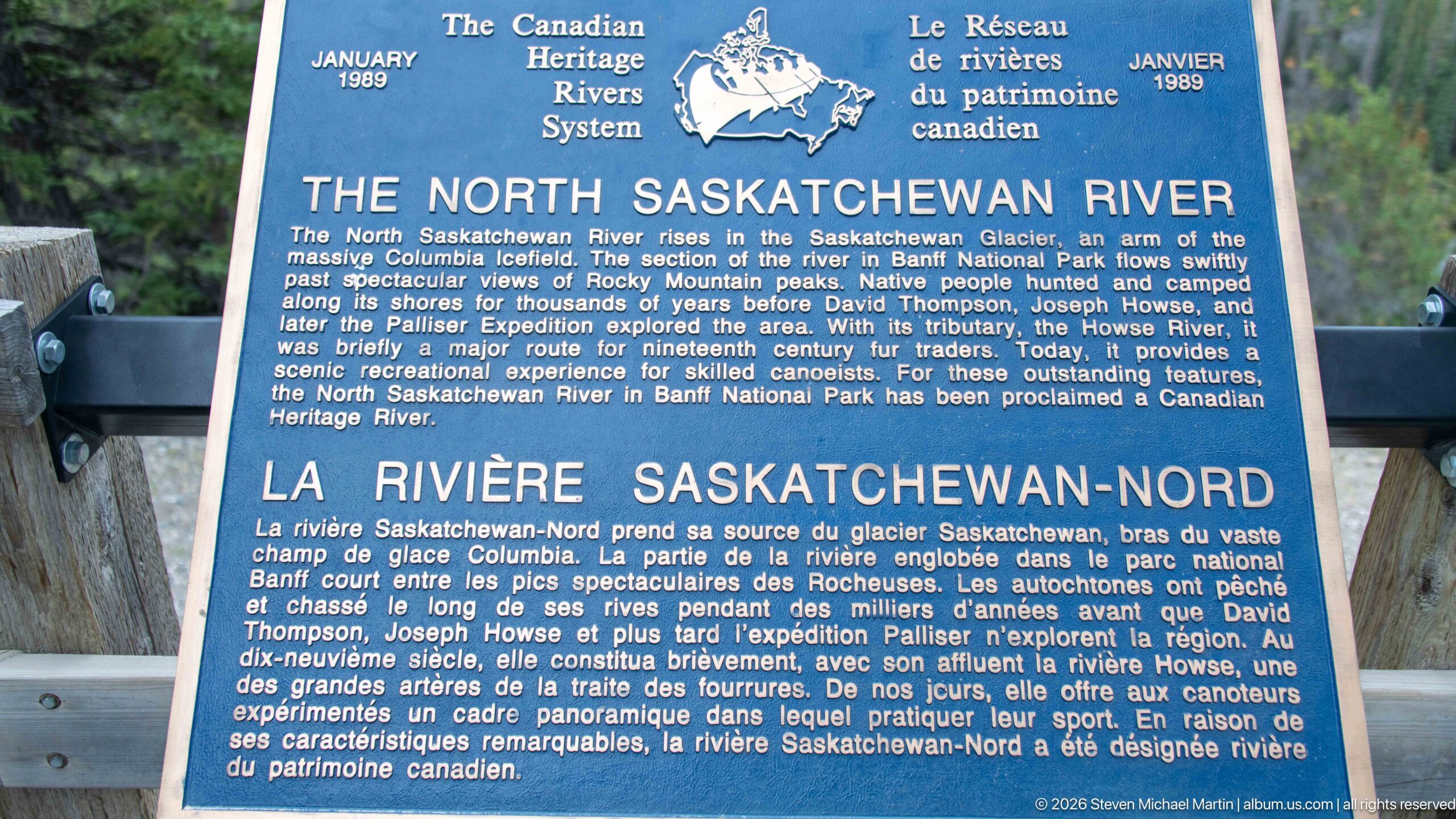
A Canadian Heritage Rivers System panel introduces the North Saskatchewan River in English and French. The text identifies its headwaters at the Saskatchewan Glacier and describes the river’s Indigenous, fur-trade and recreational history. Mounted at a roadside viewpoint, the panel provides direct geographic context for this portion of the mountain corridor and its relationship to the larger Saskatchewan River system.
Caption
A Canadian Heritage Rivers System panel introduces the North Saskatchewan River in English and French. The text identifies its headwaters at the Saskatchewan Glacier and describes the river’s Indigenous, fur-trade and recreational history. Mounted at a roadside viewpoint, the panel provides direct geographic context for this portion of the mountain corridor and its relationship to the larger Saskatchewan River system.
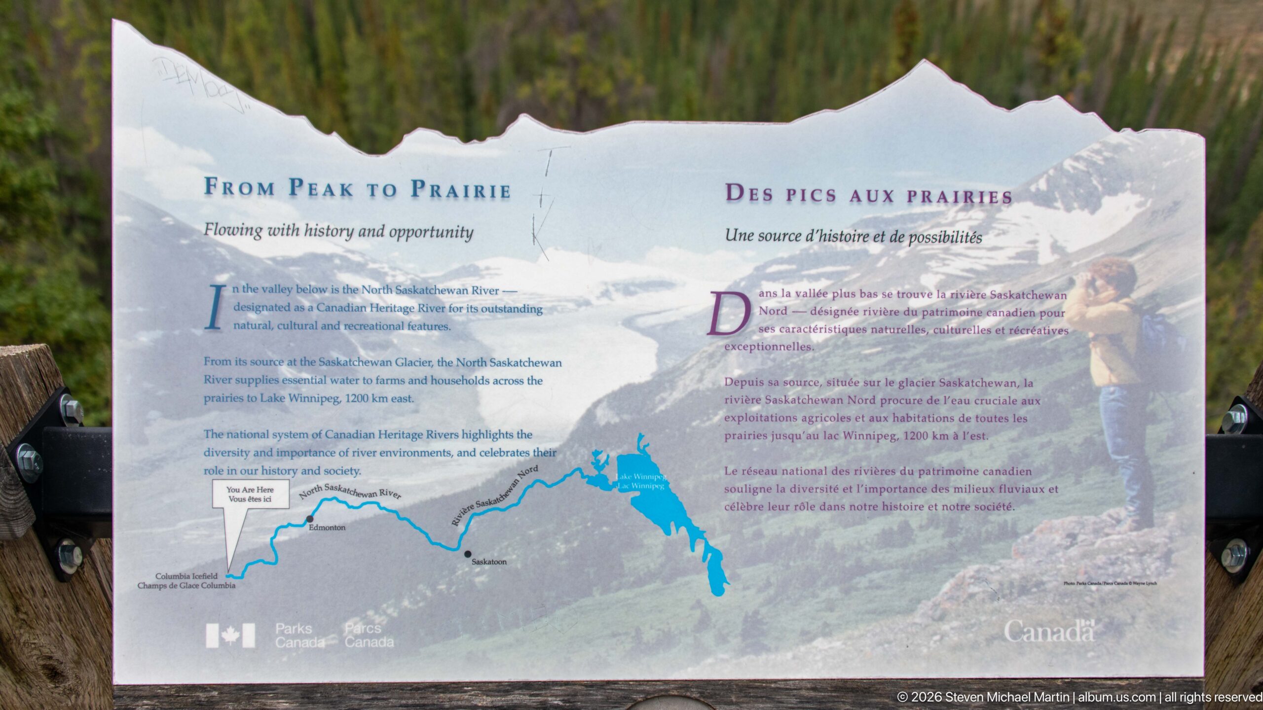
The bilingual “From Peak to Prairie” panel traces the North Saskatchewan River from its Rocky Mountain headwaters toward the prairies. A route map anchors the display, while the text discusses the river’s natural and cultural connections across the landscape. The mountain-shaped upper edge and panoramic setting reinforce the panel’s role in interpreting the river corridor from a roadside overlook.
Caption
The bilingual “From Peak to Prairie” panel traces the North Saskatchewan River from its Rocky Mountain headwaters toward the prairies. A route map anchors the display, while the text discusses the river’s natural and cultural connections across the landscape. The mountain-shaped upper edge and panoramic setting reinforce the panel’s role in interpreting the river corridor from a roadside overlook.
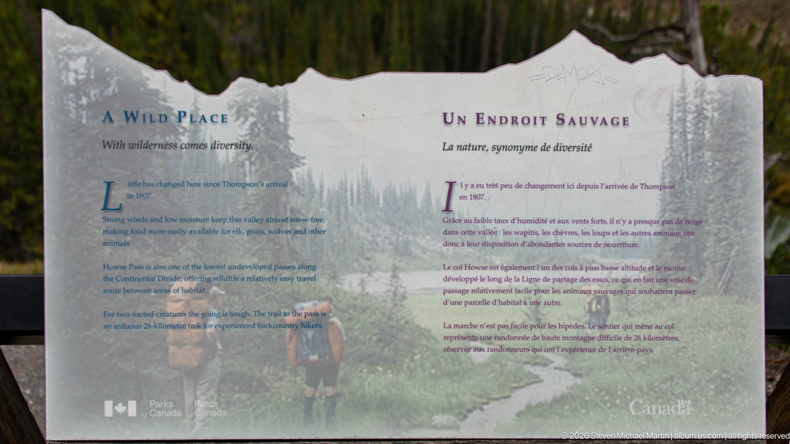
The bilingual “A Wild Place” panel interprets the ecological diversity of the North Saskatchewan River corridor. Text and a background photograph of hikers in mountain vegetation connect wilderness character with changing habitats and wildlife. Its mountain-profile silhouette and forest setting visually integrate the exhibit with the surrounding landscape while the paired English and French sections identify it as a Parks Canada interpretive installation.
Caption
The bilingual “A Wild Place” panel interprets the ecological diversity of the North Saskatchewan River corridor. Text and a background photograph of hikers in mountain vegetation connect wilderness character with changing habitats and wildlife. Its mountain-profile silhouette and forest setting visually integrate the exhibit with the surrounding landscape while the paired English and French sections identify it as a Parks Canada interpretive installation.
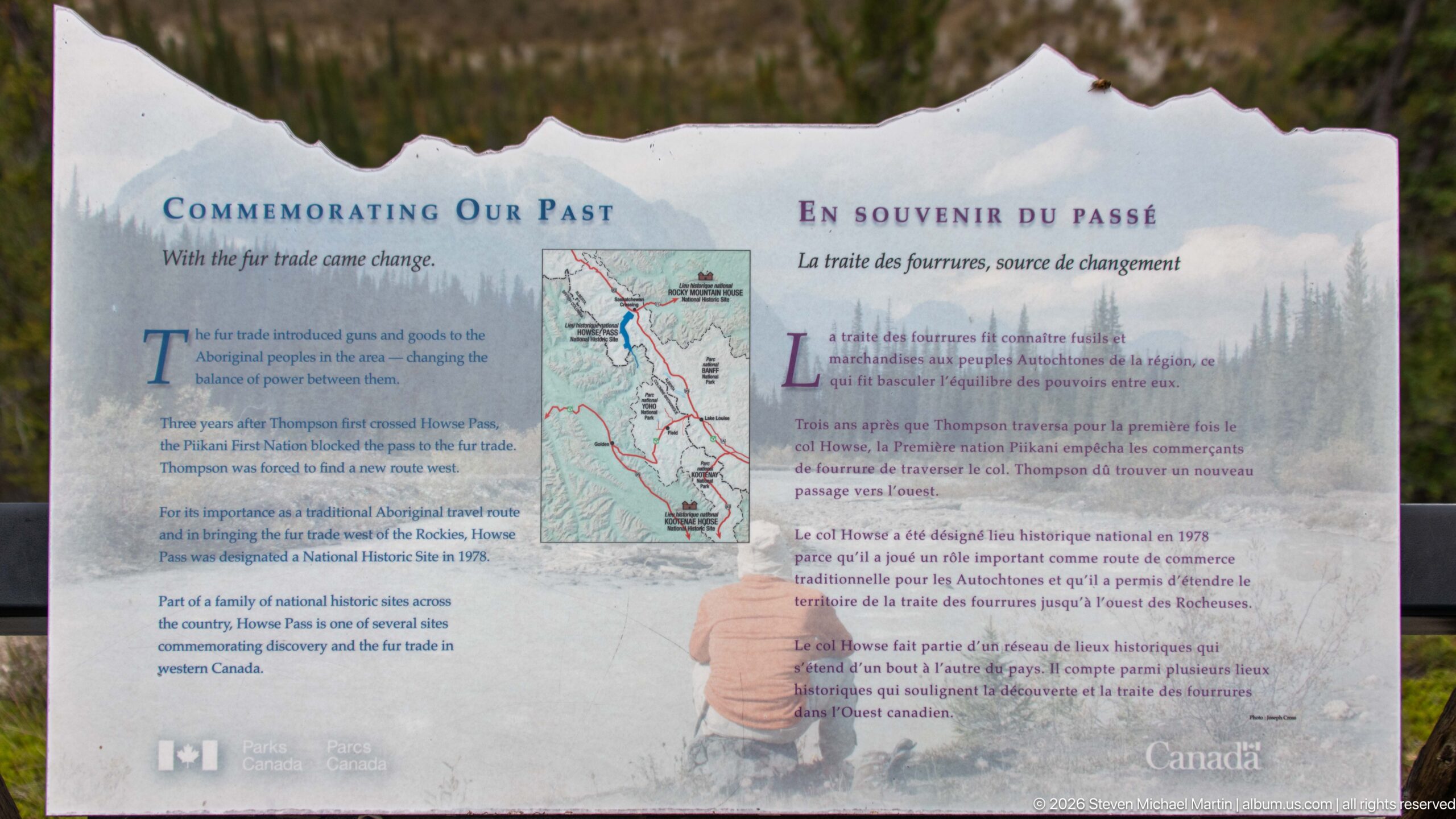
The “Commemorating Our Past / En souvenir du passé” panel explains the designation and commemoration of historic places associated with the mountain river corridor. A map and archival-style imagery accompany bilingual text about recognizing nationally significant history. The display broadens the viewpoint’s interpretation beyond scenery and natural history to include routes, sites and events remembered within the surrounding landscape.
Caption
The “Commemorating Our Past / En souvenir du passé” panel explains the designation and commemoration of historic places associated with the mountain river corridor. A map and archival-style imagery accompany bilingual text about recognizing nationally significant history. The display broadens the viewpoint’s interpretation beyond scenery and natural history to include routes, sites and events remembered within the surrounding landscape.
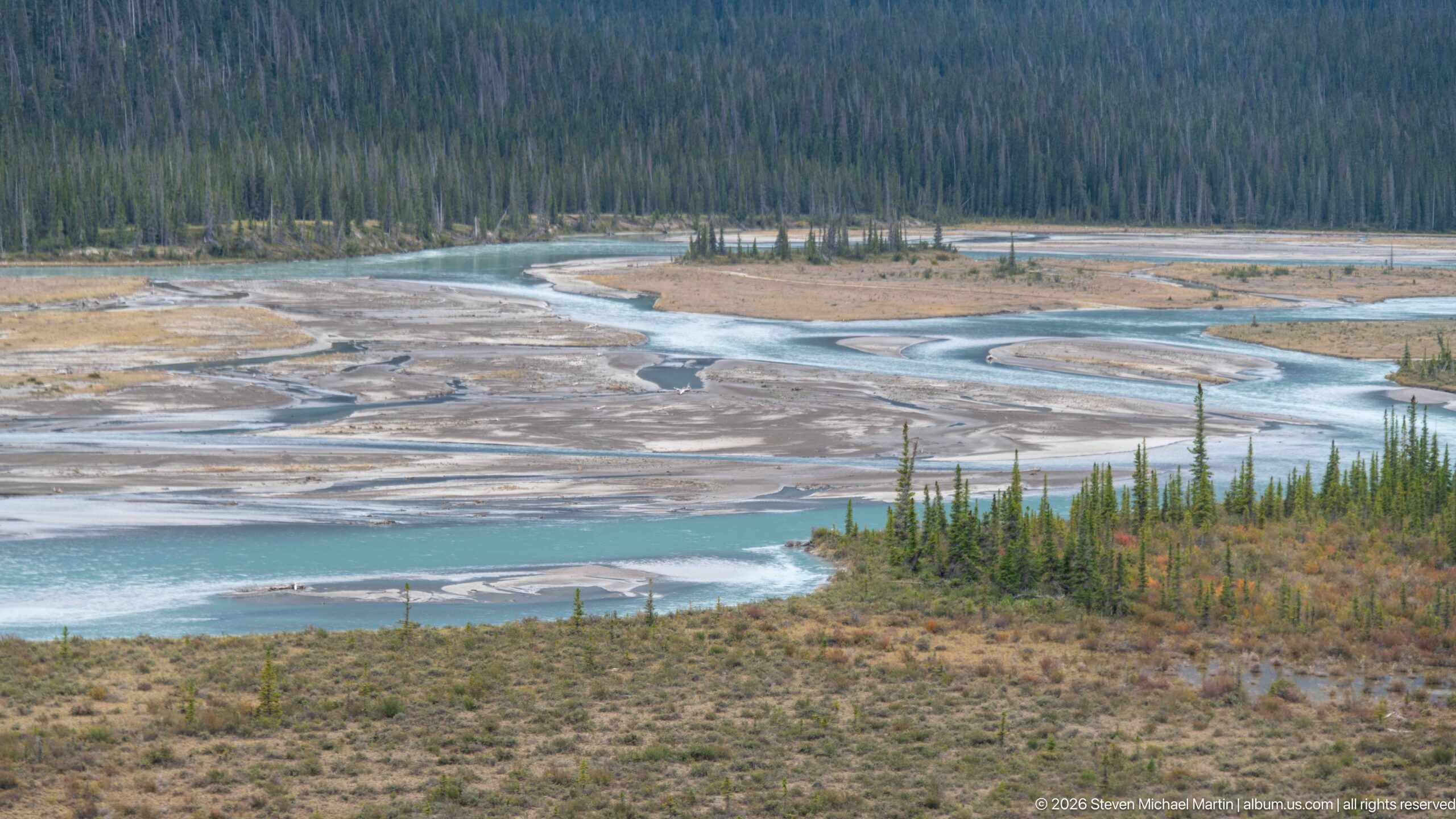
Turquoise channels divide and rejoin across a broad gravel floodplain bordered by dense conifer forest. Exposed bars, shallow side channels and vegetated islands reveal the constantly shifting pattern of a high-energy mountain river carrying glacial sediment. Seen from above, the composition clearly shows the braided form of the river system and the transition from open floodplain to continuous forest.
Caption
Turquoise channels divide and rejoin across a broad gravel floodplain bordered by dense conifer forest. Exposed bars, shallow side channels and vegetated islands reveal the constantly shifting pattern of a high-energy mountain river carrying glacial sediment. Seen from above, the composition clearly shows the braided form of the river system and the transition from open floodplain to continuous forest.
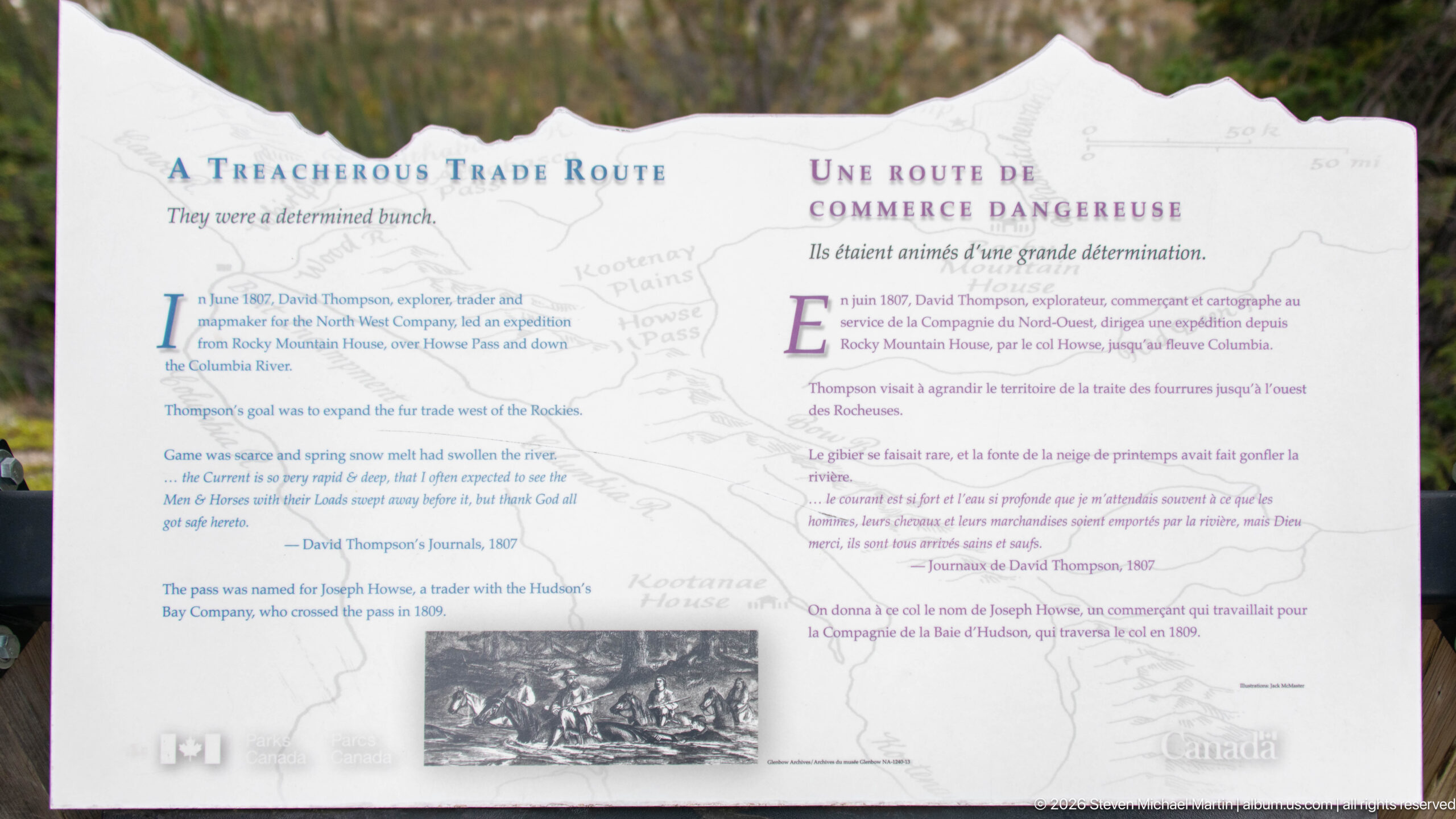
The bilingual “A Treacherous Trade Route” panel recounts travel through the mountain corridor during the fur-trade era. A pale regional map and small archival illustration accompany text describing the difficult route used by traders and explorers. The display places modern roadside travel in contrast with the much more demanding crossings undertaken before engineered roads penetrated the Canadian Rockies.
Caption
The bilingual “A Treacherous Trade Route” panel recounts travel through the mountain corridor during the fur-trade era. A pale regional map and small archival illustration accompany text describing the difficult route used by traders and explorers. The display places modern roadside travel in contrast with the much more demanding crossings undertaken before engineered roads penetrated the Canadian Rockies.
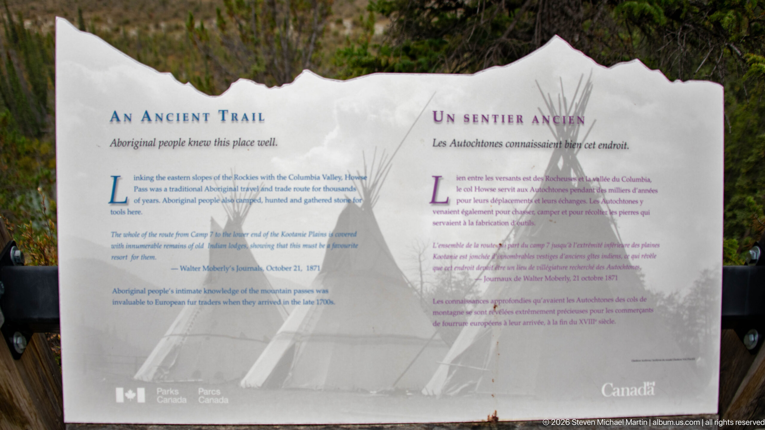
The “An Ancient Trail / Un sentier ancien” panel interprets Indigenous travel through the Rocky Mountain valleys long before modern roads. Bilingual text discusses Aboriginal peoples’ knowledge and use of mountain passes, while a tipi image forms the central visual element. The panel situates the transportation corridor within a much longer history of human movement through the Canadian Rockies.
Caption
The “An Ancient Trail / Un sentier ancien” panel interprets Indigenous travel through the Rocky Mountain valleys long before modern roads. Bilingual text discusses Aboriginal peoples’ knowledge and use of mountain passes, while a tipi image forms the central visual element. The panel situates the transportation corridor within a much longer history of human movement through the Canadian Rockies.
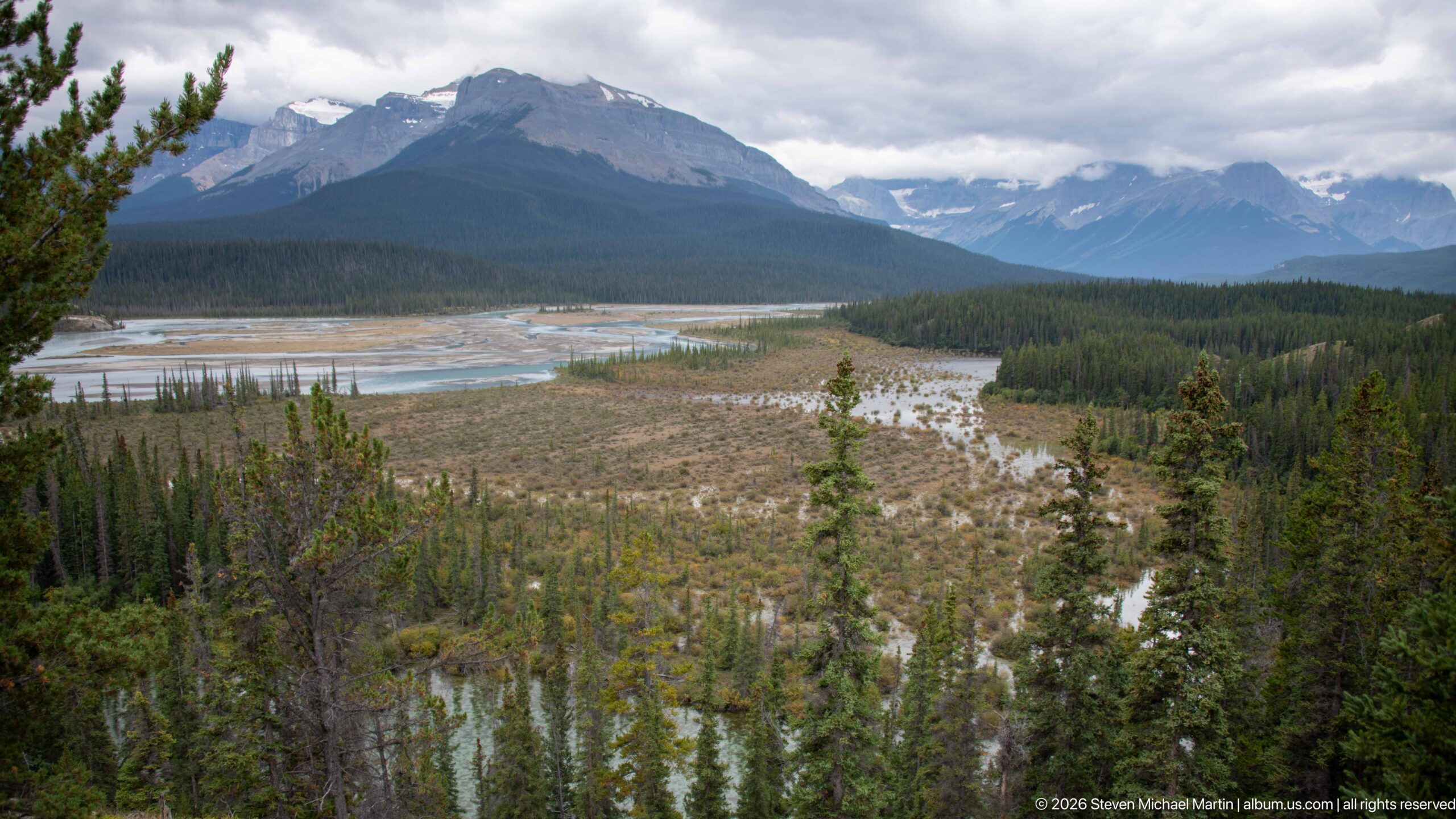
A broad mountain valley opens around pale braided channels and gravel bars, with dense conifer forest occupying terraces and lower slopes. Successive ridges recede toward cloud-covered peaks, giving the elevated viewpoint considerable depth. The river’s divided channels and expansive floodplain demonstrate how water, sediment and forest together shape the floor of this Canadian Rockies corridor.
Caption
A broad mountain valley opens around pale braided channels and gravel bars, with dense conifer forest occupying terraces and lower slopes. Successive ridges recede toward cloud-covered peaks, giving the elevated viewpoint considerable depth. The river’s divided channels and expansive floodplain demonstrate how water, sediment and forest together shape the floor of this Canadian Rockies corridor.
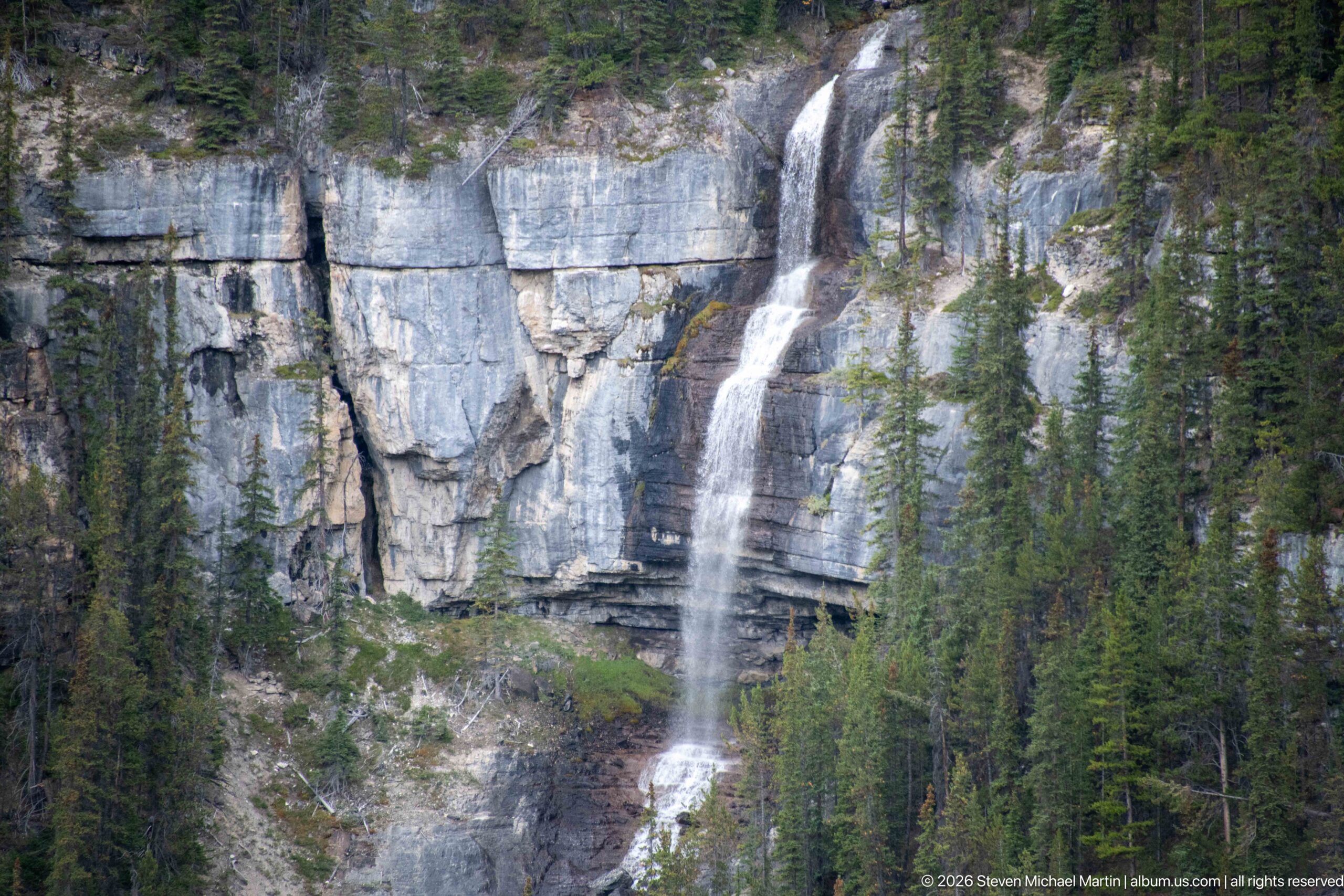
A slender waterfall plunges from a forested rim across a high, horizontally layered limestone cliff before continuing over lower rock shelves. Conifers cling to ledges and frame the cascade, emphasizing the height of the exposed wall. The closer view reveals the waterfall’s main vertical drop and the resistant rock bands that control its stepped descent.
Caption
A slender waterfall plunges from a forested rim across a high, horizontally layered limestone cliff before continuing over lower rock shelves. Conifers cling to ledges and frame the cascade, emphasizing the height of the exposed wall. The closer view reveals the waterfall’s main vertical drop and the resistant rock bands that control its stepped descent.
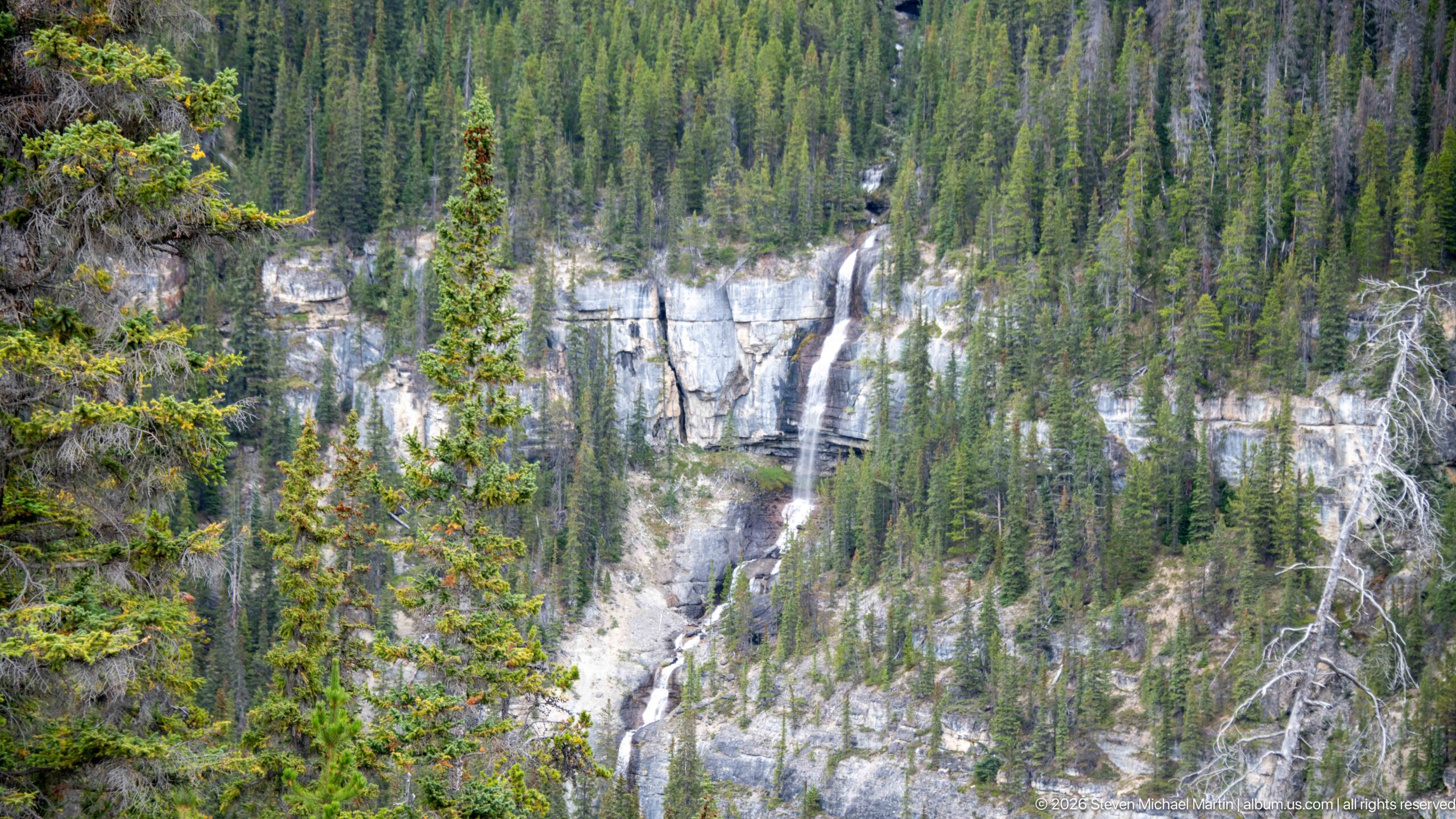
Seen from farther back, the waterfall continues through a long sequence of drops and chutes cut into pale limestone. Dense spruce and fir partially conceal the lower cascade, while the upper fall emerges from the forest above a prominent cliff band. This wider view establishes the full vertical extent of the drainage and its relationship to the surrounding wooded slope.
Caption
Seen from farther back, the waterfall continues through a long sequence of drops and chutes cut into pale limestone. Dense spruce and fir partially conceal the lower cascade, while the upper fall emerges from the forest above a prominent cliff band. This wider view establishes the full vertical extent of the drainage and its relationship to the surrounding wooded slope.
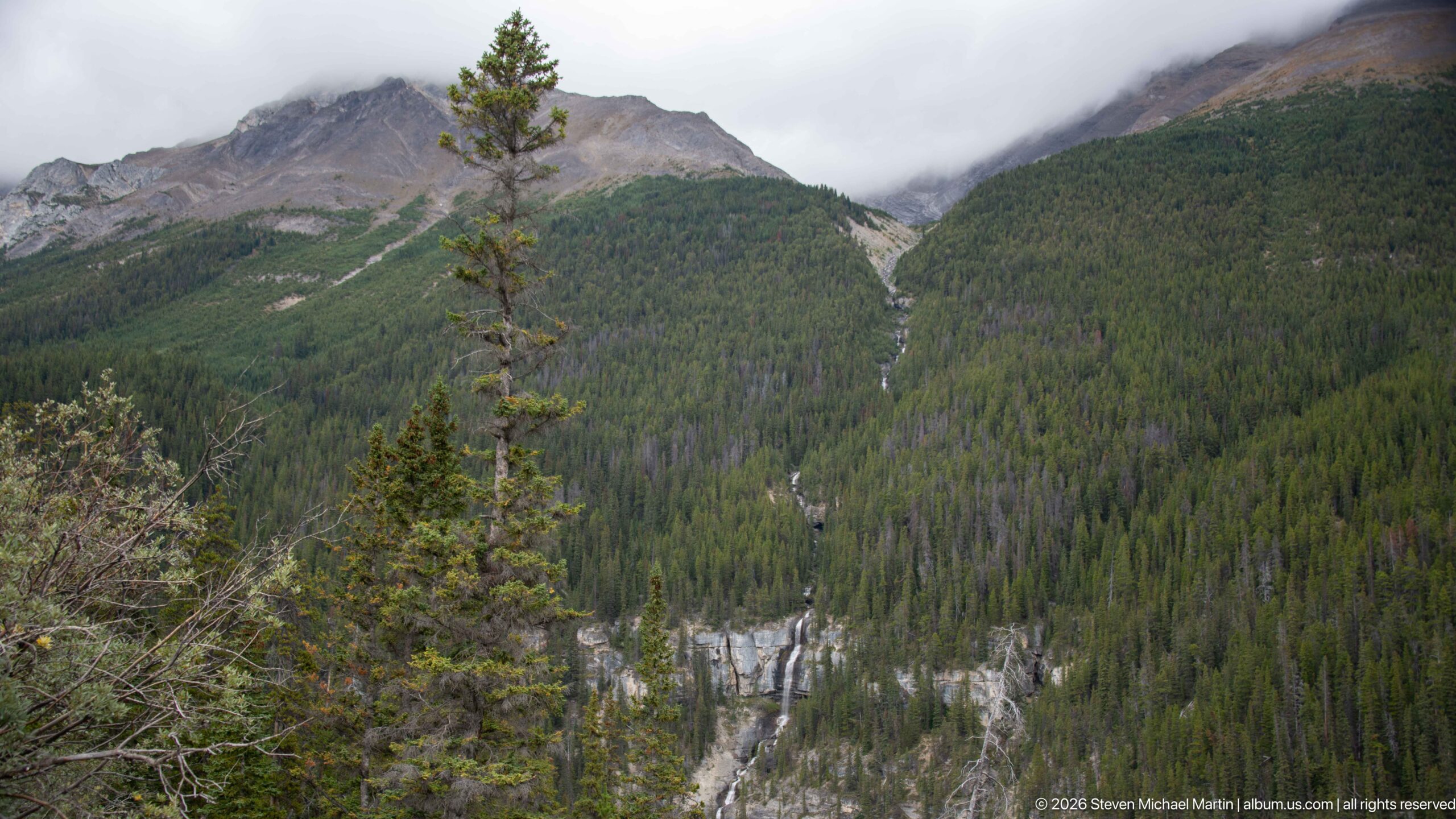
A narrow white cascade threads down the center of a broad conifer-covered mountainside, linking exposed limestone cliffs at the valley bottom with cloud-covered upper slopes. The distant viewpoint shifts attention from the individual falls to the entire drainage system. Forest, rock and running water form a continuous vertical line through the mountain landscape.
Caption
A narrow white cascade threads down the center of a broad conifer-covered mountainside, linking exposed limestone cliffs at the valley bottom with cloud-covered upper slopes. The distant viewpoint shifts attention from the individual falls to the entire drainage system. Forest, rock and running water form a continuous vertical line through the mountain landscape.
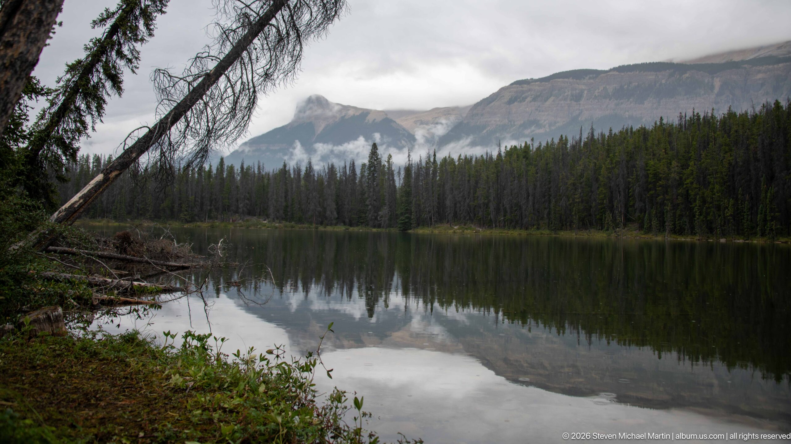
A calm mountain lake mirrors dark conifer forest and pale peaks partly hidden by low cloud. Fallen trunks and shoreline vegetation frame the left foreground, while the glassy water doubles the muted gray-green landscape. The quiet composition contrasts with the nearby highway and river scenes, presenting an enclosed forest lake sheltered beneath the surrounding mountains.
Caption
A calm mountain lake mirrors dark conifer forest and pale peaks partly hidden by low cloud. Fallen trunks and shoreline vegetation frame the left foreground, while the glassy water doubles the muted gray-green landscape. The quiet composition contrasts with the nearby highway and river scenes, presenting an enclosed forest lake sheltered beneath the surrounding mountains.
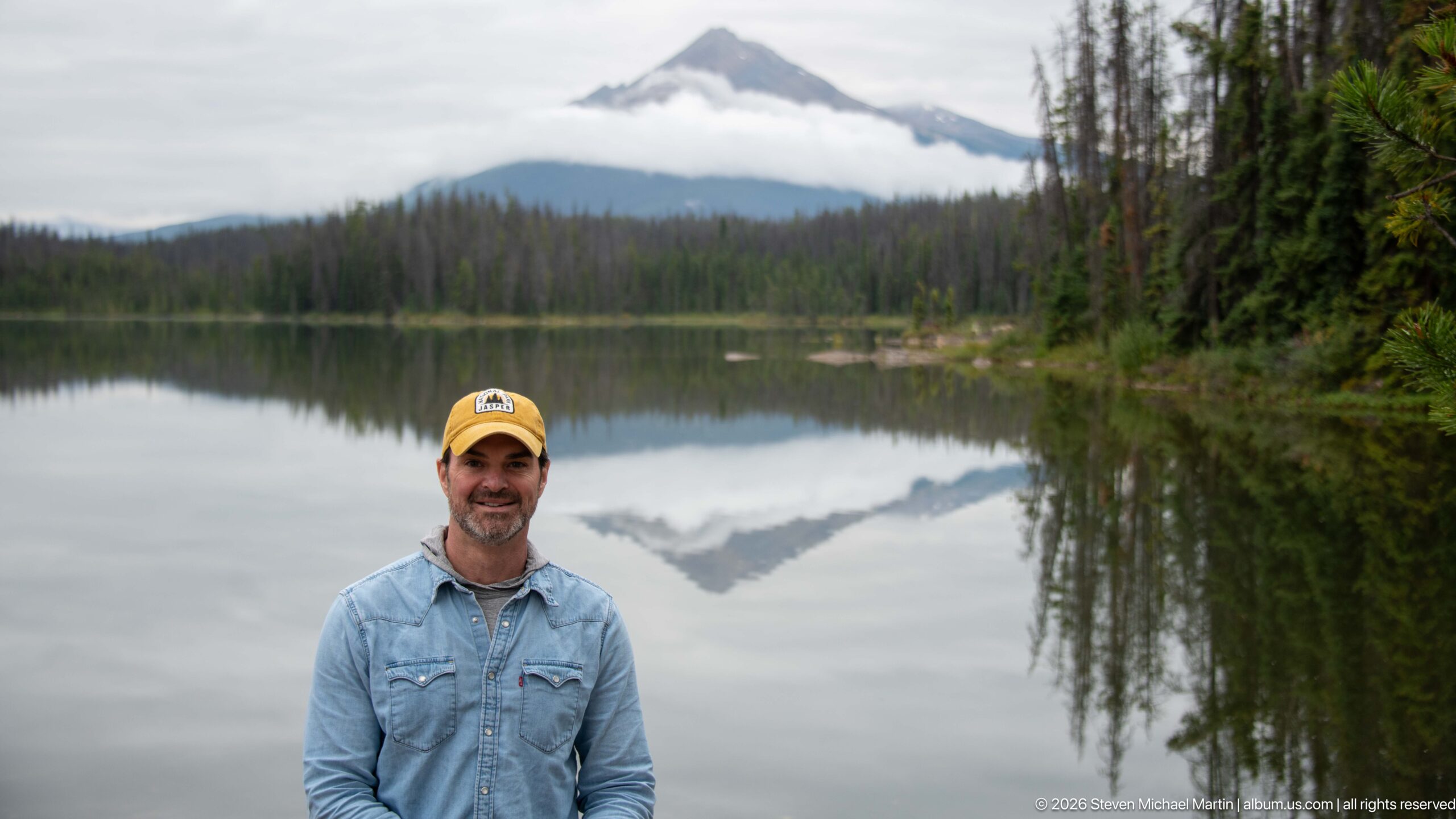
A traveler stands at the edge of a still mountain lake, with a sharply triangular peak and a horizontal band of cloud reflected behind him. The shallow depth of field keeps the portrait prominent while preserving the distinctive symmetry of mountain and reflection. Forested shores enclose the water, giving the scene a quiet roadside-stop character within the Canadian Rockies.
Caption
A traveler stands at the edge of a still mountain lake, with a sharply triangular peak and a horizontal band of cloud reflected behind him. The shallow depth of field keeps the portrait prominent while preserving the distinctive symmetry of mountain and reflection. Forested shores enclose the water, giving the scene a quiet roadside-stop character within the Canadian Rockies.
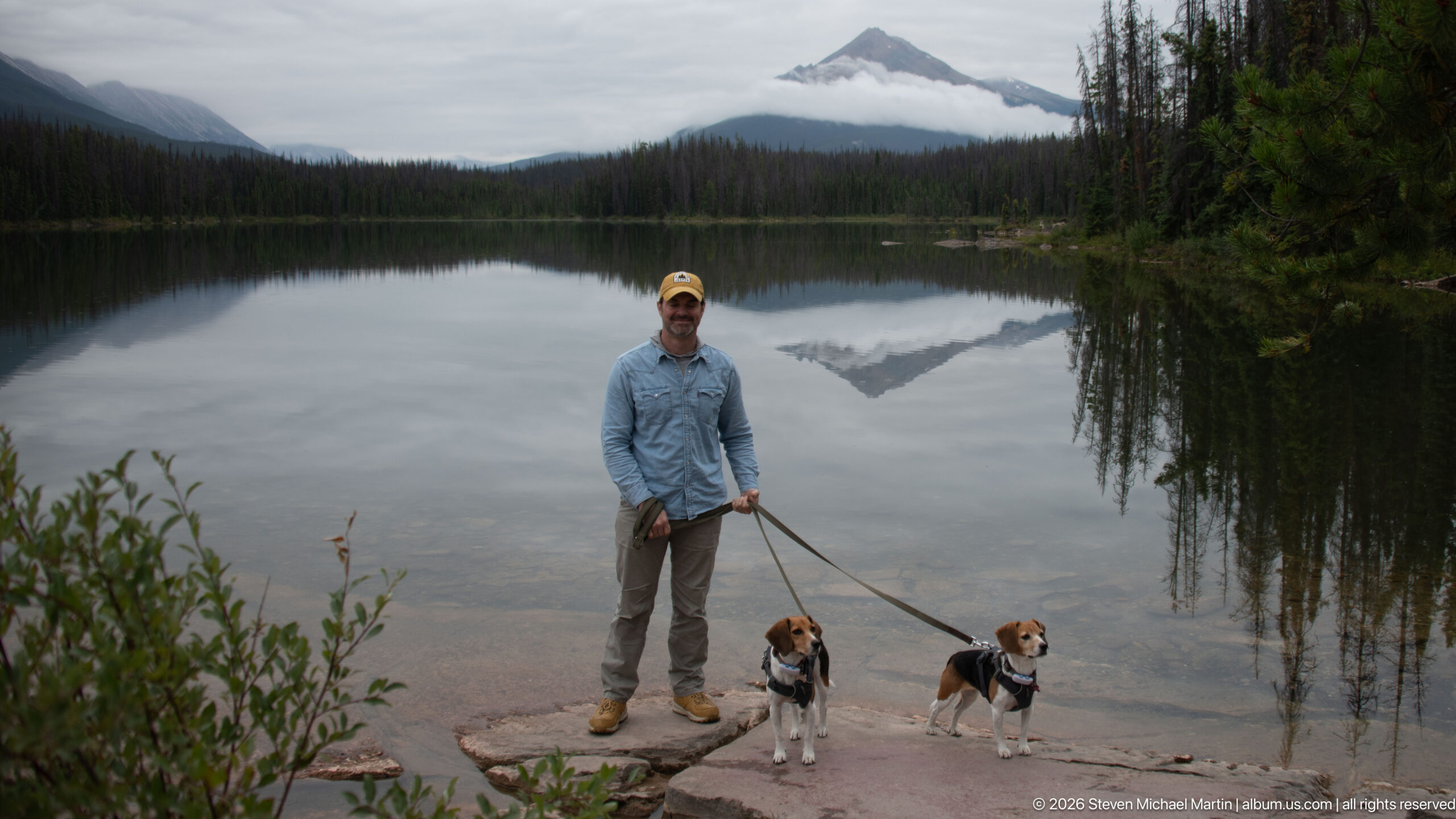
A traveler stands on the rocky lakeshore holding leashes for two beagles while a triangular mountain rises beyond the water. A low horizontal cloud band crosses the peak and is repeated almost perfectly in the lake’s reflection. The people-and-pets view records the roadside journey at human scale while retaining the still lake and mountain as the dominant setting.
Caption
A traveler stands on the rocky lakeshore holding leashes for two beagles while a triangular mountain rises beyond the water. A low horizontal cloud band crosses the peak and is repeated almost perfectly in the lake’s reflection. The people-and-pets view records the roadside journey at human scale while retaining the still lake and mountain as the dominant setting.
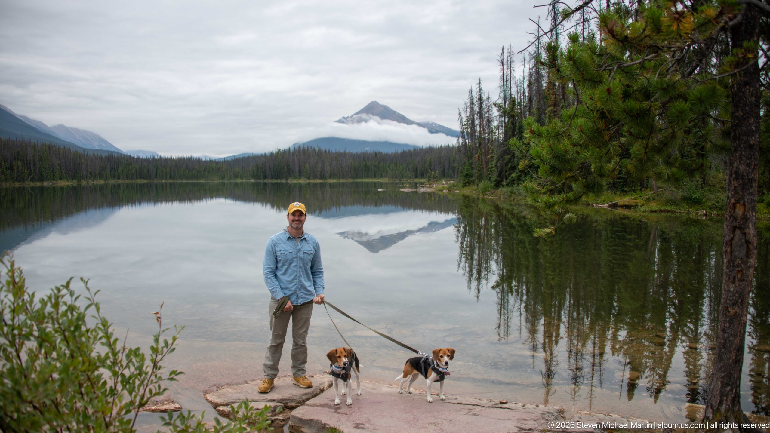
Standing on a flat shoreline rock, a traveler poses with two leashed beagles beside a glassy mountain lake. The wider framing includes dense pines at right and a triangular peak centered across the water, its summit bisected by low cloud and mirrored below. The composition combines a personal road-trip portrait with a clear record of the lake’s forested setting.
Caption
Standing on a flat shoreline rock, a traveler poses with two leashed beagles beside a glassy mountain lake. The wider framing includes dense pines at right and a triangular peak centered across the water, its summit bisected by low cloud and mirrored below. The composition combines a personal road-trip portrait with a clear record of the lake’s forested setting.
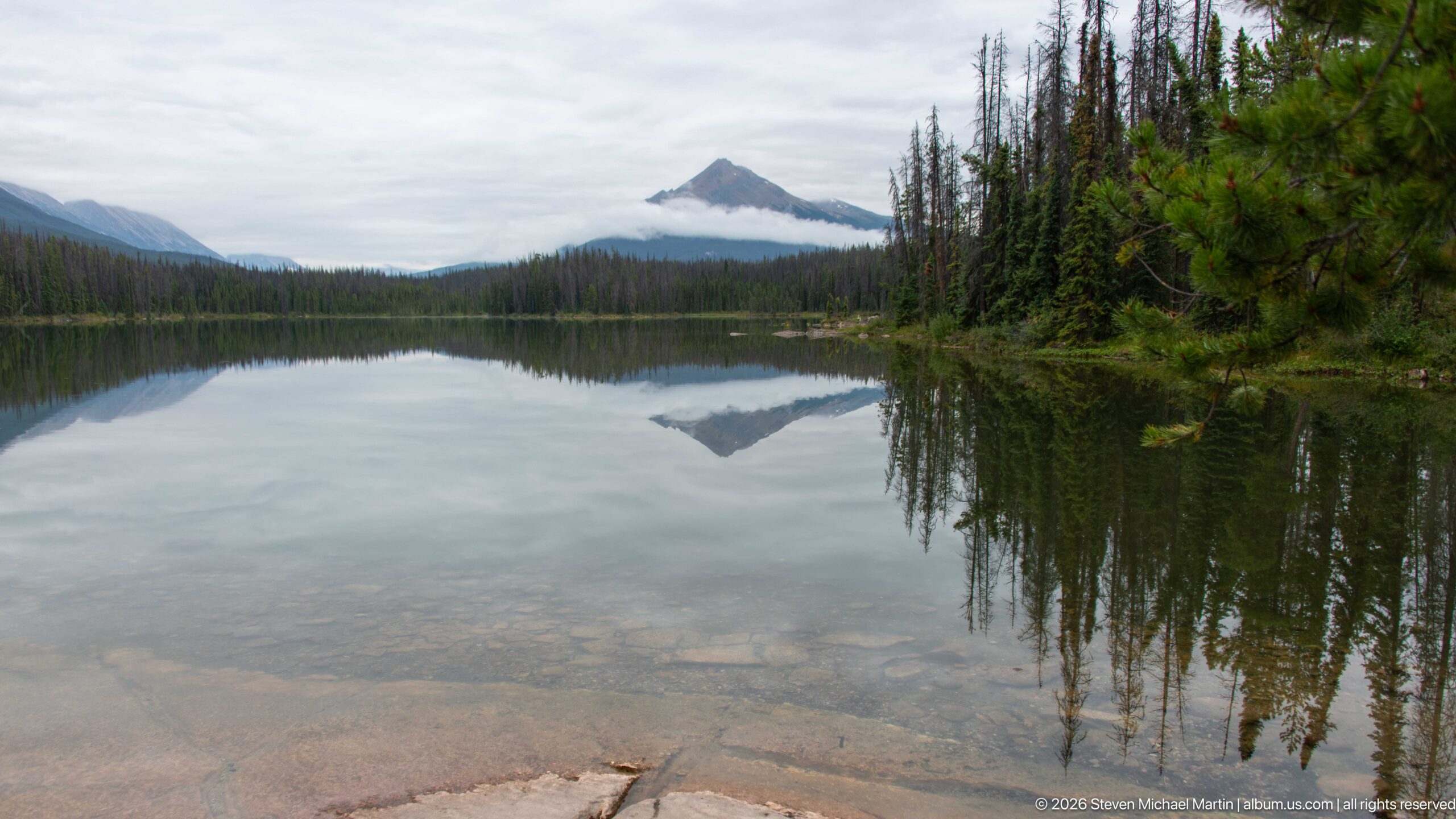
A sharply triangular mountain rises beyond a perfectly calm lake, with a narrow band of low cloud wrapping its lower summit. The mountain, cloud and dark forest are reflected almost symmetrically in the water, while submerged stones remain visible through the clear shallows in the foreground. The centered composition turns the lake surface into a near-continuous extension of the sky and mountain.
Caption
A sharply triangular mountain rises beyond a perfectly calm lake, with a narrow band of low cloud wrapping its lower summit. The mountain, cloud and dark forest are reflected almost symmetrically in the water, while submerged stones remain visible through the clear shallows in the foreground. The centered composition turns the lake surface into a near-continuous extension of the sky and mountain.
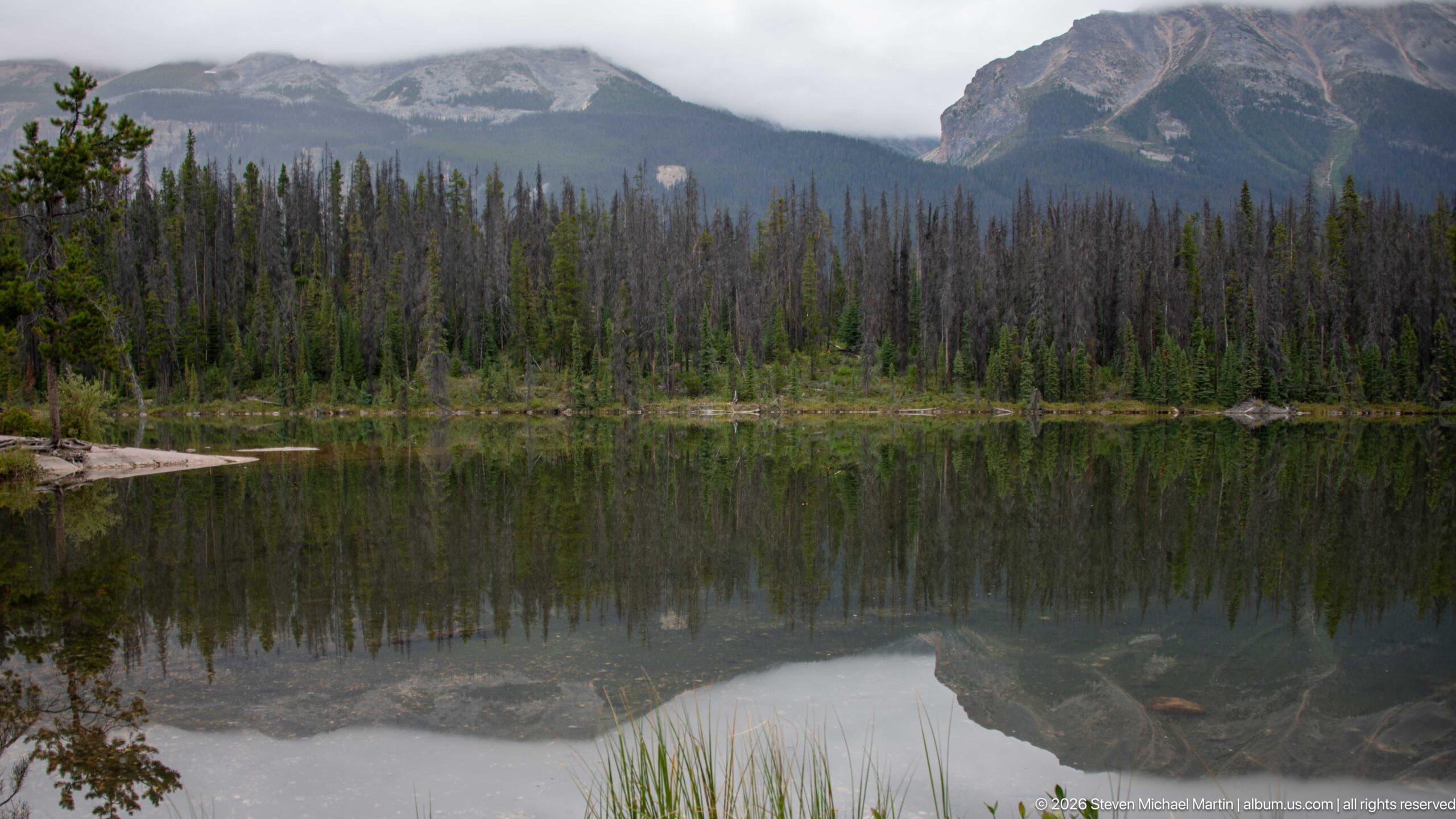
Dark conifer forest lines the far shore of a quiet lake beneath steep gray mountains partly obscured by cloud. The nearly still water reflects the forest and lower rock faces, while reeds and a small branch enter the foreground. This lateral view shifts attention away from the isolated triangular peak toward the enclosed mountain basin surrounding the lake.
Caption
Dark conifer forest lines the far shore of a quiet lake beneath steep gray mountains partly obscured by cloud. The nearly still water reflects the forest and lower rock faces, while reeds and a small branch enter the foreground. This lateral view shifts attention away from the isolated triangular peak toward the enclosed mountain basin surrounding the lake.
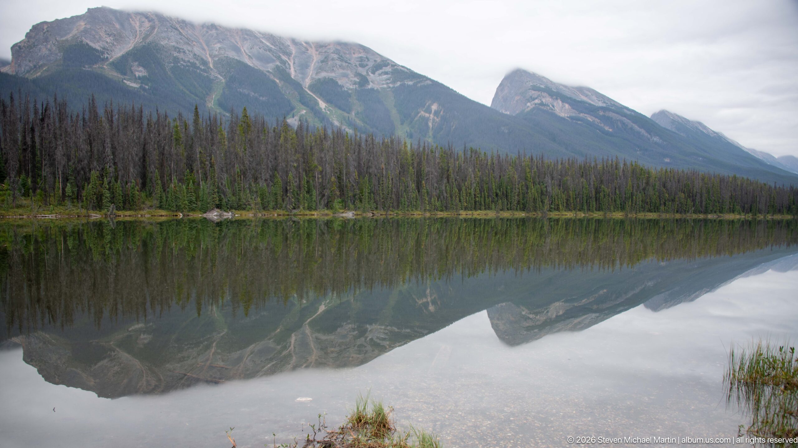
A long, rugged mountain ridge stretches above the far shore and is reproduced almost continuously in the calm lake surface. Pale avalanche chutes and exposed rock cut through the forested lower slopes, creating strong diagonal patterns in both mountain and reflection. The broad horizontal composition emphasizes the lake’s stillness and the scale of the surrounding Rocky Mountain basin.
Caption
A long, rugged mountain ridge stretches above the far shore and is reproduced almost continuously in the calm lake surface. Pale avalanche chutes and exposed rock cut through the forested lower slopes, creating strong diagonal patterns in both mountain and reflection. The broad horizontal composition emphasizes the lake’s stillness and the scale of the surrounding Rocky Mountain basin.
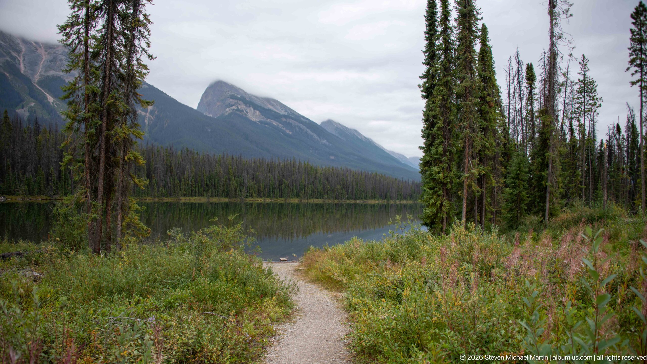
A narrow gravel footpath curves through shrubs and tall conifers along the edge of a mountain lake. Across the water, steep gray peaks rise above continuous forest beneath an overcast sky. The trail provides a more intimate foreground than the preceding open-water views, showing how visitors move through the wooded shoreline landscape.
Caption
A narrow gravel footpath curves through shrubs and tall conifers along the edge of a mountain lake. Across the water, steep gray peaks rise above continuous forest beneath an overcast sky. The trail provides a more intimate foreground than the preceding open-water views, showing how visitors move through the wooded shoreline landscape.
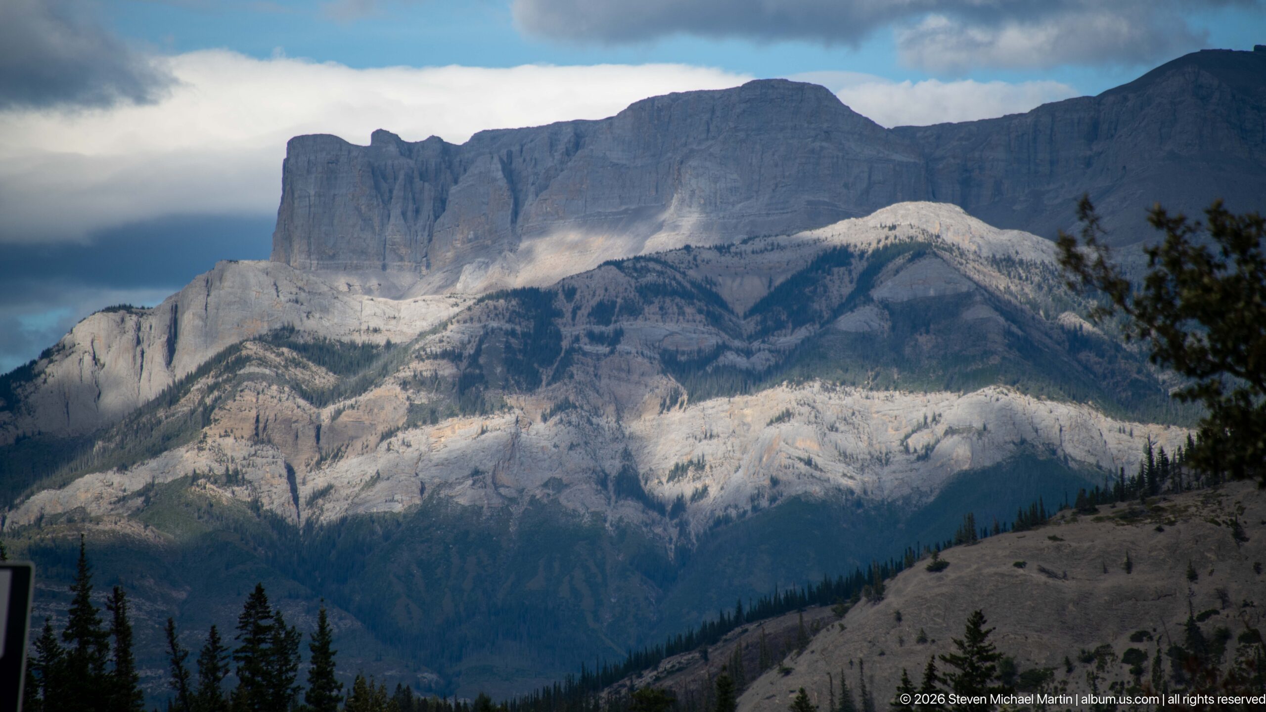
A monumental limestone massif fills the frame, its broad upper wall rising above folded and stepped lower strata. Sunlight breaks through storm clouds to illuminate pale rock bands while dark forest and a sparsely vegetated ridge occupy the foreground. The changing light reveals the mountain’s complex sedimentary structure but the proof sheet alone does not securely establish a proper name.
Caption
A monumental limestone massif fills the frame, its broad upper wall rising above folded and stepped lower strata. Sunlight breaks through storm clouds to illuminate pale rock bands while dark forest and a sparsely vegetated ridge occupy the foreground. The changing light reveals the mountain’s complex sedimentary structure but the proof sheet alone does not securely establish a proper name.
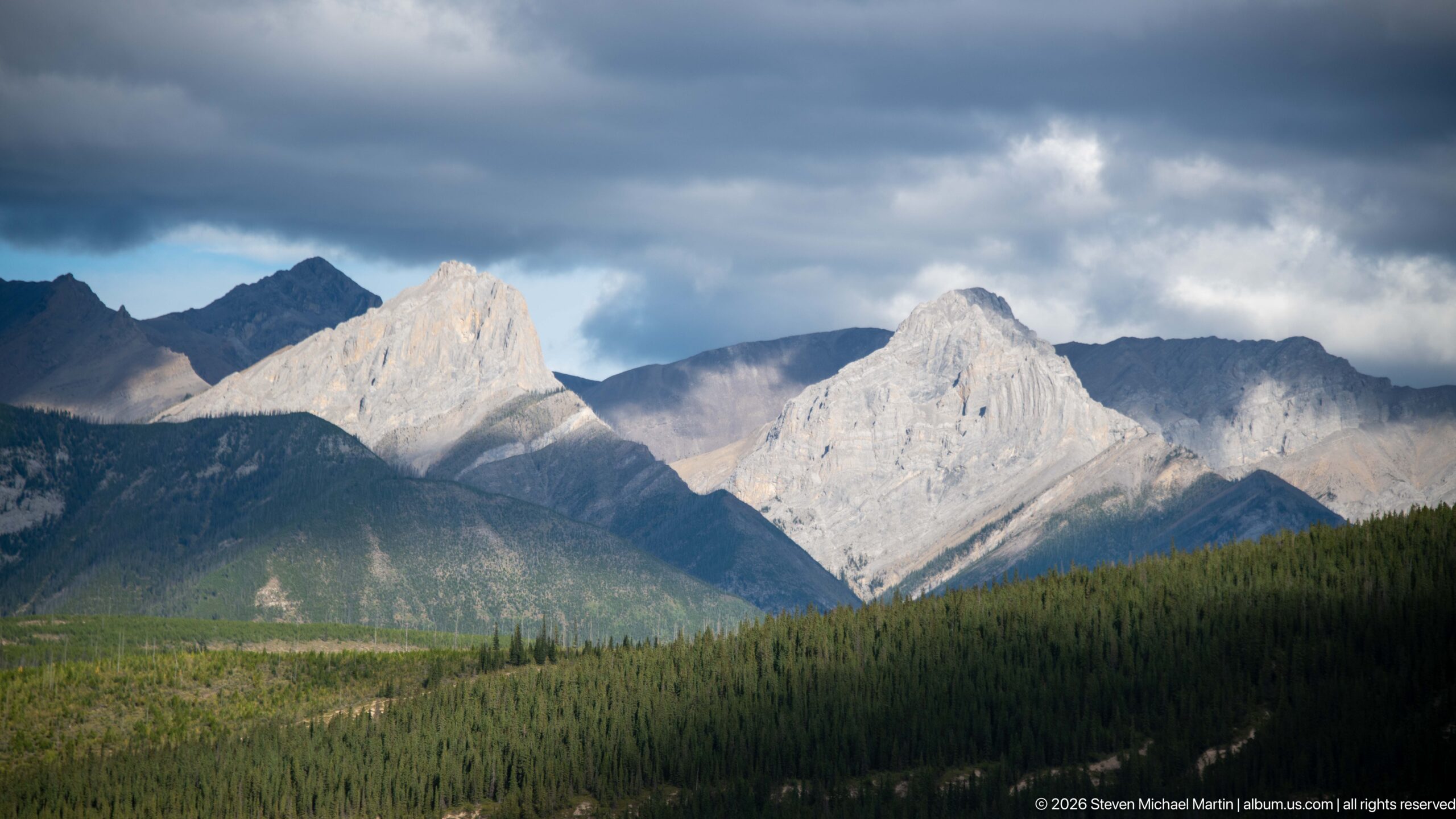
Two pale, sharply sculpted limestone peaks catch direct sunlight while darker ridges and heavy clouds surround them. Dense conifer forest blankets the lower valley, intensifying the contrast between the illuminated rock and shadowed landscape. The telephoto composition isolates the peaks as a study in Rocky Mountain geology and rapidly changing mountain weather.
Caption
Two pale, sharply sculpted limestone peaks catch direct sunlight while darker ridges and heavy clouds surround them. Dense conifer forest blankets the lower valley, intensifying the contrast between the illuminated rock and shadowed landscape. The telephoto composition isolates the peaks as a study in Rocky Mountain geology and rapidly changing mountain weather.
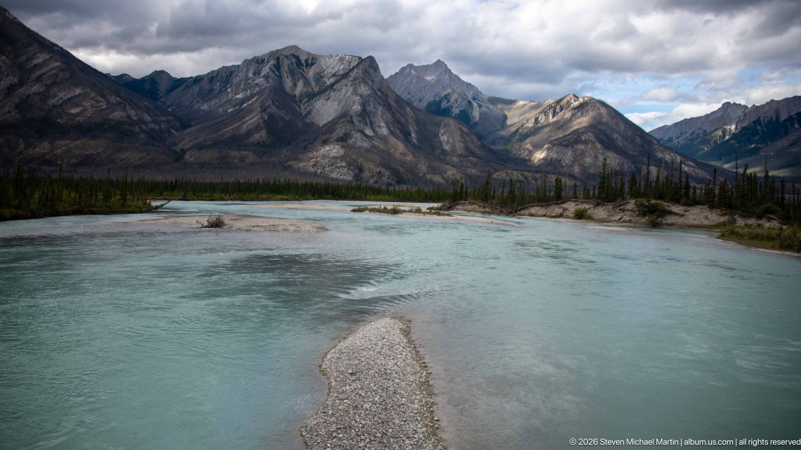
A broad turquoise mountain river sweeps past pale gravel bars beneath a rugged wall of folded and fractured peaks. Sparse conifers occupy islands and banks while cloud shadows move across the mountains. The low riverside viewpoint emphasizes the cold, sediment-rich water and active channel, contrasting the smooth river surface with the sharply eroded terrain beyond.
Caption
A broad turquoise mountain river sweeps past pale gravel bars beneath a rugged wall of folded and fractured peaks. Sparse conifers occupy islands and banks while cloud shadows move across the mountains. The low riverside viewpoint emphasizes the cold, sediment-rich water and active channel, contrasting the smooth river surface with the sharply eroded terrain beyond.
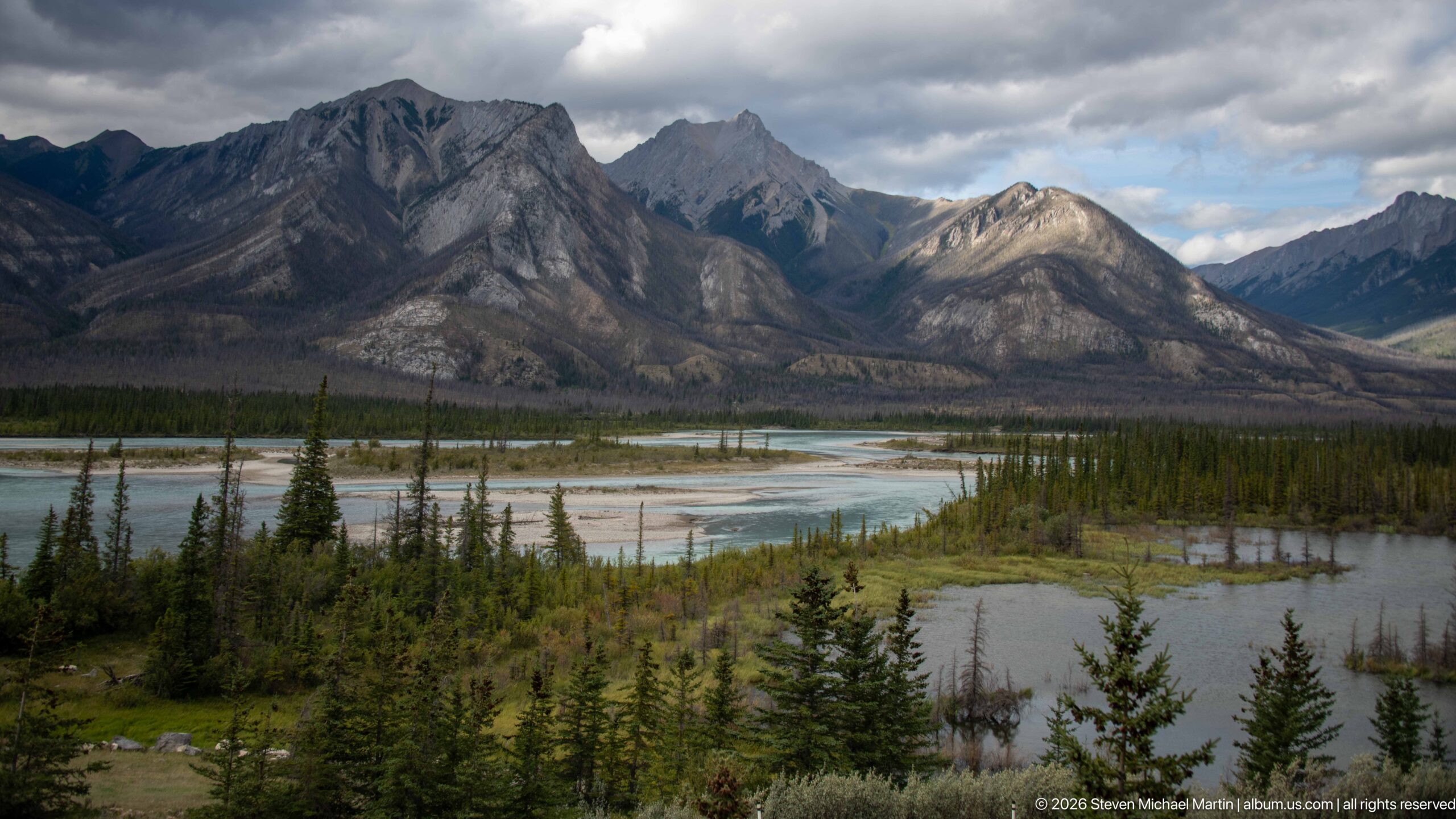
From an elevated viewpoint, several pale-blue river channels spread across a broad gravel floodplain before converging beneath steep Rocky Mountain slopes. Conifer islands divide the water, and the surrounding peaks show pronounced folds, gullies and exposed rock. The wider perspective reveals the river’s braided planform and the scale of the valley floor far more clearly than the adjacent close riverside view.
Caption
From an elevated viewpoint, several pale-blue river channels spread across a broad gravel floodplain before converging beneath steep Rocky Mountain slopes. Conifer islands divide the water, and the surrounding peaks show pronounced folds, gullies and exposed rock. The wider perspective reveals the river’s braided planform and the scale of the valley floor far more clearly than the adjacent close riverside view.
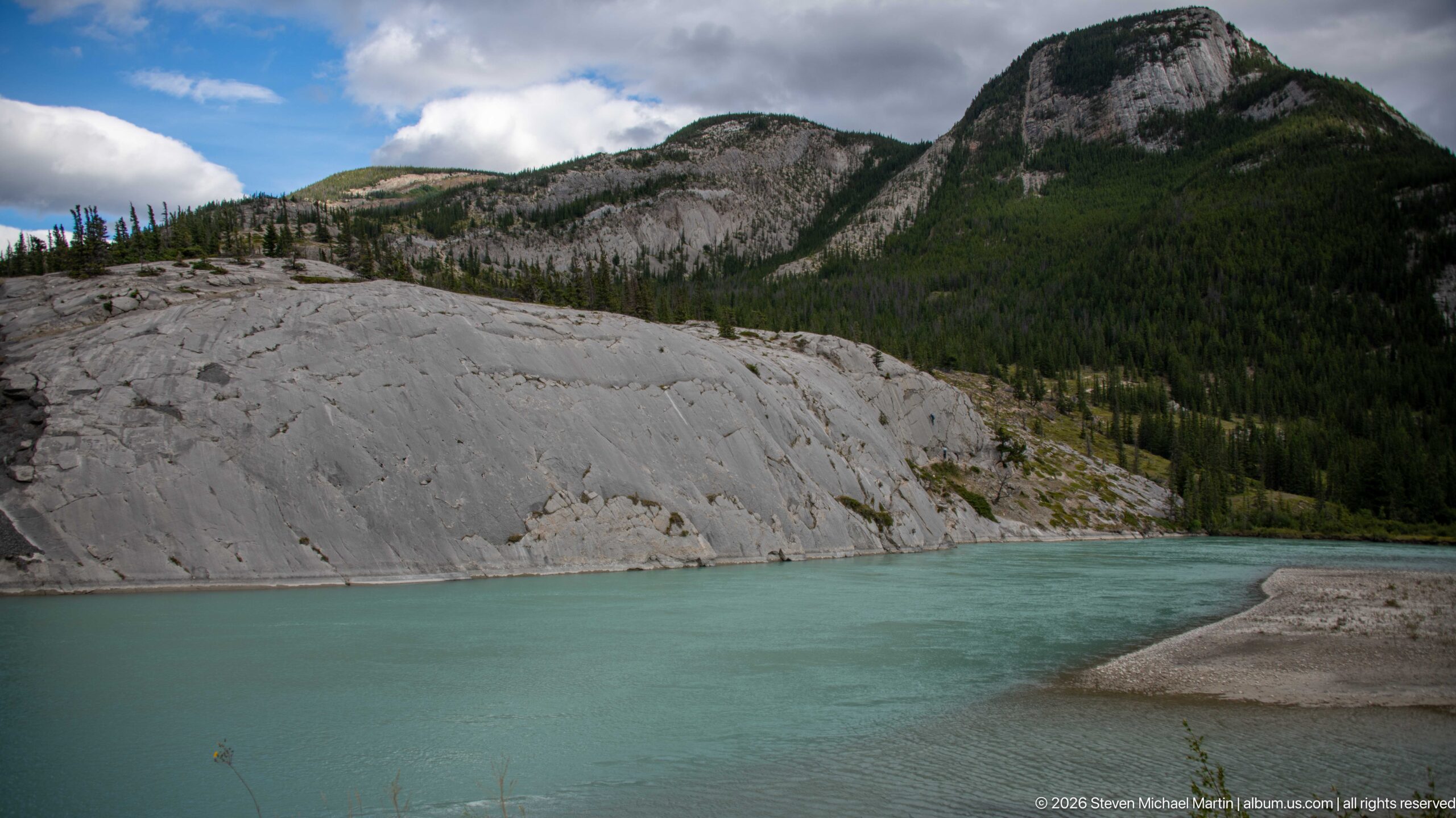
Opaque turquoise water bends around a gravel point below a broad expanse of smooth, pale limestone bedrock. Conifer forest climbs the rounded slopes behind the exposed rock, where glacial or fluvial erosion has left a comparatively clean, gently inclined surface. The close landscape view emphasizes the contrast among blue-green water, bare gray stone and dense forest.
Caption
Opaque turquoise water bends around a gravel point below a broad expanse of smooth, pale limestone bedrock. Conifer forest climbs the rounded slopes behind the exposed rock, where glacial or fluvial erosion has left a comparatively clean, gently inclined surface. The close landscape view emphasizes the contrast among blue-green water, bare gray stone and dense forest.
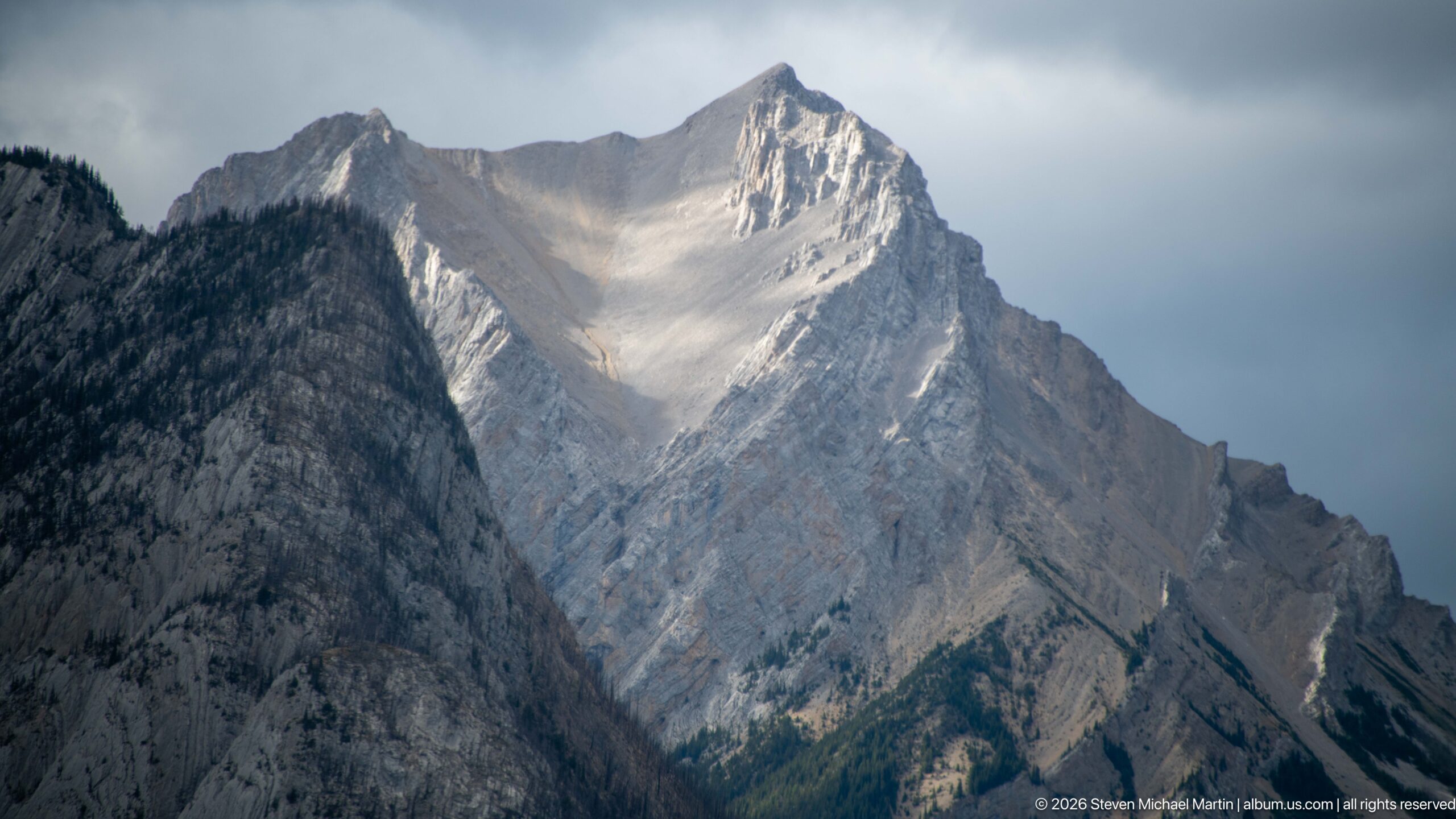
A steep pyramidal peak rises abruptly above darker neighboring ridges, its pale limestone face etched by gullies and diagonal strata. A shaft of filtered light brightens the upper basin beneath a heavy gray sky, revealing the mountain’s angular structure and sharp summit. The tight framing supports a detailed geological description but not a secure proper-name identification.
Caption
A steep pyramidal peak rises abruptly above darker neighboring ridges, its pale limestone face etched by gullies and diagonal strata. A shaft of filtered light brightens the upper basin beneath a heavy gray sky, revealing the mountain’s angular structure and sharp summit. The tight framing supports a detailed geological description but not a secure proper-name identification.
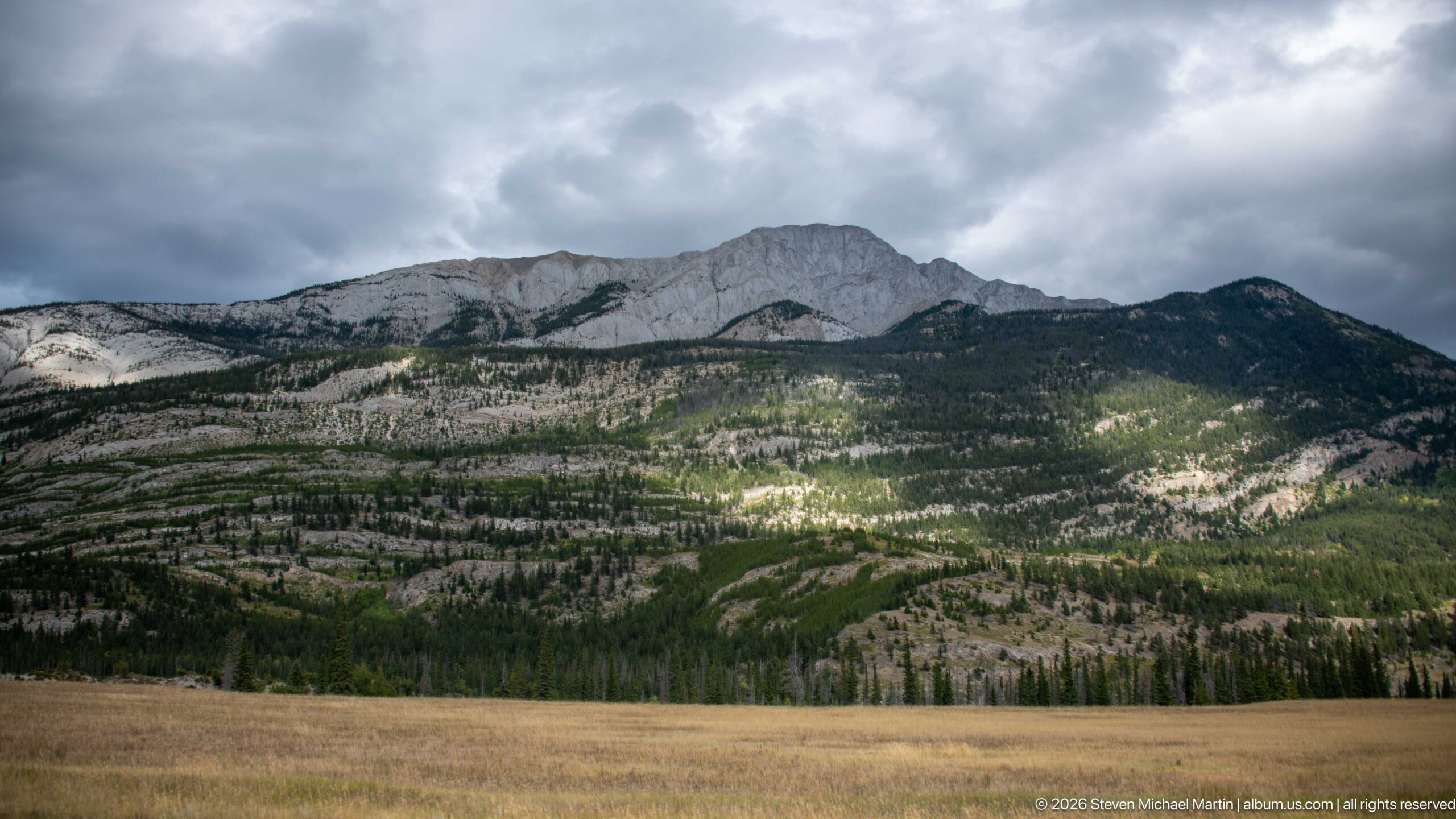
A pale limestone ridge rises above open, sparsely forested slopes beneath a dense ceiling of storm cloud. Long bands of exposed rock and scattered conifers trace the mountain’s structure, while a patch of sunlight brightens the lower slope and reveals subtle benches and drainage lines. The wide view emphasizes the contrast between bare sedimentary rock, recovering forest, and rapidly changing mountain weather.
Caption
A pale limestone ridge rises above open, sparsely forested slopes beneath a dense ceiling of storm cloud. Long bands of exposed rock and scattered conifers trace the mountain’s structure, while a patch of sunlight brightens the lower slope and reveals subtle benches and drainage lines. The wide view emphasizes the contrast between bare sedimentary rock, recovering forest, and rapidly changing mountain weather.
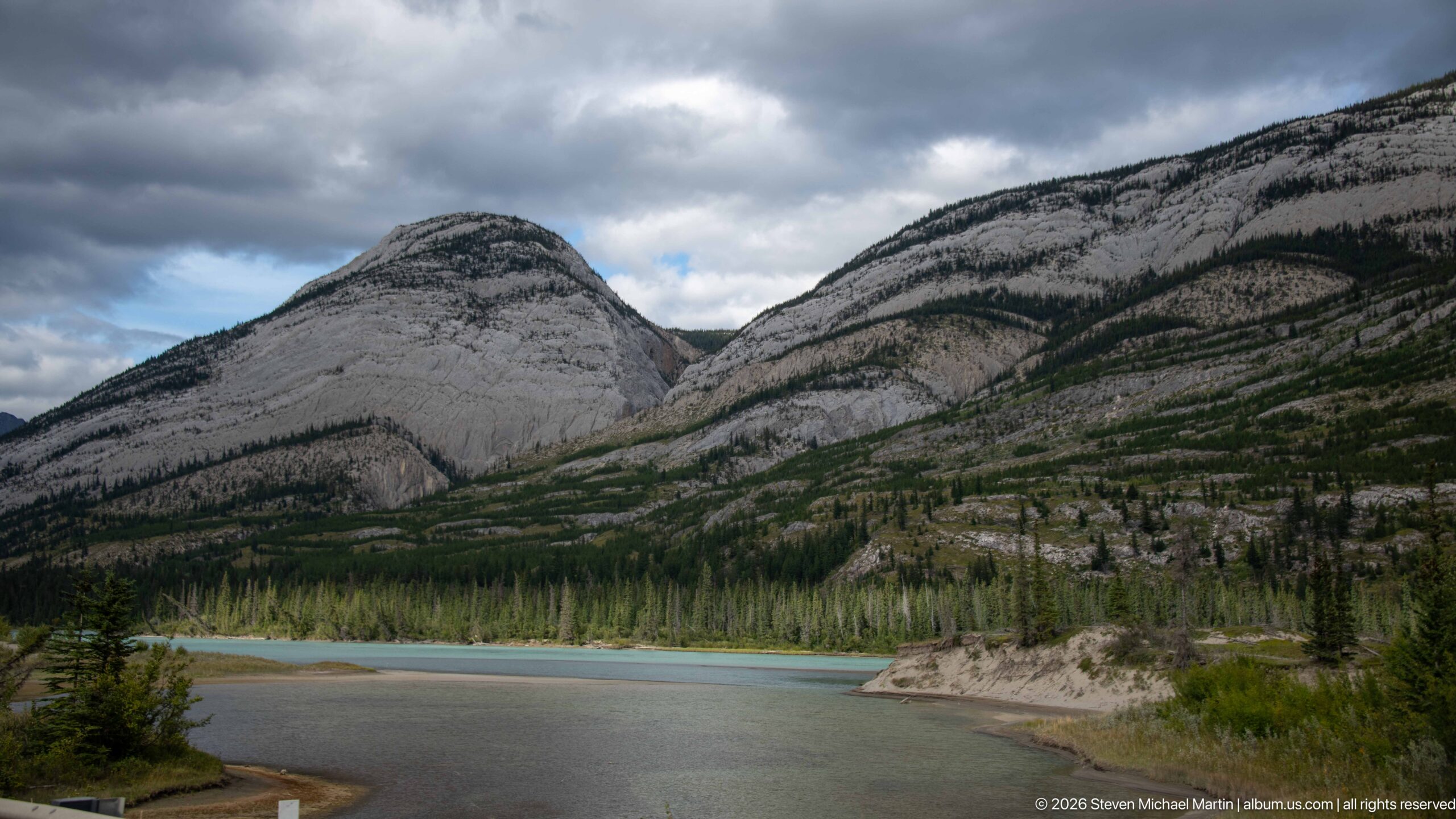
Turquoise water bends around a pale gravel point beneath steep, folded limestone slopes. Dark conifer bands follow benches and gullies across the mountainsides, making the tilted sedimentary structure especially legible. Heavy clouds gather above the valley while a small opening of blue sky brightens the center, giving this riverside view a stronger geological emphasis than the broader braided-river scene nearby.
Caption
Turquoise water bends around a pale gravel point beneath steep, folded limestone slopes. Dark conifer bands follow benches and gullies across the mountainsides, making the tilted sedimentary structure especially legible. Heavy clouds gather above the valley while a small opening of blue sky brightens the center, giving this riverside view a stronger geological emphasis than the broader braided-river scene nearby.
🏞️ National Park Field Guide
📍 Overview
The Trans-Canada Highway and the quieter Bow Valley Parkway reveal Banff National Park as both a protected Rocky Mountain landscape and a corridor of movement. Roads, railway tracks, rivers, forests, visitor facilities, and wildlife crossings occupy the same valleys beneath steep limestone ridges. Across the portfolio, changing cloud and light repeatedly transform those mountains, while roadside viewpoints bring braided rivers, wetlands, waterfalls, and exposed rock into close relationship with the infrastructure used to travel through the park. The result is not simply a record of a drive: it is a study of how geology, water, forest, wildlife conservation, and human travel meet within Banff’s mountain valleys.
🏔️ Landscape
The portfolio moves through broad valley floors and narrow mountain passages where roads and rivers repeatedly converge. In the Bow Valley, dense conifer forest rises from wetlands, river terraces, and floodplains toward pale limestone walls and castellated ridges. Elsewhere, turquoise channels divide around gravel bars and wooded islands, showing the braided form of mountain rivers from elevated roadside viewpoints. Waterfalls descend stepped cliffs, and cloud frequently obscures or reveals the upper mountains. These recurring relationships—river, forest, exposed rock, road, and weather—give the corridor its visual continuity even as individual landforms change from one viewpoint to the next.
🪨 Geology
Exposed sedimentary rock is one of the strongest visual themes along the route. Many photographs show horizontally bedded limestone, steeply tilted strata, folded slopes, stepped escarpments, scree bands, and fortress-like cliffs. Castle Mountain is identifiable by its distinctive castellated profile, while other ridges are best understood through their visible structure rather than assigned uncertain names. Water follows and exposes this geology: narrow cascades descend resistant rock ledges, while broad valleys hold rivers that spread sediment across gravel floodplains. Together, the photographs make the architecture of the Canadian Rockies legible at several scales, from individual bedding planes to entire chains of tilted peaks.
🌿 Ecology
Conifer forest is the ecological matrix of the photographed corridor, extending across valley floors and lower mountain slopes and enclosing many of the roads, rivers, wetlands, and visitor sites. Open floodplains and braided channels interrupt that forest with gravel bars, shallow side channels, and vegetated islands, while wetlands add quieter water and marsh habitat. The highway also makes habitat connectivity a visible conservation issue. Vegetated wildlife overpasses carry grasses and young trees above traffic, reconnecting habitat across the divided roadway and demonstrating how road design can respond to ecological fragmentation within a protected landscape.
🦌 Wildlife
Wildlife is present in this portfolio chiefly through Banff’s conservation and interpretation infrastructure rather than through photographed encounters with wild animals. Vegetated overpasses show how the park maintains movement routes across the Trans-Canada Highway, while Bow Valley Parkway signs and bilingual bear-safety displays make wildlife awareness part of the roadside experience. Bear imagery, paw-print diagrams, and interpretive material connect visitors with the realities of traveling through wildlife habitat. A beagle photographed beside the vehicle navigation display belongs to the road-trip story as a companion animal, not as evidence of Banff wildlife.
🧭 Human History
Modern highways occupy valleys that served as travel corridors long before engineered roads. Roadside interpretive panels place the landscape within that longer history, describing Indigenous use of mountain passes and ancient travel routes as well as the difficult journeys of traders and explorers during the fur-trade era. Interpretation of the North Saskatchewan River also connects its mountain headwaters with Indigenous history, trade, recreation, and the larger river system. Later transportation layers remain visible in railway tracks, road bridges, signs, gateways, and the Trans-Canada Highway itself. Seen together, these elements present movement through the Rockies as a continuing human story rather than a phenomenon that began with automobile tourism.
🥾 Visitor Experience
Travel through this landscape alternates between movement and close observation. The divided Trans-Canada Highway provides long views through the mountain corridor and passes directly beneath wildlife crossings, while the Bow Valley Parkway is represented as a quieter two-lane route enclosed by forest and marked by timber gateways and bilingual signs. Roadside stops introduce river overlooks and interpretive panels, and wet pavement, low cloud, breaks of sunlight, and evening color continually alter what can be seen. Photographs of a traveler standing on the roadway with a camera reinforce the importance of stopping, looking, and using the road itself as a vantage point from which to read the surrounding landscape.
📷 Photography Notes
The strongest photographs use the corridor’s linear features to organize the immense scale of the Rockies. Centered highways create powerful vanishing lines toward distant peaks, while elevated viewpoints clarify the parallel courses of roads and rivers through constrained valleys. Telephoto views isolate waterfalls, bedding planes, and cloud-wrapped summits; wider frames reveal braided floodplains, forest patterns, and successive mountain ridges. Weather is an active compositional element throughout the portfolio: low cloud hides summits, openings in the sky spotlight rock faces, wet pavement reflects light, and dusk separates the valley into layers of vegetation, mountain, and sky. Signs, interpretive panels, bridges, cabins, and wildlife crossings provide useful detail views that keep the photographic story grounded in the lived and managed landscape.