Jasper Town and Visitor Center Introduction
Jasper is the principal townsite of Jasper National Park, set in the broad Athabasca River valley and surrounded by the peaks of the Canadian Rockies. The community developed as an important railway and administrative center in the early twentieth century, providing a gateway into what became one of Canada’s most celebrated national parks. Despite its role as the park’s commercial and transportation hub, Jasper retains a compact scale, with its historic railway station, hotels, shops, civic buildings, and mountain views concentrated along and around Connaught Drive.
At the heart of the town is the Jasper Park Information Centre, one of Jasper’s most important historic buildings. Designed by Edmonton architect A.M. Calderon and constructed in 1913–1914, the building originally combined park administrative offices with living quarters for the park superintendent; its upper floor also contained a library, museum, and drafting room, while the basement once housed a fish hatchery. Built of local fieldstone, logs, and wood, its irregular gables, porches, steep roof, and rustic detailing helped establish an architectural vocabulary that influenced later development in Jasper and elsewhere in Canada’s national parks. The building was designated a National Historic Site of Canada in 1992.
The Information Centre stands within Athabasca Park, directly across Connaught Drive from Jasper’s historic railway station, creating a civic landscape closely tied to the town’s origins as a railway gateway. Several other heritage buildings nearby—including the former Bank of Commerce, Jasper Fire Hall, Post Office, and Athabasca Hotel—illustrate the town’s development during the first decades of the twentieth century. Together with Jasper’s walkable streets and dramatic mountain setting, these buildings reveal another side of the national park: not only the wilderness beyond town, but also the architecture and community created to welcome generations of travelers into the Canadian Rockies.
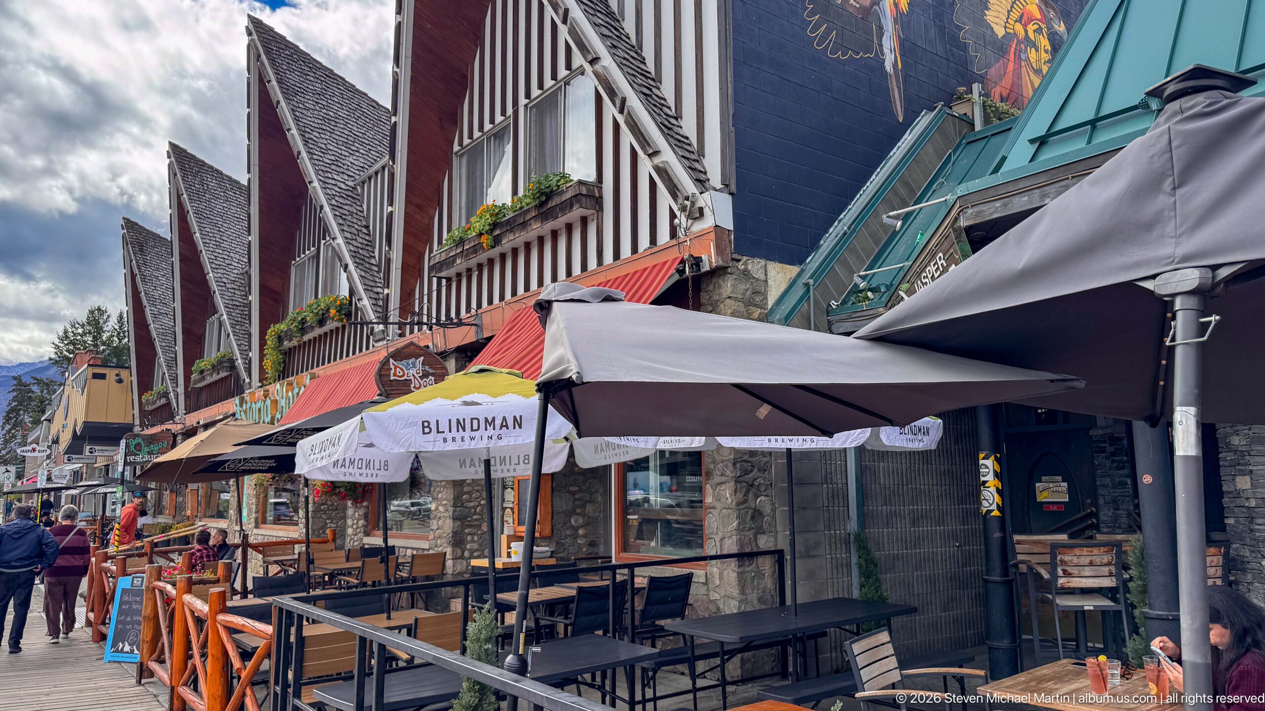
Outdoor dining terraces line a downtown Jasper block beneath umbrellas, awnings, steep gables, and a green metal roof. Stone storefront bases and timber details reinforce the mountain-town character, while pedestrians and closely spaced restaurant seating show the active commercial use of the streetscape.
Caption
Outdoor dining terraces line a downtown Jasper block beneath umbrellas, awnings, steep gables, and a green metal roof. Stone storefront bases and timber details reinforce the mountain-town character, while pedestrians and closely spaced restaurant seating show the active commercial use of the streetscape.
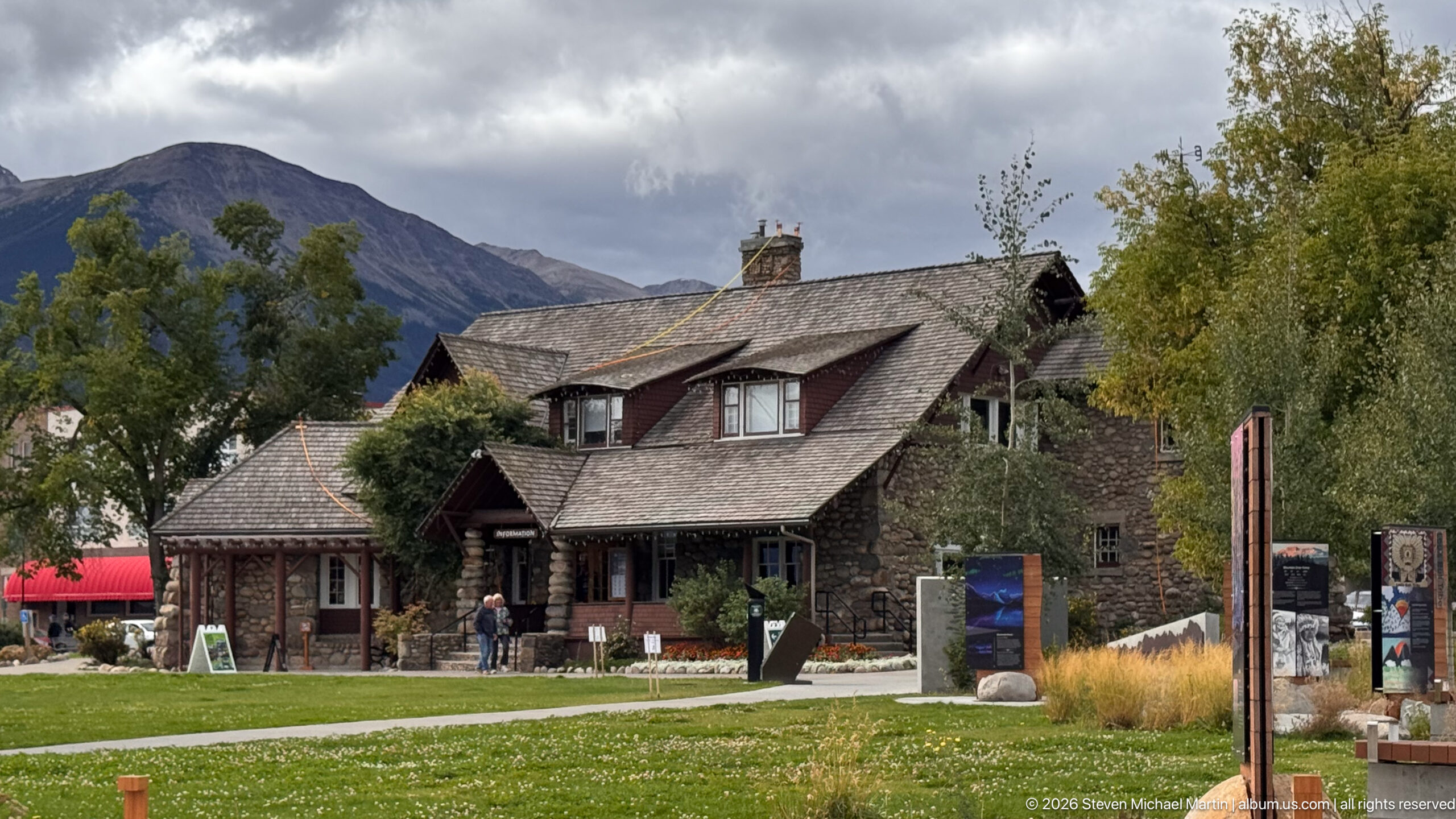
The Jasper Information Centre fills the middle ground with rough stone walls, shingled roofs, dormers, and timbered entrances, while a mountain slope and heavy clouds rise behind it. Seen across the lawn and visitor paths, the composition provides a strong three-quarter architectural view of the National Historic Site in its townsite setting.
Caption
The Jasper Information Centre fills the middle ground with rough stone walls, shingled roofs, dormers, and timbered entrances, while a mountain slope and heavy clouds rise behind it. Seen across the lawn and visitor paths, the composition provides a strong three-quarter architectural view of the National Historic Site in its townsite setting.
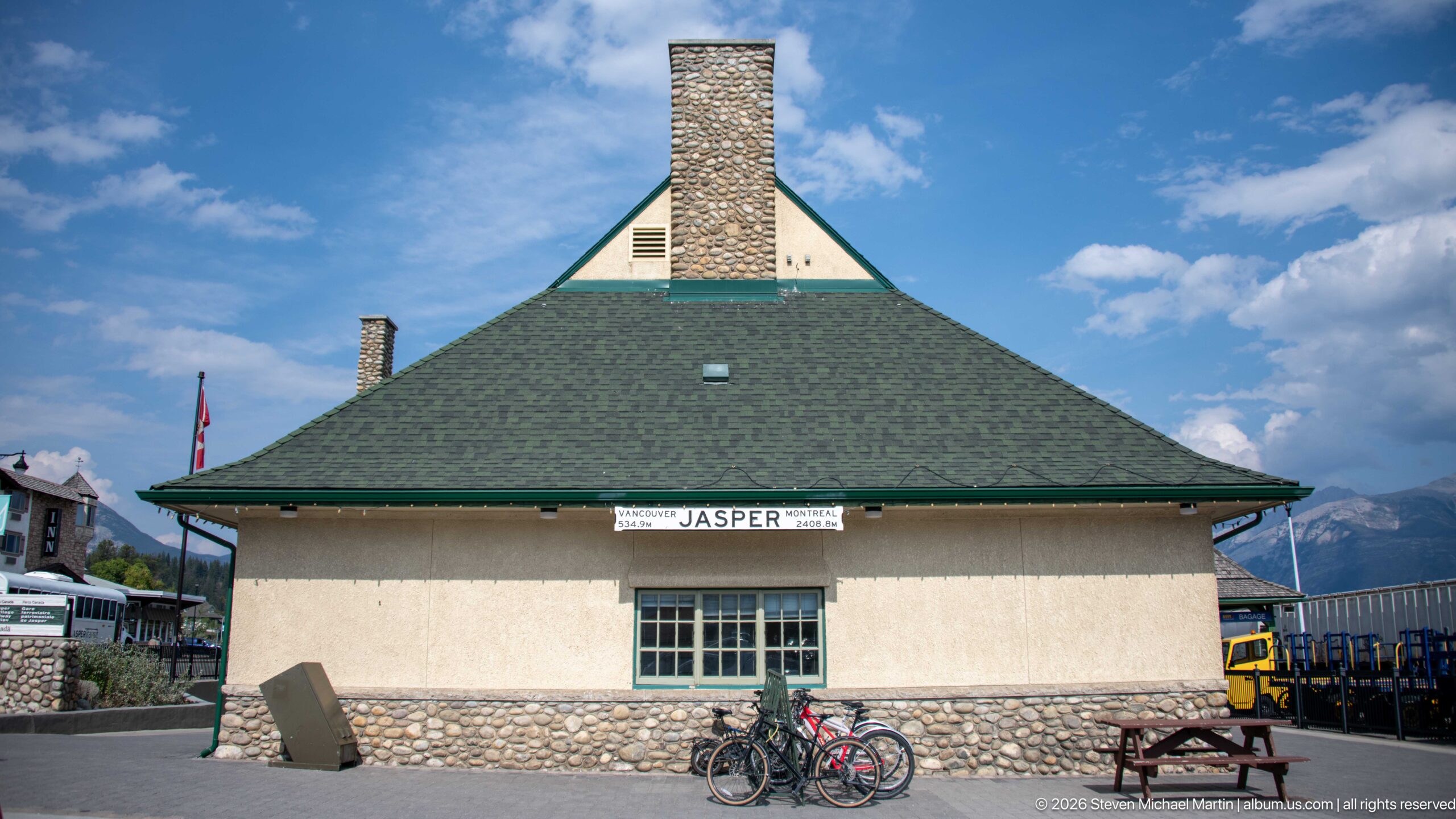
The end elevation of Jasper railway station is defined by a broad green hipped roof, central stone chimney, pale stucco wall, and rounded fieldstone base. Bicycles and a picnic table at ground level add everyday scale, while distant mountains and blue sky place the heritage station firmly within Jasper's Canadian Rockies setting.
Caption
The end elevation of Jasper railway station is defined by a broad green hipped roof, central stone chimney, pale stucco wall, and rounded fieldstone base. Bicycles and a picnic table at ground level add everyday scale, while distant mountains and blue sky place the heritage station firmly within Jasper's Canadian Rockies setting.
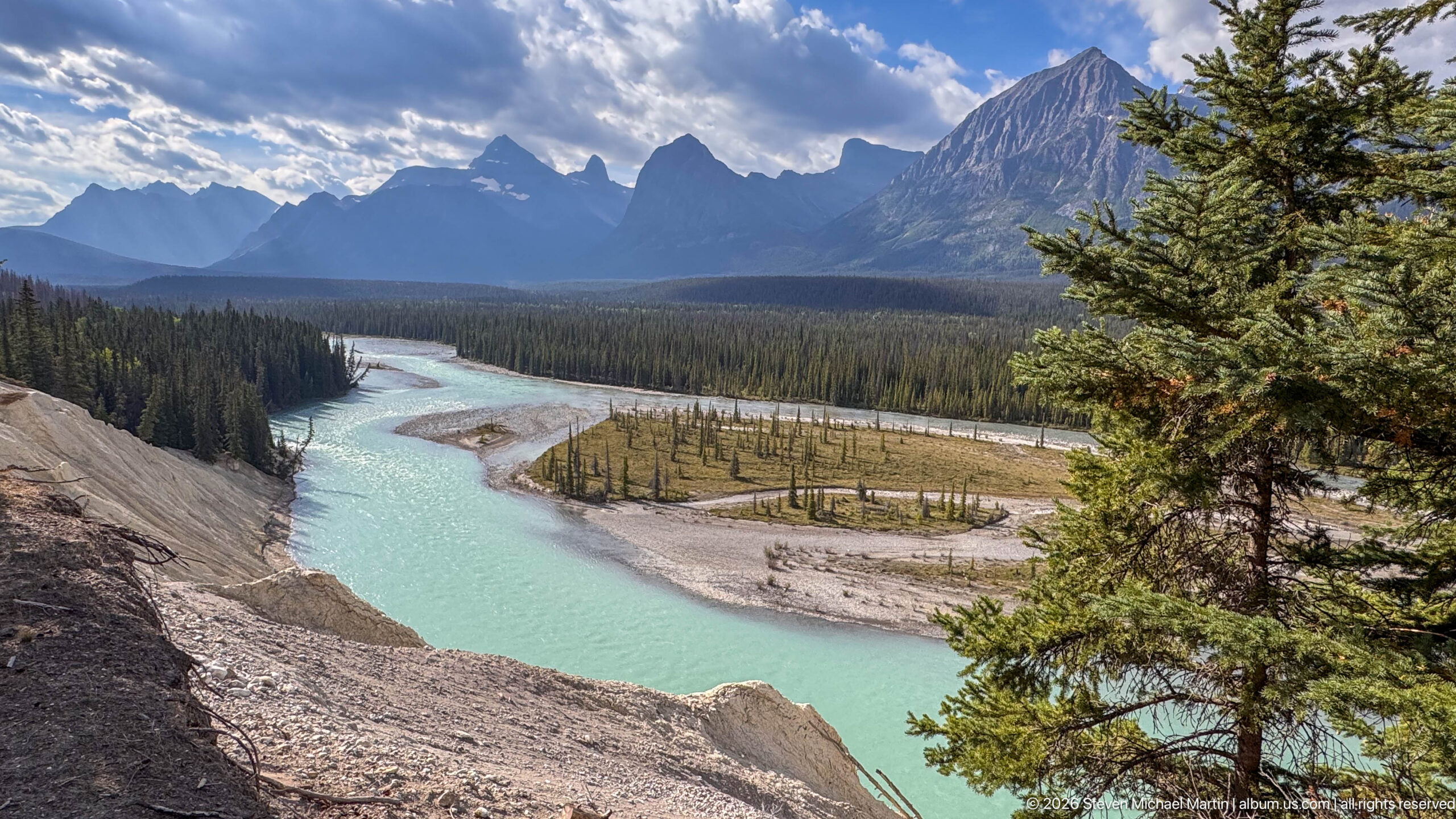
A pale turquoise river bends around gravel bars and forested islands beneath a dramatic wall of Canadian Rockies peaks. The elevated viewpoint reveals the broad valley floor and braided channel pattern, while a foreground conifer frames the scene and adds depth to the expansive mountain landscape.
Caption
A pale turquoise river bends around gravel bars and forested islands beneath a dramatic wall of Canadian Rockies peaks. The elevated viewpoint reveals the broad valley floor and braided channel pattern, while a foreground conifer frames the scene and adds depth to the expansive mountain landscape.
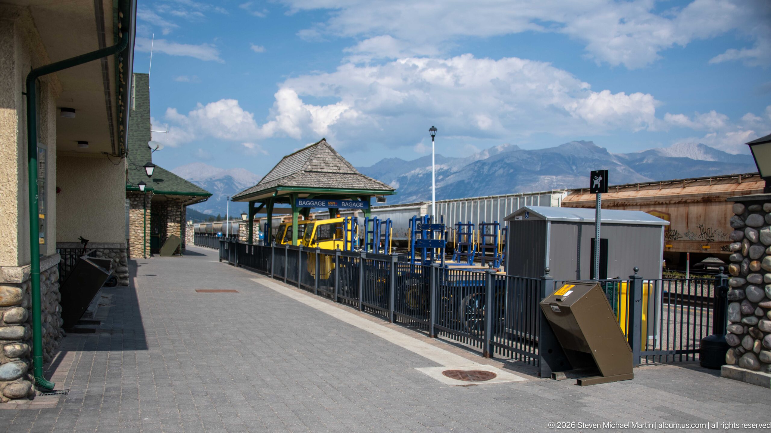
Looking along the Jasper station platform, a covered pavilion, railings, service equipment, and trackside infrastructure frame a broad view toward the Canadian Rockies. The composition places the historic station at left and the working railway environment at right, emphasizing the continuing relationship between Jasper's passenger facilities and the mountain corridor.
Caption
Looking along the Jasper station platform, a covered pavilion, railings, service equipment, and trackside infrastructure frame a broad view toward the Canadian Rockies. The composition places the historic station at left and the working railway environment at right, emphasizing the continuing relationship between Jasper's passenger facilities and the mountain corridor.
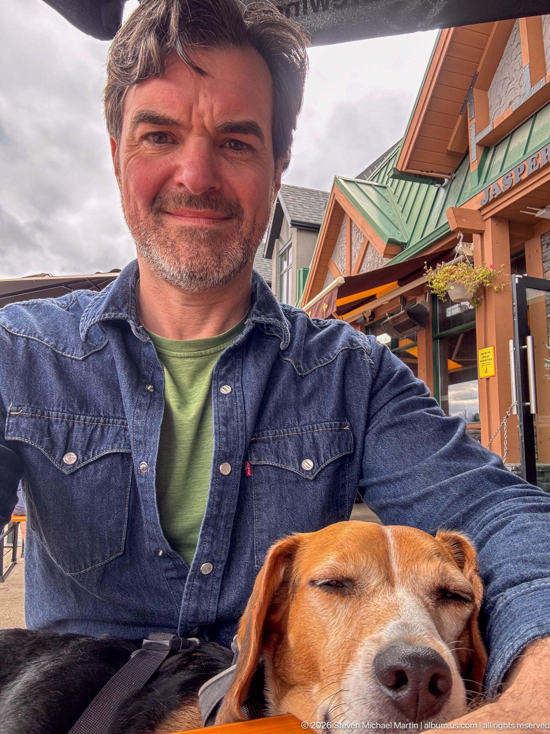
A seated traveler poses at an outdoor table while a tricolor beagle rests against him with eyes closed. Colorful storefront architecture and patio furnishings fill the background, creating an intimate pause within the Jasper townsite rather than a formal view of its landmarks.
Caption
A seated traveler poses at an outdoor table while a tricolor beagle rests against him with eyes closed. Colorful storefront architecture and patio furnishings fill the background, creating an intimate pause within the Jasper townsite rather than a formal view of its landmarks.
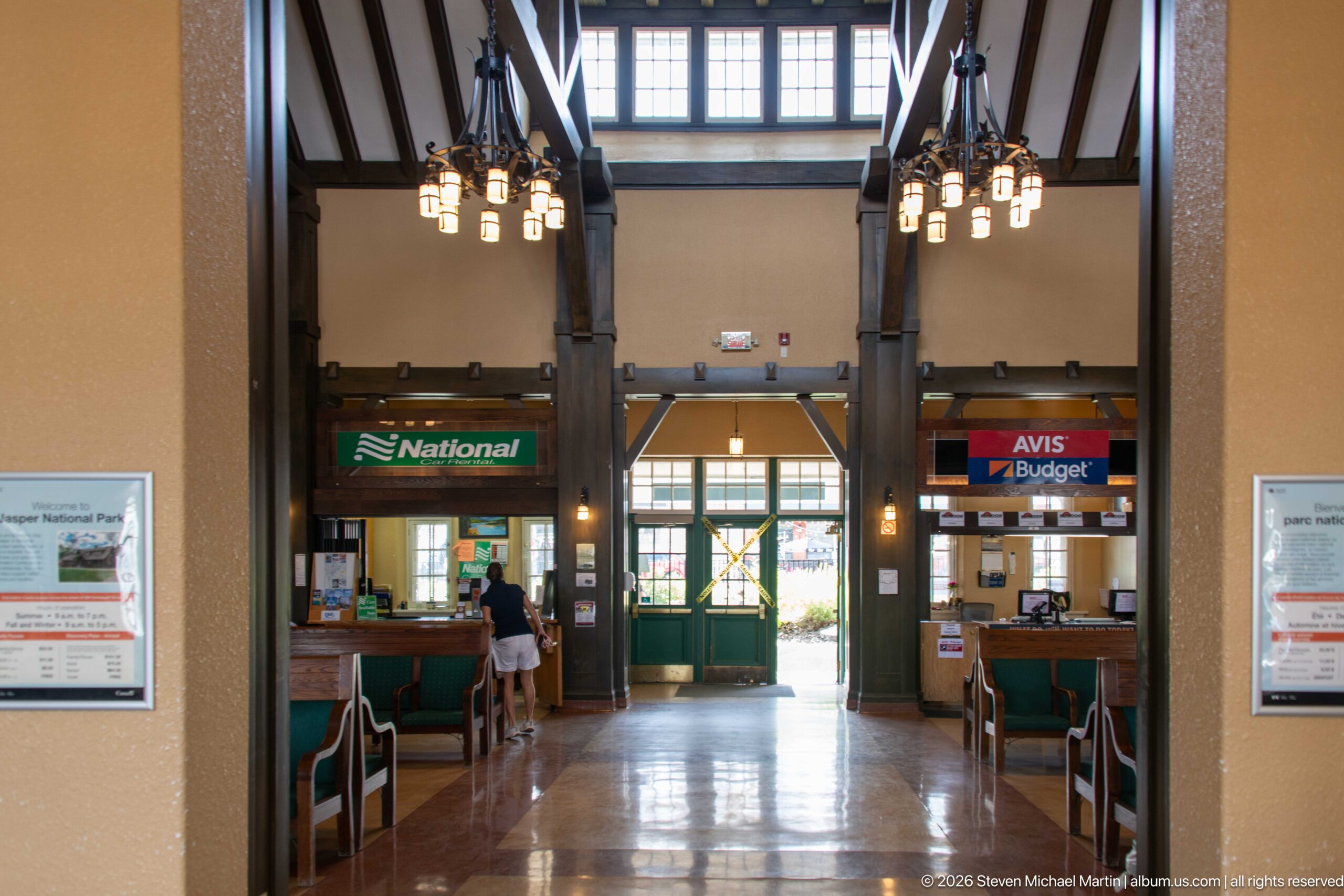
A centered view down Jasper railway station's waiting room emphasizes its tall timber frame and axial arrangement. Passenger benches line the hall beneath hanging lights, rental counters flank the far end, and glazed green doors open toward daylight, revealing the symmetry and generous scale of the interior circulation space.
Caption
A centered view down Jasper railway station's waiting room emphasizes its tall timber frame and axial arrangement. Passenger benches line the hall beneath hanging lights, rental counters flank the far end, and glazed green doors open toward daylight, revealing the symmetry and generous scale of the interior circulation space.
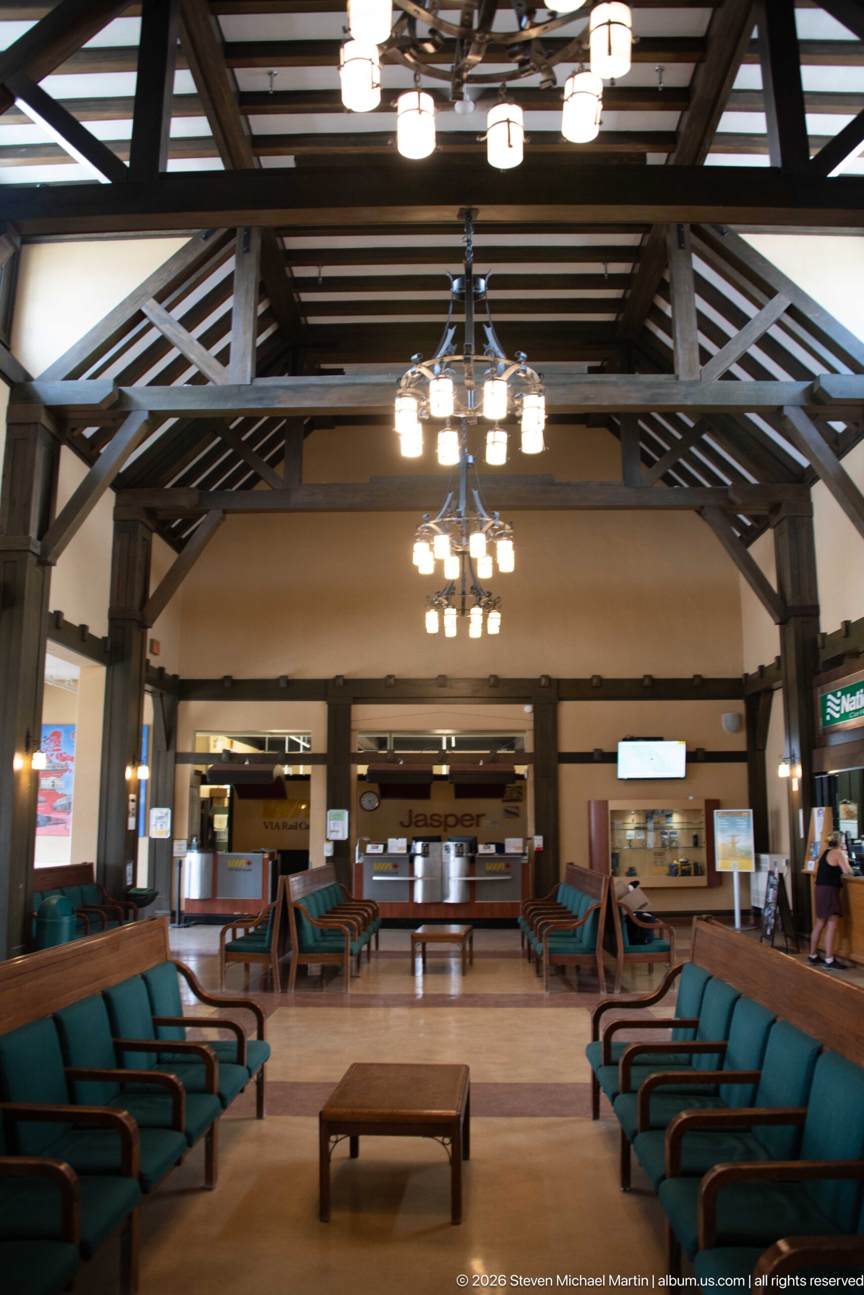
Long rows of green-upholstered wooden benches create a strong central aisle through Jasper railway station's waiting room. Overhead, exposed timber trusses and repeated hanging fixtures lead toward the VIA Rail counters, giving this broad view a clear sense of the hall's symmetry, scale, and continuing passenger function.
Caption
Long rows of green-upholstered wooden benches create a strong central aisle through Jasper railway station's waiting room. Overhead, exposed timber trusses and repeated hanging fixtures lead toward the VIA Rail counters, giving this broad view a clear sense of the hall's symmetry, scale, and continuing passenger function.
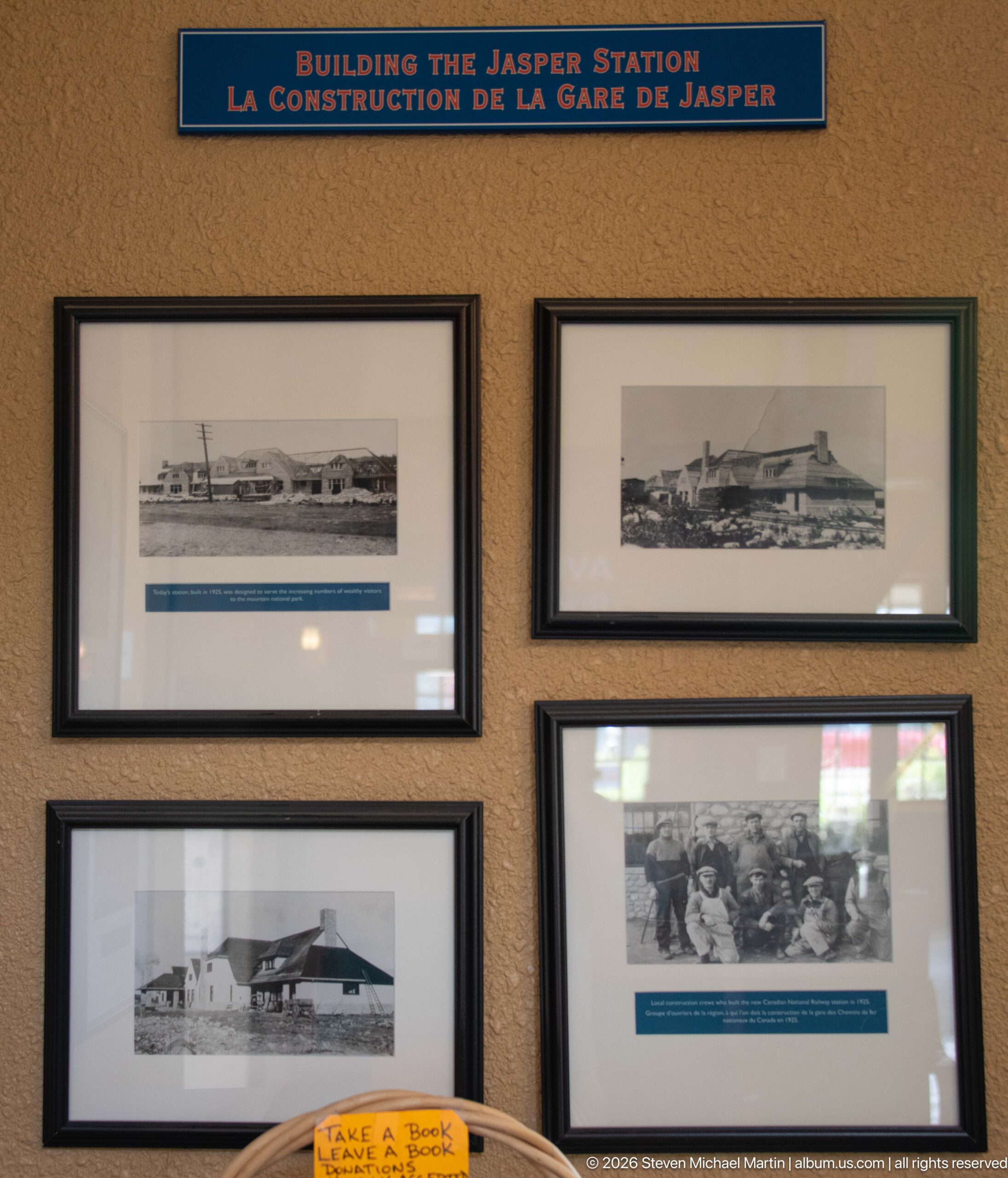
The bilingual exhibit “Building the Jasper Station” combines early photographs of the station complex with a larger group image, focusing specifically on the creation of Jasper's railway facilities. Architectural views in the upper frames show low, elongated station forms, while the lower photograph preserves a human record of the construction era.
Caption
The bilingual exhibit “Building the Jasper Station” combines early photographs of the station complex with a larger group image, focusing specifically on the creation of Jasper's railway facilities. Architectural views in the upper frames show low, elongated station forms, while the lower photograph preserves a human record of the construction era.
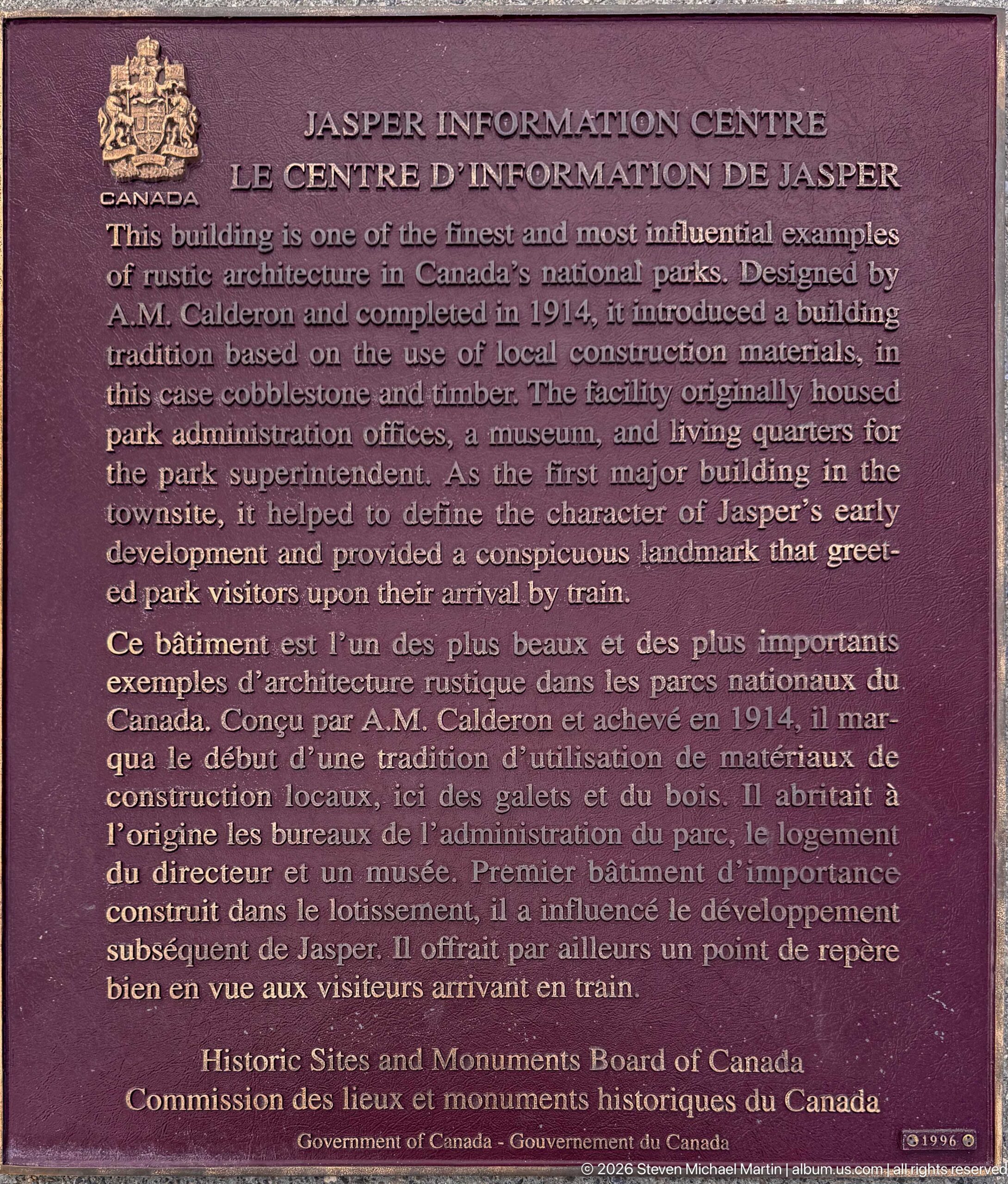
A bronze bilingual plaque identifies the Jasper Information Centre and summarizes its architectural and administrative history. The text notes its 1913–1914 construction and describes the building as an influential example of rustic architecture, while the Historic Sites and Monuments Board of Canada attribution formalizes its national commemoration.
Caption
A bronze bilingual plaque identifies the Jasper Information Centre and summarizes its architectural and administrative history. The text notes its 1913–1914 construction and describes the building as an influential example of rustic architecture, while the Historic Sites and Monuments Board of Canada attribution formalizes its national commemoration.
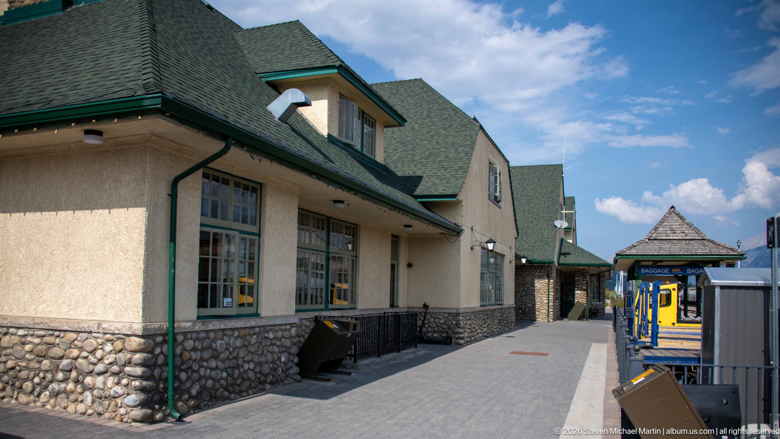
The platform side of Jasper railway station combines rough fieldstone at the base with light stucco walls, green trim, and steeply pitched roofs. The close architectural view follows the sheltered pedestrian edge toward a small platform pavilion, showing how rustic masonry and restrained detailing shape the station's railway-facing elevation against the mountain setting.
Caption
The platform side of Jasper railway station combines rough fieldstone at the base with light stucco walls, green trim, and steeply pitched roofs. The close architectural view follows the sheltered pedestrian edge toward a small platform pavilion, showing how rustic masonry and restrained detailing shape the station's railway-facing elevation against the mountain setting.
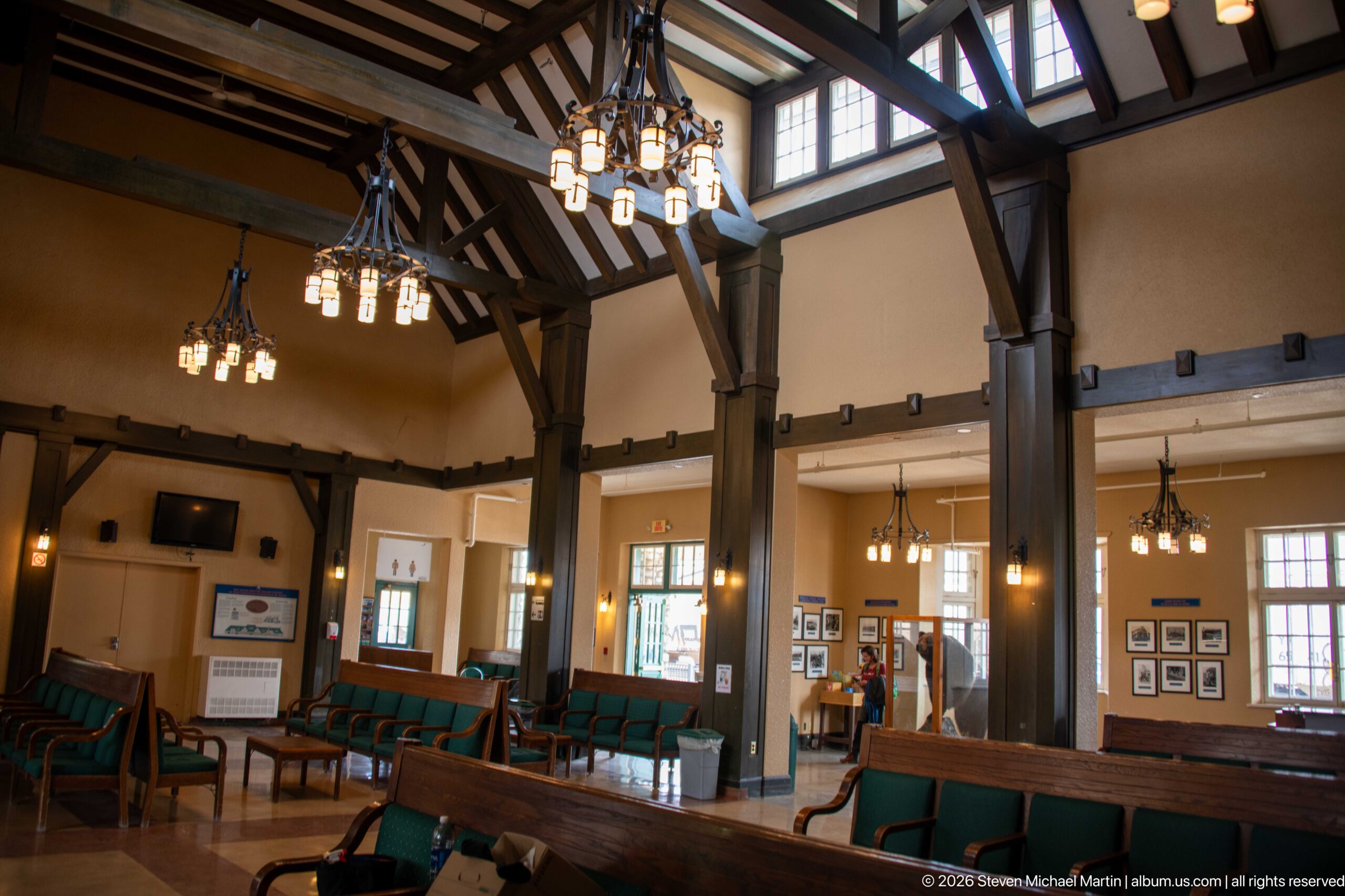
Heavy timber posts and braces organize the high-ceilinged waiting room inside Jasper railway station. Rows of green-upholstered wooden benches sit beneath clustered pendant lights, while clerestory windows bring daylight into the tall central space. The exposed structural frame gives the passenger hall a distinctly rustic character suited to its Canadian Rockies setting.
Caption
Heavy timber posts and braces organize the high-ceilinged waiting room inside Jasper railway station. Rows of green-upholstered wooden benches sit beneath clustered pendant lights, while clerestory windows bring daylight into the tall central space. The exposed structural frame gives the passenger hall a distinctly rustic character suited to its Canadian Rockies setting.
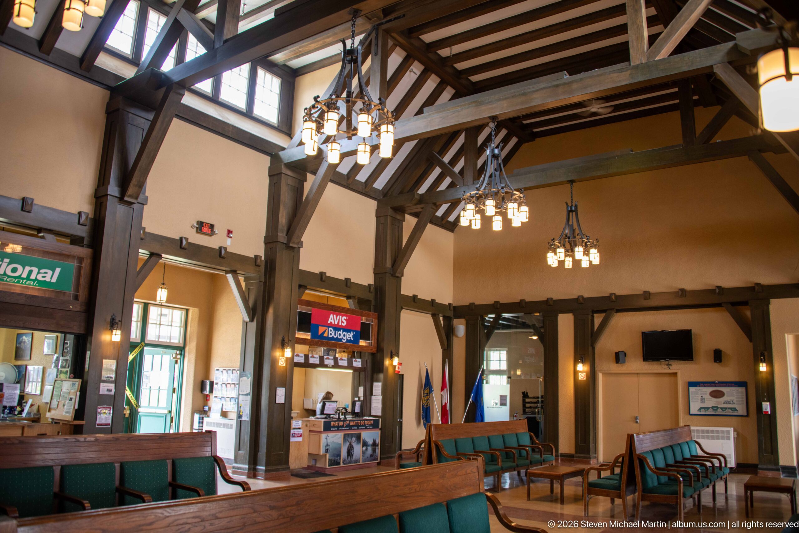
Rental counters occupy one side of Jasper railway station's lofty passenger hall beneath exposed timber trusses and multi-light chandeliers. Green-upholstered benches remain prominent in the foreground, while commercial signs and service desks show the adaptive use of the historic interior alongside its continuing transportation function.
Caption
Rental counters occupy one side of Jasper railway station's lofty passenger hall beneath exposed timber trusses and multi-light chandeliers. Green-upholstered benches remain prominent in the foreground, while commercial signs and service desks show the adaptive use of the historic interior alongside its continuing transportation function.
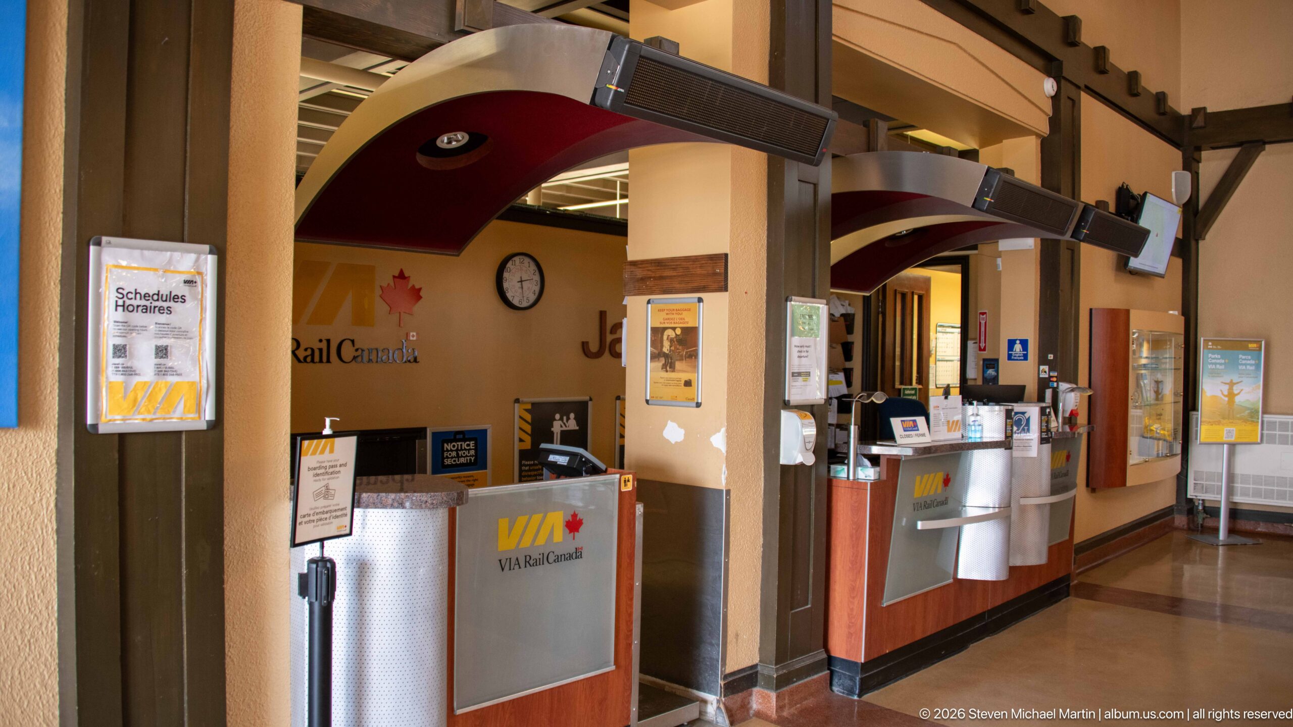
VIA Rail Canada service counters stand beneath curved canopy forms in Jasper railway station, with a wall clock, schedule display, and station lettering reinforcing the passenger-rail setting. This closer view isolates the functional heart of the station, where contemporary ticketing equipment operates within the historic building.
Caption
VIA Rail Canada service counters stand beneath curved canopy forms in Jasper railway station, with a wall clock, schedule display, and station lettering reinforcing the passenger-rail setting. This closer view isolates the functional heart of the station, where contemporary ticketing equipment operates within the historic building.
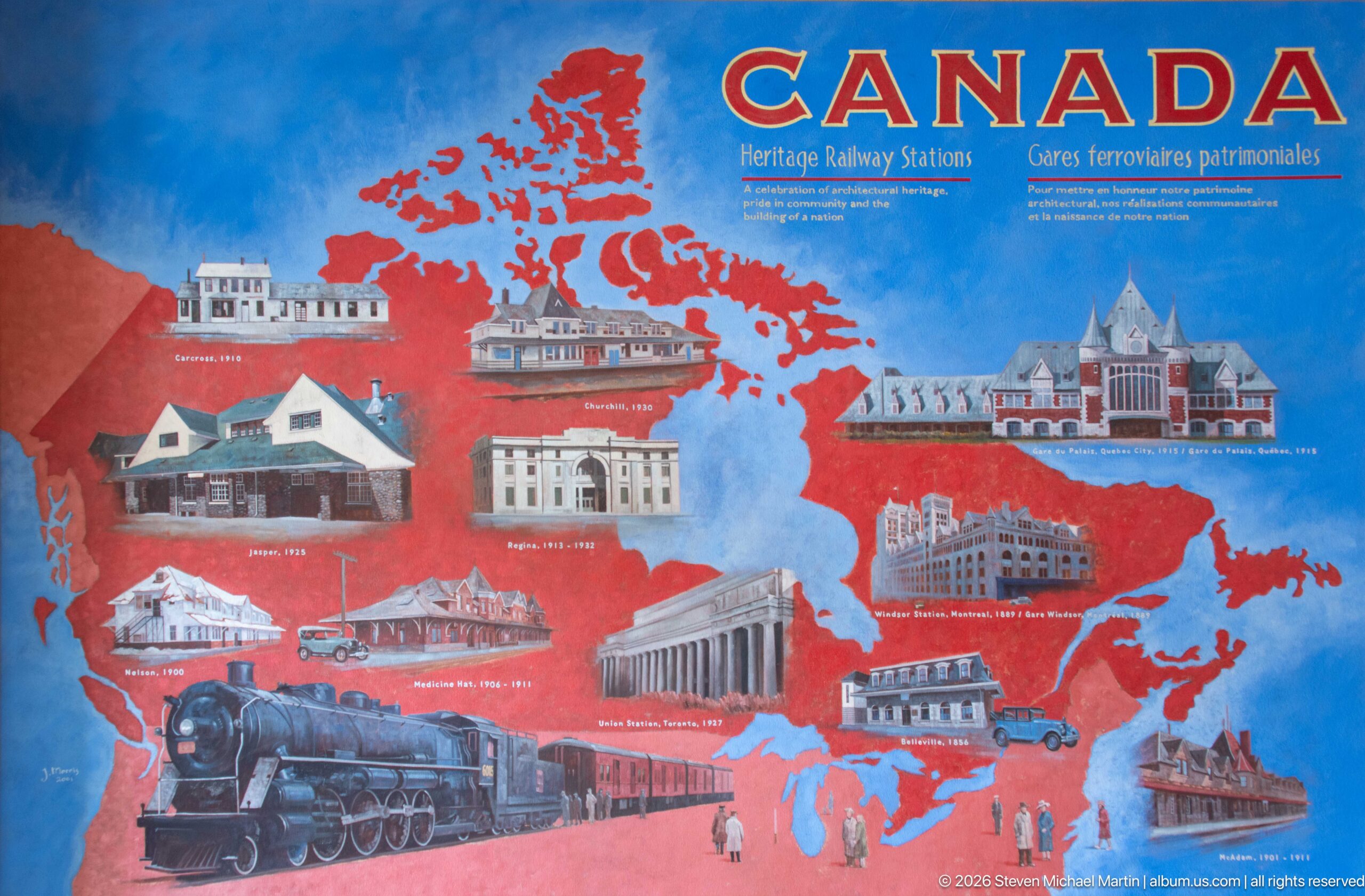
A colorful bilingual display maps heritage railway stations across Canada, pairing a red silhouette of the country with illustrated station buildings and a historic steam train. Installed inside Jasper station, the panel places the local building within a broader national story of railway architecture and preservation.
Caption
A colorful bilingual display maps heritage railway stations across Canada, pairing a red silhouette of the country with illustrated station buildings and a historic steam train. Installed inside Jasper station, the panel places the local building within a broader national story of railway architecture and preservation.
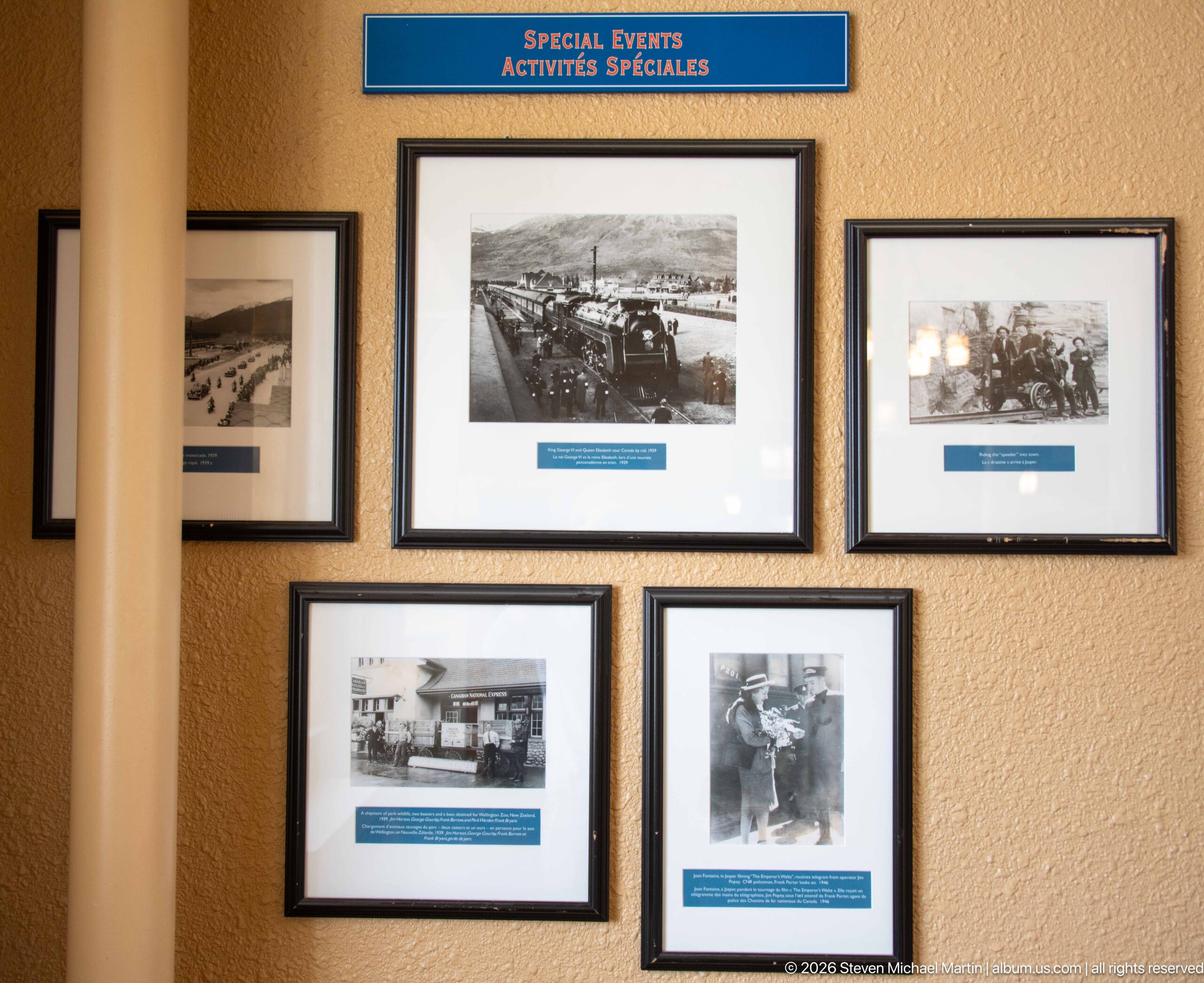
Historic photographs grouped beneath the bilingual heading “Special Events / Activités spéciales” document railway-related gatherings and activities associated with Jasper. The framed arrangement mixes broad scenes with closer human subjects, forming part of the station's interpretive presentation of local railway and community history.
Caption
Historic photographs grouped beneath the bilingual heading “Special Events / Activités spéciales” document railway-related gatherings and activities associated with Jasper. The framed arrangement mixes broad scenes with closer human subjects, forming part of the station's interpretive presentation of local railway and community history.
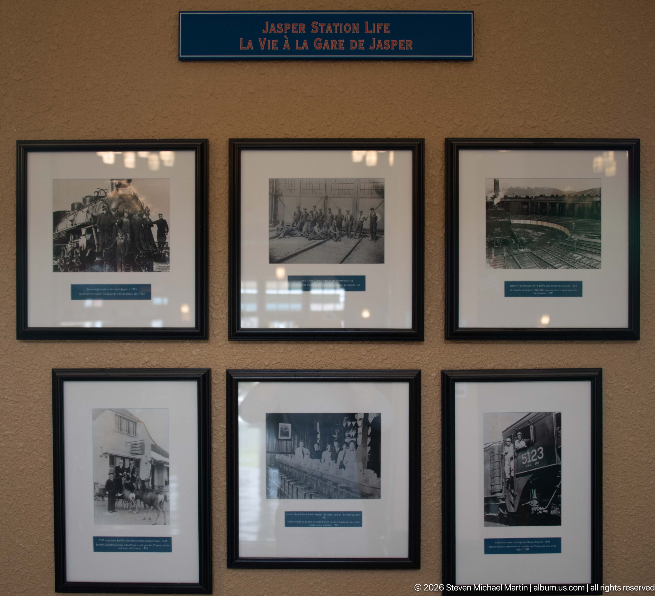
Six archival photographs form a compact exhibit titled “Jasper Station Life / La vie à la gare de Jasper.” Railway workers, trains, and station scenes appear across the grid, shifting attention from the building itself to the people and operations that animated Jasper's rail connection.
Caption
Six archival photographs form a compact exhibit titled “Jasper Station Life / La vie à la gare de Jasper.” Railway workers, trains, and station scenes appear across the grid, shifting attention from the building itself to the people and operations that animated Jasper's rail connection.
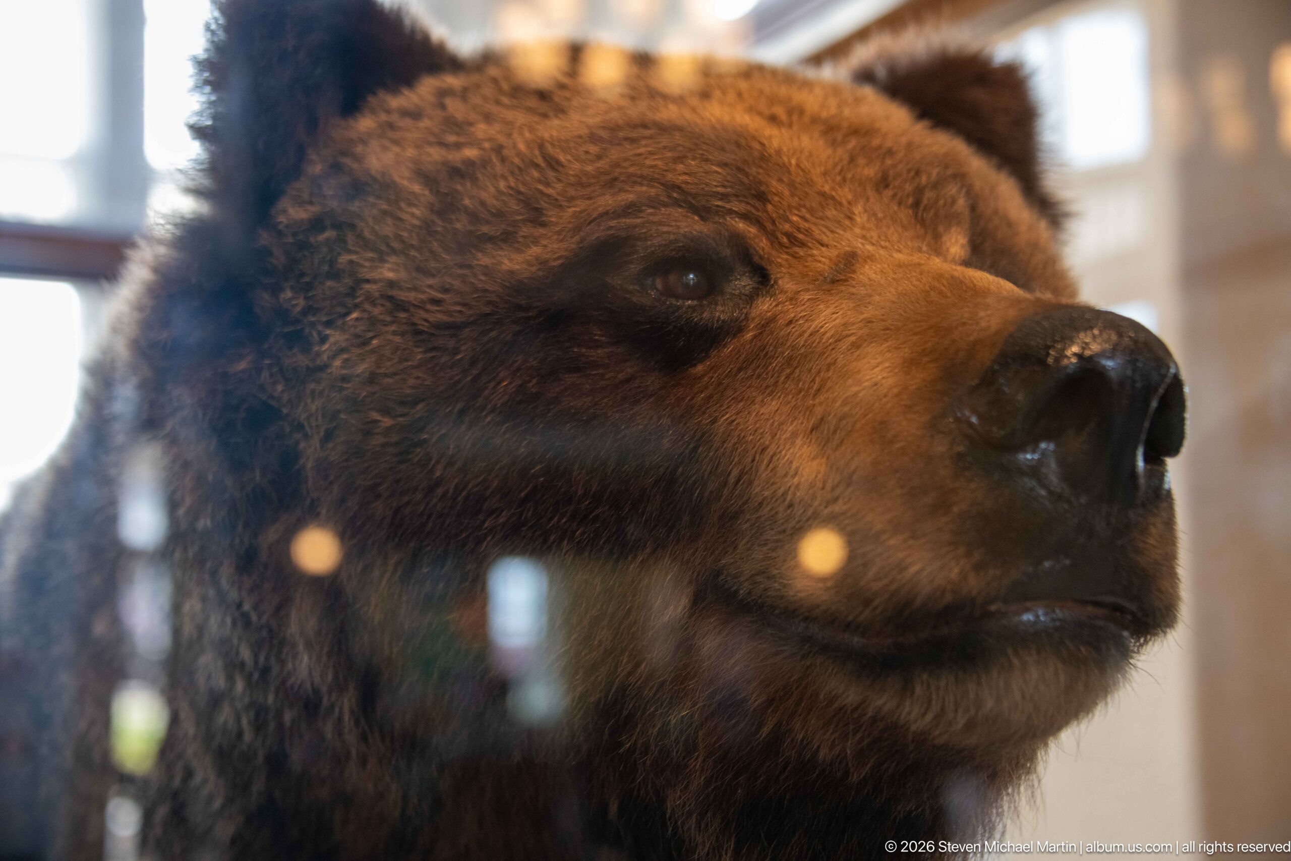
A mounted bear specimen fills the frame behind reflective glass, its dense brown fur, rounded ears, long muzzle, and dark nose rendered in close detail. Displayed within Jasper railway station, the specimen introduces a natural-history element into an interior otherwise devoted largely to passenger service and railway heritage.
Caption
A mounted bear specimen fills the frame behind reflective glass, its dense brown fur, rounded ears, long muzzle, and dark nose rendered in close detail. Displayed within Jasper railway station, the specimen introduces a natural-history element into an interior otherwise devoted largely to passenger service and railway heritage.
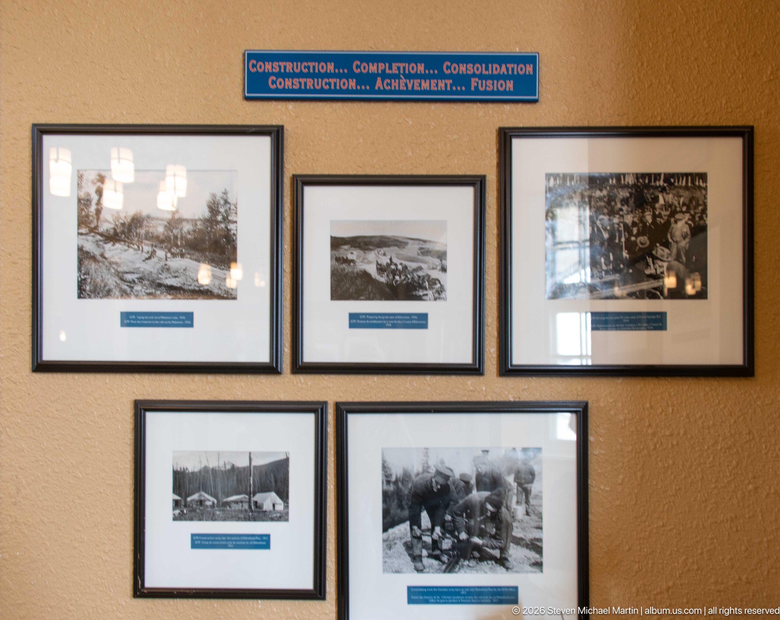
Five archival photographs appear beneath the bilingual heading “Construction… Completion… Consolidation,” tracing phases of railway development through work camps, construction scenes, and groups of laborers. The display situates Jasper station within the larger physical and human effort required to establish rail service through the region.
Caption
Five archival photographs appear beneath the bilingual heading “Construction… Completion… Consolidation,” tracing phases of railway development through work camps, construction scenes, and groups of laborers. The display situates Jasper station within the larger physical and human effort required to establish rail service through the region.
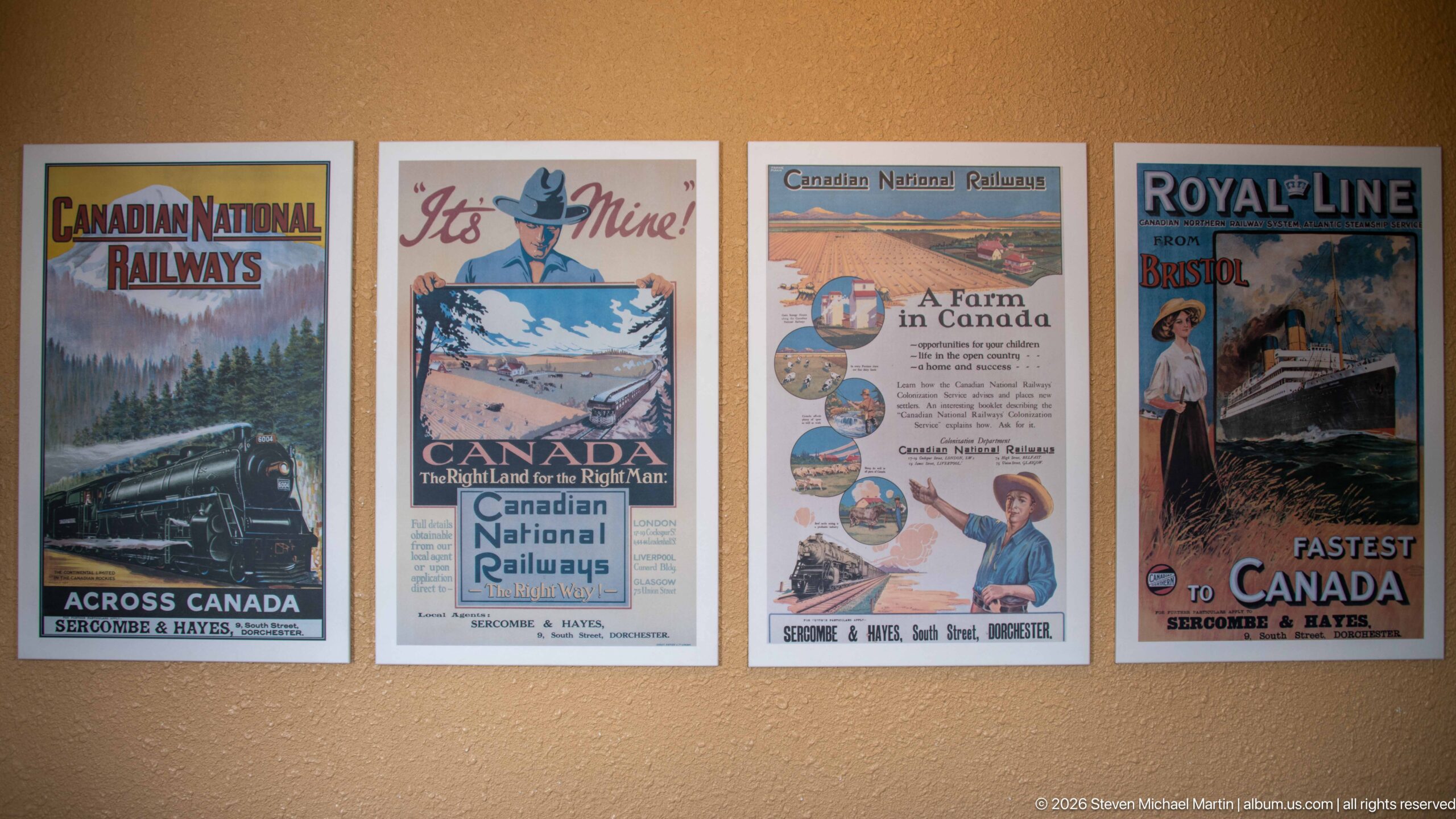
Four vintage-style railway advertisements line the station wall, promoting Canadian National Railways, travel in Canada, Canadian National Railways farm settlement, and Royal Line service. Their illustrated landscapes, trains, and bold period typography recall the central role of railway advertising in presenting Canada as both a travel destination and a place of settlement.
Caption
Four vintage-style railway advertisements line the station wall, promoting Canadian National Railways, travel in Canada, Canadian National Railways farm settlement, and Royal Line service. Their illustrated landscapes, trains, and bold period typography recall the central role of railway advertising in presenting Canada as both a travel destination and a place of settlement.
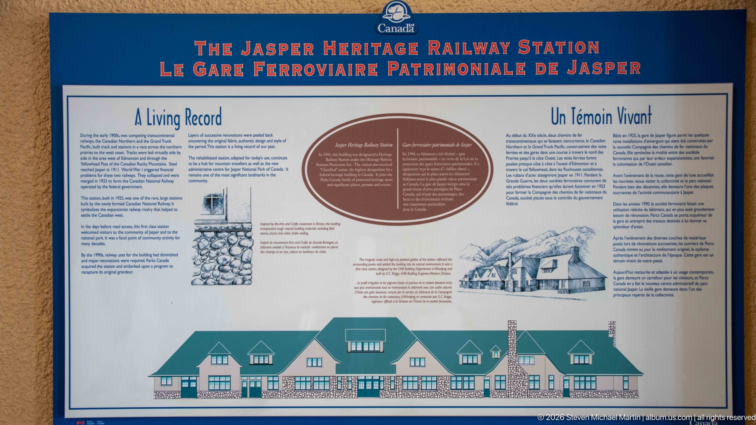
A bilingual interpretive panel titled “The Jasper Heritage Railway Station” presents the building as a “Living Record,” combining historical text, small illustrations, and a long elevation drawing of the station. The exhibit makes the architecture itself the subject, using the façade drawing to explain the station's form and heritage significance.
Caption
A bilingual interpretive panel titled “The Jasper Heritage Railway Station” presents the building as a “Living Record,” combining historical text, small illustrations, and a long elevation drawing of the station. The exhibit makes the architecture itself the subject, using the façade drawing to explain the station's form and heritage significance.
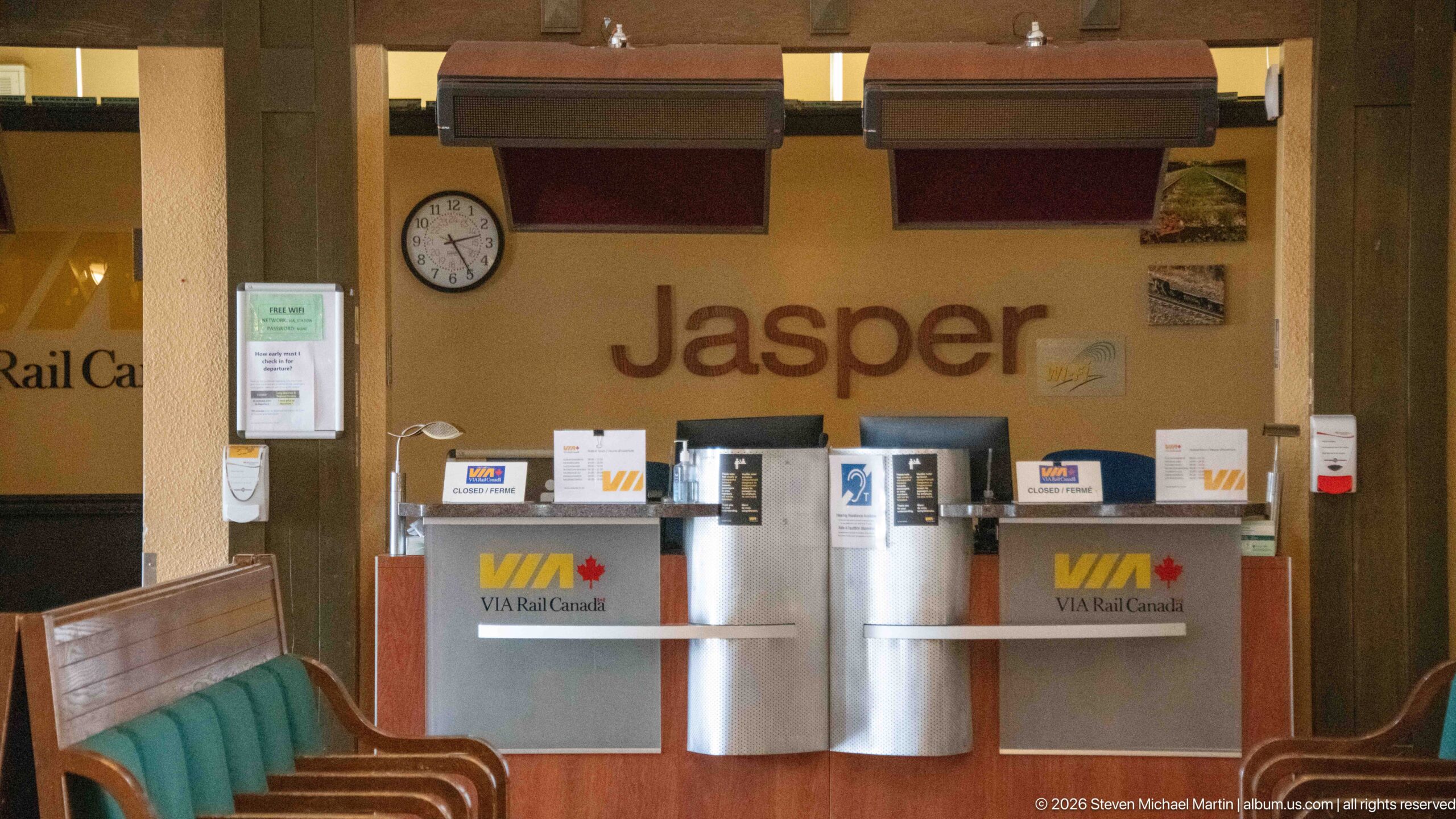
Two VIA Rail Canada counters sit beneath the large wall name “Jasper,” creating a direct visual link between national passenger service and the station's local identity. A clock, service notices, monitors, and counter equipment complete the working ticketing area, while nearby wooden seating preserves the character of the historic passenger hall.
Caption
Two VIA Rail Canada counters sit beneath the large wall name “Jasper,” creating a direct visual link between national passenger service and the station's local identity. A clock, service notices, monitors, and counter equipment complete the working ticketing area, while nearby wooden seating preserves the character of the historic passenger hall.
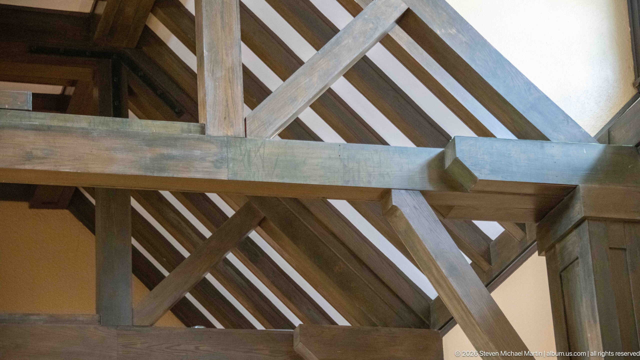
Massive timber members intersect beneath the pitched roof of Jasper railway station, revealing the joinery and bracing that give the passenger hall its rustic structural expression. This tight architectural study removes most furnishings from view and concentrates on posts, horizontal beams, diagonal braces, and closely spaced roof rafters.
Caption
Massive timber members intersect beneath the pitched roof of Jasper railway station, revealing the joinery and bracing that give the passenger hall its rustic structural expression. This tight architectural study removes most furnishings from view and concentrates on posts, horizontal beams, diagonal braces, and closely spaced roof rafters.
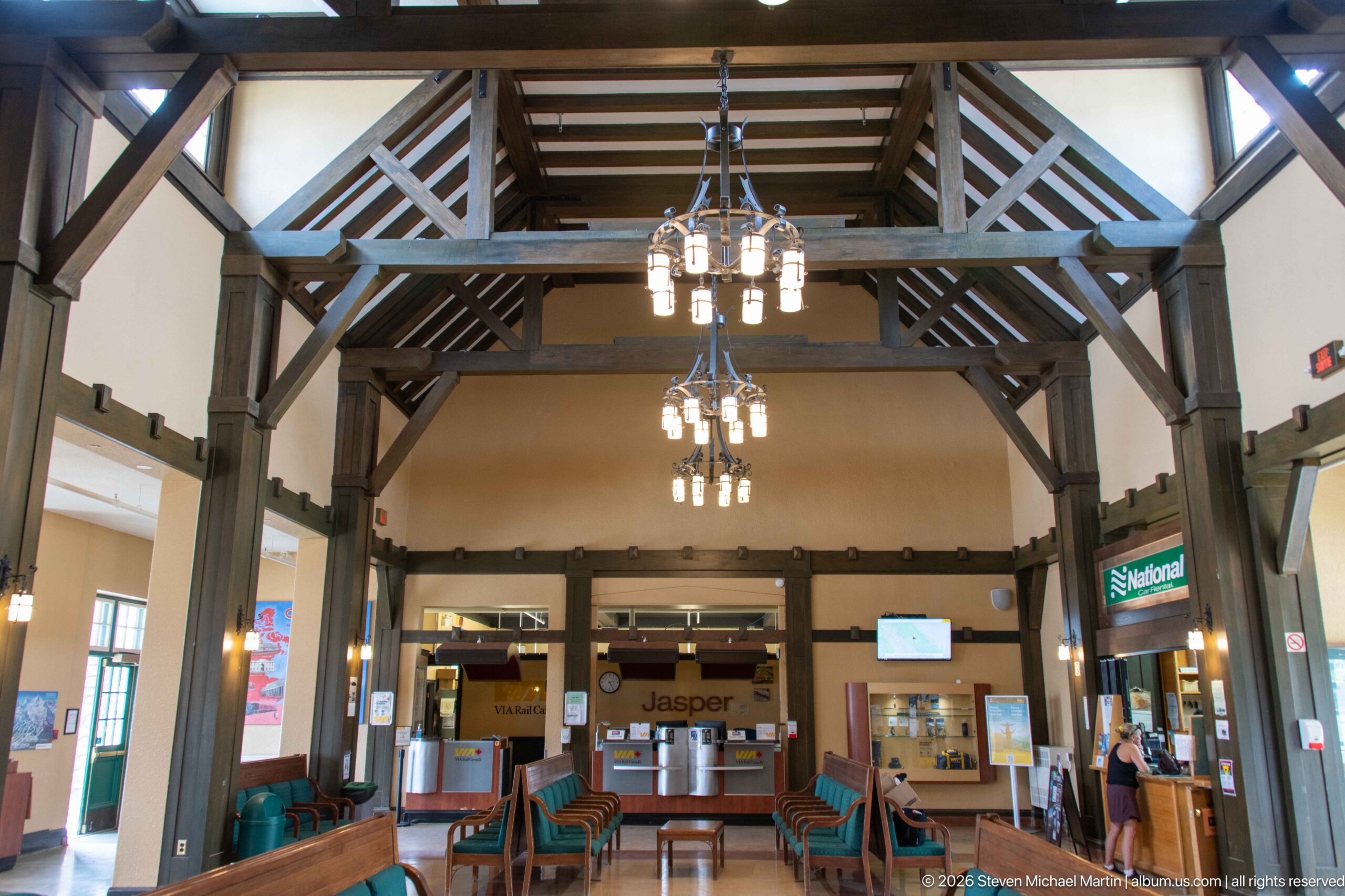
From a slightly higher framing, Jasper station's exposed roof structure dominates the passenger hall. Triangular timber bracing and repeated chandeliers span above the seating area, while the ticketing zone remains visible below, linking the building's architectural character with its active role as a railway station.
Caption
From a slightly higher framing, Jasper station's exposed roof structure dominates the passenger hall. Triangular timber bracing and repeated chandeliers span above the seating area, while the ticketing zone remains visible below, linking the building's architectural character with its active role as a railway station.
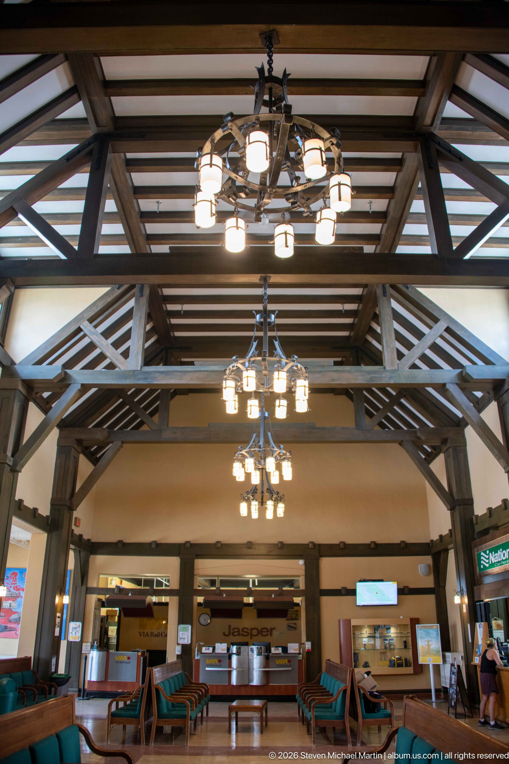
Layered timber trusses stretch across Jasper railway station's waiting room beneath a ceiling of exposed joists, punctuated by rows of multi-light fixtures. The upward-looking composition gives greater prominence to the structural rhythm than to the seating below, documenting the craftsmanship that defines the hall's interior character.
Caption
Layered timber trusses stretch across Jasper railway station's waiting room beneath a ceiling of exposed joists, punctuated by rows of multi-light fixtures. The upward-looking composition gives greater prominence to the structural rhythm than to the seating below, documenting the craftsmanship that defines the hall's interior character.
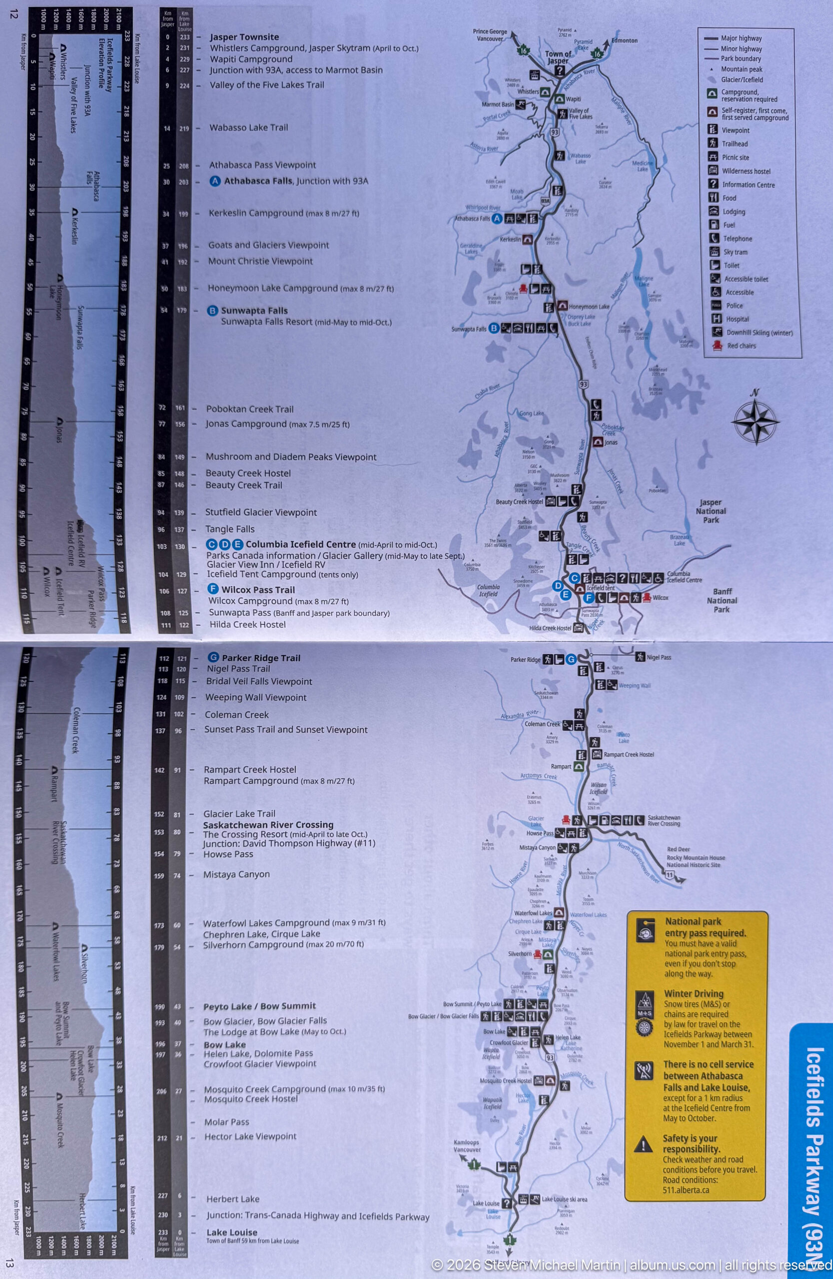
A large printed visitor map traces the principal north-south road corridor through Jasper National Park, pairing the mapped route with dense columns of campground, trail, service, and safety information. The folded sheet functions as practical trip-planning material, translating the park's long mountain geography into a linear network of destinations and facilities.
Caption
A large printed visitor map traces the principal north-south road corridor through Jasper National Park, pairing the mapped route with dense columns of campground, trail, service, and safety information. The folded sheet functions as practical trip-planning material, translating the park's long mountain geography into a linear network of destinations and facilities.
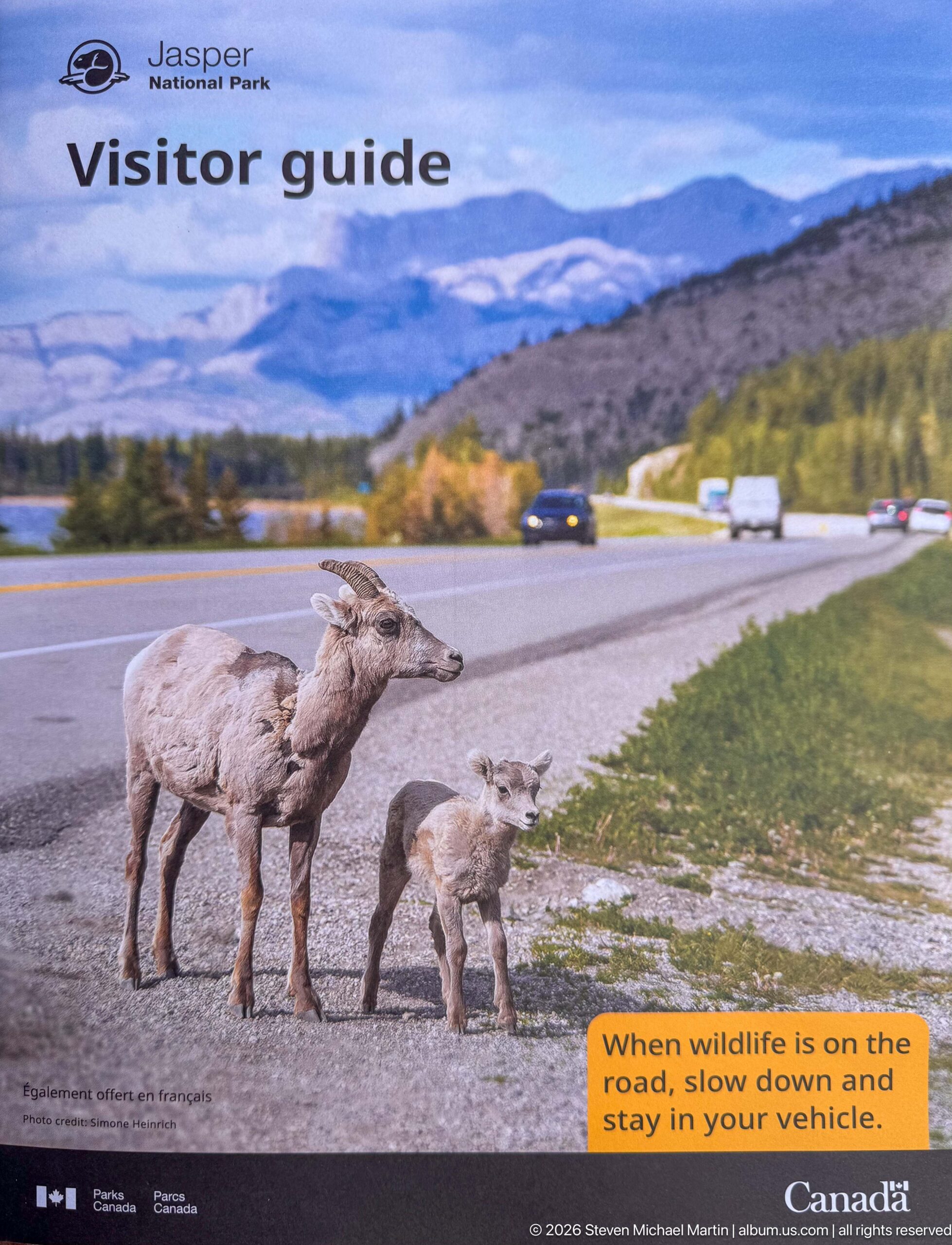
A visitor-guide photograph shows a bighorn ewe and lamb beside a roadway, paired with a bright warning reminding motorists to slow down and remain in their vehicles when wildlife is present. The panel uses a common roadside encounter to communicate safe behavior for both animals and park visitors.
Caption
A visitor-guide photograph shows a bighorn ewe and lamb beside a roadway, paired with a bright warning reminding motorists to slow down and remain in their vehicles when wildlife is present. The panel uses a common roadside encounter to communicate safe behavior for both animals and park visitors.
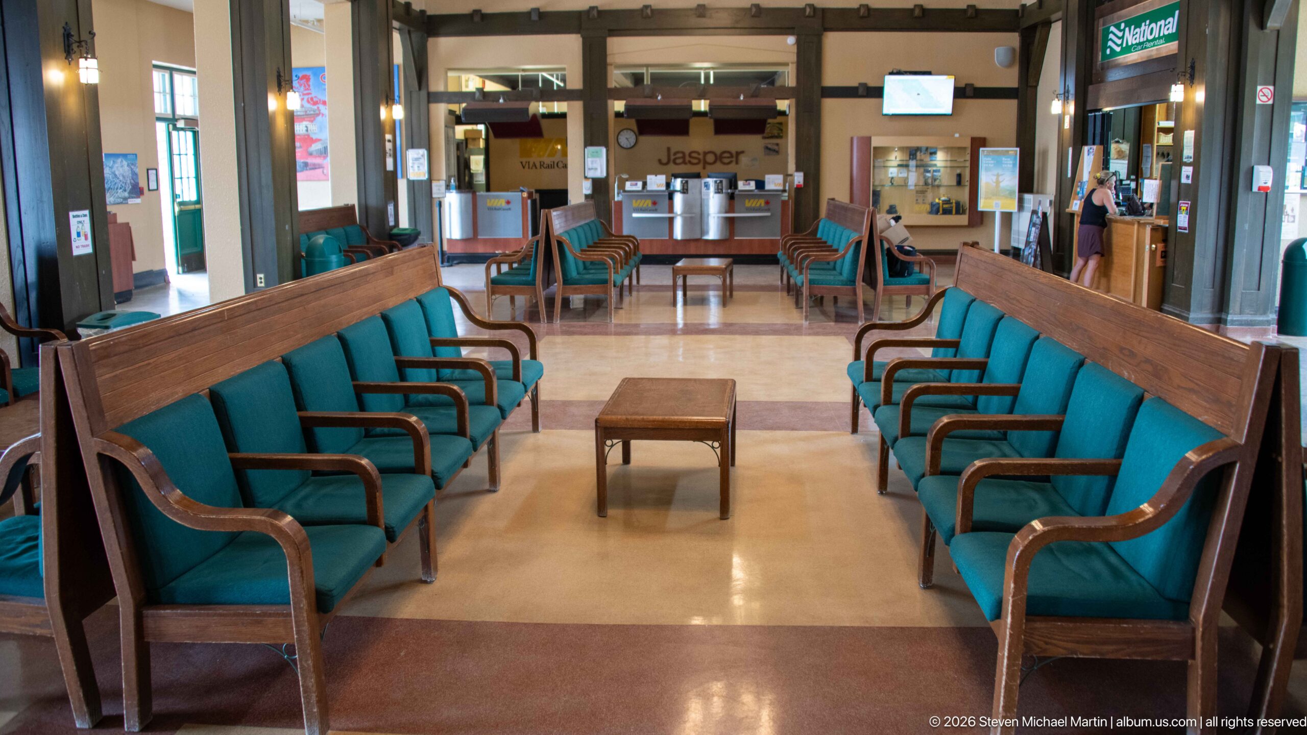
Two facing rows of long wooden benches with green upholstered seats define a quiet waiting area inside Jasper railway station. A small table occupies the center of the polished floor, while the ticketing and rental areas remain visible beyond, emphasizing the station's orderly passenger circulation and preserved period character.
Caption
Two facing rows of long wooden benches with green upholstered seats define a quiet waiting area inside Jasper railway station. A small table occupies the center of the polished floor, while the ticketing and rental areas remain visible beyond, emphasizing the station's orderly passenger circulation and preserved period character.
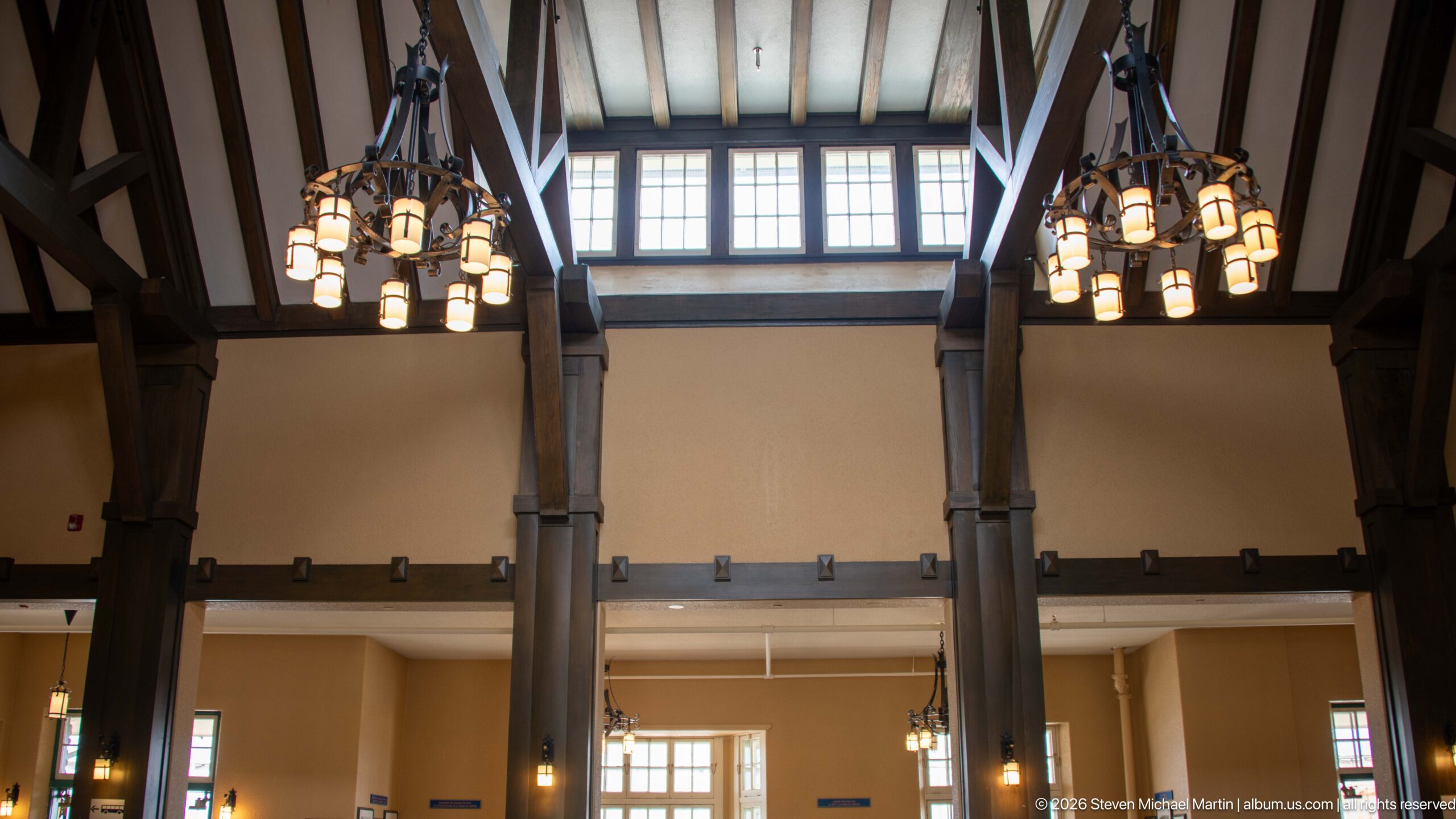
Tall timber posts rise toward a bank of clerestory windows in Jasper railway station, with clustered chandeliers suspended on either side. By cropping out most of the passenger furnishings, the view isolates the vertical proportions of the hall and the way daylight enters above the heavy structural frame.
Caption
Tall timber posts rise toward a bank of clerestory windows in Jasper railway station, with clustered chandeliers suspended on either side. By cropping out most of the passenger furnishings, the view isolates the vertical proportions of the hall and the way daylight enters above the heavy structural frame.
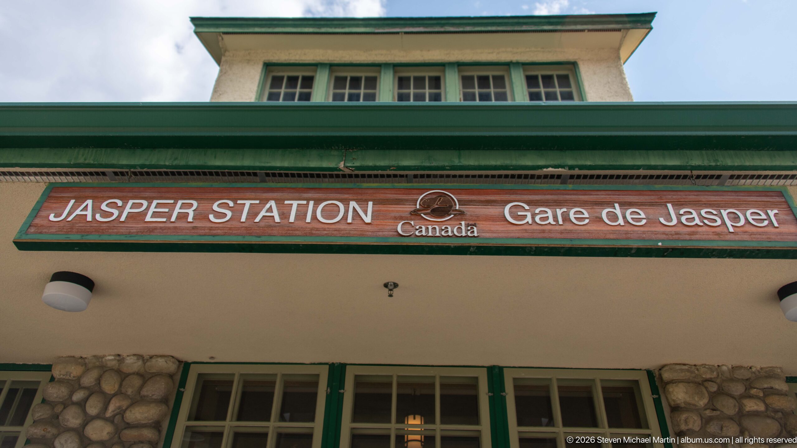
The bilingual "Jasper Station / Gare de Jasper" sign spans the exterior beneath a deep green roof edge, with the Canada wordmark centered between the English and French names. The close view also records the station's pale stucco, green-painted window trim, and rounded fieldstone base.
Caption
The bilingual "Jasper Station / Gare de Jasper" sign spans the exterior beneath a deep green roof edge, with the Canada wordmark centered between the English and French names. The close view also records the station's pale stucco, green-painted window trim, and rounded fieldstone base.
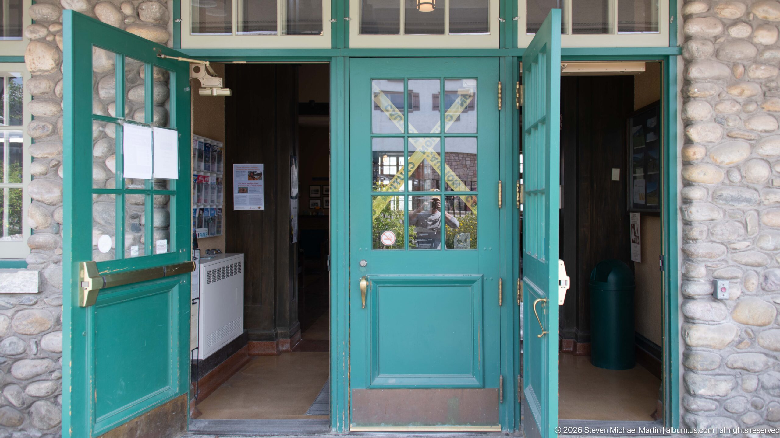
Green-painted glazed double doors open through the fieldstone-and-stucco exterior of Jasper railway station. Multi-pane sidelights and brass-colored hardware give the entrance a carefully detailed appearance, while the open leaves provide a glimpse into the darker timber-lined station interior.
Caption
Green-painted glazed double doors open through the fieldstone-and-stucco exterior of Jasper railway station. Multi-pane sidelights and brass-colored hardware give the entrance a carefully detailed appearance, while the open leaves provide a glimpse into the darker timber-lined station interior.
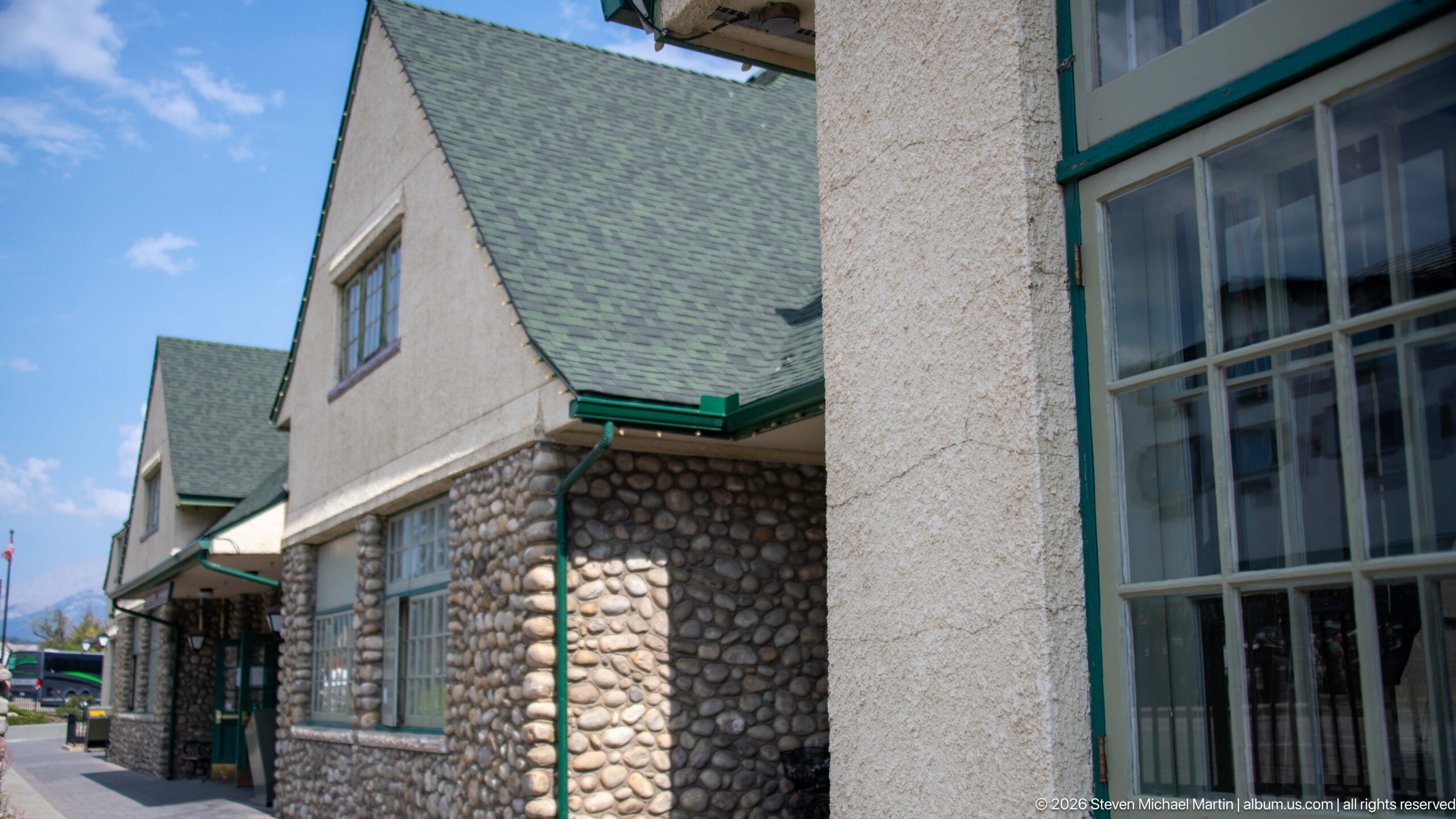
A close oblique view of Jasper railway station shows the transition from rounded fieldstone masonry to rough-textured stucco, green-painted trim, and steep shingled roof planes. Projecting wall sections and multi-pane windows create depth along the elevation, highlighting the varied materials used to give the station its rustic architectural character.
Caption
A close oblique view of Jasper railway station shows the transition from rounded fieldstone masonry to rough-textured stucco, green-painted trim, and steep shingled roof planes. Projecting wall sections and multi-pane windows create depth along the elevation, highlighting the varied materials used to give the station its rustic architectural character.
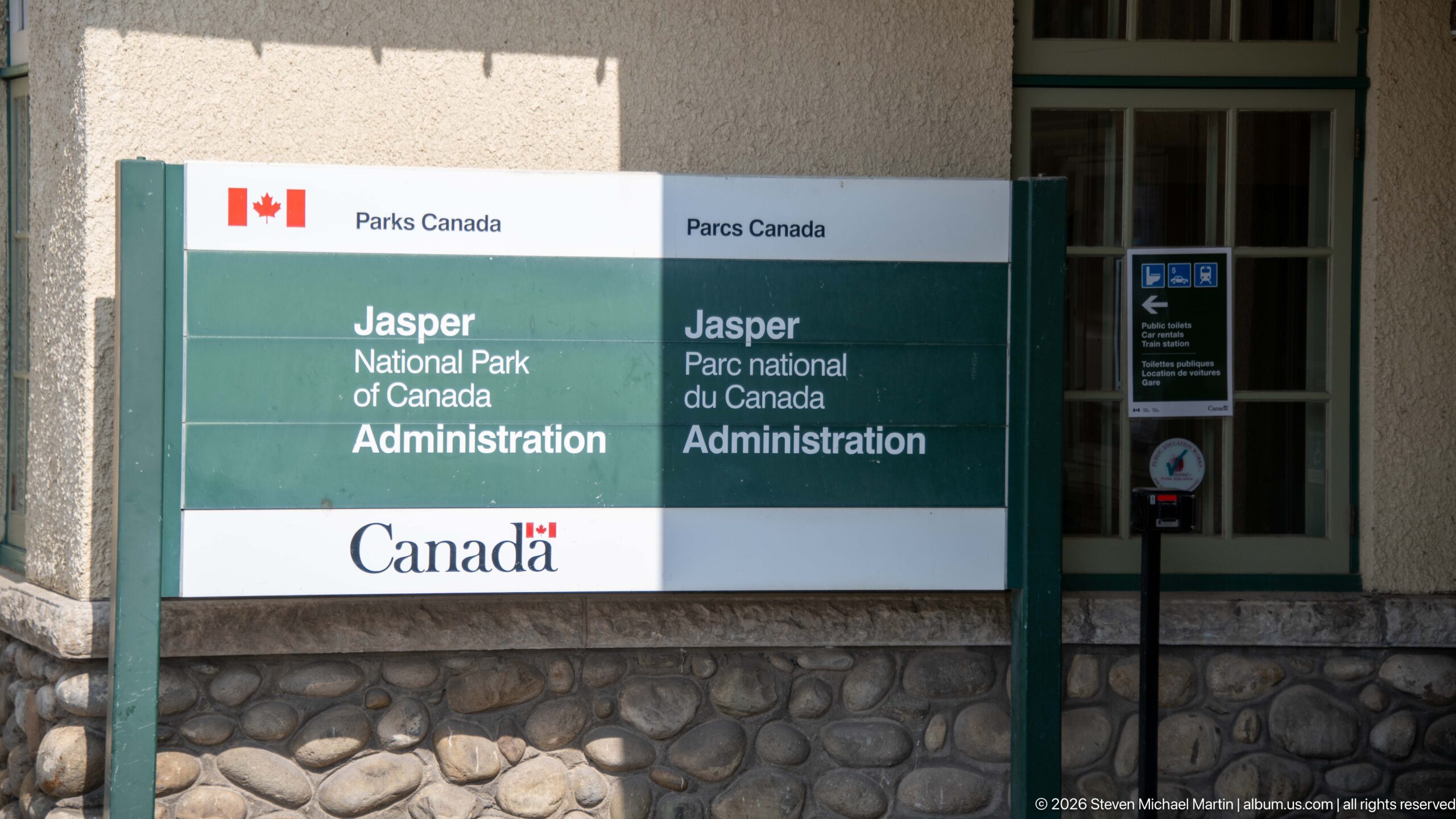
A bilingual Parks Canada sign identifies the Jasper National Park of Canada Administration beside a building with a rounded fieldstone base and green-trimmed window. The tightly framed view records the federal administrative presence in Jasper through official signage rather than through a broad architectural portrait.
Caption
A bilingual Parks Canada sign identifies the Jasper National Park of Canada Administration beside a building with a rounded fieldstone base and green-trimmed window. The tightly framed view records the federal administrative presence in Jasper through official signage rather than through a broad architectural portrait.
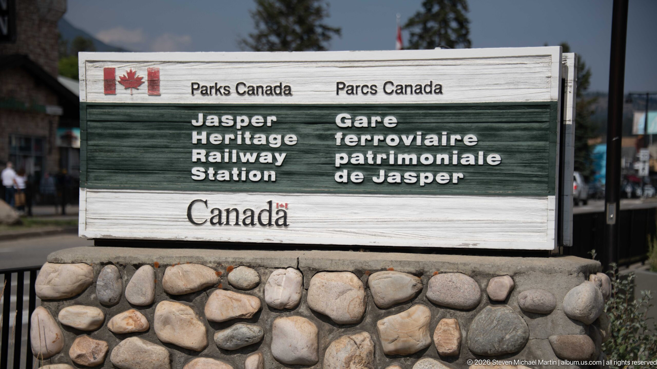
A weathered Parks Canada sign marks the “Jasper Heritage Railway Station / Gare ferroviaire patrimoniale de Jasper.” Mounted on a base of rounded river stone, the bilingual marker foregrounds the station's heritage designation while visually echoing the fieldstone masonry used on the building itself.
Caption
A weathered Parks Canada sign marks the “Jasper Heritage Railway Station / Gare ferroviaire patrimoniale de Jasper.” Mounted on a base of rounded river stone, the bilingual marker foregrounds the station's heritage designation while visually echoing the fieldstone masonry used on the building itself.
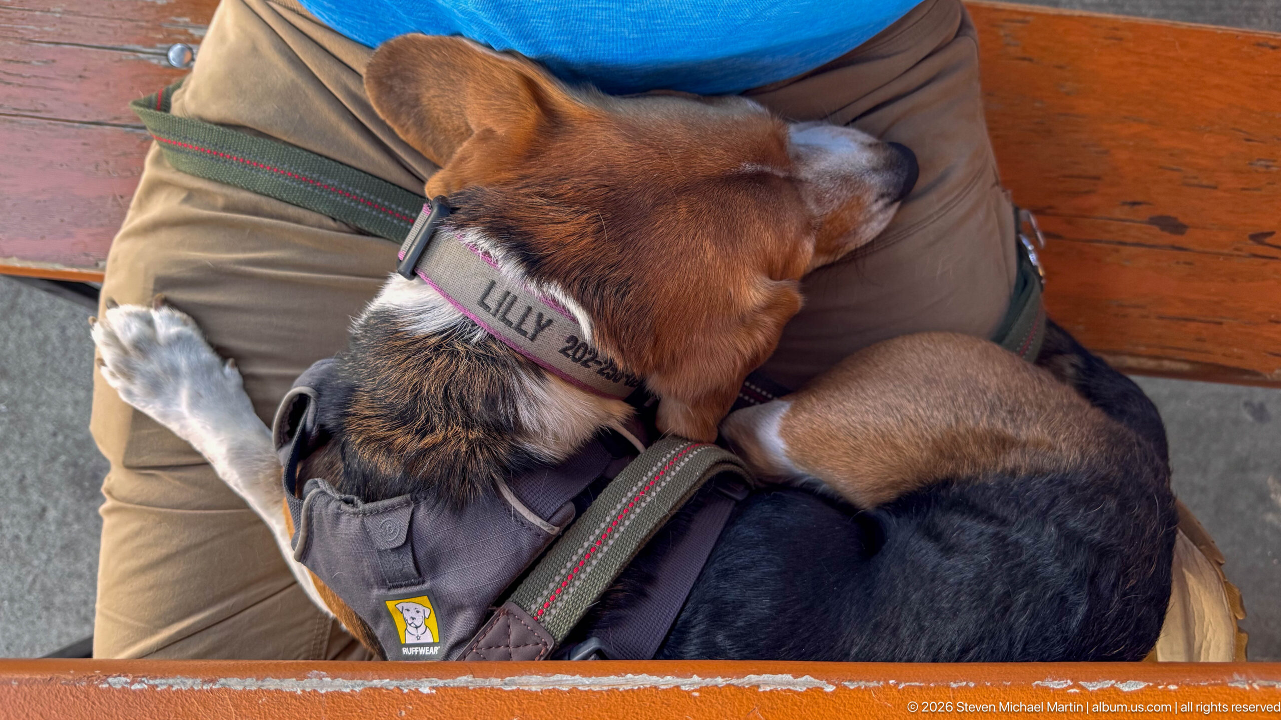
A small tricolor beagle rests curled across a seated person's lap, its head tucked toward the person's arm and one white paw extended. The close, overhead composition shifts away from Jasper's architecture and landscape to a quiet travel moment, with the dog's harness, leash, and name collar visible.
Caption
A small tricolor beagle rests curled across a seated person's lap, its head tucked toward the person's arm and one white paw extended. The close, overhead composition shifts away from Jasper's architecture and landscape to a quiet travel moment, with the dog's harness, leash, and name collar visible.
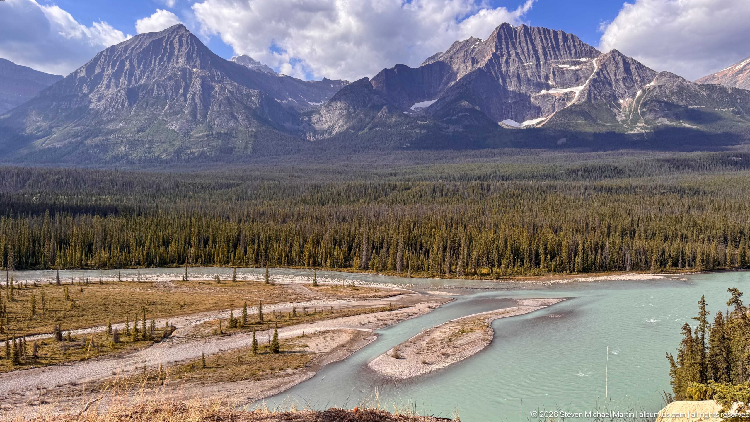
A turquoise river divides around pale gravel bars below a densely forested valley and steep, layered mountain walls in Jasper National Park. Seen from an elevated viewpoint, the composition emphasizes the broad relationship among braided channels, floodplain deposits, conifer forest, and the rugged Canadian Rockies skyline.
Caption
A turquoise river divides around pale gravel bars below a densely forested valley and steep, layered mountain walls in Jasper National Park. Seen from an elevated viewpoint, the composition emphasizes the broad relationship among braided channels, floodplain deposits, conifer forest, and the rugged Canadian Rockies skyline.
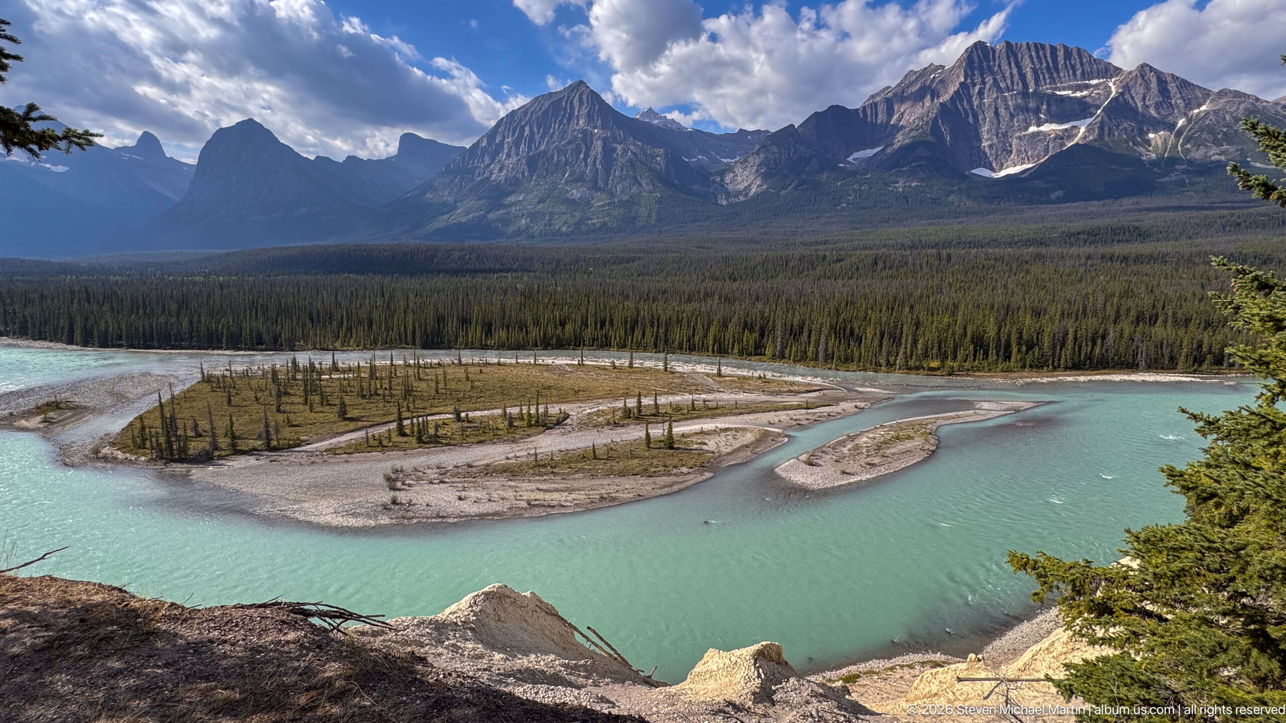
From a wider elevated vantage, multiple turquoise channels sweep around gravel islands at the edge of an expansive conifer forest, with a serrated mountain basin rising beyond. The broader framing gives the river's braided form greater prominence and shows how water, sediment, forest, and alpine relief combine in Jasper National Park's valley landscape.
Caption
From a wider elevated vantage, multiple turquoise channels sweep around gravel islands at the edge of an expansive conifer forest, with a serrated mountain basin rising beyond. The broader framing gives the river's braided form greater prominence and shows how water, sediment, forest, and alpine relief combine in Jasper National Park's valley landscape.
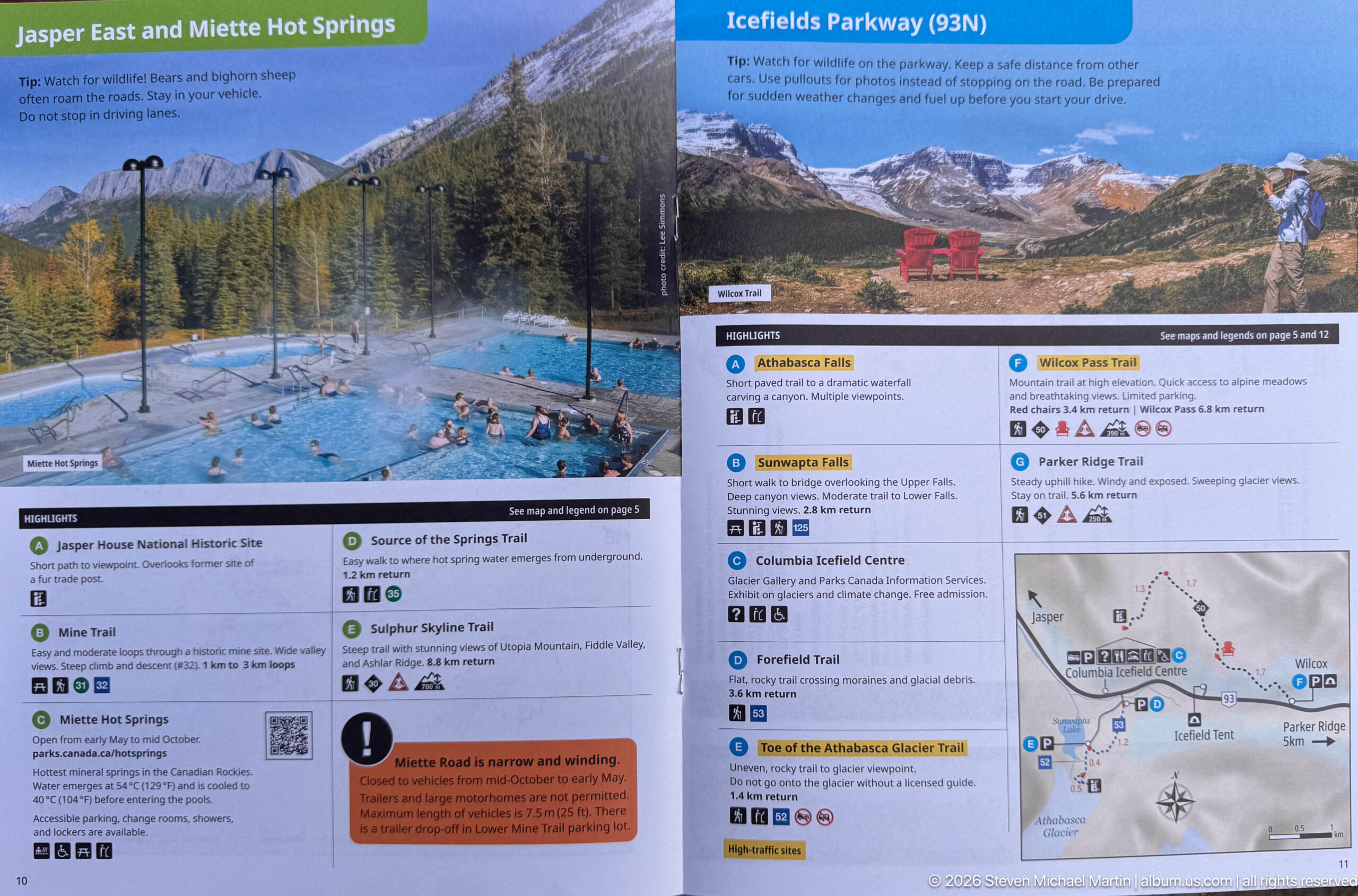
A visitor-guide spread pairs a photograph of outdoor hot-spring pools with an Icefields Parkway section featuring red chairs, trail listings, and a small route map. The page condenses recreation options into illustrated planning information, linking developed visitor facilities with hikes and roadside destinations along the mountain corridor.
Caption
A visitor-guide spread pairs a photograph of outdoor hot-spring pools with an Icefields Parkway section featuring red chairs, trail listings, and a small route map. The page condenses recreation options into illustrated planning information, linking developed visitor facilities with hikes and roadside destinations along the mountain corridor.
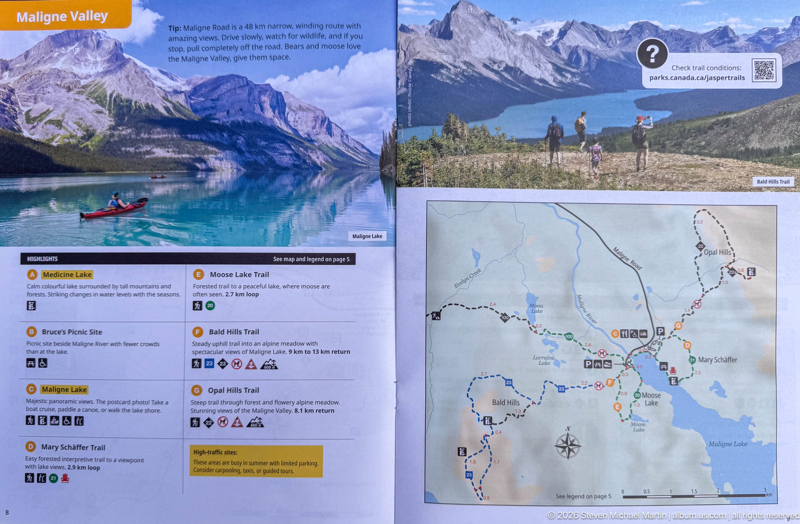
A Maligne Valley guide spread combines photographs of turquoise mountain water and hikers with trail descriptions and a detailed route map. Named destinations and numbered symbols organize the valley as a sequence of stops, giving visitors a compact visual reference for lakes, trails, viewpoints, and recreation opportunities.
Caption
A Maligne Valley guide spread combines photographs of turquoise mountain water and hikers with trail descriptions and a detailed route map. Named destinations and numbered symbols organize the valley as a sequence of stops, giving visitors a compact visual reference for lakes, trails, viewpoints, and recreation opportunities.
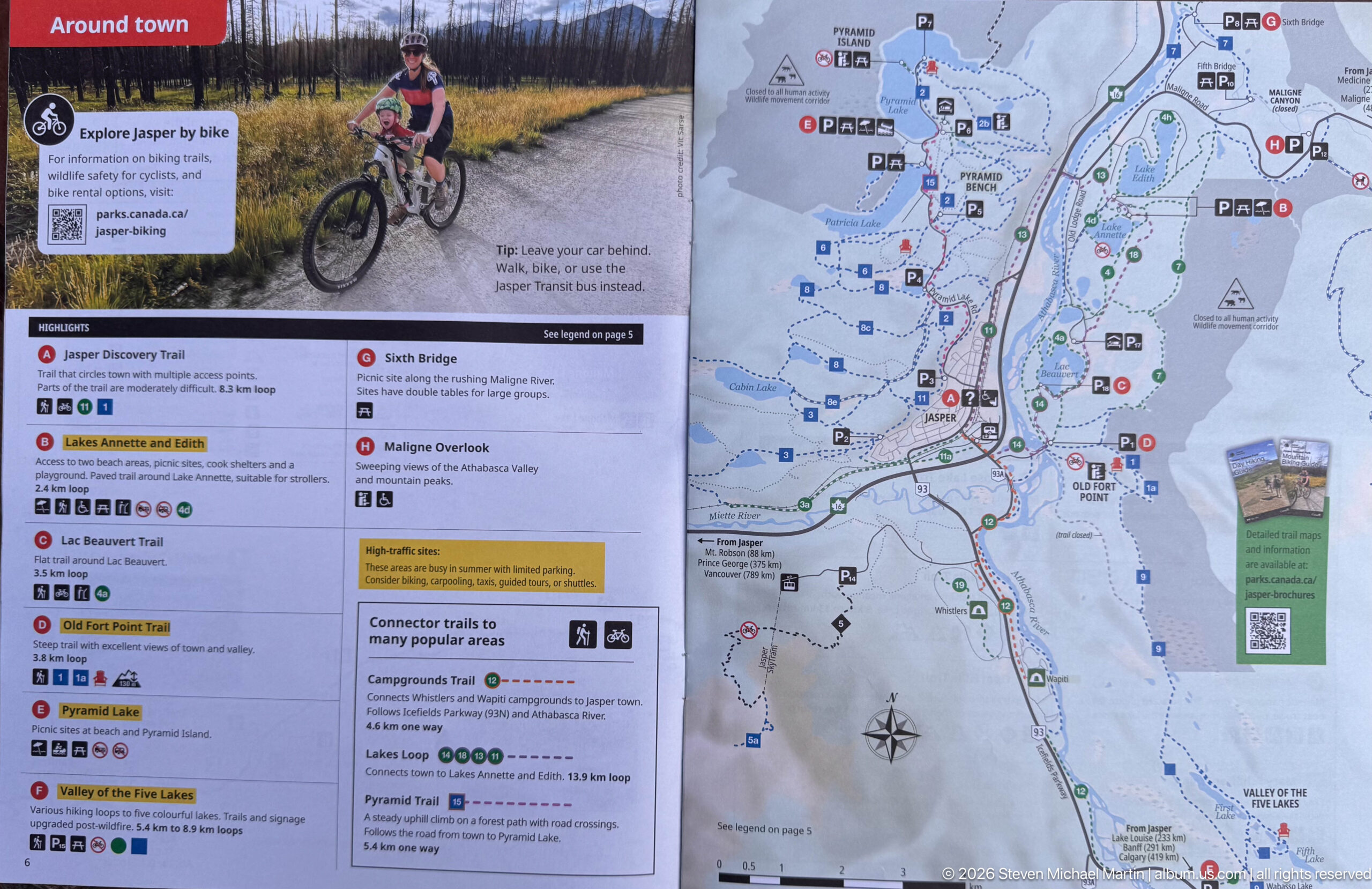
This visitor-guide spread focuses on Jasper town and nearby trails, combining a cyclist photograph, short route descriptions, and a detailed townsite map. Symbols mark streets, paths, facilities, and points of interest, making the page a practical orientation tool for exploring the community without a vehicle.
Caption
This visitor-guide spread focuses on Jasper town and nearby trails, combining a cyclist photograph, short route descriptions, and a detailed townsite map. Symbols mark streets, paths, facilities, and points of interest, making the page a practical orientation tool for exploring the community without a vehicle.
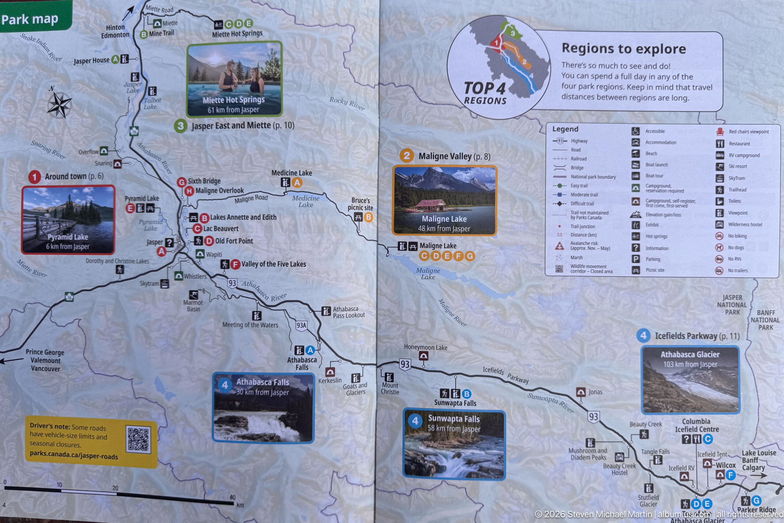
A broad regional map organizes Jasper National Park into numbered areas to explore, with inset photographs and route lines connecting major valleys, lakes, and the Icefields Parkway. A legend of visitor symbols at upper right turns the map into both a geographic overview and a compact recreation-planning reference.
Caption
A broad regional map organizes Jasper National Park into numbered areas to explore, with inset photographs and route lines connecting major valleys, lakes, and the Icefields Parkway. A legend of visitor symbols at upper right turns the map into both a geographic overview and a compact recreation-planning reference.
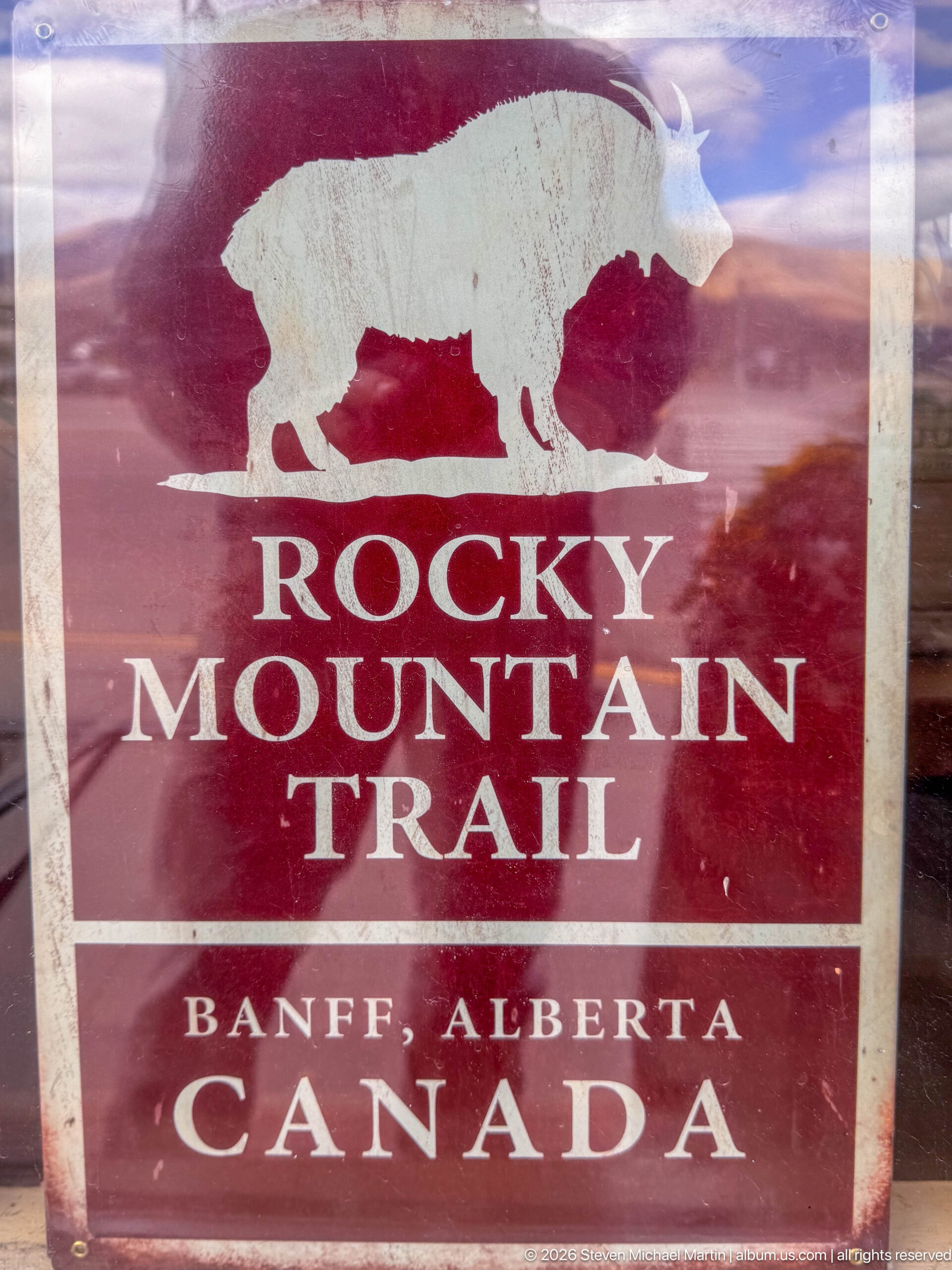
A weathered red sign bears a white bison silhouette above the words “Rocky Mountain Trail,” followed by “Banff, Alberta, Canada.” Scratches and fading across the surface give the emblem a well-used appearance, preserving a graphic identity associated with mountain travel in Alberta.
Caption
A weathered red sign bears a white bison silhouette above the words “Rocky Mountain Trail,” followed by “Banff, Alberta, Canada.” Scratches and fading across the surface give the emblem a well-used appearance, preserving a graphic identity associated with mountain travel in Alberta.
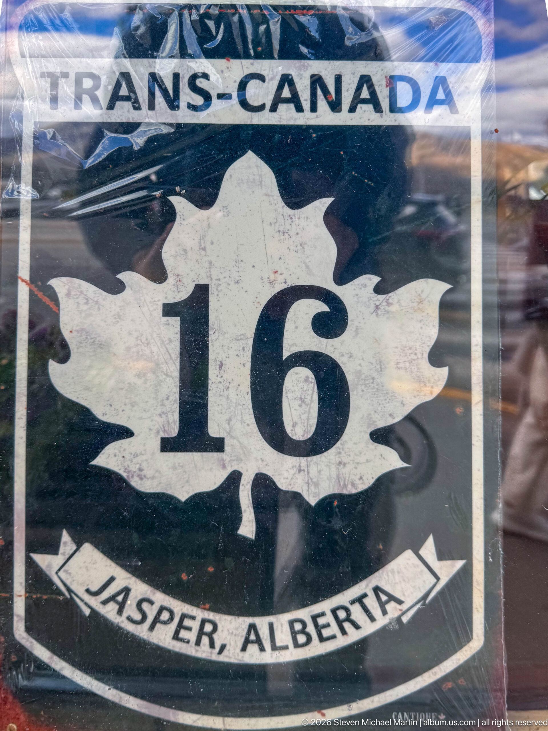
A maple-leaf highway shield marked “16” identifies the Trans-Canada route at Jasper, Alberta. The dark green background, white leaf, and curved Jasper banner create a compact piece of transportation graphic design tied directly to the community's place on a major east-west highway corridor.
Caption
A maple-leaf highway shield marked “16” identifies the Trans-Canada route at Jasper, Alberta. The dark green background, white leaf, and curved Jasper banner create a compact piece of transportation graphic design tied directly to the community's place on a major east-west highway corridor.
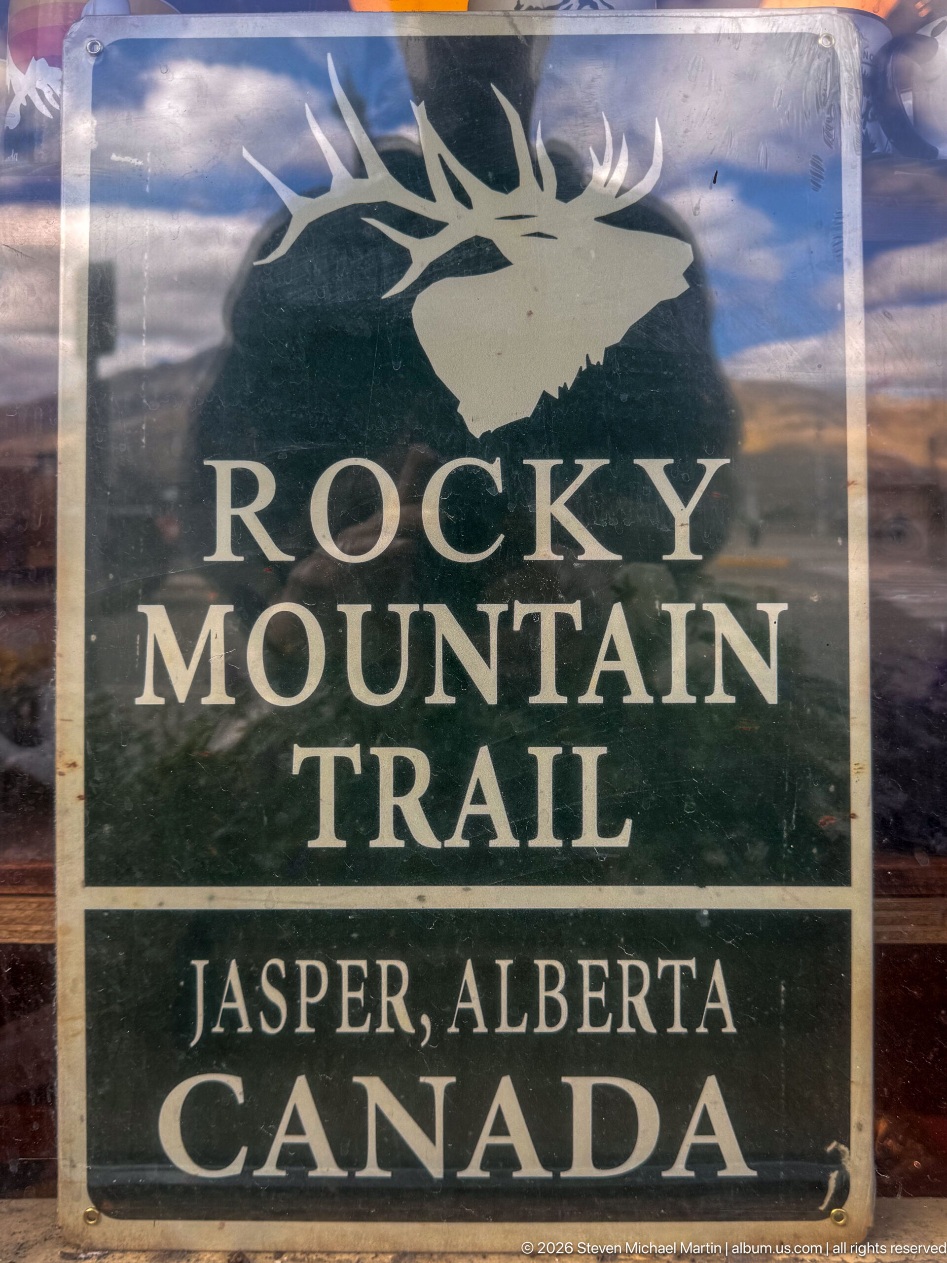
A dark green Rocky Mountain Trail sign features a pale elk head and antlers above the route name, with “Jasper, Alberta, Canada” below. The animal emblem distinguishes the Jasper version from the neighboring Banff bison sign and links the route's visual identity to Rocky Mountain wildlife.
Caption
A dark green Rocky Mountain Trail sign features a pale elk head and antlers above the route name, with “Jasper, Alberta, Canada” below. The animal emblem distinguishes the Jasper version from the neighboring Banff bison sign and links the route's visual identity to Rocky Mountain wildlife.
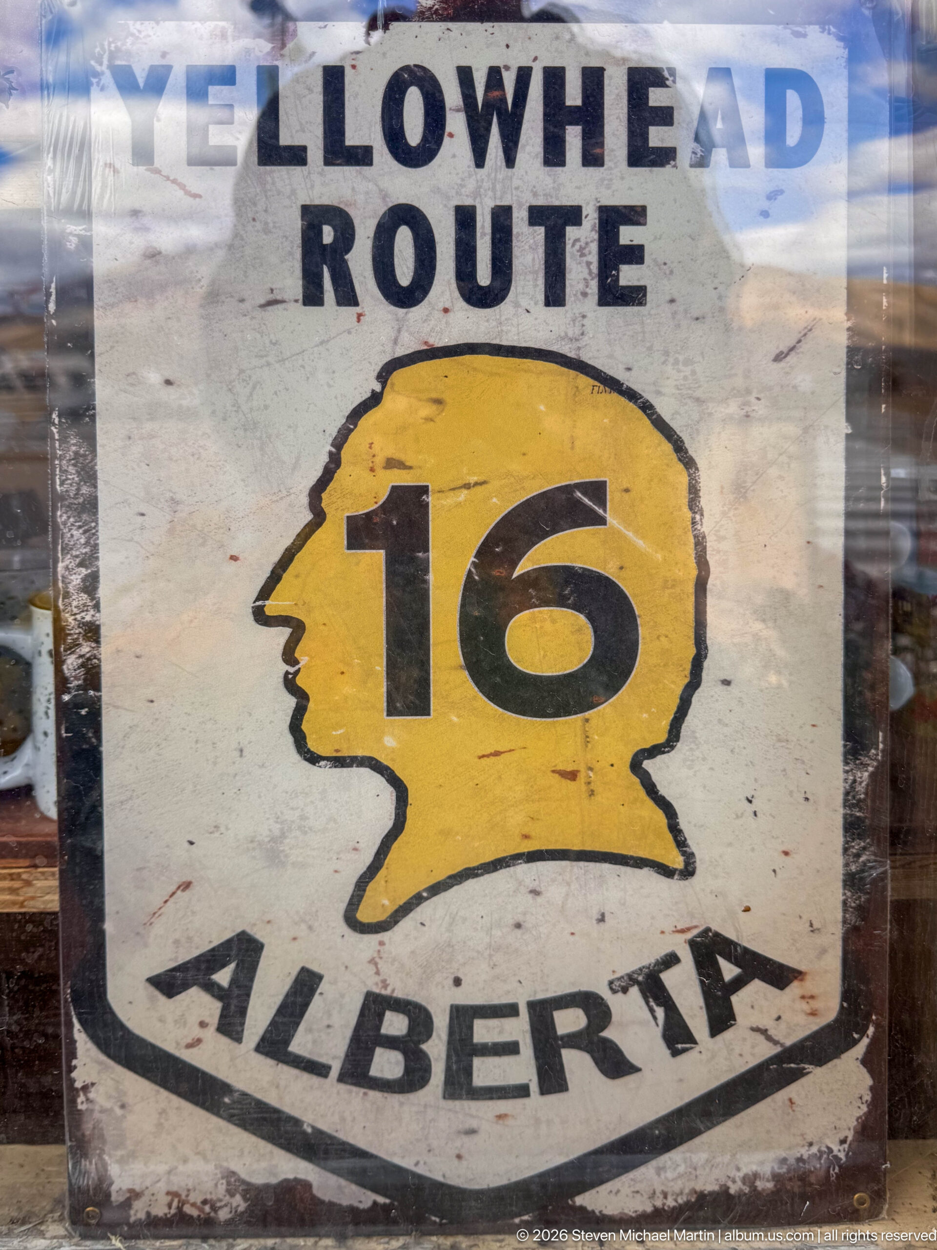
A weathered Yellowhead Route shield centers the number “16” inside a yellow profile-shaped emblem above “Alberta.” The simple black, yellow, and white design records a regional highway identity associated with the east-west route through Jasper and the Canadian Rockies.
Caption
A weathered Yellowhead Route shield centers the number “16” inside a yellow profile-shaped emblem above “Alberta.” The simple black, yellow, and white design records a regional highway identity associated with the east-west route through Jasper and the Canadian Rockies.
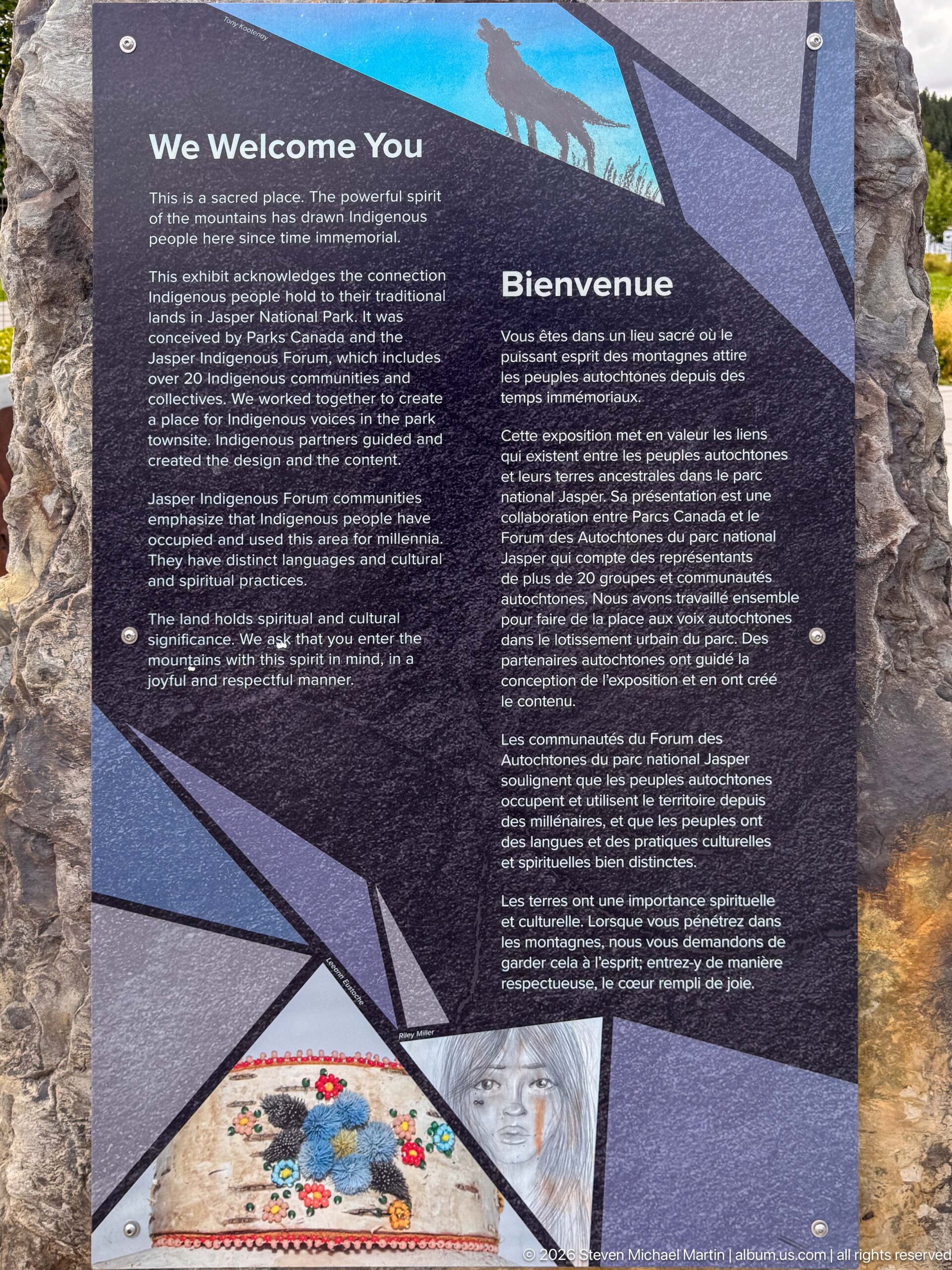
A bilingual interpretive panel welcomes visitors with text describing Indigenous peoples and their enduring relationships with the mountain landscape. Geometric graphics, a small animal silhouette, and a colorful circular design frame the dense English and French text, placing Indigenous presence at the beginning of the visitor-center experience.
Caption
A bilingual interpretive panel welcomes visitors with text describing Indigenous peoples and their enduring relationships with the mountain landscape. Geometric graphics, a small animal silhouette, and a colorful circular design frame the dense English and French text, placing Indigenous presence at the beginning of the visitor-center experience.
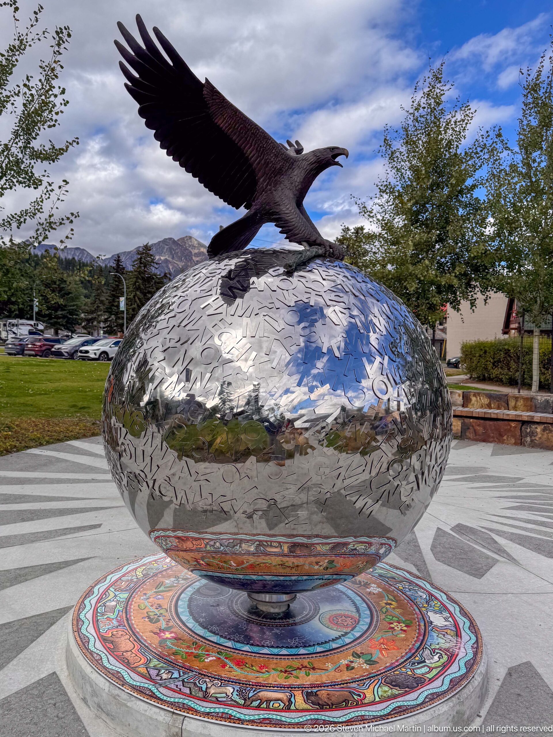
A dark metal eagle spreads its wings atop a polished spherical sculpture covered with etched or cut-out markings. The globe rises from a vividly patterned circular base, combining wildlife imagery, reflective metalwork, and decorative motifs in a prominent piece of outdoor public art near Jasper's visitor facilities.
Caption
A dark metal eagle spreads its wings atop a polished spherical sculpture covered with etched or cut-out markings. The globe rises from a vividly patterned circular base, combining wildlife imagery, reflective metalwork, and decorative motifs in a prominent piece of outdoor public art near Jasper's visitor facilities.
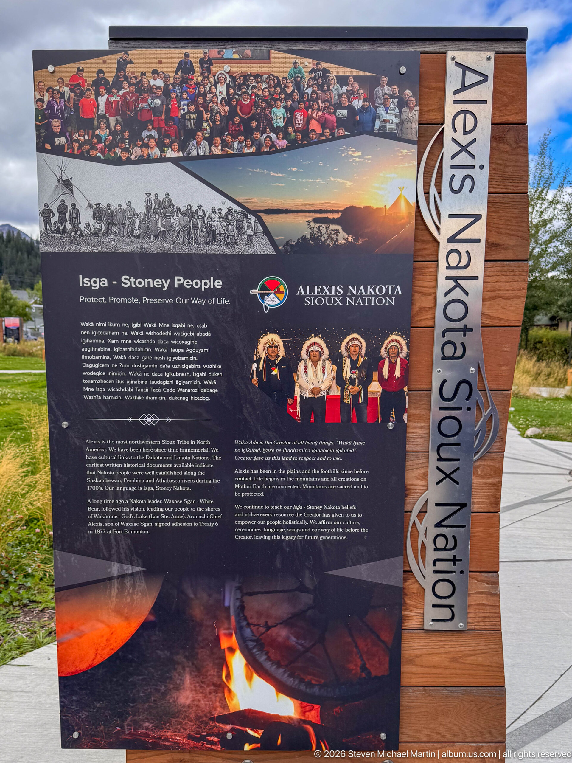
An outdoor interpretive panel headed “Isga - Stoney People” presents the Alexis Nakota Sioux Nation through historical photographs, contemporary cultural imagery, bilingual text, and a campfire motif. The vertical wooden side panel names the nation prominently, giving Indigenous history and living culture a visible place within Jasper's visitor landscape.
Caption
An outdoor interpretive panel headed “Isga - Stoney People” presents the Alexis Nakota Sioux Nation through historical photographs, contemporary cultural imagery, bilingual text, and a campfire motif. The vertical wooden side panel names the nation prominently, giving Indigenous history and living culture a visible place within Jasper's visitor landscape.
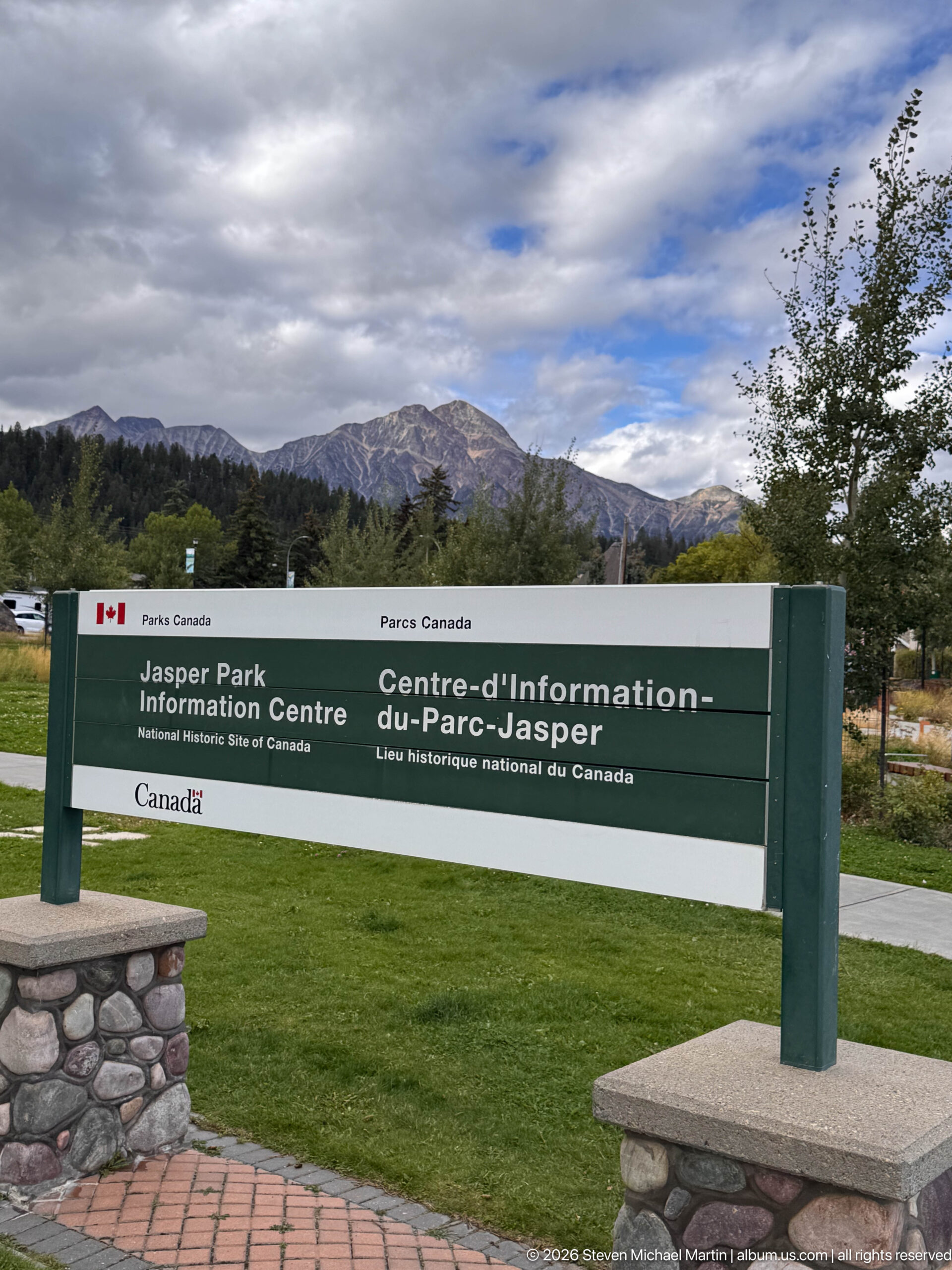
A bilingual Parks Canada sign identifies the Jasper Information Centre as a National Historic Site of Canada. Set against lawn, trees, and a mountain ridge, the long green-and-white marker connects the visitor facility with both its federal heritage status and its Canadian Rockies setting.
Caption
A bilingual Parks Canada sign identifies the Jasper Information Centre as a National Historic Site of Canada. Set against lawn, trees, and a mountain ridge, the long green-and-white marker connects the visitor facility with both its federal heritage status and its Canadian Rockies setting.
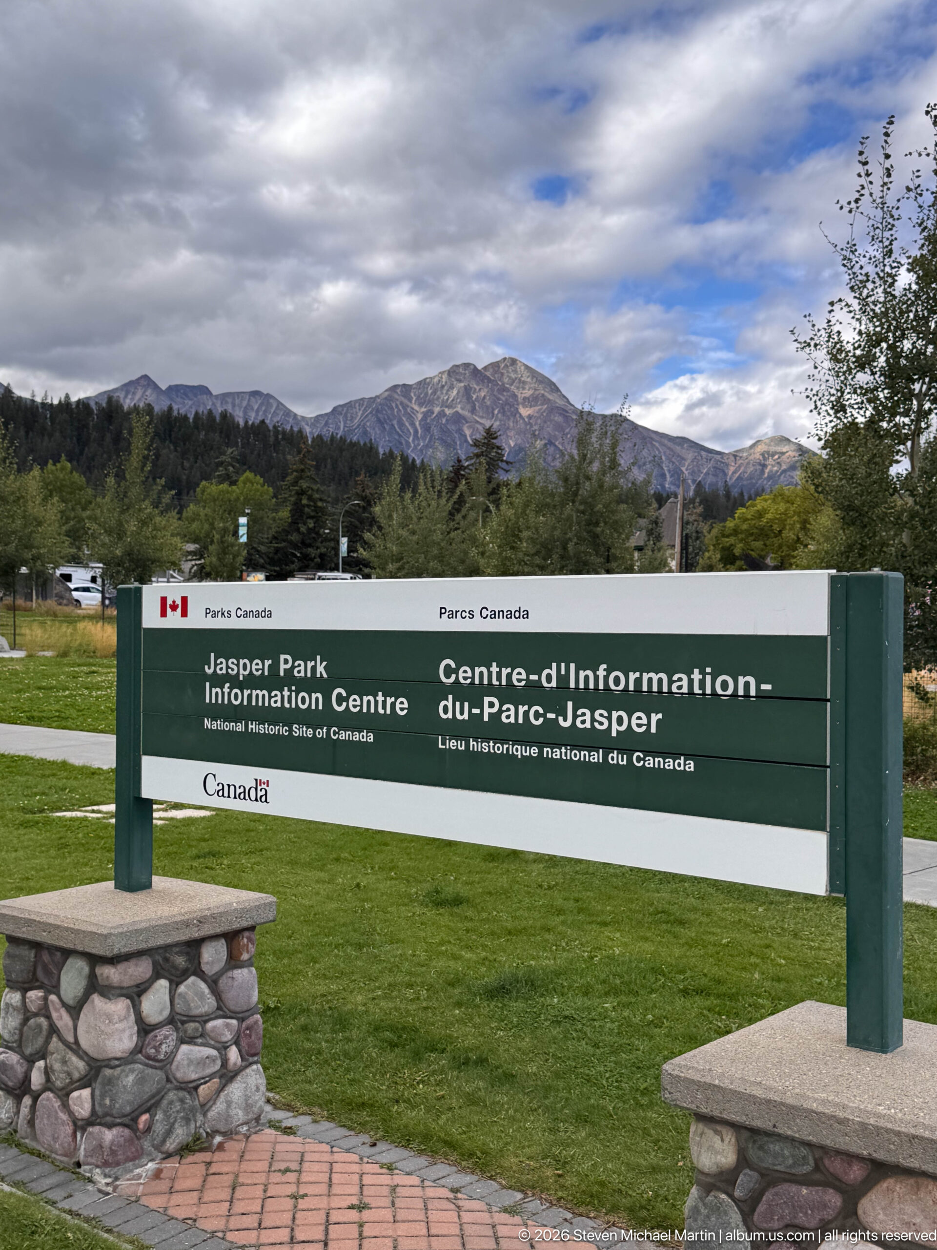
The Jasper Information Centre's bilingual National Historic Site sign stretches across the foreground while a broad mountain ridge rises beyond the landscaped grounds. This slightly shifted composition gives more prominence to the surrounding terrain, placing the heritage marker within the natural setting that defines the townsite.
Caption
The Jasper Information Centre's bilingual National Historic Site sign stretches across the foreground while a broad mountain ridge rises beyond the landscaped grounds. This slightly shifted composition gives more prominence to the surrounding terrain, placing the heritage marker within the natural setting that defines the townsite.
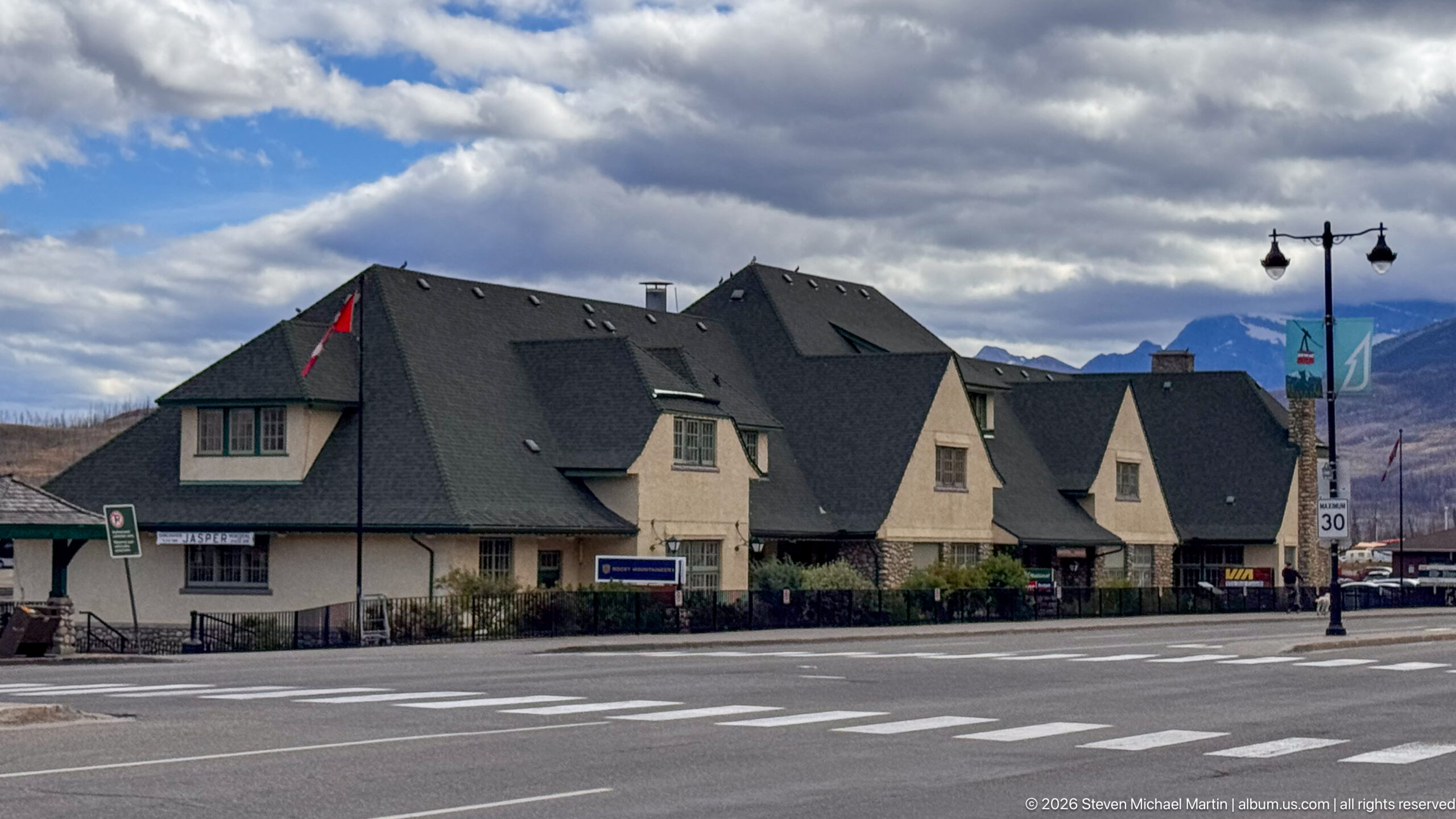
A steep-roofed historic commercial building anchors a Jasper street corner beneath dramatic clouds and mountain slopes. Multiple gables, dormers, pale walls, and dark roof planes give the structure a picturesque mountain-town profile, while crosswalks, signs, and storefront activity establish its active downtown setting.
Caption
A steep-roofed historic commercial building anchors a Jasper street corner beneath dramatic clouds and mountain slopes. Multiple gables, dormers, pale walls, and dark roof planes give the structure a picturesque mountain-town profile, while crosswalks, signs, and storefront activity establish its active downtown setting.
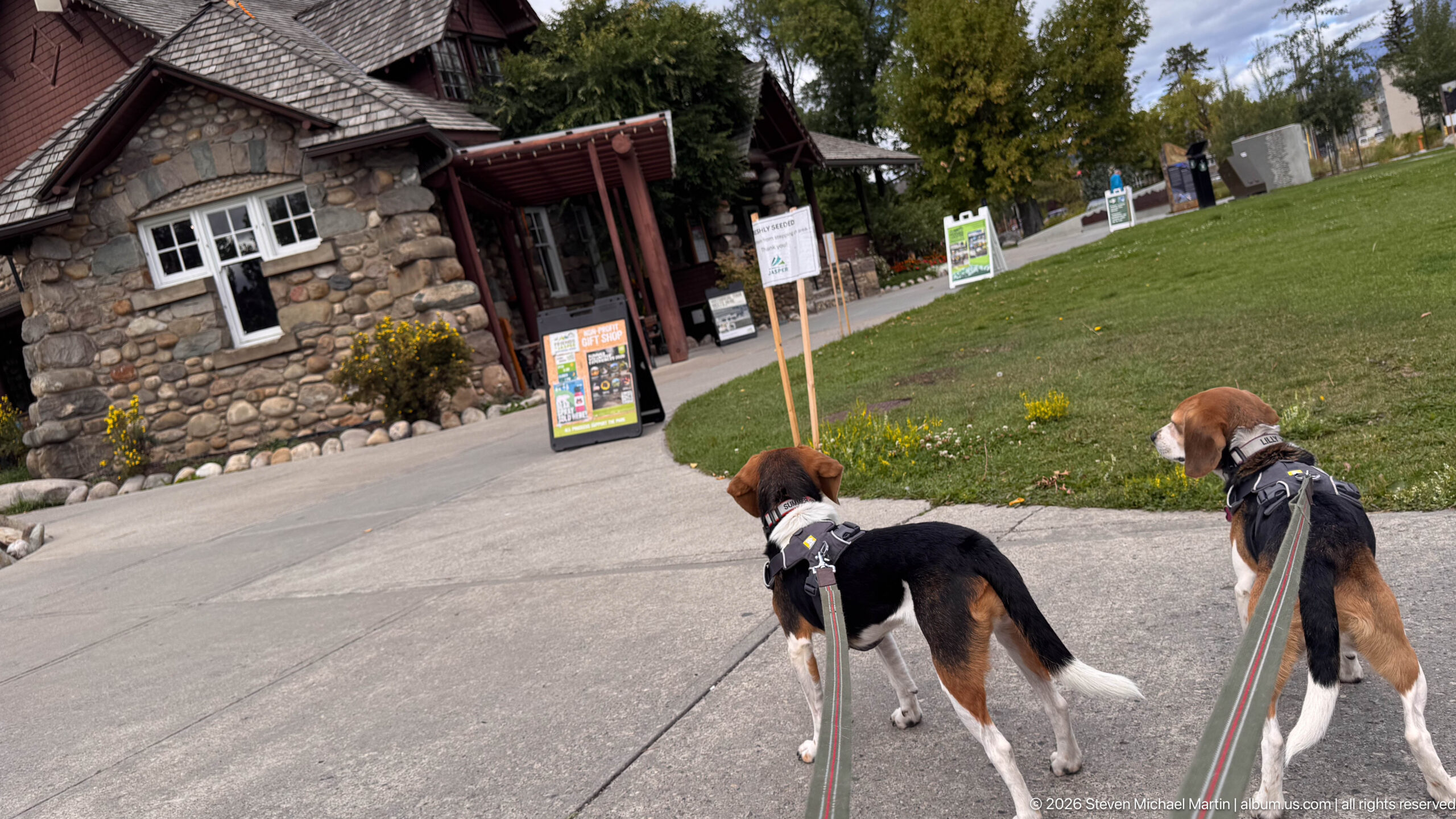
Two leashed beagles walk toward the stone-and-timber Jasper Information Centre across a paved path. The dogs occupy the foreground while the rustic building, lawn, interpretive signs, and mature trees establish the destination, turning the heritage site into part of an everyday pedestrian visit through Jasper.
Caption
Two leashed beagles walk toward the stone-and-timber Jasper Information Centre across a paved path. The dogs occupy the foreground while the rustic building, lawn, interpretive signs, and mature trees establish the destination, turning the heritage site into part of an everyday pedestrian visit through Jasper.
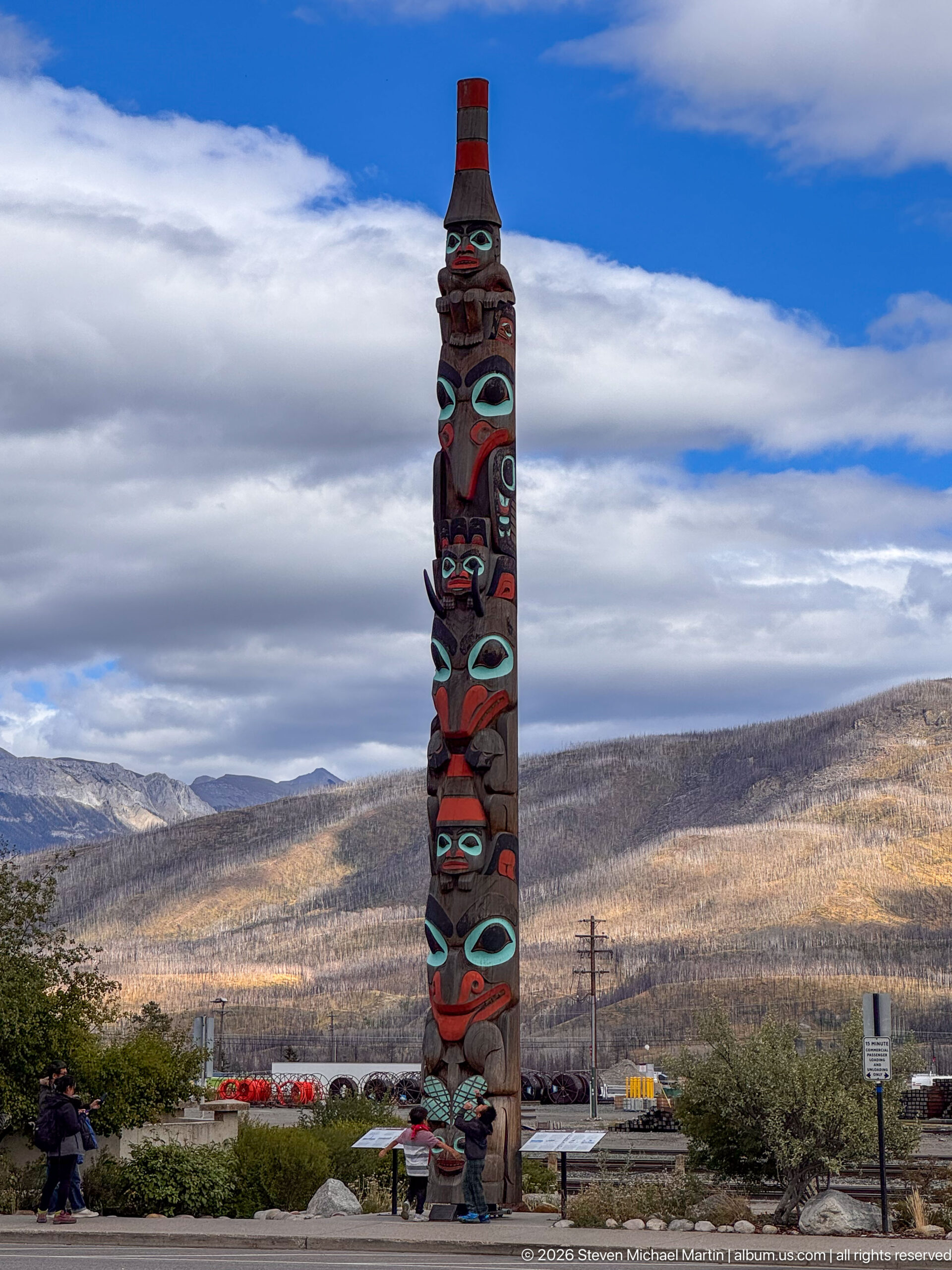
A tall carved and painted totem pole rises against a broad mountain ridge and layered sky in Jasper. Stacked animal and human-like forms in red, black, turquoise, and natural wood tones create a strong vertical landmark, while railway infrastructure and town landscaping remain low on the horizon behind it.
Caption
A tall carved and painted totem pole rises against a broad mountain ridge and layered sky in Jasper. Stacked animal and human-like forms in red, black, turquoise, and natural wood tones create a strong vertical landmark, while railway infrastructure and town landscaping remain low on the horizon behind it.
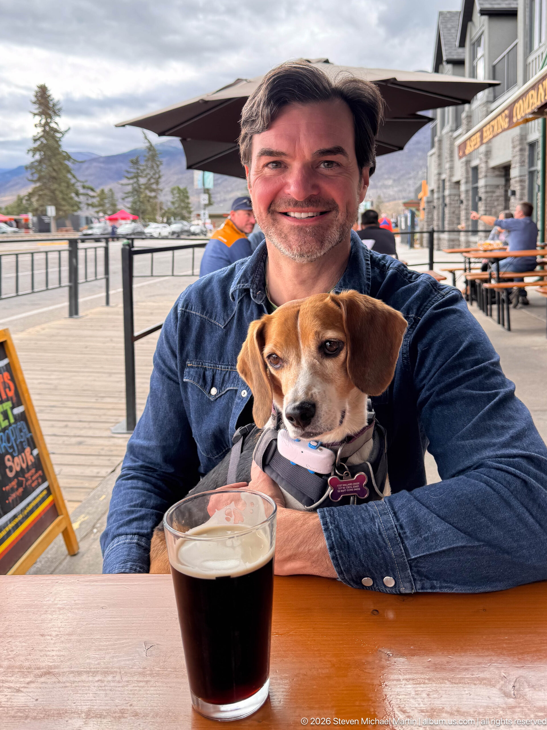
A tricolor beagle sits upright in a traveler's arms at an outdoor Jasper table, with a glass of dark beverage centered in the foreground. Patio umbrellas, railings, and storefronts frame the pair, giving the image a relaxed townsite character distinct from the portfolio's architectural and interpretive views.
Caption
A tricolor beagle sits upright in a traveler's arms at an outdoor Jasper table, with a glass of dark beverage centered in the foreground. Patio umbrellas, railings, and storefronts frame the pair, giving the image a relaxed townsite character distinct from the portfolio's architectural and interpretive views.
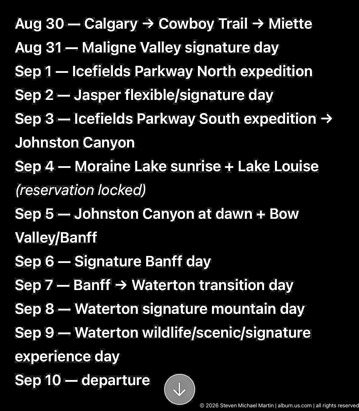
A black digital itinerary screen lists a sequence of September travel days through Jasper, the Icefields Parkway, Banff, Waterton, and surrounding destinations. The compact schedule records the trip's planned progression from arrival and wildlife days through lake, canyon, and scenic excursions to departure.
Caption
A black digital itinerary screen lists a sequence of September travel days through Jasper, the Icefields Parkway, Banff, Waterton, and surrounding destinations. The compact schedule records the trip's planned progression from arrival and wildlife days through lake, canyon, and scenic excursions to departure.
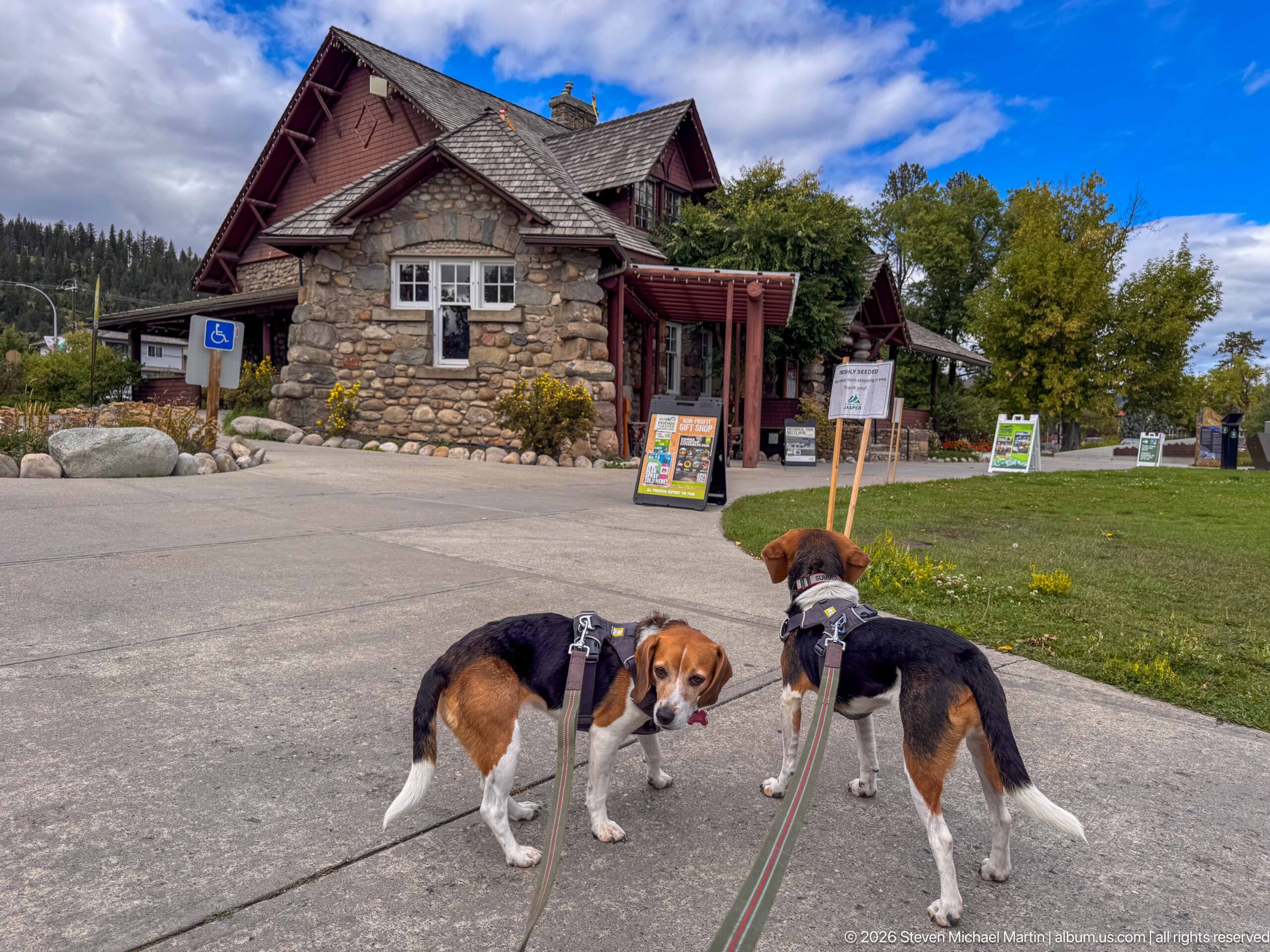
Two tricolor beagles pause on the paved approach to the Jasper Information Centre, one turning toward the camera while the other faces the building. The rustic stone walls, deep roof, lawn, and visitor signage provide a clear architectural setting, while the dogs give the scene an informal travel perspective.
Caption
Two tricolor beagles pause on the paved approach to the Jasper Information Centre, one turning toward the camera while the other faces the building. The rustic stone walls, deep roof, lawn, and visitor signage provide a clear architectural setting, while the dogs give the scene an informal travel perspective.
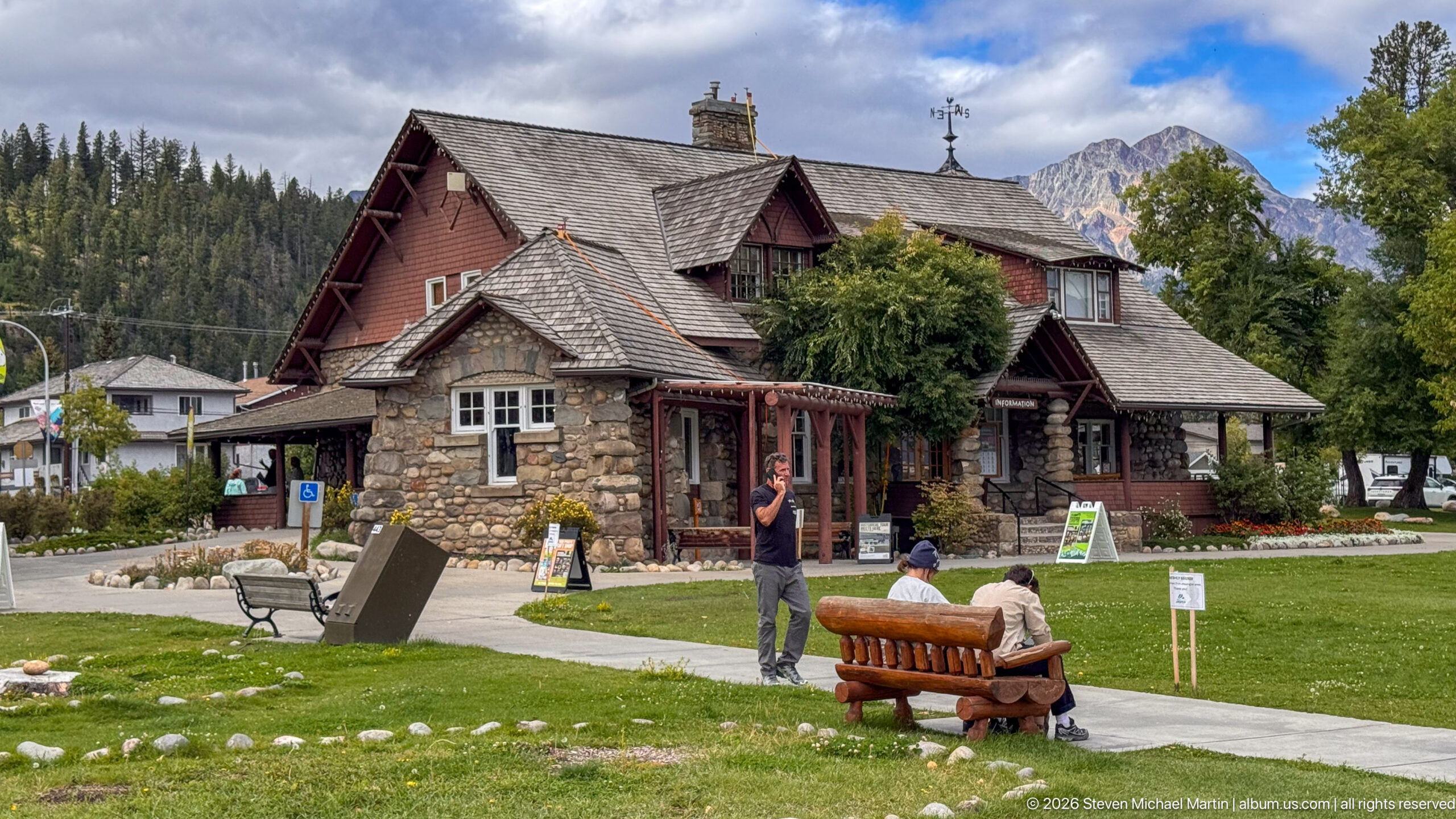
Stone walls, shingled gables, timber details, and deep roof planes give the Jasper Information Centre its distinctive rustic profile. Seen across a green lawn with benches and visitors, the building reads as both a historic landmark and an active public facility, with mountains rising immediately behind the townsite.
Caption
Stone walls, shingled gables, timber details, and deep roof planes give the Jasper Information Centre its distinctive rustic profile. Seen across a green lawn with benches and visitors, the building reads as both a historic landmark and an active public facility, with mountains rising immediately behind the townsite.
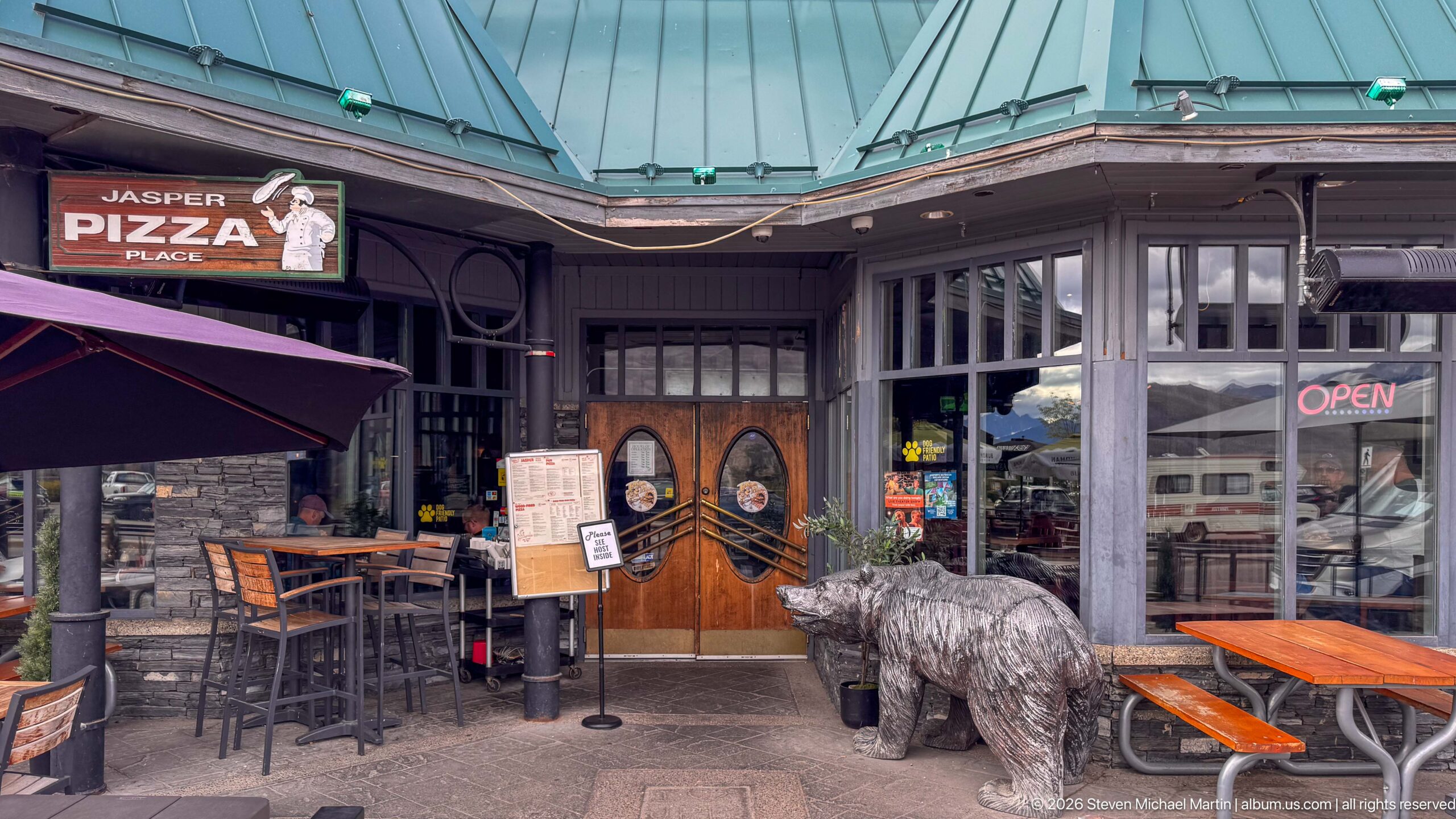
The entrance to Jasper Pizza Place sits beneath a green metal roof, with carved wooden double doors, an illuminated open sign, outdoor tables, and a large bear sculpture clustered around the storefront. The close street-level view records the playful commercial character of downtown Jasper's restaurant scene.
Caption
The entrance to Jasper Pizza Place sits beneath a green metal roof, with carved wooden double doors, an illuminated open sign, outdoor tables, and a large bear sculpture clustered around the storefront. The close street-level view records the playful commercial character of downtown Jasper's restaurant scene.
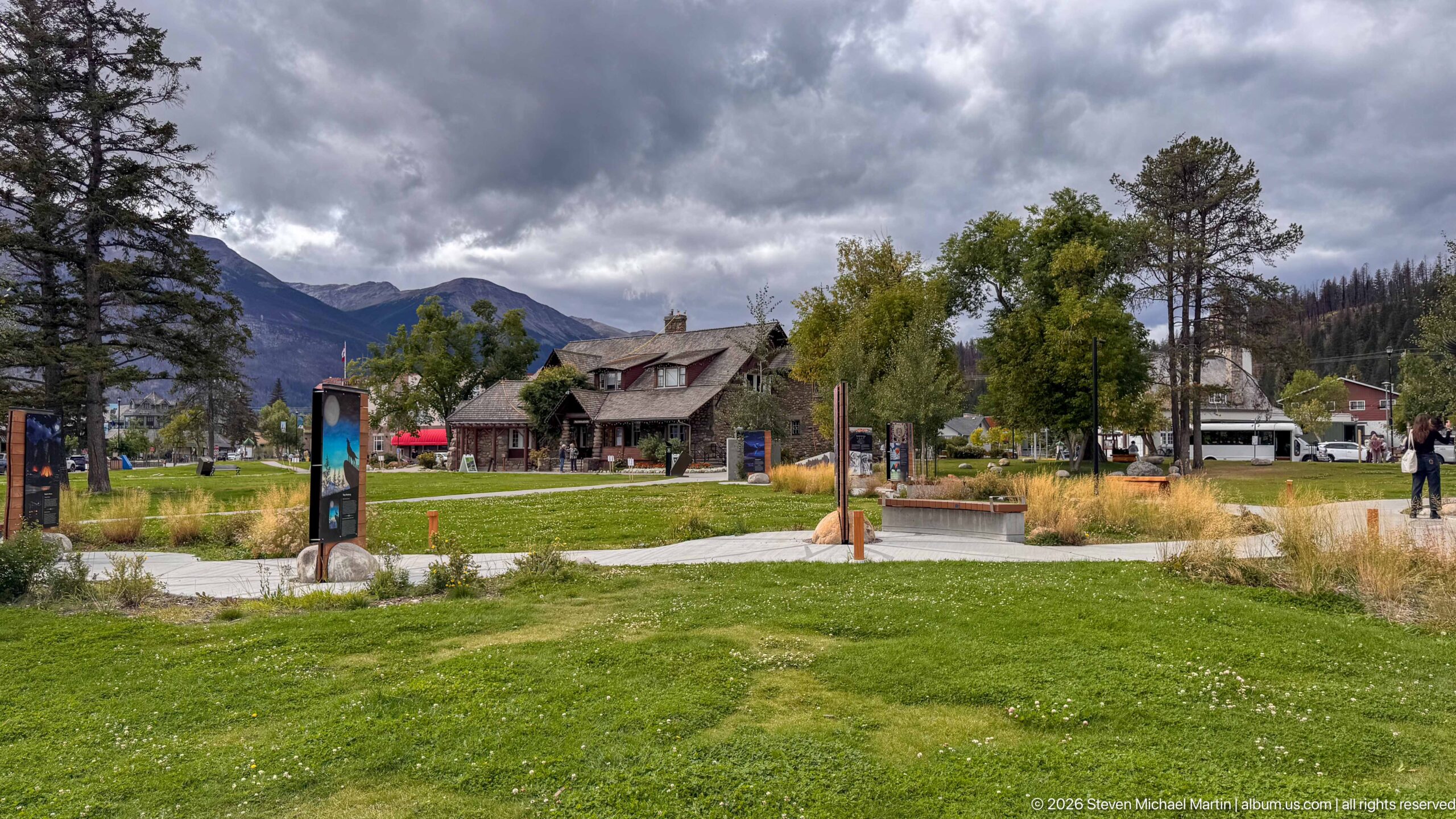
A broad lawn, curving paths, native-looking plantings, and interpretive elements lead toward the Jasper Information Centre beneath a dark, unsettled sky. The distant building is partially framed by mature trees and mountains, giving this view greater emphasis to the landscaped public space surrounding the historic site.
Caption
A broad lawn, curving paths, native-looking plantings, and interpretive elements lead toward the Jasper Information Centre beneath a dark, unsettled sky. The distant building is partially framed by mature trees and mountains, giving this view greater emphasis to the landscaped public space surrounding the historic site.
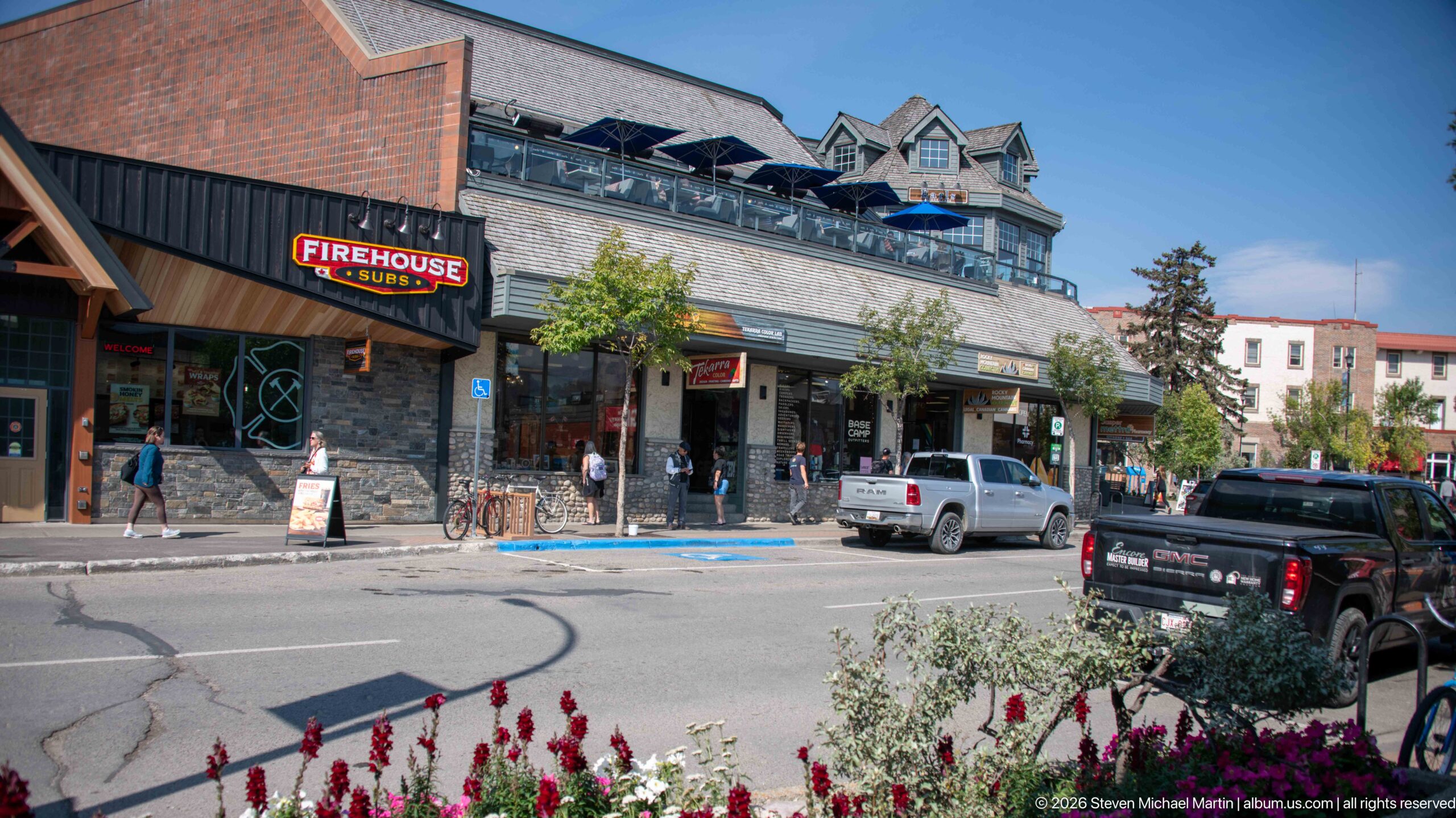
A downtown Jasper commercial block combines stone-faced storefronts, upper-level terraces, steep decorative gables, parked vehicles, and flower beds along the street. A Firehouse Subs sign provides a clear business landmark within the broader streetscape, while the mixed façade treatments illustrate the town's contemporary mountain-commercial character.
Caption
A downtown Jasper commercial block combines stone-faced storefronts, upper-level terraces, steep decorative gables, parked vehicles, and flower beds along the street. A Firehouse Subs sign provides a clear business landmark within the broader streetscape, while the mixed façade treatments illustrate the town's contemporary mountain-commercial character.
🏞️ National Park Field Guide
📍 Overview
Jasper Town and Visitor Center presents the unusual meeting point of national-park landscape, historic architecture, transportation, interpretation, and everyday town life. The portfolio moves between the Jasper Information Centre, Jasper railway station, downtown streets, visitor maps and interpretive displays, while repeatedly returning to the Canadian Rockies that surround the community. Rather than separating the town from the national park, these photographs show how Jasper functions within it: a place where visitors orient themselves to a much larger protected landscape and where buildings, roads, railway infrastructure, public spaces, and mountain scenery remain visually interconnected.
🏔️ Landscape
Jasper occupies a broad mountain setting in which the scale of the Canadian Rockies is apparent even from the developed townsite. Mountains rise behind the railway station, visitor facilities, commercial streets, signs, lawns, and outdoor gathering places, continually placing the built environment within a larger natural setting. Several elevated landscape views extend that relationship beyond town, showing turquoise braided river channels divided by pale gravel bars, broad conifer forests, and steep mountain walls. Visitor maps and guide material reinforce the same spatial pattern, presenting Jasper as a starting point for movement through valleys, lakes, trails, hot springs, waterfalls, and the Icefields Parkway.
🪨 Geology
The portfolio’s strongest geological evidence appears in its broad valley landscapes rather than in close studies of individual rock formations. Elevated views show a river divided into multiple turquoise channels around exposed gravel bars and islands, demonstrating an active valley floor where flowing water and transported sediment continually shape the visible landscape. Steep, layered and jagged mountain masses rise abruptly beyond the forested lowlands, creating the strong contrast between valley floor and high-relief terrain that defines the photographed setting. Because the photographs do not establish specific formations or individual peaks, the most useful interpretation is at this larger scale: mountains, river channels, sediment deposits, and valley topography together provide the physical framework within which Jasper’s ecosystems and human development are situated.
🌿 Ecology
Conifer forest, river corridors, gravel bars, mountain slopes, and developed town edges form the principal ecological settings visible in the portfolio. The photographed river valley demonstrates how water, exposed sediment, forest, and mountainous terrain occur together across a broad natural system, while visitor materials connect Jasper with additional habitats along the Icefields Parkway and Maligne Valley. Wildlife interpretation appears prominently in park information, including a road-safety panel featuring a bighorn ewe and lamb and instructions for motorists to slow down and remain in their vehicles. Within this portfolio that wildlife evidence is interpretive rather than a documented encounter in the landscape, but it illustrates an important ecological reality of Jasper: wildlife habitat and human transportation corridors can overlap, making visitor behavior part of responsible park use.
🦌 Wildlife Encounters
Photographs in this portfolio document wildlife encounters with wildlife safety guide in the Jasper landscape. The photographs place these animals in settings that include Bighorn sheep road-safety visitor-guide panel. These encounters provide direct, visit-specific evidence of how wildlife uses the habitats interpreted in this field guide.
🦌 Wildlife
Wildlife appears throughout the Jasper visitor environment as an important element of park identity and interpretation. A bighorn ewe and lamb are featured in visitor information explaining safe behavior around animals near roads, while bear, elk, bison, and eagle imagery appears in taxidermy, historic travel emblems, public art, signage, and commercial decoration. These representations should not be read as records of wildlife encounters during the photographed visit; instead, they show how strongly animals are woven into the visual language used to interpret and represent the Canadian Rockies. The portfolio therefore documents wildlife most clearly through education, cultural imagery, and visitor-safety messaging rather than through direct observation of free-ranging animals.
🧭 Human History
Jasper’s human history is especially visible through its railway and heritage architecture. The railway station is documented from the platform, exterior elevations, entrances, waiting room, ticket counters, structural framing, historic displays, and heritage signage. Its fieldstone base, pale stucco, green trim, heavy timber structure, clerestory windows, passenger benches, and exposed roof framing demonstrate the architectural character preserved within an active transportation facility. Exhibits inside the station expand the story through archival photographs of construction, railway workers, station life, special events, historic railway advertising, and heritage stations across Canada. Nearby, the Jasper Information Centre is identified by official signage and a commemorative plaque as a National Historic Site; photographs record its rough stone walls, shingled roofs, dormers, timber details, landscaped grounds, and relationship to the surrounding mountains. Indigenous history and continuing cultural presence also enter the visitor landscape through interpretive installations, including an Alexis Nakota Sioux Nation panel and broader Indigenous welcome material. Together these elements present Jasper not simply as a service town inside a national park, but as a place shaped by Indigenous relationships with the landscape, railway development, federal park administration, tourism, transportation, and heritage conservation.
🥾 Visitor Experience
Jasper works particularly well as a place of orientation. Maps and visitor guides in the portfolio organize the national park into routes and destinations, including the townsite, Maligne Valley, the Icefields Parkway, trails, hot springs, waterfalls, campgrounds, and other visitor facilities. Within town, the experience is more intimate and pedestrian: paths cross landscaped grounds around the Jasper Information Centre, the railway station remains accessible as both a working facility and a heritage interior, and commercial streets provide restaurants, patios, shops, and gathering places beneath the surrounding mountains. Historic highway and travel signs add another layer to this sense of movement, recalling the Trans-Canada Highway, Yellowhead Route, and Rocky Mountain Trail. The result is a visitor experience in which orientation, transportation, heritage, recreation, and ordinary town life overlap before travelers continue outward into the larger park.
📷 Photography Notes
The portfolio gains much of its strength from alternating scale. Wide views place the Jasper Information Centre, railway station, streets, and river valley within their mountain setting, while tighter photographs isolate fieldstone masonry, green doors, timber trusses, clerestory windows, benches, signs, plaques, maps, archival displays, and other details that explain how these places function and why they matter. Symmetrical compositions inside the railway station emphasize the long central aisle and structural rhythm of the passenger hall, whereas oblique exterior views reveal changes in material and roof form. Signs and interpretive panels are photographed closely enough to preserve their role as historical evidence, while broader town views retain pedestrians, patios, bicycles, dogs, landscaping, and vehicles as indicators of contemporary use. Taken together, the photographs treat Jasper as both landscape and lived place, using architectural detail, documentary evidence, human-scale activity, and mountain context to connect the townsite with the national park around it.