Jasper Icefield Sunwapta Falls
Sunwapta Falls is a powerful waterfall on the Sunwapta River in Jasper National Park, reached from the Icefields Parkway south of the Jasper townsite. Fed by meltwater originating at the Athabasca Glacier, the river carries glacial water northward through the Canadian Rockies before plunging over the falls and into a narrow rock gorge. Surrounded by dense conifer forest and mountain terrain, Sunwapta Falls combines the broad scale of the Icefields Parkway landscape with an unusually close view of the erosive force of moving water.
The falls occupy an important transition in the park’s glacially shaped landscape, where the smaller hanging Chaba Valley meets the deeper Athabasca Valley. Here the Sunwapta River descends in a stepping waterfall before being compressed into a deeply incised limestone gorge. The main falls can be viewed from several established overlooks and from a wooden bridge crossing the river, providing perspectives both upstream across the approaching rapids and downward into the confined canyon. Farther downstream, a trail leads to Lower Sunwapta Falls, a succession of smaller waterfalls flowing through narrow rock channels.
Sunwapta Falls is especially effective as a place to see the continuing relationship between glaciers, rivers, geology, and erosion in Jasper National Park. Water originating high in the Columbia Icefield landscape is still reshaping the valley as it moves through the Sunwapta River system, exploiting fractures and weaknesses in the underlying rock and carrying sediment downstream. From the turquoise glacial water and exposed rock ledges to the surrounding forest and distant mountains, the falls provide a compact expression of the natural processes that have shaped—and continue to shape—the Canadian Rockies.
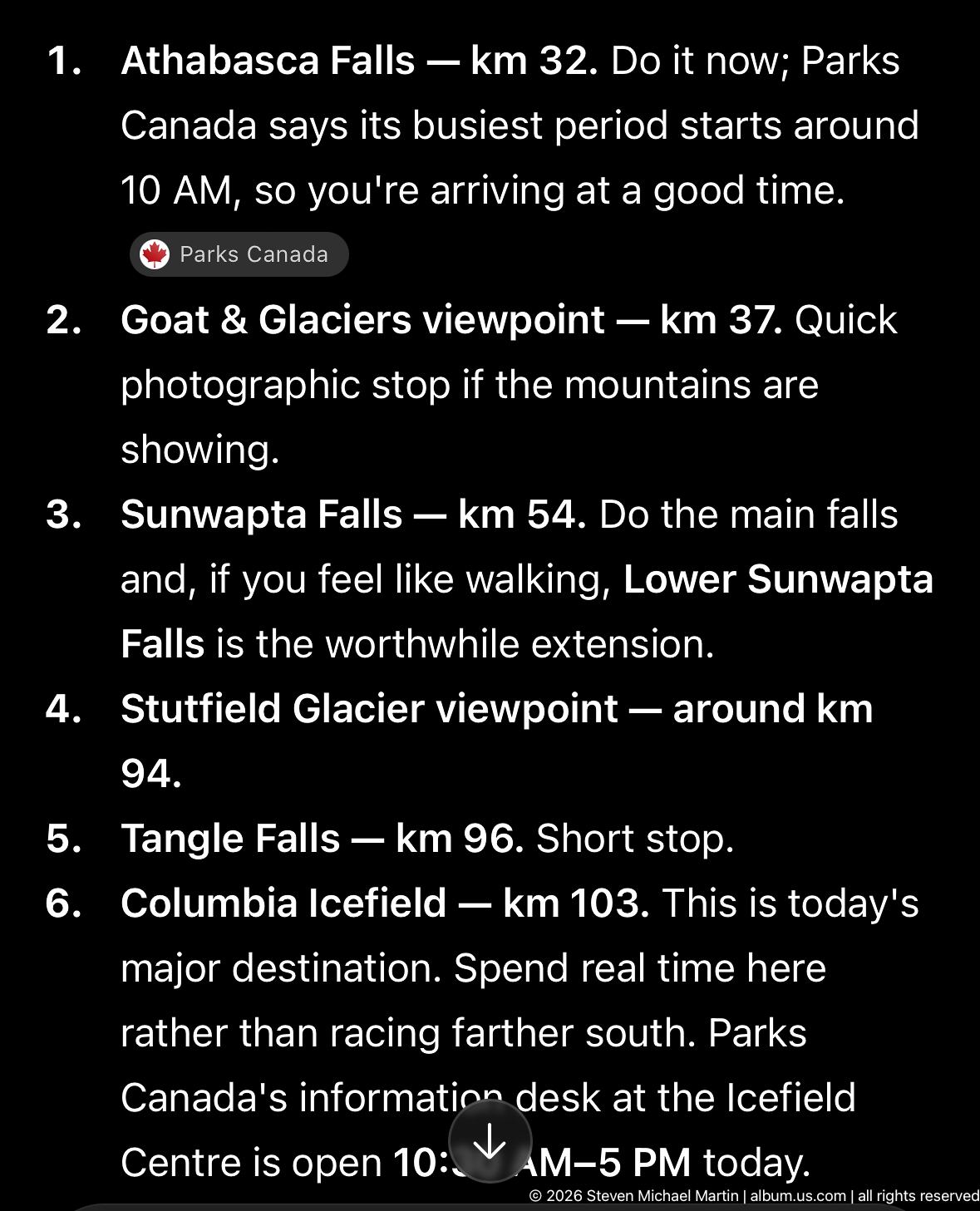
An itinerary screen places Sunwapta Falls at kilometer 54 on a southbound Icefields Parkway route, between the Goat & Glaciers viewpoint and Stutfield Glacier viewpoint. The notes distinguish the main falls from the optional Lower Sunwapta Falls walk, providing documentary context for the waterfall visit rather than a view of the landscape itself.
Caption
An itinerary screen places Sunwapta Falls at kilometer 54 on a southbound Icefields Parkway route, between the Goat & Glaciers viewpoint and Stutfield Glacier viewpoint. The notes distinguish the main falls from the optional Lower Sunwapta Falls walk, providing documentary context for the waterfall visit rather than a view of the landscape itself.
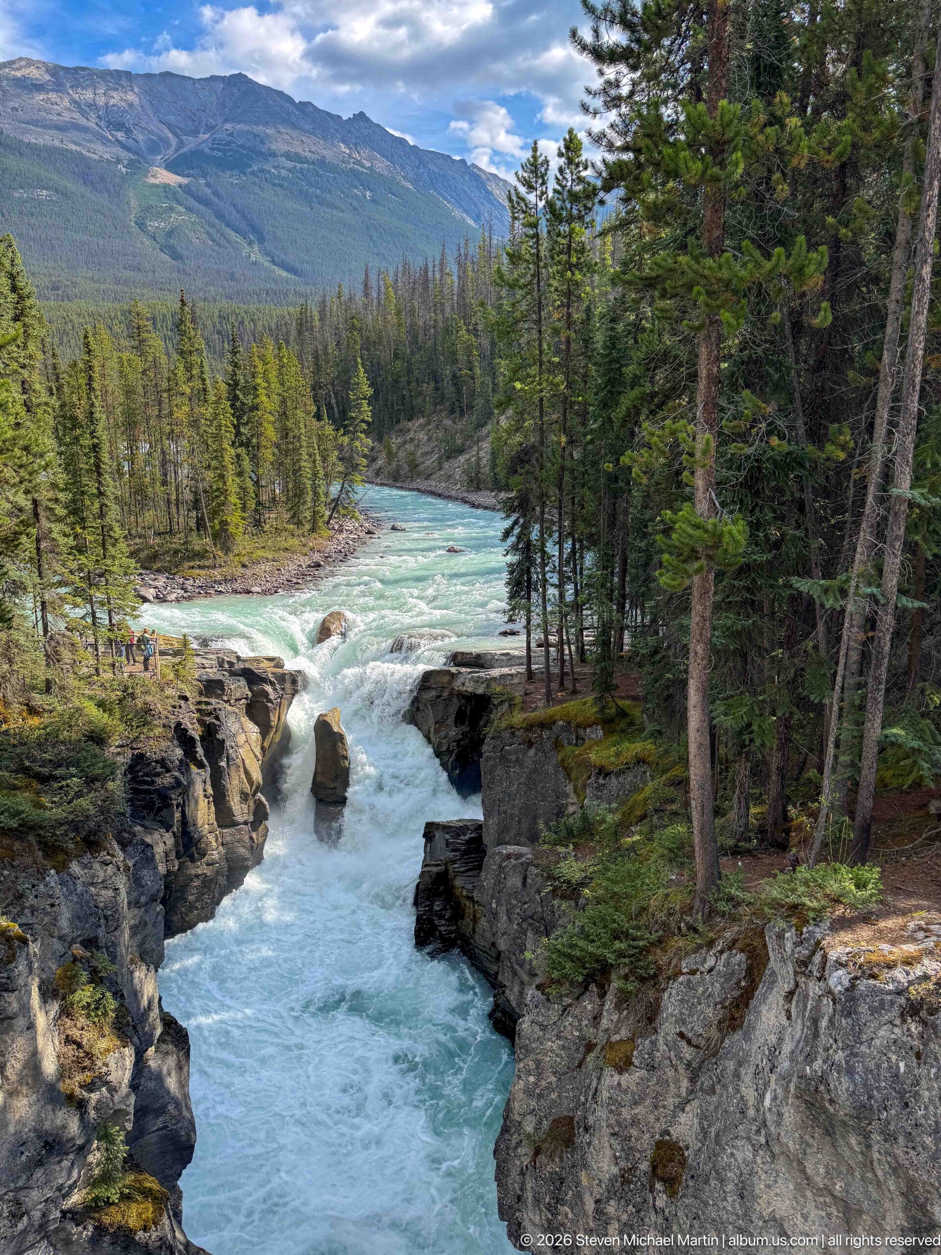
From an elevated viewpoint, the Sunwapta River drops into its confined gorge as the channel curves through dense conifer forest. The central rock and sculpted canyon margins anchor the foreground, while the broader river, forest, and mountain slopes beyond show the waterfall within its larger Jasper National Park setting.
Caption
From an elevated viewpoint, the Sunwapta River drops into its confined gorge as the channel curves through dense conifer forest. The central rock and sculpted canyon margins anchor the foreground, while the broader river, forest, and mountain slopes beyond show the waterfall within its larger Jasper National Park setting.
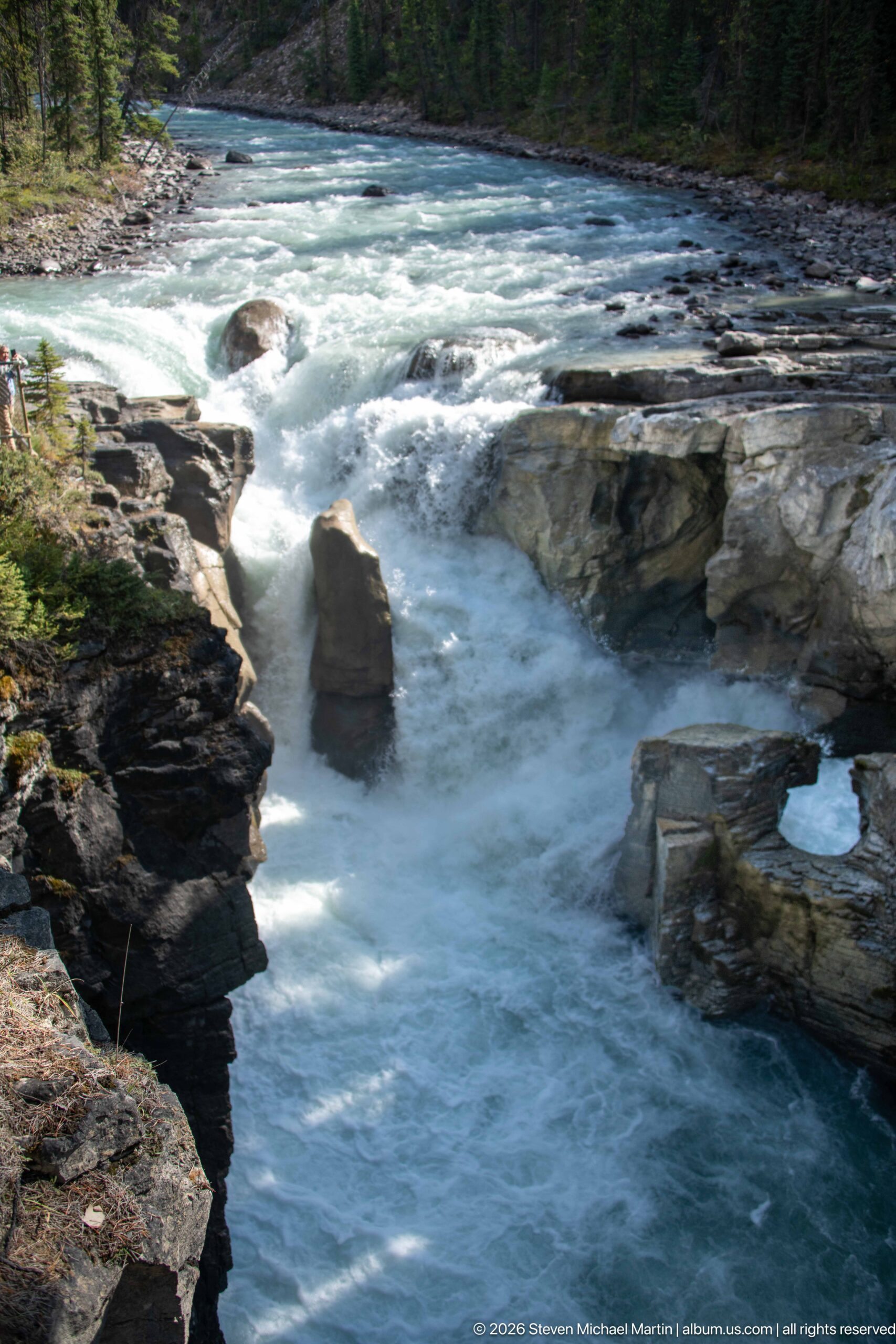
The Sunwapta River funnels around a tall, isolated rock at the lip of the gorge, turning from blue-green current to white water as it descends between layered rock ledges. The tighter composition concentrates on the distinctive channel geometry and erosional setting of the main Sunwapta Falls.
Caption
The Sunwapta River funnels around a tall, isolated rock at the lip of the gorge, turning from blue-green current to white water as it descends between layered rock ledges. The tighter composition concentrates on the distinctive channel geometry and erosional setting of the main Sunwapta Falls.
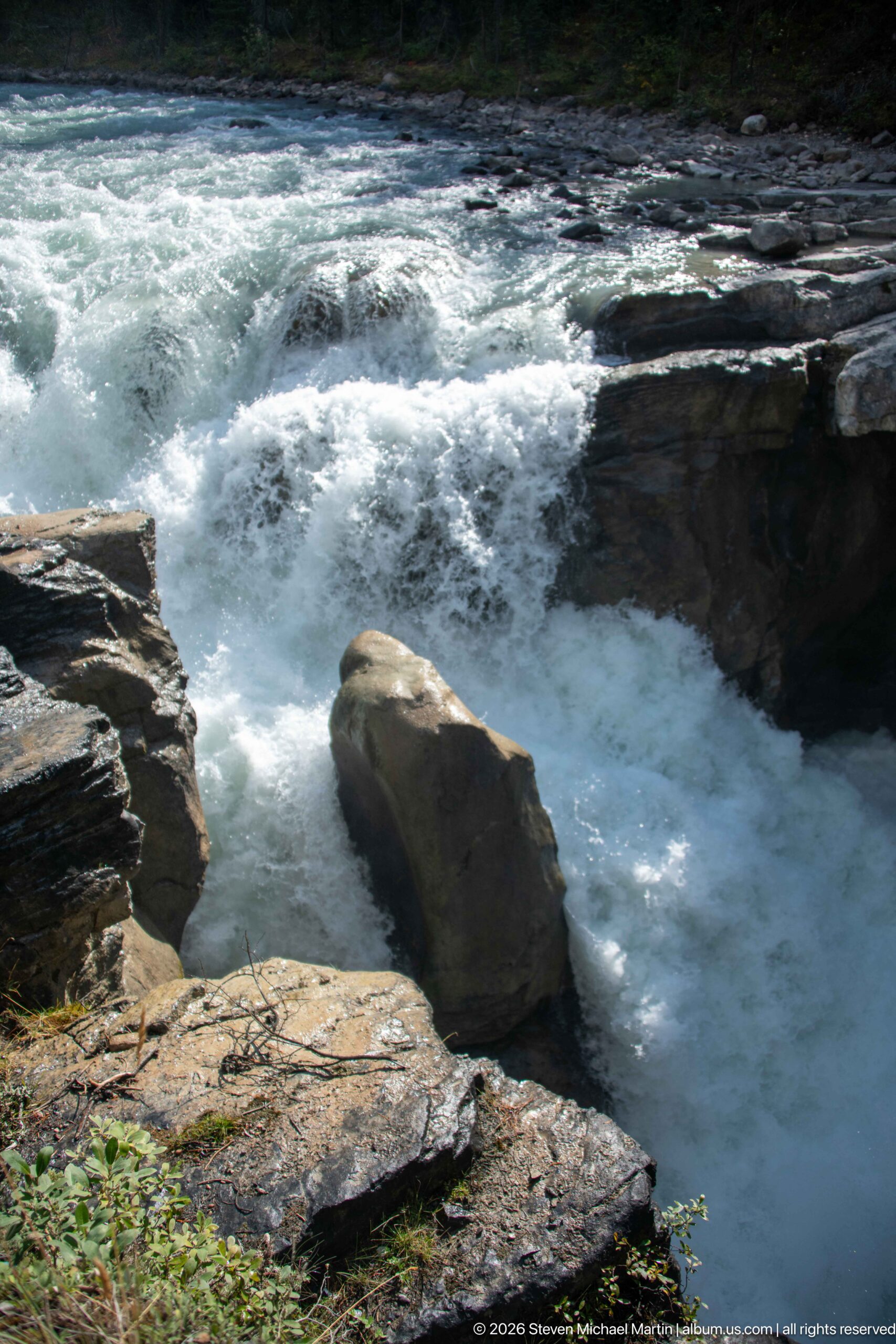
Immediately above the main drop, turbulent Sunwapta River water courses around a large angular boulder and over dark, layered rock ledges. This close study isolates the river's force and the resistant rock forms that constrict the channel, without relying on a broad landscape view.
Caption
Immediately above the main drop, turbulent Sunwapta River water courses around a large angular boulder and over dark, layered rock ledges. This close study isolates the river's force and the resistant rock forms that constrict the channel, without relying on a broad landscape view.
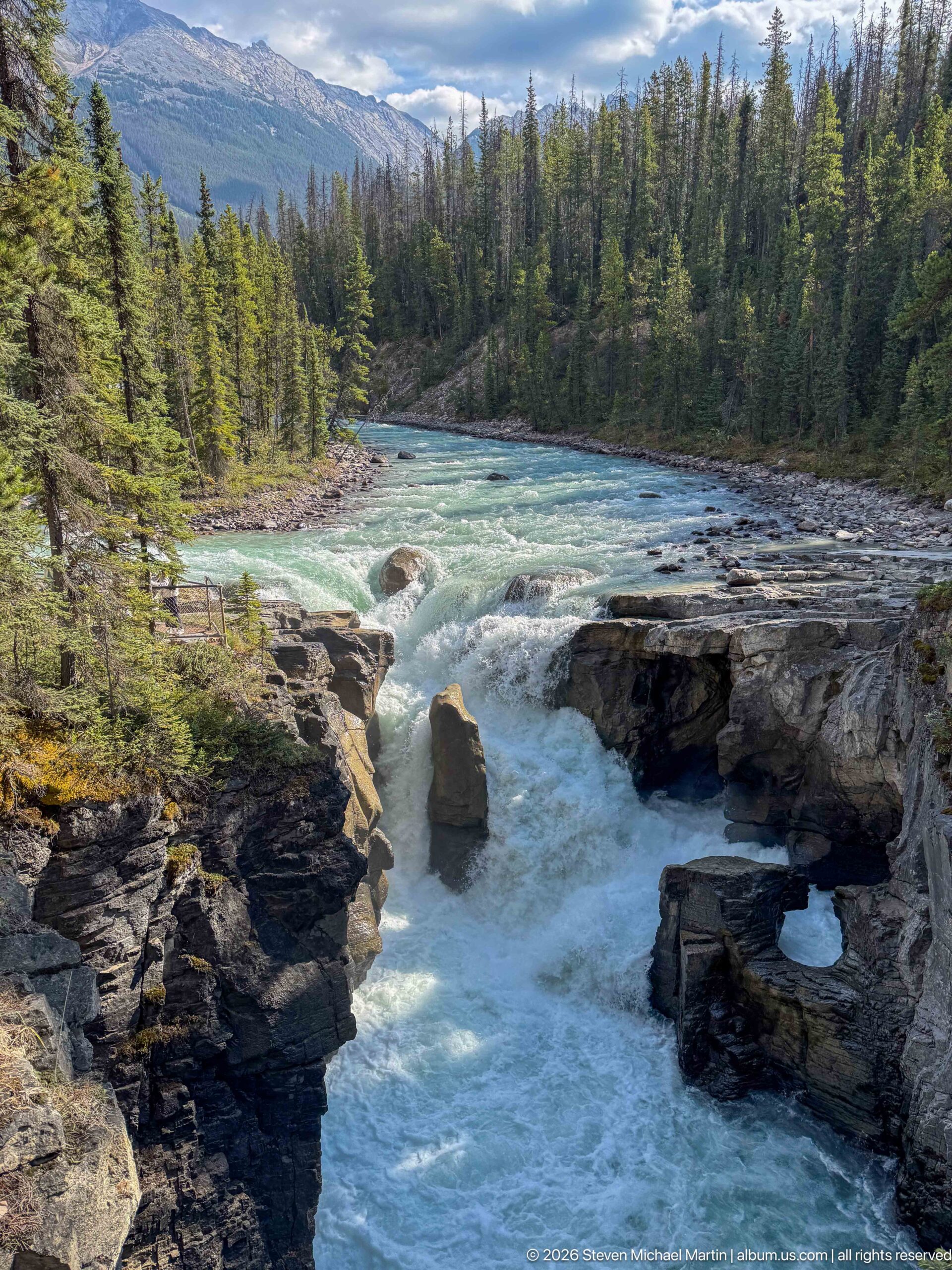
The Sunwapta River surges over a rocky drop and into the narrow gorge at Sunwapta Falls, with a prominent mid-channel rock dividing the white water. Layered rock walls and dense conifer forest frame the channel, while distant mountain slopes broaden the view into the surrounding Canadian Rockies landscape.
Caption
The Sunwapta River surges over a rocky drop and into the narrow gorge at Sunwapta Falls, with a prominent mid-channel rock dividing the white water. Layered rock walls and dense conifer forest frame the channel, while distant mountain slopes broaden the view into the surrounding Canadian Rockies landscape.
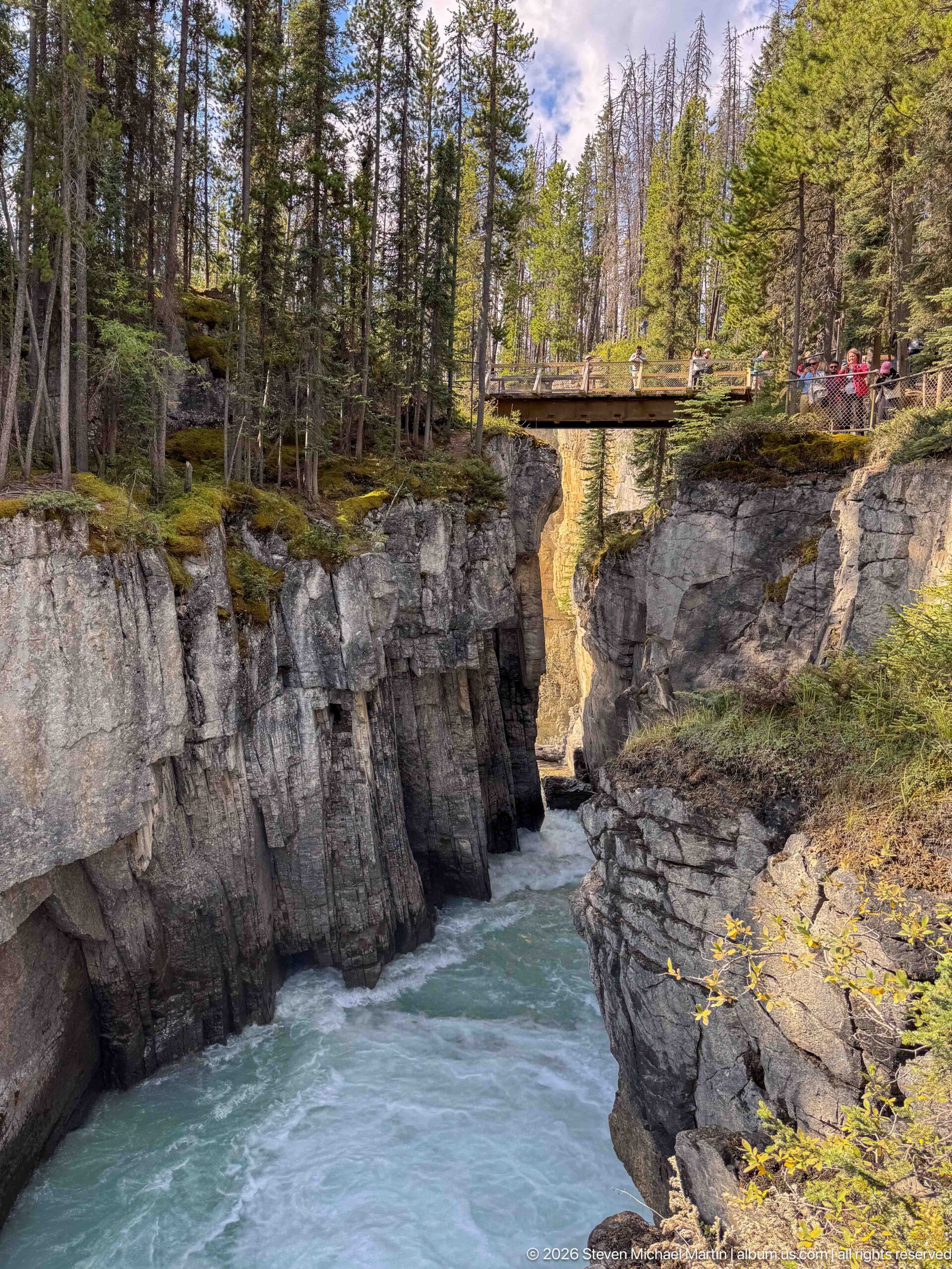
A wooden pedestrian bridge crosses the deeply cut gorge at Sunwapta Falls, where the river is confined between steep, fractured rock walls. Visitors gathered along the bridge provide scale for the canyon, while the shaded water below demonstrates how abruptly the broad river corridor narrows at the falls.
Caption
A wooden pedestrian bridge crosses the deeply cut gorge at Sunwapta Falls, where the river is confined between steep, fractured rock walls. Visitors gathered along the bridge provide scale for the canyon, while the shaded water below demonstrates how abruptly the broad river corridor narrows at the falls.
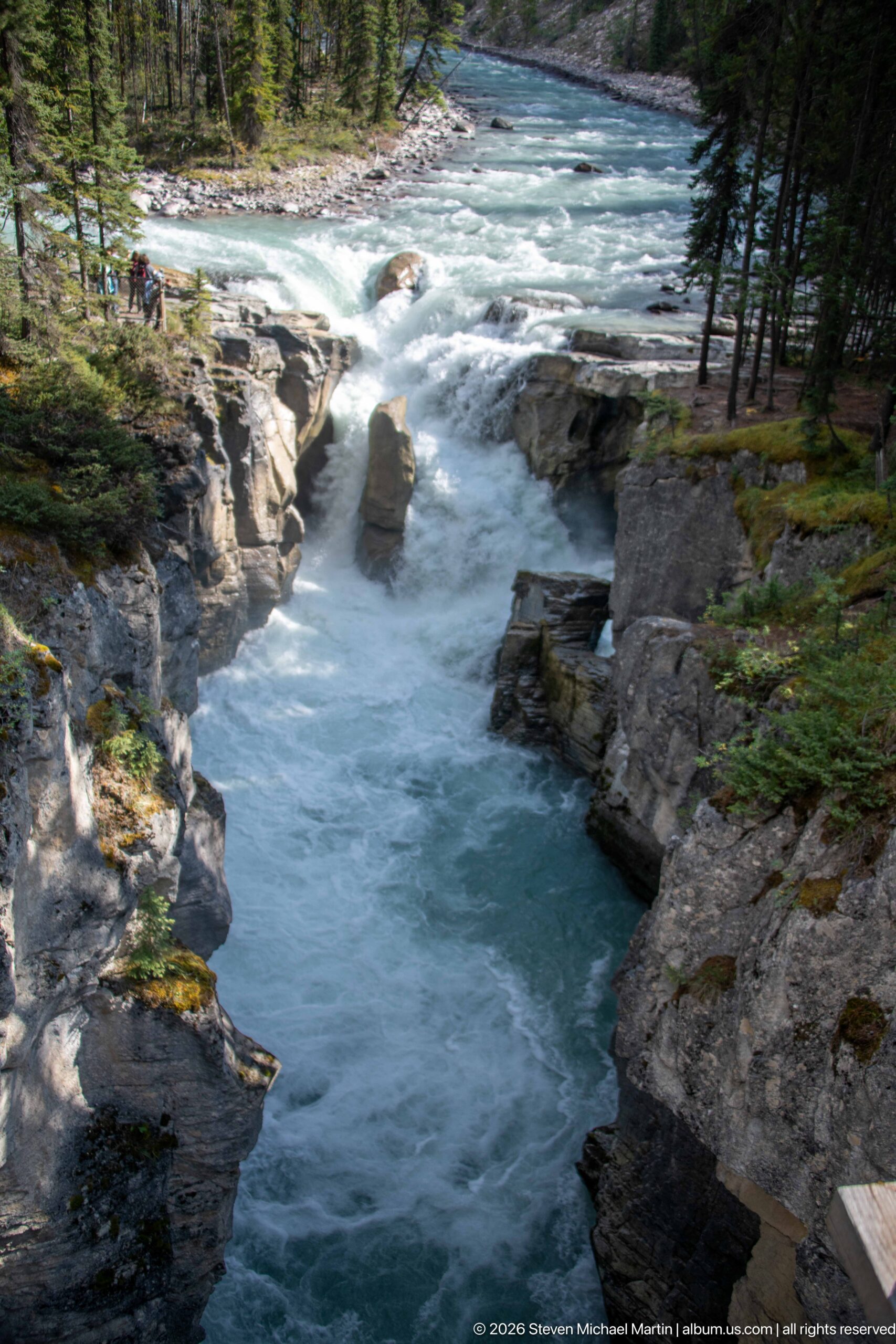
An elevated overview follows the Sunwapta River from its broader turquoise upstream channel into the constricted white-water drop of Sunwapta Falls. The central rock, stepped ledges, and forested canyon walls clearly show the transition from open river to narrow gorge that defines the site.
Caption
An elevated overview follows the Sunwapta River from its broader turquoise upstream channel into the constricted white-water drop of Sunwapta Falls. The central rock, stepped ledges, and forested canyon walls clearly show the transition from open river to narrow gorge that defines the site.
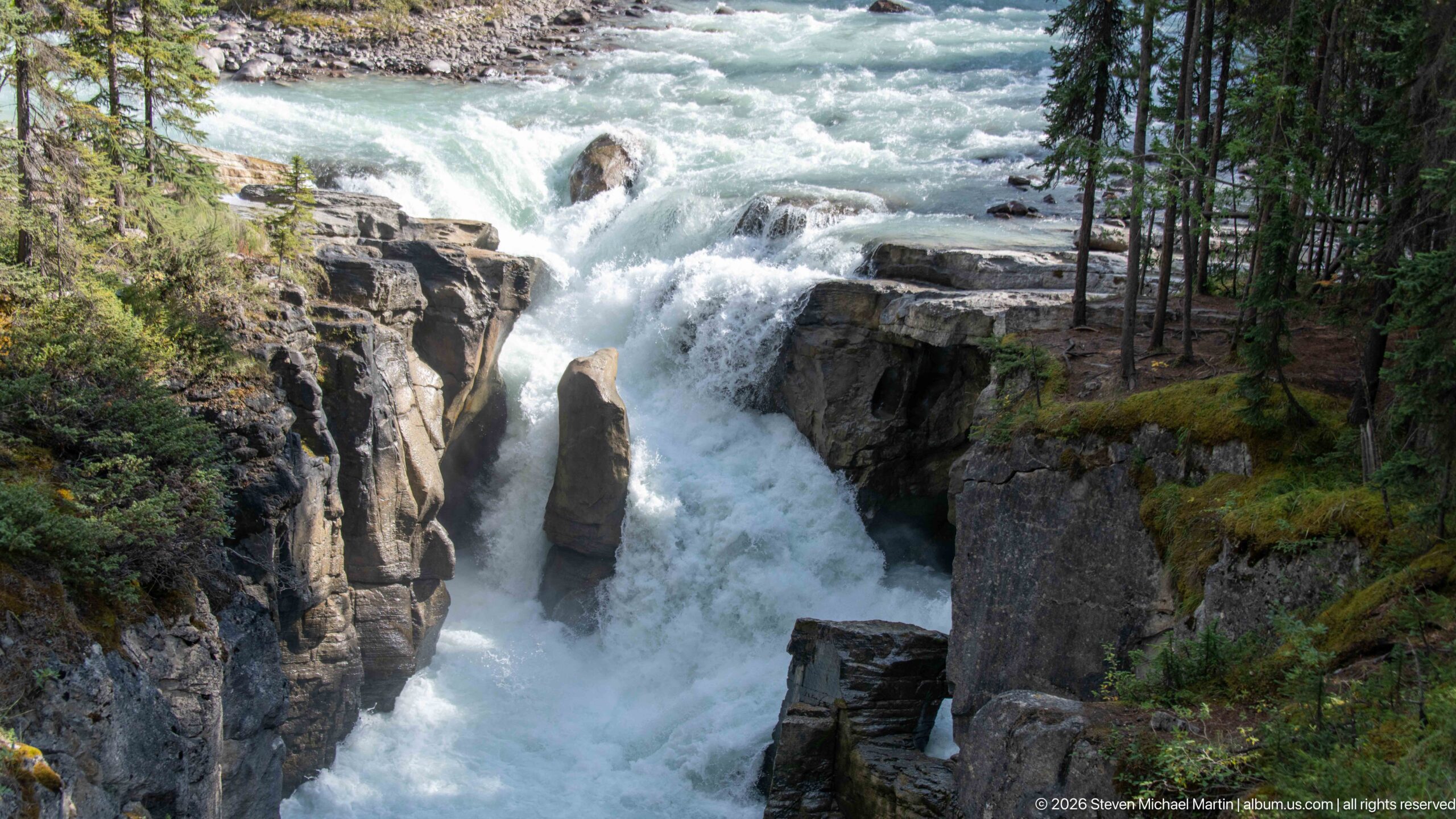
The main Sunwapta Falls drop fills the frame as white water divides around the tall central rock and plunges between steep canyon walls. Conifers cling to the gorge margins, and the upstream rapids remain visible above the drop, creating a clear overview of the waterfall's characteristic form.
Caption
The main Sunwapta Falls drop fills the frame as white water divides around the tall central rock and plunges between steep canyon walls. Conifers cling to the gorge margins, and the upstream rapids remain visible above the drop, creating a clear overview of the waterfall's characteristic form.
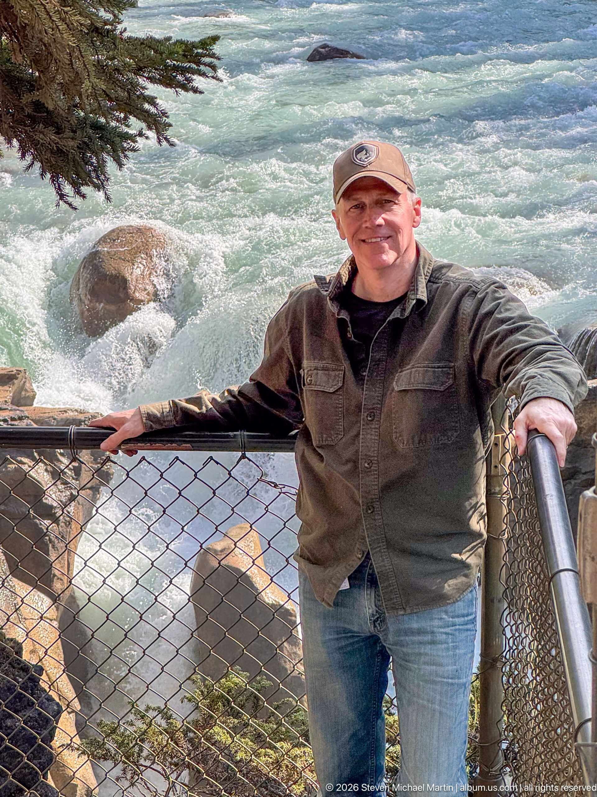
A visitor stands at the protective railing above the turbulent Sunwapta River, with pale turquoise glacial water churning around exposed boulders below. The close viewpoint emphasizes the force of the river immediately around the falls area while the metal railing establishes the developed overlook from which visitors experience the gorge.
Caption
A visitor stands at the protective railing above the turbulent Sunwapta River, with pale turquoise glacial water churning around exposed boulders below. The close viewpoint emphasizes the force of the river immediately around the falls area while the metal railing establishes the developed overlook from which visitors experience the gorge.

Foaming glacial water fills the background of this close portrait at the Sunwapta Falls area, reducing the scene to the visitor and the restless surface of the Sunwapta River. The tight framing removes most built and geological context but clearly records the river's speed and turbulence at the overlook.
Caption
Foaming glacial water fills the background of this close portrait at the Sunwapta Falls area, reducing the scene to the visitor and the restless surface of the Sunwapta River. The tight framing removes most built and geological context but clearly records the river's speed and turbulence at the overlook.
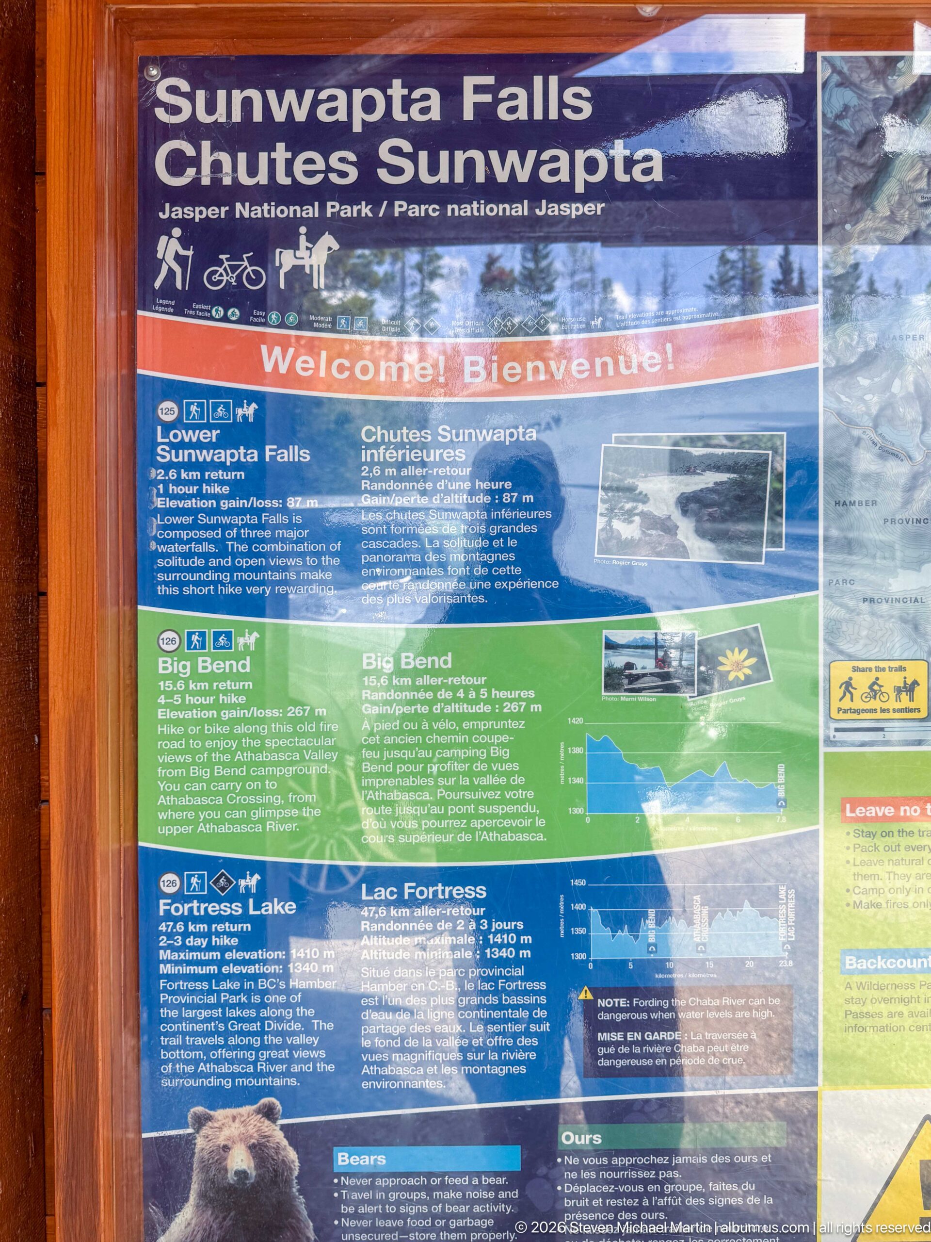
The bilingual Parks Canada information panel at Sunwapta Falls introduces the site and nearby Icefields Parkway destinations through maps, photographs, and visitor guidance. Its location-specific heading, 'Sunwapta Falls / Chutes Sunwapta,' provides direct documentary identification of the visitor area.
Caption
The bilingual Parks Canada information panel at Sunwapta Falls introduces the site and nearby Icefields Parkway destinations through maps, photographs, and visitor guidance. Its location-specific heading, 'Sunwapta Falls / Chutes Sunwapta,' provides direct documentary identification of the visitor area.
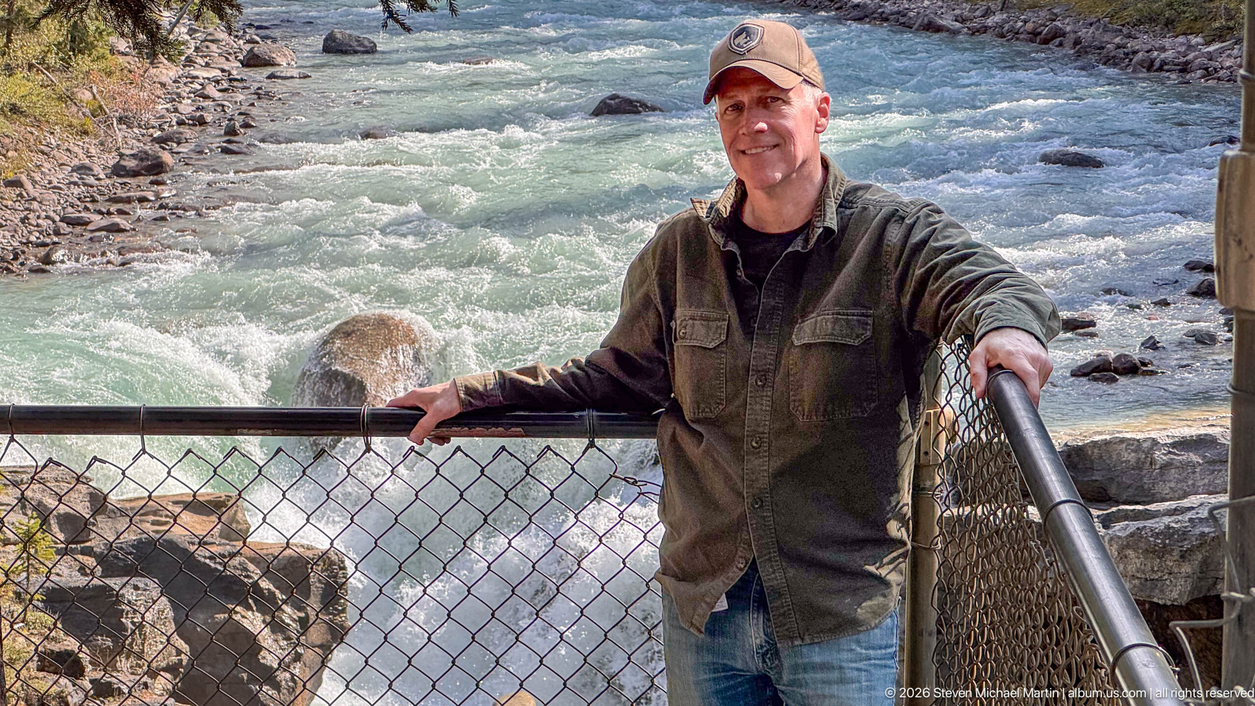
Seen from farther back, a visitor leans against the fenced overlook while the Sunwapta River courses through the rocky channel behind him. The wider composition adds the edge of the gorge and more of the developed viewing barrier, placing the portrait within the physical setting of the Sunwapta Falls visitor area.
Caption
Seen from farther back, a visitor leans against the fenced overlook while the Sunwapta River courses through the rocky channel behind him. The wider composition adds the edge of the gorge and more of the developed viewing barrier, placing the portrait within the physical setting of the Sunwapta Falls visitor area.
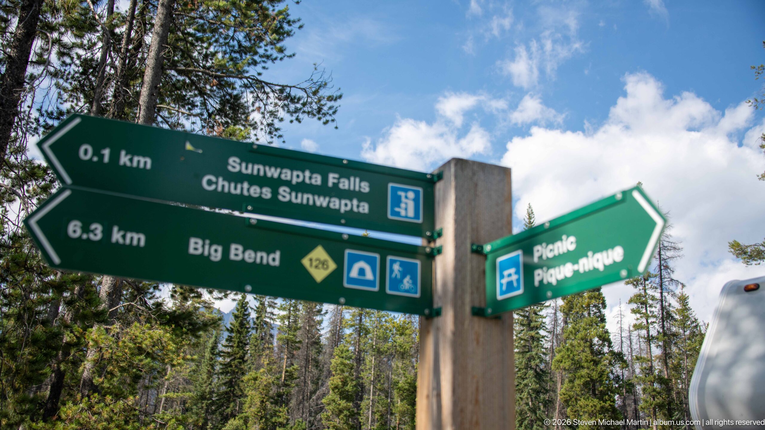
A Parks Canada directional sign marks Sunwapta Falls only 0.1 kilometer away and points 6.3 kilometers toward Big Bend on route 126, with a separate arrow for the picnic area. The bilingual 'Sunwapta Falls / Chutes Sunwapta' wording and trail symbols document the site's wayfinding system.
Caption
A Parks Canada directional sign marks Sunwapta Falls only 0.1 kilometer away and points 6.3 kilometers toward Big Bend on route 126, with a separate arrow for the picnic area. The bilingual 'Sunwapta Falls / Chutes Sunwapta' wording and trail symbols document the site's wayfinding system.
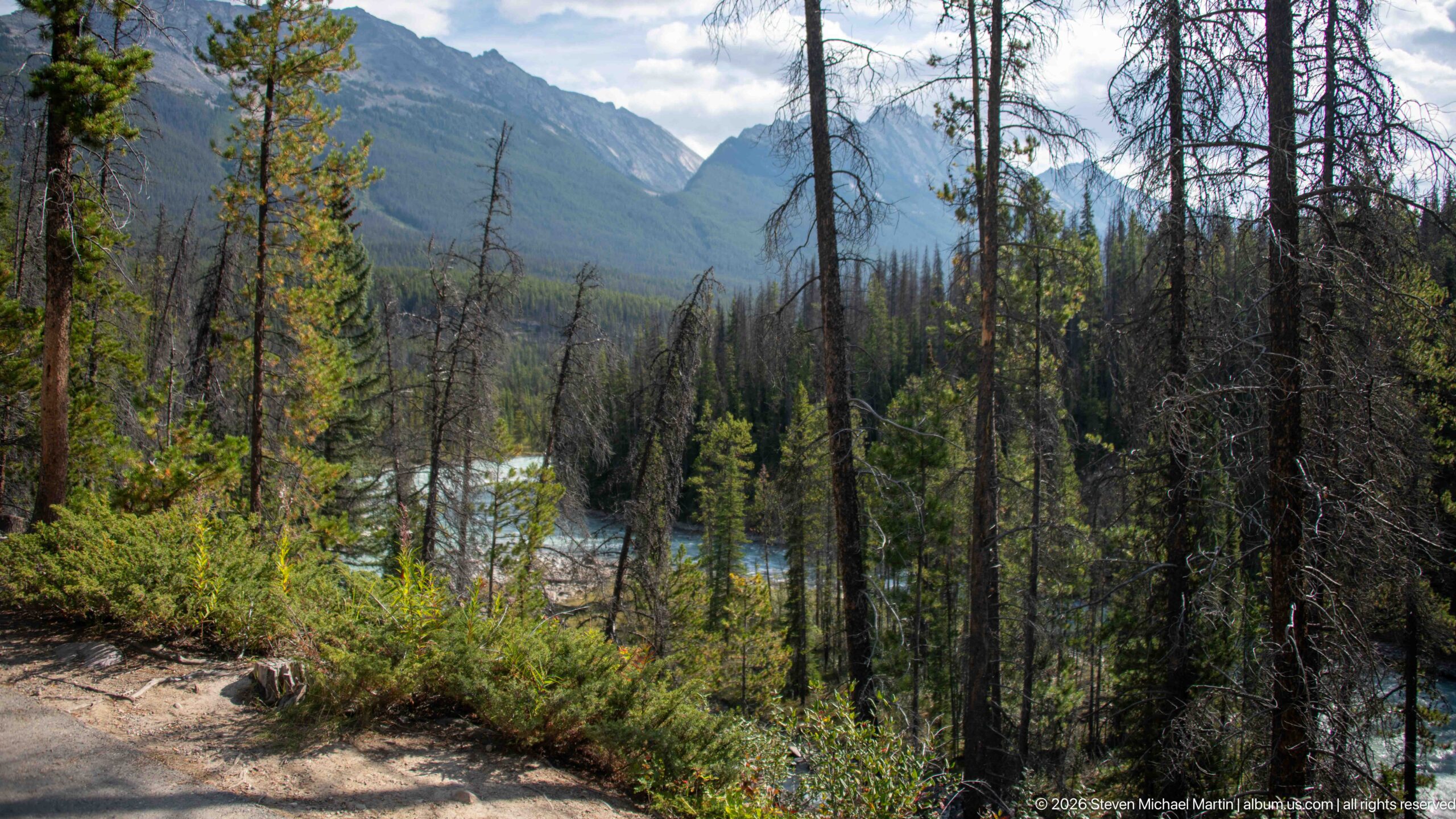
A dirt path follows the forested Sunwapta Falls area with glimpses of pale turquoise river water between the trees. Steep mountain slopes rise beyond the valley, while standing dead trees and dense low vegetation give the scene a more contextual character than the close waterfall viewpoints.
Caption
A dirt path follows the forested Sunwapta Falls area with glimpses of pale turquoise river water between the trees. Steep mountain slopes rise beyond the valley, while standing dead trees and dense low vegetation give the scene a more contextual character than the close waterfall viewpoints.
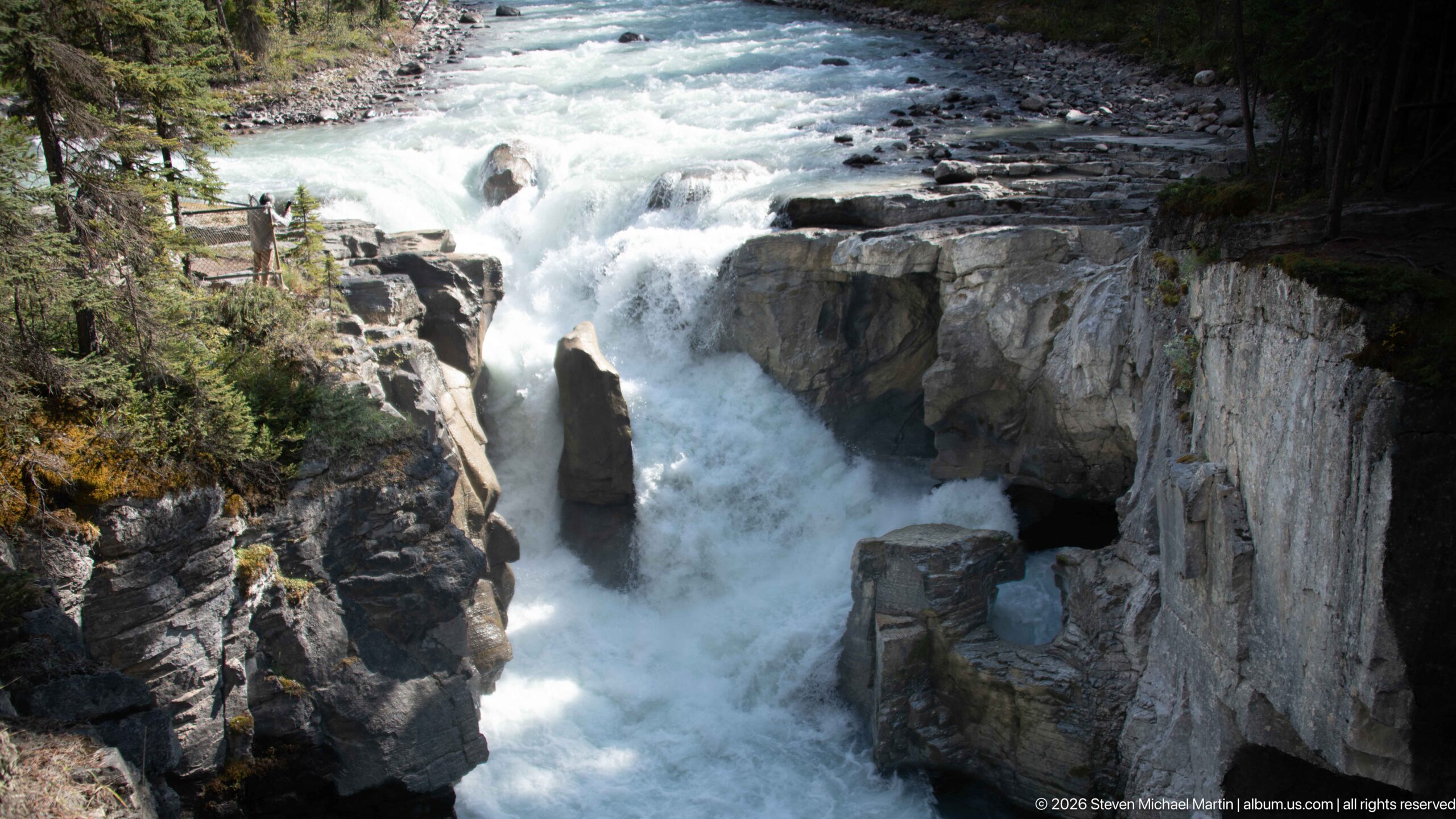
A steep view into Sunwapta Falls shows the river plunging beside the tall central rock and disappearing into the confined canyon below. Vertical and layered rock faces dominate the composition, making the depth and narrowness of the gorge especially apparent while the upstream rapids remain visible at the top.
Caption
A steep view into Sunwapta Falls shows the river plunging beside the tall central rock and disappearing into the confined canyon below. Vertical and layered rock faces dominate the composition, making the depth and narrowness of the gorge especially apparent while the upstream rapids remain visible at the top.
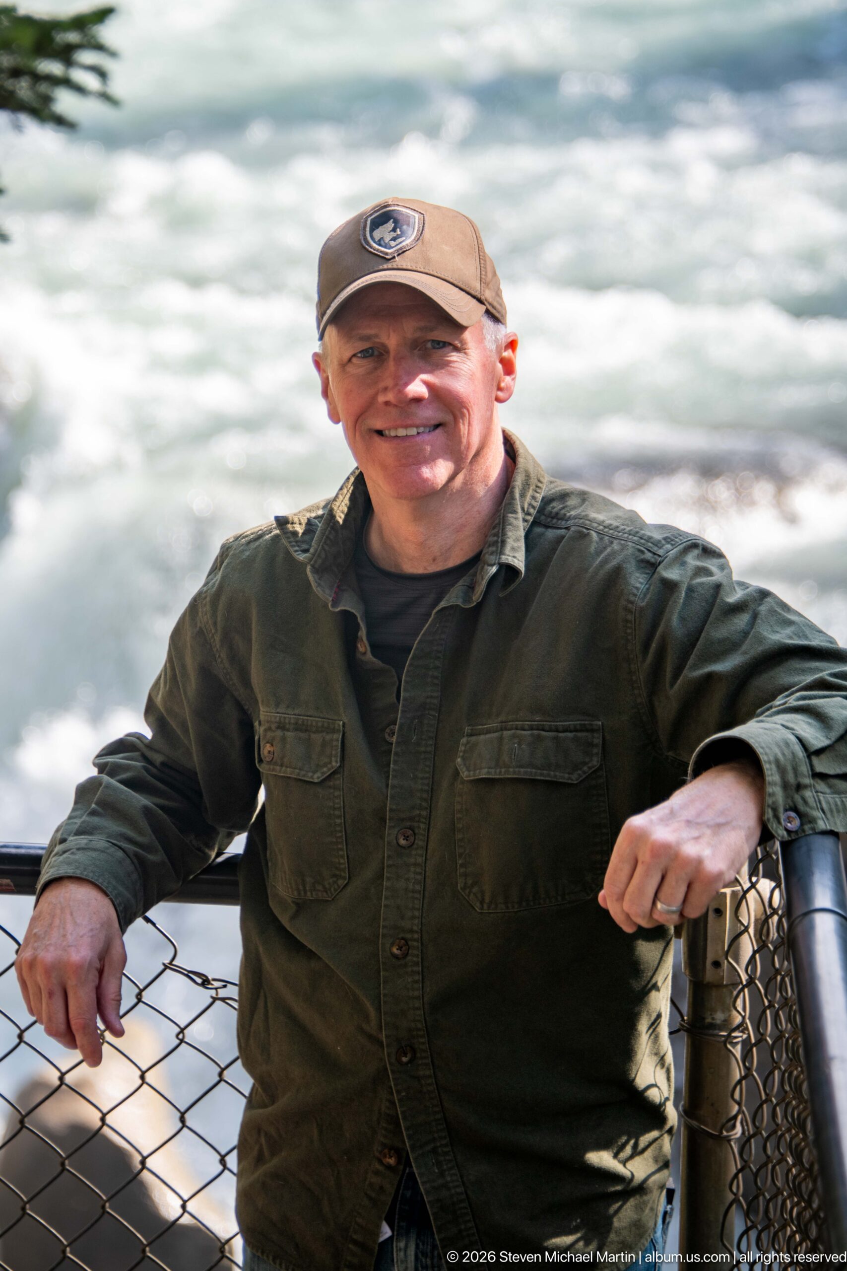
A visitor leans on the overlook railing with the foaming Sunwapta River filling nearly the entire background. The shallow visual context focuses attention on the human scale of the viewpoint and the luminous, fast-moving glacial water rather than the gorge's rock architecture.
Caption
A visitor leans on the overlook railing with the foaming Sunwapta River filling nearly the entire background. The shallow visual context focuses attention on the human scale of the viewpoint and the luminous, fast-moving glacial water rather than the gorge's rock architecture.
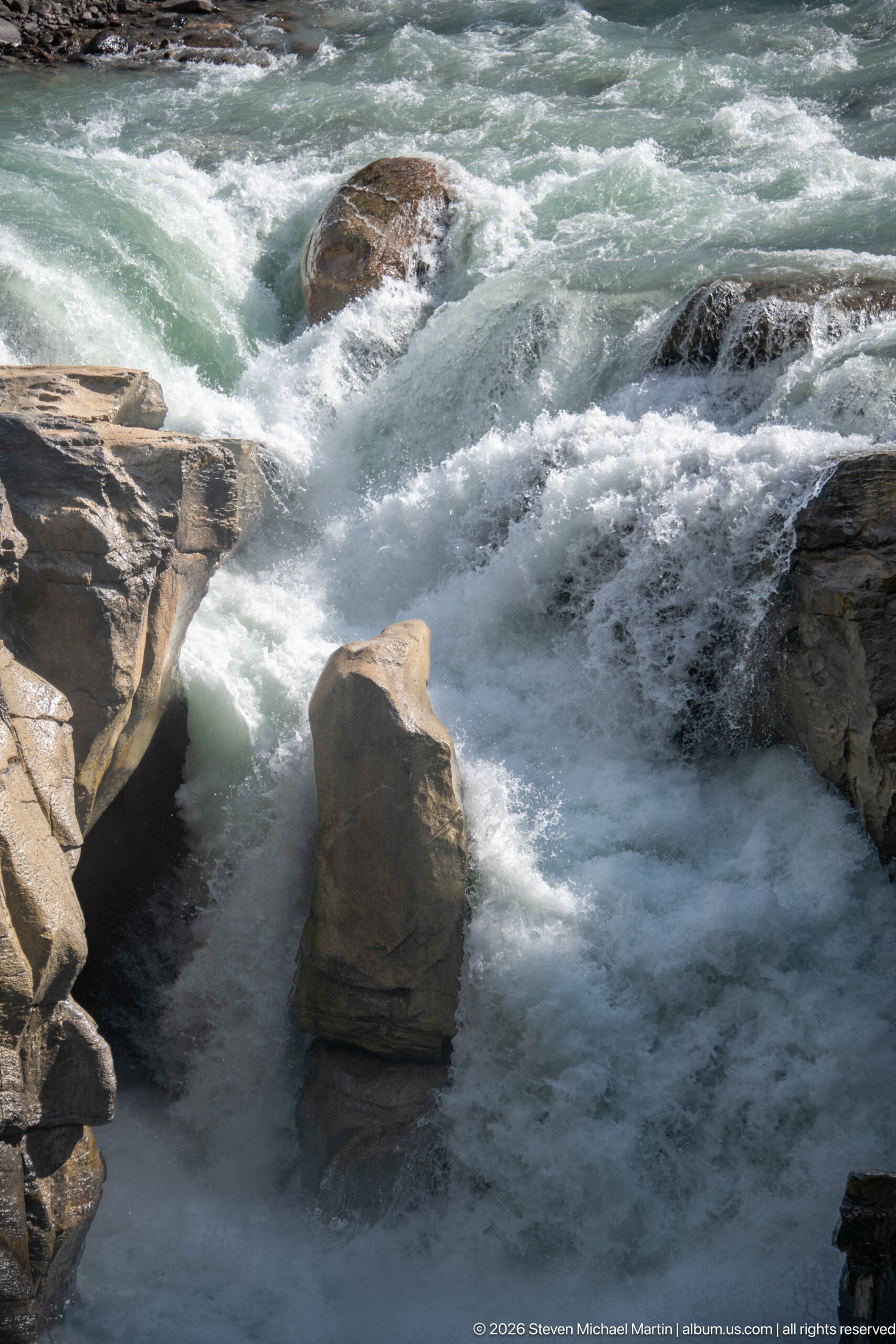
Blue-green Sunwapta River water accelerates over shallow ledges and breaks around the prominent angular rock above the main drop. The close framing emphasizes the patterned currents, white foam, and exposed bedrock that precede the river's plunge into the gorge.
Caption
Blue-green Sunwapta River water accelerates over shallow ledges and breaks around the prominent angular rock above the main drop. The close framing emphasizes the patterned currents, white foam, and exposed bedrock that precede the river's plunge into the gorge.
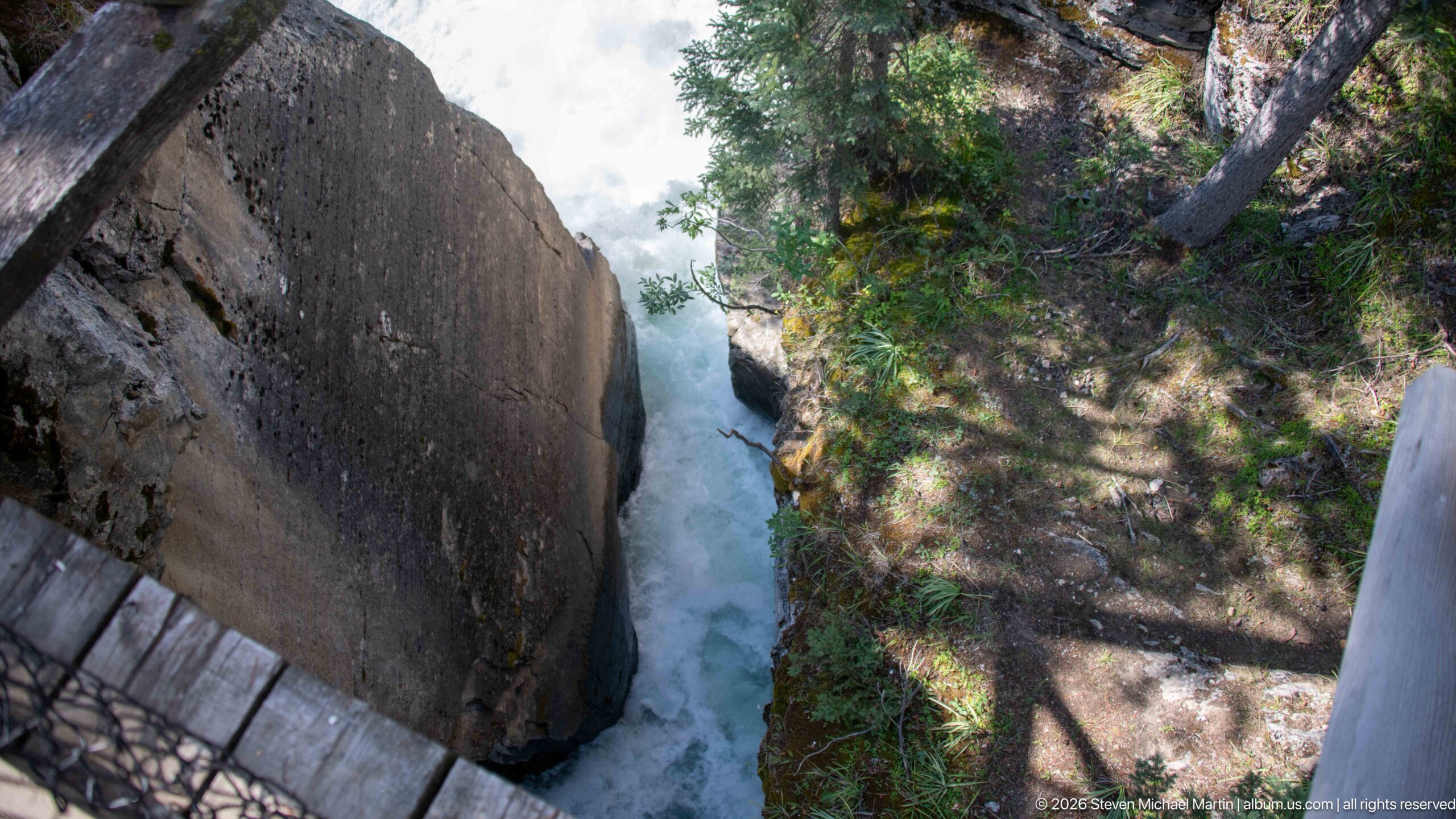
A near-vertical view from the developed overlook looks down between massive rock walls toward the white water of Sunwapta Falls. Sections of railing at the frame edges reveal the visitor viewpoint, while the compressed perspective emphasizes the abrupt depth of the gorge and the narrow space occupied by the river.
Caption
A near-vertical view from the developed overlook looks down between massive rock walls toward the white water of Sunwapta Falls. Sections of railing at the frame edges reveal the visitor viewpoint, while the compressed perspective emphasizes the abrupt depth of the gorge and the narrow space occupied by the river.
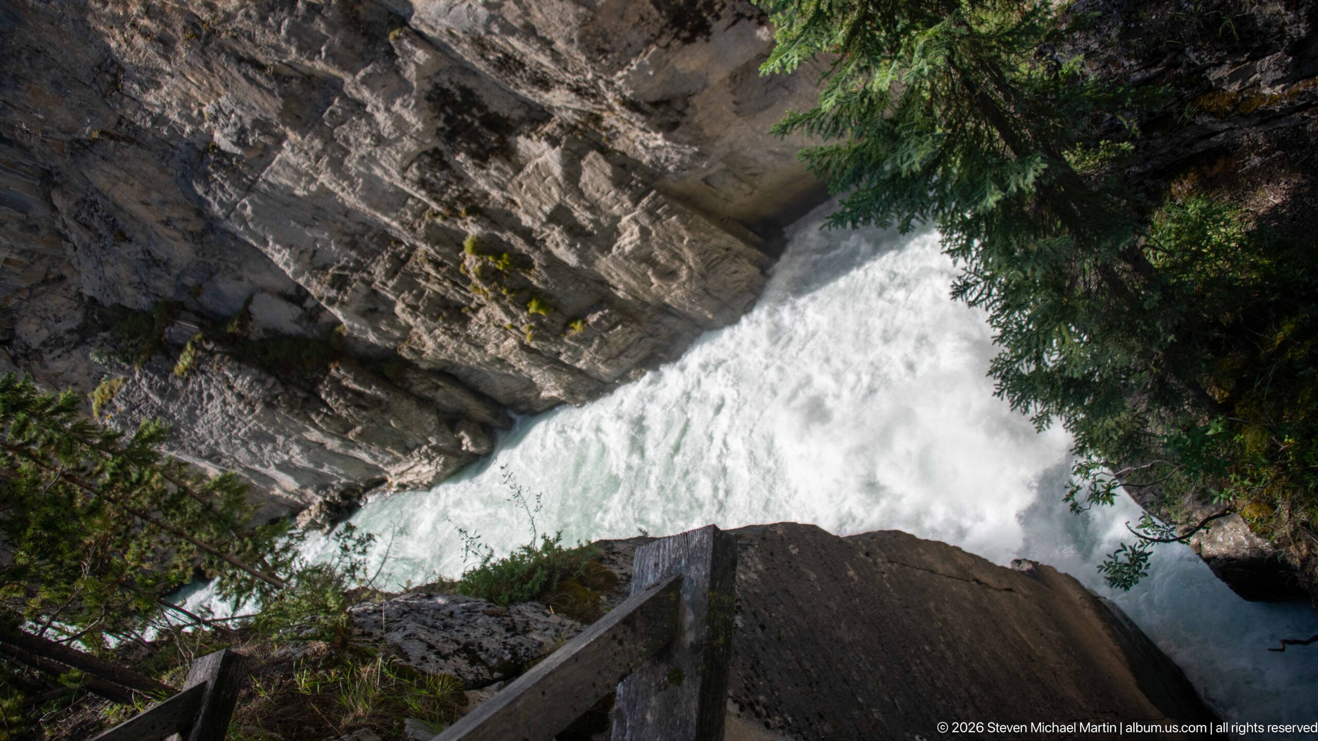
From another overlook angle, a wooden railing leads the eye toward foaming Sunwapta River water compressed beneath overhanging, layered rock. Conifer branches frame the opening, combining visitor infrastructure, canyon geology, and the river's turbulent passage in a single steeply angled composition.
Caption
From another overlook angle, a wooden railing leads the eye toward foaming Sunwapta River water compressed beneath overhanging, layered rock. Conifer branches frame the opening, combining visitor infrastructure, canyon geology, and the river's turbulent passage in a single steeply angled composition.
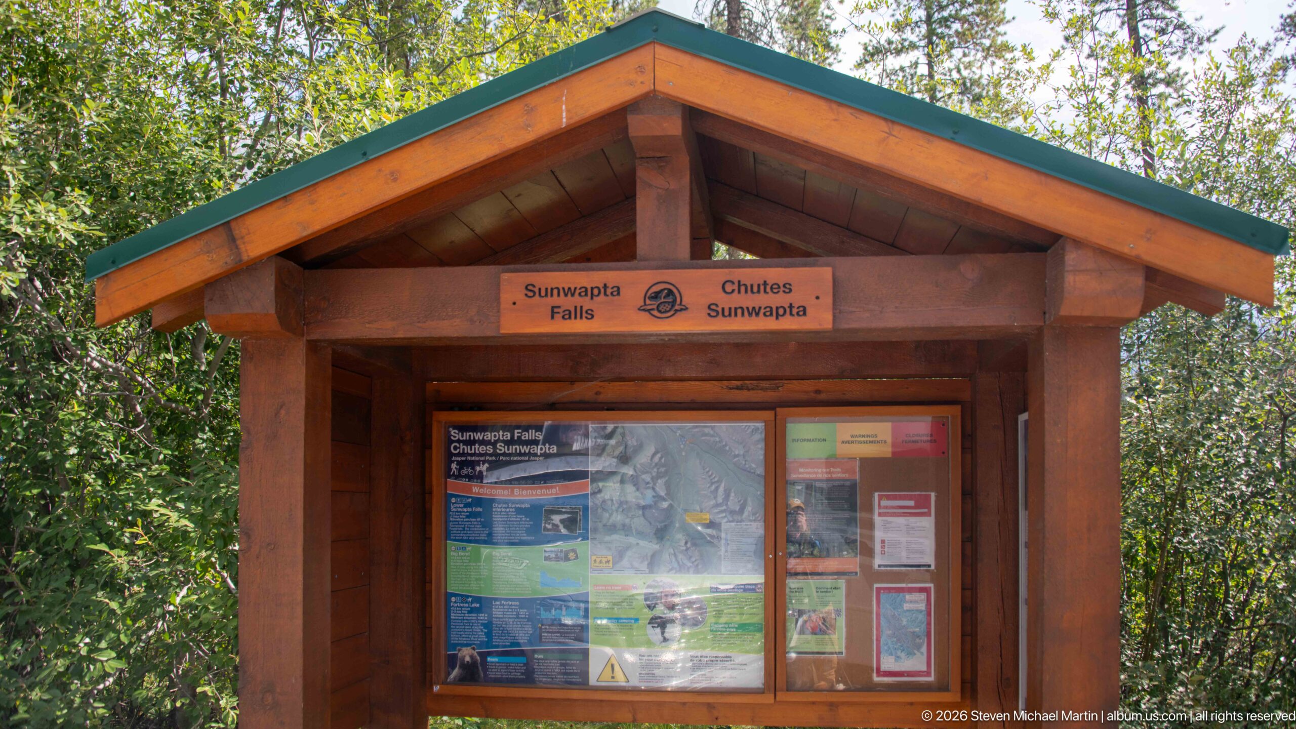
A timber information kiosk marks the Sunwapta Falls visitor area with bilingual 'Sunwapta Falls / Chutes Sunwapta' signage beneath its gabled roof. Maps and notices fill the protected display case, documenting the Parks Canada orientation point used by visitors before entering the trail and overlook area.
Caption
A timber information kiosk marks the Sunwapta Falls visitor area with bilingual 'Sunwapta Falls / Chutes Sunwapta' signage beneath its gabled roof. Maps and notices fill the protected display case, documenting the Parks Canada orientation point used by visitors before entering the trail and overlook area.
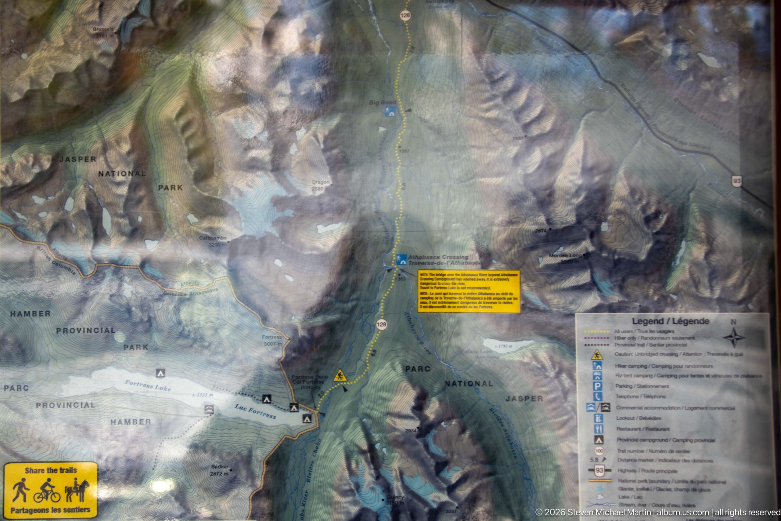
A visitor orientation map presents the mountain corridor through Jasper National Park and the Icefields Parkway region, accompanied by a bilingual legend and safety notice. Although reflections obscure some detail, the panel records the broader geographic context in which the Sunwapta Falls stop is located.
Caption
A visitor orientation map presents the mountain corridor through Jasper National Park and the Icefields Parkway region, accompanied by a bilingual legend and safety notice. Although reflections obscure some detail, the panel records the broader geographic context in which the Sunwapta Falls stop is located.
Scenic Landscape Field Guide
📍 Overview
Sunwapta Falls is a waterfall complex on the Sunwapta River in Jasper National Park, reached from the Icefields Parkway. Its defining story is one of living geology: glacial meltwater from the Athabasca Glacier travels down the Sunwapta River and then drops into a narrow limestone gorge where the smaller, glacially carved Chaba Valley meets the deeper Athabasca Valley. The result is a landscape in which water, rock, and the legacy of glaciation can be read together at close range. The main visitor area provides short approaches to several viewpoints, while Lower Sunwapta Falls lies farther downstream along Trail 125.
🏔️ Physical Setting
Sunwapta Falls lies within the Canadian Rockies landscape of Jasper National Park, approximately 54 kilometres south of Jasper along Highway 93, the Icefields Parkway. Here the Sunwapta River moves through conifer forest and mountain terrain before being abruptly confined by a deeply cut gorge. From the developed viewpoints, visitors can see the transition from a broader river corridor to turbulent water compressed between steep rock walls. The wooden bridge and overlook system provide especially clear spatial context, revealing how closely the visitor route follows the edge of the canyon.
🪨 Geology & Landform
The falls occupy a meeting point between two glacially shaped valleys: the smaller hanging Chaba Valley and the deeper Athabasca Valley. That difference in valley elevation helps create the stepping waterfall, while the Sunwapta River has cut a narrow gorge into the limestone below. At the main falls, the river changes character rapidly—from a broad, fast-moving glacial stream to white water divided by resistant rock and funneled into a confined canyon. The photographs repeatedly show layered and fractured rock walls, exposed ledges, large boulders, and the prominent mid-channel rock around which the current divides, making erosion and channel confinement visible parts of the visitor experience.
🌿 Ecology
Conifer forest closely surrounds the river and gorge, softening the edges of an otherwise forceful rock-and-water landscape. Trees occupy the canyon margins and extend across the surrounding mountain slopes, while the river itself links this forested setting to the high glacial environment upstream. The portfolio does not document a wildlife encounter at Sunwapta Falls, so its strongest ecological story is the relationship among glacial meltwater, the river corridor, exposed rock, and the surrounding forest. Together these elements show how the falls sit within a connected mountain system rather than functioning as an isolated scenic feature.
◆ Seasonal Character
The photographs record a river carrying substantial, fast-moving water through the falls, with blue-green currents turning to white water as they pass over ledges and enter the gorge. Because the Sunwapta River receives meltwater originating at the Athabasca Glacier, its flow belongs to a larger glacial watershed whose appearance and volume can change through the season. Conditions visible in this portfolio—turbulent water, spray, wet rock, and dense green vegetation—should be understood as the character of this particular visit rather than a fixed appearance of the falls throughout the year.
👁️ Viewpoints
The most revealing viewpoints are those that show the river immediately before and during its descent into the gorge. Elevated overlooks provide broad views of turquoise water narrowing into white water around the central rock, while steeper downward angles emphasize the depth and confinement of the canyon. The wooden pedestrian bridge is both a viewing platform and a useful scale reference, showing visitors suspended above the narrow river channel between steep rock walls. Closer positions along the railing isolate rapids, boulders, layered ledges, and foaming water; wider compositions reconnect those details to the surrounding conifer forest and mountain landscape. Lower Sunwapta Falls can be reached downstream on Trail 125, but individual cascades should be identified as part of the lower falls only when their location is independently confirmed.
📷 Photography Notes
Sunwapta Falls rewards a sequence of scales rather than a single definitive frame. Wide views can establish the Sunwapta River, gorge, forest, and surrounding relief; medium views show the characteristic transition from open river to constricted waterfall; and tight compositions reveal currents breaking around boulders and rock ledges. The bridge, railings, and occasional visitors can be useful rather than distracting when they provide scale for the gorge or clarify the geometry of the viewpoints. Because several waterfall compositions are visually similar, the strongest photographic edit favors meaningful changes in viewpoint, channel shape, geology, and scale instead of near-duplicate frames. Specific mountain names or lower-falls identifications should be avoided unless the photograph or location evidence supports them.