Jasper Icefield Athabasca Falls
The Icefields Parkway winds south from Jasper through one of the most dramatic landscapes of the Canadian Rockies, following the broad Athabasca River valley beneath steep mountain walls, hanging glaciers, waterfalls, and forests shaped by ice. Much of this terrain owes its present form to immense glaciers that repeatedly advanced and retreated across the Rockies, carving deep valleys and leaving behind the rugged peaks and glacial landforms that define Jasper National Park today.
Among the most impressive stops along the northern Icefields Parkway is Athabasca Falls, about 30 kilometers south of the Jasper townsite. Here the glacier-fed Athabasca River is forced through a narrow gorge, where the tremendous volume of water has cut deeply into the underlying rock. The falls are notable less for their height than for their extraordinary power, as the river plunges through the constricted channel in a turbulent succession of whitewater, spray, sculpted rock, and deep pools.
The journey between Jasper and the icefields reveals the continuing influence of glaciers throughout the landscape. Water descending from glaciers and high mountain snowfields gathers in rivers and waterfalls that eventually flow far beyond the national park, while exposed rock, moraines, and broad U-shaped valleys preserve evidence of the much larger ice masses that once covered the region. Together, the Icefields Parkway and Athabasca Falls provide a vivid introduction to the geological forces of ice and water that continue to shape Jasper National Park.
:::
This should paste directly beneath the opening image on the portfolio pa
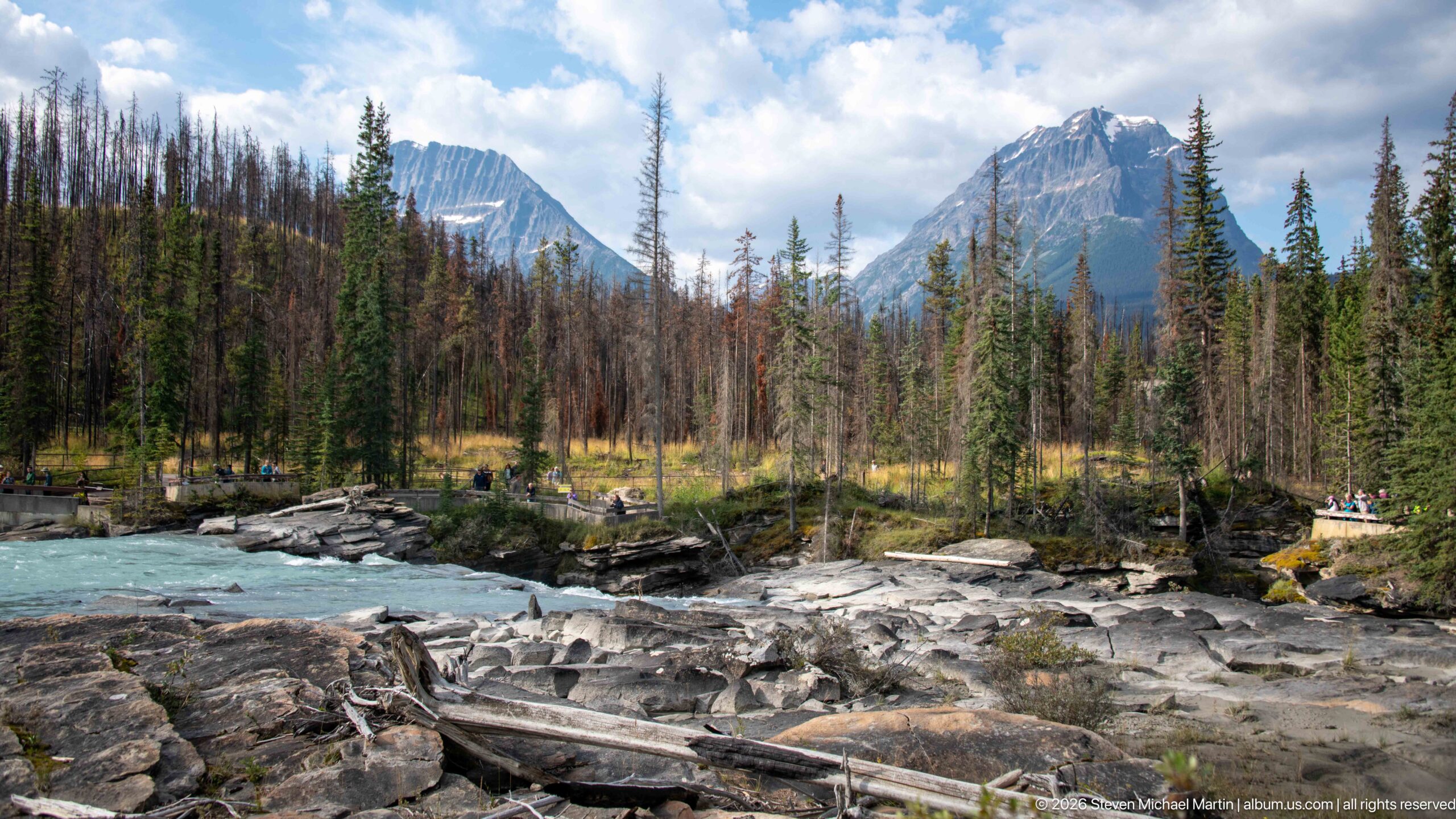
The Athabasca River flows past broad bedrock shelves beneath a forested mountain valley near Athabasca Falls. Fallen trunks and pale, weathered rock occupy the foreground, while conifers and standing dead trees open toward steep peaks beyond. The composition shifts attention away from the waterfall itself to the larger river corridor, where water, forest, exposed rock, and mountain relief define the Jasper National Park setting.
Caption
The Athabasca River flows past broad bedrock shelves beneath a forested mountain valley near Athabasca Falls. Fallen trunks and pale, weathered rock occupy the foreground, while conifers and standing dead trees open toward steep peaks beyond. The composition shifts attention away from the waterfall itself to the larger river corridor, where water, forest, exposed rock, and mountain relief define the Jasper National Park setting.
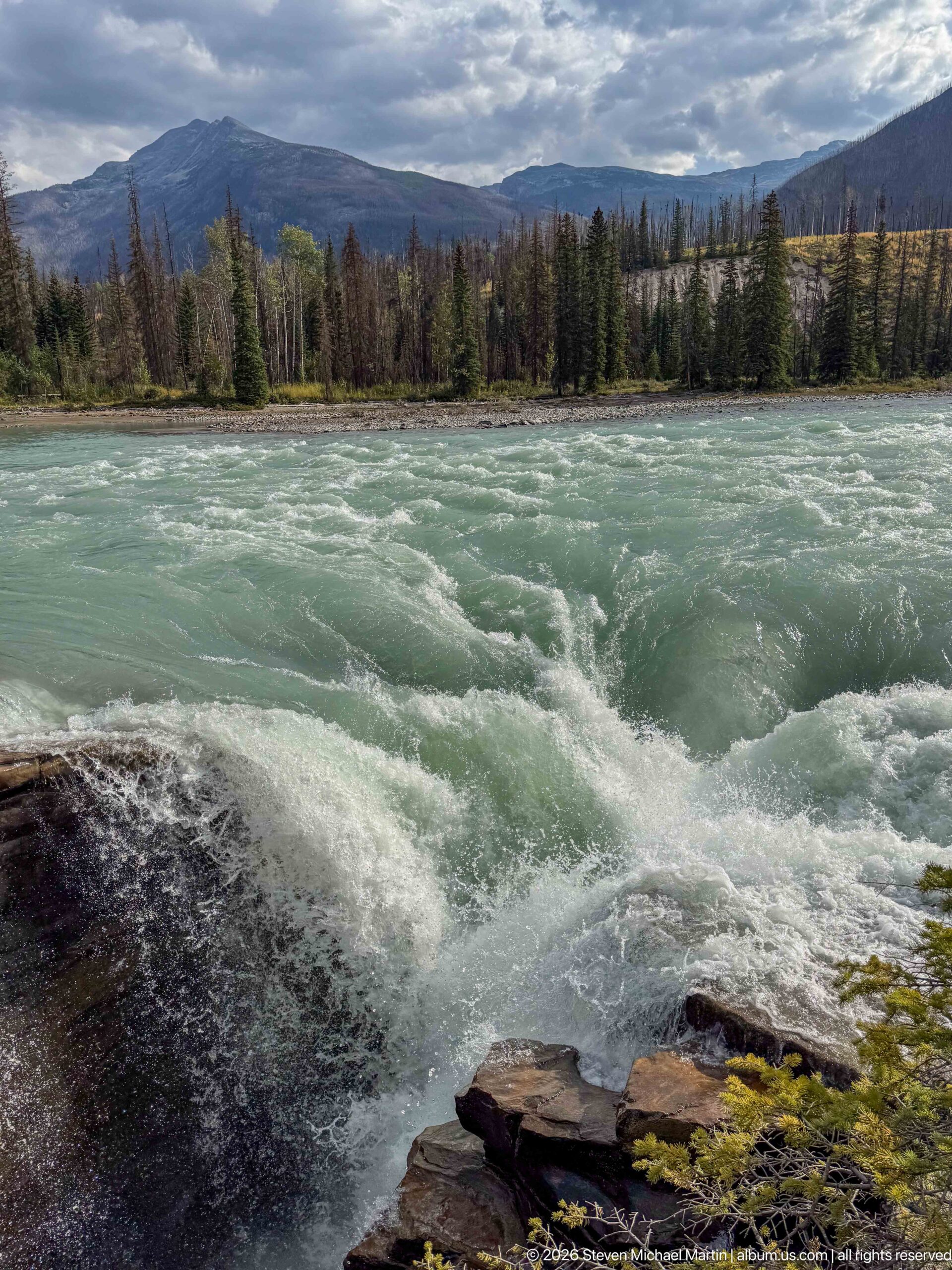
The Athabasca River churns across the frame in a broad field of turquoise rapids above the main falls. A dark rock ledge anchors the foreground while the opposite bank carries conifer forest toward low mountain ridges. Without the dramatic vertical drop, this view emphasizes the river’s speed and turbulence before it reaches the constricted gorge, adding upstream context to the waterfall sequence.
Caption
The Athabasca River churns across the frame in a broad field of turquoise rapids above the main falls. A dark rock ledge anchors the foreground while the opposite bank carries conifer forest toward low mountain ridges. Without the dramatic vertical drop, this view emphasizes the river’s speed and turbulence before it reaches the constricted gorge, adding upstream context to the waterfall sequence.
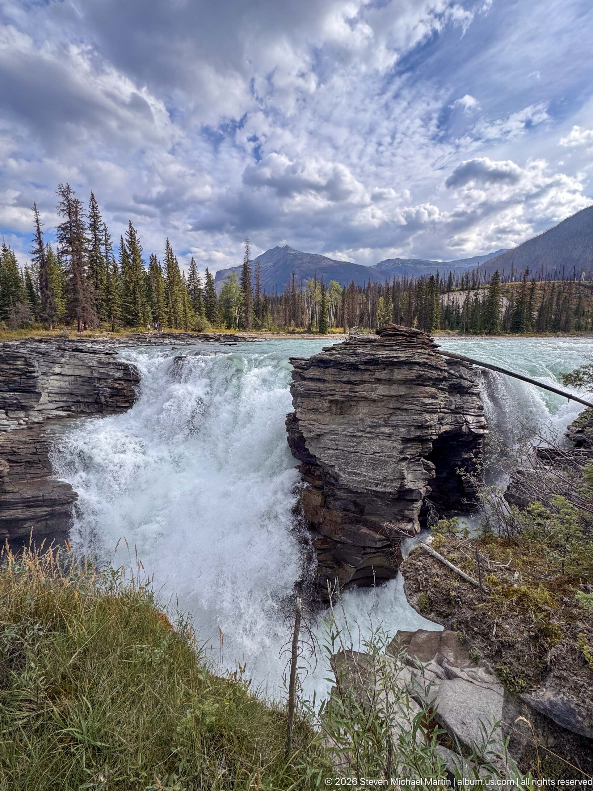
A wide landscape view shows the Athabasca River breaking into whitewater as it enters the falls between layered rock shelves. The low foreground of grass and stone opens toward conifer forest, distant mountains, and a broad cloud-filled sky. By giving the surrounding valley nearly equal weight with the waterfall, the composition places Athabasca Falls within the larger Canadian Rockies landscape rather than isolating the drop.
Caption
A wide landscape view shows the Athabasca River breaking into whitewater as it enters the falls between layered rock shelves. The low foreground of grass and stone opens toward conifer forest, distant mountains, and a broad cloud-filled sky. By giving the surrounding valley nearly equal weight with the waterfall, the composition places Athabasca Falls within the larger Canadian Rockies landscape rather than isolating the drop.
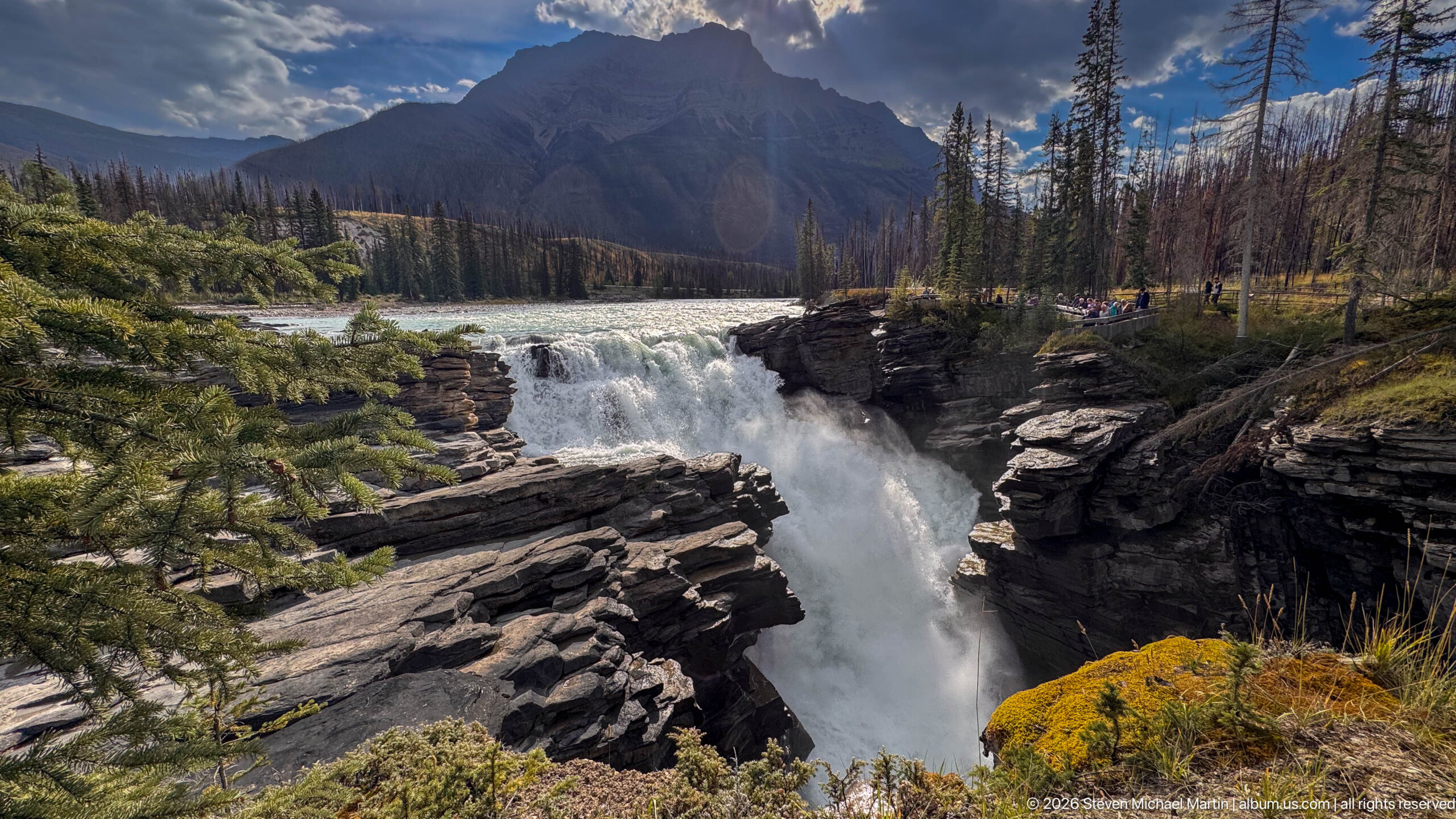
Athabasca Falls drops forcefully between resistant rock walls as the broad river is funneled into its canyon. The elevated viewpoint reveals the waterfall’s compact but powerful form, with mist rising from the constricted channel below. Layered bedrock, conifer forest, and a steep mountain backdrop connect the falls to the glaciated Canadian Rockies landscape surrounding Jasper National Park.
Caption
Athabasca Falls drops forcefully between resistant rock walls as the broad river is funneled into its canyon. The elevated viewpoint reveals the waterfall’s compact but powerful form, with mist rising from the constricted channel below. Layered bedrock, conifer forest, and a steep mountain backdrop connect the falls to the glaciated Canadian Rockies landscape surrounding Jasper National Park.
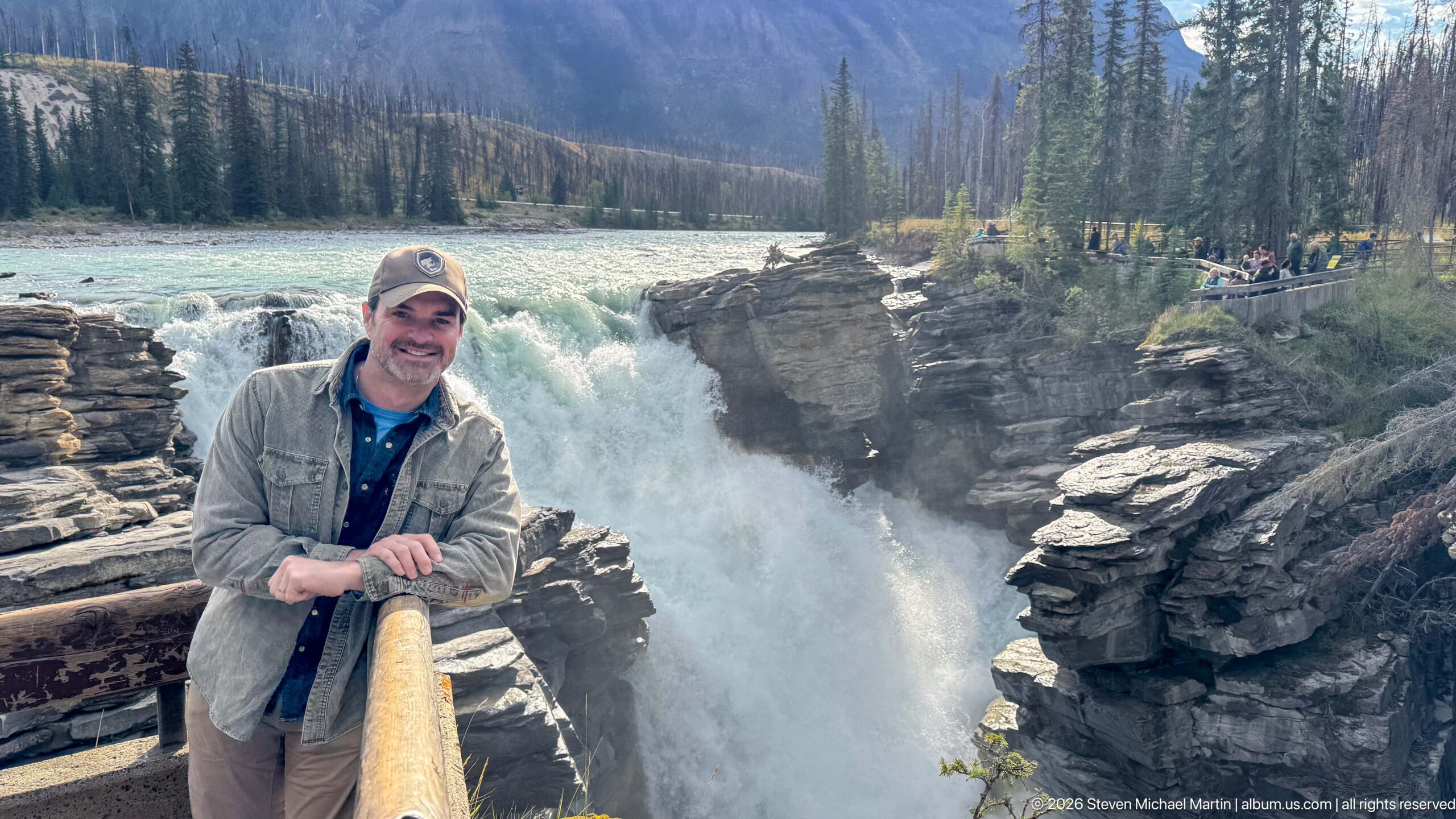
A visitor stands at a wooden railing directly above the turbulent gorge of Athabasca Falls. Behind him, the Athabasca River plunges through layered rock while other visitors gather along the opposite viewpoint. The portrait records the relationship between the developed overlook and the natural spectacle, using the waterfall and canyon as an unmistakable setting rather than treating the human figure in isolation.
Caption
A visitor stands at a wooden railing directly above the turbulent gorge of Athabasca Falls. Behind him, the Athabasca River plunges through layered rock while other visitors gather along the opposite viewpoint. The portrait records the relationship between the developed overlook and the natural spectacle, using the waterfall and canyon as an unmistakable setting rather than treating the human figure in isolation.
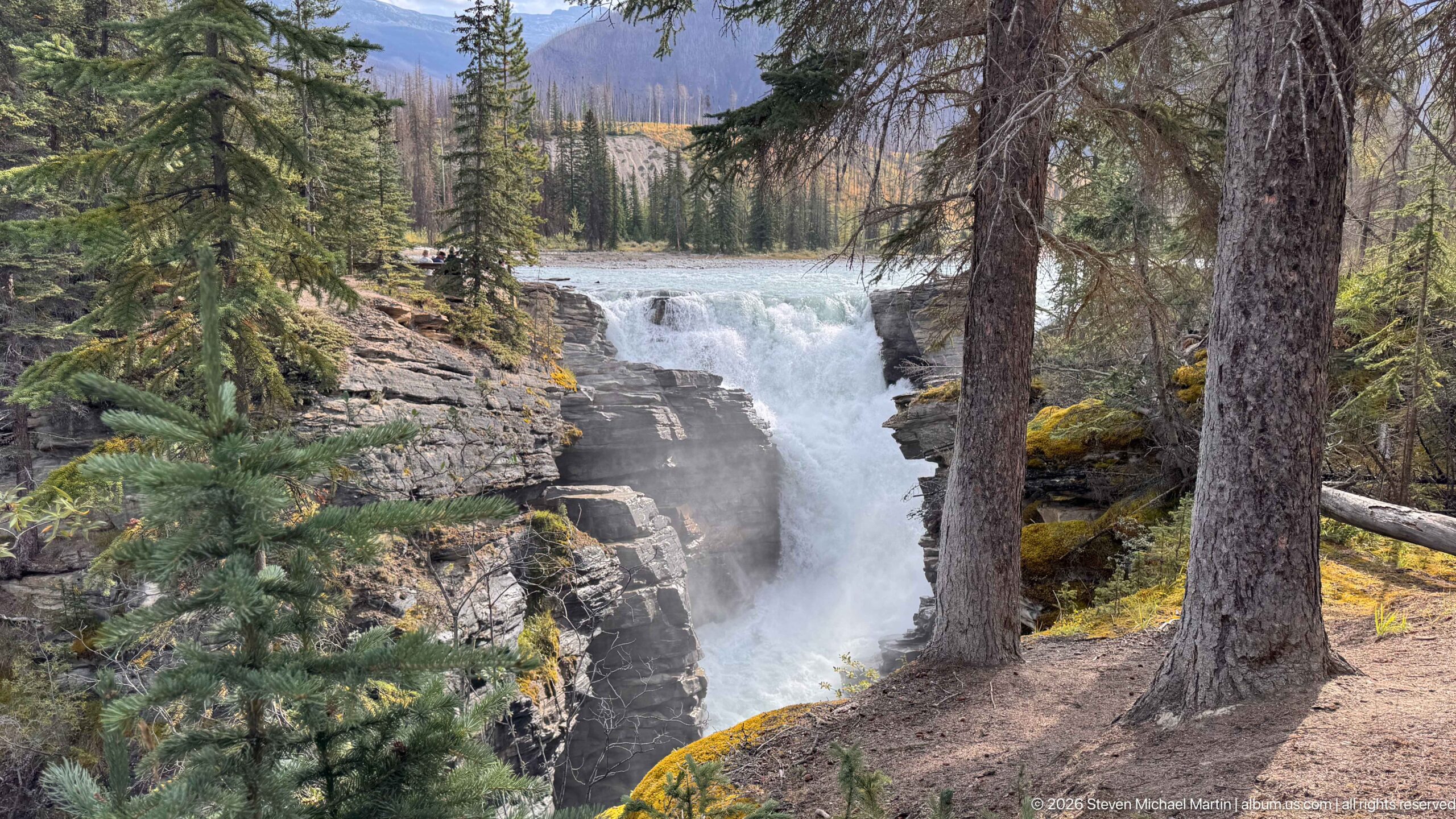
Athabasca Falls appears through tall conifer trunks from a wooded viewpoint, where the river drops between dark layered rock walls. The trees partially screen the waterfall and create a strong sense of depth, shifting attention from the open overlooks to the surrounding forest. Whitewater and spray remain visible beyond the trunks, linking the visitor trail environment directly to the gorge.
Caption
Athabasca Falls appears through tall conifer trunks from a wooded viewpoint, where the river drops between dark layered rock walls. The trees partially screen the waterfall and create a strong sense of depth, shifting attention from the open overlooks to the surrounding forest. Whitewater and spray remain visible beyond the trunks, linking the visitor trail environment directly to the gorge.
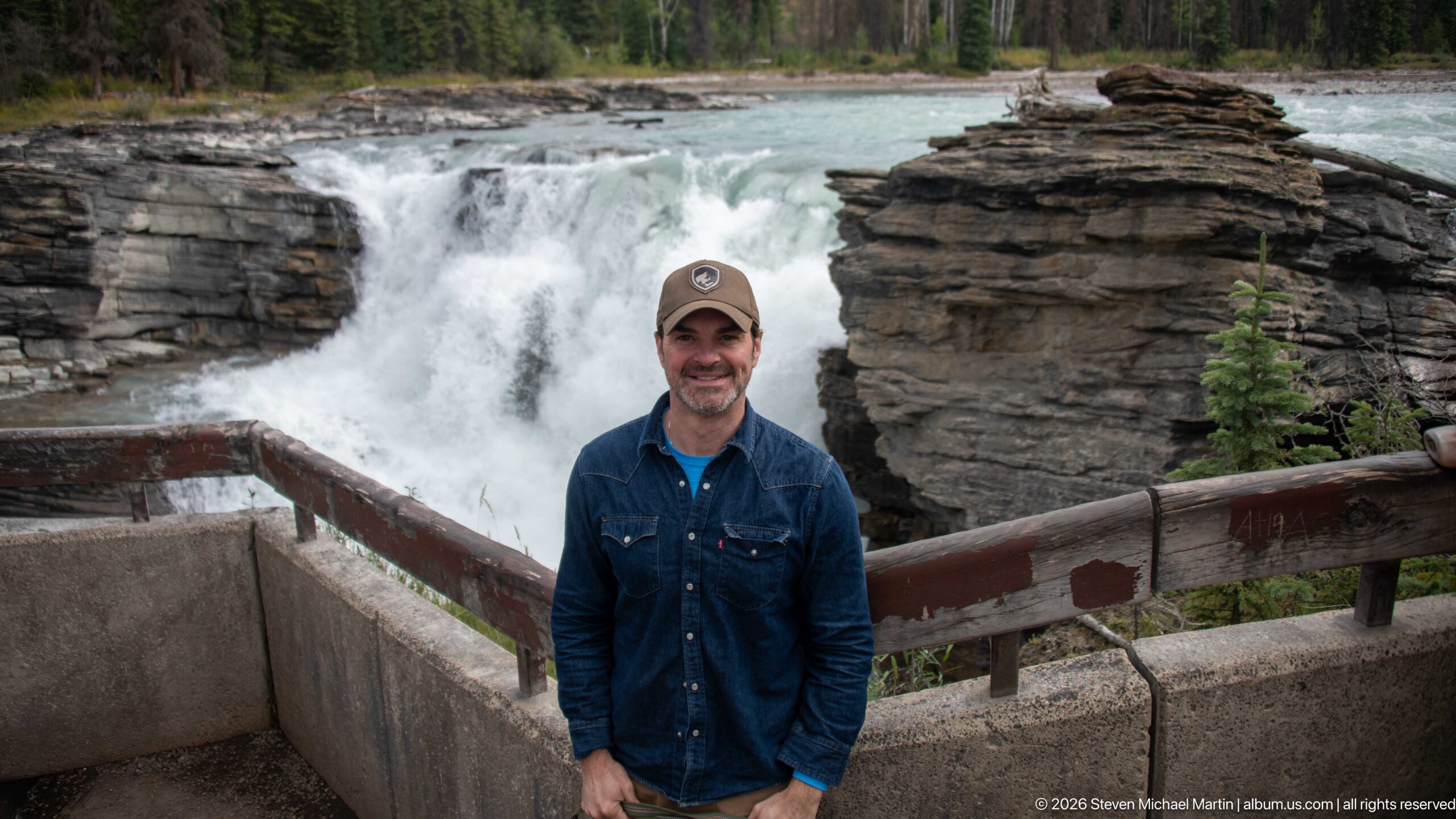
A visitor stands at a developed overlook with Athabasca Falls filling the background between prominent layered rock masses. The wooden railing and concrete barrier establish the protected viewpoint, while whitewater drops immediately behind him and the turquoise river continues upstream. The centered portrait combines a clear record of the traveler with one of the portfolio’s strongest contextual views of the main falls.
Caption
A visitor stands at a developed overlook with Athabasca Falls filling the background between prominent layered rock masses. The wooden railing and concrete barrier establish the protected viewpoint, while whitewater drops immediately behind him and the turquoise river continues upstream. The centered portrait combines a clear record of the traveler with one of the portfolio’s strongest contextual views of the main falls.
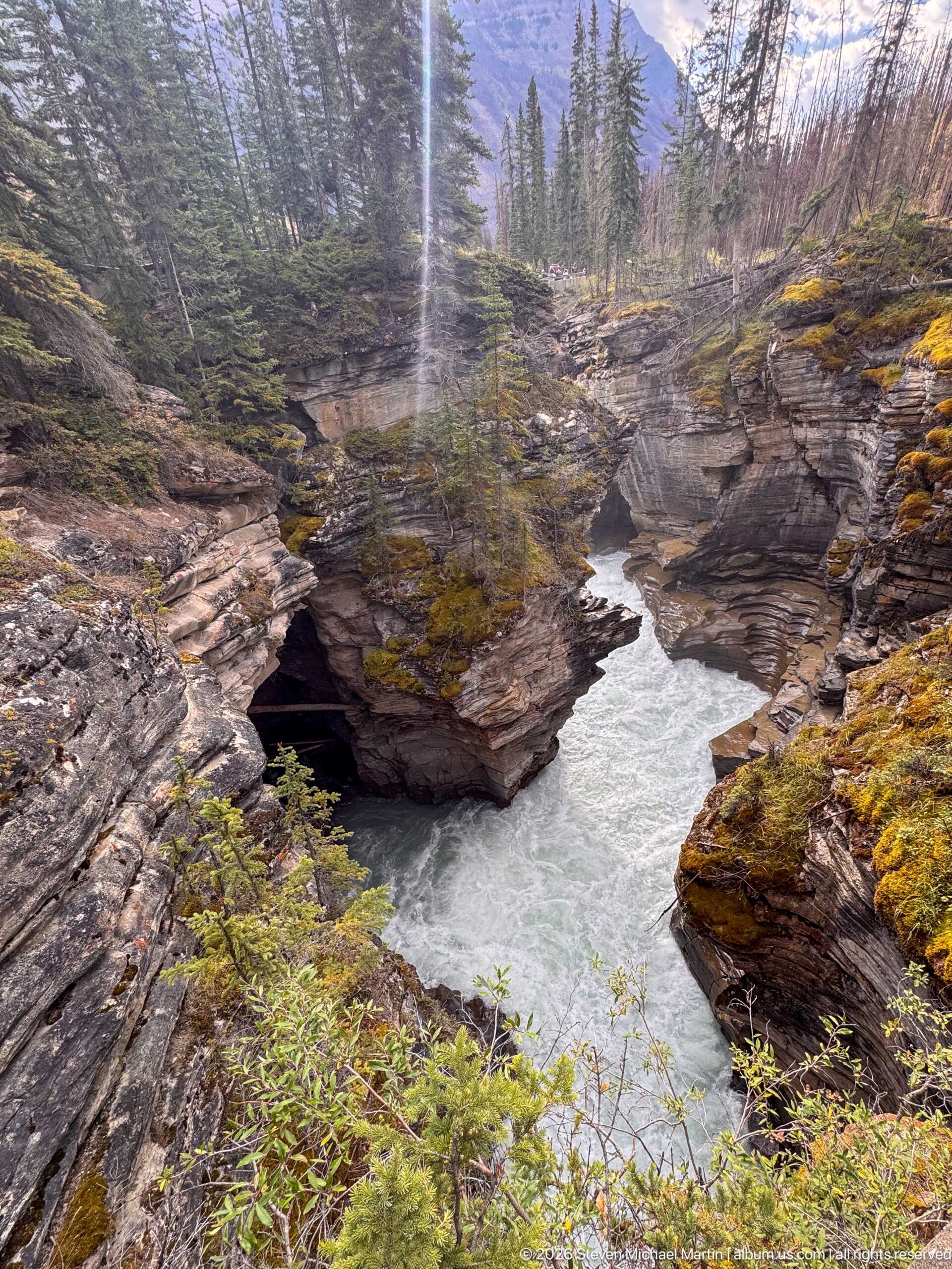
The Athabasca River winds through a deeply incised bedrock channel below the falls, its pale water curving between rounded and layered rock walls. Moss and low vegetation brighten the canyon rim while conifers rise behind the gorge. This downstream view shows how the river remains confined after the main waterfall, continuing to shape a narrow passage through the resistant rock.
Caption
The Athabasca River winds through a deeply incised bedrock channel below the falls, its pale water curving between rounded and layered rock walls. Moss and low vegetation brighten the canyon rim while conifers rise behind the gorge. This downstream view shows how the river remains confined after the main waterfall, continuing to shape a narrow passage through the resistant rock.
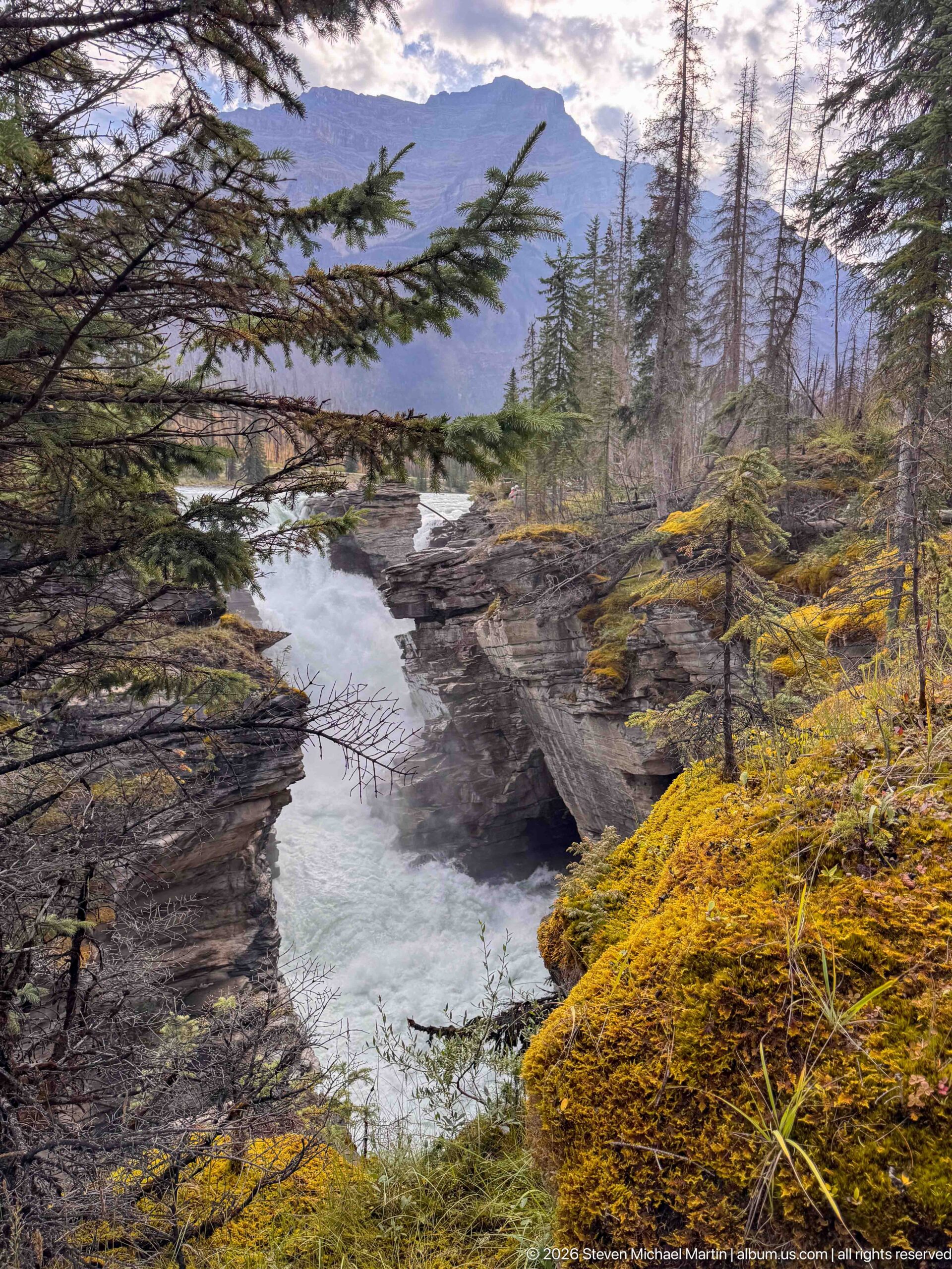
The river narrows through a sinuous bedrock passage in the forested lower canyon below Athabasca Falls. Layered and sculpted rock walls guide pale turquoise water through the center of the frame, while moss, low vegetation, and conifer branches soften the canyon rim. The quieter composition highlights the erosional architecture of the gorge rather than the spectacle of the main waterfall.
Caption
The river narrows through a sinuous bedrock passage in the forested lower canyon below Athabasca Falls. Layered and sculpted rock walls guide pale turquoise water through the center of the frame, while moss, low vegetation, and conifer branches soften the canyon rim. The quieter composition highlights the erosional architecture of the gorge rather than the spectacle of the main waterfall.
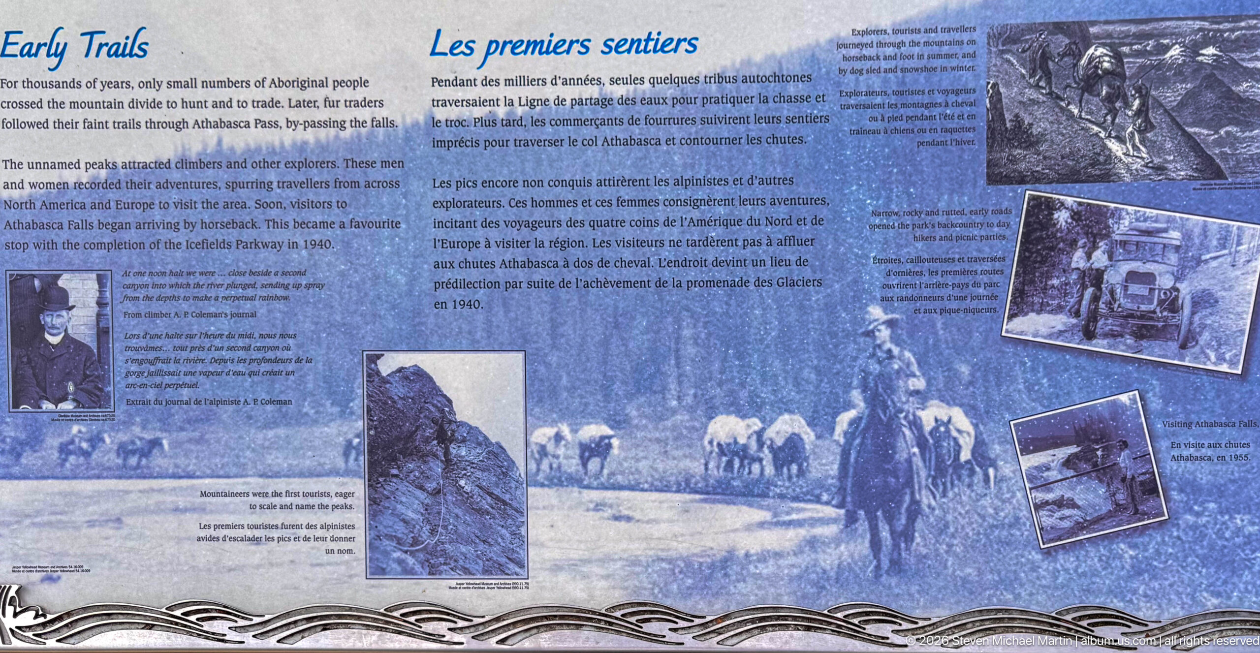
An interpretive panel titled “Les premiers sentiers” presents the early trail history of the Athabasca Falls area through archival photographs, bilingual text, and illustrations. The display places human access within the larger protected landscape, showing how routes and visitor use developed around the falls while the historic images contrast earlier travel conditions with the modern trail system.
Caption
An interpretive panel titled “Les premiers sentiers” presents the early trail history of the Athabasca Falls area through archival photographs, bilingual text, and illustrations. The display places human access within the larger protected landscape, showing how routes and visitor use developed around the falls while the historic images contrast earlier travel conditions with the modern trail system.
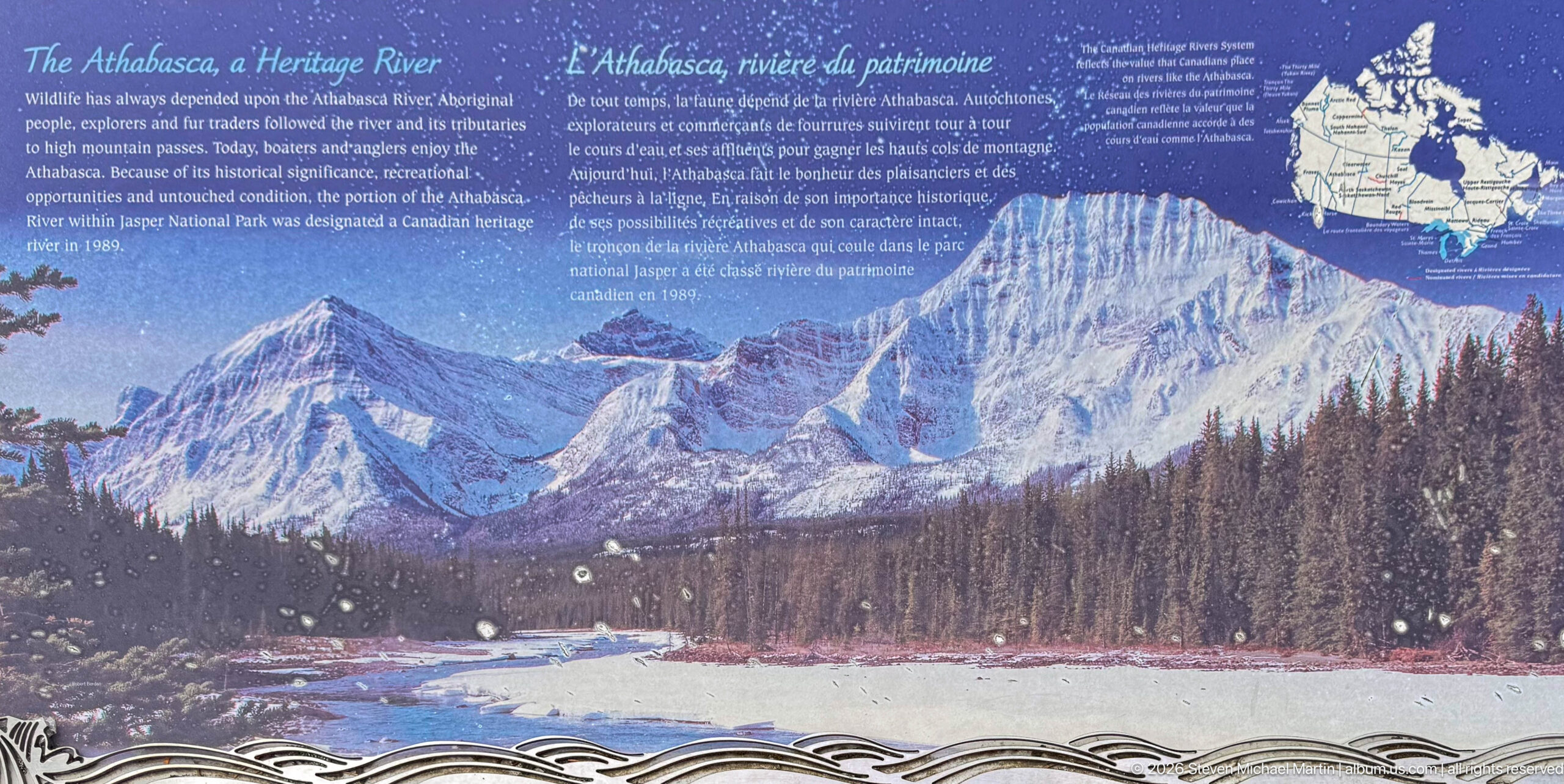
A bilingual interpretive panel presents the Athabasca River as a defining feature of the surrounding landscape. A broad mountain-and-river photograph fills most of the display, accompanied by text and a watershed map. The panel connects the river corridor with the Canadian Rockies and emphasizes the Athabasca as more than scenery: it is the major watercourse shaping this valley.
Caption
A bilingual interpretive panel presents the Athabasca River as a defining feature of the surrounding landscape. A broad mountain-and-river photograph fills most of the display, accompanied by text and a watershed map. The panel connects the river corridor with the Canadian Rockies and emphasizes the Athabasca as more than scenery: it is the major watercourse shaping this valley.
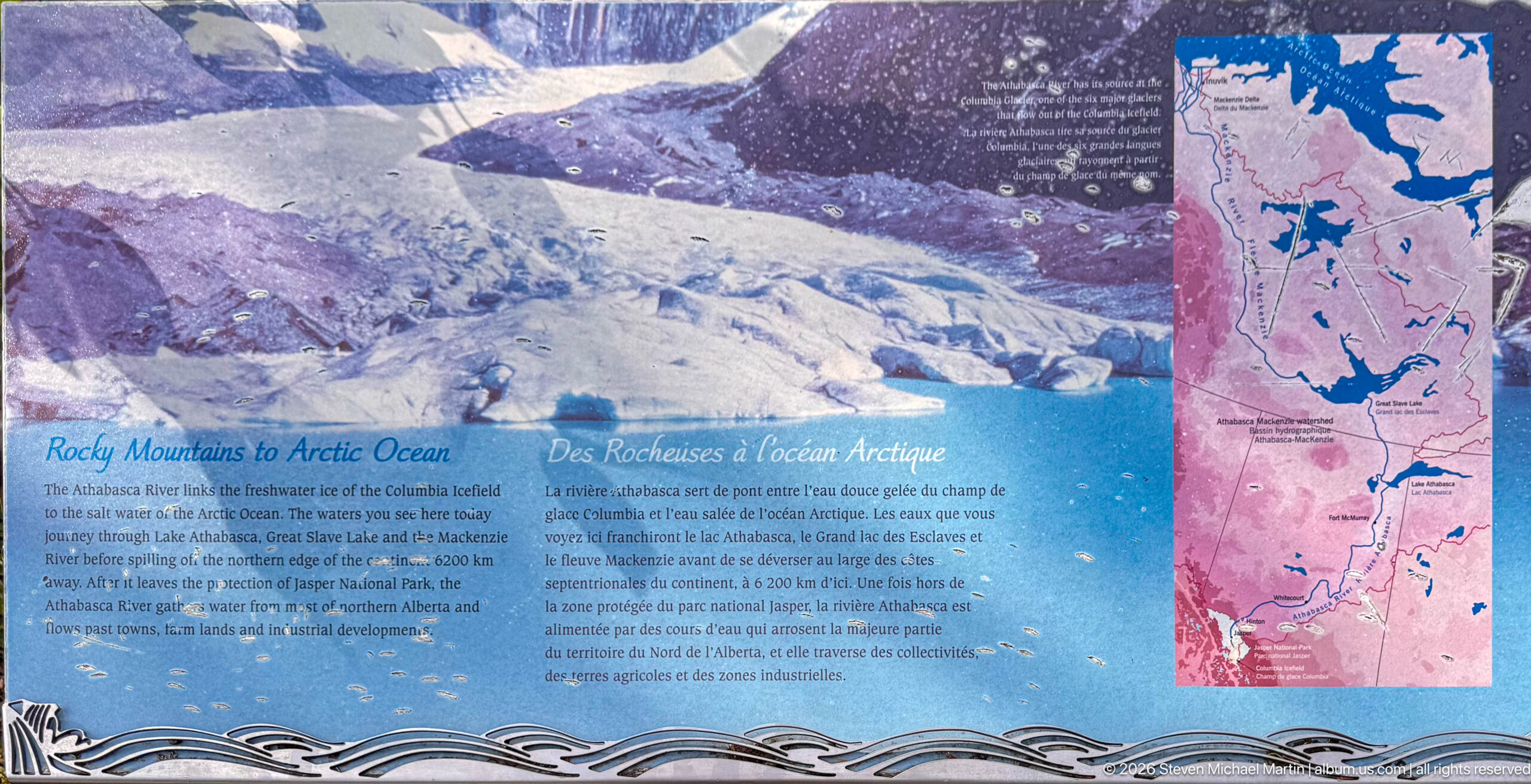
A bilingual panel explains the Athabasca River’s place in a much larger drainage system, using a glacier photograph and regional maps to trace water from the Rocky Mountains toward the Arctic Ocean watershed. The display broadens the interpretation of Athabasca Falls from a single scenic stop to one point within a river system extending far beyond Jasper National Park.
Caption
A bilingual panel explains the Athabasca River’s place in a much larger drainage system, using a glacier photograph and regional maps to trace water from the Rocky Mountains toward the Arctic Ocean watershed. The display broadens the interpretation of Athabasca Falls from a single scenic stop to one point within a river system extending far beyond Jasper National Park.
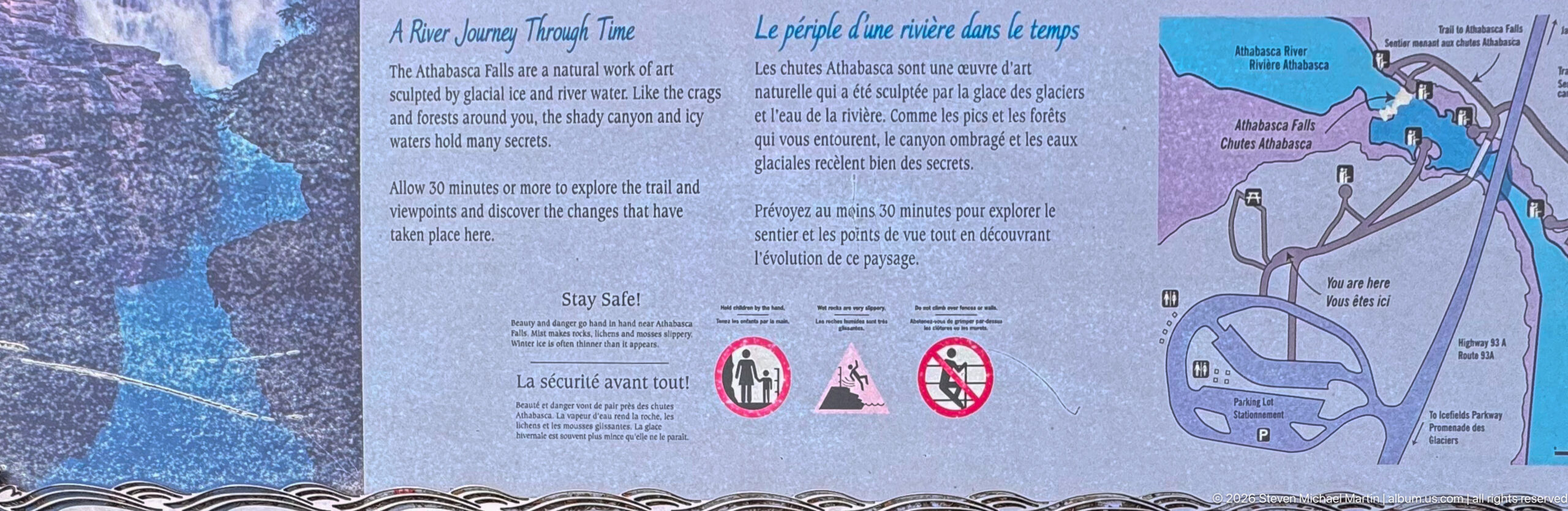
This visitor-information panel combines a site map with bilingual safety guidance for exploring Athabasca Falls. The diagram marks the trail network, viewpoints, parking area, and surrounding river corridor, while warning symbols reinforce the hazards posed by steep canyon edges and powerful water. It documents the managed visitor landscape that provides access to the falls without diminishing the site’s natural risks.
Caption
This visitor-information panel combines a site map with bilingual safety guidance for exploring Athabasca Falls. The diagram marks the trail network, viewpoints, parking area, and surrounding river corridor, while warning symbols reinforce the hazards posed by steep canyon edges and powerful water. It documents the managed visitor landscape that provides access to the falls without diminishing the site’s natural risks.
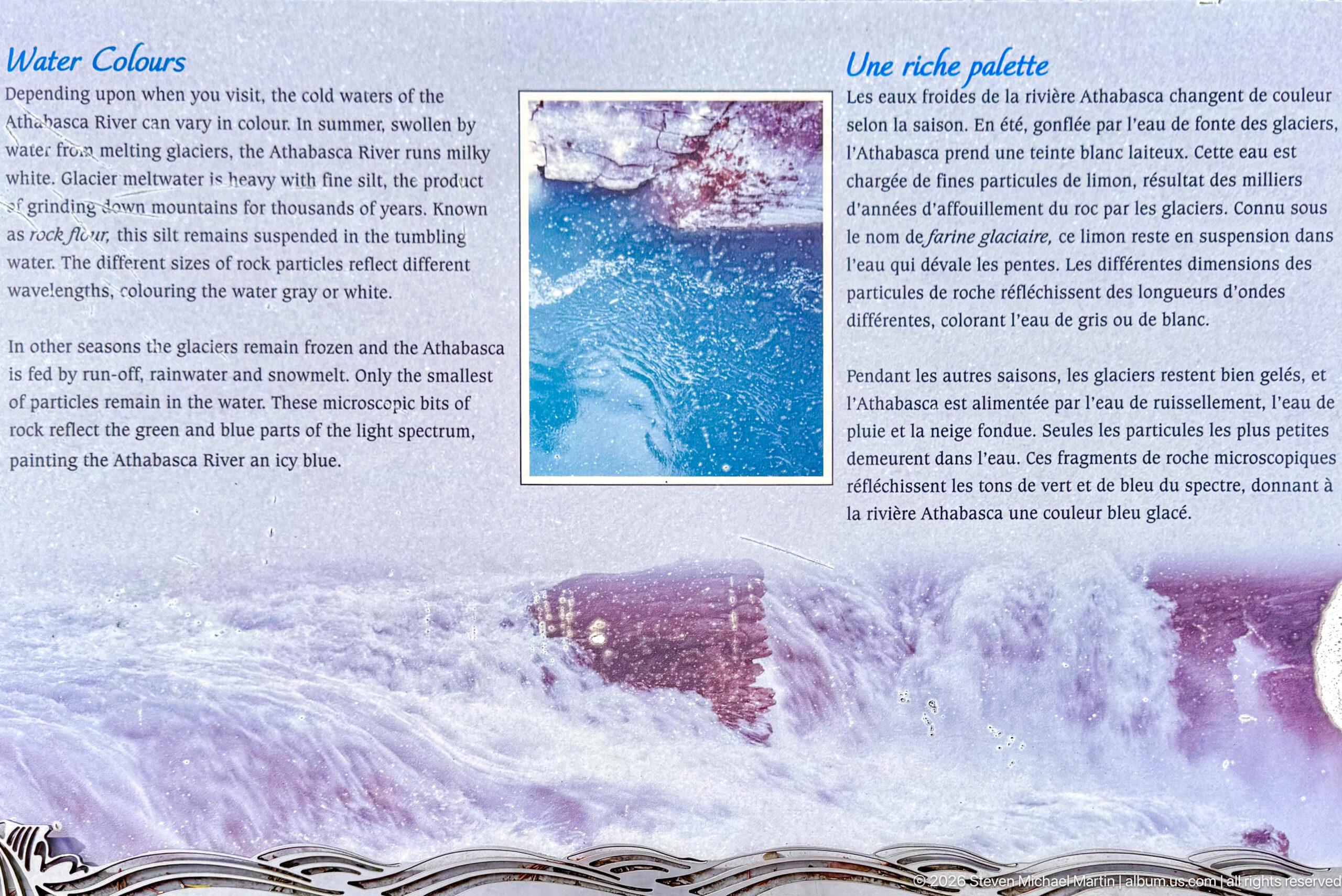
A bilingual interpretive panel explains the changing color of the Athabasca River, pairing text with a close view of vivid blue-green water and a broader river scene. The display relates the river’s milky or turquoise appearance to fine sediment associated with glacial landscapes, providing geological context for the distinctive water color visible around Athabasca Falls and along the Icefields Parkway.
Caption
A bilingual interpretive panel explains the changing color of the Athabasca River, pairing text with a close view of vivid blue-green water and a broader river scene. The display relates the river’s milky or turquoise appearance to fine sediment associated with glacial landscapes, providing geological context for the distinctive water color visible around Athabasca Falls and along the Icefields Parkway.
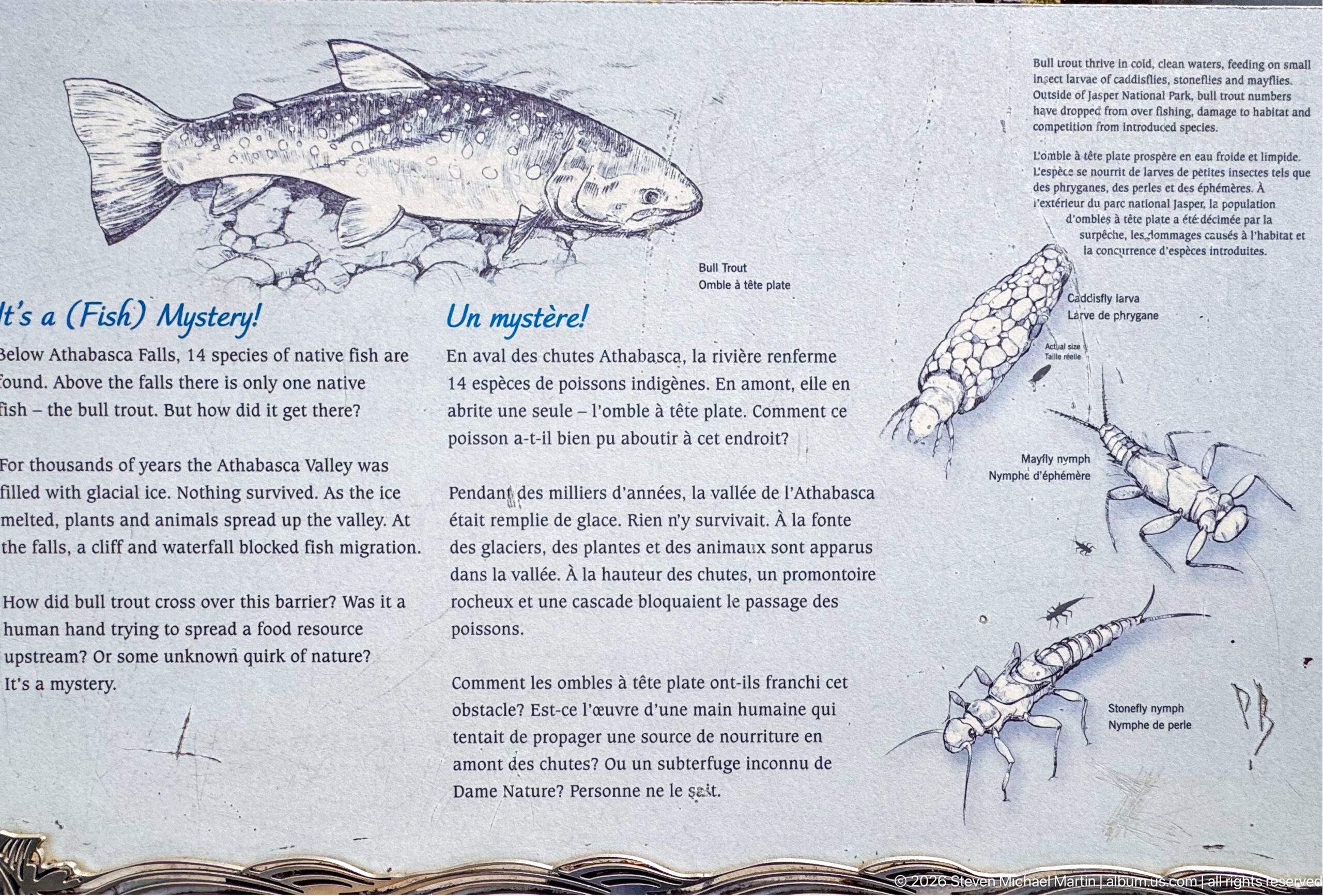
This bilingual wildlife panel focuses on bull trout in the Athabasca River system. A large fish illustration and diagrams of aquatic invertebrates accompany text describing the species and its river habitat. Positioned within the Athabasca Falls interpretive sequence, the display adds an ecological dimension to the surrounding canyon and whitewater, where the river is both a geological force and a living aquatic environment.
Caption
This bilingual wildlife panel focuses on bull trout in the Athabasca River system. A large fish illustration and diagrams of aquatic invertebrates accompany text describing the species and its river habitat. Positioned within the Athabasca Falls interpretive sequence, the display adds an ecological dimension to the surrounding canyon and whitewater, where the river is both a geological force and a living aquatic environment.
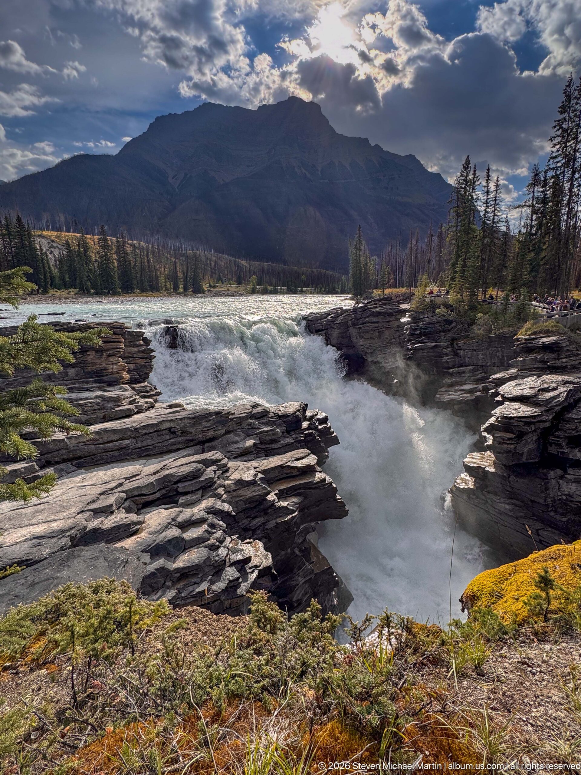
The Athabasca River spreads across a broad channel before surging over Athabasca Falls and into the narrow bedrock gorge. Layered rock shelves frame the whitewater in the foreground, while forest and a dark mountain ridge establish the larger Jasper setting. The view clearly shows the geomorphic contrast that defines the site: an open river abruptly compressed into a confined canyon.
Caption
The Athabasca River spreads across a broad channel before surging over Athabasca Falls and into the narrow bedrock gorge. Layered rock shelves frame the whitewater in the foreground, while forest and a dark mountain ridge establish the larger Jasper setting. The view clearly shows the geomorphic contrast that defines the site: an open river abruptly compressed into a confined canyon.
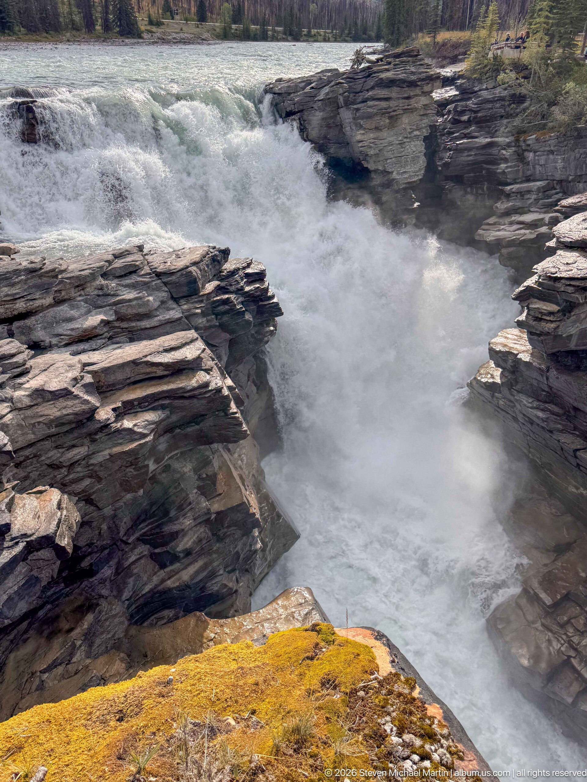
Whitewater pours over the lip of Athabasca Falls and disappears into a tight opening between layered bedrock walls. This closer composition minimizes the surrounding landscape to emphasize water, rock, and the abrupt narrowing of the Athabasca River. Spray obscures the deepest part of the channel, conveying the force of the river without requiring an estimate of flow or velocity.
Caption
Whitewater pours over the lip of Athabasca Falls and disappears into a tight opening between layered bedrock walls. This closer composition minimizes the surrounding landscape to emphasize water, rock, and the abrupt narrowing of the Athabasca River. Spray obscures the deepest part of the channel, conveying the force of the river without requiring an estimate of flow or velocity.
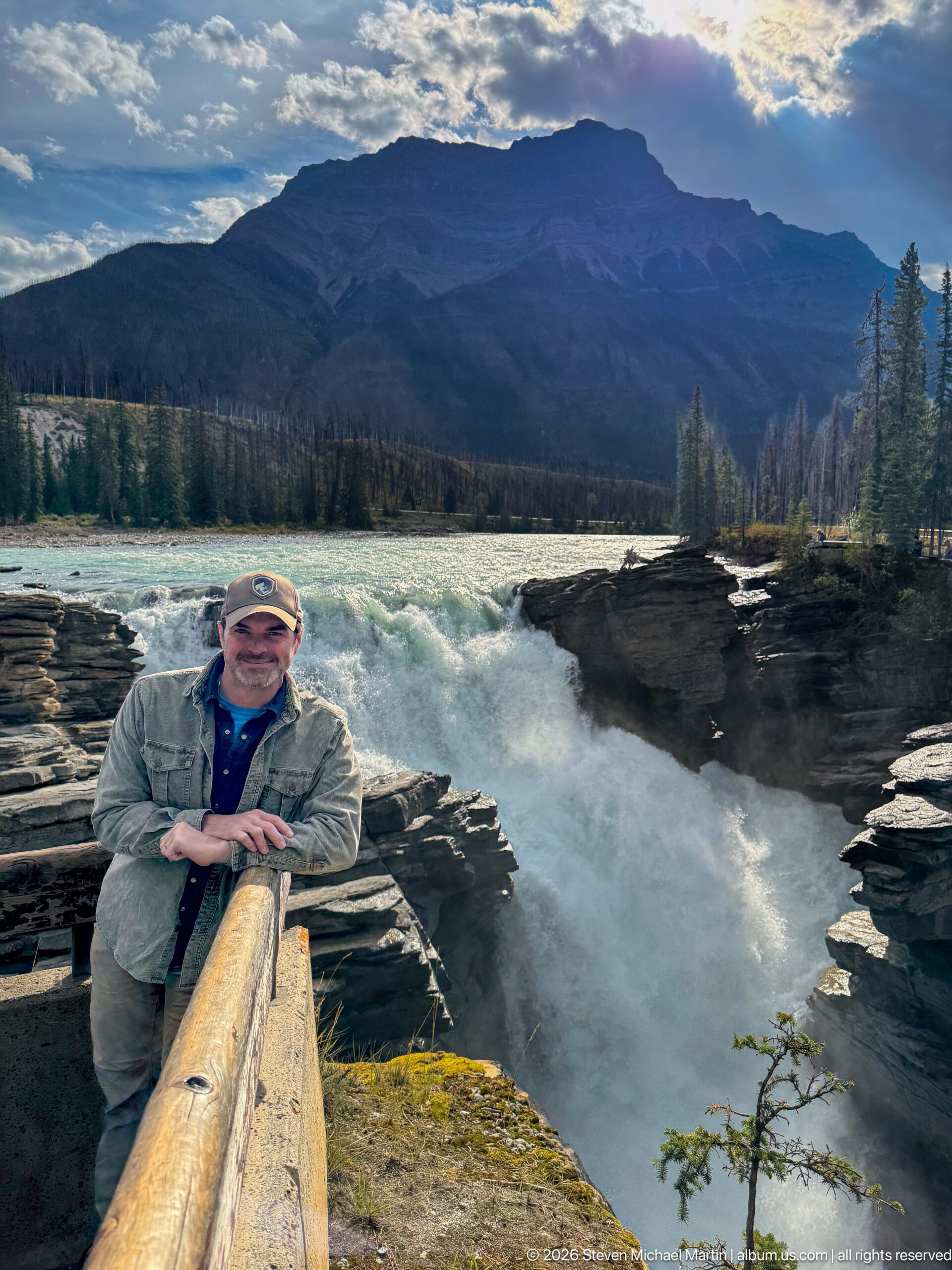
A visitor leans against the viewpoint railing with Athabasca Falls immediately behind him and the mountain skyline rising beyond the river. The composition combines a personal travel portrait with a broad environmental context: turquoise water approaches the falls, whitewater drops into the gorge, and the forested valley leads toward the Canadian Rockies. The overlook railing marks the managed edge of this powerful river landscape.
Caption
A visitor leans against the viewpoint railing with Athabasca Falls immediately behind him and the mountain skyline rising beyond the river. The composition combines a personal travel portrait with a broad environmental context: turquoise water approaches the falls, whitewater drops into the gorge, and the forested valley leads toward the Canadian Rockies. The overlook railing marks the managed edge of this powerful river landscape.
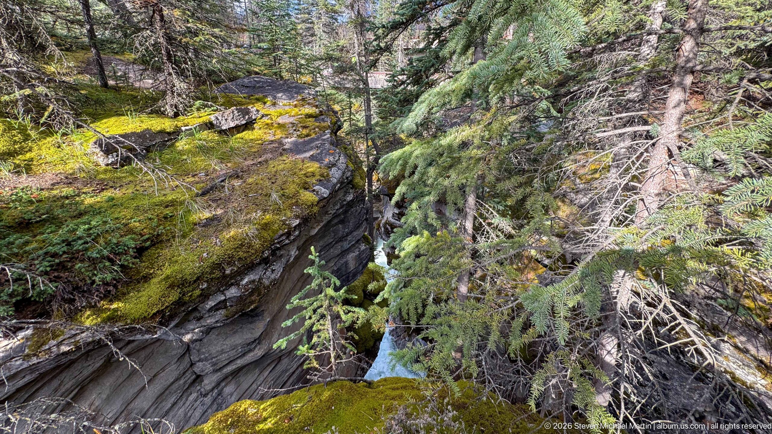
A narrow stream of pale turquoise water is partly concealed by spruce branches and moss-covered bedrock near the Athabasca Falls trail. Unlike the broad main waterfall views, this composition concentrates on the intimate canyon environment: fractured layered rock, damp moss, fallen wood, and dense conifers surround the confined watercourse. The exact named channel is not established by the proof sheet, so the identification remains conservative.
Caption
A narrow stream of pale turquoise water is partly concealed by spruce branches and moss-covered bedrock near the Athabasca Falls trail. Unlike the broad main waterfall views, this composition concentrates on the intimate canyon environment: fractured layered rock, damp moss, fallen wood, and dense conifers surround the confined watercourse. The exact named channel is not established by the proof sheet, so the identification remains conservative.
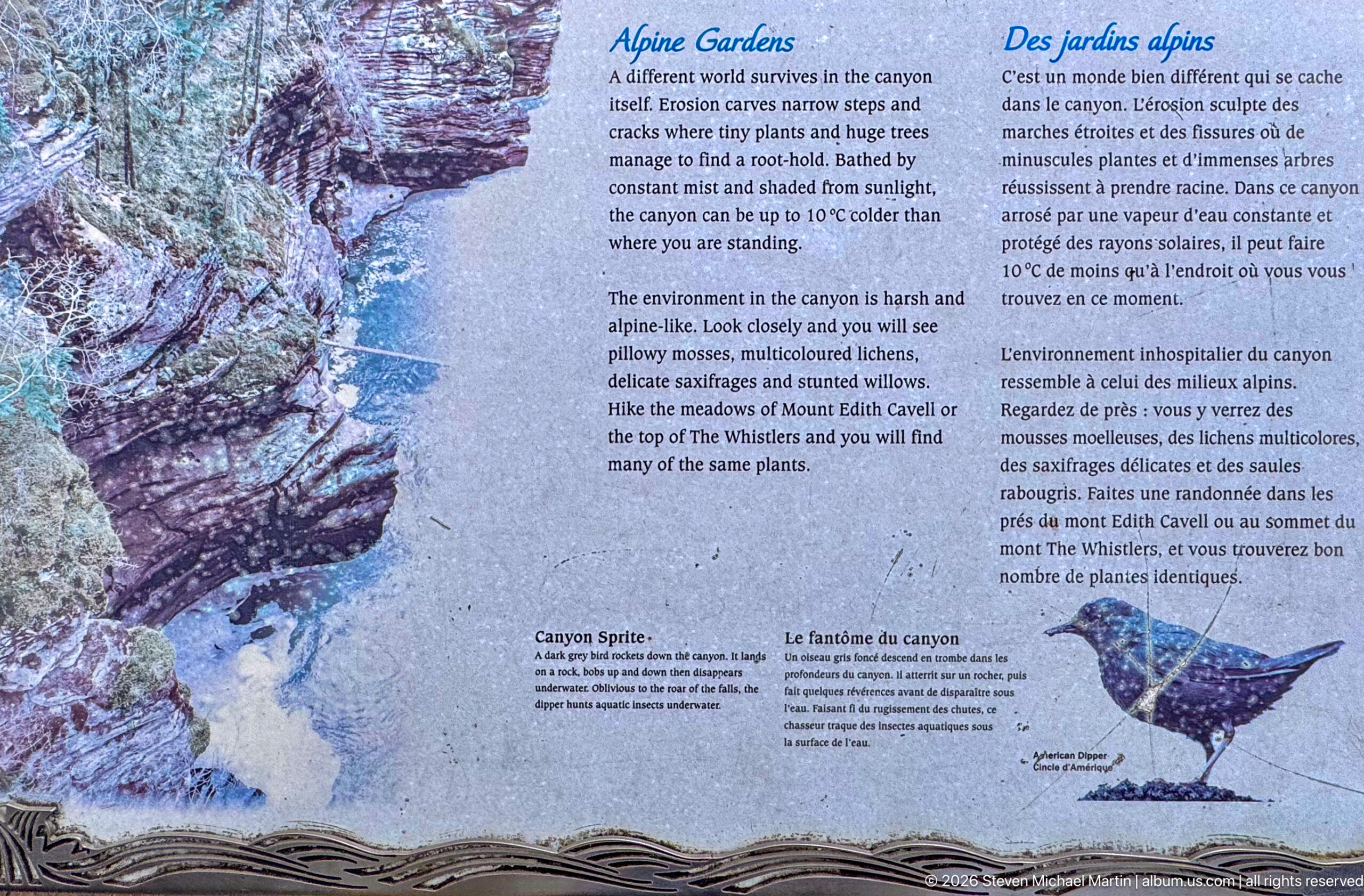
A bilingual panel titled “Alpine Gardens” interprets the cool, moist microhabitats within the Athabasca Falls canyon. Text and illustrations describe plants associated with shaded rock walls and spray-influenced conditions, while a canyon photograph and bird drawing connect vegetation with the broader ecosystem. The panel directs attention to small-scale ecological communities that can be overlooked beside the more dramatic waterfall.
Caption
A bilingual panel titled “Alpine Gardens” interprets the cool, moist microhabitats within the Athabasca Falls canyon. Text and illustrations describe plants associated with shaded rock walls and spray-influenced conditions, while a canyon photograph and bird drawing connect vegetation with the broader ecosystem. The panel directs attention to small-scale ecological communities that can be overlooked beside the more dramatic waterfall.
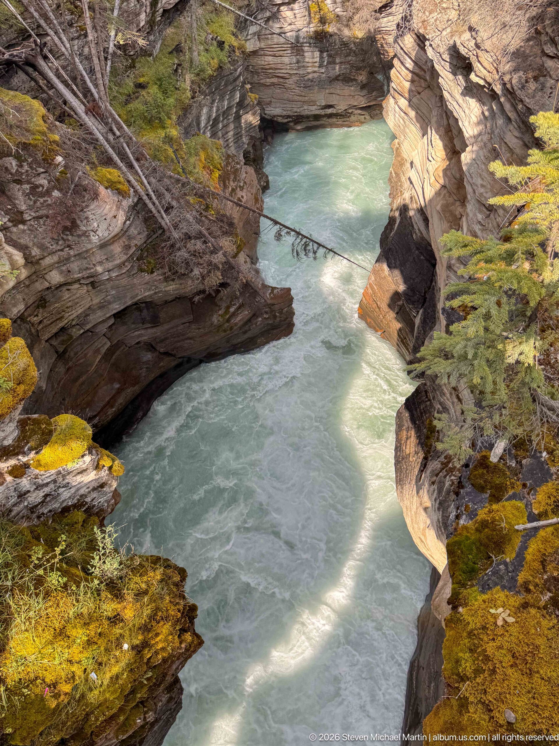
A calm-looking turquoise reach of the Athabasca River occupies a narrow basin between steep, sculpted rock walls below Athabasca Falls. Sunlight crosses the water while moss and low vegetation cling to the canyon rim. The composition contrasts with the violent whitewater upstream, revealing how the same river alternates between turbulent constrictions and quieter-looking pools within the lower gorge.
Caption
A calm-looking turquoise reach of the Athabasca River occupies a narrow basin between steep, sculpted rock walls below Athabasca Falls. Sunlight crosses the water while moss and low vegetation cling to the canyon rim. The composition contrasts with the violent whitewater upstream, revealing how the same river alternates between turbulent constrictions and quieter-looking pools within the lower gorge.
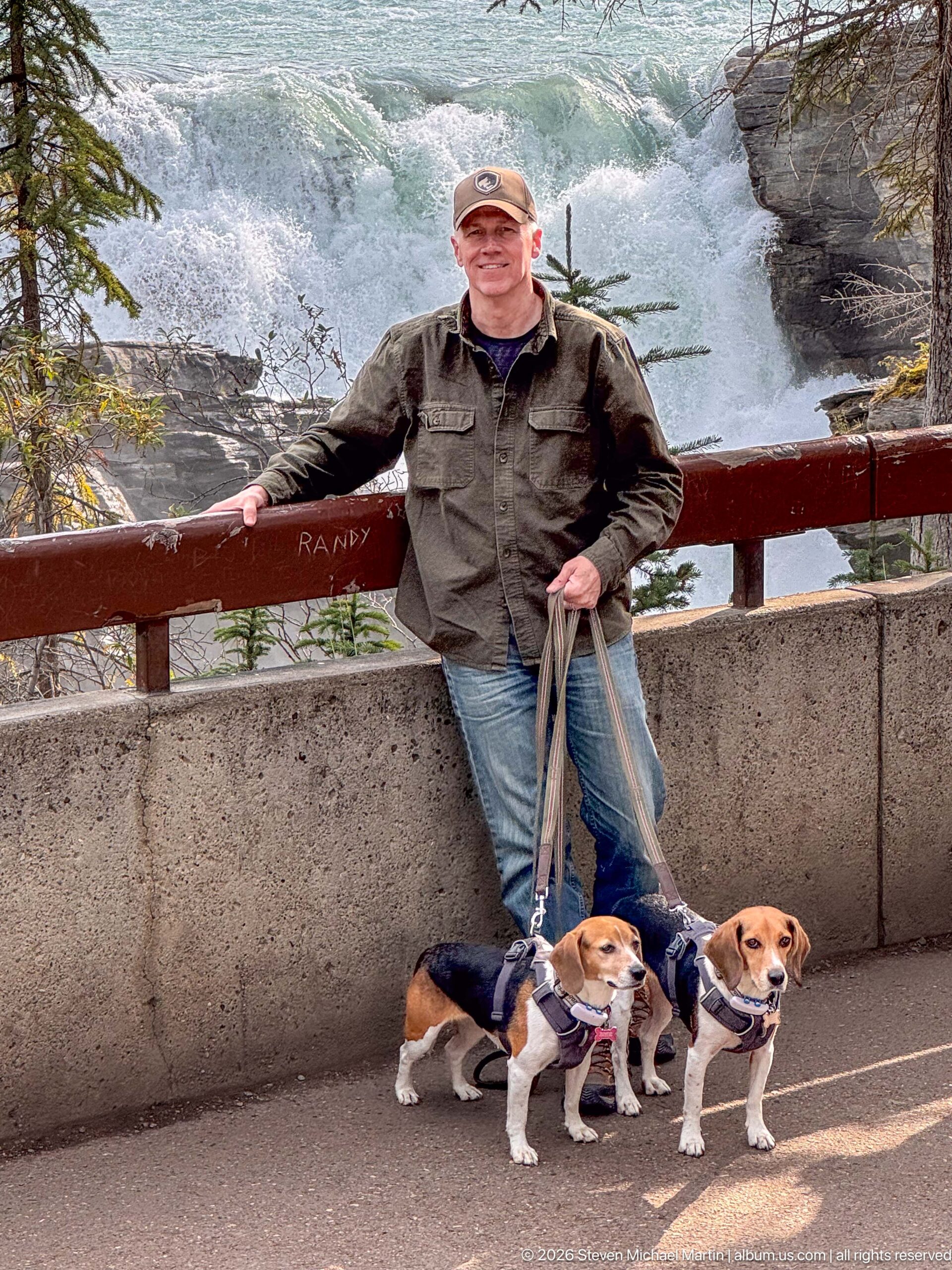
A visitor stands with two beagles at a developed overlook above the rushing Athabasca River. The railing and concrete barrier define the safe viewing area, while whitewater and layered rock remain visible immediately behind the group. The scene records Athabasca Falls as both a powerful natural feature and an accessible stop along the Jasper travel route, with the dogs adding a distinctive personal element.
Caption
A visitor stands with two beagles at a developed overlook above the rushing Athabasca River. The railing and concrete barrier define the safe viewing area, while whitewater and layered rock remain visible immediately behind the group. The scene records Athabasca Falls as both a powerful natural feature and an accessible stop along the Jasper travel route, with the dogs adding a distinctive personal element.
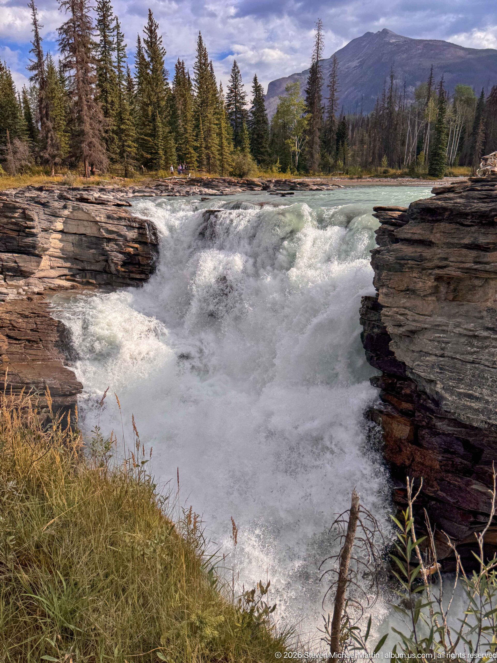
The Athabasca River gathers into foaming whitewater as it reaches the brink of the falls between layered rock walls. Seen from upstream, the composition emphasizes the transition from a broad turquoise river to a confined chute rather than the vertical drop itself. Forest and mountain ridges beyond the river place this active erosional zone within the larger Jasper National Park landscape.
Caption
The Athabasca River gathers into foaming whitewater as it reaches the brink of the falls between layered rock walls. Seen from upstream, the composition emphasizes the transition from a broad turquoise river to a confined chute rather than the vertical drop itself. Forest and mountain ridges beyond the river place this active erosional zone within the larger Jasper National Park landscape.
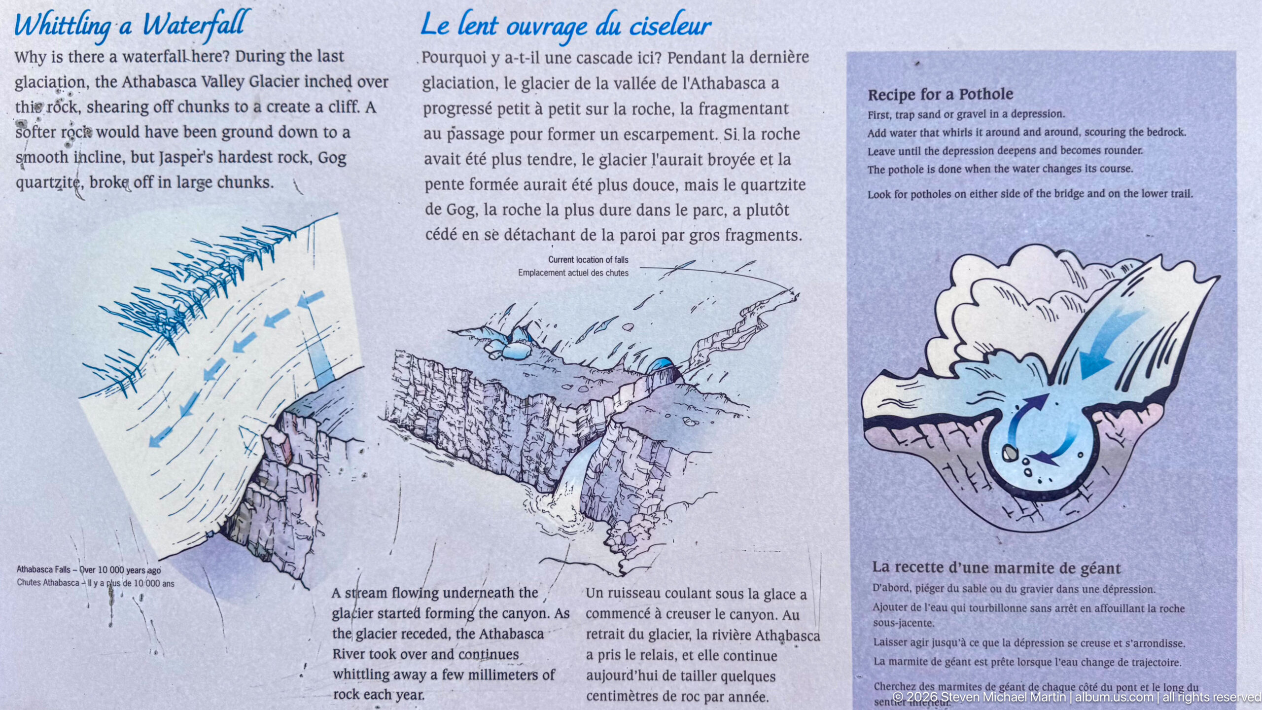
This bilingual geological panel explains how moving water and sediment can grind circular potholes into bedrock. Diagrams show water swirling beneath glacial ice and within a rocky channel, while a cartoon-like illustration simplifies the erosional process for visitors. At Athabasca Falls, the display helps interpret the sculpted canyon as the product of persistent interaction among water, sediment, and rock.
Caption
This bilingual geological panel explains how moving water and sediment can grind circular potholes into bedrock. Diagrams show water swirling beneath glacial ice and within a rocky channel, while a cartoon-like illustration simplifies the erosional process for visitors. At Athabasca Falls, the display helps interpret the sculpted canyon as the product of persistent interaction among water, sediment, and rock.
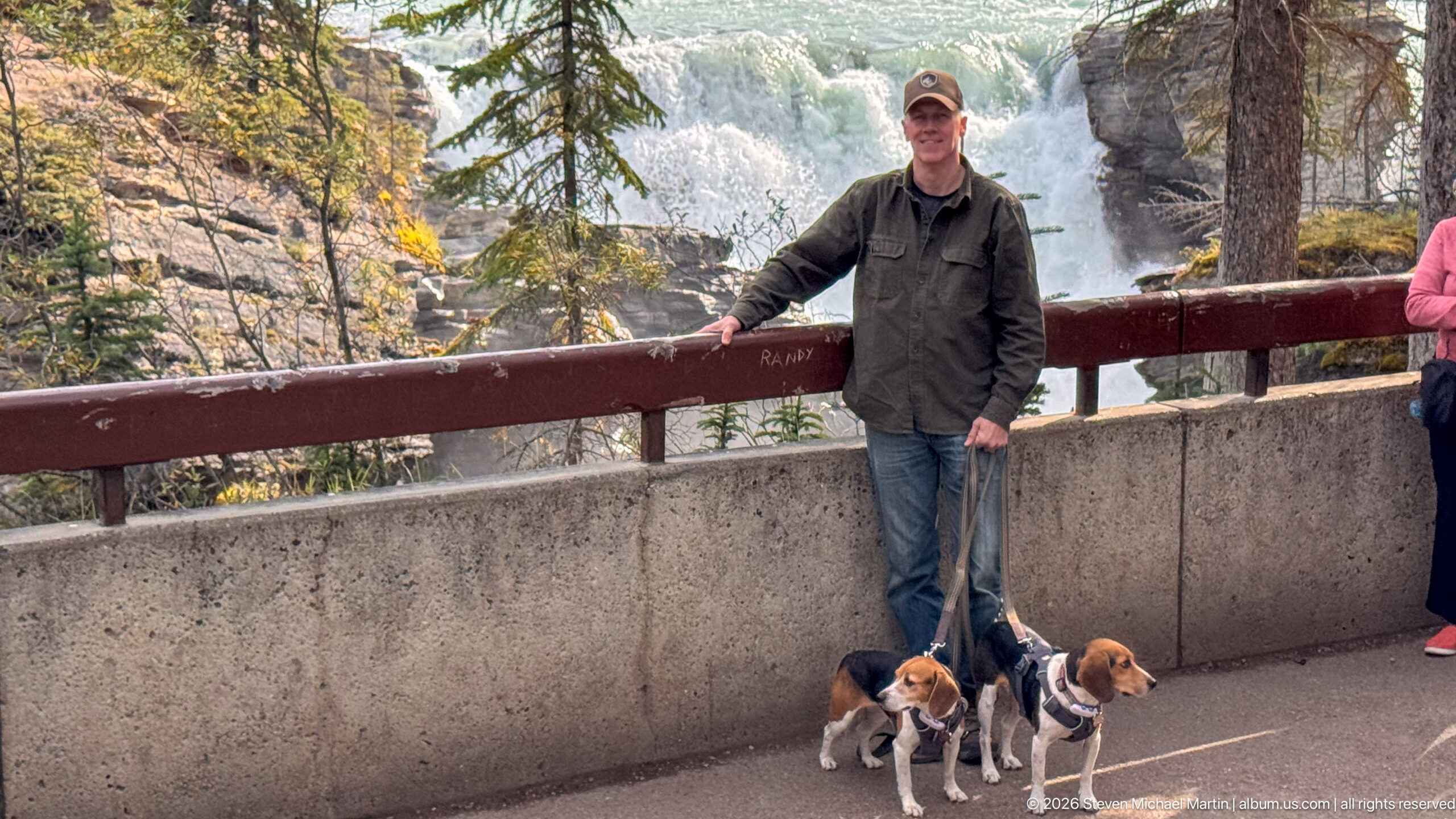
A visitor and two leashed beagles pause beside the railing at an Athabasca Falls overlook. Whitewater and the rocky river channel fill the background, while the concrete barrier and timber rail show the built infrastructure that keeps visitors separated from the gorge. Compared with the preceding group portrait, this frame places more emphasis on the person and dogs while retaining the falls as context.
Caption
A visitor and two leashed beagles pause beside the railing at an Athabasca Falls overlook. Whitewater and the rocky river channel fill the background, while the concrete barrier and timber rail show the built infrastructure that keeps visitors separated from the gorge. Compared with the preceding group portrait, this frame places more emphasis on the person and dogs while retaining the falls as context.
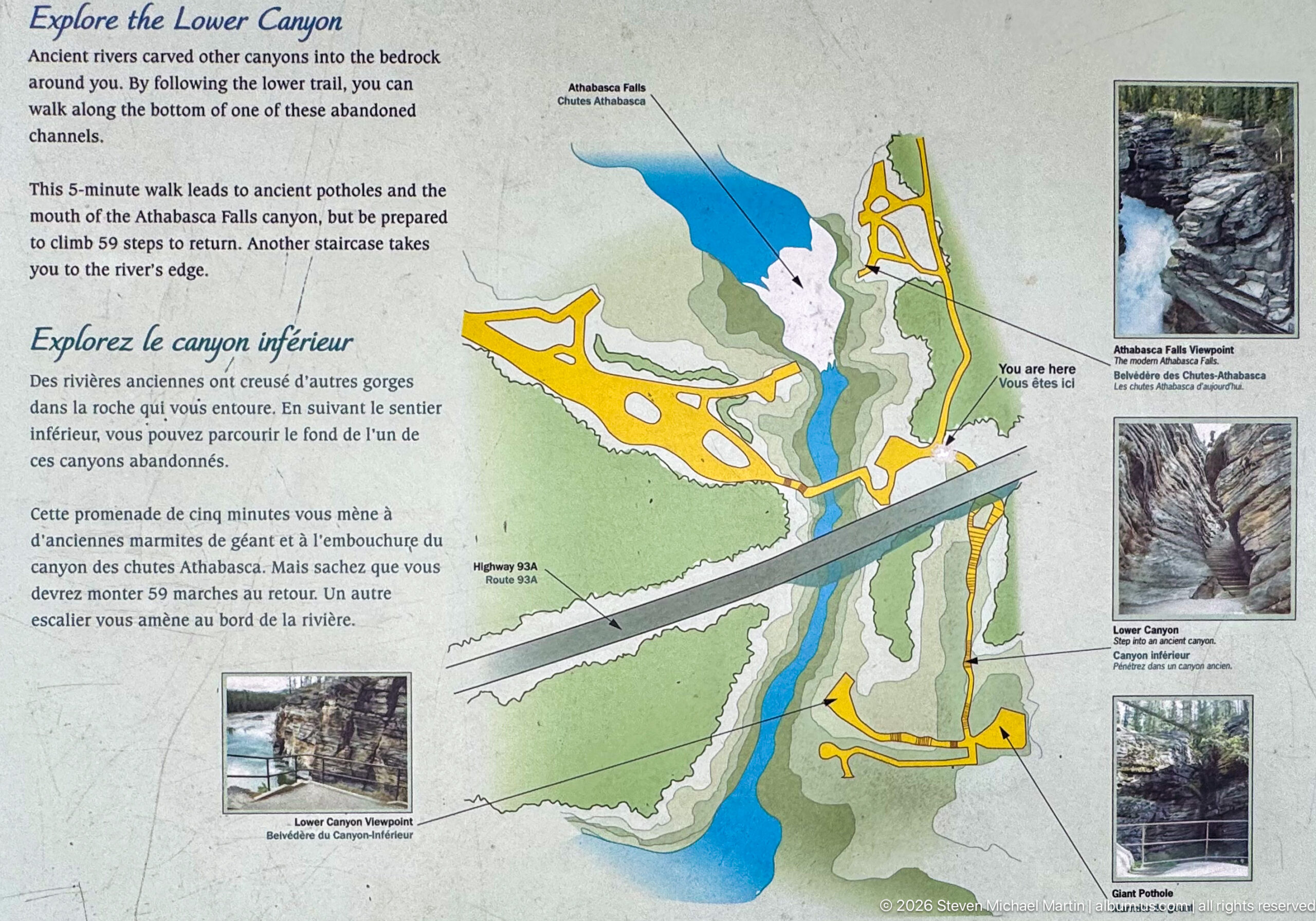
A bilingual map titled “Explore the Lower Canyon” diagrams the trail system around Athabasca Falls and the downstream gorge. Colored paths, the river, Highway 93A, and small reference photographs orient visitors to named canyon features and viewpoints. The panel is especially useful as a spatial record of how the developed trail network follows both sides of the river and crosses the transportation corridor.
Caption
A bilingual map titled “Explore the Lower Canyon” diagrams the trail system around Athabasca Falls and the downstream gorge. Colored paths, the river, Highway 93A, and small reference photographs orient visitors to named canyon features and viewpoints. The panel is especially useful as a spatial record of how the developed trail network follows both sides of the river and crosses the transportation corridor.
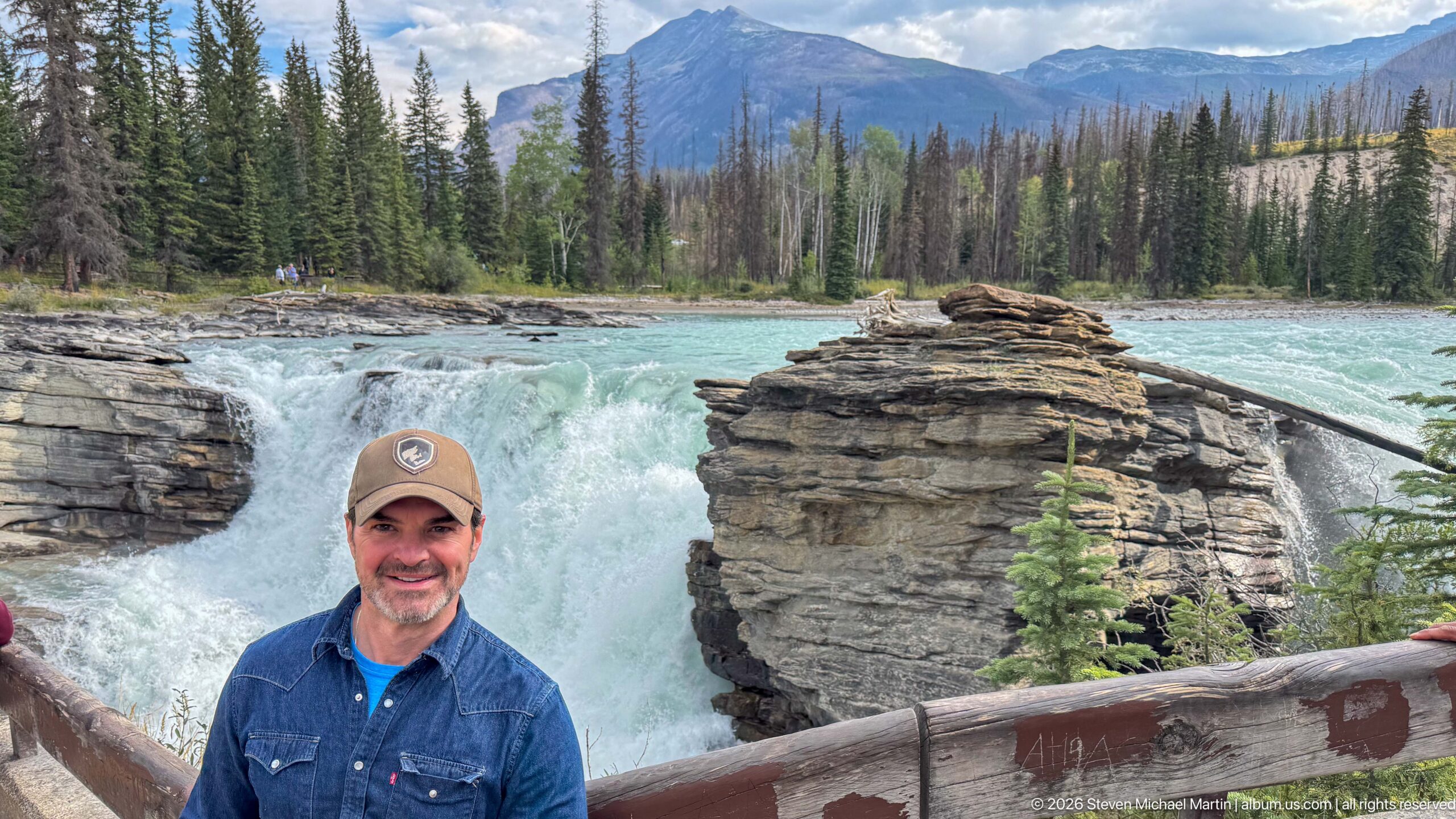
A smiling visitor stands at the railing with Athabasca Falls dropping behind a prominent layered rock outcrop. The upstream river, conifer forest, and mountain slopes extend across the background, giving the portrait unusually complete landscape context. The central rock mass visually divides the waterfall and helps demonstrate how resistant bedrock constricts the Athabasca River at the falls.
Caption
A smiling visitor stands at the railing with Athabasca Falls dropping behind a prominent layered rock outcrop. The upstream river, conifer forest, and mountain slopes extend across the background, giving the portrait unusually complete landscape context. The central rock mass visually divides the waterfall and helps demonstrate how resistant bedrock constricts the Athabasca River at the falls.
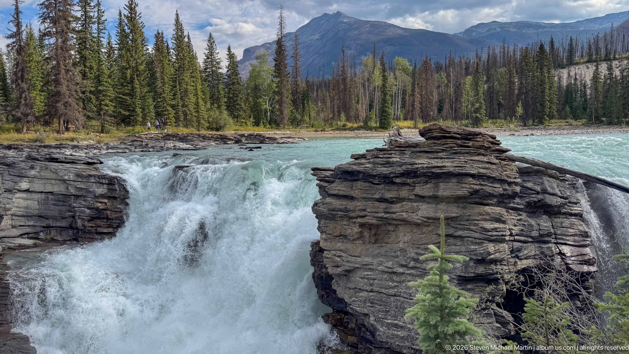
Athabasca Falls surges around a prominent layered rock outcrop that stands within the constricted river channel. The closer view emphasizes the relationship between resistant bedrock and rushing water, with the falls splitting around the rock before disappearing into the gorge. Turquoise water upstream and the forested mountain valley beyond provide enough context to locate the detail within the larger falls complex.
Caption
Athabasca Falls surges around a prominent layered rock outcrop that stands within the constricted river channel. The closer view emphasizes the relationship between resistant bedrock and rushing water, with the falls splitting around the rock before disappearing into the gorge. Turquoise water upstream and the forested mountain valley beyond provide enough context to locate the detail within the larger falls complex.
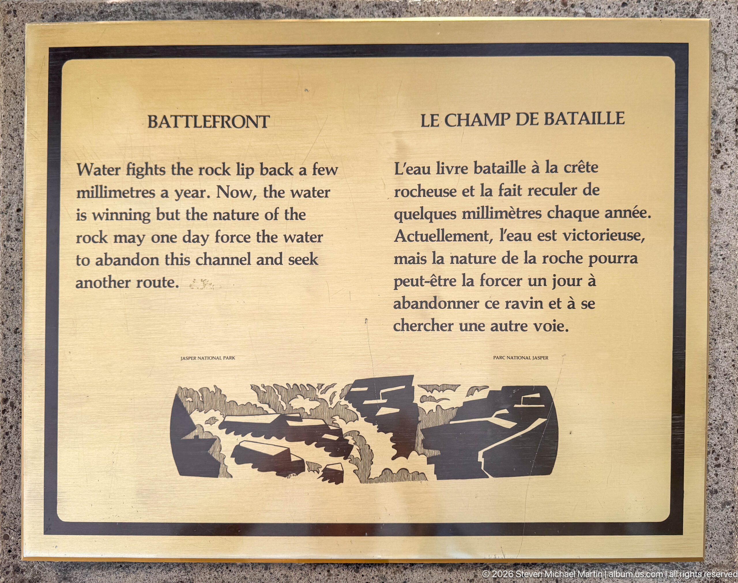
An interpretive sign titled “Battlefront” explains the continuing contest between water and rock at Athabasca Falls. English and French text describes the rock lip retreating by small increments as the river erodes the crest, while a simplified diagram illustrates the changing channel. The panel translates a slow geomorphic process into a visitor-scale explanation of how the waterfall and gorge continue to evolve.
Caption
An interpretive sign titled “Battlefront” explains the continuing contest between water and rock at Athabasca Falls. English and French text describes the rock lip retreating by small increments as the river erodes the crest, while a simplified diagram illustrates the changing channel. The panel translates a slow geomorphic process into a visitor-scale explanation of how the waterfall and gorge continue to evolve.
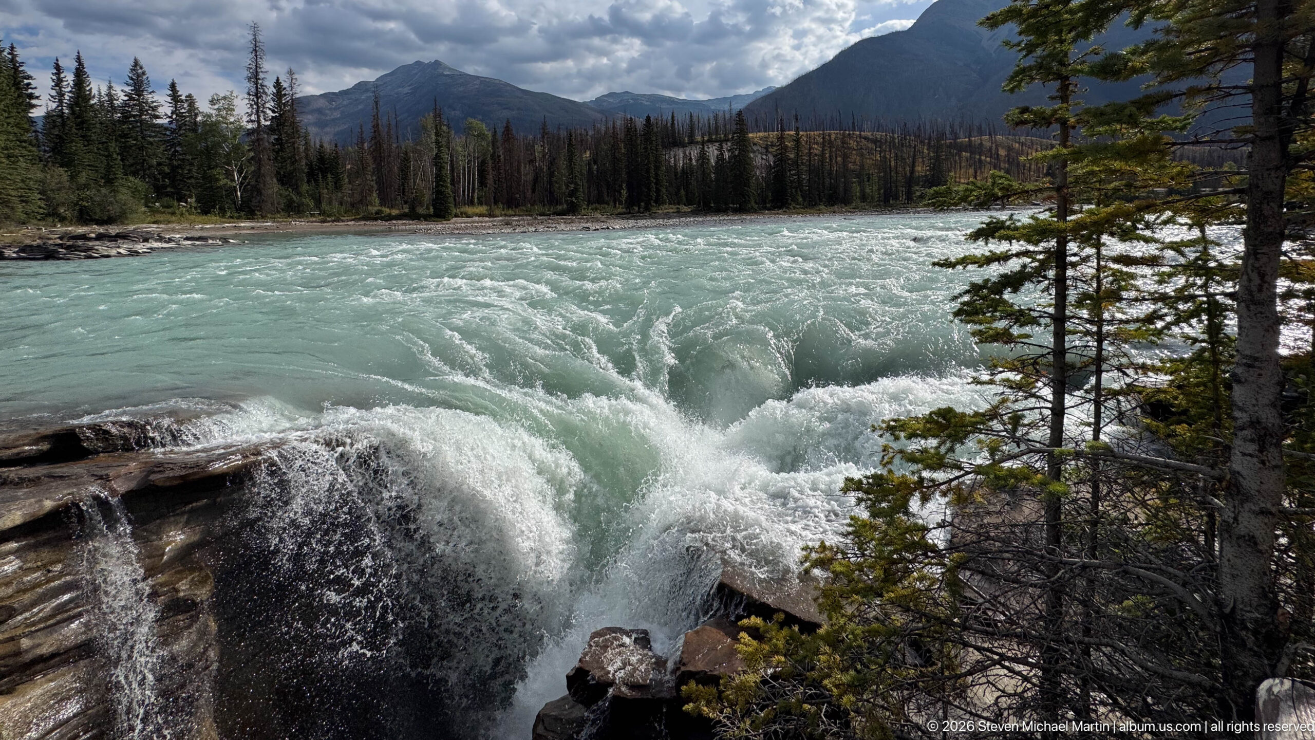
Turquoise water rolls into a band of whitewater beside a rocky ledge upstream of Athabasca Falls. Conifers frame the right side while the opposite forest and mountain slope close the background. The elevated viewpoint reveals the texture of standing waves and turbulent current across the river surface, complementing the waterfall images with a closer study of the Athabasca River before its major constriction.
Caption
Turquoise water rolls into a band of whitewater beside a rocky ledge upstream of Athabasca Falls. Conifers frame the right side while the opposite forest and mountain slope close the background. The elevated viewpoint reveals the texture of standing waves and turbulent current across the river surface, complementing the waterfall images with a closer study of the Athabasca River before its major constriction.
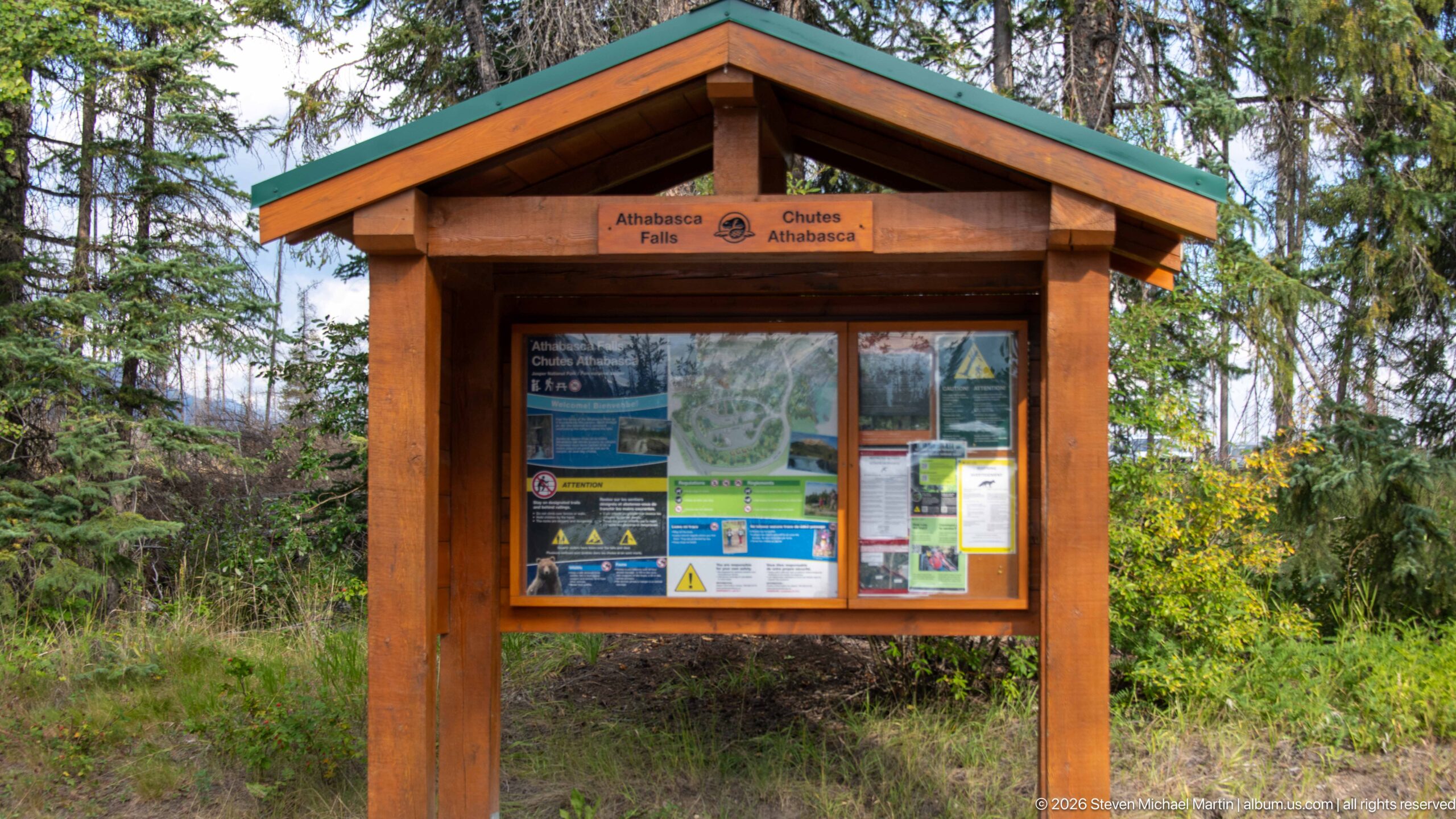
A timber information kiosk marks the visitor area at Athabasca Falls, with the place name displayed in English and French beneath a small park emblem. Maps, notices, safety information, and visitor guidance fill the enclosed board. Surrounded by conifers, the structure documents the managed entry point to the falls and the practical information infrastructure supporting access to the canyon trails.
Caption
A timber information kiosk marks the visitor area at Athabasca Falls, with the place name displayed in English and French beneath a small park emblem. Maps, notices, safety information, and visitor guidance fill the enclosed board. Surrounded by conifers, the structure documents the managed entry point to the falls and the practical information infrastructure supporting access to the canyon trails.
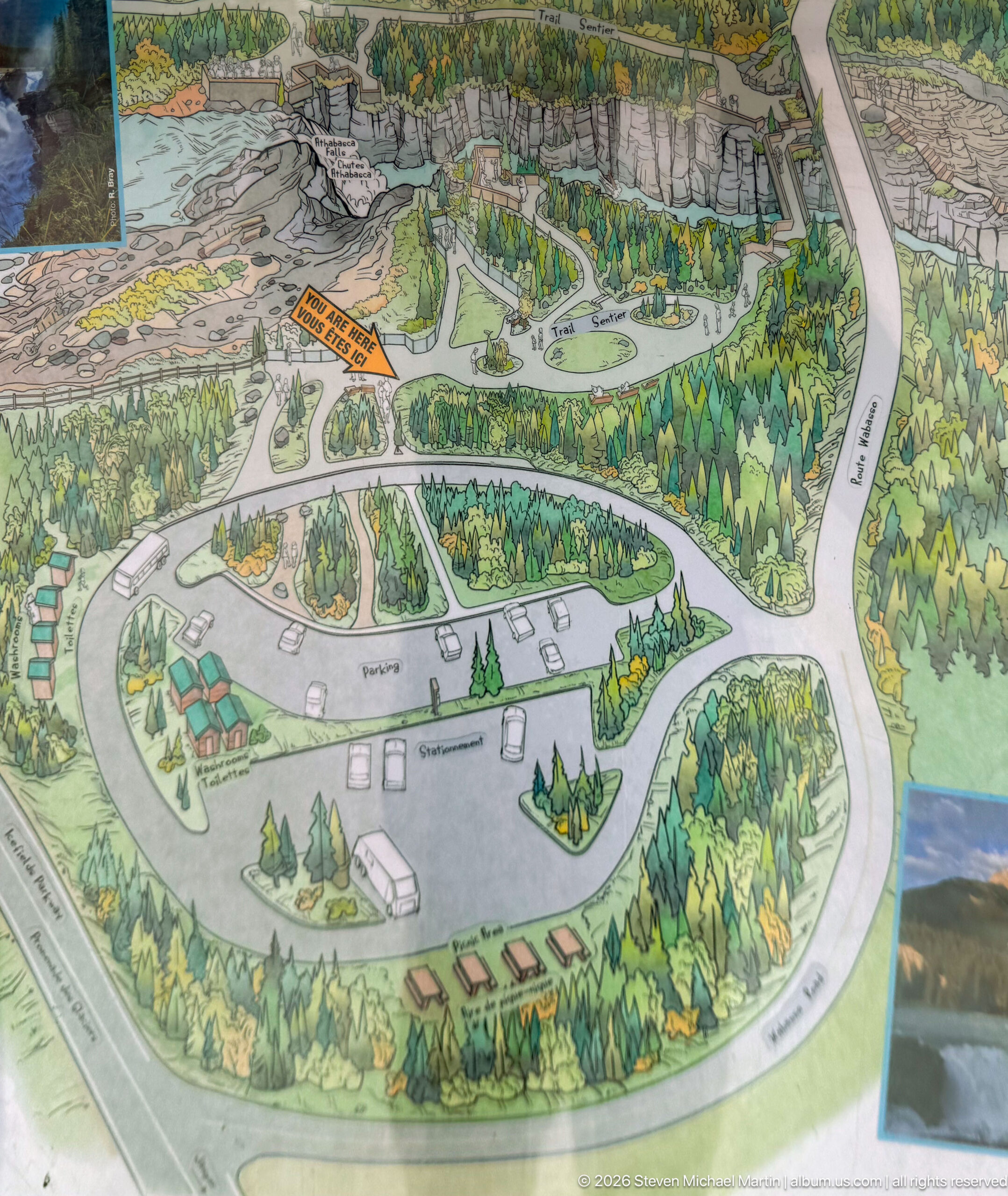
An illustrated orientation map presents the developed visitor area at Athabasca Falls, including roads, parking loops, paths, buildings, forest, and the river corridor. The bird’s-eye drawing clarifies the relationship between vehicle access and the trail network more intuitively than a conventional plan. It also records the substantial visitor infrastructure surrounding a site whose photographs otherwise concentrate on water, rock, and forest.
Caption
An illustrated orientation map presents the developed visitor area at Athabasca Falls, including roads, parking loops, paths, buildings, forest, and the river corridor. The bird’s-eye drawing clarifies the relationship between vehicle access and the trail network more intuitively than a conventional plan. It also records the substantial visitor infrastructure surrounding a site whose photographs otherwise concentrate on water, rock, and forest.
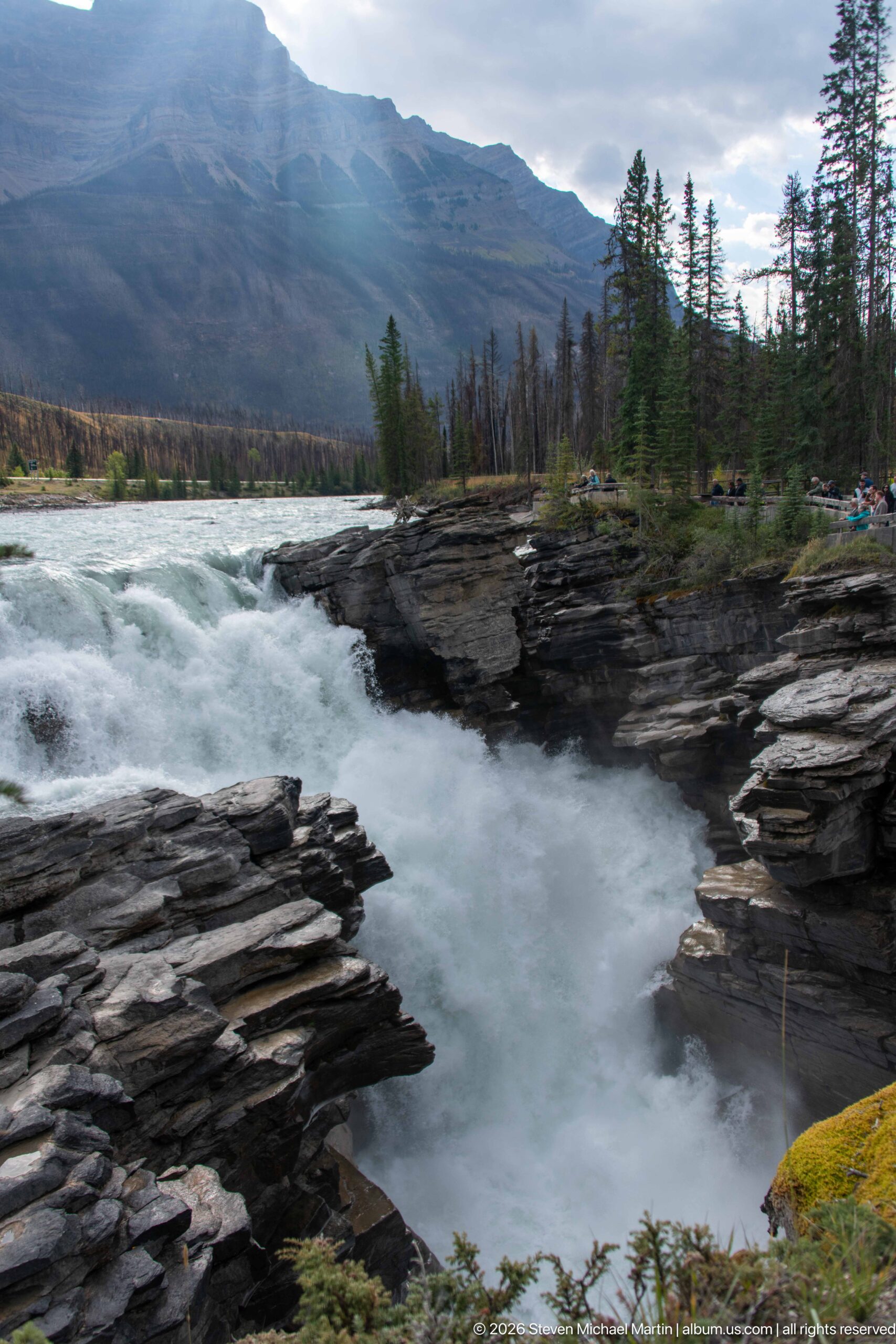
Whitewater sweeps across Athabasca Falls before disappearing into the gorge beside layered rock ledges. The wider side view includes conifers, the upstream river, and a long mountain slope beneath a partly clouded sky, placing the falls within its broader valley setting. Dark stratified bedrock in the foreground contrasts with the pale, aerated water and emphasizes the river’s confinement at the brink.
Caption
Whitewater sweeps across Athabasca Falls before disappearing into the gorge beside layered rock ledges. The wider side view includes conifers, the upstream river, and a long mountain slope beneath a partly clouded sky, placing the falls within its broader valley setting. Dark stratified bedrock in the foreground contrasts with the pale, aerated water and emphasizes the river’s confinement at the brink.
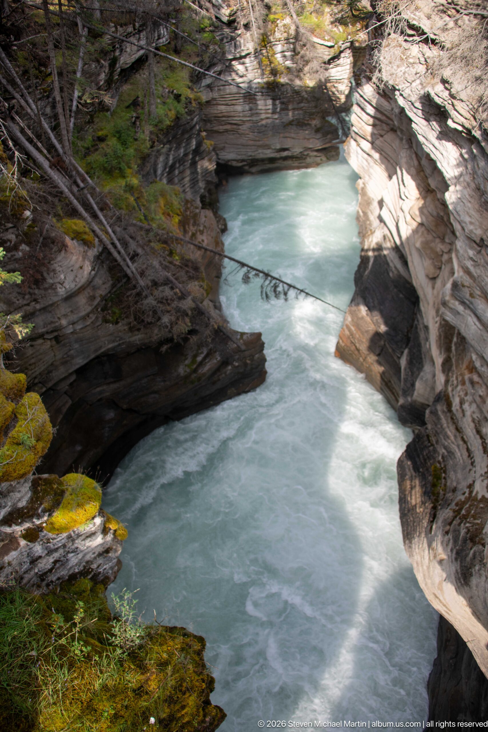
Pale turquoise water moves through a sharply confined reach of the lower canyon below Athabasca Falls. Steep, sculpted bedrock walls bend around the channel, while moss, shrubs, fallen branches, and conifers cling to the rim. Sunlight striking one rock face reveals the pronounced layering and erosional shaping of the canyon, making the geological structure more prominent than the water’s surface turbulence.
Caption
Pale turquoise water moves through a sharply confined reach of the lower canyon below Athabasca Falls. Steep, sculpted bedrock walls bend around the channel, while moss, shrubs, fallen branches, and conifers cling to the rim. Sunlight striking one rock face reveals the pronounced layering and erosional shaping of the canyon, making the geological structure more prominent than the water’s surface turbulence.
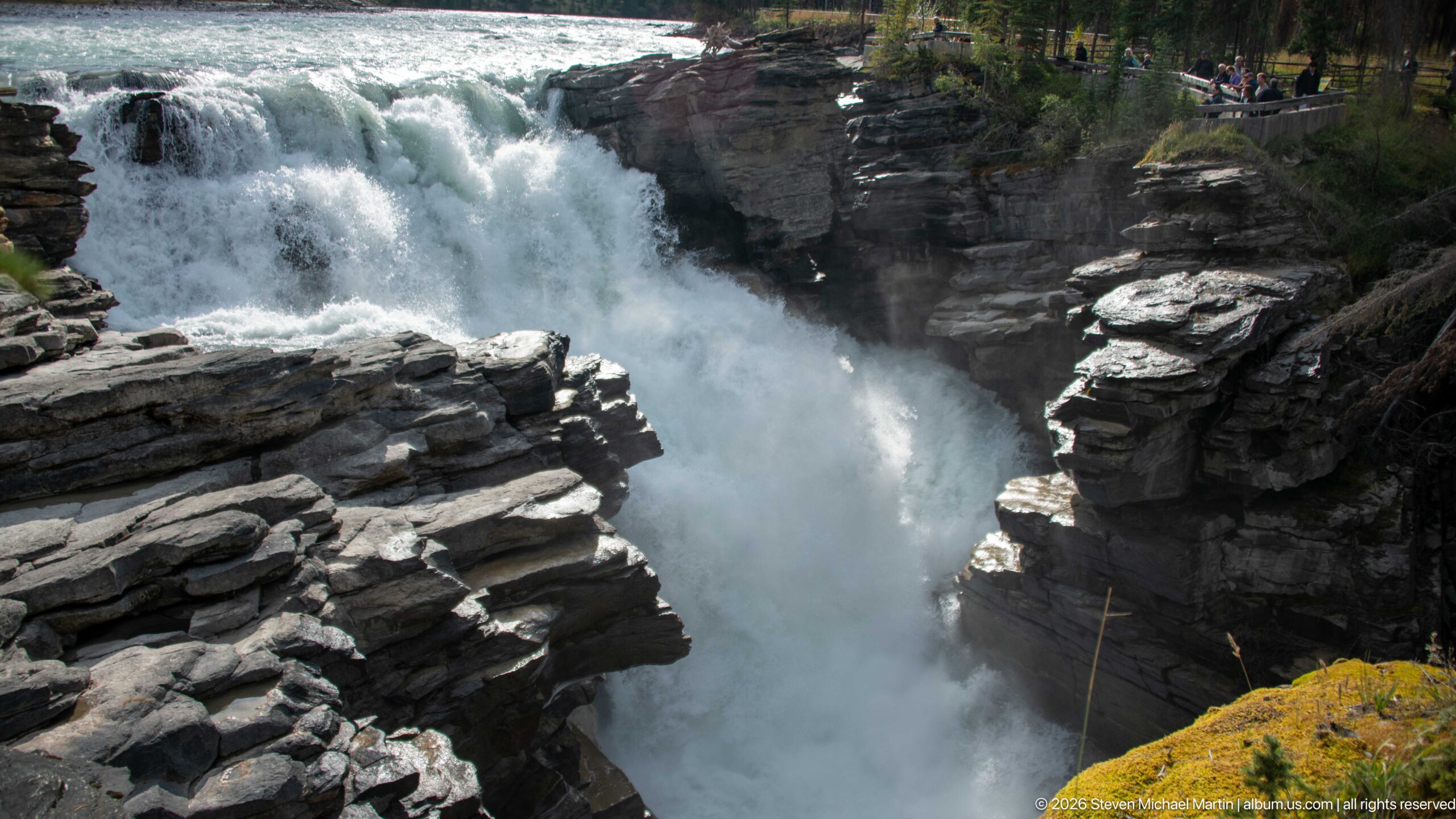
Athabasca Falls surges over the rock lip and plunges into a narrow gorge framed by thick, horizontally layered bedrock. Spray fills the confined channel, partly obscuring the water below, while visitors appear at a developed viewpoint high on the opposite rim. The elevated perspective makes the abrupt compression of the Athabasca River especially clear and reveals the scale of the canyon walls around the falling water.
Caption
Athabasca Falls surges over the rock lip and plunges into a narrow gorge framed by thick, horizontally layered bedrock. Spray fills the confined channel, partly obscuring the water below, while visitors appear at a developed viewpoint high on the opposite rim. The elevated perspective makes the abrupt compression of the Athabasca River especially clear and reveals the scale of the canyon walls around the falling water.
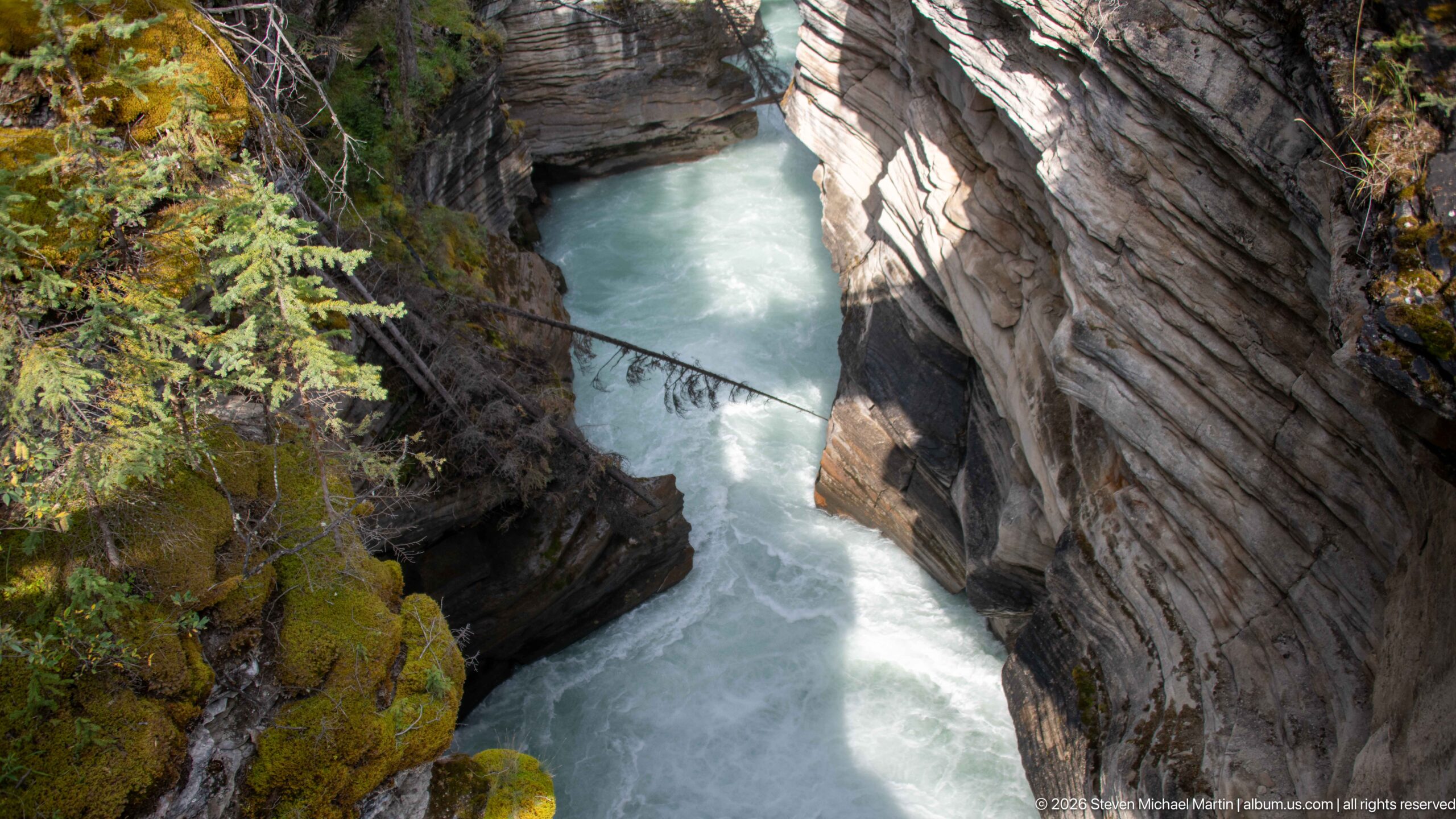
Viewed steeply downward, the Athabasca River squeezes through a narrow rock-walled passage below the falls. The pale water occupies only a slim corridor between strongly layered canyon walls, one brightly lit and the other shaded beneath moss and vegetation. This vertical composition gives unusual emphasis to the depth and confinement of the gorge, showing the river far below the forested rim.
Caption
Viewed steeply downward, the Athabasca River squeezes through a narrow rock-walled passage below the falls. The pale water occupies only a slim corridor between strongly layered canyon walls, one brightly lit and the other shaded beneath moss and vegetation. This vertical composition gives unusual emphasis to the depth and confinement of the gorge, showing the river far below the forested rim.
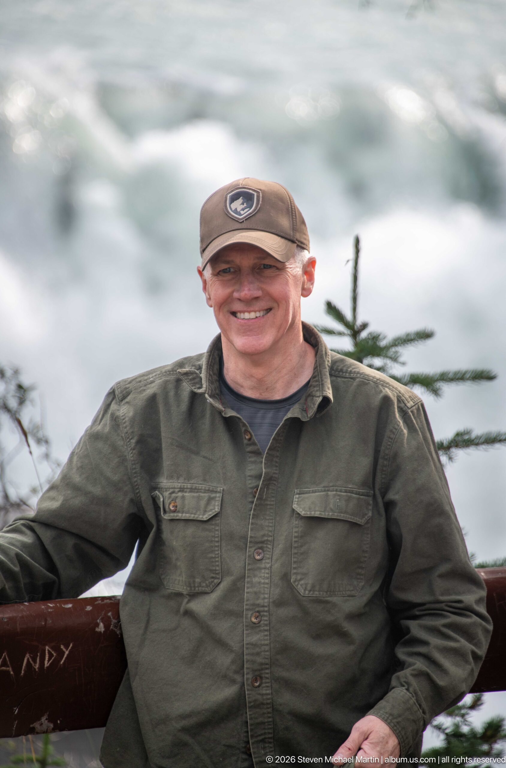
A visitor smiles beside a wooden overlook railing with the rushing Athabasca River rendered softly behind him. The shallow depth of field isolates the figure from the bright water while a small conifer branch retains a sense of the surrounding forested setting. Rather than functioning as a landscape record, the frame documents the personal experience of the developed viewpoint at Athabasca Falls.
Caption
A visitor smiles beside a wooden overlook railing with the rushing Athabasca River rendered softly behind him. The shallow depth of field isolates the figure from the bright water while a small conifer branch retains a sense of the surrounding forested setting. Rather than functioning as a landscape record, the frame documents the personal experience of the developed viewpoint at Athabasca Falls.
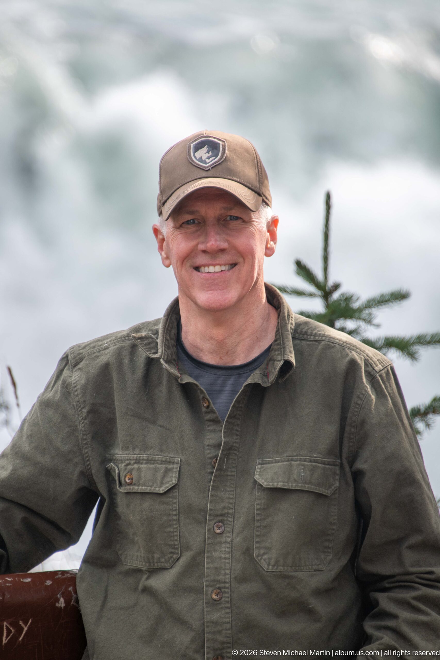
A close portrait places a smiling visitor against a softly blurred backdrop of the Athabasca River. His cap, glasses, and green overshirt are sharply rendered, while the bright water and a conifer branch recede into an abstract background. The tighter crop distinguishes this frame from the preceding environmental portrait by concentrating on the person while retaining just enough river context to locate the scene at the falls overlook.
Caption
A close portrait places a smiling visitor against a softly blurred backdrop of the Athabasca River. His cap, glasses, and green overshirt are sharply rendered, while the bright water and a conifer branch recede into an abstract background. The tighter crop distinguishes this frame from the preceding environmental portrait by concentrating on the person while retaining just enough river context to locate the scene at the falls overlook.
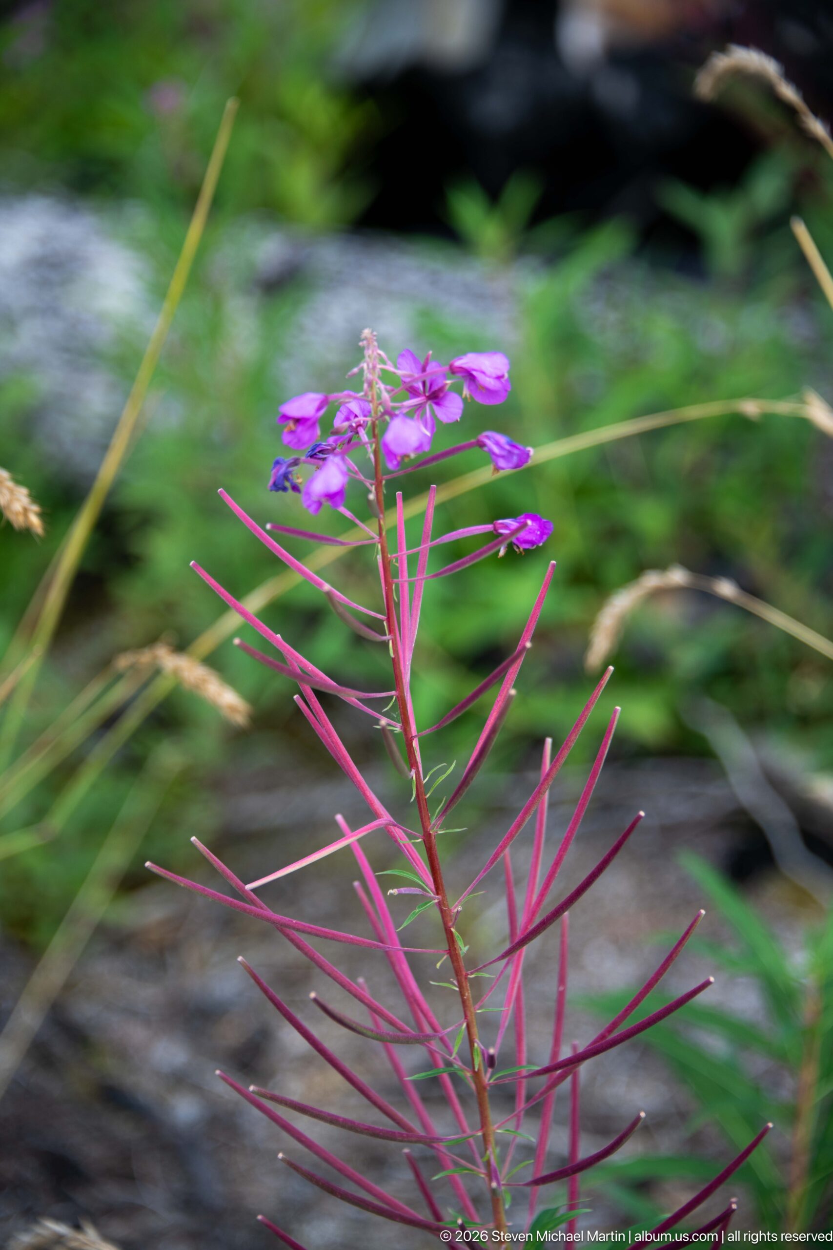
A fireweed stem carries bright magenta flowers above long, narrow reddish seed pods, set against a softly blurred green and gray background. The combination of four-petaled pink blossoms and slender capsules is characteristic of this common northern wildflower. The close botanical view adds seasonal plant detail to a portfolio otherwise dominated by the Athabasca River, bedrock, wildlife, and visitor landscapes.
Caption
A fireweed stem carries bright magenta flowers above long, narrow reddish seed pods, set against a softly blurred green and gray background. The combination of four-petaled pink blossoms and slender capsules is characteristic of this common northern wildflower. The close botanical view adds seasonal plant detail to a portfolio otherwise dominated by the Athabasca River, bedrock, wildlife, and visitor landscapes.
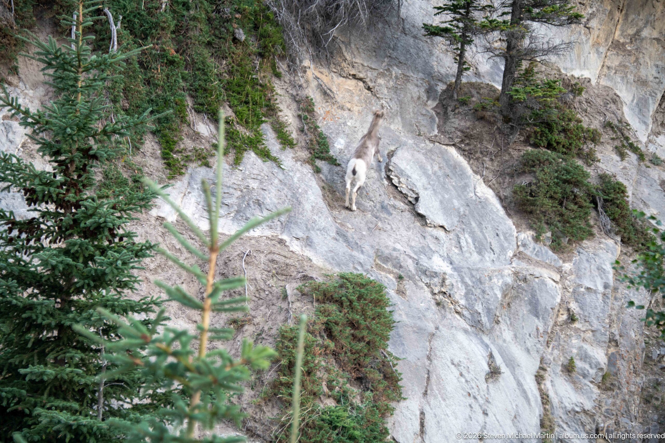
A bighorn sheep stands on a steep, pale rock slope above the Athabasca Falls area, its compact body and curved horns visible against the exposed cliff. Sparse conifers and low vegetation grow from fractures and ledges around the animal. The distant view emphasizes the sheep’s sure-footed use of rugged terrain, while the surrounding rock face provides strong habitat context rather than an isolated wildlife portrait.
Caption
A bighorn sheep stands on a steep, pale rock slope above the Athabasca Falls area, its compact body and curved horns visible against the exposed cliff. Sparse conifers and low vegetation grow from fractures and ledges around the animal. The distant view emphasizes the sheep’s sure-footed use of rugged terrain, while the surrounding rock face provides strong habitat context rather than an isolated wildlife portrait.
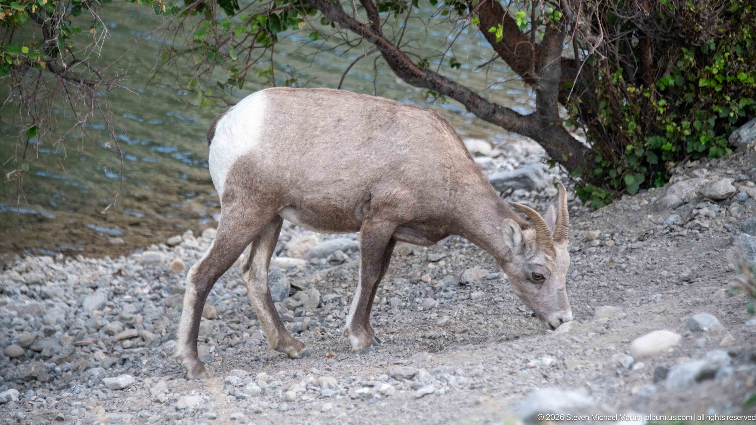
A bighorn sheep lowers its head to feed on sparse vegetation along a gravelly bank near the river. The close view shows its gray-brown coat, pale rump, sturdy legs, and backward-curving horns in detail. Water and overhanging vegetation form a subdued background, shifting the emphasis from cliff habitat to feeding behavior within the lower-elevation river corridor of Jasper National Park.
Caption
A bighorn sheep lowers its head to feed on sparse vegetation along a gravelly bank near the river. The close view shows its gray-brown coat, pale rump, sturdy legs, and backward-curving horns in detail. Water and overhanging vegetation form a subdued background, shifting the emphasis from cliff habitat to feeding behavior within the lower-elevation river corridor of Jasper National Park.
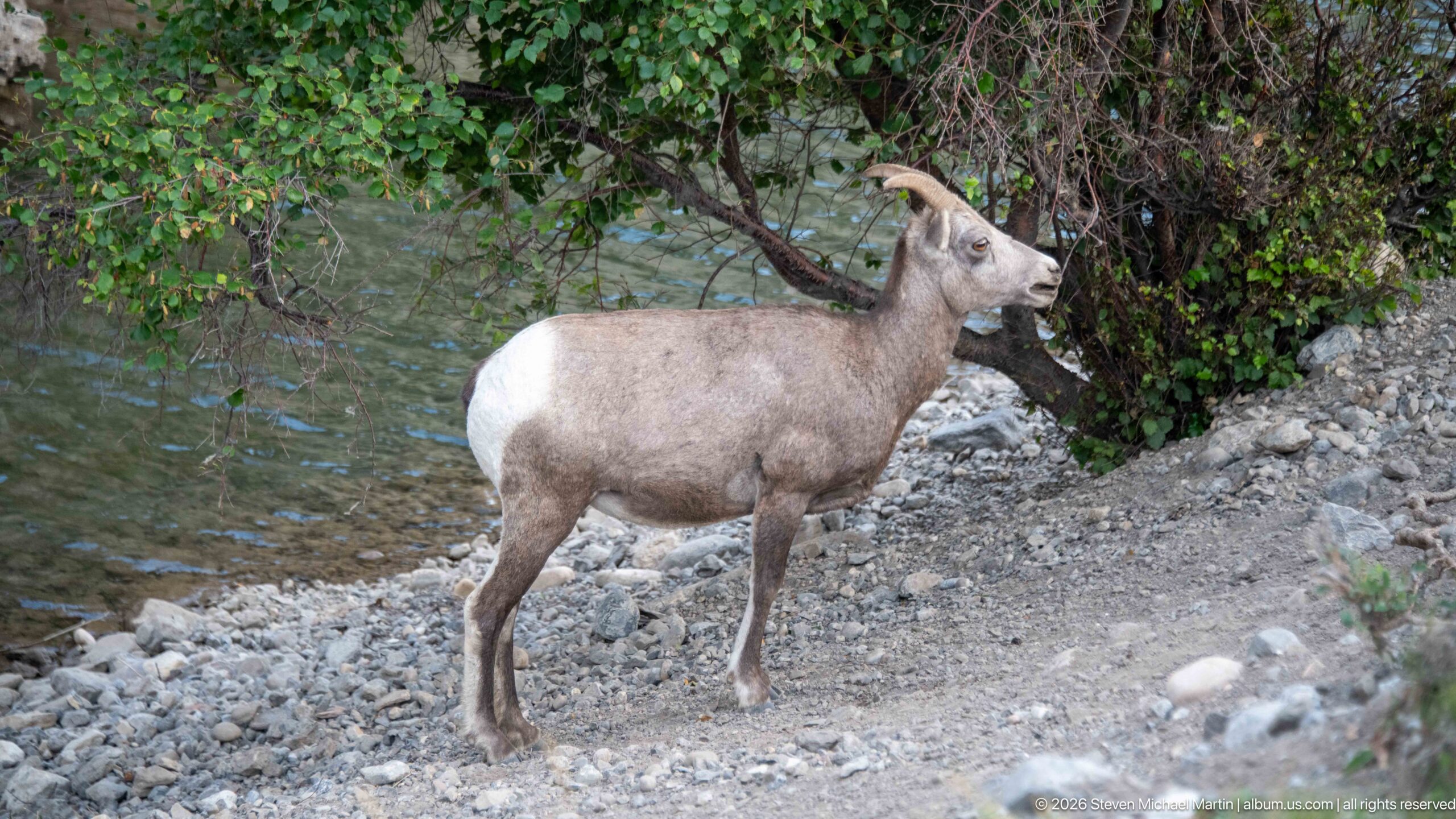
A bighorn sheep pauses upright on a gravelly bank, its head raised and horns outlined against dark foliage. The side profile clearly shows the pale rump patch, gray-brown coat, and compact mountain-sheep build, while blue-green water appears behind the animal. This alert stance complements the adjacent grazing view and provides a clearer record of body proportions and horn shape.
Caption
A bighorn sheep pauses upright on a gravelly bank, its head raised and horns outlined against dark foliage. The side profile clearly shows the pale rump patch, gray-brown coat, and compact mountain-sheep build, while blue-green water appears behind the animal. This alert stance complements the adjacent grazing view and provides a clearer record of body proportions and horn shape.
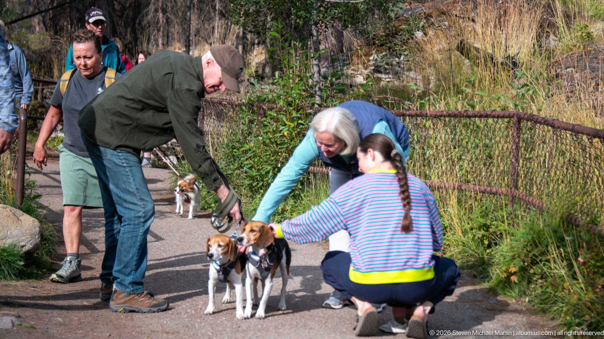
Several visitors gather around two leashed beagles on a paved trail near Athabasca Falls. Two people crouch or bend to greet the dogs while another stands behind them, creating an informal moment of social interaction within the developed visitor area. A metal railing, grasses, shrubs, and forest vegetation frame the path, distinguishing the scene from the portfolio’s waterfall and wildlife studies.
Caption
Several visitors gather around two leashed beagles on a paved trail near Athabasca Falls. Two people crouch or bend to greet the dogs while another stands behind them, creating an informal moment of social interaction within the developed visitor area. A metal railing, grasses, shrubs, and forest vegetation frame the path, distinguishing the scene from the portfolio’s waterfall and wildlife studies.
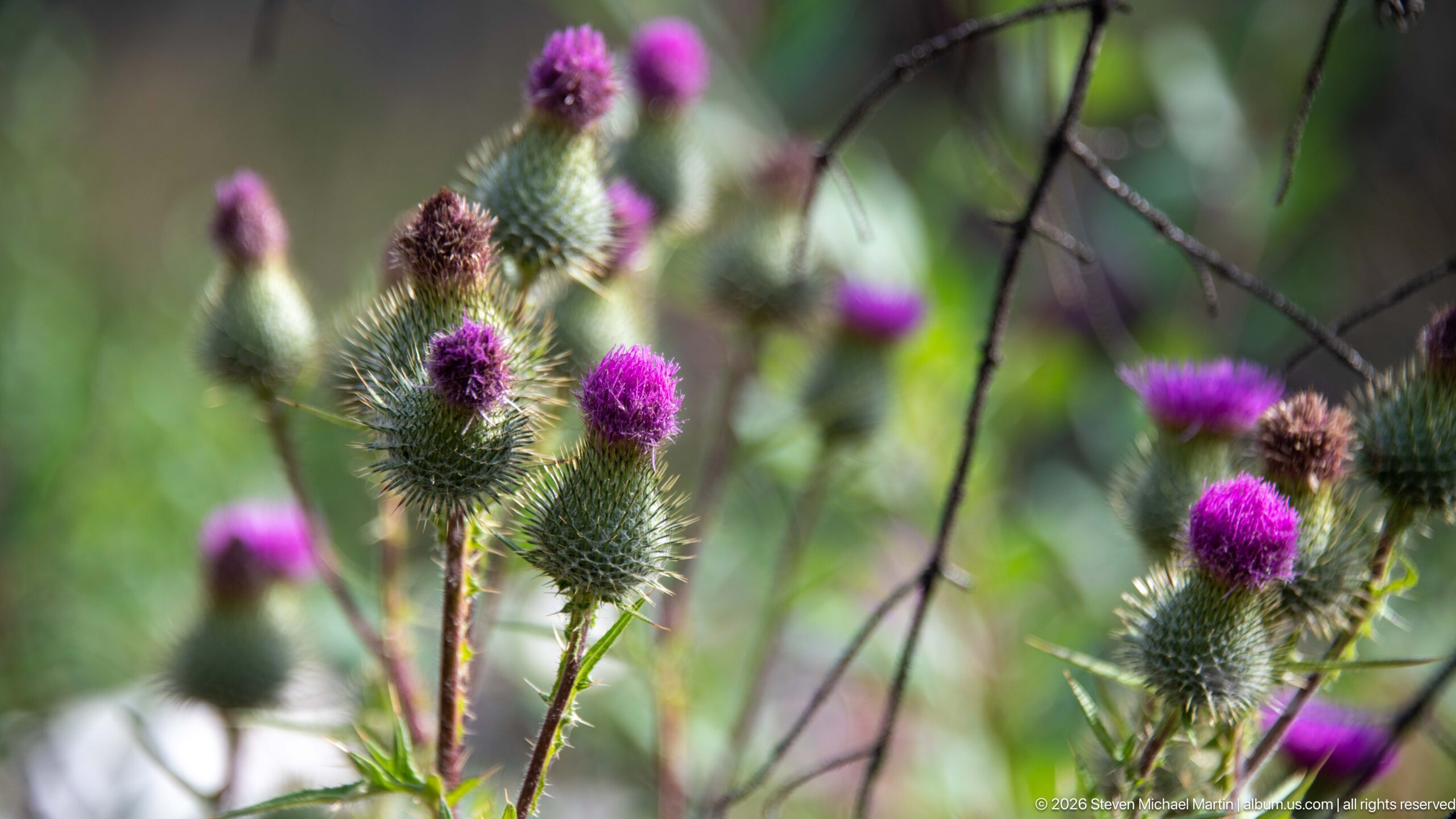
Purple thistle flower heads rise above clusters of spiny green buds in a shallow-focus botanical study. Several blooms are at different stages, from tightly closed heads to fully colored tufts, while the soft forest background isolates their texture and form. The close composition records small-scale plant life along the Athabasca Falls trail without assigning a more precise species than the visible proof sheet can support.
Caption
Purple thistle flower heads rise above clusters of spiny green buds in a shallow-focus botanical study. Several blooms are at different stages, from tightly closed heads to fully colored tufts, while the soft forest background isolates their texture and form. The close composition records small-scale plant life along the Athabasca Falls trail without assigning a more precise species than the visible proof sheet can support.
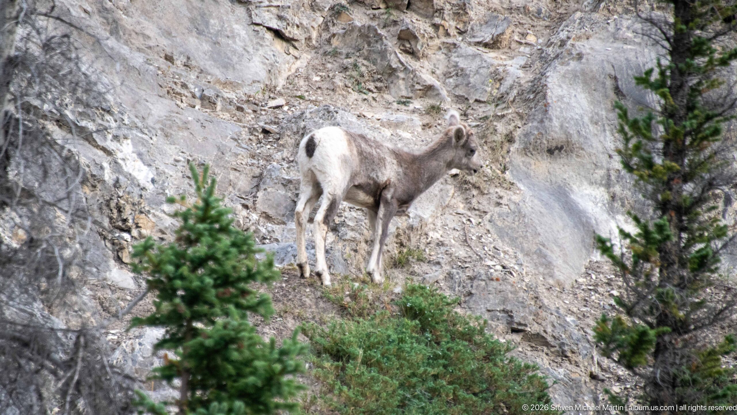
A bighorn sheep moves across a steep, fractured rock face, its pale rump and curved horns standing out against the gray stone. Small conifers and low shrubs occupy pockets of soil around the animal, reinforcing the rugged mountain habitat. The elevated side view records the sheep negotiating terrain far steeper than the gravel-bank portraits, illustrating its close association with rocky slopes in Jasper National Park.
Caption
A bighorn sheep moves across a steep, fractured rock face, its pale rump and curved horns standing out against the gray stone. Small conifers and low shrubs occupy pockets of soil around the animal, reinforcing the rugged mountain habitat. The elevated side view records the sheep negotiating terrain far steeper than the gravel-bank portraits, illustrating its close association with rocky slopes in Jasper National Park.
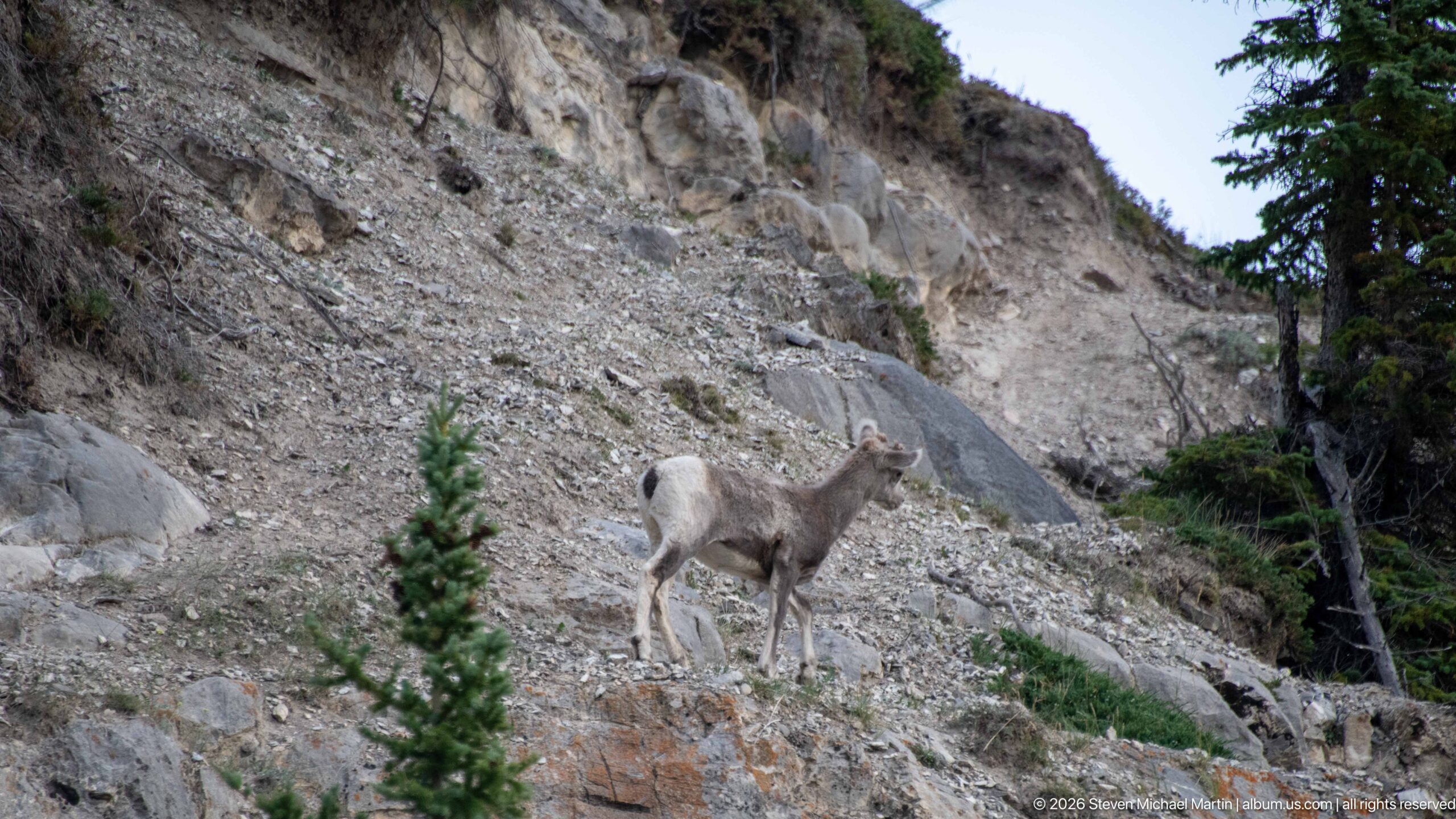
A bighorn sheep stands on an open scree slope beneath a pale cliff, surrounded by loose angular rock and scattered vegetation. Its side profile, curved horns, and pale rump are visible against the largely treeless background. Compared with the tighter wildlife portraits, this wider composition emphasizes scale and habitat, showing the animal as a small figure within an extensive, unstable-looking mountain slope.
Caption
A bighorn sheep stands on an open scree slope beneath a pale cliff, surrounded by loose angular rock and scattered vegetation. Its side profile, curved horns, and pale rump are visible against the largely treeless background. Compared with the tighter wildlife portraits, this wider composition emphasizes scale and habitat, showing the animal as a small figure within an extensive, unstable-looking mountain slope.
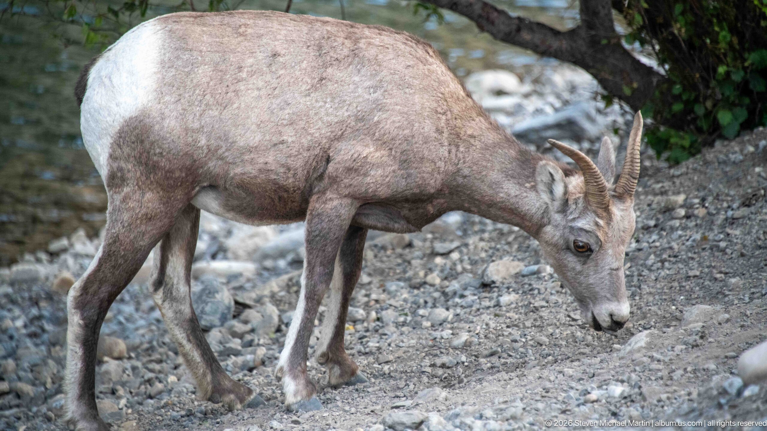
A close side view shows a bighorn sheep feeding with its muzzle nearly touching the gravel. The animal’s coarse gray-brown coat, pale rump, muscular shoulders, slender legs, and ridged backward-curving horns are rendered in strong detail. The tight framing minimizes the surrounding river corridor and makes this one of the portfolio’s clearest records of the species’ physical characteristics and grazing behavior.
Caption
A close side view shows a bighorn sheep feeding with its muzzle nearly touching the gravel. The animal’s coarse gray-brown coat, pale rump, muscular shoulders, slender legs, and ridged backward-curving horns are rendered in strong detail. The tight framing minimizes the surrounding river corridor and makes this one of the portfolio’s clearest records of the species’ physical characteristics and grazing behavior.
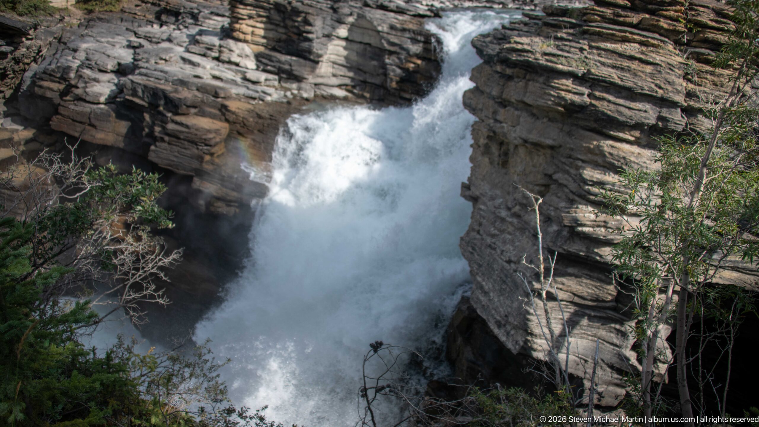
Athabasca Falls plunges through a narrow cleft between massive layered rock walls, sending whitewater and spray into the shadowed gorge below. The high viewpoint looks directly into the confined channel, where the scale of the bedrock walls dominates the composition. Conifers and bare branches along the margins provide a natural frame while the waterfall forms a bright vertical path through the dark canyon.
Caption
Athabasca Falls plunges through a narrow cleft between massive layered rock walls, sending whitewater and spray into the shadowed gorge below. The high viewpoint looks directly into the confined channel, where the scale of the bedrock walls dominates the composition. Conifers and bare branches along the margins provide a natural frame while the waterfall forms a bright vertical path through the dark canyon.
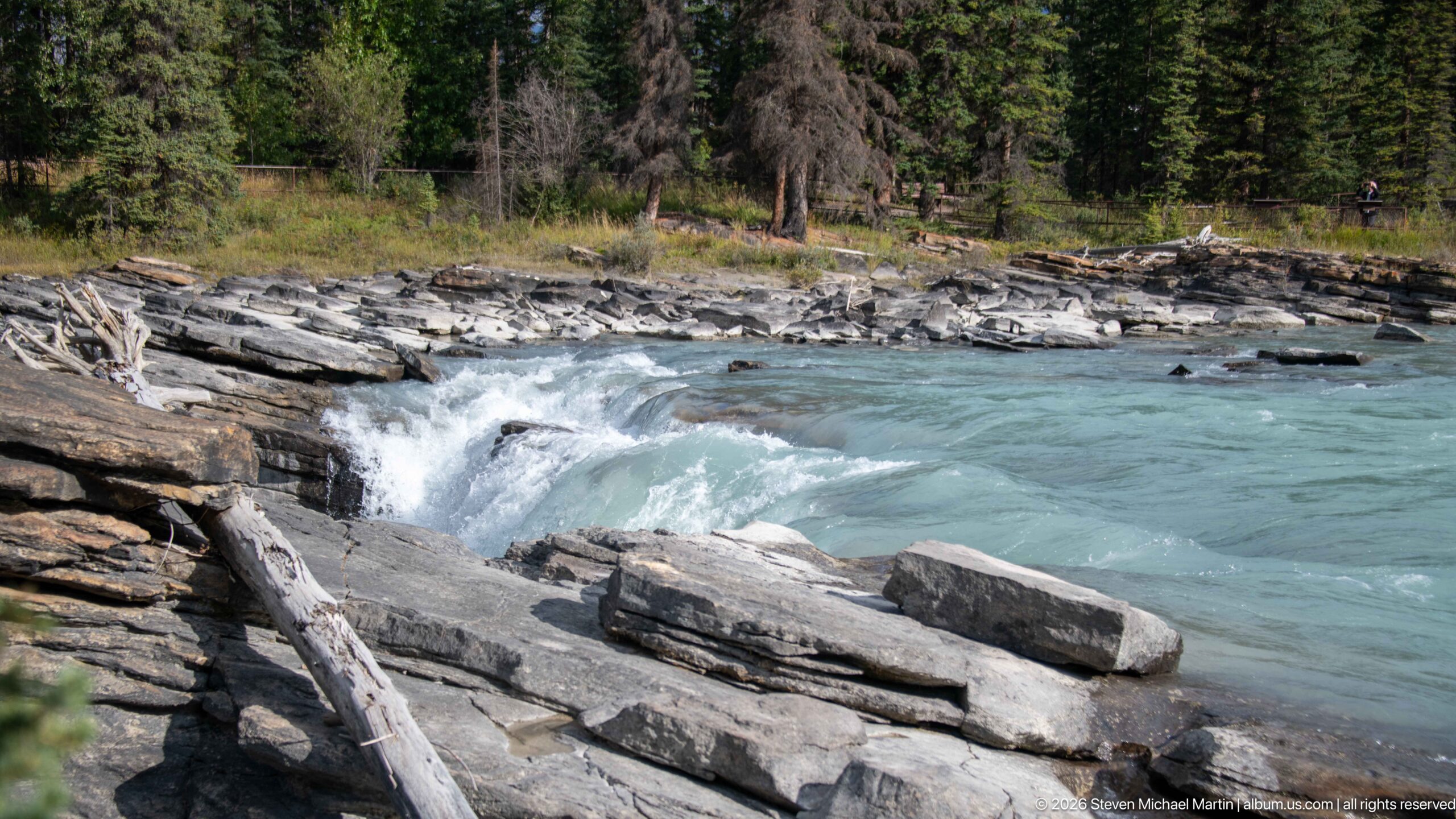
The Athabasca River sweeps across shallow layered bedrock in a broad turquoise rapid near the falls. Whitewater curls around exposed slabs and a large angular block in the foreground, while driftwood and conifer forest line the opposite bank. The lower viewpoint emphasizes the river’s lateral movement and the stepped rock surface, contrasting with the vertical plunge and deeply confined canyon seen elsewhere in the sequence.
Caption
The Athabasca River sweeps across shallow layered bedrock in a broad turquoise rapid near the falls. Whitewater curls around exposed slabs and a large angular block in the foreground, while driftwood and conifer forest line the opposite bank. The lower viewpoint emphasizes the river’s lateral movement and the stepped rock surface, contrasting with the vertical plunge and deeply confined canyon seen elsewhere in the sequence.
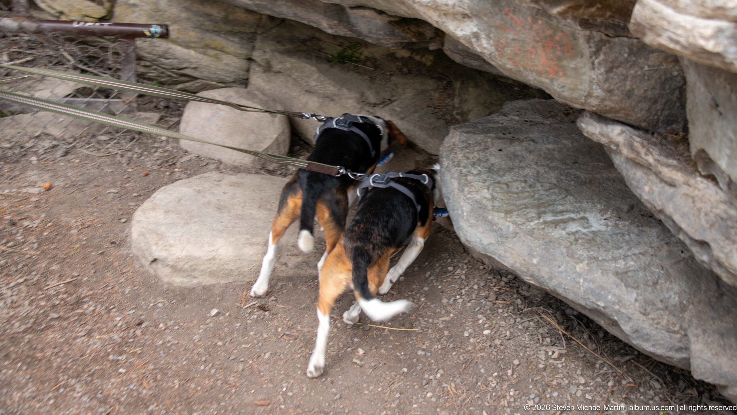
Two leashed beagles investigate a small opening beneath a layered bedrock overhang beside the Athabasca Falls trail. Both dogs have their heads pushed toward the dark recess while their leads extend out of frame, turning the geological setting into a moment of canine curiosity. Large angular stones and compacted trail surface surround the opening, providing a close, informal record of the dogs’ exploration.
Caption
Two leashed beagles investigate a small opening beneath a layered bedrock overhang beside the Athabasca Falls trail. Both dogs have their heads pushed toward the dark recess while their leads extend out of frame, turning the geological setting into a moment of canine curiosity. Large angular stones and compacted trail surface surround the opening, providing a close, informal record of the dogs’ exploration.
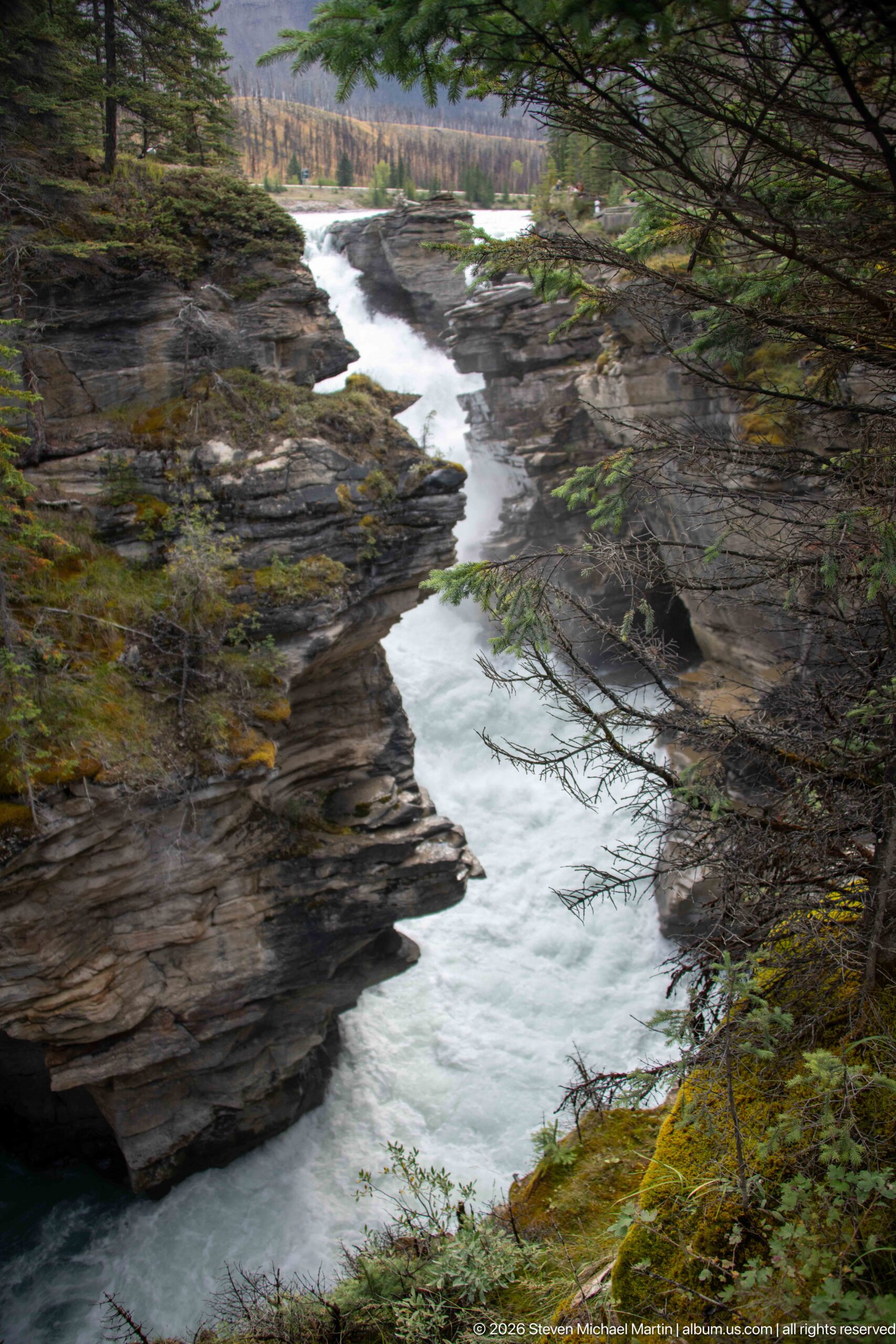
The Athabasca River winds through a long, narrow bedrock gorge below the falls, alternating between pale turquoise current and bands of whitewater. Layered rock walls step inward along both sides, while conifer branches frame the elevated viewpoint and moss covers the near rim. The extended view reveals more of the canyon’s downstream course than the tighter compositions, emphasizing its sinuous form and repeated constrictions.
Caption
The Athabasca River winds through a long, narrow bedrock gorge below the falls, alternating between pale turquoise current and bands of whitewater. Layered rock walls step inward along both sides, while conifer branches frame the elevated viewpoint and moss covers the near rim. The extended view reveals more of the canyon’s downstream course than the tighter compositions, emphasizing its sinuous form and repeated constrictions.
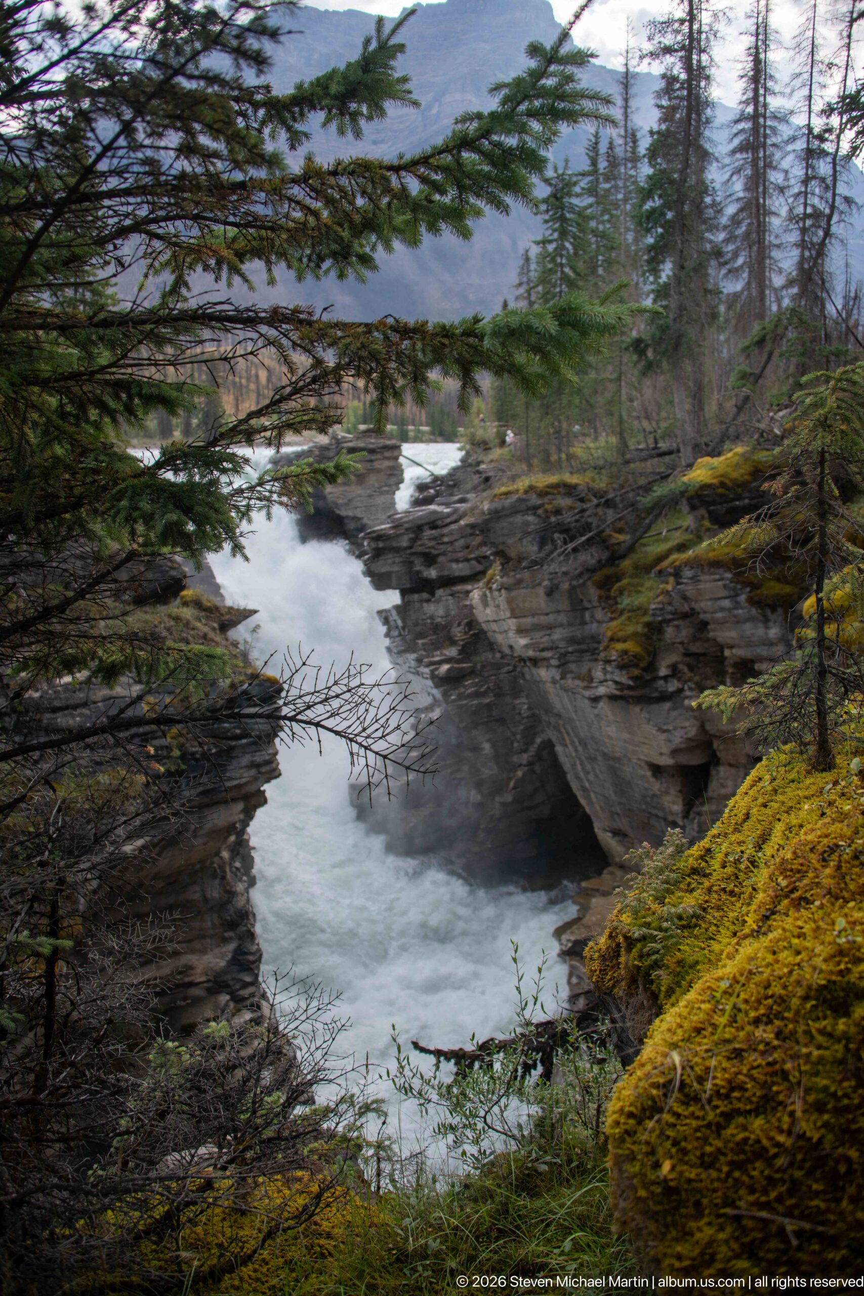
Conifer branches and a moss-covered canyon rim frame a narrow reach of the Athabasca River below the falls. Pale water bends between dark layered rock walls before continuing toward the broader river visible beyond. The foreground vegetation creates a more enclosed perspective than the preceding canyon view, drawing attention to the relationship between forest cover, damp rock surfaces, and the confined watercourse.
Caption
Conifer branches and a moss-covered canyon rim frame a narrow reach of the Athabasca River below the falls. Pale water bends between dark layered rock walls before continuing toward the broader river visible beyond. The foreground vegetation creates a more enclosed perspective than the preceding canyon view, drawing attention to the relationship between forest cover, damp rock surfaces, and the confined watercourse.
Scenic Landscape Field Guide
📍 Overview
Athabasca Falls is one of the most powerful landscape features along the Icefields Parkway in Jasper National Park. Here the glacier-fed Athabasca River, broad and relatively open upstream, is abruptly compressed into a narrow bedrock gorge. The falls are striking less for exceptional height than for the force of the river as whitewater, spray, turquoise water, and sculpted rock converge within the confined channel. The site provides an especially clear introduction to the continuing geological work of water within a much larger Canadian Rockies landscape shaped by glaciation.
🏔️ Physical Setting
Athabasca Falls lies in the Athabasca River valley about 31 kilometers south of Jasper, near the junction of the Icefields Parkway and Highway 93A. Forested valley slopes, distant mountain walls, the broad river, and the deeply incised gorge place the falls within a landscape whose large-scale form reflects repeated glaciation. At the falls, the river changes character dramatically: broad reaches of blue-green water and rapids give way to turbulent whitewater forced between steep rock walls before continuing through a winding lower canyon. Conifer forest, moss-covered rock, driftwood, wildflowers, and exposed bedrock create smaller-scale transitions along the river corridor.
🪨 Geology & Landform
Athabasca Falls demonstrates the interaction of two major landscape-shaping processes in the Canadian Rockies. Glaciers helped create the broad mountain valleys and regional topography, while the modern Athabasca River continues to modify that inherited landscape through fluvial erosion. At the falls, the river is concentrated into a restricted bedrock channel, producing turbulent flow, spray, eddies, and powerful currents that exploit fractures and irregularities in the rock. Downstream, the river winds through a deeply confined gorge bordered by layered, fractured, polished, and sculpted surfaces. These visible forms record active erosion, although photographs alone cannot establish the age or rate at which individual features developed.
🌿 Ecology
The Athabasca River forms an ecological corridor through Jasper’s lower mountain valleys, linking river, riparian, forest, rocky-slope, and montane habitats. Vegetation photographed around the falls ranges from conifer forest and moss on damp canyon margins to summer wildflowers including fireweed and thistles. The portfolio also documents an encounter with bighorn sheep, including close views of animals beside the river corridor. Photographs show a sheep standing alert on a gravelly bank and another grazing at close range, with the species’ gray-brown coat, pale rump, sturdy build, and backward-curving horns clearly visible. These encounters connect the falls and river landscape to the larger protected ecosystem of Jasper National Park.
🦌 Wildlife Encounters
Photographs in this portfolio document wildlife encounters with Bighorn sheep in the Jasper landscape. The photographs place these animals in settings that include Standing bighorn sheep beside the river and Close grazing portrait of a bighorn sheep. These encounters provide direct, visit-specific evidence of how wildlife uses the habitats interpreted in this field guide.
◆ Seasonal Character
Summer gives Athabasca Falls a landscape of strong contrasts: vigorous river flow and bright whitewater against dark wet rock, turquoise water beneath forested banks, and flowering plants along the trails and river corridor. Fireweed and purple thistles provide small bursts of seasonal color within a portfolio dominated by rock, water, and conifers. Weather and changing light alter the appearance of the gorge throughout a visit, with diffuse conditions preserving detail in whitewater and wet bedrock while brighter light increases reflections and contrast. Water level, weather, and vegetation all change seasonally, so the character of the falls is never entirely static.
👁️ Viewpoints
The developed paths around Athabasca Falls reveal the site as a sequence rather than a single waterfall view. Broad upstream perspectives establish the Athabasca River within its mountain and forest setting before closer overlooks reveal the sudden compression of the river into the falls and gorge. Elevated viewpoints look directly into the narrow rock cleft and turbulent plunge zone, while downstream perspectives follow pale turquoise water through the winding canyon and repeated bedrock constrictions. Railings, stairs, paths, and overlooks provide useful human scale, and moving among these viewpoints makes the transition from broad river to waterfall to confined canyon especially clear.
📷 Photography Notes
Athabasca Falls rewards a photographic sequence that moves between landscape scale and geological detail. Wide compositions can establish the river, forest, mountain valley, and approach to the falls, while tighter frames isolate whitewater, spray, layered bedrock, eddies, polished surfaces, and the constricted channel. Views showing the transition from the broad upstream river into the narrow gorge are particularly effective because they explain why the falls appear so powerful. The portfolio also benefits from contrasting subjects: close botanical studies add seasonal detail, bighorn sheep photographs connect the river corridor to Jasper’s wildlife, and occasional visitors or built features establish scale. Longer exposures can smooth moving water for visual effect, but shutter treatment changes only its appearance and should not be interpreted as evidence of different flow conditions.