Rocky Mountain House National Historic Site Introduction
Rocky Mountain House National Historic Site occupies a broad terrace above the North Saskatchewan River in central Alberta, where Indigenous travel routes, the fur trade, and European exploration converged for generations. Long before fur-trade companies arrived, the river corridor and nearby confluence with the Clearwater River were important gathering and travel areas for Indigenous peoples, particularly the Blackfoot, as well as the Ktunaxa and other peoples moving between the plains and the mountains. In 1799, the North West Company established Rocky Mountain House here while its rival, the Hudson’s Bay Company, constructed Acton House nearby, beginning more than seven decades of trading activity along this stretch of the river.
The site became especially important as a base for exploration toward and across the Rocky Mountains. Surveyor, mapmaker, and fur trader David Thompson spent several seasons at Rocky Mountain House, accompanied by his wife Charlotte Small, and used the post as a starting point for his efforts to find a practical route across the Continental Divide. In 1807, Thompson traveled west from Rocky Mountain House through Howse Pass and reached the Columbia River watershed, part of the extraordinary series of journeys through which he mapped vast portions of western North America. Rocky Mountain House consequently became much more than an isolated trading post: it stood at the eastern threshold of routes linking the northern plains, the mountain passes, and eventually the Columbia River country.
Today, Rocky Mountain House is principally an archaeological landscape rather than a reconstructed fort. The remains of four fur-trade posts operated by the North West Company and Hudson’s Bay Company between 1799 and 1875 survive across the property, revealing successive attempts to maintain trade as commercial relationships and regional transportation patterns changed. Trails lead through the former fort locations and along the North Saskatchewan River, while archaeological features, interpretive installations, and the surviving chimneys of the final Hudson’s Bay Company post help make the otherwise subtle traces of the trading era visible. Together, the landscape tells a much larger story of Indigenous trade and diplomacy, intense corporate rivalry, exploration across the Rockies, and the transformation of western Canada during the nineteenth century.
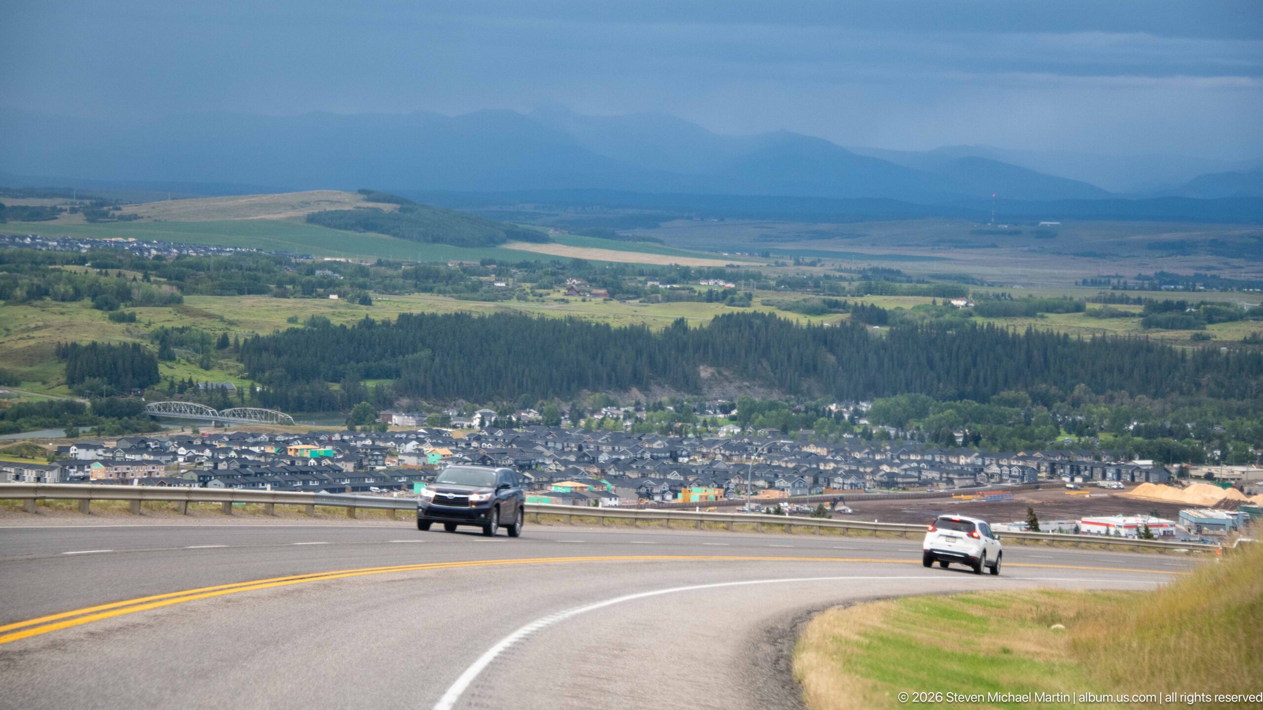
A divided highway curves downhill toward the town of Rocky Mountain House, spreading across the valley floor below while hazy mountain ridges rise in the distance. Two vehicles descend the grade beneath a heavy blue-gray sky. The elevated viewpoint connects the urban settlement, surrounding agricultural country, and the eastern approach to the Canadian Rockies in one expansive travel landscape.
Caption
A divided highway curves downhill toward the town of Rocky Mountain House, spreading across the valley floor below while hazy mountain ridges rise in the distance. Two vehicles descend the grade beneath a heavy blue-gray sky. The elevated viewpoint connects the urban settlement, surrounding agricultural country, and the eastern approach to the Canadian Rockies in one expansive travel landscape.
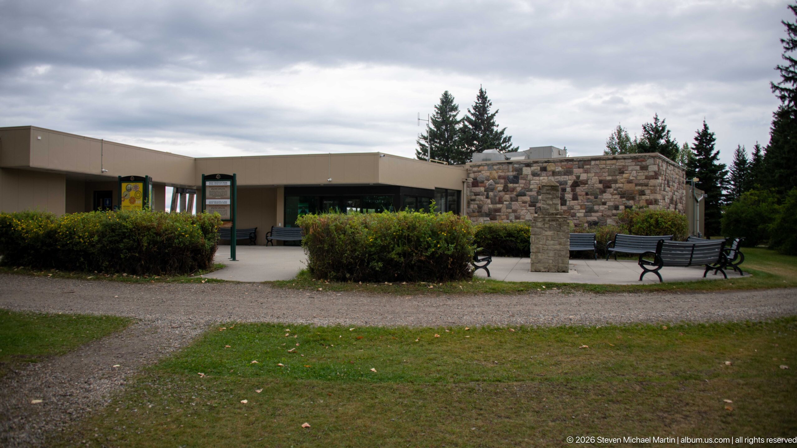
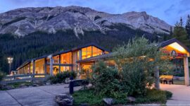
The low modern visitor centre stretches behind clipped hedges and a network of gravel paths, with a substantial stone-faced section marking one side of the entrance area. Benches and bicycle racks occupy the paved plaza. The understated building contrasts with the reconstructed and archaeological features elsewhere on the site while serving as the primary indoor orientation point for visitors.
Caption
The low modern visitor centre stretches behind clipped hedges and a network of gravel paths, with a substantial stone-faced section marking one side of the entrance area. Benches and bicycle racks occupy the paved plaza. The understated building contrasts with the reconstructed and archaeological features elsewhere on the site while serving as the primary indoor orientation point for visitors.
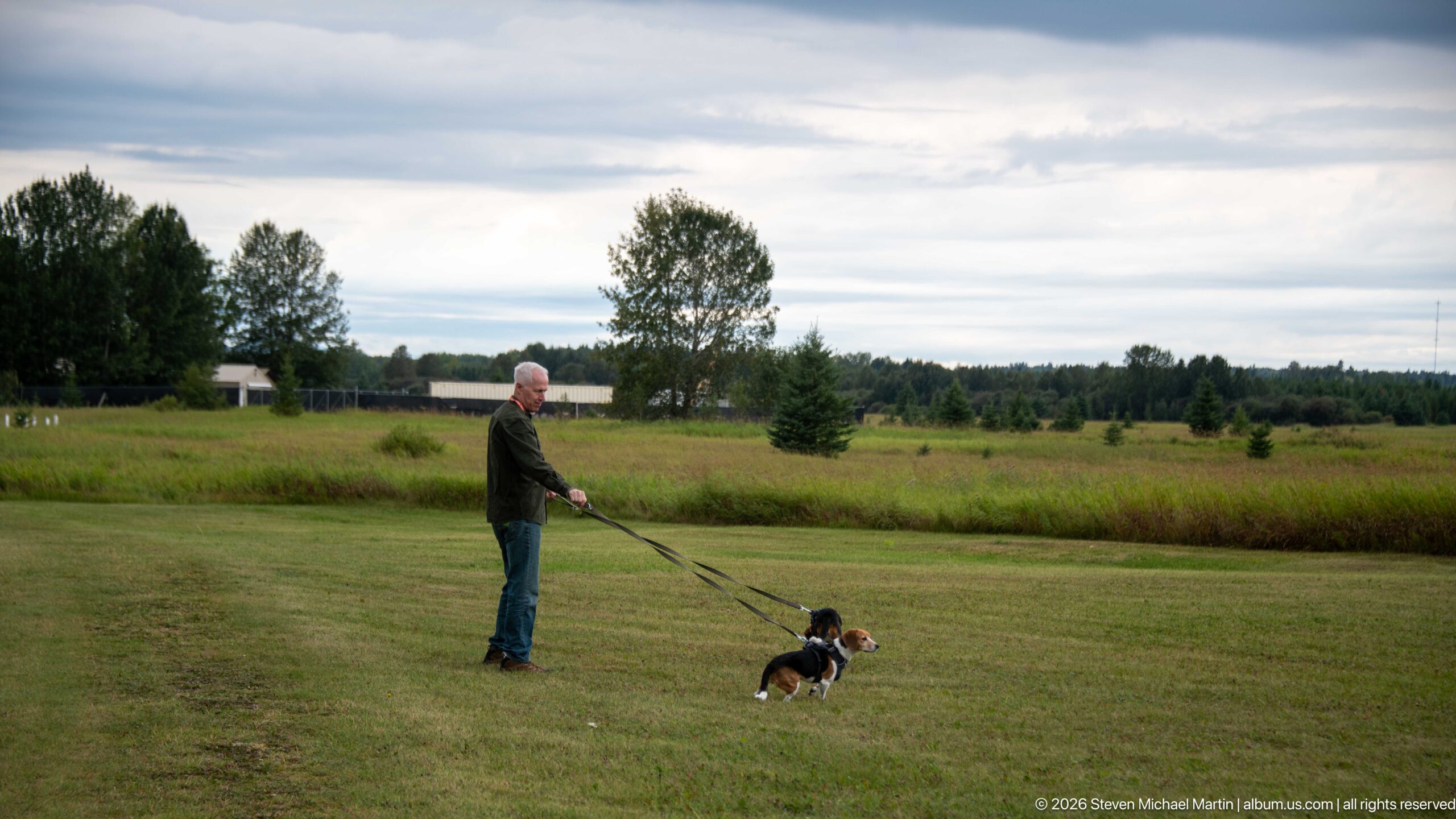
A visitor walks two small dogs across a broad mown lawn at Rocky Mountain House National Historic Site. Beyond the foreground, taller meadow grasses, scattered young conifers, mature trees, and a cloudy sky show the spacious park-like setting surrounding the interpreted historic areas. The scene records contemporary recreational use of a landscape preserved primarily for its cultural history.
Caption
A visitor walks two small dogs across a broad mown lawn at Rocky Mountain House National Historic Site. Beyond the foreground, taller meadow grasses, scattered young conifers, mature trees, and a cloudy sky show the spacious park-like setting surrounding the interpreted historic areas. The scene records contemporary recreational use of a landscape preserved primarily for its cultural history.
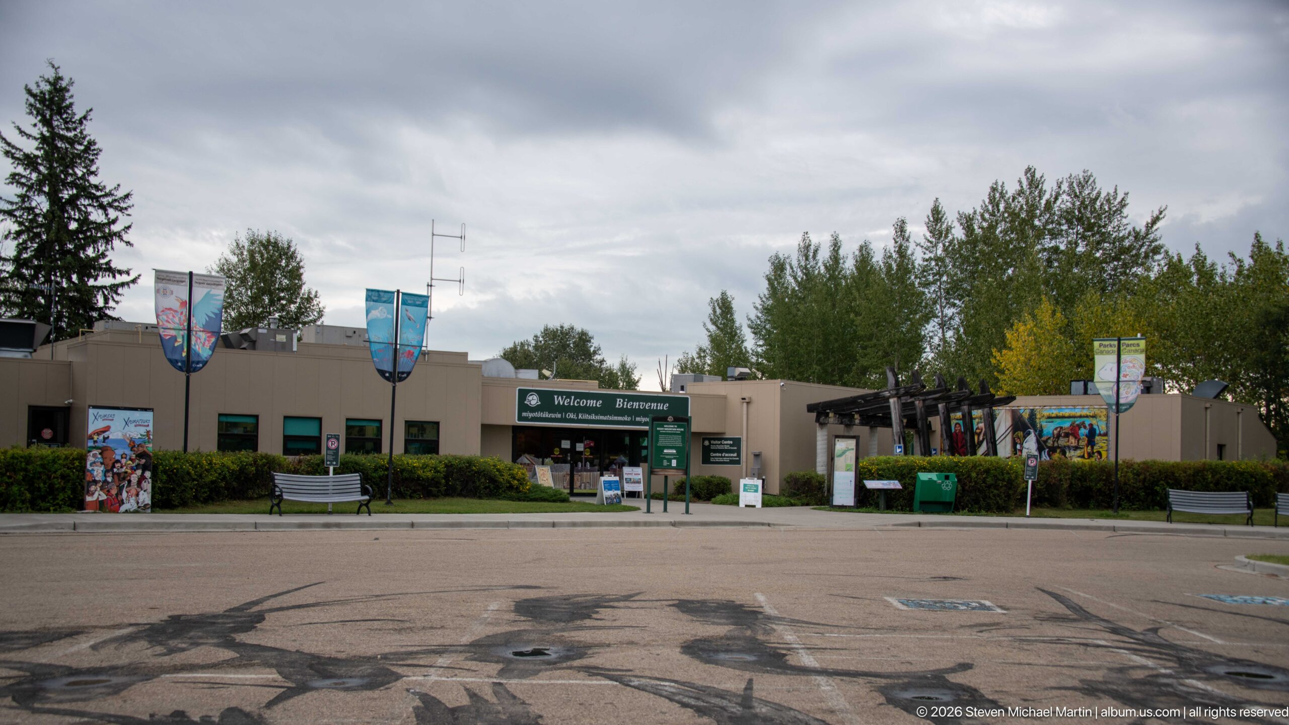
The low visitor-centre complex stretches across the frame beneath an overcast sky, with banners, entrance signage, murals, landscaping, and the timber approach structure all visible together. This broad view establishes how the site's contemporary visitor facilities combine orientation, cultural artwork, and Parks Canada programming at the main arrival area.
Caption
The low visitor-centre complex stretches across the frame beneath an overcast sky, with banners, entrance signage, murals, landscaping, and the timber approach structure all visible together. This broad view establishes how the site's contemporary visitor facilities combine orientation, cultural artwork, and Parks Canada programming at the main arrival area.
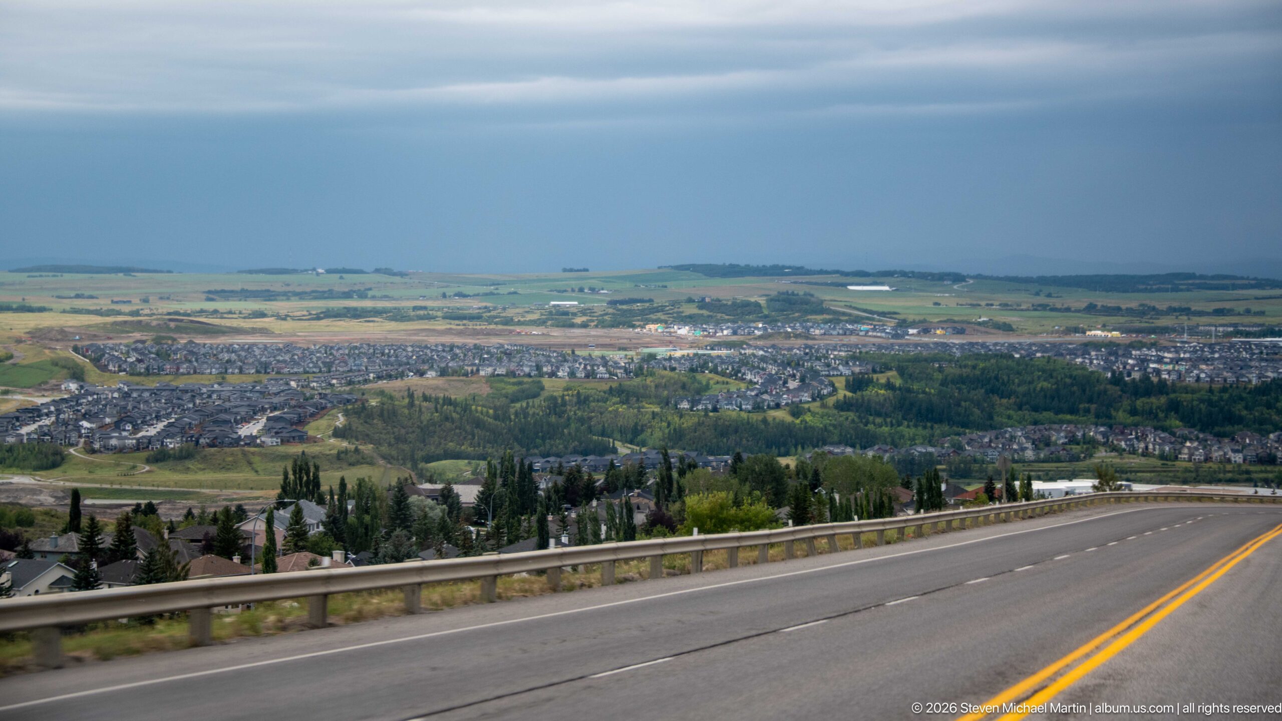
From an elevated roadway, the town of Rocky Mountain House spreads across a broad valley of residential neighborhoods, wooded corridors, and agricultural land. The foreground guardrail and yellow centerline retain the sense of movement through the landscape, while a dark storm front above the distant plains gives the final view a distinctly transitional, end-of-journey atmosphere.
Caption
From an elevated roadway, the town of Rocky Mountain House spreads across a broad valley of residential neighborhoods, wooded corridors, and agricultural land. The foreground guardrail and yellow centerline retain the sense of movement through the landscape, while a dark storm front above the distant plains gives the final view a distinctly transitional, end-of-journey atmosphere.
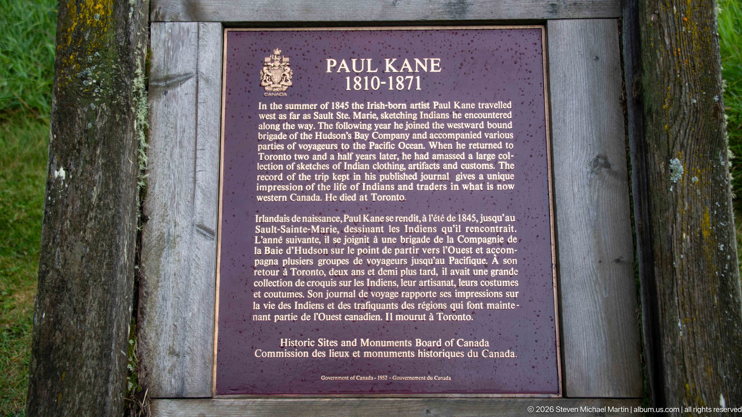
A bilingual federal plaque commemorates Paul Kane (1810–1871), the Irish-born artist whose western travels and subsequent paintings helped shape nineteenth-century visual records of Indigenous peoples and landscapes in what is now Canada. Mounted within a rustic timber frame, the marker places Kane's work within the interpretive landscape of Rocky Mountain House and its broader history of travel across the West.
Caption
A bilingual federal plaque commemorates Paul Kane (1810–1871), the Irish-born artist whose western travels and subsequent paintings helped shape nineteenth-century visual records of Indigenous peoples and landscapes in what is now Canada. Mounted within a rustic timber frame, the marker places Kane's work within the interpretive landscape of Rocky Mountain House and its broader history of travel across the West.
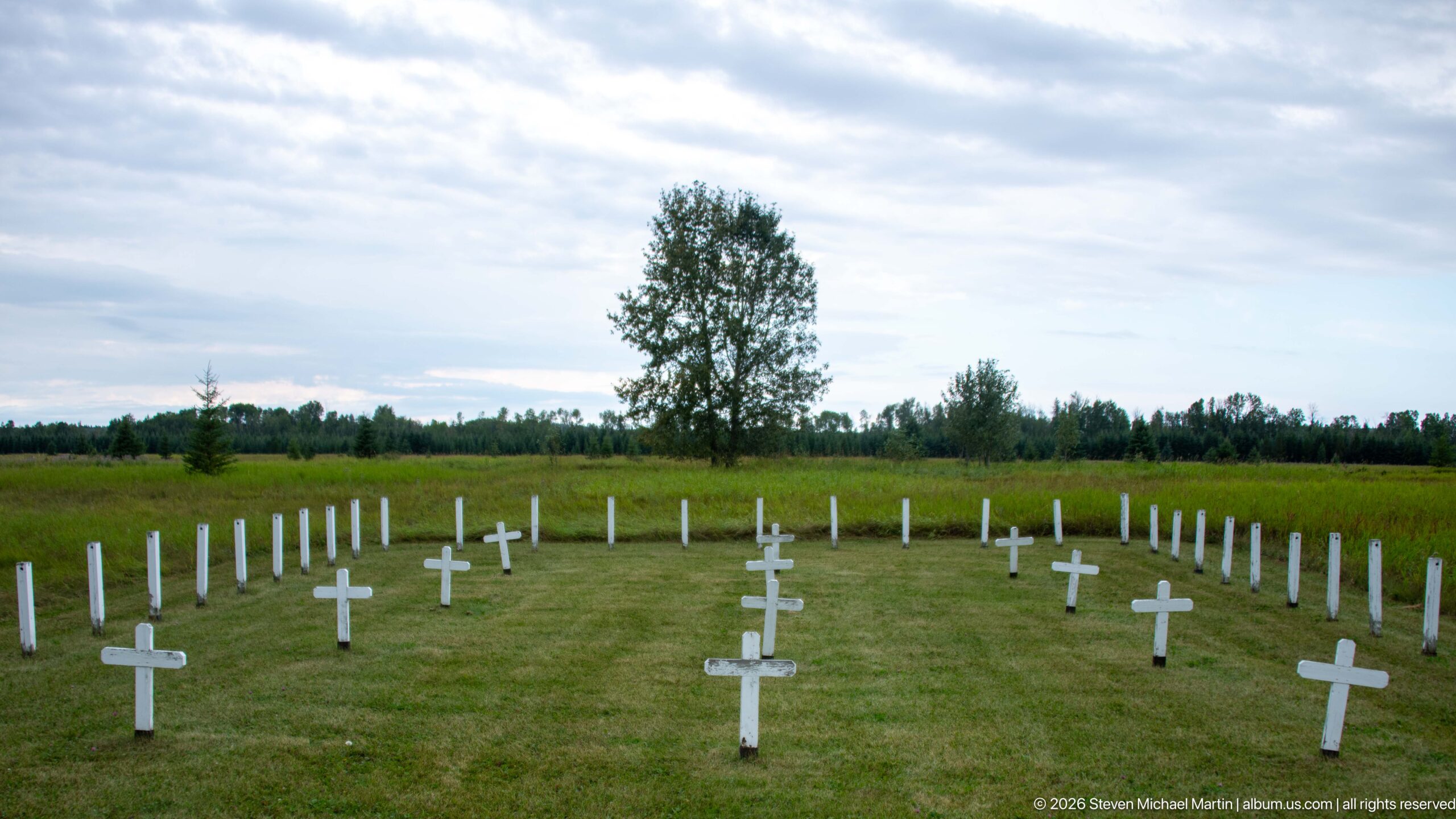
White grave markers spread in a broad arc across a mown clearing, revealing the scale and spatial character of the historic burial ground. Cross-shaped markers intermingle with simpler upright posts, while prairie vegetation and trees enclose the cemetery at a distance. The wide view places the memorial landscape within the open terrain of Rocky Mountain House National Historic Site.
Caption
White grave markers spread in a broad arc across a mown clearing, revealing the scale and spatial character of the historic burial ground. Cross-shaped markers intermingle with simpler upright posts, while prairie vegetation and trees enclose the cemetery at a distance. The wide view places the memorial landscape within the open terrain of Rocky Mountain House National Historic Site.
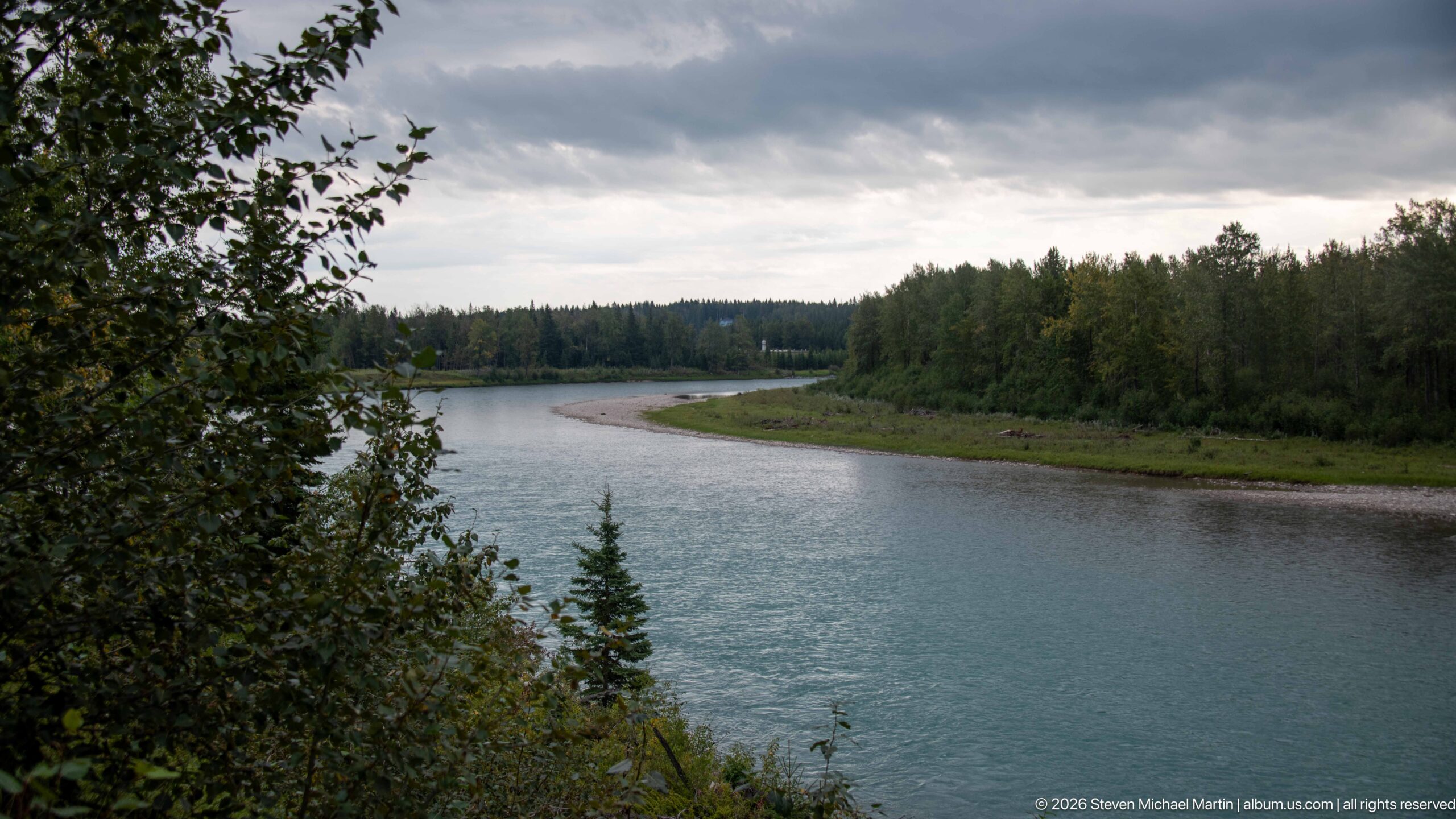
The North Saskatchewan River curves through a broad forested corridor below Rocky Mountain House National Historic Site, with a gravel bar tracing the inside of the bend. Dark clouds and muted light give the water a cool blue-gray tone. The view underscores the river’s physical presence in a place whose trade, travel, and exploration history depended fundamentally on waterways.
Caption
The North Saskatchewan River curves through a broad forested corridor below Rocky Mountain House National Historic Site, with a gravel bar tracing the inside of the bend. Dark clouds and muted light give the water a cool blue-gray tone. The view underscores the river’s physical presence in a place whose trade, travel, and exploration history depended fundamentally on waterways.
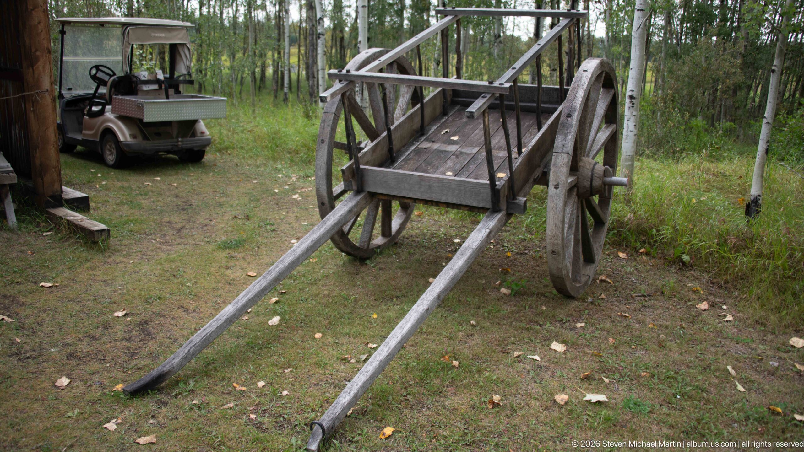
A simple two-wheeled wooden cart stands at the edge of the wooded interpretive area, its large spoked wheels, open platform, and long parallel shafts clearly exposed. The stripped-down construction makes the vehicle’s mechanics easy to read and provides a tangible example of overland freight technology used alongside river transport in the fur-trade era.
Caption
A simple two-wheeled wooden cart stands at the edge of the wooded interpretive area, its large spoked wheels, open platform, and long parallel shafts clearly exposed. The stripped-down construction makes the vehicle’s mechanics easy to read and provides a tangible example of overland freight technology used alongside river transport in the fur-trade era.
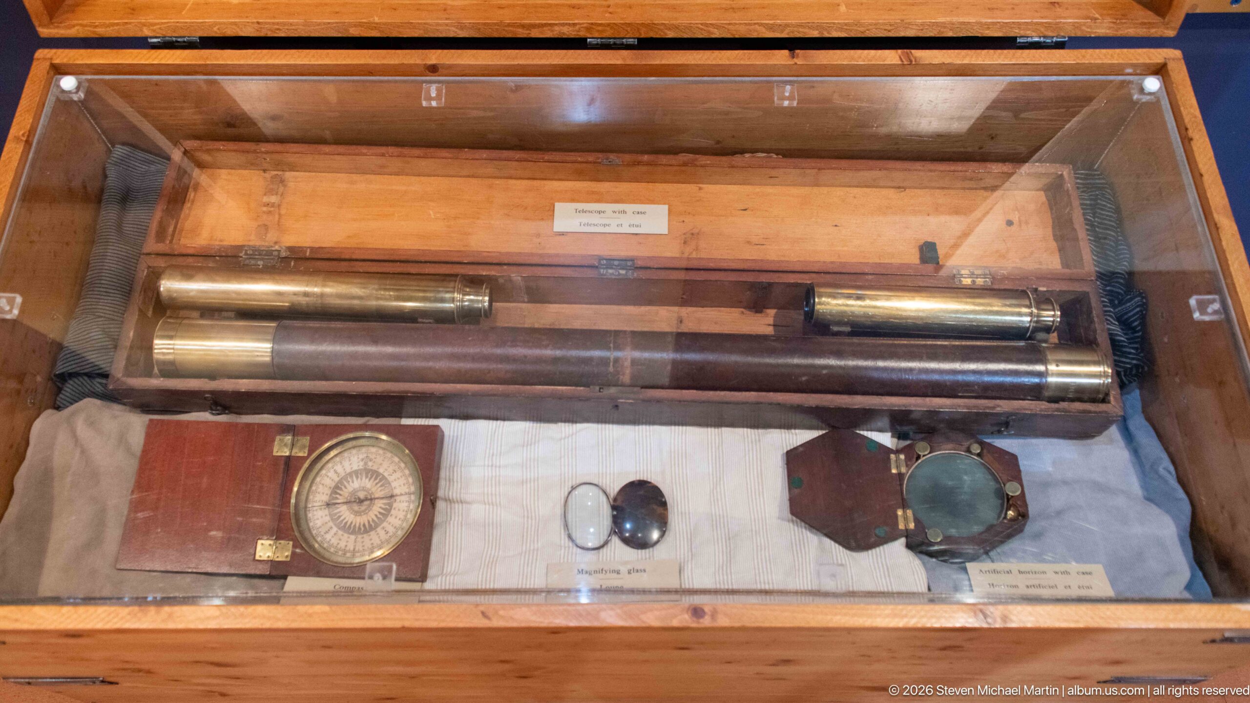
A display case gathers precision instruments associated with surveying or navigation, including long cylindrical brass components, a boxed circular compass-like instrument, and smaller optical or measuring devices. Their careful fitted cases and metal construction contrast with the organic materials elsewhere in the gallery and point to the technical equipment used to measure and record unfamiliar country.
Caption
A display case gathers precision instruments associated with surveying or navigation, including long cylindrical brass components, a boxed circular compass-like instrument, and smaller optical or measuring devices. Their careful fitted cases and metal construction contrast with the organic materials elsewhere in the gallery and point to the technical equipment used to measure and record unfamiliar country.
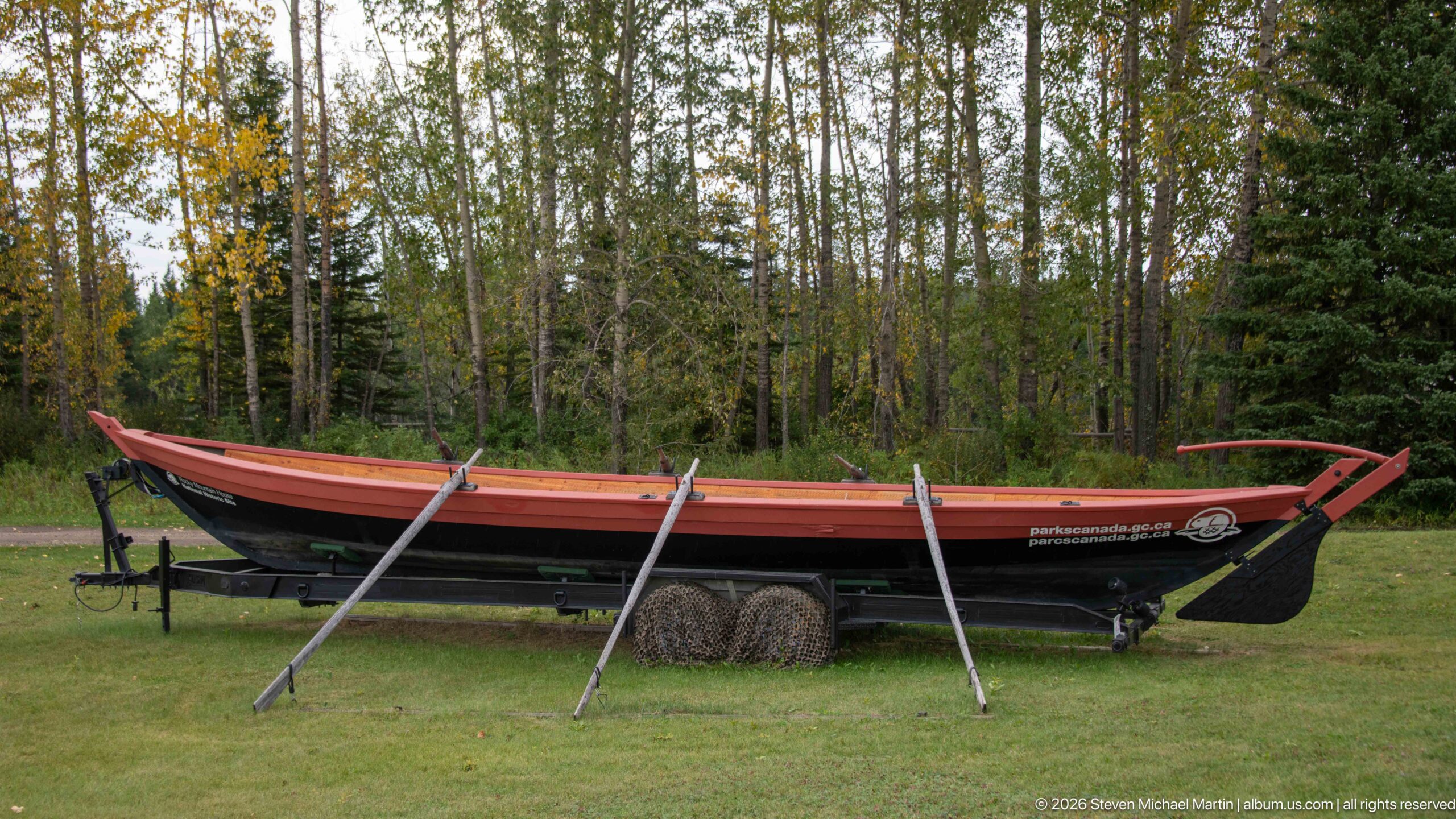
A long open wooden boat rests on supports with several long oars positioned alongside it, presenting the type of substantial watercraft used to move people and cargo through the fur-trade transportation network. Its high sides, pointed ends, and elongated hull dominate the grassy display area, with forest forming a subdued backdrop.
Caption
A long open wooden boat rests on supports with several long oars positioned alongside it, presenting the type of substantial watercraft used to move people and cargo through the fur-trade transportation network. Its high sides, pointed ends, and elongated hull dominate the grassy display area, with forest forming a subdued backdrop.
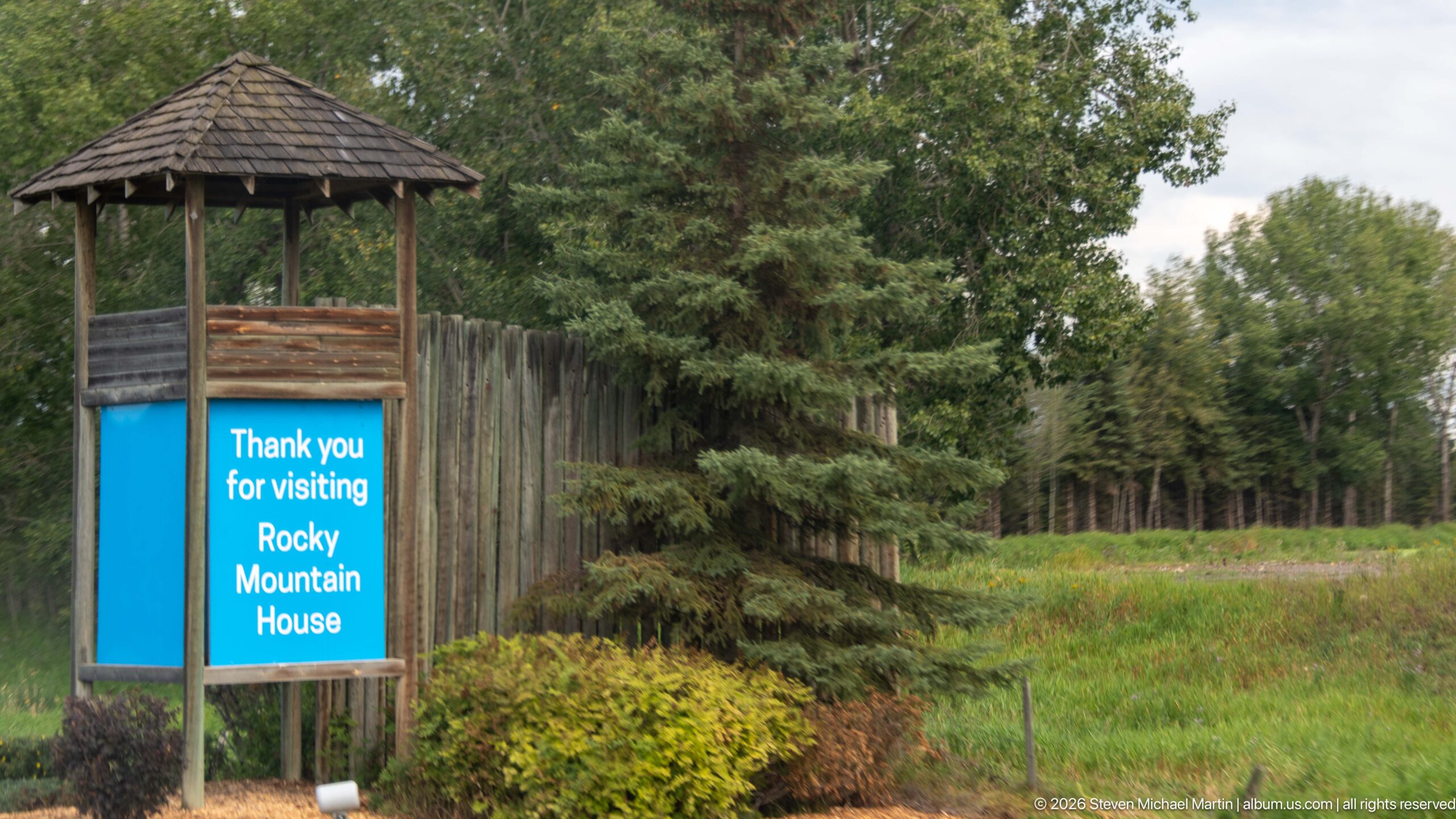
A rustic exit sign thanks visitors to Rocky Mountain House beside a tall log palisade and dense vegetation. The modest wayfinding feature marks the transition from the interpreted historic-site grounds into the surrounding wooded landscape, with rough timber construction visually echoing the site's fur-trade setting without itself being a historic structure.
Caption
A rustic exit sign thanks visitors to Rocky Mountain House beside a tall log palisade and dense vegetation. The modest wayfinding feature marks the transition from the interpreted historic-site grounds into the surrounding wooded landscape, with rough timber construction visually echoing the site's fur-trade setting without itself being a historic structure.
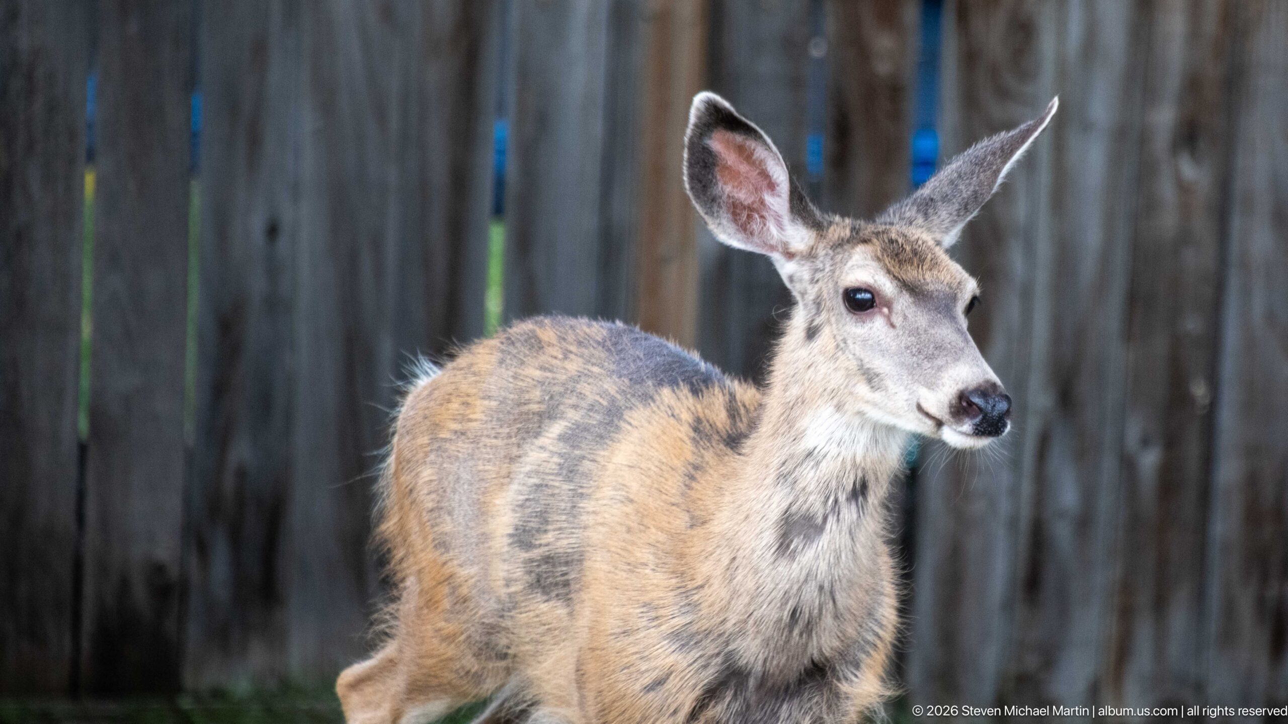
A mule deer stands nearly frontal with its head turned slightly to one side, showing the long ears, dark muzzle, and mottled gray-brown coat characteristic of the species. The shallow depth of field isolates the animal from a vertical timber fence, distinguishing this view from the tighter facial portrait and the later full-body studies.
Caption
A mule deer stands nearly frontal with its head turned slightly to one side, showing the long ears, dark muzzle, and mottled gray-brown coat characteristic of the species. The shallow depth of field isolates the animal from a vertical timber fence, distinguishing this view from the tighter facial portrait and the later full-body studies.
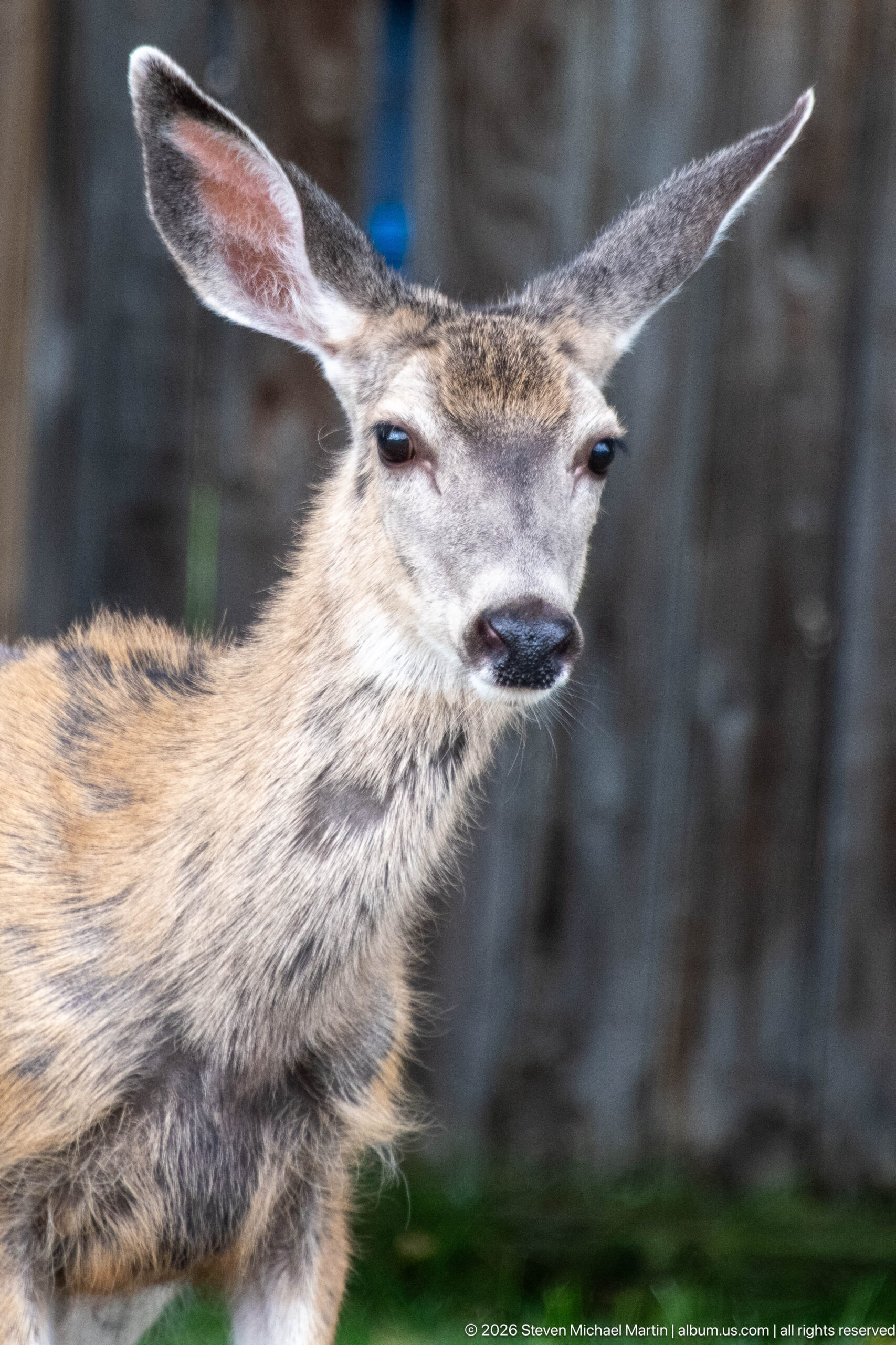
A mule deer fills the frame in a close portrait, its oversized ears held outward and gray-brown summer coat sharply separated from the softly blurred timber background. The tight composition records the animal's facial features and alert posture rather than its broader habitat, creating a wildlife study within the developed grounds of Rocky Mountain House National Historic Site.
Caption
A mule deer fills the frame in a close portrait, its oversized ears held outward and gray-brown summer coat sharply separated from the softly blurred timber background. The tight composition records the animal's facial features and alert posture rather than its broader habitat, creating a wildlife study within the developed grounds of Rocky Mountain House National Historic Site.

Blue and red Métis flags fly from a pole, each bearing the white infinity symbol associated with Métis identity. The close framing concentrates on the two banners as they move in the wind against leafy branches, presenting a cultural symbol encountered in the interpretation of the peoples and communities connected with the fur trade.
Caption
Blue and red Métis flags fly from a pole, each bearing the white infinity symbol associated with Métis identity. The close framing concentrates on the two banners as they move in the wind against leafy branches, presenting a cultural symbol encountered in the interpretation of the peoples and communities connected with the fur trade.
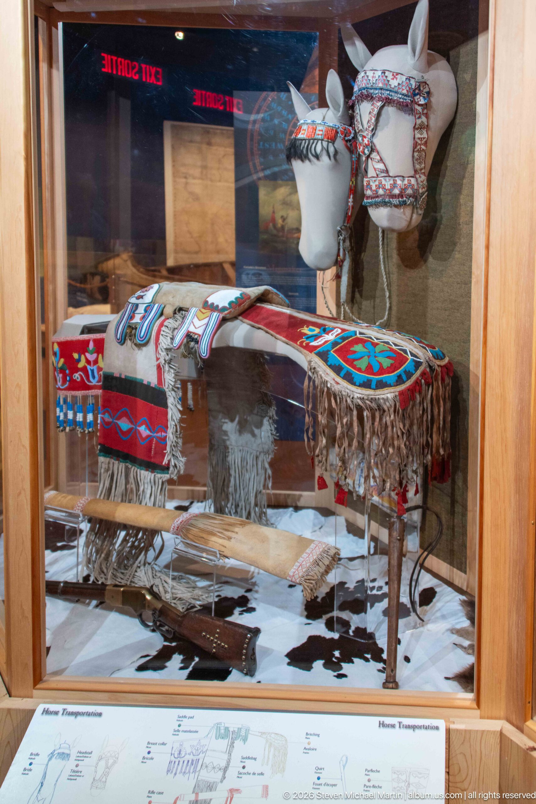
A museum case displays richly beaded and fringed horse equipment arranged on and around a white horse-form mount. Broad panels carry bold red, blue, black, and white geometric designs, with long fringe hanging below. The exhibit presentation connects decorative beadwork with equestrian material culture while protecting the objects behind reflective glass.
Caption
A museum case displays richly beaded and fringed horse equipment arranged on and around a white horse-form mount. Broad panels carry bold red, blue, black, and white geometric designs, with long fringe hanging below. The exhibit presentation connects decorative beadwork with equestrian material culture while protecting the objects behind reflective glass.
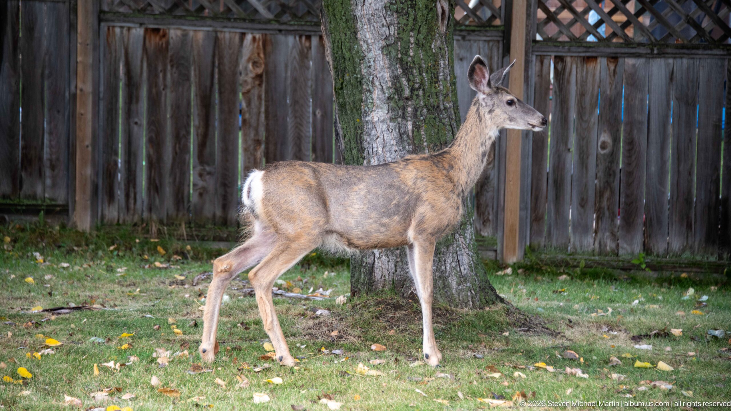
A mule deer pauses in profile beside a mature tree within a grassy, fenced area. Its raised head and forward-facing ears suggest alert attention, while the full-body view clearly records the animal's slender legs, gray-brown coat, and white rump. The surrounding lawn and wooden enclosure place this wildlife encounter within the site's managed landscape.
Caption
A mule deer pauses in profile beside a mature tree within a grassy, fenced area. Its raised head and forward-facing ears suggest alert attention, while the full-body view clearly records the animal's slender legs, gray-brown coat, and white rump. The surrounding lawn and wooden enclosure place this wildlife encounter within the site's managed landscape.
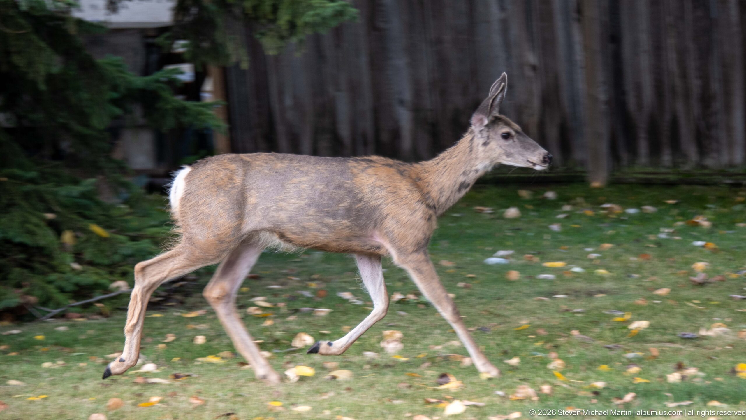
A mule deer strides across the grass in a clean side profile, one foreleg extended and the body caught mid-step. The moving animal is separated from a dark wooded background, emphasizing gait and body proportions rather than the stationary alert poses seen in adjacent photographs. Fallen leaves scattered across the lawn add an early-autumn context.
Caption
A mule deer strides across the grass in a clean side profile, one foreleg extended and the body caught mid-step. The moving animal is separated from a dark wooded background, emphasizing gait and body proportions rather than the stationary alert poses seen in adjacent photographs. Fallen leaves scattered across the lawn add an early-autumn context.
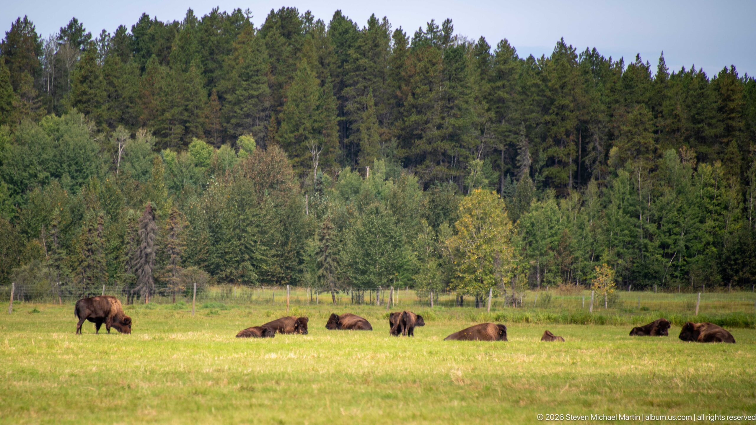
A small herd of plains bison occupies an open meadow bordered by mixed woodland, with one animal grazing while several others rest on the grass. The broad landscape view emphasizes the herd's distribution across the field and the transition from pasture to forest, providing environmental context rather than an individual wildlife portrait.
Caption
A small herd of plains bison occupies an open meadow bordered by mixed woodland, with one animal grazing while several others rest on the grass. The broad landscape view emphasizes the herd's distribution across the field and the transition from pasture to forest, providing environmental context rather than an individual wildlife portrait.
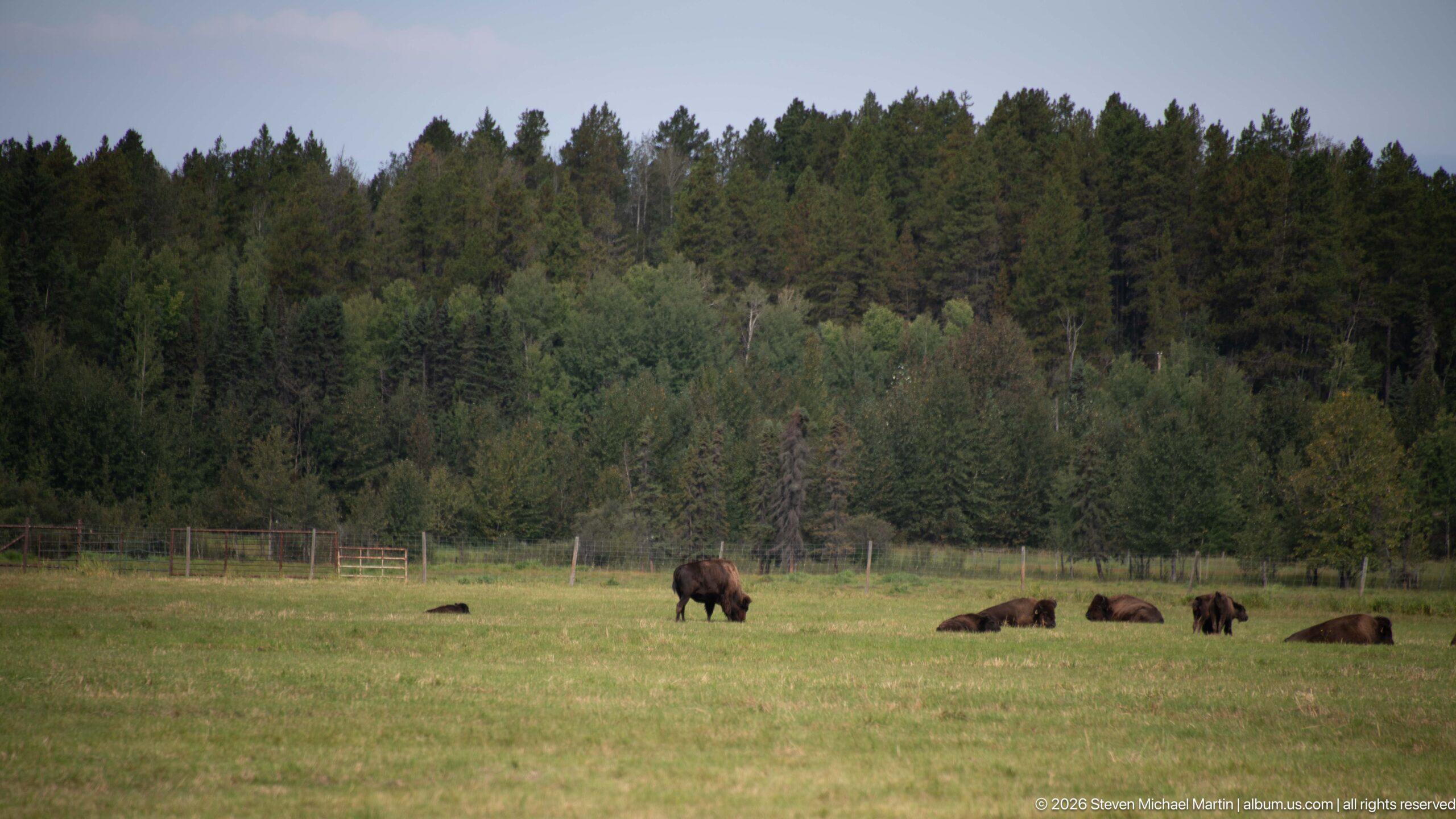
A lone grazing bison anchors the left side of this meadow view while other members of the herd lie farther back near the forest edge. Greater separation between the animals gives the scene a spacious quality and records how the herd uses the open grassland adjoining the wooded boundary at Rocky Mountain House.
Caption
A lone grazing bison anchors the left side of this meadow view while other members of the herd lie farther back near the forest edge. Greater separation between the animals gives the scene a spacious quality and records how the herd uses the open grassland adjoining the wooded boundary at Rocky Mountain House.
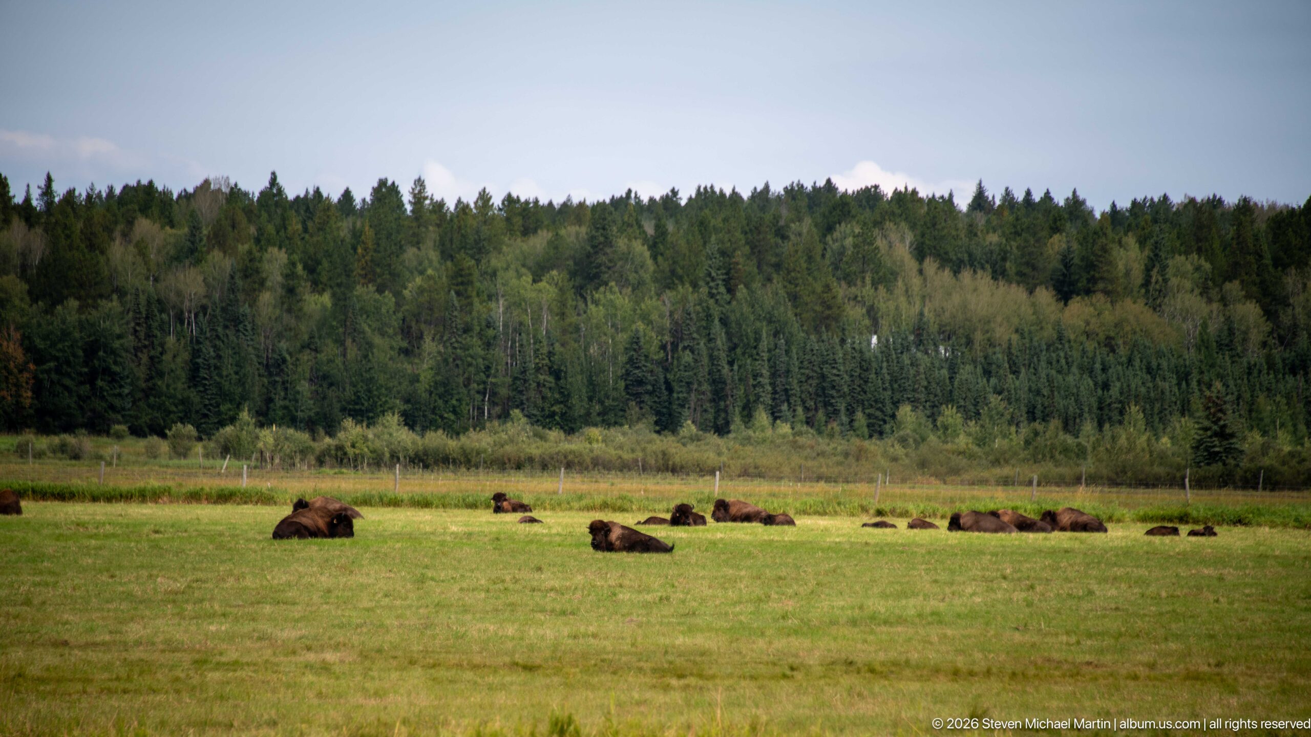
Bison appear as scattered dark forms across a broad green field beneath a continuous wall of mixed forest. This widest herd view minimizes individual detail in favor of scale, spacing, and habitat, showing the animals dispersed across the open meadow under an overcast sky at Rocky Mountain House National Historic Site.
Caption
Bison appear as scattered dark forms across a broad green field beneath a continuous wall of mixed forest. This widest herd view minimizes individual detail in favor of scale, spacing, and habitat, showing the animals dispersed across the open meadow under an overcast sky at Rocky Mountain House National Historic Site.
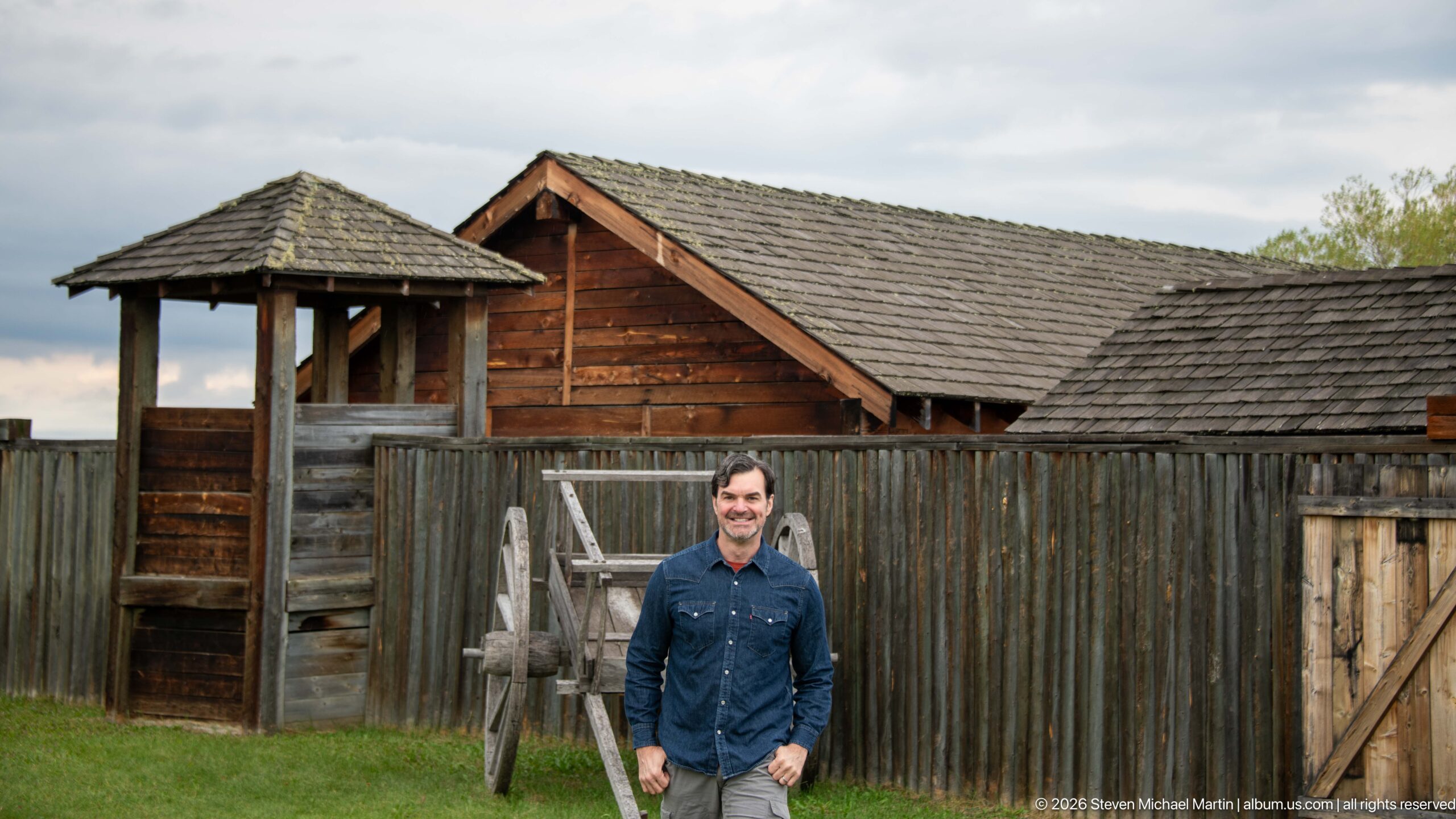
A visitor stands before the timber palisade and gateway structures of the site's fur-trade interpretation area. Rough vertical logs, shingled roofs, a lookout-like corner structure, and a large wooden wheel create the visual vocabulary of a trading post, while the person in the foreground provides scale for the reconstructed setting.
Caption
A visitor stands before the timber palisade and gateway structures of the site's fur-trade interpretation area. Rough vertical logs, shingled roofs, a lookout-like corner structure, and a large wooden wheel create the visual vocabulary of a trading post, while the person in the foreground provides scale for the reconstructed setting.
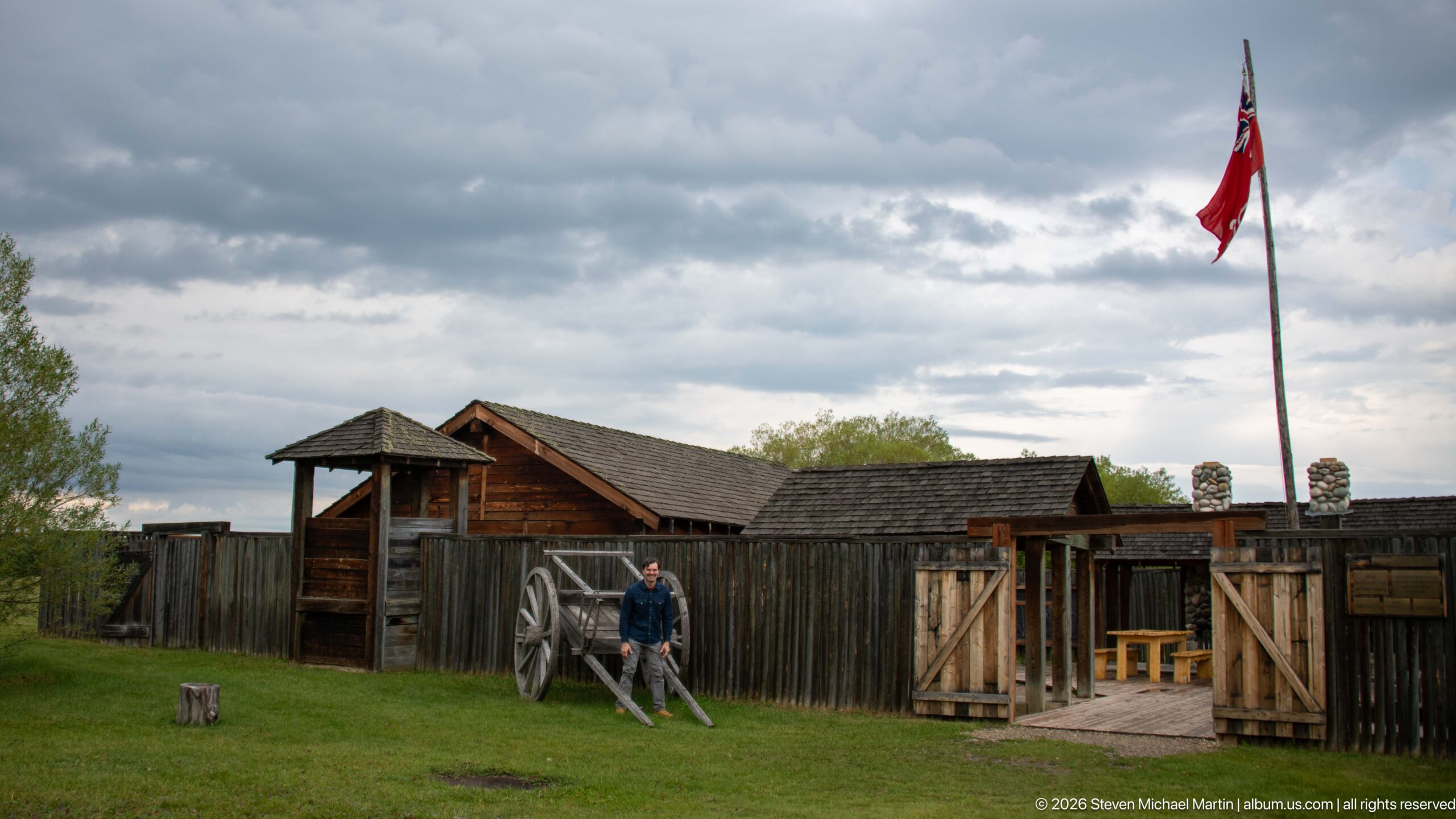
A wider view encompasses the interpreted fur-trade enclosure, including timber palisades, roofed corner structures, an open gate, and a tall flagstaff rising into a dramatic cloudy sky. A visitor near the center supplies scale, while the expanded composition shows how the reconstructed elements are arranged across the grassy grounds.
Caption
A wider view encompasses the interpreted fur-trade enclosure, including timber palisades, roofed corner structures, an open gate, and a tall flagstaff rising into a dramatic cloudy sky. A visitor near the center supplies scale, while the expanded composition shows how the reconstructed elements are arranged across the grassy grounds.
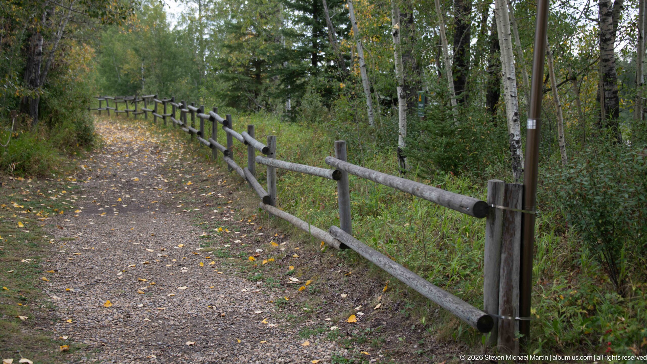
A gently curving gravel trail passes through deciduous woodland beside a split-rail fence. Fallen yellow leaves scatter across the path, and the repeating fence posts draw the eye into the trees. The photograph records the quieter landscape experience of Rocky Mountain House National Historic Site away from its reconstructed fur-trade displays.
Caption
A gently curving gravel trail passes through deciduous woodland beside a split-rail fence. Fallen yellow leaves scatter across the path, and the repeating fence posts draw the eye into the trees. The photograph records the quieter landscape experience of Rocky Mountain House National Historic Site away from its reconstructed fur-trade displays.
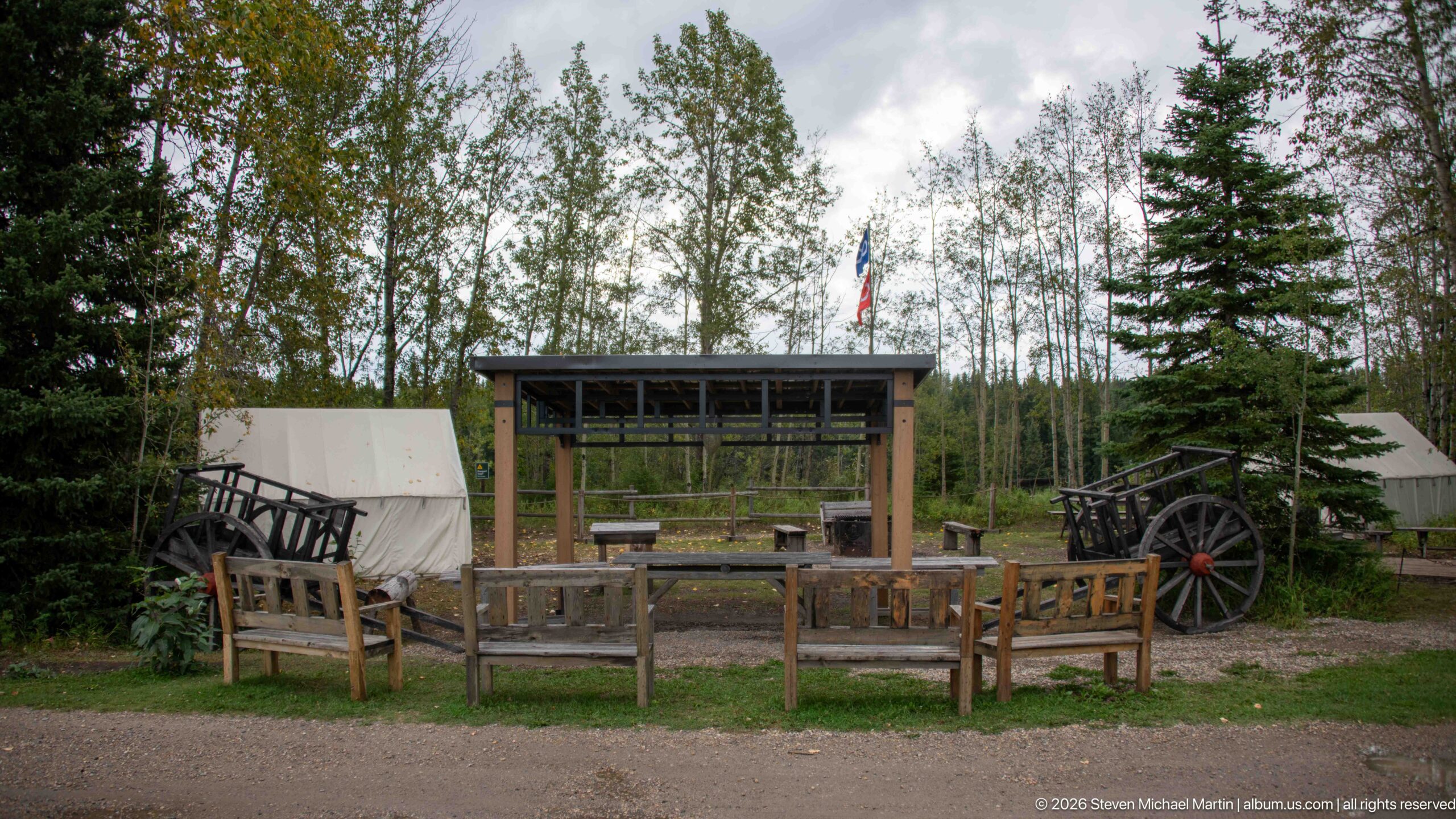
An outdoor interpretation area combines canvas tents, a wooden wagon, benches, and a roofed demonstration shelter within a wooded clearing. The arrangement evokes the mobile equipment and working spaces associated with travel and trade, while the modern interpretive layout remains evident in the orderly seating and maintained grounds.
Caption
An outdoor interpretation area combines canvas tents, a wooden wagon, benches, and a roofed demonstration shelter within a wooded clearing. The arrangement evokes the mobile equipment and working spaces associated with travel and trade, while the modern interpretive layout remains evident in the orderly seating and maintained grounds.
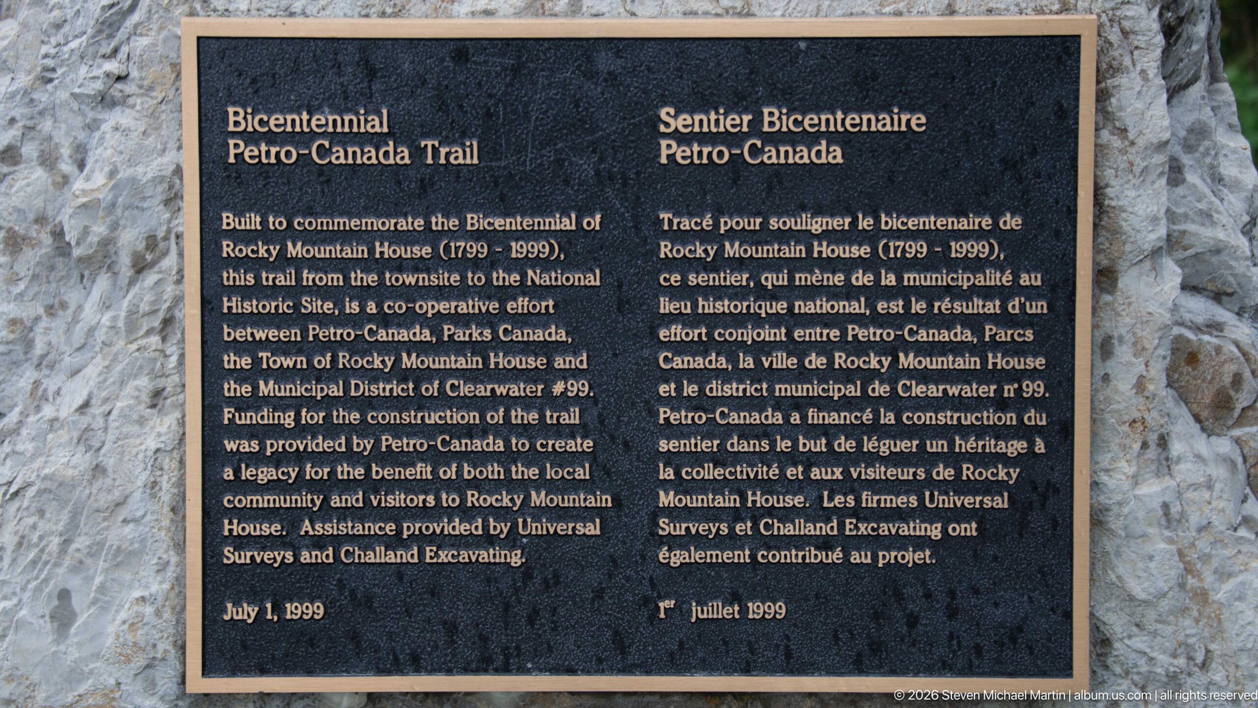
A bilingual bronze plaque identifies the Petro-Canada Trail, built to commemorate the 1799–1999 bicentennial of Rocky Mountain House. Mounted on stone, the marker credits Parks Canada, Petro-Canada, the Town of Rocky Mountain House, and the Municipal District of Clearwater for the cooperative trail project and records its dedication on July 1, 1999.
Caption
A bilingual bronze plaque identifies the Petro-Canada Trail, built to commemorate the 1799–1999 bicentennial of Rocky Mountain House. Mounted on stone, the marker credits Parks Canada, Petro-Canada, the Town of Rocky Mountain House, and the Municipal District of Clearwater for the cooperative trail project and records its dedication on July 1, 1999.
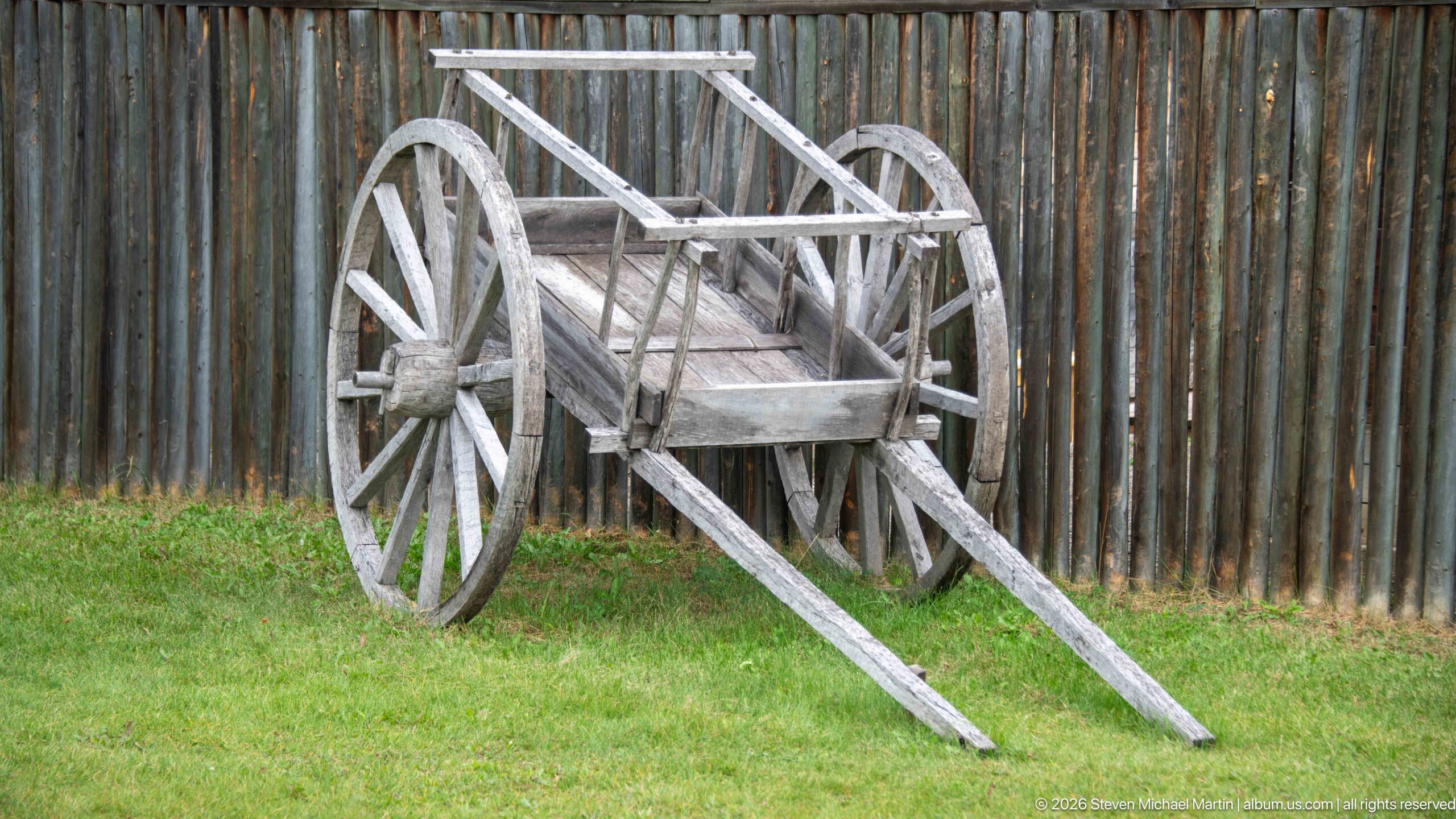
A weathered two-wheeled wooden cart stands against a vertical log palisade, its long shafts extending toward the foreground. The simple construction—large spoked wheels, plank bed, and light timber frame—makes the transport technology itself the subject, isolated from the busier interpretive scenes elsewhere in the portfolio.
Caption
A weathered two-wheeled wooden cart stands against a vertical log palisade, its long shafts extending toward the foreground. The simple construction—large spoked wheels, plank bed, and light timber frame—makes the transport technology itself the subject, isolated from the busier interpretive scenes elsewhere in the portfolio.
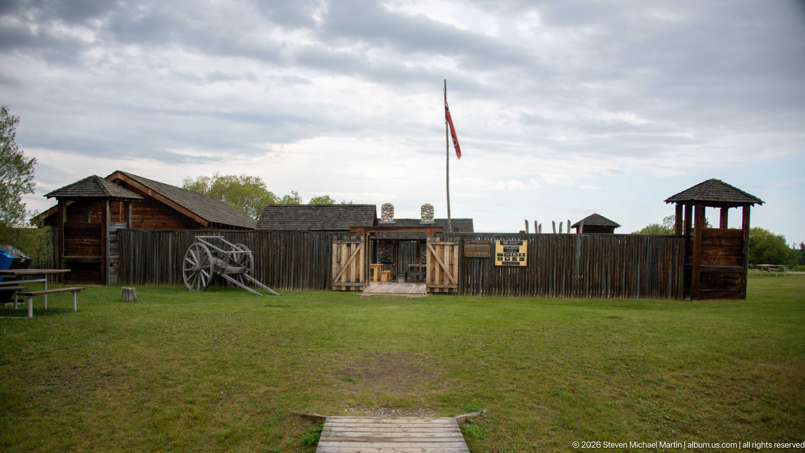
The interpreted fur-trade enclosure stretches across the frame behind an open lawn, with a central gateway, corner structures, shingled roofs, and a tall flagstaff organizing the composition. Seen from farther back than adjacent views, the photograph clarifies the enclosure's overall footprint and the relationship among its palisade, gates, and interior buildings.
Caption
The interpreted fur-trade enclosure stretches across the frame behind an open lawn, with a central gateway, corner structures, shingled roofs, and a tall flagstaff organizing the composition. Seen from farther back than adjacent views, the photograph clarifies the enclosure's overall footprint and the relationship among its palisade, gates, and interior buildings.
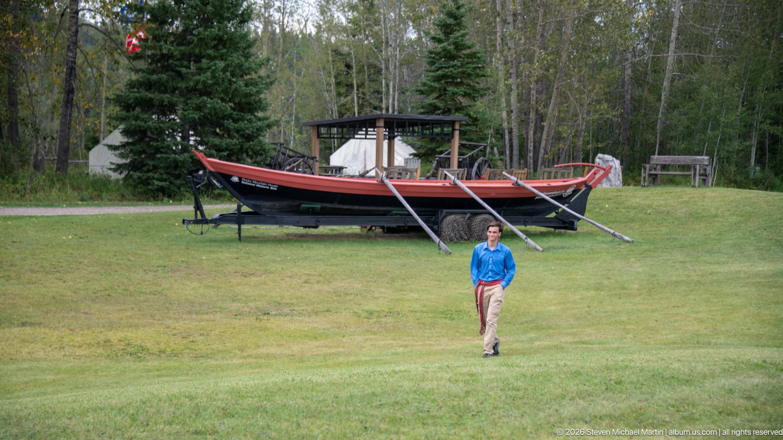
A visitor walks across the open lawn with the large fur-trade boat display behind him, allowing the vessel's considerable length and height to register at human scale. Canvas tents and a roofed shelter appear farther back among the trees, linking the boat to the site's broader outdoor interpretation of travel and trading life.
Caption
A visitor walks across the open lawn with the large fur-trade boat display behind him, allowing the vessel's considerable length and height to register at human scale. Canvas tents and a roofed shelter appear farther back among the trees, linking the boat to the site's broader outdoor interpretation of travel and trading life.
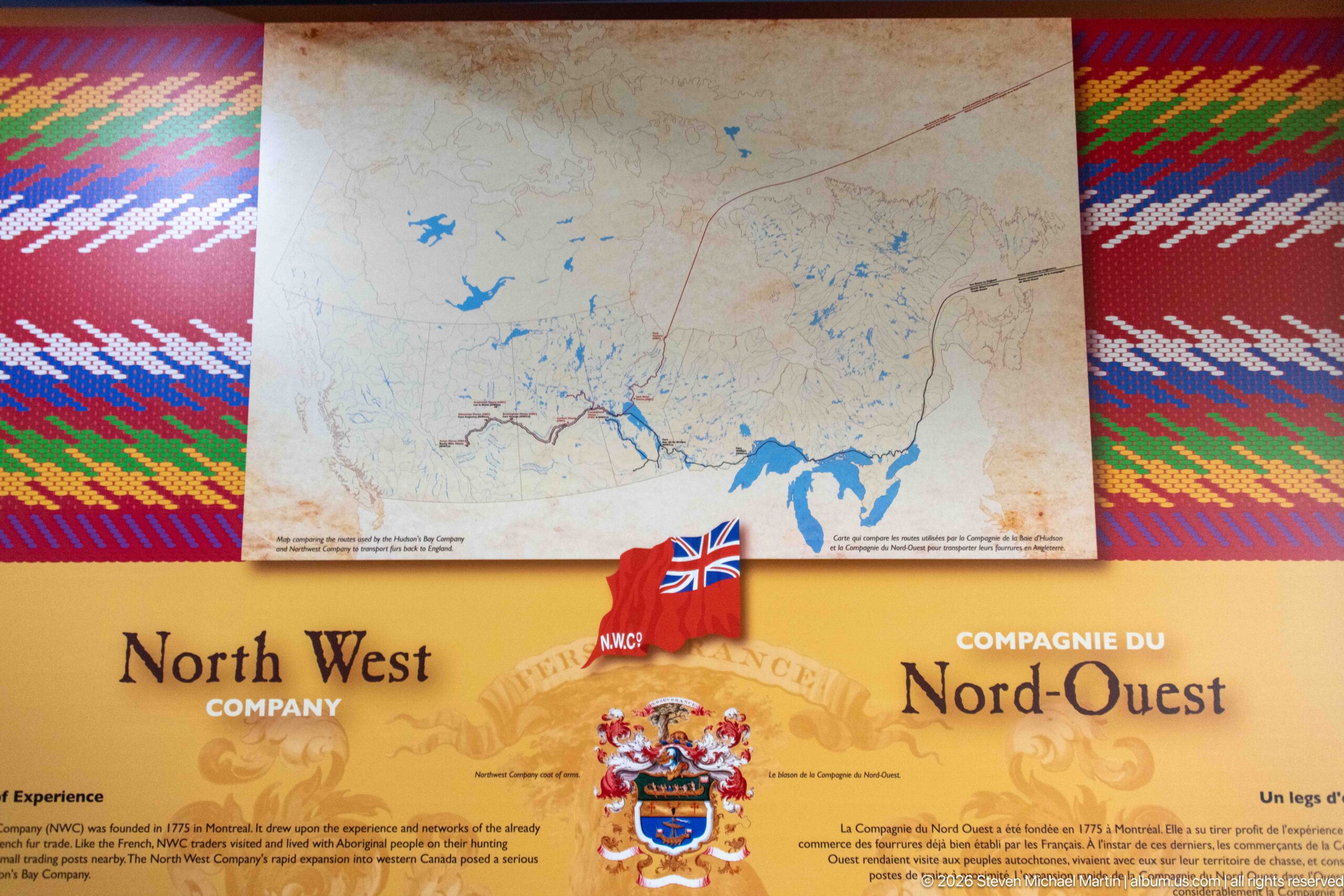
An interpretive panel devoted to the North West Company combines a large regional map, bilingual headings, historical text, and the company's heraldic emblem. Bright woven-pattern borders frame the display, while a small British flag marker on the map area reinforces the exhibit's explanation of the company's place in the competitive fur trade.
Caption
An interpretive panel devoted to the North West Company combines a large regional map, bilingual headings, historical text, and the company's heraldic emblem. Bright woven-pattern borders frame the display, while a small British flag marker on the map area reinforces the exhibit's explanation of the company's place in the competitive fur trade.
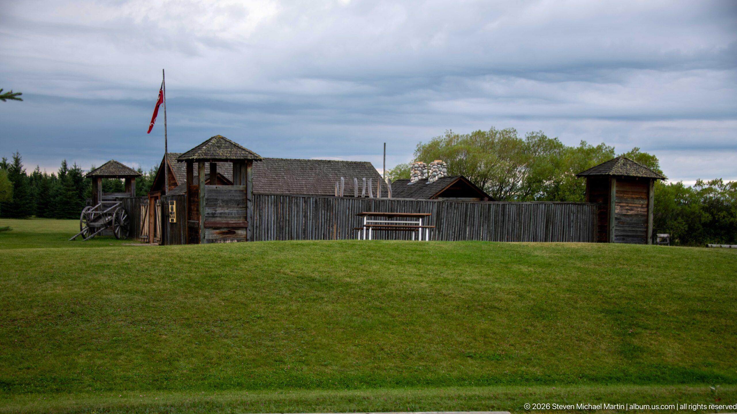
A grassy rise leads to the outer side of the interpreted fur-trade enclosure, where vertical log walls connect roofed corner structures and low timber buildings. Viewed from outside and slightly below, this angle emphasizes the defensive visual form of the palisade and the enclosure's silhouette beneath a heavy overcast sky.
Caption
A grassy rise leads to the outer side of the interpreted fur-trade enclosure, where vertical log walls connect roofed corner structures and low timber buildings. Viewed from outside and slightly below, this angle emphasizes the defensive visual form of the palisade and the enclosure's silhouette beneath a heavy overcast sky.
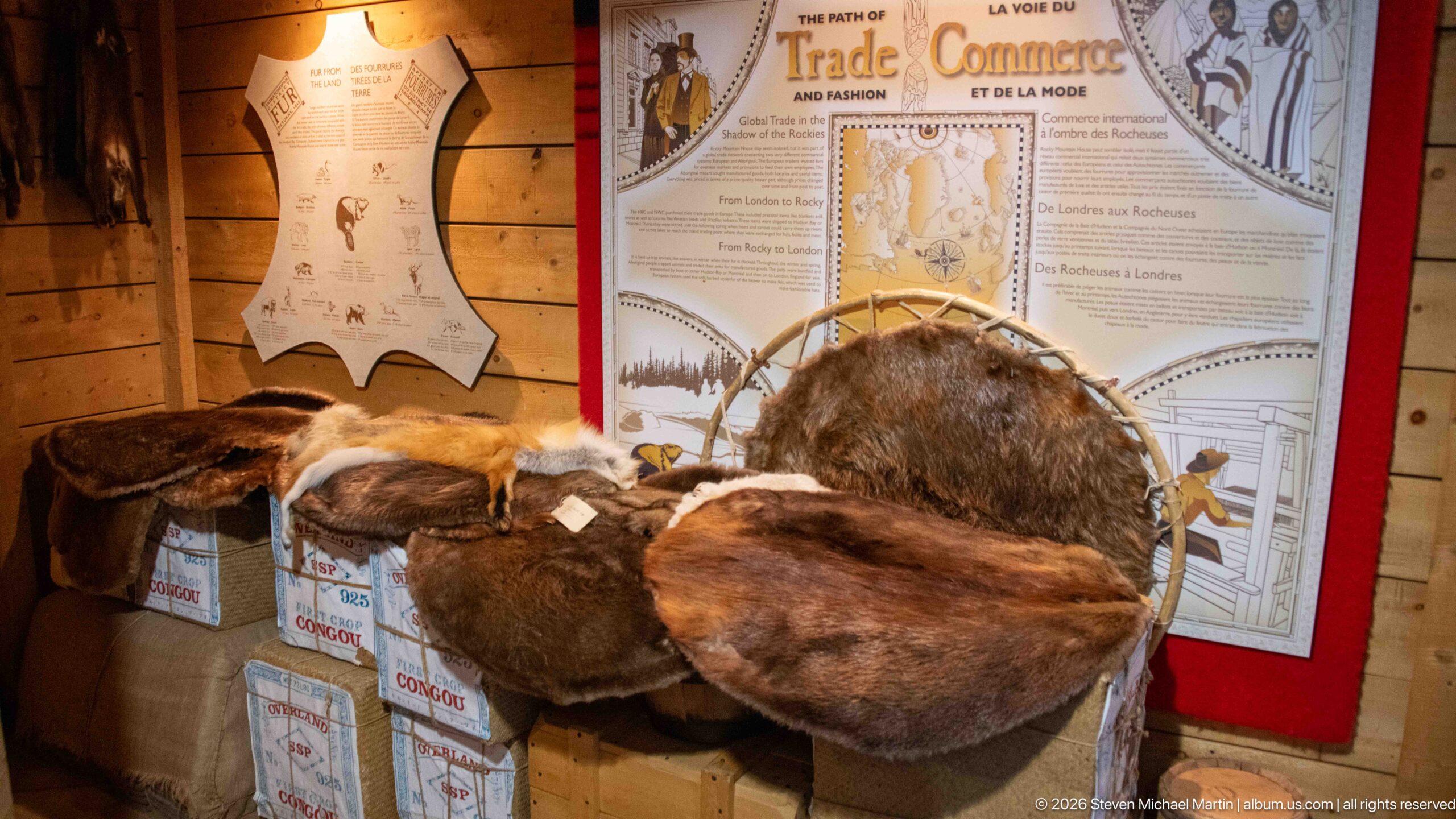
Several prepared animal pelts are displayed over trade-goods boxes beneath an interpretive panel titled around the path of trade and commerce. The tactile fur specimens bring the commodity at the center of the historic trade into the foreground, while the map and explanatory graphics behind them connect those materials to wider exchange routes and relationships.
Caption
Several prepared animal pelts are displayed over trade-goods boxes beneath an interpretive panel titled around the path of trade and commerce. The tactile fur specimens bring the commodity at the center of the historic trade into the foreground, while the map and explanatory graphics behind them connect those materials to wider exchange routes and relationships.
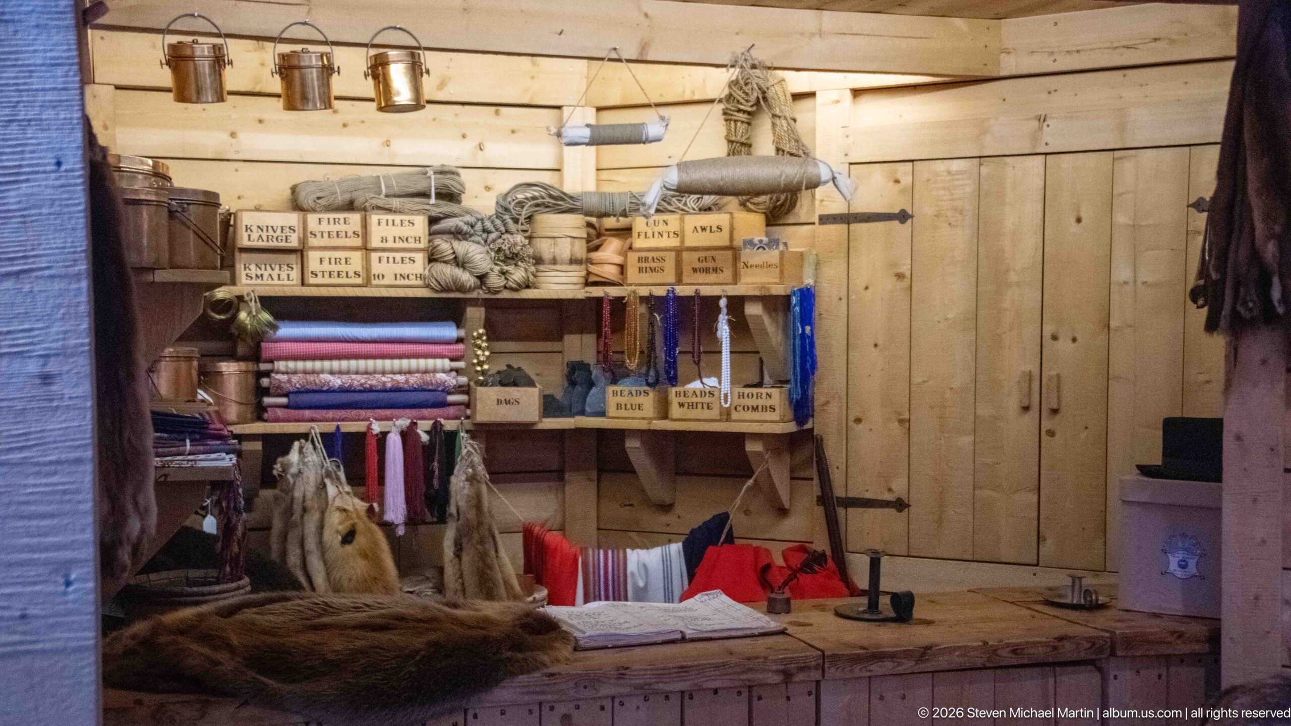
A recreated trading-post interior presents folded textiles, labeled boxes, rope, tools, and other goods arranged behind a wooden counter. The dense display evokes the variety of commodities exchanged through fur-trade posts, while plank walls and utilitarian shelving frame the merchandise in a deliberately workmanlike setting.
Caption
A recreated trading-post interior presents folded textiles, labeled boxes, rope, tools, and other goods arranged behind a wooden counter. The dense display evokes the variety of commodities exchanged through fur-trade posts, while plank walls and utilitarian shelving frame the merchandise in a deliberately workmanlike setting.
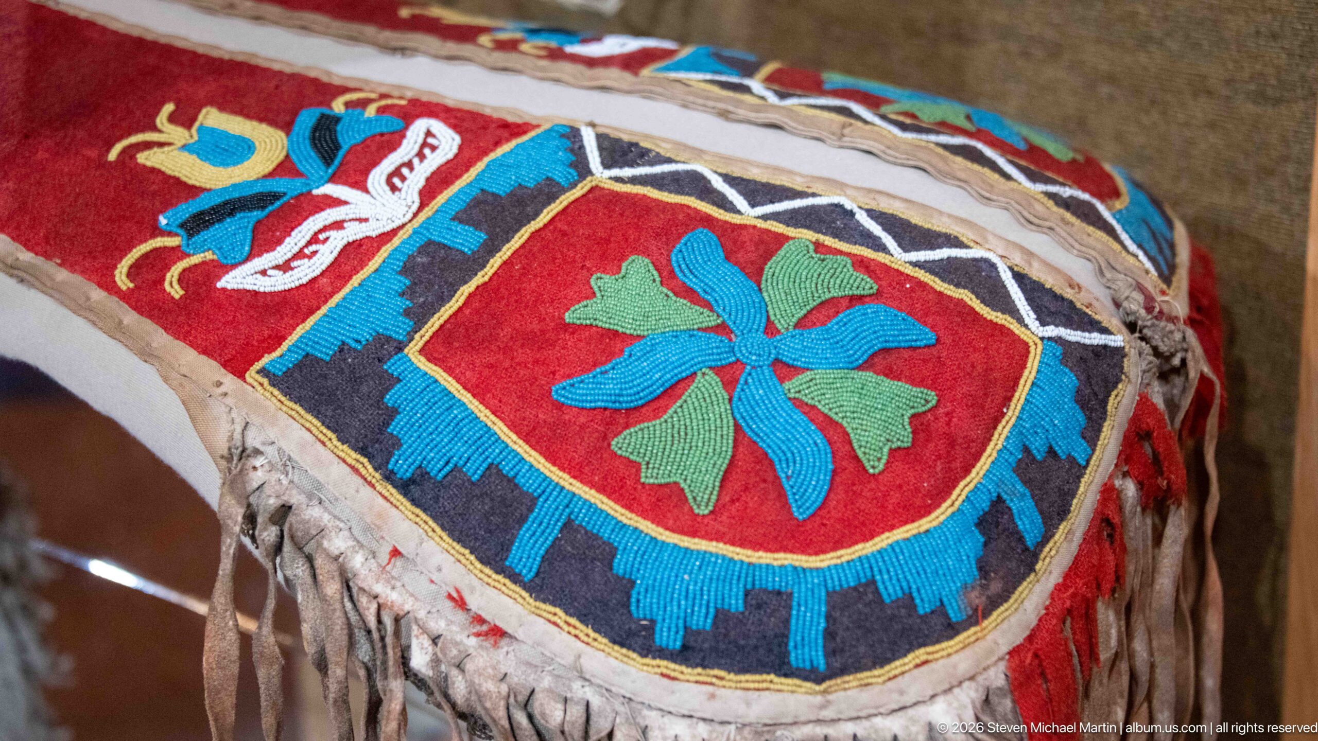
Dense beadwork covers a hide or leather surface in vivid red, blue, green, white, and black, centered on a four-petaled floral motif and bordered by geometric bands. The close detail isolates the handworked decoration, fringe, stitching, and worn surface, allowing the craftsmanship and color pattern to be studied independently of the larger exhibit case.
Caption
Dense beadwork covers a hide or leather surface in vivid red, blue, green, white, and black, centered on a four-petaled floral motif and bordered by geometric bands. The close detail isolates the handworked decoration, fringe, stitching, and worn surface, allowing the craftsmanship and color pattern to be studied independently of the larger exhibit case.
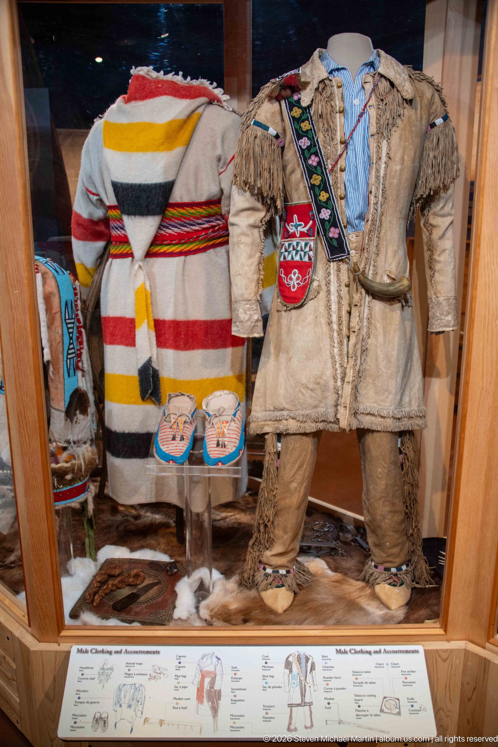
Two decorated outfits are presented side by side in a museum case: one with broad horizontal bands of red, yellow, black, and white, and another of pale hide with fringe and narrow beaded ornament. Moccasins and smaller accessories complete the display, emphasizing contrasting approaches to color, construction, and surface decoration.
Caption
Two decorated outfits are presented side by side in a museum case: one with broad horizontal bands of red, yellow, black, and white, and another of pale hide with fringe and narrow beaded ornament. Moccasins and smaller accessories complete the display, emphasizing contrasting approaches to color, construction, and surface decoration.
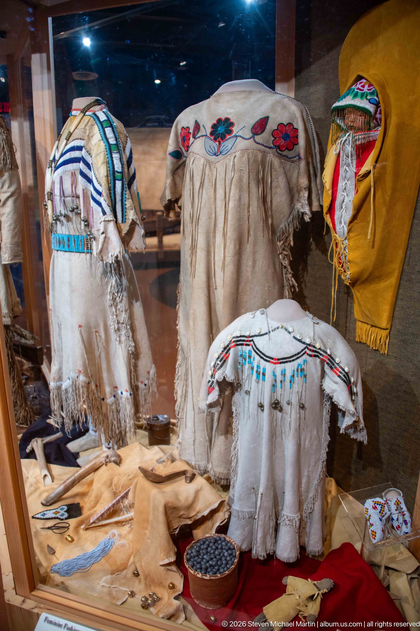
A group of pale hide garments fills the display case, each differentiated by bands of beadwork, painted or appliquéd motifs, and long fringe. The arrangement includes adult- and child-sized clothing forms as well as smaller objects laid below, presenting a range of decorative techniques rather than a single isolated garment.
Caption
A group of pale hide garments fills the display case, each differentiated by bands of beadwork, painted or appliquéd motifs, and long fringe. The arrangement includes adult- and child-sized clothing forms as well as smaller objects laid below, presenting a range of decorative techniques rather than a single isolated garment.
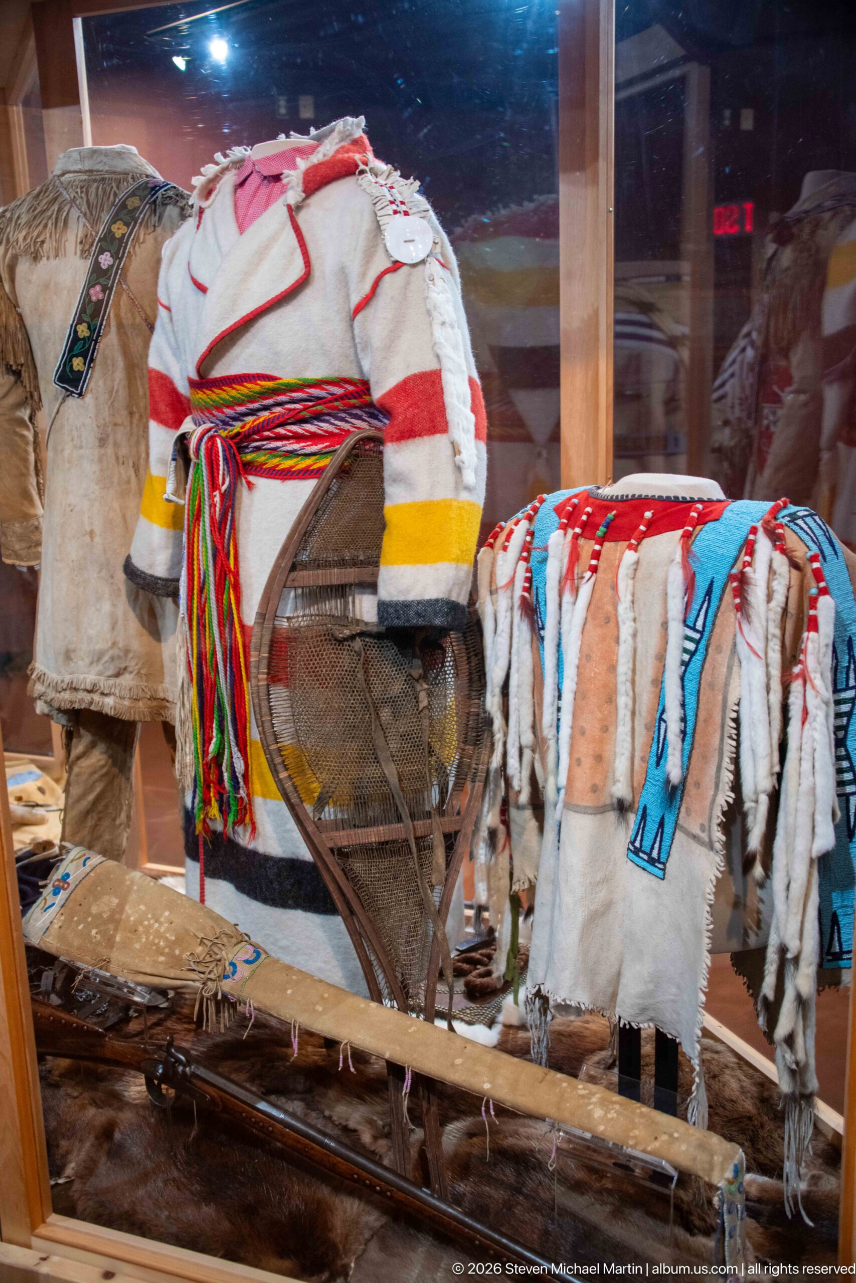
A curved wooden frame stands in front of decorated hide garments and textiles, its bent members and crosspieces forming a lightweight transport-related structure. Bright fringe and patterned material drape nearby, visually linking practical travel equipment with decorated personal belongings. The crowded case makes the frame's exact function less certain than its construction and context.
Caption
A curved wooden frame stands in front of decorated hide garments and textiles, its bent members and crosspieces forming a lightweight transport-related structure. Bright fringe and patterned material drape nearby, visually linking practical travel equipment with decorated personal belongings. The crowded case makes the frame's exact function less certain than its construction and context.
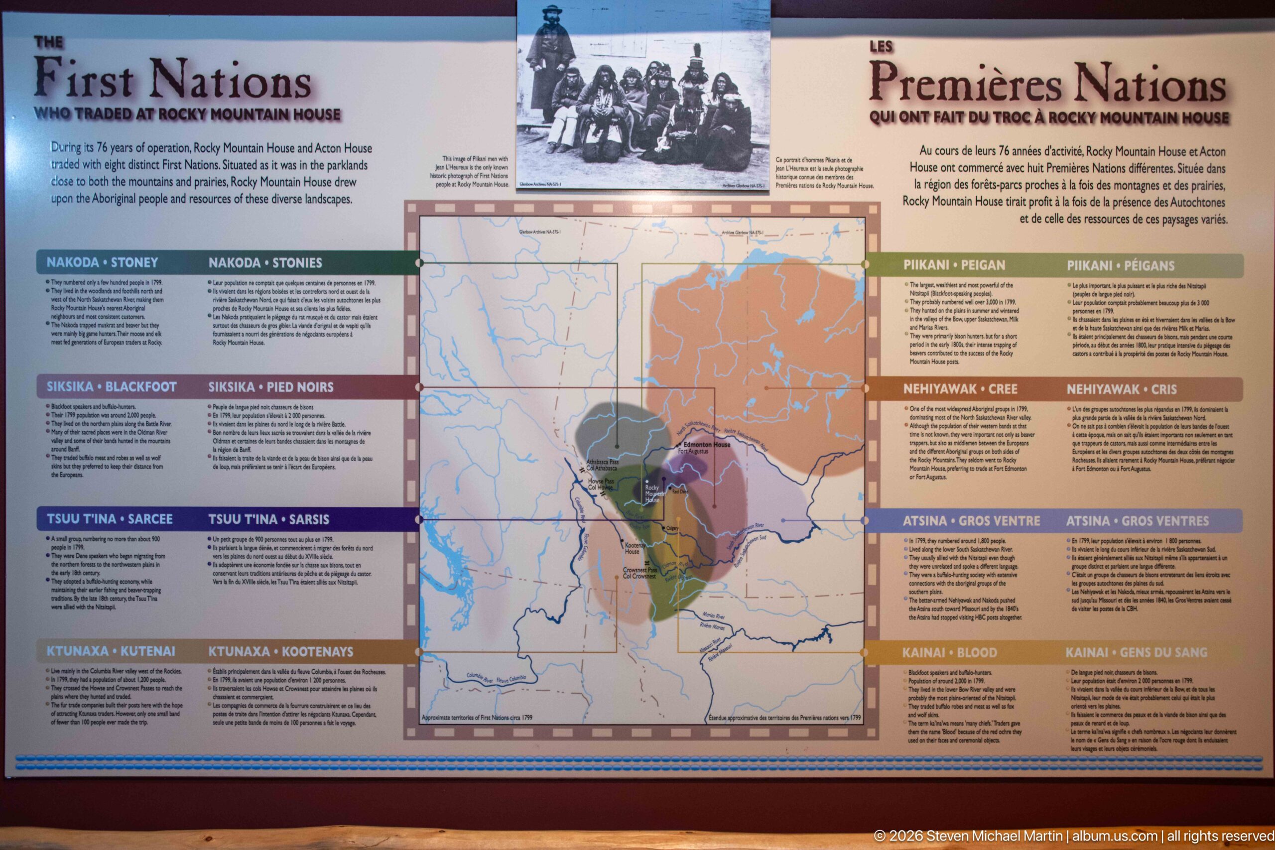
A bilingual interpretive panel titled “First Nations Who Once Met at Rocky Mountain House” maps the homelands and relationships of Indigenous peoples connected with the region. Named sections around the central map include Nakoda, Siksika, Tsuut'ina, Ktunaxa, Piikani, Nehiyawak, and Kainai, placing the fur-trade site within a much older Indigenous cultural geography.
Caption
A bilingual interpretive panel titled “First Nations Who Once Met at Rocky Mountain House” maps the homelands and relationships of Indigenous peoples connected with the region. Named sections around the central map include Nakoda, Siksika, Tsuut'ina, Ktunaxa, Piikani, Nehiyawak, and Kainai, placing the fur-trade site within a much older Indigenous cultural geography.
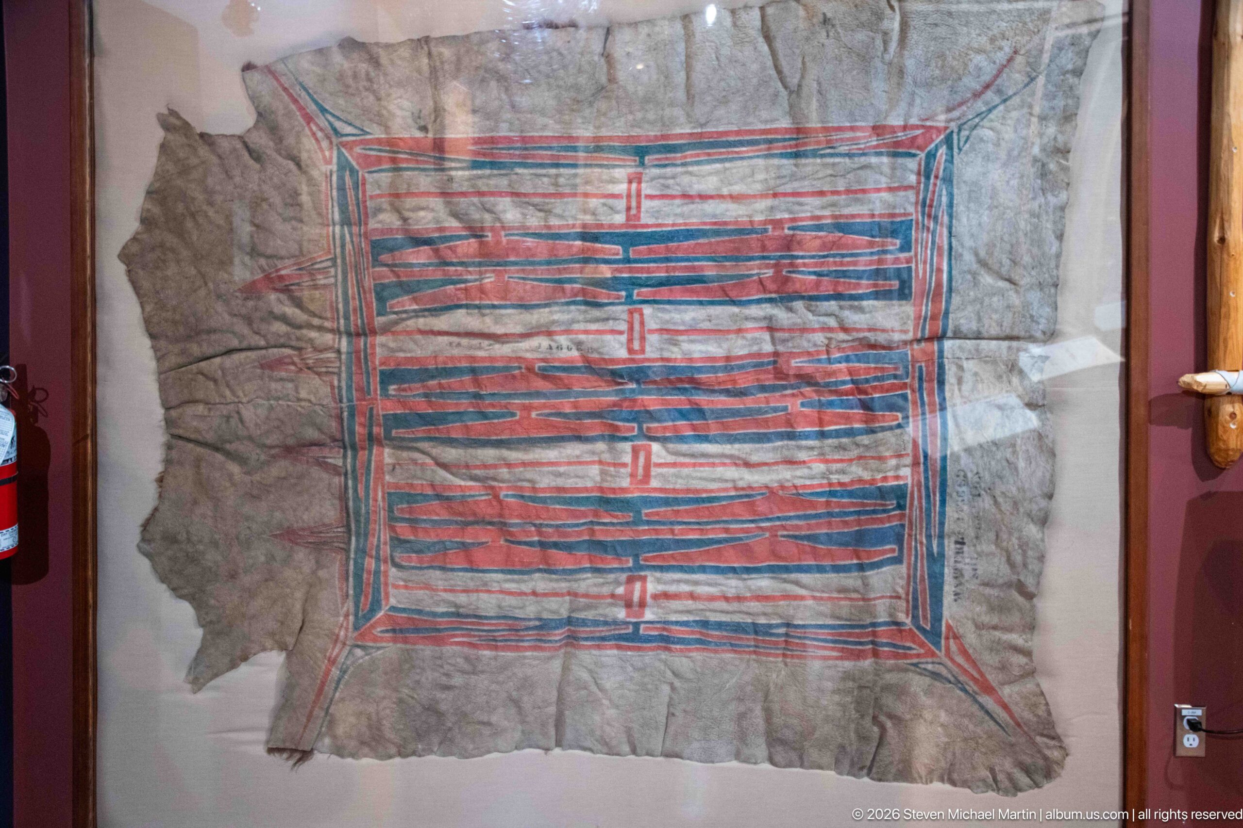
A large hide displayed flat behind glass carries a rectangular geometric composition painted in red and blue. Parallel lines, repeated bands, and paired central divisions create a disciplined symmetrical pattern across the irregular natural outline of the hide, making the contrast between worked design and animal material especially visible.
Caption
A large hide displayed flat behind glass carries a rectangular geometric composition painted in red and blue. Parallel lines, repeated bands, and paired central divisions create a disciplined symmetrical pattern across the irregular natural outline of the hide, making the contrast between worked design and animal material especially visible.
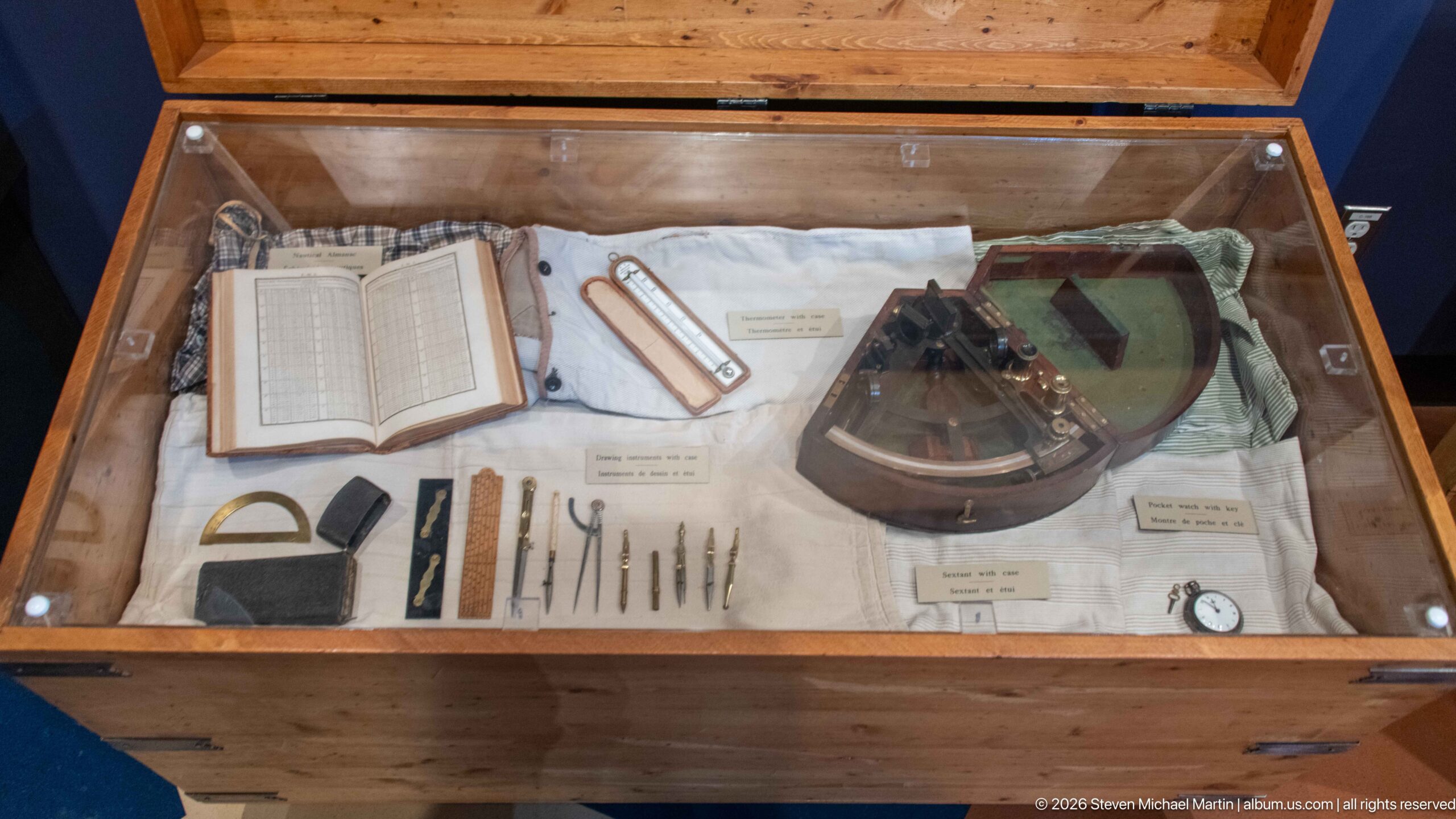
A glass-topped case brings together an open ledger, measuring tools, writing implements, a compass-like navigation instrument, and other small objects associated with travel and recordkeeping. The tightly arranged display shifts attention from the site's broad landscape to the practical equipment that supported movement, observation, documentation, and daily work within the fur-trade world interpreted at Rocky Mountain House National Historic Site.
Caption
A glass-topped case brings together an open ledger, measuring tools, writing implements, a compass-like navigation instrument, and other small objects associated with travel and recordkeeping. The tightly arranged display shifts attention from the site's broad landscape to the practical equipment that supported movement, observation, documentation, and daily work within the fur-trade world interpreted at Rocky Mountain House National Historic Site.
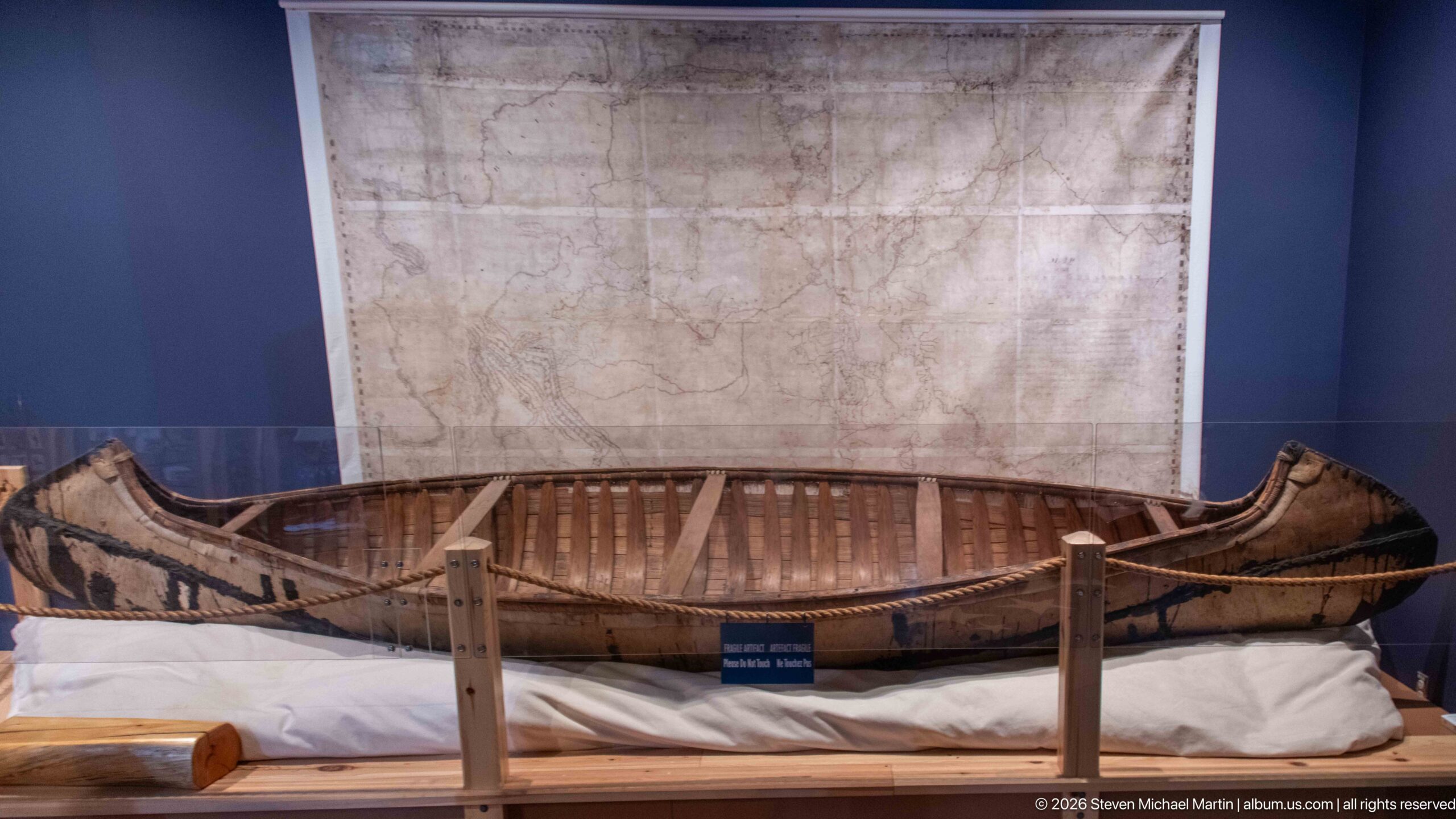
A long Indigenous watercraft rests beneath a large historic map, its slender hull, raised ends, exposed ribs, and stitched or fastened exterior construction clearly visible. Displayed at full length, the vessel demonstrates the lightweight boat technology that made river travel practical across the Canadian interior, where waterways served as essential transportation corridors linking communities and fur-trade posts.
Caption
A long Indigenous watercraft rests beneath a large historic map, its slender hull, raised ends, exposed ribs, and stitched or fastened exterior construction clearly visible. Displayed at full length, the vessel demonstrates the lightweight boat technology that made river travel practical across the Canadian interior, where waterways served as essential transportation corridors linking communities and fur-trade posts.
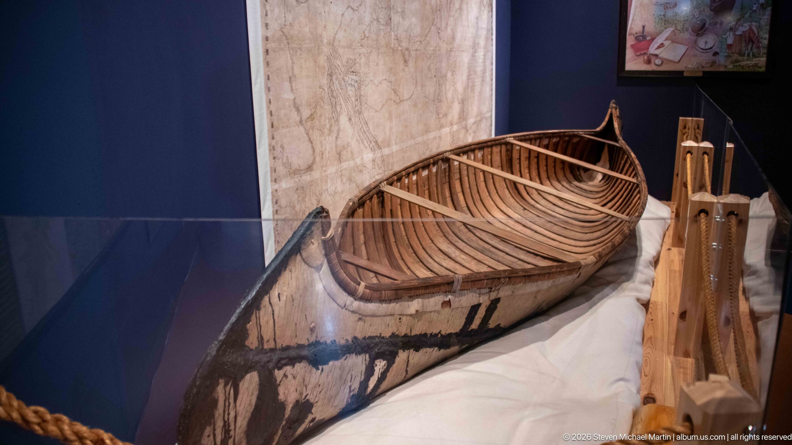
Viewed from one end, the displayed watercraft reveals the closely spaced ribs and longitudinal members that give its hull shape and strength. The elevated viewpoint also shows the pointed, upturned end and the contrast between the pale interior framework and darker exterior covering. This detail makes the vessel's construction legible in a way that the broader exhibit view cannot.
Caption
Viewed from one end, the displayed watercraft reveals the closely spaced ribs and longitudinal members that give its hull shape and strength. The elevated viewpoint also shows the pointed, upturned end and the contrast between the pale interior framework and darker exterior covering. This detail makes the vessel's construction legible in a way that the broader exhibit view cannot.
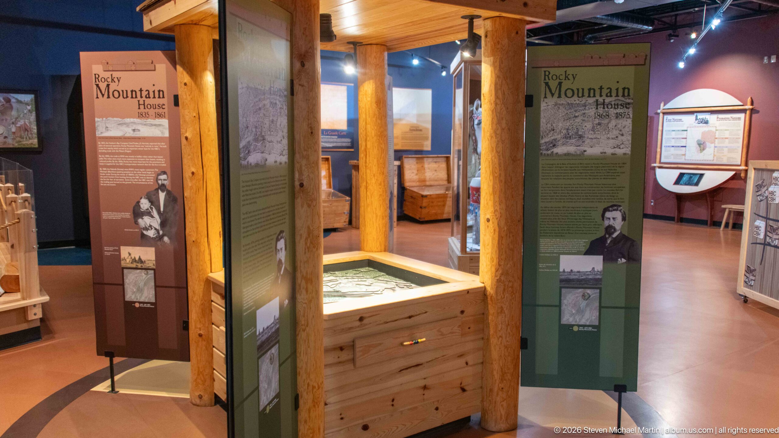
Timber posts frame a cluster of interpretive panels inside the visitor-centre gallery, including displays devoted to Rocky Mountain House and figures connected with its history. A low wooden exhibit case anchors the center of the space while maps, portraits, text, and artifacts surround it. The arrangement places the site's people, geography, and trading history within a compact, immersive museum setting.
Caption
Timber posts frame a cluster of interpretive panels inside the visitor-centre gallery, including displays devoted to Rocky Mountain House and figures connected with its history. A low wooden exhibit case anchors the center of the space while maps, portraits, text, and artifacts surround it. The arrangement places the site's people, geography, and trading history within a compact, immersive museum setting.
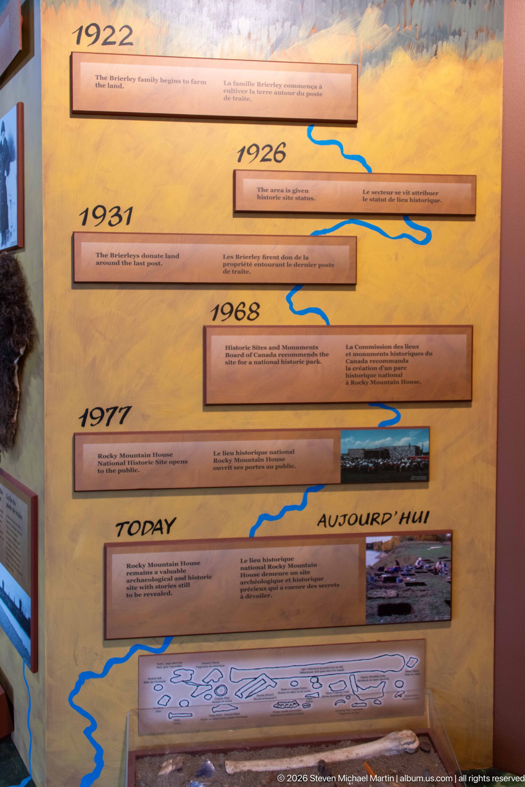
A vertical timeline uses dated entries, blue river lines, and small illustrations to trace changes in the Rocky Mountain House landscape through the twentieth century and into the present. Dates including 1926, 1931, 1968, and 1977 organize the panel, while the stylized river course reinforces the importance of waterways to the site's continuing interpretation.
Caption
A vertical timeline uses dated entries, blue river lines, and small illustrations to trace changes in the Rocky Mountain House landscape through the twentieth century and into the present. Dates including 1926, 1931, 1968, and 1977 organize the panel, while the stylized river course reinforces the importance of waterways to the site's continuing interpretation.
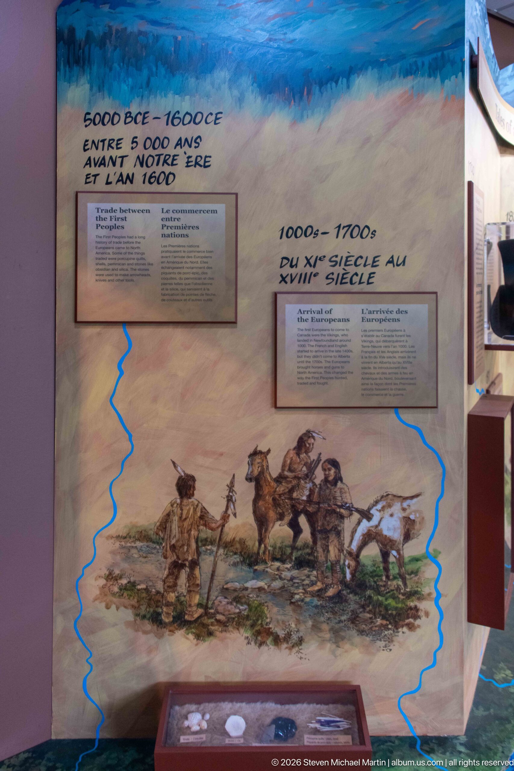
Mounted riders and pack animals cross an open landscape beneath bilingual text describing the centuries around 1600, giving visual form to long-distance movement before the establishment of the later fur-trade posts. A blue route line threads through the composition, linking the historical illustration to the broader gallery narrative about travel, exchange, and changing networks across the interior.
Caption
Mounted riders and pack animals cross an open landscape beneath bilingual text describing the centuries around 1600, giving visual form to long-distance movement before the establishment of the later fur-trade posts. A blue route line threads through the composition, linking the historical illustration to the broader gallery narrative about travel, exchange, and changing networks across the interior.
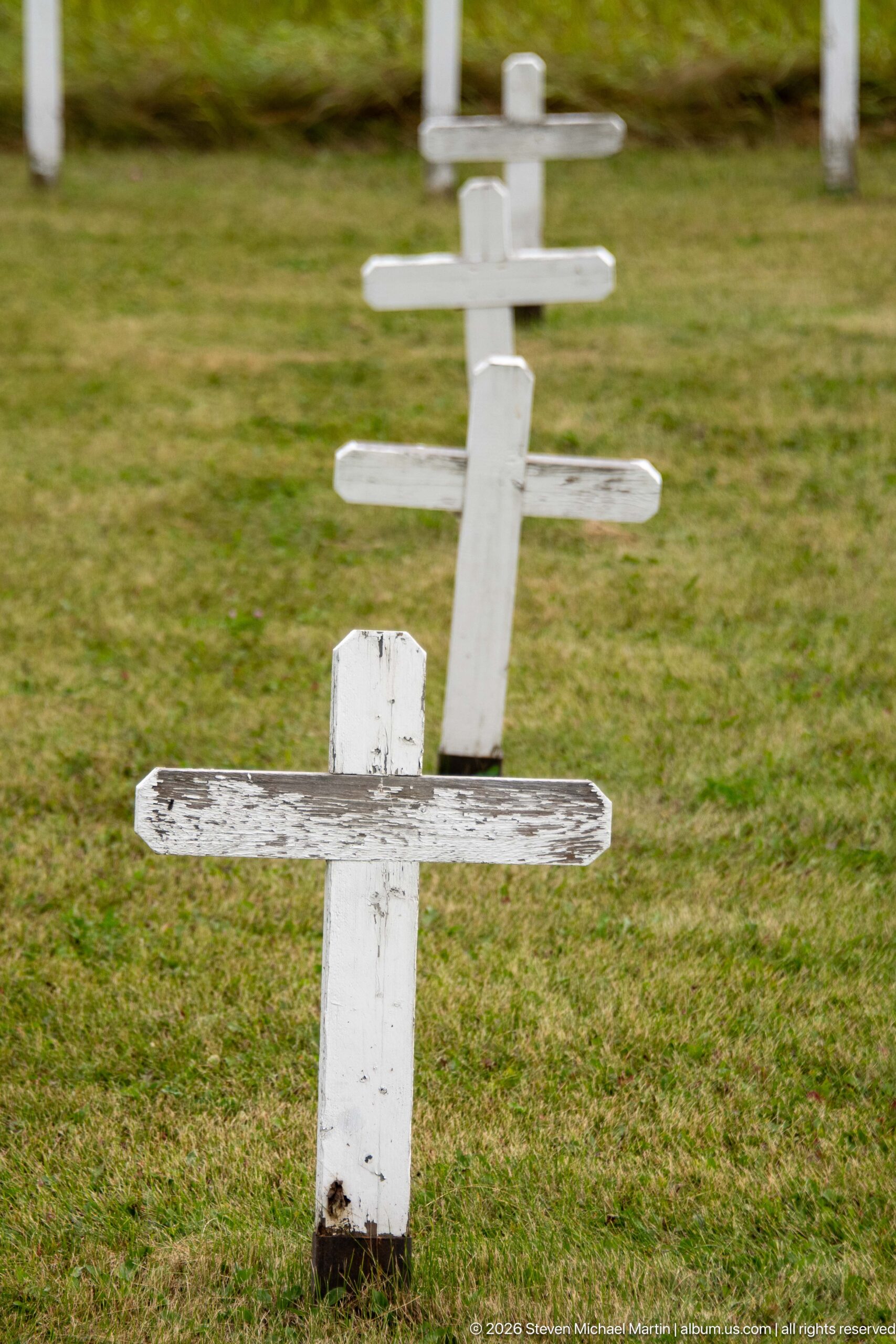
A line of simple white wooden crosses recedes across the grass, marking graves within the historic burial ground at Rocky Mountain House National Historic Site. The shallow focus isolates the nearest weathered marker while repeating cross forms lead toward the background. Their modest construction and regular spacing create a quiet visual counterpoint to the museum's artifact-rich interpretation of fur-trade life.
Caption
A line of simple white wooden crosses recedes across the grass, marking graves within the historic burial ground at Rocky Mountain House National Historic Site. The shallow focus isolates the nearest weathered marker while repeating cross forms lead toward the background. Their modest construction and regular spacing create a quiet visual counterpoint to the museum's artifact-rich interpretation of fur-trade life.
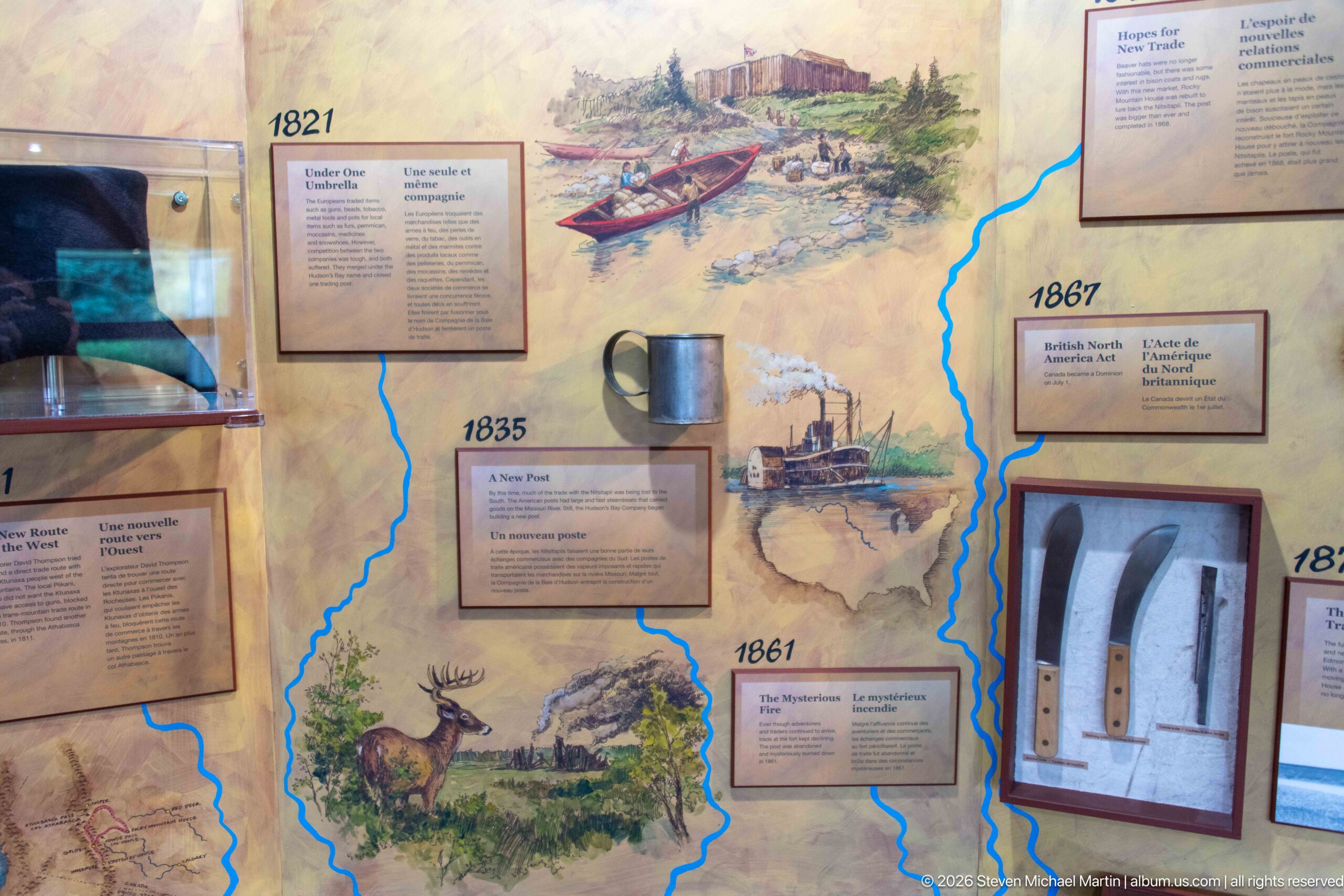
An illustrated chronology layers fur-trade scenes, dated episodes, text panels, and artifact displays around a blue river network. Vignettes of Indigenous people, traders, wildlife, boats, and a steam vessel connect changing forms of travel and exchange to the waterways that structured life in the region. The mixed-media presentation compresses several periods of Rocky Mountain House history into a single visual narrative.
Caption
An illustrated chronology layers fur-trade scenes, dated episodes, text panels, and artifact displays around a blue river network. Vignettes of Indigenous people, traders, wildlife, boats, and a steam vessel connect changing forms of travel and exchange to the waterways that structured life in the region. The mixed-media presentation compresses several periods of Rocky Mountain House history into a single visual narrative.
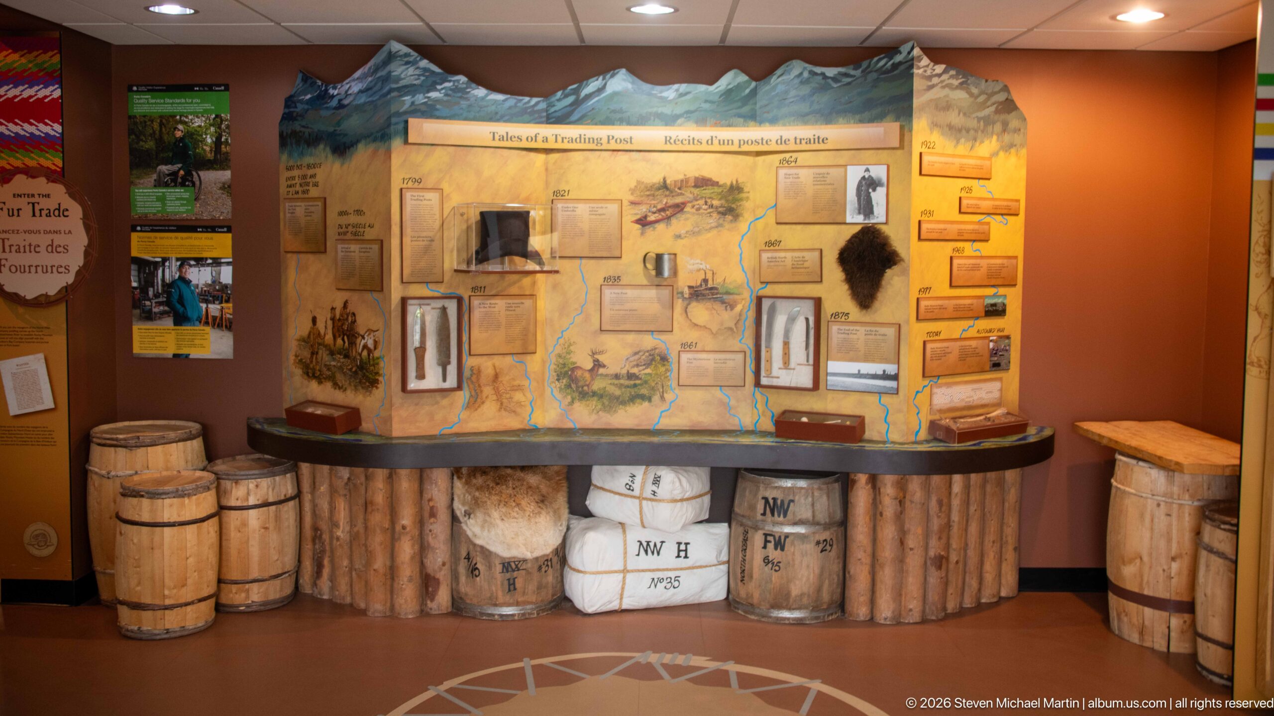
The 'Tales of a Trading Post' exhibit combines a large illustrated map with barrels, wrapped trade bales, small artifacts, and documentary material. Its counter-like base evokes the movement and storage of goods while the wall display traces people and events associated with exchange. Together, the objects and graphics translate the commercial workings of a fur-trade post into an accessible museum tableau.
Caption
The 'Tales of a Trading Post' exhibit combines a large illustrated map with barrels, wrapped trade bales, small artifacts, and documentary material. Its counter-like base evokes the movement and storage of goods while the wall display traces people and events associated with exchange. Together, the objects and graphics translate the commercial workings of a fur-trade post into an accessible museum tableau.
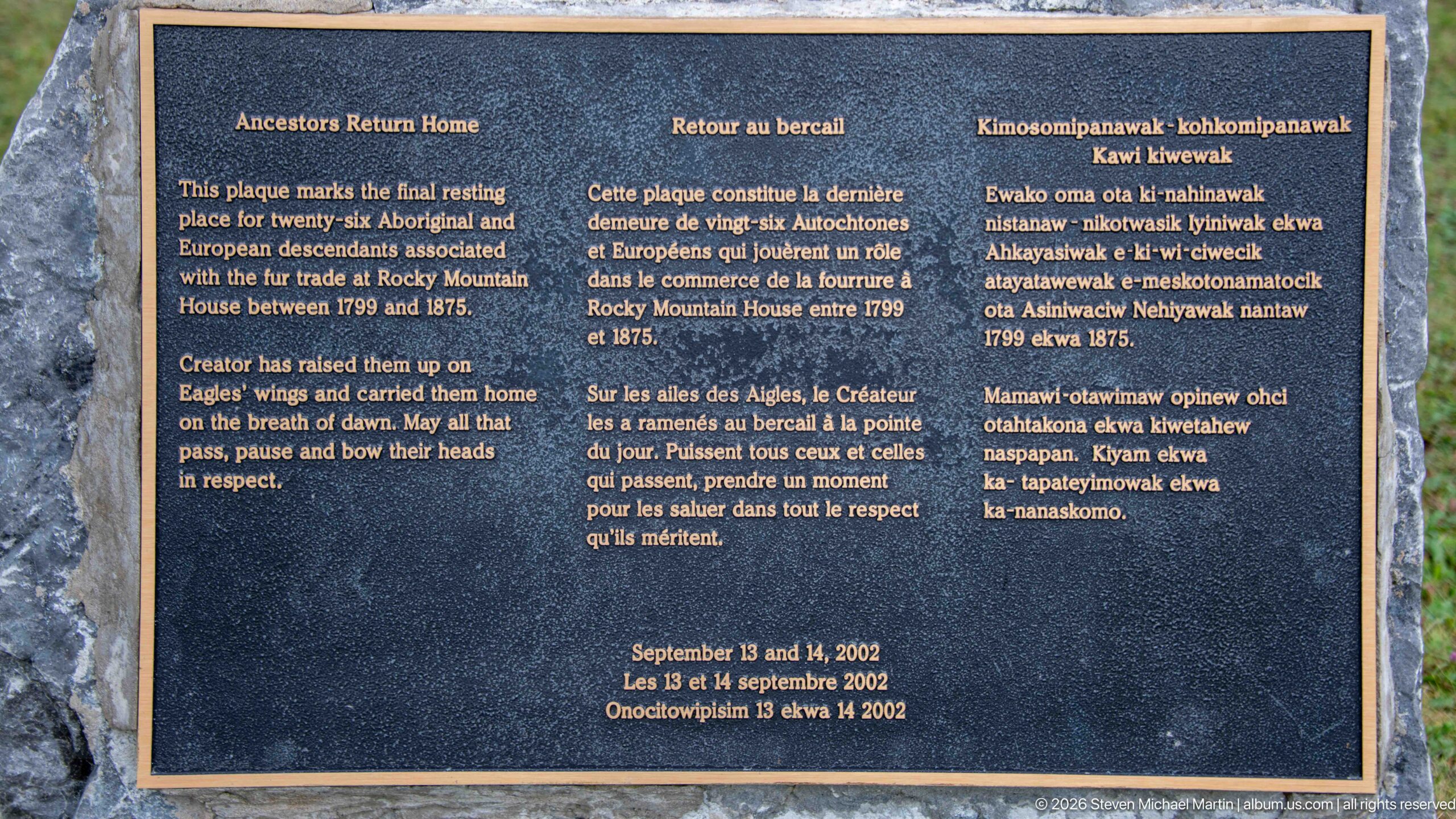
A memorial plaque identifies this area as the final resting place of more than sixty Aboriginal and European descendants associated with the fur trade at Rocky Mountain House between 1799 and 1875. Presented in English, French, and an Indigenous language, the inscription asks visitors to treat the burial ground with respect and records the site's continuing commemorative significance.
Caption
A memorial plaque identifies this area as the final resting place of more than sixty Aboriginal and European descendants associated with the fur trade at Rocky Mountain House between 1799 and 1875. Presented in English, French, and an Indigenous language, the inscription asks visitors to treat the burial ground with respect and records the site's continuing commemorative significance.
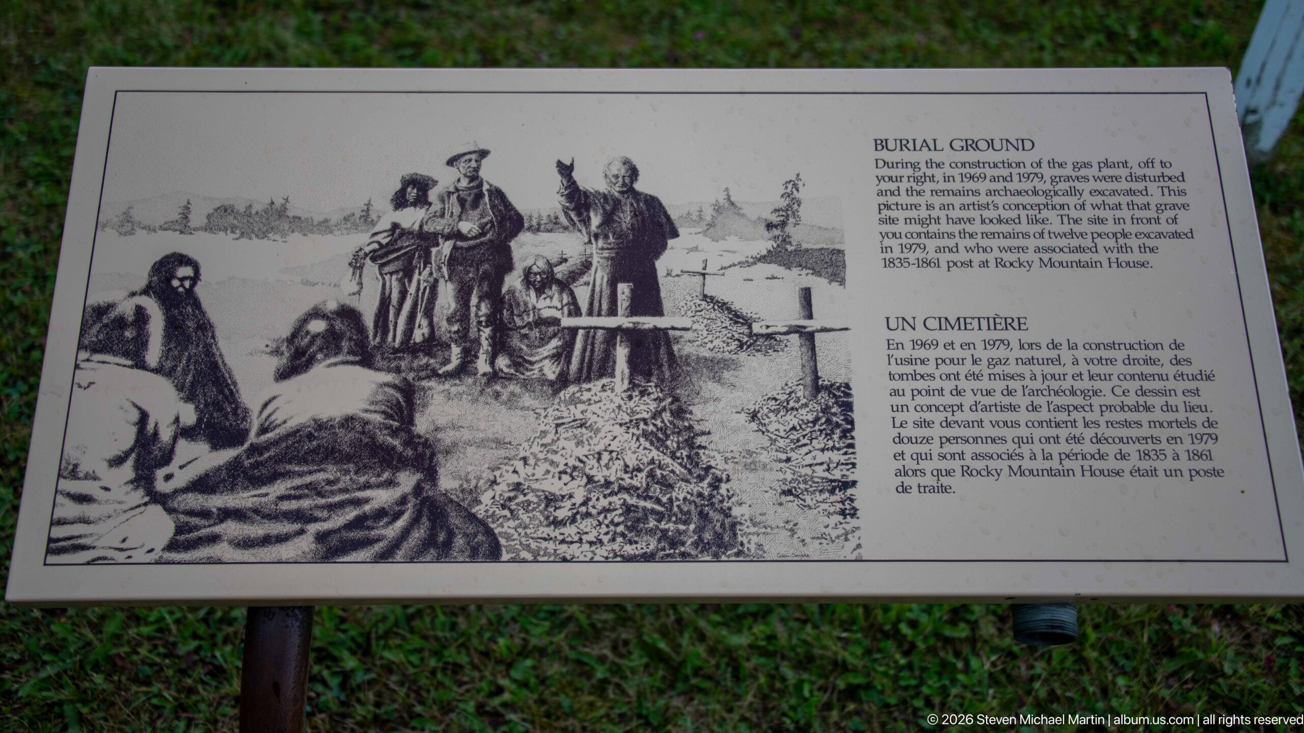
An outdoor panel titled 'Burial Ground' pairs a historical burial illustration with bilingual text explaining the cemetery at Rocky Mountain House. Positioned beside the graves, the sign provides documentary context for the otherwise spare field of white markers. Its combination of archival-style imagery and concise interpretation helps connect the present memorial landscape with the people who lived and died around the trading posts.
Caption
An outdoor panel titled 'Burial Ground' pairs a historical burial illustration with bilingual text explaining the cemetery at Rocky Mountain House. Positioned beside the graves, the sign provides documentary context for the otherwise spare field of white markers. Its combination of archival-style imagery and concise interpretation helps connect the present memorial landscape with the people who lived and died around the trading posts.
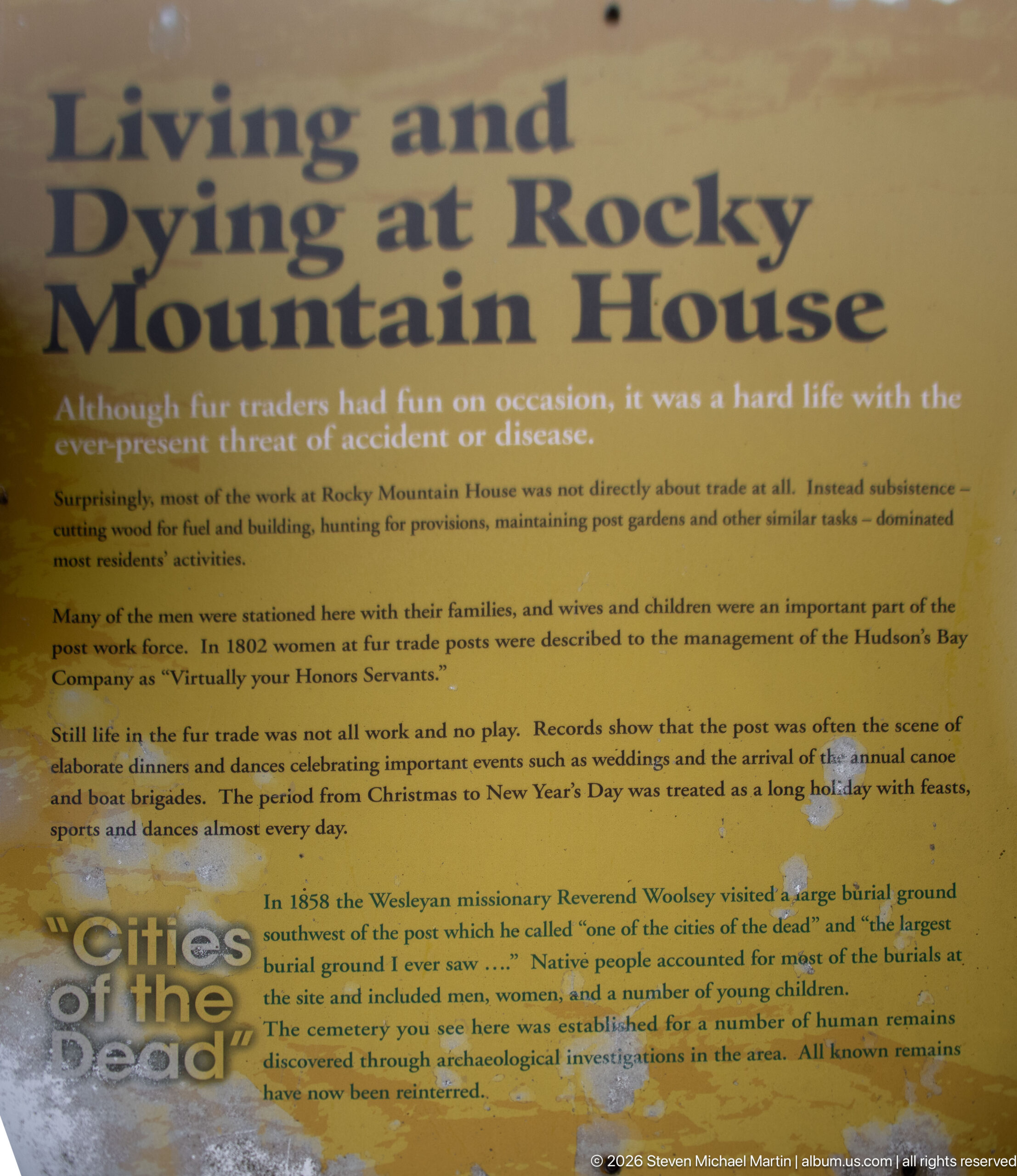
A weathered interpretive panel examines everyday life and mortality at Rocky Mountain House, noting illness, domestic routines, celebrations, and the nearby burial ground. Large headings and dense text make the human consequences of remote post life central to the display. Surface wear and staining also reveal the panel's long exposure within the outdoor interpretive landscape.
Caption
A weathered interpretive panel examines everyday life and mortality at Rocky Mountain House, noting illness, domestic routines, celebrations, and the nearby burial ground. Large headings and dense text make the human consequences of remote post life central to the display. Surface wear and staining also reveal the panel's long exposure within the outdoor interpretive landscape.
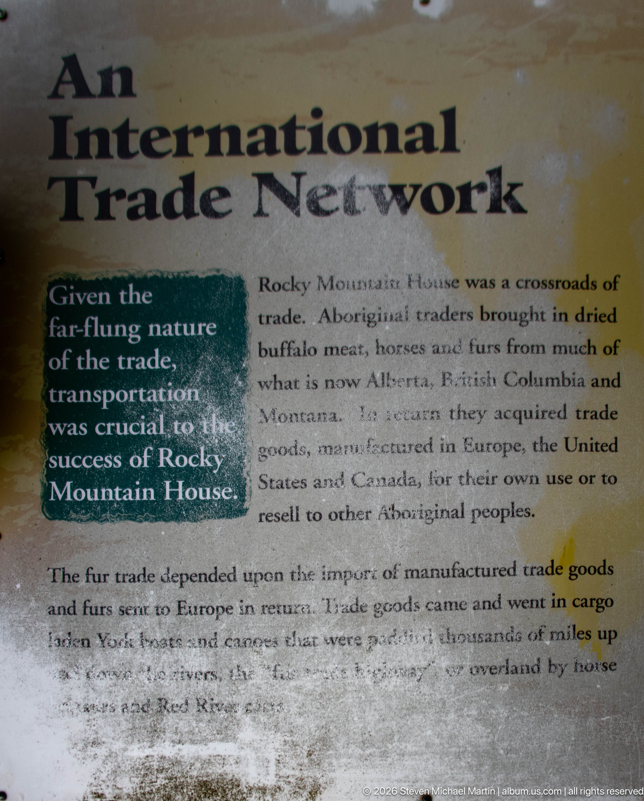
The 'International Trade Network' panel places Rocky Mountain House within exchange systems extending far beyond the immediate region. Its text describes Aboriginal traders bringing local products while manufactured goods arrived through networks reaching Europe, the United States, and Canada. The weathered outdoor display emphasizes that the post functioned as a commercial crossroads connected simultaneously to Indigenous trading systems and international supply chains.
Caption
The 'International Trade Network' panel places Rocky Mountain House within exchange systems extending far beyond the immediate region. Its text describes Aboriginal traders bringing local products while manufactured goods arrived through networks reaching Europe, the United States, and Canada. The weathered outdoor display emphasizes that the post functioned as a commercial crossroads connected simultaneously to Indigenous trading systems and international supply chains.
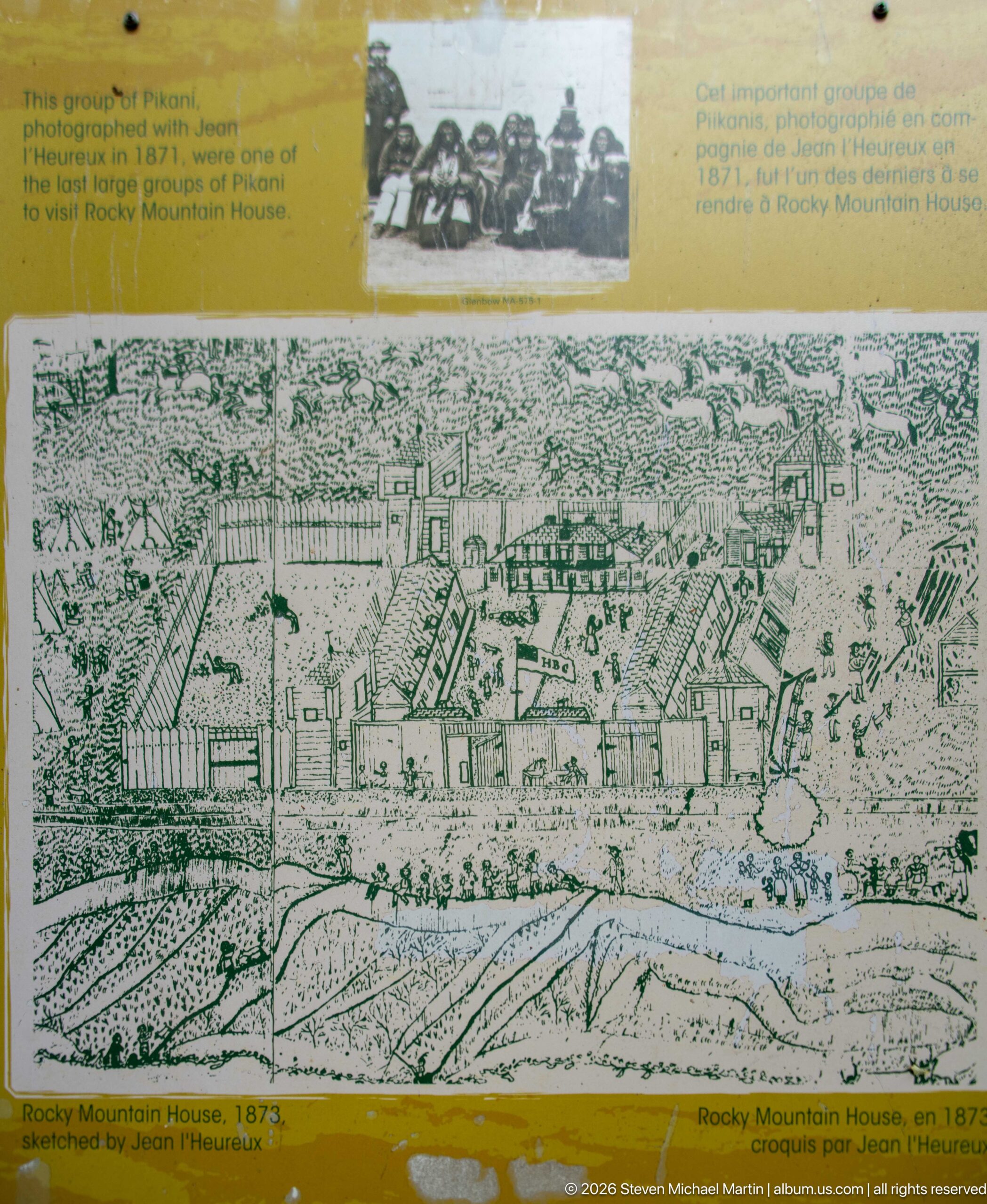
A reproduced drawing labeled Rocky Mountain House in 1875 presents a dense complex of palisades, cabins, yards, and larger post buildings. Seen from an elevated viewpoint, the illustration clarifies how the trading establishment was organized as a working compound rather than a single structure. A small archival group photograph above the drawing adds another documentary layer to the weathered interpretive panel.
Caption
A reproduced drawing labeled Rocky Mountain House in 1875 presents a dense complex of palisades, cabins, yards, and larger post buildings. Seen from an elevated viewpoint, the illustration clarifies how the trading establishment was organized as a working compound rather than a single structure. A small archival group photograph above the drawing adds another documentary layer to the weathered interpretive panel.
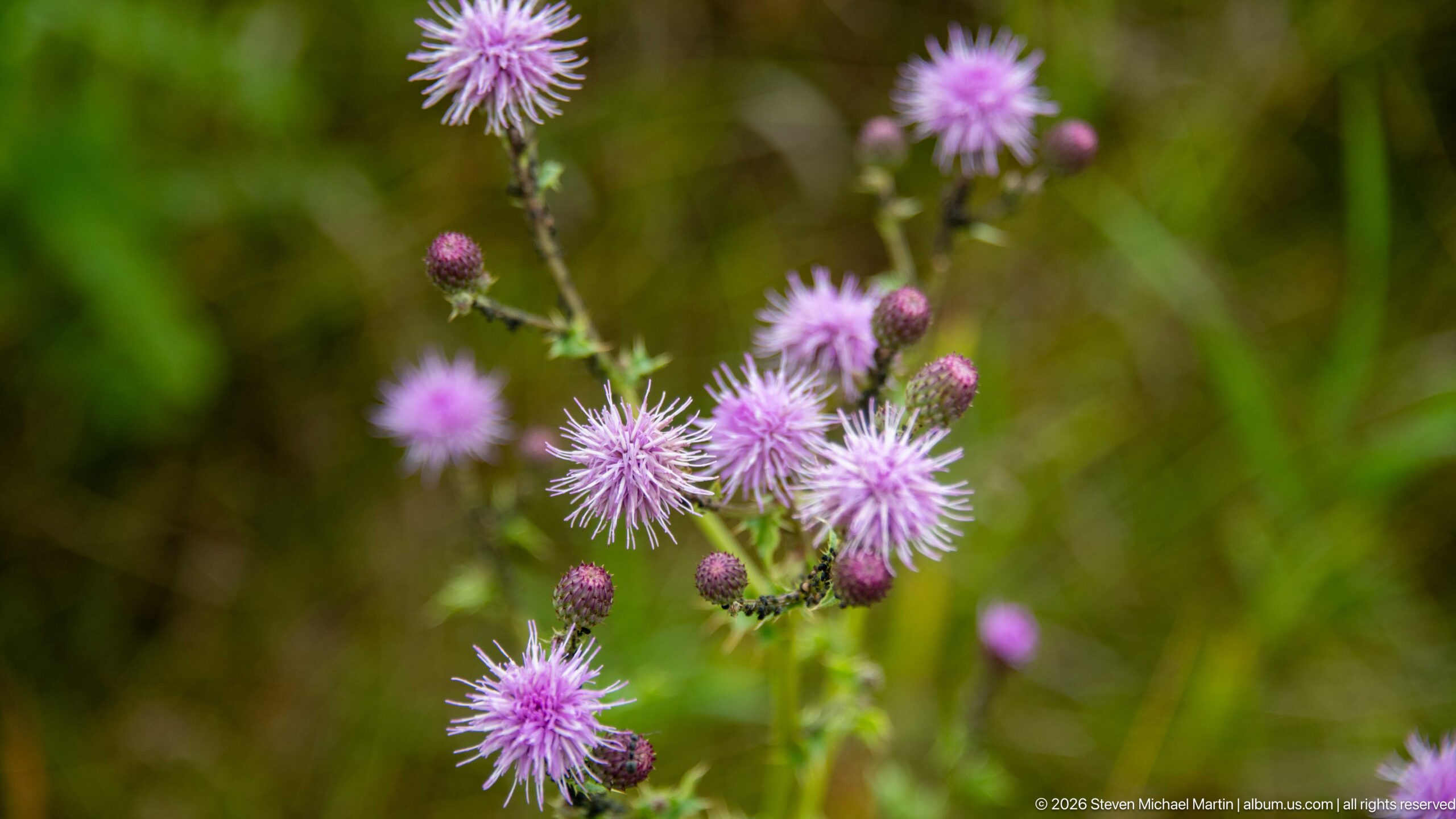
Purple thistle-like flower heads rise from green meadow vegetation, their fine radiating florets sharply separated from the softly blurred background. Several unopened buds and flowers at different stages surround the central cluster, recording the late-season plant life growing within the historic site's broader grassland landscape rather than one of its built or archaeological features.
Caption
Purple thistle-like flower heads rise from green meadow vegetation, their fine radiating florets sharply separated from the softly blurred background. Several unopened buds and flowers at different stages surround the central cluster, recording the late-season plant life growing within the historic site's broader grassland landscape rather than one of its built or archaeological features.
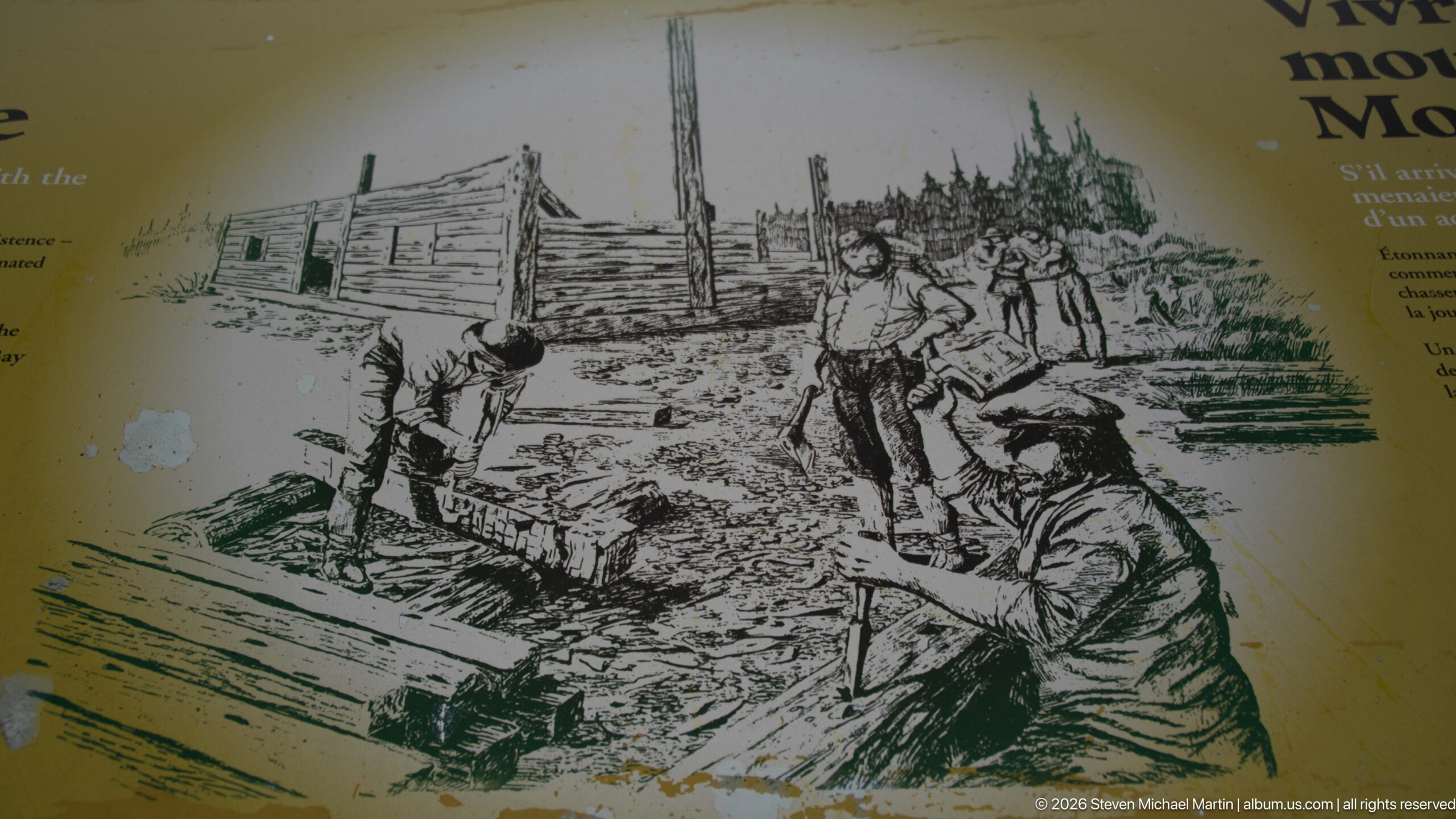
A black-and-white historical illustration shows several men working with heavy timber beside a rough log building, emphasizing the physical labor required to construct and maintain a remote post. Tools, stacked logs, and the unfinished structure dominate the scene. Reproduced on an outdoor panel, the drawing provides a visual counterpart to written interpretation of daily work at Rocky Mountain House.
Caption
A black-and-white historical illustration shows several men working with heavy timber beside a rough log building, emphasizing the physical labor required to construct and maintain a remote post. Tools, stacked logs, and the unfinished structure dominate the scene. Reproduced on an outdoor panel, the drawing provides a visual counterpart to written interpretation of daily work at Rocky Mountain House.
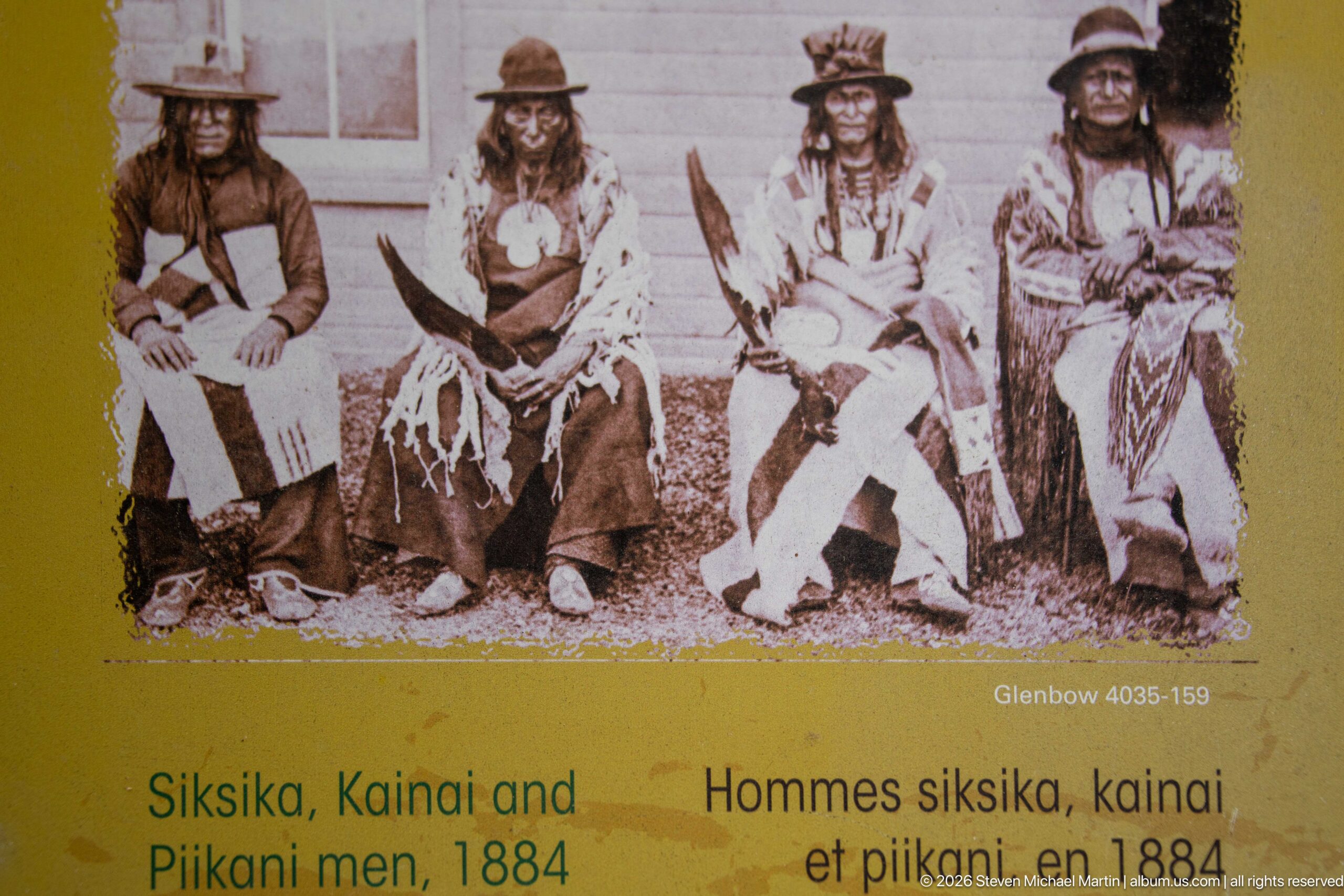
A reproduced archival photograph presents four seated Siksika, Kainai and Piikani men in 1884, as identified by the exhibit caption beneath the portrait. Their clothing, hats, and personal adornment are clearly visible against a plain backdrop. The panel foregrounds Indigenous people as historical actors within the regional story rather than treating the fur trade solely through company posts and European personnel.
Caption
A reproduced archival photograph presents four seated Siksika, Kainai and Piikani men in 1884, as identified by the exhibit caption beneath the portrait. Their clothing, hats, and personal adornment are clearly visible against a plain backdrop. The panel foregrounds Indigenous people as historical actors within the regional story rather than treating the fur trade solely through company posts and European personnel.
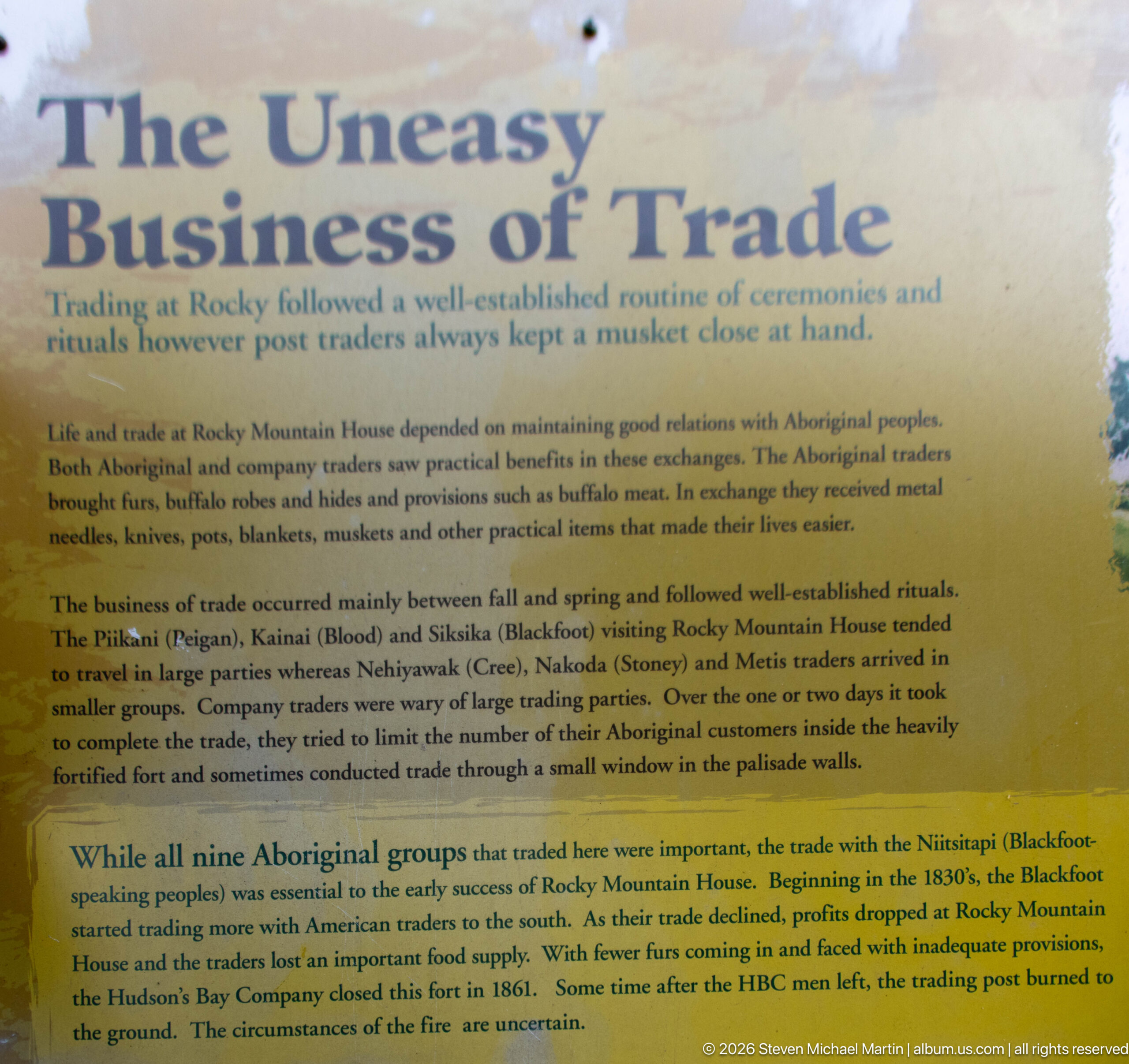
The 'Uneasy Business of Trade' panel describes commerce at Rocky Mountain House as a negotiated relationship governed by ceremony, protocol, and changing alliances rather than a simple exchange of goods. Its text emphasizes the importance of Indigenous trading partners and the routines that structured visits to the posts. Weathering across the panel surface reinforces its role as part of the site's outdoor interpretive trail.
Caption
The 'Uneasy Business of Trade' panel describes commerce at Rocky Mountain House as a negotiated relationship governed by ceremony, protocol, and changing alliances rather than a simple exchange of goods. Its text emphasizes the importance of Indigenous trading partners and the routines that structured visits to the posts. Weathering across the panel surface reinforces its role as part of the site's outdoor interpretive trail.
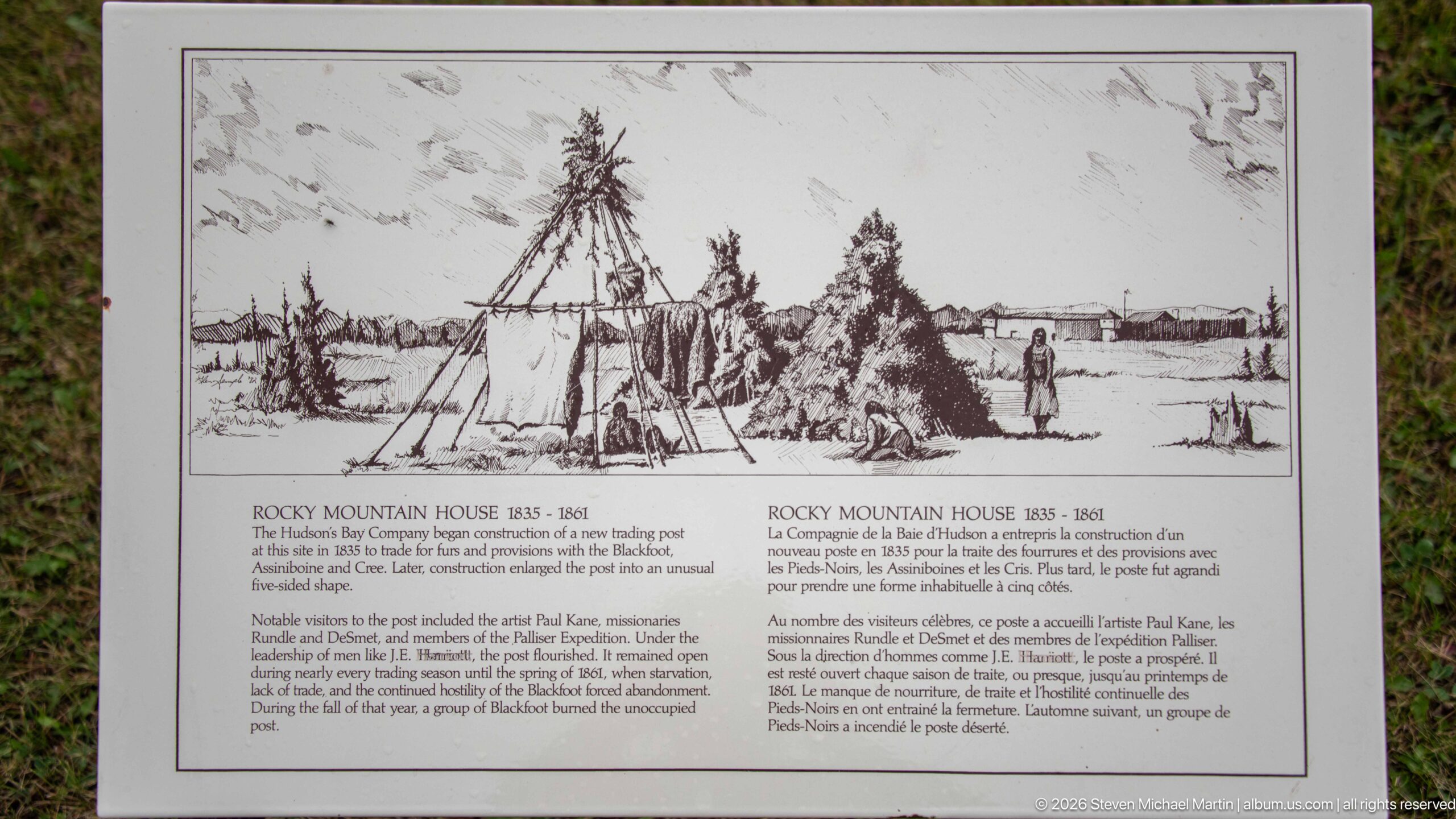
A bilingual interpretive panel reproduces a nineteenth-century view of Rocky Mountain House, with tipis, figures, fencing, and low post buildings distributed across the river landscape. The caption dates the scene to 1835–1861 and discusses construction and artistic interpretation. The drawing helps visitors imagine the spatial relationship between Indigenous encampments and the fur-trade establishment.
Caption
A bilingual interpretive panel reproduces a nineteenth-century view of Rocky Mountain House, with tipis, figures, fencing, and low post buildings distributed across the river landscape. The caption dates the scene to 1835–1861 and discusses construction and artistic interpretation. The drawing helps visitors imagine the spatial relationship between Indigenous encampments and the fur-trade establishment.
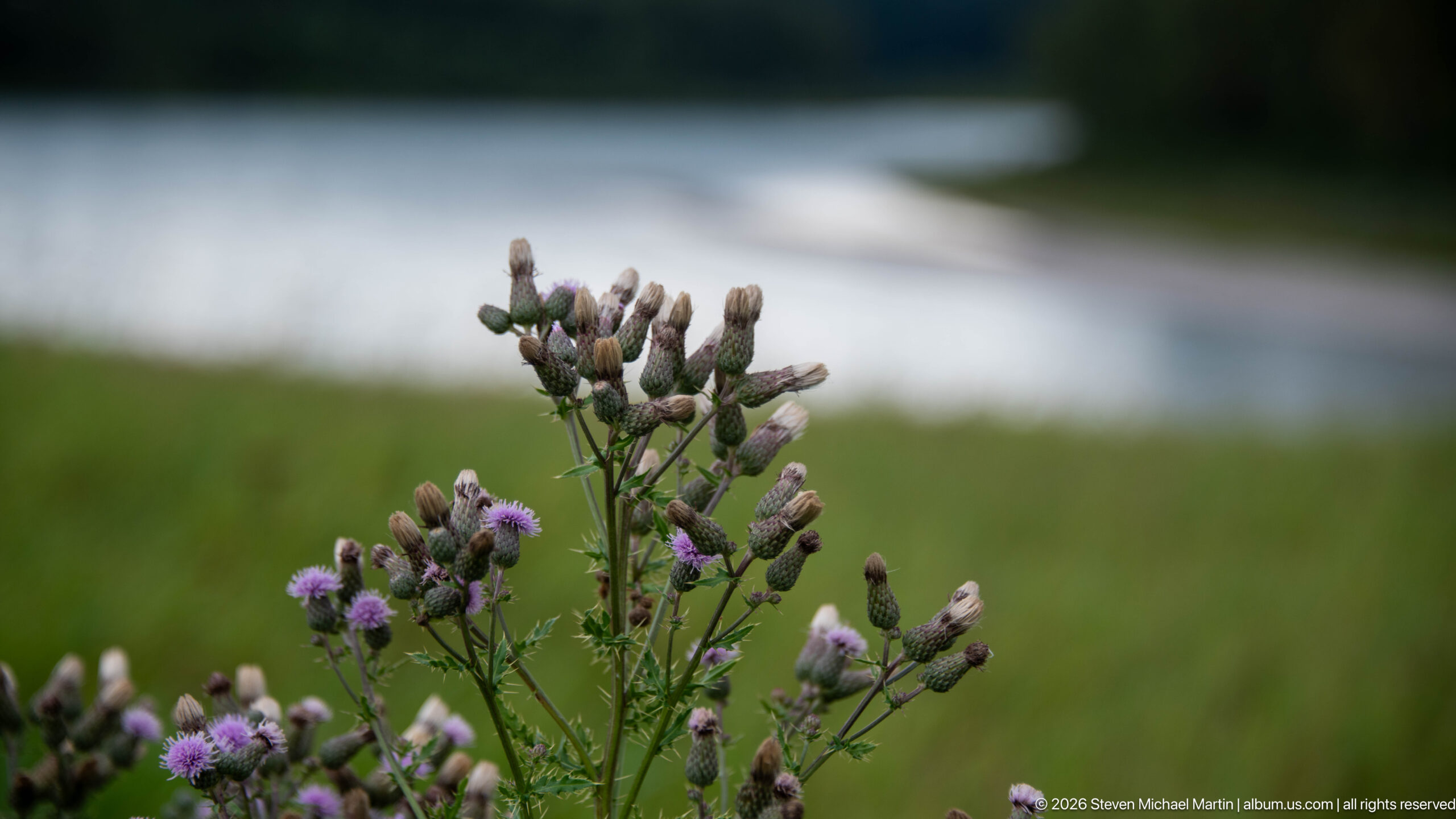
Thistle-like purple flowers and pale developing seed heads stand sharply against a softly blurred band of water and meadow. The shallow depth of field separates the branching plant from the riverine setting, creating a botanical detail within a portfolio otherwise dominated by interpretation and historic structures. The water in the background locates the vegetation within the site's broader riparian landscape.
Caption
Thistle-like purple flowers and pale developing seed heads stand sharply against a softly blurred band of water and meadow. The shallow depth of field separates the branching plant from the riverine setting, creating a botanical detail within a portfolio otherwise dominated by interpretation and historic structures. The water in the background locates the vegetation within the site's broader riparian landscape.
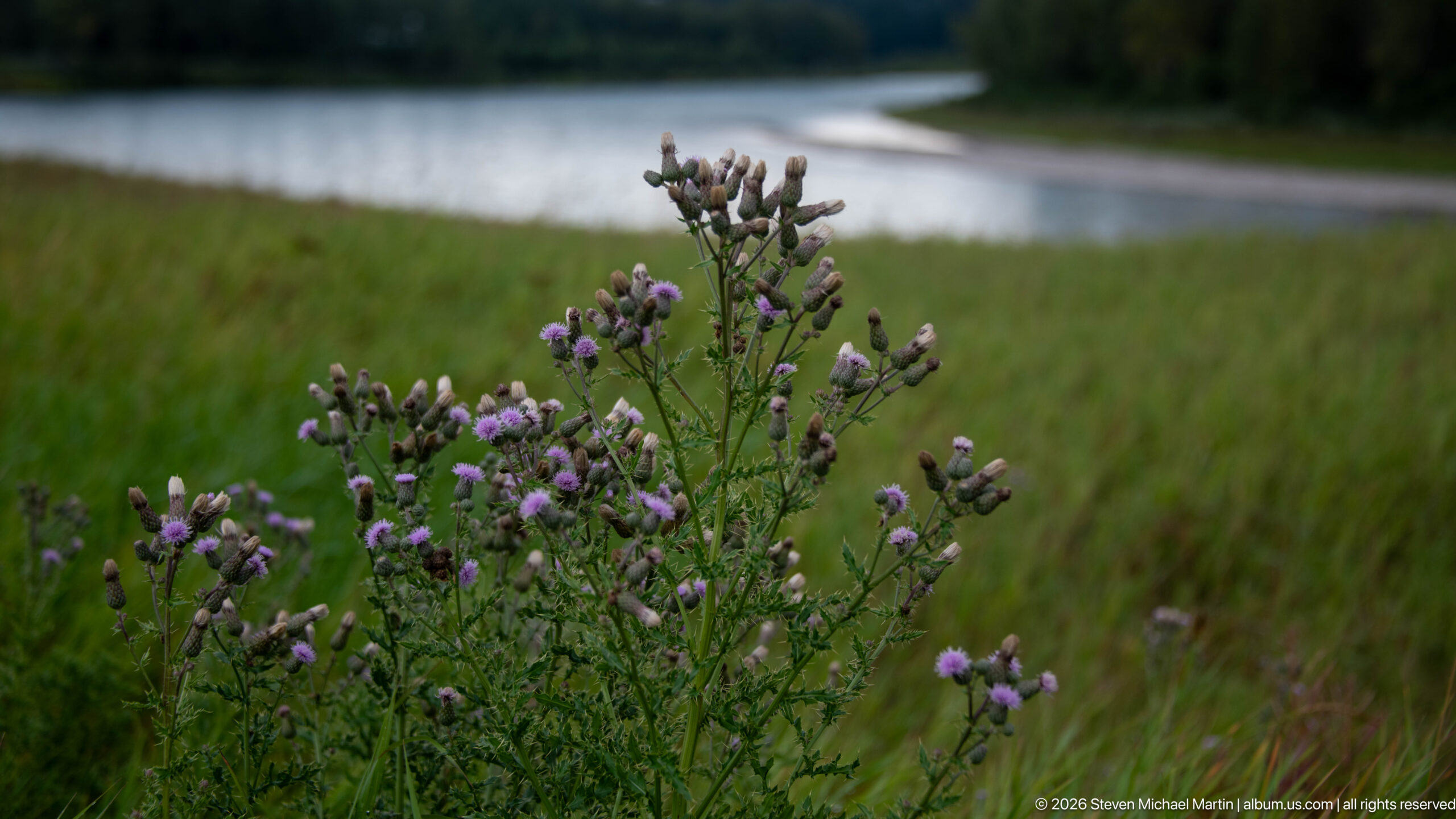
A taller stand of thistle-like plants rises from dense grass beside a calm watercourse, with purple blossoms and numerous pale buds distributed across branching stems. Compared with the tighter neighboring botanical view, this composition shows more of the plant's full form and its relationship to the riverbank habitat, linking seasonal vegetation to the site's North Saskatchewan River setting.
Caption
A taller stand of thistle-like plants rises from dense grass beside a calm watercourse, with purple blossoms and numerous pale buds distributed across branching stems. Compared with the tighter neighboring botanical view, this composition shows more of the plant's full form and its relationship to the riverbank habitat, linking seasonal vegetation to the site's North Saskatchewan River setting.
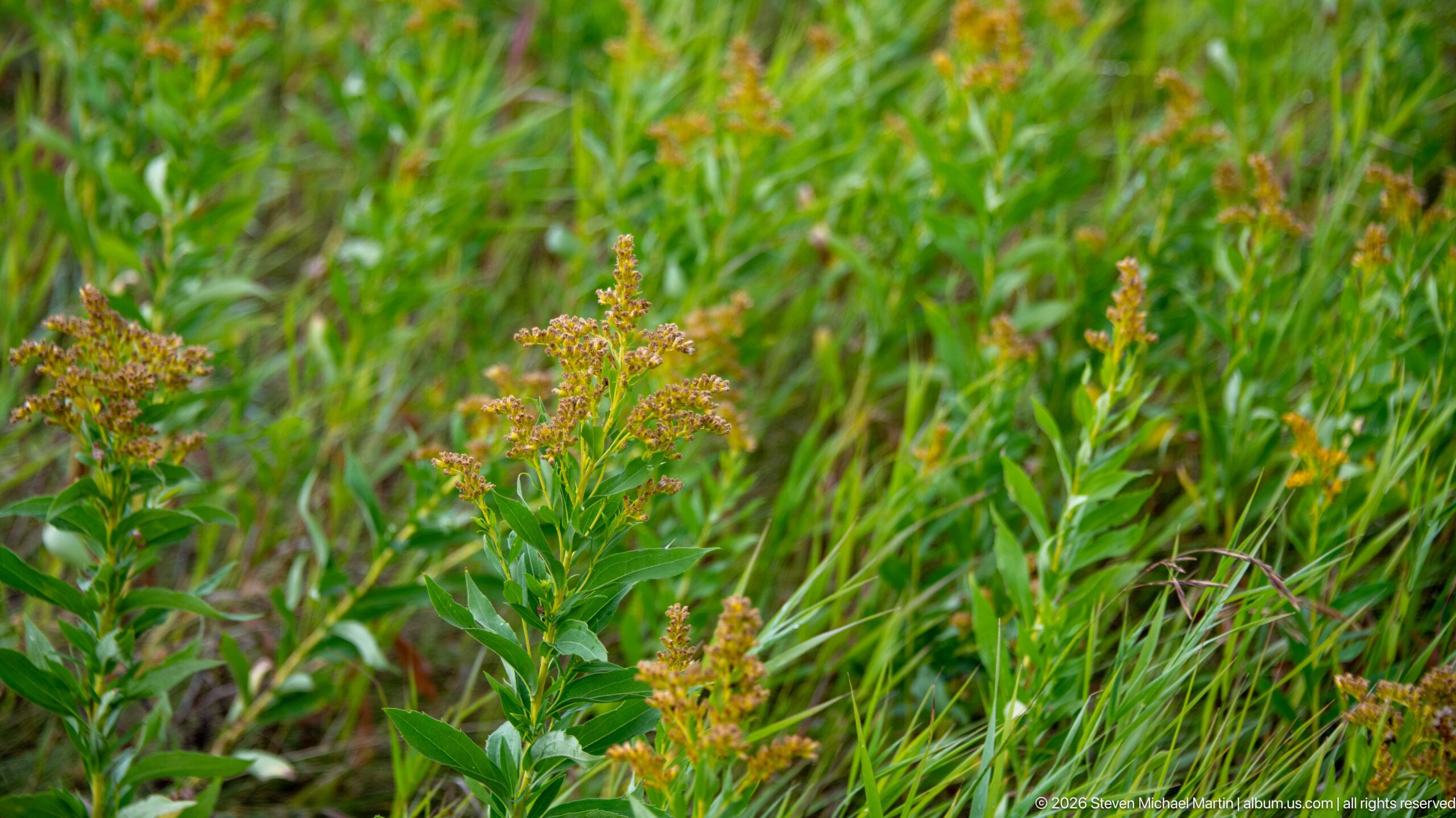
Rust-orange clusters top leafy green stems amid dense late-season vegetation, adding a warmer botanical note to the historic site's meadow landscape. The frame concentrates on overlapping stems and seed or flower heads rather than a single specimen, emphasizing the layered texture of the grassland. Species-level identification is not secure from the proof sheet, so the record remains intentionally descriptive.
Caption
Rust-orange clusters top leafy green stems amid dense late-season vegetation, adding a warmer botanical note to the historic site's meadow landscape. The frame concentrates on overlapping stems and seed or flower heads rather than a single specimen, emphasizing the layered texture of the grassland. Species-level identification is not secure from the proof sheet, so the record remains intentionally descriptive.
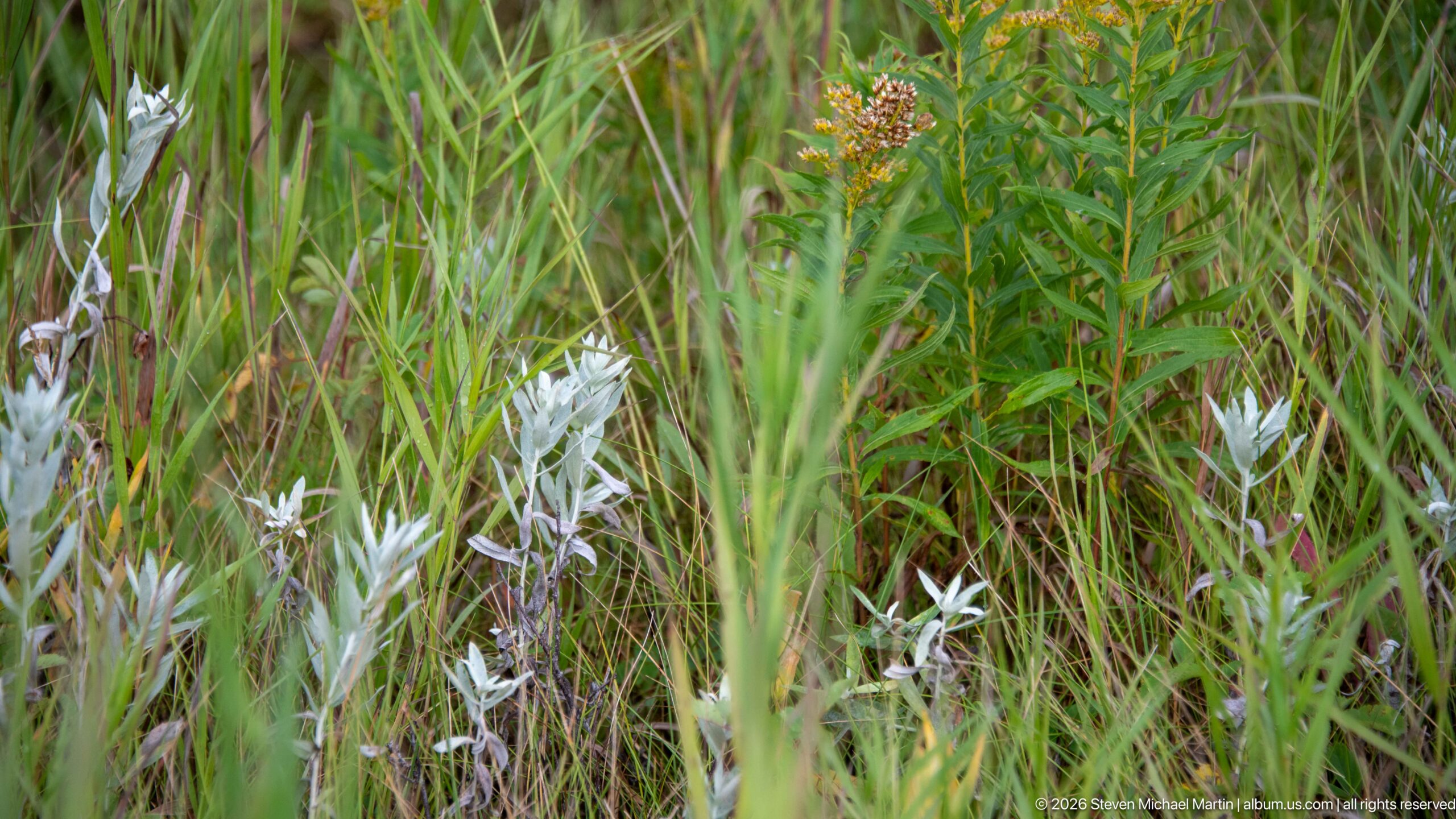
Pale, silvery leaves stand out against tall green grasses and reddish seed heads in a mixed meadow community. The low viewpoint records contrasting foliage color and texture rather than a landmark or exhibit, showing the varied vegetation within the historic site's open grounds. Because the proof sheet does not provide enough diagnostic detail for a confident species identification, the caption avoids a botanical name.
Caption
Pale, silvery leaves stand out against tall green grasses and reddish seed heads in a mixed meadow community. The low viewpoint records contrasting foliage color and texture rather than a landmark or exhibit, showing the varied vegetation within the historic site's open grounds. Because the proof sheet does not provide enough diagnostic detail for a confident species identification, the caption avoids a botanical name.
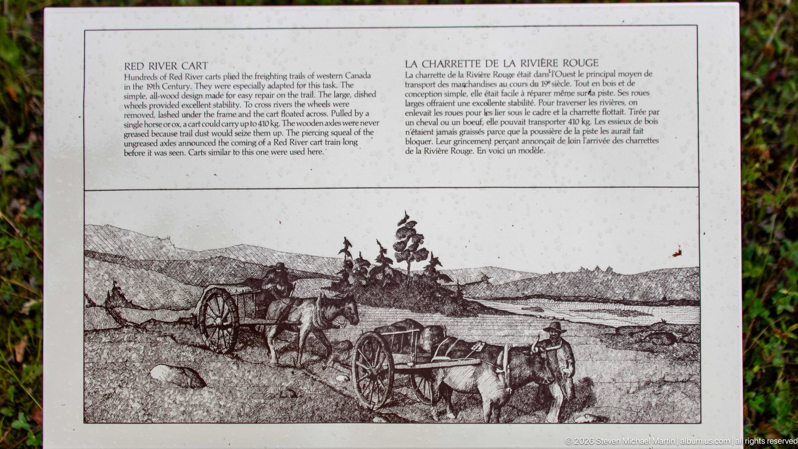
A bilingual outdoor panel illustrates horse-drawn Red River carts crossing open country, a transportation technology crucial to moving bulky freight overland where waterways did not provide direct access. The large historical drawing shows multiple two-wheeled carts in procession beneath a broad prairie horizon. Text above the scene explains the vehicle's role within the trade and transportation networks interpreted at Rocky Mountain House.
Caption
A bilingual outdoor panel illustrates horse-drawn Red River carts crossing open country, a transportation technology crucial to moving bulky freight overland where waterways did not provide direct access. The large historical drawing shows multiple two-wheeled carts in procession beneath a broad prairie horizon. Text above the scene explains the vehicle's role within the trade and transportation networks interpreted at Rocky Mountain House.
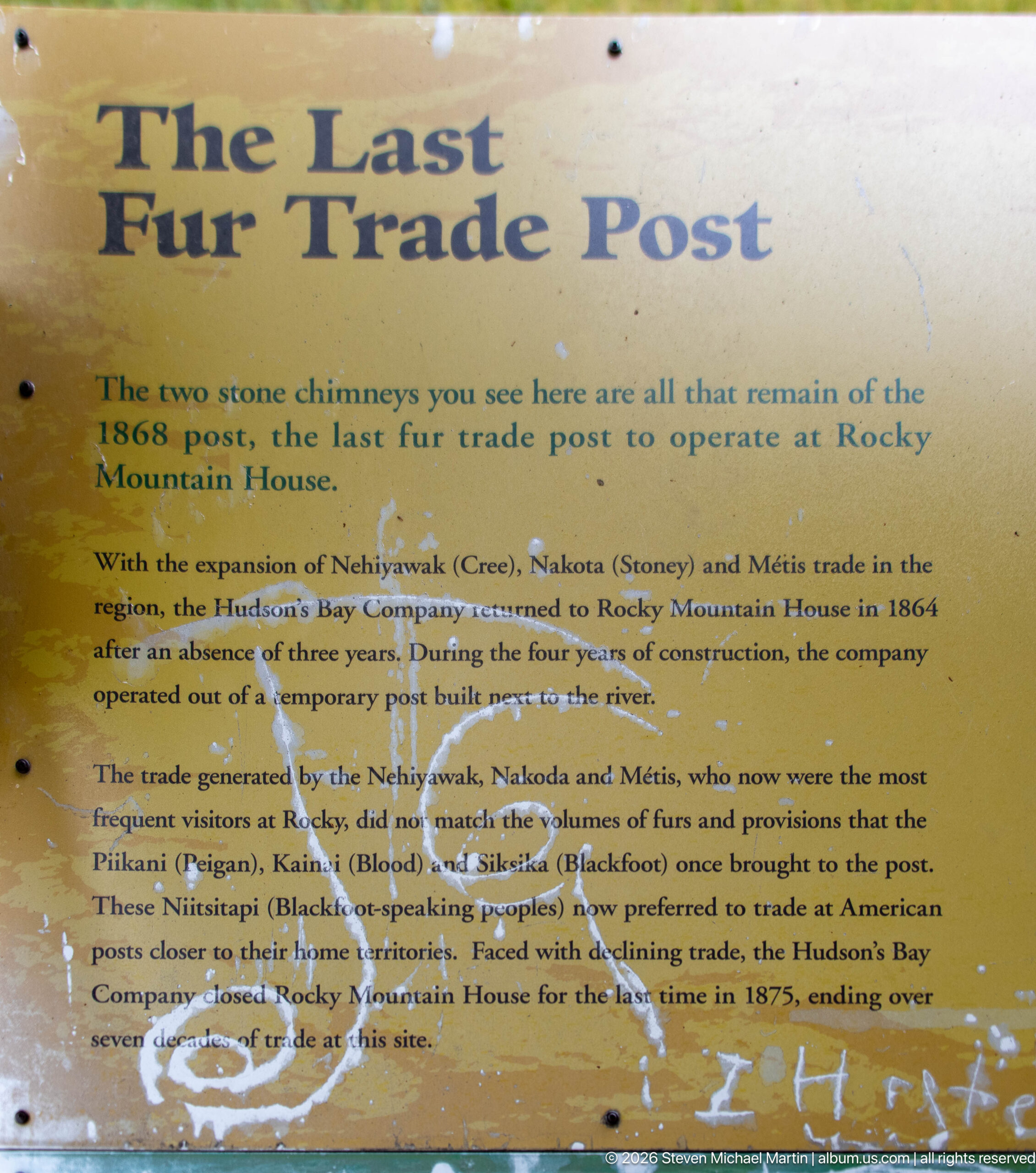
The 'Last Fur Trade Post' panel explains that two stone chimneys survive from the 1868 post, the final fur-trade establishment operated at Rocky Mountain House. Its text recounts the post's role amid changing trade patterns and relationships with Indigenous communities before closure in 1875. Weathering, lichen, and staining across the sign make the outdoor panel itself part of the site's long-used interpretive landscape.
Caption
The 'Last Fur Trade Post' panel explains that two stone chimneys survive from the 1868 post, the final fur-trade establishment operated at Rocky Mountain House. Its text recounts the post's role amid changing trade patterns and relationships with Indigenous communities before closure in 1875. Weathering, lichen, and staining across the sign make the outdoor panel itself part of the site's long-used interpretive landscape.
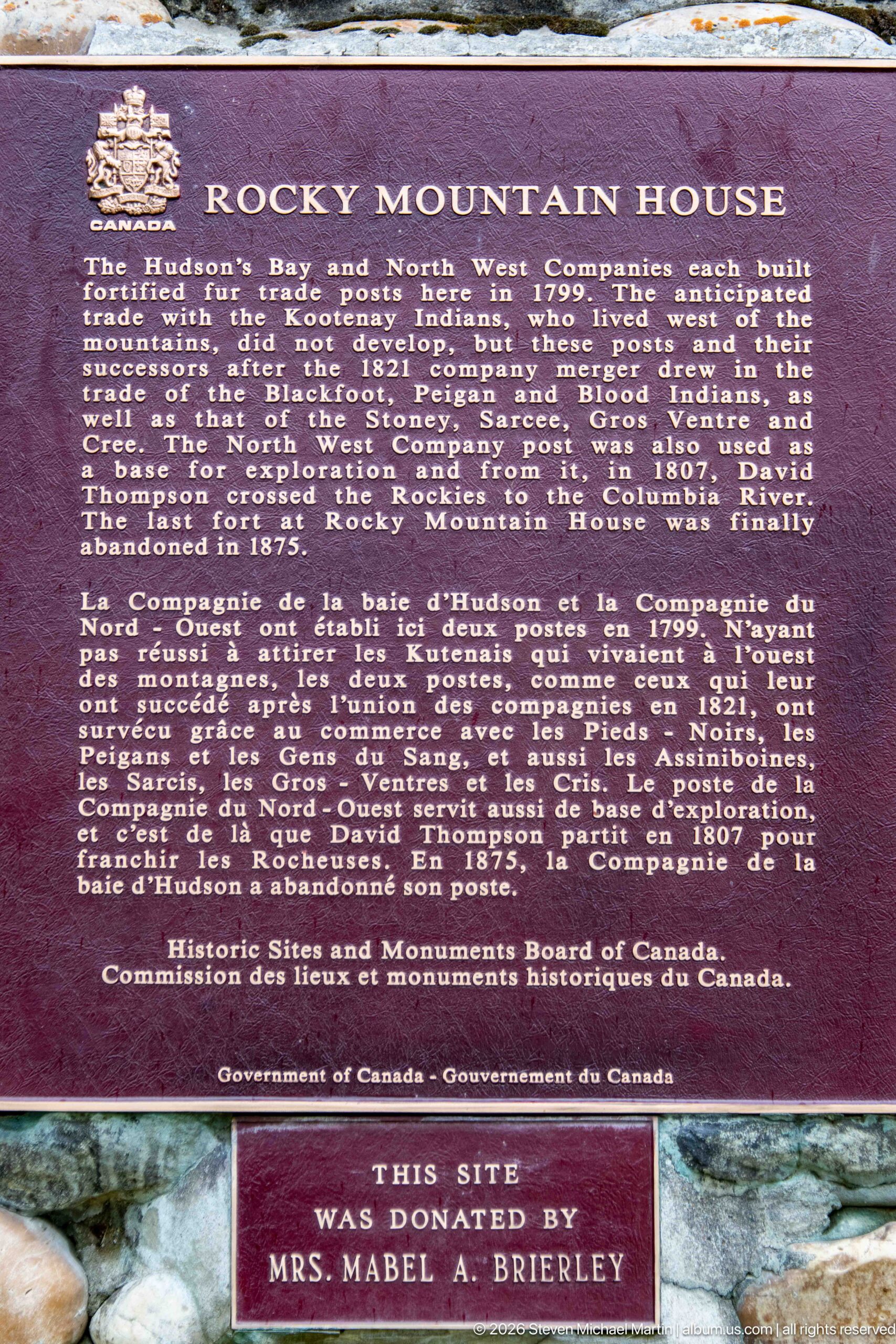
A Historic Sites and Monuments Board of Canada plaque summarizes the national significance of Rocky Mountain House, describing competing North West Company and Hudson’s Bay Company posts, exploration toward the Rockies, and the later history of the site. A smaller plaque below records that the site was donated by Mrs. Mabel A. Brierley, adding a layer of preservation history to the memorial.
Caption
A Historic Sites and Monuments Board of Canada plaque summarizes the national significance of Rocky Mountain House, describing competing North West Company and Hudson’s Bay Company posts, exploration toward the Rockies, and the later history of the site. A smaller plaque below records that the site was donated by Mrs. Mabel A. Brierley, adding a layer of preservation history to the memorial.
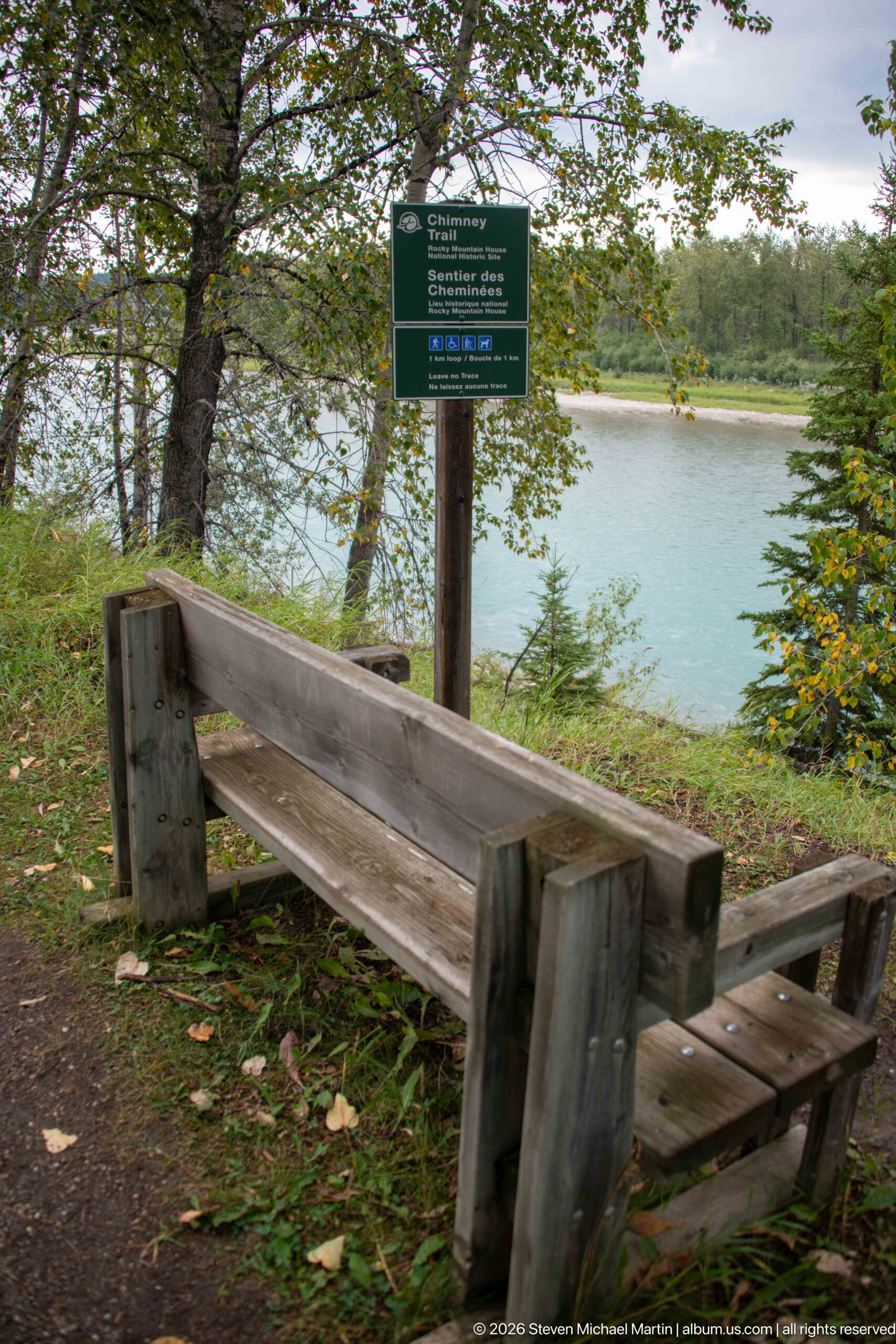
A heavy wooden bench faces the North Saskatchewan River from a shaded overlook, with a green bilingual sign mounted just beyond it. Framed by leafy branches and conifers, the turquoise-blue water fills the middle distance. The quiet viewpoint gives visitors a direct visual connection to the river corridor that shaped transportation and settlement at Rocky Mountain House.
Caption
A heavy wooden bench faces the North Saskatchewan River from a shaded overlook, with a green bilingual sign mounted just beyond it. Framed by leafy branches and conifers, the turquoise-blue water fills the middle distance. The quiet viewpoint gives visitors a direct visual connection to the river corridor that shaped transportation and settlement at Rocky Mountain House.
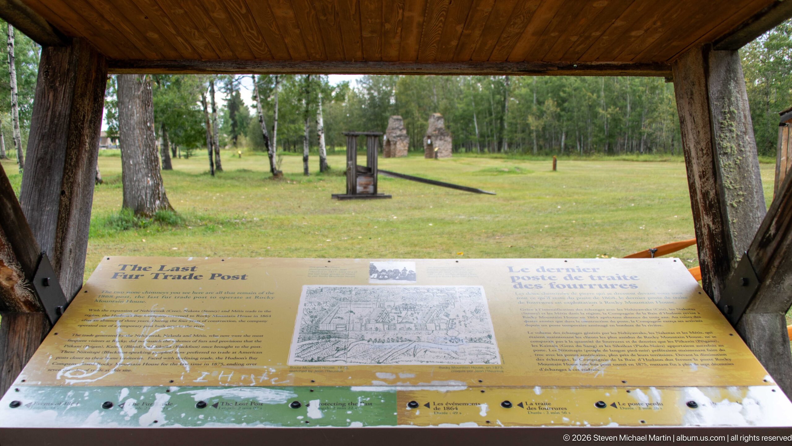
A timber shelter protects an interpretive station devoted to the last fur-trade post, with text, maps, and historical illustrations arranged across the sloping panel. Beyond the exhibit, the open grounds and distant stone features connect the documentary material directly to the archaeological landscape it explains. The composition shows how interpretation is integrated into the site rather than confined to the visitor centre.
Caption
A timber shelter protects an interpretive station devoted to the last fur-trade post, with text, maps, and historical illustrations arranged across the sloping panel. Beyond the exhibit, the open grounds and distant stone features connect the documentary material directly to the archaeological landscape it explains. The composition shows how interpretation is integrated into the site rather than confined to the visitor centre.
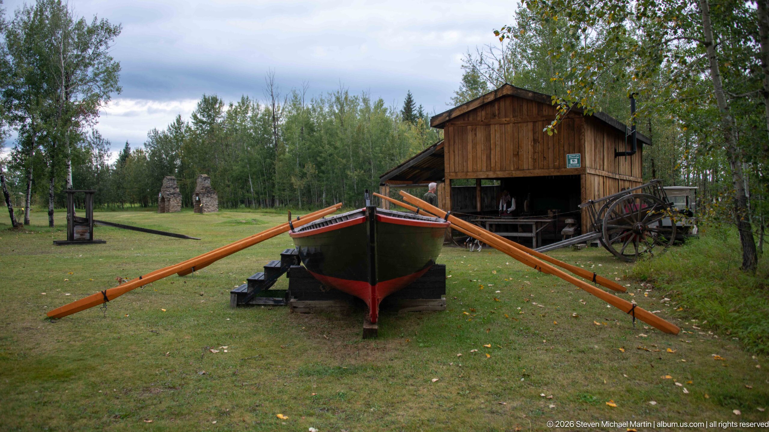
A broad wooden boat rests on supports with exceptionally long oars extended to either side, creating a dramatic foreground to a timber building and wheeled equipment behind it. The outdoor display evokes the transport technologies that connected fur-trade posts by river and overland routes. Its placement among reconstructed or interpretive structures gives visitors a tangible sense of the scale of working watercraft.
Caption
A broad wooden boat rests on supports with exceptionally long oars extended to either side, creating a dramatic foreground to a timber building and wheeled equipment behind it. The outdoor display evokes the transport technologies that connected fur-trade posts by river and overland routes. Its placement among reconstructed or interpretive structures gives visitors a tangible sense of the scale of working watercraft.
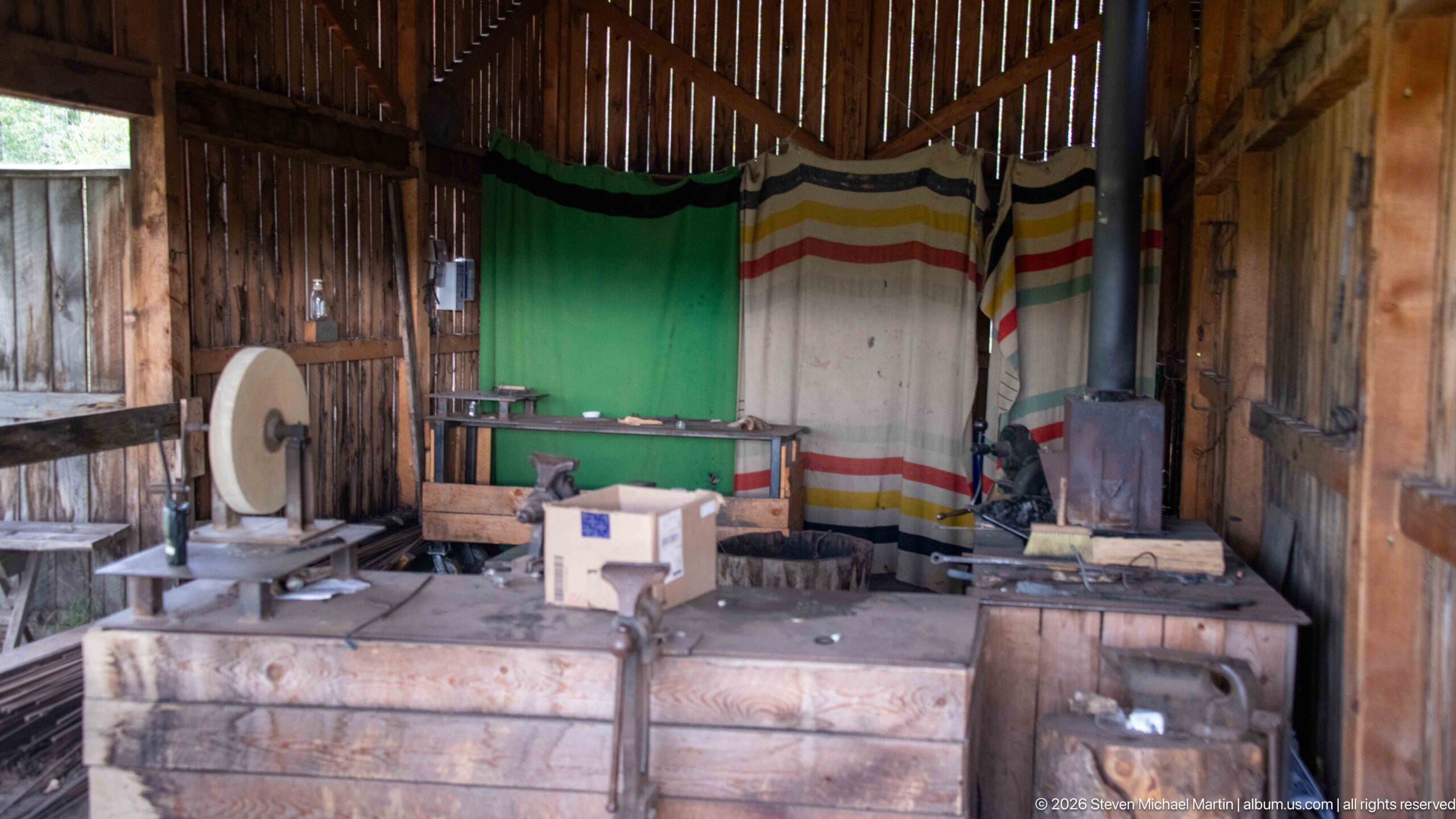
A furnished workshop interior combines a hand-powered grindstone, heavy workbench, small iron stove, wooden boxes, and striped blankets hung across the rear wall. The dense arrangement suggests the practical repair and maintenance work required at an isolated trading post, while the rough plank walls and exposed framing reinforce the utilitarian character of the reconstructed interpretive space.
Caption
A furnished workshop interior combines a hand-powered grindstone, heavy workbench, small iron stove, wooden boxes, and striped blankets hung across the rear wall. The dense arrangement suggests the practical repair and maintenance work required at an isolated trading post, while the rough plank walls and exposed framing reinforce the utilitarian character of the reconstructed interpretive space.
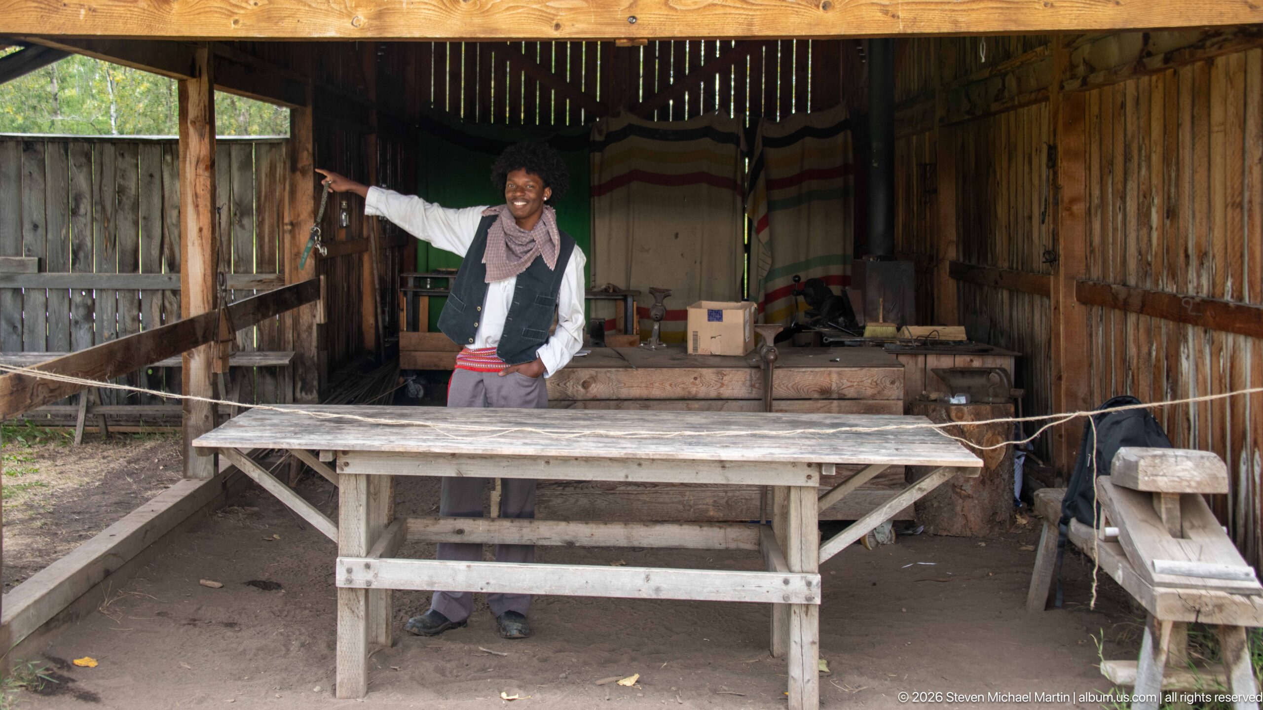
A costumed interpreter stands behind a long wooden worktable inside the furnished workshop, gesturing toward the surrounding equipment as part of the site’s living-history presentation. Barrels, boxes, benches, tools, a stove, and striped blankets fill the timber enclosure, turning the reconstructed workspace into a setting for explaining the labor and material culture of a fur-trade post.
Caption
A costumed interpreter stands behind a long wooden worktable inside the furnished workshop, gesturing toward the surrounding equipment as part of the site’s living-history presentation. Barrels, boxes, benches, tools, a stove, and striped blankets fill the timber enclosure, turning the reconstructed workspace into a setting for explaining the labor and material culture of a fur-trade post.
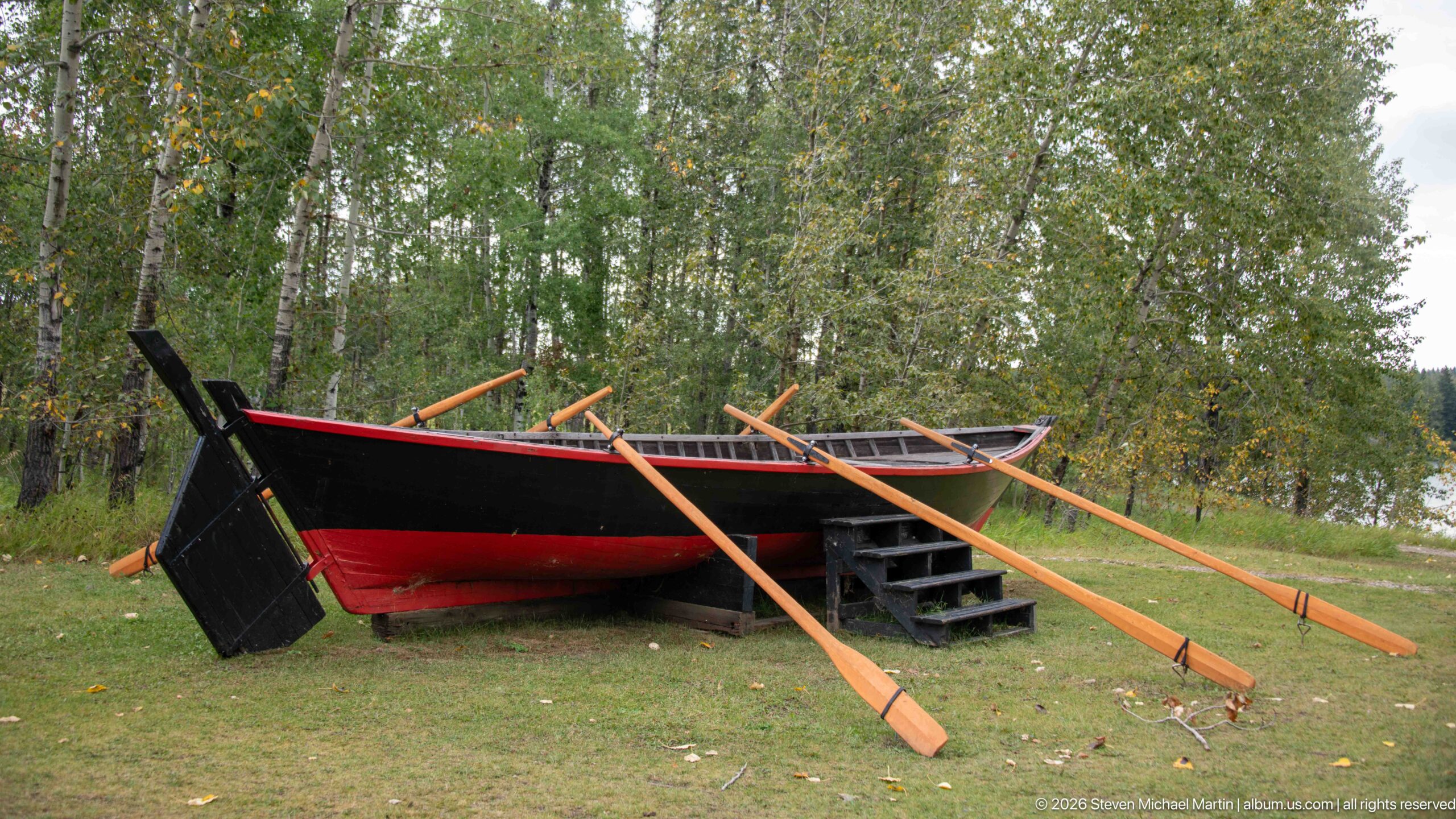
A broad black-and-red wooden boat rests on the grass with multiple long oars laid across its gunwales. The high ends, deep hull, and substantial rowing equipment distinguish it from a light canoe and evoke the larger freight boats used on inland waterways. Displayed at full scale, the vessel emphasizes how much labor and equipment river transportation demanded.
Caption
A broad black-and-red wooden boat rests on the grass with multiple long oars laid across its gunwales. The high ends, deep hull, and substantial rowing equipment distinguish it from a light canoe and evoke the larger freight boats used on inland waterways. Displayed at full scale, the vessel emphasizes how much labor and equipment river transportation demanded.
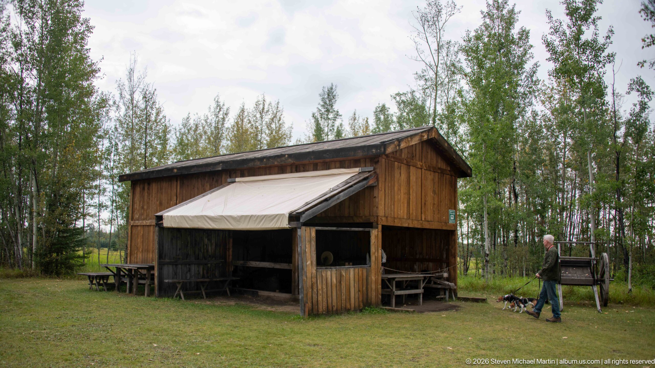
An open-front timber workshop stands on the edge of a grassy clearing, its canvas awning sheltering benches and work surfaces along the façade. A visitor walking nearby gives scale to the modest structure. Set among trees, the building functions as an outdoor interpretive environment where the material routines of a trading post can be demonstrated rather than merely described.
Caption
An open-front timber workshop stands on the edge of a grassy clearing, its canvas awning sheltering benches and work surfaces along the façade. A visitor walking nearby gives scale to the modest structure. Set among trees, the building functions as an outdoor interpretive environment where the material routines of a trading post can be demonstrated rather than merely described.
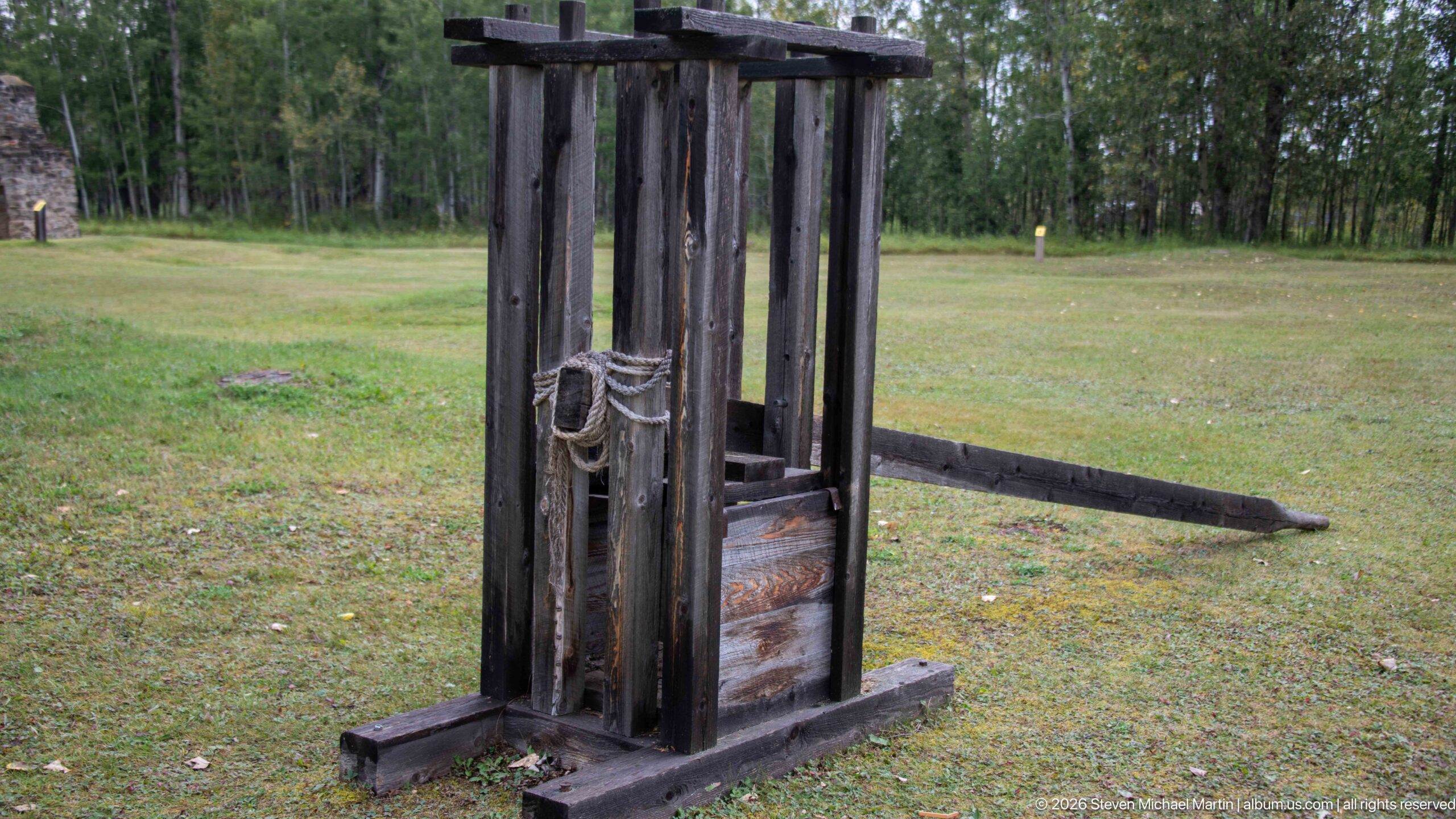
A freestanding timber mechanism rises from the lawn, built from heavy vertical posts, crosspieces, rope, and a lower wooden element that appears designed to move or bear force. Its exposed construction makes the working principle visible, although the proof sheet does not establish the apparatus’s exact historical function. The object is therefore best read as a reconstructed piece of trade-post working equipment.
Caption
A freestanding timber mechanism rises from the lawn, built from heavy vertical posts, crosspieces, rope, and a lower wooden element that appears designed to move or bear force. Its exposed construction makes the working principle visible, although the proof sheet does not establish the apparatus’s exact historical function. The object is therefore best read as a reconstructed piece of trade-post working equipment.
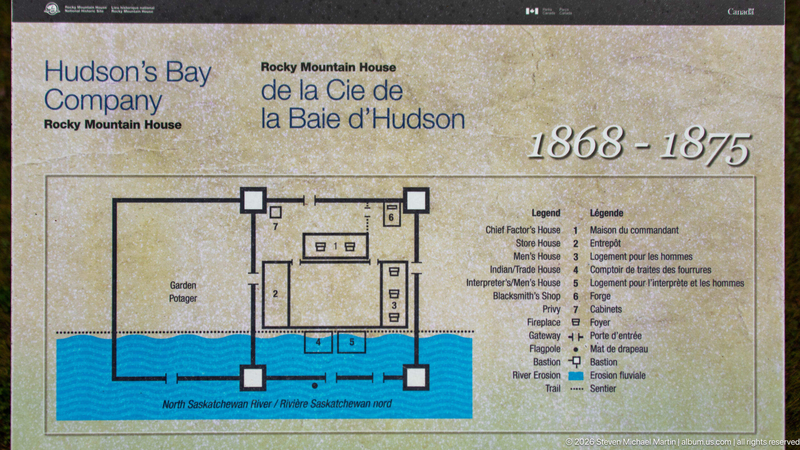
A bilingual site plan maps the Hudson’s Bay Company Rocky Mountain House post from 1868 to 1875 beside the North Saskatchewan River. Numbered outlines identify the chief factor’s house, store house, men’s quarters, blacksmith shop, cabins, gateway, flagpole, bastion, and other features, translating the vanished compound into a readable spatial arrangement.
Caption
A bilingual site plan maps the Hudson’s Bay Company Rocky Mountain House post from 1868 to 1875 beside the North Saskatchewan River. Numbered outlines identify the chief factor’s house, store house, men’s quarters, blacksmith shop, cabins, gateway, flagpole, bastion, and other features, translating the vanished compound into a readable spatial arrangement.
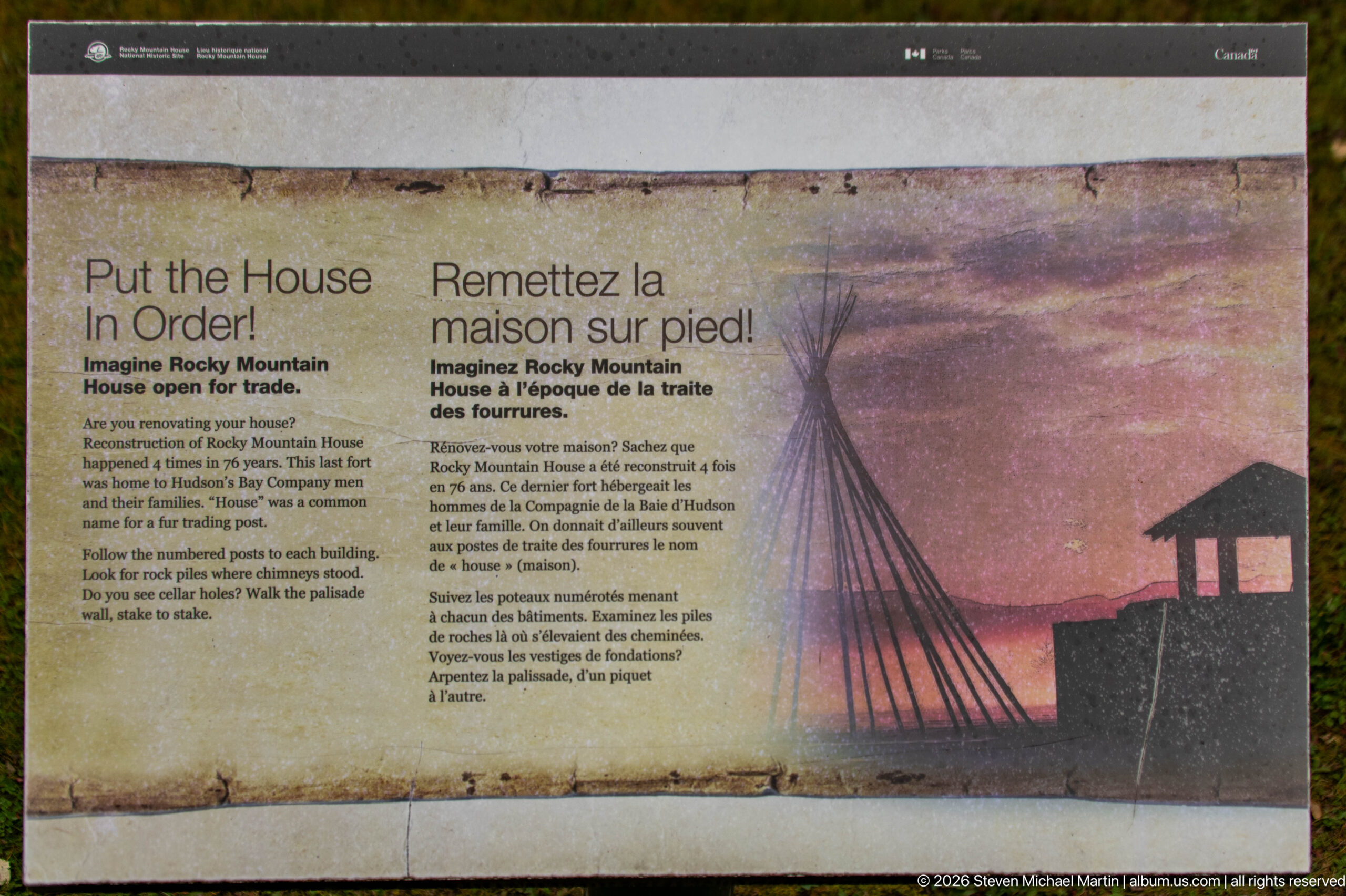
“Put the House in Order!” turns the post plan into an interactive exercise, asking visitors to imagine Rocky Mountain House open for trade and arrange building elements within the fort. A stylized tipi and post silhouette accompany the bilingual instructions. The activity encourages visitors to think spatially about how a working fur-trade establishment was organized rather than treating its buildings as isolated features.
Caption
“Put the House in Order!” turns the post plan into an interactive exercise, asking visitors to imagine Rocky Mountain House open for trade and arrange building elements within the fort. A stylized tipi and post silhouette accompany the bilingual instructions. The activity encourages visitors to think spatially about how a working fur-trade establishment was organized rather than treating its buildings as isolated features.
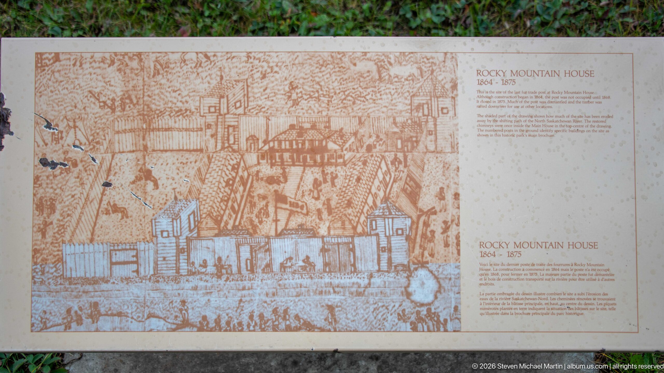
Sepia-toned historical drawings reconstruct the appearance of Rocky Mountain House across different periods, pairing architectural views with explanatory text. Fences, low timber buildings, and figures populate the larger scene, while a smaller view below provides another perspective on the post. Together the illustrations help translate archaeological traces into an intelligible nineteenth-century built landscape.
Caption
Sepia-toned historical drawings reconstruct the appearance of Rocky Mountain House across different periods, pairing architectural views with explanatory text. Fences, low timber buildings, and figures populate the larger scene, while a smaller view below provides another perspective on the post. Together the illustrations help translate archaeological traces into an intelligible nineteenth-century built landscape.
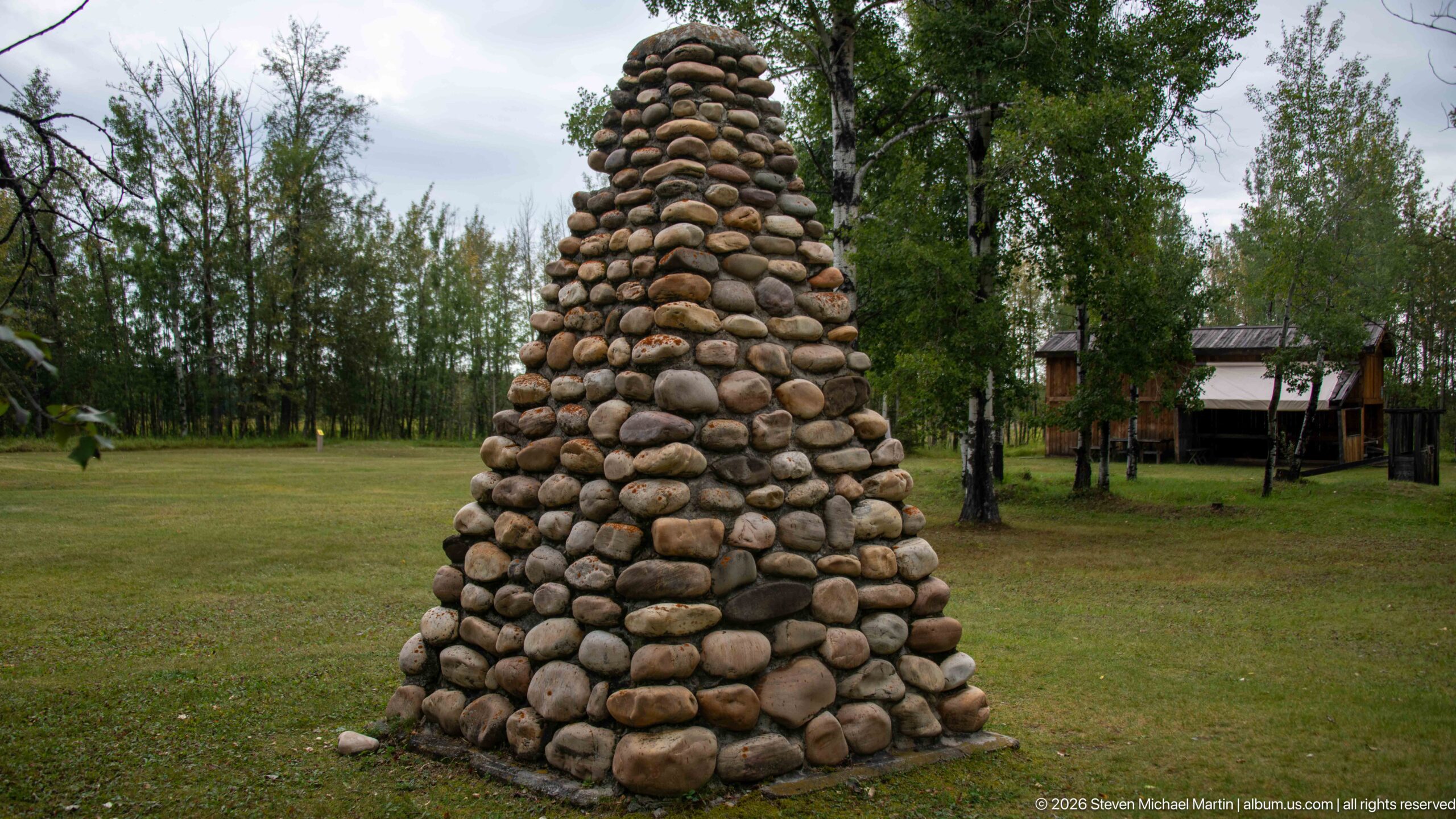
A tall tapered monument built from rounded fieldstones rises from the lawn near the visitor facilities. Its carefully stacked river-rock construction creates a rough-textured, cairn-like form that stands apart from the site’s surviving historic chimneys. Without a visible inscription in this view, the photograph records the monument primarily as a landscape and commemorative feature rather than assigning a more specific identity.
Caption
A tall tapered monument built from rounded fieldstones rises from the lawn near the visitor facilities. Its carefully stacked river-rock construction creates a rough-textured, cairn-like form that stands apart from the site’s surviving historic chimneys. Without a visible inscription in this view, the photograph records the monument primarily as a landscape and commemorative feature rather than assigning a more specific identity.
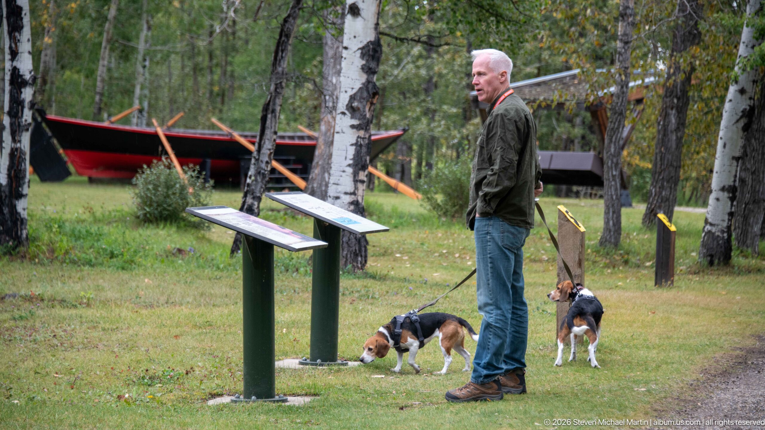
A visitor pauses with two beagles beside low outdoor interpretive panels, with the large black-and-red boat visible through the birches behind him. The scene links several elements of the visitor experience—trail interpretation, reconstructed transportation, and the wooded setting—while the dogs and leash provide a contemporary scale and human presence within the historic-site landscape.
Caption
A visitor pauses with two beagles beside low outdoor interpretive panels, with the large black-and-red boat visible through the birches behind him. The scene links several elements of the visitor experience—trail interpretation, reconstructed transportation, and the wooded setting—while the dogs and leash provide a contemporary scale and human presence within the historic-site landscape.
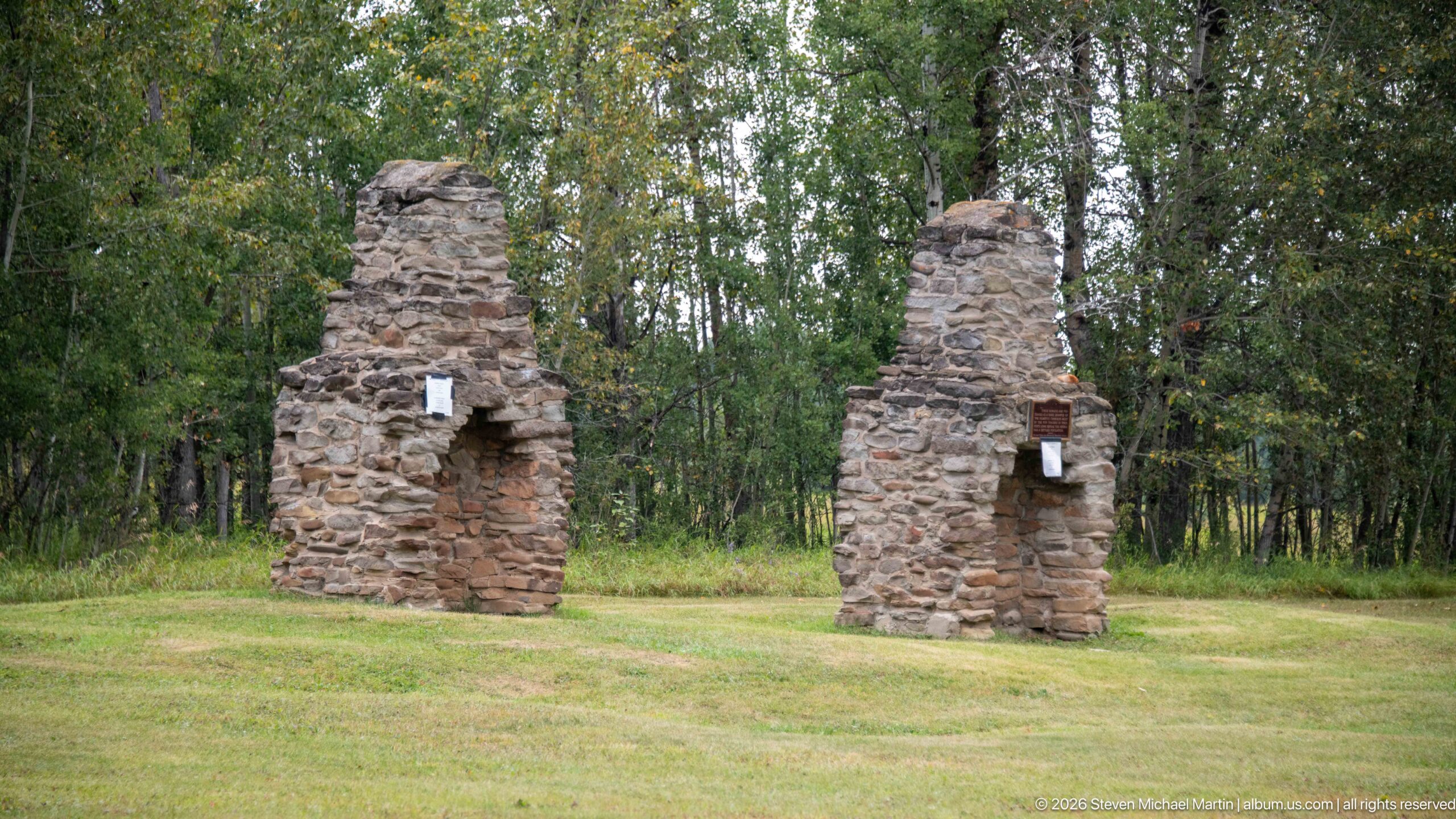
Two freestanding stone chimneys rise from the mown grounds, their rough rubble masonry and projecting hearth openings surviving after the surrounding wooden building disappeared. Seen together against the forest edge, the paired structures make the footprint of the last fur-trade post tangible and are among the most visually substantial historic remnants preserved at Rocky Mountain House National Historic Site.
Caption
Two freestanding stone chimneys rise from the mown grounds, their rough rubble masonry and projecting hearth openings surviving after the surrounding wooden building disappeared. Seen together against the forest edge, the paired structures make the footprint of the last fur-trade post tangible and are among the most visually substantial historic remnants preserved at Rocky Mountain House National Historic Site.
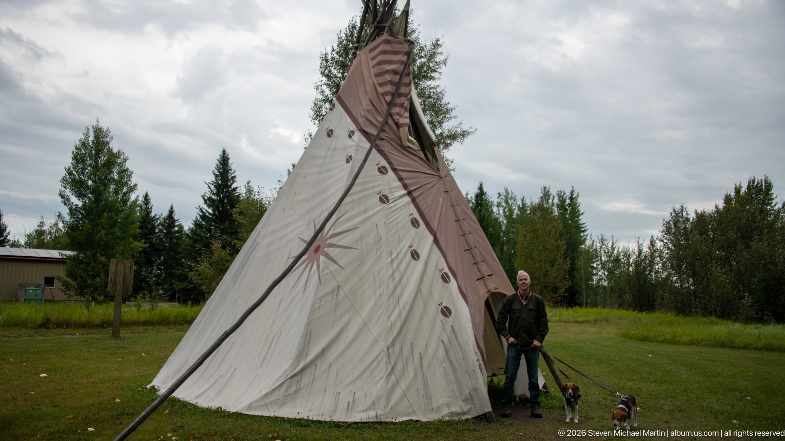
From a narrower side angle, the tipi’s steep conical profile and long projecting lodge poles become especially prominent against the cloudy sky. Painted circular and star-like motifs punctuate the pale canvas, while a visitor and two dogs stand close to the base. This view emphasizes the height and structural geometry of the installation more than the broader contextual photograph.
Caption
From a narrower side angle, the tipi’s steep conical profile and long projecting lodge poles become especially prominent against the cloudy sky. Painted circular and star-like motifs punctuate the pale canvas, while a visitor and two dogs stand close to the base. This view emphasizes the height and structural geometry of the installation more than the broader contextual photograph.
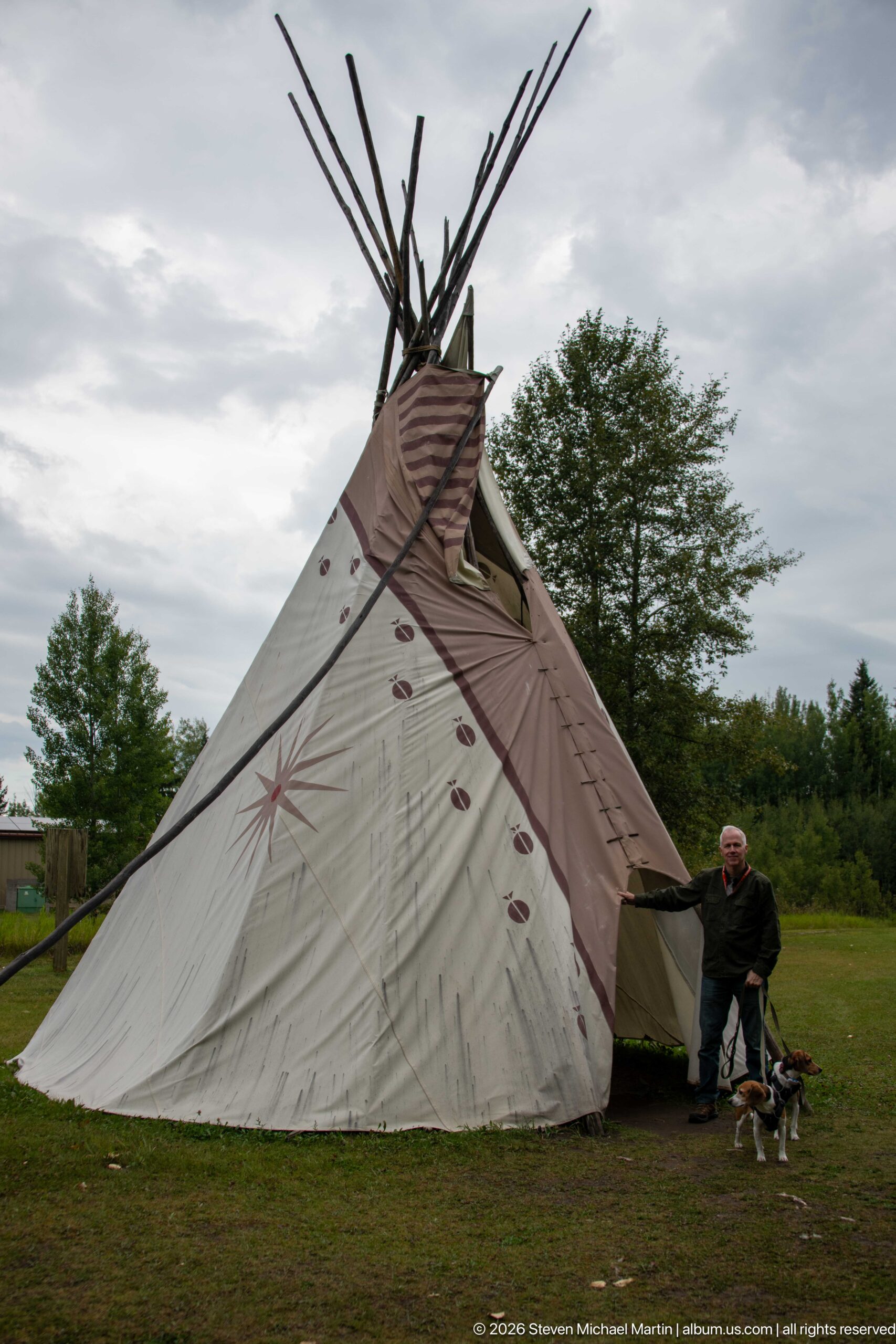
A large canvas tipi stands on the open grounds, its tall lodge poles extending well above the patterned covering. Geometric starbursts and small repeated motifs decorate the pale fabric, while a visitor with two dogs at the entrance provides scale. The installation introduces Indigenous cultural presence into the interpreted landscape through a full-size dwelling form rather than a museum case or text panel.
Caption
A large canvas tipi stands on the open grounds, its tall lodge poles extending well above the patterned covering. Geometric starbursts and small repeated motifs decorate the pale fabric, while a visitor with two dogs at the entrance provides scale. The installation introduces Indigenous cultural presence into the interpreted landscape through a full-size dwelling form rather than a museum case or text panel.
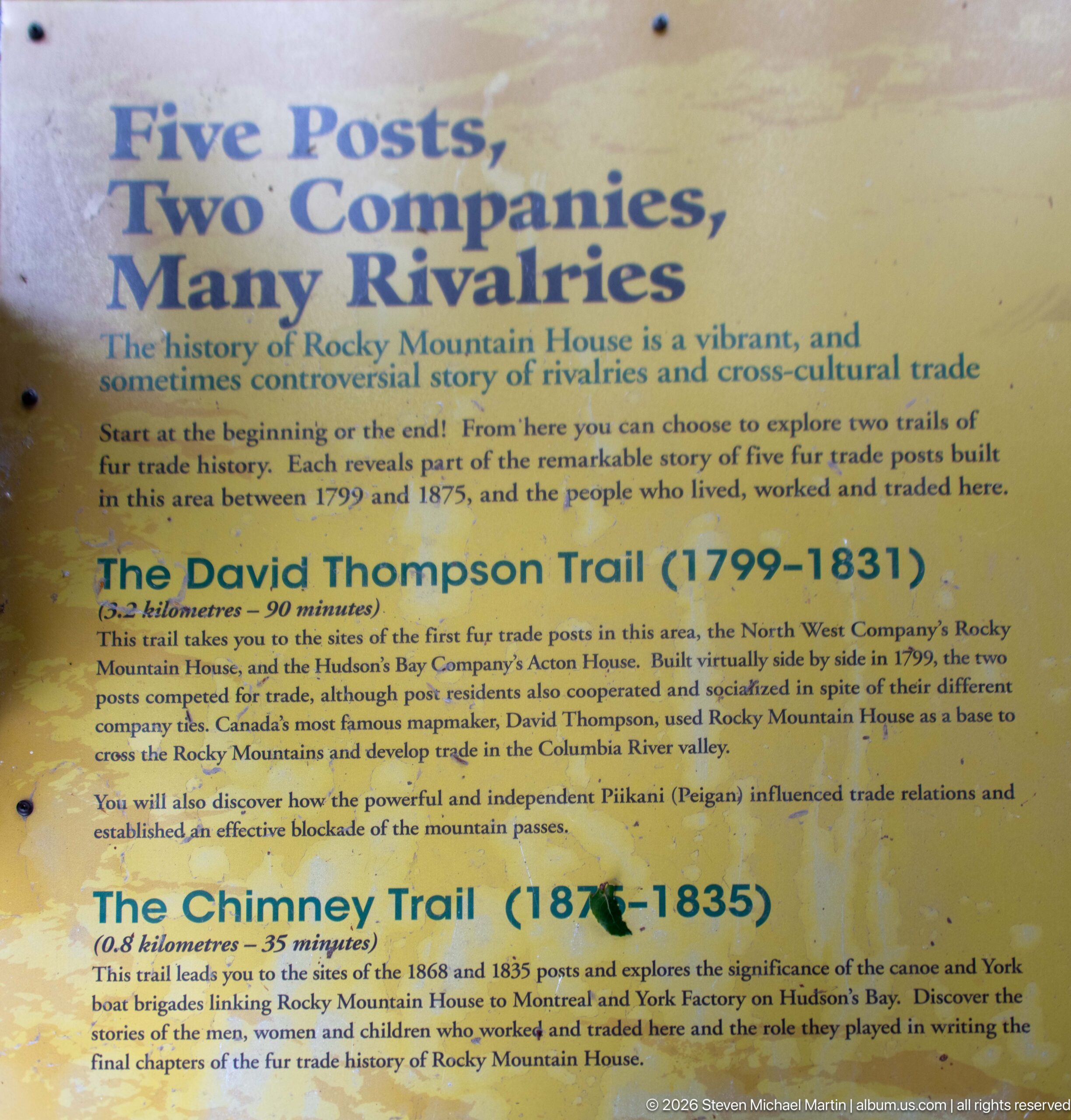
“Two Posts, Two Companies, Many Rivalries” introduces walking routes through Rocky Mountain House’s competing fur-trade landscapes. The panel describes the David Thompson Trail and Chimney Trail, connecting the North West Company and Hudson’s Bay Company stories to surviving archaeological and architectural evidence. Its large headings make the site’s corporate rivalry the organizing theme for exploring the grounds on foot.
Caption
“Two Posts, Two Companies, Many Rivalries” introduces walking routes through Rocky Mountain House’s competing fur-trade landscapes. The panel describes the David Thompson Trail and Chimney Trail, connecting the North West Company and Hudson’s Bay Company stories to surviving archaeological and architectural evidence. Its large headings make the site’s corporate rivalry the organizing theme for exploring the grounds on foot.
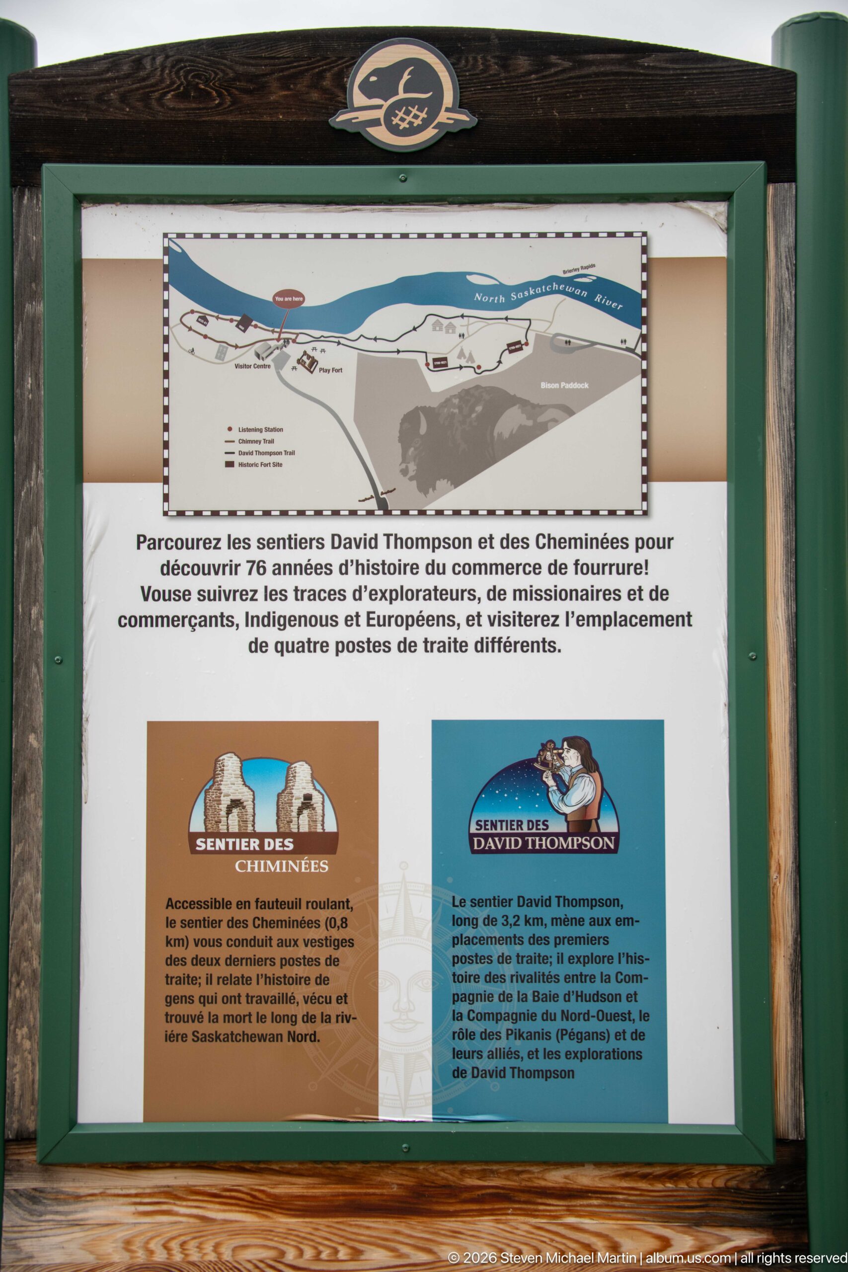
A framed orientation sign introduces the David Thompson and Chimney trails in French, combining a small route map with illustrated historical figures and short descriptions. The panel invites visitors to follow the paths through the site’s fur-trade history, linking David Thompson’s exploration story with the archaeological and structural remains encountered along the trail system.
Caption
A framed orientation sign introduces the David Thompson and Chimney trails in French, combining a small route map with illustrated historical figures and short descriptions. The panel invites visitors to follow the paths through the site’s fur-trade history, linking David Thompson’s exploration story with the archaeological and structural remains encountered along the trail system.
A stylized beaver emblem is mounted against dark-stained timber, using blue-gray and cream shapes to depict the animal above a horizontal waterline. The compact sign functions as a visual identity marker within the historic site, where the beaver also carries an obvious association with the fur trade that shaped Rocky Mountain House’s development.
Caption
A stylized beaver emblem is mounted against dark-stained timber, using blue-gray and cream shapes to depict the animal above a horizontal waterline. The compact sign functions as a visual identity marker within the historic site, where the beaver also carries an obvious association with the fur trade that shaped Rocky Mountain House’s development.
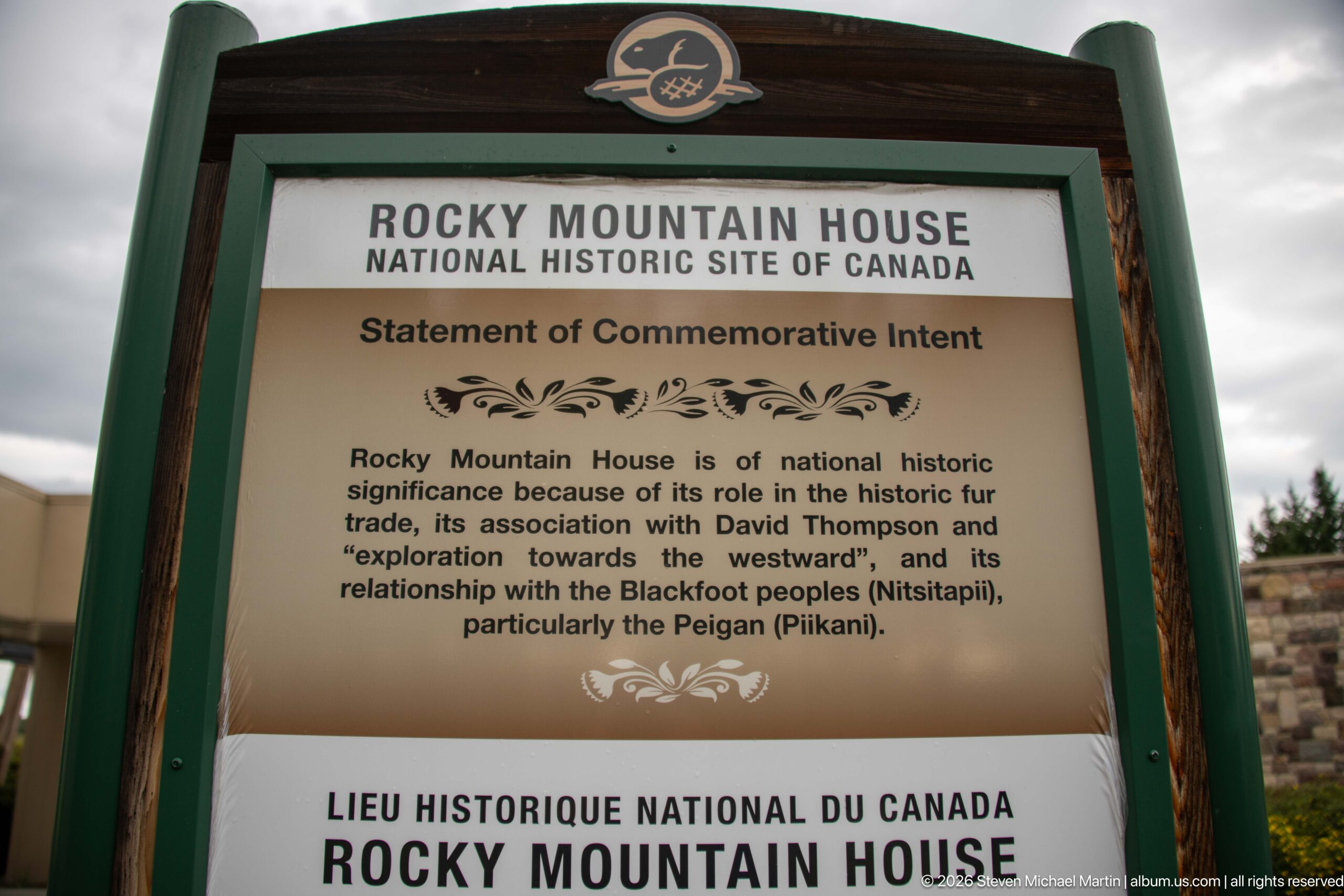
The Statement of Commemorative Intent identifies Rocky Mountain House as nationally significant for its role in the historic fur trade, its association with David Thompson and western exploration, and its relationship with Blackfoot peoples, particularly the Peigan (Piikani). Framed beneath the site name and beaver emblem, the bilingual sign succinctly defines the themes that guide interpretation across the property.
Caption
The Statement of Commemorative Intent identifies Rocky Mountain House as nationally significant for its role in the historic fur trade, its association with David Thompson and western exploration, and its relationship with Blackfoot peoples, particularly the Peigan (Piikani). Framed beneath the site name and beaver emblem, the bilingual sign succinctly defines the themes that guide interpretation across the property.
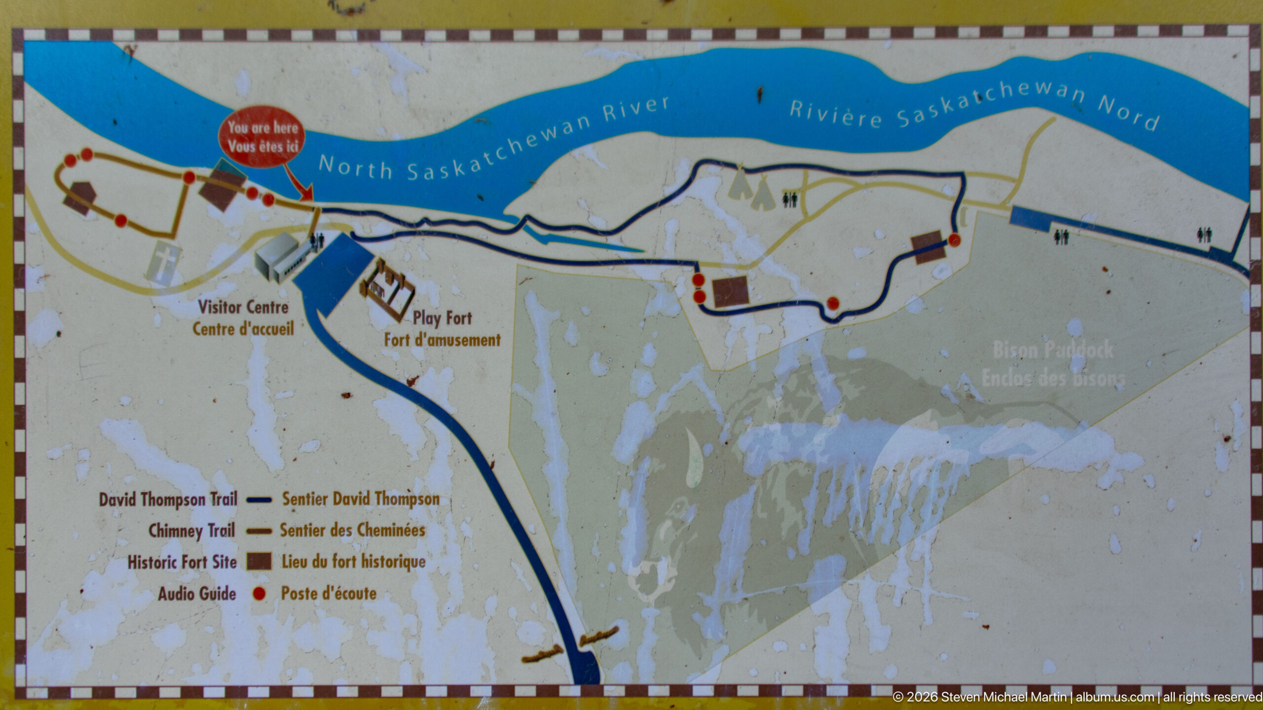
A weathered site map traces visitor routes along the North Saskatchewan River, marking the visitor centre, play fort, David Thompson Trail, Chimney Trail, Historic Fort Site, and other destinations. Color-coded paths and icons organize the dispersed historic landscape into a walkable network, helping visitors connect archaeological remains, interpretation, and river viewpoints across the grounds.
Caption
A weathered site map traces visitor routes along the North Saskatchewan River, marking the visitor centre, play fort, David Thompson Trail, Chimney Trail, Historic Fort Site, and other destinations. Color-coded paths and icons organize the dispersed historic landscape into a walkable network, helping visitors connect archaeological remains, interpretation, and river viewpoints across the grounds.
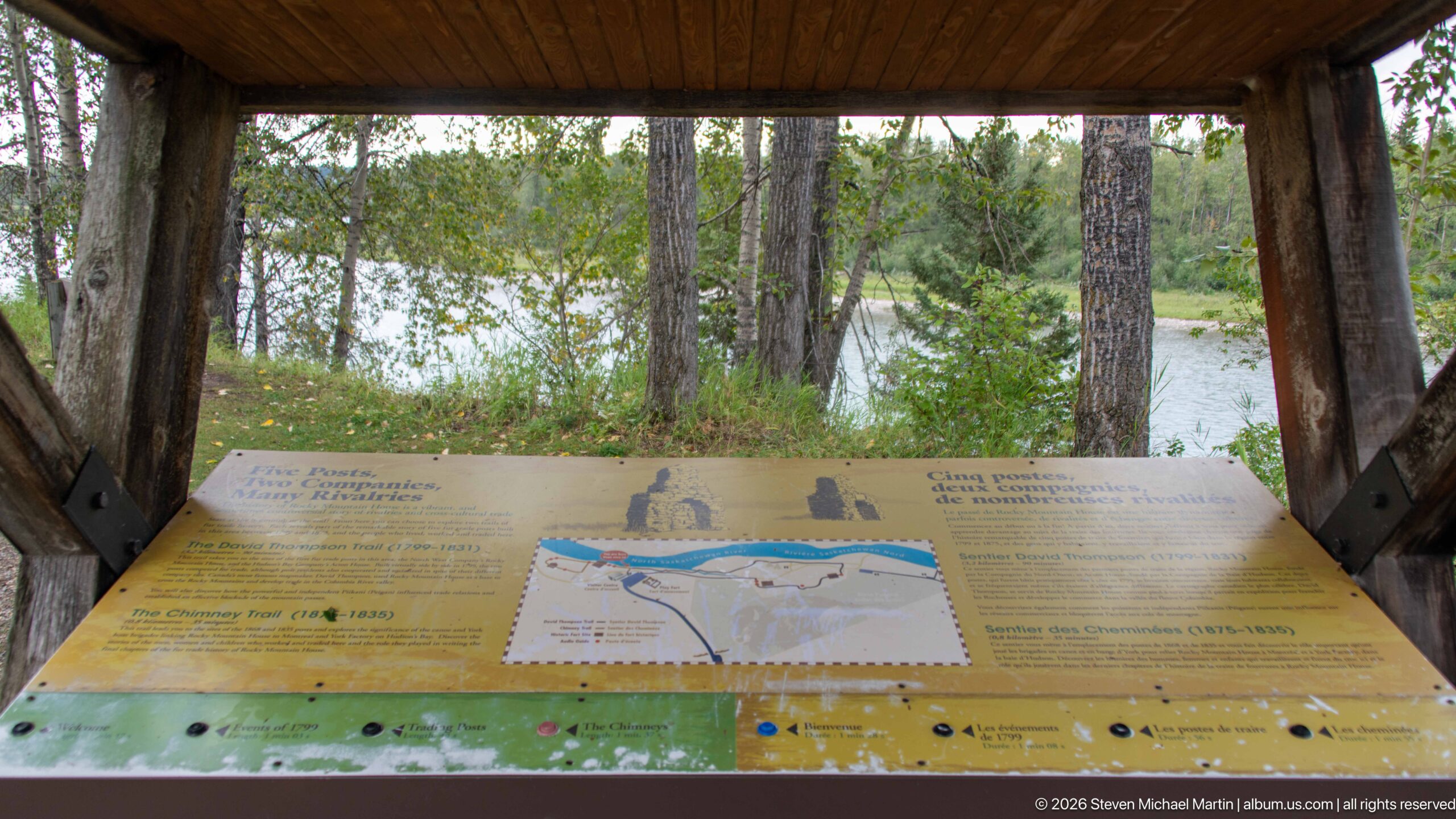
A timber-roofed interpretive station frames a large sloping panel that combines trail information, a site map, and historical context. Through the open shelter, trees and the river corridor remain visible, allowing visitors to orient themselves while still looking into the landscape being explained. The design integrates wayfinding and historical interpretation directly into the walking route.
Caption
A timber-roofed interpretive station frames a large sloping panel that combines trail information, a site map, and historical context. Through the open shelter, trees and the river corridor remain visible, allowing visitors to orient themselves while still looking into the landscape being explained. The design integrates wayfinding and historical interpretation directly into the walking route.
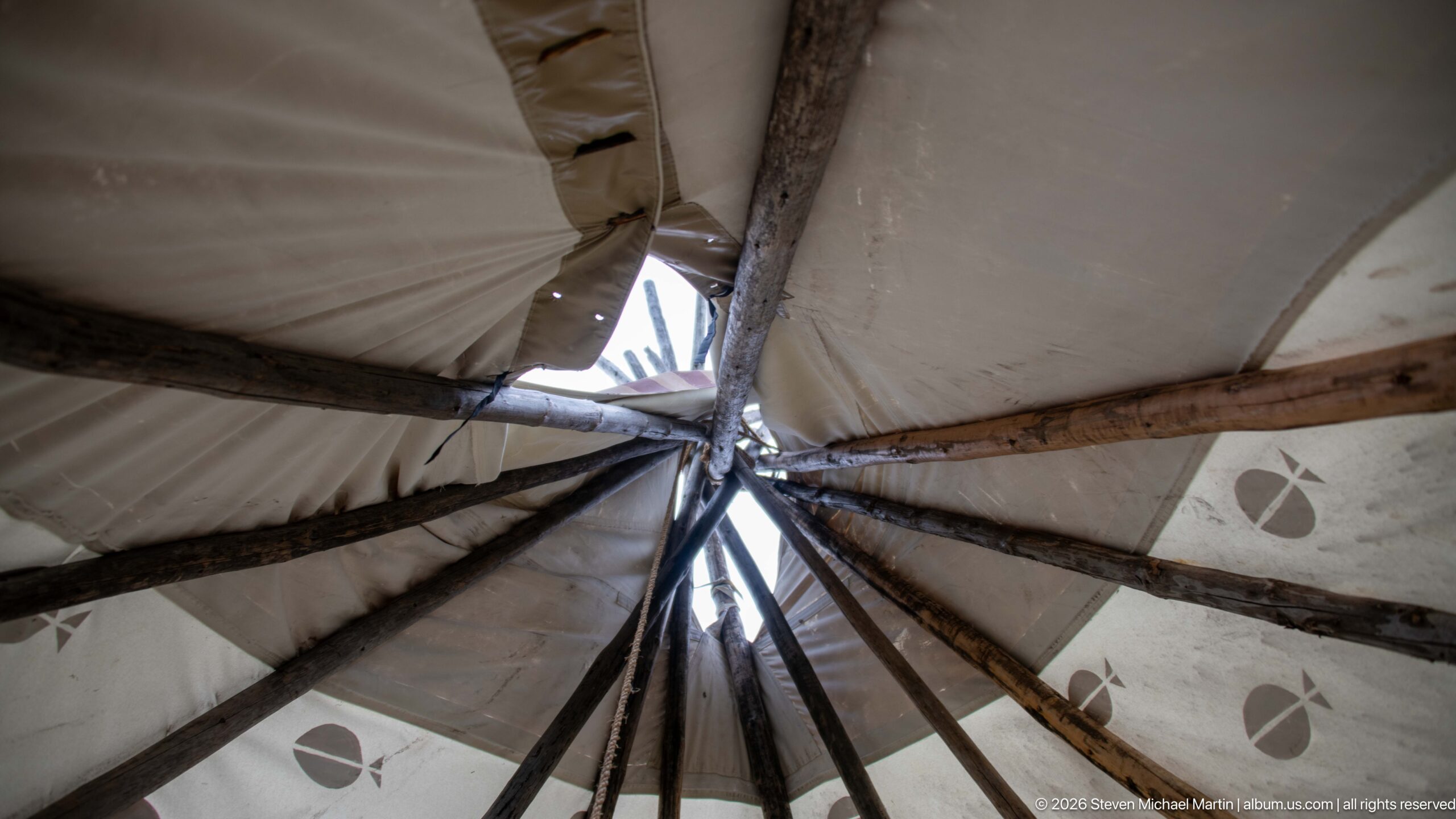
Looking upward from inside the tipi reveals the radial structure of the lodge poles as they converge toward the smoke opening. Light enters through gaps near the apex, silhouetting the dark poles against the pale canvas. Small painted motifs on the covering become secondary to the structural geometry, making this interior view a clear study of how the conical lodge is supported.
Caption
Looking upward from inside the tipi reveals the radial structure of the lodge poles as they converge toward the smoke opening. Light enters through gaps near the apex, silhouetting the dark poles against the pale canvas. Small painted motifs on the covering become secondary to the structural geometry, making this interior view a clear study of how the conical lodge is supported.
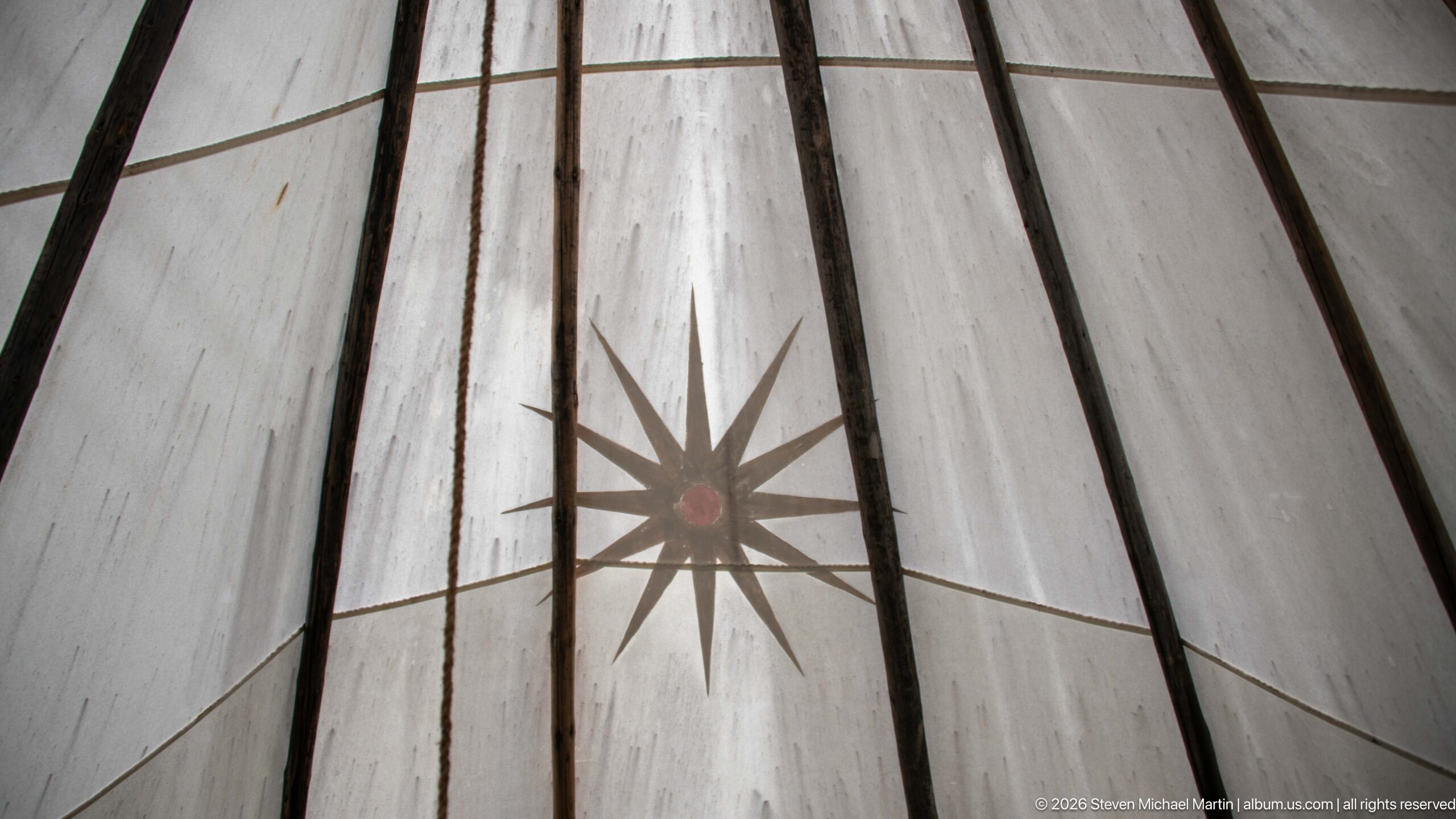
A large many-pointed starburst painted on the tipi canvas is centered between two dark lodge poles, with a small red circle at its core. Seen from inside, the translucent covering softens the daylight and reveals seams and weather marks in the fabric. The close view isolates decorative detail that is only a small component of the tipi’s exterior appearance.
Caption
A large many-pointed starburst painted on the tipi canvas is centered between two dark lodge poles, with a small red circle at its core. Seen from inside, the translucent covering softens the daylight and reveals seams and weather marks in the fabric. The close view isolates decorative detail that is only a small component of the tipi’s exterior appearance.
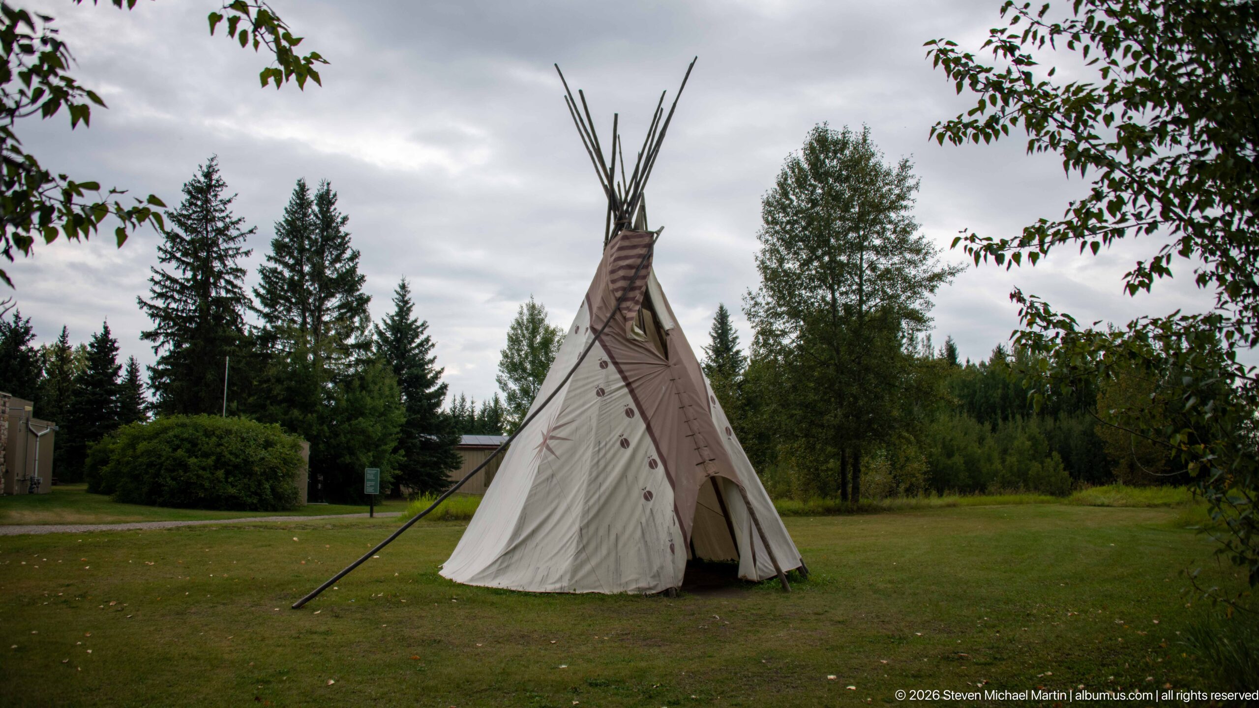
A painted canvas tipi stands alone on a broad lawn beneath an overcast sky, framed by mature conifers, deciduous trees, and low shrubs. The open entrance and long lodge poles are visible from a distance, placing the structure within the modern visitor landscape. Compared with closer views, this composition emphasizes setting and the tipi’s relationship to the surrounding grounds.
Caption
A painted canvas tipi stands alone on a broad lawn beneath an overcast sky, framed by mature conifers, deciduous trees, and low shrubs. The open entrance and long lodge poles are visible from a distance, placing the structure within the modern visitor landscape. Compared with closer views, this composition emphasizes setting and the tipi’s relationship to the surrounding grounds.
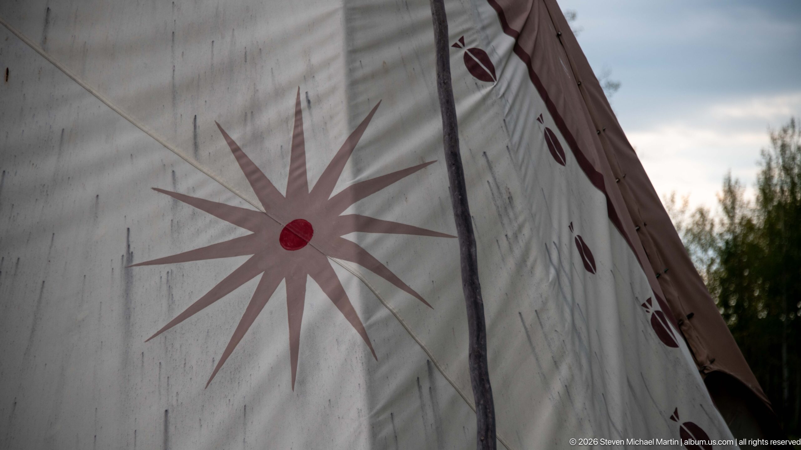
A close view of the tipi covering isolates a large starburst with a red circular center and a vertical series of smaller oval motifs along the adjoining panel. The weathered canvas, seam lines, and supporting pole are clearly visible at this scale. By excluding most of the structure, the composition turns attention from the lodge’s form to its painted decorative vocabulary.
Caption
A close view of the tipi covering isolates a large starburst with a red circular center and a vertical series of smaller oval motifs along the adjoining panel. The weathered canvas, seam lines, and supporting pole are clearly visible at this scale. By excluding most of the structure, the composition turns attention from the lodge’s form to its painted decorative vocabulary.
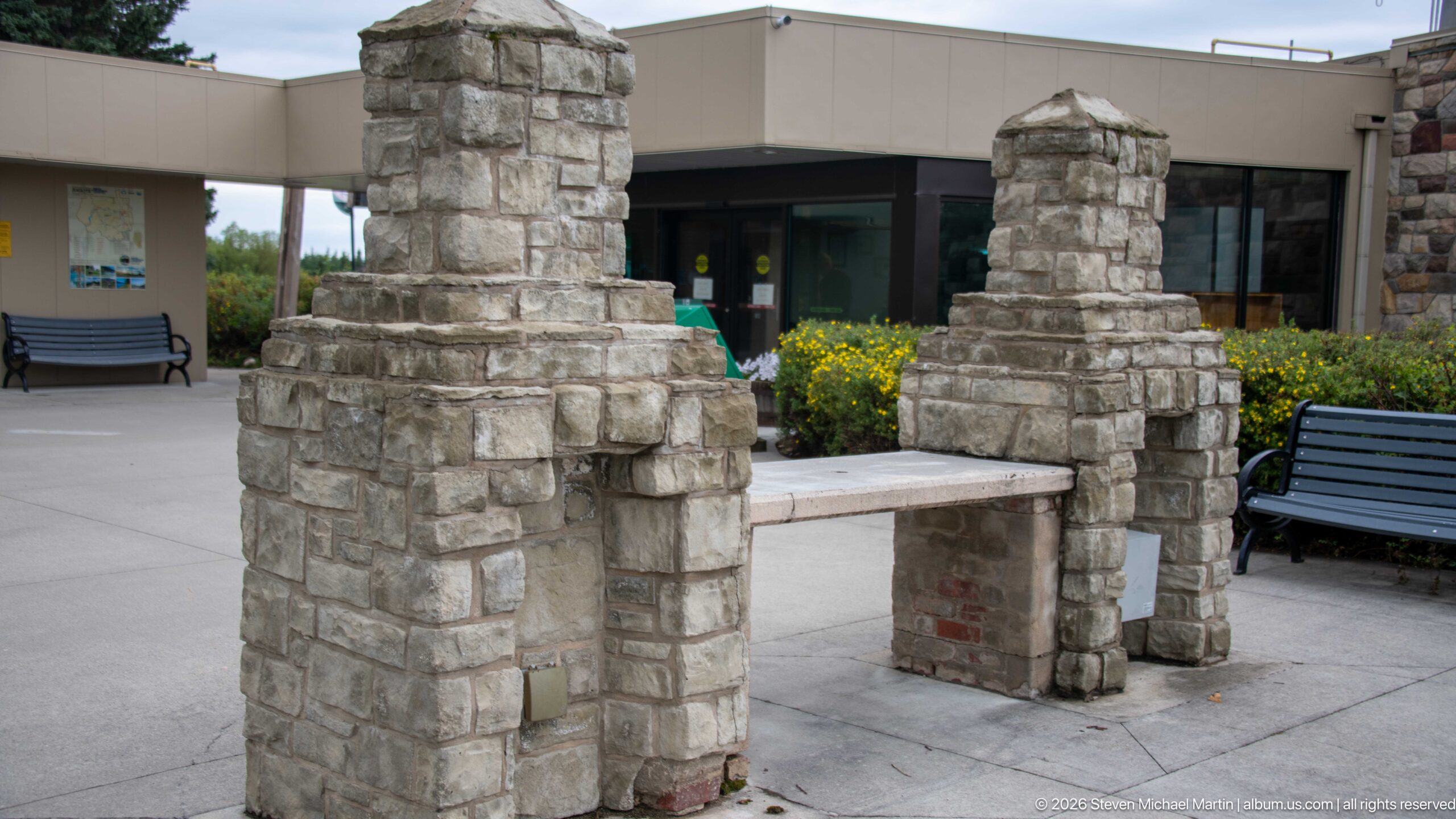
Two rough stone piers frame a low stone-and-masonry bench or connecting element in the visitor-centre plaza. Their stepped profiles and irregular blocks echo the material of historic masonry elsewhere at Rocky Mountain House while functioning within a modern landscaped setting. The entrance doors, benches, flowers, and contemporary building behind clearly distinguish this installation from the surviving fur-trade chimneys.
Caption
Two rough stone piers frame a low stone-and-masonry bench or connecting element in the visitor-centre plaza. Their stepped profiles and irregular blocks echo the material of historic masonry elsewhere at Rocky Mountain House while functioning within a modern landscaped setting. The entrance doors, benches, flowers, and contemporary building behind clearly distinguish this installation from the surviving fur-trade chimneys.
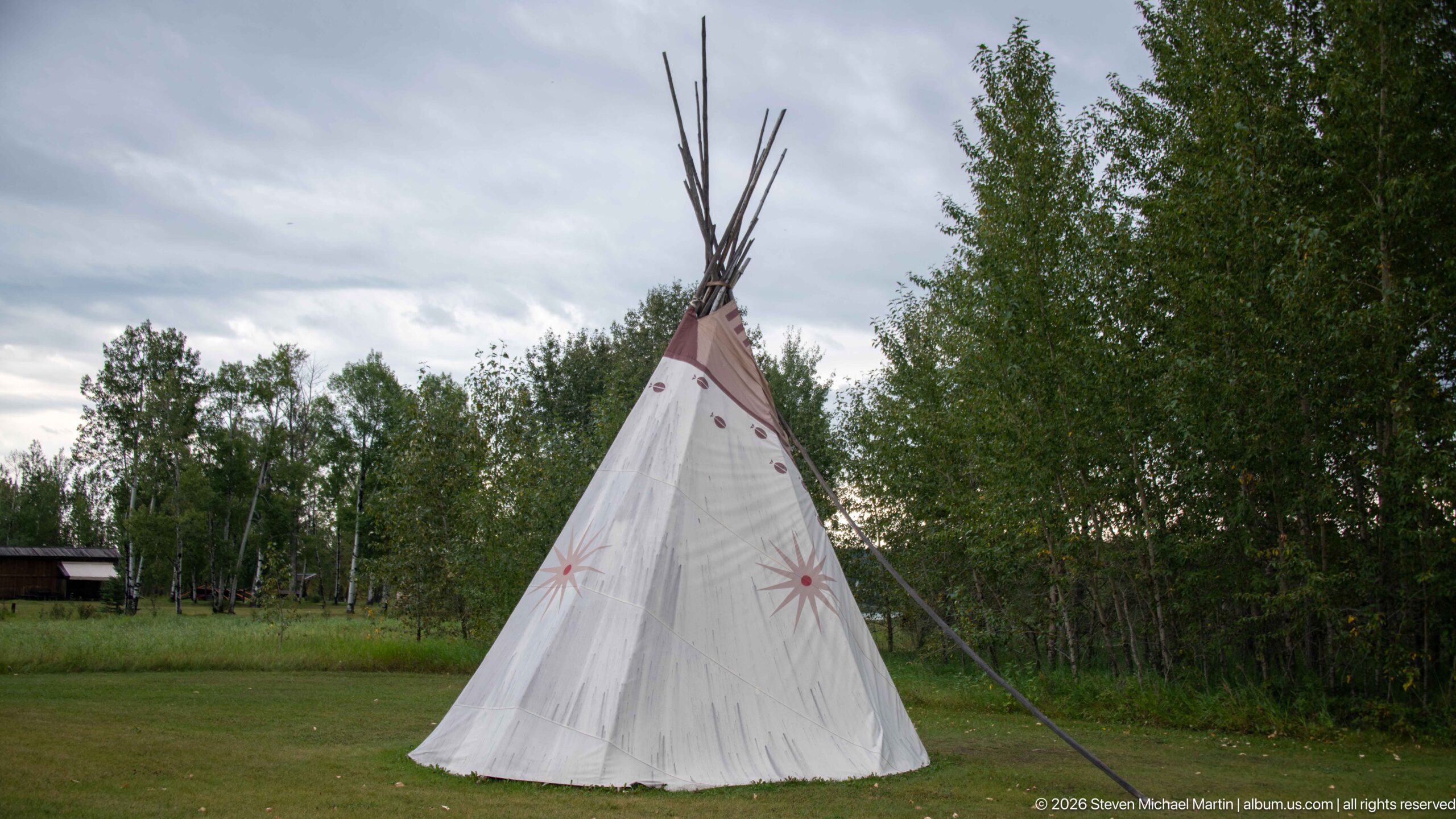
Seen from the opposite side, the tipi presents an uninterrupted conical sweep of pale canvas punctuated by several starburst motifs and small painted forms. Long poles project above the apex while guy lines extend to the grass. The absence of people and the dark tree line behind it make the lodge’s silhouette and painted surface the dominant elements of the composition.
Caption
Seen from the opposite side, the tipi presents an uninterrupted conical sweep of pale canvas punctuated by several starburst motifs and small painted forms. Long poles project above the apex while guy lines extend to the grass. The absence of people and the dark tree line behind it make the lodge’s silhouette and painted surface the dominant elements of the composition.
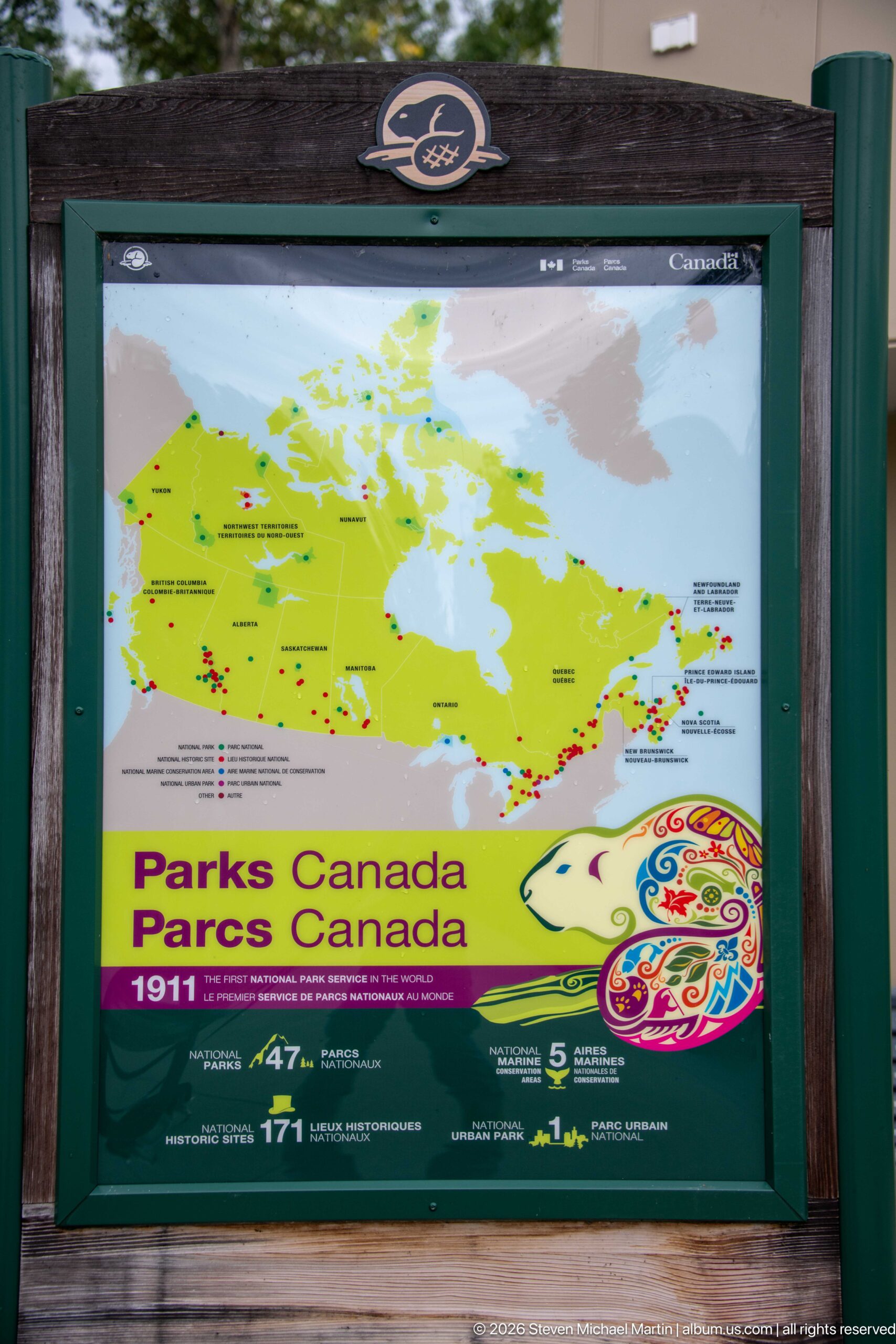
A framed Parks Canada panel maps the national network of protected and commemorative places across Canada. The bright green map, bilingual agency branding, and illustrated anniversary graphic place Rocky Mountain House National Historic Site within a much larger system of parks, historic sites, and conservation areas administered across the country.
Caption
A framed Parks Canada panel maps the national network of protected and commemorative places across Canada. The bright green map, bilingual agency branding, and illustrated anniversary graphic place Rocky Mountain House National Historic Site within a much larger system of parks, historic sites, and conservation areas administered across the country.
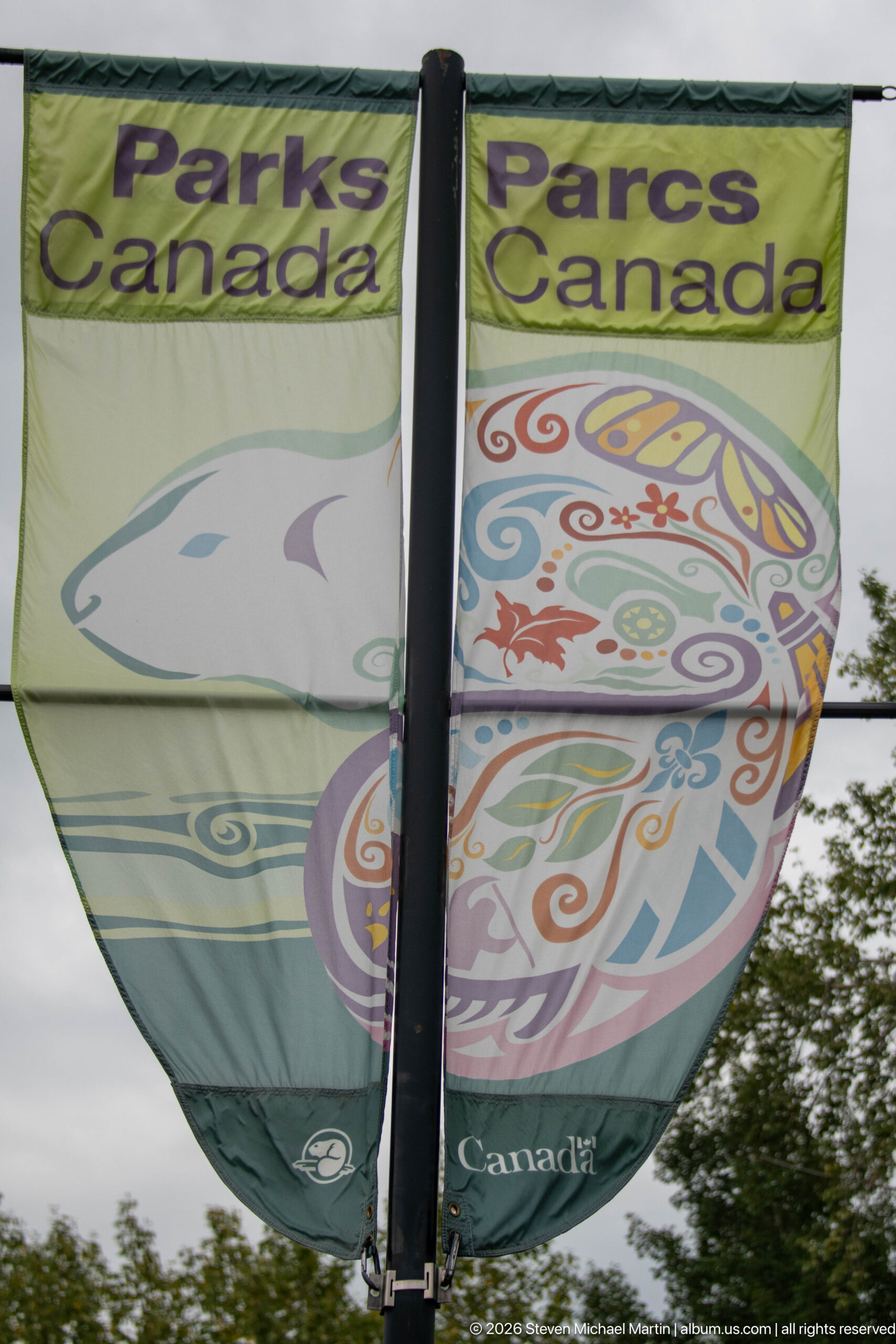
A fabric banner uses a large stylized animal form filled with colorful curving motifs beneath bilingual Parks Canada lettering. Suspended outdoors on a vertical support, the design functions as contemporary site branding rather than historical reconstruction, adding a graphic cultural element to the visitor-area landscape.
Caption
A fabric banner uses a large stylized animal form filled with colorful curving motifs beneath bilingual Parks Canada lettering. Suspended outdoors on a vertical support, the design functions as contemporary site branding rather than historical reconstruction, adding a graphic cultural element to the visitor-area landscape.
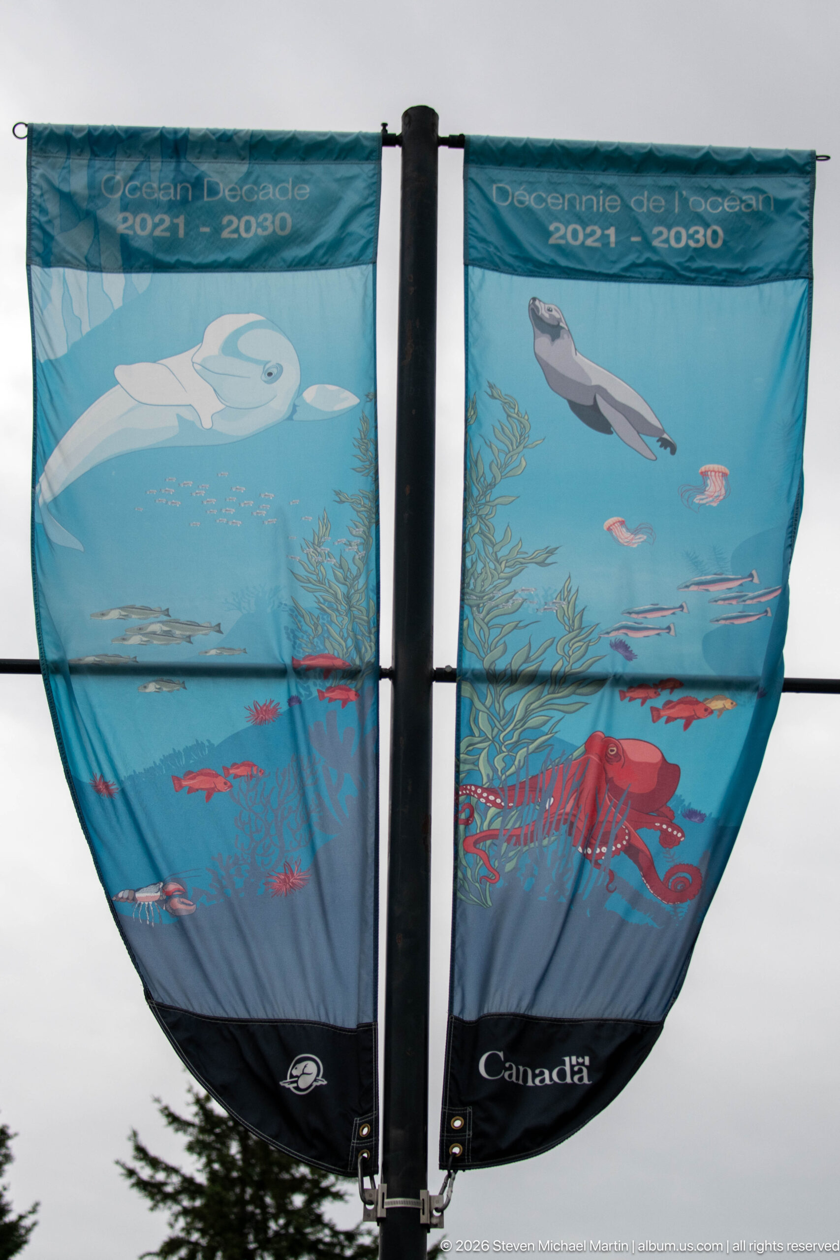
A blue Parks Canada banner marks the United Nations Decade on Ecosystem Restoration, 2021–2030, using stylized aquatic plants, fish, a bird, and other wildlife to communicate ecological recovery. Displayed near the visitor centre, the contemporary graphic broadens the site's interpretation beyond cultural history to include stewardship of the surrounding natural environment.
Caption
A blue Parks Canada banner marks the United Nations Decade on Ecosystem Restoration, 2021–2030, using stylized aquatic plants, fish, a bird, and other wildlife to communicate ecological recovery. Displayed near the visitor centre, the contemporary graphic broadens the site's interpretation beyond cultural history to include stewardship of the surrounding natural environment.
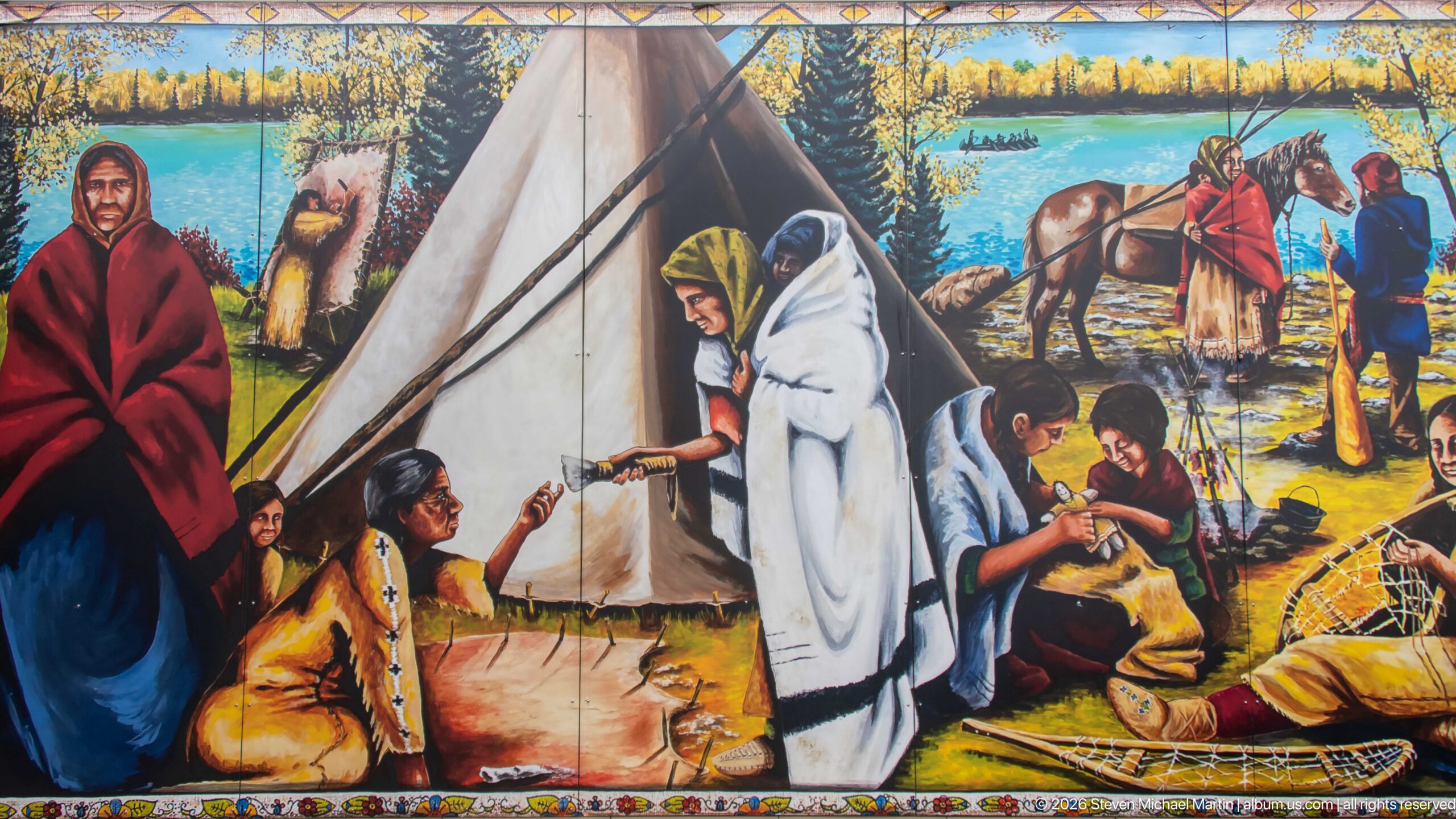
A large painted mural presents an Indigenous camp scene centered on a tipi, with figures wrapped in blankets, people working near the ground, horses, and forested country beyond. Rather than isolating a single activity, the composition brings together shelter, clothing, animals, and social interaction to evoke community life within the broader cultural interpretation at Rocky Mountain House.
Caption
A large painted mural presents an Indigenous camp scene centered on a tipi, with figures wrapped in blankets, people working near the ground, horses, and forested country beyond. Rather than isolating a single activity, the composition brings together shelter, clothing, animals, and social interaction to evoke community life within the broader cultural interpretation at Rocky Mountain House.
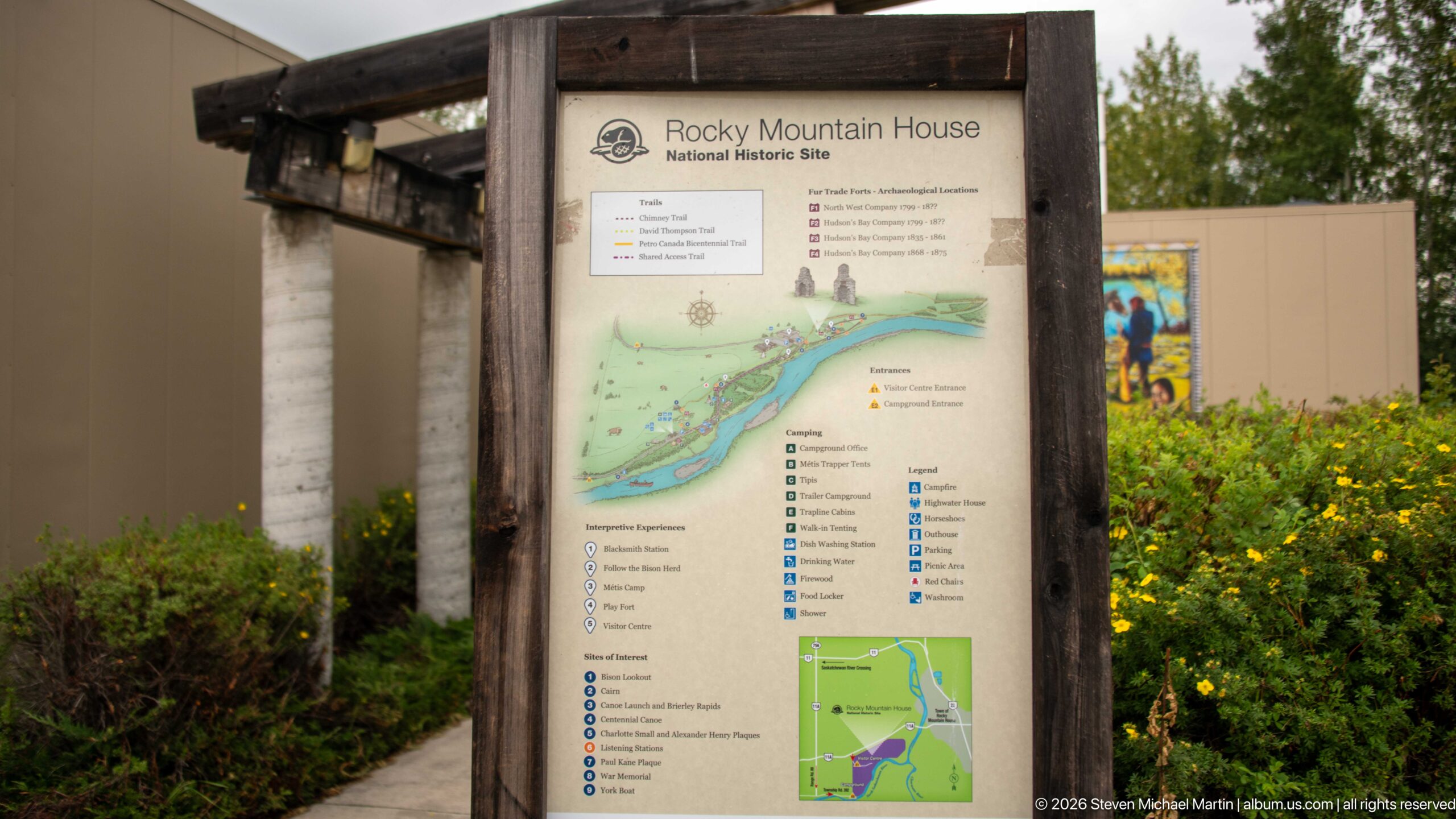
A freestanding orientation panel maps Rocky Mountain House National Historic Site and identifies visitor facilities, trails, interpretive locations, and points of interest. The diagram follows the river corridor through the property, helping visitors understand the relationship between the entrance area, historic resources, campground, and walking routes before entering the grounds.
Caption
A freestanding orientation panel maps Rocky Mountain House National Historic Site and identifies visitor facilities, trails, interpretive locations, and points of interest. The diagram follows the river corridor through the property, helping visitors understand the relationship between the entrance area, historic resources, campground, and walking routes before entering the grounds.
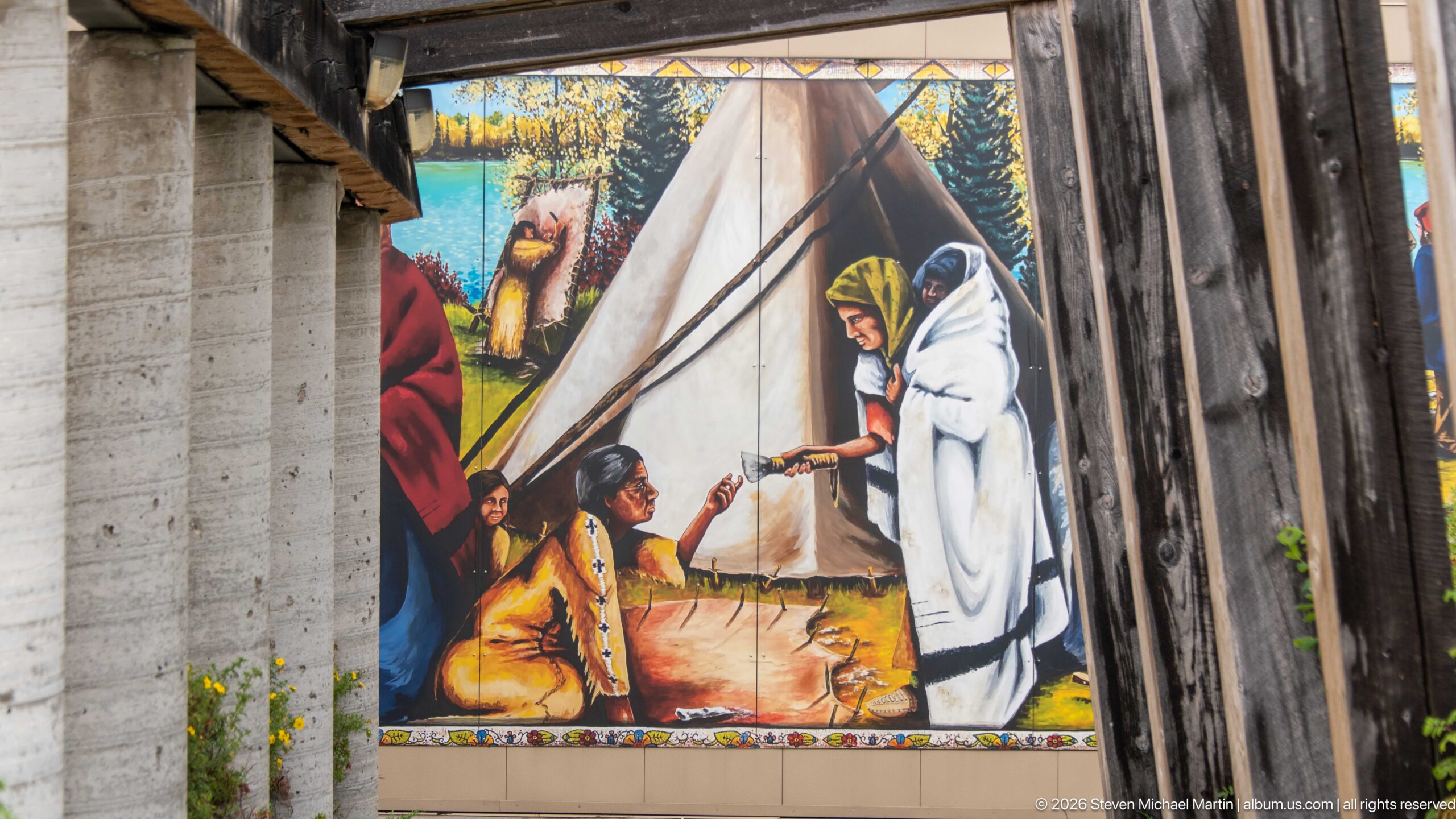
Heavy vertical timbers frame a close view of the site's Indigenous cultural mural, cropping the larger composition to emphasize a tipi and figures engaged in exchange or conversation. The architectural framing makes the artwork part of the visitor approach, where contemporary interpretation and rustic construction meet at the entrance complex.
Caption
Heavy vertical timbers frame a close view of the site's Indigenous cultural mural, cropping the larger composition to emphasize a tipi and figures engaged in exchange or conversation. The architectural framing makes the artwork part of the visitor approach, where contemporary interpretation and rustic construction meet at the entrance complex.
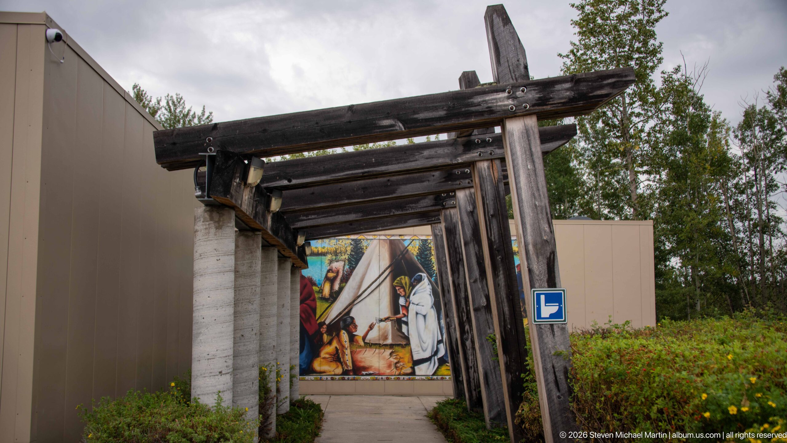
A sequence of rough-hewn timber posts and crossbeams forms a narrow covered approach beside the visitor complex. The repeating wooden frames draw the eye toward the colorful tipi mural at the far end, while shrubs and a paved path soften the utilitarian structure. The composition records the designed transition from parking and arrival areas into the site's interpretive setting.
Caption
A sequence of rough-hewn timber posts and crossbeams forms a narrow covered approach beside the visitor complex. The repeating wooden frames draw the eye toward the colorful tipi mural at the far end, while shrubs and a paved path soften the utilitarian structure. The composition records the designed transition from parking and arrival areas into the site's interpretive setting.
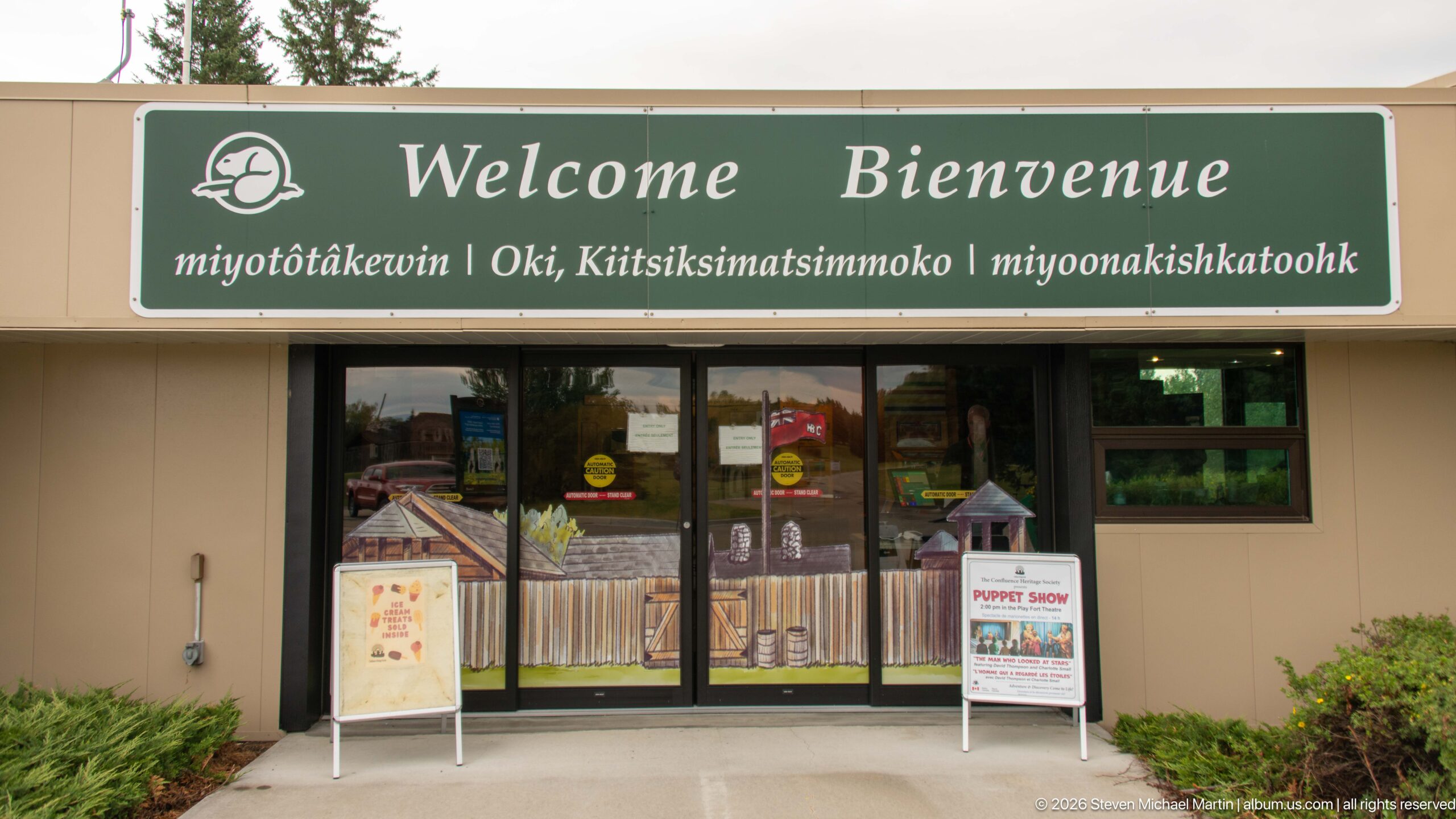
A large green 'Welcome / Bienvenue' sign spans the visitor-centre entrance, with additional Indigenous-language greetings presented beneath the English and French headings. Glass doors, event posters, and small freestanding signs create an active arrival point, while the multilingual presentation signals the site's effort to acknowledge the diverse cultural histories connected with Rocky Mountain House.
Caption
A large green 'Welcome / Bienvenue' sign spans the visitor-centre entrance, with additional Indigenous-language greetings presented beneath the English and French headings. Glass doors, event posters, and small freestanding signs create an active arrival point, while the multilingual presentation signals the site's effort to acknowledge the diverse cultural histories connected with Rocky Mountain House.
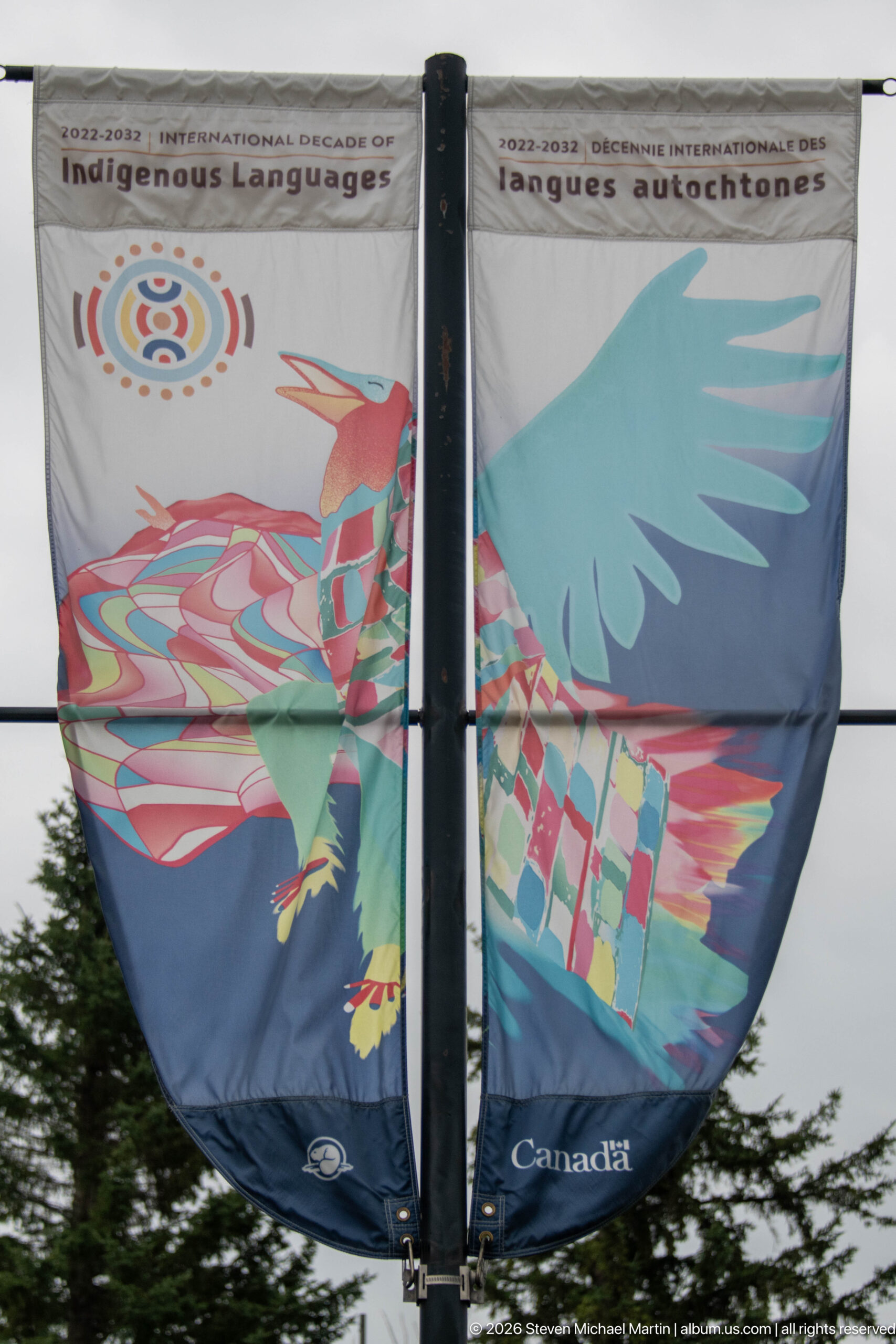
A pair of fabric panels forms a vivid stylized bird whose wings and body are filled with geometric patterns in red, turquoise, yellow, and green. The contemporary Parks Canada banner uses Indigenous-inspired visual language as part of the visitor-area display, contrasting with the historical photographs and archaeological interpretation elsewhere on the site.
Caption
A pair of fabric panels forms a vivid stylized bird whose wings and body are filled with geometric patterns in red, turquoise, yellow, and green. The contemporary Parks Canada banner uses Indigenous-inspired visual language as part of the visitor-area display, contrasting with the historical photographs and archaeological interpretation elsewhere on the site.
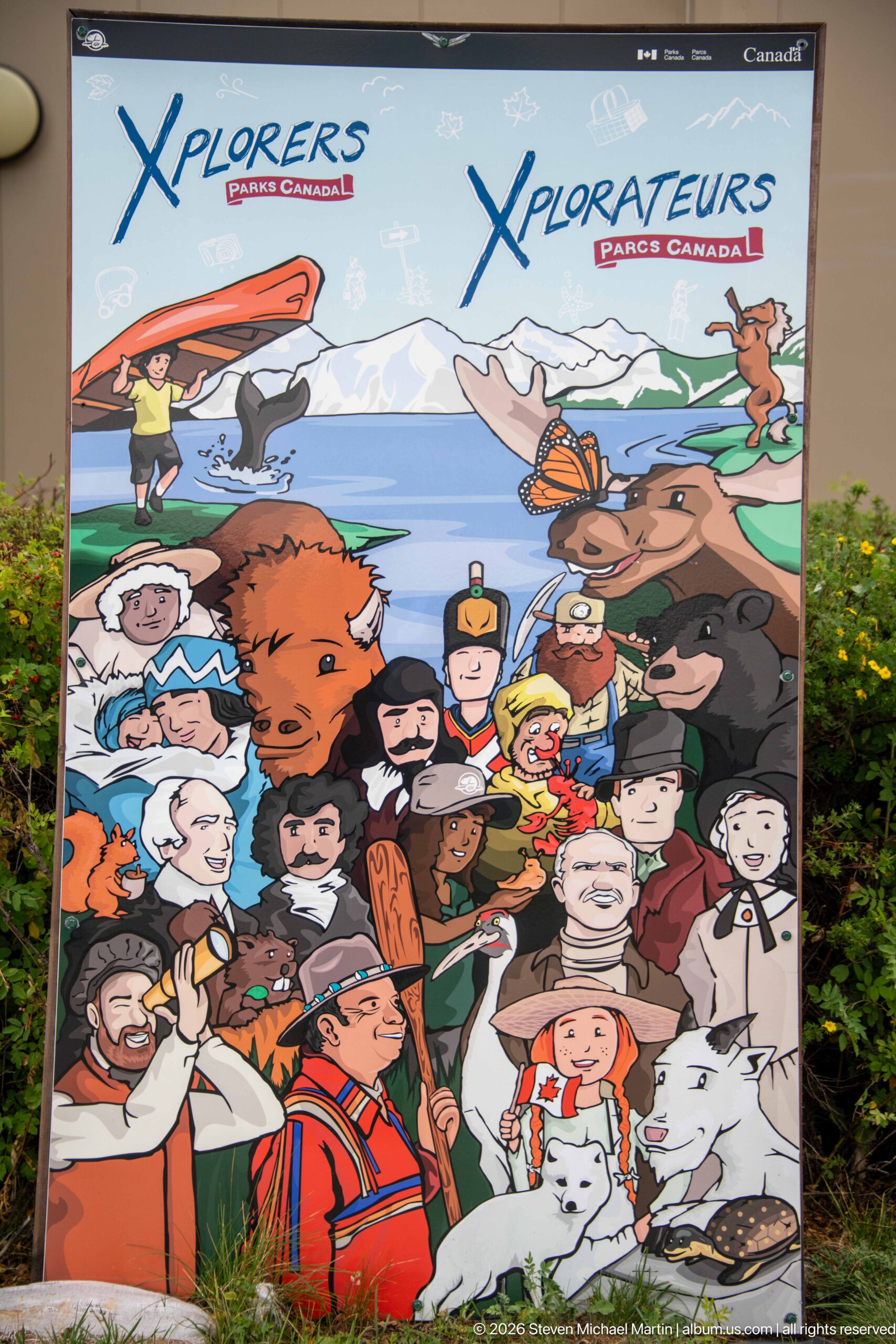
A bright Parks Canada Xplorers panel gathers cartoon figures, animals, historic characters, and outdoor scenes into a playful collage aimed at younger visitors. The crowded composition suggests the range of stories and activities encountered through the national program, turning the visitor-centre exterior into an invitation for children to explore cultural and natural history.
Caption
A bright Parks Canada Xplorers panel gathers cartoon figures, animals, historic characters, and outdoor scenes into a playful collage aimed at younger visitors. The crowded composition suggests the range of stories and activities encountered through the national program, turning the visitor-centre exterior into an invitation for children to explore cultural and natural history.
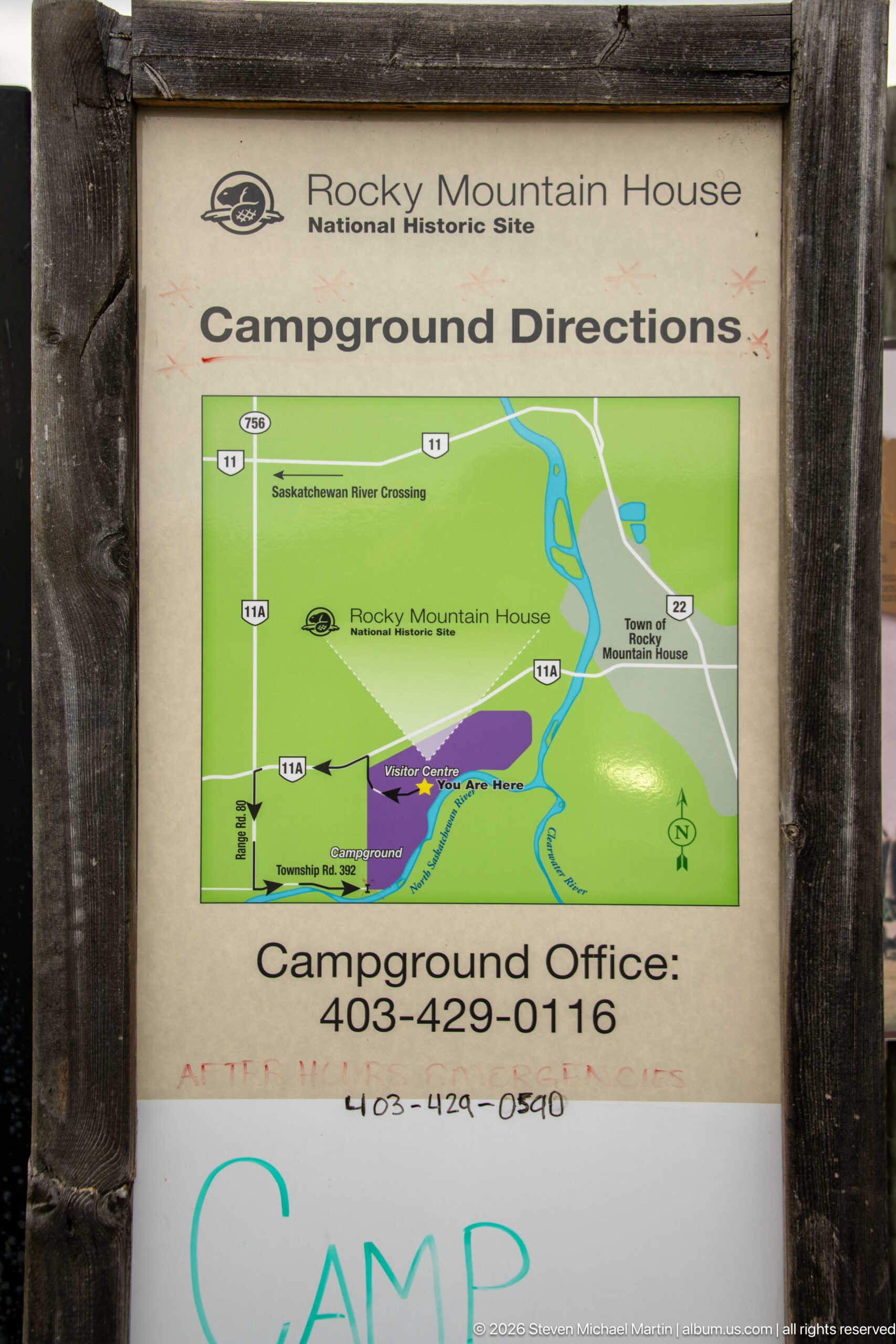
A wood-framed campground sign provides a simplified regional map, directional arrows, highway numbers, and contact information for visitors traveling between the national historic site and its camping facilities. The practical wayfinding panel documents the site's recreational infrastructure as well as the broader road network connecting it to the surrounding Alberta landscape.
Caption
A wood-framed campground sign provides a simplified regional map, directional arrows, highway numbers, and contact information for visitors traveling between the national historic site and its camping facilities. The practical wayfinding panel documents the site's recreational infrastructure as well as the broader road network connecting it to the surrounding Alberta landscape.
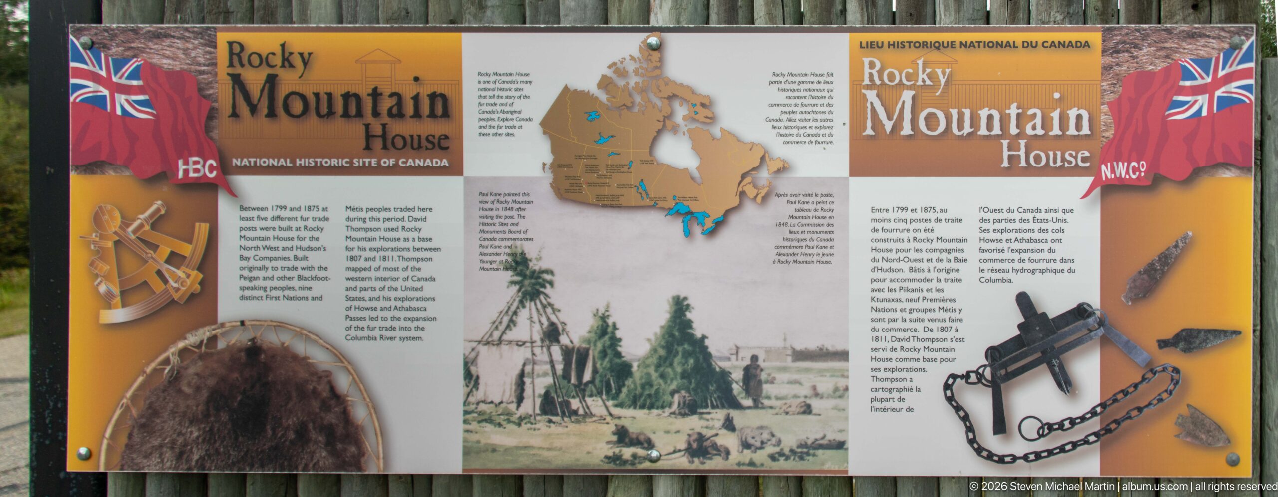
A bilingual Parks Canada panel introduces Rocky Mountain House through maps, archival imagery, and illustrations of trade-related objects. Hudson's Bay Company and North West Company references flank a central historic scene, visually summarizing the rivalry, exchange networks, and material culture associated with the site's fur-trade history.
Caption
A bilingual Parks Canada panel introduces Rocky Mountain House through maps, archival imagery, and illustrations of trade-related objects. Hudson's Bay Company and North West Company references flank a central historic scene, visually summarizing the rivalry, exchange networks, and material culture associated with the site's fur-trade history.
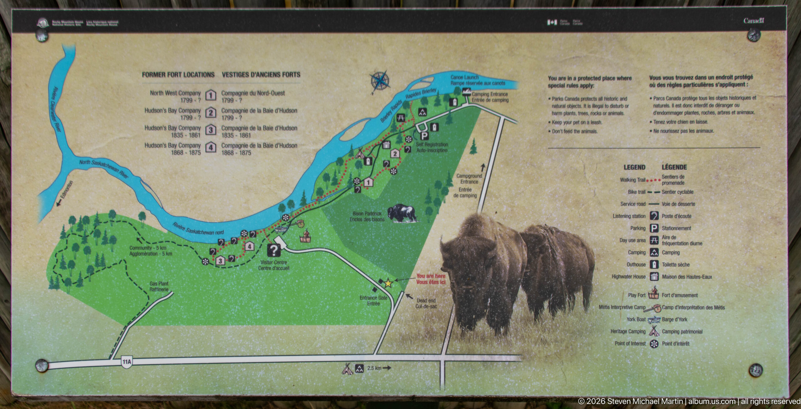
A large illustrated map traces roads, trails, facilities, and numbered points of interest across the Rocky Mountain House property, with the river defining the upper edge of the site. Two bison illustrations occupy the foreground of the panel, connecting practical visitor orientation with the grassland wildlife interpretation encountered elsewhere along the route.
Caption
A large illustrated map traces roads, trails, facilities, and numbered points of interest across the Rocky Mountain House property, with the river defining the upper edge of the site. Two bison illustrations occupy the foreground of the panel, connecting practical visitor orientation with the grassland wildlife interpretation encountered elsewhere along the route.

Two Canadian flags rise above a rustic fenced entrance area containing outdoor interpretive panels and visitor signage. A rain puddle mirrors the cloudy sky in the foreground, while dense vegetation surrounds the approach. The scene places the site's formal Parks Canada identity within a deliberately rustic landscape treatment recalling the timber construction associated with historic trading posts.
Caption
Two Canadian flags rise above a rustic fenced entrance area containing outdoor interpretive panels and visitor signage. A rain puddle mirrors the cloudy sky in the foreground, while dense vegetation surrounds the approach. The scene places the site's formal Parks Canada identity within a deliberately rustic landscape treatment recalling the timber construction associated with historic trading posts.
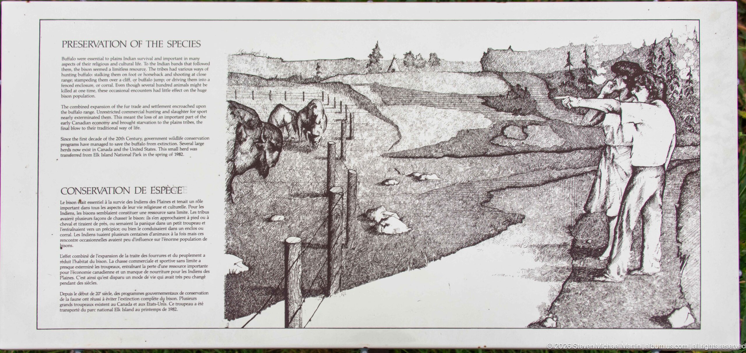
A bilingual conservation panel pairs explanatory text with a black-and-white drawing of a riverbank scene, where a person observes wildlife habitat near water. The illustration and heading frame species protection as part of the site's broader stewardship role, linking cultural interpretation with management of the living landscape around Rocky Mountain House.
Caption
A bilingual conservation panel pairs explanatory text with a black-and-white drawing of a riverbank scene, where a person observes wildlife habitat near water. The illustration and heading frame species protection as part of the site's broader stewardship role, linking cultural interpretation with management of the living landscape around Rocky Mountain House.
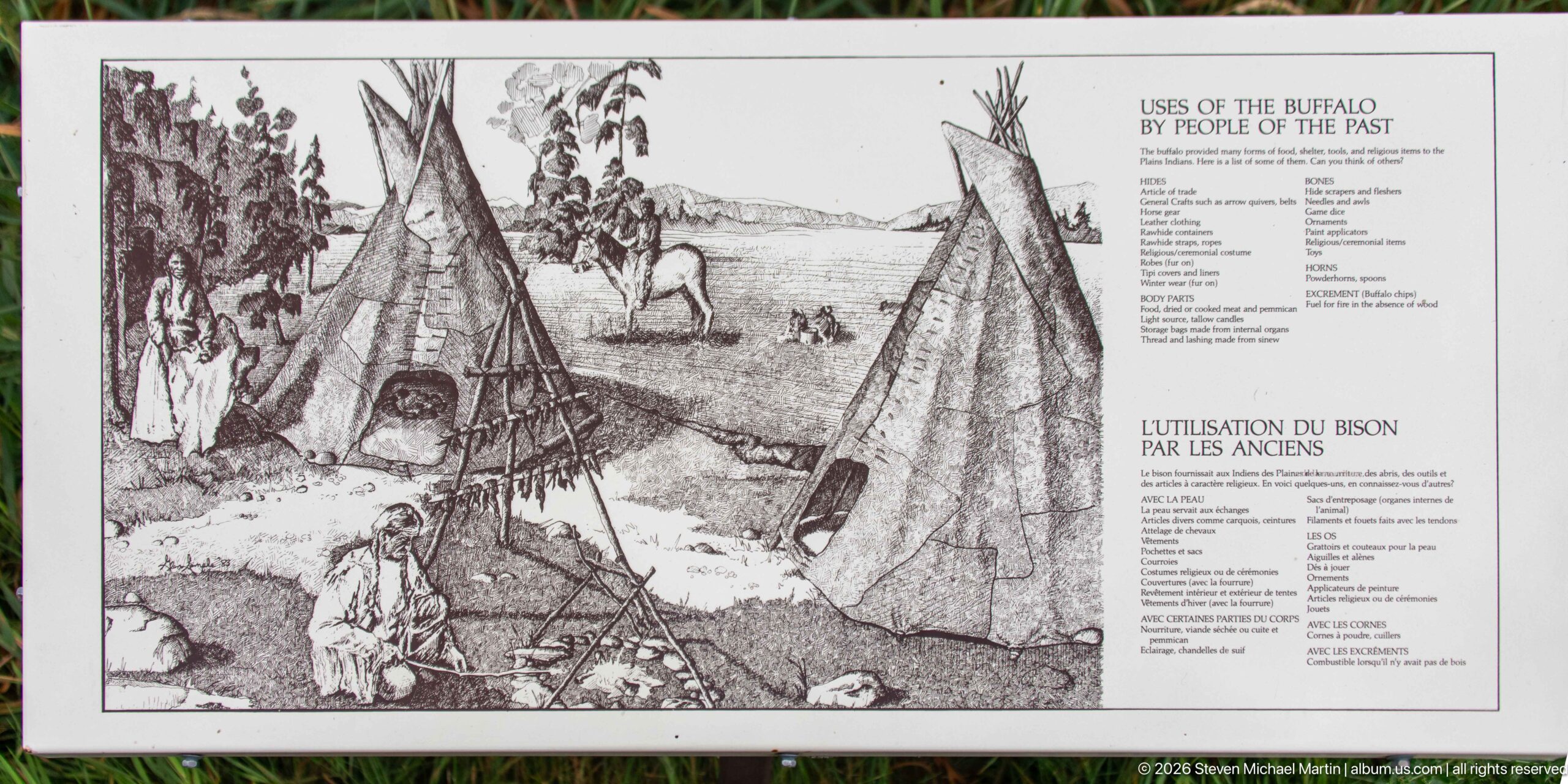
An interpretive panel titled 'Uses of the Buffalo by People of the Past' combines a camp illustration with a detailed list of how different parts of the animal were used. Tipis, people, tools, and a bison appear together, presenting the animal not simply as wildlife but as a central material resource within Indigenous life on the plains.
Caption
An interpretive panel titled 'Uses of the Buffalo by People of the Past' combines a camp illustration with a detailed list of how different parts of the animal were used. Tipis, people, tools, and a bison appear together, presenting the animal not simply as wildlife but as a central material resource within Indigenous life on the plains.
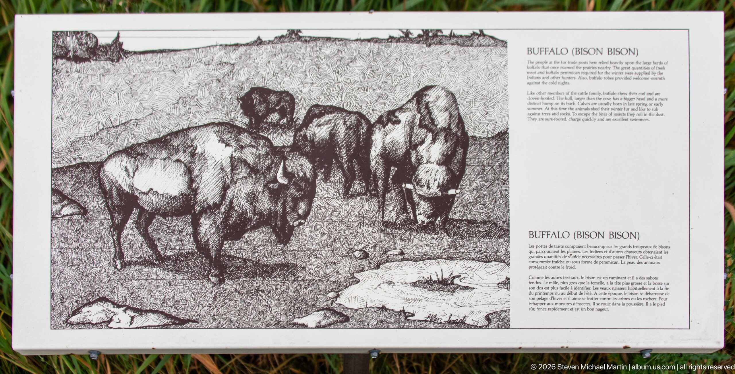
A wildlife panel identifies the buffalo, or bison, with a large black-and-white illustration of a small herd standing on open ground. English and French text accompanies the drawing, giving visitors species information within the same interpretive sequence that addresses conservation and traditional Indigenous uses of bison.
Caption
A wildlife panel identifies the buffalo, or bison, with a large black-and-white illustration of a small herd standing on open ground. English and French text accompanies the drawing, giving visitors species information within the same interpretive sequence that addresses conservation and traditional Indigenous uses of bison.
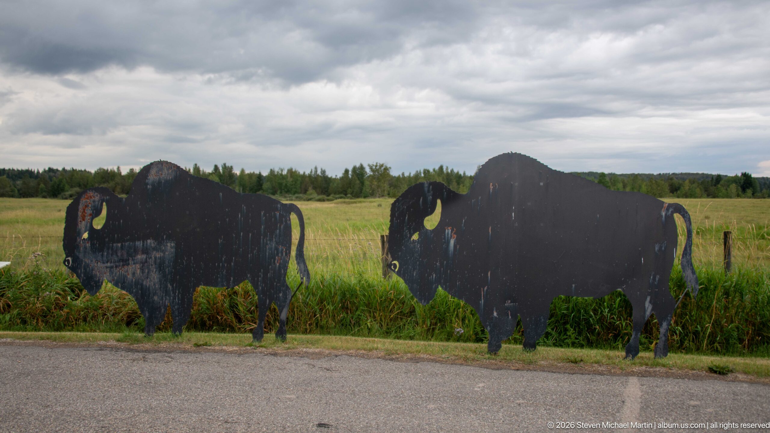
Two dark bison silhouettes stand in tall roadside grass, their curved horns and massive shoulders immediately readable against the open field. Weathering and paint loss reveal them as interpretive cutouts rather than live animals, creating a simple visual marker for the site's bison-related natural and cultural interpretation.
Caption
Two dark bison silhouettes stand in tall roadside grass, their curved horns and massive shoulders immediately readable against the open field. Weathering and paint loss reveal them as interpretive cutouts rather than live animals, creating a simple visual marker for the site's bison-related natural and cultural interpretation.
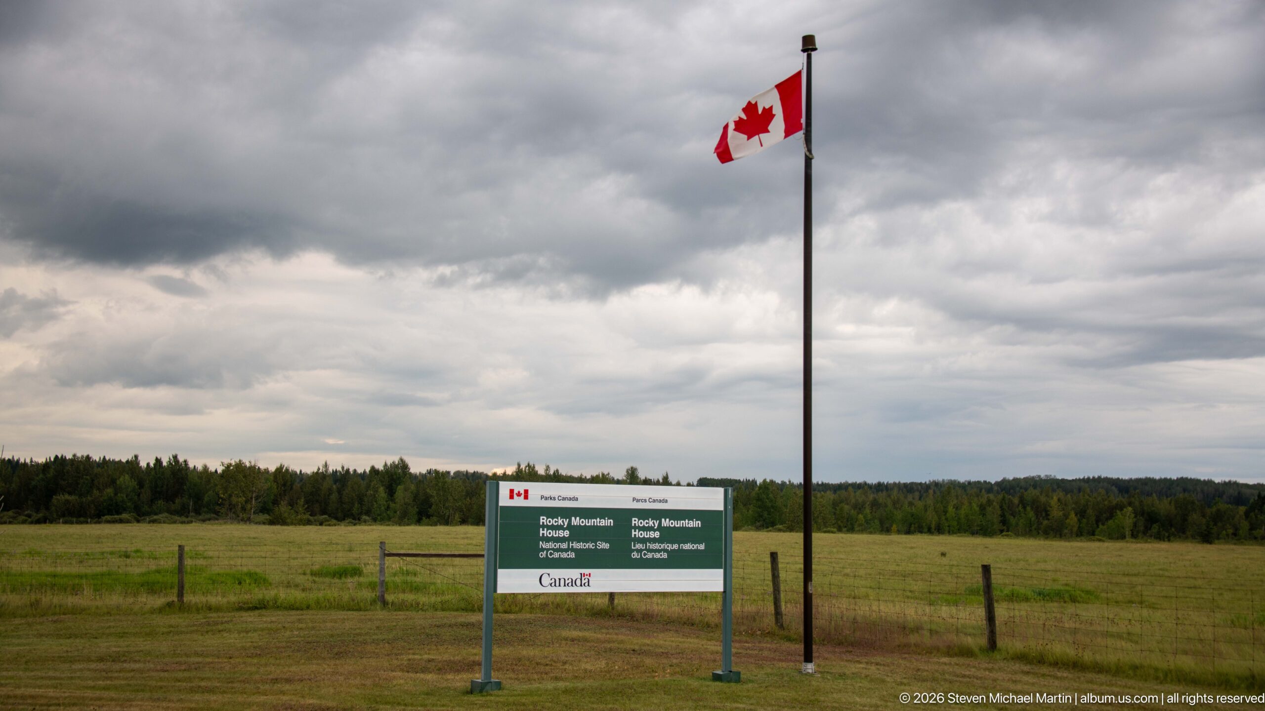
A Canadian flag flies above the bilingual Parks Canada entrance sign for Rocky Mountain House National Historic Site, set against open grassland and a distant tree line. The uncluttered composition gives the site's formal identity prominence while preserving the broad prairie setting that surrounds the historic grounds.
Caption
A Canadian flag flies above the bilingual Parks Canada entrance sign for Rocky Mountain House National Historic Site, set against open grassland and a distant tree line. The uncluttered composition gives the site's formal identity prominence while preserving the broad prairie setting that surrounds the historic grounds.
The official Parks Canada sign identifies Rocky Mountain House National Historic Site in English and French, with federal branding along its upper and lower bands. Framed tightly against grass and woodland, the view isolates the site's formal designation from the wider entrance landscape and makes the bilingual national-historic-site status clearly legible.
Caption
The official Parks Canada sign identifies Rocky Mountain House National Historic Site in English and French, with federal branding along its upper and lower bands. Framed tightly against grass and woodland, the view isolates the site's formal designation from the wider entrance landscape and makes the bilingual national-historic-site status clearly legible.
A compact green Parks Canada wayfinding sign combines the agency's beaver emblem with a bold white arrow pointing left. Mounted low beside vegetation, the marker provides simple directional guidance within the site while using the familiar national parks symbol as its primary visual identifier.
Caption
A compact green Parks Canada wayfinding sign combines the agency's beaver emblem with a bold white arrow pointing left. Mounted low beside vegetation, the marker provides simple directional guidance within the site while using the familiar national parks symbol as its primary visual identifier.
A green roadside sign directs motorists toward Rocky Mountain House National Historic Site, indicating a five-kilometre distance and displaying service symbols for visitor facilities. Positioned above a rural verge with meadow and woodland beyond, it records the transition from the regional highway network to the site's access road.
Caption
A green roadside sign directs motorists toward Rocky Mountain House National Historic Site, indicating a five-kilometre distance and displaying service symbols for visitor facilities. Positioned above a rural verge with meadow and woodland beyond, it records the transition from the regional highway network to the site's access road.
A beagle rests its head on a thick red, black, white, and gray patterned blanket inside a vehicle, looking toward the camera while another dog is partly visible behind. The intimate travel moment contrasts with the preceding roadside and site views, documenting the canine companions accompanying the journey through Alberta.
Caption
A beagle rests its head on a thick red, black, white, and gray patterned blanket inside a vehicle, looking toward the camera while another dog is partly visible behind. The intimate travel moment contrasts with the preceding roadside and site views, documenting the canine companions accompanying the journey through Alberta.
Dozens of round hay bales punctuate a broad green field beneath a pale overcast sky, creating a repeating pattern across the agricultural landscape. The low horizon and distant dark tree line emphasize the openness of the country around Rocky Mountain House, shifting the portfolio from the national historic site to the working rural landscape encountered on departure.
Caption
Dozens of round hay bales punctuate a broad green field beneath a pale overcast sky, creating a repeating pattern across the agricultural landscape. The low horizon and distant dark tree line emphasize the openness of the country around Rocky Mountain House, shifting the portfolio from the national historic site to the working rural landscape encountered on departure.
🏞️ National Park Field Guide
📍 Overview
Rocky Mountain House National Historic Site brings together the landscapes and stories of a place shaped by travel, exchange, Indigenous presence, the fur trade, and later commemoration. The portfolio moves between open meadow, woodland, river-oriented interpretation, reconstructed and archaeological settings, museum exhibits, and the modern visitor complex. Fur-trade boats, trade goods, maps, clothing, beadwork, transportation equipment, burial-ground markers, and interpretive panels show how the site uses both landscape and material culture to explain the people and networks connected with Rocky Mountain House.
🏔️ Landscape
The site occupies a broad, open setting where grassland, meadow, woodland, and river corridors provide the physical framework for the historic story. Trails pass through deciduous woods and along split-rail fencing, while wide lawns and meadow edges surround interpretive structures, the burial ground, and outdoor exhibits. Views beyond the site extend into agricultural country around the town of Rocky Mountain House, with foothills and distant mountain ridges visible from the highway. This transition from river country and prairie-like openings toward the Canadian Rockies helps explain why movement through the landscape is such a persistent theme in the site’s interpretation.
🪨 Geology
The portfolio does not document exposed bedrock, distinctive formations, or other geological features closely enough to support a detailed geological interpretation. Instead, the physical landscape is expressed through the broad valley setting, river corridor, open fields, and distant foothills and mountain ridges visible near Rocky Mountain House. These landforms provide the regional setting for the site’s cultural history without supplying enough photographic evidence to identify specific rock units or geological processes.
🌿 Ecology
Meadow, grassland, riparian vegetation, and mixed woodland create a varied ecological setting around the historic site. The photographs include living mule deer in the developed grounds, including alert portraits, a full-body view beside a tree, and an animal walking across grass. Other images record purple thistle-like flowers, seed heads, silvery foliage, riverbank vegetation, and broad meadow edges. Bison are also prominent in the portfolio and in site interpretation, although the evidence package does not classify the photographed herd views as eligible wildlife encounters. Together, these subjects show how natural habitats remain visible alongside the site’s cultural and archaeological interpretation.
🦌 Wildlife Encounters
Photographs in this portfolio document wildlife encounters with Mule deer in the Jasper landscape. The photographs place these animals in settings that include Mule deer three-quarter portrait, Full-body mule deer beside tree, and Walking mule deer. These encounters provide direct, visit-specific evidence of how wildlife uses the habitats interpreted in this field guide.
🦌 Wildlife
Mule deer are the clearest documented wildlife encounter in the portfolio. Several photographs follow the same species at close range: a nearly frontal animal with long ears and dark muzzle, a full-body deer standing beside a mature tree, and another walking across a grassy lawn. These views place wildlife within the site’s managed landscape rather than in a remote backcountry setting. Bison appear repeatedly in meadow views and interpretive displays, reinforcing their importance to the site’s broader grassland and Indigenous cultural interpretation, but only the mule deer records are identified in the supplied evidence as eligible photographed wildlife encounters.
🧭 Human History
Human history dominates the interpretation at Rocky Mountain House National Historic Site. Exhibits describe Indigenous travel and trade, the North West Company and Hudson’s Bay Company, trading-post commerce, river transportation, Red River carts, surveying and navigation, and the succession of fur-trade posts associated with the site. First Nations interpretation identifies Nakoda, Siksika, Tsuut’ina, Ktunaxa, Piikani, Nehiyawak, and Kainai connections to the region, while Métis flags and displays of clothing, beadwork, painted hide, horse equipment, and other material culture broaden the story beyond company operations. The historic burial ground, with simple white markers and a trilingual memorial plaque, adds a commemorative dimension by marking the resting place of more than sixty Aboriginal and European descendants associated with the fur trade between 1799 and 1875. Outdoor interpretation also identifies the final fur-trade post, established in 1868 and closed in 1875, with surviving stone chimneys serving as tangible remnants of that last occupation.
🥾 Visitor Experience
A visit unfolds through several distinct settings. The visitor centre introduces the site with maps, timelines, artifacts, cultural displays, and exhibits such as “Tales of a Trading Post.” Outside, trails connect the interpreted fort area, boat and cart displays, the burial ground, open meadows, and sheltered interpretive stations. Orientation maps, bilingual signage, multilingual welcome text, Parks Canada banners, and family-focused Xplorers material make the contemporary visitor infrastructure easy to recognize. The experience alternates between close observation of objects and signs and broader walks through grassland and woodland, allowing the historical narrative to remain tied to the physical setting.
📷 Photography Notes
The portfolio is strongest when it alternates scale and subject type. Wide views establish the fort enclosure, burial ground, meadow, visitor complex, and surrounding Alberta landscape; medium views show boats, carts, interpretive stations, and museum displays; close photographs isolate beadwork, painted hide, instruments, signs, flowers, and wildlife. The mule deer sequence demonstrates the value of changing viewpoint and framing around a repeated subject, while the burial-ground photographs move effectively from memorial plaque to individual marker to broad landscape. Overcast light keeps detail visible across timber, grass, museum cases, and signage, and the final highway panoramas provide a useful geographic transition from the historic site to the town, foothills, and distant mountains.