Jasper Columbia Icefield
The Columbia Icefield, straddling the Continental Divide in the Canadian Rockies, is the largest icefield in the Rocky Mountains and one of the defining landscapes of Jasper National Park. Covering more than 300 square kilometers of high alpine terrain, the icefield feeds several major glaciers, including the Athabasca, Dome, Stutfield, Columbia, and Saskatchewan Glaciers. Its position high along the Continental Divide also creates an extraordinary hydrological crossroads, with meltwater ultimately flowing toward the Pacific, Arctic, and Atlantic Ocean drainage systems. ([Parks Canada][1])
The most accessible part of the icefield is the Athabasca Glacier, which descends from the immense ice plateau toward the Icefields Parkway. Here the glacier has shaped a stark landscape of moraines, exposed rock, meltwater, and broad U-shaped valleys that reveal the immense erosive power of ice. The glacier has been retreating for more than a century, leaving its former extent clearly visible across the valley floor. The Columbia Icefield and its glaciers remain important subjects of scientific study as researchers document changes in ice volume, snowfall, temperature, and the flow of glacier-fed rivers throughout the Canadian Rockies.
Today the Columbia Icefield forms one of the most dramatic sections of the Icefields Parkway, the 230-kilometer mountain road linking Jasper and Lake Louise. The route provides views of the Athabasca and neighboring glaciers as they descend from some of the highest peaks in the Canadian Rockies, including the great massif surrounding Mount Columbia, Alberta’s highest peak. The icefield lies within the Canadian Rocky Mountain Parks UNESCO World Heritage Site, where glaciers, rivers, mountains, and exposed geology preserve an exceptional record of the forces that continue to shape this landscape.
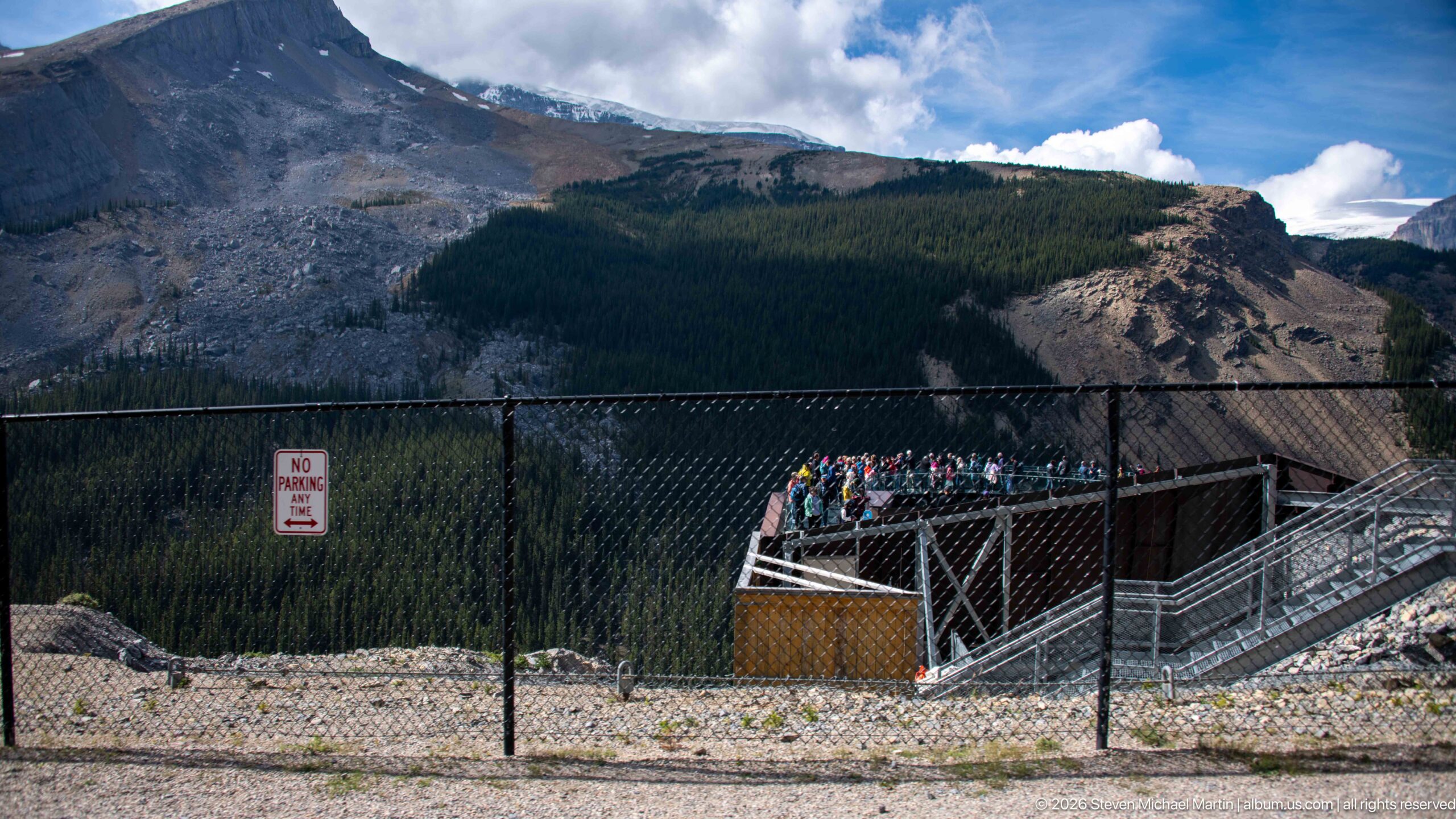
The approach to the Columbia Icefield Skywalk reveals the observation structure projecting over the steep Sunwapta Valley. Railings, stairs, and the cantilevered platform introduce a distinctly human scale against forested slopes, exposed rock, and the immense glacially carved mountain landscape.
Caption
The approach to the Columbia Icefield Skywalk reveals the observation structure projecting over the steep Sunwapta Valley. Railings, stairs, and the cantilevered platform introduce a distinctly human scale against forested slopes, exposed rock, and the immense glacially carved mountain landscape.
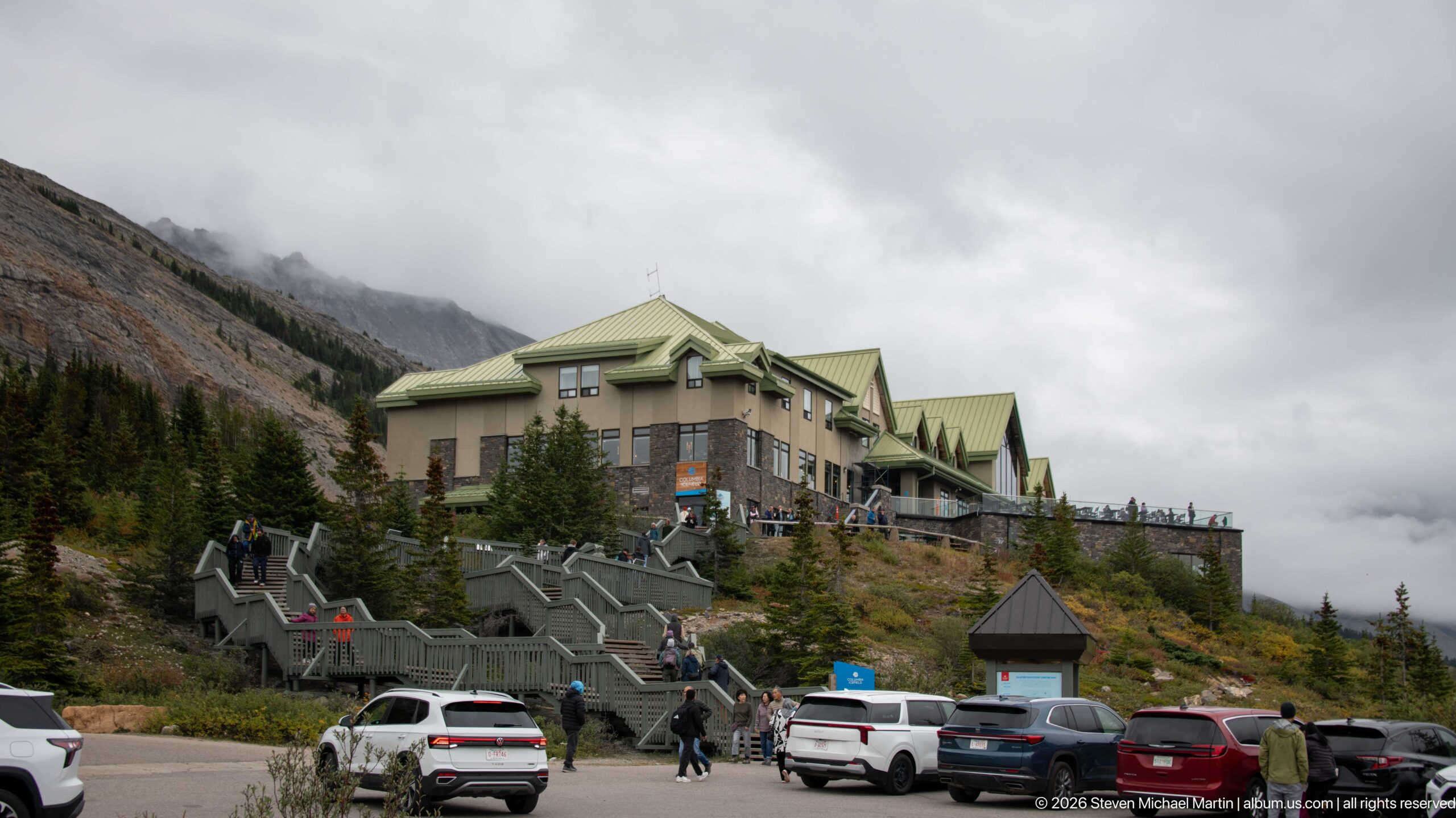
The Columbia Icefield Glacier Discovery Centre rises above the parking area in a complex of stone, stucco, and green metal roofs. Broad exterior stairs carry visitors up the slope to the building, which serves as the principal orientation and tour hub facing the Athabasca Glacier area along the Icefields Parkway.
Caption
The Columbia Icefield Glacier Discovery Centre rises above the parking area in a complex of stone, stucco, and green metal roofs. Broad exterior stairs carry visitors up the slope to the building, which serves as the principal orientation and tour hub facing the Athabasca Glacier area along the Icefields Parkway.
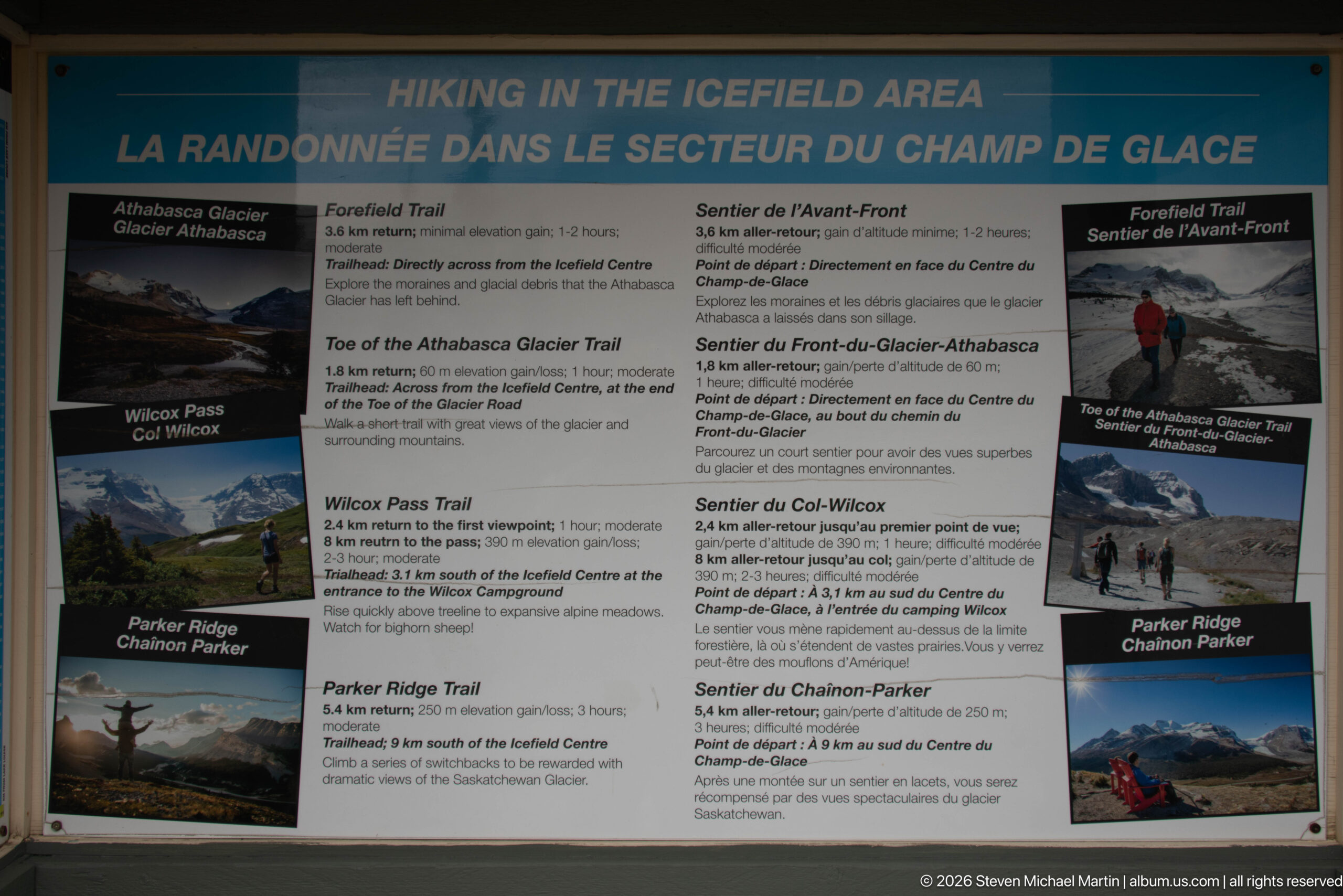
A bilingual hiking board summarizes major walks in the Columbia Icefield area, including the Athabasca Glacier, Forefield, Wilcox Pass, Toe of the Athabasca Glacier, and Parker Ridge trails. Photographs, distances, and estimated times provide a compact orientation to routes ranging from short glacier approaches to longer alpine hikes.
Caption
A bilingual hiking board summarizes major walks in the Columbia Icefield area, including the Athabasca Glacier, Forefield, Wilcox Pass, Toe of the Athabasca Glacier, and Parker Ridge trails. Photographs, distances, and estimated times provide a compact orientation to routes ranging from short glacier approaches to longer alpine hikes.
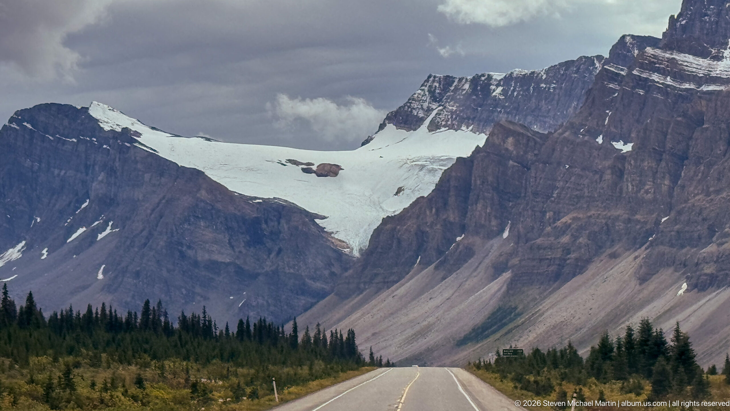
The Icefields Parkway runs directly toward a dramatic mountain wall where a broad snow-and-ice field occupies the high saddle between steep sedimentary cliffs. The centered roadway creates a strong sense of approach and scale, closing the portfolio with the road itself as the foreground route into the glaciated Canadian Rockies.
Caption
The Icefields Parkway runs directly toward a dramatic mountain wall where a broad snow-and-ice field occupies the high saddle between steep sedimentary cliffs. The centered roadway creates a strong sense of approach and scale, closing the portfolio with the road itself as the foreground route into the glaciated Canadian Rockies.
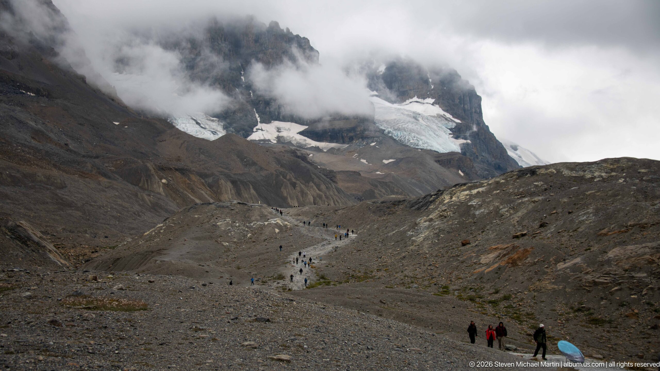
Visitors walking across the glacial forefield toward Athabasca Glacier forms the principal subject of this Columbia Icefield view. Numerous small figures follow a pale trail across barren moraine toward glacier ice beneath low cloud and steep rock walls. The composition records the close relationship among glacier ice, exposed sedimentary rock, moraine or alpine vegetation that defines this high-elevation Canadian Rockies landscape.
Caption
Visitors walking across the glacial forefield toward Athabasca Glacier forms the principal subject of this Columbia Icefield view. Numerous small figures follow a pale trail across barren moraine toward glacier ice beneath low cloud and steep rock walls. The composition records the close relationship among glacier ice, exposed sedimentary rock, moraine or alpine vegetation that defines this high-elevation Canadian Rockies landscape.
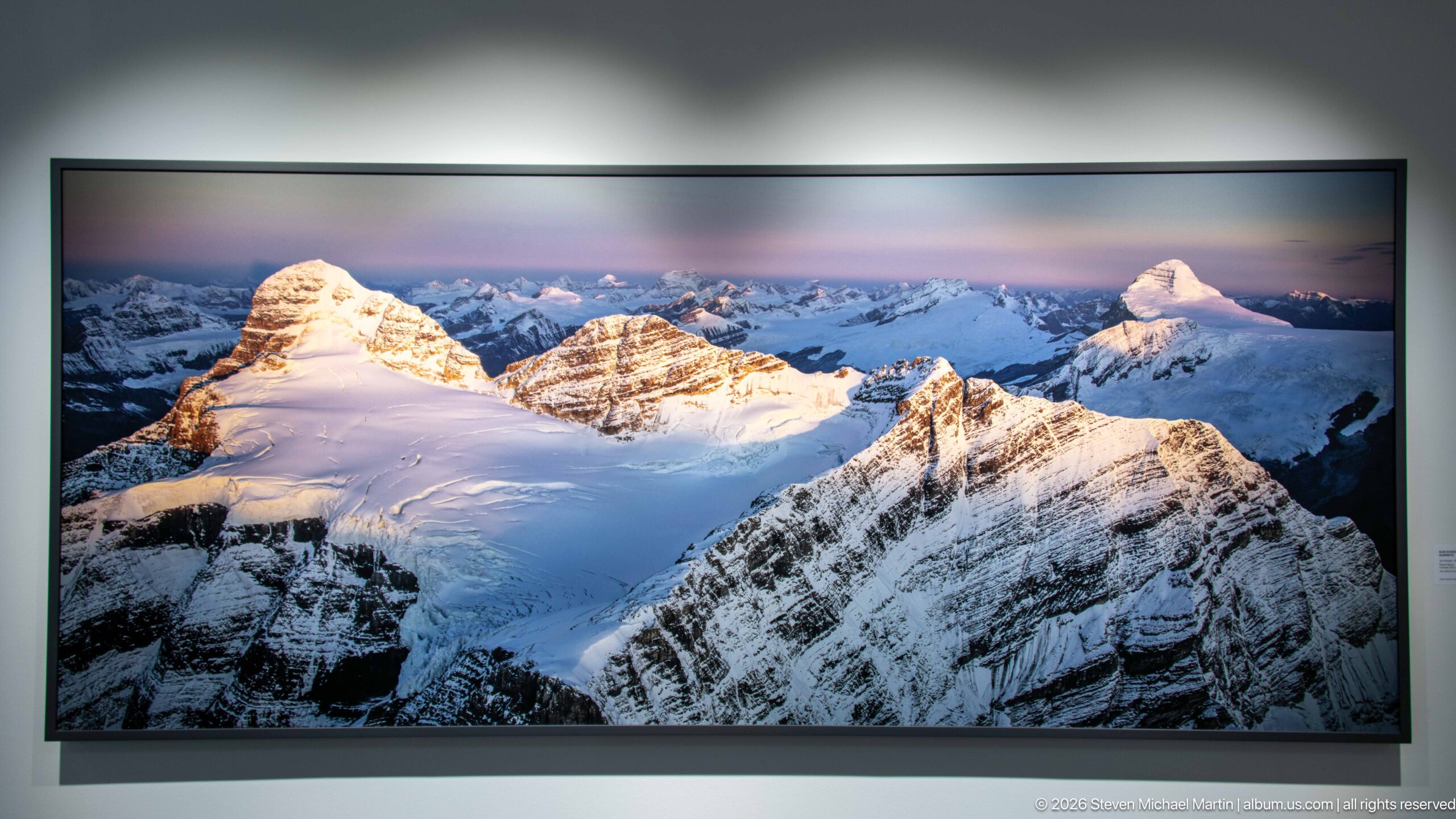
A panoramic gallery photograph shows snow-covered peaks rising around a broad high icefield, with warm sunlight catching the summits beneath a pastel sky. The elevated perspective reveals how glaciers occupy connected basins and saddles across the high Canadian Rockies rather than existing only as isolated valley tongues.
Caption
A panoramic gallery photograph shows snow-covered peaks rising around a broad high icefield, with warm sunlight catching the summits beneath a pastel sky. The elevated perspective reveals how glaciers occupy connected basins and saddles across the high Canadian Rockies rather than existing only as isolated valley tongues.
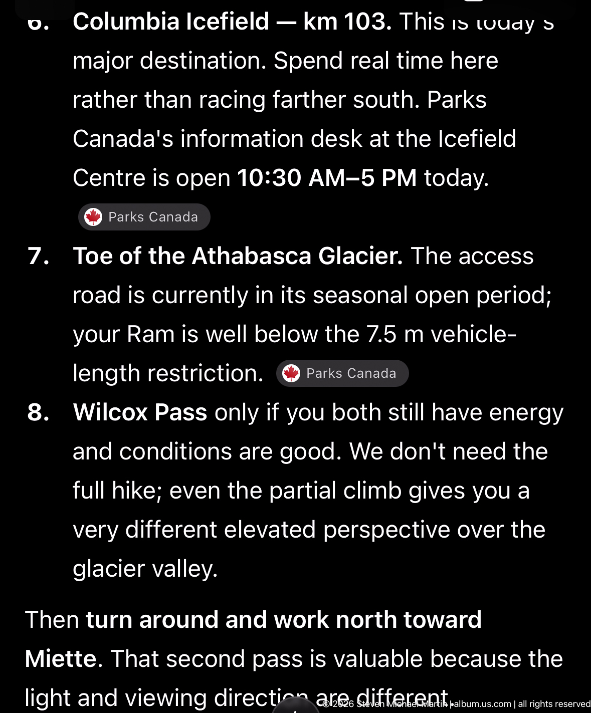
Travel-planning notes organize a Columbia Icefield stop around the Athabasca Glacier and Wilcox Pass. The visible text records practical Parks Canada information and route guidance, providing documentary context for the day's exploration rather than a landscape view of the icefield itself.
Caption
Travel-planning notes organize a Columbia Icefield stop around the Athabasca Glacier and Wilcox Pass. The visible text records practical Parks Canada information and route guidance, providing documentary context for the day's exploration rather than a landscape view of the icefield itself.
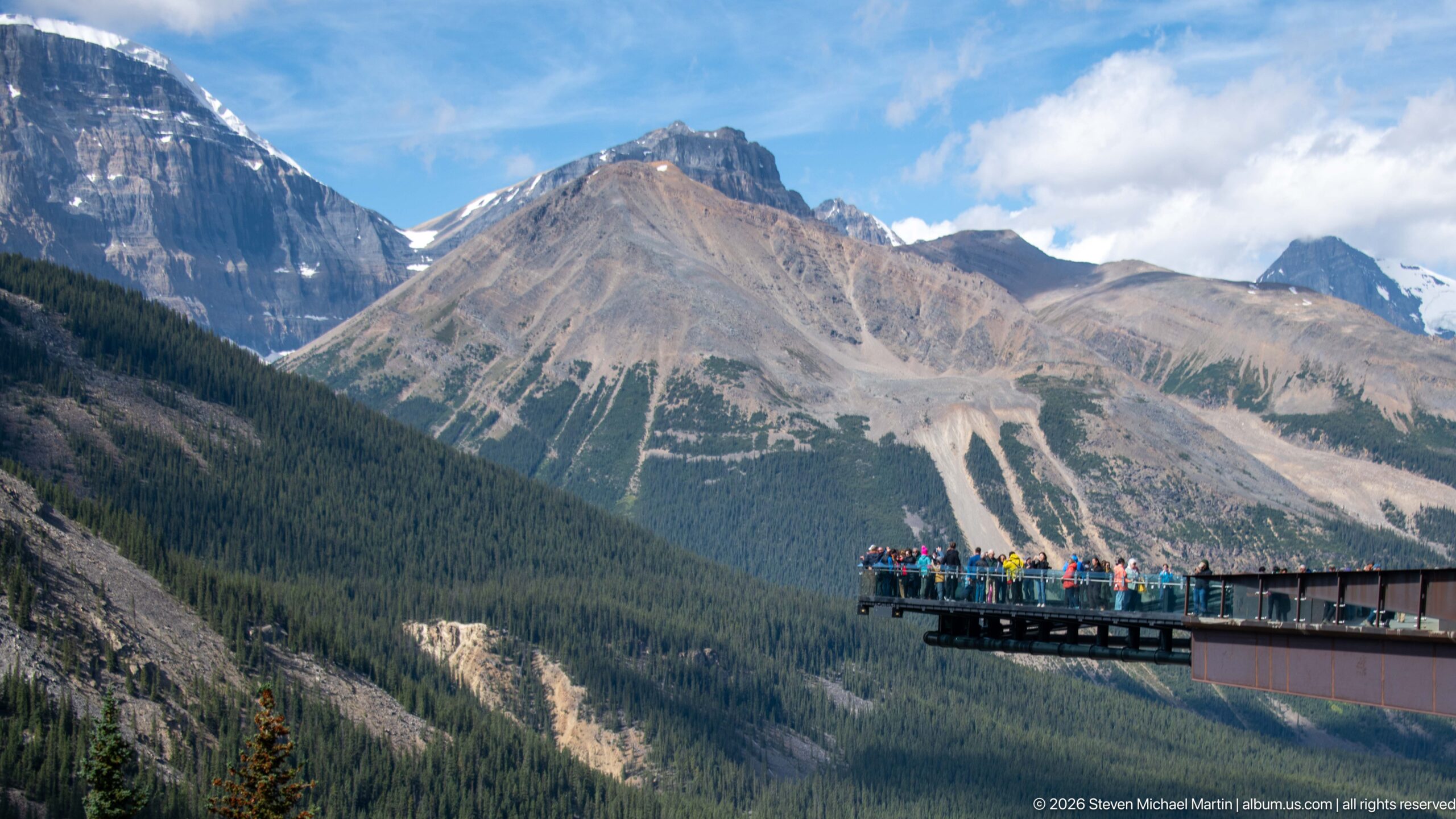
The Columbia Icefield Skywalk projects into an expansive Rocky Mountain panorama, with visitors concentrated at the glass-railed outer platform. By placing the structure at the edge of the frame, the composition gives greater weight to the surrounding valley, forest, scree slopes, and layered peaks.
Caption
The Columbia Icefield Skywalk projects into an expansive Rocky Mountain panorama, with visitors concentrated at the glass-railed outer platform. By placing the structure at the edge of the frame, the composition gives greater weight to the surrounding valley, forest, scree slopes, and layered peaks.
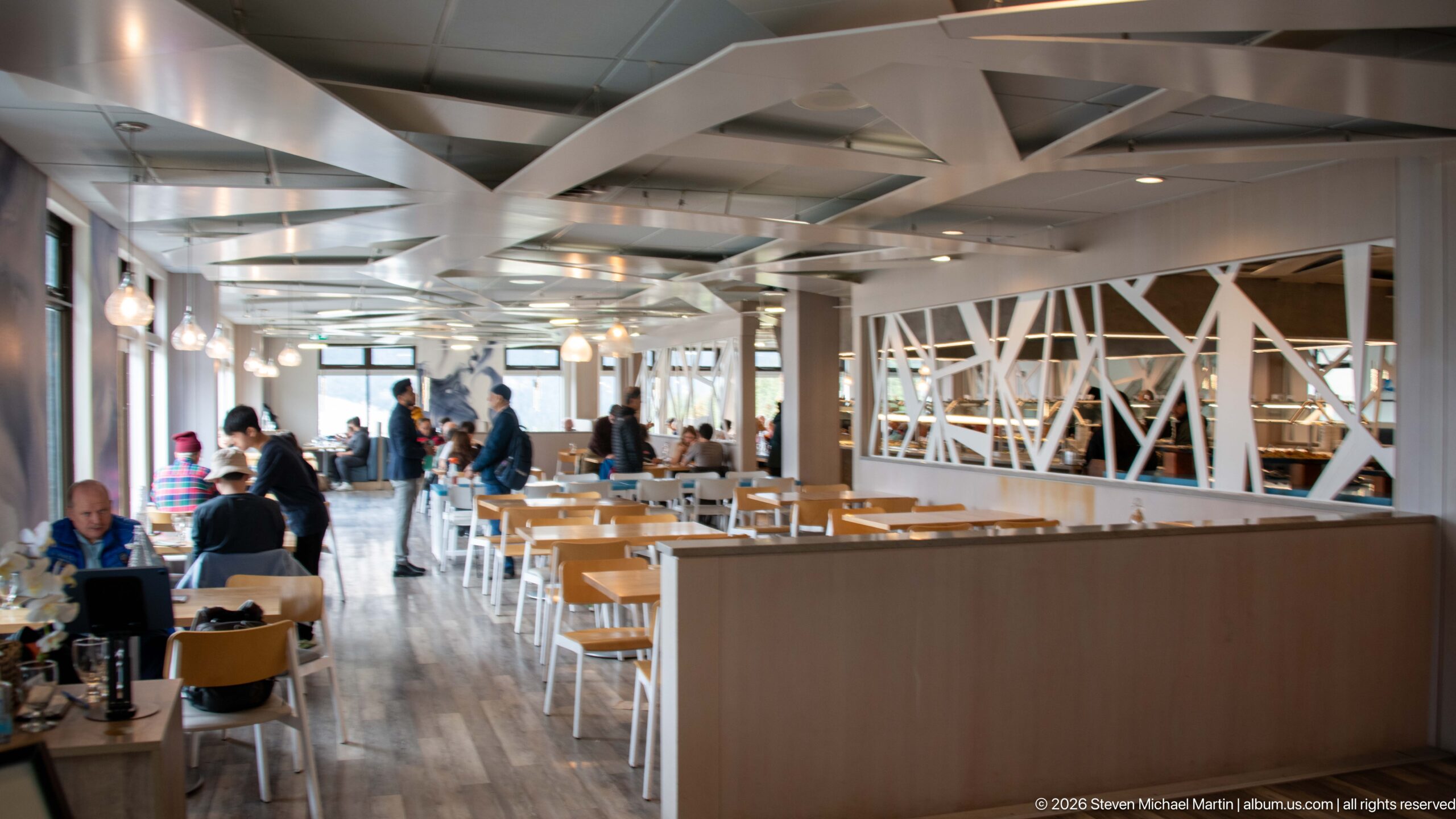
A bright dining area inside the Columbia Icefield visitor centre combines pale wood furnishings with white exposed trusses and globe-like pendant lights. Large windows and an open plan keep the space visually connected to the mountain setting while accommodating visitors between glacier excursions and road travel.
Caption
A bright dining area inside the Columbia Icefield visitor centre combines pale wood furnishings with white exposed trusses and globe-like pendant lights. Large windows and an open plan keep the space visually connected to the mountain setting while accommodating visitors between glacier excursions and road travel.
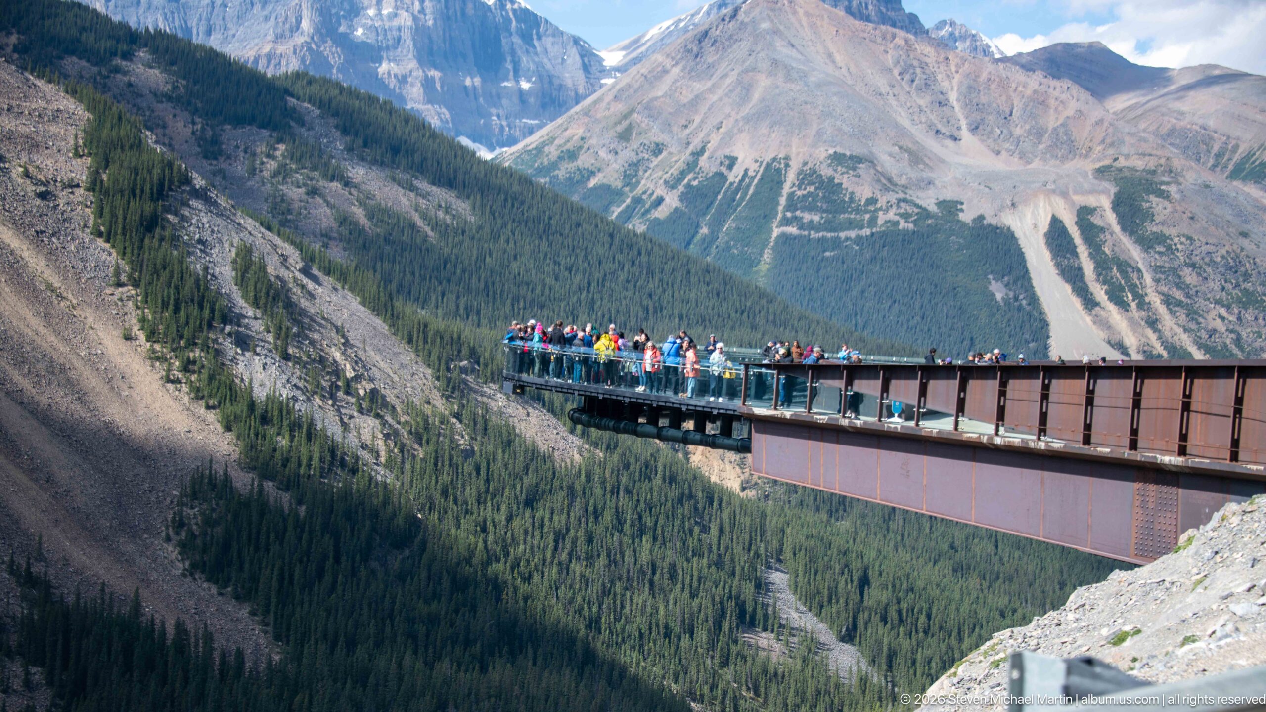
Visitors gather at the outer end of the Columbia Icefield Skywalk, a cantilevered observation platform extending over the Sunwapta Valley. The side view emphasizes the structure's projection beyond the cliff edge and its dramatic relationship to the steep forested slopes and sedimentary mountains beyond.
Caption
Visitors gather at the outer end of the Columbia Icefield Skywalk, a cantilevered observation platform extending over the Sunwapta Valley. The side view emphasizes the structure's projection beyond the cliff edge and its dramatic relationship to the steep forested slopes and sedimentary mountains beyond.

A plush moose branded “Columbia Icefield” represents the wildlife-themed merchandise sold at the visitor complex. Its exaggerated antlers and patterned garment turn a recognizable Canadian animal into a souvenir, illustrating how regional wildlife imagery is incorporated into the commercial side of the Columbia Icefield visitor experience.
Caption
A plush moose branded “Columbia Icefield” represents the wildlife-themed merchandise sold at the visitor complex. Its exaggerated antlers and patterned garment turn a recognizable Canadian animal into a souvenir, illustrating how regional wildlife imagery is incorporated into the commercial side of the Columbia Icefield visitor experience.
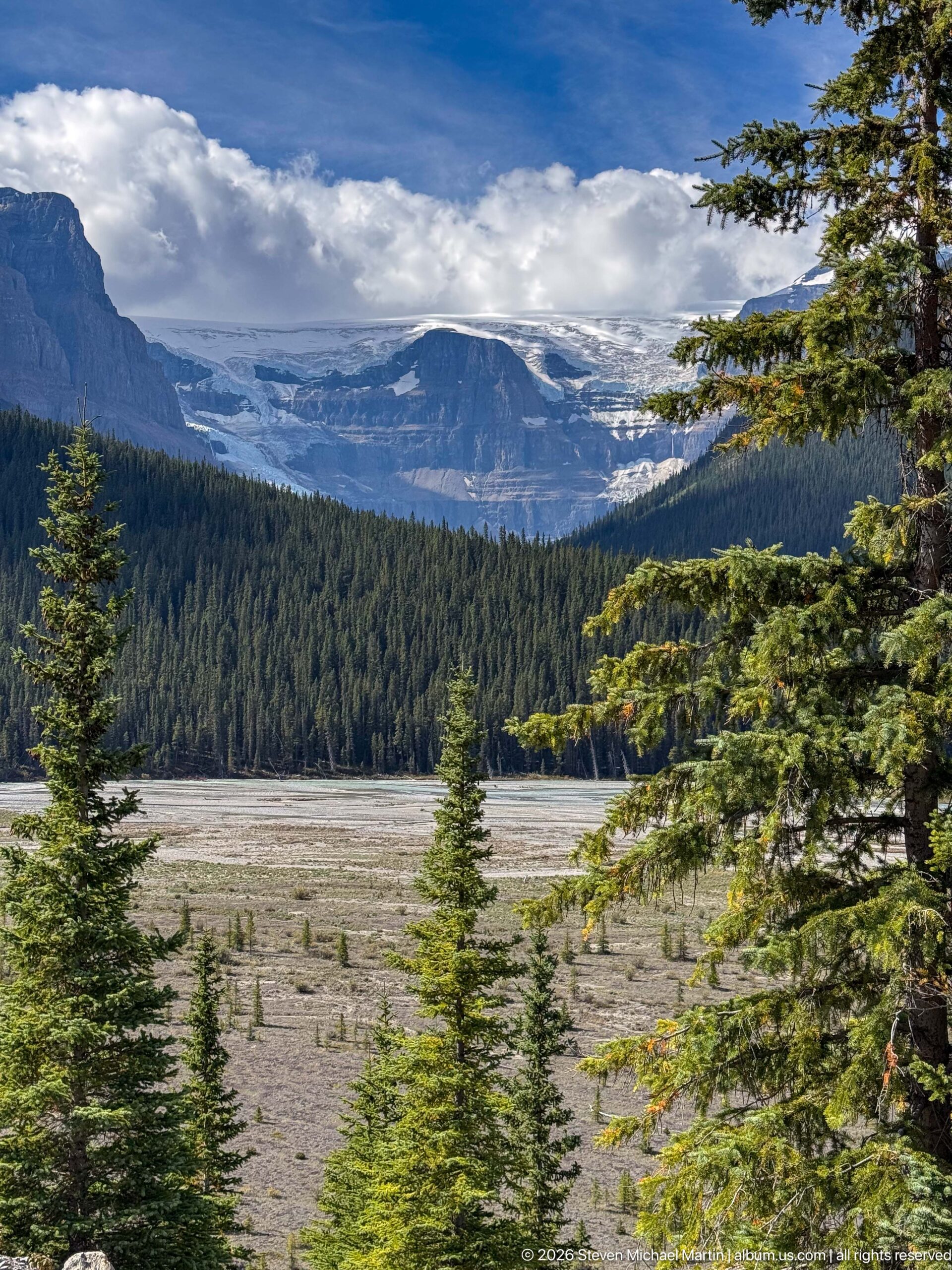
Across a broad gravelly forefield and dense conifer forest, a distant glacier descends from cloud-covered high country. The layered view places active ice within the larger Rocky Mountain landscape, with forest, recently worked sediment, and steep mountain walls emphasizing the scale of the glaciated terrain.
Caption
Across a broad gravelly forefield and dense conifer forest, a distant glacier descends from cloud-covered high country. The layered view places active ice within the larger Rocky Mountain landscape, with forest, recently worked sediment, and steep mountain walls emphasizing the scale of the glaciated terrain.
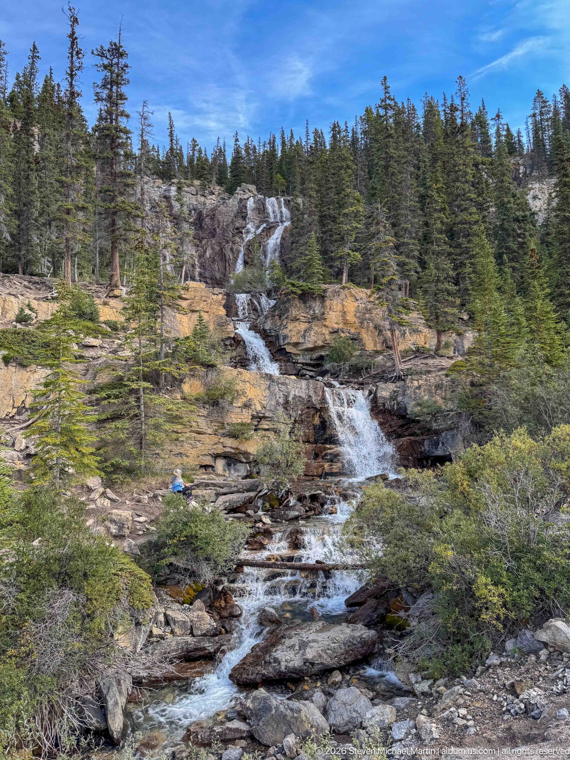
A mountain stream drops through a succession of small falls over dark, stepped bedrock, framed by conifers and low subalpine shrubs. The broken channel illustrates how steep Rocky Mountain terrain concentrates runoff into energetic cascades before the water reaches the broader glacier-shaped valleys below.
Caption
A mountain stream drops through a succession of small falls over dark, stepped bedrock, framed by conifers and low subalpine shrubs. The broken channel illustrates how steep Rocky Mountain terrain concentrates runoff into energetic cascades before the water reaches the broader glacier-shaped valleys below.
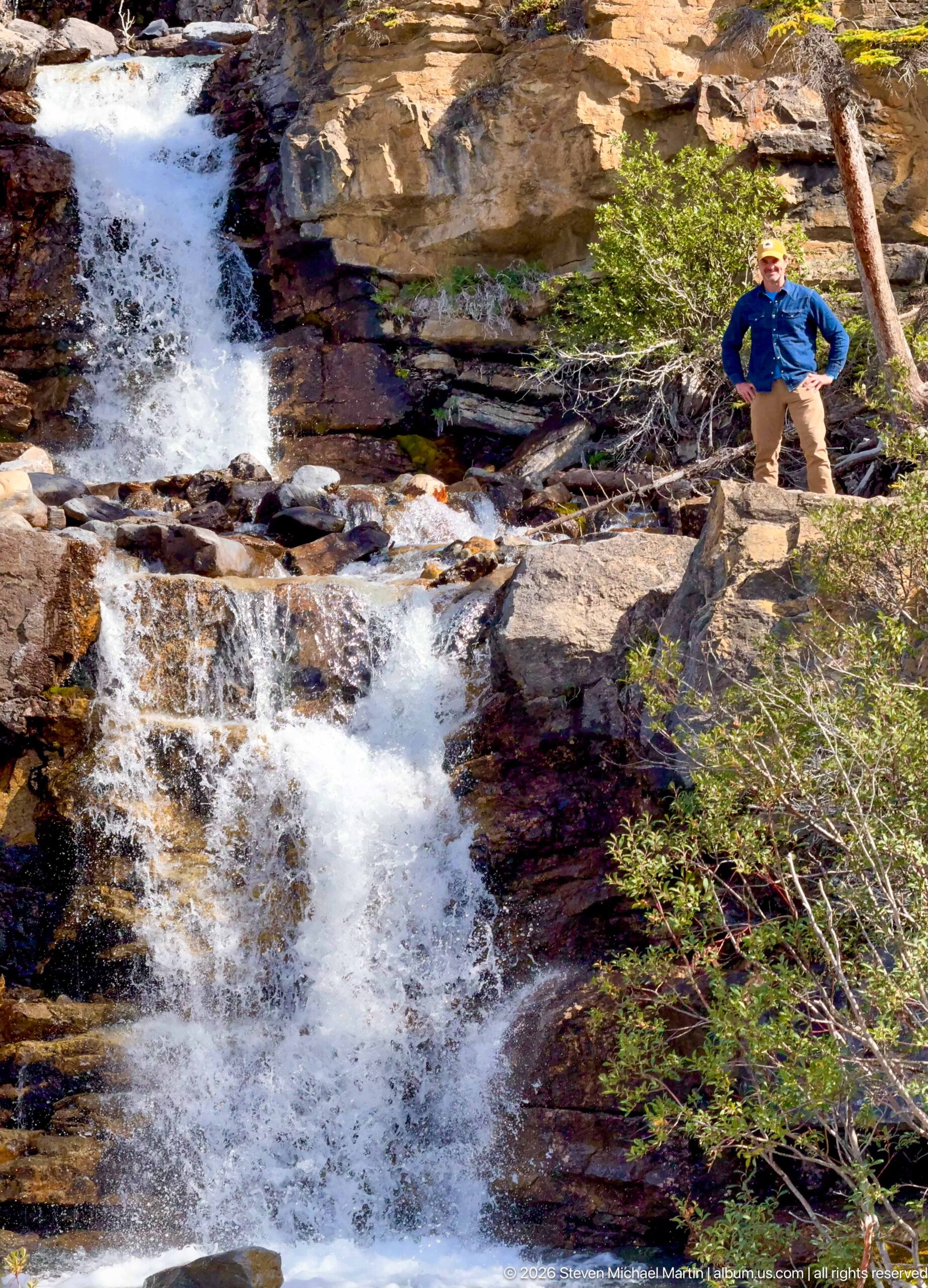
A visitor stands above a stepped mountain cascade as white water rushes over blocky bedrock and around fallen timber. The human figure gives the channel scale and distinguishes this intimate streamside view from the broader waterfall compositions elsewhere in the sequence.
Caption
A visitor stands above a stepped mountain cascade as white water rushes over blocky bedrock and around fallen timber. The human figure gives the channel scale and distinguishes this intimate streamside view from the broader waterfall compositions elsewhere in the sequence.
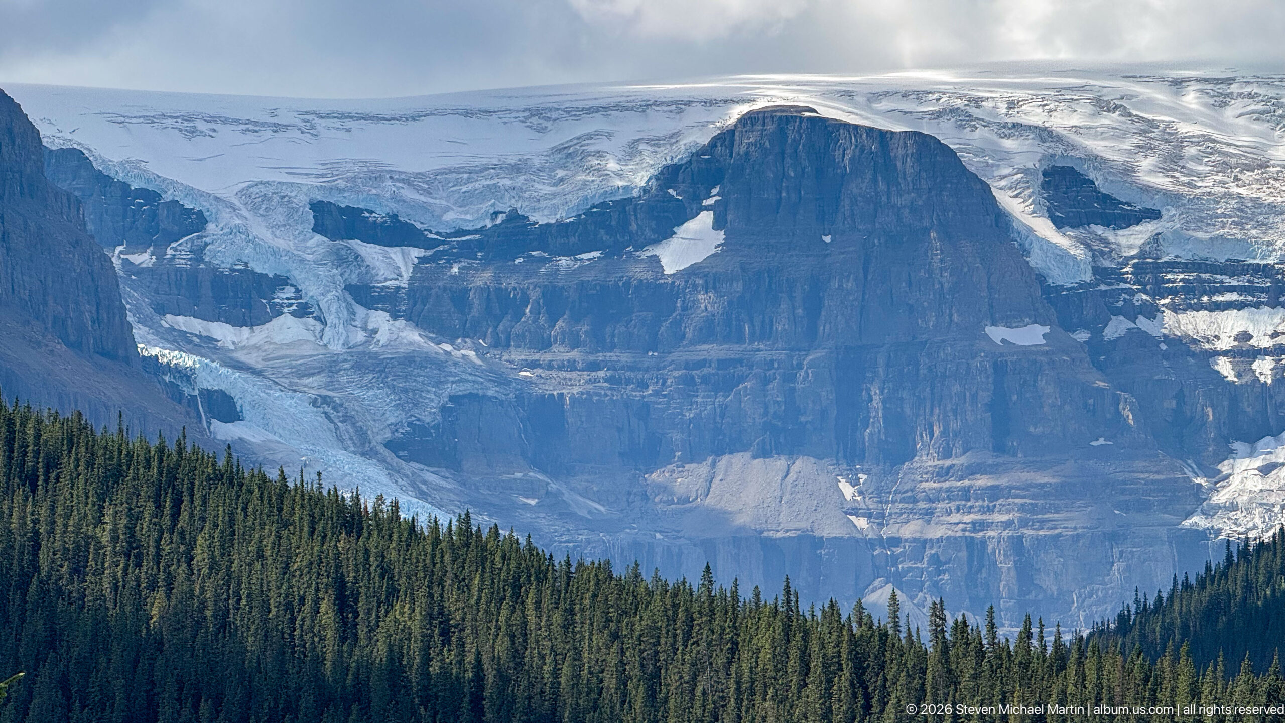
Glacier ice pours around a massive, horizontally layered rock buttress above a dark band of conifer forest. Crevassed ice, exposed sedimentary cliffs, and lingering snowfields reveal the close relationship between resistant mountain bedrock and the outlet glaciers descending from the Columbia Icefield region.
Caption
Glacier ice pours around a massive, horizontally layered rock buttress above a dark band of conifer forest. Crevassed ice, exposed sedimentary cliffs, and lingering snowfields reveal the close relationship between resistant mountain bedrock and the outlet glaciers descending from the Columbia Icefield region.
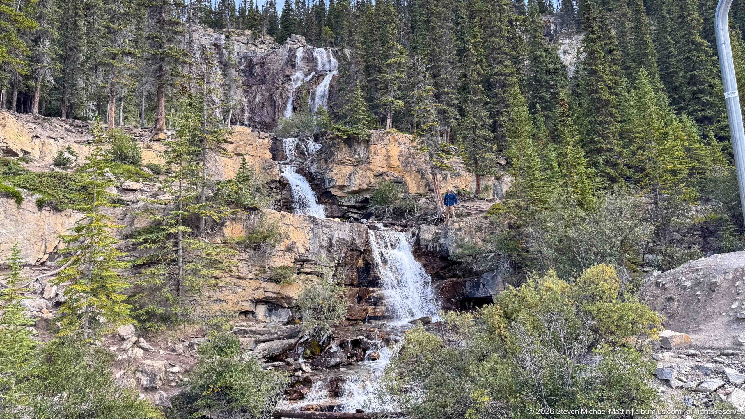
A narrow waterfall descends over a sequence of resistant rock ledges amid conifers and shrubs. A visitor standing beside the upper cascade provides a useful sense of scale, while the exposed strata and broken blocks show how flowing water follows weaknesses in the mountain bedrock.
Caption
A narrow waterfall descends over a sequence of resistant rock ledges amid conifers and shrubs. A visitor standing beside the upper cascade provides a useful sense of scale, while the exposed strata and broken blocks show how flowing water follows weaknesses in the mountain bedrock.
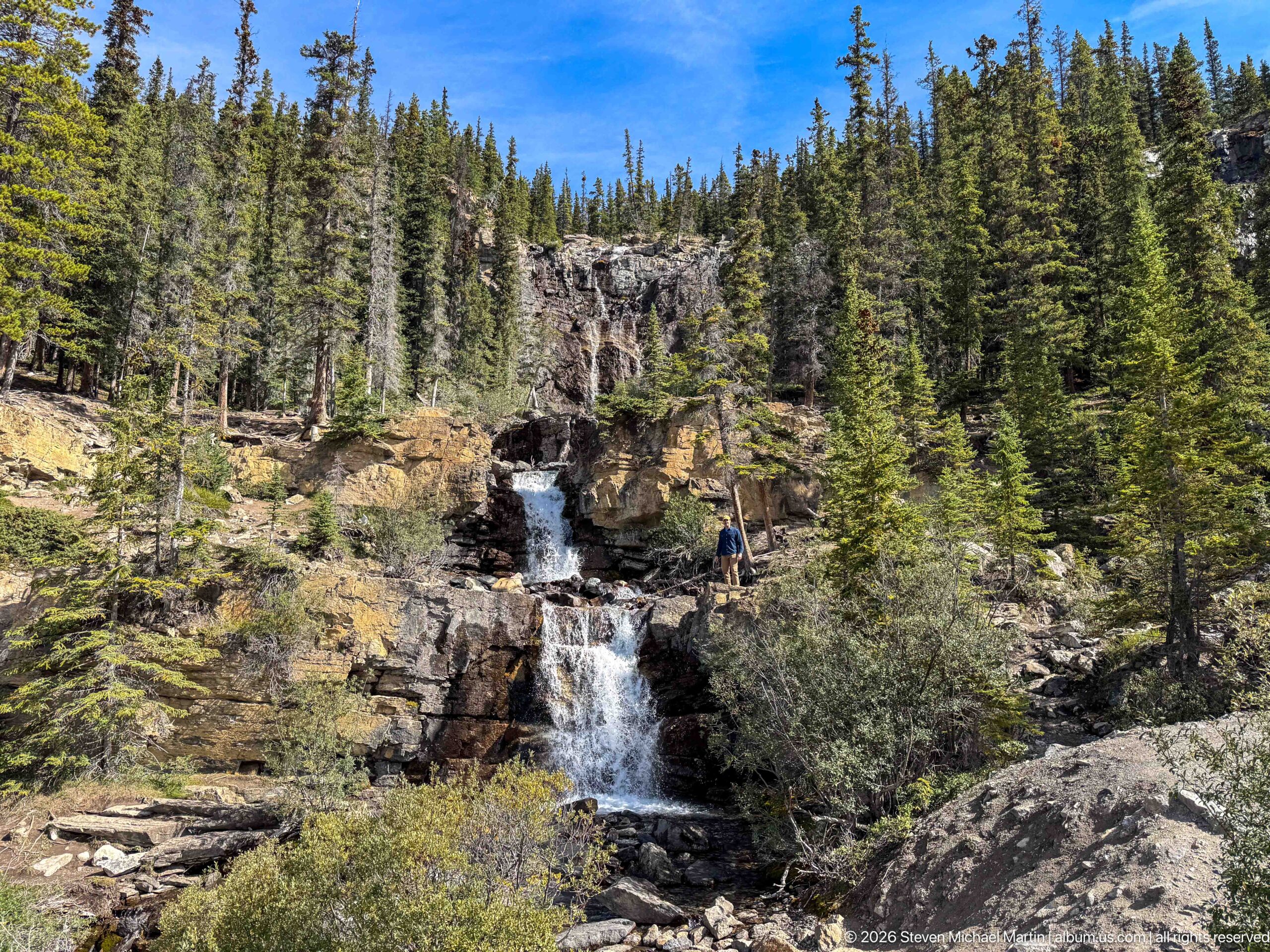
White water plunges through a dark cleft in layered rock, enclosed by a steep conifer forest and scattered low shrubs. The compact view concentrates attention on the waterfall's vertical drop and the resistant bedrock that confines the stream within this rugged mountain channel.
Caption
White water plunges through a dark cleft in layered rock, enclosed by a steep conifer forest and scattered low shrubs. The compact view concentrates attention on the waterfall's vertical drop and the resistant bedrock that confines the stream within this rugged mountain channel.
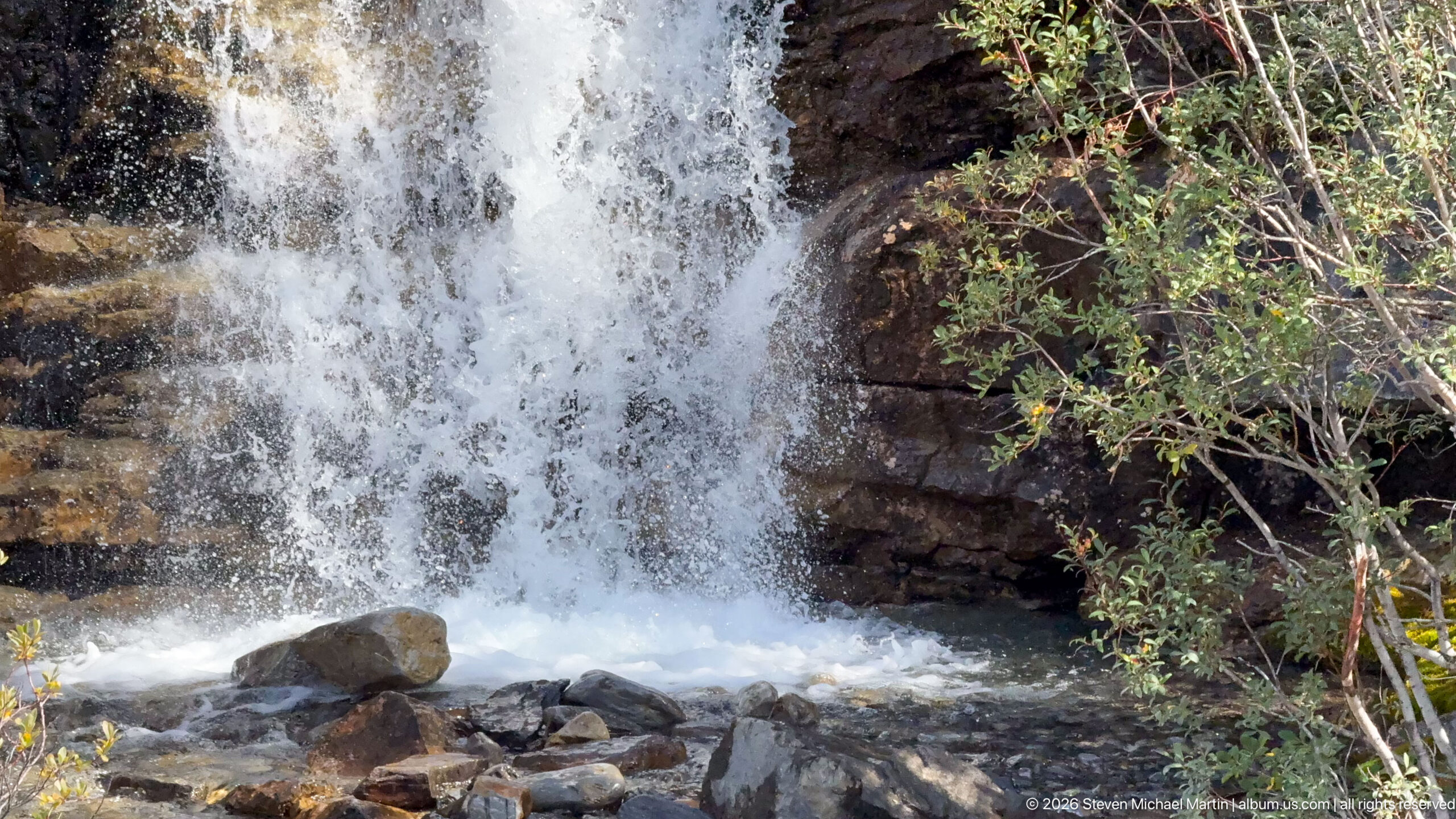
Foaming water fills the frame as it drops over a dark rock lip into a shallow, boulder-strewn plunge pool. Leafy shrubs at the edge soften the otherwise rocky composition, while the close viewpoint emphasizes turbulence, spray, and the erosive force of the stream.
Caption
Foaming water fills the frame as it drops over a dark rock lip into a shallow, boulder-strewn plunge pool. Leafy shrubs at the edge soften the otherwise rocky composition, while the close viewpoint emphasizes turbulence, spray, and the erosive force of the stream.
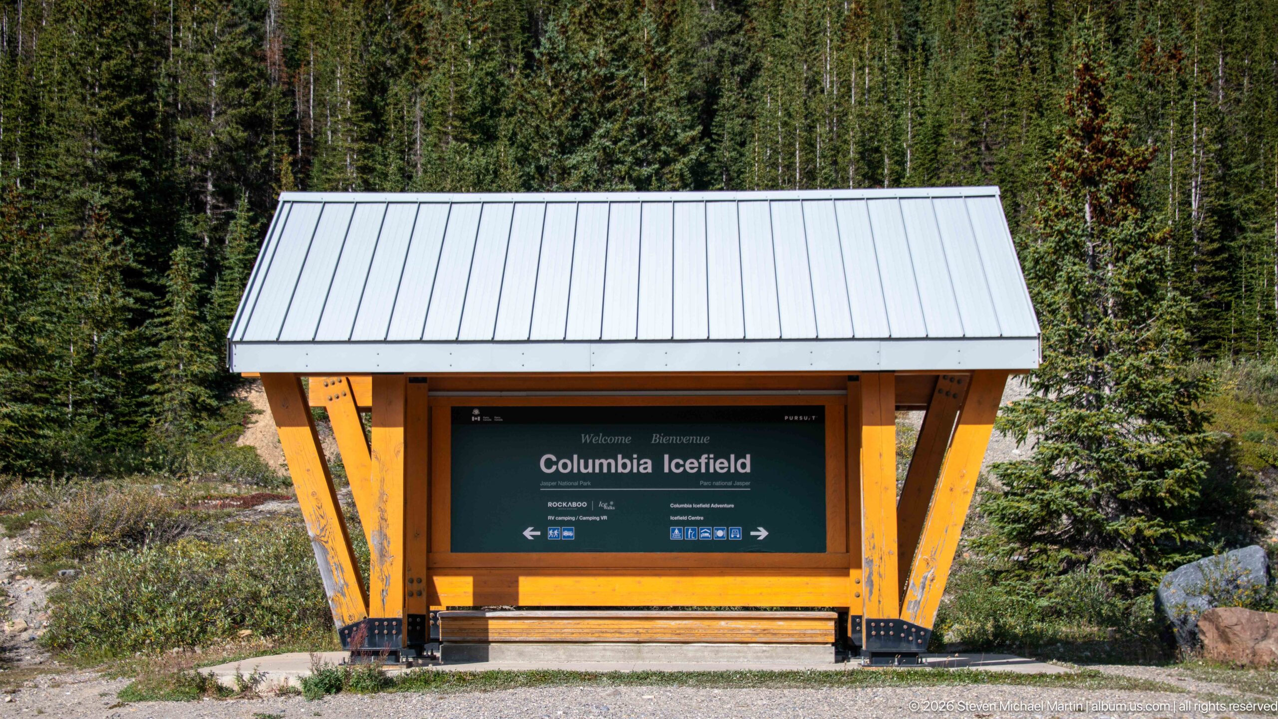
A timber-framed roadside information shelter welcomes visitors to the Columbia Icefield corridor. Set against dense conifer forest, the bilingual-style park structure provides orientation at the landscape scale, marking the transition from the Icefields Parkway to viewpoints and visitor facilities associated with the icefield.
Caption
A timber-framed roadside information shelter welcomes visitors to the Columbia Icefield corridor. Set against dense conifer forest, the bilingual-style park structure provides orientation at the landscape scale, marking the transition from the Icefields Parkway to viewpoints and visitor facilities associated with the icefield.
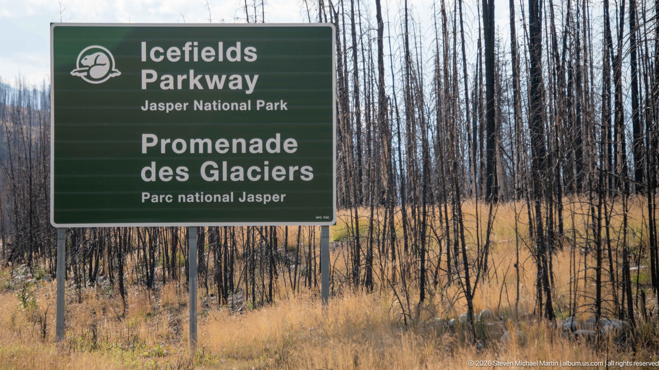
A green Parks Canada sign identifies the Icefields Parkway in Jasper National Park, while blackened trunks and tawny grasses fill the background. The juxtaposition documents the highway corridor within a recently burned forest landscape, where surviving ground vegetation contrasts sharply with the standing dead trees.
Caption
A green Parks Canada sign identifies the Icefields Parkway in Jasper National Park, while blackened trunks and tawny grasses fill the background. The juxtaposition documents the highway corridor within a recently burned forest landscape, where surviving ground vegetation contrasts sharply with the standing dead trees.
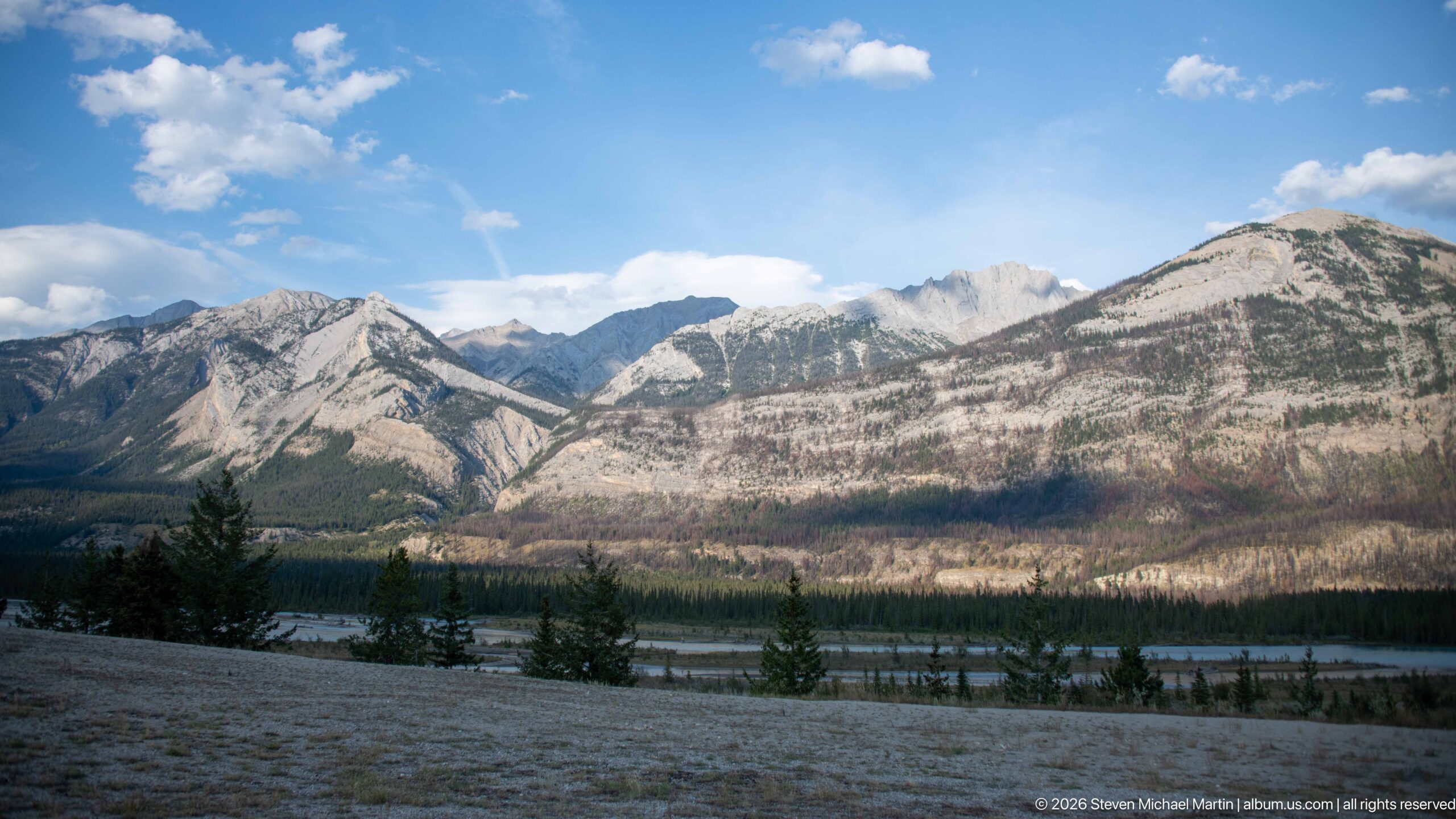
Pale, sharply layered mountain ridges rise above a broad valley where fire-affected forest opens views toward the river corridor. The scene contrasts exposed Rocky Mountain geology with recovering vegetation, showing how disturbance can temporarily reveal landforms that dense conifer cover ordinarily obscures.
Caption
Pale, sharply layered mountain ridges rise above a broad valley where fire-affected forest opens views toward the river corridor. The scene contrasts exposed Rocky Mountain geology with recovering vegetation, showing how disturbance can temporarily reveal landforms that dense conifer cover ordinarily obscures.
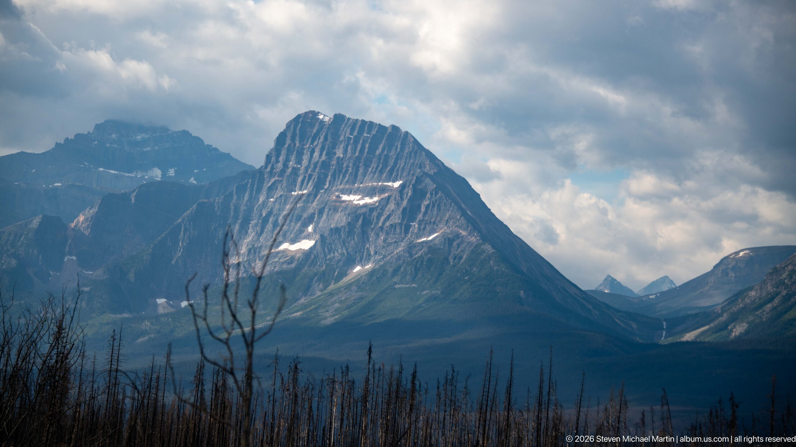
A steep mountain face rises dramatically above a foreground of fire-killed trunks, its strongly tilted sedimentary layers picked out by alternating light and shadow. Small lingering snow patches and broken clouds accentuate the peak's structure, while the burned foreground creates an unusually open view of the mountain.
Caption
A steep mountain face rises dramatically above a foreground of fire-killed trunks, its strongly tilted sedimentary layers picked out by alternating light and shadow. Small lingering snow patches and broken clouds accentuate the peak's structure, while the burned foreground creates an unusually open view of the mountain.
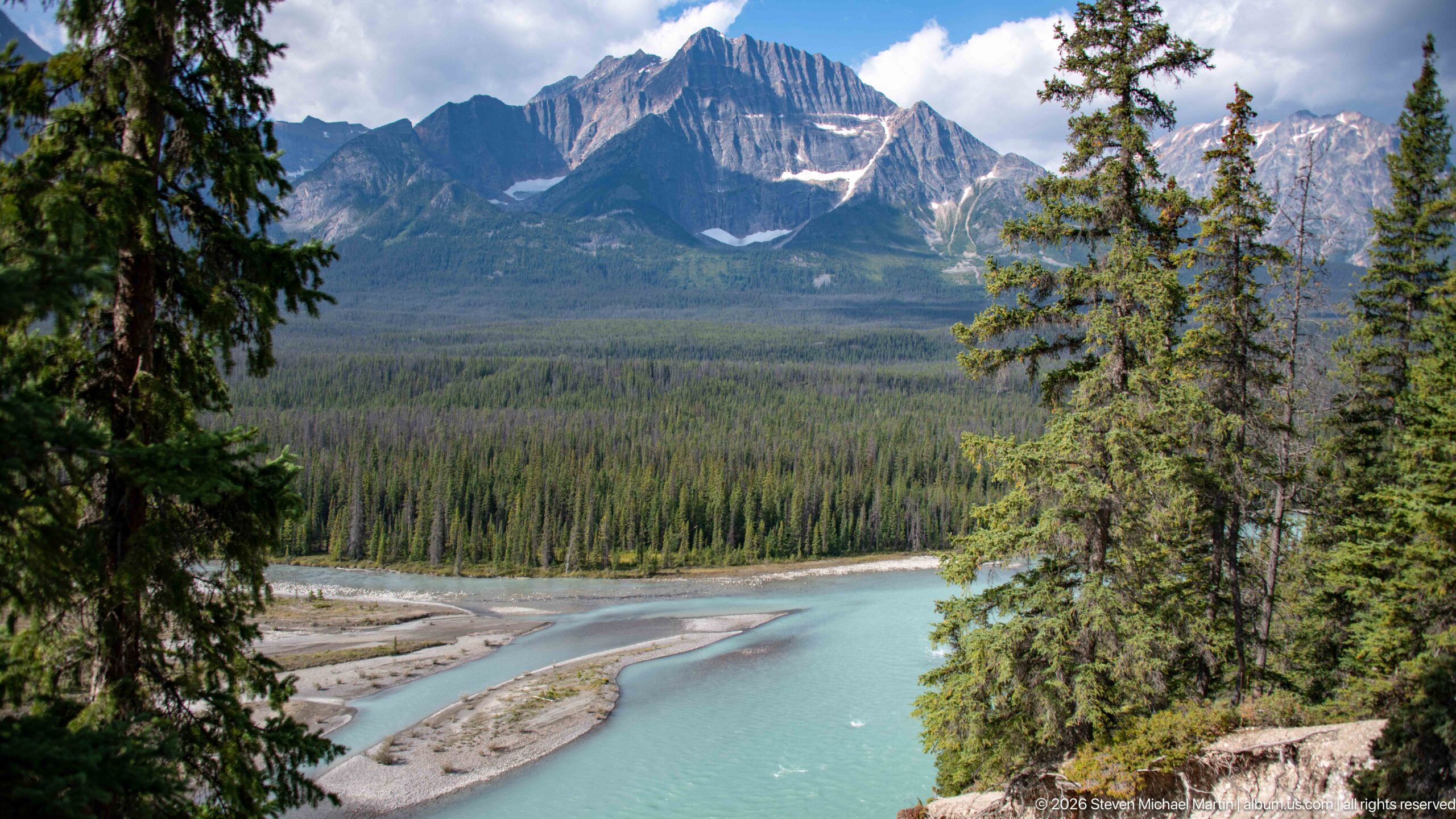
A turquoise glacial river curves around pale gravel bars beneath dense conifer forest and a steep, layered mountain massif. Suspended rock flour gives the water its milky blue-green color, while the braided channel and exposed sediment record the continual movement and redeposition of glacial material downstream.
Caption
A turquoise glacial river curves around pale gravel bars beneath dense conifer forest and a steep, layered mountain massif. Suspended rock flour gives the water its milky blue-green color, while the braided channel and exposed sediment record the continual movement and redeposition of glacial material downstream.
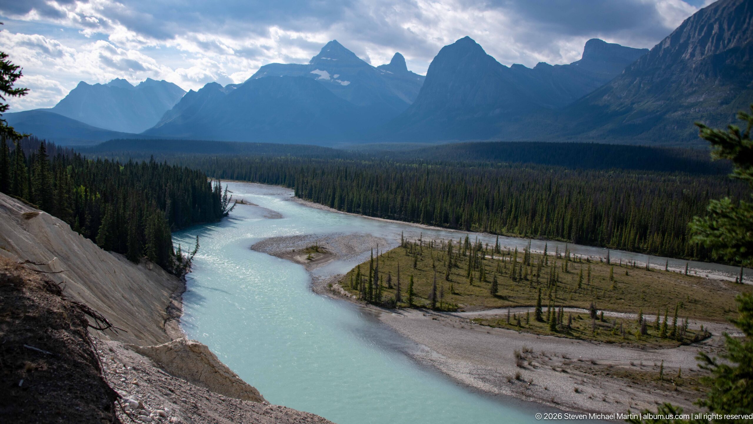
From an elevated viewpoint, a pale turquoise river bends around gravel islands and sparse young trees before disappearing into a dark conifer valley. Jagged mountain silhouettes close the horizon, while the channel's shifting bars and milky color reveal a landscape actively supplied with glacial sediment.
Caption
From an elevated viewpoint, a pale turquoise river bends around gravel islands and sparse young trees before disappearing into a dark conifer valley. Jagged mountain silhouettes close the horizon, while the channel's shifting bars and milky color reveal a landscape actively supplied with glacial sediment.
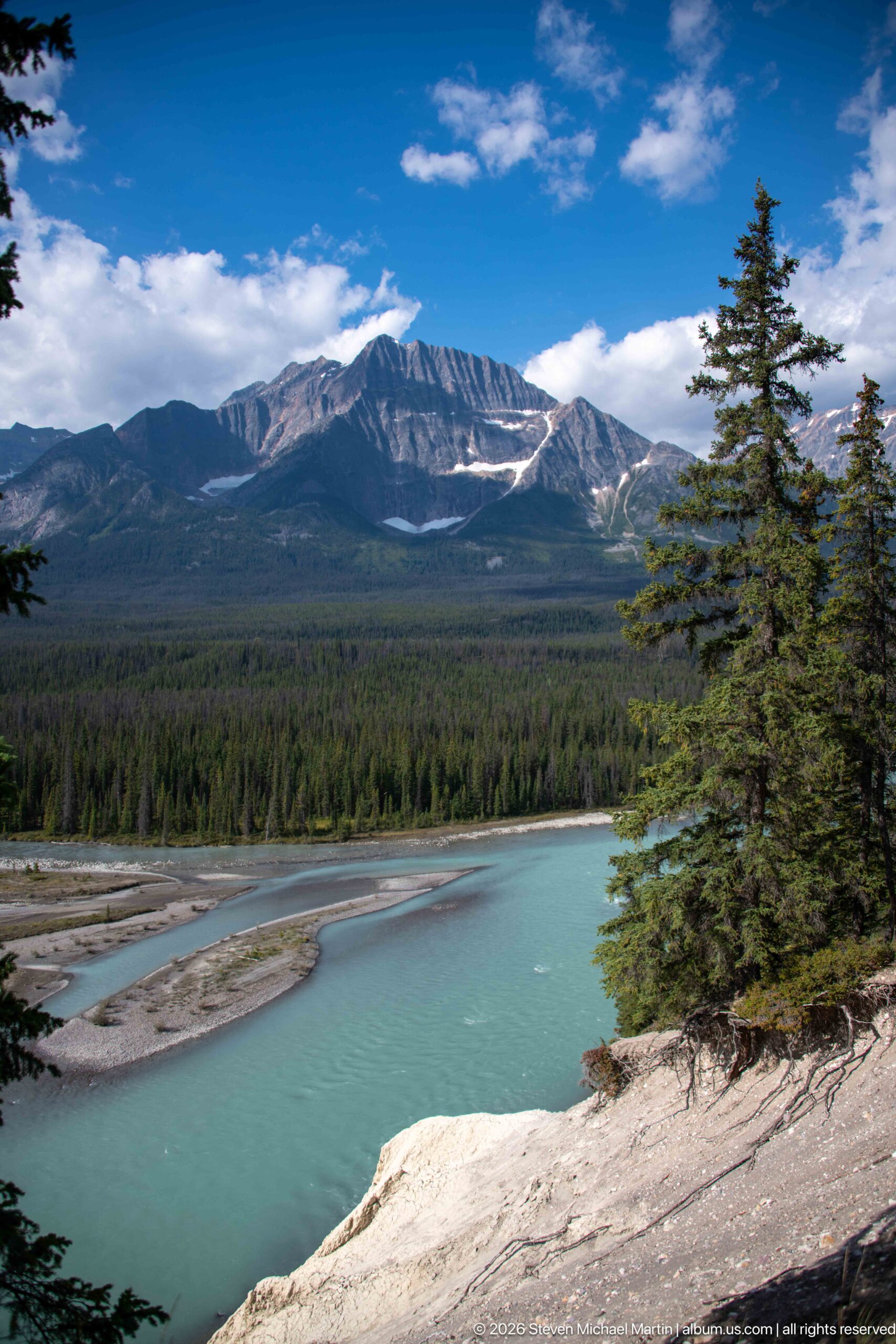
Blue-green glacial water sweeps past pale gravel bars at the foot of a forested valley, backed by a long, horizontally banded mountain ridge. The broad composition emphasizes the sediment-rich river system produced by alpine erosion and meltwater moving through the glacier-shaped Canadian Rockies.
Caption
Blue-green glacial water sweeps past pale gravel bars at the foot of a forested valley, backed by a long, horizontally banded mountain ridge. The broad composition emphasizes the sediment-rich river system produced by alpine erosion and meltwater moving through the glacier-shaped Canadian Rockies.
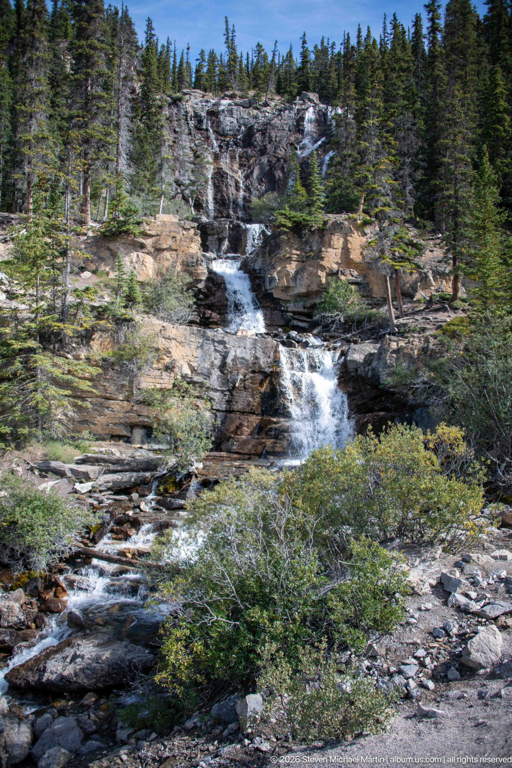
A mountain stream spreads across several broad rock ledges, breaking into white cascades before gathering again among shrubs and conifers. This wider composition reveals the full stepped channel and the way resistant bedrock controls the stream's repeated drops through the subalpine forest.
Caption
A mountain stream spreads across several broad rock ledges, breaking into white cascades before gathering again among shrubs and conifers. This wider composition reveals the full stepped channel and the way resistant bedrock controls the stream's repeated drops through the subalpine forest.
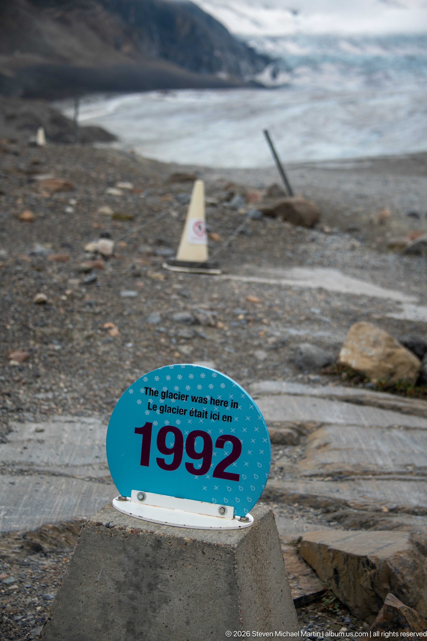
A dated marker records the former position of Athabasca Glacier in 1992, standing on terrain now exposed in front of the ice. The separation between the marker and present glacier provides a direct, easily read indication of retreat across the forefield.
Caption
A dated marker records the former position of Athabasca Glacier in 1992, standing on terrain now exposed in front of the ice. The separation between the marker and present glacier provides a direct, easily read indication of retreat across the forefield.
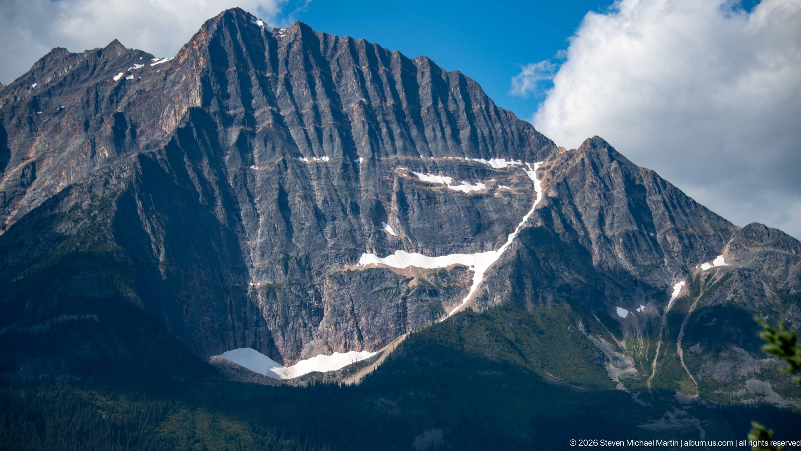
Steep parallel bands of sedimentary rock dominate this close mountain view, cut by gullies and highlighted by isolated patches of late-season snow. The strongly expressed bedding provides a clear visual example of the faulted, folded, and uplifted rocks later sculpted by glaciers across the Canadian Rockies.
Caption
Steep parallel bands of sedimentary rock dominate this close mountain view, cut by gullies and highlighted by isolated patches of late-season snow. The strongly expressed bedding provides a clear visual example of the faulted, folded, and uplifted rocks later sculpted by glaciers across the Canadian Rockies.
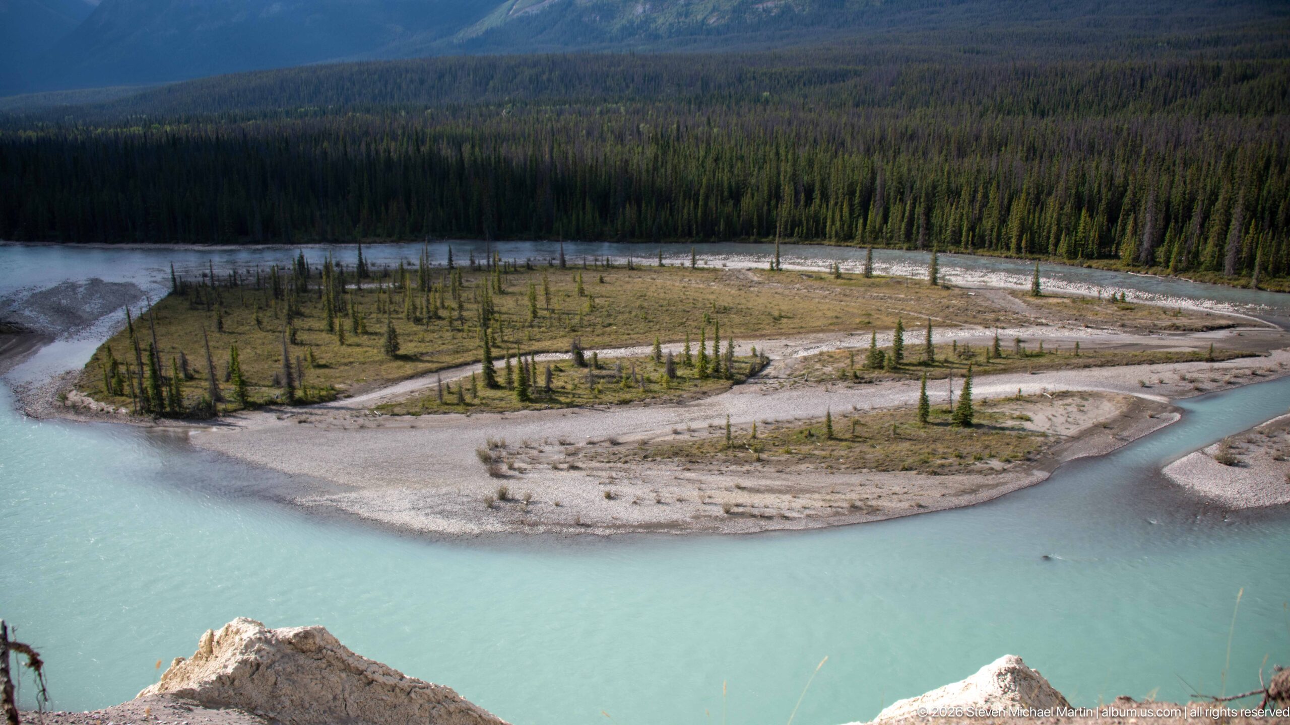
A low gravel island divides the pale turquoise current, supporting scattered young conifers and other pioneer vegetation on recently deposited sediment. The elevated view isolates the river's active floodplain, where shifting channels repeatedly reshape bars and determine where woody vegetation can become established.
Caption
A low gravel island divides the pale turquoise current, supporting scattered young conifers and other pioneer vegetation on recently deposited sediment. The elevated view isolates the river's active floodplain, where shifting channels repeatedly reshape bars and determine where woody vegetation can become established.
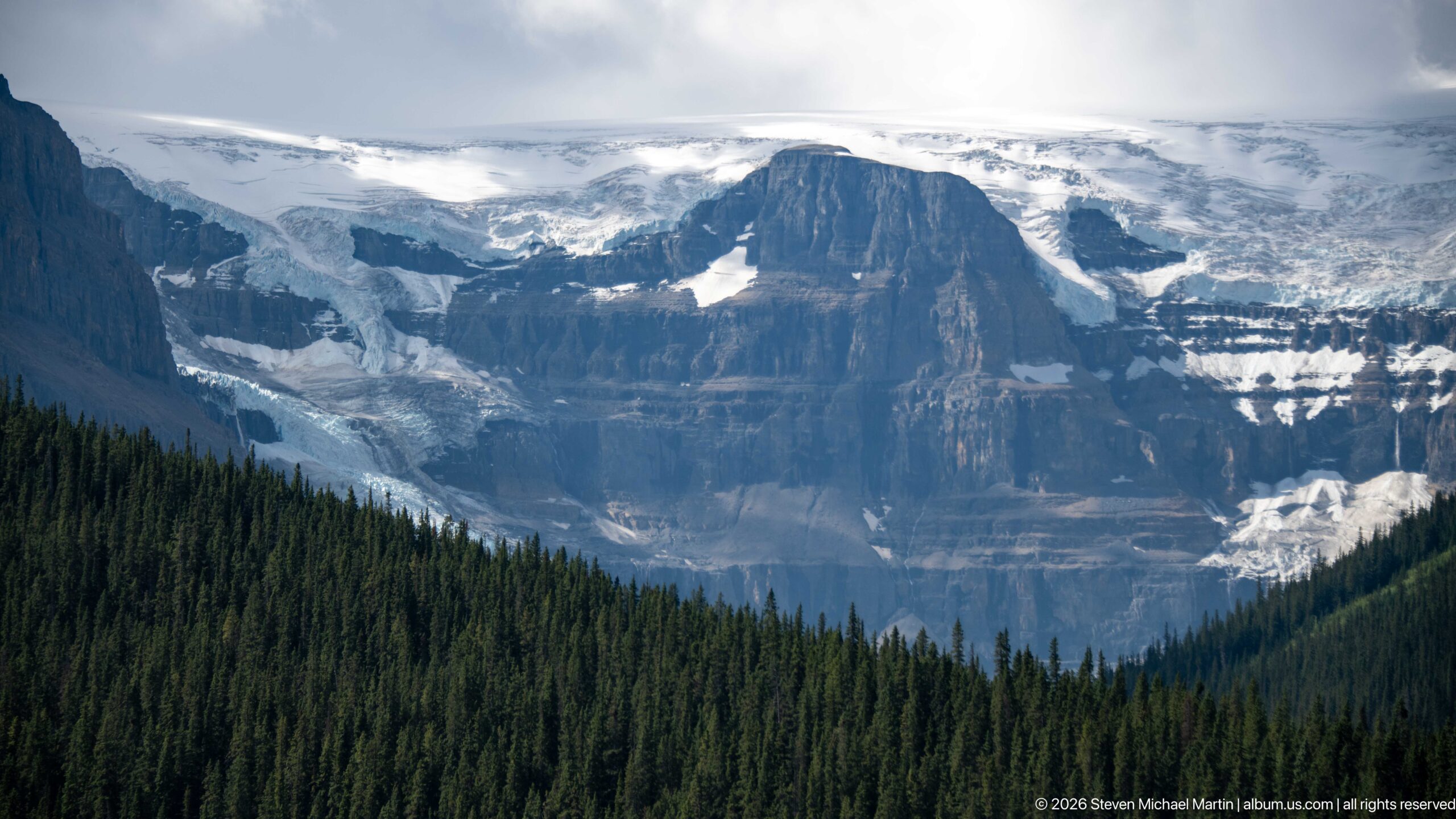
A broad outlet glacier descends from the high icefield around a massive dark rock buttress, its fractured surface and snow-covered upper reaches contrasting with dense forest below. The telephoto view compresses ice, cliff, and trees into a clear vertical sequence of alpine environments.
Caption
A broad outlet glacier descends from the high icefield around a massive dark rock buttress, its fractured surface and snow-covered upper reaches contrasting with dense forest below. The telephoto view compresses ice, cliff, and trees into a clear vertical sequence of alpine environments.
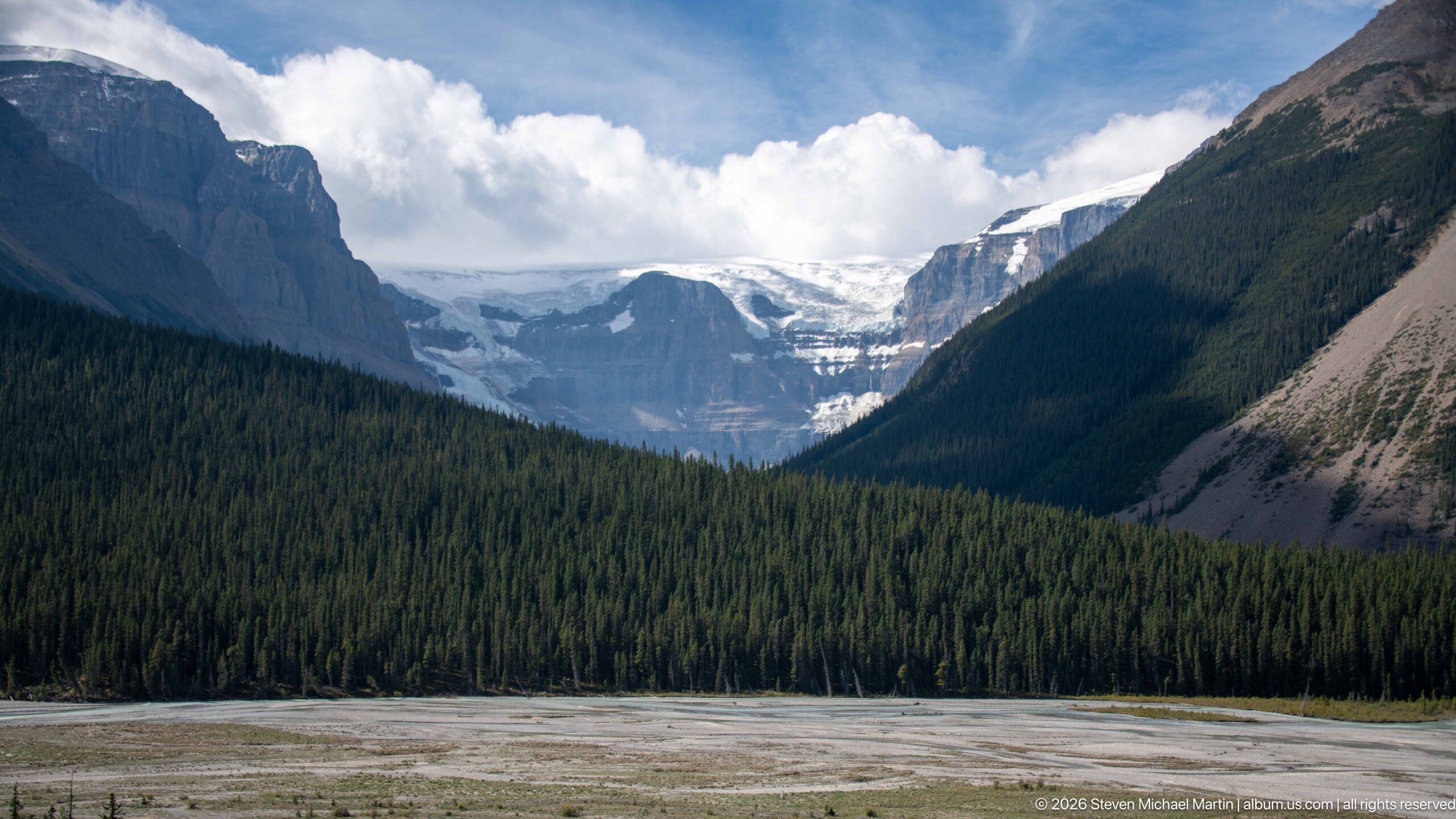
A distant outlet glacier fills the head of a deep U-shaped valley, framed by steep forested slopes and bare rock walls. The broad gravel foreground and dark conifer belt create successive depth layers, emphasizing the glacier's position high within terrain extensively shaped by earlier ice.
Caption
A distant outlet glacier fills the head of a deep U-shaped valley, framed by steep forested slopes and bare rock walls. The broad gravel foreground and dark conifer belt create successive depth layers, emphasizing the glacier's position high within terrain extensively shaped by earlier ice.
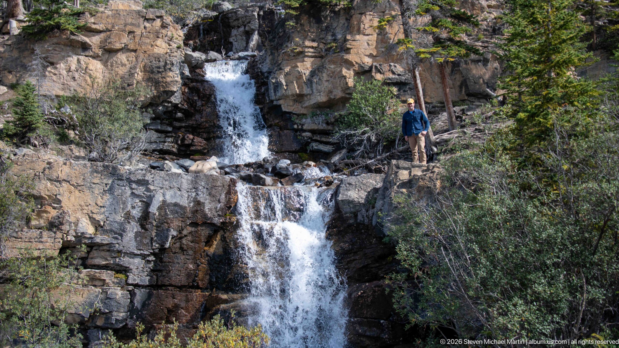
A visitor stands beside a two-tier waterfall as the stream drops through a narrow notch and then over a broader lower ledge. The figure provides scale for the exposed rock face, while conifers and shrubs frame the falls within the surrounding mountain forest.
Caption
A visitor stands beside a two-tier waterfall as the stream drops through a narrow notch and then over a broader lower ledge. The figure provides scale for the exposed rock face, while conifers and shrubs frame the falls within the surrounding mountain forest.
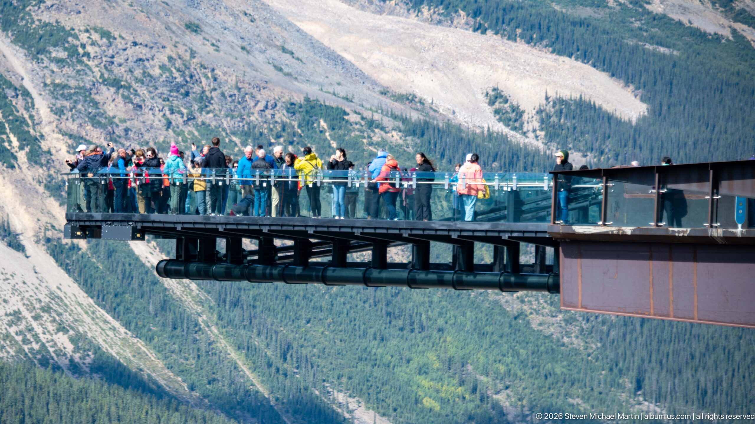
Visitors line the transparent railings of the Columbia Icefield Skywalk, seen in a tighter side view that emphasizes the cantilevered platform and its elevation above the valley. Bright clothing and human figures provide scale against the immense forested and rocky mountain slopes beyond.
Caption
Visitors line the transparent railings of the Columbia Icefield Skywalk, seen in a tighter side view that emphasizes the cantilevered platform and its elevation above the valley. Bright clothing and human figures provide scale against the immense forested and rocky mountain slopes beyond.
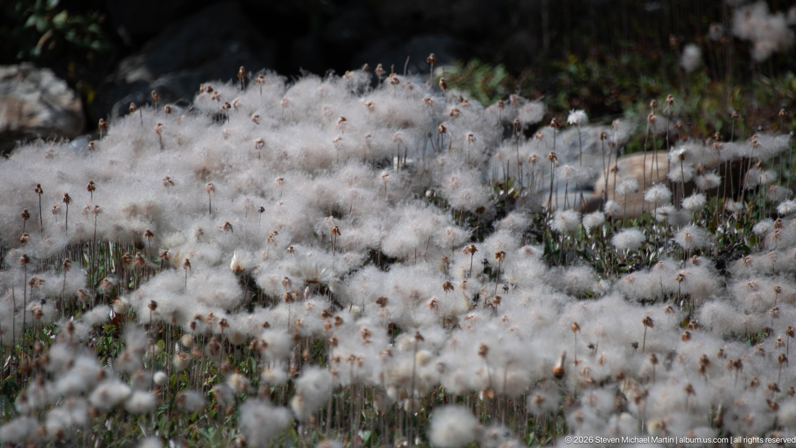
A dense patch of white, cotton-like seed heads rises above low alpine vegetation and scattered rocks. The shallow depth of field isolates the soft tufts against a darker background, documenting one of the small-scale plant communities occupying moist ground within the severe high-elevation environment.
Caption
A dense patch of white, cotton-like seed heads rises above low alpine vegetation and scattered rocks. The shallow depth of field isolates the soft tufts against a darker background, documenting one of the small-scale plant communities occupying moist ground within the severe high-elevation environment.
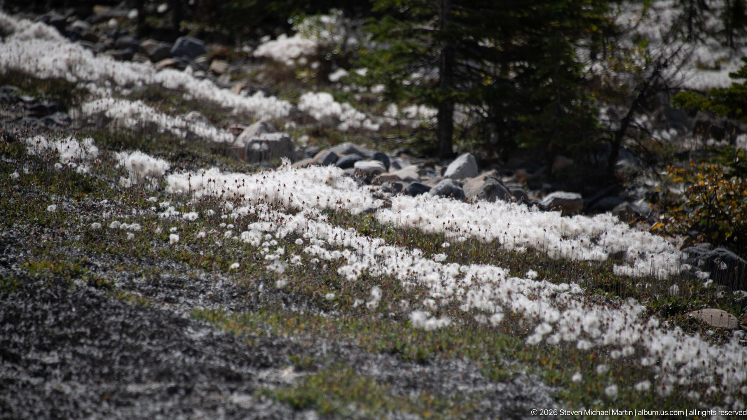
White cotton-like seed heads spread across a rocky alpine slope, forming a bright textured carpet among low vegetation, scattered stones, and conifers. The wider view places the plants within their mountain habitat and shows how dense colonies can occupy open, moisture-retaining ground.
Caption
White cotton-like seed heads spread across a rocky alpine slope, forming a bright textured carpet among low vegetation, scattered stones, and conifers. The wider view places the plants within their mountain habitat and shows how dense colonies can occupy open, moisture-retaining ground.
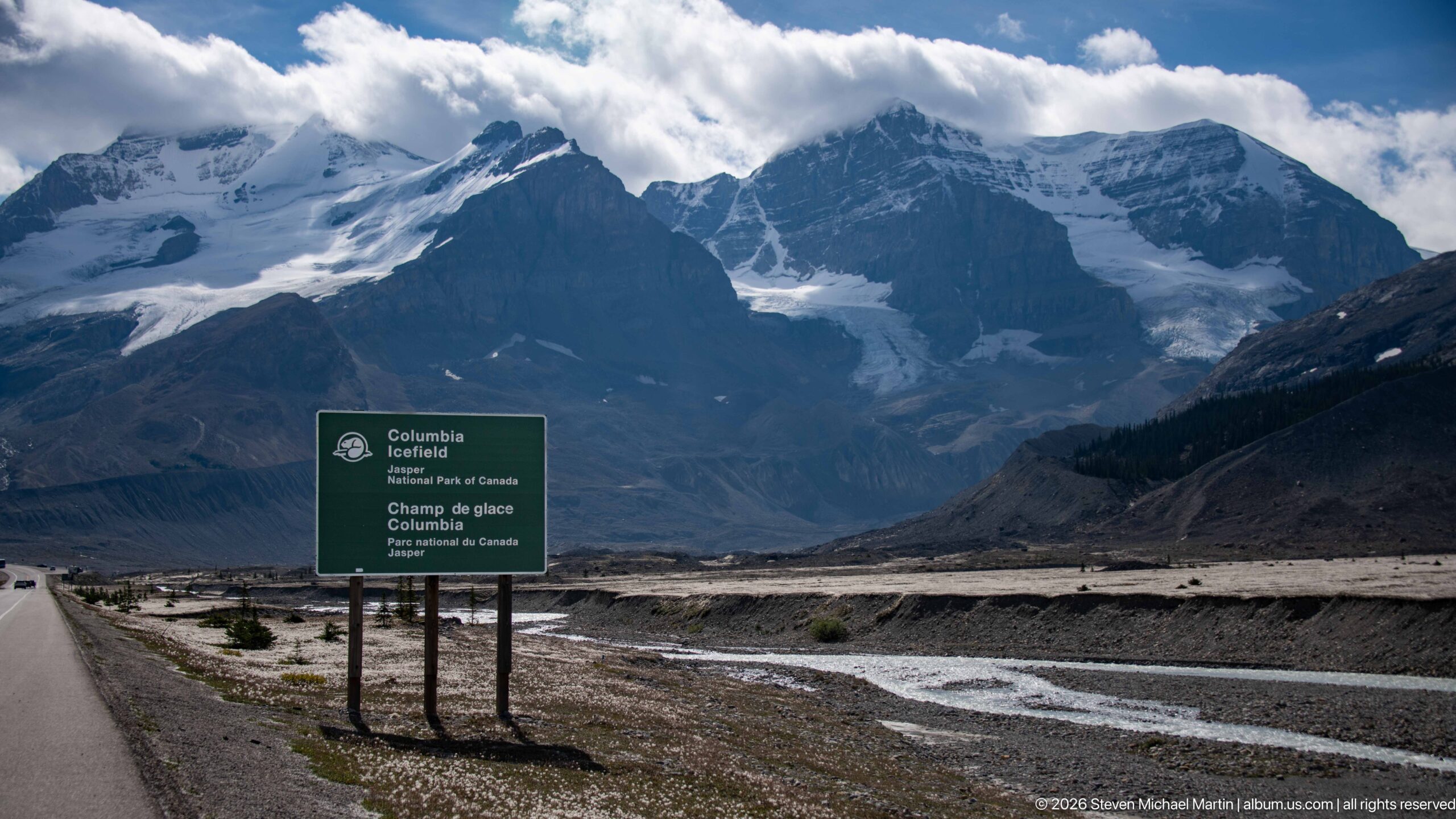
A green Parks Canada sign marks the Columbia Icefield area beside the road, with braided meltwater channels, barren forefield, and glacier-covered peaks filling the valley beyond. The composition directly links visitor orientation with the high alpine landscape and the sediment-rich drainage emerging from the icefield region.
Caption
A green Parks Canada sign marks the Columbia Icefield area beside the road, with braided meltwater channels, barren forefield, and glacier-covered peaks filling the valley beyond. The composition directly links visitor orientation with the high alpine landscape and the sediment-rich drainage emerging from the icefield region.
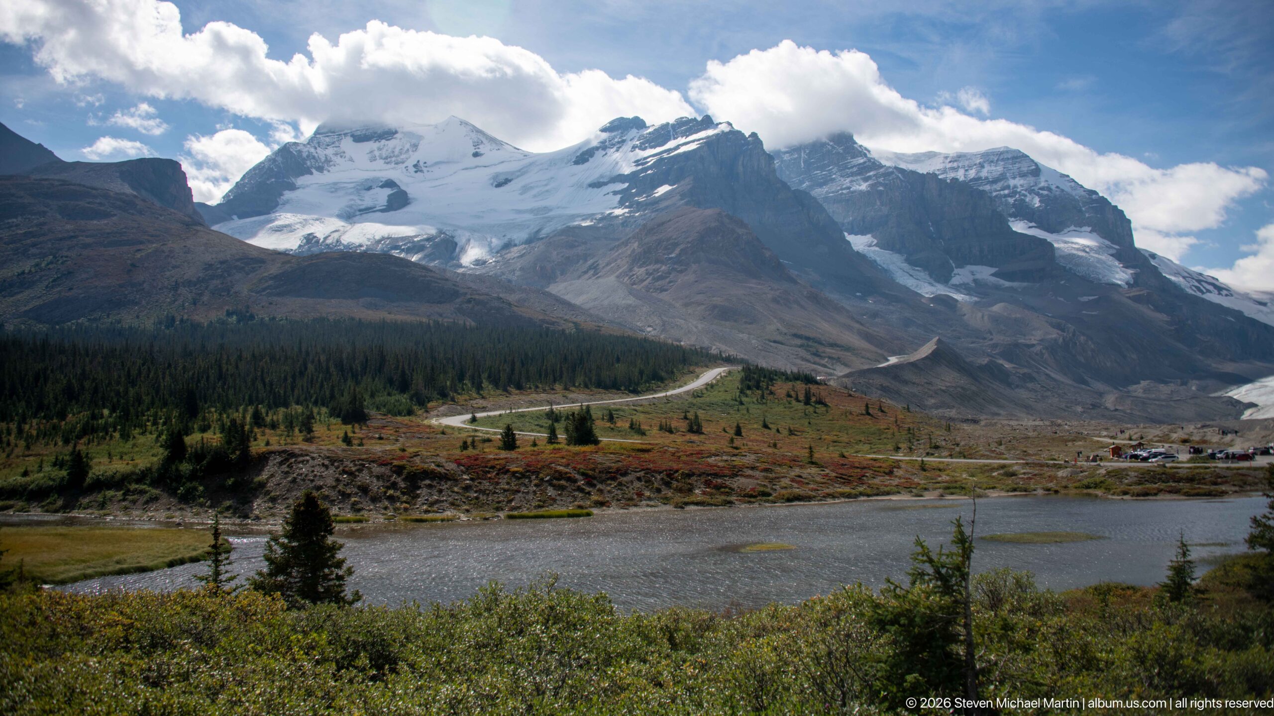
Glacier-covered peaks dominate a high-elevation landscape of low shrubs, scattered conifers, and a small pond, while a winding road traces the base of the mountains. Autumn reds and golds in the foreground contrast with pale ice and dark sedimentary rock above.
Caption
Glacier-covered peaks dominate a high-elevation landscape of low shrubs, scattered conifers, and a small pond, while a winding road traces the base of the mountains. Autumn reds and golds in the foreground contrast with pale ice and dark sedimentary rock above.
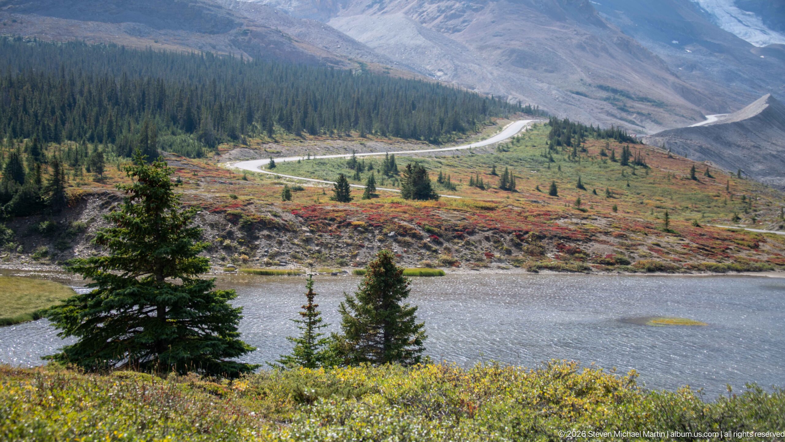
A small alpine pond fills the foreground below a winding mountain road, surrounded by low shrubs turning yellow and red and scattered conifers. Beyond, sparse vegetation gives way to broad gray mountain slopes, illustrating the rapid transition from subalpine growth to exposed high-elevation terrain.
Caption
A small alpine pond fills the foreground below a winding mountain road, surrounded by low shrubs turning yellow and red and scattered conifers. Beyond, sparse vegetation gives way to broad gray mountain slopes, illustrating the rapid transition from subalpine growth to exposed high-elevation terrain.
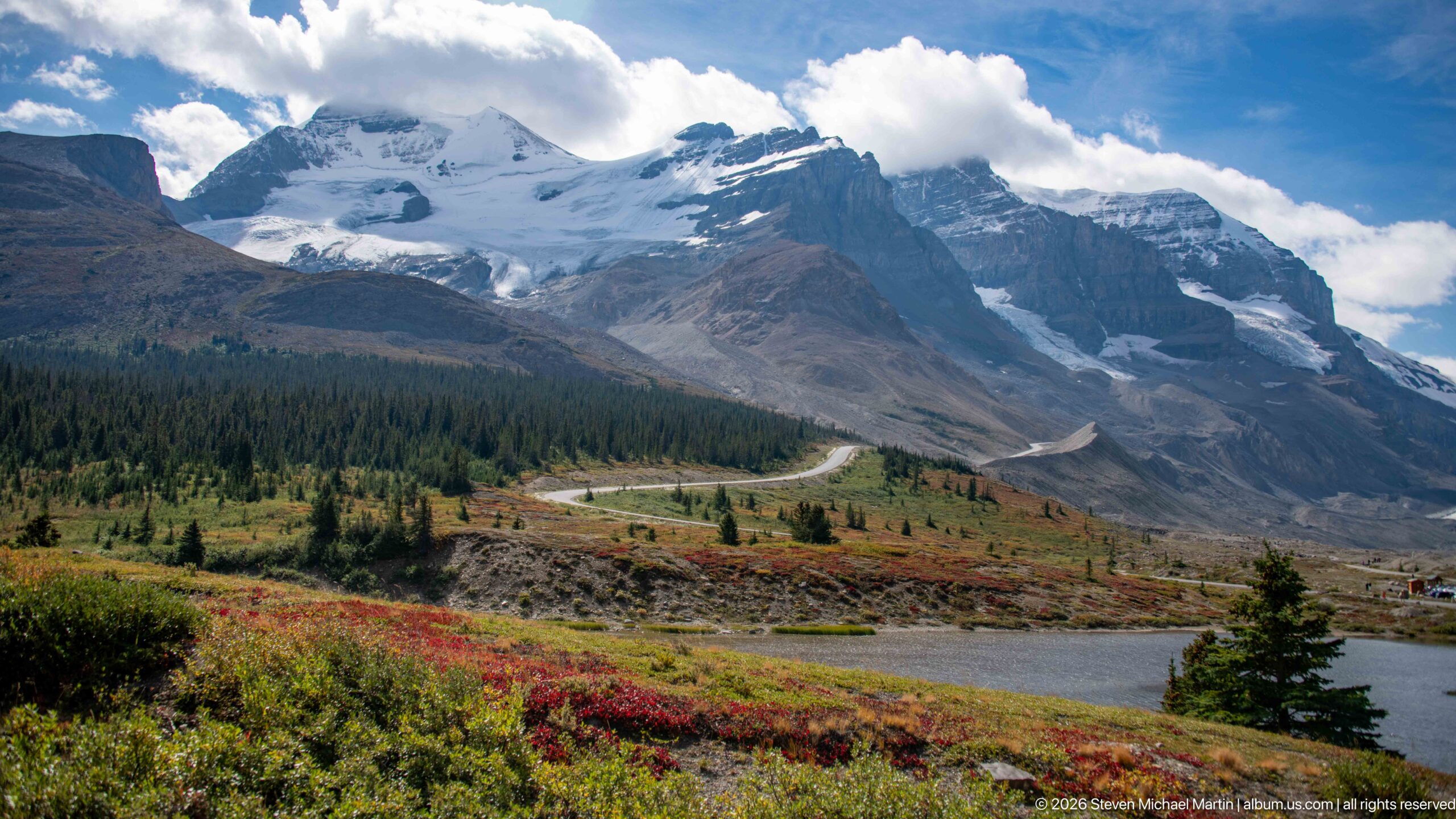
Glaciated peak above an alpine pond and autumn vegetation forms the principal subject of this Columbia Icefield view. A glacier- and snow-covered mountain rises above an alpine pond, conifers, and red-gold low vegetation; a road curves through the middle distance. The composition records the close relationship among glacier ice, exposed sedimentary rock, moraine or alpine vegetation that defines this high-elevation Canadian Rockies landscape.
Caption
Glaciated peak above an alpine pond and autumn vegetation forms the principal subject of this Columbia Icefield view. A glacier- and snow-covered mountain rises above an alpine pond, conifers, and red-gold low vegetation; a road curves through the middle distance. The composition records the close relationship among glacier ice, exposed sedimentary rock, moraine or alpine vegetation that defines this high-elevation Canadian Rockies landscape.
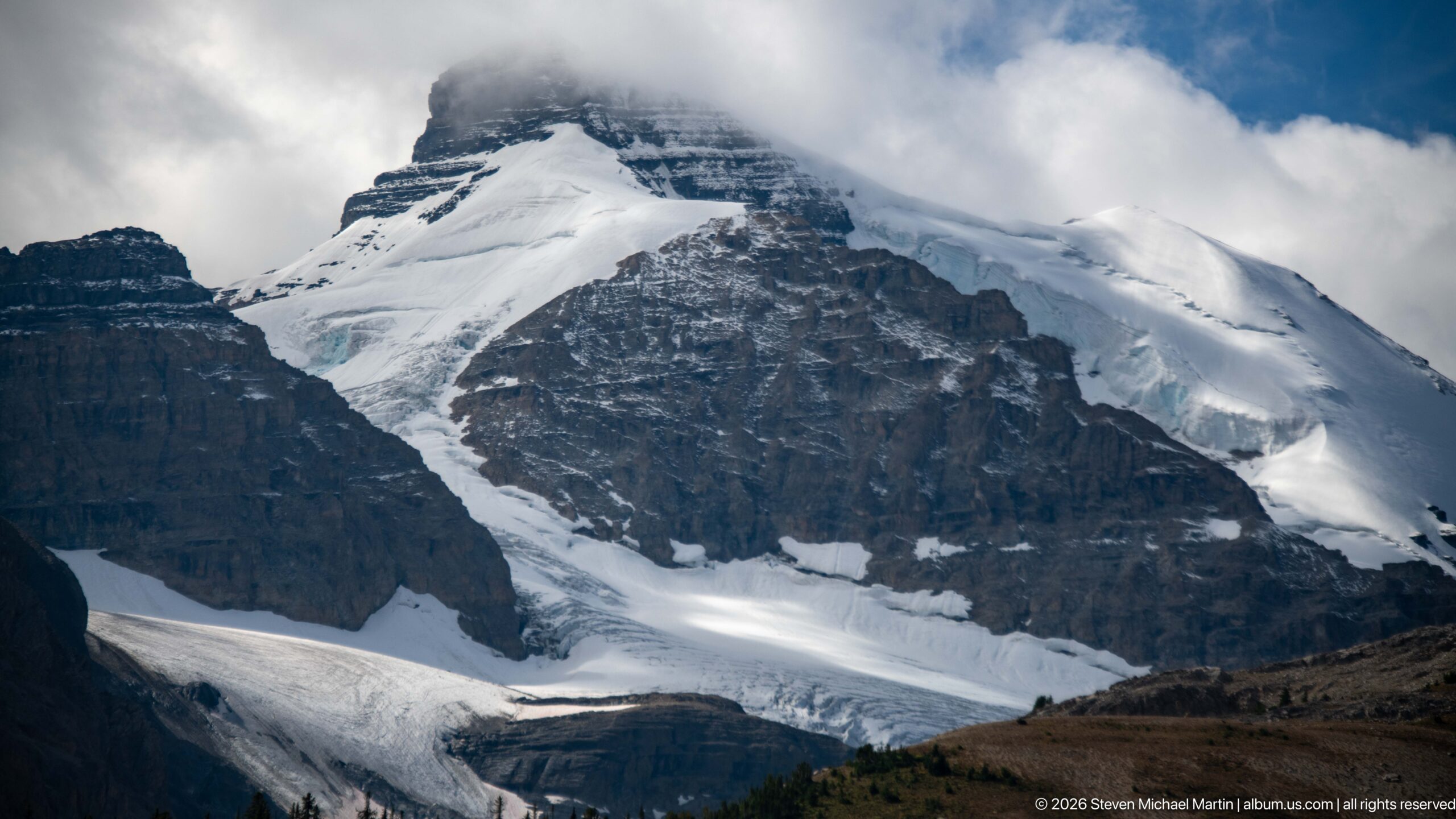
Glacier and snowfields on a steep sedimentary mountain forms the principal subject of this Columbia Icefield view. A close view shows snow and glacier ice draped across a steep, horizontally layered mountain beneath low cloud. The composition records the close relationship among glacier ice, exposed sedimentary rock, moraine or alpine vegetation that defines this high-elevation Canadian Rockies landscape.
Caption
Glacier and snowfields on a steep sedimentary mountain forms the principal subject of this Columbia Icefield view. A close view shows snow and glacier ice draped across a steep, horizontally layered mountain beneath low cloud. The composition records the close relationship among glacier ice, exposed sedimentary rock, moraine or alpine vegetation that defines this high-elevation Canadian Rockies landscape.
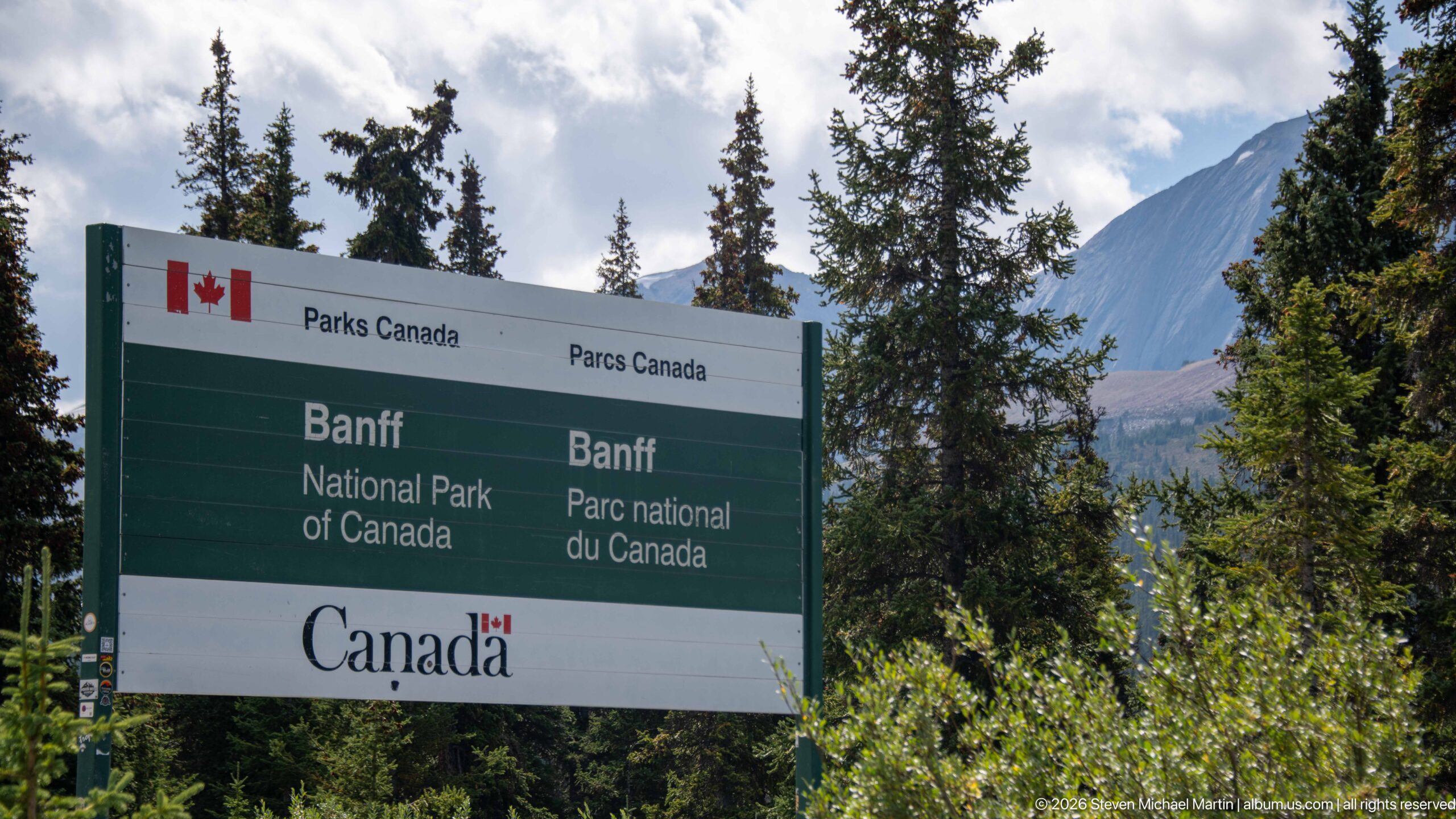
A bilingual Parks Canada boundary sign identifies Banff National Park along the Canadian Rockies corridor. The surrounding conifers and mountain backdrop place the administrative marker directly within the high-elevation landscape shared by the national parks around the Columbia Icefield.
Caption
A bilingual Parks Canada boundary sign identifies Banff National Park along the Canadian Rockies corridor. The surrounding conifers and mountain backdrop place the administrative marker directly within the high-elevation landscape shared by the national parks around the Columbia Icefield.
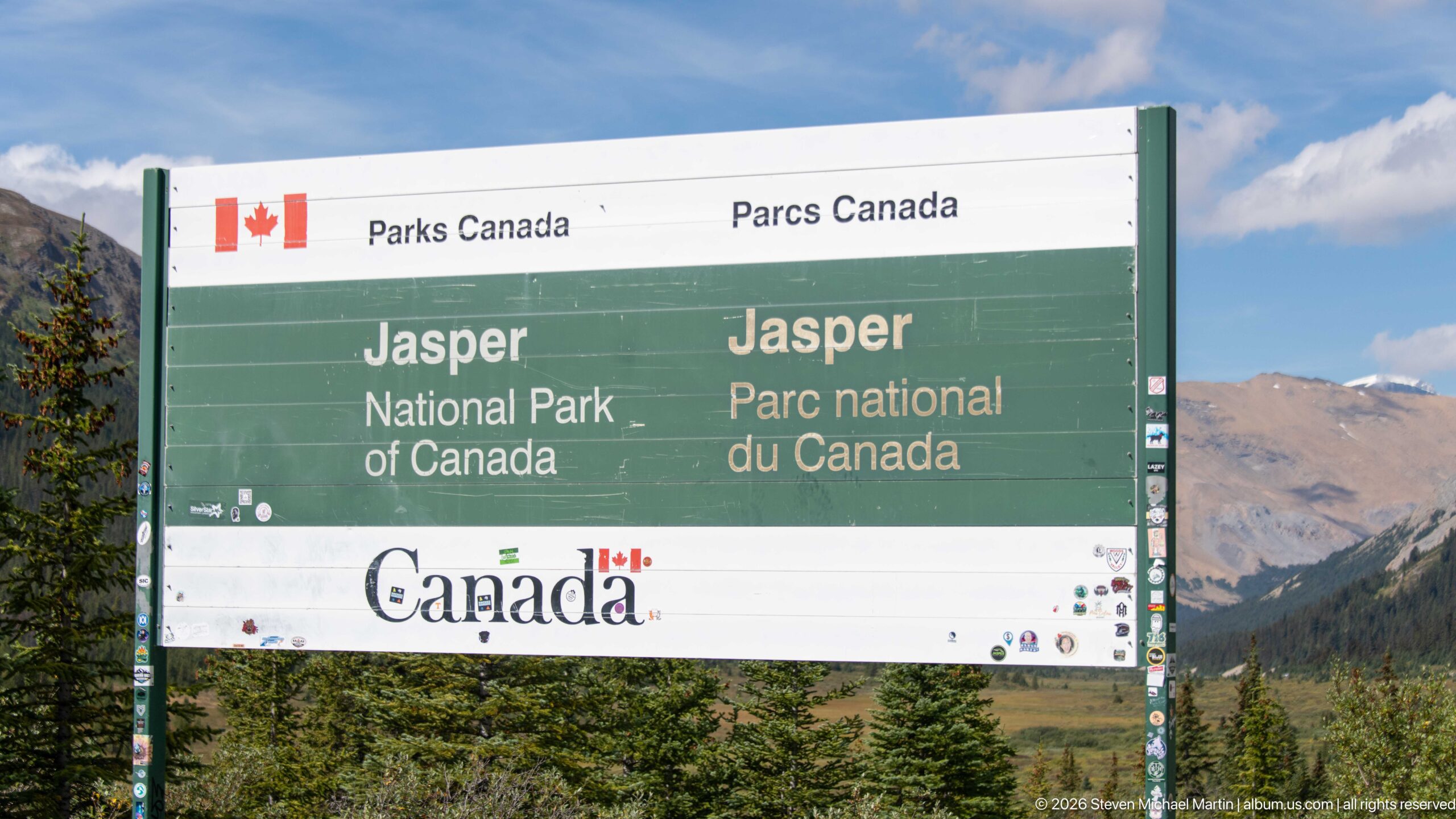
A bilingual Parks Canada boundary sign identifies Jasper National Park along the Canadian Rockies corridor. The surrounding conifers and mountain backdrop place the administrative marker directly within the high-elevation landscape shared by the national parks around the Columbia Icefield.
Caption
A bilingual Parks Canada boundary sign identifies Jasper National Park along the Canadian Rockies corridor. The surrounding conifers and mountain backdrop place the administrative marker directly within the high-elevation landscape shared by the national parks around the Columbia Icefield.
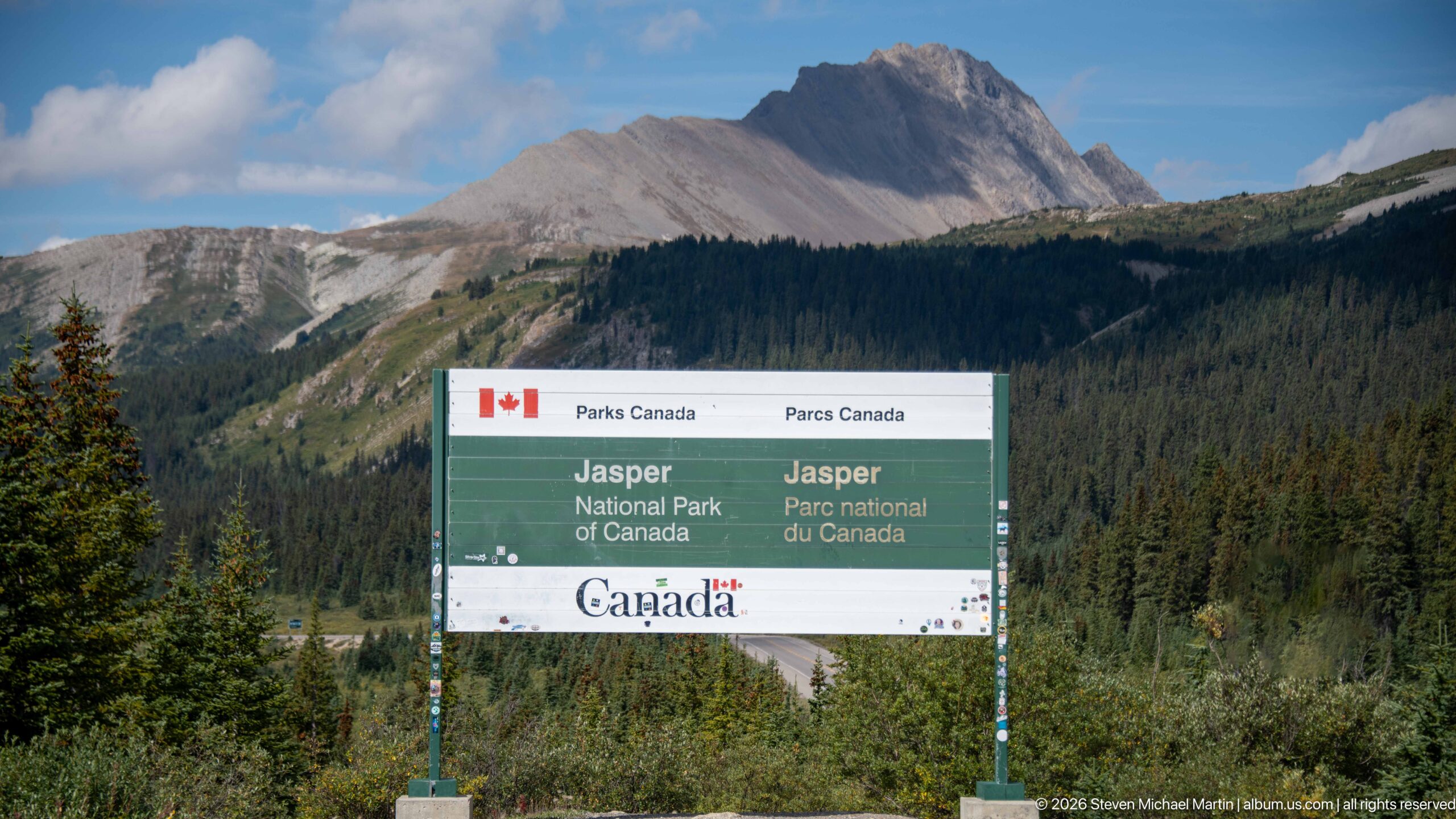
A bilingual Parks Canada boundary sign identifies Jasper National Park along the Canadian Rockies corridor. The surrounding conifers and mountain backdrop place the administrative marker directly within the high-elevation landscape shared by the national parks around the Columbia Icefield.
Caption
A bilingual Parks Canada boundary sign identifies Jasper National Park along the Canadian Rockies corridor. The surrounding conifers and mountain backdrop place the administrative marker directly within the high-elevation landscape shared by the national parks around the Columbia Icefield.
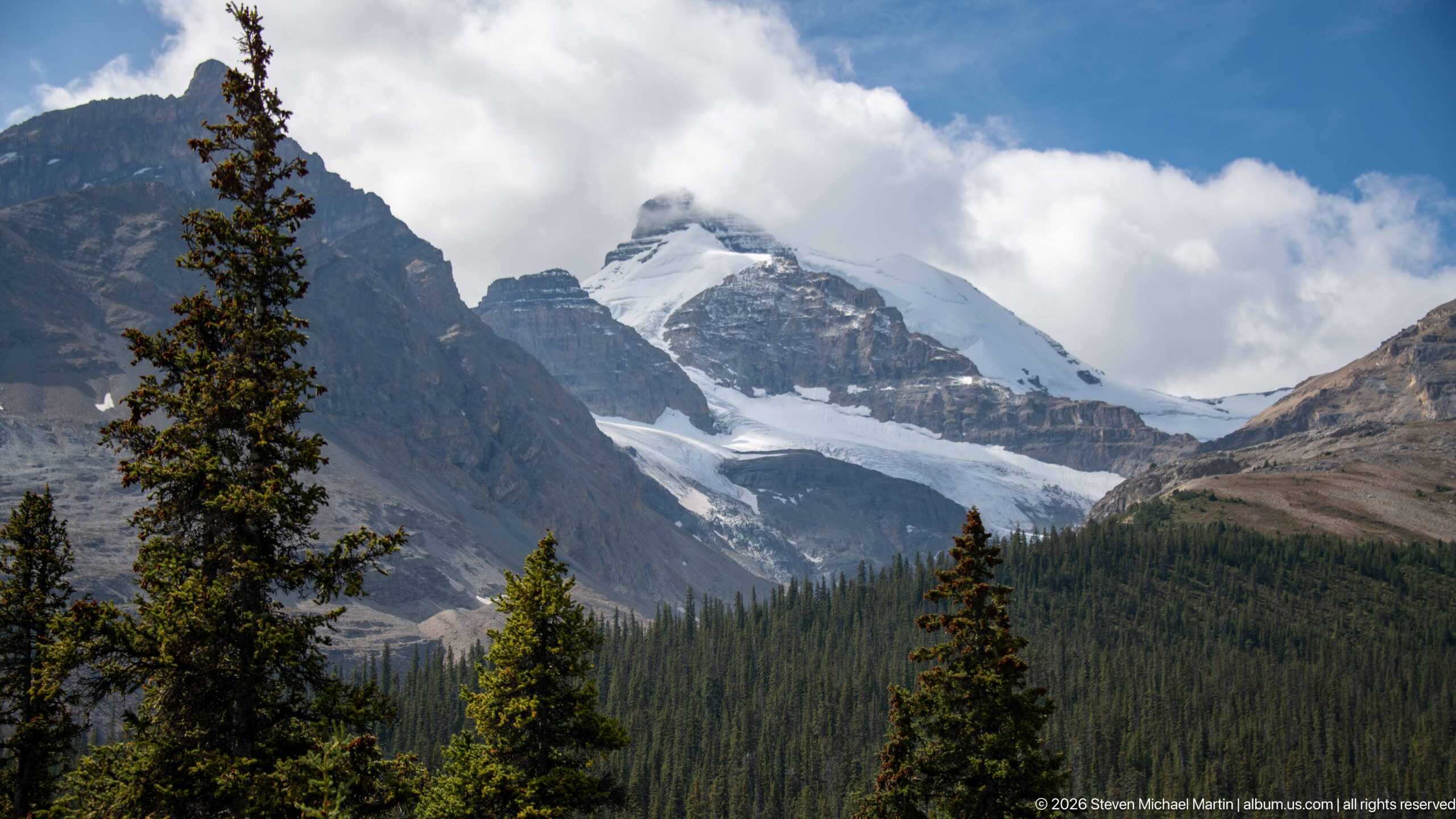
Glacier descending between steep mountain walls forms the principal subject of this Columbia Icefield view. A glacier and snowfield descend from a cloud-wrapped summit between dark rock walls, with conifers in the foreground. The composition records the close relationship among glacier ice, exposed sedimentary rock, moraine or alpine vegetation that defines this high-elevation Canadian Rockies landscape.
Caption
Glacier descending between steep mountain walls forms the principal subject of this Columbia Icefield view. A glacier and snowfield descend from a cloud-wrapped summit between dark rock walls, with conifers in the foreground. The composition records the close relationship among glacier ice, exposed sedimentary rock, moraine or alpine vegetation that defines this high-elevation Canadian Rockies landscape.
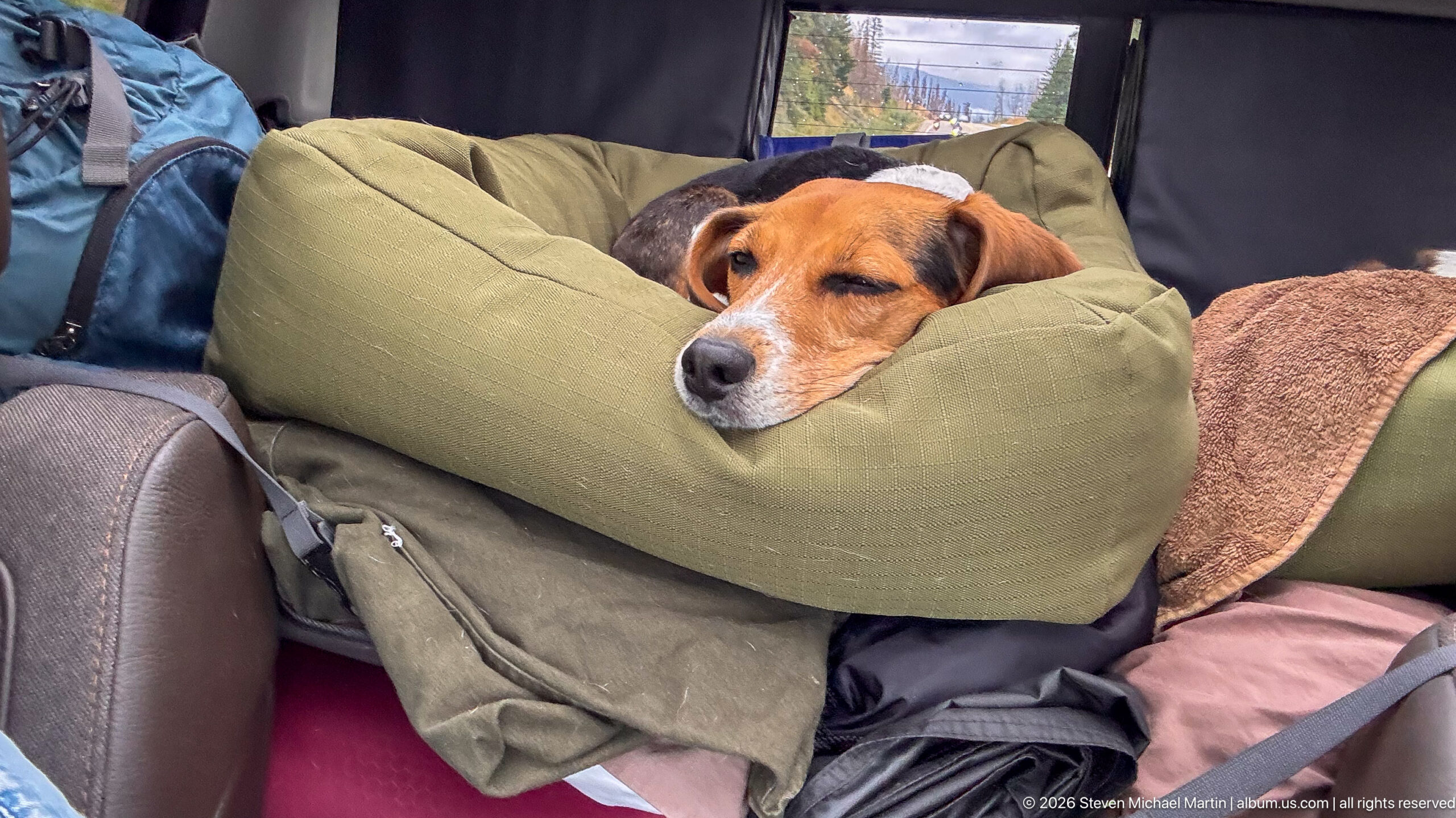
Beagle asleep on travel bedding. A beagle rests with its head on a green cushion amid blankets and travel gear inside a vehicle. The human and canine subjects provide scale and a personal travel record within the Columbia Icefield sequence while preserving the visible relationship to the surrounding mountain or glacier setting.
Caption
Beagle asleep on travel bedding. A beagle rests with its head on a green cushion amid blankets and travel gear inside a vehicle. The human and canine subjects provide scale and a personal travel record within the Columbia Icefield sequence while preserving the visible relationship to the surrounding mountain or glacier setting.
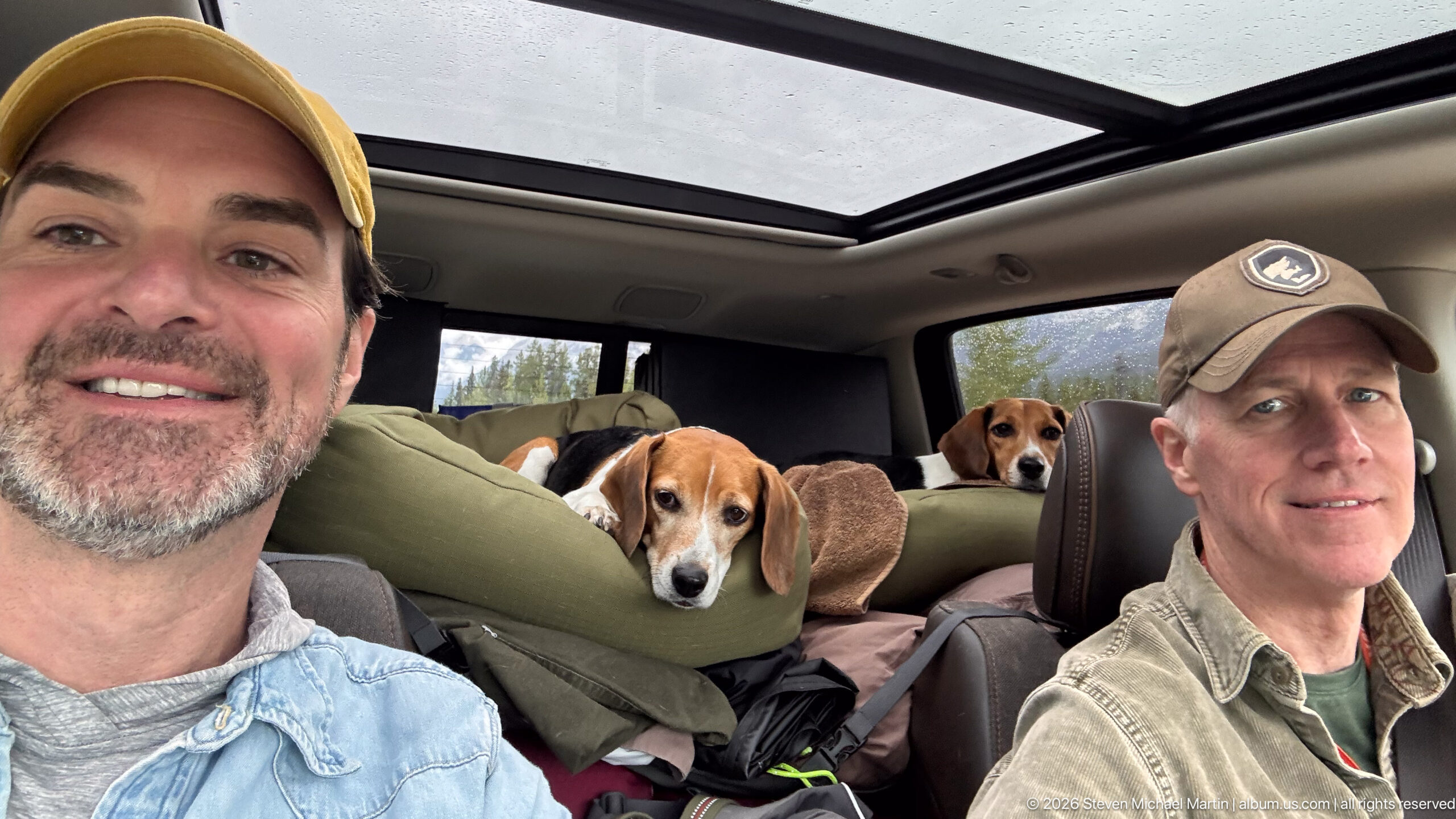
Two travelers with two beagles inside a vehicle. Two adults sit in the front of a vehicle while two beagles rest among bedding in the rear; the panoramic roof is visible overhead. The human and canine subjects provide scale and a personal travel record within the Columbia Icefield sequence while preserving the visible relationship to the surrounding mountain or glacier setting.
Caption
Two travelers with two beagles inside a vehicle. Two adults sit in the front of a vehicle while two beagles rest among bedding in the rear; the panoramic roof is visible overhead. The human and canine subjects provide scale and a personal travel record within the Columbia Icefield sequence while preserving the visible relationship to the surrounding mountain or glacier setting.
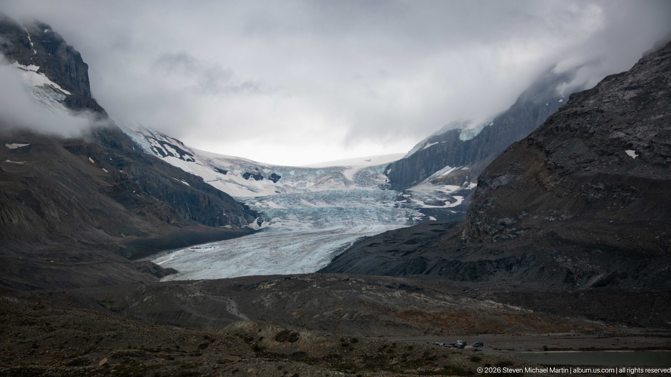
Athabasca Glacier terminus and forefield forms the principal subject of this Columbia Icefield view. A broad glacier descends between dark mountain walls beneath low cloud, with gray moraine and forefield terrain in front. The composition records the close relationship among glacier ice, exposed sedimentary rock, moraine or alpine vegetation that defines this high-elevation Canadian Rockies landscape.
Caption
Athabasca Glacier terminus and forefield forms the principal subject of this Columbia Icefield view. A broad glacier descends between dark mountain walls beneath low cloud, with gray moraine and forefield terrain in front. The composition records the close relationship among glacier ice, exposed sedimentary rock, moraine or alpine vegetation that defines this high-elevation Canadian Rockies landscape.
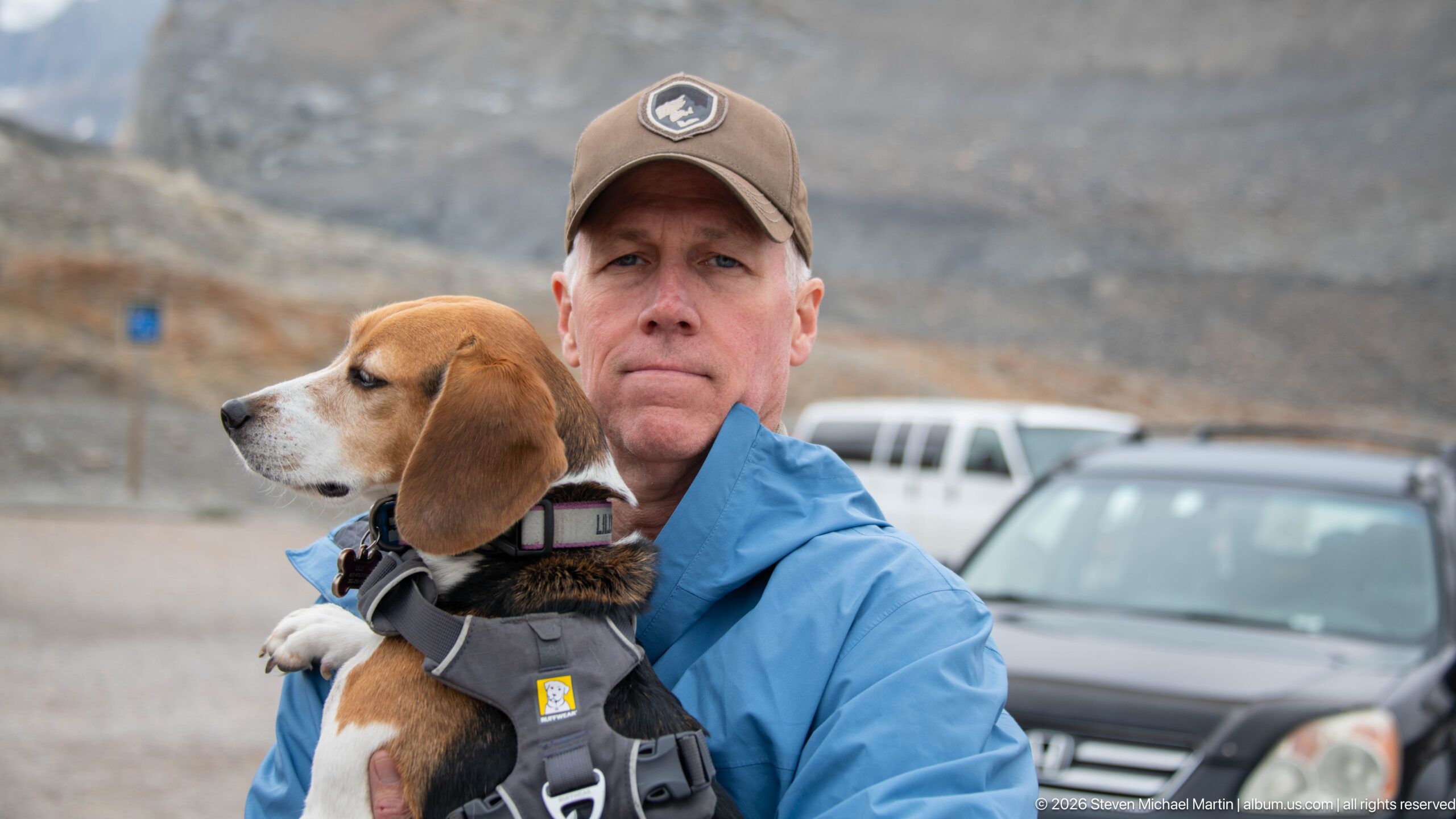
Visitor holding a beagle near the glacier parking area. An adult in a blue jacket holds a beagle in a harness; parked vehicles and a barren mountain slope are softly focused behind. The human and canine subjects provide scale and a personal travel record within the Columbia Icefield sequence while preserving the visible relationship to the surrounding mountain or glacier setting.
Caption
Visitor holding a beagle near the glacier parking area. An adult in a blue jacket holds a beagle in a harness; parked vehicles and a barren mountain slope are softly focused behind. The human and canine subjects provide scale and a personal travel record within the Columbia Icefield sequence while preserving the visible relationship to the surrounding mountain or glacier setting.
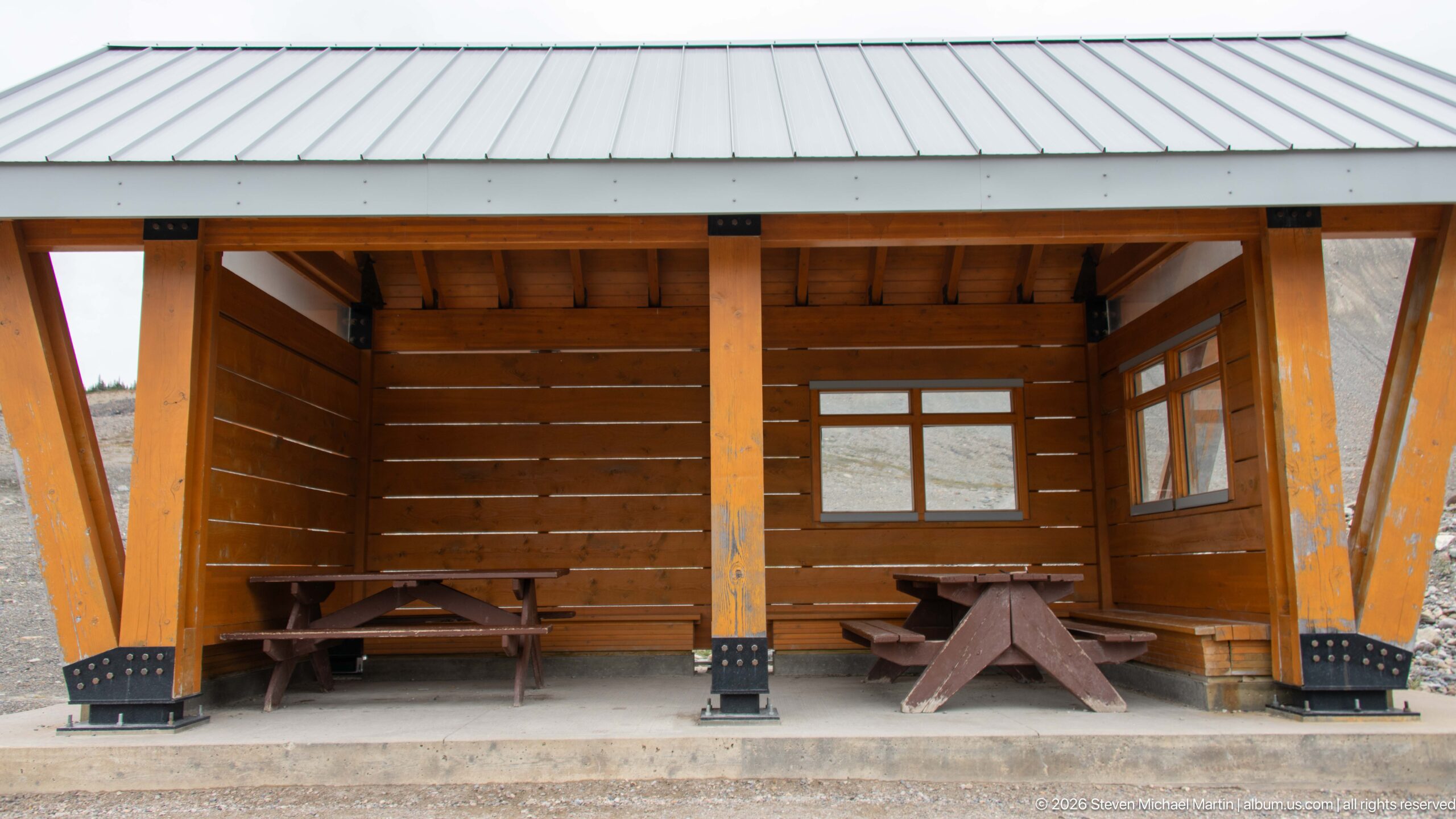
An open timber picnic shelter provides a simple protected rest area near the glacier visitor zone. Heavy wood posts, exposed framing, a metal roof, and fixed picnic tables reflect the functional park infrastructure serving visitors in the exposed high-elevation environment.
Caption
An open timber picnic shelter provides a simple protected rest area near the glacier visitor zone. Heavy wood posts, exposed framing, a metal roof, and fixed picnic tables reflect the functional park infrastructure serving visitors in the exposed high-elevation environment.
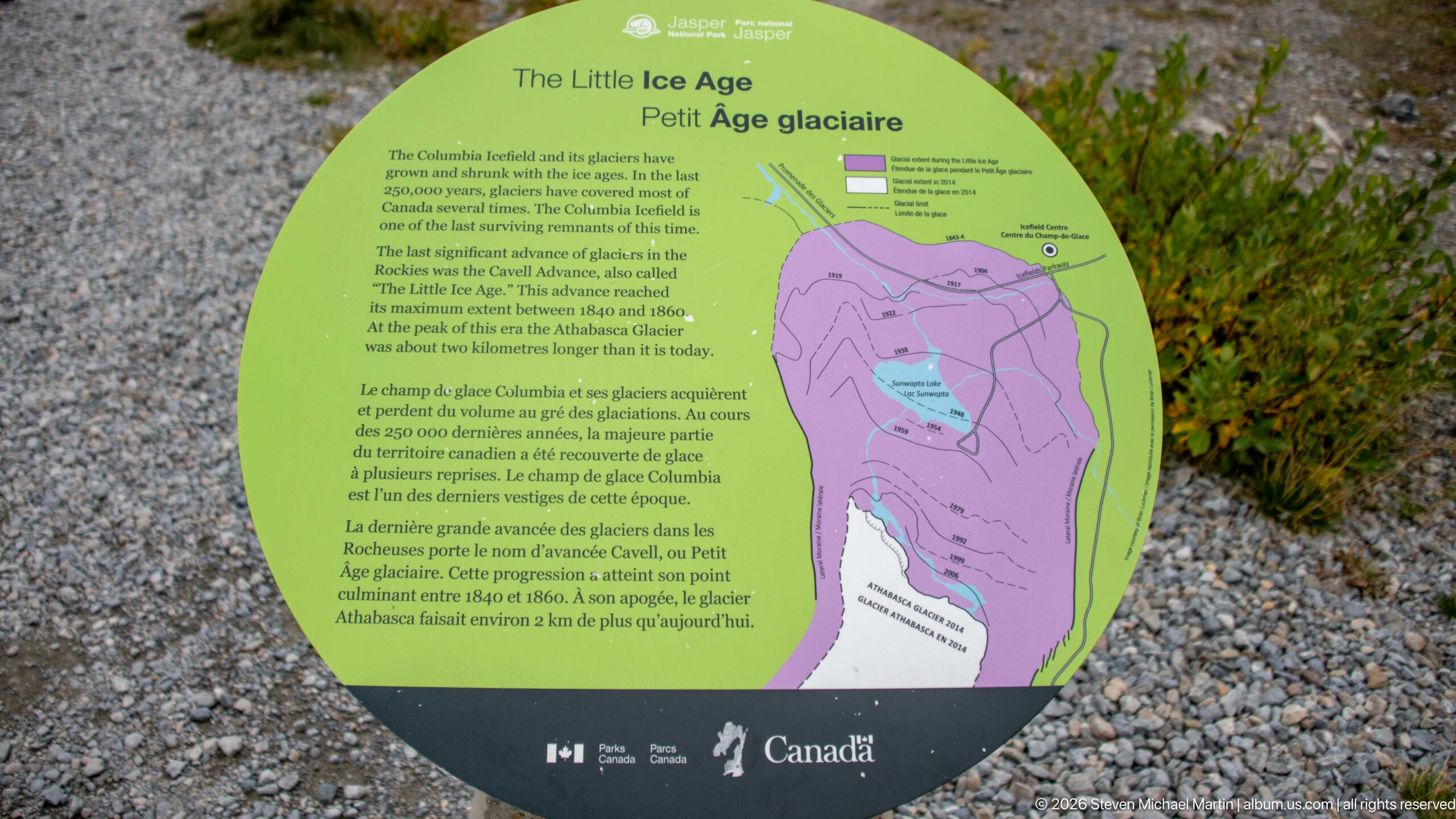
The Little Ice Age interpretive panel stands along the Athabasca Glacier visitor route. The panel places the glacier’s modern retreat within the longer history of advance and recession, using mapped outlines to explain former ice extent.
Caption
The Little Ice Age interpretive panel stands along the Athabasca Glacier visitor route. The panel places the glacier’s modern retreat within the longer history of advance and recession, using mapped outlines to explain former ice extent.
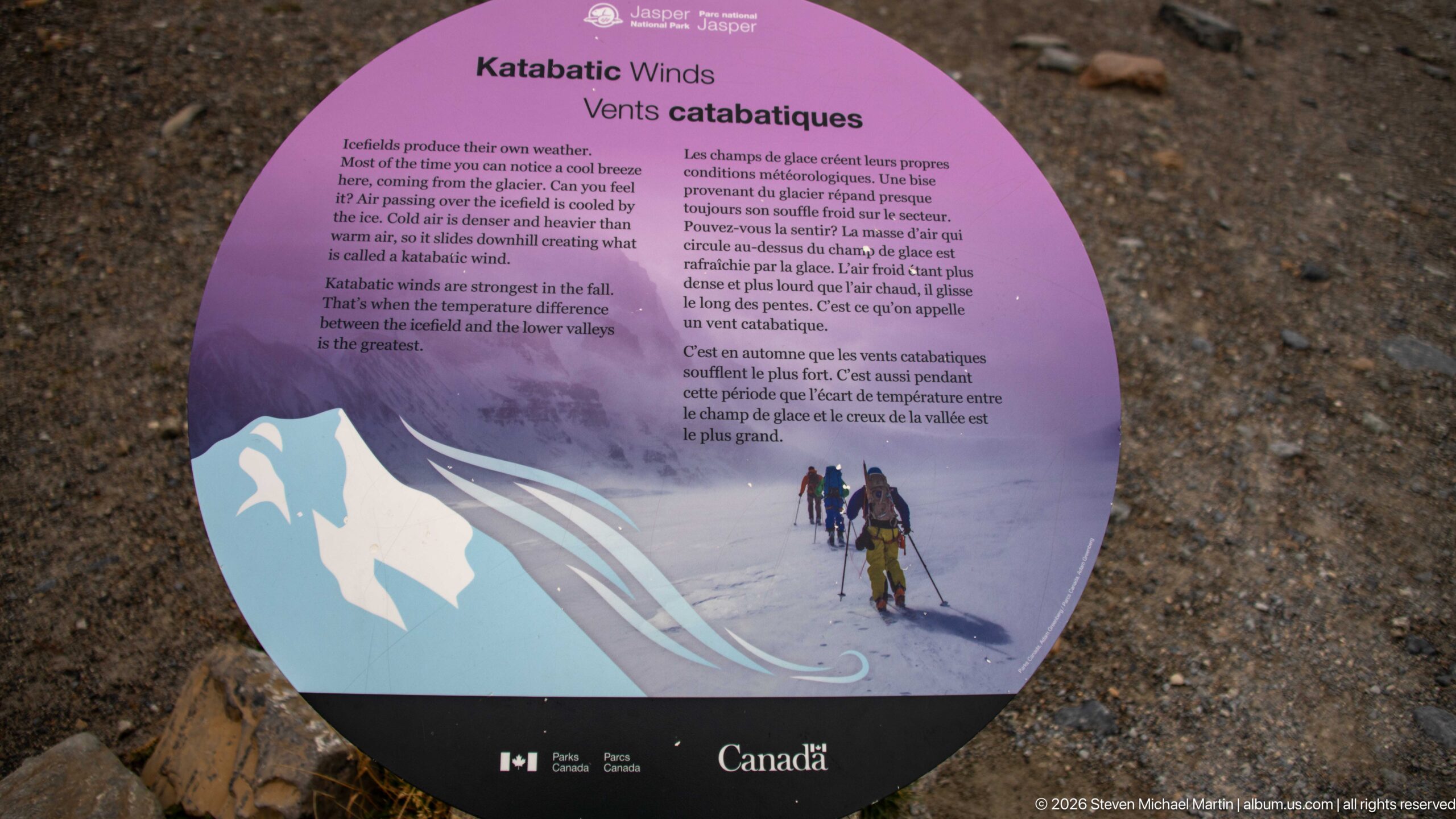
Katabatic Winds interpretive panel stands along the Athabasca Glacier visitor route. The display explains the dense, cold air that flows downslope from glacier surfaces, linking a directly experienced weather effect to the icefield environment.
Caption
Katabatic Winds interpretive panel stands along the Athabasca Glacier visitor route. The display explains the dense, cold air that flows downslope from glacier surfaces, linking a directly experienced weather effect to the icefield environment.
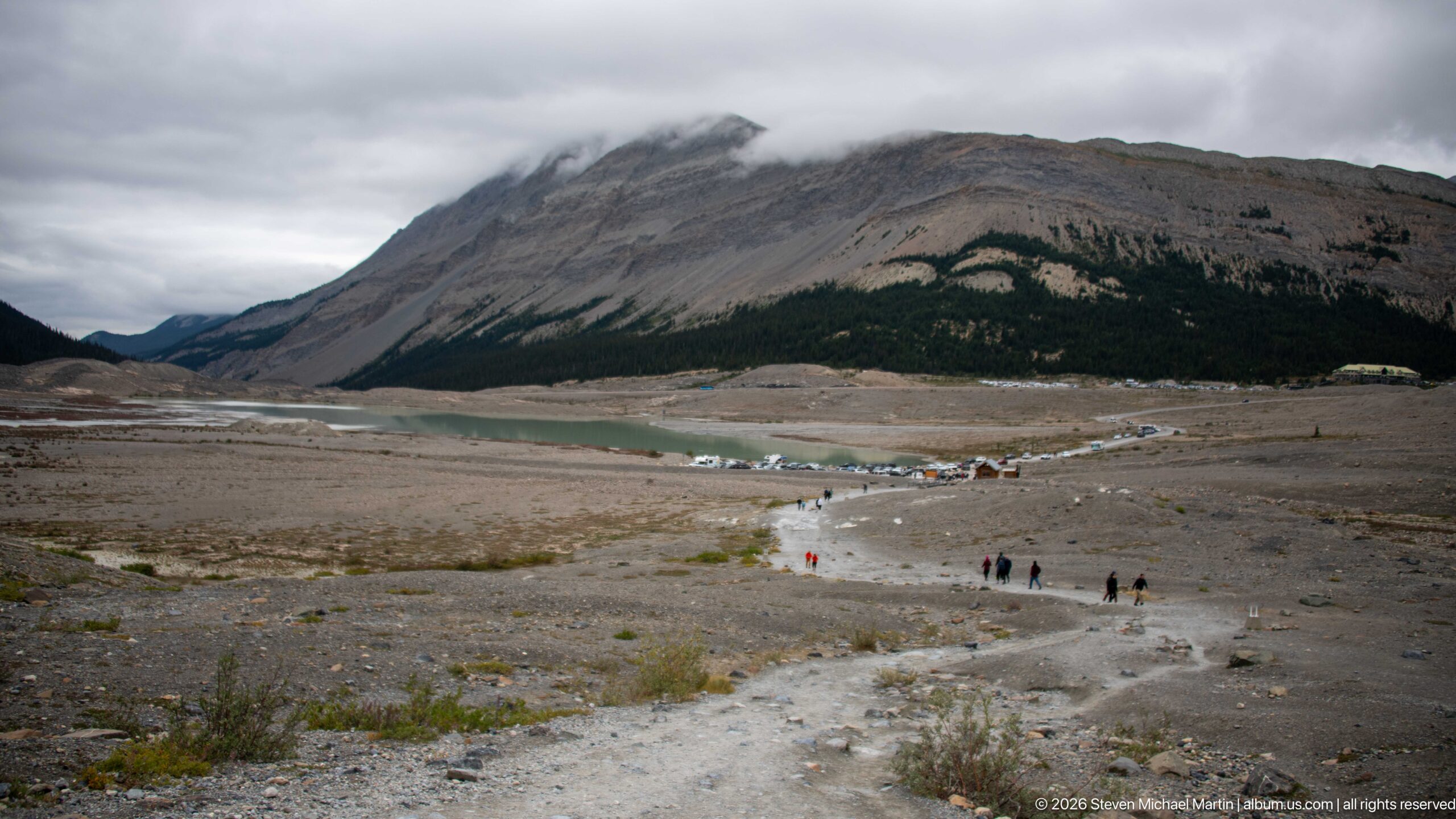
Visitor trail across deglaciated forefield forms the principal subject of this Columbia Icefield view. A broad barren valley floor with a pale trail and scattered visitors extends toward water and mountain slopes under overcast skies. The composition records the close relationship among glacier ice, exposed sedimentary rock, moraine or alpine vegetation that defines this high-elevation Canadian Rockies landscape.
Caption
Visitor trail across deglaciated forefield forms the principal subject of this Columbia Icefield view. A broad barren valley floor with a pale trail and scattered visitors extends toward water and mountain slopes under overcast skies. The composition records the close relationship among glacier ice, exposed sedimentary rock, moraine or alpine vegetation that defines this high-elevation Canadian Rockies landscape.
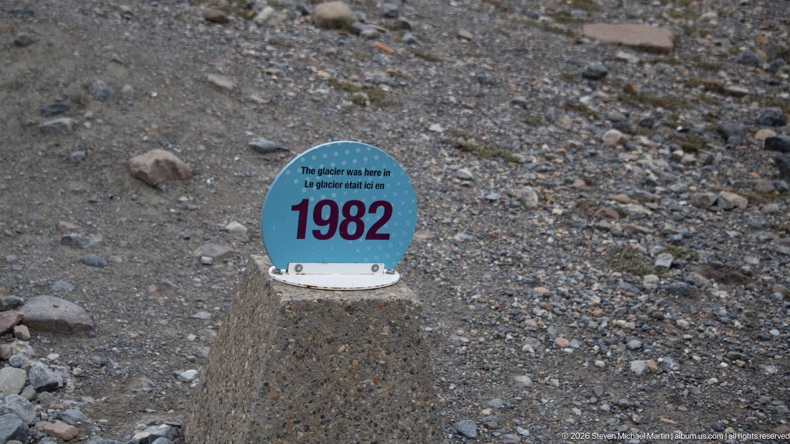
A dated marker records the former position of Athabasca Glacier in 1982, standing on terrain now exposed in front of the ice. The separation between the marker and present glacier provides a direct, easily read indication of retreat across the forefield.
Caption
A dated marker records the former position of Athabasca Glacier in 1982, standing on terrain now exposed in front of the ice. The separation between the marker and present glacier provides a direct, easily read indication of retreat across the forefield.
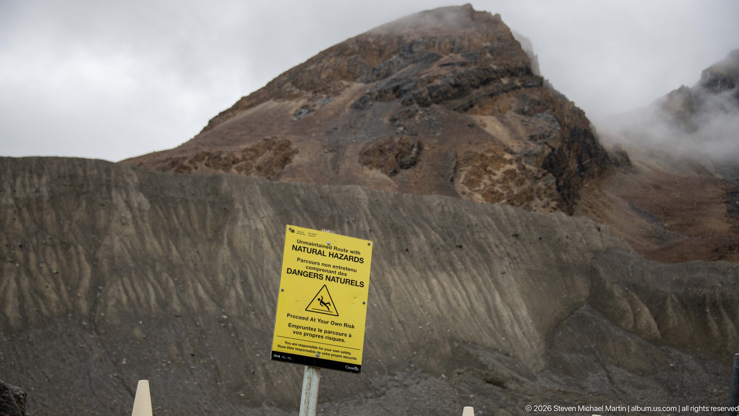
A yellow Parks Canada natural-hazards notice stands against steep, barren moraine terrain near the glacier. Its prominent placement underscores the unstable and dynamic conditions of the recently deglaciated forefield, where loose sediment, steep slopes, meltwater, and changing ice conditions require caution.
Caption
A yellow Parks Canada natural-hazards notice stands against steep, barren moraine terrain near the glacier. Its prominent placement underscores the unstable and dynamic conditions of the recently deglaciated forefield, where loose sediment, steep slopes, meltwater, and changing ice conditions require caution.
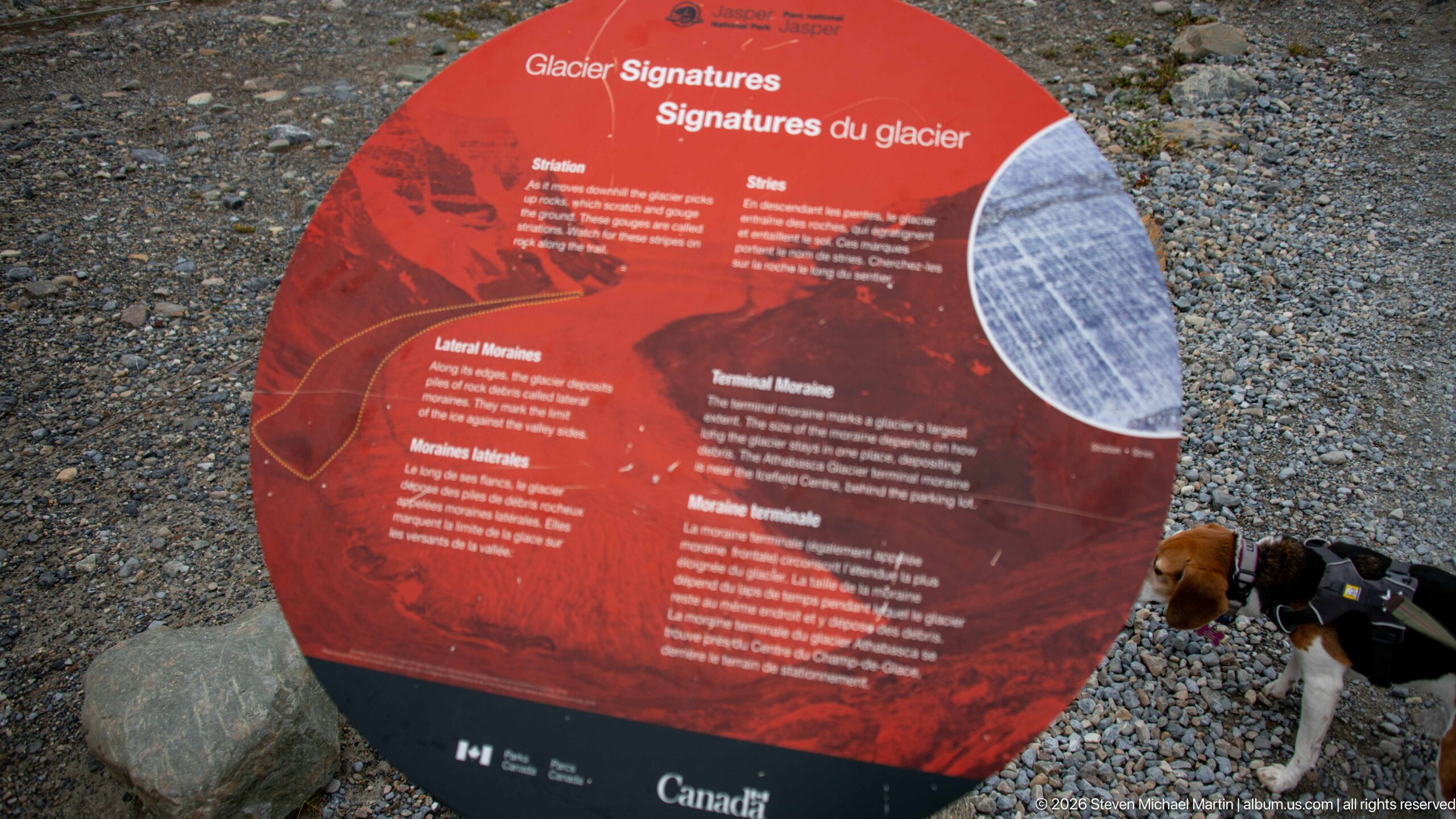
Glacier Signatures interpretive panel stands along the Athabasca Glacier visitor route. The display identifies landforms and deposits left by moving and retreating ice, helping visitors read the barren forefield as evidence of glacial processes.
Caption
Glacier Signatures interpretive panel stands along the Athabasca Glacier visitor route. The display identifies landforms and deposits left by moving and retreating ice, helping visitors read the barren forefield as evidence of glacial processes.
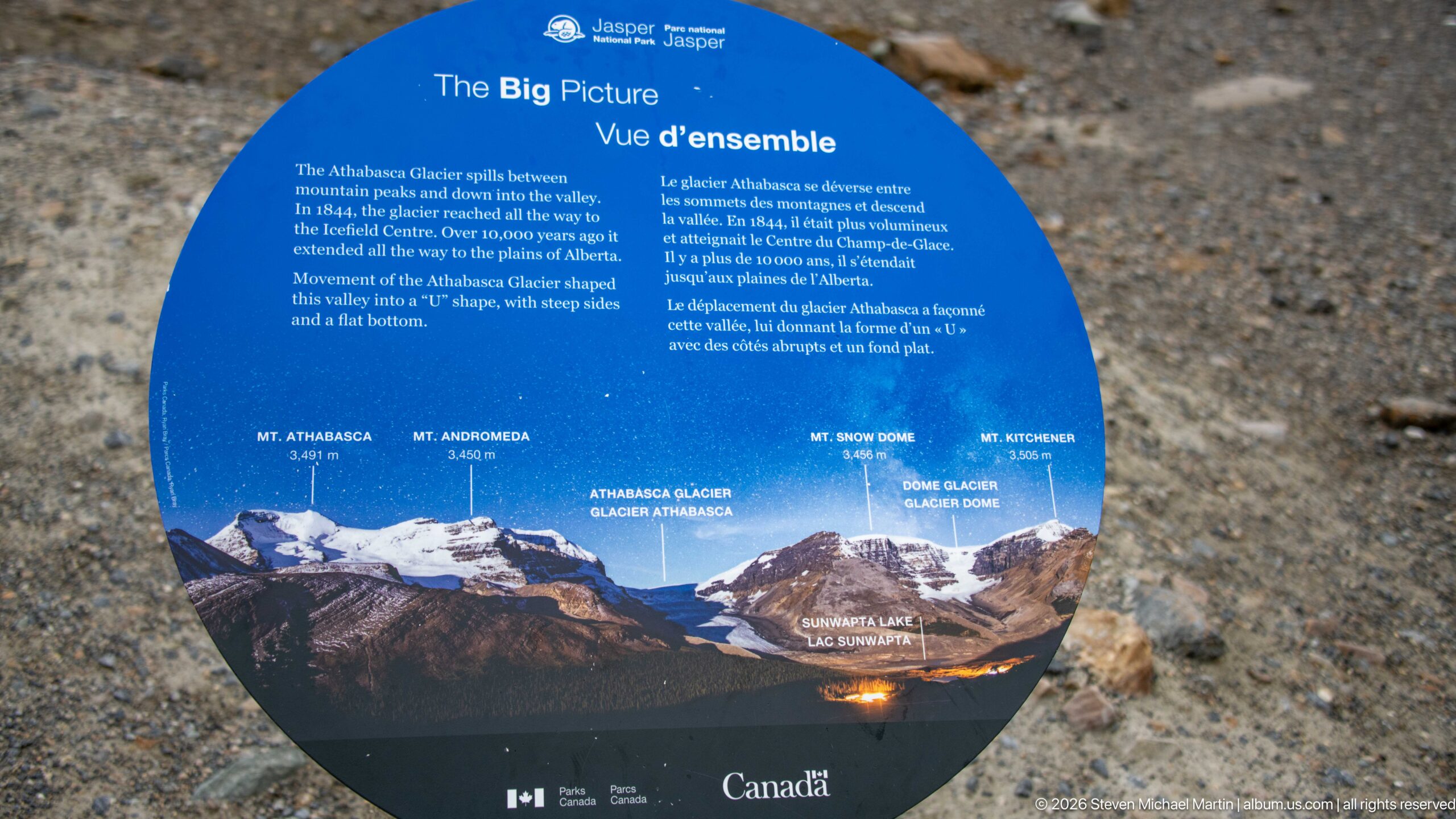
The Big Picture Athabasca Glacier interpretive panel stands along the Athabasca Glacier visitor route. The overview diagram relates Athabasca Glacier to the surrounding peaks and icefield, providing orientation for features visible from the forefield.
Caption
The Big Picture Athabasca Glacier interpretive panel stands along the Athabasca Glacier visitor route. The overview diagram relates Athabasca Glacier to the surrounding peaks and icefield, providing orientation for features visible from the forefield.
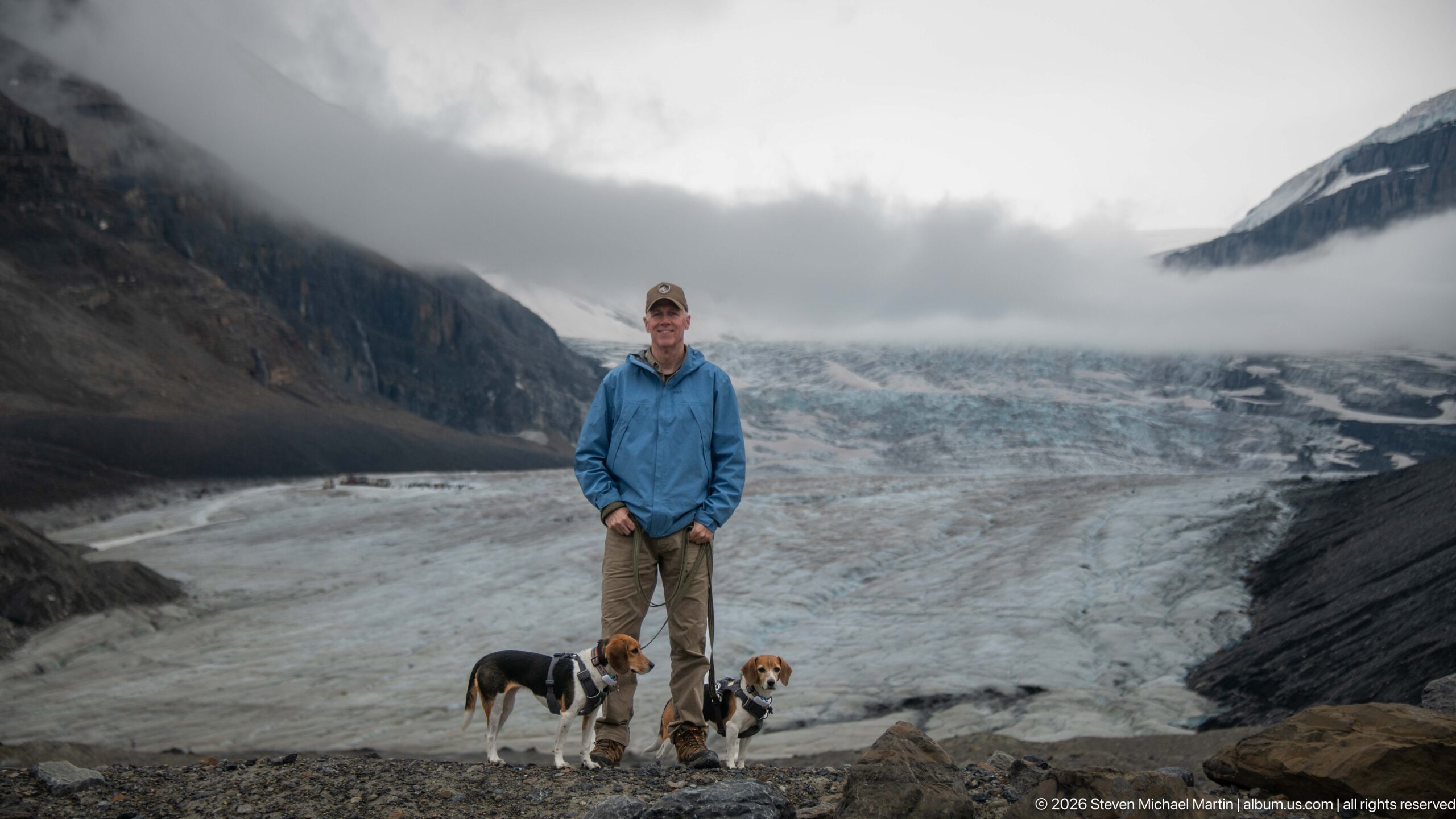
Traveler and two beagles before Athabasca Glacier. An adult in a blue jacket stands with two beagles on rocky ground, with the broad glacier descending behind under low cloud. The human and canine subjects provide scale and a personal travel record within the Columbia Icefield sequence while preserving the visible relationship to the surrounding mountain or glacier setting.
Caption
Traveler and two beagles before Athabasca Glacier. An adult in a blue jacket stands with two beagles on rocky ground, with the broad glacier descending behind under low cloud. The human and canine subjects provide scale and a personal travel record within the Columbia Icefield sequence while preserving the visible relationship to the surrounding mountain or glacier setting.
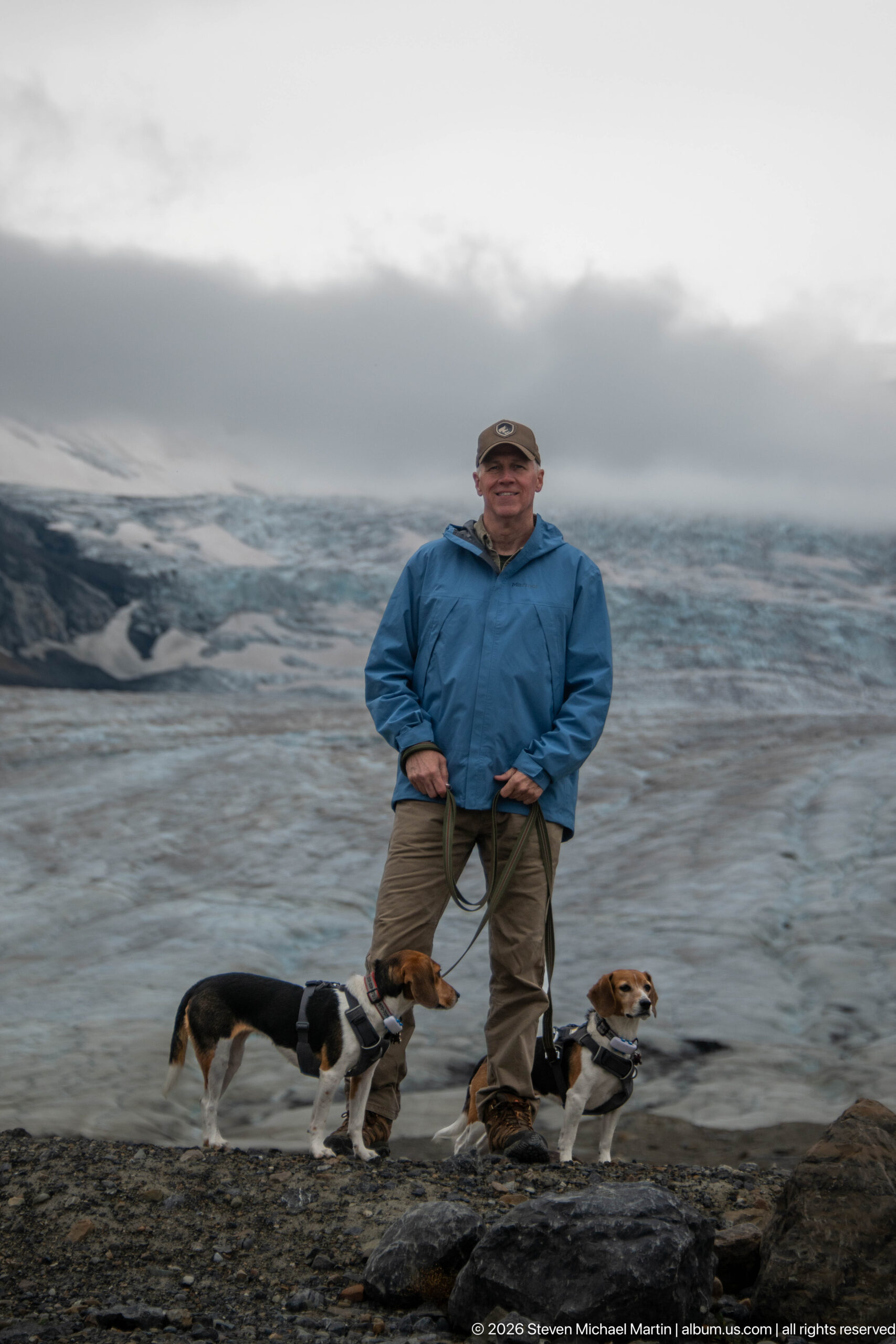
Traveler and two beagles beside glacier ice. An adult stands with two leashed beagles on the rocky forefield; textured glacier ice fills most of the background. The human and canine subjects provide scale and a personal travel record within the Columbia Icefield sequence while preserving the visible relationship to the surrounding mountain or glacier setting.
Caption
Traveler and two beagles beside glacier ice. An adult stands with two leashed beagles on the rocky forefield; textured glacier ice fills most of the background. The human and canine subjects provide scale and a personal travel record within the Columbia Icefield sequence while preserving the visible relationship to the surrounding mountain or glacier setting.
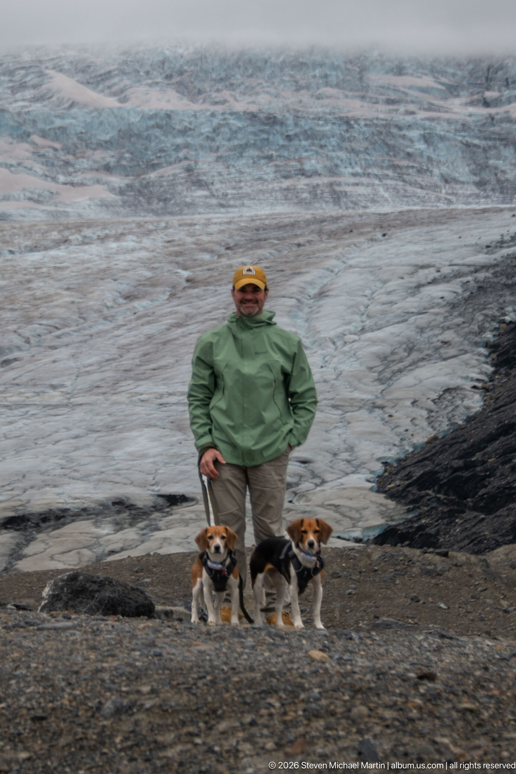
Traveler and two beagles on rocky glacier forefield. An adult poses with two beagles in front of textured glacier ice; dark gravel and moraine occupy the foreground. The human and canine subjects provide scale and a personal travel record within the Columbia Icefield sequence while preserving the visible relationship to the surrounding mountain or glacier setting.
Caption
Traveler and two beagles on rocky glacier forefield. An adult poses with two beagles in front of textured glacier ice; dark gravel and moraine occupy the foreground. The human and canine subjects provide scale and a personal travel record within the Columbia Icefield sequence while preserving the visible relationship to the surrounding mountain or glacier setting.
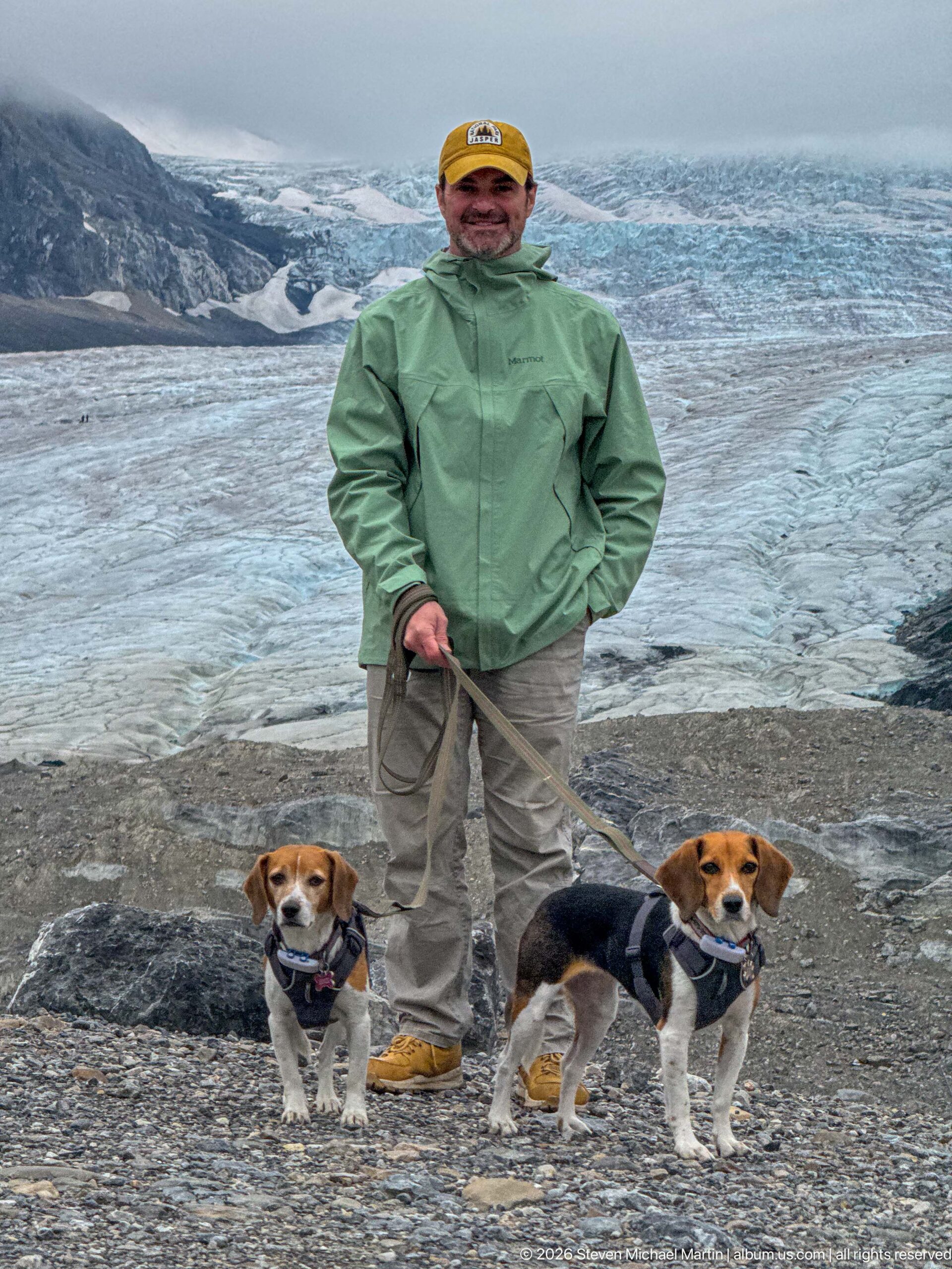
Close portrait of traveler and two beagles before glacier. An adult and two beagles fill the foreground while blue-gray glacier ice and debris bands extend across the background. The human and canine subjects provide scale and a personal travel record within the Columbia Icefield sequence while preserving the visible relationship to the surrounding mountain or glacier setting.
Caption
Close portrait of traveler and two beagles before glacier. An adult and two beagles fill the foreground while blue-gray glacier ice and debris bands extend across the background. The human and canine subjects provide scale and a personal travel record within the Columbia Icefield sequence while preserving the visible relationship to the surrounding mountain or glacier setting.
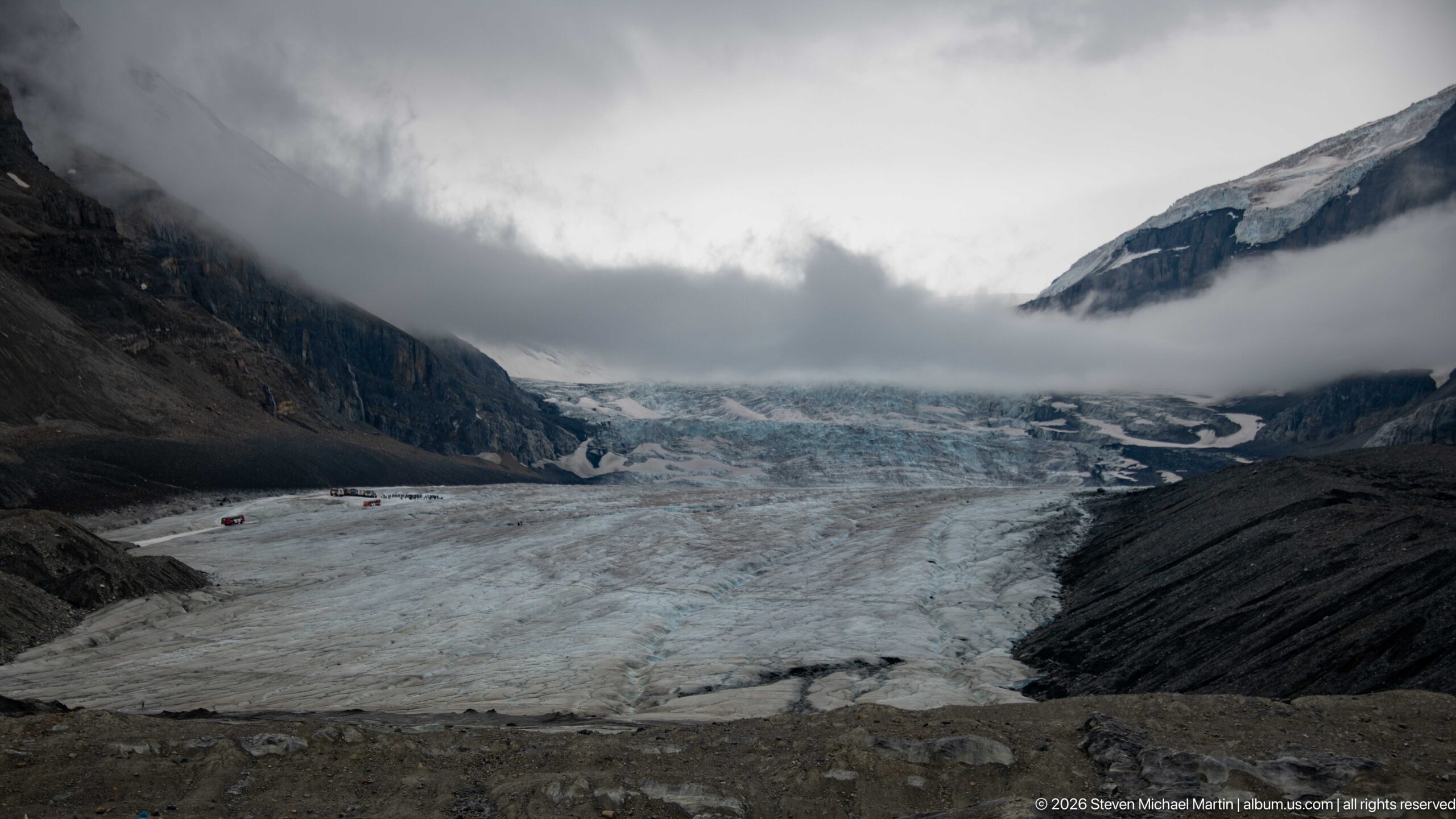
Broad view of Athabasca Glacier and valley walls forms the principal subject of this Columbia Icefield view. Glacier ice fills the valley between dark moraine slopes and steep mountains, with low cloud obscuring the upper accumulation area. The composition records the close relationship among glacier ice, exposed sedimentary rock, moraine or alpine vegetation that defines this high-elevation Canadian Rockies landscape.
Caption
Broad view of Athabasca Glacier and valley walls forms the principal subject of this Columbia Icefield view. Glacier ice fills the valley between dark moraine slopes and steep mountains, with low cloud obscuring the upper accumulation area. The composition records the close relationship among glacier ice, exposed sedimentary rock, moraine or alpine vegetation that defines this high-elevation Canadian Rockies landscape.
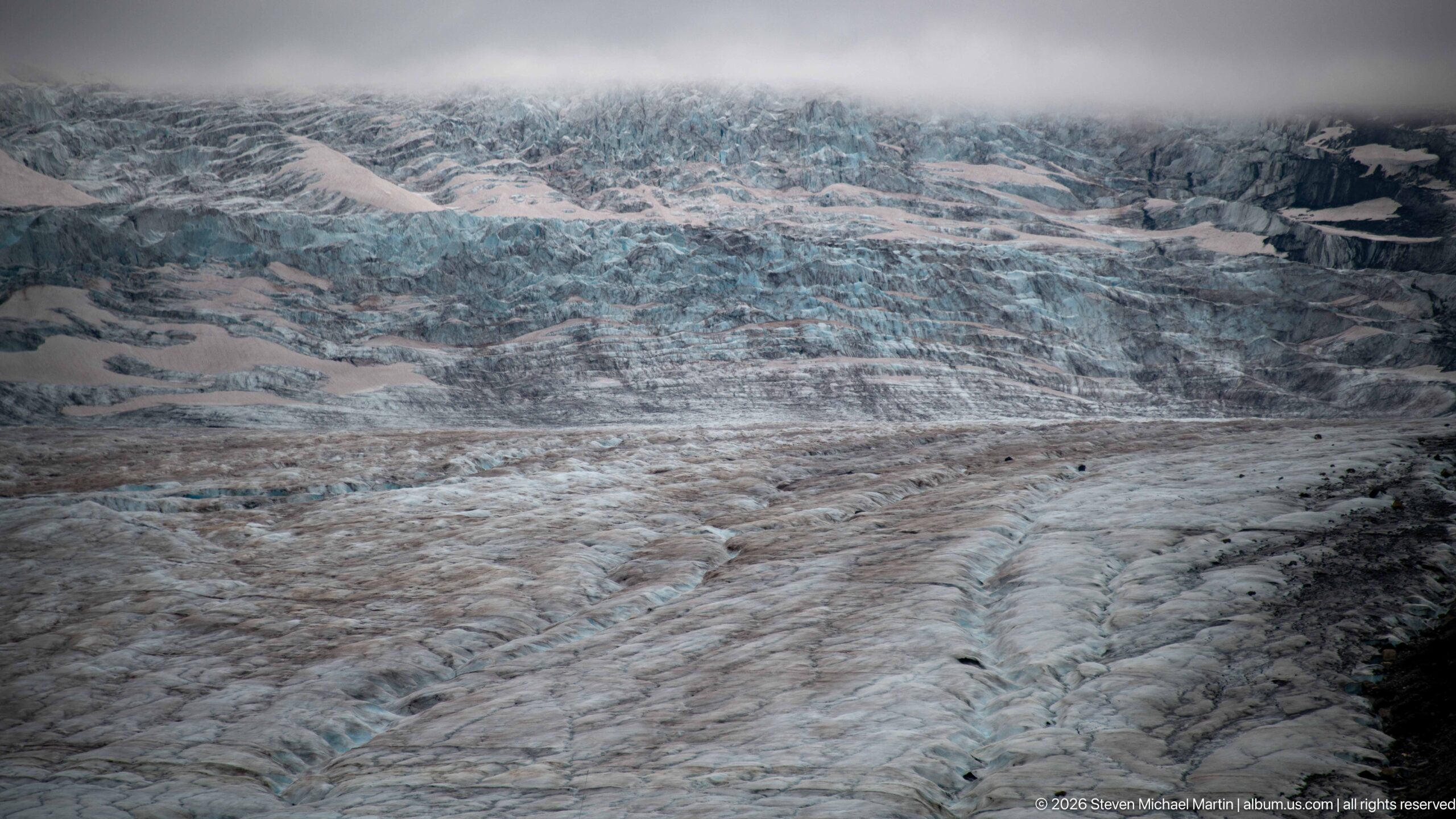
Crevassed and debris-streaked glacier surface forms the principal subject of this Columbia Icefield view. A tight view shows fractured blue-white glacier ice crossed by gray debris bands, ridges, and shallow crevasses. The composition records the close relationship among glacier ice, exposed sedimentary rock, moraine or alpine vegetation that defines this high-elevation Canadian Rockies landscape.
Caption
Crevassed and debris-streaked glacier surface forms the principal subject of this Columbia Icefield view. A tight view shows fractured blue-white glacier ice crossed by gray debris bands, ridges, and shallow crevasses. The composition records the close relationship among glacier ice, exposed sedimentary rock, moraine or alpine vegetation that defines this high-elevation Canadian Rockies landscape.
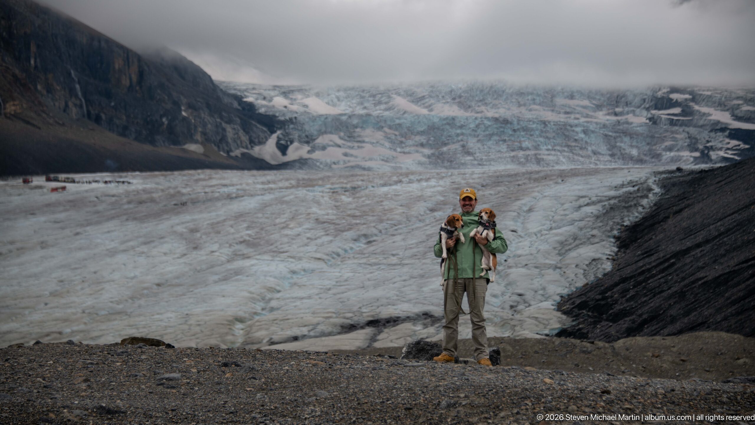
Traveler holding two beagles before Athabasca Glacier. An adult in a green jacket holds two beagles while standing on dark gravel with Athabasca Glacier filling the background. The human and canine subjects provide scale and a personal travel record within the Columbia Icefield sequence while preserving the visible relationship to the surrounding mountain or glacier setting.
Caption
Traveler holding two beagles before Athabasca Glacier. An adult in a green jacket holds two beagles while standing on dark gravel with Athabasca Glacier filling the background. The human and canine subjects provide scale and a personal travel record within the Columbia Icefield sequence while preserving the visible relationship to the surrounding mountain or glacier setting.
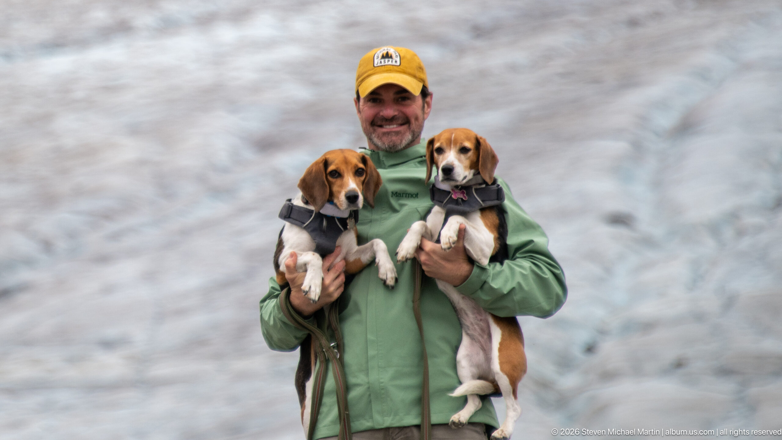
Traveler and two beagles against glacier backdrop. A smiling adult holds two beagles in harnesses; the glacier surface forms a softly focused blue-gray background. The human and canine subjects provide scale and a personal travel record within the Columbia Icefield sequence while preserving the visible relationship to the surrounding mountain or glacier setting.
Caption
Traveler and two beagles against glacier backdrop. A smiling adult holds two beagles in harnesses; the glacier surface forms a softly focused blue-gray background. The human and canine subjects provide scale and a personal travel record within the Columbia Icefield sequence while preserving the visible relationship to the surrounding mountain or glacier setting.
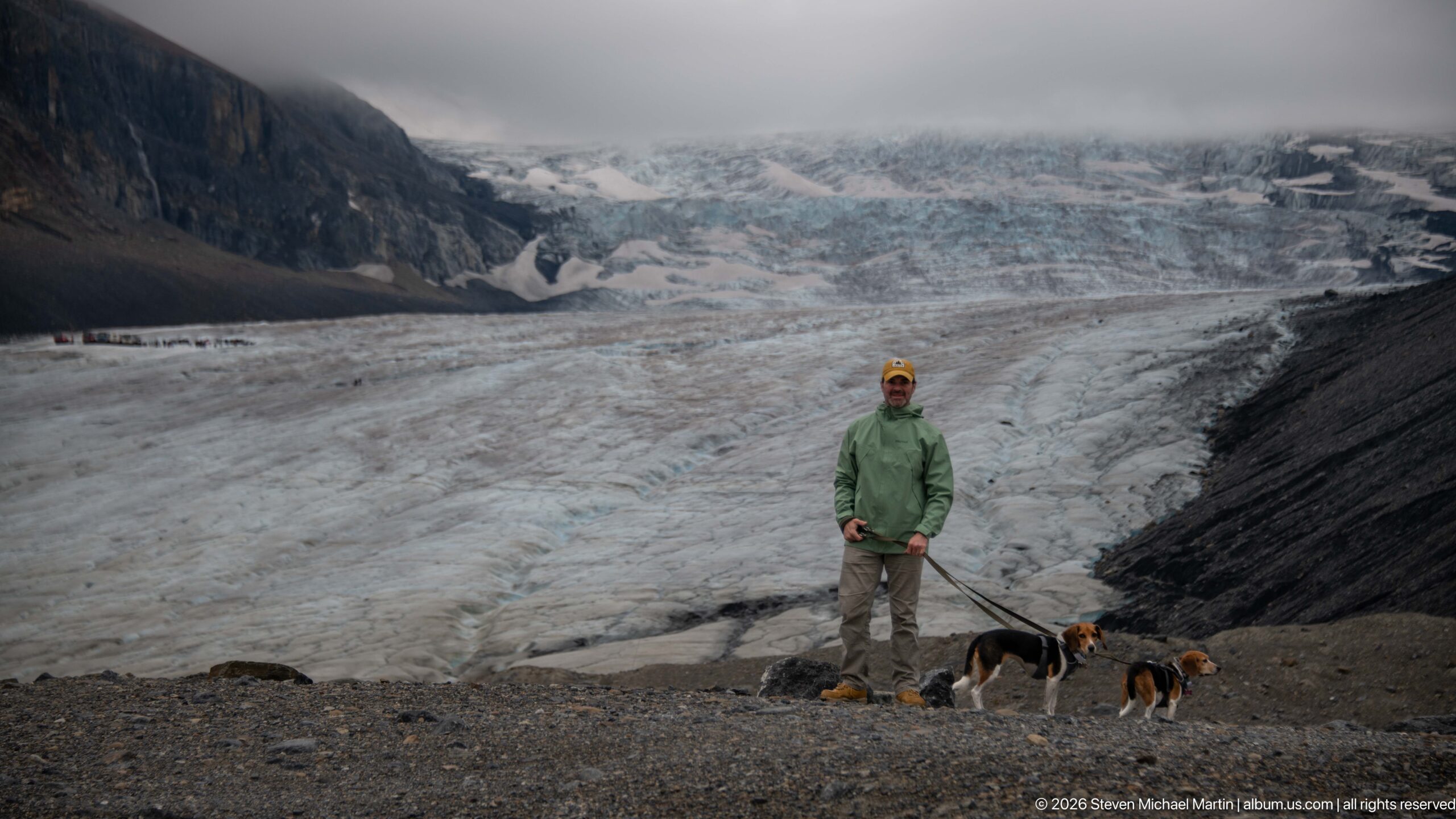
Traveler with two leashed beagles on glacial forefield. An adult in a green jacket stands with two leashed beagles on rocky ground, with the glacier and dark moraine behind. The human and canine subjects provide scale and a personal travel record within the Columbia Icefield sequence while preserving the visible relationship to the surrounding mountain or glacier setting.
Caption
Traveler with two leashed beagles on glacial forefield. An adult in a green jacket stands with two leashed beagles on rocky ground, with the glacier and dark moraine behind. The human and canine subjects provide scale and a personal travel record within the Columbia Icefield sequence while preserving the visible relationship to the surrounding mountain or glacier setting.
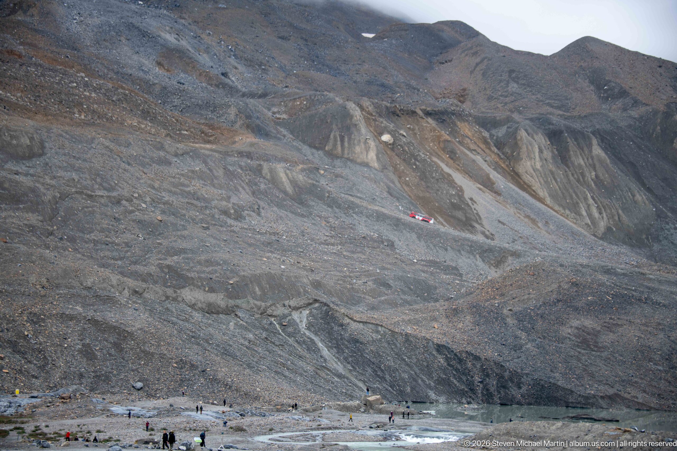
A vast moraine slope rises above the Athabasca Glacier forefield, its gray-brown surface incised by runoff channels and streaked with contrasting sediment. Tiny visitors and a red vehicle near the base reveal the immense scale of the unconsolidated material exposed and reworked as the glacier has retreated.
Caption
A vast moraine slope rises above the Athabasca Glacier forefield, its gray-brown surface incised by runoff channels and streaked with contrasting sediment. Tiny visitors and a red vehicle near the base reveal the immense scale of the unconsolidated material exposed and reworked as the glacier has retreated.
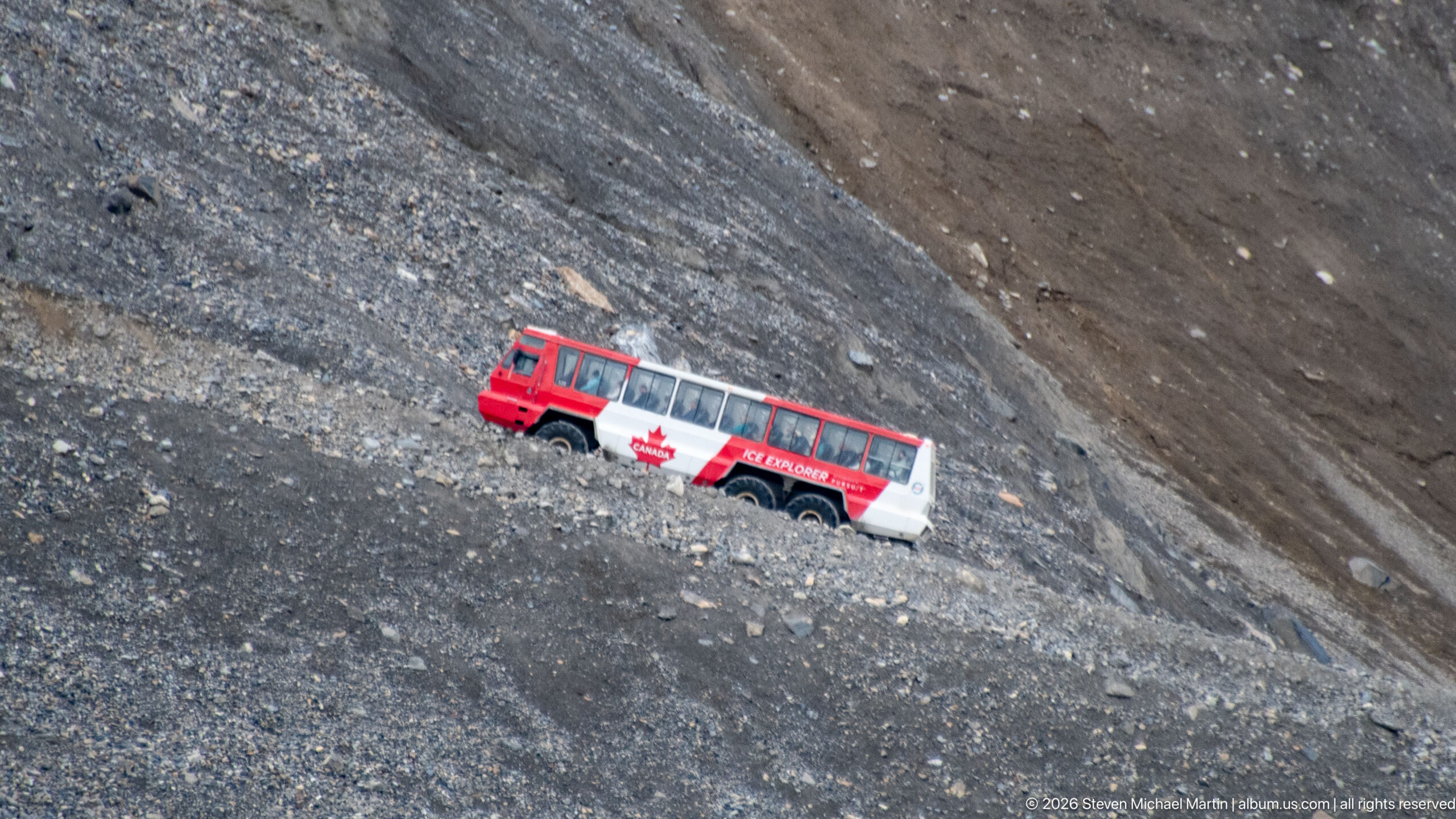
A red-and-white Ice Explorer traverses a steep moraine slope in the Columbia Icefield visitor area. Its oversized tires and high-clearance body are designed for travel over rough glacial terrain, while the surrounding loose rock and barren slope convey the scale and instability of the recently deglaciated landscape.
Caption
A red-and-white Ice Explorer traverses a steep moraine slope in the Columbia Icefield visitor area. Its oversized tires and high-clearance body are designed for travel over rough glacial terrain, while the surrounding loose rock and barren slope convey the scale and instability of the recently deglaciated landscape.
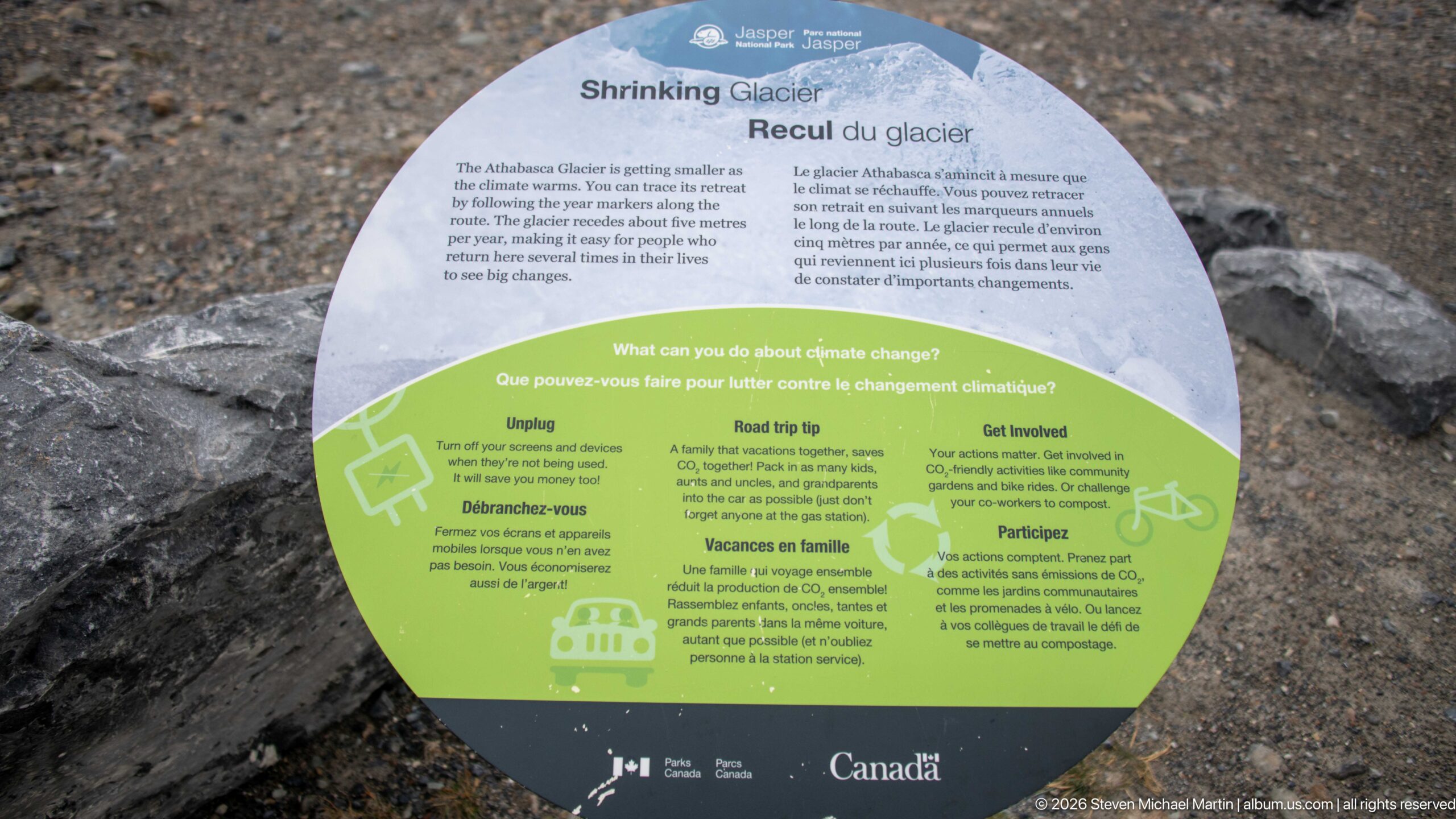
The bilingual “Shrinking Glacier” interpretive panel addresses the retreat of Athabasca Glacier and connects visible landscape change with climate. Its circular display combines explanatory text with practical suggestions for reducing greenhouse-gas emissions, placing contemporary environmental change within the visitor experience at the glacier.
Caption
The bilingual “Shrinking Glacier” interpretive panel addresses the retreat of Athabasca Glacier and connects visible landscape change with climate. Its circular display combines explanatory text with practical suggestions for reducing greenhouse-gas emissions, placing contemporary environmental change within the visitor experience at the glacier.
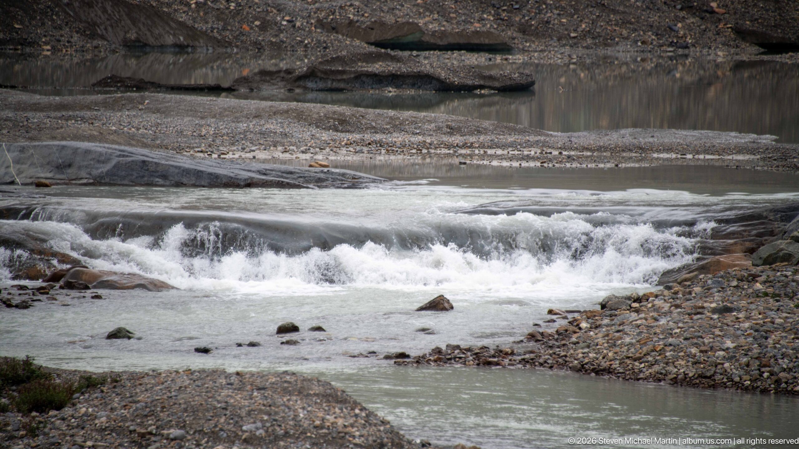
Pale, sediment-rich meltwater tumbles over low rock ledges in the Athabasca Glacier forefield. Gravel bars, exposed bedrock, and shallow channels surround the cascade, illustrating how water emerging from the glacier continually transports and rearranges sediment across terrain uncovered by retreating ice.
Caption
Pale, sediment-rich meltwater tumbles over low rock ledges in the Athabasca Glacier forefield. Gravel bars, exposed bedrock, and shallow channels surround the cascade, illustrating how water emerging from the glacier continually transports and rearranges sediment across terrain uncovered by retreating ice.
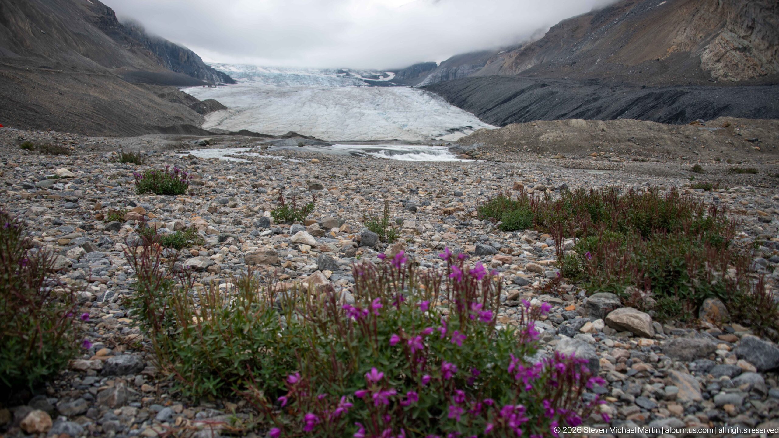
Clusters of pink-purple wildflowers occupy the stony forefield below Athabasca Glacier, where sparse vegetation is becoming established among loose gravel and cobbles. Beyond them, the glacier descends between steep sedimentary walls, creating a layered view of ecological succession, deglaciated terrain, and active ice.
Caption
Clusters of pink-purple wildflowers occupy the stony forefield below Athabasca Glacier, where sparse vegetation is becoming established among loose gravel and cobbles. Beyond them, the glacier descends between steep sedimentary walls, creating a layered view of ecological succession, deglaciated terrain, and active ice.
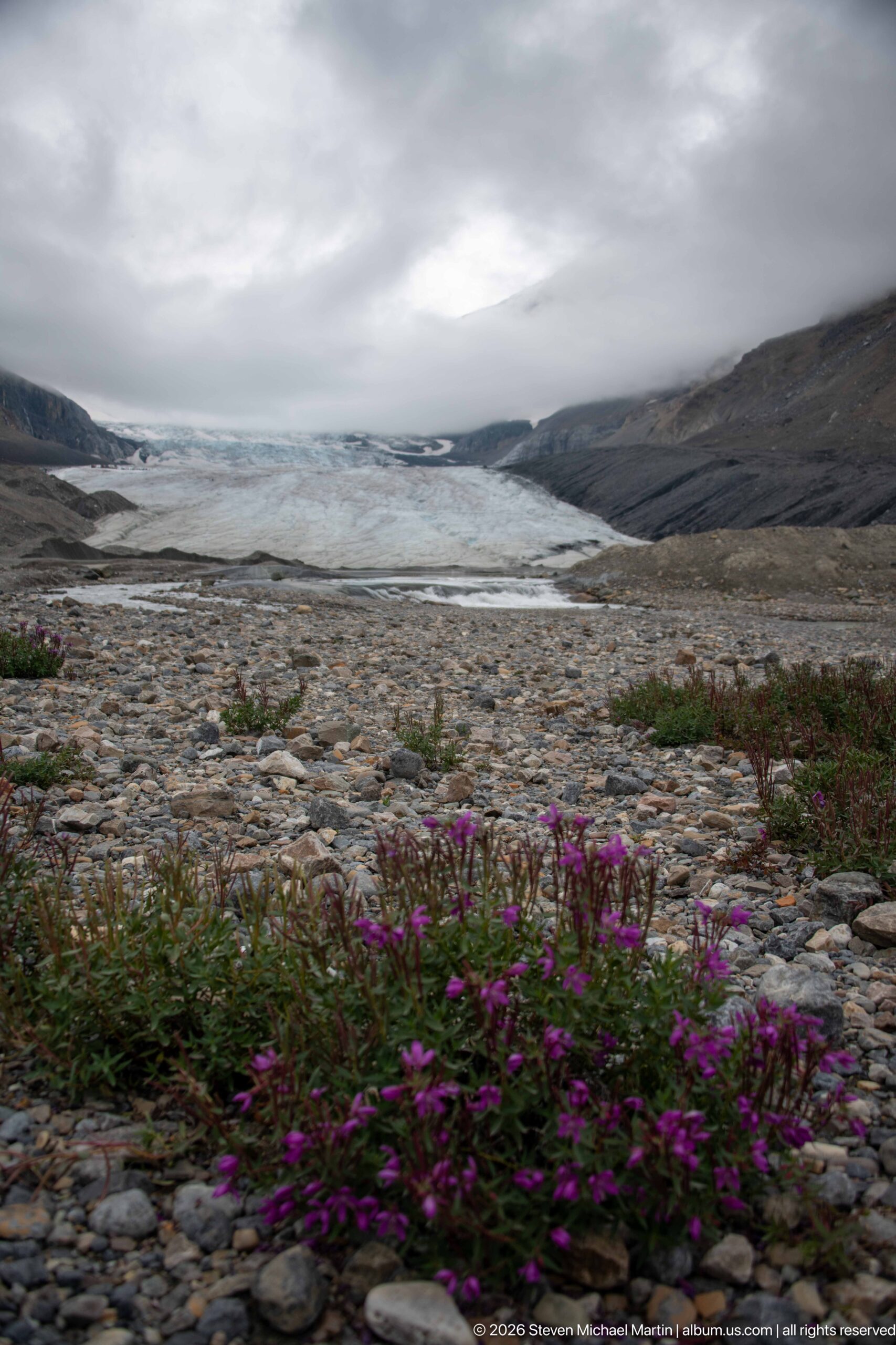
Purple alpine wildflowers brighten the rocky forefield below Athabasca Glacier, contrasting new plant growth with the broad expanse of ice and barren mountain walls beyond. The low viewpoint links pioneer vegetation on recently exposed ground with the glacier that shaped and formerly occupied much more of the valley.
Caption
Purple alpine wildflowers brighten the rocky forefield below Athabasca Glacier, contrasting new plant growth with the broad expanse of ice and barren mountain walls beyond. The low viewpoint links pioneer vegetation on recently exposed ground with the glacier that shaped and formerly occupied much more of the valley.
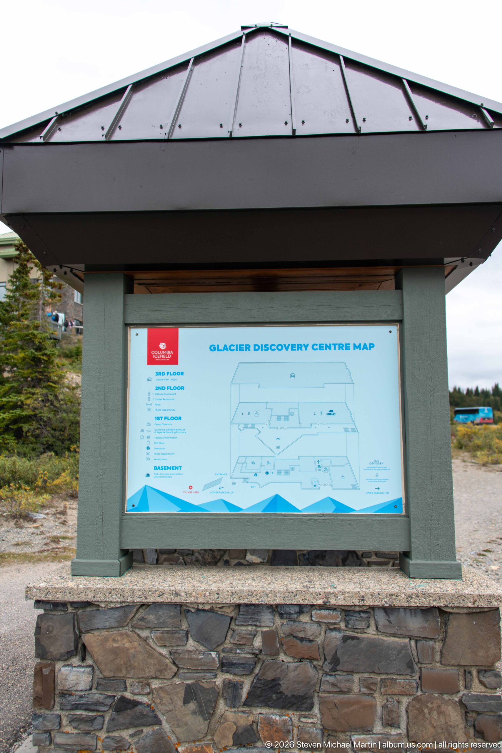
A sheltered “Glacier Discovery Centre Map” orients visitors to the multi-level complex and its services. Mounted within a stone-and-timber kiosk, the diagram functions as practical wayfinding for a busy visitor centre whose terraces, parking areas, and tour facilities occupy the steep slope opposite Athabasca Glacier.
Caption
A sheltered “Glacier Discovery Centre Map” orients visitors to the multi-level complex and its services. Mounted within a stone-and-timber kiosk, the diagram functions as practical wayfinding for a busy visitor centre whose terraces, parking areas, and tour facilities occupy the steep slope opposite Athabasca Glacier.
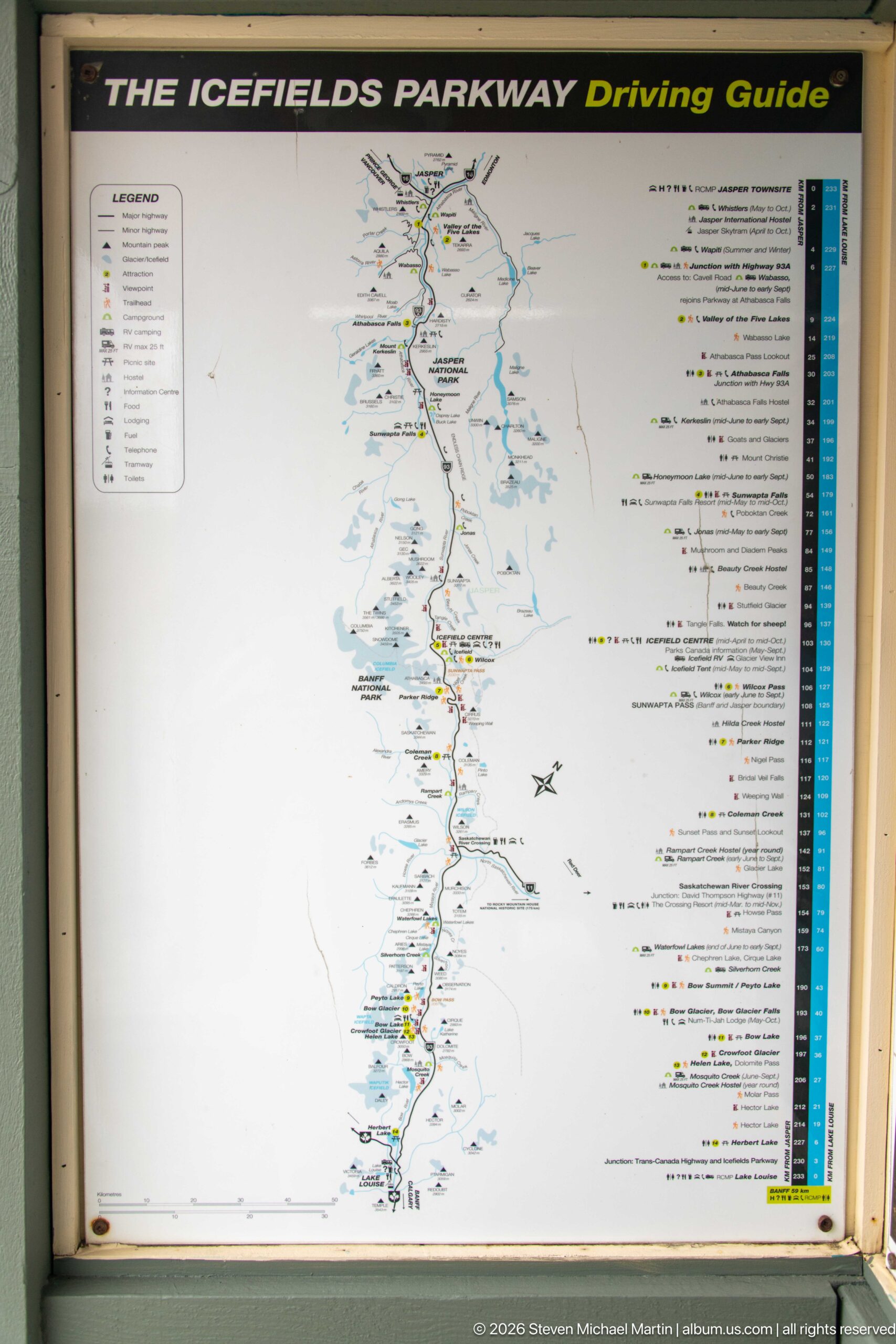
The Icefields Parkway Driving Guide maps the long mountain corridor linking major viewpoints, trailheads, lakes, waterfalls, and glacier features. Its elongated format mirrors the north-south route, helping visitors understand the Columbia Icefield as one stop within a much larger protected landscape extending through Jasper and Banff national parks.
Caption
The Icefields Parkway Driving Guide maps the long mountain corridor linking major viewpoints, trailheads, lakes, waterfalls, and glacier features. Its elongated format mirrors the north-south route, helping visitors understand the Columbia Icefield as one stop within a much larger protected landscape extending through Jasper and Banff national parks.
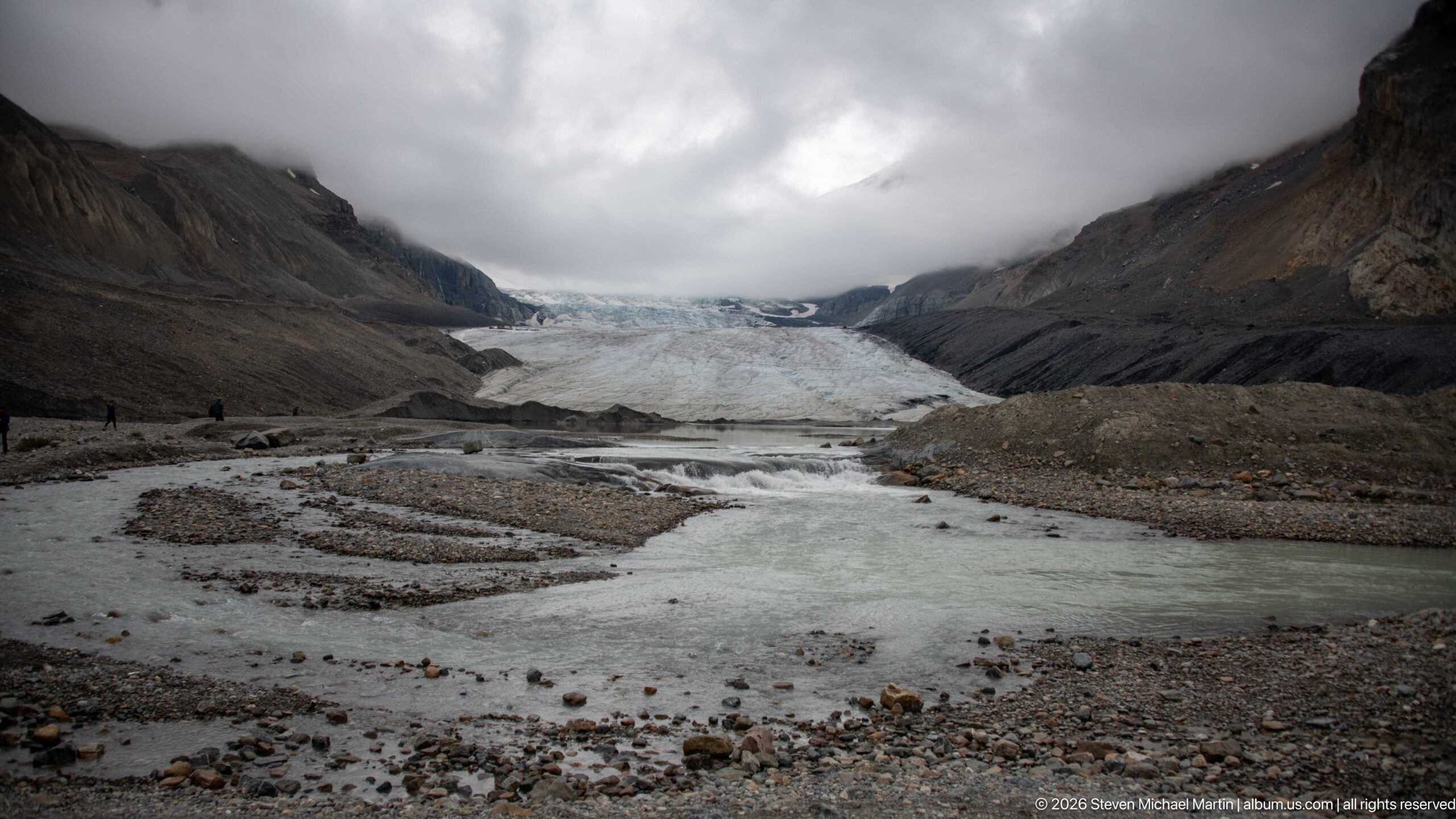
Athabasca Glacier fills the head of the valley beyond braided meltwater channels and gravel bars. The broad foreground exposes the glacier’s working landscape: sediment-laden water divides around unstable deposits while dark lateral moraines and steep mountain walls frame the receding ice.
Caption
Athabasca Glacier fills the head of the valley beyond braided meltwater channels and gravel bars. The broad foreground exposes the glacier’s working landscape: sediment-laden water divides around unstable deposits while dark lateral moraines and steep mountain walls frame the receding ice.
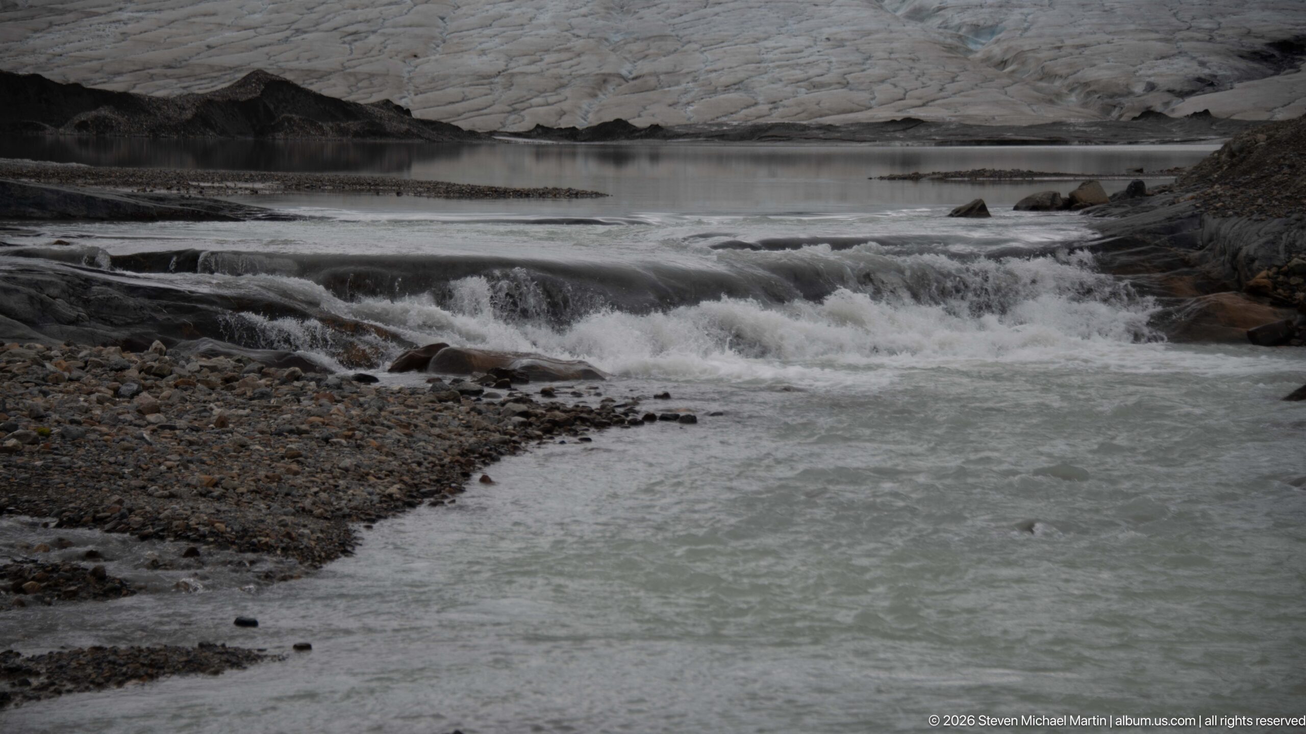
Milky meltwater rushes across shallow bedrock ledges below Athabasca Glacier, carrying fine sediment away from the ice. The close composition concentrates on turbulent flow and exposed rock, with the glacier edge visible beyond the channel and reinforcing the stream’s immediate glacial source.
Caption
Milky meltwater rushes across shallow bedrock ledges below Athabasca Glacier, carrying fine sediment away from the ice. The close composition concentrates on turbulent flow and exposed rock, with the glacier edge visible beyond the channel and reinforcing the stream’s immediate glacial source.
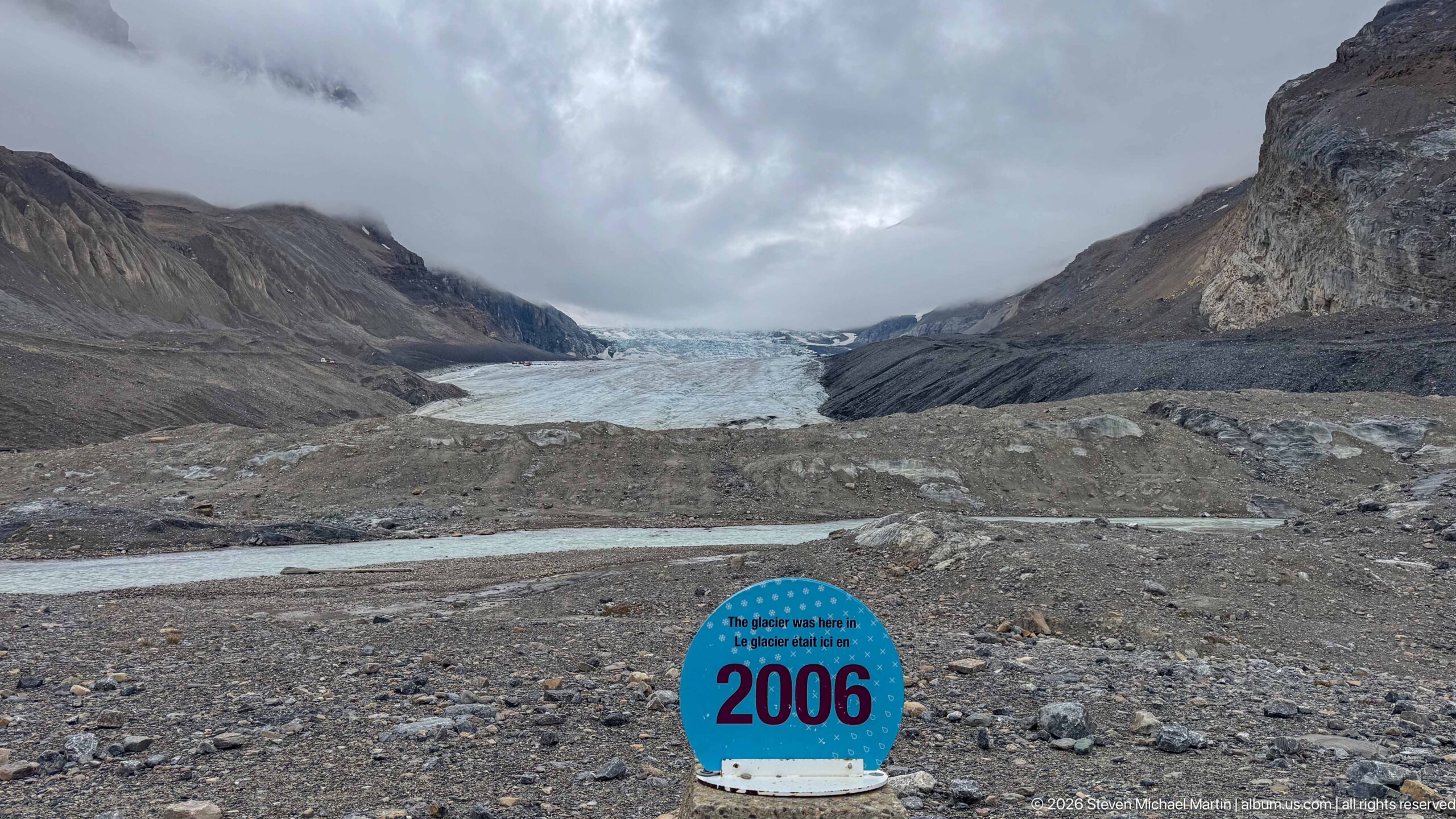
A blue 2006 marker records the former position of Athabasca Glacier on ground now separated from the present ice by a broad barren forefield. The direct sightline from the dated marker to the glacier makes retreat legible in the landscape without relying on an abstract chart or map.
Caption
A blue 2006 marker records the former position of Athabasca Glacier on ground now separated from the present ice by a broad barren forefield. The direct sightline from the dated marker to the glacier makes retreat legible in the landscape without relying on an abstract chart or map.
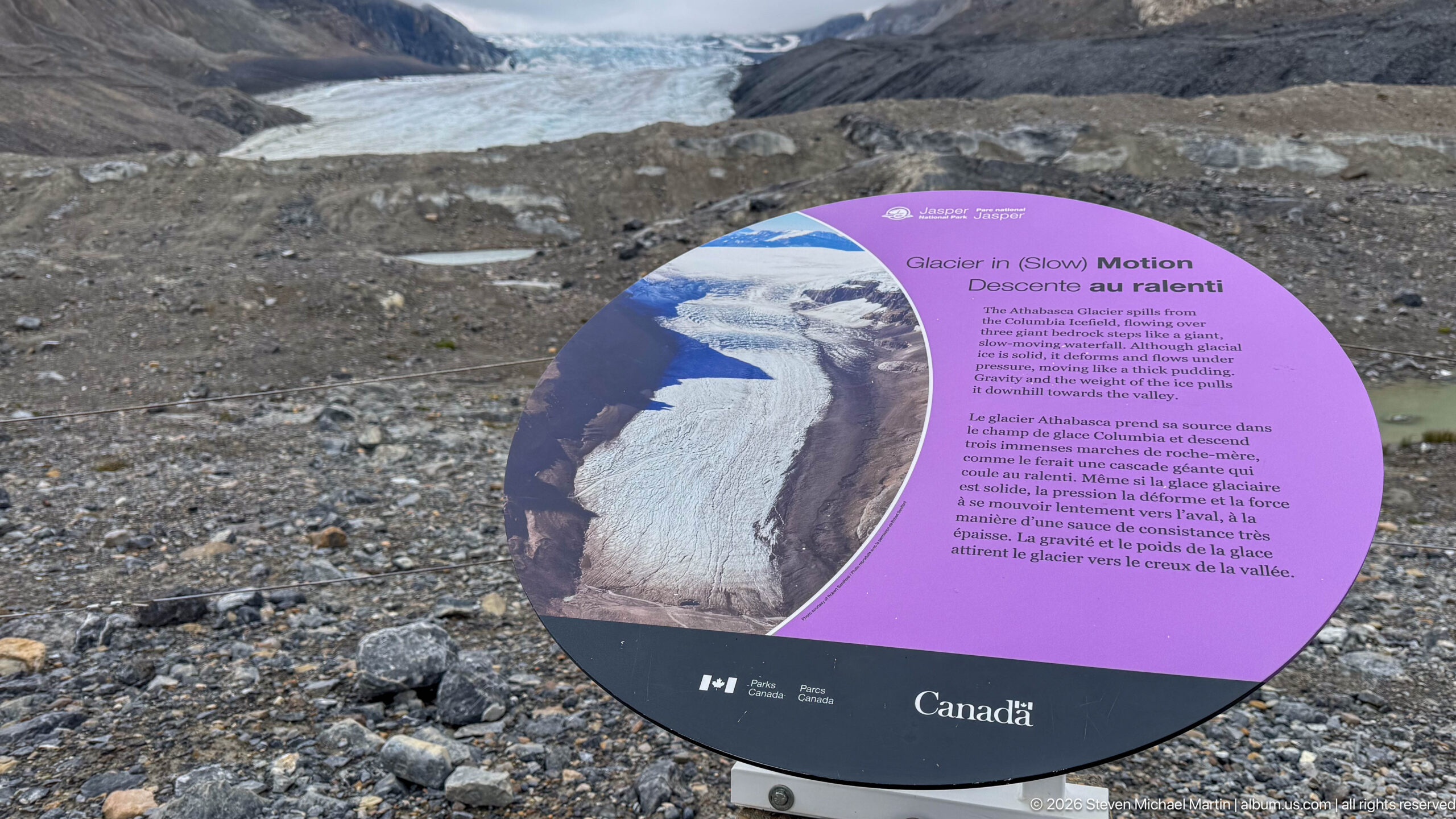
The bilingual “Glacier in Slow Motion” panel explains that glacier ice moves downslope under its own weight. An aerial photograph and diagrammatic presentation connect the apparently static ice visible from the forefield with the continual flow that transports snow and ice from the accumulation area toward the glacier terminus.
Caption
The bilingual “Glacier in Slow Motion” panel explains that glacier ice moves downslope under its own weight. An aerial photograph and diagrammatic presentation connect the apparently static ice visible from the forefield with the continual flow that transports snow and ice from the accumulation area toward the glacier terminus.
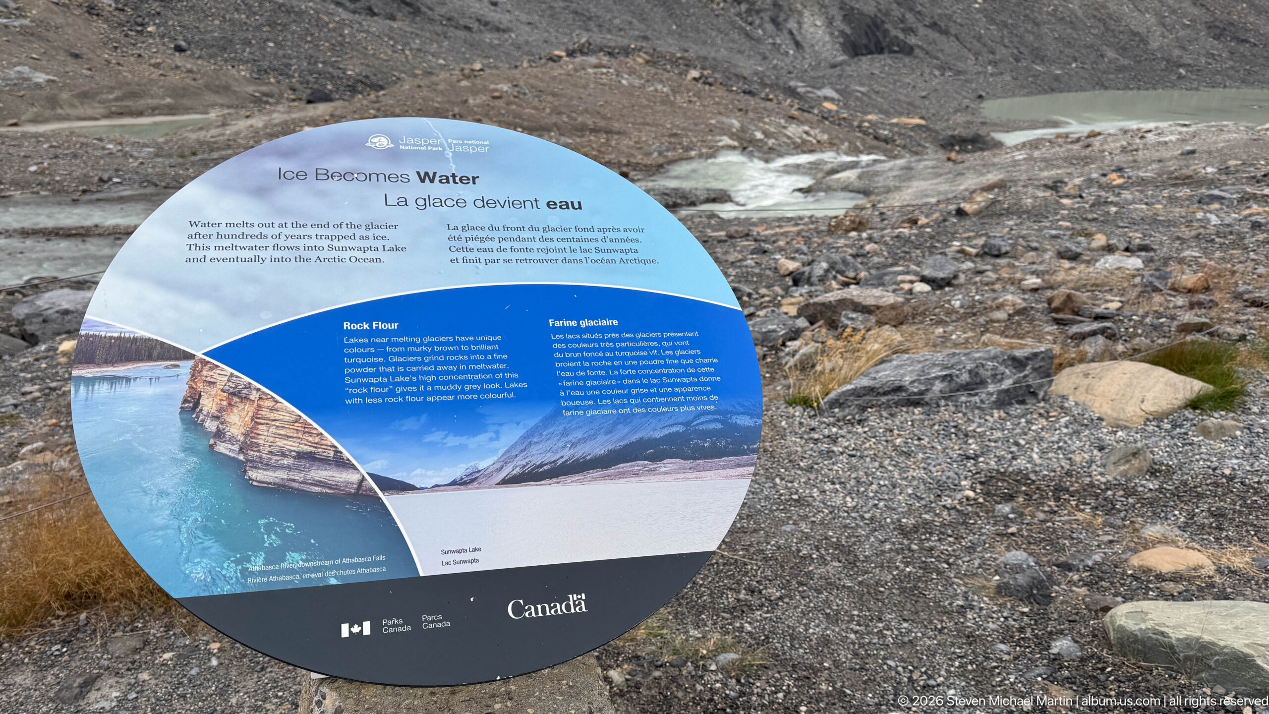
The “Ice Becomes Water” interpretive panel follows glacier meltwater beyond the ice, linking the forefield to downstream river systems. Photographs and bilingual text explain how water released from mountain glaciers enters larger watersheds, extending the significance of the Columbia Icefield far beyond the immediate glacier valley.
Caption
The “Ice Becomes Water” interpretive panel follows glacier meltwater beyond the ice, linking the forefield to downstream river systems. Photographs and bilingual text explain how water released from mountain glaciers enters larger watersheds, extending the significance of the Columbia Icefield far beyond the immediate glacier valley.
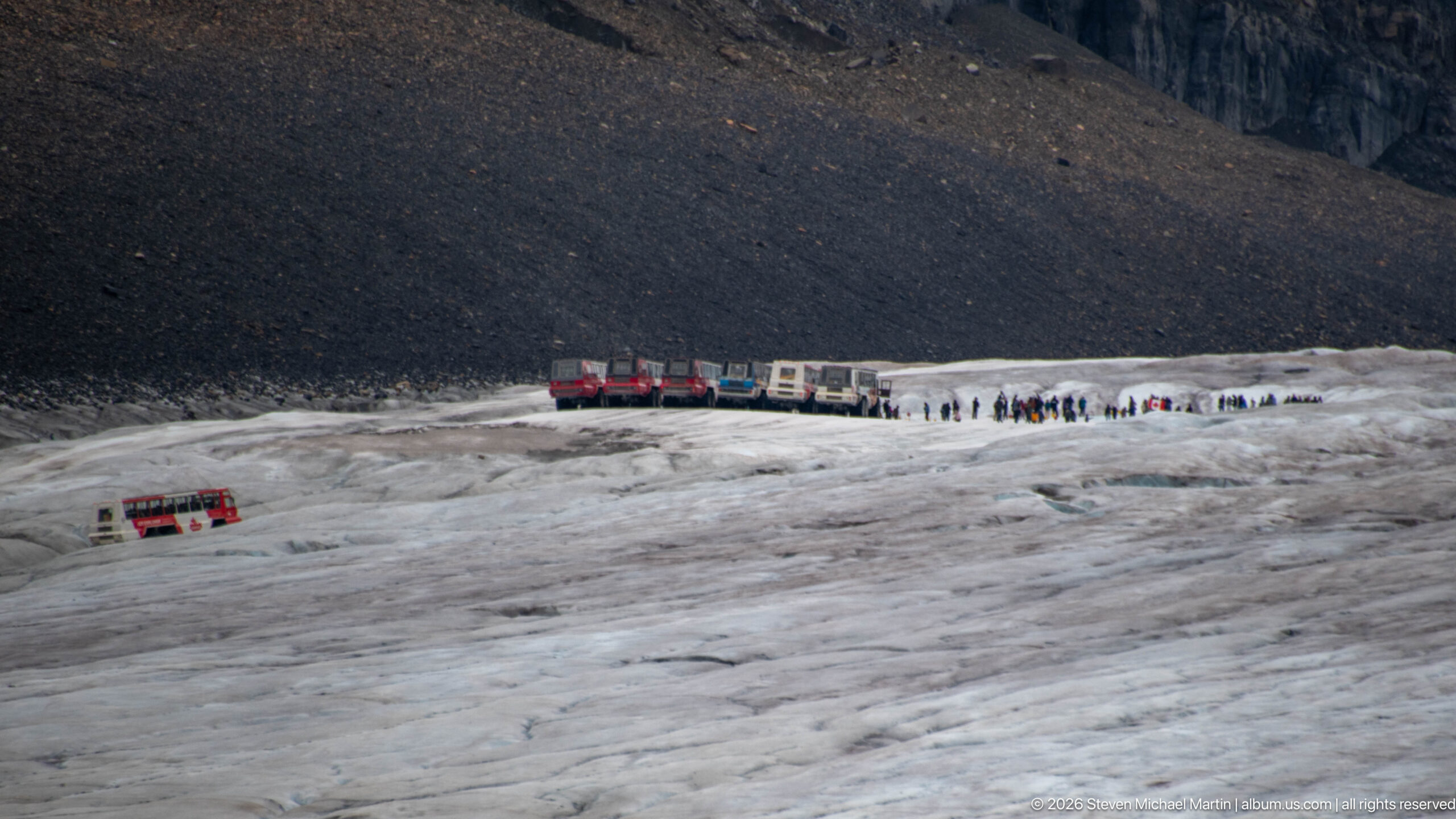
Several Ice Explorer vehicles and groups of visitors occupy a designated area on Athabasca Glacier. The elevated view shows the machines and people as small elements against the broad ice surface and dark moraine slope, providing an unusually clear sense of scale for both the glacier and the organized visitor operation.
Caption
Several Ice Explorer vehicles and groups of visitors occupy a designated area on Athabasca Glacier. The elevated view shows the machines and people as small elements against the broad ice surface and dark moraine slope, providing an unusually clear sense of scale for both the glacier and the organized visitor operation.
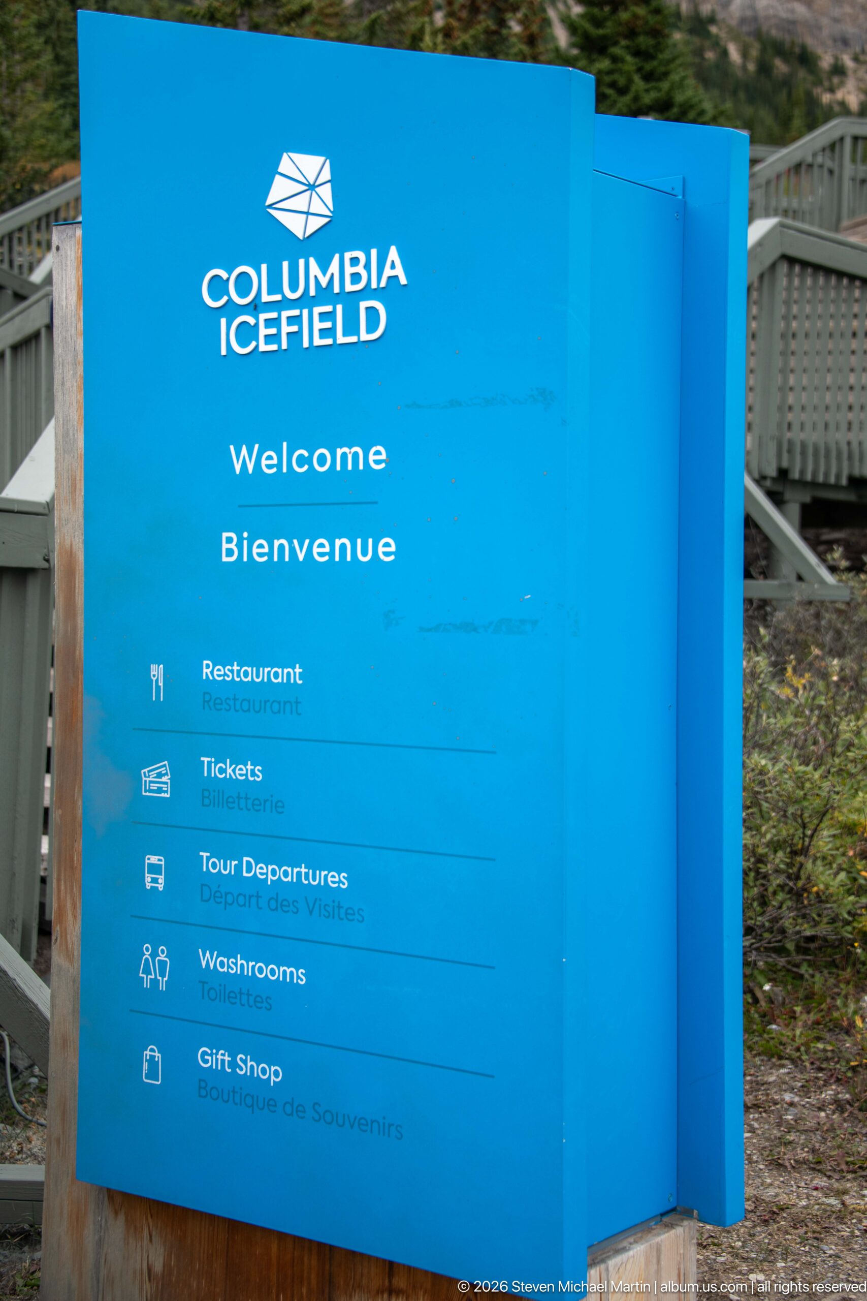
A bright blue Columbia Icefield welcome sign directs visitors to the complex’s principal services: restaurant, tickets, tour departures, washrooms, and gift shop. The bilingual wayfinding reflects the site’s role as a major visitor hub rather than simply a roadside glacier viewpoint.
Caption
A bright blue Columbia Icefield welcome sign directs visitors to the complex’s principal services: restaurant, tickets, tour departures, washrooms, and gift shop. The bilingual wayfinding reflects the site’s role as a major visitor hub rather than simply a roadside glacier viewpoint.
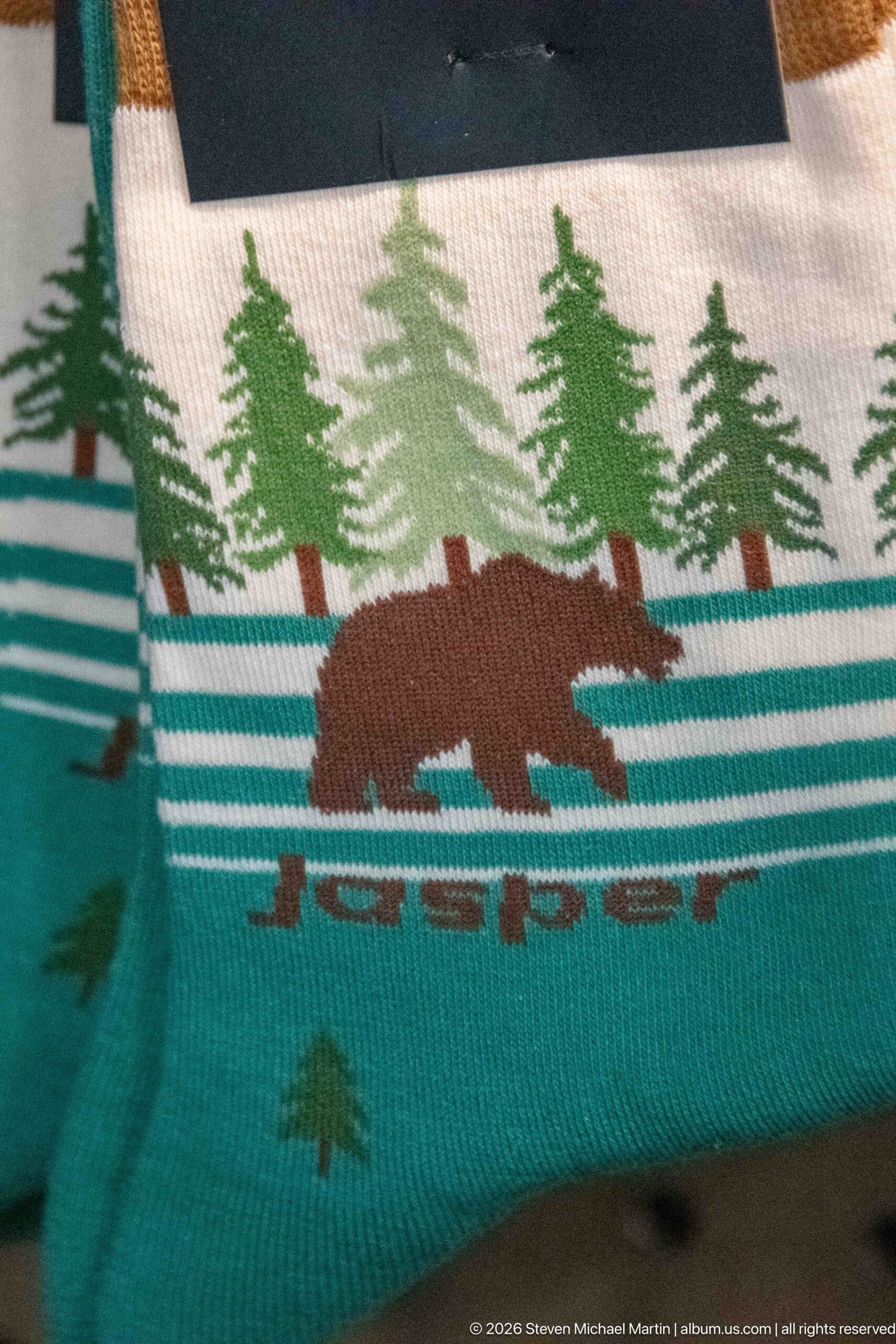
A woven souvenir textile depicts a brown bear moving through stylized conifer forest above turquoise horizontal bands. The simplified wildlife-and-landscape motif draws on familiar Canadian Rocky Mountain imagery, using repeated trees, water-like stripes, and the bear silhouette as decorative regional symbols.
Caption
A woven souvenir textile depicts a brown bear moving through stylized conifer forest above turquoise horizontal bands. The simplified wildlife-and-landscape motif draws on familiar Canadian Rocky Mountain imagery, using repeated trees, water-like stripes, and the bear silhouette as decorative regional symbols.
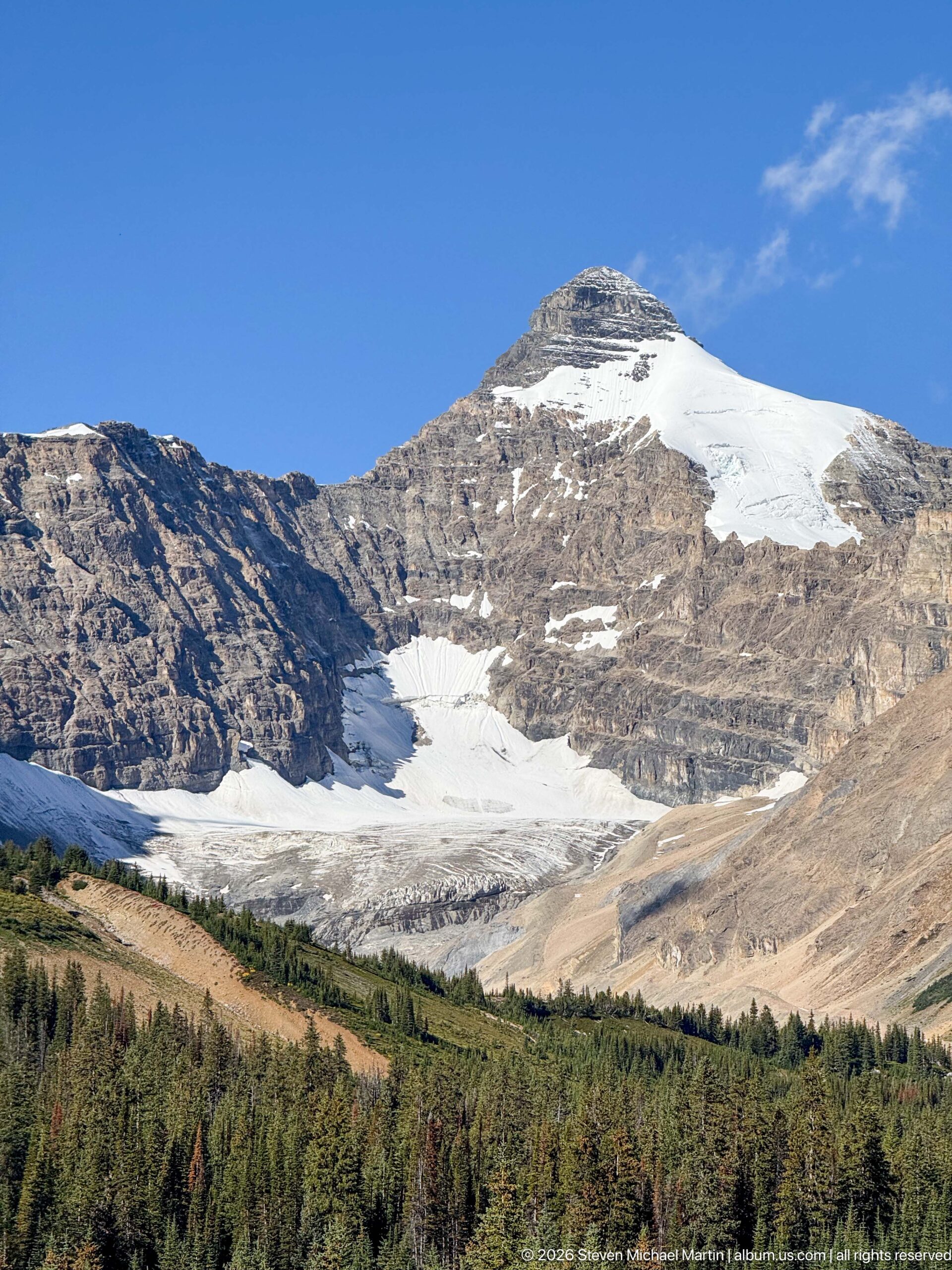
Snowfields and a small glacier-like ice body occupy high basins on a broad sedimentary mountain above dense conifer forest. Clear weather reveals the contrast between pale ice, layered brown-gray rock, and the dark forest belt, but the proof sheet does not provide enough location evidence to assign a specific glacier name.
Caption
Snowfields and a small glacier-like ice body occupy high basins on a broad sedimentary mountain above dense conifer forest. Clear weather reveals the contrast between pale ice, layered brown-gray rock, and the dark forest belt, but the proof sheet does not provide enough location evidence to assign a specific glacier name.
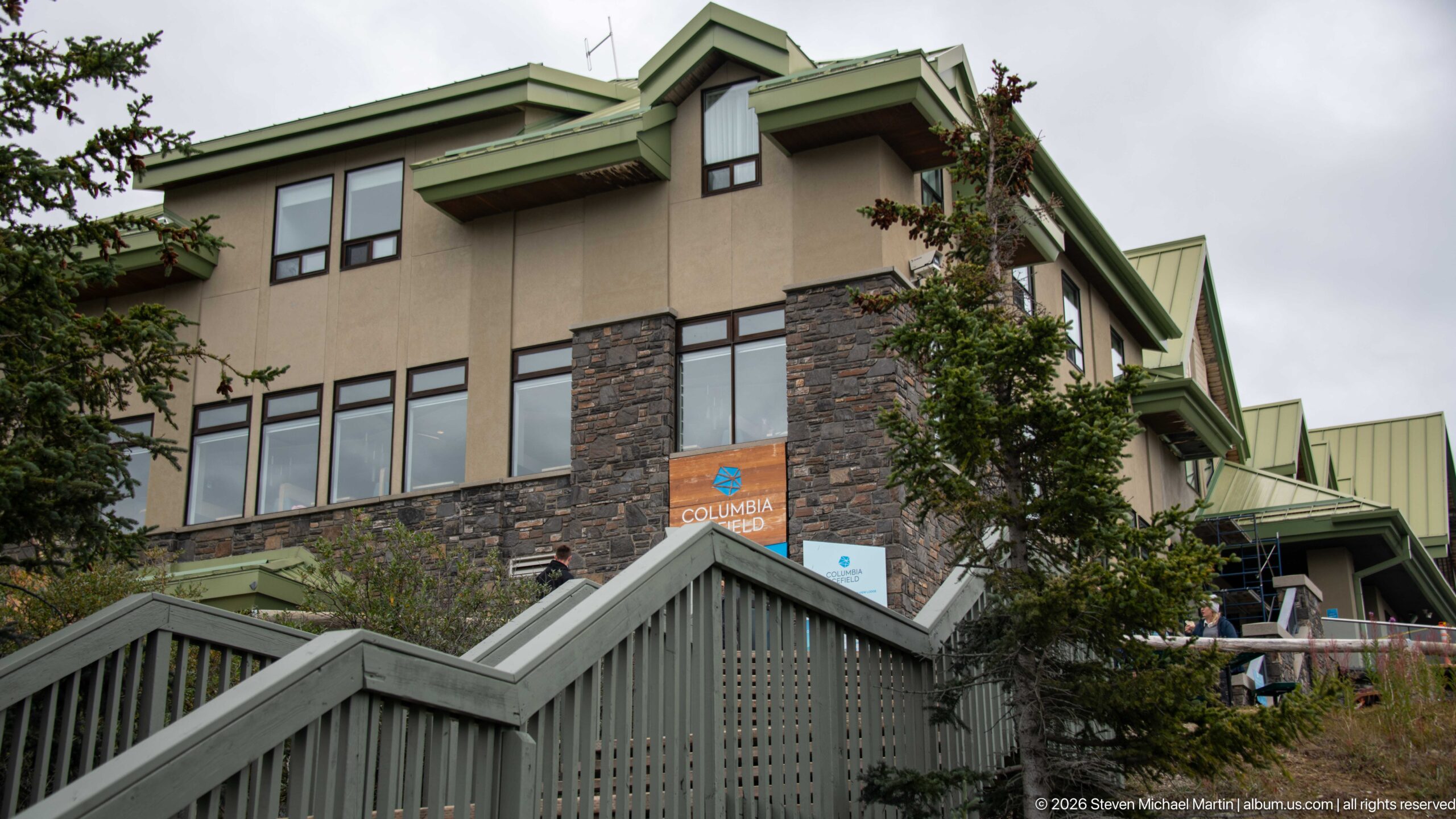
Stone masonry, tan wall surfaces, green metal roofs, and projecting bays articulate the Glacier Discovery Centre as it climbs the mountainside. Exterior stairs and terraces channel visitors between levels, while nearby conifers partly screen the large complex and tie its materials and roof forms to the surrounding mountain setting.
Caption
Stone masonry, tan wall surfaces, green metal roofs, and projecting bays articulate the Glacier Discovery Centre as it climbs the mountainside. Exterior stairs and terraces channel visitors between levels, while nearby conifers partly screen the large complex and tie its materials and roof forms to the surrounding mountain setting.
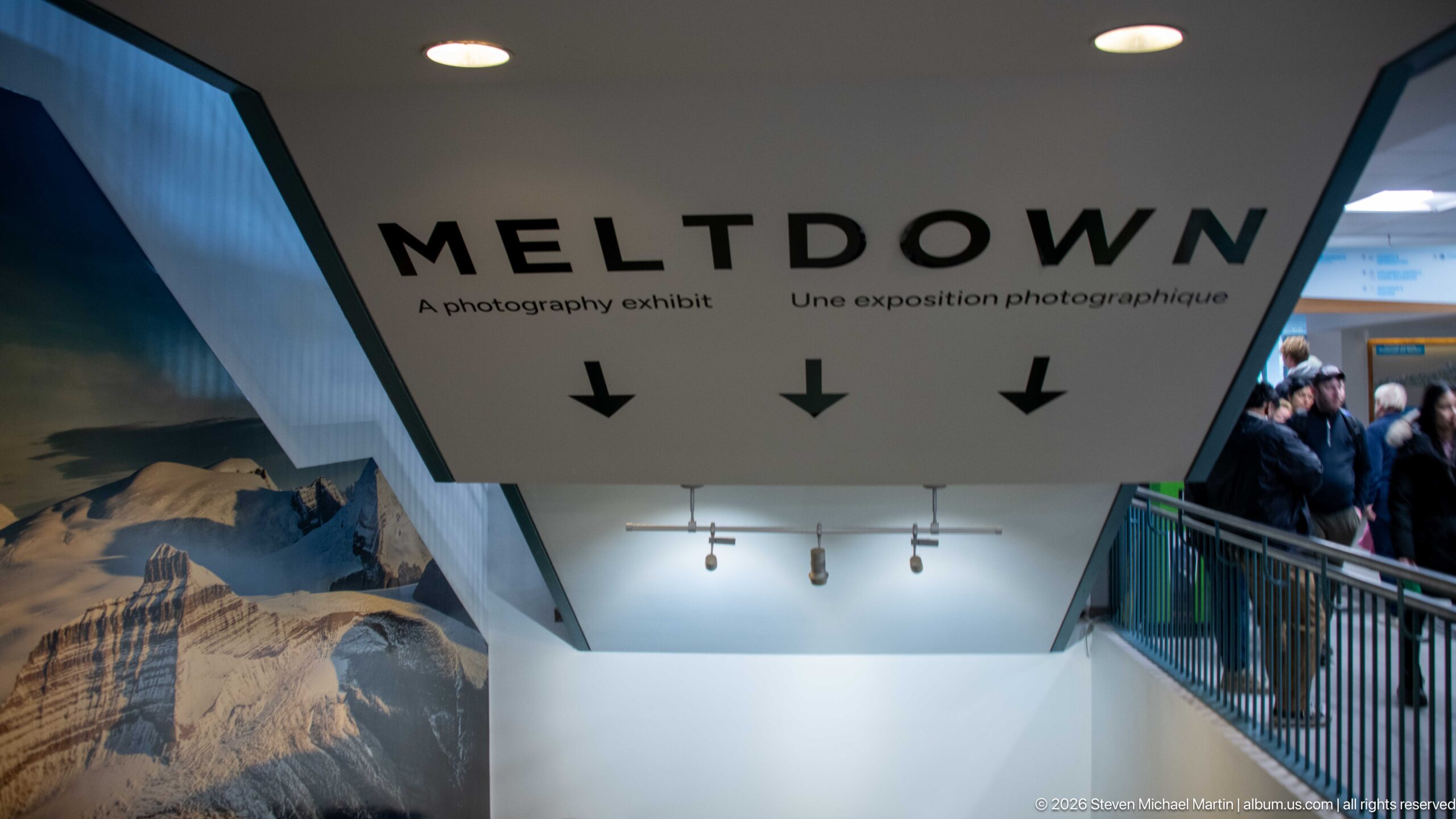
An overhead sign introduces “MELTDOWN,” a bilingual photography exhibition inside the Columbia Icefield visitor centre. Large black lettering and downward arrows lead visitors into the gallery, where photographic interpretation shifts attention from the outdoor glacier experience to visual documentation of ice, landscape, and environmental change.
Caption
An overhead sign introduces “MELTDOWN,” a bilingual photography exhibition inside the Columbia Icefield visitor centre. Large black lettering and downward arrows lead visitors into the gallery, where photographic interpretation shifts attention from the outdoor glacier experience to visual documentation of ice, landscape, and environmental change.
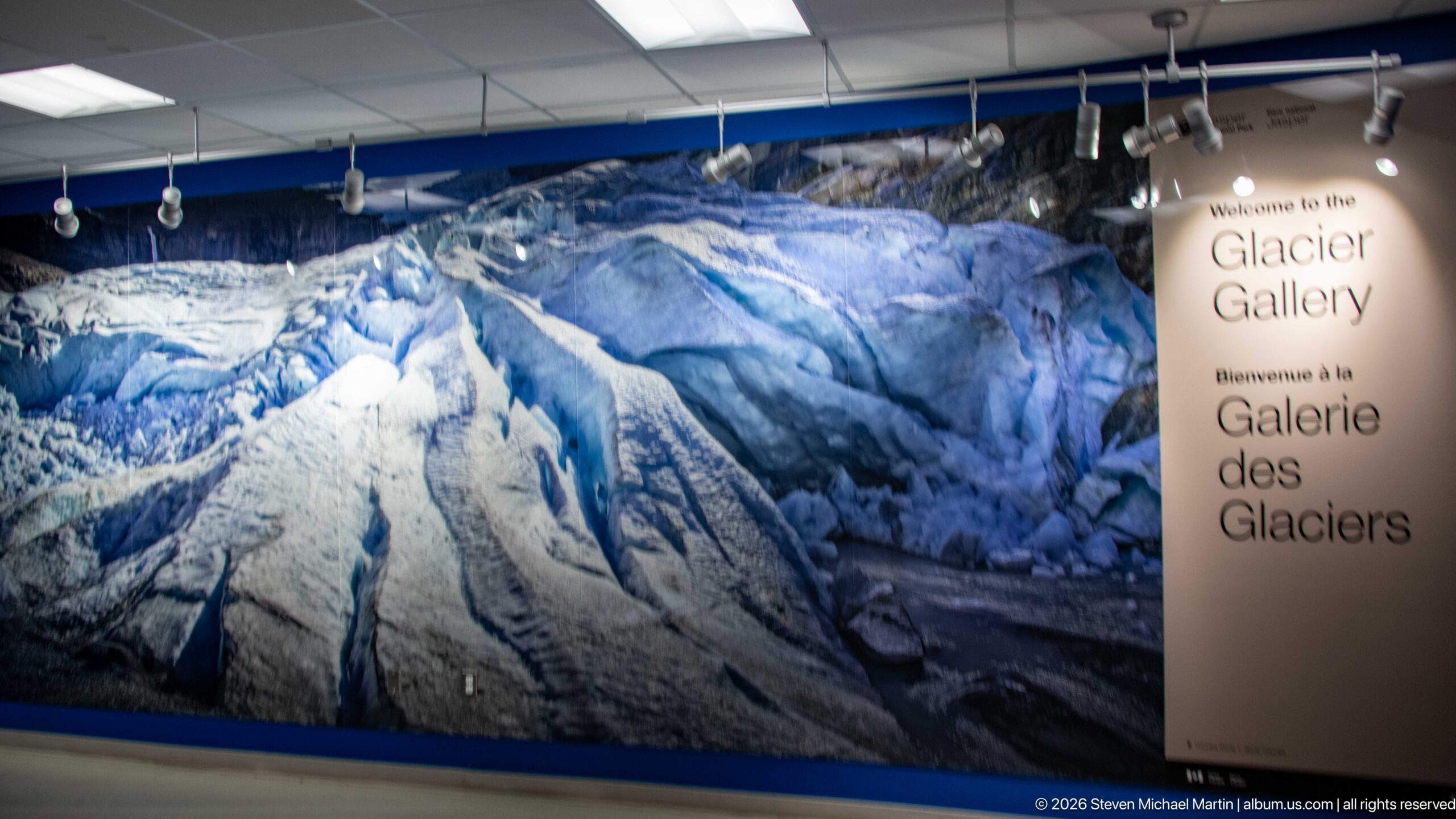
A panoramic photograph of deeply crevassed glacier ice introduces the Glacier Gallery inside the Columbia Icefield visitor centre. The bilingual welcome panel and wall-scale image immerse visitors in textures and forms difficult to appreciate from a distant roadside viewpoint, shifting the interpretive focus toward the structure of the ice itself.
Caption
A panoramic photograph of deeply crevassed glacier ice introduces the Glacier Gallery inside the Columbia Icefield visitor centre. The bilingual welcome panel and wall-scale image immerse visitors in textures and forms difficult to appreciate from a distant roadside viewpoint, shifting the interpretive focus toward the structure of the ice itself.
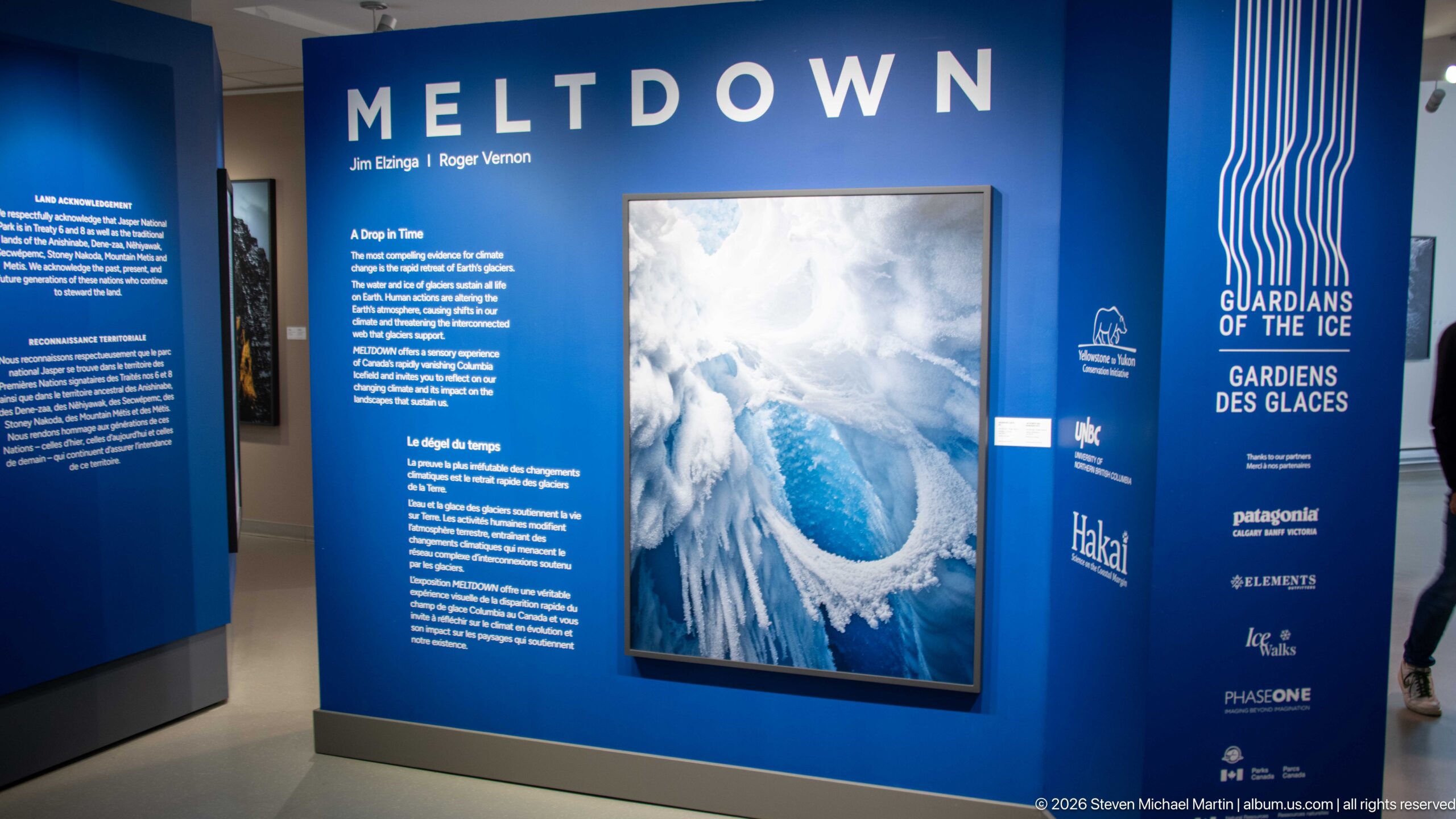
The “MELTDOWN” exhibition presents large-format glacier photography against deep blue interpretive walls. Aerial ice imagery, bilingual text, and “Guardians of the Ice” branding frame glaciers as both visually complex landscapes and subjects of environmental documentation, extending the visitor centre’s interpretation beyond the nearby Athabasca Glacier.
Caption
The “MELTDOWN” exhibition presents large-format glacier photography against deep blue interpretive walls. Aerial ice imagery, bilingual text, and “Guardians of the Ice” branding frame glaciers as both visually complex landscapes and subjects of environmental documentation, extending the visitor centre’s interpretation beyond the nearby Athabasca Glacier.
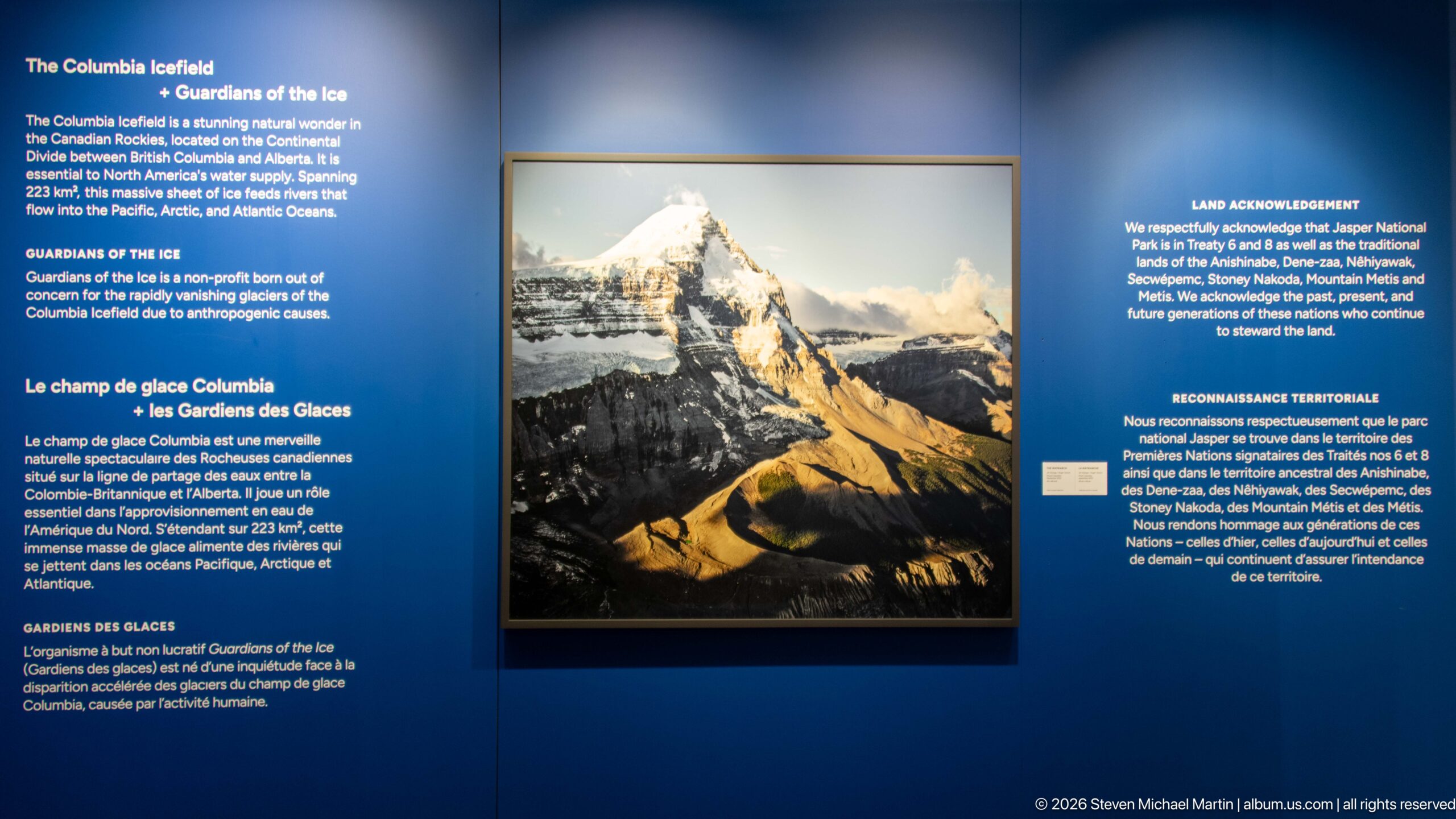
A framed mountain photograph anchors a bilingual “Guardians of the Ice” interpretive wall. Surrounding text introduces the project and a land acknowledgement, placing contemporary glacier photography within a broader discussion of place, stewardship, and the cultural relationships connected to the Columbia Icefield region.
Caption
A framed mountain photograph anchors a bilingual “Guardians of the Ice” interpretive wall. Surrounding text introduces the project and a land acknowledgement, placing contemporary glacier photography within a broader discussion of place, stewardship, and the cultural relationships connected to the Columbia Icefield region.
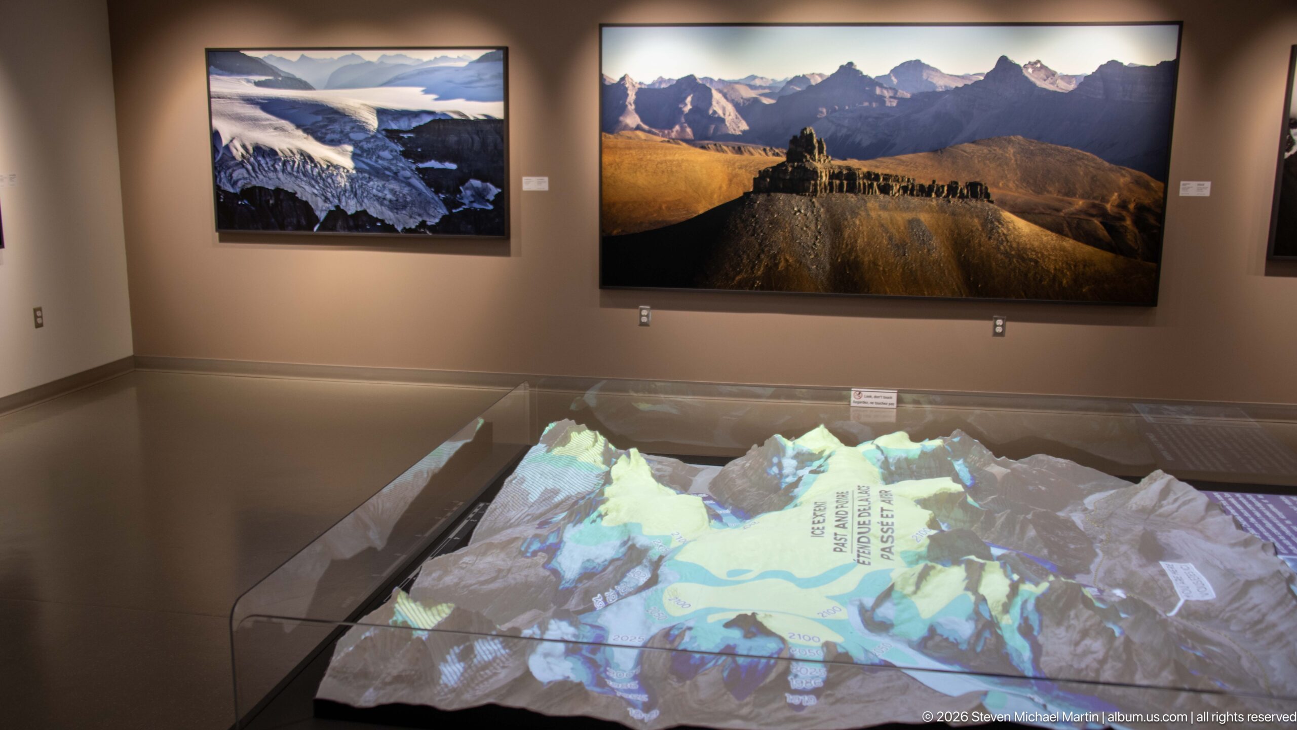
A projected map animates a three-dimensional relief model of the Columbia Icefield beneath large mountain photographs. The installation combines topography and photography, allowing visitors to relate named glaciers and peaks to the physical shape of the landscape rather than viewing each glacier as an isolated feature.
Caption
A projected map animates a three-dimensional relief model of the Columbia Icefield beneath large mountain photographs. The installation combines topography and photography, allowing visitors to relate named glaciers and peaks to the physical shape of the landscape rather than viewing each glacier as an isolated feature.
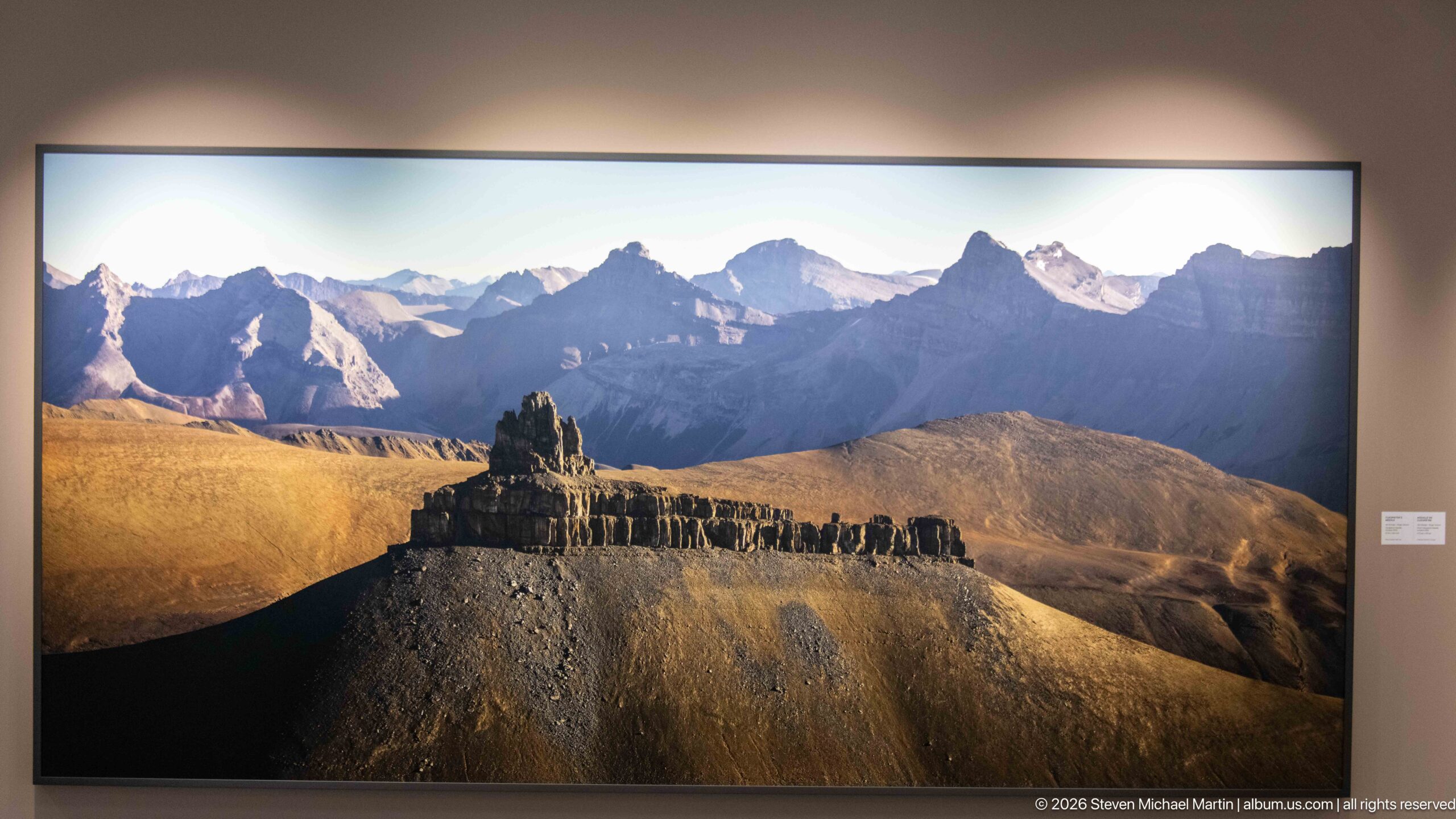
A large-format gallery photograph isolates a sharply eroded, flat-topped ridge against a chain of jagged Rocky Mountain peaks. Warm low-angle light reveals the ridge’s layered rock and gullies, emphasizing geological form and erosion rather than glacier ice within the broader Columbia Icefield exhibition.
Caption
A large-format gallery photograph isolates a sharply eroded, flat-topped ridge against a chain of jagged Rocky Mountain peaks. Warm low-angle light reveals the ridge’s layered rock and gullies, emphasizing geological form and erosion rather than glacier ice within the broader Columbia Icefield exhibition.
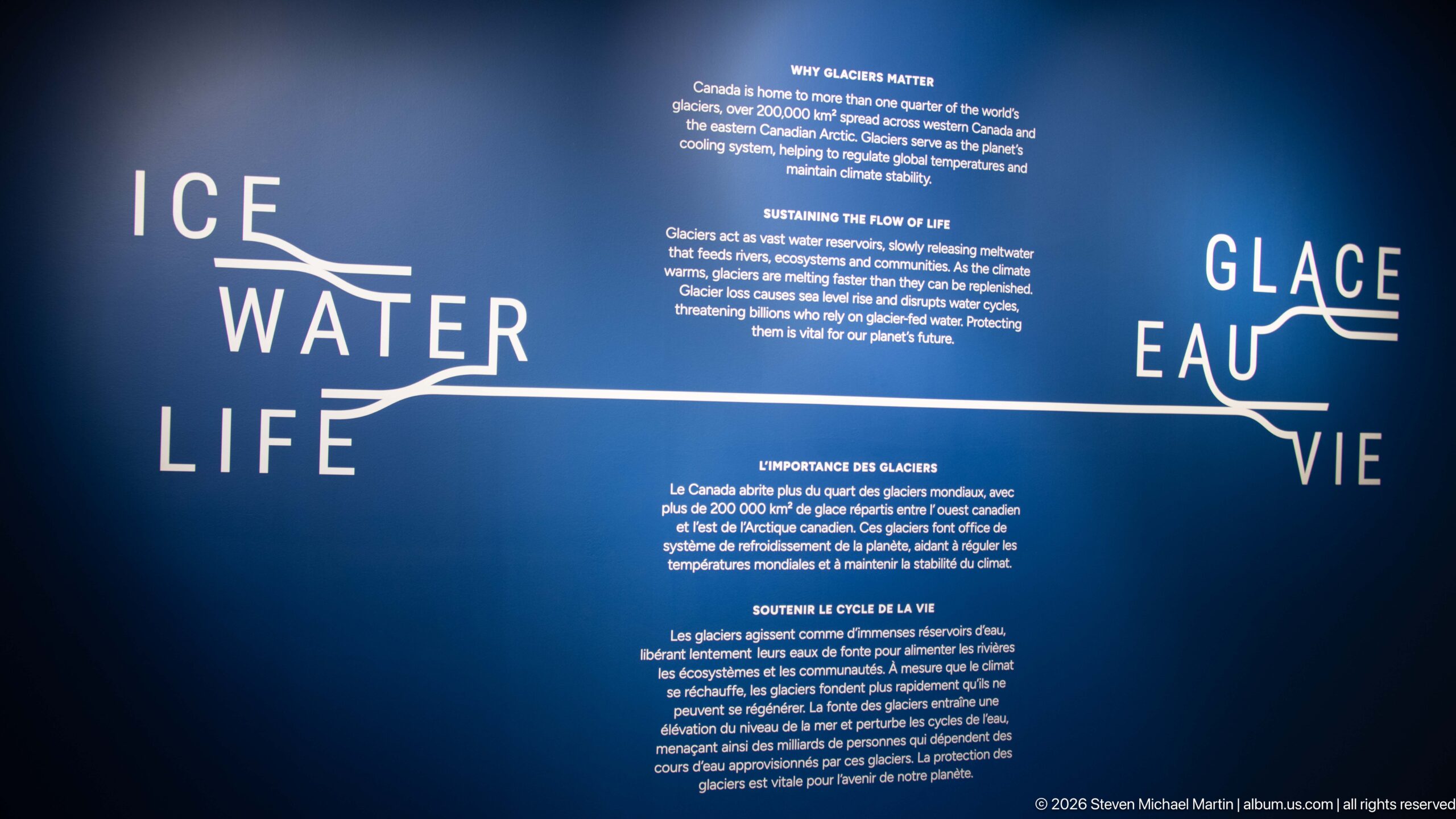
The bilingual “Ice Water Life / Glace Eau Vie” wall explains why glaciers matter as reservoirs and sources of freshwater. Its branching graphic links ice, water, and life visually, while accompanying text connects glacier change with downstream ecosystems and communities that depend on sustained mountain water supplies.
Caption
The bilingual “Ice Water Life / Glace Eau Vie” wall explains why glaciers matter as reservoirs and sources of freshwater. Its branching graphic links ice, water, and life visually, while accompanying text connects glacier change with downstream ecosystems and communities that depend on sustained mountain water supplies.
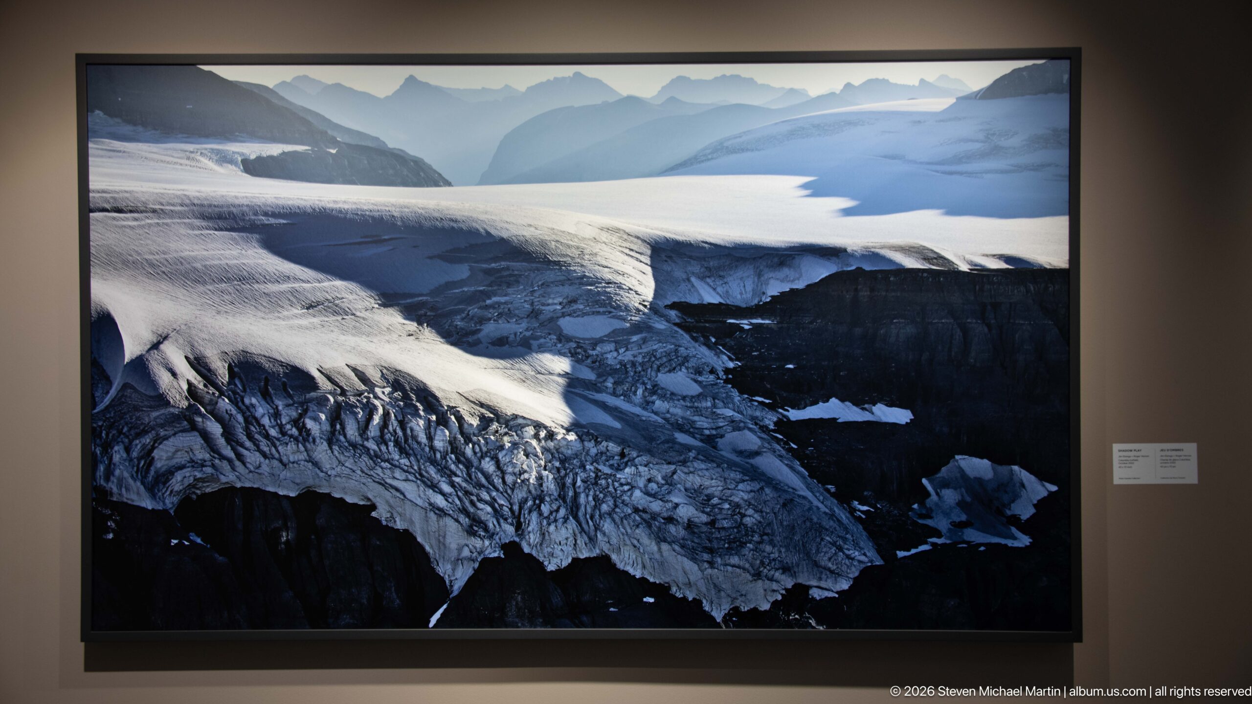
An aerial gallery photograph follows a broad snow-covered icefield as it narrows into a heavily crevassed outlet glacier. The high viewpoint exposes flow lines, fractured ice, and the sharp transition from smooth accumulation surfaces to broken ice descending across steep mountain terrain.
Caption
An aerial gallery photograph follows a broad snow-covered icefield as it narrows into a heavily crevassed outlet glacier. The high viewpoint exposes flow lines, fractured ice, and the sharp transition from smooth accumulation surfaces to broken ice descending across steep mountain terrain.
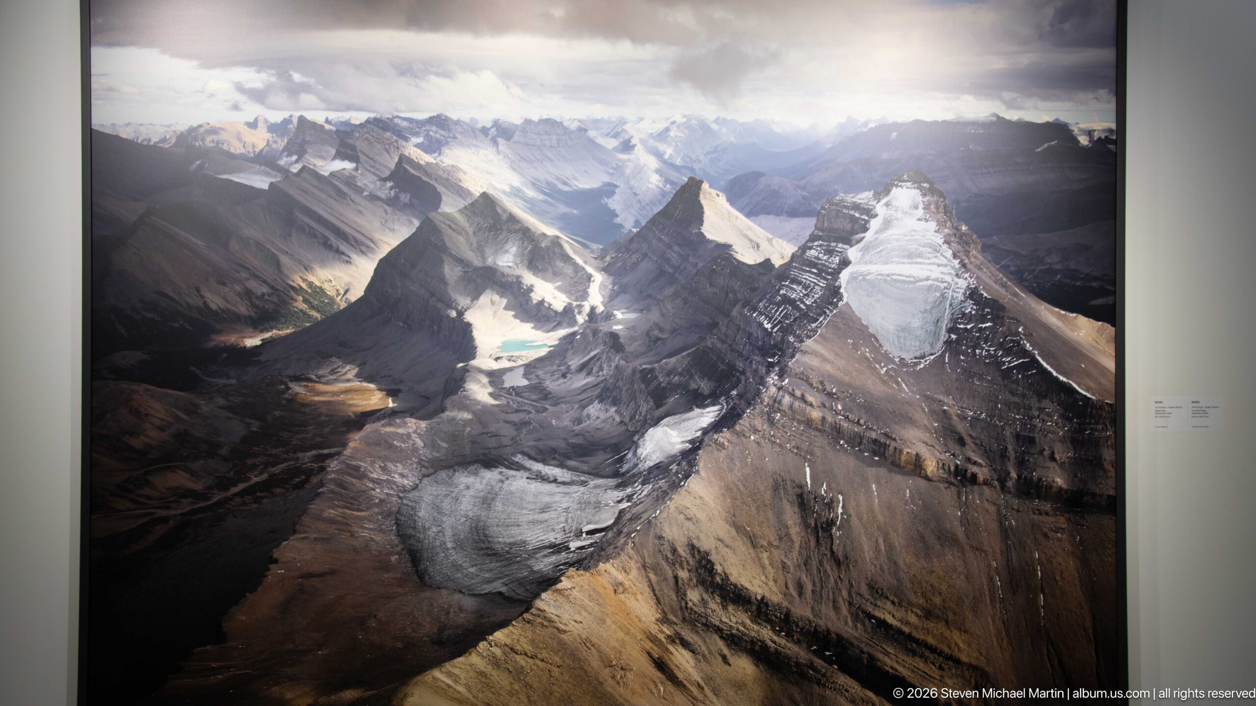
An aerial gallery photograph looks across steep sedimentary ridges cut by glaciers and deep valleys, with small turquoise lakes punctuating the darker terrain. The oblique view demonstrates how ice has occupied and reshaped multiple adjoining valleys across the Canadian Rockies, leaving a complex network of cirques, troughs, and high basins.
Caption
An aerial gallery photograph looks across steep sedimentary ridges cut by glaciers and deep valleys, with small turquoise lakes punctuating the darker terrain. The oblique view demonstrates how ice has occupied and reshaped multiple adjoining valleys across the Canadian Rockies, leaving a complex network of cirques, troughs, and high basins.
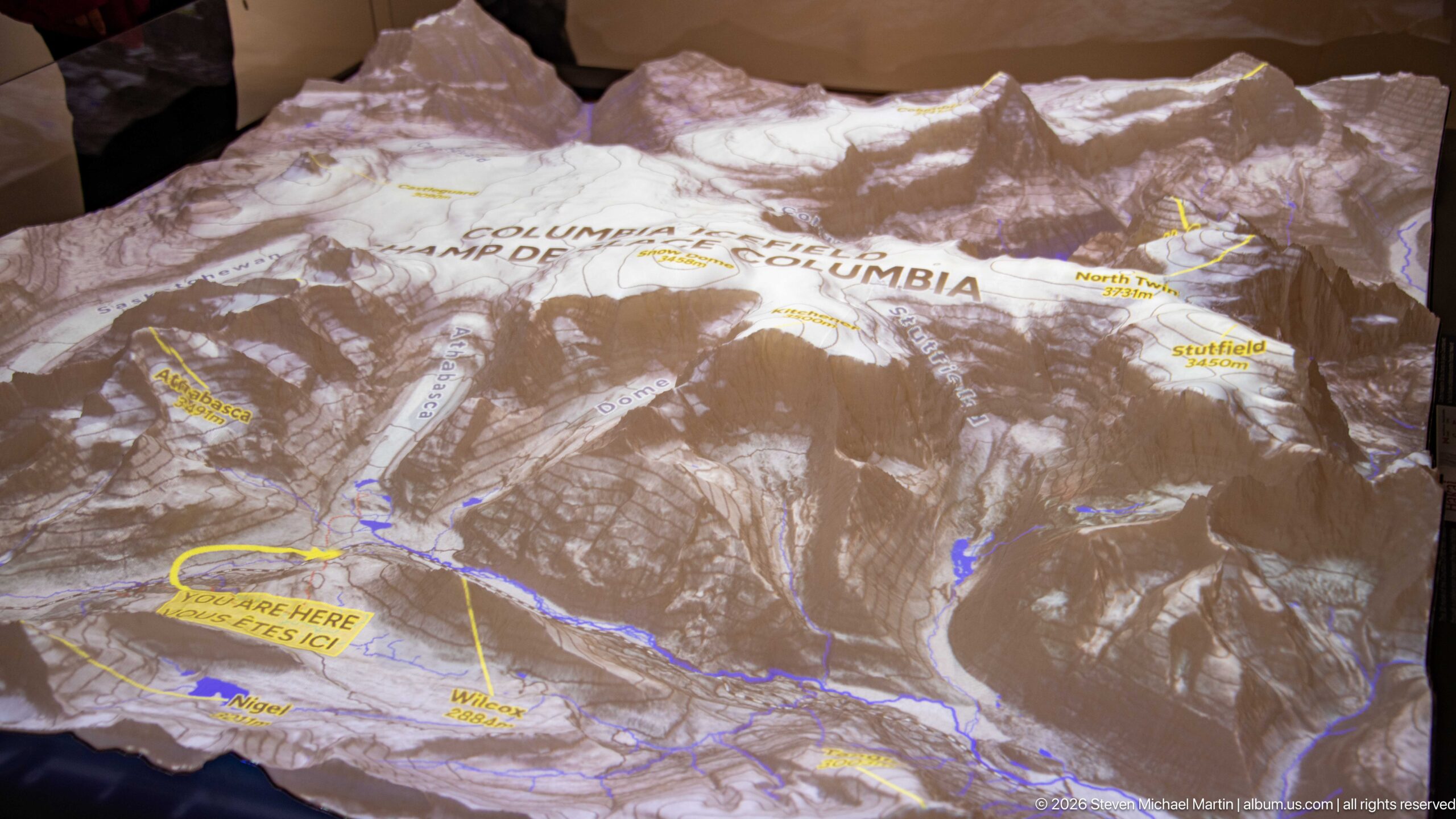
A projected topographic display maps the Columbia Icefield across a three-dimensional relief surface, labeling glaciers, routes, and visitor locations. The “You Are Here” marker ties the visitor centre to the surrounding terrain, turning the model into both an orientation tool and an explanation of the icefield’s interconnected geography.
Caption
A projected topographic display maps the Columbia Icefield across a three-dimensional relief surface, labeling glaciers, routes, and visitor locations. The “You Are Here” marker ties the visitor centre to the surrounding terrain, turning the model into both an orientation tool and an explanation of the icefield’s interconnected geography.
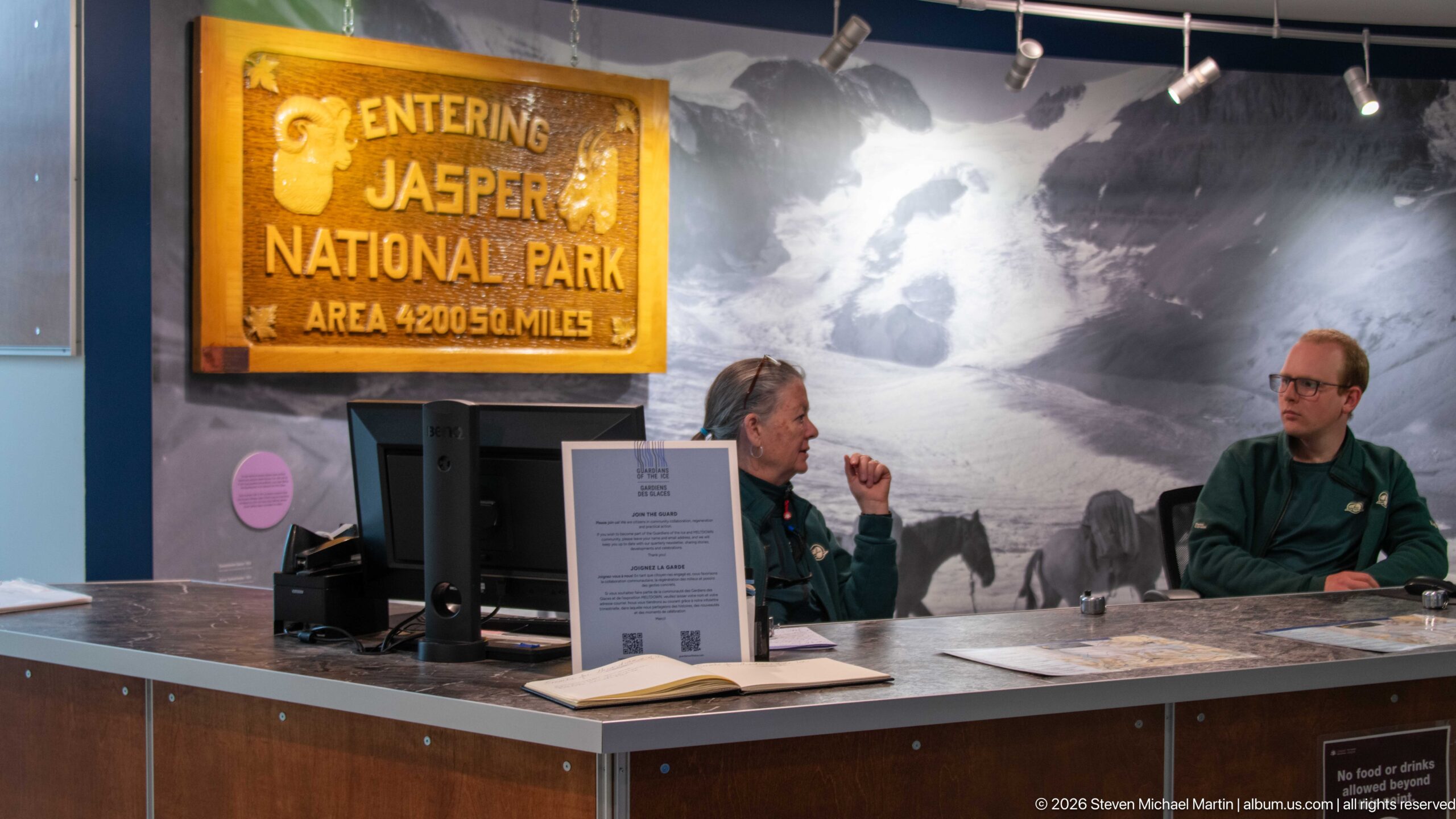
The visitor information counter combines contemporary trip assistance with historical park imagery. Two staff members sit beneath an older-style “Entering Jasper National Park” sign, while a large glacier photograph fills the wall behind them, linking present-day orientation services with the visual history and identity of the park.
Caption
The visitor information counter combines contemporary trip assistance with historical park imagery. Two staff members sit beneath an older-style “Entering Jasper National Park” sign, while a large glacier photograph fills the wall behind them, linking present-day orientation services with the visual history and identity of the park.
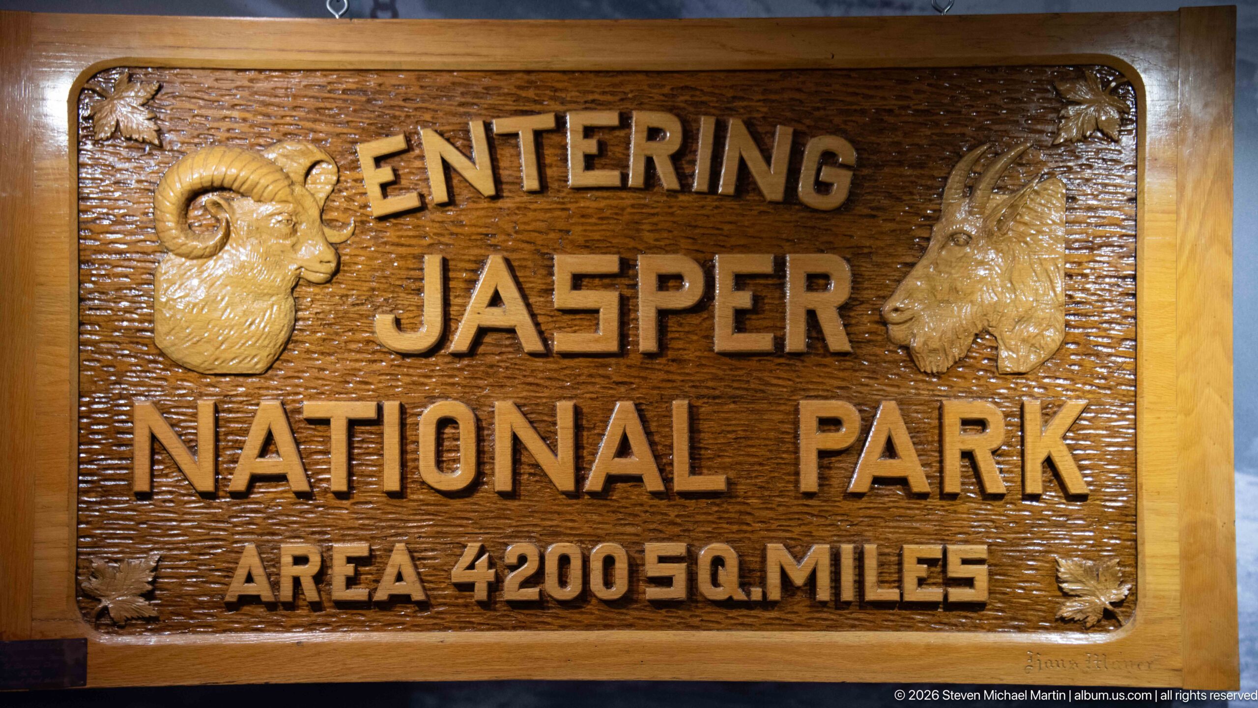
A carved wooden “Entering Jasper National Park” sign preserves an earlier style of park gateway signage. Reliefs of a bighorn sheep and mountain goat flank the lettering, while the historic area figure—4,200 square miles—reflects the sign’s period presentation rather than modern metric park interpretation.
Caption
A carved wooden “Entering Jasper National Park” sign preserves an earlier style of park gateway signage. Reliefs of a bighorn sheep and mountain goat flank the lettering, while the historic area figure—4,200 square miles—reflects the sign’s period presentation rather than modern metric park interpretation.
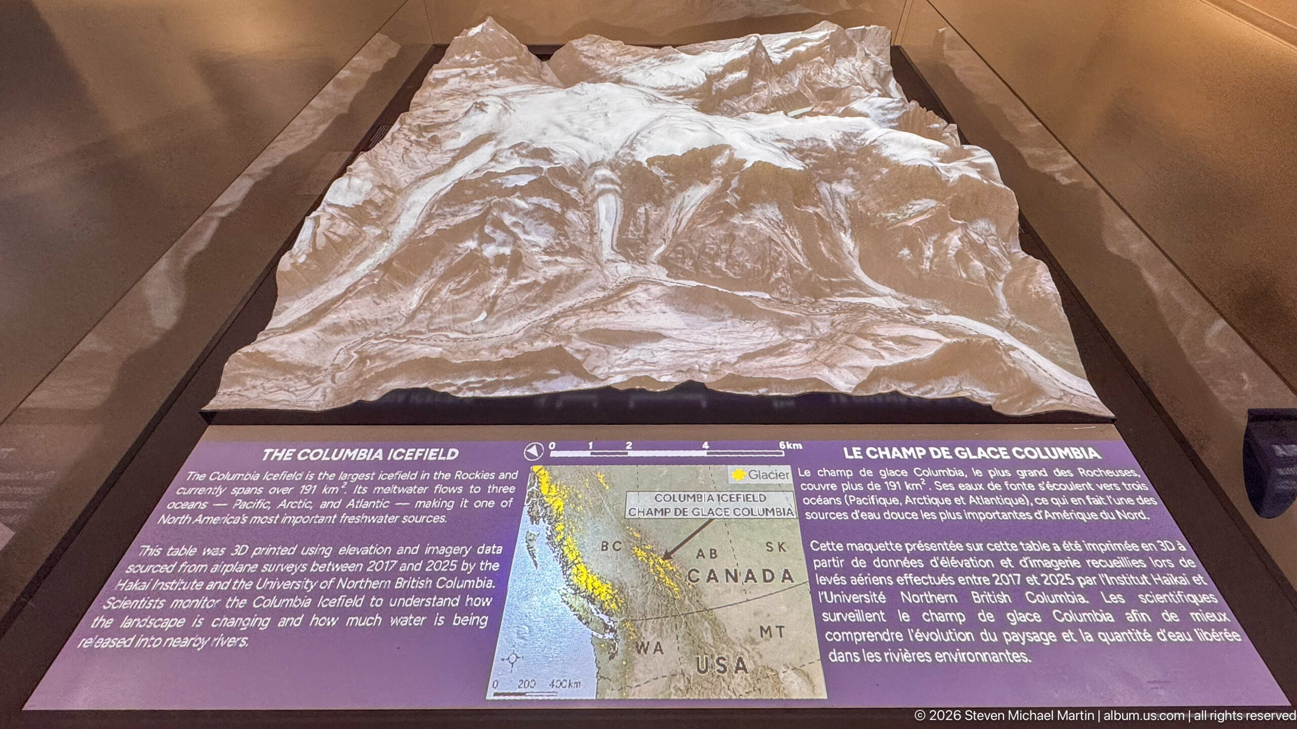
A three-dimensional relief model presents the Columbia Icefield as a connected high-mountain system rather than a single glacier. The bilingual interpretive panel and locator map place the modeled peaks and ice within the Canadian Rockies, helping visitors understand the icefield’s broad extent across the Continental Divide and its relationship to surrounding terrain.
Caption
A three-dimensional relief model presents the Columbia Icefield as a connected high-mountain system rather than a single glacier. The bilingual interpretive panel and locator map place the modeled peaks and ice within the Canadian Rockies, helping visitors understand the icefield’s broad extent across the Continental Divide and its relationship to surrounding terrain.
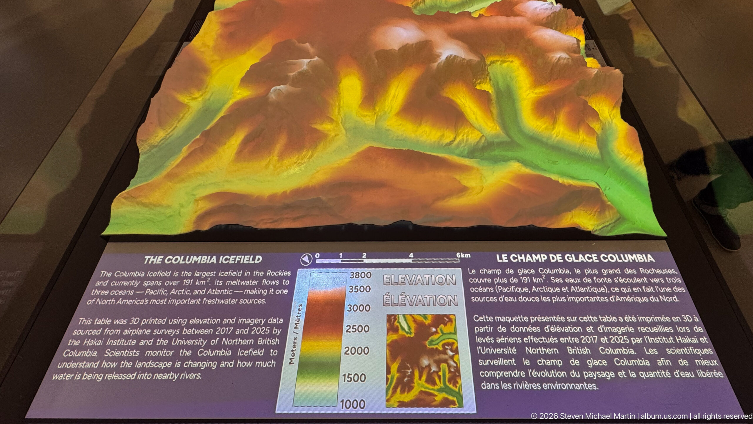
Color-coded elevation is projected across a relief model of the Columbia Icefield, transforming the mountain surface into a visual elevation map. Greens mark lower terrain while yellow, orange, and brown tones rise toward the highest areas, making the steep vertical range of the icefield region immediately legible in three dimensions.
Caption
Color-coded elevation is projected across a relief model of the Columbia Icefield, transforming the mountain surface into a visual elevation map. Greens mark lower terrain while yellow, orange, and brown tones rise toward the highest areas, making the steep vertical range of the icefield region immediately legible in three dimensions.
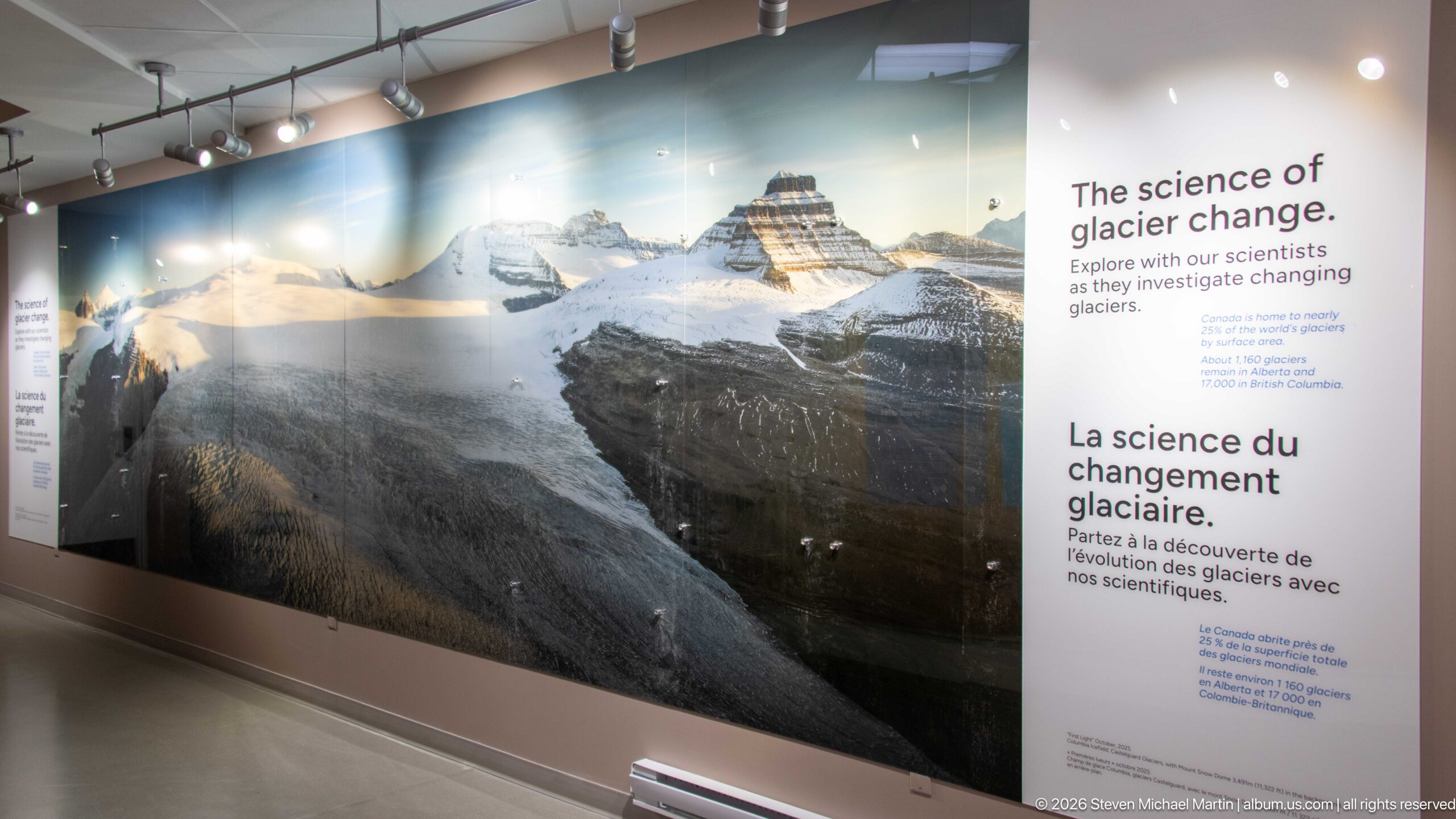
The “Science of Glacier Change” exhibit pairs a wall-size mountain photograph with bilingual text describing how scientists study changing glaciers. The display shifts interpretation from visible scenery to measurement and observation, emphasizing that glacier change is monitored through systematic research rather than inferred from a single view.
Caption
The “Science of Glacier Change” exhibit pairs a wall-size mountain photograph with bilingual text describing how scientists study changing glaciers. The display shifts interpretation from visible scenery to measurement and observation, emphasizing that glacier change is monitored through systematic research rather than inferred from a single view.
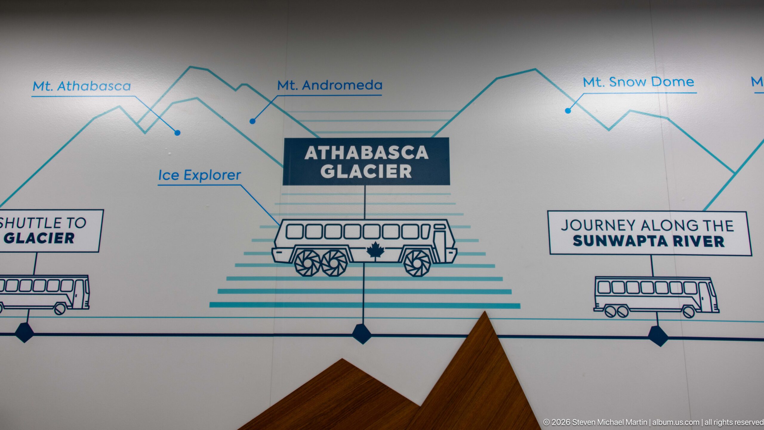
A stylized wayfinding graphic links Athabasca Glacier with the Ice Explorer, glacier shuttle, Sunwapta River route, and surrounding peaks. Simple line drawings and mountain profiles convert the visitor experience into an easily read sequence, while labels for Mount Athabasca, Mount Andromeda, and Snow Dome provide geographic orientation.
Caption
A stylized wayfinding graphic links Athabasca Glacier with the Ice Explorer, glacier shuttle, Sunwapta River route, and surrounding peaks. Simple line drawings and mountain profiles convert the visitor experience into an easily read sequence, while labels for Mount Athabasca, Mount Andromeda, and Snow Dome provide geographic orientation.
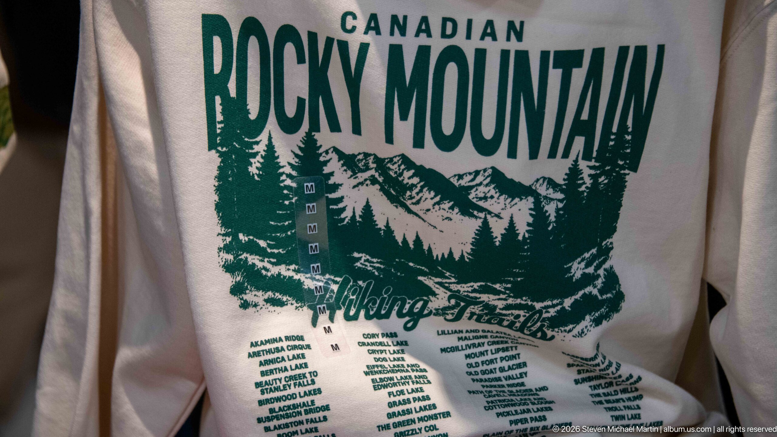
A souvenir shirt uses a retro green mountain graphic and “Canadian Rocky Mountain” lettering to celebrate hiking culture in the region. A long list of trail and destination names turns the garment into a compact catalog of Rocky Mountain recreation, contrasting commercial visitor merchandise with the scientific and interpretive exhibits nearby.
Caption
A souvenir shirt uses a retro green mountain graphic and “Canadian Rocky Mountain” lettering to celebrate hiking culture in the region. A long list of trail and destination names turns the garment into a compact catalog of Rocky Mountain recreation, contrasting commercial visitor merchandise with the scientific and interpretive exhibits nearby.

“Authentically Canadian” lettering and a maple-leaf emblem mark a retail area inside the Columbia Icefield visitor complex. The spare black graphic on pale wood uses one of Canada’s most recognizable national symbols to frame locally themed merchandise and the commercial visitor experience.
Caption
“Authentically Canadian” lettering and a maple-leaf emblem mark a retail area inside the Columbia Icefield visitor complex. The spare black graphic on pale wood uses one of Canada’s most recognizable national symbols to frame locally themed merchandise and the commercial visitor experience.
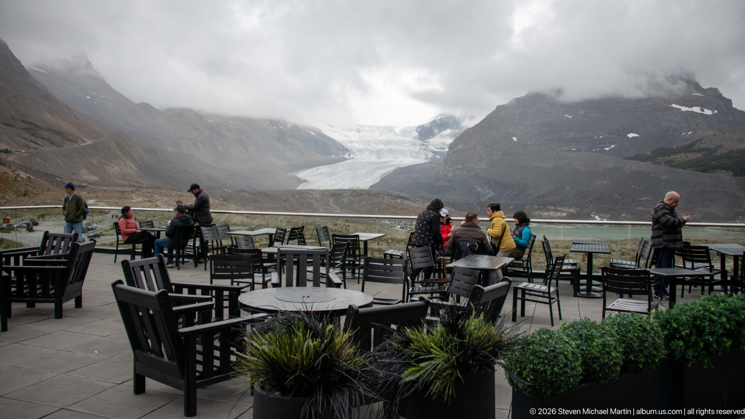
An outdoor terrace at the Columbia Icefield visitor complex faces directly toward Athabasca Glacier. Visitors gather among patio tables while the glacier descends between dark mountain walls across the valley, turning an ordinary dining and rest area into a broad observation point for the icefield landscape.
Caption
An outdoor terrace at the Columbia Icefield visitor complex faces directly toward Athabasca Glacier. Visitors gather among patio tables while the glacier descends between dark mountain walls across the valley, turning an ordinary dining and rest area into a broad observation point for the icefield landscape.
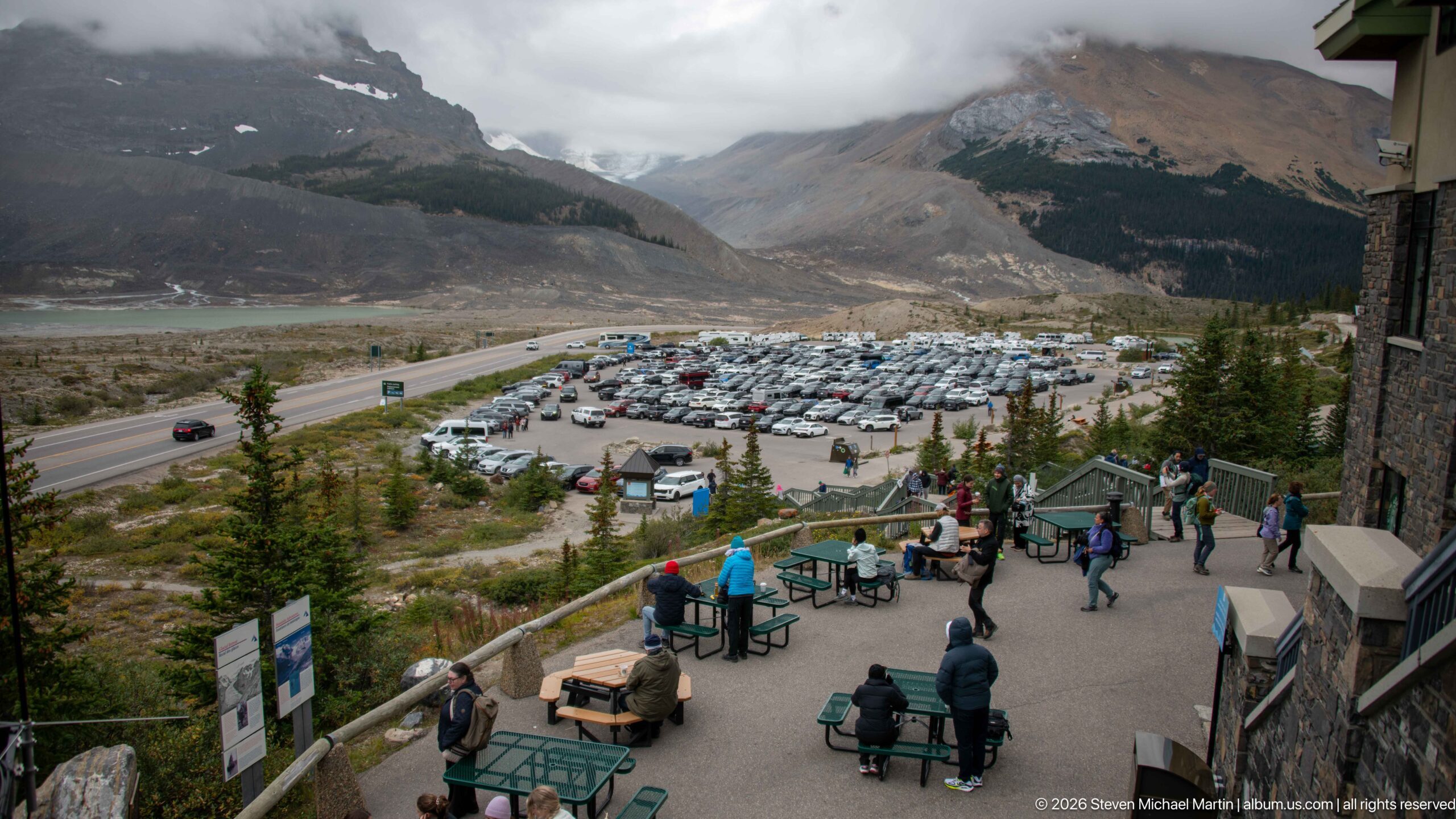
From the Glacier Discovery Centre, an elevated view looks over visitor terraces, the large parking area, the Icefields Parkway corridor, and the broad valley beyond. The composition reveals the scale of infrastructure concentrated opposite Athabasca Glacier and places the visitor complex within the much larger glacially carved mountain landscape.
Caption
From the Glacier Discovery Centre, an elevated view looks over visitor terraces, the large parking area, the Icefields Parkway corridor, and the broad valley beyond. The composition reveals the scale of infrastructure concentrated opposite Athabasca Glacier and places the visitor complex within the much larger glacially carved mountain landscape.
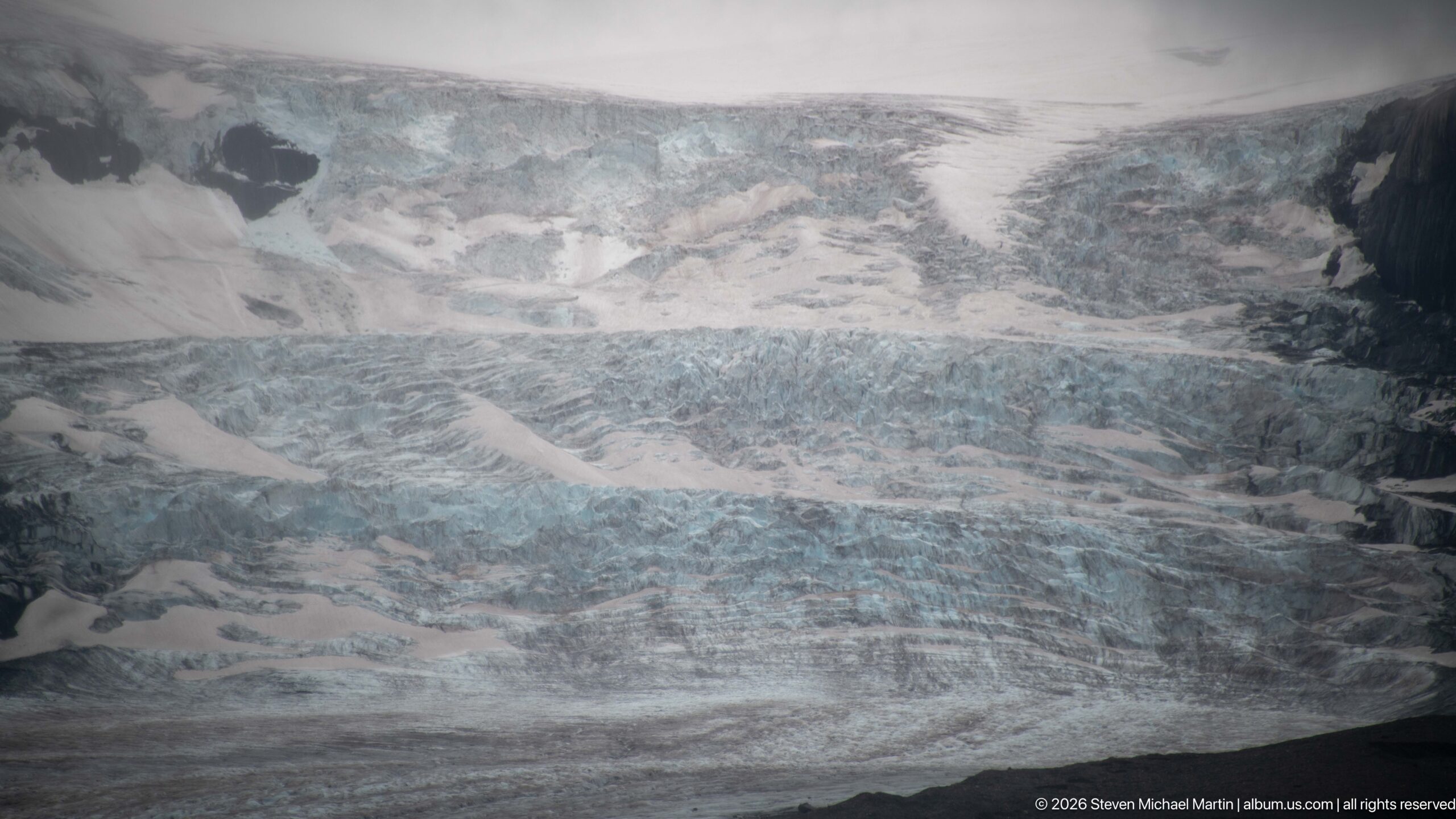
Broken blue-white ice fills this telephoto view of Athabasca Glacier, where deep crevasses and irregular seracs mark a steep, heavily fractured section of the glacier. Alternating bands of snow, blue ice, and gray debris expose the complex surface created as moving ice deforms across uneven mountain terrain.
Caption
Broken blue-white ice fills this telephoto view of Athabasca Glacier, where deep crevasses and irregular seracs mark a steep, heavily fractured section of the glacier. Alternating bands of snow, blue ice, and gray debris expose the complex surface created as moving ice deforms across uneven mountain terrain.
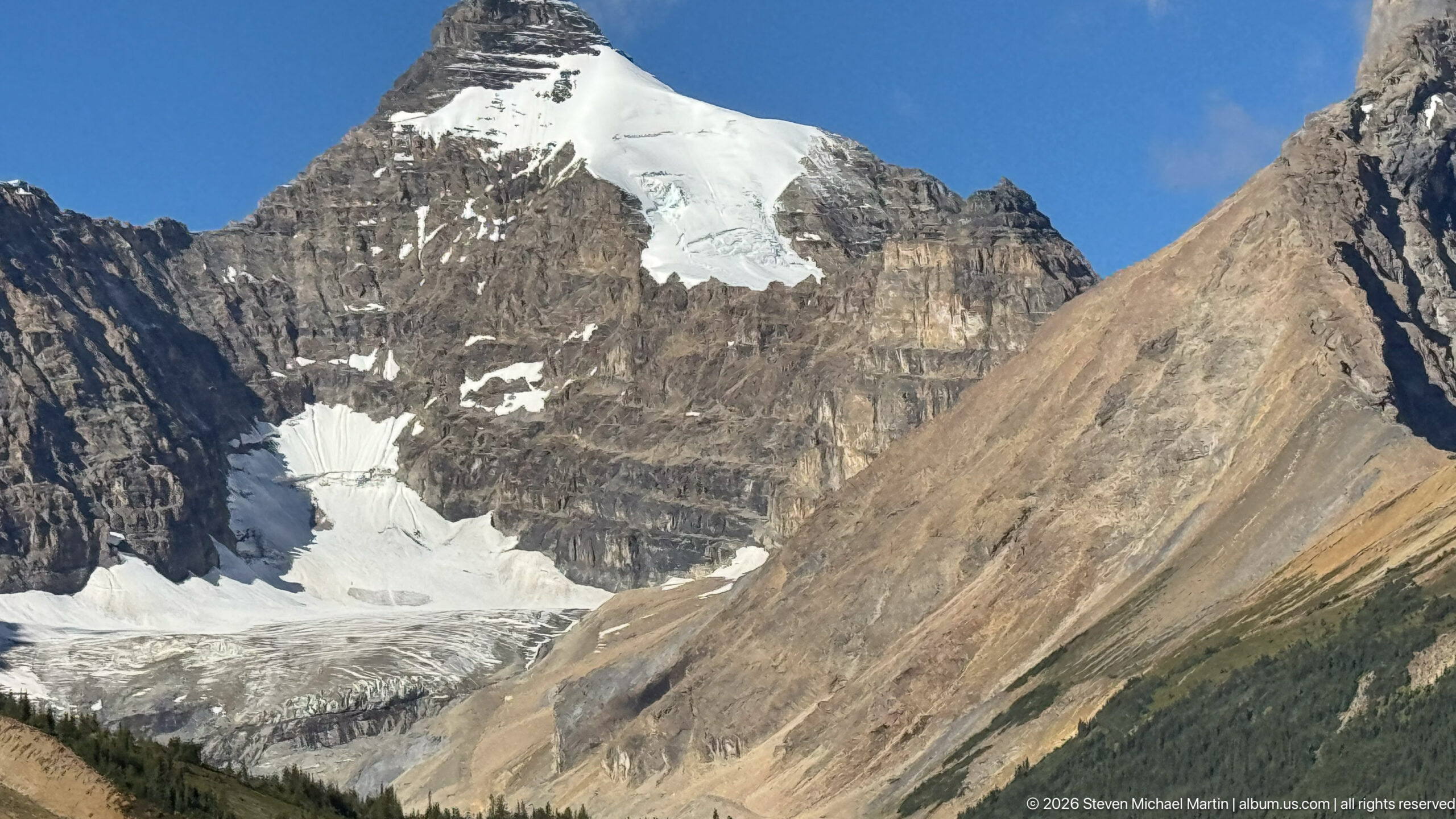
A glacier occupies a steep-walled mountain cirque, descending beneath a snow-covered upper basin between sharply layered rock faces. The close view clearly records active ice and glacially carved terrain, although the proof sheet alone does not securely establish which named Columbia Icefield outlet or neighboring glacier is shown.
Caption
A glacier occupies a steep-walled mountain cirque, descending beneath a snow-covered upper basin between sharply layered rock faces. The close view clearly records active ice and glacially carved terrain, although the proof sheet alone does not securely establish which named Columbia Icefield outlet or neighboring glacier is shown.
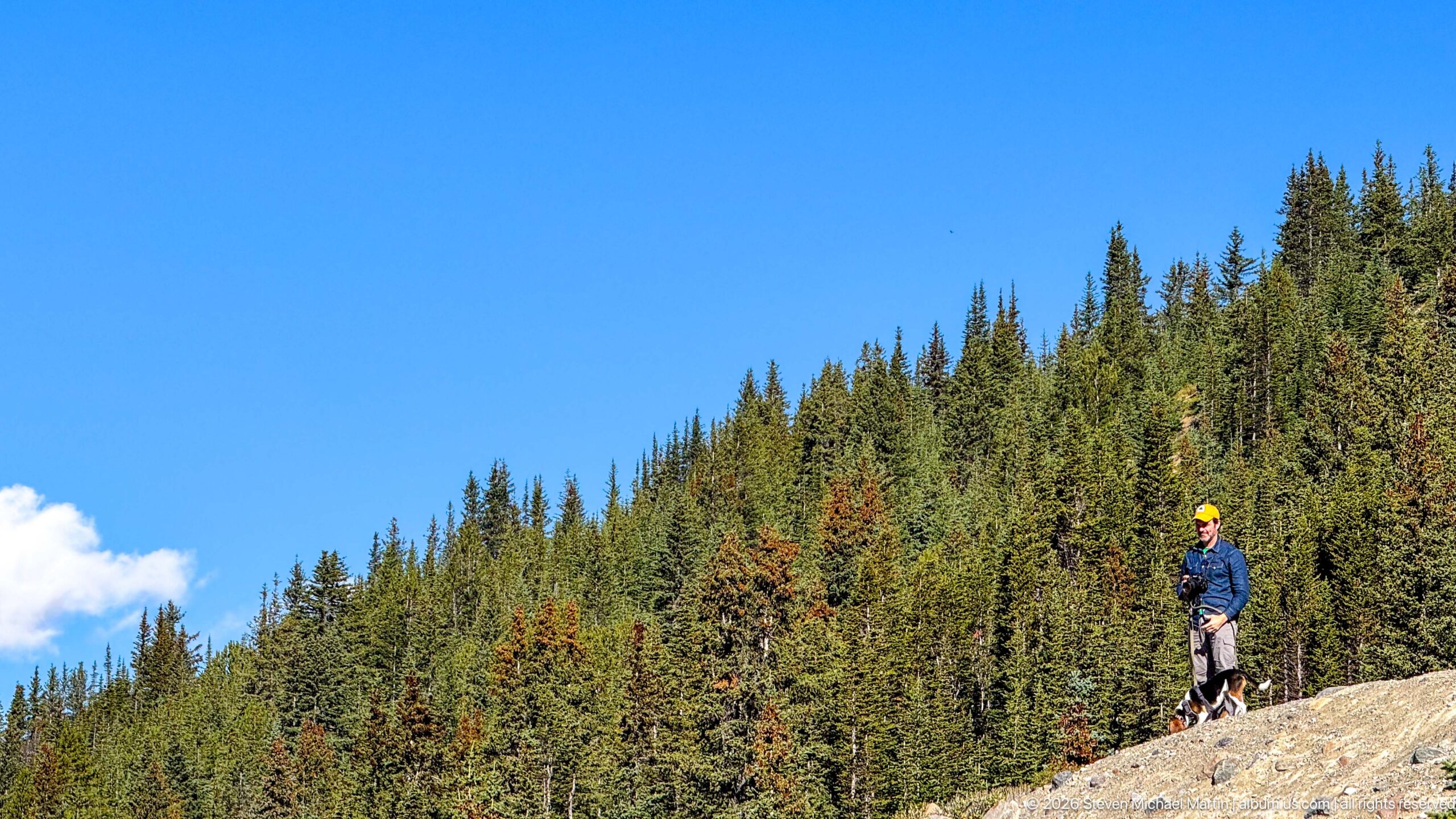
A traveler pauses on a pale rocky slope beside dense subalpine conifer forest under a clear blue sky. The human figure provides scale for the open, stony terrain and records a quieter roadside or trail moment within the Columbia Icefield journey, away from the major visitor facilities and glacier viewpoints.
Caption
A traveler pauses on a pale rocky slope beside dense subalpine conifer forest under a clear blue sky. The human figure provides scale for the open, stony terrain and records a quieter roadside or trail moment within the Columbia Icefield journey, away from the major visitor facilities and glacier viewpoints.
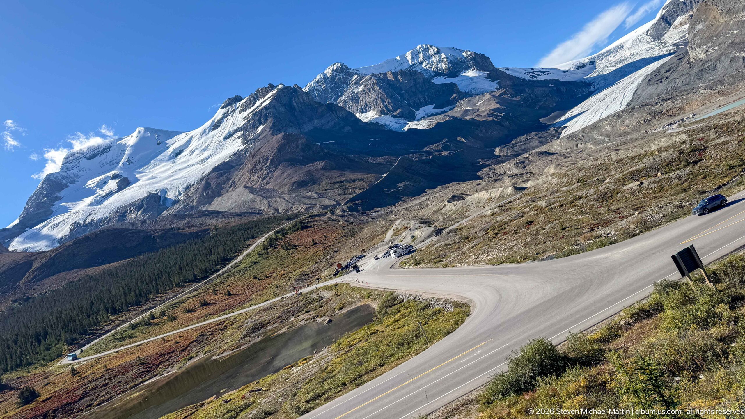
The Icefields Parkway curves across an open mountainside beneath steep glaciated peaks, creating a strong visual link between the road and the high alpine terrain it traverses. Snowfields, exposed sedimentary rock, sparse vegetation, and the sweeping switchback-like bend convey the dramatic elevation changes of the Columbia Icefield corridor.
Caption
The Icefields Parkway curves across an open mountainside beneath steep glaciated peaks, creating a strong visual link between the road and the high alpine terrain it traverses. Snowfields, exposed sedimentary rock, sparse vegetation, and the sweeping switchback-like bend convey the dramatic elevation changes of the Columbia Icefield corridor.
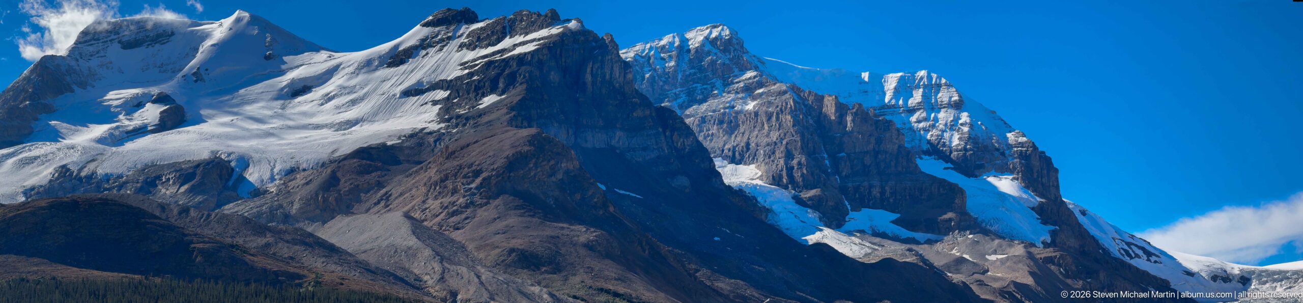
Jagged towers and steep sedimentary cliffs dominate this telephoto mountain view, with snow and small ice fields lodged in high gullies and basins. The tight framing emphasizes the rugged structure and erosional relief of the Canadian Rockies rather than providing enough surrounding context for a reliable named-peak identification.
Caption
Jagged towers and steep sedimentary cliffs dominate this telephoto mountain view, with snow and small ice fields lodged in high gullies and basins. The tight framing emphasizes the rugged structure and erosional relief of the Canadian Rockies rather than providing enough surrounding context for a reliable named-peak identification.
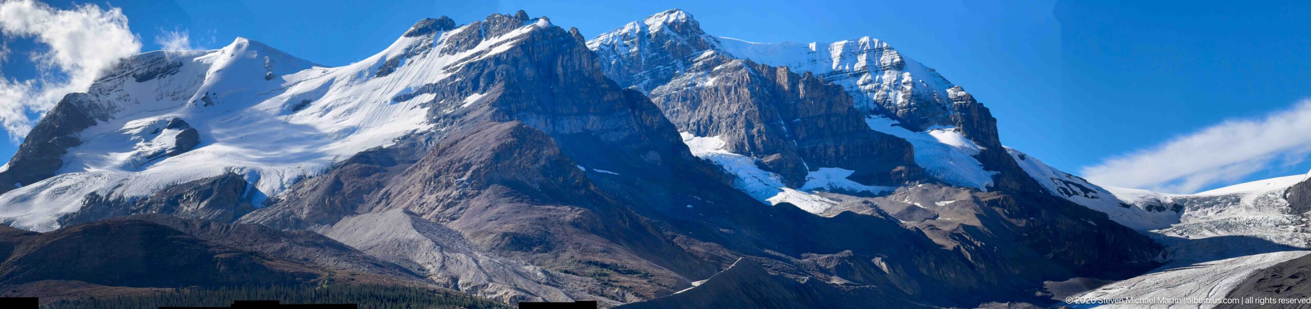
A closer view isolates the mountain’s serrated rock towers, pale sedimentary bands, and snow-filled ledges. Strong light and shadow reveal the deeply eroded architecture of the peak, while small remnants of snow and ice occupy protected high-elevation recesses; the available view does not justify assigning a specific peak name.
Caption
A closer view isolates the mountain’s serrated rock towers, pale sedimentary bands, and snow-filled ledges. Strong light and shadow reveal the deeply eroded architecture of the peak, while small remnants of snow and ice occupy protected high-elevation recesses; the available view does not justify assigning a specific peak name.
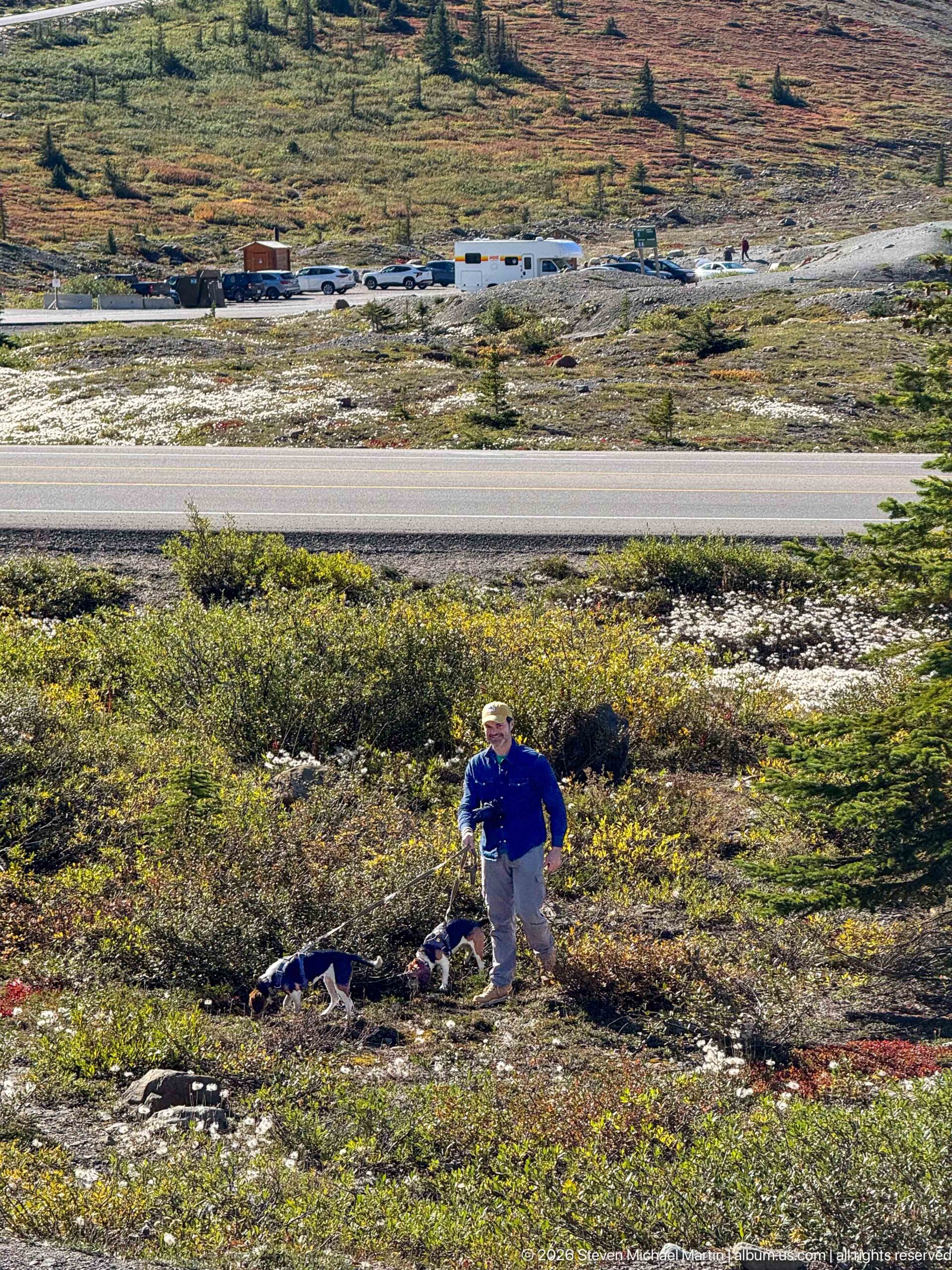
A traveler stands with two dogs among low alpine shrubs beside the Icefields Parkway corridor. The road, parked vehicles, and open high-elevation vegetation in the background place the personal travel portrait within the exposed Columbia Icefield landscape, where forest gives way to low, wind-shaped plant communities.
Caption
A traveler stands with two dogs among low alpine shrubs beside the Icefields Parkway corridor. The road, parked vehicles, and open high-elevation vegetation in the background place the personal travel portrait within the exposed Columbia Icefield landscape, where forest gives way to low, wind-shaped plant communities.
🏞️ National Park Field Guide
📍 Overview
The Columbia Icefield is one of the defining landscapes of the Canadian Rockies, a vast accumulation of mountain ice spanning the Continental Divide and feeding several major outlet glaciers. Its position at the crest of the range makes it both a dramatic visual centerpiece of the Icefields Parkway and an important hydrological divide, with meltwater ultimately contributing to river systems flowing toward the Pacific, Arctic, and Atlantic drainage basins. Within this portfolio, the icefield is experienced most directly through the Athabasca Glacier and the surrounding high mountain landscape, where ice, exposed rock, meltwater, and recently deglaciated terrain reveal a landscape undergoing continual change.
🏔️ Landscape
The Columbia Icefield landscape is defined by scale and contrast. Broad expanses of snow and glacier ice occupy the highest terrain while steep, layered mountain walls descend toward valleys shaped by earlier and more extensive glaciation. Along the Icefields Parkway, changing elevations and viewpoints reveal outlet glaciers, waterfalls, glacial streams, alpine vegetation, exposed sedimentary rock, and wide forefields left behind as the ice has retreated. At the Athabasca Glacier, the transition from active ice to bare rock and moraine can be examined at close range, making the relationship between the present glacier and the much larger glacial landscape surrounding it particularly visible.
🪨 Geology
Ice and rock together record the geological story of the Columbia Icefield. The surrounding mountains expose strongly layered sedimentary formations that were uplifted as the Canadian Rockies developed, while repeated glaciation subsequently reshaped the terrain through erosion and the movement of enormous volumes of ice. The Athabasca Glacier forefield preserves especially clear evidence of these processes. Moraines mark former ice margins, meltwater carries finely ground sediment away from the glacier, and newly exposed surfaces document terrain that was covered by ice comparatively recently. The modern Columbia Icefield is a remnant of the much more extensive Pleistocene ice that once occupied the region, allowing visitors to see both the enduring geological framework of the Rockies and the continuing processes that modify it.
🌿 Ecology
The severe conditions surrounding the Columbia Icefield create a pronounced ecological transition from glacier ice and barren forefield to increasingly established alpine and subalpine communities. Newly exposed ground initially offers little soil or shelter, but vegetation gradually colonizes stable surfaces as ecological succession proceeds. Alpine plants occupy protected sites during the short growing season, while lower and more sheltered terrain supports denser vegetation and conifer forest. Meltwater connects the icefield to ecosystems far beyond the immediate glacier margins, carrying cold water and glacial sediment into downstream rivers. The result is an ecological landscape in which elevation, exposure, water, temperature, and the history of glacial retreat strongly influence where plants and animals can live.
🦌 Wildlife
Wildlife around the Columbia Icefield occupies a demanding mountain environment shaped by elevation, weather, sparse vegetation, and steep terrain. The broader Icefields Parkway corridor provides habitat for characteristic Rocky Mountain species, including bighorn sheep and mountain goats, whose adaptations allow them to use rugged slopes and exposed alpine areas. Bighorn sheep are distinguished by their sandy-brown coats and white rump patches, with mature rams carrying massive curved horns, while mountain goats have white coats, beards, and short black horns. Wildlife observations in this landscape are closely tied to habitat and season, and animals encountered along roads or visitor areas remain part of a protected national-park ecosystem rather than attractions isolated from their surroundings.
🧭 Human History
Human experience of the Columbia Icefield has increasingly been shaped by the effort to understand, cross, protect, and interpret this high mountain environment. Today the Icefields Parkway provides access through terrain that would otherwise remain difficult to approach, while the Columbia Icefield visitor facilities interpret the glaciers, mountain environment, and continuing changes in the ice. Exhibits examine subjects including glacier movement, meltwater, katabatic winds, glacial landforms, and the retreat of the Athabasca Glacier. Position markers on the forefield make that retreat tangible by identifying former glacier margins. The icefield also forms part of the Canadian Rocky Mountain Parks UNESCO World Heritage Site, placing its geological and ecological significance within the larger internationally recognized landscape of the Canadian Rockies.
🥾 Visitor Experience
The Icefields Parkway offers a succession of perspectives on the Columbia Icefield landscape, from distant glaciers suspended between mountain summits to waterfalls, rivers, ponds, and exposed rock encountered along the highway. The Athabasca Glacier provides the most immediate encounter with the ice. From the visitor area and forefield, trails and interpretive displays lead toward views of the glacier while documenting how far its terminus has retreated. The Columbia Icefield Discovery Centre adds exhibits, maps, models, historic interpretation, and elevated views across the valley, while nearby visitor experiences provide additional perspectives on the surrounding glacial terrain. Weather and light can change rapidly at this elevation, making clouds, wind, precipitation, and shifting visibility integral parts of experiencing the landscape.
📷 Photography Notes
Photographing the Columbia Icefield effectively requires moving between the monumental scale of the landscape and the smaller evidence that explains how it functions. Wide views establish the relationship among glaciers, layered mountain walls, valleys, roads, rivers, and the Continental Divide, while closer photographs reveal crevassed ice, moraine, meltwater channels, exposed rock, alpine vegetation, and interpretive markers recording former glacier positions. Including people, vehicles, buildings, or other recognizable elements can provide valuable scale in a landscape whose dimensions are otherwise difficult to judge. Changing weather is equally important photographically: clouds moving across the peaks, reflected light on glacier ice, turquoise glacial water, and brief openings of sunlight can transform both the appearance of the icefield and the visual separation between ice, rock, and sky.”