…This itinerary follows the waterways traveled by the voyageurs, French and French-Canadian canoe men who transported goods and furs across vast river and lake networks linking Montreal with the interior of North America. Moving along routes shaped by Indigenous knowledge and geographic necessity, the journey explores how trade, exploration, and cultural exchange connected distant regions during the era of New France. These landscapes illustrate how mobility, cooperation, and adaptation shaped the development of early North American societies.
Voyageurs Trading Route
The voyageurs were central figures in the fur trade networks that connected the interior of North America with global markets from the late 17th through early 19th centuries. Working primarily for French and later British trading companies, these skilled canoe men transported trade goods and valuable pelts across thousands of miles of rivers, lakes, and portage routes linking Montreal to the Great Lakes and beyond. Their journeys followed transportation corridors first developed by Indigenous peoples, demonstrating how exploration and trade depended upon cultural exchange and shared geographic knowledge.
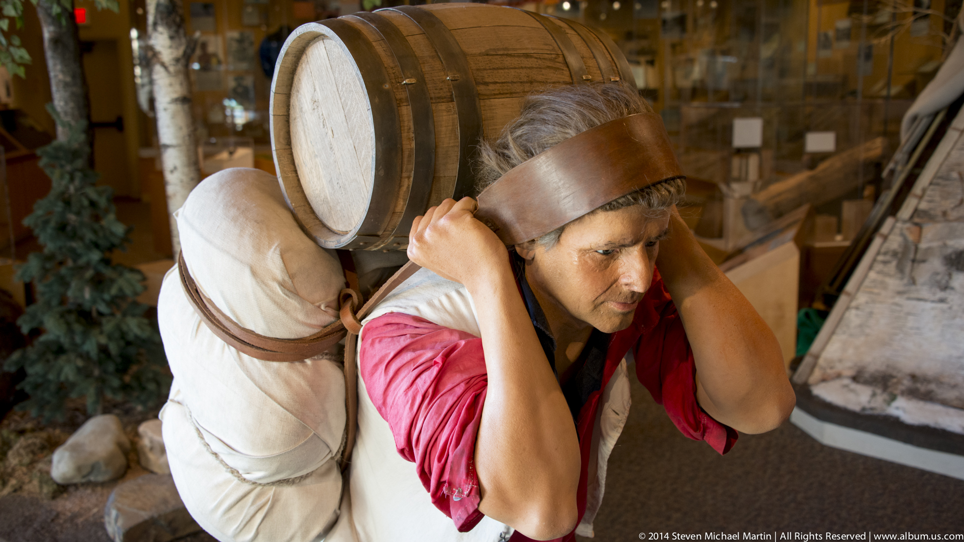
Voyageurs typically traveled in birchbark canoes capable of carrying heavy cargo while navigating narrow rivers, rapids, and shallow waterways. These expeditions required extraordinary physical endurance, as crews paddled for long hours and carried large bundles of trade goods across portages between waterways. The fur trade economy that depended upon these routes became one of the most important economic systems in early Canadian history, influencing patterns of settlement, diplomacy, and cultural interaction across vast regions of the continent.
The trading route illustrates how New France developed as a network of relationships rather than a collection of isolated settlements. French traders, Indigenous communities, missionaries, and explorers contributed to the creation of an interconnected landscape shaped by commerce and cooperation. The voyageurs themselves often served as cultural intermediaries, facilitating communication and exchange between different societies and helping establish enduring links between European and Indigenous traditions.
Route Overview
The itinerary follows major waterways historically used as transportation corridors linking the St. Lawrence River with the Great Lakes and the interior of North America. Beginning near Montreal, voyageurs traveled west through river systems and interconnected lakes, transporting trade goods to remote posts and returning with valuable furs destined for European markets. These routes eventually extended thousands of miles into the continental interior, demonstrating the scale and ambition of early commercial networks.
Travel along the voyageurs’ routes depended heavily on seasonal conditions, particularly the spring thaw when waterways became navigable. Canoe brigades followed carefully mapped passages that balanced efficiency with safety, often requiring portages where goods were carried overland between waterways. Some routes included hundreds of rapids and dozens of lakes, illustrating the geographic challenges faced by voyageurs navigating the North American interior.
Today, the landscapes associated with the voyageurs provide insight into how mobility and trade shaped cultural development across early Canada and the northern United States. Rivers, lakes, and portage routes continue to illustrate the geographic logic that influenced exploration, economic activity, and cultural interaction during the period of New France.
Connections to Acadian Migration
The voyageurs were part of the broader French-speaking world that developed across North America during the period of New France. Just as Acadian communities established agricultural settlements along the Bay of Fundy beginning in the early 1600s, voyageurs helped extend French influence deep into the interior through networks of rivers, lakes, and portage routes. Both groups depended upon cooperation, adaptation to unfamiliar environments, and strong community relationships in order to sustain life far from European centers of power.
Although Acadians were primarily farmers and voyageurs were primarily traders, both shared linguistic traditions, religious practices, and cultural ties that connected distant regions of North America. Families originating in western France contributed to the development of multiple French-speaking societies across the continent, from Acadian villages in Nova Scotia to trading posts along the Great Lakes and Mississippi River systems. These connections illustrate how migration and mobility shaped the cultural geography of early North America.
Understanding the voyageurs’ routes alongside Acadian settlement patterns helps reveal the broader structure of New France as a network of relationships spanning large geographic distances. Rivers functioned as transportation corridors linking communities that might otherwise appear isolated, demonstrating how language, commerce, and shared experience connected regions across the Atlantic world.
Nature / Parks / WildlifeNational Seashores, Lakeshores, and Rivers
Grand Portage Grand Portage was one of the most important transfer points along the voyageurs’ fur trade routes linking the interior of North America with Montreal and European markets. Located near the northwestern shore of Lake Superior, the site served as a critical meeting place where goods were transferred between…
Effigy Mounds Effigy Mounds National Monument preserves a remarkable collection of prehistoric earthworks created by Indigenous peoples over a thousand years ago. These mounds, often shaped in the forms of animals such as bears and birds, served ceremonial and spiritual purposes within the cultural traditions of the region’s early inhabitants.…
Grand Portage Grand Portage was one of the most important transfer points along the voyageurs’ fur trade routes linking the interior of North America with Montreal and European markets. Located near the northwestern shore of Lake Superior, the site served as a critical meeting place where goods were transferred between…
Voyageurs National Park Voyageurs National Park preserves a landscape of interconnected lakes and waterways that closely resemble the environments traveled by French and French-Canadian voyageurs during the height of the fur trade. Located along the border between the United States and Canada, the park includes large expanses of water separated…
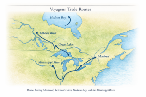
The voyageurs’ trading routes formed an interconnected network of waterways linking the St. Lawrence River with the Great Lakes and the interior of North America. Beginning near Montreal, canoe routes extended westward through a series of rivers, lakes, and portage trails that allowed travel across vast distances without the need for constructed roads. These routes followed pathways first developed by Indigenous communities, whose geographic knowledge made long-distance trade possible.
Major segments of the route included travel along the St. Lawrence River, passage through the Great Lakes system, and navigation of inland waterways extending toward the Mississippi River and western Canada. Portage routes such as Grand Portage allowed travelers to bypass rapids or difficult terrain by carrying canoes and cargo overland between navigable waterways. Seasonal conditions, water levels, and weather patterns strongly influenced travel timing and route selection.
The map illustrates how geographic features shaped economic and cultural connections across early North America. Rather than isolated settlements, New France developed as a network of linked environments connected by water. These transportation corridors allowed goods, ideas, and people to move across great distances, contributing to the formation of shared cultural traditions across multiple regions of the continent.
Voyageur Route Geography
The voyageurs traveled interconnected waterways linking Montreal to the interior of North America. These routes relied on natural river systems and lakes rather than constructed roads.
St. Lawrence River → primary access route from the Atlantic
Ottawa River → major westward corridor
Great Lakes → transportation network connecting distant regions
Lake Superior → gateway to interior trade routes
Grand Portage → overland transfer point between watersheds
Interior lakes and rivers → routes extending thousands of miles inland
The itinerary follows major waterways historically used as transportation corridors linking the St. Lawrence River with the Great Lakes and the interior of North America. Beginning near Montreal, voyageurs traveled west through river systems and interconnected lakes, transporting trade goods to remote posts and returning with valuable furs destined for European markets. These routes eventually extended thousands of miles into the continental interior, demonstrating the scale and ambition of early commercial networks.
Travel along the voyageurs’ routes depended heavily on seasonal conditions, particularly the spring thaw when waterways became navigable. Canoe brigades followed carefully mapped passages that balanced efficiency with safety, often requiring portages where goods were carried overland between waterways. Some routes included hundreds of rapids and dozens of lakes, illustrating the geographic challenges faced by voyageurs navigating the North American interior.
Today, the landscapes associated with the voyageurs provide insight into how mobility and trade shaped cultural development across early Canada and the northern United States. Rivers, lakes, and portage routes continue to illustrate the geographic logic that influenced exploration, economic activity, and cultural interaction during the period of New France.