Kihihi – Uganda
The town of Kihihi lies in southwestern Uganda near the edge of Bwindi Impenetrable National Park, one of the most famous wildlife destinations in Africa. The town serves as a gateway for travelers heading into the dense rainforest in search of mountain gorillas.
Surrounded by rolling hills, farmland, and forested valleys, Kihihi marks the transition between Uganda’s agricultural countryside and the dense rainforest of Bwindi. Small lodges and camps in the region provide access to gorilla trekking routes within the park.
From here visitors begin their journeys into one of the most biologically rich rainforests in the world.
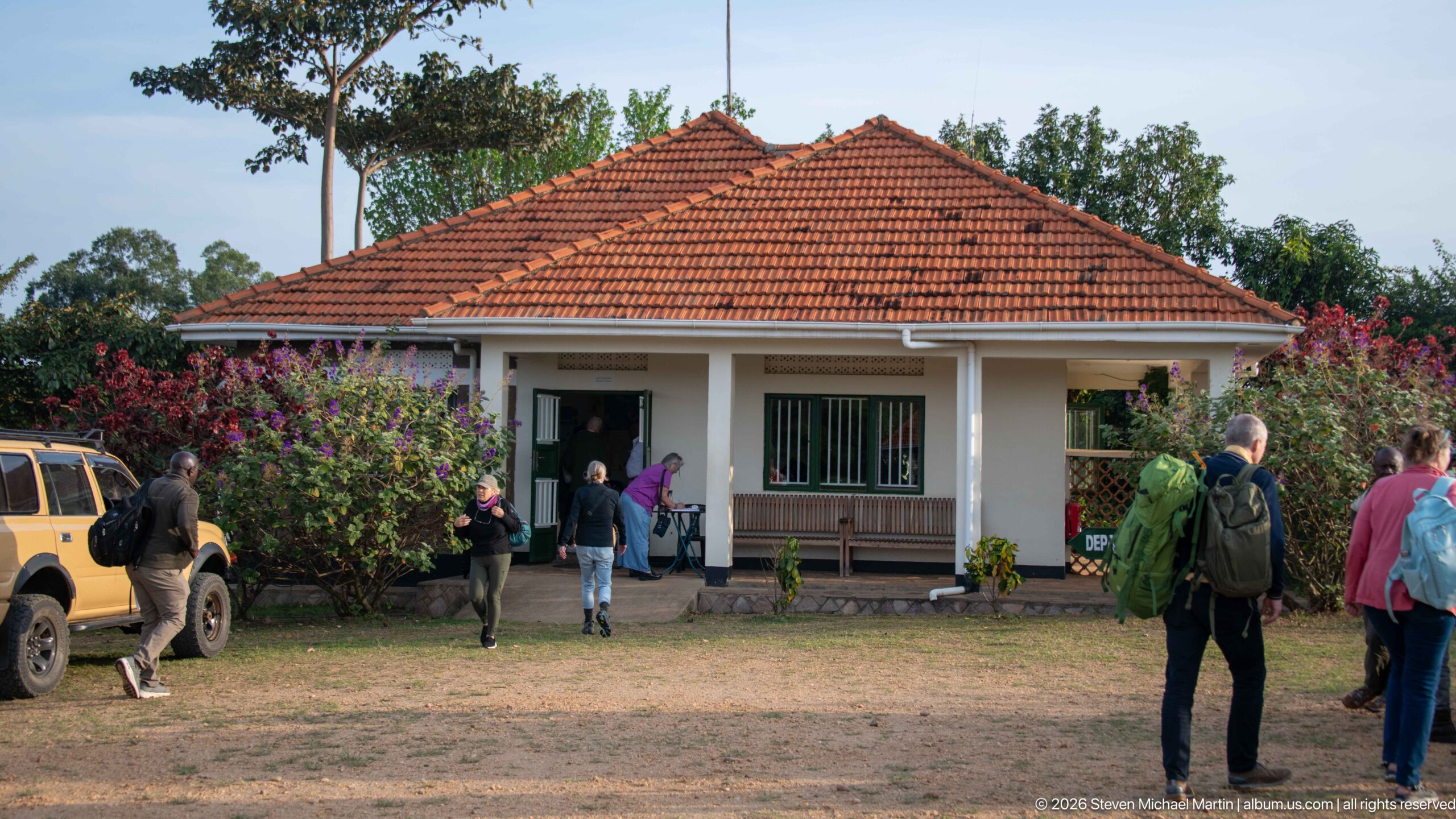
The compact Kihihi passenger terminal sits beneath a red-tiled hipped roof, fronted by a veranda and flowering garden beds. Travelers gather outside while safari vehicles remain parked nearby. Seen from across the airfield, the building reads as a small regional gateway rather than a conventional large airport terminal, integrating passenger processing with immediate road transfers.
Caption
The compact Kihihi passenger terminal sits beneath a red-tiled hipped roof, fronted by a veranda and flowering garden beds. Travelers gather outside while safari vehicles remain parked nearby. Seen from across the airfield, the building reads as a small regional gateway rather than a conventional large airport terminal, integrating passenger processing with immediate road transfers.
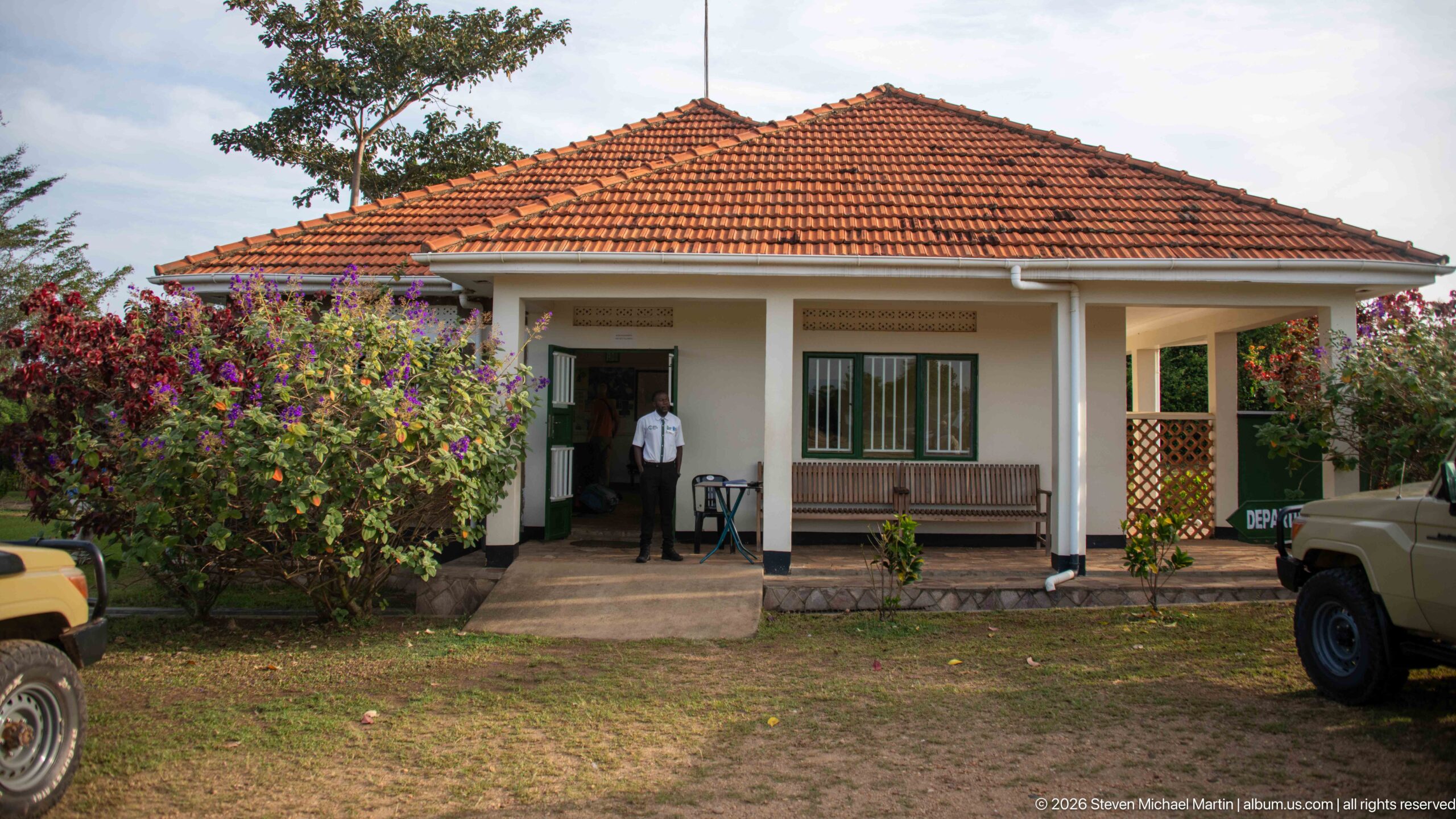
A compact single-story passenger building faces the airfield beneath a broad red tiled roof. A central entrance, shaded veranda, bench, barred windows, flowering shrubs, and nearby safari vehicles underscore the modest, ground-level character of regional aviation infrastructure in Kihihi.
Caption
A compact single-story passenger building faces the airfield beneath a broad red tiled roof. A central entrance, shaded veranda, bench, barred windows, flowering shrubs, and nearby safari vehicles underscore the modest, ground-level character of regional aviation infrastructure in Kihihi.
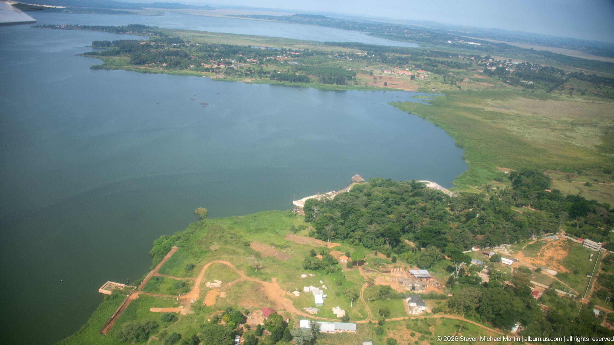
A broad lake fills the foreground of this oblique aerial view, edged by cultivated plots, scattered buildings, trees, and a small shoreline landing area. Seen from a low-flying aircraft in southwestern Uganda, the scene records the close relationship between settlement, agriculture, and the lake margin in the wider Kihihi travel corridor.
Caption
A broad lake fills the foreground of this oblique aerial view, edged by cultivated plots, scattered buildings, trees, and a small shoreline landing area. Seen from a low-flying aircraft in southwestern Uganda, the scene records the close relationship between settlement, agriculture, and the lake margin in the wider Kihihi travel corridor.
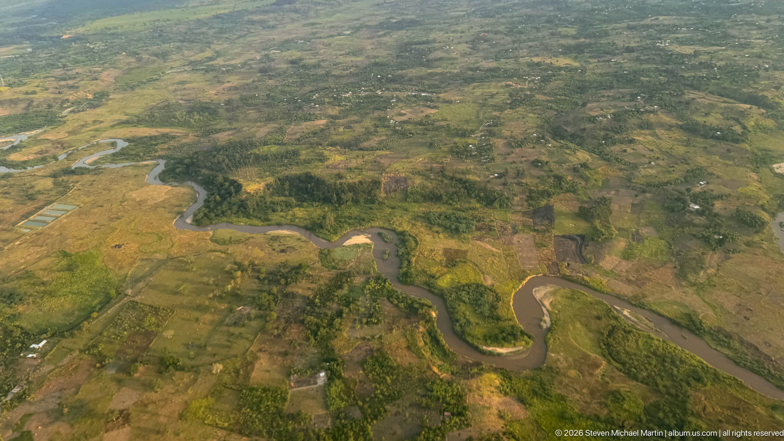
A sinuous river winds through a broad patchwork of wetlands, fields, and cultivated plots below the flight path from Kihihi. Tight bends, muddy channels, and greener floodplain vegetation distinguish the watercourse from the drier surrounding land. Scattered roads and settlements reveal a working rural landscape shaped by both seasonal water and agriculture.
Caption
A sinuous river winds through a broad patchwork of wetlands, fields, and cultivated plots below the flight path from Kihihi. Tight bends, muddy channels, and greener floodplain vegetation distinguish the watercourse from the drier surrounding land. Scattered roads and settlements reveal a working rural landscape shaped by both seasonal water and agriculture.
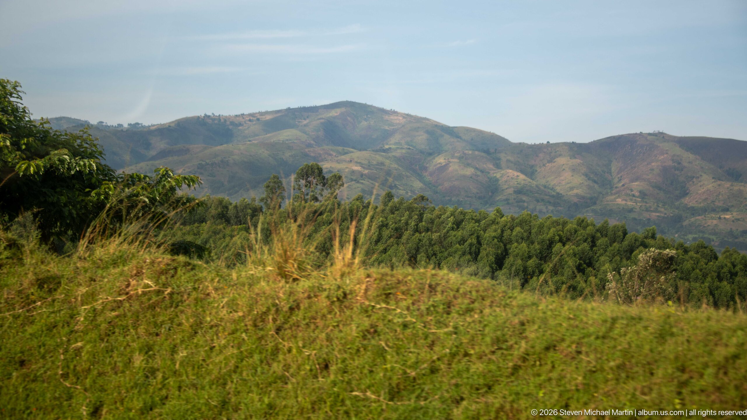
Rounded mountain ridges rise beyond a foreground of grasses and scattered trees, their slopes patterned by patches of vegetation and cultivation. The layered view records the broken highland terrain of southwestern Uganda, where settled agricultural land meets steeper uplands.
Caption
Rounded mountain ridges rise beyond a foreground of grasses and scattered trees, their slopes patterned by patches of vegetation and cultivation. The layered view records the broken highland terrain of southwestern Uganda, where settled agricultural land meets steeper uplands.
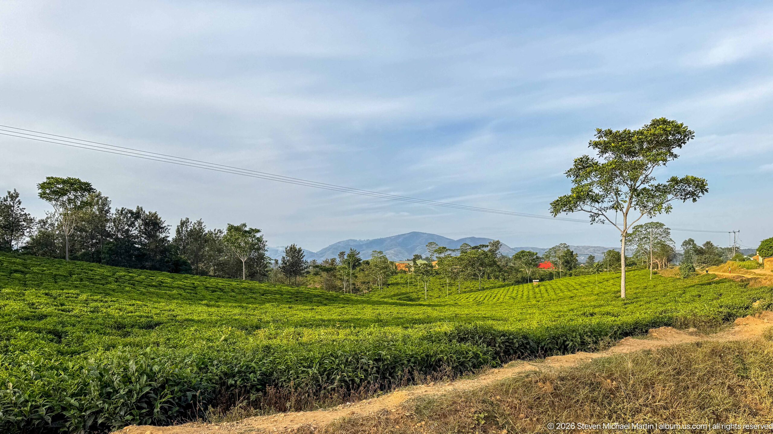
Low, clipped tea bushes spread across the foreground and middle distance, interrupted by scattered trees and a pale dirt track. Beyond the plantation, blue hills rise beneath a lightly clouded sky, linking the cultivated fields around Kihihi to the broader highland landscape of southwestern Uganda.
Caption
Low, clipped tea bushes spread across the foreground and middle distance, interrupted by scattered trees and a pale dirt track. Beyond the plantation, blue hills rise beneath a lightly clouded sky, linking the cultivated fields around Kihihi to the broader highland landscape of southwestern Uganda.
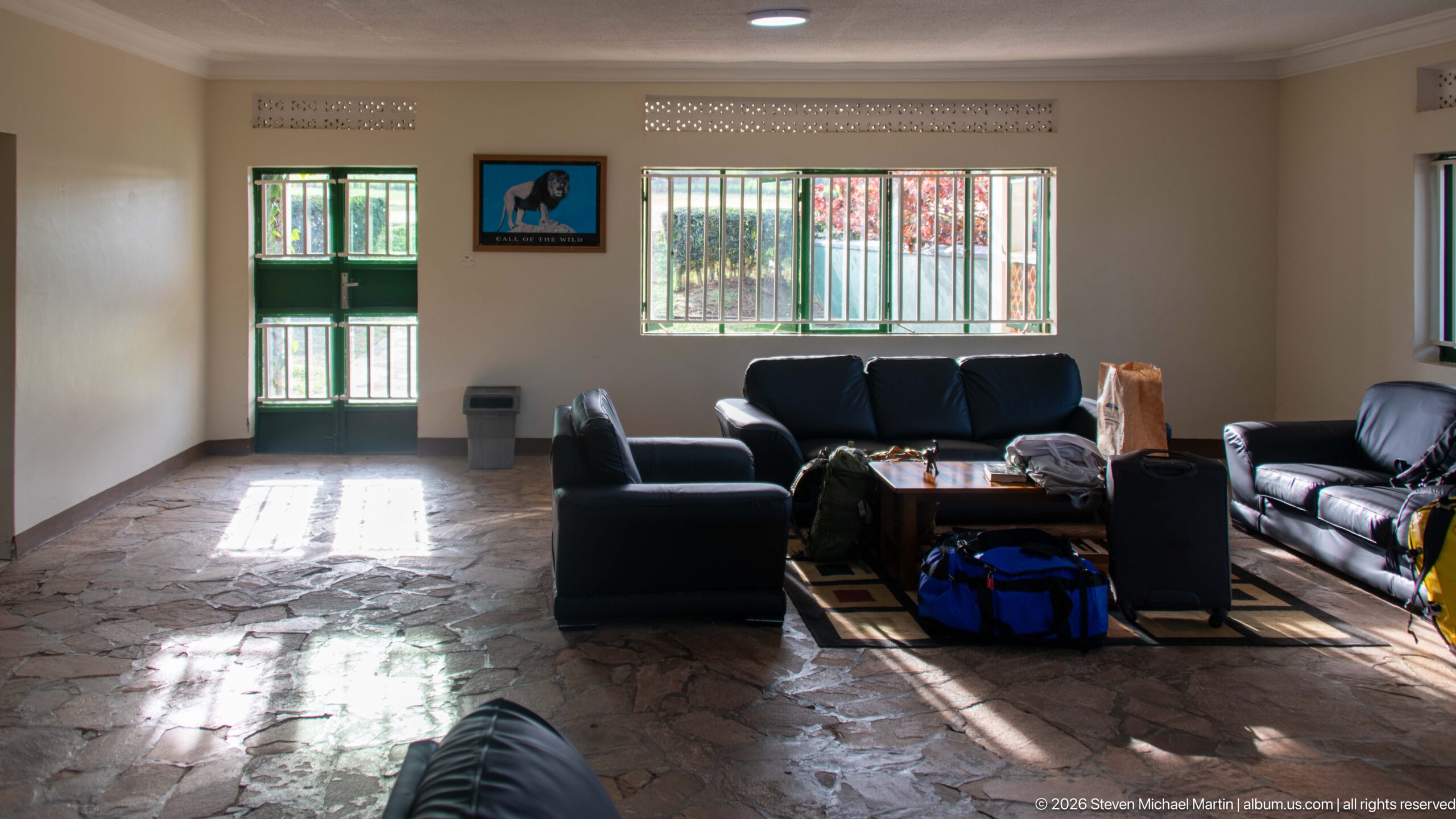
Sunlight falls across the stone-patterned floor of a modest passenger lounge furnished with black sofas and armchairs. Barred windows, a green door, luggage, and simple waiting-room furnishings suggest the intimate scale of a regional airfield facility serving travelers through Kihihi.
Caption
Sunlight falls across the stone-patterned floor of a modest passenger lounge furnished with black sofas and armchairs. Barred windows, a green door, luggage, and simple waiting-room furnishings suggest the intimate scale of a regional airfield facility serving travelers through Kihihi.
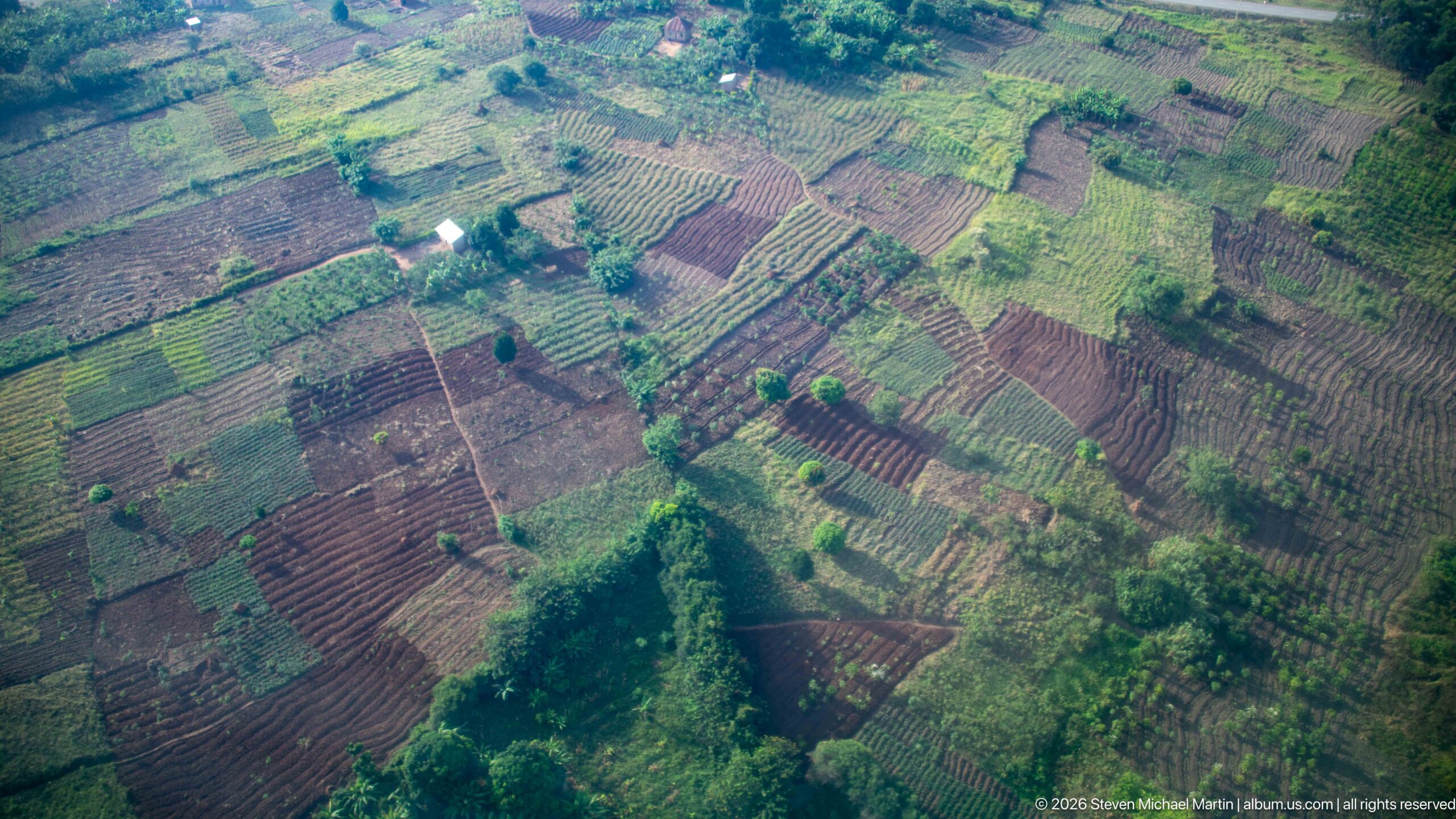
Small cultivated plots form an irregular patchwork beneath the aircraft, divided by footpaths, hedges, trees, and narrow strips of uncultivated vegetation. The aerial viewpoint reveals the fine-grained pattern of smallholder agriculture around Kihihi, with contrasting soil tones and crop rows distinguishing neighboring fields.
Caption
Small cultivated plots form an irregular patchwork beneath the aircraft, divided by footpaths, hedges, trees, and narrow strips of uncultivated vegetation. The aerial viewpoint reveals the fine-grained pattern of smallholder agriculture around Kihihi, with contrasting soil tones and crop rows distinguishing neighboring fields.
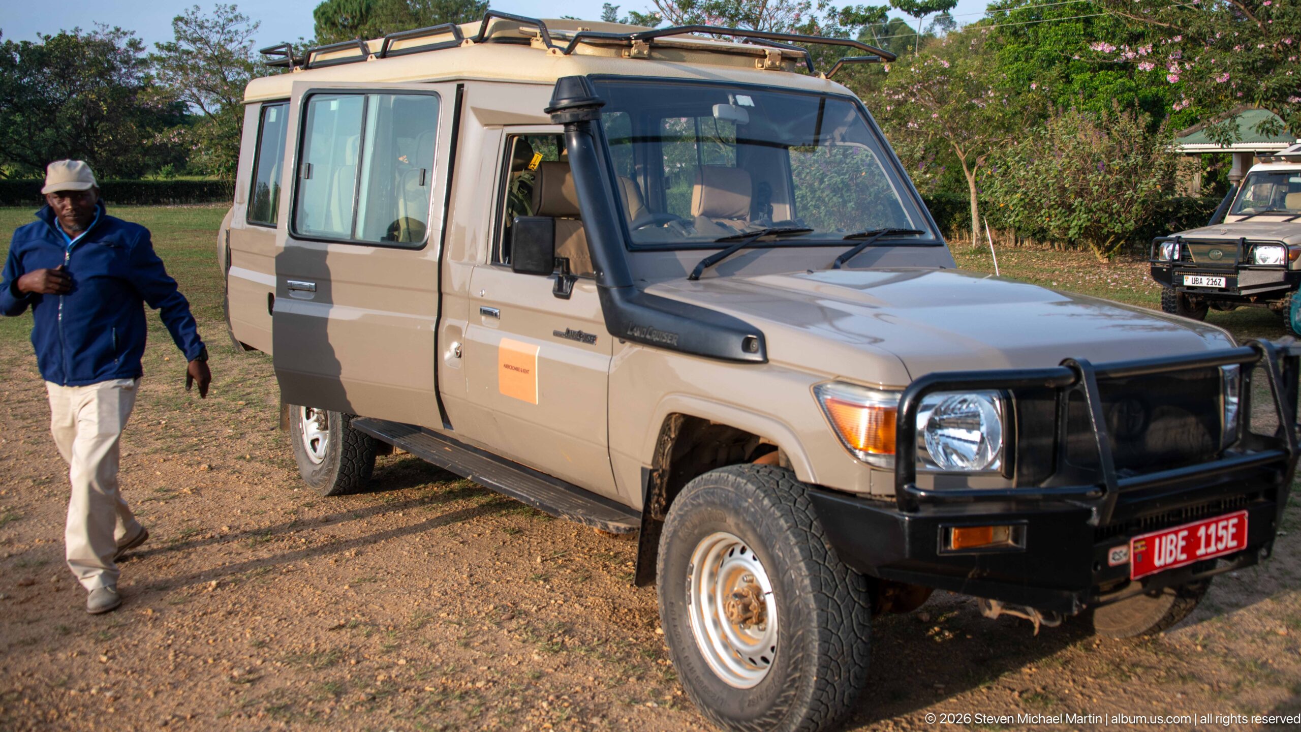
A long-wheelbase safari vehicle stands on the dirt apron at Kihihi, its raised roof section, snorkel, brush guard, and rugged tires adapted for unpaved travel. A man walks alongside while another vehicle waits in the background. The close view emphasizes the specialized road transport used to carry visitors from the airstrip into southwestern Uganda’s lodge and wildlife circuit.
Caption
A long-wheelbase safari vehicle stands on the dirt apron at Kihihi, its raised roof section, snorkel, brush guard, and rugged tires adapted for unpaved travel. A man walks alongside while another vehicle waits in the background. The close view emphasizes the specialized road transport used to carry visitors from the airstrip into southwestern Uganda’s lodge and wildlife circuit.
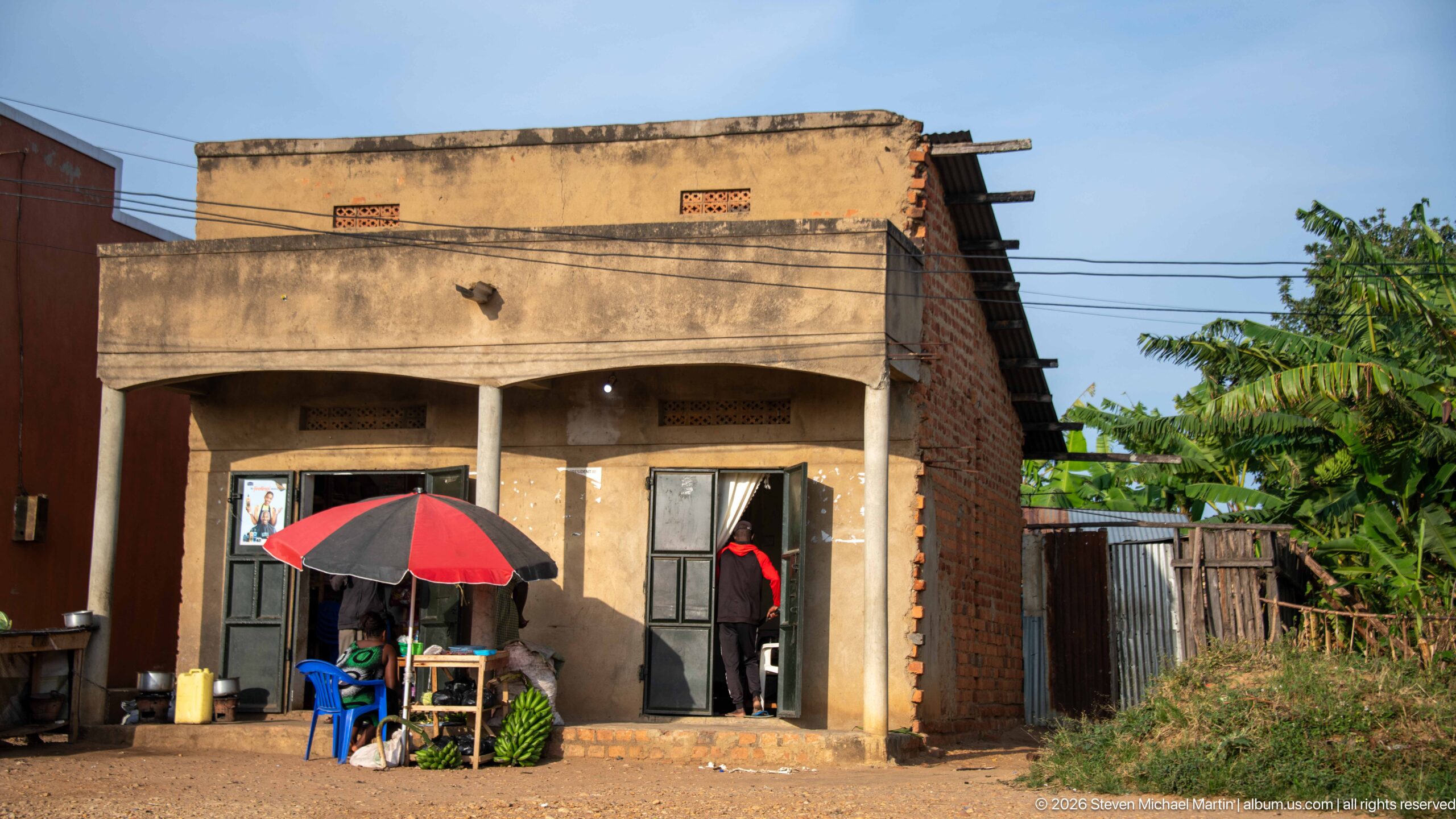
A modest concrete-and-brick storefront opens directly onto the roadside, where a red-and-black umbrella shades a small table and blue plastic chair. Exposed masonry, ventilation blocks, corrugated additions, and banana plants behind the building give a close architectural view of Kihihi’s small-scale commercial streetscape.
Caption
A modest concrete-and-brick storefront opens directly onto the roadside, where a red-and-black umbrella shades a small table and blue plastic chair. Exposed masonry, ventilation blocks, corrugated additions, and banana plants behind the building give a close architectural view of Kihihi’s small-scale commercial streetscape.

The dark silhouette of a high-wing propeller aircraft crosses a continuous green surface below during an aerial approach or departure near Kihihi. The softened outline and lack of visible ground detail make the aircraft shadow itself the dominant subject, turning the transit between airfield and landscape into a graphic aerial study.
Caption
The dark silhouette of a high-wing propeller aircraft crosses a continuous green surface below during an aerial approach or departure near Kihihi. The softened outline and lack of visible ground detail make the aircraft shadow itself the dominant subject, turning the transit between airfield and landscape into a graphic aerial study.
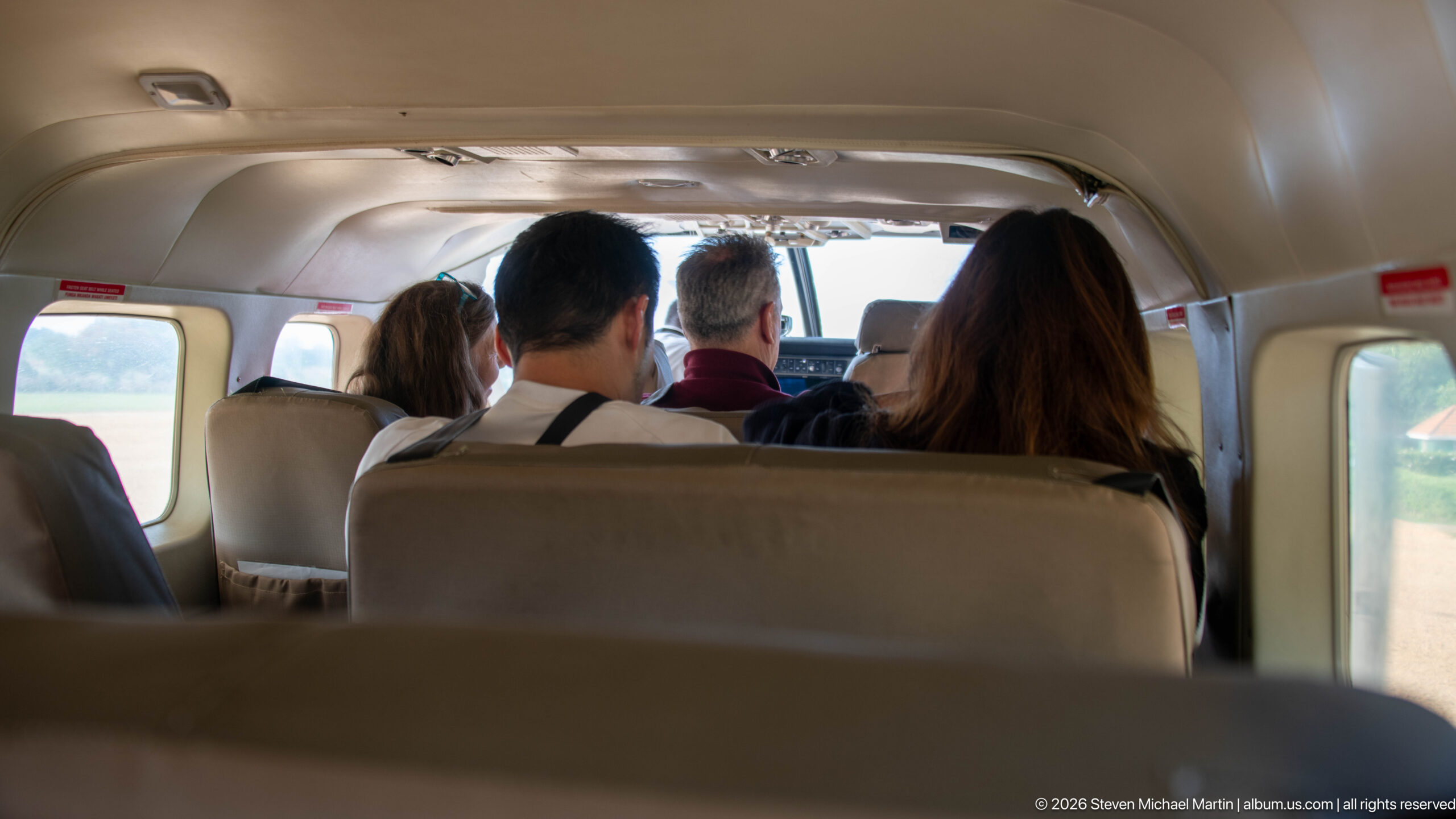
Passengers sit in closely spaced seats inside a small aircraft, viewed forward from the rear of the cabin toward the cockpit. Beige interior panels, compact windows, and the narrow aisle convey the scale of regional air travel serving Kihihi and southwestern Uganda.
Caption
Passengers sit in closely spaced seats inside a small aircraft, viewed forward from the rear of the cabin toward the cockpit. Beige interior panels, compact windows, and the narrow aisle convey the scale of regional air travel serving Kihihi and southwestern Uganda.
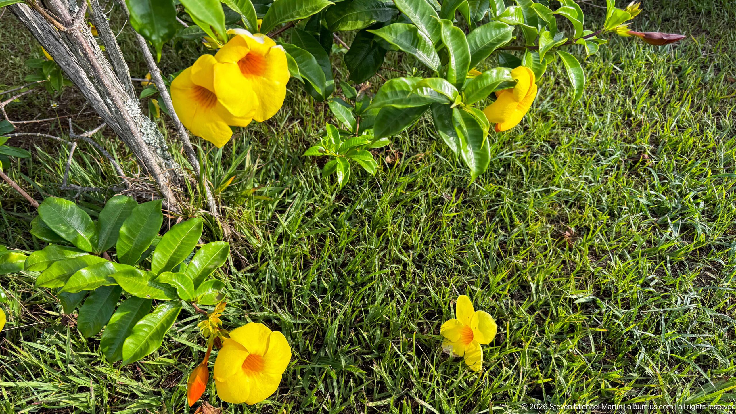
Several vivid yellow, trumpet-shaped flowers with orange-red throats open among glossy green leaves beside a lawn. Their flared corollas and contrasting centers make the ornamental planting the clear subject, photographed at close range in the Kihihi setting.
Caption
Several vivid yellow, trumpet-shaped flowers with orange-red throats open among glossy green leaves beside a lawn. Their flared corollas and contrasting centers make the ornamental planting the clear subject, photographed at close range in the Kihihi setting.
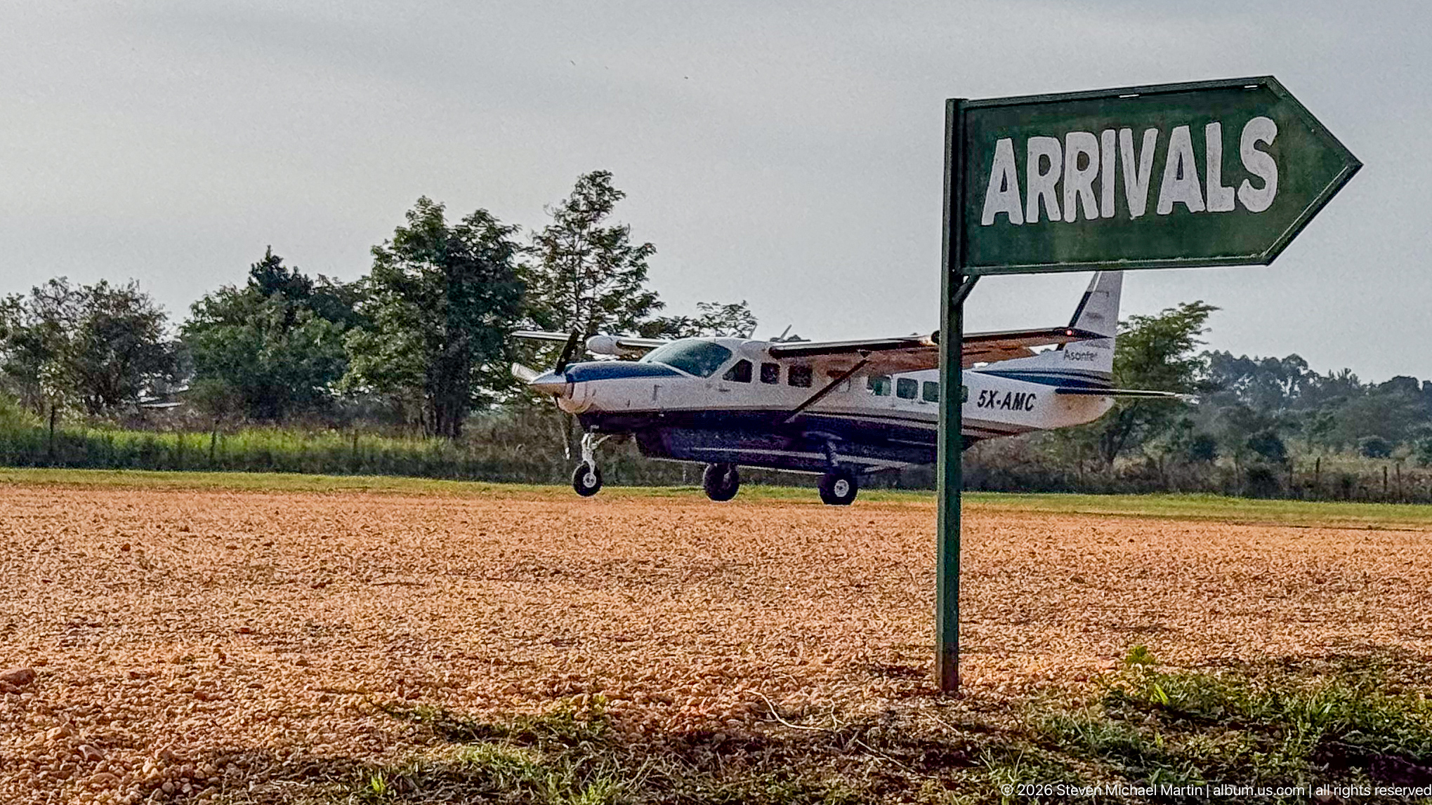
A green arrow marked “ARRIVALS” stands beside a gravel airstrip as a small high-wing aircraft rolls or waits beyond it. The juxtaposition of hand-painted wayfinding and the compact aircraft conveys the informal scale of regional aviation facilities around Kihihi.
Caption
A green arrow marked “ARRIVALS” stands beside a gravel airstrip as a small high-wing aircraft rolls or waits beyond it. The juxtaposition of hand-painted wayfinding and the compact aircraft conveys the informal scale of regional aviation facilities around Kihihi.

A dense cluster of ruffled pink trumpet-shaped blossoms hangs from a bare twig against a clear blue sky. Pale yellow throats glow within the flowers, while the shallow depth of field isolates the bloom from the surrounding vegetation.
Caption
A dense cluster of ruffled pink trumpet-shaped blossoms hangs from a bare twig against a clear blue sky. Pale yellow throats glow within the flowers, while the shallow depth of field isolates the bloom from the surrounding vegetation.
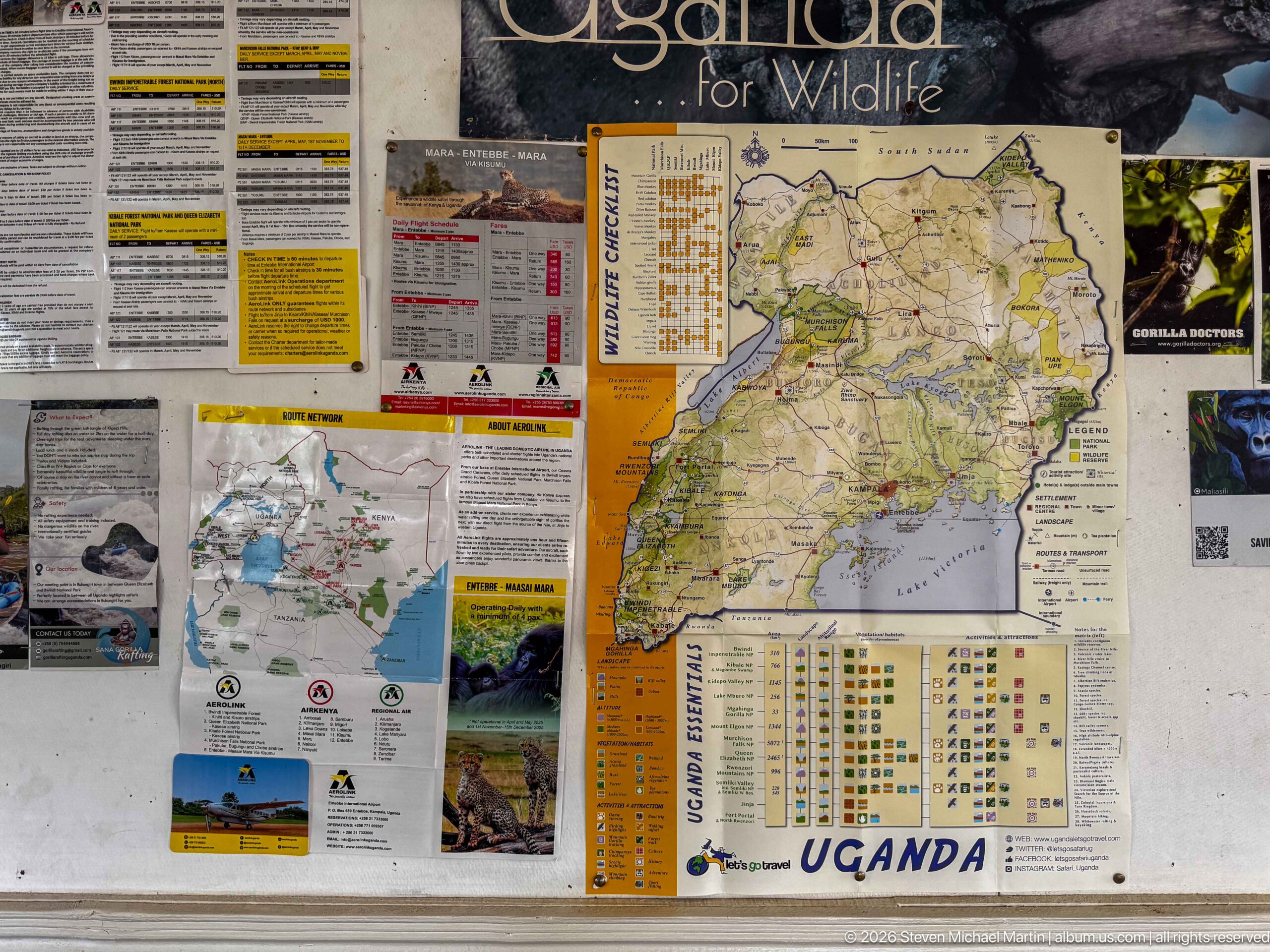
A wall-mounted information display combines a large map of Uganda with wildlife photographs, visitor notices, and travel materials. The central map and surrounding species imagery frame Kihihi as a gateway within a broader network of Ugandan parks and wildlife destinations.
Caption
A wall-mounted information display combines a large map of Uganda with wildlife photographs, visitor notices, and travel materials. The central map and surrounding species imagery frame Kihihi as a gateway within a broader network of Ugandan parks and wildlife destinations.
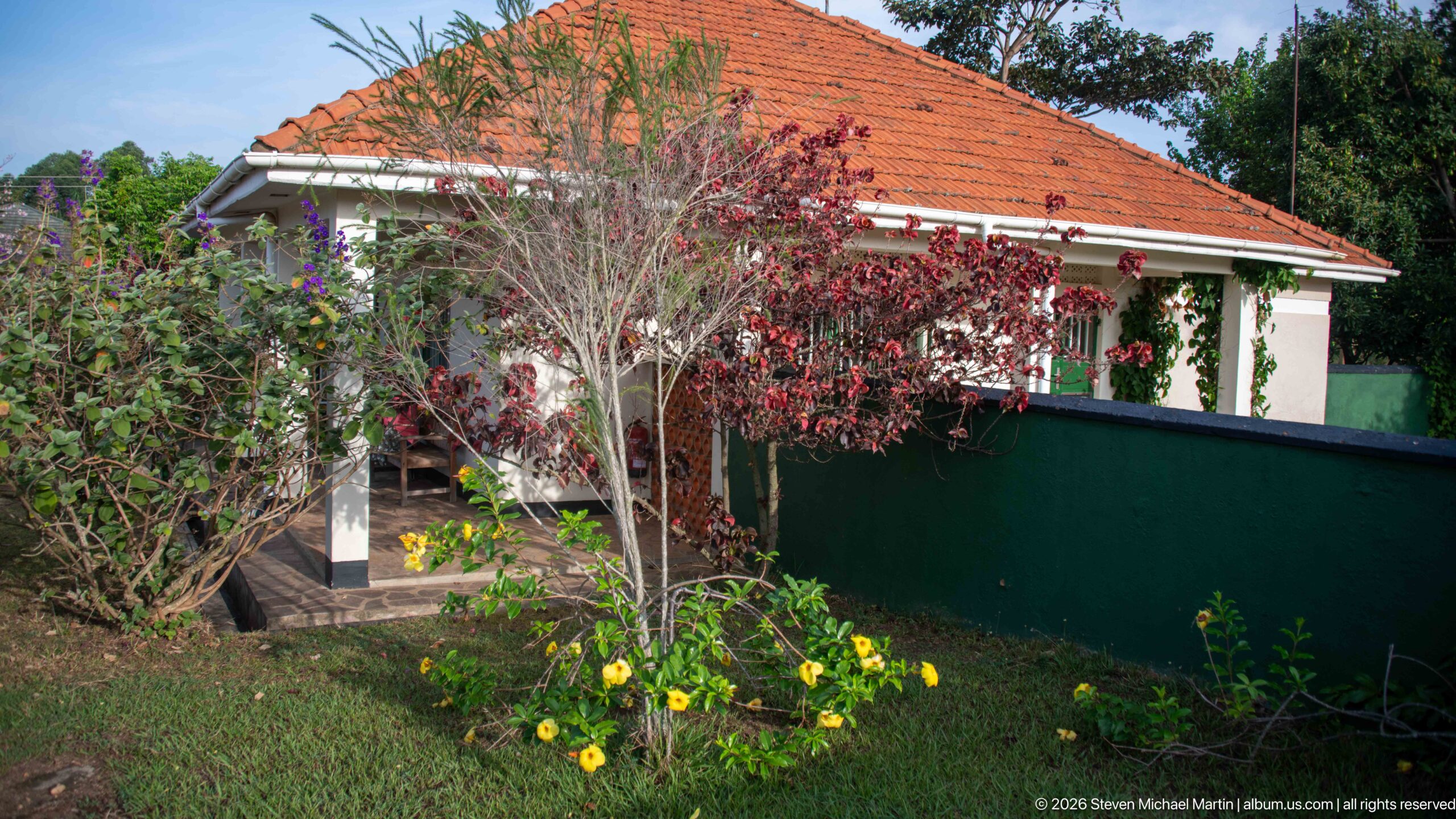
A low, pale building with a red tiled hipped roof sits behind a garden of flowering shrubs and yellow blossoms. A shaded veranda, barred windows, and simple landscaping give the structure the appearance of a small regional airfield or visitor facility in Kihihi.
Caption
A low, pale building with a red tiled hipped roof sits behind a garden of flowering shrubs and yellow blossoms. A shaded veranda, barred windows, and simple landscaping give the structure the appearance of a small regional airfield or visitor facility in Kihihi.
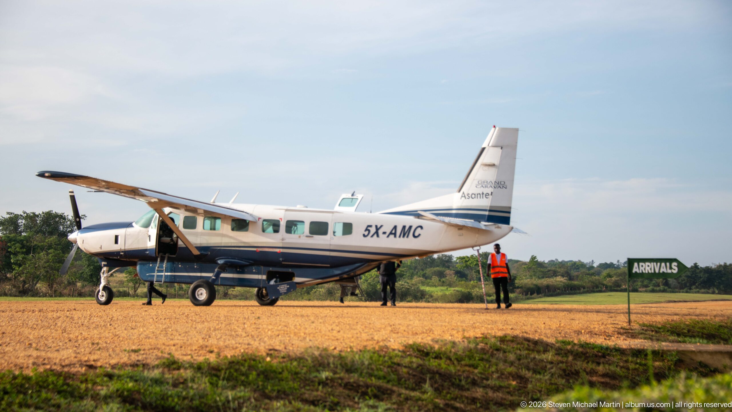
An Aerolink Uganda high-wing turboprop stands on the gravel airstrip near the green arrivals marker while ground staff wait alongside. The compact aircraft and unpaved operating surface illustrate the regional air links used to reach southwestern Uganda’s protected landscapes.
Caption
An Aerolink Uganda high-wing turboprop stands on the gravel airstrip near the green arrivals marker while ground staff wait alongside. The compact aircraft and unpaved operating surface illustrate the regional air links used to reach southwestern Uganda’s protected landscapes.
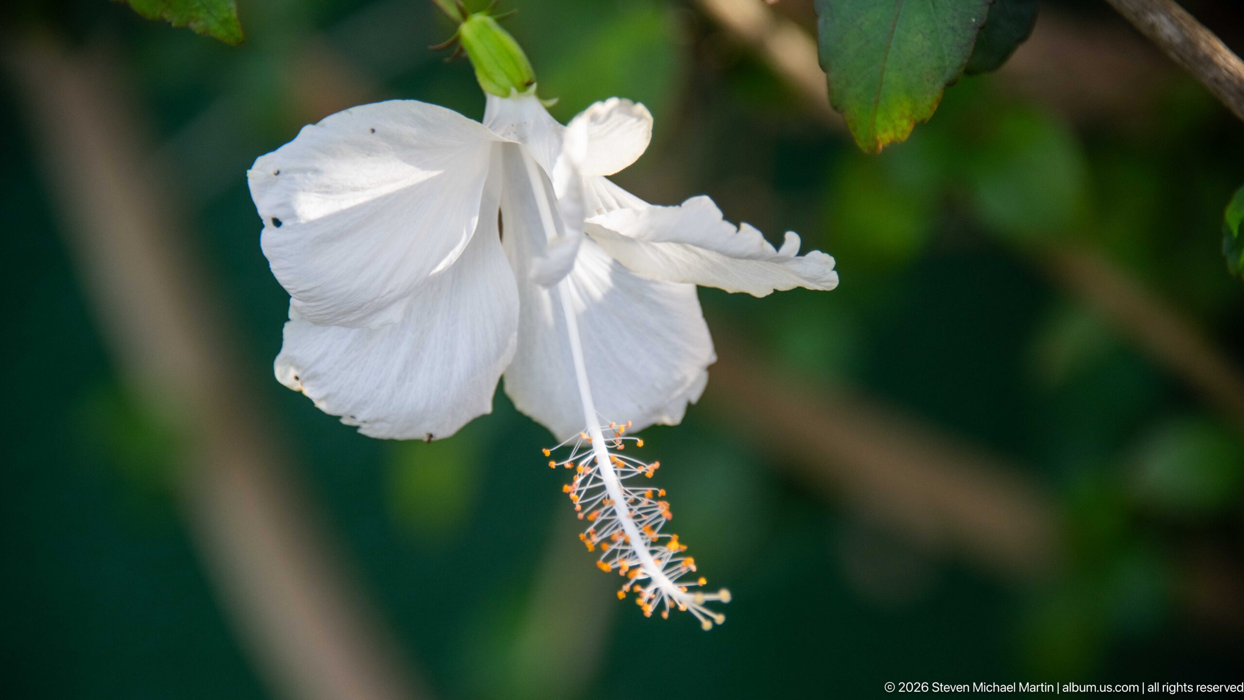
A white hibiscus-like flower hangs against dark green foliage, its long projecting staminal column tipped with orange anthers. Soft background blur isolates the delicate petals and reproductive structures, making this a close botanical detail rather than a broader garden view.
Caption
A white hibiscus-like flower hangs against dark green foliage, its long projecting staminal column tipped with orange anthers. Soft background blur isolates the delicate petals and reproductive structures, making this a close botanical detail rather than a broader garden view.

Clusters of saturated purple flowers and reddish buds extend from a woody stem against a softly blurred green background. The close focus emphasizes the small blossoms, prominent stamens, and branching inflorescence while leaving the broader plant and habitat out of view.
Caption
Clusters of saturated purple flowers and reddish buds extend from a woody stem against a softly blurred green background. The close focus emphasizes the small blossoms, prominent stamens, and branching inflorescence while leaving the broader plant and habitat out of view.

A dark green arrow marked “DEPARTURES” points across a stone-paved area outside the small airfield facility. The hand-painted sign provides a simple counterpart to the arrivals marker, documenting passenger wayfinding at the regional aviation stop.
Caption
A dark green arrow marked “DEPARTURES” points across a stone-paved area outside the small airfield facility. The hand-painted sign provides a simple counterpart to the arrivals marker, documenting passenger wayfinding at the regional aviation stop.

A stylized gorilla silhouette rises above the bold words “EXPERIENCE UGANDA” on a yellow background. The graphic links national tourism branding with Uganda’s best-known primate experiences, an especially relevant motif for travelers continuing from Kihihi toward the Bwindi region.
Caption
A stylized gorilla silhouette rises above the bold words “EXPERIENCE UGANDA” on a yellow background. The graphic links national tourism branding with Uganda’s best-known primate experiences, an especially relevant motif for travelers continuing from Kihihi toward the Bwindi region.
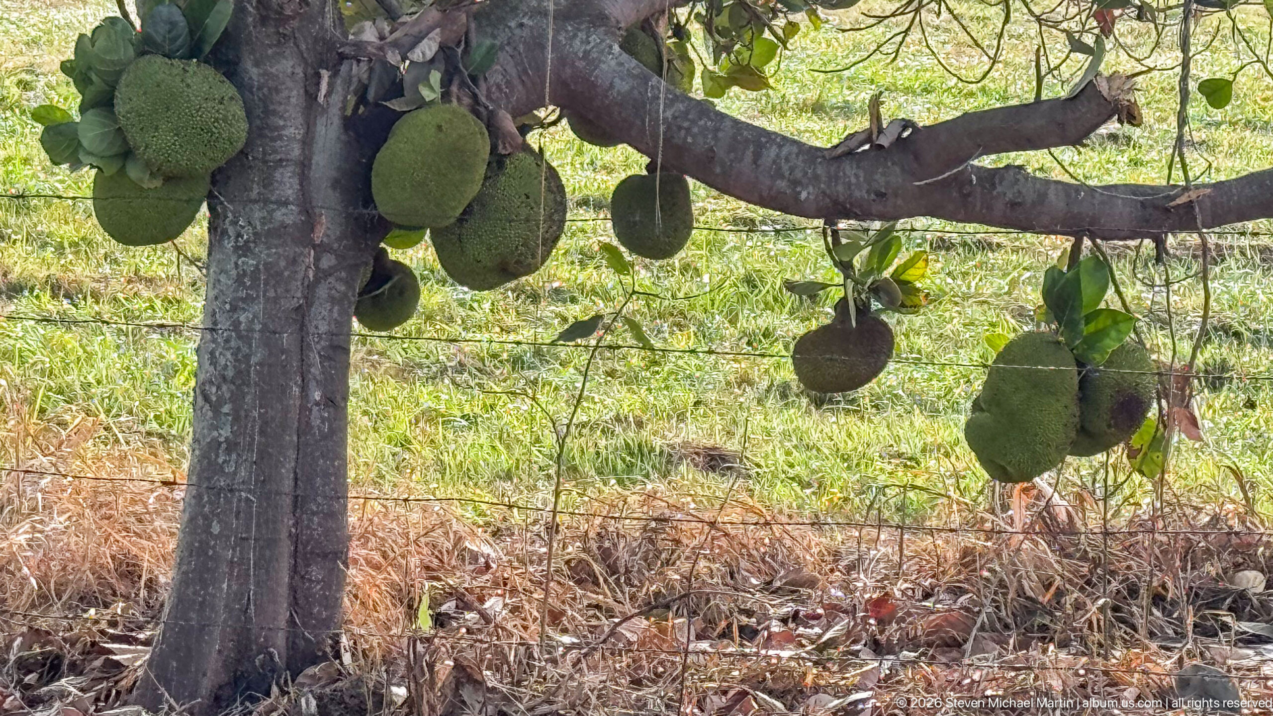
Large green, knobbly jackfruits hang directly from the trunk and heavy lower branches of a mature tree. The clustered fruits demonstrate the species’ cauliflorous habit, with developing fruit borne on older woody growth rather than at the tips of leafy shoots.
Caption
Large green, knobbly jackfruits hang directly from the trunk and heavy lower branches of a mature tree. The clustered fruits demonstrate the species’ cauliflorous habit, with developing fruit borne on older woody growth rather than at the tips of leafy shoots.
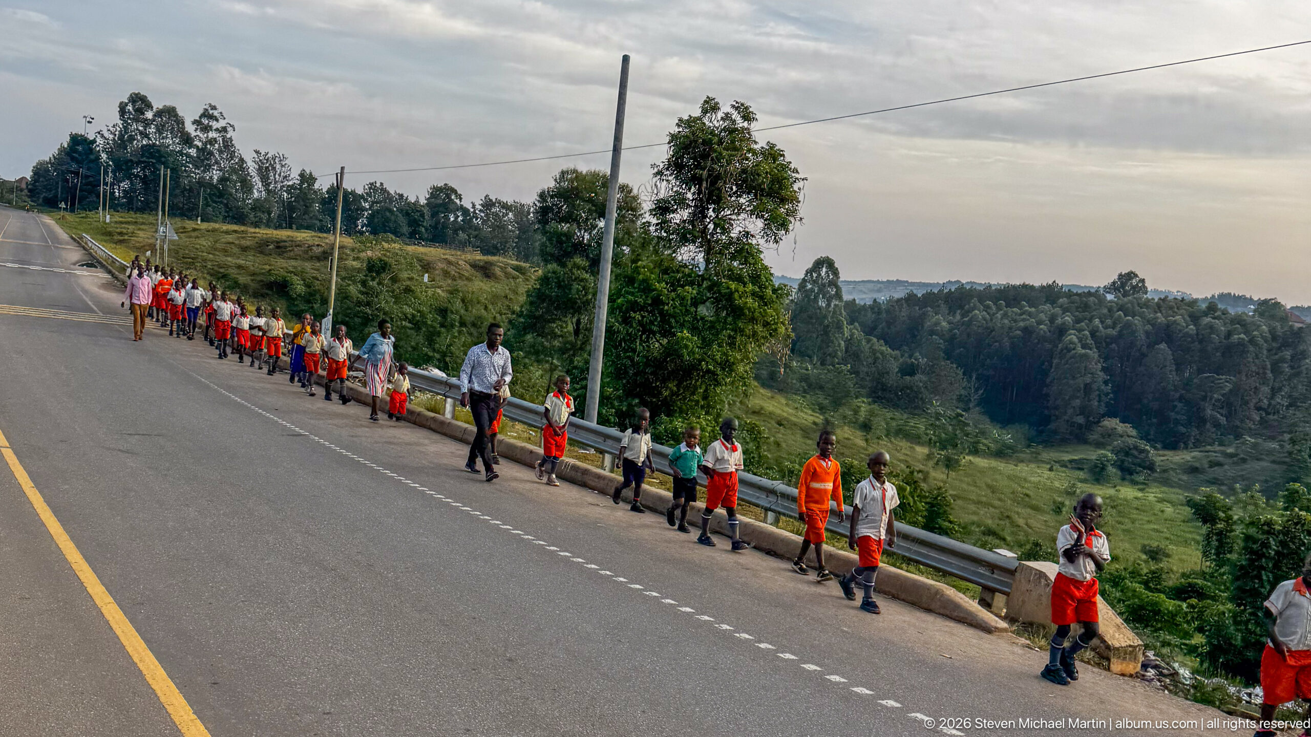
A long line of schoolchildren in coordinated orange, white, and green uniforms walks along the shoulder of a paved road through hilly countryside. Adults accompany the group as it follows a guardrail, creating a strong diagonal procession across the rural roadside landscape.
Caption
A long line of schoolchildren in coordinated orange, white, and green uniforms walks along the shoulder of a paved road through hilly countryside. Adults accompany the group as it follows a guardrail, creating a strong diagonal procession across the rural roadside landscape.
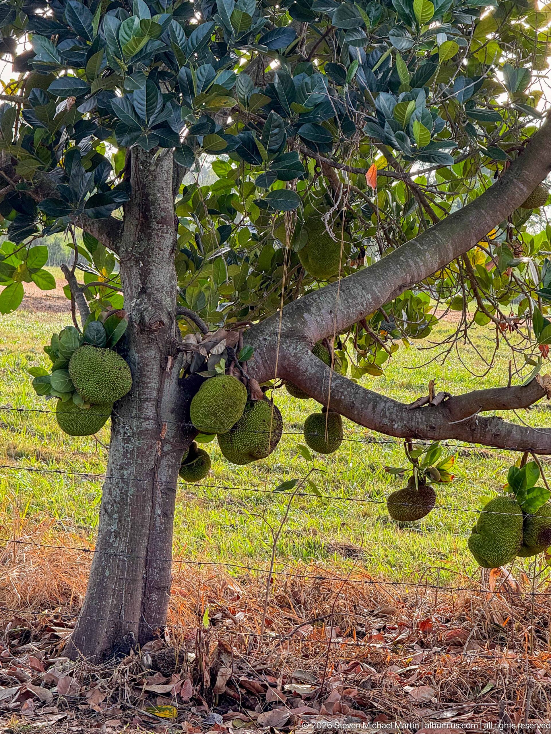
A second view of the jackfruit tree shows numerous green fruits attached to the trunk and spreading lower limbs beneath a dense canopy. The wider framing reveals how heavily the mature tree is fruiting and places the cauliflorous clusters in relation to the trunk, ground, and surrounding vegetation.
Caption
A second view of the jackfruit tree shows numerous green fruits attached to the trunk and spreading lower limbs beneath a dense canopy. The wider framing reveals how heavily the mature tree is fruiting and places the cauliflorous clusters in relation to the trunk, ground, and surrounding vegetation.

Young children in matching orange shorts or skirts and pale shirts walk in small groups along the edge of a paved road. The closer viewpoint distinguishes individual uniforms and expressions while the guardrail and steep green roadside place the procession within Kihihi’s hilly rural setting.
Caption
Young children in matching orange shorts or skirts and pale shirts walk in small groups along the edge of a paved road. The closer viewpoint distinguishes individual uniforms and expressions while the guardrail and steep green roadside place the procession within Kihihi’s hilly rural setting.
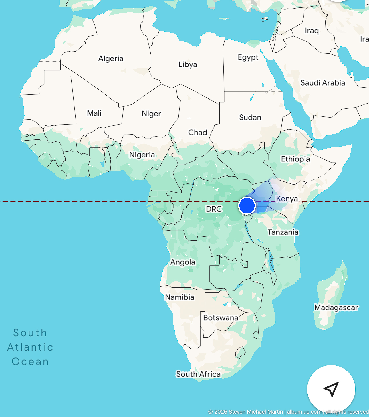
A digital map places the Kihihi journey within eastern Africa, with Uganda highlighted near Rwanda, Burundi, Kenya, Tanzania, and the Democratic Republic of the Congo. A blue location marker centers attention on the Great Lakes region while the continental view establishes broader geographic orientation.
Caption
A digital map places the Kihihi journey within eastern Africa, with Uganda highlighted near Rwanda, Burundi, Kenya, Tanzania, and the Democratic Republic of the Congo. A blue location marker centers attention on the Great Lakes region while the continental view establishes broader geographic orientation.
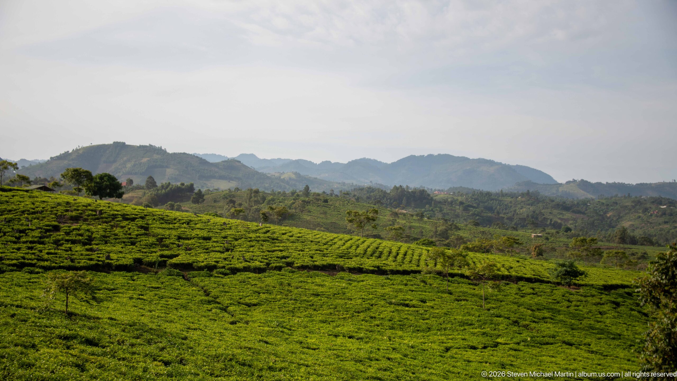
Orderly bands of low, bright-green cultivated shrubs sweep across rolling hills, with taller trees and hazy ridges rising behind them. The repeating rows and clipped vegetation suggest a tea-growing landscape, while the distant hills provide geographic context for the humid highlands around southwestern Uganda.
Caption
Orderly bands of low, bright-green cultivated shrubs sweep across rolling hills, with taller trees and hazy ridges rising behind them. The repeating rows and clipped vegetation suggest a tea-growing landscape, while the distant hills provide geographic context for the humid highlands around southwestern Uganda.
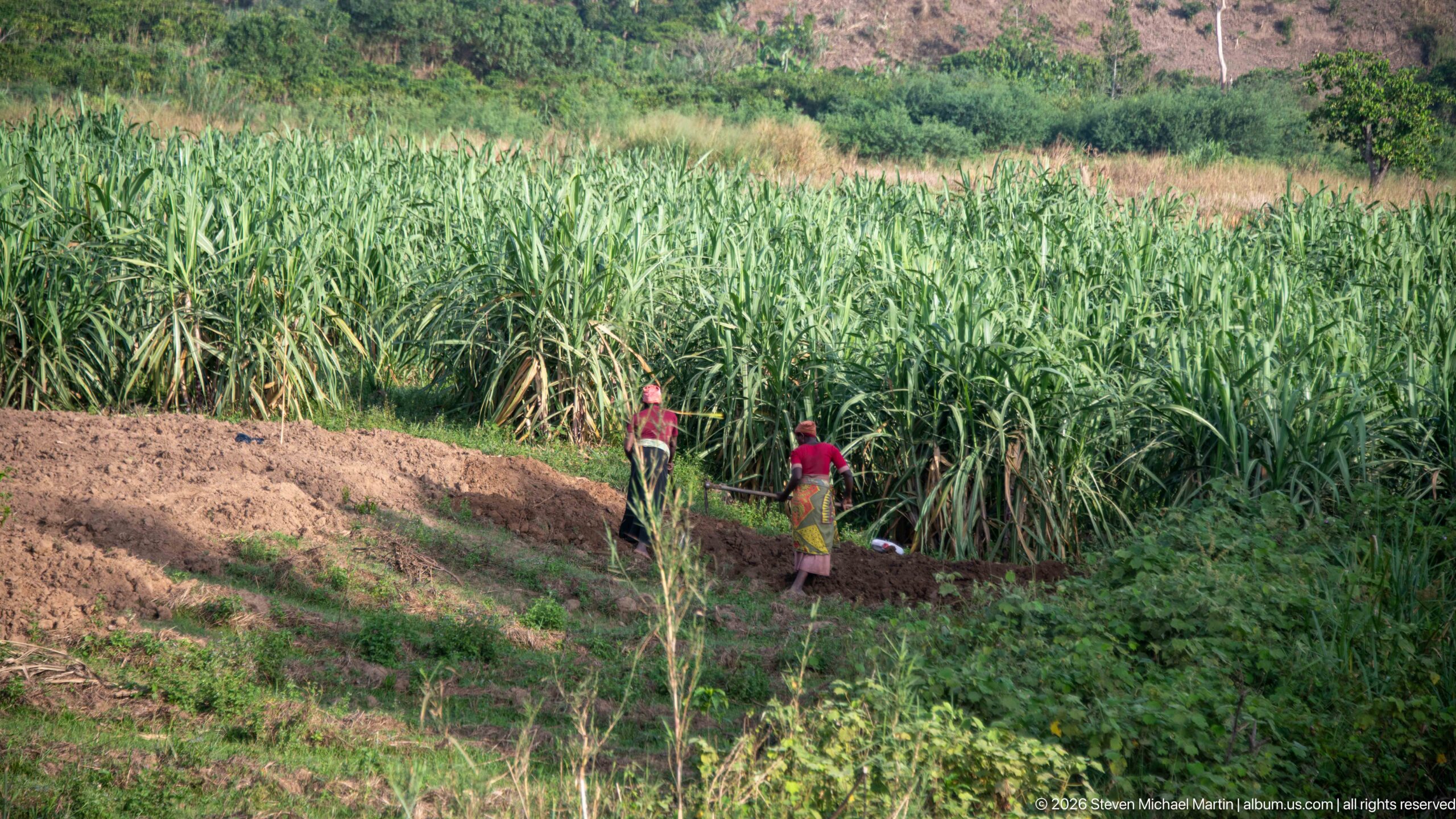
Two people stand beside a dense field of tall cane-like plants, with freshly worked earth and lower crops in the foreground. The scene documents small-scale agricultural labor in the Kihihi countryside while preserving uncertainty about the exact crop at proof-sheet resolution.
Caption
Two people stand beside a dense field of tall cane-like plants, with freshly worked earth and lower crops in the foreground. The scene documents small-scale agricultural labor in the Kihihi countryside while preserving uncertainty about the exact crop at proof-sheet resolution.
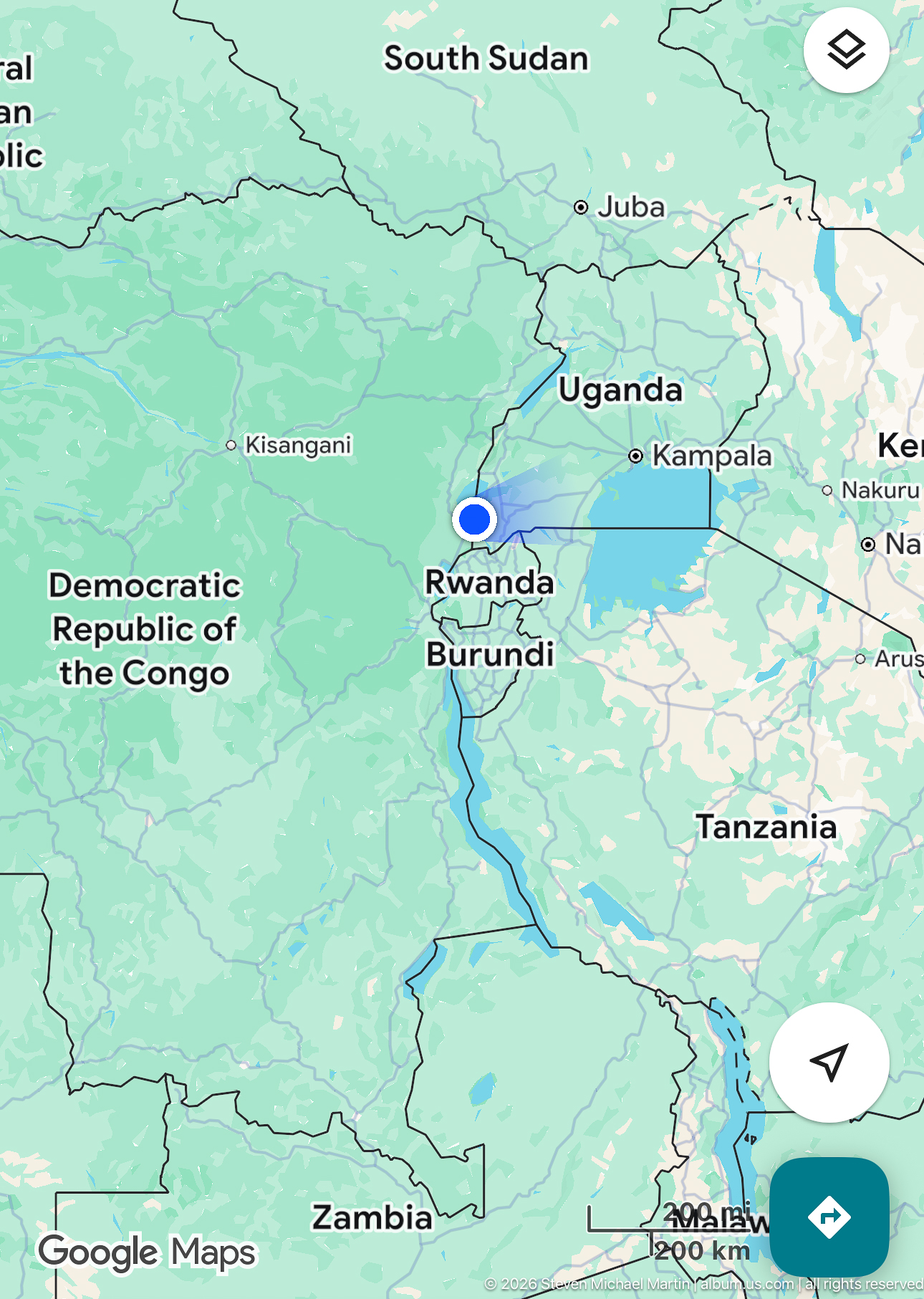
A closer digital map centers southwestern Uganda between Rwanda and the Democratic Republic of the Congo, with Kampala and regional borders visible for orientation. The blue location marker and route line place the Kihihi area within the densely connected borderlands of the African Great Lakes region.
Caption
A closer digital map centers southwestern Uganda between Rwanda and the Democratic Republic of the Congo, with Kampala and regional borders visible for orientation. The blue location marker and route line place the Kihihi area within the densely connected borderlands of the African Great Lakes region.
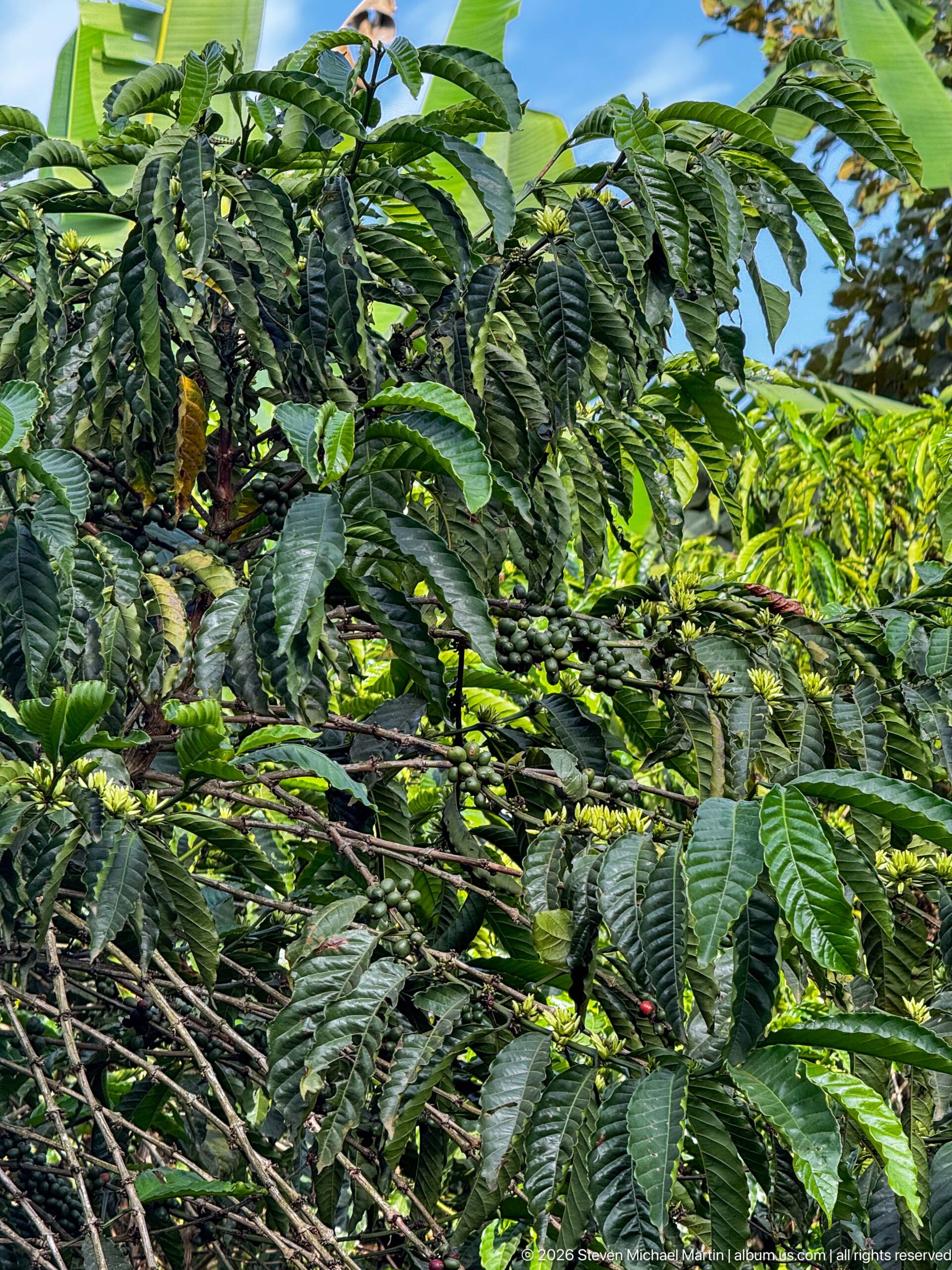
Glossy, opposite leaves fill the frame around clusters of small developing fruits along the branches of a coffee plant. The close view emphasizes the dense evergreen foliage and fruiting nodes characteristic of cultivated coffee in Uganda’s humid agricultural landscapes.
Caption
Glossy, opposite leaves fill the frame around clusters of small developing fruits along the branches of a coffee plant. The close view emphasizes the dense evergreen foliage and fruiting nodes characteristic of cultivated coffee in Uganda’s humid agricultural landscapes.
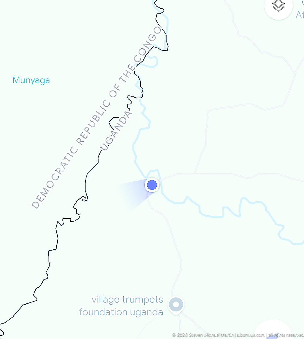
A digital map zooms into the Uganda–Democratic Republic of the Congo border area, with the international boundary, waterways, and a blue location marker visible. The close geographic view situates the Kihihi region near Uganda’s western frontier and the broader Albertine Rift borderlands.
Caption
A digital map zooms into the Uganda–Democratic Republic of the Congo border area, with the international boundary, waterways, and a blue location marker visible. The close geographic view situates the Kihihi region near Uganda’s western frontier and the broader Albertine Rift borderlands.
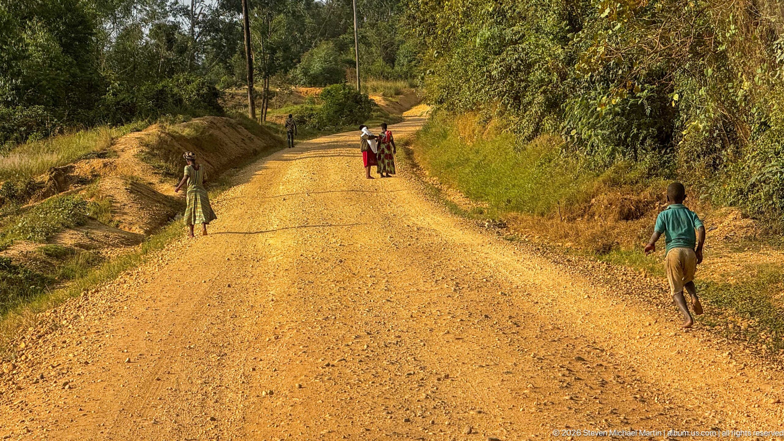
Several pedestrians move along a broad unpaved road bordered by cut banks, grasses, and trees. Their spacing across the road and the warm low-angle light emphasize everyday foot travel through the rolling rural countryside around Kihihi.
Caption
Several pedestrians move along a broad unpaved road bordered by cut banks, grasses, and trees. Their spacing across the road and the warm low-angle light emphasize everyday foot travel through the rolling rural countryside around Kihihi.
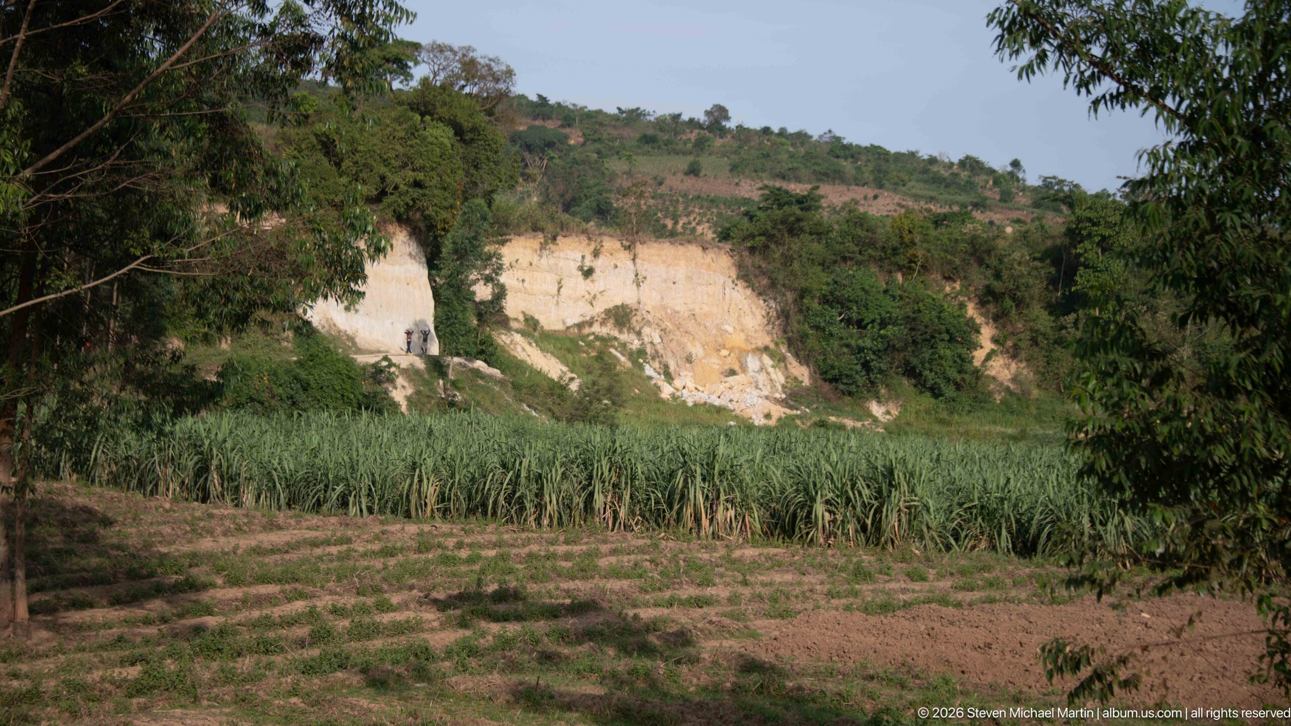
Cultivated plots and a dense strip of tall crops spread across a shallow valley below a conspicuous pale exposed face cut into the hillside. Trees frame the scene, contrasting irrigated or moisture-rich farmland with the eroded or quarried-looking slope beyond.
Caption
Cultivated plots and a dense strip of tall crops spread across a shallow valley below a conspicuous pale exposed face cut into the hillside. Trees frame the scene, contrasting irrigated or moisture-rich farmland with the eroded or quarried-looking slope beyond.
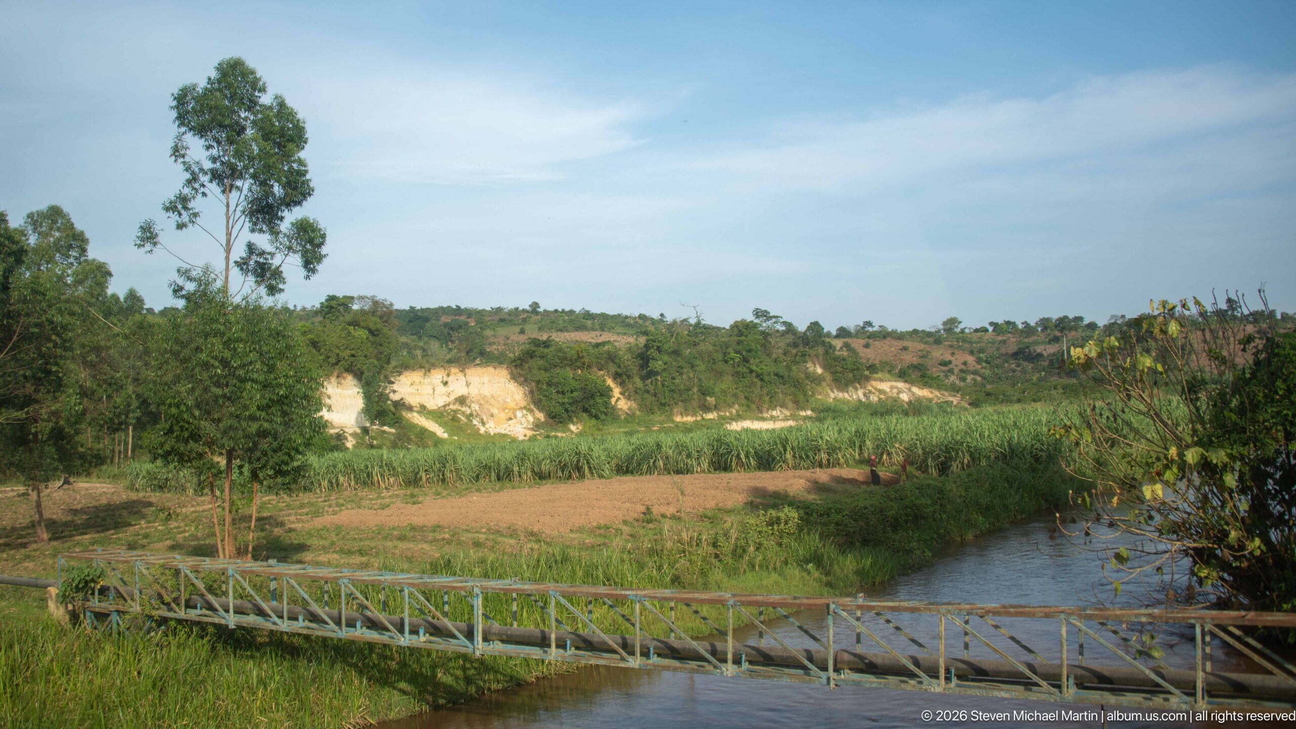
A narrow metal footbridge crosses a small river at the edge of cultivated fields, with tall crops, trees, and pale exposed slopes beyond. The watercourse and bridge form the foreground anchor while the wider view shows how farming occupies the low ground around Kihihi’s rolling terrain.
Caption
A narrow metal footbridge crosses a small river at the edge of cultivated fields, with tall crops, trees, and pale exposed slopes beyond. The watercourse and bridge form the foreground anchor while the wider view shows how farming occupies the low ground around Kihihi’s rolling terrain.
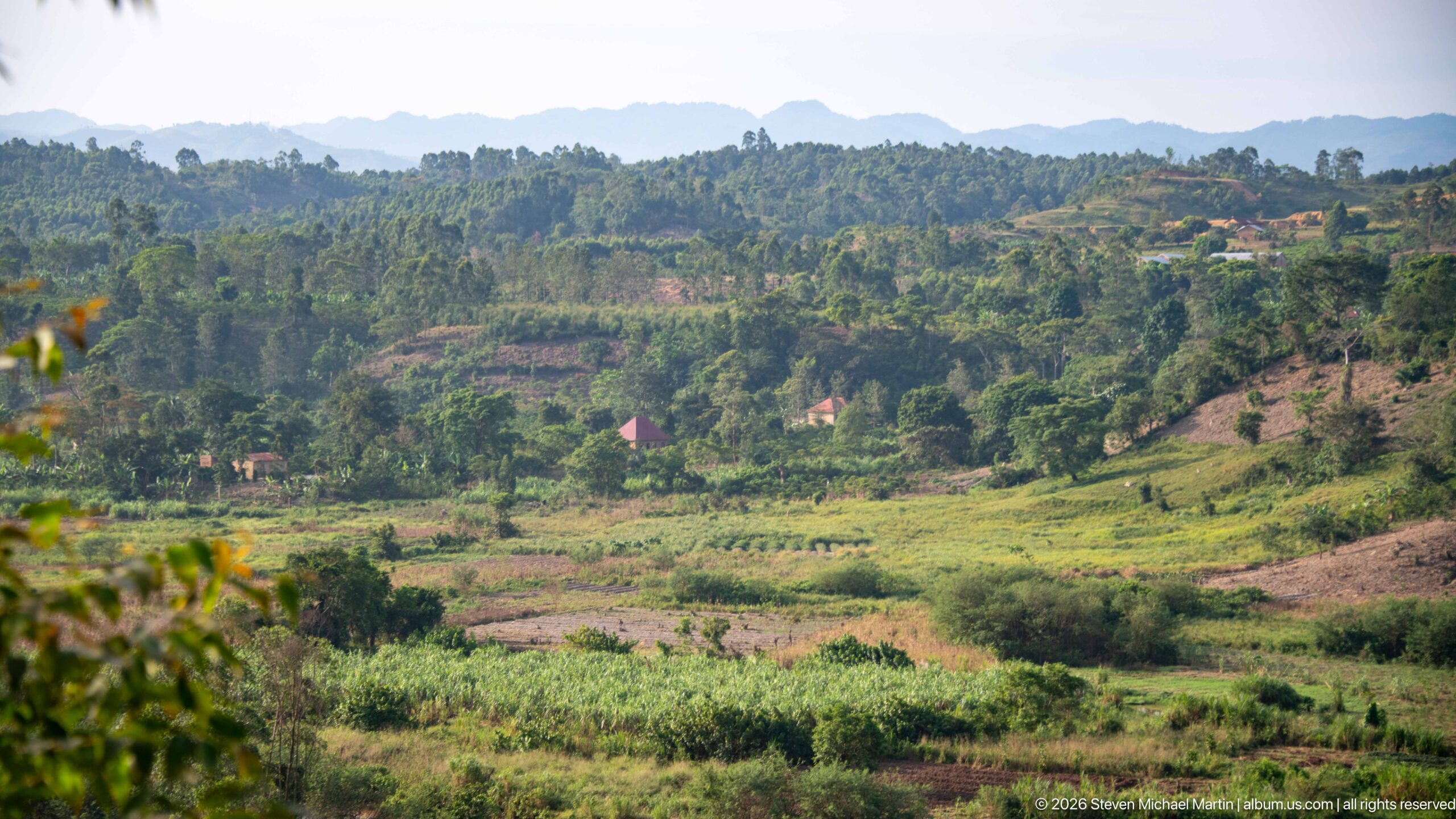
Cultivated fields and scattered homes spread across rolling green hills outside Kihihi, with a hazy mountain ridge closing the horizon. The patchwork of crops, fallow ground, trees, and homesteads shows the intensively worked rural landscape surrounding the town and provides a broad geographic context for the agricultural scenes that follow.
Caption
Cultivated fields and scattered homes spread across rolling green hills outside Kihihi, with a hazy mountain ridge closing the horizon. The patchwork of crops, fallow ground, trees, and homesteads shows the intensively worked rural landscape surrounding the town and provides a broad geographic context for the agricultural scenes that follow.
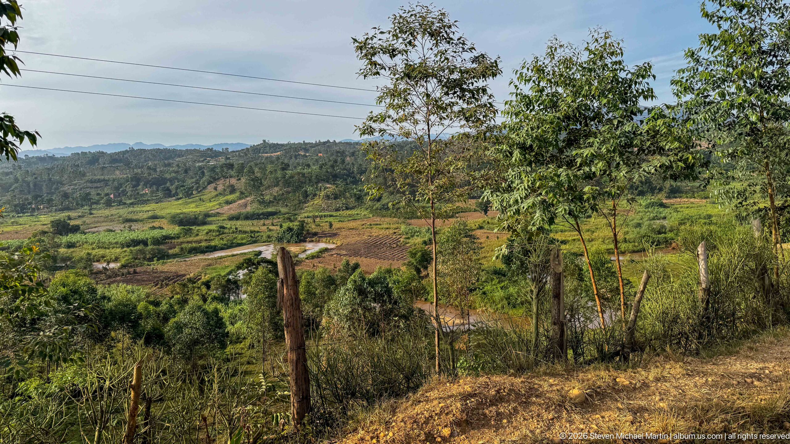
A roadside viewpoint looks over irregular cultivated plots, young trees, fence posts, and low green hills near Kihihi. Dry grass in the foreground contrasts with the greener fields beyond, while utility lines and scattered structures place the agricultural landscape within a settled rural corridor rather than an isolated natural setting.
Caption
A roadside viewpoint looks over irregular cultivated plots, young trees, fence posts, and low green hills near Kihihi. Dry grass in the foreground contrasts with the greener fields beyond, while utility lines and scattered structures place the agricultural landscape within a settled rural corridor rather than an isolated natural setting.
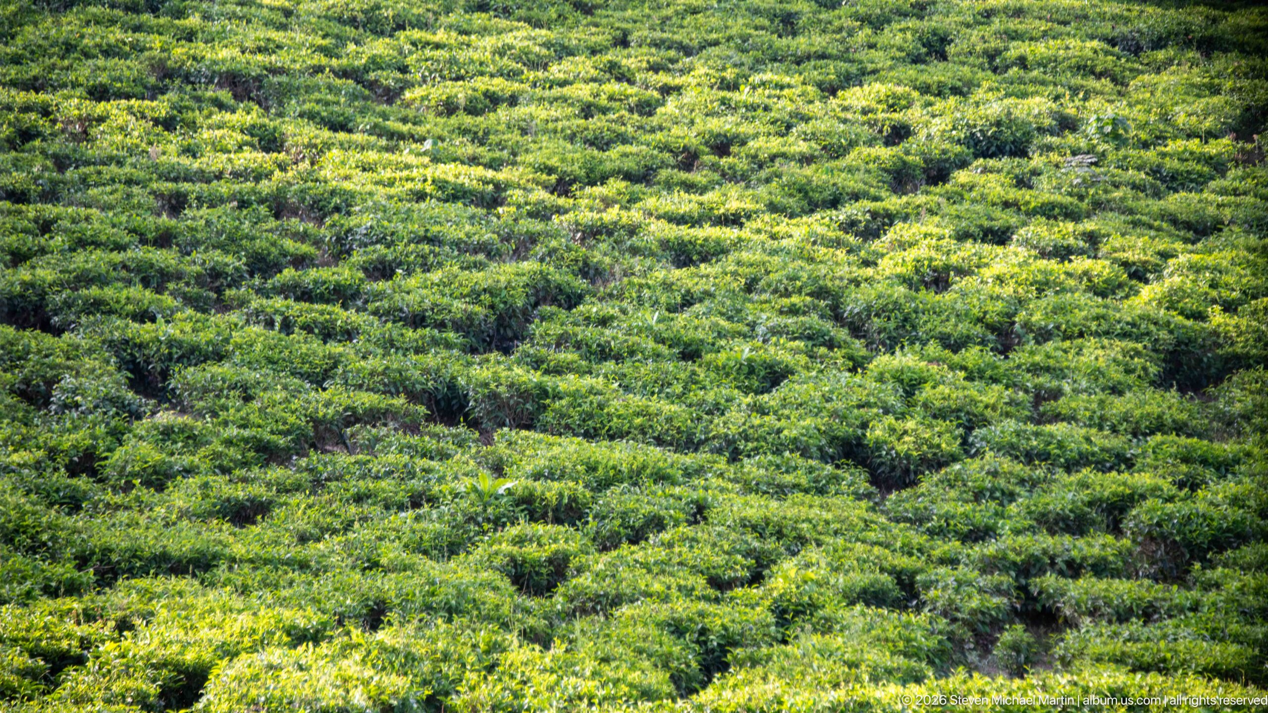
Dense rows of low tea bushes cover the undulating ground, creating a textured pattern of bright and dark green foliage. The clipped, waist-high shrubs and narrow picking lanes are characteristic of managed tea cultivation, offering a close landscape view of commercial agriculture in the Kihihi area.
Caption
Dense rows of low tea bushes cover the undulating ground, creating a textured pattern of bright and dark green foliage. The clipped, waist-high shrubs and narrow picking lanes are characteristic of managed tea cultivation, offering a close landscape view of commercial agriculture in the Kihihi area.
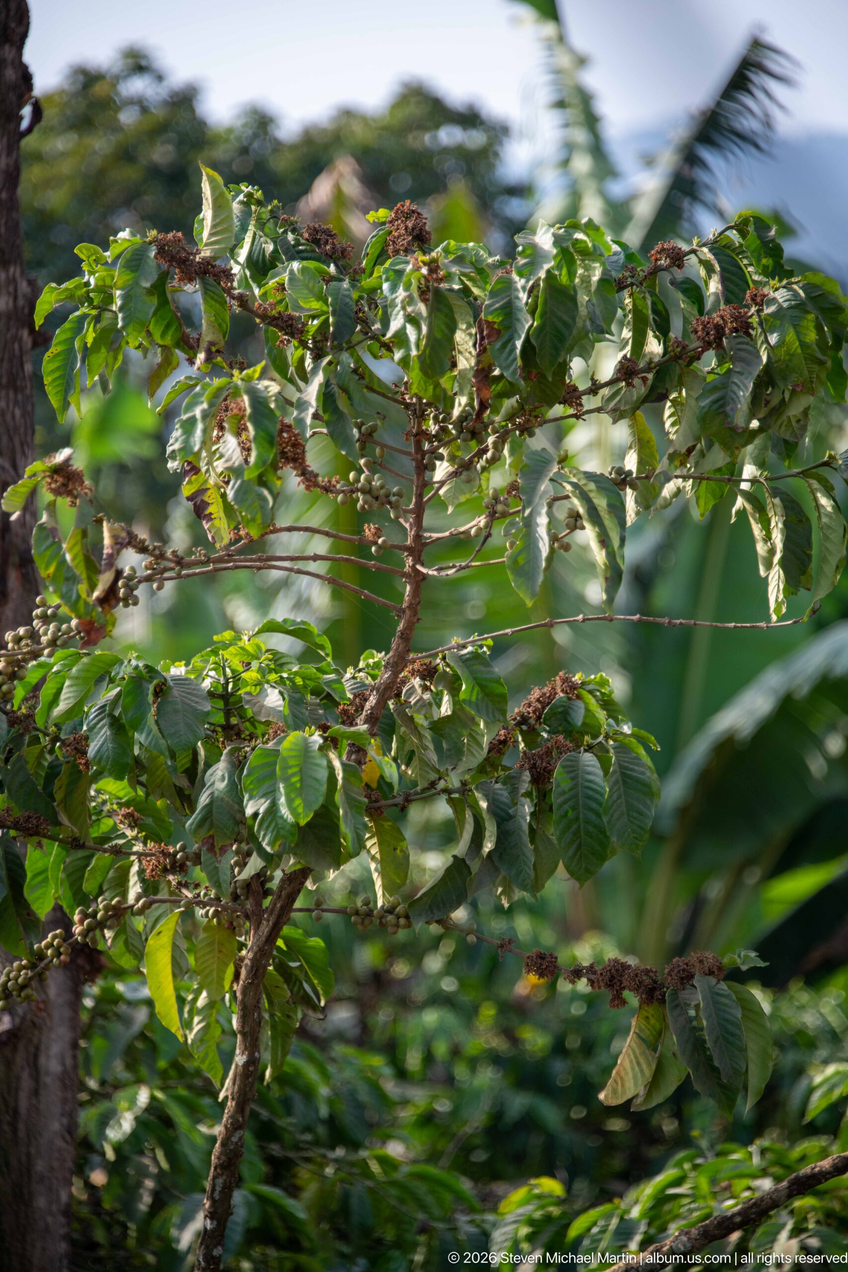
Clusters of green and reddish coffee cherries hang along a leafy branch, seen at close range against softly blurred tropical vegetation. The paired glossy leaves and berries borne tightly along the branch are characteristic of coffee, shifting the portfolio from broad agricultural landscape to the detail of a cultivated crop grown in southwestern Uganda.
Caption
Clusters of green and reddish coffee cherries hang along a leafy branch, seen at close range against softly blurred tropical vegetation. The paired glossy leaves and berries borne tightly along the branch are characteristic of coffee, shifting the portfolio from broad agricultural landscape to the detail of a cultivated crop grown in southwestern Uganda.
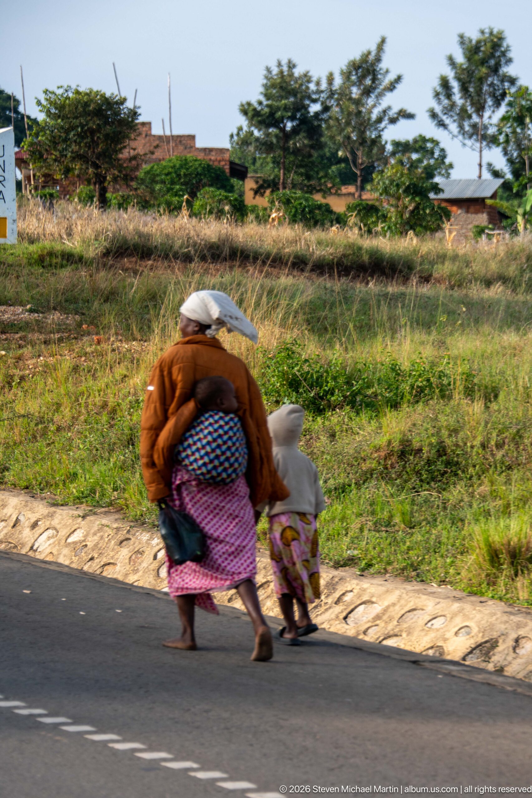
An adult carrying a large bundled load walks hand in hand with a small child along the edge of a paved road outside Kihihi. Their movement across the frame, backed by open grass, cultivated ground, and scattered buildings, creates a concise view of everyday pedestrian travel through the town’s rural-urban fringe.
Caption
An adult carrying a large bundled load walks hand in hand with a small child along the edge of a paved road outside Kihihi. Their movement across the frame, backed by open grass, cultivated ground, and scattered buildings, creates a concise view of everyday pedestrian travel through the town’s rural-urban fringe.
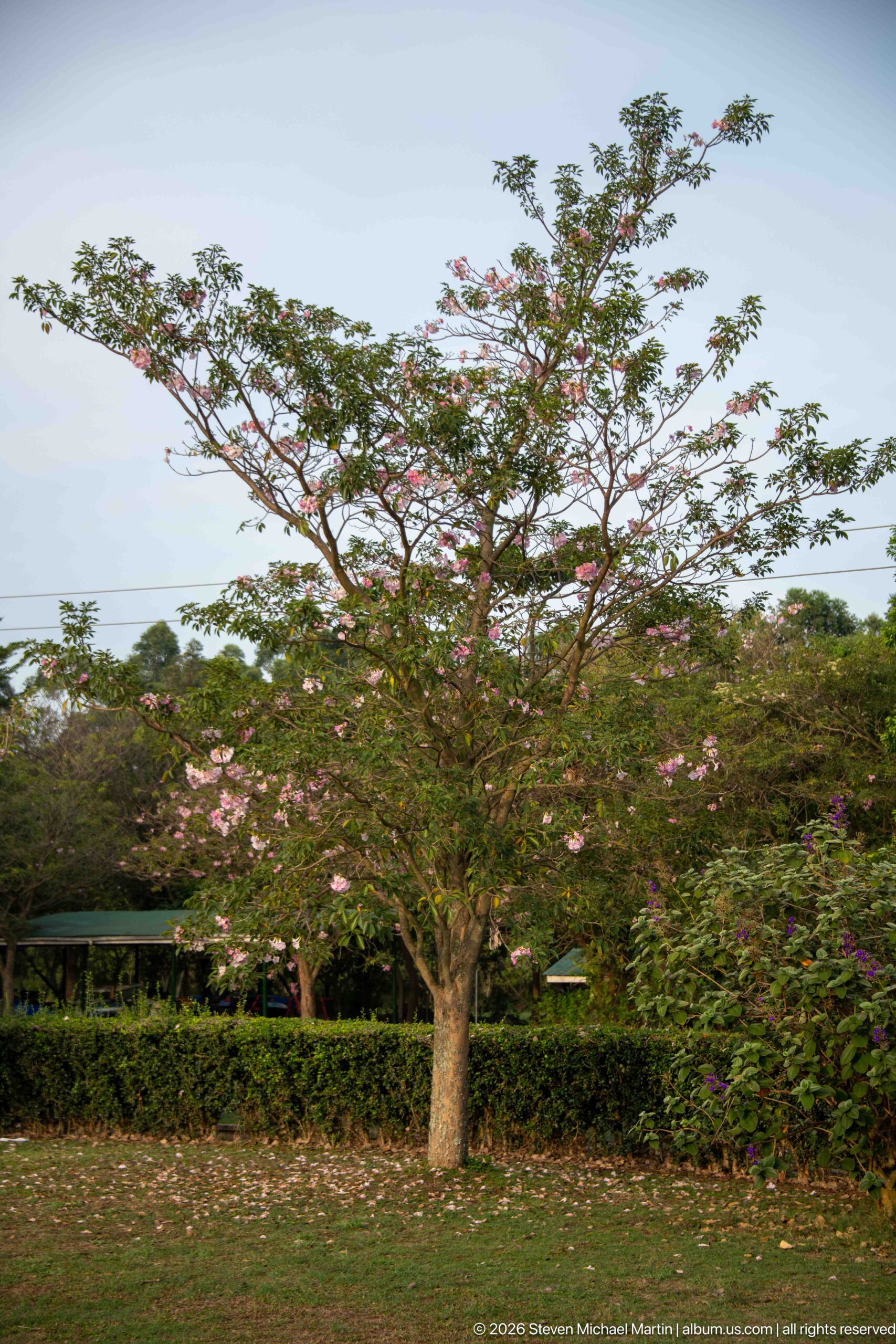
A broad, spreading tree carries scattered clusters of pale pink blossoms above a low hedge and garden planting. Its open branching structure fills most of the frame, with patches of sky visible through the canopy, creating a botanical portrait centered on form and seasonal flowering rather than a confidently assigned species.
Caption
A broad, spreading tree carries scattered clusters of pale pink blossoms above a low hedge and garden planting. Its open branching structure fills most of the frame, with patches of sky visible through the canopy, creating a botanical portrait centered on form and seasonal flowering rather than a confidently assigned species.
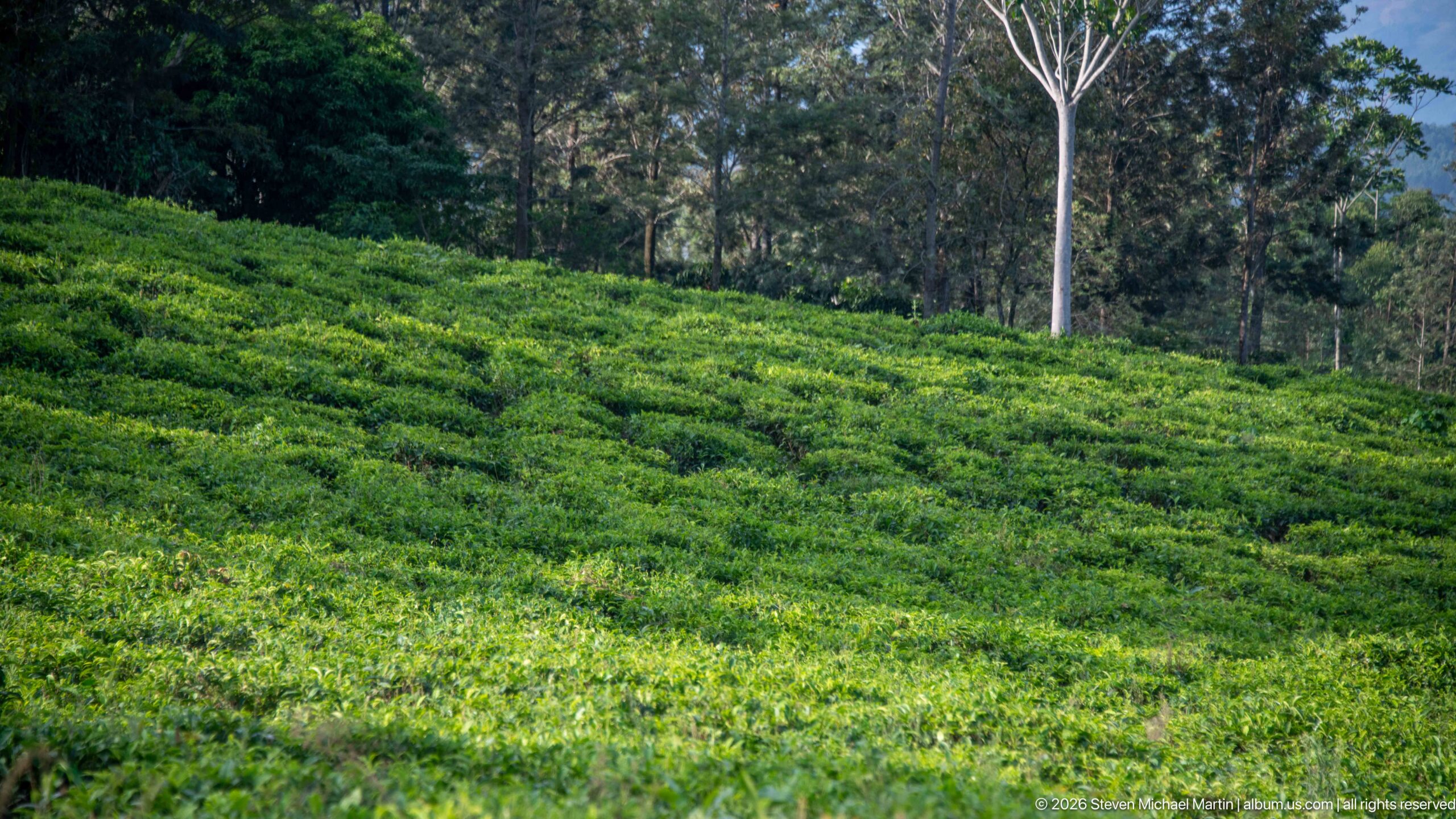
A broad tea field rises toward a line of mature trees, its tightly clipped bushes forming bands across the slope. The taller trunks and forest-edge vegetation give this view a stronger sense of scale than the preceding close study, showing how cultivated tea occupies the open hillside within a more wooded highland setting.
Caption
A broad tea field rises toward a line of mature trees, its tightly clipped bushes forming bands across the slope. The taller trunks and forest-edge vegetation give this view a stronger sense of scale than the preceding close study, showing how cultivated tea occupies the open hillside within a more wooded highland setting.
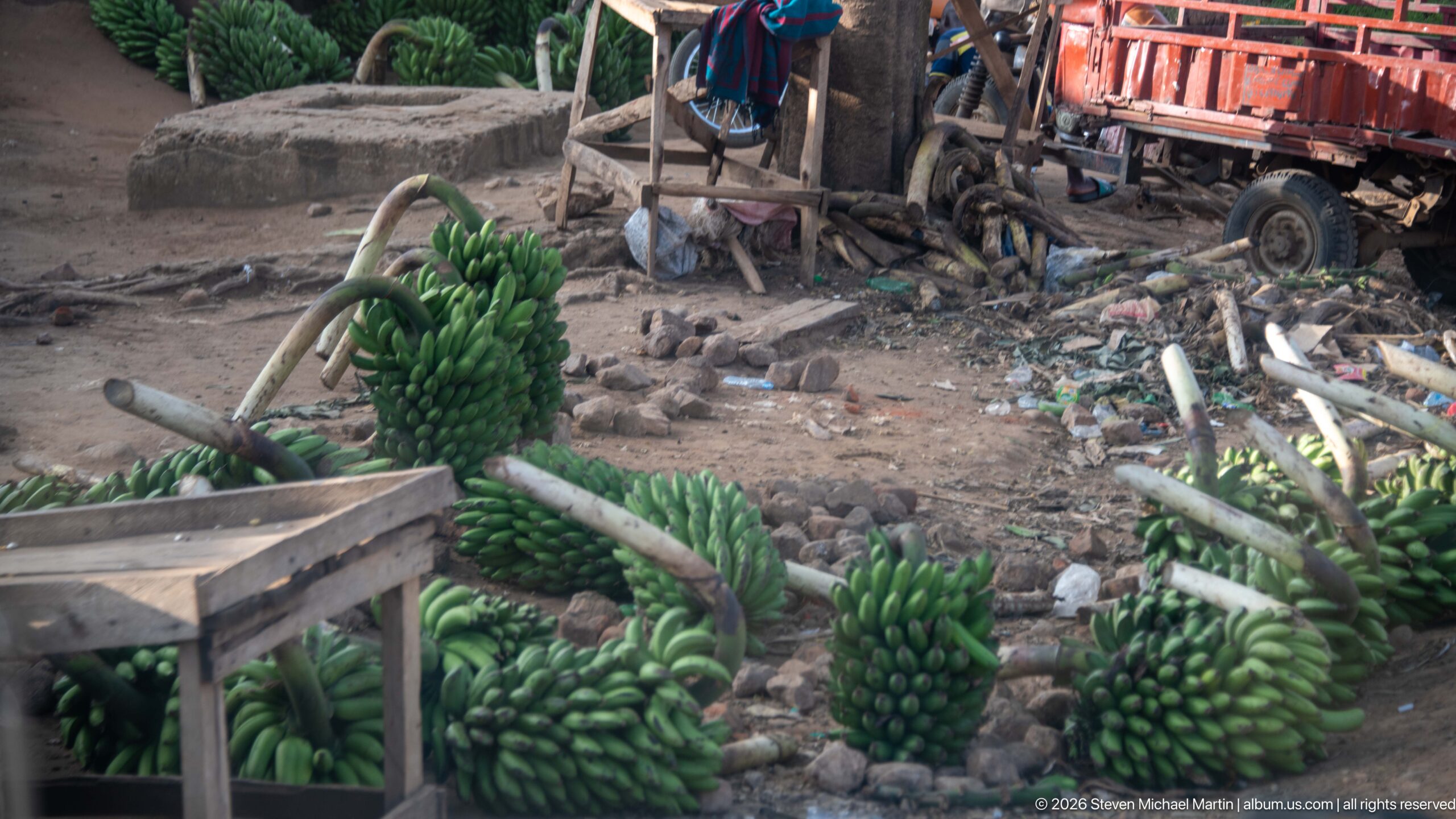
Large bunches of freshly cut green bananas lie and hang around a rough roadside work area, some still attached to thick stalks. Wooden benches, scattered timber, a trailer, and bare earth frame the harvest, presenting the crop at the point of handling or sale rather than growing in the field.
Caption
Large bunches of freshly cut green bananas lie and hang around a rough roadside work area, some still attached to thick stalks. Wooden benches, scattered timber, a trailer, and bare earth frame the harvest, presenting the crop at the point of handling or sale rather than growing in the field.
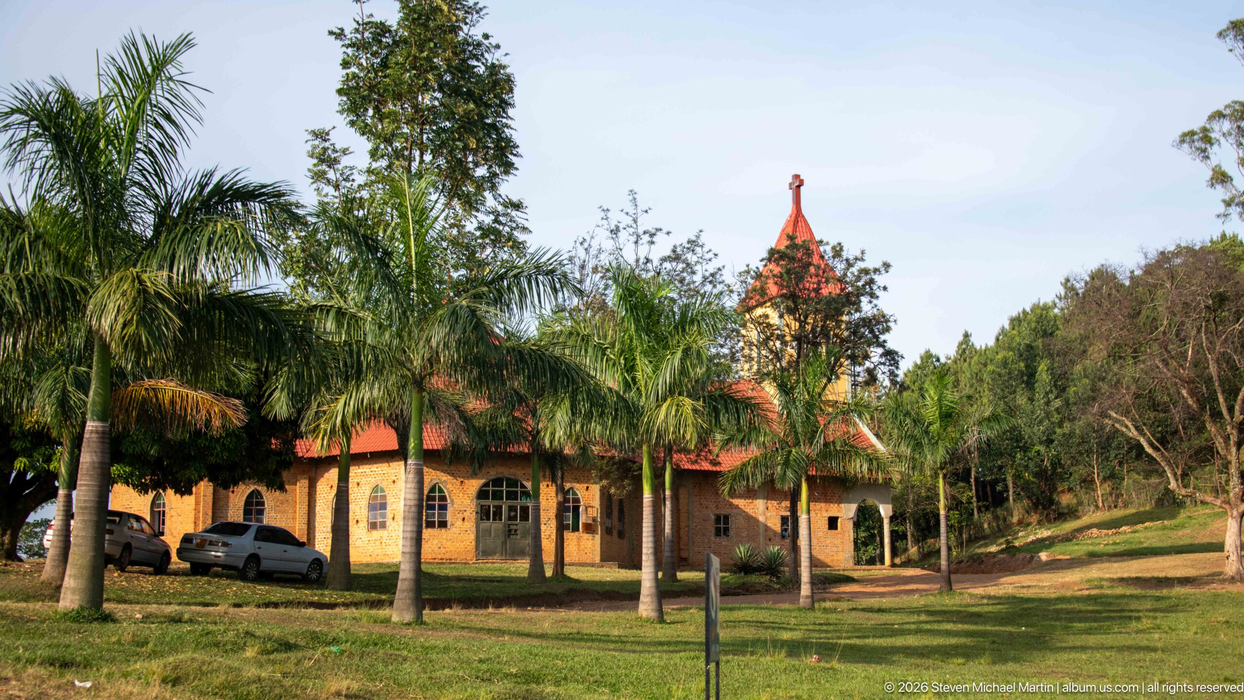
A small church stands among palms and mature trees, its warm brick walls, red metal roof, arched windows, and narrow pointed tower forming the principal architectural features. Parked cars and a broad lawn place the building within a landscaped compound in Kihihi; the church is not named because no identifying sign is legible.
Caption
A small church stands among palms and mature trees, its warm brick walls, red metal roof, arched windows, and narrow pointed tower forming the principal architectural features. Parked cars and a broad lawn place the building within a landscaped compound in Kihihi; the church is not named because no identifying sign is legible.
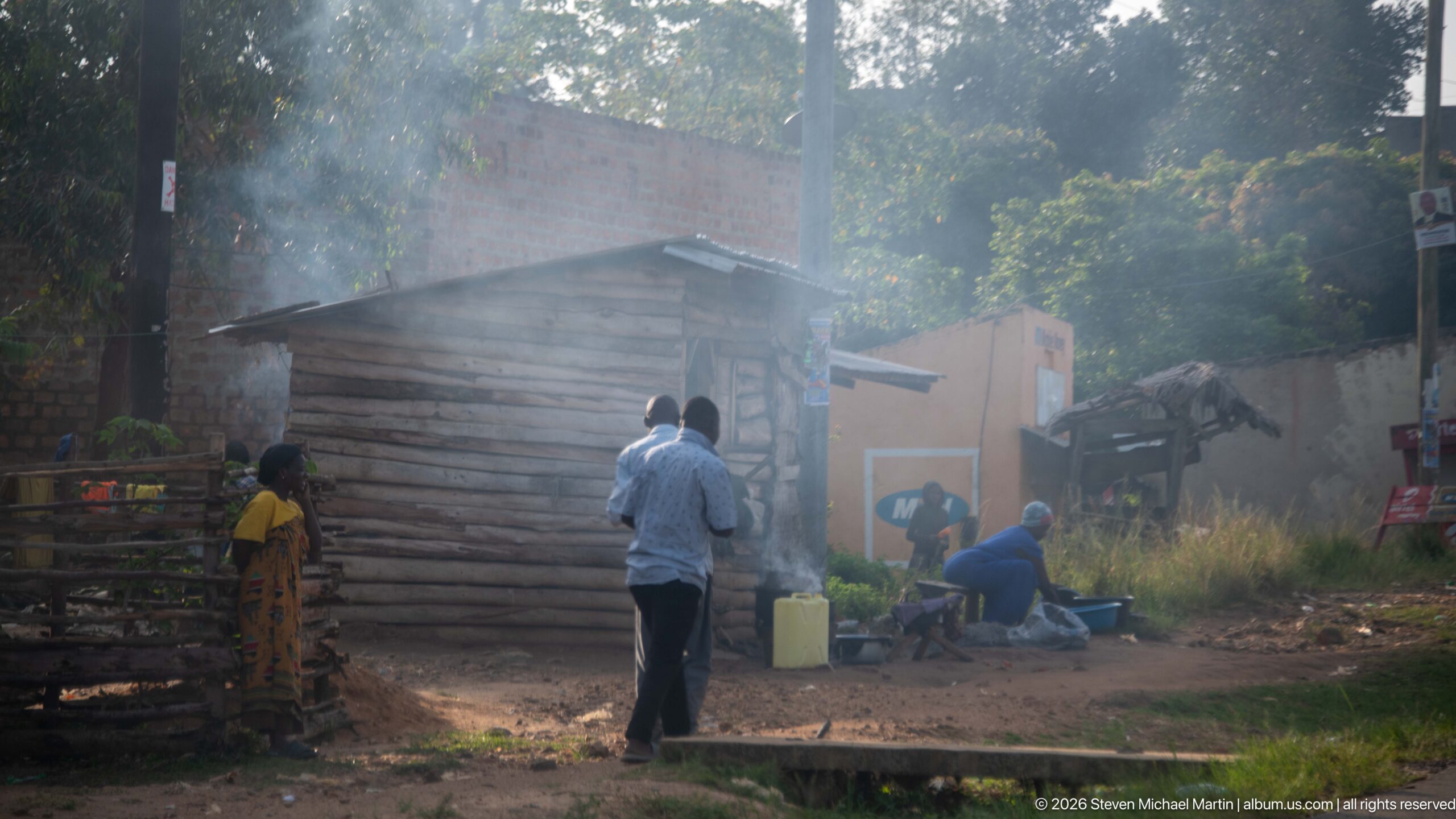
Residents gather beside a rough timber structure along an unpaved neighborhood edge in Kihihi, with smoke or cooking haze drifting through the trees. Plastic containers, simple outbuildings, and a narrow drainage channel contribute to the close street-level view of everyday activity away from the town’s commercial frontage.
Caption
Residents gather beside a rough timber structure along an unpaved neighborhood edge in Kihihi, with smoke or cooking haze drifting through the trees. Plastic containers, simple outbuildings, and a narrow drainage channel contribute to the close street-level view of everyday activity away from the town’s commercial frontage.

A lone pedestrian in white clothing walks away from the camera with a large turquoise-wrapped load balanced on the head. The grassy verge, shallow drainage, utility pole, and brick buildings place the figure within a residential edge of Kihihi, emphasizing the practical movement of goods on foot.
Caption
A lone pedestrian in white clothing walks away from the camera with a large turquoise-wrapped load balanced on the head. The grassy verge, shallow drainage, utility pole, and brick buildings place the figure within a residential edge of Kihihi, emphasizing the practical movement of goods on foot.
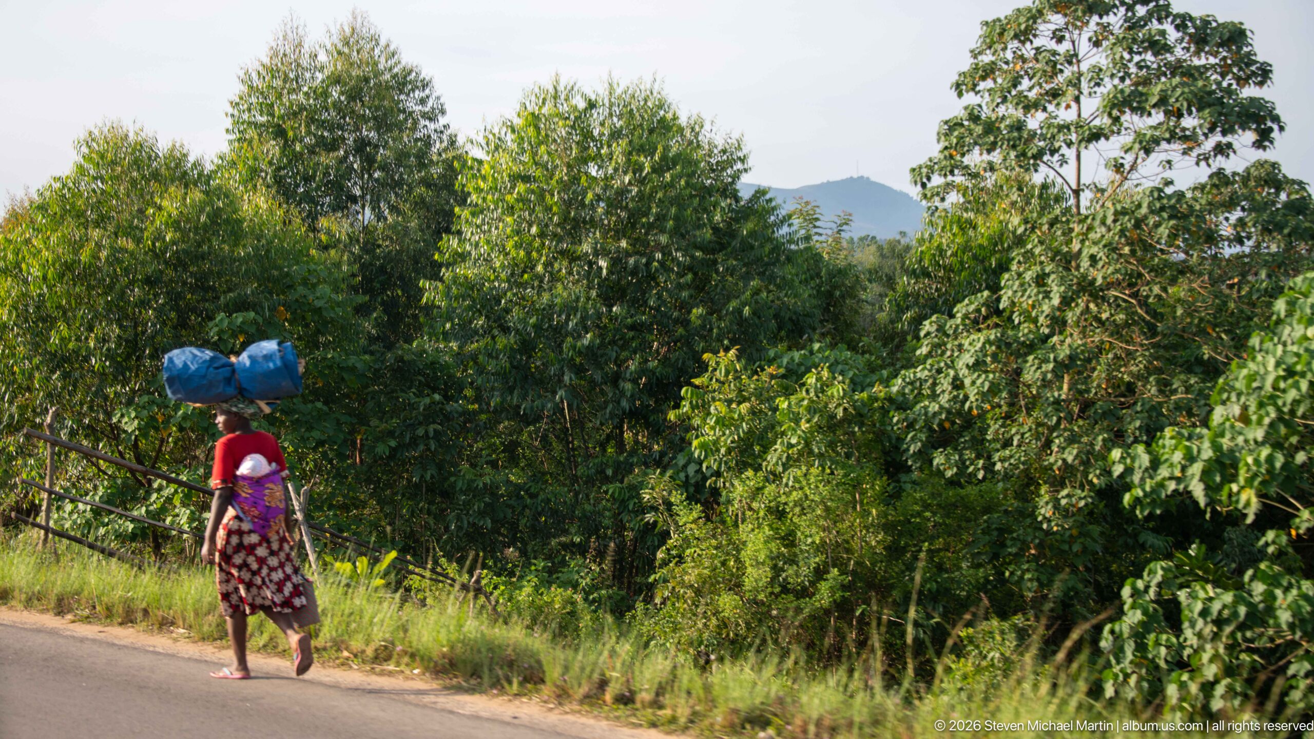
A woman walks along the paved roadside carrying two large blue-wrapped bundles balanced on her head. Dense green vegetation fills the slope behind her, with a distant hill appearing through the trees, giving this everyday transport scene a distinctly leafy setting on the outskirts of Kihihi.
Caption
A woman walks along the paved roadside carrying two large blue-wrapped bundles balanced on her head. Dense green vegetation fills the slope behind her, with a distant hill appearing through the trees, giving this everyday transport scene a distinctly leafy setting on the outskirts of Kihihi.
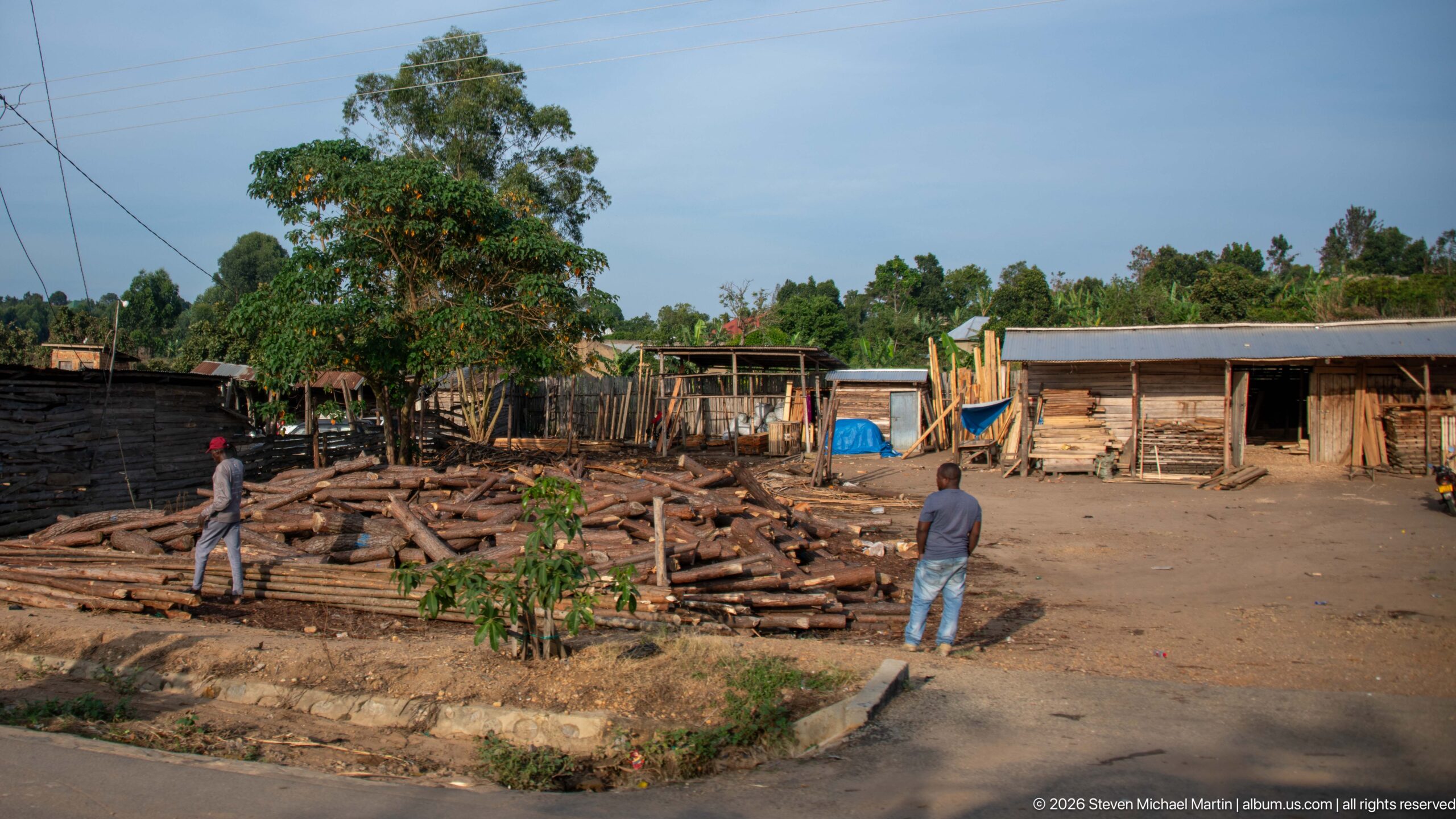
Cut logs and rough timber are spread across an open yard bordered by plank-built sheds, while two people stand among the materials. The quantity of sawn and unsawn wood, together with the work-yard layout, identifies the scene as a timber-handling or woodworking area within Kihihi’s roadside commercial district.
Caption
Cut logs and rough timber are spread across an open yard bordered by plank-built sheds, while two people stand among the materials. The quantity of sawn and unsawn wood, together with the work-yard layout, identifies the scene as a timber-handling or woodworking area within Kihihi’s roadside commercial district.
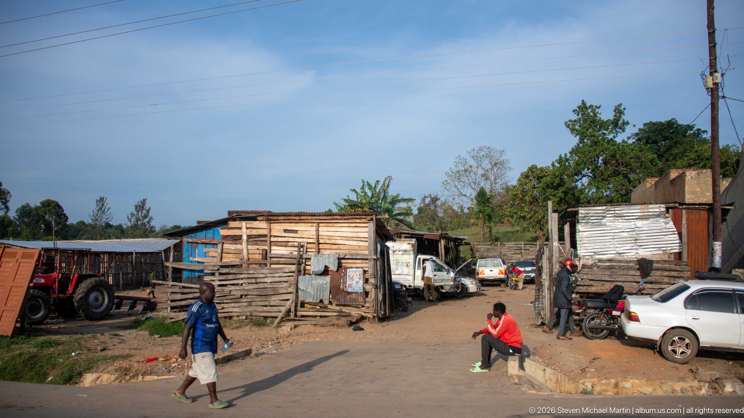
An unpaved lane passes between rough timber and corrugated-metal workshops, parked cars, motorcycles, and a tractor. Pedestrians move through the uneven street, giving a wider view of the mixed workshop, transport, and trading activity behind Kihihi’s main commercial frontage.
Caption
An unpaved lane passes between rough timber and corrugated-metal workshops, parked cars, motorcycles, and a tractor. Pedestrians move through the uneven street, giving a wider view of the mixed workshop, transport, and trading activity behind Kihihi’s main commercial frontage.
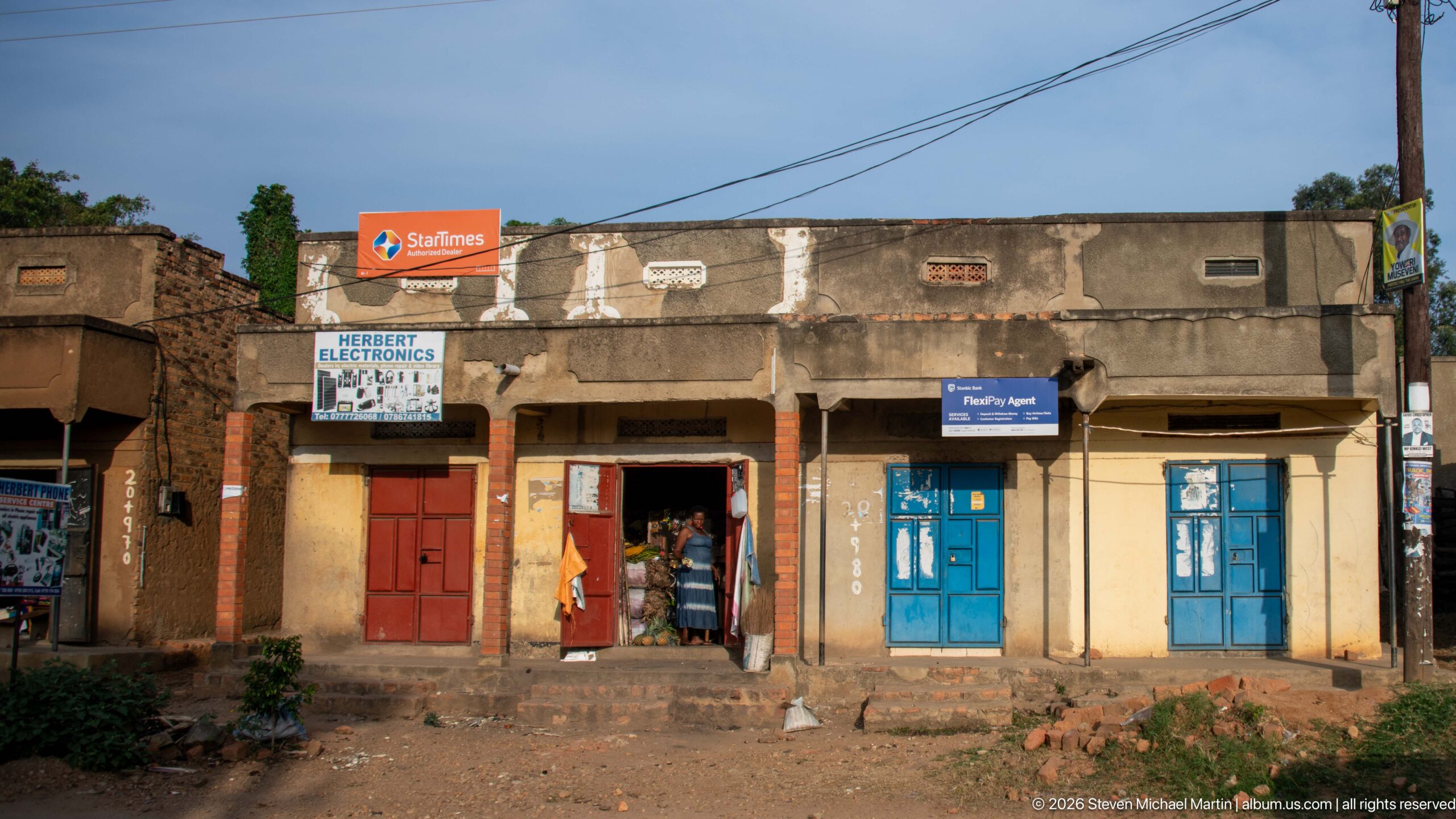
A row of weathered concrete storefronts faces the main road in Kihihi, including a clearly signed Herbert Electronics shop beneath mobile-network advertising. Red and blue metal doors, open shopfronts, overhead wires, and people at the entrances create a compact record of the town’s everyday retail architecture.
Caption
A row of weathered concrete storefronts faces the main road in Kihihi, including a clearly signed Herbert Electronics shop beneath mobile-network advertising. Red and blue metal doors, open shopfronts, overhead wires, and people at the entrances create a compact record of the town’s everyday retail architecture.
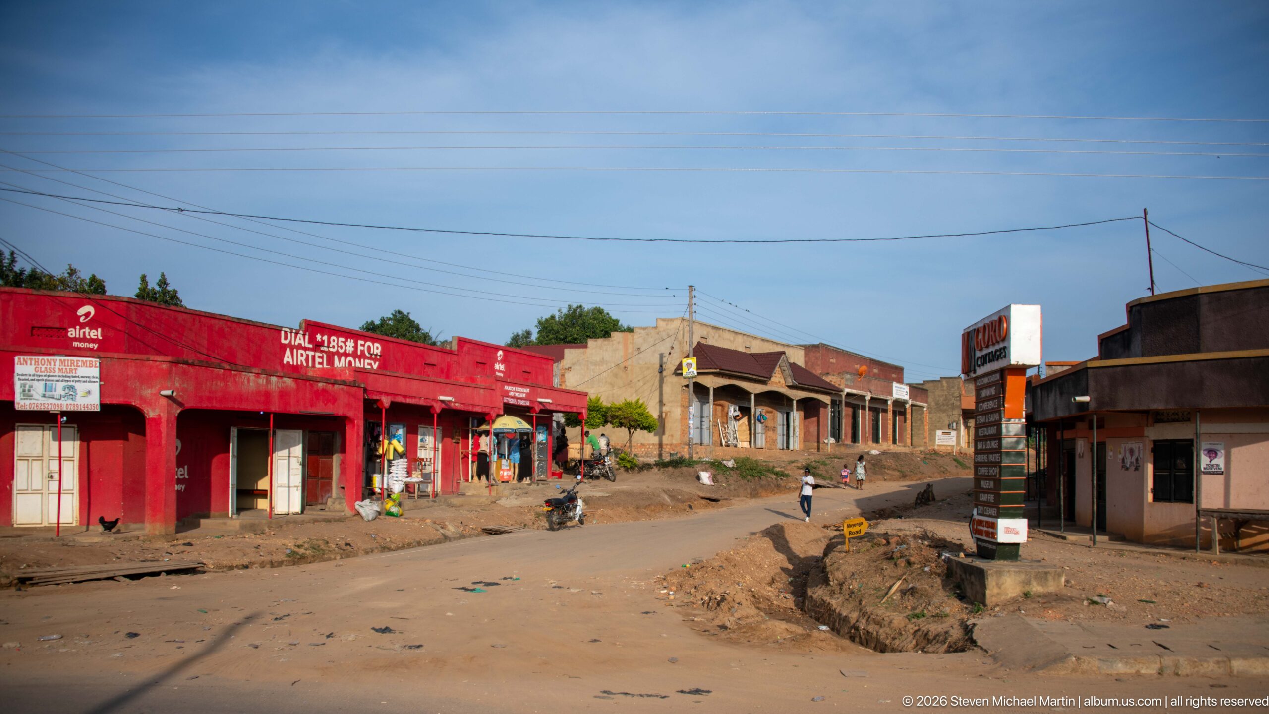
Low shops line a broad unpaved side road, with a bright red Airtel-branded block standing out among more subdued masonry storefronts. Pedestrians, a motorcycle, open drainage, utility lines, and scattered goods convey the scale and infrastructure of Kihihi’s commercial center in a wide street-level view.
Caption
Low shops line a broad unpaved side road, with a bright red Airtel-branded block standing out among more subdued masonry storefronts. Pedestrians, a motorcycle, open drainage, utility lines, and scattered goods convey the scale and infrastructure of Kihihi’s commercial center in a wide street-level view.
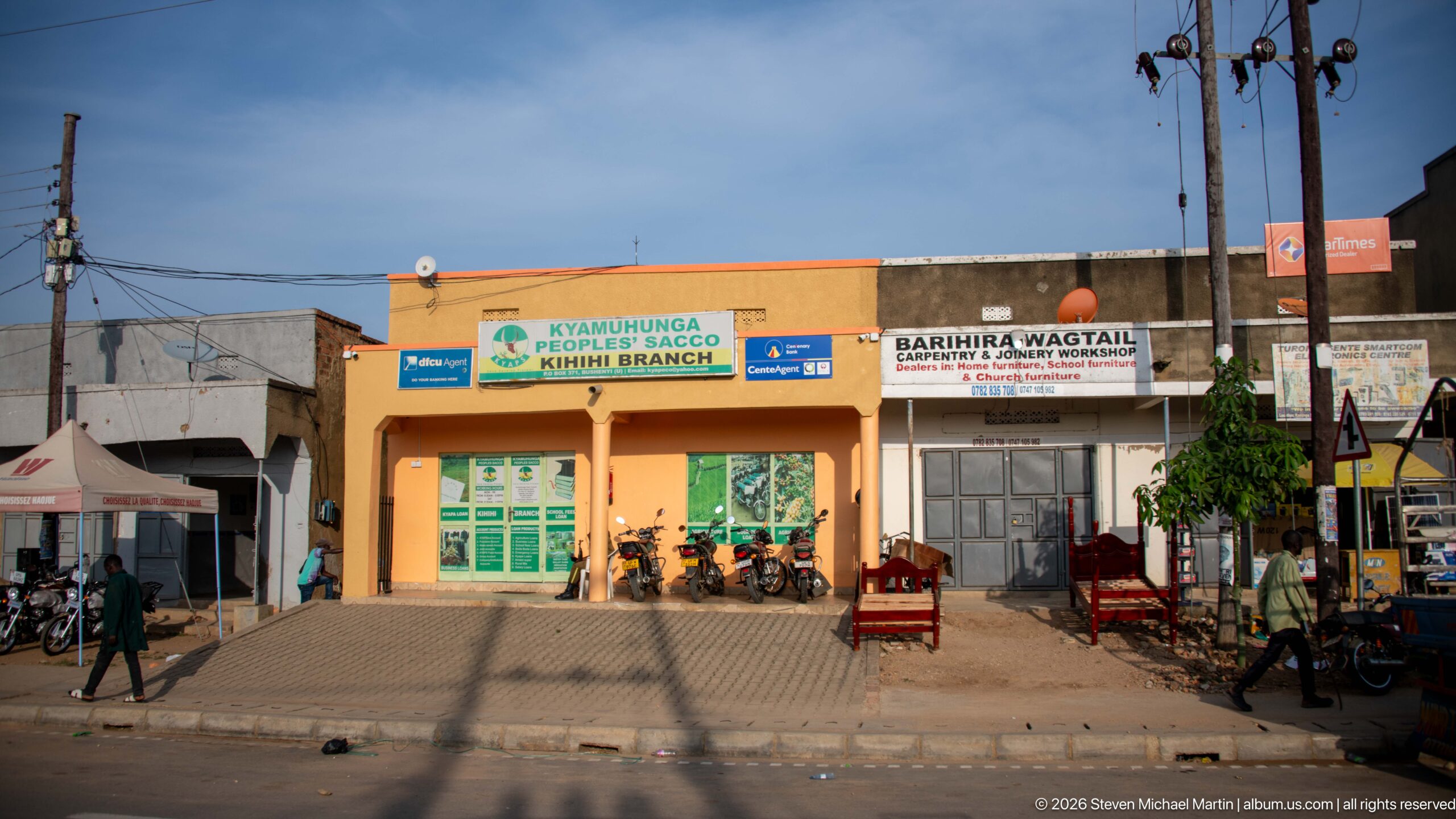
The orange façade of Kyamuhunga Peoples SACCO’s Kihihi Branch anchors a busy row of roadside businesses. Neighboring signage, motorcycles, chairs, utility poles, and pedestrians crowd the frontage, while long shadows stretch across the paving, creating a detailed record of financial and retail services in the town center.
Caption
The orange façade of Kyamuhunga Peoples SACCO’s Kihihi Branch anchors a busy row of roadside businesses. Neighboring signage, motorcycles, chairs, utility poles, and pedestrians crowd the frontage, while long shadows stretch across the paving, creating a detailed record of financial and retail services in the town center.
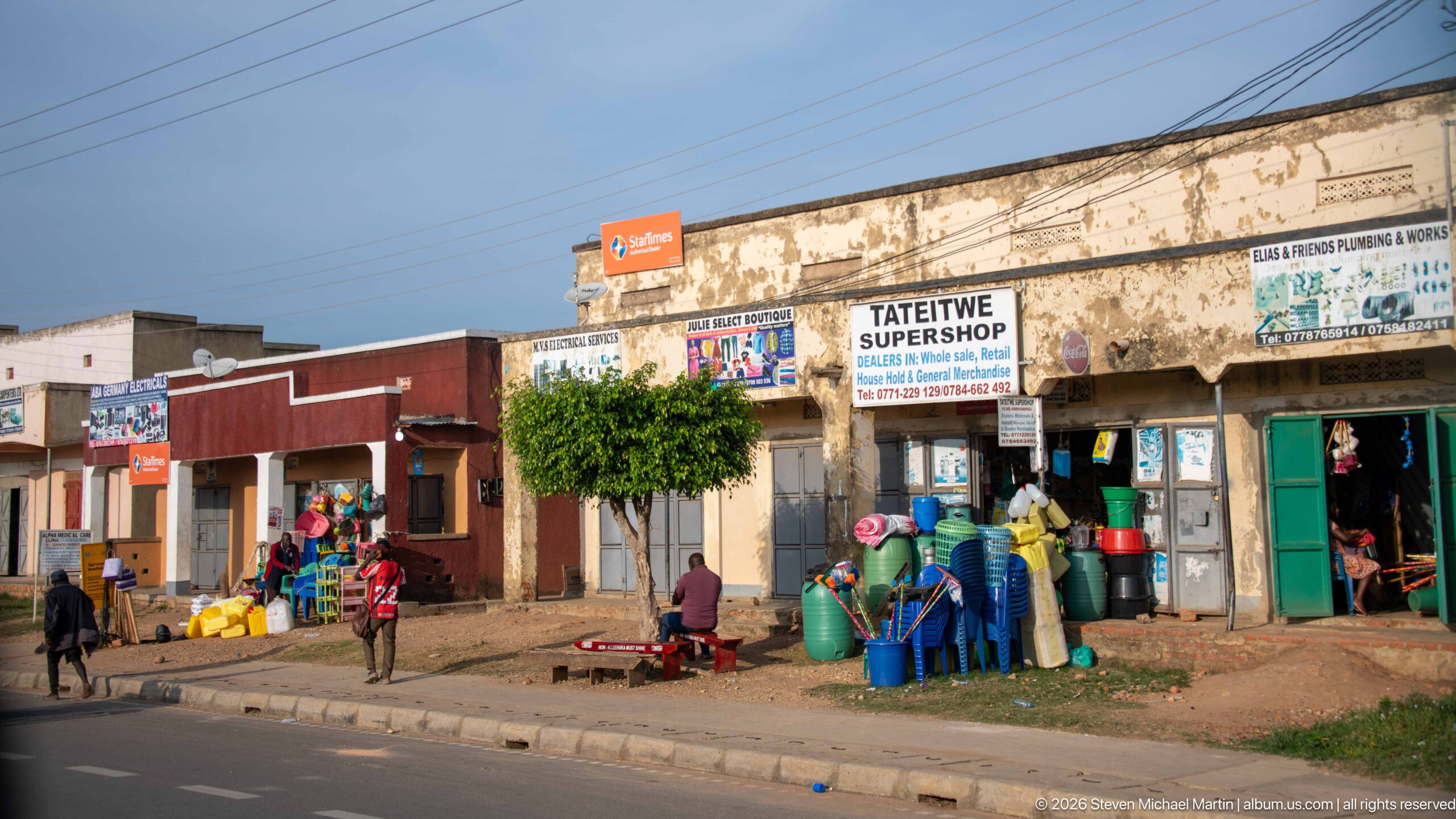
Tateitwe Supershop occupies part of a weathered roadside commercial block, with brightly colored plastic basins, buckets, chairs, and other household goods stacked outside. People sit and stand along the frontage beneath painted signs and utility wires, illustrating the open-display retail pattern of central Kihihi.
Caption
Tateitwe Supershop occupies part of a weathered roadside commercial block, with brightly colored plastic basins, buckets, chairs, and other household goods stacked outside. People sit and stand along the frontage beneath painted signs and utility wires, illustrating the open-display retail pattern of central Kihihi.
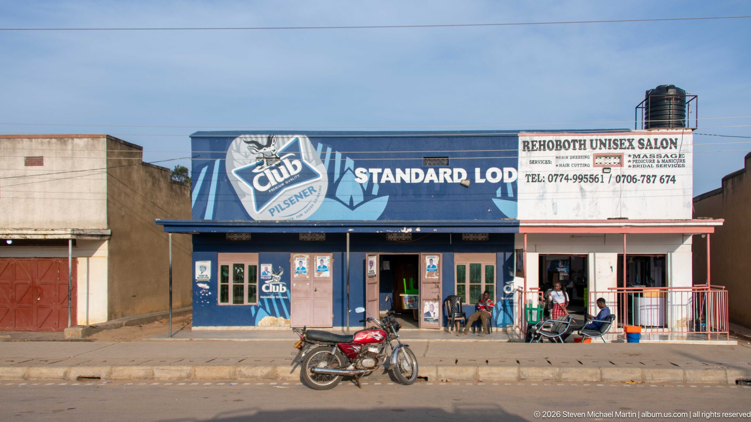
Standard Lodge and Rehoboth Unisex Salon share a low roadside commercial building marked by large painted signs. A motorcycle stands at the curb while several people occupy the shaded frontage, combining lodging, personal services, and street activity in a straightforward view of Kihihi’s main-road businesses.
Caption
Standard Lodge and Rehoboth Unisex Salon share a low roadside commercial building marked by large painted signs. A motorcycle stands at the curb while several people occupy the shaded frontage, combining lodging, personal services, and street activity in a straightforward view of Kihihi’s main-road businesses.
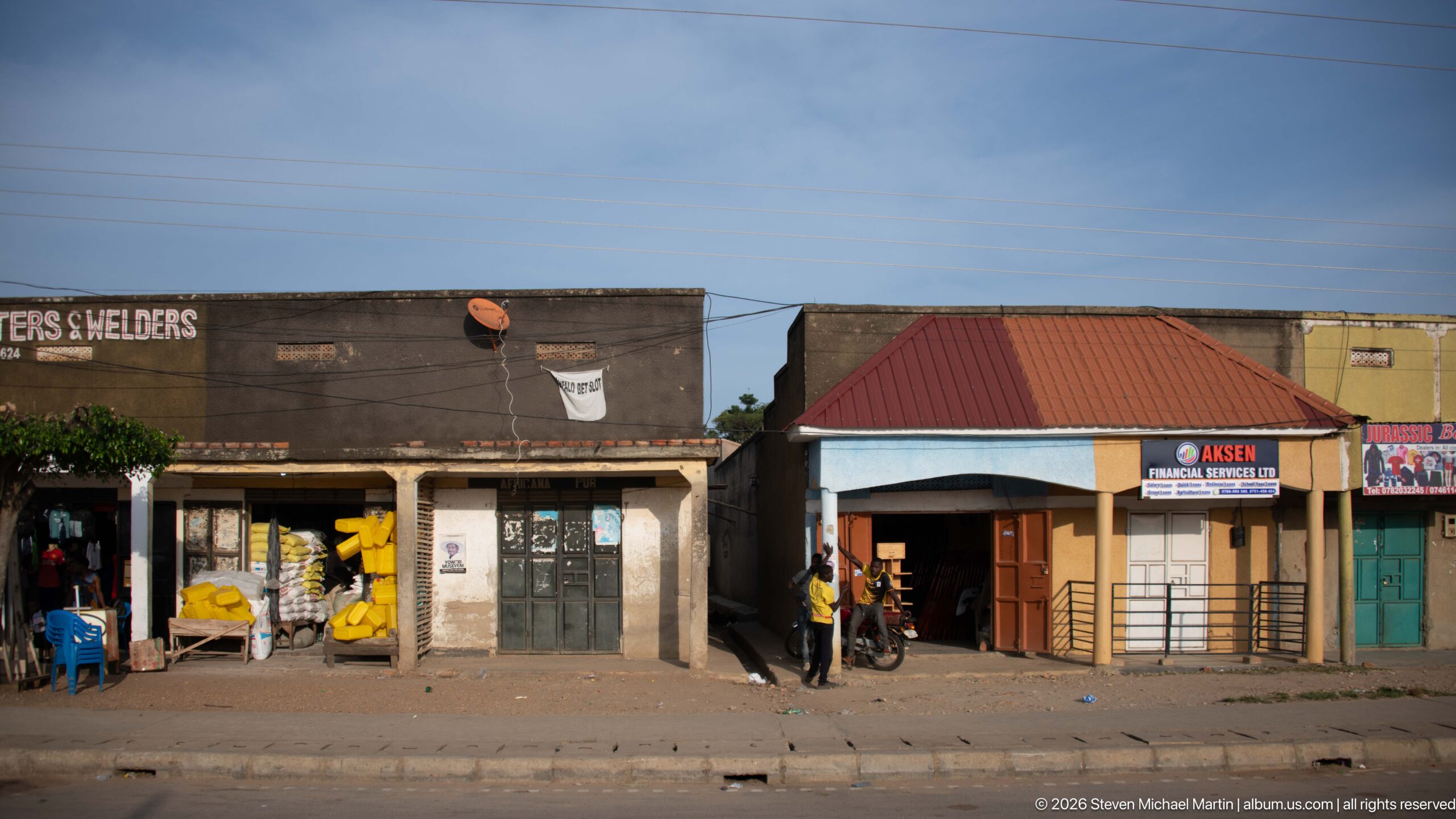
Open-front shops occupy a mixed row of concrete and brick buildings, with sacks and other goods stacked inside the darker storefront at left and financial-service signage on the red-roofed building beside it. The composition emphasizes the varied small businesses operating shoulder to shoulder along Kihihi’s paved commercial road.
Caption
Open-front shops occupy a mixed row of concrete and brick buildings, with sacks and other goods stacked inside the darker storefront at left and financial-service signage on the red-roofed building beside it. The composition emphasizes the varied small businesses operating shoulder to shoulder along Kihihi’s paved commercial road.

Kihihi Quality Plastics Solutions displays plastic chairs, basins, containers, luggage, and clothing across an open storefront beneath a large illustrated sign. A yellow umbrella shades part of the merchandise, making this one of the portfolio’s clearest views of the colorful goods presented directly to passing customers along the commercial street.
Caption
Kihihi Quality Plastics Solutions displays plastic chairs, basins, containers, luggage, and clothing across an open storefront beneath a large illustrated sign. A yellow umbrella shades part of the merchandise, making this one of the portfolio’s clearest views of the colorful goods presented directly to passing customers along the commercial street.
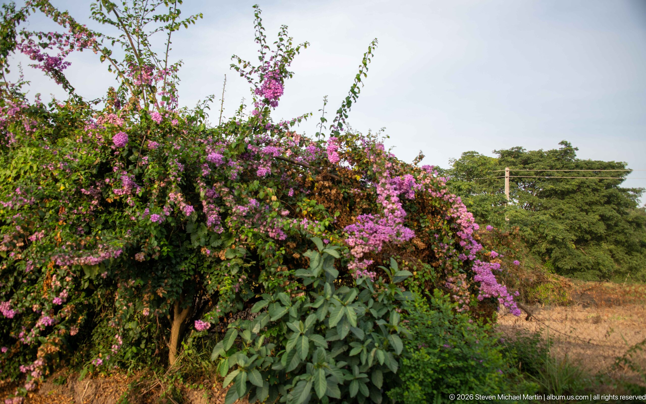
A large bougainvillea spills outward in dense sprays of magenta bracts, rising above mixed green foliage at the edge of a dry roadside garden. The close botanical view interrupts the town sequence with a vivid example of ornamental planting in Kihihi’s warm, cultivated landscape.
Caption
A large bougainvillea spills outward in dense sprays of magenta bracts, rising above mixed green foliage at the edge of a dry roadside garden. The close botanical view interrupts the town sequence with a vivid example of ornamental planting in Kihihi’s warm, cultivated landscape.
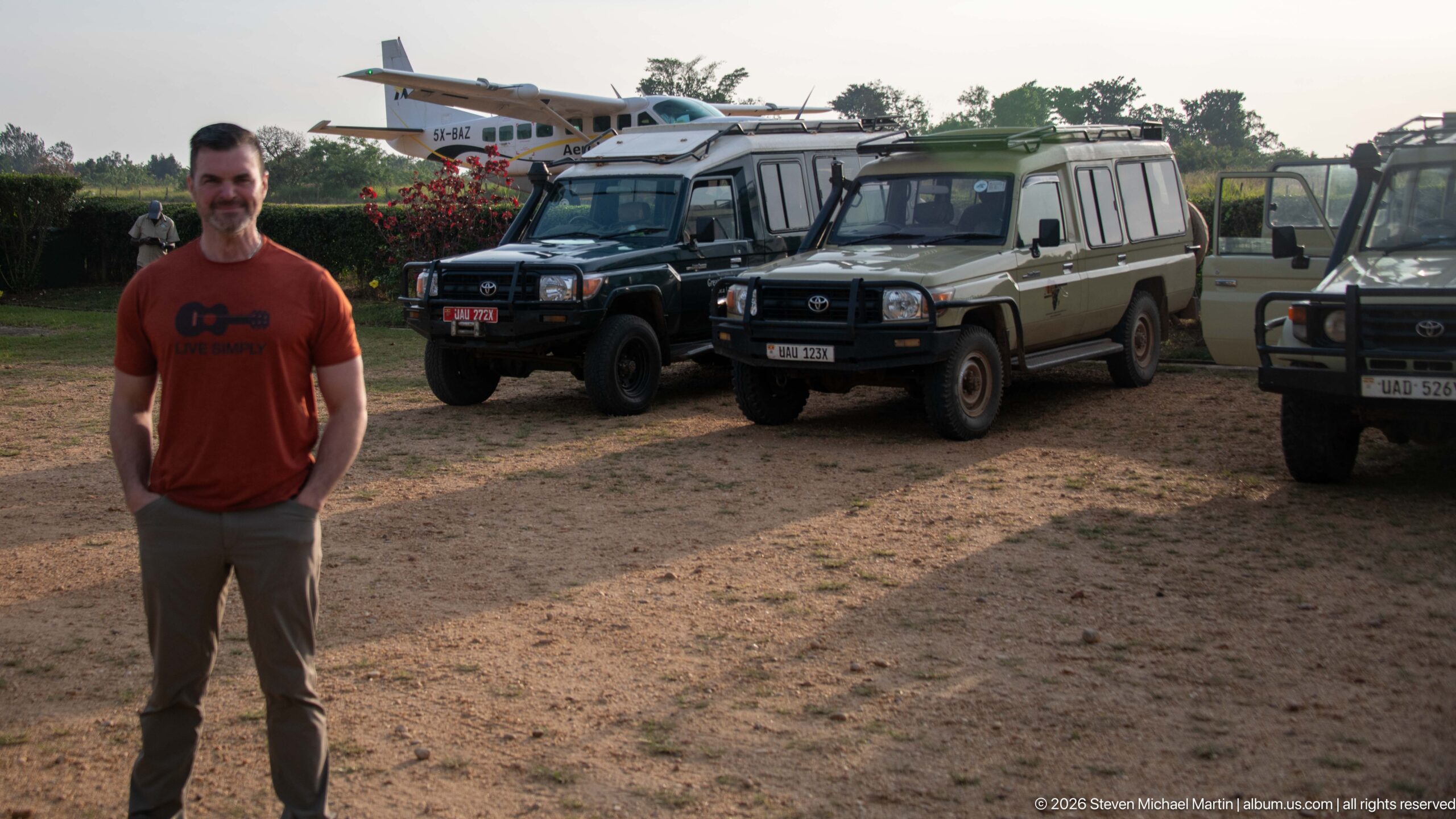
A traveler stands in front of several rugged four-wheel-drive safari vehicles parked on bare ground, with a small aircraft visible behind them. The juxtaposition of person, vehicles, and aircraft marks a transport transition in the Kihihi sequence, where road-based safari travel connects with regional air service.
Caption
A traveler stands in front of several rugged four-wheel-drive safari vehicles parked on bare ground, with a small aircraft visible behind them. The juxtaposition of person, vehicles, and aircraft marks a transport transition in the Kihihi sequence, where road-based safari travel connects with regional air service.
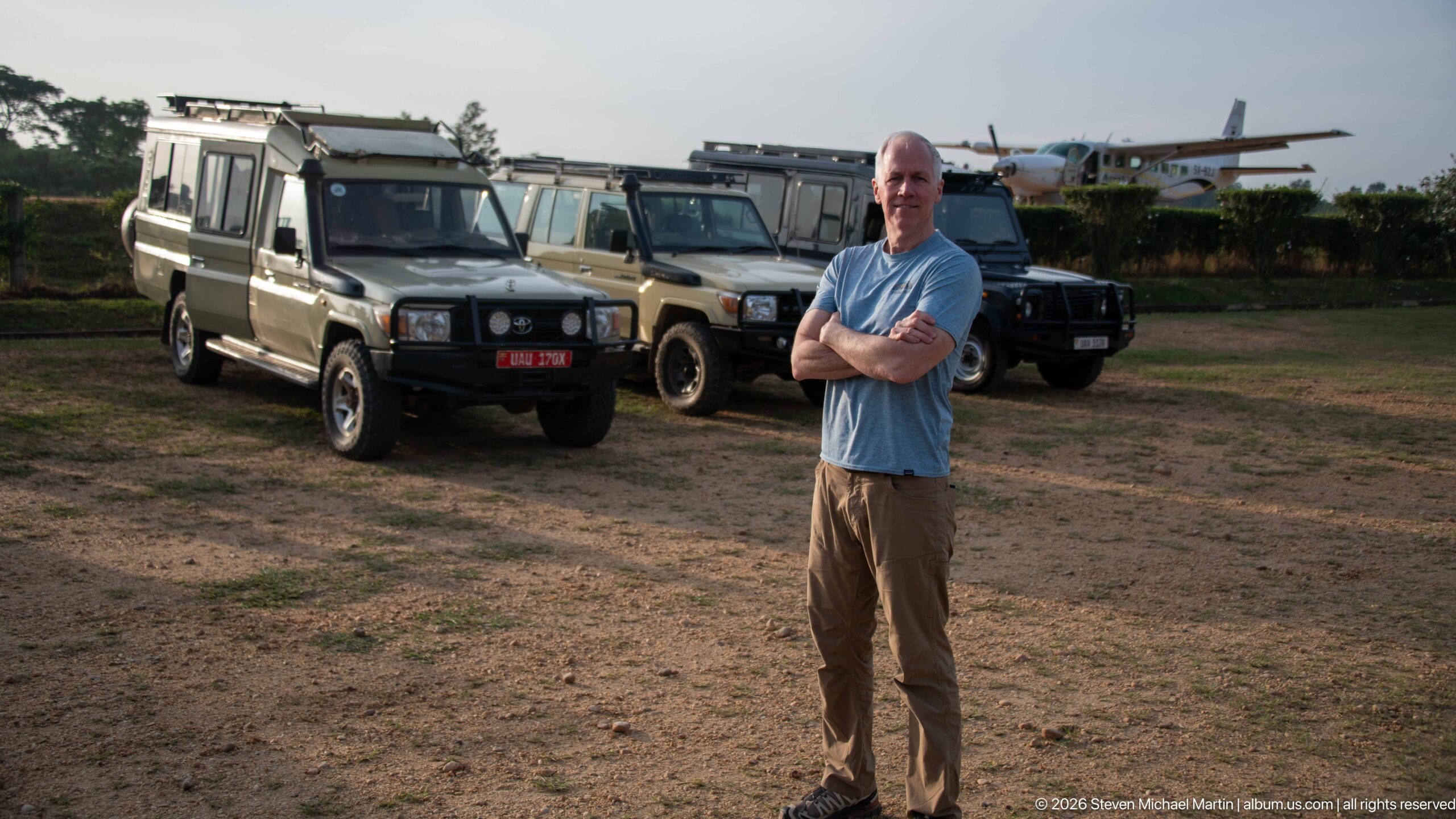
A traveler stands with arms crossed beside a line of four-wheel-drive safari vehicles, while the tail and wing of a small aircraft rise behind the parking area. The tighter portrait-like framing emphasizes the handoff between air arrival and overland safari transport in the Kihihi travel sequence.
Caption
A traveler stands with arms crossed beside a line of four-wheel-drive safari vehicles, while the tail and wing of a small aircraft rise behind the parking area. The tighter portrait-like framing emphasizes the handoff between air arrival and overland safari transport in the Kihihi travel sequence.
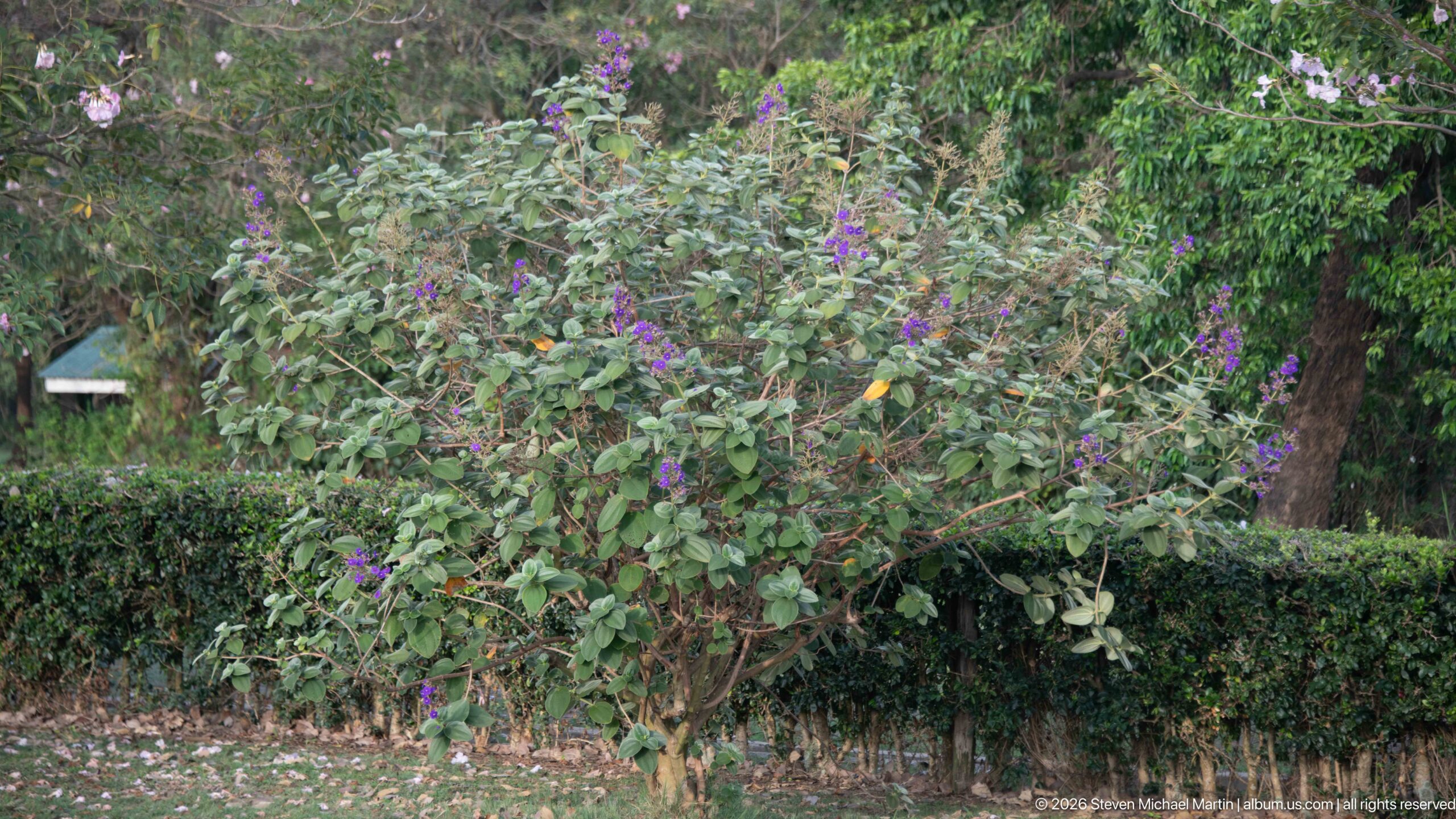
Small purple blossoms punctuate a loose, leafy shrub growing behind a neatly clipped hedge. Mature trees and layered garden vegetation fill the background, presenting a quiet horticultural detail from the landscaped grounds associated with the Kihihi travel stop rather than the agricultural fields seen earlier.
Caption
Small purple blossoms punctuate a loose, leafy shrub growing behind a neatly clipped hedge. Mature trees and layered garden vegetation fill the background, presenting a quiet horticultural detail from the landscaped grounds associated with the Kihihi travel stop rather than the agricultural fields seen earlier.
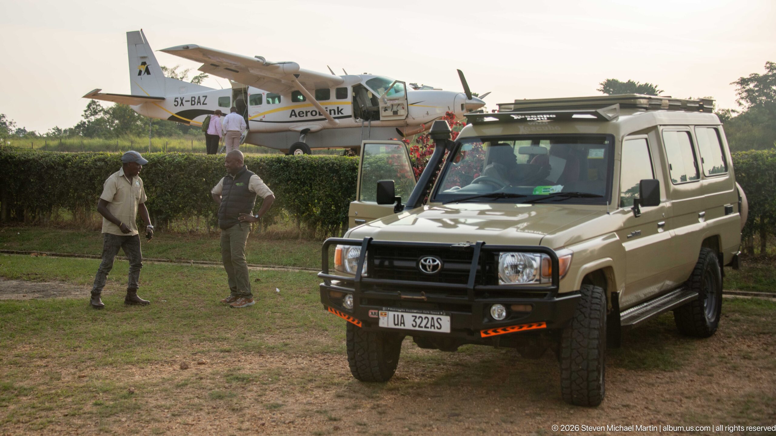
A high-clearance Toyota safari vehicle waits on grass with an AeroLink turboprop aircraft parked behind it and two people standing nearby. The composition directly links regional aviation with the four-wheel-drive transfers used to continue journeys from Kihihi into southwestern Uganda’s road network and safari destinations.
Caption
A high-clearance Toyota safari vehicle waits on grass with an AeroLink turboprop aircraft parked behind it and two people standing nearby. The composition directly links regional aviation with the four-wheel-drive transfers used to continue journeys from Kihihi into southwestern Uganda’s road network and safari destinations.

A bright yellow AeroLink Uganda advertisement promotes regional air connections with a stylized gorilla graphic and aircraft imagery. The visible destination list includes Entebbe International Airport and several Ugandan safari gateways, tying Kihihi’s small-aircraft transport to the wider network serving protected landscapes and tourism circuits.
Caption
A bright yellow AeroLink Uganda advertisement promotes regional air connections with a stylized gorilla graphic and aircraft imagery. The visible destination list includes Entebbe International Airport and several Ugandan safari gateways, tying Kihihi’s small-aircraft transport to the wider network serving protected landscapes and tourism circuits.
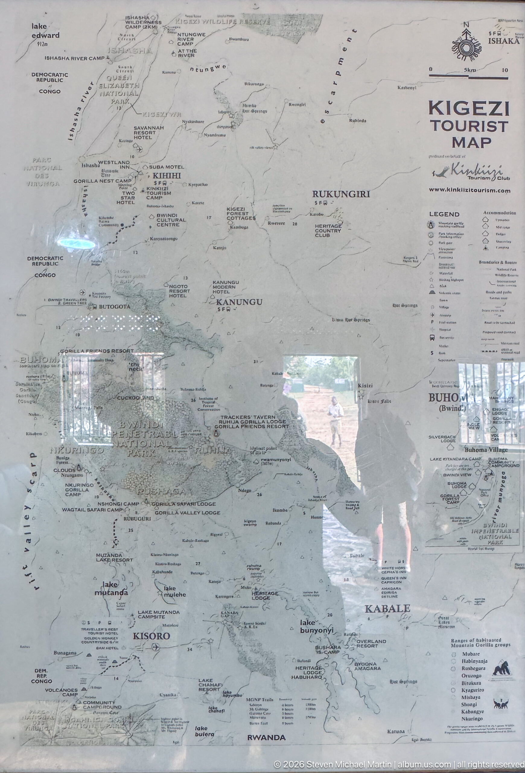
A wall-mounted Kigezi Tourist Map presents southwestern Uganda as a network of towns, roads, parks, lakes, and visitor destinations. Reflections in the protective surface partly obscure fine detail, but place names including Kihihi and Kabale are visible, situating the airstrip within the broader Kigezi tourism region and its overland connections.
Caption
A wall-mounted Kigezi Tourist Map presents southwestern Uganda as a network of towns, roads, parks, lakes, and visitor destinations. Reflections in the protective surface partly obscure fine detail, but place names including Kihihi and Kabale are visible, situating the airstrip within the broader Kigezi tourism region and its overland connections.
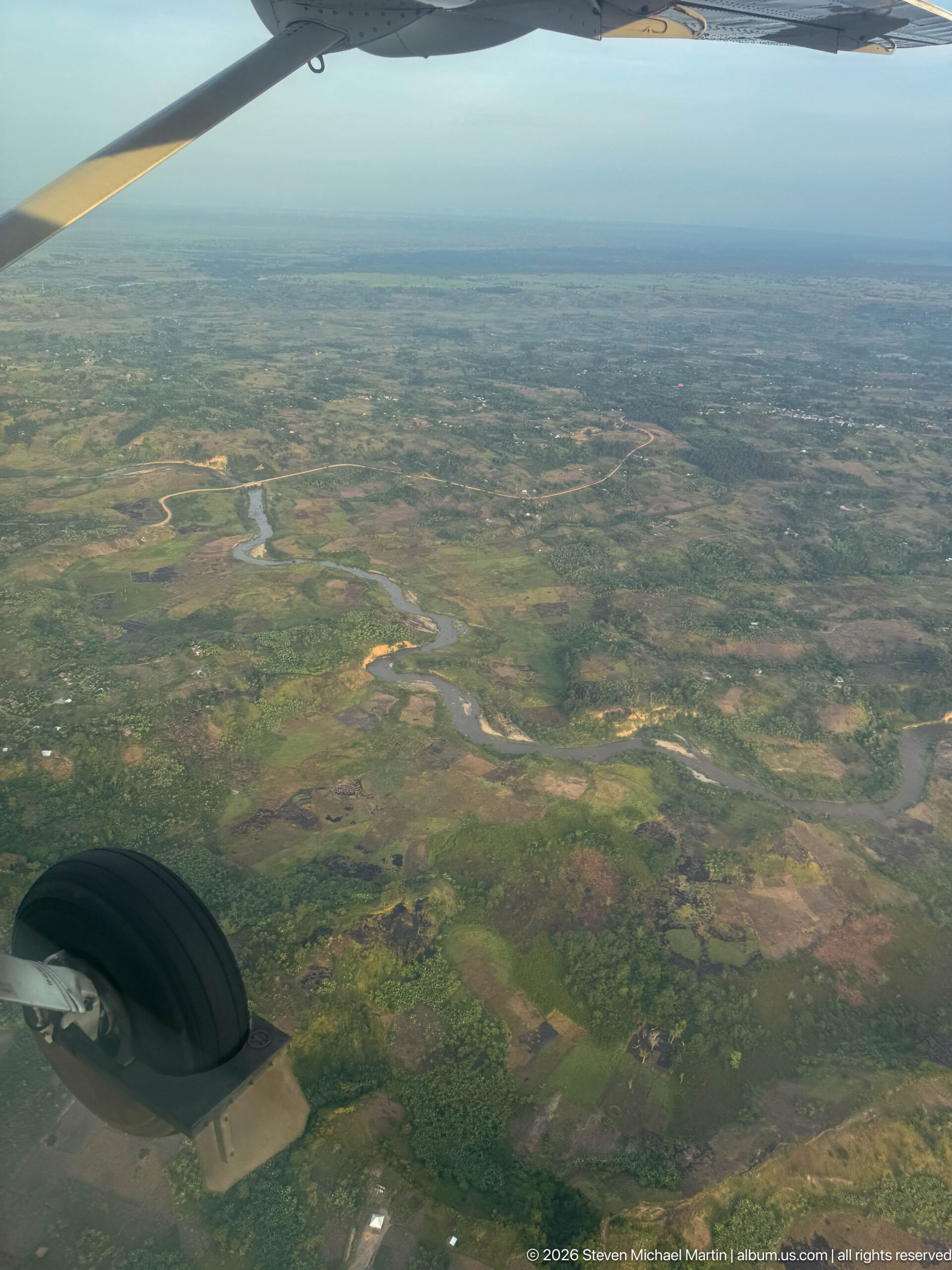
Seen past the aircraft’s wheel and wing, a winding river crosses an expansive mosaic of wetland, farmland, and open ground. The oblique aerial perspective emphasizes the scale of the floodplain and the repeated bends of the channel, while distant haze softens the horizon. The scene records the transition from Kihihi’s uplands toward lower, broader terrain.
Caption
Seen past the aircraft’s wheel and wing, a winding river crosses an expansive mosaic of wetland, farmland, and open ground. The oblique aerial perspective emphasizes the scale of the floodplain and the repeated bends of the channel, while distant haze softens the horizon. The scene records the transition from Kihihi’s uplands toward lower, broader terrain.
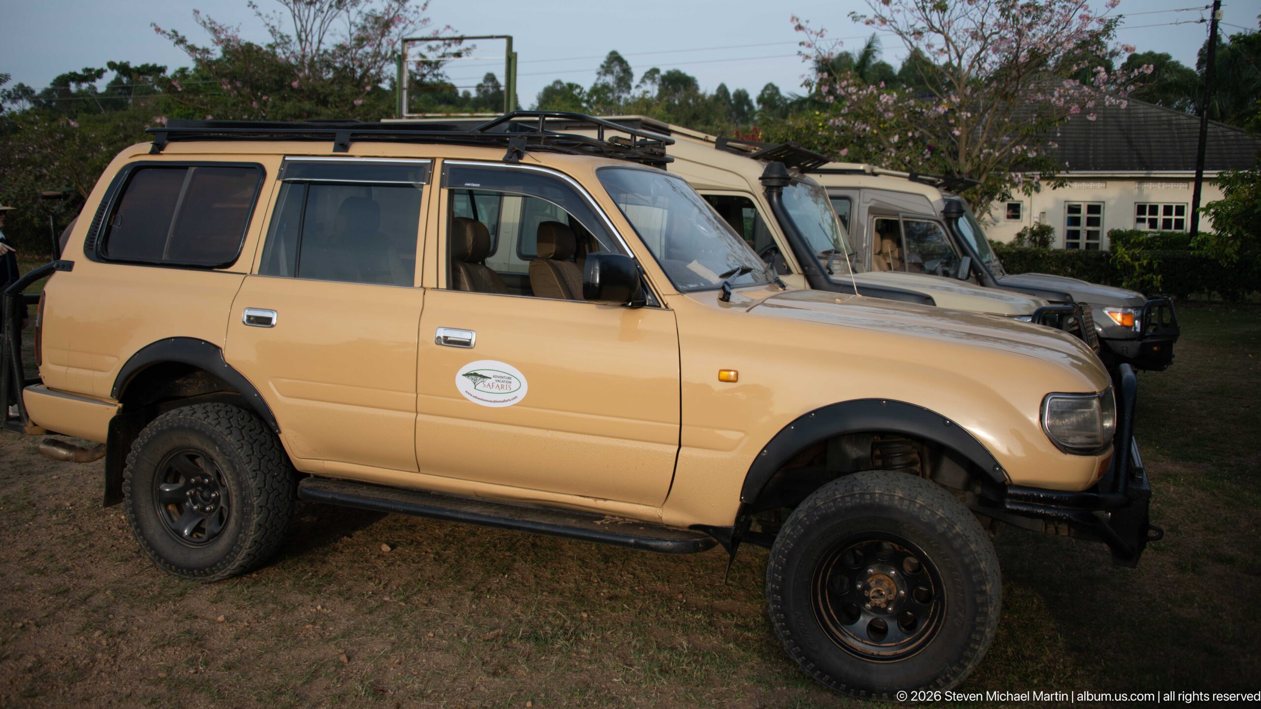
A beige Toyota four-wheel-drive safari vehicle is parked in profile, fitted with off-road tires, roof rack, side step, and front protection for travel on rough roads. Other similarly equipped vehicles line up behind it, emphasizing the specialized ground transport used for onward journeys from Kihihi.
Caption
A beige Toyota four-wheel-drive safari vehicle is parked in profile, fitted with off-road tires, roof rack, side step, and front protection for travel on rough roads. Other similarly equipped vehicles line up behind it, emphasizing the specialized ground transport used for onward journeys from Kihihi.
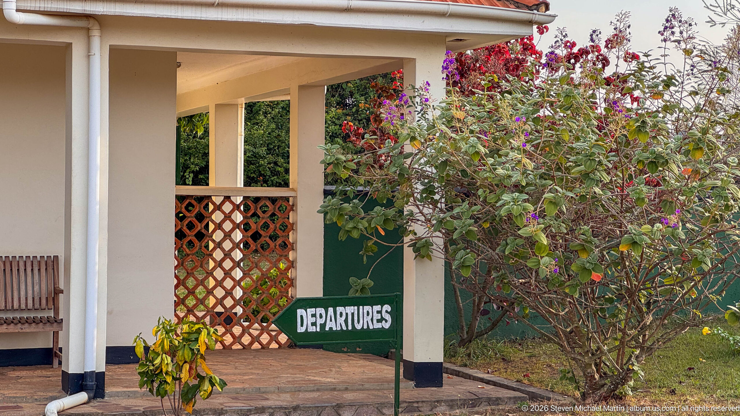
A green “DEPARTURES” sign marks the covered veranda of the small passenger terminal at Kihihi, with flowering shrubs and a lattice screen framing the entrance. The low, informal building and garden setting convey the scale of regional air service here, where travelers transfer between light aircraft and road vehicles serving southwestern Uganda.
Caption
A green “DEPARTURES” sign marks the covered veranda of the small passenger terminal at Kihihi, with flowering shrubs and a lattice screen framing the entrance. The low, informal building and garden setting convey the scale of regional air service here, where travelers transfer between light aircraft and road vehicles serving southwestern Uganda.

A line of four-wheel-drive safari vehicles waits on the dry grass beside Kihihi airstrip, ready for arriving passengers. Toyota Land Cruiser–type vehicles dominate the lineup, many fitted with roof racks or raised safari roofs for wildlife viewing. The arrangement illustrates the airport’s role as a transfer point between regional flights and overland travel in southwestern Uganda.
Caption
A line of four-wheel-drive safari vehicles waits on the dry grass beside Kihihi airstrip, ready for arriving passengers. Toyota Land Cruiser–type vehicles dominate the lineup, many fitted with roof racks or raised safari roofs for wildlife viewing. The arrangement illustrates the airport’s role as a transfer point between regional flights and overland travel in southwestern Uganda.
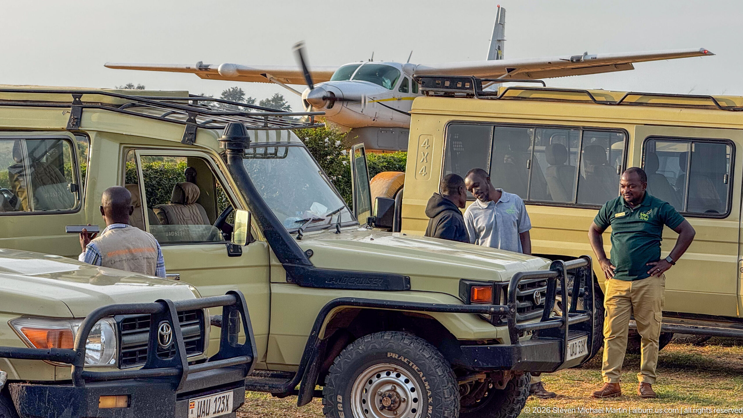
Safari vehicles cluster beside a high-wing light aircraft at Kihihi airstrip as drivers and passengers prepare for onward travel. The close overlap of aircraft, Land Cruiser–type vehicles, and people on the apron shows the practical handoff between bush-flight service and road transport that connects this small regional airfield with lodges and protected landscapes in southwestern Uganda.
Caption
Safari vehicles cluster beside a high-wing light aircraft at Kihihi airstrip as drivers and passengers prepare for onward travel. The close overlap of aircraft, Land Cruiser–type vehicles, and people on the apron shows the practical handoff between bush-flight service and road transport that connects this small regional airfield with lodges and protected landscapes in southwestern Uganda.
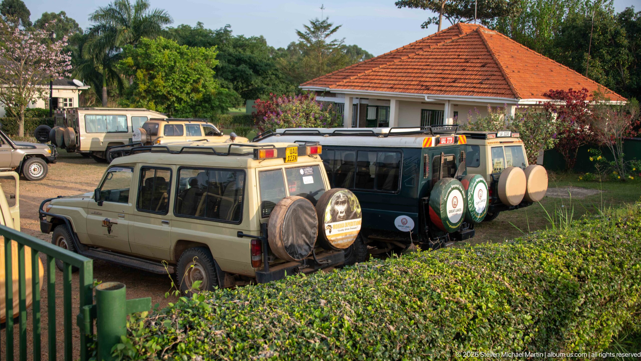
Safari vehicles fill the small parking area beside Kihihi’s red-roofed terminal, their rear-mounted spare tires and rooftop equipment facing the camera. The elevated viewpoint places the vehicles, hedges, and terminal in one frame, showing how closely the ground-transfer area is integrated with the passenger building at this compact regional airfield.
Caption
Safari vehicles fill the small parking area beside Kihihi’s red-roofed terminal, their rear-mounted spare tires and rooftop equipment facing the camera. The elevated viewpoint places the vehicles, hedges, and terminal in one frame, showing how closely the ground-transfer area is integrated with the passenger building at this compact regional airfield.
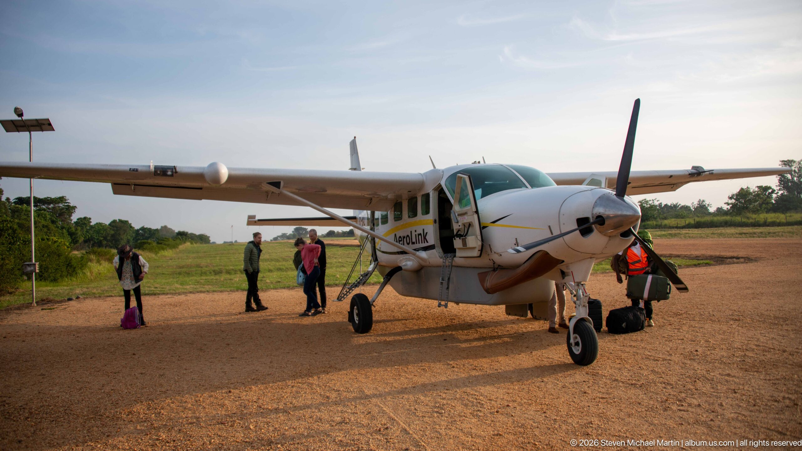
A high-wing Aerolink Uganda turboprop stands on the gravel apron at Kihihi with its cabin door open as passengers and ground staff gather nearby. The aircraft’s short-field configuration—high wing, fixed landing gear, and single propeller—suits regional routes linking small airstrips. The frontal three-quarter view records boarding activity before departure.
Caption
A high-wing Aerolink Uganda turboprop stands on the gravel apron at Kihihi with its cabin door open as passengers and ground staff gather nearby. The aircraft’s short-field configuration—high wing, fixed landing gear, and single propeller—suits regional routes linking small airstrips. The frontal three-quarter view records boarding activity before departure.
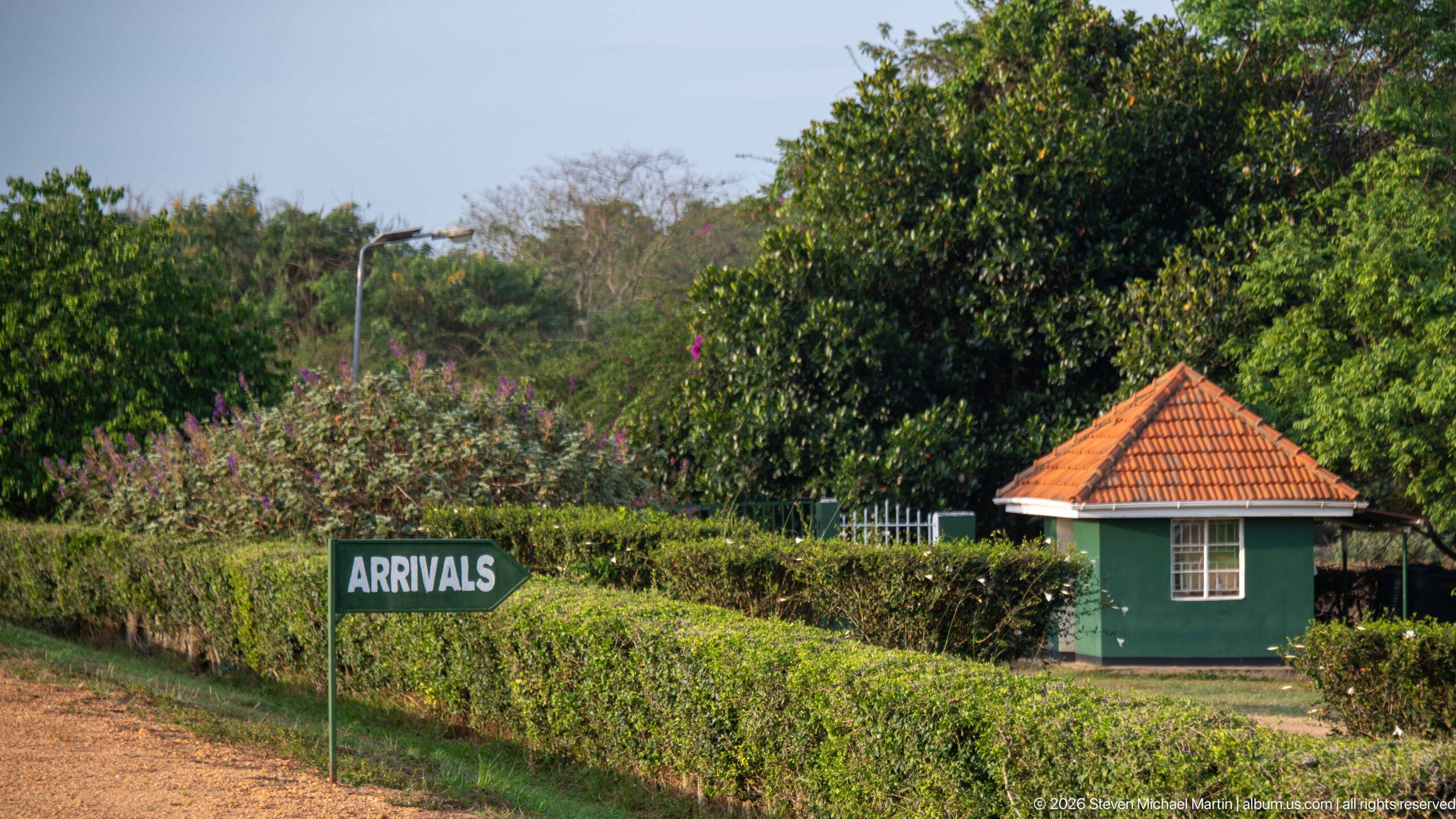
A blue “ARRIVALS” sign rises above clipped hedges at the edge of Kihihi’s passenger area, with a small green guard or service hut tucked behind the landscaping. The quiet garden-like setting contrasts with larger airport infrastructure and helps define the simple circulation pattern through this regional airstrip.
Caption
A blue “ARRIVALS” sign rises above clipped hedges at the edge of Kihihi’s passenger area, with a small green guard or service hut tucked behind the landscaping. The quiet garden-like setting contrasts with larger airport infrastructure and helps define the simple circulation pattern through this regional airstrip.
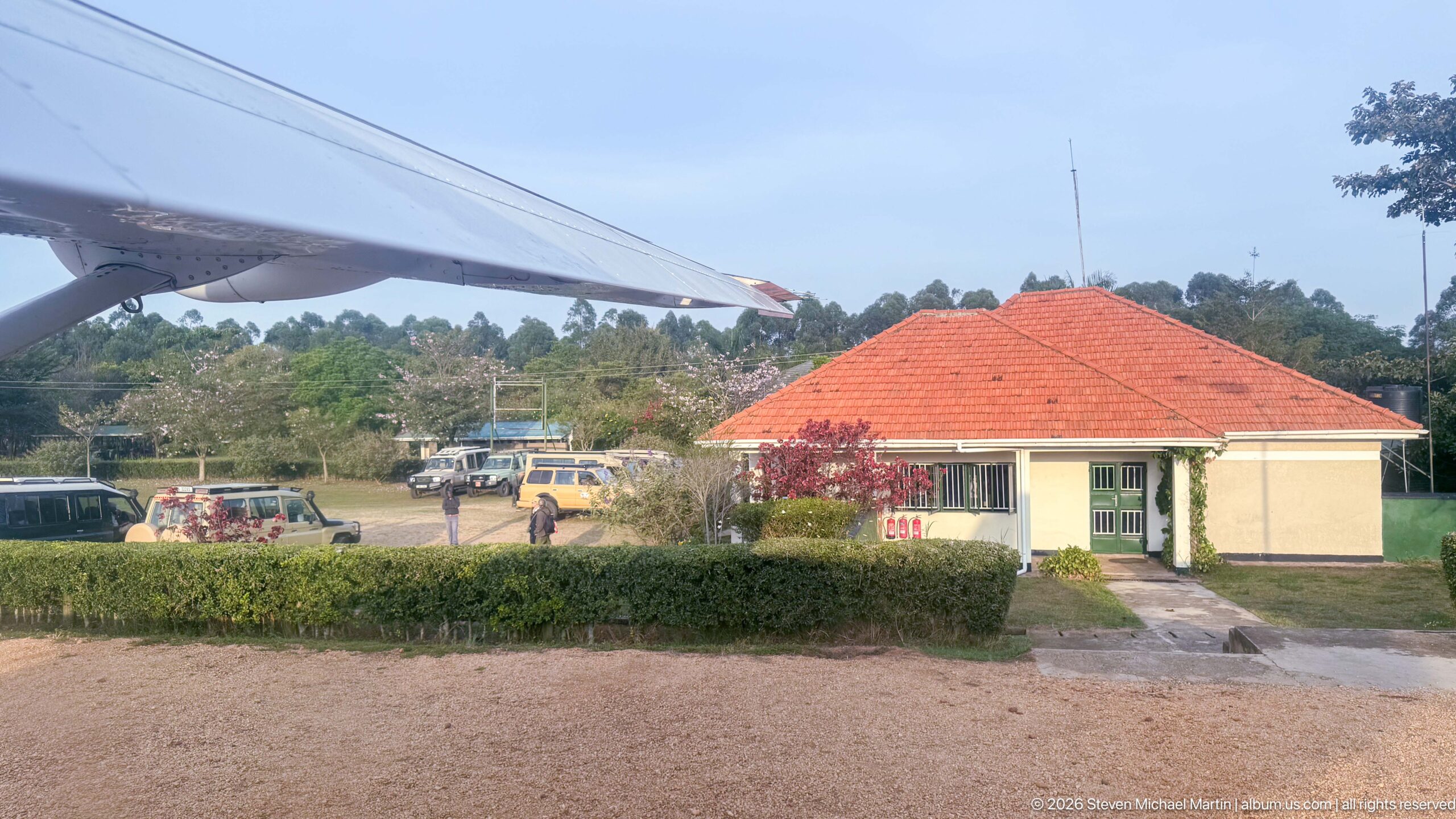
The red-roofed Kihihi terminal recedes below the wing of a departing light aircraft, with safari vehicles and the gravel apron visible beyond the hedge. This airborne angle ties together the passenger building, ground-transfer area, and aircraft movement, marking the transition from the airstrip to an aerial view of southwestern Uganda.
Caption
The red-roofed Kihihi terminal recedes below the wing of a departing light aircraft, with safari vehicles and the gravel apron visible beyond the hedge. This airborne angle ties together the passenger building, ground-transfer area, and aircraft movement, marking the transition from the airstrip to an aerial view of southwestern Uganda.
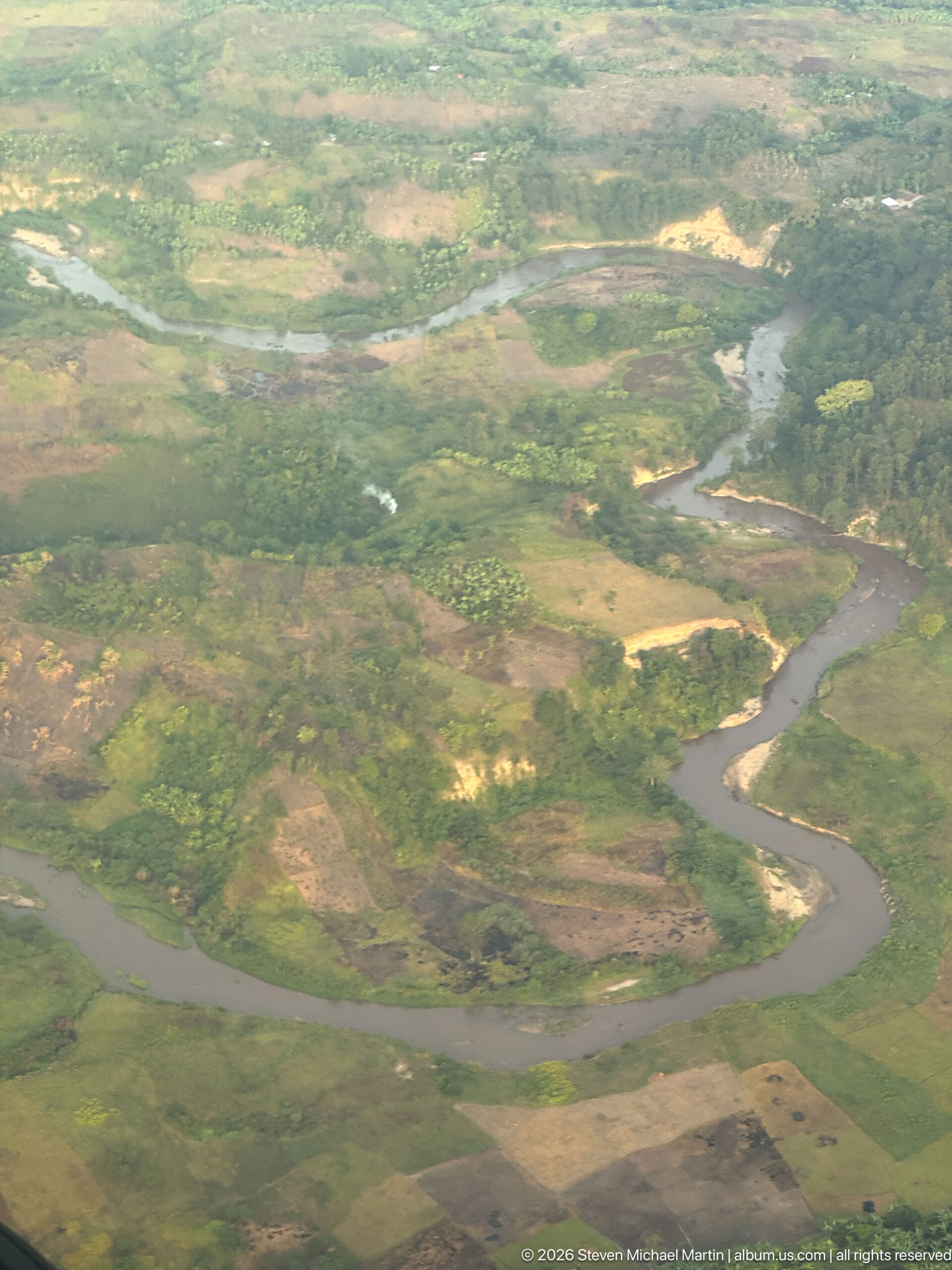
A broad brown-water river forms a near horseshoe bend across a green floodplain, with pale sand or exposed sediment tracing parts of the inner bank. Smaller channels and cultivated patches extend beyond the main course. The tighter aerial framing isolates the river’s meander geometry and the contrast between active channel, floodplain, and surrounding rural land.
Caption
A broad brown-water river forms a near horseshoe bend across a green floodplain, with pale sand or exposed sediment tracing parts of the inner bank. Smaller channels and cultivated patches extend beyond the main course. The tighter aerial framing isolates the river’s meander geometry and the contrast between active channel, floodplain, and surrounding rural land.
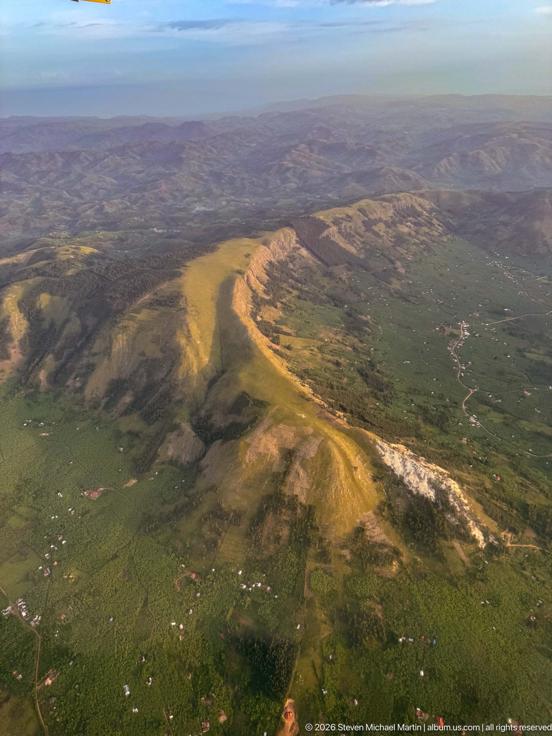
An elongated ridge rises sharply above greener cultivated lowlands, its sunlit crest and exposed pale slopes revealing strong relief. Small settlements and tracks scatter across the lower ground. From the air, the landform reads as part of a broader dissected highland landscape, where steep scarps separate ridges from the surrounding agricultural mosaic.
Caption
An elongated ridge rises sharply above greener cultivated lowlands, its sunlit crest and exposed pale slopes revealing strong relief. Small settlements and tracks scatter across the lower ground. From the air, the landform reads as part of a broader dissected highland landscape, where steep scarps separate ridges from the surrounding agricultural mosaic.
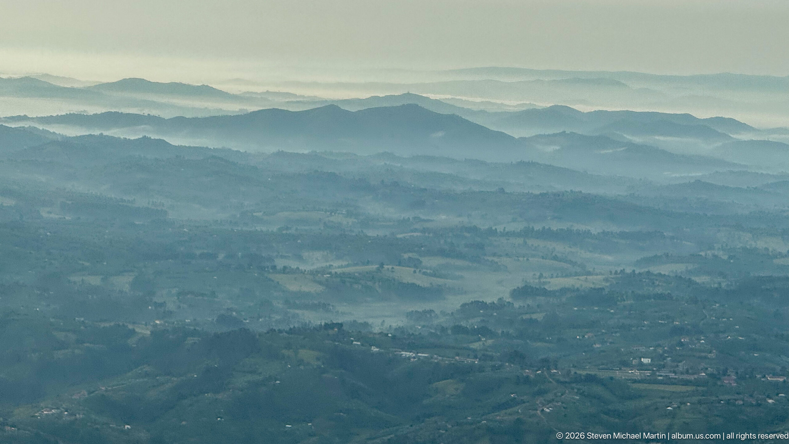
Successive ridgelines fade into blue-gray haze across the highlands of western Uganda, with cultivated slopes and scattered settlement visible in the foreground. The compressed aerial perspective turns the terrain into overlapping bands, emphasizing elevation, deep valleys, and the densely worked mosaic of fields and tree cover across the lower slopes.
Caption
Successive ridgelines fade into blue-gray haze across the highlands of western Uganda, with cultivated slopes and scattered settlement visible in the foreground. The compressed aerial perspective turns the terrain into overlapping bands, emphasizing elevation, deep valleys, and the densely worked mosaic of fields and tree cover across the lower slopes.
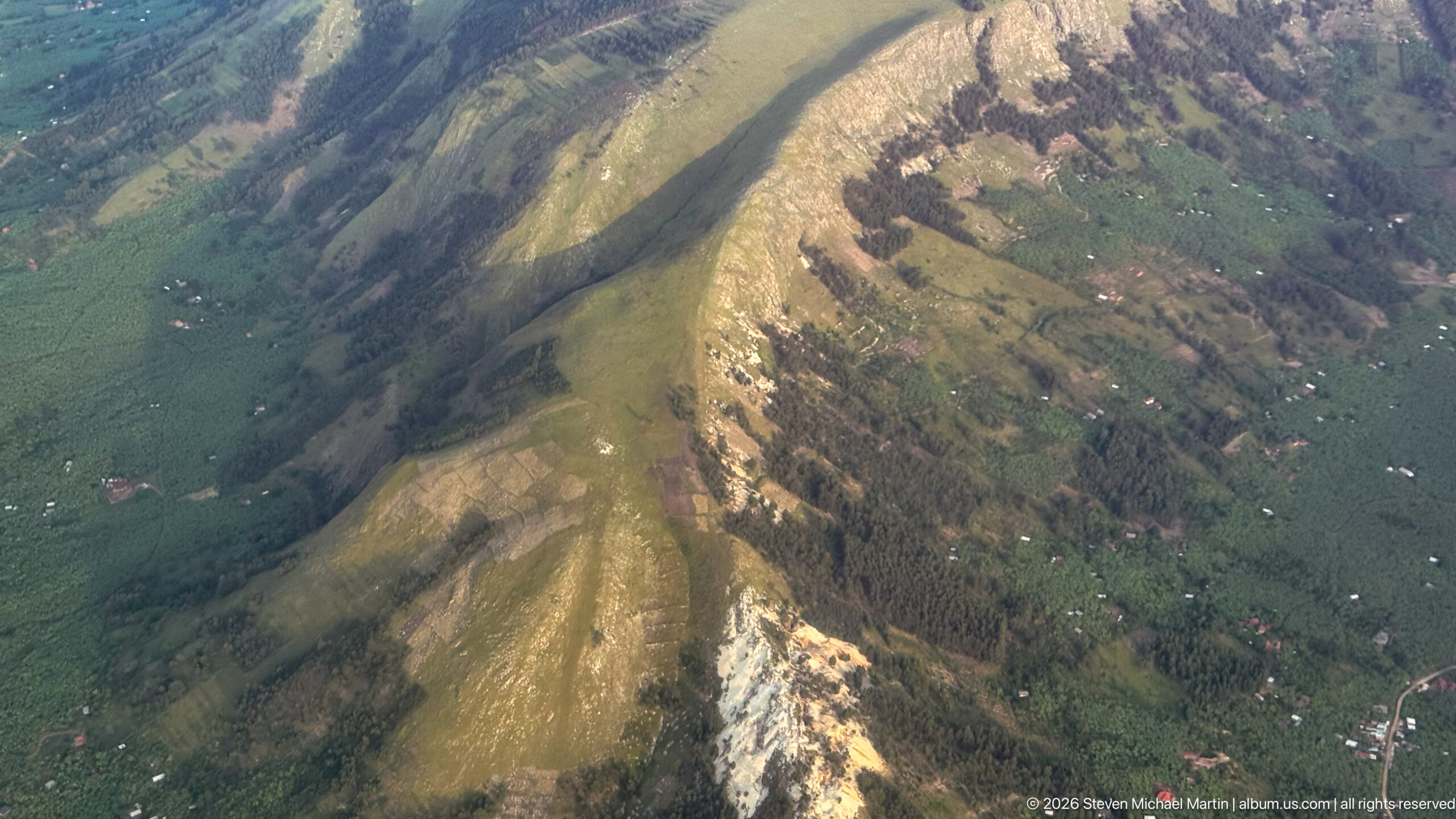
A steep, narrow escarpment drops through a patchwork of green fields, darker woodland, and scattered homesteads. Pale exposed rock or soil breaks through the slope in several bands, while cultivation reaches close to the crest and lower flanks. The close aerial view emphasizes how farming and settlement occupy even sharply dissected terrain.
Caption
A steep, narrow escarpment drops through a patchwork of green fields, darker woodland, and scattered homesteads. Pale exposed rock or soil breaks through the slope in several bands, while cultivation reaches close to the crest and lower flanks. The close aerial view emphasizes how farming and settlement occupy even sharply dissected terrain.
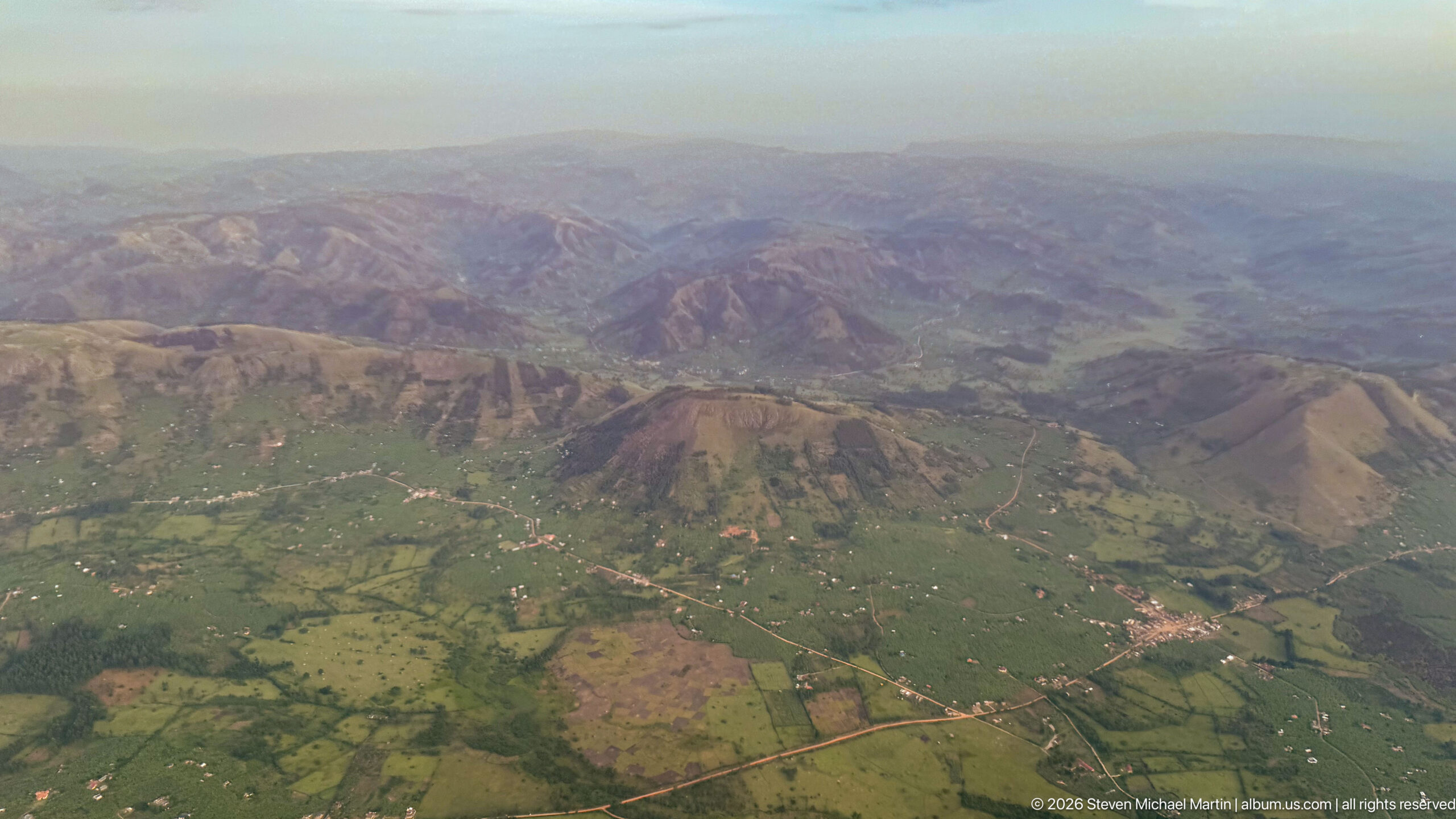
Rugged brown and green ridges overlook broad cultivated valleys patterned with fields, roads, and scattered settlements. The high oblique view places the inhabited valley floor against the more broken uplands, revealing the contrast between steep relief and intensively used agricultural land in western Uganda.
Caption
Rugged brown and green ridges overlook broad cultivated valleys patterned with fields, roads, and scattered settlements. The high oblique view places the inhabited valley floor against the more broken uplands, revealing the contrast between steep relief and intensively used agricultural land in western Uganda.
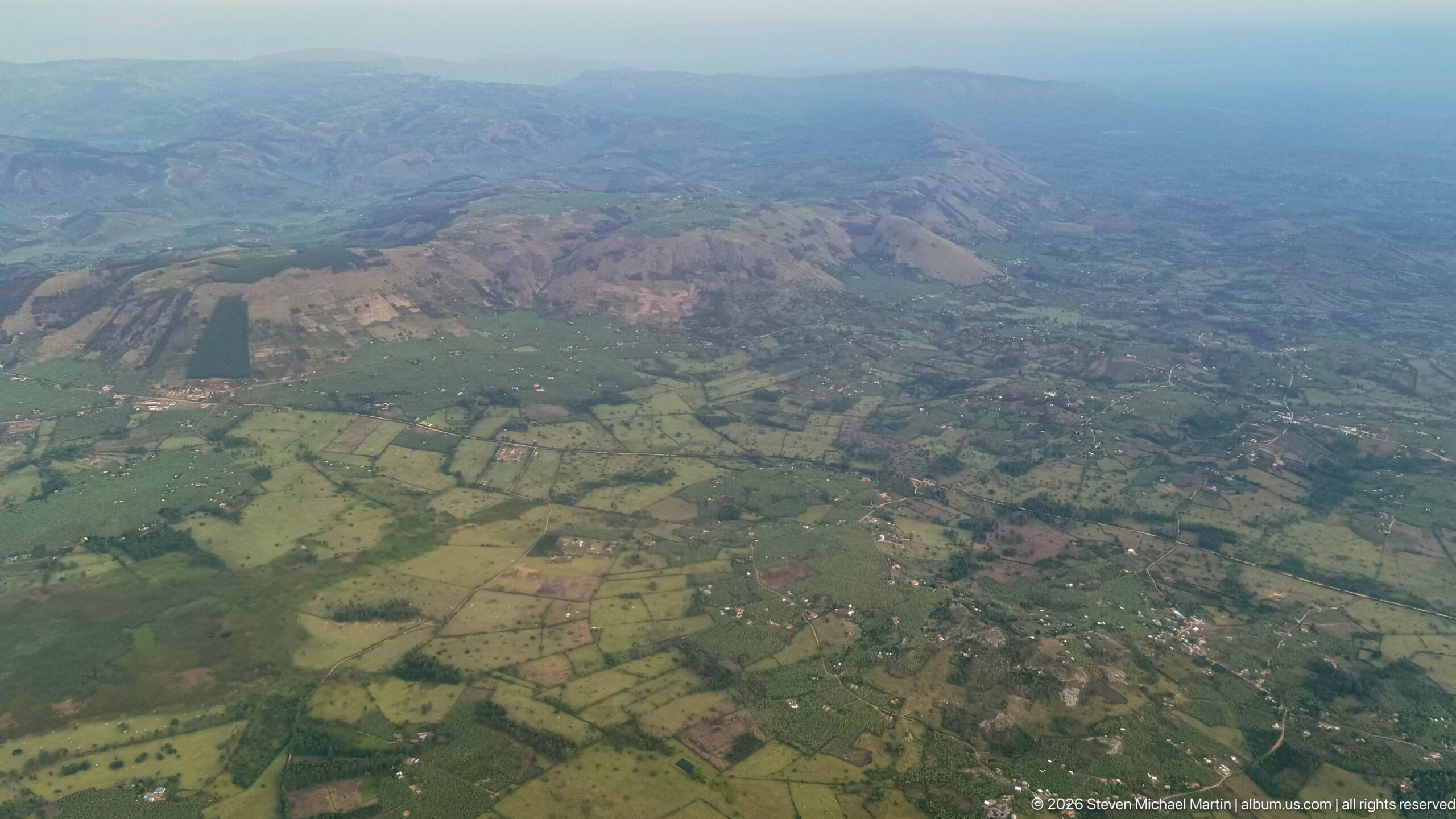
A broad agricultural mosaic of green and brown fields spreads across rolling foothills, with villages, tree belts, and unpaved roads threading between plots. Low ridges rise beyond the cultivated plain. The wider aerial view emphasizes settlement density and the fine-grained pattern of small farms across the landscape.
Caption
A broad agricultural mosaic of green and brown fields spreads across rolling foothills, with villages, tree belts, and unpaved roads threading between plots. Low ridges rise beyond the cultivated plain. The wider aerial view emphasizes settlement density and the fine-grained pattern of small farms across the landscape.
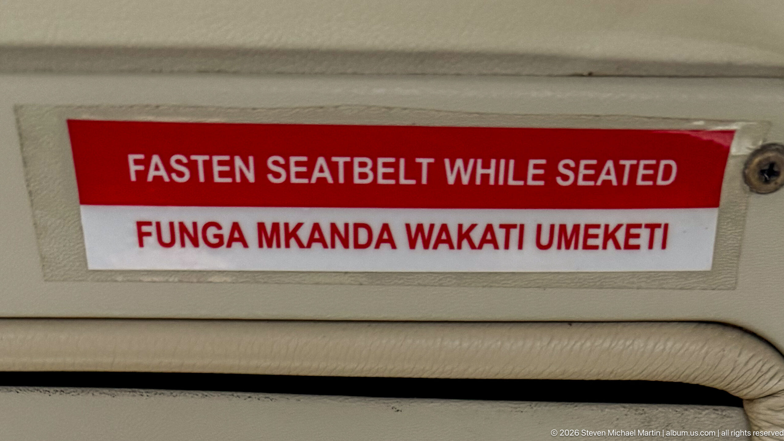
A cabin placard gives the seatbelt instruction in English and Swahili: “FASTEN SEATBELT WHILE SEATED” above “FUNGA MKANDA WAKATI UMEKETI.” Mounted on the aircraft interior, the bilingual notice is a small but specific detail of regional air travel, linking routine onboard safety information with East African language use.
Caption
A cabin placard gives the seatbelt instruction in English and Swahili: “FASTEN SEATBELT WHILE SEATED” above “FUNGA MKANDA WAKATI UMEKETI.” Mounted on the aircraft interior, the bilingual notice is a small but specific detail of regional air travel, linking routine onboard safety information with East African language use.
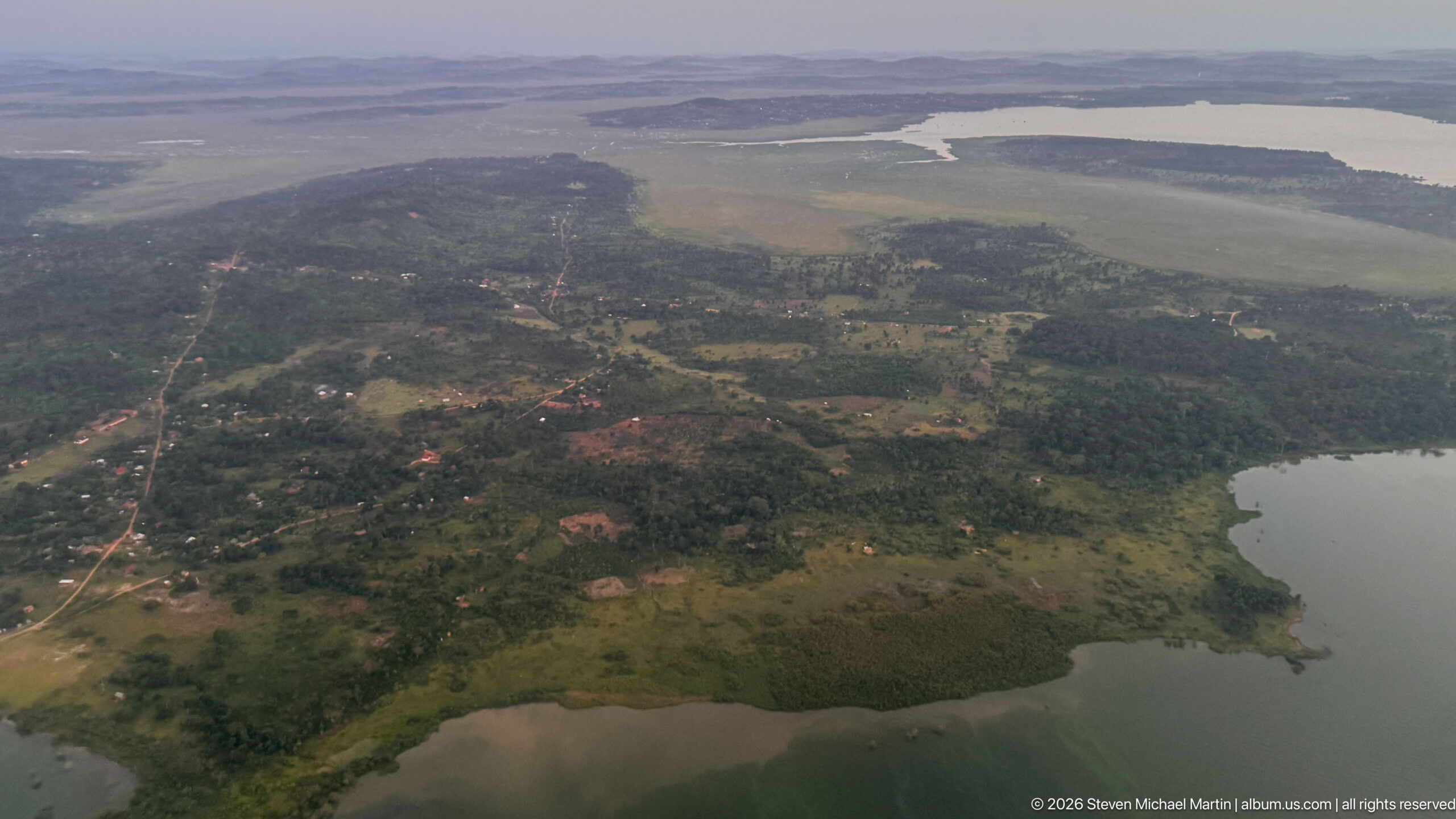
A wooded peninsula projects into a broad body of water, with smaller inlets, marshy shallows, and scattered settlement visible inland. Roads and cultivated clearings cut through the vegetation, while distant water channels break the horizon into islands and peninsulas. The aerial view emphasizes the irregular shoreline and close relationship between wetlands, farms, and villages.
Caption
A wooded peninsula projects into a broad body of water, with smaller inlets, marshy shallows, and scattered settlement visible inland. Roads and cultivated clearings cut through the vegetation, while distant water channels break the horizon into islands and peninsulas. The aerial view emphasizes the irregular shoreline and close relationship between wetlands, farms, and villages.
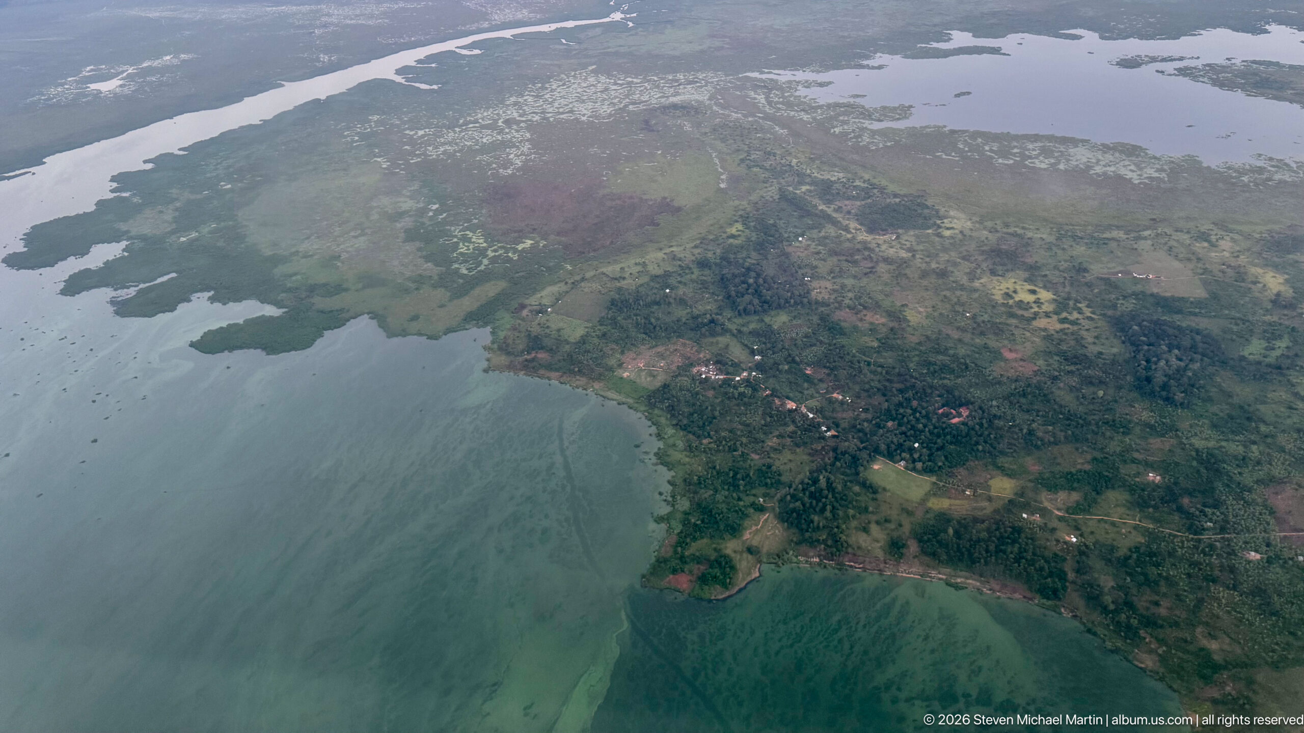
A settled peninsula extends into pale blue-green water, its shoreline broken by small bays and marshy edges. Clusters of buildings, fields, and tree cover occupy the higher ground, while irregular water channels continue toward the horizon. This closer aerial view distinguishes the inhabited headland from the broader lake-and-wetland landscape surrounding it.
Caption
A settled peninsula extends into pale blue-green water, its shoreline broken by small bays and marshy edges. Clusters of buildings, fields, and tree cover occupy the higher ground, while irregular water channels continue toward the horizon. This closer aerial view distinguishes the inhabited headland from the broader lake-and-wetland landscape surrounding it.
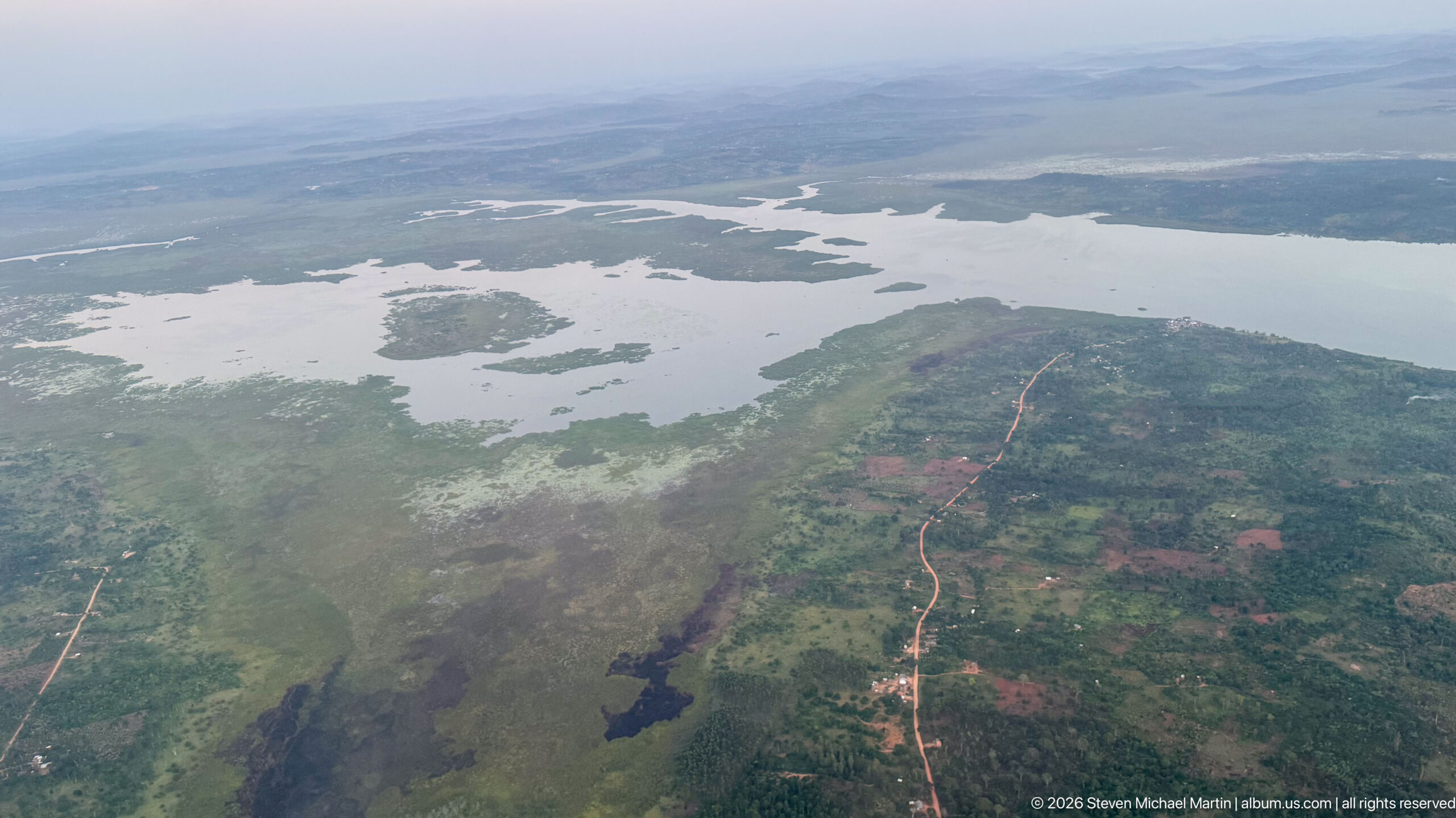
Shallow water spreads through an intricate network of channels, marshy islands, and low peninsulas, with a reddish road running through cultivated and settled ground in the foreground. The branching shoreline suggests a seasonally variable wetland margin rather than a simple open coast, and the aerial viewpoint reveals how water and land interlock across the plain.
Caption
Shallow water spreads through an intricate network of channels, marshy islands, and low peninsulas, with a reddish road running through cultivated and settled ground in the foreground. The branching shoreline suggests a seasonally variable wetland margin rather than a simple open coast, and the aerial viewpoint reveals how water and land interlock across the plain.

Aerolink Uganda aircraft 5X-BZJ stands on the apron during passenger operations, its high wing, fixed landing gear, and single turboprop engine identifying the Cessna Grand Caravan type used on regional routes. Ground staff work beside the aircraft as passengers board or disembark, while another wing crosses the top of the frame.
Caption
Aerolink Uganda aircraft 5X-BZJ stands on the apron during passenger operations, its high wing, fixed landing gear, and single turboprop engine identifying the Cessna Grand Caravan type used on regional routes. Ground staff work beside the aircraft as passengers board or disembark, while another wing crosses the top of the frame.
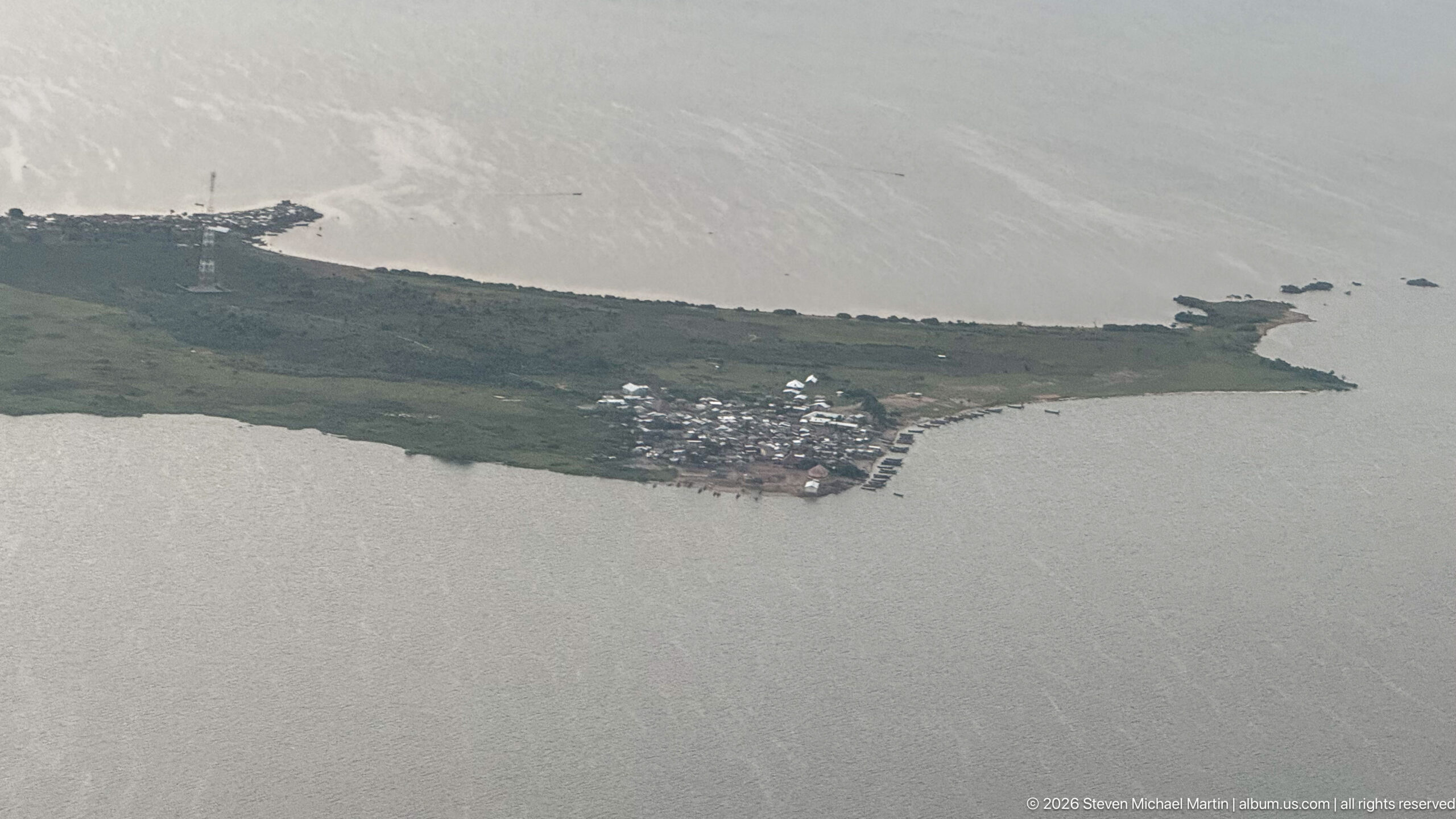
A compact settlement occupies the end of a narrow green peninsula surrounded by broad gray water. Buildings cluster tightly near the shoreline, while a communications mast and scattered structures extend along the landward side. The high aerial perspective isolates the community’s constrained waterfront setting and the sharp contrast between dense settlement and open water.
Caption
A compact settlement occupies the end of a narrow green peninsula surrounded by broad gray water. Buildings cluster tightly near the shoreline, while a communications mast and scattered structures extend along the landward side. The high aerial perspective isolates the community’s constrained waterfront setting and the sharp contrast between dense settlement and open water.

Two passengers sit side by side inside the cabin of a regional light aircraft, both secured with shoulder belts and facing the camera. The compact interior, small windows, and closely spaced seating convey the scale of bush-flight travel used between Uganda’s smaller airstrips. This personal frame shifts the sequence from landscape and transport documentation to the passenger experience.
Caption
Two passengers sit side by side inside the cabin of a regional light aircraft, both secured with shoulder belts and facing the camera. The compact interior, small windows, and closely spaced seating convey the scale of bush-flight travel used between Uganda’s smaller airstrips. This personal frame shifts the sequence from landscape and transport documentation to the passenger experience.

Passengers fill the narrow cabin of a regional light aircraft, viewed forward from the rear seats toward the cockpit. Seatbacks, overhead fittings, side windows, and the close spacing of travelers emphasize the utilitarian layout of small-aircraft service. The blue sky ahead through the windshield suggests the flight is underway or preparing to depart.
Caption
Passengers fill the narrow cabin of a regional light aircraft, viewed forward from the rear seats toward the cockpit. Seatbacks, overhead fittings, side windows, and the close spacing of travelers emphasize the utilitarian layout of small-aircraft service. The blue sky ahead through the windshield suggests the flight is underway or preparing to depart.
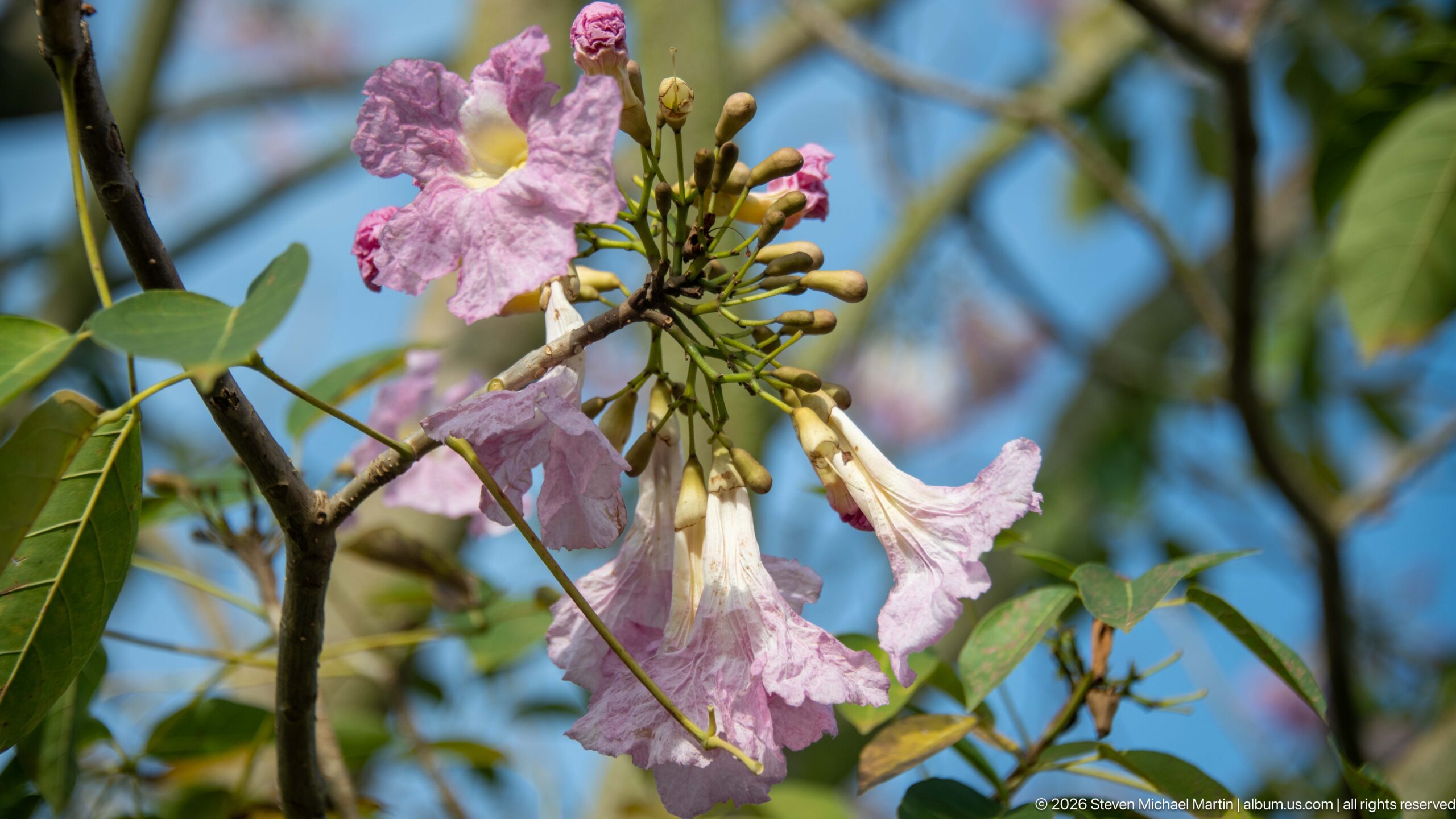
Clusters of pale pink, trumpet-shaped blossoms open among compound green leaves, with several unopened buds grouped at the end of the branch. The flower form and branching habit suggest a pink trumpet tree or related ornamental species, but the close view does not show enough diagnostic detail for a definitive botanical identification.
Caption
Clusters of pale pink, trumpet-shaped blossoms open among compound green leaves, with several unopened buds grouped at the end of the branch. The flower form and branching habit suggest a pink trumpet tree or related ornamental species, but the close view does not show enough diagnostic detail for a definitive botanical identification.
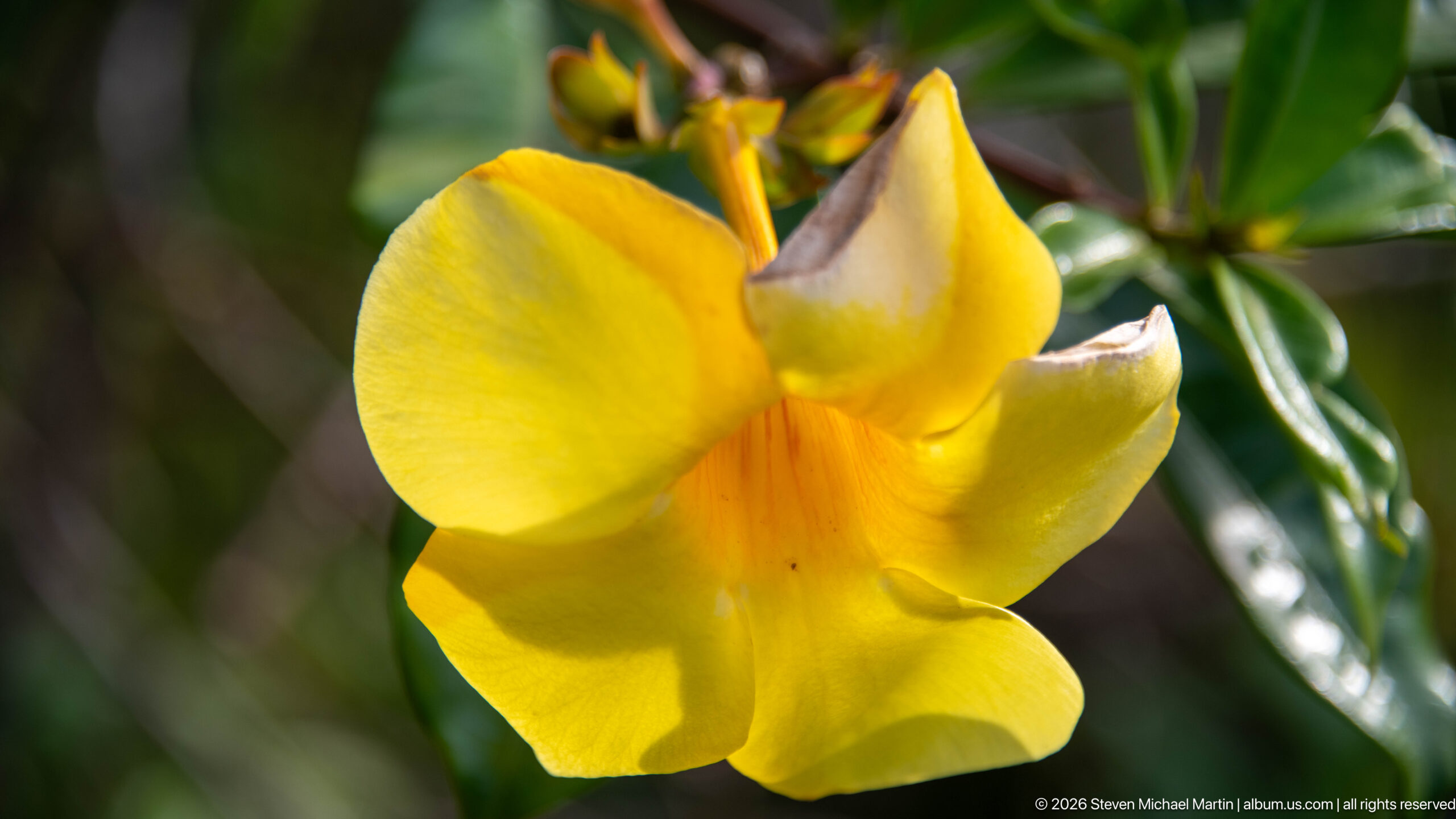
A single vivid yellow trumpet-shaped flower fills the frame against glossy green foliage, its broad overlapping lobes surrounding a deeper orange throat. The form is characteristic of several tropical ornamental vines and shrubs, including golden-trumpet types, but the photograph does not show enough foliage or growth habit to support a secure species-level identification.
Caption
A single vivid yellow trumpet-shaped flower fills the frame against glossy green foliage, its broad overlapping lobes surrounding a deeper orange throat. The form is characteristic of several tropical ornamental vines and shrubs, including golden-trumpet types, but the photograph does not show enough foliage or growth habit to support a secure species-level identification.