Waterton Lakes National Park Introduction
Waterton Lakes National Park occupies a remarkable meeting place where the Rocky Mountains rise abruptly from the rolling grasslands of southern Alberta. Here, long mountain valleys open directly onto the prairie, creating a landscape that feels distinctly different from the higher, more enclosed terrain of Banff and Jasper. Upper Waterton Lake stretches southward across the international boundary into Montana, while roads and trails lead toward places such as Red Rock Canyon, Cameron Lake, and the surrounding peaks. Established as a protected area in 1895, Waterton became Canada’s fourth national park and today forms the Canadian half of the Waterton-Glacier International Peace Park, created with neighboring Glacier National Park in 1932 and designated a UNESCO World Heritage Site in 1995.
Waterton’s relatively compact landscape contains an extraordinary variety of environments. Prairie grasslands, aspen groves, forests, wetlands, lakes, and steep mountain slopes occur within short distances of one another, supporting a correspondingly rich diversity of plants and wildlife. The transition between prairie and mountains is especially striking along the park’s eastern edge, where there is little foothill country to soften the change in elevation. Upper Waterton Lake, extending across the Canada–United States border, provides the geographical centerpiece of the park and a natural connection between Waterton and Glacier, two protected landscapes that have been managed cooperatively across the international boundary for generations.
Human history is equally visible throughout Waterton. The small Waterton townsite grew from early twentieth-century settlement and tourism development, while the Prince of Wales Hotel, completed by the Great Northern Railway in 1927, still commands its dramatic bluff above Upper Waterton Lake. The park also preserves the site of western Canada’s first producing oil well, a reminder that this landscape was once explored for resources as well as scenery. Yet Waterton remains intimate compared with the larger Canadian Rocky Mountain parks: mountains, lakes, historic buildings, wildlife, and open prairie are compressed into a relatively small area. That combination—and the sense that the Rockies simply rise out of the plains—gives Waterton Lakes a character entirely its own.
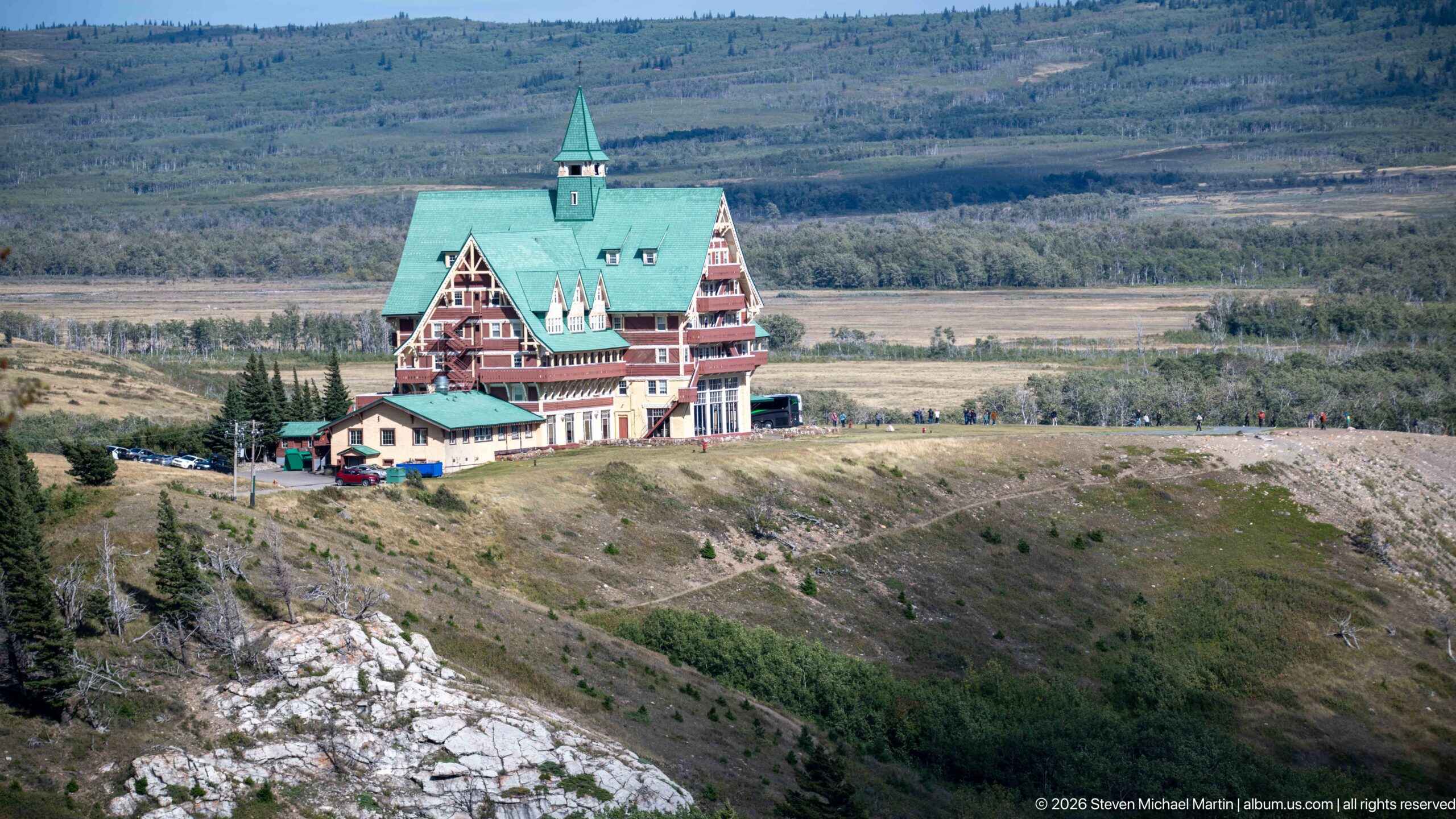
The Prince of Wales Hotel stands prominently on its exposed bluff, its steep green roofs, central tower, and red-and-cream timbered façades visible against the open Waterton landscape. Seen from a distance, the building’s dramatic siting becomes as important as its architecture: the large hotel occupies a narrow ridge with broad mountain and prairie terrain extending behind it.
Caption
The Prince of Wales Hotel stands prominently on its exposed bluff, its steep green roofs, central tower, and red-and-cream timbered façades visible against the open Waterton landscape. Seen from a distance, the building’s dramatic siting becomes as important as its architecture: the large hotel occupies a narrow ridge with broad mountain and prairie terrain extending behind it.
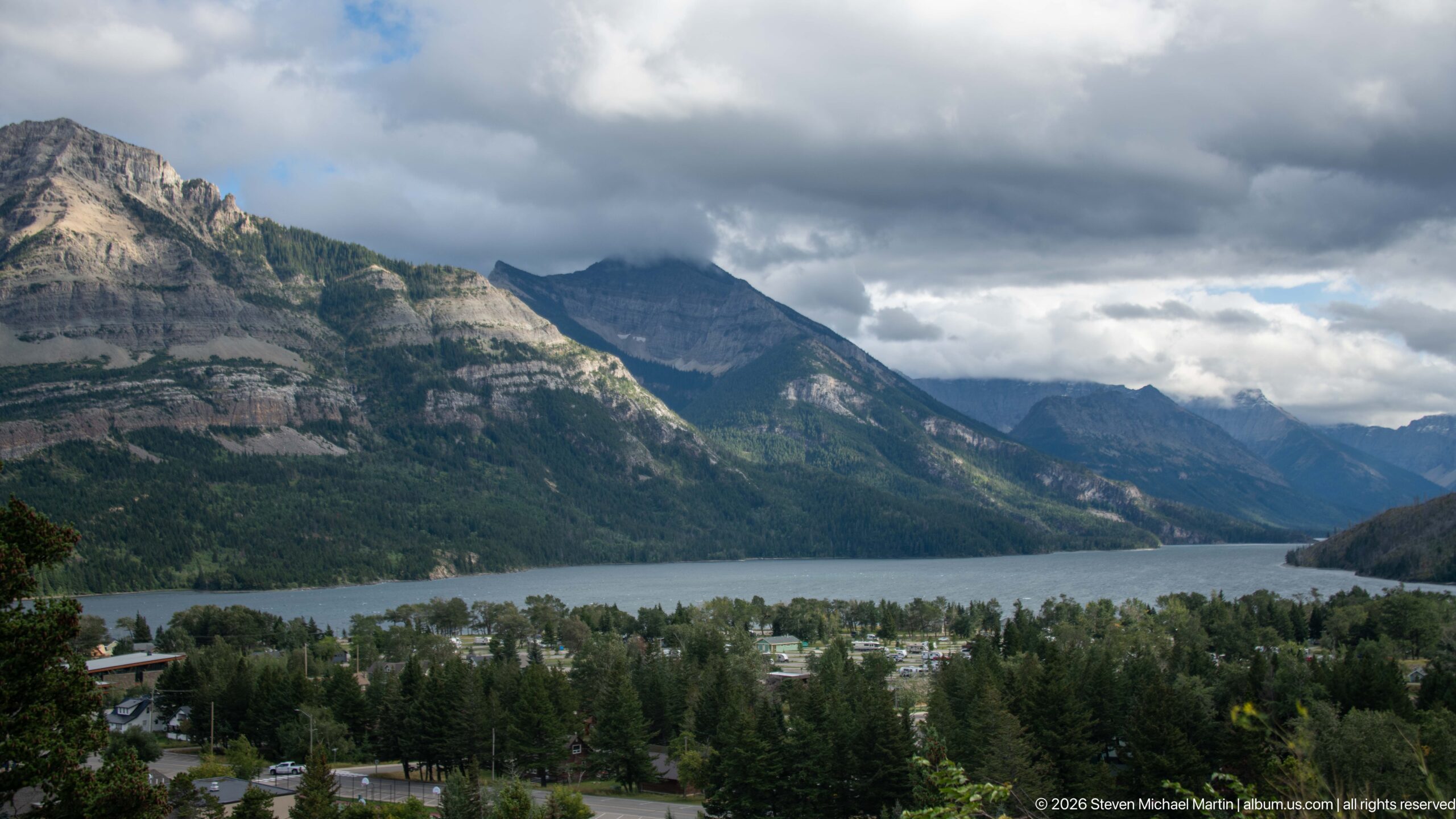
The Waterton townsite spreads across the foreground below a long reach of Upper Waterton Lake, with steep mountain walls enclosing the valley beyond. From this elevated viewpoint, roofs and trees occupy only a narrow band between the viewer and the water, emphasizing how closely the settlement is fitted into the mountain landscape. Heavy clouds deepen the valley’s shadows while brighter rock faces remain visible across the lake.
Caption
The Waterton townsite spreads across the foreground below a long reach of Upper Waterton Lake, with steep mountain walls enclosing the valley beyond. From this elevated viewpoint, roofs and trees occupy only a narrow band between the viewer and the water, emphasizing how closely the settlement is fitted into the mountain landscape. Heavy clouds deepen the valley’s shadows while brighter rock faces remain visible across the lake.
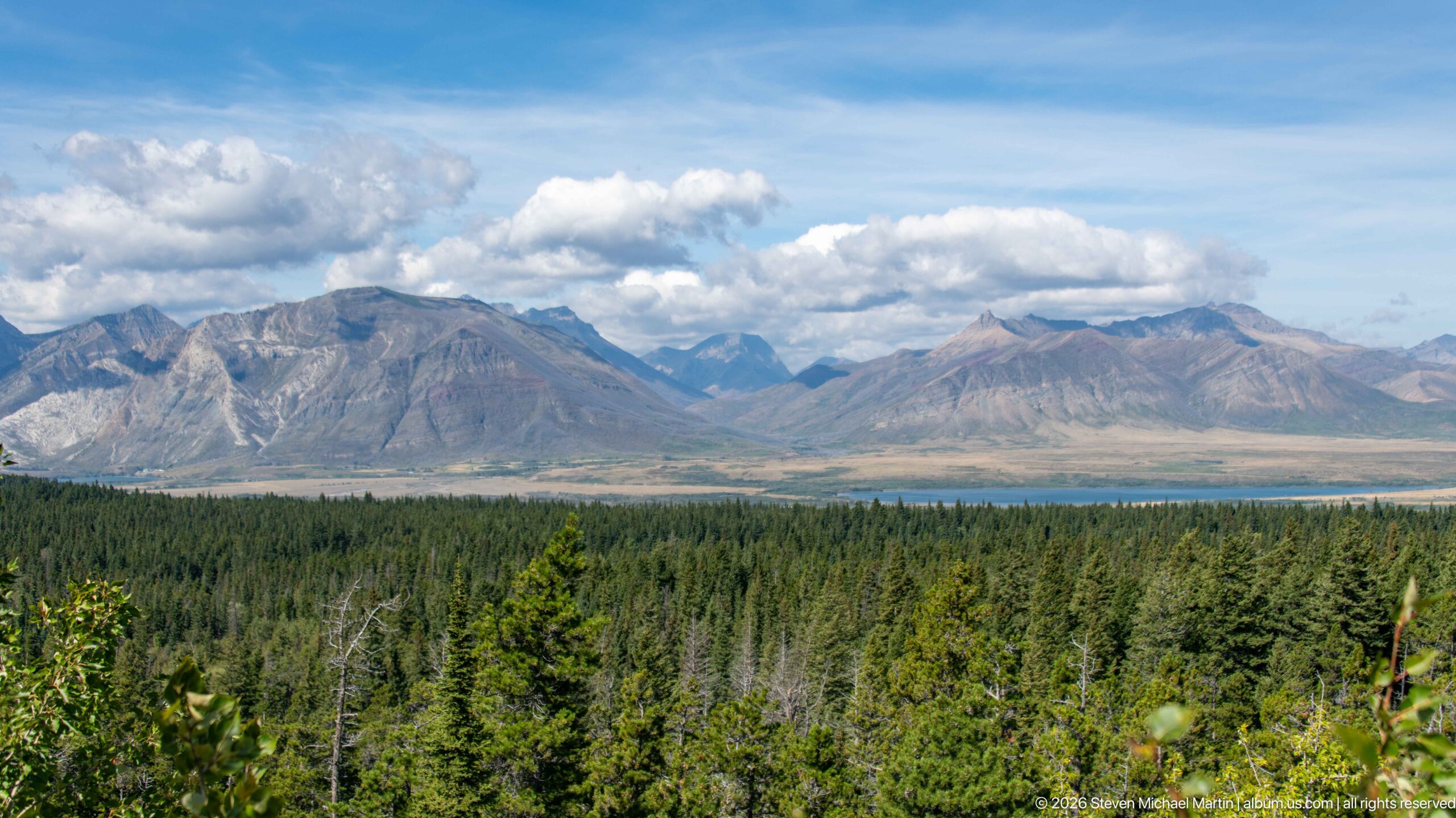
A broad mountain panorama opens beyond dense conifer forest, with long gray ridges and more distant peaks extending across the horizon. The elevated viewpoint emphasizes the transition from continuous woodland to exposed mountain slopes and open valleys. Broken clouds cast alternating light and shadow across the range, giving the scene depth while documenting the large-scale topography surrounding Waterton Lakes without relying on a specific peak identification.
Caption
A broad mountain panorama opens beyond dense conifer forest, with long gray ridges and more distant peaks extending across the horizon. The elevated viewpoint emphasizes the transition from continuous woodland to exposed mountain slopes and open valleys. Broken clouds cast alternating light and shadow across the range, giving the scene depth while documenting the large-scale topography surrounding Waterton Lakes without relying on a specific peak identification.
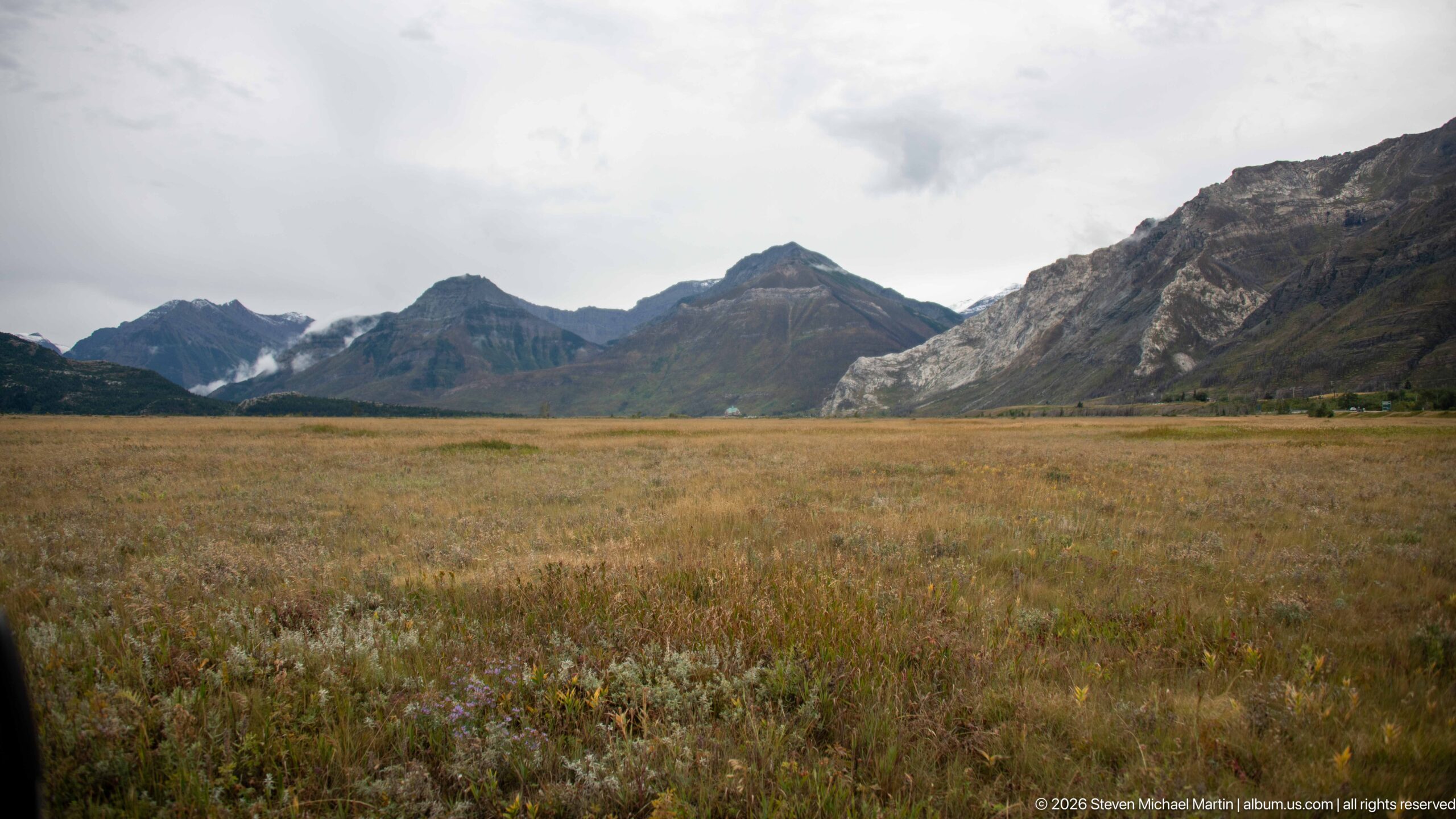
A wide expanse of tawny grassland leads toward a chain of dark, rugged mountains under a pale overcast sky. The low vegetation keeps the foreground open, allowing the mountain front to dominate the horizon from end to end. This broader panorama extends the preceding prairie views and shows the Waterton landscape as a continuous transition from open plains to steep Rocky Mountain relief.
Caption
A wide expanse of tawny grassland leads toward a chain of dark, rugged mountains under a pale overcast sky. The low vegetation keeps the foreground open, allowing the mountain front to dominate the horizon from end to end. This broader panorama extends the preceding prairie views and shows the Waterton landscape as a continuous transition from open plains to steep Rocky Mountain relief.
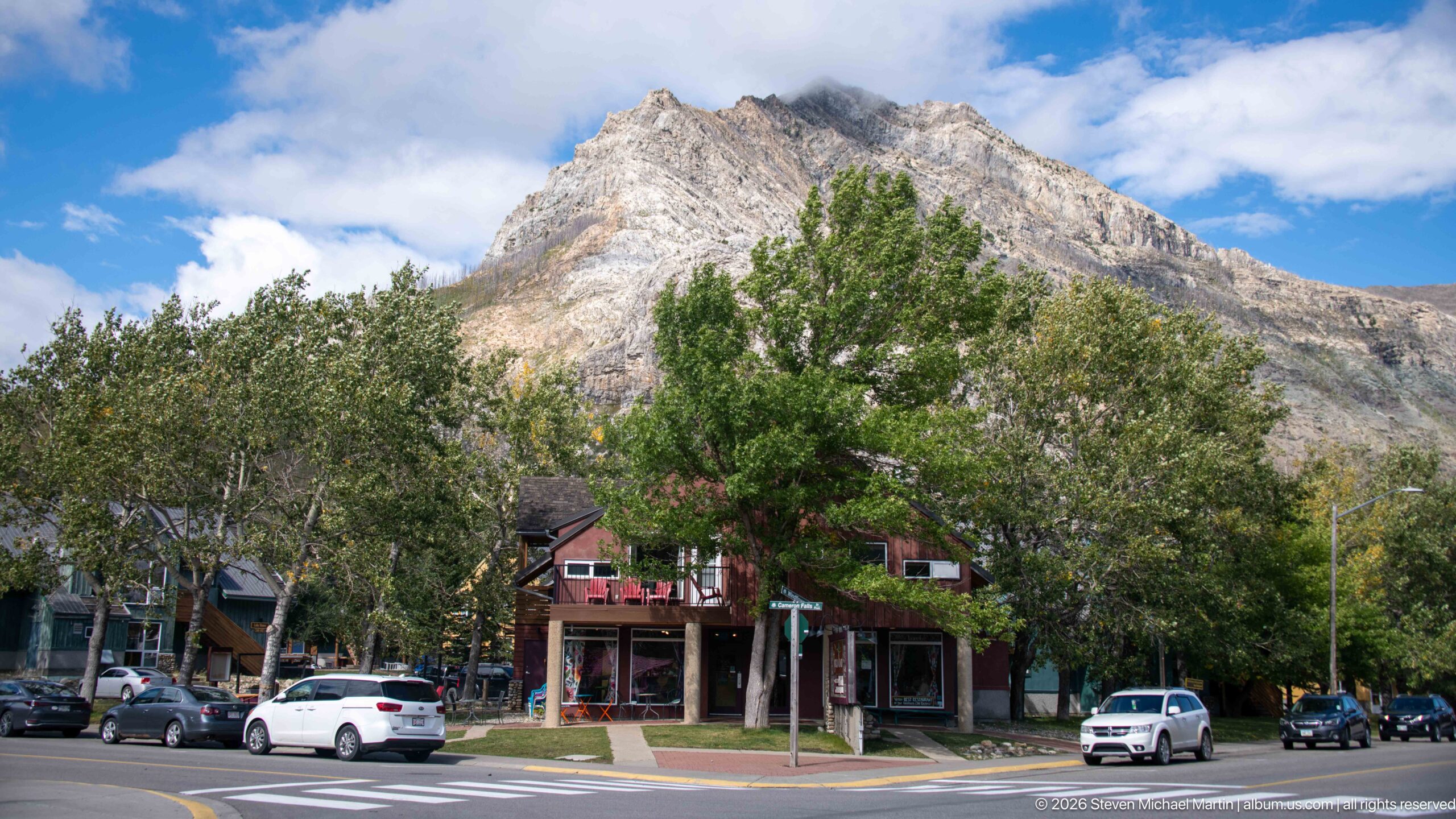
Low shops and lodging buildings line a Waterton townsite street beneath a massive pale-gray mountain face. Mature deciduous trees partly screen the storefronts, while parked and moving vehicles mark the active commercial center. The composition demonstrates the townsite’s unusually close relationship to the surrounding Rockies: ordinary streets and businesses sit immediately below steep, exposed mountain terrain.
Caption
Low shops and lodging buildings line a Waterton townsite street beneath a massive pale-gray mountain face. Mature deciduous trees partly screen the storefronts, while parked and moving vehicles mark the active commercial center. The composition demonstrates the townsite’s unusually close relationship to the surrounding Rockies: ordinary streets and businesses sit immediately below steep, exposed mountain terrain.
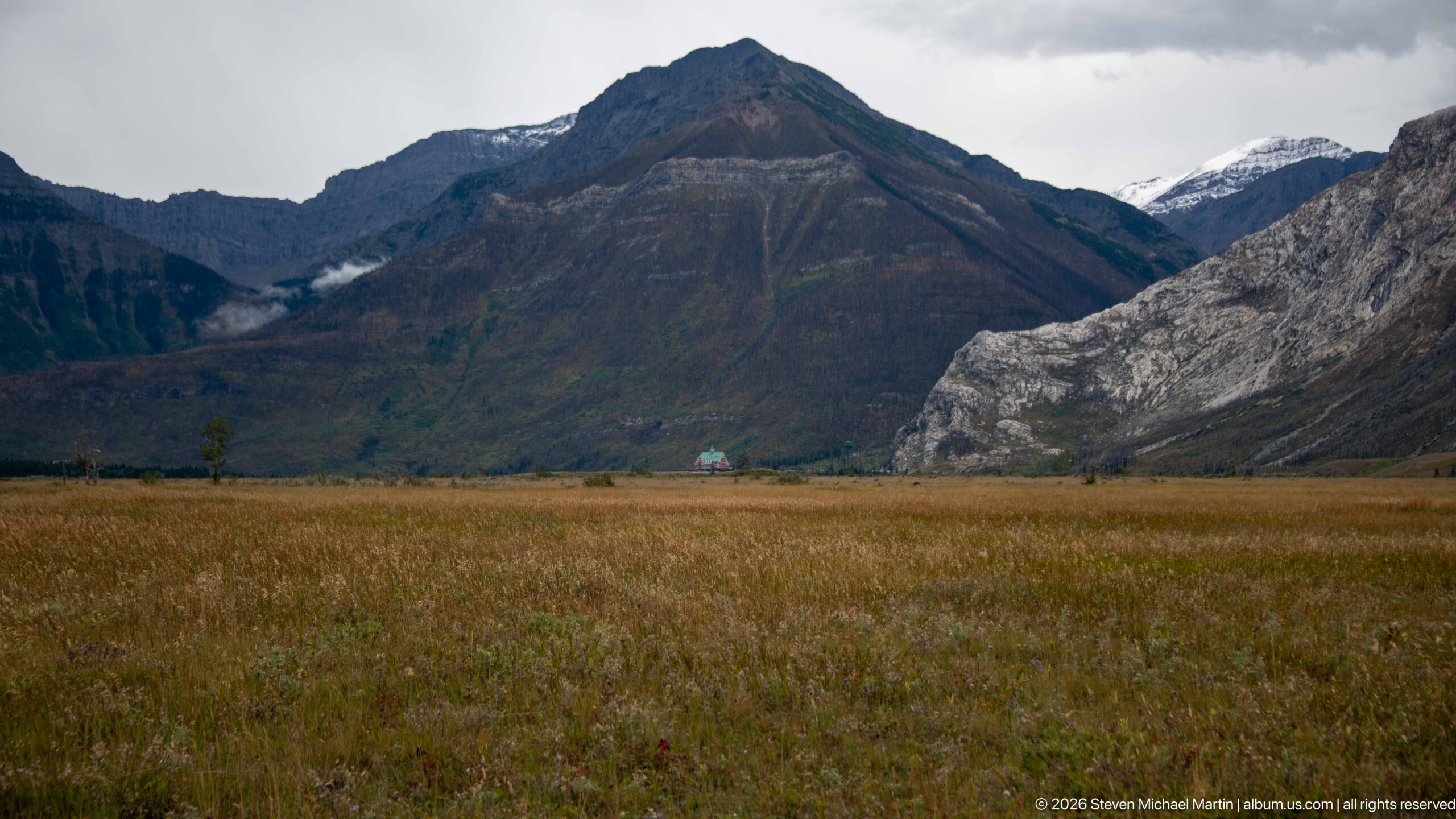
Rust-colored grassland fills the foreground below steep mountain walls and a prominent dark pyramidal summit. A pale gray rock face cuts across the right side of the basin, while a small distant building provides scale near the foot of the mountains. The wide view emphasizes the openness of Waterton’s lowlands and the sudden rise of rugged terrain immediately beyond them.
Caption
Rust-colored grassland fills the foreground below steep mountain walls and a prominent dark pyramidal summit. A pale gray rock face cuts across the right side of the basin, while a small distant building provides scale near the foot of the mountains. The wide view emphasizes the openness of Waterton’s lowlands and the sudden rise of rugged terrain immediately beyond them.
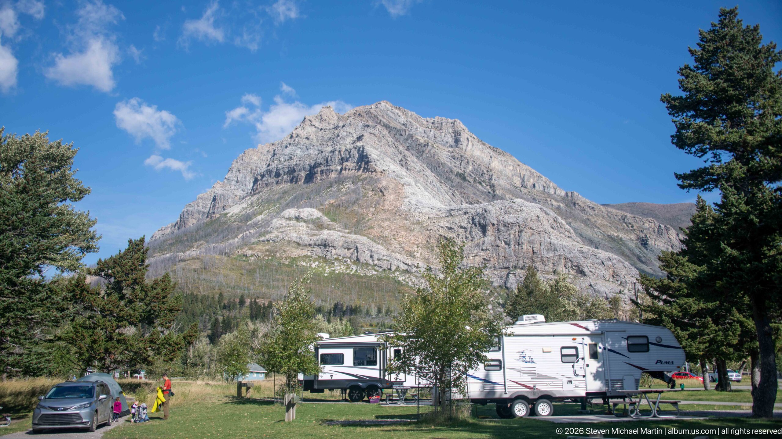
Recreational vehicles and tents occupy a grassy campground beneath a steep, layered mountain in Waterton Lakes. Mature conifers frame the campsites while cars, trailers, and camping equipment show the scale of the developed visitor area. The juxtaposition is characteristic of the park experience: substantial campground infrastructure sits immediately below rugged Rocky Mountain terrain, allowing overnight visitors to remain closely connected to the surrounding landscape.
Caption
Recreational vehicles and tents occupy a grassy campground beneath a steep, layered mountain in Waterton Lakes. Mature conifers frame the campsites while cars, trailers, and camping equipment show the scale of the developed visitor area. The juxtaposition is characteristic of the park experience: substantial campground infrastructure sits immediately below rugged Rocky Mountain terrain, allowing overnight visitors to remain closely connected to the surrounding landscape.
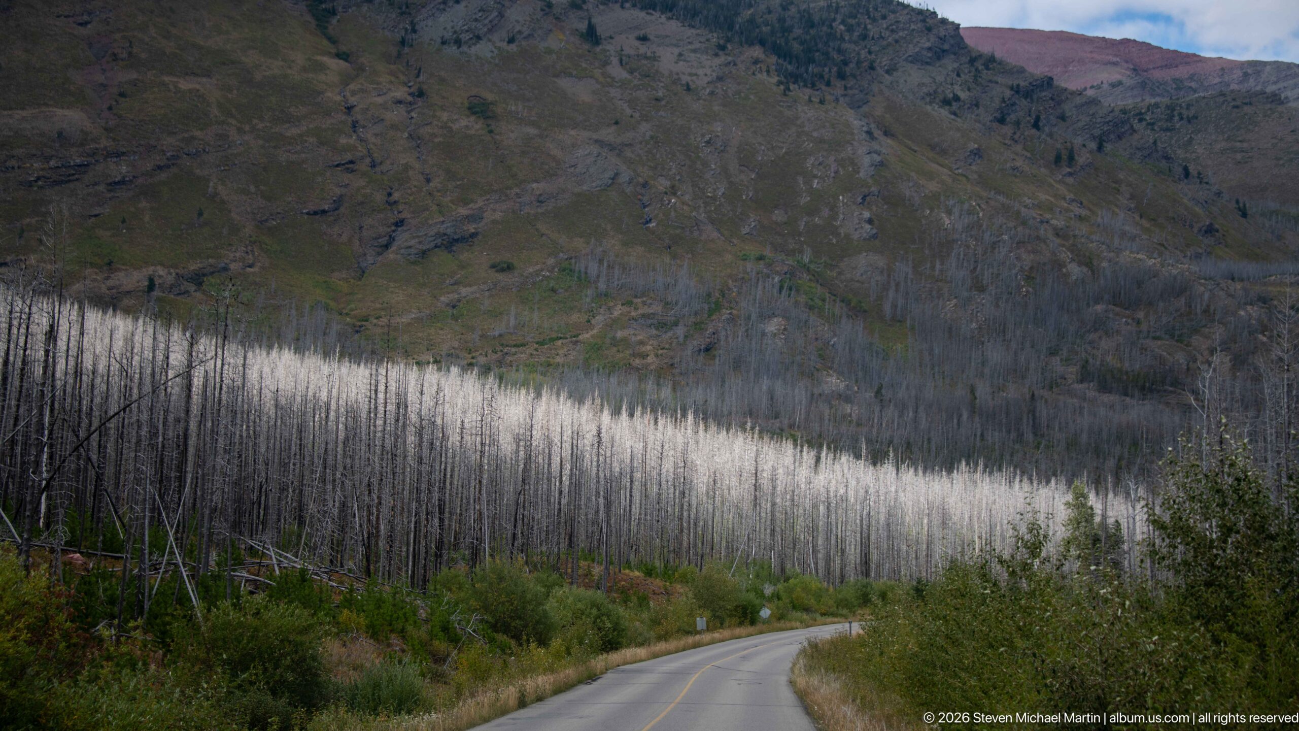
A paved park road curves gently through a broad burn scar beneath a steep mountain slope. Dense ranks of pale standing snags cover the lower terrain, while patches of green shrubs and young vegetation mark ongoing recovery near the roadside. The open canopy exposes landforms that would once have been screened by forest, making wildfire’s transformation of the Waterton landscape especially apparent from the road.
Caption
A paved park road curves gently through a broad burn scar beneath a steep mountain slope. Dense ranks of pale standing snags cover the lower terrain, while patches of green shrubs and young vegetation mark ongoing recovery near the roadside. The open canopy exposes landforms that would once have been screened by forest, making wildfire’s transformation of the Waterton landscape especially apparent from the road.

A campsite reservation confirmation for Waterton Lakes shows a confirmed stay with a 2:00 PM check-in and 11:00 AM check-out. The screen identifies site E23, a medium tent equipment type, and a party size of two guests. As a travel record, it documents the practical campground arrangements associated with the Waterton visit rather than a landscape or park feature.
Caption
A campsite reservation confirmation for Waterton Lakes shows a confirmed stay with a 2:00 PM check-in and 11:00 AM check-out. The screen identifies site E23, a medium tent equipment type, and a party size of two guests. As a travel record, it documents the practical campground arrangements associated with the Waterton visit rather than a landscape or park feature.
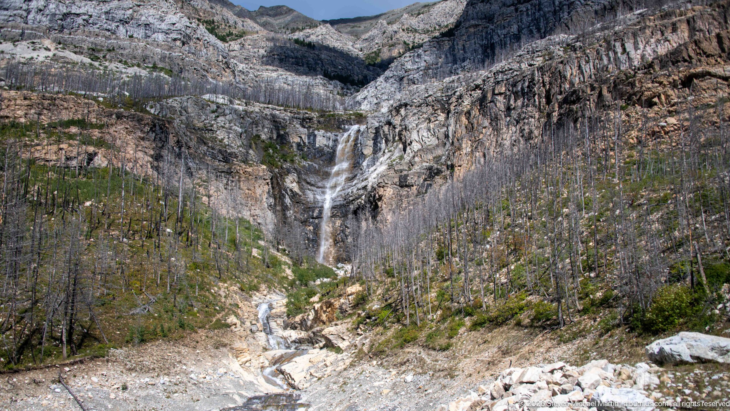
A tall waterfall descends in several white ribbons from a layered cliff into a rocky basin filled with standing dead trees. Below the main drop, the stream continues through pale bedrock toward the foreground. The broad view places flowing water, exposed geology, and post-fire forest in a single composition, showing how a mountain drainage cuts through the dramatically altered slopes of Waterton Lakes.
Caption
A tall waterfall descends in several white ribbons from a layered cliff into a rocky basin filled with standing dead trees. Below the main drop, the stream continues through pale bedrock toward the foreground. The broad view places flowing water, exposed geology, and post-fire forest in a single composition, showing how a mountain drainage cuts through the dramatically altered slopes of Waterton Lakes.
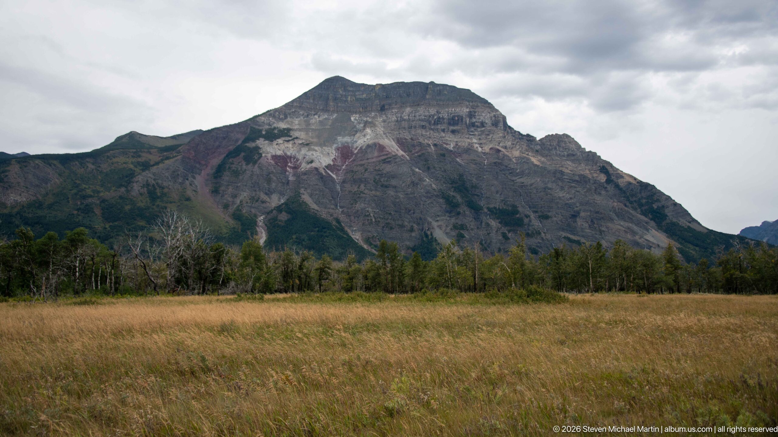
A broad golden grassland stretches toward a massive gray-brown mountain whose layered summit rises beneath an overcast sky. A thin belt of trees marks the transition between open prairie and steep rock. The uncluttered foreground makes the abrupt meeting of plains and mountains especially clear, one of the defining landscape relationships of Waterton Lakes.
Caption
A broad golden grassland stretches toward a massive gray-brown mountain whose layered summit rises beneath an overcast sky. A thin belt of trees marks the transition between open prairie and steep rock. The uncluttered foreground makes the abrupt meeting of plains and mountains especially clear, one of the defining landscape relationships of Waterton Lakes.
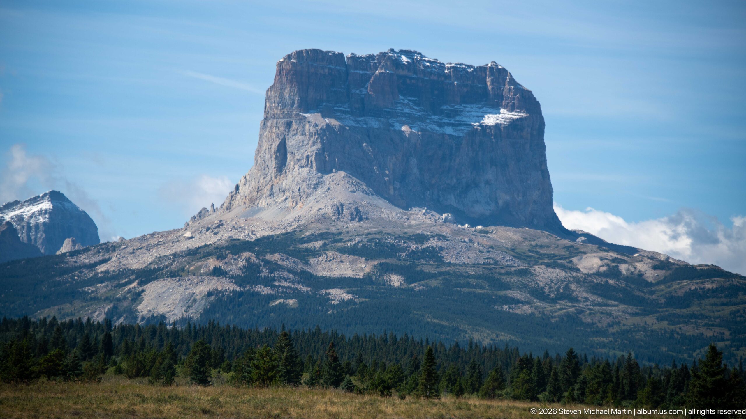
Chief Mountain rises as an isolated, flat-topped mass above the forest and open foothills east of Waterton Lakes. Its sheer upper cliffs and broad summit form a distinctive landmark at the meeting of the Rocky Mountain front and the plains. The closer view emphasizes the mountain’s abrupt relief, exposed sedimentary rock, and the way its massive profile stands apart from neighboring peaks.
Caption
Chief Mountain rises as an isolated, flat-topped mass above the forest and open foothills east of Waterton Lakes. Its sheer upper cliffs and broad summit form a distinctive landmark at the meeting of the Rocky Mountain front and the plains. The closer view emphasizes the mountain’s abrupt relief, exposed sedimentary rock, and the way its massive profile stands apart from neighboring peaks.

A small beagle-type dog rests against a passenger inside a vehicle, adding a personal travel moment to the Waterton Lakes sequence. Warm autumn foliage is visible through the side window while the dog looks downward from the passenger’s lap. The close interior composition shifts attention from the surrounding mountain landscape to the practical experience of traveling through the region with a companion animal.
Caption
A small beagle-type dog rests against a passenger inside a vehicle, adding a personal travel moment to the Waterton Lakes sequence. Warm autumn foliage is visible through the side window while the dog looks downward from the passenger’s lap. The close interior composition shifts attention from the surrounding mountain landscape to the practical experience of traveling through the region with a companion animal.
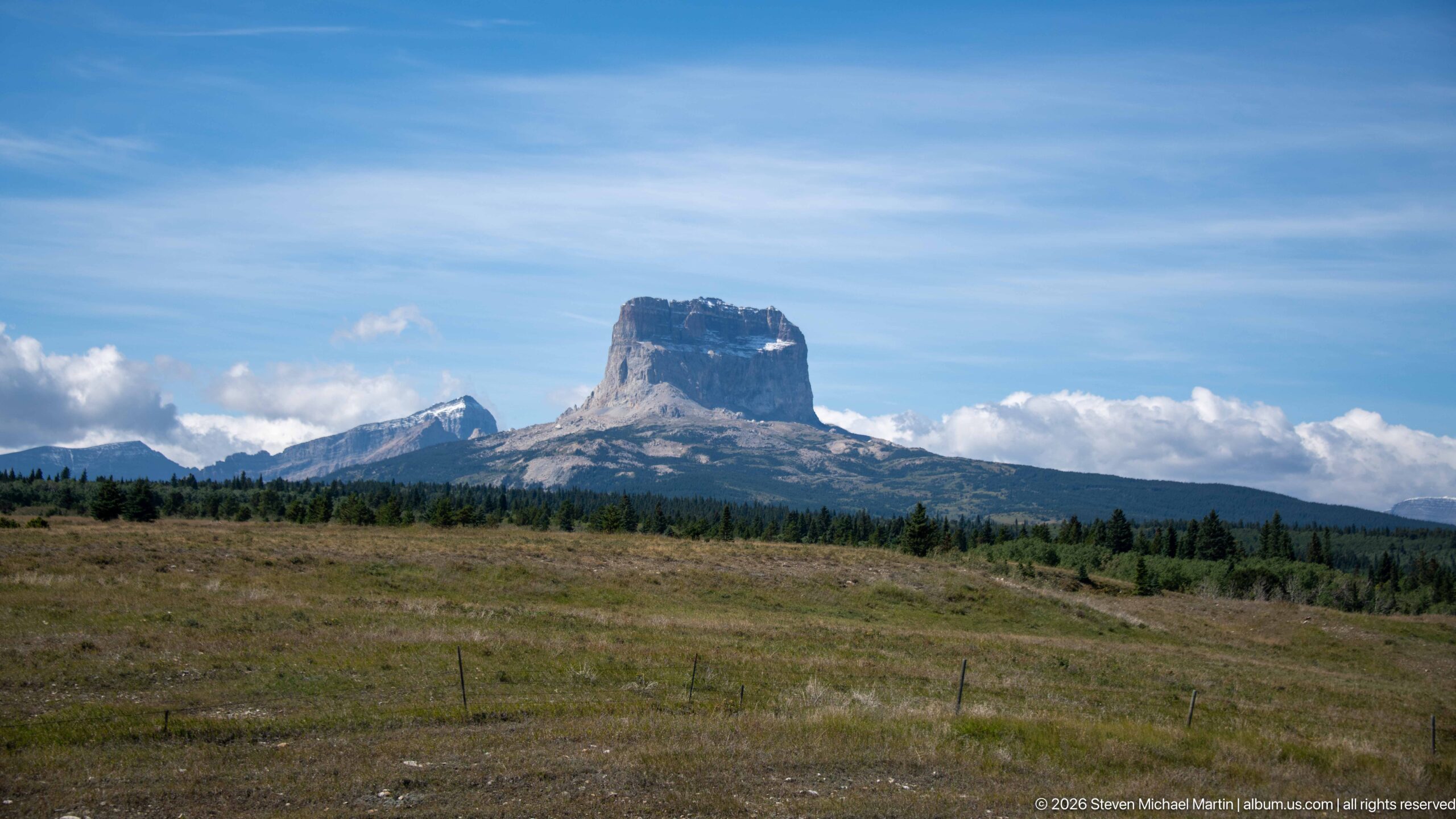
Chief Mountain appears beyond a broad sweep of open foothill grassland, its blocklike summit rising above a dark band of conifer forest. This wider view places the landmark within the prairie-to-mountain transition characteristic of the Waterton region. Fence posts and gently rolling ground in the foreground reinforce the scale and openness of the landscape before the Rocky Mountain front rises sharply in the distance.
Caption
Chief Mountain appears beyond a broad sweep of open foothill grassland, its blocklike summit rising above a dark band of conifer forest. This wider view places the landmark within the prairie-to-mountain transition characteristic of the Waterton region. Fence posts and gently rolling ground in the foreground reinforce the scale and openness of the landscape before the Rocky Mountain front rises sharply in the distance.
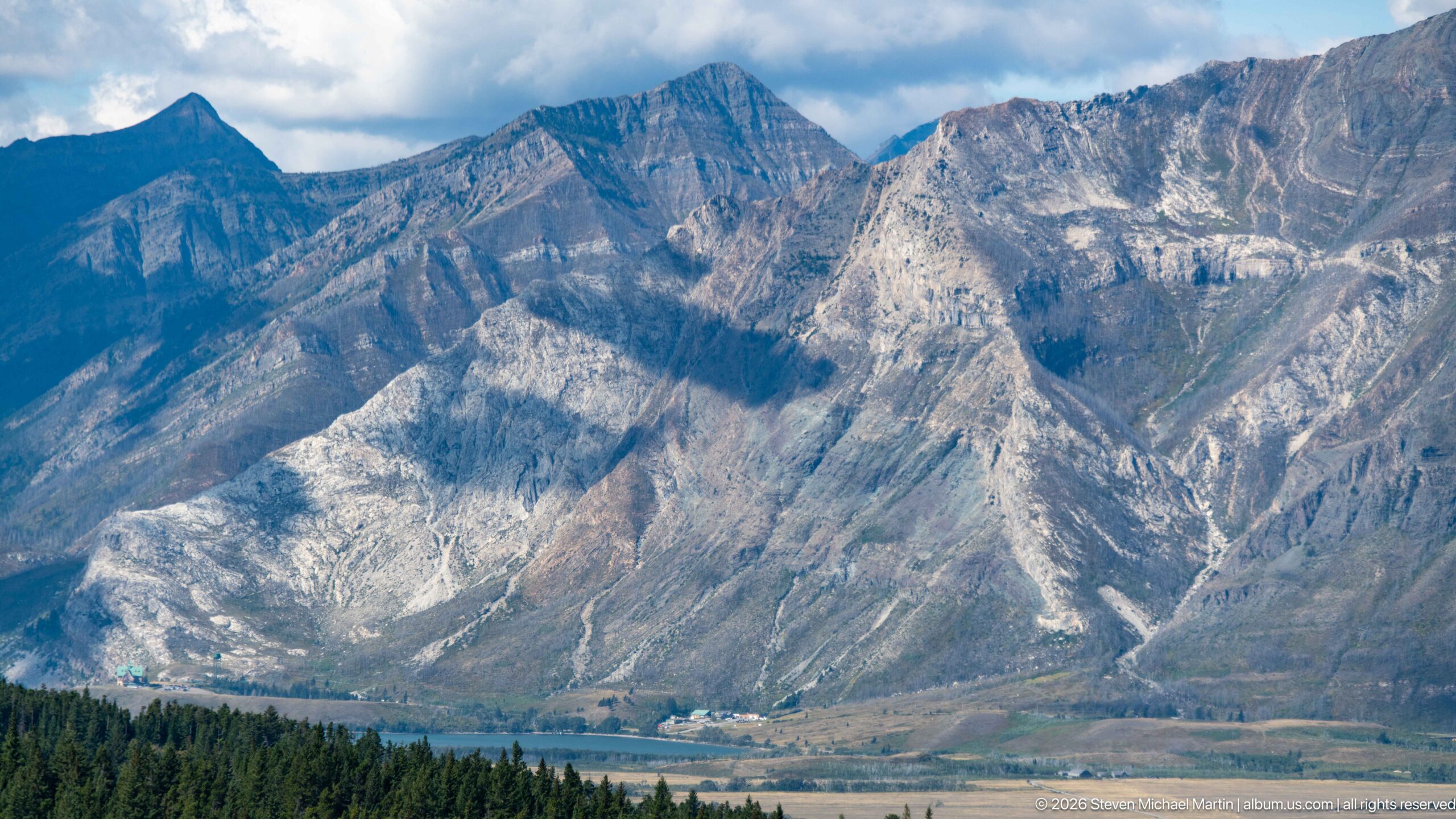
Steep, layered mountain slopes dominate this compressed view of the Rocky Mountain front near Waterton Lakes. Pale rock bands, gullies, and tilted strata create a strongly textured face above a narrow strip of forest and developed valley floor. Rather than isolating a named summit, the photograph records the region’s exposed geology and the abrupt vertical transition from lowland settlement and woodland to rugged alpine terrain.
Caption
Steep, layered mountain slopes dominate this compressed view of the Rocky Mountain front near Waterton Lakes. Pale rock bands, gullies, and tilted strata create a strongly textured face above a narrow strip of forest and developed valley floor. Rather than isolating a named summit, the photograph records the region’s exposed geology and the abrupt vertical transition from lowland settlement and woodland to rugged alpine terrain.
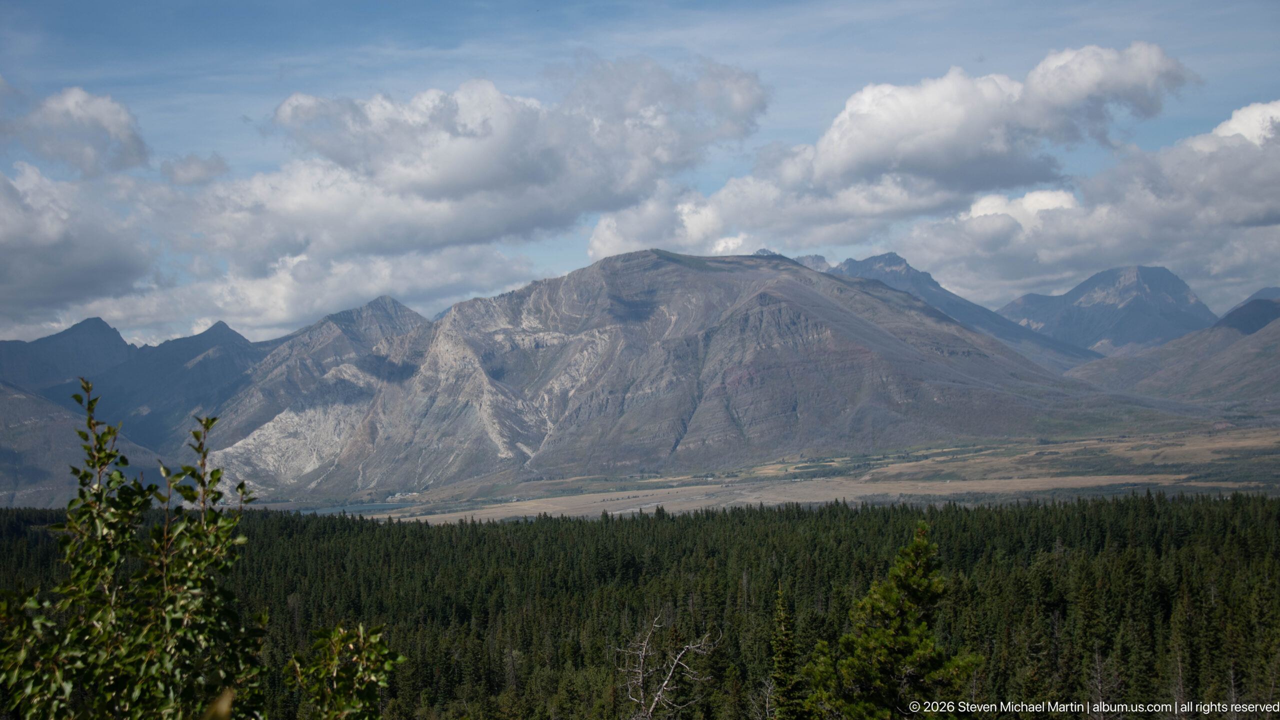
A long, heavily eroded mountain ridge rises above dark conifer forest as large cumulus clouds gather overhead. Pale scree channels and exposed strata cut through the gray slopes, while deeper mountain silhouettes recede at the right edge. The subdued light and tighter framing distinguish this view from the preceding panorama, concentrating attention on the ridge’s weathered surface and the dramatic meeting of forest, rock, and sky.
Caption
A long, heavily eroded mountain ridge rises above dark conifer forest as large cumulus clouds gather overhead. Pale scree channels and exposed strata cut through the gray slopes, while deeper mountain silhouettes recede at the right edge. The subdued light and tighter framing distinguish this view from the preceding panorama, concentrating attention on the ridge’s weathered surface and the dramatic meeting of forest, rock, and sky.
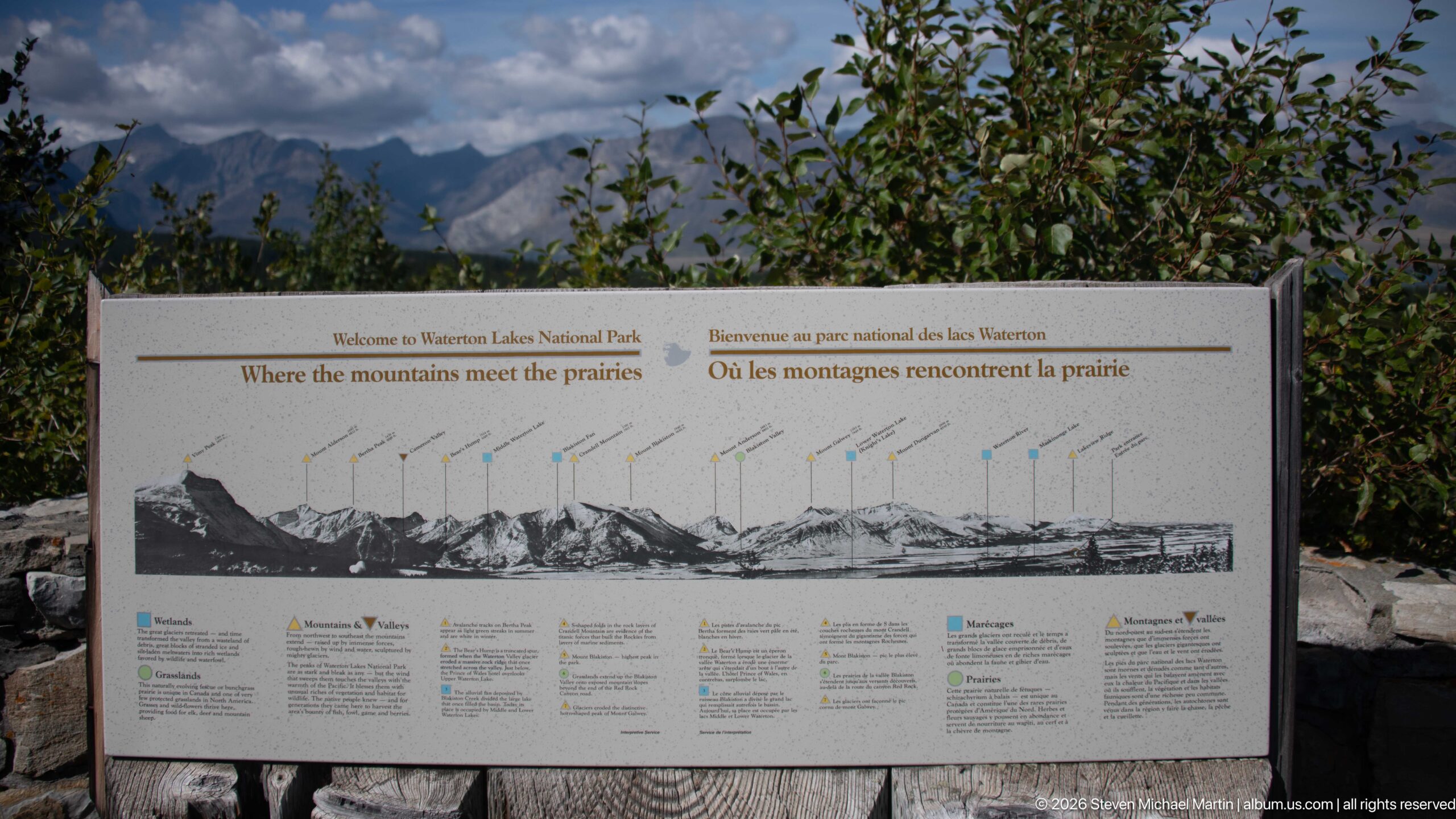
An outdoor orientation panel titled “Where the mountains meet the prairies” identifies the skyline visible from Waterton Lakes with a labeled mountain profile. The display makes the park’s defining geographic transition explicit: Rocky Mountain peaks rise directly from the open prairie landscape. Color-coded symbols and bilingual text provide additional interpretation, while the photographed panel preserves the names and relationships of features seen from this viewpoint.
Caption
An outdoor orientation panel titled “Where the mountains meet the prairies” identifies the skyline visible from Waterton Lakes with a labeled mountain profile. The display makes the park’s defining geographic transition explicit: Rocky Mountain peaks rise directly from the open prairie landscape. Color-coded symbols and bilingual text provide additional interpretation, while the photographed panel preserves the names and relationships of features seen from this viewpoint.
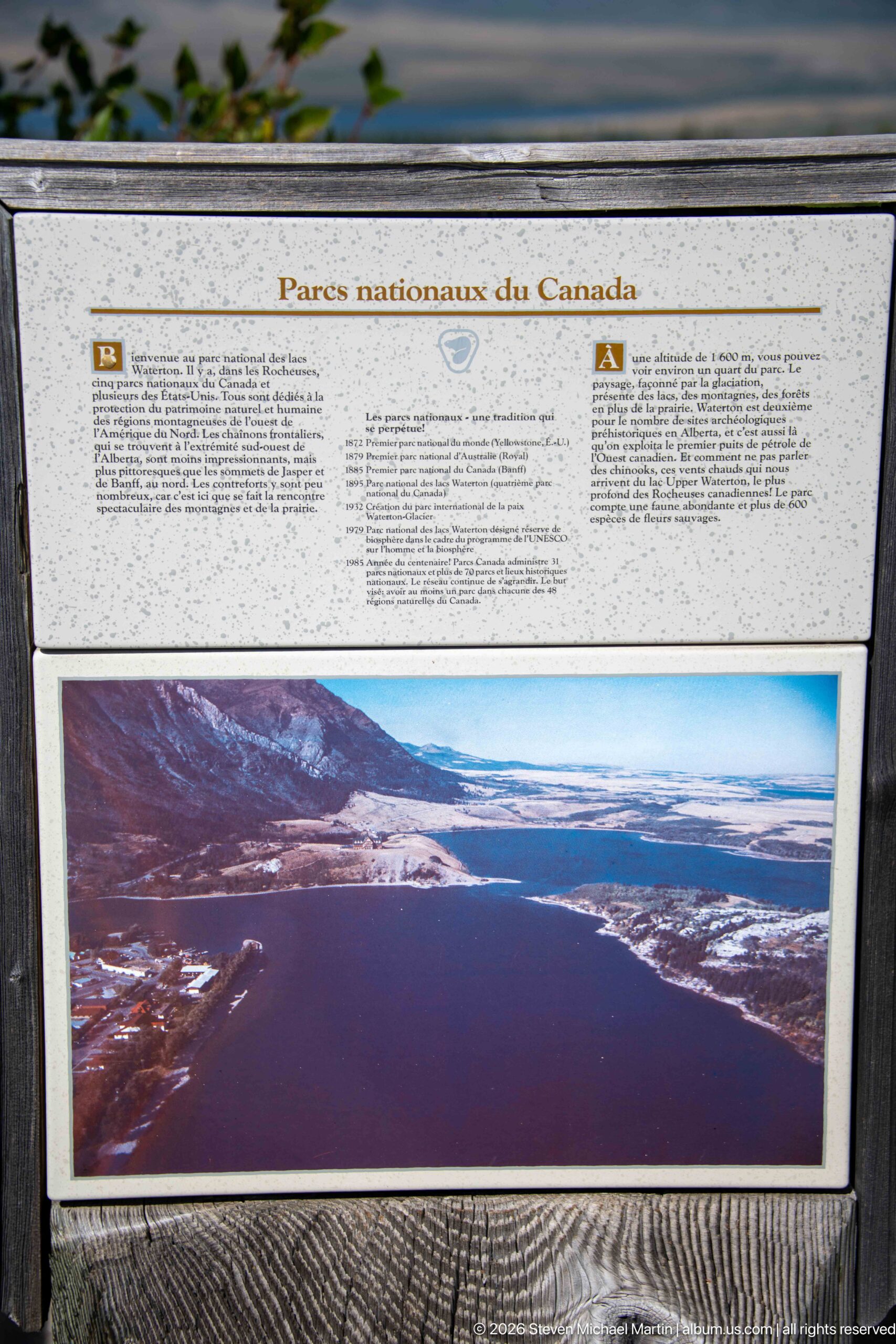
A bilingual Parks Canada interpretive panel introduces the idea of a national peace park above a large landscape photograph of an international mountain lake. English and French text share the display, reflecting the Canadian setting and the cross-border conservation story central to Waterton-Glacier. The panel itself becomes the subject here, documenting how visitors are oriented to the park’s international significance before entering the surrounding landscape.
Caption
A bilingual Parks Canada interpretive panel introduces the idea of a national peace park above a large landscape photograph of an international mountain lake. English and French text share the display, reflecting the Canadian setting and the cross-border conservation story central to Waterton-Glacier. The panel itself becomes the subject here, documenting how visitors are oriented to the park’s international significance before entering the surrounding landscape.
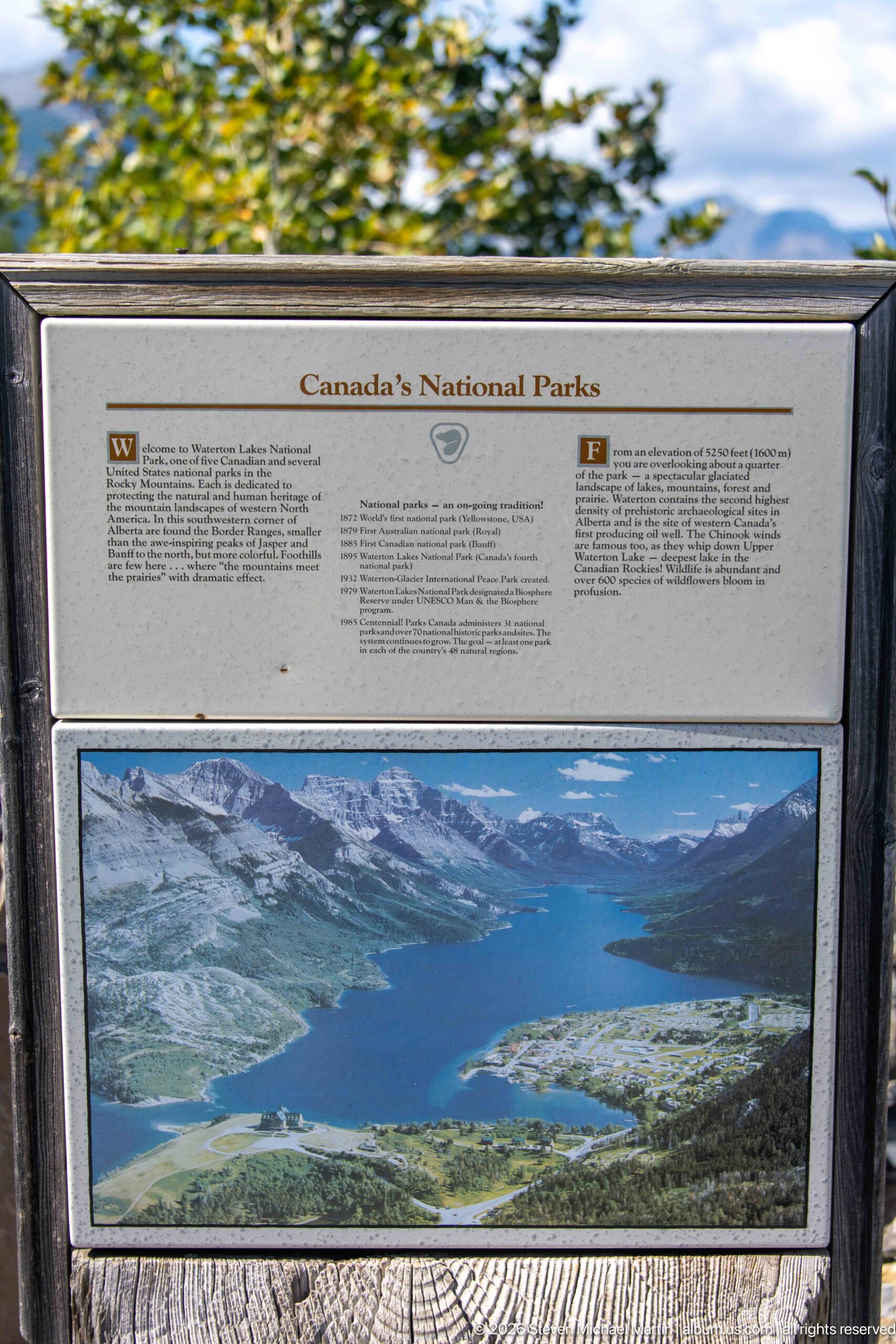
“Canada’s National Parks” heads this bilingual interpretive display, which pairs explanatory text with a sweeping view of a long mountain lake enclosed by steep ridges. The panel places Waterton Lakes within the larger national park system and uses landscape imagery to connect conservation with scenery. Its weathered outdoor mounting and bilingual presentation are characteristic of Parks Canada visitor interpretation in a site where natural and international heritage themes overlap.
Caption
“Canada’s National Parks” heads this bilingual interpretive display, which pairs explanatory text with a sweeping view of a long mountain lake enclosed by steep ridges. The panel places Waterton Lakes within the larger national park system and uses landscape imagery to connect conservation with scenery. Its weathered outdoor mounting and bilingual presentation are characteristic of Parks Canada visitor interpretation in a site where natural and international heritage themes overlap.
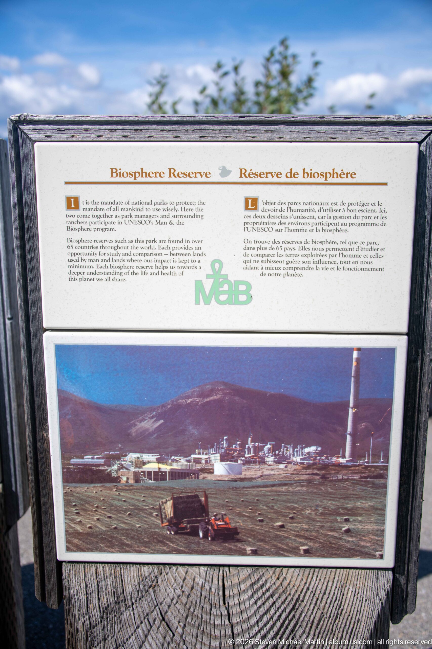
A bilingual “Biosphere Reserve” panel documents another layer of conservation recognition associated with the Waterton landscape. Explanatory text appears above a historical-looking photograph showing buildings and a tall industrial structure against mountain terrain. The display broadens the visitor narrative beyond scenery alone, presenting the region as a place where conservation, settlement, and changing human uses have intersected over time.
Caption
A bilingual “Biosphere Reserve” panel documents another layer of conservation recognition associated with the Waterton landscape. Explanatory text appears above a historical-looking photograph showing buildings and a tall industrial structure against mountain terrain. The display broadens the visitor narrative beyond scenery alone, presenting the region as a place where conservation, settlement, and changing human uses have intersected over time.
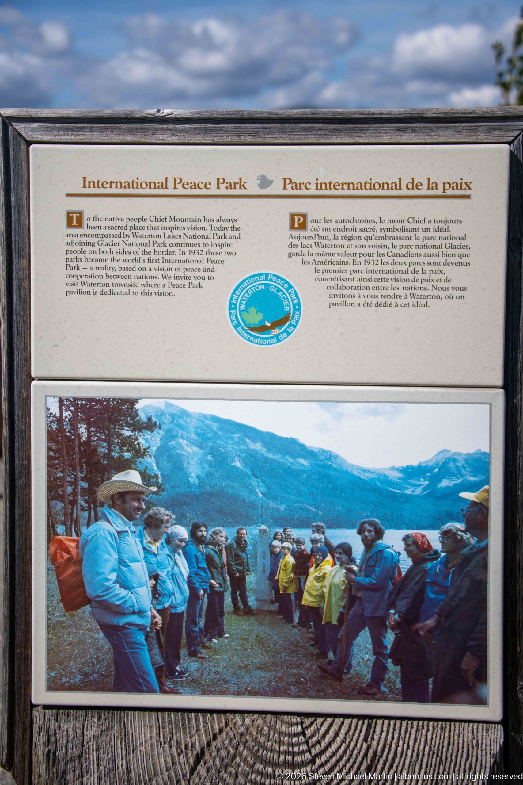
The International Peace Park is the focus of this bilingual interpretive display, marked by a circular emblem and a large archival photograph of visitors gathered at a mountain viewpoint. Waterton Lakes and neighboring Glacier National Park are presented through the idea of cooperation across an international boundary. The historic group scene gives the panel a human dimension, linking the protected landscape to the ceremonies, travel, and public engagement associated with the peace park.
Caption
The International Peace Park is the focus of this bilingual interpretive display, marked by a circular emblem and a large archival photograph of visitors gathered at a mountain viewpoint. Waterton Lakes and neighboring Glacier National Park are presented through the idea of cooperation across an international boundary. The historic group scene gives the panel a human dimension, linking the protected landscape to the ceremonies, travel, and public engagement associated with the peace park.
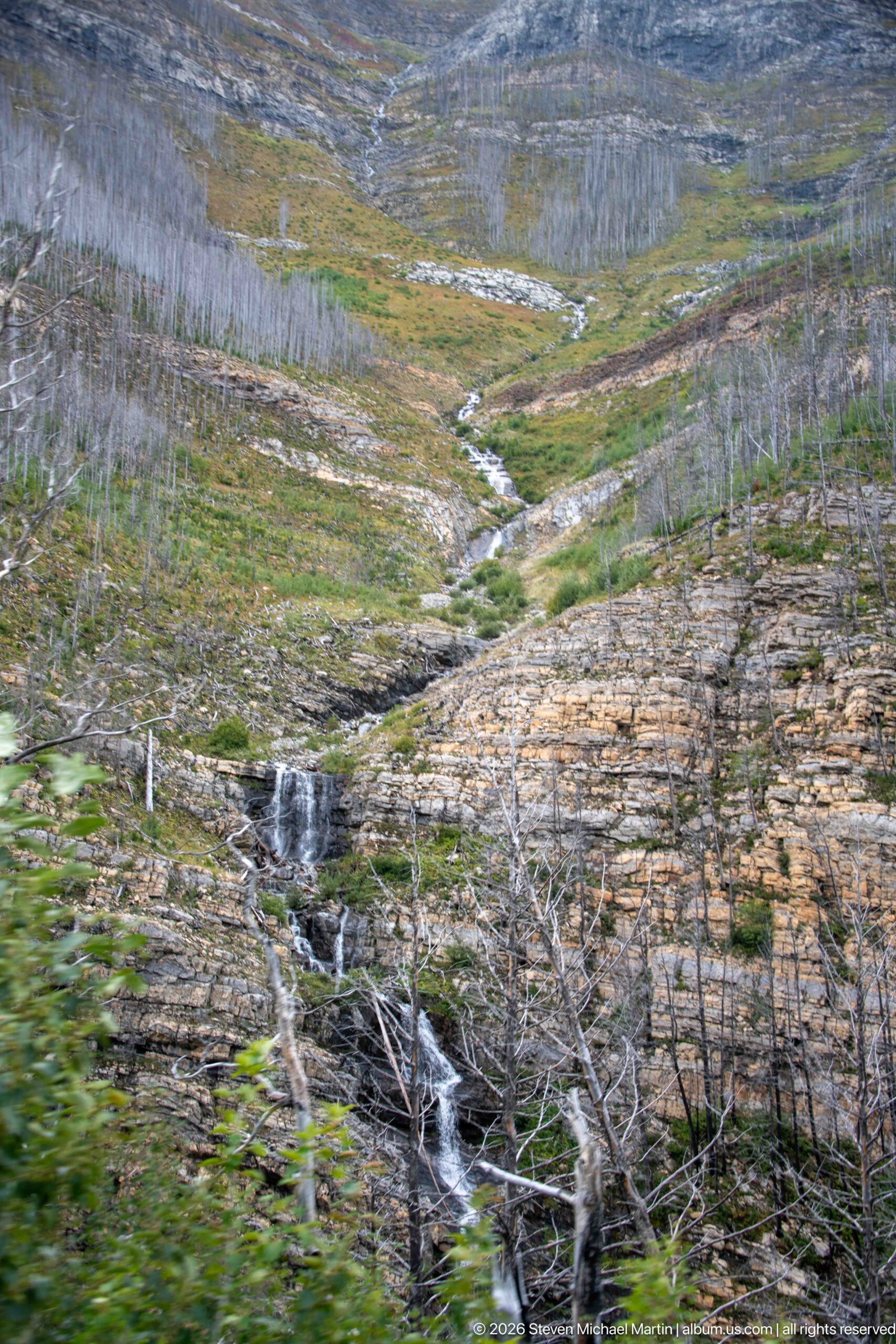
A small stream drops over exposed rock through a sparsely vegetated mountain drainage marked by numerous standing dead trees. Low green plants and grasses are returning between pale rock shelves, creating a visible contrast between recovering ground cover and the fire-altered forest. The wider composition places the modest cascade within the damaged slope, recording ecological change as part of the contemporary Waterton Lakes landscape.
Caption
A small stream drops over exposed rock through a sparsely vegetated mountain drainage marked by numerous standing dead trees. Low green plants and grasses are returning between pale rock shelves, creating a visible contrast between recovering ground cover and the fire-altered forest. The wider composition places the modest cascade within the damaged slope, recording ecological change as part of the contemporary Waterton Lakes landscape.
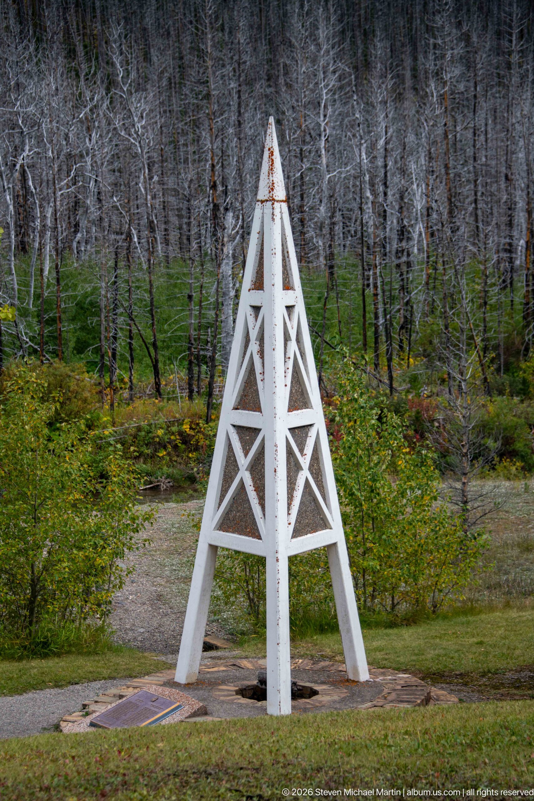
A white timber derrick rises from a circular base amid a forest of fire-killed trunks at the First Oil Well in Western Canada site. Its tapered framework evokes the drilling structures used during the region’s early petroleum exploration. The stark geometric monument stands out against regenerating vegetation and gray snags, linking Waterton’s industrial history with a landscape that has continued to change through natural disturbance.
Caption
A white timber derrick rises from a circular base amid a forest of fire-killed trunks at the First Oil Well in Western Canada site. Its tapered framework evokes the drilling structures used during the region’s early petroleum exploration. The stark geometric monument stands out against regenerating vegetation and gray snags, linking Waterton’s industrial history with a landscape that has continued to change through natural disturbance.
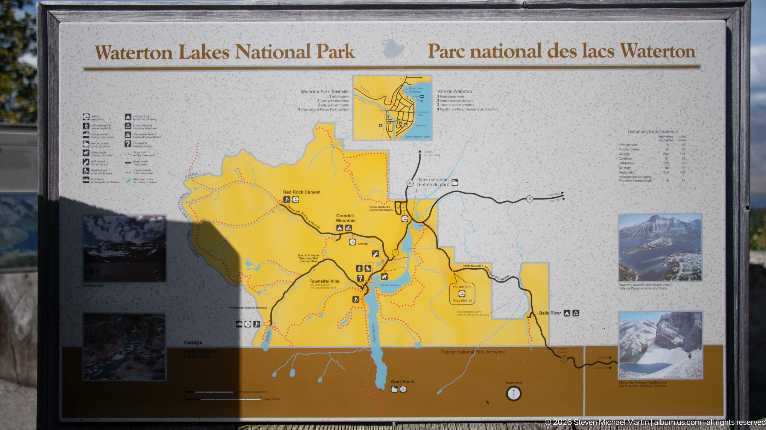
A bilingual visitor map of Waterton Lakes National Park shows the protected area in yellow, with roads, trails, waterways, facilities, and surrounding geographic context arranged across the panel. Insets and small photographs supplement the central map. As an orientation document, the display records how visitors encounter the park spatially, connecting the townsite and road network with lakes, valleys, trail corridors, and the international boundary landscape.
Caption
A bilingual visitor map of Waterton Lakes National Park shows the protected area in yellow, with roads, trails, waterways, facilities, and surrounding geographic context arranged across the panel. Insets and small photographs supplement the central map. As an orientation document, the display records how visitors encounter the park spatially, connecting the townsite and road network with lakes, valleys, trail corridors, and the international boundary landscape.
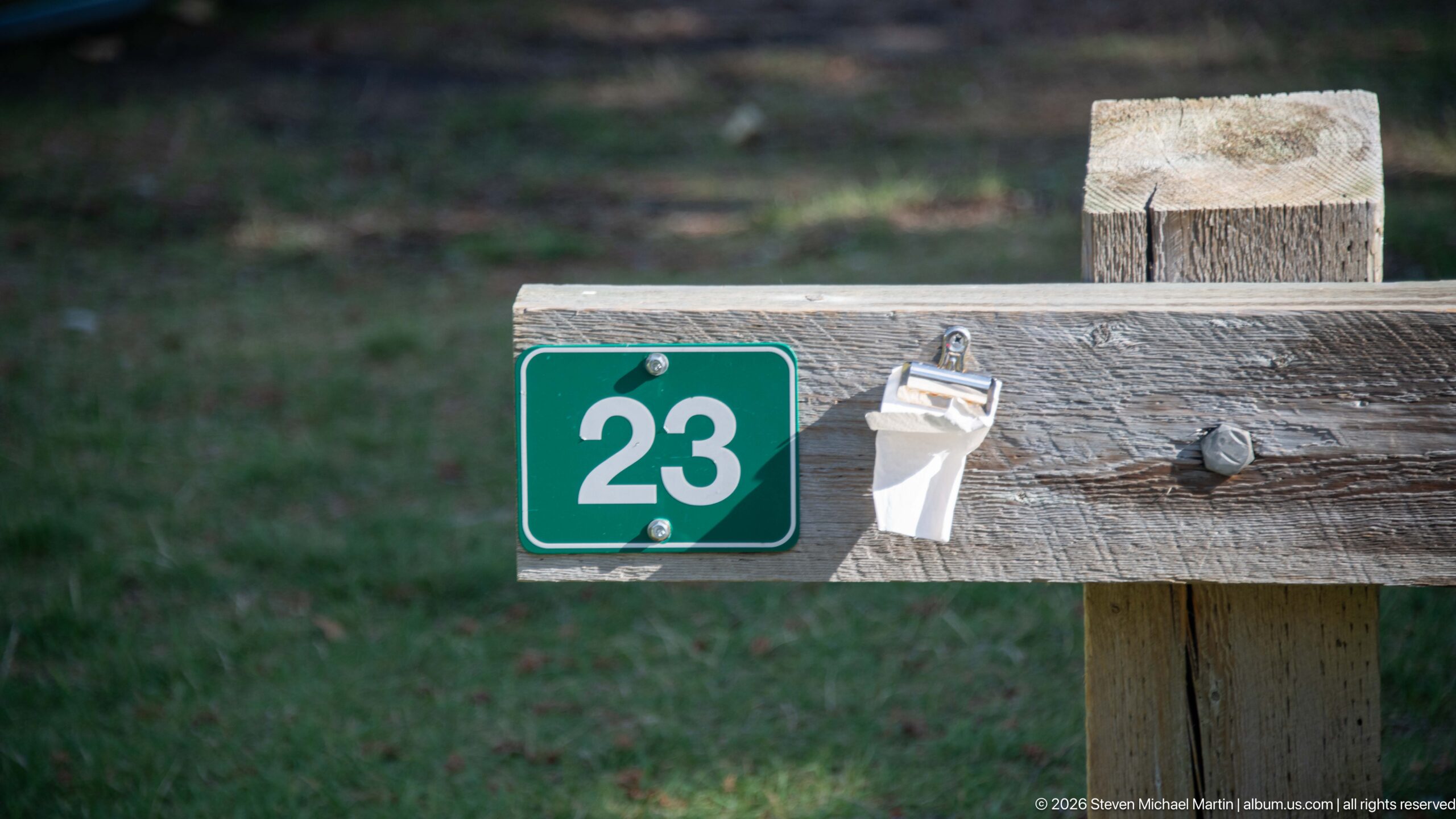
A green campsite marker numbered 23 is fixed to a weathered wooden rail, with a small white utility fitting attached beside it. The shallow depth of field isolates these practical campground details from the grassy background. This close view records the modest infrastructure that organizes overnight use in Waterton Lakes, contrasting with the expansive mountain scenery and interpretive displays elsewhere in the portfolio.
Caption
A green campsite marker numbered 23 is fixed to a weathered wooden rail, with a small white utility fitting attached beside it. The shallow depth of field isolates these practical campground details from the grassy background. This close view records the modest infrastructure that organizes overnight use in Waterton Lakes, contrasting with the expansive mountain scenery and interpretive displays elsewhere in the portfolio.
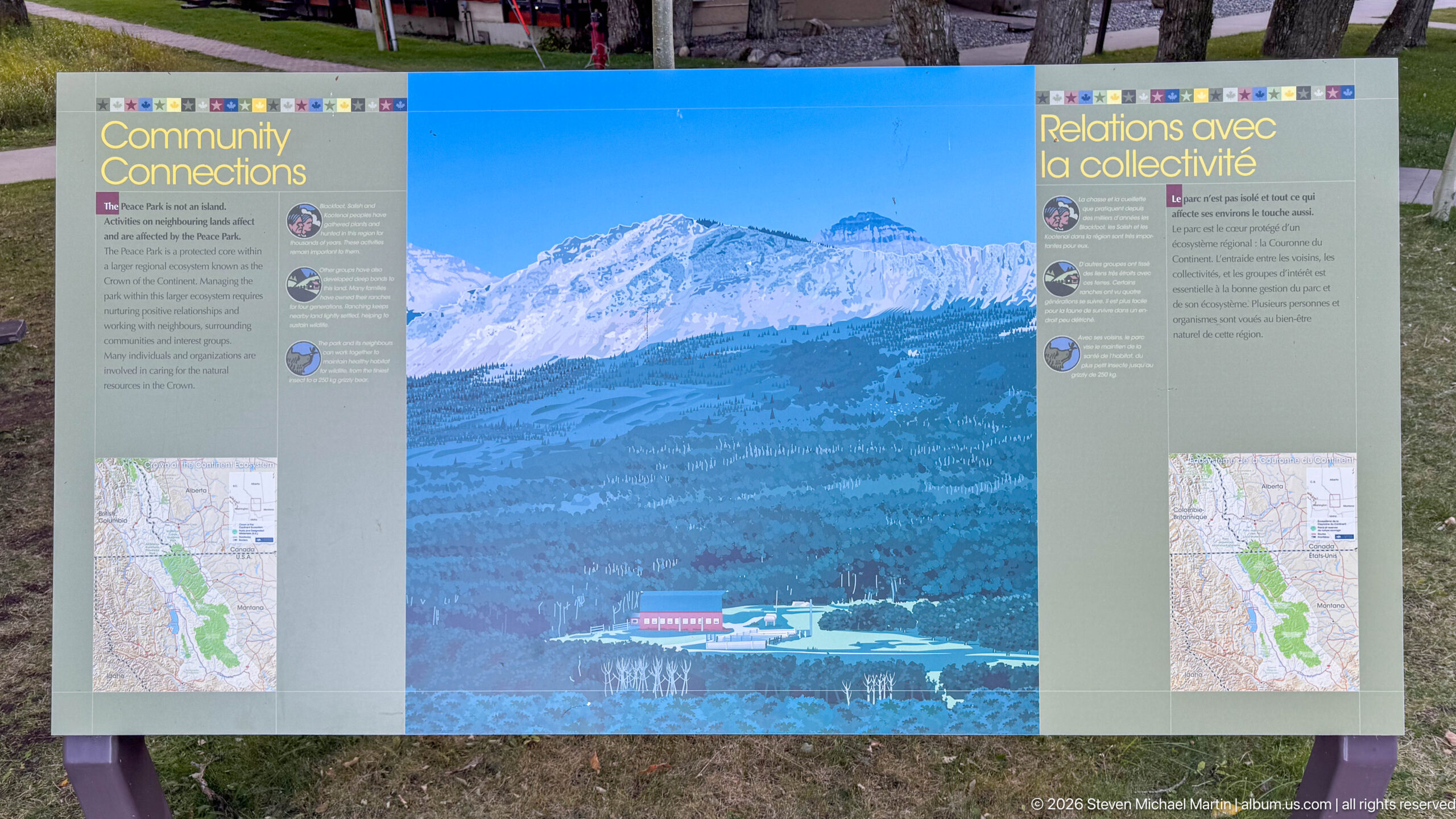
A bilingual panel titled “Connections” uses a mountain landscape and maps to explain relationships extending beyond Waterton Lakes itself. The central image shows forested slopes and a developed lakeside setting beneath high peaks, while side columns present interpretive text and locator graphics. The display contributes to the park’s broader peace-park narrative by emphasizing geographic and institutional links across a landscape that does not end at a political boundary.
Caption
A bilingual panel titled “Connections” uses a mountain landscape and maps to explain relationships extending beyond Waterton Lakes itself. The central image shows forested slopes and a developed lakeside setting beneath high peaks, while side columns present interpretive text and locator graphics. The display contributes to the park’s broader peace-park narrative by emphasizing geographic and institutional links across a landscape that does not end at a political boundary.
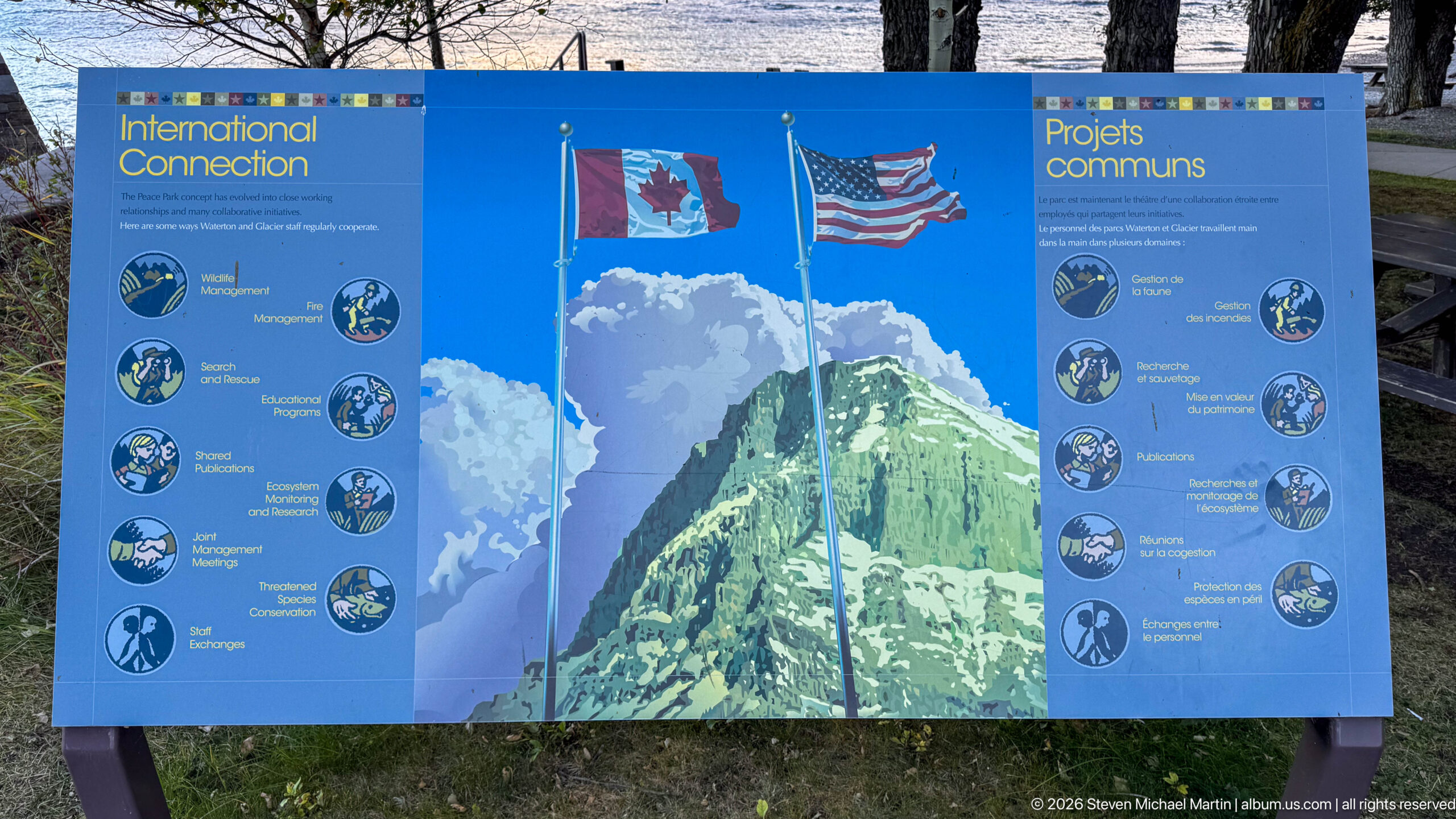
Canadian and United States flags rise above a stylized mountain on this bilingual panel devoted to shared projects. Rows of circular illustrations flank the central graphic, representing areas of cross-border cooperation associated with the Waterton-Glacier landscape. The design makes international partnership visually immediate: two national symbols occupy the same mountain setting while paired interpretive sections describe joint work on either side of the border.
Caption
Canadian and United States flags rise above a stylized mountain on this bilingual panel devoted to shared projects. Rows of circular illustrations flank the central graphic, representing areas of cross-border cooperation associated with the Waterton-Glacier landscape. The design makes international partnership visually immediate: two national symbols occupy the same mountain setting while paired interpretive sections describe joint work on either side of the border.
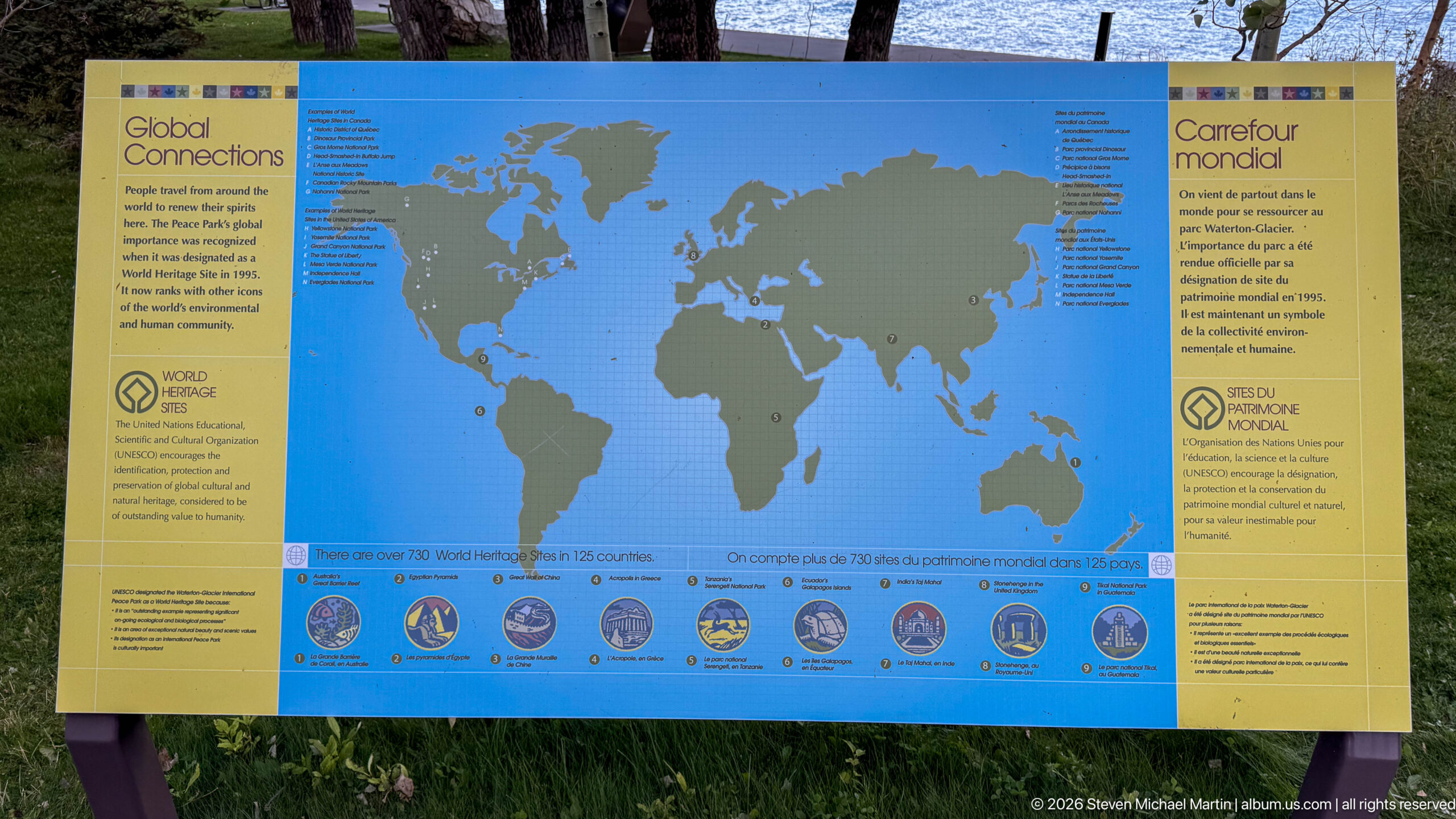
A large world map anchors this bilingual interpretive panel about global connections and World Heritage. Numerous locations are marked across the continents, while a row of circular photographs or emblems runs along the bottom beneath the map. The display places Waterton-Glacier within an international network of recognized places, shifting the visitor’s perspective from a single mountain park to the worldwide framework of heritage conservation.
Caption
A large world map anchors this bilingual interpretive panel about global connections and World Heritage. Numerous locations are marked across the continents, while a row of circular photographs or emblems runs along the bottom beneath the map. The display places Waterton-Glacier within an international network of recognized places, shifting the visitor’s perspective from a single mountain park to the worldwide framework of heritage conservation.
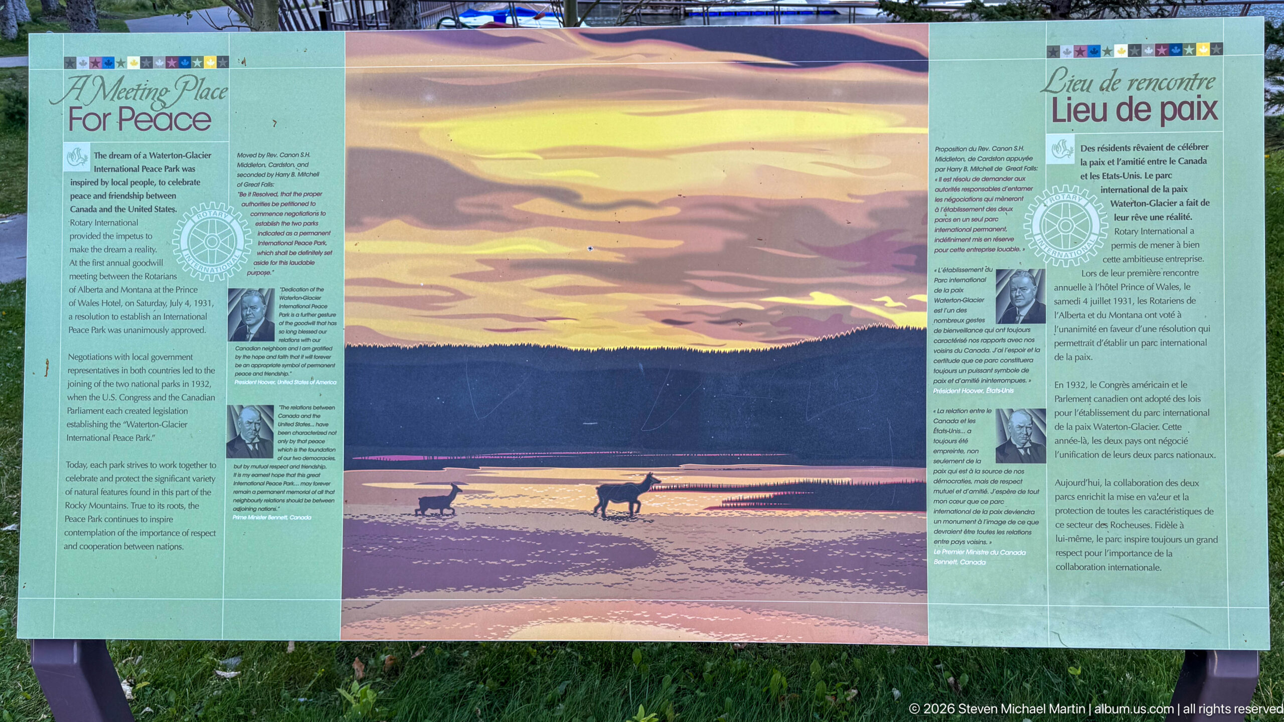
A bilingual “Place of peace” panel centers on a warm-toned wildlife landscape, where two ungulates stand in shallow water against a luminous mountain horizon. Text columns and smaller images flank the central scene, connecting the quiet natural setting to the peace-park theme. The display uses wildlife and open space rather than political symbols to convey the protected landscape as shared habitat and a setting for international understanding.
Caption
A bilingual “Place of peace” panel centers on a warm-toned wildlife landscape, where two ungulates stand in shallow water against a luminous mountain horizon. Text columns and smaller images flank the central scene, connecting the quiet natural setting to the peace-park theme. The display uses wildlife and open space rather than political symbols to convey the protected landscape as shared habitat and a setting for international understanding.
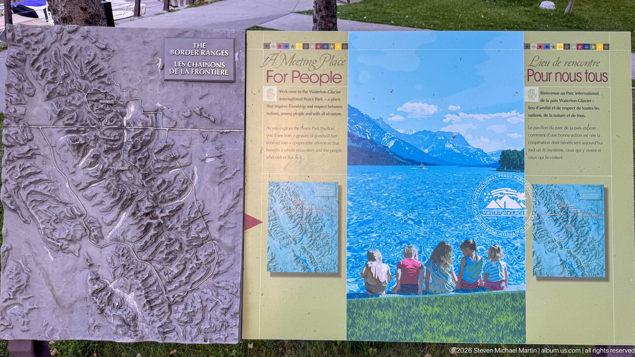
A bilingual panel titled “A Meeting Place For People” combines a bright lake-and-mountain scene with maps and interpretive text. A separate relief-like panel at left adds a tactile or sculptural element to the display. Together they frame Waterton Lakes as a place shaped not only by dramatic geography but also by generations of human movement, gathering, and connection across the mountain landscape.
Caption
A bilingual panel titled “A Meeting Place For People” combines a bright lake-and-mountain scene with maps and interpretive text. A separate relief-like panel at left adds a tactile or sculptural element to the display. Together they frame Waterton Lakes as a place shaped not only by dramatic geography but also by generations of human movement, gathering, and connection across the mountain landscape.
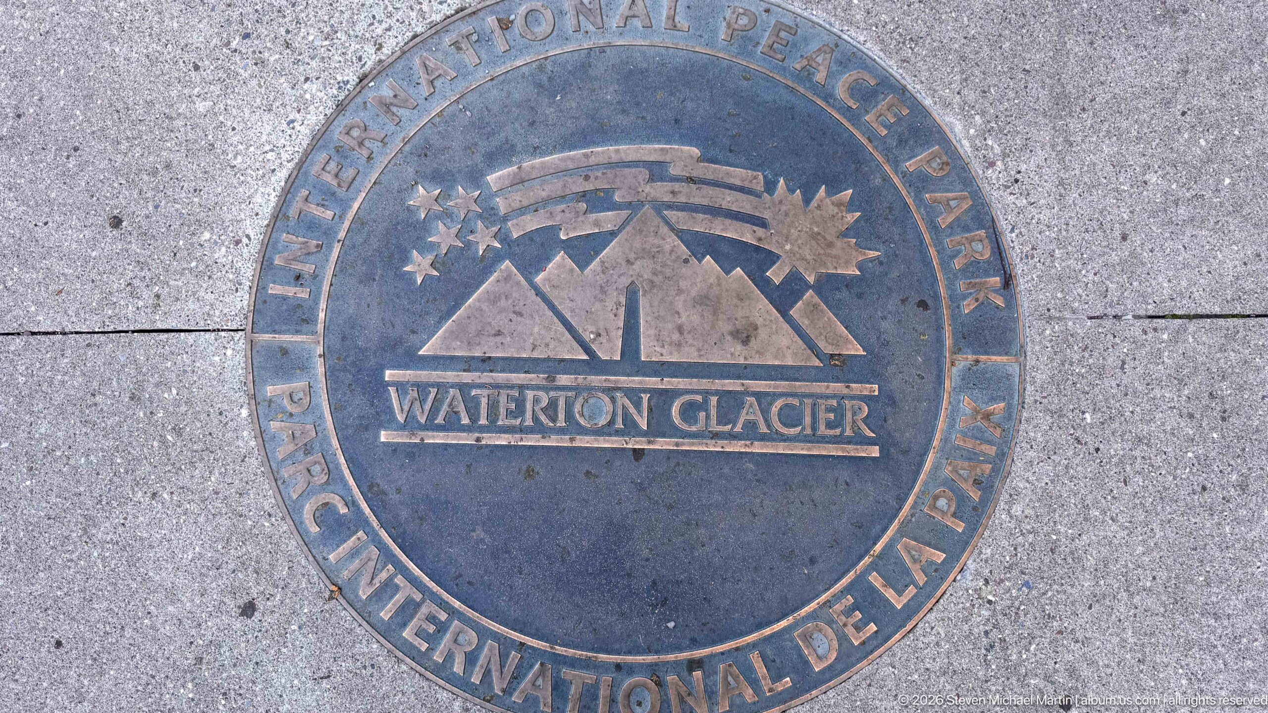
A circular pavement medallion marks the Waterton-Glacier International Peace Park with a stylized mountain emblem, stars, and the park name in English and French. Set directly into the paving, the marker turns the international designation into a physical element of the visitor space. Weathering and surface patina give the emblem a tactile presence distinct from the nearby interpretive panels and freestanding monument.
Caption
A circular pavement medallion marks the Waterton-Glacier International Peace Park with a stylized mountain emblem, stars, and the park name in English and French. Set directly into the paving, the marker turns the international designation into a physical element of the visitor space. Weathering and surface patina give the emblem a tactile presence distinct from the nearby interpretive panels and freestanding monument.
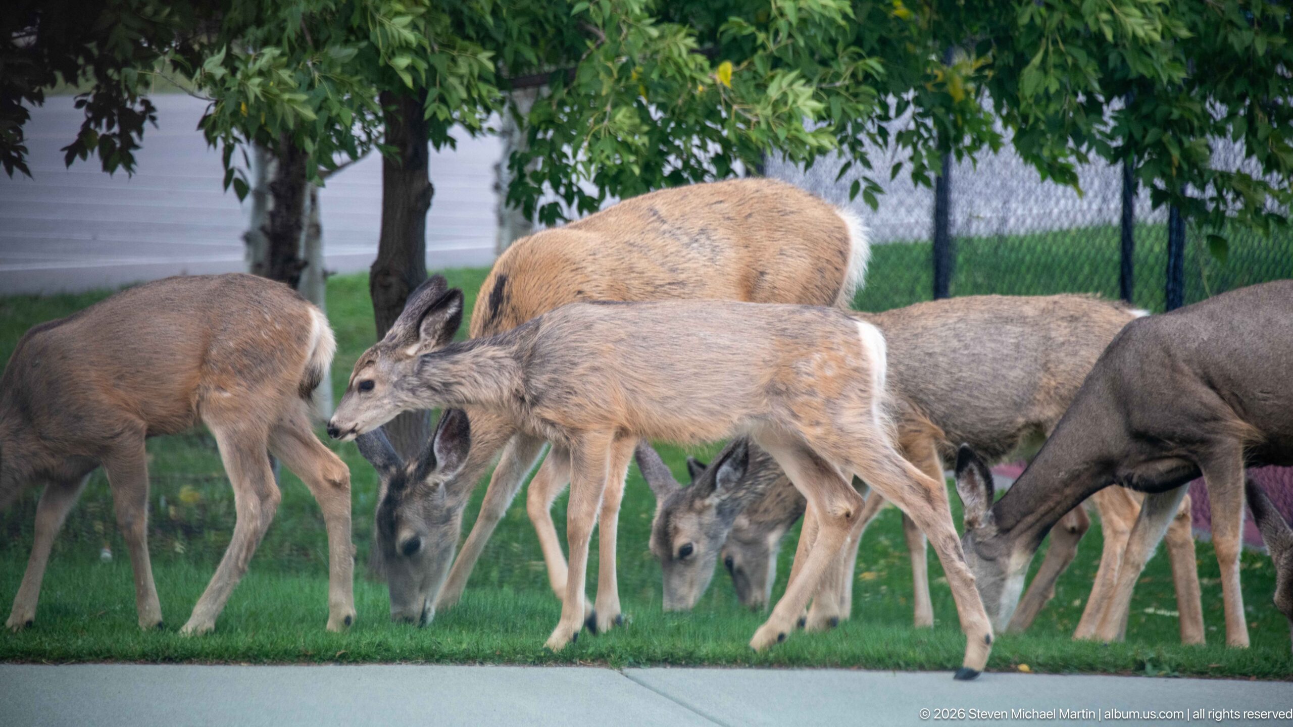
A small group of mule deer grazes on maintained grass beside a paved walkway in the Waterton townsite. Large ears, gray-brown coats, and the animals’ compact group behavior are clearly visible as several feed with heads lowered. The developed setting—lawn, fencing, and nearby structures—shows how readily wildlife moves through occupied areas of the park, creating close but still distinctly wild encounters.
Caption
A small group of mule deer grazes on maintained grass beside a paved walkway in the Waterton townsite. Large ears, gray-brown coats, and the animals’ compact group behavior are clearly visible as several feed with heads lowered. The developed setting—lawn, fencing, and nearby structures—shows how readily wildlife moves through occupied areas of the park, creating close but still distinctly wild encounters.
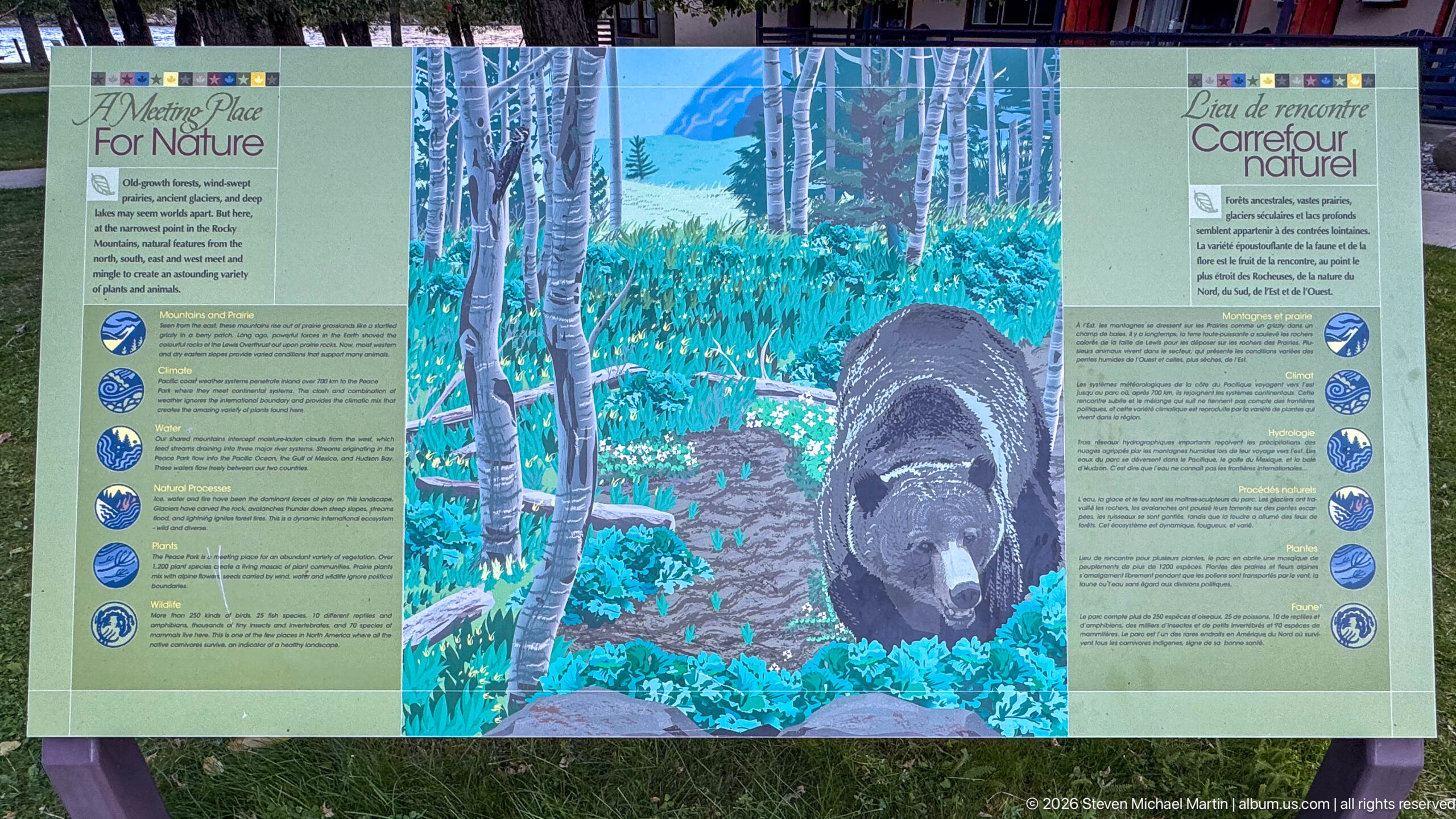
A bilingual “Careful Nature” panel uses a large black bear illustration to focus attention on wildlife awareness in Waterton Lakes. The bear moves through a stylized aspen-and-understory scene while columns of text and circular symbols frame the image. The display reflects an important aspect of visiting the park: people share developed and backcountry spaces with large mammals, making informed behavior part of the conservation experience.
Caption
A bilingual “Careful Nature” panel uses a large black bear illustration to focus attention on wildlife awareness in Waterton Lakes. The bear moves through a stylized aspen-and-understory scene while columns of text and circular symbols frame the image. The display reflects an important aspect of visiting the park: people share developed and backcountry spaces with large mammals, making informed behavior part of the conservation experience.
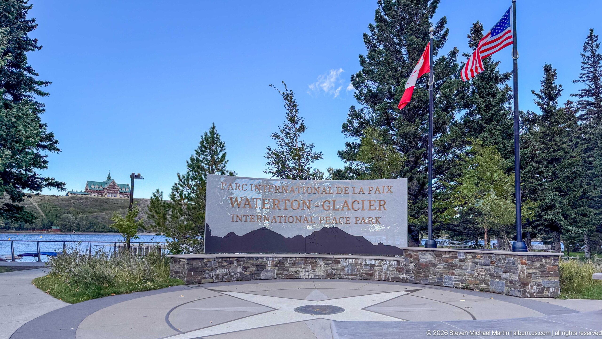
The Waterton-Glacier International Peace Park monument stands beside Canadian and United States flags near the lakeshore. Its bilingual inscription names the international park, while the circular pavement marker in front repeats the peace-park emblem. Trees frame the formal display and a historic-looking lakeside building appears in the distance, creating a layered view of the park’s cross-border identity within the developed Waterton townsite.
Caption
The Waterton-Glacier International Peace Park monument stands beside Canadian and United States flags near the lakeshore. Its bilingual inscription names the international park, while the circular pavement marker in front repeats the peace-park emblem. Trees frame the formal display and a historic-looking lakeside building appears in the distance, creating a layered view of the park’s cross-border identity within the developed Waterton townsite.
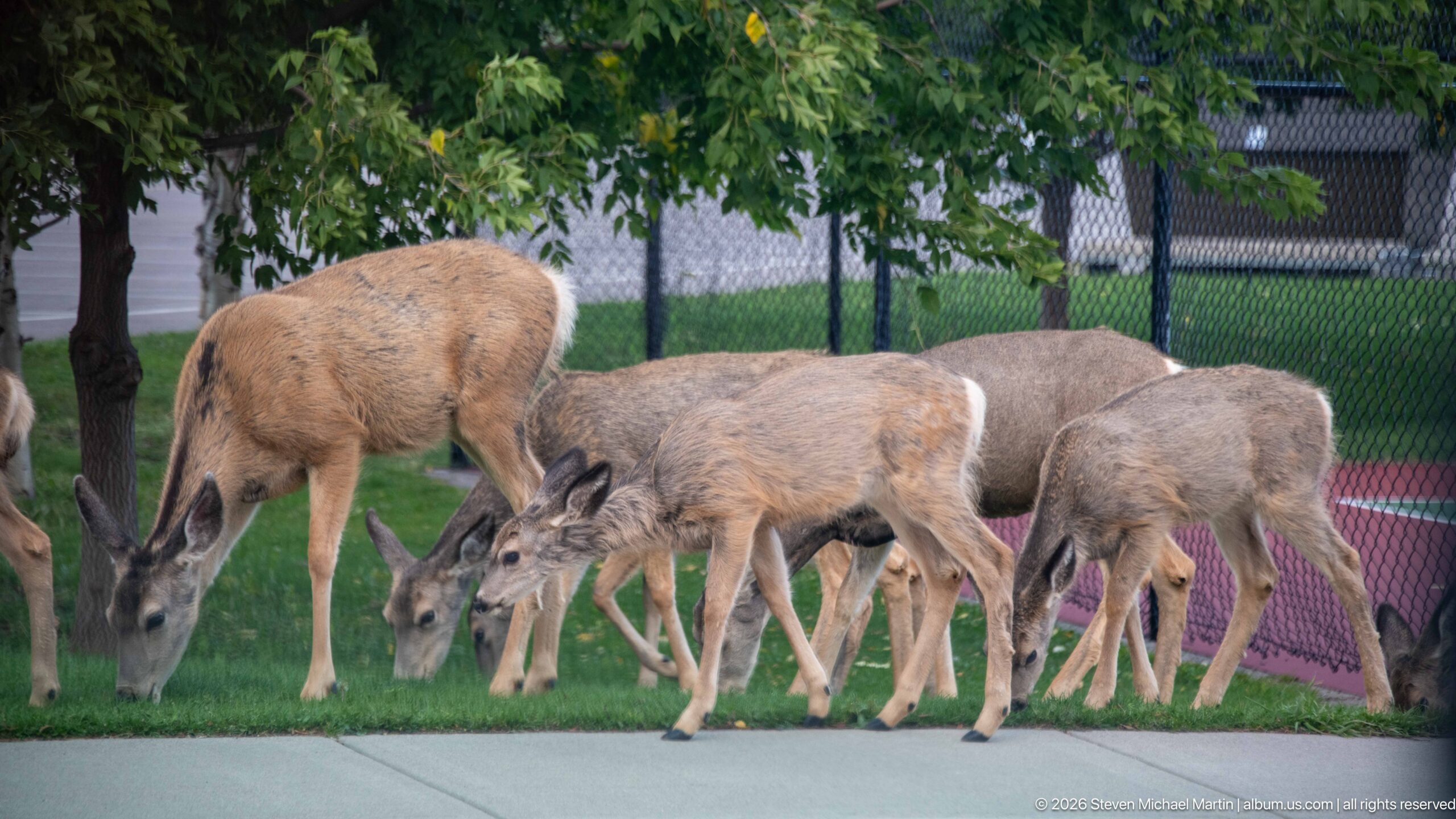
Mule deer feed closely together along the edge of a maintained lawn, with a chain-link fence and recreation surface immediately behind them. This tighter composition emphasizes the animals rather than the broader townsite setting, revealing large ears, slender legs, and seasonal gray-brown coats. Their calm feeding behavior illustrates the frequent overlap between wildlife habitat and developed spaces within Waterton Lakes.
Caption
Mule deer feed closely together along the edge of a maintained lawn, with a chain-link fence and recreation surface immediately behind them. This tighter composition emphasizes the animals rather than the broader townsite setting, revealing large ears, slender legs, and seasonal gray-brown coats. Their calm feeding behavior illustrates the frequent overlap between wildlife habitat and developed spaces within Waterton Lakes.
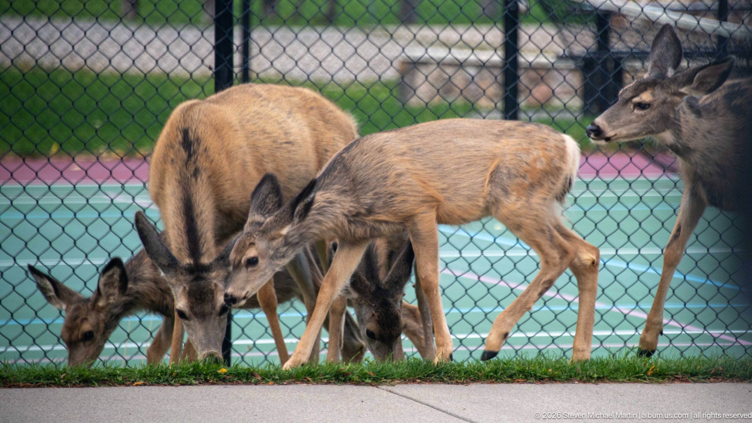
Several mule deer graze along a narrow strip of grass beside a fenced recreation court in the Waterton townsite. One younger-looking animal crosses the center of the group while others feed with their heads lowered. The fence and brightly colored court surface create a distinctly developed backdrop, underscoring the close proximity of free-ranging wildlife to everyday visitor facilities within the national park.
Caption
Several mule deer graze along a narrow strip of grass beside a fenced recreation court in the Waterton townsite. One younger-looking animal crosses the center of the group while others feed with their heads lowered. The fence and brightly colored court surface create a distinctly developed backdrop, underscoring the close proximity of free-ranging wildlife to everyday visitor facilities within the national park.

Adult and juvenile mule deer gather along the grass beside a paved walkway, with a fenced recreation court filling the background. The smaller deer stand among larger animals as the group feeds at close range, offering a clear comparison of body size and proportions. Their presence in a highly developed setting is characteristic of the porous boundary between wildlife habitat and the Waterton townsite.
Caption
Adult and juvenile mule deer gather along the grass beside a paved walkway, with a fenced recreation court filling the background. The smaller deer stand among larger animals as the group feeds at close range, offering a clear comparison of body size and proportions. Their presence in a highly developed setting is characteristic of the porous boundary between wildlife habitat and the Waterton townsite.
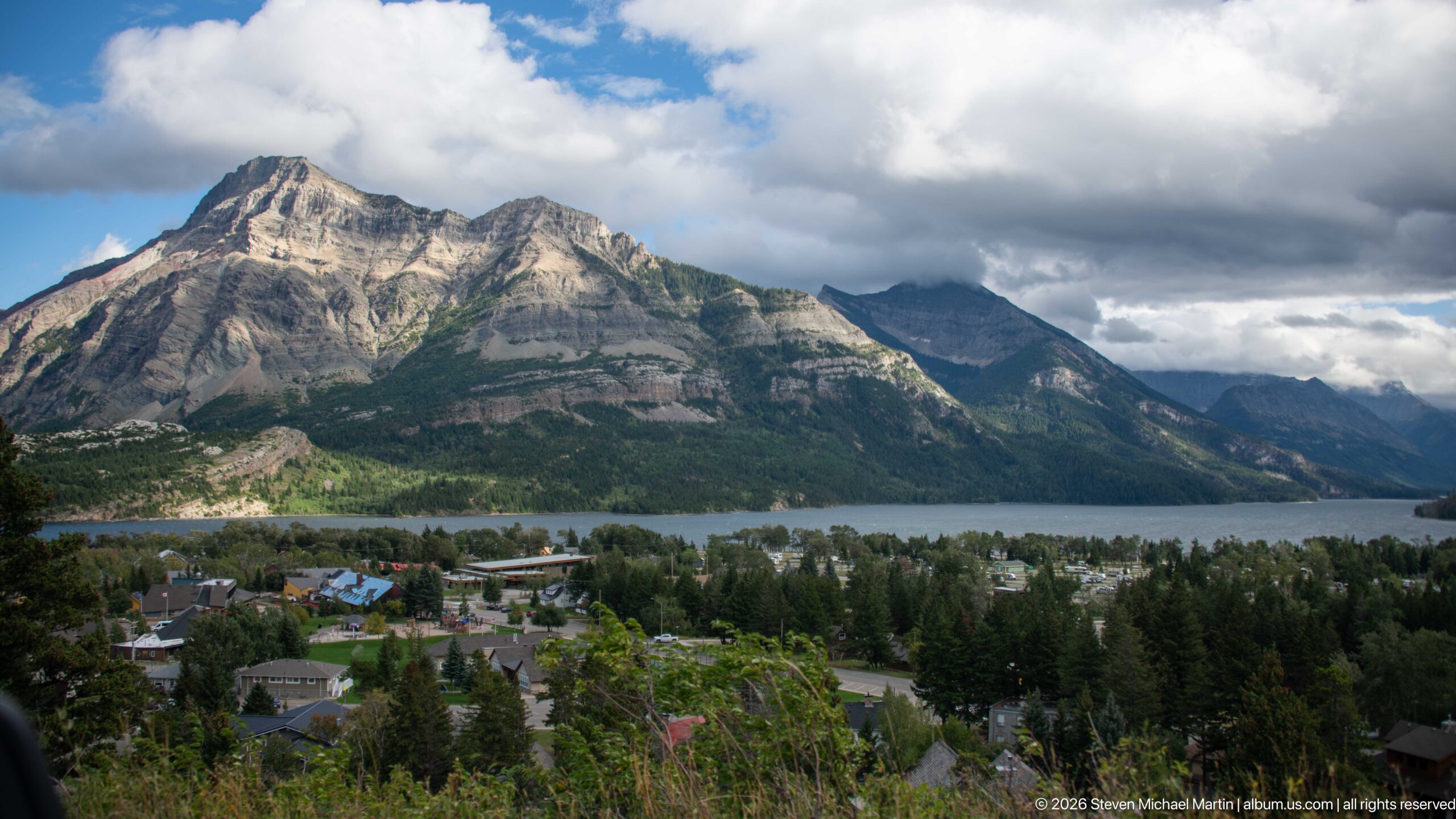
Upper Waterton Lake forms a broad horizontal band behind the Waterton townsite in this elevated landscape view. Houses and mature trees fill the lower slope, while strongly layered mountains rise immediately across the water. Sunlight breaking through thick clouds catches portions of the rock face and shoreline, giving the scene greater contrast than the neighboring panorama and highlighting the town’s compact position between lake and mountain.
Caption
Upper Waterton Lake forms a broad horizontal band behind the Waterton townsite in this elevated landscape view. Houses and mature trees fill the lower slope, while strongly layered mountains rise immediately across the water. Sunlight breaking through thick clouds catches portions of the rock face and shoreline, giving the scene greater contrast than the neighboring panorama and highlighting the town’s compact position between lake and mountain.
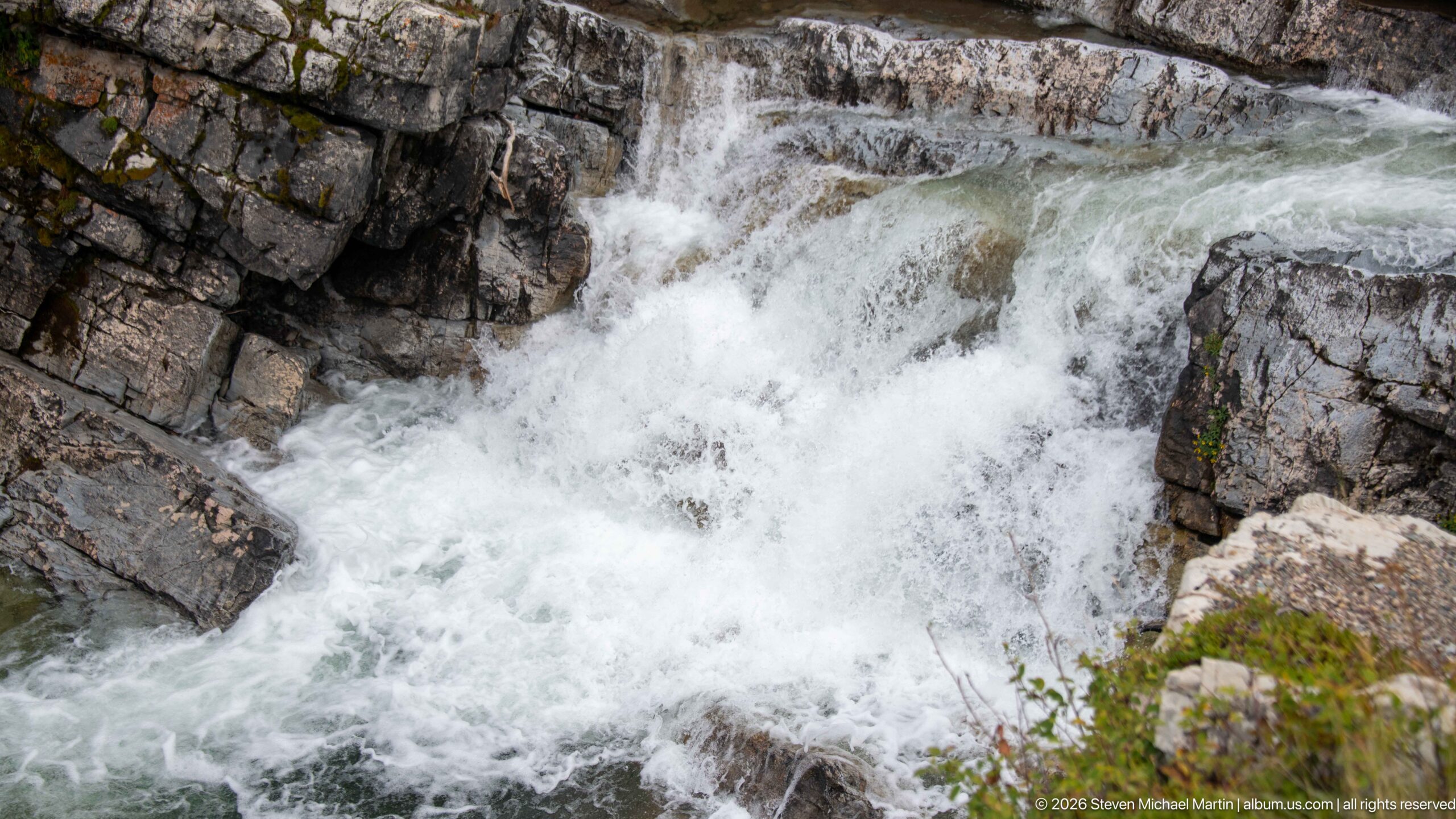
White water surges through a narrow channel cut into layered gray rock, filling the frame with a close view of a mountain cascade. Angular ledges confine the flow and break it into short drops, chutes, and turbulent pools. With little surrounding landscape visible, the photograph concentrates on the physical interaction between water and bedrock rather than identifying a named waterfall or stream.
Caption
White water surges through a narrow channel cut into layered gray rock, filling the frame with a close view of a mountain cascade. Angular ledges confine the flow and break it into short drops, chutes, and turbulent pools. With little surrounding landscape visible, the photograph concentrates on the physical interaction between water and bedrock rather than identifying a named waterfall or stream.
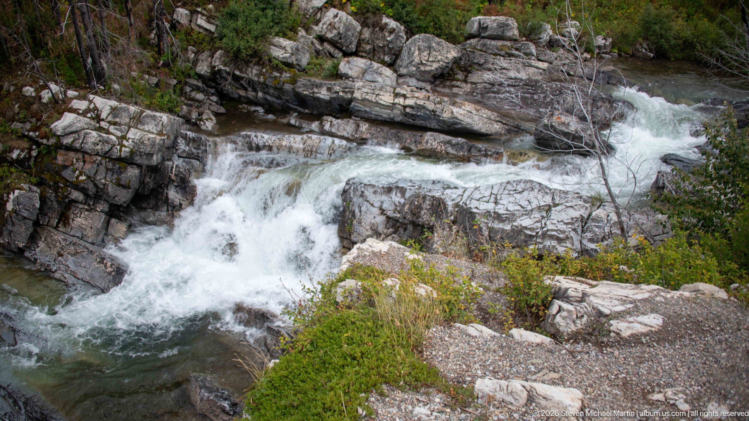
White water drops through a sequence of angular rock ledges, splitting around a large central block before gathering in a narrow pool below. The close viewpoint reveals fractured, layered bedrock and low vegetation rooted along the margins. Rather than assigning a specific waterfall name, the view records the energetic relationship between a mountain stream and the resistant rock channel it has cut through.
Caption
White water drops through a sequence of angular rock ledges, splitting around a large central block before gathering in a narrow pool below. The close viewpoint reveals fractured, layered bedrock and low vegetation rooted along the margins. Rather than assigning a specific waterfall name, the view records the energetic relationship between a mountain stream and the resistant rock channel it has cut through.
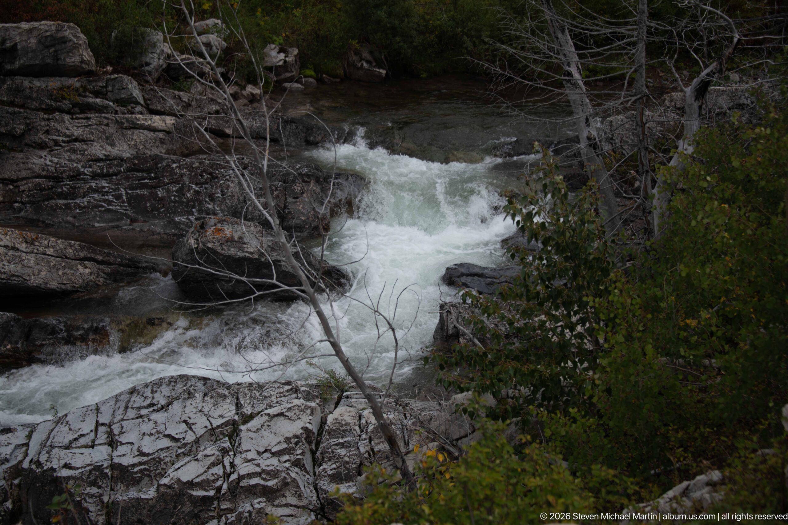
A narrow torrent rushes between dark, layered rock walls beneath overhanging shrubs and bare branches. The tighter framing and subdued light give this section of the stream a more enclosed character than the neighboring cascade view. Water funnels through a constricted channel before dropping over pale slabs, illustrating how small changes in bedrock shape produce concentrated rapids within Waterton Lakes’ mountain drainages.
Caption
A narrow torrent rushes between dark, layered rock walls beneath overhanging shrubs and bare branches. The tighter framing and subdued light give this section of the stream a more enclosed character than the neighboring cascade view. Water funnels through a constricted channel before dropping over pale slabs, illustrating how small changes in bedrock shape produce concentrated rapids within Waterton Lakes’ mountain drainages.
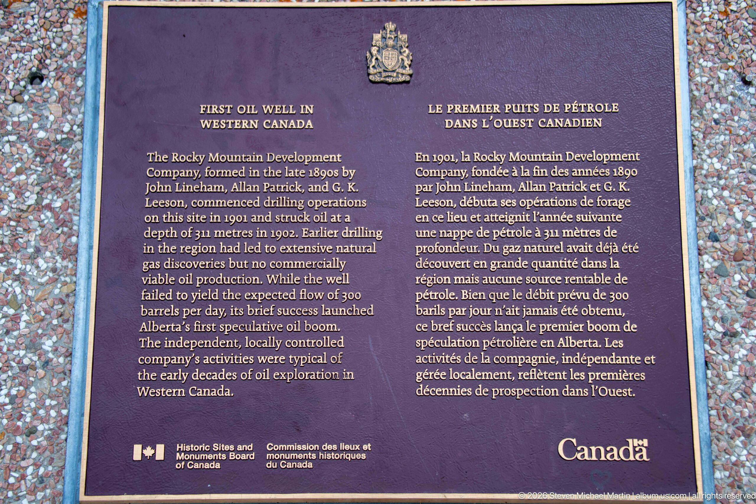
A bilingual Historic Sites and Monuments Board plaque marks the First Oil Well in Western Canada. The text identifies the Rocky Mountain Development Company and describes early drilling activity in the Waterton region, while the federal crest and Canada wordmark frame the commemoration. The plaque records the industrial history embedded within a landscape now better known for national-park conservation and mountain scenery.
Caption
A bilingual Historic Sites and Monuments Board plaque marks the First Oil Well in Western Canada. The text identifies the Rocky Mountain Development Company and describes early drilling activity in the Waterton region, while the federal crest and Canada wordmark frame the commemoration. The plaque records the industrial history embedded within a landscape now better known for national-park conservation and mountain scenery.
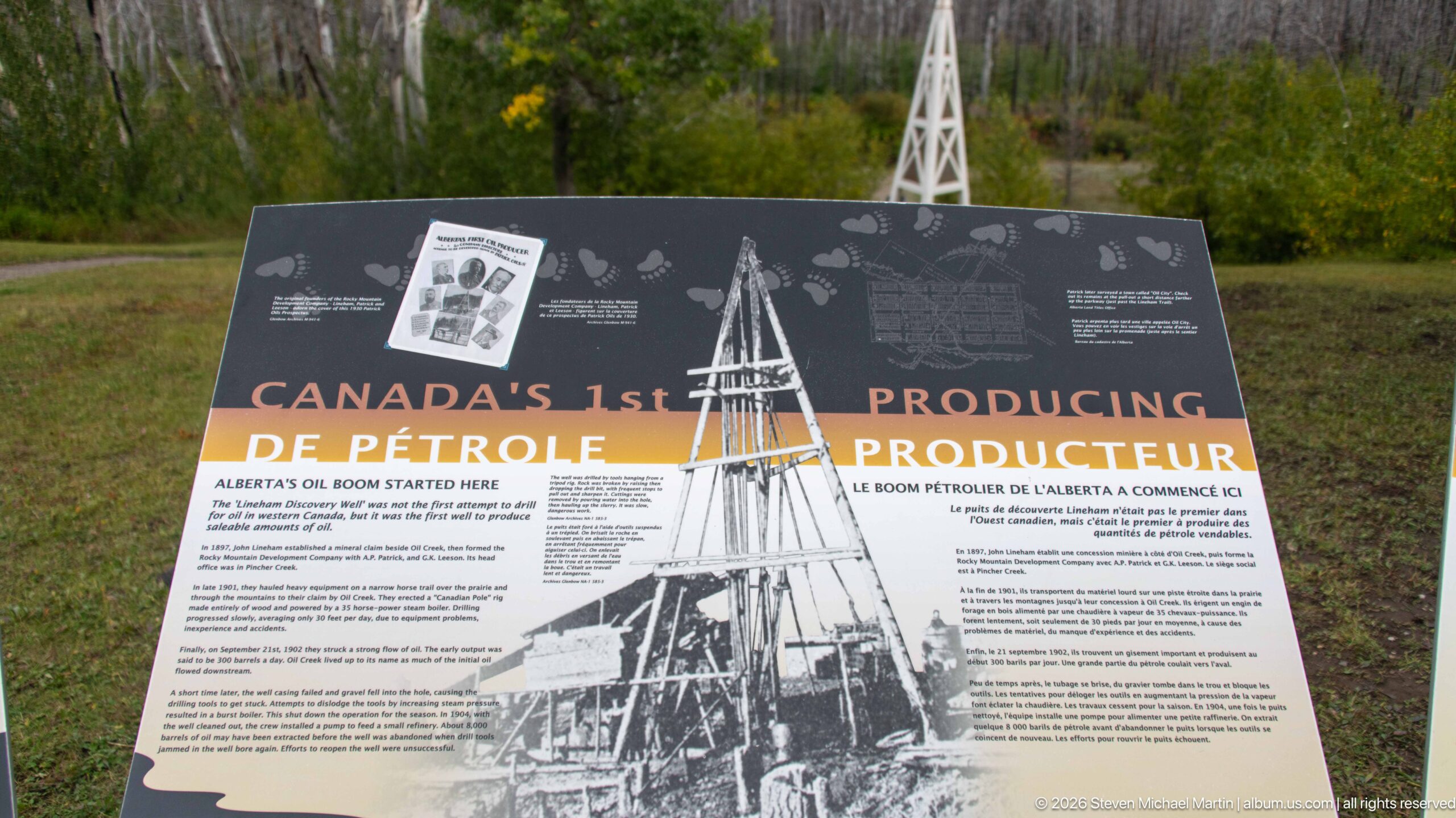
An interpretive panel titled “Canada’s 1st Producing Oil Well” combines a large archival drilling photograph with bilingual text about petroleum exploration in the Waterton area. The reconstructed white derrick is visible beyond the panel, tying historical imagery directly to the commemorative site. Together, the display and monument explain an industrial chapter that predates the modern emphasis on recreation and conservation in the surrounding national park.
Caption
An interpretive panel titled “Canada’s 1st Producing Oil Well” combines a large archival drilling photograph with bilingual text about petroleum exploration in the Waterton area. The reconstructed white derrick is visible beyond the panel, tying historical imagery directly to the commemorative site. Together, the display and monument explain an industrial chapter that predates the modern emphasis on recreation and conservation in the surrounding national park.
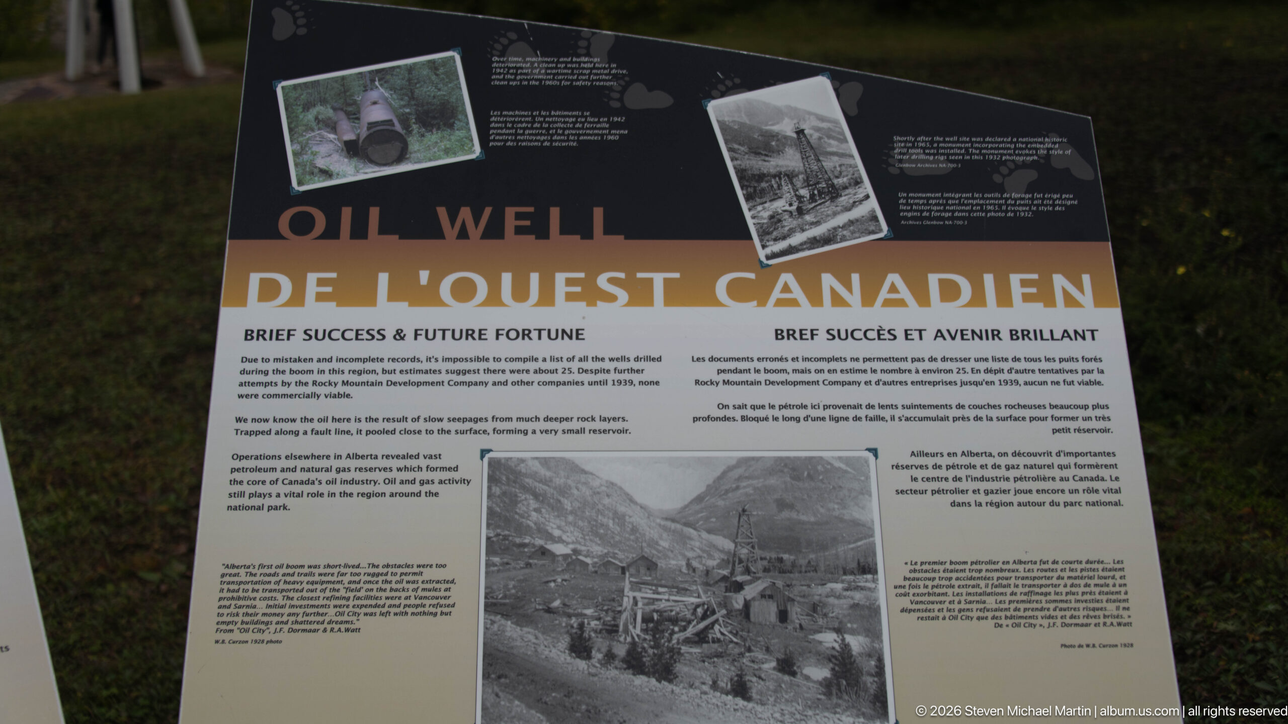
A bilingual oil-history panel presents archival photographs and text beneath a prominent “Oil Well” heading. One historic view shows drilling structures and buildings in a mountain valley, placing early petroleum exploration within the physical setting of Waterton. The display complements the nearby plaque and reconstructed derrick by using period imagery to show how the site functioned when resource extraction, rather than park tourism, shaped this particular landscape.
Caption
A bilingual oil-history panel presents archival photographs and text beneath a prominent “Oil Well” heading. One historic view shows drilling structures and buildings in a mountain valley, placing early petroleum exploration within the physical setting of Waterton. The display complements the nearby plaque and reconstructed derrick by using period imagery to show how the site functioned when resource extraction, rather than park tourism, shaped this particular landscape.
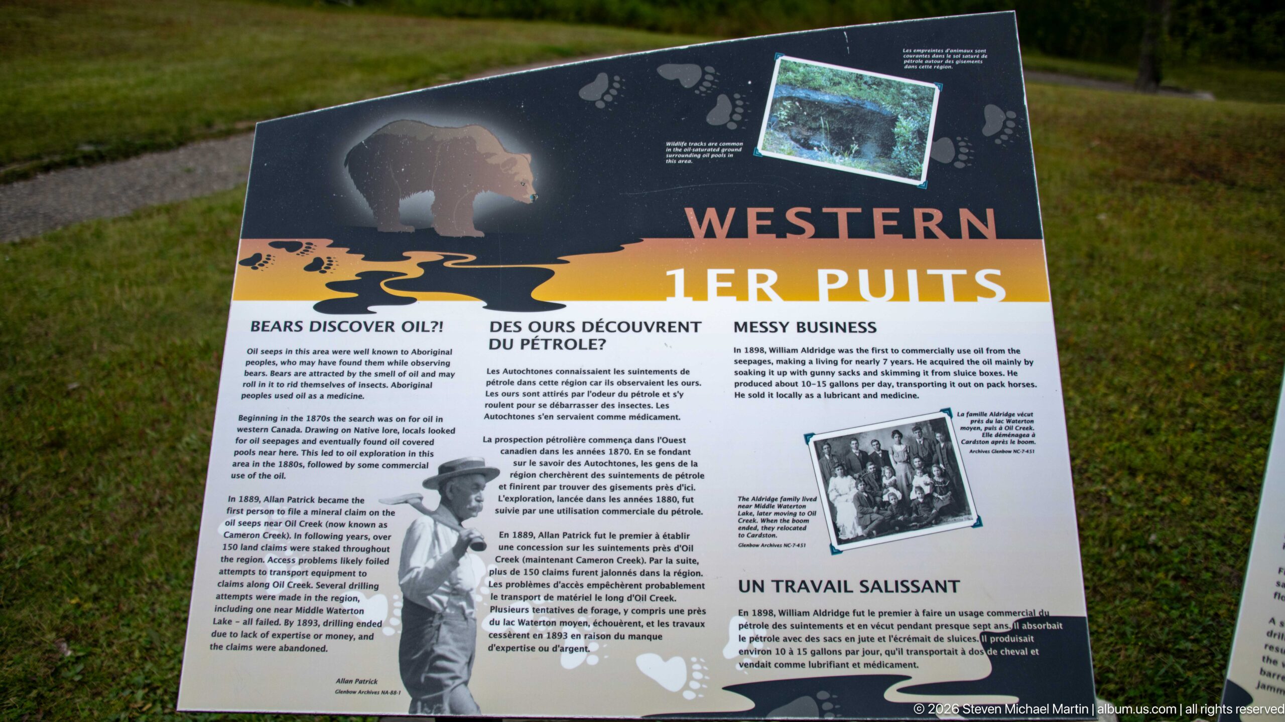
A bilingual interpretive panel headed “Western” explores the early petroleum story through archival photographs, a bear graphic, and sections on discovery and the difficult work involved. The mixed imagery places human exploration within the wildlife-rich Waterton landscape. As part of the First Oil Well historic-site sequence, the panel expands the story beyond machinery to the conditions and experiences surrounding early resource exploration.
Caption
A bilingual interpretive panel headed “Western” explores the early petroleum story through archival photographs, a bear graphic, and sections on discovery and the difficult work involved. The mixed imagery places human exploration within the wildlife-rich Waterton landscape. As part of the First Oil Well historic-site sequence, the panel expands the story beyond machinery to the conditions and experiences surrounding early resource exploration.
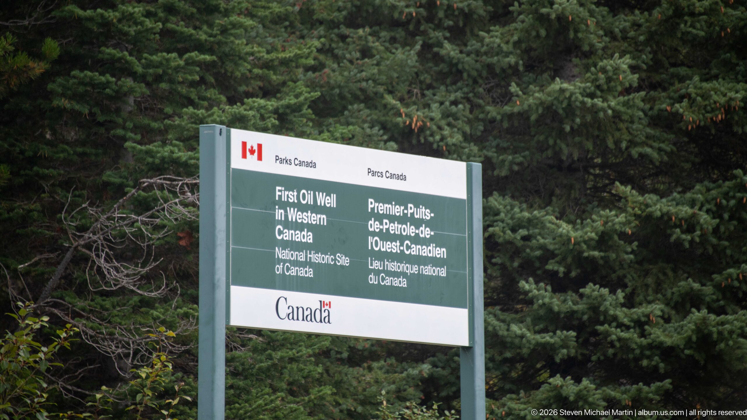
A Parks Canada roadside sign identifies the First Oil Well in Western Canada National Historic Site in English and French. Mounted against dense evergreen forest, the simple gray-and-white sign provides a formal entrance marker for the commemorative area. Its understated design contrasts with the reconstructed derrick and detailed interpretive panels, establishing the site’s federal historic designation before visitors encounter the surviving story on the ground.
Caption
A Parks Canada roadside sign identifies the First Oil Well in Western Canada National Historic Site in English and French. Mounted against dense evergreen forest, the simple gray-and-white sign provides a formal entrance marker for the commemorative area. Its understated design contrasts with the reconstructed derrick and detailed interpretive panels, establishing the site’s federal historic designation before visitors encounter the surviving story on the ground.
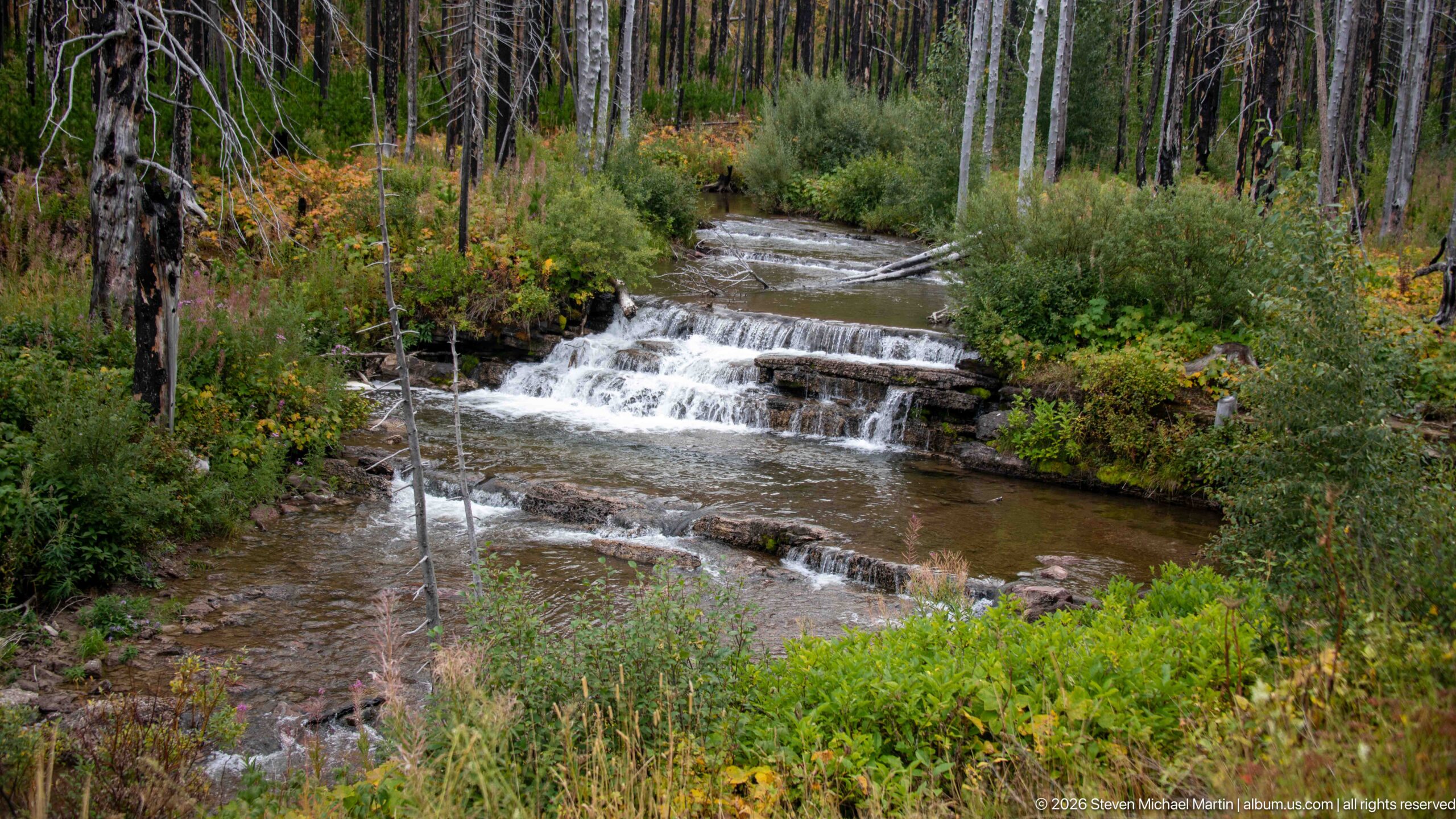
A shallow mountain stream tumbles over a series of low, stair-like rock ledges within a recovering forest. Green shrubs and autumn-tinted groundcover crowd the banks, while slender dead trunks rise behind the channel. The modest scale and repeated horizontal drops distinguish this watercourse from the larger rocky cascades nearby, offering a quieter view of water moving through Waterton’s fire-altered forest.
Caption
A shallow mountain stream tumbles over a series of low, stair-like rock ledges within a recovering forest. Green shrubs and autumn-tinted groundcover crowd the banks, while slender dead trunks rise behind the channel. The modest scale and repeated horizontal drops distinguish this watercourse from the larger rocky cascades nearby, offering a quieter view of water moving through Waterton’s fire-altered forest.
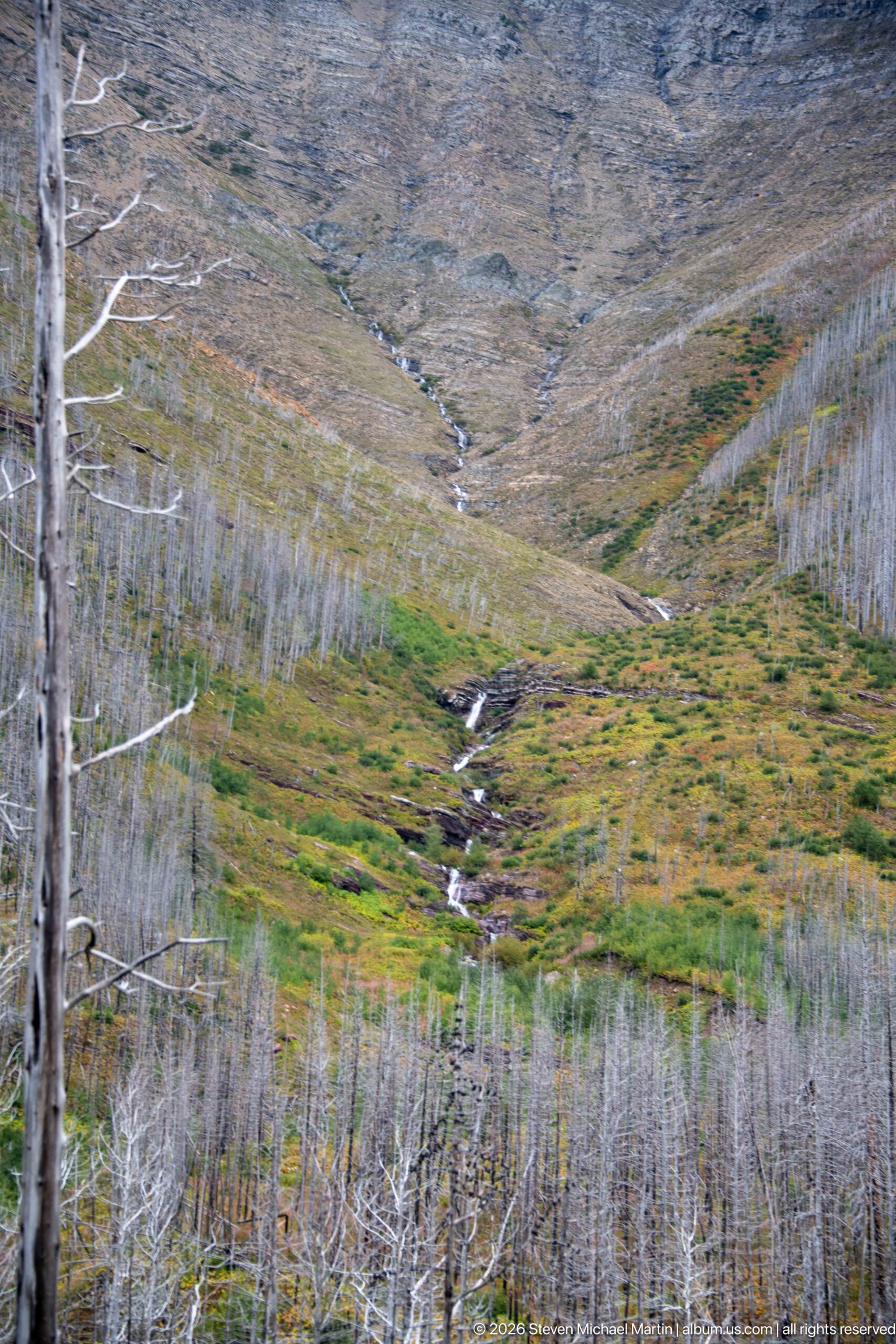
A small mountain stream descends through a broad valley whose slopes are covered with standing fire-killed trees. Green and rusty groundcover follows the drainage, while exposed gray slopes rise above the recovering vegetation. The telephoto view compresses the valley and makes the stream a narrow bright thread through the burn scar, showing how waterways continue to organize ecological recovery after severe disturbance.
Caption
A small mountain stream descends through a broad valley whose slopes are covered with standing fire-killed trees. Green and rusty groundcover follows the drainage, while exposed gray slopes rise above the recovering vegetation. The telephoto view compresses the valley and makes the stream a narrow bright thread through the burn scar, showing how waterways continue to organize ecological recovery after severe disturbance.
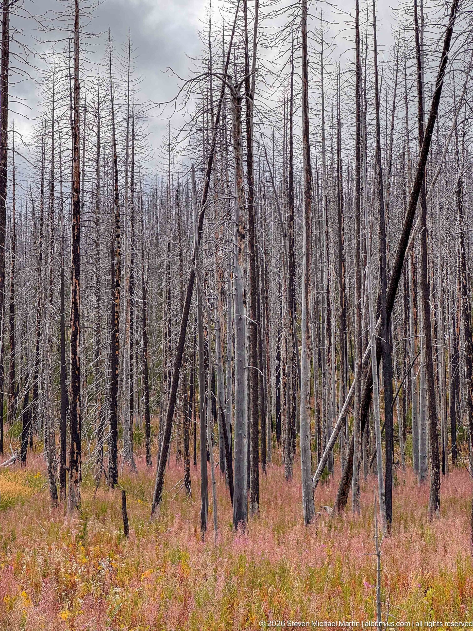
Charred and silvered trunks stand densely across a fire-altered forest, some leaning at sharp angles among upright snags. A carpet of pink, red, and green vegetation spreads across the newly open forest floor. The closer viewpoint emphasizes individual tree damage and fallen stems, while the bright understory demonstrates how rapidly low vegetation can occupy space once shaded by a closed conifer canopy.
Caption
Charred and silvered trunks stand densely across a fire-altered forest, some leaning at sharp angles among upright snags. A carpet of pink, red, and green vegetation spreads across the newly open forest floor. The closer viewpoint emphasizes individual tree damage and fallen stems, while the bright understory demonstrates how rapidly low vegetation can occupy space once shaded by a closed conifer canopy.
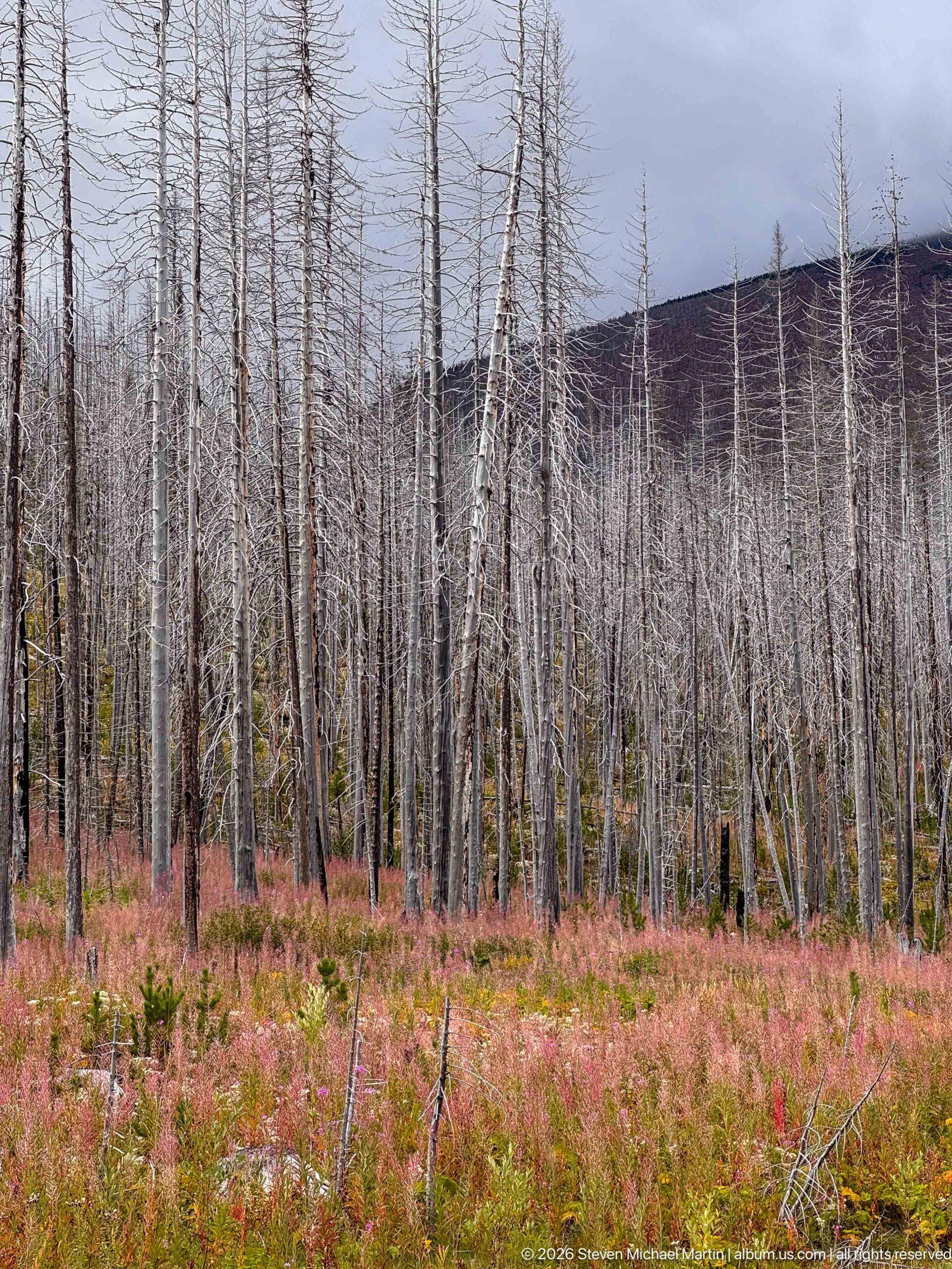
A broad field of pink and rust-colored vegetation spreads beneath a dense stand of pale fire-killed trees, with a dark mountain slope rising beyond. The horizontal bands of living groundcover, dead forest, and mountain make the scale of the disturbance especially clear. New growth now occupies the open forest floor, while the standing trunks preserve the former woodland structure across the Waterton landscape.
Caption
A broad field of pink and rust-colored vegetation spreads beneath a dense stand of pale fire-killed trees, with a dark mountain slope rising beyond. The horizontal bands of living groundcover, dead forest, and mountain make the scale of the disturbance especially clear. New growth now occupies the open forest floor, while the standing trunks preserve the former woodland structure across the Waterton landscape.
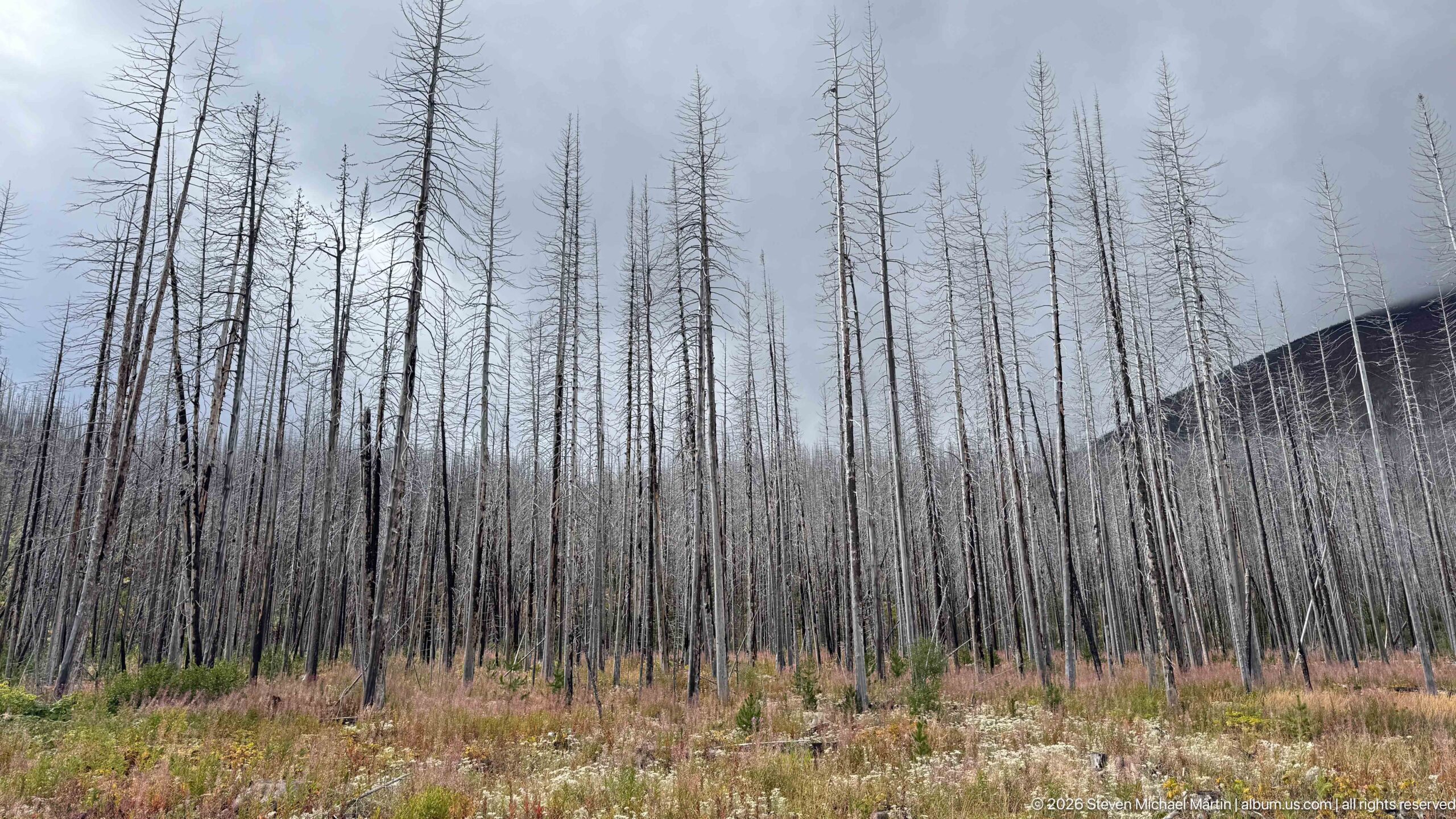
Tall gray snags fill the frame beneath an overcast sky, forming a stark vertical pattern across a former conifer forest. Low grasses, wildflowers, and shrubs have returned across the open ground, creating a second layer of vegetation beneath the dead canopy. The composition isolates wildfire’s long-lasting structural effects on the forest while also recording visible signs of ecological renewal at ground level.
Caption
Tall gray snags fill the frame beneath an overcast sky, forming a stark vertical pattern across a former conifer forest. Low grasses, wildflowers, and shrubs have returned across the open ground, creating a second layer of vegetation beneath the dead canopy. The composition isolates wildfire’s long-lasting structural effects on the forest while also recording visible signs of ecological renewal at ground level.
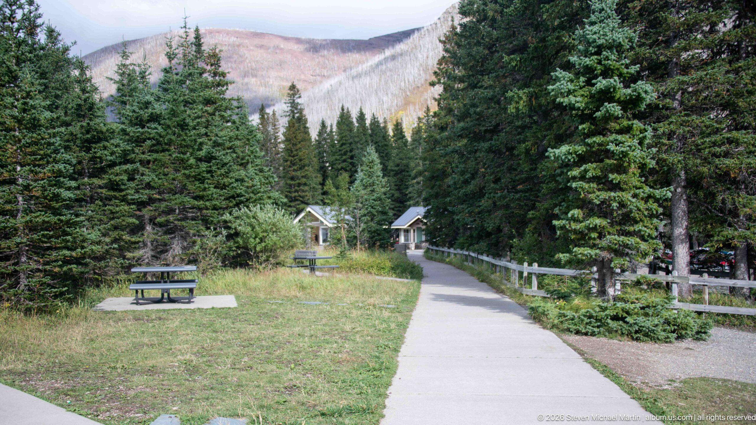
A paved pedestrian path leads through dense evergreen forest toward small park buildings at Cameron Lakeshore. A picnic table occupies the grassy clearing at left, while a wooden rail separates the walkway from vegetation on the right. The developed approach provides a quiet transition from parking and visitor facilities toward the lake, with a fire-affected mountain slope visible through the trees in the distance.
Caption
A paved pedestrian path leads through dense evergreen forest toward small park buildings at Cameron Lakeshore. A picnic table occupies the grassy clearing at left, while a wooden rail separates the walkway from vegetation on the right. The developed approach provides a quiet transition from parking and visitor facilities toward the lake, with a fire-affected mountain slope visible through the trees in the distance.
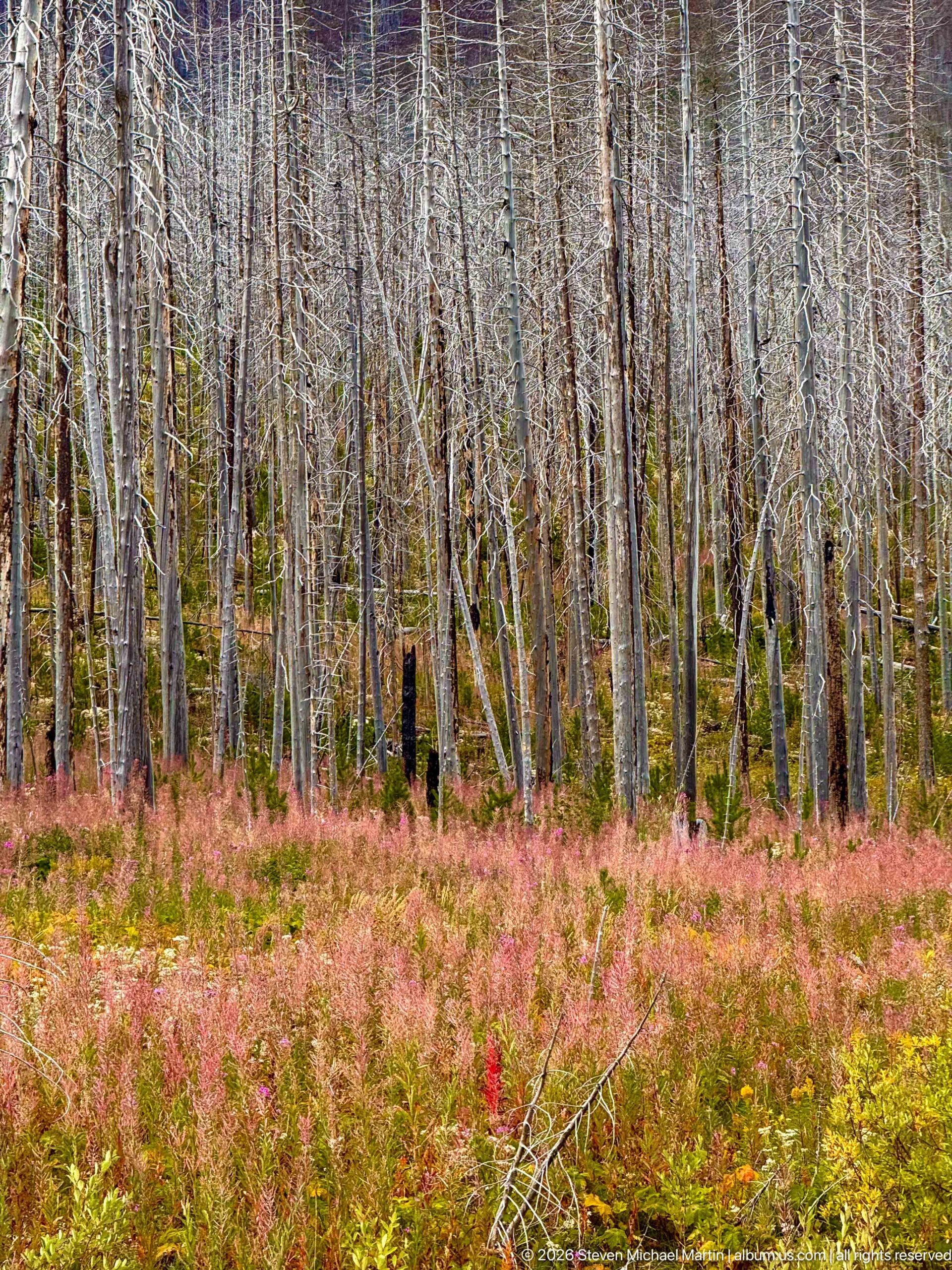
Pink-red groundcover and patches of yellow-green vegetation form a vivid carpet beneath tightly spaced gray trunks in this detailed view of post-fire recovery. The surviving vertical stems create a nearly graphic pattern, while the absence of a mature canopy allows the understory to dominate. This closer composition shifts attention from the scale of the burn to the vegetation recolonizing the forest floor.
Caption
Pink-red groundcover and patches of yellow-green vegetation form a vivid carpet beneath tightly spaced gray trunks in this detailed view of post-fire recovery. The surviving vertical stems create a nearly graphic pattern, while the absence of a mature canopy allows the understory to dominate. This closer composition shifts attention from the scale of the burn to the vegetation recolonizing the forest floor.
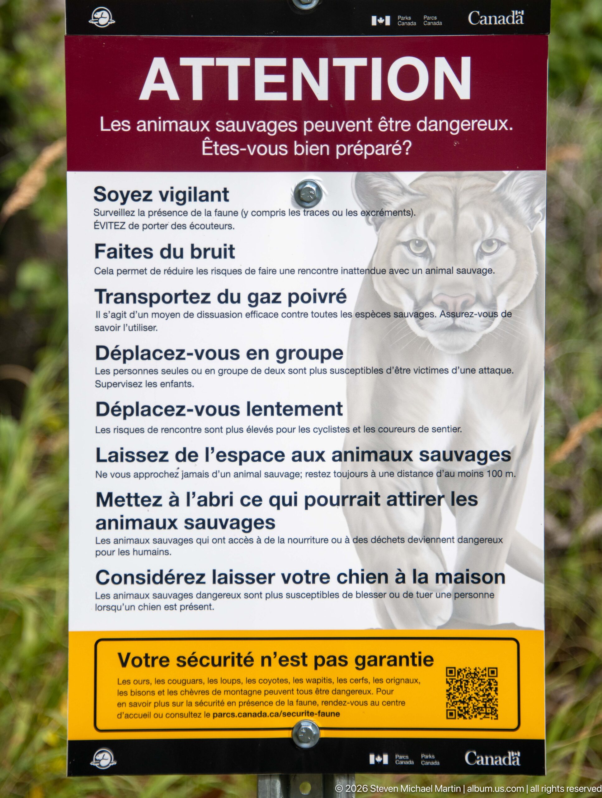
A French Parks Canada warning sign tells visitors that wild animals can be dangerous and lists precautions for encounters with bears and other wildlife. A large bear illustration dominates the upper portion, while bold headings emphasize vigilance, noise, bear spray, group travel, distance, and food security. The sign reflects the practical wildlife-safety messaging used at Cameron Lakeshore, where visitors enter active mountain habitat.
Caption
A French Parks Canada warning sign tells visitors that wild animals can be dangerous and lists precautions for encounters with bears and other wildlife. A large bear illustration dominates the upper portion, while bold headings emphasize vigilance, noise, bear spray, group travel, distance, and food security. The sign reflects the practical wildlife-safety messaging used at Cameron Lakeshore, where visitors enter active mountain habitat.
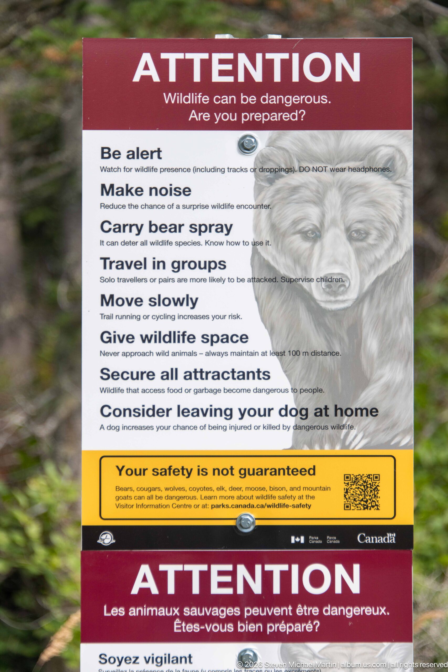
An English Parks Canada warning sign states that wildlife can be dangerous and gives concise instructions for safer travel in bear country. Visitors are advised to remain alert, make noise, carry bear spray, travel in groups, move slowly, give wildlife space, secure attractants, and consider leaving a dog at home. A large bear illustration reinforces the message at this mountain-lake access point.
Caption
An English Parks Canada warning sign states that wildlife can be dangerous and gives concise instructions for safer travel in bear country. Visitors are advised to remain alert, make noise, carry bear spray, travel in groups, move slowly, give wildlife space, secure attractants, and consider leaving a dog at home. A large bear illustration reinforces the message at this mountain-lake access point.
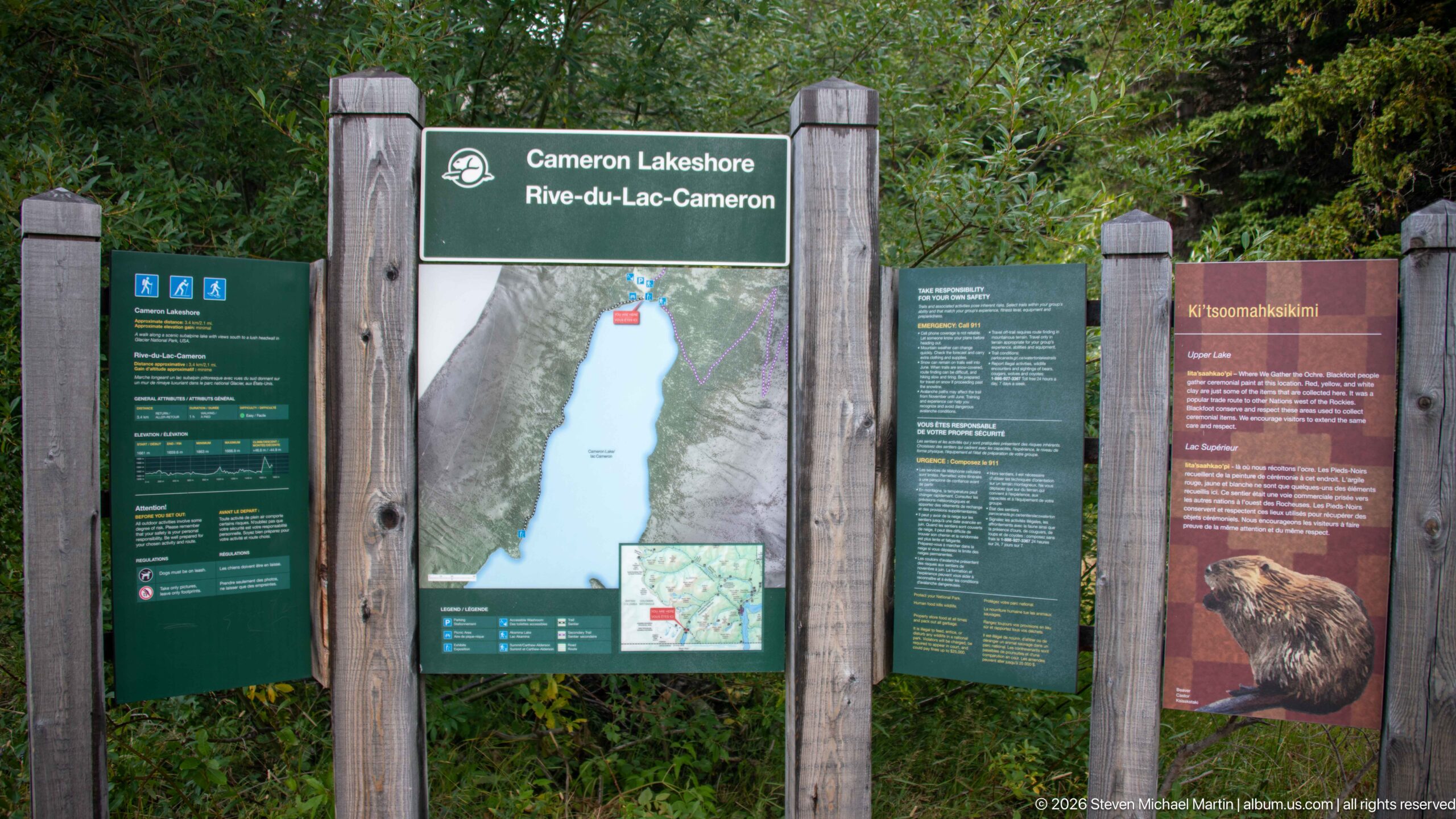
A multi-panel Parks Canada information board marks Cameron Lakeshore, centered on a map of the long mountain lake and surrounding trail system. Visitor information appears on the left, while a wildlife panel on the right features a bear illustration and the heading “K’tsoomakssin.” The display combines navigation, safety, and interpretation at the developed lakeshore access point.
Caption
A multi-panel Parks Canada information board marks Cameron Lakeshore, centered on a map of the long mountain lake and surrounding trail system. Visitor information appears on the left, while a wildlife panel on the right features a bear illustration and the heading “K’tsoomakssin.” The display combines navigation, safety, and interpretation at the developed lakeshore access point.
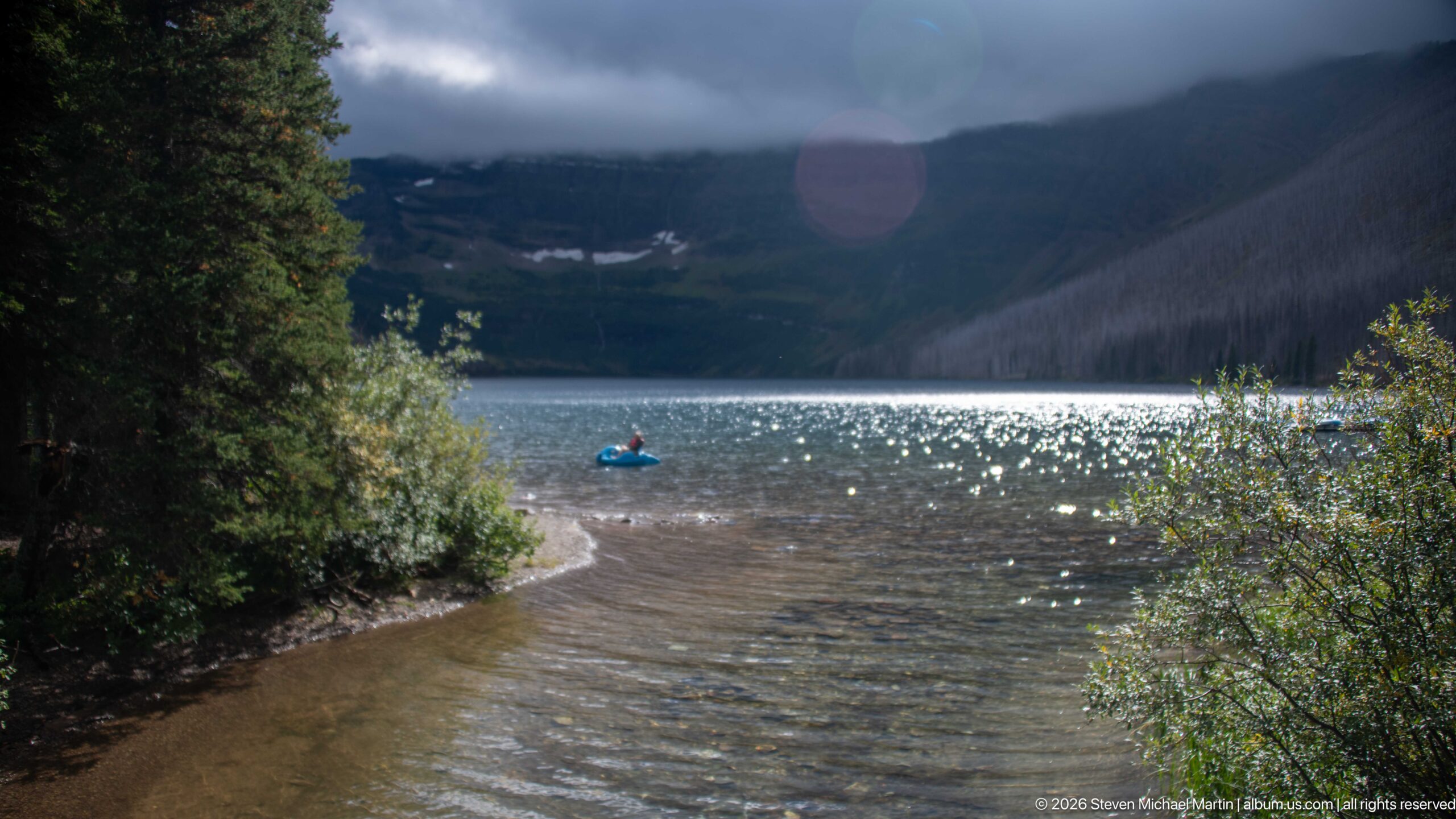
A lone paddler crosses the sunlit water of Cameron Lake near a curving, shallow shoreline. Dense shrubs frame the foreground while steep mountain walls rise into low cloud across the lake. Bright reflections scatter over the surface around the small blue craft, creating a strong sense of scale between the solitary visitor and the enclosed alpine basin.
Caption
A lone paddler crosses the sunlit water of Cameron Lake near a curving, shallow shoreline. Dense shrubs frame the foreground while steep mountain walls rise into low cloud across the lake. Bright reflections scatter over the surface around the small blue craft, creating a strong sense of scale between the solitary visitor and the enclosed alpine basin.
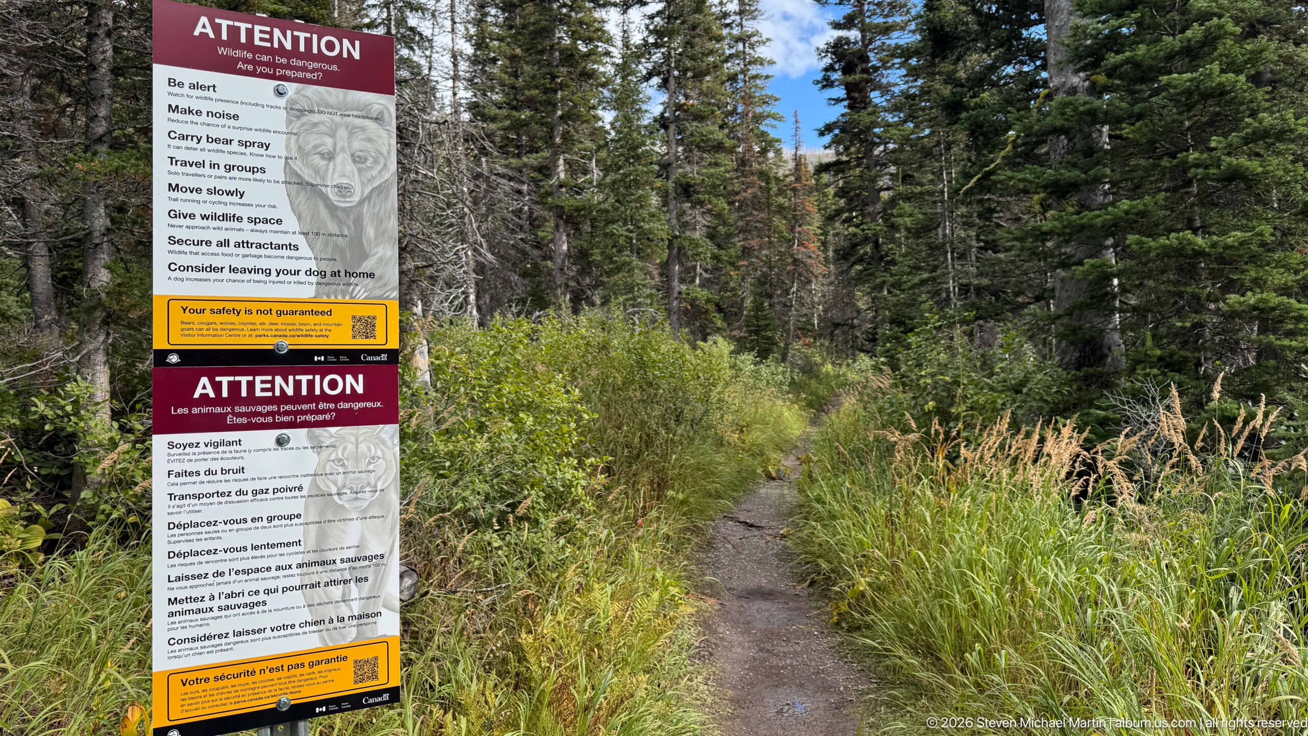
A narrow dirt trail enters dense conifer forest beside a tall bilingual wildlife-warning sign at Cameron Lakeshore. Grasses and shrubs crowd the path edges, giving the route a more enclosed character than the nearby developed walkway. The juxtaposition of the trail and safety notice makes the transition clear: visitors are leaving a managed lakeshore facility and entering habitat where wildlife awareness becomes especially important.
Caption
A narrow dirt trail enters dense conifer forest beside a tall bilingual wildlife-warning sign at Cameron Lakeshore. Grasses and shrubs crowd the path edges, giving the route a more enclosed character than the nearby developed walkway. The juxtaposition of the trail and safety notice makes the transition clear: visitors are leaving a managed lakeshore facility and entering habitat where wildlife awareness becomes especially important.
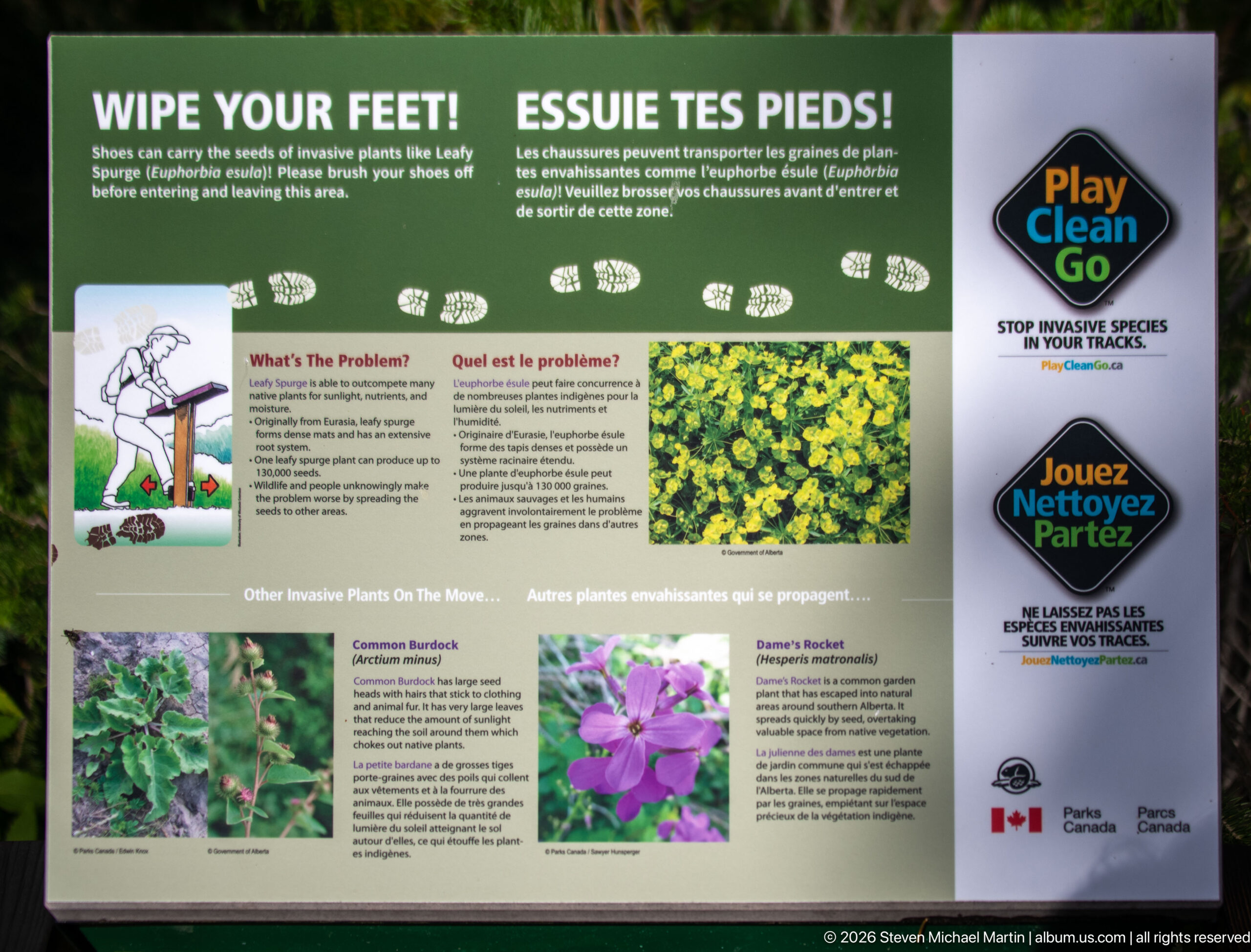
A Parks Canada “Play Clean Go” panel asks visitors to clean their footwear before entering and leaving the area to reduce the spread of invasive plants. Boot-print graphics cross the top, while photographs and text identify examples of unwanted species. The display links a simple visitor action—removing seeds and soil from shoes—to protection of native plant communities around Cameron Lakeshore.
Caption
A Parks Canada “Play Clean Go” panel asks visitors to clean their footwear before entering and leaving the area to reduce the spread of invasive plants. Boot-print graphics cross the top, while photographs and text identify examples of unwanted species. The display links a simple visitor action—removing seeds and soil from shoes—to protection of native plant communities around Cameron Lakeshore.
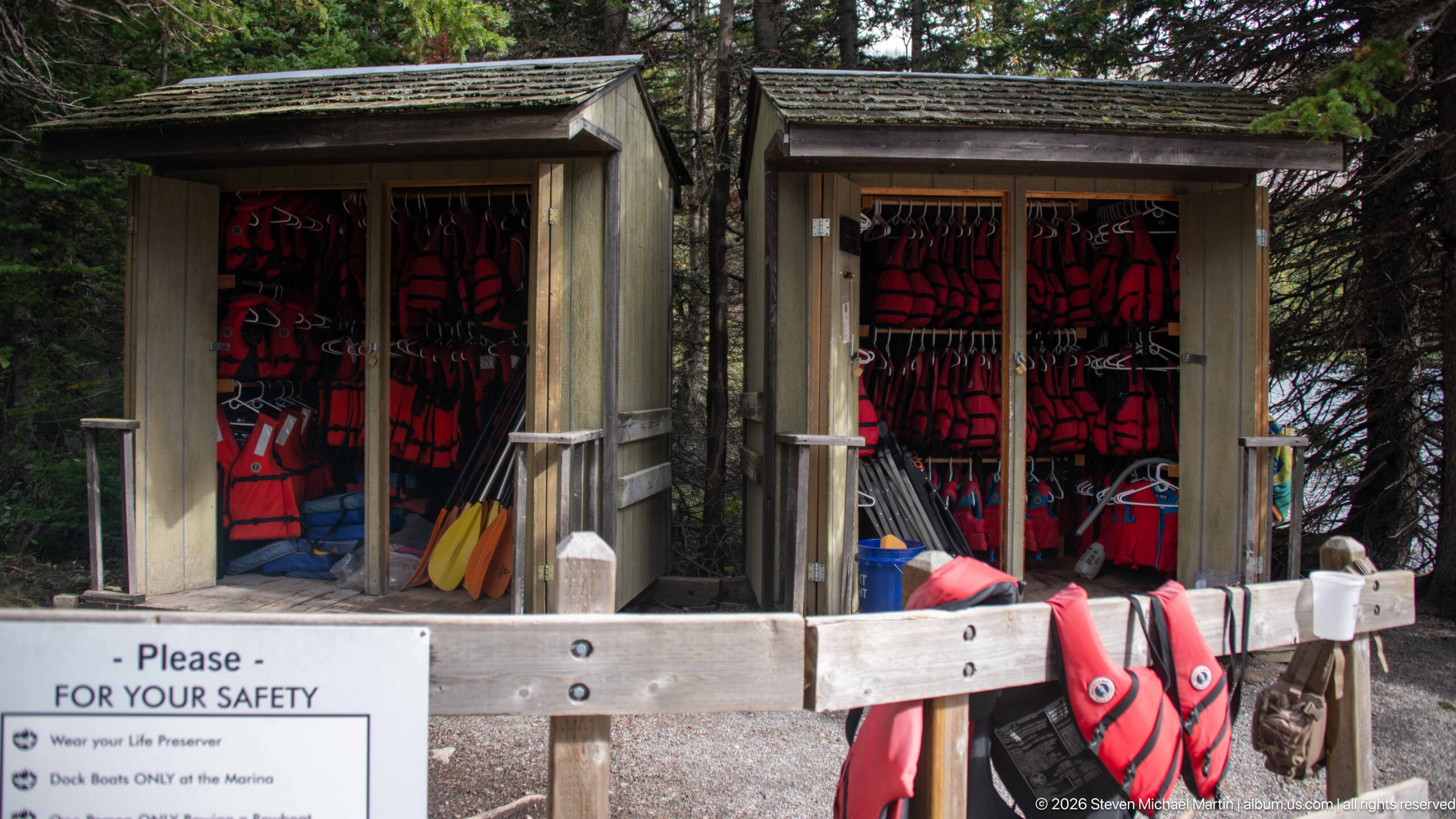
Life jackets and paddles hang in open wooden storage bays near the Cameron Lake waterfront. Bright red flotation devices, yellow paddles, and other boating equipment fill the small shelter, while a safety notice is mounted across the front. The utilitarian station documents the infrastructure supporting paddling and small-craft recreation at the developed lakeshore.
Caption
Life jackets and paddles hang in open wooden storage bays near the Cameron Lake waterfront. Bright red flotation devices, yellow paddles, and other boating equipment fill the small shelter, while a safety notice is mounted across the front. The utilitarian station documents the infrastructure supporting paddling and small-craft recreation at the developed lakeshore.
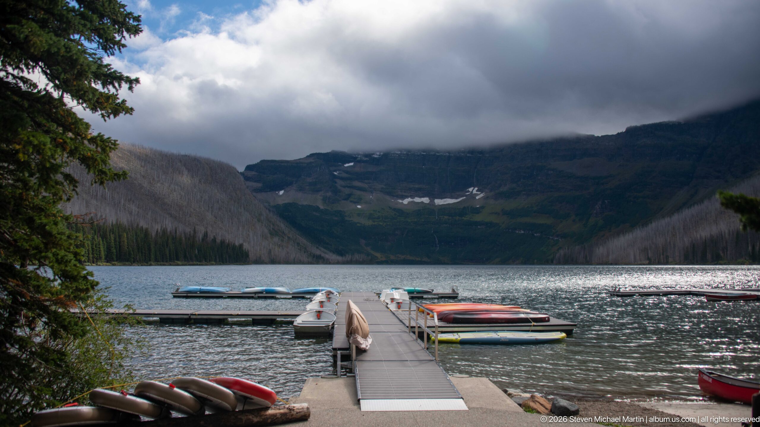
A floating dock extends into Cameron Lake toward a line of small recreational craft moored on both sides. Canoes or kayaks lie stacked near the shore, while low cloud hangs over the steep mountain basin at the far end of the lake. The developed dock provides a strong foreground axis into the landscape, connecting visitor recreation directly with the dramatic alpine setting.
Caption
A floating dock extends into Cameron Lake toward a line of small recreational craft moored on both sides. Canoes or kayaks lie stacked near the shore, while low cloud hangs over the steep mountain basin at the far end of the lake. The developed dock provides a strong foreground axis into the landscape, connecting visitor recreation directly with the dramatic alpine setting.
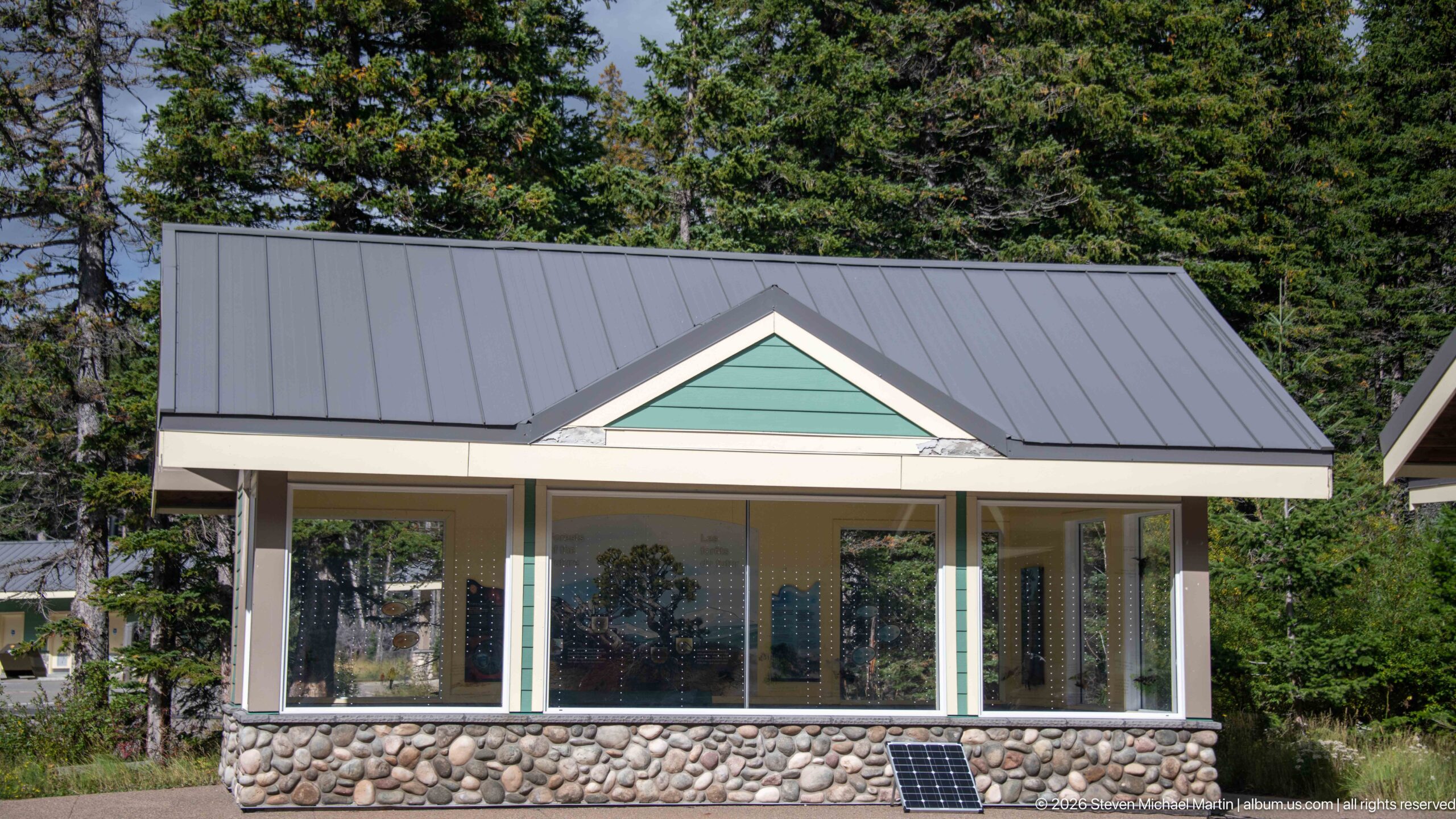
A compact park building at Cameron Lakeshore combines broad windows, pale trim, green gable siding, a standing-seam metal roof, and a rounded-stone base. A small solar panel rests against the foundation. The simple, durable design fits the wooded recreation area and allows views through the glazed walls, while the stonework visually ties the structure to the mountain setting.
Caption
A compact park building at Cameron Lakeshore combines broad windows, pale trim, green gable siding, a standing-seam metal roof, and a rounded-stone base. A small solar panel rests against the foundation. The simple, durable design fits the wooded recreation area and allows views through the glazed walls, while the stonework visually ties the structure to the mountain setting.
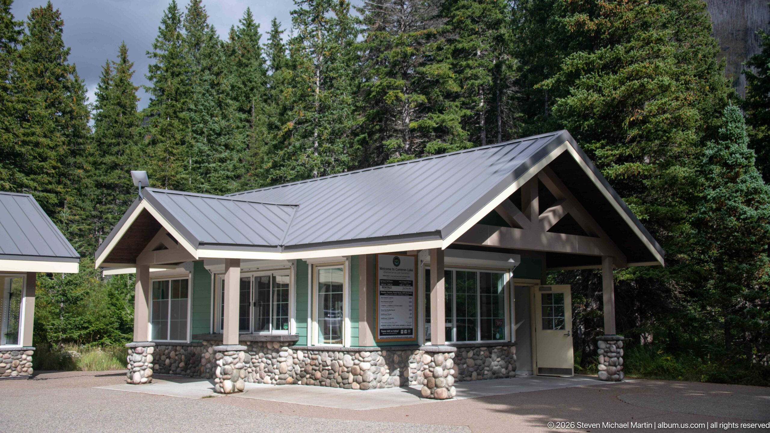
A gabled visitor facility stands among mature conifers at Cameron Lakeshore, with a deep covered entrance supported by heavy timber framing and rounded-stone piers. Large windows wrap the lighter central volume beneath a gray metal roof. The sheltered doorway and prominent information panel suggest an arrival or service function, while the materials echo the smaller lakeshore building nearby.
Caption
A gabled visitor facility stands among mature conifers at Cameron Lakeshore, with a deep covered entrance supported by heavy timber framing and rounded-stone piers. Large windows wrap the lighter central volume beneath a gray metal roof. The sheltered doorway and prominent information panel suggest an arrival or service function, while the materials echo the smaller lakeshore building nearby.
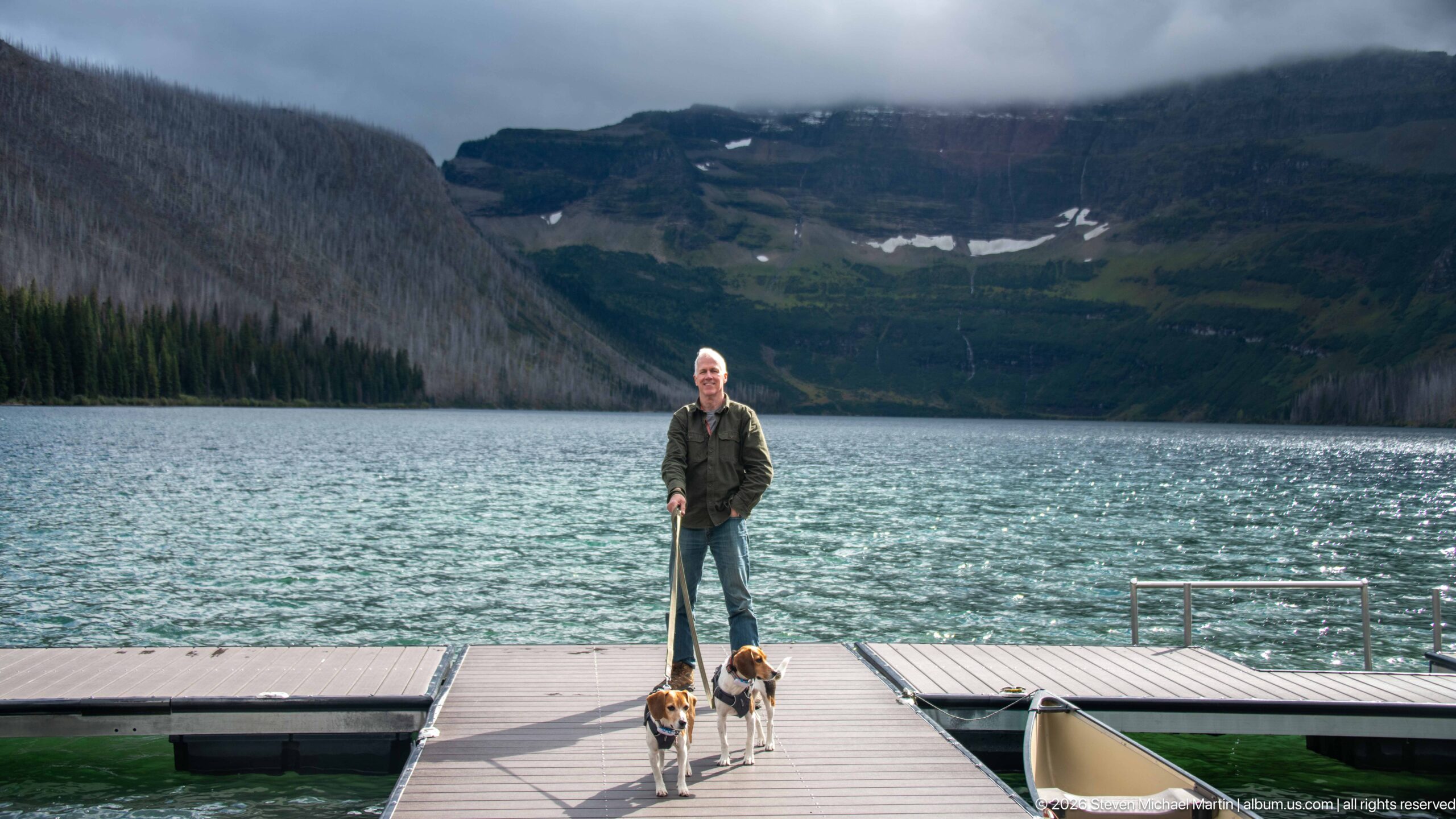
A visitor stands at the end of a floating dock with two beagles beside him, Cameron Lake spreading behind them toward steep mountains partly hidden by low cloud. The centered composition turns the dock into a strong leading line from the dogs and traveler toward the alpine basin. Wind-textured water and the dark mountain walls give the personal portrait a distinctly rugged Waterton setting.
Caption
A visitor stands at the end of a floating dock with two beagles beside him, Cameron Lake spreading behind them toward steep mountains partly hidden by low cloud. The centered composition turns the dock into a strong leading line from the dogs and traveler toward the alpine basin. Wind-textured water and the dark mountain walls give the personal portrait a distinctly rugged Waterton setting.
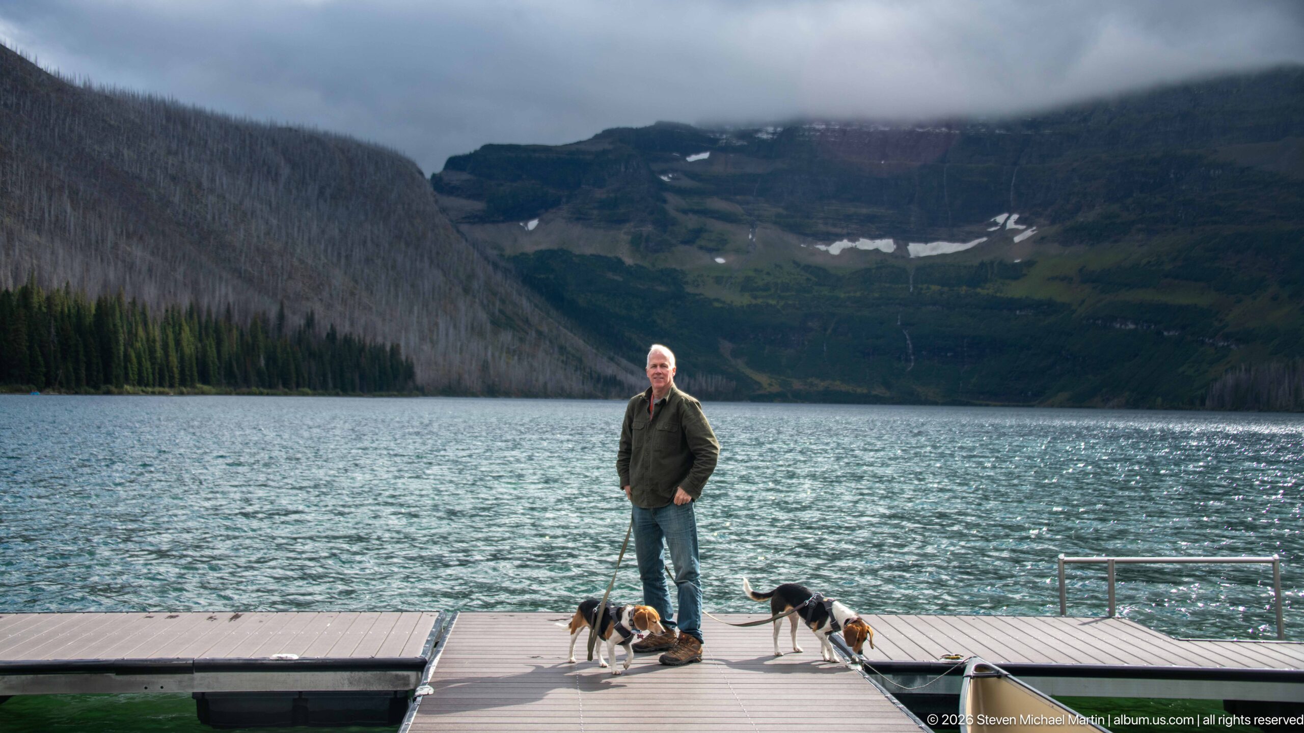
A visitor poses with two beagles near the end of a Cameron Lake dock as one dog faces toward the water and the other turns across the boards. The looser arrangement creates a more candid counterpart to the neighboring portrait. Behind them, low clouds obscure the upper mountain walls while patches of lingering snow remain visible in the high basin.
Caption
A visitor poses with two beagles near the end of a Cameron Lake dock as one dog faces toward the water and the other turns across the boards. The looser arrangement creates a more candid counterpart to the neighboring portrait. Behind them, low clouds obscure the upper mountain walls while patches of lingering snow remain visible in the high basin.
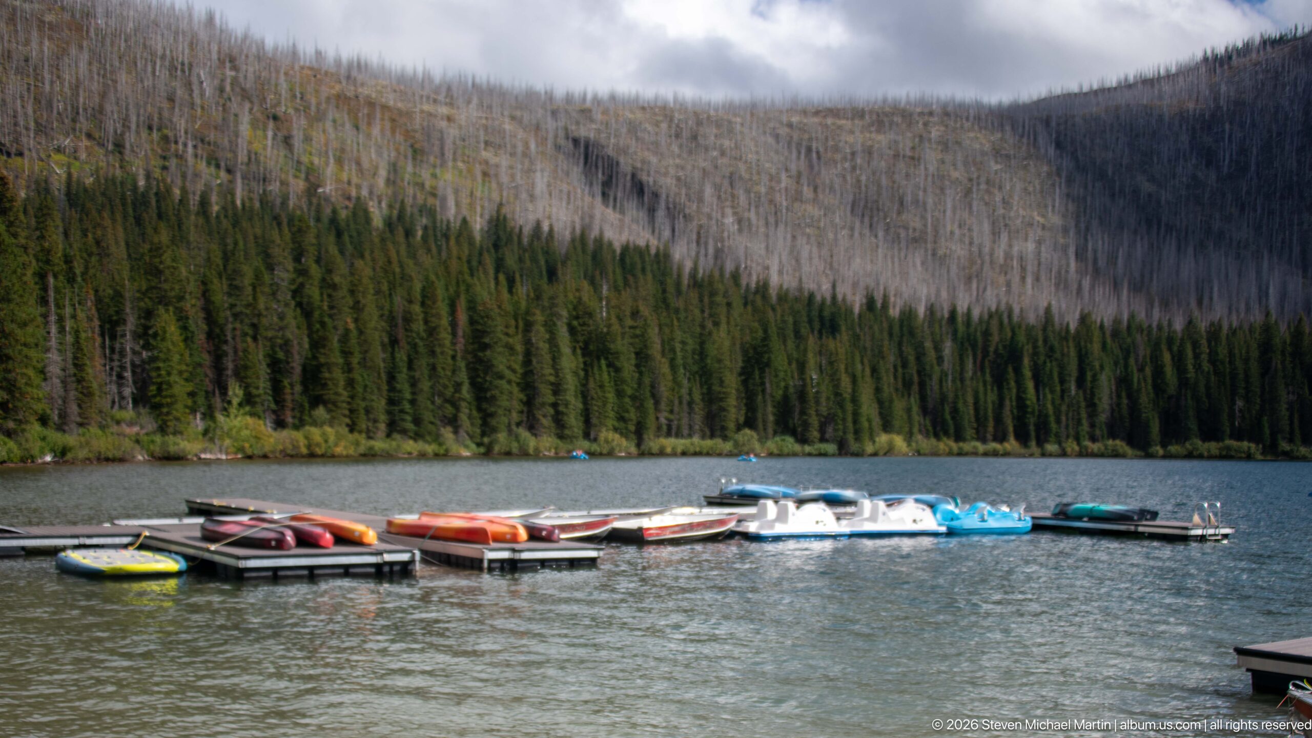
Colorful canoes, kayaks, and pedal boats cluster around floating docks on Cameron Lake beneath a steep forested slope. Above the green conifers, a broad band of pale standing dead trees marks the mountain’s fire history. The view links two prominent themes of the lakeshore: summer water recreation in the foreground and the continuing visual legacy of wildfire across the surrounding basin.
Caption
Colorful canoes, kayaks, and pedal boats cluster around floating docks on Cameron Lake beneath a steep forested slope. Above the green conifers, a broad band of pale standing dead trees marks the mountain’s fire history. The view links two prominent themes of the lakeshore: summer water recreation in the foreground and the continuing visual legacy of wildfire across the surrounding basin.
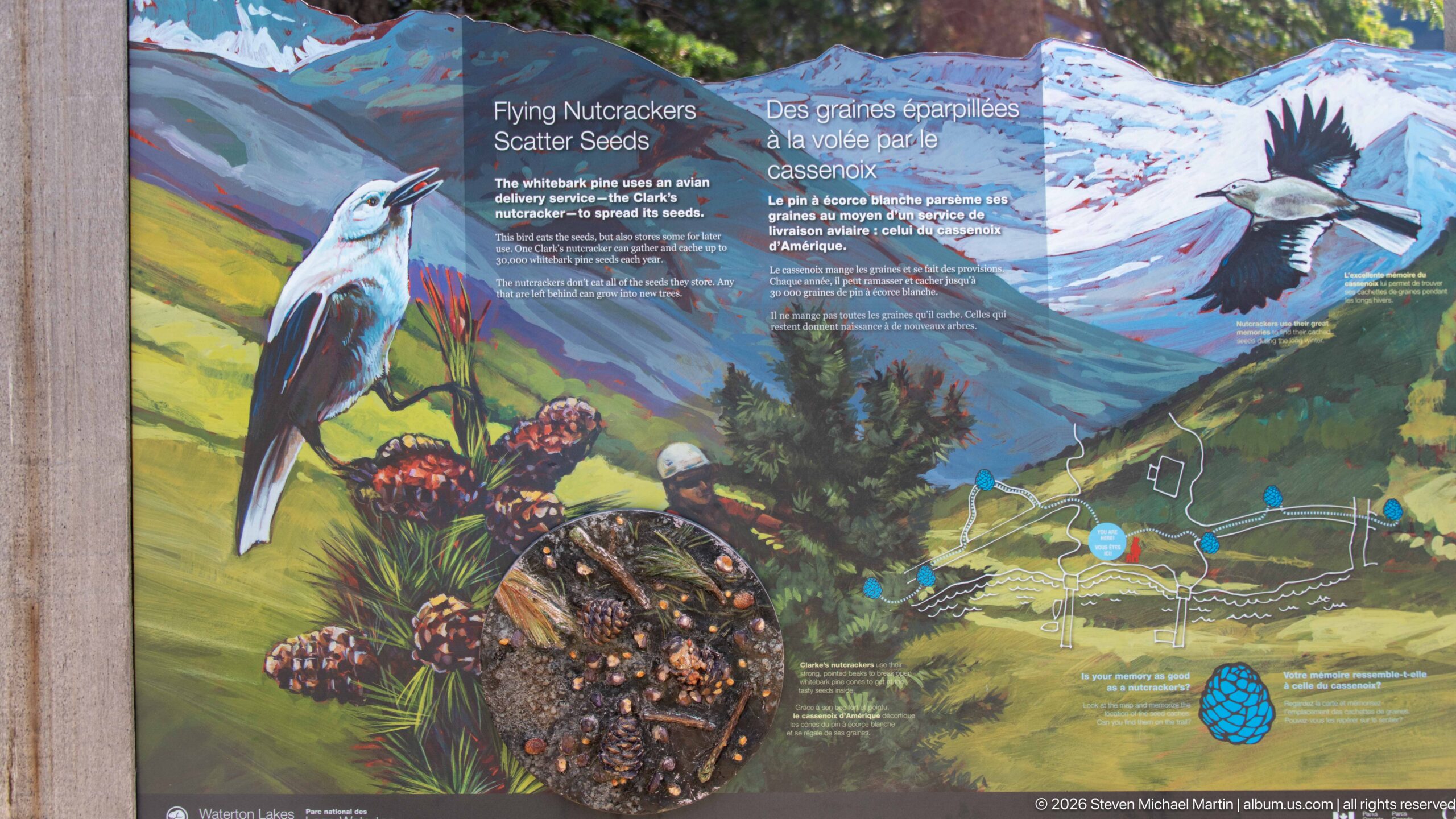
A colorful Parks Canada panel titled “Flying Nutcrackers Scatter Seeds” explains the relationship between Clark’s nutcrackers and mountain forests. Painted birds, whitebark-pine cones and seeds, a mountain landscape, and a small map combine ecological process with place. The illustration highlights the bird’s role in moving and caching seeds, an interaction especially relevant to the regeneration and persistence of high-elevation forests.
Caption
A colorful Parks Canada panel titled “Flying Nutcrackers Scatter Seeds” explains the relationship between Clark’s nutcrackers and mountain forests. Painted birds, whitebark-pine cones and seeds, a mountain landscape, and a small map combine ecological process with place. The illustration highlights the bird’s role in moving and caching seeds, an interaction especially relevant to the regeneration and persistence of high-elevation forests.
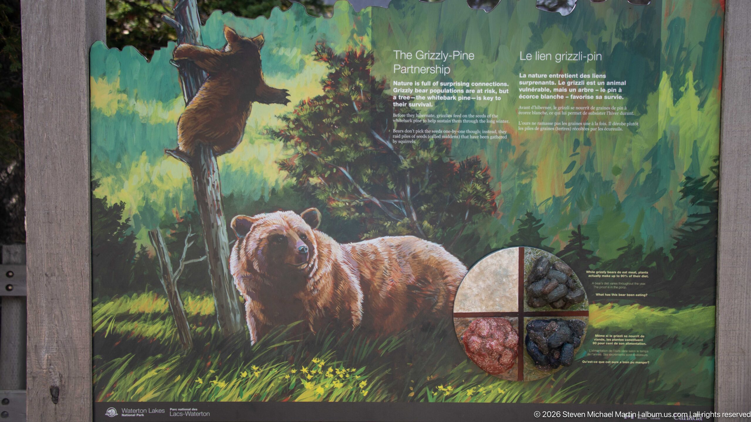
A richly illustrated panel titled “The Grizzly–Pine Partnership” links a grizzly bear with the forest plants and food sources around it. A bear dominates the foreground while another climbs a tree, and circular details highlight cones and berries. The exhibit presents the animal as part of an interconnected mountain ecosystem rather than as an isolated wildlife subject, emphasizing the ecological relationships that sustain large mammals in Waterton Lakes.
Caption
A richly illustrated panel titled “The Grizzly–Pine Partnership” links a grizzly bear with the forest plants and food sources around it. A bear dominates the foreground while another climbs a tree, and circular details highlight cones and berries. The exhibit presents the animal as part of an interconnected mountain ecosystem rather than as an isolated wildlife subject, emphasizing the ecological relationships that sustain large mammals in Waterton Lakes.
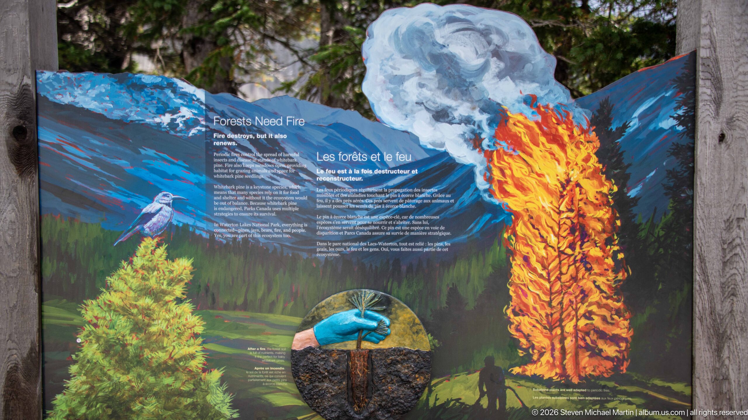
A dramatic “Forests Need Fire” panel uses flames, smoke, a green conifer, and a newly planted seedling to explain fire as an ecological process. A gloved hand and circular soil detail reinforce the theme of renewal after disturbance. The vivid contrast between burning forest and young growth mirrors the extensive post-fire landscapes visible elsewhere in Waterton Lakes and helps visitors interpret those altered slopes as dynamic ecosystems.
Caption
A dramatic “Forests Need Fire” panel uses flames, smoke, a green conifer, and a newly planted seedling to explain fire as an ecological process. A gloved hand and circular soil detail reinforce the theme of renewal after disturbance. The vivid contrast between burning forest and young growth mirrors the extensive post-fire landscapes visible elsewhere in Waterton Lakes and helps visitors interpret those altered slopes as dynamic ecosystems.
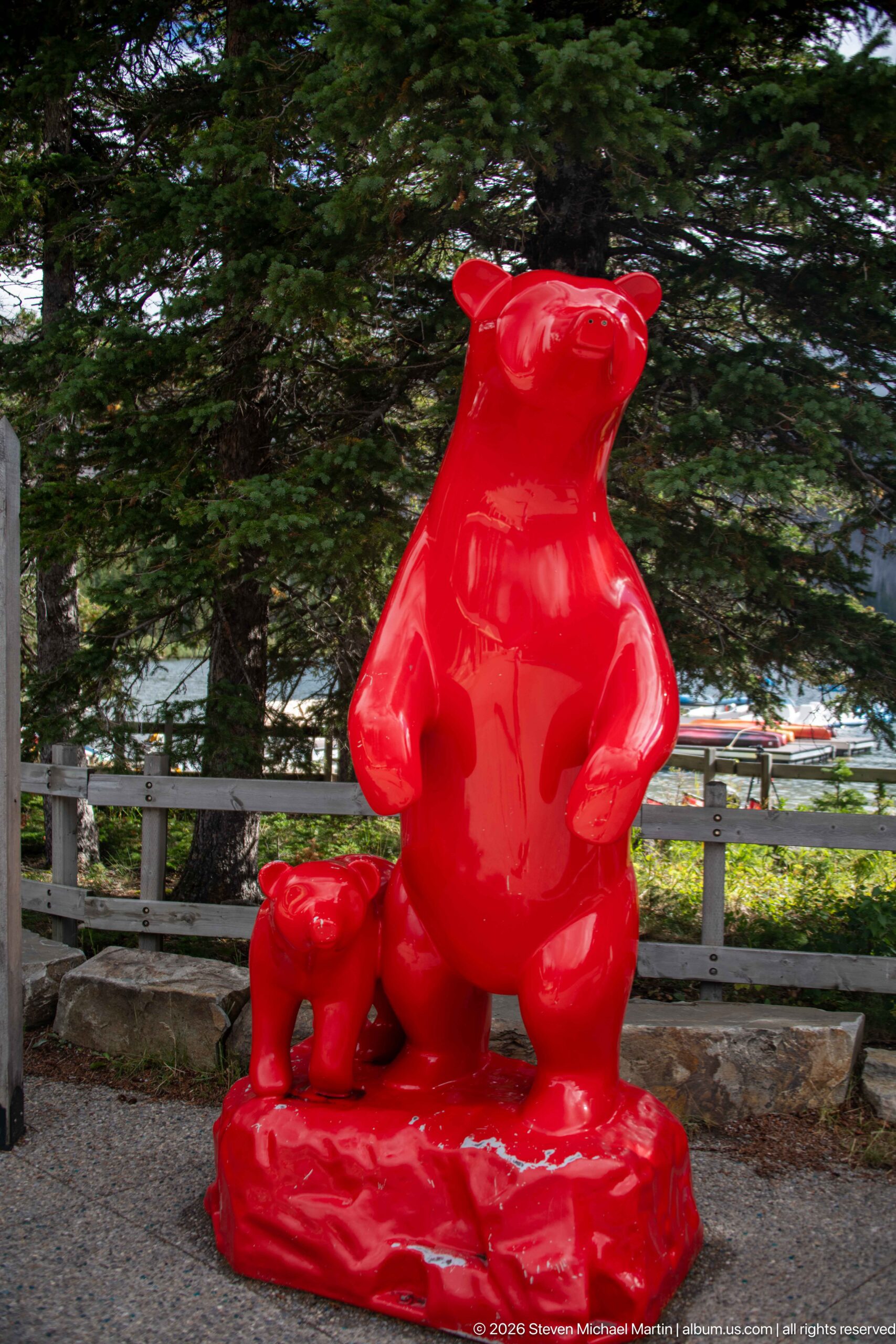
A glossy red sculpture of an adult bear and cub stands on a low base among conifers near the developed lakeshore area. The oversized adult rises upright while the smaller cub walks beside it, creating a playful but unmistakable wildlife grouping. Its saturated color and smooth surface distinguish the work sharply from the natural greens, grays, and browns of the surrounding park landscape.
Caption
A glossy red sculpture of an adult bear and cub stands on a low base among conifers near the developed lakeshore area. The oversized adult rises upright while the smaller cub walks beside it, creating a playful but unmistakable wildlife grouping. Its saturated color and smooth surface distinguish the work sharply from the natural greens, grays, and browns of the surrounding park landscape.
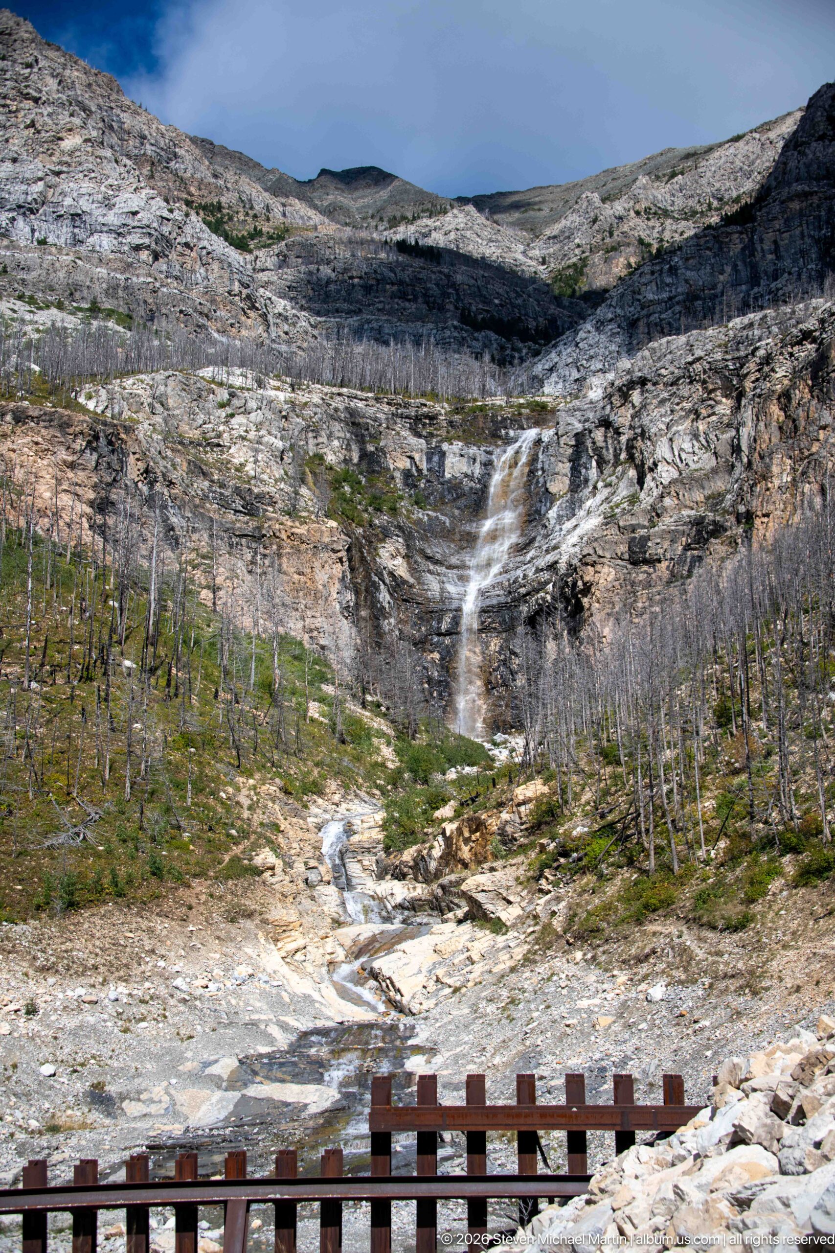
A high waterfall spills from a broad rock amphitheater and feeds a stream that winds down pale slabs toward a roadside barrier in the foreground. Standing dead trees cover much of the basin, while sparse green vegetation follows wetter ground. The wider viewpoint reveals the full drainage from cliff to lower channel and places the cascade within a heavily fire-altered mountain setting.
Caption
A high waterfall spills from a broad rock amphitheater and feeds a stream that winds down pale slabs toward a roadside barrier in the foreground. Standing dead trees cover much of the basin, while sparse green vegetation follows wetter ground. The wider viewpoint reveals the full drainage from cliff to lower channel and places the cascade within a heavily fire-altered mountain setting.
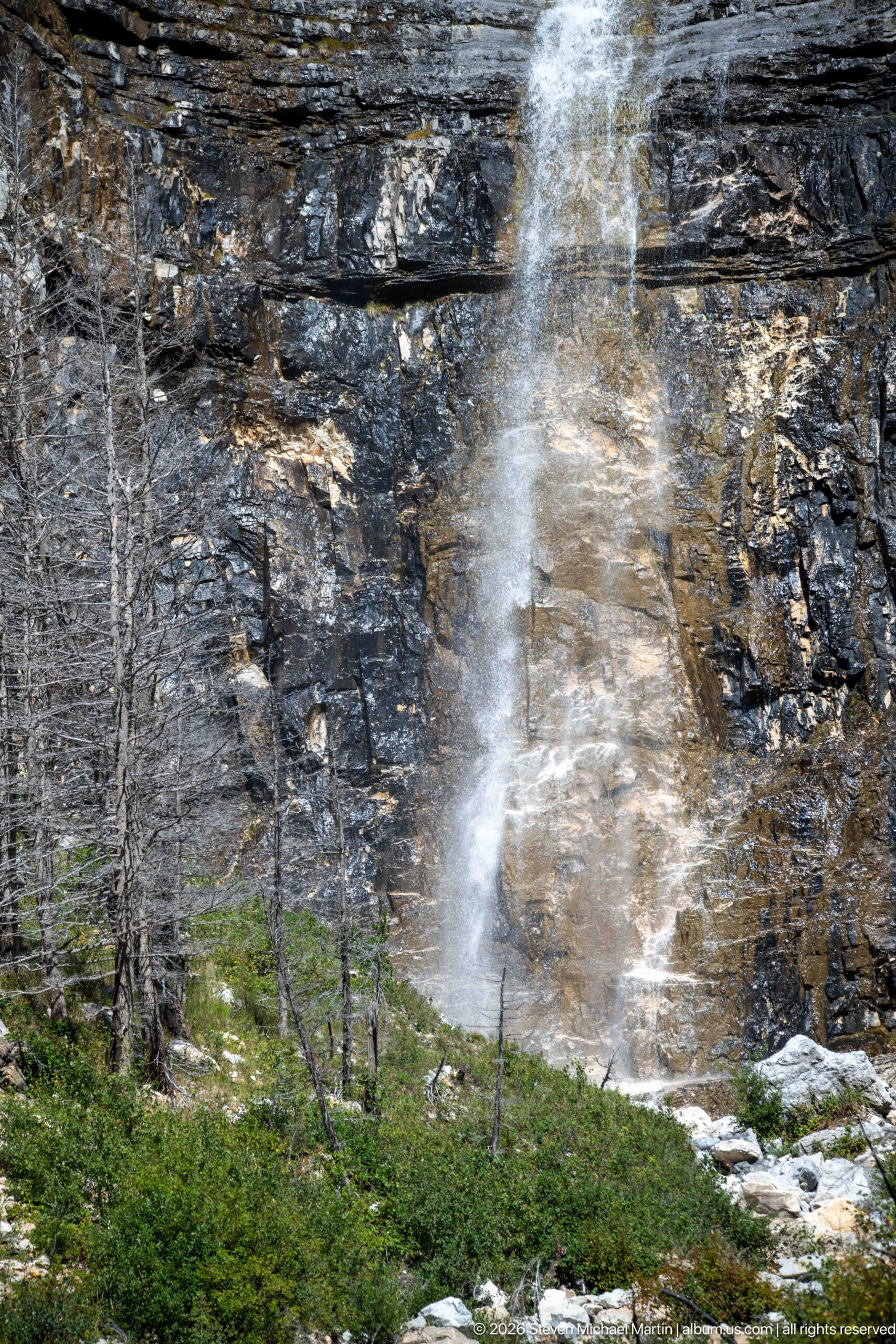
A narrow waterfall fans outward as it drops across a dark, horizontally layered cliff. Wind and irregular rock surfaces break the water into translucent veils before it reaches green vegetation and scattered dead trunks at the base. The close framing removes most of the surrounding basin, concentrating attention on the texture of the bedrock and the changing shape of the falling water.
Caption
A narrow waterfall fans outward as it drops across a dark, horizontally layered cliff. Wind and irregular rock surfaces break the water into translucent veils before it reaches green vegetation and scattered dead trunks at the base. The close framing removes most of the surrounding basin, concentrating attention on the texture of the bedrock and the changing shape of the falling water.
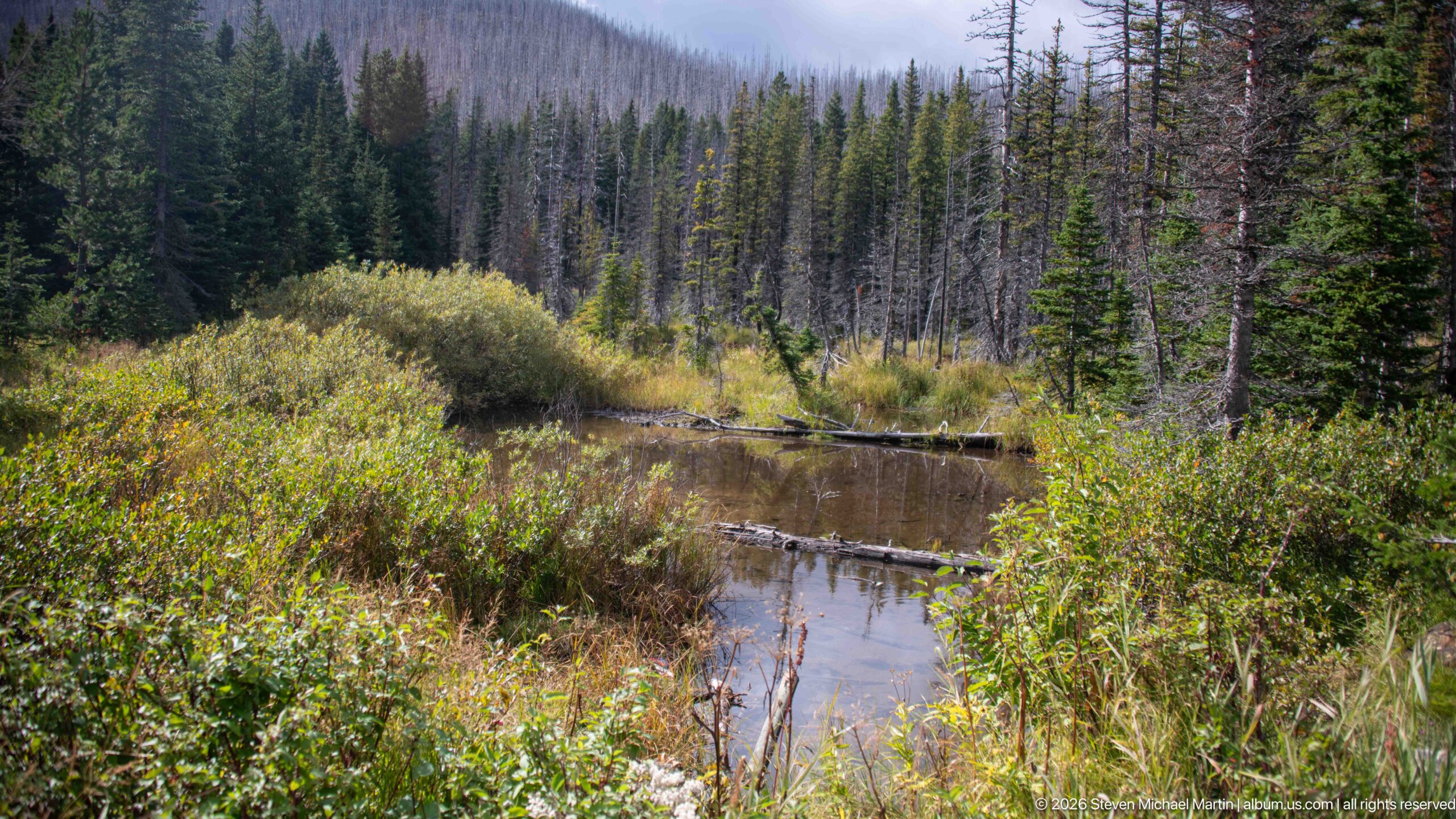
A quiet, narrow channel winds through dense willow and low wetland vegetation below a forested mountain slope. Fallen logs cross the dark water while extensive standing dead trees rise behind the green riparian corridor. The scene contrasts still water and vigorous streamside growth with the fire-altered forest beyond, illustrating how wet habitats can retain a distinct ecological character within a disturbed mountain landscape.
Caption
A quiet, narrow channel winds through dense willow and low wetland vegetation below a forested mountain slope. Fallen logs cross the dark water while extensive standing dead trees rise behind the green riparian corridor. The scene contrasts still water and vigorous streamside growth with the fire-altered forest beyond, illustrating how wet habitats can retain a distinct ecological character within a disturbed mountain landscape.
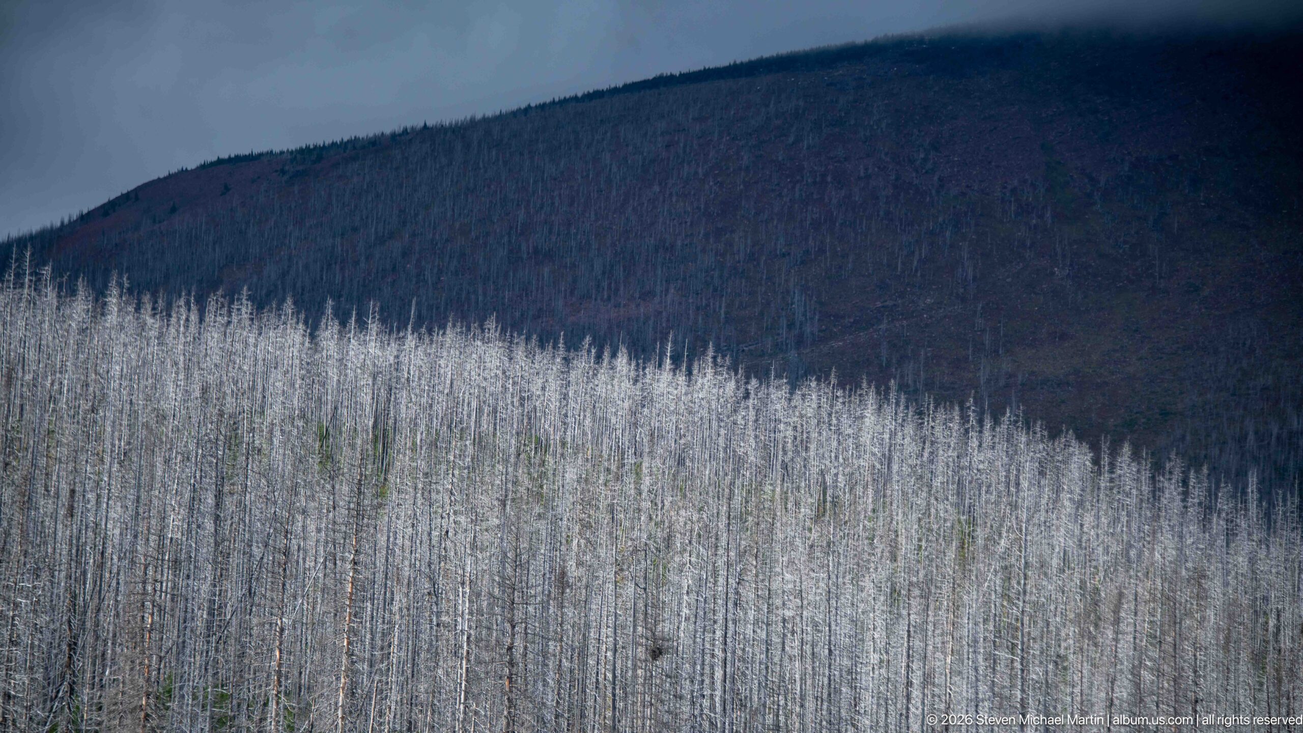
Thousands of pale standing snags form a dense band across the lower mountain slope, while a darker, more distant ridge rises behind them. The telephoto compression turns the fire-killed trunks into a nearly continuous silver-gray texture. With little ground vegetation visible, this view emphasizes the scale and persistence of canopy loss rather than the colorful regeneration documented in closer photographs from the same Waterton landscape.
Caption
Thousands of pale standing snags form a dense band across the lower mountain slope, while a darker, more distant ridge rises behind them. The telephoto compression turns the fire-killed trunks into a nearly continuous silver-gray texture. With little ground vegetation visible, this view emphasizes the scale and persistence of canopy loss rather than the colorful regeneration documented in closer photographs from the same Waterton landscape.
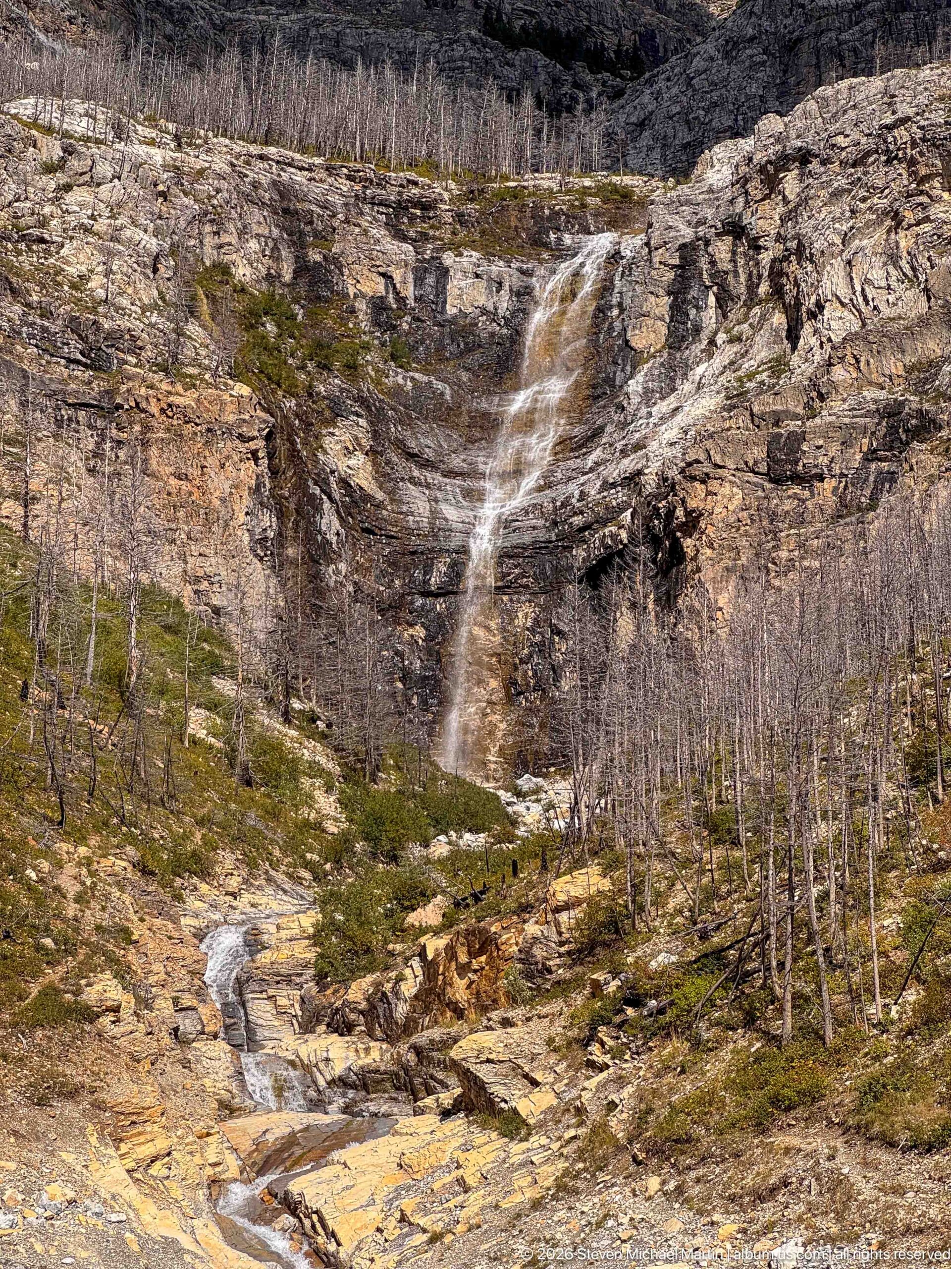
A slender waterfall descends from a dark cliff into a broad rocky drainage where the stream continues over pale, polished slabs. Fire-killed trunks stand across the surrounding slopes, opening views that a mature forest would have obscured. The composition connects the high drop to its downstream course, emphasizing the way flowing water follows fractures and shallow channels across the exposed mountain bedrock.
Caption
A slender waterfall descends from a dark cliff into a broad rocky drainage where the stream continues over pale, polished slabs. Fire-killed trunks stand across the surrounding slopes, opening views that a mature forest would have obscured. The composition connects the high drop to its downstream course, emphasizing the way flowing water follows fractures and shallow channels across the exposed mountain bedrock.
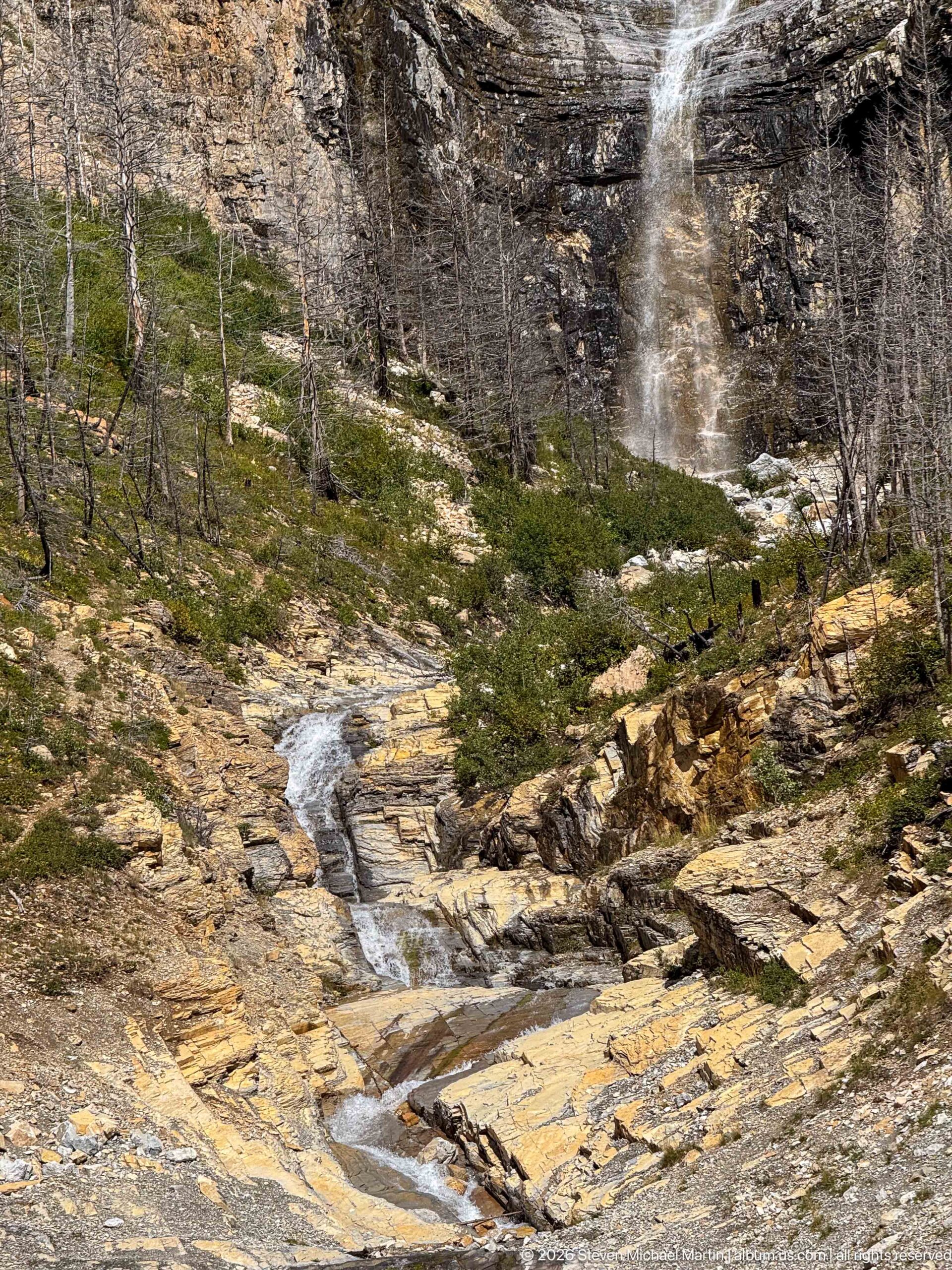
A shallow stream threads through a pale, fractured bedrock channel toward the foreground while a tall waterfall drops from the cliff at upper right. Low shrubs and scattered fire-killed trees occupy the slopes between the two. By giving more space to the downstream channel than the falls themselves, this view highlights the drainage system as a continuous feature cutting through the exposed Waterton landscape.
Caption
A shallow stream threads through a pale, fractured bedrock channel toward the foreground while a tall waterfall drops from the cliff at upper right. Low shrubs and scattered fire-killed trees occupy the slopes between the two. By giving more space to the downstream channel than the falls themselves, this view highlights the drainage system as a continuous feature cutting through the exposed Waterton landscape.
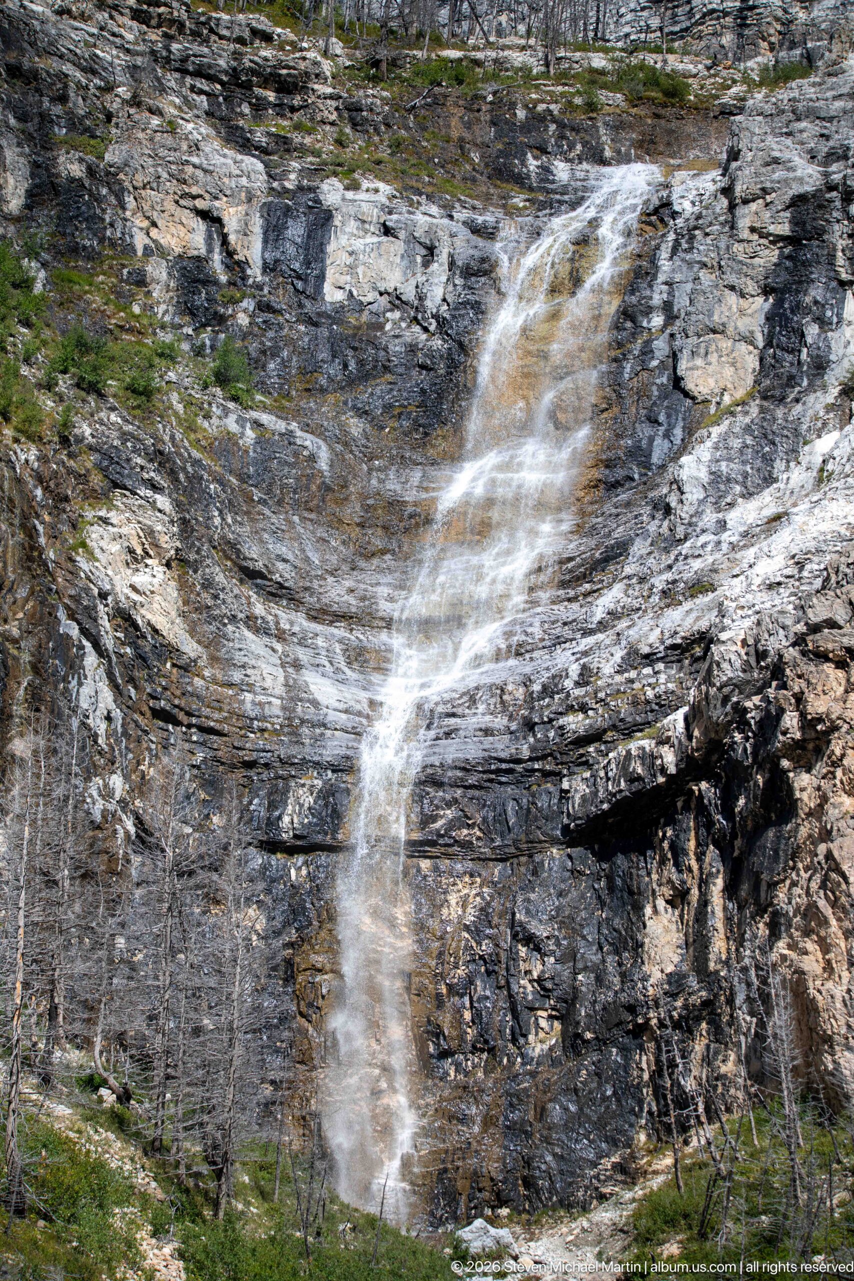
A broad sheet of water breaks into multiple ribbons as it descends a steep wall of dark stratified rock. The close view reveals ledges and horizontal bands that interrupt the flow and redirect it across the cliff face. Sparse dead trunks at the base provide scale and connect the falls to the fire-altered forest surrounding this mountain drainage.
Caption
A broad sheet of water breaks into multiple ribbons as it descends a steep wall of dark stratified rock. The close view reveals ledges and horizontal bands that interrupt the flow and redirect it across the cliff face. Sparse dead trunks at the base provide scale and connect the falls to the fire-altered forest surrounding this mountain drainage.
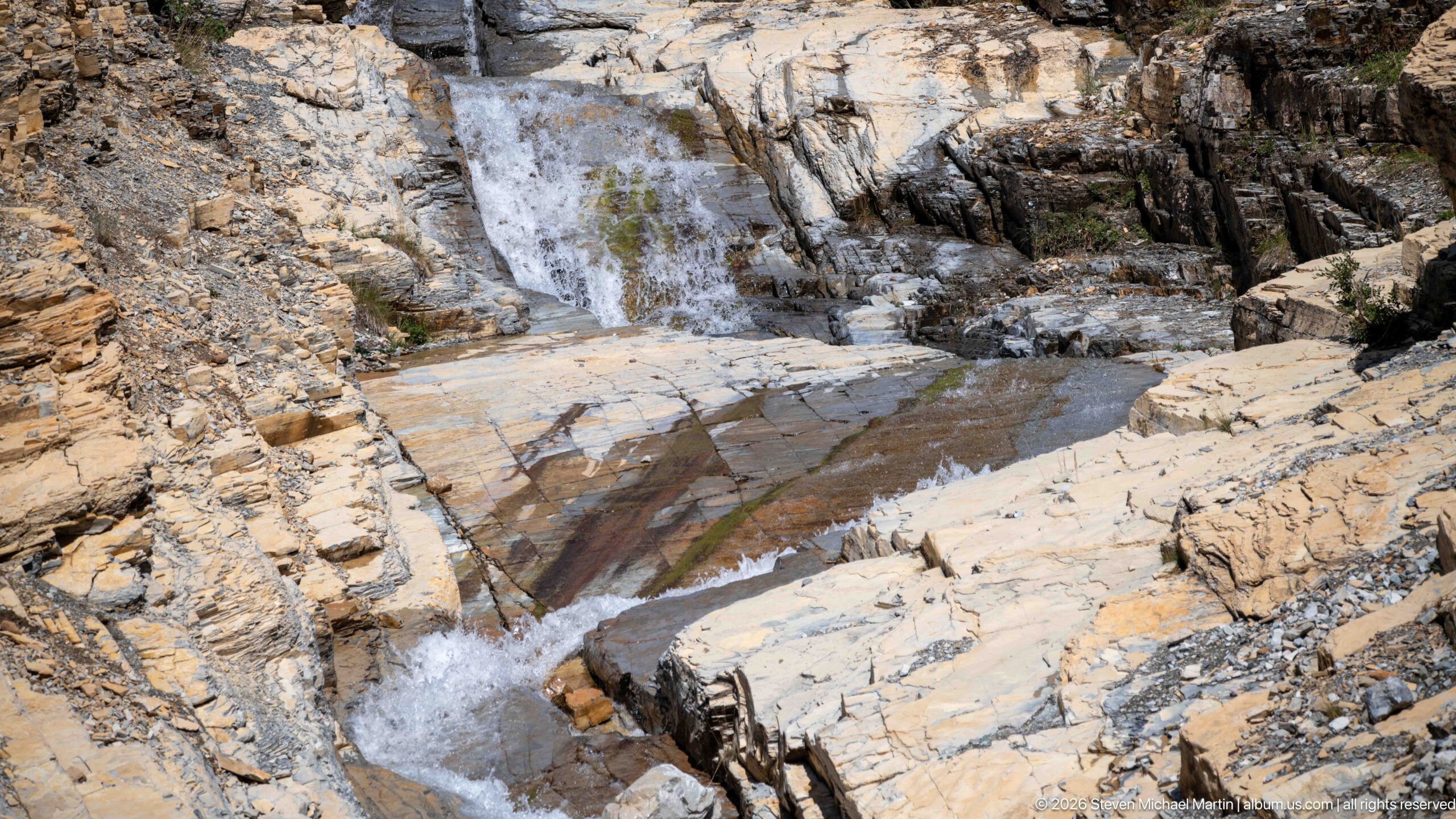
Water drops through a compact series of chutes and pools carved into pale, strongly layered bedrock. Darker wet surfaces trace the stream’s path across the rock, while broken angular edges reveal the structure of the channel. The close composition excludes the surrounding forest and mountains, turning attention to erosion, flow, and the intricate geometry of the exposed stone.
Caption
Water drops through a compact series of chutes and pools carved into pale, strongly layered bedrock. Darker wet surfaces trace the stream’s path across the rock, while broken angular edges reveal the structure of the channel. The close composition excludes the surrounding forest and mountains, turning attention to erosion, flow, and the intricate geometry of the exposed stone.
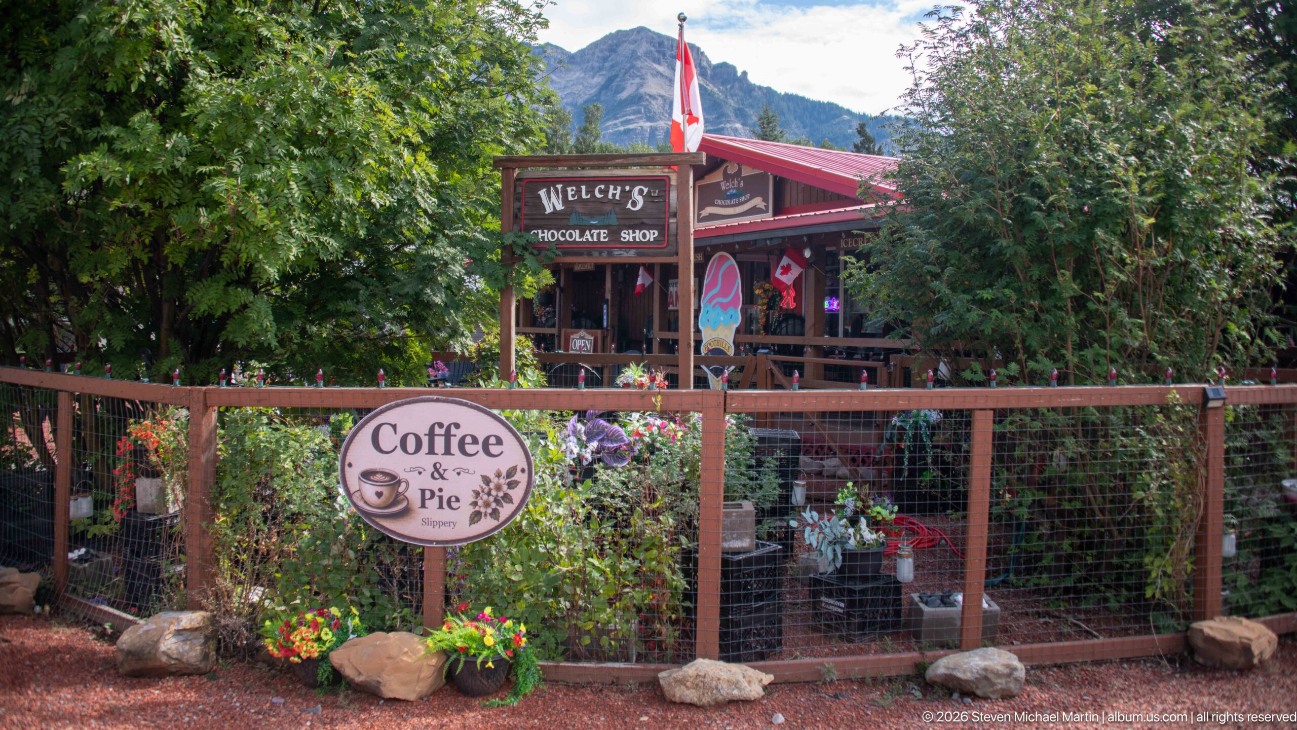
Welch’s Chocolate Shop appears behind a rustic fence and dense garden plantings in the Waterton townsite. A Canadian flag rises above the red-roofed storefront, while a round “Coffee & Pie” sign advertises another part of its visitor-oriented trade. Flowers, trees, wood railings, and hand-painted signage give the small commercial building an intimate character beneath the surrounding mountain slopes.
Caption
Welch’s Chocolate Shop appears behind a rustic fence and dense garden plantings in the Waterton townsite. A Canadian flag rises above the red-roofed storefront, while a round “Coffee & Pie” sign advertises another part of its visitor-oriented trade. Flowers, trees, wood railings, and hand-painted signage give the small commercial building an intimate character beneath the surrounding mountain slopes.
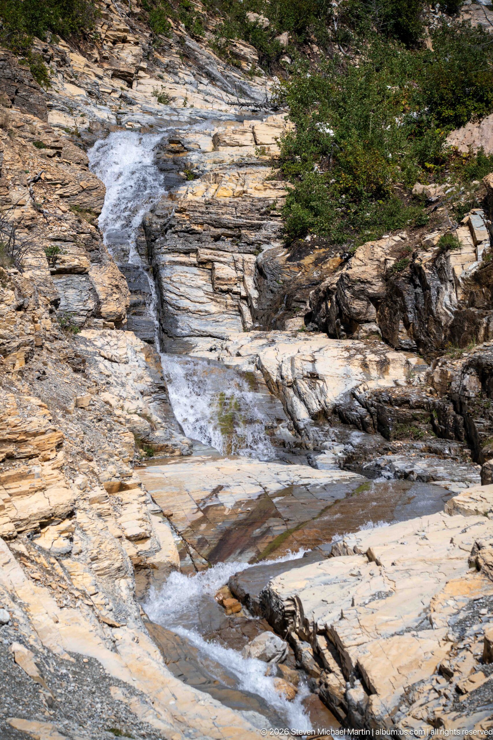
A mountain stream descends through a succession of shallow steps carved across broad pale rock slabs. Small pools collect between ledges before the water narrows again into short chutes, while low vegetation borders the upper channel. The elevated viewpoint reveals the stream’s path across the exposed bedrock and emphasizes erosion patterns rather than the larger waterfall farther upslope.
Caption
A mountain stream descends through a succession of shallow steps carved across broad pale rock slabs. Small pools collect between ledges before the water narrows again into short chutes, while low vegetation borders the upper channel. The elevated viewpoint reveals the stream’s path across the exposed bedrock and emphasizes erosion patterns rather than the larger waterfall farther upslope.

A green baseball cap embroidered with the words “John Moose” and a yellow moose emblem rests on a vehicle dashboard. The shallow depth of field leaves the Waterton streetscape outside softly blurred, turning the souvenir or personal item into the unmistakable subject. Its simple stitched logo provides a playful wildlife reference within a portfolio otherwise dominated by actual animals, mountains, and park interpretation.
Caption
A green baseball cap embroidered with the words “John Moose” and a yellow moose emblem rests on a vehicle dashboard. The shallow depth of field leaves the Waterton streetscape outside softly blurred, turning the souvenir or personal item into the unmistakable subject. Its simple stitched logo provides a playful wildlife reference within a portfolio otherwise dominated by actual animals, mountains, and park interpretation.
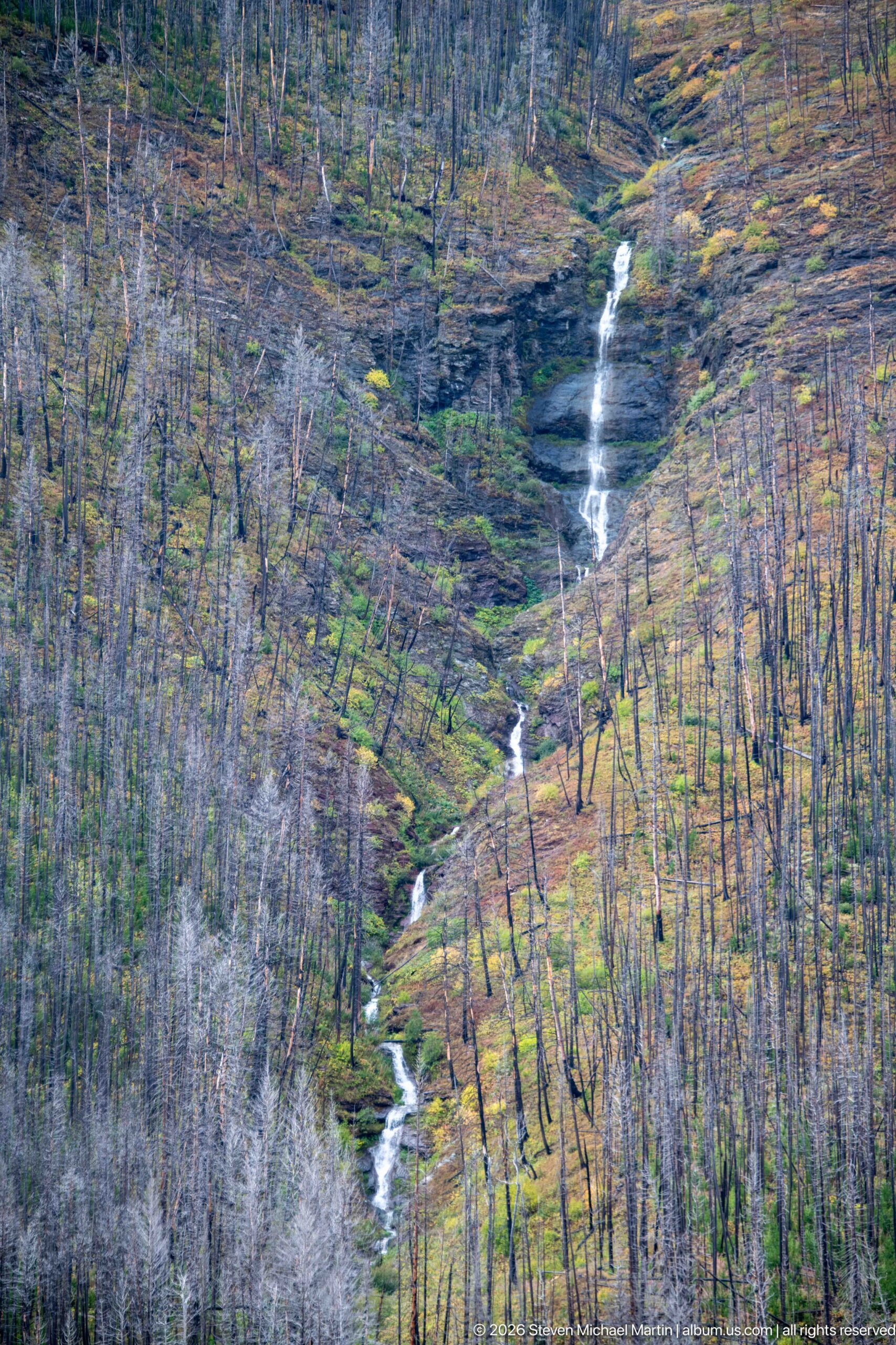
A narrow white cascade descends in multiple steps through a broad slope filled with standing fire-killed trees. Green and yellow vegetation follows the drainage, tracing a sinuous corridor through the otherwise gray forest. The telephoto view compresses the slope and turns the watercourse into a bright vertical thread, revealing how moisture supports concentrated regrowth across Waterton’s burned mountain terrain.
Caption
A narrow white cascade descends in multiple steps through a broad slope filled with standing fire-killed trees. Green and yellow vegetation follows the drainage, tracing a sinuous corridor through the otherwise gray forest. The telephoto view compresses the slope and turns the watercourse into a bright vertical thread, revealing how moisture supports concentrated regrowth across Waterton’s burned mountain terrain.
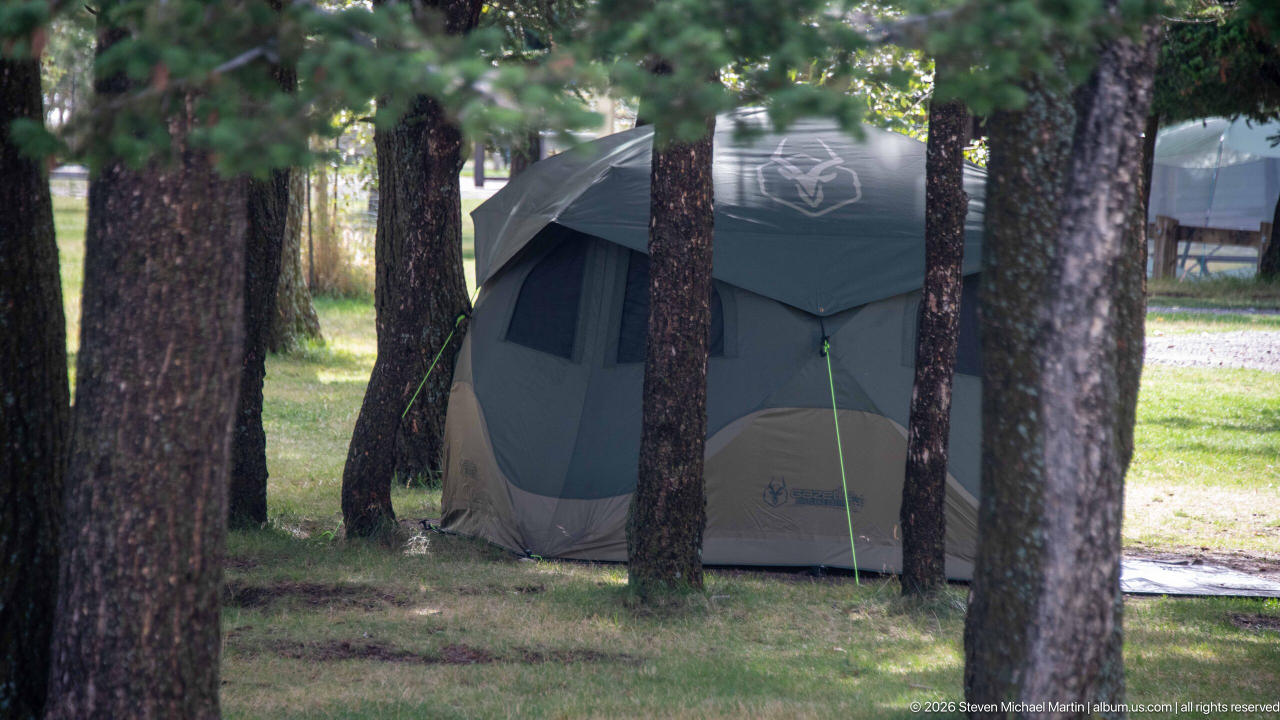
A tall cabin-style tent is pitched between mature tree trunks on a grassy campground site in Waterton Lakes. Guy lines extend from the green-and-gray shelter while neighboring campsites and park infrastructure remain softly visible through the trees. The view documents the practical side of staying inside the national park, where established camping facilities place overnight visitors directly within the wooded mountain environment.
Caption
A tall cabin-style tent is pitched between mature tree trunks on a grassy campground site in Waterton Lakes. Guy lines extend from the green-and-gray shelter while neighboring campsites and park infrastructure remain softly visible through the trees. The view documents the practical side of staying inside the national park, where established camping facilities place overnight visitors directly within the wooded mountain environment.
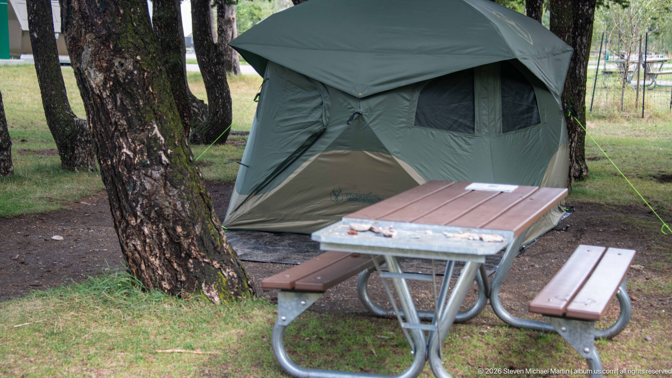
A large green-and-gray tent fills the wooded campsite behind a metal-framed picnic table. Mature trunks provide shade around the level camping pad, while the table’s weathered top and benches show the simple infrastructure supplied for overnight visitors. This closer view shifts from the tent alone to the organization of the campsite, recording the practical arrangement of shelter, dining space, and trees.
Caption
A large green-and-gray tent fills the wooded campsite behind a metal-framed picnic table. Mature trunks provide shade around the level camping pad, while the table’s weathered top and benches show the simple infrastructure supplied for overnight visitors. This closer view shifts from the tent alone to the organization of the campsite, recording the practical arrangement of shelter, dining space, and trees.
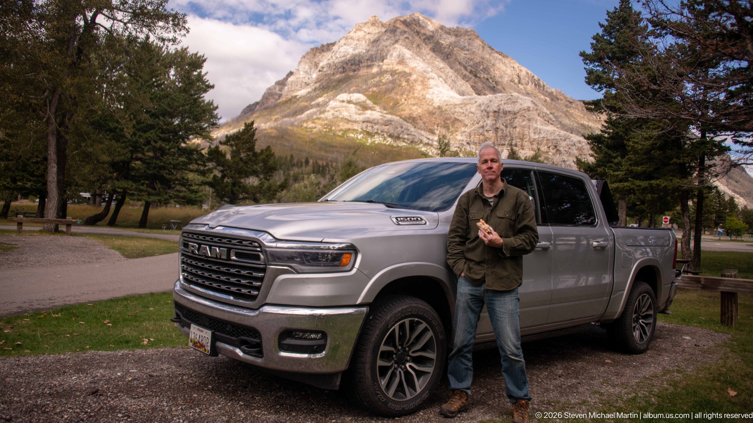
A traveler stands beside a silver RAM pickup truck at a Waterton Lakes campground, with a steep pale mountain rising dramatically behind the vehicle. Picnic tables, conifers, and campsite markers place the portrait within a developed park setting. The combination of road-trip vehicle, casual pose, and monumental mountain backdrop turns an everyday camping moment into a clear record of scale and setting in the Canadian Rockies.
Caption
A traveler stands beside a silver RAM pickup truck at a Waterton Lakes campground, with a steep pale mountain rising dramatically behind the vehicle. Picnic tables, conifers, and campsite markers place the portrait within a developed park setting. The combination of road-trip vehicle, casual pose, and monumental mountain backdrop turns an everyday camping moment into a clear record of scale and setting in the Canadian Rockies.
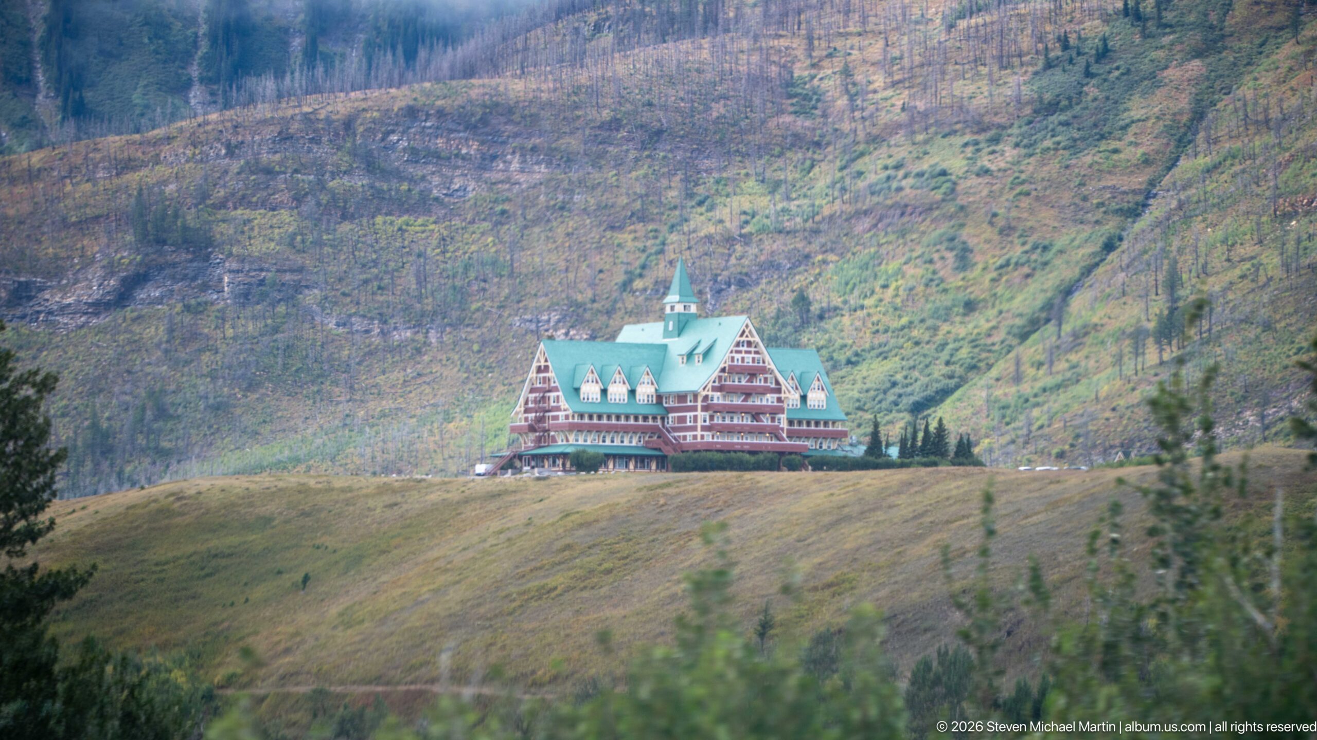
The Prince of Wales Hotel occupies a low ridge beneath an expansive mountain slope marked by sparse, fire-affected forest. Its green roof and red-and-cream façade remain vivid even at considerable distance, making the landmark a focal point within the much larger landscape. The telephoto view emphasizes how isolated the hotel appears between open grassland and the steep, altered mountain terrain behind it.
Caption
The Prince of Wales Hotel occupies a low ridge beneath an expansive mountain slope marked by sparse, fire-affected forest. Its green roof and red-and-cream façade remain vivid even at considerable distance, making the landmark a focal point within the much larger landscape. The telephoto view emphasizes how isolated the hotel appears between open grassland and the steep, altered mountain terrain behind it.
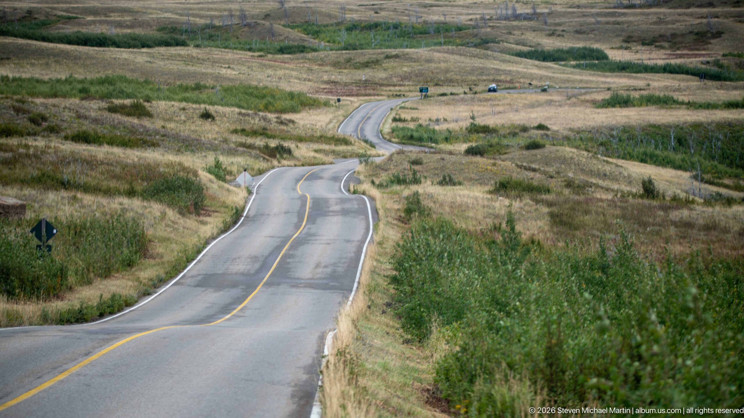
A two-lane paved road undulates across open foothill terrain, bending repeatedly through grasses and low shrubs before disappearing into the distance. Sparse traffic and roadside signs provide scale, while the absence of dense forest opens a broad view across the rolling land. The elevated viewpoint highlights the road itself as a linear element threading through the transitional landscape around Waterton Lakes.
Caption
A two-lane paved road undulates across open foothill terrain, bending repeatedly through grasses and low shrubs before disappearing into the distance. Sparse traffic and roadside signs provide scale, while the absence of dense forest opens a broad view across the rolling land. The elevated viewpoint highlights the road itself as a linear element threading through the transitional landscape around Waterton Lakes.
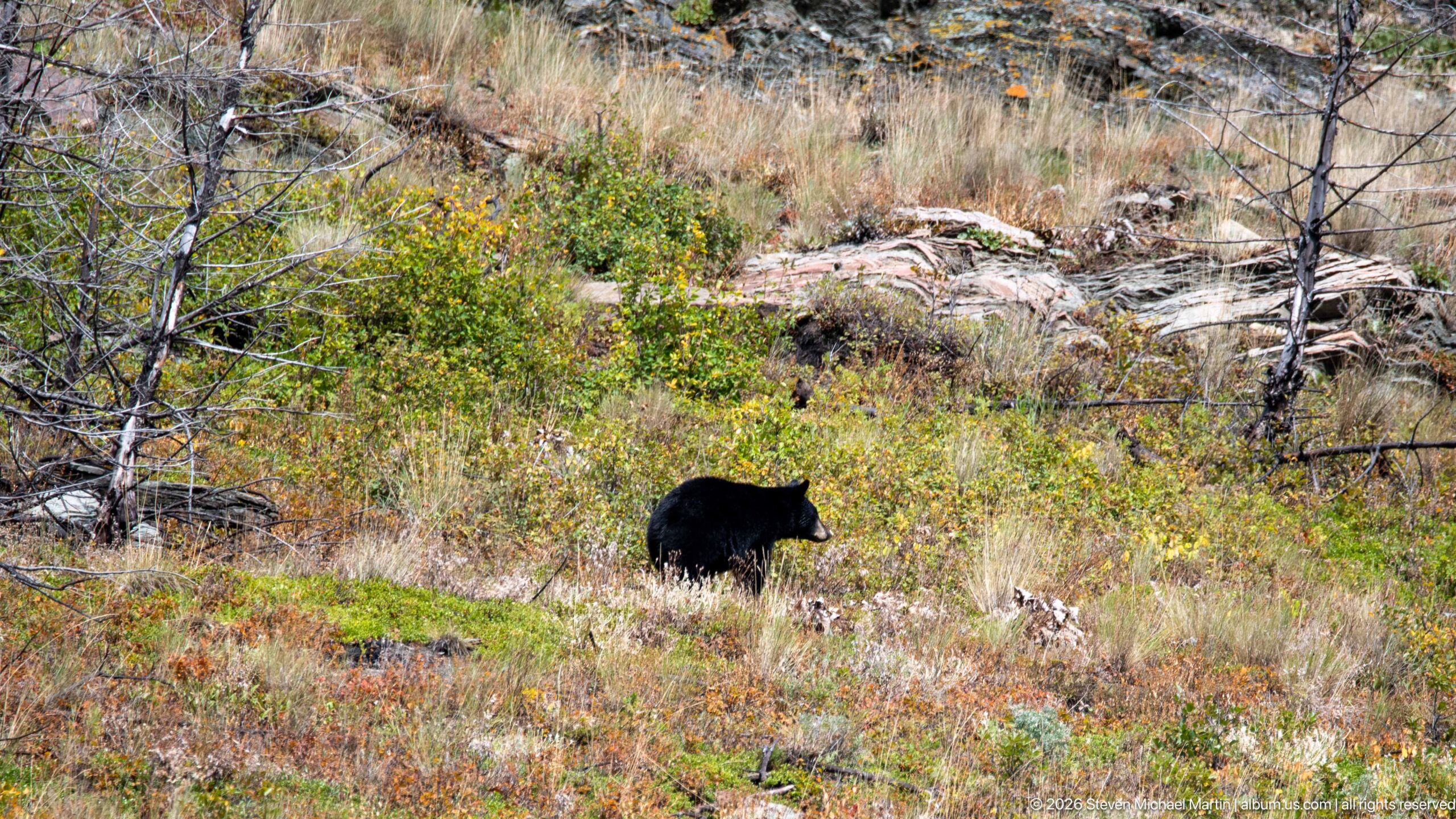
An American black bear moves through low shrubs and grasses in a fire-altered Waterton landscape. Its compact dark body, rounded ears, and relatively straight facial profile are visible against pale fallen wood and sparse standing trunks. The open post-fire habitat makes the animal unusually easy to see, while autumn-toned vegetation provides a varied feeding environment along the recovering slope.
Caption
An American black bear moves through low shrubs and grasses in a fire-altered Waterton landscape. Its compact dark body, rounded ears, and relatively straight facial profile are visible against pale fallen wood and sparse standing trunks. The open post-fire habitat makes the animal unusually easy to see, while autumn-toned vegetation provides a varied feeding environment along the recovering slope.
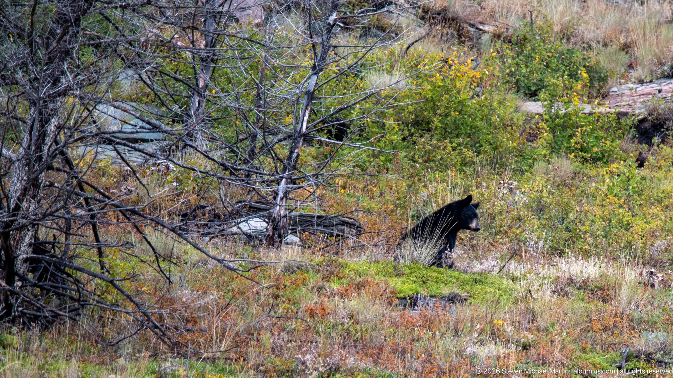
A black bear crosses a patchwork of green, yellow, and rust-colored vegetation among thin dead trunks and fallen branches. Seen in profile, the bear’s rounded ears and dark coat stand out against the bright recovering understory. This second view places more intervening branches around the animal, showing how quickly wildlife can disappear into even a relatively open post-fire woodland.
Caption
A black bear crosses a patchwork of green, yellow, and rust-colored vegetation among thin dead trunks and fallen branches. Seen in profile, the bear’s rounded ears and dark coat stand out against the bright recovering understory. This second view places more intervening branches around the animal, showing how quickly wildlife can disappear into even a relatively open post-fire woodland.
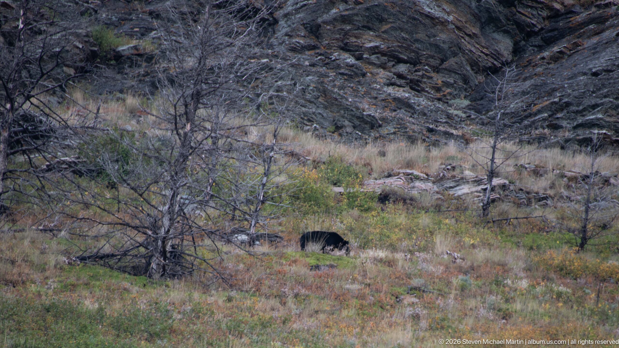
A black bear is partly hidden by low shrubs as it moves across an open, fire-affected slope beneath dark rock outcrops. Only the animal’s back, head, and portions of its body remain visible through the vegetation, making this encounter more concealed than the preceding views. The surrounding dead saplings and colorful groundcover show how recovering burn areas provide both forage and visual cover.
Caption
A black bear is partly hidden by low shrubs as it moves across an open, fire-affected slope beneath dark rock outcrops. Only the animal’s back, head, and portions of its body remain visible through the vegetation, making this encounter more concealed than the preceding views. The surrounding dead saplings and colorful groundcover show how recovering burn areas provide both forage and visual cover.
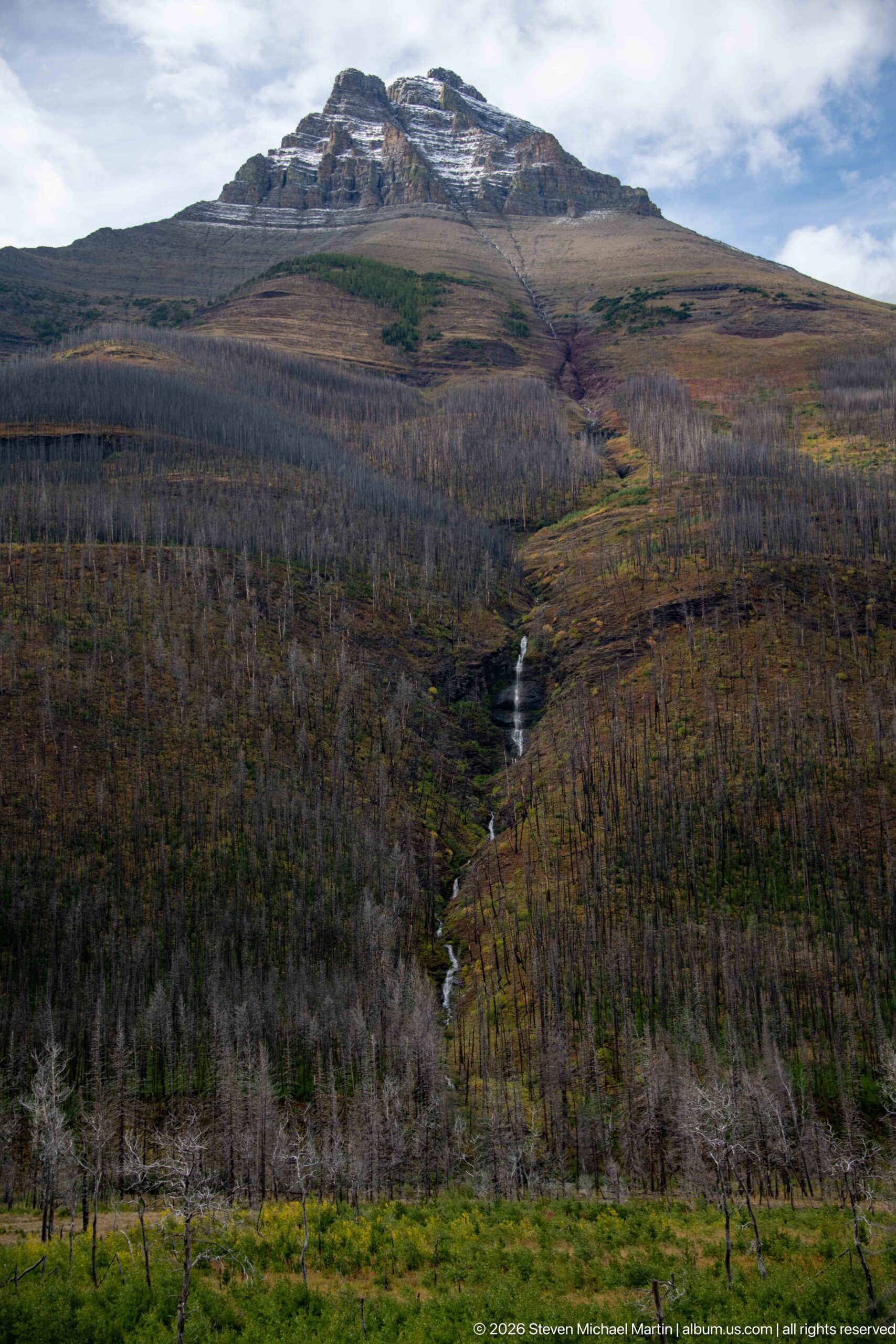
A broad mountain slope rises above an extensive forest of standing gray snags, with a narrow cascade drainage cutting down the center. Bands of green, yellow, and rust vegetation mark wetter ground and seasonal change across the burn scar. The wide composition places the small watercourse within the full scale of the disturbed landscape, contrasting surviving alpine rock with the transformed forest below.
Caption
A broad mountain slope rises above an extensive forest of standing gray snags, with a narrow cascade drainage cutting down the center. Bands of green, yellow, and rust vegetation mark wetter ground and seasonal change across the burn scar. The wide composition places the small watercourse within the full scale of the disturbed landscape, contrasting surviving alpine rock with the transformed forest below.
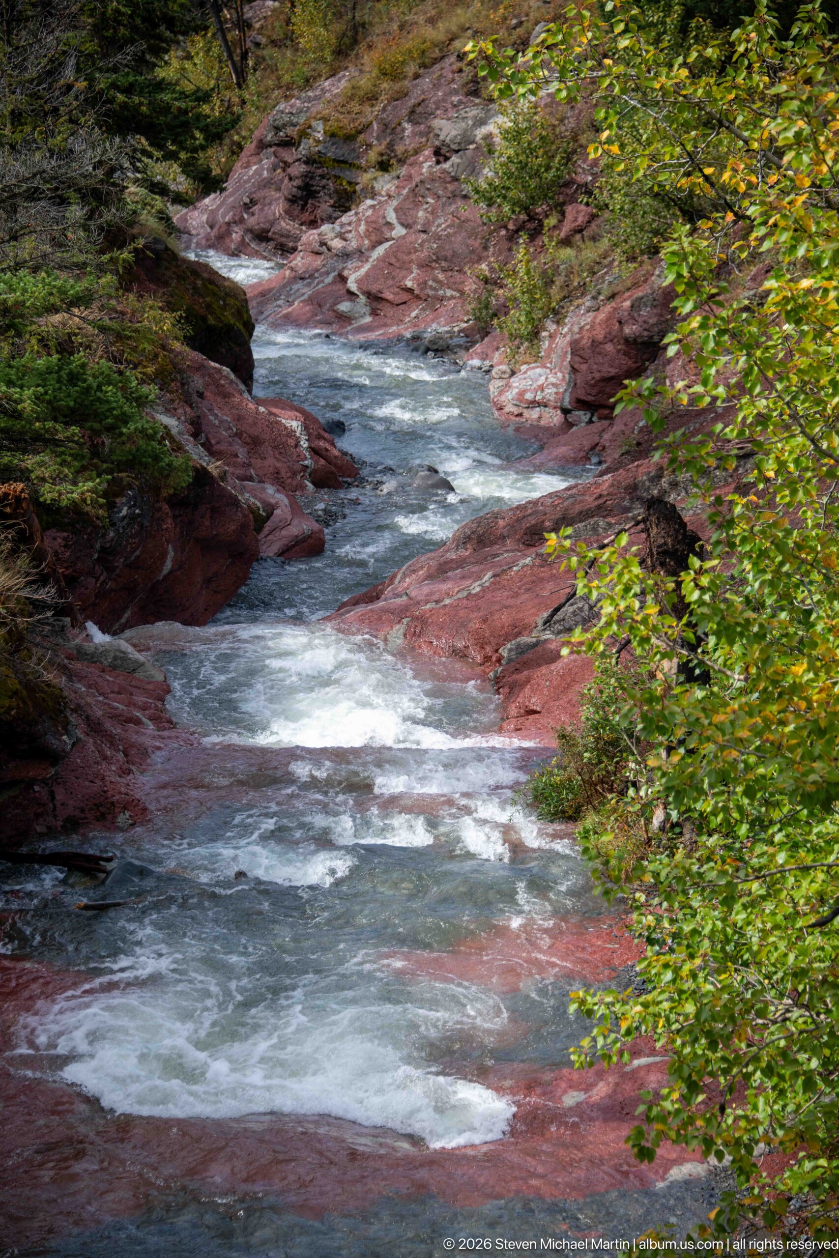
A swift mountain stream winds between smooth red rock shelves, its blue-gray water broken by short rapids and pale foam. Green shrubs overhang the channel at right, softening the strongly colored stone. The broader composition shows how the water follows a sinuous bedrock corridor rather than a single vertical drop, distinguishing this reach from the neighboring waterfall details.
Caption
A swift mountain stream winds between smooth red rock shelves, its blue-gray water broken by short rapids and pale foam. Green shrubs overhang the channel at right, softening the strongly colored stone. The broader composition shows how the water follows a sinuous bedrock corridor rather than a single vertical drop, distinguishing this reach from the neighboring waterfall details.
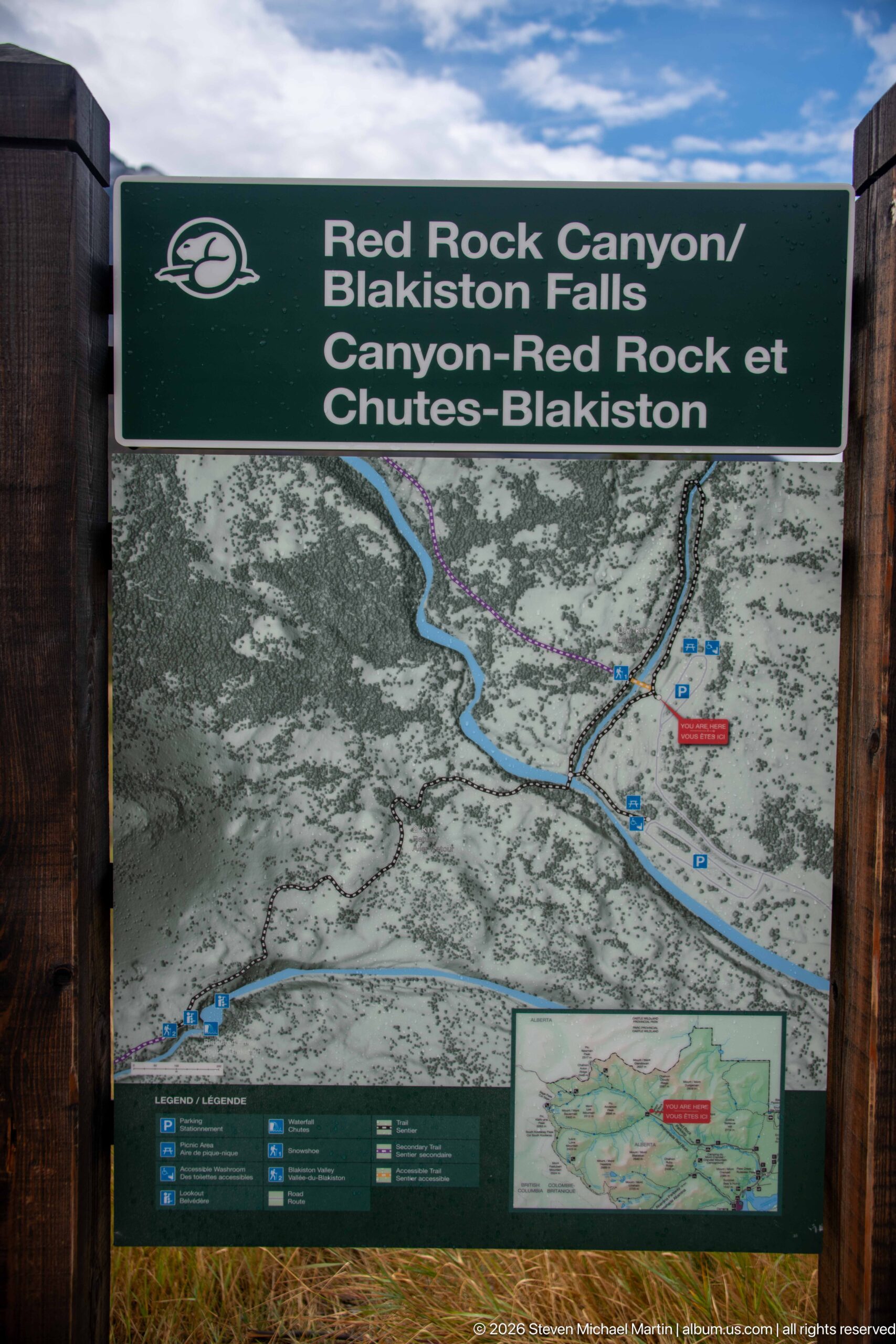
A large Parks Canada map identifies the Red Rock Canyon and Blakiston Falls area, showing roads, trails, waterways, facilities, and surrounding terrain. The bilingual heading provides the destination names while a smaller locator inset places the trail system in regional context. As a practical orientation display, the map connects the canyon visit with nearby hiking opportunities and the developed road network.
Caption
A large Parks Canada map identifies the Red Rock Canyon and Blakiston Falls area, showing roads, trails, waterways, facilities, and surrounding terrain. The bilingual heading provides the destination names while a smaller locator inset places the trail system in regional context. As a practical orientation display, the map connects the canyon visit with nearby hiking opportunities and the developed road network.
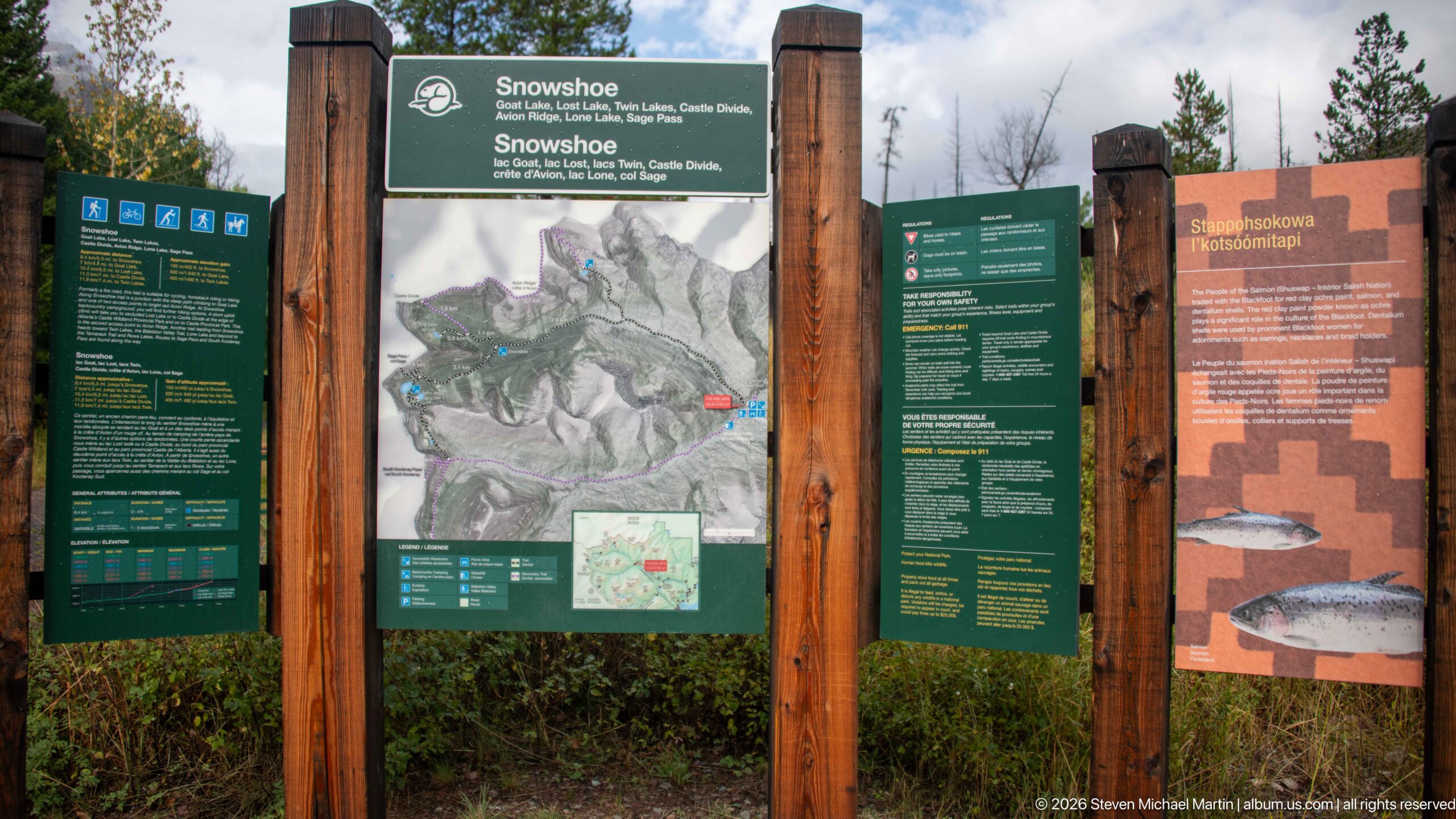
A multi-panel trailhead display identifies the Snowshoe route with a central topographic map, bilingual trail information, and adjacent interpretive material. The orange panel at right discusses bull trout and road-stream relationships, while green panels provide route and visitor guidance. Heavy timber posts frame the board, creating a durable orientation point for hikers entering this part of Waterton Lakes.
Caption
A multi-panel trailhead display identifies the Snowshoe route with a central topographic map, bilingual trail information, and adjacent interpretive material. The orange panel at right discusses bull trout and road-stream relationships, while green panels provide route and visitor guidance. Heavy timber posts frame the board, creating a durable orientation point for hikers entering this part of Waterton Lakes.
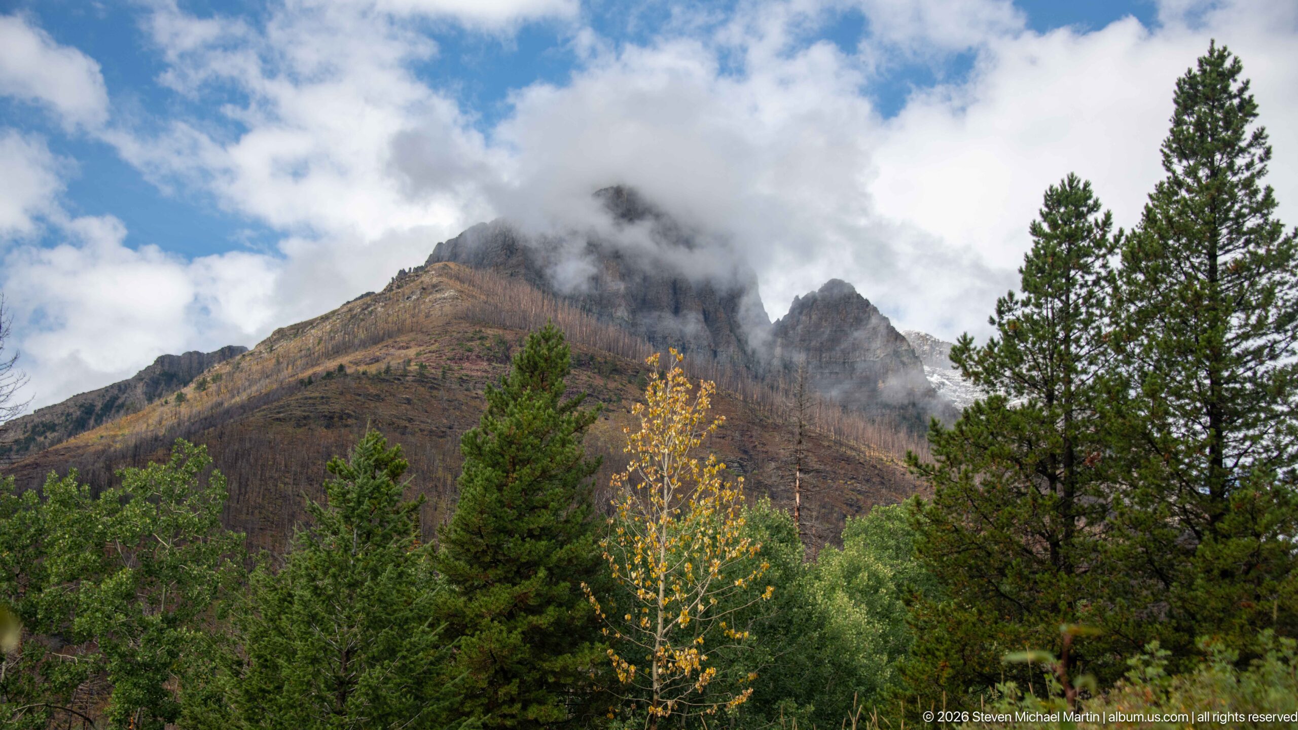
Jagged mountain peaks rise above a mixed forest as low cloud curls around their upper slopes. A single yellowing deciduous tree stands brightly against darker conifers in the foreground, introducing an autumn accent to the otherwise subdued scene. The cloud hides portions of the skyline and creates shifting layers of rock, forest, and mist rather than a fully exposed mountain portrait.
Caption
Jagged mountain peaks rise above a mixed forest as low cloud curls around their upper slopes. A single yellowing deciduous tree stands brightly against darker conifers in the foreground, introducing an autumn accent to the otherwise subdued scene. The cloud hides portions of the skyline and creates shifting layers of rock, forest, and mist rather than a fully exposed mountain portrait.
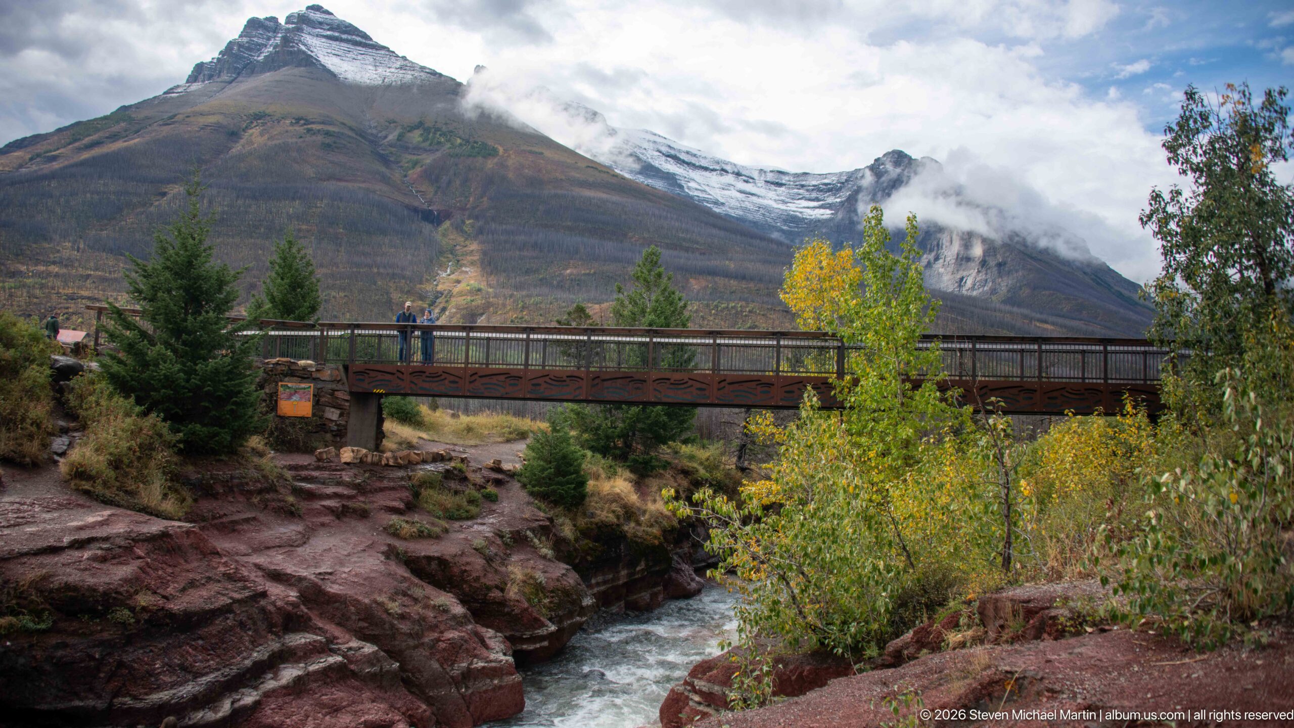
A long pedestrian bridge crosses a fast mountain stream confined between striking reddish rock walls. Autumn-yellow shrubs and young conifers soften the gorge edges, while cloud hangs across the high mountains beyond. Several visitors on the bridge provide scale, linking the developed trail structure to the energetic water and colorful geology below in a layered Waterton Lakes landscape.
Caption
A long pedestrian bridge crosses a fast mountain stream confined between striking reddish rock walls. Autumn-yellow shrubs and young conifers soften the gorge edges, while cloud hangs across the high mountains beyond. Several visitors on the bridge provide scale, linking the developed trail structure to the energetic water and colorful geology below in a layered Waterton Lakes landscape.
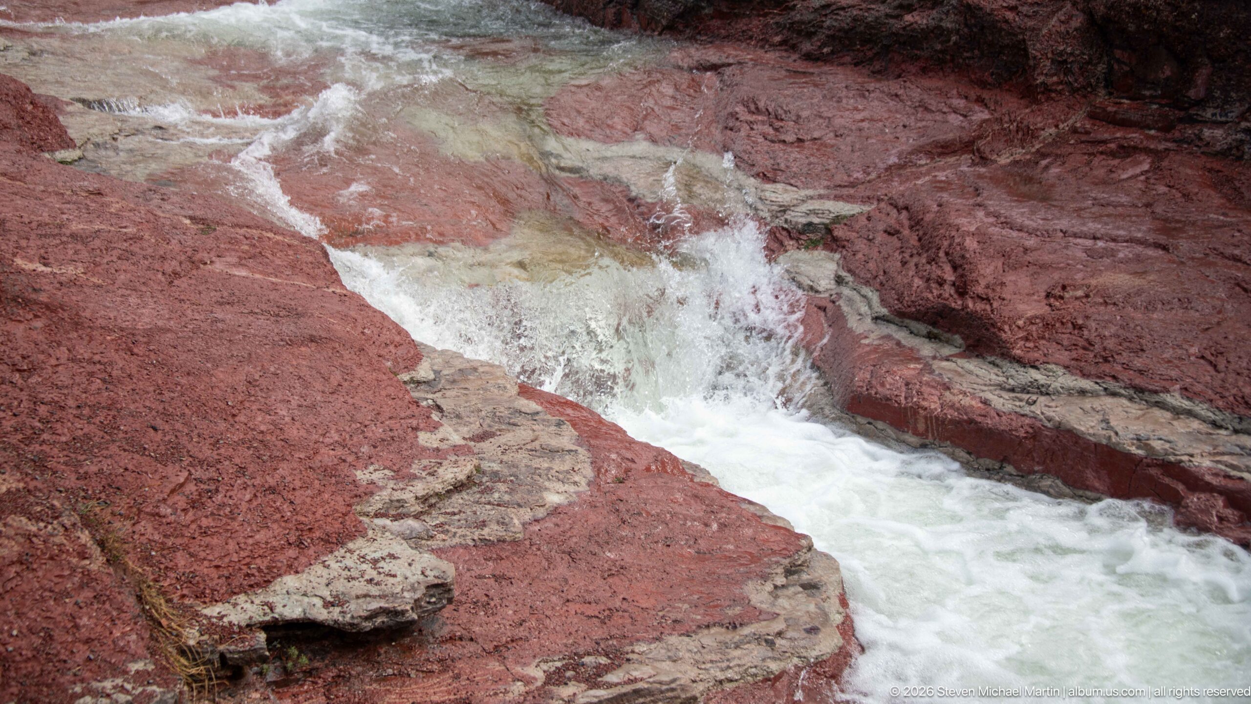
White water surges through a narrow chute carved into vivid red and pale banded rock. Thin horizontal beds and broken ledges steer the flow into a compact waterfall before the stream continues downstream. The close view concentrates on the striking contrast between moving water and the iron-rich red stone that gives this Waterton Lakes drainage its distinctive visual character.
Caption
White water surges through a narrow chute carved into vivid red and pale banded rock. Thin horizontal beds and broken ledges steer the flow into a compact waterfall before the stream continues downstream. The close view concentrates on the striking contrast between moving water and the iron-rich red stone that gives this Waterton Lakes drainage its distinctive visual character.
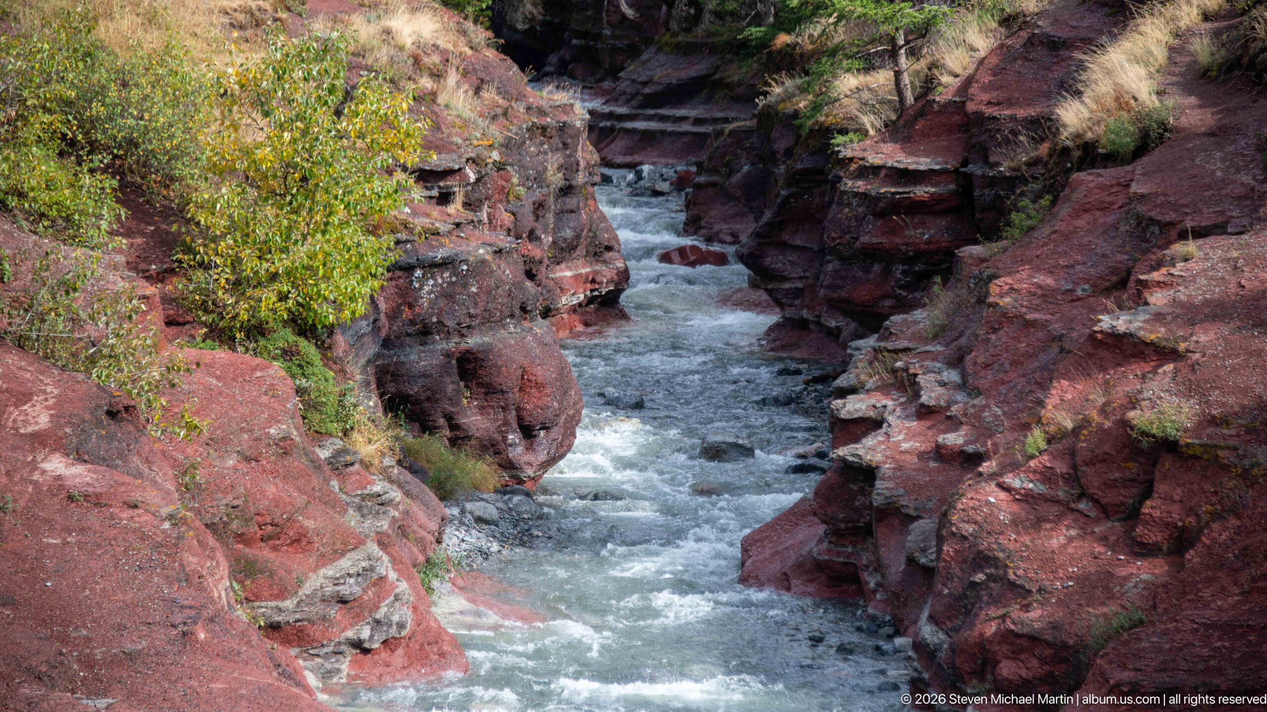
A narrow torrent runs through steep walls of dark red, horizontally bedded rock. Rounded projections and undercut ledges constrict the channel, forcing the water into a turbulent central passage. Yellow-green shrubs and grasses cling to the upper margins, providing scale and emphasizing the depth of the gorge. The view is centered on the erosional form of the canyon rather than a broad landscape.
Caption
A narrow torrent runs through steep walls of dark red, horizontally bedded rock. Rounded projections and undercut ledges constrict the channel, forcing the water into a turbulent central passage. Yellow-green shrubs and grasses cling to the upper margins, providing scale and emphasizing the depth of the gorge. The view is centered on the erosional form of the canyon rather than a broad landscape.
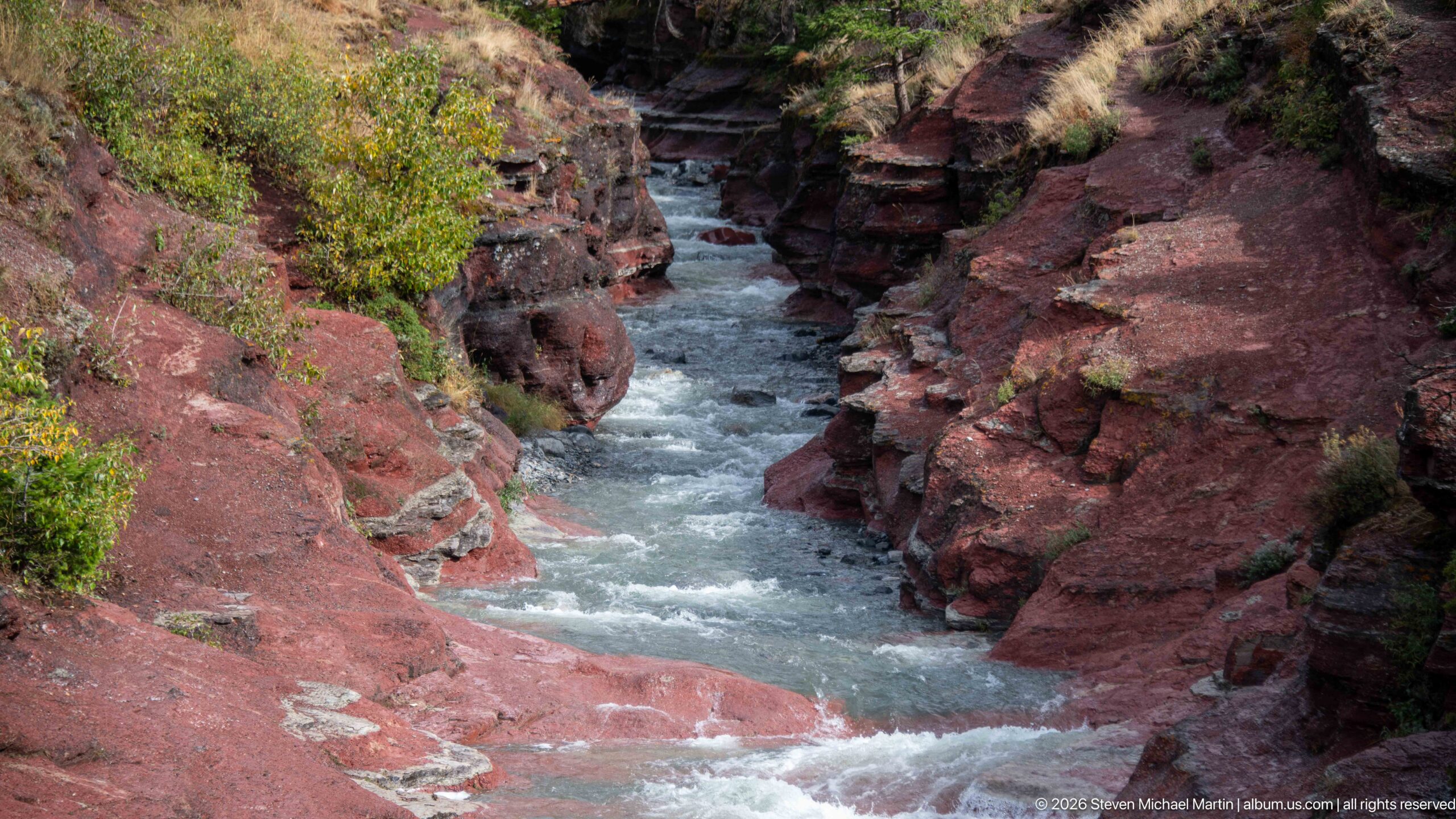
Rapids squeeze through a sculpted corridor of red and gray-banded bedrock, where projecting walls narrow the stream before it opens toward the foreground. Thin sedimentary layers are especially visible on the right wall, while grasses and shrubs occupy pockets above the rock. This viewpoint emphasizes the gorge’s asymmetrical walls and the way flowing water has exploited fractures and weaker layers.
Caption
Rapids squeeze through a sculpted corridor of red and gray-banded bedrock, where projecting walls narrow the stream before it opens toward the foreground. Thin sedimentary layers are especially visible on the right wall, while grasses and shrubs occupy pockets above the rock. This viewpoint emphasizes the gorge’s asymmetrical walls and the way flowing water has exploited fractures and weaker layers.
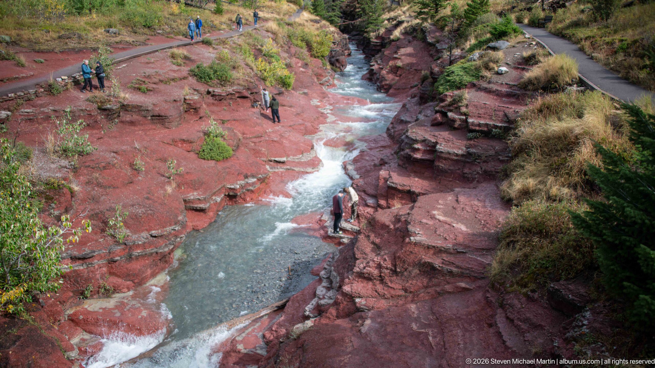
From an elevated viewpoint, the stream traces a pale blue-gray line through a deeply incised corridor of red rock. A paved path follows the upper right rim, revealing the developed visitor route beside the gorge, while sparse shrubs and grasses grow from cracks and ledges. The wider perspective connects the canyon’s geology, flowing water, and human access in a single composition.
Caption
From an elevated viewpoint, the stream traces a pale blue-gray line through a deeply incised corridor of red rock. A paved path follows the upper right rim, revealing the developed visitor route beside the gorge, while sparse shrubs and grasses grow from cracks and ledges. The wider perspective connects the canyon’s geology, flowing water, and human access in a single composition.
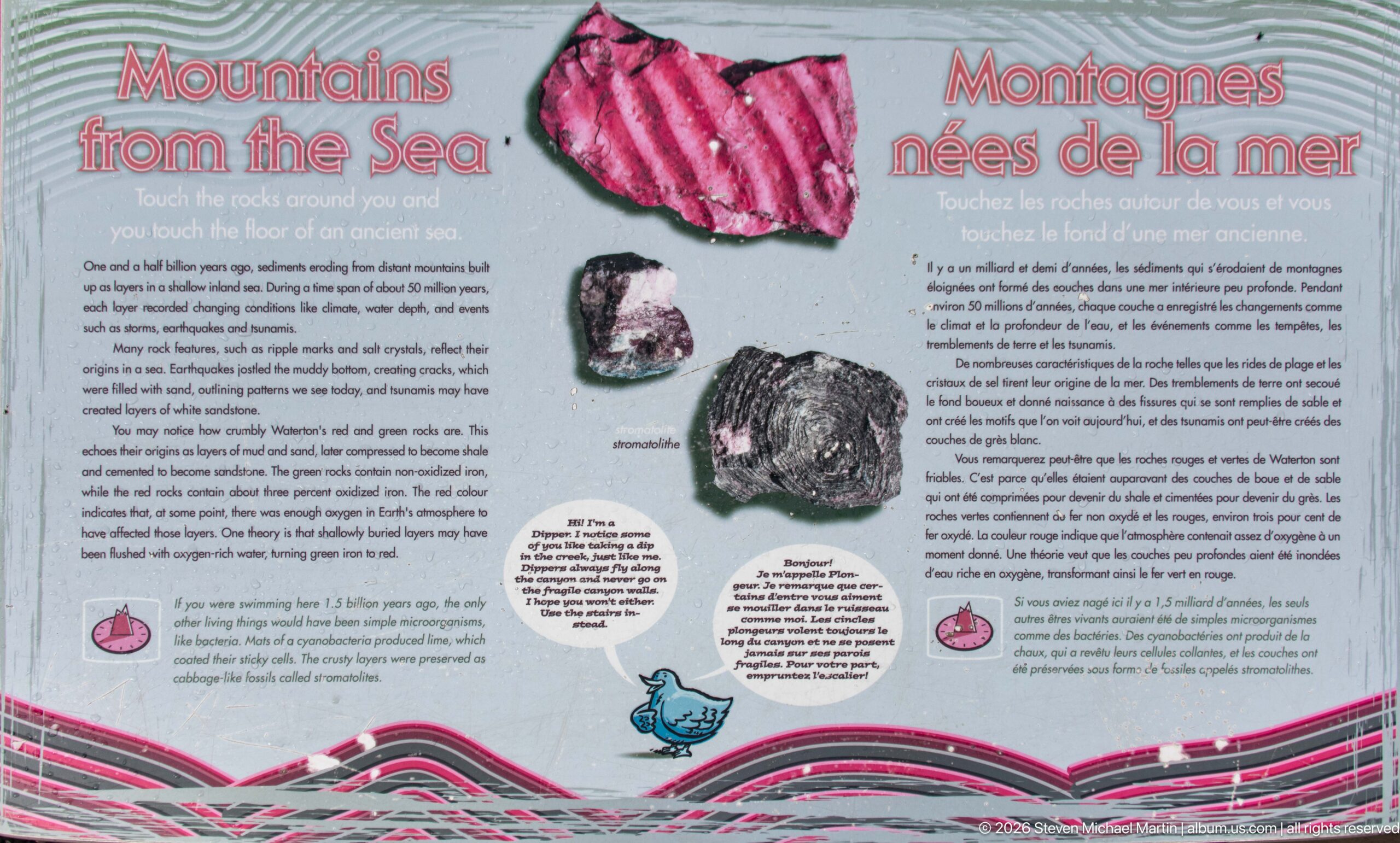
A bilingual interpretive panel titled “Mountains Born of the Sea” explains the origin of Waterton’s colorful rocks. Large samples or illustrations of red, pale, and dark stone accompany diagrams and explanatory text, while stylized rock layers run across the bottom. The exhibit connects the conspicuous red canyon bedrock nearby with the much older geological processes that formed and later uplifted these sedimentary layers.
Caption
A bilingual interpretive panel titled “Mountains Born of the Sea” explains the origin of Waterton’s colorful rocks. Large samples or illustrations of red, pale, and dark stone accompany diagrams and explanatory text, while stylized rock layers run across the bottom. The exhibit connects the conspicuous red canyon bedrock nearby with the much older geological processes that formed and later uplifted these sedimentary layers.
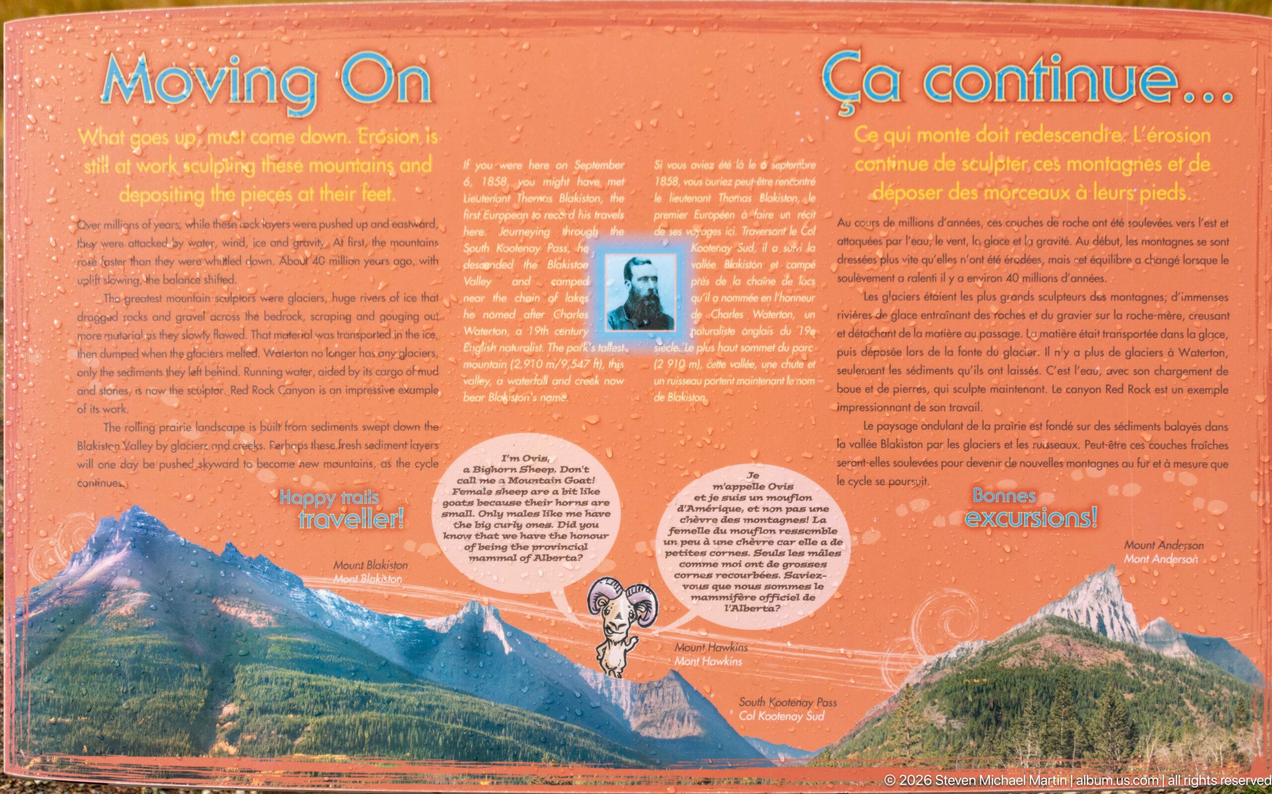
An orange bilingual panel continues the red-rock geological story with mountain illustrations, explanatory text, and small diagrams describing how the landscape changed after the rocks formed. The graphic treatment links ancient geological processes to the modern Waterton skyline. Positioned after the “Mountains Born of the Sea” display, it extends the visitor narrative from rock formation to uplift, erosion, and the landscape visible today.
Caption
An orange bilingual panel continues the red-rock geological story with mountain illustrations, explanatory text, and small diagrams describing how the landscape changed after the rocks formed. The graphic treatment links ancient geological processes to the modern Waterton skyline. Positioned after the “Mountains Born of the Sea” display, it extends the visitor narrative from rock formation to uplift, erosion, and the landscape visible today.
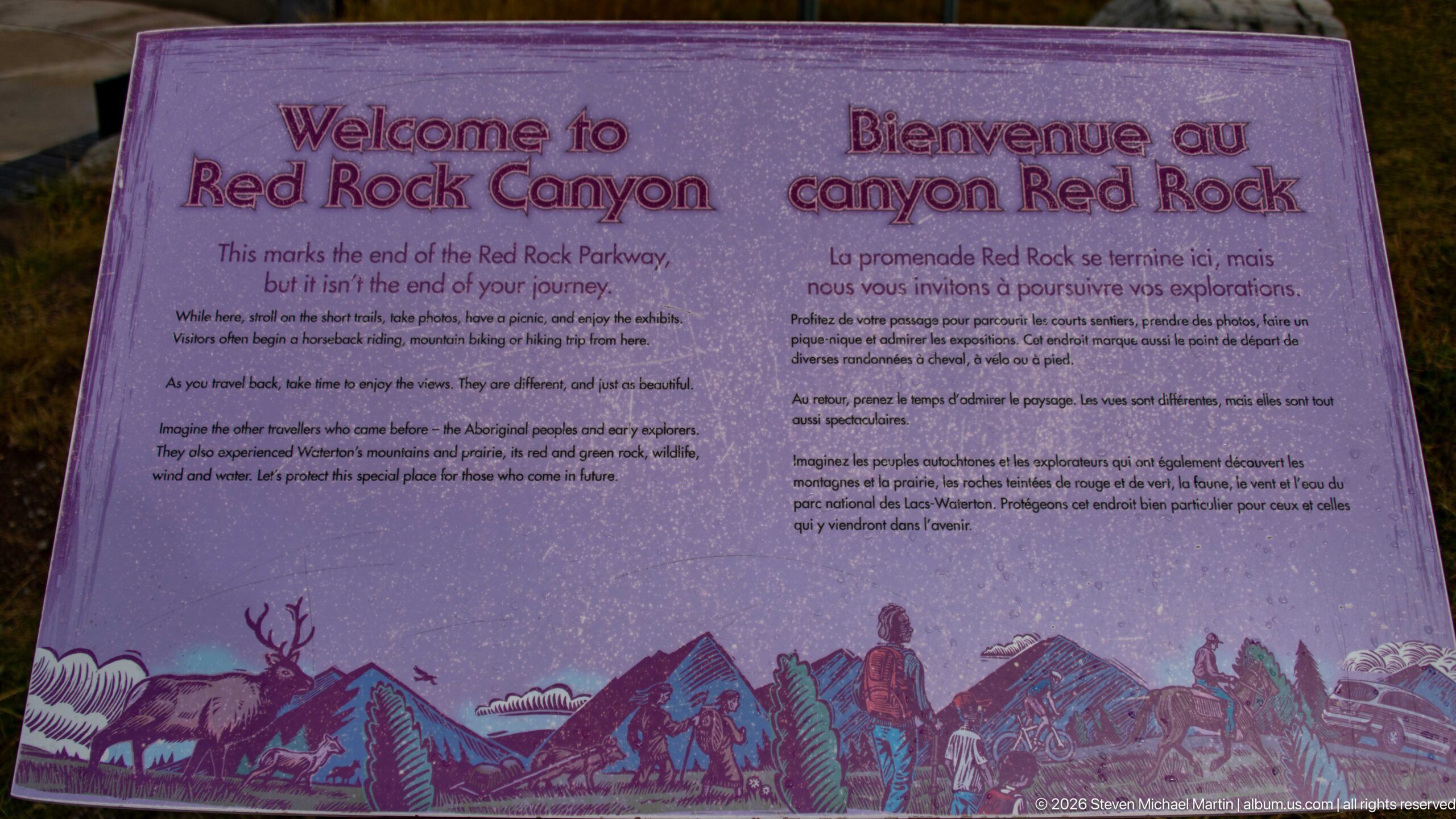
A bilingual welcome panel marks Red Rock Canyon and encourages visitors to continue exploring beyond the immediate viewpoint. Purple-toned mountain, wildlife, and hiking illustrations form a decorative band beneath the text. The display functions as both an arrival marker and an orientation message, establishing the canyon by name while placing it within a broader landscape of trails, wildlife, and mountain scenery.
Caption
A bilingual welcome panel marks Red Rock Canyon and encourages visitors to continue exploring beyond the immediate viewpoint. Purple-toned mountain, wildlife, and hiking illustrations form a decorative band beneath the text. The display functions as both an arrival marker and an orientation message, establishing the canyon by name while placing it within a broader landscape of trails, wildlife, and mountain scenery.
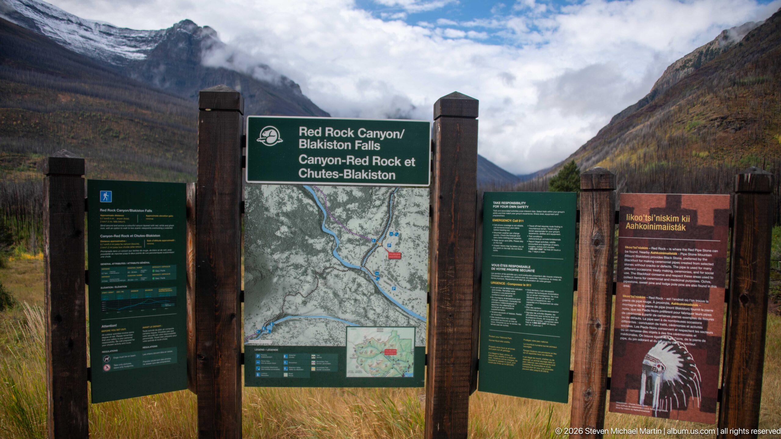
A multi-panel trailhead display combines the Red Rock Canyon and Blakiston Falls map with green visitor-information panels and an orange cultural or interpretive panel. Heavy timber posts frame the installation against steep mountains and low cloud. The wider view records the complete orientation station rather than the map alone, showing how route information, safety guidance, and interpretation are grouped at the trail access point.
Caption
A multi-panel trailhead display combines the Red Rock Canyon and Blakiston Falls map with green visitor-information panels and an orange cultural or interpretive panel. Heavy timber posts frame the installation against steep mountains and low cloud. The wider view records the complete orientation station rather than the map alone, showing how route information, safety guidance, and interpretation are grouped at the trail access point.
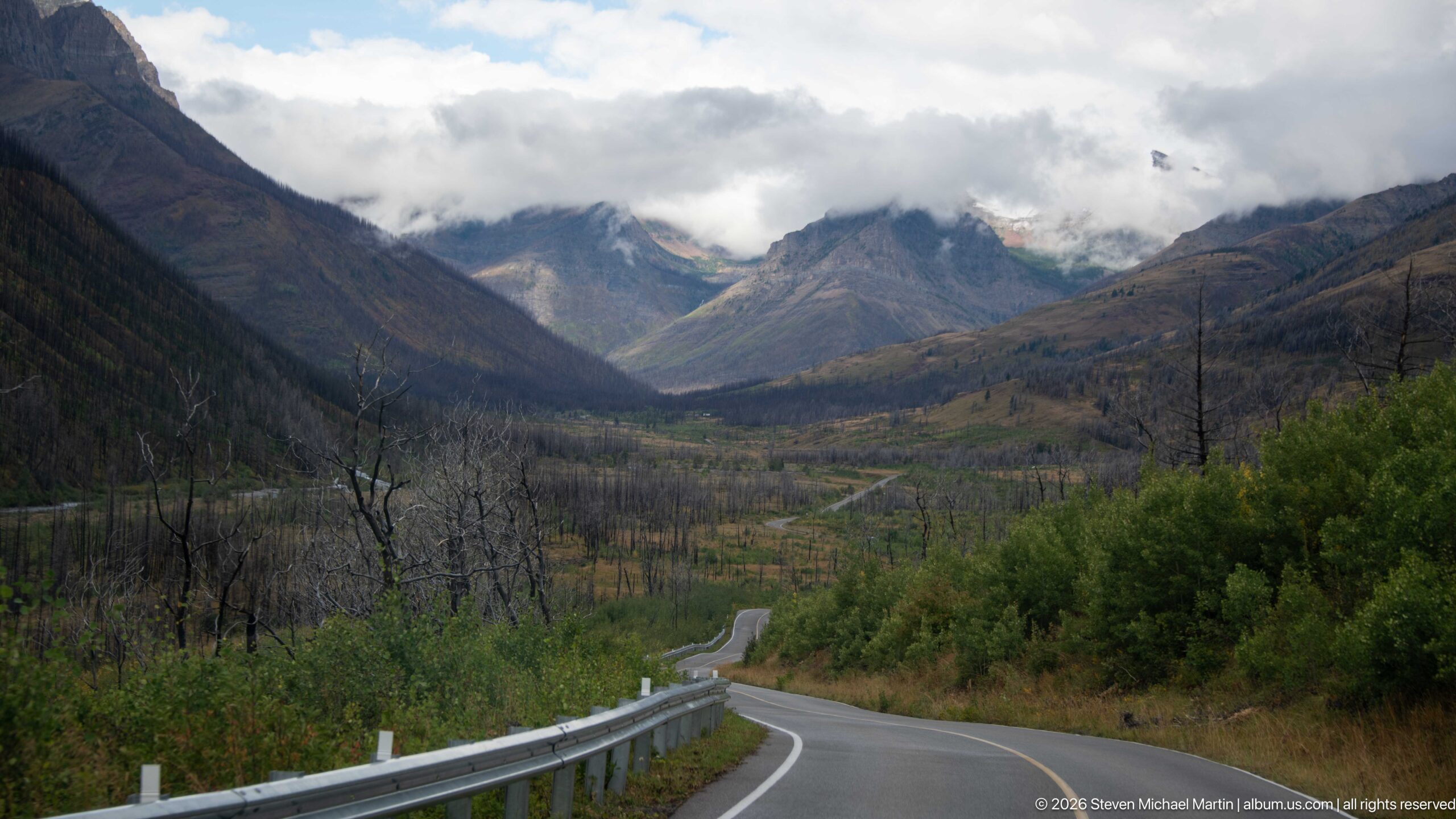
A paved road curves through a broad Waterton valley toward jagged peaks partly hidden by low cloud. Extensive standing dead trees cover the lower slopes, while green shrubs and young vegetation line the roadway. The road’s descending curves draw the eye into the basin and reveal the scale of the fire-altered forest beneath the rugged mountain skyline.
Caption
A paved road curves through a broad Waterton valley toward jagged peaks partly hidden by low cloud. Extensive standing dead trees cover the lower slopes, while green shrubs and young vegetation line the roadway. The road’s descending curves draw the eye into the basin and reveal the scale of the fire-altered forest beneath the rugged mountain skyline.
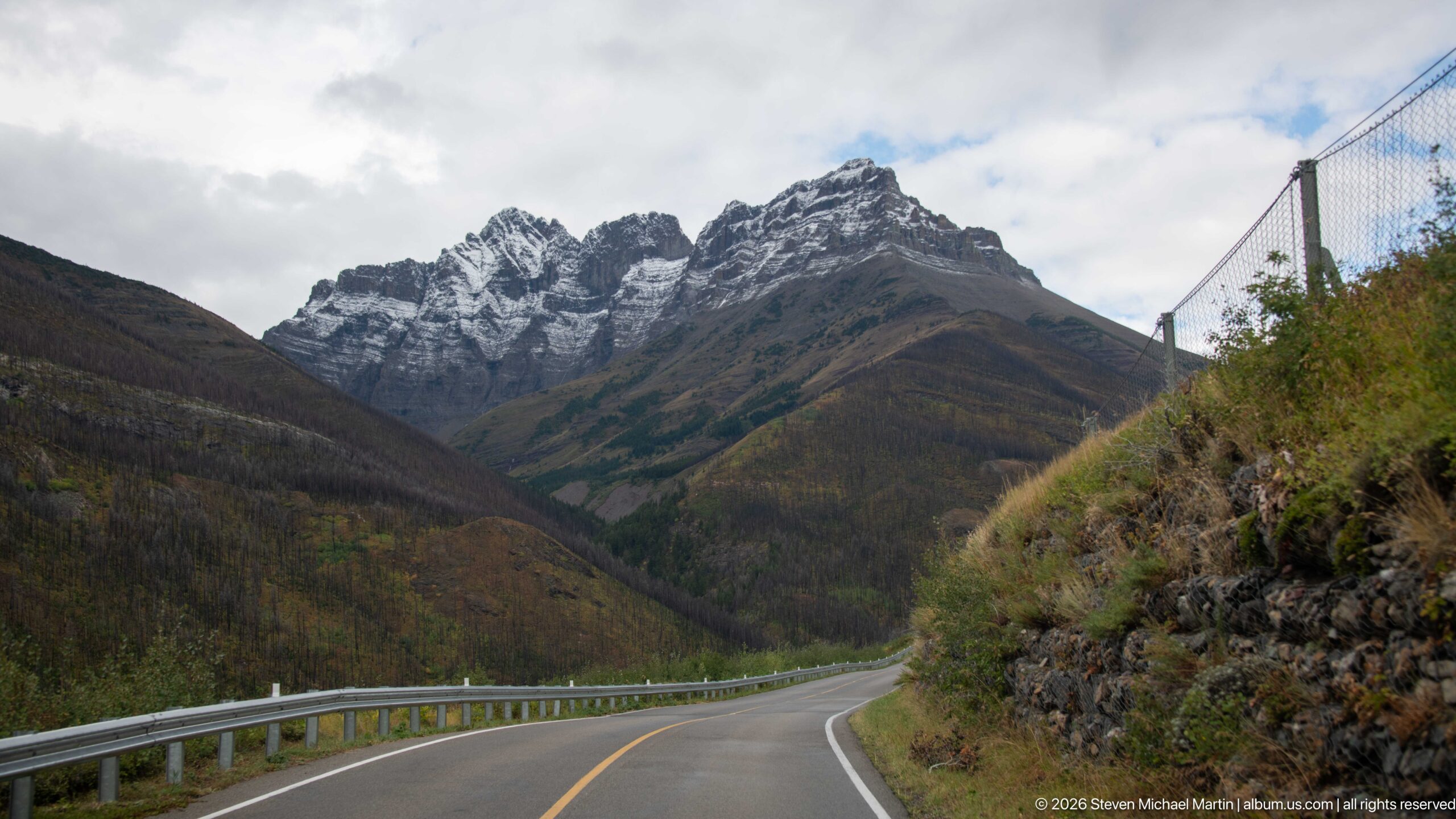
A two-lane road bends gently toward a dramatic cluster of jagged, lightly snow-dusted peaks. Steep brown-green slopes close in on both sides, while a guardrail follows the left shoulder and a rocky bank rises at right. The composition uses the road as a strong foreground line into the mountains, with broken cloud revealing the serrated skyline ahead.
Caption
A two-lane road bends gently toward a dramatic cluster of jagged, lightly snow-dusted peaks. Steep brown-green slopes close in on both sides, while a guardrail follows the left shoulder and a rocky bank rises at right. The composition uses the road as a strong foreground line into the mountains, with broken cloud revealing the serrated skyline ahead.
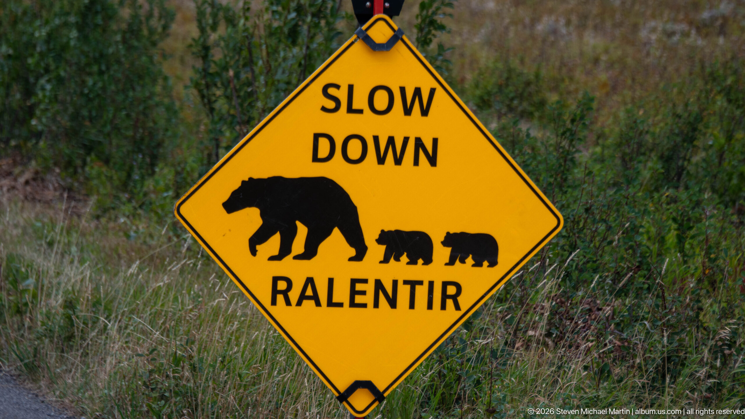
A bright yellow roadside sign asks drivers to “Slow Down / Ralentir” beneath silhouettes of an adult bear and two cubs. Set against roadside grasses and shrubs, the warning makes wildlife protection immediate and easily understood without lengthy text. The family grouping also signals the particular risk posed when bears cross roads with young in Waterton Lakes.
Caption
A bright yellow roadside sign asks drivers to “Slow Down / Ralentir” beneath silhouettes of an adult bear and two cubs. Set against roadside grasses and shrubs, the warning makes wildlife protection immediate and easily understood without lengthy text. The family grouping also signals the particular risk posed when bears cross roads with young in Waterton Lakes.
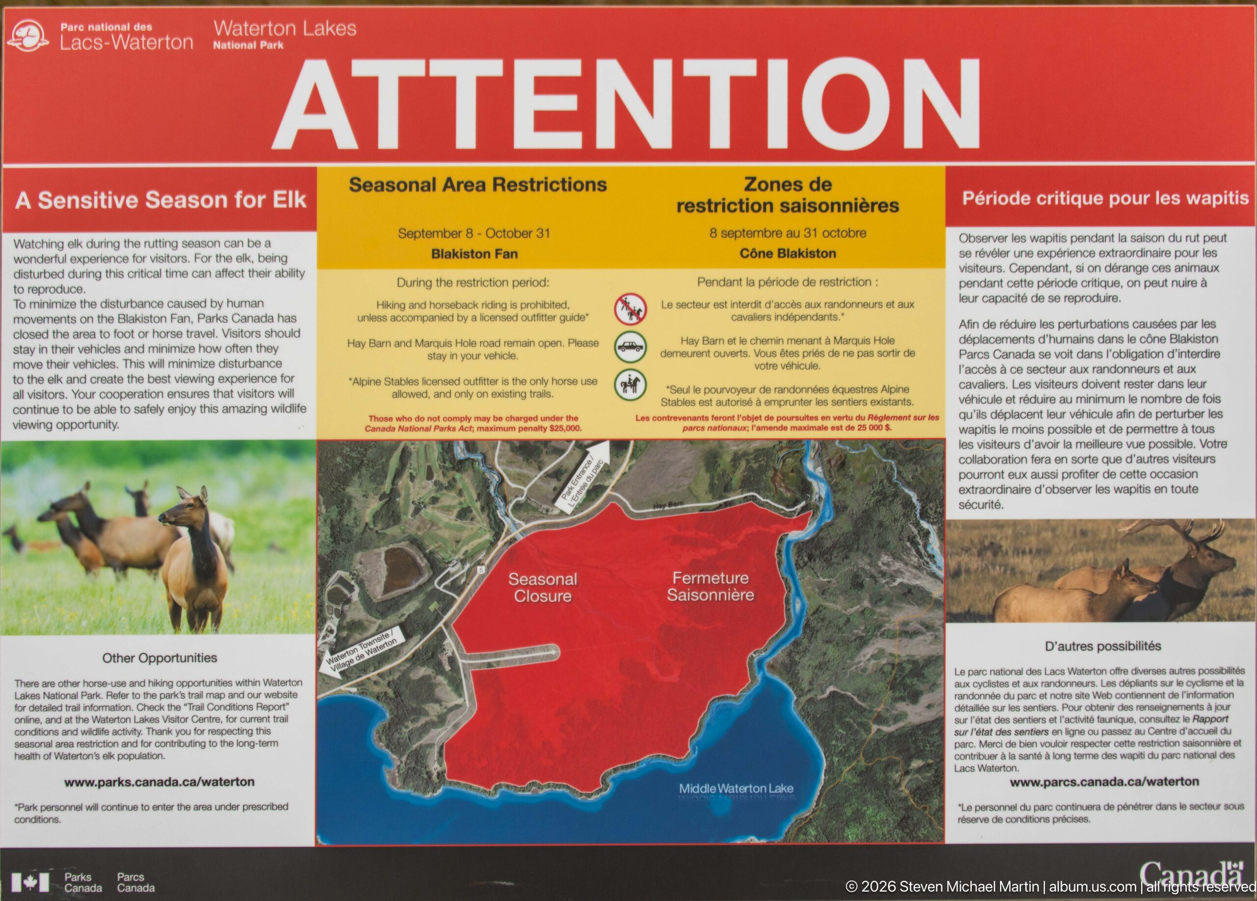
A large Parks Canada “ATTENTION” panel explains seasonal area restrictions associated with a sensitive season for elk. A map marks the closure zone in red, while photographs of elk and surrounding habitat accompany bilingual explanatory text. The display translates wildlife management into a clear spatial restriction, showing visitors where access is limited to reduce disturbance during a vulnerable period.
Caption
A large Parks Canada “ATTENTION” panel explains seasonal area restrictions associated with a sensitive season for elk. A map marks the closure zone in red, while photographs of elk and surrounding habitat accompany bilingual explanatory text. The display translates wildlife management into a clear spatial restriction, showing visitors where access is limited to reduce disturbance during a vulnerable period.
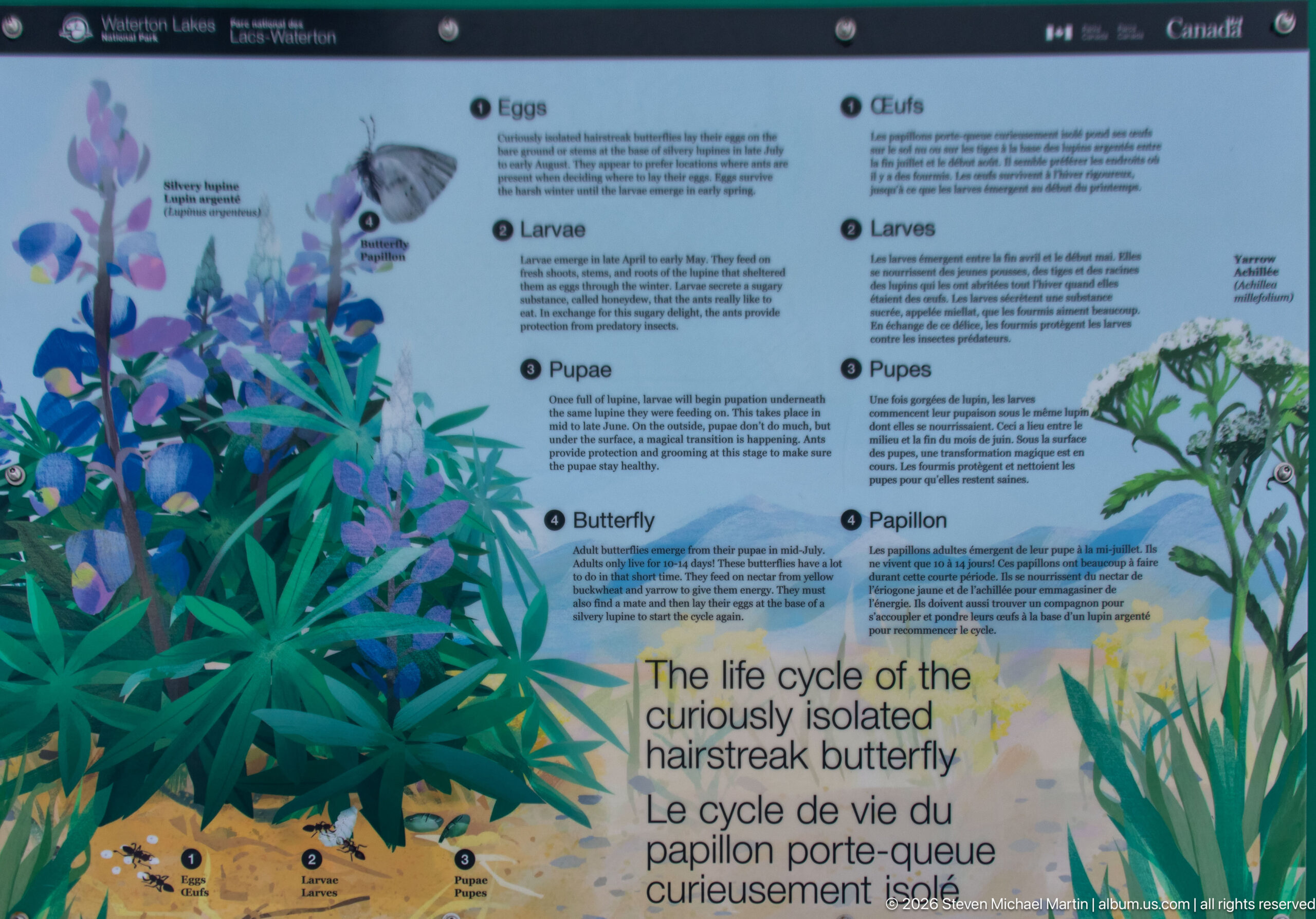
A bilingual interpretive panel illustrates the life cycle of a hairstreak butterfly from eggs and larvae through pupae to adult. Detailed plant paintings surround the developmental stages, tying the insect closely to its host vegetation. The educational display emphasizes how a small and easily overlooked species depends on particular plants and habitats within the Waterton landscape.
Caption
A bilingual interpretive panel illustrates the life cycle of a hairstreak butterfly from eggs and larvae through pupae to adult. Detailed plant paintings surround the developmental stages, tying the insect closely to its host vegetation. The educational display emphasizes how a small and easily overlooked species depends on particular plants and habitats within the Waterton landscape.
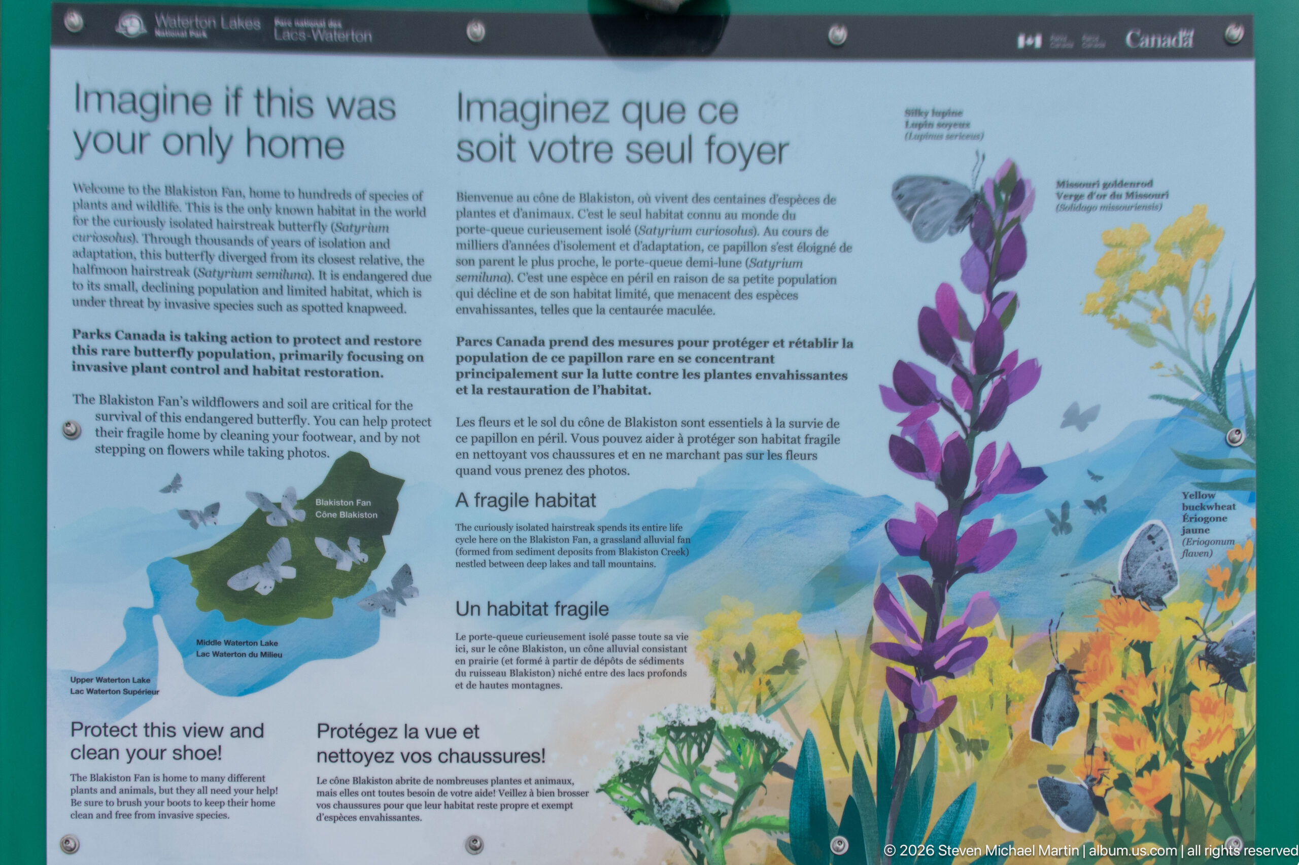
A bilingual panel headed “Imagine if this were your only home” presents flowering plants, butterflies, and a small habitat map to explain the vulnerability of a specialized butterfly environment. The text and illustrations shift attention from the insect’s life cycle to conservation of the place it requires. Bright lupines and other flowers visually reinforce the dependence of wildlife on intact native plant communities.
Caption
A bilingual panel headed “Imagine if this were your only home” presents flowering plants, butterflies, and a small habitat map to explain the vulnerability of a specialized butterfly environment. The text and illustrations shift attention from the insect’s life cycle to conservation of the place it requires. Bright lupines and other flowers visually reinforce the dependence of wildlife on intact native plant communities.
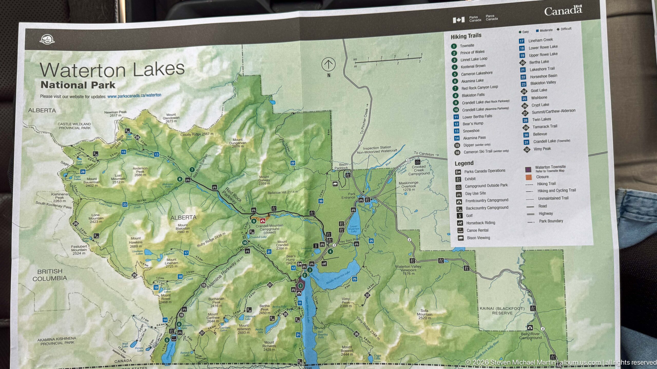
A large Waterton Lakes National Park map presents the park’s lakes, roads, trails, campgrounds, viewpoints, and other visitor facilities across the mountain landscape. Upper Waterton Lake forms a prominent blue north-south feature near the center-right, while a detailed legend organizes recreation and service symbols. The map provides a comprehensive spatial overview of the park rather than focusing on a single destination.
Caption
A large Waterton Lakes National Park map presents the park’s lakes, roads, trails, campgrounds, viewpoints, and other visitor facilities across the mountain landscape. Upper Waterton Lake forms a prominent blue north-south feature near the center-right, while a detailed legend organizes recreation and service symbols. The map provides a comprehensive spatial overview of the park rather than focusing on a single destination.
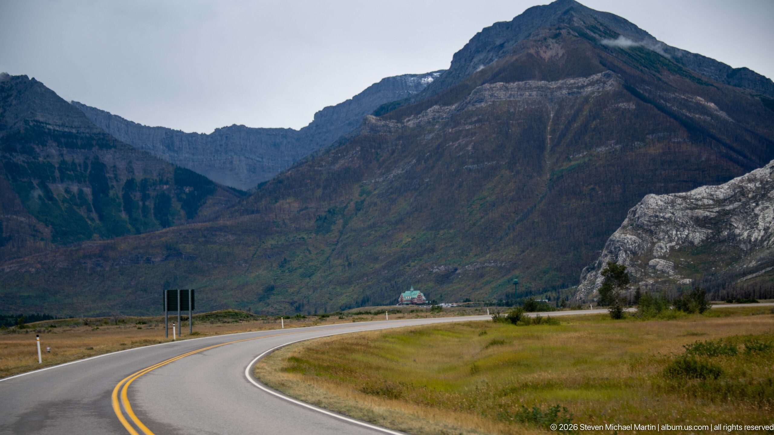
A paved two-lane road sweeps across open grassland toward a massive mountain wall, where dark slopes and pale exposed rock create strong contrasts. A small green-roofed building sits near the road in the middle distance, emphasizing the scale of the surrounding terrain. The low, open foreground and looming mountain face illustrate how abruptly the Rockies rise from Waterton’s prairie edge.
Caption
A paved two-lane road sweeps across open grassland toward a massive mountain wall, where dark slopes and pale exposed rock create strong contrasts. A small green-roofed building sits near the road in the middle distance, emphasizing the scale of the surrounding terrain. The low, open foreground and looming mountain face illustrate how abruptly the Rockies rise from Waterton’s prairie edge.
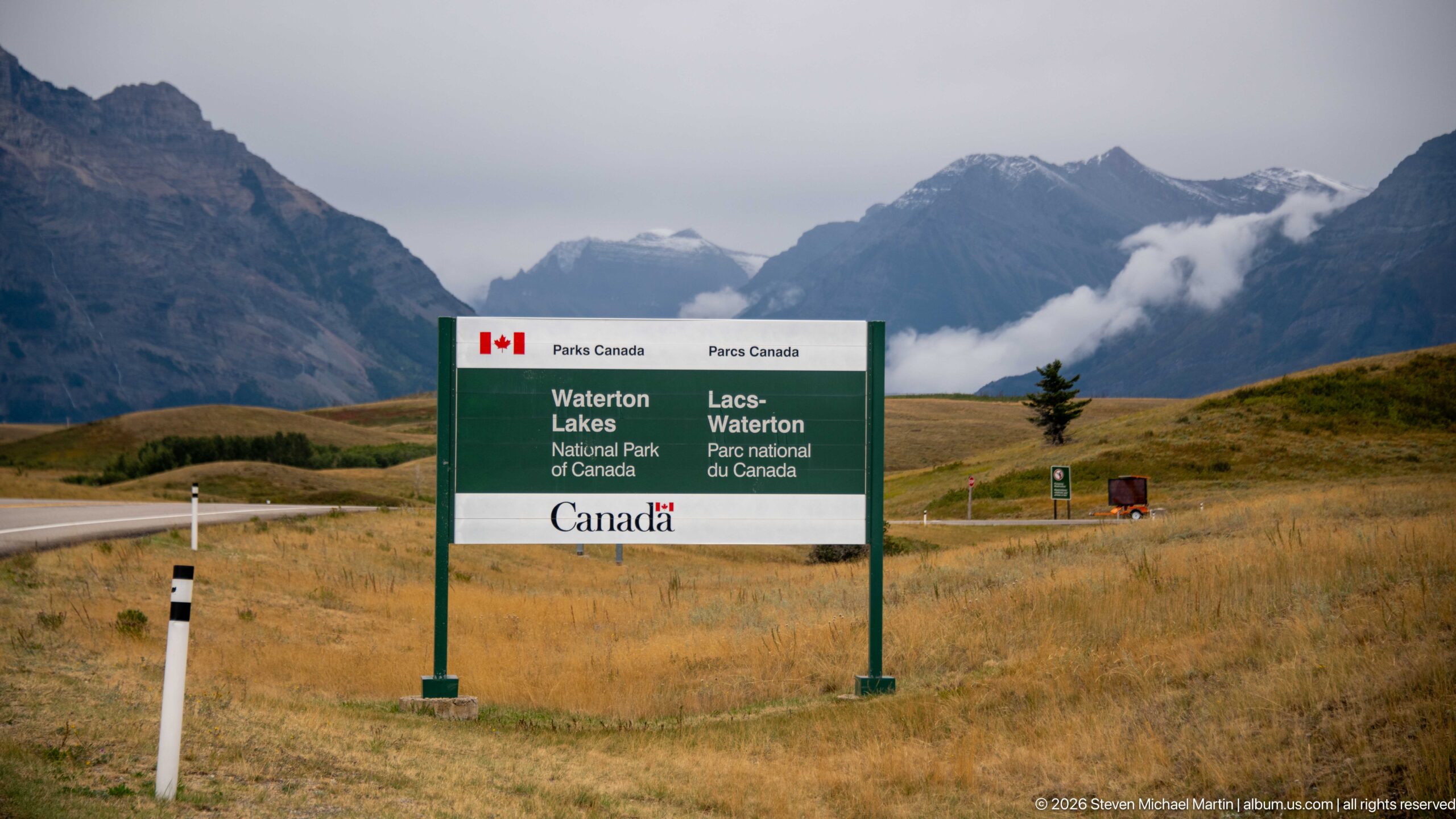
A bilingual Parks Canada entrance sign announces Waterton Lakes National Park of Canada against rolling golden grassland and cloud-wrapped mountains. The simple green-and-white sign sits low in the open landscape, allowing the dramatic mountain backdrop to remain prominent. As an arrival marker, it establishes the protected area by name while visually introducing the park’s characteristic meeting of prairie and Rockies.
Caption
A bilingual Parks Canada entrance sign announces Waterton Lakes National Park of Canada against rolling golden grassland and cloud-wrapped mountains. The simple green-and-white sign sits low in the open landscape, allowing the dramatic mountain backdrop to remain prominent. As an arrival marker, it establishes the protected area by name while visually introducing the park’s characteristic meeting of prairie and Rockies.
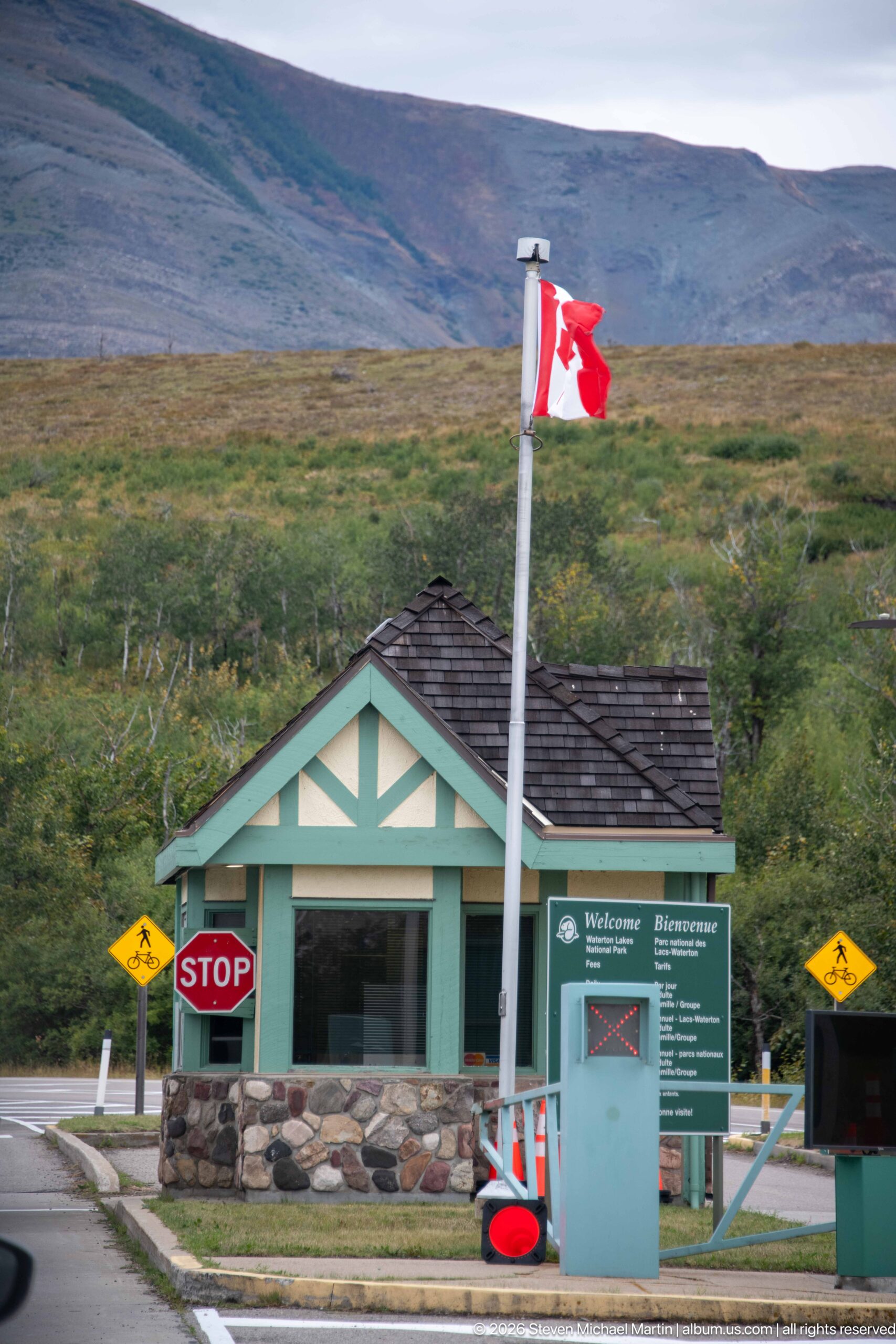
A small green-and-cream entrance building stands beneath a Canadian flag at the Waterton Lakes approach. Stonework forms the lower walls, while a nearby panel headed “Welcome / Bienvenue” provides visitor information. Yellow wildlife-warning signs flank the roadway, combining arrival formalities with reminders that the park road passes through active animal habitat.
Caption
A small green-and-cream entrance building stands beneath a Canadian flag at the Waterton Lakes approach. Stonework forms the lower walls, while a nearby panel headed “Welcome / Bienvenue” provides visitor information. Yellow wildlife-warning signs flank the roadway, combining arrival formalities with reminders that the park road passes through active animal habitat.
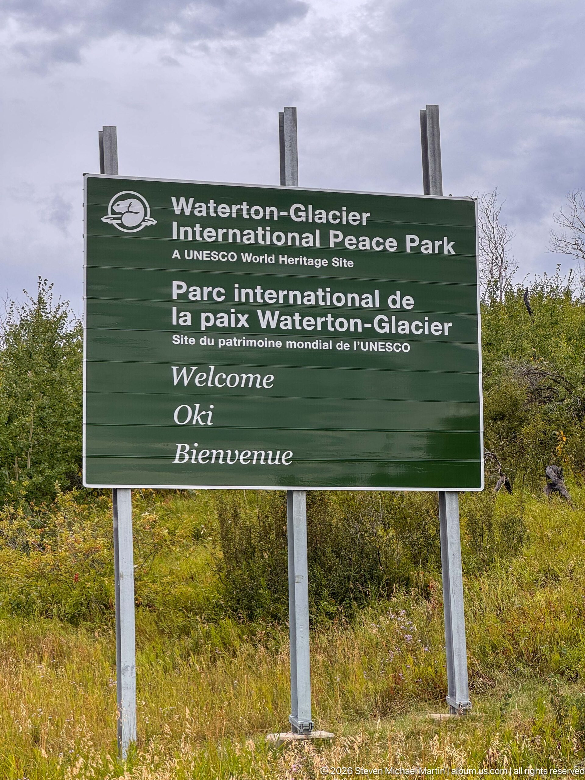
A large bilingual roadside sign welcomes visitors to the Waterton-Glacier International Peace Park and identifies it as a UNESCO World Heritage Site. Mounted on simple timber posts amid low shrubs and autumn vegetation, the sign makes the park’s international conservation status explicit at the landscape level. English and French wording presents the cross-border designation as part of the visitor’s arrival experience.
Caption
A large bilingual roadside sign welcomes visitors to the Waterton-Glacier International Peace Park and identifies it as a UNESCO World Heritage Site. Mounted on simple timber posts amid low shrubs and autumn vegetation, the sign makes the park’s international conservation status explicit at the landscape level. English and French wording presents the cross-border designation as part of the visitor’s arrival experience.
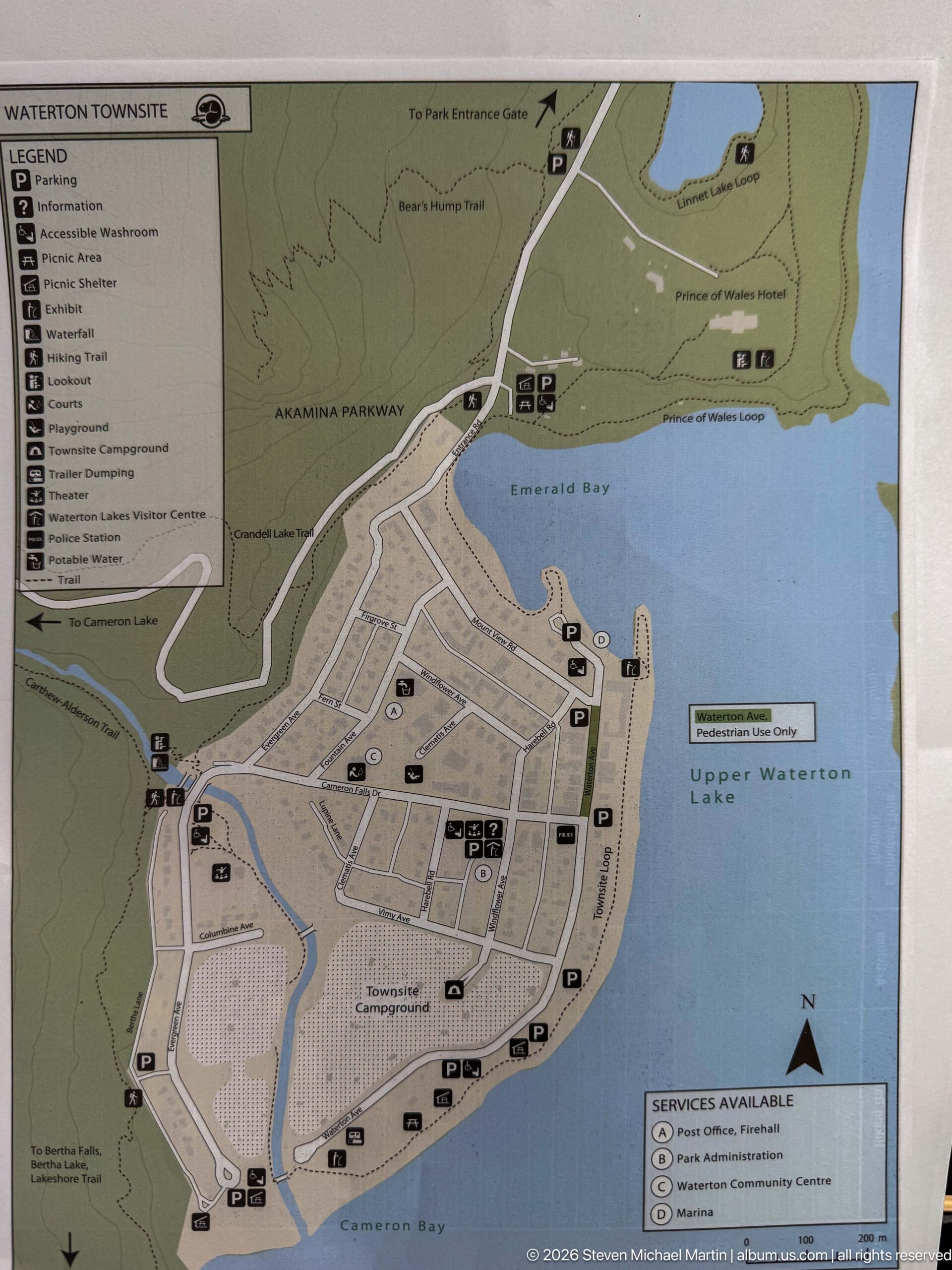
A detailed visitor map shows the Waterton townsite between Emerald Bay, Cameron Bay, and Upper Waterton Lake. Streets, parking areas, services, recreation facilities, and shoreline features are marked with symbols, while the Akamina Parkway and Prince of Wales Hotel appear in the surrounding context. The map provides a close-scale orientation to the developed townsite and its relationship to the lake.
Caption
A detailed visitor map shows the Waterton townsite between Emerald Bay, Cameron Bay, and Upper Waterton Lake. Streets, parking areas, services, recreation facilities, and shoreline features are marked with symbols, while the Akamina Parkway and Prince of Wales Hotel appear in the surrounding context. The map provides a close-scale orientation to the developed townsite and its relationship to the lake.
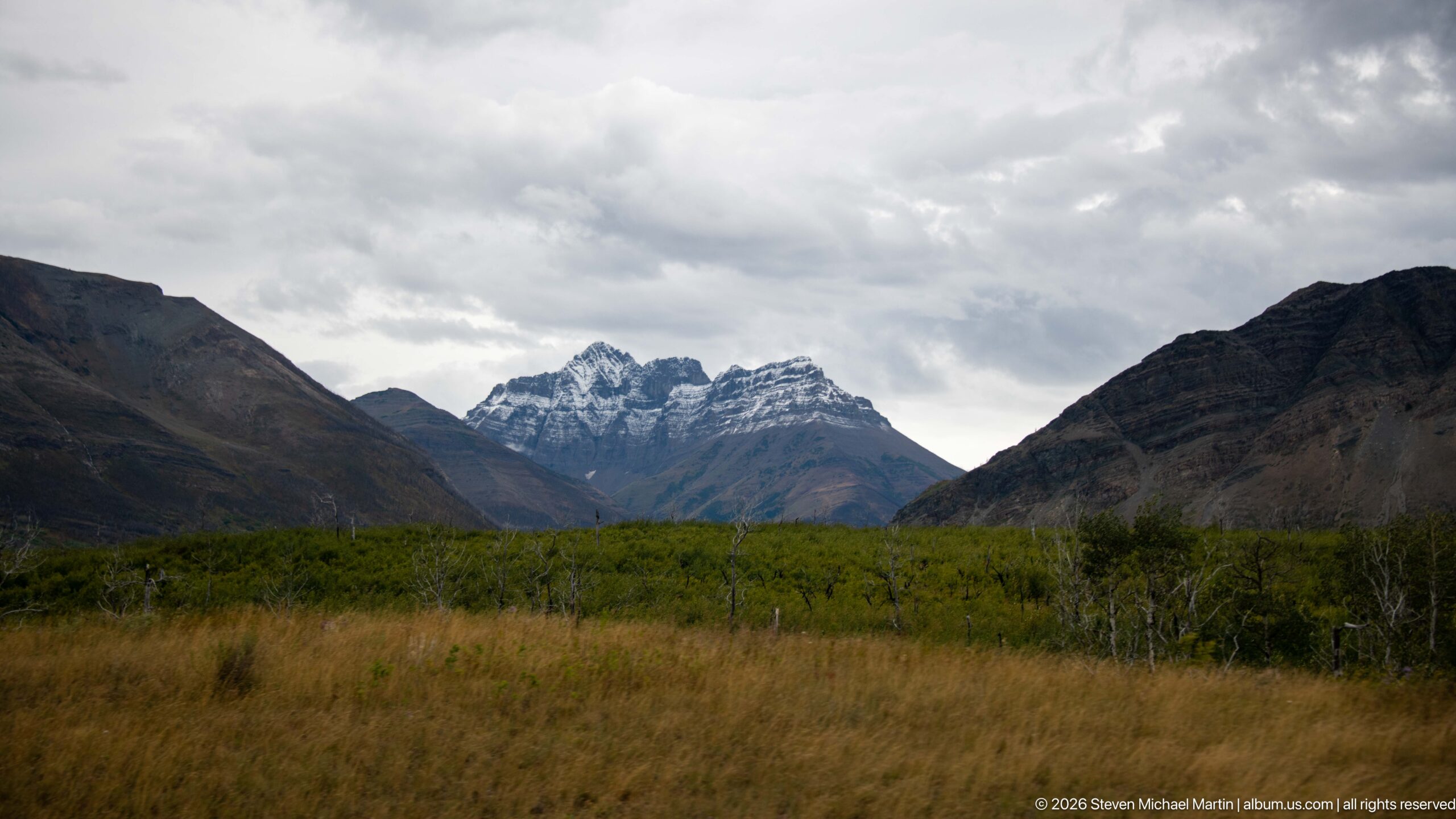
Jagged gray peaks rise at the head of a broad valley framed by darker slopes on both sides. Low shrubs and tawny grasses occupy the foreground, while heavy clouds hang above the serrated central skyline. The subdued weather compresses the color palette and draws attention to the layered mountain forms, offering a quiet establishing view of Waterton’s rugged interior landscape.
Caption
Jagged gray peaks rise at the head of a broad valley framed by darker slopes on both sides. Low shrubs and tawny grasses occupy the foreground, while heavy clouds hang above the serrated central skyline. The subdued weather compresses the color palette and draws attention to the layered mountain forms, offering a quiet establishing view of Waterton’s rugged interior landscape.
🏞️ National Park Field Guide
📍 Overview
Waterton Lakes is a protected landscape where open foothill grasslands meet the abrupt eastern front of the Canadian Rockies. The portfolio follows that transition from Chief Mountain and broad prairie approaches into mountain valleys, Upper Waterton Lake, Cameron Lake, Red Rock Canyon, forested drainages, and the developed Waterton townsite. It also records the park’s international conservation identity through the Waterton-Glacier International Peace Park and its UNESCO World Heritage recognition. Together, these views present a national park shaped by exposed geology, water, fire, wildlife, recreation, and a long human history visible in both the landscape and its interpretive sites.
🏔️ Landscape
The defining visual relationship at Waterton Lakes is the sudden rise of rugged mountains from open grassland. Wide foothill views give way to steep layered slopes, narrow valleys, long lakes, and mountain roads that draw directly toward the Rocky Mountain front. Upper Waterton Lake anchors the townsite landscape, while Cameron Lake occupies a more enclosed mountain setting and Red Rock Canyon compresses water and rock into a narrow, intensely colored corridor. Fire-altered slopes add another layer to the scenery: standing dead trees open views across valleys and mountainsides while green shrubs and young vegetation mark continuing recovery.
🪨 Geology
Exposed rock is a constant presence across the portfolio, from the layered mountain faces above the foothills to close views of streams cutting through resistant bedrock. Red Rock Canyon provides the clearest geological study. There, moving water is confined by vivid red, horizontally layered rock, forming rapids, chutes, ledges, and sculpted gorge walls. Interpretive displays connect these colorful sedimentary rocks with ancient geological processes and later mountain building and erosion. Elsewhere, pale strata, scree channels, fractured ledges, and steep gray ridges make the structure and weathering of the Rocky Mountain landscape visible at multiple scales.
🌿 Ecology
Waterton Lakes is shown as a landscape of closely connected prairie, forest, riparian, lakeshore, and post-fire habitats. The portfolio repeatedly records ecological change after wildfire: gray standing snags remain across broad slopes and drainages while grasses, shrubs, and other low vegetation return beneath them. Streams continue to organize moist corridors through these recovering areas. Interpretive material also emphasizes specialized habitat relationships, including the life cycle and host-plant dependence of a hairstreak butterfly, seasonal restrictions associated with elk, invasive-species prevention at Cameron Lakeshore, and the ecological role of fire. The photographs of mule deer in the townsite and black bears in recovering burned woodland show that wildlife habitat also overlaps with heavily visited areas.
🦌 Wildlife Encounters
Photographs in this portfolio document wildlife encounters with Mule deer and Black bear in the Jasper landscape. The photographs place these animals in settings that include Mule deer grazing in Waterton townsite, Mule deer beside fenced recreation court, Black bear moving through shrubs and burned woodland, and Partly obscured black bear in recovering burn area. These encounters provide direct, visit-specific evidence of how wildlife uses the habitats interpreted in this field guide.
🦌 Wildlife
The visit documented living wildlife in two very different settings. Mule deer were photographed grazing in the Waterton townsite beside lawns, walkways, fencing, and recreation facilities, demonstrating how free-ranging animals move through developed areas. Later, black bears were photographed moving through shrubs and burned woodland, where standing dead trunks and regenerating vegetation formed a markedly different habitat. The broader visitor landscape reinforces the need for wildlife awareness through bear-safety panels, roadside warnings, and seasonal elk restrictions. These encounters place wildlife within the park’s actual mosaic of townsite, roadside, forest, and recovering post-fire habitat rather than treating animals as isolated subjects.
🧭 Human History
Human history at Waterton Lakes is visible through conservation, industry, settlement, and cross-border cooperation. A sequence at the First Oil Well in Western Canada National Historic Site includes a commemorative plaque, reconstructed timber derrick, archival photographs, and interpretive panels describing early petroleum exploration in the Waterton region. In the townsite, the Prince of Wales Hotel appears prominently on its bluff above the lake, while maps, visitor facilities, campgrounds, docks, roads, and recreation areas document the developed park landscape. A second major historical thread is the Waterton-Glacier International Peace Park, represented by bilingual interpretation, Canadian and United States flags, a monument, pavement medallion, and UNESCO World Heritage signage that frame the protected landscape as an international undertaking.
🥾 Visitor Experience
The portfolio presents Waterton Lakes as a park experienced by moving repeatedly between broad viewpoints and close observation. Roads cross open grassland and fire-altered valleys before reaching mountain destinations; trails and orientation boards lead visitors toward Red Rock Canyon, Blakiston Falls, and Cameron Lakeshore; and the townsite provides campgrounds, recreation facilities, lakeside access, and views across Upper Waterton Lake. Cameron Lake adds paddling, docks, rental craft, and shoreline walking to the experience, while interpretive panels throughout the park explain geology, ecology, wildlife safety, conservation, and history. The result is a compact sequence in which major mountain scenery, developed visitor spaces, wildlife, and detailed interpretation are often encountered within short distances of one another.
📷 Photography Notes
The strongest photographic narrative comes from alternating establishing views with precise details. Wide frames show the prairie-to-mountain transition, lake basins, townsite, and fire-altered valleys; medium views place roads, buildings, trails, wildlife, and visitor infrastructure within those settings; and close photographs isolate cascades, layered rock, signs, maps, monuments, and interpretive displays. Repeated subjects benefit from changes in viewpoint rather than duplication: Red Rock Canyon can move from gorge overview to water-and-bedrock detail, while post-fire scenes can shift from whole valleys to regenerating groundcover and stream corridors. Wildlife photographs are most informative when enough habitat remains in the frame to show why the encounter belongs specifically to Waterton Lakes.